Ku-ring-gai Heritage Conservation Areas North Inventory Sheet
Ku-ring-gai Heritage Conservation Areas North Inventory Sheet
Ku-ring-gai Heritage Conservation Areas North Inventory Sheet

You also want an ePaper? Increase the reach of your titles
YUMPU automatically turns print PDFs into web optimized ePapers that Google loves.
<strong>Ku</strong>-<strong>ring</strong>-<strong>gai</strong><br />
<strong>Heritage</strong> <strong>Conservation</strong> <strong>Areas</strong> <strong>North</strong> <strong>Inventory</strong> <strong>Sheet</strong><br />
Item No<br />
Item Name<br />
Item Type<br />
Group Collection<br />
Category<br />
Key Historical<br />
Periods<br />
Primary Address<br />
Local Govt. area<br />
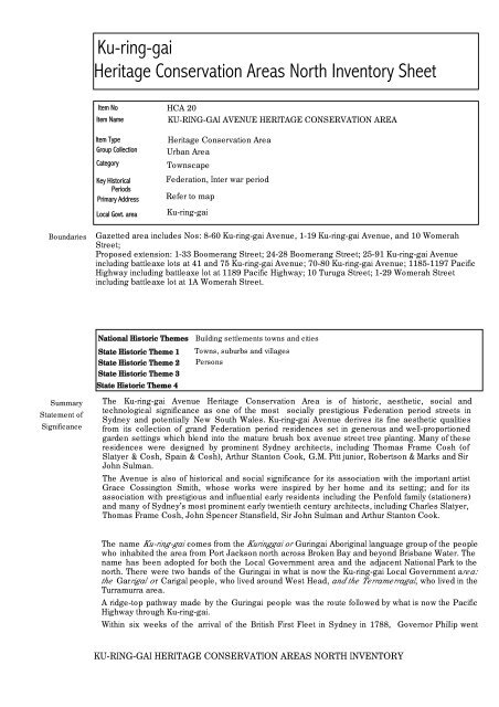
HCA 20<br />
KU-RING-GAI AVENUE HERITAGE CONSERVATION AREA<br />
<strong>Heritage</strong> <strong>Conservation</strong> Area<br />
Urban Area<br />
Townscape<br />
Federation, Inter war period<br />
Refer to map<br />
<strong>Ku</strong>-<strong>ring</strong>-<strong>gai</strong><br />
Boundaries<br />
Gazetted area includes Nos: 8-60 <strong>Ku</strong>-<strong>ring</strong>-<strong>gai</strong> Avenue, 1-19 <strong>Ku</strong>-<strong>ring</strong>-<strong>gai</strong> Avenue, and 10 Womerah<br />
Street;<br />
Proposed extension: 1-33 Boomerang Street; 24-28 Boomerang Street; 25-91 <strong>Ku</strong>-<strong>ring</strong>-<strong>gai</strong> Avenue<br />
including battleaxe lots at 41 and 75 <strong>Ku</strong>-<strong>ring</strong>-<strong>gai</strong> Avenue; 70-80 <strong>Ku</strong>-<strong>ring</strong>-<strong>gai</strong> Avenue; 1185-1197 Pacific<br />
Highway including battleaxe lot at 1189 Pacific Highway; 10 Turuga Street; 1-29 Womerah Street<br />
including battleaxe lot at 1A Womerah Street.<br />
National Historic Themes<br />
State Historic Theme 1<br />
State Historic Theme 2<br />
State Historic Theme 3<br />
State Historic Theme 4<br />
Building settlements towns and cities<br />
Towns, suburbs and villages<br />
Persons<br />
Summary<br />
Statement of<br />
Significance<br />
The <strong>Ku</strong>-<strong>ring</strong>-<strong>gai</strong> Avenue <strong>Heritage</strong> <strong>Conservation</strong> Area is of historic, aesthetic, social and<br />
technological significance as one of the most socially prestigious Federation period streets in<br />
Sydney and potentially New South Wales. <strong>Ku</strong>-<strong>ring</strong>-<strong>gai</strong> Avenue derives its fine aesthetic qualities<br />
from its collection of grand Federation period residences set in generous and well-proportioned<br />
garden settings which blend into the mature brush box avenue street tree planting. Many of these<br />
residences were designed by prominent Sydney architects, including Thomas Frame Cosh (of<br />
Slatyer & Cosh, Spain & Cosh), Arthur Stanton Cook, G.M. Pitt junior, Robertson & Marks and Sir<br />
John Sulman.<br />
The Avenue is also of historical and social significance for its association with the important artist<br />
Grace Cossington Smith, whose works were inspired by her home and its setting; and for its<br />
association with prestigious and influential early residents including the Penfold family (stationers)<br />
and many of Sydney’s most prominent early twentieth century architects, including Charles Slatyer,<br />
Thomas Frame Cosh, John Spencer Stansfield, Sir John Sulman and Arthur Stanton Cook.<br />
The name <strong>Ku</strong>-<strong>ring</strong>-<strong>gai</strong> comes from the <strong>Ku</strong><strong>ring</strong><strong>gai</strong> or Gu<strong>ring</strong>ai Aboriginal language group of the people<br />
who inhabited the area from Port Jackson north across Broken Bay and beyond Brisbane Water. The<br />
name has been adopted for both the Local Government area and the adjacent National Park to the<br />
north. There were two bands of the Gu<strong>ring</strong>ai in what is now the <strong>Ku</strong>-<strong>ring</strong>-<strong>gai</strong> Local Government area:<br />
the Garrigal or Carigal people, who lived around West Head, and the Terramerragal, who lived in the<br />
Turramurra area.<br />
A ridge-top pathway made by the Gu<strong>ring</strong>ai people was the route followed by what is now the Pacific<br />
Highway through <strong>Ku</strong>-<strong>ring</strong>-<strong>gai</strong>.<br />
Within six weeks of the arrival of the British First Fleet in Sydney in 1788, Governor Phillip went<br />
KU-RING-GAI HERITAGE CONSERVATION AREAS NORTH INVENTORY
<strong>Ku</strong>-<strong>ring</strong>-<strong>gai</strong><br />
<strong>Heritage</strong> <strong>Conservation</strong> <strong>Areas</strong> <strong>North</strong> <strong>Inventory</strong> <strong>Sheet</strong><br />
Historical<br />
Summary<br />
explo<strong>ring</strong> around Broken Bay, and commented on the friendliness of the Aboriginal people. However,<br />
when he returned a year later, all except those too sick with smallpox fled from him. By 1790, over<br />
half of the Gu<strong>ring</strong>ai nation had been wiped out by smallpox. By the 1840s, most of the Aboriginal<br />
people had disappeared from Pittwater and their traditional lands had been taken over by white<br />
settlers. Some Gu<strong>ring</strong>ai survivors of the small pox epidemic formed what was known to the British<br />
colonists as the Broken Bay tribe led by Bungaree, who was notable for completing the first<br />
circumnavigation of Australia with Matthew Flinders in 1801-02. Another notable Gu<strong>ring</strong>ai person in<br />
the early contact period was Bennelong’s wife Barangaroo, who was noted in colonist’s records for<br />
her strong personality.<br />
Today, there are over 800 culturally significant Aboriginal sites found in <strong>Ku</strong>-<strong>ring</strong>-<strong>gai</strong> National Park,<br />
including rock engravings, rock shelter drawings, paintings and stencils, axe grinding grooves and<br />
shell middens, and Aboriginal people live throughout Sydney metropolitan area.<br />
There are around 100 recorded Aboriginal sites in the <strong>Ku</strong>-<strong>ring</strong>-<strong>gai</strong> LGA and large areas are<br />
considered to have high potential for unrecorded sites. These sites are still important to Aboriginal<br />
people living in the region and there are many Aboriginal people and local residents actively working<br />
to protect these sites and promote the rich Aboriginal heritage of the area.<br />
The earliest European settlement in <strong>Ku</strong>-<strong>ring</strong>-<strong>gai</strong> was along the major roads, and was generally rural<br />
in nature. Du<strong>ring</strong> the 19th century, timber getting and orchards were major activities, and a few villas<br />
were built which are still extant (for example in the 1880s Grandview on Pymble Hill, 1178 Pacific<br />
Highway, the former orange orchard of which now forms part of the grounds of PLC school). Robert<br />
Pymble (commemorated in the suburb name), was an early timber-getter and orchardist who settled<br />
in Pymble in the 1820s and and Robert McIntosh (commemorated in McIntosh Street Gordon) as<br />
another notable early orchardist, of <strong>Ku</strong>-<strong>ring</strong>-<strong>gai</strong>.<br />
The <strong>North</strong> Shore Railway line was established in 1890, and subdivision of orchards and large estates<br />
for residential development near the railway stations proceeded thereafter. The location of stations<br />
along the railway defined the focus of the <strong>Ku</strong>-<strong>ring</strong>-<strong>gai</strong> Town Centres and neighbourhood areas (with<br />
the exception of St. Ives, which developed on Mona Vale Road at a later stage). The railway line was<br />
duplicated in 1909, electrified in 1928. The subsequent opening of the Sydney Harbour Bridge in<br />
1932 led to a major shift of Sydney’s elite (the business owners and managers, the doctors,<br />
solicitors, architects, artists, politicians) to the north shore, and particularly <strong>Ku</strong>-<strong>ring</strong>-<strong>gai</strong>, from other<br />
areas of Sydney (particularly Ashfield, Burwood and Strathfield).<br />
<strong>Ku</strong>-<strong>ring</strong>-<strong>gai</strong> Avenue (formerly known as <strong>Ku</strong>-<strong>ring</strong>-<strong>gai</strong> Chase Avenue) “is located within the Big Island<br />
Estate, a 2,000 acre tract of land leased to Thomas Hyndes in 1822, granted to John Terry Hughes<br />
by 1842, and subdivided by Burns, Withers and Burdett Smith in 1872. Lots were sold off in large<br />
portions, to be a<strong>gai</strong>n subdivided for residential development….By 1903, the first year the Sands<br />
Directories included <strong>Ku</strong>-<strong>ring</strong>-<strong>gai</strong> suburbs as residential units, a total of sixteen named properties were<br />
listed in <strong>Ku</strong>-<strong>ring</strong>-<strong>gai</strong> Chase Avenue (later <strong>Ku</strong>-<strong>ring</strong>-<strong>gai</strong> Avenue) and three properties in Womerah St.”<br />
“There are three estates that cover <strong>Ku</strong>-<strong>ring</strong>-<strong>gai</strong> Avenue. They are the Allowah Estate the Fifeshire<br />
Estate [both 1890s] and Glensloy Estate [1916]. Each of these subdivisions were developed quite<br />
separately from the others.”<br />
The <strong>Heritage</strong> <strong>Conservation</strong> Area encompasses a collection of fine, substantial heritage-listed<br />
Federation period houses, many of them architect-designed and six built as the architect’s own<br />
residences. Many of these houses are associated with persons of historical significance. Of note are:<br />
The Terricks, 60 <strong>Ku</strong>-<strong>ring</strong>-<strong>gai</strong> Avenue, built 1908, designed and occupied by architect Thomas Cosh;<br />
Cheppywood 28 <strong>Ku</strong>-<strong>ring</strong>-<strong>gai</strong> Avenue, built 1920, designed by architect John Spencer Stansfield;<br />
Mildura, 8 <strong>Ku</strong>-<strong>ring</strong>-<strong>gai</strong> Avenue, built 1899, designed by architect Charles Slatyer as his own<br />
residence; Cranleigh, 12 <strong>Ku</strong>-<strong>ring</strong>-<strong>gai</strong> Avenue, built c. 1899, designed by architects Slatyer & Cosh;<br />
Glensloy (aka Wychwood) 17 <strong>Ku</strong>-<strong>ring</strong>-<strong>gai</strong> Avenue, built 1901, designed by Robertson & Marks<br />
architects; Newstead, 34 <strong>Ku</strong>-<strong>ring</strong>-<strong>gai</strong> Avenue, built c. 1898, designed by architect GM Pitt Junior;<br />
Waiwera, 40 <strong>Ku</strong>-<strong>ring</strong>-<strong>gai</strong> Avenue, altered by Slatyer & Cosh architects in 1902, owned by architect<br />
Arthur Stanton Cook 1920-1927; Woodstock, 40 <strong>Ku</strong>-<strong>ring</strong>-<strong>gai</strong> Avenue, built c. 1905, believed to be<br />
designed by architect Thomas Cosh for William C. Penfold; Erekor, 54 <strong>Ku</strong>-<strong>ring</strong>-<strong>gai</strong> Avenue, built 1899<br />
for Dr. James Cosh, designed by architect Thomas Cosh; Stathendrick, 56 <strong>Ku</strong>-<strong>ring</strong>-<strong>gai</strong> Avenue, built<br />
c. 1901 to a design by Thomas Cosh; No. 7 <strong>Ku</strong>-<strong>ring</strong>-<strong>gai</strong> Avenue was designed by architect John<br />
KU-RING-GAI HERITAGE CONSERVATION AREAS NORTH INVENTORY
<strong>Ku</strong>-<strong>ring</strong>-<strong>gai</strong><br />
<strong>Heritage</strong> <strong>Conservation</strong> <strong>Areas</strong> <strong>North</strong> <strong>Inventory</strong> <strong>Sheet</strong><br />
Sheddon Adam for his sister; Egelabra at 70 <strong>Ku</strong>-<strong>ring</strong>-<strong>gai</strong> Avenue was designed by Thomas Cosh of<br />
Spain & Cosh architects.<br />
Notable inter-war period to 1940s houses are: 71 <strong>Ku</strong>-<strong>ring</strong>-<strong>gai</strong> Avenue, designed by architect F. Glynn<br />
Gilling of the firm Joseland & Gilling as his parents’ retirement house; and Oakburn, 5 Womerah<br />
Street, designed by Professor Leslie Wilkinson in 1940.<br />
Resubdivision of many of the <strong>Ku</strong>-<strong>ring</strong>-<strong>gai</strong> Avenue and Womerah Street properties occurred in the<br />
1960s, often resulting in battleaxe allotments. Most of these battlexe alotments contain newer<br />
housing, however some retain older houses: the battleaxe alotment at 75 <strong>Ku</strong>-<strong>ring</strong>-<strong>gai</strong> Avenue<br />
contains the house Chasecote designed by architect Arthur Stanton-Cook. circa 1906; another, at 41<br />
<strong>Ku</strong>-<strong>ring</strong>-<strong>gai</strong> Avenue, contains an interesting Inter war mediterranean style house. Another alotment<br />
created in the 1960s, 3 Womerah Street, contains the Creaser Residence desiged in 1962 by<br />
architect Peter Muller.<br />
The area was classified by the National Trust as the <strong>Ku</strong>-<strong>ring</strong>-<strong>gai</strong> Avenue Urban <strong>Conservation</strong> Area in<br />
1984.<br />
There is a significant avenue of mature brush box trees lining <strong>Ku</strong>-<strong>ring</strong>-<strong>gai</strong> Avenue, possibly the work<br />
of the Wahroonga Progress Association which undertook a beautification program of street tree<br />
plantings in the area.<br />
Womerah Street: spectacular and highly significant remnant blue gum high forest trees as street<br />
trees. Large mature gardens obscure houses. Blocks frequently feature hedging rather than front<br />
fences. There is soft edging along most of the street.<br />
<strong>Ku</strong>-<strong>ring</strong>-<strong>gai</strong> Avenue from No. 26 (corner Womerah Street) to north: wide street, mature brush box<br />
street tree planting interspersed with jacarandas. Concrete kerbing both sides, and large mature<br />
gardens surround substantial houses.<br />
<strong>Ku</strong>-<strong>ring</strong>-<strong>gai</strong> Avenue from corner Womerah Street to the Pacific Highway: mixed mature brush box<br />
and jacarandas as street tree planting. Concrete kerbing both sides, Large mature gardens to<br />
substantial houses.<br />
Boomerang Street: from Bobbin Head Road to <strong>Ku</strong>-<strong>ring</strong>-<strong>gai</strong> Avenue: mature street tree plantings on<br />
both sides, concrete kerbing both sides, elaborate stone front fencing of the large site of the house<br />
Ingleholme at No. 17 on the north side, relatively high hedges and masonry front fences. Relatively<br />
busy street with considerable local through traffic.<br />
Built Character: A predominance of fine substantial 2 storey late 19th century and Federation period<br />
mansions, the majority in the Federation Queen Anne style, on large lots with large mature gardens,<br />
interspersed with a smaller number of later 1 and 2 storey houses, frequently also high quality<br />
architect-designed housing of their period. The overall visual impact of the area is as high-quality<br />
Federation period streetscapes, including Federation period street tree planting, and mature<br />
gardens.<br />
The buildings from the key periods of significance for the area - Federation period 1890s-1914, and<br />
the Inter war period are predominantly brick with slate or terracotta tile roofs and timber-framed<br />
windows. Later housing is frequently rendered brick or non-traditional (e.g.. blond) brickwork, with<br />
concrete tiled roofs. Traditional front fencing is generally timber picket, brick, cast iron palisade or<br />
sandstone. Front fences to later houses are frequently high timber lap & cap or brush fencing,<br />
however many later houses have no front fences.<br />
KU-RING-GAI HERITAGE CONSERVATION AREAS NORTH INVENTORY
<strong>Ku</strong>-<strong>ring</strong>-<strong>gai</strong><br />
<strong>Heritage</strong> <strong>Conservation</strong> <strong>Areas</strong> <strong>North</strong> <strong>Inventory</strong> <strong>Sheet</strong><br />
Materials<br />
Overall, the area is remarkably intact, and contains 24 heritage-listed items, with a number of<br />
buildings identified as a potential heritage items. There are no buildings within the defined <strong>Heritage</strong><br />
<strong>Conservation</strong> Area rated as Detracting.<br />
Physical<br />
Condition<br />
Later resubdivision, particularly in the 1960s and 1970s, have resulted in the creation of battleaxe<br />
alotments and the construction of a small number of 1960s and later houses (often a result of loss<br />
of garden areas and areas formerly used for tennis courts from the larger Federation period<br />
allotments). Note that some 1940s to 1960s housing is high quality architect-designed and rate as<br />
potential heritage items. Original street trees (evidenced from c. 1943 NSW Lands Dept. aerial<br />
photographs) in <strong>Ku</strong>-<strong>ring</strong>-<strong>gai</strong> Avenue are brush box. The brush box avenue has been eroded in the<br />
section of <strong>Ku</strong>-<strong>ring</strong>-<strong>gai</strong> Avenue between the intersection with Womerah Street and the Pacific<br />
Highway through the planting of jacarandas and other species.<br />
Modifications<br />
<strong>Ku</strong>-<strong>ring</strong>-<strong>gai</strong> Avenue <strong>Heritage</strong> <strong>Conservation</strong> Area is of historical significance as one of the most<br />
prestigious Federation-period streets in the Sydney metropolitan area, which evidences the lifestyles<br />
of Sydney society’s elite in the period from the 1890s to the 1920s.<br />
KU-RING-GAI HERITAGE CONSERVATION AREAS NORTH INVENTORY
<strong>Ku</strong>-<strong>ring</strong>-<strong>gai</strong><br />
<strong>Heritage</strong> <strong>Conservation</strong> <strong>Areas</strong> <strong>North</strong> <strong>Inventory</strong> <strong>Sheet</strong><br />
Historical<br />
Significance<br />
<strong>Ku</strong>-<strong>ring</strong>-<strong>gai</strong> Avenue <strong>Heritage</strong> <strong>Conservation</strong> Area is of historical associational significance for its<br />
association with prominent Federation period architects Charles Slatyer, Thomas Frame Cosh, John<br />
Spencer Stansfield, G.M. Pitt Junior, Arthur Stanton Cook and Robertson & Marks, who designed<br />
many of the houses in the street (some houses for themselves and their family members); its<br />
association with prominent residents including artist Grace Cossington Smith, W.C. Penfold<br />
(stationer), Reginald Marcus Clarke (retailer), Charles Lefebvre (Woolbroker), along with architects<br />
Charles Slatyer, Thomas Frame Cosh and John Spencer Stansfield; and for its association with later<br />
architects including F. Glynn Gilling of the firm Joseland & Gilling who designed 71 <strong>Ku</strong>-<strong>ring</strong>-<strong>gai</strong><br />
Avenue as his parents’ retirement house in the inter-war period. The street’s association with Grace<br />
Cossington Smith is particularly strong, as <strong>Ku</strong>-<strong>ring</strong>-<strong>gai</strong> Avenue itself, surrounding streets, and views<br />
from her home Cossington, feature frequently in her artworks.<br />
Historical Assoc<br />
Significance<br />
<strong>Ku</strong>-<strong>ring</strong>-<strong>gai</strong> Avenue is of aesthetic significance as one of the most prestigious Federation period<br />
streets in Sydney. It derives its fine aesthetic qualities from its collection of grand, frequently<br />
architect-designed Federation period residences set in generous and well-proportioned garden<br />
settings which blend into the mature brush box avenue street tree planting.<br />
The aesthetic qualities of the street view represented in Grace Cossington Smith’s 1930 pencil<br />
drawing titled <strong>Ku</strong>-<strong>ring</strong>-<strong>gai</strong> Chase Avenue late 1930s can still be seen today.<br />
Later architect-designed residences on subdivided sites have added to this significance.<br />
Aesthetic<br />
Significance<br />
The Avenue is of social significance for its association with the important artist Grace Cossington<br />
Smith, many of whose works were inspired by her home in the Avenue, the Avenue itself, and<br />
surrounding streets.<br />
Social Significance<br />
KU-RING-GAI HERITAGE CONSERVATION AREAS NORTH INVENTORY
<strong>Ku</strong>-<strong>ring</strong>-<strong>gai</strong><br />
<strong>Heritage</strong> <strong>Conservation</strong> <strong>Areas</strong> <strong>North</strong> <strong>Inventory</strong> <strong>Sheet</strong><br />
TechnicalResearch<br />
Significance<br />
Rarity<br />
<strong>Ku</strong>-<strong>ring</strong>-<strong>gai</strong> Avenue is one of a handful of prestigious Federation period streets within the Sydney<br />
metropolitan area which housed society’s elite in the early 20th century. It is comparable in many<br />
respects to:<br />
• Redmyre Road, Strathfield (Strathfield LGA)<br />
• Bradleys Head Road, Mosman (Mosman LGA)<br />
• The Appian Way, Burwood (Burwood LGA)<br />
• Martin Road and Cook Road, Centennial Park (City of Sydney LGA)<br />
• Kent Road and Bereford Estate, Rose Bay; and Eton Avenue, Darling Point (Woollahra LGA)<br />
Representative of a handful of prestigious Federation period Sydney streets which housed the elite<br />
of Sydney society in the early 20th Century (see also Rarity above).<br />
Representativeness<br />
Listings<br />
Study<br />
Details<br />
Recommended<br />
Management<br />
Identified as part of a National Trust Urban <strong>Conservation</strong> Area in 1984<br />
<strong>Ku</strong>-<strong>ring</strong>-<strong>gai</strong> <strong>Heritage</strong> <strong>Conservation</strong> <strong>Areas</strong> <strong>North</strong> Review Paul Davies Pty Ltd November 2010<br />
1. Protection of Significance<br />
(a) Subdivision:<br />
- Require a Curtilage assessment as part of any <strong>Heritage</strong> Impact Assessment to accompany an<br />
application for further subdivision of sites within the HCA, with particular emphasis on the potential<br />
impact of subdivision on garden settings<br />
(b) Key Historical Period significant and contributory development:<br />
- retain one and two storey late 19th century, early to mid 20th century residences up to the 1960s<br />
period, heritage-listed and contributory<br />
- maintain characteristic building alignments<br />
- retain form<br />
- retain finishes and detail, including face brickwork. Encourage chemical stripping of paint from<br />
face brickwork.<br />
KU-RING-GAI HERITAGE CONSERVATION AREAS NORTH INVENTORY
<strong>Ku</strong>-<strong>ring</strong>-<strong>gai</strong><br />
<strong>Heritage</strong> <strong>Conservation</strong> <strong>Areas</strong> <strong>North</strong> <strong>Inventory</strong> <strong>Sheet</strong><br />
- Front fences: retain original front fences and reinstate front fences in appropriate period detail<br />
when missing, to a height not more than 1.6m above natural ground level. Discourage use of brush<br />
fencing.<br />
- hedging species preferred: photinia, murraya paniculata, camellia. Cyprus leylandii should not be<br />
used for hedging.<br />
2. Redevelopment of neutral sites:<br />
- encourage interpretation of earlier subdivision patterns<br />
- respect scale and form of contributory development<br />
- respect building line of contributory development<br />
- encourage use of brickwork not rendered or painted finishes<br />
- encourage contemporary detail<br />
- provide landscape screening and softening<br />
- recognise the collective precedents and impacts of each proposal<br />
- avoid flat reflective monotonous glazed facades<br />
- develop an approach for new development to enhance existing heritage character of the street<br />
- Encourage hedging without front fencing to modern or infill housing in the street<br />
- hedging species preferred: photinia, murraya paniculata, camellia. Cyprus leylandii should not be<br />
used for hedging.<br />
3. Enhance significance of the <strong>Heritage</strong> <strong>Conservation</strong> Area<br />
- maintain and enhance brush box street tree planting in <strong>Ku</strong>-<strong>ring</strong>-<strong>gai</strong> Avenue. Gradually replace<br />
other tree species (e.g.. jacaranda) with brush box in <strong>Ku</strong>-<strong>ring</strong>-<strong>gai</strong> Avenue.<br />
- reinforce existing mature street tree planting in Boomerang Street<br />
- maintain soft edges to Womerah Street<br />
- protect remnant Blue Gum High Forest trees in street verges of Womerah Street<br />
4. Car Parking<br />
- do not allow construction of garages or carports on the street alignment of properties<br />
- garages and carports are to be located behind the building line, and preferably to the rear of the<br />
main building on each site<br />
5. Landscaping<br />
- Encourage maintenance and establishment of gardens including substantial trees and shrubs -<br />
limit paving and hard surfacing, particularly to front gardens<br />
6. View Protection<br />
- ensure landscape buffer on adjacent sites outside the <strong>Heritage</strong> <strong>Conservation</strong> Area separates<br />
development within the Turramurra Town Centre from <strong>Ku</strong>-<strong>ring</strong>-<strong>gai</strong> Avenue <strong>Heritage</strong> <strong>Conservation</strong><br />
Area<br />
- ensure development on adjacent sites within the Turramurra Town Centre does not exceed 3<br />
storeys in height<br />
7. <strong>Heritage</strong> Items and Potential <strong>Heritage</strong> Items:<br />
- protect listed <strong>Heritage</strong> items within the <strong>Heritage</strong> <strong>Conservation</strong> Area<br />
- undertake further heritage assessment of the identified potential heritage items within the area<br />
References<br />
<strong>Ku</strong>-<strong>ring</strong>-<strong>gai</strong> <strong>Heritage</strong> and Neighbourhood Character Study Part B Godden Mackay Logan and Keys<br />
Young, June 2000<br />
<strong>Ku</strong>-<strong>ring</strong>-<strong>gai</strong> Avenue Study, Jennifer Harvey (unpublished), 2008<br />
Authorship<br />
Chery Kemp, Paul Davies Pty Ltd, Architects, <strong>Heritage</strong> Consultants<br />
KU-RING-GAI HERITAGE CONSERVATION AREAS NORTH INVENTORY
<strong>Ku</strong>-‐<strong>ring</strong>-‐<strong>gai</strong> Avenue HCA photos <br />
Womerah Street streetscape<br />
<strong>Ku</strong>-<strong>ring</strong>-<strong>gai</strong> Avenue, looking north from Womerah<br />
Street intersection<br />
Oakburn, 5 Womerah Street (Leslie Wilkinson,<br />
1940)<br />
Ingleholme, 17 Boomerang Street (John Sulman,<br />
1896)<br />
Hampton/Bellhaven, 55 <strong>Ku</strong>-<strong>ring</strong>-<strong>gai</strong> Avenue, 1897<br />
(attributed to John Stanton Cook)<br />
Ilancourt ,37 <strong>Ku</strong>-<strong>ring</strong>-<strong>gai</strong> Avenue (Nixon & Allen,<br />
1897)
<strong>Ku</strong>-<strong>ring</strong>-<strong>gai</strong><br />
<strong>Heritage</strong> <strong>Conservation</strong> <strong>Areas</strong> <strong>North</strong> <strong>Inventory</strong> <strong>Sheet</strong><br />
Item No<br />
Item Name<br />
Item Type<br />
Group Collection<br />
Category<br />
Key Historical<br />
Periods<br />
Primary Address<br />
Local Govt. area<br />
HCA 17 part<br />
PYMBLE HEIGHTS HERITAGE CONSERVATION AREA<br />
<strong>Heritage</strong> <strong>Conservation</strong> Area<br />
Urban Area<br />
Townscape<br />
Victorian, Federation, Inter-war<br />
Refer to map<br />
<strong>Ku</strong>-<strong>ring</strong>-<strong>gai</strong><br />
Boundaries<br />
The Pymble Heights <strong>Heritage</strong> <strong>Conservation</strong> Area encompasses properties at Nos. 35-45 Grandview<br />
Street, 2-14 Wellesley Avenue, 2 & 4 Mocatta Avenue, Nos. 11 and 11A and 31 King Edward Street,<br />
Nos. 10-24 King Edward Street, Nos. 19-33 Church Street, Nos.10-20 Church Street, and Nos. 5-13<br />
Station Street, Pymble.<br />
Summary<br />
Statement of<br />
Significance<br />
National Historic Themes<br />
State Historic Theme 1<br />
State Historic Theme 2<br />
State Historic Theme 3<br />
State Historic Theme 4<br />
Building settlements towns and cities<br />
Towns, suburbs and villages<br />
A largely intact portion of the 1892 Pymble Heights Estate subdivision encompassing 18 listed<br />
heritage items, particularly intact Victorian, Federation and Inter-war period housing. The area is of<br />
aesthetic significance for its fine groups of Victorian, Federation period and Inter war period<br />
houses, outstanding groups including the group of heritage items at Nos. 35-45 Grandview Street<br />
and 2 Wellesley Road (Corner Grandview Street) which illustrate the transition from Victorian to<br />
Federation period architectural styles; and the group of heritage items at 19-33 Church Street, an<br />
impressive group of high quality houses built from the 1890s on a ridge top affording district views:<br />
these Church Street houses were particularly prominent in historic photos c. 1900 taken from<br />
Grandview or King Edward Streets looking north. The Pymble Heights heritage conservation area<br />
is of historical significance as it represents the high quality housing development for wealthy<br />
families which followed closely on the opening of Pymble railway station on 1 January 1890. Both<br />
Hoffbank at 33 Church Street and Kiewa at 29 Church Street, were constructed for the wealthy<br />
woolbroker Duncan Carson.<br />
The name <strong>Ku</strong>-<strong>ring</strong>-<strong>gai</strong> comes from the <strong>Ku</strong><strong>ring</strong><strong>gai</strong> or Gu<strong>ring</strong>ai Aboriginal language group of the people<br />
who inhabited the area from Port Jackson north across Broken Bay and beyond Brisbane Water. The<br />
name has been adopted for both the Local Government area and the adjacent National Park to the<br />
north. There were two bands of the Gu<strong>ring</strong>ai in what is now the <strong>Ku</strong>-<strong>ring</strong>-<strong>gai</strong> Local Government area:<br />
the Garrigal or Carigal people, who lived around West Head, and the Terramerragal, who lived in the<br />
Turramurra area.<br />
A ridge-top pathway made by the Gu<strong>ring</strong>ai people was the route followed by what is now the Pacific<br />
Highway through <strong>Ku</strong>-<strong>ring</strong>-<strong>gai</strong>.<br />
Within six weeks of the arrival of the British First Fleet in Sydney in 1788, Governor Phillip went<br />
explo<strong>ring</strong> around Broken Bay, and commented on the friendliness of the Aboriginal people. However,<br />
when he returned a year later, all except those too sick with smallpox fled from him. By 1790, over<br />
KU-RING-GAI HERITAGE CONSERVATION AREAS NORTH INVENTORY
<strong>Ku</strong>-<strong>ring</strong>-<strong>gai</strong><br />
<strong>Heritage</strong> <strong>Conservation</strong> <strong>Areas</strong> <strong>North</strong> <strong>Inventory</strong> <strong>Sheet</strong><br />
Historical<br />
Summary<br />
half of the Gu<strong>ring</strong>ai nation had been wiped out by smallpox. By the 1840s, most of the Aboriginal<br />
people had disappeared from Pittwater and their traditional lands had been taken over by white<br />
settlers. Some Gu<strong>ring</strong>ai survivors of the small pox epidemic formed what was known to the British<br />
colonists as the Broken Bay tribe led by Bungaree, who was notable for completing the first<br />
circumnavigation of Australia with Matthew Flinders in 1801-02. Another notable Gu<strong>ring</strong>ai person in<br />
the early contact period was Bennelong’s wife Barangaroo, who was noted in colonist’s records for<br />
her strong personality.<br />
Today, there are over 800 culturally significant Aboriginal sites found in <strong>Ku</strong>-<strong>ring</strong>-<strong>gai</strong> National Park,<br />
including rock engravings, rock shelter drawings, paintings and stencils, axe grinding grooves and<br />
shell middens, and Aboriginal people live throughout Sydney metropolitan area.<br />
There are around 100 recorded Aboriginal sites in the <strong>Ku</strong>-<strong>ring</strong>-<strong>gai</strong> LGA and large areas are<br />
considered to have high potential for unrecorded sites. These sites are still important to Aboriginal<br />
people living in the region and there are many Aboriginal people and local residents actively working<br />
to protect these sites and promote the rich Aboriginal heritage of the area.<br />
The earliest European settlement in <strong>Ku</strong>-<strong>ring</strong>-<strong>gai</strong> was along the major roads, and was generally rural<br />
in nature. Du<strong>ring</strong> the 19th century, timber getting and orchards were major activities, and a few villas<br />
were built which are still extant (for example in the 1880s Grandview on Pymble Hill, 1178 Pacific<br />
Highway, the former orange orchard of which now forms part of the grounds of PLC school). Robert<br />
Pymble (commemorated in the suburb name), was an early timber-getter and orchardist who settled<br />
in Pymble in the 1820s and and Robert McIntosh (commemorated in McIntosh Street Gordon) as<br />
another notable early orchardist of <strong>Ku</strong>-<strong>ring</strong>-<strong>gai</strong>.<br />
The <strong>North</strong> Shore Railway line was established in 1890, and subdivision of orchards and large estates<br />
for residential development near the railway stations proceeded thereafter. The location of stations<br />
along the railway defined the focus of the neighbourhood areas (with the exception of St. Ives, which<br />
developed on Mona Vale Road at a later stage). The railway line was duplicated in 1909, electrified<br />
in 1928. The subsequent opening of the Sydney Harbour Bridge in 1932 led to a major shift of<br />
Sydney’s elite (the business owners and managers, the doctors, solicitors, architects, artists,<br />
politicians) to the north shore, and particularly <strong>Ku</strong>-<strong>ring</strong>-<strong>gai</strong>, from other areas of Sydney (particularly<br />
Ashfield, Burwood and Strathfield).<br />
Station Street was the western boundary of D.D. Mathew’s 800-acre land grant of 1838 and of the<br />
Pymble Heights subdivision of 1892, a later re-issue of an earlier subdivision.<br />
On 21 September 1883 Thomas Walker Esq. of Concord lodged a Primary Application for 15 acres<br />
of land fronting Lane Cove Road adjacent to Edward Hacking’s farm. Section A was subdivided into<br />
23 lots as the Roseville Estate, many of the lots accessed by the newly formed Roseville Avenue<br />
(later renamed Wellesley Road).<br />
“The first land transaction of the subdivision was on 1 November 1892 when William McKeown sold<br />
lots 5 to 15 to the Rev. Paul Clipsham. This meant that Rev. Clipsham owned all the land in the<br />
subdivision on the western side of Roseville Avenue (now Wellesley Road) from Grandview to<br />
Church Street. The Rev. Clipsham was living in the immediate area from at least 1893: he was<br />
included in the Wesleyan Church records for Pymble from 1893 and was listed on the electoral roll in<br />
Roseville Avenue (now Wellesley Road) from 1894.” (Harvey, Jennifer, unpublished draft article Pymble)<br />
Between 1904 and 1905 four houses were listed in the Sand’s Directory in Roseville Avenue (now<br />
Wellesley Road) including Aldboro (now No. 2 Wellesley Road), on the corner of Grandview Street,<br />
constructed c. 1893.<br />
“In November 1892 William Henry McKeown subdivided the remainder of his land and advertised it<br />
for sale as the Pymble Heights Estate....The boundaries were Station Street to the west and the<br />
earlier Roseville Estate and Stoney Creek Road to the east....When the subdivision was first<br />
promoted only Hope and Church Streets serviced the area. Church Street had been named after the<br />
Methodist Church, which was located on the eastern side of Stoney Creek Road. By 1895 seven of<br />
the ten lots south of Church Street had been reconfigured to make twenty-four smaller lots. Edwards<br />
and Emily Streets were formed: these were later known as King Edward Street....By 1898 the Sand’s<br />
directory listed five households in the area.” (Harvey, Jennifer, unpublished draft article Pymble).<br />
The houses developed in the Pymble Heights estate 1892 subdivision for wealthy families are<br />
KU-RING-GAI HERITAGE CONSERVATION AREAS NORTH INVENTORY
<strong>Ku</strong>-<strong>ring</strong>-<strong>gai</strong><br />
<strong>Heritage</strong> <strong>Conservation</strong> <strong>Areas</strong> <strong>North</strong> <strong>Inventory</strong> <strong>Sheet</strong><br />
epitomised by the groups of heritage listed late Victorian and Federation period houses<br />
at 35-45 Grandview Street and 19-33 Church Street.<br />
Grandview Street: runs parallel to the railway. Wide street, with the railway on the southern side,<br />
concrete kerbing on both sides. Slopes down from intersection with Pacific Highway. View of railway<br />
platform from the street. The retail/commercial section of the street (western end) is predominantly 2<br />
storey c. 1920s shops, in various states of alteration, plus two larger commercial buildings, c. 1980s.<br />
The eastern end is dominated by a group of late 19th century and early 20th century heritage-listed<br />
houses.<br />
Station Street: Relatively wide steep street, concrete kerbing both sides, footpath only on western<br />
side, scattered street trees.<br />
Church Street, King Edward Street, Mocatta Avenue, Wellesley Street: relatively wide streets with<br />
concrete kerbing both sides, scattered and mixed street trees. Church Street is elevated, particularly<br />
on its northern side, and houses afford district views, particularly from upper levels.<br />
Built character: The area encompasses groups of heritage items in Grandview Street and Church<br />
Street, which include large late 19th century houses, and a number of substantial Federation-period<br />
heritage items in Station Street, Church St and Wellesley Road, along with larger numbers of interwar<br />
period houses and a small number of late 20th century houses. The southern side of Church<br />
Street includes two listed heritage items.<br />
Late 19th century dwellings in Grandview Street have rendered brick walls, later housing<br />
predominantly brick walls. Roofs are variously slate, unglazed terracotta tiled or concrete tiled, with<br />
unglazed terracotta tiling predominant. Windows are timber-framed either casements or double<br />
hung, except to late 20th century housing, which often feature aluminium framed windows.<br />
KU-RING-GAI HERITAGE CONSERVATION AREAS NORTH INVENTORY
<strong>Ku</strong>-<strong>ring</strong>-<strong>gai</strong><br />
<strong>Heritage</strong> <strong>Conservation</strong> <strong>Areas</strong> <strong>North</strong> <strong>Inventory</strong> <strong>Sheet</strong><br />
Materials<br />
The designated area is largely intact in representing the key historical development periods -<br />
Victorian, Federation and Inter-war.<br />
Physical<br />
Condition<br />
Some housing within the area has been replaced with modern housing particularly along the<br />
southern side of Church Street. Some Federation and Inter-war houses are now inappropriately<br />
roofed in concrete roof tiles.<br />
Modifications<br />
The Pymble Heights <strong>Heritage</strong> <strong>Conservation</strong> Area is of historical significance as a late 19th century<br />
subdivision which retains largely intact development from the 1890s through to the Inter-war period.<br />
KU-RING-GAI HERITAGE CONSERVATION AREAS NORTH INVENTORY
<strong>Ku</strong>-<strong>ring</strong>-<strong>gai</strong><br />
<strong>Heritage</strong> <strong>Conservation</strong> <strong>Areas</strong> <strong>North</strong> <strong>Inventory</strong> <strong>Sheet</strong><br />
Historical<br />
Significance<br />
Some houses within the area have particular historical associations, such as Hoffbank, 33 Church<br />
Street and Kiewa, 29 Church Street, both built for woolbroker Duncan Carson.<br />
Historical Assoc<br />
Significance<br />
The Pymble Heights <strong>Heritage</strong> <strong>Conservation</strong> Area is of aesthetic significance for its collection of late<br />
19th century to Federation period heritage items, particularly the continuous group of heritage items<br />
from 35-45 Grandview Street and 2 Wellesley Road (corner Grandview Street), and the group at 19<br />
-33 Church Street, and its largely intact streetscapes of Federation to Inter war period housing,<br />
which occupy hilly topography rising steeply from Grandview Street to Church Street.<br />
Aesthetic<br />
Significance<br />
Social Significance<br />
KU-RING-GAI HERITAGE CONSERVATION AREAS NORTH INVENTORY
<strong>Ku</strong>-<strong>ring</strong>-<strong>gai</strong><br />
<strong>Heritage</strong> <strong>Conservation</strong> <strong>Areas</strong> <strong>North</strong> <strong>Inventory</strong> <strong>Sheet</strong><br />
TechnicalResearch<br />
Significance<br />
The Pymble Heights <strong>Heritage</strong> <strong>Conservation</strong> <strong>Areas</strong> contains a rare intact and continuous group of late<br />
19th Century to Federation period heritage items at Nos. 35-45 Grandview St and 2 Wellesley Road<br />
(corner Grandview Street), and another significant group of predominantly heritage listed fine houses<br />
at 19-33 Church Street.<br />
Rarity<br />
The Pymble Heights <strong>Heritage</strong> <strong>Conservation</strong> Area is representative of residential development for<br />
wealthy families following the opening of Pymble Railway Station in 1890 to the Inter-war period.<br />
Representativeness<br />
Listings<br />
Study<br />
Details<br />
Recommended<br />
Management<br />
Identified as part of a National Trust Urban <strong>Conservation</strong> Area in 1996.<br />
<strong>Ku</strong>-<strong>ring</strong>-<strong>gai</strong> <strong>Heritage</strong> <strong>Conservation</strong> <strong>Areas</strong> <strong>North</strong> Review Paul Davies Pty Ltd November 2010<br />
1. Protection of Significance<br />
(a) Subdivision:<br />
- Require a Curtilage assessment as part of any <strong>Heritage</strong> Impact Assessment to accompany an<br />
application for further subdivision of sites within the HCA, with particular emphasis on the impact of<br />
subdivision on garden settings<br />
(b) Key Historical Period significant and contributory development:<br />
- retain one and two storey Victorian, Federation and Inter-war period residences, heritage-listed<br />
and contributory<br />
- maintain characteristic building alignments<br />
- retain form<br />
- retain finishes and detail, including face brickwork to Federation period and Inter-war period<br />
houses. Encourage chemical stripping of paint from face brickwork where painted.<br />
KU-RING-GAI HERITAGE CONSERVATION AREAS NORTH INVENTORY
<strong>Ku</strong>-<strong>ring</strong>-<strong>gai</strong><br />
<strong>Heritage</strong> <strong>Conservation</strong> <strong>Areas</strong> <strong>North</strong> <strong>Inventory</strong> <strong>Sheet</strong><br />
- encourage replacement of concrete roof tiling with unglazed terracotta Marseilles pattern roof<br />
tiling where inappropriate retiling has occurred<br />
- encourage retention of slate roofing<br />
- Front fences: retain original front fences. Discourage use of brush fencing and high brick walls<br />
above 1.6m in height. Encourage use of low brick front fencing or hedging in lieu of fencing in King<br />
Edward Street and Church Street, particularly for modern houses.<br />
- hedging species preferred: photinia, murraya paniculata, camellia. Cyprus leylandii should not be<br />
used for hedging.<br />
2. Redevelopment of neutral sites:<br />
- encourage interpretation of earlier subdivision patterns<br />
- respect scale and form of contributory development<br />
- respect building line of contributory development<br />
- encourage use of brickwork not rendered or painted finishes<br />
- encourage contemporary detail<br />
- provide landscape screening and softening<br />
- recognise the collective precedents and impacts of each proposal<br />
- avoid flat reflective monotonous glazed facades<br />
- develop an approach for new development to enhance existing heritage character of the area<br />
- encourage low brick front fencing or hedging in lieu of fencing to modern or infill housing in the<br />
area<br />
- hedging species preferred: photinia, murraya paniculata, camellia. Cyprus leylandii should not be<br />
used for hedging.<br />
3. Enhance significance of the <strong>Heritage</strong> <strong>Conservation</strong> Area<br />
- maintain and enhance street tree planting<br />
4. Car Parking<br />
- do not allow construction of garages or carports on the street alignment of properties<br />
- garages and carports are to be located behind the building line, and preferably to the rear of the<br />
main building on each site<br />
5. Landscaping<br />
- Encourage maintenance and establishment of gardens to houses including substantial trees and<br />
shrubs - limit paving and hard surfacing, particularly to front gardens<br />
6. View Protection<br />
- development within the Pymble Town Centre in particular in King Edward Street and at Nos 1A<br />
and 3 Station Street, adjacent to the <strong>Heritage</strong> <strong>Conservation</strong> Area, should be restricted to one to<br />
two storeys in height and incorporate a landscape buffer particularly along property boundaries<br />
adjacent to the <strong>Heritage</strong> <strong>Conservation</strong> Area, to soften potential impacts<br />
References<br />
Authorship<br />
7. <strong>Heritage</strong> Items and Potential <strong>Heritage</strong> Items:<br />
- protect the listed <strong>Heritage</strong> items within the <strong>Heritage</strong> <strong>Conservation</strong> Area:<br />
Willendon/Coolagalla 45 Grandview Street; Mountain View/Wanganui 43 Grandview Street;<br />
Dahinda 41 Grandview Street; Corinda/Burra Bru/Boreba 39 Grandview Street; <strong>Ku</strong>-<strong>ring</strong>-<strong>gai</strong> 35<br />
Grandview Street; Aldboro 2 Wellesley Road (Corner Grandview Street); Alister Brae 24 King<br />
<strong>Ku</strong>-<strong>ring</strong>-<strong>gai</strong> Urban <strong>Conservation</strong> Area Study – Stage 2 and 2(a) December 2002, Godden Mackay<br />
Logan<br />
Pymble unpublished Draft article, Jennifer Harvey, <strong>Ku</strong>-<strong>ring</strong>-<strong>gai</strong> Historical Society<br />
C. Kemp, Paul Davies Pty Ltd Architects, <strong>Heritage</strong> Consultants<br />
KU-RING-GAI HERITAGE CONSERVATION AREAS NORTH INVENTORY
Pymble Heights HCA photos <br />
Church Street streetscape<br />
Hoffbank, 33 Church Street<br />
Kiewa, 29 Church Street<br />
25 Church Street<br />
23 Church Street Batonga, 31 King Edward Street (corner Church<br />
Street)
<strong>Ku</strong>-<strong>ring</strong>-<strong>gai</strong><br />
<strong>Heritage</strong> <strong>Conservation</strong> <strong>Areas</strong> <strong>North</strong> <strong>Inventory</strong> <strong>Sheet</strong><br />
Item No<br />
Item Name<br />
Item Type<br />
Group Collection<br />
Category<br />
Key Historical<br />
Periods<br />
Primary Address<br />
Local Govt. area<br />
HCA 18 part<br />
ORINOCO STREET HERITAGE CONSERVATION AREA<br />
<strong>Heritage</strong> <strong>Conservation</strong> Area<br />
Urban Area<br />
Townscape<br />
Federation, Inter-war<br />
Refer to map<br />
<strong>Ku</strong>-<strong>ring</strong>-<strong>gai</strong><br />
Boundaries<br />
The area encompasses Nos. 1-31 Orinoco Street (including 5a Orinoco Street and 2-14 Orinoco Street,<br />
16 Livingstone Avenue, and 30 to 38 Livingstone Avenue, Pymble<br />
National Historic Themes<br />
State Historic Theme 1<br />
State Historic Theme 2<br />
State Historic Theme 3<br />
State Historic Theme 4<br />
Building settlements towns and cities<br />
Towns, suburbs and villages<br />
Persons<br />
Summary<br />
Statement of<br />
Significance<br />
Orinoco Street is significant historically and aesthetically as an highly intact portion of the 1894<br />
Hamilton Estate subdivision developed from the early 20th century, and for its collection of Peddle<br />
Thorp designed bungalows. The <strong>Heritage</strong> <strong>Conservation</strong> Area boundary also encompasses 16<br />
Livingstone Avenue, a house designed 1956-57 by architects Morrow & Gordon for Grace Irene<br />
Gordon, wife of Percy J. Gordon architect, principal of the firm at the time, as his family residence.<br />
The area is considered rare for its concentration of housing designed by a single architectural firm<br />
(Peddle Thorp later Peddle Thorp & Walker) between 1913 and 1930, and for its collection of fine<br />
inter war period housing at the southern end of Orinoco Street, wrapping around into Livingstone<br />
Avenue.<br />
The name <strong>Ku</strong>-<strong>ring</strong>-<strong>gai</strong> comes from the <strong>Ku</strong><strong>ring</strong><strong>gai</strong> or Gu<strong>ring</strong>ai Aboriginal language group of the people<br />
who inhabited the area from Port Jackson north across Broken Bay and beyond Brisbane Water. The<br />
name has been adopted for both the Local Government area and the adjacent National Park to the<br />
north. There were two bands of the Gu<strong>ring</strong>ai in what is now the <strong>Ku</strong>-<strong>ring</strong>-<strong>gai</strong> Local Government area:<br />
the Garrigal or Carigal people, who lived around West Head, and the Terramerragal, who lived in the<br />
Turramurra area.<br />
A ridge-top pathway made by the Gu<strong>ring</strong>ai people was the route followed by what is now the Pacific<br />
Highway through <strong>Ku</strong>-<strong>ring</strong>-<strong>gai</strong>.<br />
Within six weeks of the arrival of the British First Fleet in Sydney in 1788, Governor Phillip went<br />
explo<strong>ring</strong> around Broken Bay, and commented on the friendliness of the Aboriginal people. However,<br />
when he returned a year later, all except those too sick with smallpox fled from him. By 1790, over<br />
half of the Gu<strong>ring</strong>ai nation had been wiped out by smallpox. By the 1840s, most of the Aboriginal<br />
people had disappeared from Pittwater and their traditional lands had been taken over by white<br />
settlers. Some Gu<strong>ring</strong>ai survivors of the small pox epidemic formed what was known to the British<br />
colonists as the Broken Bay tribe led by Bungaree, who was notable for completing the first<br />
KU-RING-GAI HERITAGE CONSERVATION AREAS NORTH INVENTORY
<strong>Ku</strong>-<strong>ring</strong>-<strong>gai</strong><br />
<strong>Heritage</strong> <strong>Conservation</strong> <strong>Areas</strong> <strong>North</strong> <strong>Inventory</strong> <strong>Sheet</strong><br />
Historical<br />
Summary<br />
circumnavigation of Australia with Matthew Flinders in 1801-02. Another notable Gu<strong>ring</strong>ai person in<br />
the early contact period was Bennelong’s wife Barangaroo, who was noted in colonist’s records for<br />
her strong personality.<br />
Today, there are over 800 culturally significant Aboriginal sites found in <strong>Ku</strong>-<strong>ring</strong>-<strong>gai</strong> National Park,<br />
including rock engravings, rock shelter drawings, paintings and stencils, axe grinding grooves and<br />
shell middens, and Aboriginal people live throughout Sydney metropolitan area.<br />
There are around 100 recorded Aboriginal sites in the <strong>Ku</strong>-<strong>ring</strong>-<strong>gai</strong> LGA and large areas are<br />
considered to have high potential for unrecorded sites. These sites are still important to Aboriginal<br />
people living in the region and there are many Aboriginal people and local residents actively working<br />
to protect these sites and promote the rich Aboriginal heritage of the area.<br />
The earliest European settlement in <strong>Ku</strong>-<strong>ring</strong>-<strong>gai</strong> was along the major roads, and was generally rural<br />
in nature. Du<strong>ring</strong> the 19th century, timber getting and orchards were major activities, and a few villas<br />
were built which are still extant (for example in the 1880s Grandview on Pymble Hill, 1178 Pacific<br />
Highway, the former orange orchard of which now forms part of the grounds of PLC school). Robert<br />
Pymble (commemorated in the suburb name), was an early timber-getter and orchardist who settled<br />
in Pymble in the 1820s and and Robert McIntosh (commemorated in McIntosh Street Gordon) as<br />
another notable early orchardist of <strong>Ku</strong>-<strong>ring</strong>-<strong>gai</strong>.<br />
The <strong>North</strong> Shore Railway line was established in 1890, and subdivision of orchards and large estates<br />
for residential development near the railway stations proceeded thereafter. The location of stations<br />
along the railway defined the focus of the <strong>Ku</strong>-<strong>ring</strong>-<strong>gai</strong> Town Centres and neighbourhood areas (with<br />
the exception of St. Ives, which developed on Mona Vale Road at a later stage). The railway line was<br />
duplicated in 1909, electrified in 1928. The subsequent opening of the Sydney Harbour Bridge in<br />
1932 led to a major shift of Sydney’s elite (the business owners and managers, the doctors,<br />
solicitors, architects, artists, politicians) to the north shore, and particularly <strong>Ku</strong>-<strong>ring</strong>-<strong>gai</strong>, from other<br />
areas of Sydney (particularly Ashfield, Burwood and Strathfield).<br />
Orinoco Street lies within two grants, both made in 1821: 60 acres granted to Richard Wall and 60<br />
acres granted to William Lysett. In 1894 Frederick James Hamilton, then owner of the land, sold 37<br />
acres to William Gilder and William Lambert. Gilder and Lambert subdivided the land as the Hamilton<br />
Estate and offered the 24 lots for auction on 20 October 1906. The road that provided access to<br />
these lots was named Orinoco Street. Nothing sold at the auction, and over a year later in 1908, Lot<br />
1 was purchased by William Robert Charlton. In October 1910 Gilder and Lambert readvertised the<br />
lots for sale, this time naming it the Lambert Estate.<br />
By 1916 there were probably seven houses in Orinoco Street. Significant early houses built in the<br />
street are:<br />
• Rosebank, 1 Orinoco Street, designed by architects Peddle & Thorp for the Rev. John<br />
Oberlin Harris, 1913<br />
• Birralee, 3 Orinoco Street, designed by architects Peddle & Thorp, 1918 for Clara Oberlin<br />
Harris<br />
• Highclere, 5 Orinoco Street, designed by architects Peddle & Thorp, built 1915 for John<br />
Oberlin Harris<br />
• Clewer, 5a Orinoco Street, designed by architects Peddle & Thorp, built 1919 for Rev. John<br />
Oberlin Harris<br />
• Greencorner, 2 Orinoco Street built 1929-30 for Ernest Rule Taylor and his wife Kathleen,<br />
designed by architectural firm Peddle Thorp & Walker.<br />
• St Albans, 12 Orinoco Street, built 1924 for Ruth & John Gibbs, designed by architectural<br />
firm Peddle & Thorp<br />
(Information on Orinoco Street from unpublished draft article Orinoco Street, Kathie Rieth, <strong>Ku</strong>-<strong>ring</strong>-<strong>gai</strong> Historical Society)<br />
At 16 Livingstone Avenue is a house built 1956-57 to a design by architects Morrow & Gordon for<br />
Grace Irene Gordon, wife of Percy J. Gordon architect, principal of the firm at the time, as his family<br />
residence.<br />
By 1943 most lots within the heritage conservation area were developed with housing.<br />
KU-RING-GAI HERITAGE CONSERVATION AREAS NORTH INVENTORY
<strong>Ku</strong>-<strong>ring</strong>-<strong>gai</strong><br />
<strong>Heritage</strong> <strong>Conservation</strong> <strong>Areas</strong> <strong>North</strong> <strong>Inventory</strong> <strong>Sheet</strong><br />
Orinoco Street joins Livingstone Avenue at its northern end, turns a right angle and rejoins<br />
Livingstone Avenue at its southern end. The street is relatively wide, concrete kerbed and with<br />
footpaths on both sides, and slopes down to the south. The street has mixed street trees, including<br />
jacarandas.<br />
Livingstone Avenue: the houses at 30-38 Livingstone Avenue are elevated above the street level,<br />
with steep driveways, and well setback from the street. These houses are viewable from the<br />
footpath and not readily visible from the street. They form a relatively isolated pocket of interwar<br />
housing which continues the group of inter-war housing at the southern end of Orinoco Street.<br />
Built character: generally single storey Federation and Inter-war period houses with large gardens.<br />
Housing styles include Federation bungalow, Inter war Mediterranean, inter war Functionalist, inter<br />
war Georgian revival.<br />
The majority of houses from the key historical periods (Federation and Inter-war) are brick (often<br />
painted) and roughcast stuccoed brick, with terracotta tiled roofs and timber framed windows, either<br />
casements or double-hung. No. 3 Orinoco Street features a gabled terracotta shingled roof.<br />
KU-RING-GAI HERITAGE CONSERVATION AREAS NORTH INVENTORY
<strong>Ku</strong>-<strong>ring</strong>-<strong>gai</strong><br />
<strong>Heritage</strong> <strong>Conservation</strong> <strong>Areas</strong> <strong>North</strong> <strong>Inventory</strong> <strong>Sheet</strong><br />
Materials<br />
Of the houses within the <strong>Heritage</strong> <strong>Conservation</strong> Area, only five have been rated as Neutral, the<br />
remainder being Contributory to the character of the area. Many of the neutral houses were<br />
developed on sites which remained vacant in 1943, rather than being replacements of earlier<br />
housing. The <strong>Heritage</strong> <strong>Conservation</strong> Area is therefore highly intact.<br />
Physical<br />
Condition<br />
Brickwork to houses from the key historical periods is often painted. A few houses have been reroofed<br />
with concrete roof tiles.<br />
Modifications<br />
The Orinoco Street <strong>Heritage</strong> <strong>Conservation</strong> Area is of historical significance as a highly intact area of<br />
Federation and Inter-war period housing, representative of the development of the Hamilton Estate<br />
from the early 20th century, following the opening of the <strong>North</strong> Shore railway line in 1890. A<br />
significant portion of the houses, (six houses) were designed between 1913 and 1930 by a single<br />
architectural firm, Peddle Thorp, and therefore illustrate changing designs from the same firm over<br />
this period.<br />
KU-RING-GAI HERITAGE CONSERVATION AREAS NORTH INVENTORY
<strong>Ku</strong>-<strong>ring</strong>-<strong>gai</strong><br />
<strong>Heritage</strong> <strong>Conservation</strong> <strong>Areas</strong> <strong>North</strong> <strong>Inventory</strong> <strong>Sheet</strong><br />
Historical<br />
Significance<br />
Seven of the houses within the <strong>Heritage</strong> <strong>Conservation</strong> Area have historical associations with the<br />
architectural firms Peddle Thorp/Peddle Thorp & Walker, and Morrow and Gordon (16 Livingstone<br />
Street). Four of the Peddle Thorp houses in Orinoco Street built between 1913 and 1919 were built<br />
for the Reverend John Oberlin Harris or his family: Rosebank 1 Orinoco Street, designed by<br />
architects Peddle & Thorp for the Rev. John Oberlin Harris, 1913; Birralee 3 Orinoco Street,<br />
designed by architects Peddle & Thorp, 1918 for Clara Oberlin Harris; Highclere 5 Orinoco Street,<br />
designed by architects Peddle & Thorp, built 1915 for John Oberlin Harris; Clewer 5a Orinoco<br />
Street, designed by architects Peddle & Thorp, built 1919 for Rev. John Oberlin Harris. The house at<br />
No. 16 Livingstone Street has strong historical association with architect Percy J. Gordon, principal<br />
of Morrow & Gordon at the time, as it was built as his family home.<br />
Historical Assoc<br />
Significance<br />
Aesthetic<br />
Significance<br />
The Orinoco Street <strong>Heritage</strong> <strong>Conservation</strong> Area is considered to be of high aesthetic significance<br />
for its concentration of architect-designed houses. The street contains six houses designed by the<br />
architectural firm Peddle Thorp or Peddle Thorp & Walker between 1913 and 1930, and these<br />
houses illustrate changing designs from a single prominent Sydney architectural firm over this<br />
period.<br />
No. 16 Livingstone Street, included within the <strong>Heritage</strong> <strong>Conservation</strong> Area, is a house built 1956/57<br />
to a design by the architectural firm Morrow & Gordon for Grace Irene Gordon, wife of Percy J.<br />
Gordon architect, principal of the firm at the time, as his family residence.<br />
Both Peddle Thorp (later Peddle Thorp & Walker), now Peddle Thorp a<strong>gai</strong>n, and Morrow & Gordon<br />
were prominent Sydney architectural firms. The Peddle Thorp architectural firm still continues in<br />
practice today. Morrow & Gordon were the designers of the former Grace building (now the Grace<br />
Hotel) and former AWA buildings in the City of Sydney (both buildings still extant and heritage<br />
listed).<br />
Social Significance<br />
KU-RING-GAI HERITAGE CONSERVATION AREAS NORTH INVENTORY
<strong>Ku</strong>-<strong>ring</strong>-<strong>gai</strong><br />
<strong>Heritage</strong> <strong>Conservation</strong> <strong>Areas</strong> <strong>North</strong> <strong>Inventory</strong> <strong>Sheet</strong><br />
TechnicalResearch<br />
Significance<br />
The area is considered rare for its concentration of housing designed by a single architectural firm<br />
(Peddle Thorp later Peddle Thorp & Walker) between 1913 and 1930.<br />
Rarity<br />
Representativeness<br />
Listings<br />
Study<br />
Details<br />
Recommended<br />
Management<br />
Identified as part of a National Trust Urban <strong>Conservation</strong> Area in 1996.<br />
<strong>Ku</strong>-<strong>ring</strong>-<strong>gai</strong> <strong>Heritage</strong> <strong>Conservation</strong> <strong>Areas</strong> <strong>North</strong> Review Paul Davies Pty Ltd November 2010<br />
1. Protection of Significance<br />
(a) Subdivision:<br />
- Require a Curtilage assessment as part of a <strong>Heritage</strong> Impact Assessment to accompany any<br />
application for further subdivision of sites within the HCA, with particular emphasis on the impact of<br />
subdivision on garden settings<br />
(b) Key Historical Period significant and contributory development:<br />
- retain one and two storey Federation and Inter-war period residences, heritage-listed and<br />
contributory<br />
- maintain characteristic building alignments<br />
- retain form<br />
- retain finishes and detail, including face brickwork and roughcast stucco to Federation period and<br />
Inter-war period houses. Encourage chemical stripping of paint from face brickwork where painted.<br />
KU-RING-GAI HERITAGE CONSERVATION AREAS NORTH INVENTORY
<strong>Ku</strong>-<strong>ring</strong>-<strong>gai</strong><br />
<strong>Heritage</strong> <strong>Conservation</strong> <strong>Areas</strong> <strong>North</strong> <strong>Inventory</strong> <strong>Sheet</strong><br />
- encourage replacement of concrete roof tiling with unglazed terracotta Marseilles pattern roof<br />
tiling where inappropriate retiling has occurred.<br />
- encourage retention of terracotta shingled roofs and terracotta tile roofs<br />
- Front fences: retain original front fences. Discourage use of brush fencing and high brick walls<br />
above 1.6m in height.<br />
- hedging species preferred: photinia, murraya paniculata, camellia. Cyprus leylandii should not be<br />
used for hedging.<br />
2. Redevelopment of neutral sites:<br />
- encourage interpretation of earlier subdivision patterns<br />
- respect scale and form of contributory development - this is generally single storey, therefore new<br />
2 storey houses should be discouraged in this area.<br />
- respect building line of contributory development<br />
- encourage use of brickwork not rendered or painted finishes<br />
- encourage contemporary detail<br />
- provide landscape screening and softening<br />
- recognise the collective precedents and impacts of each proposal<br />
- avoid flat reflective monotonous glazed facades<br />
- develop an approach for new development to enhance existing heritage character of the area<br />
- encourage low brick fencing or hedging in lieu of fencing to modern or infill housing in the area<br />
- hedging species preferred: photinia, murraya paniculata, camellia. Cyprus leylandii should not be<br />
used for hedging.<br />
3. Enhance significance of the <strong>Heritage</strong> <strong>Conservation</strong> Area<br />
- maintain and enhance street tree planting<br />
4. Car Parking<br />
- do not allow construction of garages or carports on the street alignment of properties<br />
- garages and carports are to be located behind the building line, and preferably to the rear of the<br />
main building on each site<br />
5. Landscaping<br />
- Encourage maintenance and establishment of gardens to houses including substantial trees and<br />
shrubs<br />
- limit paving and hard surfacing, particularly to front gardens<br />
6. View Protection<br />
- development within the Pymble Town Centre particularly in Livingstone Avenue and blocks behind<br />
Orinoco Street properties, adjacent to the <strong>Heritage</strong> <strong>Conservation</strong> Area, should be restricted to two<br />
storeys in height and incorporate a landscape buffer particularly along property boundaries<br />
adjacent to the <strong>Heritage</strong> <strong>Conservation</strong> Area, to soften potential impacts<br />
7. <strong>Heritage</strong> Items and Potential <strong>Heritage</strong> Items:<br />
- Protect potential heritage items within the <strong>Heritage</strong> <strong>Conservation</strong> Area and undertake further<br />
heritage assessment of potential heritage items within the <strong>Heritage</strong> <strong>Conservation</strong> Area.<br />
References<br />
Authorship<br />
<strong>Ku</strong>-<strong>ring</strong>-<strong>gai</strong> Urban <strong>Conservation</strong> Area Study – Stage 2 and 2(a) December 2002, Godden Mackay<br />
Logan<br />
Orinoco Street unpublished draft article Kathie Rieth, <strong>Ku</strong>-<strong>ring</strong>-<strong>gai</strong> Historical Society<br />
C. Kemp, Paul Davies Pty Ltd Architects, <strong>Heritage</strong> Consultants<br />
KU-RING-GAI HERITAGE CONSERVATION AREAS NORTH INVENTORY
Orinoco Street HCA photos <br />
Southern end of Orinoco Street and section of Livingstone Avenue within the HCA in 1943<br />
27 Orinoco Street 36 Livingstone Road (near Orinoco Street)<br />
Orinoco Street streetscape<br />
32 Livingstone Avenue
<strong>Ku</strong>-<strong>ring</strong>-<strong>gai</strong><br />
<strong>Heritage</strong> <strong>Conservation</strong> <strong>Areas</strong> <strong>North</strong> <strong>Inventory</strong> <strong>Sheet</strong><br />
Item No<br />
Item Name<br />
Item Type<br />
Group Collection<br />
Category<br />
Key Historical<br />
Periods<br />
Primary Address<br />
Local Govt. area<br />
HCA 18 part<br />
PYMBLE AVENUE HERITAGE CONSERVATION AREA<br />
<strong>Heritage</strong> <strong>Conservation</strong> Area<br />
Urban area<br />
Townscape<br />
Inter-war: 1930s-1940s<br />
Refer to map<br />
<strong>Ku</strong>-<strong>ring</strong>-<strong>gai</strong><br />
Boundaries<br />
The Pymble Avenue <strong>Heritage</strong> <strong>Conservation</strong> Area encompasses the properties at 56-72 Pymble Avenue<br />
and 37-61 Pymble Avenue, excluding battleaxe allotments with the exception of Nos. 70 and 72<br />
Pymble Avenue (both developed prior to 1943).<br />
Summary<br />
Statement of<br />
Significance<br />
National Historic Themes<br />
State Historic Theme 1<br />
State Historic Theme 2<br />
State Historic Theme 3<br />
State Historic Theme 4<br />
Building settlements towns and cities<br />
Towns, suburbs and villages<br />
Persons<br />
Pymble Avenue <strong>Heritage</strong> <strong>Conservation</strong> Area is historically significant as a portion of Richard’s<br />
Wall’s 1824 land grant which became the Pymble Station Estate subdivision of 47 one-acre<br />
residential lots on either side of Pymble Avenue, advertised for sale between 1893 and 1910,<br />
developed in the Federation to inter-war period, with substantial one and two storey houses, often<br />
architect-designed. The area is of aesthetic significance for its group of fine, Federation to inter-war<br />
period houses in generous garden settings within a spectacular mature blue gum high forest<br />
streetscape. The area contains a representative collection of fine houses including:<br />
- Grey House 59 Pymble Avenue constructed c. 1916 to the design of architect Hedley Vicars<br />
Graham for Jane and Oscar Curtis, exporter, built on Lot 41 of the Pymble Station Estate (heritage<br />
listed). In 1918 Jane Curtis sold the property to the Presbyterian Church, which used it as a<br />
residence for the Principal of its Ladies College (PLC). Dr. Marden, Miss Everett and Miss Nancy<br />
Jobson, all lived there. This property is historically associated with PLC school.<br />
- Elderslie 41 Pymble Avenue, designed by architects Peddle Thorp & Walker in 1939 with<br />
innovative design features (heritage listed)<br />
- 37 Pymble Avenue, constructed 1940 to the design of architect J. Aubrey Kerr for Jean and Colin<br />
Milne<br />
- Grenier aka Brambledene, 61 Pymble Avenue, constructed c. 1918 for Millicent and Edward<br />
Bryant, reputed to have been designed by architects Waterhouse & Lake, built on Lot 40 of the<br />
Pymble Station Estate. Millicent Bryant became the first Australian woman to <strong>gai</strong>n a pilot’s license<br />
on 28 March 1927.<br />
- Boongala, 56 Pymble Avenue, built 1939 for Geoffrey Phillip Stuckey, a fellow of St. Paul’s<br />
College, Sydney University, admitted to the NSW Bar in 1924, and joint editor for the 2nd edition of<br />
Parker’s Equity Practice in NSW 1949.<br />
- Orana, 60 Pymble Avenue, designed 1937 by architects Peddle Thorp & Walker for Claude<br />
Robinson Cornwell, company manager. The house was the subject of an article in the Sydney<br />
Morning Herald Women’s Supplement on 16 January 1939.<br />
KU-RING-GAI HERITAGE CONSERVATION AREAS NORTH INVENTORY
<strong>Ku</strong>-<strong>ring</strong>-<strong>gai</strong><br />
<strong>Heritage</strong> <strong>Conservation</strong> <strong>Areas</strong> <strong>North</strong> <strong>Inventory</strong> <strong>Sheet</strong><br />
Historical<br />
Summary<br />
The name <strong>Ku</strong>-<strong>ring</strong>-<strong>gai</strong> comes from the <strong>Ku</strong><strong>ring</strong><strong>gai</strong> or Gu<strong>ring</strong>ai Aboriginal language group of the people<br />
who inhabited the area from Port Jackson north across Broken Bay and beyond Brisbane Water. The<br />
name has been adopted for both the Local Government area and the adjacent National Park to the<br />
north. There were two bands of the Gu<strong>ring</strong>ai in what is now the <strong>Ku</strong>-<strong>ring</strong>-<strong>gai</strong> Local Government area:<br />
the Garrigal or Carigal people, who lived around West Head, and the Terramerragal, who lived in the<br />
Turramurra area.<br />
A ridge-top pathway made by the Gu<strong>ring</strong>ai people was the route followed by what is now the Pacific<br />
Highway through <strong>Ku</strong>-<strong>ring</strong>-<strong>gai</strong>.<br />
Within six weeks of the arrival of the British First Fleet in Sydney in 1788, Governor Phillip went<br />
explo<strong>ring</strong> around Broken Bay, and commented on the friendliness of the Aboriginal people. However,<br />
when he returned a year later, all except those too sick with smallpox fled from him. By 1790, over<br />
half of the Gu<strong>ring</strong>ai nation had been wiped out by smallpox. By the 1840s, most of the Aboriginal<br />
people had disappeared from Pittwater and their traditional lands had been taken over by white<br />
settlers. Some Gu<strong>ring</strong>ai survivors of the small pox epidemic formed what was known to the British<br />
colonists as the Broken Bay tribe led by Bungaree, who was notable for completing the first<br />
circumnavigation of Australia with Matthew Flinders in 1801-02. Another notable Gu<strong>ring</strong>ai person in<br />
the early contact period was Bennelong’s wife Barangaroo, who was noted in colonist’s records for<br />
her strong personality.<br />
Today, there are over 800 culturally significant Aboriginal sites found in <strong>Ku</strong>-<strong>ring</strong>-<strong>gai</strong> National Park,<br />
including rock engravings, rock shelter drawings, paintings and stencils, axe grinding grooves and<br />
shell middens, and Aboriginal people live throughout Sydney metropolitan area.<br />
There are around 100 recorded Aboriginal sites in the <strong>Ku</strong>-<strong>ring</strong>-<strong>gai</strong> LGA and large areas are<br />
considered to have high potential for unrecorded sites. These sites are still important to Aboriginal<br />
people living in the region and there are many Aboriginal people and local residents actively working<br />
to protect these sites and promote the rich Aboriginal heritage of the area.<br />
The earliest European settlement in <strong>Ku</strong>-<strong>ring</strong>-<strong>gai</strong> was along the major roads, and was generally rural<br />
in nature. Du<strong>ring</strong> the 19th century, timber getting and orchards were major activities, and a few villas<br />
were built which are still extant (for example in the 1880s Grandview on Pymble Hill, 1178 Pacific<br />
Highway, the former orange orchard of which now forms part of the grounds of PLC school). Robert<br />
Pymble (commemorated in the suburb name), was an early timber-getter and orchardist who settled<br />
in Pymble in the 1820s and and Robert McIntosh (commemorated in McIntosh Street Gordon) as<br />
another notable early orchardist of <strong>Ku</strong>-<strong>ring</strong>-<strong>gai</strong>.<br />
The <strong>North</strong> Shore Railway line was established in 1890, and subdivision of orchards and large estates<br />
for residential development near the railway stations proceeded thereafter. The location of stations<br />
along the railway defined the focus of the <strong>Ku</strong>-<strong>ring</strong>-<strong>gai</strong> Town Centres and neighbourhood areas (with<br />
the exception of St. Ives, which developed on Mona Vale Road at a later stage). The railway line was<br />
duplicated in 1909, electrified in 1928. The subsequent opening of the Sydney Harbour Bridge in<br />
1932 led to a major shift of Sydney’s elite (the business owners and managers, the doctors,<br />
solicitors, architects, artists, politicians) to the north shore, and particularly <strong>Ku</strong>-<strong>ring</strong>-<strong>gai</strong>, from other<br />
areas of Sydney (particularly Ashfield, Burwood and Strathfield).<br />
Pymble Avenue <strong>Heritage</strong> <strong>Conservation</strong> Area lies within the 1821 60-acre grant to Richard Wall, and<br />
was subdivided and advertised for sale between 1893 and 1910 as the Pymble Station Estate. The<br />
land was divided into 47 lots of one acre residential blocks on either side of Pymble Avenue and 12<br />
smaller lots fronting Lane Cove Road (Pacific Highway), between Livingstone Avenue and Avon<br />
Road, with a 20 foot lane at the rear of some of the commercial lots. The Pymble Station Estate did<br />
not sell well, with only ten lots of 47 purchased from the Estate by 1907. Grey House at 59 Pymble<br />
Avenue was constructed c. 1916, and Grenier aka Brambledene, 61 Pymble Avenue, constructed c.<br />
1918, however the area was substantially developed in the inter-war 1920s-1940s period, and further<br />
subdivision of the lots to create battleaxes also began in this period.<br />
By 1943 most lots within the heritage conservation area were developed with housing, including the<br />
battleaxe alotments at Nos. 70 and 72 Pymble Ave<br />
Pymble Avenue has wide street verges vegetated with mature blue gum high forest. The<br />
carriageway is relatively narrow and features concrete kerbing and gutte<strong>ring</strong> both sides. The street<br />
runs north-south and slopes steeply down from the north. The section within the <strong>Heritage</strong><br />
<strong>Conservation</strong> Area is slightly curved at its northern end.<br />
The <strong>Heritage</strong> <strong>Conservation</strong> Area consists of a group of one and two storey houses predominantly<br />
from the Inter-war period, including two heritage items. Neutral buildings within the area are Nos. 45<br />
and 57 Pymble Avenue, and 70A Pymble Avenue: all other buildings within the <strong>Heritage</strong><br />
KU-RING-GAI HERITAGE CONSERVATION AREAS NORTH INVENTORY
<strong>Ku</strong>-<strong>ring</strong>-<strong>gai</strong><br />
<strong>Heritage</strong> <strong>Conservation</strong> <strong>Areas</strong> <strong>North</strong> <strong>Inventory</strong> <strong>Sheet</strong><br />
<strong>Conservation</strong> Area are contributory.<br />
House walls are brick or rendered brick, roofs are steeply pitched, hipped and/or gabled and finished<br />
in slate or terracotta. Windows are usually timber framed and vertically proportioned. Houses are<br />
well set back from the street within generous garden settings and original front fences are generally<br />
low (under 1.2m in height) and of brick or rendered brick.<br />
The buildings from the key periods of significance for the area - Federation and Inter war periods -<br />
are predominantly brick or rendered brick with slate or terracotta tile roofs and timber-framed<br />
windows. Traditional front fencing is generally low brick or rendered brick, and hedging is often a<br />
feature.<br />
KU-RING-GAI HERITAGE CONSERVATION AREAS NORTH INVENTORY
<strong>Ku</strong>-<strong>ring</strong>-<strong>gai</strong><br />
<strong>Heritage</strong> <strong>Conservation</strong> <strong>Areas</strong> <strong>North</strong> <strong>Inventory</strong> <strong>Sheet</strong><br />
Modifications<br />
Pymble Avenue <strong>Heritage</strong> <strong>Conservation</strong> Area is of historical significance as a largely intact portion of<br />
the Pymble Station Estate subdivision, part of Richard Wall’s 1924 land grant, developed for<br />
housing in the Federation to inter-war period.<br />
Two houses in the area were the subject of newspaper articles upon their construction:<br />
Orana, 60 Pymble Avenue, designed 1937 by architects Peddle Thorp & Walker for Claude<br />
Robinson Cornwell, company manager, was the subject of an article in the Sydney Morning Herald<br />
Women’s Supplement on 16 January 1939.<br />
Elderslie, 41 Pymble Avenue, designed by architects Peddle Thorp & Walker in 1939 was the<br />
subject of a “Building and Construction” article in the Sydney Morning Herald on August 15, 1939.<br />
Historical<br />
Significance<br />
Architects associated with the area are: Peddle Thorp & Walker, designers of Elderslie, No. 41<br />
Pymble Avenue in 1939 and Orana, 60 Pymble Avenue, designed in 1937; Hedley Vicars Graham<br />
designer of Grey House 59 Pymble Avenuec. 1916; J. Aubrey Kerr designer of 37 Pymble Avenue in<br />
1940.<br />
Prominent early residents of the area were: Millicent Bryant, the first Australian woman to <strong>gai</strong>n a<br />
pilot’s license on 28 March 1927, who lived at Grenier aka Brambledene, 61 Pymble Avenue,<br />
constructed c. 1918 for Millicent and Edward Bryant, and reputed to have been designed by<br />
architects Waterhouse & Lake; and Geoffrey Phillip Stuckey, a fellow of St. Paul’s College, Sydney<br />
University, admitted to the NSW Bar in 1924, and joint editor for the 2nd edition of Parker’s Equity<br />
Practice in NSW 1949, who resided at Boongala, 56 Pymble Avenue, built for him in 1939.<br />
Historical Assoc<br />
Significance<br />
The Pymble Avenue <strong>Heritage</strong> <strong>Conservation</strong> area is of aesthetic significance for its substantial one<br />
and two storey Federation to Inter-war period houses, many architect-designed, within generous<br />
KU-RING-GAI HERITAGE CONSERVATION AREAS NORTH INVENTORY
<strong>Ku</strong>-<strong>ring</strong>-<strong>gai</strong><br />
<strong>Heritage</strong> <strong>Conservation</strong> <strong>Areas</strong> <strong>North</strong> <strong>Inventory</strong> <strong>Sheet</strong><br />
garden settings on large lots, within a mature blue gum high forest streetscape setting. The<br />
<strong>Heritage</strong> <strong>Conservation</strong> Area boundary encompasses a representative collection of fine Federation<br />
to inter war period houses, including two heritage listed houses at 59 and 41 Pymble Avenue.<br />
Aesthetic<br />
Significance<br />
Social Significance<br />
TechnicalResearch<br />
Significance<br />
The concentration of architect-designed houses within the area, and the blue gum high forest<br />
streetscape are considered rare.<br />
Rarity<br />
A fine representative area of Federation to Inter-war period housing styles within generous garden<br />
settings.<br />
Representativeness<br />
KU-RING-GAI HERITAGE CONSERVATION AREAS NORTH INVENTORY
<strong>Ku</strong>-<strong>ring</strong>-<strong>gai</strong><br />
<strong>Heritage</strong> <strong>Conservation</strong> <strong>Areas</strong> <strong>North</strong> <strong>Inventory</strong> <strong>Sheet</strong><br />
Listings<br />
Study<br />
Details<br />
Recommended<br />
Management<br />
Two listed heritage items within the area.<br />
<strong>Ku</strong>-<strong>ring</strong>-<strong>gai</strong> <strong>Heritage</strong> <strong>Conservation</strong> <strong>Areas</strong> <strong>North</strong> Review Paul Davies Pty Ltd November 2010<br />
1. Protection of Significance<br />
(a) Subdivision:<br />
- Require a Curtilage assessment as part of a <strong>Heritage</strong> Impact Assessment to accompany any<br />
application for further subdivision of sites within the HCA, with particular emphasis on the impact of<br />
subdivision on garden settings<br />
(b) Key Historical Period significant and contributory development:<br />
- retain one and two storey Federation and Inter-war period residences, heritage-listed and<br />
contributory<br />
- maintain characteristic building alignments<br />
- retain form<br />
- retain finishes and detail, including face brickwork and roughcast stucco to Federation period and<br />
Inter-war period houses. Encourage chemical stripping of paint from face brickwork where painted.<br />
- encourage replacement of concrete roof tiling with unglazed terracotta Marseilles pattern roof<br />
tiling where inappropriate retiling has occurred.<br />
- encourage retention of terracotta tile roofs<br />
- Front fences: retain original front fences - generally low brick or rendered brick fencing.<br />
Encourage replacement of modern unsympathetic fencing with new fencing to reflect the house<br />
style and appearance.<br />
- hedging species preferred: photinia, murraya paniculata, camellia. Cyprus leylandii should not be<br />
used for hedging.<br />
2. Redevelopment of neutral sites:<br />
- encourage interpretation of earlier subdivision patterns<br />
- respect scale and form of contributory development, which is a mix of one and two storey housing<br />
- respect building line of contributory development<br />
- encourage use of brickwork not rendered or painted finishes<br />
- encourage contemporary detail<br />
- provide landscape screening and softening<br />
- recognise the collective precedents and impacts of each proposal<br />
- avoid flat reflective monotonous glazed facades<br />
- develop an approach for new development to enhance existing heritage character of the area<br />
- encourage low brick fencing or hedging in lieu of fencing to modern or infill housing in the area<br />
- hedging species preferred: photinia, murraya paniculata, camellia. Cyprus leylandii should not be<br />
used for hedging.<br />
3. Enhance significance of the <strong>Heritage</strong> <strong>Conservation</strong> Area<br />
- maintain and enhance street tree planting<br />
4. Car Parking<br />
- do not allow construction of garages or carports on the street alignment of properties.<br />
- garages excavated beneath new houses or incorporated into a new house are acceptable,<br />
however large expanses of garage doors are to be broken up, and timber garage doors are<br />
preferred.<br />
- discourage new driveway crossings, in particular do not allow new driveway crossings where this<br />
would involve removal of mature street trees<br />
5. Landscaping<br />
- Encourage maintenance and establishment of gardens to houses including substantial trees and<br />
KU-RING-GAI HERITAGE CONSERVATION AREAS NORTH INVENTORY
<strong>Ku</strong>-<strong>ring</strong>-<strong>gai</strong><br />
<strong>Heritage</strong> <strong>Conservation</strong> <strong>Areas</strong> <strong>North</strong> <strong>Inventory</strong> <strong>Sheet</strong><br />
shrubs<br />
- limit paving and hard surfacing, particularly to front gardens<br />
6. View Protection<br />
- not relevant<br />
7. <strong>Heritage</strong> Items and Potential <strong>Heritage</strong> Items:<br />
- protect the listed <strong>Heritage</strong> items within the <strong>Heritage</strong> <strong>Conservation</strong> Area:<br />
41 and 59 Pymble Avenue<br />
- Protect potential heritage items within the <strong>Heritage</strong> <strong>Conservation</strong> Area and undertake further<br />
heritage assessment of the potential heritage items within the <strong>Heritage</strong> <strong>Conservation</strong> Area.<br />
References<br />
Authorship<br />
Richard Wall’s Grant of 60 acres Jennifer Harvey, The Historian - Official Journal of the <strong>Ku</strong>-<strong>ring</strong>-<strong>gai</strong><br />
Historical Society Inc. Vol. 38, No. 1 October 2009 p.6 - 25<br />
<strong>Ku</strong>-<strong>ring</strong>-<strong>gai</strong> Urban <strong>Conservation</strong> Area Study – Stage 2 and 2(a) December 2002, Godden Mackay<br />
Logan<br />
Sydney Morning Herald 15 August 1939, p. 6 Building and Construction column, article on house<br />
at 41 Pymble Avenue<br />
C. Kemp, Paul Davies Pty Ltd Architects, <strong>Heritage</strong> Consultants<br />
KU-RING-GAI HERITAGE CONSERVATION AREAS NORTH INVENTORY
Pymble Avenue HCA Photos <br />
Pymble Avenue HCA in 1943 (left)<br />
Cotswold 51 Pymble Avenue<br />
Hilltop, 61 Pymble Avenue<br />
56 Pymble Avenue Pymble Avenue streetscape
<strong>Ku</strong>-<strong>ring</strong>-<strong>gai</strong><br />
<strong>Heritage</strong> <strong>Conservation</strong> <strong>Areas</strong> <strong>North</strong> <strong>Inventory</strong> <strong>Sheet</strong><br />
Historical<br />
Summary<br />
the early contact period was Bennelong’s wife Barangaroo, who was noted in colonist’s records for<br />
her strong personality.<br />
Today, there are over 800 culturally significant Aboriginal sites found in <strong>Ku</strong>-<strong>ring</strong>-<strong>gai</strong> National Park,<br />
including rock engravings, rock shelter drawings, paintings and stencils, axe grinding grooves and<br />
shell middens, and Aboriginal people live throughout Sydney metropolitan area.<br />
There are around 100 recorded Aboriginal sites in the <strong>Ku</strong>-<strong>ring</strong>-<strong>gai</strong> LGA and large areas are<br />
considered to have high potential for unrecorded sites. These sites are still important to Aboriginal<br />
people living in the region and there are many Aboriginal people and local residents actively working<br />
to protect these sites and promote the rich Aboriginal heritage of the area.<br />
The earliest European settlement in <strong>Ku</strong>-<strong>ring</strong>-<strong>gai</strong> was along the major roads, and was generally rural<br />
in nature. Du<strong>ring</strong> the 19th century, timber getting and orchards were major activities, and a few villas<br />
were built which are still extant (for example in the 1880s Grandview on Pymble Hill, 1178 Pacific<br />
Highway, the former orange orchard of which now forms part of the grounds of PLC school). Robert<br />
Pymble (commemorated in the suburb name), was an early timber-getter and orchardist who settled<br />
in Pymble in the 1820s and and Robert McIntosh (commemorated in McIntosh Street Gordon) as<br />
another notable early orchardist of <strong>Ku</strong>-<strong>ring</strong>-<strong>gai</strong>.<br />
The <strong>North</strong> Shore Railway line was established in 1890, and subdivision of orchards and large estates<br />
for residential development near the railway stations proceeded thereafter. The location of stations<br />
along the railway defined the focus of the <strong>Ku</strong>-<strong>ring</strong>-<strong>gai</strong> Town Centres and neighbourhood areas (with<br />
the exception of St. Ives, which developed on Mona Vale Road at a later stage). The railway line was<br />
duplicated in 1909, electrified in 1928. The subsequent opening of the Sydney Harbour Bridge in<br />
1932 led to a major shift of Sydney’s elite (the business owners and managers, the doctors,<br />
solicitors, architects, artists, politicians) to the north shore, and particularly <strong>Ku</strong>-<strong>ring</strong>-<strong>gai</strong>, from other<br />
areas of Sydney (particularly Ashfield, Burwood and Strathfield).<br />
Pymble Avenue <strong>Heritage</strong> <strong>Conservation</strong> Area lies within the 1821 60-acre grant to Richard Wall, and<br />
was subdivided in 1894 as the Pymble Station Estate. The lots at this time failed to be developed for<br />
housing, presumably due to the steep terrain and distance from the railway station.<br />
Housing development of the area occurred in the 1920s to 1940s period, and subdivision of the lots<br />
to create battleaxes also began in this period.<br />
By 1943 most lots within the heritage conservation area were developed with housing, including the<br />
battleaxe alotments at Nos. 70 and 72 Pymble Avenue.<br />
Pymble Avenue has wide street verges with blue gum high forest trees, the carriageway is relatively<br />
narrow and features concrete kerbing and gutte<strong>ring</strong> both sides. The street runs north-south and<br />
slopes steeply down from the north. The section within the HCA is slightly curved at its northern end.<br />
The HCA consists of a group of one and two storey houses predominantly from the Inter-war period,<br />
including two heritage items. Neutral buildings within the area are Nos. 45 and 57 Pymble Avenue,<br />
and 70A Pymble Avenue: all other buildings within the HCA are contributory.<br />
Walls are brick or rendered brick, roofs are steeply pitched hipped and/or gabled and finished in<br />
slate or terracotta. Windows are usually timber framed and vertically proportioned. Houses are well<br />
set back from the street within generous garden settings and original front fences are generally low<br />
(under 1.2m in height) and of brick or rendered brick.<br />
The buildings from the key period of significance for the area - Inter war period are predominantly<br />
brick or rendered brick with slate or terracotta tile roofs and timber-framed windows. Traditional front<br />
fencing is generally low brick or rendered brick, and hedging is often a feature.<br />
KU-RING-GAI HERITAGE CONSERVATION AREAS NORTH INVENTORY
<strong>Ku</strong>-<strong>ring</strong>-<strong>gai</strong><br />
<strong>Heritage</strong> <strong>Conservation</strong> <strong>Areas</strong> <strong>North</strong> <strong>Inventory</strong> <strong>Sheet</strong><br />
Materials<br />
Of the houses within the <strong>Heritage</strong> <strong>Conservation</strong> Area, only three have been rated as Neutral, the<br />
remainder being Contributory to the character of the area. The <strong>Heritage</strong> <strong>Conservation</strong> Area is<br />
therefore highly intact.<br />
Physical<br />
Condition<br />
Modifications<br />
Pymble Avenue <strong>Heritage</strong> <strong>Conservation</strong> Area is of historical significance as a largely intact portion of<br />
the Pymble Station Estate subdivsion of 1894, which remained undeveloped until the inter-war<br />
period.<br />
KU-RING-GAI HERITAGE CONSERVATION AREAS NORTH INVENTORY
<strong>Ku</strong>-<strong>ring</strong>-<strong>gai</strong><br />
<strong>Heritage</strong> <strong>Conservation</strong> <strong>Areas</strong> <strong>North</strong> <strong>Inventory</strong> <strong>Sheet</strong><br />
Historical<br />
Significance<br />
No. 41 Pymble Avenue Elderslie is associated with its designers architects Peddle Thorp & Walker.<br />
Historical Assoc<br />
Significance<br />
The Pymble Avenue <strong>Heritage</strong> <strong>Conservation</strong> area is of aesthetic significance for its substantial one<br />
and two storey houses Inter-war period houses within garden settings on large lots, within ablue<br />
gum high forest streetscape setting. The <strong>Heritage</strong> <strong>Conservation</strong> Area boundary encompasses a<br />
representative collection of fine inter war period housing, including two heritage listed houses at 59<br />
and 41 Pymble Avenue, No. 41 Elderslie, having been designed by architects Peddle Thorp &<br />
Walker in 1939 with innovative design features.<br />
Aesthetic<br />
Significance<br />
Social Significance<br />
KU-RING-GAI HERITAGE CONSERVATION AREAS NORTH INVENTORY
<strong>Ku</strong>-<strong>ring</strong>-<strong>gai</strong><br />
<strong>Heritage</strong> <strong>Conservation</strong> <strong>Areas</strong> <strong>North</strong> <strong>Inventory</strong> <strong>Sheet</strong><br />
TechnicalResearch<br />
Significance<br />
Rarity<br />
A fine representative area of Inter-war period housing styles within a forested garden setting.<br />
Representativeness<br />
Listings<br />
Study<br />
Details<br />
Recommended<br />
Management<br />
Two listed heritage items within the area.<br />
<strong>Ku</strong>-<strong>ring</strong>-<strong>gai</strong> <strong>Heritage</strong> <strong>Conservation</strong> <strong>Areas</strong> <strong>North</strong> Review Paul Davies Pty Ltd November 2010<br />
1. Protection of Significance<br />
(a) Subdivision:<br />
- Require a Curtilage assessment as part of a <strong>Heritage</strong> Impact Assessment to accompany any<br />
application for further subdivision of sites within the HCA, with particular emphasis on the impact of<br />
subdivision on garden settings<br />
(b) Key Historical Period significant and contributory development:<br />
- retain one and two storey Federation and Inter-war period residences, heritage-listed and<br />
contributory<br />
- maintain characteristic building alignments<br />
- retain form<br />
- retain finishes and detail, including face brickwork and roughcast stucco to Federation period and<br />
Inter-war period houses. Encourage chemical stripping of paint from face brickwork where painted.<br />
- encourage replacement of concrete roof tiling with unglazed terracotta Marseilles pattern roof<br />
KU-RING-GAI HERITAGE CONSERVATION AREAS NORTH INVENTORY
<strong>Ku</strong>-<strong>ring</strong>-<strong>gai</strong><br />
<strong>Heritage</strong> <strong>Conservation</strong> <strong>Areas</strong> <strong>North</strong> <strong>Inventory</strong> <strong>Sheet</strong><br />
tiling where inappropriate retiling has occurred.<br />
- encourage retention of terracotta tile roofs<br />
- Front fences: retain original front fences - generally low brick or rendered brick fencing.<br />
Encourage replacement of modern unsympathetic fencing with new fencing to reflect the house<br />
style and appearance.<br />
- hedging species preferred: photinia, murraya paniculata, camellia. Cyprus leylandii should not be<br />
used for hedging.<br />
2. Redevelopment of neutral sites:<br />
- encourage interpretation of earlier subdivision patterns<br />
- respect scale and form of contributory development, which is a mix of one and two storey housing<br />
- respect building line of contributory development<br />
- encourage use of brickwork not rendered or painted finishes<br />
- encourage contemporary detail<br />
- provide landscape screening and softening<br />
- recognise the collective precedents and impacts of each proposal<br />
- avoid flat reflective monotonous glazed facades<br />
- develop an approach for new development to enhance existing heritage character of the area<br />
- encourage low brick fencing or hedging in lieu of fencing to modern or infill housing in the area<br />
- hedging species preferred: photinia, murraya paniculata, camellia. Cyprus leylandii should not be<br />
used for hedging.<br />
3. Enhance significance of the <strong>Heritage</strong> <strong>Conservation</strong> Area<br />
- maintain and enhance street tree planting<br />
4. Car Parking<br />
- do not allow construction of garages or carports on the street alignment of properties.<br />
- garages excavated beneath new houses or incorporated into a new house are acceptable,<br />
however large expanses of garage doors are to be broken up, and timber garage doors are<br />
preferred.<br />
5. Landscaping<br />
- Encourage maintenance and establishment of gardens to houses including substantial trees and<br />
shrubs<br />
- limit paving and hard surfacing, particularly to front gardens<br />
6. View Protection<br />
- not relevant<br />
7. <strong>Heritage</strong> Items and Potential <strong>Heritage</strong> Items:<br />
- protect the listed <strong>Heritage</strong> items within the <strong>Heritage</strong> <strong>Conservation</strong> Area:<br />
41 Pymble Avenue - Elderslie, designed in 1939 by architects Peddle Thorp & Walker; and 59<br />
Pymble Avenue<br />
- Protect potential heritage items within the <strong>Heritage</strong> <strong>Conservation</strong> Area and undertake further<br />
heritage assessment of the potential heritage items within the <strong>Heritage</strong> <strong>Conservation</strong> Area.<br />
References<br />
Authorship<br />
<strong>Ku</strong>-<strong>ring</strong>-<strong>gai</strong> Urban <strong>Conservation</strong> Area Study – Stage 2 and 2(a) December 2002, Godden Mackay<br />
Logan<br />
Sydney Morning Herald 15 August 1939, p. 6 Building and Construction column, article on house<br />
at 41 Pymble Avenue<br />
C. Kemp, Paul Davies Pty Ltd Architects, <strong>Heritage</strong> Consultants<br />
KU-RING-GAI HERITAGE CONSERVATION AREAS NORTH INVENTORY
Pymble Avenue HCA Photos <br />
Pymble Avenue HCA in 1943 (left)<br />
Cotswold 51 Pymble Avenue<br />
Hilltop, 61 Pymble Avenue<br />
56 Pymble Avenue Pymble Avenue streetscape
<strong>Ku</strong>-<strong>ring</strong>-<strong>gai</strong><br />
<strong>Heritage</strong> <strong>Conservation</strong> <strong>Areas</strong> <strong>North</strong> <strong>Inventory</strong> <strong>Sheet</strong><br />
Item No<br />
Item Name<br />
Item Type<br />
Group Collection<br />
Category<br />
Key Historical<br />
Periods<br />
Primary Address<br />
Local Govt. area<br />
HCA 23<br />
WARRAWEE HERITAGE CONSERVATIONA AREA<br />
<strong>Heritage</strong> <strong>Conservation</strong> Area<br />
Urban Area<br />
Townscape<br />
1890-1910s; Inter-war 1920s-1930s; 1940s-1960s<br />
Refer to map<br />
<strong>Ku</strong>-<strong>ring</strong>-<strong>gai</strong><br />
Boundaries<br />
<strong>North</strong>: Across Warrawee Avenue along the northern boundary of properties at Nos 16 and 19<br />
Warrawee Avenue and 33A Bangalla Street, along the north boundary of Gillespie Field, and across<br />
Young Street along the north boundary of 11 Young Street; East: following the eastern boundaries of<br />
properties at 1A-11 Young Street, encompassing propeties at 19 and 17 Bangalla Street, and then<br />
following Cherry Street down to No. 23-25 Cherry St; South: the south boundaries of properties at 23<br />
-25 Cherry Street, 36-42A Hastings Road, encompassing properties at 65 and 67 Brentwood Avenue,<br />
and then following the northern side of the railway line; west: encompassing 44 & 37A Bangalla St,<br />
then following western boundaries of properties at Nos. 12-16 Warrawee Avenue<br />
National Historic Themes<br />
State Historic Theme 1<br />
State Historic Theme 2<br />
State Historic Theme 3<br />
State Historic Theme 4<br />
Building settlements towns and cities<br />
Towns, suburbs and villages<br />
Persons<br />
Domestic Life<br />
Summary<br />
Statement of<br />
Significance<br />
Warrawee <strong>Heritage</strong> <strong>Conservation</strong> Area is of aesthetic significance for its remarkable concentration<br />
of architecturally distinguished houses set within fine landscaped garden settings on large sites,<br />
many of the houses designed by notable architects including Eleanor Cullis-Hill, John Horbury<br />
Hunt, H. Joseland, Joseland & Gillings, Maurice B. Halligan, John Sulman, Hugh Venables Vernon,<br />
Waterhouse & Lake, and Wilson, Neave & Berry. Fine gardens blend with regenerated native trees<br />
and the undulating topography to create an aesthetically fine residential landscape.<br />
Warrawee <strong>Heritage</strong> <strong>Conservation</strong> Area is of historical significance as an exclusively residential<br />
area, which retains evidence of its early settlement, subdivision and continuing development, in its<br />
main road pattern created in the 1890s, and evidence of later subdivision of earlier estates such as<br />
the Pibrac Estate subdivision of 1920, which created Pibrac Avenue. A notable feature of the area’s<br />
layout, which is of historical significance, is the early creation of battleaxe allotments from the 1917<br />
subdivision of the Warrawee Garden Estate.<br />
The area is also of historical significance for its collection of early houses associated with<br />
prominent historical figures including Pibrac, the home of Frederick Eccleston Du Faur (1832<br />
-1915); Roseburn and Kooyong designed for two of the Gillespie brothers, proprietors of Anchor<br />
Flour Mills and prominent benefactors of Knox Grammar School, and Audley, designed for Preston<br />
L. Gowing of Gowings department stores.<br />
Warrawee was a prime timber-getting location from circa 1815, dominated by the holdings of timber<br />
contractor Thomas Hyndes to the east and west of Lane Cove Road (now the Pacific Highway).<br />
Hyndes’ land included vast stands of cedar, mahogany, turpentine, ironbark and blue gum. Hyndes<br />
had formally leased the 2000 acres (809ha) to the east of Lane Cove Road by 1822 and in 1840 the<br />
land was re-leased to John Terry Hughes, a prominent merchant and brewer, to whom a deed of<br />
KU-RING-GAI HERITAGE CONSERVATION AREAS NORTH INVENTORY
<strong>Ku</strong>-<strong>ring</strong>-<strong>gai</strong><br />
<strong>Heritage</strong> <strong>Conservation</strong> <strong>Areas</strong> <strong>North</strong> <strong>Inventory</strong> <strong>Sheet</strong><br />
Historical<br />
Summary<br />
grant was made out in 1842. The grant was measured from the Lane Cove Road, with the western<br />
border of the estate extending along the line of what became Woonona Avenue to Junction Road,<br />
thence further west into Hornsby Shire, the northern border being the present Boundary Road, and<br />
the eastern border extending to the borders of Robert Pymble’s grant. As the timber was removed,<br />
the cleared land was converted to use as orchards and market gardens.<br />
Lands to the east of Lane Cove Road were totally contained within the 1876 subdivision of The Big<br />
Island Estate, The nucleus of the estate was bought, and in turn marketed by a group of politicians –<br />
Burns, Withers and Burdett Smith – in 1878, promoted as the Vanceville Estate. The Vanceville<br />
Estate was bounded by Cleveland Street to the west, Great Eastern Road (now Eastern Road) to the<br />
east, Burns Road to the north, and east-west cross streets were Hastings Road, Smith Street (later<br />
Bangalla), Gordon Lane (later Chilton Parade), and Billyard Avenue. Forty-one blocks, varying in size<br />
between four and seven acres (1.6-2.8ha) were sold to orchardists and market gardeners, who took<br />
up occupation. The orchards of Frederick Chilton and his son were prominent and productive<br />
landholdings in the area up until 1938.<br />
Plans for the <strong>North</strong> Shore railway line were announced as early as 1882, and the Vanceville Estate<br />
was further subdivided into lots of around 5 acres each. A number of these lots were purchased by<br />
Eccleston Du Faur, statesman and philanthropist, who built a substantial house Pibrac (1889), now<br />
with the address 11 Pibrac Avenue.<br />
However, when the <strong>North</strong> Shore railway line opened in January 1890 there was no station at<br />
Warrawee, the nearest stations being Wahroonga and Turramurra. The result was a delay in<br />
subdivision for further residential development.<br />
Warrawee began to develop as an exclusive residential district with no shops, no post office, no<br />
public school, no churches, and no railway station until 1900. The railway commissioners were<br />
lobbied to construct a railway station at Warrawee by local residents including J.C. Remington, the<br />
second owner of Pibrac. Despite initial resistance from the railway commissioners due to the short<br />
distance between this location and the next station, Wahroonga, the lobbying prevailed and<br />
Warrawee Station was opened on 1 August 1900.<br />
The exclusive residential character of the area became more pronounced after the opening of the<br />
railway station, as prominent wealthy residents, particularly Joseph Beresford Grant, gazumped<br />
commercial developers by buying up every site with a possibility for commercial use and building<br />
houses on the sites. One of these houses is Woodcourt, 34 Heydon Avenue designed by architect<br />
Leslie Wilkinson (within HCA 25).<br />
Individual holdings of between one to four acres were largely retained from 1890 until the late 1920s.<br />
By the 1920s pressure for suburban consolidation meant further subdivision, with lots ranging in size<br />
from half an acre to one and a half acres. The character of homes in Warrawee was protected by<br />
covenants stipulating building materials and cost of construction.<br />
A feature of Warrawee is the early appearance of battleaxe lots, for example 36 Hastings Road<br />
dating from the 1917 subdivision of the Warrawee Garden Estate. Similarly the subdivision of the<br />
Pibrac Estate in 1920, which formed Pibrac Avenue, included battleaxe blocks. However, the nature<br />
of these subdivisions allowed lots to remain large and many of the established houses to include<br />
landscaped gardens and tennis courts.<br />
The area contains a large number of architect-designed heritage listed items built from the late 19th<br />
century, many of these designed by the most prominent architects of their period, including:<br />
Rathven, 29 Bangalla Street, 1935, architect Eleanor Cullis-Hill<br />
33A Bangalla Street, 1937, architects Waterhouse & Lake (formerly known as 35)<br />
Audley, 37 Bangalla Street, 1935 architect F. Glynn Gilling for Preston L. Gowing of Gowings<br />
department stores<br />
Cobbins, 30 Bangalla Street, architect B.J. Waterhouse<br />
Pibrac, 11 Pibrac Avenue, 1889, architect John Horbury Hunt, designed for Frederick Eccleston du<br />
Faur, public servant, surveyor and draftsman, director of a pastoralists agency with Francis Gerard,<br />
also a patron of exploration, science and the arts<br />
KU-RING-GAI HERITAGE CONSERVATION AREAS NORTH INVENTORY
<strong>Ku</strong>-<strong>ring</strong>-<strong>gai</strong><br />
<strong>Heritage</strong> <strong>Conservation</strong> <strong>Areas</strong> <strong>North</strong> <strong>Inventory</strong> <strong>Sheet</strong><br />
Roseburn (aka Virginia Lodge), 23 Pibrac Avenue, 1900, architect Howard Joseland, designed for<br />
George Gillespie of Gillespie Bros proprietors of Anchor flour mills<br />
Kooyong (originally Upton Gray), 55 Hastings Road, 1894, architect John Sulman, designed for John<br />
Gillespie of Gillespie Bros., proprietors of Anchor flour mills<br />
Wirepe, 69 Hastings Road, 1893, designed by architect Maurice B. Halligan for Walter Windeyer<br />
Traill, also an architect.<br />
Sp<strong>ring</strong>wood, 34 Hastings Road, 1919, designed by architects Wilson Neave & Berry for cricketer T.<br />
W. Garrett.<br />
Cheddington, 52 Hastings Road, c. 1890, architect John Horbury Hunt, built for Francis Gerard,<br />
business partner in a pastoralist’s agency with Frederick Eccleston du Faur (1st owner of Pibrac),<br />
and auctioneer and friend of J.C. Remington (2nd owner of Pibrac)<br />
Warrawee <strong>Heritage</strong> <strong>Conservation</strong> Area has a diverse subdivision pattern created by subdivision and<br />
resubdivision over time, resulting in a variety of lot sizes and shapes, including battleaxe alotments.<br />
Battleaxe alotments along Hastings Road date from as early as 1907. The topography is generally<br />
gently sloping and streets vary in width, Cherry Street (originally known as Cherry Lane) and<br />
Hastings Road and the western end of Pibrace Avenue being particularly narrow. There are no<br />
formal avenues of street trees within the area, however there are mature street trees in street verges<br />
along the wider streets (eg. Bangalla Street) and elsewhere generous gardens with large mature<br />
trees with canopies extending over the street give an urban forest appearance to the area.<br />
Houses are set within generous gardens, in some cases to the extent where houses are barely<br />
visible from the street (examples are the heritage items Kooyong at 55 Hastings Road and<br />
Cheddington at 52 Hastings Road): this is more typical of earlier houses within the area (built from c.<br />
1890). Inter-war period houses are frequently two storeys, with generous setbacks, and viewable<br />
from the street. The majority of the area contains fine large houses dating from 1890-1940s,<br />
however Young Street and Raymond Avenue contain some more modest houses.<br />
Architectural styles which are featured within the area are Federation Queen Anne, Federation Arts<br />
& Crafts, two <strong>North</strong> American stick & shingle style houses designed by architect J. Horbury Hunt<br />
(Pibrac and Cheddington), Inter-war styles including Georgian revival, Old English, Mediterranean,<br />
Functionalist, California Bungalow and Free Classical, many of the houses in these styles having<br />
been architect-designed.<br />
Pibrac Avenue has a distinctive enclosed character, and while new houses now feature on the<br />
western side (from 2C-4), the remainder of the Avenue is an enclave of substantial fine houses<br />
dating from the 1890s to the Inter-war period and including some of the most significant houses in<br />
the area (for example Kooyong, Pibrac, Roseburn).<br />
Wall finishes are brick or rendered or stuccoed brick, roofs are usually slate, terracotta tile or terracotta<br />
shingled; windows are usually timber framed and vertically proportioned, however some Inter-war Functionalist<br />
style houses feature steel-framed windows, including corner or curved bay windows, with horizontal glazing<br />
bars. Original fences in the Federation period are often brick with wrought iron or timber picket, up to 1.6m in<br />
height, Inter war period fencing is generally low brick or rendered brick up to 1.2m in height. Hedging is a<br />
common feature and its use with traditional fencing, instead of high brush fencing, should be encouraged.<br />
KU-RING-GAI HERITAGE CONSERVATION AREAS NORTH INVENTORY
<strong>Ku</strong>-<strong>ring</strong>-<strong>gai</strong><br />
<strong>Heritage</strong> <strong>Conservation</strong> <strong>Areas</strong> <strong>North</strong> <strong>Inventory</strong> <strong>Sheet</strong><br />
Materials<br />
The area contains a predominance of contributory rated buildings and listed heritage items, and is<br />
largely intact, with a scatter of neutral rated buildings, often modern houses on subdivided sites once<br />
part of large gardens.<br />
Physical<br />
Condition<br />
There are a number of sites rated as neutral scattered throughout the area, and these are often<br />
recently constructed houses, often constructed on subdivided sites of former tennis courts and<br />
gardens, however the majority of sites are occupied by development rated as contributory and listed<br />
heritage items. For example the site of the modern house at 1A Young Street (rated neutral) was<br />
once part of the garden of 23 Bangalla Street.<br />
Modifications<br />
Warrawee <strong>Heritage</strong> <strong>Conservation</strong> Area is of historical significance as an exclusively residential area,<br />
which retains evidence of its early settlement, subdivision and continuing development, in its main<br />
road pattern created in the 1890s, and evidence of later subdivision of earlier estates such as the<br />
Pibrac Estate subdivision of 1920, which created Pibrac Avenue. A notable feature of the area’s<br />
layout, which is of historical significance, is the early creation of battleaxe allotments from the 1917<br />
subdivision of the Warrawee Garden Estate.<br />
KU-RING-GAI HERITAGE CONSERVATION AREAS NORTH INVENTORY
<strong>Ku</strong>-<strong>ring</strong>-<strong>gai</strong><br />
<strong>Heritage</strong> <strong>Conservation</strong> <strong>Areas</strong> <strong>North</strong> <strong>Inventory</strong> <strong>Sheet</strong><br />
Historical<br />
Significance<br />
The area is of historical associational significance for its collection of early houses associated with<br />
prominent historical figures including Pibrac, the home of Frederick Eccleston Du Faur (1832-1915);<br />
Roseburn and Kooyong designed for two of the Gillespie brothers, proprietors of Anchor Flour Mills<br />
and prominent benefactors of Knox Grammar School, and Audley, designed for Preston L. Gowing<br />
of Gowings department stores.<br />
Historical Assoc<br />
Significance<br />
Warrawee <strong>Heritage</strong> <strong>Conservation</strong> Area is of aesthetic significance for its remarkable concentration<br />
of architecturally distinguished houses set within fine landscaped garden settings on large sites,<br />
many of the houses are designed by notable architects including Eleanor Cullis-Hill, John Horbury<br />
Hunt, H. Joseland, Joseland & Gillings, Maurice B. Halligan, John Sulman, Hugh Venables Vernon,<br />
Waterhouse & Lake, and Wilson, Neave & Berry. Fine gardens blend with regenerated native trees<br />
and the undulating topography to create an aesthetically fine residential landscape. Gillespie Field<br />
(Knox Grammar playing field) is historically associated with the Gillespie Brothers, proprietors of<br />
proprietors of Anchor Flour Mills and benefactors of Knox Grammar School.<br />
Aesthetic<br />
Significance<br />
Social Significance<br />
KU-RING-GAI HERITAGE CONSERVATION AREAS NORTH INVENTORY
<strong>Ku</strong>-<strong>ring</strong>-<strong>gai</strong><br />
<strong>Heritage</strong> <strong>Conservation</strong> <strong>Areas</strong> <strong>North</strong> <strong>Inventory</strong> <strong>Sheet</strong><br />
TechnicalResearch<br />
Significance<br />
The Warrawee <strong>Heritage</strong> <strong>Conservation</strong> Area is rare for its concentation of fine architect designed<br />
houses within the three key periods of historical significance for the area (1890-1960).<br />
Rarity<br />
Representativeness<br />
Listings<br />
Study<br />
Details<br />
Recommended<br />
Management<br />
24 listed heritage items within the HCA<br />
<strong>Ku</strong>-<strong>ring</strong>-<strong>gai</strong> <strong>Heritage</strong> <strong>Conservation</strong> <strong>Areas</strong> <strong>North</strong> Review Paul Davies Pty Ltd November 2010<br />
1. Protection of Significance<br />
(a) Subdivision:<br />
- Require a Curtilage assessment as part of a <strong>Heritage</strong> Impact Assessment to accompany any<br />
application for further subdivision of sites within the HCA, with particular emphasis on the impact of<br />
subdivision on garden settings<br />
(b) Key Historical Period significant and contributory development:<br />
- retain one and two storey Federation, Inter-war period, and 1940s-1960s period residences,<br />
heritage-listed and contributory<br />
- maintain characteristic building alignments<br />
- retain form<br />
- retain finishes and detail, including face brickwork and roughcast stucco to Federation period and<br />
Inter-war period houses. Encourage chemical stripping of paint from face brickwork where painted.<br />
KU-RING-GAI HERITAGE CONSERVATION AREAS NORTH INVENTORY
<strong>Ku</strong>-<strong>ring</strong>-<strong>gai</strong><br />
<strong>Heritage</strong> <strong>Conservation</strong> <strong>Areas</strong> <strong>North</strong> <strong>Inventory</strong> <strong>Sheet</strong><br />
- encourage replacement of concrete roof tiling with unglazed terracotta Marseilles pattern roof<br />
tiling where inappropriate retiling has occurred.<br />
- encourage retention of terracotta tile and terracotta shingle roofs<br />
- Front fences: retain and repair original front fences. Encourage replacement of modern<br />
unsympathetic fencing with new fencing to reflect the house style and appearance.<br />
- hedging species preferred: photinia, murraya paniculata, camellia. Cyprus leylandii should not be<br />
used for hedging.<br />
2. Redevelopment of neutral sites:<br />
- encourage interpretation of earlier subdivision patterns<br />
- respect scale and form of contributory development, which is a mix of one and two storey housing<br />
- respect building line of contributory development<br />
- encourage use of brickwork not rendered or painted finishes<br />
- encourage contemporary detail<br />
- provide landscape screening and softening<br />
- recognise the collective precedents and impacts of each proposal<br />
- avoid flat reflective monotonous glazed facades<br />
- develop an approach for new development to enhance existing heritage character of the area<br />
- encourage low brick fencing or hedging in lieu of fencing to modern or infill housing in the area<br />
- hedging species preferred: photinia, murraya paniculata, camellia. Cyprus leylandii should not be<br />
used for hedging.<br />
3. Enhance significance of the <strong>Heritage</strong> <strong>Conservation</strong> Area<br />
- maintain and enhance street tree planting<br />
4. Car Parking<br />
- do not allow construction of garages or carports on the street alignment of properties.<br />
- garages excavated beneath new houses or incorporated into a new house are acceptable,<br />
however large expanses of garage doors are to be broken up, and timber garage doors are<br />
preferred.<br />
5. Landscaping<br />
- Encourage maintenance and establishment of gardens to houses including substantial trees and<br />
shrubs<br />
- limit paving and hard surfacing, particularly to front gardens<br />
6. View Protection<br />
- not relevant<br />
7. <strong>Heritage</strong> Items and Potential <strong>Heritage</strong> Items:<br />
- protect the listed <strong>Heritage</strong> items within the <strong>Heritage</strong> <strong>Conservation</strong> Area.<br />
- Protect potential heritage items within the <strong>Heritage</strong> <strong>Conservation</strong> Area and undertake further<br />
heritage assessment of the potential heritage items within the <strong>Heritage</strong> <strong>Conservation</strong> Area.<br />
References<br />
Authorship<br />
<strong>Ku</strong>-<strong>ring</strong>-<strong>gai</strong> Urban <strong>Conservation</strong> Area Study – Stage 2 and 2(a) December 2002, Godden Mackay<br />
Logan<br />
Edwards, Zeny The Architectural Gems of Warrawee, 2000<br />
C. Kemp, Paul Davies Pty Ltd Architects, <strong>Heritage</strong> Consultants<br />
KU-RING-GAI HERITAGE CONSERVATION AREAS NORTH INVENTORY
Warrawee HCA photos <br />
Bangalla Street streetscape<br />
Hastings Road streetscape<br />
Pibrac, 11 Pibrac Avenue (John Horbury Hunt,<br />
1889)<br />
Cheddington, 52 Hastings Road (John Horbury<br />
Hunt, c. 1890)<br />
49 Cherry Street 11 Young Street
<strong>Ku</strong>-<strong>ring</strong>-<strong>gai</strong><br />
<strong>Heritage</strong> <strong>Conservation</strong> <strong>Areas</strong> <strong>North</strong> <strong>Inventory</strong> <strong>Sheet</strong><br />
Item No<br />
Item Name<br />
Item Type<br />
Group Collection<br />
Category<br />
Key Historical<br />
Periods<br />
Primary Address<br />
Local Govt. area<br />
HCA 25<br />
HEYDON AVE WARRAWEE/WOODVILLE AVE WAHROONGA HERITAGE<br />
CONSERVATION AREA<br />
<strong>Heritage</strong> <strong>Conservation</strong> Area<br />
Urban Area<br />
Townscape<br />
1890-1910s; Inter-war 1920s-1930s; 1940s-1960s<br />
Refer to map<br />
<strong>Ku</strong>-<strong>ring</strong>-<strong>gai</strong><br />
Boundaries<br />
<strong>North</strong>: eastern side of Redleaf Avenue, and between the boundaries of Nos. 43 and 45 Woodville<br />
Avenue; East: the western side of the railway line: South: a line behind the properties at 1-15 Winton<br />
Street; South: encompassing properties from 1 Winton Street, 2B Winton Street, 1407 Pacific Highway,<br />
then excluding properties at 1-7 Eulbertie Ave and 2-2A Eulbertie Ave, then following the eastern side<br />
of the Pacific Highway up to the intersection with Redleaf Avenue.<br />
Summary<br />
Statement of<br />
Significance<br />
National Historic Themes<br />
State Historic Theme 1<br />
State Historic Theme 2<br />
State Historic Theme 3<br />
State Historic Theme 4<br />
Building settlements towns and cities<br />
Towns, suburbs and villages<br />
Persons<br />
Domestic Life<br />
The Heydon Avenue Warrawee/Woodville Avenue Wahroonga <strong>Heritage</strong> <strong>Conservation</strong> Area is a<br />
distinctive residential area of historical and aesthetic significance for its fine Federation and Interwar<br />
period streetscapes, including Yosefa Avenue, which contains houses designed by architect<br />
Augustus Aley. The area contains a number of heritage items by notable architects including<br />
Redleaf and Inglewood, both designed by Howard Joseland. Significantly, the area retains its<br />
oldest house, Reaycroft at 17 Heydon Avenue, built in the Federation Queen Anne style in 1895 to<br />
a design by architects Castleton and Lake for Judge Heydon, after whom Heydon Avenue is<br />
named.<br />
Warrawee was a prime timber-getting location from circa 1815, dominated by the holdings of timber<br />
contractor Thomas Hyndes to the east and west of Lane Cove Road (now the Pacific Highway).<br />
Hyndes’ land included vast stands of cedar, mahogany, turpentine, ironbark and blue gum. Hyndes<br />
had formally leased the 2000 acres (809ha) to the east of Lane Cove Road by 1822 and in 1840 the<br />
land was re-leased to John Terry Hughes, a prominent merchant and brewer, to whom a deed of<br />
grant was made out in 1842. The grant was measured from the Lane Cove Road, with the western<br />
border of the estate extending along the line of what became Woonona Avenue to Junction Road,<br />
thence further west into Hornsby Shire, the northern border being the present Boundary Road, and<br />
the eastern border extending to the borders of Robert Pymble’s grant. As the timber was removed,<br />
the cleared land was converted to use as orchards and market gardens.<br />
Lands to the east of Lane Cove Road were totally contained within the 1876 subdivision of The Big<br />
Island Estate. The nucleus of the estate was bought, and in turn marketed by a group of politicians –<br />
Burns, Withers and Burdett Smith – in 1878, promoted as the Vanceville Estate. The Vanceville<br />
Estate was bounded by Cleveland Street to the west, Great Eastern Road (now Eastern Road) to the<br />
east, Burns Road to the north, and east-west cross streets were Hastings Road, Smith Street (later<br />
Bangalla), Gordon Lane (later Chilton Parade), and Billyard Avenue. Forty-one blocks, varying in size<br />
KU-RING-GAI HERITAGE CONSERVATION AREAS NORTH INVENTORY
<strong>Ku</strong>-<strong>ring</strong>-<strong>gai</strong><br />
<strong>Heritage</strong> <strong>Conservation</strong> <strong>Areas</strong> <strong>North</strong> <strong>Inventory</strong> <strong>Sheet</strong><br />
Historical<br />
Summary<br />
between four and seven acres (1.6-2.8ha) were sold to orchardists and market gardeners, who took<br />
up occupation.<br />
Plans for the <strong>North</strong> Shore railway line were announced as early as 1882, and the Vanceville Estate<br />
was further subdivided into lots of around 5 acres each. However, when the line opened in January<br />
1890 there was no station at Warrawee, the nearest stations being Wahroonga and Turramurra. The<br />
result was a delay in subdivision for further residential development.<br />
Warrawee began to develop as an exclusive residential district with no shops, no post office, no<br />
public school, no churches, and no railway station until 1900. The railway commissioners were<br />
lobbied to construct a railway station at Warrawee by local residents including J.C. Remington, the<br />
second owner of Pibrac. Despite initial resistance from the railway commissioners due to the short<br />
distance between this location and the next station, Wahroonga, the lobbying prevailed and<br />
Warrawee Station was opened on 1 August 1900.<br />
The exclusive residential character of the area became more pronounced after the opening of the<br />
railway station, as prominent wealthy residents, particularly Joseph Beresford Grant (manager of<br />
Atlas Assurance Co. and later Raine & Horne) gazumped commercial developers by buying up every<br />
site with a possibility for commercial use and building houses on the sites. One of these houses is<br />
Woodcourt, 34 Heydon Avenue designed by architect Leslie Wilkinson (within HCA25). The house<br />
was built to block a row of shops destined for the site. Grant was responsible for the construction of a<br />
number of substantial residential dwellings in Warrawee, Pymble and Killara, many by well-know<br />
architects.<br />
In 1907, the <strong>Ku</strong>-<strong>ring</strong>-<strong>gai</strong> Recreation Company, which included members of the Progress Society,<br />
purchased four and a half acres (1.82 ha) of land fronting Lane Cove Road (Pacific Highway) in<br />
Warrawee. The club was later renamed the Warrawee Bowling Club, and is the oldest bowling club in<br />
<strong>Ku</strong>-<strong>ring</strong>-<strong>gai</strong>.<br />
The high reputation of the area for its residential character was sometimes used in promoting sales<br />
of land in new subdivisions, for example the 1914 sale of the Winton Estate, with ten lots offered for<br />
sale in Winton Avenue, advertised the area as “The District of Beautiful Houses”. Further, most land<br />
sales were subject to covenants specifying building materials and the cost of new houses, for<br />
example lots in the Blytheswood Estate in 1908 had a covenant specifying that any building erected<br />
must be worth more than 300 pounds in value and must be fenced.<br />
HCA25 developed its character and form du<strong>ring</strong> the 1920s and 1930s. A large portion of the area<br />
was taken up by Knox Grammar School, established in 1924. The school had initially conducted itself<br />
from Innisfail (aka Ewan House) the home of brewer John Toohey in Wahroonga (now part of the<br />
Knox Preparatory School).<br />
To the east of Knox Grammar School, Heydon Avenue (originally Beaufain Avenue, renamed after<br />
Judge C.G. Heydon who lived there) was largely developed in the 1920s and 1930s following<br />
subdivision of Judge Heydon’s estate Reaycroft at 17 Heydon Avenue: Reaycroft was built in 1895 to<br />
a design by Castleton and Lake in the Federation Queen Anne style, and is the area’s oldest home.<br />
Eulbertie Avenue, Winton Street and Borambil Street were subdivided and developed between 1900<br />
and 1908.<br />
Yosefa Avenue, named after Judge Heydon’s wife, who built the house Yosefa in the 1890s, was laid<br />
out in 1924, with the house demolished for the subdivision. Yosefa Avenue contains ten houses, four<br />
designed by architect Augustus Aley including Innisfree at No. 8, which he designed for himself in<br />
1920 and Santos at No. 11, also designed by Aley for his own use in 1929.<br />
At the northern end of the area, the heritage-listed house Redleaf, on the site encompassing four<br />
blocks at 28-30 Woodville Avenue, at the corner of Redleaf Avenue, was completed in 1899 to the<br />
design of Howard Joseland for solicitor Walter Parish of the Sydney legal firm Parish Patience and<br />
McIntyre. In the 1920s, <strong>Ku</strong>-<strong>ring</strong>-<strong>gai</strong> Council successfully re-planned the area around the approaches<br />
to Wahroonga Station, resuming land encompassing Redleaf in 1926 and forming a new roadway,<br />
Redleaf Avenue. Redleaf house was originally set within an extensive garden of five acres. By 1915<br />
the property was owned by Arthur Crane of the Tap Manufacturers G.E. Crane and Sons. After the<br />
property was resumed in 1926 by <strong>Ku</strong>-<strong>ring</strong>-<strong>gai</strong> Council to provide better access to Wahroonga<br />
Railway Station, the Council subdivided the property in 1929; the subdivision being called the <strong>Ku</strong>-<br />
KU-RING-GAI HERITAGE CONSERVATION AREAS NORTH INVENTORY
<strong>Ku</strong>-<strong>ring</strong>-<strong>gai</strong><br />
<strong>Heritage</strong> <strong>Conservation</strong> <strong>Areas</strong> <strong>North</strong> <strong>Inventory</strong> <strong>Sheet</strong><br />
<strong>ring</strong>-<strong>gai</strong> Council's Model Town Subdivision. At that time the house was purchased by the Sisters of<br />
Mercy and converted into a nursing home, a use which continued until the mid 1960s. Redleaf has<br />
been a private residence since 1966.<br />
The <strong>Ku</strong>-<strong>ring</strong>-<strong>gai</strong> Council Model Town Subdivision of 1929, not only formed Redleaf Avenue, but also<br />
extended Woodville Avenue north to intersect with Redleaf Avenue.<br />
“The Council had commissioned real estate agents to auction the Redleaf estate in October 1929,<br />
just a little over two weeks before the Wall Street Stock Exchange crash.”<br />
Due to the timing of this subdivision, the northern end of this area, with the exception of Redleaf, is<br />
dominated by housing built from 1929 into the 1930s and 1940s. Despite the Wall Street Stock<br />
Exchange crash and the subsequent commencement of the Great Depression, it is worth noting that<br />
this subdivision near Wahroonga Railway Station, in a wealthy area of Sydney where unemployment<br />
was low, took place at a time when the completion of the Sydney Harbour Bridge (completed 1932)<br />
was anticipated.<br />
HCA 25 includes the site of Warrawee Public School on the western side of the Pacific Highway. The<br />
land on which Warrawee Public School stands was originally part of George Wood’s land grant, later<br />
acquired by Reginald Finlay, who built a large single storey house Blytheswood on the land.<br />
On June 1905, the Department of Public Instruction purchased part of the land to build Warrawee<br />
Public School, and the remaining property, including the residence, was purchased by Mr. William<br />
Quigley.<br />
The original Warrawee Public School building was built at 1486 Pacific Highway in 1906, on the<br />
corner of Blytheswood Avenue. The public school’s foundation stone was laid by Mrs C.G. Wade,<br />
wife of the Premier of NSW, on 2 June 1906, and the school officially opened in mid November 1906<br />
with 108 pupils. The school building was extended in 1935. In 1950, the NSW Education Dept.<br />
purchased the property Blytheswood plus three other blocks of land (now 1482 Pacific Highway), and<br />
the Blytheswood house was demolished for new classrooms for the Infants Department of the<br />
school. New Infants school buildings were constructed in 1981-1982, and the original 1906 school<br />
building, with later extensions, remains at 1486 Pacific Highway.<br />
The streetscapes within the heritage conservation area are fine streetscapes of Inter-war housing,<br />
with the exception of Winton Street, which contains a number of significant Federation period<br />
houses.<br />
The topography is gently sloping and the area, located between the Pacific Highway and the railway<br />
line, has limited access points and narrow streets, and a number of cul-de-sacs, giving an enclosed<br />
character. Alotments are generally regular in size, with notable exceptions such as the site of<br />
Redleaf. Mature mixed street trees and mature garden tree canopies overhanging streets provide an<br />
urban forest character.<br />
Architectural styles represented within the area include Federation Queen Anne, and Inter-war<br />
styles including Old English, Mediterranean, California Bungalow.<br />
Walls are usually brick or rendered brick, roofs are steeply pitched hipped and/or gabled, and clad in slate,<br />
terracotta tile or terracotta shingling. Windows are usually vertically proportioned and timber framed.<br />
KU-RING-GAI HERITAGE CONSERVATION AREAS NORTH INVENTORY
<strong>Ku</strong>-<strong>ring</strong>-<strong>gai</strong><br />
<strong>Heritage</strong> <strong>Conservation</strong> <strong>Areas</strong> <strong>North</strong> <strong>Inventory</strong> <strong>Sheet</strong><br />
Materials<br />
The area contains a predominance of contributory sites, listed heritage items and potential heritage<br />
items.<br />
Physical<br />
Condition<br />
A number of sites have been redeveloped with recent housing in Eulbertie Avenue, Heyond<br />
Avenue, Borambil Street and Woodville Avenue.<br />
Modifications<br />
Woodville Road is largely a product of the <strong>Ku</strong>-<strong>ring</strong>-<strong>gai</strong> Council Model Town Subdivision of 1929, and<br />
Eulbertie Avenue and Yosefa Avenue of the 1920s subdivision of the former site of the house<br />
Yosefa.<br />
Significantly, the area retains its oldest house, Reaycroft at 17 Heydon Avenue, built in the<br />
Federation Queen Anne style in 1895 to a design by architects Castleton and Lake for Judge<br />
Heydon, after whom Heydon Avenue is named.<br />
KU-RING-GAI HERITAGE CONSERVATION AREAS NORTH INVENTORY
<strong>Ku</strong>-<strong>ring</strong>-<strong>gai</strong><br />
<strong>Heritage</strong> <strong>Conservation</strong> <strong>Areas</strong> <strong>North</strong> <strong>Inventory</strong> <strong>Sheet</strong><br />
Historical<br />
Significance<br />
The area has strong historical association with Knox Grammar School , established within the area<br />
in the Inter-war period and the Warrawee Bowling Club, established in 1907.<br />
Historical Assoc<br />
Significance<br />
The Heydon Avenue Warrawee/Woodville Avenue Wahroonga <strong>Heritage</strong> <strong>Conservation</strong> Area is a<br />
distinctive residential area of aesthetic significance for its fine Federation and Inter-war period<br />
streetscapes, including Yosefa Avenue, which contains houses designed by architect Augustus<br />
Aley. The area contains a number of heritage items by notable architects including Redleaf and<br />
Inglewood, both designed by Howard Joseland.<br />
Aesthetic<br />
Significance<br />
Social Significance<br />
KU-RING-GAI HERITAGE CONSERVATION AREAS NORTH INVENTORY
<strong>Ku</strong>-<strong>ring</strong>-<strong>gai</strong><br />
<strong>Heritage</strong> <strong>Conservation</strong> <strong>Areas</strong> <strong>North</strong> <strong>Inventory</strong> <strong>Sheet</strong><br />
TechnicalResearch<br />
Significance<br />
Rarity<br />
The area is an intact representative area of predominantly Federation and Inter-war period housing.<br />
Representativeness<br />
Listings<br />
Study<br />
Details<br />
Recommended<br />
Management<br />
The area contains 8 heritage listed items.<br />
<strong>Ku</strong>-<strong>ring</strong>-<strong>gai</strong> <strong>Heritage</strong> <strong>Conservation</strong> <strong>Areas</strong> <strong>North</strong> Review Paul Davies Pty Ltd November 2010<br />
1. Protection of Significance<br />
(a) Subdivision:<br />
- Require a Curtilage assessment as part of a <strong>Heritage</strong> Impact Assessment to accompany any<br />
application for further subdivision of large sites within the HCA, with particular emphasis on the<br />
impact of subdivision on garden settings<br />
- discourage any further subdivision of the (majority) smaller sites within the area<br />
(b) Key Historical Period significant and contributory development:<br />
- retain one and two storey Federation and Inter-war period residences, heritage-listed and<br />
contributory<br />
- maintain characteristic building alignments<br />
- retain form<br />
- retain finishes and detail, including face brickwork and roughcast stucco to Federation period and<br />
KU-RING-GAI HERITAGE CONSERVATION AREAS NORTH INVENTORY
<strong>Ku</strong>-<strong>ring</strong>-<strong>gai</strong><br />
<strong>Heritage</strong> <strong>Conservation</strong> <strong>Areas</strong> <strong>North</strong> <strong>Inventory</strong> <strong>Sheet</strong><br />
Inter-war period houses. Encourage chemical stripping of paint from face brickwork where painted.<br />
- encourage replacement of concrete roof tiling with unglazed terracotta Marseilles pattern roof<br />
tiling where inappropriate retiling has occurred.<br />
- encourage retention of slate, terracotta tile and terracotta shingle roofs<br />
- Front fences: retain and repair original front fences. Encourage replacement of modern<br />
unsympathetic fencing with new fencing to reflect the house style and appearance.<br />
- hedging species preferred: photinia, murraya paniculata, camellia. Cyprus leylandii should not be<br />
used for hedging.<br />
2. Redevelopment of neutral sites:<br />
- respect scale and form of contributory development, which is a mix of one and two storey housing<br />
- respect building line of contributory development<br />
- encourage use of brickwork not rendered or painted finishes<br />
- encourage contemporary detail<br />
- provide landscape screening and softening<br />
- recognise the collective precedents and impacts of each proposal<br />
- avoid flat reflective monotonous glazed facades<br />
- develop an approach for new development to enhance existing heritage character of the area<br />
- encourage low brick fencing or hedging in lieu of fencing to modern or infill housing in the area<br />
- hedging species preferred: photinia, murraya paniculata, camellia. Cyprus leylandii should not be<br />
used for hedging.<br />
3. Enhance significance of the <strong>Heritage</strong> <strong>Conservation</strong> Area<br />
- maintain and enhance street tree planting<br />
4. Car Parking<br />
- do not allow construction of garages or carports on the street alignment of properties.<br />
- garages excavated beneath new houses or incorporated into a new house are acceptable,<br />
however large expanses of garage doors are to be broken up, and timber garage doors are<br />
preferred.<br />
5. Landscaping<br />
- Encourage maintenance and establishment of gardens to houses including substantial trees and<br />
shrubs<br />
- limit paving and hard surfacing, particularly to front gardens<br />
6. View Protection<br />
- not relevant<br />
7. <strong>Heritage</strong> Items and Potential <strong>Heritage</strong> Items:<br />
- protect the listed <strong>Heritage</strong> items within the <strong>Heritage</strong> <strong>Conservation</strong> Area.<br />
- Protect potential heritage items within the <strong>Heritage</strong> <strong>Conservation</strong> Area and undertake further<br />
heritage assessment of the potential heritage items within the <strong>Heritage</strong> <strong>Conservation</strong> Area.<br />
References<br />
Authorship<br />
<strong>Ku</strong>-<strong>ring</strong>-<strong>gai</strong> Urban <strong>Conservation</strong> Area Study – Stage 2 and 2(a) December 2002, Godden Mackay<br />
Logan<br />
Edwards, Zeny The Architectural Gems of Warrawee, 2000<br />
C. Kemp, Paul Davies Pty Ltd Architects, <strong>Heritage</strong> Consultants<br />
KU-RING-GAI HERITAGE CONSERVATION AREAS NORTH INVENTORY
Heydon Avenue, Warrawee/Woodville Avenue Wahroonga HCA photos <br />
Heydon Avenue streetscape<br />
Woodville Avenue streetscape<br />
2 Heydon Avenue 4 Winton Street<br />
35 Woodville Avenue Jadenor, 41 Woodville Avenue
<strong>Ku</strong>-<strong>ring</strong>-<strong>gai</strong><br />
<strong>Heritage</strong> <strong>Conservation</strong> <strong>Areas</strong> <strong>North</strong> <strong>Inventory</strong> <strong>Sheet</strong><br />
Item No<br />
Item Name<br />
Item Type<br />
Group Collection<br />
Category<br />
Key Historical<br />
Periods<br />
Primary Address<br />
Local Govt. area<br />
HCA 27 28 28a<br />
WAHROONGA HERITAGE CONSERVATION AREA<br />
<strong>Heritage</strong> <strong>Conservation</strong> Area<br />
Urban Area<br />
Townscape<br />
1890-1910s; Inter-war 1920s-1940s.<br />
Refer to map<br />
<strong>Ku</strong>-<strong>ring</strong>-<strong>gai</strong><br />
Boundaries<br />
Refer to map<br />
National Historic Themes<br />
State Historic Theme 1<br />
State Historic Theme 2<br />
State Historic Theme 3<br />
State Historic Theme 4<br />
Building settlements towns and cities<br />
Towns, suburbs and villages<br />
Persons<br />
Domestic Life<br />
Social Institutions<br />
Summary<br />
Statement of<br />
Significance<br />
Wahroonga <strong>Heritage</strong> <strong>Conservation</strong> Area is of heritage significance for its distinctive residential<br />
streetscapes which evidence the transformation of early subdivisions of the 1890s into the later<br />
rectilinear grid lot street and lot pattern of later subdivisions including the Wahroonga Heights<br />
Estate. The area contains a significant collection of grand residences from the Federation and<br />
Inter-war periods, built following the opening of the <strong>North</strong> Shore railway line in 1890, many of these<br />
the residences of prominent families of this period, and often designed by prominent architects, for<br />
example the 1894 Ewan House (formerly Innisfail) designed by architect Herbert Wardell for John<br />
Thomas Toohey, and eleven houses designed by the architect Howard Joseland. The western end<br />
of Burns Road and western side of Coonanbarra Road are representative streetscapes of intact<br />
more modest Federation period houses.<br />
The through-block pathways and formal avenues of street trees within the area (in Burns Road,<br />
Water Street and Coonanbarra Road) along with the formal landscaping of Wahroonga Park, and<br />
its distinctive John Sulman-designed shops in Coonanbarra Road facing the Park, are a tribute to<br />
the work of the Wahroonga Progress Association in the early 20th century (which included Sulman<br />
as a member), and have resulted in a high-quality and distinctive residential landscape.<br />
This area was one of <strong>Ku</strong>-<strong>ring</strong>-<strong>gai</strong>’s richest timber-getting areas, characterised by vast stands of<br />
cedar, mahogany, turpentine, ironbark and blue gum. Timber contractor Thomas Hyndes leased<br />
2000 acres (800ha) to the east of Lane Cove Road (now the Pacific Highway) by 1822. In 1840, the<br />
land was re-leased to John Terry Hughes, a prominent merchant and brewer, to whom a deed of<br />
grant was made out in 1842. The grant was measured from the Lane Cove Road, with the western<br />
border of the estate extending along the line of what became Woonona Avenue to Junction Road,<br />
thence further west into Hornsby Shire, the northern border being the present Boundary Road, and<br />
KU-RING-GAI HERITAGE CONSERVATION AREAS NORTH INVENTORY
<strong>Ku</strong>-<strong>ring</strong>-<strong>gai</strong><br />
<strong>Heritage</strong> <strong>Conservation</strong> <strong>Areas</strong> <strong>North</strong> <strong>Inventory</strong> <strong>Sheet</strong><br />
Historical<br />
Summary<br />
the eastern border extending to the borders of Robert Pymble’s grant.<br />
In 1876 the estate, known as The Big Island estate, was subdivided into large portions by a syndicate<br />
of politicians and businessmen, Burdett Smith, Burns and Withers. The boundaries of this first<br />
subdivision laid down the pattern of Wahroonga as it is now known, and a map showing the plan of<br />
roads in 1889 denotes the roads formed at that time and marks the boundaries of the portions. These<br />
roads were Boundary, Great Eastern (now Eastern), Burns, Billyard and Smith (now Bangalla)<br />
Roads.<br />
At the time of the subdivision of The Big Island estate, some lots were bought separately to the major<br />
holdings. One of these became known as ‘Noonan’s Paddock’ after its owner. Patrick Noonan<br />
occupied the lot now bounded by Stuart, Coonanbarra, Illoura and spanning what was later to be the<br />
railway station. At the time of the second survey for the railway line (1883) there was little<br />
development shown in the central Wahroonga area. Noonan’s block and an adjacent block to the<br />
north were the only ones occupied at that time.<br />
In 1878 the largest of the portions created by the 1876 subdivision was itself subdivided (DP 503).<br />
This was the Vanceville Estate, bordered by Great Eastern (now Eastern) Road, Burns Road, a line<br />
south of and parallel to Cleveland and with cross streets Hastings, Smith (later Bangalla), Gordon<br />
Lane (later Chilton), and Billyard Avenue. Forty-one blocks, varying in size between one and seven<br />
acres (0.4-2.8ha), were sold to orchardists and market gardeners.<br />
The road pattern within the area results from this early subdivision history of The Big Island and<br />
Vanceville estates, and Noonan’s block remained open space and later became Wahroonga Park.<br />
Post 1890<br />
When the railway line was built (completed 1890), the line ran through Noonan’s Paddock, and the<br />
station at Wahroonga was initially known (and shown on maps) as “Noonan’s Platform”. The Upper<br />
<strong>North</strong> Shore was no longer perceived as a rural area for orchardists and market gardeners, but as a<br />
healthy and desirable place to live. Between 1891 and 1897, the remaining portions of The Big Island<br />
were subdivided, with streets forming a regular grid pattern, with other estates being offered after a<br />
two-year period. The pattern of land release was as follows: Wahroonga Estate between Woonona<br />
and Coonanbarra 1891, 1893, 1895, 1897; Bundarra Estate (north of the HCA) 1892, 1893;<br />
Wahroonga Heights Estate from Burns to Boundary, north to Woonona and east to Eastern Road,<br />
and with another section spanning Cleveland in 1893, 1895, 1897. This estate was released in<br />
several sections, with the first spanning Cleveland Road as DP 2943.<br />
At the same time orcharding lots in the former Vanceville Estate were further subdivided for<br />
residential lots. A characteristic of most of the residential lots in the Wahroonga area was the size of<br />
the lots: they were large, one to three acres (0.4-1.2ha) in size and were designed for politicians,<br />
business and professional men. George Collingridge, a resident of Hornsby, prepared an 1897 map<br />
of Wahroonga to illustrate his magazine Progress: An Illustrated Journal and Magazine. Although<br />
lands through to Boundary Road were fully subdivided by 1897, and although there were individual<br />
large homes facing Grosvenor, Junction and Kintore Streets, the concentration of development in the<br />
early years of the twentieth century occurred south of Burns Road (within HCA 27). These first<br />
residences were described as palatial, planted with magnificent gardens.<br />
Other lots of The Big Island held by individuals were independently subdivided, such as The<br />
Wahroonga Station Estate with lots fronting Coonanbarra and Railway Avenue, subdivided in 1910,<br />
and Barnes Estate east of Illoura Avenue.<br />
HCA28 and HCA28A are both wholly within the Wahroonga Heights Estate subdivided 1893, 1895<br />
and 1897.<br />
Wahroonga had a strong Presbyterian presence, and many street names reflect Scottish origins<br />
(Burns, Braeside, Stuart, Lochville). The first Wahroonga complex of shops in Coonanbarra Road<br />
was established in 1895 (designed by John Sulman) and consisted of George Boyne’s Railway<br />
Stores and McKye’s Bakery. An amusement hall also opened in Coonanbarra Road in 1896. The<br />
hall was bought by the Presbyterian community in 1898 and became known as the Wahroonga<br />
Presbyterian Hall. The foundation of St Johns Presbyterian (now Uniting) Church was laid in 1929,<br />
and services began in 1930. The Gillespie family of Wahroonga and Warrawee were major<br />
benefactors of the Presbyterian Church, initially lending the purchase price of the hall, and remaining<br />
KU-RING-GAI HERITAGE CONSERVATION AREAS NORTH INVENTORY
<strong>Ku</strong>-<strong>ring</strong>-<strong>gai</strong><br />
<strong>Heritage</strong> <strong>Conservation</strong> <strong>Areas</strong> <strong>North</strong> <strong>Inventory</strong> <strong>Sheet</strong><br />
long-term benefactors of Knox Grammar School.<br />
St. Andrew’s Anglican Church was established on the corner of Cleveland and Water Streets in<br />
1904, followed by a new church in 1936; Wahroonga Methodist Church (now <strong>Ku</strong>-<strong>ring</strong>-<strong>gai</strong><br />
Presbyterian Church) opened in 1916, and Catholic services began at a house Greenmeadows, in<br />
Billyard Avenue in 1948, with services moved to the new Holy Name Church and Priory in 1954.<br />
The work of the Wahroonga Progress Association formed in 1895 (eleven years prior to the formation<br />
of the local Council) was a major influence on the developing character of the suburb. The<br />
association performed many functions later taken over by local government: property valuation,<br />
forming and improvement of roads and pathways, avenue plantings of trees, secu<strong>ring</strong> parkland,<br />
positioning of street lights, erecting turnstiles and footbridges, advising on water supply, postal,<br />
telephone and rail services. The Wahroonga Progress Association lobbied for the establishment of<br />
Wahroonga Park on the remaining portion of Noonan’s Paddock, owned by John Sulman. The<br />
association, by 1925 renamed the Wahroonga Community Service Association, landscaped the park<br />
with plants, labour and maintenance donated by its members.<br />
Educational institutions operated in the area from 1897, those still remaining being Prouille Catholic<br />
Primary School at 3-5 Water Street, near Cleveland Street, established by Dominican Sisters in<br />
1950, associated with the Holy Name church at 35 Billyard Avenue; Wahroonga Public School “The<br />
Bush School” at 71 Burns Road, established in 1944 and officially opened by Mrs Evatt, the wife of<br />
Clive Evatt; St John’s Uniting Church Wahroonga Preparatory school, established in 1926 and<br />
located behind the church at 61 Coonanbarra Road (corner Cleveland Street) in a modern building;<br />
St Edmund’s School, including the house “Midhope”, at 60 Burns Road, corner Wahroonga Avenue,<br />
established by the Christian Brothers in 1950s, originally as a school for blind boys, now cate<strong>ring</strong> to<br />
children with a range of special needs; Knox Grammar Preparatory School at 1-3 Billyard Avenue,<br />
which includes Innisfail House (later renamed Ewan House) built in 1896 for John Thomas Toohey,<br />
and purchased in 1928 for the Knox Grammar Preparatory School; 15 Cleveland Street, (part of<br />
Knox Preparatory School); and St. Lucy’s School at 21-23 Cleveland Street, established in 1938,<br />
originally in Homebush by the Dominican Sisters as a school for blind children, and moved to<br />
Wahroonga in 1959, which now caters for children with a range of disabilities.<br />
Large homes were taken over by institutions in the mid 20th century including Rippon Grange<br />
(1890s) in Water Street, which became the John Williams Memorial Hospital in 1951, in 1980 being<br />
taken over by the Hornsby & <strong>Ku</strong>-<strong>ring</strong>-<strong>gai</strong> District Hospital for disability services; Redleaf, (1897) in<br />
Redleaf Avenue used as a convalescent hospital 1946-1948; Greystanes the 1894 Pockley Home at<br />
49 Burns Road became the Mt Alverna Franciscan retreat from 1951-1987; and Berith Park (1909) at<br />
19 Billyard Avenue was occupied by Dominican Sisters 1957-1979, and the c. 1910 Federation<br />
Queen Anne style house at 134 Eastern Road (now 1 Glenwood Close), which was the Patrician<br />
Brothers Training College until recent years. All of these houses except Rippon Grange have since<br />
reverted to private residential use.<br />
After World War 1 some of the larger residential estates began to be subdivided. The original estate<br />
home was often retained on one block of an acre or so (0.4ha), with an access driveway, surrounded<br />
by smaller lots offered for sale. This has resulted in a pattern of battleaxe allotments, often with<br />
earlier, significant houses. An example of such subdivisions of this period is the Rippon Grange<br />
subdivision of 1922 with formed new lots extending from Water Street through to Billyard Avenue.<br />
The house at 134 Eastern Road/1 Glenwood Close is part of a new residential subdivision.<br />
Today there is considerable evidence of the work of the Wahroonga Progress Association including<br />
formal avenues of street trees in Burns Road and Water Street, the layout of Wahroonga Park, the<br />
pattern of pedestrian pathways through blocks.<br />
The area has gently sloping streets and informal street tree plantings in most streets with some<br />
exceptions such as Burns Road and Water Street with formal avenues of London Plane or brush<br />
box trees.<br />
The area is characterised by large lots and a high concentration of large, heritage-listed houses<br />
(some now within school or institutional sites), and with many schools and churches within the area.<br />
Subdivision and re-subdivision has resulted in a high degree of irregularity in lot sizes, however<br />
KU-RING-GAI HERITAGE CONSERVATION AREAS NORTH INVENTORY
<strong>Ku</strong>-<strong>ring</strong>-<strong>gai</strong><br />
<strong>Heritage</strong> <strong>Conservation</strong> <strong>Areas</strong> <strong>North</strong> <strong>Inventory</strong> <strong>Sheet</strong><br />
most lots remain large, and a number are very large.<br />
Some streets are narrow, such as the eastern end of Water Street, and some streets have soft<br />
edges.<br />
The area contains grand Federation period houses, modest Federation period and Inter-war period<br />
housing, grand and modest 1940s-1960s housing, much of it intact and contributory, and including<br />
many iconic and prominent heritage-listed houses.<br />
Wahroonga Park is one of the most formally landscaped parks in the northern section of <strong>Ku</strong>-<strong>ring</strong>-<strong>gai</strong>,<br />
a legacy of the work of the Wahroonga Progress Association in the early 20th century, also<br />
responsible for the series of through-block pedestrian paths throughout the area.<br />
The area contains three churches – St Andrews Anglican, Wahroonga Presbyterian, and St. John’s<br />
Uniting Church – and six schools – Prouille Catholic Primary School, Wahroonga Public School “The<br />
Bush School”, St John’s Uniting Church Wahroonga Preparatory school, St Edmund’s School, Knox<br />
Grammar Preparatory School and St. Lucy’s School. A number of these schools include large<br />
houses which were once private residences (for example the former Toohey residence now part of<br />
Knox Grammar Prepatory School).<br />
Description<br />
Walls of houses are generally brick or rendered walls, roofs are steeply pitched hipped and/or gabled with slate,<br />
terracotta tile or terracotta shingle roofing. Windows are vertically proportioned and timber framed, with the<br />
exception of some Inter-war Functionalist style and later 1960s houses which feature steel-framed windows.<br />
KU-RING-GAI HERITAGE CONSERVATION AREAS NORTH INVENTORY
<strong>Ku</strong>-<strong>ring</strong>-<strong>gai</strong><br />
<strong>Heritage</strong> <strong>Conservation</strong> <strong>Areas</strong> <strong>North</strong> <strong>Inventory</strong> <strong>Sheet</strong><br />
Materials<br />
The area contains a predominance of contributory rated buildings and a very large number of listed<br />
heritage items and potential heritage items, and is largely intact, with a scatter of neutral rated<br />
buildings, often modern houses on subdivided sites once part of large gardens.<br />
Physical<br />
Condition<br />
There are a number of sites rated as neutral scattered throughout the area, and these are often<br />
recently constructed houses, often constructed on subdivided sites of former tennis courts and<br />
gardens, however the majority of sites are occupied by development rated as contributory or listed<br />
heritage items.<br />
Modifications<br />
The area has historical significance as an area which developed as a high quality residential area<br />
from the 1890s, featu<strong>ring</strong> a distinctive pattern of irregular lots resulting from its history of subdivision<br />
and resubdivision of large sites. The area has historical significance as a representative high quality<br />
residential area largely developed in the period 1890s to the 1940s, and with some formal planning<br />
resulting from the work of the Wahroonga Progress Association.<br />
KU-RING-GAI HERITAGE CONSERVATION AREAS NORTH INVENTORY
<strong>Ku</strong>-<strong>ring</strong>-<strong>gai</strong><br />
<strong>Heritage</strong> <strong>Conservation</strong> <strong>Areas</strong> <strong>North</strong> <strong>Inventory</strong> <strong>Sheet</strong><br />
Historical<br />
Significance<br />
The area has strong historical association with the Wahroonga Progress Association, responsible for<br />
formal street tree avenues, layout of Wahroonga Park, and the system of through-block pedestrian<br />
pathways, and with prominent architects including Howard Joseland who designed 11 houses in the<br />
area, and Sir John Sulman, who designed the heritage-listed shops facing Wahroonga Park, and<br />
also has historical association with prominent early residents including John Thomas Toohey, one of<br />
the Gillespie brothers, and others.<br />
Historical Assoc<br />
Significance<br />
Aesthetic<br />
Significance<br />
Wahroonga <strong>Heritage</strong> <strong>Conservation</strong> Area is of heritage significance for its distinctive residential<br />
streetscapes which evidence the transformation of early subdivisions of the 1890s into the later<br />
rectilinear grid lot street and lot pattern of later subdivisions including the Wahroonga Heights<br />
Estate. The area contains a significant collection of grand residences from the Federation and<br />
Inter-war periods, built following the opening of the <strong>North</strong> Shore railway line in 1890, many of these<br />
the residences of prominent families of this period, and often designed by prominent architects, for<br />
example the 1894 Ewan House (formerly Innisfail) designed by architect Herbert Wardell for John<br />
Thomas Toohey, and eleven houses designed by the architect Howard Joseland. The western end<br />
of Burns Road and western side of Coonanbarra Road are representative streetscapes of intact<br />
more modest Federation period houses.<br />
The through-block pathways and formal avenues of street trees within the area (in Burns Road,<br />
Water Street and Coonanbarra Road) along with the formal landscaping of Wahroonga Park, and<br />
its distinctive John Sulman-designed shops in Coonanbarra Road facing the Park, are a tribute to<br />
the work of the Wahroonga Progress Association in the early 20th century (which included Sulman<br />
as a member), and have resulted in a high-quality and distinctive residential landscape.<br />
Social Significance<br />
KU-RING-GAI HERITAGE CONSERVATION AREAS NORTH INVENTORY
<strong>Ku</strong>-<strong>ring</strong>-<strong>gai</strong><br />
<strong>Heritage</strong> <strong>Conservation</strong> <strong>Areas</strong> <strong>North</strong> <strong>Inventory</strong> <strong>Sheet</strong><br />
TechnicalResearch<br />
Significance<br />
The area is rare for its concentration of substantial, fine high-quality, and frequently architectdesigned<br />
housing from the period 1890s-1960s (and predominantly prior to the1940s).<br />
Rarity<br />
A representative high quality residential area developed from the 1890s to the 1960s (and<br />
predominantly prior to the 1940s).<br />
Representativeness<br />
Listings<br />
Study<br />
Details<br />
Recommended<br />
Management<br />
There is a large concentration of listed heritage items within the area.<br />
<strong>Ku</strong>-<strong>ring</strong>-<strong>gai</strong> <strong>Heritage</strong> <strong>Conservation</strong> <strong>Areas</strong> <strong>North</strong> Review Paul Davies Pty Ltd November 2010<br />
1. Protection of Significance<br />
(a) Subdivision:<br />
- Require a Curtilage assessment as part of a <strong>Heritage</strong> Impact Assessment to accompany any<br />
application for further subdivision of sites within the HCA, with particular emphasis on the impact of<br />
subdivision on garden settings<br />
(b) Key Historical Period significant and contributory development:<br />
- retain one and two storey Federation, Inter-war period, and 1940s-1960s period residences,<br />
heritage-listed and contributory<br />
- maintain characteristic building alignments<br />
- retain form<br />
- retain finishes and detail, including face brickwork and roughcast stucco to Federation period and<br />
KU-RING-GAI HERITAGE CONSERVATION AREAS NORTH INVENTORY
<strong>Ku</strong>-<strong>ring</strong>-<strong>gai</strong><br />
<strong>Heritage</strong> <strong>Conservation</strong> <strong>Areas</strong> <strong>North</strong> <strong>Inventory</strong> <strong>Sheet</strong><br />
Inter-war period houses. Encourage chemical stripping of paint from face brickwork where painted.<br />
- encourage replacement of concrete roof tiling with unglazed terracotta Marseilles pattern roof<br />
tiling where inappropriate retiling has occurred.<br />
- encourage retention of terracotta tile and terracotta shingle roofs<br />
- Front fences: retain and repair original front fences. Encourage replacement of modern<br />
unsympathetic fencing with new fencing to reflect the house style and appearance.<br />
- hedging species preferred: photinia, murraya paniculata, camellia. Cyprus leylandii should not be<br />
used for hedging.<br />
2. Redevelopment of neutral sites:<br />
- encourage interpretation of earlier subdivision patterns<br />
- respect scale and form of contributory development, which is a mix of one and two storey housing<br />
- respect building line of contributory development<br />
- encourage use of brickwork not rendered or painted finishes<br />
- encourage contemporary detail<br />
- provide landscape screening and softening<br />
- recognise the collective precedents and impacts of each proposal<br />
- avoid flat reflective monotonous glazed facades<br />
- develop an approach for new development to enhance existing heritage character of the area<br />
- encourage low brick fencing or hedging in lieu of fencing to modern or infill housing in the area<br />
- hedging species preferred: photinia, murraya paniculata, camellia. Cyprus leylandii should not be<br />
used for hedging.<br />
3. Enhance significance of the <strong>Heritage</strong> <strong>Conservation</strong> Area<br />
- maintain and enhance street tree planting<br />
4. Car Parking<br />
- do not allow construction of garages or carports on the street alignment of properties.<br />
- garages excavated beneath new houses or incorporated into a new house are acceptable,<br />
however large expanses of garage doors are to be broken up, and timber garage doors are<br />
preferred.<br />
5. Landscaping<br />
- Encourage maintenance and establishment of gardens to houses including substantial trees and<br />
shrubs<br />
- limit paving and hard surfacing, particularly to front gardens<br />
6. View Protection<br />
- not relevant<br />
7. <strong>Heritage</strong> Items and Potential <strong>Heritage</strong> Items:<br />
- protect the listed <strong>Heritage</strong> items within the <strong>Heritage</strong> <strong>Conservation</strong> Area.<br />
- Protect potential heritage items within the <strong>Heritage</strong> <strong>Conservation</strong> Area and undertake further<br />
heritage assessment of the potential heritage items within the <strong>Heritage</strong> <strong>Conservation</strong> Area.<br />
References<br />
<strong>Ku</strong>-<strong>ring</strong>-<strong>gai</strong> Urban <strong>Conservation</strong> Area Study – Stage 2 and 2(a) December 2002, Godden Mackay<br />
Logan<br />
Authorship<br />
C. Kemp, Paul Davies Pty Ltd Architects, <strong>Heritage</strong> Consultants<br />
KU-RING-GAI HERITAGE CONSERVATION AREAS NORTH INVENTORY
Wahroonga HCA photos<br />
Craignairn 37 Burns Road<br />
Water Street streetscape<br />
1 Stuart Street Wahroonga 18 Illoura Avenue Wahroonga<br />
Presbyterian Church, Wahroonga<br />
Anglican Church, Wahroonga<br />
11 Burns Road Wahroonga 6 Crescent Close Wahroonga