Mazamas Wilderness Navigation class handouts
Mazamas Wilderness Navigation class handouts
Mazamas Wilderness Navigation class handouts

You also want an ePaper? Increase the reach of your titles
YUMPU automatically turns print PDFs into web optimized ePapers that Google loves.
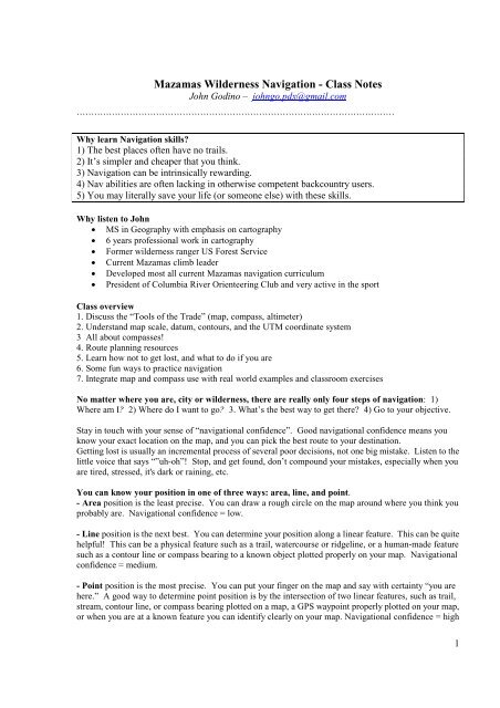
<strong>Mazamas</strong> <strong>Wilderness</strong> <strong>Navigation</strong> - Class Notes<br />
John Godino – johngo.pdx@gmail.com<br />
````````````````````````````````````````````````````````````````````````````````````````````````````````````<br />
Why learn <strong>Navigation</strong> skills?<br />
1) The best places often have no trails.<br />
2) It’s simpler and cheaper that you think.<br />
3) <strong>Navigation</strong> can be intrinsically rewarding.<br />
4) Nav abilities are often lacking in otherwise competent backcountry users.<br />
5) You may literally save your life (or someone else) with these skills.<br />
Why listen to John<br />
• MS in Geography with emphasis on cartography<br />
• 6 years professional work in cartography<br />
• Former wilderness ranger US Forest Service<br />
• Current <strong>Mazamas</strong> climb leader<br />
• Developed most all current <strong>Mazamas</strong> navigation curriculum<br />
• President of Columbia River Orienteering Club and very active in the sport<br />
Class overview<br />
1. Discuss the “Tools of the Trade” (map, compass, altimeter)<br />
2. Understand map scale, datum, contours, and the UTM coordinate system<br />
3 All about compasses!<br />
4. Route planning resources<br />
5. Learn how not to get lost, and what to do if you are<br />
6. Some fun ways to practice navigation<br />
7. Integrate map and compass use with real world examples and <strong>class</strong>room exercises<br />
No matter where you are, city or wilderness, there are really only four steps of navigation: 1)<br />
Where am I? 2) Where do I want to go? 3. What’s the best way to get there? 4) Go to your objective.<br />
Stay in touch with your sense of “navigational confidence”. Good navigational confidence means you<br />
know your exact location on the map, and you can pick the best route to your destination.<br />
Getting lost is usually an incremental process of several poor decisions, not one big mistake. Listen to the<br />
little voice that says “”uh-oh”! Stop, and get found, don’t compound your mistakes, especially when you<br />
are tired, stressed, it's dark or raining, etc.<br />
You can know your position in one of three ways: area, line, and point.<br />
- Area position is the least precise. You can draw a rough circle on the map around where you think you<br />
probably are. <strong>Navigation</strong>al confidence = low.<br />
- Line position is the next best. You can determine your position along a linear feature. This can be quite<br />
helpful! This can be a physical feature such as a trail, watercourse or ridgeline, or a human-made feature<br />
such as a contour line or compass bearing to a known object plotted properly on your map. <strong>Navigation</strong>al<br />
confidence = medium.<br />
- Point position is the most precise. You can put your finger on the map and say with certainty “you are<br />
here.” A good way to determine point position is by the intersection of two linear features, such as trail,<br />
stream, contour line, or compass bearing plotted on a map, a GPS waypoint properly plotted on your map,<br />
or when you are at a known feature you can identify clearly on your map. <strong>Navigation</strong>al confidence = high<br />
1
Why is a map more important than a compass?<br />
There are FOUR main components of navigation, and maps tell you ALL of them.<br />
1. Distance (How far is the approach hike to base camp?)<br />
2. Elevation (What’s the elevation gain to the summit?)<br />
3. Terrain (Steep or flat? Gully or ridge? Dense forest or open snow?)<br />
4. Direction (If we head NW from here, we’ll find the trail )<br />
A map can tell you all of these. A compass cannot tell you distance, elevation, or terrain. A compass is<br />
only used when you need more precise direction, such as “the saddle on the ridgeline we are trying to hit<br />
is 310° from camp”.<br />
Unless you want to walk in a straight line, a compass is next to useless without a map.<br />
Maps – an overview<br />
What’s a “topo” map? - Symbols & Legend - Datum - Declination - Scale - Coordinate systems<br />
Lat-Long vs. UTM - Contour lines<br />
Topographic maps show four main things:<br />
1) Contours (elevation), 2) Water features, 3) Vegetation 4) Manmade features (roads, trails).<br />
What’s a 7½ minute maps?<br />
• The entire USA (outside of Alaska) is mapped at a scale of 1:24,000, and printed on a sheet<br />
showing with 7.5 minutes of longitude and 7.5 minutes of latitude, about 6 by 9 miles. This is the<br />
most detailed and consistent base map of the country.<br />
• These were the only good maps available for a long time.<br />
• Nowadays, many private companies (like Green Trails or Nat Geo Topo software) have taken the<br />
free government base map data and made the maps more user-friendly for backcountry use by<br />
highlighting trails, adding a clear UTM grid and a more useful legend. Therefore, using an actual<br />
7½ minute map in the backcountry is becoming a thing of the past.<br />
3 cautions on using mapping software<br />
1. Major features may be missing, depending on the date of the air photos used for the base map<br />
(example: no Hwy 20 in the WA Cascades?!)<br />
2. The map scale can be whacky; there’s no standard.<br />
3. Useful information in the margins of printed maps may be missing.<br />
Map Legends<br />
• Most maps do not have complete legends, esp. map printed from mapping software.<br />
• Universal legend standards do not exist, so symbols or colors are not alike on all maps.<br />
2
Map Datums<br />
• A map datum is a model of the earth used by surveyors. Your GPS has LOTS to choose from!<br />
• Earlier datums were based on surveyed points. Newer ones are based on satellite measurements.<br />
One is not “better” than another, just different.<br />
• Most all US topo maps are based on either NAD-27 or NAD-83. (NAD = North American<br />
Datum, 1927 or 1983). Older topo maps are typically NAD-27.<br />
• Most GPS units default to a datum “WGS 84”; it’s the same as NAD83.<br />
• Do you need to care about datums? Only if you are using a GPS, then the datum on your GPS<br />
should be set to the same as your paper map.<br />
• If the datums are not the same, you could have a discrepancy of about 200 meters. (Maybe a<br />
problem, normally not.)<br />
Map Declination<br />
- Most maps have a declination diagram that<br />
usually looks something like this. You can<br />
ignore mils and GN, which means grid north.<br />
- Set the adjustable declination on your compass<br />
(here 14 degrees east) to match your map, so you<br />
can more easily use map and compass together.<br />
Map Scale<br />
• All printed maps should have either a ratio or a bar scale. Often you’ll have both.<br />
• All of USA is mapped at 1:24,000 - a good level of detail for backcountry travel.<br />
• Ratio scale: A “1:100,000” scale means the distance between any two map points is 100,000<br />
times longer in the real world. (3.5 cm on map = 3.5 Km on the ground).<br />
• Ratio scale is great in metric countries, next to useless in USA<br />
Note that a large scale map shows a small area, i.e. more zoomed in. A small-scale map shows a large<br />
area, i.e. zoomed out. (This is not very intuitive for some people, me included!)<br />
Map measuring tips:<br />
1. Get a sharpie pen, and put small black tick marks on your compass string every 2.6 inches apart.<br />
On a 1:24,000 scale map, each tick mark represents one mile.<br />
2. Copy the bar scale onto scrap paper. Use this scrap paper to measure distances.<br />
3. Finger scale: Put your fingers onto the scale bar, and see what finger covers a convenient portion<br />
of a mile or a KM, such as “ my thumb width = ½ mile”. Then, measure map distance with your<br />
thumb.<br />
```````````````````````````````````````````````````````````````````````````````````````````````````````````````````````````````<br />
3
Contours<br />
Developing the ability to look at a topo map and visualize the real terrain that it represents is a key longterm<br />
skill to develop in navigation. Shaded relief makes this a LOT easier! (The above images were<br />
made from Gmap4 free software.)<br />
Contour interval = the real world vertical distance represented by each contour line. This is typically 40<br />
feet on a large-scale map.<br />
Index contour = typically every fifth line, printed in bold, which has an elevation value printed<br />
somewhere on it. This is typically 200 feet on a large-scale map.<br />
Widely spaced lines indicate a gentle slope. Closely spaced lines show a steeper slope. Contour lines that<br />
touch one another represent a cliff!<br />
Concentric circles show a summit.<br />
Spurs (ridges) and gullies (valleys) look almost identical. Learning to differentiate between them is an<br />
important map reading skill. Here's the main tip: Spurs have contours that bend downhill. Gullies<br />
have contours that bend uphill. (Tip: streams always run in gullies, and never on ridges =^)<br />
```````````````````````````````````````````````````````````````````````````````````````````````````````````````````````````<br />
Coordinate systems<br />
Coordinate systems, aka grids, let you to specify a “street address” of any point on Earth.<br />
4
Potentially the most important use for coordinates is: “I need help, and this is exactly where I am!”<br />
There are three main types in use for land navigation:<br />
1) Latitude/Longitude, 2) Public Lands Survey System, and 3) UTM (the preferred system for us!)<br />
An in-depth explanation of all 3 coordinates systems is here:<br />
<strong>Mazamas</strong>.org --> Resources --> Tip of the Week --> Route Planning and <strong>Navigation</strong><br />
Lat long<br />
• Oldest and most commonly used coordinate system.<br />
• Used mostly by pilots and sailors, work better over long distances. However, for land navigation,<br />
they have drawbacks. (There are 3 different ways to state lat/long coordinates, confusing!!!)<br />
• See a complete Lat Long explanation on the <strong>Mazamas</strong> web Resources Tip of the Week <br />
Route Finding and <strong>Navigation</strong><br />
Public Lands Survey System (PLS)<br />
• Created in the 1800s to survey much of the Western US.<br />
• Generally used to survey/identify land parcels in rural or wild areas.<br />
• This system lays out a series of 1 square mile grids, based on Township and Range.<br />
• Mostly seen on US Forest Service and BLM maps, not so useful for backcountry use.<br />
• It’s not useful for precise wilderness navigation, but as it’s on some maps you’ll see, you should<br />
be familiar with it.<br />
• To read a coordinate, give the township, range, and section (and maybe quarter section)<br />
UTM (Universal Transverse Mercator)<br />
Why do we like UTM? Grids are square and same size - Based on meters, easy base 10 system - One way<br />
to write coordinates, not three - Uses only positive coordinates - More accurate (to 1 meter) - Easy to<br />
determine coordinates from a map - Easy to transmit coordinates by voice or text - Easy to shorten / round<br />
off - Easier to plot compass bearings on map<br />
• The UTM system is metric. UTM coordinates are just like the X-Y graphs from high school<br />
geometry. The Easting is the X axis, the Northing is the Y axis.<br />
• UTM coordinates of a given point can be calculated from a map, or read off of a GPS.<br />
• Easting values increase as you move east, and are always 6 digits.<br />
• Northing values increase as you move north, and are always 7 digits (in USA).<br />
• UTM coordinates are always given in a specific order: Zone, Easting, and Northing. (Remember:<br />
Z-E-N)<br />
• A UTM grid is typically printed as a 1 km grid across the map.<br />
• The UTM grid can be used to quickly estimate distances in km.<br />
```````````````````````````````````````````````````````````````````````````````````````````````````````````````````````````<br />
The four main navigational tools are map, compass, altimeter, and GPS.<br />
Altimeters<br />
• Altimeters work by measuring changes in barometric pressure.<br />
• It is important to calibrate your altimeter regularly in the field to ensure accurate measurements!<br />
Encourage everyone on your team to do the same. Do this at points of known elevation.<br />
• Altimeters can be used to fix your point position. If you are on a linear feature, such as a trail,<br />
stream, or ridgeline, and you can get an altimeter reading, you can plot your point position where<br />
the appropriate contour line crosses your linear feature.<br />
5
• Weather prediction: A rising elevation reading when you are stationary indicates falling<br />
barometric pressure, and possible stormy weather.<br />
````````````````````````````````````````````````````````````````````````````````````````````````````````````````````````````<br />
Compasses<br />
Most important compass tip: Be sure you buy one that has adjustable declination. Such compasses<br />
allow you to take all bearings to true north and avoid confusing backcountry arithmetic. This is the<br />
modern way to use map and compass.<br />
Two great compasses are the Suunto M2 and Suunto M3 (the M3 is my favorite). These are about $24<br />
and $34 at REI.<br />
You do NOT need a mirrored compass. A simple baseplate compass with adjustable declination is all<br />
most backcountry users need. They are plenty accurate for recreational users.<br />
If you do adventure travel, consider a global compass, designed to work in every part of the world.<br />
If you take a North American compass to New Zealand it may not work, because the needle may drag on<br />
the bezel due to the different direction and intensity of the earth’s magnetic field.<br />
Remember, a compass is a magnet. Never use it near metal objects, like a belt buckle or hood of a car.<br />
There are four main things to do with a compass<br />
(1 & 2 are common and easy; 3 & 4 are a bit harder but are less common.)<br />
1. Take a bearing to an object<br />
2. Follow a bearing to an object<br />
3. Get a bearing from point A to point B off the map<br />
4. Take a bearing from your position to an object and plot on the map<br />
That’s it! (and you thought compasses were confusing =^)<br />
A bearing is a direction expressed in degrees, in relation to true north.<br />
Bearings are measured clockwise from 0 degrees north.<br />
Memorize the 4 bearings for the four main directions:<br />
0 = north, 90 = east, 180 = south, 270 = west.<br />
Compass use is a much better “show” than a “tell”. See some excellent, short instructional videos on<br />
YouTube here: www.mazamas.org --> Resources --> <strong>Navigation</strong> Training<br />
Try a “triangle” exercise on following bearings:<br />
Start near the middle of a large room. (Mark your start point by putting an object on the floor.)<br />
• Walk 10 paces on a bearing of 45 degrees.<br />
• Walk 10 paces on a bearing of 165 degrees.<br />
• Walk 10 paces on a bearing of 285 degrees.<br />
You should have walked a triangle, ending up where you started.<br />
Try it outside with longer pacing distance, like 100 paces. See how accurate your bearings and pacing<br />
are.<br />
Why “triangulation” rarely works to get you unlost<br />
The concept of triangulation is: Take bearings to 2-3 objects, then plot them on your map. Where the<br />
lines intersect is your location. For this to work, you need to: 1) Be able to see objects, 2) Be able to<br />
recognize them, AND 3) Have those objects actually be on your map! Not very likely in the real world<br />
when you are truly lost!<br />
6
Orienting the map<br />
• Most of us hold maps with north always at the top.<br />
• However, it’s often helpful to rotate the map so the direction you are walking is furthest away<br />
from you.<br />
• This orient your map to the terrain, esp. helpful when reading subtle map features.<br />
• Example: If you are walking south, hold the map so the north end is closest to your body and the<br />
map is “upside down”.<br />
Declination<br />
• Most people find this the most confusing part of using a compass, but it’s actually pretty simple.<br />
• Maps are based on “true north” (the geographic north pole).<br />
• But . . . the magnetic needle of a compass points to magnetic north, not true north. These two<br />
places are NOT the same!<br />
• Declination is simply the angle between true north and magnetic north.<br />
• With a declination adjusted compass, all bearings are measured to true north, making the compass<br />
match your map.<br />
Declination varies a lot based on your location in the world, and a little bit over time. Look on the bottom<br />
of the map or check the web for current declination for your area. Presently, it’s 17 degrees in Portland.<br />
Buy a compass with adjustable declination, spend an extra $10, set it once, and forget about it (as long<br />
as you stay in OR and WA.) Once it’s set, the needle still points to magnetic north, but the “N” on the<br />
compass dial will point to the true north pole, letting you measure all bearings to true north with no math<br />
required.<br />
Some old school nav. books tell you to measure bearings to magnetic north, then add / subtract to get the<br />
true north bearing. Don’t make a habit of this - even simple arithmetic in the backcountry when you’re<br />
lost /stressed is asking for trouble!<br />
The Frugal navigator: If<br />
you do NOT have a<br />
compass with adjustable<br />
declination, (despite your<br />
instructor’s best efforts =),<br />
add a strip of tape or<br />
sharpie pen mark to the<br />
dial.<br />
Why declination matters – ¼ mile error per mile traveled in the Pacific NW<br />
• Scenario: Heidi and Hans start at the same location in Oregon. They want to find their camp,<br />
which is one mile away, due east. They each set their compass to 90 degrees and start walking.<br />
• Heidi has her compass correctly adjusted (17 degrees east) for declination, and thus walks her<br />
bearing correctly (measured to true north) and hits her objective.<br />
• Hans does not have his compass adjusted for declination, walks his bearing to magnetic north,<br />
which is actually a bearing of 107 degrees. Hans is 1/4 mile off - LOST!<br />
7
Is my compass adjusted for declination?<br />
1. Turn your compass so North is at the direction of travel arrow. Now look at your red orienting<br />
arrow (ignore the magnetic needle).<br />
2. If the red arrow is pointing directly at the “N”, your compass is NOT adjusted for declination (left<br />
photo).<br />
3. If the red arrow is pointed about 17 degrees to the right of the “N”, (or about 1 o’clock), then your<br />
compass IS adjusted for declination in the NW (right photo).<br />
Backbearings<br />
A backbearing is the 180 degree<br />
opposite bearing of the one you are on.<br />
This is useful to know if you need to<br />
retrace your route. Easiest math-free<br />
way to determine a backbearing: just<br />
look at the other “end” of the compass.<br />
Aiming off<br />
Handy when your goal is<br />
along a linear feature, like<br />
a trail, stream or road.<br />
Intentionally “aim off” to<br />
one side, (usually the<br />
uphill side) so you’re sure<br />
of which way to turn at<br />
the linear feature.<br />
``````````````````````````````````````````````````````````````````````````````````````````````````````````<br />
Resources . . .<br />
8
Download ANY 7.5 minute map for FREE from the USGS. store.usgs.gov<br />
Files are about 20+ Mb, pdf files, high resolution scans. Whatta deal, your tax dollars at work.<br />
Best map stores in Portland are REI and Nature of the Northwest<br />
800 NE Oregon St, Portland, www.naturenw.org<br />
Free hiking and climbing maps on the <strong>Mazamas</strong> website<br />
The <strong>Mazamas</strong> web has over 50 maps of NW climbing routes and Portland area hikes.<br />
.pdf format, print on a single 8.5” x 11” sheet of paper, various scales. See them here: <strong>Mazamas</strong>.org --><br />
Resources --> Maps for Climbing and Hiking<br />
How to print amazing quality maps<br />
Getting the highest quality printouts you can (from either map software or online maps) is critical. Best<br />
print quality does NOT come from an inkjet printer!<br />
Solution: Save maps as a .pdf or .tiff file to a USB flash drive, go to Fed-Ex office store, print from the<br />
copy machines or ask the staff to print it for you (heavier paper than on the self-serve machines.)<br />
Mapping software: National Geographic Topo is still the standard. Must buy per state, cost is about<br />
$50. Allows easy export/import of GPS tracks and waypoints, a very handy feature.<br />
Free topo maps online<br />
Gmap4 is a 100% free enhanced Google Map viewer. (All online, nothing to download)<br />
Very high resolution contours, easily make and export GPS waypoints, even decent printing! It’s the best<br />
mapping software I’ve found, highly recommended! Google search: Gmap4.<br />
Make your smart phone a $600 GSP receiver<br />
Your smart phone could be your new GPS for outdoor play. Check out “IHikeGPS” for the Iphone. Free<br />
hi resolution maps for US and Canada, add waypoints, record tracks, shows your position in real time,<br />
very cool! Cost: just $8! www.ihikegps.com<br />
The Santiam Alpine Club has a page with waypoints for popular OR climbs.<br />
http://www.santiamalpineclub.org/mountain/climbing/gps/routes/<br />
Good sources of trip reports:<br />
Climbers: www.summitpost.com<br />
Skiers: www.turns-all-year.com<br />
Route Card<br />
• A Route Card, aka travel agenda, is a compilation of maps, images, key GPS points and text<br />
descriptions crammed onto a few sheets of paper. Sort of a mini self-made guidebook.<br />
• It has enough detail and decision points to make you confident of successful navigation.<br />
• Making one forces you to pay attention to subtle route details.<br />
• Make a copy for each member of the climb team.<br />
• More here: <strong>Mazamas</strong>.org --> Resources --> Tip of the Week --> Route Planning and <strong>Navigation</strong><br />
Google Earth and Google maps<br />
Both allow import of GPS tracks and waypoints, very useful for seeing your trail in 3-D and shaded relief.<br />
Drawing a line in Google Earth creates a .kmz file, which can be easily converted with web software to a<br />
.gpx file for use on your GPS. Comparing a topo map with Google Earth is a terrific way to develop your<br />
“contour eye.”<br />
Staying Unlost<br />
9
• #1 - Maintain a high level of navigational confidence! If you can always find your location on a<br />
map, you cannot be “lost”.<br />
• Turn around and look at your return route often. Look up and around every 30 seconds and note<br />
landmarks.<br />
• Always use a waterproof map bag. 1 gallon ziplocks work great, as do sheet protectors.<br />
• Mark your route with brightly colored plastic survey tape or crepe paper (bring @ 5 meters).<br />
• If you have a GPS, always mark a waypoint at your car or point where you leave the trail.<br />
• Always carry a whistle, and keep it handy.<br />
• Never separate your group unless it’s for a very good reason.<br />
• Most people get lost on descent, not on the ascent. When ascending, the terrain ahead decreases<br />
in size. When descending, the terrain ahead increases in size, giving you an increasing number of<br />
route choices, each potentially wrong.<br />
• Rushing downhill during poor visibility is usually a bad idea.<br />
• Always have the descent route researched, mapped and memorized as well as the ascent route.<br />
If you are lost<br />
Searchers look for clues, not people. Leave lots of clues (deliberate footprints, lined up rocks, written<br />
notes, scratched arrows in dirt).<br />
Many newer LED headlamps have a blink mode. Bring your headlamp to a high point with good<br />
visibility. Set to blink at night to indicate your position.<br />
If you are lost, S-T-O-P<br />
1. Stop: Stay where you are! Take off your pack, count slowly to 10, have food/water.<br />
2. Think: Activate brain! Where were you last unlost? Can you go there?<br />
3. Observe: Look for shelter, fuel water What are your resources?<br />
4. Plan: Make a plan, and say it out loud.<br />
``````````````````````````````````````````````````````````````````````````````````````````````````````````<br />
<strong>Navigation</strong> Practice<br />
On mazamas web: www.mazamas.org --> Resources --> Tip of the Week. See over 200 outdoors<br />
related tips, including <strong>Navigation</strong>.<br />
Mt. Tabor has a permanent map and compass practice course established by <strong>Mazamas</strong>.<br />
The required map and field exercises are here: <strong>Mazamas</strong>.org --> Resources --> <strong>Navigation</strong> Training.<br />
Audit this <strong>class</strong> again<br />
• All <strong>Mazamas</strong> lectures (except First Aid) are free and open to anyone.<br />
• Drop in on navigation lectures (taught 5 times per year) anytime you want.)<br />
Practice skills on familiar trails<br />
Take your map, compass, altimeter and GPS on fair-weather hikes you are already know well. Practice!<br />
Doing this often on a relaxed sunny hike prepares you for . . . those other times. =^)<br />
1. At viewpoints, orient your map to the terrain. Identify real world features and match them to your<br />
map. This helps you to read contours.<br />
2. Practice estimating distances. Pick out some real world features, guess how far away they are,<br />
locate them on your map, and use your map scale bar to determine the actual distance.<br />
10
3. If you are unsure of your location on the map, get a GPS waypoint, and then use the UTM grids<br />
on the side of your map to locate your position on the map.<br />
4. When at a known position on the map, use the map to determine your UTM location. Then get a<br />
GPS waypoint and see how close the points match (within 200 meters is pretty good.)<br />
Practice GPS use with geocaching<br />
www.geocaching.com - Requires a GPS - Search for hidden “caches” of trinkets and a logbook to sign.<br />
There’s thousands of geocaches around Portland.<br />
Take a navigation <strong>class</strong>es at REI<br />
Take map/compass or GPS <strong>class</strong> at a local REI store. Prices are reasonable, instructors are generally<br />
solid, and the price is right. See rei.com, search a specific store.<br />
Try Orienteering<br />
Called “hiking with your brain turned on”, map & compass only are used to locate control points. Local<br />
Portland club: Columbia River Orienteering Club. Local meets are held year round, beginners are<br />
welcome. Several permanent orienteering courses are in the PDX area where you can practice anytime<br />
you want. See www.croc.org under Training.<br />
11