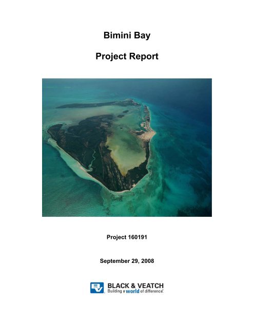
Bimini Bay Project Report - Bahamas Environment, Science and ...
Bimini Bay Project Report - Bahamas Environment, Science and ...
Bimini Bay Project Report - Bahamas Environment, Science and ...

Create successful ePaper yourself
Turn your PDF publications into a flip-book with our unique Google optimized e-Paper software.
<strong>Bimini</strong> <strong>Bay</strong><br />
<strong>Project</strong> <strong>Report</strong><br />
<strong>Project</strong> 160191<br />
September 29, 2008
<strong>Bimini</strong> <strong>Bay</strong><br />
Contents<br />
Table of Contents<br />
1.0 Executive Summary............................................................................................. 1-1<br />
2.0 Introduction.......................................................................................................... 2-1<br />
3.0 <strong>Project</strong> Overview ................................................................................................. 3-1<br />
3.1 <strong>Project</strong> Description...................................................................................3-1<br />
3.2 <strong>Bimini</strong> <strong>Bay</strong> <strong>Project</strong> Timeline ...................................................................3-5<br />
4.0 Scope of Review .................................................................................................. 4-1<br />
4.1 Documents ...............................................................................................4-1<br />
4.2 Site Visit Activities..................................................................................4-3<br />
4.3 Personal Interviews <strong>and</strong> Consultations ....................................................4-4<br />
4.3.1 <strong>Bahamas</strong> Government ............................................................... 4-5<br />
4.3.2 NGOs......................................................................................... 4-5<br />
4.4 Other Sources...........................................................................................4-5<br />
5.0 Assessment <strong>and</strong> Analysis..................................................................................... 5-1<br />
5.1 Approvals <strong>and</strong> Authorizations .................................................................5-1<br />
5.1.1 Master Development Plans........................................................ 5-1<br />
5.1.2 Permits....................................................................................... 5-4<br />
5.2 <strong>Environment</strong>al Impacts <strong>and</strong> Management ...............................................5-7<br />
5.2.1 Impact Assessments................................................................... 5-7<br />
5.2.2 Observed Phase 1 Impacts......................................................... 5-9<br />
5.2.3 Phase 2 Impacts ....................................................................... 5-16<br />
5.2.4 Mitigation <strong>and</strong> Management Practices .................................... 5-17<br />
5.3 Coastal Stabilization ..............................................................................5-20<br />
5.3.1 Baseline Coastal Conditions.................................................... 5-20<br />
5.3.2 <strong>Project</strong> Development Coastal Stabilization............................. 5-21<br />
5.3.3 Considerations <strong>and</strong> Recommendations.................................... 5-23<br />
5.4 National Wetl<strong>and</strong>s Committee Policy <strong>and</strong> Subcommittee Site<br />
Visit <strong>Report</strong>............................................................................................5-24<br />
5.5 Feasibility of Further Phase 2 Development..........................................5-28<br />
5.5.1 Assessing Isl<strong>and</strong> Capacity for Further Resort<br />
Development............................................................................ 5-28<br />
5.5.2 Golf Course Footprint Fatal Flaw Assessment........................ 5-29<br />
160191 - 092908 TC-1
<strong>Bimini</strong> <strong>Bay</strong><br />
Contents<br />
Table of Contents (Continued)<br />
6.0 Findings <strong>and</strong> Recommendations.......................................................................... 6-1<br />
6.1 Findings <strong>and</strong> Determinations of Gaps......................................................6-1<br />
6.2 Recommendations Going Forward ..........................................................6-5<br />
6.2.1 <strong>Environment</strong>al Management Plans <strong>and</strong> Practices...................... 6-6<br />
6.2.2 Marine <strong>Environment</strong>.................................................................. 6-9<br />
6.2.3 Golf Course Layout <strong>and</strong> Design................................................ 6-9<br />
6.2.4 Marine Protection Area ........................................................... 6-10<br />
6.2.5 <strong>Environment</strong>al Impact Assessment ......................................... 6-11<br />
6.2.6 Permits <strong>and</strong> Compliance Records............................................ 6-14<br />
6.2.7 Public Awareness .................................................................... 6-14<br />
6.2.8 Coastal Stabilization................................................................ 6-15<br />
Appendix A<br />
Appendix B<br />
Appendix C<br />
Appendix D<br />
Maps<br />
<strong>Bimini</strong> <strong>Bay</strong> Resort Development Features <strong>and</strong> Authorizations<br />
Site Visit Photographs of Resort Development Conditions<br />
Inventory of <strong>Bimini</strong> <strong>Bay</strong> Field Studies <strong>and</strong> Assessments<br />
Tables<br />
Table 4-1 Review Documents Provided by BEST Commission ....................................4-1<br />
Table 4-2 Documents Provided by RAV <strong>Bahamas</strong> to BVI ............................................4-2<br />
Table 5-1 Department of Physical Planning Approvals <strong>and</strong> Applications Pending for<br />
RAV <strong>Bahamas</strong> Ltd. (<strong>Bimini</strong> <strong>Bay</strong> <strong>Project</strong>) at North <strong>Bimini</strong>...........................5-5<br />
Table 6-1 <strong>Bimini</strong> <strong>Bay</strong> Resort <strong>Environment</strong>al Management Plans--Recommended<br />
Contents .........................................................................................................6-7<br />
Figures<br />
Figure 1 <strong>Bimini</strong> <strong>Bay</strong> L<strong>and</strong> Use Plan...............................................................................3-2<br />
Figure 2 Proposed Phase 1 Area .....................................................................................3-3<br />
Figure 3 Phase 1 <strong>and</strong> 2 Areas..........................................................................................3-4<br />
Figure 4 Comparison of 2004 <strong>and</strong> 2006 Plan Footprints................................................5-3<br />
Figure 5 EA Update’s Master Plan Comparison...........................................................5-14<br />
Figure 6 Hurricane <strong>and</strong> Tropical Storm Paths near the <strong>Bahamas</strong> (1990 - 2007)..........5-21<br />
Figure 7 Boundaries of the Proposed North <strong>Bimini</strong> MPA............................................5-27<br />
Figure 8 Phase 2B Area Available for Golf Course Development...............................5-32<br />
160191 - 092908 TC-2
<strong>Bimini</strong> <strong>Bay</strong><br />
Executive Summary<br />
1.0 Executive Summary<br />
The <strong>Bimini</strong> <strong>Bay</strong> <strong>Project</strong> located on North <strong>Bimini</strong> is a proposed resort development<br />
consisting of private single-family <strong>and</strong> condominium residential housing, hotel <strong>and</strong> timeshare<br />
units, a casino, marinas, a golf course, commercial shops <strong>and</strong> restaurants,<br />
swimming <strong>and</strong> beach facilities, <strong>and</strong> associated utility infrastructure.<br />
Black & Veatch International (BVI) was contracted by the Government of the <strong>Bahamas</strong><br />
(GOB) to conduct an impartial, independent evaluation of the <strong>Bimini</strong> <strong>Bay</strong> <strong>Project</strong> to<br />
identify the extent to which the GOB previously approved individual aspects of current<br />
Phase 1 project development. The GOB also requested that BVI evaluate the extent to<br />
which existing development activities have been addressed in environmental assessment<br />
(EA) <strong>and</strong> management plan submittals, as well as the extent to which environmental<br />
degradation occurred beyond that described in these environmental submittals. The GOB<br />
also specifically requested BVI to examine the potential impacts from <strong>and</strong> isl<strong>and</strong> capacity<br />
to accommodate changes proposed in the latest proposed project l<strong>and</strong> use plans.<br />
BVI reviewed documents, conducted interviews, <strong>and</strong> performed a site visit to investigate<br />
<strong>and</strong> audit the extent of project development, construction activities, <strong>and</strong> existing site<br />
conditions. Based on these actions, BVI prepared this gap analysis report summarizing<br />
its analysis <strong>and</strong> findings; it concludes with recommendations for moving forward with<br />
<strong>Bimini</strong> <strong>Bay</strong> Resort project development.<br />
The following summarizes the findings of the gap analysis:<br />
Boundaries of <strong>Project</strong> Approvals<br />
Construction within<br />
approved areas<br />
Construction activities<br />
permitted<br />
Findings of Gap Analysis<br />
No gaps<br />
Potential<br />
gaps<br />
All current Phase 1 development features <strong>and</strong><br />
improvements either completed or under<br />
construction are within the boundaries of GOB<br />
approvals.<br />
Documentation of necessary permits covering all<br />
activities from initiation of construction to present<br />
could not be produced for review.<br />
Master l<strong>and</strong> use plan Gaps New master plan proposed in 2006 involving<br />
proposed exchange of Easter Key l<strong>and</strong>s for<br />
additional reclaimed l<strong>and</strong>s possibly agreed to, but<br />
property transfers have yet to be made. It differs<br />
from the master plan included in the Heads of<br />
Agreement (HOA) as well as the master plan<br />
approved by the Town Planning Committee.<br />
160191 - 092908 1-1
<strong>Bimini</strong> <strong>Bay</strong><br />
Executive Summary<br />
Findings of Gap Analysis<br />
Public awareness Gaps A lack of transparency <strong>and</strong> public access to<br />
documentation of authorizations of the extent <strong>and</strong><br />
boundaries of planned project’s development<br />
activities has created confusion for local residents,<br />
Non-Governmental Organizations (NGOs) <strong>and</strong> even<br />
other Government agencies, as evidenced by efforts<br />
to establish a Marine Protection Area in North<br />
<strong>Bimini</strong>.<br />
<strong>Environment</strong>al Management Practices<br />
Coastal stabilization No gaps Construction of concrete walls reinforced with steel<br />
rods imbedded in bedrock at the edge of developed<br />
areas is appropriate. Future development should<br />
incorporate design wave <strong>and</strong> site stormwater<br />
analysis, including utilization of wave <strong>and</strong> sediment<br />
computer modeling, as well as other recommended<br />
design elements.<br />
<strong>Environment</strong>al<br />
management<br />
Gaps<br />
<strong>Environment</strong>al Impacts <strong>and</strong> Degradation<br />
Extent of<br />
environmental<br />
degradation beyond<br />
what was anticipated<br />
Impacts of proposed<br />
isl<strong>and</strong> reconfiguration<br />
Gaps<br />
Potential<br />
gaps<br />
No written environmental management plan (EMP)<br />
as required under the 2004 HOA. Lack of<br />
implementation of numerous common<br />
environmental management practices <strong>and</strong><br />
procedures at the project site.<br />
<strong>Environment</strong>al impacts to existing terrestrial <strong>and</strong><br />
aquatic resources have resulted from Phase 1<br />
activities; however, the significance <strong>and</strong> extent of<br />
these impacts cannot reasonably be determined due<br />
to a lack of sufficient baseline data or impact<br />
characterization within the project environmental<br />
reports.<br />
Ability to quantify <strong>and</strong> compare potential impacts<br />
hindered by lack of data on proposed Phase 1 isl<strong>and</strong><br />
reconfiguration(s) <strong>and</strong> associated marina basin <strong>and</strong><br />
interconnecting waterways, combined with lack of<br />
identification, characterization, location, or<br />
quantification of specific resources <strong>and</strong> habitats in<br />
the vicinity of the subject isl<strong>and</strong>(s).<br />
160191 - 092908 1-2
<strong>Bimini</strong> <strong>Bay</strong><br />
Executive Summary<br />
Findings of Gap Analysis<br />
Isl<strong>and</strong> capacity for<br />
further resort<br />
development<br />
Potential<br />
gaps<br />
Lack of available data on current ecological<br />
conditions <strong>and</strong> physical boundaries <strong>and</strong> vague<br />
conceptual descriptions of proposed golf course<br />
design <strong>and</strong> layout preclude reasonable assessment of<br />
isl<strong>and</strong>’s capacity for further sustainable resort<br />
development. However, a fatal flaw assessment<br />
finds that potentially 112.5 to 134 acres could be<br />
suitable for development of a golf course providing<br />
for avoidance of <strong>and</strong> protective buffers around<br />
sensitive environmental resources <strong>and</strong> habitats.<br />
The report concludes with the following recommendations for consideration in moving<br />
forward with <strong>Bimini</strong> <strong>Bay</strong> Resort project development:<br />
Recommended Steps Forward<br />
1. RAV <strong>Bahamas</strong> Ltd. should be immediately required to develop a detailed<br />
<strong>Environment</strong>al Management Plan (EMP) to include both constructionphase<br />
<strong>and</strong> operational-phase issues for all Phase 1 development activities.<br />
2. RAV <strong>Bahamas</strong> Ltd. should be required to install an open bridge to the<br />
existing southernmost artificial isl<strong>and</strong>, utilize siltation curtains during all<br />
dredging activities, <strong>and</strong> monitor water quality, turbidity, <strong>and</strong> sea grasses.<br />
3. Detailed field surveys should be undertaken of the Phase 2 area to identify<br />
current baseline conditions, locations, <strong>and</strong> the extent of all sensitive<br />
resources <strong>and</strong> habitats; the findings should be incorporated into golf<br />
course design plans <strong>and</strong> layouts to ensure avoidance <strong>and</strong> protection of the<br />
identified sensitive resources.<br />
4. Scoping consultations should commence to establish the appropriate<br />
content <strong>and</strong> methodology of a comprehensive <strong>Environment</strong>al Impact<br />
Assessment (EIA) report to be submitted for review <strong>and</strong> approval as a precondition<br />
to proceeding with any Phase 2 construction activities.<br />
5. As part of the EIA scoping process, the GOB <strong>and</strong> RAV <strong>Bahamas</strong> Ltd.<br />
should actively seek mutually acceptable compromises <strong>and</strong> compatible<br />
sustainable design solutions to competing project development <strong>and</strong><br />
environmental marine preservation objectives.<br />
6. A comprehensive EIA <strong>and</strong> EMP should be prepared in accordance with<br />
the scoping guidance <strong>and</strong> submitted to the <strong>Bahamas</strong> <strong>Environment</strong>, <strong>Science</strong><br />
& Technology Commission (BEST) Commission for review <strong>and</strong> approval.<br />
160191 - 092908 1-3
<strong>Bimini</strong> <strong>Bay</strong><br />
Executive Summary<br />
7. The final EIA should be made available for public inspection, <strong>and</strong> public<br />
comments should be presented to the Cabinet along with the BEST<br />
Commission’s recommendations regarding the acceptability of the impacts<br />
in deciding whether, <strong>and</strong> to what extent, to authorize further Phase 2<br />
development.<br />
8. A central repository for all plans, permits, licenses, <strong>and</strong> approvals should<br />
be established at the Isl<strong>and</strong> Administrator’s office, <strong>and</strong> should be<br />
maintained at the resort for inspections by government staff.<br />
9. A communications forum should be established on North <strong>Bimini</strong> to<br />
provide notice to local residents of the nature <strong>and</strong> extent of all project<br />
development plans, approvals, <strong>and</strong> authorizations, as well as major project<br />
construction activities or events that may temporarily produce increased<br />
dem<strong>and</strong>s on isl<strong>and</strong> infrastructure or services.<br />
10. Review <strong>and</strong> approval of Phase 2 construction plans should require that<br />
appropriate coastal stabilization features, including (at a minimum) design<br />
wave <strong>and</strong> site stormwater analysis, be incorporated before any approvals<br />
are issued.<br />
160191 - 092908 1-4
<strong>Bimini</strong> <strong>Bay</strong><br />
Introduction<br />
2.0 Introduction<br />
Black & Veatch International (BVI) was contracted by the Government of the <strong>Bahamas</strong><br />
(GOB) to conduct an impartial, independent evaluation of the <strong>Bimini</strong> <strong>Bay</strong> <strong>Project</strong> to:<br />
• Identify the extent to which individual aspects of current Phase 1 project<br />
development were previously approved by the Government,<br />
• Evaluate the extent to which these existing Phase 1 development activities<br />
were addressed in the EA <strong>and</strong> subsequent amendments submitted to the<br />
<strong>Bahamas</strong> <strong>Environment</strong>, <strong>Science</strong> & Technology Commission (BEST)<br />
Commission in seeking these approvals,<br />
• Assess the extent to which environmental degradation has occurred<br />
beyond what was described in these environmental submittals, <strong>and</strong><br />
• Recommend what additional baseline surveys, studies, investigations,<br />
impact analyses, mitigation measures, <strong>and</strong> environmental management<br />
plans are appropriate <strong>and</strong> necessary to adequately address past <strong>and</strong><br />
potential future impacts from completion of both Phases 1 <strong>and</strong> 2 of the<br />
<strong>Bimini</strong> <strong>Bay</strong> <strong>Project</strong>.<br />
In conducting this independent evaluation, BVI accomplished the following:<br />
• Conducted a site audit visit to the <strong>Bimini</strong> <strong>Bay</strong> <strong>Project</strong> to observe the extent<br />
of completed <strong>and</strong> ongoing construction activities, as well as the baseline<br />
ecological conditions of undisturbed areas planned to be developed, <strong>and</strong><br />
through interviews <strong>and</strong> inspections ascertained what environmental<br />
management plans <strong>and</strong> practices were being implemented as part of the<br />
ongoing construction activities.<br />
• Reviewed numerous approval letters <strong>and</strong> permits issued by agencies <strong>and</strong><br />
Ministries of the GOB, including Heads of Agreements (HOA), to assess<br />
<strong>and</strong> define the extent of existing <strong>and</strong> planned future project development<br />
components that have been authorized to proceed with construction.<br />
• Reviewed existing project EA reports submitted to BEST to identify the<br />
extent to which impacts from completed <strong>and</strong> ongoing construction<br />
activities were included <strong>and</strong> adequately assessed in these documents.<br />
• Conducted interviews of the developer <strong>and</strong> its environmental consultants,<br />
government officials, local residents, NGOs <strong>and</strong> other interested parties<br />
concerning the history, underst<strong>and</strong>ing <strong>and</strong> concerns (if any) regarding<br />
permitting <strong>and</strong> ongoing development of the project.<br />
• Reviewed design drawings <strong>and</strong> observed coastal stabilization features to<br />
evaluate the sufficiency of these features.<br />
• Reviewed the National Wetl<strong>and</strong>s Subcommittee site visit report <strong>and</strong><br />
investigated conflict with proposed Marine Protection Area.<br />
160191 - 092908 2-1
<strong>Bimini</strong> <strong>Bay</strong><br />
Introduction<br />
• Reviewed habitat mapping from EA reports, observed baseline ecological<br />
conditions, <strong>and</strong> utilized GIS mapping from aerial photographs to estimate<br />
available acreage within the Phase 2 area for establishing a golf course,<br />
with provisions for avoidance of <strong>and</strong> protective buffers around sensitive<br />
environmental resources.<br />
Based on these document reviews <strong>and</strong> observations <strong>and</strong> information obtained from the<br />
previously mentioned site visit, BVI has prepared this gap analysis report that<br />
summarizes its findings regarding the extent of project development <strong>and</strong> construction<br />
activities that have already been approved, the extent to which these activities have been<br />
addressed in EA <strong>and</strong> EMP submittals, as well as the extent to which environmental<br />
degradation occurred beyond that described in these environmental submittals. This<br />
report also examines the potential impacts from <strong>and</strong> isl<strong>and</strong> capacity to accommodate<br />
planned future resort development, <strong>and</strong> concludes with recommendations for moving<br />
forward with <strong>Bimini</strong> <strong>Bay</strong> Resort project development. Specific recommendations are<br />
provided for further or additional environmental surveys <strong>and</strong> analyses that should be<br />
undertaken to sufficiently identify <strong>and</strong> characterize potential environmental impacts from<br />
planned future project development activities, as well as mitigation <strong>and</strong> management<br />
practices <strong>and</strong> monitoring metrics <strong>and</strong> programs that should be developed <strong>and</strong><br />
incorporated into a comprehensive project construction <strong>and</strong> operations environmental<br />
management plans <strong>and</strong> procedures.<br />
The following appendices are also included in this report:<br />
• Appendix A--Maps.<br />
• Appendix B--<strong>Bimini</strong> <strong>Bay</strong> Resort Development Features <strong>and</strong><br />
Authorizations.<br />
• Appendix C--Current Phase 1 Development Photographs.<br />
• Appendix D--Inventory of <strong>Bimini</strong> <strong>Bay</strong> Field Studies <strong>and</strong> Assessments.<br />
160191 - 092908 2-2
<strong>Bimini</strong> <strong>Bay</strong><br />
<strong>Project</strong> Overview<br />
3.0 <strong>Project</strong> Overview<br />
3.1 <strong>Project</strong> Description<br />
The <strong>Bimini</strong> <strong>Bay</strong> <strong>Project</strong> is located on North <strong>Bimini</strong> Isl<strong>and</strong>. It is a proposed resort<br />
development consisting of private singe-family <strong>and</strong> condominium residential housing,<br />
hotel <strong>and</strong> time-share units, a casino, marinas, a golf course, commercial shops <strong>and</strong><br />
restaurants, swimming <strong>and</strong> beach facilities, <strong>and</strong> associated utility infrastructure. RAV<br />
<strong>Bahamas</strong> Ltd. acquired the property through a quiet title action, <strong>and</strong> then, in 1997,<br />
executed an HOA with the GOB for the planned resort shown on Figure 1. The proposed<br />
resort master l<strong>and</strong> use plan has been revised several times over the succeeding 11 years.<br />
Construction of residential housing, commercial village, marinas <strong>and</strong> infrastructure<br />
facilities are nearing completion in the southwestern area of the proposed resort<br />
development. RAV <strong>Bahamas</strong> Ltd. has also completed dredging of an entrance channel<br />
from <strong>Bimini</strong> Harbour, <strong>and</strong> has initiated dredging of marinas, as well as clearing <strong>and</strong><br />
filling of areas for the hotel, casino, <strong>and</strong> residential isl<strong>and</strong>s. All of these areas have<br />
generally been referenced as Phase 1 of the <strong>Bimini</strong> <strong>Bay</strong> <strong>Project</strong> in various<br />
correspondence <strong>and</strong> permits. Areas north of Phase 1 are designated for further<br />
development of residential <strong>and</strong> golf course facilities. Construction within this area<br />
commonly referred to as Phase 2 has yet to begin.<br />
For the purposes of this report, “Phase 1A” consists of those areas where, as of June<br />
2008, construction of residential housing, marinas, <strong>and</strong> utility infrastructure was already<br />
or almost completed. “Phase 1B” consists of those areas that have been at least partially<br />
cleared for development of the hotel <strong>and</strong> casino <strong>and</strong> where reclamation <strong>and</strong> development<br />
of the nearby residential isl<strong>and</strong> is planned. “Phase 2” refers to the development of<br />
additional residential lots <strong>and</strong> golf course north of the hotel site that is planned for<br />
construction in the near future.<br />
Refer to Figures 2 <strong>and</strong> 3 for delineation of the areas referenced as Phases 1A, 1B, <strong>and</strong> 2.<br />
160191 - 092908 3-1
<strong>Bimini</strong> <strong>Bay</strong><br />
<strong>Project</strong> Overview<br />
Figure 1<br />
<strong>Bimini</strong> <strong>Bay</strong> L<strong>and</strong> Use Plan<br />
160191 - 092908 3-2
<strong>Bimini</strong> <strong>Bay</strong><br />
<strong>Project</strong> Overview<br />
Figure 2<br />
Proposed Phase 1 Area<br />
160191 - 092908 3-3
<strong>Bimini</strong> <strong>Bay</strong><br />
<strong>Project</strong> Overview<br />
Figure 3<br />
Phase 1 <strong>and</strong> 2 Areas<br />
160191 - 092908 3-4
<strong>Bimini</strong> <strong>Bay</strong><br />
<strong>Project</strong> Overview<br />
3.2 <strong>Bimini</strong> <strong>Bay</strong> <strong>Project</strong> Timeline<br />
The following provides a brief chronological summary of key activities <strong>and</strong> actions<br />
regarding development of the <strong>Bimini</strong> <strong>Bay</strong> Resort on the project site:<br />
• 1980s--Resort development commonly known as the <strong>Bimini</strong> <strong>Bay</strong> <strong>Project</strong>,<br />
planned <strong>and</strong> designed by ROBEX International, obtains approval from the<br />
GOB. The project was ab<strong>and</strong>oned after limited construction of residences<br />
<strong>and</strong> electric <strong>and</strong> plumbing infrastructure were installed.<br />
• 1990s--Capo Group acquires project development rights <strong>and</strong> approval<br />
from the GOB.<br />
RAV <strong>Bahamas</strong> Ltd. acquires ownership of the 700 acre site through quiet<br />
title action.<br />
• 1997--On 7 June, the Commonwealth of the <strong>Bahamas</strong> signs the Ramsar<br />
Convention on Wetl<strong>and</strong>s.<br />
On 31 July, the GOB <strong>and</strong> RAV <strong>Bahamas</strong> Ltd. enter into an HOA for<br />
development of a hotel resort on 700 acres of l<strong>and</strong> situated on the northern<br />
portion of North <strong>Bimini</strong>.<br />
In December, RAV <strong>Bahamas</strong> Ltd. submits to the BEST Commission an<br />
EA of the <strong>Bimini</strong> <strong>Bay</strong> Resort <strong>and</strong> Residential <strong>Project</strong> prepared by<br />
environmental consultant Applied Technology <strong>and</strong> Management, Inc<br />
(ATM).<br />
• 1998--RAV <strong>Bahamas</strong> Ltd. commences project development <strong>and</strong><br />
construction, consisting primarily of site clearing, dredging, fill, <strong>and</strong><br />
compaction activities.<br />
• 2000--Efforts to establish a marine protection area in North <strong>Bimini</strong>,<br />
including studies <strong>and</strong> public consultations, are initiated by the former<br />
Department of Fisheries (now Department of Marine Resources).<br />
• 2003--In response to BEST Commission concerns <strong>and</strong> recommendations,<br />
new turbidity curtains (with suspension cable <strong>and</strong> anchor) are utilized to<br />
control impacts of marina dredging activities, <strong>and</strong> daily turbidity<br />
measurements begin.<br />
Construction of residential housing structures begins on the project site.<br />
In December, an amendment to the 1997 EA entitled “<strong>Bimini</strong> <strong>Bay</strong><br />
<strong>Environment</strong>al Studies Program,” prepared by ATM, is submitted by RAV<br />
<strong>Bahamas</strong> Ltd. to the BEST Commission.<br />
• 2004--On 9 June, the GOB <strong>and</strong> RAV <strong>Bahamas</strong> Ltd. executed an HOA<br />
with numerous revisions of terms <strong>and</strong> conditions from the original 1997<br />
160191 - 092908 3-5
<strong>Bimini</strong> <strong>Bay</strong><br />
<strong>Project</strong> Overview<br />
HOA (refer to summary in Subsection 5.1.1), including new requirement<br />
for RAV <strong>Bahamas</strong> Ltd. to complete “Phase 1” within 5 years.<br />
Installation of marinas begins <strong>and</strong> construction of housing continues on<br />
the project site.<br />
• 2005--RAV <strong>Bahamas</strong> Ltd. presents proposed changes in the master<br />
development plan to the Government. Changes include converting<br />
multiple isl<strong>and</strong>s to single large isl<strong>and</strong> adjacent to the hotel site.<br />
The <strong>Bahamas</strong> National Wetl<strong>and</strong> Committee drafts a National Wetl<strong>and</strong>s<br />
Policy <strong>and</strong> submits it to the Cabinet for endorsement.<br />
On behalf of the BEST Commission, SENES Consultants conducts an<br />
assessment of project approvals <strong>and</strong> authorizations issued by the GOB, the<br />
developer’s compliance with conditions of these approvals, environmental<br />
impact assessments (EIAs) <strong>and</strong> studies conducted by the developer, <strong>and</strong><br />
the environmental impacts resulting from implementation of the project.<br />
A report dated September 2005 was provided by SENES to the BEST<br />
Commission.<br />
• 2006--RAV <strong>Bahamas</strong> Ltd. proposes changes in the master development<br />
plan to the Government. Changes proposed included downsizing the<br />
project footprint, <strong>and</strong> shifting development away from the area south of<br />
the golf course <strong>and</strong> west of East Wells (Tracts 10A <strong>and</strong> 11 comprising<br />
approximately 153 acres) in exchange for 49.11 additional acres of isl<strong>and</strong><br />
reclamation.<br />
RAV <strong>Bahamas</strong> Ltd submits to the BEST Commission a second<br />
amendment to the EA dated 20 August 2006, entitled “<strong>Bimini</strong> <strong>Bay</strong><br />
<strong>Environment</strong>al Update” prepared by ATM.<br />
• 2007--On 31 July, representatives of the <strong>Bahamas</strong> National Subcommittee<br />
on Wetl<strong>and</strong>s conduct a site visit of the <strong>Bimini</strong> <strong>Bay</strong> <strong>Project</strong> <strong>and</strong> prepare a<br />
report summarizing concerns expressed by local residents, observations,<br />
<strong>and</strong> recommendations.<br />
In September, ATM submits a letter to the BEST Commission outlining<br />
key issues to be addressed in two EIA addenda for the Phase 2 of the<br />
<strong>Bimini</strong> <strong>Bay</strong> <strong>Project</strong> development, <strong>and</strong> results from hydraulic modeling of<br />
the proposed new isl<strong>and</strong> configurations in the North Sound.<br />
• 2008--On 22 May, BVI is contracted to conduct an independent<br />
assessment of the <strong>Bimini</strong> <strong>Bay</strong> development project.<br />
BVI audit team conducts a field visit of the <strong>Bimini</strong> <strong>Bay</strong> Resort <strong>and</strong> North<br />
<strong>Bimini</strong> from 30 June through 3 July..<br />
BVI’s draft report is submitted to the BEST Commission on 22 August..<br />
160191 - 092908 3-6
<strong>Bimini</strong> <strong>Bay</strong><br />
<strong>Project</strong> Overview<br />
BVI’s final report is submitted to the BEST Commission, GOB, <strong>and</strong> RAV<br />
<strong>Bahamas</strong> on 29 September 2008.<br />
160191 - 092908 3-7
<strong>Bimini</strong> <strong>Bay</strong><br />
Scope of Review<br />
4.0 Scope of Review<br />
4.1 Documents<br />
The documents listed in Table 4-1 were provided by the BEST Commission to BVI for<br />
review <strong>and</strong> evaluation. The documents listed in Table 4-2 were provided by RAV<br />
<strong>Bahamas</strong> Ltd. to BVI.<br />
Table 4-1<br />
Review Documents Provided by BEST Commission<br />
1 EA prepared by ATM dated December 1997.<br />
2 <strong>Bimini</strong> <strong>Bay</strong> <strong>Environment</strong>al Studies Program, Exhibit A-2 prepared by ATM, dated December 2003.<br />
3 <strong>Bimini</strong> <strong>Bay</strong> <strong>Environment</strong>al Studies Program prepared by ATM, dated December 2003.<br />
4 Crown Lease by Commonwealth of the <strong>Bahamas</strong> for 5.14 acres of Submerged L<strong>and</strong> signed 19 May<br />
2005 by RAV <strong>Bahamas</strong> Ltd. (unsigned by Minister of L<strong>and</strong>s <strong>and</strong> Surveys).<br />
5 Lease for 5.14 acres of Submerged L<strong>and</strong> signed 8 February 2006 by Minister Responsible for L<strong>and</strong>s<br />
<strong>and</strong> Surveys Perry Christie.<br />
6 <strong>Environment</strong>al Review of RAV <strong>Bahamas</strong> Ltd <strong>Bimini</strong> <strong>Bay</strong> Resort <strong>Project</strong> by SENES Consultants<br />
Ltd dated September 2005.<br />
7 <strong>Bimini</strong> <strong>Bay</strong> <strong>Environment</strong>al Update prepared by ATM, dated August 20, 2006.<br />
8 Series of letter correspondence between RAV <strong>Bahamas</strong> Ltd. <strong>and</strong> the <strong>Bahamas</strong> Investment Authority<br />
dated 24 September 2006, 25 October 2007, 18 December 2007, <strong>and</strong> 19 December 2007.<br />
9 Excavation Permit No. CPL/91P, dated 21 February 2006.<br />
10 Extract from Conclusions of Meeting of the Cabinet held on Tuesday, 11 July 2006.<br />
11 Letter from Port controller Captain Allens dated 23 February 2007 regarding approval of<br />
application 47/03 by Minister of Transport <strong>and</strong> Aviation.<br />
12 Minute Paper for Prime Minister by Permanent Secretary Ronald Thompson, dated 7 January 2007.<br />
13 Letter from Ministry of Labour & Financial Services to Valentine S. Grimes (Reference<br />
MFSI/PRJ/BI/11) dated 1 May 2007 regarding proposed amendment of 2004 HOA.<br />
14 National Wetl<strong>and</strong> Committee site visit report, dated 31 July 2007.<br />
15 Minute paper No. OPM/T&I/3A RAV by Under Secretary Audley Greaves dated 19 November<br />
2007.<br />
16 Application for Sea Bed Lease submitted by Valentine S. Grimes & Co on behalf of RAV <strong>Bahamas</strong><br />
Ltd., dated 6 November 2007.<br />
17 Letter from Director of Investments to RAV <strong>Bahamas</strong> Ltd. (Reference OPM/PRJ/<strong>Bimini</strong> Isl<strong>and</strong>/05),<br />
dated 18 December 2007.<br />
18 Extract from Minutes of National Economic Council meeting held on Tuesday, 24 April 2007.<br />
19 Extract from Minutes of National Economic Council meeting held on Tuesday, 12 April 2007 (24<br />
January 2008).<br />
20 <strong>Bahamas</strong> Journal of <strong>Science</strong>, Volume 9, Number 2, May 2002.<br />
160191 - 092908 4-1
<strong>Bimini</strong> <strong>Bay</strong><br />
Scope of Review<br />
Table 4-2<br />
Documents Provided by RAV <strong>Bahamas</strong> to BVI<br />
1 24 June 2008 letter to Rafael Reyes from Loraine Cox, BEST regarding notice of BVI site visit.<br />
2 4 June 2008 fax from Ashley Saunders to Ronald Thompson, Permanent Secretary, in support of<br />
<strong>Bimini</strong> <strong>Bay</strong> letter <strong>and</strong> pages of citizen signatures.<br />
3 31 March 2008 letter to Geraldo Capo from Ronald Thompson, Permanent Secretary regarding<br />
approvals to excavate seabed approved in original EIA agreement <strong>and</strong> to begin development <strong>and</strong> sale<br />
of 90 lots.<br />
4 18 March 2008 letter to Valentine S. Grimes & Co. from R. S. Hardy, Department of L<strong>and</strong>s <strong>and</strong><br />
Surveys regarding approval/offer of 5.03 acre seabed lease <strong>and</strong> request for additional documents.<br />
5 5 March 2008 letter from Rafael Reyes to Interested Parties responding to emails <strong>and</strong> blog posting<br />
about <strong>Bimini</strong> <strong>Bay</strong> <strong>Project</strong>.<br />
6 23 February 2007 letter to Rafael Reyes from Captain Anthony J. Allens, Port Controller regarding<br />
approval of project by Docks Committee <strong>and</strong> Ministry of Transport <strong>and</strong> Aviation <strong>and</strong> request to<br />
contact the Ministry of Works.<br />
7 29 September 2006 letter to Rafael Reyes from Ambassador Keod Smith regarding recommendation<br />
concerning L<strong>and</strong> Use Master Plan.<br />
8 23 August 2006 letter to Geraldo Capo from Ambassador Keod Smith regarding temporary ancillary<br />
construction facilities.<br />
9 21 August 2006 letter to Ambassador Keod Smith from Rafael Reyes seeking response to proposed<br />
revised Master Plan.<br />
10 23 March 2006 letter to Prime Minister Christie from Raphael Reyes regarding proposed revised<br />
Master Plan.<br />
11 21 February 2006 Permit for Excavation issued to RAV from Director of Physical Planning.<br />
12 Bruce LaFleur & Associates design drawing of seawall, dated 1 June 2005.<br />
13 10 May 2005 letter to Rafael Reyes from Captain Anthony J. Allens, Port Controller regarding<br />
acknowledgement of plan for Navigational Aids.<br />
14 3 May 2005 letter from John Duchock, ATM (for RAV) to Donald Cooper, BEST regarding turbidity<br />
monitoring reports.<br />
15 15 March 2005 Permit for Excavation issued to RAV from Director of Physical Planning.<br />
16 8 October 2003 letter to <strong>Bimini</strong> <strong>Bay</strong> from Captain Anthony J. Allens, Port Controller regarding<br />
approval of project by Ministry of Transport <strong>and</strong> Aviation <strong>and</strong> request to contact the Ministry of<br />
Works <strong>and</strong> BEST.<br />
17 18 July 2003 fax to Geraldo Capo from Department of L<strong>and</strong> Planning regarding Approval in<br />
Principle of L<strong>and</strong> Use (specified elements).<br />
18 29 January 2003 letter to Michael Major, Department of Physical Planning from Geraldo Capo<br />
regarding request for extension to master plan <strong>and</strong> excavation permit.<br />
19 6 November 2002 letter from Water <strong>and</strong> Sewerage Corporation to <strong>Bimini</strong> <strong>Bay</strong> Water Limited<br />
regarding acceptance of <strong>Bimini</strong> Desalinated Water Supply proposal.<br />
160191 - 092908 4-2
<strong>Bimini</strong> <strong>Bay</strong><br />
Scope of Review<br />
Table 4-2 (Continued)<br />
Documents Provided by RAV <strong>Bahamas</strong> Ltd. to BVI<br />
20 21 February 2002 Approval of Revised Master plan <strong>and</strong> Permit/license for Excavation issued to RAV<br />
from Director of Physical Planning.<br />
21 14 July 1999 - License for Excavation issued to RAV from Director of Physical Planning.<br />
22 11 July 1998 letter to Jose Puentes, Capo Group from Michael Major, Department of Physical<br />
Planning regarding Approval in Principle of resort development with conditions.<br />
23 Diagram of site development plan over aerial photo (undated).<br />
24 List of Isl<strong>and</strong> Contributions from <strong>Bimini</strong> <strong>Bay</strong> Resort (undated).<br />
25 Four notebooks of turbidity monitoring reports for 2004-2005 time period.<br />
26 23 December 1998 Supreme Court Registry of RAV <strong>Bahamas</strong> Ltd.’s owner in fee simple to 685.454<br />
acres on North <strong>Bimini</strong> <strong>and</strong> East Wells.<br />
27 21 April 2007 Water <strong>and</strong> Sewerage Agreement.<br />
28 15 February 2008 correspondence from RAV <strong>Bahamas</strong> Ltd. Counsel to the Office of the Prime<br />
Minister regarding the development of a marina using 5.03a acres of seabed versus 3.93 acres of<br />
seabed.<br />
29 1 May 2008 correspondence from the Ministry of Labour & Financial Services regarding the<br />
proposed l<strong>and</strong> exchange at North <strong>Bimini</strong>.<br />
4.2 Site Visit Activities<br />
BVI conducted a site audit visit from June 30 through July 3, 2008. The following<br />
summarizes the activities undertaken during this visit:<br />
• 30 June 2008--Upon arrival at the project site in the early afternoon,<br />
group discussions with project construction <strong>and</strong> environmental manager<br />
Rafael Reyes were held at the RAV <strong>Bahamas</strong> Ltd. construction site office.<br />
Objectives <strong>and</strong> logistics of the site visit were discussed, a history of the<br />
project was provided, <strong>and</strong> past <strong>and</strong> current development master plans were<br />
reviewed.<br />
The team completed an introductory site tour by four-wheel ATV to<br />
familiarize itself with the different features, activities <strong>and</strong> the extent of<br />
ongoing <strong>and</strong> planned project development.<br />
• 1 July 2008--In the morning, a boat <strong>and</strong> pilot provided by RAV <strong>Bahamas</strong><br />
Ltd. was used to visit several tidal creeks in the North Sound, <strong>and</strong> the<br />
western termini of East Creek <strong>and</strong> the Bonefish Hole. The marine<br />
biologist entered the water using snorkel gear to take photos of fish <strong>and</strong><br />
the general conditions in the visited tidal creeks. The terrestrial biologist<br />
made observations of wildlife <strong>and</strong> plants, <strong>and</strong> assisted with the snorkel<br />
survey as needed.<br />
160191 - 092908 4-3
<strong>Bimini</strong> <strong>Bay</strong><br />
Scope of Review<br />
Discussions were held with local resident Ashley Saunders regarding the<br />
history of the project site <strong>and</strong> community impacts <strong>and</strong> benefits from<br />
project development to date.<br />
Discussions were held with Mr. Livingston Marshall, independent<br />
environmental consultant <strong>and</strong> former member of Prime Minster Christie’s<br />
staff, regarding the 2004 amendment of the HOA <strong>and</strong> efforts to establish a<br />
marine protection area in North <strong>Bimini</strong> during the Christie administration.<br />
Isl<strong>and</strong> Administrator Sherrick Ellis was interviewed regarding concerns,<br />
issues <strong>and</strong> attitudes of the local government <strong>and</strong> <strong>Bimini</strong> residents about the<br />
<strong>Bimini</strong> <strong>Bay</strong> <strong>Project</strong>.<br />
Interviews <strong>and</strong> discussions with Advanced Technology <strong>and</strong> Management<br />
(ATM) project environmental consultants Steven Peene <strong>and</strong> Kitty Ziober<br />
regarding past environmental studies, as well as the scope <strong>and</strong><br />
methodology for any ongoing or future EIAs.<br />
The biologists visited the Phase 2 site proposed for development of 91<br />
private resident lots to observe <strong>and</strong> assess existing terrestrial conditions.<br />
• 2 July 2008--The proposed golf course <strong>and</strong> East Wells residential sites<br />
were visited to observe <strong>and</strong> evaluate their existing ecological conditions.<br />
Two watercraft were used, one for ocean travel offshore of North <strong>Bimini</strong><br />
<strong>and</strong> one a Carolina skiff for approaching shallow areas <strong>and</strong> to go ashore<br />
for me<strong>and</strong>er surveys of habitat <strong>and</strong> observations of general site conditions.<br />
Reviews of permits, drawings <strong>and</strong> other documents were performed at the<br />
RAV <strong>Bahamas</strong> Ltd. construction office.<br />
Observational inspections of tidal creeks, wetl<strong>and</strong>s <strong>and</strong> mangroves were<br />
undertaken by snorkeling <strong>and</strong> boat tour in East Creek <strong>and</strong> the East Wells<br />
areas. The boundaries <strong>and</strong> markings of the navigation channel were also<br />
observed from the boat.<br />
• 3 July 2008--BVI conducted interviews of RAV <strong>Bahamas</strong> Ltd. staff <strong>and</strong><br />
provided an exit audit summary at an all day meeting at the RAV<br />
<strong>Bahamas</strong> Ltd. construction office. The exit audit reviewed some<br />
preliminary findings <strong>and</strong> provided recommendations for advancing the<br />
project subject to government approval.<br />
4.3 Personal Interviews <strong>and</strong> Consultations<br />
In addition to discussions <strong>and</strong> inquiries held with RAV <strong>Bahamas</strong> Ltd. <strong>Project</strong><br />
Construction <strong>and</strong> <strong>Environment</strong>al Manager Rafael Reyes, <strong>and</strong> ATM project environmental<br />
consultants Steven Peene <strong>and</strong> Kitty Ziober held during the site visit, BVI contacted<br />
160191 - 092908 4-4
<strong>Bimini</strong> <strong>Bay</strong><br />
Scope of Review<br />
several individuals in government agencies <strong>and</strong> non-governmental organizations (NGOs)<br />
that had direct knowledge of or involvement with the <strong>Bimini</strong> <strong>Bay</strong> <strong>Project</strong> in an attempt to<br />
enhance underst<strong>and</strong>ing of project history, perceived impacts <strong>and</strong> competing or conflicting<br />
activities <strong>and</strong> efforts regarding the project site. The individuals listed in the following<br />
subsections were interviewed <strong>and</strong> consulted by BVI.<br />
4.3.1 <strong>Bahamas</strong> Government<br />
• <strong>Bimini</strong> Isl<strong>and</strong> Administrator –Sherrick Ellis interviewed in person at<br />
Administrator’s office in <strong>Bimini</strong> on 1 July 2008.<br />
• Department of <strong>Environment</strong>al Health Services –Linda Bowe<br />
interviewed in person at DEHS <strong>Bimini</strong> office on 2 July 2008.<br />
• Department of Marine Resources – LaKeshia Anderson interviewed by<br />
telephone on 15 August 2008.<br />
• Department of Physical Planning – Crestwell Stewart contacted by<br />
telephone <strong>and</strong> fax on 18 September 2008.<br />
• <strong>Bahamas</strong> <strong>Environment</strong>, <strong>Science</strong> & Technology Commission (BEST) –<br />
Nakira Wilchcombe (former BEST project manager, now with the Gr<strong>and</strong><br />
Bahama Port Authority) interviewed by telephone on 10 September 2008.<br />
4.3.2 NGOs<br />
• <strong>Bahamas</strong> National Trust (BNT) – Eric Carey interviewed by telephone<br />
on 22 July 2008.<br />
• <strong>Bahamas</strong> Reef <strong>Environment</strong> <strong>and</strong> Educational Foundation (BREEF) –<br />
Casuarina McKinney interviewed by telephone on 7 August 2008.<br />
4.4 Other Sources<br />
In addition to the above referenced documents, site visit <strong>and</strong> interviews, BVI also<br />
consulted the following sources in preparing this report:<br />
• History of <strong>Bimini</strong>, Volume I by Ashley Saunders (revised edition<br />
published in 2000 by New World Press), <strong>and</strong> Volume II (revised edition<br />
published in 2006).<br />
• <strong>Bahamas</strong> National Wetl<strong>and</strong>s Policy posted on the BEST Commission Web<br />
site.<br />
160191 - 092908 4-5
<strong>Bimini</strong> <strong>Bay</strong><br />
Scope of Review<br />
• NOAA Tide Table Website for the Caribbean Sea [http://www.coops.nos.noaa.gov/tides05/tab2ec4.html#112].<br />
• NOAA/NOS Hurricane tracking Web site<br />
[http://maps.csc.noaa.gov/hurricanes/].<br />
160191 - 092908 4-6
<strong>Bimini</strong> <strong>Bay</strong><br />
Assessment <strong>and</strong> Analysis<br />
5.0 Assessment <strong>and</strong> Analysis<br />
5.1 Approvals <strong>and</strong> Authorizations<br />
The following is a summary of approvals <strong>and</strong> authorizations granted for the development<br />
of the project based on BVI reviews of copies of HOA, permits, licenses <strong>and</strong><br />
correspondence to <strong>and</strong> from government agencies, ministries, <strong>and</strong> offices. Notations of<br />
individual project development features that BVI observed had been or were being<br />
completed during Phase 1, or planned for Phase 2, are also provided.<br />
5.1.1 Master Development Plans<br />
The GOB <strong>and</strong> RAV <strong>Bahamas</strong> Ltd originally entered into an HOA on 31 July 1997 for the<br />
development of a resort on 700 acres of l<strong>and</strong> situated on the northern portion of North<br />
<strong>Bimini</strong>. The HOA set forth requirements <strong>and</strong> provisions for specific features of the<br />
proposed resort, including a hotel, casino, harbour entrance channel, marinas, residential<br />
lots, golf course, commercial village, staff housing, waste supply, social contributions<br />
<strong>and</strong> environmental impact studies. A master l<strong>and</strong> use <strong>and</strong> phased development plan was<br />
incorporated by reference; refer to Figure 1.<br />
Approval of a revised project scope was documented in a letter from the Prime Ministers<br />
Office signed by Permanent Secretary David Davis to the Gerardo Capo dated 27 May<br />
1998 [Reference OPM/T&I/T/34]. Revisions to the scope included reduced Phase 1<br />
development to no more than 2000 hotel <strong>and</strong> condominium rooms <strong>and</strong> single-family<br />
homes; a links style golf course that minimizes impact on natural vegetation <strong>and</strong> run-off<br />
to the sea; stopping dredging of the ring channel at the top of the bay in the vicinity of<br />
Tract 14 of the approved master, with wooden docks to be constructed over mangroves<br />
where they occur along the shoreline adjacent to the channel; limiting building heights to<br />
no more than three stories (except for the hotel); <strong>and</strong> to revisit the size of the proposed<br />
European Style Casino once significant progress on the development has been achieved..<br />
According to a Department of Physical Planning letter dated 11 July 1998, Approval in<br />
Principle was granted at a 5 August 1998 Town Planning Committee meeting subject to<br />
several conditions, including termination of channel dredging at Tract No. 14 of the<br />
master l<strong>and</strong> use plan, constructing wooden docks over mangroves located along the<br />
shoreline adjacent to the channel, <strong>and</strong> construction of a “Links Golf Course” which<br />
would minimize the impact on natural vegetation <strong>and</strong> prevent run-off into the sea.<br />
Subsequent meetings of the Town Planning Committee on 12 July 2002 <strong>and</strong> 15 July 2003<br />
referenced in Department of Physical Planning correspondence granted Approval in<br />
Principle to l<strong>and</strong> use in Phase 1 of the project.<br />
The HOA was revised <strong>and</strong> amended on 9 June 2004, wherein numerous provisions <strong>and</strong><br />
conditions of the original 1997 HOA were replaced or changed. In addition to revising<br />
the minimum number or size of hotel rooms, marina slips <strong>and</strong> casino floor space,<br />
substantive changes were made to exp<strong>and</strong> the golf course from “at least 9 holes” to an<br />
160191 - 092908 5-1
<strong>Bimini</strong> <strong>Bay</strong><br />
Assessment <strong>and</strong> Analysis<br />
18 hole links style course, providing water supply to residents of North <strong>Bimini</strong>, <strong>and</strong><br />
submission of environmental management plans. Additionally, the master development<br />
plan was revised <strong>and</strong> approved, as shown on Figure 2.<br />
RAV <strong>Bahamas</strong> Ltd. subsequently presented a series of proposed revisions to the master<br />
development plan to the Government. In 2005, a proposal to convert multiple isl<strong>and</strong>s<br />
adjacent to the hotel site to single large was presented. In 2006, additional proposed<br />
revisions to the master plan included downsizing the project footprint by shifting<br />
development away from the area south of the golf course <strong>and</strong> west of East Wells (Tracts<br />
10A <strong>and</strong> 11 comprising approximately 153 acres) in exchange for 49.11 additional acres<br />
to enable reclamation of the single large isl<strong>and</strong> proposed in 2005. The 2006 proposed<br />
revised master plan is shown on Figure 3. A comparison of the 2004 <strong>and</strong> 2006 plan<br />
footprints is shown on Figure 4.<br />
The proposed revisions were presented <strong>and</strong> discussed in a meeting of the Cabinet on 11<br />
July 2006. In addition to the master l<strong>and</strong> use revisions <strong>and</strong> exchange of l<strong>and</strong>, proposals<br />
for improvements to the <strong>Bimini</strong> airport, health clinic, primary school facilities, employee<br />
housing <strong>and</strong> ferry boat floating docks were presented for consideration. In 2007, the<br />
Ministry of Labour <strong>and</strong> Financial Services presented memor<strong>and</strong>um NEC(07)50 to the<br />
National Economic Council regarding the proposed revisions. According to an extract of<br />
minutes from meetings of the National Economic Council held on April 12 <strong>and</strong> 24, 2007,<br />
the Council agreed to an amendment of the Master L<strong>and</strong> Use Plan, overall reduction of<br />
2130 to 1187 resort units, <strong>and</strong> exchange of l<strong>and</strong> in the East Wells area for l<strong>and</strong> to be<br />
reclaimed near the planned hotel site, with RAV <strong>Bahamas</strong> Ltd. paying $10,000 per acre<br />
for the reclaimed l<strong>and</strong>. Consideration of the extent <strong>and</strong> funding of the other proposed<br />
community improvements were recommended for further consideration by the Ministry<br />
of Works <strong>and</strong> Immigration <strong>and</strong> the Ministry of Education, <strong>Science</strong> <strong>and</strong> Technology. The<br />
results of these meetings were communicated to RAV <strong>Bahamas</strong> Ltd. by letter dated<br />
1 May 2007 from the Ministry of Labour <strong>and</strong> Financial Services to their legal counsel<br />
Valentine S. Grimes.<br />
The <strong>Bahamas</strong> Investment Authority issued a letter dated 24 September 2007 to RAV<br />
<strong>Bahamas</strong> Ltd. [Reference No. PRJ/BIMINI ISLANDS/05] asking for confirmation of<br />
project development activities discussed in an Office of the Prime Minister meeting held<br />
on 21 September 2007. Among other things, the Investment Authority letter sought<br />
confirmation that all dredging of the channel <strong>and</strong> removal of mangroves would be<br />
suspended pending completion of an environmental review, <strong>and</strong> that the golf course<br />
would be limited to hard l<strong>and</strong>s <strong>and</strong> would not be exp<strong>and</strong>ed beyond 9 holes in Phase 1.<br />
The <strong>Bahamas</strong> Investment Authority re-asserted that the proposed golf course should be<br />
limited to 9 holes in a subsequent letter dated 18 December 2007. A subsequent letter<br />
from the Office of the Prime Minister dated 31 March 2008 signed by Permanent<br />
Secretary Ronald Thompson advised that RAV <strong>Bahamas</strong> Ltd. would be allowed to<br />
excavate the portion of the channel (subject to necessary permits) that was approved in<br />
the original EIA agreement, <strong>and</strong> that the company would be permitted to begin<br />
development <strong>and</strong> sale of the additional 90 lots up to the to of the bay in the Phase 2 area<br />
(refer to the area designated 2A on Figure 3).<br />
160191 - 092908 5-2
<strong>Bimini</strong> <strong>Bay</strong><br />
Assessment <strong>and</strong> Analysis<br />
Figure 4<br />
Comparison of 2004 <strong>and</strong> 2006 Plan Footprints<br />
160191 - 092908 5-3
<strong>Bimini</strong> <strong>Bay</strong><br />
Assessment <strong>and</strong> Analysis<br />
BVI observed during the site visit that two marinas had been completed <strong>and</strong> that most of<br />
the residential housing in the Phase 1A area was nearing completion. Dredging of the<br />
channel to the <strong>Bimini</strong> harbour entrance as well as the areas around the marinas had also<br />
been completed. The commercial village near the resort entrance was constructed <strong>and</strong><br />
shops were being opened. The desalination plant, water storage tanks <strong>and</strong> wastewater<br />
treatment tanks were completed <strong>and</strong> in operation, <strong>and</strong> the sludge drying beds were under<br />
construction at the utility site. In the Phase 1B area, the site where the hotel is planned<br />
had been cleared <strong>and</strong> compacted. Construction staging <strong>and</strong> equipment storage areas <strong>and</strong><br />
employee housing were occupying a portion of Mosquito Point. No further significant<br />
l<strong>and</strong> disturbance from project development was observed north of the hotel <strong>and</strong><br />
construction staging area during the site visit.<br />
5.1.2 Permits<br />
A centralized, complete storage of government licenses <strong>and</strong> compliance records was not<br />
available at <strong>Bimini</strong> <strong>Bay</strong> for review by BVI. RAV <strong>Bahamas</strong> Ltd. was unable to provide<br />
records for all of the GOB permits <strong>and</strong> approvals obtained <strong>and</strong> used since 1997.<br />
Similarly, there apparently is no one source or repository in the GOB where copies or<br />
even references to all permits <strong>and</strong> approvals granted to the <strong>Bimini</strong> <strong>Bay</strong> <strong>Project</strong> could be<br />
accessed.<br />
Accordingly, the assessment of permits, approvals, <strong>and</strong> authorizations was based on the<br />
review <strong>and</strong> evaluation of individual licenses <strong>and</strong> agency correspondence provided for<br />
examination. Refer to Table 5-1 for specific details.<br />
5.1.2.1 Dredge <strong>and</strong> Fill<br />
Licenses to excavate or l<strong>and</strong>fill were issued by the Director of Physical Planning to RAV<br />
<strong>Bahamas</strong> Ltd. pursuant to Section 7 of the Conservation <strong>and</strong> Protection of Physical<br />
L<strong>and</strong>scape of the <strong>Bahamas</strong> Act of 1997. License No. CPL/91L issued for individual 12<br />
month periods on July 14, 1999, February 21, 2002, March 15, 2005 <strong>and</strong> February 21,<br />
2006 were reviewed. Each license had an approved plan attached delineating the areas<br />
approved for excavation <strong>and</strong> l<strong>and</strong>filling. Conditions for l<strong>and</strong>filled areas include<br />
maintaining a finished elevation of 6 feet above mean sea level, installation of<br />
appropriate bulk heading or revetment, revegetation of soils to prevent soil erosion <strong>and</strong><br />
blight, <strong>and</strong> submission of a l<strong>and</strong>scaping plan within three months of license issuance.<br />
Conditions of excavation included installation of turbidity curtains, as well as conditions<br />
to conduct turbidity <strong>and</strong> water quality monitoring <strong>and</strong> submit reports to the BEST<br />
Commission included in the 2005 <strong>and</strong> 2006 licenses.<br />
There were several gaps in periods covered by the licenses provided for review. These<br />
include a 19 month period between 14 July 2000 <strong>and</strong> 21 February 2002, a 25 month<br />
period between 21 February 2003 <strong>and</strong> 15 March 2005, <strong>and</strong> the period since 21 February<br />
2007. RAV <strong>Bahamas</strong> Ltd. advised that permits had been obtained every year for<br />
160191 - 092908 5-4
<strong>Bimini</strong> <strong>Bay</strong><br />
Assessment <strong>and</strong> Analysis<br />
Table 5-1<br />
Department of Physical Planning Approvals <strong>and</strong> Applications Pending for RAV <strong>Bahamas</strong> Ltd.<br />
(<strong>Bimini</strong> <strong>Bay</strong> <strong>Project</strong>) at North <strong>Bimini</strong><br />
Date Application No. Details of Proposal<br />
OPM/T&I/T/24 Master Plan covering properties up to Utility<br />
Site 14 at the top of <strong>Bimini</strong> <strong>Bay</strong><br />
AP/134/72 Master Plan covering properties up to Utility<br />
Site 14 at the top of <strong>Bimini</strong> <strong>Bay</strong><br />
CPL/91P Original application to dredge channel in <strong>Bimini</strong><br />
<strong>Bay</strong> <strong>and</strong> l<strong>and</strong> reclamation<br />
Date of TPC of<br />
DPP Decision<br />
Comments/Conditions<br />
27 May 1998 See conditions outlined in letter dated 27 May 1998<br />
5 August 1998 See conditions outlined in letter dated 11 July 1998<br />
14 July 1999 Permit has been renewed on an annual basis subject to conditions (a)<br />
through (l).<br />
Note: application for renewal to 2008 is currently pending<br />
15 July 2003 Approval has been renewed on an annual basis<br />
AP/134/72 Revised Master Plan Phase 1 comprising<br />
Subphases 1A through 1D<br />
5.2.03 MOW/SUB/136/5/15 Subdivision Plan for Phase 1 comprising<br />
24.7.03 Acceptance in Principle granted for Phase 1 Subdivision<br />
Subphases 1A through 1D<br />
MOW/SUB/136/5/15 Subdivision Plan for Phase 1 comprising<br />
30.1.04 Final Subdivision Approval granted for sale of lots in Phase 1<br />
Subphases 1A through 1D<br />
Subdivision<br />
27.4.06 AP/134/72 Proposal to include <strong>Bimini</strong> <strong>Bay</strong> Village Time- 12.9.06 See conditions of Approval in Principle in letter dated 5 October 2006<br />
Share site (16.36 acres) <strong>and</strong> <strong>Bimini</strong> <strong>Bay</strong> Village<br />
Central services & Infrastructure support 2 sites<br />
(8.4 acres) as part of Phase 1 Master Plan<br />
17.7.00 BP03383 Hotel/Housing/Casino comprising 24,000 9.8.00 Referred by District Council<br />
square feet<br />
21.3.03 BP03497 Condominiums/Houses 8.4.03 Referred by District Council<br />
21.3.03 BP03498 Condominiums 8.4.03 Referred by District Council<br />
15.7.03 BP03511 Seawall comprising 2,644 lineal feet 9.9.03 Referred by District Council<br />
15.11.04 BP03555 Beach club 7.12.04 Referred by District Council<br />
15.11.04 BP03556 Restaurant <strong>and</strong> Fisherman’s Village 7.12.04 Referred by District Council<br />
15.11.04 BP03557 Entrance Gate 7.12.04 Referred by District Council<br />
17.9.07 BP03700* Residence 29.11.07 Referred by District Council<br />
17.9.07 BP03701* Residence 29.11.07 Referred by District Council<br />
17.9.07 BP03703* Residence 29.11.07 Referred by District Council<br />
26.9.07 BP03705* Residence 29.11.07 Referred by District Council<br />
Complied by: M.L. Major / C. B. Zonicle 26 September 2007.<br />
160191 - 092908 5-5
<strong>Bimini</strong> <strong>Bay</strong><br />
Assessment <strong>and</strong> Analysis<br />
dredging activities, which have been ongoing on a near continuous basis throughout<br />
project development, but could not provide copies of permits for the noted gaps.<br />
Turbidity monitoring reports provided by RAV <strong>Bahamas</strong> Ltd. indicate that dredging was<br />
conducted during the February 2002 to March 2005 gaps in permit coverage. It further<br />
appears that l<strong>and</strong>scaping plans were never submitted within 3 months of issuance of each<br />
license.<br />
It was also noted that by letter dated 24 September 2007 the <strong>Bahamas</strong> Investment<br />
Authority had instructed RAV <strong>Bahamas</strong> Ltd. to halt all channel dredging while the<br />
environmental review is underway. However, a subsequent letter from the Office of the<br />
Prime Minister dated 31 March 2008 signed by Permanent Secretary Ronald Thompson<br />
advised that RAV <strong>Bahamas</strong> Ltd. would be allowed to excavate the portion of the channel<br />
(subject to necessary permits) that was approved in the original EIA agreement. No<br />
dredging activities were observed or underway during the BVI site visit.<br />
5.1.2.2 Marinas<br />
Crown Lease Number 1081 of 5.14 acres of submerged l<strong>and</strong> for development of the<br />
marina at the southernmost edge of the project was signed by RAV <strong>Bahamas</strong> on 19 May<br />
2005 <strong>and</strong> 8 February 2006 by the Hon. Perry Christie as Minster Responsible for L<strong>and</strong>s<br />
<strong>and</strong> Surveys. This lease was granted for a period of 21 years <strong>and</strong> provided for a yearly<br />
rental of $41,512.36. It also provided for execution of a new lease of 3.93 acres once the<br />
marina planned to the north of the subject lease in Parcel B is completed.<br />
By letter dated 6 November 2006 from Valentine S. Grimes acting on behalf of RAV<br />
<strong>Bahamas</strong> Ltd, an application for a Seabed Lease for 5.03 acres (1.13 acres more than the<br />
3.93 acres noted in the previous lease) for the second marina was made to Prime Minister<br />
Hon. Hubert Ingraham. Approval of the exp<strong>and</strong>ed marina <strong>and</strong> offer of a seabed lease on<br />
the same terms as those set forth in Crown Lease number 1081 was communicated by<br />
letter dated 18 March 2008 from the Department of L<strong>and</strong>s <strong>and</strong> Surveys to Valentine S.<br />
Grimes.<br />
A copy of this second lease was not provided to BVI for review. According to the 18<br />
March 2008 approval letter, RAV <strong>Bahamas</strong> Ltd. was to have provided a survey plan<br />
delineating the 5.03 acres to the Department of L<strong>and</strong>s <strong>and</strong> Surveys as well as a dock<br />
layout plan to the Port Department.<br />
Approvals from the Minister of Transport <strong>and</strong> Aviation communicated by letter from the<br />
Port Department to RAV <strong>Bahamas</strong> Ltd., dated 23 February 2007, <strong>and</strong> signed by Port<br />
Controller Captain Anthony Allens were provided for BVI review; however, the specific<br />
activity or project feature being approved was not expressly identified. This letter did<br />
reference favorable consideration by the Docks Committee, as well as location of second<br />
marina, which by inference would appear to relate to the proposed marina layout plan.<br />
The letter advised contacting the Ministry of Works to obtain necessary permits. A<br />
similar letter dated 8 October 2003 was also provided to BVI that did not expressly<br />
160191 - 092908 5-6
<strong>Bimini</strong> <strong>Bay</strong><br />
Assessment <strong>and</strong> Analysis<br />
reference the Docks Committee, <strong>and</strong> also advised notifying the BEST Commission in<br />
addition to the Ministry of Works as to the commencement date.<br />
BVI observed that two marinas had been constructed <strong>and</strong> were in operation during the<br />
site visit.<br />
5.1.2.3 Buildings<br />
BVI was provided a collection of detailed engineering drawings for review while at the<br />
project construction office, many with government agency stamps indicating their review<br />
<strong>and</strong> approval. These included the following:<br />
• Water distribution <strong>and</strong> wastewater drawings stamped by the Water &<br />
Sewage Corporation Engineering <strong>and</strong> Planning section.<br />
• Wastewater treatment facilities layout stamped by the District Council,<br />
<strong>Bimini</strong> Isl<strong>and</strong>s.<br />
• Dock Plans stamped by the District Council, <strong>Bimini</strong> Isl<strong>and</strong>s.<br />
• Entrance gate plans stamped by the Ministry of Public Works, Department<br />
of Health Services, Department of Physical Planning, <strong>and</strong> Minister of<br />
Works & L<strong>and</strong>s.<br />
• Residence plans stamped by the Department of <strong>Environment</strong>al Health<br />
Services, <strong>and</strong> Department of Physical Planning.<br />
• Plat 2004 – Dept. of L<strong>and</strong>s <strong>and</strong> Surveys.<br />
• Drainage maps, paving plans, <strong>and</strong> curb plans stamped by the District<br />
Council, <strong>Bimini</strong> Isl<strong>and</strong>s.<br />
• Plumbing <strong>and</strong> electrical drawings stamped by the District Council, <strong>Bimini</strong><br />
Isl<strong>and</strong>s.<br />
5.2 <strong>Environment</strong>al Impacts <strong>and</strong> Management<br />
BVI reviewed the EIAs <strong>and</strong> studies provided by RAV <strong>Bahamas</strong> Ltd. to the BEST<br />
Commission, <strong>and</strong> attempted to compare their predicted impacts or characterization of<br />
losses to actual impacts <strong>and</strong> that could be observed or inferred from Phase 1A <strong>and</strong> B<br />
construction activities, as well as future planned Phase 2 development. BVI also took<br />
note of mitigation measures <strong>and</strong> environmental management plans <strong>and</strong> practices<br />
described in these environmental submittals <strong>and</strong> observed during the site visit to be<br />
implemented in ongoing Phase 1 activities <strong>and</strong> future Phase 2 development plans.<br />
5.2.1 Impact Assessments<br />
An initial EA of the <strong>Bimini</strong> <strong>Bay</strong> Resort <strong>and</strong> Residential <strong>Project</strong> dated December 1997<br />
was prepared by environmental consultant Applied Technology <strong>and</strong> Management, Inc<br />
(ATM). This EA provided a summary of baseline environmental conditions based on<br />
160191 - 092908 5-7
<strong>Bimini</strong> <strong>Bay</strong><br />
Assessment <strong>and</strong> Analysis<br />
field assessments <strong>and</strong> studies conducted when the project was originally proposed <strong>and</strong><br />
approved for the subject site during the 1980’s, <strong>and</strong> some follow-up confirmation field<br />
surveys conducted by M.A. Roessler Associates in December 1992 <strong>and</strong> November 1997.<br />
It also provided a description of the project development plans at the time, <strong>and</strong><br />
anticipated resulting impacts to ecological resources <strong>and</strong> human community on <strong>Bimini</strong>.<br />
Separate reports on demographic data, transportation, solid waste, geology, inlet <strong>and</strong> the<br />
Roessler biological assessment were provided as attachments to this EA.<br />
An amendment to 1997 EA entitled “<strong>Bimini</strong> <strong>Bay</strong> <strong>Environment</strong>al Studies Program” was<br />
prepared by ATM in 2003. This amendment consisted of six individual studies requested<br />
<strong>and</strong> agreed to by the BEST Commission in early 2003. The six studies included provided<br />
the following:<br />
• An assessment of the extent to which project construction activities had<br />
resulted in adverse impacts on mangroves in the <strong>Bimini</strong> lagoon.<br />
• An assessment of coastal conditions focused on determining any project<br />
induced impacts from existing work.<br />
• An assessment of project dredging impacts on fisheries in the <strong>Bimini</strong><br />
lagoon.<br />
• Hydrodynamic modeling to assess potential changes to water quality,<br />
flushing, <strong>and</strong> salinity of the <strong>Bimini</strong> lagoon from dredging activities <strong>and</strong><br />
shoreline alterations.<br />
• Description of new excavation practices, turbidity curtains design <strong>and</strong><br />
anchoring techniques, <strong>and</strong> ongoing turbidity monitoring program.<br />
• A supplemental EA for the new man-made isl<strong>and</strong> <strong>and</strong> marine commercial<br />
center features that were not addressed in the original 1997 EA.<br />
A second EA amendment dated August 20, 2006 was produced by ATM to cover<br />
proposed changes to the 2004 Master Plan in shoreline geometry, excavation footprints<br />
<strong>and</strong> development densities. It focused on changes resulting from reconfiguration of the<br />
series of small man-made residential isl<strong>and</strong>s into one large man-made isl<strong>and</strong> at the<br />
northern end of the Phase 1 area, <strong>and</strong> provided updates to the previous hydrodynamic<br />
modeling study. No assessment of potential impacts from proposed changes in<br />
development plans in the Phase 2 area were included in this second amendment.<br />
Characterizations of baseline conditions in the EA <strong>and</strong> subsequent amendments were<br />
based on research of previous studies <strong>and</strong> various field surveys where the methodologies<br />
were not always described or explained. A summary table of the surveys <strong>and</strong> studies<br />
documented in the project EA <strong>and</strong> amendments is included in Appendix D of this report.<br />
Unfortunately, criteria used to characterize impacts (e.g., extent, intensity, duration <strong>and</strong><br />
frequency, risk, reversibility, etc.) were not formally incorporated into the EA <strong>and</strong><br />
subsequent amendments. Direct <strong>and</strong> indirect impacts were described in general<br />
quantitative <strong>and</strong> qualitative terms, <strong>and</strong> cumulative impacts were not addressed at all.<br />
Available monitoring data was limited to a few years of turbidity <strong>and</strong> water quality<br />
160191 - 092908 5-8
<strong>Bimini</strong> <strong>Bay</strong><br />
Assessment <strong>and</strong> Analysis<br />
reports. Accordingly, determination of the extent to which impacts from completed <strong>and</strong><br />
ongoing construction activities were accurately predicted or adequately assessed could<br />
only be based on BVI’s review of these documents <strong>and</strong> “snap-shot in time” observations<br />
from the site visit.<br />
Impacts occur as three basic types, impacts to the physical environment (abiotic; e.g.,<br />
erosion <strong>and</strong> sedimentation), impacts to the natural environment (biotic; e.g., mangrove<br />
removal), or socioeconomic impacts (e.g., changes in l<strong>and</strong> use).<br />
5.2.2 Observed Phase 1 Impacts<br />
The chief environmental concerns related to Phase 1 include the following impacts<br />
(reported in various documents <strong>and</strong> observed during the July 2008 site visit):<br />
• Dredging of the navigation channel <strong>and</strong> marina basins produced<br />
sedimentation resulting in reduced cover by sea grasses, which further<br />
resulted in alteration of benthic habitats <strong>and</strong> communities dependent on<br />
sea grasses. Suspended sediment also increased turbidity <strong>and</strong> reduced<br />
microflora <strong>and</strong> microfauna productivity (abiotic impacts).<br />
• Removal of mangroves <strong>and</strong> other vegetation resulted in habitat loss.<br />
• Clearing, filling <strong>and</strong> grading of l<strong>and</strong>s produced changes in physical<br />
environment that likely increased impervious surface, elevated soil<br />
temperatures, increased salinity, <strong>and</strong> decreased redox potential (abiotic<br />
impacts).<br />
• Construction of the man-made isl<strong>and</strong> resulted in loss or conversion of<br />
habitat, <strong>and</strong> changes in hydrodynamic flushing, <strong>and</strong> increased impervious<br />
surface that will produce run-off to the sea (biotic <strong>and</strong> abiotic impacts).<br />
• Construction of resident <strong>and</strong> transient housing <strong>and</strong> associated<br />
infrastructure (streets, utilities, waste management) generated changes to<br />
l<strong>and</strong> use <strong>and</strong> aesthetics (socioeconomic impacts).<br />
• Infrastructure improvements (e.g., potable water, transportation, <strong>and</strong><br />
energy) produced both adverse <strong>and</strong> beneficial cumulative impacts (abiotic,<br />
biotic <strong>and</strong> socioeconomic impacts).<br />
• Poor management of stormwater runoff likely caused reduced water<br />
quality from inflows of contaminants <strong>and</strong> nutrients (abiotic impacts).<br />
• Use of pesticides <strong>and</strong> mechanical removal of invasive <strong>and</strong> non-native<br />
species likely produced adverse effects on water quality because of<br />
changed vegetative cover (abiotic <strong>and</strong> biotic impacts).<br />
160191 - 092908 5-9
<strong>Bimini</strong> <strong>Bay</strong><br />
Assessment <strong>and</strong> Analysis<br />
5.2.2.1 Terrestrial Impacts<br />
Many areas of the Phase 1 project site were impacted by activities preceding the July<br />
2008 site visit, as described above. In particular regard to terrestrial impacts, there has<br />
been a loss of wildlife habitat. Clearing for hotel construction has caused a significant<br />
loss of natural vegetation in the hotel vicinity. Presumably, hotel l<strong>and</strong>scaping would<br />
replace some lost vegetation. However, the proximity of the hotel to frequent human<br />
activity would limit recovery of use by those wildlife species that require segregation<br />
from humans, while species tolerant of humans would colonize the newly created habitat.<br />
Nonetheless, since the portion of North <strong>Bimini</strong> that includes the hotel site has been<br />
urbanized, particularly south of the hotel site, this may not be a significant wildlife<br />
impact.<br />
According to available information, the hotel site before development began was a<br />
mixture of disturbed or cultivated l<strong>and</strong>, marshy area near the bay (Mosquito Point) <strong>and</strong><br />
exposed coastal rock or coral (Paradise Point). Information on wildlife resources before<br />
construction began is generally anecdotal, but based on similar habitats elsewhere on<br />
<strong>Bimini</strong>, it is unlikely that the proposed hotel/casino site represented a unique wildlife<br />
resource before clearing began. The loss of mangrove in the area – estimated to be<br />
around 17.4 acres in the EA amendments - is important, but primarily for reasons of<br />
maintaining a stable shoreline, which could be provided by other means such as seawalls<br />
or re-established mangroves in selected areas. Earlier attempts to drain the marshy area,<br />
probably a tidal flat wetl<strong>and</strong>, had already disturbed the area <strong>and</strong> resulted in a lowering of<br />
the water table, in an attempt to reduce the mosquito population.<br />
Anticipated beneficial impacts from hotel construction <strong>and</strong> by extension the 91 lots to be<br />
constructed along the western coast, include removing st<strong>and</strong>s of an invasive species<br />
(Australian pine or Casuarina sp.), preservation of coastal vegetation where feasible, <strong>and</strong><br />
l<strong>and</strong>scaping using native species to the extent possible<br />
5.2.2.2 Marine <strong>and</strong> Fisheries Impacts<br />
Permits issued for Phase 1 allowed destruction of mangrove <strong>and</strong> sea grass habitats by<br />
dredge-<strong>and</strong>-fill. The effects of mangrove destruction on the <strong>Bimini</strong> lagoonal ecosystem<br />
can be partly understood by considering the following components <strong>and</strong> linkages:<br />
1. Intertidal Mangroves – Sunlight, water <strong>and</strong> nutrients are converted into<br />
plant biomass by mangroves (predominantly red mangrove, Rhizophora<br />
mangle) <strong>and</strong> attached forms of algae, with the latter being most important<br />
in places where sunlight reaches wet or immersed surfaces (mud, s<strong>and</strong>,<br />
mangrove roots).<br />
2. Intertidal Prey – Small organisms (small fishes, shrimps, crabs, worms)<br />
consume mangrove <strong>and</strong> algal biomass that is either living or is in a<br />
partially decomposed state.<br />
160191 - 092908 5-10
<strong>Bimini</strong> <strong>Bay</strong><br />
Assessment <strong>and</strong> Analysis<br />
3. Tidal Interactions Between Predator <strong>and</strong> Prey – The outgoing tide forces<br />
some intertidal prey organisms to move from the tidal floodplain into<br />
deeper, subtidal waters within tidal creeks <strong>and</strong> at the fringe of the<br />
mangrove forest, where they are preyed upon by juvenile gray (mangrove)<br />
snappers (Lutjanus griseus), juvenile grunts (Haemulon flavolineatum, H.<br />
sciurus) <strong>and</strong> other fishes. Juvenile snappers <strong>and</strong> grunts, in turn, are<br />
vulnerable to larger predators (great barracuda, sharks, jacks) if they leave<br />
the protection of the red mangrove roots. Other species, such as the<br />
abundant yellowfin mojarra (Gerres cinereus), are less dependent on<br />
protective structure, <strong>and</strong> move back <strong>and</strong> forth among different types of<br />
shallow-water habitat (tidal floodplains, tidal creeks, sea grass beds, open<br />
s<strong>and</strong> bottom), <strong>and</strong> are preyed upon by larger predators such as juvenile<br />
lemon sharks (Negaprion brevirostris) in the process.<br />
Subtidal mangrove roots that are exposed to drainage from intertidal mangroves are<br />
therefore essential habitat for juvenile gray snappers, grunts <strong>and</strong> similar species in the<br />
<strong>Bimini</strong> lagoonal complex. All adult gray snappers found on reefs, wrecks <strong>and</strong> other<br />
deeper-water habitats were at one time entirely dependent on shallow-water nursery<br />
habitats for their survival. Because <strong>Bimini</strong> is relatively isolated on the western Great<br />
Bahama Bank, destruction of this type of nursery habitat is likely to exert widespread<br />
influence on reef-fish communities in the area.<br />
The sea grass beds destroyed or damaged by dredging during Phase 1 had nursery<br />
function similar to that of mangroves, in that sea grass beds provide refuge from<br />
predation <strong>and</strong> contribute to the foundation of the food web, largely though associated<br />
epiphytes <strong>and</strong> benthic algae growing on sea grass-stabilized sediment. Sea grasses<br />
(dominated by Thalassia testudinum) <strong>and</strong> the larger types of algae (Laurencia,<br />
Polysiphonia, Halimeda, Penicillus, Rhipocephalus, etc.) provide refuge from predation,<br />
whereas smaller algae (benthic <strong>and</strong> epiphytic microalgae) contribute substantially to the<br />
foundation of the local aquatic food web. Bonefish (Albula spp.) <strong>and</strong> queen conch<br />
(Strombus gigus) are dependent on healthy sea grass beds as juveniles <strong>and</strong> adults. In the<br />
absence of variation in harvesting <strong>and</strong> natural mortality, the time-averaged loss of<br />
productivity by these species can be expected to be proportionate to the loss of habitat<br />
caused by Phase 1.<br />
Sea grasses, epiphytes, <strong>and</strong> benthic algae cannot completely recolonize dredged areas<br />
because total light attenuation has been increased by increasing the depth. Reduced light<br />
levels at depth inhibit or outright prevent the growth of these plants. Growth of sea<br />
grasses <strong>and</strong> larger benthic algae has also been diminished in the shallows along the<br />
perimeter of dredged locations, most likely due to disturbance during dredging <strong>and</strong><br />
subsequent increased wave energy from boat wakes. Turbidity associated with dredging<br />
has increased light attenuation locally <strong>and</strong> in any areas where turbidity was not<br />
adequately contained. Sedimentation of suspended inorganic particles associated with<br />
dredging also has disrupted benthic habitats via burial of existing benthic communities<br />
<strong>and</strong> changes in the thickness of unconsolidated sediments.<br />
160191 - 092908 5-11
<strong>Bimini</strong> <strong>Bay</strong><br />
Assessment <strong>and</strong> Analysis<br />
The creation of a dredged channel leading to North Sound likely increased the encounter<br />
rate between large sharks <strong>and</strong> the juvenile lemon sharks that use North Sound <strong>and</strong> the<br />
Western Lagoon as nursery habitat. These interactions are not likely to be apparent<br />
during the day, as some larger sharks (notably tiger sharks, Galeocerdo cuvier) use<br />
nighttime high tides to invade shallows where they prey on smaller sharks. Workers at<br />
the <strong>Bimini</strong> Biological Research Station have documented use of North Sound by the<br />
smalltooth sawfish (Pristis pectinata), an endangered species.<br />
5.2.2.3 Community Impacts<br />
The <strong>Bimini</strong> <strong>Bay</strong> Resort development project has produced several positive<br />
socioeconomic impacts <strong>and</strong> beneficial contributions to the residents <strong>and</strong> community of<br />
North <strong>Bimini</strong>. New infrastructure improvements to North <strong>Bimini</strong> provided by RAV<br />
<strong>Bahamas</strong> Ltd. have enhanced the quality of life in this community. A listing of the social<br />
<strong>and</strong> community improvements that RAV <strong>Bahamas</strong> Ltd. has indicated a commitment to<br />
complete are contained within Section 4.1 of this report. These include supplying potable<br />
water to the entire isl<strong>and</strong> of North <strong>Bimini</strong> from the project’s reverse osmosis water<br />
treatment plant, <strong>and</strong> construction of a 5 acre lighted community recreational complex in<br />
Bailey Town that is nearing completion. RAV <strong>Bahamas</strong> Ltd. has also purchased a<br />
firefighting truck capable of pumping salt water to provide firefighting capabilities to all<br />
of North <strong>Bimini</strong>; this truck has been delivered to the isl<strong>and</strong>. However, as of June 2008, it<br />
was awaiting customs clearance before being put into use.<br />
Year-round employment opportunities are being made available to Bahamians <strong>and</strong><br />
<strong>Bimini</strong>tes in the resort operations areas (residential, restaurant, reception, marina,<br />
commercial shops, <strong>and</strong> other hospitality services). Hospitality training <strong>and</strong><br />
apprenticeship programs are being provided through the recognized Johnson & Wales<br />
curriculum.<br />
The increase in road traffic resulting from additional visitors to North <strong>Bimini</strong> from the<br />
resort is being mitigated by restricting homeowners to using golf carts for transportation,<br />
<strong>and</strong> utilization of only those golf carts licensed by the Isl<strong>and</strong> administration. Local<br />
residents are currently allowed to enter the resort <strong>and</strong> have unrestricted access to the<br />
beaches <strong>and</strong> other areas north of the Phase 1A area.<br />
RAV <strong>Bahamas</strong> Ltd. has also provided charitable donations of books, computers, musical<br />
instruments <strong>and</strong> college scholarships to local schools <strong>and</strong> pupils. It is also understood<br />
that paint was donated to 60 residences <strong>and</strong> businesses on North <strong>Bimini</strong> <strong>and</strong> that RAV<br />
<strong>Bahamas</strong> Ltd. sponsored the cleanup <strong>and</strong> removal of ab<strong>and</strong>oned cars <strong>and</strong> a barge from the<br />
isl<strong>and</strong>.<br />
5.2.2.4 Man-Made Isl<strong>and</strong> Reconfiguration Impacts<br />
The major change between the 2004 master plan <strong>and</strong> the updated 2006 master plan in the<br />
Phase 1 area is the reconfiguration of the northern man-made isl<strong>and</strong>. The August 2006<br />
EA amendment (2006 EA Update) generated by ATM states the 2004 Master Plan shows<br />
160191 - 092908 5-12
<strong>Bimini</strong> <strong>Bay</strong><br />
Assessment <strong>and</strong> Analysis<br />
three separate isl<strong>and</strong>s covering 80.7 acres, along with several marina basins with<br />
interconnecting waterways <strong>and</strong> a navigation channel running along the bayside of the<br />
proposed isl<strong>and</strong>s. In contrast, the 2006 master plan shows one large isl<strong>and</strong> covering<br />
63.5 acres, along with one interior marina basin <strong>and</strong> no bayside navigation access. The<br />
2006 Master Plan also includes provisions for 50 overwater bungalows of 2800 square<br />
feet apiece. Refer to Figure 5 for the 2006 EA Update’s representation of the 2004<br />
Master Plan man-made isl<strong>and</strong> configuration versus the 2006 Master Plan man-made<br />
isl<strong>and</strong> reconfiguration.<br />
The reconfiguration of the isl<strong>and</strong> has effects on marina configuration, the amount <strong>and</strong><br />
areas of dredging, flushing characteristics of the bay <strong>and</strong> water quality.<br />
The 2004 master plan included three isl<strong>and</strong>s with a combined area of 80.7 acres while the<br />
updated plan had one large isl<strong>and</strong> of 63.5 acres <strong>and</strong> 50 overwater homes. Considering<br />
both the area of the isl<strong>and</strong> <strong>and</strong> the areas to be dredged as impacted l<strong>and</strong>, the new plan has<br />
about 40 less impacted acres. Although the 2006 EA Update states that it is anticipated<br />
that the piles used for the overwater homes would be treated timber, no details were<br />
provided on construction methods or materials or on the associated impacts except that<br />
the homes would shade the sea bottom.<br />
The reconfiguration of the isl<strong>and</strong> also changed the configurations of the marinas in the<br />
Phase 1 area. The total number of slips would be decreased by 50 from 559 to 509<br />
during Phase 1. However, 50 slips would be added to later phases. In addition, the size<br />
of the largest yachts would be increased from 120 to 150 feet <strong>and</strong> the mega-yacht marina<br />
increased in size from 32 to 60 slips. No further information was provided on the<br />
potential effects of these changes.<br />
The 2004 master plan anticipated the need to excavate about 2,500,000 cubic yards (cy)<br />
of material. It is estimated that about 1,450,000 cy have already been excavated <strong>and</strong> that<br />
an additional 3,600,000 cy will be excavated. This means the total amount of excavated<br />
material will be more than double the amount originally planned. The increased amount<br />
is the result of two changes; the depth of excavation is now 15 feet as opposed to 10 to 12<br />
feet <strong>and</strong> the reconfiguration of the isl<strong>and</strong> has resulted in a larger basin. The additional<br />
excavation will produce increased turbidity over a longer period of time than previously<br />
expected. It appears that the modeling conducted to determine impacts of dredging was<br />
not updated to account for the changes proposed in the 2006 master plan. As previously<br />
noted herein, some sea grass beds have already been negatively affected by dredging.<br />
BMPs including silt curtains <strong>and</strong> monitoring will need to be implemented to minimize the<br />
negative effects of dredging.<br />
Hydrodynamic <strong>and</strong> water quality modeling were conducted to determine the effects of the<br />
proposed project on circulation, flushing <strong>and</strong> water quality in <strong>Bimini</strong> <strong>Bay</strong>. The original<br />
modeling report was included in the document as Appendix A. Results of additional<br />
modeling to reflect the new master plan were included as Appendix B. This additional<br />
modeling simulated all of the hydrodynamic <strong>and</strong> water quality parameters considered in<br />
the analysis for the 2004 plan. The updated modeling included all changes proposed in<br />
160191 - 092908 5-13
<strong>Bimini</strong> <strong>Bay</strong><br />
Assessment <strong>and</strong> Analysis<br />
Figure 5<br />
EA Update’s Master Plan Comparison<br />
160191 - 092908 5-14
<strong>Bimini</strong> <strong>Bay</strong><br />
Assessment <strong>and</strong> Analysis<br />
the 2006 plan, which in addition to the reconfiguration of the isl<strong>and</strong> included changes to<br />
the planned Phase 2 areas including a smaller canal system in the northern portion of the<br />
bay, no infilling of mangroves in the East Wells area <strong>and</strong> no dredging in East Creek. As<br />
a result, the modeling results cumulatively incorporates all of these changes, <strong>and</strong> does not<br />
distinguish between the changes caused only by the isl<strong>and</strong> reconfiguration from the other<br />
changes to the Phase 2 plans.<br />
To determine the effects of the proposed changes in the master plan, the post-construction<br />
conditions for the 2004 <strong>and</strong> 2006 plans were compared. Changes in expected impacts<br />
(2004 versus 2006 plans) are listed below:<br />
• Velocities in some areas are further reduced over the 2004 plan. This<br />
appears to be primarily due to deeper dredged areas.<br />
• Although temperatures generally increase with the project, it appears that<br />
changes in temperature from pre-project conditions are not as great in the<br />
2006 plan as in the 2004 plan.<br />
• DO concentrations tend to be somewhat less with the 2006 plan. Under<br />
both plans, there are areas where DO concentrations would increase over<br />
pre-project conditions. However, with the 2006 plan, there is a greater<br />
area where DO concentrations would decrease, although slightly, over preproject<br />
conditions.<br />
• Flushing characteristics of the bay are better under the updated plan.<br />
Overall, it appears that reconfiguration of the northern man-made isl<strong>and</strong> would result in a<br />
somewhat better marine environmental conditions than that proposed in the 2004 master<br />
plan. The total bay area impacted by this feature would be reduced <strong>and</strong> flushing<br />
characteristics would be improved. However, not all changes would be positive.<br />
Proposed dredging is now about double the original plan although the increase is due to<br />
both a larger basin <strong>and</strong> deeper depths.<br />
Alternatively, the three-isl<strong>and</strong> configuration will result in greater total<br />
bulkhead/revetment length, providing hardened shoreline that can serve as additional<br />
subtidal fish habitat within the dredged-<strong>and</strong>-filled area. The newly constructed bulkheads<br />
<strong>and</strong> floating docks in the marina are presently being used as fish habitat, as indicated by<br />
the snappers, grunts, damselfish, angelfish, etc., that can be readily observed there. This<br />
habitat use is a side effect of the development which by no means offsets the damage to<br />
natural habitats, <strong>and</strong> the assemblage of species that uses hardened shorelines, docks <strong>and</strong><br />
pilings, because habitat is different from the assemblage that uses natural shorelines.<br />
Nevertheless, fishes <strong>and</strong> invertebrates in the North Sound that depend on hard structures<br />
such as mangrove prop roots for protection from predators are periodically flushed from<br />
these refuges by the falling tide as a result of the naturally shallow slope of most<br />
shoreline areas in North Sound. The presence of hardened structures in deeper, subtidal<br />
water is therefore an asset that has local contextual importance.<br />
160191 - 092908 5-15
<strong>Bimini</strong> <strong>Bay</strong><br />
Assessment <strong>and</strong> Analysis<br />
Finally, the nature <strong>and</strong> scale of impacts to <strong>and</strong> losses of existing marine habitat from the<br />
reconfigured man-made isl<strong>and</strong> cannot be accurately quantified. The 2006 EA Update<br />
only generally states that the majority of the impact linked to the man-made isl<strong>and</strong>’s<br />
construction will be the loss of mangroves, sea grass <strong>and</strong> other bay bottom benthic<br />
communities, but does not provide any specific characterization of these resources, nor<br />
does it identify the locations or quantify the number or extent of these resources <strong>and</strong><br />
habitats. Similarly, neither the 1997 EA nor the 2003 amendment provide any specific<br />
identification, characterization, location, quantification of specific resources <strong>and</strong> habitats<br />
in the vicinity of the subject isl<strong>and</strong>(s), other than to provide a general description of the<br />
habitat existing on Mosquito Point. Therefore, to quantify the potential impact of the<br />
reconfigured isl<strong>and</strong>, the location, type, <strong>and</strong> quality of marine communities expected to be<br />
impacted by both the 2004 or 2006 Master Plan must be determined. Once this study is<br />
completed, RAV <strong>Bahamas</strong> Ltd. will be able to conclusively state the net benefit or<br />
detriment of the man-made isl<strong>and</strong>’s reconfiguration on the bay’s ecology.<br />
5.2.3 Phase 2 Impacts<br />
Based on the master l<strong>and</strong> use plan <strong>and</strong> design concept as of July 2008, Phase 2<br />
development is anticipated to include the following key impacts:<br />
• Grading <strong>and</strong> cut/fill for golf course development, including construction of<br />
clubhouse, maintenance facilities <strong>and</strong> stormwater management system will<br />
likely result in habitat conversion <strong>and</strong> habitat loss, changes to the physical<br />
environment, including soil <strong>and</strong> water quality changes, light level changes,<br />
aesthetic changes, <strong>and</strong> loss of recreational opportunities that are dependent<br />
on existing conditions; (abiotic, biotic <strong>and</strong> socioeconomic impacts).<br />
• Dredging of extended navigational channel <strong>and</strong> l<strong>and</strong>fill activities will<br />
cause alteration of benthic habitat, turbidity <strong>and</strong> water quality impacts.<br />
• Removal of existing mangrove habitat for the golf course development,<br />
particularly in tidal creek areas will result in habitat loss, changes to<br />
physical environment, <strong>and</strong> changes to water quality from sedimentation, as<br />
well as reduction of hydrologic connectivity in intertidal l<strong>and</strong>s (biotic <strong>and</strong><br />
abiotic impacts).<br />
• Uncontrolled runoff <strong>and</strong> erosion will produce adverse water quality <strong>and</strong><br />
sedimentation impacts to the North Sound (abiotic impacts).<br />
• Construction of a residential areas involving vegetation clearing <strong>and</strong><br />
infrastructure improvements will likely result in habitat loss or conversion,<br />
as well as water quality impacts (biotic <strong>and</strong> abiotic impacts).<br />
• Golf course operation, especially the use of fertilizers, herbicides or<br />
pesticides, will impact the water quality of surface waters, the freshwater<br />
lens <strong>and</strong> sources of irrigation water. Reuse water, brackish water or<br />
stormwater runoff could introduce nutrients <strong>and</strong> other contaminants that<br />
adversely impact water quality; (abiotic <strong>and</strong> biotic impacts).<br />
160191 - 092908 5-16
<strong>Bimini</strong> <strong>Bay</strong><br />
Assessment <strong>and</strong> Analysis<br />
• Installation <strong>and</strong> operation of lighting systems may produce nesting sea<br />
turtle impacts from lights at night during the nesting season<br />
(approximately May to October), as well as possibly attracting hatchling<br />
turtles who use moonlight to navigate to water, possibly increasing<br />
mortality; (biotic impacts).<br />
5.2.4 Mitigation <strong>and</strong> Management Practices<br />
The following is a summary of the mitigation measures <strong>and</strong> environmental management<br />
plans <strong>and</strong> practices observed to have been implemented during Phase 1 project<br />
development.<br />
5.2.4.1 Phase 1 Mitigation Measures<br />
Measures observed by BVI to have been implemented to mitigate potential impacts from<br />
construction of Phase 1 included the following:<br />
• <strong>Report</strong>ed use of turbidity curtains <strong>and</strong> earthen berm barrier to mitigate<br />
sedimentation <strong>and</strong> turbidity impacts from dredging activities.<br />
• Installation of seawalls to provide coastal stabilization.<br />
• L<strong>and</strong>scaping of developed areas with predominately native plants.<br />
Additional mitigation actions <strong>and</strong> activities in the form of social <strong>and</strong> community<br />
improvements observed to have been implemented as of June 2008 include the following:<br />
• Supplying potable water to all residents <strong>and</strong> businesses in North <strong>Bimini</strong><br />
from the project’s reverse osmosis water treatment plant.<br />
• Purchase/provision of a fire fighting truck capable of pumping salt water<br />
(on isl<strong>and</strong> but awaiting customs clearance).<br />
• Construction of 5 acre lighted recreational complex (nearing completion).<br />
RAV <strong>Bahamas</strong> Ltd. issued a 5 March 2008 letter to interested parties in which it asserts<br />
that the project has brought economic benefits to the isl<strong>and</strong> of <strong>Bimini</strong>, including<br />
increased tourism <strong>and</strong> employment of 200 Bahamians. Specifically, RAV <strong>Bahamas</strong> Ltd.<br />
claims that it hosted 15 scheduled events in 2007 <strong>and</strong> played a large role in more than<br />
2,300 tourists visiting the isl<strong>and</strong> over the 2007 Labor Day weekend, with approximately<br />
1,500 of those 2,300 tourists staying at the <strong>Bimini</strong> <strong>Bay</strong> Resort <strong>and</strong> Marina.<br />
In addition to <strong>and</strong> including the above, RAV <strong>Bahamas</strong> Ltd. indicated intentions to<br />
complete a variety of environmental <strong>and</strong> social mitigation activities. These activities<br />
include the following:<br />
• Reducing the approved density of the overall project from 2,130 units to<br />
approximately 1,877 units.<br />
160191 - 092908 5-17
<strong>Bimini</strong> <strong>Bay</strong><br />
Assessment <strong>and</strong> Analysis<br />
• Constructing an additional wing of the <strong>Bimini</strong> clinic to allow more beds.<br />
• Payment of the salary of a qualified full-time doctor who would provide<br />
service to residents of <strong>Bimini</strong> as well as to transient residents of the isl<strong>and</strong>.<br />
• Payment of the salary of a qualified part-time Dentist who would visit the<br />
isl<strong>and</strong> twice a month in order to provide service to residents of <strong>Bimini</strong> as<br />
well as to transient residents of the isl<strong>and</strong>.<br />
• Cooperate with the Government with respect to local school facilities to<br />
implement a more advanced learning educational program would be made<br />
possible by using computer science to expedite <strong>and</strong> improve the learning<br />
ability of the local children to the st<strong>and</strong>ard of the United States.<br />
• Construction of a primary school on l<strong>and</strong> in North <strong>Bimini</strong> to accommodate<br />
250 children.<br />
• Cooperate with the Government in the establishment of an adult<br />
vocational learning system in the hotel industries that would teach <strong>and</strong><br />
train adults who are desirous of improving themselves.<br />
• Undertake the construction of all infrastructure <strong>and</strong> construction of a<br />
multi-housing community together with a commercial site. The units<br />
would be sold to <strong>Bimini</strong> <strong>Bay</strong> Bahamian workers at affordable prices, with<br />
certain covenants <strong>and</strong> conditions that would be provided to full-time<br />
employees of the <strong>Bimini</strong> <strong>Bay</strong> Resort.<br />
• Create with the Government a Joint Committee to evaluate forthcoming<br />
entrepreneur opportunities for <strong>Bimini</strong>tes.<br />
• Provide water to the residents of North <strong>Bimini</strong>.<br />
As noted above, most of the mitigation for permanent losses of resources <strong>and</strong> ongoing<br />
environmental impacts is provided in the form of socioeconomic/community benefits <strong>and</strong><br />
environmental management practices. Mitigation for permanent losses can be provided<br />
“in kind” by establishing preserves where the same or similar species <strong>and</strong> habitats are<br />
created <strong>and</strong> spared from impacts or destruction from future development through<br />
conservation measures. In this regard, RAV <strong>Bahamas</strong> Ltd. has offered to transfer to the<br />
GOB the title to l<strong>and</strong>s in <strong>and</strong> around Easter Key <strong>and</strong> East Creek (Tracts 10-A <strong>and</strong> 11 on<br />
Figure 5), which comprise approximately 153 acres of primarily mangroves <strong>and</strong> tidal<br />
flats that could potentially be incorporated into a preserve (such as the proposed Marine<br />
Protection Area discussed below in Section 5.4). BVI recommends a formal delineation<br />
of existing resources <strong>and</strong> the suitability for creating <strong>and</strong> exp<strong>and</strong>ing habitats in this 153<br />
acre area should be undertaken. The results <strong>and</strong> findings of these investigations should<br />
be used to determine <strong>and</strong> confirm whether in-kind mitigation of impacts from Phase 1 as<br />
well as any future Phase 2 resort development could be reasonably achieved by the<br />
proposed exchange.<br />
Furthermore, development <strong>and</strong> implementation of a comprehensive EMP to prevent,<br />
control, <strong>and</strong> minimize potentially environmentally detrimental construction <strong>and</strong><br />
160191 - 092908 5-18
<strong>Bimini</strong> <strong>Bay</strong><br />
Assessment <strong>and</strong> Analysis<br />
operational activities will provide mitigation for Phase 1 impacts. The recommended<br />
content of this environmental plan is outlined in Subsection 6.2.1 of this report.<br />
5.2.4.2 <strong>Environment</strong>al Management Plans <strong>and</strong> Practices<br />
No evidence of written procedures for environmental management <strong>and</strong> monitoring of site<br />
construction activities were provided or apparent to BVI during this review. References<br />
to an EMP were noted in some correspondence, but it was confirmed by both RAV<br />
<strong>Bahamas</strong> Ltd <strong>and</strong> ATM that a written EMP had not been developed to date.<br />
Based on inquiries <strong>and</strong> observations during the site visit, BVI determined the following:<br />
• No written procedures for minimization of sediment discharge to the bay<br />
or ocean from stormwater runoff from on-l<strong>and</strong> construction areas<br />
(including cleared areas, grading activities, construction sites, <strong>and</strong> areas<br />
awaiting final l<strong>and</strong>scaping or paving) could be produced for inspection.<br />
No adverse impacts associated with management of stormwater runoff<br />
were readily apparent; however, no extended heavy precipitation event<br />
occurred during the site visit. Large areas barren of vegetation that<br />
presented opportunities for soil loss <strong>and</strong> erosion during a heavy rainstorm<br />
were observed. Some protective berms <strong>and</strong> lower areas that may tend to<br />
trap runoff water were noted; however, not all construction areas had<br />
obvious stormwater runoff prevention <strong>and</strong> management design features<br />
(such as soil berms, silt fencing or retention ponds) in place to minimize<br />
potential erosion <strong>and</strong> washout of soil to adjacent waterways.<br />
• No written procedures for chemicals management (delivery, storage <strong>and</strong><br />
use of supplies such as fuel, oils, paints, batteries, cleaning supplies, <strong>and</strong><br />
related materials) to minimize any possible spillage or other losses to the<br />
ground or to waterways could be produced for inspection. Secondary<br />
containment was provided for some of the fuel supplies used at the site,<br />
<strong>and</strong> no evidence of actual spillage of chemicals or fuels, such as stained<br />
ground or distressed vegetation, was observed during the site visit. No<br />
outside storage of paints or other construction-related chemicals, nor<br />
unloading of bulk fuel was observed during the site visit.<br />
• No written procedures for selection <strong>and</strong> use of fertilizers, herbicides, or<br />
other l<strong>and</strong>scaping chemicals to minimize losses to the ocean <strong>and</strong> bay could<br />
be produced for inspection. L<strong>and</strong>scaping was in progress during the visit.<br />
Although no bulk usage of l<strong>and</strong>scaping chemicals was observed, plans or<br />
procedures to avoid spillage or over-application of l<strong>and</strong>scaping chemicals<br />
<strong>and</strong> careful selection of chemicals that are environmentally-appropriate for<br />
the area could not be confirmed.<br />
• No written procedures for responsible management of solid wastes <strong>and</strong><br />
debris, as well as removal of scrap <strong>and</strong> retired equipment/materials, could<br />
be produced for inspection. A significant accumulation of scrap <strong>and</strong><br />
discarded materials was observed during the site visit, as well as a large<br />
160191 - 092908 5-19
<strong>Bimini</strong> <strong>Bay</strong><br />
Assessment <strong>and</strong> Analysis<br />
amount of scrap metal that had been loaded onto a barge that RAV<br />
<strong>Bahamas</strong> Ltd. explained was to be shipped to a recycler in Freeport, Gr<strong>and</strong><br />
<strong>Bahamas</strong>.<br />
• No written procedures for the management of sanitary wastes <strong>and</strong> odours<br />
at the project wastewater treatment facility were available for inspection.<br />
Installation of wastewater treatment sludge drying beds had begun but had<br />
not been completed by the time of the site visit.<br />
• No written procedures for the management of vehicle/equipment use,<br />
storage, fueling <strong>and</strong> maintenance were available for inspection.<br />
• Other than turbidity monitoring reports, no records of ongoing<br />
environmental monitoring or inspections could be produced for review.<br />
5.3 Coastal Stabilization<br />
The following is a summary of BVI’s evaluation of the sufficiency of project coastal<br />
stabilization features based on observations during the site visit <strong>and</strong> a review of design<br />
drawings, independent research, <strong>and</strong> industry experience.<br />
5.3.1 Baseline Coastal Conditions<br />
The project’s interior (eastern <strong>and</strong> southern) shoreline borders <strong>Bimini</strong> lagoonal complex,<br />
which generally forms the central area of North <strong>Bimini</strong>. Water depths in the bay range<br />
between 0 <strong>and</strong> 20 feet, depending on time of tidal fluctuation <strong>and</strong> location. Tidal range<br />
averages 2.4 feet with spring tidal range of 2.9 feet <strong>and</strong> a mean tidal elevation of 1.3 feet.<br />
These are based on the tide gauge listed as North <strong>Bimini</strong> in NOAA Tidal Station records.<br />
General water depth in the bay is 18 inches to 4 feet, except navigation channels, which<br />
are approximately 15 feet deeper than the surrounding areas.<br />
On the western <strong>and</strong> northern shore, beach materials generally consist of loose or<br />
compacted s<strong>and</strong>s <strong>and</strong> decomposing limestone or loosely cemented s<strong>and</strong>stone. In places,<br />
larger rocks have been placed as a temporary revetment, but these are not formally<br />
considered coastal protection. Where beach is absent, the shoreline generally consists of<br />
eroded vertical limestone or soft s<strong>and</strong>stone outcroppings <strong>and</strong> tidal shoals that are<br />
occasionally exposed during low tide. Long-term beach <strong>and</strong> near-shore profile (transect)<br />
data collection was not available so erosion rates are unknown. Beaches viewed on the<br />
field trip appear narrow with a noticeable slope. Beach material sediment distribution is<br />
unknown but major constituents have generally been identified.<br />
Wave action in <strong>Bimini</strong> lagoonal complex is reduced relative to the ocean-side coastline<br />
<strong>and</strong> generally was less than 1 foot during the July 2008 site visit, except for boat wakes in<br />
navigation channels. Wind may significantly affect water depths <strong>and</strong> local waves,<br />
creating a seiche that fully exposes portions of the bay. This appears to be more<br />
prevalent north-south than east-west, although wind direction generally is eastward. The<br />
eastern side of <strong>Bimini</strong> is primarily mangrove swamps, which are exposed or shoaling<br />
during low tides. Wave action along the western coast of North <strong>Bimini</strong> appears to be<br />
160191 - 092908 5-20
<strong>Bimini</strong> <strong>Bay</strong><br />
Assessment <strong>and</strong> Analysis<br />
more erosive than on the eastern portion of East <strong>Bimini</strong>, in large part because the western<br />
coast is sparsely vegetated. The western coast is mainly s<strong>and</strong>y beaches interrupted by<br />
rocky outcrops, while the eastern coast is predominantly mangroves, chiefly red<br />
mangrove.<br />
Mangroves are the primary vegetation along both the ocean <strong>and</strong> bay sides of eastern<br />
North <strong>Bimini</strong> (Easter Key <strong>and</strong> East Wells). Mangrove swamps adequately prevent<br />
erosion of the shoreline without intervention.<br />
Topography on North <strong>Bimini</strong> is at a very low elevation (on the order of 5 to10 feet above<br />
mean sea level), <strong>and</strong> the risk from tropical storm <strong>and</strong> hurricane flooding appears<br />
significant.<br />
Significant tropical storm <strong>and</strong> hurricane impacts in the <strong>Bahamas</strong> have been documented<br />
historically. <strong>Bimini</strong> has been hit by at least 10 hurricanes in the last 100 years. Hurricane<br />
<strong>and</strong> tropical storm tracks between 1990 <strong>and</strong> 2007 within 150 miles of the western<br />
<strong>Bahamas</strong> are presented on Figure 6. Economic risk <strong>and</strong> damages include flooding<br />
generated by short-term high intensity precipitation, wind, wave action, <strong>and</strong> sea surge.<br />
<strong>Bimini</strong> Vicinity<br />
Figure 6<br />
Hurricane <strong>and</strong> Tropical Storm Paths near the <strong>Bahamas</strong> (1990 - 2007)<br />
5.3.2 <strong>Project</strong> Development Coastal Stabilization<br />
Dredge material from the navigation channel <strong>and</strong> the two marina basins has been used to<br />
augment the Phase 1A development, <strong>and</strong> is being stockpiled for use in creating additional<br />
l<strong>and</strong> on the hotel site, the 91 lots area, <strong>and</strong> the golf course. Dredge material consists of<br />
silty s<strong>and</strong>s, s<strong>and</strong>s, cap rock, oolitic <strong>and</strong> coralline limestone <strong>and</strong> moderately cemented<br />
s<strong>and</strong>stone. Man-made l<strong>and</strong> is formed by dumping dredge material inside an encapsulated<br />
160191 - 092908 5-21
<strong>Bimini</strong> <strong>Bay</strong><br />
Assessment <strong>and</strong> Analysis<br />
area <strong>and</strong> compressing the soil to approximately 90 percent compaction. Once formed,<br />
man-made l<strong>and</strong> appears to be impermeable <strong>and</strong> runoff may be increased. However, the<br />
formation of gullies <strong>and</strong> rills was not observed in portions of the site left exposed to<br />
weather for several years.<br />
The project coastal stabilization approach seems to be largely confined to the<br />
construction of concrete walls reinforced with steel rods imbedded in bedrock at the edge<br />
of developed areas. All existing coastal protective structures have been integrated into<br />
bedrock by excavation of a trench <strong>and</strong> drilling for pilings followed by pouring of concrete<br />
walls. Deadman supports for the walls extend l<strong>and</strong>ward <strong>and</strong> are buried by approximately<br />
four feet of compacted backfill.<br />
The selection of concrete seawalls for marina, residential, <strong>and</strong> coastal protection appears typical<br />
(refer to photos from the field trip below) <strong>and</strong> not inappropriate for the environment. Expectation of<br />
submergence from flooding, wave action, surge or possible harbor seiching is normal <strong>and</strong> materials<br />
selected will continue to function without damage if backfill remains intact <strong>and</strong> footings (described<br />
as rock trenches) remain sound.<br />
If founded on rock, these seawalls should not be prone to foundation failure; however,<br />
long-term deterioration from exposure to salt, sunlight, waves, temporary submergence,<br />
impact damage (in the marina), <strong>and</strong> general weathering will occur.<br />
It could not be determined to what extent (if any) wave climatology was included as a<br />
stabilization structure design input. Furthermore, no mitigation measures to minimize<br />
spread of suspended sediments <strong>and</strong> control turbidity, such as utilizing floating sediment<br />
curtains, were observed during construction <strong>and</strong> installation of coastal stabilization walls<br />
during the site visit.<br />
The concrete retaining walls in use provide stabilization <strong>and</strong> are commonly used<br />
elsewhere where coastal protection is needed before “soft” engineering with vegetation is<br />
possible. However, the existing concrete in some places is already showing signs of wear<br />
160191 - 092908 5-22
<strong>Bimini</strong> <strong>Bay</strong><br />
Assessment <strong>and</strong> Analysis<br />
<strong>and</strong> rust from the reinforcing steel inside the wall crusting the concrete surface. This is<br />
particularly apparent near the general service marina <strong>and</strong> may be the result of boat<br />
collisions. Nonetheless, erosion of the man-made l<strong>and</strong> <strong>and</strong> fill material on graded l<strong>and</strong><br />
has not been substantial <strong>and</strong> coastal protection is generally functional. Despite some<br />
lapses, sedimentation in the bay has not been widespread. Localized disturbance will be<br />
overcome in time by natural processes as vegetation recovers. Where feasible,<br />
consideration of other shore protection approaches that incorporate bioengineered <strong>and</strong><br />
ecologically sustainable elements to help control turbidity <strong>and</strong> siltation, improve water<br />
quality, increase infiltration, <strong>and</strong> enhance the visual coastal environment would be<br />
beneficial to the <strong>Bimini</strong> <strong>Bay</strong> <strong>Project</strong>.<br />
5.3.3 Considerations <strong>and</strong> Recommendations<br />
• L<strong>and</strong> filling - Improved infiltration can be engineered into man-made l<strong>and</strong><br />
with better material placement <strong>and</strong> inclusion of granular material to act as<br />
connective channels for surface water infiltration. Dredged material<br />
placement that includes coralline limestone <strong>and</strong> moderately cemented<br />
s<strong>and</strong>stone can act as an in situ binding agent, decreasing porosity <strong>and</strong><br />
diminishing infiltration; this is good for building construction but not<br />
supportive of surface vegetation. Final surface design of man-made l<strong>and</strong><br />
should therefore consider vegetation use <strong>and</strong> supportive infiltration<br />
groundwater <strong>and</strong> vadose zone storage. Consideration of vegetation to<br />
cover long-term storage of dredge material prior to final use should be<br />
incorporated into overall dredge material use plans.<br />
• Alternative long-term use of dredge material for beach nourishment<br />
purposes (if compatible), or bay habitat creation, could be considered.<br />
• Coastal stabilization construction practices should include floating<br />
sediment curtains to minimize the spread of suspended sediments <strong>and</strong> to<br />
control turbidity.<br />
• Structural integrity <strong>and</strong> control of rust damage of reinforcing steel within<br />
the seawalls may be improved with epoxy type surface treatment. Other<br />
design elements that are important are at least a 3 inch cover of concrete<br />
over reinforcing steel members <strong>and</strong> epoxy coverage of all reinforcing steel<br />
cut ends.<br />
Typical Design Specification for Marine Reinforcing Steel Protection<br />
Reinforcing steel shall be ASTM A615 Gr. 60 epoxy coated.<br />
The repairing of damaged, cut, or abraded surfaces of the epoxy coating shall be done with the epoxy<br />
material of the same type used for the initial application, or other material recommended for this purpose<br />
by the manufacturer of the coating materials <strong>and</strong> approved by the owner. Repair coatings shall be applied<br />
in accordance with the manufacturer's printed instructions <strong>and</strong> directions.<br />
The coating shall be readily applied without thinning. If thinning is desired by the contractor, additional<br />
coats may be required to achieve the specified film thickness. Thinning shall not be performed without the<br />
prior approval of the Engineer.<br />
160191 - 092908 5-23
<strong>Bimini</strong> <strong>Bay</strong><br />
Assessment <strong>and</strong> Analysis<br />
5.4 National Wetl<strong>and</strong>s Committee Policy <strong>and</strong> Subcommittee<br />
Site Visit <strong>Report</strong><br />
The <strong>Bahamas</strong> National Wetl<strong>and</strong> Committee serves an advisory role to the BEST<br />
Commission on implementation of policies <strong>and</strong> programs to fulfill national obligations as<br />
a signatory part to the Ramsar Convention on Wetl<strong>and</strong>s. Working together, the BEST<br />
Commission <strong>and</strong> the National Wetl<strong>and</strong> Committee had developed the <strong>Bahamas</strong> National<br />
Wetl<strong>and</strong>s Policy, which is posted on the BEST Commission Web site.<br />
The <strong>Bahamas</strong> National Wetl<strong>and</strong> Policy notes that coastal wetl<strong>and</strong>s, including tidal creeks,<br />
sustain most forms of marine life that are important to the economy of the <strong>Bahamas</strong> <strong>and</strong><br />
provide natural flood control <strong>and</strong> coastline protection by absorbing water, trapping<br />
sediment, <strong>and</strong> by stabilizing the shoreline (p. 2). While each development may bring<br />
benefits such as jobs or services, it also brings the potential for increased flood damage<br />
<strong>and</strong> loss of habitat for fisheries <strong>and</strong> wildlife if not done in an environmentally conscience<br />
way (p. 3). As wetl<strong>and</strong>s are degraded or lost, they lose their natural capacity to absorb<br />
water, retain sediment <strong>and</strong> protect the shoreline, therefore increasing the threat of<br />
flooding. While wetl<strong>and</strong>s will not prevent damage due to hurricane events, they do offer<br />
a natural means of defense <strong>and</strong> remediation (p. 4).<br />
A subcommittee of the National Wetl<strong>and</strong>s Committee, led by John Bowleg <strong>and</strong><br />
consisting of representatives of the BEST Commission, Department of Marine Resources,<br />
Department of <strong>Environment</strong>al Health Services, Office of the Attorney General, <strong>Bahamas</strong><br />
Reef <strong>Environment</strong> <strong>and</strong> Educational Foundation (BREEF), Nature Conservancy, <strong>and</strong> the<br />
<strong>Bahamas</strong> National Trust (BNT) made a visit to <strong>Bimini</strong> on July 31, 2007 <strong>and</strong> prepared a<br />
summary site visit report that was submitted to the Office of the Prime Minister. A copy<br />
of this report was provided to <strong>and</strong> reviewed by BVI.<br />
The subcommittee report explained that the purpose of this visit was to (1) identify areas<br />
that should be considered “Protected Wetl<strong>and</strong>s” <strong>and</strong> (2) investigate ongoing project<br />
activities that were reported by email messages to be affecting wetl<strong>and</strong>s <strong>and</strong> mangroves.<br />
According to the report, a meeting with local residents in Bailey Town, North <strong>Bimini</strong> was<br />
held, in which residents expressed the following concerns:<br />
1. Lack of communication from central <strong>and</strong> local government regarding the<br />
status of approvals <strong>and</strong> future development plans of the <strong>Bimini</strong> <strong>Bay</strong><br />
<strong>Project</strong>.<br />
2. Lack of awareness <strong>and</strong> underst<strong>and</strong>ing of the l<strong>and</strong>-space granted to the<br />
<strong>Bimini</strong> <strong>Bay</strong> <strong>Project</strong> <strong>and</strong> whether the development exceeds the size of the<br />
l<strong>and</strong>-space needed.<br />
3. Restricted entry onto the <strong>Bimini</strong> <strong>Bay</strong> <strong>Project</strong> site <strong>and</strong> access to beaches<br />
<strong>and</strong> Eastern Wells by local residents.<br />
4. Social <strong>and</strong> economic impacts, both positive <strong>and</strong> adverse, to neighboring<br />
communities from <strong>Bimini</strong> <strong>Bay</strong> visitors, including the following:<br />
160191 - 092908 5-24
<strong>Bimini</strong> <strong>Bay</strong><br />
Assessment <strong>and</strong> Analysis<br />
• Access to <strong>and</strong> support of local businesses <strong>and</strong> restaurants.<br />
• Traffic congestion from an increase in motor vehicles.<br />
• Influx of foreign workers.<br />
5. Destruction <strong>and</strong> permanent loss of mangroves from project development.<br />
BVI inquired about these issues during interviews with the Isl<strong>and</strong> Administrator, RAV<br />
<strong>Bahamas</strong> Ltd., NGOs, <strong>and</strong> in r<strong>and</strong>om informal conversations with <strong>Bimini</strong> residents.<br />
Summary comments are provided below:<br />
1&2. There was a universal agreement that lack of communication from the<br />
government has hindered any informed awareness or real underst<strong>and</strong>ing of<br />
the extent of the l<strong>and</strong> granted to RAV <strong>Bahamas</strong> Ltd. for development of<br />
the <strong>Bimini</strong> <strong>Bay</strong> <strong>Project</strong>.<br />
3. BVI did take note of project site security measures, which required visitors<br />
to obtain wrist b<strong>and</strong>s from the <strong>Bimini</strong> <strong>Bay</strong> office before being allowed<br />
access to some residential, pool, <strong>and</strong> restaurant areas. BVI also observed<br />
unrestricted vehicle access being allowed to beaches <strong>and</strong> areas beyond the<br />
Phase 1 development.<br />
4. In discussions with the Isl<strong>and</strong> Administrator, traffic was being managed<br />
by restricting off-resort transportation to a limited number of licensed golf<br />
carts, <strong>and</strong> that resort visitors were supporting local businesses <strong>and</strong><br />
restaurants. The Administrator also opined that adequate <strong>and</strong> fair<br />
employment opportunities were being provided by the project to local<br />
residents.<br />
5. Finally, there was a general, shared concern amongst the residents <strong>and</strong><br />
Isl<strong>and</strong> Administrator over the potential permanent loss of mangroves from<br />
continued project development.<br />
The subcommittee report also stated that subcommittee members toured the northern <strong>and</strong><br />
northeastern coast of <strong>Bimini</strong> by boat to observe <strong>and</strong> record existing plant <strong>and</strong> animal<br />
species <strong>and</strong> to determine the function of these ecosystems.<br />
The report concluded with several recommendations, including the following:<br />
• Limiting the extent of development to just north of Paradise Point.<br />
• Discontinuing all reclamation <strong>and</strong> dredging activities in the lagoon <strong>and</strong><br />
mangrove areas.<br />
• Discontinuing all dredging until a complete assessment is carried out <strong>and</strong><br />
proper permits are approved.<br />
• Revising the project l<strong>and</strong> use plan to downsize the development to<br />
minimize adverse environmental impacts.<br />
160191 - 092908 5-25
<strong>Bimini</strong> <strong>Bay</strong><br />
Assessment <strong>and</strong> Analysis<br />
• Informing the Local Administrator of project developments in order for<br />
him to provide general information to local residents.<br />
• Implementing a fully operational wetl<strong>and</strong>s monitoring program.<br />
• Having the developer produce a report documenting granted approvals.<br />
• Sharing information on authorizations granted under HOA <strong>and</strong> permits<br />
with relevant groups.<br />
• Having the GOB declare the boundaries of proposed Marine Protected<br />
Areas (MPAs), <strong>and</strong> having the Department of Marine Resources conduct<br />
public consultations on implementation plans for these MPAs.<br />
An email message from Grant Johnson, proprietor of the <strong>Bimini</strong> S<strong>and</strong>s resort on South<br />
<strong>Bimini</strong> (<strong>and</strong> assumed competitor to the <strong>Bimini</strong> <strong>Bay</strong> Resort) was attached to this report,<br />
along with some information on mangroves downloaded from the <strong>Bimini</strong> Biological<br />
Field Station (University of Miami Shark Lab).<br />
Without commenting specifically on the subcommittee report recommendations, BVI did<br />
attempt to determine to what extent efforts to establish the proposed MPA in North<br />
<strong>Bimini</strong> would affect or conflict with future project development plans <strong>and</strong> authorizations.<br />
Based on interviews of individuals involved in the MPA efforts, it was found that, in the<br />
late 1990s, several scientists had undertaken surveys to identify areas with a unique or<br />
sensitive diversity of habitat in the <strong>Bahamas</strong>, <strong>and</strong> recommended a list of 35 sites for<br />
consideration in establishing conservation preserves. Initial screening by the Ministry of<br />
Agriculture <strong>and</strong> Fisheries (now Marine Resources) produced a list of 13 c<strong>and</strong>idate sites,<br />
from which five were selected <strong>and</strong> approved by the Cabinet for further consideration <strong>and</strong><br />
establishment.<br />
Public consultations through Town Meetings were conducted by the Department of<br />
Marine Resources <strong>and</strong> BREEF on <strong>Bimini</strong> to communicate <strong>and</strong> discuss the proposed<br />
boundaries <strong>and</strong> management of the MPA in North <strong>Bimini</strong>. During these consultations,<br />
<strong>Bimini</strong> residents raised concerns over plans to establish a “no take” MPA. As a result,<br />
plans were revised to restrict fishing within the MPA to “catch <strong>and</strong> release” only.<br />
As of August 2008, the Ministry of Agriculture <strong>and</strong> Marine Resources had yet to<br />
formally submit the North <strong>Bimini</strong> MPA to Cabinet for official designation. Ultimately, a<br />
Parliamentary Decree must be issued to legally establish the MPA.<br />
A map of the boundaries of the proposed North <strong>Bimini</strong> MPA is shown on Figure 7.<br />
These proposed boundaries overlap <strong>and</strong> encompass most of the Phase 2 (essentially all of<br />
Phase 2B) of the <strong>Bimini</strong> <strong>Bay</strong> Resort development area authorized under the HOA. Based<br />
on interviews with Department of Marine Resources, BNT, <strong>and</strong> BREEF staff, the<br />
boundaries of the proposed MPA were established without knowledge of the geographic<br />
160191 - 092908 5-26
<strong>Bimini</strong> <strong>Bay</strong><br />
Assessment <strong>and</strong> Analysis<br />
Figure 7<br />
Boundaries of the Proposed North <strong>Bimini</strong> MPA<br />
160191 - 092908 5-27
<strong>Bimini</strong> <strong>Bay</strong><br />
Assessment <strong>and</strong> Analysis<br />
extent of development authorized for the <strong>Bimini</strong> <strong>Bay</strong> Resort. Furthermore, no groundproofing<br />
field surveys were undertaken by these entities to determine <strong>and</strong> map the<br />
condition <strong>and</strong> extent of the existing sensitive ecological resources when establishing<br />
these boundaries.<br />
5.5 Feasibility of Further Phase 2 Development<br />
Concerns have been raised as to whether North <strong>Bimini</strong> isl<strong>and</strong> has the capacity to<br />
accommodate further resort development beyond the <strong>Bimini</strong> <strong>Bay</strong> Phase 1 boundaries.<br />
While RAV <strong>Bahamas</strong> Ltd. <strong>and</strong> the Government have executed an HOA for a 700 acre<br />
development (including a Phase 2 area on l<strong>and</strong>s adjoining the northern <strong>and</strong> eastern shores<br />
of the North Sound), conditions of subsequent governmental approvals <strong>and</strong><br />
correspondence (including the Town Planning Committee Approval in Principle) limit<br />
current development activities to within the designated Phase 1 area. However,<br />
authorization (subject to necessary permits) to begin excavation of the proposed channel<br />
<strong>and</strong> development of residential lots in the Phase 2A area (refer to Figure 3) was recently<br />
provided by an Office of Prime Minister letter dated 31 March 2008.<br />
A particular feature of interest <strong>and</strong> debate is the golf course proposed to be located on the<br />
northern portion of North <strong>Bimini</strong> isl<strong>and</strong>. The 2004 HOA currently provides for “an<br />
eighteen-hole links-style golf course,” which is a revision from the original 1997 HOA<br />
provision for “at least Nine (9) holes.” The <strong>Bahamas</strong> Investment Authority has<br />
subsequently, by letter dated 24 September 2007, advised RAV <strong>Bahamas</strong> Ltd. that<br />
“Phase 1 approval included a nine (9) hole golf course” <strong>and</strong> that “there shall be no<br />
expansion of this component <strong>and</strong> the golf course will be limited to hard l<strong>and</strong>s.”<br />
5.5.1 Assessing Isl<strong>and</strong> Capacity for Further Resort Development<br />
Currently, none of the Phase 2 area has been disturbed by development activities, other<br />
than some limited survey work. The master l<strong>and</strong> use plan from the 2004 revised HOA<br />
(Figure 2) indicates that planned Phase 2 development would include commercial,<br />
marina, utility, golf course, <strong>and</strong> residential l<strong>and</strong> uses. The subsequent 2006 master l<strong>and</strong><br />
use plan (Figure 3) reflects a proposed scaling back of development to include these same<br />
l<strong>and</strong> uses, but with less density <strong>and</strong> within a smaller footprint that precludes development<br />
within 153 acres situated between the eastern shore of North Sound <strong>and</strong> East Creek to be<br />
donated to the Government.<br />
To evaluate the sustainable feasibility for further Phase 2 development, at a minimum, (1)<br />
the amount (size) of available l<strong>and</strong> must be ascertained, (2) existing physical <strong>and</strong><br />
ecological conditions of this l<strong>and</strong> must be determined, (3) the proposed uses <strong>and</strong><br />
development of the subject l<strong>and</strong>, including all construction <strong>and</strong> operational activities,<br />
must be sufficiently defined, <strong>and</strong> (4) existing socioeconomic conditions as well as<br />
reasonable growth projections for <strong>Bimini</strong> must also be considered.<br />
160191 - 092908 5-28
<strong>Bimini</strong> <strong>Bay</strong><br />
Assessment <strong>and</strong> Analysis<br />
Insufficient information exists in the documents provided to BVI to provide an informed<br />
evaluation of the isl<strong>and</strong>’s present <strong>and</strong> future capacity to accommodate the proposed resort<br />
development build-out.<br />
The descriptions of physical <strong>and</strong> ecological conditions of North <strong>Bimini</strong> isl<strong>and</strong> provided in<br />
the 1997 EA <strong>and</strong> subsequent amendments are limited <strong>and</strong> dated. The resource<br />
assessment in the 1997 EA appears to rely heavily upon (<strong>and</strong> only offer observational<br />
confirmation of) documented findings of previous field studies, the most recent being in a<br />
1983 report of field investigations on North <strong>Bimini</strong> conducted over 3 days in December<br />
1982. Although ATM has advised BVI that a new EA amendment has been developed<br />
addressing the Phase 2A residential development, it has yet to be formally provided to<br />
BEST, <strong>and</strong> does not address the remaining Phase 2B development areas.<br />
Definitions of Phase 2 development plans <strong>and</strong> activities are similarly limited. While<br />
cursory descriptions <strong>and</strong> maps of planned l<strong>and</strong> uses were set forth in the 1997 EA, the<br />
density, layout <strong>and</strong> nature of these uses <strong>and</strong> activities have since changed several times.<br />
The latest proposed 2006 l<strong>and</strong> use plan is only conceptual at this point. RAV <strong>Bahamas</strong><br />
Ltd. advised BVI that while a layout of residential lots to be developed in the Phase 2A<br />
area is available for review, plans for development beyond this point were still fluid, <strong>and</strong><br />
detailed descriptions <strong>and</strong> plans showing l<strong>and</strong> uses, features, locations, elevations <strong>and</strong><br />
infrastructure for Phase 2B areas have yet to be developed, <strong>and</strong>/or could not be provided<br />
to BVI for review.<br />
The lack of available data on current ecological conditions <strong>and</strong> physical boundaries of<br />
North <strong>Bimini</strong> isl<strong>and</strong>, combined with the vague conceptual descriptions of Phase 2B<br />
development plans, must be enhanced <strong>and</strong> improved before any consideration of present<br />
<strong>and</strong> future socioeconomic impacts can be undertaken, <strong>and</strong> a reasonably measurable<br />
assessment of potential sustainability for further resort development can be provided.<br />
5.5.2 Golf Course Footprint Fatal Flaw Assessment<br />
In the absence of sufficient data to conduct the resort capacity assessment, BVI<br />
attempted to conduct a “fatal flaw” assessment to determine whether the existing physical<br />
<strong>and</strong> ecological conditions of the isl<strong>and</strong> offer sufficient space to support construction <strong>and</strong><br />
operation of the primary feature of the Phase 2B development plans – an 18 hole golf<br />
course. In performing this fatal flaw assessment, BVI focused on the general region<br />
between foredune <strong>and</strong> the shoreline of the sound in the Phase 2B area that could<br />
potentially be developed as golf course in a sustainable manner, provided the appropriate<br />
design precautions <strong>and</strong> mitigation is incorporated to limit environmental impacts.<br />
5.5.2.1 Suitability of Habitats <strong>and</strong> Sensitive Resources<br />
Based on the habitat maps <strong>and</strong> descriptions in the EA <strong>and</strong> subsequent amendment reports<br />
by ATM, the most dominant habitat in the Phase 2B area designated for golf course<br />
development has been characterized as either “stunted” or “severely stunted” mangroves.<br />
The implication is that these areas are less healthy, less desirable for preservation than<br />
160191 - 092908 5-29
<strong>Bimini</strong> <strong>Bay</strong><br />
Assessment <strong>and</strong> Analysis<br />
what are called “healthy” mangroves in the ATM reports. The observed stunted<br />
condition likely occurs because of soil nutrient deficiencies <strong>and</strong> should not be mistaken<br />
as an indication of illness in the absence of a specific stressor (e.g., insect infestation).<br />
Nevertheless, these areas are suitable c<strong>and</strong>idates for golf course tees, fairways <strong>and</strong> greens<br />
provided that sufficient buffers to adjacent mangroves <strong>and</strong> dune vegetation along the<br />
shoreline of the sound or ocean, as well as along the boundaries of adjacent “healthy”<br />
(primarily red) mangrove habitats, are incorporated into the overall course design. The<br />
buffer areas to adjacent shorelines <strong>and</strong> mangroves should be 50 feet wide at a minimum,<br />
with a 100 foot buffer width being recommended wherever feasible.<br />
Mangroves <strong>and</strong> other vegetation in tidal creek <strong>and</strong> pond areas should be retained to the<br />
maximum extent possible, along with the above recommended buffer widths. Portions of<br />
tidal flow that generally are exposed during low tide <strong>and</strong> are shallower than 6 inches<br />
during high tide may be used for golf course construction. Locations immediately<br />
adjacent to these areas that retain more than 6 inches of water at any time should be<br />
avoided as well as preventing blockage of tidal flow into <strong>and</strong> out of these areas.<br />
A tidal creek extending north through the mid-section of the so-called Tip (herein<br />
referred to as “North Creek”) should be retained as well as the mangroves surrounding it,<br />
even if stunted. This creek serves as an important fish nursery <strong>and</strong> needs to retain its<br />
hydrologic connectivity with the sound as well as providing a tangle of mangrove roots to<br />
provide escape <strong>and</strong> nursery cover for fish <strong>and</strong> other aquatic organisms. A sufficiently<br />
wide buffer zone should be retained around this North Creek area, to be established based<br />
on an on-the-ground survey to determine the extent of tidal flow through the area,<br />
extending 100 feet back from the upper limit of high tide, if possible.<br />
Additionally, the portion of the North Sound l<strong>and</strong> area fronting the ocean should be<br />
retained in its present form as much as possible to allow dune vegetation to persist <strong>and</strong><br />
stabilize the beach. The most important area is the foredune, the point immediately<br />
above the beach where Sea Oats (Uniola paniculata) <strong>and</strong> other vegetation can establish.<br />
The beach is a more dynamic environment, subject to wave action during low or high<br />
tides <strong>and</strong> storms, while the foredune is generally more stable <strong>and</strong> hospitable to<br />
vegetation. The existing beach should be retained <strong>and</strong> allowed to wax <strong>and</strong> wane<br />
naturally, perhaps as a golf course amenity for public access.<br />
Easter Key <strong>and</strong> East Creek should be avoided altogether since these areas are unique<br />
natural resources that cannot be easily replaced. These areas should be considered the<br />
farthest eastward or southern extent of the golf course <strong>and</strong> a suitable vegetative buffer<br />
retained to prevent degradation of them. A minimum buffer width of 100 feet is<br />
recommended. Where tidal wetl<strong>and</strong>s occur in these areas, they should be retained intact.<br />
5.5.2.2 Estimated Footprint of Suitable L<strong>and</strong> for Development<br />
BVI utilized GIS mapping from aerial photographs to estimate the acreage available for<br />
establishing a golf course within the Phase 2B area (Figure 3). BVI then digitized <strong>and</strong><br />
incorporated habitat maps from the 1997 EA as well as findings from its own<br />
160191 - 092908 5-30
<strong>Bimini</strong> <strong>Bay</strong><br />
Assessment <strong>and</strong> Analysis<br />
observational field investigations conducted during the site visit to identify locations of<br />
sensitive environmental resources within this available Phase 2B golf course area, as well<br />
as to provide for avoidance of <strong>and</strong> protective buffers around these sensitive<br />
environmental resources. Since specific design <strong>and</strong> layout of the proposed golf course<br />
was not available, guidance from the US <strong>Environment</strong>al Protection Agency <strong>and</strong> best<br />
industry practices for construction <strong>and</strong> operation of golf courses were also considered in<br />
evaluating the available footprint for development of a golf course in this area.<br />
A total of approximately 276.6 acres of l<strong>and</strong> exists in the Phase 2B area that is available<br />
for golf course development. A map of this area is shown on Figure 8, which also<br />
outlines the most sensitive resources that should be avoided – namely the existing red<br />
mangroves, natural ponds with mangroves, <strong>and</strong> North Creek tidal floodplain area. Figure<br />
8 also depicts buffer areas around these sensitive resources, along with 100 foot buffers<br />
around the North Sound <strong>and</strong> the ocean shoreline (which encompass sensitive foredune<br />
<strong>and</strong> sea oats habitats). Altogether, these sensitive features amount to approximately<br />
142.67 to 164.13 acres, depending on whether a 50 foot or 100 foot buffer is provided<br />
around the red mangrove areas. Avoidance of these sensitive resources would leave<br />
112.5 to 133.93 acres available for development of a golf course.<br />
Whether this provides sufficient space to accommodate the desired 18 hole golf course<br />
will depend upon the type of course <strong>and</strong> design layout to be developed. Eighteen hole<br />
golf facilities in the United States average about 150 to 200 acres of l<strong>and</strong>, according to<br />
the US <strong>Environment</strong>al Protection Agency by reference to the Golf Course<br />
Superintendents Association of America. A typical urban course is only 110 to 120<br />
acres, while courses in resort areas may be 170 to 190 acres.<br />
5.5.2.3 Layout Design <strong>and</strong> Mitigation Recommendations<br />
Golf course layout <strong>and</strong> design should utilize existing vegetation <strong>and</strong> habitat features<br />
wherever appropriate <strong>and</strong> feasible. Existing wetl<strong>and</strong>s in the golf course area, mainly at<br />
the upper limits of tidal flows, should be retained either as golf course hazards or as part<br />
of the rough. Eradication or control of invasive non-native species should be part of the<br />
golf course management. In particular, Australian pine should be considered for<br />
removal. The existing plant community identified as “whitel<strong>and</strong>” should be retained as<br />
much as possible. This area is notable for native hardwoods <strong>and</strong> other plant species <strong>and</strong><br />
represents a significant habitat on <strong>Bimini</strong>. A unique soil chemistry <strong>and</strong> extreme soil<br />
nutrient deficiency in this area of old foredunes produces a significant <strong>and</strong> relatively rare<br />
ecosystem. Careful <strong>and</strong> selective removal of some shrubs or trees for golf course<br />
purposes may be possible. However, replacement of the sterile s<strong>and</strong> with turf may cause<br />
changes to the existing plant community. Linear ponds between the whitel<strong>and</strong> s<strong>and</strong><br />
ridges should be investigated for unique species before disturbance. If any are present,<br />
the ponds should be avoided <strong>and</strong> existing conditions be retained to the extent possible.<br />
Reducing impacts to mangroves in the golf course area may best be accomplished by<br />
retaining the highest quality mangroves, tidal ponds <strong>and</strong> creeks as rough areas, hazards or<br />
preserved areas. Other general impact reductions can be obtained by using a links-style<br />
160191 - 092908 5-31
<strong>Bimini</strong> <strong>Bay</strong><br />
Assessment <strong>and</strong> Analysis<br />
Figure 8<br />
Phase 2B Area Available for Golf Course Development<br />
160191 - 092908 5-32
<strong>Bimini</strong> <strong>Bay</strong><br />
Assessment <strong>and</strong> Analysis<br />
course design (minimal bunkers, minimal fertilizer <strong>and</strong> pesticide use, <strong>and</strong> generally<br />
longer grass beside fairways) to minimize freshwater <strong>and</strong> fertilizer runoff into the sound,<br />
<strong>and</strong> by using a high-salinity tolerant turfgrass, such as paspalum mangrove establishment<br />
techniques should be considered to exp<strong>and</strong> the mangroves into the sound – which would<br />
in essence extend the “buffer” into the water. However, because this would mean a<br />
conversion of the existing habitat, a thorough ecological assessment would be required in<br />
advance of any such work to determine what species or ecosystems would be affected<br />
<strong>and</strong> to what degree. Furthermore, mangrove establishment can require many years before<br />
reaching a successful conclusion, so appropriate performance st<strong>and</strong>ards should be<br />
developed as part of an adaptive management program including regular monitoring to<br />
ensure that the mangroves adequately provide the desired functions.<br />
In summary, assuming an 18-hole golf course can be designed to fit into the 112.5 to<br />
134 acre footprint given the constraints discussed above <strong>and</strong> shown on Figure 8, it<br />
appears that the Phase 2B area could potentially accommodate the proposed golf course<br />
feature. However, significant limitations to avoid environmental impacts will make<br />
course design a challenging <strong>and</strong> sensitive matter. For example, improper disposal of<br />
untreated stormwater or irrigation effluent into either the sound or the ocean would alter<br />
chemical, physical, <strong>and</strong> biological conditions, most likely resulting in degradation of<br />
important resources, such as mangroves <strong>and</strong> other vegetation, commercial fisheries <strong>and</strong><br />
their food supply, water quality, visual appeal <strong>and</strong> economic uses of the l<strong>and</strong> or water.<br />
160191 - 092908 5-33
<strong>Bimini</strong> <strong>Bay</strong><br />
Findings <strong>and</strong> Recommendations<br />
6.0 Findings <strong>and</strong> Recommendations<br />
6.1 Findings <strong>and</strong> Determinations of Gaps<br />
Based on the foregoing described assessment of the <strong>Bimini</strong> <strong>Bay</strong> Resort development from<br />
a review of documents, interviews of individuals, site observations <strong>and</strong> other research,<br />
BVI presents to the GOB findings <strong>and</strong> gap determinations regarding (1) the extent to<br />
which individual aspects of current Phase 1 project development were previously<br />
approved by the Government, (2) the extent to which these existing Phase 1 development<br />
activities were addressed in the EA <strong>and</strong> EMP reports <strong>and</strong> submittals, <strong>and</strong> (3) the extent to<br />
which environmental degradation has occurred beyond what was described in these<br />
environmental submittals.<br />
A table of the evolution <strong>and</strong> approvals of key project features is included in Appendix B:<br />
1. Boundaries of <strong>Project</strong> Approvals--It appears that all of the current<br />
project Phase 1 development features <strong>and</strong> improvements that either have<br />
been completed or are under construction are within the bounds of what<br />
was previously approved by the GOB in the 1997 <strong>and</strong> 2004 HOAs, as well<br />
as the Town Planning Committee l<strong>and</strong> use Approvals in Principle of 5<br />
August 1998, 17 January 2002 <strong>and</strong> 18 July 2003. Correspondence from<br />
the Department of Physical Planning indicates that Town Planning<br />
Committee expressly limited its l<strong>and</strong> use approvals to only the Phase 1<br />
areas on the 1997 <strong>and</strong> 2004 master development plans (refer to Figures 1<br />
<strong>and</strong> 2).<br />
RAV <strong>Bahamas</strong> Ltd. has completed dredging of an entrance channel to the<br />
<strong>Bimini</strong> harbour entrance as well as two marinas at the resort. A majority<br />
of the residential housing in the Phase 1A area has been constructed or is<br />
nearing completion. A commercial village near the resort entrance has<br />
been constructed <strong>and</strong> shops are now being opened. The desalination plant,<br />
water storage tanks <strong>and</strong> wastewater treatment tanks were completed <strong>and</strong> in<br />
operation, <strong>and</strong> the sludge drying beds are under construction at the utility<br />
site. The site where the hotel <strong>and</strong> casino are planned has been cleared, <strong>and</strong><br />
construction staging <strong>and</strong> employee housing are occupying a portion of<br />
Mosquito Point at the northern edge of the approved Phase 1 area. All of<br />
these features <strong>and</strong> activities were represented in master l<strong>and</strong> use plans<br />
attached to the above described Government approvals.<br />
All of the construction <strong>and</strong> improvements undertaken to date appear to be<br />
within the approved Phase 1 development areas. No site clearing,<br />
dredging or construction activities, or disturbances appear to have begun<br />
in the areas designated as Phase 2 on the approved master development<br />
plans. This is demonstrated on Map 1 of Appendix A, where approved<br />
development plans are overlain onto a recent aerial photo of the project<br />
site. Accordingly, there do not appear to be any gaps between approved<br />
160191 - 092908 6-1
<strong>Bimini</strong> <strong>Bay</strong><br />
Findings <strong>and</strong> Recommendations<br />
Phase 1 master plan <strong>and</strong> l<strong>and</strong> use <strong>and</strong> the extent of current construction<br />
<strong>and</strong> development activities on the project site.<br />
Based on the documentation provided for review, there are some possible<br />
gaps in the coverage of construction activities under valid licenses <strong>and</strong><br />
permits throughout Phase 1 development. Not all of the requisite permits<br />
<strong>and</strong> licenses issued by the various governmental agencies could be<br />
produced for BVI inspection. In particular, there were three periods of<br />
time, ranging from 18 to 25 months, in which excavation <strong>and</strong> l<strong>and</strong>fill<br />
licenses could not be produced for review. The fact that neither RAV<br />
<strong>Bahamas</strong> Ltd. nor the Government has a central repository for records or<br />
copies of all licenses <strong>and</strong> approvals issued to the project presents<br />
significant challenges to both entities in confirming permit coverage <strong>and</strong><br />
compliance <strong>and</strong>, therefore, presents a major procedural gap in this area.<br />
With regard to future development plans, it is understood that RAV<br />
<strong>Bahamas</strong> Ltd. has acquired, through quiet title action, ownership of the<br />
approximately 700 acre property shown in its master development plans of<br />
1997 <strong>and</strong> 2004 (refer to Figures 1 <strong>and</strong> 2). In 2006, RAV <strong>Bahamas</strong> Ltd.<br />
proposed to donate approximately 153 acres south of the proposed golf<br />
course <strong>and</strong> west of East Wells to the Government in exchange for 49.11<br />
additional acres of reclaimed l<strong>and</strong> in the Phase 1B area. It appears that in<br />
2007, the National Economic Council agreed to the proposed exchange of<br />
l<strong>and</strong> for the additional reclaimed l<strong>and</strong>s to be sold at $10,000 per acre. BVI<br />
was not provided, <strong>and</strong> did not review, any deeds or other documentation of<br />
property ownership or l<strong>and</strong> transfers or transactions, <strong>and</strong> therefore cannot<br />
confirm if there are any gaps in ownership <strong>and</strong> approved future<br />
development plans.<br />
Finally, there is a major gap in public knowledge or access to<br />
documentation of the extent <strong>and</strong> boundaries of the planned project<br />
development <strong>and</strong> those areas <strong>and</strong> activities that have been granted<br />
Government approvals <strong>and</strong> authorizations to proceed. This gap has<br />
created confusion <strong>and</strong> appears to be the source of significant concern for<br />
local residents, NGOs, <strong>and</strong> even within central <strong>and</strong> local governmental<br />
agencies. This is evidenced by seemingly conflicting efforts to establish a<br />
Marine Protection Area in areas of North <strong>Bimini</strong> that have been<br />
undertaken by Government agencies <strong>and</strong> NGOs since the signing of the<br />
original HOA <strong>and</strong> 1998 Town Planning Committee l<strong>and</strong> use Approval in<br />
Principle.<br />
2. <strong>Environment</strong>al Assessments <strong>and</strong> Management Plans--Article XI of the<br />
1997 HOA required submittal of an <strong>Environment</strong>al Impact Study prepared<br />
in accordance with applicable government guidelines. This condition was<br />
replaced in the 2004 amended HOA to further require that the Developer<br />
(RAV <strong>Bahamas</strong> Ltd.) submit environmental management plans prepared<br />
160191 - 092908 6-2
<strong>Bimini</strong> <strong>Bay</strong><br />
Findings <strong>and</strong> Recommendations<br />
in accordance with applicable government guidelines, provide additional<br />
environmental studies from time to time as deemed necessary as the<br />
project progresses, <strong>and</strong> appoint a representative to meet with the<br />
government to develop environmental procedures <strong>and</strong> programs to be<br />
implemented to allow the development to proceed as mutually agreed.<br />
An EA prepared by ATM, dated December 1997, was submitted to the<br />
BEST Commission that described the project development as envisioned<br />
at that time, as well as baseline conditions of ecological resources existing<br />
within the project boundaries. Subsequent environmental studies were<br />
periodically provided to address specific aspects or changes in<br />
development plans as the project progressed. However, a written EMP<br />
was apparently never developed or submitted by RAV <strong>Bahamas</strong> Ltd. The<br />
absence of an EMP represents a significant gap in what was previously<br />
required for the subject project, as well as what is current industry practice<br />
in major resort development projects.<br />
The extent to which existing Phase 1 development activities were<br />
adequately addressed <strong>and</strong> resulting impacts were reasonably predicted in<br />
the EA <strong>and</strong> subsequent amendments is not conclusive. The project EIAs<br />
<strong>and</strong> amendments performed to date do not provide sufficient baseline data<br />
or characterization of impacts according to any defined criteria to allow<br />
BVI to make an informed evaluation of the extent to which environmental<br />
degradation has occurred beyond what was described in these<br />
environmental submittals.<br />
With regard to future Phase 2 development plans, due to the evolution of<br />
project l<strong>and</strong> use plans <strong>and</strong> lack of current detail definition of design<br />
features to be developed, the current EA <strong>and</strong> supplements do not provide a<br />
sufficient basis upon which the BEST Commission can adequately assess<br />
the potential <strong>and</strong> likely degree of future environmental impacts. Similarly,<br />
the lack of recent baseline data <strong>and</strong> design details prevents BVI from<br />
making any informed finding or determination whether the isl<strong>and</strong> can<br />
reasonably accommodate all the planned Phase 2 improvements. No<br />
detail surveys of terrestrial <strong>and</strong> aquatic species in the Phase 2B proposed<br />
golf course <strong>and</strong> residential development areas have been undertaken for at<br />
least 10 years.<br />
3. <strong>Environment</strong>al Impacts <strong>and</strong> Degradation--As previously mentioned,<br />
the project EIAs <strong>and</strong> amendments performed to date do not provide<br />
sufficient baseline data or characterization of impacts according to any<br />
defined criteria to allow BVI to make an informed evaluation of the extent<br />
to which environmental degradation has occurred beyond what was<br />
described in these environmental submittals.<br />
160191 - 092908 6-3
<strong>Bimini</strong> <strong>Bay</strong><br />
Findings <strong>and</strong> Recommendations<br />
The 1997 EA provided that “the mangrove community that will be directly<br />
impacted by the project consists primarily of stunted red mangroves that<br />
are less than 6 feet in height. Removal of these mangroves will eliminate<br />
390 acres of the mangrove community adjacent to the North Sound”<br />
(p. 89). It further notes as a secondary affect “the removal of the stunted<br />
mangroves from the areas adjacent to the North Sound will have an<br />
adverse affect upon the fish population in this area” (p. 90). The 1997 EA<br />
predicted direct effects from construction <strong>and</strong> loss of mangroves on finfish<br />
<strong>and</strong> shellfish populations are expected to be minimal, but noted that<br />
indirect effects on <strong>Bimini</strong> fisheries are exceedingly difficult to predict.<br />
The 1997 EA did not address predicted direct or indirect impacts to sea<br />
grasses or other submerged aquatic vegetation <strong>and</strong> habitat.<br />
Based on the habitat maps included in the 1997 EA, it can be concluded<br />
that most of the Phase 1A development has taken place in previously<br />
disturbed areas dominated by st<strong>and</strong>s of invasive Australian pine trees.<br />
However, site clearing in the Phase 1B area appears to have resulted in the<br />
conversion of previously marshy l<strong>and</strong>s <strong>and</strong> removal of mostly red<br />
mangroves <strong>and</strong> stunted species of red, black <strong>and</strong> white mangroves. The<br />
2003 EA supplement estimated that over 17 acres of mangroves had been<br />
removed or filled by July 2003. Information on wildlife resources in the<br />
Phase 1 area before construction began is generally anecdotal, but it<br />
probably did not represent a unique wildlife resource before clearing<br />
began.<br />
Historical reports of turbidity <strong>and</strong> sedimentation generated from dredging<br />
activities indicate that significant impacts to water quality <strong>and</strong> aquatic<br />
habitat have occurred in the North Sound. This was confirmed in the<br />
findings of the 2003 EA supplemental report that reported approximately<br />
57 acres of Thalassia habitat had been significantly impacted without<br />
recovery, with an additional 480 acres observed as having what was<br />
described as minor impacts with recovery. Utilization of new turbidity<br />
curtains <strong>and</strong> ongoing turbidity <strong>and</strong> water quality monitoring since 2003<br />
have likely served to reduce these impacts.<br />
Based on the master development plan <strong>and</strong> described resort development<br />
features <strong>and</strong> activities, the GOB apparently had knowledge <strong>and</strong> awareness<br />
of the potential extent of loss <strong>and</strong> degradation of mangroves resources that<br />
would result from the authorizations it granted to RAV <strong>Bahamas</strong> Ltd. in<br />
the 1997 HOA <strong>and</strong> amended 2004 HOA. It is not as clear whether<br />
resulting impacts to water quality <strong>and</strong> aquatic habitat could have<br />
reasonably been expected from the documentation provided to the<br />
Government in seeking these l<strong>and</strong> use <strong>and</strong> construction activity approvals.<br />
160191 - 092908 6-4
<strong>Bimini</strong> <strong>Bay</strong><br />
Findings <strong>and</strong> Recommendations<br />
6.2 Recommendations Going Forward<br />
The following are BVI’s recommendations for consideration in moving forward with<br />
<strong>Bimini</strong> <strong>Bay</strong> Resort project development:<br />
1. As soon as possible, RAV <strong>Bahamas</strong> Ltd. should be required to develop a<br />
detailed EMP to include both construction-phase <strong>and</strong> operational-phase<br />
issues for all Phase 1 development activities. This EMP should be<br />
submitted to the BEST Commission for review, comments, <strong>and</strong> approval,<br />
<strong>and</strong> should continue to be a “living document” guiding environmental<br />
management practices throughout the operation of the resort.<br />
2. RAV <strong>Bahamas</strong> Ltd. should be required to maintain <strong>and</strong> improve marine<br />
environment conditions during completion of Phase 1 construction<br />
activities, including installing an open bridge to the existing southernmost<br />
artificial isl<strong>and</strong>, utilizing siltation curtains during all dredging activities,<br />
<strong>and</strong> monitoring water quality, turbidity, <strong>and</strong> sea grasses.<br />
3. RAV <strong>Bahamas</strong> Ltd. should be required to provide an analysis of the<br />
capacity of North <strong>Bimini</strong> to accommodate further Phase 2 sustainable<br />
development. In particular, if Phase 2 is intended to include a golf course<br />
feature, detailed field surveys should be undertaken to identify current<br />
baseline conditions, locations <strong>and</strong> extent of all sensitive resources <strong>and</strong><br />
habitats in the proposed golf course area. The results of these field<br />
surveys should be provided to the BEST Commission, <strong>and</strong> sufficient<br />
avoidance <strong>and</strong> protection of the identified sensitive resources should be<br />
incorporated into the development of all golf course design plans <strong>and</strong><br />
layouts.<br />
4. RAV <strong>Bahamas</strong> Ltd. should be required to prepare <strong>and</strong> submit a<br />
comprehensive EIA report to the BEST Commission for review <strong>and</strong><br />
approval before proceeding with any Phase 2 construction activities.<br />
Scoping consultations with the BEST Commission should be performed as<br />
soon as possible to establish the appropriate scope, content, <strong>and</strong><br />
methodology of this EIA report.<br />
5. As part of the Phase 2 EIA scoping process, the GOB <strong>and</strong> RAV <strong>Bahamas</strong><br />
Ltd. should actively engage in a good faith dialogue to seek mutually<br />
acceptable compromises <strong>and</strong> compatible sustainable design solutions to<br />
competing project development, environmental preservation <strong>and</strong> l<strong>and</strong> use<br />
objectives. At the conclusion of these discussions, the Government should<br />
advise RAV <strong>Bahamas</strong> Ltd. of its intentions regarding establishment of a<br />
Marine Protection Area in North <strong>Bimini</strong>.<br />
6. A comprehensive EIA should be prepared in accordance with the guidance<br />
<strong>and</strong> direction provided in the scoping meeting <strong>and</strong> submitted to the BEST<br />
160191 - 092908 6-5
<strong>Bimini</strong> <strong>Bay</strong><br />
Findings <strong>and</strong> Recommendations<br />
Commission for review <strong>and</strong> approval. An EMP for Phase 2 construction<br />
<strong>and</strong> operational activities should also be submitted for review <strong>and</strong><br />
approval after all EIA review questions <strong>and</strong> issues are resolved with the<br />
BEST Commission.<br />
7. The final EIA incorporating all revisions from review comments <strong>and</strong><br />
evolution of project designs should be posted on the BEST Commission’s<br />
Web site <strong>and</strong> made available for public inspection at the offices of the<br />
Ministry of the <strong>Environment</strong>. Public comment should be solicited for a<br />
reasonable time period through email, written correspondence, <strong>and</strong> verbal<br />
statements at hearings. These comments should be considered <strong>and</strong><br />
presented to the Cabinet along with the BEST Commission’s<br />
recommendations regarding the acceptability of the impacts <strong>and</strong><br />
authorization to proceed with Phase 2 development.<br />
8. A central repository for all plans, permits, licenses, <strong>and</strong> approvals should<br />
be established at the central government Isl<strong>and</strong> Administrator’s office, <strong>and</strong><br />
copies of all these authorizations as well as applications, environmental<br />
studies, <strong>and</strong> monitoring records should be maintained at the resort for<br />
inspections by government staff.<br />
9. A communications forum should be established on North <strong>Bimini</strong> for<br />
providing notice to local residents of the nature <strong>and</strong> extent of all project<br />
development plans, approvals <strong>and</strong> authorizations, as well as major<br />
construction activities or events at the project that may temporarily<br />
produce increased dem<strong>and</strong>s on isl<strong>and</strong> infrastructure or services.<br />
10. Review <strong>and</strong> approval of Phase 2 construction plans should require that<br />
appropriate coastal stabilization features, including (at a minimum) design<br />
wave <strong>and</strong> site stormwater analysis, be incorporated before any approvals<br />
are issued.<br />
More specific recommendations associated with the previous steps are provided in the<br />
following subsections.<br />
6.2.1 <strong>Environment</strong>al Management Plans <strong>and</strong> Practices<br />
RAV <strong>Bahamas</strong> Ltd. should develop, as soon as possible, a detailed EMP to include both<br />
construction-phase <strong>and</strong> operational-phase issues. The content of these EMPs should<br />
incorporate all applicable elements outlined in BEST Guidelines. A recommended<br />
outline of minimum contents is provided in Table 6-1. The EMP should be designed to<br />
demonstrate responsible environmental management to any internal or external reviewer<br />
including representatives of RAV <strong>Bahamas</strong> Ltd., the <strong>Bahamas</strong> Government, citizen<br />
groups, NGOs, investors <strong>and</strong> customers of <strong>Bimini</strong> <strong>Bay</strong> Resort.<br />
160191 - 092908 6-6
<strong>Bimini</strong> <strong>Bay</strong><br />
Findings <strong>and</strong> Recommendations<br />
Table 6-1<br />
<strong>Bimini</strong> <strong>Bay</strong> Resort <strong>Environment</strong>al Management Plans<br />
Recommended Contents<br />
Construction Activities EMP<br />
Identification of environmental operations<br />
<strong>Environment</strong>al policies <strong>and</strong> strategies<br />
Construction resource usage (including such items as water, fuel, <strong>and</strong> materials)<br />
Planned mitigation measures<br />
Dredging turbidity protection<br />
Construction erosion <strong>and</strong> sediment control<br />
Beach/shore protection<br />
Management of Chemicals/fuels/vehicles<br />
Pollution prevention/waste minimization<br />
Waste h<strong>and</strong>ling<br />
Response to potential accidents, malfunctions, spills<br />
Emergency preparedness<br />
Staff Responsibilities during construction (including contractors)<br />
Training (including contractors)<br />
Communication program<br />
Inspections, audits, corrective action, <strong>and</strong> plan revisions<br />
Operations/General EMP<br />
Identification of environmental operations/environmental aspects of facility <strong>and</strong> project<br />
Summary of applicable environmental regulatory bodies <strong>and</strong> st<strong>and</strong>ards<br />
<strong>Environment</strong>al policies, goals <strong>and</strong> strategies<br />
Resource usage (including such items as water, fuel, <strong>and</strong> materials)<br />
Continuing l<strong>and</strong> management<br />
Stormwater management<br />
L<strong>and</strong>scaping operations (including fertilizer <strong>and</strong> pesticide management)<br />
Marina management<br />
Pollution prevention/waste minimization<br />
Waste h<strong>and</strong>ling<br />
Response to potential accidents, malfunctions, spills<br />
Emergency preparedness<br />
<strong>Environment</strong>al monitoring program<br />
Staffing <strong>and</strong> responsibilities<br />
Training<br />
Communication program<br />
Inspections, audits, corrective action, <strong>and</strong> plan revisions<br />
Community relations<br />
<strong>Report</strong>ing – internal, public, <strong>and</strong> government<br />
160191 - 092908 6-7
<strong>Bimini</strong> <strong>Bay</strong><br />
Findings <strong>and</strong> Recommendations<br />
Resort areas <strong>and</strong> activity-specific management practices that should be considered during<br />
the development of these EMPs include the following:<br />
Hotel/Casino<br />
• Maintain stormwater runoff controls to control surface discharges to ocean<br />
or bay.<br />
• Monitor water use <strong>and</strong> waste management for possible improvements.<br />
• Develop <strong>and</strong> implement a recycling program for paper products, plastics<br />
<strong>and</strong> other materials as appropriate to reduce overall waste. Encourage<br />
participation by guests <strong>and</strong> employees through education <strong>and</strong> advocacy<br />
programs.<br />
• Establish composting program for trimmed l<strong>and</strong>scaping materials (grass,<br />
trimmed branches, leaves, etc.). Make compost available to Bahamians<br />
for personal use in gardens, etc.<br />
Marinas<br />
• Develop <strong>and</strong> implement a spill prevention <strong>and</strong> pollution cleanup plan.<br />
• Obtain <strong>and</strong> maintain Blue Flag Marina status.<br />
• Consider environmentally-friendly maintenance procedures to remove<br />
barnacles <strong>and</strong> other attached aquatic life from floating docks.<br />
• Develop <strong>and</strong> implement management plan to reduce use by predators<br />
using the navigation channel to hunt in marinas (e.g., sharks <strong>and</strong> rays).<br />
• Develop a sustainable dredging management plan with material re-use or<br />
beach nourishment if compatible.<br />
Commercial Zone<br />
• Develop <strong>and</strong> implement a recycling program for paper products, plastics<br />
<strong>and</strong> other materials as appropriate to reduce overall waste. Encourage<br />
participation by guests <strong>and</strong> employees through education <strong>and</strong> advocacy<br />
programs.<br />
• Encourage use of non-disposable utensils <strong>and</strong> other items (e.g., washroom<br />
towels) to the extent possible to reduce overall waste.<br />
Golf Course<br />
• Develop <strong>and</strong> implement plan to monitor <strong>and</strong> reduce fertilizer, herbicide<br />
<strong>and</strong> pesticide use throughout the course.<br />
• Continue to maintain stormwater systems to prevent uncontrolled<br />
discharges to ocean or bay.<br />
160191 - 092908 6-8
<strong>Bimini</strong> <strong>Bay</strong><br />
Findings <strong>and</strong> Recommendations<br />
• Encourage use of course for alternative uses (e.g., walking trails on cart<br />
paths at pre-arranged times when golf course use is reduced; scheduled<br />
bird-watching opportunities).<br />
East Wells Residential Development<br />
• Maintain stormwater runoff controls to control surface discharges to ocean<br />
or bay.<br />
• Monitor beaches for use by sea turtles <strong>and</strong> mangroves for use by <strong>Bimini</strong><br />
Boa.<br />
• Establish marked walking trails in non-sensitive areas for public access.<br />
Fence off or otherwise block access to more sensitive areas.<br />
• Develop <strong>and</strong> implement a recycling program for paper products, plastics<br />
<strong>and</strong> other materials as appropriate to reduce overall waste.<br />
• Encourage participation by guests <strong>and</strong> employees through education <strong>and</strong><br />
advocacy programs.<br />
Construction Staging Areas<br />
• Minimize the outdoor storage of solid wastes, construction debris <strong>and</strong><br />
retired/discarded equipment, which would be beneficial in reducing<br />
possible stormwater runoff pollution <strong>and</strong> minimizing visual pollution<br />
(negative aesthetics).<br />
6.2.2 Marine <strong>Environment</strong><br />
RAV <strong>Bahamas</strong> Ltd. should proceed with plans to install an open bridge to the existing<br />
artificial isl<strong>and</strong> to improve current patterns <strong>and</strong> flushing effects around the residential<br />
isl<strong>and</strong> <strong>and</strong> marina area. Siltation curtains should be deployed <strong>and</strong> turbidity monitoring<br />
conducted during all excavation/dredging activities, even when dredging behind earthen<br />
berms, in accordance with the governmental licenses <strong>and</strong> agreements. Monitoring of<br />
water quality, turbidity, <strong>and</strong> sea grasses should be continued through construction <strong>and</strong> for<br />
a sufficiently long period of resort operations to demonstrate that mitigation measures<br />
<strong>and</strong> isl<strong>and</strong>/lagoon design are achieving the results modeled <strong>and</strong> represented in the<br />
environmental studies <strong>and</strong> approvals. .<br />
6.2.3 Golf Course Layout <strong>and</strong> Design<br />
RAV <strong>Bahamas</strong> Ltd. should undertake an analysis of the capacity of North <strong>Bimini</strong> to<br />
accommodate further Phase 2 sustainable development by conducting new detailed field<br />
surveys of the existing physical <strong>and</strong> ecological conditions of the areas to be developed,<br />
including an on-the-ground survey to determine the extent of tidal flow through the North<br />
Creek area. Consideration should be given to inviting representatives of the Government<br />
<strong>and</strong> NGOs to observe <strong>and</strong> participate in these detailed field surveys. Once the existing<br />
160191 - 092908 6-9
<strong>Bimini</strong> <strong>Bay</strong><br />
Findings <strong>and</strong> Recommendations<br />
resources <strong>and</strong> habitats have been identified, characterized, <strong>and</strong> mapped, the suitability of<br />
these l<strong>and</strong>s for further development should be undertaken based on the proposed uses <strong>and</strong><br />
development of the subject l<strong>and</strong> (including all construction <strong>and</strong> operational activities) <strong>and</strong><br />
existing socioeconomic conditions as well as reasonable growth projections for <strong>Bimini</strong>.<br />
In particular, the proposed development of a golf course in the Phase 2B area should<br />
involve consideration <strong>and</strong> incorporation of the findings of the detailed field surveys <strong>and</strong><br />
l<strong>and</strong> suitability determination into the proposed course design <strong>and</strong> layout.<br />
Golf course layout <strong>and</strong> design should utilize existing vegetation <strong>and</strong> habitat features<br />
wherever appropriate <strong>and</strong> feasible. Existing wetl<strong>and</strong>s, mainly at the upper limits of tidal<br />
flows, should be retained either as golf course hazards or as part of the rough. Reducing<br />
impacts to sensitive habitats in the golf course area should be accomplished by retaining<br />
the highest quality mangroves, tidal ponds, <strong>and</strong> creeks as rough areas, hazards, or<br />
preserved areas. Buffer areas to these mangroves, ponds <strong>and</strong> creeks, as well as adjacent<br />
shorelines, should be incorporated into the course layout, providing for a 50 foot wide<br />
buffer at a minimum, with a 100 foot buffer width being recommended. A minimum<br />
100 foot buffer width is recommended for all shorelines <strong>and</strong> around the tidal extent of<br />
North Creek.<br />
Other golf course impact reductions can be achieved by using a links-style course design<br />
(minimal bunkers, minimal fertilizer <strong>and</strong> pesticide use, <strong>and</strong> generally longer grass beside<br />
fairways) to minimize freshwater <strong>and</strong> fertilizer runoff into the sound, <strong>and</strong> by using a<br />
high-salinity tolerant turfgrass, such as paspalum. Mangrove establishment techniques<br />
should be considered to exp<strong>and</strong> the mangroves into the sound. Eradication or control of<br />
invasive non-native species should also be part of the golf course management.<br />
6.2.4 Marine Protection Area<br />
Development designs for Phase 2 of the project should consider, <strong>and</strong> to the extent<br />
practicable accommodate, concerns regarding the potential loss of wetl<strong>and</strong>s <strong>and</strong><br />
mangrove habitats, as well as establishment of the proposed marine protection area<br />
(MPA). The tidal creek <strong>and</strong> associated tidal floodplain near North Point as well as areas<br />
in North Sound should be considered for inclusion in the MPA (refer to Figure 7 <strong>and</strong> the<br />
North Creek Map in Appendix A). The tidal creek near North Point was identified as<br />
having considerable subtidal prop-root structure that received tidal runoff from the<br />
mangrove-dominated floodplain, making it singularly important as gray (mangrove)<br />
snapper nursery habitat. Intensive use of this tidal creek by juvenile gray snappers was<br />
photographically documented during the site visit. Preservation of sensitive marine<br />
resources <strong>and</strong> sensible project development are not necessarily conflicting <strong>and</strong> mutually<br />
exclusive of each other. BVI encourages RAV <strong>Bahamas</strong> Ltd. <strong>and</strong> the GOB to actively<br />
engage in a good faith dialogue to seek mutually acceptable compromises <strong>and</strong> compatible<br />
sustainable design solutions to these competing project development, environmental<br />
preservation <strong>and</strong> l<strong>and</strong> use objectives.<br />
160191 - 092908 6-10
<strong>Bimini</strong> <strong>Bay</strong><br />
Findings <strong>and</strong> Recommendations<br />
6.2.5 <strong>Environment</strong>al Impact Assessment<br />
RAV <strong>Bahamas</strong> Ltd. should prepare <strong>and</strong> submit a comprehensive EIA to the BEST<br />
Commission for review <strong>and</strong> approval before proceeding with any Phase 2 construction<br />
activities. This comprehensive EIA should incorporate baseline conditions from the<br />
previous 1997 EA <strong>and</strong> subsequent amendments <strong>and</strong> updates of existing baseline<br />
ecological conditions for all Phase 2 project development areas; set forth a current<br />
description of planned project development construction <strong>and</strong> operation design <strong>and</strong><br />
activities; assess potential impacts to Phase 2 areas from the described planned<br />
development activities; characterize these potential impacts in accordance with criteria<br />
pre-approved by the BEST Commission; <strong>and</strong> identify <strong>and</strong> address all available feasible<br />
mitigation, monitoring <strong>and</strong> management measures that can be implemented to reduce or<br />
avoid the identified potential adverse impacts. Refer to the following:<br />
• In addition to the baseline studies recommended in BEST’s General EIA<br />
Guidance, consideration of project-specific assessments <strong>and</strong> surveys<br />
should be made of the following:<br />
−<br />
Mangroves <strong>and</strong> wetl<strong>and</strong>s in the proposed golf course areas to<br />
identify all the species, functions <strong>and</strong> hydrologic connectivity to<br />
North Sound <strong>and</strong> classify the wetl<strong>and</strong>s in accordance with the<br />
criteria set forth in the National Wetl<strong>and</strong>s Policy. Detailed<br />
mapping of species should be provided for use in golf course<br />
design optimization.<br />
−<br />
−<br />
−<br />
Natural tidal attenuation along the North Sound shoreline should<br />
be calculated to allow present hydrologic connectivity conditions<br />
to be used as a baseline for detecting future changes – particularly<br />
in the tidal floodplain associated with the tidal creek at the north<br />
end of North Sound. Hydrologic connectivity should be measured<br />
at varying lateral <strong>and</strong> l<strong>and</strong>ward distances from this tidal creek. All<br />
measurements should be made under representative tidal<br />
conditions. Water-level recorders should be used to monitor at<br />
least one complete tidal cycle to allow correction for tidal-phase<br />
differences among locations.<br />
Stable isotopes that are naturally recorded within aquatic plants<br />
should be surveyed to determine chlorophyll levels <strong>and</strong> nutrient<br />
influences throughout the <strong>Bimini</strong> lagoonal complex. These<br />
chemical fingerprints could be used to produce a map of the<br />
relative influence of different nutrient sources (sewerage, fertilizer,<br />
<strong>and</strong> atmosphere) in different parts of the lagoonal complex. Future<br />
repetition of this mapping can be used to identify the cause of any<br />
increase in chlorophyll a concentration, should this occur.<br />
Water quality monitoring of the freshwater lens to determine the<br />
preconstruction baseline quality <strong>and</strong> parameters.<br />
160191 - 092908 6-11
<strong>Bimini</strong> <strong>Bay</strong><br />
Findings <strong>and</strong> Recommendations<br />
−<br />
−<br />
Performance of a cultural resources survey to identify the potential<br />
presence of archaeological resources <strong>and</strong> historical properties<br />
onsite that will be directly affected by the resort development.<br />
Transportation study to determine the existing traffic loads <strong>and</strong><br />
capacity of North <strong>Bimini</strong> road system.<br />
• The project description should include design information <strong>and</strong><br />
alternatives considered, such as golf course site selection <strong>and</strong> layout<br />
design that minimizes earthmoving <strong>and</strong> filling, retains <strong>and</strong> incorporates<br />
existing l<strong>and</strong>forms (e.g., dunes, mangroves, native plant st<strong>and</strong>s),<br />
minimizes erosive steep slopes, utilizing more grassy hollows than s<strong>and</strong><br />
bunkers to enhance stormwater drainage management, <strong>and</strong> selection of<br />
plant <strong>and</strong> grass species that allows use of less fertilizer <strong>and</strong> brackish water<br />
for irrigation <strong>and</strong> reduces maintenance costs <strong>and</strong> impacts. Additionally,<br />
description of coastal stabilization features should identify wave <strong>and</strong> still<br />
water elevation design values.<br />
• Analysis <strong>and</strong> characterization of impacts should be based on defined<br />
measurable criteria (e.g., extent, intensity, duration <strong>and</strong> frequency, risk,<br />
reversibility, etc.). Direct <strong>and</strong> indirect impacts should be assessed, as well<br />
as cumulative impacts for long-term management <strong>and</strong> disposal of solid<br />
wastes in <strong>Bimini</strong>, as well as air quality <strong>and</strong> noise impacts from future<br />
power generation requirements for the project <strong>and</strong> <strong>Bimini</strong>.<br />
• Consideration of the following mitigation <strong>and</strong> management measures<br />
should be addressed in the EIA:<br />
−<br />
Retaining mangroves with high hydrologic connectivity to North<br />
Sound, particularly near any tidal creeks (hydrologic connectivity<br />
can be calculated as the tidal range at any given point within the<br />
tidal floodplain divided by the tidal range in adjacent open waters).<br />
−<br />
−<br />
−<br />
Establishing buffer areas (recommend minimum of 100 feet)<br />
adjacent to mangroves <strong>and</strong> installing boardwalks or similar<br />
structures for access to/from boat slips outside of the mangrove<br />
shoreline areas.<br />
Retaining selected st<strong>and</strong>s of native plant species wherever possible<br />
(e.g., mangroves, freshwater or brackish wetl<strong>and</strong>s, dunes <strong>and</strong><br />
beaches, etc.).<br />
Incorporating natural l<strong>and</strong>forms <strong>and</strong> plant communities into the<br />
golf course design to minimize intensely managed areas, <strong>and</strong><br />
maintaining existing dune/beach/mangrove ecosystems to the<br />
maximum feasible extent.<br />
160191 - 092908 6-12
<strong>Bimini</strong> <strong>Bay</strong><br />
Findings <strong>and</strong> Recommendations<br />
−<br />
−<br />
−<br />
−<br />
−<br />
−<br />
−<br />
−<br />
Controlling use of fertilizers, herbicides, <strong>and</strong> pesticides on golf<br />
course areas.<br />
Recovery of stormwater <strong>and</strong> irrigation water on the golf course by<br />
a drainage system for treatment <strong>and</strong> reuse rather than allowing<br />
discharge to the ocean or the bay.<br />
Minimizing l<strong>and</strong> clearing to active construction areas, <strong>and</strong> revegetating<br />
developed areas as quickly as possible.<br />
Applying water or other surfactants to cleared <strong>and</strong> construction<br />
areas for fugitive dust control as needed to maintain air quality <strong>and</strong><br />
limit dust settling on adjacent water.<br />
Ensuring that effluent from concrete washing or other activities<br />
does not enter the ocean or bay.<br />
Establishing l<strong>and</strong>scaping in completed areas as quickly as possible<br />
to stabilize soils <strong>and</strong> re-establish aesthetic appearance <strong>and</strong>, where<br />
feasible, including features attractive to wildlife, such as arbors<br />
with flowering vines.<br />
Developing long-term plans to use any dredge material (tested as<br />
clean <strong>and</strong> not polluted) as beach nourishment material when<br />
suitable locations with similar sediment characteristics are<br />
available <strong>and</strong> man-made isl<strong>and</strong> building is complete. Seek other<br />
alternative uses for dredge spoil where possible (habitat creation,<br />
for example).<br />
If lighting is used for evening play, consider using shielding light<br />
from the ocean or bay areas, particularly if turtles are known to be<br />
nesting anywhere near the course, <strong>and</strong> cordoning off beach nesting<br />
areas to prohibit public access until hatchlings leave the area.<br />
• Monitoring programs should be proposed in this EIA, including<br />
consideration of the following:<br />
−<br />
Monitoring of marine habitat to track the presence of valued finfish<br />
<strong>and</strong> shellfish species <strong>and</strong> habitats such as sea grasses to serve as a<br />
metric of fisheries habitat <strong>and</strong> recovery/resiliency of the sea grass.<br />
−<br />
−<br />
Monitoring chlorophyll throughout the <strong>Bimini</strong> lagoonal complex to<br />
determine if long-term nutrient enrichment is occurring as the<br />
result of <strong>Bimini</strong> <strong>Bay</strong> Resort development (i.e., nutrients from<br />
general l<strong>and</strong>scaping <strong>and</strong> l<strong>and</strong>/marina sewerage sources).<br />
Monitoring of subsurface water quality to detect potential impacts<br />
to the freshwater lens from project development activities.<br />
160191 - 092908 6-13
<strong>Bimini</strong> <strong>Bay</strong><br />
Findings <strong>and</strong> Recommendations<br />
−<br />
−<br />
−<br />
Monitoring of terrestrial habitats for the presence of threatened,<br />
endangered, or protected species, <strong>and</strong> monitoring of mangroves to<br />
assess survival <strong>and</strong> impacts from project activities, <strong>and</strong> invasive<br />
species to ensure proper maintenance measures are being taken.<br />
Monitoring <strong>and</strong> inspection of the shoreline on an annual basis to<br />
document potential project-related changes <strong>and</strong> sufficiency of<br />
coastal protection features.<br />
Monitoring of traffic loads <strong>and</strong> transportation capacities to<br />
determine the adequacy of proposed isl<strong>and</strong> traffic mitigation<br />
measures.<br />
Once submitted to the BEST Commission, the EIA should be made available for public<br />
review <strong>and</strong> comment. It is recommended that it be posted on the BEST Web site <strong>and</strong> its<br />
posting be advertised in the local newspaper or otherwise communicated to <strong>Bimini</strong><br />
residents. The procedures for filing public comments, as well as the key steps of the EIA<br />
review <strong>and</strong> approval process, should also be clearly communicated to all <strong>Bimini</strong><br />
residents, interested parties, <strong>and</strong> Bahamians.<br />
6.2.6 Permits <strong>and</strong> Compliance Records<br />
A central repository for all project development master plans, permits, licenses, <strong>and</strong><br />
approvals should be established at the central government Isl<strong>and</strong> Administrator’s office.<br />
This can be accomplished by m<strong>and</strong>ating that all permit applications, approvals, <strong>and</strong><br />
related correspondence be copied to the Isl<strong>and</strong> Administrator, who should be required to<br />
maintain these files <strong>and</strong> use them to advise residents <strong>and</strong> other interested Bahamians of<br />
the extent of plans <strong>and</strong> approvals when requested or as otherwise deemed appropriate.<br />
Similarly, RAV <strong>Bahamas</strong> Ltd. should maintain a complete set of records at the resort to<br />
demonstrate compliance with each governmental permit/approval requirement. This<br />
could include any files, notes, logs, photos, or other records associated with each<br />
requirement, action, communication, <strong>and</strong> decision, as applicable. The BEST<br />
Commission or other appropriate agency should periodically have staff visit this<br />
repository as well as the resort to audit <strong>and</strong> confirm that all necessary permits <strong>and</strong><br />
approvals have been issued for the ongoing activities, as well as to determine that<br />
compliance with all of the conditions of these permits <strong>and</strong> approvals is being achieved<br />
<strong>and</strong> maintained.<br />
6.2.7 Public Awareness<br />
A communications forum should be established to provide notice to local <strong>Bimini</strong><br />
residents of the nature <strong>and</strong> extent of all project approvals <strong>and</strong> authorizations issued by the<br />
GOB. Consideration should also be given to using this (or a similar) communications<br />
forum to provide notice of major construction activities or events at the project that may<br />
temporarily produce increased dem<strong>and</strong>s on isl<strong>and</strong> infrastructure or services (water<br />
supply, road traffic, boat traffic, beach access, etc.). The Isl<strong>and</strong> Administrator’s office<br />
160191 - 092908 6-14
<strong>Bimini</strong> <strong>Bay</strong><br />
Findings <strong>and</strong> Recommendations<br />
could serve as the primary source for notice information through its retention of project<br />
master plans, permits, licenses, <strong>and</strong> approvals (previously recommended), <strong>and</strong> should<br />
make copies of these documents available for inspection by residents <strong>and</strong> the public upon<br />
request.<br />
6.2.8 Coastal Stabilization<br />
Coastal protection for future Phase 2 development should incorporate design wave <strong>and</strong><br />
site stormwater analysis, including utilization of wave <strong>and</strong> sediment computer modeling<br />
to better underst<strong>and</strong> coastal sediment movement <strong>and</strong> better define relationships between<br />
pocket beaches <strong>and</strong> open beaches. Reference to project wave <strong>and</strong> still water elevation<br />
design values <strong>and</strong> wave climatology should be provided, including local wave<br />
climatology; design wave characteristics (wave heights, periods, return frequency, <strong>and</strong><br />
direction); basic meteorology (monthly average, low, high, <strong>and</strong> annual maximum <strong>and</strong><br />
minimum temperature, barometric pressure, wind speed, wind direction, <strong>and</strong><br />
precipitation); sources of fill <strong>and</strong> constituents, quantity, grain size distribution, <strong>and</strong><br />
storage plans for any dredged materials; <strong>and</strong> specifications for reinforcing steel <strong>and</strong><br />
concrete mix <strong>and</strong> placement for all marine installations.<br />
160191 - 092908 6-15
<strong>Bimini</strong> <strong>Bay</strong><br />
Appendix A<br />
Appendix A<br />
Maps<br />
160191 - 092908 A-1
<strong>Bimini</strong> <strong>Bay</strong><br />
Appendix A<br />
Extent of Current Phase 1 Development<br />
160191 - 092908 A-2
<strong>Bimini</strong> <strong>Bay</strong><br />
Appendix A<br />
North Creek Map<br />
160191 - 092908 A-3
<strong>Bimini</strong> <strong>Bay</strong><br />
Appendix B<br />
Appendix B<br />
<strong>Bimini</strong> <strong>Bay</strong> Resort Development Features<br />
<strong>and</strong> Authorizations<br />
160191 - 092908 B-1
<strong>Bimini</strong> <strong>Bay</strong><br />
Appendix B<br />
Feature 1997 HOA 2004 HOA 2006 Proposed Revision June 2008 Status Permits<br />
Hotel <strong>and</strong> Casino<br />
No less than 200 rooms<br />
No less than 250 rooms<br />
410 room Conrad Hilton Hotel Site preparation under way, but no<br />
structures are under construction.<br />
Approximate 10,000 sq. ft. American<br />
Style Casino<br />
Approximate 10,000 sq. ft. American<br />
Style Casino<br />
Agreement in place with Conrad<br />
Hilton.<br />
Seeking contract with recognized<br />
casino operator.<br />
Town Planning Committee Approval in<br />
Principle of 5 August 1998 limited the<br />
number of hotel, condo <strong>and</strong> residential<br />
units in Phase 1 to no more than 2,000<br />
rooms. Maximum height of hotel not to<br />
exceed 7 stories.<br />
Navigation Channel <strong>and</strong><br />
Marinas<br />
Residential Lots<br />
Construction of a navigation channel<br />
from <strong>Bimini</strong> harbour entrance<br />
No less than 150 boat slips for rent <strong>and</strong>/or<br />
sale<br />
No less than 78 lots<br />
• Lots to contain 2 to 3 bedroom<br />
residences<br />
• Residences contain NLT 1,200<br />
square feet<br />
No less than 75 condominiums<br />
• Condominiums to range from 1,<br />
2, or 3 bedroom<br />
Construction of a navigation channel<br />
from <strong>Bimini</strong> harbour entrance –<br />
approximately 1.5 miles long, 15 feet<br />
deep <strong>and</strong> 120 feet wide.<br />
No less than 150 slips for rent <strong>and</strong>/or<br />
sale<br />
Government to facilitate lease to<br />
Developer for submerged l<strong>and</strong> for a<br />
period of 21 years with option to<br />
renew for three successive 21 year<br />
periods<br />
No less than 70 lots<br />
• Lots to contain 2 to 3<br />
bedroom residences<br />
• Residences contain NLT<br />
1,200 square feet<br />
Construction of a Channel <strong>and</strong> turning<br />
Basin as previously approved up to site<br />
14 in the northern most end of <strong>Bimini</strong><br />
<strong>Bay</strong> of the original Approved master<br />
Plan<br />
559 Marina slips inclusive of the 140<br />
existing slips<br />
Construction of a swing Bridge <strong>and</strong><br />
turning basin to provide access to the<br />
Hotel warehousing <strong>and</strong> supply<br />
facilities.<br />
• 50 Over Water Bungalows<br />
• 125 Time Share or Condo Units at<br />
Developers discretion<br />
• 250 Time Share Units on the<br />
Commercial Site<br />
• 358 Conduct Units placed on the<br />
Isl<strong>and</strong> across from the Contrad<br />
Hotel Site<br />
• 40 <strong>Bay</strong> Front on l<strong>and</strong> Bungalows<br />
• 100 Space Site Condo Units<br />
• 91 Single Family Homes; Beach<br />
<strong>and</strong> <strong>Bay</strong> Front lots<br />
• 34 Estate Site Beach Homes<br />
located on Track 12<br />
• 100 Golf Course Condo Units <strong>and</strong><br />
Homes<br />
• 329 units condo homes currently<br />
Channel installation from harbor to<br />
project site Tract #4 completed.<br />
240 to 250 boat slips installed<br />
76 single family residence parcels to<br />
be developed in Phase 1A<br />
59 single family residences<br />
constructed, 7 additional parcels sold<br />
completed or under construction<br />
Golf Course At least 9 holes 18 hole links style golf course 18 hole Golf Course Planning for 18 hole course under<br />
way with Robert Trent Jones design<br />
team. No physical construction or<br />
site preparation has begun. (Phase 2<br />
activity)<br />
Town Planning Committee Approval in<br />
Principle of 5 August 1998 conditioned<br />
on termination of dredging in the ring<br />
channel at the top of <strong>Bimini</strong> <strong>Bay</strong> (Utility<br />
site #14), <strong>and</strong> all adjacent wooden docks<br />
to be constructed over mangroves.<br />
Licenses to Excavate or L<strong>and</strong>fill (valid<br />
for 12-months) issued by the Director of<br />
Physical Planning on 14 July 1999, 21<br />
February 2002, 15 March 2005, <strong>and</strong> 21<br />
February 2006.<br />
Town Planning Committee Approval of<br />
11 July 1998 limited the number of hotel,<br />
condo <strong>and</strong> residential units in Phase 1 to<br />
no more than 2,000 rooms. Subsequent<br />
15 July 2003 Town Planning Committee<br />
Approval in Principle provided for 22<br />
ocean, 32 isl<strong>and</strong> <strong>and</strong> 60 bayside lots<br />
zoned for single family residential use in<br />
Phase 1.<br />
Town Planning Committee Approval in<br />
Principle of 5 August 1998 to construct a<br />
“Links Golf Course”<br />
160191 - 092908 B-2
<strong>Bimini</strong> <strong>Bay</strong><br />
Appendix B<br />
Feature 1997 HOA 2004 HOA 2006 Proposed Revision June 2008 Status Permits<br />
Commercial Center<br />
The Commercial Center is to include, but<br />
not be limited to:<br />
The Commercial Center shall<br />
include, but not be limited to:<br />
Commercial Sites<br />
Commercial village constructed <strong>and</strong><br />
shops opening near resort<br />
• Shops<br />
• Shops<br />
entrance/ferry dock. So far includes:<br />
• Boutique<br />
• Boutique<br />
• Shops<br />
• Deli<br />
• Deli<br />
• Deli<br />
• Mini Mart<br />
• Mini Mart<br />
• Mini Mart/Marine<br />
• Health Spa<br />
• Health Spa<br />
Shop/Liquor Store<br />
• Marine Shop<br />
• Marine Shop<br />
• Liquor Store<br />
• Liquor Store<br />
• Medical Center<br />
• Medical Center<br />
First preference for operation shall be<br />
given to Bahamians on a leasehold<br />
basis in accordance with National<br />
Labour Employment<br />
Phase 1 Construction: 300 employees<br />
Phase 1 Operation: 450 employees<br />
Developer to make every effort to fill all<br />
jobs with Bahamian citizens.<br />
Investment Policy.<br />
Phase 1 Construction: 100<br />
employees<br />
Phase 1 Operation: 300 employees<br />
Current construction workforce<br />
between 210 – 270.<br />
Current operational workforce 230<br />
with July pool opening.<br />
175-185 Bahamanians on current<br />
operations staff, of which 80 are<br />
from <strong>Bimini</strong>.<br />
Staff Housing Housing for approximately 200<br />
employees on site<br />
Bahamian developers will be encouraged<br />
to construct housing for approximately<br />
650 employees in <strong>Bimini</strong> Isl<strong>and</strong>s.<br />
Housing for approximately 200<br />
employees on site, provided that<br />
should the Government desire, the<br />
Developer will work with relevant<br />
agencies with respect to the provision<br />
of alternative housing off-site.<br />
Bahamian developers will be<br />
encouraged to construct housing for<br />
approximately 650 employees in<br />
<strong>Bimini</strong> Isl<strong>and</strong>s.<br />
Housing for approximately 240<br />
construction <strong>and</strong> operation staff<br />
erected <strong>and</strong> inhabited.<br />
Still seeking property off-site for<br />
employee housing.<br />
Expenditures NLT $100 Million for Phase 1 Invested over $110 million to date on<br />
Phase 1<br />
Water Supply<br />
Acceptable sewage disposal<br />
Water supply <strong>and</strong> disposal<br />
Garbage systems<br />
Acceptable sewage collection <strong>and</strong><br />
treatment system<br />
Suitable <strong>and</strong> acceptable water supply<br />
system by the construction of a<br />
desalination plant.<br />
Provisions for supplying water for<br />
the residents of North <strong>Bimini</strong>.<br />
Utility Sites<br />
Reverse osmosis desalination water<br />
supply facility installed <strong>and</strong><br />
operating. Original capacity of<br />
250,000 gallons per day (gpd) has<br />
been exp<strong>and</strong>ed to 300,000 gpd.<br />
Facility is supplying potable water to<br />
residents of North <strong>Bimini</strong>.<br />
Water <strong>and</strong> Sewerage Corporation, by<br />
letter dated 6 November2002, accepts the<br />
proposed date, price, <strong>and</strong> quantity for the<br />
supply of desalinated water to <strong>Bimini</strong><br />
under a Build Own Operate (BOD)<br />
agreement.<br />
160191 - 092908 B-3
<strong>Bimini</strong> <strong>Bay</strong><br />
Appendix B<br />
Feature 1997 HOA 2004 HOA 2006 Proposed Revision June 2008 Status Permits<br />
Structure Heights No structure to exceed four stories in<br />
height above ground level.<br />
Transportation<br />
<strong>Environment</strong>al Studies <strong>and</strong><br />
Management<br />
Roads, waterways, pathways, <strong>and</strong> green<br />
ways to service the Resort<br />
Developer is to submit an <strong>Environment</strong>al<br />
Impact Study<br />
The <strong>Project</strong> is a designated “golf<br />
cart” community.<br />
Developer to conduct additional<br />
environmental studies as deemed<br />
necessary by the Government.<br />
No structure erected onsite exceeds<br />
four stories.<br />
One three-story housing complex.<br />
Car traffic is restricted, although<br />
locals are allowed to drive onsite to<br />
access beaches. Resort owners <strong>and</strong><br />
workers use golf carts for<br />
transportation.<br />
Original 1997 environmental<br />
assessment amended by subsequent<br />
studies dated December 2003 <strong>and</strong><br />
August 2006.<br />
Town Planning Committee Approval in<br />
Principle of 5 August 1998 limited<br />
buildings (except hotel) to maximum<br />
height of three stories<br />
Social Contribution<br />
Developer to create list of Bahamian<br />
suppliers of quality goods <strong>and</strong> materials<br />
Developer to utilize <strong>and</strong> promote the<br />
suppliers as well as incorporate <strong>and</strong>/or<br />
use local culture <strong>and</strong> artists in the<br />
continuing operations of the Resort, <strong>and</strong><br />
without prejudice to the generality of the<br />
foregoing to:<br />
• Invite local professions in the<br />
design <strong>and</strong> construction phases<br />
of the resort<br />
• Utilize Bahamian art<br />
• Provide market place for straw<br />
works <strong>and</strong> local h<strong>and</strong>icraft<br />
• Utilize Bahamian cuisine, local<br />
farm produce <strong>and</strong> marine<br />
products<br />
• Involve local entertainers <strong>and</strong><br />
musicians<br />
• Make available to Bahamians<br />
opportunities for the operations<br />
of shops, water sports,<br />
recreational <strong>and</strong> entertainment<br />
within the Resorts<br />
• Make information available to<br />
Bahamian licensed Realtors<br />
• Utilize Bahamian owned<br />
transportation methods for<br />
transporting guests to <strong>and</strong> from<br />
locations on <strong>Bimini</strong>.<br />
Developer to submit an EMP<br />
1997 HOA amended to add the<br />
following provisions:<br />
• Developer to pay for the<br />
construction of primary<br />
school to accommodate 250<br />
children<br />
• Developer to donate a fire<br />
truck capable of fighting a<br />
fire in a four-story structure.<br />
• Developer to provide multidisciplinary<br />
on-the-job<br />
technical skills training <strong>and</strong><br />
apprenticeship programs.<br />
No EMP developed or submitted to<br />
date.<br />
Primary school construction has yet<br />
to commence.<br />
Fire truck on isl<strong>and</strong>, awaiting<br />
customs clearance.<br />
Technical training <strong>and</strong> apprenticeship<br />
programs provided through Johnson<br />
& Wales curriculum.<br />
Other community contributions<br />
include:<br />
• Construction of 5 acre<br />
lighted recreational complex<br />
under way<br />
• Books, computers, musical<br />
instruments <strong>and</strong> college<br />
scholarships donated to<br />
local schools & pupils<br />
• Junk cars <strong>and</strong> barge removal<br />
• Painting of 60 residences<br />
<strong>and</strong> business in North<br />
<strong>Bimini</strong><br />
• Christmas toys <strong>and</strong> turkey<br />
donations to local residents<br />
160191 - 092908 B-4
<strong>Bimini</strong> <strong>Bay</strong><br />
Appendix C<br />
Appendix C<br />
Site Visit Photographs of Resort Development Conditions<br />
160191 - 092908 C-1
<strong>Bimini</strong> <strong>Bay</strong><br />
Appendix C<br />
Extent of Current Phase 1 Development<br />
160191 - 092908 C-2
<strong>Bimini</strong> <strong>Bay</strong><br />
Appendix C<br />
160191 - 092908 C-3
<strong>Bimini</strong> <strong>Bay</strong><br />
Appendix C<br />
160191 - 092908 C-4
<strong>Bimini</strong> <strong>Bay</strong><br />
Appendix C<br />
160191 - 092908 C-5
<strong>Bimini</strong> <strong>Bay</strong><br />
Appendix C<br />
160191 - 092908 C-6
<strong>Bimini</strong> <strong>Bay</strong><br />
Appendix C<br />
160191 - 092908 C-7
<strong>Bimini</strong> <strong>Bay</strong><br />
Appendix C<br />
160191 - 092908 C-8
<strong>Bimini</strong> <strong>Bay</strong><br />
Appendix C<br />
160191 - 092908 C-9
<strong>Bimini</strong> <strong>Bay</strong><br />
Appendix C<br />
160191 - 092908 C-10
<strong>Bimini</strong> <strong>Bay</strong><br />
Appendix C<br />
160191 - 092908 C-11
<strong>Bimini</strong> <strong>Bay</strong><br />
Appendix C<br />
160191 - 092908 C-12
<strong>Bimini</strong> <strong>Bay</strong><br />
Appendix C<br />
160191 - 092908 C-13
<strong>Bimini</strong> <strong>Bay</strong><br />
Appendix C<br />
160191 - 092908 C-14
<strong>Bimini</strong> <strong>Bay</strong><br />
Appendix C<br />
160191 - 092908 C-15
<strong>Bimini</strong> <strong>Bay</strong><br />
Appendix C<br />
160191 - 092908 C-16
<strong>Bimini</strong> <strong>Bay</strong><br />
Appendix C<br />
160191 - 092908 C-17
<strong>Bimini</strong> <strong>Bay</strong><br />
Appendix C<br />
160191 - 092908 C-18
<strong>Bimini</strong> <strong>Bay</strong><br />
Appendix C<br />
160191 - 092908 C-19
<strong>Bimini</strong> <strong>Bay</strong><br />
Appendix D<br />
Appendix D<br />
Inventory of <strong>Bimini</strong> <strong>Bay</strong> Field Studies<br />
<strong>and</strong> Assessments<br />
160191 - 092908 D-1
<strong>Bimini</strong> <strong>Bay</strong><br />
Appendix D<br />
Inventory of <strong>Bimini</strong> <strong>Bay</strong> Field Studies <strong>and</strong> Assessments<br />
Subject Field Survey Study Details<br />
Aquatic/Coastal<br />
Fisheries X Information gathered from the Department<br />
of Fisheries of the <strong>Bahamas</strong> Ministry of<br />
Agriculture <strong>and</strong> Fisheries <strong>and</strong> presented data<br />
reported as l<strong>and</strong>ings for commercial<br />
purposes for the period of 1987 -1996.<br />
Game Fish - Bone Fish<br />
June 18-20 <strong>and</strong> July 22-25, 2003 field<br />
studies conducted to assess Impacts of<br />
Dredging on the Fisheries of the <strong>Bimini</strong><br />
Lagoon. Study performed by snorkeling<br />
transects through most areas of the bay <strong>and</strong><br />
reviewed impacts of dredging on fisheries<br />
habitat.<br />
No study or survey completed to date.<br />
Lack of information prevented the 1997 EA<br />
from predicting the potential future impacts<br />
on the Bone Fish from the proposed project.<br />
Deepwater Navigation Access X 1960s study by Harrison, Byrne, Boon <strong>and</strong><br />
Moncure. Detailed study of the existing<br />
navigation channel between North <strong>and</strong> South<br />
<strong>Bimini</strong>.<br />
ATM conducted field observations during<br />
the development of the 1997 EA <strong>and</strong> did not<br />
note significant changes from the 1960s<br />
study.<br />
Mangroves X June 21-22, 2003 field studies conducted to<br />
determine <strong>and</strong> document the extent to which<br />
construction activities associated with the<br />
<strong>Bimini</strong> <strong>Bay</strong> development resulted in adverse<br />
impacts to mangroves. Concluded that<br />
mangroves that were directly impacted were<br />
within the approved Phase 1 <strong>and</strong> that impacts<br />
to mangroves outside the Phase 1 area<br />
appeared minimal.<br />
Coastal Conditions X Assessment focused on determining any<br />
project-induced impacts on coastal<br />
conditions from existing work. A network<br />
of survey monuments along the shoreline for<br />
future use in monitoring changes.<br />
160191 - 092908 D-2
<strong>Bimini</strong> <strong>Bay</strong><br />
Appendix D<br />
Inventory of <strong>Bimini</strong> <strong>Bay</strong> Field Studies <strong>and</strong> Assessments<br />
Subject Field Survey Study Details<br />
Water Quality X July 12 -29, 2003 continuous gages installed<br />
to record water level, temperature, DO,<br />
salinity, <strong>and</strong> currents at several locations<br />
throughout <strong>Bimini</strong> <strong>Bay</strong>. Discrete water<br />
quality <strong>and</strong> sediment samples were also<br />
taken. In 2006, ATM developed a<br />
hydrodynamic, sediment transport <strong>and</strong> water<br />
quality model with a specific focus on the<br />
immediate vicinity of the areas affected by<br />
Phase 1 <strong>and</strong> evaluated baywide impacts<br />
associated with future development<br />
alternatives.<br />
Marine Habitat X June 18-20 <strong>and</strong> July 22-25, 2003 field<br />
studies aid in determination of impacts of the<br />
man-made isl<strong>and</strong> <strong>and</strong> peninsula on marine<br />
environment/sea grass. Study consisted of<br />
snorkeling transects through most areas of<br />
the <strong>Bay</strong>.<br />
Current Patterns <strong>and</strong> Sediment Transport X Investigations of Local Current Patters <strong>and</strong><br />
Potential Isl<strong>and</strong> Effects on Sediment<br />
Transport. Included:<br />
(1) WQMAP Modeling – simulation of<br />
hydrodynamic <strong>and</strong> water quality conditions<br />
observed in <strong>Bimini</strong> <strong>Bay</strong>, <strong>and</strong> (2) in July 2003<br />
the deployment of continuous monitoring<br />
stations (for 1 month) collecting water<br />
chemistry samples <strong>and</strong> sediment quality<br />
samples.<br />
General Ecological Review X 1983 - Cursory investigation of the project<br />
property completed by Tropical Bio-<br />
Industries, Inc.<br />
Terrestrial<br />
Threatened <strong>and</strong> Endangered Species<br />
October 1997 - Follow-up assessment<br />
completed by M. Roessler <strong>and</strong> G. Braun.<br />
No study or survey completed to date.<br />
The follow-up assessment conducted in<br />
October 1997 states that no endangered<br />
animals were observed; however, it is<br />
probably that the site has resident<br />
populations of Specotyto cuniculeria (the<br />
burrowing owl) <strong>and</strong> the Epicrates spp.<br />
(<strong>Bimini</strong> boa constrictor). No indication of<br />
additional studies to confirm the endangered<br />
species presence or absence from the site.<br />
160191 - 092908 D-3
<strong>Bimini</strong> <strong>Bay</strong><br />
Appendix D<br />
Inventory of <strong>Bimini</strong> <strong>Bay</strong> Field Studies <strong>and</strong> Assessments<br />
Subject Field Survey Study Details<br />
Upl<strong>and</strong> Habitat X October 13-16, 1997 survey conducted to<br />
identify upl<strong>and</strong> vegetation Involved visiting<br />
North <strong>Bimini</strong>, the aquatic, <strong>and</strong> wetl<strong>and</strong> <strong>and</strong><br />
upl<strong>and</strong> areas around the airport on South<br />
<strong>Bimini</strong>. Study investigated the mangrove,<br />
whitel<strong>and</strong>, s<strong>and</strong> scrub, Uniola str<strong>and</strong>, <strong>and</strong><br />
coastal rock on North <strong>Bimini</strong> <strong>and</strong> mangrove,<br />
blackl<strong>and</strong> <strong>and</strong> developed areas on South<br />
<strong>Bimini</strong>.<br />
Hydrology X In 2003, the existing hydrodynamic <strong>and</strong><br />
water quality models developed during the<br />
original impacts assessment were updated to<br />
reflect the proposed changes<br />
Historical <strong>and</strong> Archaeological<br />
No study or survey completed to date.<br />
Socioeconomic<br />
Traffic X 1980s Roadway Transportation System<br />
Study for <strong>Bimini</strong> <strong>Bay</strong>. Actual date of study<br />
is not clear.<br />
August 2006 <strong>Bimini</strong> <strong>Bay</strong> <strong>Environment</strong>al<br />
Update by ATM states that a transportation<br />
study was not performed to adequately<br />
assess the impact of Phase 1 infrastructure<br />
changes on pedestrian <strong>and</strong> vehicular access.<br />
Demographic X Demographic <strong>and</strong> Social Characteristics data<br />
gathered from 1990 Census.<br />
Air Quality<br />
No study or survey completed to date.<br />
Water Resources<br />
Utilities<br />
Wastewater<br />
No study or survey completed to date.<br />
No study or survey completed to date.<br />
Solid Waste X April 10, 1986 Preliminary Solid Waste<br />
Study for <strong>Bimini</strong> <strong>Bay</strong><br />
Irrigation<br />
Hazardous Materials<br />
No study or survey completed to date.<br />
No study or survey completed to date.<br />
Soil <strong>and</strong> Dredged Material X 1985 Soil investigation of <strong>Bimini</strong> <strong>Bay</strong><br />
June 2003 Boring of in situ dredged<br />
materials was conducted to aid in<br />
determining the acceptability of dredged<br />
materials for use in l<strong>and</strong> reclamation.<br />
(a) 1997 EA largely relies on studies, assessments <strong>and</strong> the results of planning efforts that were conducted for the project<br />
when originally proposed <strong>and</strong> approved for the subject site during the 1980s.<br />
160191 - 092908 D-4