READ MORE - Field Studies Council
READ MORE - Field Studies Council
READ MORE - Field Studies Council

Create successful ePaper yourself
Turn your PDF publications into a flip-book with our unique Google optimized e-Paper software.
prices<br />
centres<br />
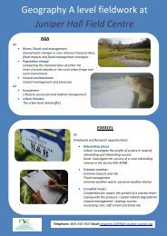
IB Diploma Geography<br />
Internal Assessment, 3days<br />
EXAMPLE LEARNING OBJECTIVES AND OUTCOMES: Freshwater (Discharge, stream flow and channel shape)<br />
Syllabus links: Part 2, Option A: Freshwater – issues and conflicts. Sub-topic 2 - Drainage basins and flooding. Sub-topic<br />
3 - Management issues and strategies.<br />
Example Learning Objectives<br />
• To consider how key river<br />
variables such as discharge<br />
and channel shape are<br />
related.<br />
• To relate river landforms<br />
observed during the day to<br />
physical processes.<br />
• To develop case study<br />
knowledge on a local<br />
drainage basin scale.<br />
Potential Learning Outcomes<br />
All students will:<br />
• Outline a clear fieldwork question relating to stream discharge.<br />
• Describe the geographical context to their investigation.<br />
• Define the terms discharge, stream flow, channel shape, channel roughness and hydraulic radius.<br />
• Demonstrate an awareness of the formulas used to calculate variables such as discharge and<br />
hydraulic radius.<br />
• Use OS map extracts, aerial photographs and/or satellite imagery to identify geographical<br />
characteristics of the sampling sites.<br />
• Identify key risks involved with river fieldwork and suggest ways of managing these risks.<br />
• Collect primary information on discharge, stream flow and channel shape to answer their initial<br />
fieldwork question.<br />
• Describe the sampling strategy employed during the study.<br />
• Identify landforms created by the processes of erosion, transportation and deposition.<br />
• Describe the processes of erosion, transportation and deposition.<br />
• Use appropriate methods to display primary information (e.g. scattergraphs, stream cross<br />
sections, proportional symbols).<br />
• Identify trends and anomalies in the information (e.g. from scatter graphs).<br />
Most students will:<br />
• Use OS map extracts and/or GIS extracts to justify the sampling locations.<br />
• Justify the use of the chosen sampling strategy.<br />
• Explain how the processes of erosion, transportation and deposition have formed the resultant<br />
landforms.<br />
• Explain any anomalies in the information (e.g. those shown on scattergraphs) and relate these to<br />
the initial fieldwork question.<br />
• Carry out an appropriate statistical test (e.g. Spearman Rank) to support the initial fieldwork<br />
question.<br />
• Explain the nature of the relationship between discharge, stream flow and channel shape.<br />
Some students will:<br />
• Use secondary data to assess the extent to which the primary information collected reflects the<br />
river’s usual characteristics.<br />
• Critically evaluate the methods used to collect the information and the resulting impact on the<br />
reliability and validity of the results and conclusions.<br />
• Compare and contrast different ways of presenting data (e.g. scattergraphs, stream cross<br />
sections, proportional symbols) and select the most appropriate technique for their information.<br />
FSC Head office, Preston Montford, Montford Bridge, Shrewsbury, Shropshire, SY4 1HW<br />
Tel: 01743 852100 Fax: 01743 852101 Email: enquiries@field-studies-council.org Website: www.field-studies-council.org<br />
<strong>Field</strong> <strong>Studies</strong> <strong>Council</strong> is a limited Company, registered in England and Wales No. 412621 and a Charity No. 313364. Registered Office; Preston Montford, Shrewsbury, Shropshire SY4 1HW