READ MORE - Field Studies Council
READ MORE - Field Studies Council
READ MORE - Field Studies Council

Create successful ePaper yourself
Turn your PDF publications into a flip-book with our unique Google optimized e-Paper software.
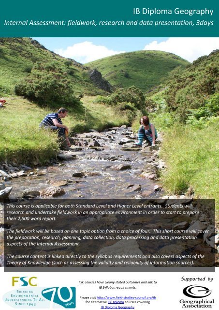
IB Diploma Geography<br />
Internal Assessment: fieldwork, research and data presentation, 3days<br />
This course is applicable for both Standard Level and Higher Level entrants. Students will<br />
research and undertake fieldwork in an appropriate environment in order to start to prepare<br />
their 2,500 word report.<br />
The fieldwork will be based on one topic option from a choice of four. This short course will cover<br />
the preparation, research, planning, data collection, data processing and data presentation<br />
aspects of the Internal Assessment.<br />
The course content is linked directly to the syllabus requirements and also covers aspects of the<br />
Theory of Knowledge (such as assessing the validity and reliability of information sources).<br />
FSC courses have clearly stated outcomes and link to<br />
IB Syllabus requirements.<br />
Please visit http://www.field-studies-council.org/ib<br />
for alternative IB Diploma courses covering<br />
IB Diploma Geography
prices<br />
centres<br />
IB Diploma Geography<br />
Internal Assessment, 3days<br />
COURSE LENGTH<br />
3 Days (2 nights with 6 teaching sessions)<br />
Monday /<br />
Wednesday<br />
Tuesday /<br />
Thursday<br />
Wednesday /<br />
Friday<br />
Friday Saturday Sunday<br />
Arrive for<br />
lunch.<br />
Afternoon and<br />
evening<br />
sessions<br />
Morning,<br />
afternoon and<br />
evening<br />
sessions<br />
Morning<br />
session.<br />
Depart after<br />
Lunch<br />
OR<br />
Arrive for<br />
evening meal.<br />
Evening<br />
session<br />
Morning,<br />
afternoon and<br />
evening<br />
sessions<br />
Morning and<br />
afternoon<br />
sessions.<br />
EXAMPLE COURSE TIMETABLE<br />
Monday Tuesday Wednesday<br />
Arrival (approx mid-day)<br />
Introduction to the requirements of<br />
the Internal Assessment (this may<br />
include a mini-investigation in the<br />
Centre grounds if appropriate).<br />
Research on the area and topic to be<br />
investigated.<br />
<strong>Field</strong>work on the chosen Internal<br />
Assessment topic from morning to<br />
late afternoon.<br />
Late afternoon and evening sessions<br />
to cover write up of introduction and<br />
data collection.<br />
COURSE CONTENT<br />
Select ONE of the following topics to prepare for Internal Assessment:<br />
Completion of the methodology and<br />
data presentation sections of the<br />
report.<br />
Production of a teacher copy<br />
(electronic or paper) of all student<br />
work.<br />
Depart after lunch.<br />
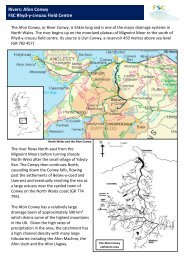
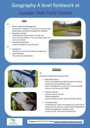
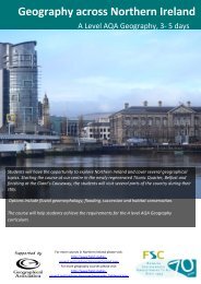
Freshwater (Discharge, stream flow and channel shape)<br />
This day links to Option A: Freshwater – issues and conflicts, in Part 2 of the syllabus. During this investigation students will study a<br />
small scale drainage basin to explore the relationship between discharge, stream flow and channel shape. There will also be<br />
opportunities to observe landforms resulting from stream channel processes such as erosion, transportation and deposition.<br />
Coastal margins<br />
This day links to Option B: Oceans and their coastal margins, in Part 2 of the syllabus. During this investigation students will<br />
undertake fieldwork to observe a number of different coastal management strategies and evaluate the effectiveness of these in<br />
addressing coastal erosion. Students will also investigate beach dynamics and their interaction with local coastal management<br />
strategies.<br />
Tourism in a rural area<br />
This day links to Option E: Leisure, sport and tourism, in Part 2 of the syllabus. During this investigation students will visit a rural<br />
tourist honeypot site. The focus will be on assessing the impact of tourism in the area and reflecting on the management strategies<br />
that can be used to promote sustainable tourism for the future. Students will consider the need to balance the advantages of<br />
tourism with the need to minimise conflicts and environmental damage.<br />
Urban environments (Central Business District)<br />
This day links to Option G: urban environments, in Part 2 of the syllabus. During this investigation students will focus on<br />
investigating the structure of the central business district (CBD). <strong>Field</strong>work will be carried out to define the boundary of the central<br />
business district and de-limit different zones within it. This will link to patterns of retail activity and zoning of urban functions.<br />
FSC Head office, Preston Montford, Montford Bridge, Shrewsbury, Shropshire, SY4 1HW<br />
Tel: 01743 852100 Fax: 01743 852101 Email: enquiries@field-studies-council.org Website: www.field-studies-council.org<br />
<strong>Field</strong> <strong>Studies</strong> <strong>Council</strong> is a limited Company, registered in England and Wales No. 412621 and a Charity No. 313364. Registered Office; Preston Montford, Shrewsbury, Shropshire SY4 1HW
prices<br />
centres<br />
IB Diploma Geography<br />
Internal Assessment, 3days<br />
LEARNING OUTCOMES/OBJECTIVES<br />
EXAMPLE LEARNING OBJECTIVES AND OUTCOMES: Internal Assessment<br />
Example Learning<br />
Objectives<br />
• To understand the<br />
requirements of the<br />
Internal<br />
Assessment.<br />
• To investigate an area of<br />
the syllabus in greater<br />
depth through the<br />
collection of primary and<br />
secondary information in<br />
relation to a key question.<br />
• To develop a range of<br />
geographical skills,<br />
knowledge, understanding<br />
and values in relation to a<br />
geographical topic.<br />
Potential Learning Outcomes<br />
All students will:<br />
• Identify a clear fieldwork question and geographical context to their investigation.<br />
• Integrate annotated maps, aerial photographs and/or satellite images into their written report.<br />
• Carry out fieldwork in the outdoor classroom, collecting information for the Internal Assessment.<br />
• Demonstrate an awareness of safety issues and risk assessment in geographical fieldwork.<br />
• Describe and explain appropriate methods of collecting information.<br />
• Display primary information in a variety of formats.<br />
• Demonstrate a basic knowledge and understanding of the fieldwork investigation by interpreting<br />
and explaining the information.<br />
• Formulate a conclusion, based on the primary and secondary information collected.<br />
• Evaluate the information gathered and the conclusions drawn.<br />
• Produce a written report of no more than 2,500 words.<br />
• Organise and format the written report using the requirements specified in the IB syllabus.<br />
Most students will:<br />
• Use secondary data in the pre-fieldwork phase to justify and contextualise their fieldwork.<br />
• Use GIS information as part of their written report.<br />
• Justify the methods used to collect primary and secondary information and be aware of<br />
alternatives.<br />
• Identify the most appropriate methods of displaying information and use these techniques<br />
competently and accurately.<br />
• Demonstrate a thorough knowledge and understanding of the fieldwork investigation by<br />
interpreting and explaining the information.<br />
• Use an analytical rather than descriptive focus to their written report.<br />
• Use more sophisticated methods of analysis such as statistics as part of their written report.<br />
• Provide a concise summary of the findings of their fieldwork investigation and link this to their<br />
initial fieldwork question.<br />
• Critically evaluate the effectiveness of their research methodology and the validity of outcomes.<br />
• Suggest plausible ways of extending their fieldwork investigation in the future.<br />
Some students will:<br />
• Make a significant contribution to the planning stages of the fieldwork investigation.<br />
• Synthesise a range of geographical information in various forms and from various sources.<br />
• Critically evaluate the methods used to collect information.<br />
• Identify the most appropriate statistical test to use (where relevant) to analyse information and<br />
use this technique competently and accurately.<br />
• Recognise that their conclusions may be partial, tentative or incomplete.<br />
• Demonstrate a thorough understanding of how limitations in research methodology may impact<br />
upon the reliability and validity of results and conclusions.<br />
FSC Head office, Preston Montford, Montford Bridge, Shrewsbury, Shropshire, SY4 1HW<br />
Tel: 01743 852100 Fax: 01743 852101 Email: enquiries@field-studies-council.org Website: www.field-studies-council.org<br />
<strong>Field</strong> <strong>Studies</strong> <strong>Council</strong> is a limited Company, registered in England and Wales No. 412621 and a Charity No. 313364. Registered Office; Preston Montford, Shrewsbury, Shropshire SY4 1HW
prices<br />
centres<br />
IB Diploma Geography<br />
Internal Assessment, 3days<br />
EXAMPLE LEARNING OBJECTIVES AND OUTCOMES: Freshwater (Discharge, stream flow and channel shape)<br />
Syllabus links: Part 2, Option A: Freshwater – issues and conflicts. Sub-topic 2 - Drainage basins and flooding. Sub-topic<br />
3 - Management issues and strategies.<br />
Example Learning Objectives<br />
• To consider how key river<br />
variables such as discharge<br />
and channel shape are<br />
related.<br />
• To relate river landforms<br />
observed during the day to<br />
physical processes.<br />
• To develop case study<br />
knowledge on a local<br />
drainage basin scale.<br />
Potential Learning Outcomes<br />
All students will:<br />
• Outline a clear fieldwork question relating to stream discharge.<br />
• Describe the geographical context to their investigation.<br />
• Define the terms discharge, stream flow, channel shape, channel roughness and hydraulic radius.<br />
• Demonstrate an awareness of the formulas used to calculate variables such as discharge and<br />
hydraulic radius.<br />
• Use OS map extracts, aerial photographs and/or satellite imagery to identify geographical<br />
characteristics of the sampling sites.<br />
• Identify key risks involved with river fieldwork and suggest ways of managing these risks.<br />
• Collect primary information on discharge, stream flow and channel shape to answer their initial<br />
fieldwork question.<br />
• Describe the sampling strategy employed during the study.<br />
• Identify landforms created by the processes of erosion, transportation and deposition.<br />
• Describe the processes of erosion, transportation and deposition.<br />
• Use appropriate methods to display primary information (e.g. scattergraphs, stream cross<br />
sections, proportional symbols).<br />
• Identify trends and anomalies in the information (e.g. from scatter graphs).<br />
Most students will:<br />
• Use OS map extracts and/or GIS extracts to justify the sampling locations.<br />
• Justify the use of the chosen sampling strategy.<br />
• Explain how the processes of erosion, transportation and deposition have formed the resultant<br />
landforms.<br />
• Explain any anomalies in the information (e.g. those shown on scattergraphs) and relate these to<br />
the initial fieldwork question.<br />
• Carry out an appropriate statistical test (e.g. Spearman Rank) to support the initial fieldwork<br />
question.<br />
• Explain the nature of the relationship between discharge, stream flow and channel shape.<br />
Some students will:<br />
• Use secondary data to assess the extent to which the primary information collected reflects the<br />
river’s usual characteristics.<br />
• Critically evaluate the methods used to collect the information and the resulting impact on the<br />
reliability and validity of the results and conclusions.<br />
• Compare and contrast different ways of presenting data (e.g. scattergraphs, stream cross<br />
sections, proportional symbols) and select the most appropriate technique for their information.<br />
FSC Head office, Preston Montford, Montford Bridge, Shrewsbury, Shropshire, SY4 1HW<br />
Tel: 01743 852100 Fax: 01743 852101 Email: enquiries@field-studies-council.org Website: www.field-studies-council.org<br />
<strong>Field</strong> <strong>Studies</strong> <strong>Council</strong> is a limited Company, registered in England and Wales No. 412621 and a Charity No. 313364. Registered Office; Preston Montford, Shrewsbury, Shropshire SY4 1HW
prices<br />
centres<br />
IB Diploma Geography<br />
Internal Assessment, 3days<br />
EXAMPLE LEARNING OBJECTIVES AND OUTCOMES: Coastal margins<br />
Syllabus links: Part 2, Option B: Oceans and their coastal margins. Sub-topic 5 – Coastal margins.<br />
Example Learning<br />
Objectives<br />
• To consider how<br />
successful coastal<br />
management requires an<br />
understanding of both<br />
physical and human<br />
aspects.<br />
• To evaluate the<br />
effectiveness of a costal<br />
management strategy.<br />
• To develop case study<br />
knowledge of coastal<br />
management strategies.<br />
Potential Learning Outcomes<br />
All students will:<br />
• Outline a clear fieldwork question relating to coastal environments.<br />
• Describe the geographical context to their investigation.<br />
• Use OS map extracts, aerial photographs and/or satellite imagery to identify geographical<br />
characteristics of the coastline and possible survey locations.<br />
• Identify key risks involved with coastal fieldwork and suggest ways of managing these risks.<br />
• Describe the sampling strategy employed during the study.<br />
• Collect primary information (e.g. wave type and frequency, beach profiles at managed and<br />
unmanaged sites, cost/benefit analyses) to answer their initial fieldwork question.<br />
• Observe a number of different coastal defences and map their location.<br />
• Use appropriate methods to display primary information (e.g. proportional symbols, annotated<br />
maps, beach profiles).<br />
Most students will:<br />
• Suggest appropriate fieldwork techniques to use to investigate the effectiveness of different coastal<br />
defence strategies.<br />
• Justify the use of the chosen sampling strategy.<br />
• Explain the advantages and disadvantages of different coastal defence strategies observed during<br />
the day.<br />
• Compare and contrast the beach profiles in front of coastal defences with unmanaged locations.<br />
• Carry out an appropriate statistical test (e.g. Mann Whitney U) to support the initial fieldwork<br />
question.<br />
• Explain any anomalies in the information and relate these to the initial fieldwork question.<br />
Some students will:<br />
• Critically evaluate the methods used to collect the information and the resulting impact on the<br />
reliability and validity of the results and conclusions.<br />
• Explain how beach profile shape and size relates to the function of different coastal defences.<br />
• Evaluate different coastal defence strategies in order to justify which strategy is the most<br />
appropriate for a particular location.<br />
• Use information from the Shoreline Management Plan to inform suggestions of how the coastline<br />
should be managed in the future.<br />
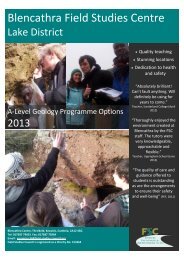
High Quality teaching<br />
It is the same inside the classroom as it is<br />
outside the classroom; the teacher<br />
delivering the content plays a vital role in<br />
ensuring successful learning outcomes are<br />
achieved.<br />
This is why every FSC Centre has taken<br />
great care in developing a team of gifted<br />
field teachers with a real passion for the<br />
subject being taught.<br />
Not only are they experts, they are gifted<br />
teachers with a real passion for the subject<br />
being taught. FSC field teachers are the<br />
reason why many schools return year after<br />
year.<br />
Protecting fieldwork opportunities for<br />
everybody<br />
Growing pressures on outdoor learning has<br />
led the FSC to take on an important role;<br />
championing the rights and opportunities<br />
for people of all ages to experience the<br />
environment at first hand.<br />
The FSC has lead in campaigns to reverse<br />
the continuing decline in fieldwork within<br />
secondary schools and to build<br />
opportunities for out-of-classroom<br />
learning.<br />
As a registered charity, the FSC receives no<br />
statutory funding. It relies solely on fees<br />
charged for courses and membership.<br />
Therefore, by visiting an FSC Centre not<br />
only are you receiving a high quality<br />
educational experience for your students,<br />
you are also you are helping to protect<br />
fieldwork opportunities for everybody.<br />
FSC Head office, Preston Montford, Montford Bridge, Shrewsbury, Shropshire, SY4 1HW<br />
Tel: 01743 852100 Fax: 01743 852101 Email: enquiries@field-studies-council.org Website: www.field-studies-council.org<br />
<strong>Field</strong> <strong>Studies</strong> <strong>Council</strong> is a limited Company, registered in England and Wales No. 412621 and a Charity No. 313364. Registered Office; Preston Montford, Shrewsbury, Shropshire SY4 1HW
prices<br />
centres<br />
IB Diploma Geography<br />
Internal Assessment, 3days<br />
EXAMPLE LEARNING OBJECTIVES AND OUTCOMES: Tourism in a rural area<br />
Syllabus links: Part 2, Option E: Leisure, sport and tourism. Sub-topic 6 – Leisure at the local scale: tourism.<br />
Example Learning Objectives<br />
• To consider the impact of<br />
tourism in an area.<br />
• To consider how tourism in a<br />
rural area can be managed to<br />
take account of the needs of<br />
different people and the<br />
environment.<br />
• To develop case study<br />
knowledge of tourism in a<br />
rural area.<br />
Potential Learning Outcomes<br />
All students will:<br />
• Outline a clear fieldwork question relating to rural tourism.<br />
• Describe the geographical context to their investigation.<br />
• Define the terms environmental carrying capacity and perceptual carrying capacity.<br />
• Use OS map extracts, aerial photographs and/or satellite imagery to identify geographical<br />
characteristics that have led to the development of tourism in the area.<br />
• Identify key risks involved with rural fieldwork and suggest ways of managing these risks.<br />
• Collect primary information (e.g. footpath depth, soil compaction, vegetation cover, evidence of<br />
management) to answer their initial fieldwork question.<br />
• Describe the sampling strategy employed during the study.<br />
• Use appropriate methods to display primary information (e.g. kite diagrams, annotated<br />
photographs, footpath cross sections).<br />
• Use their primary and secondary information to assess the level of tourist impact.<br />
• Relate the general characteristics of environmental impact to their fieldwork location.<br />
• Suggest possible ways of managing the environmental impacts of tourism at their fieldwork<br />
location.<br />
Most students will:<br />
• Suggest appropriate fieldwork techniques to use to investigate their fieldwork question.<br />
• Justify the use of the chosen sampling strategy.<br />
• Carry out an appropriate statistical test (e.g. Mann Whitney U) to support the initial fieldwork<br />
question.<br />
• Explain any anomalies in the information and relate these to the initial fieldwork question.<br />
• Recognise the need to balance maximum capacity with the needs of different stakeholders and<br />
the environment.<br />
• Suggest appropriate management strategies that may be used to manage the impact of tourism<br />
at their fieldwork location in the future.<br />
Some students will:<br />
• Critically evaluate the methods used to collect the information and the resulting impact on the<br />
reliability and validity of the results and conclusions.<br />
• Compare and contrast different ways of presenting data (e.g. kite diagrams, annotated<br />
photographs, footpath cross sections) and select the most appropriate technique for their<br />
information.<br />
• Justify the management strategies suggested to encourage sustainable tourism at their fieldwork<br />
location.<br />
• Relate a general model of tourism development to their fieldwork location and use this to inform<br />
suggestions of how the area should be managed in the future.<br />
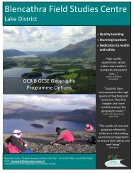
External Recognition of Quality<br />
All our centres have been awarded the<br />
Quality Badge by The <strong>Council</strong> for Learning<br />
Outside the Classroom. The badge is<br />
awarded to organisations that have<br />
demonstrated that they consistently<br />
deliver high quality teaching and learning<br />
experiences and manage risk effectively.<br />
This means that you will have to complete<br />
less paperwork when visiting our centres<br />
FSC Head office, Preston Montford, Montford Bridge, Shrewsbury, Shropshire, SY4 1HW<br />
Tel: 01743 852100 Fax: 01743 852101 Email: enquiries@field-studies-council.org Website: www.field-studies-council.org<br />
<strong>Field</strong> <strong>Studies</strong> <strong>Council</strong> is a limited Company, registered in England and Wales No. 412621 and a Charity No. 313364. Registered Office; Preston Montford, Shrewsbury, Shropshire SY4 1HW
prices<br />
centres<br />
IB Diploma Geography<br />
Internal Assessment, 3days<br />
EXAMPLE LEARNING OBJECTIVES AND OUTCOMES: Urban environments (Central Business District)<br />
Syllabus links: Part 2, Option G: Urban environments. Sub-topic 2 – Urban land use.<br />
Example Learning Objectives<br />
• To investigate the location<br />
and internal structure of the<br />
central business district<br />
(CBD).<br />
• To develop case study<br />
knowledge on an urban<br />
environment.<br />
Potential Learning Outcomes<br />
All students will:<br />
• Outline a clear fieldwork question relating to urban environments.<br />
• Describe the geographical context to their investigation.<br />
• Describe the characteristics of a central business district (CBD).<br />
• Use OS map extracts, aerial photographs and/or satellite imagery to identify geographical<br />
characteristics of the settlement and possible survey locations.<br />
• Identify key risks involved with urban fieldwork and suggest ways of managing these risks.<br />
• Collect primary information (e.g. the spatial distribution of land uses and services, pedestrian<br />
flows) to answer their initial fieldwork question.<br />
• Describe the sampling strategy employed during the study.<br />
• Use appropriate methods to display primary information (e.g. isolines, choropleth maps).<br />
• Relate the general characteristics of a CBD to their chosen settlement.<br />
• Use their primary and secondary information to define and describe the boundary of the central<br />
business district.<br />
• Explain the spatial distribution of key land uses and/or services within the CBD.<br />
• Use their primary and secondary information to identify the core of the central business district.<br />
Most students will:<br />
• Suggest appropriate fieldwork techniques to use to locate the CBD and its inner core (e.g.<br />
mapping the spatial distribution of services and land uses, pedestrian surveys, building height,<br />
vertical zoning).<br />
• Justify the use of the chosen sampling strategy.<br />
• Carry out an appropriate statistical test (e.g. Nearest Neighbour) to support the initial fieldwork<br />
question.<br />
• Justify the choice of boundary of the CBD, using primary and secondary information.<br />
• Explain any anomalies in the information (e.g. those shown on a choropleth map or<br />
scattergraph) and relate these to the initial fieldwork question.<br />
• Explain why the CBD occupies its current location.<br />
Some students will:<br />
• Compare and contrast different ways of presenting data (e.g. isolines, choropleth maps and<br />
scattergraphs) and select the most appropriate technique for their information.<br />
• Critically evaluate the methods used to collect the information and the resulting impact on the<br />
reliability and validity of the results and conclusions.<br />
• Suggest possible future changes in the spatial distribution of land uses and services found in the<br />
CBD.<br />
• Explain the impacts of spatial variations in the CBD and consider the extent to which these are<br />
positive or negative.<br />
FSC Head office, Preston Montford, Montford Bridge, Shrewsbury, Shropshire, SY4 1HW<br />
Tel: 01743 852100 Fax: 01743 852101 Email: enquiries@field-studies-council.org Website: www.field-studies-council.org<br />
<strong>Field</strong> <strong>Studies</strong> <strong>Council</strong> is a limited Company, registered in England and Wales No. 412621 and a Charity No. 313364. Registered Office; Preston Montford, Shrewsbury, Shropshire SY4 1HW
prices<br />
centres<br />
IB Diploma Geography<br />
Internal Assessment, 3days<br />
FSC CENTRES<br />
Choose one topic<br />
Freshwater<br />
Coastal<br />
Margins<br />
Tourism In a<br />
rural area<br />
Urban<br />
environments<br />
Blencathra<br />
BL<br />
Tel: 01768 779 601<br />
<br />
Castle Head<br />
CH<br />
Tel: 0845 330 7364<br />
<br />
Dale Fort<br />
DF<br />
Tel: 0845 330 7365<br />
<br />
Derrygonnelly<br />
DG<br />
Tel: 028 686 41673<br />
<br />
Flatford Mill<br />
FM<br />
Tel: 0845 330 7368<br />
<br />
Juniper Hall<br />
JH<br />
Tel: 0845 458 3507<br />
<br />
Kindrogan<br />
KD<br />
Tel: 01250 870 150<br />
<br />
Margam<br />
MA<br />
Tel: 01639 895636<br />
<br />
Malham Tarn<br />
MT<br />
Tel: 01729 830 331<br />
<br />
Nettlecombe<br />
NC<br />
Tel: 01984 640 320<br />
<br />
Orielton<br />
OR<br />
Tel: 0845 330 7372<br />
<br />
Preston Montford<br />
PM<br />
Tel: 0845 330 7378<br />
<br />
Rhyd-y-creuau<br />
RC<br />
Tel: 01690 710 494<br />
<br />
TO BOOK THIS COURSE, SIMPLY:<br />
Slapton Ley<br />
SL<br />
Tel: 01548 580 466<br />
<br />
1. Choose the time of the year you would like to attend<br />
2. Pick the centre/centres of interest<br />
3. Check availability online or contact head office using the details at the bottom of the page or<br />
contact the centre of your choice<br />
*Please note to book this course the minimum size of your group must be 12 students and 1 member of staff<br />
Please visit<br />
http://www.field-studies-council.org/ib<br />
for alternative IB Diploma courses covering IB Geography fieldwork<br />
FSC Head office, Preston Montford, Montford Bridge, Shrewsbury, Shropshire, SY4 1HW<br />
Tel: 01743 852100 Fax: 01743 852101 Email: enquiries@field-studies-council.org Website: www.field-studies-council.org<br />
<strong>Field</strong> <strong>Studies</strong> <strong>Council</strong> is a limited Company, registered in England and Wales No. 412621 and a Charity No. 313364. Registered Office; Preston Montford, Shrewsbury, Shropshire SY4 1HW
prices<br />
centres<br />
IB Diploma Geography<br />
Internal Assessment, 3days<br />
COURSE PRICES<br />
The cost of this course is shown below. The fee varies depending on time of year, arrival and departure days/times and<br />
course content. The FSC prides itself on being flexible; the course content can be tailored to meet your needs.<br />
Alternatively, we can work with you to create a fully bespoke course to meet your exact requirements.<br />
3 day timetable, 2014, prices from: Band A: £99 Band B: £125 Band C: £150 Band D: £169 Band E: £177<br />
Week Beginning Band Week Beginning Band<br />
06 January 2014 A 07 July 2014 E<br />
13 January 2014 A 14 July 2014 C<br />
20 January 2014 B 21 July 2014 B<br />
27 January 2014 C 28 July 2014 A<br />
03 February 2014 C 04 August 2014 A<br />
10 February 2014 C 11 August 2014 A<br />
17 February 2014 C 18 August 2014 B<br />
24 February 2014 D 25 August 2014 B<br />
03 March 2014 D 01 September 2014 C<br />
10 March 2014 D 08 September 2014 D<br />
17 March 2014 D 15 September 2014 D<br />
24 March 2014 D 22 September 2014 D<br />
31 March 2014 D 29 September 2014 D<br />
07 April 2014 B 06 October 2014 D<br />
14 April 2014 B 13 October 2014 D<br />
21 April 2014 C 20 October 2014 C<br />
28 April 2014 C 27 October 2014 B<br />
05 May 2014 C 03 November 2014 D<br />
12 May 2014 C 10 November 2014 D<br />
19 May 2014 C 17 November 2014 C<br />
26 May 2014 B 24 November 2014 C<br />
02 June 2014 D 01 December 2014 A<br />
09 June 2014 E 08 December 2014 A<br />
16 June 2014 E 15 December 2014 A<br />
23 June 2014 E 22 December 2014 A<br />
30 June 2014 E 29 December 2014 A<br />
Included within the course price:<br />
‣ Expert tuition by fully trained staff<br />
‣ Rigorous and proven health and safety procedures including 24 hour emergency cover<br />
‣ Access to risk assessments<br />
‣ Full board (residential visits)<br />
‣ Specialist equipment and exclusive access to specially developed resources<br />
‣ Free places for visiting staff in a ratio of 1 to 12 students<br />
‣ E-mail support before and after the course (on request)<br />
‣ Personal and travel insurance<br />
Please remember travel to the field centre and to fieldwork sites is not included in the course fee.<br />
FSC offers a number of IB Diploma courses covering IB Geography, IB Biology, IB Environmental Systems and Societies,<br />
IB CAS and IB teacher training. Please visit our website for further information.<br />
FSC Head office, Preston Montford, Montford Bridge, Shrewsbury, Shropshire, SY4 1HW<br />
Tel: 01743 852100 Fax: 01743 852101 Email: enquiries@field-studies-council.org Website: www.field-studies-council.org<br />
<strong>Field</strong> <strong>Studies</strong> <strong>Council</strong> is a limited Company, registered in England and Wales No. 412621 and a Charity No. 313364. Registered Office; Preston Montford, Shrewsbury, Shropshire SY4 1HW