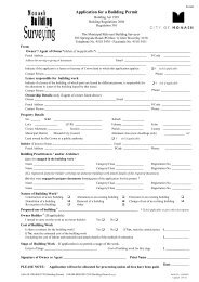
RESIDENTIAL CHECKLIST - City of Monash
RESIDENTIAL CHECKLIST - City of Monash
RESIDENTIAL CHECKLIST - City of Monash

You also want an ePaper? Increase the reach of your titles
YUMPU automatically turns print PDFs into web optimized ePapers that Google loves.
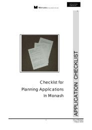
<strong>RESIDENTIAL</strong><br />
<strong>CHECKLIST</strong><br />
MONASH DEVELOPMENT GUIDE<br />
Application Checklist for<br />
Residential Development<br />
In <strong>Monash</strong><br />
Adopted:- 1 September 2005<br />
<strong>RESIDENTIAL</strong> <strong>CHECKLIST</strong><br />
1<br />
<strong>City</strong> <strong>of</strong> <strong>Monash</strong><br />
1 September 2005
<strong>RESIDENTIAL</strong><br />
<strong>CHECKLIST</strong><br />
MONASH DEVELOPMENT GUIDE<br />
An application for Planning Permit for residential development lodged with Council must be<br />
accompanied by adequate information to enable its assessment in compliance with the provisions <strong>of</strong><br />
the <strong>Monash</strong> Planning Scheme.<br />
This Checklist has been prepared to give guidance to applicants so that the correct information is<br />
provided with the application and processing delays are minimised.<br />
Application for Planning Permit - Detail to be submitted<br />
Application Form / Fees / Title - details<br />
Completed application form<br />
The prescribed application fee<br />
Notification fee (if applicable)<br />
Full copy <strong>of</strong> Title<br />
Use <strong>of</strong> easement approval,<br />
(if relevant)<br />
The application form must be accurately completed,<br />
including the property address and full description <strong>of</strong> the<br />
proposal.<br />
A list <strong>of</strong> "Current fees and charges" is available<br />
Full details <strong>of</strong> any covenants or other restrictions must<br />
be provided.<br />
Written approval from the appropriate service authorities<br />
and Council’s Engineering Division is required<br />
Site and Neighbourhood Description<br />
Levels and Features Plan<br />
A Site Description plan that<br />
documents the site and its surrounds<br />
A statement confirming that the<br />
information on the Site Description<br />
plan is accurate.<br />
Neighbourhood Description that<br />
documents the built form character<br />
surrounding the site.<br />
Plan is to be prepared by a Licensed Land Surveyor<br />
accurately showing the existing site levels, contours at<br />
0.20m interval and features at a Scale <strong>of</strong> 1:100.<br />
If the land is located within the Special Building<br />
Overlay or Land Subject to Inundation Overlay the<br />
levels must be to Australian Height Datum (AHD).<br />
The Site Description should identify the opportunities<br />
and constraints relevant to development <strong>of</strong> the site.<br />
A separate “Site Description Plan – Assessment”<br />
checklist is available for use to verify if all relevant data<br />
has been included on the plan.<br />
A “Certification <strong>of</strong> Accuracy <strong>of</strong> Site Description<br />
Plan” form is available for completion by the Architect,<br />
Designer or consultant that has prepared the Site<br />
Description plan<br />
This report must consider the dwellings in the<br />
surrounding area and document their character, built<br />
form, scale, front setback and fence, architectural and<br />
ro<strong>of</strong> style and other notable features.<br />
A "Neighbourhood Description" guideline is<br />
available to define the format and detail required by<br />
<strong>Monash</strong> to satisfy this requirement.<br />
2<br />
<strong>City</strong> <strong>of</strong> <strong>Monash</strong><br />
1 September 2005
<strong>RESIDENTIAL</strong><br />
<strong>CHECKLIST</strong><br />
MONASH DEVELOPMENT GUIDE<br />
Site and Neighbourhood Description (Continued)<br />
Arboricultural Report<br />
This report must be prepared by a qualified Arborist to<br />
detail the health and structure <strong>of</strong> significant trees on site<br />
and on abutting land within proximity <strong>of</strong> any proposed<br />
buildings or works.<br />
The report must also specify minimum setbacks <strong>of</strong><br />
buildings and works and any construction techniques<br />
necessary to minimise impact on significant trees.<br />
Design Response<br />
A Design Response<br />
Shadow diagrams<br />
The Design Response must explain how the design <strong>of</strong><br />
the proposed development has responded to the<br />
opportunities and constraints identified by the site<br />
analysis.<br />
Prepared for at 9am and 3pm at the September Equinox.<br />
Where shadows have an impact on adjoining secluded<br />
private open space, detail should be provided, including<br />
existing shadows, at a Scale <strong>of</strong> 1:100.<br />
Proposed Development Plans - (3 copies required)<br />
Ground Level Plan - drawn to a Scale <strong>of</strong> 1:100 showing the following detail;<br />
Title boundaries <strong>of</strong> the site with dimensions shown.<br />
Location <strong>of</strong> buildings showing all windows on adjoining<br />
properties within 9 metres <strong>of</strong> the boundary including all<br />
eave overhangs.<br />
Location size height and spread <strong>of</strong> significant vegetation<br />
on adjoining properties within 9 metres <strong>of</strong> the boundary<br />
Internal layout <strong>of</strong> all buildings including existing<br />
buildings to be retained including all eave overhangs<br />
Detail <strong>of</strong> all landings, and steps to all buildings.<br />
Dimensions <strong>of</strong> all buildings<br />
Setbacks <strong>of</strong> buildings to all boundaries<br />
All service facilities, clotheslines, electric supply, water<br />
& gas meters, storage areas, rubbish bins area, airconditioning<br />
units, water tanks, solar hot water units etc<br />
All proposed driveways, car parking areas,<br />
footpaths and paved areas<br />
Information detailing site coverage and the<br />
area <strong>of</strong> hard surface pavement in square metres<br />
is to be provided.<br />
3<br />
<strong>City</strong> <strong>of</strong> <strong>Monash</strong><br />
1 September 2005
<strong>RESIDENTIAL</strong><br />
<strong>CHECKLIST</strong><br />
MONASH DEVELOPMENT GUIDE<br />
Proposed Development Plans - (3 copies required)<br />
Ground Level Plan (Continued) - drawn to a Scale <strong>of</strong> 1:100 showing the following detail;<br />
Open space areas<br />
Site levels and contours at 0.2m intervals<br />
Proposed finished floor levels<br />
Existing significant vegetation<br />
Features on the road reserve abutting the site.<br />
Basic landscape detail. Such as screen planting<br />
areas, proposed canopy trees, and garden beds,<br />
lawn areas<br />
Defined in square metres with a minimum<br />
dimension <strong>of</strong> 3 metres<br />
Transferred from the survey plan<br />
To same datum as site levels<br />
Identified as "Retain" or "To be Removed"<br />
Service pits, poles, street trees, drains kerb and<br />
channel, footpaths, existing X'ings etc<br />
Note:- A detail landscape plan will be<br />
required as a condition <strong>of</strong> approval<br />
First Floor Level Plan (if relevant) - drawn to a Scale <strong>of</strong> 1:100 providing the following detail;<br />
Title boundaries <strong>of</strong> the site with dimensions shown.<br />
Location <strong>of</strong> buildings showing all windows on<br />
adjoining properties within 9 metres <strong>of</strong> the<br />
boundary including all eave overhangs.<br />
Internal layout <strong>of</strong> all first floor areas including<br />
existing buildings to be retained.<br />
All eave overhangs to be shown.<br />
Ground floor ro<strong>of</strong> areas<br />
Detail <strong>of</strong> all decks, landings, and steps to first floor<br />
areas.<br />
Dimensions <strong>of</strong> all first floor areas.<br />
Setbacks <strong>of</strong> first floor areas to all boundaries<br />
Proposed finished floor levels<br />
To same datum as site levels<br />
4<br />
<strong>City</strong> <strong>of</strong> <strong>Monash</strong><br />
1 September 2005
<strong>RESIDENTIAL</strong><br />
<strong>CHECKLIST</strong><br />
MONASH DEVELOPMENT GUIDE<br />
Proposed Development Plans - (3 copies required)<br />
Elevation Plan - For all elevations <strong>of</strong> the dwellings drawn to a Scale <strong>of</strong> 1:100 providing the following<br />
detail:<br />
Correctly drawn having regard to site levels and<br />
contour detail provided by the survey plan<br />
Ground level line at the adjacent property boundary<br />
Dotted line showing the top <strong>of</strong> the existing or any<br />
proposed fence on the property boundary<br />
Heights <strong>of</strong> walls located on property boundaries<br />
Overall building heights<br />
Floor to ceiling heights<br />
Proposed excavation works<br />
NOTE:-<br />
Failure to provide all <strong>of</strong> the information required will result in<br />
either:<br />
• Return <strong>of</strong> all documents requiring re-submission with all<br />
information<br />
or<br />
• Delayed processing <strong>of</strong> the application.<br />
Acknowledgment:- Plans (modified) - McLauchlan & Associates<br />
5<br />
<strong>City</strong> <strong>of</strong> <strong>Monash</strong><br />
1 September 2005