Jan/Feb 2008 - KWVA - Korean War Veterans Association
Jan/Feb 2008 - KWVA - Korean War Veterans Association
Jan/Feb 2008 - KWVA - Korean War Veterans Association

Create successful ePaper yourself
Turn your PDF publications into a flip-book with our unique Google optimized e-Paper software.
HILL 342 rom page 57<br />
76<br />
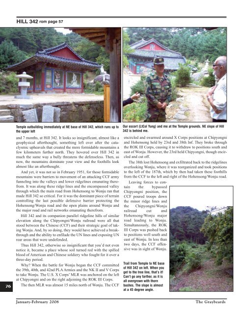
Temple outbuilding immediately at NE base of Hill 342, which runs up to<br />
the upper left<br />
and 7 months, at Hill 342. It looks so insignificant, almost like a<br />
geophysical afterthought, something left over after the cataclysmic<br />
upheavals that created the more formidable mountains a<br />
few kilometers further north. They hovered over Hill 342 in<br />
much the same way a bully threatens the defenseless. Then, as<br />
now, the mountains dominate your view and the foothills look<br />
almost like an afterthought.<br />
And yet, it was not so in <strong>Feb</strong>ruary 1951, for those formidable<br />
mountains were barriers to movement of an attacking CCF army<br />
funneling into the valleys and lower ridgelines emanating therefrom.<br />
It was along these ridge lines and the encompassed valley<br />
through which the main road from Hohensong to Wonju ran that<br />
made Hill 342 so critical. For it was the dominant piece of terrain<br />
controlling the last possible defensive barrier protecting the<br />
Hohensong/Wonju road and the open plains around Wonju and<br />
the major road and rail networks emanating therefrom.<br />
Hill 342 and its companion parallel ridgeline hills of similar<br />
elevation along the Chipyongni/Wonju railroad were all that<br />
stood between the Chinese (CCF) and their strategic goal of taking<br />
Wonju. And, by so doing, they would have achieved a breakthrough<br />
and the ability to enfilade the UN lines and exposing UN<br />
rear areas that were undefended.<br />
Thus Hill 342, otherwise so insignificant that you’d not even<br />
notice it, became a place whose soil turned red with the spilled<br />
blood of American and Chinese soldiery who fought for it over a<br />
three-day period.<br />
Why? When the battle for Wonju began the CCF committed<br />
the 39th, 40th, and 42nd PLA Armies and the NK II and V Corps<br />
to take Wonju. The U.S. X Corps’ MLR was anchored on the left<br />
at Chipyongni and on the right adjoining the ROK III Corps.<br />
The then MLR was almost 15 miles north of Wonju. The CCF<br />
Our escort (LtCol Yung) and me at the Temple grounds. NE slope of Hill<br />
342 is behind me.<br />
encircled and swarmed around X Corps positions at Chipyongni<br />
and Hohensong held by 23rd and 38th Inf. They broke through<br />
the ROK III Corps, causing it to withdraw to positions south and<br />
east of Wonju. However, the 23rd held Chipyongni, though encircled<br />
and cut off.<br />
The 38th lost Hohensong and exfiltrated back to the ridgelines<br />
overlooking Wonju, where it was reorganized and took positions<br />
to the left of the 187th, which by then had taken these foothills<br />
from the CCF to the left and right of the Hohensong/Wonju road.<br />
Leaving forces to contain<br />
the bypassed<br />
Chipyongni position, the<br />
CCF poured troops down<br />
the minor ridge lines and<br />
the Chipyongni/Wonju<br />
railroad cut and<br />
Hohensong/Wonju major<br />
road leading to Wonju.<br />
Simultaneously, the ROK<br />
III Corps was pushed back<br />
to positions well south and<br />
east of Wonju. In less than<br />
two days, the CCF offensive<br />
was in sight of Wonju.<br />
Trail from Temple to NE base<br />
of Hill 342 on left. When you<br />
get to the tree line, that’s it!<br />
Can’t go any farther, as it is<br />
all overgrown with thorn<br />
bushes. The slope is almost<br />
at a 45 degree angle.<br />
<strong>Jan</strong>uary-<strong>Feb</strong>ruary <strong>2008</strong><br />
The Graybeards