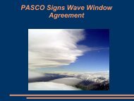
2006 March (529kB) - Pacific Soaring Council
2006 March (529kB) - Pacific Soaring Council
2006 March (529kB) - Pacific Soaring Council

Create successful ePaper yourself
Turn your PDF publications into a flip-book with our unique Google optimized e-Paper software.
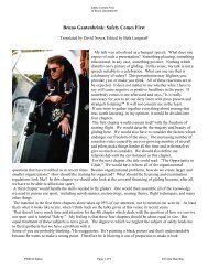
moving to higher and farther ground I catch good<br />
thermals that propel me with 4 knots to 13,000’.<br />
Good, the day is much better than expected,<br />
although this is a frequent finding in the Truckee<br />
valley where the conditions are more favorable than<br />
anywhere else around. I can see lots of clouds on<br />
the Pine Nuts and fly there. I arrive slowly at the<br />
south end of the Pine Nuts, but there are not many<br />
clouds in the Topaz valley and I decide to go to<br />
Topaz airport and then come back. I cannot see<br />
what happens to the northeast, where the bad<br />
weather is supposed to come from, and I do not<br />
think advisable to go farther south.<br />
Coming back on the Pine Nuts, the sky is now full of<br />
vertically extended cumulus clouds. While many<br />
have the base at 10,000’, others have the base at<br />
13,000’ and more. When departing from a cloud at<br />
12,500’, I have to dodge others at lower elevation.<br />
The air is crystal clear, the clouds are puffy,<br />
brilliantly white ahead, in front and below me and I<br />
am mesmerized by this environment. At times I find<br />
myself below 10,000’ feet and can see all the<br />
familiar territory I am flying over, at times I am high,<br />
sailing around clouds, spotting only fragments of<br />
the now unrecognizable terrain below, floating in a<br />
fantastic country populated by moving white<br />
surfaces.<br />
go to the northeast - I can go toward the expected<br />
bad weather, and come back when I meet it. So I<br />
direct around Reno toward Air Sailing, which I reach<br />
at 7,000’. There is a glider in tow down there.<br />
Surprisingly I find some lift downwind of the Dog<br />
Skin range, which gives me enough altitude to go in<br />
front of the range and get a real climb to the 11,000’<br />
I need. Another 30 miles northeast I reach Adams<br />
Peak at 12,000’. Looking north along the ridge that<br />
continues toward Susanville I see a very dark sky: a<br />
large thunderstorm rages there, and while its aspect<br />
is intimidating, there is a promise of good lift on its<br />
edges. Looking toward Nervino and Quincy the sky<br />
shows poor clouds at low altitude.<br />
I choose to go toward Quincy because there are not<br />
many landing places going to Susanville. On the<br />
ridge to the east of Quincy I reach a small lake a<br />
few mile north of Taylorsville, but I am down to<br />
8,000’ in places, so I cannot continue. I come back,<br />
still low. Three miles from Nervino Airport (4,900’) I<br />
am down to 6,600’. I go towards a ridge where I<br />
saved myself before, and begin a long fight against<br />
the law of gravity, using very weak lift. At first I am<br />
barely able to stay up. It is 4:40 PM. After 15<br />
minutes I reach 8,500’ and try to advance toward<br />
dark clouds to the west, but after a few miles I have<br />
to come back to the same ridge.<br />
This time after more work I reach 9,500’, and in the<br />
meanwhile I can observe that the thunderstorm that<br />
was around Susanville one hour ago is much closer<br />
now. Instead of me going to the storm, the storm<br />
came to me. Very dark clouds are a few miles<br />
away, and with this altitude I try to reach for them. If<br />
I find the good lift I think is there, I can reach<br />
Truckee with one glide. But I find no lift. The clouds<br />
are good looking, but I cannot find lift. Now I<br />
continue east, having just enough altitude to reach<br />
Reno Stead. Eventually I find some sink, and my<br />
margin over Reno Stead decreases until I am below<br />
glide. And I have a range of mountain in front, and I<br />
have unpredictable weather. Now my chosen<br />
landing point is the dry lake a few miles west of<br />
Stead.<br />
I direct towards the range of mountains. At the foot<br />
of the range I find lift. After gaining 1,000’ I know I<br />
am saved, but the lift continues up to 9,000’, drifting<br />
my glider and myself above the mountain range.<br />
Now I am beneath good-looking clouds, and I<br />
continue toward Reno Stead and more clouds. A<br />
few miles east of the airport I finally find the climb<br />
that takes us to cloud base at 12,000’ and I am in<br />
final glide for Truckee.<br />
I arrive at the north end of the Pine Nuts, determine<br />
that the weather is still good for now and decide to<br />
On a day that on paper one could only fly a couple<br />
of hours locally, I flew more than 7 hours and<br />
covered 272 (OLC) miles. Notably, from the ridge at<br />
7