

IWMP 7 - Commissionerate of Rural Development Gujarat State ...
IWMP 7 - Commissionerate of Rural Development Gujarat State ...
IWMP 7 - Commissionerate of Rural Development Gujarat State ...

Create successful ePaper yourself
Turn your PDF publications into a flip-book with our unique Google optimized e-Paper software.
Detail Project Report <strong>IWMP</strong> 7<br />
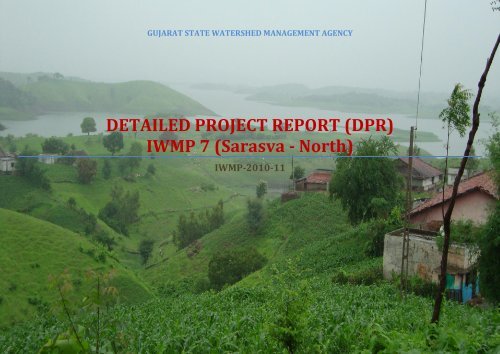
GUJARAT STATE WATERSHED MANAGEMENT AGENCY<br />
DETAILED PROJECT REPORT (DPR)<br />
<strong>IWMP</strong> 7 (Sarasva - North)<br />
<strong>IWMP</strong>-2010-11<br />
<strong>Gujarat</strong> <strong>State</strong> watershed Management Agency
Detail Project Report <strong>IWMP</strong> 7<br />
Contents<br />
Table no.1: Basic project information ................................................................................................................................................................................................................. 5<br />
Table no.2: Weightage <strong>of</strong> the project .................................................................................................................................................................................................................. 8<br />
Table no.3: Watershed information .................................................................................................................................................................................................................. 10<br />
Table no.4: <strong>Development</strong>al programmes running in the project area: .......................................................................................................................................................... 10<br />
Table no. 5: Previous Watershed programmes in the project area: ............................................................................................................................................................... 11<br />
Table no. 6: PIA: .................................................................................................................................................................................................................................................. 12<br />
Table no. 7: Staff at PIA level: ............................................................................................................................................................................................................................ 15<br />
Table no. 8: Land use pattern: ........................................................................................................................................................................................................................... 16<br />
Table no. 9: Soil type and topography: ............................................................................................................................................................................................................. 18<br />
Table no. 10: Flood and drought condition: ..................................................................................................................................................................................................... 19<br />
Table no. 11.1: Soil Erosion ............................................................................................................................................................................................................................... 20<br />
Table no. 11.2: Soil Salinity/Alkalinity (Salinity ingress) ............................................................................................................................................................................... 20<br />
Table no. 11.3: Waterlogging Conditions ......................................................................................................................................................................................................... 21<br />
Table no. 12: Climatic conditions: ..................................................................................................................................................................................................................... 21<br />
Table no. 13: Physiography and relief .............................................................................................................................................................................................................. 22<br />
Table no. 14: Land ownership details ............................................................................................................................................................................................................... 22<br />
Table no. 15: Agriculture ................................................................................................................................................................................................................................... 23<br />
Table no. 16: Irrigation ...................................................................................................................................................................................................................................... 23<br />
Table no. 17: Crop details: ................................................................................................................................................................................................................................. 24<br />
Table no. 18: Livestock ...................................................................................................................................................................................................................................... 27<br />
Table no. 19: Drinking water ............................................................................................................................................................................................................................. 28<br />
Table no. 20: Details <strong>of</strong> Common Property Resources .................................................................................................................................................................................... 28<br />
Table no. 21: Demographic information ........................................................................................................................................................................................................... 29<br />
Table no. 22: Literacy rate ................................................................................................................................................................................................................................. 30<br />
<strong>Gujarat</strong> <strong>State</strong> watershed Management Agency
Detail Project Report <strong>IWMP</strong> 7<br />
Table no. 23: Migration details .......................................................................................................................................................................................................................... 30<br />
Table no. 24: Poverty ......................................................................................................................................................................................................................................... 31<br />
Table no. 25: Village infrastructure .................................................................................................................................................................................................................. 32<br />
Table no. 26 : Facilities / HH assets .................................................................................................................................................................................................................. 32<br />
Table no. 27: Income .......................................................................................................................................................................................................................................... 33<br />
Table no.28: Dependence on Forest/CPR ......................................................................................................................................................................................................... 33<br />
Table no. 29: Livelihood pattern (Occupational distribution) ........................................................................................................................................................................ 34<br />
Table no. 30: Details <strong>of</strong> Scientific Planning and Inputs in <strong>IWMP</strong> projects* ................................................................................................................................................... 36<br />
Table no. 31: Watershed Committee details .................................................................................................................................................................................................... 46<br />
Table no. 32: SHG detail ..................................................................................................................................................................................................................................... 56<br />
Table no. 33: UG detail ....................................................................................................................................................................................................................................... 58<br />
Table no.34: Entry point activities (EPA) (All financial figures in Lacks Rs.) ................................................................................................................................................ 62<br />
Table no.35: Details <strong>of</strong> activities <strong>of</strong> preparatory phase (All financial figures in Lacks Rs.) ........................................................................................................................ 42<br />
Table no.36: Activities related to Surface water resources in the project areas (all financial figures in Lacks Rs.) .................................................................................. 63<br />
Table no.37: Activities related to recharging ground water resources in the project areas (all financial figures in Lacks Rs.) ............................................................... 72<br />
Table no. 38: Activities related to livelihoods by Self Help Groups (SHGs) in the project areas ................................................................................................................. 95<br />
Table no. 39: Other activities <strong>of</strong> watershed works phase – Proposed target .................................................................................................... Error! Bookmark not defined.<br />
Table no.40: Details <strong>of</strong> engineering structures in watershed works* ................................................................................................................ Error! Bookmark not defined.<br />
Table no.41: Details <strong>of</strong> activities connected with vegetative cover in watershed works ............................................................................................................................. 99<br />
Table no.42: Details <strong>of</strong> allied / other activities ................................................................................................................................................................................................ 72<br />
Table no.43: Details <strong>of</strong> activities in the CPRs in the project areas ................................................................................................................................................................ 104<br />
Table no. 44: Capacity Building Institution: ................................................................................................................................................................................................... 104<br />
Table no. 45: Capacity Building plan:.............................................................................................................................................................................................................. 104<br />
Table no.46: Information, education and Communication Activities: ......................................................................................................................................................... 105<br />
Table no. 47: Village wise- activity wise budget ............................................................................................................................................................................................ 107<br />
<strong>Gujarat</strong> <strong>State</strong> watershed Management Agency
Detail Project Report <strong>IWMP</strong> 7<br />
Table no. 48: Budget at a glance ...................................................................................................................................................................................................................... 107<br />
Table no.49: Details <strong>of</strong> Convergence <strong>of</strong> <strong>IWMP</strong> with other Schemes ............................................................................................................................................................. 108<br />
Table no. 50: Public-Private Partnership in the <strong>IWMP</strong> projects* ................................................................................................................................................................. 108<br />
Table no. 51: Employment in Project area: .................................................................................................................................................................................................... 119<br />
Table no. 52: Details <strong>of</strong> seasonal migration from Project area ..................................................................................................................................................................... 120<br />
Table no. 53: Details <strong>of</strong> average ground water table depth in the project areas (in meters) .................................................................................................................... 121<br />
Table no. 54: Status <strong>of</strong> Drinking water*.......................................................................................................................................................................................................... 113<br />
Table no. 55: Details <strong>of</strong> Kharif crop area and yield in the project areas ...................................................................................................................................................... 113<br />
Table no. 56: Area under horticulture ............................................................................................................................................................................................................ 113<br />
Table no. 57: Forest/vegetative cover ................................................................................................................................................................. Error! Bookmark not defined.<br />
Table no. 58: Details <strong>of</strong> livestock in the project areas * (for fluids please mention in litres, for solids please mention in kgs. and income in Rs.) .............................. 117<br />
Table no. 59: Backward-Forward linkages..................................................................................................................................................................................................... 121<br />
<strong>Gujarat</strong> <strong>State</strong> watershed Management Agency
Detail Project Report <strong>IWMP</strong> 7<br />
Executive Summary<br />
Sarasva (N) cluster (<strong>IWMP</strong> 7) has been Sanction under the Integrated Watershed Management Programme running under the new Common Guideline 2008. It is<br />
located in South West direction <strong>of</strong> the Kadana taluka; Panchmahal district and <strong>Gujarat</strong> state. It consists <strong>of</strong> sixteen villages (Sarasva (N), Ditvas, Karvai, Moti Rath,<br />
Nani Rath, Bhul, Nana Padadara, Tarkoni Nal, Amboja, Karodia (North), Sarsdi, Rankakot, Jambunala, Pachher, Ghaswada, Ranakpur). The total Geographical area <strong>of</strong><br />
the watershed project is about 8364.96 ha, <strong>of</strong> which 2258.06 ha has been covered under Watershed –Hariyali Project remaining 6232.72 ha has to treat under<br />
Integrated Watershed management Programme. This covers 10 Micro watersheds. Based on thirteen Parameter (as per table no 2.1) watershed area has been<br />
selected.<br />
District Watershed <strong>Development</strong> Unit, Panchmahal has been selected as Project Implementation Agency (PIA) for Sarasva (N) cluster (<strong>IWMP</strong> 7) by <strong>State</strong> level Nodal<br />
Agency (GSWMA – <strong>Gujarat</strong> <strong>State</strong> Watershed Management Agency for <strong>Gujarat</strong> state). PIA is responsible for the Successful Implementation <strong>of</strong> the Watershed project.<br />
The WDT is an integral part <strong>of</strong> the PIA and will be set up by the PIA. WDT should have knowledge and experience in agriculture, soil science, water management,<br />
social mobilization and institutional building.<br />
DPR (Detail Project Report) is prepared after carrying out Baseline Survey, Technical survey and PRA Exercise (Participatory <strong>Rural</strong> appraisal) at village level. As per<br />
NRAA‘s Tools for Base Line Survey and Performance Assessment <strong>of</strong> Watershed <strong>Development</strong> Projects in India; Baseline survey was conducted at household level for<br />
Socio-economic information, Bio-physical survey was conducted at field level for natural resource information; same as PRA for better people participation and<br />
need identification <strong>of</strong> local people. Then Work plan will be prepared and resolution <strong>of</strong> DPR in Garmshabha will be done.<br />
Scientific inputs like GPS, GIS are used for watershed planning. Soil and water conservation structures are selected by Ridge to valley approach. Livelihood activities<br />
for the asset less persons have been planed as per local people’s competencies. Production system and micro enterprises have been planned as per requirement <strong>of</strong><br />
local people. For better implementation, we have designed a capacity building schedule for the different stakeholders like User groups, Self Help Groups, Village<br />
watershed committee etc.<br />
Soil and water conservation activities, livelihood plan, production system and enterprise development work will be implemented as peer DPR during the work<br />
phase. Expected outcome was pre-discussed and finalized DPR has been summed up using LFA (Logical framework <strong>of</strong> Analysis).<br />
<strong>Gujarat</strong> <strong>State</strong> watershed Management Agency
Detail Project Report <strong>IWMP</strong> 7<br />
CHAPTER 1<br />
PROJECT BACKGROUND<br />
<strong>Gujarat</strong> <strong>State</strong> watershed Management Agency
Detail Project Report <strong>IWMP</strong> 7<br />
1. 1. Basic Project Information<br />
Panchmahal district is a part <strong>of</strong> Eastern Hilly Region <strong>of</strong> the state and sub-divided into two sub-micro regions namely, Mahi plain and Forested scrub zone, on the<br />
basis <strong>of</strong> topography, climate, soils and natural vegetation. It lies between the parallels <strong>of</strong> latitude 22.17° and 23.20° and the meridians <strong>of</strong> Longitude 73.20° and 74.2°.<br />
The length <strong>of</strong> the district from north to south is about 128.7 km and from east to west about 68.1 km. It is bounded on the north by the Sabarkantha district, on the<br />
east by Dahod district, on the south by Anand districts. Out <strong>of</strong> the total geographical area (513819 Ha), <strong>of</strong> the district, cultivable land 47 percent and 22.50 percent<br />
land is under forest cover and its rank is 5th in terms <strong>of</strong> area among the district <strong>of</strong> the state. The region covers the western part <strong>of</strong> the district and includes<br />
Lunawada, Santrampur, Godhra, Kalol, Shehera, and Halol talukas. Geographically, the rocks found in this region are alluvium, blown sand, etc., Deccan trap,<br />
Erinpurru Granite, Gneiss Aravalli and associated rocks.<br />
The project <strong>IWMP</strong> 7 consists <strong>of</strong> sixteen villages <strong>of</strong> the Kadana Block which falls on North part <strong>of</strong> the district Panchmahal. The villages are named Sarasva (N), Ditvas,<br />
Karvai, Moti Rath, Nani Rath, Bhul, Nana Padadara, Tarkoni Nal, Amboja, Karodia (North), Sarsdi, Rankakot, Jambunala, Pachher, Ghaswada, Ranakpur. Basic details<br />
like the census code, Gram panchayat, Block, Total area, area to be treated in this project and the project cost <strong>of</strong> the Project <strong>IWMP</strong> 7 are furnished in the Table no. 1<br />
Table no.1: Basic project information<br />
Villages<br />
Name<br />
Sl<br />
<strong>of</strong> the<br />
No.<br />
Name<br />
Census code<br />
project<br />
Gram Panchayats Taluka District<br />
Area <strong>of</strong> the<br />
project<br />
Area<br />
proposed to<br />
be treated<br />
Total<br />
project<br />
cost (in<br />
lack Rs)<br />
1<br />
Sarasva (N) 170020115370000 Sarasva (N) Old<br />
1470.50 970.50 116.460<br />
2 Ditvas 170020115350000<br />
1300.09 800.09 96.011<br />
Ditvas<br />
3 Karvai 170020115360000 508.44 508.44 61.013<br />
4 Moti Rath 170020115490000 Moti Rath 882.84 382.84 45.941<br />
5 Nani Rath 170020115500000 Nani Rath 462.06 395.82 32.400<br />
6 <strong>IWMP</strong> Bhul 170020115380000<br />
169.57 169.57 20.348<br />
Bhul Kadana Panchmahal<br />
7 7 Nana Padadara 170020115470000 130.97 130.97 15.716<br />
8 Tarkoni Nal 170020115480000 Tarkoni Nal 259.72 259.72 31.166<br />
9 Amboja 170020115640000<br />
391.55 391.55 46.986<br />
10 Karodia (North) 170020115650000 Sarsdi<br />
478.72 246.93 29.632<br />
11 Sarsdi 170020115660000 787.27 520.06 62.407<br />
12 Rankakot 170020115530000 Ghaswada 152.57 152.57 18.308<br />
PIA<br />
DWDU<br />
Panchmahal<br />
<strong>Gujarat</strong> <strong>State</strong> watershed Management Agency
13 Jambunala 170020115630000 239.44 239.44 28.733<br />
14 Pachher 170020115520000 256.92 256.92 30.830<br />
15 Ghaswada 170020115620000 403.40 403.40 48.408<br />
16 Ranakpur 170020115590000 Ranakpur 470.90 403.90 48.468<br />
Total 8364.96 6232.72 732.827<br />
Detail Project Report <strong>IWMP</strong> 7<br />
The project <strong>IWMP</strong> 7 covers mainly ten micro-watersheds named 5E2A1a1d, 5E2A1a1c, 5E2A1a1e, 5E2A1a1a, 5E1C4c2c, 5E1C4c1c, 5E1C4a1a, 5E2A1a1b,<br />
5E1C4b2b and 5E1C4a2c. The details <strong>of</strong> the previous project in the area are described in the table no. 4 and table no. 5.<br />
1.2 Need <strong>of</strong> Watershed <strong>Development</strong> Programme<br />
Watershed approach has emerged as a sustainable strategy to conserve the natural resources i.e. water, forest, soil in an integrated manner particularly in the rain<br />
fed and drought areas. As per an estimate <strong>of</strong> Government <strong>of</strong> India, The integrated and holistic approach <strong>of</strong> watershed development has been focused for sustainable<br />
development <strong>of</strong> the backward region.<br />
Due to the geographical diversity, Panchmahal needs Integrated Watershed Management Programme. (<strong>IWMP</strong>) Watershed <strong>Development</strong> Programme is selected on<br />
the basis <strong>of</strong> thirteen parameter namely Poverty Index, Percentage <strong>of</strong> SC/ST, Actual Wages, Percentage <strong>of</strong> small and marginal farmers, ground water status, moisture<br />
Index, Area under rainfed agriculture, Drinking Water situation in the area, Percentage <strong>of</strong> Degraded land, Productivity potential <strong>of</strong> the land, Continuity <strong>of</strong> another<br />
watershed that has already developed/ treated, cluster approach for plain or for holly terrain. Based on these thirteen parameters a composite ranking was given in<br />
the table No. 2<br />
Table no.2: Weightage <strong>of</strong> the project<br />
Project name<br />
Weightage<br />
Village<br />
i ii iii iv v vi vii viii ix X xi xii Xiii<br />
Total<br />
Sarasava(N) 7.5 10 5 10 3 10 15 5 15 15 5 0 15 115.5<br />
Ditvas 7.5 10 5 10 3 10 15 5 15 15 5 0 15 115.5<br />
Karvai 7.5 10 5 10 3 10 15 5 15 15 10 0 15 120.50<br />
<strong>IWMP</strong> 7<br />
Motirath 7.5 10 5 10 3 10 15 5 15 15 10 0 15 120.50<br />
Nanirath 7.5 10 5 10 3 10 15 5 15 15 5 0 15 115.5<br />
Bhul 7.5 10 5 10 3 10 15 7.5 10 10 5 0 15 118.00<br />
Nana Padadara 7.5 10 5 10 3 10 15 7.5 10 10 5 0 15 113.00<br />
Tarkoninal 5 10 5 10 3 10 10 7.5 10 10 5 0 15 98.00<br />
Amboja 5 10 5 10 3 10 10 7.5 10 10 5 0 15 100.50<br />
<strong>Gujarat</strong> <strong>State</strong> watershed Management Agency
<strong>Gujarat</strong> <strong>State</strong> watershed Management Agency<br />
Detail Project Report <strong>IWMP</strong> 7<br />
Karodiya 5 10 5 10 3 10 10 7.5 10 10 5 0 15 105.50<br />
Sarasadi 5 10 5 10 3 10 10 7.5 10 10 5 0 15 105.50<br />
Rakakot 5 10 5 10 3 10 10 7.5 10 10 5 0 15 105.50<br />
Jambunala 5 10 5 10 3 10 10 7.5 10 10 5 0 15 105.50<br />
Pacher 5 10 5 10 3 10 10 7.5 10 10 5 0 15 105.50<br />
Ghasvada 5 10 5 10 3 10 10 7.5 10 10 5 0 15 105.50<br />
Ranakpur 5 10 5 10 3 10 10 7.5 10 10 5 0 15 105.50<br />
Table No.2.1: Criteria and weightge for selection <strong>of</strong> watershed<br />
S.<br />
Maximum<br />
Criteria<br />
Ranges & scores<br />
No<br />
score<br />
Poverty index (% <strong>of</strong> poor to<br />
i<br />
10 Above 80 % (10) 80 to 50 % (7.5) 50 to 20 % (5)<br />
population)<br />
ii % <strong>of</strong> SC/ ST population 10 More than 40 % (10) 20 to 40 % (5) Less than 20 % (3)<br />
iii Actual wages 5<br />
iv<br />
% <strong>of</strong> small and marginal<br />
farmers<br />
Actual wages are significantly<br />
lower than minimum wages (5)<br />
Actual wages are equal to or<br />
higher than minimum wages<br />
(0)<br />
10 More than 80 % (10) 50 to 80 % (5) Less than 50 % (3)<br />
Below 20<br />
% (2.5)<br />
v Ground water status 5 Over exploited (5) Critical (3) Sub critical (2) Safe (0)<br />
vi<br />
vii<br />
Moisture index/<br />
DPAP/ DDP Block<br />
Area under rain-fed<br />
agriculture<br />
15<br />
-66.7 & below (15)<br />
DDP Block<br />
-33.3 to -66.6 (10)<br />
DPAP Block<br />
0 to -33.2 (0)<br />
Non DPAP/ DDP Block<br />
15 More than 90 % (15) 80 to 90 % (10) 70 to 80% (5)<br />
viii Drinking water 10 No source (10) Problematic village (7.5) Partially covered (5)<br />
ix Degraded land 15 High – above 20 % (15) Medium – 10 to 20 % (10)<br />
x<br />
xi<br />
Productivity potential <strong>of</strong> the<br />
land<br />
Contiguity to another<br />
watershed that has already<br />
been developed/ treated<br />
15<br />
10<br />
Lands with low production &<br />
where productivity can be<br />
significantly enhanced with<br />
reasonable efforts (15)<br />
Contiguous to previously<br />
treated watershed & contiguity<br />
within the micro watersheds in<br />
Lands with moderate<br />
production & where<br />
productivity can be enhanced<br />
with reasonable efforts (10)<br />
Contiguity within the micro<br />
watersheds in the project but<br />
non contiguous to previously<br />
Low- less than 10 % <strong>of</strong> TGA<br />
(5)<br />
Lands with high production<br />
& where productivity can be<br />
marginally enhanced with<br />
reasonable efforts (5)<br />
Neither contiguous to<br />
previously treated<br />
watershed nor contiguity<br />
Above 70<br />
%<br />
(Reject)<br />
Fully<br />
covered<br />
(0)
Detail Project Report <strong>IWMP</strong> 7<br />
xii<br />
xiii<br />
Cluster approach in the plains<br />
(more than one contiguous<br />
micro-watersheds in the<br />
project)<br />
Cluster approach in the hills<br />
(more than one contiguous<br />
micro-watersheds in the<br />
project)<br />
15<br />
15<br />
the project (10) treated watershed (5) within the micro<br />
watersheds in the project<br />
(0)<br />
Above 6 micro-watersheds in<br />
cluster (15)<br />
Above 5 micro-watersheds in<br />
cluster (15)<br />
4 to 6 micro watersheds in<br />
cluster (10)<br />
3 to 5 micro watersheds in<br />
cluster (10)<br />
2 to 4 micro watersheds in<br />
cluster (5)<br />
2 to 3 micro watersheds in<br />
cluster (5)<br />
Total 150 150 90 41 2.5<br />
Project type: Hilly/desert/Other<br />
Table no.3: Watershed information<br />
Name <strong>of</strong> the project No. Of watersheds to be treated Watershed code Watershed regime/type/order<br />
<strong>IWMP</strong> 7 10<br />
5E2A1a1d, 5E2A1a1c, 5E2A1a1e, 5E2A1a1a, 5E1C4c2c,<br />
5E1C4c1c, 5E1C4a1a, 5E2A1a1b, 5E1C4b2b, 5E1C4a2c<br />
Mini watershed<br />
1.3 Other developmental programmes running in the project area<br />
Poverty in rural area has remained by and large, the main focal point <strong>of</strong> governments and development agencies. Sustainable rural development is the most effective<br />
way to eliminate this curse. To improve the livelihood <strong>of</strong> rural people, governments have allocated much fund for the rural areas. Constant efforts are being taken to<br />
ensure development <strong>of</strong> rural areas. So many state and central government’s projects and schemes are running in the project area as given in table no 4.<br />
Table no.4: <strong>Development</strong>al programmes running in the project area:<br />
Sl Name <strong>of</strong> the<br />
Sponsoring agency<br />
Objectives <strong>of</strong> the programme/scheme<br />
no programme/scheme<br />
Government <strong>of</strong> India<br />
1 BRGF<br />
Year <strong>of</strong><br />
commencement<br />
Villages<br />
covered<br />
Estimated number <strong>of</strong><br />
beneficiaries<br />
Employment & Infrastructure 2006-07 16 Villager<br />
with World Bank<br />
2 IAY Government <strong>of</strong> India <strong>Development</strong> <strong>of</strong> Social Infrastructure 2006-07 16 BPL<br />
3 MGNREGA Government <strong>of</strong> India Employment Generation 2005-06 16 Villager<br />
4 SAY Government <strong>of</strong> <strong>Gujarat</strong> <strong>Development</strong> <strong>of</strong> Social Infrastructure 2006-07 16 BPL<br />
5 TSC Government <strong>of</strong> India Improve the sanitary facilities in the rural area 2006-07 16 Villager<br />
6 WASMO Government <strong>of</strong> <strong>Gujarat</strong> Safe Drinking water 2006-07 5 Villager<br />
<strong>Gujarat</strong> <strong>State</strong> watershed Management Agency
Table no. 5: Previous Watershed programmes in the project area:<br />
Sl<br />
no<br />
Project<br />
name<br />
Year<br />
started<br />
Name <strong>of</strong><br />
villages<br />
No. Of<br />
micro<br />
watershed<br />
Watershed<br />
codes<br />
Area<br />
under<br />
treatment<br />
Funding<br />
source<br />
Nodal<br />
agency<br />
PIA<br />
Total<br />
cost<br />
Expenditure<br />
incurred up<br />
to start <strong>of</strong><br />
6<strong>IWMP</strong><br />
Detail Project Report <strong>IWMP</strong> 7<br />
% financial<br />
completion<br />
% physical<br />
completion<br />
Sarasva<br />
1 Pre- 2000-<br />
1<br />
500.00<br />
GLDC 30.00 23.97 79.90% 79.90%<br />
(N)<br />
Hariyali 2001<br />
2 Ditvas 1 500.00 GLDC 30.00 23.95 79.83 % 79.83 %<br />
2006-<br />
3<br />
07<br />
Moti Rath 1 500.00<br />
30.00 10.32 34.40% 34.40%<br />
5EB6<br />
GOI DWDU<br />
4<br />
Nani Rath<br />
192.06 11.52 11.52 100% 100%<br />
Hariyali<br />
TDO<br />
Karodia<br />
5 DPAP 2005-<br />
231.79<br />
Kadana<br />
(North) 1<br />
30.00 17.33 57.76% 57.76%<br />
06<br />
6 Sarsdi 267.21<br />
7 Rankpur 67.00 4.02 4.02 100% 100%<br />
Total 2258.06<br />
<strong>Gujarat</strong> <strong>State</strong> watershed Management Agency
Detail Project Report <strong>IWMP</strong> 7<br />
CHAPTER 2<br />
PROJECT IMPLEMENTING AGENCY<br />
<strong>Gujarat</strong> <strong>State</strong> watershed Management Agency
Detail Project Report <strong>IWMP</strong> 7<br />
2.1 Project Implementation Agency<br />
The Project Implementation Agency (PIA) is selected by an appropriate mechanism by <strong>Gujarat</strong> <strong>State</strong> Watershed Management Agency (GSWMA), the <strong>State</strong> Level<br />
Nodal Agency (SLNA) for Integrated Watershed Management Programme (<strong>IWMP</strong>) in <strong>Gujarat</strong>. The PIA is responsible for implementation <strong>of</strong> watershed project. This<br />
PIA may include relevant line department, autonomous organizations under <strong>State</strong>/ Central Government, Government Institutes/ Research bodies, Intermediate<br />
Panchayats, Voluntary Organizations (VOs). The PIA <strong>of</strong> <strong>IWMP</strong> 7 Project is District watershed development unit (DWDU), Panchmahal.<br />
2.2 Roles and Responsibilities <strong>of</strong> the PIA as per New Common Guideline - 2008<br />
The Project Implementing Agency (PIA) will provide necessary technical guidance to the Gram Panchayat for preparation <strong>of</strong> development plans for the watershed<br />
through Participatory <strong>Rural</strong> Appraisal (PRA) exercise, undertake community organization and training for the village communities, supervise watershed<br />
development activities, inspect and authenticate project accounts, encourage adoption <strong>of</strong> low cost technologies and build upon indigenous technical knowledge,<br />
monitor and review the overall project implementation and set up institutional arrangements for post-project operation and maintenance and further development<br />
<strong>of</strong> the assets created during the project period. PIA, after careful scrutiny, shall submit the Action Plan for Watershed <strong>Development</strong> Project for approval <strong>of</strong> the<br />
DWDU and other arrangements. (As per Para - 38)<br />
The PIA shall submit the periodical progress report to DWDU. The PIA shall also arrange physical, financial and social audit <strong>of</strong> the work undertaken. It will facilitate<br />
the mobilization <strong>of</strong> additional financial resources from other government programmes, such as NREGA, BRGF, SGRY, National Horticulture Mission, Tribal Welfare<br />
schemes, Artificial Ground Water Recharging, Greening India, etc. (As per Para - 39)<br />
2.3 District Watershed <strong>Development</strong> Unit, Panchmahal<br />
2.3.1 The organization and its objectives<br />
The District Watershed <strong>Development</strong> Unit (DWDU), Panchmahal is a district level nodal agency to oversee for the smooth implementation <strong>of</strong> watershed projects in<br />
the district. The District <strong>Development</strong> Officer (DDO) is the chairman <strong>of</strong> the DWDU. The DWDU has dedicated and experienced staff comprising one Project Director<br />
(Deputation from <strong>Gujarat</strong> Forest Department); a Technical Expert (on contractual basis) and Multidisciplinary Team (MDT) <strong>of</strong> civil Engineer, agriculture expert, and<br />
community mobilization expert, surveyor and computer operator. The remaining staff i.e. MIS coordinator, system analyst and accountant will be recruited for<br />
administration work. The objective <strong>of</strong> the DWDU Panchmahal are surveying, planning, implementing, documenting, and promoting watershed development projects<br />
and related development activities in the district. Moreover, the DWDU Panchmahal will work as a PIA for some <strong>IWMP</strong> projects.<br />
<strong>Gujarat</strong> <strong>State</strong> watershed Management Agency
Detail Project Report <strong>IWMP</strong> 7<br />
2.3.2 Programmes/project <strong>of</strong> DWDU Panchmahal<br />
At present eight <strong>IWMP</strong> projects have been sanctioned by Government <strong>of</strong> India for Panchmahal district. The entry point activities <strong>of</strong> all the eight <strong>IWMP</strong> projects have<br />
been identified by the respective PIAs in the district. Panchmahal Territorial Forestry Division as PIA for eight projects (<strong>IWMP</strong> 1 to 6, 10 and 11) and DWDU itself is<br />
PIA for the three projects (<strong>IWMP</strong> 7 to 9).<br />
Apart from <strong>IWMP</strong> projects, DWDU Panchmahal is involved in Pre-Hariyali and Hariyali projects (DPAP) and out <strong>of</strong> that all are still running in the district. The DWDU<br />
Panchmahal is also monitoring a central government sponsored scheme on “Artificial Recharge <strong>of</strong> Groundwater through Dug well” in the district.<br />
2.4 SWOT Analysis <strong>of</strong> the DWDU<br />
Strength:<br />
(1) Dedicated and experience staffs and multidisciplinary team<br />
(2) Independent District Level Nodal Agency<br />
(3) Strong linkages with national and state level institutions, agricultural universities and NGOs for capacity building and technical guidance<br />
(4) Scientific planning in watershed projects with the help <strong>of</strong> BISAG, Gandhinagar<br />
(5) District level monitoring coordination & cooperation Committee<br />
Weakness:<br />
(1) No permanent staff<br />
(2) No permanent <strong>of</strong>fice building<br />
Opportunities:<br />
(1) A number <strong>of</strong> different other development schemes <strong>of</strong> the government are running; so, there can be horizontal integration and convergence <strong>of</strong> programme<br />
(2) Better financial provision under <strong>IWMP</strong><br />
(3) Usage <strong>of</strong> new technologies <strong>of</strong> watershed modelling and GPS for monitoring the watershed activities<br />
(4) Online IT connectivity for managing data cell for better transparency<br />
<strong>Gujarat</strong> <strong>State</strong> watershed Management Agency
Detail Project Report <strong>IWMP</strong> 7<br />
Threats:<br />
(1) Rainfall being very scarce and unreliable in the project area, the activities planned to be taken up may yield limited impact<br />
(2) Irregularities in fund flow can derail the smooth functioning<br />
(3) Lack <strong>of</strong> contribution and cooperation from local people<br />
(4) Low literacy rate in the project area<br />
(5) Local level conflicts and politics<br />
Table no. 6: PIA:<br />
Sl. No. Names <strong>of</strong> project Details <strong>of</strong> PIA<br />
(i) Type <strong>of</strong> organization Autonomous<br />
(ii) Name <strong>of</strong> organization DWDU Panchmahal<br />
1 <strong>IWMP</strong> 7<br />
(iii) Designation & Address PIA and Project Director, Prajapati faliya, Kadana<br />
(iv) Telephone (02675) 236066<br />
(v) Fax -<br />
(vi) E-mail iwmp7pia@gmail.com<br />
Table no. 7: Staff at PIA level:<br />
Sl<br />
Name Age Sex Designation Qualification Experience Job assigned<br />
no<br />
Monthly<br />
remuneration<br />
1 Mr K.T.Parmar 52 M Project Maneger & PIA Bsc (Agri) 30 Year Project Implementation 61000/-<br />
2 Mr Tejas Tank 26 M Technical Expert MBA 3 year Co-ordination 30250/-<br />
3 Mr V.H.Bhamaniya 37 M MDT Eng & PIA Nodal B.Tech (Agri.Eng.) 8 Year Co-ordination 18500/-<br />
4 Mr G.R.Taviyad 37 M WDT Engineer D.C.E. 8 Year Engineering work 12000/-<br />
5 Mr. D.J.Pargi 34 M WDT Agriculture BRS Agri 7 Year Agricultural work 8000/-<br />
6 Miss B.H.Solanki 25 F WDT Social Mobilize M.S.W. Fresh Community mobilization work 8000/-<br />
7 Mr A.N.Ninama 30 M Data Entry Operater P.G.D.C.A 5 Year Data Entry 5000/-<br />
<strong>Gujarat</strong> <strong>State</strong> watershed Management Agency
Detail Project Report <strong>IWMP</strong> 7<br />
CHAPTER 3<br />
BASIC INFORMATION OF THE PROJECT AREA<br />
<strong>Gujarat</strong> <strong>State</strong> watershed Management Agency
Detail Project Report <strong>IWMP</strong> 7<br />
3.1 Geography and Geo-hydrology<br />
3.1.1 Land use pattern<br />
By land use pattern we mean the distribution <strong>of</strong> land in accordance with its use or in the study <strong>of</strong> village land, we are concerned with surface utilisation. The concept<br />
<strong>of</strong> land use is a key concept for understanding rural land use. It includes many broad categories and their sub-division and level <strong>of</strong> management which may exist<br />
with certain defined types <strong>of</strong> land use.<br />
The total geographical area <strong>of</strong> Project is 8364.96 ha out <strong>of</strong> which 2116.22 ha (25.29 % <strong>of</strong> the total area) is under agriculture use and the cultivated lands <strong>of</strong> the<br />
village are very fertile and give better yield than the other lands. Most <strong>of</strong> the cultivable lands are used for double crops i.e. Kharif and Rabi. Still 1684.42 ha (79.59 %<br />
<strong>of</strong> the total area) is rainfed due to no assured irrigation facilities. There is 4040.42 ha forest area. The total cultivable wasteland and non-cultivable wasteland is<br />
298.90 ha and 2192.75 ha respectively.<br />
Table no. 8: Land use pattern:<br />
S. No. Names <strong>of</strong> villages<br />
Geographical Area <strong>of</strong> the Forest Land under<br />
Permanent<br />
Wasteland<br />
Rainfed area<br />
village<br />
Area agricultural use<br />
pastures Cultivable Non-cultivable<br />
1 Sarasva (N) 1470.5 0.00 211.00 0.00 0.00 0.93 1258.57<br />
2 Ditvas 1300.09 716.05 401.76 381.76 0.00 182.28 0.00<br />
3 Karvai 508.44 230.34 249.04 240.04 0.00 27.01 2.05<br />
4 Motirath 882.84 486.08 308.59 299.59 0.00 6.16 82.01<br />
5 Nanirath 462.06 219.42 105.21 83.21 0.00 3.01 134.42<br />
6 Bhul 169.57 86.11 60.00 41.00 0.00 0.60 22.86<br />
7 Nana Padadara 130.97 61.96 46.95 0.00 0.00 10.95 11.11<br />
8 Tarkoninal 259.72 224.07 28.55 8.55 0.00 3.22 3.88<br />
9 Ambuja 391.55 263.46 30.75 0.00 0.00 1.45 124.89<br />
10 Karodiya (N) 478.72 246.93 16.00 0.00 0.00 15.86 199.93<br />
11 Sarasdi 787.27 441.06 27.31 23.31 0.00 13.21 305.69<br />
12 Rakakot 152.57 112.02 27.70 17.70 0.00 12.85 0.00<br />
13 Jambunala 239.44 202.67 29.30 17.30 0.00 6.32 1.15<br />
14 Pacher 256.92 209.00 43.00 24.00 0.00 0.00 4.92<br />
15 Ghasvada 403.4 257.92 111.50 106.50 0.00 11.89 22.09<br />
16 Rankpur 470.9 283.33 165.23 156.23 0.00 3.16 19.18<br />
<strong>Gujarat</strong> <strong>State</strong> watershed Management Agency
Detail Project Report <strong>IWMP</strong> 7<br />
Total 8364.96 4040.42 2116.22 1684.42 0.0 298.90 2192.75<br />
3.1.2 Soil and topography<br />
Sarsva (N) watershed Programme comes under Middle <strong>Gujarat</strong> agro climatic zone. The soil is mainly Shallow black, Semi rockey and Semi loamy soil. Fine Loam is<br />
soil composed <strong>of</strong> sand, silt, and clay in relatively even concentration (about 40-40-20% concentration respectively), considered ideal for gardening and agricultural<br />
uses. Loam soils generally contain more nutrients and humus than sandy soils, have better infiltration and drainage than silty soils, and are easier to till than clay<br />
soils. These vary in depth from shallow to deep. The typical soil derived from the Deccan trap is the regur or Shallow Black, semi rockey and semi loamy soil. Manly<br />
black soil areas have a high degree <strong>of</strong> fertility.<br />
Table no. 9: Soil type and topography:<br />
S. No. Project Name<br />
Name <strong>of</strong> the Agro-climatic<br />
Names <strong>of</strong> the<br />
Major soil types<br />
b) Area in ha<br />
zone covers project area<br />
villages<br />
a)Type<br />
b) Area in ha<br />
Topography #<br />
1<br />
1470.50 Sarasva (N)<br />
1470.50 Hilly and 0-15%<br />
2 1300.09 Ditvas Shallow<br />
1300.09 Hilly and 0-15%<br />
3 508.44 Karvai Black,semi rockey 508.44 Hilly and 0-15%<br />
<strong>IWMP</strong>-7<br />
Middle <strong>Gujarat</strong><br />
4 882.84 Motirath and semi loamy 882.84 Hilly and 0-20%<br />
5 462.06 Nanirath soil<br />
462.06 Hilly and 0-20%<br />
6 169.57 Bhul 169.57 Hilly and 0-25%<br />
<strong>Gujarat</strong> <strong>State</strong> watershed Management Agency
Detail Project Report <strong>IWMP</strong> 7<br />
7 130.97 Nana Padadara 130.97 Hilly and 0-25%<br />
8 259.72 Tarkoninal 259.72 Hilly and 0-25%<br />
9 391.55 Ambuja 391.55 Hilly and 0-25%<br />
10 478.72 Karodiya (N) 478.72 Hilly and 0-25%<br />
11 787.27 Sarasdi 787.27 Hilly and 0-25%<br />
12 152.57 Rakakot 152.57 Hilly and 0-25%<br />
13 239.44 Jambunala 239.44 Hilly and 0-10%<br />
14 256.92 Pacher 256.92 Hilly and 0-15%<br />
15 403.40 Ghasvada 403.40 Hilly and 0-10%<br />
16 470.90 Rankpur 470.90 Hilly and 0-15%<br />
# Flat, undulating, moderate slope, Steep slope<br />
Table no. 10: Flood and drought condition:<br />
Sl no Village Flood (Incidence) Drought (Incidence)<br />
1 Sarasva (N) - Once in 3 Year<br />
2 Ditvas - Once in 3 Year<br />
3 Karvai - Once in 3 Year<br />
4 Motirath Once in 4 Year Once in 3 Year<br />
5 Nanirath Once in 4 Year Once in 3 Year<br />
6 Bhul Once in 3 Year Once in 3 Year<br />
7 Nana Padadara Once in 3 Year Once in 3 Year<br />
8 Tarkoninal Once in 4 Year Once in 3 Year<br />
9 Ambuja Once in 4 Year Once in 3 Year<br />
10 Karodiya (N) Once in 4 Year Once in 3 Year<br />
11 Sarasdi Once in 4 Year Once in 3 Year<br />
12 Rakakot - Once in 3 Year<br />
13 Jambunala - Once in 3 Year<br />
14 Pacher Once in 3 Year Once in 3 Year<br />
15 Ghasvada - Once in 3 Year<br />
16 Rankpur - Once in 3 year<br />
3.2 Edaphic factor<br />
An edaphic factor relating to the physical or chemical composition <strong>of</strong> the soil found in a particular area. For example, very alkaline soil may be an edaphic factor<br />
limiting the variety <strong>of</strong> plants growing in a region. Edaphic factors that influence soil organisms are derived from the development <strong>of</strong> soils and are both physical and<br />
biological (e.g. mineral and humus content, and pH).<br />
<strong>Gujarat</strong> <strong>State</strong> watershed Management Agency
Detail Project Report <strong>IWMP</strong> 7<br />
3.2.1 Soil erosion<br />
Erosion is the process <strong>of</strong> weathering and transport <strong>of</strong> solids (sediment, soil, rock and other particles) in the natural environment or their source and deposits them<br />
elsewhere. It usually occurs due to transport by wind, water, or ice; by down-slope creep <strong>of</strong> soil and other material under the force <strong>of</strong> gravity; or by living organisms,<br />
such as burrowing animals, in the case <strong>of</strong> bio erosion.<br />
As per above mentioned Land use pattern (Table no 8), soil properties and topography (Table no 9) soil erosion is generally through water. And geographically<br />
project area is almost flat so run<strong>of</strong>f <strong>of</strong> rain fall is main cause <strong>of</strong> erosion. There is no wind erosion. In the water erosion; splash erosion impinges on 72 to 78 % <strong>of</strong><br />
total project area by detachment and airborne movement <strong>of</strong> small soil particles caused by the impact <strong>of</strong> raindrops on soil. Rill erosion impinges on 12 to 18 % <strong>of</strong> the<br />
total area by the development <strong>of</strong> small, ephemeral concentrated flow paths, which function as both sediment source and sediment delivery systems for erosion. This<br />
is typically found in channels <strong>of</strong> streams and rivers. Gully erosion impinges on 8 to 12 % <strong>of</strong> the total area; this is occurred when water flows in narrow channels<br />
during or immediately after heavy rains. There is no ravenous in the project area. Tillage and cropping practices, as well a land management practices, directly affect<br />
the overall soil erosion problems on a farm. Certain conservation measures can reduce soil erosion. For example, Farm bunding, earthen dam, check wall, gully<br />
plugs, loose boulder checks may be considered.<br />
11. Edaphic Factors<br />
Table no. 11.1: Soil Erosion<br />
Project name Cause Type <strong>of</strong> erosion Area affected (ha) Run <strong>of</strong>f (mm/ year)<br />
<strong>IWMP</strong> 7<br />
3.2.2 Soil Salinity<br />
<strong>Gujarat</strong> <strong>State</strong> watershed Management Agency<br />
Average soil loss (Tonnes/<br />
ha/ year)<br />
Water erosion<br />
A Sheet 5018.97<br />
B Rill 1003.79<br />
C Gully 669.20<br />
278 5 to 10<br />
D Ravenous 0.00<br />
Wind erosion 0.00<br />
Total 6691.96 278<br />
The Saline soil has excessive concentration <strong>of</strong> natural soluble salts, mainly <strong>of</strong> chlorides, sulphates and carbonates <strong>of</strong> calcium, magnesium and sodium. The total<br />
concentration <strong>of</strong> salts is estimated by way <strong>of</strong> electrical conductivity. If the electric conductivity (EC) <strong>of</strong> soil extract is more than 4 dS/m, they are called "saline soils".<br />
They are also called “white alkali” soils. In arid regions, where evaporation exceeds the precipitation, the soluble salts accumulate near the soil surface. Soil
Detail Project Report <strong>IWMP</strong> 7<br />
Salinization in the coastal area is due to the accumulation <strong>of</strong> salts from the inundated seawater. Irrigation water contains a high concentration <strong>of</strong> soluble salts;<br />
particularly sodium salts which lead to salinity.<br />
Table no. 11.2: Soil Salinity/Alkalinity (Salinity ingress)<br />
Name <strong>of</strong> the Village Survey Number Soil pH Type <strong>of</strong> Salinity (Inherent/Ingress)<br />
<strong>IWMP</strong>-7 - 6 to 8 Inherent<br />
Table no. 11.3: Waterlogging Conditions<br />
Name <strong>of</strong> the Village Survey Number Reasons<br />
Motirath - Catchment Area <strong>of</strong> Kadana Dam<br />
Nanirath - Catchment Area <strong>of</strong> Kadana Dam<br />
Aamboja - Catchment Area <strong>of</strong> Kadana Dam<br />
Karodiya (N) - Catchment Area <strong>of</strong> Kadana Dam<br />
Sarasdi - Catchment Area <strong>of</strong> Kadana Dam<br />
Pacher - Catchment Area <strong>of</strong> Kadana Dam<br />
3.3 Rainfall vs Run<strong>of</strong>f<br />
As 79.59 % project area lays under rainfed; so rainfall is major factor for crop productivity and also indirectly affected livelihood <strong>of</strong> the villager. Irregularity in<br />
rainfall is major problem <strong>of</strong> farmers for success <strong>of</strong> better productivity even though fertile soil for crop. The rainfall is scanty which has resulted in recurrent<br />
phenomenon <strong>of</strong> drought in every two to three years. The average rainfall <strong>of</strong> this area is about 804 mm (from past five year data). As Topography <strong>of</strong> project area is<br />
hilly so run<strong>of</strong>f <strong>of</strong> rainfall water through 1st order stream (Naali) then 2nd order Stream (Nala) and 3rd order Stream (Nadi).<br />
Table no. 12: Climatic conditions:<br />
Average temperature ( o c)<br />
Name <strong>of</strong> project Year Average rainfall- last 5 years<br />
Summer<br />
Winter<br />
Max Min Max Min<br />
2007 1187 mm 43 26 36 16<br />
<strong>IWMP</strong>-7<br />
2008 699mm 42 25 37 17<br />
2009 778mm 40 24 35 18<br />
2010 660mm 41 25 35 17<br />
2011 695mm 40 24 36 18<br />
<strong>Gujarat</strong> <strong>State</strong> watershed Management Agency
Detail Project Report <strong>IWMP</strong> 7<br />
Table no. 13: Physiography and relief<br />
Village name Elevation (mt) Slope range (%) Major streams<br />
Sarasva (N) 125 0-15 Ctachment <strong>of</strong> Kadana Dam<br />
Ditvas 123 0-15 Ctachment <strong>of</strong> Kadana Dam<br />
Karvai 104 0-15 Ctachment <strong>of</strong> Kadana Dam<br />
Motirath 174 0-20 Ctachment <strong>of</strong> Kadana Dam<br />
Nanirath 97 0-20 Mahi River<br />
Bhul 105 0-25 Mahi River<br />
Nana Padadara 134 0-25 Ctachment <strong>of</strong> Kadana Dam<br />
Tarkoninal 119 0-25 Mahi River<br />
Ambuja 114 0-25 Mahi River<br />
Karodiya (N) 104 0-25 Mahi River<br />
Sarasdi 129 0-25 Ctachment <strong>of</strong> Kadana Dam<br />
Rakakot 102 0-25 Mahi River<br />
Jambunala 98 0-10 Mahi River<br />
Pacher 101 0-15 Mahi River<br />
Ghasvada 98 0-10 Mahi River<br />
Rankpur 101 0-15 Mahi River<br />
3.4 Land and Agriculture<br />
Land resource is more important to the people whose livelihood depend on agriculture. As agriculture output purely depends on land resource. Thus, lack <strong>of</strong> access<br />
to land increases incidence <strong>of</strong> poverty in rural areas. In rural areas, land ownership has a social value and serves as a security for credit, natural hazards or life<br />
contingencies, and also adds to the social status. Shallow black and red soils are the two most important soil groups for agricultural production that are found in the<br />
project area. These are considered good for cultivation <strong>of</strong> Maize, Paddy, Tur in Kharif and Wheat, Gram in Rabi. The land conservation measure such as earthen<br />
bund in the area some farm will conserve Land from soil erosion and Khet Talavli help for irrigation in Rabi crop <strong>of</strong> Gram or wheat in the residual moisture.<br />
Table no. 14: Land ownership details<br />
Sl no<br />
Village<br />
Total owned land<br />
HHs giving land HHs taking land<br />
Gen OBC SC ST<br />
on lease<br />
on lease<br />
1 Sarasva (N) 0.00 0.00 189.85 1280.65 0 0<br />
2 Ditvas 0.00 0.00 129.70 454.34 0 0<br />
3 Karvai 0.00 0.00 132.30 146.00 0 0<br />
4 Motirath 0.00 0.00 169.50 227.26 0 0<br />
5 Nanirath 0.00 0.00 3.29 242.64 0 0<br />
<strong>Gujarat</strong> <strong>State</strong> watershed Management Agency
Detail Project Report <strong>IWMP</strong> 7<br />
6 Bhul 0.00 0.00 0.00 80.17 0 0<br />
7 Nana Padadara 0.00 0.00 0.00 69.01 0 0<br />
8 Tarkoninal 0.00 0.00 0.00 35.65 0 0<br />
9 Ambuja 0.00 0.00 0.00 128.09 0 0<br />
10 Karodiya (N) 0.00 0.00 0.00 231.39 0 0<br />
11 Sarasdi 0.00 0.00 0.00 346.21 0 0<br />
12 Rakakot 0.00 0.00 0.00 40.55 0 0<br />
13 Jambunala 0.00 0.00 0.00 36.77 0 0<br />
14 Pacher 0.00 0.00 2.19 45.73 0 0<br />
15 Ghasvada 0.00 0.00 0.00 145.48 0 0<br />
16 Rankpur 0.00 0.00 116.80 70.77 0 0<br />
Total 0.00 0.00 743.63 3580.71 0 0<br />
Table no. 15: Agriculture<br />
Sl no<br />
Village<br />
Net sown area<br />
One time Two times Three times<br />
1 Sarasva (N) 211.00 12.00 0<br />
2 Ditvas 401.76 17.00 0<br />
3 Karvai 249.04 7.00 0<br />
4 Motirath 308.59 1.00 0<br />
5 Nanirath 105.21 7.00 0<br />
6 Bhul 60.00 8.00 0<br />
7 Nana Padadara 46.95 5.00 0<br />
8 Tarkoninal 28.55 5.00 0<br />
9 Ambuja 30.75 3.00 0<br />
10 Karodiya (N) 16.00 5.00 0<br />
11 Sarasdi 27.31 3.00 0<br />
12 Rakakot 27.70 2.00 0<br />
13 Jambunala 29.30 5.00 0<br />
14 Pacher 43.00 5.00 0<br />
15 Ghasvada 111.50 10.00 0<br />
16 Rankpur 165.23 24.00 0<br />
Total 1861.89 119.00 0<br />
Table no. 16: Irrigation<br />
Sl<br />
no<br />
Village<br />
Availability<br />
months<br />
<strong>Gujarat</strong> <strong>State</strong> watershed Management Agency<br />
Source 1 : Canal Source 2 : Check dam / Pond Source 3 : Well<br />
Availability<br />
Availability<br />
Net area Gross area<br />
Net area Gross area<br />
Net area<br />
months<br />
months<br />
Gross area
<strong>Gujarat</strong> <strong>State</strong> watershed Management Agency<br />
Detail Project Report <strong>IWMP</strong> 7<br />
1 Sarasva (N) 0 0.00 0.00 2 10.00 10.00 2 2.00 2.00<br />
2 Ditvas 0 0.00 0.00 2 15.00 15.00 2 2.00 2.00<br />
3 Karvai 0 0.00 0.00 2 5.00 5.00 2 2.00 2.00<br />
4 Motirath 0 0.00 0.00 0 0.00 0.00 2 1.00 1.00<br />
5 Nanirath 0 0.00 0.00 2 2.00 2.00 2 5.00 5.00<br />
6 Bhul 0 0.00 0.00 2 3.00 3.00 2 5.00 5.00<br />
7 Nana Padadara 0 0.00 0.00 0 0.00 0.00 2 5.00 5.00<br />
8 Tarkoninal 0 0.00 0.00 2 5.00 5.00 0 0.00 0.00<br />
9 Ambuja 0 0.00 0.00 0 0.00 0.00 2 3.00 3.00<br />
10 Karodiya (N) 0 0.00 0.00 0 0.00 0.00 2 5.00 5.00<br />
11 Sarasdi 0 0.00 0.00 0 0.00 0.00 2 3.00 3.00<br />
12 Rakakot 0 0.00 0.00 0 0.00 0.00 2 2.00 2.00<br />
13 Jambunala 0 0.00 0.00 0 0.00 0.00 2 5.00 5.00<br />
14 Pacher 0 0.00 0.00 0 0.00 0.00 2 5.00 5.00<br />
15 Ghasvada 0 0.00 0.00 2 5.00 5.00 2 5.00 5.00<br />
16 Rankpur 0 0.00 0.00 0 0.00 0.00 2 4.00 4.00<br />
Table no. 17: Crop details:<br />
Sl<br />
no<br />
Village<br />
Kharif (Monsoon)<br />
Crop 1 Maize Crop 2 Panddy Crop 3 Tur<br />
Area Production Productivity Area Production Productivity Area Production Productivity<br />
1 Sarasva (N) 150 120000 800 50 35000 700 11 2750 250<br />
2 Ditvas 175 138250 790 170 119000 700 57 14190 250<br />
3 Karvai 150 118350 789 70 49000 700 29 7260 250<br />
4 Motirath 200 162000 810 75 48750 650 34 8230 245<br />
5 Nanirath 60 48000 800 30 19500 650 15 3650 240<br />
6 Bhul 30 23700 790 20 12000 600 10 2350 235<br />
7 Nana Padadara 25 19725 789 15 9000 600 7 1703 245<br />
8 Tarkoninal 15 12000 800 10 5750 575 4 834 235<br />
9 Ambuja 18 14220 790 10 5500 550 3 633 230<br />
10 Karodiya (N) 8 6312 789 7 3675 525 1 225 225<br />
11 Sarasdi 14 11200 800 10 5250 525 3 794 240<br />
12 Rakakot 14 11270 805 10 5750 575 4 870 235<br />
13 Jambunala 15 12000 800 10 5750 575 4 1032 240<br />
14 Pacher 20 15900 795 15 8250 550 8 1840 230<br />
15 Ghasvada 65 52325 805 35 24500 700 12 2875 250<br />
16 Rankpur 80 64000 800 70 49000 700 15 3808 250<br />
Sl Village Rabi (Winter)
Detail Project Report <strong>IWMP</strong> 7<br />
no Crop 1 Wheat Crop 2 Gram Crop 3<br />
Area Production Productivity Area Production Productivity Area Production Productivity<br />
1 Sarasva (N) 25 625000 25000 15 1875 125 0 0 0<br />
2 Ditvas 22 471900 21450 25 3125 125 0 0 0<br />
3 Karvai 10 95000 9500 5 625 125 0 0 0<br />
4 Motirath 8 59200 7400 3 375 125 0 0 0<br />
5 Nanirath 5 23750 4750 2 250 125 0 0 0<br />
6 Bhul 4 14400 3600 3 375 125 0 0 0<br />
7 Nana Padadara 4 14800 3700 5 625 125 0 0 0<br />
8 Tarkoninal 3 6300 2100 0 0 125 0 0 0<br />
9 Ambuja 3 6525 2175 0 0 125 0 0 0<br />
10 Karodiya (N) 3 6300 2100 0 0 125 0 0 0<br />
11 Sarasdi 4 12800 3200 3 375 125 0 0 0<br />
12 Rakakot 4 14400 3600 0 0 125 0 0 0<br />
13 Jambunala 5 21250 4250 5 625 125 0 0 0<br />
14 Pacher 3 7200 2400 0 0 125 0 0 0<br />
15 Ghasvada 7 49000 7000 0 0 125 0 0 0<br />
16 Rankpur 5 25000 5000 0 0 125 0 0 0<br />
3.5 Comparative data <strong>of</strong> the crop productivity <strong>of</strong> the project area<br />
“The term productivity in general means the total output per unit <strong>of</strong> factor input. For example land productivity means output per hectare <strong>of</strong> land. Productivity is an<br />
average and is calculated by dividing the total output <strong>of</strong> a particular crop by the total cultivated area under that crop.” Data are made available by the Baseline<br />
survey (for Villages and project area), Handbook <strong>of</strong> Agriculture, ICAR publication 2006(For <strong>Gujarat</strong> and India), and Final district plan (DAP) <strong>of</strong> Dept. <strong>of</strong> Agriculture<br />
(for Panchmahal). The results indicate that project villages have poor productivity compared to India, <strong>Gujarat</strong> and district. The Project area comes under middle<br />
<strong>Gujarat</strong>. So farmers grow crop according to the rainfall. If they get good rainfall they generally grow high value crops. So we can say that monsoon decides cropping<br />
patterns <strong>of</strong> project area.<br />
Major limitations reduce crop productivity; there are number <strong>of</strong> factors which have time and again affected productivity.<br />
i) Depletion <strong>of</strong> water table<br />
Due to scanty and insufficient rainfall and continuous discharge from underground water resources, there is depletion <strong>of</strong> water table. This adds to the cost <strong>of</strong><br />
irrigation from tube wells.<br />
ii) Irregularity <strong>of</strong> rainfall<br />
<strong>Gujarat</strong> <strong>State</strong> watershed Management Agency
Detail Project Report <strong>IWMP</strong> 7<br />
This is a major problem. Even in good years, there is a gap between two spells <strong>of</strong> rainfall – sometimes exceeding one month or there is delayed rainfall or<br />
missing last round <strong>of</strong> rains in September.<br />
iii) Recurrent droughts<br />
This happens at least thrice in a decade. Sometimes there are two recurring droughts. Many times, two-thirds <strong>of</strong> the state gets affected. During the second<br />
spell, the entire agriculture fails, <strong>of</strong>ten pushing even a well-to-do farmer below poverty line.<br />
iv) Increase in operation cost<br />
The cost <strong>of</strong> farming is going up due to rise in labour cost, Fuel cost etc.<br />
v) Inherent Soil Salinity<br />
Soil salinity is one <strong>of</strong> the major constraints in development <strong>of</strong> agriculture.<br />
vi) Lack <strong>of</strong> other facilities such as storage and marketing<br />
5-10% <strong>of</strong> agriculture product damage after harvesting due to scarcity <strong>of</strong> proper storage and proper market for sale. So he sells to local traders at the low<br />
prices. Farmers mainly face proper means <strong>of</strong> transportation and roads. And second problem is farmers don’t have proper storage facilities.<br />
<strong>Gujarat</strong> <strong>State</strong> watershed Management Agency
Detail Project Report <strong>IWMP</strong> 7<br />
3.6 Livestock<br />
In the project area total 1471 buffaloes, 208 cows, 4320 goats, and 3697 bullocks. Most <strong>of</strong> farmers having buffaloes and cows for overcome need <strong>of</strong> milk and organic<br />
manure for farm; and Majority <strong>of</strong> trible community depends on goat and sheep rearing for their livelihood. Milk production is comparative poor. Milching animal<br />
rearing is one <strong>of</strong> suitable alternative option for livelihood.<br />
Table no. 18: Livestock<br />
Sl no Village<br />
Buffalo Cow Total Milk<br />
Goat<br />
No milk No Milk (Buffalo+Cow) No Milk<br />
Sheep Bullock Hen Others<br />
1 Sarasva (N) 250 100 10 5 105 700 0 0 800 1500 0<br />
2 Ditvas 300 160 45 10 170 735 0 0 660 1200 0<br />
3 Karvai 234 165 14 4 169 465 0 0 300 800 0<br />
4 Motirath 160 35 18 5 40 625 0 0 367 731 0<br />
5 Nanirath 70 15 15 3 18 164 0 0 168 256 0<br />
6 Bhul 25 5 10 3 8 138 0 0 88 103 0<br />
7 Nana Padadara 30 8 10 4 12 218 0 0 138 211 0<br />
8 Tarkoninal 55 5 18 4 9 327 0 0 168 328 0<br />
9 Ambuja 15 3 10 2 5 118 0 0 56 151 0<br />
10 Karodiya (N) 27 7 6 1 8 108 0 0 62 127 0<br />
11 Sarasdi 30 5 10 3 8 250 0 0 180 152 0<br />
12 Rakakot 60 18 15 5 23 88 0 0 97 193 0<br />
13 Jambunala 45 15 9 3 18 113 0 0 112 158 0<br />
14 Pacher 15 5 5 1 6 56 0 0 98 196 0<br />
15 Ghasvada 70 30 5 0 30 60 0 0 210 191 0<br />
16 Rankpur 85 25 8 1 26 155 0 0 193 169 0<br />
Total 1471 601 208 54 655 4320 0 0 3697 6466 0<br />
<strong>Gujarat</strong> <strong>State</strong> watershed Management Agency
Detail Project Report <strong>IWMP</strong> 7<br />
3.7 Quality <strong>of</strong> Drinking water<br />
Drinking water availability is 10 to 11 months in the project area. Mainly sources <strong>of</strong> drinking water are well and hand pump. Drinking water quality is Brackish. As<br />
TDS is between 500 to 30000 milli grame/liter. Ph is approximately near to 7 which are showing neutral quality. “Brackish water is water that has more salinity<br />
than fresh water, but not as much as seawater. It may result from mixing <strong>of</strong> seawater with fresh water, as in estuaries, or it may occur in brackish fossil aquifers. The<br />
word comes from the Middle Dutch root ""brak,"" meaning ""salten"" or ""salty"". Technically, brackish water contains between 0.5 and 30 grams <strong>of</strong> salt per litre<br />
more <strong>of</strong>ten expressed as 0.5 to 30 parts per thousand (ppt or %).<br />
Table no. 19: Drinking water<br />
Sl no Village Ground water table (mt) Source <strong>of</strong> drinking water Availability in months Quality<br />
1 Sarasva (N) 8 .00 Open Well/Hand Pump 8 to 10 Brackish<br />
2 Ditvas 8.50 Open Well/Hand Pump 8 to 10 Brackish<br />
3 Karvai 7.50 Open Well/Hand Pump 8 to 10 Brackish<br />
4 Motirath 11.50 Open Well/Hand Pump 8 to 9 Brackish<br />
5 Nanirath 8.50 Open Well/Hand Pump 8 to 10 Brackish<br />
6 Bhul 10.50 Open Well/Hand Pump 8 to 9 Brackish<br />
7 Nana Padadara 10.50 Open Well/Hand Pump 8 to 9 Brackish<br />
8 Tarkoninal 12.75 Open Well/Hand Pump 7 to 8 Brackish<br />
9 Amboja 7.50 Open Well/Hand Pump 8 to 10 Brackish<br />
10 Karodiya (N) 6.50 Open Well/Hand Pump 8 to 10 Brackish<br />
11 Sarasdi 9.50 Open Well/Hand Pump 8 to 10 Brackish<br />
12 Rakakot 10.50 Open Well/Hand Pump 7 to 8 Brackish<br />
13 Jambunala 8.50 Open Well/Hand Pump 8 to 10 Brackish<br />
14 Pacher 8.50 Open Well/Hand Pump 8 to 10 Brackish<br />
15 Ghasvada 9.50 Open Well/Hand Pump 8 to 10 Brackish<br />
16 Rankpur 10.50 Open Well/Hand Pump 8 to 10 Brackish<br />
Table no. 20: Details <strong>of</strong> Common Property Resources<br />
S.<br />
No.<br />
Names <strong>of</strong><br />
project<br />
1 <strong>IWMP</strong> 7<br />
Total Area (ha)<br />
CPR<br />
Area owned/ In possession <strong>of</strong><br />
Area available for treatment (ha)<br />
Particulars<br />
Pvt.<br />
Govt.<br />
Any other Pvt.<br />
Govt.<br />
Any other (Pl.<br />
PRI<br />
PRI<br />
persons (specify deptt.) (Pl. Specify) persons (specify deptt.)<br />
Specify)<br />
Wasteland/ degraded land 0 2491.65 0 0 0 2491.65 0 0<br />
Pastures 0 0 0 0 0 0 0 0<br />
Orchards 0 0 0 0 0 0 0 0<br />
Village Woodlot 0 0 0 0 0 0 0 0<br />
<strong>Gujarat</strong> <strong>State</strong> watershed Management Agency
3.8 Socio-Economic Pr<strong>of</strong>ile<br />
3.8.1 Demographic status<br />
<strong>Gujarat</strong> <strong>State</strong> watershed Management Agency<br />
Detail Project Report <strong>IWMP</strong> 7<br />
Forest 0 4040.42 0 0 0 4040.42 0 0<br />
Village Ponds/ Tanks 0 32 0 0 0 32 0 0<br />
Community Buildings 0 55 0 0 0 55 0 0<br />
Weekly Markets 0 0 0 0 0 0 0 0<br />
Permanent markets 0 0 0 0 0 0 0 0<br />
Temples/ Places <strong>of</strong> worship 0 28 0 0 0 28 0 0<br />
Others (Pl. specify) 0 0 0 0 0 0 0 0<br />
Total population <strong>of</strong> Project area is 20740 out <strong>of</strong> it 11072 males and 9668 females. Sex ratio is 873 in project area. Total household <strong>of</strong> project area is 3655 nos.<br />
Mostly Population is ST and SC as shown in table no 21. Literacy rate is very poor due to trible region and Migration. It is common knowledge that migration <strong>of</strong><br />
people is moving out <strong>of</strong> their villages and reaching nearby or remote destinations in search <strong>of</strong> gainful work Migration is a typical phenomenon. The phenomenon <strong>of</strong><br />
out – migration from villages is commonly observed though available data and information are too scanty and sketch to present in this report. <strong>Development</strong> <strong>of</strong><br />
agriculture and animal husbandry is so backward as to compel farmers – even small and marginal farmers or even agricultural laborers in times failure <strong>of</strong> monsoon<br />
and the resultant drought conditions to leave their villages and migrate to out side places in search <strong>of</strong> jobs. There are hardly any employment opportunities in farm,<br />
non – farm and service sectors to any considerable extend in the district both during agricultural season as well as <strong>of</strong>f-season. There are also a fair number <strong>of</strong><br />
persons who migrate into this district in search <strong>of</strong> jobs and labour (skilled or unskilled) work. People migrate during summer season to different parts <strong>of</strong> the state<br />
like Rajkot, Junagadh and Jamnagar for agricultural labour work, same as for Surat, Navsari, Kheda, Ahmedabad as daily wagers and Diamond workers. For better<br />
scope and standard <strong>of</strong> living; some people permanently migrate to taluka or district place also.<br />
Table no. 21: Demographic information<br />
Sl<br />
Population SC ST<br />
Village<br />
no<br />
Total Male Female Total Male Female % Total Male Female %<br />
1 Sarasva (N) 3698 1799 1899 180 82 98 4.86 3338 1634 1704 90.26<br />
2 Ditvas 4937 3030 1907 43 19 24 0.87 3504 1817 1617 70.97<br />
3 Karvai 1597 801 796 65 27 38 4.07 1449 735 714 90.73<br />
4 Motirath 2165 1126 1039 69 33 32 3.18 2069 1070 999 95.56<br />
5 Nanirath 1238 638 600 0 0 0 0.00 1231 660 571 99.43<br />
6 Bhul 773 372 401 9 4 5 1.16 667 324 343 86.28<br />
7 Nana Padadara 333 174 159 0 0 0 0.00 333 174 159 100.00<br />
8 Tarkoninal 941 498 443 0 0 0 0.00 898 472 426 95.43<br />
9 Ambuja 254 127 127 0 0 0 0.00 254 127 127 100.00
Detail Project Report <strong>IWMP</strong> 7<br />
10 Karodiya (N) 475 245 230 0 0 0 0.00 475 245 230 100.00<br />
11 Sarasdi 1077 559 518 0 0 0 0.00 1070 557 513 99.35<br />
12 Rakakot 239 125 114 0 0 0 0.00 233 122 111 97.48<br />
13 Jambunala 294 149 145 0 0 0 0.00 291 147 144 98.97<br />
14 Pacher 385 198 187 3 2 1 0.77 382 196 186 99.22<br />
15 Ghasvada 936 490 446 0 0 0 0.00 929 486 443 99.25<br />
16 Rankpur 1398 741 657 39 19 20 2.78 1341 714 627 95.92<br />
Total 20740 11072 9668 408 186 218 18464 9480 8914<br />
Table no. 22: Literacy rate<br />
Sl<br />
Literacy<br />
Village<br />
no<br />
Total % Male % Female %<br />
Literacy % above age 14 Literacy % below age 14<br />
1 Sarasva (N) 1195 32.31 846 70.79 349 28.36 22 78<br />
2 Ditvas 1529 30.97 1081 70.69 448 29.30 19 81<br />
3 Karvai 569 37.31 394 69.24 175 30.75 23 77<br />
4 Motirath 723 33.39 542 74.96 181 25.03 21 79<br />
5 Nanirath 481 38.85 339 70.47 142 29.52 25 75<br />
6 Bhul 242 31.30 173 71.48 69 28.51 20 80<br />
7 Nana Padadara 144 43.24 98 68.05 46 31.94 34 66<br />
8 Tarkoninal 407 43.25 283 69.53 124 30.46 33 67<br />
9 Ambuja 85 33.46 60 70.58 25 29.41 27 73<br />
10 Karodiya (N) 195 41.05 140 71.79 55 28.20 31 69<br />
11 Sarasdi 436 40.48 297 68.11 136 31.19 29 71<br />
12 Rakakot 116 48.53 75 64.65 41 35.34 34 66<br />
13 Jambunala 128 43.53 78 60.93 50 39.06 33 67<br />
14 Pacher 136 35.32 95 69.85 41 30.14 28 72<br />
15 Ghasvada 459 49.03 311 67.75 148 32.24 37 63<br />
16 Rankpur 620 44.34 436 70.32 184 29.67 33 67<br />
Table no. 23: Migration details<br />
Migration<br />
Migration by months<br />
Sl<br />
Total<br />
Main reason for<br />
Village<br />
Up to 3<br />
More than 6<br />
no<br />
population Total Male Female<br />
3-6 months<br />
migration<br />
months<br />
months<br />
1 Sarasva (N) 3698 690 435 255 414 207 69 Saurastra –<br />
2 Ditvas 4937 838 515 323 502 251 85<br />
Agrilabour<br />
3 Karvai 1597 308 188 120 184 92 32 Ahmedabad ,<br />
4 Motirath 2165 1225 638 587 735 367 123<br />
Modasa –<br />
5 Nanirath 1238 278 168 110 166 50 62 casual labour<br />
<strong>Gujarat</strong> <strong>State</strong> watershed Management Agency<br />
Income during<br />
migration /<br />
month<br />
3000/-to<br />
4000/-
6 Bhul 773 168 90 78 100 51 17 Surat Casual<br />
7 Nana Padadara 333 180 118 62 108 54 18<br />
labour<br />
8 Tarkoninal 941 242 152 90 145 72 25<br />
9 Ambuja 254 130 85 45 78 39 13<br />
10 Karodiya (N) 475 228 162 66 136 40 52<br />
11 Sarasdi 1077 324 215 109 194 58 72<br />
12 Rakakot 239 178 112 66 106 53 19<br />
13 Jambunala 294 98 59 39 58 30 10<br />
14 Pacher 385 198 128 70 118 59 21<br />
15 Ghasvada 936 212 162 50 127 63 22<br />
16 Rankpur 1398 394 280 114 236 118 40<br />
Total 20740 5691 3507 2184 3407 1604 680<br />
Detail Project Report <strong>IWMP</strong> 7<br />
Table no. 24: Poverty<br />
Sl no Village Total Household<br />
BPL<br />
0-16 16-20 Total<br />
% <strong>of</strong> BPL HH Total Land less HH % <strong>of</strong> land less HH<br />
1 Sarasva (N) 575 85 32 117 20.34 15 2.60<br />
2 Ditvas 730 61 164 225 10.27 8 1.09<br />
3 Karvai 282 220 87 307 38.65 2 0.70<br />
4 Motirath 378 187 159 346 30.68 0 0<br />
5 Nanirath 235 193 55 248 35.31 0 0<br />
6 Bhul 173 76 77 153 29.47 0 0<br />
7 Nana Padadara 72 23 17 40 20.83 0 0<br />
8 Tarkoninal 222 112 76 188 27.92 0 0<br />
9 Ambuja 62 40 26 66 33.87 0 0<br />
10 Karodiya (N) 89 93 28 121 47.19 0 0<br />
11 Sarasdi 208 66 85 151 25.00 0 0<br />
12 Rakakot 44 21 12 33 25.00 0 0<br />
13 Jambunala 74 18 11 29 16.21 0 0<br />
14 Pacher 75 01 23 24 10.66 0 0<br />
15 Ghasvada 173 13 104 117 22.54 0 0<br />
16 Rankpur 263 31 153 184 23.95 0 0<br />
Total 3655 1654 1291 2945 25 4.39<br />
<strong>Gujarat</strong> <strong>State</strong> watershed Management Agency
Detail Project Report <strong>IWMP</strong> 7<br />
3.8.2 Infrastructure facilities<br />
The project area is well connected with Kadana taluka with pucca roads. The villages have fully electricity connectivity. Most <strong>of</strong> villages have an Anganvadi, primary<br />
school and higher secondary school is only in Ditvas. Post <strong>of</strong>fice is available in Sarasva (N), Ditvas, Moti rath and Sarasdi village. Ditvas and Rankpur have Milk<br />
collection center. Nearest market yard is available in kadana city only.<br />
Table no. 25: Village infrastructure<br />
Pucca<br />
road to<br />
Sl<br />
Village the<br />
no<br />
village<br />
(Y/N)<br />
Schools<br />
LP UP HS<br />
<strong>Gujarat</strong> <strong>State</strong> watershed Management Agency<br />
Colleges<br />
(Number)<br />
Post Office<br />
(Distance)<br />
Banks<br />
(Number)<br />
Distance<br />
from<br />
nearest<br />
market<br />
yard<br />
Milk<br />
collection<br />
centre<br />
(Number)<br />
Milk<br />
cooperativ<br />
e<br />
(Number)<br />
Other<br />
cooperatives<br />
/ CBIs<br />
(Number)<br />
1 Sarasva (N) Y 1 1 0 0 1 0 38 0 0 0 0<br />
2 Ditvas Y 1 1 1 0 1 0 48 1 0 0 0<br />
3 Karvai Y 1 0 0 0 0 0 36 0 0 0 0<br />
4 Motirath Y 1 1 0 0 1 0 38 0 0 0 0<br />
5 Nanirath Y 1 0 0 0 0 0 34 0 0 0 0<br />
6 Bhul Y 1 0 0 0 0 0 28 0 0 0 0<br />
7 Nana Padadara Y 1 0 0 0 0 0 26 0 0 0 0<br />
8 Tarkoninal Y 1 1 0 0 0 0 30 0 0 0 0<br />
9 Ambuja N 1 0 0 0 0 0 24 0 0 0 0<br />
10 Karodiya (N) N 1 0 0 0 0 0 36 0 0 0 0<br />
11 Sarasdi Y 1 0 0 0 1 0 38 0 0 0 0<br />
12 Rakakot Y 1 0 0 0 0 0 25 0 0 0 0<br />
13 Jambunala Y 0 0 0 0 0 0 24 0 0 0 0<br />
14 Pacher N 1 0 0 0 0 0 30 0 0 0 0<br />
15 Ghasvada Y 1 1 0 0 0 0 22 0 0 0 0<br />
16 Rankpur Y 1 0 0 0 0 0 22 1 0 0 0<br />
Table no. 26 : Facilities / HH assets<br />
Sl<br />
no<br />
Village<br />
HHs with<br />
electricity<br />
HHs with<br />
safety<br />
latrines<br />
HHs with phones<br />
HHs with vehicle<br />
Land line Mobile 2-wheeler 4-wheeler<br />
HHs with<br />
TV set<br />
HHs with<br />
cooking gas<br />
HHs with<br />
Drinking<br />
water<br />
1 Sarasva (N) 555 158 0 1298 125 10 215 15 0 0<br />
2 Ditvas 705 252 0 1937 158 15 165 25 0 0<br />
3 Karvai 265 145 0 997 115 09 110 16 0 0<br />
4 Motirath 340 48 0 965 95 12 25 10 0 0<br />
Any other<br />
institution<br />
HHs<br />
with<br />
freedge
Detail Project Report <strong>IWMP</strong> 7<br />
5 Nanirath 215 28 0 938 25 03 10 05 0 0<br />
6 Bhul 145 25 0 473 19 02 15 07 0 0<br />
7 Nana Padadara 58 05 0 233 10 01 07 02 0 0<br />
8 Tarkoninal 190 15 0 641 30 02 12 05 0 0<br />
9 Ambuja 28 02 0 54 01 00 01 01 0 0<br />
10 Karodiya (N) 68 03 0 175 02 00 02 05 0 0<br />
11 Sarasdi 197 29 0 777 55 05 30 25 0 0<br />
12 Rakakot 39 22 0 139 29 02 11 07 0 0<br />
13 Jambunala 72 26 0 194 11 02 09 10 0 0<br />
14 Pacher 30 04 0 185 02 00 02 05 0 0<br />
15 Ghasvada 158 58 0 636 57 10 35 35 0 0<br />
16 Rankpur 240 37 0 998 53 07 32 32 0 0<br />
Table no. 27: Per capita Income<br />
Sl no Village Agriculture Forestry Animal husbandry Casual labour Services Handicraft Others Total<br />
1 Sarasva (N) 15000 0 50 1500 2000 0 1500 20050<br />
2 Ditvas 14500 0 60 1800 2200 0 1650 20210<br />
3 Karvai 13000 0 0 2200 1400 0 1300 17900<br />
4 Motirath 12000 0 0 2400 1500 0 1450 17350<br />
5 Nanirath 12500 0 0 1800 1450 0 1150 16900<br />
6 Bhul 13500 0 0 1900 1250 0 1250 17900<br />
7 Nana Padadara 12000 0 0 1850 850 0 1200 15900<br />
8 Tarkoninal 11000 0 0 2500 1400 0 1250 16150<br />
9 Ambuja 10000 0 0 1600 500 0 1000 13100<br />
10 Karodiya (N) 11500 0 0 2000 500 0 1050 15050<br />
11 Sarasdi 12000 0 0 1850 1800 0 1250 16900<br />
12 Rakakot 11500 0 30 1700 1350 0 1350 15930<br />
13 Jambunala 13500 0 35 1900 800 0 1250 17485<br />
14 Pacher 12000 0 0 1750 500 0 1300 15550<br />
15 Ghasvada 14000 0 45 1650 1700 0 1250 18645<br />
16 Rankpur 13500 0 40 1750 1550 0 1350 18190<br />
Project average 12594 0 16 1884 1297 0 1284 17076<br />
Table no.28: Dependence on Forest/CPR<br />
Sl no<br />
Village<br />
Benefit type 1 Benefit type 2 Benefit type 2<br />
% sells Income % sells Income % sells Income<br />
Total income<br />
1 Sarasva (N) 0 0 0 0 0 0 0<br />
2 Ditvas 0 0 0 0 0 0 0<br />
<strong>Gujarat</strong> <strong>State</strong> watershed Management Agency
Detail Project Report <strong>IWMP</strong> 7<br />
3 Karvai 0 0 0 0 0 0 0<br />
4 Motirath 0 0 0 0 0 0 0<br />
5 Nanirath 0 0 0 0 0 0 0<br />
6 Bhul 0 0 0 0 0 0 0<br />
7 Nana Padadara 0 0 0 0 0 0 0<br />
8 Tarkoninal 0 0 0 0 0 0 0<br />
9 Ambuja 0 0 0 0 0 0 0<br />
10 Karodiya (N) 0 0 0 0 0 0 0<br />
11 Sarasdi 0 0 0 0 0 0 0<br />
12 Rakakot 0 0 0 0 0 0 0<br />
13 Jambunala 0 0 0 0 0 0 0<br />
14 Pacher 0 0 0 0 0 0 0<br />
15 Ghasvada 0 0 0 0 0 0 0<br />
16 Rankpur 0 0 0 0 0 0 0<br />
3.8.3 Livelihood pattern<br />
Agriculture, Casual labour, and Animal Husbandry are basic occupation in the project area. Income from agriculture is comparative batter due to good productivity<br />
but still it is not up to mark. Animal husbandry is Subsidiary occupation <strong>of</strong> many farmers. Labour are not getting work round the year so during <strong>of</strong>f-season so they<br />
are migrate to other place for better employment for more than 210 days. New livelihood opportunities for asset less can reduce migration <strong>of</strong> people.<br />
Table no. 29: Livelihood pattern (Occupational distribution)<br />
Sl no Village Total workforce Agriculture Animal husbandry (AH) Agriculture + AH Casual labour Services Handicraft Others<br />
1 Sarasva (N) 2218 2041 15 1939 76 35 0 52<br />
2 Ditvas 2962 2725 20 2589 103 45 0 69<br />
3 Karvai 958 881 0 837 28 20 0 29<br />
4 Motirath 1299 1195 0 1135 43 22 0 39<br />
5 Nanirath 742 683 0 649 22 15 0 22<br />
6 Bhul 463 426 0 405 13 10 0 14<br />
7 Nana Padadara 199 183 0 174 5 5 0 6<br />
8 Tarkoninal 546 502 0 477 7 20 0 16<br />
9 Ambuja 152 140 0 133 7 1 0 5<br />
10 Karodiya (N) 285 262 0 249 13 1 0 9<br />
11 Sarasdi 646 594 0 565 2 30 0 19<br />
12 Rakakot 143 126 0 120 1 15 0 1<br />
13 Jambunala 176 162 0 154 4 5 0 5<br />
14 Pacher 231 213 0 202 10 2 0 7<br />
<strong>Gujarat</strong> <strong>State</strong> watershed Management Agency
Detail Project Report <strong>IWMP</strong> 7<br />
15 Ghasvada 561 516 0 490 9 30 0 6<br />
16 Rankpur 836 769 0 731 17 25 0 25<br />
Total 12417 11418 35 10849 360 281 0 324<br />
<strong>Gujarat</strong> <strong>State</strong> watershed Management Agency
Detail Project Report <strong>IWMP</strong> 7<br />
CHAPTER 4<br />
WATERSHED DEVELOPMENT WORK<br />
<strong>Gujarat</strong> <strong>State</strong> watershed Management Agency
Detail Project Report <strong>IWMP</strong> 7<br />
4. Watershed Activities<br />
Watershed Management as a strategy has been adopted by Government <strong>of</strong> India especially in the rainfed area <strong>of</strong> semi-arid tropics. These areas are characterized by<br />
low and undependable rain, low soil fertility low literacy rate, migration, less knowledge about new technology used in agriculture and many more. Several studies<br />
identified that there is a dire need <strong>of</strong> a systematic and scientific approach to deal with watershed development. The common guidelines generate a fresh and flexible<br />
framework for the next generation watershed development.<br />
4.1 Scientific Planning<br />
(I) Cluster Approach<br />
The new approach envisages a broader vision <strong>of</strong> geo-hydrological units normally <strong>of</strong> average size <strong>of</strong> 1,000 to 5,000 hectares comprising <strong>of</strong> clusters <strong>of</strong> microwatersheds.<br />
Sarsava (N) project consist <strong>of</strong> ten micro-watersheds with 5E2A1a1d, 5E2A1a1c, 5E2A1a1e, 5E2A1a1a, 5E1C4c2c, 5E1C4c1c, 5E1C4a1a,<br />
5E2A1a1b, 5E1C4b2b, 5E1C4a2c as their respective codes.<br />
(II) Baseline Survey<br />
To access the impact if any watershed development programs a detailed baseline survey has to be conducted. This acts a benchmark for any intervention during and<br />
post implementation <strong>of</strong> any development program. A detailed baseline survey was conducted which involved household census survey, Bio- physical survey and<br />
Village level data from Talati cum Mantri. Household census survey includes a detailed questionnaire which was been filled by visiting each and every housed hold<br />
in the village. This gave in the details <strong>of</strong> the demographic pr<strong>of</strong>ile <strong>of</strong> the literacy percentage, SC/ST population, number <strong>of</strong> BPL household, cattle population, and net<br />
consumption rate in the village, average milk production <strong>of</strong> the cattle and various schemes running and their benefits.<br />
(III) Technical survey<br />
Technical survey or Bio-physical survey was conducted to identify various natural resources available in the village. It included the soil typology, well in the area,<br />
crop taken in the field, cropping pattern, fertilizer used and various sources <strong>of</strong> irrigation in the field. Existing structure in field and site for new structure can be<br />
identifying by this survey.<br />
(IV) Participatory <strong>Rural</strong> Appraisal (PRA)<br />
<strong>Gujarat</strong> <strong>State</strong> watershed Management Agency
Detail Project Report <strong>IWMP</strong> 7<br />
The past experience <strong>of</strong> watershed has given tremendous input to focus on creating accountability <strong>of</strong> the stakeholders towards the program. This has created an<br />
emphasis to include all the stakeholder communities and their local Indigenous technological Knowledge (ITK) while planning for any activity. Participatory<br />
approach provides a new path for planning, implementing, monitoring and post-withdrawal activities with a complete accountability <strong>of</strong> the stakeholders. Various<br />
PRA techniques like resource mapping, social mapping and season calendars were used to understand the physical and social orientation <strong>of</strong> the village in general<br />
and watershed in specific. These tools put the villagers in ease that the complicated questionnaires. Various tools like Matrix Ranking, Venn diagram were used to<br />
identify various local vegetations (apt for afforestation), Fodders crops, various institutions and their significance in the life <strong>of</strong> the farmers.<br />
(V) Use <strong>of</strong> GIS and Remote Sensing for Planning<br />
Use <strong>of</strong> various high scientific tools has been promoted at various stages <strong>of</strong> watershed development.<br />
(a) Prioritization<br />
Geographical Information System (GIS) has been used for prioritization process. Various layer maps were created like Geo-morphological, Soil, BPL population,<br />
SC/ST population, Ground water status, Drinking water facility, Slope percent. These were all given proper Weightage according to the DoLR specification. This<br />
helped in prioritization <strong>of</strong> various watershed areas.<br />
(b) Planning<br />
A action plan matrix was formulated by <strong>State</strong> Level Nodal Agency (SLNA) taking in to account various features like slope percent, soil depth, soil texture, soil erosion<br />
in the area for waste land, forest land and agriculture land. Global Positioning System (GPS) was used to identify each and every water conservation structures<br />
available in the project area. This was used to create a map. Contour map <strong>of</strong> vertical interval <strong>of</strong> 1 meter at a scale <strong>of</strong> 1:8000 was used for identifying various<br />
locations for soil and water conservation structures.<br />
(c) Hydrological modeling<br />
Hydrology modeling technique was used for locating drainage, stream length, flow direction, sink, and flow accumulation. This model overlaid over cadastral map to<br />
calculate the catchment area <strong>of</strong> each structures like check dam, etc. This has helped to remove the human error which generally occurs while calculating the<br />
catchment area <strong>of</strong> a check dam.<br />
<strong>Gujarat</strong> <strong>State</strong> watershed Management Agency
Detail Project Report <strong>IWMP</strong> 7<br />
Table no. 30: Details <strong>of</strong> Scientific Planning and Inputs in <strong>IWMP</strong> projects<br />
S. No. Scientific criteria/ inputs used Whether scientific criteria was used<br />
(A) Planning<br />
Cluster approach<br />
Yes<br />
Whether technical back-stopping for the project has been arranged? If yes, mention the name <strong>of</strong> the Institute -<br />
Baseline survey<br />
Yes<br />
Hydro-geological survey<br />
Yes<br />
Contour mapping<br />
Yes<br />
Participatory Net Planning (PNP)<br />
Yes<br />
Remote sensing data-especially soil/ crop/ run-<strong>of</strong>f cover Yes<br />
Ridge to Valley treatment<br />
Yes<br />
Online IT connectivity between<br />
(1) Project and DWDU cell/ZP Yes<br />
(2) DWDU and SLNA Yes<br />
(3) SLNA and DoLR Yes<br />
Availability <strong>of</strong> GIS layers<br />
1. Cadastral map Yes<br />
2. Village boundaries Yes<br />
3. Drainage Yes<br />
4. Soil (Soil nutrient status) Yes<br />
5. Land use Yes<br />
6. Ground water status Yes<br />
7. Watershed boundaries Yes<br />
8. Activity Yes<br />
Crop simulation models #<br />
Integrated coupled analyzer/ near infrared visible spectroscopy/ medium spectroscopy for high speed soil<br />
nutrient analysis<br />
Normalized difference vegetation index (NDVI)#<br />
Weather Station<br />
Yes<br />
(B) Inputs<br />
1. Bio-pesticides Yes<br />
2. Organic manures Yes<br />
3. Vermicompost Yes<br />
4. Bio-fertilizer Yes<br />
5. Water saving devices Yes<br />
<strong>Gujarat</strong> <strong>State</strong> watershed Management Agency
6. Mechanized tools/ implements Yes<br />
7. Bio-fencing Yes<br />
8. Nutrient budgeting Yes<br />
9. Automatic water level recorders & sediment samplers Yes<br />
Any other (please specify)<br />
#NDVI - Ratio <strong>of</strong> the differences <strong>of</strong> the response <strong>of</strong> vegetation in the near infrared & red regions <strong>of</strong> the electromagnetic spectrum<br />
Detail Project Report <strong>IWMP</strong> 7<br />
PRA Photo<br />
<strong>Gujarat</strong> <strong>State</strong> watershed Management Agency
<strong>Gujarat</strong> <strong>State</strong> watershed Management Agency<br />
Detail Project Report <strong>IWMP</strong> 7
Detail Project Report <strong>IWMP</strong> 7<br />
Table no.31: Details <strong>of</strong> PRA Activities conducted in the project area<br />
Name <strong>of</strong> the PRA<br />
Sr. No.<br />
Date<br />
Activity / FGD<br />
Lessons learnt / Understanding <strong>of</strong> the problem/situation<br />
1 Social Mapping<br />
2 Resource Mapping<br />
3 Transect Walk<br />
4<br />
Focused Group<br />
Discussion<br />
10/08/2011<br />
to<br />
22/11/2011<br />
<strong>Gujarat</strong> <strong>State</strong> watershed Management Agency<br />
ST Population (Damor, Bariya, Khanta, Rot, Vaghadiya, Khant, Sangada, Taviyad, Bodat, Pargi,<br />
Harijan, Chamar, Dindor, Pateliya)<br />
Scatterd Popluation.<br />
Main Festevals:- Diwali,Holi<br />
High Expenditure on Social Occasions<br />
Poor Litreacy Rate<br />
Village Insititution: Gram Panchayat, Dairy Co Operative, Temple etc<br />
Main Source <strong>of</strong> Income: Agriculture & Animal Husbendury<br />
Drinking Water Sources: Open wells (For 10 th Month Period) & Hand Pump<br />
Rain Fed Agriculture<br />
Average Land Holding-1 Acre<br />
Observation<br />
Irrigatation Source<br />
Open Well/Bore Well<br />
Area Under Rabi Session: 54:25 Ha (Main Crop wheat, Red Gram, Mung, Castor, Vegetables)<br />
Ground Water Table: 8 mt Below<br />
Oil Engine use for Irrigation Facilities<br />
Agriculture<br />
‣ Major Crops : Maize, Paddy, Tur, Wheat etc.<br />
‣ Lack <strong>of</strong> Knowledge <strong>of</strong> Improved Agriculture Practices<br />
‣ Use <strong>of</strong> local Varity <strong>of</strong> seed Reduced the crop Prodction<br />
‣ Low Prices <strong>of</strong> Crop Due to Lack <strong>of</strong> Market Linkage<br />
‣ Un known about Modern Technology<br />
‣ Soil Depth Average 20 to 40 cm & 5 to 20% slope<br />
‣ Local Animal Breed<br />
Poor Fertility <strong>of</strong> Soil & Crop Production<br />
Improved Seed & Production<br />
Less Vegetables Farming<br />
Improvement <strong>of</strong> Cattle Breed & Milk Production<br />
Women Demand for more Employment in Project Village
Detail Project Report <strong>IWMP</strong> 7<br />
5 Seasonal Mapping<br />
6 Soil Mapping<br />
Women Interested in SHG<br />
Main Source <strong>of</strong> employment are Agriculture, AH and Farm Labour<br />
Crop grown in only two Season (Monsoon & Ravi Season)<br />
Village Women Working in Agriculture, AH & Home Wife<br />
40 to 60 % Rockey Shadow Soil<br />
10 to 15 % Red & Brown (Goradu) Soil<br />
15 to 20 % Soil Mix with Stonee soil<br />
20 to 40 % Flate to Modarate Slope for Forest Area<br />
0 to 45 % Flate to Modarate Slope<br />
Soil Erasion from Farm Land, & Forest Land<br />
Low Vegetative Cover<br />
<strong>Gujarat</strong> <strong>State</strong> watershed Management Agency
Detail Project Report <strong>IWMP</strong> 7<br />
Problem Tree<br />
<strong>Gujarat</strong> <strong>State</strong> watershed Management Agency
Detail Project Report <strong>IWMP</strong> 7<br />
Object tree analysis<br />
<strong>Gujarat</strong> <strong>State</strong> watershed Management Agency
4.2 Institution Building (I) Watershed Committee (WC)<br />
<strong>Gujarat</strong> <strong>State</strong> watershed Management Agency<br />
Detail Project Report <strong>IWMP</strong> 7<br />
The Gram Sabha will constitute the Watershed Committee (WC) to implement the Watershed project with the technical support <strong>of</strong> the WDT in the village. The<br />
Watershed Committee (WC) has to be registered under the Society Registration Act, 1860. The Gram Sabha may elect/appoint any suitable person from the village<br />
as the Chairman <strong>of</strong> Watershed Committee. The secretary <strong>of</strong> the Watershed Committee (WC) will be a paid functionary <strong>of</strong> the Watershed Committee (WC). The<br />
Watershed Committee (WC) will comprise <strong>of</strong> at least 10 members, half <strong>of</strong> the members shall be representatives <strong>of</strong> SHGs and User Groups, SC/ST community, women<br />
and landless persons in the village. One member <strong>of</strong> the WDT shall also be represented in the Watershed Committee (WC). Where the Panchayat covers more than<br />
one village, they would constitute a separate subcommittee for each village to manage the watershed development project in the concerned village. Where a<br />
watershed project covers more than one Gram Panchayat, separate committees will be constituted for each Gram Panchayat. The Watershed Committee (WC)<br />
would be provided with an independent rented <strong>of</strong>fice accommodation with Internet connected computer for IT link up.<br />
The watershed committee has a pivotal role to play during and after the project implementation period.<br />
Table no. 32.1: Ghaswada Watershed Committee details<br />
Date <strong>of</strong><br />
Registration<br />
Sl. Names <strong>of</strong><br />
as a Society<br />
No. WCs<br />
(dd/mm/<br />
yyyy)<br />
Designation M/F Age SC ST SF MF LF<br />
Vagadiya<br />
1 Vechatbhai<br />
Lalabhai<br />
Khant<br />
2 Kantibhai<br />
Hathibhai<br />
Khant<br />
3 Ratnabhai<br />
Chufrabhai<br />
Khant<br />
4 Manilal<br />
Rupabhai<br />
Khant<br />
5 Babubhai<br />
Lembabhai<br />
6<br />
Khant<br />
Rameshbhai<br />
UG SHG GP<br />
Any<br />
other<br />
Landless<br />
Educational<br />
qualification<br />
Function/s<br />
assigned#<br />
President M 36 1 1 - - - - - 1 - B.A. B<br />
Secretary M 38 1 1 - - - - - - - 12 Pass C<br />
Member M 40 1 1 - - - - - - - 10 Pass E<br />
Member M 34 1 1 - - - - - - - 12 Pass I<br />
Member M 33 1 1 - - - - - - - - B<br />
Member M 30 1 1 - - - - - - - 10 Pass D
7<br />
8<br />
9<br />
10<br />
11<br />
12<br />
Pratapbhai<br />
Khata<br />
Mashabhai<br />
Dhulabhai<br />
Damor<br />
Balvantbhai<br />
Laxmanbhai<br />
Pargi<br />
Narmadaben<br />
Nanabhai<br />
Damor<br />
Savitaben<br />
Kanabhai<br />
Vagadiya<br />
Rajuben<br />
Khemabhai<br />
Vagadiya<br />
Ranchodbhai<br />
Khatrabhai<br />
Detail Project Report <strong>IWMP</strong> 7<br />
Member M 35 1 1 - - - - - - - - E<br />
Member M 37 1 1 - - - - - - - 8 Pass H<br />
Member F 28 1 1 - - - - - - - 6 Pass J<br />
Member F 29 1 1 - - - - - - - 10 Pass F<br />
Member F 26 1 1 - - - - - - - 9 Pass C<br />
Member M 38 1 1 - - - - - - - 5 Pass J<br />
Table no. 32.2: Tarkoninal Watershed Committee details<br />
Date <strong>of</strong><br />
Registration<br />
Sl. Names <strong>of</strong><br />
as a Society<br />
No. WCs<br />
(dd/mm/<br />
yyyy)<br />
Designation M/F Age SC ST SF MF LF<br />
UG SHG GP<br />
Dama<br />
1 Lalabhai<br />
President M 48 1 1 - - - - - - - 5 Pass B<br />
Shalubhai<br />
Patelliya<br />
2 Motibhai<br />
Secretary M 38 1 1 - - - - - - - 12 Pass C<br />
Somabhai<br />
Amliyar<br />
3 Lalabhai<br />
Member M 40 1 1 - - - - - - - 5 Pass E<br />
Ditabhai<br />
Taviyad<br />
4 Laxmanbhai<br />
Member M 34 1 1 - - - - - - - 12 Pass I<br />
Lalabhai<br />
5 Dama Member M 33 1 1 - - - - - - - 4 Pass B<br />
<strong>Gujarat</strong> <strong>State</strong> watershed Management Agency<br />
Any<br />
other<br />
Landless<br />
Educational<br />
qualification<br />
Function/s<br />
assigned#
6<br />
7<br />
8<br />
9<br />
10<br />
11<br />
12<br />
13<br />
Danabhai<br />
Valabhai<br />
Vagadiya<br />
Laxmanbhai<br />
Nathabhai<br />
Taviyad<br />
Raysingbhai<br />
Somabhai<br />
Khant<br />
Dhuliben<br />
Fulabhai<br />
Dama<br />
Savitaben<br />
Parvatbhai<br />
Raval<br />
Shardaben<br />
Ashokbhai<br />
Pateliya<br />
Bhemabhai<br />
Motibhai<br />
Pateliya<br />
Abesingbhai<br />
Akhmabhai<br />
Pateliya<br />
Fulabhai<br />
Pujabhai<br />
Detail Project Report <strong>IWMP</strong> 7<br />
Member M 30 1 1 - - - - - - - 10 Pass D<br />
Member M 35 1 1 - - - - - - -<br />
Member F 37 1 1 - - - - - - - 3 Pass H<br />
Member F 28 1 1 - - - - - - - 7 Pass J<br />
Member F 29 1 1 - - - - - - - 7 Pass F<br />
Member M 26 1 1 - - - - - - - 10 Pass C<br />
Member M 35 1 1 - - - - - - - 10 Pass C<br />
Member M 40 1 1 - - - - - - - 7 Pass J<br />
10<br />
pass<br />
E<br />
Table no. 32.3: Nanirath Watershed Committee details<br />
Date <strong>of</strong><br />
Registration<br />
Sl. Names <strong>of</strong><br />
as a Society<br />
No. WCs<br />
(dd/mm/<br />
yyyy)<br />
Designation M/F Age SC ST SF MF LF<br />
Bhamaniya<br />
1 Javarabhai<br />
Pujabhai<br />
Bhamaniya<br />
2 Maganbhai<br />
Surmabhai<br />
<strong>Gujarat</strong> <strong>State</strong> watershed Management Agency<br />
UG SHG GP<br />
Any<br />
other<br />
Landless<br />
Educational<br />
qualification<br />
Function/s<br />
assigned#<br />
President M 48 1 1 - - - - - - 1 10 Pass B<br />
Secretary M 38 1 1 - - - - - - - 12 Pass C
3<br />
4<br />
5<br />
6<br />
7<br />
8<br />
9<br />
10<br />
11<br />
12<br />
Taviyad<br />
Fatiben<br />
Somabhai<br />
Bhamaniya<br />
Udabhai<br />
Somabhai<br />
Taviyad<br />
Magalabhai<br />
Lalabhai<br />
Damor<br />
Parvatbhai<br />
Somabhai<br />
Taviyad<br />
Kalubhai<br />
Akhamabhai<br />
Dholi Valiben<br />
Akhmabhai<br />
Taviyad<br />
Sartanbhai<br />
Koyabhai<br />
Raval Kaliben<br />
Masabhai<br />
Taviyad<br />
Kalubhai<br />
Ujmabhai<br />
Bhamaniya<br />
Nathabhai<br />
Rumalbhai<br />
Detail Project Report <strong>IWMP</strong> 7<br />
Member F 40 1 1 - - - - - - - 3 Pass E<br />
Member M 34 1 1 - - - - - - - 12 Pass I<br />
Member M 33 1 1 - - - - - - - 7 Pass B<br />
Member M 30 1 1 - - - - - - - 10 Pass D<br />
Member M 35 1 1 - - - - - - - 7 Pass E<br />
Member F 37 1 1 - - - - - - - 2 Pass H<br />
Member M 28 1 1 - - - - - - - 6 Pass J<br />
Member F 29 1 1 - - - - - - - 10 Pass F<br />
Member M 28 1 1 - - - - - - - 10 Pass G<br />
Member M 26 1 1 - - - - - - - 9 Pass C<br />
Table no. 32.4: Motirath Watershed Committee details<br />
Date <strong>of</strong><br />
Registration<br />
Sl. Names <strong>of</strong><br />
as a Society<br />
No. WCs<br />
(dd/mm/<br />
yyyy)<br />
Designation M/F Age SC ST SF MF LF<br />
UG SHG GP<br />
Taviyad<br />
1 Lalabhai<br />
President M 48 1 1 - - - - - 1 - B.A. B<br />
Parvatbhai<br />
2 Taviyad Secretary M 38 1 1 - - - - - - - 12 Pass C<br />
<strong>Gujarat</strong> <strong>State</strong> watershed Management Agency<br />
Any<br />
other<br />
Landless<br />
Educational<br />
qualification<br />
Function/s<br />
assigned#
3<br />
4<br />
5<br />
6<br />
7<br />
8<br />
9<br />
10<br />
11<br />
Rajeshbhai<br />
Parvatbhai<br />
Taviyad<br />
Nareshbhai<br />
Laxmanshin<br />
Taviyad<br />
Premilaben<br />
Koyabhai<br />
Taviyad<br />
Nathabhai<br />
Bharubhai<br />
Taviyad<br />
Savabhai<br />
Goutmabhai<br />
Khant<br />
Bhuriben<br />
Shanabhai<br />
Taviyad<br />
Ashwinbhai<br />
Lalabhai<br />
Taviyad<br />
Navalben<br />
Udabhai<br />
Taviyad<br />
Punamben<br />
Jeshingbhai<br />
Chhamar<br />
Lalabhai<br />
Vechatbhai<br />
Detail Project Report <strong>IWMP</strong> 7<br />
Member M 40 1 1 - - - - - - - 10 Pass E<br />
Member M 34 1 1 - - - - - - - 12 Pass I<br />
Member M 33 1 1 - - - - - - - - B<br />
Member M 30 1 1 - - - - - - - 10 Pass D<br />
Member M 35 1 1 - - - - - - - - E<br />
Member M 37 1 1 - - - - - - - 8 Pass H<br />
Member F 28 1 1 - - - - - - - 6 Pass J<br />
Member F 29 1 1 - - - - - - - 10 Pass F<br />
Member F 28 1 1 - - - - - - - 10 Pass G<br />
Table no. 32.5: Sarasva (N) Watershed Committee details<br />
Date <strong>of</strong><br />
Educational<br />
Function/s<br />
Registration<br />
Sl. Names <strong>of</strong><br />
Landless<br />
other qualifi-<br />
assigned#<br />
Any<br />
as a Society Designation M/F Age SC ST SF MF LF<br />
UG SHG GP<br />
No. WCs<br />
(dd/mm/<br />
cation<br />
yyyy)<br />
1<br />
Roat Fatabhai<br />
Manabhai<br />
President M 48 1 1 - - - - - 1 - B.A. B<br />
2 Sangada Secretary M 38 1 1 - - - - - - - 12 Pass C<br />
<strong>Gujarat</strong> <strong>State</strong> watershed Management Agency
3<br />
4<br />
5<br />
6<br />
7<br />
8<br />
9<br />
10<br />
11<br />
12<br />
13<br />
14<br />
Ghamirshin<br />
Dhulabhai<br />
Damor<br />
Ramabhai<br />
Bhurabhai<br />
Roat Hirabhai<br />
Bhurabhai<br />
Bodat<br />
Saburbhai<br />
Mangubhai<br />
Khant<br />
Somabhai<br />
Mashabhai<br />
Sangada<br />
Laxmanbhai<br />
Koyabhai<br />
Khata<br />
Savitaben<br />
Dhirabhai<br />
Harijan<br />
Jeshiben<br />
Somabhai<br />
Roat Revaben<br />
Bhagabhai<br />
Vagadiya<br />
Vikashbhai<br />
Dhulabhai<br />
Roat<br />
Ramanbhai<br />
Bhurabhai<br />
Vagadiya<br />
Zalabhai<br />
Bapubhai<br />
Vagadiya<br />
Vindobhai<br />
Somabhai<br />
Detail Project Report <strong>IWMP</strong> 7<br />
Member M 40 1 1 - - - - - - - 10 Pass E<br />
Member M 34 1 1 - - - - - - - 12 Pass I<br />
Member M 33 1 1 - - - - - - - - B<br />
Member M 30 1 1 - - - - - - - 10 Pass D<br />
Member M 35 1 1 - - - - - - - - E<br />
Member M 37 1 1 - - - - - - - 8 Pass H<br />
Member F 28 1 1 - - - - - - - 6 Pass J<br />
Member F 29 1 1 - - - - - - - 10 Pass F<br />
Member F 28 1 1 - - - - - - - 10 Pass G<br />
Member F 26 1 1 - - - - - - - 9 Pass C<br />
Member M 51 1 1 - - - - - 1 - 10 Pass C<br />
Member M 29 1 1 - - - - - - - 10 Pass C<br />
<strong>Gujarat</strong> <strong>State</strong> watershed Management Agency
Table no. 32.6: Ditvas Watershed Committee details<br />
Date <strong>of</strong><br />
Registration<br />
Sl. Names <strong>of</strong><br />
as a Society<br />
No. WCs<br />
(dd/mm/<br />
yyyy)<br />
Designation M/F Age SC ST SF MF LF<br />
Damor<br />
1 Jeshingbhai<br />
Somabhai<br />
Damor<br />
2 Kalubhai<br />
Hirabhai<br />
Damor<br />
3 Surmabhai<br />
Bhurabhai<br />
Damor<br />
4 Laxmanbhai<br />
Kankabhai<br />
Vagadiya<br />
5 Mashurabhai<br />
Galabhai<br />
Damor<br />
6 Nanabhai<br />
Ranchodbhai<br />
Taral<br />
7 Magalabhai<br />
Nathabhai<br />
Damor<br />
8 Hantiben<br />
Ramabhai<br />
Harijan<br />
9 Mathubhai<br />
Saburbhai<br />
Damor<br />
10 Kashiben<br />
Jesingbhai<br />
Labana<br />
11 Indrasinh<br />
Manilal<br />
<strong>Gujarat</strong> <strong>State</strong> watershed Management Agency<br />
UG SHG GP<br />
Detail Project Report <strong>IWMP</strong> 7<br />
Any<br />
other<br />
Landless<br />
Educational<br />
qualification<br />
Function/s<br />
assigned#<br />
President M 48 1 1 - - - - - 1 - B.A. B<br />
Secretary M 38 1 1 - - - - - - - 12 Pass C<br />
Member M 40 1 1 - - - - - - - 10 Pass E<br />
Member M 34 1 1 - - - - - - - 12 Pass I<br />
Member M 33 1 1 - - - - - - - - B<br />
Member M 30 1 1 - - - - - - - 10 Pass D<br />
Member M 35 1 1 - - - - - - - - E<br />
Member M 37 1 1 - - - - - - - 8 Pass H<br />
Member F 28 1 1 - - - - - - - 6 Pass J<br />
Member F 29 1 1 - - - - - - - 10 Pass F<br />
Member F 28 1 1 - - - - - - - 10 Pass G
12<br />
Pagi<br />
Natvarbhai<br />
Kalubhai<br />
Detail Project Report <strong>IWMP</strong> 7<br />
Member F 26 1 1 - - - - - - - 9 Pass C<br />
Table no. 32.7: Bhul Watershed Committee details<br />
Date <strong>of</strong><br />
Registration<br />
Sl. Names <strong>of</strong><br />
as a Society<br />
No. WCs<br />
(dd/mm/<br />
yyyy)<br />
Designation M/F Age SC ST SF MF LF<br />
Dindor<br />
1 Bharatbhai<br />
Akhamabhai<br />
Dindor<br />
2 Popatbhai<br />
Nathabhai<br />
Dindor<br />
3 Navabhai<br />
Akhamabhai<br />
Dindor<br />
4 Somabhai<br />
Navabhai<br />
Dindor<br />
5 Hirabhai<br />
Chufrabhai<br />
Dindor<br />
6 Bharatbhai<br />
Bhurabhai<br />
Dindor<br />
7 Dalpatbhai<br />
Bhurabhai<br />
Dindor<br />
8 Keshiben<br />
Arjanbhai<br />
9<br />
Baria Lilaben<br />
Bharatbhai<br />
Baria<br />
10 Hathibhai<br />
Bhemabhai<br />
<strong>Gujarat</strong> <strong>State</strong> watershed Management Agency<br />
UG SHG GP<br />
Any<br />
other<br />
Landless<br />
Educational<br />
qualification<br />
Function/s<br />
assigned#<br />
President M 48 1 1 - - - - - 1 - B.A. B<br />
Secretary M 38 1 1 - - - - - - - 12 Pass C<br />
Member M 40 1 1 - - - - - - - 10 Pass E<br />
Member M 34 1 1 - - - - - - - 12 Pass I<br />
Member M 33 1 1 - - - - - - - - B<br />
Member M 30 1 1 - - - - - - - 10 Pass D<br />
Member M 35 1 1 - - - - - - - - E<br />
Member M 37 1 1 - - - - - - - 8 Pass H<br />
Member F 28 1 1 - - - - - - - 6 Pass J<br />
Member F 29 1 1 - - - - - - - 10 Pass F
11<br />
12<br />
Dindor<br />
Ranchodbhai<br />
Pujabhai<br />
Taviyad<br />
Bharatbhai<br />
Ujmabhai<br />
Detail Project Report <strong>IWMP</strong> 7<br />
Member F 28 1 1 - - - - - - - 10 Pass G<br />
Member F 26 1 1 - - - - - - - 9 Pass C<br />
Table no. 32.8: Sarasdi Watershed Committee details<br />
Date <strong>of</strong><br />
Registration<br />
Sl. Names <strong>of</strong><br />
as a Society<br />
No. WCs<br />
(dd/mm/<br />
yyyy)<br />
Designation M/F Age SC ST SF MF LF<br />
Valu<br />
1 Arjanbhai<br />
Somabhai<br />
Pateliya<br />
2 Gemabhai<br />
Bhurabhai<br />
Pateliya<br />
3<br />
Arjanbhai<br />
Rupabhai<br />
Lembabhai<br />
Dindor<br />
4 Jethabhai<br />
Motibhai<br />
Valu<br />
5 Jitmalbhai<br />
Akhmabhai<br />
Pateliya<br />
6 Rupabhai<br />
Dhulabhai<br />
7<br />
Valu Jeshiben<br />
Maheshbhai<br />
Vagadiya<br />
8 Abeshingbhai<br />
Lalabhai<br />
9<br />
Taviyad<br />
Rajiben<br />
<strong>Gujarat</strong> <strong>State</strong> watershed Management Agency<br />
UG SHG GP<br />
Any<br />
other<br />
Landless<br />
Educational<br />
qualification<br />
Function/s<br />
assigned#<br />
President M 48 1 1 - - - - - 1 - B.A. B<br />
Secretary M 58 1 1 - - - - - 1 - 10 Pass C<br />
Member M 40 1 1 - - - - - - - 10 Pass E<br />
Member M 34 1 1 - - - - - - - 12 Pass I<br />
Member M 33 1 1 - - - - - - - - B<br />
Member M 30 1 1 - - - - - - - 10 Pass D<br />
Member M 35 1 1 - - - - - - - - E<br />
Member M 37 1 1 - - - - - - - 8 Pass H<br />
Member F 28 1 1 - - - - - - - 6 Pass J
10<br />
11<br />
12<br />
Ujmabhai<br />
Pagi<br />
Kanabhai<br />
Lalabhai<br />
Damor<br />
Laxmanbhai<br />
Rupabhai<br />
Damor<br />
Jesingbhai<br />
Sanabhai<br />
Detail Project Report <strong>IWMP</strong> 7<br />
Member M 29 1 1 - - - - - - - 10 Pass F<br />
Member M 28 1 1 - - - - - - - 10 Pass G<br />
Member M 35 1 1 - - - - - - - 10 Pass C<br />
Table no. 32.9: Rankpur Watershed Committee details<br />
Date <strong>of</strong><br />
Registration<br />
Sl. Names <strong>of</strong><br />
as a Society<br />
No. WCs<br />
(dd/mm/<br />
yyyy)<br />
Designation M/F Age SC ST SF MF LF<br />
UG SHG GP<br />
Damor<br />
1 Amrabhai<br />
President M 48 1 1 - - - - - 1 - B.A. B<br />
Dalabhai<br />
Damor<br />
2 Bhemabhai<br />
Secretary M 38 1 1 - - - - - - - 12 Pass C<br />
Manabhai<br />
Damor<br />
3 Sakalabhai<br />
Member M 40 1 1 - - - - - - - 10 Pass E<br />
Koyabhai<br />
Damor<br />
4 Jeshingbhai<br />
Member M 34 1 1 - - - - - - - 12 Pass I<br />
Kalubhai<br />
Damor<br />
5 Udabhai<br />
Member M 33 1 1 - - - - - - - - B<br />
Laxmanbhai<br />
Damor<br />
6 Dilipbhai<br />
Member M 30 1 1 - - - - - - - 10 Pass D<br />
Pratapbhai<br />
Damor<br />
7 Parvatbhai<br />
Member M 35 1 1 - - - - - - - - E<br />
Galabhai<br />
8 Damor Member M 37 1 1 - - - - - - - 8 Pass H<br />
<strong>Gujarat</strong> <strong>State</strong> watershed Management Agency<br />
Any<br />
other<br />
Landless<br />
Educational<br />
qualification<br />
Function/s<br />
assigned#
9<br />
10<br />
11<br />
12<br />
Sakaliben<br />
Chhatrabhai<br />
Parmar<br />
Manguben<br />
Dhanjibhai<br />
Damor<br />
Jashiben<br />
Partapbhai<br />
Damor<br />
Shukhabhai<br />
Fulabhai<br />
Damor<br />
Laxmanbhai<br />
Hirabhai<br />
Detail Project Report <strong>IWMP</strong> 7<br />
Member F 28 1 1 - - - - - - - 6 Pass J<br />
Member F 29 1 1 - - - - - - - 10 Pass F<br />
Member F 28 1 1 - - - - - - - 10 Pass G<br />
Member F 26 1 1 - - - - - - - 9 Pass C<br />
# Only the letter assigned, as below, needs to be typed, except for `J’, where the type may be specifically mentioned.<br />
A. PNP and PRA B. Planning<br />
C. Maintenance <strong>of</strong> Accounts D. Signing <strong>of</strong> cheques and making payments<br />
E. Supervision <strong>of</strong> construction activities F. Cost Estimation<br />
G. Verification & Measurement H. Record <strong>of</strong> labour employed<br />
I. Social Audit J. Any other (please specify).<br />
ii) Self Help Group<br />
Self Help Groups are motivated, small homogenous groups organized together through credit and thrift activities. Self help group initiative especially for women<br />
help uplift their livelihood. Generally self help groups include landless and poor women.<br />
Before formation <strong>of</strong> the SHGs, during PRA activities, Focused Group Discussions (FGDs) were held with the women, which came up with the following observations:<br />
a) Lack <strong>of</strong> proper credit facilities due to low intervention <strong>of</strong> formal financial credit institution.<br />
b) Excessive exploitation <strong>of</strong> weaker section by money lenders<br />
c) Lack <strong>of</strong> attitude for saving among poor people<br />
d) Lack <strong>of</strong> knowledge on credit and thrift activity and banking.<br />
<strong>Gujarat</strong> <strong>State</strong> watershed Management Agency
Table no. 33: SHG detail<br />
S. No.<br />
Name <strong>of</strong><br />
village<br />
With<br />
only<br />
Men<br />
Total no. <strong>of</strong> registered SHGs<br />
With only<br />
Women<br />
<strong>Gujarat</strong> <strong>State</strong> watershed Management Agency<br />
With<br />
both<br />
No. <strong>of</strong> members<br />
No. <strong>of</strong> SC/ST in each<br />
category<br />
Detail Project Report <strong>IWMP</strong> 7<br />
No. <strong>of</strong> BPL in each<br />
category<br />
Total Categories M F Total M F Total M F Total<br />
1 Sarasva 3 3 0 6<br />
(i) Landless<br />
(ii) SF 8 10 18 8 10 18 20 20 40<br />
(iii) MF 20 10 30 20 10 30 6 8 14<br />
(iv) LF 5 3 8 5 3 8<br />
Total 3 3 0 6 33 23 56 33 23 56 26 26 52<br />
2 Ditvas 3 3 0 6<br />
(i) Landless<br />
(iv) LF<br />
(ii) SF 30 29 59 30 29 59 28 30 58<br />
(iii) MF 3 4 7 3 4 7 3 1 4<br />
Total 3 3 0 6 33 33 66 33 33 66 31 31 62<br />
3 Karvai 2 2 0 4<br />
(i) Landless<br />
(ii) SF 5 6 11 6 5 11 7 6 11<br />
(iii) MF 11 13 24 11 13 24 11 13 24<br />
(iv) LF 4 5 9 4 5 9 4 5 9<br />
Total 2 2 0 4 20 24 44 21 23 44 22 24 44<br />
4 Motirath 1 1 0 2<br />
(i) Landless<br />
(ii) SF 8 8 16 8 8 16 5 6 11<br />
(iii) MF 3 3 6 3 3 6 0 0 0<br />
(iv) LF 0 0 0 0 0 0 0 0 0<br />
Total 1 1 0 2 11 11 22 11 11 22 5 6 11<br />
5 Nanirath 0 3 0 3<br />
(i) Landless<br />
(ii) SF 26 26 26 26 26 26<br />
(iii) MF 7 7 7 7 7 7<br />
(iv) LF 0 0 0 0 0 0<br />
Total 0 3 3 3 33 33 33 33 33 33<br />
6 Bhul 1 1 0 2<br />
(i) Landless<br />
(ii) SF 9 8 17 9 8 17 9 8 17<br />
(iii) MF 2 3 5 2 3 5 0 0 0<br />
(iv) LF 0 0 0 0 0 0 0 0 0<br />
Total 1 1 0 2 11 11 22 11 11 22 9 8 17<br />
7 Nanapadadra 1 1 0 2<br />
(i) Landless<br />
(ii) SF 11 11 22 11 11 22 10 06 16
<strong>Gujarat</strong> <strong>State</strong> watershed Management Agency<br />
Detail Project Report <strong>IWMP</strong> 7<br />
(iii) MF<br />
(iv) LF<br />
Total 1 1 0 2 11 11 22 11 11 22 10 06 16<br />
8 Tarkoninal 2 1 0 3<br />
(i) Landless<br />
(iv) LF<br />
(ii) SF 22 11 33 22 11 33 22 11 33<br />
(iii) MF<br />
Total 2 1 0 3 22 11 33 22 11 33 22 11 33<br />
9 Amboja 1 1 0 2<br />
(i) Landless<br />
(ii) SF<br />
(iii) MF 10 9 19 10 9 19 10 4 14<br />
(iv) LF 1 2 3 1 2 3 0 0 0<br />
Total 1 1 0 2 11 11 22 11 11 22 10 4 14<br />
10 Karodia (n) 1 1 0 2<br />
(i) Landless<br />
(iv) LF<br />
(ii) SF<br />
(iii) MF 11 11 22 11 11 22 9 10 19<br />
Total 1 1 0 2 11 11 22 11 11 22 9 10 19<br />
11 Sarasdi 2 2 0 4<br />
(i) Landless<br />
(ii) SF 18 20 38 17 19 36 20 20 40<br />
(iii) MF 4 4 6 5 3 8 0 0 0<br />
(iv) LF 0 0 0 0 0 0 0 0 0<br />
Total 2 2 0 4 22 24 44 22 22 44 20 20 40<br />
12 Rakakot 1 2 0 3<br />
(i) Landless<br />
(ii) SF<br />
(iii) MF 8 19 27 8 19 27 9 17 26<br />
(iv) LF 3 3 6 3 3 6 0 0 0<br />
Total 1 2 0 3 11 22 33 11 22 33 9 17 26<br />
13 Jambunala 2 1 0 3<br />
(i) Landless<br />
(iv) LF<br />
(ii) SF<br />
(iii) MF 22 11 33 22 11 33 20 9 29<br />
Total 2 1 0 3 22 11 33 22 11 33 20 9 29<br />
14 Pacher 1 1 0 2<br />
(i) Landless<br />
(iv) LF<br />
(ii) SF 12 12 24 12 12 24 11 10 21<br />
(iii) MF<br />
Total 1 1 0 2 12 12 24 12 12 24 11 10 21
Detail Project Report <strong>IWMP</strong> 7<br />
15 Ghaswada 2 2 0 4<br />
(i) Landless<br />
(ii) SF 20 20 40 20 20 40 15 10 25<br />
(iii) MF 2 2 4 2 2 4 2 1 3<br />
(iv) LF 0 0 0 0 0 0 0 0 0<br />
Total 2 2 0 4 22 22 44 22 22 44 17 11 28<br />
(i) Landless<br />
16<br />
(ii) SF<br />
0 3 0 3<br />
Rankpur<br />
(iii) MF 24 24 24 24 24 24<br />
(iv) LF 9 9 9 9 9 9<br />
Total 0 3 0 3 33 33 33 33 33 33<br />
iii) User Group:<br />
User Groups are normally formed to manage an activity or asset created under the programme on a long term basis. The user group collects user charges from their<br />
members, oversee the works and manage the benefits.<br />
It was decided that each group would formulate certain internal rules and have a feeling <strong>of</strong> ownership with community spirit.<br />
Table no. 34: UG detail<br />
S. No.<br />
Name <strong>of</strong><br />
village<br />
With only<br />
Men<br />
Total no. <strong>of</strong> registered SHGs<br />
With only<br />
Women<br />
<strong>Gujarat</strong> <strong>State</strong> watershed Management Agency<br />
With<br />
both<br />
No. <strong>of</strong> members<br />
No. <strong>of</strong> SC/ST in<br />
each category<br />
No. <strong>of</strong> BPL in each<br />
category<br />
Total Categories M F Total M F Total M F Total<br />
(i) Landless 0 0 0 0 0 0 0 0 0<br />
(ii) SF 80 13 93 80 13 93 11 3 14<br />
1 Sarasva 15 3 0 18<br />
(iii) MF 0 0 0 0 0 0 0 0 0<br />
(iv) LF 0 0 0 0 0 0 0 0 0<br />
Total 15 3 0 18 80 13 93 80 13 93 11 3 14<br />
(i) Landless 0 0 0 0 0 0 0 0 0<br />
(ii) SF 99 10 109 99 10 109 7 2 9<br />
2 Ditvas 12 2 0 14<br />
(iii) MF 0 0 0 0 0 0 0 0 0<br />
(iv) LF 0 0 0 0 0 0 0 0 0<br />
Total 12 2 0 14 99 10 109 99 10 109 7 2 9<br />
3 Karvai 10 1 0 11<br />
(i) Landless 0 0 0 0 0 0 0 0 0<br />
(ii) SF 40 4 44 40 4 44 5 4 9
<strong>Gujarat</strong> <strong>State</strong> watershed Management Agency<br />
Detail Project Report <strong>IWMP</strong> 7<br />
(iii) MF 0 0 0 0 0 0 0 0 0<br />
(iv) LF 0 0 0 0 0 0 0 0 0<br />
Total 10 1 0 11 40 4 44 40 4 44 5 4 9<br />
(i) Landless 0 0 0 0 0 0 0 0 0<br />
4 Motirath 12 1 0 13<br />
(ii) SF 58 7 65 58 7 65 6 2 8<br />
(iii) MF 0 0 0 0 0 0 0 0 0<br />
(iv) LF 0 0 0 0 0 0 0 0 0<br />
Total 12 1 0 13 58 7 65 58 7 65 6 2 8<br />
(i) Landless 0 0 0 0 0 0 0 0 0<br />
5 Nanirath 4 1 0 5<br />
(ii) SF 30 5 35 30 5 35 4 1 5<br />
(iii) MF 0 0 0 0 0 0 0 0 0<br />
(iv) LF 0 0 0 0 0 0 0 0 0<br />
Total 4 1 0 5 30 5 35 30 5 35 4 1 5<br />
(i) Landless 0 0 0 0 0 0 0 0 0<br />
6 Bhul 2 1 0 3<br />
(ii) SF 12 3 15 12 3 15 2 3 5<br />
(iii) MF 0 0 0 0 0 0 0 0 0<br />
(iv) LF 0 0 0 0 0 0 0 0 0<br />
Total 2 1 0 3 12 3 15 12 3 15 2 3 5<br />
(i) Landless 0 0 0 0 0 0 0 0 0<br />
7<br />
Nanapadad<br />
(ii) SF 10 3 13 10 3 13 2 1 3<br />
2 1 0 3<br />
ra<br />
(iii) MF 0 0 0 0 0 0 0 0 0<br />
(iv) LF 0 0 0 0 0 0 0 0 0<br />
Total 2 1 0 3 10 3 13 10 3 13 2 1 3<br />
(i) Landless 0 0 0 0 0 0 0 0 0<br />
Tarkorni<br />
(ii) SF 30 3 33 30 3 33 11 3 14<br />
8<br />
4 1 0 5<br />
nad<br />
(iii) MF 0 0 0 0 0 0 0 0 0<br />
(iv) LF 0 0 0 0 0 0 0 0 0<br />
Total 4 1 0 5 30 3 33 30 3 33 11 3 14<br />
(i) Landless 0 0 0 0 0 0 0 0 0<br />
(ii) SF 27 3 30 27 3 30 10 2 12<br />
9 Amboja 4 1 0 5<br />
(iii) MF 0 0 0 0 0 0 0 0 0<br />
(iv) LF 0 0 0 0 0 0 0 0 0<br />
Total 4 1 0 5 27 3 30 27 3 30 10 2 12<br />
10<br />
Karodiya<br />
(N)<br />
4 1 0 5<br />
(i) Landless 0 0 0 0 0 0 0 0 0<br />
(ii) SF 17 5 22 17 5 22 6 3 9
Detail Project Report <strong>IWMP</strong> 7<br />
(iii) MF 0 0 0 0 0 0 0 0 0<br />
(iv) LF 0 0 0 0 0 0 0 0 0<br />
Total 4 1 0 5 17 5 22 17 5 22 6 3 9<br />
(i) Landless 0 0 0 0 0 0 0 0 0<br />
11 Sarsadi 5 1 0 6<br />
(ii) SF 22 5 27 22 5 27 10 3 13<br />
(iii) MF 0 0 0 0 0 0 0 0 0<br />
(iv) LF 0 0 0 0 0 0 0 0 0<br />
Total 5 1 0 6 22 5 27 22 5 27 10 3 13<br />
(i) Landless 0 0 0 0 0 0 0 0 0<br />
12 Rakakot 2 1 0 3<br />
(ii) SF 8 3 11 8 3 11 3 2 5<br />
(iii) MF 0 0 0 0 0 0 0 0 0<br />
(iv) LF 0 0 0 0 0 0 0 0 0<br />
Total 2 1 0 3 8 3 11 8 3 11 3 2 5<br />
(i) Landless 0 0 0 0 0 0 0 0 0<br />
13 Jambunada 4 1 0 5<br />
(ii) SF 21 5 26 21 5 26 5 3 8<br />
(iii) MF 0 0 0 0 0 0 0 0 0<br />
(iv) LF 0 0 0 0 0 0 0 0 0<br />
Total 4 1 0 5 21 5 26 21 5 26 5 3 8<br />
(i) Landless 0 0 0 0 0 0 0 0 0<br />
14 Pachher 4 1 0 5<br />
(ii) SF 30 5 35 30 5 35 6 7 13<br />
(iii) MF 0 0 0 0 0 0 0 0 0<br />
(iv) LF 0 0 0 0 0 0 0 0 0<br />
Total 4 1 0 5 30 5 35 30 5 0 0 7 13<br />
(i) Landless 0 0 0 0 0 0 0 0 0<br />
15 Ghaswada 12 1 0 13<br />
(ii) SF 58 7 65 58 7 65 15 4 19<br />
(iii) MF 0 0 0 0 0 0 0 0 0<br />
(iv) LF 0 0 0 0 0 0 0 0 0<br />
Total 12 1 0 13 58 7 65 58 7 65 15 4 19<br />
(i) Landless 0 0 0 0 0 0 0 0 0<br />
16 Ranakpur 10 1 0 11<br />
(ii) SF 120 8 128 120 8 128 15 5 20<br />
(iii) MF 0 0 0 0 0 0 0 0 0<br />
(iv) LF 0 0 0 0 0 0 0 0 0<br />
Total 10 1 0 11 120 8 128 120 8 128 15 5 20<br />
<strong>Gujarat</strong> <strong>State</strong> watershed Management Agency
Detail Project Report <strong>IWMP</strong> 7<br />
4.3 Physical activities to be undertaken under <strong>IWMP</strong> 7<br />
4.3.1 Entry point activities (EPA)<br />
EPA activities are taken up under watershed projects to build a rapport with the village community at the beginning <strong>of</strong> the project; generally, certain important<br />
works which are in urgent demand <strong>of</strong> the local community are taken up. A group Discussion was conducted with watershed <strong>Development</strong> Committee regarding the<br />
EPA activity, it was conveyed to the WC that an amount <strong>of</strong> Rs. 29.91 Lacks was allotted for EPA activity; which was 4 per cent <strong>of</strong> total allocated budget. The villagers<br />
discussed various activities which they felt is important but after a brief discussion it was conveyed to them that only those activities can be taken, which revive the<br />
common natural resources. It was also taken into priority that there should be an instrument <strong>of</strong> convergence which will result in sustainability <strong>of</strong> activities.<br />
Table no.35: Entry point activities (EPA) (All financial figures in Lacks Rs.)<br />
S. No. Names <strong>of</strong> Villages<br />
Amount earmarked<br />
Estimated<br />
Entry Point Activities planned<br />
for EPA<br />
cost<br />
Expected outcome<br />
Washing ghat 1.164 Approach space for Village pond<br />
Check wall repairing 0.756 Soil and Water conservation<br />
1 Sarasva (N) 4.66<br />
Stone pitching 0.892 Soil and Water conservation<br />
Washing ghat 1.233 Approach space for Village pond<br />
Check dam Repairing 0.612 Soil and Water conservation<br />
2 Ditvas 3.84<br />
Waste weir Repairing 1.841 Soil and Water conservation<br />
Causeway Repairing 1.999 Connecting Village road<br />
3 Karvai 2.44 Check dam Repairing 2.441 Soil and Water conservation<br />
4 Motirath 1.84<br />
Causeway 1.051 Connecting Village road<br />
Causeway 0.786 Connecting Village road<br />
5 Nanirath 1.90 Check dam Repairing 1.900 Soil and Water conservation<br />
6 Bhul 0.81 Washing ghat 0.814 Approach space for Village pond<br />
7 Nana Padadara 0.63 Check dam Repairing 0.629 Soil and Water conservation<br />
8 Tarkoninal 1.25 Check dam Repairing 1.247 Soil and Water conservation<br />
9 Ambuja 1.88 Causeway with Earthen Work 1.879 Connecting Village road<br />
10 Karodiya (N) 1.19 Check dam Repairing 1.185 Soil and Water conservation<br />
11 Sarasdi 2.50<br />
Causeway Repairing 1.994 Connecting Village road<br />
Water Tank and Havada 0.501 Drinking Water facilities for animals<br />
12 Rakakot 0.73 Pond Earthen work and Stone Pitching 0.732 Soil and Water conservation<br />
13 Jambunala 1.15 Check wall 1.149 Soil and Water conservation<br />
14 Pacher 1.23 Causeway Repairing 1.233 Connecting Village road<br />
15 Ghasvada 1.94 Causeway 1.030 Connecting Village road<br />
<strong>Gujarat</strong> <strong>State</strong> watershed Management Agency
Detail Project Report <strong>IWMP</strong> 7<br />
Causeway 0.906 Connecting Village road<br />
16 Rankpur 1.94<br />
Washing ghat 1.040 Approach space for Village pond<br />
Check wall 0.899 Soil and Water conservation<br />
Total 29.92 29.913<br />
4.3.2 Watershed <strong>Development</strong> work<br />
Watershed development works are to be done during second phase <strong>of</strong> watershed project. A multi-tier ridge to valley sequence approach should be approached<br />
towards implementation <strong>of</strong> watershed development projects. A net budget <strong>of</strong> 56 percent is allocated for this work.<br />
Table no.36: Details <strong>of</strong> ridge line treatment / land based activities in watershed works*<br />
Type <strong>of</strong> treatment Type <strong>of</strong> land Target<br />
S.<br />
Name <strong>of</strong><br />
(ii)<br />
(i)<br />
(iii)<br />
Unit<br />
No Village name<br />
(iii)<br />
structures<br />
(i) Ridge Draina<br />
Private<br />
Community (pl.<br />
cu.m./<br />
(ii) Others<br />
(No./<br />
.<br />
Land<br />
No.<br />
area (R) ge line<br />
dev. (L)<br />
(D)<br />
(P)<br />
specify)<br />
rmt)<br />
1 Sarasva<br />
2 Ditvas<br />
<strong>Gujarat</strong> <strong>State</strong> watershed Management Agency<br />
Estimated cost (Rs. in<br />
lakh)<br />
M W O T<br />
Expected<br />
month & year<br />
<strong>of</strong> completion<br />
(mm/yyyy)<br />
Staggered<br />
trenching<br />
Boulder check R C Forest 50 nos 1.05 April. - 2014<br />
Pond<br />
Deepening<br />
L C 2 nos 4.00 April. - 2015<br />
Stone bunding R P 815 RMT 2.65 April. - 2015<br />
Earthen<br />
bunding<br />
L C 2 nos 1.30 April. - 2014<br />
Gully plug R C 50 Nos 7.50 April. - 2014<br />
Gabion<br />
structures<br />
D C 8 nos 4.80 April. - 2014<br />
Field bunds L P 8010 RMT 3.68 April. - 2015<br />
Any others (pl.<br />
specify)<br />
Total 24.98<br />
Staggered<br />
trenching<br />
Boulder check R C Forest 50 nos 1.05 April. - 2014<br />
Stone bunding R P Forest 625 RMT 2.03 April. - 2015
<strong>Gujarat</strong> <strong>State</strong> watershed Management Agency<br />
Detail Project Report <strong>IWMP</strong> 7<br />
Earthen<br />
bunding<br />
L C 4 nos 2.60 April. - 2014<br />
Gully plug R C 36 Nos 5.40 April. - 2014<br />
Gabion<br />
structures<br />
D C 6 nos 3.60 April. - 2014<br />
Field bunds L P 1350 RMT 4.24 April. - 2015<br />
Any others (pl.<br />
specify)<br />
Total 18.92<br />
Staggered<br />
trenching<br />
R Forest 600 RMT 0.33 April. - 2014<br />
Boulder check R C Forest 98 nos 2.05 April. - 2014<br />
Stone bunding R P Forest 620 RMT 2.01 April. - 2015<br />
Earthen<br />
L C 2 nos 1.30 April. - 2014<br />
bunding<br />
3 Karvai<br />
Gully plug R C 34 Nos 5.10 April. - 2014<br />
Gabion<br />
structures<br />
D C 2 nos 1.20 April. - 2014<br />
Field bunds L P 12066 RMT 3.92 April. - 2015<br />
Any others (pl.<br />
specify)<br />
Total 15.91<br />
Staggered<br />
trenching<br />
Boulder check R C Forest 31 nos 0.65 April. - 2014<br />
Stone bunding R P 320 RMT 1.04 April. - 2015<br />
Earthen<br />
L C 4 nos 2.40 April. - 2014<br />
bunding<br />
4 Motirath<br />
Gully plug R C 30 Nos 4.50 April. - 2014<br />
Gabion<br />
structures<br />
D C 2 nos 1.20 April. - 2014<br />
Field bunds L P 14020 RMT 4.55 April. - 2015<br />
Any others (pl.<br />
specify)<br />
Total 14.34<br />
5 Nanirath<br />
Staggered<br />
trenching
<strong>Gujarat</strong> <strong>State</strong> watershed Management Agency<br />
Detail Project Report <strong>IWMP</strong> 7<br />
Boulder check R C Forest 50 nos 1.05 April. - 2014<br />
Stone bunding R P 510 RMT 1.65 April. - 2015<br />
Earthen<br />
bunding<br />
L C 2 nos 1.20 April. - 2014<br />
Gully plug R C 30 Nos 4.50 April. - 2014<br />
Gabion<br />
structures<br />
D C 2 nos 1.20 April. - 2014<br />
Field bunds L P 1610 RMT 5.23 April. - 2015<br />
Any others (pl.<br />
specify)<br />
Total 14.83<br />
Staggered<br />
trenching<br />
Boulder check R C Forest 10 nos 0.21 April. - 2014<br />
Stone bunding R P 200 RMT 0.65 April. - 2015<br />
Earthen<br />
L C 1 nos 0.60 April. - 2014<br />
bunding<br />
6 Bhul<br />
Gully plug R C 15 Nos 2.25 April. - 2014<br />
Gabion<br />
structures<br />
D C 0 nos 0.00 April. - 2014<br />
Field bunds L P 3010 RMT 1.38 April. - 2015<br />
Any others (pl.<br />
specify)<br />
Total 5.09<br />
Staggered<br />
trenching<br />
Boulder check R C Forest 0 nos<br />
Stone bunding R P 300 RMT 0.97 April. - 2015<br />
Earthen<br />
L C 0.00<br />
Nanapadadr bunding<br />
7<br />
a<br />
Gully plug R C 10 Nos 1.50 April. - 2014<br />
Gabion<br />
structures<br />
D C 0 nos 0.00 April. - 2014<br />
Field bunds L P 3196 RMT 1.47 April. - 2015<br />
Any others (pl.<br />
specify)<br />
Total 3.94
<strong>Gujarat</strong> <strong>State</strong> watershed Management Agency<br />
Detail Project Report <strong>IWMP</strong> 7<br />
Staggered<br />
trenching<br />
Boulder check R C Forest 50 nos 1.05 April. - 2014<br />
Stone bunding R P 250 RMT 0.81 April. - 2015<br />
Earthen<br />
L C 0.00<br />
bunding<br />
8 Tarkoninal<br />
Gully plug R C 30 Nos 4.50 April. - 2014<br />
Gabion<br />
structures<br />
D C 0 nos 0.00 April. - 2014<br />
Field bunds L P 3250 RMT 1.50 April. - 2015<br />
Any others (pl.<br />
specify)<br />
Total 7.86<br />
Staggered<br />
trenching<br />
Boulder check R C Forest 200 nos 4.20 April. - 2014<br />
Stone bunding R P 825 RMT 2.76 April. - 2015<br />
Earthen<br />
L C 2 nos 1.30 April. - 2014<br />
bunding<br />
9 Amboja<br />
Gully plug R C 25 Nos 3.75 April. - 2014<br />
Gabion<br />
structures<br />
D C 1 nos 0.60 April. - 2014<br />
Field bunds L P 4560 RMT 2.09 April. - 2015<br />
Any others (pl.<br />
specify)<br />
Total 14.70<br />
Staggered<br />
trenching<br />
Boulder check R C Forest 50 nos 1.05 April. - 2014<br />
Pond<br />
Deepening<br />
L C 1 nos 2.00 April. - 2015<br />
10 Karodiya Stone bunding R P 180 RMT 0.59 April. - 2015<br />
Earthen<br />
bunding<br />
L C 1 nos 0.60 April. - 2014<br />
Gully plug R C 12 Nos 1.80 April. - 2014<br />
Gabion<br />
structures<br />
D C 0 nos 0.00 April. - 2014
<strong>Gujarat</strong> <strong>State</strong> watershed Management Agency<br />
Detail Project Report <strong>IWMP</strong> 7<br />
Field bunds L P 6110 RMT 2.81 April. - 2015<br />
Any others (pl.<br />
specify)<br />
Total 8.85<br />
Staggered<br />
trenching<br />
Boulder check R C Forest 100 nos 2.10 April. - 2014<br />
Stone bunding R P 2018 RMT 6.55 April. - 2015<br />
Earthen<br />
L C 1 nos 0.60 April. - 2014<br />
bunding<br />
11 Sarasdi<br />
Gully plug R C 30 Nos 4.50 April. - 2014<br />
Gabion<br />
structures<br />
D C 1 nos 0.60 April. - 2014<br />
Field bunds L P 11305 RMT 5.20 April. - 2015<br />
Any others (pl.<br />
specify)<br />
Total 19.55<br />
Staggered<br />
trenching<br />
R Forest 1210 RMT 0.66 April. - 2014<br />
Boulder check R C Forest 0 nos<br />
Stone bunding R P 185 RMT 0.6 April. - 2015<br />
Earthen<br />
L C 0.00<br />
bunding<br />
12 Rakakot<br />
Gully plug R C 20 Nos 3.00 April. - 2014<br />
Gabion<br />
structures<br />
D C 0 nos 0.00 April. - 2014<br />
Field bunds L P 4085 RMT 1.88 April. - 2015<br />
Any others (pl.<br />
specify)<br />
Total 6.14<br />
Staggered<br />
trenching<br />
Boulder check R C Forest 55 nos 1.15 April. - 2014<br />
13 Jambunala Stone bunding R P 200 RMT 0.65 April. - 2015<br />
Earthen<br />
bunding<br />
L C 1 nos 0.60 April. - 2014<br />
Gully plug R C 30 Nos 4.50 April. - 2014
<strong>Gujarat</strong> <strong>State</strong> watershed Management Agency<br />
Detail Project Report <strong>IWMP</strong> 7<br />
Gabion<br />
structures<br />
D C 0 nos 0.00 April. - 2014<br />
Field bunds L P 7500 RMT 3.45 April. - 2015<br />
Any others (pl.<br />
specify)<br />
Total 10.35<br />
Staggered<br />
trenching<br />
Boulder check R C Forest 30 nos 0.63 April. - 2014<br />
Stone bunding R P 100 RMT 0.32 April. - 2015<br />
Earthen<br />
L C 0.00<br />
bunding<br />
14 Pacher<br />
Gully plug R C 31 Nos 4.65 April. - 2014<br />
Gabion<br />
structures<br />
D C 1 nos 0.60 April. - 2014<br />
Field bunds L P 7175 RMT 3.30 April. - 2015<br />
Any others (pl.<br />
specify)<br />
Total 9.50<br />
Staggered<br />
trenching<br />
Boulder check R C Forest 0 nos<br />
Stone bunding R P 675 RMT 2.19 April. - 2015<br />
Earthen<br />
L C 0.00<br />
bunding<br />
15 Ghasvada<br />
Gully plug R C 35 Nos 5.25 April. - 2014<br />
Gabion<br />
structures<br />
D C 0 nos 0.00 April. - 2014<br />
Field bunds L P 16036 RMT 7.37 April. - 2015<br />
Any others (pl.<br />
specify)<br />
Total 14.81<br />
16 Rankpur<br />
Staggered<br />
trenching<br />
Boulder check R C Forest 100 nos 2.10 April. - 2014<br />
Stone bunding R P 850 RMT 2.76 April. - 2015<br />
Earthen L C 1 nos 0.60 April. - 2014
<strong>Gujarat</strong> <strong>State</strong> watershed Management Agency<br />
Detail Project Report <strong>IWMP</strong> 7<br />
bunding<br />
Gully plug R C 30 Nos 4.50 April. - 2014<br />
Gabion<br />
structures<br />
0 nos 0.00 April. - 2014<br />
Field bunds L P 10000 RMT 4.60 April. - 2015<br />
Any others (pl.<br />
specify)<br />
Total 14.56<br />
Grand Total 204.33<br />
(M – Materials, W- wages, O- others, T – Total)<br />
Table no.37: Activities related to Surface water resources in the project areas (all financial figures in Lacks Rs.)<br />
Proposed target<br />
S. No. Village name<br />
Type <strong>of</strong><br />
structures<br />
No.<br />
Augmentation/ repair <strong>of</strong> existing<br />
structures<br />
Area to<br />
be<br />
irrigated<br />
(ha)<br />
Storage<br />
capacity<br />
Estimated<br />
cost<br />
No.<br />
Construction <strong>of</strong> new structures<br />
Area to<br />
be<br />
irrigated<br />
(ha)<br />
Storage<br />
capacity<br />
Estimated<br />
cost<br />
Area to<br />
be<br />
irrigated<br />
(ha)<br />
Total target<br />
Storage<br />
capacity<br />
Estimated<br />
cost<br />
Waste weir 0 0 0 0 1 1.30 1.30<br />
Nala plug 0 0 0 0 15 9.00 9.00<br />
1 Sarasva<br />
Check wall 0 0 0 0 15 18.00 18.00<br />
Check dam 0 0 0 0 6 18.00 18.00<br />
Protection wall 0 0 0 0 7 9.80 9.80<br />
Pond Deepening 0 0 0 0 2 4.00 4.00<br />
Total 0 0 0 0 46 0 0 60.10 0 0 60.10<br />
Nala plug 0 0 0 0 13 7.80 7.80<br />
2 Ditvas<br />
Check wall 0 0 0 0 13 15.60 15.60<br />
Check dam 0 0 0 0 5 15.00 15.00<br />
Protection wall 0 0 0 0 3 4.20 4.20<br />
Total 0 0 0 0 34 0 0 42.60 0 0 42.60<br />
3 Karvai<br />
Nala plug 0 0 0 0 11 6.30 6.30<br />
Check wall 0 0 0 0 9 10.80 10.80
Detail Project Report <strong>IWMP</strong> 7<br />
Check dam 0 0 0 0 2 6.00 6.00<br />
Protection wall 0 0 0 0 2 2.80 2.80<br />
Total 0 0 0 0 24 0 0 25.90 0 0 25.90<br />
Nala plug 0 0 0 0 5 3.00 3.00<br />
4 Motirath<br />
Check wall 0 0 0 0 6 7.20 7.20<br />
Check dam 0 0 0 0 2 6.00 6.00<br />
Protection wall 0 0 0 0 4 5.60 5.60<br />
Total 0 0 0 0 17 0 0 21.80 0 0 21.80<br />
Nala plug 0 0 0 0 7 4.20 4.20<br />
5 Nanirath<br />
Check wall 0 0 0 0 6 7.20 7.20<br />
Check dam 0 0 0 0 1 3.00 3.00<br />
Protection wall 0 0 0 0 4 5.60 5.60<br />
Total 0 0 0 0 18 0 0 20.00 0 0 20.00<br />
Nala plug 0 0 0 0 4 2.40 2.40<br />
6 Bhul<br />
Check wall 0 0 0 0 2 2.40 2.40<br />
Check dam 0 0 0 0 1 3.00 3.00<br />
Protection wall 0 0 0 0 2 2.80 2.80<br />
Total 0 0 0 0 9 0 0 10.60 0 0 10.60<br />
Nala plug 0 0 0 0 2 1.20 1.20<br />
7 NanaPadadra Check wall 0 0 0 0 2 2.40 2.40<br />
Check dam 0 0 0 0 1 3.00 3.00<br />
Total 0 0 0 0 5 0 0 6.60 0 0 6.60<br />
Nala plug 0 0 0 0 5 3.00 3.00<br />
8 Tarkoninal<br />
Check wall 0 0 0 0 4 4.80 4.80<br />
Check dam 0 0 0 0 1 3.00 3.00<br />
Protection wall 0 0 0 0 2 2.80 2.80<br />
Total 0 0 0 0 12 0 0 13.60 0 0 13.60<br />
Nala plug 0 0 0 0 7 4.20 4.20<br />
9 Ambuja<br />
Check wall 0 0 0 0 6 7.20 7.20<br />
Check dam 0 0 0 0 1 3.00 3.00<br />
Protection wall 0 0 0 0 3 4.20 4.20<br />
Total 0 0 0 0 17 0 0 18.60 0 0 18.60<br />
10 Karodiya (N) Nala plug 0 0 0 0 4 2.40 2.40<br />
<strong>Gujarat</strong> <strong>State</strong> watershed Management Agency
Detail Project Report <strong>IWMP</strong> 7<br />
Check wall 0 0 0 0 3 3.60 3.60<br />
Check dam 0 0 0 0 1 3.00 3.00<br />
Protection wall 0 0 0 0 3 4.20 4.20<br />
Total 0 0 0 0 11 0 0 13.20 0 0 13.20<br />
Nala plug 0 0 0 0 8 4.80 4.80<br />
11 Sarasdi<br />
Check wall 0 0 0 0 7 8.40 8.40<br />
Check dam 1 1.6 1 3.00 4.60<br />
Protection wall 0 0 0 0 2 2.80 2.80<br />
Total 0 0 0 0 18 0 0 19.00 0 0 20.60<br />
Nala plug 0 0 0 0 4 2.40 2.40<br />
12 Rakakot<br />
Check dam 0 0 0 0 2 2.40 2.40<br />
Check dam 0 0 0 0 0 0.00 0.00<br />
Protection wall 0 0 0 0 2 2.80 2.80<br />
Total 0 0 0 0 8 0 0 7.60 0 0 7.60<br />
Nala plug 0 0 0 0 4 2.40 2.40<br />
13 Jambunala Check dam 1 0 0 1.2 1 3.00 4.20<br />
Protection wall 0 0 0 0 1 1.40 1.40<br />
Total 0 0 0 0 6 0 0 6.80 0 0 8.00<br />
Nala plug 0 0 0 0 6 3.60 3.60<br />
14 Pacher<br />
Check wall 0 0 0 0 2 2.40 2.40<br />
Check dam 0 0 0 0 1 3.00 3.00<br />
Protection wall 0 0 0 0 2 2.80 2.80<br />
Total 0 0 0 0 11 0 0 11.80 0 0 11.80<br />
Nala plug 0 0 0 0 10 6.00 6.00<br />
15 Ghasvada<br />
Check wall 0 0 0 0 5 6.00 6.00<br />
Check dam 0 0 0 0 1 3.00 3.00<br />
Protection wall 0 0 0 0 2 2.80 2.80<br />
Total 0 0 0 0 18 0 0 17.80 0 0 17.80<br />
Nala plug 0 0 0 0 8 4.80 4.80<br />
16 Rankpur<br />
Check wall 0 0 0 0 6 7.20 7.20<br />
Check dam 0 0 0 0 1 3.00 3.00<br />
Protection wall 0 0 0 0 3 4.20 4.20<br />
Total 0 0 0 0 18 0 0 19.20 0 0 19.20<br />
<strong>Gujarat</strong> <strong>State</strong> watershed Management Agency
<strong>Gujarat</strong> <strong>State</strong> watershed Management Agency<br />
Detail Project Report <strong>IWMP</strong> 7<br />
Grand total 2 2.80 272 315.20 318.00<br />
Table no.38: Activities related to recharging ground water resources in the project areas (all financial figures in Lacks Rs.)<br />
Proposed target<br />
Augmentation/ repair <strong>of</strong> existing Construction <strong>of</strong> new recharging<br />
recharging structures<br />
structures<br />
S. No. Name <strong>of</strong> Villages Type <strong>of</strong> structures<br />
Area to be<br />
Area to be<br />
Estimated<br />
Estimated<br />
No. irrigated<br />
No. irrigated<br />
cost<br />
cost<br />
(ha)<br />
(ha)<br />
1 Sarasva<br />
2 Ditvas<br />
3 Karvai<br />
4 Motirath<br />
5 Nanirath<br />
6 Bhul<br />
7 Nanapadadra<br />
8 Tarkoninal<br />
Area to be<br />
irrigated<br />
(ha)<br />
Total target<br />
Estimated<br />
cost<br />
Open wells 3 0.90 7 9.80 10.70<br />
Bore wells 1 0.60 0 0.00 0.60<br />
Total for the village 4 0 1.50 7 0 9.80 0 11.30<br />
Open wells 3 0.90 7 9.80 10.70<br />
Bore wells 1 0.60 0 0.00 0.60<br />
Total for the village 4 0 1.50 7 0 9.80 0 11.30<br />
Open wells 2 0.60 5 7.00 7.60<br />
Bore wells 1 0.60 0 0.00 0.60<br />
Total for the village 3 0 1.20 5 0 7.00 0 8.20<br />
Open wells 3 0.60 5 7.00 7.60<br />
Bore wells 1 0.60 0 0.00 0.60<br />
Total for the village 4 0 1.20 5 0 7.00 0 8.20<br />
Open wells 2 0.60 5 7.00 7.60<br />
Bore wells 1 0.60 0 0.00 0.60<br />
Total for the village 3 0 1.20 5 0 7.00 0 8.20<br />
Open wells 2 0.60 3 4.20 4.80<br />
Bore wells 1 0.60 0 0.00 0.60<br />
Total for the village 3 0 1.20 3 0 4.20 0 5.40<br />
Open wells 2 0.60 3 4.20 4.80<br />
Bore wells 1 0.60 0 0.00 0.60<br />
Total for the village 3 0 1.20 3 0 4.20 0 5.40<br />
Open wells 2 0.60 3 4.20 4.80<br />
Bore wells 1 0.60 0 0.00 0.60<br />
Total for the village 3 0 1.20 3 0 4.20 0 5.40
Detail Project Report <strong>IWMP</strong> 7<br />
9 Ambuja<br />
10 Karodiya (N)<br />
11 Sarasdi<br />
12 Rakakot<br />
13 Jambunala<br />
14 Pacher<br />
15 Ghasvada<br />
16 Rankpur<br />
Open wells 1 0.25 3 4.20 4.45<br />
Bore wells 1 0.60 0 0.00 0.60<br />
Total for the village 2 0 0.85 3 0 4.20 0 5.05<br />
Open wells 2 0.60 3 4.20 4.80<br />
Bore wells 1 0.60 0 0.00 0.60<br />
Total for the village 3 0 1.20 3 0 4.20 0 5.40<br />
Open wells 2 0.60 5 7.00 7.60<br />
Bore wells 1 0.60 0 0.00 0.60<br />
Total for the village 3 0 1.20 5 0 7.00 0 8.20<br />
Open wells 2 0.60 3 4.20 4.80<br />
Bore wells 1 0.60 0 0.00 0.60<br />
Total for the village 3 0 1.20 3 0 4.20 0 5.40<br />
Open wells 2 0.60 3 4.20 4.80<br />
Bore wells 1 0.60 0 0.00 0.60<br />
Total for the village 3 0 1.20 3 0 4.20 0 5.40<br />
Open wells 2 0.60 3 4.20 4.80<br />
Bore wells 1 0.60 0 0.00 0.60<br />
Total for the village 3 0 1.20 3 0 4.20 0 5.40<br />
Open wells 2 0.60 5 7.00 7.60<br />
Bore wells 1 0.60 0 0.00 0.60<br />
Total for the village 3 0 1.20 5 0 7.00 0 8.20<br />
Open wells 2 0.60 5 7.00 7.60<br />
Bore wells 1 0.60 0 0.00 0.60<br />
Total for the village 3 0 1.20 5 0 7.00 0 8.20<br />
Total for the Project 50 0 19.45 68 0 95.20 0 114.65<br />
Table no.39: Details <strong>of</strong> activities related to livelihood, production system and micro-enterprises<br />
S.<br />
No.<br />
Name <strong>of</strong><br />
village<br />
Name <strong>of</strong> activity<br />
Quantity<br />
No/ha/unit<br />
(i)<br />
Private<br />
Type <strong>of</strong> land<br />
(ii)<br />
Community<br />
(iii)<br />
Others<br />
(pl.<br />
specify)<br />
Executing<br />
agency<br />
(i) UG (ii)SHG<br />
(iii) Others<br />
(pl. specify)<br />
Estimated<br />
cost<br />
(Rs. in<br />
Lacks)<br />
Target<br />
Expected<br />
month & year<br />
<strong>of</strong> completion<br />
(mm/yyyy)<br />
<strong>Gujarat</strong> <strong>State</strong> watershed Management Agency
Detail Project Report <strong>IWMP</strong> 7<br />
1 Sarasva (N)<br />
Crop Demonstration<br />
Maize, Red Gram, Tur, Paddy, Wheat, Bean<br />
(Val)<br />
6 nos P UG 0.30<br />
Cotton, Castor 2 no P UG 0.16<br />
Turmeric, Ginger, Garlic etc 3 nos P UG 0.45<br />
Vegetable Demonstration<br />
Chilly, Brinjal, Tomato, Lady Finger, Guar,<br />
Cauliflower, Cabbage etc<br />
7 nos P UG 0.35<br />
Climber type Vegetable 7 nos P UG 1.47<br />
Promotion <strong>of</strong> Agricultural Activities<br />
Vegetable Nursery (Green House) and<br />
Promotion <strong>of</strong> Vegetable Seeding<br />
Sprayer Pump to UG (in Nursery)<br />
Horticulture Plantation 30 nos P UG 4.50<br />
Floriculture<br />
Better Quality (Improved Variety) Seed Store<br />
Organic Farming 0.00<br />
Vermi Compost to Individual 10 nos P UG 1.00<br />
Vermi Compost to SHG<br />
Agro-Processing Unit<br />
Flour & Rice Processing Unit 2 C SHG 2.00<br />
Dal/Rice Processing Unit<br />
Dairy Product making<br />
Herbal Collection Centre and Processing Unit<br />
Spice making Unit<br />
Oil Extraction Unit<br />
Leather Work 1 C SHG 1.50<br />
Bamboo Work 3 C SHG 1.50<br />
Zero Energy Cold Storage 2 P UG 0.30<br />
Maize threshing Unit<br />
Agricultural allied activity<br />
Poultry farming to individual 50 nos P UG 1.50<br />
Poultry farming to SHG 1 Unit C SHG 1.00<br />
<strong>Gujarat</strong> <strong>State</strong> watershed Management Agency
2 Ditvas<br />
Fishery 0.00<br />
Forestry Nursery<br />
Dairy <strong>Development</strong> 0.00<br />
Cattle camp & Vaccination Camp, Artificial<br />
Insemination etc<br />
10 nos C UG 1.00<br />
Goat Rearing 1 nos C SHG 1.00<br />
Milk Production<br />
Promotion <strong>of</strong> Fodder, green as well as dry 80 nos P UG 0.80<br />
Cattle Feed Store 1 nos p SHG 1.00<br />
Minor Activities<br />
Up Gradation Centering Materails<br />
Paper Dish Making<br />
Oil Engine 2 C UG 0.50<br />
Crop Demonstration<br />
Maize, Red Gram, Tur, Paddy, Wheat, Bean<br />
(Val)<br />
5 no P UG 0.30<br />
Cotton, Castor 2 no P UG 0.16<br />
Turmeric, Ginger, Garlic etc 3 nos P UG 0.45<br />
Vegetable Demonstration 0.00<br />
Chilly, Brinjal, Tomato, Lady Finger, Guar,<br />
Cauliflower, Cabbage etc<br />
7 nos P UG 0.35<br />
Climber type Vegetable 7 nos P UG 1.47<br />
Promotion <strong>of</strong> Agricultural Activities 0.00<br />
Vegetable Nursery (Green House) and<br />
Promotion <strong>of</strong> Vegetable Seeding<br />
1 unit C UG 0.50<br />
Sprayer Pump to UG (in Nursery) 2 unit C UG 0.10<br />
Horticulture Plantation 25 unit C UG 3.75<br />
Floriculture<br />
Better Quality (Improved Variety) Seed Store<br />
Organic Farming 0.00<br />
Vermi Compost to Individual 8 nos P UG 0.80<br />
Vermi Compost to SHG 16.88<br />
Agro-Processing Unit<br />
Flour & Rice Processing Unit 1 C SHG 1.00<br />
<strong>Gujarat</strong> <strong>State</strong> watershed Management Agency<br />
Detail Project Report <strong>IWMP</strong> 7
Detail Project Report <strong>IWMP</strong> 7<br />
3 Karvai<br />
Dal/Rice Processing Unit<br />
Dairy Product making<br />
Herbal Collection Centre and Processing Unit<br />
Spice making Unit 1 C SHG 1.00<br />
Oil Extraction Unit<br />
Leather Work 1 C SHG 1.50<br />
Bamboo Work 1 C SHG 0.50<br />
Zero Energy Cold Storage<br />
Maize threshing Unit 2 C UG 0.15<br />
Agricultural allied activity<br />
Poultry farming to individual 40 nos UG 0.80<br />
Poultry farming to SHG<br />
Fishery 0.00<br />
Forestry Nursery<br />
Dairy <strong>Development</strong> 0.00<br />
Cattle camp & Vaccination Camp, Artificial<br />
Insemination etc<br />
10 nos C 1.00<br />
Goat Rearing 1 nos C SHG 0.50<br />
Milk Production<br />
Promotion <strong>of</strong> Fodder, green as well as dry 42 no P UG 0.42<br />
Cattle Feed Store 1 C SHG 2.00<br />
Minor Activities<br />
Up Gradation Centering Materails<br />
Oil Engine 2 C UG 0.50<br />
Paper Dish Making 1 C SHG 0.50<br />
Crop Demonstration<br />
Maize, Red Gram, Tur, Paddy, Wheat, Bean<br />
(Val)<br />
5 no P UG 0.25<br />
Cotton, Castor 1 no P UG 0.08<br />
Turmeric, Ginger, Garlic etc 3 nos P UG 0.45<br />
Vegetable Demonstration 0.00<br />
Chilly, Brinjal, Tomato, Lady Finger, Guar,<br />
Cauliflower, Cabbage etc<br />
7 nos P UG 0.35<br />
<strong>Gujarat</strong> <strong>State</strong> watershed Management Agency
Climber type Vegetable 5 nos P UG 1.05<br />
Promotion <strong>of</strong> Agricultural Activities 0.00<br />
Vegetable Nursery (Green House) and<br />
Promotion <strong>of</strong> Vegetable Seeding<br />
Sprayer Pump to UG (in Nursery)<br />
Horticulture Plantation 15 unit C UG 2.25<br />
Floriculture<br />
Better Quality (Improved Variety) Seed Store<br />
Organic Farming 0.00<br />
Vermi Compost to Individual 8 nos C UG 0.80<br />
Vermi Compost to SHG 16.88<br />
Agro-Processing Unit<br />
Flour & Rice Processing Unit 1 C SHG 1.00<br />
Dal/Rice Processing Unit<br />
Dairy Product making<br />
Herbal Collection Centre and Processing Unit<br />
Spice making Unit<br />
Oil Extraction Unit<br />
Leather Work<br />
Bamboo Work<br />
Zero Energy Cold Storage 1 C UG 0.15<br />
Maize threshing Unit 2 C SHG 0.15<br />
Agricultural allied activity<br />
Poultry farming to individual 20 nos P UG 0.40<br />
Poultry farming to SHG 1 Unit C SHG 1.00<br />
Fishery 0.00<br />
Forestry Nursery<br />
Dairy <strong>Development</strong> 0.00<br />
Cattle camp & Vaccination Camp, Artificial<br />
Insemination etc<br />
8 nos C UG 0.80<br />
Goat Rearing 1 nos C SHG 0.50<br />
Milk Production<br />
Promotion <strong>of</strong> Fodder, green as well as dry 20 nos P UG 0.20<br />
<strong>Gujarat</strong> <strong>State</strong> watershed Management Agency<br />
Detail Project Report <strong>IWMP</strong> 7
Detail Project Report <strong>IWMP</strong> 7<br />
4 Motirath<br />
Cattle Feed Store 1 P UG 1.00<br />
Minor Activities<br />
Up Gradation Centering Materails<br />
Oil Engine 1 P SHG 0.50<br />
Paper Dish Making 1 C SHG 0.50<br />
Crop Demonstration<br />
Maize, Red Gram, Tur, Paddy, Wheat, Bean<br />
(Val)<br />
5 no P UG 0.25<br />
Cotton, Castor<br />
Turmeric, Ginger, Garlic etc 2 nos P UG 0.30<br />
Vegetable Demonstration 0.00<br />
Chilly, Brinjal, Tomato, Lady Finger, Guar,<br />
Cauliflower, Cabbage etc<br />
4 nos P UG 0.20<br />
Climber type Vegetable 4 nos P UG 0.40<br />
Promotion <strong>of</strong> Agricultural Activities 0.00<br />
Vegetable Nursery (Green House) and<br />
Promotion <strong>of</strong> Vegetable Seeding<br />
Sprayer Pump to UG (in Nursery)<br />
Horticulture Plantation<br />
Floriculture<br />
Better Quality (Improved Variety) Seed Store<br />
Organic Farming 0.00<br />
Vermi Compost to Individual 5 nos C UG 0.50<br />
Vermi Compost to SHG<br />
Agro-Processing Unit<br />
Flour & Rice Processing Unit 1 C SHG 1.00<br />
Dal/Rice Processing Unit<br />
Dairy Product making<br />
Herbal Collection Centre and Processing Unit<br />
Spice making Unit<br />
Oil Extraction Unit<br />
Leather Work 1 P SHG 1.00<br />
Bamboo Work<br />
<strong>Gujarat</strong> <strong>State</strong> watershed Management Agency
5 Nanirath<br />
Zero Energy Cold Storage<br />
Maize threshing Unit 2 P SHG 1.50<br />
Agricultural allied activity<br />
Poultry farming to individual 20 nos UG 0.40<br />
Poultry farming to SHG<br />
Fishery 1 Unit C SHG 1.00<br />
Forestry Nursery<br />
Dairy <strong>Development</strong> 0.00<br />
Cattle camp & Vaccination Camp, Artificial<br />
Insemination etc<br />
5 nos C UG 0.50<br />
Goat Rearing 1 nos C SHG 1.00<br />
Milk Production<br />
Promotion <strong>of</strong> Fodder, green as well as dry 12 nos P UG 0.12<br />
Cattle Feed Store<br />
Minor Activities<br />
Up Gradation Centering Materails<br />
Oil Engine 1 P UG 0.50<br />
Paper Dish Making 1 P SHG 0.50<br />
Crop Demonstration<br />
Maize, Red Gram, Tur, Paddy, Wheat, Bean<br />
(Val)<br />
5 no P UG 0.25<br />
Cotton, Castor<br />
Turmeric, Ginger, Garlic etc 2 nos P UG 0.30<br />
Vegetable Demonstration 0.00<br />
Chilly, Brinjal, Tomato, Lady Finger, Guar,<br />
Cauliflower, Cabbage etc<br />
4 nos P UG 0.20<br />
Climber type Vegetable 4 nos P UG 0.84<br />
Promotion <strong>of</strong> Agricultural Activities 0.00<br />
Vegetable Nursery (Green House) and<br />
Promotion <strong>of</strong> Vegetable Seeding<br />
Sprayer Pump to UG (in Nursery)<br />
Horticulture Plantation 10 unit C UG 1.50<br />
Floriculture<br />
Better Quality (Improved Variety) Seed Store<br />
<strong>Gujarat</strong> <strong>State</strong> watershed Management Agency<br />
Detail Project Report <strong>IWMP</strong> 7
Detail Project Report <strong>IWMP</strong> 7<br />
6 Bhul<br />
Organic Farming 0.00<br />
Vermi Compost to Individual 5 nos C UG 0.50<br />
Vermi Compost to SHG 16.88<br />
Agro-Processing Unit<br />
Flour & Rice Processing Unit 1 P SHG 1.00<br />
Dal/Rice Processing Unit<br />
Dairy Product making<br />
Herbal Collection Centre and Processing Unit<br />
Spice making Unit<br />
Oil Extraction Unit<br />
Leather Work<br />
Bamboo Work<br />
Zero Energy Cold Storage<br />
Maize threshing Unit<br />
Agricultural allied activity<br />
Poultry farming to individual 10 nos UG 0.20<br />
Poultry farming to SHG<br />
Fishery 1 Unit C SHG 1.00<br />
Forestry Nursery<br />
Dairy <strong>Development</strong> 0.00<br />
Cattle camp & Vaccination Camp, Artificial<br />
Insemination etc<br />
8 nos C UG 0.80<br />
Goat Rearing 1 nos C SHG 0.50<br />
Milk Production<br />
Promotion <strong>of</strong> Fodder, green as well as dry 35 nos P UG 0.35<br />
Cattle Feed Store 1 nos C SHG 1.00<br />
Minor Activities<br />
Up Gradation Centering Materails<br />
Oil Engine 1 P UG 0.25<br />
Paper Dish Making 1 P SHG 0.50<br />
Crop Demonstration<br />
Maize, Red Gram, Tur, Paddy, Wheat, Bean<br />
(Val)<br />
4 no P UG 0.20<br />
<strong>Gujarat</strong> <strong>State</strong> watershed Management Agency
Cotton, Castor<br />
Turmeric, Ginger, Garlic etc<br />
Vegetable Demonstration 0.00<br />
Chilly, Brinjal, Tomato, Lady Finger, Guar,<br />
Cauliflower, Cabbage etc<br />
2 nos P UG 0.10<br />
Climber type Vegetable 2 nos P UG 0.42<br />
Promotion <strong>of</strong> Agricultural Activities 0.00<br />
Vegetable Nursery (Green House) and<br />
Promotion <strong>of</strong> Vegetable Seeding<br />
Sprayer Pump to UG (in Nursery)<br />
Horticulture Plantation 5 unit P UG 0.75<br />
Floriculture<br />
Better Quality (Improved Variety) Seed Store<br />
Organic Farming 0.00<br />
Vermi Compost to Individual 2 nos C UG 0.20<br />
Vermi Compost to SHG 16.88<br />
Agro-Processing Unit<br />
Flour & Rice Processing Unit 1 C SHG 0.75<br />
Dal/Rice Processing Unit<br />
Dairy Product making<br />
Herbal Collection Centre and Processing Unit<br />
Spice making Unit<br />
Oil Extraction Unit<br />
Leather Work<br />
Bamboo Work<br />
Zero Energy Cold Storage<br />
Maize threshing Unit<br />
Agricultural allied activity<br />
Poultry farming to individual 12 nos UG 0.24<br />
Poultry farming to SHG<br />
Fishery 1 Unit C SHG 0.80<br />
Forestry Nursery<br />
Dairy <strong>Development</strong> 0.00<br />
<strong>Gujarat</strong> <strong>State</strong> watershed Management Agency<br />
Detail Project Report <strong>IWMP</strong> 7
7 Nanapadadara<br />
Cattle camp & Vaccination Camp, Artificial<br />
Insemination etc<br />
4 nos C UG 0.40<br />
Goat Rearing<br />
Milk Production<br />
Promotion <strong>of</strong> Fodder, green as well as dry<br />
Cattle Feed Store<br />
Minor Activities<br />
Up Gradation Centering Materails<br />
Paper Dish Making<br />
Crop Demonstration<br />
Maize, Red Gram, Tur, Paddy, Wheat, Bean<br />
(Val)<br />
3 no P UG 0.15<br />
Cotton, Castor<br />
Turmeric, Ginger, Garlic etc<br />
Vegetable Demonstration 0.00<br />
Chilly, Brinjal, Tomato, Lady Finger, Guar,<br />
Cauliflower, Cabbage etc<br />
2 nos P UG 0.10<br />
Climber type Vegetable 1 no P UG 0.10<br />
Promotion <strong>of</strong> Agricultural Activities 0.00<br />
Vegetable Nursery (Green House) and<br />
Promotion <strong>of</strong> Vegetable Seeding<br />
Sprayer Pump to UG (in Nursery)<br />
Horticulture Plantation 7 unit P UG 0.75<br />
Floriculture<br />
Better Quality (Improved Variety) Seed Store<br />
Organic Farming 0.00<br />
Vermi Compost to Individual 2 nos P UG 0.20<br />
Vermi Compost to SHG 16.88<br />
Agro-Processing Unit<br />
Flour & Rice Processing Unit 1 C SHG 1.00<br />
Dal/Rice Processing Unit<br />
Dairy Product making<br />
Herbal Collection Centre and Processing Unit<br />
Spice making Unit<br />
<strong>Gujarat</strong> <strong>State</strong> watershed Management Agency<br />
Detail Project Report <strong>IWMP</strong> 7
8 Tarkoninal<br />
Oil Extraction Unit<br />
Leather Work<br />
Bamboo Work<br />
Zero Energy Cold Storage<br />
Maize threshing Unit<br />
Agricultural allied activity<br />
Poultry farming to individual<br />
Poultry farming to SHG<br />
Fishery<br />
Forestry Nursery<br />
Dairy <strong>Development</strong> 0.00<br />
Cattle camp & Vaccination Camp, Artificial<br />
Insemination etc<br />
2 nos C UG 0.20<br />
Goat Rearing<br />
Milk Production<br />
Promotion <strong>of</strong> Fodder, green as well as dry<br />
Cattle Feed Store 1 nos P UG 1.00<br />
Minor Activities<br />
Up Gradation Centering Materails<br />
Paper Dish Making 1 C SHG 0.50<br />
Crop Demonstration<br />
Maize, Red Gram, Tur, Paddy, Wheat, Bean<br />
(Val)<br />
4 no P UG 0.20<br />
Cotton, Castor<br />
Turmeric, Ginger, Garlic etc<br />
Vegetable Demonstration 0.00<br />
Chilly, Brinjal, Tomato, Lady Finger, Guar,<br />
Cauliflower, Cabbage etc<br />
5 nos P UG 0.25<br />
Climber type Vegetable 3 nos P 0.63<br />
Promotion <strong>of</strong> Agricultural Activities 0.00<br />
Vegetable Nursery (Green House) and<br />
Promotion <strong>of</strong> Vegetable Seeding<br />
Sprayer Pump to UG (in Nursery)<br />
Horticulture Plantation 9 unit P UG 1.35<br />
<strong>Gujarat</strong> <strong>State</strong> watershed Management Agency<br />
Detail Project Report <strong>IWMP</strong> 7
9 Ambuja<br />
Floriculture<br />
Better Quality (Improved Variety) Seed Store<br />
Organic Farming 0.00<br />
Vermi Compost to Individual 5 nos P UG 0.50<br />
Vermi Compost to SHG 16.88<br />
Agro-Processing Unit<br />
Flour & Rice Processing Unit 1 nos C SHG 1.00<br />
Dal/Rice Processing Unit<br />
Dairy Product making<br />
Herbal Collection Centre and Processing Unit<br />
Spice making Unit<br />
Oil Extraction Unit<br />
Leather Work<br />
Bamboo Work<br />
Zero Energy Cold Storage<br />
Maize threshing Unit 2 P UG 0.15<br />
Agricultural allied activity<br />
Poultry farming to individual 10 nos UG 0.20<br />
Poultry farming to SHG 1 Unit C SHG 0.50<br />
Fishery 1 C SHG 0.50<br />
Forestry Nursery<br />
Dairy <strong>Development</strong> 0.00<br />
Cattle camp & Vaccination Camp, Artificial<br />
Insemination etc<br />
3 nos C UG 0.30<br />
Goat Rearing<br />
Milk Production<br />
Promotion <strong>of</strong> Fodder, green as well as dry 35 nos P UG 0.35<br />
Cattle Feed Store 1 C SHG 1.00<br />
Minor Activities<br />
Up Gradation Centering Materails<br />
Paper Dish Making<br />
Crop Demonstration<br />
Maize, Red Gram, Tur, Paddy, Wheat, Bean 5 no P UG 0.25<br />
<strong>Gujarat</strong> <strong>State</strong> watershed Management Agency<br />
Detail Project Report <strong>IWMP</strong> 7
(Val)<br />
Cotton, Castor<br />
Turmeric, Ginger, Garlic etc<br />
Vegetable Demonstration 0.00<br />
Chilly, Brinjal, Tomato, Lady Finger, Guar,<br />
Cauliflower, Cabbage etc<br />
5 nos P UG 0.25<br />
Climber type Vegetable 3 nos P UG 0.63<br />
Promotion <strong>of</strong> Agricultural Activities 0.00<br />
Vegetable Nursery (Green House) and<br />
Promotion <strong>of</strong> Vegetable Seeding<br />
Sprayer Pump to UG (in Nursery)<br />
Horticulture Plantation 8 unit P UG 1.20<br />
Floriculture<br />
Better Quality (Improved Variety) Seed Store<br />
Organic Farming 0.00<br />
Vermi Compost to Individual 5 nos C UG 0.50<br />
Vermi Compost to SHG 16.88<br />
Agro-Processing Unit<br />
Flour & Rice Processing Unit 1 nos C SHG 1.25<br />
Dal/Rice Processing Unit<br />
Dairy Product making<br />
Herbal Collection Centre and Processing Unit<br />
Spice making Unit<br />
Oil Extraction Unit<br />
Leather Work<br />
Bamboo Work<br />
Zero Energy Cold Storage<br />
Maize threshing Unit 2 p UG 0.15<br />
Agricultural allied activity<br />
Poultry farming to individual 20 nos UG 0.40<br />
Poultry farming to SHG 1 Unit C SHG 0.50<br />
Fishery 0.00<br />
Forestry Nursery<br />
<strong>Gujarat</strong> <strong>State</strong> watershed Management Agency<br />
Detail Project Report <strong>IWMP</strong> 7
10 Karodiya<br />
Dairy <strong>Development</strong> 0.00<br />
Cattle camp & Vaccination Camp, Artificial<br />
Insemination etc<br />
8 nos C UG 0.80<br />
Goat Rearing 1 nos C SHG 1.00<br />
Milk Production<br />
Promotion <strong>of</strong> Fodder, green as well as dry 42 no P UG 0.42<br />
Cattle Feed Store 1 P SHG 1.00<br />
Minor Activities<br />
Up Gradation Centering Materails<br />
Paper Dish Making<br />
Crop Demonstration<br />
Maize, Red Gram, Tur, Paddy, Wheat, Bean<br />
(Val)<br />
4 no P UG 0.20<br />
Cotton, Castor<br />
Turmeric, Ginger, Garlic etc<br />
Vegetable Demonstration 0.00<br />
Chilly, Brinjal, Tomato, Lady Finger, Guar,<br />
Cauliflower, Cabbage etc<br />
5 nos P UG 0.25<br />
Climber type Vegetable 2 nos P UG 0.42<br />
Promotion <strong>of</strong> Agricultural Activities 0.00<br />
Vegetable Nursery (Green House) and<br />
Promotion <strong>of</strong> Vegetable Seeding<br />
Sprayer Pump to UG (in Nursery)<br />
Horticulture Plantation 6 unit P UG 0.90<br />
Floriculture<br />
Better Quality (Improved Variety) Seed Store<br />
Organic Farming 0.00<br />
Vermi Compost to Individual 4 nos C UG 0.40<br />
Vermi Compost to SHG 16.88<br />
Agro-Processing Unit<br />
Flour & Rice Processing Unit<br />
Dal/Rice Processing Unit<br />
Dairy Product making<br />
Herbal Collection Centre and Processing Unit<br />
<strong>Gujarat</strong> <strong>State</strong> watershed Management Agency<br />
Detail Project Report <strong>IWMP</strong> 7
11 Sarasdi<br />
Spice making Unit<br />
Oil Extraction Unit<br />
Leather Work<br />
Bamboo Work<br />
Zero Energy Cold Storage<br />
Maize threshing Unit 2 P UG 0.15<br />
Agricultural allied activity<br />
Poultry farming to individual 10 nos UG 0.20<br />
Poultry farming to SHG 1 Unit C SHG 0.50<br />
Fishery 0.00<br />
Forestry Nursery<br />
Dairy <strong>Development</strong> 0.00<br />
Cattle camp & Vaccination Camp, Artificial<br />
Insemination etc<br />
4 nos C UG 0.40<br />
Goat Rearing 1 nos C SHG 0.50<br />
Milk Production<br />
Promotion <strong>of</strong> Fodder, green as well as dry 10 P UG 0.10<br />
Cattle Feed Store 1 P SHG 1.00<br />
Minor Activities<br />
Up Gradation Centering Materails<br />
Paper Dish Making 1 P SHG 0.50<br />
Crop Demonstration<br />
Maize, Red Gram, Tur, Paddy, Wheat, Bean<br />
(Val)<br />
5 no P UG 0.25<br />
Cotton, Castor 1 no P UG 0.08<br />
Turmeric, Ginger, Garlic etc 2 nos P UG 0.30<br />
Vegetable Demonstration 0.00<br />
Chilly, Brinjal, Tomato, Lady Finger, Guar,<br />
Cauliflower, Cabbage etc<br />
5 nos P UG 0.25<br />
Climber type Vegetable 3 nos P UG 0.63<br />
Promotion <strong>of</strong> Agricultural Activities 0.00<br />
Vegetable Nursery (Green House) and<br />
Promotion <strong>of</strong> Vegetable Seeding<br />
Sprayer Pump to UG (in Nursery)<br />
<strong>Gujarat</strong> <strong>State</strong> watershed Management Agency<br />
Detail Project Report <strong>IWMP</strong> 7
Horticulture Plantation 10 unit P UG 1.50<br />
Floriculture<br />
Better Quality (Improved Variety) Seed Store<br />
Organic Farming 0.00<br />
Vermi Compost to Individual 5 nos C UG 0.50<br />
Vermi Compost to SHG 16.88<br />
Agro-Processing Unit<br />
Flour & Rice Processing Unit 1 C SHG 1.25<br />
Dal/Rice Processing Unit<br />
Dairy Product making<br />
Herbal Collection Centre and Processing Unit<br />
Spice making Unit 1 C SHG 1.00<br />
Oil Extraction Unit<br />
Leather Work<br />
Bamboo Work<br />
Zero Energy Cold Storage<br />
Maize threshing Unit 2 P UG 0.15<br />
Agricultural allied activity<br />
Poultry farming to individual 30 nos UG 0.60<br />
Poultry farming to SHG<br />
Fishery 0.00<br />
Forestry Nursery<br />
Dairy <strong>Development</strong> 0.00<br />
Cattle camp & Vaccination Camp, Artificial<br />
Insemination etc<br />
8 nos C UG 0.80<br />
Goat Rearing 2 nos C SHG 1.00<br />
Milk Production<br />
Promotion <strong>of</strong> Fodder, green as well as dry 34 P UG 0.34<br />
Cattle Feed Store 1 P SHG 2.00<br />
Minor Activities<br />
Up Gradation Centering Materails<br />
Oil Engine 1 P UG 0.25<br />
Paper Dish Making 1 P SHG 0.50<br />
<strong>Gujarat</strong> <strong>State</strong> watershed Management Agency<br />
Detail Project Report <strong>IWMP</strong> 7
Detail Project Report <strong>IWMP</strong> 7<br />
12 Rakakot<br />
Crop Demonstration<br />
Maize, Red Gram, Tur, Paddy, Wheat, Bean<br />
(Val)<br />
4 no P UG 0.20<br />
Cotton, Castor<br />
Turmeric, Ginger, Garlic etc<br />
Vegetable Demonstration 0.00<br />
Chilly, Brinjal, Tomato, Lady Finger, Guar,<br />
Cauliflower, Cabbage etc<br />
5 nos P UG 0.25<br />
Climber type Vegetable 2 nos P UG 0.42<br />
Promotion <strong>of</strong> Agricultural Activities 0.00<br />
Vegetable Nursery (Green House) and<br />
Promotion <strong>of</strong> Vegetable Seeding<br />
Sprayer Pump to UG (in Nursery)<br />
Horticulture Plantation 7 unit P UG 1.20<br />
Floriculture<br />
Better Quality (Improved Variety) Seed Store<br />
Organic Farming 0.00<br />
Vermi Compost to Individual 3 nos C UG 0.30<br />
Vermi Compost to SHG 16.88<br />
Agro-Processing Unit<br />
Flour & Rice Processing Unit 1 P SHG 0.75<br />
Dal/Rice Processing Unit<br />
Dairy Product making<br />
Herbal Collection Centre and Processing Unit<br />
Spice making Unit<br />
Oil Extraction Unit<br />
Leather Work<br />
Bamboo Work<br />
Zero Energy Cold Storage<br />
Maize threshing Unit<br />
Agricultural allied activity<br />
Poultry farming to individual 12 nos UG 0.24<br />
Poultry farming to SHG<br />
<strong>Gujarat</strong> <strong>State</strong> watershed Management Agency
13 Jambunala<br />
Fishery 0.00<br />
Forestry Nursery<br />
Dairy <strong>Development</strong> 0.00<br />
Cattle camp & Vaccination Camp, Artificial<br />
Insemination etc<br />
3 nos C UG 0.30<br />
Goat Rearing<br />
Milk Production<br />
Promotion <strong>of</strong> Fodder, green as well as dry<br />
Cattle Feed Store<br />
Minor Activities<br />
Up Gradation Centering Materails<br />
Paper Dish Making 1 C SHG 0.50<br />
Crop Demonstration<br />
Maize, Red Gram, Tur, Paddy, Wheat, Bean<br />
(Val)<br />
4 no P UG 0.20<br />
Cotton, Castor<br />
Turmeric, Ginger, Garlic etc<br />
Vegetable Demonstration 0.00<br />
Chilly, Brinjal, Tomato, Lady Finger, Guar,<br />
Cauliflower, Cabbage etc<br />
5 nos P UG 0.25<br />
Climber type Vegetable 2 nos P UG 0.25<br />
Promotion <strong>of</strong> Agricultural Activities 0.00<br />
Vegetable Nursery (Green House) and<br />
Promotion <strong>of</strong> Vegetable Seeding<br />
Sprayer Pump to UG (in Nursery)<br />
Horticulture Plantation 5 unit P UG 0.75<br />
Floriculture<br />
Better Quality (Improved Variety) Seed Store<br />
Organic Farming 0.00<br />
Vermi Compost to Individual 4 nos C UG 0.40<br />
Vermi Compost to SHG 16.88<br />
Agro-Processing Unit<br />
Flour & Rice Processing Unit 1 C SHG 1.00<br />
Dal/Rice Processing Unit<br />
<strong>Gujarat</strong> <strong>State</strong> watershed Management Agency<br />
Detail Project Report <strong>IWMP</strong> 7
Detail Project Report <strong>IWMP</strong> 7<br />
14 Pachher<br />
Dairy Product making<br />
Herbal Collection Centre and Processing Unit<br />
Spice making Unit<br />
Oil Extraction Unit<br />
Leather Work<br />
Bamboo Work<br />
Zero Energy Cold Storage<br />
Maize threshing Unit 2 P UG 0.15<br />
Agricultural allied activity<br />
Poultry farming to individual 20 nos UG 0.40<br />
Poultry farming to SHG<br />
Fishery 0.00<br />
Forestry Nursery<br />
Dairy <strong>Development</strong> 0.00<br />
Cattle camp & Vaccination Camp, Artificial<br />
Insemination etc<br />
6 nos C UG 0.60<br />
Goat Rearing 1 nos C SHG 0.50<br />
Milk Production<br />
Promotion <strong>of</strong> Fodder, green as well as dry 50 no P UG 0.50<br />
Cattle Feed Store<br />
Minor Activities<br />
Up Gradation Centering Materails<br />
Paper Dish Making 1 C SHG 0.50<br />
Crop Demonstration<br />
Maize, Red Gram, Tur, Paddy, Wheat, Bean<br />
(Val)<br />
4 no P UG 0.20<br />
Cotton, Castor<br />
Turmeric, Ginger, Garlic etc<br />
Vegetable Demonstration 0.00<br />
Chilly, Brinjal, Tomato, Lady Finger, Guar,<br />
Cauliflower, Cabbage etc<br />
5 nos P UG 0.25<br />
Climber type Vegetable 2 no P UG 0.42<br />
Promotion <strong>of</strong> Agricultural Activities 0.00<br />
<strong>Gujarat</strong> <strong>State</strong> watershed Management Agency
Vegetable Nursery (Green House) and<br />
Promotion <strong>of</strong> Vegetable Seeding<br />
Sprayer Pump to UG (in Nursery)<br />
Horticulture Plantation 6 unit C SHG 0.90<br />
Floriculture<br />
Better Quality (Improved Variety) Seed Store<br />
Organic Farming 0.00<br />
Vermi Compost to Individual 4 nos C UG 0.40<br />
Vermi Compost to SHG 16.88<br />
Agro-Processing Unit<br />
Flour & Rice Processing Unit<br />
Dal/Rice Processing Unit<br />
Dairy Product making<br />
Herbal Collection Centre and Processing Unit<br />
Spice making Unit<br />
Oil Extraction Unit<br />
Leather Work<br />
Bamboo Work<br />
Zero Energy Cold Storage<br />
Maize threshing Unit 2 P UG 0.15<br />
Agricultural allied activity<br />
Poultry farming to individual 30 nos UG 0.60<br />
Poultry farming to SHG<br />
Fishery 0.00<br />
Forestry Nursery<br />
Dairy <strong>Development</strong> 0.00<br />
Cattle camp & Vaccination Camp, Artificial<br />
Insemination etc<br />
6 nos C UG 0.60<br />
Goat Rearing 2 nos C SHG 1.00<br />
Milk Production<br />
Promotion <strong>of</strong> Fodder, green as well as dry 40 P UG 0.40<br />
Cattle Feed Store<br />
Minor Activities<br />
<strong>Gujarat</strong> <strong>State</strong> watershed Management Agency<br />
Detail Project Report <strong>IWMP</strong> 7
Detail Project Report <strong>IWMP</strong> 7<br />
15 Ghaswada<br />
Up Gradation Centering Materails 1 P SHG 0.85<br />
Oil Engine 1 P UG 0.25<br />
Paper Dish Making<br />
Crop Demonstration<br />
Maize, Red Gram, Tur, Paddy, Wheat, Bean<br />
(Val)<br />
5 no P UG 0.25<br />
Cotton, Castor<br />
Turmeric, Ginger, Garlic etc 2 nos P UG 0.30<br />
Vegetable Demonstration 0.00<br />
Chilly, Brinjal, Tomato, Lady Finger, Guar,<br />
Cauliflower, Cabbage etc<br />
5 nos P UG 0.25<br />
Climber type Vegetable 3 nos P UG 0.63<br />
Promotion <strong>of</strong> Agricultural Activities 0.00<br />
Vegetable Nursery (Green House) and<br />
Promotion <strong>of</strong> Vegetable Seeding<br />
Sprayer Pump to UG (in Nursery)<br />
Horticulture Plantation 6 unit P UG 0.90<br />
Floriculture<br />
Better Quality (Improved Variety) Seed Store<br />
Organic Farming 0.00<br />
Vermi Compost to Individual 5 nos C UG 0.50<br />
Vermi Compost to SHG 16.88<br />
Agro-Processing Unit<br />
Flour & Rice Processing Unit 1 C SHG 1.00<br />
Dal/Rice Processing Unit<br />
Dairy Product making<br />
Herbal Collection Centre and Processing Unit<br />
Spice making Unit 1 C UG 0.50<br />
Oil Extraction Unit<br />
Leather Work<br />
Bamboo Work<br />
Zero Energy Cold Storage<br />
Maize threshing Unit 2 P UH 0.15<br />
<strong>Gujarat</strong> <strong>State</strong> watershed Management Agency
16 Rankpur<br />
Agricultural allied activity<br />
Poultry farming to individual 20 nos UG 0.40<br />
Poultry farming to SHG 1 Unit C SHG 1.00<br />
Fishery 0.00<br />
Forestry Nursery<br />
Dairy <strong>Development</strong> 0.00<br />
Cattle camp & Vaccination Camp, Artificial<br />
Insemination etc<br />
10 nos C UG 1.00<br />
Goat Rearing 2 nos C SHG 1.00<br />
Milk Production<br />
Promotion <strong>of</strong> Fodder, green as well as dry 22 P UG 0.22<br />
Cattle Feed Store 1 P SHG 1.00<br />
Minor Activities<br />
Up Gradation Centering Materails<br />
Oil Engine 1 P UG 0.25<br />
Paper Dish Making<br />
Crop Demonstration<br />
Maize, Red Gram, Tur, Paddy, Wheat, Bean<br />
(Val)<br />
5 no P UG 0.25<br />
Cotton, Castor<br />
Turmeric, Ginger, Garlic etc 2 nos P UG 0.30<br />
Vegetable Demonstration 0.00<br />
Chilly, Brinjal, Tomato, Lady Finger, Guar,<br />
Cauliflower, Cabbage etc<br />
5 nos P UG 0.25<br />
Climber type Vegetable 3 nos P UG 0.63<br />
Promotion <strong>of</strong> Agricultural Activities 0.00<br />
Vegetable Nursery (Green House) and<br />
Promotion <strong>of</strong> Vegetable Seeding<br />
Sprayer Pump to UG (in Nursery)<br />
Horticulture Plantation 6 unit P UG 0.90<br />
Floriculture<br />
Better Quality (Improved Variety) Seed Store<br />
Organic Farming 0.00<br />
Vermi Compost to Individual 5 nos C UG 0.50<br />
<strong>Gujarat</strong> <strong>State</strong> watershed Management Agency<br />
Detail Project Report <strong>IWMP</strong> 7
Vermi Compost to SHG 16.88<br />
Agro-Processing Unit<br />
Flour & Rice Processing Unit 1 C SHG 1.00<br />
Dal/Rice Processing Unit<br />
Dairy Product making<br />
Herbal Collection Centre and Processing Unit<br />
Spice making Unit 1 C UG 0.50<br />
Oil Extraction Unit<br />
Leather Work<br />
Bamboo Work<br />
Zero Energy Cold Storage<br />
Maize threshing Unit 2 P UH 0.15<br />
Agricultural allied activity<br />
Poultry farming to individual 20 nos UG 0.40<br />
Poultry farming to SHG 1 Unit C SHG 1.00<br />
Fishery 0.00<br />
Forestry Nursery<br />
Dairy <strong>Development</strong> 0.00<br />
Cattle camp & Vaccination Camp, Artificial<br />
Insemination etc<br />
10 nos C UG 1.00<br />
Goat Rearing 2 nos C SHG 1.00<br />
Milk Production<br />
Promotion <strong>of</strong> Fodder, green as well as dry 20 P UG 0.20<br />
Cattle Feed Store 1 P SHG 1.00<br />
Minor Activities<br />
Up Gradation Centering Materails<br />
Oil Engine 1 P UG 0.25<br />
Paper Dish Making 1 C SHG 0.50<br />
<strong>Gujarat</strong> <strong>State</strong> watershed Management Agency<br />
Detail Project Report <strong>IWMP</strong> 7<br />
Table no. 40: Activities related to livelihoods by Self Help Groups (SHGs) in the project areas<br />
Names <strong>of</strong><br />
Major activities <strong>of</strong> the SHGs<br />
S. No.<br />
Villages<br />
Name <strong>of</strong> activity No. <strong>of</strong> SHGs involved Average annual income from activity per SHG<br />
Flour and dal processing unit 1 0.50<br />
1 Sarasva (N)<br />
Spice Making Unit 1 0.60
Detail Project Report <strong>IWMP</strong> 7<br />
2 Ditvas<br />
3 Karvai<br />
4 Motirath<br />
5 Nanirath<br />
6 Bhul<br />
7 Nana Padadara<br />
8 Tarkoninal<br />
9 Ambuja<br />
<strong>Gujarat</strong> <strong>State</strong> watershed Management Agency<br />
Leather Work 1 0.25<br />
Bamboo Work 3 0.25<br />
Poultry Farming to SHG 1 0.10<br />
Goat Rearing 1 0.25<br />
Cattle Feed Store 1 1.20<br />
Paper dish making unit 1 0.40<br />
Flour and dal processing unit 1 0.50<br />
Spice Making Unit 1 0.75<br />
Leather Work 1 0.25<br />
Bamboo Work 1 0.20<br />
Goat Rearing 1 0.10<br />
Paper dish making unit 1 0.25<br />
Flour and dal processing unit 1 0.50<br />
Poultry Farming To SHG 1 0.10<br />
Cattle Feed Store 1 0.50<br />
Goat Rearing 1 0.20<br />
Paper dish making unit 1 1.20<br />
Flour and dal processing unit 1 0.60<br />
Poultry Farming To SHG 1 1.80<br />
Goat Rearing 1 0.15<br />
Paper Dish Making 1 0.25<br />
Lether work 1 0.50<br />
Flour and dal processing unit 1 0.50<br />
Fishery 1 0.50<br />
Paper Dish Making 1 0.24<br />
Cattle Feed Store 1 0.60<br />
Flour and dal processing unit 1 0.50<br />
Fishery 1 0.85<br />
Cattle Feed Store 1 0.50<br />
Paper dish making unit 1 0.15<br />
Flour and dal processing unit 1 0.50<br />
Cattle Feed Store 1 0.15<br />
Poultry Farming To SHG 1 0.20<br />
Fishery 1 0.75<br />
Flour and dal processing unit 1 0.50<br />
Poultry Farming To SHG 1 0.50<br />
Goat rearing 1 1.10<br />
Cattle Feed Store 1 0.15
Detail Project Report <strong>IWMP</strong> 7<br />
10 Karodiya (N)<br />
11 Sarasdi<br />
12 Rakakot<br />
13 Jambunala<br />
14 Pacher<br />
15 Ghasvada<br />
16 Rankpur<br />
Cattle Feed Store 1 0.50<br />
Goat Rearing 1 0.75<br />
Paper Dish Making 1 0.50<br />
Poultry Farming to SHG 1 0.50<br />
Flour and dal processing unit 1 0.50<br />
Spice Making Unit 1 0.50<br />
Goat rearing 2 1.20<br />
Cattle Feed Store 1 0.25<br />
Paper dish making unit 1 0.15<br />
Flour and dal processing unit 1 0.50<br />
Paper dish making unit 1 0.30<br />
Flour and dal processing unit 1 1.20<br />
Goat Rearing 1 0.15<br />
Paper Dish Making 1 0.25<br />
Goat rearing 1 1.10<br />
Flour and dal processing unit 1 0.25<br />
Flour and dal processing unit 1 0.50<br />
Spice Making Unit 1 0.30<br />
Poultry Farming to SHG 1 0.40<br />
Cattle Feed Store 1 0.50<br />
Goar Rearing 1 0.15<br />
Flour and dal processing unit 1 0.50<br />
Spice Making 1 0.30<br />
Poultry Farming to SHG 1 0.50<br />
Paper Dish Making 1 0.40<br />
Cattle Feed Store 1 0.15<br />
Table no. 41: Linkages developed at village level<br />
Sr. No. Village Name <strong>of</strong> activity Forward/Backward linkage Linkage with Outcome<br />
Flour and dal processing unit Backward Village level 0.50<br />
Spice Making Unit Forward Santrampur City 0.60<br />
Leather Work Backward Village level 0.25<br />
1 Sarasva (N)<br />
Bamboo Work Forward/Backward Santrampur City 0.25<br />
Poultry Farming to SHG Forward Santrampur City 0.10<br />
Goat Rearing Forward/Backward Santrampur City/Village Level 0.25<br />
Cattle Feed Store Backward Village level 1.20<br />
Paper dish making unit Backward Village level 0.40<br />
2 Ditvas Flour and dal processing unit Backward Village level 0.50<br />
<strong>Gujarat</strong> <strong>State</strong> watershed Management Agency
3 Karvai<br />
4 Motirath<br />
5 Nanirath<br />
6 Bhul<br />
7 Nana Padadara<br />
8 Tarkoninal<br />
9 Ambuja<br />
10 Karodiya (N)<br />
11 Sarasdi<br />
<strong>Gujarat</strong> <strong>State</strong> watershed Management Agency<br />
Detail Project Report <strong>IWMP</strong> 7<br />
Spice Making Unit Forward/Backward Santrampur City/Village Level 0.75<br />
Leather Work Forward/Backward Santrampur City/Village Level 0.25<br />
Bamboo Work Forward/Backward Santrampur City/Village Level 0.20<br />
Goat Rearing Forward/Backward Santrampur City/Village Level 0.10<br />
Paper dish making unit Forward/Backward Santrampur City/Village Level 0.25<br />
Flour and dal processing unit Backward Village level 0.50<br />
Poultry Farming To SHG Forward/Backward Santrampur City/Village Level 0.10<br />
Cattle Feed Store Backward Village level 0.50<br />
Goat Rearing Backward Village level 0.20<br />
Paper dish making unit Backward Village level 1.20<br />
Flour and dal processing unit Forward/Backward Santrampur City/Village Level 0.60<br />
Poultry Farming To SHG Forward/Backward Santrampur City/Village Level 1.80<br />
Goat Rearing Forward/Backward Santrampur City/Village Level 0.15<br />
Paper Dish Making Forward/Backward Santrampur City/Village Level 0.25<br />
Leather Work Backward Village level 0.50<br />
Flour and dal processing unit Backward Village level 0.50<br />
Fishery Backward Village level 0.50<br />
Paper Dish Making Forward/Backward Santrampur City/Village Level 0.24<br />
Cattle Feed Store Forward/Backward Santrampur City/Village Level 0.60<br />
Flour and dal processing unit Backward Village level 0.50<br />
Fishery Forward/Backward Santrampur City/Village Level 0.85<br />
Cattle Feed Store Backward Village level 0.50<br />
Paper dish making unit Forward/Backward Santrampur City/Village Level 0.15<br />
Flour and dal processing unit Backward Village level 0.50<br />
Cattle Feed Store Forward/Backward Santrampur City/Village Level 0.15<br />
Poultry Farming To SHG Forward/Backward Santrampur City/Village Level 0.20<br />
Fishery Forward/Backward Santrampur City/Village Level 0.75<br />
Flour and dal processing unit Backward Village level 0.50<br />
Poultry Farming To SHG Backward Village level 0.50<br />
Goat rearing Forward/Backward Santrampur City/Village Level 1.10<br />
Cattle Feed Store Forward/Backward Santrampur City/Village Level 0.15<br />
Cattle Feed Store Backward Village level 0.50<br />
Goat Rearing Forward/Backward Santrampur City/Village Level 0.75<br />
Paper Dish Making Backward Village level 0.50<br />
Poultry Farming to SHG Backward Village level 0.50<br />
Flour and dal processing unit Backward Village level 0.50<br />
Spice Making Unit Backward Village level 0.50<br />
Goat rearing Forward/Backward Santrampur City/Village Level 1.20
Detail Project Report <strong>IWMP</strong> 7<br />
12 Rakakot<br />
13 Jambunala<br />
14 Pacher<br />
15 Ghasvada<br />
16 Rankpur<br />
Cattle Feed Store Backward Village level 0.25<br />
Paper dish making unit Forward/Backward Santrampur City/Village Level 0.15<br />
Flour and dal processing unit Backward Village level 0.50<br />
Paper dish making unit Backward Village level 0.30<br />
Flour and dal processing unit Backward Village level 1.20<br />
Goat Rearing Forward/Backward Santrampur City/Village Level 0.15<br />
Paper Dish Making Forward/Backward Santrampur City/Village Level 0.25<br />
Goat rearing Forward/Backward Santrampur City/Village Level 1.10<br />
Flour and dal processing unit Forward/Backward Santrampur City/Village Level 0.25<br />
Flour and dal processing unit Backward Village level 0.50<br />
Spice Making Unit Backward Village level 0.30<br />
Poultry Farming to SHG Forward/Backward Santrampur City/Village Level 0.40<br />
Cattle Feed Store Backward Village level 0.50<br />
Goar Rearing Forward/Backward Santrampur City/Village Level 0.15<br />
Flour and dal processing unit Backward Village level 0.50<br />
Spice Making Backward Village level 0.30<br />
Poultry Farming to SHG Backward Village level 0.50<br />
Paper Dish Making Backward Village level 0.40<br />
Cattle Feed Store Forward/Backward Santrampur City/Village Level 0.15<br />
Table no.42: Details <strong>of</strong> activities connected with vegetative cover in watershed works<br />
S. No. Name <strong>of</strong> village<br />
Name <strong>of</strong><br />
structure/ work<br />
(i)<br />
Ridge<br />
area<br />
(R)<br />
Type <strong>of</strong> treatment<br />
(ii)<br />
Drainage<br />
line<br />
(D)<br />
(iii)<br />
Land<br />
dev.<br />
(L)<br />
(i)<br />
Private<br />
Type <strong>of</strong> land<br />
(ii)<br />
Community<br />
(iii)<br />
Others<br />
(pl.<br />
specify)<br />
Executing<br />
agency<br />
(i) UG<br />
(ii)SHG<br />
(iii) Others<br />
(pl.<br />
specify)<br />
Afforestation 0 0 0 0 0 0 0 0 0 0 0<br />
Regeneration 0 0 0 0 0 0 0 0 0 0 0<br />
Agro-forestry 0 0 0 0 0 0 0 0 0 0 0<br />
1 Sarasva (N)<br />
Fuel wood 0 0 0 0 0 0 0 0 0 0 0<br />
Fodder 0 0 0 0 0 0 0 0 0 0 0<br />
Horticulture 0 0 0 0 0 0 0 0 0 0 0<br />
Pasture dev. 0 0 0 0 0 0 0 0 0 0 0<br />
Nursery raising 0 0 0 0 0 0 0 0 0 0 0<br />
<strong>Gujarat</strong> <strong>State</strong> watershed Management Agency<br />
Area<br />
(ha)<br />
No. <strong>of</strong><br />
plants<br />
Target<br />
Estimated<br />
cost<br />
(Rs. in<br />
Lacks)<br />
Expected<br />
month &<br />
year <strong>of</strong><br />
completion<br />
(mm/ yyyy)
2 Ditvas<br />
3 Karvai<br />
4<br />
Motirath<br />
5 Nanirath<br />
<strong>Gujarat</strong> <strong>State</strong> watershed Management Agency<br />
Detail Project Report <strong>IWMP</strong> 7<br />
Others (pl.<br />
specify)<br />
0 0 0 0 0 0 0 0 0 0 0<br />
Afforestation 0 0 0 0 0 0 0 0 0 0 0<br />
Regeneration 0 0 0 0 0 0 0 0 0 0 0<br />
Agro-forestry 0 0 0 0 0 0 0 0 0 0 0<br />
Fuel wood 0 0 0 0 0 0 0 0 0 0 0<br />
Fodder 0 0 0 0 0 0 0 0 0 0 0<br />
Horticulture 0 0 0 0 0 0 0 0 0 0 0<br />
Pasture dev. 0 0 0 0 0 0 0 0 0 0 0<br />
Nursery raising 0 0 0 0 0 0 0 0 0 0 0<br />
Others (pl. 0 0 0 0 0 0 0 0 0 0 0<br />
specify)<br />
Afforestation 0 0 0 0 0 0 0 0 0 0 0<br />
Regeneration 0 0 0 0 0 0 0 0 0 0 0<br />
Agro-forestry 0 0 0 0 0 0 0 0 0 0 0<br />
Fuel wood 0 0 0 0 0 0 0 0 0 0 0<br />
Fodder 0 0 0 0 0 0 0 0 0 0 0<br />
Horticulture 0 0 0 0 0 0 0 0 0 0 0
6<br />
Bhul<br />
7 Nanapadadara<br />
8<br />
Tarkoninal<br />
9 Ambuja<br />
<strong>Gujarat</strong> <strong>State</strong> watershed Management Agency<br />
Detail Project Report <strong>IWMP</strong> 7<br />
Pasture dev. 0 0 0 0 0 0 0 0 0 0 0<br />
Nursery raising 0 0 0 0 0 0 0 0 0 0 0<br />
Others (pl.<br />
specify)<br />
0 0 0 0 0 0 0 0 0 0 0<br />
Afforestation 0 0 0 0 0 0 0 0 0 0 0<br />
Regeneration 0 0 0 0 0 0 0 0 0 0 0<br />
Agro-forestry 0 0 0 0 0 0 0 0 0 0 0<br />
Fuel wood 0 0 0 0 0 0 0 0 0 0 0<br />
Fodder 0 0 0 0 0 0 0 0 0 0 0<br />
Horticulture 0 0 0 0 0 0 0 0 0 0 0<br />
Pasture dev. 0 0 0 0 0 0 0 0 0 0 0<br />
Nursery raising 0 0 0 0 0 0 0 0 0 0 0<br />
Others (pl. 0 0 0 0 0 0 0 0 0 0 0<br />
specify)<br />
Afforestation 0 0 0 0 0 0 0 0 0 0 0<br />
Regeneration 0 0 0 0 0 0 0 0 0 0 0<br />
Agro-forestry 0 0 0 0 0 0 0 0 0 0 0<br />
Fuel wood 0 0 0 0 0 0 0 0 0 0 0<br />
Fodder 0 0 0 0 0 0 0 0 0 0 0<br />
Horticulture 0 0 0 0 0 0 0 0 0 0 0<br />
Pasture dev. 0 0 0 0 0 0 0 0 0 0 0<br />
Nursery raising 0 0 0 0 0 0 0 0 0 0 0<br />
Others (pl. 0 0 0 0 0 0 0 0 0 0 0<br />
specify)<br />
Afforestation 0 0 0 0 0 0 0 0 0 0 0<br />
Regeneration 0 0 0 0 0 0 0 0 0 0 0<br />
Agro-forestry 0 0 0 0 0 0 0 0 0 0 0<br />
Fuel wood 0 0 0 0 0 0 0 0 0 0 0<br />
Fodder 0 0 0 0 0 0 0 0 0 0 0<br />
Horticulture 0 0 0 0 0 0 0 0 0 0 0<br />
Pasture dev. 0 0 0 0 0 0 0 0 0 0 0<br />
Nursery raising 0 0 0 0 0 0 0 0 0 0 0<br />
Others (pl. 0 0 0 0 0 0 0 0 0 0 0<br />
specify)<br />
Afforestation 0 0 0 0 0 0 0 0 0 0 0<br />
Regeneration 0 0 0 0 0 0 0 0 0 0 0<br />
Agro-forestry 0 0 0 0 0 0 0 0 0 0 0<br />
Fuel wood 0 0 0 0 0 0 0 0 0 0 0
10 Karodiya (N)<br />
11 Sarasdi<br />
12 Rakakot<br />
13 Jambunala<br />
<strong>Gujarat</strong> <strong>State</strong> watershed Management Agency<br />
Detail Project Report <strong>IWMP</strong> 7<br />
Fodder 0 0 0 0 0 0 0 0 0 0 0<br />
Horticulture 0 0 0 0 0 0 0 0 0 0 0<br />
Pasture dev. 0 0 0 0 0 0 0 0 0 0 0<br />
Nursery raising 0 0 0 0 0 0 0 0 0 0 0<br />
Others (pl.<br />
specify)<br />
0 0 0 0 0 0 0 0 0 0 0<br />
Afforestation 0 0 0 0 0 0 0 0 0 0 0<br />
Regeneration 0 0 0 0 0 0 0 0 0 0 0<br />
Agro-forestry 0 0 0 0 0 0 0 0 0 0 0<br />
Fuel wood 0 0 0 0 0 0 0 0 0 0 0<br />
Fodder 0 0 0 0 0 0 0 0 0 0 0<br />
Horticulture 0 0 0 0 0 0 0 0 0 0 0<br />
Pasture dev. 0 0 0 0 0 0 0 0 0 0 0<br />
Nursery raising 0 0 0 0 0 0 0 0 0 0 0<br />
Others (pl. 0 0 0 0 0 0 0 0 0 0 0<br />
specify)<br />
Afforestation 0 0 0 0 0 0 0 0 0 0 0<br />
Regeneration 0 0 0 0 0 0 0 0 0 0 0<br />
Agro-forestry 0 0 0 0 0 0 0 0 0 0 0<br />
Fuel wood 0 0 0 0 0 0 0 0 0 0 0<br />
Fodder 0 0 0 0 0 0 0 0 0 0 0<br />
Horticulture 0 0 0 0 0 0 0 0 0 0 0<br />
Pasture dev. 0 0 0 0 0 0 0 0 0 0 0<br />
Nursery raising 0 0 0 0 0 0 0 0 0 0 0<br />
Others (pl. 0 0 0 0 0 0 0 0 0 0 0<br />
specify)<br />
Afforestation 0 0 0 0 0 0 0 0 0 0 0<br />
Regeneration 0 0 0 0 0 0 0 0 0 0 0<br />
Agro-forestry 0 0 0 0 0 0 0 0 0 0 0<br />
Fuel wood 0 0 0 0 0 0 0 0 0 0 0<br />
Fodder 0 0 0 0 0 0 0 0 0 0 0<br />
Horticulture 0 0 0 0 0 0 0 0 0 0 0<br />
Pasture dev. 0 0 0 0 0 0 0 0 0 0 0<br />
Nursery raising 0 0 0 0 0 0 0 0 0 0 0<br />
Others (pl. 0 0 0 0 0 0 0 0 0 0 0<br />
specify)<br />
Afforestation 0 0 0 0 0 0 0 0 0 0 0<br />
Regeneration 0 0 0 0 0 0 0 0 0 0 0
14 Pacher<br />
15 Ghasvada<br />
16 Rankpur<br />
<strong>Gujarat</strong> <strong>State</strong> watershed Management Agency<br />
Detail Project Report <strong>IWMP</strong> 7<br />
Agro-forestry 0 0 0 0 0 0 0 0 0 0 0<br />
Fuel wood 0 0 0 0 0 0 0 0 0 0 0<br />
Fodder 0 0 0 0 0 0 0 0 0 0 0<br />
Horticulture 0 0 0 0 0 0 0 0 0 0 0<br />
Pasture dev. 0 0 0 0 0 0 0 0 0 0 0<br />
Nursery raising 0 0 0 0 0 0 0 0 0 0 0<br />
Others (pl.<br />
specify)<br />
0 0 0 0 0 0 0 0 0 0 0<br />
Afforestation 0 0 0 0 0 0 0 0 0 0 0<br />
Regeneration 0 0 0 0 0 0 0 0 0 0 0<br />
Agro-forestry 0 0 0 0 0 0 0 0 0 0 0<br />
Fuel wood 0 0 0 0 0 0 0 0 0 0 0<br />
Fodder 0 0 0 0 0 0 0 0 0 0 0<br />
Horticulture 0 0 0 0 0 0 0 0 0 0 0<br />
Pasture dev. 0 0 0 0 0 0 0 0 0 0 0<br />
Nursery raising 0 0 0 0 0 0 0 0 0 0 0<br />
Others (pl. 0 0 0 0 0 0 0 0 0 0 0<br />
specify)<br />
Afforestation 0 0 0 0 0 0 0 0 0 0 0<br />
Regeneration 0 0 0 0 0 0 0 0 0 0 0<br />
Agro-forestry 0 0 0 0 0 0 0 0 0 0 0<br />
Fuel wood 0 0 0 0 0 0 0 0 0 0 0<br />
Fodder 0 0 0 0 0 0 0 0 0 0 0<br />
Horticulture 0 0 0 0 0 0 0 0 0 0 0<br />
Pasture dev. 0 0 0 0 0 0 0 0 0 0 0<br />
Nursery raising 0 0 0 0 0 0 0 0 0 0 0<br />
Others (pl. 0 0 0 0 0 0 0 0 0 0 0<br />
specify)<br />
Afforestation 0 0 0 0 0 0 0 0 0 0 0<br />
Regeneration 0 0 0 0 0 0 0 0 0 0 0<br />
Agro-forestry 0 0 0 0 0 0 0 0 0 0 0<br />
Fuel wood 0 0 0 0 0 0 0 0 0 0 0<br />
Fodder 0 0 0 0 0 0 0 0 0 0 0<br />
Horticulture 0 0 0 0 0 0 0 0 0 0 0<br />
Pasture dev. 0 0 0 0 0 0 0 0 0 0 0<br />
Nursery raising 0 0 0 0 0 0 0 0 0 0 0<br />
Others (pl. 0 0 0 0 0 0 0 0 0 0 0<br />
specify)
Detail Project Report <strong>IWMP</strong> 7<br />
Table no.43: Details <strong>of</strong> activities in the CPRs in the project areas<br />
Target<br />
S. No.<br />
Name(s) <strong>of</strong> the<br />
villages<br />
CPR particulars<br />
Activity proposed<br />
Target area under the activity<br />
(ha)<br />
Estimated expenditure (Rs.)<br />
Expected no. <strong>of</strong><br />
beneficiaries<br />
Total for project<br />
Total for village<br />
0 0 0 0 0<br />
Table no. 44: Capacity Building Institution:<br />
S. No.<br />
Name <strong>of</strong> the<br />
Training<br />
Institute<br />
Full Address with<br />
contact no., website<br />
& e-mail<br />
Type <strong>of</strong><br />
Institute#<br />
Area(s) <strong>of</strong><br />
specialization$<br />
1 N M Sadguru Dahod NGO Watershed<br />
2 BISAG Gandhinagar Autonomous GIS<br />
3 CSWCRTI Vasad<br />
Research Soil and water<br />
Institutes Conservation<br />
Accredita-tion<br />
details<br />
Reference Year<br />
Trainings<br />
No. <strong>of</strong> trainings<br />
assigned<br />
No. <strong>of</strong> trainees<br />
to be trained<br />
# Central govt. Dept./ <strong>State</strong> govt. Dept./ Autonomous Body/ Research Institutes/ Universities/ Others (pl. specify)<br />
$ Capacity Building/ Agriculture/ Horticulture/ Animal Husbandry/ Pisciculture/ Remote Sensing/ Water conservation/ Ground water/ Forestry/ livelihoods/<br />
entrepreneurship development/ others (pl. specify)<br />
Table no. 45: Capacity Building plan:<br />
S. No.<br />
Project<br />
Total no. <strong>of</strong> No. <strong>of</strong> persons to be<br />
Project Stakeholders<br />
name<br />
persons<br />
trained<br />
No. <strong>of</strong> training programmes Estimated cost<br />
PIA 2 2 3 0.20<br />
WDTs 5 5 5 0.50<br />
UGs 80 80 5 0.60<br />
1 <strong>IWMP</strong> 7<br />
SHGs 100 100 5 0.75<br />
WCs 55 55 3 0.40<br />
GPs 0 0 0 0<br />
Community 50 50 3 0.30<br />
<strong>Gujarat</strong> <strong>State</strong> watershed Management Agency
Detail Project Report <strong>IWMP</strong> 7<br />
Others<br />
(Pl. specify)<br />
0 0 0 0<br />
292 292 24 2.75<br />
Table no.46: Information, Education and Communication Activities:<br />
S. No. Activity Executing agency Estimated expenditure (Rs.)<br />
1<br />
2<br />
Banners, Hoardings<br />
Wall Painting at 3 community<br />
Place<br />
DWDU Panchmahal<br />
0.35<br />
0.50<br />
3 Pamphlets and Posters 0.10<br />
4 Street Play (Bhavai) 0.20<br />
Outcome<br />
(may quantify, wherever possible)<br />
Awareness for the importance <strong>of</strong><br />
watershed project<br />
<strong>Gujarat</strong> <strong>State</strong> watershed Management Agency
Detail Project Report <strong>IWMP</strong> 7<br />
Chapter 5<br />
BUDGET<br />
<strong>Gujarat</strong> <strong>State</strong> watershed Management Agency
Detail Project Report <strong>IWMP</strong> 7<br />
Table no. 47: Budget at a glance for the project<br />
Sl no Budget component Cost requirement<br />
1 Administrative costs (10 %) 74.79<br />
2 Monitoring & Evalution (2 %) 14.92<br />
3 Entry Point activity (4 %) 29.93<br />
4 Institution and Capacity Building (5 %) 37.40<br />
5 Detailed Project Report (1 %) 7.46<br />
6 Watershed <strong>Development</strong> Works (56 % ) 418.85<br />
7 Livelihood activities for asset less (9 % ) 67.31<br />
8 Production systems and micro-enterprises (10 % ) 74.79<br />
9 Consolidation phase (3 %) 22.44<br />
Total 747.89<br />
Table no. 48: Village wise- component wise budget available under <strong>IWMP</strong><br />
Activity<br />
Sl<br />
Village<br />
Watershed development Livelihood for Production system<br />
no<br />
EPA Institution and CB DPR<br />
Consolidation Total<br />
Work<br />
asset less and Microenterprises<br />
1 Sarasva (N) 4.66 5.82 1.16 65.22 10.48 11.65 3.49 116.46<br />
2 Ditvas 3.84 4.80 0.96 53.77 8.64 9.60 2.88 96.01<br />
3 Karvai 2.44 3.05 0.61 34.17 5.49 6.10 1.83 61.01<br />
4 Moti Rath 1.84 2.30 0.46 25.73 4.13 4.59 1.38 45.94<br />
5 Nani Rath 1.30 1.62 0.32 18.14 2.92 3.24 0.97 32.40<br />
6 Bhul 0.81 1.02 0.20 11.39 1.83 2.03 0.61 20.35<br />
7 Nana Padadara 0.63 0.79 0.16 8.80 1.41 1.57 0.47 15.72<br />
8 Tarkoni Nal 1.25 1.56 0.31 17.45 2.80 3.12 0.93 31.17<br />
9 Amboja 1.88 2.35 0.47 26.31 4.23 4.70 1.41 46.99<br />
10 Karodia (North) 1.19 1.48 0.30 16.59 2.67 2.96 0.89 29.63<br />
11 Sarsdi 2.50 3.12 0.62 34.95 5.62 6.24 1.87 62.41<br />
12 Rankakot 0.73 0.92 0.18 10.25 1.65 1.83 0.55 18.31<br />
13 Jambunala 1.15 1.44 0.29 16.09 2.59 2.87 0.86 28.73<br />
14 Pachher 1.23 1.54 0.31 17.26 2.77 3.08 0.92 30.83<br />
15 Ghaswada 1.94 2.42 0.48 27.11 4.36 4.84 1.45 48.41<br />
16 Ranakpur 1.94 2.42 0.48 27.14 4.36 4.85 1.45 48.47<br />
Total 29.31 36.64 7.33 410.38 65.95 73.28 21.98 732.83<br />
<strong>Gujarat</strong> <strong>State</strong> watershed Management Agency
Detail Project Report <strong>IWMP</strong> 7<br />
Table no. 49: Village wise gap in funds requirement<br />
Sl No Village Total cost requirement Total funds available under <strong>IWMP</strong> Gap in funds requirement<br />
1 Sarasva (N) 82.02 65.218 16.802<br />
2 Ditvas 67.07 53.766 13.304<br />
3 Karvai 43.90 34.167 9.733<br />
4 Motirath 39.67 25.727 13.943<br />
5 Nanirath 36.26 26.599 9.661<br />
6 Bhul 16.90 11.395 5.505<br />
7 Nana Padadara 15.74 8.801 6.939<br />
8 Tarkoninal 25.69 17.453 8.237<br />
9 Ambuja 33.86 26.312 7.548<br />
10 Karodiya (N) 22.32 16.594 5.726<br />
11 Sarasdi 40.23 34.948 5.282<br />
12 Rakakot 18.74 10.253 8.487<br />
13 Jambunala 26.58 16.090 10.49<br />
14 Pacher 34.87 17.265 17.605<br />
15 Ghasvada 46.08 27.108 18.972<br />
16 Rankpur 35.60 27.142 8.458<br />
Total 585.53 418.838 166.692<br />
Table no.50: Details <strong>of</strong> Convergence <strong>of</strong> <strong>IWMP</strong> with other Schemes<br />
S. No. Village name Phase/ Type <strong>of</strong> work*<br />
<strong>Gujarat</strong> <strong>State</strong> watershed Management Agency<br />
Activity to be carried<br />
out<br />
Fund made<br />
available to <strong>IWMP</strong><br />
due to convergence<br />
(Rs. in Lacks)<br />
Scheme with<br />
which<br />
convergence<br />
took place<br />
Reference no. <strong>of</strong><br />
activity/ task/<br />
structure in DPR<br />
Level at which<br />
decision for<br />
convergence was<br />
taken<br />
1 Sarasva (N) Work Phase/ SMC Protection wall 9.80 MGNREGA Table no 37 Village Level<br />
2 Sarasva (N) Work Phase/ SMC Check wall 6.00 MGNREGA Table no 37 Village Level<br />
3 Sarasva (N) Work Phase/ SMC Open well 9.80 MGNREGA Table no 38 Village Level<br />
4 Ditvas Work Phase/ SMC Contour trench 1.05 Forest Table no 36 Village Level<br />
5 Ditvas Work Phase/ SMC Checkwall 3.60 MGNREGA Table no 37 Village Level<br />
6 Ditvas Work Phase/ SMC Protection wall 4.20 MGNREGA Table no 37 Village Level<br />
7 Ditvas Work Phase/ SMC Open well 9.80 MGNREGA Table no 38 Village Level<br />
8 Karvai Work Phase/ SMC Checkwall 4.80 MGNREGA Table no 37 Village Level<br />
9 Karvai Work Phase/ SMC Protection wall 4.20 MGNREGA Table no 37 Village Level<br />
10 Karvai Work Phase/ SMC Open well 7.00 MGNREGA Table no 38 Village Level
Detail Project Report <strong>IWMP</strong> 7<br />
11 Motirath Work Phase/ SMC Protection wall 5.60 MGNREGA Table no 37 Village Level<br />
12 Motirath Work Phase/ SMC Check wall 4.80 MGNREGA Table no 37 Village Level<br />
13 Motirath Work Phase/ SMC Nala Plug 2.20 MGNREGA Table no 37 Village Level<br />
14 Motirath Work Phase/ SMC Open well 7.00 MGNREGA Table no 38 Village Level<br />
15 Nanirath Work Phase/ SMC Protection wall 5.60 MGNREGA Table no 37 Village Level<br />
16 Nanirath Work Phase/ SMC Check wall 2.40 MGNREGA Table no 37 Village Level<br />
17 Nanirath Work Phase/ SMC Open well 7.00 MGNREGA Table no 38 Village Level<br />
18 Bhul Work Phase/ SMC Checkwall 1.20 MGNREGA Table no 37 Village Level<br />
19 Bhul Work Phase/ SMC Protection wall 2.80 MGNREGA Table no 37 Village Level<br />
20 Bhul Work Phase/ SMC Open well 4.20 MGNREGA Table no 38 Village Level<br />
21 Nana Padadara Work Phase/ SMC Checkwall 1.20 MGNREGA Table no 37 Village Level<br />
22 Nana Padadara Work Phase/ SMC Protection wall 2.80 MGNREGA Table no 37 Village Level<br />
23 Nana Padadara Work Phase/ SMC Open well 4.20 MGNREGA Table no 38 Village Level<br />
24 Tarkoninal Work Phase/ SMC Checkwall 1.20 MGNREGA Table no 37 Village Level<br />
25 Tarkoninal Work Phase/ SMC Protection wall 2.80 MGNREGA Table no 37 Village Level<br />
26 Tarkoninal Work Phase/ SMC Open well 4.80 MGNREGA Table no 38 Village Level<br />
27 Ambuja Work Phase/ SMC Boulder check 0.71 Forest Table no 36 Village Level<br />
28 Ambuja Work Phase/ SMC Protection wall 4.20 MGNREGA Table no 37 Village Level<br />
29 Ambuja Work Phase/ SMC Open well 4.20 MGNREGA Table no 38 Village Level<br />
30 Karodiya (N) Work Phase/ SMC Boulder check 0.49 Forest Table no 36 Village Level<br />
31 Karodiya (N) Work Phase/ SMC Checkwall 1.20 MGNREGA Table no 37 Village Level<br />
32 Karodiya (N) Work Phase/ SMC Protection wall 2.80 MGNREGA Table no 37 Village Level<br />
33 Karodiya (N) Work Phase/ SMC Open well 4.20 MGNREGA Table no 38 Village Level<br />
34 Sarasdi Work Phase/ SMC Checkwall 2.40 MGNREGA Table no 37 Village Level<br />
35 Sarasdi Work Phase/ SMC Protection wall 2.80 MGNREGA Table no 37 Village Level<br />
36 Sarasdi Work Phase/ SMC Open well 7.00 MGNREGA Table no 38 Village Level<br />
37 Rakakot Work Phase/ SMC Protection wall 1.40 MGNREGA Table no 37 Village Level<br />
38 Rakakot Work Phase/ SMC Open well 4.20 MGNREGA Table no 38 Village Level<br />
39 Jambunala Work Phase/ SMC Boulder check 1.05 Forest Table no 36 Village Level<br />
40 Jambunala Work Phase/ SMC Protection wall 1.40 MGNREGA Table no 37 Village Level<br />
41 Jambunala Work Phase/ SMC Open well 4.20 MGNREGA Table no 38 Village Level<br />
42 Pacher Work Phase/ SMC Protection wall 2.80 MGNREGA Table no 37 Village Level<br />
43 Pacher Work Phase/ SMC Open well 4.20 MGNREGA Table no 38 Village Level<br />
<strong>Gujarat</strong> <strong>State</strong> watershed Management Agency
Detail Project Report <strong>IWMP</strong> 7<br />
44 Ghasvada Work Phase/ SMC Checkwall 2.40 MGNREGA Table no 37 Village Level<br />
45 Ghasvada Work Phase/ SMC Protection wall 2.80 MGNREGA Table no 37 Village Level<br />
46 Ghasvada Work Phase/ SMC Open well 7.00 MGNREGA Table no 38 Village Level<br />
47 Rankpur Work Phase/ SMC Checkwall 2.40 MGNREGA Table no 36 Village Level<br />
48 Rankpur Work Phase/ SMC Protection wall 4.20 MGNREGA Table no 37 Village Level<br />
49 Rankpur Work Phase/ SMC Open well 7.00 MGNREGA Table no 38 Village Level<br />
195.10<br />
*Phase/Type <strong>of</strong> work: EPA, Land base, Surface water, Ground water, Livelihood<br />
Table no. 51: Public-Private Partnership in the <strong>IWMP</strong> projects<br />
Name <strong>of</strong> Private<br />
Type <strong>of</strong> agreement signed<br />
S. No. Sector Partner<br />
c) Any other<br />
a)MoU b)Contract<br />
Agency<br />
(pl. specify)<br />
Financial contribution<br />
<strong>IWMP</strong><br />
Private sector<br />
Partnership<br />
Interventions<br />
Expected<br />
Outcomes<br />
1 0 0 0 0 0 0 0<br />
Comments<br />
<strong>Gujarat</strong> <strong>State</strong> watershed Management Agency
Detail Project Report <strong>IWMP</strong> 7<br />
Chapter 6<br />
OUTCOMES<br />
<strong>Gujarat</strong> <strong>State</strong> watershed Management Agency
Detail Project Report <strong>IWMP</strong> 7<br />
6.1 Expected Outcomes<br />
This project is a need based project which aims to increase the individual income, to generate self employment and to increase the agricultural productivity in the<br />
sixteen project villages <strong>of</strong> Kadana block under the <strong>IWMP</strong>. This project will be focused on multi approach activities which create an employment opportunity in their<br />
native villages for sustaining their income and check the migration, which became a key to defeat the present problems. Project will not only focus on create<br />
employment opportunity but also it focus on the sustainable use <strong>of</strong> natural resources by using latest appropriate technology and strengthening the local leaders<br />
through capacity building and training, which ultimately ensure the sustainable livelihood <strong>of</strong> the people <strong>of</strong> the project Village. The detail expected outcome are<br />
detailed below.<br />
Table no.52: Environmental Benefits<br />
Sr.<br />
No.<br />
Village<br />
<strong>Gujarat</strong> <strong>State</strong> watershed Management Agency<br />
Soil loss (cmt) Water storage (Cmt) Ground water table (mt) Tree cover<br />
Preproject<br />
Expected<br />
postproject<br />
Preproject<br />
Expected<br />
postproject<br />
Open<br />
well:<br />
preproject<br />
Open<br />
well:<br />
postproject<br />
Bore<br />
well:<br />
preproject<br />
Bore<br />
well:<br />
postproject<br />
Area in<br />
Ha.: preproject<br />
Area in<br />
Ha.: postproject<br />
1 Sarasva (N)<br />
0 50000 8.0 7.50 60 58 0.00 0.00 NA NA<br />
2 Ditvas 0 60000 8.0 7.50 60 58 429.63 446.82 NA NA<br />
3 Karvai 0 40000 7.5 7.00 55 53 138.20 143.73 NA NA<br />
4 Motirath 0 60000 8.5 8.00 75 73 291.65 303.31 NA NA<br />
5 Nanirath 0 45000 10.0 9.50 75 73 131.65 136.92 NA NA<br />
6 Bhul 0 40000 10.0 9.50 75 73 51.67 53.73 NA NA<br />
7 Nana Padadara 0 55000 9.0 8.50 65 63 37.18 38.66 NA NA<br />
8 Tarkoninal 0 35000 6.0 5.50 75 73 134.44 139.82 NA NA<br />
5 to 10 2 to 4<br />
9 Ambuja 0 45000 7.5 7.00 55 53 158.08 164.40 NA NA<br />
10 Karodiya (N) 0 30000 7.5 7.00 60 58 148.16 154.08 NA NA<br />
11 Sarasdi 0 55000 8.5 8.00 65 63 264.64 275.22 NA NA<br />
12 Rakakot 0 35000 10.0 9.50 75 73 67.21 69.90 NA NA<br />
13 Jambunala 0 65000 10.0 9.50 75 73 121.60 126.47 NA NA<br />
14 Pacher 0 60000 10.5 10.00 80 77 125.40 130.42 NA NA<br />
15 Ghasvada 0 45000 7.5 7.00 55 53 154.75 160.94 NA NA<br />
16 Rankpur 0 35000 8.5 8.00 60 58 170.00 176.80 NA NA<br />
Tree<br />
count:<br />
preproject<br />
Tree<br />
count:<br />
postproject
Detail Project Report <strong>IWMP</strong> 7<br />
6.1.1: Drinking water<br />
The villages in the project area totally depend upon hand pump and well for drinking and other domestic activities but the availability <strong>of</strong> water is only 10 months at<br />
maximum. The activities <strong>of</strong> watershed and the linkage with the WASMO will increase the ground water table so that the expected status <strong>of</strong> drinking water will<br />
increase. Comparative status <strong>of</strong> drinking water between pre-project and expected post project are furnished as under.<br />
Table no. 53: Status <strong>of</strong> Drinking water<br />
S. No. Names <strong>of</strong> Villages<br />
Availability <strong>of</strong> drinking water (no. <strong>of</strong> months in a year)<br />
Quality <strong>of</strong> drinking water<br />
Pre-project Expected Post project Pre-project Expected Post-project<br />
Comments<br />
1 Sarasva (N) 8 to 10 12 Brackish Potable -<br />
2 Ditvas 8 to 10 12 Brackish Potable -<br />
3 Karvai 8 to 10 12 Brackish Potable -<br />
4 Motirath 8 to 9 12 Brackish Potable -<br />
5 Nanirath 8 to 10 12 Brackish Potable -<br />
6 Bhul 8 to 9 12 Brackish Potable -<br />
7 Nana Padadara 8 to 9 12 Brackish Potable -<br />
8 Tarkoninal 7 to 8 12 Brackish Potable -<br />
9 Ambuja 8 to 10 12 Brackish Potable -<br />
10 Karodiya (N) 8 to 10 12 Brackish Potable -<br />
11 Sarasdi 8 to 10 12 Brackish Potable -<br />
12 Rakakot 7 to 8 12 Brackish Potable -<br />
13 Jambunala 8 to 10 12 Brackish Potable -<br />
14 Pacher 8 to 10 12 Brackish Potable -<br />
15 Ghasvada 8 to 10 12 Brackish Potable -<br />
16 Rankpur 8 to 10 12 Brackish Potable -<br />
6.1.2: Expected Crops Yield.<br />
Due to additional availability <strong>of</strong> water farmers <strong>of</strong> the project area will be able to crops in their available land during winter seasons. Even after taking rainy season<br />
and post-rainy season crops into consideration, they will get a good price for vegetables in summer also. The productivity will also increase due to the use <strong>of</strong><br />
updated techniques.<br />
Table no. 54:Crop area and yield in the project area<br />
Sr. No. Name <strong>of</strong> village Name <strong>of</strong> crops Pre-project Expected Post-project<br />
<strong>Gujarat</strong> <strong>State</strong> watershed Management Agency
Detail Project Report <strong>IWMP</strong> 7<br />
Area (ha)<br />
Production in Qtl<br />
Average Yield (kg)<br />
per ha.<br />
Area (ha)<br />
Production in Qtl<br />
Average Yield<br />
per ha (kg)<br />
1 Sarsva (N)<br />
2 Ditvas<br />
3 Karvai<br />
4 Moti Rath<br />
5 Nani Rath<br />
6 Bhul<br />
Kharif<br />
Maize 150.00 1200.00 8.00 157.50 1320.00 8.80<br />
Paddy 50.00 350.00 7.00 52.50 385.00 7.70<br />
Rabi<br />
Wheat 25.00 6250.00 25.00 26.25 6875.00 27.5<br />
Kharif<br />
Maize 175.00 1382.50 7.90 183.75 1520.75 8.69<br />
Paddy 170.00 1190.00 7.00 178.50 1309.00 7.70<br />
Rabi<br />
Wheat 22.00 4708.00 21.4 23.10 5178.80 23.54<br />
Kharif<br />
Maize 150.00 1183.50 7.89 157.50 1301.85 8.68<br />
Paddy 70.00 490.00 7.00 73.50 539.00 7.70<br />
Rabi<br />
Wheat 10.00 950.00 95.00 10.50 1045.00 104.50<br />
Kharif<br />
Maize 200.00 1620.00 8.10 210.00 1782.00 8.91<br />
Paddy 75.00 487.50 6.50 78.75 536.25 7.15<br />
Rabi<br />
Wheat 8.00 592.00 74.00 8.40 651.20 81.40<br />
Kharif<br />
Maize 60.00 480.00 8.00 63.00 528.00 8.80<br />
Paddy 30.00 195.00 6.50 31.50 214.50 7.15<br />
Rabi<br />
Wheat 5.00 237.50 47.50 5.25 261.25 52.25<br />
Kharif<br />
Maize 30.00 237.00 7.90 31.50 260.70 8.69<br />
Paddy 20.00 120.00 6.00 21.00 132.00 6.60<br />
Rabi<br />
Wheat 4.00 144.00 36.00 4.20 158.40 39.60<br />
<strong>Gujarat</strong> <strong>State</strong> watershed Management Agency
Detail Project Report <strong>IWMP</strong> 7<br />
Kharif<br />
Maize 25.00 197.25 7.89 26.25 216.98 8.68<br />
7 Nana Padadara<br />
Paddy 15.00 90.00 6.00 15.75 99.00 6.60<br />
Rabi<br />
Wheat 4.00 148.00 37.00 4.20 162.80 40.70<br />
Kharif<br />
Maize 15.00 120.00 8.00 15.75 132.00 8.80<br />
8 Tarkoni Nal<br />
Paddy 10.00 57.50 5.75 10.50 63.25 6.33<br />
Rabi<br />
Wheat 3.00 63.00 21.00 3.15 69.30 23.10<br />
Kharif<br />
Maize 18.00 142.20 7.90 18.90 156.42 8.69<br />
9 Amboja<br />
Paddy 10.00 55.00 5.50 10.50 60.50 6.05<br />
Rabi<br />
Wheat 3.00 65.25 21.75 3.15 71.78 23.93<br />
Kharif<br />
Maize 8.00 63.12 7.89 8.40 69.43 8.68<br />
10 Karodiya (N)<br />
Paddy 7.00 36.75 5.25 7.35 40.43 5.78<br />
Rabi<br />
Wheat 3.00 63.00 21.00 3.15 69.30 23.10<br />
Kharif<br />
Maize 14.00 112.00 8.00 14.70 123.20 8.80<br />
11 Sarsadi<br />
Paddy 10.00 52.50 5.25 10.50 57.75 5.78<br />
Rabi<br />
Wheat 4.00 128.00 32.00 4.20 140.80 35.20<br />
Kharif<br />
Maize 14.00 112.70 8.05 14.70 123.97 8.86<br />
12 Rakakot<br />
Paddy 10.00 57.50 5.75 10.50 63.25 6.33<br />
Rabi<br />
Wheat 4.00 144.00 36.00 4.20 158.40 39.60<br />
Kharif<br />
13 Jambunala<br />
Maize 15.00 120.00 8.00 15.75 132.00 8.80<br />
Paddy 10.00 57.50 5.75 10.50 63.25 6.33<br />
<strong>Gujarat</strong> <strong>State</strong> watershed Management Agency
Detail Project Report <strong>IWMP</strong> 7<br />
14 Pacher<br />
15 Ghaswada<br />
16 Rankpur<br />
Rabi<br />
Wheat 5.00 212.50 42.50 5.25 233.75 46.75<br />
Kharif<br />
Maize 20.00 159.00 7.95 21.00 174.90 8.75<br />
Paddy 15.00 82.50 5.50 15.75 90.75 6.05<br />
Rabi<br />
Wheat 3.00 72.00 24.00 3.15 79.20 26.40<br />
Kharif<br />
Maize 65.00 523.25 8.05 68.25 575.58 8.86<br />
Paddy 35.00 245.00 7.00 36.75 269.50 7.70<br />
Rabi<br />
Wheat 7.00 490.00 70.00 7.35 539.00 77.00<br />
Kharif<br />
Maize 80.00 640.00 8.00 84.00 704.00 8.80<br />
Paddy 70.00 490.00 7.00 73.50 539.00 7.70<br />
Rabi<br />
Wheat 5.00 250.00 50.00 5.25 275.00 55.00<br />
6.1.3: Horticulture<br />
The below table shows the area under horticulture proposed to be covered through <strong>IWMP</strong>-8. The detail village wise description is given as under.<br />
Table no. 55: Area under horticulture / other crops<br />
S. No. Name <strong>of</strong> Village Crop Existing area under the crop Area post project<br />
1 Sarasva (N)<br />
0.0 4.5<br />
2 Ditvas 0.0 4.7<br />
3 Karvai 0.0 2.5<br />
4 Motirath 0.0 1.5<br />
5 Nanirath 0.0 1.7<br />
Mango, Gauva, Chikoo, Lemon<br />
6 Bhul 0.0 0.7<br />
7 Nana Padadara 0.0 0.4<br />
8 Tarkoninal 0.0 0.7<br />
9 Ambuja 0.0 1.0<br />
10 Karodiya (N) 0.0 1.6<br />
<strong>Gujarat</strong> <strong>State</strong> watershed Management Agency
11 Sarasdi 0.0 2.0<br />
12 Rakakot 0.0 0.4<br />
13 Jambunala 0.0 0.8<br />
14 Pacher 0.0 0.7<br />
15 Ghasvada 0.0 1.6<br />
16 Rankpur 0.0 1.6<br />
6.1.4 Livestock<br />
Detail Project Report <strong>IWMP</strong> 7<br />
Table 58 gives the details <strong>of</strong> livestock in the project villages <strong>of</strong> the project <strong>IWMP</strong>-8. The livestock details are given as per the baseline survey. Milch-animals include<br />
cow and buffalo in the project area. Productivity <strong>of</strong> the cow is 1-2 liters per day where as the buffalo give 2- 3 litter <strong>of</strong> milk per day.<br />
Table no. 56: Details <strong>of</strong> livestock in the project areas (for fluids please mention in litres, for solids please mention in kgs. and income in Rs.)<br />
Sr. No. Name <strong>of</strong> Village Type <strong>of</strong> Animal<br />
Pre-Project<br />
Expected Post-project<br />
No. Yield Income No. Yield Income<br />
Milch-animals 260 105 3150 273 116 3465<br />
1 Sarsva (N)<br />
Draught Purpose animals 800 0 0 840 0 0<br />
Animals for other purpose 700 0 0 735 0 0<br />
Total 1760 105 3150 1848 115.5 3465<br />
Milch-animals 345 170 5100 362 187 5610<br />
2 Ditvas<br />
Draught Purpose animals 660 0 0 693 0 0<br />
Animals for other purpose 735 0 0 772 0 0<br />
Total 1740 170 5100 1827 187 5610<br />
Milch-animals 248 169 5070 260 186 5577<br />
3 Karvai<br />
Draught Purpose animals 300 0 0 315 0 0<br />
Animals for other purpose 465 0 0 488 0 0<br />
Total 1013 169 5070 1064 186 5577<br />
Milch-animals 178 40 1200 187 44 1320<br />
4 Moti Rath<br />
Draught Purpose animals 367 0 0 385 0 0<br />
Animals for other purpose 625 0 0 656 0 0<br />
Total 1170 40 1200 1228.5 44 1320<br />
Milch-animals 85 18 540 89 20 594<br />
5 Nani Rath<br />
Draught Purpose animals 168 0 0 176 0 0<br />
Animals for other purpose 164 0 0 172 0 0<br />
<strong>Gujarat</strong> <strong>State</strong> watershed Management Agency
Detail Project Report <strong>IWMP</strong> 7<br />
Total 417 18 540 437.85 19.8 594<br />
Milch-animals 35 8 240 37 9 264<br />
6 Bhul<br />
Draught Purpose animals 88 0 0 92 0 0<br />
Animals for other purpose 138 0 0 145 0 0<br />
Total 261 8 240 274.05 8.8 264<br />
Milch-animals 40 12 360 42 13 396<br />
7 Nana Padadara<br />
Draught Purpose animals 138 0 0 145 0 0<br />
Animals for other purpose 218 0 0 229 0 0<br />
Total 396 12 360 415.8 13.2 396<br />
Milch-animals 73 9 270 77 10 297<br />
8 Tarkoni nal<br />
Draught Purpose animals 168 0 0 176 0 0<br />
Animals for other purpose 327 0 0 343 0 0<br />
Total 568 9 270 596.4 9.9 297<br />
Milch-animals 25 5 150 26 6 165<br />
9 Amboja<br />
Draught Purpose animals 56 0 0 59 0 0<br />
Animals for other purpose 118 0 0 124 0 0<br />
Total 199 5 150 208.95 5.5 165<br />
Milch-animals 33 8 240 35 9 264<br />
10 Karodiya (N)<br />
Draught Purpose animals 62 0 0 65 0 0<br />
Animals for other purpose 108 0 0 113 0 0<br />
Total 203 8 240 213.15 8.8 264<br />
Milch-animals 40 8 240 42 9 264<br />
11 Sarasdi<br />
Draught Purpose animals 180 0 0 189 0 0<br />
Animals for other purpose 250 0 0 263 0 0<br />
Total 470 8 240 493.5 8.8 264<br />
Milch-animals 75 23 690 79 25 759<br />
12 Rakakot<br />
Draught Purpose animals 97 0 0 102 0 0<br />
Animals for other purpose 88 0 0 92 0 0<br />
Total 260 23 690 273 25.3 759<br />
Milch-animals 54 18 540 57 20 594<br />
13 Jambunala<br />
Draught Purpose animals 112 0 0 118 0 0<br />
Animals for other purpose 113 0 0 119 0 0<br />
Total 279 18 540 292.95 19.8 594<br />
<strong>Gujarat</strong> <strong>State</strong> watershed Management Agency
Detail Project Report <strong>IWMP</strong> 7<br />
Milch-animals 20 6 180 21 7 198<br />
14 Pacher<br />
Draught Purpose animals 98 0 0 103 0 0<br />
Animals for other purpose 56 0 0 59 0 0<br />
Total 174 6 180 182.7 6.6 198<br />
Milch-animals 75 30 900 79 33 990<br />
15 Ghaswada<br />
Draught Purpose animals 210 0 0 221 0 0<br />
Animals for other purpose 60 0 0 63 0 0<br />
Total 345 30 900 362.25 33 990<br />
Milch-animals 93 26 780 98 29 858<br />
16 Rankpur<br />
Draught Purpose animals 193 0 0 203 0 0<br />
Animals for other purpose 155 0 0 163 0 0<br />
Total 441 26 780 463.05 28.6 858<br />
6.1.5: Employment<br />
This programme also aims simultaneously to improve the living conditions <strong>of</strong> the people. Employment opportunities will be generated for the people through<br />
different soil and water conservation activities and livelihood activities. Self employment would be created by providing the people with cash support in the form <strong>of</strong><br />
direct livelihood activities like agriculture, animal husbandry and enterprise development.<br />
Table no. 57: Employment to be supplemented in the Project area:<br />
S. NO.<br />
Wage employment<br />
Self employment<br />
Names <strong>of</strong><br />
No. <strong>of</strong> mandays No. <strong>of</strong> beneficiaries No. <strong>of</strong> beneficiaries<br />
Villages<br />
SC ST Others Women Total SC ST Others Women Total SC ST Others Women Total<br />
1<br />
Sarasva<br />
(N)<br />
1512 28035 0 8862 42210 144 2670 0 844 2814 12 166 0 16 166<br />
2 Ditvas 357 15277 0 4683 15634 34 1455 0 446 1489 6 175 0 15 175<br />
3 Karvai 546 12180 0 3812 12726 52 1160 0 363 1212 8 73 0 6 73<br />
4 Motirath 577 17377 0 5386 17954 55 1655 0 513 1710 8 104 0 9 104<br />
5 Nanirath 0 10342 0 3018 10342 0 985 0 295 985 0 62 0 5 62<br />
6 Bhul 73 5607 0 1701 5680 7 534 0 162 541 2 34 0 3 34<br />
7<br />
Nana<br />
Padadara<br />
0 2782 0 840 2782 0 265 0 80 265 0 16 0 2 16<br />
8 Tarkoninal 0 7539 0 2258 7539 0 718 0 215 718 0 45 0 4 45<br />
9 Ambuja 0 2142 0 640 2142 0 204 0 61 204 0 12 0 1 12<br />
10 Karodiya 0 3990 0 1197 3990 0 380 0 114 380 0 24 0 2 24<br />
<strong>Gujarat</strong> <strong>State</strong> watershed Management Agency
Detail Project Report <strong>IWMP</strong> 7<br />
(N)<br />
11 Sarasdi 0 8988 0 2688 8988 0 856 0 256 856 0 54 0 5 54<br />
12 Rakakot 0 1953 0 588 1953 0 186 0 56 168 0 12 0 1 12<br />
13 Jambunala 0 2436 0 735 2436 0 232 0 70 232 0 15 0 1 15<br />
14 Pacher 21 3202 0 966 3223 2 305 0 92 307 2 20 0 2 22<br />
15 Ghasvada 0 7812 0 2342 7812 0 744 0 223 744 0 46 0 4 46<br />
16 Rankpur 336 11256 0 4389 11592 32 1072 0 418 1394 4 67 0 6 71<br />
6.1.6 Expected Migration Checked<br />
Watershed development works can -<br />
‣ Generate new opportunities in local area through the physical treatments <strong>of</strong> the watershed activities,<br />
‣ Increase the production <strong>of</strong> agriculture produces through adopting updated/ new techniques,<br />
‣ The number <strong>of</strong> crop cultivation will increase as the ground water level available to the farmers in the winter and summer season i.e. the farmers will able to<br />
take second and third crop in their agriculture land.<br />
Hence the Watershed development increased demands for labour. This will lead to decrease in the number <strong>of</strong> seasonal migration from the area.<br />
Table no. 58: Seasonal migration from Project area<br />
Sl. No. Names <strong>of</strong> villages No. <strong>of</strong> persons migrating<br />
No. <strong>of</strong> days per year <strong>of</strong><br />
migration<br />
Pre-project Expected post project Pre-project Expected post project<br />
1 Sarasva (N) 690 290 165 30<br />
2 Ditvas 838 238 160 30<br />
3 Karvai 308 95 158 30<br />
4 Motirath 1225 320 169 30<br />
5 Nanirath 278 78 168 30<br />
6 Bhul 168 68 155 30<br />
7 Nana Padadara 180 74 158 30<br />
8 Tarkoninal 242 97 162 30<br />
9 Ambuja 130 45 163 30<br />
10 Karodiya (N) 228 56 175 30<br />
11 Sarasdi 324 103 152 30<br />
12 Rakakot 178 68 167 30<br />
13 Jambunala 98 28 173 30<br />
14 Pacher 198 94 175 30<br />
15 Ghasvada 212 42 152 30<br />
<strong>Gujarat</strong> <strong>State</strong> watershed Management Agency
16 Rankpur 394 92 148 30<br />
Table no.59: Per capital Income<br />
Detail Project Report <strong>IWMP</strong> 7<br />
Sr. No. Project name Source <strong>of</strong> Income Pre-project Expected post project<br />
Agriculture 12594 15113<br />
Forestry 0 200<br />
Animal Husbandry 16 19<br />
Casual Labour 1884 2261<br />
1 <strong>IWMP</strong> 7<br />
Services 1297 1427<br />
Handicraft 0 0<br />
Business 0 0<br />
Others 1284 1412<br />
Total 17076 20432<br />
6.1.7 Backward-Forward linkages<br />
The sustainable livelihood activities need good forward and backward support. Without such support system the activities may fail to deliver the desired results.<br />
These linkages would involve credit, machinery, input supply, marketing, etc. The details are given as under.<br />
Table no. 60: Backward-Forward linkages<br />
S. No. Project Type <strong>of</strong> Marketing Facility Pre-project (no.) During the project (no.) Post-project (no.)<br />
Backward linkages 0 0 0<br />
Seed certification 0 0 0<br />
Seed supply system 0 0 0<br />
Fertilizer supply system 0 0 0<br />
Pesticide supply system 0 0 0<br />
Credit institutions 0 0 0<br />
Water supply 0 0 0<br />
1 <strong>IWMP</strong> 7 Extension services 0 KVK, NGO KVK, NGO<br />
Nurseries 0 Yes Yes<br />
Tools/machinery suppliers 0 Yes Yes<br />
Price Support system 0 0 0<br />
Labour 0 0 0<br />
Any other (please specify) (Organic manuare) 0 Vermi compost Vermi compost<br />
Forward linkages 0 0 0<br />
Harvesting/threshing machinery 0 0 0<br />
<strong>Gujarat</strong> <strong>State</strong> watershed Management Agency
6.2 Logical Frame Work Analysis<br />
Detail Project Report <strong>IWMP</strong> 7<br />
Storage (including cold storage) 0 0 0<br />
Road network 0 0 0<br />
Transport facilities 0 0 0<br />
Markets / Mandis 0 0 0<br />
Agro and other Industries 0 0 0<br />
Milk and other collection centres 0 0 0<br />
Labour 0 0 0<br />
Any other (please specify) 0 0 0<br />
Logical Frame Work Analysis (LFA) describes the project goal, objectives, and the activities which will help to achieve the objective. This frame also gives expected<br />
results, performance variable indictors, mean <strong>of</strong> verification and the risk and assumptions <strong>of</strong> the project. The monitoring team and evaluation team should follow<br />
the frame for the achievements. Natural disaster, political intervention and pre-conception <strong>of</strong> the local people may become obstacle in front the success <strong>of</strong> the<br />
project. It was found that, Person <strong>of</strong> this area believes that the work related to the bamboo handi-craft lower the social status in the society. Hence after the training<br />
<strong>of</strong> the handi-craft, the people are not using the skill for the betterment.<br />
The means <strong>of</strong> the verification will help the monitoring team to verify the things where as the performance variable indicators are the indicators <strong>of</strong> the project which<br />
shows the success or failure.<br />
Sr<br />
no<br />
Goals<br />
1<br />
PROJECT STRATEGY<br />
(Goals, Objectives,<br />
Purpose, Activities,<br />
outcomes/outputs)<br />
Restoring ecological<br />
balance and increasing<br />
productivity in such<br />
region necessitate<br />
undertaking all<br />
developmental<br />
activities<br />
<strong>Gujarat</strong> <strong>State</strong> watershed Management Agency<br />
OBJECTIVELY VERIFIABLE<br />
INDICATORS(OVI)<br />
Promote appropriate technologies for<br />
efficient and sustainable use <strong>of</strong> rainwater<br />
Conservation <strong>of</strong> soil and improve the land<br />
productivity<br />
Regenerate the vegetation cover on<br />
denuded wastelands, promote tree based<br />
farming systems and sustainable agriculture<br />
MEANS OF VERIFICATION(MOV)<br />
Identify high-quality natural features,<br />
map them, and include them in<br />
planning documents.<br />
Improvement in vegetative cover.<br />
Increase ground water table in the<br />
well and irrigated area.<br />
Better agricultural yields.<br />
ASSUMPTIONS/RISKS/CHALLENGES<br />
Social and political stability<br />
No major environmental<br />
catastrophes (e.g. drought,<br />
earthquake etc)<br />
Absence <strong>of</strong> conflicts in project area
Detail Project Report <strong>IWMP</strong> 7<br />
Improve Livestock Productivity<br />
Identify and protect greenway corridors.<br />
Increase per capita income <strong>of</strong> local<br />
people by wage employment and self<br />
employment.<br />
2<br />
Ensure sustainable<br />
growth and<br />
development.<br />
Bring the underprivileged sections <strong>of</strong><br />
society in to the mainstream<br />
Equip rural communities for sustainable<br />
management <strong>of</strong> the natural resources.<br />
Backward and Forward linkages<br />
Work available within the village and<br />
therefore no need for migration<br />
Proper maintained and care taking <strong>of</strong><br />
the physical assets<br />
Desired participation <strong>of</strong> people<br />
Self reliant through livelihood<br />
Willingness <strong>of</strong> villagers to work<br />
together for future<br />
Normal trend <strong>of</strong> population<br />
growth<br />
Objectives<br />
Building community organisations<br />
Soil and water Conservation<br />
1<br />
Rainfed<br />
<strong>Development</strong><br />
Area<br />
Increase vegetative cover <strong>of</strong> the project<br />
area.<br />
Increase in water availability in the project<br />
area<br />
Decrease in soil erosion, run <strong>of</strong>f, and silt<br />
load.<br />
Waste and pasture land development<br />
Physical verification by site visit.<br />
Satellite imagery (GIS) <strong>of</strong> the project<br />
area.<br />
Asset registration at Grampanchayat.<br />
Local people’s view.<br />
Measurement Book<br />
Site selection is accurate.<br />
All the activity will give the best<br />
results<br />
2<br />
Creation <strong>of</strong> new<br />
livelihood<br />
opportunities<br />
Afforastation and Plantation.<br />
Wage employment generation through<br />
Physical structure work.<br />
Self employment through SHG activity link<br />
up with bankable project.<br />
No <strong>of</strong> SHG formation and link up with<br />
bankable project.<br />
Mandays Generate through Physical<br />
work.<br />
All work through man power and<br />
minimum utilization <strong>of</strong> machine.<br />
<strong>Gujarat</strong> <strong>State</strong> watershed Management Agency
Detail Project Report <strong>IWMP</strong> 7<br />
Livelihood activity as per the local people’s<br />
competency.<br />
Mitigation <strong>of</strong> migration<br />
Production system and Micro enterprise<br />
activity for value addition<br />
Maintained Accountability <strong>of</strong> the fund<br />
Efficient site selection<br />
Cost Benefit ratio calculation<br />
3<br />
Effective management<br />
and budgetary control.<br />
Local People’s contribution<br />
Proper utilization <strong>of</strong> available fund.<br />
Internal rate <strong>of</strong> return(IRR)<br />
Fund available from convergence.<br />
All activity will give efficient result.<br />
Maintenance <strong>of</strong> accounts and records by the<br />
villagers themselves.<br />
Link up facilities <strong>of</strong> agri-input like hybrid<br />
seed, pesticide, and fertilizer.<br />
Watershed <strong>Development</strong> Fund<br />
4<br />
Backward and forward<br />
linkages<br />
Extension services through capacity<br />
building.<br />
Market link up by value addition <strong>of</strong> agrioutput.<br />
Increase facilities for agri-input and<br />
agri-output.<br />
Increase income from agriculture.<br />
Climatic condition is favourable for<br />
agriculture<br />
5<br />
Women’s Sociopolitical<br />
and economic<br />
empowerment<br />
<strong>Gujarat</strong> <strong>State</strong> watershed Management Agency<br />
Micro enterprise activity for value addition.<br />
Women along with men are taking part in<br />
community level decision making process.<br />
Self Help Groups <strong>of</strong> men and women both.<br />
Adequate representation <strong>of</strong> women,<br />
different<br />
Efforts are taken to build the capacity <strong>of</strong><br />
women<br />
leads to active participation <strong>of</strong><br />
women in the watershed<br />
development projects<br />
Linking SHGs with external financial<br />
institutions<br />
Improved access to credit for<br />
livelihood purposes.<br />
No internal conflict will rise.<br />
Everyone participate positively.<br />
Success story <strong>of</strong> the SHG activity.<br />
Purposes<br />
1 Participation various 75 percent <strong>of</strong> the women and the weaker Socio-economic survey Favourable socio-cultural
Detail Project Report <strong>IWMP</strong> 7<br />
sections <strong>of</strong> the<br />
watershed community<br />
section(SC/ST, landless) attending meetings<br />
and voicing their thoughts<br />
Gramshabha<br />
conditions at the village<br />
Effective Net panning<br />
UGs and SHGs<br />
Increase new Livelihood opportunities for<br />
assetless and resource poor.<br />
<br />
Village Watershed Committee.<br />
2<br />
Increase in living<br />
standard <strong>of</strong> the people.<br />
Increase income through new practices <strong>of</strong><br />
agricultural activity.<br />
Social statues<br />
Increase in per capita income.<br />
Reduce migration rate.<br />
Socio-economic survey<br />
Smooth flow <strong>of</strong> funds<br />
3<br />
Capacity building <strong>of</strong><br />
community<br />
organization specially<br />
<strong>of</strong> the women and the<br />
weaker sections<br />
Increase in purchasing capacity <strong>of</strong> the<br />
villagers, particularly the poor.<br />
50 per cent <strong>of</strong> the households, particularly<br />
the weaker section, should be members <strong>of</strong><br />
either Self Help Groups or User Groups.<br />
Need assessment<br />
Crucial component for achieving the desired<br />
results.<br />
Annual Action Plan for Capacity<br />
Building<br />
Mechanism for effective monitoring<br />
and follow-up.<br />
More no <strong>of</strong> participation in the<br />
capacity building programme.<br />
Activities<br />
1<br />
Community<br />
mobilisation<br />
Well prepared training modules and reading<br />
materials<br />
programmes like immunization, eradicating<br />
illiteracy; empowerment <strong>of</strong> the weak and<br />
the underprivileged, creating self managed<br />
institutions <strong>of</strong> the poor etc.<br />
To create sustained behavioral change that<br />
will bring about community participation<br />
for sustainability and self-reliance.<br />
No <strong>of</strong> SHGs and UGs formed<br />
People participation in decision<br />
making process.<br />
Social Audit.<br />
Gramshabha<br />
Religion conflict<br />
Communal related opposition<br />
Social Mobilization is the process <strong>of</strong> pooling<br />
Success story<br />
<strong>Gujarat</strong> <strong>State</strong> watershed Management Agency
Detail Project Report <strong>IWMP</strong> 7<br />
together, harnessing, actualizing and<br />
utilizing potential human resources for the<br />
purpose <strong>of</strong> development.<br />
organizing the target groups to take<br />
initiatives and assert themselves<br />
Social Mobilization as a means for Human<br />
Resource <strong>Development</strong><br />
To create equalities among the various<br />
communities<br />
Identification <strong>of</strong> their needs and problems<br />
Each village has Village watershed<br />
committee (VWC).<br />
2<br />
Formation <strong>of</strong> village<br />
level organisations<br />
Formation <strong>of</strong> Watershed Committee, User<br />
Group<br />
Registration <strong>of</strong> VWC<br />
Unity and prosperity in the village<br />
management.<br />
Number <strong>of</strong> User group depending on the<br />
coverage <strong>of</strong> particular intervention<br />
Ridge to valley approach<br />
Final Action Plan Map<br />
Ridge area and Drainage line treatment<br />
Physical verification<br />
Encroachment<br />
3<br />
Water<br />
works<br />
harvesting<br />
Maps (Cadastral map, Drainage and water<br />
bodies, Contour Map)<br />
Appropriate Site selection and structure<br />
selection.<br />
GIS imagery<br />
Local people’s view<br />
Measurement Book<br />
Internal conflict<br />
Local Political involvement<br />
Affoastation and Agr<strong>of</strong>orestry<br />
Final Action Plan Map<br />
4<br />
Vegetative<br />
improvement work<br />
Crop Demonstration<br />
GIS imagery<br />
Success ratio <strong>of</strong> plantation is 100<br />
percentages.<br />
outcomes/outputs<br />
<br />
New Agricultural Practises<br />
<strong>Gujarat</strong> <strong>State</strong> watershed Management Agency
Detail Project Report <strong>IWMP</strong> 7<br />
1<br />
Increase soil moisture<br />
index<br />
Soil and water conservation activities<br />
Ground water recharge.<br />
Engineering structure for surface irrigation<br />
Productivity enhancement through new<br />
agricultural practices.<br />
Soil sample testing<br />
Improvement in Irrigated land<br />
Soil condition is batter<br />
Crop Demonstration<br />
Inter and multi cropping system<br />
2<br />
Increase in crop<br />
production<br />
Improvement in farm mechanisation<br />
High nutritional value traditional crops<br />
should not be totally replaced by high<br />
yielding varieties.<br />
Productivity improvement<br />
Change in cropping pattern<br />
Enough Rain fall will fall in the<br />
project area.<br />
Selection <strong>of</strong> high productive native species<br />
over exotic species.<br />
Use <strong>of</strong> bio-compost, organic mulch (Green<br />
manure) and vermi-compost will result in<br />
lesser use <strong>of</strong> permissible chemical fertilizers<br />
and pesticides<br />
New sources <strong>of</strong> drinking water<br />
3<br />
Increase in water<br />
availability in the<br />
watershed area<br />
Repairing and renovation <strong>of</strong> existing<br />
drinking water facilities<br />
Regular disinfections by chlorination and<br />
use <strong>of</strong> filters will reduce chances <strong>of</strong> water<br />
borne diseases.<br />
Ground water table<br />
Water sample testing<br />
Rainfall is enough to meet daily<br />
water need <strong>of</strong> project area.<br />
4<br />
Increase in fuel and<br />
fodder availability<br />
Increase in the proportion <strong>of</strong> households<br />
having more security <strong>of</strong> fodder<br />
Reduction in drudgery <strong>of</strong> fodder collection<br />
Decrease in Migration due to fodder<br />
unavailability.<br />
Livestock growth is normal<br />
<strong>Gujarat</strong> <strong>State</strong> watershed Management Agency
Detail Project Report <strong>IWMP</strong> 7<br />
especially women<br />
Pasture land and wasteland will be<br />
developed.<br />
Quantity <strong>of</strong> fodder saved/consumed.<br />
<strong>Gujarat</strong> <strong>State</strong> watershed Management Agency
Detail Project Report <strong>IWMP</strong> 7<br />
Chapter 7<br />
QUALITY AND SUSTAILABILITY OF THE PROJECT<br />
<strong>Gujarat</strong> <strong>State</strong> watershed Management Agency
Detail Project Report <strong>IWMP</strong> 7<br />
Introduction: Chapter-7 deals with the plan in which the activities <strong>of</strong> watershed <strong>IWMP</strong> 7 Project <strong>of</strong> Panchmahal maintain the quality and renders the project<br />
sustainable. In details the chapter describes that the proper and regular monitoring and evaluation <strong>of</strong> the project can trimming down the improper implementation<br />
<strong>of</strong> activities so that the quality can be controlled at the right time. The chapter extends with the appropriate post-project techniques for project sustainability and<br />
research and documentation for maintaining the records, locate the loop falls in implementing and follow up the project with a new and suitable adaptation for the<br />
area development.<br />
7.1 Plans for Monitoring and Evaluation:<br />
To control the activities at the stage <strong>of</strong> implementing proper plans has formed for monitoring and Evaluation. Project monitoring is one <strong>of</strong> the important<br />
components in watershed development programmes. The broad objectives <strong>of</strong> a watershed project demand good monitoring framework. A monitoring framework is<br />
suggested which within the capacity <strong>of</strong> watershed development teams and watershed committees. No great deal <strong>of</strong> training, human resources or instruments are<br />
expected to be employed. The monitoring should actually assist the project team to provide a guideline for improvement in the activities and output the project.<br />
Selection <strong>of</strong> an appropriate measure for the given area and ensuring the quality <strong>of</strong> project measures to be given great attention at the time <strong>of</strong> monitoring.<br />
7.1.1 Three Ties <strong>of</strong> Monitoring: Three tiers <strong>of</strong> monitoring are planned –<br />
First Tire (Monitoring <strong>of</strong> activities):<br />
This is carried out by the head <strong>of</strong> local PO’s along with part time workers to monitor the implementation <strong>of</strong> all activities as per the action plan. The<br />
monitoring also aims at ensuring that the quality <strong>of</strong> work is as per the guidelines prescribed for each activity.<br />
Second Tire (Monitoring <strong>of</strong> outputs):<br />
To check the outputs <strong>of</strong> the activities, project coordinators along with the part time workers monitors as per the logical frame work. The indicators are<br />
selected considering the broad objectives <strong>of</strong> the project. One can adopt or modify these as per requirement at the time <strong>of</strong> implementation. The output level<br />
indicators needs to be devised by the project team based on the outcome level indicators on. Outputs need to be monitored frequently, may be once in a quarter/ six<br />
months.<br />
Third Tire (Monitoring <strong>of</strong> Outcomes):<br />
<strong>Gujarat</strong> <strong>State</strong> watershed Management Agency
Detail Project Report <strong>IWMP</strong> 7<br />
Project reviewing committee along with the project co-coordinator will monitor the overall outcomes <strong>of</strong> the objectives as per the log frame. The outcomes<br />
level monitoring may start in the second year and continue on an annual basis. Most <strong>of</strong> the information can be available from the sets <strong>of</strong> output level indicators.<br />
Participatory methods should be used at the time <strong>of</strong> monitoring the activities.<br />
The methods <strong>of</strong> collecting samples data for the monitoring activities should be clearly documented in the monitoring report. The detail <strong>of</strong> the monitoring system is<br />
presented in the table as under.<br />
Table no 60. Details <strong>of</strong> Monitoring system proposed for the project<br />
Tiers <strong>of</strong> Monitoring Basis <strong>of</strong> monitoring Frequency <strong>of</strong> monitoring Orientation <strong>of</strong> the Indicator Monitoring by<br />
First tier<br />
Immediate result<br />
basis<br />
Regular Monthly Monitoring Activity oriented Local People organizations<br />
Second Tier<br />
Monitoring <strong>of</strong> Regular monitoring (Quarterly,<br />
Internal project team (WDT, PIA, MDT, Experts and<br />
Objective oriented<br />
Outputs<br />
half yearly and annually )<br />
PM)<br />
Third Tier<br />
1. Specified monitoring team formed by DWDU,<br />
Monitoring <strong>of</strong> Annually but monitoring start<br />
Goal Oriented<br />
2. External Monitoring team by GSWMA<br />
Outcomes<br />
from second year onwards?<br />
Apart from the above mentioned monitoring system, there are a Web-based GIS System is being developed for monitoring and evaluating the project in its<br />
planning & implementation phases. The system would be available on a public domain and can be accessed by all the stakeholders <strong>of</strong> the project. The system shows<br />
the entire state <strong>of</strong> <strong>Gujarat</strong> and all <strong>of</strong> those areas selected over the next 18 years. Filtering allows the user to zoom onto one particular project. Details related to soil<br />
type, Land-use classification, inhabitation etc., can be obtained village-wise. Furthermore, survey-number wise details related to ownership, irrigation source, yield<br />
etc., can also be accessed by the users <strong>of</strong> the system. This system is being used for pooling up the details obtained from the DPR. In other words, the DPR is made<br />
available online in the form <strong>of</strong> a database which will help the stakeholders know areas <strong>of</strong> importance viz., already treated areas/historical works in the area,<br />
proposed areas for treatment etc., for further treatment and planning. The system would also show the satellite imageries <strong>of</strong> various years from the project<br />
inception stage to the project closing stages. This allows the user to evaluate the effectiveness <strong>of</strong> the treatment and thereby plan corrective measures for the project<br />
area. The system would serve as an aiding tool to the planners and evaluators for judging the efficacy <strong>of</strong> the project.<br />
<strong>Gujarat</strong> <strong>State</strong> watershed Management Agency
Detail Project Report <strong>IWMP</strong> 7<br />
Yet another component <strong>of</strong> the Web-based GIS system is the Mobile based Monitoring & Evaluation System, which will help the ground staff alias WDTs<br />
(Watershed <strong>Development</strong> Team) to transmit information from the ground level to the central server. Also, any higher-up <strong>of</strong>ficial in charge <strong>of</strong> the project can obtain<br />
information regarding the project area on their mobile phone by means <strong>of</strong> an SMS. The system works in the following manner. The WDT equipped with a GPS<br />
instrument marks the latitude-longitude information <strong>of</strong> various treatment areas during the DPR. The probable sites are then transferred onto the central server.<br />
During the works phase, any progress in the treatment areas is reported to the server by means <strong>of</strong> an SMS by the WDT. Similarly, any nodal <strong>of</strong>ficer or higher-up<br />
<strong>of</strong>ficial can view the progress in a project by means <strong>of</strong> summarized reports generated over frequent periods <strong>of</strong> time.<br />
7.1.2 Evaluation:<br />
The project will be evaluated by the external agency after the project completion to see the impact <strong>of</strong> the project in the area. The external agency should use<br />
the monitoring tool specified in the DPR <strong>of</strong> the project and should consider the assumptions and risk mentioned in the DPR because these are the factors which may<br />
be an obstacle in the implementation <strong>of</strong> the project. The agency will be decided by the <strong>State</strong> Nodal Agency (GSWMA) at the time <strong>of</strong> the evaluation. The evaluation<br />
will be evaluate that the goal is achieved or not after the implementation <strong>of</strong> the project.<br />
7.2 Plans for Post-Project Management/Sustainability Approach:<br />
Watershed development project can be rendered sustainable through an appropriate combination <strong>of</strong> environmental balance, community participation and<br />
institutionalization <strong>of</strong> process. So the detail plans for the post project management are described as under:<br />
7.2.1 Adopting Environment friendly conservation measures<br />
The measures taken up will be long lasting. Along with engineering measures, efforts will also be made to establish forest cover in the upper catchment<br />
areas and on the slopes. The downstream area will have prolonged stream flows. The stream banks should also be vegetated to create a buffer between land and<br />
water bodies. Such vegetation helps in stabilizing streams, enhancing recharge and improving the riparian habitat.<br />
An including species <strong>of</strong> trees and grasses will be selected for developing a vegetative cover at the time <strong>of</strong> implementation <strong>of</strong> <strong>IWMP</strong> 7 project <strong>of</strong> Panchmahal.<br />
The diversity <strong>of</strong> vegetative measures is the key to sustainability. Combination <strong>of</strong> shallow and deep-rooted plants, fast and slow growing plants, productive and<br />
<strong>Gujarat</strong> <strong>State</strong> watershed Management Agency
Detail Project Report <strong>IWMP</strong> 7<br />
medical plants and herbs will be encouraged. The vegetation created will ultimately help to recharge the rainwater, use the soil moisture optimally and provide<br />
direct and indirect benefits to the community and environment as a whole.<br />
Land use pattern will go hand in hand with carrying capacity <strong>of</strong> the watershed. Optimum use <strong>of</strong> water and increased use <strong>of</strong> organic fertilizers is the key to<br />
conserve the precious land source. Water overuse and excessive fertilization leads to permanent damage <strong>of</strong> lands and groundwater.<br />
It is important to maintain soil quality through crop management. Crop diversity and crop rotation helps in improving the micro flora and fauna present in<br />
the soil and maintaining the healthy symbiotic subsystems relationship.<br />
7.2.2 Participation <strong>of</strong> local community in development and management<br />
During the planning phase the local people’s participation were involved and it is planned that the involvement during implementation and post project<br />
maintenance will enhance the impact <strong>of</strong> project and maintain the structures. However, participation without empowerment does not help in achieving sustainable<br />
development. So People will be made aware <strong>of</strong> different concepts and options for their livelihood and natural resource management. Local wisdom is important in<br />
understanding rural dynamics that includes the interface between human behavior and its economic / ecological implications. The interests <strong>of</strong> a community will be<br />
created and maintained by adopting the measures in such a manner that they provide immediate, medium term and long term benefits to the community.<br />
7.2.3 Institutionalization for post project management<br />
A dynamic institutional arrangement is necessary for project management, facilitation <strong>of</strong> benefit sharing and maintenance <strong>of</strong> the resources. This usually<br />
includes small user groups for different resources / assets as well as village level organizations. In-built system and mechanisms will be developed for qualitative<br />
growth and dynamisms <strong>of</strong> the organizations. The community organizations should be linked to other Government and Non Government institutes <strong>of</strong> interest. The<br />
potential people’s organizations were formed in the project area include Watershed level Organization and Users Groups.<br />
Watershed level Committee<br />
Watershed level organization is established right from the beginning <strong>of</strong> the project. The overall planning, coordination, management and maintenance are<br />
possible through this representative body. This clearly implies representation from different sections <strong>of</strong> the community – landholders and landless, upper reach and<br />
lower reach, men and women, lower and upper castes, Gram Panchayat and other existing political or non political organizations.<br />
<strong>Gujarat</strong> <strong>State</strong> watershed Management Agency
Detail Project Report <strong>IWMP</strong> 7<br />
User Groups<br />
The other categories <strong>of</strong> institutions are formed <strong>of</strong> various groups with common areas <strong>of</strong> interest in the project area named user groups. These include,<br />
depending upon necessity, Self Help Groups <strong>of</strong> women and men, User Groups for common assets, Natural Clubs, etc. The capacities <strong>of</strong> different groups will be<br />
developed time to time for effective functioning <strong>of</strong> these groups. A mechanism will be developed to ensure continuity, both in learning, functioning and actions that<br />
from responsibilities <strong>of</strong> such groups during the implementation project activities.<br />
<strong>Gujarat</strong> <strong>State</strong> watershed Management Agency
Detail Project Report <strong>IWMP</strong> 7<br />
Chapter 8<br />
Maps<br />
<strong>Gujarat</strong> <strong>State</strong> watershed Management Agency
Detail Project Report <strong>IWMP</strong> 7<br />
Anexxure<br />
Technical Details <strong>of</strong> the Soil and Moisture conservation works <strong>of</strong> the Project <strong>IWMP</strong> 7<br />
Gully Plug:<br />
Feasibility <strong>of</strong> the Structure in Project Villages is: The structure is very much suitable for this project due to the following reasons:<br />
Villages has Moderate slopes<br />
Presence <strong>of</strong> gullies in this project area<br />
The region has shallow soil depth.<br />
It is a more permanent structure if well maintained<br />
It is self stabilizing<br />
Technical Specification <strong>of</strong> the Gully Plug: Table no40.6 gives the technical specification <strong>of</strong> Gully Plug <strong>of</strong> project villages under the project <strong>IWMP</strong> 7.<br />
Technical Specification <strong>of</strong> Gully Plug<br />
Particulars Value Units<br />
Top width <strong>of</strong> Gully Plug 0.60 Meter<br />
Bottom width <strong>of</strong> Gully Plug 0.60 Meter<br />
Depth above ground level 1.00 Meter<br />
Depth <strong>of</strong> Foundation 0.90 Meter<br />
Cross section <strong>of</strong> Gully Plug 0.99 Sq. Meter<br />
Proposed Area 0.5 Ha<br />
Cost Estimation <strong>of</strong> Gully Plug <strong>of</strong> Village: The cost is estimated as per the SOR rate <strong>of</strong> R & B, Panchmahl. The detail cost <strong>of</strong> gully Plug is as under.<br />
Cost Estimation <strong>of</strong> Gully Plug<br />
Sr. No Description Quantity Unit Rate<br />
Amount<br />
(Rs)<br />
Remarks<br />
<strong>Gujarat</strong> <strong>State</strong> watershed Management Agency
Detail Project Report <strong>IWMP</strong> 7<br />
1 Excavation for fdn ………………………....Hard soil 2.70 Cmt 60.00 162.00<br />
2<br />
Providing and laying c.c. 1:4:8 ………….. etc comp<br />
0.45 Cmt 1836.00 826.20<br />
3 Providing UCR masonry ……………… in fdn & Pli. 5.31 Cmt 1705.00 9053.55<br />
4 Providing and laying c.c. 1:2:4 ………….. etc comp 0.30 Cmt 2738.00 821.40<br />
5 Providing 20 mm plastering on ....... in c.m. 1:4 etc comp. 14.16 Smt 108.00 1529.28<br />
6 Prodding and fixing Name Plate ……… etc comp. 1 No 216.00 216.00<br />
3.00 to 6.00<br />
Meter<br />
average<br />
Length <strong>of</strong> one<br />
Gully Plug<br />
Total 12608.43<br />
Say Estimate cost <strong>of</strong> one Gully Plug 13000.00<br />
Nala Plug<br />
Feasibility <strong>of</strong> the Structure in Project Villages is: The structure is very much suitable for this project due to the following reasons:<br />
Villages has much Moderate slopes<br />
<strong>Gujarat</strong> <strong>State</strong> watershed Management Agency<br />
Nalla are mostly seen in the project area.<br />
To control the erosion<br />
The region has shallow soil depth.<br />
Technical Specification <strong>of</strong> the Nalla Plug Type-1:<br />
It is a more permanent structure if well maintained<br />
Two types <strong>of</strong> Nalla Plug are proposed to see the location and the area <strong>of</strong> the villages. The types are different in the total unit cost. The cost <strong>of</strong> type one is Rs.<br />
50,000.00 where the other type has cost <strong>of</strong> Rs. 60,000.00<br />
Technical Details <strong>of</strong> Nalla Plug<br />
Particulars Value Units<br />
Top width <strong>of</strong> Nala Plug 0.50 Meter<br />
Bottom width <strong>of</strong> Nala Plug 1.20 Meter<br />
Height above ground level 1.10 Meter<br />
Depth <strong>of</strong> Foundation 1.15 Meter
Detail Project Report <strong>IWMP</strong> 7<br />
Cross section <strong>of</strong> Nala Plug 0.93 Sq. Meter<br />
Unit cost 1.00 Ha<br />
Cost Estimation <strong>of</strong> Nala Plug type -1<br />
Sr. No Description Quantity Unit Rate(Rs)<br />
Amount<br />
(Rs)<br />
1 Excavation for fdn ………………………....Hard soil 22.25 Cmt 60.00 1335.00<br />
2 Providing and laying c.c. 1:5:10 ………….. etc comp 1.80 Cmt 1836.00 3304.80<br />
3 Providing UCR masonry 1:6 ………… in fdn & Pli. 23.65 Cmt 1602.00 37887.30<br />
4 Providing and laying c.c. 1:2:4 ………….. etc comp 1.95 Cmt 2738.00 5339.10<br />
5 Providing Pointing on ....... in c.m. 1:3 etc comp. 39.15 Smt 44.00 1722.60<br />
6 Prodding and fixing Name Plate ……… etc comp. 1.00 No 339.00 339.00<br />
Total 49927.80<br />
Estimate cost <strong>of</strong> one Nala Plug 50,000/-<br />
Cost Estimation <strong>of</strong> Nala Plug type-2<br />
Sr. No Description Quantity Unit Rate (Rs)<br />
Amount<br />
(Rs)<br />
1 Excavation for fdn ………………………....Hard soil 27.405 Cmt 60.00 1644.30<br />
2 Providing and laying c.c. 1:5:10 ………….. etc comp 2.28 Cmt 1836.00 4186.08<br />
3 Providing UCR masonry 1:6 ………… in fdn & Pli. 28.34 Cmt 1602.00 45400.68<br />
4 Providing and laying c.c. 1:2:4 ………….. etc comp 2.27 Cmt 2738.00 6215.26<br />
5 Providing Pointing on ....... in c.m. 1:3 etc comp. 41.32 Smt 44.00 1818.08<br />
6 Prodding and fixing Name Plate ……… etc comp. 1.00 No 339.00 339.00<br />
Total 59,603.40/-<br />
Estimate cost <strong>of</strong> one Nala Plug 60,000/-<br />
Remarks<br />
9.00 to 12.00<br />
Meter<br />
average<br />
Length <strong>of</strong> one<br />
Nala Plug<br />
Remarks<br />
9.00 to 12.00<br />
Meter<br />
average<br />
Length <strong>of</strong> one<br />
Nala Plug<br />
Contour Trenches<br />
<strong>Gujarat</strong> <strong>State</strong> watershed Management Agency
U/S<br />
0.70 mt<br />
Detail Project Report <strong>IWMP</strong> 7<br />
Plantation & Fodder<br />
D/S<br />
GL<br />
GL<br />
0.60 mt<br />
0.30 mt<br />
Technical Details <strong>of</strong> Contour Trenches<br />
Particulars Value Units<br />
Trench Top Width 0.70 Meter<br />
Trench Bottom Width 0.30 Meter<br />
Trench Depth 0.60 Meter<br />
Estimation <strong>of</strong> Contour Trenches<br />
Cam Description Unit<br />
1 Earth Work<br />
Earth work in excavation in foundation/ trench up to 1.5 meter<br />
depth. Compaction <strong>of</strong> bottom, correction <strong>of</strong> sides, refilling <strong>of</strong><br />
blank spaces with soil and disposal <strong>of</strong> remaining soil up to 50<br />
meter.<br />
In ordinary/ s<strong>of</strong>t soil<br />
<strong>Gujarat</strong> <strong>State</strong> watershed Management Agency<br />
Length Width Depth Quantity Rate Amount<br />
(Mt.) (Mt.) (Mt.) (Cum)
In hard soil Cmt 1 .00<br />
0.70+0.30<br />
2<br />
Detail Project Report <strong>IWMP</strong> 7<br />
0.60 0.30 60.00 18.00<br />
Fragmented rock<br />
ordinary rock<br />
2 Vegetative Work<br />
Supply <strong>of</strong> Stylo/ Dhaman Seed, Ketki 4 gm/ Meter in two lines<br />
1.00 1.00 mt 12.00 12.00<br />
and plantation cost (L.S.)<br />
Unit cost per RMT 30.00<br />
Staggered Trenches<br />
Plantation & Fodder<br />
U/S<br />
D/S<br />
GL<br />
GL<br />
0.45 mt<br />
0.60 mt<br />
Technical Details <strong>of</strong> Staggered Trenches<br />
Particulars Value Units<br />
<strong>Gujarat</strong> <strong>State</strong> watershed Management Agency
Detail Project Report <strong>IWMP</strong> 7<br />
Trench Length 2.50 Meter<br />
Trench Width 0.60 Meter<br />
Trench Depth 0.45 Meter<br />
Cost Estimation <strong>of</strong> Staggered Trenches<br />
Sr.<br />
No<br />
Description<br />
Nos<br />
Length Width Depth Quantity Rate (Rs)<br />
(Mt.) (Mt.) (Mt.) (Cum)<br />
Amount<br />
(Rs)<br />
1 Earth Work<br />
Earth work in excavation in foundation/ trench up to 1.5 meter<br />
depth. Compaction <strong>of</strong> bottom, correction <strong>of</strong> sides, refilling <strong>of</strong> blank<br />
spaces with soil and disposal <strong>of</strong> remaining soil up to 50 meter.<br />
In ordinary/ s<strong>of</strong>t soil<br />
In hard soil 1 2.50 0.60 0.45 0.675 60.00 40.50<br />
Fragmented rock<br />
ordinary rock<br />
2 Vegetative Work<br />
Supply <strong>of</strong> Stylo/ Dhaman Seed, Ketki 4 gm/ Meter in two lines and<br />
plantation cost (L.S.)<br />
Unit cost <strong>of</strong> the Staggered trenches<br />
1 1Nos 9.50 9.50<br />
50.00 Rs<br />
Land Leveling<br />
Technical details <strong>of</strong> Land Leveling<br />
Particulars Value Units<br />
Average Cutting Length 50.00 Meter<br />
<strong>Gujarat</strong> <strong>State</strong> watershed Management Agency
Detail Project Report <strong>IWMP</strong> 7<br />
Average Cutting Width 20.00 Meter<br />
Average Cutting Depth<br />
0.15 Meter<br />
Total Average Cutting Area 150.00 Cmt<br />
Cost Estimation <strong>of</strong> Land Leveling<br />
Sr. No Description Quantity Unit Rate<br />
1<br />
Amount<br />
(Rs)<br />
Excavation for fdn ………………………....Hard soil 150.00 Cmt 60.00 9000.00<br />
Total 9000.00<br />
Remarks<br />
Say Estimate cost <strong>of</strong> Land Leveling<br />
9000.00 Rs/Ha<br />
Earthen Bund<br />
Technical details <strong>of</strong> Earth Bund<br />
Particulars Value Units<br />
Structure Length 10.00 Meter<br />
Structure Height 1.00 Meter<br />
Upstream Slope 1 : 1 -<br />
Downstream Slope 1 : 1 -<br />
Bund Top Width 1.00 Meter<br />
Structure Base Width 3.00 Meter<br />
Structure Cross Section 2.00 Smt<br />
Cost Estimation <strong>of</strong> Earth Bund<br />
Sr.<br />
Description<br />
No<br />
No.<br />
Length<br />
(Mt.)<br />
Width<br />
(Mt)<br />
Depth<br />
(Mt)<br />
Qty<br />
(Cmt<br />
Rate<br />
(Rs)<br />
Amount (Rs)<br />
<strong>Gujarat</strong> <strong>State</strong> watershed Management Agency
Detail Project Report <strong>IWMP</strong> 7<br />
1<br />
Earth Work Construction <strong>of</strong> earthen bund (dry <strong>of</strong> moist)<br />
excavation<br />
and lying in 15 cm layer, breaking <strong>of</strong> clods. Separating leaves and<br />
small Stonees, dressing and compaction with<br />
sheep foot roller or<br />
hand rammer<br />
Up to 1.5 meter lift and 50 meter lead.<br />
a)ordinary soil<br />
b)hard soil<br />
3.00 + 1.00<br />
1 10.00<br />
2<br />
1.00 20.00 60.00 1200.00<br />
2 Providing 300 mm Thick Pucca Rubble Pitching in cm 1:5<br />
Proportion Width the surface pointed with cm 1:3 etc comp. for<br />
all Leads and Lifts<br />
U/S and D/S 2 2.50 - 0.90 4.50 504.80 2271.60<br />
Top 1 2.50 - 1.20 3.00 504.80 1514.40<br />
Total 4986.00<br />
Unit Cost <strong>of</strong> Earthen Bund<br />
5000/ Nos<br />
Farm Bund<br />
<strong>Gujarat</strong> <strong>State</strong> watershed Management Agency
1:1<br />
Detail Project Report <strong>IWMP</strong> 7<br />
U/S<br />
0.30 m t<br />
D/S<br />
1:1<br />
0.60 mt<br />
GL<br />
1.50 m t<br />
GL<br />
Technical details <strong>of</strong> Farm Bund<br />
Particulars Value Units<br />
Structure Length 1.00 Meter<br />
Structure Height 0.60 Meter<br />
Upstream Slope 1 : 1<br />
Downstream Slope 1 : 1<br />
Bund Top Width 0.30 Meter<br />
Structure Base Width 1.50 Meter<br />
Structure Cross Section 0.54 Smt<br />
Estimation <strong>of</strong> Farm Bund<br />
Sr. No Description Quantity Unit Rate (Rs)<br />
1 General Work 1.5 Smt 3.00 4.50<br />
Clearing bushes / Dag Belling 2.5 to 5.00 cm Deep<br />
Amount<br />
(Rs)<br />
Remarks<br />
2<br />
Excavation for fdn ………………………....Hard soil<br />
0.54 Cmt 60.00 32.40<br />
<strong>Gujarat</strong> <strong>State</strong> watershed Management Agency
Detail Project Report <strong>IWMP</strong> 7<br />
3<br />
Vegetative Work<br />
Sowing <strong>of</strong> seed on the constructed ridge<br />
Supply <strong>of</strong> Style/ Damon @ 4 gm /mt in (single line)<br />
4.00 Gm - 5.00<br />
Total 41.90<br />
Say Estimate cost <strong>of</strong> Farm Bund<br />
42 Rs/rmt<br />
Rain Ro<strong>of</strong> Well Recharge<br />
Technical Details and Cost Estimation <strong>of</strong> Rain Ro<strong>of</strong> Well Recharge<br />
Sr. No Description Quantity Unit Rate (Rs)<br />
1<br />
Providing and fixing P.V.C. Pipe @110 mm Dia …….. etc Comp.<br />
Amount<br />
(Rs)<br />
30.00 Rmt 275.00 8250.00<br />
Remarks<br />
Total 8250.00<br />
Say Estimate cost <strong>of</strong> one Rain Ro<strong>of</strong> Well Recharge 8300.00<br />
Check Dam<br />
Technical Details <strong>of</strong> Check Dam<br />
Particulars Value Units<br />
Top width <strong>of</strong> Body Wall 1.00 Meter<br />
Bottom width <strong>of</strong> Body Wall 2.50 Meter<br />
Top Width <strong>of</strong> Key Wall 1.00 Meter<br />
Top Width <strong>of</strong> Toe Wall 0.45 Meter<br />
Total Height <strong>of</strong> Check Dam (From G.L.) 1.30 Meter<br />
Total Height <strong>of</strong> Check Dam 3.20 Meter<br />
Total Length Check Dam 23.20 Meter<br />
Cost Estimation <strong>of</strong> Check Dam type<br />
Sr. No Description Quantity Unit Rate<br />
Amount<br />
(Rs)<br />
1 Excavation for fdn ………………………....Hard soil 64.26 Cmt 60.00 3855.60<br />
Remarks<br />
<strong>Gujarat</strong> <strong>State</strong> watershed Management Agency
2 Excavation for fdn ………………………....Hard Murom 80.33 Cmt 102.00 8193.15<br />
3 Excavation for fdn ………………………...S<strong>of</strong>t Rocks 16.07 Cmt 107.00 1718.96<br />
4 Providing and laying c.c. 1:4:8 ………….. etc comp 28.60 Cmt 1836.00 52509.60<br />
5 Providing UCR masonry 1 : 5…………… in fdn & Pli. 188.60 Cmt 1705.00 321563.00<br />
6 Providing and laying c.c. 1:2:4 ………….. etc comp 14.50 Cmt 2738.00 39701.00<br />
7 Providing 20 mm plastering on.... in c.m. 1:3 etc comp. 195.30 Smt 112.00 21873.60<br />
8 Prodding and fixing Name Plate ……… etc comp. 1.00 Nos 339.00 339.00<br />
Total 449753.91<br />
Estimate cost <strong>of</strong> one Check Dam 4,50,000/-<br />
Detail Project Report <strong>IWMP</strong> 7<br />
<strong>Gujarat</strong> <strong>State</strong> watershed Management Agency


