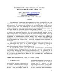
remote sensing techniques for land use classification - GERS ...
remote sensing techniques for land use classification - GERS ...
remote sensing techniques for land use classification - GERS ...

You also want an ePaper? Increase the reach of your titles
YUMPU automatically turns print PDFs into web optimized ePapers that Google loves.
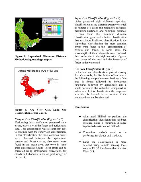
Figure 8. Supervised Minimum Distance<br />
Method, using training samples.<br />
Supervised Classification (Figures 7 - 8)<br />
After generated eight different supervised<br />
<strong>classification</strong>s using different parameters such<br />
as number of classes and parametric methods;<br />
maximum likelihood and minimum distance,<br />
It was found that minimum distance<br />
<strong>classification</strong> generated a better <strong>classification</strong><br />
than maximum likelihood <strong>classification</strong>. In the<br />
supervised <strong>classification</strong> the most common<br />
errors were found in the <strong>classification</strong> of<br />
pasture and <strong>for</strong>est, in some areas the<br />
wavelength of these elements was conf<strong>use</strong>d,<br />
this can be due to the high intensity of green<br />
<strong>land</strong> cover of the area and the intensity of<br />
<strong>for</strong>est in the watershed.<br />
Arc View Classification (Figure 9)<br />
In the <strong>land</strong> <strong>use</strong> <strong>classification</strong> generated using<br />
Arc View tools; the distribution of <strong>land</strong> <strong>use</strong> is<br />
the following: the predominant <strong>land</strong> <strong>use</strong> of the<br />
area is <strong>for</strong>est, followed by herbaceous<br />
range<strong>land</strong>, followed by agriculture, and a<br />
small portion of the watershed composed an<br />
urban area. In this <strong>classification</strong> the range<strong>land</strong><br />
area that is located in the center of the<br />
watershed can not be observed.<br />
Figure 9. Arc View GIS, Land Use<br />
Classification of Río Jauca.<br />
Unsupervised Classification (Figures 5 - 6)<br />
Per<strong>for</strong>ming this <strong>classification</strong> generated some<br />
errors, especially in the <strong>for</strong>est and agricultural<br />
<strong>land</strong>. This <strong>classification</strong> was a significant tool<br />
to continue with the supervised <strong>classification</strong>.<br />
In this <strong>classification</strong> the most common errors<br />
were observed between the agriculture,<br />
pasture and <strong>for</strong>est classes, also errors were<br />
found in the urban area, that were in some<br />
areas classified as clouds. These errors can be<br />
corrected using atmospheric corrections, <strong>for</strong><br />
clouds and shadows in the original image of<br />
IKONOS.<br />
Conclusions<br />
After <strong>use</strong>d ERDAS to per<strong>for</strong>m the<br />
<strong>classification</strong>, significant data has been<br />
obtained using a minimum distance<br />
supervised <strong>classification</strong> method.<br />
Correction methods need to be<br />
per<strong>for</strong>med <strong>for</strong> clouds and shadows.<br />
Land <strong>use</strong> <strong>classification</strong> is more<br />
detailed using <strong>remote</strong> <strong>sensing</strong> tools<br />
such as ERDAS software than the Arc<br />
View GIS.<br />
4