

rufiji environment management project - Coastal Forests of Kenya ...
rufiji environment management project - Coastal Forests of Kenya ...
rufiji environment management project - Coastal Forests of Kenya ...

You also want an ePaper? Increase the reach of your titles
YUMPU automatically turns print PDFs into web optimized ePapers that Google loves.
Rufiji Environment Management Project 1<br />
Environmental Management and Biodiversity Conservation <strong>of</strong> <strong>Forests</strong>,<br />
Woodlands, and Wetlands <strong>of</strong> the Rufiji Delta and Floodplain<br />
Assessment <strong>of</strong> Potential Rangeland Resources in<br />
Selected Areas towards Designing a Livestock<br />
Development Strategy<br />
in Rufiji District<br />
Angello Joseph Mwilawa<br />
For more information please contact<br />
Technical Report No. 40<br />
(Muthasari wa Kiswahili Upo)<br />
June 2003<br />
Project Manager,<br />
Rufiji Environment Management Project<br />
P.O. Box 13513<br />
Dar-es-Salaam, Tanzania<br />
Tel: 44 Utete Rufiji 0r 023-2402972 o r 022- 2666088/0741 322366 Dar-es-Salaam<br />
Email: rempute1@bushmail.net or iucndar@epiq.or.tz<br />
1 The Rufiji District Council implements Rufiji Environment Management Project with technical assistance from IUCN – The World<br />
Conservation Union, and funding from the Royal Netherlands Embassy.
Rufiji Environment Management Project – REMP<br />
Project Goal: To promote the long-term conservation through ‘wise use’ <strong>of</strong> the lower Rufiji<br />
forests, woodlands and wetlands, such that biodiversity is conserved, critical ecological<br />
functions are maintained, renewable natural resources are used sustainably and the livelihoods<br />
<strong>of</strong> the area’s inhabitants are secured and enhanced.<br />
Objectives<br />
• To promote the integration <strong>of</strong> <strong>environment</strong>al conservation and sustainable development<br />
through <strong>environment</strong>al planning within the Rufiji Delta and Floodplain.<br />
• To promote the sustainable use <strong>of</strong> natural resources and enhance the livelihoods <strong>of</strong> local<br />
communities by implementing sustainable pilot development activities based on wise use<br />
principles.<br />
• To promote awareness <strong>of</strong> the values <strong>of</strong> forests, woodlands and wetlands and the<br />
importance <strong>of</strong> wise use at village, district, regional and central government levels, and to<br />
influence national policies on natural resource <strong>management</strong>.<br />
Project Area<br />
The <strong>project</strong> area is within Rufiji District in the ecosystems affected by the flooding <strong>of</strong> the river<br />
(floodplain and delta), downstream <strong>of</strong> the Selous Game Reserve and also including several<br />
upland forests <strong>of</strong> special importance.<br />
Project Implementation<br />
The <strong>project</strong> is run from the district Headquarters in Utete by the Rufiji District Administration<br />
through a district Environmental Management Team coordinated by the District Executive<br />
Director. The Project Manager is employed by the <strong>project</strong> and two Technical Advisers are<br />
employed by IUCN.<br />
Project partners, particularly NEMC, the Coast Region, RUBADA, The Royal Netherlands<br />
Embassy and the Ministry <strong>of</strong> Natural Resources and Tourism, collaborate formally through<br />
their participation in the Project Steering Committee and also informally.<br />
Project Outputs<br />
At the end <strong>of</strong> the first five –year phase (1998-2003) <strong>of</strong> the <strong>project</strong> the expected outputs are:<br />
An Environmental Management Plan: an integrated plan for the <strong>management</strong> <strong>of</strong> the<br />
ecosystems (forests, woodlands and wetlands) and natural resources <strong>of</strong> the <strong>project</strong> area that<br />
has been tested and revised so that it can be assured <strong>of</strong> success - especially through<br />
development hand-in-hand with the District council and the people <strong>of</strong> Rufiji.<br />
Village (or community) Natural Resource Management Plans: These will be produced in pilot<br />
villages to facilitate village planning for natural resource <strong>management</strong>. The <strong>project</strong> will<br />
support the implementation <strong>of</strong> these plans by researching the legislation, providing training<br />
and some support for zoning, mapping and gazettement <strong>of</strong> reserves.<br />
Established Wise Use Activities: These will consist <strong>of</strong> the successful sustainable development<br />
activities that are being tried and tested with pilot village and communities and are shown to<br />
be sustainable<br />
Key forests will be conserved: <strong>Forests</strong> in Rufiji District that have shown high levels <strong>of</strong> plant<br />
biodiversity, endemism or other valuable biodiversity characteristics will be conserved by<br />
gazettement, forest <strong>management</strong> for conservation, and /or awareness-raising with their<br />
traditional owners.
REMP Technical Report 40: Rangeland Resources in Rufjiji<br />
Exeutive Summary<br />
Rufiji District, the southernmost District <strong>of</strong> Coast Region, covers an area <strong>of</strong> 13,339 km 2 and is<br />
characterized by four main soil types:<br />
• Nutrient-poor coarse sands covered by Miombo woodland and coastal forest mosaics (4250 km 2<br />
plus some 3400 km 2 inside the Selous Game Reserve)<br />
• Finer red sandy soils originally covered by coastal forest (2700 km 2 ),<br />
• The Rufiji River floodplain (1700 km 2 ) <strong>of</strong> loams and clays interspersed with sands, covered by<br />
tall grass and occasional trees.<br />
• Fine salty clays <strong>of</strong> the delta covered by mangrove and grasslands (1300 km 2 ).<br />
The average annual rainfall ranges from 1200 mm at the coast to 600 mm in the western floodplain and<br />
displays a bimodal pattern. The heaviest rainy season begins in mid March and ends in May. The<br />
lighter short rains fall from mid November to January. Only part <strong>of</strong> the floodplain soils are highly<br />
suitable for agriculture and, because <strong>of</strong> the need for fallows and the variable area reached by the annual<br />
floods, some 15,000 ha, <strong>of</strong> the estimated 45,000 ha that are suitable on the floodplain, are annually<br />
cultivated. Some 25,000 ha <strong>of</strong> the coastal forest on the red soils <strong>of</strong> the Northern Hills have already been<br />
cleared for cultivation. There is only a limited potential for sustainable forms <strong>of</strong> agriculture elsewhere<br />
in the district. Traditionally, the Rufiji inhabitants acquire their animal protein needs from fishing,<br />
hunting and poultry-keeping. Except in the delta, the inhabitants traditionally are not keepers <strong>of</strong> large<br />
livestock (goats, sheep, cattle), mostly because <strong>of</strong> the abundance <strong>of</strong> Tsetse flies. Therefore, the number<br />
<strong>of</strong> large livestock in the district has traditionally been small, a few hundred at the most and <strong>of</strong>ten<br />
owned by immigrant government staff. Since 2002 a fundamental change has occurred and immigrant<br />
pastoralists and agro-pastoralists have come into the District from other regions/ districts in search <strong>of</strong><br />
pasture and water bringing considerable herds with them. Currently, it is estimated that the district has<br />
about 5,000 head <strong>of</strong> indigenous cattle (mainly cattle (4,000) from immigrating pastoralists), 300 dairy<br />
cattle, 7000 goats, 1,000 layer chickens and 400,000 local chickens. As expected the arrival <strong>of</strong> the<br />
immigrants has been welcomed in some places, while in other places it has been a source <strong>of</strong> tension<br />
and conflict.<br />
With the aim <strong>of</strong> assessing the utilization, by immigrant and local livestock keepers <strong>of</strong> the natural<br />
resources <strong>of</strong> the District, the Rufiji District Council through its District Agricultural and Livestock<br />
Department, with the support from the Rufiji Environment Management Project (REMP), contracted<br />
this study. The main output expected from the study was to provide baseline information on the<br />
physical potential <strong>of</strong> Rufiji’s grasslands, and contribute in developing a District Livestock<br />
Management Strategy. This strategy would strive towards ecological, social and economic<br />
sustainability. Terms <strong>of</strong> reference were prepared to guide the study, bearing in mind the goal <strong>of</strong> REMP<br />
namely, to promote the long-term conservation through wise use <strong>of</strong> the lower Rufiji River forests,<br />
woodlands and wetlands, such that biodiversity is conserved, critical ecological functions are<br />
maintained, renewable natural resources are used sustainably, and the livelihoods <strong>of</strong> the area’s<br />
inhabitants are secured and enhanced. Among other things the study did not consider the value and<br />
economics <strong>of</strong> wild animals versus pastoral production, but this could be a subject for further research.<br />
Similarly, because <strong>of</strong> the limitation to one discipline in the team, the study gives views mainly on<br />
pastoral production and pays only minor attention to other important users such as the indigenous<br />
cultivators, fishers and hunters. The study was carried out in February 2003, an exceptionally dry year<br />
when the Rufiji river did not flood and the floodplain remained dry and accessible. The consultant<br />
visited a total <strong>of</strong> 20 villages namely: Mohoro, Chumbi A, B, & C, Muyuyu, Ruaruke A & B, Kikale,<br />
Hanga, Mlanzi, Kivinja A and B, Bungu B, Mjawa, and Uponda. Others were Kilimani, Ngorongo<br />
east, Mgomba, Ikwiriri South and North and lastly Umwe north. The villages were selected by the<br />
DALDO’s <strong>of</strong>fice, as areas which seem to have physical potential for pastoralism and /or were already<br />
grazed by traditional pastoral herds. Brief interviews were conducted with focus groups in all the<br />
i
REMP Technical Report 40: Rangeland Resources in Rufjiji<br />
villages visited and with key informants identified from the respective areas. A checklist was prepared<br />
using the Terms <strong>of</strong> Reference given. During the field range assessment, range condition was assessed<br />
using visual appraisal <strong>of</strong> relative proportion <strong>of</strong> desirable, undesirable forage plants and presence <strong>of</strong><br />
perennial grasses in the ground layer. The indigenous knowledge <strong>of</strong> forage quality from immigrating<br />
pastoralists, who had familiarity with some <strong>of</strong> the species found in Rufiji, was used. Forage yields were<br />
estimated through actual clipping methods and Grazing Capacity was estimated. These were once-<strong>of</strong>f,<br />
one season production studies. The results should therefore be viewed with the caution as only a series<br />
<strong>of</strong> studies over a period <strong>of</strong> several seasons under actual grazing that can provide accurate grazing<br />
capacity data.<br />
The overall results showed that, on a purely forage yield basis, Rufiji District has some areas that<br />
could potentially support extensive livestock production. Most <strong>of</strong> the potential rangelands assessed<br />
were in good condition, perhaps because they have never been subjected to regular livestock grazing,<br />
but others had some limitations. Extensive grazing areas that might be considered for supporting<br />
livestock production with different animal units are mentioned. For proper assessment for use <strong>of</strong> any <strong>of</strong><br />
the sites as rangelands, studies <strong>of</strong> the sites under actual grazing need to be undertaken. Before<br />
recommending any site for designation as a rangeland area, social and economic studies are required.<br />
Livestock infrastructure is inadequate in all the areas. The study has outlined the requirements in each<br />
village which include dips, watering points and Tsetse control where applicable. Livestock markets are<br />
required and market locations have been suggested. The following recommendations are made to assist<br />
the District Council with the development <strong>of</strong> a District Livestock Management Strategy:<br />
• A District statement should be issued asking prospective immigrant pastoralists to wait outside<br />
until the District, in collaboration with the villagers, has developed a Livestock Management<br />
Strategy that will provide wise and sustainable use <strong>of</strong> the available grazing resource.<br />
Meanwhile those pastoralists who are in Rufiji already should work together with local people<br />
in respective villages to properly allocate and demarcate the grazing areas and watering points<br />
and stock routes.<br />
• Vegetation maps need to be established that will guide the District Council for planning,<br />
implementing and analyzing the results <strong>of</strong> subsequent rangeland surveys (as a necessary early<br />
element <strong>of</strong> rangelands inventory). Rangeland Management decisions require an understanding<br />
<strong>of</strong> vegetation dynamics (changes). With such information District Councils and villages should<br />
be able to make proper judgments. Special attention should be paid to the impact <strong>of</strong> the new<br />
burning regimes that may be imposed by the immigrant livestock keepers. This should be seen<br />
as part <strong>of</strong> the development <strong>of</strong> a wider vision on burning practices and their impacts in the<br />
District.<br />
• The District Council should broadly categorise the district land into areas where pastoralism is<br />
not permitted, permitted seasonally, permitted with conditions outlined in District and /or<br />
village by-laws. The District Council should apply the precautionary principle with regard to<br />
protection <strong>of</strong> some selected highly biodiverse areas and initially exclude them completely from<br />
pastoralism. Special care should also be taken to avoid damage to standing crops and plantings<br />
in the floodplain. The recession-type Mlao cultivation may be an unfamiliar land use to<br />
immigrant pastoralists.<br />
• Land use attributes should be monitored to determine any changes. As many changes are longterm<br />
in nature, range trend monitoring must also be long-term. There is a need to convene<br />
frequent meetings among the rangeland users to discuss and assess the rangeland status<br />
periodically. The District Council should plan and budget for this monitoring and seek support<br />
for this new function from higher authorities and donors.<br />
• Immigrating pastoralists, local people in their respective villages and extension staff should,<br />
taking into consideration the needs <strong>of</strong> other users/land uses including domestic water collectors,<br />
fishers, wild fauna and flora, estimate the rational animal unit number <strong>of</strong> livestock that can be<br />
kept in their areas. Special attention needs to be given to the potential deterioration <strong>of</strong> water<br />
ii
REMP Technical Report 40: Rangeland Resources in Rufjiji<br />
quality <strong>of</strong> stagnant water bodies such as the flood-plain associated lakes, should these be used<br />
as watering points. The importance <strong>of</strong> the lakes for domestic water supply and local livelihoods<br />
and the risks <strong>of</strong> their eutrophication, with the associated spread <strong>of</strong> harmful waterweeds should<br />
be taken into account.<br />
• The size and the potentiality <strong>of</strong> a particular grazing land will determine the reasonable number<br />
<strong>of</strong> livestock units that will be allowed to a particular village or community. Strict adherence to<br />
agreed numbers could reduce conflicts.<br />
• Villagers should be supplied with objective information on the proper number <strong>of</strong> animal units<br />
that can be kept in their villages without negative effect to their rangelands.<br />
• Villages should be assisted to develop by-laws governing all land uses and conservation<br />
strategies. In this case it implies the need for clear demarcation <strong>of</strong> zones for livestock grazing<br />
and crop cultivation activities.<br />
• There should be a deliberate effort on awareness creation and education on livestock husbandry<br />
and rangelands <strong>management</strong> (for local natural resource users and for immigrant pastoralists)<br />
• Strengthening communication between the District and villages. Also, communication<br />
mechanisms should be established at village level between local people and immigrating<br />
livestock keepers. The District Council should play a facilitation role in ensuring such<br />
communication.<br />
• The village governments should be empowered through knowledge acquisition on village<br />
resource ownership, <strong>management</strong> and utilization.<br />
• Establishment <strong>of</strong> livestock markets, in places like Ikwiriri and Nyambawala, should be<br />
considered in collaboration with village and ward authorities and immigrant pastoralists.<br />
• There is a need to invite more agricultural and veterinary outlets in the district.<br />
• District Councils and livestock keepers should mobilize resources to facilitate construction <strong>of</strong><br />
livestock infrastructure in the identified locations.<br />
• There is a need to strengthen extension services particularly by adding/employing more<br />
livestock extension staff/ field <strong>of</strong>ficers in the district and bringing veterinary services closer to<br />
livestock keepers. However, for sustainability District Council should facilitate training <strong>of</strong> para<br />
vets from communities themselves. They can be trained in LITIs and MATIs.<br />
iii
REMP Technical Report 40: Rangeland Resources in Rufjiji<br />
Muhtasari Wa Taarifa<br />
MSHAURI BINGWA WA UOTO WA NYANDA ZA MALISHO KUHUSU<br />
TATHMINI YA UOTO WA NYANDA ZA MALISHO KATIKA MAENEO<br />
YALIYOTAJWA KWA LENGO LA KUWA NA MKAKATI WA<br />
KUSIMAMIA NAKUENDE LEZA MIFUGO WILAYA YA RUFIJI<br />
Wilaya ya Rufiji ni miongoni mwa wilaya sita zinazounda Mkoa wa Pwani na ambayo iko kusini zaidi<br />
ya wilaya zingine. Wilaya hii ina ukubwa wa eneo za mraba km² 13,339 na imegawanyika katika<br />
makundi manne(4) ya aina za udongo kama ifuatavyo:-<br />
• Udongo wa kichanga uliokosa mbolea uliogubikwa na miti aina ya Miombo na aina nyingine za<br />
Misitu ya Pwani yenye ukubwa wa eneo km² 4,250 (pamoja na eneo la Selous Game Reserve<br />
lenye ukubwa wa eneo za mraba km² 3,400).<br />
• Udongo mwekundu laini wa kichanga wenye asili ya kugubikwa na Misitu ya Pwani wenye<br />
ukubwa wa eneo la mraba km² 2,700.<br />
• Bonde la Mafuriko la Mto Rufiji lenye udongo tifu tifu uliochanganyika na udongo wa<br />
mfinyanzi wenye ukubwa wa eneo la mraba km² 1,700. Aina hii ya udongo una kiasi kidogo<br />
cha mchanga uliotawaliwa na nyasi ndefu na miti ya hapa na pale.<br />
• Udongo laini wa kifinyanzi wa chumvi chumvi ulioko maeneo ya Delta uliogubikwa na misitu<br />
ya mikoko (kapa) na mbuga za nyasi zenye ukubwa wa km² 1,300.<br />
Wilaya inapata wastani wa mvua kati ya mm 1200 kwa maeneo ya pwani mpaka mm 600 magharibi<br />
mwa maeneo ya mafuriko ya Mto Rufiji. Wilaya huwa inapata mvua za aina mbili yaani mvua kubwa<br />
za Masika zinazoanza katikati ya mwezi wa March na kumalizika mwishoni mwa mwezi Mei; pia kuna<br />
mvua za Vuli zinazoanza katikati ya mwezi wa Novemba na kukatika mwezi Januari.<br />
Ni eneo kiasi tu ya bonde la Mafuriko la Mto Rufiji ndilo lenye udongo wenye rutuba nzuri inay<strong>of</strong>aa<br />
kwa kilimo. Tena ni kwa sababu ya kilimo cha kupumzisha ardhi au kulazimishwa kupumzishwa kwa<br />
sababu ya mafuriko ya mwaka yanapotokea ambayo husababisha maeneo hayo kutokulimwa. Kiasi<br />
cha makisio ya hektari 45,000 ambazo ziko katika ukanda wa Mafuriko zinaz<strong>of</strong>aa kwa Kilimo ni<br />
hektari 15,000 ndizo zinazolimwa kila mwaka. Kiasi cha hektari zipatazo 25,000 zilizo na misitu ya<br />
pwani na ambazo zimetawaliwa na Milima ya Kaskazini yenye udongo mwekundu zimefyekwa kwa<br />
ajili ya kilimo. Kutokana na hali hiyo kuna maeneo machache yaliyobaki ambayo kiendelevu yanafaa<br />
kwa kilimo wilayani.<br />
Kwa asili, wananchi wa wilaya hii huwa wanapata viini lishe vya protini kutokana na uvuvi, uwindaji<br />
na ufugaji wa kuku. Ni wananchi waishio katika Delta tu walio na ng’ombe ,mbuzi na kondoo.<br />
Sababu moja inayowafanya wananchi wa maeneo hayo kutokufuga wanyama wakubwa (mbuzi,<br />
kondoo na ng’ombe) ni uwingi wa mbung’o. Kwa hiyo ni wazi kuwa idadi ya wanyama wakubwa kwa<br />
asili ni kidogo/asilimia chache ya wanyama wakubwa zaidi sana wanamilikiwa na wafanyakazi<br />
wahamiaji wa serikali.<br />
Tangu mwaka 2002 kumekuwa na mabadiliko makubwa kutokana na wafugaji wa jadi na wakulima<br />
wafugaji kuingia wilayani toka mikoa na wilaya zingine kwa ajili ya kutafuta malisho na maji.<br />
Wafugaji hao wameingia na idadi kubwa ya mifugo.<br />
Mpaka sasa wilaya inakadiriwa kuwa na idadi ifuatayo ya mifugo:-<br />
iv
REMP Technical Report 40: Rangeland Resources in Rufjiji<br />
• Ng’ombe …………………………….5000 (4000 wafugaji wa jadi)<br />
• Mbuzi………………………………...7000<br />
• Ng’ombe wa maziwa…………………300<br />
• Kuku wa mayai……………………….1000<br />
• Kuku wa asili………………………….400,000.<br />
Uingiaji wa wafugaji wa jadi wilayani kumepokelewa vizuri na wananchi wengine, lakini katika<br />
baadhi ya maeneo/vijiji ni chanzo cha matatizo/migogoro. Kuingia kwa wafugaji wa jadi kumeamsha<br />
hisia mpya toka kwa wananchi, madiwani na Timu ya Kusimamia Mazingira ya Wilaya (EMT) kutaka<br />
kujua/ kutathmini uwepo, na uwezo wa uoto wa nyanda za malisho zilizopo. Halmashauri ya Wilaya<br />
kupitia idara yake ya Kilimo/Mifugo ikisaidiwa na Mradi wa Kusimamia Mazingira Rufiji<br />
(MUMARU-REMP) ilimwajiri mtaalamu bingwa wa nyanda za malisho toka Taasisi ya Uchunguzi<br />
Mpwapwa. Lengo la Halmashauri ilikuwa ni kupata taarifa za awali za kuwepo kwa uoto wa nyanda<br />
za malisho, ubora wake na uwezo wake katika kuhimili idadi ya mifugo iliyopo.<br />
Taarifa hizo zingesaidia wilaya kutengeneza Mkakati wa Kusimamia na Kuendeleza Ufugaji Endelevu.<br />
Mkakati huo ungeangalia zaidi mahusiano yaliyopo baina ya wanyama, watu na mimea; mambo ya<br />
jamii na mambo ya kiuchumi ili yawe endelevu. Hadidu za rejea zilitengenezwa ili kuratibu<br />
utafiti/tathmini huku tukizingatia mapendekezo ya MUMARU yaani kudumisha uhifadhi wa muda<br />
mrefu kupitia matumizi mazuri ya misitu iliyopo mabondeni mwa Mto Rufiji, miti na ardhi chepe<br />
chepe kiasi cha bioanuai zilizopo zinahifadhiwa, mahusiano ya viumbe yanatunza, rasilimali<br />
zinazojirudia zinatumika kiendelevu na maisha ya wananchi katika maeneo husika yanalindwa na hali<br />
ya kipato kinaboreshwa. Pamoja na hayo yote, tathmini hiyo haikuangalia thamani za kiuchumi za<br />
wanyama pori kulinganisha na uzalishaji wa ng’ombe wa asili. Bali hilo linahitaji utafiti wa kina.<br />
Licha ya hayo utafiti/tathmini hiyo ilihusu zaidi uzalishaji wa ng’ombe wa asili na kutoa umuhimu<br />
mdogo kwa watumiaji wengine wa nyanda za malisho kama vile wakulima, wavuvi na wawindaji.<br />
Tathmini hiyo ilifanyika mnamo mwezi wa Februari 2002, mwaka ambao haujawahi kutokea kwa<br />
ukame na Mto Rufiji kukosa mafuriko. Hivyo maeneo ya mafuriko kubaki makavu hali ambayo<br />
iliwezesha maeneo kufikika bila shida. Mtaalamu bingwa alitembelea vijiji ishirini (20) navyo ni;<br />
Mohoro, Chumbi A,B na C; Muyuyu, Ruaruke A na B; Kikale, Hanga, Mlanzi, Kivinja A na B;<br />
Bungu, Mjawa, Uponda, Kilimani, Ngorongo, Mgomba, Ikwiriri Kusini na Kaskazini na Umwe<br />
Kaskazini. Vijiji hivyo vilipendekezwa na <strong>of</strong>isi ya DALDO kama maeneo yenye dalili za kuwa na<br />
uoto mzuri wa nyanda za malisho kwa ajili ya mifugo au maeneo hayo yalikwisha kuwako na<br />
wanyama wa asili wakichungwa.<br />
Usaili mdogo ulifanyika kwa makundi maalumu yaliyoko katika vijiji na watu maarufu au viongozi<br />
walitambuliwa na kuhojiwa. Orodha ya maswali iliandaliwa kwa kutumia hadidu za rejea alizopewa<br />
na Afisa Kilimo/Mifugo na kuthibitishwa na Timu ya Kusimamia Mazingira (EMT). Wakati wa<br />
tathmini katika mbuga; uzuri wa nyanda za malisho ulikadiriwa kwa kutumia macho kulinganisha na<br />
uoto wa malisho hafifu, uoto wa kudumu wa nyasi katika ardhi. Elimu ya asili ya utambuzi wa<br />
malisho mazuri toka kwa wafugaji wa jadi ambao walikuwa tayari wana uzoefu mdogo wa Rufiji<br />
ulitumika. Uzalishaji wa malisho ulipimwa kwa njia ya kukata na kupima malisho kwa idadi fulani ya<br />
wanyama ulikadiriwa.<br />
Shughuli hii ya utafiti wa uzalishaji wa malisho ilikuwa ya msimu mmoja kwa hiyo matokeo ya<br />
utafiti/tathmini hiyo lazima yaangaliwe kwa uangalifu sana. Ili kupata takwimu zilizo sahihi ilitakiwa<br />
tathmini kadhaa zifanyike kwa muda wa misimu mingi kwa wanyama kulishwa katika maeneo husika.<br />
Ndipo unaweza kupata majibu yanayoaminika hususan ya uwezo wa malisho.<br />
Tahadhari:- Hatuna vipimo vya ukubwa kwa maeneo yaliyotajwa. Kwa hiyo bado hatuwezi kukisia<br />
idadi ya mifugo inay<strong>of</strong>aa kwa eneo lo lote la kijiji au kwa Wilaya nzima.<br />
v
REMP Technical Report 40: Rangeland Resources in Rufjiji<br />
Kwa ujumla matokeo hayo yanahusu upimaji wa nyasi tu, yanaonyesha kwamba Rufiji ina maeneo<br />
machache yanayoweza kulisha mifugo katika usimamizi wa aina ya “extensive” yaani eneo kubwa<br />
linahitajika kwa wanyama wachache. Maeneo mengi yaliyotathminiwa yalionyesha kuwa yana uoto<br />
mzuri wa nyanda za malisho kwa sababu pengine yalikuwa hayajatumika na wanyama kwa muda<br />
mrefu. Mengine yalikuwa na mapungufu/ au matatizo yaliyojitokeza.<br />
Maeneo ya nyanda za malisho yanayoweza kufikiriwa kuwa yanafaa kwa idadi kadhaa ya mifugo<br />
yametajwa. Eneo lo lote lisitumike kama nyanda za malisho kabla ya tathmini kufanyika kwa<br />
wanyama kulisha katika eneo husika kwa muda maalaum. Kabla ya eneo kutangazwa kuwa nyanda za<br />
malisho utafiti wa kina wa kijamii na kiuchumi lazima ufanyike. Miundo mbinu kwa ajili ya mifugo<br />
katika maeneo yote zilikuwa hakuna. Utafiti huu umeorodhesha mahitaji ya kila kijiji ikijumuisha<br />
majosho, maeneo ya maji, uzuiaji wa mbung’o. Minada inayohitajika na mapendekezo ya wapi<br />
kujengwa yametajwa.<br />
Ushauri ufuatao umependekezwa ili kusaidia Halmashauri ya Wilaya kutengeneza mkakati wa<br />
Kusimamia na Kuendeleza Ufugaji Endelevu.<br />
• Halmashauri ya Wilaya itoe tamko la kuzuia uingiaji wa wafugaji wa asili kutoka Mikoa<br />
mingine hadi hapo Halmashauri, ikishirikiana na vijiji vikamilishe Mkakati wa Kusimamia na<br />
Kuendeleza Ufugaji ambao utatoa matumizi bora na endelevu ya Nyanda za Malisho yaliyopo.<br />
Wakati huo huo wafugaji jadi ambao wamekwishaingia inabidi washirikiane pamoja na wenyeji<br />
wa maeneo husika ili kutenga mipaka kwa ajili ya kugawa maeneo kwa matumizi mbali mbali<br />
kama vile maeneo ya kilimo, uvuvi, misitu, malisho, vyanzo vya maji na njia za mifugo.<br />
• Ramani za uoto wa asili zianzishwe ili zisaidie kama mwongozo kwa Halmashuri ya Wilaya<br />
katika kupanga mipango, utekelezaji na uchanganuaji wa matokeo yaliy<strong>of</strong>anywa juu ya Utafiti<br />
wa Nyanda za Malisho. Kwa taarifa hizo Halmashauri ya Wilaya pamoja na vijiji vitaweza<br />
kufanya maamuzi yanay<strong>of</strong>aa hususan usimamizi wa nyanda za malisho yanahitaji kuhusu<br />
mabadiliko ya uoto, msimu hadi msimu. Taarifa za takwimu yazingatiwe mabadiliko<br />
yanayoweza kufuatana na uchomaji moto malisho na wafugaji wa jadi. Hii inaweza kuwa moja<br />
ya njia ya kuelewa matokeo yanayosababishwa na uchomaji moto kwa Wilaya nzima.<br />
• Halmashauri ya Wilaya itenge maeneo ambayo wafugaji wa jadi hawaruhusiwi kuingia na<br />
kukaa, kuruhusiwa kuchungia kwa misimu/majira mbali mbali, kuruhusiwa kwa masharti<br />
yaliyolotolewa na Halmashauri au sheria ndogo za vijiji. Wilaya izingatie kanuni za tahadhari<br />
zinazohusu uzuiaji wa wafugaji wa jadi kuingia katika maeneo ambayo yana wingi wa<br />
bioanuai.<br />
• Pia iwekwe taratibu na kanuni za pekee kuepuka uharibifu wa mazao na upondaji wa miche<br />
katika tambarare ya Mafuriko. Kilimo cha Mlao kitakuwa kigeni kwa wafugaji wa jadi wengi.<br />
• Watumiaji wote wote wa nyanda za malisho wanashauriwa wakae pamoja ili kujadili, kuratibui<br />
na kukisia mabadiliko. Kwa asili mabadiliko mengi ni ya muda mrefu, hivyo mipango ya<br />
kuratibu mbuga inafaa iwe ya muda mrefu. Inafaa watumiaji wa nyanda za malisho wakae<br />
mara kwa mara ilio kujadili na kupima hali ya nyanda kwa vipindi maalum. Halmashauri ya<br />
Wilaya iwe na mpango na bajeti kwa ajili ya kuratibu masuala hayo na inafaa watafutwe<br />
wahisani waweze kusaidia.<br />
• Wafugaji wa jadi, wakazi wa vijiji husika na wataalam wa ugani inafaa wafikirie mahitaji ya<br />
watumiaji wengine wa Nyanda za malisho na ardhi kama vile wachota maji, wavuvi, vimelea<br />
vya mimea na wanyama wadogo, ukadiriaji wa idadi ya mifugo ambao wanaweza kutunzwa<br />
vi
REMP Technical Report 40: Rangeland Resources in Rufjiji<br />
katika eneo moja.<br />
• Uangalifu mkubwa unahitajika katika vijiji vyote juu ya uchafuzi wa vyanzo vya maji safi<br />
yaliyoenea katika tambarare za mafuriko ambako kuna mabwawa ambayo yanatumika<br />
wanadamu. Umuhimu wa maji ya mabwawa kwa matumizi ya wananchi kwa ajili ya maisha<br />
yao na hatari itakayojitokeza kuhusiana na kusambaa kwa magugu maji hatari inafaa<br />
izingatiwe.<br />
• Ukubwa na uzuri wa eneo la malisho ni kigezo cha kukuongoza kujua idadi ya mifugo<br />
inayoruhusiwa katika eneo husika.<br />
• Wanakijiji inafaa wapatiwe taarifa na takwimu zisizo na ubaguzi juu ya idadi ya mifugo<br />
inayoweza kuhodhiwa katika kijiji husika bila ya kuleta uharibifu Nyanda za Malisho.<br />
• Wanakijiji inabidi wapewe msaada wa kitaalam jinsi ya kutengeneza sheria ndogo ndogo<br />
zinazohusu uhifadhi na matumizi bora ya ardhi. Kwa hali hiyo inabidi kijiji kitenge maeneo<br />
kwa ajili ya shughuli za Mifugo na Kilimo<br />
• Inabidi pawepo na uhamasishaji na utoaji wa elimu kuhusu ufugaji bora pamoja na kutunzaji<br />
wa maeneo ya malisho na maliasili kwa wafugaji asili na watumiaji wengine wa ardhi.<br />
• Kuimarisha mawasiliano mazuri kati ya Wilaya na vijiji pia njia za mawasiliano kati ya wenyeji<br />
wa kijiji na wafugaji jadi ziimarishwe. Yote hayo kuimarika inabidi Halmashauri ya Wilaya<br />
isaidie katika jambo hilo.<br />
• Serikali za vijiji zipewe mamlaka kwa kuelimishwa ili kujua umilikaji, utunzaji na utumiaji wa<br />
maliasili zilizopo inavyotakiwa.<br />
• Inapendekezwa kuanzisha minada katika maeneo yanay<strong>of</strong>aa kama vile Ikwiriri, Nyambawala<br />
kwa kushirikiana na kijiji , kata na wafugaji jadi.<br />
• Kuna ulazima wa kuwakaribisha wawekezaji wa nje na ndani katika nyanja za kilimo na<br />
mifugo<br />
• Halmashuri ya Wilaya na wafugaji wa jadi lazima washirikiane kuanzisha miundo mbinu<br />
husika katika maeneo yaliyopendekezwa.<br />
• Halmashauri ya Wilaya inabidi iimarishe huduma za ugani kwa kuajiri wataalam wa mifugo ili<br />
wawe karibu na wafugaji. Ili huduma hiyo iwe endelevu Halmashauri ya Wilaya ifanye<br />
mpango wa kufundisha wanavijiji mambo ya ufugaji bora (wahudumu wa tiba ya awali) ili<br />
wawe wanatoa huduma vijijini, wafundishwe katika vyuo vya Mifugo.<br />
vii
REMP Technical Report 40: Rangeland Resources in Rufjiji<br />
Table <strong>of</strong> Contents<br />
Exeutive Summary ..................................................................................................................................................i<br />
Muhtasari Wa Taarifa ..........................................................................................................................................iv<br />
List <strong>of</strong> Tables..........................................................................................................................................................ix<br />
Acronyms and Definitions ..................................................................................................................................... x<br />
Acknowledgements................................................................................................................................................xi<br />
1 Introduction................................................................................................................................................... 1<br />
1.1 Geographical Location and Description <strong>of</strong> the study area..................................................................... 1<br />
1.2 Livestock status in the area ................................................................................................................... 1<br />
2 Methodology.................................................................................................................................................. 3<br />
2.1 Selection <strong>of</strong> Study Villages ................................................................................................................... 3<br />
2.2 Sampling procedure and Interviews ...................................................................................................... 3<br />
2.3 Field data Collection ............................................................................................................................. 3<br />
2.4 Range condition..................................................................................................................................... 3<br />
2.5 Estimation <strong>of</strong> Forage Yields.................................................................................................................. 4<br />
2.6 Estimation <strong>of</strong> Grazing Capacity ............................................................................................................ 4<br />
3 Results and Discussion.................................................................................................................................. 5<br />
3.1 Brief overview <strong>of</strong> the villages visited................................................................................................... 5<br />
3.2 Areas used and or suggested for extensive grazing and watering points............................................. 10<br />
3.3 Status <strong>of</strong> the Grasslands Assessed....................................................................................................... 12<br />
3.4 Status <strong>of</strong> Livestock Infrastructure ....................................................................................................... 13<br />
3.5 Inventory <strong>of</strong> dominant pasture species ................................................................................................ 14<br />
3.6 Areas suitable for extensive livestock grazing .................................................................................... 15<br />
3.7 Available Livestock Infrastructure ...................................................................................................... 16<br />
3.8 Identification <strong>of</strong> grasslands users ........................................................................................................ 17<br />
3.9 Potential conflict in the study area ...................................................................................................... 18<br />
3.10 Thoughts on Coping with Conflict...................................................................................................... 18<br />
3.11 Land tenure system.............................................................................................................................. 19<br />
3.12 Rangelands Management Practices and Options................................................................................. 20<br />
3.13 Options For Consideration .................................................................................................................. 21<br />
4 Conclusions and Recommendations.......................................................................................................... 23<br />
4.1 Conclusions ......................................................................................................................................... 23<br />
4.2 Recommendations ............................................................................................................................... 23<br />
5 References.................................................................................................................................................... 25<br />
6 Appendices................................................................................................................................................... 26<br />
6.1 Appendix 1: Rufiji Environment Management Project TERMS OF REFERENCE (TOR) for<br />
Rangelands Assessment – DEVELOPING LIVESTOCK PRODUCTION STRATEGY for Rufiji District.... 26<br />
6.2 Appendix 2: Time Table for Surveying Rufiji Rangelands for Livestock Production. ....................... 27<br />
6.3 Appendix 3: Areas visited and their location GPS readings in UT M zone 37 ARC 1960 ................. 28<br />
6.4 Appendix 4: Map showing Pastoral activity in East Rufiji District..................................................... 30<br />
6.5 Appendix 5: List <strong>of</strong> Participants During Field Data Collection .......................................................... 31<br />
6.6 Appendix 6: Photograph <strong>of</strong> participants in villages visited................................................................ 39<br />
viii
REMP Technical Report 40: Rangeland Resources in Rufjiji<br />
List <strong>of</strong> Tables<br />
Table 1: Range condition assessment basing on percentage cover <strong>of</strong> herb layer ..................................................... 4<br />
Table 2: Potential Grazing areas and watering points in the villages visited in Rufiji District (suggested by village<br />
leaders and district <strong>of</strong>ficers)........................................................................................................................... 11<br />
Table 3: The grassland condition and estimated forage yields (Kg Dm/ha) for each potential grazing area in the<br />
villages visited ............................................................................................................................................... 12<br />
Table 4: The estimated Grazing Capacity (A.U. /ha) and estimated number <strong>of</strong> animal units possible per 50<br />
Hectares <strong>of</strong> pasture in the village visited ....................................................................................................... 13<br />
Table 5: Identification <strong>of</strong> possible areas for Dip construction, Market places and Watering points ...................... 14<br />
Table 6: Observed dominant grass and herb species situated in various potential extensive grazing lands visited15<br />
Table 7: Observed tree/ shrub browse species situated in various potentialextensive grazing land visited ........... 15<br />
Table 8: Grass/ Forage suitability rating <strong>of</strong> the identified and visited potential extensive grazing areas............... 16<br />
ix
REMP Technical Report 40: Rangeland Resources in Rufjiji<br />
Acronyms and Definitions<br />
AEZ<br />
BRALUP<br />
DALDO<br />
EMT<br />
GPS<br />
IUCN<br />
IRA<br />
MBOMIPA<br />
PA<br />
LPRI<br />
LITI<br />
RDC<br />
REMP<br />
MUMARU<br />
MWLD<br />
STTA<br />
TACD<br />
ToR<br />
WCA<br />
WD<br />
URT<br />
Rangelands<br />
Stocking Rate<br />
Carrying Capacity<br />
Grazing Capacity<br />
Range Condition<br />
Agro-Ecological / Economic Zones<br />
Bureau <strong>of</strong> Resource Assessment and Land Use Planning<br />
District Agricultural and Livestock Development Officer<br />
Environment Management Team<br />
Global Positioning System<br />
The World Conservation Union<br />
Institute <strong>of</strong> Resource Assessment<br />
Matumizi Bora ya Malihai Idodi na Pawaga<br />
Protected Areas<br />
Livestock Production Research Institute<br />
Livestock Training Institute<br />
Rufiji District Council<br />
Rufiji Environment Management Project<br />
Mradi wa Uhifadhi wa Mazingira Rufiji (Swahili for REMP)<br />
Ministry <strong>of</strong> Water and Livestock Development<br />
Short Term Technical Adviser<br />
Technical Adviser Community Develeopment<br />
Terms Of Reference<br />
Wildlife Conservation Act<br />
Wildlife Division<br />
United Republic <strong>of</strong> Tanzania<br />
Is an uncultivated land that will support grazing and browsing animals;<br />
however, in this context the area can be used also for agriculture; may<br />
include fallowed fields and wooded areas. Although most rangelands are<br />
arid or semi-arid and predominantly grassy, the author <strong>of</strong> the report assumes<br />
that rangelands also occur in sub-humid and humid zones and in areas with<br />
predominantly woody vegetation or which support shifting cultivation<br />
Is the actual number <strong>of</strong> animals on the specific area for a specific period <strong>of</strong><br />
time, usually for grazing season; basically it is the number <strong>of</strong> animals that<br />
the livestock owner decides to put on the land.<br />
Is the average number <strong>of</strong> animals (or stocking rate) a range can support/<br />
sustain over time, even though the seasonal and /or annual numbers may<br />
vary.<br />
Is a specific number <strong>of</strong> animals that may graze on a unit <strong>of</strong> land year after<br />
year without injury to the land; it gives the potential <strong>of</strong> situation.<br />
Consider the ratio <strong>of</strong> the rangeland forage growth by the herbivore<br />
requirement.<br />
Is the current productivity <strong>of</strong> a rangeland relative to what that range is<br />
naturally capable <strong>of</strong> producing; expresses what rangeland situation is at the<br />
time when a range condition survey is carried out.<br />
x
REMP Technical Report 40: Rangeland Resources in Rufjiji<br />
Acknowledgements<br />
I wholeheartedly extend my appreciation to different people who contributed their ideas which have<br />
been presented in this report following the participatory focused group interviews and the visits made<br />
in the grazing areas. I would like to thank the village leaders, elders, women and youth, for their<br />
fruitful discussions and willingness to walk long distances in the bush.<br />
I am most grateful to REMP, Utete for providing me with all logistical support while carrying out this<br />
work. The Project Manager (Mhina F.), Chief Technical Advisor (Dr Olivier Hamerlynck ) and the<br />
STTA (Mr Simon Jennings ) provided me all the necessary Technical and Logistical support. Also Mr<br />
Simon is thanked for incorporating the GPS points gathered during my field visit into the Rufiji basal<br />
map from REMP. Of course the entire REMP staff and Mr Barnabas at IUCN, Dar es Salaam all are<br />
thanked for their Logistical and moral support at different times.<br />
I am very grateful to Ms Rose Hogan, the TACD for her assistance in reviewing and clarifying the<br />
content <strong>of</strong> the Terms <strong>of</strong> Reference. Her comments, suggestions and support throughout the report<br />
writing are highly acknowledged.<br />
Mr Peter John, the DALDO, Rufiji is thanked for invaluable suggestions and effort to clarify the Terms<br />
<strong>of</strong> Reference prior to signing the contract and for the comments in finalizing this report.<br />
I express my sincere gratitude to Mr. Magamba Mhalla, District Livestock Subject Matter Specialist,<br />
who accompanied me during my field visit. His extensive experience with local people was such a<br />
useful tool. He was patient walking long distance in the grassland areas and also working over long<br />
hours in a day. A special thanks goes to Mr. Samson Mrema who was the driver during my field data<br />
collection. He was keen to see that the vehicle was sober and could travel to most remote areas with<br />
extremely rough roads.<br />
I owe special thanks to the following people who contributed much to the success <strong>of</strong> this work:<br />
The EMT staff, for their comments and suggestions during the first day <strong>of</strong> the initialization <strong>of</strong> this<br />
work.<br />
I am also indebted to Mr Deogratias J. B. Kashasha the DSMS-LP and Mr Jamhuri Kaiwanga the<br />
extension staff (Chumbi) in Rufiji for their constant moral support and ideas especially during field<br />
visits.<br />
I would like to thank my employer, the Ministry <strong>of</strong> Water and Livestock Development (MWLD), the<br />
Zonal Director (Dr Sachin M. Das) and the Livestock Production Research Institute (LPRI), Mpwapwa<br />
for granting me permission to undertake this assignment as part <strong>of</strong> our enhancing Collaboration with<br />
District Councils. I appreciate much the input made by the Principal Livestock Training Institute<br />
(LITI), Mpwapwa, Mr. M. Maskini (Range Scientist) and the Head <strong>of</strong> Cattle Research at LPRI, Mr.<br />
Jefta I. Mkonyi for pro<strong>of</strong> reading this report.<br />
My sincere thanks are due to my beloved wife Fanikio, my sons Andrew and Amosi, who were in<br />
constant PRAYERS, patience and understanding during my field work in Rufiji and while writing this<br />
report.<br />
Lastly but not least, l am thankful to all my colleagues and friends at the Livestock Research Institute,<br />
Mpwapwa for their advice and help.<br />
xi
1 Introduction<br />
REMP Technical Report 40: Rangeland Resources in Rufjiji<br />
1.1 Geographical Location and Description <strong>of</strong> the study area<br />
Rufiji is among the districts in Coast Region and is located at about 7 o 30’S to 8 o 40’S and 39 o 50’E to<br />
39 o 40’E along the east coast <strong>of</strong> Tanzania. The soils are characterized by blackish grey to grey clayey<br />
vertisols (black cotton soils) occurring along riverbanks and in pans (mbugas) away from the rivers.<br />
These soils are associated with water logging so that plant species which cannot tolerate water logging<br />
cannot survive under this soils. The rainfall ranges from 600 – 1200 mm. Rufiji District is located in<br />
the coast region and has its District headquarters at Utete. The human population stands at about<br />
193,000 (URT 2002). The climate <strong>of</strong> Rufiji District tends to have bimodal rains where by the heaviest<br />
rainy season begins in mid March and ends in early June while the light and short rains falls in mid<br />
November and end early January. The District covers on area <strong>of</strong> 13,339 km 2. Out <strong>of</strong> this, 4,824 km 2 are<br />
deemed suitable for crop and livestock production. Rufiji is adjacent to the Selous Game Reserve and<br />
is blessed with large concentration <strong>of</strong> wild herbivores throughout the area. It is reported that only 900<br />
km 2 , are seasonally cultivated although cultivation takes place almost all the year around at different<br />
places. The dry season (May/June to August) is when there is flood recession and agriculture is done in<br />
flood plains (DALDOs Reports). Major means <strong>of</strong> survival in the district include agriculture, fishing,<br />
forest product, livestock keeping (mainly poultry) and petty business. Fishery plays a significant role.<br />
It is estimated to have a total economic value <strong>of</strong> $ 7.4 million at the district level (Turpie, 2000 REMP<br />
Technical report no. 17)<br />
1.2 Livestock status in the area<br />
The District has no traditional pastoralists and the inhabitants <strong>of</strong> this area traditionally are not livestock<br />
keepers. For a long time the number <strong>of</strong> livestock kept in the District has been small. In the recent years<br />
also Heifer Project International (HPI) has introduced a small number <strong>of</strong> dairy cattle under zerograzing<br />
system. However, local chickens are kept in significant numbers. It is estimated that the<br />
district has about 5,000 head <strong>of</strong> indigenous cattle (including 4,000 cattle from immigrating<br />
pastoralists), 300 dairy cattle, 7000 Goats, 1000 layers and 400,000 local chickens. In the recent years,<br />
there has been immigration <strong>of</strong> pastoralists and agropastoralists with their large number <strong>of</strong> cattle from<br />
other places in search <strong>of</strong> pasture and water. Nationally, population pressure coupled with alienation <strong>of</strong><br />
large tracts <strong>of</strong> land to investors and other agriculturists, has necessitated use <strong>of</strong> even marginal grazing<br />
land for cultivation resulting in overgrazing and migration <strong>of</strong> people to other regions. For example the<br />
Maasai have moved to Morogoro Region, giving rise to intense conflicts between crop farmers and<br />
livestock keepers in the immigrating areas. Since 2001 many Sukuma and Barbaigs have moved to<br />
Rufiji from Mbeya, Iringa, Kilombero -Morogoro, Kisarawe, Kibaha and Dar es Salaam. It has been<br />
estimated that by December 2002 a total <strong>of</strong> over 4,000 cattle had arrived in the District (DALDOs<br />
Report February 2002). It is estimated that, at the rate pastoralists are entering Rufiji District at present,<br />
ten times this number <strong>of</strong> cattle will have arrived before the end <strong>of</strong> 2003.<br />
As expected, their arrival has been welcomed in some places, while in other places it has been a source<br />
<strong>of</strong> tension and conflict. The tensions observed were in the areas or villages where the local people were<br />
not consulted nor informed before or on their arrival. Also in some cases where cattle had grazed on<br />
crop fields, and there were difficulties in agreement on compensation between the crop field owners<br />
and pastoralists. With this situation, the Rufiji District Council Authority together with the Rufiji<br />
Environment Project (REMP) <strong>management</strong> team decided to make rangelands resources assessment<br />
geared at planning livestock <strong>management</strong> in the District in a more sustainable way. The assessment<br />
aims at generating information necessary for long term conservation <strong>of</strong> biodiversity, which is necessary<br />
for livestock and <strong>environment</strong> <strong>management</strong> planning. For proper and effective rangelands utilization<br />
for livestock production it is very important that all the potential areas for grazing be clearly defined,<br />
agreed by present land users, and possible infrastructure should be put in place. Terms <strong>of</strong> reference<br />
1
REMP Technical Report 40: Rangeland Resources in Rufjiji<br />
were given for study implementation (Appendix 1). This report has made suggestions, mainly relating<br />
to the physical production capacity <strong>of</strong> the potential rangelands, on some <strong>of</strong> the areas, while others need<br />
further research. Issues such as potential impact on other economic enterprises especially fisheries,<br />
crop production and wildlife enterprises and on the aquatic and forest ecosystems are not dealt with in<br />
this consultancy and need further research.<br />
REMP’s critical objectives are to ensure that existing biodiversity flora and fauna are managed and<br />
conserved, potential ecosystems are maintained, sustainable utilization <strong>of</strong> renewable natural resources<br />
and human well being are improved. REMP “MUMARU” is a <strong>project</strong> operating within the District<br />
with technical support from The World Conservation Union (IUCN).<br />
2
2 Methodology<br />
2.1 Selection <strong>of</strong> Study Villages<br />
REMP Technical Report 40: Rangeland Resources in Rufjiji<br />
A total <strong>of</strong> 20 villages were visited. The villages were purposefully selected by the District Agricultural<br />
Livestock Office (DALDO’s) following site visits made by two District Livestock Subject Matter<br />
Specialists (SMS) and the REMP –Technical Adviser in Community Development (TACD) a month<br />
earlier. The criteria used in selecting these villages were, the status <strong>of</strong> the grasslands, presence <strong>of</strong><br />
immigrating pastoralists and extensive livestock grazing areas that could possibly attract immigrating<br />
pastoralists from other regions. The consultant did not have an influence on selection <strong>of</strong> the villages<br />
visited.<br />
2.2 Sampling procedure and Interviews<br />
Focused group interviews were employed using a checklist based on the Terms <strong>of</strong> Reference (ToR).<br />
The groups were composed <strong>of</strong> village leaders, village elders, youth and representation from women.<br />
Participatory tools were used to facilitate the discussions and for good response. Areas with pastoralists<br />
were visited and interviews were conducted. The questions prepared in the checklist were based on the<br />
issues to be answered in the Terms <strong>of</strong> Reference (Appendix 1). Informal discussions were undertaken<br />
also with key informants. Among the issues in the checklist were livestock issues, infrastructure<br />
availability, water sources, stock routes, relationships between local residents and pastoralists. Other<br />
key informants interviewed were the District Lands, Natural Resources and Environment and District<br />
Agricultural and Livestock Officers. It was noted that due to lack <strong>of</strong> enough time and multidisciplinary<br />
team the consultant might have missed other important issues in detail like wildlife, biodiversity and<br />
recent socio-economics data.<br />
2.3 Field data Collection<br />
The consultant and his accompanying District Subject Matter Specialist visited the villages within the<br />
suggested total number <strong>of</strong> days in early February (Appendix 2). In all the villages visited there was<br />
good welcome from the local people and they were willing to take us to the areas earmarked as<br />
potential for extensive livestock grazing. The areas said to be earmarked were those identified by the<br />
villagers themselves in response to a previous letter received from the District Authority, requesting<br />
villages to demarcate land for various use including grazing lands. Global Positioning System (GPS)<br />
readings were taken in all interested areas for future mapping and follow up activities. This included<br />
the areas that were reachable like some potential grazing areas and watering points (Appendix 3). In all<br />
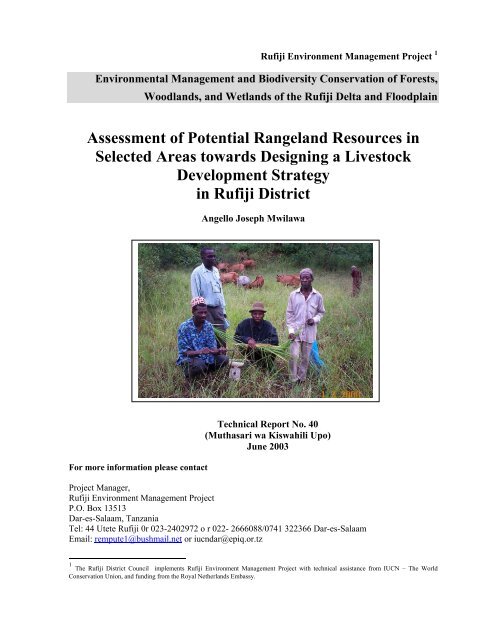
the meetings all the participants in each village were photographed using digital camera (Appendix 4).<br />
2.4 Range condition<br />
This approach was used to arrive at grazing capacities or proper stocking rates. During the field<br />
assessment two methods were used in assessing range condition: the relative proportion <strong>of</strong> desirable<br />
and undesirable forage plant species were used to describe classes <strong>of</strong> range condition. The assistance <strong>of</strong><br />
immigrating pastoralists on issues relating to vegetation and tsetse distribution in the area was used.<br />
Also the presence <strong>of</strong> perennial grasses in the ground layer, especially in relation to what is maximal<br />
possible under those conditions and the condition <strong>of</strong> the perennial grass tufts. According to Food<br />
Agricultural Organization (FAO) (1991) the assessment <strong>of</strong> the range condition could involve two<br />
components: the condition <strong>of</strong> the pasture and the extent <strong>of</strong> soil erosion under grazing conditions.<br />
Pasture condition was assessed from relative proportions <strong>of</strong> desirable and undesirable plants, by<br />
estimation <strong>of</strong> their relative amounts in comparisons with those that are optimal for the <strong>environment</strong>al<br />
conditions prevalent in the area. Desirable species in this context included grasses perennials and sweet<br />
grasses, and the undesirables included shrubs, annuals and sour grasses. From the measurements the<br />
range condition was given in four classes (Table 1). Tse tse infestation was assessed through<br />
3
REMP Technical Report 40: Rangeland Resources in Rufjiji<br />
pastoralists interviews and visual appraisal while walking across the grazing areas.<br />
Table 1: Range condition assessment basing on percentage cover <strong>of</strong> herb layer<br />
Range Condition<br />
% Basal cover <strong>of</strong> herb layer<br />
Excellent More than 75<br />
Good Condition Between 50 – 75<br />
Fair condition Between 25 - 50<br />
Poor Condition Less than 25<br />
2.5 Estimation <strong>of</strong> Forage Yields<br />
The method used to estimate herbage yields was as described by Repport et al (1992). A 100 metre<br />
length transect was established in the entire grazing site and sampling points were located along the<br />
transect at almost 20 metre intervals. Herbage in a 0.5 square metre quadrat was clipped to ground<br />
level using a pair <strong>of</strong> secateurs. Fresh samples from each point were weighed in the field using a spring<br />
balance. Later the average dry weight for samples per quadrat was estimated and calculated for the<br />
production <strong>of</strong> dry matter yield per hectare for each grazing areas. Pastoralists and local people were<br />
willing to provide labour while collecting the data.<br />
2.6 Estimation <strong>of</strong> Grazing Capacity<br />
The suggested and reported grazing lands as was listed by DALDOs <strong>of</strong>fice and mentioned by villages<br />
for field visit were assessed for its grazing capacity. By definition, Grazing Capacity (GC) refers to a<br />
specific number <strong>of</strong> animals that may graze on a unit <strong>of</strong> land year after year without injury to the land. It<br />
gives therefore the potential situation. A first approximation <strong>of</strong> grazing capacity was obtained by<br />
dividing the rangeland forage growth by the herbivore requirement. Proper Use Factor (PUF) <strong>of</strong> 0.6<br />
was used because <strong>of</strong> sub humid and humid nature <strong>of</strong> the area assessed (Pratt and Gwynne, 1977). A<br />
PUF <strong>of</strong> 0.1 was considered to have been consumed by termites. The Animal Unit (A.U.) considered is<br />
equivalent to traditional cattle with 250 kg live weight that consumes 6.5 kgDM/day. Grazing Capacity<br />
is the ratio <strong>of</strong> forage production (F) to herbivore requirement <strong>of</strong> dry matter in weight per animal unit<br />
per unit time multiplied with PUF in decimal. Proper Use Factor refers to the maximum proportion <strong>of</strong><br />
forage growth that can be grazed each year from a given type <strong>of</strong> forage without inducing a downward<br />
trend in forage production. Forage quality (perennial and palatable species) and drinking water<br />
accessibility were equally considered. The main variable used for the estimation <strong>of</strong> grazing capacity<br />
was the standing crop available for forage. This was estimated by determining forage weight by<br />
clipping. However, other methods could be used like remote sensing (e.g. using NDVI) and models<br />
e.g. PHYGROW model. The overall grazing capacity given for each area did not consider other wild<br />
herbivores. However, as it was mentioned earlier due closeness to the Selous Game Reserve, wild<br />
herbivores are found in this areas. Further studies should establish the estimated number <strong>of</strong> herbivores<br />
around and hence estimate forage consumption by grazer/ browsers and browser/ grazers.<br />
4
3 Results and Discussion<br />
REMP Technical Report 40: Rangeland Resources in Rufjiji<br />
3.1 Brief overview <strong>of</strong> the villages visited<br />
i. South <strong>of</strong> River Rufiji / Inner Delta<br />
The villages outlined under this zone are Mohoro, Kiwanga and Chumbi.<br />
Topography: All villages are situated in flood plain area associated with forests.<br />
Hydrology: Always river flood is present and some small lakes<br />
ii. North <strong>of</strong> River Rufiji; Flood Plains <strong>of</strong> Rufiji and Ruhoi Rivers towards Delta<br />
The villages outlined under this zone are Muyuyu, Mtunda and Kikale<br />
Topography: The all villages are situated in flood plain area associated with forests and hilly<br />
Hydrology: Always river floods and makes some small lakes.<br />
iii. North <strong>of</strong> River Rufiji and Flood Plains and Terrace<br />
The villages outlined under this zone are Mgomba, Umwe and Ikwiriri<br />
Topography: The villages are situated in flood plain area, associated with forests and hilly.<br />
Hydrology: Usually the river floods and makes some small lakes.<br />
iv. Western Flood plain<br />
The villages outlined under this zone are Ngorongo, Ikwiriri North and Kilimani<br />
Topography: Flood plain.<br />
Hydrology: Always river flood is present.<br />
v. High lands (Plateau)<br />
The villages outlined under this zone are Bungu,Ruaruke,Mjawa,Uponda andMlanzi.<br />
Topography: Almost the areas are hilly and covered by forest.<br />
Hydrology: There are temporal ponds.<br />
3.1.1 Mohoro<br />
Mohoro has the following sub villages: Sungapwani, Sungabara, Nyampakapwani, Nyampakabara, Old<br />
Mohoro, King’ongo and Mtuleke. The village main activities are agriculture, timber and forest<br />
harvesting, fishing and charcoal making. The main crops grown are rice, maize, cassava, cashew nuts,<br />
sugarcane and coconuts. Timber harvesting is done mainly by people from outside the village who<br />
obtain a permit from the District Council and about 25% <strong>of</strong> the revenue is supposed to be returned to<br />
the village. Charcoal making is done mainly by local people but there is no revenue that is returned to<br />
the village.<br />
Pastoralists <strong>of</strong> the Sukuma ethnicity arrived in Mohoro village at the end <strong>of</strong> year 2001. On arrival,<br />
some <strong>of</strong> the pastoralists informed the village government <strong>of</strong> their arrival and were given a permit to<br />
stay. Later other pastoralists came and settled illegally. It was noted that, the village had demarcated<br />
the grazing area at Nyambawala. However, only one pastoralist called Mchapakazi Zagazaga agreed to<br />
stay there. Others stay at the following sub villages King’ongo, Mtuleke and Kilindi. The other<br />
livestock keepers mentioned are: Yuda Masasa, Musa Makwega, Mulekwa Njoro, Ngwege, Paulo<br />
Hessa, James Chuma, J. Hessa, Bulendu, Daudi Mashamba and Masolozu Munosana. The village has<br />
one local cattle keeper. Some other local farmers keep goats. About 150 goats are kept in the village.<br />
5
REMP Technical Report 40: Rangeland Resources in Rufjiji<br />
3.1.2 Kiwanga<br />
Pastoralists <strong>of</strong> the Sukuma ethnicity arrived in Kiwanga village during the year 2002, with three herds<br />
<strong>of</strong> cattle. On arrival, the pastoralists reported to the village government and they were allocated to stay<br />
in Mohoro- Kiwanga border. The area was not used for cultivation in recent years except in some cases<br />
where some old established cashew and mango trees may have been cultivated by indigenous families<br />
20/30 years back. However, it was observed that there was cultivation taking place by pastoralists<br />
themselves and other people. Similar to Mohoro, the main activities <strong>of</strong> the people in Kiwanga are<br />
agriculture, fishing, charcoal making, timber logging, salt making and petty business. So far their<br />
relationship with the pastoralists has been good.<br />
3.1.3 Chumbi<br />
The activities carried out by Chumbi residents are mainly crop cultivation, fishing, timber harvesting<br />
and charcoal making. The crops grown are rice, maize, millet, bananas, cashewnuts, simsim, coconuts,<br />
and sugarcane. The main source <strong>of</strong> water for the people and livestock is Mohoro river. During the year<br />
2001 two Sukuma pastoral communities arrived in Chumbi. The village government was informed and<br />
allocated them the area in Kiyengea at Chumbi C for livestock keeping. The pastoralists present in<br />
Chumbi are: Tisa Maduka who stays in Bwembeletele, Omaru Maganga and Matias Maganga at<br />
Tuacheni and Hassan Maganga in Kiyengea.<br />
3.1.4 Muyuyu<br />
Agriculture is the main activity <strong>of</strong> the Muyuyu residents. They plant rice, maize, cassava, cashewnuts,<br />
millet, simsim and fruits. Other activities are fishing in the following small ponds and lakes,<br />
Ndambwe, Nyakongo, Kyakala, Lung’ala, Nyakalimba, Mpapai, Mwongoswe, Kipera, Mbiligani,<br />
Bwembweni, Pungu, Nyakiyaka, and Lungola river. Timber making and tree harvesting is also another<br />
activity which is done in collaboration with the District Council. The village received pastoralists<br />
during the year 2002. The pastoralists were allocated the following areas: Nyankongo, Nyakatungulu<br />
and Mtunda for the Barbaigs, where as Nyakalimba and Mbiliganyi were allocated to Sukuma pastoral<br />
communities. Immigrant pastoralists are; Emmanuel Rugolola (Nyamwezi), Wiliam and Mahemba<br />
(Barbaigs) and Mkanda (Sukuma).<br />
3.1.5 Mtunda<br />
Mtunda is divided into Mtunda A and B each with three sub-villages. Mtunda A has the following sub<br />
villages Mtunda A, Mbongola and Nguwalo while Mtunda B has sub-village Mtunda B, Nganyanga<br />
and Beta. Sukuma pastoralists arrived in Mtunda and were settled at Ruhoi Mkwajuni overlooking the<br />
flood plain few kms away from the village centre. It was apparent that the relationship with local<br />
people was good. The main activities in the village are agriculture, fishing, timber harvesting, and<br />
petty business.<br />
Currently crop cultivation is undertaken in the following areas Mangawa, Mbongola, Ngunguyungwa,<br />
Domba, Dei and Dodwa. Later it will be expanded to Mpalakili, Mwanafugu, Mwakenge and<br />
Ndandala. A pastoralists called Bujiku Shindamagaji, informed that he came from Kimbiji-Kigamboni<br />
in Dar es Salaam. The route he used was through Sangasanga, Songa, Mpafu, Ruaruke, Kikale, Mtunda<br />
and Kikwajuni. Livestock get drinking water from Litawa waterhole.<br />
3.1.6 Kikale<br />
Kikale has the following sub villages Kikale town and Makoge. The main activities in the village are<br />
agriculture, fishing, timber harvesting and fuelwood selling. Areas reported potential for grazing were,<br />
Nyanjuguni near valley bottom and Yogobale on uplands. There were no pastoralists settled in this<br />
area.<br />
6
REMP Technical Report 40: Rangeland Resources in Rufjiji<br />
3.1.7 Mgomba North<br />
The main activities are agriculture, fishing, Charcoal making and timber harvesting. Areas used for<br />
cultivation are Mapwigili, Nyamaturi, Bondeni Bwata, Kilalani, Tipo, Nyoti, Ngulunge and Mpondeni.<br />
Areas suggested as potential for grazing are Pangapanga and Gulwandanga. Sources <strong>of</strong> water available<br />
for livestock are lake Matola and Uba. The villagers benefit from Rufiji river. When the river floods it<br />
provides alluvial soils which are fertile, fishing and water flows to other dams. There were no<br />
pastoralists settled in this area.<br />
3.1.8 Umwe North<br />
The main activities are, agriculture, charcoal making and petty business. Areas used for cultivation are,<br />
Nyamitumba and Mbumbako. Crops cultivated are: rice, maize, cassava, simsim, cashewnuts,<br />
cowpeas, groundnuts, banana, millet, various fruits and pigeon peas. The village extends up to<br />
Mbogola where it borders with forest reserve. The area that might be considered for grazing is<br />
Kiagabe. On the northern part, Mikasange and Nyakatombe could also be used. Watering points<br />
available are Ruhoi River, which is salty, and Kiagabe pond.<br />
3.1.9 Ikwiriri South<br />
Similar to other villages, the main activities for Ikwiriri South are agriculture, fishing, timber<br />
harvesting, charcoal making and beekeeping. Also farmers are involved in petty business. Pastoralists<br />
arrived in Ikwiriri at the beginning <strong>of</strong> February 2002. There was a temporary agreement as to whether<br />
or not they should stay near Nyamwage. Areas that could be used for grazing are Mtongani,<br />
Nyamwage and around Ilu lake. The watering area to be used is Pasudishi, a road-making borrow pit.<br />
Pastoralists in this area are from Barbaig ethnicities namely are: Mayoka Joseph, Sadiki Mabehe,<br />
George Loya, Lameck and Saidi Kidawami.<br />
3.1.10 Mlanzi<br />
Agriculture is the main activity followed by charcoal making. The crops grown are cassava, maize,<br />
various fruits, rice and vegetables. Charcoal making is done in areas being cleared for cultivation.<br />
Areas used for cultivation are Nyambombwe, Kikimbili, Kimbundu, Bundai, Nyamwimbi and Mpondi.<br />
The village has no extensive grazing areas.<br />
3.1.11 Hanga<br />
The main activities in this village are agriculture, fishing and charcoal making. The agricultural crops<br />
grown are rice, maize, cashewnuts, palm, fruits, millet, bananas, tomatoes etc. Cultivation is mainly<br />
done in the following areas: Nyambwande (sub- village <strong>of</strong> Ng’ambe, Mangunga and Ngundutupi),<br />
Kimbogo (sub-village <strong>of</strong> Kilabe, Mikuruti and Obeni), Ngambe (sub-village <strong>of</strong> Mikuyu, Mtajuta,<br />
Mitamani and Ng’ambe and Mkima (sub-village <strong>of</strong> Msangamwelu, Kibwibwi and Hanga). Charcoal<br />
making is done locally in crop fields. Fishing is done in the Indian Ocean. The village has some 19<br />
goats which are not well taken care <strong>of</strong>. The village has identified possible grazing areas at Viahemeni<br />
and Kilabe in Mkukurume area.<br />
3.1.12 Kivinja A<br />
The participants reported that the main activities were fishing in the Indian Ocean, and , agriculture<br />
with main crops being rice, cashewnuts, cassava and cowpeas. Other activities were charcoal making.<br />
The pastoralists who were residing at Chaduma visited the village and stayed for about two months.<br />
However, they stayed only for a short time because <strong>of</strong> water logging and inadequancy <strong>of</strong> palatable<br />
plant species. Then they returned north to Mkuranga. The village has a shortage <strong>of</strong> water for humans.<br />
7
REMP Technical Report 40: Rangeland Resources in Rufjiji<br />
3.1.13 Mjawa<br />
This is another village with the following main activities: agriculture, charcoal making, timber<br />
harvesting, and petty business. Areas used for crops growing were Bonjo, Mtetani, Dutani and Gossa.<br />
Charcoal making is done around the fields. There was no livestock kept around the village with the<br />
exception <strong>of</strong> only a few chicken. They earmarked an areas for extensive livestock grazing as Mianzini<br />
and Mkadi. But also part <strong>of</strong> Mkadi is used for beekeeping. There is a serious problem <strong>of</strong> water for<br />
humans. They have to wait for over six hours to obtain water from dug wells.<br />
3.1.14 Uponda<br />
The village has two sub villages namely; Uponda and Uchembe. The main activities in the village are<br />
agriculture, charcoal making and timber harvesting. Pastoralists stayed for about two months at<br />
Uchembe. During rains, the area has a problem <strong>of</strong> water logging. Pastoralists abandoned staying in this<br />
area. The water ponds are very far from the residents and it was observed that men fetch water using<br />
bicycles.<br />
3.1.15 Bungu<br />
Similar to other villages agriculture is the main activity, followed by charcoal making. Beekeeping is<br />
being implemented by a group <strong>of</strong> 17 village members. Also about 7 people have cattle kept under zero<br />
grazing system through HPI <strong>project</strong>, while others own some chicken. Pastoralists arrived in the village<br />
in the year 2002 and they stayed for about 8 months. Village members informed us that sometimes,<br />
while cattle passing graze in crops. Farmers reported that the presence <strong>of</strong> livestock provided them with<br />
animal products <strong>of</strong> which they were lacking. They bought meat at a good (negotiable) price. Villagers<br />
informed us that the potential areas suggested for grazing were Uchembe and Mbungio.Also part <strong>of</strong> the<br />
Kigandu forestry area could be used for grazing. One <strong>of</strong> the major problem is water for both livestock<br />
and human beings. Village members are willing to host livestock keepers but need a good and clear<br />
understanding between themselves.<br />
3.1.16 Ruaruke B<br />
The village has the following sub villages Mgererani, Nyanindi Makoge, Sangweni Matosa, Mfule<br />
Mkumbini and Kimbele Fumiti. The activities done in the village are cultivation in all the sub villages<br />
and mainly on the following crops; maize, cassava, rice, cashewnuts, palms, coconuts, Bananas, fruits,<br />
and cowpeas. Other activities are fishing in Indian Ocean and Mtunda pond, and forestry logging<br />
mainly from mangroves is for timber making. Livestock keeping comprises mainly local chicken and a<br />
few sheep and goats. The team was informed that during the year 2002, pastoralists stayed for one<br />
night only and they proceeded to other villages. The village has earmarked Sangueni and Mkumbini for<br />
extensive livestock grazing. Watering points were: Njassa Gegedu, Njassa Miliki, Ntwana, Mkelele to<br />
Nyamisati. Other grazing areas suggested were Kimbwele to Mkumbini<br />
3.1.17 Ruaruke A<br />
The main activities in Ruaruke are agriculture, fishing, timber making, charcoal making and salt<br />
making. Crops grown are cassava, maize, cashewnuts, simsim,coconuts, palms, sugarcane, cowpeas<br />
and fruits. Areas used for cropping are in all sub villages which are Nyambarapi, Kindanda, Mwenge,<br />
Kiwaga, Mbowa. The only livestock kept are local chickens and few goats. Fishing is done in the<br />
Indian Ocean. Salt making is done in Ruaruke B. Areas suggested for livestock extensive grazing are in<br />
the southern part called Nyamtimba and north east called Kimbwili. The areas need approval from<br />
village members before they are used. Areas used as sources <strong>of</strong> water from natural wells are Famiti,<br />
Nyamtimba, Nyamindi, Nyambarapi, Nganora, Mkumbini, Matosa, Ndegwa, Kimbwili, Kikunda,<br />
Mpingo, Ntaminalo, Kikunda, Mwangimbwage, Mfaume, Mpangapanga and Mtendeni.<br />
8
REMP Technical Report 40: Rangeland Resources in Rufjiji<br />
3.1.18 Ngorongo (East)<br />
The meeting was well attended although the villagers had another meeting to attend. The villagers<br />
informed the team that their main activities were as follows:<br />
-agriculture: growing rice, maize, cashew nuts, simsim, cotton, cassava, millets, bananas, cowpeas,<br />
pumpkins, sugarcane and various fruits.<br />
-fishing is done in Rufiji river and Mtambo pond.<br />
-timber cutting is also done but they have no control since the permission for harvesting trees comes<br />
from the District Council.<br />
-livestock keeping is done but mainly on chicken and have few cattle and sheep which are kept by one<br />
person.<br />
-Cutting and selling trees for various use<br />
-charcoal making<br />
-other petty business<br />
The village has not received pastoralists yet but they have seen them in the neighboring villages and<br />
the problems that are being faced. The village has heard bad experiences from other villages and hence<br />
discussions were favouring to oppose any idea related to livestock keeping in their area. The village<br />
has extensive grazing area but there is no water at all. The areas used for crop growing are: Baweni,<br />
Mtuluma, Nyasule, Kitoti and Mtandeni. The areas that could be earmarked for livestock keeping<br />
should be south <strong>of</strong> the Rufiji river at Lwangwa, Mbingo, Mipogoro and Kibebele. The watering area<br />
could perhaps be Ndagala, Mayai, Makibwi and Kumbeiba. The villagers unanimously informed that<br />
they do not like keeping livestock but they need irrigation facilities.<br />
3.1.19 Kilimani<br />
The main activities in the village are agriculture, beekeeping, fishing, timber harvesting, livestock<br />
keeping and small petty business. Crops grown are: maize, rice, pumpkins, cashew nuts, simsim,<br />
cotton, potatoes, various fruits, millet, vegetables and cowpeas. Areas used for cultivation are Gefu,<br />
Mpongonya, Nyera, Kilombero, Songosongo, Mona, Nyafisi, Mkongomandai, Nturuma, Mbungo and<br />
Kowani in Ngorongo. Kilimani has not yet set aside a specific area for extensive grazing. Fishing is<br />
done in small dams at Mtambo, Ngwele, Nyakitolo, Msanga, Meli, Matimbwa bora, Majiwe, Kiporoi,<br />
Rupindo, Mwangia and Kitumbokesi. Also fishing is done in Rufiji river. Livestock keeping is mainly<br />
local chicken, and some turkeys and doves. But, cattle and goats used to be kept by two people in the<br />
village. Of recent, a few Barbaig pastoralists have been reported and are staying in the village at Meli<br />
and Sanga. There was no proper formality with their arrival. Due to the past conflicts local farmers do<br />
not want livestock keepers in the area. It was apparent that in this meeting farmers had misconceived<br />
ideas that were related to conflict resolution between Barabaig pastoralists and crop cultivators in the<br />
area, which had been requested from the District Authority. It was difficult even to decide where the<br />
meeting should be conducted. However, finally the place was identified and over a hundred<br />
participants attended. Following good introduction and clarification <strong>of</strong> our objectives, the meeting went<br />
on very smoothly with cheers at the end.<br />
3.1.20 Ikwiriri North<br />
Agriculture was reported to be the main activity in this village. Several crops are been cultivated, these<br />
are rice, maize, cassava, ground nuts, cow peas, cashew nuts, simsim, cotton, fruits and vegetables. The<br />
areas used for crop cultivation are Kilalani, Bwata, Mpalange, Nyoti, Kifuru, Mbongola bordering to<br />
Mng’aru, Nyamitumba, Mbomboko, Kiukilio, Mikasenge and Kiakala. Other activities are charcoal<br />
making, timber making, fishing, beekeeping, and petty business. Livestock keeping is done on local<br />
chicken with very few goats and cattle. Village members informed that pastoralists arrived and stayed<br />
at Mparange and later they went to Muyuyu. The village reported that they do not have an area yet for<br />
grazing but discussions are going on with Umwe on a particular land ownership to be adopted.<br />
9
REMP Technical Report 40: Rangeland Resources in Rufjiji<br />
3.2 Areas used and or suggested for extensive grazing and watering points<br />
Most <strong>of</strong> the villages visited had earmarked specific areas as potentialextensive livestock grazing areas.<br />
This was the follow-up implementation <strong>of</strong> the directive from the District authority demanding all<br />
villages to have grazing areas. About 19 main grazing areas were proposed (by villagers interviewed<br />
following our visits) and some <strong>of</strong> them were visited for actual field assessment. In each grazing area,<br />
watering points for livestock were reported (Table 2).<br />
It was noted that Nyambawala was the most preferred grazing area for Mohoro and Kiwanga residents<br />
despite other factors. Other areas in Mohoro are good but quite small and sometimes are close to<br />
cropping areas. The rangelands assessed in Muhoro were: Nyambawala; Londondo and Mtuleke.<br />
Kiwanga village leadership has earmarked the area bordering to Mohoro at Londondo as a grazing<br />
area. The areas in Londondo Shella and Mtuleke had less tsetse flies compared to Nyawambala.<br />
However, crop cultivators mainly use Shella area and so it would not be available to pastoralists..<br />
Muyuyu has potential grazing areas but requires control <strong>of</strong> livestock numbers especially at Mpaje.<br />
Lung’ara is most preferred by residents, but pastoralists feel that it is too far but will go there later<br />
when they have brought their families. Also pastoralists would like to stay close to the local people so<br />
that children can go to school and they can market their milk.<br />
Mtunda has a good potential grazing area and a slight tsetse problem.<br />
Mgomba north has good extensive potential grazing areas i.eover 200 ha (authors and villagers<br />
estimates) but has high tree density.<br />
Ikwiriri south has a small area i.e less than 100 ha (authors and villagers estimates) that might carry a<br />
very small number <strong>of</strong> animal units for sustainable extensive livestock grazing. Hanga, Kilabe and<br />
Mkuruma have the potential for grazing, but it is a small area and that it is surrounded by crop<br />
cultivation. Kivinja A, extensive potential grazing area is located at Chaduma that joins with<br />
Kisanjani. The other part <strong>of</strong> Kivinja has extensive grazing area but less palatable species. In Mjawa<br />
water was a big problem especially for human consumption. Hence livestock keeping might not be<br />
appropriate.<br />
Uchembe in Uponda is a good extensive potential grazing area but water is a problem and during the<br />
wet season, a major part <strong>of</strong> the grassland is water logged. Also it is not clear whether the area belongs<br />
to Uponda village or Bungu village. The area has sparse tree distribution which favors forage growth<br />
but needs construction <strong>of</strong> dams for livestock and water sources close to people.<br />
Ruaruke A & B have good extensive potential grazing areas but during the wet season the areas are<br />
water logged except in a few places where bomas could be constructed like Kimbwili and Nyamtimba.<br />
Livestock keeping is unlikely to be appropriate in water logged areas.<br />
Kilimani has good potential grazing areas but there has been miscommunication with pastoralists<br />
which has caused serious conflict between them and the resident villagers.<br />
Ngorongo residents have heard bad experience from other villages, hence do not like extensive<br />
livestock keeping at all.<br />
Umwe has extensive ungrazed area around Kiagabe valley. The area floods to a certain level and<br />
hence not cultivated.<br />
It was apparent that the watering points suggested are mainly areas where livestock can access without<br />
10
REMP Technical Report 40: Rangeland Resources in Rufjiji<br />
interference with human domestic use. The consultant did not have adequate time or assistance to make<br />
estimates <strong>of</strong> the sizes <strong>of</strong> the potential grazing areas visited. Therefore it is impossible to calculate<br />
overall carrying capacities per particular grazing area, per village or for the whole district.<br />
In summary, potential grazing areas exist but many areas are limited by flooding, lack <strong>of</strong> suitable water<br />
supply, closeness to cultivation and lack <strong>of</strong> clarity regarding adminsitrative area under which the site<br />
belongs. Also calculation <strong>of</strong> size <strong>of</strong> the potential grazing areas available per village is a pre-requisite to<br />
calculating the possible carrying capacity for each village. It should be remembered that these were<br />
once-<strong>of</strong>f, one season production studies. The results should be viewed with the caution that it is only a<br />
series <strong>of</strong> studies over a period <strong>of</strong> several seasons under actual grazing that can provide accurate grazing<br />
capacity data. Also if one refers to Table 8 it is seen that the grass/forage characteristics <strong>of</strong> the Ikwiriri<br />
area are considered only marginally suitable for livestock.<br />
Table 2: Potential Grazing areas and watering points in the villages visited in Rufiji District<br />
(suggested by village leaders and district <strong>of</strong>ficers)<br />
Village Possible Grazing area Possible Watering points<br />
Mohoro Londondo; Nyambawala*, King’ongo *,<br />
Mtuleke*, Kilindi *, Luwiko – crops grown<br />
Shimo la udongo,, Kwamnenwa, Nyamkundi,<br />
Nyambawala, Mwake, Bomba, Lupunga, Shella,<br />
Mpelepele and Sunga –to be used by people only<br />
Kiwanga Kiwanga*-Mohoro border Shimo la udongo<br />
Muyuyu Nyakongo, Nyakatungulu, Mtunda*, Lung’ara dam, Nyankongo, and Pungu, Nyakiako<br />
Nyakalimba, Mbilingani, Mikaribora*;<br />
Lung’ara<br />
Chumbi Kiyengea* (Chumbi C), Twacheni*, Mohoro river,<br />
Mtunda Ruhoi Mkwajuni, Mbawa –Kihutu, Ruhoi<br />
(Mbiligani, Ngunguyungwa, Kichumbe),<br />
Ngatima (Kilagasi, Ntungya, Kifimbo)<br />
Ruhoi river (problem muddy and high salt level),<br />
Litawa Rambo dam<br />
Kikale Nyanjuguni (valley), Yogobale (potential for Ruhoi river from Kikale,<br />
wildlife but northeast for grazing)<br />
Mgomba Pangapanga and Gulwandanga (good but Matola dam, Uba Lake and other small seasonal<br />
North tree density high–open up)<br />
ponds around Uba dam<br />
Umwe North Kiagabe, Nyamitumba, mbumbuko Ruhoi river, Kiagabe dam<br />
Ngumbuluni (forestry reserve)<br />
Ikwiriri (S) Nyamwage*, Mtongani*, Ilu Poka river, Pasudishi,<br />
Mlanzi No grazing area available Dug wells available and charcos<br />
Hanga Viahemeni, Mkukuruma near Kilabe (good Mkukuruma Kilabe southwards<br />
but small)<br />
Kivinja A Chaduma, Kivinja Kisanjani Mpundule, Bogela river, and Mzingwi. (Generally<br />
water for human is a problem)<br />
Mjawa Mianzini, Mkadi (beekeeping) Bottom valley <strong>of</strong> mianzini. (Similarly water for<br />
human is a serious problem)<br />
Uponda Uchembe Zumbe dam, Kiloka dam, Nyamidevu<br />
Bungu Uchembe, Mbungio, Kigandu (Forestry area) Nyang’ombe dam, Zumbe dam, Kimara dam,<br />
Matakula dam, Uvuteni river<br />
Ngorongo (E) Suggested for: Lwangwa, Mbingo, Ndangala, Mayai, Makibwi and Kumbeiba<br />
Mipopolo, Kibebele<br />
Kilimani Meli* and Sanga* Meli and Sanga, Lembangwele dam, Masanga<br />
dam,<br />
Ruaruke B Sangweni, Kimbwili -Mkumbini Gegedu, Njassa Miliki, Ntwana and Mkelele to<br />
Nyamisati<br />
Ruaruka A Nyamtimba, Kimbwili Mkelele – furrow passes to Kimbwili<br />
Ikwiriri (N)<br />
*Livestock Present during the visits<br />
Mbongola and Kifuru. However, there is no<br />
clear demarcation with Umwe –discussions<br />
going on<br />
11
REMP Technical Report 40: Rangeland Resources in Rufjiji<br />
3.3 Status <strong>of</strong> the Grasslands Assessed<br />
The status <strong>of</strong> the grassland in terms <strong>of</strong> their condition and their estimated forage yield is presented in<br />
Table 3. It was apparent that Nyambawala, Mtunda, Mgomba and Umwe North had excellent grassland<br />
condition but are limited by the presence <strong>of</strong> tsetse. It should also be noted that Mtunda, Mgomba and<br />
Umwe North and many other sites mentioned, were not being grazed during the study period.<br />
The areas <strong>of</strong> Muyuyu, Chumbi, Kilimani and Ikwiriri had fair condition mainly due to on going<br />
grazing and improper livestock distribution.<br />
Table 4 presents the estimated Grazing Capacity and the number <strong>of</strong> animal units allowable per 50<br />
Hectares, assuming that all other factors are optimal and continue to be optimal from season to season.<br />
For example, to calculate the number <strong>of</strong> animal units which might be contempleted for Ikwiriri South<br />
(if all stakeholders agreed to pastoralism on the approximately 100 Hectares <strong>of</strong> grassland and if the<br />
pastoralists were able to manage the tsetse fly problem) the following simple mathematics can be<br />
followed. Animal Units per year per 50 Ha is estimated at 30. Multiply by 2 to get the Animal Units<br />
possible for 100 Ha. That is an estimate <strong>of</strong> the sustainable carrying capacity <strong>of</strong> a maximum <strong>of</strong> 60<br />
Animal Units per year for the Ikwiriri South area. The herds arriving in Rufiji range from 50 to 200<br />
head. Therefore Ikwiriri South could carry only one small herd each year. Some, areas mentioned in<br />
Table 4 (four) have even lower estimated grazing capacity than this. The other nine areas were<br />
estimated to have higher carrying capacity but it must be remembered that many other factors should<br />
be considered in estimating the suitability <strong>of</strong> a site for pastoralism. Also if one refers to Table 8, for<br />
example, it is seen that the grass/forage characteristics <strong>of</strong> the Ikwiriri area are considered only<br />
marginally suitable for livestock and that there is a medium level <strong>of</strong> tsetse infestation. Therefore<br />
decision makers, taking these and other ecological and social factors into account, might categorise the<br />
area as unsuitable for pastoralism.<br />
Table 3: The grassland condition and estimated forage yields (Kg Dm/ha) for each potential<br />
grazing area in the villages visited<br />
Potential grazing area Range condition Forage yields (kg DM/ha)<br />
Mohoro – Nyambawala Excellent 4200<br />
Muyuyu- Nyankongo/<br />
Nyakatungulu/ Fair condition 2400<br />
Mtunda – Ruhoi/Mkwajuni,<br />
Mbawa,kihutu;,Ngatima Excellent 4620<br />
Chumbi – Kiyengea/Tuacheni<br />
Fair condition 2050<br />
Ruaruke B –<br />
Sangweni/Mkumbini Good condition 3400<br />
Ruaruke A –<br />
Nyamtimba /Kimbwili Good condition 2500<br />
Kikale –Yogobale/Nyanjuguni<br />
Good condition 3250<br />
Hanga – Viahemeni/Mkukuruma<br />
Good condition 3100<br />
Kivinja –Chaduma Fair condition 3850<br />
Uponda –Uchembe/Mbugio Good condition 3300<br />
Kilimani Fair condition 2400<br />
Mgomba – Pangapanga/<br />
Excellent 4830<br />
Gwalandanga<br />
Ikwiriri –Nyamwage /Mtongani Fair condition 2850<br />
Umwe North- Kiagabe Excellent 4560<br />
12
REMP Technical Report 40: Rangeland Resources in Rufjiji<br />
Table 4: The estimated Grazing Capacity (A.U. /ha) and estimated number <strong>of</strong> animal units<br />
possible per 50 Hectares <strong>of</strong> pasture in the village visited<br />
Potential grazing area Grazing Capacity (A.U./ha/day) Animal Units(A.U.) /yr/ for 50<br />
ha.<br />
Mohoro – Nyambawala 323 44<br />
Muyuyu- Nyankongo/<br />
Nyakatungulu 196 25<br />
Mtunda – Ruhoi/Mkwajuni,<br />
Mbawa, kihutu, Ngatima 355 49<br />
Chumbi – Kiyengea/Tuacheni<br />
158 22<br />
Ruaruke – Sangweni/Mkumbini<br />
262 36<br />
Ruaruke –<br />
Nyamtimba /Kimbwili 192 26<br />
Kikale –Yogobale/Nyanjuguni<br />
250 34<br />
Hanga – Viahemeni/Mkukuruma<br />
238 33<br />
Kivinja –Chaduma 296 41<br />
Uponda –Uchembe/mbugio 254 35<br />
Kilimani 185 25<br />
Mgomba – Pangapanga/<br />
372 51<br />
Gwalandanga<br />
Ikwiriri –Nyamwage /Mtongani 219 30<br />
Umwe North- Kiagabe 351 48<br />
3.4 Status <strong>of</strong> Livestock Infrastructure<br />
As expected in all the potential grazing areas visited there was no infrastructure available for livestock<br />
with an exception <strong>of</strong> Kilimani where there is a cattle dip only which is not functional. During the<br />
interviews it was noted that pastoralists are using knapsack sprayers but not for the whole herd and it is<br />
repeated after several days/ weeks. Also most <strong>of</strong> the animal treatment is done by them using the little<br />
knowledge they have. However, under extensive and pastoral livestock keeping dipping is normally<br />
appropriate because is cheap to run. Livestock keepers with a few cattle buying a sprayer can be<br />
expensive but if well facilitated can contribute to the dipping. Dipping is the most efficient way to<br />
control ticks since the whole body <strong>of</strong> an animal gets wet and concentration <strong>of</strong> acaricide can be<br />
controlled for whole herds and from different bomas in the area. Usually there is tick resistance with<br />
different concentration and frequencies. With dipping it is easy to monitor and even when there is a<br />
need to change acaricide to make it uniform for all. Dipping can have detrimental effects on the<br />
<strong>environment</strong> and biodiversity hence, a thoroughly analysis/ survey need to be done by<br />
<strong>environment</strong>alists before considering the use <strong>of</strong> dips in conparison to other pest control measures. It<br />
can be noted that it is difficult to control and monitor the type <strong>of</strong> acaricide and concentration to be used<br />
in all the bomas. Despite the veterinary services they are locally providing, it was apparent that there is<br />
high demand for livestock extension staff and veterinary shops (pastoralists demand). Probably, it is<br />
advised that there should be training <strong>of</strong> para vets in their own communities. The majority <strong>of</strong> indigenous<br />
people depend on fishing as a source <strong>of</strong> protein and cash, they might be affected if pastoral production<br />
should be allowed. As per ToR, possible infrastructure and areas for dips, market and watering points<br />
have been suggested. Table 5 presents some <strong>of</strong> the infrastructure required and possible areas to be<br />
constructed. Much more thorough analysis <strong>of</strong> pastoral demography and ecological impacts, particularly<br />
aquatic, beekeeping and avian issues, needs to be made before decisions are made regarding provision<br />
and location <strong>of</strong> such infrastructure.<br />
13
REMP Technical Report 40: Rangeland Resources in Rufjiji<br />
Table 5: Identification <strong>of</strong> possible areas for Dip construction, Market places and Watering points<br />
Village name Dip Market Watering point<br />
required<br />
Mohoro Nyambawala Nyambawala -<br />
Chumbi Kiyengea Nyambawala -<br />
Mtunda Mtunda Ikwiriri -<br />
Ruaruke * Ruaruke -<br />
Kikale * Ruaruke -<br />
Bungu * Bungu Uchembe/Mbungio<br />
Kilimani Kilimani Kilimani -<br />
Mgomba Gulwandanga Ikwiriri -<br />
Ikwiriri * Ikwiriri -<br />
Umwe Gulwandanga Ikwiriri -<br />
* Need identification - Available<br />
3.5 Inventory <strong>of</strong> dominant pasture species<br />
Most rangeland vegetation changes over time. Climatic and characteristics <strong>of</strong> the rangeland vegetation<br />
in Rufiji falls within humid and sub-humid zone. The rainfall ranges from high (1200 mm) to medium<br />
(600 mm). The villages’ area is dominated by the following main species: Panicum – Hyparrhenia tall<br />
grass. Panicum maximum (Guinea grass) dominates locally in most areas. Hyparrhenia spp.,<br />
especially H. rufa (together with Chloris gayana (Rhodes grass – Shingamagajis grazing area),<br />
Eragrostis and Sporobolus spp) dominates seasonally flooded plain grassland, Echinocloa pyramidalis<br />
(Antelope Grass), which grows to 2-3 metres tall was also observed. Cynodon and Cyperus spp were<br />
commonly seen in association with Echinocloa. It was apparent that where forests have been cleared<br />
Panicum maximum (Guinea grass) and Digitaria spp. were observed while in areas with infertile<br />
coastal sand, essentially ungrazed, commonly were covered with Bothriochloa spp., Echinocloa<br />
pyramidalis, Hyparrhenia spp., Panicum spp., P. maximum, Themeda triandra (Red Oat Grass) and<br />
Setaria sphacelata (Common Setaria) in some places. In areas with some pastoralists in presence <strong>of</strong><br />
light grazing, Heteropogon contortus (Spear grass) starts to replace other species. Changes <strong>of</strong><br />
rangelands vegetation overtime have implications on potential rangelands production, and, likewise on<br />
the <strong>management</strong> <strong>of</strong> rangeland resources. Table 6 and 7 presents a list <strong>of</strong> forage species observed in the<br />
area.<br />
14
REMP Technical Report 40: Rangeland Resources in Rufjiji<br />
Table 6: Observed dominant grass and herb species situated in various potential extensive<br />
grazing lands visited<br />
Grass /Herb species<br />
Anaelema spp<br />
Chloris gayana (Rhodes Grass)<br />
Chloris virgata<br />
Cynodon dactyon (Star Grass)<br />
Hyparrhenia spp<br />
Brachiaria spp<br />
Hyparrhenia rufa<br />
Bothriochloa insculpta (Sweet Pitted Grass)<br />
Bothriochloa spp<br />
Leptochloa chinnensis<br />
Heteropogon contortus (Spear Grass)<br />
Indig<strong>of</strong>era spp<br />
Panicum spp<br />
Jasminium spp<br />
Panicum maximum (Guinea Grass)<br />
Panicum spp<br />
Setaria sphacelata (Common Setaria)<br />
Sporobolus spp (Pyramid Dropseed)<br />
Echinochloa pyramidalis (Antelope grass)<br />
Eragrostis spp (Sand Love Grass)<br />
Digitaria milanjiana (Wooly Finger Grass)<br />
Cyperus rotundus<br />
Commellina benghalensis<br />
Blepharis spp<br />
Family<br />
Fabaceae<br />
Poaceae<br />
Poaceae<br />
Poaceae<br />
Poaceae<br />
Poaceae<br />
Poaceae<br />
Poaceae<br />
Poaceae<br />
Poaceae<br />
Poaceae<br />
Fabaceae<br />
Poaceae<br />
Oleaceae<br />
Poaceae<br />
Poaceae<br />
Poaceae<br />
Poaceae<br />
Poaceae<br />
Poaceae<br />
Poaceae<br />
Cyperacea<br />
Commelinaceae<br />
Acanthaceae<br />
Table 7: Observed tree/ shrub browse species situated in various potentialextensive grazing land<br />
visited<br />
Tree/ Shrub species<br />
Acacia spp<br />
Acacia nilotica<br />
Acacia drepanolobium<br />
Albizia spp<br />
Albizia harveyi<br />
Acacia senegal<br />
Brachistegia spiciformis<br />
Combretum pentagonum<br />
Combretum spp<br />
Cordia spp<br />
Crotalaria spp<br />
Dichrostachys cinerea<br />
Grewia bicolor<br />
Grewia spp<br />
Markhamia lutea<br />
Terminalia spp<br />
3.6 Areas suitable for extensive livestock grazing<br />
Family<br />
Mimosaceae<br />
Mimosaceae<br />
Mimosaceae<br />
Mimosaceae<br />
Mimosaceae<br />
Mimosaceae<br />
Caesalpiniaceae<br />
Combretaceae<br />
Combretaceae<br />
Caesalpiniacea<br />
Fabaceae<br />
Mimosaceae<br />
Tiliaceae<br />
Tiliacea<br />
Bignoniaceae<br />
Combretaceae<br />
Visual appraisal and field assessment provided the suggestion on the suitable areas for extensive<br />
livestock grazing. Table 8 gives the status <strong>of</strong> grasslands suitability in areas assessed. The main factors<br />
which have been considered in this case is the primary production <strong>of</strong> the vegetation which is dependent<br />
on rainfall, physical soil characteristics, cover by perennial grasses and shrubs and the utilization <strong>of</strong> the<br />
vegetation by the animals. In areas which have not therefore been grazed, the actual utilization could<br />
15
REMP Technical Report 40: Rangeland Resources in Rufjiji<br />
not be measured.The other factor considered is the availability <strong>of</strong> drinking water (<strong>environment</strong>).<br />
However, in future other factors need to be considered such as density and performance <strong>of</strong> the animals<br />
(secondary production). Availability <strong>of</strong> livestock infrastructure is also another important factor to be<br />
considered. In identification <strong>of</strong> tsetse infested areas only visual appraisal and discussions with local<br />
people was used. The widely spread species <strong>of</strong> tse tse observed was the Glossina morsitans. Others<br />
species were Glossina austen and G. pallidispes. However, in controlling methods to be employed one<br />
needs to make fly-rounds and sample catches to determine the densities for each particular area. The<br />
densities can later be translated in terms <strong>of</strong> methods <strong>of</strong> control e.g. tse tse traps.<br />
Caution needs to be taken by local villagers to clearly demarcate stock routes so that they should not<br />
interfere with crop fields. It is suggested that the District Council, in consultation with village<br />
governments, should zone areas unsuitable, suitable with limitations and pre-requisites and suitable for<br />
livestock production.<br />
Table 8: Grass/ Forage suitability rating <strong>of</strong> the identified and visited potential extensive grazing<br />
areas<br />
Name <strong>of</strong> grazing area<br />
Suitability <strong>of</strong> Major Constraints/Requirements<br />
the forage<br />
Mohoro – Nyambawala*** (++) Dip, Tse tse traps<br />
Muyuyu- Nyankongo/ Nyakatungulu/ ** (++) Dip, stock routes, Tse tse traps/Tsetse<br />
Control<br />
Mtunda – Ruhoi/Mkwajuni, (++) Dip, stock routes<br />
Mbawa,kihutu;,Ngatima*<br />
Chumbi – Kiyengea/Tuacheni** (+) Dip, forage improvement<br />
Ruaruke B – Sangweni/Mkumbini* (0) Dip, watering points, stock routes<br />
Ruaruke A –<br />
(0) Dip, watering points, stock routes<br />
Nyamtimba /Kimbwili*<br />
Kikale,Yogobale/Nyanjuguni* (+) Watering sources, Dip<br />
Hanga – Viahemeni/Mkukuruma* (0) Watering sources, Dip<br />
Kivinja –Chaduma* (0) Watering sources, Dip<br />
Uponda –Uchembe/mbugio* (+) Water sources, Dip,<br />
Kilimani** (++) Education and conflict resolution, Dip, tsetse<br />
control<br />
Mgomba – Pangapanga/ Gwalandanga*** (++) Tse tse traps/Tsetse Control, Dip, tsetse<br />
control<br />
Ikwiriri –Nyamwage /Mtongani** (0) Dip, stock routes<br />
Umwe North- Kiagabe** (++) Dip, Tse tse traps and or Tsetse Control<br />
* low tsetse intensity ** medium tsetse infestation *** high tsetse infestation<br />
(-)=unsuitable; (0) =marginal; (+) =suitable; (++) =very suitable<br />
3.7 Available Livestock Infrastructure<br />
As was expected, since the District had few numbers <strong>of</strong> livestock kept it was apparent that in all the<br />
villages visited, there was no livestock infrastructure in place. However, it was observed that some<br />
pastoralists have sprayers for spraying their animals instead <strong>of</strong> dips. As it was mentioned before in<br />
areas where pastoral production will be considered then dipping could be appropriate instead <strong>of</strong><br />
spraying. If the villagers and District Councils are to consider using these grazing lands the following<br />
infrastructures need to be considered by the stakeholders; these should include: clear identification <strong>of</strong><br />
grazing areas ; stock routes to be identified; Veterinary centres (veterinary shops drugs and advisories);<br />
construction <strong>of</strong> dips; and provision <strong>of</strong> markets for livestock sales. Market access is a critical factor<br />
influencing market participation and risk <strong>management</strong> by pastoralists. Pastoralists with better market<br />
access sell livestock at higher rate. Marketing may play a greater role n modifying herd size in high<br />
market access sites than in low access sites especially in bad years or prolonged drought. There are no<br />
16
REMP Technical Report 40: Rangeland Resources in Rufjiji<br />
specific routes used by immigrating pastoralists. Probably the villages concerned, pastoralists and other<br />
stakeholders should identify the livestock routes. The areas need to be visited, identified and protected<br />
for other users. Of course the stock routes should not interfere with other uses like cropping activities,<br />
fisheries or domestic water collection.<br />
3.8 Identification <strong>of</strong> grasslands users<br />
Rufiji is endowed with abundance <strong>of</strong> natural resources <strong>of</strong> which some <strong>of</strong> them are found in these<br />
grasslands. It was apparent that grasslands had many users with different objectives and interest. The<br />
following were the main present users <strong>of</strong> the potential rangelands:<br />
Crop cultivators: Cultivation is one <strong>of</strong> the most extensive use <strong>of</strong> grasslands visited. Land clearing is<br />
being operated extensively and with little knowledge on farming practices that considers sustainable<br />
use <strong>of</strong> resources. As population growth increases, there is more demand for food and hence more land<br />
is cleared for cultivation beginning with potential areas and later with marginal land.<br />
Timber logging: The main objective is to harvest trees for selling. Their interest is to gain as much<br />
pr<strong>of</strong>it as possible with minimum or little investment. It was apparent that there is intensive forest<br />
harvesting. Illegal logging and charcoal production take place even in forest reserves. The harvesters<br />
have no or little knowledge on sustainable forestry harvesting.<br />
Charcoal making: The main objective is to make charcoal for home use and as a source <strong>of</strong> cash. The<br />
later objective is more destructive because trees are cut without proper tree harvesting but rather just to<br />
cut trees that could provide charcoal and get cash from the sales.<br />
Honey hunters and beekeeping: Beekeeping is another enterprise that is being advocated for honey and<br />
wax production. However, honey hunters are found in these grasslands where they obtain honey to<br />
make their living. At times fires are caused by this category <strong>of</strong> people.<br />
Miners: It is apparent that mining could be beneficial in the short run but might not be sustainable.<br />
There were a few places which revealed artisan or commercial pits and other signs indicating mining<br />
exploration trials like in Ruaruke.<br />
Fishing activities: Fishing is among the important economic activity in these grasslands areas.<br />
Available grasslands resources are associated with fishing as an enterprise in most <strong>of</strong> these areas. In<br />
areas where water is used for fishing then it might not appropriate for livestock use because <strong>of</strong> conflict<br />
<strong>of</strong> interest.<br />
Tourism: Most <strong>of</strong> the grasslands areas visited had abundance <strong>of</strong> wildlife and birds that could provide<br />
tourism attraction.<br />
For proper and effective grasslands utilization for livestock production it is very important that all the<br />
potential areas for grazing be fully agreed by all users, clearly defined and possible infrastructure<br />
should be put in place.<br />
The report has suggested some <strong>of</strong> the areas but other areas not suitable for pastoralists because <strong>of</strong> not<br />
enough drinking water, high intensity <strong>of</strong> tsetse infestation, small size, too salty and flooded “njacha”.<br />
Other areas might require further research. Implementing developmental <strong>project</strong> activities in these<br />
areas requires participation and involvement <strong>of</strong> all stakeholders from problem identification,<br />
stakeholders’ analysis and interventions.<br />
17
REMP Technical Report 40: Rangeland Resources in Rufjiji<br />
3.9 Potential conflict in the study area<br />
Heret<strong>of</strong>ore livestock ranging has not been practised in Rufiji. Residents are fishers, farmers and harvest<br />
timber , wild fauna and other grassland, woodland and aquatic products. The introduction <strong>of</strong> traditional<br />
pastoralism brings with it many land and natural resource use issues which have the potential to cause<br />
conflicts between the residents and the pastoralists. With careful stock numbers limitation, zonation<br />
and by-law imposition such conflicts can be prevented.<br />
The problem <strong>of</strong> livestock grazing on crop fields is well known. It is a constant source <strong>of</strong> tension<br />
between farmers and herders. The farmers allege that the stock cause material harm when graze on<br />
fields, damage the soil and spread unwanted weeds and that they are a nuisance. The herders retort that<br />
no harm is done. During the interviews, it was apparent that the main aspects to this problem were the<br />
“hostility due to increased risk <strong>of</strong> crop loss and hostility due to land degradation”. The <strong>management</strong> <strong>of</strong><br />
this problem depends much on the machinery <strong>of</strong> the government at village level. It is the job <strong>of</strong> diverse<br />
<strong>of</strong>ficers – extension <strong>of</strong>ficers, the village elder’s councils, village and sub village chairmen, village and<br />
ward executive <strong>of</strong>ficers and policemen to sort out the cases <strong>of</strong> crop damage. It is easy for herders to<br />
bribe these <strong>of</strong>ficials and for the farmer to have little security. One point <strong>of</strong> crucial research is to<br />
establish how changes on the quality <strong>of</strong> government at village level will affect relations between<br />
farmers and herders. Again the research design is relatively simple –one has to select and compare<br />
places known for strong and weak government respectively, and then examine farmer/ herder<br />
interactions in these sites. Hostility due to degradation also has a material basis. It is alleged that the<br />
trampling <strong>of</strong> cattle causes damage to the soil, that the material they eat deprives the land <strong>of</strong> nutrients<br />
and that they spread unwanted plants. Certainly the possibility <strong>of</strong> decline in nutrients availability must<br />
be accepted because herding cattle in kraals produces the well recognized practice <strong>of</strong> nutrient stripping<br />
in grazing areas and concentration in the settlement areas. If nutrients are increasing in the kraals, then<br />
they must be decreasing in the surrounding grazing (and farm) lands. The crucial issue however is; is<br />
this decline in soil quality due to grazing significant? Or it is marginal when compared to the effect <strong>of</strong><br />
the other farming practices? However, in future it will also be important to try to measure the<br />
consequences according to the farmers point <strong>of</strong> view. How does grazing affect their own practices? Is it<br />
the decline in nutrient status which is resented (and is grazing really the cause <strong>of</strong> the decline) or is it the<br />
change in soil texture which is the problem (trampling makes it harder to hoe, or stirs up dust)? Is there<br />
a shortage <strong>of</strong> land? How intensively is land being used?<br />
Other conflicts observed and anticipated were: water sharing with domestic uses vs livestock watering<br />
like in Shella; dogs owned by pastoralists are <strong>of</strong>fensive to most Moslem residents; fishing sites might<br />
be disturbed or damaged by herds and chemicals that might be used for cattle treatment.<br />
Among the villages visited it was apparent that Kilimani, Mohoro -Shella, and partly Uponda had<br />
experienced this type <strong>of</strong> tension. Other villages such as Ngorongo, Ikwiriri North and South, Ruaruke<br />
A and B, were on defensive side having heard negative experiences from other villages elsewhere. The<br />
existing tension also could be resolved if the village assembly was involved in making decisions<br />
regarding the hosting <strong>of</strong> pastoralists, the numbers to carry and what rules should be observed by<br />
pastoralist with respect to the locals. The immigrating pastoralists should agree on point <strong>of</strong> contacts by<br />
establishing some by laws on what happens if there is breakage <strong>of</strong> agreement. In areas where there is<br />
conflict the possible and sound solution is to bring the different parties together and agree to resolve<br />
the differences peacefully.<br />
3.10 Thoughts on Coping with Conflict<br />
In other parts <strong>of</strong> East Africa herders and farmers relations oscillate between conflict and cooperation.<br />
Local conflicts <strong>of</strong>ten arise over crop damage. Herder-farmer relations may be tense during growing<br />
season but ease after grain harvest, when farmers are eager to obtain manure for their fields and herders<br />
to gain access to crop residues for their animals. The situation in Rufiji differs in that floods usually<br />
18
REMP Technical Report 40: Rangeland Resources in Rufjiji<br />
extends the agricultural season to all but one month <strong>of</strong> the year, leaving little time for crop residue<br />
consumption by livestock.<br />
Local people in Rufiji villages should reserve their own rights to resources and to maintain their<br />
identity with the help <strong>of</strong> the District Councils by placing tight limits on outsiders especially on flood<br />
recession agriculture “mlau”. They may welcome herders on temporary basis to graze on crop residues.<br />
It is expected that immigrant herders should respect this and that will maintain good relations with<br />
farmers. Farmers who invest in large scale cash cropping are less likely than traditional small holder to<br />
seek good relations with herders. Similarly, commercial farmers exclusive land use rights, may deny<br />
herders access to valuable grazing resources.<br />
3.11 Land tenure system<br />
Similar to other parts <strong>of</strong> the country, the National Land Policy (NLP) and the Land Act 1999 and the<br />
Village Land Act 1999 applies to Rufiji District. The land is vested in the President and managed and<br />
regulated on his behalf by the Commissioner for Lands. At village level, it is prescribed as a<br />
<strong>management</strong> role for the Village Council and a consultative role for the Village Assembly. Land is<br />
arguably the most common pool resource. Communal land ownership is the dorminant land tenure<br />
system in the area. At village level, the boundary issue obviously is not simply one <strong>of</strong> the demarcation<br />
or geographical space. Usually it is about resources and, very frequently, a common resource like<br />
pastures and forests which may not be physically occupied by households but to which the community<br />
has defined (customary rights to) access. Yet it is easier for outside interests to rationalize and justify<br />
excluding such lands from villages on the ground that they are unoccupied. It was apparent that some<br />
areas are under disagreement as to who has the right to own the land. The villages under discussions<br />
are between Uchembe -Uponda and Bungu, Ikwiriri north and Umwe. It is important for all villages to<br />
define their land and natural resources, their boundaries and their customary access rights.<br />
It is important to keep on educating village members on the reviewed land policy in the country. The<br />
posters that remind villages on issues on land policy are quite useful. Some <strong>of</strong> the posters were seen at<br />
Ikwiriri (S) which had the following Swahili words:<br />
ZIJUE SHERIA ZA ARDHI 1999 NA JINSIA<br />
kifungu cha 60 (2) –sheria za Ardhi Vijijini ya 1999:<br />
“Kifungu hiki kinaeleza kuwa baraza la kijiji limepewa Uwezo wa kuunda<br />
baraza la ardhi ya kijiji litakalo kuwa na wajumbe saba (7) na kati yao watatu (3) LAZIMA wawe<br />
wanawake”.<br />
Kifungu cha 60 (9) Sheria ya Ardhi Vijijini ya 1999<br />
“Kifungu hiki kinatamka kuwa koramu katika Baraza za ardhi la kijiji litakuwa na wajumbe<br />
wasiopungua wanne (4) na kati yao wanawake ni lazima wawe wawili (2)”<br />
WITO: Mikutano katika mabaraza ya Ardhi isiendeshwe bila koramu iliyopo kisheria kufuatwa.<br />
This implies that successful resource <strong>management</strong> can not be divorced from economic activities, such<br />
as cultivation fishing, hunting or herding. Among the villages visited, ownership, conservation and<br />
<strong>management</strong> <strong>of</strong> resources should go together. The rules <strong>of</strong> tenure have effect on preservation and<br />
protection and thus affecting surrounding ecosystem. The resource conservation will be practiced by<br />
those to whom the resources belong. When the resource is owned, then villages will be serious to<br />
invest time and effort in conservation. Almost in all villages, there is a need for deliberate creation <strong>of</strong><br />
awareness and education. Villages should be facilitated in making the overall village <strong>environment</strong><br />
<strong>management</strong> plan and describe the boundaries <strong>of</strong> its land and natural resources, and therefore<br />
mechanism <strong>of</strong> ownership will be initiated. That means Rufiji has a variety <strong>of</strong> flora and fauna with great<br />
biodiversity. Local communities mainly depend on forests to supply their needs such a building<br />
material, herbal medicines, wild fruits, and bee’s products. Forestry is the main source <strong>of</strong> bioenergy for<br />
19
REMP Technical Report 40: Rangeland Resources in Rufjiji<br />
the rural households (and even poor urban and semi-urban households in the form <strong>of</strong> both wood and<br />
charcoal) which accounts for 92 per cent <strong>of</strong> the total energy consumption in Tanzania.<br />
3.12 Rangelands Management Practices and Options<br />
Among the proposed grazing areas, various stakeholders need to convene and suggest points <strong>of</strong> contact<br />
on wise use <strong>of</strong> those areas. The <strong>environment</strong> is the basic determinant <strong>of</strong> the nature and its productivity.<br />
These include climate, topography and soil, which determine the potential <strong>of</strong> the rangeland to support<br />
certain types and levels <strong>of</strong> land use. Within the limits set by this potential, the influence <strong>of</strong> pyric (fire)<br />
and biological <strong>environment</strong>al factors (tree cutting, shifting cultivation, grazing) result in different types<br />
<strong>of</strong> vegetation and levels <strong>of</strong> productivity.<br />
Cutting <strong>of</strong> trees<br />
The current trend <strong>of</strong> cutting trees and intensive forest harvesting may change the physiognomic<br />
compositional nature <strong>of</strong> vegetation. Land clearing for cultivation opens dense dry forests and thicket<br />
allowing grasses and other herbaceous species to increase in abundance. Also fires fueled by dry grass<br />
maintain the open character <strong>of</strong> the vegetation. Persistent cutting <strong>of</strong> trees for fuel, charcoal and bush on<br />
rangelands, modifies the botanical composition <strong>of</strong> the woody vegetation. Tree cutting is detrimental in<br />
the sense that it increases erosion and reduces grass growth under subsequent rapid growth <strong>of</strong> dense<br />
stands <strong>of</strong> understory trees and shrubs.<br />
Browsing/Grazing<br />
The degree <strong>of</strong> grazing affects the structure, composition, quality and productivity <strong>of</strong> rangeland<br />
vegetation. It was apparent that in areas like Kiagabe, Pangapanga, and Gulwandanga ungrazed<br />
perennial grassland accumulated dead material, increasers and woody plants; unless periodically<br />
defoliated, many grasses lose vigor and die early, thereby becoming less effective competitors against<br />
woody plants. Light to moderate levels <strong>of</strong> grazing actually maximize both primary (vegetation) and<br />
secondary (herbivores) production and encourage perennial grassland at the expense <strong>of</strong> woody<br />
vegetation. Similarly, overgrazing reduces ground cover, plant height, forage quality and productivity;<br />
changes are induced in the dominant growth form <strong>of</strong> herbaceous plants: Tall bunch grass species give<br />
way to shorter rhizomatous and stolonifereous perennials which are replaced by annual grasses and<br />
forb species. Eventually woody vegetation may be abundant which results to reduced cover <strong>of</strong><br />
palatable perennial grasses and increased amounts <strong>of</strong> less valuable and herb species. Impact <strong>of</strong> grazing<br />
on range lands vegetation depends on the type <strong>of</strong> herbivore, the number <strong>of</strong> animals utilizing the area<br />
and the distribution <strong>of</strong> use in time and space. Grazing and browsing animals bring about a number <strong>of</strong><br />
impacts on rangeland vegetation. High densities <strong>of</strong> grazing animals reduce ground cover, increase<br />
unpalatable species and reduce productivity and carrying capacity. The impact <strong>of</strong> grazing reflects how<br />
animals are distributed in terms <strong>of</strong> space and time. A given number <strong>of</strong> herbivores will have less effect<br />
on vegetation when distributed over a wider area than when concentrated in a smaller area. Similarly,<br />
grazing is apt to have a greater negative impact when the vegetation <strong>of</strong> an area is grazed continuously<br />
than when it is grazed only periodically, and therefore given opportunity to rest and maintain it’s vigor.<br />
Overgrazing / Over utilization<br />
A rangeland is overgrazed when grazing pressure induces undesirable changes in plant species and /or<br />
visible signs <strong>of</strong> soil erosion. Overgrazing is a relative term in as much as desirability <strong>of</strong> plant species<br />
depends on the intended use <strong>of</strong> a rangeland.<br />
For proper use <strong>of</strong> these grassland areas, all relevant key stakeholders need to be identified. Stakeholder<br />
analysis should be conducted to identify their objectives and interest. This will lead to common<br />
understanding and agreement on sustainable use <strong>of</strong> resources. All stakeholders should participate in<br />
formulation <strong>of</strong> rules, regulation and by-laws that will govern the sustainable use <strong>of</strong> resources<br />
20
REMP Technical Report 40: Rangeland Resources in Rufjiji<br />
particularly on sustainable livestock production.<br />
Among the rules that could be included is the implementation <strong>of</strong> the District directives in demarcating<br />
areas for cultivation, fishing, wildlife <strong>management</strong> areas, biodiversity protection areas (birds, butterfly<br />
etc potential habitats for research and tourism) and grazing areas. Users <strong>of</strong> these areas need to establish<br />
by-laws to reinforce the effectiveness and seriousness <strong>of</strong> the agreement. For crop cultivators<br />
recommended farming practices to be employed while considering sustainable use <strong>of</strong> resources.<br />
Similarly, immigrating pastoralists and agropastoralists should adhere to the principles <strong>of</strong> range<br />
<strong>management</strong>, while the District Council through their departments should provide education and<br />
technical support required during implementation <strong>of</strong> the directives.<br />
3.13 Options For Consideration<br />
• Establishment <strong>of</strong> District Range <strong>management</strong> Task force (DRTF) to evaluate and monitor range<br />
utilization trend. Probably, if there is a similar department (e.g Environment Management<br />
Team), it can be given this responsibility. The emphasis should be keeping the livestock<br />
numbers to the agreed stocking rates. They should work hand in hand with village government<br />
in enforcing village by-laws on sustainable utilization <strong>of</strong> grasslands, wildlife and watershed<br />
protection.<br />
• Villages, and village governments to control wild fires.<br />
• With <strong>environment</strong>al consideration in mind livestock disease control should be given a priority<br />
through regular dipping, vaccination for viral diseases and provision <strong>of</strong> prophylactic drugs for<br />
trypanosomiasis<br />
• Identification <strong>of</strong> poisonous plants and their possible suppression/eradication<br />
• Bush or shrub/trees can selectively be controlled manually through pastoralist self help<br />
programs. Burning can effectively control shrubs/trees, but should be controlled by skilled<br />
range managers from DALDOs <strong>of</strong>fice or Natural Resource department. Environmental impact<br />
must be properly considered before any vegetation <strong>management</strong> measures are planned.<br />
• For proper livestock distribution, livestock handling facilities need to be installed or built.<br />
These include; dips, charcos, stock routes and veterinary services to be made available close to<br />
livestock keepers.<br />
• The District Council to initiate the livestock keepers registry and to supervise and make sure<br />
that, every village has its own registry showing names, livestock numbers, area immigrated<br />
from and information on the immigrants.<br />
• Villages to conduct census annually and should be reported to District Council at least before<br />
budget period for the district. That means, levies will be collected BUT some money must be<br />
ploughed back for the Livestock development activities.<br />
• Villages should have committees to monitor and supervise the sustainable use <strong>of</strong> rangelands.<br />
• Pastoralists should be ready to reduce livestock numbers when advised especially when<br />
numbers exceeds the ecological holding capacity and this should be clearly shown in the<br />
agreement or by laws<br />
• At National level there should be coordination between regions and districts where animals are<br />
migrating to and from. This should go hand in hand with thorough animal vaccination.<br />
• The involvement <strong>of</strong> immigrating livestock keepers more closely and fully, in development<br />
interventions. Within the District range/livestock development should be based on a better<br />
understanding <strong>of</strong> the production potential <strong>of</strong> the areas and fully involve the villages and other<br />
users in an development interventions. In this case, improvement in livestock husbandry<br />
practices and <strong>management</strong> <strong>of</strong> rangelands resources.<br />
• Vegetation maps need to be established that will guide the District Council for planning,<br />
implementing and analyzing the results <strong>of</strong> subsequent rangelands surveys (as a necessary early<br />
element <strong>of</strong> rangelands inventory). Rangeland Management decisions require an understanding<br />
<strong>of</strong> vegetation dynamics (changes). With such information District Councils and villages should<br />
21
REMP Technical Report 40: Rangeland Resources in Rufjiji<br />
be able to make proper judgment. Land use attributes must be monitored to determine any<br />
changes. As many changes are long-term in nature, range trend monitoring must also be longterm.<br />
• Particular attention must be paid to resource areas, infrastructure and other creation established<br />
including: water sources, salt-licks-Na, stock routes established, low lying areas <strong>of</strong> higher<br />
productivity, strategic fodder reserves and access farm land. Access <strong>of</strong> herders to other farm<br />
inputs such as agro industrial by-products should also be considered.<br />
22
REMP Technical Report 40: Rangeland Resources in Rufjiji<br />
4 Conclusions and Recommendations<br />
4.1 Conclusions<br />
From the assessment, it can be concluded that Rufiji District has areas which are, using physical<br />
measurement parameters, potentially suitable for livestock production. The extensive grassland<br />
available supports a number <strong>of</strong> wild animals and could also provide forage to livestock. The study<br />
shows that most <strong>of</strong> the rangelands sampled are in good condition and are potential areas for livestock<br />
grazing. However , many <strong>of</strong> the sampled areas have never been grazed. Since the assessment<br />
considered the present status, their long-term suitability needs to be monitored in terms <strong>of</strong> animal<br />
condition and the range productivity over several seasons. From the analysis, areas that could support<br />
extensive livestock grazing area are Nyambawala, Muyuyu, Mtunda, Chumbi, Ruaruke B, Kikale,<br />
Kilimani, Umwe North and Mgomba North.<br />
However, in all these areas there is tsetse infestation and no livestock infrastructure. Similarly, there<br />
are areas that are not suitable for pastoral type <strong>of</strong> production system such as those that may interfere<br />
with the biodiversity conservation and cause <strong>environment</strong>al pollution in flood plains and in areas where<br />
tse tse control is difficult and water for livestock is lacking.<br />
In areas where livestock might be allowed to graze there is a need to keep the livestock number to the<br />
suggested animal unit number per given area. This will allow sustainable use <strong>of</strong> the land. Similarly, for<br />
efficient and sustainable use <strong>of</strong> these areas, there is a need to have infrastructure in place such as dips,<br />
watering points and livestock markets. Most <strong>of</strong> the areas have no livestock extension staff. The District<br />
Council might be required to employ and locate them in areas that might be used for livestock.<br />
Traditionally, the local people are not livestock keepers, for sustainable use <strong>of</strong> the rangelands, there is a<br />
need to educate the local people and immigrating pastoralists on livestock husbandry.<br />
There is a need to have village by-laws and agreements between crop farmers and livestock keepers to<br />
have clear demarcation <strong>of</strong> all land use and conservation areas especially the cropping and grazing<br />
areas.<br />
Water sources for human beings should not be used for watering livestock. Village governments<br />
should have frequent meetings <strong>of</strong> all the village members and all other stakeholders to discuss issues<br />
relating to rangelands <strong>management</strong> and utilization. The District Council through its relevant<br />
departments should facilitate and probably initiate these efforts. There is a need to convene frequent<br />
meeting among the rangeland users to discuss and assess the rangelands status periodically. Among<br />
other things the study did not consider the value and economics <strong>of</strong> wild animals versus pastoral<br />
production This issues should receive further research.<br />
4.2 Recommendations<br />
From the area sampled for assessment and the analysis, Rufiji has the potential <strong>of</strong> supporting extensive<br />
livestock grazing. However, it has some limitation in some areas such as presence <strong>of</strong> floodplains (that<br />
are used for agriculture and where farmers practice recession agriculture), tsetse infestations, lack <strong>of</strong><br />
water for livestock and lack <strong>of</strong> other infrastructure.<br />
The study, recommends the following that need to be considered:<br />
• A District statement should be issued asking prospective immigrant pastoralists to wait outside<br />
until the District, in collaboration with the villagers has developed a Livestock Management<br />
Strategy that will provide wise and sustainable use <strong>of</strong> the available grazing resource.<br />
Meanwhile those pastoralists who are in Rufiji already should work together with local people<br />
in the respective villages to properly allocate and demarcate the grazing areas, watering points<br />
and stock routes.<br />
• Vegetation maps need to be established that will guide the District Council in planning,<br />
implementing and analyzing the results <strong>of</strong> subsequent rangelands surveys (as a necessary early<br />
element <strong>of</strong> rangelands inventory). Rangeland Management decisions require an understanding<br />
23
REMP Technical Report 40: Rangeland Resources in Rufjiji<br />
<strong>of</strong> vegetation dynamics (changes). With such information District Councils and villages should<br />
be able to make proper judgments.<br />
• The District Council should broadly categorise the district land into areas where pastorlism is<br />
not permitted, permitted seasonally, permitted with conditions outlined in District and /or<br />
village by-laws. It is suggested that the District Council, in consultation with village<br />
governments, should zone areas unsuitable, suitable with limitations and pre-requisites and<br />
suitable for livestock production. The District Council should apply the precautionary principle<br />
with regard to protection <strong>of</strong> some selected highly biodiverse areas and initially exclude them<br />
completely from pastoralism.<br />
• Land use attributes should be monitored to determine any changes. As many changes are longterm<br />
in nature, range trend monitoring must also be long-term. There is a need to convene<br />
frequent meeting among the rangeland users to discuss and assess the rangelands status<br />
periodically. The District Council should plan and budget for this monitoring and seek support<br />
for this new function from higher authorities and donors.<br />
• Immigrating pastoralists, local people in their respective villages and extension staff should,<br />
considering the needs <strong>of</strong> other users/land uses including domestic water collectors, fishers, wild<br />
fauna and flora, estimate the rational animal unit number <strong>of</strong> livestock that can be kept in their<br />
areas.<br />
• The size and the potentiality <strong>of</strong> a particular grazing land will determine the reasonable number<br />
<strong>of</strong> livestock units that will be allowed to a particular village or community. Strict adherence to<br />
agreed numbers can reduce conflicts.<br />
• Villagers should be educated on the proper number <strong>of</strong> animal units that can be kept in their<br />
villages without negative effect to their rangelands<br />
• Villagers should be assisted to develop by-laws governing all land uses and conservation<br />
strategies. In this case. it implies the need for clear demarcation <strong>of</strong> zones for livestock grazing<br />
and crop cultivation activities.<br />
• There should be a deliberate effort on awareness creation and education on livestock husbandry<br />
and rangelands <strong>management</strong> (for local natural resource users and for immigrant pastoralists)<br />
• Strengthening communication between the district and villages. Also, communication<br />
mechanisms should be established at village level between local people and immigrating<br />
livestock keepers. The district Council should play a facilitation role in ensuring such<br />
communication.<br />
• The village governments should be empowered through knowledge acquisition on village<br />
resource ownership, <strong>management</strong> and utilization. Similarly, raising awareness among the<br />
community on the sustainable utilization <strong>of</strong> Natural Resources and benefits sharing among<br />
various Natural resources users.<br />
• Establishment <strong>of</strong> livestock markets, in places like Ikwiriri and Nyambawala should be<br />
considered in collaboration with village ward authorities and immigrant pastoralists.<br />
• There is a need to invite more agricultural and veterinary outlets in the district<br />
• District Councils and livestock keepers should mobilize resources to facilitate construction <strong>of</strong><br />
livestock infrastructure in the identified locations<br />
• There is a need to strengthen extension services particularly by adding/employing more<br />
livestock extension staff/ field <strong>of</strong>ficers in the district and bringing veterinary services close to<br />
livestock keepers. However, for sustainability District Council should facilitate training <strong>of</strong> para<br />
vets from communities themselves. They can be trained in LITIs and MATIs.<br />
24
5 References<br />
REMP Technical Report 40: Rangeland Resources in Rufjiji<br />
Barrow, E 2001.Natural Resource for whom and Why? The importance <strong>of</strong> village based Natural<br />
Resource Management in Rufiji District, Tanzania. Report Doc. October. Environment<br />
Management Area. Technical report No. 1.<br />
Fatkin, E., Galvin, K. A. and E.A. Roth, 1994. African Pastoralists Systems. An Integrated Approach.<br />
BookGreeway P. J. (1940). East Africa Agricultural Research Station, Amani, Tanganyika<br />
Territory. A Swahili – Botanical English Doctionary <strong>of</strong> Plant Names<br />
Herlocker D, 1999. Rangeland Resources in Eastern Africa. Their Ecology and Development.<br />
Published by GTZ<br />
Herlocker D, 1999. Strategy for the Assessment <strong>of</strong> the woody vegetation <strong>of</strong> the Rufiji<br />
Igoe, J. and D. Brockington, 1999. Pastoral Land Tenure and Community Conservation: a caseb study<br />
from North east Tanzania; Pastoral land Tenure series NoII london; IIED.<br />
Kashasha, D.J.B. Mhalla, M and R. Hogan 2003. Report Outline on the visit made to on January/Feb in<br />
preparation for task to be outlined on TOR (personal communication).<br />
Kessy J.F. 2002. The Rufiji District Forestry Action Plan report submitted to REMP<br />
McCarthy, N. Swallow, B., Kirk, M. and P. Hazel 1999. Propert Right, Risks and livestock<br />
Development in Africa. International Livestock Research Institute. Intenational Food Policy<br />
Research Institute (ILRI/IFPRI)<br />
Mbiha, E. R and Senkondo, E.M.M 2001. A socio-economic pr<strong>of</strong>ile <strong>of</strong> the Rufiji Floodplain and Delta.<br />
Technical report No. 6, Volume 1 (<strong>of</strong> 3). March<br />
Moyo, S. et 1993.The Southern African Environment; Tanzania, London; Earth scan ch 8: 234269<br />
Mwasumbi, L.B. B.H. Suleman and V.M. Kyaruu 2002. Description <strong>of</strong> the flora <strong>of</strong> October 2002.<br />
selected forests <strong>of</strong> the selected forests <strong>of</strong> the Rufiji floodplain. Technical report No. 10. REMP.<br />
Utete.<br />
Pratt, d.J. and M. D. Gwynne, 1977. Range Management and Ecology in East Africa. London, U.K.<br />
Holdder and Sto<br />
Scoones, I. 1995. Living with Uncertainity. New Directions in Pastoral Development in Africa.<br />
Shayo, D. O. 2003. Wildlife Management in Rufiji District – a report <strong>of</strong> technical backstopping<br />
consultancy in four villages. Technical report No. 32. January<br />
Shivji, I.G. 2001. A review <strong>of</strong> common Pool Resources: A country report on Tanzania. Paper presented<br />
at the Cambridge workshop.<br />
Turpie J. K. 2000. The use and value <strong>of</strong> natural resources <strong>of</strong> the flood plain and Delta, Rufiji District,<br />
Tanzania. Technical Report No. 17. November 2000<br />
Toxopeus A. G. 1998. Rangelands Management Notes on Rangelands: General aspects qualitative and<br />
quantitative measurements accessment <strong>of</strong> range conditions Grazing Capacity caluculations and<br />
Range Improvements. ITC October.<br />
United Republic <strong>of</strong> Tanzania, 1994. Report <strong>of</strong> the Presidential Commission <strong>of</strong> inqury into land matters,<br />
Vol 1 & 2 , Uppsala: SIAS<br />
25
REMP Technical Report 40: Rangeland Resources in Rufjiji<br />
6 Appendices<br />
6.1 Appendix 1: Rufiji Environment Management Project TERMS OF REFERENCE<br />
(TOR) for Rangelands Assessment – DEVELOPING LIVESTOCK PRODUCTION<br />
STRATEGY for Rufiji District<br />
TASKS OF THE CONSULTANCY:<br />
1. Assess the status <strong>of</strong> the rangelands recourses in the plateau and flood plains agro ecological zones.<br />
Make the inventory <strong>of</strong> dominant pastures and forage species; their distribution pattern and their<br />
availability to grazing livestock need to be captured. The assessment should include the<br />
identification <strong>of</strong> poisonous plants or noxious forage plant species and locate areas where their<br />
occurrence posses the threat to grazing ruminants<br />
2. In consultation with local communities and their village governments identify and recommend<br />
areas suitable for sustainable livestock production<br />
3. Estimate the carrying capacities <strong>of</strong> the identified areas for livestock production<br />
4. Identify tsetse infested areas and locate them if possible what is the intensity <strong>of</strong> infestation<br />
5. Identify and locate available infrastructure e.g. stock routes and propose the missing ones, which<br />
are necessary for livestock production. Should consider ecological integrity (dips). Should<br />
recommend the infrastructure required<br />
6. Investigate other range users and Identify the present stakeholders <strong>of</strong> the rangelands resources.<br />
Investigate wildlife <strong>management</strong> in the villages.<br />
7. Predict the potential conflict among different stakeholders which are likely to occur.<br />
8. Investigate the prevalent land tenure system and the way it affects (positively or Negatively) the<br />
rangelands resource <strong>management</strong><br />
9. Identify and locate water sources for grazing animals. Focus on water sources (lakes, rivers) when<br />
the vulnerability <strong>of</strong> drinking water to contamination is <strong>of</strong> primary concern and when the wetlands<br />
ecological integrity is likely to be jeopardized.<br />
10. Propose some <strong>management</strong> options that will ensure wise use <strong>of</strong> rangelands resource and<br />
enhancement <strong>of</strong> inhabitants livelihood. Consider integrated rangeland resource mananagement<br />
approaches that improve the role <strong>of</strong> rangelands ecosystem as provider <strong>of</strong> good and services to wide<br />
range <strong>of</strong> stakeholders. Should suggest rules, regulations and laws governing sustainable livestock<br />
production<br />
11. Define roles and responsibilities <strong>of</strong> major stakeholders taking into account their interest and their<br />
expertise to facilitate the implementation <strong>of</strong> the <strong>management</strong> options to be selected<br />
12. Analyze and report on the assessed rangelands and their implications for Rufiji inhabitants in a<br />
manner that is readily understood by natural resource managers, district leaders, decision makers<br />
and the public at large. Community involvement during data collection (including the<br />
agropastoralists) is <strong>of</strong> paramount importance. This is not just because community should be the<br />
most affected by the <strong>management</strong> decision to achieve objectives but also their indigenous<br />
knowledge need to be tapped. Consider gender involvement during data collection<br />
13. Convene a feedback workshop get local perspectives from relevant stakeholders meeting<br />
26
REMP Technical Report 40: Rangeland Resources in Rufjiji<br />
6.2 Appendix 2: Time Table for Surveying Rufiji Rangelands for Livestock<br />
Production.<br />
Date Feb., 2003 Division Ward Village<br />
10 th Feb Meeting with EMT members and preparation for the field visit<br />
11 th –12 th Feb<br />
Chumbi (A,B,C)<br />
Muhoro<br />
Nyamwage<br />
Muhoro<br />
Kiwanga<br />
13 th –14 th Feb<br />
Mtuda (A&B)<br />
Kikale<br />
Mtunda<br />
Muyuyu<br />
Njianne<br />
15 th Feb Umwe Umwe (N)<br />
15 th Feb Ikwiriri Mgomba Mgomba (N)<br />
16 th Feb Ikwiriri Ikwiriri<br />
Ikwiriri (N)<br />
Ikwiriri (S)<br />
17 th Feb Mahege<br />
Hanga<br />
Mlanzi<br />
Kivinja (A & B)<br />
18 th Feb Bungu<br />
Bungu B<br />
Uponda<br />
Mjawa<br />
19 th Feb Ngorongo<br />
Kilimani (E)<br />
Kilimani (W)<br />
Ngorongo (E)<br />
Ngorongo (W)<br />
24 th Feb Brief Presentation <strong>of</strong> field report to District and REMP<br />
27
REMP Technical Report 40: Rangeland Resources in Rufjiji<br />
6.3 Appendix 3: Areas visited and their location GPS readings in UT M zone 37 ARC<br />
1960<br />
Village/ visited/<br />
Mohoro -<br />
Sungapwani<br />
Grazing sites/or Pastoral<br />
Households<br />
Watering points/Rivers/<br />
Dams/Charcos<br />
GPS readings<br />
37 L UTM<br />
0519762 9100284<br />
Mlekwa Njoro* 0520210 9095823<br />
Shimo la Udongo 0520102 9095685<br />
Londondo 0520003 9096972<br />
Mtuleke area:<br />
Masasa Yuda<br />
0523244 9102631<br />
Bondekikoro 0523136 9102120<br />
Sunga: used people 0519841 9100658<br />
Kiwanga 0521646 9090347<br />
Luwiko 0518546 9098938<br />
Omari Rabia* 0518473 9099116<br />
Nyambawala 0517902 9097756<br />
Shella for human use 0518993 9099350<br />
Chumbi 0510940 9101724<br />
Kiyengea Area: Hassan<br />
0508428 9105788<br />
Mbogoma<br />
Mohoro river 0508059 9106321<br />
Matias Maganga 0509720 9103928<br />
Muyuyu Mahembe Hanje 0507348 9122712<br />
Hababa Kishinganyi, 0507150 9122524<br />
Korongo, Nyamkongo 0507170 9122037<br />
Kingora (calves)<br />
Mpaje 0507043 9122210<br />
Edward Labia 0510107 9122242<br />
Mzee Charles 0510082 9122599<br />
Hune Ndaaki 0510048 9122868<br />
Lung’ara 0510627 9122688<br />
Lung’ara 0515637 9124657<br />
Emannuel Lugolola 0509508 9123253<br />
Mkande Nhune 0509646 9122913<br />
River Luhoi 0516163 9125054<br />
Mtunda 0520434 9123279<br />
Ruhoi plains 0516576 9125254<br />
Bujiku Singamagaji 0519218 9124433<br />
Kikale 0521848 9134254<br />
Yogobale area 0520703 9131839<br />
Ruhoi river 0516224 9125127<br />
Mgomba North 0496952 9122081<br />
Pangapanga area 0490537 9124787<br />
Uba dam 0491944 9122670<br />
Gulwandanga 0493166 9126317<br />
28
REMP Technical Report 40: Rangeland Resources in Rufjiji<br />
Umwe North<br />
(Sub Village-<br />
Mpalange)<br />
Nyakatombe/Makasange –<br />
northwards area<br />
0495965 9129155<br />
0497892 9131089<br />
Kiagabe valley 0498884 9130299<br />
Ikwiriri South 0498437 9120850<br />
Sadiki Lukas (Mtongani) 0499233 9109889<br />
Pasudishi dam 0498303 9109628<br />
Saidi Kidawami 0499140 9109631<br />
Mlanzi 0511935 9149641<br />
Water area 0510881 9149844<br />
Mahege/Hanga 0516264 9153425<br />
Mkukurume /Kilabe 0516526 9151967<br />
Kivinja A 0527437 9160082<br />
Chaduma area 0528519 9159068<br />
Mpundule 0529172 9158799<br />
Kisanjani 0528845 9160695<br />
Mzingwi-Bogela 0528917 9161739<br />
Mahege area 0522721 9154727<br />
Mjawa 0515472 9164164<br />
Mianzini area 0519048 9162054<br />
Mkadi-Beekeeping 0517387 9163317<br />
Mkadi wells 0517142 9163642<br />
Dug wells 0515760 9164194<br />
Water-people 0515626 9163888<br />
Uponda 0512013 9162628<br />
Uchembe area 0508211 9164466<br />
Bungu B 0506834 9156780<br />
Ruaruke B 0519777 9141557<br />
Kimbwele 0524160 9144091<br />
Construct boma 0524600 9144223<br />
Barabara simu 0525740 9143918<br />
Mkelele 0527657 9142853<br />
To Nyanjati 0521632 9144684<br />
Njassa Sangweni 0522786 9139015<br />
Njassa Miliki 0522870 9138843<br />
Ruaruka A 0518859 9141842<br />
Ikwriri North 0497715 9122576<br />
Ngorongo (E) 0461091 9130284<br />
Kilimani 0463787 9125887<br />
Kidadela Kidemsha 0466475 9127097<br />
Sanga/Meli 0466633 9126700<br />
Lembangwele 0464278 9125257<br />
29
REMP Technical Report 40: Rangeland Resources in Rufjiji<br />
6.4 Appendix 4: Map showing Pastoral activity in East Rufiji District<br />
30
REMP Technical Report 40: Rangeland Resources in Rufjiji<br />
Appendix 5: List <strong>of</strong> Participants During Field Data Collection<br />
Utete HQ 1 st meeting with District EMT<br />
Name<br />
Designation<br />
N.O. Mmbaga<br />
Senior Community Development Officer (CDO)<br />
S.O. Nindai<br />
District Natural Resource Officer (DNRO)/Secretary<br />
S.M. Sagara<br />
Senior Agriculture Officer (SAFO).<br />
E.B. Chirwa<br />
District Fishery Officer (DfsO).<br />
A.B. Mwakalinga<br />
District Subject Matter Specilist (DSMS) FPN/Weather<br />
Nandi R.X<br />
District Subject Matter Specilist (DSMS) Land Planning (LP)<br />
Olivier<br />
Chief technical Adviser (CTA) REMP<br />
Bainga Bwenda<br />
Agricultural Field Officer (AFO).<br />
Magamba Mhalla<br />
District Subject Matter Specilist (DSMS) – LP.<br />
Peter J.M.B<br />
District Agriculture and Livestock <strong>of</strong>ficer (DALDO)<br />
Deogratias Kashasha Livestock Officer (L.O)<br />
Abdulrahman Masoud District Youth Development Officer (DYDO)<br />
Chande<br />
District Land and Natural Resource and Environment <strong>of</strong>ficer (DLNREO)<br />
(Assistant Coordinator <strong>of</strong> REMP<br />
Angello Mwillawa<br />
Senior Livestock Research Scientist – From LPRI, MPWAPWA -Consultant<br />
Village Name Designation Village Name Designation<br />
MOHORO Saidi Makwangu M/Kiti Kitongoji CHUMBI Mohamedi B. Mpilli M/Kiti Chumbi B<br />
A/B/C.<br />
Abdallah Goboleni M/Kiti Juma Mikuli M/Kiti Cumbi C.<br />
Omari M. Mbonde Manakijiji Ramadhani Nganga Mjumbe wa<br />
Serikali<br />
Athumani O Mwanakijiji<br />
Abdallahman Afisa Mtendaji<br />
Lyongo<br />
Ngongwa<br />
Chumbi B.<br />
Shamte A. Kitara Mwanakijiji Hamisi Ibrahimu Mjumbe wa<br />
Serikali<br />
Abbasi M Mkali Afisa Mtendaji<br />
Yusufu Kisoma Mjumbe wa<br />
wa kijiji<br />
Serikali Chumbi A<br />
Mharami Bushiri M/Kiti Kitongoji<br />
Chumbi A.<br />
Mussa H. Mbati Mjumbe wa<br />
KIWANGA Hamisi Y.<br />
Mangongoli<br />
Serikali<br />
Habibu Gongolo Mjumbe wa<br />
Serkali Chumbi C<br />
Mjumbe wa<br />
Serikali<br />
Ibrahim Mkinga Mwanakijiji OmariUgando Mjumbe wa<br />
Serikali Chumbi C<br />
Saidi B. Kiyaka Mjumbe wa<br />
Serikali<br />
Makamba S Mpilli Balozi MUYUYU Mussa A. Mlawa Diwani Kata ya<br />
Myunda<br />
Mohamedi M. Mwanakijiji Omari kaidu Mwanakijiji<br />
Ndekyo<br />
Shabini Lijoa Mwanakijiji Shuari M. Ngongota Mwanakijiji<br />
Salum A. Mbonde Mjumbe wa<br />
Mohamedi Mkamba Mwanakijiji<br />
Serikali<br />
Yusufu A. M/Kiti wa Kijiji Jumanne Nurani Village member<br />
Mandagala<br />
Ahamadi Kinoga Mjumbe wa<br />
Abdallah Manzelele Village member<br />
Serikali<br />
Rukia Mchuchuri Mwanakijiji Ali H. Nogemoyo Village member<br />
31
REMP Technical Report 40: Rangeland Resources in Rufjiji<br />
MTUNDA<br />
(A) &(B)<br />
Safia Alli Mwanakijiji Hussein A. Mege Village member<br />
Hadija Athumani Mwanakijiji Pongwe a. Mtupa Village member<br />
Saidi I. Manjelela Village member<br />
Yahya Lwambo Village Chairman<br />
Mwarami alli Mtupa Village member<br />
Mtuda A.<br />
Amani S. Village member Halingumu Ndabwe Village member<br />
Ndumbikwa<br />
Mbuma M. Village member Kassimu A. Mtupa Village member<br />
Mitongia<br />
Sophia A Mtulia Village Leader Salumu S. Mwingo Village member<br />
Saidi S Malengwe CCM chairperson<br />
Razaki H. Matimbwa Village member<br />
Mtunda A.<br />
Mwanahawa K. Village leader Puto Luamba Village member<br />
Mbondela<br />
Zaituni K. Village leader Muharami Mkingo Village member<br />
Kwamaya<br />
Mkali Mohamedi Village member Juma B. Jongo Village member<br />
Saidi O Nyaielo CCM Secretary<br />
Aliy S. Mchekwa Village member<br />
mtuda B.<br />
Jabil A Manzi Village leader<br />
Omari A. Ngomwe Village member<br />
Mtunda B.<br />
Shabani K Sea. Village secretary<br />
Ramadhani A. Mtupa Village member<br />
Mtunda A.<br />
Hamisi Mpendu Village member Hamisi Luambo Village member<br />
Mzee Halunda Village member Bakari A. Jongo Village member<br />
Mlaazi<br />
Jabili H. Village member Hamisi I Kiguni Village member<br />
Magombelia<br />
Hamisi S. Ugando Village member Shante Nogemoyo Village member<br />
Habudala Kasimu Village member Bakari S. Mkamba Village member<br />
Mustafa Ndota Village member Hamisi M. Village member<br />
Ngung’unde<br />
Amili Upatacho Village member Hassani A. Mega Village member<br />
Magesis’ Shabani Village member Saidi Kibambe Village member<br />
Saidi Muwa Village member<br />
Omali Katala Village member KIKALE Musa S. Mamba<br />
Musa Mkamba Village member Said A. Mlekeni<br />
Shabani Musa Village member Hamis A. Mbarange<br />
Nuhu Ali Mkeda Village member Hathidhi B. Mueka VEO<br />
Hadamu Shebe Village member Hon. Y. Mlawa Councillor<br />
Ali H. Mtula Village member<br />
Bakali Mbokoimo Village member MGOMBA Haruna Omari Simba Village<br />
KASKAZIN<br />
Chairperson<br />
I<br />
Ali Mohamedi Village member Moshi Mkanywe Village leader<br />
Ali Bakali Village member Hussein Yusufu Village leader<br />
Likoselo<br />
Hamiss Bakali Village member Tatu Seif Mponda Village leader<br />
Bakali Yusufu Village member Mohamed S. Mkundi VEO<br />
Mzee Idi Village member Pili Athuman Village leader<br />
Nyawaba<br />
Ali Yusufu Village member Abdallah Mtupa Village leader<br />
Rashidi Ndubikila Village member<br />
Yusufu Punguto Village member UMWE Rajabu J. Kilimali Chairman<br />
KASKAZIN<br />
I<br />
32
REMP Technical Report 40: Rangeland Resources in Rufjiji<br />
Yusufu Ungando Village member Bakari S. VEO<br />
Mpembenua<br />
Omari Mbondela Village member Said M. Mbute Village member<br />
Yusuf Mang’onga Village member Said A. Mtimbe Village member<br />
Saleli Mlawa Village member Hassan S. Mbonde Village member<br />
Musa Ali Village member Omari M. Mpawane Village member<br />
Mzee Kassimu Sea Village member Mohamedi J. Village member<br />
Ngatebuli<br />
Musa Omali Village member Said H. Said Village member<br />
Musa Mohamedi Village member Ali J. Matengua Village member<br />
Hasani A. Upindo Village member Ali M. Mbute Village member<br />
Juma Musa Village member Ali B. Mpalaki Village member<br />
Omali Mgomi Village member<br />
Yusufu Mtupa Village member IKWIRIRI Shaban Kilingamoyo Chairman<br />
KUSINI<br />
Mohamed Musa Village member Fatu Mkwaonywe Village leader<br />
Juma Maege Village member Mohamed R. Mgomi VEO<br />
Kiwenini Kirungi Village leader<br />
MLANZI Ali J. Mtangiamoyo VEO<br />
Said Amili Village member HANGA Hamisi Saidi Village Leader<br />
Zuberi Ligwala P/school<br />
Mharami Kasimu Village member<br />
Chairman<br />
Hismaili O. Mpaka Village member Ramadhani Village member<br />
Toromeni<br />
Jumanne Rute Village member Juma S. Pukwa Village member<br />
Musa jumaa Juma I. Rwambo Village member<br />
Juma Rondo Village member Haji Abdallah Village Leader<br />
Jumanne Kijimba Village member Yusuf H. Rukwa Village member<br />
Said O. Mpaka Village member Ally Bakari Village member<br />
Bakari Kenda Village member Salumu B. Toromeni Village member<br />
Seifu Amiri Village member Hassani Ngumbo Village member<br />
Hija Mpaka Village leader Hamisi Salumu Village leader<br />
Musa Saidi Village member Ramadhani S. Village leader<br />
Rukwa<br />
Hamisi Ngajima Village member Haji Kasimu Village member<br />
Seifu Ngaora Village member Shabani M. Mnele Village member<br />
Jumu Kufakulala Village member Nuru M. Mandume Village member<br />
Abdallah Londo Village member Musa Bakari Village member<br />
Hajidu Juma Village member Nomani Said Village member<br />
Hamisi Ngajima Village member Shabani Mhina Village member<br />
Mohamedi Ngwilika Village member Jowa Hemedi Village leader<br />
Mohamedi Lipola Village member Twaiba Iddi V/ Chairman<br />
Haruna Amili Village member Rashidi Mwishehe Village member<br />
Hisa Muenga Village member Zaluni Mboro Village member<br />
Ramadhani Mpitapa Village member KIVINJA Abrahamani Ali CCM Secretary<br />
“A”<br />
Hamisi Mpanganya Village member Bakari Mbonde Village leader<br />
Hamisi Kanda Village member Masudi Mpemba Village leader<br />
Seif Jeta Village member Hamza Ally Village leader<br />
Sultani Bakari Village member Salama Mbonde Village leader<br />
kiborieani Village member Nahodha R. Bora Village leader<br />
Hamisi Mseto Village member Idi Kisa Village leader<br />
Mohamedi Mpuka Village member Yusufu Aburu Village leader<br />
Limbatike Village member Harufani Buyu Village leader<br />
Sultani Masunda Village member Hija A. Mngombe Village leader<br />
33
REMP Technical Report 40: Rangeland Resources in Rufjiji<br />
Hamisi Shabani Village member Abrahamani Alli Village leader<br />
Mandikili Village member Ally Hababuu Village leader<br />
Rajabu Mkopi Village member Ally Salumu Village leader<br />
Juma Lipitile Village member Hasani Kisi Village leader<br />
Mbonde Kasimu Village member Kasim N. Village leader<br />
Magalambwe<br />
Mzee Kipilili Village member Hamidi W. Mpoge Village leader<br />
Mshoma Masunda Village member Mohamed M. Msema Village member<br />
Matoywa Village member Twalha O. Mtambo Village member<br />
Shuwali Seif Village member Yahaya A. Toto Village member<br />
Masudi linamwane Village member Ally Mlanzi Village member<br />
Mohamedi Juma Village member Said y. kalam Village member<br />
Makua Village member Juma A. Mjambo Village member<br />
Seifu Mugalo Village member Bakari O. Dijas Village leader<br />
Hemedi Baku Village member Hasani Hamidu CUF Secretary<br />
Mkali Mtoto Village member Mohamede H Village leader<br />
Namwe<br />
Masudi Mandami Village member Mohamed A. Twahili Village leader<br />
Mtope Seifu Village member Yusufu M. Village leader<br />
Mkungunikie<br />
Mzee Machipi Village member Mwaharami Habagu Village leader<br />
Ngunge<br />
Hamisi Nguyu Village member Hasan H. Toto Village leader<br />
Like Village member Masudi Baka M. Village leader<br />
Motisha Hamidu Village member Kasimbila Village leader<br />
Kikwata Amili Village member Mwarami M. Msena VEO<br />
Hamisi Hidi Village member Asia Shabani Village leader<br />
Juma Sabili Village member Ziada Ally Village leader<br />
John Matunda Village member Sijali A. Msena Village leader<br />
Matimbwa Village member Zakia Shamte Village leader<br />
Kaimu Ngakula Village member Binti Ally Village leader<br />
Mohamed Mugalo Village Chairman Abrahamani Village leader<br />
Athumani<br />
Haruna Mpendu Village member Adam Y. Tulango Village leader<br />
Ally S. Lukale Village member<br />
MJAWA Muharami Ngatoma Village chairman Sutani Tulango Village member<br />
Mohamed kitimla VEO Zuberi A. Jongo Village member<br />
Hassani Mbale Village member Wage Juma Village member<br />
Issa Songana Village member Said Omari Village member<br />
Yosako Bogoma Village member Haruna R. Mketo Village member<br />
Shabani Bwaki Village member<br />
Hatibu Lochwa Village member UPONDA Omary Mtunga Village leader<br />
Yusufu Mtolilo Village member Saidi Said Village member<br />
Zakiya Hakungwa Village member Omari Mtawanya Village member<br />
Sultani Choma Village member Abiola Village member<br />
Hija Mapande Village member Saanane Juakali Village member<br />
Visenti Malembo Village member Charles Symon Village member<br />
Patriki Mshinde Village member Abdallah Mussa Village member<br />
Aisha Bakari Village member Mwalami Jongo Village member<br />
Magrethi Haule Sub-village<br />
Omari Mssanga Village leader<br />
chairperson<br />
Bakari Choma Sub-village<br />
Abdallah Mwaye Village member<br />
chairman<br />
Hemedi Ndete Village leader Sevelin Chiled Village member<br />
Kassimu Mkomba Village leader Salum Nanyalika Village member<br />
34
REMP Technical Report 40: Rangeland Resources in Rufjiji<br />
BUNGU<br />
‘B’<br />
Exavery Matukuta Village leader Salum Shibe Village member<br />
Bakari E. Ndombo Village member Nadhilu Monero Village member<br />
Alliy Melopa Village leader Mohamed<br />
Village member<br />
Mkukumba<br />
Kassim Zomboko Village member<br />
Ali B. Ndambwe VEO Salum Matika Village member<br />
Likupatile Village member Abdallah Plonga Village member<br />
Juma Shamte Village member Samiya Hamza Village member<br />
Ali Mohamedi Village member Maulidi Kitako Village member<br />
Mohamedi Mtuta Village member Rashidi Mwaye Village member<br />
Jitu Mteta Village member Mzee Amani Village leader<br />
Abdu Salum Village member Moshi Simba CCM Secretary<br />
Kigumi Village member Mohamed Nendae Village member<br />
Makope Amili Village member Hamisi Kazimali Village member<br />
Mshauli Village member Mfaume Husseini Village member<br />
Mpanyika Village member Hamida Mohmedi Village member<br />
Moyogani Village member Mohmed Nyanja Village member<br />
Zuhura Ramadhani Village member Saidi Khery CCM leader<br />
Pili Ali Village member Hamisi Alfani Village leader<br />
Mwajuma Ndugi Village member Hamisi Makacho Village leader<br />
Mamin Salum Village member Mohamed Abubakari Village chairman<br />
Nyalukwili Village member<br />
Aisha Makope Village member NGORONG Mzee Kipoka Village member<br />
O ‘A & B’ ungando<br />
Mama Ngondai Village member Shabani Milondomo Village chairman<br />
Mariamu amiri Village member Mzee Munija Ward Secretary<br />
Shani Mtuanga Village member Hassan Mbembeni Village member<br />
Sefu sultani Village member Abdallah Sakoro Village member<br />
Ally miba Village member Mzee Mbonde Village member<br />
Mohamed Mwadili Village member Sule Village member<br />
Shabani Kigikele Village member Sarehe Mbamba Village member<br />
Amili Lyamikono Village member Seyo Village member<br />
Nyokora Village member Mzee Mkenzwa Village member<br />
Mndumbo Village member Salumu Matimbwa Village member<br />
Hamisi Mkumba Village member Mzee Ngabeleka Village member<br />
Omari Sunga Village member Mzee Kalindima Village member<br />
Nyangondai Village member Idd Mpokele Village member<br />
Omari Mfifa Village member Hemedi Kiboyoboyo Village member<br />
Mwajabu Beka Village member Musa Lulo Village member<br />
Tol Kikalikinya Village member Shamte Ngabeleka Village member<br />
Yasini Kilindo Village member Fikiri Manogerwa Village member<br />
Maulidi kalo Village member Siwazuri Mbembeni Village member<br />
Azizi Rwambo Village member Nyambonde Mbilinyi Village member<br />
Ramadhani Saidi Village member Amina<br />
Village member<br />
Mkandambwe<br />
Ally Nyambunda Village member Hasani<br />
Village member<br />
Mkandambwe<br />
Mohamed Saidi Village member Mashaka Kigomba Village member<br />
Ramadhani Musa Village member Seifu Ufuta Village member<br />
Mzee Masanda Village member Yunusi Ungando Village member<br />
Musa Mpili Village member Issa Mangwala Village member<br />
Rajabu Kilindo Village member Maudhi Mkumba Village member<br />
Omari Muba Village member Bakari Mtambo Village member<br />
Omari Mkamba Village member Hasara Mbembeni Village member<br />
35
REMP Technical Report 40: Rangeland Resources in Rufjiji<br />
KILIMANI<br />
‘A & B’<br />
Saidi Ngindo Village member Mzee Ngaengwa Village member<br />
Salum Kiyumbo Village member<br />
Mshamu Kindamba Village member Juma Village member<br />
Juma Kisokora Village member Uwesu Mbembeni VEO<br />
Selemani Mtyanga Village member Omari Yoghyo Village member<br />
Hamisi Mtonya Village member Mzee Lupaa Medical assistant<br />
Shukuru Dikokona Village member Azizi Kachoko Village member<br />
Shauri Momba Village member Salum Kitola Village member<br />
Mzee Ndumba Village member Salum T. Lulo Village member<br />
Mzee Selemala Village member Hassani Mpange Village member<br />
Halfani Gubwi Village member Abdalahaman Musa Village member<br />
Abdu Idi Village member Mzee Kigumi Village member<br />
Moshi Sambale Village member Ramadhani Mneka Village member<br />
Juma Ndungaji Village member Ligogi Village member<br />
Salumu<br />
Village member Athumani Juma Village member<br />
Mpangandaro<br />
Shamte Kapungu Village member Nassoro mnimba Village member<br />
Saidi Mikengesi Village member Zamoyoni Mwera Village member<br />
Uwesu Bokeka Village member Matupu Village member<br />
Abdala Nasoro Village member Mzee Mapande Village member<br />
Moshi Ipombe Village member Mzee Mkumba Village member<br />
Moshi<br />
Mzee Denja Village member Athumani Kiokile Village member<br />
Seifu Kiilili Village member Ali Mogealiu Village member<br />
Ali Msumu Village member Yussufu Chambo Village member<br />
Mzee Mpange Village member Mohamedi Mikonzi Village member<br />
Moshi Kisokora Village member Hamisi Mbembeni Village member<br />
Moshi Njechele Village member Hamisi Ngalemea Village member<br />
Shabani Mtaukila Village member Logolo Shrehe Village member<br />
Huseni Ngaroka Village member Hassani Mbolombo Village member<br />
Selemani Seifu Village member Hamisi Punzi Village member<br />
Juma Matimbwa Village member Hashimu Kiumwa Village member<br />
Shaweji Gochi Village member Mzee Pongwa Village member<br />
Kiumwa<br />
Hasani Malisi Village member Hamisi Jongo Village member<br />
Abdala Songo Village member Saidi Upolo Village member<br />
Dihenga Village member Hassani ungando Village member<br />
Sudi Bokera Village member Rashidi Mogealiu Village member<br />
Shabani Sudi Village member Mtambo Village member<br />
Bakari Kusia Village member Kasimu Kirogwela Village member<br />
Ngoba Mkeyenge Village member Mzee Ali Jongo Village member<br />
Ali Songasonga Village member Shabani Sakoro Village member<br />
Ath Suba Village member Saidi Kidiamiangi Village member<br />
Mzee Kisokwa Village member Hassani Ngabeleka Village member<br />
Ramadhani Mkeleka Village member Mzee Kindaki Village member<br />
Mwera<br />
Titili Ngwele Village member Uwesu Mbili Mbili Village member<br />
Kasimu Makeha Village member Abdalahamani Village member<br />
Kiboyoboyo<br />
Abdala Ngakonda Village member Rajabu likulo Village member<br />
Hamisi Tenyu Village member Nyamkumba Village member<br />
Matenganya<br />
Moshi Gange Village member Siamini Mikonzi Village member<br />
Ali Mkubuge Village member Selemani Village member<br />
36
REMP Technical Report 40: Rangeland Resources in Rufjiji<br />
Moshi Mketo Village member<br />
Babulao Sabo Village member RUARUKE Mgen A. Monero<br />
Shabani Kirungi Village member Bakari A. Ndomondo Village chairman<br />
Ramadhani Mkuka Village member Bakeri A. Marufua Village secretary<br />
Mzee Bora Village member Bakari R. Kilinda Village member<br />
Shamte Maneno Village member Shaban M. Marufya Village member<br />
Yaona Kisoma Village member Shaha H. Marufya Village member<br />
Saidi Ngayoga Village member Mustafa M. Mwipi Village member<br />
Idi Ibrahim Village member Saidi H. Manguda Village member<br />
Maulidi Msanga Village member Mohamedi<br />
Village member<br />
Mndendya<br />
Selemani Saidi Village member Abdallah S. Mandai Village member<br />
Salumu Maulidi Village member Abdu H Manguda Village member<br />
Shabani Msanga Village member Jumanne farahani Village member<br />
Hemedi Denja Village member Hassani Mpendu<br />
Ath Jenga Village member Mkalipa<br />
Mzee Ali Sobo Village member Kudaidi Makufya<br />
Mzee seifu Village member Hassani A.<br />
Mbembeni<br />
Mwandama<br />
Mzee Saidi Village member<br />
Abdu B. Kiyumbo<br />
Mohamedi<br />
Yahaya Mnyongia Village member Issa H. Tanda<br />
Seifu Mtaukila Village member Abdu J. Mfuguji<br />
Mzee Jafari Village member<br />
Musa M. Baraka<br />
Ngokoleko<br />
Mzee Saidi Village member<br />
Ally R. Kilapo<br />
Mwangia<br />
Mzee Mkeyenge Village member Musa J. Farahani<br />
Juma Mkima Village member<br />
Jumanne Mninge Village member RUARUKE Tunu H. Nguru Village secretary<br />
‘A’<br />
Mzee Mwau Village member Amiri A. Kinyogori Village chairman<br />
Mzee Seifu Rashid Village member Hija A. Onga Village leader<br />
Kasimu Bombwe Village member Sulaimana Mfaume Village leader<br />
Sudi Yusufu Village member Ally S. Mfaume Village leader<br />
Hamisi Ngaleka Village member Amiri H. Mkumba S/-village C/man<br />
Mzee Ali Mbiku Village member Saidi Ngumba Village member<br />
Mzee Sudi Kiililil Village member Salumu Kabange Village member<br />
Mzee Liutike Village member Rashidi Mandiba Village member<br />
Mzee Mwalongo Village member Ally S. Milandu Village member<br />
Mzee Myali Village member Hamisi A. Ukuluma Village member<br />
Saidi Ndungati Village member Wazili Mafufy Village member<br />
Mzee Lumu Village member Shirali Mjenga Village member<br />
Adamu Ngakonda Village member Ally Mteketra Village member<br />
Mzee Songasonga Village member Hamisi A. Kisoma Village member<br />
Mzee bokera Village member Uwesu Njalanguru Village member<br />
Rajabu Bokera Village member Shirali Mtorya Village member<br />
Hidaya Nyangalio Village member Rajabu<br />
Village member<br />
Kuchochurana<br />
Sunajibu Mwegio Village member Hasani J. Kimila Village member<br />
Mzee<br />
Village member Jamadi Mwandama Village member<br />
Nyamatimbwa<br />
Mzee Mwanaidi Village member Aluna Kabange Village member<br />
Mkopo<br />
Pili Mwagenge Village member Mahadhi B. Village member<br />
37
REMP Technical Report 40: Rangeland Resources in Rufjiji<br />
IKWIRIRI<br />
NORTH<br />
Nguombili<br />
Mzee Nyabutwa Village member Mbigika Village member<br />
Pili Mpingo Village member Amiri Mtamburura Village member<br />
Mzee Mwetinrwa Village member Hashimu O. Kisoma Village member<br />
Mzee Machale Village member Kasimu Kilango Village member<br />
Moshi Mwetinrwa Village member Ramadhani Njechele Village member<br />
Saidi Ndumba Village member Hemedi I. Mnyungu Village member<br />
Abdu Mshamu Village member Amiri O. Msanga Village member<br />
Saidi Kiame Village member Mwindoe Milongie Village member<br />
Seifu Matimbwa Village member Saidi udinga Village member<br />
Chepesi Mwetindwa Village member Saidi Chukuli Village member<br />
Moshi Mdugi Village member Mussa Mchekwa Village member<br />
Mariamu Mkeleka Village member Jumanne Mtimbo Village member<br />
Angaisho Msafiri Village member Bakari Mtote Village member<br />
Swaumu Kirungi Village member Abdallah Papa Village member<br />
Mwamviga Sungura Village member Yusufu Timboti Village member<br />
Mama Subira Village member Hamisi Lundu Village member<br />
Mama Haji Village member Seifu A. Ngundai Village member<br />
Mama Seifu Village member Njechele Village member<br />
Tatu Mwangia Village member Hasani Mketo Village member<br />
Juma Mtenguka Village member Abdallah Maputu Village member<br />
Nyamkanzi Sule Village member Ally M. Mfaume Village member<br />
Lipongwile Village member<br />
Athumani Sudi VEO Rashidi M. Mpendu Village leader<br />
Mohamedi S. Village leader Hilali K. Village leader<br />
Mlawa<br />
Mwinyikondo<br />
Zuberi Mwinjo Village leader Ally B. Mfaume Village leader<br />
Salumu A. Sub- Village<br />
Kiyoki<br />
Village leader<br />
makombo<br />
leader<br />
Habibu Mbonde Village leader Hassani Shineni Village leader<br />
Salum Mpawane Village leader Hamisi ilionza Village leader<br />
Sultani Mgowengo Village leader Kasimu Maunga Village leader<br />
Fatuma Farahani Village leader Shamte R. Mkumba Village leader<br />
Saidi M. Sub-village<br />
Jumanne R. Kimimbi Village leader<br />
Mnongerage chairman<br />
Cosma Muhagama Village leader<br />
Mwajuma M. Village member<br />
Tindwa<br />
Mwajuma<br />
Village member<br />
Manyamda<br />
Hemedi M. Kalelea CCM Secretary<br />
Habibu S. Ndende Village chairman<br />
38
REMP Technical Report 40: Rangeland Resources in Rufjiji<br />
6.5 Appendix 6: Photograph <strong>of</strong> participants in villages visited<br />
Woman fetching water for over 4 hours at<br />
Mjawa<br />
Mjawa deforestation due to charcoal<br />
and cultivation<br />
Bungu B. Village meeting<br />
Mjawa grazing area – Mianzini charcoal behind<br />
Mjawa Natural well called Mkadi –<br />
Chairman, elder and Mrema<br />
Mjawa Village meeting<br />
39
REMP Technical Report 40: Rangeland Resources in Rufjiji<br />
Ring wells at Mjawa Village<br />
Watering point for human at Mjawa<br />
Uponda Potential Grazing area called Uchembe<br />
Women waiting for fetch water at Mjawa<br />
Uponda village meeting – Blue shirt is chairman<br />
Potential Grazing area Nyambawala<br />
40
REMP Technical Report 40: Rangeland Resources in Rufjiji<br />
KIWANGA Village members<br />
Lake Shella – area for fetching water.<br />
Kiwanga women participants with VEO<br />
Muhoro and Chairman<br />
MUHORO - grazing area for Mlekwa Njoro<br />
Lake Shella watering point<br />
Muhoro – Sungapwani sub-village<br />
41
REMP Technical Report 40: Rangeland Resources in Rufjiji<br />
Mzee Masasa- Part <strong>of</strong> his herd - Mtuleke<br />
Portion <strong>of</strong> Lake Shella<br />
Mzee Masasa showing poisonous forage<br />
species at Mtuleke<br />
Mzee Masasa’s family and Mhalla<br />
Mzee Zagaza former Boma<br />
42


