- Page 1: PhD Thesis Semantic Interpretation
- Page 5: Statutory Declaration I declare tha
- Page 8 and 9: This thesis was created at the Inst
- Page 11 and 12: Kurzfassung Eines der grundlegenden
- Page 13 and 14: Contents 1 Introduction 1 1.1 Aeria
- Page 15 and 16: CONTENTS iii 5.4.3 Prototype Refine
- Page 17 and 18: Chapter 1 Introduction Three-dimens
- Page 19 and 20: 1.2. Photo-realistic Modeling vs. V
- Page 21 and 22: 1.3. Semantic Interpretation of Aer
- Page 23 and 24: 1.4. Contributions 7 Figure 1.4: Ov
- Page 25 and 26: 1.5. Outline 9 3. From Interpreted
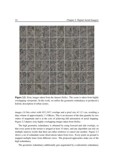
- Page 27 and 28: Chapter 2 Digital Aerial Imagery Th
- Page 29: 2.2. Redundancy 13 Figure 2.1: Geom
- Page 33 and 34: 2.3. Digital Surface Model 17 Since
- Page 35 and 36: 2.3. Digital Surface Model 19 Figur
- Page 37 and 38: 2.5. Orthographic Image Representat
- Page 39 and 40: 2.7. Summary 23 Dataset Nb of Image
- Page 41 and 42: Chapter 3 From Appearance and 3D to
- Page 43 and 44: 3.2. Overview 27 Figure 3.2: Corres
- Page 45 and 46: 3.3. Related Work 29 tation workflo
- Page 47 and 48: 3.4. Feature Representation 31 a co
- Page 49 and 50: 3.4. Feature Representation 33 cons
- Page 51 and 52: 3.4. Feature Representation 35 d LE
- Page 53 and 54: 3.4. Feature Representation 37 wher
- Page 55 and 56: 3.4. Feature Representation 39 Figu
- Page 57 and 58: 3.4. Feature Representation 41 Figu
- Page 59 and 60: 3.4. Feature Representation 43 for
- Page 61 and 62: 3.5. Randomized Forest Classifier 4
- Page 63 and 64: 3.6. Introducing Segmentation for O
- Page 65 and 66: 3.7. Refined Labeling 49 high compu
- Page 67 and 68: 3.8. Experiments on Benchmark Datas
- Page 69 and 70: 3.8. Experiments on Benchmark Datas
- Page 71 and 72: 3.8. Experiments on Benchmark Datas
- Page 73 and 74: 3.8. Experiments on Benchmark Datas
- Page 75 and 76: 3.8. Experiments on Benchmark Datas
- Page 77 and 78: 3.8. Experiments on Benchmark Datas
- Page 79 and 80: 3.9. Experiments on Aerial Images 6
- Page 81 and 82:
3.9. Experiments on Aerial Images 6
- Page 83 and 84:
3.9. Experiments on Aerial Images 6
- Page 85 and 86:
3.9. Experiments on Aerial Images 6
- Page 87 and 88:
3.9. Experiments on Aerial Images 7
- Page 89 and 90:
3.10. Discussion and Summary 73 Fig
- Page 91 and 92:
3.10. Discussion and Summary 75 Fig
- Page 93 and 94:
3.10. Discussion and Summary 77 Fig
- Page 95 and 96:
Chapter 4 From 3D to the Fusion of
- Page 97 and 98:
4.1. Introduction 81 Figure 4.1: Th
- Page 99 and 100:
4.2. Introducing a Common View 83 i
- Page 101 and 102:
4.3. Fusion of Redundant Intensity
- Page 103 and 104:
4.3. Fusion of Redundant Intensity
- Page 105 and 106:
4.3. Fusion of Redundant Intensity
- Page 107 and 108:
4.4. Fusion of Redundant Classifica
- Page 109 and 110:
4.4. Fusion of Redundant Classifica
- Page 111 and 112:
4.5. Experiments 95 Figure 4.6: A c
- Page 113 and 114:
4.5. Experiments 97 Figure 4.7: A s
- Page 115 and 116:
4.5. Experiments 99 Experiments on
- Page 117 and 118:
4.5. Experiments 101 Figure 4.10: A
- Page 119 and 120:
4.5. Experiments 103 Figure 4.12: I
- Page 121 and 122:
4.5. Experiments 105 As shown in Fi
- Page 123 and 124:
4.5. Experiments 107 Figure 4.16: A
- Page 125 and 126:
4.5. Experiments 109 Figure 4.18: S
- Page 127 and 128:
4.5. Experiments 111 Figure 4.20: C
- Page 129 and 130:
4.5. Experiments 113 Figure 4.22: O
- Page 131 and 132:
4.5. Experiments 115 the CRFs with
- Page 133 and 134:
4.5. Experiments 117 Figure 4.25: S
- Page 135 and 136:
4.5. Experiments 119 Dallas buildin
- Page 137 and 138:
4.6. Discussion and Summary 121 Fig
- Page 139 and 140:
4.6. Discussion and Summary 123 Fig
- Page 141 and 142:
4.6. Discussion and Summary 125 Fig
- Page 143 and 144:
Chapter 5 From Interpreted Regions
- Page 145 and 146:
5.1. Introduction 129 Figure 5.1: T
- Page 147 and 148:
5.3. Overview 131 cation techniques
- Page 149 and 150:
5.4. Building Modeling based on Sup
- Page 151 and 152:
5.4. Building Modeling based on Sup
- Page 153 and 154:
5.4. Building Modeling based on Sup
- Page 155 and 156:
5.4. Building Modeling based on Sup
- Page 157 and 158:
5.5. Experiments 141 Dataset Image
- Page 159 and 160:
5.5. Experiments 143 Figure 5.9: 3D
- Page 161 and 162:
5.6. Discussion and Summary 145 Fig
- Page 163 and 164:
5.6. Discussion and Summary 147 Fig
- Page 165 and 166:
Chapter 6 Conclusion This thesis ha
- Page 167 and 168:
6.2. Outlook 151 can be successfull
- Page 169 and 170:
Appendix A Publications My work at
- Page 171 and 172:
155 (17) Leberl, F., Kluckner, S.,
- Page 173 and 174:
Appendix B Acronyms CRF Conditional
- Page 175 and 176:
List of Figures 1.1 A illustration
- Page 177 and 178:
LIST OF FIGURES 161 4.15 Obtained f
- Page 179 and 180:
List of Tables 2.1 The basic inform
- Page 181 and 182:
Bibliography [Agarwal et al., 2009]
- Page 183 and 184:
BIBLIOGRAPHY 167 [Champion and Bold
- Page 185 and 186:
BIBLIOGRAPHY 169 [Forsyth et al., 1
- Page 187 and 188:
BIBLIOGRAPHY 171 [Hoiem et al., 200
- Page 189 and 190:
BIBLIOGRAPHY 173 [Leibe et al., 200
- Page 191 and 192:
BIBLIOGRAPHY 175 [Ojala et al., 200
- Page 193 and 194:
BIBLIOGRAPHY 177 [Santner et al., 2
- Page 195 and 196:
BIBLIOGRAPHY 179 [Unnikrishnan et a