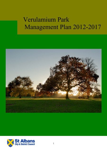
Verulamium Park Management Plan 2012-2017 v2.1
Verulamium Park Management Plan 2012-2017 v2.1
Verulamium Park Management Plan 2012-2017 v2.1

Create successful ePaper yourself
Turn your PDF publications into a flip-book with our unique Google optimized e-Paper software.
<strong>Verulamium</strong> <strong>Park</strong><br />
<strong>Management</strong> <strong>Plan</strong> <strong>2012</strong>-<strong>2017</strong><br />
1
Further copies of this management plan are available from:<br />
Green Spaces Manager<br />
Commnity Services<br />
District Council Offices<br />
St Peter's Street<br />
St Albans<br />
AL1 3JE<br />
Tel: 01727 819366<br />
E-Mail: greenspaces@stalbans.gov.uk<br />
Web: www.stalbans.gov.uk<br />
Created: November 2011<br />
Version: 2.1 - Updated March13th 2013<br />
2
CONTENTS<br />
Vision Statement ...............................................................................................5<br />
Introduction .......................................................................................................6<br />
Chapter 1 Historical and Geographical Context of <strong>Verulamium</strong> <strong>Park</strong> ..........7<br />
1.1 The Historical Context .........................................................................7<br />
1.1.1 The Excavations of Wheeler................................................................7<br />
1.1.2 The Acquisition of the <strong>Park</strong> by the Council .......................................8<br />
1.2 The Geographical Context...................................................................9<br />
1.2.1 The Location .........................................................................................9<br />
1.2.2 The Local Neighbourhood .................................................................11<br />
1.2.3 Key Features.......................................................................................12<br />
1.2.4 Access and Circulation......................................................................16<br />
1.2.5 Car <strong>Park</strong>s.............................................................................................16<br />
1.2.6 Ecology ...............................................................................................17<br />
1.2.7 Landscape Description ......................................................................21<br />
1.2.8 Conservation Designations ...............................................................22<br />
1.2.9 Buildings and Structures...................................................................23<br />
1.2.10 Leases and Agreements ....................................................................25<br />
Chapter 2 The Strategic Context....................................................................28<br />
2.1 St Albans City and District Council’s Vision and Priorities............28<br />
2.2.1 The Corporate <strong>Plan</strong>, the Local Development Framework and the<br />
Community Strategy .......................................................................................29<br />
2.3 St Albans City and District Council's Green Spaces Strategy .......29<br />
2.4 St Albans City and District Council's Tree Strategy........................30<br />
2.5 St Albans City and District Council's Health and Safety Policy .....30<br />
2.6 St Albans City and District Council's Graffiti Policy .......................31<br />
2.7 Hertfordshire Biodiversity Action <strong>Plan</strong> (HBAP) ...............................31<br />
2.8 Local Bylaws.......................................................................................32<br />
Chapter 3 The Organisational Context..........................................................33<br />
3.1 <strong>Management</strong> Structure.......................................................................33<br />
3.2 <strong>Park</strong> Grounds Maintenance ...............................................................33<br />
3.3 St Albans City and District Council's Pesticides Policy .................35<br />
3.4 Budgets ...............................................................................................36<br />
Chapter 4 The Community Context ...............................................................36<br />
4.1 The Value of Public Spaces for our Community..............................36<br />
4.2 <strong>Verulamium</strong> <strong>Park</strong> Consultative Forum..............................................37<br />
4.3 Friends of <strong>Verulamium</strong> <strong>Park</strong> and Community Involvement ............38<br />
4.4 <strong>Verulamium</strong> <strong>Park</strong> Leaflet....................................................................38<br />
4.5 Council Web Site ................................................................................39<br />
4.6 <strong>Park</strong> Notice Boards ............................................................................40<br />
4.7 St Albans City and District Community Safety Strategy.................40<br />
4.8 <strong>Verulamium</strong> <strong>Park</strong> Facebook Page.....................................................41<br />
Chapter 5 Analysis and Evaluation ...............................................................41<br />
5.1 Site Risk Assessment ........................................................................41<br />
5.2 Potential Areas for Improvement ......................................................41<br />
5.2.1 Paths, Road and Cycle Paths ............................................................41<br />
5.2.2 Car <strong>Park</strong>s.............................................................................................41<br />
3
5.2.3 Skate <strong>Park</strong> ...........................................................................................42<br />
5.2.4 Entrances, Gates and Fencing ..........................................................42<br />
5.2.5 Woodland Walk...................................................................................42<br />
5.2.6 Cycle Paths .........................................................................................43<br />
5.2.7 CCTV....................................................................................................43<br />
5.2.8 <strong>Park</strong> Furniture.....................................................................................43<br />
5.2.9 Signage and Interpretation ................................................................43<br />
5.2.10 Lakes ...................................................................................................44<br />
5.2.11 River Ver..............................................................................................44<br />
5.2.12 Grassland............................................................................................45<br />
5.2.13 Woodland ............................................................................................45<br />
5.2.14 Hedgerows ..........................................................................................46<br />
5.2.15 Trees....................................................................................................46<br />
5.2.16 Bird Wildlife Area................................................................................46<br />
5.2.17 Children’s Play Area...........................................................................47<br />
5.2.18 Activities for Young People...............................................................47<br />
5.2.19 Public Toilets ......................................................................................48<br />
5.2.20 Interpretation of Buried Roman Walls and Buildings......................48<br />
5.2.21 Cricket Squares and Pavilion ............................................................49<br />
5.2.22 Orienteering Course...........................................................................49<br />
5.2.23 BBQ Areas ..........................................................................................49<br />
5.2.24 Picnic Benches...................................................................................49<br />
5.2.25 <strong>Park</strong>’s Buildings – Maintenance and Repairs ..................................49<br />
Chapter 6 Action <strong>Plan</strong>s and their Implementation .......................................50<br />
6.1 Aims and Objectives of the Action <strong>Plan</strong>s.........................................50<br />
6.2 Monitoring the Action <strong>Plan</strong>s..............................................................52<br />
6.3 Measures of Success .........................................................................52<br />
6.4 Action <strong>Plan</strong> Review ............................................................................53<br />
APPENDIX 1 Location of Car <strong>Park</strong>s...............................................................54<br />
APPENDIX 2 <strong>Park</strong> Risk Assessment .............................................................55<br />
APPENDIX 3 - Grounds Maintenance <strong>Plan</strong>....................................................56<br />
APPENDIX 4 Grounds Maintenance Standards and Specification .............57<br />
APPENDIX 5 <strong>Park</strong> Facilities Maintenance Program .....................................58<br />
APPENDIX 6 Signage and Interpretation Design Brief ................................59<br />
APPENDIX 7 – Action <strong>Plan</strong>s <strong>2012</strong> – <strong>2017</strong> ......................................................60<br />
4
Vision Statement<br />
VERULAMIUM PARK MANAGEMENT PLAN <strong>2012</strong>-<strong>2017</strong><br />
<strong>Verulamium</strong> <strong>Park</strong> is an irreplaceable resource of beauty and opportunity. The <strong>Park</strong>’s<br />
many thousands of visitors, from near and far, come to experience the fascinating<br />
history, rich wildlife, stunning views, and recreational facilities. The site is perfectly<br />
placed to offer visitors both tranquillity and relaxation, while also enabling discovery<br />
and adventure.<br />
The vision for management of the park will be for all parties linked to the park to work<br />
together, to ensure the successful integration of measures to protect and conserve<br />
the nationally significant historic assets with the enhancement of a well-loved local<br />
landscape and a rich and dynamic visitor experience.<br />
Our vision for <strong>Verulamium</strong> <strong>Park</strong> in <strong>2017</strong> is for:<br />
• a centre for the history and discovery of St Albans: We will aim to make<br />
the most of this opportunity through the continued investigation and<br />
interpretation of the archaeological remains, coupled with improved<br />
educational resources.<br />
• a beautiful and varied landscape: we will continue to manage and conserve<br />
the landscape character of the <strong>Park</strong>, while looking to develop its relationship to<br />
the wider landscape through activities such as opening up view points.<br />
• a welcoming and accessible <strong>Park</strong>: we hope to make <strong>Verulamium</strong> <strong>Park</strong> a site<br />
that all people are able to access and WANT to access.<br />
• a site rich in biodiversity: we aim to increase the biodiversity through<br />
improvement of existing habitats and creation of new.<br />
• a site offering a diversity of recreational opportunity: recreation does not<br />
always sit comfortably with other uses and sensitivities of a site; however, we<br />
will continue to maintain and improve existing recreational facilities and look to<br />
offer new opportunities where need has been identified.<br />
• a strong identity: we want to establish a ‘brand’ for the <strong>Park</strong> that will be<br />
instantly recognisable to site visitors, and will guide partners towards a<br />
coordinated approach to publicity and promotion.<br />
• bursting with communication: in addition to all our many local site users,<br />
there are a large number of groups and organisations that have direct or<br />
indirect interest in the <strong>Park</strong>. We will strive to ensure effective dissemination of<br />
information and lines of communication through website updates, newsletters,<br />
regular meetings and consultation events.<br />
5
Introduction<br />
A clear management framework is required to guide the maintenance and<br />
development and so realise the <strong>Park</strong>s assets. The <strong>Verulamium</strong> <strong>Park</strong><br />
<strong>Management</strong> <strong>Plan</strong> has been written for this purpose and we engaged with the<br />
general public via a public consultation.<br />
What is the <strong>Verulamium</strong> <strong>Park</strong> <strong>Management</strong> <strong>Plan</strong>?<br />
The <strong>Verulamium</strong> <strong>Park</strong> <strong>Management</strong> <strong>Plan</strong> sets out the principles of<br />
management and improvements of infrastructure that <strong>Verulamium</strong> <strong>Park</strong><br />
requires. St Albans City and District Council acknowledges that the successful<br />
implementation of a management plan requires close collaboration between<br />
the public, private and voluntary sectors. Many different organisations and<br />
individuals are involved directly and indirectly in the management and use of<br />
the <strong>Park</strong>, and the Council recognises its increasingly important role as an<br />
enabler to encourage and support these wider interests.<br />
The <strong>Verulamium</strong> <strong>Park</strong> <strong>Management</strong> <strong>Plan</strong> is a published document that has<br />
been produced to guide the management and development of the park. The<br />
plan outlines the vision, aims and objectives for the park for the next five years<br />
until <strong>2017</strong>. It makes an assessment of the <strong>Park</strong>'s strengths and weaknesses,<br />
and identifies the actions that need to be implemented.<br />
Development of the <strong>Verulamium</strong> <strong>Park</strong> <strong>Management</strong> <strong>Plan</strong><br />
This is the first formal document produced to guide the management of the<br />
park. It builds on the work of the <strong>Park</strong>'s Consultative Forum, and pulls together<br />
the existing works, contracts and procedures. In its development, the plan has<br />
considered the following key areas:<br />
• HISTORIC LANDSCAPE, ARCHAEOLOGY AND EDUCATION:<br />
Protection of the nationally significant archaeological features and<br />
historic landscape, and to develop and promote educational<br />
opportunities<br />
• WELCOMING AND ACCESSIBLE: Providing clear, safe and<br />
welcoming access into and throughout the <strong>Park</strong><br />
• NATURE CONSERVATION AND BIODIVERSITY: Maintaining and<br />
enhancing the quality and value of the <strong>Park</strong>’s habitats<br />
• BUILDINGS AND FURNITURE: Ensuring all fixtures, fittings and<br />
buildings in the <strong>Park</strong> are in safe and serviceable condition and, where<br />
appropriate, of uniform design<br />
• RECREATION AND EVENTS: Developing new and innovative ways to<br />
attract a wider variety of visitors to the <strong>Park</strong>, and to fully realise its value<br />
as a site of open space<br />
• MONITORING AND REVIEW: Learning from experience and judging<br />
effectiveness of management in order to refine work programmes and<br />
make best use of scarce resources<br />
6
Chapter 1 Historical and Geographical Context of <strong>Verulamium</strong> <strong>Park</strong><br />
1.1 The Historical Context<br />
The area covered by park comprises some 50% of the Roman town of<br />
<strong>Verulamium</strong>, which extended to some 80ha by the late third century AD: the<br />
third largest in Roman Britain. After its decline and desertion, the chapels of<br />
SS Mary Magdalene and Germanus were established in medieval times. In the<br />
post-medieval period, most of the area was farmed from St Germain’s farm<br />
(now the site of <strong>Verulamium</strong> Museum), and remained in agricultural use until<br />
1929 when St Albans City and District Council acquired that part of the<br />
Roman town site to the east of Bluehouse Hill from the Earl of Verulam. The<br />
newly acquired land was to be used for a municipal park, and there seems to<br />
have been some idea of laying out some Roman buildings as part of the<br />
<strong>Park</strong>'s attractions.<br />
In the Roman period, after 43 AD, <strong>Verulamium</strong> developed into a major<br />
provincial town, and when the town walls were built in the third century, they<br />
enclosed a greater area than that of any other town walls in Britain with the<br />
exception of London and Cirencester. The precise status of Roman<br />
<strong>Verulamium</strong> has been the subject of much debate. Tacitus, writing at the end<br />
of the first century, describes the town as a municipium. Roman <strong>Verulamium</strong><br />
was also the civitas, or tribal, capital of the Catuvellauni. Under the Roman<br />
Empire the Catuvellauni controlled one of the most extensive and richest tribal<br />
territories in the province. <strong>Verulamium</strong> would therefore have been the centre<br />
of one of the richest areas in the province.<br />
1.1.1 The Excavations of Wheeler<br />
On the 2 nd August 1930, Sir Mortimer Wheeler and his first wife, Tessa,<br />
commenced a series of excavations in the <strong>Park</strong>. The Wheeler excavations<br />
mark a highly significant<br />
development, both in the<br />
understanding of <strong>Verulamium</strong><br />
and in the evolution of<br />
Romano-British studies in the<br />
country generally. For the<br />
first time a programme of<br />
excavations was undertaken<br />
with the express aim, not<br />
simply of revealing buried<br />
structures, but in order to<br />
write the history of the<br />
Roman town.<br />
The advances made by Wheeler's work in understanding Roman <strong>Verulamium</strong><br />
cannot be over-emphasized. Prior to his arrival, the account of the Roman<br />
town had hardly changed since the eighteenth century, yet seven years after<br />
the start of excavations in 1930, a detailed account of its history was<br />
published. Not surprisingly Wheeler's account of the history of <strong>Verulamium</strong> is a<br />
tremendous influence on Romano-British archaeology in the country as a<br />
7
whole. For at least 30 years after the close of the Wheeler campaign in 1934,<br />
the `Wheeler model' coloured all interpretations of the town’s past, and<br />
influenced a generation of British archaeologists.<br />
1.1.2 The Acquisition of the <strong>Park</strong> by the Council<br />
Much of land that is now <strong>Verulamium</strong> <strong>Park</strong> was divided in two and was<br />
occupied by two farms, St<br />
Germains Farm and<br />
Verulum Farm<br />
On the 18 th January 1928<br />
the strip of land adjacent<br />
to River Ver was<br />
conveyed to the Council<br />
by WNW Gape and<br />
others.<br />
On the 2 nd August 1929<br />
St Germains Farm &<br />
Verulam Woods was conveyed to the Council by The Right Honourable James<br />
Walter 4th Earl of Verulam and others.<br />
The large lake under construction in the late 20s<br />
The now Bell Meadow was conveyed to the Council by WNW Gape and others<br />
on the 29 th January 1934.<br />
On the 17 th December 1956 the former Abbey Mill Cottage was conveyed to<br />
the Council by The Society of the Faith.<br />
What is now known as Seabrook Meadow along Bluehouse Hill was conveyed<br />
to the Council by The Earl of Verulam and Gorhambury Estates Company on<br />
the 25 th March 1958.<br />
8
1.2 The Geographical Context<br />
1.2.1 The Location<br />
<strong>Verulamium</strong> <strong>Park</strong> is located close to St Albans City Centre, in the middle of the<br />
District, and lies within the ward of Verulam. It covers an area of 66.9<br />
hectares (165 acres), with many footpath links into the adjoining countryside.<br />
Two of its boundaries are major routes into the City i.e. Bluehouse Hill and<br />
King Harry Lane.<br />
Location map of park<br />
The map above shows the key facilities and features contained within the <strong>Park</strong>:<br />
• The Lakes including Heron Island<br />
• The Roman sites including the mosaic, London Gate and the lines of the<br />
Roman Wall<br />
• Westminster Lodge, the athletics track and the sports courts<br />
• Children’s areas including the splash park and the play area<br />
• The café (Inn on the <strong>Park</strong>)<br />
• <strong>Park</strong>ing and toilet facilities<br />
Appendix 3 – Detailed plan of <strong>Verulamium</strong> <strong>Park</strong><br />
More detailed information regarding the key features can be found in Section 1.2.3.<br />
The park is divided into 6 district areas or zones as detailed below<br />
9
The aerial photograph below shows the boundary of the <strong>Park</strong> and the features listed<br />
above.<br />
10
1.2.2 The Local Neighbourhood<br />
The local area demographics are illustrated in the below tables<br />
Population, Male / Female split<br />
St Albans<br />
Verulum<br />
All People 129,005 All People 6,186<br />
Male 49.1% Male 49.2%<br />
Female 50.9% Female 50.7%<br />
Source: Office for National Statistics 2001 Census<br />
Age Structure<br />
Age Groups St Albans Verulam Ward<br />
Age 0 to 15 26,514 1,001<br />
Age 16 to 24 11,505 498<br />
Age 25 to 49 49,167 2,142<br />
Age 50 to 64 22,588 1,422<br />
Aged 65 Plus 19,231 1,123<br />
Source: Office for National Statistics 2001 Census<br />
Ethnic Groups<br />
St Albans<br />
Verulam Ward<br />
All People 129,005 6,182<br />
White 120,105 5,913<br />
White: British 112,047 5,528<br />
White: Irish 2,546 128<br />
White: Other White 5,512 257<br />
Mixed 2,038 83<br />
Mixed: White and Black Caribbean 582 10<br />
Mixed: White and Black African 196 9<br />
Mixed: White and Asian 679 35<br />
Mixed: Other Mixed 581 29<br />
Asian or Asian British 4,269 87<br />
Asian or Asian British: Indian 1,146 68<br />
Asian or Asian British: Pakistani 720 0<br />
Asian or Asian British: Bangladeshi 1,628 0<br />
Asian or Asian British: Other Asian 775 19<br />
Black or Black British 1,299 34<br />
Black or Black British: Caribbean 805 25<br />
Black or Black British: African 365 9<br />
Black or Black British: Other Black 129 0<br />
Chinese or Other Ethnic Group 1,294 65<br />
Chinese or Other Ethnic Group: Chinese 659 36<br />
Chinese or Other Ethnic Group: Other Ethnic<br />
Group 635 29<br />
Source: Office for National Statistics 2001 Census<br />
11
1.2.3 Key Features<br />
The park benefits from a wide range of features comprising ecological<br />
interests, archaeological remains and sporting facilities. The key features are<br />
highlighted below:<br />
Ornamental Lakes: The ornamental lakes provide a habitat for a variety of<br />
birds, waterfowl and bats. They are also a key visitor attraction and have<br />
educational value.<br />
Heronry: The Heronry is located on the larger of the two islands on the main<br />
lake. In 2011 there were 14 nests and 38 chicks on the island. Each spring<br />
the RSPB use the <strong>Park</strong> as one of its locations in a national event called “A<br />
Date with Nature”. The event offers members of the public free access to long<br />
range telescopes with a rare opportunity to view the nesting herons and other<br />
waterfowl at the lake edge. In <strong>2012</strong> a remote camera was installed on the<br />
Island that will allow visitors to view the nesting birds.<br />
Web link to the RSPB “A date with nature” in <strong>Verulamium</strong> <strong>Park</strong> website<br />
River Ver: The River Ver is a chalk stream and is one of the shortest rivers in<br />
England. The river passes through the <strong>Park</strong> from the west to the east and<br />
feeds water in to lake on its way.<br />
Woodland: The main area of woodland is in the areas of the Roman Wall<br />
along the Causeway and along King Harry Lane.<br />
Spring and Summer Wild Flower Meadows: There are various areas of<br />
grass meadow left to flower in the spring / summer to encourage wildlife and to<br />
add to the biodiversity of the <strong>Park</strong>.<br />
Grebe House: Grebe House is the home of the Herts and Middlesex Wildlife<br />
Trust. The charity manages an area spanning 1,900 acres, from wetlands and<br />
woodlands to rare patches of heath and orchard. They take practical action<br />
every day to help wildlife flourish, through the management of their 43 nature<br />
reserves and the protection of the species that live there.<br />
Cycle Routes: In <strong>2012</strong> the Council formally opened the long awaited cycle<br />
route. The first phase of the route crosses the <strong>Park</strong> North to South linking key<br />
green transport links within the City.<br />
Development of phase two East to West runs between Westminster Lodge<br />
and St Michaels began in December <strong>2012</strong> and will be completed by the<br />
summer of 2013.<br />
12
Roman Walls and the London Gate. Across the <strong>Park</strong> there are some 300<br />
linear meters of the <strong>Verulamium</strong><br />
City walls exposed, some 15 feet<br />
high. These walls and the two<br />
forts are an important historical<br />
feature and attraction to the<br />
<strong>Park</strong>.<br />
Roman Mosaic / Hypocaust: The Hypocaust is housed within a purpose<br />
built viewing building and is an “in situ” section of a Roman under-floor heating<br />
system. There is an outstanding “Roman Mosaic” housed within a purpose<br />
built viewing building. A Hypocaust beneath the Mosaic is also to be seen.<br />
<strong>Verulamium</strong> Museum: This Museum depicts everyday life in Roman Britain<br />
and inside visitors will find:<br />
• Recreated Roman rooms<br />
• Hands-on Discovery Areas<br />
• Video presentations<br />
• Touch screen databases<br />
• Some of the finest Roman mosaics and wall plasters outside the<br />
Mediterranean<br />
Toddlers Splash <strong>Park</strong>: The former Paddling Pool was re-developed into the<br />
new Toddlers Splash <strong>Park</strong> and<br />
installed over the original pool to<br />
protect the buried archaeological<br />
remains. It opened to the public on<br />
Friday 26 th August 2005. It is made<br />
up of approximately 12 high and low<br />
water features inserted into the<br />
surface and is open from the 1 st<br />
bank holiday in May through to the<br />
2 nd Sunday in September each year.<br />
Play Area: This is located at the<br />
centre of the <strong>Park</strong> and is one of the<br />
District’s largest play area, it includes swings, slides rocking play items and<br />
climbing frames.<br />
Inn on the <strong>Park</strong>: The Inn on the <strong>Park</strong> Café is open year round, seven days a<br />
week serving freshly made food to eat in or take away. The Inn on the <strong>Park</strong><br />
was voted for by the residents of the District as “The Family Friendly<br />
Restaurant of the year 2011”.<br />
13
London <strong>2012</strong> Olympic Legacy Facilities<br />
• adiZone: The adiZone is a giant outdoor gym located within the <strong>Park</strong><br />
and was officially opened by Team GB Gymnast Daniel Keatings in<br />
2010. It was co-funded by St Albans City and District Council along with<br />
adidas and The Great Outdoor Gym Company. It brings a little piece<br />
of the London <strong>2012</strong> Games to St Albans. The adiZone is designed to<br />
enable and inspire local people to take part in more physical activities<br />
encouraging them to play a variety of sports. There is a wide range of<br />
equipment which includes football and basketball on the multi-games<br />
area and easy-to-use resistance gym equipment as well as a climbing<br />
wall.<br />
• Beach Volleyball Court: <strong>Verulamium</strong> <strong>Park</strong> is one of six venues to gain<br />
a new beach volleyball court after the London <strong>2012</strong> Olympic Games.<br />
The sand was taken directly from Horse Guards Parade and the<br />
training courts in St James’ <strong>Park</strong>.<br />
Over 700 tonnes of sand was donated by The London <strong>2012</strong> Organising<br />
Committee and the project was funded by Sport England. The<br />
investment forms part of Volleyball England’s grassroots Go Spike<br />
campaign which is aimed at increasing participation in volleyball by<br />
creating more volleyball and beach volleyball facilities and running free<br />
‘come and try’ taster sessions across the country.<br />
Westminster Lodge Leisure Centre: The new £24m Westminster Lodge<br />
Leisure Centre opened to the Public on the 10 th November <strong>2012</strong>. This state of<br />
the art facility offers a wide range of<br />
activities including: Swimming, Gym,<br />
Fitness Classes, <strong>Verulamium</strong> Spa,<br />
Sports Hall, Climbing Wall and much<br />
more. Now that the new facility is<br />
open the old one has been<br />
demolished and new car parks put in<br />
its place.<br />
Sports Courts: The hard surface sports courts are located adjacent to the<br />
play area and they include Tennis Courts / Netball Courts and 1 Basket Ball /<br />
Netball Court.<br />
14
Athletics Track and Abbey View 9 Hole Golf Course: The golf course is<br />
open to all on a pay and play basis all year round. The facility was<br />
established in 1990 and has been growing ever since. The centre also<br />
includes a 400m running tack and associated athletics facilities, changing<br />
rooms, pro shop, club room, football pitch, putting green and a golf practice<br />
net.<br />
Football Pitches: There are 12 senior and 3 junior football pitches in the<br />
<strong>Park</strong>, all of which are available for hire during the football season. Bookings<br />
can be made via the Council’s Grounds Maintenance Contractor John<br />
O’Conner Ltd on their website www.johnoconner.co.uk or by calling them on<br />
0800 3457405.<br />
Cricket Pitches: There are 2 Cricket Pitches and a Cricket Pavilion in the<br />
<strong>Park</strong>, both of which are available, for hire during the Cricket season. Bookings<br />
can be made via the Council’s Grounds Maintenance Contractor John O’<br />
Conner Ltd on their website www.johnoconner.co.uk or by calling free on 0800<br />
3457405.<br />
Sports Pavilions: The <strong>Park</strong> benefits from 2 sports pavilions. St Michael’s<br />
Changing Room, located in the car park next to the Museum offers a number<br />
of rooms for teams to change in as well as, showering facilities. This is also<br />
the location of one of the <strong>Park</strong>s three public toilet facilities. The Cricket<br />
Pavilion is located adjacent to the children’s play area and offers a small<br />
kitchen, toilet and changing rooms as well as a main hall. The hall is used<br />
week days during school term times by school groups to have their lunch<br />
during visits the Museum, <strong>Park</strong> and Abbey.<br />
Crazy Golf: The 12 hole crazy golf course is located adjacent to the tennis<br />
and netball courts and is open all year round. Balls and clubs can be hired<br />
from Abbey View Golf and Track.<br />
Abbey Theatre: The Company of Ten was formed in 1934 by 10 young<br />
people who had the enthusiasm to set up a drama group, and the<br />
determination to stage performances of a professional standard. The number<br />
of people involved grew quickly after that. The current theatre is located within<br />
the park.<br />
Special Events: Special Events are one-off events. Special events can be<br />
organised by the Council and other individuals, groups and private<br />
organisations. Example of special events include:<br />
• The Annual Fireworks Display<br />
• St Albans Half Marathon<br />
• St Albans Festival for All<br />
• The RSPB’s “A date with nature”<br />
• The Alban Pilgrimage<br />
• Music in the <strong>Park</strong><br />
• Midnight Walk<br />
The largest of the events is the well renowned Fireworks Display in November<br />
which attracted in excess of 20,000 spectators.<br />
15
Orienteering Course: Working in conjunction with the Hertfordshire<br />
Orienteering Club, an orienteering course has been laid out across the <strong>Park</strong>,<br />
and a leaflet produced to assist users of the course. The leaflet can be<br />
downloaded from the Council's web site, or purchased for a small fee from<br />
Westminster Lodge Leisure Centre.<br />
<strong>Park</strong> Furniture: The <strong>Park</strong> has a good supply and wide range of litter bins, dog<br />
waste bins and benches. The features are generally located at key circulation<br />
areas and comprise of one type of dog bin and various styles of both litter bins<br />
and benches.<br />
Signage and Interpretation: Currently there are welcome notice boards<br />
located at the 5 main entrances, with various different types and standard of<br />
signage located within the <strong>Park</strong>. Interpretation of the important features is<br />
currently very limited and under development. A design brief has been<br />
produced and new signage will be procured and installed during 2013.<br />
Public toilets: There are three public toilets at:<br />
• St Michael’s at the museum entrance<br />
• The Causeway<br />
• Running Track<br />
These toilets are open daily from dawn to dusk throughout the year and are<br />
cleaned by the grounds maintenance contractor.<br />
1.2.4 Access and Circulation<br />
The <strong>Park</strong> can be accessed by road, foot and by public transport. It is well<br />
connected to a network of roads and footpaths that pass around the <strong>Park</strong>, they<br />
include Bluehouse Hill, Fishpool Street, King Harry Lane, Holywell Hill, St<br />
Michael’s Street. In addition it has good links to both the M1 and M25.<br />
There are two railway stations in St Albans, St Albans City Station in the City<br />
Centre is on the mainline in to London St Pancras International, and the Abbey<br />
Station is just outside the <strong>Park</strong> entrance on Hollywell Hill and links to Watfford<br />
Juction Railway Station and then on London Euston<br />
The Alban Way Cycle Path which links St Albans and Hatfield begins not far<br />
from the <strong>Park</strong>, on Cottonmill Lane, and the Ver Valley Walk follows the River<br />
Ver which runs through the <strong>Park</strong>.<br />
1.2.5 Car <strong>Park</strong>s<br />
There are two car parks located within the <strong>Park</strong> boundaries sited next to<br />
Westminster Lodge Leisure Centre at Holywell Hill and at <strong>Verulamium</strong><br />
Museum off St Michael’s Street. In addition, there are also a number of other<br />
car parks located within walking distance in the City Centre.<br />
Car parking facilities around Westminster Lodge have been reduced as a<br />
result of the construction work at the site of the new leisure centre. The new<br />
car park will open in March 2013.<br />
16
www.stalbans.gov.uk/parking<br />
Appendix 5 – Location of Car <strong>Park</strong>s<br />
1.2.6 Ecology<br />
The <strong>Park</strong> has significant ecological value, containing a variety of habitats that<br />
support a wide diversity of species, some protected by legislation. It has value<br />
through being a large green space on the edge of an dense urban area and<br />
adjacent to the wider countryside, with key ecological links such as the River<br />
Ver.<br />
The <strong>Park</strong>’s habitats are described in the following paragraphs<br />
Grassland<br />
A significant proportion of the <strong>Park</strong> is given to amenity grassland, which<br />
developed from former arable land in the latter half of the 20 th century. The<br />
closely-mown sward is generally species poor and of little wildlife value, but<br />
provides a valuable resource for formal and informal recreation.<br />
Some areas, such as the west side of the site along Blue House Hill known as<br />
Seabrook Field are managed specifically as wild flower meadow, and has a<br />
more relaxed mowing regime, resulting in swathes of Lowland Meadow.<br />
These grassland areas are of greater ecological value, with a wider diversity of<br />
plant species, providing suitable habitat for reptiles, invertebrates and foraging<br />
birds.<br />
Trees and Woodland<br />
For such a large site, the <strong>Park</strong> has fairly limited woodland and tree cover,<br />
which makes existing woodland highly important to the park as a whole. The<br />
site does not have an historic legacy of woodland. The existing woodlands and<br />
trees are either remnant field boundary tree lines or areas of the <strong>Park</strong> that<br />
have not been intensively used or managed allowing for succession.<br />
Tree stock across the <strong>Park</strong> comprises hornbeam, oak, lime, horse chestnut,<br />
willow, field maple and sycamore. In the parkland areas of the site, the mature<br />
and semi-mature trees are particularly significant to the character and<br />
appearance of the landscape, while providing suitable bat roosting and bird<br />
nesting habitat.<br />
The main areas of woodland and scrub are located around the Roman Wall<br />
and along the boundary with King Harry Lane, and parts of the River Ver. In<br />
addition to the canopy species, the shrub understory consists predominantly of<br />
hawthorn, elder, and hazel. Ground flora is limited in places, such as the<br />
<strong>Verulamium</strong> Hills area of the site, where the canopy cover is quite dense.<br />
Scrub and Ruderal Vegetation<br />
The <strong>Park</strong> contains some areas of scrub and tall ruderal (i.e. plants growing in<br />
wasteland or disturbed land) vegetation along the River Ver and Seabrook<br />
17
Field. These areas are not subject to intensive management, allowing the<br />
growth of species such as bramble, nettle, and hogweed, with occasional<br />
shrubs. These areas have ecological value for foraging wildlife, and provide<br />
especially good habitat for reptiles such as grass snake and common lizard,<br />
particularly along the River Ver.<br />
Hedgerow<br />
There are a number of managed, predominantly single-species hedgerows<br />
across the <strong>Park</strong>. The largest is the hawthorn hedge that follows a main<br />
footpath diagonally across the centre of the <strong>Park</strong>. These hedgerows are<br />
regularly clipped to maintain a box-like appearance, and are a fairly limited<br />
ecological value.<br />
In comparison, the hedgerows that exist in the <strong>Park</strong> in Seabrook Meadow are<br />
far more ecologically valuable. They offer more foraging opportunities and<br />
provide potential nesting sites for small birds.<br />
Lakes<br />
The lakes comprise two bodies of water, one a great deal larger than the<br />
other. Construction started on both lakes in September 1930 and was<br />
completed in February 1932. The lakes comprise of a concrete edging and<br />
bases, no more than 1m deep. The larger of the lakes contains a two wooded<br />
islands, one of which supports a heronry. The lakes are surrounded by<br />
amenity grass and/or surfaced footpath. The marginal or semi-aquatic<br />
vegetation is limited to northern end of the large lake.<br />
The lakes support a large a population of waterfowl, maintained and increased<br />
through the popularity of feeding by visitors. This has resulted in a great input<br />
of nutrient-rich bird droppings leading to a highly eutrophic, heavily silted water<br />
body. The lakes are fed by the River Ver through a sluice. This sluice has a<br />
restriction plate fitted and does not allow water to pass through during low river<br />
levels. In addition the extraction of water from the River Ver is licensed by the<br />
Environment Agency. The Ver is a chalk stream, sourced from an aquifer<br />
located near Markyate in Hertfordshire. Chalk streams are rare and<br />
ecologically valuable, providing good habitat for fish and invertebrates.<br />
The River was originally canalised by the Romans in the 3 rd Century AD<br />
providing power to the mills right up untie the Victorian period.<br />
The northern and southern sections of the river has in places typical chalk<br />
stream qualities with fairly rapid flow and clear water allowing clarity to a<br />
relatively un-silted river bottom. In contrast, the canalized section alongside<br />
the lakes has very low flow, resulting in deposition of silt and very poor clarity.<br />
This section and others through the course are also affected by dense tree<br />
canopy.<br />
The <strong>Park</strong>’s significant species are described in the following paragraphs.<br />
Waterfowl and Wildfowl<br />
<strong>Verulamium</strong> <strong>Park</strong> is recognised as a valuable site for its bird populations, with<br />
RSPB surveys recording 64 species in 2010. The lakes and the River Ver<br />
18
oth form significant habitats for waterfowl, particularly for waterfowl. There is<br />
also value in the expanse of parkland and more wooded areas around the<br />
Roman Wall.<br />
The Heronry is the most significant bird-related feature sited on the<br />
southernmost islands. This is designated a County Wildlife Site. This<br />
currently supports 6-7 breeding pairs of Grey Heron. Aside from ecological<br />
significance, the heron are an important part of the <strong>Park</strong>’s visitor experience,<br />
with the RSPB operating a viewpoint close to the heronry during the breeding<br />
season. In <strong>2012</strong> a remote camera was installed on the Island to enable<br />
visitors to view the nesting bird a the RSPB visitor station.<br />
The water bodies support a large diversity of waterfowl, including mallard,<br />
tufted duck, shoveler, coot and moorhen. The water bodies are also important<br />
foraging habitat for other species of bird, such as swallow and kingfisher.<br />
The wider <strong>Park</strong> is populated by a variety of typical parkland birds, such as<br />
green woodpecker little owl and mistle thrush. Birds of prey can often be<br />
spotted across the <strong>Park</strong>, including red kite, sparrow hawk, and common<br />
buzzard.<br />
Reptiles and Amphibians<br />
Swathes of scrub and ruderal vegetation along the banks of the River Ver<br />
provide suitable habitats for reptiles and amphibians. In the past, grass snake<br />
has been recorded in the <strong>Park</strong>, and slow worm is known to be present in the<br />
surrounding area. Great crested newts have not been identified on site, but<br />
have been recorded as little as 300m to the south east.<br />
Mammals<br />
The <strong>Park</strong> has some ecological value for supporting a number of rare and<br />
protected bat species. The water bodies, meadows and wooded margins<br />
provide good foraging habitat. The River Ver works as a green corridor for<br />
bats (Noctules, pipistrelles and daubentons). There have also been records of<br />
brown long-eared and whiskered bat. It is not known exactly where the roosts<br />
are, but some are likely to be in trees and buildings within the <strong>Park</strong>.<br />
Daubentons, for example, generally choose roosts close to water bodies.<br />
Water vole is a protected species within the UK, and in the past has been<br />
known to be present along the River Ver. Records exist for the species within<br />
the vicinity of the <strong>Park</strong>, and it may well occur in the more naturalised stretches<br />
of the River, or more likely used as transport between more attractive habitats.<br />
The 2007 ecological survey of the <strong>Park</strong> did not identify the presence of<br />
badger. However it did mention the recorded presence of badger in the area<br />
and the suitability of the <strong>Park</strong> as foraging habitat. The <strong>Verulamium</strong> Hills and<br />
the woodland walk, which could potentially be suitable locations for setts.<br />
Common mammals are also found within the <strong>Park</strong>, such as fox, rat and rabbit.<br />
Insects<br />
19
The <strong>Park</strong> has many habitats suitable for supporting a variety of insect<br />
populations. The most notable species thought to be present, although not<br />
actually recorded on site, is stag beetle. This is a European Protected species.<br />
20
1.2.7 Landscape Description<br />
The <strong>Park</strong> has a country park feel with a number of distinctive areas. The<br />
formal area of the <strong>Park</strong> is<br />
centred on the main lake with its<br />
two islands and the heronry and<br />
the smaller boating lake. Both<br />
lakes are themselves<br />
surrounded by paths allowing<br />
visitors to stroll around the lakes<br />
admiring the wildlife.<br />
Wide open spaces are broken by<br />
mature trees that mark the line<br />
of the original field boundaries.<br />
Today some of the meadows are named after the individual land owners from<br />
the past. There is a large area of woodland located at the southern site of the<br />
<strong>Park</strong> along the Roman ditch and City Walls.<br />
Large areas of grass meadow dominate the <strong>Park</strong>, along its boundary with<br />
Bluehouse Hill and King Harry Lane were spectacular views of the <strong>Park</strong> and<br />
Cathedral can be seen.<br />
Formal use is concentrated along the central path that runs from east to west<br />
linking Holywell Hill and the village of St Michael’s. With good access and<br />
regular supervision from the <strong>Park</strong> Ranger and Leisure <strong>Management</strong> Contract<br />
Staff, the Children’s Play Area, adiZone, Toddlers Splash <strong>Park</strong> provide<br />
endless fun for visitors. The Inn on the <strong>Park</strong>, tennis, netball and basket ball<br />
facilities as well as the football pitches and cricket pitches are also locatd in<br />
this area. Located just off Holywell Hill is the new Westminster Lodge Leisure<br />
Centre and Abbey View Golf Track Facility.<br />
Almost all the <strong>Park</strong> is laid out on gentle sloping land, with gradients in several<br />
directions. This adds to the attractiveness of the landscape and allows for<br />
spectacular view of the Abbey and City.<br />
The <strong>Park</strong> has well used cricket and football pitches and two pavilions; the<br />
Cricket pavilion is in the centre of the <strong>Park</strong> and is also used by school parties<br />
as a rest area during their visits to the <strong>Park</strong>. The second pavilion known as St<br />
Michael’s Changing Rooms is located in car park adjacent to the Museum.<br />
The <strong>Park</strong> hosts a number of events throughout the year including the Annual<br />
Fire Work Display, St Albans Half Marathon, “St Albans Pilgrimage”.<br />
21
Appendix 3 – Detailed <strong>Plan</strong> of the <strong>Park</strong><br />
A <strong>Park</strong> Ranger is on duty every day. Their role is to be a friendly face in the<br />
<strong>Park</strong>, to provide help and information to visitor and to monitor to engage with<br />
the public. They also perform other important tasks such as emptying of litter<br />
bins, picking up of litter and monitoring public safety within the <strong>Park</strong>.<br />
1.2.8 Conservation Designations<br />
The <strong>Park</strong> is a complex site with a number of significant features within its<br />
archaeology, history, and wildlife and landscape character. The intrinsic value<br />
of these features is preserved through legislation, which has a constraining<br />
influence on how the site is managed. Details of the conservation<br />
designations within the <strong>Park</strong> are listed in the table below, and where possible,<br />
annotated on the Constraints <strong>Plan</strong>.<br />
Scale Designation Detail<br />
National<br />
Scheduled Ancient<br />
Monument (SAM)<br />
Listed Buildings<br />
The Roman City of <strong>Verulamium</strong>, which lies<br />
underneath the part of <strong>Park</strong> and countryside<br />
to the west, is a designated Scheduled<br />
Ancient Monument.<br />
There are numerous listed buildings, mostly<br />
around the north western fringes of the site.<br />
The constraints imposed by this designation<br />
also relate to the setting of the building in<br />
addition to preservation of its structure, and<br />
therefore has a bearing on any alterations to<br />
the surrounding landscape.<br />
County Wildlife Site <strong>Verulamium</strong> Lakes and Abbey Mill Lane Area<br />
are both designated as County Wildlife Sites,<br />
areas of at least district importance that are<br />
considered to be of ‘critical natural capital’.<br />
District / Borough<br />
Conservation area<br />
The entire park falls within the conservation<br />
area for St Albans, a designation which seeks<br />
to preserve the character or appearance of a<br />
particularly valuable area. This covers all<br />
aspects of the landscape, including trees.<br />
Therefore, if any tree works are to take place<br />
within the <strong>Park</strong>, a request must be made to<br />
the planning authority, who will decide<br />
whether the works can commence or whether<br />
to issue a tree preservation order.<br />
Metropolitan<br />
Green Belt<br />
Zones of Visibility<br />
The entire <strong>Park</strong> falls within the Metropolitan<br />
Green Belt, designated under PPG2 (Green<br />
Belts), which restricts the growth of<br />
development in strategic rural areas on the<br />
edge of conurbations.<br />
Policy 114 designates the southern end of<br />
22
the <strong>Park</strong> as a key viewpoint location to the<br />
centre of St Albans, and restricts any<br />
development within the town that would<br />
detract from this valuable asset.<br />
1.2.9 Buildings and Structures<br />
There are a number of buildings situated within the <strong>Park</strong>. Some of these<br />
buildings are managed directly by the Council, and others are leased to<br />
individuals or organisations or privately owned. The details are shown in the<br />
following table:<br />
Name Location Occupancy / Use Who Maintains it<br />
Off Mud<br />
Lane, near<br />
Holywell Hill<br />
Westminster<br />
Lodge Leisure<br />
Centre<br />
Abbey View<br />
Golf and Track<br />
Inn on the<br />
<strong>Park</strong><br />
adiZone<br />
Toddlers<br />
Splash <strong>Park</strong><br />
Children’s Play<br />
Area<br />
Beach Volley<br />
Ball courts<br />
Hard Surface<br />
Sports courts<br />
Off Mud<br />
Lane, near<br />
Holywell Hill<br />
Within the<br />
<strong>Park</strong> near<br />
the<br />
Toddler’s<br />
Splash <strong>Park</strong><br />
Centre of<br />
the <strong>Park</strong><br />
near the<br />
Play Area<br />
Centre of<br />
the <strong>Park</strong><br />
near the<br />
Play Area<br />
Centre of<br />
the <strong>Park</strong><br />
near the<br />
adiZone<br />
Centre of<br />
the <strong>Park</strong><br />
near the<br />
Play Area<br />
Centre of<br />
the <strong>Park</strong><br />
near the<br />
Owned by St Albans City<br />
and District Council and<br />
managed through the<br />
Leisure <strong>Management</strong><br />
Contract<br />
Owned by St Albans City<br />
and District Council and<br />
managed through the<br />
Leisure <strong>Management</strong><br />
Contract<br />
Owned by St Albans City<br />
and District Council and<br />
leased to Inn on the <strong>Park</strong><br />
(St Albans) Ltd<br />
Owned by St Albans City<br />
and district Council and<br />
maintained by the<br />
Grounds Maintenance<br />
Contractor<br />
Owned by St Albans City<br />
and District Council and<br />
managed through the<br />
Leisure <strong>Management</strong><br />
Contract<br />
Owned by St Albans City<br />
and district Council and<br />
maintained by the<br />
Grounds Maintenance<br />
Contractor<br />
TBC<br />
Owned by St Albans City<br />
and District Council and<br />
managed through the<br />
23<br />
For the first 12 mouth after<br />
sectional (<strong>2012</strong>) completion<br />
Wilmot Dixon Ltd. After the<br />
first 12 months Sports and<br />
Leisure <strong>Management</strong> Ltd<br />
(SLM) will be responsible<br />
for all maintenance<br />
requirements.<br />
Leisure Connection Ltd<br />
Inn in the <strong>Park</strong> (St Albans<br />
Ltd)<br />
John O’Conner Ltd<br />
Leisure Connection Ltd<br />
John O’Conner Ltd<br />
TBC<br />
Leisure Connection Ltd
Causeway<br />
Toilets Facility<br />
St Michael's<br />
Pavilion and<br />
Toilet Facility<br />
Running Track<br />
Toilet facility<br />
Grebe House<br />
Play Area<br />
At the<br />
southern<br />
end of the<br />
lake<br />
Car <strong>Park</strong> at<br />
St Michael’s<br />
At the Golf<br />
and Track<br />
Facility<br />
Car <strong>Park</strong> at<br />
St Michael’s<br />
Leisure <strong>Management</strong><br />
Contract<br />
Owned by St Albans City<br />
and district Council and<br />
cleaned by the Grounds<br />
Maintenance Contractor<br />
Owned by St Albans City<br />
and district Council and<br />
cleaned by the Grounds<br />
Maintenance Contractor<br />
Owned by St Albans City<br />
and district Council and<br />
cleaned by the Grounds<br />
Maintenance Contractor<br />
The land is owned by the<br />
Council, a lease<br />
arrangement is in place<br />
and the building is owned<br />
by the Herts and<br />
Middlesex Wildlife Trust<br />
St Albans City and District<br />
Council<br />
St Albans City and District<br />
Council<br />
St Albans City and District<br />
Council<br />
Herts and Middelsex<br />
Wildlife Trust<br />
<strong>Verulamium</strong><br />
Museum<br />
Roman Mosaic<br />
/ Hypocaust<br />
Building<br />
English<br />
Heritage<br />
Guardianship<br />
Area<br />
Car <strong>Park</strong> at<br />
St Michael’s<br />
Within the<br />
<strong>Park</strong> near<br />
the<br />
Children’s<br />
Play Area<br />
Within the<br />
<strong>Park</strong> around<br />
the exposed<br />
Roman City<br />
wall and<br />
Ditch<br />
Air Cadet’s Hut Adjacent to<br />
Westminster<br />
Lodge<br />
Sea Cadet’s<br />
Hut<br />
Abbey Theatre<br />
Within the<br />
car park at<br />
Westminster<br />
Lodge<br />
Within the<br />
car park at<br />
Westminster<br />
Lodge<br />
The building is owned<br />
and managed by St<br />
Albans City and District<br />
Council<br />
The building is owned<br />
and managed by St<br />
Albans City and District<br />
Council<br />
The land is owned by the<br />
Council but there is a<br />
guardianship agreement<br />
between the Council and<br />
English Heritage<br />
The land is owned by the<br />
Council and a ground<br />
lease arrangement is in<br />
place. The building is<br />
owned by the Air Cadets<br />
The land is owned by the<br />
Council and a ground<br />
lease arrangement is in<br />
place. The building is<br />
owned by the Sea<br />
Cadets<br />
The land is owned by the<br />
Council and a ground<br />
lease arrangement is in<br />
place. The building is<br />
owned by the Theatre<br />
Trust<br />
24<br />
St Albans City and District<br />
Council – Museum Services<br />
St Albans City and District<br />
Council – Museum Services<br />
Maintenance and<br />
preservation of features and<br />
archaeological remains is<br />
the responsibility of English<br />
Heritage<br />
St Albans Air Cadets<br />
St Albans Sea Cadets<br />
Abbey Theatre Trust
Cricket<br />
Pavilion<br />
Thames Water<br />
Pumping<br />
Station<br />
In the<br />
middle of<br />
the <strong>Park</strong><br />
near the<br />
Play Area<br />
In the<br />
middle of<br />
the meadow<br />
in front of<br />
Westminster<br />
The building is owned<br />
and managed by the<br />
Grounds Maintenance<br />
Contractor.<br />
Thames Water owns the<br />
free hold of the land and<br />
building.<br />
St Albans City and District<br />
Council<br />
Thames Water<br />
Lodge<br />
As part of updating its Asset Register the Council has carried out a condition<br />
survey on all the <strong>Park</strong>s buildings owned and maintained by the Council.<br />
See Appendix 4 - <strong>Park</strong> Facilities Maintenance Program for further information<br />
about facilities that are managed by the Council<br />
1.2.10 Leases and Agreements<br />
The management and development of the <strong>Park</strong> needs to take into account a<br />
number of contract lease agreements between the Council and various<br />
stakeholder groups. These include:<br />
• Leisure <strong>Management</strong> Contracts<br />
The Council's Leisure <strong>Management</strong> Contracts includes the operation and<br />
management of the new Westminster Lodge Leisure Centre and the<br />
Abbey View Golf and Running Track Facility, Toddler’s Splash <strong>Park</strong>, Crazy<br />
Golf Course, Basket Ball Court and the Tennis and Netball courts. This<br />
includes all aspect of grounds maintenance within these facilities.<br />
The new Westminster Lodge Leisure Centre is owned by the Council and<br />
managed in partnership with Sports and Leisure <strong>Management</strong> Ltd (SLM)<br />
they are known locally as Everyone Active at Westminster Lodge Leisure<br />
Centre. Everyone Active is responsible for the day to day operation<br />
management of the facility including all bookings. The performance for this<br />
contract is monitored by the Councils Leisure Services Officer.<br />
Contact Details: 01727 736088<br />
Abbey View Golf and Track is owned by the Council and managed in<br />
partnership with Leisure Connection Ltd. Leisure Connection is<br />
responsible for the day to day operation management of the facility<br />
including all bookings. The performance for this contract is monitored by<br />
the Councils Leisure Services Officer.<br />
• Grounds Maintenance Contract<br />
The Council has a grounds maintenance contract with John O’Conner Ltd<br />
who carries out all aspect of grounds maintenance work within the <strong>Park</strong><br />
and across the District. The contract was re-tendered during 2006, and a<br />
five year contract was awarded to John O'Conner (Grounds Maintenance)<br />
Ltd (JOC), effective from 1 st January 2007. In 2011 the Council approved<br />
the extension of this contract for a further two years. The contractor has<br />
achieved the standard required to be awarded BS EN ISO 9001:2000 for<br />
25
their Quality <strong>Management</strong> System, and BS EN ISO 14001:2004 for their<br />
Environmental <strong>Management</strong> System. During 2013 the Councils Grounds<br />
Maintenance Contract will be re tendered with a new contract starting 1 st<br />
January 2014.<br />
The Council monitors the performance of the contractor and conducts<br />
frequent visits to the park, these are both announced and unannounced to<br />
the contractor. In addition to these, the Council also holds a monthly<br />
contract meeting were issues relating to performance are discussed and<br />
actions are agreed.<br />
See Appendix 4 - Grounds Maintenance Standard and Specification for<br />
further information.<br />
• English Heritage Guardianship Area<br />
Large areas of the <strong>Park</strong> around the exposed Roman Walls and Ditch are<br />
currently managed directly by English Heritage, under a Guardianship Area<br />
agreement. This means that although that land is owned by the Council<br />
English Heritage has full responsibility for the maintenance and<br />
conservation of the Roman Walls, and grounds maintenance. The Council<br />
is planning to take over the grounds maintenance responsibility from<br />
English Heritage and will include these areas within the new Grounds<br />
Maintenance contract starting in 2014.<br />
• Herts and Middlesex Wildlife Trust - Grebe House<br />
To the south west of the <strong>Park</strong> stands Grebe House, a timber framed<br />
building that was salvaged from Watford and relocated to the <strong>Park</strong> in the<br />
late 70s. The land is leased to the Herts and Middlesex Wildlife Trust by<br />
the Council but the building is owned by the trust.<br />
Contact Details: 01727858301<br />
www.hertswildlifetrust.org.uk/<br />
• Inn on the <strong>Park</strong><br />
The Inn on the <strong>Park</strong> is a popularly café located at the northern end of the<br />
park. Though the building is owned by the Council it is operated by the<br />
“Inn on the <strong>Park</strong> St Albans Ltd” via a lease. All maintenance responsibility<br />
sites with the operator and the Council receives considerable income as a<br />
result of this arrangement.<br />
Contact Details: 01727 838246<br />
www.inn-on-the-park.com<br />
• Ice Cream Concession<br />
The Council has an arrangement in place that enables a street trader to<br />
sell ice creams in each on the Council three <strong>Park</strong>s. The contract is<br />
currently awarded to the same company that operates the Inn on the <strong>Park</strong>.<br />
and the Council receives considerable income as a result.<br />
Contact Details: 01727 838246<br />
www.inn-on-the-park.com<br />
26
• Fitness Groups<br />
The Council has a permit scheme in place and a number of organisations<br />
are allowed to conduct formal fitness sessions in the <strong>Park</strong> throughout the<br />
year. They provide an important service to local residents and it is<br />
important that a clear framework is in place to ensure that their activities<br />
do not have a negative impact on the <strong>Park</strong> and the <strong>Park</strong> users.<br />
• Abbey Theatre<br />
The current theatre is located within the <strong>Park</strong>, the land is owned, by the<br />
Council and leased to the Theatre Trust, and the building is owned the<br />
Trust.<br />
Contact Details: 01727 857861<br />
www.abbeytheatre2.org.uk<br />
• Air Cadet’s Hut<br />
The St Albans Air Cadets are based within the <strong>Park</strong> and lease land from<br />
the Council. The building is owned and maintained by the Air Cadets.<br />
• Sea Cadet’s Hut<br />
The St Albans Sea Cadets are based within the <strong>Park</strong> and lease land from<br />
the Council. The building is owned and maintained by the Air Cadets<br />
• Pumping Station<br />
A small area of land was sold to a local water supply company (now<br />
Thames Water) in the middle of the Meadow in front of Westminster Lodge<br />
Leisure Centre. The facility is used to pump water out of the ground and<br />
used to supply drinking water to the area. Thames Water is responsible<br />
for all aspects of this facility.<br />
• Television Broadcasting Antenna<br />
The broadcast antenna is located at the boundary of the <strong>Park</strong> with<br />
Bluehouse Hill and King Harry Lane. The land is leased to the BBC and<br />
they have responsibility for the maintenance of the antenna and all<br />
associated equipment. The site was recently upgraded to support the the<br />
digital switch over in <strong>2012</strong>.<br />
27
Chapter 2 The Strategic Context<br />
There are a number of strategies that the Council and its partners are using to<br />
ensure that services are meeting local needs in the best possible way. These<br />
strategies will therefore influence the development of this <strong>Management</strong> <strong>Plan</strong><br />
and in turn, this plan can help contribute to the success of key parts of those<br />
strategies.<br />
2.1 St Albans City and District Council’s Vision and Priorities<br />
St Albans City and District Council has a clear set of visions, aims and<br />
commitments and these are laid out below:<br />
Vision<br />
Our vision, aims and commitments provide the over-riding direction for our<br />
work and help us to play our part in delivering the District’s Sustainable<br />
Community Strategy, produced by the Local Strategic Partnership.<br />
Vision and aims<br />
• To contribute to a high quality of life for all residents<br />
• To deliver excellent services to residents<br />
• To support a cleaner, greener and safer District<br />
• To represent the entire District and deliver localism by working closely<br />
with residents, community groups and Town and Parish council<br />
Commitments<br />
• Protecting the vulnerable<br />
• <strong>Plan</strong>ning for the future<br />
• Delivering for young people and families<br />
• Attracting more business and tourism<br />
• Delivering sports and leisure facilities<br />
• Enabling and delivering transport improvements<br />
• District cleaner, greener and safer<br />
• Ensuring value for your money<br />
The corporate plan is structured around the four priorities previously agreed by<br />
Council in February 2010 and in developing the corporate plan for <strong>2012</strong>-16 we<br />
will fully reflect the new priorities. The following sections set out how our<br />
priorities will deliver the priorities of the Sustainable Community Strategy,<br />
along with the key milestones to take these forward over the next three years.<br />
Links to the new priorities are also highlighted. We have also identified<br />
supporting initiatives which will help us to address these priorities and to play a<br />
bigger part in delivering the Sustainable Community Strategy’s priorities and<br />
gap areas.<br />
All supporting initiatives will be picked up in the relevant departmental<br />
business plans. In addition to our supporting initiatives, we have a number of<br />
‘statutory services’ which we have a legal obligation to provide and other key<br />
services which we consider central to the aims of the Council. As part of our<br />
budget and corporate planning process we look to minimise our activity on<br />
non-statutory services that are not a priority, in order to make sure that we<br />
focus on delivering our service priorities.<br />
28
2.2.1 The Corporate <strong>Plan</strong>, the Local Development Framework and the<br />
Community Strategy<br />
The Local Development Framework (LDF) is the spatial expression of the<br />
Sustainable Community Strategy and the corporate plan. The LDF is a set of<br />
planning documents which will describe how growth and development should<br />
be guided and managed over the next 20 years. This plan will influence and<br />
support much of our work and will have an impact across our aims on issues<br />
such as the need for additional affordable housing and protecting our natural<br />
and built environment. The corporate plan also links with other local, regional<br />
and national key strategies such as the three-year Local Area Agreement with<br />
Hertfordshire County Council, which sets out targets for our work to make sure<br />
public services across the county continue to improve.<br />
The corporate plan priorities flow through into the departmental business<br />
plans, which identify the work programmes and performance targets for each<br />
of the Council’s departments. Ultimately the work programmes and<br />
performance targets set for individual staff as part of the appraisal process<br />
come from these. The diagram below shows how our corporate plan is shaped<br />
by key external strategies and how it guides the work of the Council.<br />
2.3 St Albans City and District Council's Green Spaces Strategy<br />
The draft Green Spaces Strategy is to be adopted by the Council, and will<br />
include an Action <strong>Plan</strong>. Work on drafting the strategy is in its final stages. The<br />
strategy will set the overall objectives for all Green Space policy and<br />
management, and it will be linked into the Council’s new Local Development<br />
Framework and City Vision.<br />
The Green Spaces Strategy will allow the Council to put forward a more<br />
rigorous case for additional funding for parks and open spaces, including a<br />
29
larger share of section 106 agreements (planning gain from local<br />
developments).<br />
2.4 St Albans City and District Council's Tree Strategy<br />
First adopted by the Council in 2004 and reviewed in 2010, the Tree Strategy<br />
makes a number of important policy recommendations for the maintenance of<br />
trees in green spaces:<br />
• The Council will seek to create a varied and sustainable tree population<br />
and continue its development and expansion with new planting of amenity<br />
trees<br />
• The Council will aim to encourage and enable better understanding of the<br />
<strong>Management</strong> of trees in order to promote greater community ownership<br />
and awareness through the tree warden scheme.<br />
• The Council will aim to maintain the highest possible standards of tree care<br />
and management.<br />
.<br />
• Where appropriate the Council will ensure dead and fallen wood is left on<br />
site and dead trees are left standing to encourage the biodiversity of the<br />
site.<br />
• The removal of trees or heavy lopping will be resisted unless there are<br />
sound arboriculture or other reasons<br />
• The Council will aim to maximise the recycling or utilisation of tree related<br />
‘Waste’ created by the Council’s own tree management.<br />
• The Council will endeavour to protect trees and their growing environment<br />
from threats such as: loss of and damage to verges, the activities of<br />
Statutory undertakers and others excavating near trees, and damage from<br />
the over-use of road de-icing salt.<br />
• The Council will ensure that any ancient and veteran trees, for which it is<br />
responsible, are retained and protected as special historical, wildlife and<br />
landscape features.<br />
• Trees will be maintained and reinforced by new planting in areas where<br />
shad is needed in public areas.<br />
2.5 St Albans City and District Council's Health and Safety Policy<br />
It is imperative that any management plan for parks and green spaces meets<br />
the criteria of the Council’s Health and Safety Policy. The Council has<br />
appointed a specialist company to review all of its procedures and risk<br />
assessments and to conduct annual audits on the Grounds Maintenance<br />
Contractors processes and risk assessments.<br />
Health and safety is a key section in the park’s grounds maintenance<br />
specification, with the contractor required to provide a Method Statement<br />
detailing how he will address this area in detail. The Method Statements from<br />
30
the contractor, which formed part of the tender process, will be updated<br />
annually by the contractor as part of their annual plan.<br />
The <strong>Park</strong> Ranger plays a key role in monitoring the use of the <strong>Park</strong> and is<br />
supported but other Council Officers who carry out regularly assessments and<br />
checks to ensure that the <strong>Park</strong> is as safe as it can be. These assessment and<br />
check include:<br />
• Weekly Play Area Inspection<br />
• Annual Play Area inspection and risk assessment<br />
• Legionella Check in Pavilions and toilet facilities<br />
• Electrical testing<br />
• Visual checks of <strong>Park</strong> furniture<br />
• Footpath inspections<br />
• Water sampling on the Lakes<br />
• Testing of emergency lighting<br />
• Checking other emergency equipment<br />
• Annual servicing of heating systems<br />
• Annual Audit of GM Contractors Systems<br />
2.6 St Albans City and District Council's Graffiti Policy<br />
The Council has now adopted a zero tolerance policy towards the presence of<br />
graffiti anywhere in the District. It has purchased a new van dedicated to the<br />
removal of graffiti and staffed it with a man employed by the cleansing<br />
Contractor - now known as the 'man with a van'.<br />
The Council has widely advertised their new policy, which offers to carry out<br />
free removal of all graffiti visible in public places, provided it has the consent of<br />
the owner of the property on which the graffiti has been placed. Offensive<br />
graffiti will be removed within 24 hours and everything else within a week.<br />
This graffiti policy applies to <strong>Verulamium</strong> <strong>Park</strong>, where the <strong>Park</strong> staff and the<br />
<strong>Park</strong> Ranger have a duty to monitor graffiti daily and report all instances. The<br />
contract specification requires the contractor to remove all graffiti from the<br />
parks furniture and play equipment, to comply with the Council's district wide<br />
policy.<br />
2.7 Hertfordshire Biodiversity Action <strong>Plan</strong> (HBAP)<br />
In 1998, as Hertfordshire’s response to the establishment of a national<br />
biodiversity framework, a 50-year vision for the wildlife and natural habitats of<br />
the county was prepared on behalf of the Hertfordshire Environmental Forum<br />
by Herts and Middlesex Wildlife Trust. This represented the first Biodiversity<br />
Action <strong>Plan</strong> for the county and was one of the earliest to be produced in<br />
England. In 2002 a Hertfordshire Biodiversity Officer was appointed and in<br />
2006 the plan was reviewed and re-launched.<br />
The BAP identifies those habitats and species which are of priority for<br />
conservation action within the county, and provides a valuable source of<br />
information on the county’s natural assets. The plan forms the framework for<br />
31
action by the Biodiversity Partners, local authorities, businesses and the many<br />
voluntary groups associated with wildlife conservation across the county.<br />
The 50 year BAP groups the many habitats found within Hertfordshire into<br />
seven generic Habitat Action <strong>Plan</strong>s (HAP). Of these seven, the <strong>Park</strong> is<br />
covered by the Urban HAP, which includes details on managed green spaces<br />
and urban wetlands.<br />
The Conservation Direction for this HAP is to maintain the existing diversity<br />
and extent of wildlife in all urban areas, expanding the range and distribution<br />
of rare and common species and enabling this resource to be utilised as an<br />
educational tool.<br />
The <strong>Plan</strong> also incorporates a number of Species Action <strong>Plan</strong>s (SAPs) for the<br />
key priority species found in Hertfordshire. SAPs of relevance to <strong>Verulamium</strong><br />
include water vole, great crested newt, and stag beetle.<br />
2.8 Local Bylaws<br />
<strong>Verulamium</strong> <strong>Park</strong> has its own set of byelaws, which were originally drawn up<br />
nearly 80 years ago. In common with similar byelaws applying to other parks<br />
and Green Spaces they have become dated, and are no longer applicable to<br />
modern day circumstances such as the use of barbecues, motor bikes,<br />
bicycles, amplified music and metal detectors. In addition the maximum fine<br />
for breaking a byelaw is around £2.<br />
The Council has therefore decided to introduce a new single set of byelaws, to<br />
apply to all of its parks and green spaces, including many new sites that had<br />
not had the protection of byelaws in the past.<br />
A draft set of new Bylaws have been drawn up and extensive public<br />
consultation will be carried out in 2013.<br />
32
Chapter 3 The Organisational Context<br />
3.1 <strong>Management</strong> Structure<br />
The management of the park is the responsibility of St Albans City and District<br />
Council and these responsibility are delivered as shown below:<br />
The management of the <strong>Park</strong> is the responsibility of St Albans City and District<br />
Council and this responsibility is devolved as follows:<br />
3.2 <strong>Park</strong> Grounds Maintenance<br />
It is fundamental that any management document for parks and open spaces<br />
takes account of the principles of management and standards of specification<br />
that define how the grounds maintenance works will be delivered. The Council<br />
contracts out the grounds maintenance work in the <strong>Park</strong> as part of a larger<br />
contract.<br />
The specification is both performance and frequency based and the contractor<br />
is responsible for all grounds maintenance works – including:<br />
• Grass Gutting<br />
• Sweeping of Paths<br />
• Supplying of all labour, machinery, tools, and materials.<br />
• Hedge Maintenance<br />
• Removal of Litter<br />
• Emptying of Litter and Dog Bins<br />
• Removal of Graffiti<br />
• Maintaining the Play Area and adiZone<br />
• Sports Pavilions and Sports Pitches<br />
33
The contractor carries out the specification by using mobile specialist<br />
teams who visit the <strong>Park</strong> as required, in addion the <strong>Park</strong> Rangers also<br />
carry out some of these duties.<br />
See Appendix 3 - Grounds Maintenance Specification for further details on<br />
what the grounds maintenance contractor is required to do.<br />
In addition to standard contract requirements the grounds maintenance<br />
specification has a number of specific improvements relating to the <strong>Park</strong>:<br />
• The contractor is required to provide a <strong>Park</strong> Ranger service in the <strong>Park</strong>,<br />
during daylight hours seven days per week. The <strong>Park</strong> Ranger will be<br />
clearly identifiable, and will be available to address customer enquiries<br />
and deter anti-social behaviour. The Ranger is linked by two way radio to<br />
the Council's CCTV control centre, this scheme is called St Albans<br />
Business Against Crime (SABAC) and this is monitored by the police. If<br />
necessary this link can provide a fast response to emergencies, or if the<br />
Ranger is placed in a threatening situation. The Ranger is also accredited<br />
by Hertfordshire Police and has similar powers to those of a Police<br />
Community Support Officer’s.<br />
• Administer the bookings of the football and cricket pitches, and the<br />
pavilions, through a computerised online booking service, including the<br />
collection of fees and charges.<br />
http://unibase.johnoconner.co.uk/spb/Sites.aspx?C=1<br />
• The recorded inspection of the <strong>Park</strong>'s play area and adiZone, using a new<br />
computer based recording system.<br />
• Carrying out the repairs and annual maintenance of the <strong>Park</strong> benches.<br />
34
• Staff support for special events in the <strong>Park</strong>, to include assistance with<br />
setting up and clearing up at a number of named events.<br />
• New requirements for the contractor to adopt sustainable practices. This<br />
includes controlling vehicle emissions, buying locally from sustainable<br />
sources, reducing packaging on materials, reduction in the use of<br />
chemicals, the mulching of all shrub borders and the re-cycling of green<br />
waste.<br />
See Appendix 3 - Grounds Maintenance Specification for further details on<br />
what the grounds maintenance contractor is required to do.<br />
3.3 St Albans City and District Council's Pesticides Policy<br />
The Council requires its grounds maintenance contractor to carry out the<br />
recommendations and policies formerly outlined in the Council’s pesticide<br />
policy and now updated in the Council’s new Sustainable Procurement Policy.<br />
The use of pesticides in the <strong>Park</strong> has been reduced and replaced with<br />
enhanced horticultural practices. These include:<br />
• The use of weed-killer in shrub borders; to be replaced with mulching.<br />
• The use of weed-killer around tree bases and path edges; to be carried<br />
out with edging tools.<br />
• Mass spraying of paths and roads; to be restricted to spot spraying.<br />
• Restrictions on the use of selective weed-killer, fungicide and worm-killer<br />
on sports surfaces, to be replaced with a greater emphasis on good<br />
horticultural practice. This is to be backed up with an annual soil test to<br />
ensure that fertilisers and chemicals are not being applied needlessly.<br />
.<br />
In 2009 the Grounds Maintenance contractor sub-contracted the weed<br />
spraying out to a specialised company. This company have brought new<br />
solutions to the old problems such as<br />
blanket spraying of weeds on hard<br />
surfaces.<br />
They purchased a machine call Weed-<br />
It. This computer controlled spraying<br />
system allows only the weeds to be<br />
identified (by a laser identifying the<br />
weeds and selectively spraying the<br />
plant with specific nozzles) this has<br />
seen a 50-70 % reduction on the<br />
chemicals used across the District.<br />
35
3.4 Budgets<br />
The Councils financial year is 1 st April to the 31 st March. The net budgets for<br />
the next three years are shown below and cover all aspect of routine<br />
maintenance and repairs in the <strong>Park</strong>:<br />
2013/14 £177’083<br />
2014/15 £177’570<br />
2015/16 £179;759<br />
The Council has a Sustainable Procurement Policy, and this contract operates<br />
under this policy. Additional works in the <strong>Park</strong>, outside of the contract, are put<br />
out to tender with Local specialist companies. This assists local employment<br />
and promotes competitive pricing.<br />
Chapter 4 The Community Context<br />
The <strong>Park</strong> is not only a key green space in the District but it also contributes to<br />
a better quality of life for residents and visitors alike. The CABE report below<br />
shows why this is so important.<br />
4.1 The Value of Public Spaces for our Community<br />
The CABE Space document highlights the value of existing open space,<br />
quoting that over 2.5 billion visits are made each year to urban green spaces.<br />
It states that despite the importance placed on open spaces, and the impact it<br />
has on our lives, a large proportion of these open spaces can be neglected<br />
and taken for granted.<br />
It indicates that the value that open space brings to an area is split into areas<br />
including:<br />
• the impact that a high quality public environment can have on the<br />
economic life of urban areas;<br />
• the important role open space can play in addressing the increasing<br />
obesity and health problems of the nation - open spaces helping to<br />
improve both physical and mental health through encouraging walking,<br />
participation in sport and the enjoyment of a green and natural<br />
environment;<br />
• open space is crucial to child development, and good quality open spaces<br />
can contribute to this development, providing opportunities for fun,<br />
exercise and learning;<br />
• open space can offer the potential for meeting spaces; and<br />
• open space can enhance the cultural identity of an area and can be seen<br />
to provide a sense of place for local communities.<br />
36
4.2 <strong>Verulamium</strong> <strong>Park</strong> Consultative Forum<br />
While the direct management responsibility for the <strong>Park</strong> rests with the Council,<br />
the Council attempts to involve the community and the park’s other<br />
stakeholders in its management.<br />
The Consultative <strong>Park</strong> Forum was created to encourage stakeholder and<br />
community involvement in the management and development of the <strong>Park</strong>.<br />
The terms of reference were to:<br />
• To provide an openly active line of communication for local groups and<br />
organizations with an interest in the well-being and future enhancement<br />
of the <strong>Park</strong>.<br />
• To encourage the active support of the local community through the<br />
discussion and dissemination of information of mutual concern.<br />
• To meet twice a year to discuss the issues that affect <strong>Verulamium</strong> <strong>Park</strong>,<br />
inviting relevant District Council officers as and when necessary.<br />
While its decisions are non-binding on the Council the forum continues to have<br />
a significant input into the development of the park and now has a<br />
membership that includes:<br />
• District Councillors<br />
• Local residents<br />
• Green Spaces Manager<br />
• <strong>Park</strong>s and Green Spaces Officer<br />
• Hertfordshire Constabulary<br />
• John O’Conner Ltd (grounds maintenance contractor)<br />
• SLM Ltd (Westminster Lodge Leisure Centre)<br />
• Leisure Connections Ltd (Abbey View Golf and Track)<br />
• Hertfordshire Orienteering Club<br />
• Police Community Team.<br />
• Civic Society<br />
• Abbey Theatre<br />
• Society of St Michael’s and Kingsbury<br />
The Consultative Forum is administered by the Council, and chaired by the<br />
Green Spaces Manager. The Minutes are action based and along with the<br />
agendas are published on the Council website.<br />
37
4.3 Friends of <strong>Verulamium</strong> <strong>Park</strong> and Community Involvement<br />
Sadly “The Friends of <strong>Verulamium</strong> <strong>Park</strong>” recently disbanded due to lack of<br />
support. The Friends worked tirelessly for over ten years to help support the<br />
<strong>Park</strong>.<br />
At their last AGM, the Friends agreed that the accumulated funds that the<br />
group has raised would be transferred to the Ver Vally Society. The Ver Valley<br />
Society has agreed that this money would be used to support improvements to<br />
the park.<br />
In recent years the Friends of <strong>Verulamium</strong> <strong>Park</strong> have, worked with the Council<br />
and others, and replanted a hedge line in Seabrook Meadow. This work has<br />
continued with the Support or the Countryside <strong>Management</strong> Service and<br />
various volunteer groups.<br />
Despite the “Friends of <strong>Verulamium</strong> <strong>Park</strong>” disbanding we have continued to<br />
gain support and involvement from the community.<br />
With the support of the<br />
Countryside <strong>Management</strong><br />
Service we have planted<br />
a new hedge line. The<br />
hedge was planted in<br />
November <strong>2012</strong> by a<br />
group or around 50<br />
volunteers (from a multi<br />
faith group) as part of<br />
“Interfaith Week” and we<br />
were joined by Member of<br />
Parliament Eric Pickles -<br />
Secretary of State for<br />
Communities and Local Government. Pictured above, from the left. Eric<br />
Pickles MP, Jon Green - Green Spaces Manager and Cllr Chichester-Miles<br />
Minor scrub clearance around tree bases has also been carried out by an<br />
environmental group form a local School.<br />
4.4 <strong>Verulamium</strong> <strong>Park</strong> Leaflet<br />
The Council has developed a <strong>Park</strong> leaflet which is available from Westminster<br />
Lodge Leisure Centre, Abbey View Golf and Track, <strong>Verulamium</strong> Museum, Inn<br />
on the <strong>Park</strong>, The Tourist Information Centre and the Council Offices. It can<br />
also be viewed and downloaded from the <strong>Verulamium</strong> <strong>Park</strong> web page on the<br />
Council’s website at www.stalbans.gov.uk/verulamiumpark<br />
38
<strong>Park</strong> Leaflet<br />
4.5 Council Web Site<br />
The Council provides a dedicated webpage’s for the <strong>Park</strong> which forms part of<br />
the Council's web site; this site was has recently received a facelift.<br />
www.stalbans.gov.uk/verulamiumpark<br />
In <strong>2012</strong> Council has launch a visitors website for St Albans. The purpose of<br />
the site is to promote the city and encourage people to visit St Albans.<strong>Park</strong>.<br />
www.enjoystalbans.com<br />
39
4.6 <strong>Park</strong> Notice Boards<br />
There are five <strong>Park</strong> notice boards located at the key entrances to <strong>Park</strong>. These<br />
notice boards show a plan of the <strong>Park</strong> with a “You are Here” label and detail<br />
key features within the <strong>Park</strong>. There is space set aside for local community<br />
groups to display posters and notices.<br />
4.7 St Albans City and District Community Safety Strategy<br />
<strong>Park</strong>s and Green Spaces in the District can contribute significantly to the aims<br />
and objectives of Community Safety, by offering suitable opportunities for the<br />
community to take part in a variety of programmes and activities.<br />
The <strong>Park</strong> Rangers assist the Community Safety Partnership by<br />
bringing individuals that are causing anti-social behaviour to the attention of<br />
the relevant person or organisation. The <strong>Park</strong> Ranger is accredited by<br />
Hertfordshire Police which gives the <strong>Park</strong> Ranger the power to take names<br />
and addresses and confiscate alcohol. Emergency contact details can be<br />
found in the parks notice boards.<br />
St Albans has adopted new legislation to deal with anti-social drinking on the<br />
Streets, and from 1 st January 2006 the area covered by this legislation has<br />
been extended to include <strong>Verulamium</strong> <strong>Park</strong>.<br />
St Albans operates a partnership group called the Joint Agency Group (JAG),<br />
which is chaired by Hertfordshire Constabulary. Membership includes officers<br />
from the Council’s Community Safety section, the <strong>Park</strong>s and Green Spaces<br />
Manager, the Fire Brigade, the County Council, Probation Service and various<br />
Police support officers. The Group meets monthly and reviews current hot<br />
spots for anti-social behaviour and crime. <strong>Verulamium</strong> has had problem areas,<br />
and JAG has initiated some measures to address anti-social behaviour and<br />
the fear of crime. This includes opening up dialogue with young groups who<br />
like to come to the park and the installation of CCTV on St Albans Abbey and<br />
in the Car <strong>Park</strong> as well as increasing the patrolling of the park by the local<br />
Police Community Support Officer.<br />
40
4.8 <strong>Verulamium</strong> <strong>Park</strong> Facebook Page<br />
In 2010 a Facebook page was created by the Council to help promote<br />
activities and events in the <strong>Park</strong>. The address is as follows:<br />
www.facebook.com/verulamiumpark<br />
Chapter 5 Analysis and Evaluation<br />
In this chapter, analysis is made of the <strong>Park</strong>s facilities and the activities that<br />
take place. The Need for improvement is highlighted.<br />
5.1 Site Risk Assessment<br />
The <strong>Park</strong> Risk Assessments is undertaken annually to evaluate the potential<br />
risks throughout the <strong>Park</strong> to all park users and including Staff and Contractors.<br />
The risk assessment is reviewed and updated every year, and monitored<br />
through the regular Client/Contractor site inspections.<br />
In addition, the Ground Maintenance contractor produces risk assessments for<br />
their activities, staff, and equipment. These are also monitored through the<br />
contract monitoring process.<br />
See Appendix 2 for the site Risk Assessment<br />
5.2 Potential Areas for Improvement<br />
5.2.1 Paths, Road and Cycle Paths<br />
Many of the paths that run through the <strong>Park</strong> are designated as Public Rights of<br />
Way and the maintenance responsibility for these paths rests with<br />
Hertfordshire County Council. In <strong>2012</strong> Hertfordshire County Council and St<br />
Albans District Council constructed cycling routes within the <strong>Park</strong> running from<br />
Westminster Lodge to the Roman Museum and from King Harry Lane along<br />
the Causway to the Fighting Cocks Public House.<br />
The annual repair budget is insufficient to cover the larger capital works such<br />
as widening the paths and large areas of resurfacing. Each year sections of<br />
hard surfaces that are in need of minor repairs are identified and tenders are<br />
sent out for this work. The Council will continue during the period of this<br />
management plan to carry annual repairs to the hard surfaces.<br />
The Grounds Maintenance Contractor is required to regularly sweep all paths<br />
and report any defects to the Council.<br />
5.2.2 Car <strong>Park</strong>s<br />
The development of the new Westminster Lodge Leisure Centre will seen two<br />
of the three car parks completely redesigned with added capacity.<br />
Construction of the new car parks started shortly after the new Leisure Centre<br />
has opened in November <strong>2012</strong>, completion is planned for the end of March<br />
2013.<br />
41
5.2.3 Skate <strong>Park</strong><br />
Unlike Rothamsted <strong>Park</strong> in Harpenden, the <strong>Park</strong> does not have a Skate <strong>Park</strong><br />
facility and it has been agreed that the Council will look into the feasibility and<br />
seek funding opportunities that could allow one to be installed in the <strong>Park</strong>.<br />
5.2.4 Entrances, Gates and Fencing<br />
There are five main entrances to the <strong>Park</strong>:<br />
• Off Holywell Hill<br />
• Off King Harry Lane – Westminster Lodge Leisure Centre<br />
• Abbey Mill Lane<br />
• St Michael’s Street at the River Ver<br />
• St Michael’s Street at St Michael’s School<br />
In addition to the five main entrances, there is an informal entrance located on<br />
King Harry Lane next to the<br />
lay-by for parking and<br />
pedestrian crossing. The<br />
Council plans, subject to<br />
English Heritage approval, to<br />
create a new formal entrance<br />
with a new vehicle and<br />
pedestrian gated access.<br />
The <strong>Park</strong> is not locked over<br />
night, though gates and<br />
bollards have been installed at<br />
the main entrances to prevent<br />
unauthorised vehicle access.<br />
Much of the <strong>Park</strong> boundary is along the River Ver, King Harry Lane and<br />
Bluehouse Hill with a small proportion shared with adjoining landowners. The<br />
boundary of Bluehouse Hill leads on to open countryside and comprises of a<br />
post and rail wooden fence. This fence is in need of repair/replacement and<br />
the Council plans to replace it with a similar fence or plant a sustainable hedge<br />
line.<br />
5.2.5 Woodland Walk<br />
In 2011, the woodland areas around the Roman Wall and Ditch along the<br />
Causeway were identified as an area that could offer a Woodland Walk,<br />
incorporating nature, history, heritage and wildlife in a currently under used but<br />
part of the <strong>Park</strong>. Working with English Heritage and other partners the Council<br />
began looking into the feasibility of this project in 2011 and will continue in<br />
<strong>2012</strong>/13, however the project is reliant of element of the cycle path project<br />
being completed . The project represents a major piece of work to conserve<br />
and enhance visitor appreciation and enjoyment of the Roman town defences.<br />
42
5.2.6 Cycle Paths<br />
Historically cycling has not been permitted in the <strong>Park</strong>, but cyclists had used<br />
the <strong>Park</strong> anyway. In <strong>2012</strong> a new cycle route was constructed and is now<br />
open, though final works will be completed in 2013/14.<br />
5.2.7 CCTV<br />
The <strong>Park</strong> is currently serviced by a number of CCTV cameras located in the<br />
car parks, on street furniture just outside the park and by a camera located on<br />
the Abbey Tower.<br />
The redevelopment of the Leisure Centre and surrounding car park will include<br />
the replacement of the existing cameras in 2013.<br />
5.2.8 <strong>Park</strong> Furniture<br />
Benches: There are<br />
approximately 80 benches<br />
in the <strong>Park</strong>, most of these<br />
are located around the lake<br />
and along the central path<br />
running east to west.<br />
Large proportions of these<br />
benches are Memorial<br />
Benches. The Council, over<br />
a period of time, wishes to<br />
standardise the styles of <strong>Park</strong><br />
furniture used within the <strong>Park</strong> and has chosen a bench style called Stanford<br />
pictured (right and above) for the formal areas and a rustic style for the less<br />
formal areas. The Council will be working with English Heritage to agree new<br />
positions in the less formal areas of the <strong>Park</strong>, and reposition a number of<br />
benches currently located within the guardianship areas were erosion is<br />
damaging buried archaeological remains.<br />
Members of the public can visit www.stalbans.gov.uk/greenspaces or call<br />
01727 819391 for more information.<br />
Litter Bins: There are approximately 53 litter bins and 13 dog bins located at<br />
various points within the <strong>Park</strong>. Each of them is checked regularly throughout<br />
the day and emptied as and when needed as specified in the grounds<br />
maintenance specification.<br />
5.2.9 Signage and Interpretation<br />
There is a lack of good signage directing visitors to the <strong>Park</strong> and around it.<br />
The Council plans to address this by introducing a <strong>Park</strong> “brand” and installing<br />
new notice boards, welcome signs and finger posts. The <strong>Park</strong> is an important<br />
wildlife and heritage site and there is also a need to work with partners to<br />
develop and install interpretation boards at key locations around the <strong>Park</strong> such<br />
at the lakes and Roman Walls.<br />
The key signage and interpretation needs to be addressed are as follows:<br />
43
• Main Entrance signs (see section 5.2.4 above)<br />
• Lake, river and wildlife signs<br />
• Roman walls and remains interpretation<br />
• Signage for proposed cycle routes and woodland walk<br />
See Appendix 6 for the Signage and Interpretation Design Brief<br />
The project represent a significant investment and is being funded partly by<br />
the Council and via a section 106 contribution. The new signage is to be<br />
installed early summer 2013.<br />
5.2.10 Lakes<br />
The condition of both lakes is far from perfect with room for improvement.<br />
They have become heavily silted and the over-population of waterfowl and<br />
associated problems with fouling has lead to the water having its oxygen<br />
content depleted by organic nutrients. This has greatly reduced the lakes<br />
ecological value and its aesthetic appeal. A key factor is the large population<br />
of birds being fed by the public. Though we recognise the community and<br />
social value of feeding the birds the Council has, through consultation, decided<br />
to ask the public to not to feed the birds.<br />
The two islands provide a safe habitat for waterfowl, most notably the herons<br />
and the Council will continue to work with partners to improve the island<br />
habitat by removing vegetation that does not provide a stable base for nests.<br />
There is a need to create an area of wetland vegetation alongside the south<br />
east bank of the larger lake to include wildfowl exclusion fencing during<br />
establishment.<br />
The lake surrounds are concrete edged and abut either footpaths or amenity<br />
grass. In some locations, amenity grass is proving to be an inappropriate<br />
option with areas becoming scrappy and rutted from the use of maintenance<br />
equipment on damp ground. These areas could be achieving a lot more with<br />
regards to their biodiversity carrying potential, in addition to their visual appeal.<br />
However, due to the scale of the work and the cost involved it will not be<br />
possible to make significant improvements to the lake during the life of this<br />
management plan.<br />
The Grounds Maintenance Contractor is required to ensure that that lakes are<br />
maintained in a clean and attractive condition. Work that they carry out is<br />
detailed in Appendix 5 – <strong>Park</strong> Facility Maintenance Program<br />
The Council has considered installing life preservers but following advice from<br />
a Health and Safety Consultant has decided against this option as the<br />
practicalities outweigh the level of risk.<br />
5.2.11 River Ver<br />
The River Ver is an ecologically significant chalk stream, with the capacity for<br />
supporting a diversity of flora and fauna. However, when the lakes were<br />
created in the <strong>Park</strong> in the early half of the 20 th Century, the River was<br />
canalised, forming an unnatural channel. Currently, the section of the river<br />
44
that runs past the lakes is very slow moving, leading to deposition of silt. In<br />
many areas the river is also covered by a dense tree canopy, allowing little<br />
light through and leading to deposition of leaf litter, as such the Council has<br />
crown reduced a large number of tree to improve this situation<br />
The River is a great asset to the site, both with regards to ecological value and<br />
visitor appeal. There are however, limited opportunities for visitors to get near<br />
to the more interesting stretches of the River, such as in the east part of the<br />
<strong>Park</strong>, where footpaths are separated from the channel by a fairly dense band<br />
of vegetation. There is a need to improve access to the river and install a<br />
surfaced section of path along the southern section of the river (adjacent to<br />
Westminster Lodge Meadow) over an existing sight-line path.<br />
The Council work closely with the Environment Agency and reports any of<br />
obstructions to the river that could result is flooding. In addition, the Grounds<br />
Maintenance Contractor regularly checks for and remove litter.<br />
5.2.12 Grassland<br />
There is abundance of grassland in the <strong>Park</strong> and it is important to think<br />
whether the current maintenance regimes are appropriate and cost effective.<br />
For example, there are many sports pitches which, although subjected to more<br />
intensive maintenance and higher costs, serve a valuable recreational<br />
function. There are also areas of amenity grass which receive fairly regular<br />
cutting through the growing season and, although low in biodiversity value,<br />
serve the function of providing space for informal recreation. In other areas<br />
where recreation isn’t as desirable, the focus is more on biodiversity value and<br />
associated relaxed maintenance regimes. Grassland management should<br />
consider how the site is used and where maintenance regimes could be<br />
adapted to provide most benefit.<br />
See Appendix 4 – Grounds Maintenance Specification for further information.<br />
5.2.13 Woodland<br />
The woodland in the <strong>Park</strong> is fairly limited and mainly concentrated in the south<br />
side of the <strong>Park</strong> around the Roman Wall which is currently maintained by<br />
English Heritage. The area has significance for both biodiversity and visitors,<br />
and management of it should aim to benefit both. For example, current<br />
access through the woodland, along the path from King Harry Lane, is quite<br />
dark due to dense canopy; therefore there is a need to thin the canopy. This<br />
would not only increase the attractiveness and security of the path, but also<br />
help encourage woodland flora and enhance the visual character and<br />
structural stability of the Roman Wall.<br />
There is a need to improve public access to other parts of the woodland and<br />
making them more of a visitor feature. The creation of the “Woodland Walk”<br />
will be the first of this type of project (see 5.2.5).<br />
There is also a number of existing projects in operation, carried out in<br />
partnership with the Friends Group and CMS, that aim to manage parts of the<br />
woodland to assist the regeneration of self seeded trees and these need to be<br />
developed further.<br />
45
In addition, an area of unused lane adjacent to the <strong>Park</strong> at the bottom of<br />
Abbey Mill Lane is owned by the Council and we have produced a small green<br />
Spaces Action plan for this area. This document is available upon request<br />
See Appendix 4 – Grounds Maintenance Specification for further information.<br />
5.2.14 Hedgerows<br />
The hedgerows across the site of varying degrees of quality and condition. In<br />
some places, undermining by rabbits is destroying the hedge. The hedgerows<br />
are important ecological corridors/habitats and landscape visual features, and<br />
should be retained and enhanced where possible. The Council has recently<br />
secured consent from English Heritage to plant a new hedge line in Bell<br />
Meadow and will continue working with the Friends of <strong>Verulamium</strong> <strong>Park</strong> and<br />
other Community Groups to continue to plant the hedge line on Seabrook<br />
Meadow. Running through the centre of the <strong>Park</strong> is an ancient hedgerow that<br />
divides the formal and informal part of the <strong>Park</strong>.<br />
We plan to regenerate this hedgerow, and in doing so will ensure that it<br />
includes a mix of native species used of local providence, characteristic of the<br />
area, we will also allow a number of ‘standards’ to grow up to maturity, rather<br />
than cutting the whole hedge.<br />
5.2.15 Trees<br />
See Appendix 4 – Grounds Maintenance Specification for further information.<br />
The <strong>Park</strong> has a good stock of mature trees that are fundamental to its<br />
parkland character. These include significant features, such as the avenues<br />
that area remnant of the old field boundaries. At some point in the future<br />
these trees will die and/or need to be felled, which will have a significant<br />
impact on the <strong>Park</strong>. Therefore, management of the site should be looking to<br />
retain the <strong>Park</strong>’s distinctive character in the long term through establishing<br />
new tree planting that will eventually replace the mature tree stock.<br />
Tree planting in the <strong>Park</strong> is constrained by its ancient monument status so<br />
large areas within it cannot be used because of buried archaeological<br />
remains.<br />
The Council also has a Memorial Tree Programme where designated locations<br />
have been agreed with English Heritage that allows the Council to plant<br />
specimen trees in memory of a friend / relative or to celebrate an event. This<br />
programme will be developed further. In addition to the memorial tree planting<br />
scheme the Council will being working with English Heritage<br />
5.2.16 Bird Wildlife Area<br />
Located adjacent to Grebe House there is a small section of land that used to<br />
be occupied by a small zoo some 30 years ago. The area of land until<br />
recently was completely overgrown and unused. During spring <strong>2012</strong> the area<br />
was seeded with native flower meadow grass. Working with The Herts and<br />
46
Middlesex Wildlife Trust, the plan is to investigate using the area as a feeding<br />
area for birds. This will provide an important educational experience for<br />
visitors to the <strong>Park</strong>.<br />
5.2.17 Children’s Play Area<br />
The play area is enclosed by a fence and and the site maintenance is included<br />
within the grounds maintenance contract. The contract specification requires<br />
the contractor to carry out daily recorded inspections, and to carry out minor<br />
repairs. More major repairs and improvements are carried out by the Council.<br />
The whole site is inspected annually in December, by an independent<br />
company. The company's detailed annual report is used by the Council to<br />
guide its annual playground repairs and improvements programme, with the<br />
work carried out during the following April to October period.<br />
See Appendix 4 – Grounds Maintenance Specification for further information.<br />
5.2.18 Activities for Young People<br />
Working in partnership with contractors and community partners, the Council<br />
has designed and developed two community based activity programmes,<br />
(Mobile Skate <strong>Park</strong> and Play/Sport in the <strong>Park</strong>s). The aim of both programmes<br />
is to engage children and young people in quality, accessible and inclusive<br />
play and free-time opportunities; with each programme being based on an<br />
assessment of local needs and designed to address gaps in local provision.<br />
Both programmes operate in the <strong>Park</strong> during school holiday periods.<br />
The Sports in the <strong>Park</strong> programme originally started in a small number of open<br />
spaces in 1999, with support and funding from the Early Years Childcare<br />
Development Partnership. Over the years the programme has developed and<br />
is now fully funded by the Council, and delivered through the St Albans Arts,<br />
Sport and Health Development Team.<br />
The key aim of the project is to provide opportunities for children and young<br />
people aged between 5 – 12 years of age, to access free quality and inclusive<br />
sport and physical activity sessions within their local community. Traditionally<br />
the project has operated during the summer school holiday period.<br />
In 2008 the Council successfully secured funding from the Big Lottery Fund to<br />
improve play and free-time provision across the District. The funding enabled<br />
the Council to expand the Sports in the <strong>Park</strong>s project by introducing Play in the<br />
<strong>Park</strong>s, and implementing a new Mobile Skate <strong>Park</strong> provision; both schemes<br />
offer children and young people aged 5 to 16 years more opportunities to<br />
access free inclusive play and free-time activities in local parks and open<br />
spaces. As all of the above has been very successful, it is the intention to<br />
continue to develop these opportunities further depending on funding.<br />
47
5.2.19 Public Toilets<br />
There are three sets of public toilets situated in the park. These are located at<br />
Abbey View Golf and Track, on the Causeway at the end of the Lake and at<br />
the car park at the Roman Museum.<br />
The public toilets have provision for the disabled, and are opened, cleaned<br />
and inspected through the grounds maintenance contract.<br />
See Appendix 5 - <strong>Park</strong> Building Maintenance Program for further information<br />
5.2.20 Interpretation of Buried Roman Walls and Buildings<br />
Interpretation of the known archaeological features is limited and needs<br />
improving see section 5.2.9. However there is also a need to provide<br />
interpretation for buried sites. In previous years the layout of known Roman<br />
building under the ground has been marked on the grass using a GPS plotter<br />
and sports pitch line marking equipment. We will continue to mark out the<br />
layout of known buildings under the ground. The <strong>Verulamium</strong> Museum<br />
produces an interactive tour of the <strong>Park</strong> and the marked out buildings were an<br />
important feature for the tour.<br />
The Museum Service, with the support of English Heritage plan to investigate<br />
ways to improve interpretation of buried buildings.<br />
In addition, the Council will plant flower meadows along the lines of the Roman<br />
City Wall to provide an educational and interpretational tool for museums.<br />
Working with English Heritage the Council will investigate the feasibility of<br />
conducting grounds maintenance within the guardianship areas on behalf of<br />
English Heritage. This will help to improve the look and feel of these areas as<br />
they will be maintained to the same standard as the rest of the <strong>Park</strong>.<br />
48
5.2.21 Cricket Squares and Pavilion<br />
The cricket pavilion is not currently used to its full potential and is left empty<br />
most of the year. Working with the grounds maintenance contractor the<br />
Council will work in increase it use.<br />
5.2.22 Orienteering Course<br />
Working in conjunction with the Hertfordshire Orienteering Club, an<br />
orienteering course has been laid out across the <strong>Park</strong>, and a leaflet produced<br />
to assist users of the course. The leaflet can be downloaded from the<br />
Council's web site, or purchased for a small fee from the Leisure Centre. This<br />
needs to be promoted further over the next five years.<br />
5.2.23 BBQ Areas<br />
There are currently no official BBQ areas in the <strong>Park</strong>. However, after a<br />
successful trial in another park, it is intended to introduce official areas in<br />
<strong>Verulamium</strong> <strong>Park</strong> in the future.<br />
5.2.24 Picnic Benches<br />
Barbeque area in Rothamsted <strong>Park</strong>,<br />
Since the Toddler’s Splash <strong>Park</strong> opened the Council has received feedback<br />
from users asking the provision of picnic benches. New picnic tables have<br />
been purchased and installed around the Toddlers Splash <strong>Park</strong>.<br />
5.2.25 <strong>Park</strong>’s Buildings – Maintenance and Repairs<br />
The Council has devised an annual planned maintenance and repairs<br />
programme for all the park's buildings, following site inspections by the<br />
Council's Building Surveyor.<br />
See Appendix 5 – <strong>Park</strong> Facility Maintenance Program. for further information<br />
These facilities are currently managed by Leisure Connection and the Council<br />
will continues to monitor the contractor’s performance and identify<br />
improvements that need to be taken.<br />
49
Chapter 6 Action <strong>Plan</strong>s and their Implementation<br />
6.1 Aims and Objectives of the Action <strong>Plan</strong>s<br />
The Action <strong>Plan</strong>s (set out in Appendix 1) have been established to achieve the<br />
vision, aims and objectives set out below. The plans take the format of annual<br />
work sheets, addressing activities that fall outside of the general contracted<br />
maintenance operations. They cover the period from April <strong>2012</strong> to March <strong>2017</strong><br />
inclusive. In some cases, tasks are ongoing and so appear on more than one<br />
action plan.<br />
Column 1 and 2 of the action plan lists the management objective for each<br />
particular task. In many instances, a work activity will fulfil a number of<br />
objectives, and so it should be noted that each action has been put against<br />
what has been considered to be its primary objective. Column 3 briefly<br />
identifies the action with further information provided in an external document of<br />
specifications, referenced in Column 7. Column 4 sets out the organisation/s<br />
responsible for delivery of the stated action (see list of abbreviations below),<br />
and Columns 5 and 6 give the estimated cost for carrying out the works, and<br />
how the cost is intended to be covered.<br />
ABBREVIATIONS<br />
CMS<br />
EH<br />
FoVP<br />
GM<br />
HA<br />
HMWT<br />
IotP<br />
RSPB<br />
SADC<br />
ST<br />
VM<br />
Countryside <strong>Management</strong> Service<br />
English Heritage<br />
Friends of <strong>Verulamium</strong> <strong>Park</strong><br />
Grounds Maintenance Contractor<br />
Highways Authority (Herts CC)<br />
Herts & Middlesex Wildlife Trust<br />
Inn on the <strong>Park</strong><br />
Royal Society for the Protection of Birds<br />
St Albans City and District Council<br />
Sustrans<br />
<strong>Verulamium</strong> Museum<br />
At the end of each annual period, the action plan will be updated to show the<br />
progress of the activities for that year. In theory, all should be marked as<br />
complete in Column 8, but if for any reason actions haven’t been achieved,<br />
details are to be recorded here. If appropriate, remnant activities can then be<br />
moved in to one of the future actions plans.<br />
The Action <strong>Plan</strong>s are based on the following aims and objectives:<br />
A - HISTORIC LANDSCAPE, ARCHAEOLOGY AND EDUCATION<br />
To protect the nationally significant archaeological remains and historic<br />
landscape, and to develop and promote their interpretation and<br />
enjoyment through additional educational opportunities.<br />
A1<br />
Ensure above ground historic features and buried archaeological<br />
remains are appropriately managed to ensure their preservation<br />
50
A2<br />
A3<br />
Conserve the landscape character of the site and its relationship with St<br />
Albans and the wider landscape<br />
Develop and promote a greater understanding and interest in the<br />
Roman town, the development of the post-Roman landscape and, in<br />
particular, how this dynamic landscape history is reflected in the park.<br />
B - WELCOMING AND ACCESSIBLE<br />
To provide clear, safe and welcoming access into and throughout the<br />
<strong>Park</strong><br />
B1<br />
B2<br />
B3<br />
B4<br />
Improve all site entrances to form welcoming, appealing gateways to<br />
the <strong>Park</strong><br />
Ensure that visitors are able to successfully navigate to, from, and<br />
around the <strong>Park</strong><br />
Provide a suitable network of accessible paths and transport routes<br />
throughout the <strong>Park</strong><br />
Ensure that visitors feel safe and secure in all areas of the <strong>Park</strong><br />
C - NATURE CONSERVATION AND BIODIVERSITY<br />
To maintain and enhance the quality and value of the <strong>Park</strong>’s habitats<br />
C1<br />
C2<br />
C3<br />
C4<br />
C5<br />
Improve the ecology and biodiversity value of water bodies within the<br />
<strong>Park</strong><br />
Manage grassland throughout the <strong>Park</strong> to reflect the needs of<br />
recreation and biodiversity<br />
Develop a network of well managed hedgerows<br />
Manage woodland areas for the benefit of both wildlife and park visitors<br />
Manage and enhance certain areas for the particular benefit of wildlife<br />
conservation<br />
D - BUILDINGS AND FURNITURE<br />
To ensure all fixtures, fittings and buildings in the <strong>Park</strong> are in safe and<br />
serviceable condition and, where appropriate, of uniform design<br />
D1<br />
D2<br />
D3<br />
D4<br />
Establish and introduce a standard, uniform design of furniture<br />
Ensure all fixtures and fittings are maintained in a serviceable, safe and<br />
attractive condition<br />
Remove clutter and poorly sited furniture<br />
Ensure the upkeep of all buildings in a safe and serviceable condition,<br />
and used to their full potential<br />
E - RECREATION AND EVENTS<br />
To develop new and innovative ways to attract a wider variety of visitors<br />
to the <strong>Park</strong>, and to fully realise its value as a site of open space<br />
E1<br />
E2<br />
Ensure existing recreational facilities are maintained in safe and<br />
serviceable condition, and improved and upgraded as required<br />
Provide new recreational facilities where need and/or opportunity has<br />
been identified<br />
51
E3<br />
Develop an annual programme of events with partners and key<br />
stakeholders and communicate<br />
F - MONITORING AND REVIEW<br />
To learn from experience and judge effectiveness of management in<br />
order to refine work programmes and make best use of scarce<br />
resources<br />
6.2 Monitoring the Action <strong>Plan</strong>s<br />
The <strong>Verulamium</strong> <strong>Park</strong> <strong>Management</strong> <strong>Plan</strong> is intended to cover a period of five<br />
years, from January <strong>2012</strong> to March <strong>2017</strong>. It is recognised that developing a<br />
management plan is only the start. What is also required is a system to<br />
deliver, monitor and evaluate the delivery and effectiveness of the plan, and<br />
identify any areas for change. There are a number of ways that this will be<br />
achieved:<br />
• The management plan contains five annual action plans, one for each year<br />
of the plan. They detail specific targets arising out of the analysis of the<br />
<strong>Park</strong>s strengths and weaknesses, and public feedback. The actions<br />
identify resources and timescales for completing every task.<br />
• The specific targets will be fed into the departmental work programme of<br />
Community Services, allocated to a named officer and monitored by the<br />
Green Spaces Manager.<br />
• Any programmes that have attracted financial support, in the way of capital<br />
funding, will be monitored by the capital programmes joint officer group,<br />
who report directly to the Head of Community Services.<br />
• The main annual actions will be highlighted on a map of <strong>Verulamium</strong> <strong>Park</strong>,<br />
and displayed permanently on the <strong>Park</strong>’s public notice boards. The <strong>Park</strong><br />
users are therefore being invited to monitor the plans and their progress.<br />
• The entire management plan, together with its annual action plans will be<br />
available to view, and download from the Council’s web site.<br />
• A progress report will be prepared for discussion at the twice yearly<br />
meeting of the <strong>Park</strong>s Forum.<br />
6.3 Measures of Success<br />
The action plans and their specific targets need to be achievable, even if they<br />
are targets that stretch the capabilities and resources of all concerned.<br />
Otherwise there will be large scale failure which will destroy the confidence in<br />
the management plan and in the process. Success will be evaluated in the<br />
following ways:<br />
• The completion of every specific task, within time and within the resources<br />
allocated.<br />
• Feedback from the <strong>Park</strong> Forum at its twice yearly meetings.<br />
52
• Feedback from the park users.<br />
6.4 Action <strong>Plan</strong> Review<br />
There will be an annual review starting with the autumn meeting of the <strong>Park</strong>s<br />
Forum. The review will be officer led and will take into account the public<br />
feedback during the year.<br />
The annual review will also take into account any new policy or financial<br />
changes, either from the Council or the Government, that may affect the plans<br />
already set within the management plan.<br />
The annual plan just completed will have a column added showing the<br />
outcomes against each target, and the following annual plans will be adjusted<br />
if necessary, and by general agreement, to reflect the outcomes of the review.<br />
In the final year of the management plan a more wide ranging review will be<br />
held, and the plan rewritten to include a fresh analysis of the park.<br />
53
APPENDIX 1 Location of Car <strong>Park</strong>s<br />
54
Date: 18/02/2013<br />
Scale: - 1:8000<br />
© Crown copyright and database rights 2013 Ordnance Survey 100018953
APPENDIX 2 <strong>Park</strong> Risk Assessment<br />
55
RISK ASSESSMENT FORM<br />
Activity / Area Being Assessed:<br />
Department<br />
Section<br />
Location:<br />
Persons at Risk:<br />
Assessor’s Name:<br />
Assessor’s Job Title:<br />
Site Risk Assessment<br />
Community Services<br />
<strong>Park</strong> and Green Spaces<br />
<strong>Verulamium</strong> <strong>Park</strong><br />
Monitoring Officers, Site Users, Contractors<br />
Daniel Flitton<br />
Green Spaces Officers<br />
Date of Assessment: 5 th Febuary 2013<br />
Assessor’s Signature:<br />
Review (by) Date:<br />
Legislation Applicable:<br />
Feb 2014<br />
Health and Safety at Work Act 1974, work place regulations,<br />
1
Ref<br />
1<br />
2<br />
3<br />
4<br />
5<br />
Hazard<br />
Contractors<br />
Weather<br />
Conditions<br />
Uneven<br />
Terrain on<br />
open ground<br />
Dogs<br />
Sharps<br />
Who may be<br />
affected<br />
All staff and<br />
public<br />
All Staff<br />
All Staff and<br />
members of<br />
the public<br />
All Staff<br />
All Staff and<br />
members of<br />
the public<br />
Expected Consequence Existing control Measure L S R<br />
Potential accident as a<br />
result of the contractor<br />
failing to comply with<br />
H&S regulations<br />
Lightening strike, wet<br />
and slippery conditions.<br />
Falls, Ankle injury<br />
Dog attack<br />
Gog mess<br />
Needle stick injury and<br />
exposure to biological<br />
hazards<br />
The contractor carries out risk<br />
assessments of work activates.<br />
Contract Specification and conditions of<br />
contract define standard to be achieved.<br />
Staff are issued with PPE, jackets,<br />
trousers and boots.<br />
During stormy weather when lightening is<br />
experienced staff are instructed to take<br />
shelter indoors or inside a car but NOT<br />
under any trees.<br />
Some areas of the park flood when the<br />
river is high, in such situations the <strong>Park</strong><br />
Ranger will close footpaths as required.<br />
Staff are issued with Wellington boots<br />
and safety boots as needed.<br />
During wet and icy condition<br />
consideration is given to rescheduling<br />
the inspection<br />
Staff are issued with personal alarms.<br />
Staff are issued with mobile phones.<br />
Any incidents are reported to the<br />
Councils HR department.<br />
The <strong>Park</strong> Ranger and other maintenance<br />
will remove dog mess as they find it.<br />
Staff have been given bio hazard and<br />
sharps training.<br />
The GMC is contracted to remove all bio<br />
hazards as and when they are identified.<br />
Staff are not required to clean up or<br />
remove needles or bio hazards.<br />
The GMC conduct a regular litter pick at<br />
the site<br />
Additional Control<br />
Measures<br />
L S RR<br />
2 2 4 2 2 4<br />
2 2 4 2 2 4<br />
2 2 4 2 2 4<br />
2 2 4 2 2 4<br />
1 4 4 1 4 4<br />
Date<br />
Completed<br />
2
Ref<br />
6<br />
7<br />
8<br />
9<br />
Hazard<br />
Asbestos<br />
Toilets<br />
Facilities<br />
Play Areas /<br />
adiZone<br />
Equipment<br />
Trees<br />
Who may be<br />
affected<br />
All staff and<br />
Contractors<br />
All Staff,<br />
Contractors<br />
and members<br />
of the public<br />
All Staff and<br />
members of<br />
the public<br />
All Staff and<br />
members of<br />
the public<br />
Expected Consequence Existing control Measure L S R<br />
Exposure to Asbestos<br />
Infection from Bio<br />
Hazards, slip on wet<br />
floors<br />
Personal injured as a<br />
result of damaged<br />
equipment or misuse<br />
Injury as a result of a<br />
falling Tree or tree<br />
branch.<br />
Were staff suspect that fly tipping may<br />
contain asbestos it is reported to the<br />
technical services depart who arrange for<br />
it to be removed by an approved<br />
contractor<br />
An asbestos survey has been carried out<br />
on each of the Councils buildings and<br />
action taken as required.<br />
The toilet facilities are regularly checked<br />
and cleaned throughout the day.<br />
Wet floor sign are put in place when the<br />
floor is wet.<br />
The facilities are fitted with automatic<br />
lights<br />
In the event that the facility is out of use<br />
or unsafe the <strong>Park</strong> Ranger will close the<br />
facility until it is made safe.<br />
The GMC conduct regular check on play<br />
equipment.<br />
Any faults are repaired or reported to the<br />
Technical Services team who will<br />
arrange for the repairs to be carried out.<br />
Signs are installed at both the toddlers<br />
play area and adiZone giving details of<br />
the how and who should use the<br />
equipment.<br />
An annual Inspection is conducted by the<br />
Play Area inspection company. This<br />
assessment includes a risk assessment<br />
and a report that details what action is<br />
required and its priority.<br />
A tree survey has been conducted and<br />
action is taken based on a trees risk<br />
score.<br />
Minor work is carried out on trees as and<br />
when it is needed.<br />
Any trees that pose a possible hazard<br />
Additional Control<br />
Measures<br />
2 1 2 2 1 2<br />
1 4 4 1 4 4<br />
1 2 2 1 2 2<br />
1 4 4 1 4 4<br />
L<br />
S<br />
RR<br />
Date<br />
Completed<br />
3
Ref<br />
10<br />
Hazard<br />
Paths<br />
Who may be<br />
affected<br />
All Staff and<br />
members of<br />
the public<br />
Expected Consequence Existing control Measure L S R<br />
Injury as a result of<br />
tripping or slipping on<br />
damaged or dirty path<br />
surface.<br />
due to hung limbs are reported to the<br />
Trees and Woodland Team and the area<br />
if fenced off by the <strong>Park</strong> Ranger<br />
The <strong>Park</strong> Ranger regularly patrols the<br />
<strong>Park</strong> and any damage is reported to the<br />
<strong>Park</strong>s and Green Spaces Team who will<br />
arrange for Technical Services to carry<br />
out repairs.<br />
The path surfaces are cleaned of a<br />
regular basis by the GMC.<br />
Additional Control<br />
Measures<br />
2 2 4 2 2 4<br />
L<br />
S<br />
RR<br />
Date<br />
Completed<br />
11<br />
Visits to<br />
Lake Islands<br />
Staff and<br />
partner<br />
organisations<br />
Getting wet, Downing,<br />
and contamination from<br />
dirty water.<br />
A small boat is used to travel to and from<br />
the islands.<br />
Life jackets are issued.<br />
An emergency pack containing blankets,<br />
first aid kit, and mobile phone will be<br />
located on the shore.<br />
A safe system of work is written for each<br />
visit to the islands.<br />
A person will stay on sore and supervise<br />
in case assistance is needed.<br />
2 3 6 2 3 6<br />
12<br />
Events<br />
All<br />
Injury and Accidents as<br />
a result of inappropriate<br />
and poorly managed<br />
events<br />
An application to hold an event in the<br />
<strong>Park</strong> is required.<br />
The event organisers produce a risk<br />
assessment specific to that event.<br />
The Council submits the event<br />
application and risk assessment to the<br />
Safety Advisory Group and will either<br />
approve or declined the event application<br />
based on the feedback from the group.<br />
The Council conducts onsite supervision<br />
of event held in the <strong>Park</strong>.<br />
1 4 4 1 4 4<br />
4
Ref<br />
13<br />
14<br />
Hazard<br />
Vehicles<br />
moving<br />
around the<br />
<strong>Park</strong><br />
Cycling<br />
16 Abbey View<br />
Golf Course<br />
and Running<br />
Track<br />
17<br />
18<br />
19<br />
20<br />
21<br />
22<br />
Toddlers<br />
Splash <strong>Park</strong><br />
Netball,<br />
Tennis and<br />
basket Ball<br />
Inn on the<br />
<strong>Park</strong><br />
Who may be<br />
affected<br />
All<br />
All<br />
n/a<br />
n/a<br />
n/a<br />
n/a<br />
Expected Consequence Existing control Measure L S R<br />
Injury as a result of<br />
collision with vehicle<br />
and trip, slip and fall<br />
because of damaged<br />
grounds<br />
Collision between<br />
Cyclist and pedestrian,<br />
fall form bicycle<br />
resulting in injury<br />
n/a<br />
n/a<br />
n/a<br />
n/a<br />
Crazy Golf n/a n/a<br />
Beach<br />
Courts<br />
Pavilions<br />
Electricity<br />
All<br />
All<br />
All<br />
Injury as a result of<br />
damaged equipment<br />
and contaminated sand<br />
Injury as a result of<br />
damaged equipment<br />
and structures<br />
Injury as a result of<br />
faulty or damaged<br />
electrical systems<br />
Access to the <strong>Park</strong> is restricted and<br />
speeds are limited to 5mph. hazards<br />
warning light are to be turned on.<br />
Designated routes have been defined<br />
within the park and a code of conduct is<br />
in place<br />
This facility is managed by Leisure<br />
Connection Ltd. Refer to their risk<br />
assessment<br />
This facility is managed by Leisure<br />
Connection Ltd. Refer to their risk<br />
assessment<br />
This facility is managed by Leisure<br />
Connection Ltd. Refer to their risk<br />
assessment<br />
This facility is managed by the Inn on the<br />
<strong>Park</strong>. Refer to their risk assessment<br />
This facility is managed by Leisure<br />
Connection Ltd. Refer to their risk<br />
assessment<br />
TBC. The facility is not yet open to the<br />
public.<br />
The buildings are regularly checked by<br />
the <strong>Park</strong> ranger.<br />
Routine checks and Maintenance work is<br />
carried out by the Council.<br />
Any portable equipment used in Council<br />
building is PAT tested<br />
A fixed electrical test is carried out on<br />
each facility provided by the Council, and<br />
2 2 4<br />
2 2 4<br />
Additional Control<br />
Measures<br />
Investigate and<br />
Indroduce a<br />
Vehicel Permit<br />
system setting out<br />
code of practice<br />
Indroduce cycling<br />
policy and code of<br />
conduct<br />
n/a<br />
n/a<br />
n/a<br />
n/a<br />
n/a<br />
L<br />
S<br />
RR<br />
1 2 2<br />
2 2 4<br />
1 2 3 1 3 3<br />
1 4 4 1 4 4<br />
Date<br />
Completed<br />
n/a<br />
n/a<br />
n/a<br />
n/a<br />
n/a<br />
5
Ref<br />
Hazard<br />
Who may be<br />
affected<br />
Expected Consequence Existing control Measure L S R<br />
action taken as required.<br />
Additional Control<br />
Measures<br />
L<br />
S<br />
RR<br />
Date<br />
Completed<br />
23<br />
Legionella All Legionella Infection<br />
A specific Legionella risk Assessment is<br />
carried out on each facility by an<br />
approved contractor.<br />
Routine program of work is in place.<br />
The Council arranges for water sampling<br />
to be carried out at each facility annually<br />
Risk Assessment Reviewed as acceptable<br />
by Accountable Manager<br />
Jon Green<br />
Signature<br />
Date 8 th Feb 2013 Job Title Green Spades Manager<br />
6
RISK ASSESSMENT GUIDANCE<br />
1. Methodology<br />
The Risk Assessment should be conducted by a competent person and completed through information obtained by observation, interviewing key staff and the<br />
review of documentation.<br />
2. Hazard and Risk<br />
A hazard is something which has the potential to cause harm; a risk is the potential that the harm from a hazard will occur given the adequacy of the existing<br />
arrangements. Therefore to assess risk, the controls, procedures, and working practices are examined.<br />
3. Assessing Risk<br />
R = Risk, L = Likelihood, S = Severity, RR = Residual Risk<br />
Risk = Likelihood x Severity. To estimate likelihood and severity the following ranking classification should be used:<br />
a) Likelihood<br />
• Very Unlikely – There is a 1 in a million chance of the hazardous event happening (1)<br />
• Unlikely – There is a 1 in a 100,000 chance of the hazardous event happening (2)<br />
• Fairly Likely – There is a 1 in a 10,000 chance of the hazardous event happening (3)<br />
• Likely - There is a 1 in a 1,000 chance of the hazardous event happening (4)<br />
• Very Likely - There is a 1 in a 100 chance of the hazardous event happening (5)<br />
b) Severity<br />
• Insignificant – No injury (1)<br />
• Minor – Minor injuries needing first aid (2)<br />
• Moderate – Up to three days absence (3)<br />
• Major – More than three days absence (4)<br />
• Catastrophic – death (5)<br />
The following hazard matrix should then be used to calculate the risk rating for the activity:<br />
7
Severity<br />
Very Likely 5 5 10 15 20 25<br />
Likelihood<br />
Likely 4 4 8 12 16 20<br />
Fairly Likely 3 3 6 9 12 15<br />
Unlikely 2 2 4 6 8 10<br />
Very Unlikely 1 1 2 3 4 5<br />
1 2 3 4 5<br />
Insignificant Minor Moderate Major Catastrophic<br />
The following table should then be used to rate the risk and plan corrective action:<br />
Risk Level Tolerability Comments<br />
1 – 4 Acceptable No further action required, but ensure<br />
controls are maintained<br />
5 – 9 Adequate Look to improve at the next review<br />
10 – 16 Tolerable Look to improve within a specified<br />
timescale<br />
8
APPENDIX 3 - Grounds Maintenance <strong>Plan</strong><br />
56
ÊÚ$T<br />
#S<br />
VERULAMIUM PARK<br />
Grounds Maintenance <strong>Plan</strong><br />
#S #S<br />
#SÊÚ %[<br />
$T<br />
ÊÚ ÊÚ ÊÚ<br />
ÊÚ<br />
$T<br />
ÊÚ #S<br />
$T $T ÊÚ<br />
$T<br />
ÊÚ<br />
ÊÚ ÊÚ ÊÚ<br />
$T<br />
%[ $T<br />
$T<br />
ÊÚ ÊÚ&VÊÚÊÚ<br />
$T $T$T %[<br />
%[<br />
$TÊÚ$T<br />
$T<br />
%[$T ÊÚÊÚ $T<br />
$T$T<br />
ÊÚ$T<br />
$T<br />
#0<br />
$T #S<br />
$T $T<br />
#·<br />
$T<br />
$T<br />
$T<br />
$T<br />
$T<br />
$T<br />
$T<br />
$T<br />
$T &V<br />
ÊÚ $T<br />
ÊÚ $T<br />
ÊÚ<br />
$T<br />
$T<br />
$T<br />
$T $T<br />
$T $T<br />
$T<br />
$T<br />
$T<br />
$T $T &V $T<br />
$T #<br />
$T<br />
# $T<br />
$T<br />
$T<br />
$T<br />
$T<br />
$T<br />
$T<br />
$T $T<br />
ÊÚ<br />
$T<br />
$T<br />
$T<br />
$T<br />
$T<br />
$T $T &V ÊÚ ÊÚ<br />
ÊÚ<br />
$T #S<br />
$TÊÚ &V<br />
$T Bench<br />
$T Bench with Mermorial<br />
#S Dog Bins<br />
%[ Gates<br />
ÊÚ Litter Bin<br />
&V Sign<br />
#0 Water Stop Cock<br />
#· Water Tap<br />
Countryside<br />
Fence<br />
Hedge 2m +<br />
Hedge Up to 2m<br />
Wall<br />
Amenity<br />
Amenity Collect<br />
Bedding<br />
Cricket Outfield<br />
Cricket Square<br />
Eco Tone A<br />
Eco Tone B<br />
Football Pitch Junior<br />
Hard Surface<br />
Lake<br />
Pavilion<br />
Play Area<br />
Public Toilets<br />
River<br />
Shrub Bed<br />
Spring meadow<br />
Summer Meadow<br />
Tall Herb<br />
Woodland<br />
#S<br />
&V #S<br />
$T<br />
$T<br />
$T<br />
$T<br />
$T<br />
ÊÚ<br />
#S<br />
#0<br />
ÊÚ $T$T ÊÚ $T<br />
$T<br />
ÊÚ<br />
ÊÚ<br />
ÊÚ<br />
%[%[<br />
ÊÚ<br />
#S<br />
N<br />
ÊÚ<br />
ÊÚ<br />
This map is based upon Ordnance Survey material<br />
with the permission of Ordnance Survey on behalf of<br />
the Controller of Her Majesty's Stationery Office.<br />
Unauthorised reproduction infringes Crown copyright<br />
and may lead to prosecution or civil proceedings.<br />
Hertfordshire County Council, 100019606 ,2011
APPENDIX 4 Grounds Maintenance Standards and<br />
Specification<br />
57
<strong>Verulamium</strong> <strong>Park</strong> Grounds Maintenance Specification<br />
Regime<br />
Amenity<br />
grass cutting<br />
Standard required<br />
Applies to all general grass areas, with grass heights being kept<br />
within the range of 25-60<br />
mm. Cuttings not collected<br />
Though this item is a performance specification the Contractor will<br />
normally cut to the following frequencies.<br />
Jan Feb Mar Apr May Jun Jul Aug Sep Oct Nov Dec<br />
- - 1 3 4 4 4 2 2 2 1 -<br />
Regime<br />
<strong>Park</strong> Ranger<br />
Standard required<br />
As a way of promoting the community safety in parks, the Contractor<br />
is to provide a <strong>Park</strong> Rangers in <strong>Verulamium</strong> <strong>Park</strong>. The <strong>Park</strong> Rangers<br />
will be required to be present <strong>Park</strong> from 7.00am to dusk all year<br />
round. The <strong>Park</strong> Rangers will carry out other appropriate ground<br />
maintenance duties within the parks, however these duties must not<br />
render them unapproachable e.g. tractor driving.<br />
Routine duties will include:<br />
• Emptying litter Bins<br />
• Speaking to members of the public<br />
• Carrying out minor repairs<br />
• Cleaning furniture<br />
• Assisting with Events<br />
• Communication with the Police regarding antisocial behaviour<br />
Rangers must wear florescent yellow coats or other highly visible<br />
clothing with “<strong>Park</strong> Ranger” clearly visible from a distance on their<br />
back. The Rangers shall be approachable by the public, resolve<br />
issues if possible, and should report incidents of anti-social behaviour<br />
that they cannot resolve to the Supervising Officer e.g. drug dealing<br />
and use, bullying, incidents contrary to the parks byelaws or those<br />
that prevent enjoyment of the facilities by other park users. In<br />
summary the Rangers should be the ‘eyes and ears’ of the Council at<br />
all times.<br />
Jan Feb Mar Apr May Jun Jul Aug Sep Oct Nov Dec<br />
31 28 31 30 31 30 31 31 30 31 30 31
Regime<br />
Shrub<br />
borders<br />
Standard required<br />
All shrub borders are to be mulched, and the mulch topped up as<br />
required. Weeds removed and shrubs pruned as per the<br />
requirements of the species, to develop strong, healthy, and stable<br />
plants where growth is not allowed to obstruct adjacent paths,<br />
buildings or grass areas.<br />
In the contract shrub borders are a performance item, however we<br />
would normally expect theses to be visited on a monthly basis<br />
throughout the year<br />
Jan Feb Mar Apr May Jun Jul Aug Sep Oct Nov Dec<br />
1 1 1 1 1 1 1 1 1 1 1 1<br />
Regime<br />
Hedges<br />
Standard required<br />
All hedges are to be cut 4 times per year, in May, July, Sept and<br />
November. The hedges are to be cut back to the start of the season’s<br />
growth, and all cuttings collected and taken to a green waste site.<br />
Certain species of hedge may not be vigorous enough to require all 4<br />
cuts. Rogue species, growing in the hedges, are to be removed<br />
during the cutting operation.<br />
Jan Feb Mar Apr May Jun Jul Aug Sep Oct Nov Dec<br />
- - - 1 - 1 - 1 - 1 - -<br />
Regime<br />
Football<br />
pitches<br />
senior and<br />
junior<br />
Standard required<br />
The pitches are hired by local clubs, usually for the season and<br />
include hiring out a pavilion for changing facilities. The pitches are<br />
marked out by the Council’s contractor, who also supplies the posts<br />
and nets and carries out maintenance and reinstatement works<br />
during - and at the end of the playing season.<br />
Jan Feb Mar Apr May Jun Jul Aug Sep Oct Nov Dec<br />
Spike 1 1 1 1 1<br />
Roll 1<br />
Top Dress 1<br />
Spray Selective 1<br />
Fertilise 1<br />
Harrow 1 1 1 1 1<br />
Cut 2 2 2 2 2 2 2 2 1<br />
Set & Mark 1<br />
Overmark 2 2 2 2 2 2 2 2<br />
Seed 1<br />
Install Goal<br />
Posts<br />
Take Down<br />
Goal Posts<br />
1<br />
1
Regime<br />
Cricket<br />
pitches<br />
Standard required<br />
Two cricket pitches are provided for hire by local Cricket Clubs. The<br />
maintenance of the squares and outfields requires specialist green<br />
keeping skills. Individual wickets are prepared and marked out before<br />
each game.<br />
Jan Feb Mar Apr May Jun Jul Aug Sep Oct Nov Dec<br />
Cut Table 1 2 4 4 4 4 4 4 2 1<br />
Cut Wicket 8 8 8 8 8<br />
Cut Boundary 2 2 4 4 4 4 4 2 1<br />
Set & Mark<br />
1<br />
Boundary<br />
Over Mark<br />
Boundary<br />
4 4 4 4 4<br />
Mark Wicket 4 4 4 4 4<br />
Spike 1<br />
Scarify 1 1 1 1 1 1 2<br />
Roll 1 2 4 4 4 4 4<br />
Top Dress<br />
(Surrey Loam)<br />
Repair Wicket 4 4 4 4 4<br />
Over Mark<br />
Wicket<br />
4 4 4 4 4<br />
Seed 1<br />
Fertilise 1<br />
Spray Selective 1<br />
Moss Treat (if<br />
required)<br />
1<br />
1
Regime<br />
Children’s<br />
play area<br />
and adiZone<br />
Standard required<br />
The children’s play area and adiZone receive a number of different<br />
inspections and routine maintenance works throughout the year.<br />
Daily - The <strong>Park</strong> Ranger visually inspects the facilities each day to<br />
ensure that they are safe and clean<br />
Weekly - Ensure security of all fixings and integrity of structures;<br />
cleanse all equipment and remove litter, detritus including broken<br />
glass.<br />
Quarterly – Visually inspect and lubricate all equipment according to<br />
manufacturer’s guidelines and carry our repairs as needed.<br />
Annual Safety Inspection – The Play Area Inspection company<br />
conduct in December of each year an inspection of each item of<br />
equipment and provides a written report with a risk assessment. The<br />
report also sets out any work that is needed to the equipment.<br />
The Contractor is required to carry out repairs as and when needed<br />
and to cover the cost of the first £100 of any problem.<br />
Jan Feb Mar Apr May Jun Jul Aug Sep Oct Nov Dec<br />
Daily Check 31 28 31 30 31 30 31 31 30 31 30 31<br />
Weekly<br />
Inspection<br />
5 4 4 4 4 4 4 4 4 5 4 4<br />
Quarterly<br />
Inspection<br />
- 1 - - 1 - - 1 - - 1 -<br />
Annual Safety<br />
Inspection<br />
- - - - - - - - - - - 1<br />
Regime<br />
<strong>Park</strong>’s<br />
furniture<br />
Standard required<br />
The <strong>Park</strong> Ranger will each day inspect the park on his or her rounds.<br />
In addition, all furniture is cleaned and graffiti removed as and when<br />
needed.<br />
Damaged furniture repaired if possible or removed from site<br />
immediately if unsafe<br />
Other parks furniture, such as bins and signs are to be kept clean and<br />
painted as required. Where damage is beyond reasonable repair,<br />
then they will be replaced by the Council<br />
Jan Feb Mar Apr May Jun Jul Aug Sep Oct Nov Dec<br />
31 28 31 30 31 30 31 31 30 31 30 31
Regime<br />
Hard<br />
surfaces<br />
Standard required<br />
Hard surfaces include paths and roadways are swept and kept litter<br />
and debris free. Weeds and moss are to be removed or treated if<br />
needed. In the autumn leaves are also removed as needed. Pot holes<br />
will be repaired as and when they occur, and an annual repairs<br />
programme is aimed at resurfacing sections of path where the<br />
surface is starting to break up.<br />
Jan Feb Mar Apr May Jun Jul Aug Sep Oct Nov Dec<br />
Sweeping 2 2 2 2 2 2 2 2 2 2 2 2<br />
Weed<br />
Treatment<br />
- - - - 1 - 1 - - 1 - -<br />
Regime<br />
Litter bins<br />
and dog bins<br />
Standard required<br />
All litter and dog bins are to be emptied each day before 10am and as<br />
and when required on additional occasions throughout the day to<br />
prevent them becoming more than three-quarters full:<br />
Jan Feb Mar Apr May Jun Jul Aug Sep Oct Nov Dec<br />
1 1 1 1 1 1 1 1 1 1 1 1<br />
Regime<br />
General litter<br />
Standard required<br />
The contract requires that litter and other deleterious are collected<br />
and removed in and the <strong>Park</strong> is kept litter free at all times. This work<br />
will normally be carried out by the <strong>Park</strong> Ranger<br />
The specification defines litter among other things as, dog faeces,<br />
leaves, any rubbish dropped or left by members of the public and<br />
fallen branches.<br />
Jan Feb Mar Apr May Jun Jul Aug Sep Oct Nov Dec<br />
1 1 1 1 1 1 1 1 1 1 1 1<br />
Regime<br />
Summer<br />
Meadow<br />
Standard required<br />
Summer flowering meadows are cut in April cut to 100 mm and<br />
again in October to 100mm after plants have set seed.<br />
The arisings are removed from site immediately after the April cut and<br />
between three and seven days after the October cut. no less than<br />
three and no more than seven days after cutting, either as hay or<br />
forage material, on the October cut: all proceeds shall accrue to the<br />
Contractor. No pesticides or weed killers are used on the Summer<br />
Meadow.<br />
Jan Feb Mar Apr May Jun Jul Aug Sep Oct Nov Dec<br />
Litter Pick - - 1 - 1 - - - 1 - 1 -<br />
Cut - - - 1 - - - - - 1 - -
Regime<br />
Spring<br />
Meadow<br />
Standard required<br />
Spring flowering meadows will require a mid or late summer cut to<br />
100mm after plants have seeded. Arsings are removed from the site<br />
between three to seven days after cutting.<br />
The meadow should then be cut to 50mm on a monthly basis for a<br />
further three cuts and the arisings left on site.<br />
No pesticides or weed killers are used on the Spring Meadows.<br />
Jan Feb Mar Apr May Jun Jul Aug Sep Oct Nov Dec<br />
Litter Pick 1 1<br />
Cutting 1 1 1 1 1 1 1<br />
Regime<br />
Tall Herb<br />
Standard required<br />
Tall Herb is rough areas that often follow the boundary of sites. The<br />
purpose of this cut is to ensure that these areas do not become<br />
overgrown and turn in to scrub. They are cut once a year to 10cm in<br />
March. All arisings are removed from site and recycled.<br />
Jan Feb Mar Apr May Jun Jul Aug Sep Oct Nov Dec<br />
Litter Pick - 1 - 1 - - - - - - - -<br />
Cut - - 1 - - - - - - - - -<br />
Regime<br />
Eco Tones<br />
Standard required<br />
Eco Tones are areas that require cutting only once every 3 years to<br />
prevent succession. The aim is to minimise disturbance to the wildlife<br />
so they have been divided into areas marked “Eco Tone A” and “Eco<br />
Tone B”.<br />
“Eco Tone A” was cut in the 3rd and 6 th year of the contract and “Eco<br />
Tone B” was cut in the 4th year and will be cut in the 7 th year of the<br />
contract. The areas are cut to10cm in March and arisings are<br />
removed from site and recycled.<br />
Jan Feb Mar Apr May Jun Jul Aug Sep Oct Nov Dec<br />
Eco Tone A - - - - - - - - - - - -<br />
Eco Tone B - - 1 - - - - - - - - -
Regime<br />
The Lakes<br />
Standard required<br />
The Contractor will maintain lakes and river banks.<br />
The Lakes are to be kept were possible free of litter, rubbish, dead<br />
animals and dead and/or invasive plants. This includes large build<br />
ups of weed and duckweed.<br />
In addition, scum and debris around the edges of the lakes will be<br />
netted off daily by the Contractor.<br />
On a weekly basis and when the water is above 10c the contactor<br />
applies a biological treatment to the water. This treatment reduces<br />
nutrient levels which help to keep the water clear and healthy.<br />
The contractor will deal with injured waterfowl and in such situation<br />
this may entail putting them into holding cages and calling in the<br />
RSPCA for assistance.<br />
Additional contract staff will be brought in to remove litter and other<br />
debris from the water<br />
Litter and Scum<br />
Removal<br />
Water<br />
Treatment<br />
Jan Feb Mar Apr May Jun Jul Aug Sep Oct Nov Dec<br />
31 28 31 30 31 30 31 31 30 31 30 31<br />
5 4 4 4 4 4 4 4 4 5 4 4<br />
Regime<br />
Standard required<br />
Public Toilets The three sets of public toilets are to be opened and closed by the<br />
Contractor 365 days a year.<br />
On a daily basis the contractor shall at all times maintained the<br />
facilities in a clean, tidy and well stocked condition, and shall report<br />
any faults or vandalism to Council who will arrange for repairs to be<br />
carried out.<br />
In addition to the daily cleaning the Contractor will also carry out a<br />
monthly deep clean of each facility.<br />
Jan Feb Mar Apr May Jun Jul Aug Sep Oct Nov Dec<br />
Daily Cleaning 31 28 31 30 31 30 31 31 30 31 30 31<br />
Monthly Deep<br />
Clean<br />
1 1 1 1 1 1 1 1 1 1 1 1
Regime<br />
Pavilions<br />
Standard required<br />
The contractor is required to clean each facility of a weekly basis and<br />
after each use. Any problem or faults that are found are reported to<br />
the Property Services team to action<br />
The contractor also manages the sports bookings and this includes<br />
the letting of sports pavilions in the park. The pavilion hire is usually<br />
associated with the hire of the football or cricket pitches, but isnot<br />
exclusively so.<br />
Weekly<br />
Cleaning and<br />
after use<br />
Jan Feb Mar Apr May Jun Jul Aug Sep Oct Nov Dec<br />
5 4 4 4 4 4 4 4 4 5 4 4
APPENDIX 5 <strong>Park</strong> Facilities Maintenance Program<br />
58
<strong>Park</strong> Buildings Maintenance Programme<br />
All park building are visited on a daily and weekly basis by the Grounds<br />
Maintenance Contractor, any problems and faults that they identify are report<br />
to the Property Service team who arrange for repairs to be carried out.<br />
A legionella Risk Assessment is carried on each facility and is reviewed every<br />
two years. The Pavilions were last assessed in <strong>2012</strong>. Any actions that have<br />
been recommended or that are required as a result of the risk assessment are<br />
carried out by the Property Services team.<br />
A full electrical inspection is carried out every five year. This is done to ensure<br />
that all electrical installations comply with the current regulations.<br />
A gas boiler is installed at St Michael’s Changing Roomsand Public Toilets.<br />
The gas installation is inspected and serviced each year.<br />
Emergency lighting is Services twice a year and fire extinguishers are<br />
serviced one a year.<br />
The Causeway Toilet was refurbish in 2010 and the Running Track in <strong>2012</strong>.<br />
This routine covers the following Facilities:<br />
• Causeway Toilets<br />
• Running Track Toilet Facility<br />
• Cricket Pavilion<br />
• St Michaels’ Pavilion and toilet Facility<br />
Action By Who<br />
When<br />
J F M A M J J A S O N D<br />
Legionella Property<br />
Assessment Services<br />
Next due 2014<br />
Monthly<br />
Sub<br />
Legionella<br />
Contractor<br />
Checks<br />
1 1 1 1 1 1 1 1 1 1 1 1<br />
Quarterly Sub<br />
Checks Contractor<br />
- - 1 - - 1 - - 1 - - 1<br />
Tank Cleaning, Sub<br />
(twice yearly) Contractor<br />
- - - - 1 - - - - - - -<br />
Water<br />
Sub<br />
Sampling Contractor<br />
- - - - - - - - - - - 1<br />
Electrical Sub<br />
Inspection Contractor<br />
Next due 2016<br />
Emergency Sub<br />
- - - - - 1 - - - - - 1<br />
lLighting<br />
Fire<br />
Extinguishers<br />
Gas Safety<br />
Report and<br />
Boiler<br />
Servicing<br />
Contractor<br />
Sub<br />
Contractor<br />
Sub<br />
Contractor<br />
- - - - 1 - - - - - - -<br />
- - - - 1 - - - - - - -<br />
Decorations<br />
Sub<br />
Contractor<br />
Next due 2016
The Lake<br />
The Contractor will maintain the lakes together with all equipment in an<br />
attractive and healthy condition.<br />
Lakes are to be kept free of litter, rubbish, dead animals and dead and/or<br />
invasive plants. This includes large build ups of weed and duckweed. In<br />
addition scum and debris around the edge of the Lake will be netted off<br />
weekly by the Contractor. The Contractor shall carry also treatment water with<br />
a product called Symbio this produced helps to control the growth of alga.<br />
Action<br />
Remove Litter<br />
Apply water<br />
Treatment<br />
By Who<br />
John<br />
O’Conner<br />
John<br />
O’Conner<br />
When<br />
J F M A M J J A S O N D<br />
Once per week throughout the Year<br />
- - Once per week during growing season - -<br />
Roads and Paths<br />
Each year the condition of all paths and roads is assessed and the funds are<br />
allocated to areas that need maintenance. The assessment is carried out by<br />
the Green Spaces Officer and an engineer.<br />
The recently installed cycle path surface is projected to last 10 years before<br />
any resurfacing is needed.<br />
Action<br />
Paths and<br />
Road<br />
Assessment<br />
Carry out<br />
repairs<br />
By Who<br />
Property<br />
Services<br />
Sub<br />
Contractor<br />
When<br />
J F M A M J J A S O N D<br />
- - 1 - - - - - - - - -<br />
- - - - - 1 1 1 1 1 - -<br />
Toddlers Splash <strong>Park</strong><br />
The Toddler’s Splash <strong>Park</strong> is a technically complex facility and requires very<br />
specialised maintenance and regular checks to ensure that the water quality<br />
meets the required starts for public use.<br />
The facility is owned by the Council and managed by Leisure Connection in<br />
accordance with the “Managing Health and Safety in Swimming Pools” guide<br />
lines issued by the Health and Safety Executive.<br />
The key items are listed blow:<br />
When<br />
Action By Who<br />
J F M A M J J A S O N D<br />
Open to the Public - - - - X X X X X - - -<br />
Daily water Leisure<br />
Daily, Every 2 hours<br />
quality checks Connection<br />
De-rid of Leisure<br />
X<br />
system, end Connection
season<br />
maintenance<br />
Daily routine<br />
maintenance<br />
check<br />
Start of<br />
season<br />
maintenance<br />
Legionella<br />
Checks<br />
Leisure<br />
Connection<br />
Leisure<br />
Connection<br />
X<br />
X X X X X<br />
X X X X X X X X X X X X
APPENDIX 6 Signage and Interpretation Design Brief<br />
59
<strong>Verulamium</strong> <strong>Park</strong><br />
Access and Interpretation Project<br />
Phase 1 Brief and Specification Document<br />
March 2013
CONTENTS<br />
1 INTRODUCTION<br />
‐ Site Description<br />
‐ Project Background<br />
‐ Project Description<br />
2 DESIGN GUIDELINES<br />
Signage Panels<br />
‐ Colour<br />
‐ Logo<br />
‐ St Albans Existing Signage<br />
‐ Typography<br />
Structures<br />
‐ Colour<br />
‐ Style<br />
‐ Custom element<br />
3 SPECIFICATIONS<br />
‐ Entrance Signage<br />
‐ Fingerposts<br />
‐ Facilities Signage<br />
4 CONDITIONS AND PROCEDURES<br />
‐ Selection procedure<br />
‐ Submission of quotes<br />
‐ Pre‐amble to Bill of Quantities<br />
5 BILL OF QUANTITIES<br />
APPENDICES<br />
1 Cost percentage calculation<br />
2 Sopwell Manor leaflet<br />
3 St Albans Monoliths<br />
4 Photos of <strong>Verulamium</strong> <strong>Park</strong>
1 INTRODUCTION<br />
SITE DESCRIPTION<br />
<strong>Verulamium</strong> <strong>Park</strong> comprises over 100 acres of beautiful parkland close to<br />
the centre of St Albans, and is a popular attraction throughout the year.<br />
The <strong>Park</strong> is named after the Roman City of <strong>Verulamium</strong> on which it stands.<br />
Remnants of the City walls and gates can still be seen, in addition to an insitu<br />
mosaic and hypocaust system. <strong>Verulamium</strong> Museum, located within<br />
the <strong>Park</strong>, displays hundreds of remarkable objects that have been<br />
excavated from the site.<br />
A main feature of the <strong>Park</strong> is the ornamental lake. Construction started on<br />
the lake during 1929, shortly after the site was purchased by the City<br />
Corporation, and gave much needed work to the unemployed during the<br />
depression. The lake is home to a wealth of waterfowl including great<br />
crested grebe, coots, pochards and tufted ducks, and the islands support<br />
one of the few heronries in Herts. The lake is fed by the River Ver, an<br />
ecologically significant chalk stream that runs through the <strong>Park</strong>.<br />
PROJECT BACKGROUND<br />
In 2011/12, St Albans City and District Council (SADC) produced a 5‐year<br />
<strong>Management</strong> <strong>Plan</strong> for <strong>Verulamium</strong> <strong>Park</strong>, the first of its kind to be adopted<br />
by the site. This plan, which was developed in consultation with key<br />
stakeholders and the public, identified a strong need for improved<br />
orientation and interpretation signage throughout the site, with the<br />
existing provision recognised as of insufficient quality and abundance.<br />
Development of a project to address this was subsequently included as a<br />
Year 1 action in the <strong>Management</strong> <strong>Plan</strong>. Both capital and S106 funding has<br />
been assigned to the project by SADC.<br />
In addition to the lake and river, the wildlife habitat is enhanced through<br />
the use of trees and grass meadows, which are important for insects and<br />
birds. The <strong>Park</strong> enjoys fantastic views of St Albans Cathedral and Abbey<br />
Church, and the wider City.<br />
The recreational value of the <strong>Park</strong> is supported by a wide range of excellent<br />
facilities. A large playground and toddlers splash park caters for younger<br />
children, while an AdiZone outdoor gym and basketball court are popular<br />
with teenagers. The <strong>Park</strong> also has a variety of sports pitches and facilities,<br />
including a golf course, and Westminster Lodge Leisure Centre which was<br />
recently rebuilt. Refreshments are available at the ‘Inn on the <strong>Park</strong>’.<br />
Existing signage in <strong>Verulamium</strong> <strong>Park</strong>
PROJECT DESCRIPTION<br />
The aim of this project is to make the cultural and natural heritage of<br />
<strong>Verulamium</strong> <strong>Park</strong> more accessible to the many thousands of visitors that<br />
visit the <strong>Park</strong> each year. <strong>Verulamium</strong> <strong>Park</strong> is unique in the array of<br />
opportunities it offers to local people and tourists, ranging from<br />
recreational facilities to historic features, expanses of parkland to the<br />
enclosed corridor of the River Ver. The site is also greatly supported by its<br />
associated facilities such as <strong>Verulamium</strong> Museum, Westminster Lodge<br />
Leisure Centre, and the Cathedral and Abbey Church of St Alban. Through<br />
this project, we will ensure that all visitors to <strong>Verulamium</strong> <strong>Park</strong> will be able<br />
to (a) discover all of the features of interest and facilities that the <strong>Park</strong> has<br />
to offer, (b) easily navigate the 66.9ha site and beyond, (c) feel welcome<br />
and safe within the <strong>Park</strong>, and (d) be encouraged to learn about the <strong>Park</strong>’s<br />
heritage and enthused to discover more.<br />
Phase 1 of this project will be important in establishing a design style for<br />
signage in <strong>Verulamium</strong> <strong>Park</strong>. Although there is no existing style to adhere<br />
to, there are a number of influences that need to be considered in the<br />
establishment of a recognisable brand; these are set out in the following<br />
pages. It is hoped that the appointed contractor will be able to incorporate<br />
their own ideas, experience and creativity into producing designs that build<br />
on and compliment these existing influences, while also producing<br />
something that is quite unique to <strong>Verulamium</strong> <strong>Park</strong>.<br />
In order to achieve these aims, the project will adopt a two phase<br />
approach. Phase 1 of the project will address the need for entrance and<br />
orientation signage in the <strong>Park</strong>, while Phase 2 will focus on providing<br />
interpretation of the <strong>Park</strong>s’ heritage and significant features.<br />
This Design Brief and Specification document is for Phase 1 of the Access<br />
and Interpretation Project. SADC are looking to appoint a contractor to<br />
design and manufacturer the following<br />
• A high quality 3D watercolour site map<br />
• A0 entrance signage (to incorporate map)<br />
• Fingerposts<br />
• Facilities signage<br />
Further details on what each of these elements entails is set out in chapter<br />
3 of this document.
2 DESIGN GUIDELINES<br />
The following section sets out guidance on the design of signage and<br />
related structures to be utilised in <strong>Verulamium</strong> <strong>Park</strong>. The section has been<br />
divided into two parts, the first covering the design of signage panels and<br />
the second the design of structures. Guidelines are built from (a) the<br />
character of the <strong>Park</strong> and surrounds, (b) St Albans City and District<br />
Council’s Design Toolkit <strong>2012</strong>, (c) existing signage successfully employed<br />
elsewhere in the District, and (d) the logo that has already been developed<br />
for the site.<br />
SIGNAGE PANELS<br />
COLOUR<br />
The main use of colour on the signs will be through the site maps and<br />
illustrations/photos – it these splashes of brightness that will draw peoples’<br />
attention to the signs. The base colour palette employed must therefore<br />
ensure that these features and the text remain bold and clear.<br />
SADC employs a corporate primary colour palette consisting of Blue, Yellow<br />
and Cyan, the first two of which are incorporated in the Council’s logo. The<br />
CMYK, Pantone and RGB specifications for the blue are as follows;<br />
LOGO<br />
The graphic to the right is the adopted logo for<br />
<strong>Verulamium</strong> <strong>Park</strong>. This logo should be<br />
incorporated into all panel designs. The<br />
current colour of the logo is SADC Council Blue<br />
(as previously detailed) but this can be altered<br />
if required. The logo will be provided to the<br />
appointed contractor as a high quality jpeg file.<br />
ST ALBANS EXISTING SIGNAGE<br />
A number of open spaces in and around St Albans<br />
have adopted a brand style that has been<br />
incorporated into site interpretation panels and<br />
leaflets. Certain elements of this design should be<br />
incorporated into the signage for <strong>Verulamium</strong><br />
<strong>Park</strong>, such as the text down the right hand side of<br />
the panel/leaflet, and the circular appearance of<br />
the logo. See<br />
Appendix 2 for<br />
examples of this<br />
design.<br />
A recent project has seen the introduction<br />
of new monolith style signs to St Albans<br />
City Centre. These tall, narrow blocks are<br />
primarily for orientation purposes, but also<br />
contain some other interpretative<br />
information, such as historic images of St<br />
Albans. There are plans in place to<br />
potentially locate one of the monoliths<br />
close to <strong>Verulamium</strong> Museum, within the<br />
<strong>Park</strong>; it is therefore important that the<br />
design of the new signage maintains a<br />
level of consistency with the monoliths, for<br />
example with regard to the use of<br />
orientation symbols and graphics.
TYPOGRAPHY<br />
The serif employed for all text on the signage should be Goudy Old Style,<br />
which will maintain consistency with the monoliths. This font should also<br />
be used for the text on the arms of fingerposts.<br />
For the information text and keys to accompany maps, the font employed<br />
should be Info Text.<br />
STRUCTURES<br />
It is important that the structures installed throughout the <strong>Park</strong>, which will<br />
include fingerposts and frames for entrance signs, are suited to the<br />
character of the space. Defining this character is made complicated by the<br />
scale of the site, and the degree of influence certain significant structures<br />
have on particular areas.<br />
For example, the site entrance from Abbey Mill Lane has a character<br />
deeply embedded in the heritage of St Albans and the history of the <strong>Park</strong> –<br />
standing in this location, one is met by views across the formal lake to the<br />
wider parkland landscape, the historic buildings of the Fighting Cocks pub<br />
and the mill, cast iron Victorian ornate lampposts leading up to the<br />
entrance, and a vista up the hill to the Cathedral and Abbey Church of St<br />
Alban. This area sits in stark contrast to the new entrance from Holywell<br />
Hill which has been completely redesigned as part of the contemporary<br />
landscape setting to the new Westminster Lodge Leisure Centre,<br />
incorporating grey lighting columns and brick features, and urban<br />
influences from the busy main road.<br />
COLOUR<br />
With regards to the colour, one thing that does stay consistent between<br />
both of these extremes is the presence of waist high black iron railings.<br />
Although these aren’t a particularly dominant feature of the site as a<br />
whole, they do contribute to the character and are appropriate to both the<br />
traditional and more contemporary sides of the <strong>Park</strong>. There are also other<br />
elements of black park infrastructure, such as litter bins and seat bases. It<br />
would therefore seem appropriate that all hard wear produced as part of<br />
this project should be Black in colour.<br />
STYLE<br />
The public park itself dates from the 1930s and, although its character is<br />
that of a city park rather than a countryside site, it does not have much of<br />
the Victorian/Edwardian element of ‘grandeur’ common to so many of our<br />
historic public open spaces. Having said that, the historic buildings<br />
associated with St Michael’s Street and Abbey Mill Lane do have a<br />
particularly strong influence on the site, as do the views out to the wider<br />
city, dominated by the Cathedral. It is definitely these elements that have<br />
a stronger influence on the character of <strong>Verulamium</strong> <strong>Park</strong> in comparison to<br />
the modern design of Westminster Lodge Leisure Centre, the car parks,<br />
and certain buildings on Holywell Hill and King Harry Lane.<br />
It would seem appropriate that new structures in <strong>Verulamium</strong> <strong>Park</strong> should<br />
have elements of a traditional park character, so far as that they<br />
compliment the setting of the lake and other important heritage park<br />
features, but are not overly ornate or elaborate so that they look confused<br />
and out of place against the backdrop of more contemporary landmarks. A<br />
clean, modern design throughout would sit comfortably with all elements<br />
of the <strong>Park</strong> while also complementing the monolith signage adopted<br />
throughout the City.<br />
There should be consistency between the structures used for both the<br />
fingerposts and the entrance signage.<br />
CUSTOM ELEMENT<br />
For the signage in <strong>Verulamium</strong> <strong>Park</strong>, it has been decided to use standard,<br />
‘off the shelf’ structures – this is in part to keep initial costs low, but more<br />
importantly to aid future maintenance and replacement of any damaged<br />
structures or structural elements. However, we would like there to be<br />
some kind of custom element that can be incorporated in to all of the<br />
structures in Phase 1 of this project, and used in any future structures in<br />
the <strong>Park</strong>, that will give them some of kind of unique identity.
We would like the contractor to come up with a proposal for what form<br />
this custom element could take. The proposal for this element will form<br />
part of the qualitative assessment of the bid, and it is suggested that the<br />
Contractor should allow in the region of 10% of the contract value to<br />
design and incorporate this custom element. It may be that the site logo or<br />
site name is etched into the structure poles, a feature design is integrated<br />
into the lower sections of the legs, or a custom finial is created.
3 SPECIFICATIONS<br />
ENTRANCE SIGNAGE<br />
No: 9<br />
Panel size: A0<br />
Panel material: GRP<br />
Panel content: Panels will include the labelled 3D watercolour site<br />
map with annotated key, ‘you are here’ point, brief<br />
text about the site, and generic site information<br />
and logos.<br />
Panel design: Design to be produced in accordance with the<br />
guidelines in chapter 2.<br />
Structure material: Powder coated stainless steel<br />
Structure colour: Black<br />
Structure Design: Two‐legged structure to include a ‘Welcome to<br />
<strong>Verulamium</strong> <strong>Park</strong>’ banner that will in some way<br />
incorporate the site logo.<br />
Design of structure to be produced in accordance<br />
with the guidelines in chapter 2, to include custom<br />
element.<br />
GRP panels need to be secure in the frame units,<br />
but also simple to install and replace by site staff.<br />
Information provided: The contractor will be provided with a map of the<br />
site with features labelled and an aerial<br />
photograph.
FINGERPOSTS<br />
No: 6<br />
Directional arms:<br />
Structure design:<br />
Approx. 8 on each post<br />
Design of structure to be produced in accordance<br />
with the guidelines in chapter 2, to include custom<br />
element.<br />
Double‐sided directional arms are to incorporate<br />
clear, legible lettering in Goudy Old Style.<br />
The structures will need to incorporate some kind<br />
of deterrent to prevent pigeon and seagull<br />
perching.<br />
Structure material:<br />
Structure colour:<br />
Powder coated stainless steel column with cast<br />
aluminium directional arms.<br />
Black<br />
Content: TBC
FACILITIES SIGNAGE<br />
Description:<br />
No: 8<br />
Panel size: A3 landscape<br />
Panel material:<br />
Fixings:<br />
Name panels that will identify different facilities on<br />
site under a consistent, recognisable banner.<br />
Panels should incorporate the site logo and similar<br />
design style to entrance panels.<br />
Aluminium with rounded edges<br />
4 no. with fixings appropriate for to attachment to<br />
walls (3 brick, 1 wooden slats)<br />
4 no. with fixings appropriate for attachment to<br />
railings.
4 CONDITIONS AND PROCEDURES<br />
PRELIMINARIES<br />
Client<br />
General<br />
Enquiries<br />
Fee<br />
Time scale<br />
Copyright<br />
Defects<br />
Liability Period<br />
Delivery<br />
Variations<br />
The client for the works will be St Albans City and District<br />
Council (SADC)<br />
General enquiries should be directed to Jon Collins of the<br />
Countryside <strong>Management</strong> Service (CMS).<br />
Tel: 01992 588433<br />
Email: jon.collins@hertfordshire.gov.uk<br />
The fee will be a lump sum fee bid inclusive of all expenses,<br />
disbursements and costs to be based on an all‐inclusive<br />
basis. The fee will be paid in one payment following<br />
delivery and inspection of all products.<br />
It is envisaged that all of the products will be produced and<br />
delivered by the end of June 2013 at the latest. The<br />
contractor will submit evidence of an achievable time<br />
frame as part of the qualitative submission (see below)<br />
The copyright of the work produced as a result of this<br />
contract, including all maps and illustrations, shall belong<br />
to the client, St Albans City and District Council.<br />
The works will be inspected during the twelve months<br />
following completion and the contractor will be required to<br />
make good at their own expense any defects which may<br />
have arisen due to poor materials of workmanship, and<br />
make up any settlement.<br />
All products are to be delivered to the following address:<br />
<strong>Verulamium</strong> <strong>Park</strong>, St Michael’s Street, St Albans, AL3 4SW<br />
The client may, without invalidating the contract, order an<br />
addition of omission to the works. The client will issue<br />
written instructions regarding these variations.<br />
SELECTION PROCEDURE<br />
The aim of the selection process is to appoint an appropriate contractor to<br />
deliver the project described in this document. SADC does not bind itself<br />
to accept the lowest quote, or indeed accept any of quotes submitted.<br />
Should this contract not be awarded, SADC reserves the right to cancel the<br />
project, to reissue in full, or to re‐specify and reissue. SADC also reserves<br />
the right to award individual elements of this contract to different<br />
contractors as appropriate.<br />
The main criteria on which the decision will be based are as follows:<br />
‐ Ability to meet requirements to a high standard – as evidenced by<br />
clear understanding of the brief and evidence of previous works of<br />
a similar nature.<br />
‐ Cost competitiveness – bids shall be judged in terms of both<br />
innovative approach and value for money.<br />
‐ Approach to the project – it is important that the contractor sets<br />
out a suitable method of working that will clearly achieve the work<br />
to a high standard within an achievable time frame.<br />
The selection process will be based on a Cost:Quality ratio, a competitive<br />
selection method that takes into consideration quality criteria submitted<br />
by contractors in addition to their fee proposal.<br />
The ratio for the selection process will be 60% cost and 40% quality.<br />
Cost percentage will be calculated using the formula set out in Appendix 1.<br />
Evaluation of quality will be determined by the assessment of certain<br />
qualitative elements to be provided by the contractor alongside their fee<br />
submission. These are as follows:<br />
1. Examples of graphic design and 3D mapping used on similar<br />
schemes.<br />
2. Methodology for the production process, to include details of<br />
proof stages and an outline time frame, from inception to delivery<br />
of product.
3. Product details for structures, to include construction diagrams<br />
and specifications, and a sample of GRP.<br />
4. Proposal for incorporation of custom feature into structures (as<br />
detailed in section 2)<br />
Each of the four elements will be scored on a scale of 0 to 10 (10 being the<br />
highest) as to how will they meet the aforementioned criteria. The scores<br />
will be added together to make up the total qualitative percentage out of<br />
40.<br />
The percentage scores for cost and quality will be added together to give a<br />
total score. The contract will be awarded to the contractor with the<br />
highest score.<br />
SUBMISSION OF QUOTES<br />
Contractors wishing to quote for the works are required to submit the<br />
following:<br />
‐ A completed Bill of Quantities<br />
‐ Qualitative information (as listed above).<br />
‐ Any other information deemed relevant to the project bid<br />
5 BILL OF QUANTITIES<br />
PREAMBLE TO BILL OF QUANTITIES<br />
‐ The rates submitted shall be a fully inclusive cost covering all labour,<br />
materials, samples, meetings, overhead charges and profit for<br />
providing the required standard of products as specified in the brief.<br />
‐ All general risks, liabilities and obligations set fort or implied as<br />
necessary to comply with the contract shall be included.<br />
‐ The contractor shall insert a quantity and price against each item in the<br />
Bill of Quantities.<br />
‐ Descriptive information in the Bills of Quantities is limited. The<br />
Contractor should refer to the full brief for further details about each<br />
item.<br />
‐ Unit prices must be shown in pounds and pence, rounded the nearest<br />
whole penny.<br />
‐ The contractor shall complete the whole of the Bill of Quantities legibly<br />
in black ink.<br />
‐ All prices are to be exclusive of Value Added Tax (VAT).<br />
All documents should be sent by recorded delivery or hand‐delivered to:<br />
Mr D Flitton<br />
St Albans City and District Council<br />
Civic Centre<br />
St Peter’s Street<br />
St Albans<br />
Hertfordshire<br />
AL1 3JE<br />
Submitted quotes must arrive at SADC by 12.00pm on Thursday 28th<br />
March 2013. Submissions received after 12.00pm will be rejected.
5 BILL OF QUANTITIES<br />
1a<br />
Description Quantity Unit Rate Price<br />
Design of A0 entrance panel, incorporating site map (see Item 4), and to include for minor<br />
differences in text and images between the different panels.<br />
1b Production of proof/s ‐<br />
‐ Item<br />
1c Production of GRP panels. 9 No.<br />
1d Production of A0 powder‐coated stainless steel frame units, to include welcome header. 9 No.<br />
2 Production of powder‐coated stainless steel finger post units, to include approx. 8<br />
directional arms on each.<br />
3a Design of A3 facilities signage (standard template with text variations between each) ‐<br />
3b Production of proof/s ‐<br />
Item<br />
7 No.<br />
3c Printing panels onto Aluminium with fixings 8 No.<br />
4 Production of a detailed 3D watercolour site map. 1 Item<br />
5 Design and production of a custom logo element to be incorporated into the structures of<br />
the entrance signs and fingerposts (suggested no more than 10% of the total contract<br />
value)<br />
Delivery of all items. ‐<br />
Item<br />
Item<br />
‐ Item<br />
Contingency 5% ‐ ‐<br />
TOTAL<br />
Item<br />
Signed:<br />
Date:<br />
Company Name:<br />
Position in Company:<br />
Telephone No.
APPENDIX 1 Cost percentage calculation<br />
The total possible score for cost will be 60, which will be awarded to the<br />
lowest quote received. The score for other bids will be worked out using<br />
the following formula:<br />
Bid score = 60 x (lowest bid price / bid price)<br />
Example<br />
Three bids received of the following values::<br />
Bid A = £100<br />
Bid B = £110<br />
Bid C = £140<br />
The cost score for each bid is:<br />
Bid A 60 x (100/100) = 60<br />
Bid B 60 x (100/110) = 54.5<br />
Bid C 60 x (100/140) = 42.9
ST ALBANS CITY AND DISTRICT COUNCIL GREEN SPACE<br />
Sopwell Nunnery<br />
Habitats<br />
Explore the variety of wildlife habitats<br />
Sopwell Nunnery Green Space has to offer.<br />
Spring Wildflower Meadow<br />
This area of wet grassland sometimes floods<br />
in winter. Wet grassland is home to specialist<br />
flowers and insects, it is increasingly rare in<br />
Hertfordshire where changes in agricultural<br />
practices and development pressure<br />
have lead to its loss.<br />
Summer Wildflower Meadow<br />
The wildflowers that flourish in this habitat<br />
provide an important nectar source for<br />
bees, butterflies and other invertebrates.<br />
Visitors might be fortunate to see a<br />
Green Woodpecker searching among the<br />
grasses for its favourite meal of ants.<br />
Wet Woodland<br />
These woodland types are dominated by<br />
mature Alder and Willow trees and are rare<br />
in Hertfordshire. The mature trees provide an<br />
excellent home for woodpeckers and bats. The<br />
insects on which they feed take advantage of<br />
loose bark, cracks and old ivy which provide<br />
shelter and hiding places. You can enjoy walking<br />
through this woodland all year round using<br />
Fenny’s boardwalk.<br />
Cottonmill Nunnery<br />
Allotments<br />
(public open days at<br />
specific times of the year)<br />
Alder<br />
The allotments have been designated a County<br />
Wildlife Site for the reptiles that live here. These<br />
creatures are typically shy of human activity but<br />
you may be privileged enough to see a Grass<br />
Snake or a Slow Worm basking in the sunshine or<br />
warming themselves on a compost heap.<br />
River Ver<br />
Kingfisher<br />
One boundary of this open<br />
space is formed by the River<br />
Ver. Chalk streams are fed<br />
from groundwater held in the<br />
sponge like chalk aquifer.<br />
The water emerges at<br />
ground level in the form<br />
of springs. These chalk<br />
streams support some<br />
of the most threatened<br />
plants and animals in<br />
Britain. Remarkably,<br />
although there are a<br />
number of chalk streams to<br />
be found across the south of<br />
England this is but one of only<br />
about 200 in the world! You<br />
can follow the River Ver Trail to<br />
walk its length looking out for<br />
Kingfishers and listening to the<br />
river as it rushes over its gravel bed.<br />
For more information on the river<br />
and walking in the valley visit:<br />
www.riverver.co.uk<br />
Green<br />
Woodpecker<br />
Slow Worm<br />
Will Atkins, LEHART<br />
A5<br />
Why not have a gentle stroll and see it for yourself?<br />
Harpenden<br />
B653<br />
Wheathampstead<br />
A1(M)<br />
Discover the natural<br />
beauty of Sopwell<br />
Nunnery Green Space<br />
Help us conserve it by:<br />
• Protecting plants and animals<br />
• Keeping dogs under control and using<br />
the bins provided<br />
• Considering other users<br />
• Preventing fires<br />
• Taking your litter home<br />
In addition, please do not damage or climb<br />
on the ruins.<br />
Who to contact<br />
If you would like to receive this publication<br />
in an alternative format, such as Braille, or in<br />
another language, please call 01727 819366.<br />
Sopwell Nunnery Green Space is owned<br />
and managed by St Albans City and<br />
District Council.<br />
For further information about Sopwell Nunnery<br />
Green Space please contact St Albans City &<br />
District Council’s <strong>Park</strong>s and Green Spaces team<br />
at: www.stalbans.gov.uk/greenspaces<br />
tel: 01727 819366 or email:<br />
groundsmaintenance@stalbans.gov.uk<br />
To find out more about allotments in St Albans<br />
visit www.stalbans.gov.uk/allotments<br />
Countryside <strong>Management</strong> Service (CMS)<br />
provides advice on the management of this<br />
green space. CMS works with communities<br />
across Hertfordshire to help them care for and<br />
enjoy the environment.<br />
M1<br />
B487<br />
A4147<br />
M25<br />
A412<br />
Garston<br />
A5183<br />
M10<br />
Chiswell<br />
Green<br />
A405<br />
M1<br />
A1081<br />
COTTONMILL<br />
LANE<br />
A5183<br />
<strong>Park</strong><br />
Street<br />
B651<br />
Sopwell Nunnery<br />
reen Space<br />
Sandridge<br />
St Albans<br />
A1081<br />
London<br />
Colney<br />
A5183<br />
How to find us<br />
A414<br />
A5183<br />
Welwyn<br />
Garden City<br />
B653<br />
A1(M)<br />
A1000<br />
Hatfield<br />
By Public Transport: Sopwell Nunnery Green Space<br />
is a fifteen minute walk from St Albans City Train<br />
Station and a ten minute walk from St Albans<br />
Abbey Station.<br />
Bus information: There are regular buses to the<br />
Cottonmill area.<br />
M25<br />
A1000<br />
For more information about public transport contact<br />
Intalink Traveline on 0871 2002233 or www.intalink.org.uk<br />
By Road: Sopwell Nunnery Green Space is situated<br />
off Cottonmill Lane, a mile south east of the centre<br />
of St Albans. There is limited car parking<br />
on Cottonmill Lane.<br />
Sopwell Nunnery<br />
reen Space<br />
A scheduled ancient monument<br />
and haven for wildlife.<br />
Explore these beautiful historic ruins,<br />
wet woodland, river and meadow habitats.<br />
ST ALBANS CITY AND DISTRICT COUNCIL GREEN SPACE<br />
For more information contact us at:<br />
www.hertslink.org/cms or tel: 01462 459395
River Ver<br />
Come and discover<br />
Sopwell Nunnery<br />
reen Space<br />
Summer Meadow<br />
25 metres<br />
(approx.)<br />
Disabled<br />
Access Point<br />
Cottonmill Lane<br />
Summer Meadow<br />
Ruins<br />
Dame Juliana Berners, a 15 th century Sopwell Prioress and angling author<br />
Sopwell Nunnery Ruins<br />
The ruins and its grounds are steeped<br />
in history and are nationally protected<br />
Commonly called Sopwell Nunnery, the ruins<br />
here should rightly be known as Lee Hall.<br />
The Nunnery or Priory, constructed around 1140<br />
by Abbot Geoffrey, was of the Benedictine<br />
order and dependent on the Abbey.<br />
The land on which the ruins stood was<br />
purchased by Sir Richard Lee, an adviser<br />
to Henry VIII, who paid the Crown £13 and<br />
6 shillings for full ownership following the<br />
Dissolution of the Monasteries. He demolished<br />
the nunnery and built a house on the<br />
foundations. Later in his life he began work to<br />
create a more fashionable, Tudor style building<br />
but died before this was complete. The main<br />
buildings lingered until the eighteenth century,<br />
with the gatehouse used in the 1950’s as<br />
a motorcycle repair shop. Visible remains<br />
include the gatehouse, one wing of an<br />
H-shaped structure, the adjoining cross-wing<br />
and a kitchen at the back.<br />
Sadleir Road<br />
Entrance<br />
to Allotments<br />
Spring Meadow<br />
Nunnery<br />
Allotments<br />
Sopwell Nunnery Ruins<br />
Wet<br />
Woodland<br />
Nunnery<br />
Allotments<br />
Alban Way - Cycleway and Footpath<br />
Fenny’s<br />
boardwalk<br />
P<br />
P H<br />
Key<br />
P<br />
P<br />
P H<br />
P H<br />
Alban Way<br />
River Ver Trail<br />
Bench<br />
Interpretation board<br />
The Ordnance Survey mapping included on this leaflet is provided by Hertfordshire<br />
County Council under licence from the Ordnance Survey in order to fulfill its public<br />
function to provide information relating to its activities, services and plans. Persons<br />
viewing this mapping should contact Ordnance Survey copyright for advice should<br />
they wish to license Ordnance Survey mapping for their own use.<br />
© Crown Copyright. All rights reserved. Hertfordshire County Council 100019606 2011.<br />
=<br />
=<br />
Did you know?<br />
The estate would originally have<br />
included a fish-pond where the current<br />
=<br />
allotments = are and a garden to supply<br />
vegetables, herbs and flowers.<br />
P<br />
P H<br />
P<br />
P H<br />
=<br />
Notice board<br />
Bin<br />
Dog bin<br />
Woodland<br />
Open area<br />
ST ALBANS CITY AND DISTRICT COUNCIL GREEN SPACE
Document 5 Visual Aids<br />
8<br />
12<br />
14<br />
1<br />
16<br />
2<br />
4<br />
15<br />
11<br />
3<br />
5<br />
6<br />
18<br />
9<br />
19<br />
7<br />
17<br />
10<br />
13<br />
1 = Photo location<br />
VERULAMIUM PARK ACCESS AND INTERPRETATION PROJECT<br />
1
Document 5 Visual Aids<br />
1. <strong>Verulamium</strong> Lake from the bridge 2. Bridge across the Lake<br />
The parkland landscape of <strong>Verulamium</strong> <strong>Park</strong><br />
provides a beautiful setting for<br />
recreation and learning.<br />
3. View towards St Albans Cathedral, with mosaic building in the foreground.<br />
VERULAMIUM PARK<br />
ACCESS AND INTERPRETATION PROJECT<br />
2
Document 5 Visual Aids<br />
4. The Lake<br />
5. A view to St Albans Cathedral<br />
6. A bench on the line of the Roman city wall 7. The Roman city wall leading to King Harry Lane<br />
VERULAMIUM PARK<br />
ACCESS AND INTERPRETATION PROJECT<br />
3
Document 5 Visual Aids<br />
Archaeological excavations of Roman <strong>Verulamium</strong><br />
The rich cultural history of <strong>Verulamium</strong> <strong>Park</strong><br />
makes it a valuable site for learning and<br />
education. In 2011, over 600 school parties<br />
visited the Museum and <strong>Park</strong>.<br />
The site was farmed before it became a public park in 1929<br />
8. <strong>Verulamium</strong> Museum<br />
Archaeological excavations of London Gate<br />
VERULAMIUM PARK<br />
ACCESS AND INTERPRETATION PROJECT<br />
4
Document 5 Visual Aids<br />
9. RSPB ‘A Date with Nature’<br />
10. The River Ver chalk stream<br />
The natural heritage of <strong>Verulamium</strong> <strong>Park</strong><br />
includes a fantastic array of habitats,<br />
including an island heronry and a<br />
European Priority Habitat chalk stream.<br />
11. Volunteers planting a hedgerow 12. Waterfowl<br />
VERULAMIUM PARK<br />
ACCESS AND INTERPRETATION PROJECT<br />
5
Document 5 Visual Aids<br />
14. The exceptionally popular Splash <strong>Park</strong><br />
13. Westminster Lodge Leisure Centre (new)<br />
<strong>Verulamium</strong> <strong>Park</strong> has excellent<br />
facilities, attracting a wide ranging<br />
audience to the site.<br />
15. AdiZone sports and fitness equipment<br />
16. The Inn on the <strong>Park</strong><br />
VERULAMIUM PARK<br />
ACCESS AND INTERPRETATION PROJECT<br />
6
Document 5 Visual Aids<br />
17. Entrance sign with temporary map and notices (1 of 5) 18. Old style English Heritage interpretation signage (1 of 2)<br />
19. Illegible and inaccurate orientation signage (1 of 2)<br />
Heritage Interpretation and Orientation<br />
Signage in <strong>Verulamium</strong> <strong>Park</strong> is<br />
outdated, in poor condition, and far too<br />
infrequent for the size and heritage<br />
significance of the <strong>Park</strong>.<br />
VERULAMIUM PARK<br />
ACCESS AND INTERPRETATION PROJECT<br />
7
APPENDIX 7 – Action <strong>Plan</strong>s <strong>2012</strong> – <strong>2017</strong><br />
60
YEAR 1 Action <strong>Plan</strong> <strong>2012</strong> ‐ 2013<br />
Obj.<br />
ref<br />
A1<br />
A3<br />
B1<br />
B2<br />
B3<br />
B4<br />
C1<br />
C2<br />
C3<br />
C4<br />
Objective Action Responsibility Spec.<br />
ref<br />
Status (complete<br />
at end of Year 1)<br />
Ensure above ground historic<br />
features and buried archaeological<br />
remains are appropriately managed<br />
Maintain above and below ground scheduled monuments in<br />
accordance with EH requirements; annual monitoring review with<br />
EH Field Monument Warden.<br />
EH / SADC ‐ Ongoing<br />
to ensure their preservation Produce a strategy for the control of rabbit population. SADC ‐<br />
Develop and promote a greater<br />
understanding and interest in the<br />
Roman town, the development of the<br />
post‐Roman landscape and, in<br />
particular, how this dynamic<br />
landscape history is reflected in the<br />
<strong>Park</strong><br />
Improve all site entrances to form<br />
welcoming, appealing gateways to<br />
the <strong>Park</strong><br />
Ensure that visitors are able to<br />
navigate to, from and around the<br />
site.<br />
Provide a suitable network of<br />
accessible paths and transport routes<br />
throughout the <strong>Park</strong><br />
Ensure that visitors feel safe and<br />
secure in all areas of the site<br />
Improve the ecology and biodiversity<br />
value of waterbodies within the <strong>Park</strong><br />
Manage grassland throughout the<br />
<strong>Park</strong> to reflect the needs of<br />
recreation and biodiversity<br />
Develop a network of well managed<br />
hedgerows<br />
Manage woodland areas for the<br />
benefit of both wildlife and park<br />
Identify and mark out route of the Roman City Wall and<br />
plant/manage as a strip of summer meadow.<br />
Establish a brief for a park‐wide Access and Interpretation<br />
project, to include discussions with partner organisations,<br />
drawing up of initial proposals, gathering information and<br />
applying for external funding.<br />
Selective removal of vegetation around King Harry Lane (south)<br />
entrance to increase visibility (works to form part of Cycle Route)<br />
SADC / VM / CMS /<br />
FoVP / WT<br />
CMS / SADC / VM /<br />
VVS / WT / RSPB<br />
ST / SADC + CMS<br />
(guidance)<br />
4.1<br />
1.1 Ongoing<br />
‐ COMPLETE<br />
Installation of ‘brown’ direction signage in and around St Albans. HA / CMS / SADC 1.2 APPLICATION<br />
SUBMITTED<br />
Cycle Route – west to east between King Harry Lane (south) and<br />
Abbey Hill Lane, and north to south between St Michael’s Street<br />
and Westminster Lodge.<br />
Selective coppicing and removals of shrubs and small trees along<br />
the south side of the causeway between King Harry Lane (south)<br />
entrance and the <strong>Park</strong> (works to form part of Cycle Route)<br />
Create an area of wetland vegetation alongside the south east<br />
bank of the larger lake, to include wildlife exclusion fencing<br />
during establishment.<br />
ST ‐ COMPLETE<br />
ST / SADC+CMS<br />
(guidance)<br />
‐ COMPLETE<br />
CMS 4.2 In progress<br />
Review SADC’s policy for feeding birds. SADC / RSPB ‐<br />
Increase existing areas of meadow grass in the south western<br />
part of the site through adapting maintenance regimes.<br />
Restore section of hedgerow on the north western boundary<br />
between the Inn on the <strong>Park</strong> and the lakes.<br />
Ongoing woodland management SADC / FoVP / CMS<br />
SADC / GM 4.3 COMPLETE<br />
CMS / FoVP 4.4 COMPLETE<br />
‐ Ongoing
C5<br />
C6<br />
D1<br />
D3<br />
D4<br />
E2<br />
F2<br />
visitors<br />
Manage and enhance identified areas<br />
for the particular benefit of wildlife<br />
conservation<br />
Manage parkand and veteran trees<br />
and establish replacement planting<br />
Establish and introduce a standard,<br />
uniform design of furniture<br />
Remove clutter and poorly sited<br />
furniture<br />
Ensure the upkeep of all buildings in<br />
a safe and serviceable condition, and<br />
used to their full potential<br />
Provide new recreational facilities<br />
where need and/or opportunity has<br />
been identified<br />
Maintain a regularly updated website<br />
with links included in other publicity<br />
materials and on site signage<br />
Establish a bird feeding area close to Wildlife Trust garden. HMWT / SADC ‐ COMPLETE<br />
Write a Green Space Action <strong>Plan</strong> for the fenced off area of land<br />
close to the Abbey Mill Lane entrance.<br />
Establishment of new tree planting across the site, to include<br />
memorial trees. Appropriate locations to be identified by<br />
archaeologist.<br />
Ongoing replacement of benches and bins as part of a rolling<br />
programme of refurbishment works and reactive maintenance.<br />
Install new recycling bins in locations close to play area and<br />
children’s splash park.<br />
Remove benches from around the site that are in poor condition<br />
and/or inappropriately sited.<br />
SADC / CMS ‐ COMPLETE<br />
SADC 4.6 Ongoing<br />
SADC 2.1 Ongoing<br />
SADC ‐<br />
SADC 2.1 Ongoing<br />
Refurbishment of toilet block close to running track SADC ‐ COMPLETE<br />
Installation of 3 x picnic tables in an area close to the children’s<br />
splash park<br />
Installation of outdoor Beach Volleyball Court next to the<br />
AdiZone.<br />
Opening of new Westminster Lodge Leisure Centre<br />
Establish a QR code to be included on entrance and<br />
interpretation signage, linked to web‐based material including<br />
<strong>Verulamium</strong> Museum’s interactive tour.<br />
SADC 2.2 Benches ordered<br />
SADC Leisure<br />
Facilities<br />
SADC Leisure<br />
Facilities<br />
‐ COMPLETE<br />
‐ COMPLETE<br />
SADC / CMS / VM 1.1 COMPLETE
Increase existing areas of meadow<br />
grass through adapting maintenance<br />
regimes.<br />
Installation of 3 x picnic tables and recycling<br />
bins close to children's Splash <strong>Park</strong><br />
Creation of bird feeding area<br />
# ##<br />
Restore section of hedgerow on the north western<br />
boundary between the Inn on the <strong>Park</strong> and the north lake<br />
Identify and mark out route of Roman City Wall<br />
and plant/manage as a strip of summer meadow.<br />
Create an area of wetland vegetation alongside<br />
the south east bank of the larger lake, to include<br />
wildfowl exclusion fencing during establishment.<br />
VERULAMIUM PARK<br />
Year 1 Action <strong>Plan</strong> <strong>2012</strong> - 2013<br />
Produce a GAP for creation of nature area<br />
Updated JC CMS 17.12.12<br />
AdiZone<br />
Amenity grass<br />
Basketball Court<br />
Building<br />
Crazy Golf<br />
Cricket square<br />
Electricity comp<br />
Football Pitch<br />
Golf fairway<br />
Golf green<br />
Golf sand<br />
Hard surface<br />
Hedge<br />
Meadow grass<br />
Playground<br />
Roman wall<br />
Rough grass<br />
Running track<br />
Scrub<br />
Splash park<br />
Tennis Courts<br />
Water<br />
Wetland veg<br />
Woodland<br />
<strong>2012</strong>-13 Action<br />
Installation of Beach<br />
Volleyball Court<br />
Installation of Cycle Route - to include selective<br />
removal of vegetation around King Harry Lane<br />
(south) entrance, new bridge and steps down<br />
to Roman ditch, and selective coppicing and<br />
removal of shrubs and small trees along the<br />
south side of the causeway.<br />
Establish brief, gather information and seek funding<br />
support for Access and Interpretation Project.<br />
Installation of 'brown' direction signage in and<br />
around St Albans.<br />
Review SADC's policy for feeding birds.<br />
Establishment of new tree planting across the site<br />
to include memorial trees. Appropriate locations to<br />
be identified by archaeologist.<br />
Ongoing woodland management.<br />
Ongoing replacement of benches and bins as part<br />
of a rolling programme of refurbishment works and<br />
reactive maintenance.<br />
Investigate feasibility of establishing<br />
a woodland walk<br />
b<br />
b<br />
b<br />
b<br />
b<br />
b<br />
b<br />
b<br />
b<br />
b<br />
b<br />
b<br />
Refurbishment of<br />
toilets<br />
Opening of new Westminster<br />
Lodge Leisure Centre<br />
N<br />
This map is based upon Ordnance Survey material<br />
with the permission of Ordnance Survey on behalf of<br />
the Controller of Her Majesty's Stationery Office.<br />
Unauthorised reproduction infringes Crown copyright<br />
and may lead to prosecution or civil proceedings.<br />
Hertfordshire County Council, 100019606 ,2011
YEAR 2 Action <strong>Plan</strong> 2013 ‐ 2014<br />
Obj.<br />
ref<br />
A1<br />
A2<br />
A3<br />
B1<br />
B3<br />
B4<br />
C1<br />
C3<br />
Objective Action Responsibility Spec.<br />
ref<br />
Ensure above ground historic<br />
features and buried archaeological<br />
remains are appropriately managed<br />
to ensure their preservation<br />
Conserve the landscape character of<br />
the site and its relationship with St<br />
Albans and the wider landscape<br />
Develop and promote a greater<br />
understanding and interest in the<br />
Roman town, the development of<br />
the post‐Roman landscape and, in<br />
particular, how this dynamic<br />
landscape history is reflected in the<br />
<strong>Park</strong><br />
Improve all site entrances to form<br />
welcoming, appealing gateways to<br />
the <strong>Park</strong><br />
Provide a suitable network of<br />
accessible paths and transport routes<br />
throughout the <strong>Park</strong><br />
Ensure that visitors feel safe and<br />
secure in all areas of the site<br />
Improve the ecology and biodiversity<br />
value of waterbodies within the <strong>Park</strong><br />
Develop a network of well managed<br />
hedgerows<br />
Maintain above and below ground scheduled monuments in<br />
accordance with EH requirements; annual monitoring review with<br />
EH Field Monument Warden.<br />
Removal of one tree to open up views to St Albans Cathedral<br />
from the <strong>Park</strong><br />
Vegetation clearance to open up views from King Harry Lane<br />
towards St Albans; to include removal of tree and shrub belt<br />
(retention of mature trees)<br />
Install timber post & rail fencing to extend boundary along newly<br />
cleared section of vegetation.<br />
Completion of Access and Interpretation Project, to include<br />
removal of existing signage; production, delivery and installation<br />
of new signage; events to coincide with new site interpretation.<br />
Identify and mark out the footprints of several of the Roman<br />
buildings in the vicinity of the mosaic/hypocaust building.<br />
Installation of pedestrian kissing gate and vehicular access gate at<br />
King Harry Lane (north) entrance.<br />
Improvements to landscape and car parks associated with new<br />
Westminster Lodge Leisure Centre.<br />
Repair footpath around the western side of the smaller lake<br />
where subsidence has occurred<br />
Explore the feasibility of widening the footpath along the west<br />
side of the lakes.<br />
Installation of CCTV cameras in the vicinity of Westminster Lodge<br />
car parks.<br />
Carry out selective coppicing of trees and shrubs along the west<br />
bank of the southern part of the River Ver.<br />
<strong>Plan</strong>t new hedgerow along part of the western boundary of the<br />
site near St Michael’s Street entrance.<br />
Status (complete at<br />
end of Year 2)<br />
EH / SADC ‐ Ongoing<br />
CMS / SADC 4.9<br />
3.1<br />
CMS / SADC / VM /<br />
VVS / WT / RSPB<br />
1.1<br />
SADC / VM / GM 1.3<br />
CMS / SADC 3.1<br />
SADC Leisure<br />
Facilities /<br />
SADC+CMS<br />
(guidance)<br />
6.1<br />
SADC / CMS 5.2<br />
SADC ‐<br />
SADC Leisure<br />
Facilities<br />
6.1<br />
CMS / FoVP / SADC 4.7<br />
CMS / FoVP 4.5 COMPLETE
C4<br />
C5<br />
C6<br />
D1<br />
D2<br />
D3<br />
D4<br />
E2<br />
Manage woodland areas for the<br />
benefit of both wildlife and park<br />
visitors<br />
Manage and enhance certain areas<br />
for the particular benefit of wildlife<br />
conservation<br />
Manage parkland and veteran trees<br />
and establish replacement planting<br />
Establish and introduce a standard,<br />
uniform design of furniture<br />
Ensure all fixtures and fittings are<br />
maintained in a serviceable, safe and<br />
attractive condition<br />
Remove clutter and poorly sited<br />
furniture<br />
Ensure the upkeep of all buildings in<br />
a safe and serviceable condition<br />
Provide new recreational facilities<br />
where need and/or opportunity has<br />
been identified<br />
Ongoing woodland management SADC / FoVP / CMS<br />
Improvements to Heronry habitat, to include removal of elder<br />
and replanting with more suitable species.<br />
Initiate improvement works to the Abbey Mill Lane area based on<br />
Green Space Action <strong>Plan</strong><br />
Establishment of new tree planting across the site, to include<br />
memorial trees. Appropriate locations to be identified by<br />
archaeologist.<br />
Ongoing replacement of benches and bins as part of a rolling<br />
programme of refurbishment works and reactive maintenance.<br />
Repair of timber post & rail fence along Bluehouse Hill and King<br />
Harry Lane.<br />
Remove unnecessary old bins and bollards from around the<br />
vicinity of Westminster Lodge car park (east) as part of the<br />
landscape improvement works for the area.<br />
Explore feasibility and options for dual use of cricket pavilion as<br />
an interpretation / information centre<br />
Installation of a BBQ area, to be located between the Inn on the<br />
<strong>Park</strong> and <strong>Verulamium</strong> Museum car park.<br />
SADC / RSPB /<br />
Barry Travis / CMS<br />
SADC / CMS<br />
‐ Ongoing<br />
4.8<br />
SADC 4.6 Ongoing<br />
SADC 2.1 Ongoing<br />
SADC 3.1<br />
SADC Leisure<br />
Facilities /<br />
SADC+CMS<br />
(guidance)<br />
SADC / Museum ‐<br />
6.1<br />
SADC / IotP 2.3<br />
F1<br />
Monitor success of habitat<br />
restoration projects and adjust<br />
maintenance / management as<br />
appropriate<br />
Monitor success of new meadow areas, refurbished hedgerow,<br />
area of wetland vegetation, and woodland walk.<br />
CMS / SADC ‐
Identify and mark out the footprints of several of<br />
the Roman buildings in the vicinity of the mosaic /<br />
hypocaust building.<br />
Repair of timber post & rail fence<br />
along Bluehouse Hill and King<br />
Harry Lane.<br />
Installation of BBQ area<br />
Investigate widening of footpath<br />
%U<br />
%U<br />
%U<br />
%U<br />
%U %U%U<br />
%U<br />
%U<br />
<strong>Plan</strong>t new hedgerow along part of the western<br />
boundary of the site near St Michael's Street<br />
entrance.<br />
%U<br />
Repair footpath around the western side of the<br />
smaller lake where subsidence has occured.<br />
Explore feasibility and options for dual use of cricket<br />
pavilion as an interpretation / information centre<br />
Improvements to heronry habitat, to include removal<br />
of elder and replanting with more suitable species.<br />
Initiate works determined by<br />
Green Space Action <strong>Plan</strong>.<br />
VERULAMIUM PARK<br />
Year 2 Action <strong>Plan</strong> 2013 - 2014<br />
Updated JC CMS 17.12.12<br />
%U Entrance Sign<br />
%U Interpretation<br />
%U Picnic Table<br />
AdiZone<br />
Amenity grass<br />
Basketball Court<br />
Beach Volleyball Court<br />
Building<br />
Crazy Golf<br />
Cricket square<br />
Electricity comp<br />
Football Pitch<br />
Golf fairway<br />
Golf green<br />
Golf sand<br />
Hard surface<br />
Hedge<br />
Meadow grass<br />
Playground<br />
Roman wall<br />
Rough grass<br />
Running track<br />
Scrub<br />
Splash park<br />
Tennis Courts<br />
Water<br />
Westminster Lodge<br />
Wetland veg<br />
Woodland<br />
2013-14 Action<br />
%U<br />
%U<br />
%U<br />
Removal of one tree to open up views to<br />
St Albans Cathedral from the <strong>Park</strong>.<br />
%U<br />
%U<br />
%U<br />
Carry out selective coppicing of trees and shrubs<br />
along the west bank of the southern part of the<br />
River Ver.<br />
Works to open up views from King Harry Lane<br />
towards St Albans - to include clearance of tree<br />
and shrub belt (retention of mature trees),<br />
installation of post+rail fence, pedestrian kissing<br />
gate, vehicular access gate, and entrance sign.<br />
%U<br />
b<br />
b<br />
b<br />
b<br />
b<br />
b<br />
b<br />
b<br />
%U<br />
%U<br />
Completion of Access and Interpretation project,<br />
to include installation of new heritage interpretation<br />
and orientation panels throughout the <strong>Park</strong>.<br />
Establishment of new tree planting across the site<br />
to include memorial trees. Appropriate locations to<br />
be identified by archaeologist.<br />
Ongoing woodland management.<br />
Ongoing replacement of benches and bins as part<br />
of a rolling programme of refurbishment works and<br />
reactive maintenance.<br />
b<br />
b<br />
b<br />
b<br />
Establishment of woodland walk, to include<br />
improvements to path, 3 x interpretation panels,<br />
and vegetation management to allow access<br />
to exposed sections of the Roman City Wall.<br />
Improvements to landscape and car parks<br />
associated with new Westminster Lodge<br />
Leisure Centre.<br />
N<br />
This map is based upon Ordnance Survey material<br />
with the permission of Ordnance Survey on behalf of<br />
the Controller of Her Majesty's Stationery Office.<br />
Unauthorised reproduction infringes Crown copyright<br />
and may lead to prosecution or civil proceedings.<br />
Hertfordshire County Council, 100019606 ,2011
YEAR 3 Action <strong>Plan</strong> 2014 ‐ 2015<br />
Obj.<br />
ref<br />
A1<br />
A3<br />
B3<br />
B4<br />
C3<br />
C4<br />
C6<br />
D1<br />
E1<br />
E3<br />
Objective Action Responsibility Spec.<br />
ref<br />
Ensure above ground historic<br />
features and buried archaeological<br />
remains are appropriately managed<br />
to ensure their preservation<br />
Develop and promote a greater<br />
understanding and interest in the<br />
Roman town, the development of<br />
the post‐Roman landscape and, in<br />
particular, how this dynamic<br />
landscape history is reflected in the<br />
<strong>Park</strong><br />
Provide a suitable network of<br />
accessible paths and transport routes<br />
throughout the <strong>Park</strong><br />
Ensure that visitors feel safe and<br />
secure in all areas of the site<br />
Develop a network of well managed<br />
hedgerows<br />
Manage woodland areas for the<br />
benefit of both wildlife and park<br />
visitors<br />
Manage parkland and veteran trees<br />
and establish replacement planting<br />
Establish and introduce a standard,<br />
uniform design of furniture<br />
Ensure existing recreational facilities<br />
are maintained in safe and<br />
serviceable condition, and improved<br />
and upgraded as required<br />
Develop an annual programme of<br />
events with partners and key<br />
stakeholders<br />
Maintain above and below ground scheduled monuments in<br />
accordance with EH requirements; annual monitoring review with<br />
EH Field Monument Warden.<br />
Re‐ mark out the footprints of several of the Roman buildings in<br />
the vicinity of the mosaic/hypocaust building.<br />
Initiate footpath widening project along the west side of the<br />
lakes.<br />
Look at the feasibility of installing CCTV cameras at the southern<br />
end of the lake<br />
<strong>Plan</strong>t new hedgerow along the remaining part of the western<br />
boundary of the site near St Michael’s Street entrance.<br />
Status (complete at<br />
end of Year 3)<br />
EH / SADC ‐ Ongoing<br />
SADC / VM / GM 1.3<br />
SADC ‐<br />
SADC ‐<br />
CMS / FoVP 4.5<br />
Ongoing woodland management SADC / FoVP / CMS<br />
Establishment of new tree planting across the site, to include<br />
memorial trees. Appropriate locations to be identified by<br />
archaeologist.<br />
Ongoing replacement of benches and bins as part of a rolling<br />
programme of refurbishment works and reactive maintenance.<br />
‐ Ongoing<br />
SADC 4.6 Ongoing<br />
SADC 2.1 Ongoing<br />
Explore feasibility of upgrading play area SADC / CMS ‐<br />
Installation of a power supply to be used for events SADC ‐
F1<br />
Monitor success of habitat<br />
restoration projects and adjust<br />
maintenance / management as<br />
appropriate<br />
Monitor success of new feature trees, work to vegetation along<br />
the west bank of the River Ver, habitat works to island, and other<br />
previous works.<br />
CMS / SADC ‐<br />
F4<br />
Carry out regular consultation<br />
exercises to let people know what is<br />
happening in the <strong>Park</strong>, and to<br />
provide an opportunity for feedback<br />
Set up a consultation exercise to publicise plans for upgrade of<br />
play area, and initial scoping for skate park potential.<br />
SADC / CMS ‐
<strong>Plan</strong>t new hedgerow along the remaining part<br />
of the western boundary of the site near<br />
St Michael's Street entrance.<br />
%U<br />
%U<br />
%U<br />
%U<br />
%U<br />
%U %U%U<br />
%U<br />
%U<br />
%U<br />
Explore feasibility of upgrading play area.<br />
Initiate footpath widening project<br />
Look at the feasibility of installing CCTV cameras<br />
at the southern end of the lake.<br />
VERULAMIUM PARK<br />
Year 3 Action <strong>Plan</strong> 2014 - 2015<br />
Updated JC CMS 17.12.12<br />
%U BBQ Area<br />
%U Entrance Sign<br />
%U Interpretation<br />
%U Picnic Table<br />
AdiZone<br />
Amenity grass<br />
Beach Volleyball Court<br />
Basketball Court<br />
Building<br />
Crazy Golf<br />
Cricket square<br />
Electricity comp<br />
Football Pitch<br />
Golf fairway<br />
Golf green<br />
Golf sand<br />
Hard surface<br />
Hedge<br />
Meadow grass<br />
Playground<br />
Roman wall<br />
Rough grass<br />
Running track<br />
Scrub<br />
Splash park<br />
Tennis Courts<br />
Water<br />
Westminster Lodge<br />
Wetland veg<br />
Woodland<br />
2014-15 Action<br />
%U<br />
%U<br />
%U<br />
%U<br />
%U<br />
%U<br />
%U<br />
Installation of power supply to be<br />
used for events.<br />
%U<br />
%U<br />
%U<br />
%U<br />
b<br />
b<br />
b<br />
b<br />
b<br />
b<br />
b<br />
b<br />
%U<br />
%U<br />
Set up consultation exercise to publicise plans for<br />
upgrade of play area, and initial scoping for skate<br />
park potential.<br />
Establishment of new tree planting across the site<br />
to include memorial trees. Appropriate locations to<br />
be identified by archaeologist.<br />
Ongoing woodland management.<br />
Ongoing replacement of benches and bins as part<br />
of a rolling programme of refurbishment works and<br />
reactive maintenance.<br />
b<br />
b<br />
b<br />
b<br />
N<br />
This map is based upon Ordnance Survey material<br />
with the permission of Ordnance Survey on behalf of<br />
the Controller of Her Majesty's Stationery Office.<br />
Unauthorised reproduction infringes Crown copyright<br />
and may lead to prosecution or civil proceedings.<br />
Hertfordshire County Council, 100019606 ,2011
YEAR 4 Action <strong>Plan</strong> 2015 ‐ 2016<br />
Obj.<br />
ref<br />
A1<br />
A3<br />
B3<br />
C4<br />
C6<br />
D1<br />
E1<br />
E2<br />
F1<br />
Objective Action Responsibility Spec.<br />
ref<br />
Ensure above ground historic<br />
features and buried archaeological<br />
remains are appropriately managed<br />
to ensure their preservation<br />
Develop and promote a greater<br />
understanding and interest in the<br />
Roman town, the development of<br />
the post‐Roman landscape and, in<br />
particular, how this dynamic<br />
landscape history is reflected in the<br />
<strong>Park</strong><br />
Provide a suitable network of<br />
accessible paths throughout the <strong>Park</strong><br />
Manage woodland areas for the<br />
benefit of both wildlife and park<br />
visitors<br />
Manage parkland and veteran trees<br />
and establish replacement planting<br />
Establish and introduce a standard,<br />
uniform design of furniture<br />
Ensure existing recreational facilities<br />
are maintained in safe and<br />
serviceable condition, and improved<br />
and upgraded as required<br />
Provide new recreational facilities<br />
where need and/or opportunity has<br />
been identified<br />
Monitor success of habitat<br />
restoration projects and adjust<br />
maintenance / management as<br />
appropriate<br />
Maintain above and below ground scheduled monuments in<br />
accordance with EH requirements; annual monitoring review with<br />
EH Field Monument Warden.<br />
Re‐ mark out the footprints of several of the Roman buildings in<br />
the vicinity of the mosaic/hypocaust building.<br />
Install a surfaced footpath alongside the southern section of the<br />
River Ver (to follow the route of the existing grass path). Surface<br />
to be recycled crushed concrete.<br />
Status (complete at<br />
end of Year 4)<br />
EH / SADC ‐ Ongoing<br />
SADC / VM / GM 1.3<br />
CMS / SADC 5.3<br />
Ongoing woodland management SADC / FoVP / CMS<br />
Establishment of new tree planting across the site, to include<br />
memorial trees. Appropriate locations to be identified by<br />
archaeologist.<br />
Ongoing replacement of benches and bins as part of a rolling<br />
programme of refurbishment works and reactive maintenance.<br />
Explore feasibility of resurfacing running track.<br />
Explore feasibility of installing a skate park close to Honeywell Hill<br />
‐ Ongoing<br />
SADC 4.6 Ongoing<br />
SADC 2.1 Ongoing<br />
SADC Leisure<br />
Facilities<br />
SADC / Leisure<br />
facilities / CMS<br />
Monitor success of previous works CMS / SADC ‐<br />
‐<br />
‐
%U<br />
VERULAMIUM PARK<br />
Action <strong>Plan</strong> Year 4 2015 - 2016<br />
Updated JC CMS 17.12.12<br />
%U<br />
%U<br />
%U<br />
%U<br />
%U %U%U<br />
%U<br />
%U<br />
%U<br />
%U BBQ Area<br />
%U Entrance Sign<br />
%U Interpretation<br />
%U Picnic Table<br />
%U Power supply<br />
AdiZone<br />
Amenity grass<br />
Basketball Court<br />
Beach Volleyball Court<br />
Building<br />
Crazy Golf<br />
Cricket square<br />
Electricity comp<br />
Football Pitch<br />
Golf fairway<br />
Golf green<br />
Golf sand<br />
Hard surface<br />
Hedge<br />
Meadow grass<br />
Playground<br />
Roman wall<br />
Rough grass<br />
Running track<br />
Scrub<br />
Splash park<br />
Tennis Courts<br />
Water<br />
Westminster Lodge<br />
Wetland veg<br />
Woodland<br />
%U<br />
%U<br />
%U<br />
%U<br />
%U<br />
%U<br />
%U<br />
Install a surfaced footpath alongside the southern<br />
section of the River Ver (to follow the route of the<br />
existing grass path). Surface to be recycled<br />
crushed concrete.<br />
%U<br />
%U<br />
%U<br />
%U<br />
b<br />
b<br />
b<br />
b<br />
b<br />
b<br />
b<br />
b<br />
%U<br />
%U<br />
Establishment of new tree planting across the site<br />
to include memorial trees. Appropriate locations to<br />
be identified by archaeologist.<br />
Ongoing woodland management.<br />
Ongoing replacement of benches and bins as part<br />
of a rolling programme of refurbishment works and<br />
reactive maintenance.<br />
b<br />
b<br />
b<br />
b<br />
Explore feasibility of<br />
resurfacing running track<br />
Explore feasibility of installing<br />
a skate park close to<br />
Honeywell Hill.<br />
N<br />
This map is based upon Ordnance Survey material<br />
with the permission of Ordnance Survey on behalf of<br />
the Controller of Her Majesty's Stationery Office.<br />
Unauthorised reproduction infringes Crown copyright<br />
and may lead to prosecution or civil proceedings.<br />
Hertfordshire County Council, 100019606 ,2011
YEAR 5 Action <strong>Plan</strong> 2016 ‐ <strong>2017</strong><br />
Obj.<br />
ref<br />
A1<br />
A3<br />
C4<br />
C6<br />
D1<br />
E1<br />
F1<br />
F3<br />
Objective Action Responsibility Spec.<br />
ref<br />
Ensure above ground historic<br />
features and buried archaeological<br />
remains are appropriately managed<br />
to ensure their preservation<br />
Develop and promote a greater<br />
understanding and interest in the<br />
Roman town, the development of<br />
the post‐Roman landscape and, in<br />
particular, how this dynamic<br />
landscape history is reflected in the<br />
<strong>Park</strong><br />
Manage woodland areas for the<br />
benefit of both wildlife and park<br />
visitors<br />
Manage parkland and veteran trees<br />
and establish replacement planting<br />
Establish and introduce a standard,<br />
uniform design of furniture<br />
Ensure existing recreational facilities<br />
are maintained in safe and<br />
serviceable condition, and improved<br />
and upgraded as required<br />
Monitor success of habitat<br />
restoration projects and adjust<br />
maintenance / management as<br />
appropriate<br />
Adjust management in light of<br />
experience<br />
Maintain above and below ground scheduled monuments in<br />
accordance with EH requirements; annual monitoring review with<br />
EH Field Monument Warden.<br />
Re‐ mark out the footprints of several of the Roman buildings in<br />
the vicinity of the mosaic/hypocaust building.<br />
Status (complete at<br />
end of Year 5)<br />
EH / SADC ‐ Ongoing<br />
SADC / VM / GM 1.3<br />
Ongoing woodland management SADC / FoVP / CMS<br />
Establishment of new tree planting across the site, to include<br />
memorial trees. Appropriate locations to be identified by<br />
archaeologist.<br />
Ongoing replacement of benches and bins as part of rolling<br />
programme of refurbishment works and reactive maintenance.<br />
Following feasibility study, aim to resurface running track.<br />
‐ Ongoing<br />
SADC 4.6 Ongoing<br />
SADC 2.1 Ongoing<br />
SADC Leisure<br />
Facilities<br />
Monitor success of previous works CMS / SADC ‐<br />
Review and revise <strong>Management</strong> <strong>Plan</strong> for the period <strong>2017</strong>‐2022. SADC / CMS ‐<br />
‐
%U<br />
VERULAMIUM PARK<br />
Year 5 Action <strong>Plan</strong> 2016 - <strong>2017</strong><br />
Updated JC CMS 17.12.12<br />
%U<br />
%U<br />
%U<br />
%U<br />
%U %U%U<br />
%U<br />
%U<br />
%U<br />
%U BBQ Area<br />
%U Entrance Sign<br />
%U Interpretation<br />
%U Picnic Table<br />
%U Power supply<br />
AdiZone<br />
Amenity grass<br />
Basketball Court<br />
Beach Volleyball Court<br />
Building<br />
Crazy Golf<br />
Cricket square<br />
Electricity comp<br />
Football Pitch<br />
Golf fairway<br />
Golf green<br />
Golf sand<br />
Hard surface<br />
Hedge<br />
Meadow grass<br />
Playground<br />
Roman wall<br />
Rough grass<br />
Running track<br />
Scrub<br />
Splash park<br />
Tennis Courts<br />
Water<br />
Westminster Lodge<br />
Wetland veg<br />
Woodland<br />
%U<br />
%U<br />
%U<br />
%U<br />
%U<br />
%U<br />
%U<br />
%U<br />
%U<br />
Year 5 actions to focus on monitoring of works<br />
from previous years, and review and update of<br />
<strong>Management</strong> <strong>Plan</strong>, to include actions for the<br />
period <strong>2017</strong>-2022.<br />
Consultation exercise as part of the <strong>Management</strong><br />
<strong>Plan</strong> review process and determination of actions.<br />
Establishment of new tree planting across the site<br />
to include memorial trees. Appropriate locations to<br />
be identified by archaeologist.<br />
Ongoing woodland management.<br />
Ongoing replacement of benches and bins as part<br />
of a rolling programme of refurbishment works and<br />
reactive maintenance.<br />
%U<br />
%U<br />
%U<br />
%U<br />
%U<br />
b<br />
b<br />
b<br />
b<br />
b<br />
b<br />
b<br />
b<br />
b<br />
b<br />
b<br />
b<br />
%U<br />
Resurfacing of<br />
running track<br />
%U<br />
N<br />
This map is based upon Ordnance Survey material<br />
with the permission of Ordnance Survey on behalf of<br />
the Controller of Her Majesty's Stationery Office.<br />
Unauthorised reproduction infringes Crown copyright<br />
and may lead to prosecution or civil proceedings.<br />
Hertfordshire County Council, 100019606 ,2011