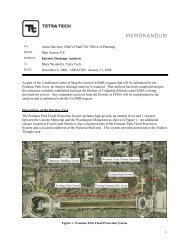
UNITED STATES DIPLOMACY CENTER - National Capital Planning ...
UNITED STATES DIPLOMACY CENTER - National Capital Planning ...
UNITED STATES DIPLOMACY CENTER - National Capital Planning ...

Create successful ePaper yourself
Turn your PDF publications into a flip-book with our unique Google optimized e-Paper software.
FIGURES<br />
LIST OF FIGURES AND TABLES<br />
Figure 1.1 Project Location 3<br />
Figure 1.2 Project Site 5<br />
Figure 1.3 2004 Concept Plan for the Harry S Truman Building Perimeter Security<br />
Improvements Project 9<br />
Figure 2.1 USDC Exhibit Halls 17<br />
Figure 2.2 USDC Entry Pavilion 19<br />
Figure 2.3 USDC Entry Pavilion: First Floor 23<br />
Figure 2.4 USDC Entry Pavilion: Roof Plan 25<br />
Figure 2.5 USDC Entry Pavilion: East Elevation 27<br />
Figure 2.6 USDC Entry Pavilion: Elevation 29<br />
Figure 2.7 USDC Entry Pavilion: East/West Section 31<br />
Figure 2.8 USDC Exhibit Hall II: North/South Section 33<br />
Figure 2.9 USDC Exhibit Hall III: North/South Section 35<br />
Figure 2.10 Existing Site Conditions (No Action Alternative) 37<br />
Figure 3.1a Existing and Proposed Views of the USDC Project Site from the Intersection of<br />
Virginia Avenue NW and 21st Street NW 55<br />
Figure 3.1b Existing and Proposed Views of the USDC Project Site from the Intersection of E<br />
and 21 st Streets NW 57<br />
Figure 3.1c Existing and Proposed Views of the USDC Project Site from Edward J. Kelly Park 59<br />
Figure 3.2 United States Diplomacy Center Entry Pavilion - Evening View 61<br />
Figure 3.3 United States Diplomacy Center Entry Pavilion - Roof Detail and Interior<br />
Visualization 65<br />
Figure 3.4 Area of Potential Effects and Contributing Resources 69<br />
Figure 3.5 Existing Contributing Features of the George C. Marshall Wing of the Harry S<br />
Truman Building 73<br />
Figure 3.6 Location of Adverse Effects to Contributing Features 77<br />
Figure 3.7 Existing Lane Use and Traffic Controls 83<br />
Figure 3.8 Existing Peak Hour Vehicular Traffic Counts (8:15 - 9:15 AM & 4:45 - 5:45 PM) 85<br />
Figure 3.9 Existing Peak Hour Pedestrian Counts (8:15 - 9:15 AM & 4:45 - 5:45 PM) 87<br />
Figure 3.10 Existing Street Peak Hour Bicycle Counts (8:15 - 9:15 AM & 4:45 - 5:45 PM) 89<br />
Figure 3.11 Location of Nearby Attractions 95<br />
Figure 3.12 On-Street Parking Opportunities 99<br />
Figure 3.13 Public Parking Facility Locations 101<br />
Figure 3.14 Anticipated Pedestrian Routes 103<br />
Figure 3.15 District of Columbia Bicycle Master Plan - Proposed Bicycle Facilities Map 107<br />
Figure 3.16 <strong>Capital</strong> Bikeshare Facilities Map 109<br />
Figure 3.17 Commuter Bus Route Map 111<br />
Figure 3.18 Commuter Bus Stop Locations 113<br />
Figure 3.19 Proposed Charter/School Bus Loading Location 115<br />
Figure 3.20 Existing Motorcoach Parking Locations 117<br />
Figure 3.21 Tour Bus Route Map 119<br />
Figure 3.22 2015 “No Action” Future Traffic Forecasts (8:15 - 9:15 AM & 4:45 - 5:45 PM) 125<br />
Figure 4.1 Vicinity Map 131