UNITED STATES DIPLOMACY CENTER - National Capital Planning ...
UNITED STATES DIPLOMACY CENTER - National Capital Planning ...
UNITED STATES DIPLOMACY CENTER - National Capital Planning ...

Create successful ePaper yourself
Turn your PDF publications into a flip-book with our unique Google optimized e-Paper software.
<strong>UNITED</strong> <strong>STATES</strong> DEPARTMENT OF STATE<br />
IN COOPERATION WITH THE<br />
NATIONAL CAPITAL PLANNING COMMISSION<br />
U.S. GENERAL SERVICES ADMINISTRATION<br />
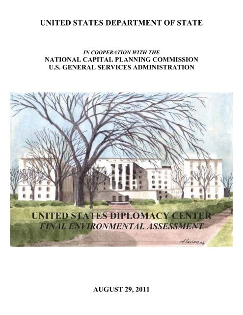
<strong>UNITED</strong> <strong>STATES</strong> <strong>DIPLOMACY</strong> <strong>CENTER</strong><br />
FINAL ENVIRONMENTAL ASSESSMENT<br />
AUGUST 29, 2011
PAGE INTENTIONALLY LEFT BLANK
<strong>UNITED</strong> <strong>STATES</strong> DEPARTMENT OF STATE<br />
FINAL ENVIRONMENTAL ASSESSMENT<br />
<strong>UNITED</strong> <strong>STATES</strong> <strong>DIPLOMACY</strong> <strong>CENTER</strong><br />
The U.S. Department of State, in cooperation with the U.S. General Services Administration and<br />
the <strong>National</strong> <strong>Capital</strong> <strong>Planning</strong> Commission, has prepared this Environmental Assessment for<br />
construction and operation of the United States Diplomacy Center, at the United States<br />
Department of State, in Washington, DC. The United States Diplomacy Center would establish a<br />
publicly-accessible museum and associated educational exhibits that would provide the American<br />
and visiting foreign public with general information regarding the practice of diplomacy. The<br />
project includes construction of a new Entry Pavilion and internal modifications to the first floor<br />
of the north wing of the George C. Marshall Wing of the Department of State Harry S Truman<br />
Building. This Environmental Assessment considers the environmental effects of implementing<br />
the No Action (no build) Alternative and the Action Alternative.<br />
RESPONSIBLE AGENCY:<br />
U.S. Department of State<br />
COOPERATING AGENCIES:<br />
<strong>National</strong> <strong>Capital</strong> <strong>Planning</strong> Commission<br />
U. S. General Services Administration<br />
For information concerning this document contact:<br />
Mr. Robert H. Sanders, Chief<br />
Office of Real Property Management - Special Projects Division<br />
United States Department of State<br />
2201 C Street NW<br />
Washington, DC 20520<br />
SandersRH@state.gov
PAGE INTENTIONALLY LEFT BLANK
TABLE OF CONTENTS<br />
PROJECT DESCRIPTION 1<br />
1.0 PURPOSED AND NEED 11<br />
1.1 Purpose 11<br />
1.2 Need 11<br />
1.3 Overview of NEPA and NHPA 11<br />
1.4 Resource Issues Considered in this Document 12<br />
1.5 Resource Issues Eliminated from Detailed Analysis 12<br />
2.0 DESCRIPTION OF ALTERNATIVES 15<br />
2.1 Action Alternative 15<br />
2.2 No Action Alternative 21<br />
3.0 AFFECTED ENVIRONMENT & ENVIRONMENTAL CONSEQUENCES 39<br />
3.1 Geology 40<br />
3.2 Topography 41<br />
3.3 Soils 41<br />
3.4 Stormwater/Groundwater 42<br />
3.5 Air Quality 43<br />
3.6 Vegetation 46<br />
3.7 Energy and Sustainability 48<br />
3.8 Land Use 49<br />
3.9 Economy, Employment and Population 52<br />
3.10 Visual Resources 53<br />
3.11 Noise 63<br />
3.12 Cultural Resources 67<br />
3.13 Utilities 79<br />
3.14 Circulation and Parking 80<br />
3.15 Public Safety 121<br />
3.16 Environmental Justice 127<br />
4.0 CUMULATIVE IMPACTS 129<br />
5.0 REFERENCES 139<br />
6.0 LIST OF PREPARERS 141<br />
APPENDIX
FIGURES<br />
LIST OF FIGURES AND TABLES<br />
Figure 1.1 Project Location 3<br />
Figure 1.2 Project Site 5<br />
Figure 1.3 2004 Concept Plan for the Harry S Truman Building Perimeter Security<br />
Improvements Project 9<br />
Figure 2.1 USDC Exhibit Halls 17<br />
Figure 2.2 USDC Entry Pavilion 19<br />
Figure 2.3 USDC Entry Pavilion: First Floor 23<br />
Figure 2.4 USDC Entry Pavilion: Roof Plan 25<br />
Figure 2.5 USDC Entry Pavilion: East Elevation 27<br />
Figure 2.6 USDC Entry Pavilion: Elevation 29<br />
Figure 2.7 USDC Entry Pavilion: East/West Section 31<br />
Figure 2.8 USDC Exhibit Hall II: North/South Section 33<br />
Figure 2.9 USDC Exhibit Hall III: North/South Section 35<br />
Figure 2.10 Existing Site Conditions (No Action Alternative) 37<br />
Figure 3.1a Existing and Proposed Views of the USDC Project Site from the Intersection of<br />
Virginia Avenue NW and 21st Street NW 55<br />
Figure 3.1b Existing and Proposed Views of the USDC Project Site from the Intersection of E<br />
and 21 st Streets NW 57<br />
Figure 3.1c Existing and Proposed Views of the USDC Project Site from Edward J. Kelly Park 59<br />
Figure 3.2 United States Diplomacy Center Entry Pavilion - Evening View 61<br />
Figure 3.3 United States Diplomacy Center Entry Pavilion - Roof Detail and Interior<br />
Visualization 65<br />
Figure 3.4 Area of Potential Effects and Contributing Resources 69<br />
Figure 3.5 Existing Contributing Features of the George C. Marshall Wing of the Harry S<br />
Truman Building 73<br />
Figure 3.6 Location of Adverse Effects to Contributing Features 77<br />
Figure 3.7 Existing Lane Use and Traffic Controls 83<br />
Figure 3.8 Existing Peak Hour Vehicular Traffic Counts (8:15 - 9:15 AM & 4:45 - 5:45 PM) 85<br />
Figure 3.9 Existing Peak Hour Pedestrian Counts (8:15 - 9:15 AM & 4:45 - 5:45 PM) 87<br />
Figure 3.10 Existing Street Peak Hour Bicycle Counts (8:15 - 9:15 AM & 4:45 - 5:45 PM) 89<br />
Figure 3.11 Location of Nearby Attractions 95<br />
Figure 3.12 On-Street Parking Opportunities 99<br />
Figure 3.13 Public Parking Facility Locations 101<br />
Figure 3.14 Anticipated Pedestrian Routes 103<br />
Figure 3.15 District of Columbia Bicycle Master Plan - Proposed Bicycle Facilities Map 107<br />
Figure 3.16 <strong>Capital</strong> Bikeshare Facilities Map 109<br />
Figure 3.17 Commuter Bus Route Map 111<br />
Figure 3.18 Commuter Bus Stop Locations 113<br />
Figure 3.19 Proposed Charter/School Bus Loading Location 115<br />
Figure 3.20 Existing Motorcoach Parking Locations 117<br />
Figure 3.21 Tour Bus Route Map 119<br />
Figure 3.22 2015 “No Action” Future Traffic Forecasts (8:15 - 9:15 AM & 4:45 - 5:45 PM) 125<br />
Figure 4.1 Vicinity Map 131
TABLES<br />
Table 3.1 NAAQS and Washington, DC Monitoring Data 45<br />
Table 3.2 De Minimis 47<br />
Table 3.3 AM/PM Peak Hour Counts 81<br />
Table 3.4 Existing Level of Service Summary (1) (2) (3) (4) 92<br />
Table 3.5 Existing Intersection Queue Summary (1) (2) (3) (4) 93<br />
Table 3.6 2015 Future (“No Action”) Level of Service Summary (1) (2) (3) 122<br />
Table 3.7 2015 Future (“No Action”) Intersection Queue Summary (1) (2) (3) 123
PAGE INTENTIONALLY LEFT BLANK
ACRONYMS AND ABBREVIATIONS<br />
ACHP<br />
APE<br />
APhA<br />
BD&C<br />
BMP<br />
Board<br />
CAA<br />
CEQ<br />
CFA<br />
CL<br />
CO<br />
CW<br />
dB(A)<br />
DC<br />
DCSHPO<br />
DDOT<br />
DoS<br />
EPA<br />
GSA<br />
HSR<br />
LEED<br />
LID<br />
LOS<br />
MOA<br />
MSAT<br />
MWCOG<br />
NAAQS<br />
NAICS<br />
NAS<br />
NCPC<br />
NEPA<br />
NHPA<br />
NO x<br />
PM 2.5/10<br />
SC<br />
SF<br />
SHPO<br />
SO 2<br />
USCS<br />
USDC<br />
VOC<br />
WMATA<br />
Advisory Council on Historic Preservation<br />
Area of Potential Effects<br />
American Pharmacists Association<br />
Building Design and Construction<br />
Best Management Practices<br />
Board of Governors of the Federal Reserve System<br />
Clean Air Act<br />
Council on Environmental Quality<br />
U.S. Commission of Fine Arts<br />
Lean Clay<br />
Carbon Monoxide<br />
Central Washington<br />
A-weighted decibels<br />
District of Columbia<br />
District of Columbia State Historic Preservation Office<br />
District Department of Transportation<br />
Department of State<br />
Environmental Protection Agency<br />
General Services Administration<br />
Historic Structures Report<br />
Leadership in Energy and Environmental Design<br />
Low Impact Development<br />
Level of Service<br />
Memorandum of Agreement<br />
Mobile Source Air Toxics<br />
Metropolitan Washington Council of Governments<br />
<strong>National</strong> Ambient Air Quality Standards<br />
<strong>National</strong> Industry Classification System<br />
<strong>National</strong> Academy of Sciences<br />
<strong>National</strong> <strong>Capital</strong> <strong>Planning</strong> Commission<br />
<strong>National</strong> Environmental Policy Act<br />
<strong>National</strong> Historic Preservation Act<br />
Nitrogen Oxides<br />
Particulate Matter<br />
Clayey Sand<br />
Square Feet<br />
State Historic Preservation Office<br />
Sulfur Dioxide<br />
Unified Soil Classification System<br />
United States Diplomacy Center<br />
Volatile Organic Compounds<br />
Washington Metropolitan Area Transit Authority
PAGE INTENTIONALLY LEFT BLANK
PROJECT DESCRIPTION<br />
The intent of the United States Diplomacy Center (USDC) is to establish, within the United States<br />
Department of State (DoS), a publicly-accessible museum and associated educational exhibits that<br />
provide the American and visiting foreign public with general information regarding the practice of<br />
diplomacy. The USDC would be located adjacent to, and within, the George C. Marshall Wing (Marshall<br />
Wing) of the DoS Harry S Truman Building, in a location that is within close proximity to such national<br />
landmarks as the Lincoln Memorial, the Vietnam Memorial, the World War II Memorial and the<br />
Washington Monument.<br />
The DoS Harry S Truman Building, located in the District of Columbia’s Northwest quadrant, faces 21 st<br />
Street NW to the east, C Street NW to the south, 23 rd Street NW to the west and D and E Streets NW to<br />
the north (Figure 1.1). Virginia Avenue NW borders the northeast corner of the Building. The USDC<br />
would comprise a new Entry Pavilion and reconfigured interior space within the northern section of the<br />
first floor of the Marshall Wing, creating three exhibit halls (Figure 1.2). The Entry Pavilion – Exhibit<br />
Hall I would be constructed in the existing forecourt of the 21 st Street NW entrance to the Marshall Wing,<br />
facing 21 st Street NW. The area of the USDC planned for the first floor of the Marshall Wing is currently<br />
used as office space, and would be transformed into Exhibit Halls II and III, complete with exhibit<br />
galleries and interactive classrooms. The USDC would be constructed in two phases: the Entry Pavilion –<br />
Exhibit Hall I would constitute Phase 1, and Exhibit Halls II and III, within the Marshall Wing, would be<br />
built in Phase 2.<br />
The concept design for the USDC encompasses approximately 41,361 square feet (SF) of space adjacent<br />
to, and within, the Marshall Wing. The two-level, steel and glass Entry Pavilion would replace the<br />
existing arrangement of canopies, planters, barriers within the original, open forecourt of the Marshall<br />
Wing, which were constructed in 1986. Additionally, the Entry Pavilion would replace the temporary<br />
screening building. The main level of the Entry Pavilion - Exhibit Hall I (America in the World), would<br />
include security screening, a reception area, exhibit space, a monumental stair to the lower level, and an<br />
elevator. Exhibit space in the Entry Pavilion would allow visitors to discover what diplomacy is, who<br />
diplomats are and what they do.<br />
The lower level of the Entry Pavilion would house a café and gift shop, seating area, coat check room,<br />
and restrooms, as well as mechanical and electrical rooms, storage, and other utility areas. Exhibit Halls<br />
II and III would be located immediately north of the Marshall Wing’s existing entrance lobby and<br />
elevator corridor. To enter Exhibit Halls II and III from the Entry Pavilion, visitors would move through<br />
the historic lobby of the Marshall Wing, making it open to the public. Exhibit Hall II (Diplomacy in<br />
Action) would include nine galleries covering a range of topics, from the foundations of diplomacy in the<br />
United States to Cold War diplomacy, technology, and the challenges of the twenty-first century. Exhibit<br />
Hall III (Advancing Diplomacy) would house interactive exhibits, classroom space and a theater, which<br />
would allow people to experience diplomacy first-hand.<br />
1
PAGE INTENTIONALLY LEFT BLANK<br />
2
STEPS<br />
H.C.<br />
H.<br />
C.<br />
H.C.<br />
H.C.<br />
H STREET<br />
24TH ST.<br />
23RD ST.<br />
22ND ST.<br />
21ST ST.<br />
20TH ST.<br />
19TH ST.<br />
18TH ST.<br />
PENNSYLVANIA AVE.<br />
USDC FOOTPRINT<br />
VIRGINIA AVENUE<br />
G STREET<br />
17TH ST.<br />
White House<br />
Kennedy<br />
Center<br />
F STREET<br />
E STREET<br />
Department of State<br />
Harry S. Truman Building<br />
C STREET<br />
CONSTITUTION AVE.<br />
German American Friendship Garden<br />
Lincoln Memorial<br />
Washington Monument<br />
Figure 1.1 - Project Location<br />
3
PAGE INTENTIONALLY LEFT BLANK<br />
4
EXHIBIT<br />
HALL III<br />
EXHIBIT<br />
HALL II<br />
GEORGE C.<br />
MARSHALL WING<br />
EXHIBIT<br />
HALL I<br />
N<br />
Figure 1.2 - Project Site<br />
5
PAGE INTENTIONALLY LEFT BLANK<br />
6
Relationship to the Harry S Truman Building Perimeter Security Improvements Project<br />
In response to increased security concerns for government agencies, DoS identified the need for a<br />
strategic security improvement plan for the Harry S Truman Building in 2002. In 2004, DoS completed<br />
the Harry S Truman Building Perimeter Security Improvement Plan (2004 Concept Plan) which<br />
recommended a number of security improvements, including the construction of a security pavilion at<br />
each of the five entrances to the Harry S Truman Building, in addition to extended sidewalks, protective<br />
fencing, a redesigned truck inspection area, a realignment of D Street NW, new guard booths, landscaping<br />
and street furniture, and retention of the closure of C Street NW from 21 st to 23 rd Streets NW (Figure 1.3).<br />
DoS plans to implement the Perimeter Security Improvements Project in five phases; the first of which<br />
includes Phase IA-D Street NW Improvements and Phase IB-C Street NW Improvements, followed by<br />
Phase II-23 rd Street NW, Phase III-21 st Street NW Improvements, Phase IV-C Street NW Pavilion and<br />
Phase V-Proposed Reconfiguration of D Street NW. The perimeter security improvements proposed for<br />
the 21 st Street NW entrance would be implemented independent of, and subsequent to, the completion of<br />
the Entry Pavilion.<br />
This document addresses only those elements associated with the proposed USDC. The proposed<br />
perimeter security improvements for the Harry S Truman Building are currently being studied as part of a<br />
separate EA, but are addressed and analyzed in this EA as a reasonably foreseeable future action that,<br />
combined with the proposed USDC, could have cumulative impacts on the human environment.<br />
The proposed concept design for the USDC replaces the elements of the original 21 st Street NW pavilion<br />
design proposed in the 2004 Concept Plan. The proposed footprint for the USDC Entry Pavilion is<br />
significantly smaller than that of the 2004 Concept Plan design for the 21 st Street NW pavilion, and<br />
consequently, would not encroach into public space. Additionally, the USDC Entry Pavilion design<br />
would accommodate security screening operations similar to those identified in the 2004 Concept Plan<br />
design for the 21 st Street NW pavilion. Excluding the construction of a 21 st Street NW pavilion, no other<br />
elements from the proposed Perimeter Security Improvements Project would be implemented under the<br />
USDC project. Construction of the USDC would be undertaken as an effort separate from, and prior to,<br />
the Perimeter Security Improvements Project.<br />
7
PAGE INTENTIONALLY LEFT BLANK<br />
8
RAMP-UP<br />
UP<br />
RAMP UP 1:12<br />
UP<br />
UP<br />
RAMP-UP<br />
STEPS<br />
E STREET<br />
E STREET<br />
EXPRESSWAY<br />
VIRGINIA AVENUE<br />
D STREET<br />
PARKING<br />
EXIT<br />
COURTYARD<br />
COURTYARD<br />
COURTYARD<br />
MARSHALL WING<br />
23 RD STREET<br />
HARRY S TRUMAN BUILDING<br />
U.S. DEPARTMENT OF STATE<br />
COURTYARD<br />
PARKING & LOADING<br />
ENTRANCE / EXIT<br />
COURTYARD<br />
COURTYARD<br />
PARKING<br />
ENTRANCE / EXIT<br />
NAVY HILL<br />
PARKING<br />
ENTRANCE / EXIT<br />
NEW STATE<br />
FEDERAL RESERVE<br />
MARTIN BUILDING<br />
C STREET<br />
C STREET<br />
PARKING<br />
EXIT<br />
NATIONAL<br />
ACADEMY OF<br />
SCIENCES<br />
PARKING ENTRANCE<br />
FEDERAL RESERVE<br />
ECCLES BUILDING<br />
Figure 1.3 - 2004 Concept Plan for the Harry S Truman Building Perimeter Security Improvements Project<br />
9
PAGE INTENTIONALLY LEFT BLANK<br />
10
1.0 PURPOSE AND NEED<br />
1.1 PURPOSE<br />
The purpose of the proposed action is to provide a place of learning and inspiration where the public can<br />
gain knowledge of the history, practice and challenges of American diplomacy. The goal of the USDC is<br />
to allow a broad audience of visitors, students and educators to explore the ways in which global<br />
relationships have impacted the present and will shape the future, to understand the complex outcomes of<br />
diplomacy, to gain insight into the responsibilities of the DoS and to absorb the compelling stories of U.S.<br />
diplomats. The USDC would provide an education center with thought-provoking exhibits and dynamic<br />
programs that would highlight the rich history of U.S. diplomacy, as well as:<br />
- Promote a better understanding of U.S. diplomacy and the DoS’ work<br />
- Reveal how U.S. diplomacy has shaped our nation’s history<br />
- Honor the service and sacrifice of former and current U.S. diplomats<br />
- Illustrate how U.S. diplomacy has impacted the daily lives of citizens<br />
- Demonstrate the ways U.S. diplomats assist U.S. citizens overseas<br />
- Build a constituency for U.S. diplomacy and the Department of State within our nation<br />
- Inspire individuals, particularly students, to pursue careers in diplomacy<br />
- Emphasize the roles people can assume as effective citizen diplomats<br />
1.2 NEED<br />
The need for the Action Alternative was first identified by former Secretary of State Madeleine Albright,<br />
who initiated the USDC Project in 2000. As identified by Secretary Albright, the USDC is needed to<br />
more clearly communicate the work of DoS to the American people. The USDC would also fulfill the<br />
need for a permanent security screening facility for visitors to the Marshall Wing.<br />
1.3 OVERVIEW OF NEPA AND NHPA<br />
In accordance with the <strong>National</strong> Environmental Policy Act of 1969 (NEPA), as amended (Title 42, U.S.<br />
Code [USC], 4321-4347) and regulations of the Council on Environmental Quality (CEQ) (40 Code of<br />
Federal Regulations [CFR] 1500-1508), this Environmental Assessment analyzes and documents<br />
environmental effects associated with the Action and No Action Alternatives. NEPA establishes<br />
procedures to “insure that environmental information is available to public officials and citizens before<br />
decisions are made and before actions are taken.” [40 C.F.R. § 1500.1(b)] The purpose of these<br />
procedures is to foster informed decisions. Coordinating NEPA procedures with those of other federal<br />
environmental statutes and executive orders facilitates NEPA objectives by promoting efficiencies in<br />
environmental planning and development of “high quality information” on which to base agency<br />
decisions [40 C.F.R. § 1500.1(b)] (Workgroup, 2008).<br />
11
In accordance with Section 106 of the <strong>National</strong> Historic Preservation Act (NHPA), 16 U.S.C. 470f, this<br />
Environmental Assessment documents effects associated with the Action and No Action Alternatives on<br />
cultural and historic resources within, and surrounding, the project area. Under Section 106 of the NHPA,<br />
Federal agencies must take into account the effect of their undertakings on historic properties and provide<br />
the Advisory Council on Historic Preservation (ACHP) a reasonable opportunity to comment with regard<br />
to such undertakings. The Section 106 implementing regulations, “Protection of Historic Properties,” 36<br />
CFR Part 800, describe a Section 106 review process, which “seeks to accommodate historic preservation<br />
concerns with the needs of Federal undertakings through consultation.” The process provides for<br />
participation of State and local governments, Indian tribes, representatives from various businesses and<br />
organizations, and private citizens in Federal project planning that may affect historic properties.<br />
The Section 106 regulations encourage agencies to coordinate their Section 106 process with their NEPA<br />
process. Through coordination, information and analyses-sharing, compliance can be completed in a<br />
streamlined fashion that minimizes the duplication of effort. This coordination also ensures historic<br />
properties receive adequate and timely consideration at the beginning of and throughout the planning<br />
process. The Section 106 regulations also provide for a specific process, detailed at 36 CFR §800.8(c),<br />
whereby the NEPA process may be used to fulfill an agency’s Section 106 responsibilities, provided that<br />
certain standards and documentation requirements are met. This approach encourages the full integration<br />
of Section 106 consultation and the coordination of environmental reviews. The benefit to stakeholders<br />
and the public of this integration is data sharing, cost and time savings, and an ability to present the big<br />
picture of a proposed action during preliminary planning and design development. It should be noted that<br />
although the ACHP regulations allow program alternatives under Subpart C, 36 CFR §800.14, the NEPA<br />
coordination provision at 36 CFR §800.8(c) is not intended to act as a program alternative to the Section<br />
106 process, but is intended to be applied on a project by project basis as appropriate. If the Federal<br />
agency selects to use an integrated approach for an undertaking or class of undertakings, then the agency<br />
must provide advance notification of its intent to the State/Tribal Historic Preservation Office<br />
(SHPO/THPO) and the ACHP (Workgroup, 2008).<br />
The U.S. General Services Administration and the <strong>National</strong> <strong>Capital</strong> <strong>Planning</strong> Commission are<br />
cooperating agency in this effort.<br />
1.4 RESOURCE ISSUES CONSIDERED IN THIS DOCUMENT<br />
Geology<br />
Topography<br />
Soils<br />
Stormwater/Groundwater<br />
Air Quality<br />
Vegetation<br />
Energy and Sustainability<br />
Land Use<br />
Economy, Employment and<br />
Population<br />
Visual Resources<br />
Noise<br />
Cultural Resources<br />
Utilities<br />
Circulation and Parking<br />
Public Safety<br />
Environmental Justice<br />
1.5 RESOURCE ISSUES ELIMINATED FROM DETAILED ANALYSIS<br />
Several impact topics were initially considered for evaluation in this EA, but were eliminated from<br />
detailed study because the proposed action would result in either no impacts or negligible impacts. These<br />
topics and the rationale for their elimination are as follows:<br />
12
FLOODPLAINS AND WETLANDS<br />
The proposed action would not result in any impacts associated with floodplains or wetlands. The project<br />
site lies outside the 100-year floodplain of the Potomac River (FIRM Map). The highly urbanized nature<br />
of the project site precludes the ability for wetlands to develop on the site. Moreover, <strong>National</strong> Wetland<br />
Inventory maps do not show existing wetlands within the project site.<br />
WILDLIFE<br />
Due to the developed landscape of the area, wildlife species in the vicinity of the project area are highly<br />
adapted to urban habitats. Species that may be affected are the Eastern Gray Squirrel (Sciurus<br />
carolinensis), the American Robin (Turdus migratorius), and the Mourning Dove (Zenaida macroura).<br />
Urban-adapted animal species would likely relocate to a similar habitat (developed landscape) in the<br />
surrounding area, during construction.<br />
THREATENED OR ENDANGERED SPECIES<br />
Due to the developed landscape of the area, there are no known critical habitats or listed rare, threatened,<br />
or endangered species or species of concern in the project area. In its letter dated August 10, 2011, the<br />
United States Department of the Interior Fish and Wildlife Service stated that, except for occasional<br />
transient individuals, no proposed or federally listed endangered or threatened species are known to exist<br />
within the project area. The Fish and Wildlife Service confirmed in its letter that no Biological<br />
Assessment or further section 7 consultation is required.<br />
COMMUNITY FACILITIES<br />
There are no churches, schools, or community public health centers within the immediate vicinity of the<br />
project area.<br />
SOLID AND HAZARDOUS WASTE<br />
Construction on this site from 1940 to the present may have obliterated any hazardous soil issues;<br />
however, any property developed as long ago as the Harry S Truman Building has potential for an<br />
unexpected discovery of hazardous waste issues as a result of prior site uses. There are no known or<br />
anticipated hazardous waste issues at this site. In the event that hazardous waste is encountered during<br />
construction, it would be handled in accordance with federally and locally mandated regulations for<br />
removal, treatment and disposal.<br />
ARCHAEOLOGICAL RESOURCES<br />
Archaeological site files at the District of Columbia Historic Preservation Office, examined by John<br />
Milner Associates, Inc. in 2006, record sixteen locations within one mile of the project area where<br />
archeological resources have been identified or predicted (supporting documentations: USGS map of sites<br />
within one mile and table of archeological investigations). Most of the historic-period sites include both<br />
commercial and domestic resources, dating from the late eighteenth century into the twentieth century;<br />
however, the nineteenth-century development of the project area is likely to have disturbed or destroyed<br />
prehistoric resources. Additionally, construction of, and alterations to, the Harry S Truman Building have<br />
most likely destroyed the nineteenth-century historic archeological resources that occupied the land now<br />
under, or adjacent to, the project area.<br />
13
PAGE INTENTIONALLY LEFT BLANK<br />
14
2.0 DESCRIPTION OF ALTERNATIVES<br />
2.1 ACTION ALTERNATIVE<br />
The 41,361 SF USDC would be accommodated within the northern section of the first floor of the<br />
Marshall Wing and a new Entry Pavilion, which would be an addition to the 21 st Street NW<br />
entrance to the Marshall Wing of the Harry S Truman Building. The proposed interior functions<br />
of the USDC would require demolition of existing interior partitions and systems for conversion<br />
of approximately 19,773 SF of the interior first floor of the northern wing of the Marshall Wing,<br />
from employee offices to Exhibit Halls II and III (Figure 2.1); however, the fundamental exterior<br />
modifications under the Action Alternative include the following:<br />
- Construction of a new, approximately 21,588 SF, two-level Entry Pavilion in the<br />
forecourt of the 21 st Street NW entrance to the Harry S Truman Building Marshall Wing<br />
- Removal of existing, exterior planters, pavers, bollards and temporary screening facilities<br />
within the 21 st Street NW forecourt<br />
- Relocation of all security screening for employees and conference center and public<br />
visitors, from the temporary facilities to the permanent, enclosed Entry Pavilion<br />
The new Entry Pavilion (Exhibit Hall I) would serve as the 21 st Street NW entrance and screening<br />
facility for DoS staff entering the Harry S Truman Building, for members of the public visiting<br />
the USDC and the George C. Marshall Conference Center, and for escorted visitors. The pavilion<br />
would measure approximately 120 feet wide, 87 feet deep and 28 feet tall, and would comprise a<br />
Main Level and a Lower Level. The Main Level would serve as an exhibit space and flex space<br />
for events, and the Lower Level would include a gift shop and café with seating, as well as<br />
bathroom facilities a coat check and building support spaces (Figure 2.2). As envisioned, the new<br />
pavilion, centered within the 21 st Street NW forecourt, would be attached to the to the limestone<br />
wall of the east facade of the existing Harry S Truman Building. Centering the pavilion within<br />
the 21 st Street NW forecourt would also require removal of all existing planters, pavers, bollards<br />
and temporary screening facilities, most of which were installed in 1986.<br />
The proposed Entry Pavilion would be constructed of textured, sandstone-colored, opaque glass<br />
panels in a steel curtain wall system as a frame around a broad expanse of transparent glass at the<br />
center of the façade, where doors would be located. Above the Entry Pavilion’s exhibit space,<br />
fritted Low E Laminated glass units would be employed to allow for a greater level of visual<br />
transparency, providing for views of the Marshall Wing façade from inside the pavilion. Opaque<br />
glass would be used above the circulation areas. While mainly self-supporting, the Entry Pavilion<br />
would tie into the structural concrete of the Marshall Wing’s four portico piers. The connection<br />
would be made through the east face of the piers, with existing limestone cladding in the location<br />
of the connection salvaged and stored and replaced with matching limestone.<br />
Security screening equipment would be located to the north and south of the entrance to the Entry<br />
Pavilion. Staff and Marshall Conference Center visitors would use the north screening station.<br />
All other visitors would enter through the screening station on the south. Ramps along the north<br />
and south walls of the Entry Pavilion would lead up from the security stations to the exhibit area<br />
at the center and to the Marshall Wing entrance. The ceiling of the exhibit space would be<br />
approximately two feet higher than the ceiling above the circulation corridors. Two enclosures<br />
would occupy the exhibit area, and a pair of stairs east of this space would carry visitors to the<br />
Lower Level.<br />
15
PAGE INTENTIONALLY LEFT BLANK<br />
16
Historic Lobby<br />
HALL II<br />
Diplomacy In Action<br />
HALL I<br />
America In The World<br />
HALL III<br />
Advancing Diplomacy<br />
Figure 2.1 - USDC Exhibit Halls<br />
17
PAGE INTENTIONALLY LEFT BLANK<br />
18
EXHIBIT<br />
ENCLOSURE<br />
ELEVATOR<br />
SHAFT<br />
OPAQUE GLASS<br />
PANEL ENCLOSURE<br />
EXISTING<br />
HISTORIC<br />
EXTERIOR<br />
LIMESTONE<br />
HISTORIC LOBBY<br />
STAIR<br />
NEW<br />
EGRESS<br />
DOOR<br />
HISTORIC<br />
ENTRANCE<br />
DOORS &<br />
VESTIBULE<br />
MECHANICAL ROOM<br />
CAFE/SEATING AREA<br />
FEATURE<br />
WALL<br />
EXISTING BASEMENT<br />
Figure 2.2 - USDC Entry Pavilion Plan<br />
19
PAGE INTENTIONALLY LEFT BLANK<br />
20
Additional exhibition space would be located in first floor of the northern wing of the Harry S<br />
Truman Building Marshall Wing. The northwest section of the Marshall Wing would serve as<br />
Exhibit Hall II and the northeast portion of the Marshall Wing would serve as Exhibit Hall III.<br />
The Entry Pavilion would be designed and constructed first, as Phase 1, and is anticipated to be<br />
completed in 2012. Completion of Phase 1 would allow the Entry Pavilion to open separate from,<br />
but in sequence with, the second phase of construction, which would include the renovation of the<br />
first floor of the Marshall Wing for Exhibit Halls II and III. Phase 2 is anticipated to be<br />
completed in 2015.<br />
Elevations, sections and plan views of the USDC can be found in Figures 2.3 - 2.9<br />
All construction activities in District of Columbia are regulated by law and require approved<br />
construction permits from the District of Columbia Department of Environment prior to the start<br />
of construction. The regulations governing stormwater management, erosion and sediment control<br />
are outlined in Chapter 5 of Title 21, and Chapter 31 of Title 20, of the District of Columbia<br />
Municipal Regulations. As part of the application for a construction permit, an erosion and<br />
sediment control plan, and/or stormwater management plan, must be submitted and approved.<br />
Upon approval of construction permits, the construction site would be inspected periodically<br />
during the construction phase of the project to ensure compliance with approved plans.<br />
2.2 NO ACTION ALTERNATIVE<br />
Under the No Action Alternative, construction, interior programming and associated exterior<br />
building modifications for the USDC would not be implemented; site conditions would remain as<br />
they are at present (Figure 2.10). Under this alternative, the Harry S Truman Building 21 st Street<br />
NW pavilion would retain its current function of security screening.<br />
While the No Action Alternative does not meet the purpose and need for the proposed action, it is<br />
studied in the Environmental Assessment to provide a baseline for assessing the magnitude of<br />
environmental effects associated with the Action Alternative.<br />
21
PAGE INTENTIONALLY LEFT BLANK<br />
22
Legend:<br />
A3.01<br />
A2.02<br />
First Floor area not affected<br />
by this project<br />
USDC SPACE<br />
Pepco Manholes Below<br />
USDC Space<br />
George C. Marshall<br />
Conference Center<br />
Historic Lobby<br />
First Floor Pavilion<br />
A3.02<br />
A3.02<br />
HISTORIC LOBBY<br />
A2.01<br />
GEORGE C. MARSHAL<br />
CONFERENCE <strong>CENTER</strong><br />
A3.01<br />
North<br />
Figure 2.3 - USDC Entry Pavilion: First Floor<br />
23
PAGE INTENTIONALLY LEFT BLANK<br />
24
A3.01<br />
A2.02<br />
Legend:<br />
86’-10”<br />
GL-4 GL-4 GL-4 GL-4<br />
GL-2<br />
GL-1 - Clear Glass<br />
GL-2 - Opaque Glass<br />
GL-3 - Clear Glass<br />
GL-4 - Opaque Glass<br />
GL-3<br />
GL-3<br />
GL-3<br />
GL-3<br />
GL-2<br />
121’-4”<br />
A2.01<br />
A3.02<br />
A3.02<br />
GL-4 GL-4 GL-4 GL-4<br />
GL-2<br />
A3.01<br />
North<br />
Figure 2.4 - USDC Entry Pavilion: Roof Plan<br />
25
PAGE INTENTIONALLY LEFT BLANK<br />
26
Legend:<br />
GL-1 - Clear Glass<br />
GL-2 - Opaque Glass<br />
28’-7”<br />
AREAWAY<br />
2/A4.01<br />
GL-2<br />
MAIN ENTRY<br />
DOORS<br />
GL-1<br />
AREAWAY<br />
Figure 2.5 - USDC Entry Pavilion: East Elevation<br />
27
PAGE INTENTIONALLY LEFT BLANK<br />
28
EGRESS<br />
DOOR<br />
STONE<br />
FACING<br />
92’-11”<br />
Figure 2.6 - USDC Entry Pavilion: Elevation<br />
29
PAGE INTENTIONALLY LEFT BLANK<br />
30
Legend:<br />
MECHANICAL<br />
OFFICES<br />
Area not affected<br />
by this project<br />
OFFICES<br />
OFFICES<br />
OFFICES<br />
OFFICES<br />
OFFICES<br />
HISTORIC LOBBY<br />
EXHIBIT<br />
ENCLOSURE<br />
EXISTING BASEMENT<br />
CAFE/SEATING AREA<br />
MECHANICAL<br />
ROOM<br />
Figure 2.7 - USDC Entry Pavilion: East/West Section<br />
31
PAGE INTENTIONALLY LEFT BLANK<br />
32
Legend:<br />
Area not affected<br />
by this project<br />
USDC Space<br />
MECH.<br />
CORRIDOR<br />
OFFICES<br />
CORRIDOR<br />
OFFICES<br />
CORRIDOR<br />
OFFICES<br />
CORRIDOR<br />
OFFICES<br />
CORRIDOR<br />
OFFICES<br />
OFFICES<br />
NEW EGRESS STAIR<br />
TO GRADE IN<br />
EXISTING AREAWAY<br />
CORRIDOR<br />
USDC<br />
SPACE<br />
USDC<br />
SPACE<br />
USDC<br />
SPACE<br />
USDC<br />
SPACE<br />
AREAWAY<br />
ELEVATOR<br />
SHAFT<br />
EXISTING<br />
BASEMENT<br />
MECHANICAL<br />
EXISTING<br />
BASEMENT<br />
MECH.<br />
EXISTING<br />
BASEMENT<br />
MECH.<br />
FARA<br />
OFFICES<br />
SUB-BASEMENT<br />
CHILLER ROOM<br />
SUB-BASEMENT<br />
MECH.<br />
Figure 2.8 - USDC Exhibit Hall II: North/South Section<br />
33
PAGE INTENTIONALLY LEFT BLANK<br />
34
Legend:<br />
Area not affected<br />
by this project<br />
USDC Space<br />
MECHANICAL<br />
OFFICES<br />
OFFICES<br />
OFFICES<br />
OFFICES<br />
OFFICES<br />
NEW EGRESS STAIR<br />
TO GRADE WITHIN<br />
EXISTING AREAWAY<br />
NORTH<br />
AREAWAY<br />
USDC<br />
SPACE<br />
OFFICES<br />
USDC<br />
SPACE<br />
AREAWAY<br />
Figure 2.9 - USDC Exhibit Hall III: North/South Section<br />
35
PAGE INTENTIONALLY LEFT BLANK<br />
36
Figure 2.10 - Existing Site Conditions (No Action Alternative)<br />
37
PAGE INTENTIONALLY LEFT BLANK<br />
38
3.0 AFFECTED ENVIRONMENT &<br />
ENVIRONMENTAL CONSEQUENCES<br />
The following chapter assesses the impacts of the Action Alternative and the No Action Alternative on<br />
the affected environment. These impacts are characterized by type, intensity and duration.<br />
TYPE<br />
The impact type refers to whether an impact is negative or positive (beneficial). Beneficial impacts would<br />
improve resource conditions and negative impacts would not. All impacts in this assessment are assumed<br />
to be negative (adverse), unless identified as beneficial.<br />
INTENSITY<br />
The intensity of a negative impact describes the magnitude of change that the negative impact generates.<br />
The intensity thresholds are as follows:<br />
NEGLIGIBLE:<br />
MINOR:<br />
MODERATE:<br />
MAJOR:<br />
There would be no impact, or the impact does not result in a noticeable<br />
change in the resource<br />
The impact would be slight, but detectable, resulting in a small but<br />
measurable change in the resource.<br />
The impact would be readily apparent and/or easily detectable<br />
The impact would be widespread and would substantially alter the<br />
resource. A major impact would be considered significant under NEPA.<br />
DURATION<br />
The duration of an impact identifies whether it occurs over a restricted period of time (short-term), or<br />
persists over a longer period (long-term). For the purposes of this analysis, it is assumed that short-term<br />
impacts would occur during the construction of the improvements, while long-term impacts would persist<br />
once the construction is complete.<br />
39
3.1 GEOLOGY<br />
AFFECTED ENVIRONMENT<br />
The project area is located within the Coastal Plain Physiographic Province of the District of Columbia.<br />
The Coastal Plain consists of a seaward thickening wedge of unconsolidated to semi-consolidated<br />
sedimentary deposits from the Cretaceous Geologic Period to the Holocene Geologic Epoch. These<br />
deposits represent marginal-marine to marine sediments consisting of interbedded sands and clays. The<br />
Coastal Plain is bordered to the east by the Atlantic Ocean and to the west by the Piedmont Physiographic<br />
Province (GeoConcepts, 2011).<br />
The existing fill soils of the top-most layer of soil are believed to be related to previous site grading. The<br />
natural soils assigned to the lower soil layers are believed to be Alluvial deposits associated with the<br />
nearby Potomac River and its tributaries. The alluvial soils are underlain by bedrock, which was<br />
encountered at about 51 to 53.5 feet depth below the existing ground surface (GeoConcepts, 2011).<br />
ENVIRONMENTAL CONSEQUENCES: ACTION ALTERNATIVE<br />
Implementation of the Action Alternative would result in long-term, minor impacts to the site’s geology,<br />
due to the construction of the Entry Pavilion’s lower level and an increase in structural load that would<br />
require increased stabilization.<br />
Both shallow and deep foundations have been evaluated for support of the Entry Pavilion. The existing<br />
fill and alluvial soils underlying the site exhibit low to moderate shear strength and high compressibility<br />
characteristics. Accordingly, the use of conventional spread footing foundations, bearing directly upon<br />
these existing fill and alluvial soils, is not recommended for support of the proposed construction. The<br />
Entry Pavilion could be supported on spread footings bearing on soils improved with aggregate piers, or<br />
caissons bearing on bedrock. Spread footings may be used to support the building, when founded on soils<br />
improved by aggregate piers; if improved by aggregate piers, spread footings could increase the allowable<br />
bearing pressure for the design of spread foundations to 4,000 pounds per SF. If used, caisson<br />
foundations bearing on bedrock would extend through the upper soils of Strata A and B to bear on the<br />
bedrock. Lower floor slabs, supported by natural soils or new compacted fill, would be feasible at the<br />
site; however, where floor sub-grades consist of existing fill, it is recommended that existing fill be<br />
undercut to a depth of at least two feet and backfilled with new compacted fill. It is recommended that<br />
the floor slab be isolated from the footings so that differential settlement of the structure would not induce<br />
shear stresses on the floor slab. The final selection of a foundation system would be based on an<br />
economic/construction schedule comparison of the aforementioned options by the general contractor or<br />
cost estimator (GeoConcepts, 2011).<br />
ENVIRONMENTAL CONSEQUENCES: NO ACTION ALTERNATIVE<br />
Under the No Action Alternative, impacts to geology would be negligible.<br />
40
3.2 TOPOGRAPHY<br />
AFFECTED ENVIRONMENT<br />
A hill is located at the intersection of Virginia Avenue NW and 23 rd Street NW. Slopes to the east of the<br />
hill extend down D Street NW toward 21 st Street NW and follow south to C Street NW. The slopes<br />
follow eastward on C Street NW or continue south on 23 rd Street NW. Additionally, slopes extend south<br />
past C Street NW, down 22 nd Street NW, towards Constitution Avenue NW. The Harry S Truman<br />
Building site slopes 31 feet from the lowest point at the corner of 21 st and C Streets NW, to its highest<br />
point at 23 rd and E Streets NW.<br />
ENVIRONMENTAL CONSEQUENCES: ACTION ALTERNATIVE<br />
Implementation of the Action Alternative would result in long-term, minor impacts on the site’s<br />
topography due to filling and grading activities for the lower floor slab areas, and as backfill against walls<br />
below grade. Unsuitable existing fill, soft or loose natural soils, organic material, and rubble would be<br />
stripped to approved subgrades, as determined by the geotechnical engineer. All subgrades would be<br />
proofrolled with a minimum 20-ton, loaded dump truck or suitable rubber tire construction equipment,<br />
approved by the geotechnical engineer, prior to the placement of new fill (GeoConcepts, 2011).<br />
If adequate space is available for a sloped earth cut for the Entry Pavilion, the excavations could be<br />
constructed by laying back the earth with temporary slopes. Temporary excavations that may occur<br />
would generally extend through sandy soils. Any benching of excavations would be performed in<br />
accordance with Occupational Safety and Health Administration requirements. If adequate space is not<br />
available for a sloped earth cut, it would be necessary to install vertical excavation support for the<br />
proposed construction (GeoConcepts, 2011). During construction, best management practices (BMPs)<br />
would be utilized to minimize the potential for soil erosion caused by minor alterations to topography at<br />
the construction site. Those BMPs could include sediment barriers, stormdrain inlet protection and dust<br />
control measures.<br />
ENVIRONMENTAL CONSEQUENCES: NO ACTION ALTERNATIVE<br />
Under the No Action Alternative, impacts to topography would be negligible.<br />
3.3 SOILS<br />
AFFECTED ENVIRONMENT<br />
The subsurface materials encountered during test borings taken in 2011 are stratified into designations,<br />
and do not imply that the materials encountered at the project area are continuous across the entire<br />
building site. Stratum designations, from the top to the lowest layers of soil, were established to<br />
characterize similar subsurface conditions based on material gradations and parent geology. The<br />
subsurface materials encountered in the test borings from the site, taken by GeoConcepts Engineering,<br />
were assigned to the following strata:<br />
- Stratum A (Existing Fill): generally firm, clayey sand, lean clay with sand, clayey gravel, and well<br />
graded gravel, fill, moist, brown, black, gray, and orange, encountered to depths of about 18.5 to 23.5<br />
feet below the existing ground surface.<br />
- Stratum B1 (Alluvium): soft, sandy, lean clay (CL), moist, gray.<br />
- Stratum B2 (Alluvium): generally firm, clayey sand (SC) with gravel, moist, gray.<br />
41
The two letter designations included in the strata descriptions represent the Unified Soil Classification<br />
System (USCS) group symbol and group name for the samples based on laboratory testing. The existing<br />
fill soils of Stratum A are believed to be related to previous site grading. The natural soils assigned to<br />
Stratum B1 and B2 are believed to be Alluvial deposits associated with the nearby Potomac River and its<br />
tributaries. The alluvial soils are underlain by bedrock, which was encountered at approximately 51 to<br />
53.5 feet depth below the existing ground surface (GeoConcepts, 2011).<br />
ENVIRONMENTAL CONSEQUENCES: ACTION ALTERNATIVE<br />
Implementation of the Action Alternative would result in long-term, minor impacts on the site’s soil, due<br />
to grading of the land for construction, and resurfacing portions of the site. Materials used for compacted<br />
fill, for support of lower floor slabs and as backfill against walls below grade, would consist of coarsegrained<br />
soils composed of gravel and sand. It is expected that the majority of soils excavated at the site<br />
would be suitable for reuse as fill, based on classification; however, the top-most layer of existing fill may<br />
not be suitable for reuse, due to potential contamination by harmful, manmade materials. Additionally,<br />
the drying of excavated soils by spreading and aerating may be necessary to obtain proper compaction.<br />
Individual borrow areas, both from on- and off-site sources, would be sampled and tested to verify<br />
classification of materials prior to using them as fill (GeoConcepts, 2011). To reduce the potential<br />
impacts associated with soil disturbance, a Soil Erosion and Sedimentation Control plan for construction<br />
activities at the project site would be developed, which would incorporate BMPs, such as silt fences, to<br />
prevent the loss of soils. Additionally, grading and excavation of soils at the project site would be<br />
minimized to the greatest extent possible.<br />
ENVIRONMENTAL CONSEQUENCES: NO ACTION ALTERNATIVE<br />
Under the No Action Alternative, impacts to soil would be negligible.<br />
3.4 STORMWATER/GROUNDWATER<br />
AFFECTED ENVIRONMENT<br />
The USDC is located in the Potomac River drainage basin, a sub-basin of the Chesapeake Bay watershed.<br />
There are no permanent bodies of water located on, or near, the site. The site is located in a highly<br />
impervious portion of the Potomac watershed and is largely covered with concrete with low infiltration<br />
rates. Approximately 90 percent of the 21 st Street NW forecourt is impervious. Stormwater runoff from<br />
the site flows through storm drains located around the property to a system of combined municipal sewer<br />
and storm drains, flowing south to the Tiber Creek Interceptor, and then to the Blue Plains Waste Water<br />
Treatment Plant (DCWRRC, 1993). Surface water that bypasses this drainage system flows southward,<br />
overland, to the Potomac River, which is located approximately one mile southwest of the site.<br />
Aquifers in Maryland and the District of Columbia are generally either unconsolidated aquifers of the<br />
Coastal Plain, or consolidated sedimentary and crystalline aquifers of the other physiographic provinces<br />
(termed non-Coastal Plain aquifers). The Patuxent and Patapsco aquifers, of the Potomac Group of the<br />
Coastal Plain aquifers, are the only Coastal Plain aquifers used for water supply in the District of<br />
Columbia. The District of Columbia relies mainly on surface water and has no specific legislation<br />
directed at groundwater management. There are no public or private wells located within the project area<br />
(USGS, 2010).<br />
42
The groundwater system under the site is composed of unconfined and unconsolidated Coastal Plain<br />
sediments. Groundwater level observations were recorded in the field during drilling and up to one day<br />
after the completion of the test borings administered by GeoConcepts Engineering. Groundwater was<br />
encountered at depths of approximately 11 to 13 feet below the existing ground surface. Accordingly,<br />
groundwater should be at, or above, the proposed basement level elevations of the Entry Pavilion. Where<br />
more impervious Stratum B1 clay soils were encountered, the amount of water seepage into the borings<br />
was limited, and it is generally not possible to establish the location of the groundwater table through<br />
short-term water level observations (GeoConcepts, 2011).<br />
ENVIRONMENTAL CONSEQUENCES: ACTION ALTERNATIVE<br />
Implementation of the Action Alternative would result in minor, short-term and potential long-term<br />
impacts to groundwater. Since groundwater would likely be encountered during construction of the Entry<br />
Pavilion, at or above the proposed basement level elevations, temporary construction dewatering and<br />
permanent subdrainage would be recommended if groundwater is present during mass excavations or<br />
excavations for foundations. Fluctuations in groundwater levels should be expected with seasons of the<br />
year, construction activity, and changes to surface grades, precipitation, or other similar factors. It is<br />
recommended that dewatering consist of an aggressive system of individual sumps and pumps during<br />
excavation. Permanent subdrainage should consist of perimeter and underfloor subdrainage. Any<br />
building elements extending below the subdrainage system should be designed for hydrostatic and uplift<br />
pressures, and be waterproofed (GeoConcepts, 2011).<br />
Minor, long-term impacts to stormwater would result from the provision of a new connection to the storm<br />
drain system, for the Entry Pavilion, which would utilize one of the existing storm drain lines that outfalls<br />
onto 21 st Street NW. There would be no addition of impervious surface beyond what currently exists at<br />
the project site, as the Entry Pavilion would be constructed within an area that is currently impervious.<br />
Short-term, minor impacts to stormwater would likely result from construction-related activities which<br />
may cause temporary disturbance to surface soil. Potential short-term sedimentation would not have a<br />
significant adverse impact on water quality. Sediment control measures would be employed according to<br />
a Soil Erosion and Sedimentation Control plan, pursuant to the District of Columbia’s building permit<br />
requirements for construction activities. This plan would incorporate BMPs to minimize the impacts on<br />
stormwater caused by construction, which would include sediment barriers, stormdrain inlet protection<br />
and dust control measures (Board, 2010).<br />
ENVIRONMENTAL CONSEQUENCES: NO ACTION ALTERNATIVE<br />
Under the No Action Alternative, impacts on stormwater and groundwater would be negligible.<br />
3.5 AIR QUALITY<br />
AFFECTED ENVIRONMENT<br />
The project area is located in the Metropolitan Washington Air Quality Control Region. The U.S.<br />
Environmental Protection Agency (EPA), under the requirements of the 1970 Clean Air Act (CAA) as<br />
amended in 1977 and 1990, has established <strong>National</strong> Ambient Air Quality Standards (NAAQS) for six<br />
criteria pollutants – ozone, carbon monoxide (CO), nitrogen oxides (NOx), particulate matter (PM 2.5 and<br />
PM 10 ), lead, and sulfur dioxide. Primary standards protect public health with an adequate margin of<br />
safety and secondary standards protect the public welfare from the adverse effects associated with<br />
pollutants in the ambient air.<br />
43
Ambient air quality data for Washington, DC, collected by the Metropolitan Washington Council of<br />
Governments (MWCOG), measured ambient air concentrations at the monitoring stations closest to the<br />
project area at well below the NAAQS, except for ozone (8-hour standard) (Table 3.1). The building is<br />
located in a PM 2.5 nonattainment area (1997 standard) and a moderate ozone nonattainment area. Areas<br />
that meet the NAAQS criteria for pollutants are designated as being “in attainment;” areas where a criteria<br />
pollutant level exceeds the NAAQS are designated as being “in nonattainment" and are based on the<br />
severity of their pollution problem—marginal, moderate, serious, severe, or extreme. The area is a<br />
maintenance area for CO, meaning that it was previously designated as nonattainment and subsequently<br />
redesignated as in attainment, subject to the requirement to develop a maintenance plan under section<br />
175A of the CAA, as amended.<br />
Existing sources of air emissions from the Harry S Truman Building include combustion emissions from<br />
water - and space-heating units and emergency generators (stationary sources), and emissions from motor<br />
vehicles traveling to and from the building, including employee, visitor and delivery vehicles (mobile<br />
sources). Steam heat for the Harry S Truman Building is provided by the General Services<br />
Administration, via an underground pipeline from a central steam plant located at another site.<br />
ENVIRONMENTAL CONSEQUENCES: ACTION ALTERNATIVE<br />
Implementation of the Action Alternative could result in short-term, minor impacts to air quality, due to<br />
proposed construction activities, and long-term, minor impacts associated with facility operations.<br />
Impacts on local and regional air quality associated with construction activities would not likely occur<br />
past the construction phase; therefore, ambient air quality modeling has not been performed.<br />
Air quality impacts during the construction phase of the project would occur primarily as a result of<br />
engine exhaust from diesel- and gas-fueled generators, personal vehicles (construction workers), dieselfueled<br />
mobile sources (such as heavy trucks), and heavy-duty construction equipment (such as bulldozers,<br />
backhoes, and cranes). These emissions would primarily consist of NO x , SO 2 , PM, CO, VOCs, and<br />
greenhouse gases, which are common at construction sites. Emissions from operating equipment and<br />
vehicles during hot summer months could contribute to ozone formation. Any congestion resulting from<br />
construction-related traffic would temporarily increase emissions in the area surrounding the construction<br />
site. Fugitive PM 10 and PM 2.5 emissions could result from activities that include site preparation,<br />
demolition, ground excavation, grading, cut-and-fill operations, structure erection, construction-related<br />
traffic, and wind erosion of uncovered demolition and excavation areas.<br />
During construction, fugitive dust emissions would be minimized by:<br />
- Applying water, soil stabilizers or vegetation to exposed soil and demolition debris to control dust<br />
- Using enclosures, covers, silt fences or wheel washers and suspension of earth-movement activities<br />
during high wind conditions<br />
- Maintaining a speed of less than 15 mph for construction equipment on unpaved surfaces, as well as<br />
utilizing fuel with a low sulfur content<br />
- Employing a construction management plan to minimize interference with regular motor vehicle<br />
traffic<br />
- Using electricity from power poles instead of generators whenever possible<br />
- Repairing and servicing construction equipment according to the regular maintenance schedule<br />
recommended for equipment<br />
- Incorporating energy-efficient supplies, whenever feasible<br />
44
Table 3.1 - NAAQS and Washington, DC Monitoring Data<br />
NATIONAL AMBIENT AIR QUALITY STANDARDS AND WASHINGTON, DC MONITORING DATA<br />
2008 Monitoring Site Primary Secondary<br />
Pollutant & Averaging Time<br />
Monitored Data Location Standard (ppm) Standard (ppm)<br />
Carbon Monoxide<br />
8- hour concentration a<br />
2.6 ppm<br />
1- hour concentration a 6.0 ppm<br />
Verizon Phone<br />
Company<br />
9 ppm<br />
35 ppm<br />
Nitrogen Dioxide<br />
Annual Arithmetic Mean c 0.013 ppm Arlington 0.053 ppm Same as primary<br />
Ozone<br />
8- hour concentration c 0.086 ppm Arlington 0.075 ppm Same as primary<br />
Arlington<br />
Particulate Matter<br />
PM2.5:<br />
13.3 g/m 3<br />
Annual Arithmetic Mean d<br />
31.5 g/m 3<br />
24- hour Maximum e<br />
24- hour Maximum a 49 g/m 3 Alexandria<br />
PM10:<br />
15 g/m 3<br />
35 g/m 3<br />
None<br />
Same as primary<br />
150 g/m 3 Same as primary<br />
Lead<br />
Quarterly (f) (f) 1.5 g/m 3 Same as primary<br />
Sulfur Dioxide<br />
Annual Arithmetic Mean b<br />
0.003 ppm<br />
24- hour concentration a<br />
0.015 ppm<br />
3- hour concentration a 0.041 ppm<br />
Alexandria<br />
0.03 ppm<br />
0.14 ppm<br />
-<br />
-<br />
-<br />
0.50<br />
Source: USEPA AirData Website, http://www.epa.gov/air/data/index.html. Accessed December 10, 2009.<br />
Notes:<br />
a Not to be exceeded more than once in a given year at any monitor. ;<br />
b Not to be exceeded at any monitor.<br />
c The fourth highest daily concentration each year (averaged over 3 consecutive years) is not to exceed the<br />
standard.<br />
d The 3-year average of the weighted annual mean concentration at each monitor must not exceed the<br />
standard.<br />
e The 3-year average of the 98 th percentile at each monitor must not exceed the standard.<br />
f Lead is no longer monitored in Washington, DC area, because concentrations consistently remain well<br />
below the NAAQS.<br />
ppm = parts per million<br />
g/m 3 = micrograms per cubic meter<br />
45
The CAA Conformity Regulations (40 CFR Parts 6, 51, and 93) require federal agencies that propose<br />
federally-funded actions to demonstrate conformity with the CAA if located in, or affecting,<br />
nonattainment or maintenance areas. The proposed construction of the USDC requires that General<br />
Conformity be met. If the increased emissions of the criteria pollutant (or its precursors) do not exceed a<br />
defined de minimis level, the federal action has minimal air quality impact, and therefore, the action is<br />
determined to conform for that pollutant, and no further analysis is required. The USDC would be<br />
located in an attainment area for all NAAQS pollutants except ozone (8-hour standard) and PM 2.5 (annual<br />
standard). It is also in a maintenance area for CO. The de minimis values for each of these three<br />
pollutants are summarized in Table 3.2. Increases in emissions that are associated with the Action<br />
Alternative would occur only during construction. While a quantitative analysis could not be performed<br />
at the current planning stage, it is presumed that the Action Alternative is exempt from the CAA<br />
conformity requirements, because the scale of proposed construction activity is highly unlikely to<br />
generate over 50 tons per year of VOC, or any other nonattainment pollutant.<br />
Motor vehicles emit seven pollutants that EPA classifies as priority mobile source air toxics (MSATs):<br />
acrolein, benzene, 1.3-butadiene, diesel particulate matter plus diesel exhaust organic gases (diesel PM),<br />
formaldehyde, naphthalene, and polycyclic organic matter. The seven priority MSATs are known or<br />
suspected to cause cancer or other serious health effects. This project has been determined to generate<br />
minimal air quality impacts for CAA criteria pollutants and has not been linked with any special MSAT<br />
concerns. This project would not result in changes in traffic volumes, vehicle mix or any other factor that<br />
would cause an increase in MSAT impacts of the project from that of the No Action Alternative.<br />
Moreover, EPA regulations for vehicle engines and fuels would cause overall MSAT emissions to decline<br />
significantly over the next several decades. Based on current regulations, an analysis of national trends<br />
with EPA’s MOBILE 6.2 model forecasts a combined reduction of 72 percent in the total annual emission<br />
rate for the priority MSATs from 1999 to 2050, while vehicle-miles of travel are projected to increase by<br />
145 percent. This would both reduce the background level of MSATs as well as the possibility of even<br />
minor MSAT emissions from this project.<br />
Mobile source air emissions associated with the project are not expected to further impact air quality in<br />
the near- or long-term. Slight changes to traffic patterns may occur; however, it is not anticipated that<br />
these changes would result in unacceptable concentrations of mobile source air pollutants in the vicinity<br />
of the project site. No additional stationary sources of air emissions are proposed as a part of the Action<br />
Alternative. It is not anticipated that the proposed action would result in additional fuel-burning<br />
equipment for heating. Moreover, the servicing of the new pavilion should not result in a significant<br />
increase in air emissions.<br />
ENVIRONMENTAL CONSEQUENCES: NO ACTION ALTERNATIVE<br />
Under the No Action Alternative, impacts to air quality would be negligible.<br />
3.6 VEGETATION<br />
AFFECTED ENVIRONMENT<br />
The project area is located in a highly urbanized area. The area surrounding the building is comprised<br />
primarily of maintained flower/shrub beds and mowed grass areas with trees lining the sidewalks. Trees<br />
planted within the perimeter of 21 st Street NW consist of American elms (Ulmus americana) planted and<br />
American sycamores (Platanus occidentalis).<br />
46
Table 3.2 - De Minimis<br />
DE MINIMIS THRESHOLD IN THE WASHINGTON DC AREA (TONS PER YEAR)<br />
Pollutant Degree of Nonattainment Level De Minimis a<br />
Ozone (VOCs) Moderate, inside an ozone transport region 50<br />
Ozone (NOx) Moderate, inside an ozone transport region 100<br />
Carbon Monoxide All Maintenance 100<br />
Particulate Matter (PM 2.5<br />
) Moderate 100<br />
Serious 70<br />
NO x<br />
= nitrogen oxides.<br />
VOCs = volatile organic compound.<br />
PM 2.5<br />
= particulate matter less than 2.5 microns in diameter.<br />
Source: 40 CFR 93.153(b)<br />
47
There are several, large, granite planters within the 21 st Street NW forecourt. These include granite<br />
planters on each side of the temporary screening facility, and granite planters that are parallel to the<br />
interior, east-facing wall of the entrance to the Marshall Wing, on either side of the 21 st Street NW<br />
entrance. Additional landscaping is provided in a granite planter along the south-facing wall of the north<br />
wing of the Marshall Wing, also within the 21 st Street NW forecourt.<br />
ENVIRONMENTAL CONSEQUENCES: ACTION ALTERNATIVE<br />
Under the Action Alternative, impacts to vegetation would be minor in the long-term, due to the removal<br />
of the granite planters around the temporary screening facility, and along the east-facing wall of the<br />
entrance to the Marshall Wing. These planters would be removed for construction of the Entry Pavilion,<br />
within the 21 st Street NW forecourt, and would not be replaced. The landscaping on the south-facing wall<br />
of the north wing of the Marshall Wing would remain undisturbed, as would the existing street trees<br />
planted along the west sidewalk on 21 st Street NW.<br />
ENVIRONMENTAL CONSEQUENCES: NO ACTION ALTERNATIVE<br />
Under the No Action Alternative, impacts to vegetation would be negligible.<br />
3.7 ENERGY AND SUSTAINABILITY<br />
AFFECTED ENVIRONMENT<br />
Executive Order 13514, Federal Leadership in Environmental, Energy, and Economic Performance<br />
directs federal agencies to strengthen their sustainable practices and to reduce greenhouse gas emissions,<br />
water and energy consumption, and diversion of materials. The proposed USDC Entry Pavilion is being<br />
designed to pursue a LEED 2009 for New Construction and Major Renovations (LEED BD&C) rating of<br />
Silver. The prerequisites for this LEED rating include prevention of construction activity pollution, a<br />
reduction of potable water consumption by 20 percent more than that established as baseline by code,<br />
fundamental commissioning and minimum energy efficiency performance, refrigerant management,<br />
building recycling collection and storage, tobacco smoke control and air quality performance.<br />
ENVIRONMENTAL CONSEQUENCES: ACTION ALTERNATIVE<br />
Under the Action Alternative, long-term impacts to energy and sustainability would be beneficial. Energy<br />
efficient technologies and sustainable measures that would be undertaken by the project include the<br />
following:<br />
- Retention of the site’s existing parking accommodations, as no additional parking would be provided<br />
for the USDC, resulting in the anticipated use of public transportation by visitors.<br />
- Specification of light-colored (white) opaque panels for the majority of the roof surface of the<br />
pavilion, resulting in a reduction of heat island conditions onsite.<br />
- Installation of sensor-driven plumbing fixtures in all public toilets and food preparation areas within<br />
the Entry Pavilion, resulting in a reduction of approximately 35 percent of the baseline water use.<br />
- Installation of backer panels along a significant portion of the opaque, glazed portion of the pavilion,<br />
resulting in increased energy efficiency of at least 14 percent lower than the baseline performance.<br />
- Agreement from DoS to utilize green power to provide approximately 35 percent of the energy<br />
supplied to the Entry Pavilion.<br />
- Agreement from DoS to utilize an independent Commissioning Agent to provide enhanced<br />
commissioning of the mechanical and electrical building systems.<br />
48
- Use of special refrigerants that would result in a minimization or elimination of emissions of<br />
compounds released by HVAC or refrigerant systems that contribute to ozone depletion (man-made<br />
global warming potential).<br />
- Provision of a construction waste management plan by the contractor for the project, resulting in a<br />
diversion of a minimum of 50 percent of all construction waste from landfills.<br />
- Fulfillment of the requirement that a minimum of 10 percent of all materials used to construct the<br />
project would constitute recycled content.<br />
- Fulfillment of the requirement that a minimum of 20 percent of all materials used to construct the<br />
project would be extracted, harvested, manufactured or recovered within a 500-mile radius of the<br />
project address.<br />
- Fulfillment of the requirement that all wood used to construct the project would be certified in<br />
accordance with the Forest Stewardship Council’s principles and criteria for general dimensional<br />
framing and finishes.<br />
- Installation of carbon dioxide monitors to detect when outside air intake airflow varies by 10 percent<br />
or more of the design values, resulting in an improved, indoor, environmental quality.<br />
- Implementation of an indoor air quality plan by the general contractor during construction and before<br />
occupancy of the building addition.<br />
- Installation of MERV 8 filters at each return air grille and building flush-out before the building is<br />
occupied by staff and the public.<br />
- Specification of interior building products, such as paints and adhesives, as low VOC-emitting<br />
materials.<br />
ENVIRONMENTAL CONSEQUENCES: NO ACTION ALTERNATIVE<br />
Under the No Action Alternative, impacts to energy and sustainability would be negligible.<br />
3.8 LAND USE<br />
AFFECTED ENVIRONMENT<br />
The project area is located in an area of medium- to high-density development in the Northwest quadrant<br />
of the District of Columbia that is primarily comprised of commercial and institutional uses. According to<br />
the District of Columbia Zoning Map, DoS is owned by the federal government and is therefore<br />
“Unzoned.” The adjacent <strong>National</strong> Academy of Sciences (NAS) and American Pharmacists Association<br />
(APhA) are zoned “Special Permit-2”. The designated land use of the Harry S Truman Building is<br />
“Federal,” as are the Board’s Eccles and Martin Buildings. The designated land use of the neighboring<br />
NAS and APhA buildings is “Institutional.”<br />
The project area is located in the District of Columbia’s <strong>National</strong> Register-eligible Northwest Rectangle<br />
Historic District. The Harry S Truman Building occupies a total of 11.8 acres. The original part of the<br />
building, Old State, was constructed during the first phase of development and is located at the corner of<br />
21 st and E Streets NW. The newest portion, constructed during the second phase of development is New<br />
State; an L-shaped building bordered by 21 st , 23 rd , C and D Streets NW. The Harry S Truman Building<br />
faces 21 st Street NW to the east, C Street NW to the south, 23 rd Street NW to the west and D and E Streets<br />
NW to the north. Virginia Avenue crosses the area at the northeast corner of the lot.<br />
49
According to the NCPC Comprehensive Plan for the <strong>National</strong> <strong>Capital</strong>: Federal Elements, the project area<br />
is located in the Central Employment Area of Washington, which includes the District of Columbia’s<br />
downtown area, as defined in the District Elements of the Comprehensive Plan, concentrations of<br />
employment facilities in the central core of Washington, and adjacent areas where additional<br />
development, economic diversification and job generation are encouraged (NCPC, 2004).<br />
ENVIRONMENTAL CONSEQUENCES: ACTION ALTERNATIVE<br />
Under the Action Alternative, impacts to land use would be minor in the long term, due to the conversion<br />
of internal building uses from offices to museum exhibition space. The conversion of internal building<br />
uses and the addition of the Entry Pavilion would not require a change in zoning, nor would it negatively<br />
affect the District of Columbia’s land use and/or zoning guidelines and requirements for the site. Specific<br />
policies outlined in the “Federal Workplace” chapter of the 2004 Comprehensive Plan for the <strong>National</strong><br />
<strong>Capital</strong>: Federal Elements, and supported by the Action Alternative, include the following (NCPC,<br />
2004):<br />
- Accommodate federal and national capital activities; balance accessibility and security, and<br />
preserving historic properties and important L’Enfant and McMillan Plan design features. The<br />
USDC would balance accessibility and security by folding security functions into the Entry Pavilion,<br />
which is part of the public museum. The USDC would also preserve many of the Harry S Truman<br />
Building’s original features.<br />
- Reinforce ‘Smart Growth’ and sustainable development planning principles; support pedestrianoriented<br />
development that adds vitality and visual interest to urban areas. The USDC would support<br />
pedestrian-oriented development as it is within proximity of several <strong>Capital</strong> Bikeshare stations,<br />
various modes of public transportation and the <strong>National</strong> Mall. The glass exterior would add vitality<br />
and visual interest to the surrounding area.<br />
- Associate federal workplaces in urban areas to their urban context and appropriately scale them to<br />
promote pedestrian activities. The design of the USDC is appropriately scaled to the pedestrian<br />
environment along 21 st Street NW.<br />
- Develop sites and buildings consistent with local agencies’ zoning, land use policies and<br />
development, redevelopment, or conservation objectives, to the maximum extent feasible. The plans<br />
for the USDC do not conflict with any local zoning or land use policies.<br />
- Ensure that safe and healthy working conditions continue to be provided and maintained at all sites<br />
and in all buildings occupied by the federal government. The USDC would include an updated and<br />
enhanced security screening facility at the 21 st Street NW entrance to Harry S Truman Building.<br />
- Incorporate security needs into the design of buildings, streetscapes, and landscapes using urban<br />
design principles in a manner that enhances and beautifies the public realm, resulting in coherent<br />
and welcoming streetscapes; does not excessively restrict or impede operational use of sidewalks or<br />
pedestrian, handicap, and vehicular mobility; and does not impact the health of existing, mature<br />
trees. Since the USDC would be located outside of public space, and its security functions would be<br />
internal, USDC-related operations are not expected to restrict or impede pedestrian activity and<br />
handicapped access, nor are they expected to significantly impact vehicular travel.<br />
The 2009 Monumental Core Framework Plan: Connecting New Destinations with the <strong>National</strong> Mall, by<br />
the <strong>National</strong> <strong>Capital</strong> <strong>Planning</strong> Commission and the Commission of Fine Arts, identifies the Harry S<br />
Truman Building and site of the future USDC as being in the Northwest Rectangle of the Monumental<br />
Core. The goals of the Monumental Core Framework Plan that are supported by the design for the USDC<br />
include: protect the <strong>National</strong> Mall from overuse, create distinctive settings for cultural facilities and<br />
commemorative works, and improve connections between the <strong>National</strong> Mall, city and the waterfront.<br />
50
The plan and design for the USDC accomplishes the Monumental Core Framework Plan’s main initiative,<br />
“Extending the Commemorative Landscape,” by capitalizing on the strategic location and existing assets<br />
of the Northwest Rectangle (NCPC, 2009). Additionally, the plan and design of the USDC support the<br />
following strategies of the Monumental Core Framework Plan:<br />
- Eliminate visual obstructions and restore corridors to improve primary and secondary physical<br />
connections. Where undervalued corridors exist, the public space should be redesigned to maximize<br />
its potential as a contributing element to the nation’s capital, such as the setting for a federal office<br />
building or a place for commemoration, recreation, or First Amendment expression. Construction of<br />
the USDC would strengthen and define the 21 st Street NW street wall. The USDC would also serve<br />
as a contributing element to the nation’s capital by providing a place for commemoration.<br />
- Develop underused and air-rights properties to promote compact development integrated with public<br />
open space. Infill development should be promoted on underused federal lands and surface parking<br />
lots to increase development density. Strategically located sites should be redeveloped to establish<br />
physical and symbolic connections and improve the mix of uses. Parking should be provided under<br />
new buildings in lieu of surface lots. The existing 21 st Street NW forecourt contains usable space that<br />
is underused. Construction of the USDC within the forecourt would create a usable, physical and<br />
symbolic connection to the Harry S Truman Building, as well as add to the mix of uses at the site.<br />
- Promote mixed-use destinations to facilitate transit-oriented development without reducing available<br />
federal office space. Adaptively reuse strategically located historic buildings to create cultural<br />
destinations that are symbolic anchors within the monumental core. An appropriate percentage of<br />
ground-floor space in all types of buildings should be programmed for retail, visitor services, or<br />
cultural and educational uses to encourage complete neighborhoods and economically viable and<br />
vibrant street life. Where vertical integration of uses within a given building is not possible, uses<br />
should be mixed horizontally among multiple buildings within a destination area. The USDC would<br />
adaptively reuse an existing structure (the existing Marshall Wing) to establish a cultural destination.<br />
- Invest in high-performance buildings and designed landscapes to reduce energy consumption and<br />
generate renewable energy; recycle wastewater, reduce stormwater runoff, and conserve potable<br />
water; reduce light pollution; and promote healthier working environments. All new site and<br />
building construction and modernization projects should incorporate principles of sustainable design<br />
and energy efficiency that meet or exceed existing standards. The USDC is planned to be constructed<br />
as a LEED Silver building.<br />
- Promote the development of renewable energy technology within Washington’s federal precincts to<br />
help accelerate the availability and use of alternative fuels. Federal agencies within central<br />
Washington can support renewable energy production regionally through shared, long-term,<br />
renewable power purchasing agreements, and locally by installing on-site renewable projects. As<br />
part of the LEED Silver qualification, the DoS would utilize green power to provide approximately<br />
35 percent of the energy supplied to the Entry Pavilion.<br />
- Upgrading infrastructure with an emphasis on green technology to modernize water and sewer<br />
systems, and develop systems that combine gray and green infrastructure to improve effective and<br />
efficient use of resources. Gray infrastructure includes water and sewer pipes and basins; green<br />
technology and other low-impact development (LID) techniques include green roofs, rain gardens,<br />
bioswales, retention basins, pervious paving, planted medians, and restored wetlands. Combined,<br />
these infrastructure systems will help to improve stormwater management and water quality, control<br />
flooding, and recharge groundwater supplies; reduce ambient air temperature and cool urban heat<br />
islands; reduce energy consumption and improve air quality; create wildlife habitat; and improve the<br />
federal workplace. As part of the LEED Silver qualification, the majority of the roof surface of the<br />
pavilion would be constructed with light-colored (white) opaque panels to reduce the heat island<br />
conditions onsite; sensor-driven plumbing fixtures would be installed in all public toilets and food<br />
preparation areas within the Entry Pavilion, resulting in a reduction of approximately 35 percent of<br />
the baseline water use; and backer panels would be installed along a significant portion of the opaque,<br />
51
glazed portion of the pavilion, resulting in increased energy efficiency of at least 14 percent lower<br />
than the baseline performance.<br />
The 2006 District of Columbia Comprehensive Plan identifies the project area as being located in Central<br />
Washington, which is considered the “monumental core” of DC; however, the site is not located within a<br />
policy focus area (DCOP, 2006). Specific Comprehensive Plan policies that the design for the USDC<br />
project adheres to include the following:<br />
- Policy CW-1.1.1: Promoting Mixed Use Development<br />
- Policy CW-1.1.6: Capturing Visitor and Employee Spending<br />
- Policy CW-1.1.12: Reinforcing Central Washington’s Characteristic Design Features<br />
- Policy CW-1.1.15: Increasing Central Washington’s Transit Mode Share<br />
- Policy CW-1.2.1: Enhancing the Identity of Central Washington Neighborhoods<br />
- Policy CW-1.2.2: Preservation of Central Washington’s Historic Resources<br />
ENVIRONMENTAL CONSEQUENCES: NO ACTION ALTERNATIVE<br />
Under the No Action Alternative, impacts to land use would be negligible.<br />
3.9 ECONOMY, EMPLOYMENT AND POPULATION<br />
AFFECTED ENVIRONMENT<br />
The 2010 U.S. Census indicated that there are eight housing units and 33 people living within Census<br />
Tract 62.02, where the project area is located. The Census Bureau’s NAICS 2009 Zip Code Business<br />
Patterns for zip code 20520 listed 19 establishments and 295 paid employees. ZIP Code Business<br />
Patterns present data on the total number of establishments, employment and payroll for ZIP Code areas<br />
nationwide. In addition, the number of establishments for nine employment-size categories is provided<br />
by detailed industry for each ZIP Code. The types of establishments included in the 2009 Zip Code<br />
Business Patterns were retail trade; finance and insurance; professional, scientific, and technical services;<br />
administrative and support and waste management and remediation services; health care and social<br />
assistance; accommodation and food services; and other services (except public administration).<br />
ENVIRONMENTAL CONSEQUENCES: ACTION ALTERNATIVE<br />
Implementation of the Action Alternative would result in short-term, beneficial impacts to DC’s economy<br />
and employment, as the number of workers would increase for the duration construction of the project.<br />
The city’s population and percentage of long-term employment is not expected to change positively or<br />
negatively for any place of business in the immediate area of the project site. Workers participating in the<br />
construction of the USDC could contribute to the DC economy by frequenting local food chains or retail<br />
stores in the vicinity of the project’s location. Fuel costs for the project could benefit DC if workers and<br />
construction vehicles use gas stations close to the project area.<br />
ENVIRONMENTAL CONSEQUENCES: NO ACTION ALTERNATIVE<br />
Under the No Build Alternative, impacts to the economy, employment and population would be<br />
negligible.<br />
52
3.10 VISUAL RESOURCES<br />
AFFECTED ENVIRONMENT<br />
The USDC project site is visible from all of the streets surrounding it, although partially obstructed from<br />
some vantage points due to trees, landscaping and the sloping topography. The USDC site is visible from<br />
the viewshed from the intersection of Virginia Avenue, 21 st and D Streets NW, looking south toward C<br />
Street NW and Constitution Avenue NW, which leads to the Mall. The view south, along the east side of<br />
21 st Street NW, includes the front and west sides of the Board’s Eccles Building, the east side of Edward<br />
J. Kelly Park, and the Board’s Martin Building west plaza and associated guard booths. The view south<br />
along the west side of 21 st Street NW includes the Harry S Truman Building Marshall Wing 21 st Street<br />
NW forecourt, temporary security barriers, planters and guard booths, and the green space on the<br />
northeast corner of the NAS property.<br />
The viewshed from the intersection of 21 st and C Streets NW, looking north, includes the raised west<br />
plaza of the Board’s Martin Building, to the east, which is bordered by plantings and hardscape, and the<br />
eastern face of Harry S Truman Building, to the west. Parallel to the sidewalk on western side of 21 st<br />
Street NW, along the perimeter of the Harry S Truman Building, are concrete planters and street lights.<br />
Additional objects within this viewshed are the guard booths on both the east and west sides of 21 st Street<br />
NW, on the Board and DoS properties, respectively. Several, tall street trees align the length of the<br />
sidewalk on the DoS side of 21 st Street NW, and a large grouping of trees is located long the sidewalk on<br />
the Board side of 21 st Street NW, at Edward J. Kelly Park.<br />
The view west, directly across 21 st Street NW, from Edward J. Kelly Park toward the 21 st Street NW<br />
forecourt of the Marshall Wing, includes a series of concrete planters along the sidewalk; the flag pole<br />
and concrete island within the enclosed horseshoe drive; the temporary security screening facility and<br />
overhang area in front of the entrance to Marshall Wing; the granite planters on either side of the<br />
temporary screening facility; a line of granite bollards across the width of the screening facility and plaza<br />
area; a series of granite planters along the interior-facing walls of the Marshall Wing; and low, granite<br />
walls abutting the backs of the planters along the interior-facing walls.<br />
ENVIRONMENTAL CONSEQUENCES: ACTION ALTERNATIVE<br />
Under the Action Alternative, long-term, moderate impacts would result from construction of the Entry<br />
Pavilion. The USDC Entry Pavilion would be visible from most vantage points along the east side of the<br />
Harry S Truman Building and along 21 st Street NW. Specifically, the proposed Entry Pavilion would be<br />
most visible from the intersection of Virginia Avenue NW and 21 st Street NW looking south and west,<br />
from E and 21 st Streets NW looking south and west, and from the intersection of C Street NW and 21 st<br />
Street NW looking north and west. Occupants of the Board’s Martin Building’s west wing and users of<br />
Edward J. Kelly Park would also have clear views of the proposed structure, when looking directly west.<br />
A compilation of existing and proposed views of the USDC site can be found in Figures 3.1a-3.1c.<br />
At night, the Entry Pavilion would emit some light into the 21 st Street NW forecourt of the Marshall Wing<br />
(Figure 3.2). The glow emitted from the opaque glass of the Entry Pavilion would be contained within<br />
the forecourt, and is not anticipated to project further out from the forecourt than the sidewalk bordering<br />
the west side of 21 st Street NW. The Entry Pavilion would be more visible in the evening, due to its<br />
luminance, than it would be without the luminance; however, the light emitted from the structure is not<br />
likely to encroach into adjacent properties, and thereby is not anticipated to detract from the architectural<br />
integrity of neighboring structures.<br />
53
PAGE INTENTIONALLY LEFT BLANK<br />
54
Existing view southwest, from the intersection of Virginia<br />
Avenue NW and 21 st Street NW.<br />
Proposed view southwest, from the intersection of Virginia<br />
Avenue NW and 21 st Street NW.<br />
Figure 3.1a - Existing and Proposed Views of the USDC Project Site from the Intersection of Virginia Avenue NW and 21 st Street NW<br />
55
PAGE INTENTIONALLY LEFT BLANK<br />
56
Existing view south, from the intersection<br />
of E and 21 st Streets NW.<br />
Proposed view south, from the intersection<br />
of E and 21 st Streets NW.<br />
Figure 3.1b - Existing and Proposed Views of the USDC Project Site from the Intersection of E and 21 st Streets NW<br />
57
PAGE INTENTIONALLY LEFT BLANK<br />
58
Existing view directly west, across 21 st Street NW, from Edward J. Kelly<br />
Park.<br />
Proposed view directly west, across 21 st Street NW, from Edward J. Kelly<br />
Park.<br />
Figure 3.1c - Existing and Proposed Views of the USDC Project Site from Edward J. Kelly Park<br />
59
PAGE INTENTIONALLY LEFT BLANK<br />
60
Figure 3.2 - United States Diplomacy Center Entry Pavilion - Evening View<br />
61
PAGE INTENTIONALLY LEFT BLANK<br />
62
The design of the USDC mitigates some of the visual impacts of the Entry Pavilion. The proposed<br />
transparent glass ceiling design would provide visitors and employees within the Entry Pavilion with<br />
views of the face of the Marshall Wing of the Harry S Truman Building (Figure 3.3). These views would<br />
be enhanced in the evenings, after the sun sets, due to the illumination of the face of the Harry S Truman<br />
Building by the glow of the opaque and semi-transparent glass structure. Although the traditional<br />
openness of the 21 st Street NW forecourt would be compromised by the Entry Pavilion, the position of the<br />
pavilion, adjacent to the public space, would further frame the 21 st Street NW streetscape. The pedestrian<br />
experience along 21 st Street NW would be enhanced by views of the soft opacity of the modern, glass<br />
Entry Pavilion, which would juxtapose the hard surface of the adjacent Harry S Truman Building. The<br />
partially transparent entrance of the Entry Pavilion would allow pedestrians to see into the structure,<br />
which, in combination with the structure’s low setting and presence of the existing, remaining street trees,<br />
would create an inviting and publicly-accessible addition to the 21 st Street NW streetscape and Harry S<br />
Truman Building landscape.<br />
ENVIRONMENTAL CONSEQUENCES: NO ACTION ALTERNATIVE<br />
Under the No Build Alternative, impacts to visual resources would be negligible.<br />
3.11 NOISE<br />
AFFECTED ENVIRONMENT<br />
Vehicular traffic constitutes the largest source of noise in the vicinity of the project area. Other sources of<br />
noise include sirens from emergency vehicles, aircraft flyovers, construction equipment operations at<br />
nearby sites, and the operation of other equipment used for building or landscape maintenance (GSA,<br />
2003). In general, potentially sensitive noise receptors include residences, hospitals, libraries, schools,<br />
day care centers, recreation areas, and other similar uses. In vicinity of the proposed action, sensitive<br />
noise receptors include the <strong>National</strong> Mall and memorials such as the Lincoln Memorial, the Vietnam<br />
Veterans Memorial, the George Washington University Hospital, George Washington University and the<br />
Korean War Memorial (Board, 2010).<br />
Chapter 28 of the District of Columbia Noise Control Act of 1977 requires that “[from] 7:00 a.m. to 7:00<br />
p.m. on any weekday, noise levels resulting from construction or demolition (excluding pile driver<br />
devices) shall not exceed 80 dB(A) unless granted a variance under §2705 of Chapter 27 of this subtitle.”<br />
Further, it states that issuance of permits for construction or demolition are contingent on written<br />
assurances that construction activities would comply with the above restrictions (Section 5 of the District<br />
of Columbia Noise Control Act of 1977, DC Law 2-53, 24 DCR 5293, 5308). In addition, the federal<br />
Occupational Safety and Health Administration regulates noise as an occupational hazard and provides its<br />
own standards based on decibel levels and hours of duration (29 CFR Parts 1910.5 and 1926.52) (Board,<br />
2010).<br />
ENVIRONMENTAL CONSEQUENCES: ACTION ALTERNATIVE<br />
Under the Action Alternative, short-term, minor impacts would result from construction activities;<br />
however, these construction activities would be required to comply with local noise ordinances. During<br />
construction, all applicable noise regulations would be adhered to, and measures to ensure that all<br />
construction equipment is maintained regularly and fitted with mufflers would be employed. All efforts<br />
would be made to keep stationary noise-generating equipment enclosed. In the long-term, the Action<br />
Alternative would not significantly alter building operations or traffic patterns, and therefore, would not<br />
create any new sources of noise, resulting in negligible long-term impacts.<br />
63
PAGE INTENTIONALLY LEFT BLANK<br />
64
EXISTING<br />
PROPOSED<br />
Figure 3.3 - United States Diplomacy Center Entry Pavilion - Roof Detail and Interior Visualization<br />
65
PAGE INTENTIONALLY LEFT BLANK<br />
66
ENVIRONMENTAL CONSEQUENCES: NO ACTION ALTERNATIVE<br />
Under the No Action Alternative, impacts on the site’s noise would be negligible.<br />
3.12 CULTURAL RESOURCES<br />
Section 106 of the <strong>National</strong> Historic Preservation Act of 1966 (as amended) requires federal agencies to<br />
take into account the effects of their undertakings on historic properties. Included in these requirements,<br />
as defined by regulations issued by the ACHP (36 CFR § 800), is the obligation to consult with the<br />
relevant state historic preservation office (SHPO) and involve the public in the Section 106 process.<br />
DoS, as lead agency for consultation, initiated the Section 106 process for the USDC with the District of<br />
Columbia State Historic Preservation Office (DCSHPO) by letter dated May 20, 2011. The initiation<br />
letter indicated that the undertaking would have the potential for adverse effects on historic resources.<br />
Informal discussions of the project subsequently took place between DoS, the DCSHPO, ACHP, and the<br />
<strong>National</strong> <strong>Capital</strong> <strong>Planning</strong> Commission (NCPC), and the undertaking was submitted at the concept level<br />
to NCPC and the U.S. Commission of Fine Arts (CFA).<br />
DoS determined to conduct Section 106 consultation for the USDC separately from that of the Perimeter<br />
Security Improvements Project. The reasons for this determination include 1) USDC funding, which is<br />
distinct from that of the Perimeter Security Improvements Project, and 2) USDC schedule, which is<br />
unrelated to the Perimeter Security Improvements Project schedule. DoS clarified this approach in a letter<br />
to the DCSHPO dated July 26, 2011, and both the DCSHPO and the ACHP have agreed to the separate<br />
consultation. DoS also notified ACHP on July 26 that it had applied the criteria of adverse effects to the<br />
undertaking and determined that adverse effects would occur as a result of its implementation. Adverse<br />
effects of the USDC will be resolved through a memorandum of agreement (MOA).<br />
DoS held a formal consultation meeting with consulting parties on August 3, 2011. In addition to the<br />
DCSHPO, ACHP, and NCPC, these consulting parties included the CFA, the Pan American Health<br />
Organization, the U.S. Institute of Peace, and George Washington University. The DC Preservation<br />
League subsequently determined to participate in the consultation.<br />
AFFECTED ENVIRONMENT<br />
The Harry S Truman Building occupies a two-square-block area in northwest Washington, DC, bounded<br />
by C Street NW on the south, D Street NW on the north, 23 rd Street NW on the west, and 21 st Street NW<br />
on the east. The building, one of the largest in the vicinity, occupies the majority of the land area within<br />
these boundaries, with narrow strips of green space fronting each façade. The USDC would be located in<br />
the northeast corner of the site, in the forecourt of the George C. Marshall Wing of the Harry S Truman<br />
Building and within the Marshall Wing itself. The Marshall Wing was determined potentially eligible for<br />
the <strong>National</strong> Register of Historic Places in 1992 by the General Services Administration (GSA). The<br />
Harry S Truman Building as a whole also contributes to the significance of the <strong>National</strong> Register-eligible<br />
Northwest Rectangle Historic District.<br />
The Area of Potential Effects (APE) for the USDC is bounded by the east side of 20 th Street NW on the<br />
east (including the Office of Personnel Management), the east side of 23 rd Street NW on the west, the<br />
north side of C Street NW and the north property boundary of the Federal Reserve Martin Building on the<br />
south, and the north side of E Street NW on the north (including the American Red Cross, DC Chapter<br />
House) (Figure 3.4). The USDC APE includes one vista associated with the L’Enfant and McMillan<br />
67
PAGE INTENTIONALLY LEFT BLANK<br />
68
STEPS<br />
H.C.<br />
H.<br />
C.<br />
H.C.<br />
H.C.<br />
Legend<br />
USDC APE<br />
USDC Phase I<br />
USDC Phase II & III<br />
Northwest Rectangle Historic<br />
District (NR Eligible)<br />
<strong>National</strong> Register Properties #<br />
Buildings and Structures<br />
1.<br />
2.<br />
3.<br />
American Red Cross, D.C. Chapter House<br />
Office of Personnel Management<br />
Harry S Truman Building<br />
10<br />
19<br />
3<br />
13<br />
14<br />
15<br />
5<br />
1<br />
16<br />
17<br />
4<br />
11<br />
18<br />
2<br />
12<br />
Statuary<br />
Streets<br />
4.<br />
5.<br />
6.<br />
7.<br />
8.<br />
9.<br />
10.<br />
11.<br />
12.<br />
General Jose de San Martin Statue<br />
Reproduction of Discus Thrower<br />
20th Street<br />
21st Street<br />
22nd Street<br />
23rd Street<br />
C Street<br />
E Street<br />
Virginia Avenue<br />
9 8 7 6<br />
20<br />
German American Friendship Garden<br />
Appropriations and Reservations<br />
13. L'Enfant Reservation No. 103<br />
14. L'Enfant Reservation No. 104<br />
15. L'Enfant Reservation No. 105<br />
16. L'Enfant Reservation No. 106<br />
17. McMillan Reservation No. 378<br />
18. McMillan Reservation No. 715<br />
19. McMillan Reservation No. 720<br />
Vistas Recognized in the Plan<br />
of the City of Washington<br />
NHL Documentation<br />
#<br />
20.<br />
Virginia Avenue (to Washington Monument)<br />
Figure 3.4 - Area of Potential Effects and Contributing Resources<br />
69
PAGE INTENTIONALLY LEFT BLANK<br />
70
plans for Washington: the view southeast along Virginia Avenue NW to the Washington Monument.<br />
Historic resources included in the APE are listed below.<br />
Properties Individually Listed in or Eligible for the <strong>National</strong> Register<br />
1. American Red Cross, DC Chapter House, 2025 E Street NW – DC Inventory of Historic Sites,<br />
October 24, 1996<br />
2. War Department (George C. Marshall Wing, State Department), 21 st and E Streets NW –<br />
determined potentially eligible for the <strong>National</strong> Register by GSA, April 23, 1992<br />
Contributing Resources in the Northwest Rectangle Historic District 1<br />
Buildings<br />
1. American Red Cross, DC Chapter House, 2025 E Street NW<br />
2. State Department (New State), 21 st and E Streets NW<br />
3. War Department (George C. Marshall Wing, State Department ), 21 st and E Streets<br />
4. Office of Personnel Management, 19 th and E Streets NW<br />
Structures<br />
1. Discus Thrower (reproduction), Virginia Avenue NW and 21 st Street NW (Reservation 105)<br />
2. General Jose de San Martin Statue, Virginia Avenue NW and 20 th Street NW (Reservation 106)<br />
Contributing Elements of the Plan of the City of Washington NHL Documentation 2<br />
Reservations<br />
1. Reservation No. 103, east side of Virginia Avenue NW above E Street NW<br />
2. Reservation No. 104, Virginia Avenue NW and 21 st Street NW, west side<br />
3. Reservation No. 105, east side of 21 st Street NW, below Virginia Avenue NW<br />
4. Reservation No. 106, west side of 20 th Street NW, above Virginia Avenue NW<br />
5. Reservation No. 378, Virginia Avenue NW, C and 21 st Streets NW<br />
6. Reservation No. 715, E Street NW, between 19 th and 20 th Streets NW<br />
7. Reservation No. 720, west side of Virginia Avenue NW, below E Street NW<br />
Streets<br />
1. 20 th Street NW<br />
2. 21 st Street NW<br />
3. 22 nd Street NW<br />
4. 23 rd Street NW<br />
5. C Street NW<br />
6. E Street NW<br />
7. Virginia Avenue NW<br />
Views and Vistas<br />
1. Virginia Avenue NW<br />
The statue of General Jose de San Martin has also been listed in the DC Inventory and the <strong>National</strong><br />
Register as part of the Memorials in Washington, DC, multiple property documentation (D.C. Inventory<br />
of Historic Sites, February 22, 2007; <strong>National</strong> Register of Historic Places, October 12, 2007).<br />
1 The Northwest Rectangle Historic District was determined eligible for the <strong>National</strong> Register by the District of<br />
Columbia State Historic Preservation Office, per the DC Inventory of Historic Sites, 2009 alphabetical edition.<br />
2 Robinson & Associates, Inc., <strong>National</strong> Historic Landmark-Nomination Form, “Plan of the City of Washington”<br />
(draft), Washington, D.C.: January 4, 2001. The NHL nomination updates and amends Sara Amy Leach and<br />
Elizabeth Barthold, <strong>National</strong> Register of Historic Places-Registration Form, “L’Enfant Plan of the City of<br />
Washington, D.C. (Washington, D.C.: Department of the Interior, <strong>National</strong> Park Service, April 24, 1997).<br />
71
In 1990, Short and Ford, Architects, produced a historic structures report (HSR) for the Harry S Truman<br />
Building. The study determined treatment levels and identified contributing and noncontributing features<br />
of the Harry S Truman Building, including the Marshall Wing. Listed below are existing significant<br />
spaces and details derived from the HSR that are potentially affected by the undertaking, some of which<br />
are shown in Figure 3.5. Because the DoS Extension (“New State”) portion of the Harry S Truman<br />
Building will not be physically affected by the USDC project, only contributing features of the Marshall<br />
Wing are listed.<br />
Exterior<br />
East<br />
- tripartite division of façade into base, shaft, and crown<br />
- bilaterally symmetrical, C-shaped building footprint and entrance forecourt<br />
- copper flagpole mounted on Dun Mountain pink granite base in forecourt<br />
- Dun Mountain pink granite facing of basement walls and cheek walls at entrance<br />
- Carnelian granite facing of areaway retaining walls<br />
- limestone facing of walls above basement<br />
- limestone string courses, cornices, door surrounds, and window sills and jambs<br />
- square limestone grilles on seventh floor<br />
- architectural bronze and glass doors at entrance<br />
- window pattern of base and central pavilion<br />
- vertical window strips of wings, including Carnelian granite spandrels<br />
- central portico<br />
- architectural bronze third-floor balcony doors and frames<br />
North<br />
- tripartite division of façade into base, shaft, and crown<br />
- Dun Mountain pink granite facing of basement walls<br />
- Carnelian granite facing of areaway retaining walls<br />
- limestone facing of walls above basement, limestone string courses, cornices, window sills and<br />
jambs<br />
- window pattern of central pavilion, base<br />
- vertical window strips of wings, including recessed Carnelian granite spandrels<br />
- square windows on seventh floor<br />
Interior<br />
East Lobby Vestibules<br />
- terrazzo flooring<br />
- architectural bronze wall and ceiling panels, diffusers, ceiling lights, doors, and transoms<br />
East Lobby<br />
- terrazzo flooring and brass dividing strips<br />
- Colorado Colorosa travertine walls and piers<br />
- plaster ceiling<br />
- architectural bronze ceiling molding and lights<br />
- circular pendant uplights<br />
- 1942 Kindred McLeary mural “The Defense of Human Freedoms” and associated fluorescent<br />
cove lighting<br />
- open stairs with terrazzo treads and risers<br />
- architectural bronze handrails, brackets, balusters, and stair rails<br />
72
George C. Marshall Wing, central pavilion, east façade<br />
(Robinson & Associates, 2011)<br />
Historic lobby, looking north<br />
(Beyer Blinder Belle, 2010)<br />
North façade areaway wall and typical window<br />
(Robinson & Associates, 2011)<br />
North wing corridor, looking north<br />
(Robinson & Associates, 2011)<br />
Figure 3.5 - Existing Contributing Features of the George C. Marsall Wing of the Harry S Truman Building<br />
73
PAGE INTENTIONALLY LEFT BLANK<br />
74
Telephone Alcoves<br />
- architectural bronze doors, telephone booth hardware, phone book lectern, light sconce, and<br />
ceiling molding<br />
- terrazzo flooring and brass dividing strips<br />
- Colorado Colorosa marble walls<br />
- acoustic plaster ceiling<br />
Corridors<br />
- Napoleon gray Missouri marble and Morocco black marble flooring<br />
- Missouri Ozark gray vein marble baseboards<br />
- plaster walls<br />
Stairs<br />
- greenstone landings and treads<br />
- plaster walls<br />
Since the completion of the historic structures report in 1990, the following original features identified as<br />
contributing in the HSR have been removed, replaced, or do not exist in the project area:<br />
Exterior<br />
East<br />
- bronze window frames (replaced in kind)<br />
- glass window panes (replaced in kind)<br />
North<br />
- bronze window frames (replaced in kind)<br />
- glass window panes (replaced in kind)<br />
Interior<br />
Corridors<br />
- painted steel doors with translucent glass panels<br />
- stainless steel drinking fountains with marble backs<br />
- some plaster walls<br />
Restrooms<br />
- pigmented structural glass wainscoting and stall dividers<br />
-<br />
ENVIRONMENTAL CONSEQUENCES: ACTION ALTERNATIVE<br />
Under the Action Alternative, impacts to cultural resources would be moderate in the long term, due to<br />
the impacts associated with the proposed Entry Pavilion on the originally open forecourt of the Marshall<br />
Wing and on views of the east façade, as well as interior building modifications.<br />
Exhibit Hall 1 - Entry Pavilion<br />
The USDC Entry Pavilion design is compatible with the simplicity, formal geometry, and materials of the<br />
Marshall Wing. It is centered within the forecourt, maintaining the Marshall Wing’s classical symmetry,<br />
and its roof line at the east façade would continue the horizontal line of the string course marking the base<br />
of the building’s tripartite division. The clear glass at the center of the pavilion’s east façade is intended<br />
to provide views of the Marshall Wing’s original doors and maintain an understanding of the Marshall<br />
Wing’s façade when viewed from 21 st Street NW. The pavilion is intended to touch the limestone façade<br />
of the Marshall Wing lightly, and the west edge of the roof, where the pavilion meets the historic façade,<br />
75
would tie into the four columns of the portico on their north and south sides. This intersection of the two<br />
structural systems would not be visible from the street.<br />
The USDC Entry Pavilion would have moderate adverse impacts on the originally open forecourt of the<br />
Marshall Wing and on views of the east façade (Figure 3.6). The original granite cheek walls flanking the<br />
entrance would be removed. The visual impacts are due to the opaque panels framing the entrance and<br />
the opaque elements within the pavilion itself (including the exhibit enclosures), which would interfere<br />
with views of the façade from the street. Along with these elements, the taller roof of the exhibit space,<br />
which would rise above the Marshall Wing’s base and interrupt views of its string course, would partially<br />
block views of the characteristic division of the building into three parts.<br />
Exhibit Halls II and III<br />
East and North Facades<br />
The USDC proposes a small number of changes to the Marshall Wing façade in order to achieve life<br />
safety goals in the implementation of Exhibit Halls II and III, which will be part of USDC Phase 2. One<br />
new egress door would be cut into the limestone facing of the east façade, north of and perpendicular to<br />
the existing entrance doors. The new door would provide emergency egress from Exhibit Hall III into the<br />
new entry pavilion. The exterior of the door is intended to be clad in limestone and would generally<br />
remain closed. However, its installation would remove original materials and would have minor adverse<br />
effects on views of the east façade from within the entry pavilion.<br />
Three new emergency egress doors would be located on the north façade of the Marshall Wing, two on<br />
the first floor and one in the basement below ground level. These doors would replace existing windows.<br />
The new egress locations on the north façade, a secondary elevation of the building, would require<br />
alterations of the window and door pattern of the Marshall Wing, remove some original limestone facing,<br />
and walks from these doors would breach the Carnelian granite of areaway retaining walls in two<br />
locations. The new means of emergency egress would therefore have minor adverse impacts on original<br />
materials of the building, as well as its characteristic arrangement of windows and walls, solids and voids.<br />
Two instances of similar alterations of an existing window into a door were implemented for previous<br />
Marshall Wing previous projects. The breaches in the areaway walls also have precedents.<br />
East Lobby Vestibules<br />
No changes to the East Lobby Vestibules are contemplated.<br />
East Lobby<br />
The undertaking would introduce an additional door in the northeast corner of the East Lobby, resulting in<br />
the removal of some original Colorado Colorosa travertine walls and altering the original circulation of<br />
the building. The new door would, however, match the extant door opening on the opposite side of the<br />
lobby. Also contemplated is the replacement in kind of the original double doors in the northwest corner<br />
of the lobby with duplicates that would provide adequate fire separation and egress. The USDC proposal<br />
also recommends directional graphics to guide visitors to the museum. The design of the directional<br />
graphics and signage has not yet been finalized, but would be reviewed by signatories to the USDC<br />
MOA. The impacts are therefore expected to be negligible.<br />
Telephone Alcoves<br />
No changes to the telephone alcoves are contemplated.<br />
76
Figure 3.6 - Location of Adverse Effects to Contributing Features<br />
77
PAGE INTENTIONALLY LEFT BLANK<br />
78
Corridor<br />
To create an open exhibition area in Exhibit Hall III, the extant walls on the west side of the L-shaped<br />
corridor from the lobby doors to the stairs in the northeast wing of the Marshall Wing would be removed.<br />
While the walls themselves do not contribute to the Marshall Wing’s significance, original marble<br />
baseboards, which are contributing features, would also be removed on the west side of the corridor. The<br />
gray and black and marble flooring, which is also original material, would be retained, as would the<br />
baseboards on the east side of the corridor. The corridor walls and ceiling were altered in a previous<br />
renovation. Alterations to the corridor would result in a minor adverse impact.<br />
Stairs<br />
The proposal would block access to original existing Stair 8D on the first floor, which contains<br />
contributing greenstone risers and treads and plaster walls. This action would alter in a small way the<br />
building’s historic circulation pattern, but the overall impact would be negligible.<br />
Mitigation<br />
An MOA is being prepared to resolve adverse effects resulting from the implementation of the USDC.<br />
The MOA specifies the following mitigation measures for adverse effects to historic resources:<br />
- The historic lobby of the Marshall Wing, now closed to the general public, would become accessible<br />
to visitors.<br />
- Models of the buildings that have housed the Department of State would be reencased and displayed<br />
in the historic lobby of the Marshall Wing.<br />
- Content on the USDC website, including text, photographs, and drawings, would document and<br />
interpret the Harry S Truman Building and other buildings that have housed DoS.<br />
- An interactive station would be installed in the lobby to interpret Kindred McLeary’s 1942 mural,<br />
“The Defense of Human Freedom.”<br />
- The status and location of the bas relief that was once installed over the entrance doors to the<br />
Marshall Wing would be investigated with the intention of graphic reproduction and display (with<br />
interpretive information) within the USDC.<br />
ENVIRONMENTAL CONSEQUENCES: NO ACTION ALTERNATIVE<br />
Under the No Action Alternative, construction, interior programming and associated exterior building<br />
modifications for the USDC would not be implemented; site conditions would remain as they are at<br />
present. By itself, implementation of the No Action Alternative for the USDC would have long-term,<br />
moderate adverse impacts on historic resources. The existing temporary security measures – including<br />
planters, barriers, and the temporary security screening – would continue under this alternative, resulting<br />
in moderate adverse impacts to the spatial organization of the Marshall Wing forecourt and views of<br />
the historic building.<br />
3.13 UTILITIES<br />
AFFECTED ENVIRONMENT<br />
Two drainage structures are located in the vehicular lay-by lane along 21 st Street NW, both of which are<br />
filled with debris that covers the outlet pipe. The outfall pipes for these structures are each 12 inches in<br />
diameter and run perpendicularly to the 36-inch sewer main within 21 st Street NW (Wiles Mensch, 2011).<br />
79
The primary electric service for the Marshall Wing is provided by two duct banks that run just north of<br />
the existing pavilion, perpendicular to the street and the building façade. Two manhole structures,<br />
approximately 14 feet in depth, are located north of the pavilion and provide access to the electric<br />
services. Documents indicate that the duct banks may have approximately six feet of cover through the<br />
courtyard area. It is assumed that the northern duct bank has a fiber optic communication line in one of<br />
the conduits; while not a common practice of Pepco, telecommunications and cable video services are<br />
often found in the same duct bank. An existing steam tunnel/trench is located along the north areaway of<br />
the 21 st Street NW forecourt. Discussions with staff indicate that the utility is not a full steam tunnel, but<br />
a smaller structure (Wiles Mensch, 2011).<br />
ENVIRONMENTAL CONSEQUENCES: ACTION ALTERNATIVE<br />
Under the Action Alternative, long-term, minor impacts would result from the provision of a new<br />
connection to the storm drain system, proposed modification of the existing electric service and<br />
modification of two existing manhole structures. The proposed storm drain connection for the pavilion<br />
would utilize one of the existing storm drain lines that outfalls onto 21 st Street NW. The potential<br />
modifications to the electric service are associated with the impacts of the proposed USDC footprint on<br />
the main electric service for DoS (Wiles Mensch, 2011).<br />
Minor modifications to two manhole structures would be required to provide Pepco with access to these<br />
structures. The design team has met with Pepco staff at the project site to discuss the provision of<br />
alternate access to the two manholes that would be impacted by the new building footprint. Because the<br />
proposed building footprint would completely cover the south manhole, the design team has incorporated<br />
access to the structure through the building. There is a possibility that the structure may need to be<br />
replaced, but the intent is to leave the service lines and the counduits active, as they exist today.<br />
The north manhole, located along the north wall, may need to be relocated in order to maintain<br />
accessibility to the structure. If relocation of the structure is required, then a replacement structure would<br />
likely be constructed just north of the existing structure. Pepco is currently reviewing the proposed<br />
sketches and details of these solutions (Wiles Mensch, 2011).<br />
ENVIRONMENTAL CONSEQUENCES: NO ACTION ALTERNATIVE<br />
Under the No Action Alternative, impacts on the site’s utilities would be negligible.<br />
3.14 CIRCULATION AND PARKING<br />
AFFECTED ENVIRONMENT<br />
It is anticipated that the USDC would not generate new peak hour vehicle trips on the adjacent road<br />
network during the weekday or weekend peak periods. The proposed USDC would be well served by<br />
public transportation and not provide any new public or private parking spaces. The USDC would also<br />
displace existing office space and generally operate during the off-peak traffic periods. Most visitors to<br />
the USDC would be attracted from visitors already in the area visiting the <strong>National</strong> Mall and neighboring<br />
attractions. It is not anticipated the operations for the USDC would adversely impact future peak period<br />
levels of service at intersections or vehicle queues.<br />
80
Even though the USDC is not anticipated to generate new peak hour vehicle trips, for informational<br />
purposes only; existing vehicular traffic counts, pedestrian counts, bicycle counts, existing lane use and<br />
traffic controls, existing signal timings, and field visits were obtained from the December 2010 Final EA<br />
for the Federal Reserve Board located adjacent to the USDC. This information provides a summary of<br />
intersection level of service and queuing results for current conditions and future conditions that consider<br />
other new development projects and regional growth.<br />
The existing peak period traffic counts were collected in 2009, from 7 AM to 10 AM and 4 PM to 7 PM,<br />
as noted in the Board’s Final EA document. Peak period traffic counts typically have an evaluative shelf<br />
life of one year, but for purposes of the USDC’s general off-peak use, this analysis is meant to serve as a<br />
representation of area conditions. The existing lane use and traffic controls are shown in Figure 3.7. The<br />
following study intersections from the Board’s Final EA operate under signal control:<br />
1) 21 st Street NW/Constitution Avenue NW<br />
2) 20 th Street NW/Constitution Avenue NW<br />
3) 21 st Street NW/C Street NW<br />
4) C Street NW/Virginia Avenue NW<br />
5) 20 th Street NW/Virginia Avenue NW<br />
6) 21 st Street NW/ Virginia Avenue NW<br />
The following study intersections currently operate under stop sign control:<br />
1) 20 th Street NW/C Street NW<br />
2) 21 st Street NW/Board (Eccles) Driveway<br />
3) 20 th Street NW/Board (Eccles) Driveway<br />
4) Board (Martin) Driveway/C Street NW<br />
5) 21 st Street NW/Board (Martin)/Department of Interior (DOI) Driveway<br />
6) 20 th Street NW/Interior Department Driveway<br />
7) 21 st Street NW/<strong>National</strong> Academy of Sciences (NAS) Exit<br />
8) 21 st Street NW/NAS Driveway<br />
9) 21 st Street NW/Department of State Driveway<br />
Individual intersection peak hours varied throughout the study area. For the purposes of the baseline<br />
analysis, it was determined that the peak hours of adjacent street traffic generally occurred from 8:15 to<br />
9:15 AM, and from 4:45 to 5:45 PM. Thus, the vehicular traffic counts were adjusted or balanced to<br />
reflect these periods (Figure 3.8). Existing peak hour pedestrian counts can be found in Figure 3.9, and<br />
existing peak hour bicyclist counts can be found in Figure 3.10.<br />
AM and PM peak hour counts on 21 st and 20 th Streets NW, and Constitution and Virginia Avenues NW,<br />
are presented below:<br />
Table 3.3 – AM/PM Peak Hour Counts<br />
Street AM PM<br />
21 st Street NW, North of Constitution Avenue NW 420 621<br />
20 th Street NW, North of Constitution Avenue NW 212 359<br />
Virginia Avenue NW, between 20 th and C Streets NW 1,182 1,175<br />
Constitution Avenue NW between 20 th and 21 st Streets NW 3,338 4,019<br />
The highest numbers of pedestrians were observed crossing Virginia Avenue NW, on the west side of 21 st<br />
Street NW, and crossing 21 st Street NW on both sides of Virginia Avenue NW. In comparison, the<br />
highest bicycle volumes were observed along 21 st Street NW and Virginia Avenue NW.<br />
81
PAGE INTENTIONALLY LEFT BLANK<br />
82
1<br />
PM<br />
AM<br />
*<br />
21st<br />
Street<br />
6<br />
20th<br />
Street<br />
1<br />
*<br />
Street<br />
Constitution<br />
Avenue<br />
Virginia<br />
Avenue<br />
Board/DOI<br />
Driveway<br />
AM<br />
PM<br />
2<br />
20th<br />
Street<br />
7<br />
Street<br />
12<br />
Street<br />
Constitution<br />
Avenue<br />
Virginia<br />
Avenue<br />
7<br />
3<br />
Street<br />
8<br />
31<br />
*<br />
6<br />
C<br />
Street<br />
15<br />
21st<br />
11<br />
5<br />
4<br />
9<br />
14<br />
3<br />
10 4<br />
14 12<br />
C<br />
20th<br />
Street<br />
Street<br />
8<br />
13<br />
9<br />
5<br />
01<br />
51<br />
1<br />
2<br />
Virginia<br />
Avenue<br />
C<br />
Street<br />
21st<br />
21st<br />
*<br />
*<br />
IDS West<br />
Driveway<br />
AM<br />
*<br />
PM<br />
20th<br />
*<br />
PM<br />
AM<br />
*<br />
Street<br />
PM<br />
AM<br />
Street<br />
Board<br />
Driveway<br />
NAS East<br />
Exit<br />
*<br />
21st<br />
*<br />
21st<br />
*<br />
*<br />
*<br />
Street<br />
PM<br />
AM<br />
*<br />
*<br />
Street<br />
*<br />
AM<br />
PM<br />
Board<br />
Driveway<br />
20th<br />
*<br />
AM<br />
PM<br />
NAS East<br />
Driveway<br />
21st<br />
*<br />
Board<br />
Driveway<br />
Street<br />
*<br />
C<br />
Street<br />
DOS East<br />
Driveway<br />
*<br />
21st<br />
Figure 3.7 - Existing Lane Use and Traffic Controls<br />
* Obtained from the "Final Environmental Assessment” for the Board of Governors of the Federal Reserve System (“Board”) dated December 1, 2010<br />
*<br />
83<br />
Wells + Associates, Inc.
PAGE INTENTIONALLY LEFT BLANK<br />
84
1<br />
21st<br />
Street<br />
6<br />
20th<br />
Street<br />
1<br />
Street<br />
Constitution<br />
Virginia<br />
Board/DOI<br />
Avenue<br />
Avenue<br />
Driveway<br />
2<br />
20th<br />
Street<br />
7<br />
Street<br />
12<br />
Street<br />
Constitution<br />
Virginia<br />
7<br />
Avenue<br />
Avenue<br />
3<br />
Street<br />
8<br />
Street<br />
31<br />
6<br />
C<br />
Street<br />
15<br />
21st<br />
11<br />
5<br />
4<br />
9<br />
14<br />
3<br />
10<br />
4<br />
14 12<br />
C<br />
Street<br />
8<br />
9<br />
20th<br />
Street<br />
13<br />
5<br />
01<br />
51<br />
1<br />
2<br />
Virginia<br />
Avenue<br />
C<br />
Street<br />
21st<br />
21st<br />
IDS West<br />
Driveway<br />
20th<br />
Street<br />
Board<br />
Driveway<br />
NAS East<br />
Exit<br />
21st<br />
21st<br />
Street<br />
Street<br />
Board<br />
NAS East<br />
Driveway<br />
Driveway<br />
20th<br />
21st<br />
Board<br />
Driveway<br />
Street<br />
C<br />
Street<br />
DOS East<br />
Driveway<br />
21st<br />
Figure 3.8 - Existing Peak Hour Vehicular Traffic Counts (8:15 - 9:15 AM & 4:45 - 5:45 PM)<br />
* Obtained from the "Final Environmental Assessment” for the Board of Governors of the Federal Reserve System (“Board”) dated December 1, 2010<br />
Wells + Associates, Inc.<br />
85
PAGE INTENTIONALLY LEFT BLANK<br />
86
1<br />
21st<br />
Street<br />
6<br />
20th<br />
Street<br />
1<br />
Street<br />
19/3<br />
6/12<br />
Constitution<br />
18/2<br />
29/5<br />
Avenue<br />
Virginia<br />
0/0<br />
111/82<br />
Avenue<br />
89/114<br />
Board/DOI<br />
Driveway<br />
3/10<br />
2<br />
20th<br />
Street<br />
7<br />
Street<br />
12<br />
Street<br />
Constitution<br />
Avenue<br />
Virginia<br />
Avenue<br />
7<br />
3<br />
Street<br />
8<br />
31<br />
6<br />
C<br />
Street<br />
15<br />
21st<br />
11<br />
5<br />
4<br />
9<br />
14<br />
3<br />
10<br />
4<br />
14 12<br />
C<br />
Street<br />
8<br />
9<br />
20th<br />
Street<br />
13<br />
5<br />
01<br />
51<br />
1<br />
2<br />
Virginia<br />
Avenue<br />
C<br />
Street<br />
21st<br />
21st<br />
13/23<br />
100/43<br />
1/1<br />
7/0<br />
10/31<br />
267/270<br />
81/101<br />
24/23<br />
IDS West<br />
Driveway<br />
107/98<br />
0/9<br />
Street<br />
20th<br />
Street<br />
47/62<br />
0/0<br />
40/39<br />
70/80<br />
32/47<br />
Board<br />
Driveway<br />
NAS East<br />
Exit<br />
21/25<br />
29/42<br />
0/0<br />
21st<br />
2/0<br />
21st<br />
Street<br />
Street<br />
15/20<br />
5/0<br />
40/24<br />
23/12<br />
Board<br />
Driveway<br />
49/22<br />
NAS East<br />
Driveway<br />
23/26<br />
36/49<br />
22/40<br />
20th<br />
21st<br />
Board<br />
Driveway<br />
Street<br />
32/38<br />
3/1<br />
30/85<br />
1/14<br />
C<br />
28/24<br />
1/1<br />
40/20<br />
Street<br />
DOS East<br />
Driveway<br />
74/97<br />
0/0<br />
21st<br />
Figure 3.9 - Existing Peak Hour Pedestrian Counts (8:15 - 9:15 AM & 4:45 - 5:45 PM)<br />
* Obtained from the "Final Environmental Assessment” for the Board of Governors of the Federal Reserve System (“Board”) dated December 1, 2010<br />
Wells + Associates, Inc.<br />
87
PAGE INTENTIONALLY LEFT BLANK<br />
88
1<br />
21st<br />
Street<br />
6<br />
20th<br />
Street<br />
1<br />
Street<br />
19/3 1/0<br />
6/12 0/6<br />
Constitution<br />
1/0<br />
11/0<br />
Avenue<br />
Virginia<br />
1/0<br />
1/1<br />
Avenue<br />
13/14<br />
Board/DOI<br />
Driveway<br />
0/0<br />
2<br />
20th<br />
Street<br />
7<br />
Street<br />
12<br />
Street<br />
Constitution<br />
Avenue<br />
Virginia<br />
Avenue<br />
7<br />
3<br />
Street<br />
8<br />
31<br />
6<br />
C<br />
Street<br />
15<br />
21st<br />
11<br />
5<br />
4<br />
9<br />
14<br />
3<br />
10<br />
4<br />
14 12<br />
C<br />
Street<br />
8<br />
9<br />
20th<br />
Street<br />
13<br />
5<br />
01<br />
51<br />
1<br />
2<br />
Virginia<br />
Avenue<br />
C<br />
Street<br />
21st<br />
21st<br />
2/1<br />
4/19<br />
0/0<br />
1/0<br />
1/9<br />
18/8<br />
17/12<br />
7/0<br />
IDS West<br />
Driveway<br />
24/3<br />
1/0<br />
Street<br />
20th<br />
Street<br />
4/2<br />
0/0<br />
0/2<br />
2/3<br />
13/14<br />
Board<br />
Driveway<br />
NAS East<br />
Exit<br />
3/2<br />
0/1<br />
0/0<br />
21st<br />
1/0<br />
21st<br />
Street<br />
Street<br />
0/0<br />
1/0<br />
6/1<br />
1/0<br />
Board<br />
Driveway<br />
0/0<br />
NAS East<br />
Driveway<br />
4/0<br />
3/10<br />
0/0<br />
20th<br />
21st<br />
Board<br />
Driveway<br />
Street<br />
14/10<br />
0/1<br />
14/0<br />
1/7<br />
C<br />
0/7<br />
6/0<br />
Street<br />
DOS East<br />
Driveway<br />
0/12<br />
9/10<br />
21st<br />
Figure 3.10 - Existing Street Peak Hour Bicycle Counts (8:15 - 9:15 AM & 4:45 - 5:45 PM)<br />
* Obtained from the "Final Environmental Assessment” for the Board of Governors of the Federal Reserve System (“Board”) dated December 1, 2010<br />
Wells + Associates, Inc.<br />
89
PAGE INTENTIONALLY LEFT BLANK<br />
90
Existing intersection levels of service were calculated at the study intersections based on existing lane use<br />
and traffic controls, existing peak hour vehicular traffic counts, existing pedestrian counts, existing<br />
bicycle counts, existing traffic signal timings obtained from the District Department of Transportation<br />
(DDOT), and the Synchro capacity analysis technique (Highway Capacity Manual methodologies). The<br />
capacity results are shown in Table 3.4. All of the study intersections currently operate at LOS “D” or<br />
better during all of the peak study hours, with the exception of the 21 st Street NW/ Constitution Avenue<br />
NW signalized intersection. During the AM peak hour, the westbound approach of the 21 st Street<br />
NW/Constitution Avenue NW intersection operates near capacity (LOS “E”). The southbound right-turn<br />
lane group operates at capacity (LOS “F”) during the PM peak hour, due to the heavy volume of vehicles<br />
turning right onto Constitution Avenue NW.<br />
It is noted that Constitution Avenue NW experiences heavy eastbound traffic during the AM peak hour<br />
and heavy westbound traffic during the PM peak hour. Traffic is regulated by the progression of vehicles<br />
through the system of signalized intersections. Field observations indicate that there are occasions when<br />
queuing occurs between intersections and limits the number of vehicles that traverse the intersection<br />
during these periods. Thus, calculated delay times for some vehicles may be longer than those reported.<br />
During the AM peak hour, the majority of traffic is oriented eastbound on Constitution Avenue NW.<br />
Eastbound queues on Constitution Avenue NW at 20 th Street NW extend back to 21 st Street NW. During<br />
the PM peak hour, the majority of traffic is oriented westbound on Constitution Avenue NW. Westbound<br />
queues on Constitution Avenue NW at 20 th Street NW extend back to 19 th Street NW. The southbound<br />
queue on 21 st Street NW extends back past upstream driveways during peak periods, due to the heavy<br />
volume of vehicles turning right onto Constitution Avenue NW. Side street queues at the signalized study<br />
intersections on Virginia Avenue NW extend back to adjacent intersections during one or more peak<br />
periods. A summary of the vehicle queues is presented in Table 3.5.<br />
The existing 21 st Street NW entrance currently serves the Marshall Conference Center and provides a<br />
secondary pedestrian access point for DoS employees and visitors. According to DoS, the Marshall<br />
Conference Center averages approximately 1,400 visitors per month. DoS also indicated that the existing<br />
21 st Street NW entrance has two peak entry times: 7 AM to 9 AM and 5 PM to 7 PM.<br />
ENVIRONMENTAL CONSEQUENCES: ACTION ALTERNATIVE<br />
Under the Action Alternative, short-term, minor impacts would result from construction-related activities<br />
associated with the reconfiguration of interior space and construction of the new Entry Pavilion. The<br />
reconfiguration of interior space would displace some existing office space and employees, which may<br />
result in a short-term reduction of personal vehicle trips to the Harry S Truman Building. In the longterm,<br />
peak period conditions would remain consistent, as represented in the future “No Action” section,<br />
due to the predominantly off-peak operations for the USDC. The USDC would be open to the public<br />
seven days a week, from approximately 10 AM to 6 PM. The proposed USDC operating hours would<br />
generally occur during weekends and the weekday off-peak traffic period, which is generally defined<br />
from 10 AM to 4 PM. The final two operating hours (4 PM to 6 PM) of the proposed USDC facility<br />
would begin to encroach into the PM peak traffic period.<br />
Adjusted visitor calculations, based on a study commissioned by the USDC in February 2005, indicate<br />
that the USDC could attract approximately 225,000 visitors annually, and that many of these visitors<br />
would be tourists coming from the <strong>National</strong> Mall and other neighboring attractions (Figure 3.11).<br />
Assuming the USDC peak daily visitor’s accounts for 0.5% of the total 225,000 annual visitors, the<br />
USDC would draw approximately 1,125 peak daily visitors from the <strong>National</strong> Mall and other neighboring<br />
attractions over an eight hour period.<br />
91
Table 3.4 - Existing Level of Service Summary (1) (2) (3) (4)<br />
noitcesretnI<br />
Traffic<br />
2009 Existing<br />
puorGenaLlortnoC<br />
AM PM<br />
1. 21 st /WN teer tS<br />
langiS )3.9( )9.21( TLBE A B<br />
Constitution Avenue NW WBTR E (60.4) A (2.2)<br />
SBLR/SBL D (54.7) B (19.1)<br />
SBR N/A F (369.5)<br />
Overall C (26.0) D (50.9)<br />
2. 20 th /WN teer tS<br />
langiS )3.7( TLBE )6.02( A C<br />
Constitution Avenue NW WBTR C (21.4) C (22.0)<br />
SBL C (22.0) C (26.8)<br />
SBR C (27.3) C (21.4)<br />
Overall C (20.9) B (17.4)<br />
3. 21 st /WN teer tS<br />
langiS )9.32( RTBE )3.32( C<br />
WN teer tS C<br />
W )5.13( LB )4.72( C<br />
WBT C (25.7) C (30.9)<br />
NBL B (11.6) A (0.0)<br />
NBR B (13.9) A (4.4)<br />
SBL A (7.4) A (4.3)<br />
SBTR A (6.9) A (4.6)<br />
Overall B (11.3) A (6.2)<br />
4. 20 th /WN teer tS<br />
TSPO TLBW]2.6[ ]6.8[ A<br />
WN teer tS C<br />
]7.21[ RLBN B A/N<br />
NBL N/A B [13.6]<br />
NBR N/A B [10.3]<br />
/WN teer tS langiS TES C . 5<br />
NeunevAainigriV<br />
W<br />
R D (37.2) D (36.7)<br />
N TLW)2.9( )8.9( A<br />
NEL D (39.1) C (25.3)<br />
NER C (22.4) A (9.7)<br />
Overall C (24.0) C (24.3)<br />
6. 20 th /WN teer tS langiS LES<br />
)7.81( )3.9( B A<br />
NeunevAainigriV<br />
W<br />
TES<br />
)6.0( )8.6( A<br />
NWTR C (24.7) A (9.8)<br />
Overall B (14.9) A (9.0)<br />
7. 21 st /WN teer tS<br />
langiS )5.51( LBS )9.02( B C<br />
NeunevAainigriV W<br />
TBS R C (21.6) B (15.4)<br />
SETR B (12.7) C (20.4)<br />
NWLT A (6.7) C (21.8)<br />
Overall B (12.6) B (18.3)<br />
8. 21 st /WN teer tS<br />
TSPO RLBW]0.0[ A<br />
yawevirD )selccE( draoB<br />
TLBS ]0.0[ A<br />
9. 20 th /WN teer tS<br />
TSPO ]4.01[ RLBE ]7.9[ B A<br />
yawevirD )selccE( draoB<br />
TLBN]1.0[ ]0.0[ A<br />
10. Board (Martin) Driveway/ STOP EBLT A [2.7] A [0.3]<br />
WN teer tS C<br />
]3.1[ ]1.1[ RLBS<br />
B<br />
11. 21 st /WN teer tS<br />
TSPO ]0.21[ LBW]0.0[ B A<br />
yawevirD D/)nitraM( IO draoB<br />
TLBS ]6.4[ ]0.0[ A<br />
12. 20 th /WN teer tS<br />
TSPO RLBW]5.9[ A<br />
yawevirDtnemtrapeDroiretnI TLBS ]6.2[ ]4.0[ A<br />
13. 21 st /WN teer tS<br />
TSPO RLBE ]8.9[ ]5.9[ A<br />
<strong>National</strong> Academy of Sciences Exit<br />
14. 21 st /WN teer tS<br />
TSPO ]8.01[ RLBE ]7.9[ B A<br />
<strong>National</strong> Academy of Sciences Driveway NBLT A [1.9] A [0.0]<br />
15. 21 st /WN teer tS<br />
TSPO ]7.01[ RBE ]8.01[ B<br />
Department of State Driveway<br />
Notes:<br />
(1) Obtained from the "Final Environmental Assessment” for the Board of Governors of the Federal<br />
Reserve System (“Board”) dated December 1, 2010<br />
(2) Analysis performed using Synchro software, version 7<br />
(3) Values in parentheses, ( ), represent signalized delay in seconds<br />
(4) Values in brackets, [ ], represent unsignalized delay in seconds<br />
Wells + Associates, Inc.<br />
McLean, Virginia<br />
92
Table 3.5 - Existing Intersection Queue Summary (1) (2) (3) (4)<br />
noitcesretnI<br />
Traffic<br />
Available 2009 Existing<br />
egarotS puorGenaL lortnoC<br />
AM PM<br />
1. 21 st Street NW/ Signal EBLT 290 285 125<br />
Constitution Avenue NW WBTR 410 210 31<br />
SBLR/SBL 145 174 43<br />
SBR 145 N/A #833<br />
2. 20 th Street NW/ Signal EBLT 410 457 85<br />
Constitution Avenue NW WBTR 320 144 453<br />
SBL 280 28 124<br />
SBR 280 37 97<br />
3. 21 st Street NW/ Signal EBTR N/A 10 41<br />
C Street NW WBL 190 50 m32<br />
WBT 190 m18 m3<br />
NBL 20 m10 0<br />
NBR 20 m109 m5<br />
SBL 180 27 33<br />
SBTR 180 34 43<br />
4. 20 th Street NW/ STOP WBLT 180 3 9<br />
C Street NW NBLR 60 26 N/A<br />
NBL 60 N/A 2<br />
NBR 60 N/A 4<br />
5. C Street NW/ Signal SETR 320 135 210<br />
NeunevAainigriV<br />
W<br />
5 07 7T 06<br />
L W N<br />
NEL 200 252 113<br />
NER 200 26 12<br />
6. 20 th Street NW/ Signal SEL 160 131 90<br />
NeunevAainigriV<br />
W<br />
TES 014 0<br />
37<br />
NWTR 320 151 57<br />
7. 21 st Street NW/ Signal SBL 150 46 158<br />
NeunevAainigriV<br />
W<br />
RTBS<br />
041 37 071<br />
SETR 170 116 115<br />
NWLT 420 24 56<br />
8. 21 st Street NW/ STOP WBLR N/A 0 0<br />
Board (Eccles) Driveway SBLT 50 0 0<br />
9. 20 th Street NW/ STOP EBLR N/A 0 0<br />
Board (Eccles) Driveway NBLT 280 0 0<br />
10. Board (Martin) Driveway/ STOP EBLT 125 2 0<br />
C Street NW SBLR N/A 1 19<br />
11. 21 st Street NW/ STOP WBL N/A 0 12<br />
Board (Martin)/DOI Driveway SBLT 20 7 0<br />
12. 20 th Street NW/ STOP WBLR N/A 0 0<br />
Interior Department Driveway SBLT 60 1 0<br />
13. 21 st Street NW/ STOP EBLR N/A 0 0<br />
<strong>National</strong> Academy of Sciences Exit<br />
14. 21 st Street NW/ STOP EBLR N/A 0 2<br />
<strong>National</strong> Academy of Sciences Driveway NBLT 50 1 0<br />
15. 21 st Street NW/ STOP EBR N/A 3 3<br />
Department of State Driveway<br />
Notes:<br />
(1) Obtained from the "Final Environmental Assessment” for the Board of Governors of the Federal<br />
Reserve System (“Board”) dated December 1, 2010<br />
(2) Queue length is based on the 95th percentile queue in feet as reported by Synchro, Version 7.<br />
(3) "#" - 95th percentile volume exceeds capacity, queue may be longer.<br />
(4) "m" - Volume for 95th percentile queue is metered by upstream signal.<br />
Wells + Associates, Inc.<br />
McLean, Virginia<br />
93
PAGE INTENTIONALLY LEFT BLANK<br />
94
17th Steet NW<br />
20th Street NW<br />
21st Street NW<br />
23rd Street NW<br />
White House<br />
Kennedy<br />
Center<br />
Virginia Avenue NW<br />
E Street NW<br />
Department of State<br />
Harry S Truman Building<br />
C Street NW<br />
President's Park South<br />
United States<br />
Institute of Peace<br />
Constitution Avenue NW<br />
Vietnam<br />
Memorial<br />
Constitution<br />
Gardens<br />
American History<br />
Museum<br />
Natural History<br />
Museum<br />
Lincoln<br />
Memorial<br />
Reflecting Pool<br />
World War II<br />
Memorial<br />
Washington<br />
Monument<br />
Holocaust<br />
Museum<br />
Figure 3.11 - Location of Nearby Attractions<br />
Wells + Associates, Inc.<br />
95
PAGE INTENTIONALLY LEFT BLANK<br />
96
Based on the <strong>National</strong> Park Service (NPS) Visitor Transportation Survey dated November 2003, the<br />
following summarizes the estimated percent modal-split for visitors to nearby attractions with the<br />
corresponding USDC daily person trip breakdown:<br />
Mode-Split<br />
Daily Person Trips<br />
Car = ±8% 90 persons<br />
Taxi = ±1% 11 persons<br />
Sightseeing Bus = ±12% 135 persons<br />
Public Bus = ±1% 11 persons<br />
Metrorail = ± 9% 101 persons<br />
Walk = ±58% 653 persons<br />
Charter/School Bus = ±9% 101 persons<br />
Other (bike) = ±2% 23 persons<br />
Total = ±100% 1,125 persons<br />
The proposed USDC would not have a substantial vehicular impact on the adjacent road network during<br />
the weekday or weekend peak periods based on the following key factors:<br />
- The USDC would generally be in operation during off-peak traffic hours.<br />
- The USDC is not proposing any public or private parking spaces with its facility.<br />
- The USDC anticipates scheduling approximately one charter/school bus per day that would<br />
specifically arrive to the area to visit the USDC.<br />
- The USDC would attract other charter/school bus groups that drop-off/pick-up at other nearby<br />
attractions that may visit the USDC through trip chaining visits of various attractions.<br />
- The USDC would predominantly attract from visitors already in the area visiting the <strong>National</strong> Mall<br />
and nearby attractions.<br />
- The USDC would implement a transportation program to enhance non-auto mobility to/from the<br />
center.<br />
As described above, the majority of USDC visitors would be drawn from those arriving to the area by<br />
non-auto modes of transportation (tour bus, Metrobus, Metrorail, walk, charter/school bus, and/or bike).<br />
Limited parking is available on the surrounding streets, but more on-street parking options become<br />
available during the off peak traffic hours when on-street parking restrictions are lifted (Figures 3.12 and<br />
3.13). There are also a limited number of public parking garages in the vicinity of the site that would<br />
expect to reach capacity early in the morning during the work week, but would begin to provide available<br />
parking spaces later in the day as daily commuters return home. It is anticipated that more parking garage<br />
spaces would be available on the weekends.<br />
The Entry Pavilion would provide 35.5 feet of sidewalk width along the west side of 21 st Street NW,<br />
which would support a pedestrian queuing area in front of the Entry Pavilion, while maintaining the<br />
north-south movement of pedestrians along the 21 st Street NW. The existing sidewalk network<br />
surrounding the USDC is expected to experience an increase in pedestrian activity. The additional<br />
pedestrian traffic would be disbursed over the USDC hours of operation and various pedestrian routes. A<br />
graphic demonstrating the various pedestrian routes is shown in Figure 3.14, and below is a list of area<br />
origins/destinations served by those routes:<br />
- Foggy Bottom-GWU Metrorail station<br />
- White House/President’s Park South<br />
- Washington Monument<br />
- Constitution Gardens<br />
- World War II Memorial<br />
- Vietnam Memorial<br />
- Lincoln Memorial<br />
- United States Institute of Peace<br />
97
PAGE INTENTIONALLY LEFT BLANK<br />
98
F Street NW<br />
22nd Street NW<br />
E Street NW<br />
23rd Street NW<br />
Department of State<br />
Harry S Truman<br />
Building<br />
21st Street NW<br />
Virginia Avenue NW<br />
20th Street NW<br />
19th Street NW<br />
C Street NW<br />
20th Street NW<br />
Constitution Avenue NW<br />
Figure 3.12 - On-Street Parking Opportunities<br />
Parking Permitted<br />
with Possible Restrictions<br />
No Parking Anytime<br />
Wells + Associates, Inc.<br />
99
PAGE INTENTIONALLY LEFT BLANK<br />
100
I Street NW<br />
GWU-APG<br />
Parking<br />
Columbia Plaza<br />
Parking<br />
23rd Street NW<br />
533 21st Street<br />
Public Parking<br />
21st Street NW<br />
20th Street NW<br />
17th Steet NW<br />
Virginia Avenue NW<br />
511 20th Street<br />
Colonial Parking<br />
E Street NW<br />
Department of State<br />
Harry S Truman Building<br />
C Street NW<br />
Constitution Avenue NW<br />
Figure 3.13 - Public Parking Facility Locations<br />
Wells + Associates, Inc.<br />
101
PAGE INTENTIONALLY LEFT BLANK<br />
102
M<br />
Foggy Bottom - GWU<br />
Metro Station<br />
I Street NW<br />
17th Steet NW<br />
20th Street NW<br />
21st Street NW<br />
23rd Street NW<br />
White House<br />
Kennedy<br />
Center<br />
Virginia Avenue NW<br />
E Street NW<br />
Department of State<br />
Harry S Truman Building<br />
C Street NW<br />
President's Park South<br />
United States<br />
Institute of Peace<br />
Constitution Avenue NW<br />
Vietnam<br />
Memorial<br />
Constitution<br />
Gardens<br />
American History<br />
Museum<br />
Lincoln<br />
Memorial<br />
Reflecting Pool<br />
World War II<br />
Memorial<br />
Washington<br />
Monument<br />
Figure 3.14 - Anticipated Pedestrian Routes<br />
Wells + Associates, Inc.<br />
103
PAGE INTENTIONALLY LEFT BLANK<br />
104
Currently, no designated bicycle lanes or routes exist within the immediate vicinity of the proposed<br />
USDC; however, the Proposed Bicycle Facilities Map in the 2005 District of Columbia Bicycle Master<br />
Plan indicates that bicycle lanes are proposed along Virginia Avenue NW and 21 st Street NW (Figure<br />
3.15). Recently, the District of Columbia implemented a successful bicycle share program, <strong>Capital</strong><br />
Bikeshare, which provides modern bicycle sharing facilities to members and non-members at key<br />
locations throughout DC. According to the <strong>Capital</strong> Bikeshare facilities map (Figure 3.16), a bike sharing<br />
station is located on 21 st Street NW, immediately proximate to the proposed USDC site.<br />
The proposed USDC would be well served by public transportation. The Harry S Truman Building is<br />
currently served by multiple WMATA Metrobus routes and commuter buses. There are approximately 14<br />
Metrobus lines (13A, 13B, 13F, 13G, 32, 36, 39, 80, S1, H1, L1, N3, P1, and X1) serving the subject<br />
vicinity on Constitution Avenue NW, Virginia Avenue NW, C Street NW, and E Street NW (Figures 3.17<br />
and 3.18). The nearest WMATA Metrorail station is Foggy Bottom-GWU, which is a half-mile walk<br />
northwest of the proposed USDC, located at 23 rd and Eye Streets, NW. The Foggy Bottom-GWU<br />
Metrorail station is served by the Blue and Orange lines.<br />
Charter/school bus groups specifically visiting the USDC would require coordination with USDC and<br />
DoS Diplomatic Security to schedule its arrival time. As shown in Figure 3.19, the proposed bus<br />
loading/unloading area would be located on the west side of 21 st Street NW, just south of the proposed<br />
USDC Entry Pavilion and north of the existing 21 st Street NW DoS driveway. At this location on 21 st<br />
Street NW, the roadway currently operates as a single, wide lane that travels one-way, southbound,<br />
between Virginia Avenue NW and C Street NW. At this location on 21 st Street NW, the roadway is not<br />
striped, and on-street parking is not permitted. The approximate travel way width for 21 st Street NW at<br />
this location is at least 24 feet. Typical travel lanes range in width between ten and 12 feet, which would<br />
permit the temporary loading/unloading of a charter/school bus on the west side of 21 st Street NW,<br />
without impeding vehicular through traffic. Additional motorcoach parking locations, as provided by<br />
DDOT, are shown in Figure 3.20 for groups generally visiting the area attractions.<br />
An additional, convenient method of transportation for USDC visitors would be sightseeing tour buses,<br />
such as Old Town Trolley, Open Top Sightseeing Tours, and Tourmobile. Many of these tour buses<br />
serve destinations within the area surrounding the project site, including the Vietnam Memorial, the<br />
World War II Memorial and the Lincoln Memorial, which is less than a half-mile walk from the proposed<br />
USDC (Figure 3.21). Located within approximately one quarter mile of the USDC are Tourmobile tour<br />
bus service and Open Top Sightseeing – Yellow Line service stops, which are proximate to the<br />
intersections of Constitution Avenue NW at 21 st and 22 nd Streets NW, respectively.<br />
Future weekday peak period intersection level of service and queuing are not included for the USDC<br />
because the USDC is not anticipated to generate new trips.<br />
DoS currently operates various transportation measures in order to reduce peak hour trips made by<br />
employees and visitors to the Harry S Truman Building. The following potential recommendations were<br />
developed to enhance mobility to/from the proposed USDC:<br />
- Provide a Facility Transportation Coordinator to assist USDC visitors, schedule and direct groups<br />
visiting by charter/school bus to use designated bus standing areas, and periodically review<br />
transportation operations to determine if any adjustments or enhancements are warranted.<br />
- Include on the USDC website information that encourages visitors/groups to visit the site as a<br />
pedestrian, with a bicycle, by public transportation, or charter/school/tour bus.<br />
- Provide adequate bicycle facilities for visitors choosing to arrive by bicycle.<br />
- Coordinate with <strong>Capital</strong> Bikeshare to potentially expand its existing nearby facility based on a<br />
periodic review of its demand.<br />
105
PAGE INTENTIONALLY LEFT BLANK<br />
106
Figure 3.15 - District of Columbia Bicycle Master Plan - Proposed Bicycle Facilities Map<br />
Wells + Associates, Inc.<br />
107
PAGE INTENTIONALLY LEFT BLANK<br />
108
Figure 3.16 - <strong>Capital</strong> Bikeshare Facilities Map<br />
Wells + Associates, Inc.<br />
109
PAGE INTENTIONALLY LEFT BLANK<br />
110
Figure 3.17 - Commuter Bus Route Map<br />
Wells + Associates, Inc.<br />
111
PAGE INTENTIONALLY LEFT BLANK<br />
112
Virginia Avenue NW<br />
B<br />
S1 - 28<br />
80 - 72<br />
B<br />
21st Street NW<br />
32 - 9<br />
36 - 4<br />
39 - 9<br />
S1 - 12<br />
80 - 68<br />
OMNI - 51<br />
LC Transit - 43<br />
Figure 3.18 - Commuter Bus Stop Locations<br />
B<br />
Bus Stop<br />
XX - XX<br />
Bus Line<br />
No. of Buses<br />
per Day<br />
Wells + Associates, Inc.<br />
113
PAGE INTENTIONALLY LEFT BLANK<br />
114
E Street NW<br />
20th Street NW<br />
Virginia Avenue NW<br />
24'<br />
Potential Charter/School<br />
Bus Loading On<br />
21st Street NW<br />
21st Street NW<br />
C Street NW<br />
Figure 3.19 - Proposed Charter/School Bus Loading Location<br />
Wells + Associates, Inc.<br />
115
PAGE INTENTIONALLY LEFT BLANK<br />
116
Figure 3.20 - Existing Motorcoach Parking Locations<br />
Wells + Associates, Inc.<br />
117
PAGE INTENTIONALLY LEFT BLANK<br />
118
23rd Street NW<br />
21st Street NW<br />
20th Street NW<br />
17th Steet NW<br />
B<br />
Kennedy<br />
Center<br />
Virginia Avenue NW<br />
Department of State<br />
Harry S Truman Building<br />
C Street NW<br />
E Street NW<br />
White House<br />
President's Park South<br />
B<br />
B<br />
B B<br />
B<br />
B<br />
B<br />
United States<br />
Institute of Peace<br />
B<br />
Lincoln<br />
Memorial<br />
Vietnam<br />
Memorial<br />
Constitution Avenue NW<br />
B B B B<br />
B<br />
B<br />
B B<br />
Constitution<br />
Gardens<br />
Reflecting Pool<br />
World War II<br />
Memorial<br />
B<br />
Washington<br />
Monument<br />
American History<br />
Museum<br />
B<br />
B<br />
B<br />
B<br />
Natural History<br />
Museum<br />
B<br />
B<br />
B<br />
B<br />
B<br />
B<br />
B<br />
Holocaust<br />
Museum<br />
B<br />
B<br />
B<br />
Bus Tour Routes<br />
Old Town Trolley - <strong>National</strong> Mall and Downtown Loop<br />
Old Town Trolley - Arlington Cemetery Loop<br />
Open Top Sightseeing Tour - Red Line<br />
Open Top Sightseeing Tour - Yellow Line<br />
Open Top Sightseeing Tour - Blue Line<br />
B<br />
B<br />
B<br />
Tourmobile - American Heritage Tour of Washington, DC<br />
Bus Stop<br />
Figure 3.21 - Tour Bus Route Map<br />
Wells + Associates, Inc.<br />
119
PAGE INTENTIONALLY LEFT BLANK<br />
120
- Coordinate events with the USIP and potentially share its lay-by lane on 23 rd Street NW.<br />
- Encourage specific arrival/departure routes for charter/school bus groups.<br />
- Restrict arrival/departure of charter/school bus groups to occur during non-commuting peaks as to not<br />
conflict with existing bus operations.<br />
ENVIRONMENTAL CONSEQUENCES: NO ACTION ALTERNATIVE<br />
Under the No Action Alternative, impacts would be minor in the long-term, due to future traffic growth<br />
patterns. Based the Board’s Final EA described under the Action Alternative, the evaluation of future<br />
transportation conditions under the “No Action” does not include the proposed USDC. To forecast future<br />
traffic, a regional traffic growth rate was used to account for near-term future developments in the District<br />
of Columbia and general background traffic growth. Consistent with previous studies for this area in the<br />
District of Columbia, a one percent annual vehicular growth rate was applied for six years, from 2009 to<br />
2015. Future (2015) traffic forecasts under the No Action were developed as a composite of existing<br />
vehicular traffic counts, regional traffic growth, and pipeline development trips/adjustments. Consistent<br />
with the Board’s Final EA, the pipeline development traffic/adjustments were based on the following<br />
projects not yet constructed/ occupied at the time of the 2009 traffic counts:<br />
- United States Institute of Peace<br />
- American Pharmacists Association expansion<br />
- Trip re-distributions resulting from the DoS Perimeter Security Proposal to reconfigure the E Street<br />
NW off-ramp to Virginia Avenue NW<br />
- Board’s proposed Visitor Screening Center and Conference Center<br />
No Action future intersection LOS were calculated at the study intersections using existing lane use and<br />
traffic controls, pedestrian counts, bicycle counts, No Action peak hour vehicular traffic forecasts (Figure<br />
3.22), existing signal timings and the Synchro capacity analysis technique. As shown in Table 3.6, all the<br />
study intersections would operate at LOS “D” or better during all the peak study hours, with the exception<br />
of the 21 st Street NW/ Constitution Avenue NW signalized intersection. This intersection would operate<br />
at an overall LOS “E” during the PM peak hour with some movements operating near, or at capacity,<br />
during both peak periods. The southbound right-turn movement at the Constitution Avenue NW/21 st<br />
Street NW intersection would continue to degrade as a result of new pipeline trips and the heavy through<br />
movements on Constitution Avenue NW. A summary of the queues, as calculated by the Synchro<br />
software from the Board’s Final EA, is presented in Table 3.7.<br />
3.15 PUBLIC SAFETY<br />
AFFECTED ENVIRONMENT<br />
Visitors to the DoS currently enter through temporary screening facilities located outside the entry lobbies<br />
to the Harry S Truman Building and the Marshall Wing. Currently, there are two temporary screening<br />
facilities on 21 st Street NW, located at the Marshall Wing entrance and the Jogger’s entrance. The<br />
concentration of security measures inside the building has made the entrance cluttered and inhibitory in<br />
the case of an emergency. Safety measures require all visitors to be checked twice inside the building.<br />
The DoS perimeter is secured by guards, temporary precast planters, retractable gates, and vehicles.<br />
Guards, barricades, and the truck checkpoint control access to the parking garage/loading dock driveway<br />
on 21 st Street NW (Concept Submission, 2011).<br />
121
Table 3.6 - 2015 Future (“No Action”) Level of Service Summary (1) (2) (3)<br />
noitcesretnI<br />
Traffic<br />
2009 Existing 2015 "No Action" Future<br />
puorGenaLlortnoC<br />
AM PM AM PM<br />
1. 21 st /WN teer tS<br />
langiS )6.9( )9.41( )3.9( )9.21( TLBE<br />
A B<br />
Constitution Avenue NW WBTR E (60.4) A (2.2) E (60.9) A (2.6)<br />
SBLR/SBL D (54.7) B (19.1) E (60.7) C (20.5)<br />
SBR N/A F (369.5) N/A F (435.6)<br />
Overall C (26.0) D (50.9) C (28.5) E (60.0)<br />
2. 20 th /WN teer tS<br />
langiS )7.7( )0.2( )3.7( TLBE )6.02( A C<br />
Constitution Avenue NW WBTR C (21.4) C (22.0) C (22.0) C (24.6)<br />
SBL C (22.0) C (26.8) C (21.6) C (26.9)<br />
SBR C (27.3) C (21.4) C (27.2) C (21.4)<br />
Overall C (20.9) B (17.4) C (22.0) B (19.0)<br />
3. 21 st /WN teer tS<br />
langiS )0.42( )9.32( RTBE )3.32( C<br />
WN teer tS C<br />
)9.43( )8.82( W )5.13( LB )4.72( C<br />
WBT C (25.7) C (30.9) C (25.7) C (34.5)<br />
NBL B (11.6) A (0.0) B (11.9) A (0.0)<br />
NBR B (13.9) A (4.4) B (14.5) A (4.6)<br />
SBL A (7.4) A (4.3) A (8.1) A (4.8)<br />
SBTR A (6.9) A (4.6) A (7.6) A (5.1)<br />
Overall B (11.3) A (6.2) B (12.8) A (7.3)<br />
4. 20 th /WN teer tS<br />
TSPO TLBW]2.6[ ]6.8[ ]8.5[ ]4.8[ A<br />
WN teer tS C<br />
]7.21[ RLBN B A/N ]9.31[ B A/N<br />
NBL N/A B [13.6] N/A B [14.5]<br />
NBR N/A B [10.3] N/A B [10.5]<br />
/WN teer tS langiS TES R C D (37.2) 5 D (36.7) D (37.4) D (36.9)<br />
NeunevAainigriV<br />
W<br />
N TLW)2.9( )0.01( )8.9( )4.9( A<br />
NEL D (39.1) C (25.3) D (41.6) C (25.6)<br />
NER C (22.4) A (9.7) C (24.3) A (8.6)<br />
Overall C (24.0) C (24.3) C (24.7) C (24.4)<br />
6. 20 th /WN teer tS langiS LES<br />
)1.91( )4.9( )7.81( )3.9( B A<br />
NeunevAainigriV<br />
W<br />
TES<br />
)6.0( )8.6( )7.0( )7.6( A<br />
NWTR C (24.7) A (9.8) C (24.9) B (10.1)<br />
Overall B (14.9) A (9.0) B (14.9) A (9.3)<br />
7. 21 st /WN teer tS<br />
langiS )9.51( )0.12( )5.51( LBS )9.02( B C B C<br />
NeunevAainigriV W<br />
TBS R C (21.6) B (15.4) C (21.7) B (15.7)<br />
SETR B (12.7) C (20.4) B (13.0) C (20.9)<br />
NWLT A (6.7) C (21.8) A (6.4) C (21.2)<br />
Overall B (12.6) B (18.3) B (12.7) B (18.6)<br />
8. 21 st /WN teer tS<br />
TSPO RLBW]0.0[ A<br />
yawevirD )selccE( draoB<br />
TLBS ]0.0[ A<br />
9. 20 th /WN teer tS<br />
TSPO ]5.01[ ]8.9[ ]4.01[ RLBE ]7.9[ B A<br />
yawevirD )selccE( draoB<br />
TLBN]1.0[ ]0.0[ A<br />
10. Board (Martin) Driveway/ STOP EBLT A [2.7] A [0.3] A [2.6] A [0.3]<br />
WN teer tS C<br />
]8.1[ ]5.1[ ]3.1[ ]1.1[ RLBS<br />
B<br />
11. 21 st /WN teer tS<br />
TSPO ]1.21[ ]0.21[ LBW]0.0[ B A<br />
yawevirD D/)nitraM( IO draoB<br />
TLBS ]6.4[ ]0.0[ ]4.4[ A<br />
12. 20 th /WN teer tS<br />
TSPO RLBW]5.9[ ]7.9[ ]6.9[ A<br />
yawevirDtnemtrapeDroiretnI<br />
TLBS ]6.2[ ]4.0[ ]3.2[ ]3.0[ A<br />
13. 21 st /WN teer tS<br />
TSPO ]6.9[ ]1.01[ RLBE ]8.9[ ]5.9[ B A<br />
<strong>National</strong> Academy of Sciences Exit<br />
14. 21 st /WN teer tS<br />
TSPO ]2.1[ ]9.9[ ]8.01[ RLBE ]7.9[ B A<br />
<strong>National</strong> Academy of Sciences Driveway NBLT A [1.9] A [0.0] A [1.8] A [0.0]<br />
15. 21 st /WN teer tS<br />
TSPO<br />
]7.01[ RBE ]8.01[ B<br />
Department of State Driveway<br />
Notes:<br />
(1) Obtained from the "Final Environmental Assessment” for the Board of Governors of the Federal Reserve System (“Board”) dated December 1, 2010<br />
(2) Analysis performed using Synchro software, version 7<br />
(3) Values in parentheses, ( ), represent signalized delay in seconds<br />
(4) Values in brackets, [ ], represent unsignalized delay in seconds<br />
Wells + Associates, Inc.<br />
McLean, Virginia<br />
122
Table 3.7 - 2015 Future (“No Action”) Intersection Queue Summary (1) (2) (3)<br />
noitcesretnI<br />
Traffic<br />
Available 2009 Existing 2015 "No Action" Future<br />
egarotS puorGenaL lortnoC<br />
AM PM AM PM<br />
1. 21 st /WN teer tS langiS TLBE<br />
092 582 521 323 041<br />
C o oitutitsn An ev nu Ne W<br />
TBW R 410 210 31 232 33<br />
SBLR/SBL 145 174 43 #235 55<br />
SBR 145 N/A #833 N/A #913<br />
2. 20 th /WN teer tS langiS TLBE<br />
014 754 58 594 49<br />
C o oitutitsn An ev nu Ne W<br />
TBW R 320 144 453 164 510<br />
SBL 280 28 124 34 133<br />
SBR 280 37 97 41 105<br />
3. 21 st /WN teer tS langiS RTBE A/N<br />
01 14 01 34<br />
WN teer tS C LBW 091 05 23m 97 65m<br />
WBT 190 m18 m3 m18 m3<br />
NBL 20 m10 0 m9 0<br />
NBR 20 m109 m5 m117 m6<br />
SBL 180 27 33 31 39<br />
SBTR 180 34 43 38 48<br />
4. 20 th /WN teer tS POTS TLBW 081 3<br />
9<br />
3<br />
01<br />
WN teer tS C LBN R 60 26 N/A 34 N/A<br />
NBL 60 N/A 2 N/A 4<br />
NBR 60 N/A 4 N/A 4<br />
/WN teer tS langiS RTES C . 5<br />
NeunevAainigriV<br />
W<br />
TLWN<br />
57<br />
023 531 012 41 42<br />
07 06 57 56<br />
NEL 200 252 113 #277 127<br />
NER 200 26 12 30 11<br />
6. 20 th /WN teer tS langiS LES<br />
061 131 09 141 701<br />
NeunevAainigriV<br />
W<br />
TES 014 0<br />
37 1<br />
7<br />
NWTR 320 151 57 165 65<br />
7. 21 st /WN teer tS langiS LBS<br />
051 64 851 15 071<br />
NeunevAainigriV W<br />
TBS R 140 73 170 77 184<br />
SETR 170 116 115 130 130<br />
NWLT 420 24 56 24 56<br />
8. 21 st /WN teer tS R A/N L 0 B 0 0 WP 0<br />
O T S<br />
yawevirD )selccE( draoB TLBS 05 0 0 0 0<br />
9. 20 th /WN teer tS R A/N L 0 B 0 EP 0 1<br />
O T S<br />
yawevirD )selccE( draoB TLBN 082 0 0 0 0<br />
10. Board (Martin) Driveway/ STOP EBLT 125 2 0 2 0<br />
WN teer tS C LBS R N/A 1 19 1 21<br />
11. 21 st /WN teer POTS tS LBW A/N 0<br />
21 0<br />
21<br />
yawevirD D/)nitraM( IO draoB<br />
TLBS 02 7<br />
0<br />
7<br />
0<br />
12. 20 th /WN teer tS R A/N L 0 B 0 0 WP 0<br />
O T S<br />
yawevirDtnemtrapeDroiretnI TLBS 06 1 0 1 0<br />
13. 21 st /WN teer tS R A/N L 0 B 0 EP 0 0<br />
O T S<br />
<strong>National</strong> Academy of Sciences Exit<br />
14. 21 st /WN teer tS R A/N L 0 B 2 EP 0 2<br />
O T S<br />
<strong>National</strong> Academy of Sciences Driveway NBLT 50 1 0 1 0<br />
15. 21 st /WN teer tS R A/N B 3 EP 3 3 O 3<br />
T S<br />
Department of State Driveway<br />
Notes:<br />
(1) Obtained from the "Final Environmental Assessment” for the Board of Governors of the Federal Reserve System (“Board”) dated December 1, 2010<br />
(2) Queue length is based on the 95th percentile queue in feet as reported by Synchro, Version 7.<br />
(3) "#" - 95th percentile volume exceeds capacity, queue may be longer.<br />
(4) "m" - Volume for 95th percentile queue is metered by upstream signal.<br />
Wells + Associates, Inc.<br />
McLean, Virginia<br />
123
PAGE INTENTIONALLY LEFT BLANK<br />
124
1<br />
21st<br />
Street<br />
6<br />
20th<br />
Street<br />
1<br />
Street<br />
Constitution<br />
Virginia<br />
Board/DOI<br />
Avenue<br />
Avenue<br />
Driveway<br />
2<br />
20th<br />
Street<br />
7<br />
Street<br />
12<br />
Street<br />
Constitution<br />
Virginia<br />
7<br />
Avenue<br />
Avenue<br />
3<br />
Street<br />
8<br />
Street<br />
31<br />
6<br />
C<br />
Street<br />
15<br />
21st<br />
11<br />
5<br />
4<br />
9<br />
14<br />
3<br />
10<br />
4<br />
14 12<br />
C<br />
Street<br />
8<br />
9<br />
20th<br />
Street<br />
13<br />
5<br />
01<br />
51<br />
1<br />
2<br />
Virginia<br />
Avenue<br />
C<br />
Street<br />
21st<br />
21st<br />
IDS West<br />
Driveway<br />
20th<br />
Street<br />
Board<br />
Driveway<br />
NAS East<br />
Exit<br />
21st<br />
21st<br />
Street<br />
Street<br />
Board<br />
NAS East<br />
Driveway<br />
Driveway<br />
20th<br />
21st<br />
Board<br />
Driveway<br />
Street<br />
C<br />
Street<br />
DOS East<br />
Driveway<br />
21st<br />
Figure 3.22 - 2015 “No Action” Future Traffic Forecasts (8:15 - 9:15 AM & 4:45 - 5:45 PM)<br />
* Obtained from the "Final Environmental Assessment” for the Board of Governors of the Federal Reserve System (“Board”) dated December 1, 2010<br />
Wells + Associates, Inc.<br />
125
PAGE INTENTIONALLY LEFT BLANK<br />
126
The Department of Health is the primary local agency tasked to promote and protect the health, safety,<br />
and quality of the life of residents, visitors, and those doing business in Washington, DC. Within the<br />
project area, police protection is provided through the Metropolitan Police Department District 2, Police<br />
Service Area 207. The Washington, DC Fire and Emergency Medical Services, Engine Company #1,<br />
provides fire protection and medical attention to residents and visitors in the project area. George<br />
Washington Medical Hospital is also nearby (Board, 2010).<br />
ENVIRONMENTAL CONSEQUENCES: ACTION ALTERNATIVE<br />
Implementation of the Action Alternative would result in long-term beneficial impacts to public safety.<br />
Two screening pavilions would be located in the Entry Pavilion – one to the north and one to the south of<br />
the main entrance. The south station would be for employees and visitors to the Marshall Center and<br />
would contain one magnetometer and one x-ray machine. The north screening station would be for<br />
USDC visitors and would have two magnetometers and two x-ray machines, along with one stationed<br />
guard to check employee identification. The south screening station would also serve as the exit for<br />
museum guests and staff (Concept Submission, 2011).<br />
Upon entering the Entry Pavilion, museum visitors would turn right and pass through the security<br />
screening, and staff and special visitors would turn left. Staff would show their badges and proceed to the<br />
historic lobby where they would pass through dual authorization turnstiles. Special/escorted visitors<br />
would pass through security screening to the left and would also proceed to the historic lobby desk to be<br />
further escorted (Concept Submission, 2011).<br />
The 21 st Street NW entrance would be maintained as an exit during construction due to its critical location<br />
as a point of egress for the Marshall Wing. Careful planning for short-term construction impacts would<br />
take place as the design progresses to guarantee the safety of building occupants during construction.<br />
Similarly, the perimeter security of the site would not be jeopardized during construction. The continuous<br />
existing perimeter security line would be maintained during construction to maintain the safety of<br />
building occupants. Failure to recognize the importance of these measures could result in short-term, and<br />
potentially major, impacts to public safety (Concept Submission, 2011).<br />
ENVIRONMENTAL CONSEQUENCES: NO ACTION ALTERNATIVE<br />
Under the No Action Alternative, safety would continue as is, which would result in long-term, minor<br />
impacts. Implementation of the No Action Alternative would result in the maintenance and operation of<br />
existing safety features.<br />
3.16 ENVIRONMENTAL JUSTICE<br />
AFFECTED ENVIRONMENT<br />
The project area is zoned for government and special uses, and therefore contains only a small residential<br />
population. There are a number of public transportation options in the area that serve workers and<br />
residents.<br />
127
ENVIRONMENTAL CONSEQUENCES: ACTION ALTERNATIVE<br />
Under the Action Alternative, impacts to low-income or minority populations would be negligible.<br />
Occupants of nearby buildings may experience nuisance noise or dust during the construction phase, but<br />
these impacts would be temporary and not disproportionately felt by minority/low-income populations.<br />
Additionally, existing transit routes that serve the project area would not be altered in any way, so as to<br />
negatively impact the nearby population.<br />
ENVIRONMENTAL CONSEQUENCES: NO ACTION ALTERNATIVE<br />
Under the No Action Alternative, impacts to low-income or minority populations would be negligible.<br />
128
4.0 CUMULATIVE IMPACTS<br />
According to Section 1508.7 of the <strong>National</strong> Environmental Policy Act:<br />
Cumulative impact is the impact on the environment which results from the<br />
incremental impact of the action when added to other past, present, and reasonably<br />
foreseeable future actions regardless of what agency (Federal or non-Federal) or person<br />
undertakes such other actions. Cumulative impacts can result from individually minor<br />
but collectively significant actions taking place over a period of time.<br />
(NEPA, the Environmental Quality Improvement Act of 1970, as amended (42 U.S.C. 4371 et<br />
seq.), sec. 309 of the Clean Air Act, as amended (42 U.S.C. 7609), and E.O. 11514 (Mar. 5, 1970,<br />
as amended by E.O. 11991, May 24, 1977))<br />
This chapter analyzes other ongoing or planned projects in the vicinity of the proposed action that may<br />
contribute cumulatively to the effects of the United States Diplomacy Center. The following ongoing or<br />
planned projects were considered in the cumulative impact analysis for the proposed USDC (Figure 4.1).<br />
Categories of impact include ‘neutral’ (none), ‘beneficial’ (positive), and ‘detrimental’ (negative).<br />
United States Institute of Peace is located at the corner of 23 rd Street and Constitution Avenue NW, just<br />
north of the Lincoln Memorial and the Vietnam Veterans Memorial. The newly constructed headquarters<br />
facility consists of a training center for professional conflict managers, conference space for public and<br />
private meetings, office space for staff, and a 20,000 SF Public Education Center (PEC). More than<br />
500,000 visitors are expected to visit the PEC each year.<br />
Lincoln Memorial Circle Rehabilitation and Security Improvements<br />
The <strong>National</strong> Park Service constructed a vehicular barrier system, and improved visitor services at the<br />
Lincoln Memorial in Washington, DC. As part of this project, rehabilitation of Lincoln Circle to improve<br />
traffic conditions occurred. A vehicular barrier wall was constructed from Daniel French Drive along the<br />
west side to Henry Bacon Drive and bollards were constructed along the outer ring of the Memorial. A<br />
secure access gate was constructed on the west side of the Memorial and two visitor services areas were<br />
constructed on the north and south sides of the Memorial. These actions improved traffic flow, parking<br />
for tour buses, safety to visitors, the cultural integrity of the Lincoln Memorial and the overall visitor<br />
experience.<br />
United States Department of State is in the process of completing the environmental process for<br />
proposed perimeter security improvements to the Harry S Truman Building, along C, D, 21 st and 23 rd<br />
Streets NW. The proposed improvements include the relocation of curbs to maximize building setback<br />
distance from the street, the placement of walls, fences and bollards to limit the potential for ramming of<br />
the building by vehicles, construction of new security pavilions and guard booths, re-alignment of D<br />
Street to control vehicular access, elimination of street-side parking, and preservation of the distinct<br />
character of the building and the surrounding area.<br />
United States Department of State is in the process of completing the environmental process for<br />
proposed perimeter security improvements to the new addition to the American Pharmacists Association,<br />
located on C Street NW, between 22 nd and 23 rd Streets NW. The proposed perimeter security<br />
improvements would include construction of security barriers along the building’s 22 nd and 23 rd Streets<br />
NW perimeters, in addition to guard booths, landscaped setback areas, and retractable barriers at<br />
vehicular entrances and exits.<br />
129
PAGE INTENTIONALLY LEFT BLANK<br />
130
STEPS<br />
H.C.<br />
H.<br />
C.<br />
H.C.<br />
H.C.<br />
VICINITY MAP<br />
24TH ST.<br />
VIRGINIA AVENUE<br />
23RD ST.<br />
22ND ST.<br />
21ST ST.<br />
20TH ST.<br />
19TH ST.<br />
H STREET<br />
G STREET<br />
18TH ST.<br />
17TH ST.<br />
PENNSYLVANIA AVE.<br />
Legend<br />
1. Department of State Harry S Truman Building<br />
2. SA-01 Columbia Plaza Annex<br />
3. SA-02<br />
4. SA-03<br />
5. SA-04<br />
F STREET<br />
16<br />
6. World Health Organization<br />
2<br />
4<br />
7. American Red Cross D.C. Chapter House<br />
15<br />
6<br />
3<br />
7<br />
E STREET<br />
8. Office of Personnel Management<br />
9. Department of Interior South<br />
10. Federal Reserve Board<br />
5<br />
14<br />
1<br />
11<br />
8<br />
C STREET<br />
21<br />
11. Federal Reserve Board<br />
12. The <strong>National</strong> Academies<br />
13. American Pharmacists Association<br />
14. Old Navy Observatory<br />
15. Kennedy Center<br />
19<br />
16. White House<br />
13<br />
12<br />
10<br />
9<br />
17. Washington Monument<br />
23<br />
CONSTITUTION AVE.<br />
18. Lincoln Memorial<br />
German American Friendship Garden<br />
18 18<br />
19. US Institute of Peace<br />
20<br />
22<br />
20. Vietnam Memorial Visitor Center<br />
21. President’s Park South<br />
22. 17 th Street NW Levee Project<br />
23. Constitution Avenue NW Improvements<br />
18<br />
17<br />
Figure 4.1 - Vicinity Map<br />
131
PAGE INTENTIONALLY LEFT BLANK<br />
132
Vietnam Veterans Memorial Visitor Center will be built northwest of the Vietnam Memorial Wall and<br />
northeast of the Lincoln Memorial, bounded by Constitution Avenue NW, 23 rd Street NW, and Henry<br />
Bacon Drive.<br />
Board of Governors of the Federal Reserve System Martin Building Conference and Visitor<br />
Screening Centers have been designed and an environmental study has been completed. The proposed<br />
11,000+ SF Visitor Screening Center would be located at the main entrance to the Martin Building on C<br />
Street NW. The new 35,000+ SF Conference Center would provide approximately 25,000+ SF of<br />
reprogrammed space within the existing podium level of the Martin Building as well as two new 5,000+<br />
SF pavilions, one each on the east and west sides of the building.<br />
<strong>National</strong> Academy of Sciences began a major restoration of its building at 2101 Constitution Avenue<br />
NW in June 2010. The project will restore and improve the building’s historic spaces, increase<br />
accessibility, and bring the building's aging infrastructure and facilities into the 21 st century.<br />
17 th Street NW Levee Project is underway and is anticipated to be completed in late 2011. The levee is<br />
located on 17 th Street NW, between Constitution and Independence Avenues NW, within the Constitution<br />
Gardens and the Washington Monument grounds. The project will require the installation of permanent<br />
walls on both sides of 17 th Street and a removable barrier system in the street to allow insertion of post<br />
and panel flood control structure. Construction will require lane closures on 17 th Street, but a minimum<br />
of one lane of traffic in each direction will remain open at all times. Occasional sidewalk closures on 17 th<br />
Street NW and along the Washington Monument grounds and Constitution Gardens are likely.<br />
President’s Park South includes Sherman Park, the First Division Monument, the Ellipse and its side<br />
panels, as well as the associated roadways in the area, including E Street, NW, which has been closed to<br />
unauthorized traffic for the past decade. The <strong>National</strong> <strong>Capital</strong> <strong>Planning</strong> Commission recently awarded the<br />
design of President’s Park South to Rogers Marvel Architects. The firm’s designs, as well as an EIS, will<br />
inform the development of alternatives for President’s Park South that will be undertaken by the <strong>National</strong><br />
Park Service and the United States Secret Service.<br />
Nearby Road Improvements:<br />
- The Federal Highway Administration and Eastern Federal Lands Highway Division have begun<br />
the rehabilitation and improvement of Constitution Avenue, between 23 rd and 15 th Streets NW.<br />
The roadway rehabilitation will start from 23 rd Street NW and move eastward toward 15 th Street<br />
NW, with work to be done in one-block sections. Work activities will include rehabilitating<br />
sections of roadway, replacement of the storm drainage system, granite curb installation, lighting<br />
replacement, fire hydrant replacement and new sidewalks on both sides of Constitution Avenue.<br />
At Virginia Avenue, the sidewalk will be extended to provide a safer pedestrian crossing.<br />
- Continued work on the rehabilitation of Ohio Drive from Independence Avenue and 23 rd Street<br />
NW to Old Constitution Avenue NW and the resurfacing of Old Constitution Avenue NW. The<br />
work on Ohio Drive includes pavement reconstruction and curb and sidewalk replacements. The<br />
work on Old Constitution Avenue includes asphalt pavement milling, selective full-depth<br />
patching, and Superpave asphalt concrete pavement overlay. Both roadways include drainage<br />
improvements and other miscellaneous work.<br />
133
WATER RESOURCES<br />
Cumulative impacts on water resources at the USDC site and vicinity would be beneficial in the longterm,<br />
and minor and adverse in the short-term, due to construction. The Harry S Truman Building<br />
perimeter security improvements would result in an increase in pervious area in the vicinity of the USDC<br />
and would therefore have beneficial impacts on overall stormwater management and groundwater in the<br />
area.<br />
AIR QUALITY<br />
Cumulative impacts on air quality at the USDC site and in the surrounding area would be minor in the<br />
long-term. Construction activities at the USDC would result in minor impacts on air quality in the shortterm,<br />
as they would generate emissions in quantities below de minimis levels. Similarly, other projects in<br />
the project area, such as those for the Harry S Truman Building Perimeter Security Improvements<br />
(future), Board (future) and APhA (future) have been determined to have minimal impact on air quality.<br />
Typically, short-term adverse cumulative impacts on air quality are expected, due to multiple construction<br />
projects occurring at the same time, in the same area. Although some or all of these nearby projects could<br />
occur concurrently with the proposed action, the cumulative impacts are not expected to be above the<br />
impact of normal construction activities occurring throughout the city.<br />
VEGETATION<br />
Cumulative impacts on vegetation at the Harry S Truman site and vicinity would be beneficial in the<br />
short- and long-term. The Build Alternatives for perimeter security at the Harry S Truman Building and<br />
APhA would have temporary detrimental impacts on vegetation in the immediate vicinity due to<br />
construction activities. In the long-term, the Harry S Truman Building perimeter security improvements<br />
would more than compensate for the loss of existing planters as a result of the USDC project, due to the<br />
proposed increase in the number of trees and other vegetative cover at the site.<br />
LAND USE<br />
The concentration of new public museum/educational uses at the USDC and the United States Institute of<br />
Peace would have a cumulative beneficial impact on land use by creating new cultural destinations that<br />
would potentially draw tourists from the <strong>National</strong> Mall and into the Foggy Bottom neighborhood. In<br />
doing so, the USDC and the United States Institute of Peace would contribute to the 2009 Monumental<br />
Core Framework Plan goals of “extending the commemorative landscape,” improving connections<br />
between the <strong>National</strong> Mall and the city, and capitalizing on the Northwest Rectangle’s location close to<br />
the <strong>National</strong> Mall.<br />
ECONOMY, EMPLOYMENT AND POPULATION<br />
The concentration of new public museum/educational uses at the USDC and the United States Institute of<br />
Peace, which both focus on aspects of international diplomacy and peace, would have a cumulative<br />
beneficial impact economy and employment, as both institutions would have the option to coordinate<br />
their programming and leverage the potential for each destination to attract visitors. Additionally, the<br />
USDC, located directly adjacent to the Board, stands to attract visitors attending conferences and events<br />
planned at the Board’s proposed, future conference facility.<br />
134
VISUAL RESOURCES<br />
The combined impact of construction on 21 st Street NW, between C Street NW and Virginia Avenue NW,<br />
as a result of the proposed action, the construction of the Harry S Truman Building Perimeter Security<br />
Improvements and the west pavilion of the Board’s Martin Building, would alter the visual character of<br />
21 st Street NW, between C Street NW and Virginia Avenue NW. Compared to existing conditions,<br />
beneficial cumulative impacts to the aesthetics along 21 st Street NW would occur in the long-term<br />
through the removal of the temporary security measures around the Harry S Truman Building, including<br />
the temporary screening pavilion and perimeter security elements, which currently clutter the streetscape.<br />
In combination with the USDC Entry Pavilion, the proposed, permanent, perimeter security<br />
improvements would replace the existing, incongruent and obtrusive security features with a family of<br />
elements that better integrate into the public realm, both in scale and choice of materials. Additionally,<br />
the combined impact of the proposed USDC Entry Pavilion and the Martin Building’s west pavilion on<br />
21 st Street NW would result in enhanced street walls and framed, channelized views south down 21 st<br />
Street NW, to the <strong>National</strong> Mall.<br />
More broadly, the amount of new construction underway or proposed in the area would change the<br />
overall visual character of the area by introducing new elements to the built environment, altering existing<br />
views and vistas, and changing the visual rhythm of the street walls along 21 st Street NW and surrounding<br />
streets. The combined effect of perimeter security improvements in the immediate area, including the<br />
DoS, APhA, United States Institute of Peace Headquarters and Board, would collectively have a moderate<br />
adverse impact on the visual character of the area, due to the construction of new security elements and<br />
the removal of street elements, such as trees. While some of these changes could be considered beneficial<br />
in that new architectural and urban design elements would be created, the combined effect of the all new<br />
construction would be a long-term change in visual character throughout the surrounding blocks.<br />
CULTURAL RESOURCES<br />
The DCSHPO concluded, on January 22, 2010, that the proposed Visitor Screening and Conference<br />
Center at the Board’s Martin Building would have no effect on historic properties, including historic<br />
districts, individually landmarked buildings, and the Plan of the City of Washington. Certain other<br />
projects in the vicinity of the USDC, such as the rehabilitation and improvement of Constitution Avenue<br />
NW and the restoration and rehabilitation of NAS, would be likely to have long-term, minor beneficial<br />
cumulative impacts on cultural resources in the area.<br />
Cumulative impacts on cultural resources in the vicinity of the USDC derive chiefly from perimeter<br />
security improvements at the Harry S Truman Building and the APhA headquarters. The security<br />
improvements include construction on DOS, APhA, and NAS property and in the rights-of-way of C, 21 st ,<br />
22 nd , and 23 rd Streets NW (roadways, sidewalks, open space). The streets are all contributing features of<br />
the Plan of the City of Washington, a historic property listed on the <strong>National</strong> Register of Historic Places.<br />
Placing security elements in the rights-of-way of the L’Enfant-McMillan Plan streets would cumulatively<br />
impact the open setting of portions of these streets and the characteristic relationship of roadway to<br />
flanking public space and adjacent buildings. Because the USDC Entry Pavilion remains within the DoS<br />
property line, the USDC does not contribute to these cumulative impacts.<br />
Due to its confined location relative to the entire scope of the L’Enfant and McMillan designs, the<br />
security construction surrounding the Harry S Truman and APhA Buildings does not prevent an<br />
understanding of the overall character of the Plan of the City of Washington, and its cumulative effect on<br />
the city plan as a whole is deemed long-term, adverse, and minor. On individual streets, however, the<br />
adverse impact varies. Long-term, adverse impacts to C Street NW are judged to be moderate to major<br />
135
ecause the street itself is closed to traffic between 21 st and 23 rd Streets NW, because it received more<br />
security construction (bollards, cheeks walls, guard booths) than other streets, and because the<br />
contributing segment of the street is only five blocks long in the area.<br />
Twenty-first Street NW remains open, but is narrowed significantly, and traffic islands and security<br />
construction obscure the intended open, symmetrical disposition of the street. Twenty-second Street NW<br />
is closed with bollards at its intersection with C Street NW, and APhA security barriers would also<br />
intrude on the street’s right-of-way. Impacts to both streets are judged to be long-term, moderate, and<br />
adverse. The DOS Perimeter Security Improvement Project proposed relocation of the curb on 23 rd Street<br />
NW to the west restores the roadway between C and D Streets NW to the center of the right-of-way, its<br />
location during the period of significance, but security construction impinges on the east side of the right<br />
of way. The DOS security construction, along with encroachments on the 23 rd Street NW right-of-way<br />
resulting from APhA security improvements and the construction of the U.S. Institute of Peace, combine<br />
to create long-term, minor, adverse impacts on views toward the Lincoln Memorial.<br />
The principal building adversely impacted by the security construction is the Harry S Truman Building.<br />
The Harry S Truman Building would receive security barriers on all four sides. In addition, new<br />
pavilions at the entrances to the Harry S Truman Building would remove original building fabric and<br />
impact views of its facades. Impacts to the Harry S Truman Building are also judged to be long-term,<br />
moderate, and adverse overall.<br />
The most significant facades of APhA, NAS, and the Board’s Eccles Building are the south facades<br />
facing West Potomac Park. These facades are set back from Constitution Avenue NW and provide<br />
dignified and spacious framing for the Lincoln Memorial and the Reflecting Pool. They receive<br />
negligible impacts from the security construction, which occurs along the northern margin of their sites.<br />
The C Street NW façade of John Russell Pope’s APhA building has already been obscured by a large<br />
addition, and those of NAS and the Eccles Building are secondary facades. The north NAS façade is a<br />
windowless addition constructed in 1969-70 in the same materials as the original building. The Eccles<br />
Building’s north façade stands a block beyond the security construction. Barriers in the forms of garden<br />
walls on the east and west sides of NAS impact that building’s setting. Due to the relatively minor<br />
significance of the affected facades and the small scale of the security improvements, the adverse<br />
cumulative impacts to APhA, NAS, and the Eccles Building are judged to be long-term and minor.<br />
Four other undertakings in the monumental core of Washington also involve alterations to the existing<br />
landscape. These projects include the Lincoln Memorial Circle Rehabilitation and Security<br />
Improvements, the Vietnam Veterans Memorial Visitor Center, the 17 th Street NW Levee Project, and the<br />
security improvements in President’s Park South. The Lincoln Memorial terminates the vista south along<br />
23 rd Street NW. The improvement included a low stone retaining wall at the inner edge of Lincoln<br />
Memorial Circle, but bollards and other barriers remained out of the vista. The Vietnam Veterans<br />
Memorial Visitor Center is closest to the USDC (23 rd Street NW, Constitution Avenue NW, and Henry<br />
Bacon Drive) and consists of below-grade construction reached by ramps descending from street-level<br />
along. The Levee Project proposes a stone-clad, concrete, post-and-panel barrier system on the<br />
Washington Monument Grounds and in West Potomac Park near the World War II Memorial. The<br />
President’s Park South construction includes slight grade changes, construction of benches and security<br />
features, tree planting, and added paving. The grade changes of these projects, the insertion of abovegrade<br />
barriers into the landscape, and the utilization of individual palettes of materials and forms for each<br />
project, along with the DOS Perimeter Security Improvements, tends to distinguish these project areas<br />
from their surroundings, resulting in a cumulative, long-term, minor adverse impact on an understanding<br />
of the L’Enfant-McMillan plans for Washington.<br />
136
CIRCULATION AND PARKING<br />
Cumulative transportation impacts from nearby projects (e.g. USIP, Board) would add additional traffic to<br />
the local surrounding network, but are not expected to significantly impact the area proximate to the<br />
proposed USDC. The current Jersey barrier system and closure of C and D Streets NW for the DoS and<br />
Board perimeters have already affected area traffic patterns. These nearby projects and their future<br />
security improvements result in the elimination of a small number of on-street parking spaces, leading to<br />
a reduction in public parking in the area.<br />
The proposed USDC evaluated herein is not anticipated to add new vehicular trips during the weekday<br />
peak periods, change existing curb cuts along the site perimeter, or change the function of existing<br />
driveways or roadways. The sidewalk area in front of the proposed Entry Pavilion on 21 st Street NW<br />
would be widened to a width of more than 30 feet. The function and operation of USDC was evaluated<br />
for potential operation solutions to best improve mobility of existing visitors already in the area to/from<br />
the proposed USDC. It could be assumed that a general increase in pedestrian traffic and the need for<br />
additional parking would occur as a result of development of the surrounding projects. It is anticipated<br />
that the majority of new Veterans Memorial Visitor Center and President’s Park South pedestrians would<br />
be realized on holidays, weekends, and the off-peak weekday periods, concurrent with the proposed<br />
USDC. The establishment of pedestrian circulation routes and way-finding between the enhanced and<br />
existing attractions would improve pedestrian mobility.<br />
Short-term, minor adverse traffic and pedestrian impacts may result if construction for the <strong>National</strong> Park<br />
Service’s proposed rehabilitation of Constitution Avenue NW should coincide with construction and/or<br />
operations for the proposed action. Potential partial or full street closures for USDC-related construction<br />
activities could directly affect C Street NW, 21 st Street NW, Constitution Avenue NW, E Street NW and<br />
parts of Virginia Avenue NW. Accordingly, these impacts could affect the Constitution Avenue NW<br />
improvements, future construction at the Board’s Martin Building and ongoing improvements at NAS.<br />
Therefore, USDC construction activities would need to be coordinated with neighboring construction<br />
projects, in order to mitigate potential construction-related impacts.<br />
PUBLIC SAFETY<br />
Cumulative impacts on safety and security in the vicinity of the USDC site would be beneficial in the<br />
short- and long-term. The combined effect of the Harry S Truman Building Perimeter Security<br />
Improvements Project and the APhA perimeter security improvements, in addition to improved screening<br />
facilities and emergency exit capabilities at the USDC, would result in a safer and more secure<br />
environment as a whole for DoS employees.<br />
137
PAGE INTENTIONALLY LEFT BLANK<br />
138
5.0 REFERENCES<br />
BearingPoint. United States Department of State United States Diplomacy Center: PMO Management<br />
Support of the U.S. Diplomacy Center. February 2005.<br />
(Board, 2010) Board of Governors of the Federal Reserve System. Final Environmental Assessment for<br />
the William McChesney Martin, Jr. Building Proposed Visitors Screening Center and Conference<br />
Center. 2010.<br />
Census Bureau NAICS 2009 Zip Code Business Patterns for zip code 20520.<br />
http://censtats.census.gov/cgi-bin/zbpnaic/zbpsect.pl<br />
(Concept Submission, 2011) Beyer Blinder Bell, et al. United States Diplomacy Center Preliminary<br />
Concept Design; <strong>National</strong> <strong>Capital</strong> <strong>Planning</strong> Commission Submission. 2011.<br />
(DCOP, 2006) District of Columbia Office of <strong>Planning</strong>. The Comprehensive Plan for the <strong>National</strong><br />
<strong>Capital</strong>: District Elements. 2006.<br />
(DCWRRC, 1993) District of Columbia Water Resources Research Center. 1993. Ground Water<br />
Resource Assessment Study for the District of Columbia. University of the District of Columbia.<br />
DC WRRC Report No. 145.<br />
(DDOT, 2005) District of Columbia Department of Transportation. Bicycle Master Plan. 2005.<br />
(EPA, 1995) U.S. Environmental Protection Agency. January 1995. AP-42, Fifth Ed., Vol. I, Chapter<br />
13.2.3: Heavy Construction Operations.<br />
(EPA, 2005) U.S. Environmental Protection Agency. 2005. Carbon Monoxide—Nature and Sources of<br />
the Pollutant. http://www.epa.gov/air/airtrends/aqtrnd01/carbon.html<br />
(FIRM map) District of Columbia Flood Insurance Rate Map 1100010018C. September 2010.<br />
(GSA, 2003) U.S. General Services Administration. Final Environmental Assessment and Finding of No<br />
Significant Impact: Disposition of Square 62. November, 2003.<br />
(MWCOG, 2005) MWCOG, Department of Environmental Programs. 2005. Air Quality Trends,<br />
Washington, DC Metropolitan Area 1993-2004.<br />
(NCPC, 2002) <strong>National</strong> <strong>Capital</strong> <strong>Planning</strong> Commission. The <strong>National</strong> <strong>Capital</strong> Urban Design and Security<br />
Plan. October 2002 / November 2004.<br />
(NCPC, 2004) <strong>National</strong> <strong>Capital</strong> <strong>Planning</strong> Commission. Comprehensive Plan for the <strong>National</strong> <strong>Capital</strong>:<br />
Federal Elements. August 5, 2004.<br />
(NCPC, 2009) <strong>National</strong> <strong>Capital</strong> <strong>Planning</strong> Commission and U.S. Commission of Fine Arts. Monumental<br />
Core Framework Plan; Connecting New Destinations with the <strong>National</strong> Mall. 2009.<br />
(USGS, 2010) U.S. Geological Survey and Maryland Geological Survey. <strong>National</strong> Water Summary -<br />
Groundwater Resources, Maryland and the District of Columbia: Water Supply Paper 2275.<br />
http://md.water.usgs.gov/publications/wsp-2275/md-dc-html.html. 2010.<br />
139
(Wiles Mensch, 2011) Wiles Mensch Corporation. Civil Engineering Design Narrative. 2011.<br />
(Workgroup, 2008) The Harmonizing Workgroup. Coordinating the <strong>National</strong> Environmental Policy Act<br />
with Other Federal Environmental Laws. 2008.<br />
140
6.0 LIST OF PREPARERS<br />
BEYER BLINDER BELLE<br />
Simone Elliot<br />
Rence Gill<br />
Hany Hassan<br />
Jim Shepherd<br />
RHODESIDE & HARWELL<br />
Emily Brodhag<br />
Eric Feldman<br />
Deana Rhodeside<br />
ROBINSON & ASSOCIATES, INC.<br />
Tim Kerr<br />
Judith Robinson<br />
U.S. DEPARTMENT OF STATE<br />
Bob Sanders<br />
Bennett Varghese<br />
U.S. <strong>DIPLOMACY</strong> <strong>CENTER</strong><br />
Douglas Mossman<br />
U.S. GENERAL SERVICES ADMINISTRATION<br />
Suzanne Hill<br />
Gary Porter<br />
Nancy Witherell<br />
WELLS & ASSOCIATES<br />
Kevin Fellin<br />
Marty Wells<br />
141
PAGE INTENTIONALLY LEFT BLANK<br />
142
APPENDIX:<br />
1. EA Scoping Letter<br />
2. EA Scoping Letter Distribution List<br />
3. Comments/Response Matrix<br />
4. Responses to Scoping Letter<br />
5. Section 106 Initiation Letter<br />
6. Section 106 Finding of Adverse Effect<br />
7. Responses to Section 106 Consultation
PAGE INTENTIONALLY LEFT BLANK
USDC EA SCOPING LETTER<br />
July 26, 2011<br />
Dear _________:<br />
Please be advised that the U.S. Department of State (DOS), in cooperation with the U.S. General Services<br />
Administration (GSA), intends to prepare an Environmental Assessment (EA) for the proposed U.S.<br />
Diplomacy Center (USDC) at the Harry S. Truman Building (HST) for DOS Headquarters. The purpose<br />
and need for the proposed action is to provide a place of learning and inspiration where the public can<br />
gain knowledge of the history, practice and challenges of American diplomacy. The EA is being prepared<br />
in accordance with Section 102 of the <strong>National</strong> Environmental Policy Act (NEPA). NEPA requires a<br />
Federal agency to provide the public with an opportunity to participate in the process of analyzing<br />
impacts to the human environment that could result from the proposed Federal action. DOS also intends<br />
to initiate consultation under Section 106 of the <strong>National</strong> Historic Preservation Act (NHPA), 16 U.S.C.<br />
470f.<br />
The purpose of this letter is to initiate the scoping process for the EA and to notify members of the<br />
community and other stakeholders of an opportunity to assist DOS in identifying potential resource issues<br />
that may be impacted as a result of the Proposed Action. Your participation in this process is greatly<br />
appreciated.<br />
The actions to be analyzed in the EA include the construction and operation of the USDC at HST. The<br />
USDC would be accommodated in a new entrance pavilion added to the 21 st Street NW entrance of the<br />
George C. Marshall Wing of the HST. The entrance pavilion is proposed to serve as both a security<br />
screening facility for DOS Staff and Museum Visitors and a public entrance to the Museum and the<br />
George C. Marshall Conference Center. The USDC would allow for open public visitation to the HST<br />
that currently is not permitted. A no action alternative will also be analyzed. Preliminary issues to be<br />
studied in the EA include: historic and cultural resources, visual quality, topography, soils, geology,<br />
noise, utilities, population, economy and employment, public safety, environmental justice, vegetation,<br />
circulation/parking, land use planning, sustainability and stormwater management.<br />
DOS is accepting comments regarding the scope of the EA for 15 calendars days from the date stamped<br />
on this letter. Comments received during the scoping period will be used to refine alternatives and issues<br />
to be analyzed in the EA. Comments received after the scoping period has concluded will be addressed to<br />
the extent feasible. Please submit your comments related to the scope of the EA to:<br />
Mr. Robert H. Sanders<br />
Chief, Office of Real Property Management - Special Projects Division<br />
United States Department of State<br />
2201 C Street NW<br />
Washington, DC 20520<br />
- or -<br />
SandersRH@state.gov<br />
After the public scoping period, DOS will analyze the comments submitted and prepare the EA. DOS<br />
will not be preparing separate responses to scoping comments, but rather will respond to comments in the<br />
EA. The public will be informed of the availability to review and comment on the analysis in the EA.<br />
Should you have any questions regarding the EA and proposed action, please call me at 202-736-7827 or<br />
email me at SandersRH@state.gov.
USDC EA SCOPING LETTER<br />
Sincerely,<br />
Robert H. Sanders<br />
Enclosures:<br />
Location Map<br />
Project Site Plan
H.C.<br />
H.C.<br />
H.C.<br />
STE P S<br />
LOCATION MAP<br />
United States Diplomacy Center<br />
H STREET<br />
PENNSYLVANIA AVE.<br />
G STREET<br />
Figure 4.3.1<br />
17TH ST.<br />
24TH ST.<br />
23RD ST.<br />
22ND ST.<br />
21ST ST.<br />
20TH ST.<br />
19TH ST.<br />
18TH ST.<br />
VIRGINIA AVENUE<br />
Kennedy<br />
Center<br />
White House<br />
F STREET<br />
E STREET<br />
Department of State<br />
Harry S. Truman Building<br />
C STREET<br />
CONSTITUTION AVE.<br />
German American Friendship Garden<br />
Lincoln Memorial Washington Monument<br />
USDC FOOTPRINT<br />
H.<br />
C.
PROJECT SITE PLAN<br />
United States Diplomacy Center<br />
NORTH
USDC EA Scoping Letter Distribution List<br />
Ms. Ann T. Dubas<br />
Property Management<br />
American Pharmacists Association<br />
2215 Constitution Avenue NW<br />
Washington, DC 20037<br />
Mr. David Levy<br />
Director, Urban Design and Plan Review<br />
<strong>National</strong> <strong>Capital</strong> <strong>Planning</strong> Commission<br />
401 9th Street NW<br />
North Lobby<br />
Suite 500<br />
Washington, DC 20004<br />
Mr. Marcel Acosta<br />
Executive Director<br />
<strong>National</strong> <strong>Capital</strong> <strong>Planning</strong> Commission<br />
401 9th Street NW<br />
North Lobby<br />
Suite 500<br />
Washington, DC 20004<br />
Mr. Thomas Luebke<br />
Secretary<br />
U.S. Commission of Fine Arts<br />
401 F Street NW<br />
Suite 312<br />
Washington, DC 20001<br />
Ms. Gabriela Vega<br />
Ward 1 Transportation Planner<br />
District Department of Transportation<br />
55 M Street, SE<br />
Suite 400<br />
Washington, DC 20003<br />
Mr. Christopher Delfs<br />
Transportation <strong>Planning</strong> Manager<br />
District Department of Transportation<br />
55 M Street, SE<br />
Suite 400<br />
Washington, DC 20003<br />
Mr. Terry Bellamy<br />
Acting Director<br />
District Department of Transportation<br />
55 M Street, SE<br />
Suite 400<br />
Washington, DC 20003<br />
Mr. Keith Bates<br />
Assistant Director for Facilities<br />
Board of Governors of the Federal Reserve System<br />
20th Street and Constitution Avenue NW<br />
Washington, DC 20551
Mr. Robert Vogel<br />
Superintendent, <strong>National</strong> Mall and Memorial Parks<br />
<strong>National</strong> Park Service<br />
900 Ohio Drive SW<br />
Washington, DC 20024<br />
Mr. Peter May<br />
Associate Regional Director, Lands, Resources and <strong>Planning</strong>, <strong>National</strong> <strong>Capital</strong> Region<br />
<strong>National</strong> Park Service<br />
1100 Ohio Drive SW<br />
Washington, DC 20242<br />
Mr. Steve Whitesell<br />
Regional Director, <strong>National</strong> <strong>Capital</strong> Region<br />
<strong>National</strong> Park Service<br />
1100 Ohio Drive SW<br />
Washington, DC 20242<br />
Ms. Kirsten Brinker Kulis<br />
GSA Liaison<br />
Advisory Council on Historic Preservation<br />
Old Post Office Building<br />
1100 Pennsylvania Avenue NW<br />
Suite 803<br />
Washington, DC 20004<br />
Mr. Chris Shaheen<br />
Revitalization Program Manager<br />
District of Columbia Office of <strong>Planning</strong><br />
1100 4th Street SW<br />
Suite E650<br />
Washington, DC 20024<br />
Ms. Harriet Tregoning<br />
Director<br />
District of Columbia Office of <strong>Planning</strong><br />
1100 4th Street SW<br />
Suite E650<br />
Washington, DC 20024<br />
Mr. Andrew Lewis<br />
Senior Historic Preservation Specialist<br />
District of Columbia State Historic Preservation Office<br />
1100 4th Street SW<br />
Suite E650<br />
Washington, DC 20024<br />
Mr. Joseph Papa<br />
Director, Office of Administration<br />
<strong>National</strong> Academy of Sciences<br />
500 Fifth Street NW<br />
Washington, DC 20001<br />
Mr. Willie R. Taylor<br />
Director, Office of Environmental Policy and Compliance<br />
U.S. Department of the Interior<br />
1849 C Street NW<br />
MS 2462<br />
Washington DC 20240
Mr. Eric Malinen<br />
Treasurer, ANC 2A05<br />
2440 Virginia Avenue NW<br />
#D-1207<br />
Washington, DC 20037<br />
Councilman Jack Evans<br />
Ward 2 Councilmember<br />
District of Columbia Council<br />
1350 Pennsylvania Avenue NW<br />
Suite 106<br />
Washington, DC 20004<br />
Mr. Jesus Aguirre<br />
Interim Director<br />
District of Columbia Department of Parks and Recreation<br />
3149 16th Street NW<br />
Washington, DC 20010<br />
Mr. William Howland<br />
Director<br />
District of Columbia Department of Public Works<br />
2000 14th Street NW<br />
6th Floor<br />
Washington, DC 20009<br />
Mr. George S. Hawkins<br />
General Manager<br />
District of Columbia Water and Sewer Authority<br />
5000 Overlook Drive SE<br />
Washington, DC 20032<br />
Chief Kenneth B. Ellerbe<br />
District of Columbia Fire and Emergency Medical Services Department<br />
1923 Vermont Avenue NW<br />
Washington, DC 20001<br />
Mr. Asher Corson<br />
Foggy Bottom Association<br />
PO Box 58087<br />
Washington, DC 20037–8087<br />
Ms. Barbara Rudnick<br />
NEPA Team Leader<br />
Environmental Protection Agency<br />
US EPA Region 3<br />
1650 Arch Street<br />
Mail Code 3EA30<br />
Philadelphia, PA 19103-2029<br />
Mr. Devin Ray<br />
U.S. Fish and Wildlife Service<br />
Chesapeake Bay Field Office<br />
177 Admiral Cochrane Drive<br />
Annapolis, MD 21401<br />
Dr. Judy Scott Feldman<br />
Chairman and President<br />
<strong>National</strong> Coalition to Save Our Mall<br />
9507 Overlea Drive<br />
Rockville, MD 20850
Dr. Mirta Roses Periago<br />
Director<br />
Pan American Health Organizations<br />
525 23rd Street NW<br />
Washington, DC 20037<br />
Mr. Donald R. Schregardus<br />
Federal Preservation Officer, Deputy Assistant Secretary of the Navy<br />
United States Department of the Navy<br />
1000 Navy Pentagon<br />
Room BF986<br />
Washington, DC 20350-1000<br />
Mr. Thomas Egeland<br />
NEPA Liaison, Office of the Assistant Secretary of the Navy for Environment and Safety<br />
United States Department of the Navy<br />
1777 North Kent Street<br />
Rosslyn, VA 22209<br />
Mr. Charles E. Nelson<br />
Senior Counselor/Vice President for Headquarters Project<br />
United States Institute of Peace<br />
2301 Constitution Avenue, NW<br />
Washington, DC 20037<br />
Changed To: Donna Ramsey-Marshall<br />
Senior Project Manager<br />
U.S. Institute of Peace<br />
2301 Constitution Avenue NW<br />
Washington, DC 20037<br />
LCDR Francis McLean<br />
Acting Director for Administration<br />
Bureau of Medicine and Surgery<br />
2300 E Street NW<br />
Washington, DC 20372-5300<br />
Mr. George Clark<br />
Chair<br />
Committee of 100<br />
1317 G Street NW<br />
Washington, DC 20005<br />
Ms. Rebecca A. Miller<br />
Executive Director<br />
District of Columbia Preservation League<br />
401 F Street NW<br />
Room 324<br />
Washington, DC 20001<br />
Mr. Michael M. Kaiser<br />
President<br />
Kennedy Center<br />
2700 F Street NW<br />
Washington, DC 20566<br />
Mr. Cheiho Ko<br />
Manager, Special Projects<br />
PEPCO Engineering<br />
701 9th Street NW<br />
Washington, DC 20001-4572
Acting Manager<br />
Safety and Occupational Health<br />
U.S. Office of Personnel Management<br />
1900 E Street NW<br />
Room 1330<br />
Washington, DC 20415<br />
Mr. Robert Nieweg<br />
Director, Southern Field Office<br />
<strong>National</strong> Trust for Historic Preservation<br />
1785 Massachusetts Avenue, NW<br />
Washington, DC 20036<br />
Mr. Nat Bottigheimer<br />
Assistant General Manager, <strong>Planning</strong> and Joint Development<br />
Washington Metropolitan Area Transit Authority<br />
600 5th Street NW<br />
Washington, DC 20001<br />
Congresswoman Eleanor Holmes Norton<br />
2136 Rayburn House Office Building<br />
Washington, DC 20515<br />
Ms. Nancy R. Giammatteo<br />
Director, <strong>Planning</strong> and Environmental Management<br />
Office of Facility Services<br />
The George Washington University<br />
2025 F Street NW<br />
Suite 215<br />
Washington, DC 20052<br />
Ms. Kendolyn Hodges-Simons<br />
Director, Office of Enforcement and Environmental Justice<br />
District Department of the Environment<br />
1200 First Street NE<br />
5th Floor<br />
Washington, DC 20002<br />
Mr. Jack Van Dop<br />
Environmental Specialist<br />
Federal Highway Administration<br />
Eastern Federal Lands Highway Division<br />
21400 Ridgetop Circle<br />
Sterling, VA 20166<br />
Mr. Gerald Solomon<br />
Director, Office of Project Development and Environmental Review<br />
Federal Highway Administration<br />
1200 New Jersey Avenue SE<br />
Washington, DC 20590<br />
Mayor Vincent C. Gray<br />
1350 Pennsylvania Avenue NW<br />
Suite 316<br />
Washington, DC 20004<br />
Mr. Douglas Staebler<br />
Vice President, Operations, Engineering & Marketing<br />
Washington Gas<br />
6801 Industrial Road<br />
Springfield, VA 22151
Mr. Horst G. Greczmiel<br />
Associate Director, NEPA Oversight<br />
Executive Office of the President - Council on Environmental Quality<br />
722 Jackson Place NW<br />
Washington, DC 20503
USDC EA SCOPING COMMENTS & RESPONSES<br />
# Agency Resource Comment Response<br />
1 NCPC Historic<br />
The Harry S Truman Building is eligible for the <strong>National</strong><br />
Register of Historic Places and there are several other<br />
historic properties in the immediate vicinity of the site.<br />
NCPC looks forward to working with the DoS, the GSA,<br />
and the District of Columbia State Historic Preservation<br />
Officer to avoid, minimize, and mitigate the adverse<br />
effects through Section 106 consultation process. NCPC<br />
requests that the EA incorporate the results of the Section<br />
106 consultation and evaluate the impacts to historic<br />
resources.<br />
The NEPA team has documented the findings of the<br />
Section 106 process in the USDC EA.<br />
2 NCPC Transportation<br />
The construction and operation of the USDC may have<br />
impacts on transportation resources. The estimated<br />
number of annual visitors to the USDC is 225,000. In<br />
addition, with the introduction of the USDC, there will be a<br />
new museum directly adjacent to the <strong>National</strong> Mall, as<br />
well as a new use at the Harry S Truman Building. The<br />
USDC will attract groups of visitors travelling by tour bus,<br />
which may be a new mode of transport to the site, or<br />
increase the number of buses driving to the site. NCPC<br />
requests that the EA evaluate the potential impacts that<br />
the USDC will have on the surrounding transportation<br />
network, including impacts to traffic volumes, levels-ofservice<br />
at nearby intersections, queuing, public transit,<br />
access to nearby parking garages, on-street parking and<br />
pedestrian circulation.<br />
The NEPA team has addressed these transportation<br />
concerns in the Circulation and Parking section of the EA.<br />
Additionally, the NEPA team met with DDOT on August<br />
12, 2011 to discuss the scope of the preferred<br />
transportation analysis.<br />
1
3 NCPC<br />
4<br />
DC Fire<br />
and EMS<br />
Dept.<br />
5<br />
US Fish &<br />
Wildlife<br />
Service<br />
Cumulative<br />
Impacts<br />
Public Safety<br />
T/E Species;<br />
Biological<br />
Resources<br />
The construction and operation of the USDC is related to<br />
other Department of State projects that have the potential<br />
to have cumulative impacts on the environment. The<br />
Perimeter Security Plan for the Harry S Truman Building<br />
is directly related to the USDC and together there is the<br />
potential for the projects to have a cumulative impact.<br />
Other projects in the immediate vicinity include the<br />
perimeter security for the American Pharmacists<br />
Association, the Lincoln Memorial Rehabilitation and<br />
Security Improvements, the Vietnam Veterans Memorial<br />
Visitor Center, the screening pavilion at the Federal<br />
Reserve Board and adjacent roadway improvements.<br />
NCPC requests that the EA identify any other projects in<br />
the area and evaluate the potential for cumulative impacts<br />
that may result.<br />
As the project moves forward, we would appreciate<br />
consideration of fire protection features, fire department<br />
access and egress as well as coordination of emergency<br />
response needs of the project. It is our goal to provide<br />
unequalled customer service, and working together helps<br />
accomplish this goal.<br />
Except for occasional transient individuals, no proposed<br />
or federally listed endangered or threatened species are<br />
known to exist within the project impact area. Therefore,<br />
no Biological Assessment of further section 7 consultation<br />
with the U.S. Fish and Wildlife Service is required.<br />
Should project plans change, or should additional<br />
information on the distribution of listed or proposed<br />
species become available, this determination may be<br />
reconsidered.<br />
2<br />
The NEPA team has addressed these projects in the<br />
Cumulative Impacts section of the EA.<br />
The USDC design team has considered and provided for<br />
fire protection features and fire department access/egress.<br />
The USDC and DoS will coordinate appropriate<br />
emergency response needs with the DC Fire and EMS<br />
Department.<br />
Comment acknowledged.
7<br />
US Fish &<br />
Wildlife<br />
Service<br />
US Fish &<br />
Wildlife<br />
Service<br />
T/E Species;<br />
Biological<br />
Resources<br />
T/E Species;<br />
Biological<br />
Resources<br />
Limited information is currently available regarding the<br />
distribution of other rare species in the District of<br />
Columbia. However, the Nature Conservancy and<br />
<strong>National</strong> Park Service (NPS) have initiated an inventory<br />
of rare species within the District. For further information<br />
on such rare species, you should contact Mary Pfaffko of<br />
the <strong>National</strong> Park Service at (202) 535-1739.<br />
Effective August 8, 2007 under the authority of the<br />
Endangered Species Act of 1973, as amended, the U.S.<br />
Fish and Wildlife Service (Service) removed (delist) the<br />
bald eagle in the lower 48 States of the United States<br />
from the Federal list of Endangered and Threatened<br />
Wildlife. However, the bald eagle will still be protected by<br />
the Bald and Golden Eagle Protection Act, Lacey Act and<br />
the Migratory Bird Treaty Act. As a result, starting on<br />
August 8, 2007, if your project may cause "disturbance" to<br />
the bald eagle, please consult the "<strong>National</strong> Bald Eagle<br />
Management Guidelines" dated May 2007. If any<br />
planned or ongoing activities cannot be conducted in<br />
compliance with the <strong>National</strong> Bald Eagle Management<br />
Guidelines (Eagle Management Guidelines), please<br />
contact the Chesapeake Bay Ecological Services Field<br />
Office at 410-573-4573 for technical assistance.<br />
3<br />
Comment acknowledged.<br />
Comment acknowledged.<br />
6
US Fish &<br />
Wildlife<br />
Service<br />
9 EPA<br />
T/E Species;<br />
Biological<br />
Resources<br />
Purpose and<br />
Need<br />
An additional concern of the Service is wetlands<br />
protection. Federal and state partners of the Chesapeake<br />
Bay Program have adopted an interim goal of no overall<br />
new loss of the Basin's remaining wetlands, and the long<br />
term goal of increasing the quality and quantity of the<br />
Basin's wetlands resource base. Because of this policy<br />
and the functions and values wetlands perform, the<br />
Service recommends avoiding wetlands impacts. All<br />
wetlands within the project area should be identified, and<br />
if alterations of wetlands is proposed, the U.S. Army<br />
Corps of Engineers, Baltimore District, should be<br />
contracted for permit requirements. They can be reached<br />
at 410-962-3670.<br />
No wetlands have been documented in the project area.<br />
Based on the information provided in your letter, the<br />
purpose of the Proposed Action is to construct and<br />
operate the USDC at the HST Building. The USDC would<br />
require a new entrance pavilion added to the 21 st Street<br />
NW entrance of the George C. Marshall Wing of the HST<br />
Building. "The entrance pavilion is proposed to serve as<br />
both a security screening facility for DoS staff and<br />
Museum visitors and a public entrance to the Museum<br />
and the George C. Marshall Conference Center. The<br />
USDC would allow for open public visitation to the HST<br />
Building that is currently not permitted." The HST<br />
Building is designated as a Level Five security facility<br />
which is comparable to the Pentagon and the White<br />
House. The EA should identify the need for the Proposed<br />
Action as well as the need to have the USDC located in<br />
the HST Building. The EA should discuss how public<br />
access will compromise security at the HST Building as<br />
well as specify proposed security measures to ensure<br />
protection of the facility and those working in the HST<br />
Building.<br />
The USDC project was first initiated by former Secretary of<br />
State Madeleine Albright, and has since been a goal of<br />
each successive Secretary. Because the Department of<br />
State Harry S Truman Building is home to the Secretary of<br />
State and the source of diplomatic relations, the logical<br />
location for the museum is the Department of State.<br />
Please refer to the Public Safety section of the EA for a<br />
discussion of short- and long-term safety measures to be<br />
taken at the USDC.<br />
4<br />
8
10 EPA Alternatives<br />
11 EPA Alternatives<br />
As described in the regulations for the Council on<br />
Environmental Quality (CEQ) (40CFR 150214), the<br />
examination and comparison of the alternatives under<br />
consideration is the heart of the environmental document.<br />
It is through this comparison that the lead agency is able<br />
to incorporate agency and public input to make informed<br />
decisions with regard to the merits of the project and the<br />
advantages and disadvantages of each of the alternatives<br />
being studied. Consequently, the CEQ regulations<br />
require that the details of each alternative, including the<br />
"no action" alternative be clearly presented in a<br />
comparative form for easy analysis by the reader. The<br />
rationale for the selection of the preferred alternative<br />
should be clearly stated in the analysis. For those<br />
alternatives that are eliminated from consideration, the<br />
reasons for their elimination should be given.<br />
The USDC EA only analyzes the No Action and Action<br />
(Preferred) Alternatives. No other alternatives were<br />
considered or eliminated.<br />
Your letter states that the "actions to be analyzed in the<br />
EA include the construction and operation of the USDC at<br />
HST." However, it is through comparative analysis of<br />
alternative location sites to house the USDC that allows<br />
for informed decision making. Did DOS consider<br />
alternative location sites for the USDC? The EA should<br />
clearly discuss and compare alternative location sites that<br />
may have been evaluated to house the USDC and the<br />
reasons for their elimination as well as the rationale for<br />
locating the USDC at HST, the Preferred Alternative.<br />
No other locations were considered for the USDC.<br />
Further information has been provided regarding the<br />
rationale for locating the USDC at the HST.<br />
5
12 EPA<br />
Environmental<br />
Impacts<br />
13 EPA Air Quality<br />
DoS requests assistance in identifying potential resource<br />
issues that may be impacted as a result of the Proposed<br />
Action. DoS states, "Preliminary issues to be studied in<br />
the EA include historic and cultural resources, visual<br />
quality, topography, soils, geology, noise, utilities,<br />
population, economy and employment, public safety,<br />
environmental justice, vegetation, circulation/parking, land<br />
use planning, sustainability and stormwater<br />
management." In addition to these resources, the EA<br />
should examine the potential direct and indirect impacts<br />
of the project on the environment. Mitigation measures<br />
for any adverse environmental impacts should be<br />
described.<br />
The EA provides an analysis of the direct impacts<br />
associated with the proposed action in Section 3, and an<br />
analysis of the indirect impacts associated with the<br />
proposed action in Section 4. Mitigation measures are<br />
provided, where appropriate, in Section 3.<br />
The Clean Air Act mandates that state agencies adopt<br />
State Implementation Plans (SIPs) that target the<br />
elimination or reduction of the severity and number of<br />
violations of the NAAQS. The EA should identify areas<br />
that meet the NAAQS standard for a criteria pollutant as<br />
well as those areas where a criteria pollutant level<br />
exceeds NAAQS.<br />
Per the Air Quality section: "Ambient air quality data for<br />
Washington, DC, collected by the Metropolitan<br />
Washington Council of Governments (MWCOG),<br />
measured ambient air concentrations at the monitoring<br />
stations closest to the project area at well below the<br />
NAAQS, except for ozone (8-hour standard) (Table 3.1).<br />
The building is located in a PM 2.5 nonattainment area<br />
(1997 standard) and a moderate ozone nonattainment<br />
area. Areas that meet the NAAQS criteria for pollutants<br />
are designated as being “in attainment;” areas where a<br />
criteria pollutant level exceeds the NAAQS are designated<br />
as being “in nonattainment" and are based on the severity<br />
of their pollution problem—marginal, moderate, serious,<br />
severe, or extreme. The area is a maintenance area for<br />
CO, meaning that it was previously designated as<br />
nonattainment and subsequently redesignated as in<br />
attainment, subject to the requirement to develop a<br />
maintenance plan under section 175A of the CAA, as<br />
amended."<br />
6
14 EPA Air Quality<br />
A general conformity rule analysis should be conducted<br />
according to the guidance provided by the EPA in<br />
Determining Conformity of General Federal Actions to<br />
State or Federal Implementation Plans. Under the<br />
general conformity rule, reasonable foreseeable<br />
emissions associated with all operational and construction<br />
activities, both direct and indirect, must be quantified and<br />
compared to the annual de minimis levels for those<br />
pollutants in nonattainment for that area.<br />
7<br />
Per the Air Quality section: "The proposed construction of<br />
the USDC requires that General Conformity be met. If the<br />
increased emissions of the criteria pollutant (or its<br />
precursors) do not exceed a defined de minimis level, the<br />
federal action has minimal air quality impact, and<br />
therefore, the action is determined to conform for that<br />
pollutant, and no further analysis is required. The USDC<br />
would be located in an attainment area for all NAAQS<br />
pollutants except ozone (8-hour standard) and PM 2.5<br />
(annual standard). It is also in a maintenance area for<br />
CO. The de minimis values for each of these three<br />
pollutants are summarized in Table 3.2. Increases in<br />
emissions that are associated with the Action Alternative<br />
would occur only during construction. It is presumed that<br />
the Action Alternative is exempt from the CAA conformity<br />
requirements, because the scale of proposed construction<br />
activity is highly unlikely to generate over 50 tons per year<br />
of VOC, or any other nonattainment pollutant."
15 EPA Air Quality<br />
16 EPA Groundwater<br />
In an effort to eliminate the NAAQS violation, DoS should<br />
control or minimize construction emissions through use of<br />
the following typical Best Management Practices (BMPs)<br />
in association with the proposed project as it involves onsite<br />
construction: utilize appropriate dust suppression<br />
methods during on-site construction activities, including<br />
application of water, soil stabilizers or vegetation, use of<br />
enclosures, covers, silt fences or wheel washers and<br />
suspension of earth-movement activities during high wind<br />
conditions; maintain a speed of less than 15 mph with<br />
construction equipment on unpaved surfaces as well as<br />
utilize fuel with lower sulfur content; employ a<br />
construction management plan in order to minimize<br />
interference with regular motor vehicle traffic; use<br />
electricity from power poles instead of generators<br />
whenever possible; repair and service construction<br />
equipment according to the regular maintenance<br />
schedule recommended for each individual equipment;<br />
and incorporate energy-efficient supplies whenever<br />
feasible.<br />
The EA sites these BMPs in the Air Quality section.<br />
The principal aquifers in the region should be identified<br />
and described. All wells, both public and private, that<br />
could potentially be affected by the project must be<br />
identified. Area of groundwater recharge in the vicinity<br />
should be identified and any potential impacts from the<br />
proposed action examined.<br />
Per the Stormwater/Groundwater section: "Aquifers in<br />
Maryland and the District of Columbia are generally either<br />
unconsolidated aquifers of the Coastal Plain, or<br />
consolidated sedimentary and crystalline aquifers of the<br />
other physiographic provinces (termed non-Coastal Plain<br />
aquifers). The Patuxent and Patapsco aquifers, of the<br />
Potomac Group of the Coastal Plain aquifers, are the only<br />
Coastal Plain aquifers used for water supply in the District<br />
of Columbia. The District of Columbia relies mainly on<br />
surface water and has no specific legislation directed at<br />
groundwater management. There are no public or private<br />
wells located within the project area."<br />
8
17 EPA LID<br />
Federal agencies are required to reduce the impacts on<br />
watershed hydrology and acquatic resources. This effort<br />
commonly referred to as low impact development (LID),<br />
implements environmentally and economically beneficial<br />
landscape practices into landscape programs, policies<br />
and practices by using a natural approach to land<br />
development and stormwater management. Federal<br />
agencies are required by EO 13148 to incorporate the<br />
principles put forth in a Guidance dated August 10, 1995.<br />
This Guidance is intended to promote principles of<br />
"sustainable landscape design and management" which<br />
recognizes the interconnection of natural resources,<br />
human resources, site design, building design, energy<br />
management, water supply, waste prevention, and facility<br />
maintenance and operation. It is important to incorporate<br />
LID efforts to mitigate the effects of development through<br />
traditional stormwater management practices which have<br />
proven to not be entirely successful.<br />
LID measures can be found in the Energy and<br />
Sustainability section.<br />
18 EPA<br />
Socioeconomic<br />
Impacts<br />
Discuss the socioeconomic and cultural status of the<br />
area, including the number of people, employees and/or<br />
jobs impacted as a result of the proposed project. The<br />
EA should address the decrease or increase of<br />
people/employees/jobs in relation to its effect on tax base,<br />
local housing, job markets, schools, utilities, businesses,<br />
etc.<br />
Please refer to the Economy, Employment and Population;<br />
Cultural Resources and Environmental Justice sections in<br />
Section 3 for this information. A small number of existing<br />
employees will be displaced to other DoS facilities in the<br />
DC Metro area, as a result of the proposed action;<br />
however, the exact number of employees to be displaced<br />
is unknown at this time.<br />
9
19 EPA<br />
20 EPA<br />
Cumulative<br />
Impacts<br />
Traffic &<br />
Transportation<br />
Cumulative impacts can result from individually minor, but<br />
collectively significant actions taking place over a period<br />
of time. The CEQ in 40 CFR 1508.7 defines cumulative<br />
impacts as impacts on the environment which result from<br />
the incremental impact of the action when added to other<br />
past, present, and reasonably foreseeable future actions<br />
regardless of what agency (federal or non-federal) or<br />
person undertakes such other actions. Therefore, a<br />
cumulative impacts assessment should be an integral part<br />
of the EA for the proposed action.<br />
Please refer to Section 4 for an assessment of Cumulative<br />
Impacts.<br />
The EA should address traffic and transportation as it<br />
relates to the proposed project. It may be necessary to<br />
provide an evaluation of existing roads specifying existing<br />
levels of service at major intersections near the project<br />
area as well as accident data. If appropriate, an<br />
evaluation of the impacts associated with an increased<br />
number of employees and visitors should be provided.<br />
The EA should discuss existing and proposed public<br />
transportation to the area under consideration and<br />
provide estimates of expected usage. Traffic projections<br />
should then be made to show expected conditions for a<br />
completed project.<br />
Please refer to Section 3 for a complete analysis of<br />
Circulation and Parking impacts.<br />
10
21 EPA<br />
Energy<br />
Efficiency<br />
EO 13514 was signed on October 5, 2009. The purpose<br />
of EO 13514 is "to establish an integrated strategy<br />
towards sustainability in the Federal Government and to<br />
make reduction of greenhouse gas emissions (GHG) a<br />
priority for Federal agencies." The EO does not<br />
rescind/eliminate the requirements of EO 13423. Instead,<br />
it expands on the energy reduction and environmental<br />
performance requirements for the Federal agencies<br />
identified in EO 13423. EO 13514 sets numerous Federal<br />
energy requirements in several areas. Please refer to the<br />
full text of EO 13514 for specific numerical and nonnumerical<br />
targets for Federal agencies to reach and show<br />
how project planning incorporates EO 13514<br />
requirements, where applicable.<br />
Please refer to Section 3 for an analysis of Energy and<br />
Sustainability impacts.<br />
22 EPA Distribution List<br />
An EA should include a Distribution List of agencies,<br />
organizations and persons to whom copies of the<br />
document were sent as indicated in 40 CFR 1502.10<br />
under "Recommended format" and 1502.19. A<br />
Distribution List identifies those parties who have been<br />
given the opportunity to comment and reveals that those<br />
not included on the list may need to be given the<br />
opportunity to review and provide input to the impacts of<br />
the proposed action.<br />
Please refer to the Appendix for the Distribution List.<br />
11
PAGE INTENTIONALLY LEFT BLANK
PAGE INTENTIONALLY LEFT BLANK
U.S. Diplomacy Center Section 106 Consulting Parties (draft)<br />
Advisory Council on Historic Preservation (ACHP)<br />
Kirsten Brinker Kulis,<br />
GSA Liaison<br />
Advisory Council on Historic Preservation<br />
Old Post Office Building<br />
1100 Pennsylvania Avenue, N.W.<br />
Suite 809<br />
Washington, D.C. 20004<br />
(202) 606-8517<br />
Advisory Neighborhood Commission (ANC2A)<br />
Eric Malinen, 2A05<br />
c/o West End Library<br />
1101 24th Street, NW<br />
Washington, DC 20037<br />
kkulis@achp.gov<br />
2A05@anc.dc.gov<br />
2440 Virginia Avenue, N.W. ericmdc@yahoo.com<br />
#D-1207<br />
Washington, DC 20037<br />
(202) 418-0995<br />
American Pharmacists Association<br />
Ann Dubas<br />
2215 Constitution Avenue NW<br />
Washington, DC 20037<br />
(202) 429-7529<br />
Board of Governors of the Federal Reserve System<br />
Keith Bates, Assistant Director, Management Division<br />
Board of Governors of the Federal Reserve System<br />
20th Street and Constitution Avenue NW<br />
Washington, DC 20551<br />
(202) 452-3720<br />
Committee of 100 for the Federal City<br />
George Clark, Chair<br />
1317 G Street NW<br />
Washington, DC 20005<br />
(202) 681-0225<br />
DC Preservation League<br />
Rebecca Miller, Executive Director<br />
401 F Street, NW<br />
Room 324<br />
Washington, DC 20001<br />
(202) 783-5144<br />
adubas@aphanet.org<br />
keithbates@frb.gov<br />
info@committeeof100.net<br />
rebecca@dcpreservation.org
District of Columbia Department of Transportation<br />
Terry Bellamy, Director<br />
ddot@dc.gov<br />
55 M Street, SE terry.bellamy@dc.gov<br />
4 th Floor<br />
Washington, DC 20009<br />
(202) 671-4097<br />
District of Columbia Office of <strong>Planning</strong><br />
Harriet Tregoning, Director<br />
1100 4 th Street, S.W.<br />
Suite E650<br />
Washington, DC 20024<br />
(202) 442-7636<br />
District of Columbia State Historic Preservation Office<br />
David Maloney<br />
Anne Brockett<br />
D.C. Office of <strong>Planning</strong>, Historic Preservation Office<br />
1100 4 th Street, Suite E650<br />
Washington D.C. 20024<br />
(202) 442-7600<br />
Foggy Bottom Association<br />
Asher Corson, President<br />
PO Box 58087<br />
Washington, DC 20037-8087<br />
George Washington University<br />
Kent G. Springfield<br />
Office of Government, International, and<br />
Community Relations<br />
2121 I Street, NW, Suite 504<br />
Washington, DC 20052<br />
(202) 994-9132<br />
<strong>National</strong> Academy of Sciences<br />
Joe Papa, Director, Office of Administration<br />
Audrey Mosley<br />
<strong>National</strong> Academy of Sciences<br />
500 Fifth Street, NW<br />
Washington, DC 20001<br />
(202) 334-1521<br />
op@dc.gov<br />
david.maloney@dc.gov<br />
anne.brockett@dc.gov<br />
lashercorson@gmail.com<br />
kspringf@gwu.edu<br />
jpapa@NAS.edu<br />
amosley@NAS.edu
<strong>National</strong> <strong>Capital</strong> <strong>Planning</strong> Commission (NCPC)<br />
David Levy, Urban Design and Plan Review<br />
401 9 th Street, NW,<br />
North Lobby<br />
Suite 500<br />
Washington, DC 20004<br />
(202) 482-7247<br />
<strong>National</strong> Park Service<br />
Steve Lorenzetti, Deputy Superintendent for <strong>Planning</strong><br />
<strong>National</strong> Mall and Memorial Parks<br />
900 Ohio Dr., S.W.<br />
Washington, D.C. 20242<br />
(202)245-4660<br />
Doug Jacobs, Deputy Associate Regional Director<br />
for Lands, Resources and <strong>Planning</strong><br />
<strong>National</strong> <strong>Capital</strong> Region<br />
<strong>National</strong> Park Service<br />
1100 Ohio Drive, S.W.<br />
Washington, D.C. 20242<br />
(202) 619-7025<br />
<strong>National</strong> Trust for Historic Preservation<br />
Southern Field Office<br />
1785 Massachusetts Avenue, NW<br />
Washington, DC 20036-2117<br />
(202) 588-6040<br />
Pan American Health Organization<br />
Ed Harkness<br />
Regional Office of the World Health Organization<br />
525 23 rd Street NW<br />
Washington, D.C. 20037<br />
(202) 974-3000<br />
U.S. Commission of Fine Arts (CFA)<br />
Thomas Luebke, Secretary<br />
401 F Street NW, Suite 312<br />
Washington, DC 20001<br />
U.S. Institute of Peace<br />
Charles Nelson<br />
2301 Constitution Avenue, NW<br />
Washington, D.C. 20037<br />
(202) 457-1700<br />
David.Levy@ncpc.gov<br />
Steve_Lorenzetti@nps.gov<br />
Doug_Jacobs@nps.gov<br />
sfo@nthp.org<br />
harkness@paho.org<br />
tluebke@cfa.gov<br />
cnelson@usip.org
U.S.Navy (USN)<br />
Mr. Donald R. Schregardus<br />
Federal Preservation Officer<br />
Deputy Assistant Secretary of the Navy (Environment)<br />
1000 Navy Pentagon<br />
Room BF986<br />
Washington, DC 20350-1000<br />
fpo@navy.mil