Coastal Construction Manual - National Ready Mixed Concrete ...
Coastal Construction Manual - National Ready Mixed Concrete ...
Coastal Construction Manual - National Ready Mixed Concrete ...

Create successful ePaper yourself
Turn your PDF publications into a flip-book with our unique Google optimized e-Paper software.
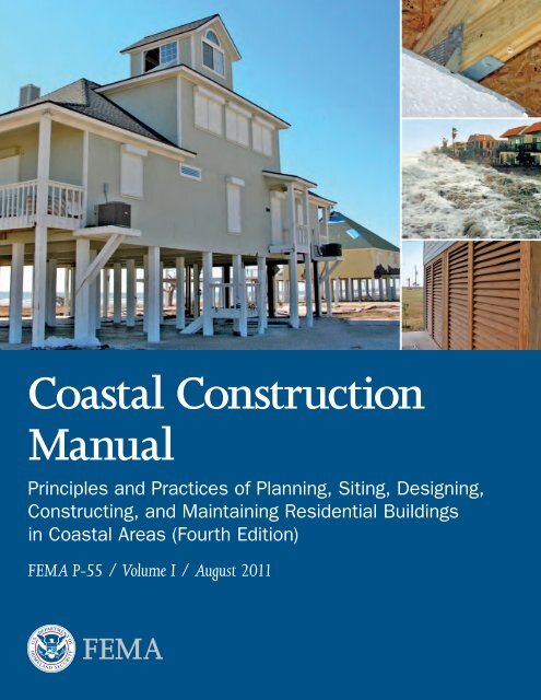
<strong>Coastal</strong> <strong>Construction</strong><br />
<strong>Manual</strong><br />
Principles and Practices of Planning, Siting, Designing,<br />
Constructing, and Maintaining Residential Buildings<br />
in <strong>Coastal</strong> Areas (Fourth Edition)<br />
FEMA P-55 / Volume I / August 2011
<strong>Coastal</strong> <strong>Construction</strong><br />
<strong>Manual</strong><br />
Principles and Practices of Planning, Siting,<br />
Designing, Constructing, and Maintaining<br />
Residential Buildings in <strong>Coastal</strong> Areas<br />
(Fourth Edition)<br />
FEMA P-55 / Volume I / August 2011
All illustrations in this document were created by<br />
FEMA or a FEMA contractor unless otherwise noted.<br />
All photographs in this document are public domain or taken<br />
by FEMA or a FEMA contractor, unless otherwise noted.
1 CHAPTER TITLE<br />
COASTAL CONSTRUCTION MANUAL<br />
Preface<br />
The 2011 <strong>Coastal</strong> <strong>Construction</strong> <strong>Manual</strong>, Fourth Edition (FEMA P-55), is a two-volume publication that<br />
provides a comprehensive approach to planning, siting, designing, constructing, and maintaining homes<br />
in the coastal environment. Volume I provides information about hazard identification, siting decisions,<br />
regulatory requirements, economic implications, and risk management. The primary audience for Volume I<br />
is design professionals, officials, and those involved in the decision-making process.<br />
Volume II contains in-depth descriptions of design, construction, and maintenance practices that, when<br />
followed, will increase the durability of residential buildings in the harsh coastal environment and reduce<br />
economic losses associated with coastal natural disasters. The primary audience for Volume II is the design<br />
professional who is familiar with building codes and standards and has a basic understanding of engineering<br />
principles.<br />
For additional information on residential coastal construction, see the FEMA Residential <strong>Coastal</strong><br />
<strong>Construction</strong> Web site at http://www.fema.gov/rebuild/mat/fema55.shtm.<br />
COASTAL CONSTRUCTION MANUAL<br />
i
1 CHAPTER TITLE<br />
COASTAL CONSTRUCTION MANUAL<br />
Fourth Edition Authors and Key Contributors<br />
William Coulbourne, Applied Technology Council<br />
Christopher P. Jones, Durham, NC<br />
Omar Kapur, URS Group, Inc.<br />
Vasso Koumoudis, URS Group, Inc.<br />
Philip Line, URS Group, Inc.<br />
David K. Low, DK Low and Associates<br />
Glenn Overcash, URS Group, Inc.<br />
Samantha Passman, URS Group, Inc.<br />
Adam Reeder, Atkins<br />
Laura Seitz, URS Group, Inc.<br />
Thomas Smith, TLSmith Consulting<br />
Scott Tezak, URS Group, Inc. – Consultant Project Manager<br />
Acknowledgments<br />
Fourth Edition Volume I Reviewers and Contributors<br />
Marcus Barnes, FEMA Headquarters<br />
Mark Crowell, FEMA Headquarters<br />
Lois Forster, FEMA Headquarters<br />
John Ingargiola, FEMA Headquarters – Technical Assistance and Research Contracts Program Manager<br />
Tucker Mahoney, FEMA Headquarters<br />
Alan Springett, FEMA Region II<br />
Paul Tertell, FEMA Headquarters – Project Manager<br />
Mark Vieira, FEMA Region IV<br />
Jonathan Westcott, FEMA Headquarters<br />
David Zaika, FEMA Headquarters<br />
Dana Bres, U.S. Department of Housing and Urban Development<br />
Stuart Davis, U.S. Army Corps of Engineers<br />
Roy Domangue, Wooden Creations, Inc.<br />
Brad Douglas, American Forest and Paper Association<br />
Russell J. Coco, Jr., Engensus<br />
Carol Friedland, Louisiana State University<br />
Trudie Johnson, Town of Hilton Head Island<br />
Ernie Katzwinkel, Dewberry<br />
Vladimir Kochkin, <strong>National</strong> Association of Home Builders<br />
Stephen Leatherman, Florida International University<br />
Amit Mahadevia, URS Group, Inc.<br />
Peter Mazikins, American Forest and Paper Association<br />
Deborah Mills, Dewberry<br />
Manuel Perotin, Atkins<br />
Rebecca Quinn, RCQuinn Consulting, Inc.<br />
Billy Ward, Champion Builders, LLC<br />
Fourth Edition Technical Editing, Layout, and Illustration<br />
Diana Burke, URS Group, Inc.<br />
Lee-Ann Lyons, URS Group, Inc.<br />
Susan Ide Patton, URS Group, Inc.<br />
Billy Ruppert, URS Group, Inc.<br />
COASTAL CONSTRUCTION MANUAL<br />
iii
1 CHAPTER TITLE<br />
COASTAL CONSTRUCTION MANUAL<br />
Contents<br />
Chapter 1. Introduction....................................................................................................................... 1-1<br />
1.1 Background................................................................................................................................. 1-1<br />
1.2 Purpose ...................................................................................................................................... 1-2<br />
1.3 Objectives.................................................................................................................................... 1-3<br />
1.3.1 Planning for <strong>Construction</strong>.............................................................................................. 1-3<br />
1.3.2 Successful Buildings........................................................................................................ 1-3<br />
1.3.2.1 Premise and Framework for Achieving Successful Designs.............................. 1-4<br />
1.3.2.2 Best Practices Approach....................................................................................1-5<br />
1.4 Organization and Use of This <strong>Manual</strong>.........................................................................................1-6<br />
1.4.1 Organization....................................................................................................................1-7<br />
Resources and Supporting Material................................................................................. 1-8<br />
1.4.2 Using the <strong>Manual</strong>........................................................................................................... 1-9<br />
1.4.3 Hazard Icons................................................................................................................... 1-9<br />
1.4.4. Contact Information......................................................................................................1-10<br />
1.5 References...................................................................................................................................1-11<br />
Chapter 2. Historical Perspective....................................................................................................... 2-1<br />
2.1 Introduction................................................................................................................................2-1<br />
2.2 <strong>Coastal</strong> Flood and Wind Events..................................................................................................2-2<br />
2.2.1 North Atlantic Coast......................................................................................................2-4<br />
2.2.2 Mid-Atlantic Coast......................................................................................................... 2-7<br />
2.2.3 South Atlantic Coast....................................................................................................... 2-8<br />
2.2.4 Gulf of Mexico Coast...................................................................................................... 2-9<br />
2.2.5 U.S. Caribbean Territories..............................................................................................2-11<br />
2.2.6 Great Lakes Coast......................................................................................................... 2-12<br />
COASTAL CONSTRUCTION MANUAL<br />
v
CONTENTS<br />
Volume I<br />
2.2.7 Pacific Coast..................................................................................................................2-13<br />
2.2.8 Hawaii and U.S. Pacific Territories.................................................................................2-15<br />
2.3 Breaking the Disaster-Rebuild-Disaster Cycle............................................................................ 2-16<br />
2.3.1 Hazard Identification.....................................................................................................2-16<br />
2.3.2 Siting.............................................................................................................................2-18<br />
2.3.3 Design.......................................................................................................................... 2-20<br />
2.3.4 <strong>Construction</strong>................................................................................................................. 2-24<br />
2.3.5 Enclosures..................................................................................................................... 2-26<br />
2.3.6 Maintenance................................................................................................................. 2-30<br />
2.4 References..................................................................................................................................2-30<br />
Chapter 3. Identifying Hazards........................................................................................................... 3-1<br />
3.1 Coastline Characteristics.............................................................................................................3-2<br />
3.1.1 <strong>Coastal</strong> Environment...................................................................................................... 3-2<br />
3.1.2 United States Coastline...................................................................................................3-4<br />
3.2 <strong>Coastal</strong> Storm Events...................................................................................................................3-7<br />
3.2.1.1 Tropical Cyclones............................................................................................ 3-8<br />
3.2.1.2 Other <strong>Coastal</strong> Storms.....................................................................................3-10<br />
3.3 <strong>Coastal</strong> Hazards........................................................................................................................ 3-12<br />
3.3.1 High Winds.................................................................................................................. 3-12<br />
3.3.1.1 Speedup of Winds Due to Topographic Effects..............................................3-15<br />
3.3.1.2 Wind-Borne Debris and Rainfall Penetration.................................................3-15<br />
3.3.1.3 Tornadoes.......................................................................................................3-16<br />
3.3.2 Earthquakes...................................................................................................................3-17<br />
3.3.3 Tsunamis.......................................................................................................................3-19<br />
3.3.4 Other Hazards and Environmental Effects.................................................................... 3-20<br />
3.3.4.1 Sea and Lake Level Rise................................................................................ 3-21<br />
3.3.4.2 Subsidence and Uplift.................................................................................... 3-24<br />
3.3.4.3 Salt Spray and Moisture................................................................................. 3-25<br />
3.3.4.4 Rain.............................................................................................................. 3-26<br />
3.3.4.5 Hail............................................................................................................... 3-26<br />
3.3.4.6 Termites........................................................................................................ 3-26<br />
3.3.4.7 Wildfire......................................................................................................... 3-27<br />
3.3.4.8 Floating Ice................................................................................................... 3-27<br />
3.3.4.9 Snow............................................................................................................. 3-27<br />
vi<br />
COASTAL CONSTRUCTION MANUAL
Volume I<br />
CONTENTS<br />
3.3.4.10 Atmospheric Ice............................................................................................. 3-27<br />
3.4 <strong>Coastal</strong> Flood Effects.................................................................................................................3-28<br />
3.4.1 Hydrostatic Forces ....................................................................................................... 3-28<br />
3.4.2 Hydrodynamic Forces................................................................................................... 3-28<br />
3.4.3 Waves............................................................................................................................ 3-31<br />
3.4.4 Flood-Borne Debris....................................................................................................... 3-33<br />
3.5 Erosion......................................................................................................................................3-35<br />
3.5.1 Describing and Measuring Erosion...............................................................................3-40<br />
3.5.2 Causes of Erosion..........................................................................................................3-42<br />
3.5.2.1 Erosion During Storms..................................................................................3-42<br />
3.5.2.2 Erosion Near Tidal Inlets, Harbor, Bay, and River Entrances........................3-44<br />
3.5.2.3 Erosion Due to Manmade Structures and Human Activities......................... 3-47<br />
3.5.2.4 Long-Term Erosion........................................................................................ 3-49<br />
3.5.2.5 Localized Scour..............................................................................................3-51<br />
3.5.3 Overwash and Sediment Burial..................................................................................... 3-52<br />
3.5.4 Landslides and Ground Failures.................................................................................... 3-52<br />
3.6 NFIP Flood Hazard Zones........................................................................................................ 3-53<br />
3.6.1 Base Flood Elevations.................................................................................................... 3-54<br />
3.6.2 Flood Insurance Zones.................................................................................................. 3-55<br />
3.6.3 FIRMs, DFIRMs, and FISs.......................................................................................... 3-56<br />
3.6.4 Wave Heights and Wave Crest Elevations...................................................................... 3-59<br />
3.6.5 Wave Runup................................................................................................................. 3-61<br />
3.6.6 Primary Frontal Dune................................................................................................... 3-61<br />
3.6.7 Erosion Considerations and Flood Hazard Mapping.....................................................3-62<br />
3.6.8 Dune Erosion Procedures..............................................................................................3-62<br />
3.6.9 Levees and Levee Protection..........................................................................................3-64<br />
3.7 Flood Hazard Assessments for Design Purposes........................................................................3-64<br />
3.7.1 Determine If Updated or More Detailed Flood Hazard Assessment is Needed.............. 3-65<br />
3.7.1.1 Does the FIRM Accurately Depict Present Flood Hazards?........................... 3-65<br />
3.7.1.2 Will Long-Term Erosion Render a FIRM Obsolete?......................................3-66<br />
3.7.1.3 Will Sea Level Rise Render a FIRM Obsolete?..............................................3-66<br />
3.7.2 Updating or Revising Flood Hazard Assessments.......................................................... 3-67<br />
3.8 Milestones of FEMA <strong>Coastal</strong> Flood Hazard Mapping Procedures and FIRMs..........................3-67<br />
3.9 References..................................................................................................................................3-69<br />
COASTAL CONSTRUCTION MANUAL<br />
vii
CONTENTS<br />
Volume I<br />
Chapter 4. Siting................................................................................................................................ 4-1<br />
4.1 Identifying Suitable Property for <strong>Coastal</strong> Residential Structures..................................................4-4<br />
4.2 Compiling Information on <strong>Coastal</strong> Property...............................................................................4-6<br />
4.3 Evaluating Hazards and Potential Vulnerability...........................................................................4-9<br />
4.3.1 Define <strong>Coastal</strong> Hazards Affecting the Property............................................................... 4-9<br />
4.3.2 Evaluate Hazard Effects on the Property........................................................................4-10<br />
4.4 General Siting Considerations................................................................................................... 4-11<br />
4.5 Raw Land Development Guidelines.......................................................................................... 4-13<br />
4.5.1 Road Placement near Shoreline......................................................................................4-15<br />
4.5.2 Lot Configurations along Shoreline................................................................................4-17<br />
4.5.3 Lot Configurations near Tidal Inlets, Bay Entrances, and River Mouths...................... 4-22<br />
4.6 Development Guidelines for Existing Lots.................................................................................4-23<br />
4.6.1 Building on Lots Close to Shoreline.............................................................................. 4-25<br />
4.6.2 Siting near Erosion Control Structures.......................................................................... 4-26<br />
4.6.3 Siting Adjacent to Large Trees....................................................................................... 4-27<br />
4.6.4 Siting of Pedestrian Access............................................................................................ 4-27<br />
4.7 Influence of Beach Nourishment and Dune Restoration on Siting Decisions.............................4-28<br />
4.8 Decision Time...........................................................................................................................4-30<br />
4.9 References .................................................................................................................................4-30<br />
Chapter 5. Investigating Regulatory Requirements.............................................................................. 5-1<br />
5.1 Land Use Regulations..................................................................................................................5-2<br />
5.1.1 <strong>Coastal</strong> Barrier Resource Areas and Other Protected Areas............................................. 5-3<br />
5.1.2 <strong>Coastal</strong> Zone Management Regulations..........................................................................5-4<br />
5.2 <strong>National</strong> Flood Insurance Program..............................................................................................5-5<br />
5.2.1 History of the NFIP........................................................................................................5-6<br />
5.2.2 FEMA Flood Hazard Studies..........................................................................................5-6<br />
5.2.3 Minimum Regulatory Requirements............................................................................... 5-7<br />
5.2.3.1 Minimum Requirements in All SFHAs........................................................... 5-7<br />
5.2.3.2 Additional Minimum Requirements for Buildings in Zone A......................... 5-9<br />
5.2.3.3 Additional Minimum Requirements for Buildings in Zone V........................5-10<br />
5.2.4 Community Rating System............................................................................................5-14<br />
viii<br />
COASTAL CONSTRUCTION MANUAL
Volume I<br />
CONTENTS<br />
5.3 Building Codes and Standards.................................................................................................. 5-15<br />
5.4 Best Practices for Exceeding Minimum NFIP Regulatory Requirements................................... 5-18<br />
5.4.1 Zone A...........................................................................................................................5-18<br />
5.4.2 <strong>Coastal</strong> A Zone and Zone V..........................................................................................5-18<br />
5.4.3 Summary.......................................................................................................................5-19<br />
5.5 References..................................................................................................................................5-20<br />
Chapter 6. Fundamentals of Risk Analysis and Risk Reduction............................................................ 6-1<br />
6.1 Assessing Risk..............................................................................................................................6-2<br />
6.1.1 Identifying Hazards for Design Criteria.......................................................................... 6-2<br />
6.1.2 Probability of Hazard Occurrence and Potential Consequences...................................... 6-3<br />
6.2 Reducing Risk ............................................................................................................................6-5<br />
6.2.1 Reducing Risk through Design and <strong>Construction</strong>...........................................................6-6<br />
6.2.1.1 Factors of Safety and Designing for Events that Exceed Design Minimums.... 6-7<br />
6.2.1.2 Designing above Minimum Requirements and Preparing for Events<br />
That Exceed Design Events.............................................................................. 6-9<br />
6.2.1.3 Role of Freeboard in <strong>Coastal</strong> <strong>Construction</strong>...................................................... 6-9<br />
6.2.2 Managing Residual Risk through Insurance................................................................. 6-10<br />
6.2.2.1 Types of Hazard Insurance.............................................................................6-11<br />
6.2.2.2 Savings, Premium, and Penalties................................................................... 6-12<br />
6.3 Communicating Risk to Clients................................................................................................ 6-13<br />
6.3.1 Misconceptions about the 100-Year Flood Event............................................................6-14<br />
6.3.2 Misconceptions about Levee Protection..........................................................................6-14<br />
6.4 References.................................................................................................................................. 6-17<br />
Acronyms......................................................................................................................................... A-1<br />
Glossary........................................................................................................................................... G-1<br />
Index..................................................................................................................................................I-1<br />
COASTAL CONSTRUCTION MANUAL<br />
ix
CONTENTS<br />
Volume I<br />
List of Figures<br />
Chapter 1<br />
Figure 1‐1. Design framework to achieve successful buildings........................................................... 1-4<br />
Chapter 2<br />
Figure 2-1.<br />
Map and timeline of significant coastal flood and wind events, and milestones<br />
for regulations, building codes, and building practices........................................... 2-2 – 2-5<br />
Figure 2-2. Schell Beach before and after the Long Island Express Hurricane in 1938.......................2-6<br />
Figure 2-3.<br />
Figure 2-4.<br />
Figure 2-5.<br />
Figure 2-6.<br />
Figure 2-7.<br />
Figure 2-8.<br />
Figure 2-9.<br />
Figure 2-10.<br />
Figure 2-11.<br />
Figure 2-12.<br />
Figure 2-13.<br />
Figure 2-14.<br />
Although this house seems to have lost only several decks and a porch during the<br />
March 1989 nor’easter, the loss of supporting soil due to long-term erosion left its<br />
structural integrity in question following successive storms............................................. 2-7<br />
Roof structure failure due to inadequate bracing and inadequate fastening of the<br />
roof deck......................................................................................................................... 2-8<br />
This elevated house atop a masonry pier foundation was lost, probably due to<br />
waves and storm surge reaching above the top of the foundation....................................2-11<br />
This house lost most of its metal roof covering due to high winds during<br />
Hurricane Marilyn in 1995........................................................................................... 2-12<br />
Erosion along the Lake Michigan shoreline at Holland, MI resulting from high<br />
lake levels and storm activity..........................................................................................2-13<br />
This building experienced structural damage due to a landslide in La Conchita,<br />
CA, after a January 2005 storm event............................................................................2-14<br />
Tsunami damage at Poloa, American Samoa..................................................................2-15<br />
School located approximately 1.3 miles from the Gulf shoreline damaged by<br />
storm surge and small waves...........................................................................................2-17<br />
Galveston Island beach house with wind damage to roof in high pressure zones<br />
at roof edge and roof corners..........................................................................................2-18<br />
Structures built close to the downdrift side of groins and jetties can experience<br />
increased erosion rates................................................................................................... 2-20<br />
Extreme case of localized scour undermining a Zone A slab-on-grade house<br />
located several hundred feet from the shoreline..............................................................2-21<br />
Successful example of well-elevated and embedded pile foundation tested by<br />
Hurricane Katrina......................................................................................................... 2-22<br />
x<br />
COASTAL CONSTRUCTION MANUAL
Volume I<br />
CONTENTS<br />
Figure 2-15.<br />
Figure 2-16.<br />
The pre-FIRM house experienced damage due to surge and waves while the<br />
newer, elevated, post-FIRM house experienced minimal damage.................................. 2-22<br />
The unprotected building sustained roof damage due to pressurization while the<br />
other sustained only minor damage because it was protected by shutters....................... 2-23<br />
Figure 2-17. Wind damage to roof structure and gable end wall....................................................... 2-24<br />
Figure 2-18. Failed masonry column connection............................................................................... 2-25<br />
Figure 2-19.<br />
Breakaway walls below the first floor of this house broke as intended under the<br />
flood forces of Hurricane Ike......................................................................................... 2-27<br />
Figure 2-20. Flood opening in an enclosure with breakaway walls..................................................... 2-27<br />
Figure 2-21.<br />
Louvers installed beneath an elevated house are a good alternative to<br />
breakaway walls............................................................................................................. 2-28<br />
Figure 2-22. An enclosure formed by open lattice.............................................................................. 2-28<br />
Figure 2-23. Above-grade enclosure................................................................................................... 2-29<br />
Figure 2-24. Two-story enclosure...................................................................................................... 2-30<br />
Chapter 3<br />
Figure 3-1. <strong>Coastal</strong> region terminology............................................................................................. 3-2<br />
Figure 3-2.<br />
Generalized depiction of erosion process along a rocky coastline.....................................3-4<br />
Figure 3-3. United States coastline.................................................................................................... 3-5<br />
Figure 3-4. Storm surge flooded this home in Ascension Parish, LA.................................................. 3-7<br />
Figure 3-5.<br />
Figure 3-6.<br />
Classification (by Saffir-Simpson Hurricane scale) of landfalling tropical cyclones<br />
along the U.S. Atlantic and Gulf of Mexico coasts, 1851–2009....................................... 3-9<br />
Flooding, erosion, and overwash at Fenwick Island, DE, following March<br />
1962 nor’easter...............................................................................................................3-11<br />
Figure 3-7. ASCE 7-10 wind speed map for Risk Category II buildings.......................................... 3-13<br />
Figure 3-8.<br />
Figure 3-9.<br />
Figure 3-10.<br />
End-wall failure of typical first-floor masonry/second-floor wood-frame building in<br />
Dade County, FL...........................................................................................................3-14<br />
Loss of roof sheathing due to improper nailing design and schedule in Kauai<br />
County, HI....................................................................................................................3-14<br />
Beach house with roof structure removed by Hurricane Ike...........................................3-14<br />
COASTAL CONSTRUCTION MANUAL<br />
xi
CONTENTS<br />
Volume I<br />
Figure 3-11.<br />
Figure 3-12.<br />
Figure 3-13.<br />
Apartment building with gable end wind damage from Hurricane Ike as a result<br />
of poor connection between brick veneer and wall structure..........................................3-15<br />
Damage from the 2009 tsunami....................................................................................3-19<br />
Observations of rates of change in mean sea level in the United States in feet<br />
per century.................................................................................................................... 3-21<br />
Figure 3-14. Mean sea level rise data for a station in Atlantic City, NJ.............................................. 3-22<br />
Figure 3-15. Monthly bulletin of lake levels for Lakes Michigan and Huron..................................... 3-23<br />
Figure 3-16. Land subsidence in the Houston-Galveston area, 1906–2000....................................... 3-24<br />
Figure 3-17. Example of corrosion, and resulting failure, of metal connectors................................... 3-25<br />
Figure 3-18. Intact houses floated off their foundations and carried inland....................................... 3-29<br />
Figure 3-19. Storm surge at Horseshoe Beach, FL............................................................................. 3-29<br />
Figure 3-20.<br />
Flow channeled between large buildings during Hurricane Opal in 1995 scoured<br />
a deep channel and damaged infrastructure and houses................................................ 3-30<br />
Figure 3-21. Pile-supported house in the area of channeled flow shown in Figure 3-20..................... 3-30<br />
Figure 3-22. This house, located in an area of channeled flow near that shown in Figure 3-20,<br />
was undermined, washed into the bay behind the barrier island, and became a<br />
threat to navigation....................................................................................................... 3-30<br />
Figure 3-23. Storm waves breaking against a seawall in front of a coastal residence........................... 3-31<br />
Figure 3-24. Wave runup beneath elevated buildings at Scituate, MA............................................... 3-31<br />
Figure 3-25.<br />
Figure 3-26.<br />
Figure 3-27.<br />
Figure 3-28.<br />
The sand underneath this Pensacola Beach, FL, building was eroded due to wave<br />
runup and storm surge.................................................................................................. 3-32<br />
<strong>Concrete</strong> slab-on-grade flipped up by wave action came to rest against two<br />
foundation members, generating large unanticipated loads on the building<br />
foundation.................................................................................................................... 3-32<br />
A pile-supported house at Dauphin Island, AL, was toppled and washed into<br />
another house, which suffered extensive damage........................................................... 3-33<br />
Pier pilings were carried over 2 miles by storm surge and waves before they came<br />
to rest against this elevated house.................................................................................. 3-34<br />
Figure 3-29. Debris generated by destroyed buildings at Pass Christian, MS..................................... 3-34<br />
Figure 3-30. Drift logs driven into coastal houses at Sandy Point, WA.............................................. 3-35<br />
Figure 3-31.<br />
Dune erosion in Ocean City, NJ, caused by the remnants of Hurricane Ida and<br />
a previous nor’easter...................................................................................................... 3-36<br />
xii<br />
COASTAL CONSTRUCTION MANUAL
Volume I<br />
CONTENTS<br />
Figure 3-32. Erosion and seawall damage in New Smyrna Beach, FL................................................ 3-37<br />
Figure 3-33. Erosion undermining a coastal residence in Oak Island, NC......................................... 3-37<br />
Figure 3-34. Overwash on Topsail Island, NC, after Hurricane Bonnie in 1998............................... 3-38<br />
Figure 3-35. A January 1987 nor’easter cut a breach across Nauset Spit on Cape Cod, MA............... 3-38<br />
Figure 3-36. Undermined house at Chatham, MA, in 1988.............................................................. 3-39<br />
Figure 3-37.<br />
Figure 3-38.<br />
Bluff failure by a combination of marine, terrestrial, and seismic processes led to<br />
progressive undercutting of blufftop apartments............................................................ 3-39<br />
Shoreline changes through time at a location approximately 1.5 miles south of<br />
Indian River Inlet, DE.................................................................................................. 3-41<br />
Figure 3-39. Breach through barrier island at Pine Beach, AL, before Hurricane Ivan (2001)<br />
and after (2004)............................................................................................................3-43<br />
Figure 3-40.<br />
Figure 3-41.<br />
Cape San Blas, Gulf County, FL in November 1984, before and after storminduced<br />
erosion.............................................................................................................3-43<br />
Ocean City Inlet, MD, was opened by a hurricane in 1933 and stabilized by jetties<br />
in 1934–35 that have resulted in extreme shoreline offset and downdrift erosion..........3-44<br />
Figure 3-42. Buildings threatened by erosion at Ocean Shores, WA, in 1998.................................... 3-45<br />
Figure 3-43.<br />
July 1989 photograph of vacant lot owned by Lucas, Isle of Palms, SC and<br />
photograph taken in December 1997 of lot with new home..........................................3-46<br />
Figure 3-44. Example of littoral sediments being trapped behind offshore breakwaters .................... 3-47<br />
Figure 3-45.<br />
Figure 3-46.<br />
Figure 3-47.<br />
Failure of seawall in Bay County, FL, led to undermining and collapse of the<br />
building behind the wall ..............................................................................................3-48<br />
Long-term erosion of the bluff along the Lake Michigan shoreline in Ozaukee<br />
County, WI, increases the threat to residential buildings outside the floodplain ........... 3-49<br />
Long-term erosion at South Bethany Beach, DE, has lowered ground elevations<br />
beneath buildings and left them more vulnerable to storm damage............................... 3-50<br />
Figure 3-48. Determination of localized scour from changes in sand color, texture, and bedding ......3-51<br />
Figure 3-49. Residential foundation that suffered severe scour on Bolivar Peninsula, TX.................. 3-52<br />
Figure 3-50. Overwash from Hurricane Opal (1995) at Pensacola Beach, FL.................................... 3-53<br />
Figure 3-51. Unstable coastal bluff at Beacon’s Beach, San Diego, CA.............................................. 3-53<br />
Figure 3-52. Portion of a paper FIRM showing coastal flood insurance rate zones............................ 3-57<br />
COASTAL CONSTRUCTION MANUAL<br />
xiii
CONTENTS<br />
Volume I<br />
Figure 3-53.<br />
Typical shoreline-perpendicular transect showing stillwater and wave crest<br />
elevations and associated flood zones............................................................................. 3-57<br />
Figure 3-54. Example DFIRM for a coastal area that shows the LiMWA.......................................... 3-58<br />
Figure 3-55.<br />
Figure 3-56.<br />
BFE determination for coastal flood hazard areas where wave crest elevations<br />
exceed wave runup elevations........................................................................................3-60<br />
Where wave runup elevations exceed wave crest elevations, the BFE is equal to<br />
the runup elevation....................................................................................................... 3-61<br />
Figure 3-57. Portions of pre- and post-Hurricane Fran FIRMs for Surf City, NC............................. 3-63<br />
Figure 3-58. Current FEMA treatment of dune removal and dune retreat......................................... 3-63<br />
Chapter 4<br />
Figure 4‐1. Evaluation of coastal property......................................................................................... 4-2<br />
Figure 4‐2.<br />
Figure 4‐3.<br />
Figure 4‐4.<br />
Figure 4‐5.<br />
Figure 4‐6.<br />
Figure 4‐7.<br />
Redevelopment on a previously developed lot as part of the rebuilding process<br />
after Hurricane Katrina................................................................................................... 4-3<br />
Long-term erosion left this well-built Kitty Hawk, NC, house standing in the ocean......4-4<br />
Although sited away from the shore, winds from Hurricane Floyd tore off<br />
the large overhanging roof of this house in Wrightstville Beach, NC..............................4-4<br />
Groins were installed in an attempt to stop erosion.........................................................4-6<br />
Cumulative effects of storms occurring within a short period at one housing<br />
development in Jacksonville, NC, July–September 1996................................................4-11<br />
When siting a foundation in two different flood zones, requirements for the most<br />
restrictive zone apply to the whole building................................................................... 4-12<br />
Figure 4‐8. Flood and debris damage to new construction in Zone A.............................................. 4-12<br />
Figure 4‐9.<br />
Figure 4‐10.<br />
Figure 4‐11.<br />
Figure 4‐12.<br />
Figure 4‐13.<br />
Figure 4‐14.<br />
Example of parcels well-suited to coastal development in Louisiana...............................4-14<br />
Example of parcels difficult to develop...........................................................................4-14<br />
Roads placed near shorelines can wash out, causing access problems for homes<br />
such as these located at Garcon Point, FL.......................................................................4-16<br />
Recommended lot layout for road setback near the shoreline..........................................4-16<br />
Comparison of Nags Head, NC, oceanfront lot layouts permitted before and<br />
after 1987.......................................................................................................................4-17<br />
Problematic versus recommended layouts for shore-parallel roadways and<br />
associated utilities...........................................................................................................4-18<br />
xiv<br />
COASTAL CONSTRUCTION MANUAL
Volume I<br />
CONTENTS<br />
Figure 4‐15.<br />
Figure 4‐16.<br />
Problematic versus recommended layouts for shoreline lots............................................4-19<br />
Narrow, low-lying areas and barrier islands are routinely subjected to coastal<br />
storm effects...................................................................................................................4-19<br />
Figure 4‐17. Lots created in line with natural or manmade features can concentrate floodwaters...... 4-20<br />
Figure 4‐18. <strong>Coastal</strong> lot development scenarios................................................................................. 4-21<br />
Figure 4‐19.<br />
Figure 4‐20.<br />
Figure 4‐21.<br />
Figure 4‐22.<br />
Figure 4‐23.<br />
Figure 4‐24.<br />
Figure 4‐25.<br />
As buildings in this Humbolt County, CA, community are threatened by<br />
bluff erosion along the Pacific Ocean, they are moved to other sites on the<br />
jointly owned parcel...................................................................................................... 4-22<br />
Three 2-year-old South Carolina houses left standing on the beach as a result<br />
of rapid erosion associated with a nearby tidal inlet....................................................... 4-23<br />
Condominiums built along the shoreline at the mouth of the Susquehanna River<br />
on the Chesapeake Bay were subjected to flood-borne debris after Hurricane Isabel...... 4-23<br />
<strong>Coastal</strong> building site in Aptos, CA, provides an example of a coastal building site<br />
subject to multiple hazards............................................................................................ 4-25<br />
Damage to buildings sited behind a rock revetment close to an eroding shoreline<br />
at Garden City Beach, SC............................................................................................. 4-26<br />
Beach erosion and damage due to a destroyed bulkhead at Bonita Beach, FL,<br />
from a subtropical storm............................................................................................... 4-27<br />
Notching the building and roofline around a tree can lead to roof and envelope<br />
damage during a high-wind event................................................................................. 4-28<br />
Chapter 5<br />
Figure 5-1.<br />
Figure 5-2.<br />
Recommended elevation for buildings in Zone A compared to minimum<br />
requirements..................................................................................................................5-19<br />
Recommended elevation for buildings in <strong>Coastal</strong> A Zone and Zone V<br />
compared to minimum requirements............................................................................ 5-20<br />
Chapter 6<br />
Figure 6‐1.<br />
Initial risk is reduced to residual risk through physical and financial risk reduction<br />
elements..........................................................................................................................6-6<br />
COASTAL CONSTRUCTION MANUAL<br />
xv
CONTENTS<br />
Volume I<br />
List of Tables<br />
Chapter 3<br />
Table 3-1. Saffir-Simpson Hurricane Wind Scale............................................................................. 3-9<br />
Table 3-2.<br />
Direct Hurricane Hits to U.S. Coastline Between 1851 and 2009 from Texas<br />
to Maine........................................................................................................................3-10<br />
Table 3-3. Enhanced Fujito Scale in Use Since 2007.......................................................................3-16<br />
Table 3-4.<br />
Earthquake MMI Scale..................................................................................................3-18<br />
Table 3-5. Areas of Observed Tsunami Events in the United States and Territories........................ 3-20<br />
Chapter 4<br />
Table 4‐1. General Information Needed to Evaluate <strong>Coastal</strong> Property ............................................ 4-7<br />
Table 4‐2.<br />
Planning and Site Development Guidelines for Raw Land.............................................4-15<br />
Table 4‐3. Guidelines for Siting Buildings on Existing Lots........................................................... 4-24<br />
Chapter 5<br />
Table 5-1. Minimum NFIP Requirements for Building in All SHFAs............................................. 5-8<br />
Table 5-2.<br />
Summary of NFIP Regulatory Requirements and Recommendations for<br />
Exceeding the Requirements..........................................................................................5-21<br />
Chapter 6<br />
Table 6-1. Probability of Natural Hazard Event Occurrence for Various Periods of Time................ 6-5<br />
xvi<br />
COASTAL CONSTRUCTION MANUAL
1 CHAPTER TITLE<br />
COASTAL CONSTRUCTION MANUAL<br />
1Introduction<br />
1.1 Background<br />
The Federal Emergency Management Agency (FEMA) first published the <strong>Coastal</strong> <strong>Construction</strong> <strong>Manual</strong><br />
(FEMA 55) in 1981. The <strong>Manual</strong> was updated in 1986 and provided guidance to public officials, designers,<br />
architects, engineers, and contractors for over a decade. In that time, however, construction practices and<br />
materials changed, and more information on hazards and building performance was developed and used to<br />
update the <strong>Manual</strong> again in 2000.<br />
Over the past several decades, the coastal population in the United States has increased significantly. The<br />
increased coastal population led to increased coastal development, which led in turn to greater numbers of<br />
structures at risk from coastal hazards. Additionally, many of the residential buildings constructed today are<br />
larger and more valuable than those of the past, resulting in the potential for larger economic losses when<br />
disasters strike. A FEMA study estimates that the combination<br />
of population growth and sea level rise may increase the portion<br />
of the U.S. population residing in a coastal floodplain from<br />
3 percent in 2010 to as much as 4 percent in 2100 (FEMA<br />
2010a [draft]).<br />
In response to increased hazards and lessons learned from<br />
past storms, regulatory requirements for construction in<br />
coastal areas have increased over the past decade. In 2000, the<br />
International Code Council (ICC) created the International<br />
Code Series (I-Codes) based on the three regional model<br />
building codes: the Building Officials Code Administrators<br />
CROSS REFERENCE<br />
Regulatory requirements,<br />
including the I-Codes, CZMA,<br />
and the NFIP, are addressed in<br />
Chapter 5.<br />
The <strong>Coastal</strong> High Hazard<br />
Area (or Zone V) is explained in<br />
Section 3.6.2 of this <strong>Manual</strong>.<br />
COASTAL CONSTRUCTION MANUAL<br />
1-1
1 INTRODUCTION<br />
International (BOCA) <strong>National</strong> Building Code (NBC), the Southern Building Code Congress International<br />
(SBCCI) Southern Building Code (SBC), and the International Conference of Building Officials (ICBO)<br />
Uniform Building Code (UBC). Based on data included in the Insurance Services Office (ISO) Building<br />
Code Effectiveness Grading Schedule (BCEGS) database, 86.5 percent of jurisdictions in the hurricaneprone<br />
region have adopted wind-resistant building codes, and 47.25 percent of flood-prone jurisdictions have<br />
adopted flood-resistant building codes (ISO 2011). As of the publication of this <strong>Manual</strong>, 33 of the 35 coastal<br />
States and U.S. territories, in implementing the <strong>Coastal</strong> Zone Management Act (CZMA) of 1972, have<br />
instituted construction setbacks and coastal resource protection programs. Many jurisdictions now require<br />
geotechnical studies and certifications from design professionals for construction along the coastline. Finally,<br />
as of May 2011, over 21,450 communities participate in the <strong>National</strong> Flood Insurance Program (NFIP),<br />
which requires, among other things, that plans for new buildings constructed in <strong>Coastal</strong> High Hazard Areas<br />
be certified by a design professional.<br />
Investigations conducted by FEMA and other organizations after major coastal disasters have consistently<br />
shown that properly sited, well-designed, and well-constructed coastal residential buildings generally perform<br />
well (refer to Chapter 2 for a discussion of the FEMA investigations). This updated <strong>Coastal</strong> <strong>Construction</strong><br />
<strong>Manual</strong>—prepared by FEMA with assistance from other agencies, organizations, and professionals involved<br />
in coastal construction and regulation—is intended to help designers and contractors identify and evaluate<br />
practices that will improve the quality of construction in coastal areas and reduce the economic losses<br />
associated with coastal disasters.<br />
The design and construction techniques included in this <strong>Manual</strong> are based on a comprehensive evaluation of:<br />
<br />
<strong>Coastal</strong> residential buildings, both existing and under construction<br />
<br />
Siting, design, and construction practices employed along the U.S. coastlines<br />
<br />
Building codes, floodplain management ordinances, and standards applicable to coastal construction<br />
<br />
Performance of coastal buildings based on post-disaster field investigations<br />
1.2 Purpose<br />
This <strong>Manual</strong> provides guidance for designing and constructing residential buildings in coastal areas that will<br />
be more resistant to the damaging effects of natural hazards. The focus is on new residential construction<br />
and substantial improvement or repairs of substantial damage to existing residential buildings—principally<br />
detached single-family homes, attached single-family homes (townhouses), and low-rise (three-story or less)<br />
multi-family buildings. Some of the recommendations of the <strong>Manual</strong> may also apply to non-substantial<br />
improvements or repairs. Discussions, examples, and example problems are provided for buildings in or<br />
near coastal flood hazard areas in a variety of coastal environments subject to high winds, flooding, seismic<br />
activity, erosion, and other hazards.<br />
This <strong>Manual</strong> is intended to be used by contractors, designers, architects, and engineers who are familiar with<br />
the design and construction of one- to three-story residential buildings in coastal areas of the United States<br />
and its territories. Readers less familiar with design and construction practices, as well as State and community<br />
officials, should also refer to FEMA P-762, Local Officials Guide for <strong>Coastal</strong> <strong>Construction</strong> (FEMA 2009),<br />
1-2 COASTAL CONSTRUCTION MANUAL
INTRODUCTION 1<br />
for guidance on planning and design considerations for improving the performance of coastal residential<br />
buildings before using this <strong>Manual</strong>.<br />
1.3 Objectives<br />
The goal of this <strong>Manual</strong> is to provide professionals guidance to assist them in pre-design, planning tasks and<br />
decisions as well as design and construction practices that will lead to building successful, disaster-resistant<br />
homes. For any project, it is critical that the project be well planned in order to minimize potential issues later<br />
on during the design and construction process and when the building is impacted by an event. These items<br />
are summarized in the following sections and elaborated on in detail throughout this <strong>Manual</strong>.<br />
1.3.1 Planning for <strong>Construction</strong><br />
One objective of this <strong>Manual</strong> is to highlight the many tasks and decisions that must be made before actual<br />
construction begins. These tasks include, but may not be limited to:<br />
<br />
Evaluating the suitability of coastal lands for residential construction<br />
<br />
Planning for development of raw land and for infill or redevelopment of previously developed land<br />
<br />
Identifying regulatory, environmental, and other constraints on construction or development<br />
<br />
Evaluating site-specific hazards and loads at a building site<br />
<br />
Evaluating techniques to mitigate hazards and reduce loads<br />
<br />
Identifying risk, insurance, and financial implications of siting, design, and construction decisions<br />
1.3.2 Successful Buildings<br />
A second objective of this <strong>Manual</strong> is to identify the best design<br />
and construction practices for building successful disasterresistant<br />
structures.<br />
In coastal areas, a building can be considered successful only if it<br />
is capable of resisting damage from coastal hazards and processes<br />
over a period of decades. This does not mean that a coastal<br />
residential building will remain undamaged over its intended<br />
lifetime, but that undermining from erosion and the effects of<br />
a design-level flood or wind event (or series of lesser events with<br />
combined impacts equivalent to a design event) will be limited.<br />
NOTE<br />
The designer should be familiar<br />
with the recommendations in<br />
this <strong>Manual</strong>, along with the<br />
building codes and engineering<br />
standards cited, as these may<br />
establish an expected level of<br />
professional care.<br />
A successful building is considered a building for which the following are true after a design-level event:<br />
<br />
The building foundation is intact and functional<br />
<br />
The envelope (lowest floor, walls, openings, and roof) is structurally sound and capable of minimizing<br />
penetration of wind, rain, and debris<br />
COASTAL CONSTRUCTION MANUAL<br />
1-3
1 INTRODUCTION<br />
TERMINOLOGY:<br />
DESIGN EVENT<br />
For the purposes of this <strong>Manual</strong>,<br />
a design event is the minimum<br />
code-required event (for natural<br />
hazards, such as flood, wind,<br />
and earthquake) and associated<br />
loads that the structure must be<br />
designed to resist.<br />
NOTE<br />
Design of a successful coastal<br />
building must consider the<br />
effects of coastal hazards and<br />
coastal processes over a period<br />
of decades.<br />
CROSS REFERENCE<br />
For more information about<br />
enclosures and the use of<br />
space below elevated buildings,<br />
see Section 2.3.5 of Chapter 2.<br />
<br />
The lowest floor elevation is high enough to prevent floodwaters<br />
from entering the building envelope<br />
<br />
The utility connections (e.g., electricity, water, sewer, natural<br />
gas) remain intact or can be easily restored<br />
<br />
The building is accessible and habitable<br />
<br />
Any damage to enclosures below the lowest floor does not<br />
result in damage to the foundation, utility connections, or<br />
elevated portions of the building or nearby structures<br />
<br />
For buildings affected by a design level seismic event, the<br />
building protects life and provides safety, even if the structure<br />
itself sustains significant damage<br />
1.3.2.1 Premise and Framework for Achieving Successful<br />
Designs<br />
The underlying goal of a successful design is expressed through its<br />
basic premise: Anticipated loads must be transferred through<br />
the building in a continuous path to the supporting soils. Any<br />
weakness in that continuous path is a potential point of failure.<br />
To fulfill this design premise, designers must address a variety<br />
of issues and constraints. These are illustrated in Figure 1-1 and<br />
summarized as follows:<br />
Funding. Any project is constrained by available funding, and<br />
designers must balance building size and expense against the<br />
Figure 1‐1.<br />
Design framework to<br />
achieve successful<br />
buildings<br />
1-4 COASTAL CONSTRUCTION MANUAL
INTRODUCTION 1<br />
desire for building success. Initial and long-term costs should be factored into the design. Higher initial<br />
construction costs may result in increased closing costs or higher mortgage rates, but may minimize potential<br />
building damage, reduce insurance rates, and reduce future maintenance costs.<br />
Risk tolerance. Some owners are willing and able to assume a high degree of financial and other risks, while<br />
other owners are more conservative and seek to minimize potential building damage and future costs.<br />
Building use. The intended use of the building will affect its layout, form, and function.<br />
Location. The location of the building will determine the nature and intensity of hazards to which the<br />
building will be exposed; loads and conditions that the building must withstand; and building codes,<br />
standards, and regulations that must be satisfied.<br />
Materials. A variety of building materials are available, and some are better suited to coastal environments<br />
than others. Owners and designers must select appropriate materials that address both aesthetic and durability<br />
issues. If an owner is prepared for frequent maintenance and replacement, the range of available materials will<br />
be wider; however, most owners are not prepared to do so, and the most durable materials should be used.<br />
Continuous load paths. Continuous load paths must be constructed and maintained over the intended life<br />
of the building.<br />
Resist or avoid hazards. The magnitudes of design forces acting on structures, coupled with project<br />
funding, building location, and other factors, will determine which forces can be resisted and which must<br />
be avoided. Structures are typically designed to resist wind loads and avoid flood loads (through elevation on<br />
strong foundations).<br />
Conditions greater than design conditions. Design loads and conditions are based on some probability<br />
of exceedance, and it is always possible that design loads and conditions can be exceeded. Designers can<br />
anticipate this and modify their initial design to better accommodate higher forces and more extreme<br />
conditions. The benefits of doing so often exceed the costs of building higher and stronger.<br />
Constructability. Ultimately, designs will only be successful if they can be implemented by contractors.<br />
Complex designs with many custom details may be difficult to construct and could lead to a variety of<br />
problems, both during construction and once the building is occupied.<br />
1.3.2.2 Best Practices Approach<br />
To promote best practices, portions of the <strong>Manual</strong> recommend and advocate techniques that exceed the<br />
minimum requirements of model building codes; design and construction standards; or Federal, State, and<br />
local regulations. The authors of the <strong>Manual</strong> are aware of the implications of such recommendations on the<br />
design, construction, and cost of coastal buildings, and make them only after careful review of building<br />
practices and subsequent building performance during design level events.<br />
Some of the recommended best practices and technical solutions presented in the previous version of<br />
FEMA 55 (2000, third edition) have been incorporated into the model building codes. For example:<br />
The 2009 and 2012 editions of the International Residential Code (IRC)—see sections R322.2.1(2) and<br />
R322.3.2(1)—require 1 foot of freeboard in the <strong>Coastal</strong> A Zone and in certain Zone V situations. Past<br />
minimum code provisions did not require any freeboard. Note that more than 1 foot of freeboard may<br />
COASTAL CONSTRUCTION MANUAL<br />
1-5
1 INTRODUCTION<br />
be indicated once the design framework steps<br />
outlined in Figure 1-1 are accomplished.<br />
<br />
The 2006, 2009, and 2012 editions of the<br />
International Building Code (IBC) require<br />
conformance with American Society of Civil<br />
Engineers (ASCE) Standard 24-05, Flood<br />
Resistant Design and <strong>Construction</strong>. ASCE 24-05<br />
requires new buildings situated in the <strong>Coastal</strong><br />
A Zone to be designed and constructed<br />
to Zone V requirements. Thus, the 2000<br />
version of the <strong>Coastal</strong> <strong>Construction</strong> <strong>Manual</strong><br />
recommendation to treat <strong>Coastal</strong> A Zone<br />
TERMINOLOGY:<br />
FREEBOARD<br />
Freeboard is an additional height that<br />
buildings are elevated above the base flood<br />
elevation (BFE). Freeboard acts as a factor<br />
of safety to compensate for uncertainties<br />
in the determination of flood elevations,<br />
and provides an increased level of flood<br />
protection. Freeboard will result in reduced<br />
flood insurance premiums.<br />
buildings like Zone V buildings is now being implemented for IBC-governed buildings through the<br />
building code.<br />
Sustainable building design concepts are increasingly being incorporated into residential building design<br />
and construction through green building rating systems. While the environmental benefits associated with<br />
adopting green building practices can be significant, these practices must be implemented in a manner<br />
that does not compromise the building’s resistance to natural hazards. FEMA P-798, Natural Hazards and<br />
Sustainability for Residential Buildings (FEMA 2010b), examines current green building rating systems<br />
in a broader context. It identifies green building practices—the tools of today’s green building rating<br />
systems—that are different from historical residential building practices and that, unless implemented with<br />
an understanding of their interactions with the rest of the structure, have the potential to compromise a<br />
building’s resistance to natural hazards. FEMA P-798 discusses how to retain or improve natural hazard<br />
resistance while incorporating green building practices.<br />
1.4 Organization and Use of This <strong>Manual</strong><br />
This <strong>Manual</strong> first provides a history of coastal disasters in the United States, an overview of the U.S. coastal<br />
environment, and fundamental considerations for constructing a building in a coastal region. The <strong>Manual</strong><br />
covers every step in the process of constructing a home in a coastal area: evaluating potential sites; selecting<br />
a site; locating, designing, and constructing the building; and insuring and maintaining the building.<br />
Flowcharts, checklists, maps, equations, and details are provided throughout the <strong>Manual</strong> to help the<br />
reader understand the entire process. In addition, example problems are presented to demonstrate decisions<br />
and calculations designers must make to reduce the potential for damage to the building from natural<br />
hazard events.<br />
The <strong>Manual</strong> also includes numerous examples of siting, design, and construction practices—both good and<br />
bad—to illustrate the results and ramifications of those practices. The intent is twofold: (1) to highlight the<br />
benefits of practices that have been employed successfully by communities, designers, and contractors, and<br />
(2) to warn against practices that have resulted in otherwise avoidable damage or loss of coastal residential<br />
buildings.<br />
1-6 COASTAL CONSTRUCTION MANUAL
INTRODUCTION 1<br />
1.4.1 Organization<br />
Because of its size, the <strong>Manual</strong> is divided into two volumes, with a total of 15 chapters. Additional supporting<br />
materials and resources are available at the FEMA Residential <strong>Coastal</strong> <strong>Construction</strong> Web site.<br />
Volume I<br />
Chapter 1 – Introduction. This chapter describes the purpose of the <strong>Manual</strong>, outlines the content and<br />
organization, and explains how icons are used throughout the <strong>Manual</strong> to guide and advise the reader.<br />
Chapter 2 – Historical Perspective. This chapter summarizes selected past coastal flood and wind events<br />
and post-event evaluations, and other major milestones. It documents the causes and types of damage<br />
associated with storms and tsunamis ranging from the 1900 hurricane that struck Galveston, TX, to the<br />
Samoan tsunami that struck American Samoa following an earthquake in September 2009.<br />
Chapter 3 – Identifying Hazards. This chapter describes coastal processes, coastal geomorphology, and<br />
coastal hazards. Regional variations for the Great Lakes, North Atlantic, Middle Atlantic, South Atlantic,<br />
Gulf of Mexico, Pacific, Alaska, Hawaii, and U.S. territories are discussed. This chapter also discusses<br />
hazards that influence the design and construction of a coastal building (coastal storms, erosion, tsunamis,<br />
and earthquakes) and their effects.<br />
Chapter 4 – Siting. This chapter describes the factors that should be considered when selecting building<br />
sites, including small parcels in areas already developed, large parcels of undeveloped land, and redevelopment<br />
sites. Guidance is also provided to help designers and contractors determine how a building should be placed<br />
on a site. Detailed discussions of the coastal construction process begin in this chapter.<br />
Chapter 5 – Investigating Regulatory Requirements. This chapter presents an overview of building codes<br />
and Federal, State, and local regulations that may affect construction on a coastal building site. Additionally,<br />
the NFIP, <strong>Coastal</strong> Barrier Resources Act (CBRA), and <strong>Coastal</strong> Zone Management (CZM) programs are<br />
described.<br />
Chapter 6 – Fundamentals of Risk Analysis and Risk Reduction. This chapter summarizes acceptable<br />
levels of risk; tradeoffs in decisions concerning siting, design, construction, and maintenance; and cost and<br />
insurance implications that should be considered in coastal construction.<br />
Volume II<br />
Chapter 7 – Pre-Design Considerations. This chapter introduces the design process, minimum design<br />
requirements, inspections, and sustainable design considerations. It discusses the cost and insurance<br />
implications of decisions made during design and construction. It also outlines the contents of Volume II.<br />
Chapter 8 – Determining Site-Specific Loads. This chapter explains how to calculate site-specific loads,<br />
including loads from high winds, flooding, seismic events, and tsunamis, as well as combinations of more<br />
than one load. Example problems are provided to illustrate the application of design load provisions of ASCE<br />
7-10, Minimum Design Loads for Buildings and Other Structures (ASCE 2010).<br />
Chapter 9 – Designing the Building. This chapter contains information on designing each part of a<br />
building to withstand expected loads. Topics covered include structural failure modes, load paths, building<br />
COASTAL CONSTRUCTION MANUAL<br />
1-7
1 INTRODUCTION<br />
systems, application of loads, structural connections, building material considerations, requirements for<br />
breakaway walls, and considerations for designing appurtenances.<br />
Chapter 10 – Designing the Foundation. This chapter presents recommendations for the selection and<br />
design of foundations. Design of foundation elements including pile capacity in soil, installation methods,<br />
and material durability considerations are discussed.<br />
Chapter 11 – Designing the Building Envelope. This chapter describes how to design roof coverings,<br />
exterior wall coverings, exterior doors and windows, shutters, and soffits to resist natural hazards.<br />
Chapter 12 – Mechanical Equipment and Utilities. This chapter provides guidance on design<br />
considerations of mechanical equipment and utilities, as well as techniques that can improve the capability<br />
of equipment to survive a natural disaster.<br />
Chapter 13 – Constructing the Building. This chapter describes how to properly construct a building<br />
in a coastal area and how to avoid common construction mistakes that may lessen the ability of a building<br />
to withstand a natural disaster. It includes guidance on material choices and durability, and construction<br />
techniques for improved resistance to decay and corrosion.<br />
Chapter 14 – Maintaining the Building. This chapter explains special maintenance concerns for new and<br />
existing buildings in coastal areas. Methods to reduce damage from corrosion, moisture, weathering, and<br />
termites are discussed, along with building elements that require frequent maintenance.<br />
Chapter 15 – Retrofitting Existing Buildings. This chapter includes broad guidance for evaluating existing<br />
residential structures to assess the need and feasibility for wildfire, seismic, flood, and wind retrofitting. It also<br />
includes a discussion of wind retrofit packages that encourage homeowners to take advantage of opportunities<br />
to strengthen their homes while performing routine maintenance (e.g., roof shingle replacement).<br />
Resources and Supporting Material<br />
The FEMA Residential <strong>Coastal</strong> <strong>Construction</strong> Web site (http://www.FEMA.gov/rebuild/mat/fema55.shtm)<br />
provides guidance and other information to augment the content of this <strong>Manual</strong>. The material provided on<br />
the Web site includes a glossary for this <strong>Manual</strong> as well as:<br />
<br />
Resource documents. Examples include Dune Walkover<br />
Guidance, Material Durability in <strong>Coastal</strong> Environments, and<br />
Swimming Pool Design Guidance.<br />
<br />
Links and contact information. Government agencies,<br />
professional and trade organizations, code and standard<br />
organizations, and natural hazard and coastal science<br />
organizations.<br />
<br />
Links to additional Web sites and coastal construction<br />
resources published by FEMA. Examples include the Wind<br />
Retrofit Guide for Residential Buildings (FEMA P-804), Home<br />
Builder’s Guide to <strong>Coastal</strong> <strong>Construction</strong> (FEMA P-499), and<br />
the FEMA Safe Room and Building Science Web sites.<br />
NOTE<br />
In previous editions of<br />
the <strong>Coastal</strong> <strong>Construction</strong><br />
<strong>Manual</strong>, Volume III contained<br />
appendices and information<br />
that expanded on content<br />
provided in Volumes I and II.<br />
The FEMA Residential <strong>Coastal</strong><br />
<strong>Construction</strong> Web site now<br />
serves as the location for<br />
additional content.<br />
1-8 COASTAL CONSTRUCTION MANUAL
INTRODUCTION 1<br />
1.4.2 Using the <strong>Manual</strong><br />
This <strong>Manual</strong> uses icons as visual guides to help readers quickly find information. These icons call out notes,<br />
warnings, definitions, cross references, cost considerations, equations, example problems, and specific hazards.<br />
Notes. Notes contain supplemental information that readers may find helpful, including things<br />
to consider when undertaking a coastal construction project, suggestions that can expedite the<br />
project, and the titles and sources of other publications related to coastal construction. Full<br />
references for publications are presented at the end of each chapter of the <strong>Manual</strong>.<br />
Warnings. Warnings present critical information that will help readers avoid mistakes that could<br />
result in dangerous conditions, violations of ordinances or laws, and possibly delays and higher<br />
costs in a coastal construction project. Any questions about the meanings of warnings in this<br />
<strong>Manual</strong> should be directed to the appropriate State or local officials.<br />
Terminology. The meanings of selected technical and other special terms are presented where<br />
appropriate.<br />
Cross references. Cross references point the reader to information that supplements or further<br />
explains issues of interest in this <strong>Manual</strong>, such as technical discussions, regulatory information,<br />
equations, tables, and figures.<br />
Cost Considerations. Cost consideration notes discuss issues that can affect short-term and<br />
lifecycle and insurance costs associated with a coastal residential construction project.<br />
Equations. Volume II includes equations for calculating loads imposed by forces associated with<br />
natural hazard events. It also presents equations used in the design of building components<br />
intended to withstand the loads imposed by design events. Equations are numbered for ease of<br />
reference.<br />
Examples. In Volume II, example problems demonstrate the calculation of flood, wind, and<br />
seismic loads on a coastal residential building. Example problems are numbered for ease of<br />
reference.<br />
1.4.3 Hazard Icons<br />
Hazard icons will help readers find information specific to their needs (see below). To use the icons effectively,<br />
readers must determine in which flood zone the property or building site in question is located. Chapter 3<br />
of this <strong>Manual</strong> explains how to make such a determination and includes detailed definitions of the flood<br />
hazard zones.<br />
COASTAL CONSTRUCTION MANUAL<br />
1-9
1 INTRODUCTION<br />
Zone V. Portion of the Special Flood Hazard Area<br />
(SFHA) that extends from offshore to the inland<br />
limit of a primary frontal dune along an open coast,<br />
and any other area subject to high-velocity wave<br />
action from storms or tsunamis.<br />
<strong>Coastal</strong> A Zone. A subset of Zone A. Specifically,<br />
that portion of the SFHA landward of Zone V (or<br />
landward of a coastline without a mapped Zone V)<br />
in which the principal source of flooding is coastal<br />
storms, and where the potential base flood wave<br />
height is between 1.5 and 3.0 feet.<br />
Zone A. Portion of the SFHA in which the principal<br />
source of flooding is runoff from rainfall, snowmelt,<br />
or coastal storms where the potential base flood wave<br />
height is between 0.0 and 3.0 feet.<br />
TERMINOLOGY:<br />
SPECIAL FLOOD<br />
HAZARD AREA<br />
The SFHA is the land area<br />
covered by the floodwaters of the<br />
base flood on NFIP maps. It is the<br />
area where the NFIP’s floodplain<br />
management regulations must<br />
be enforced and the area where<br />
the mandatory purchase of flood<br />
insurance applies. The SFHA<br />
includes Zones A, AO, AH, A1-30,<br />
AE, A99, AR, AR/A1-30, AR/AE,<br />
AR/AO, AR/AH, AR/A, VO, V1-30,<br />
VE, and V.<br />
Zone X. Includes shaded and unshaded Zone X. The flood hazard is less severe here than<br />
in the SFHA.<br />
1.4.4. Contact Information<br />
Every effort has been made to make this <strong>Manual</strong> as comprehensive as possible. However, no single manual can<br />
anticipate every situation or need that may arise in a coastal construction project. Readers who have questions<br />
not addressed herein should consult local officials. Information is also available from the FEMA Building<br />
Science Helpline (Web: http://www.fema.gov/rebuild/buildingscience/, e-mail: FEMA-Buildingsciencehelp@<br />
dhs.gov, telephone: 866-927-2104), and the Mitigation Division of the appropriate FEMA Regional Office.<br />
Contact information for FEMA personnel, the State NFIP Coordinating Agencies, and the State <strong>Coastal</strong><br />
Zone Management Agencies are provided on the FEMA Residential <strong>Coastal</strong> <strong>Construction</strong> Web page.<br />
1-10 COASTAL CONSTRUCTION MANUAL
INTRODUCTION 1<br />
1.5 References<br />
ASCE (American Society of Civil Engineers). 2005. Flood Resistant Design and <strong>Construction</strong>. ASCE<br />
Standard ASCE 24-05.<br />
ASCE. 2010. Minimum Design Loads for Buildings and Other Structures. ASCE Standard ASCE 7-10.<br />
FEMA (Federal Emergency Management Agency). 2000. FEMA 55 (3 rd Edition). <strong>Coastal</strong> <strong>Construction</strong><br />
<strong>Manual</strong>: Principles and Practices of Planning, Siting, Designing, Constructing, and Maintaining<br />
Residential Buildings in <strong>Coastal</strong> Areas. May.<br />
FEMA. 2009. P-762, Local Officials Guide for <strong>Coastal</strong> <strong>Construction</strong>: Design Considerations, Regulatory<br />
Guidance, and Best Practices for <strong>Coastal</strong> Communities. February.<br />
FEMA. 2010a (draft). The Impact of Climate Change on the <strong>National</strong> Flood Insurance Program. August 2010<br />
draft; still draft as of July 2011).<br />
FEMA. 2010b. P-798, Natural Hazards and Sustainability for Residential Buildings. September.<br />
ISO (Insurance Service Office, Inc.). 2011. Building Code Effective Grading Schedule. http://www.<br />
isomitigation.com/bcegs/0000/bcegs0001.html. Accessed June 28, 2011.<br />
COASTAL CONSTRUCTION MANUAL<br />
1-11
1 CHAPTER TITLE<br />
COASTAL CONSTRUCTION MANUAL<br />
2Historical Perspective<br />
2.1 Introduction<br />
Through the years, FEMA, other Federal agencies, State and<br />
local agencies, and other private groups have documented and<br />
evaluated the effects of coastal flood and wind events and the<br />
performance of buildings located in coastal areas during those<br />
events. These evaluations provide a historical perspective on the<br />
siting, design, and construction of buildings along the Atlantic,<br />
Pacific, Gulf of Mexico, and Great Lakes coasts. These studies<br />
provide a baseline against which the effects of later coastal flood<br />
events can be measured.<br />
Within this context, certain hurricanes, coastal storms, and other<br />
coastal flood events stand out as being especially important, either<br />
because of the nature and extent of the damage they caused or<br />
because of particular flaws they exposed in hazard identification,<br />
siting, design, construction, or maintenance practices. Many of<br />
these events—particularly those occurring since 1979—have been<br />
documented by FEMA in Flood Damage Assessment Reports,<br />
Building Performance Assessment Team (BPAT) reports, and<br />
Mitigation Assessment Team (MAT) reports. These reports<br />
summarize investigations that FEMA conducts shortly after<br />
major disasters. Drawing on the combined resources of a Federal,<br />
State, local, and private sector partnership, a team of investigators<br />
CROSS REFERENCE<br />
For resources that augment<br />
the guidance and other<br />
information in this <strong>Manual</strong>,<br />
see the Residential <strong>Coastal</strong><br />
<strong>Construction</strong> Web site (http://<br />
www.fema.gov/rebuild/mat/<br />
fema55.shtm).<br />
NOTE<br />
Hurricane categories reported<br />
in this <strong>Manual</strong> should be<br />
interpreted cautiously. Storm<br />
categorization based on wind<br />
speed may differ from that<br />
based on barometric pressure<br />
or storm surge. Also, storm<br />
effects vary geographically—<br />
only the area near the point of<br />
landfall will experience effects<br />
associated with the reported<br />
storm category.<br />
COASTAL CONSTRUCTION MANUAL<br />
2-1
2 HISTORICAL PERSPECTIVE<br />
is tasked with evaluating the performance of buildings and related infrastructure in response to the effects<br />
of natural and man-made hazards. The teams conduct field investigations at disaster sites; work closely with<br />
local and State officials to develop recommendations for improvements in building design and construction;<br />
and prepare recommendations concerning code development, code enforcement, and mitigation activities<br />
that will lead to greater resistance to hazard events.<br />
This chapter summarizes coastal flood and wind events that have affected the United States and its territories<br />
since the beginning of the twentieth century. The lessons learned regarding factors that contribute to flood<br />
and wind damage are discussed.<br />
2.2 <strong>Coastal</strong> Flood and Wind Events<br />
This section summarizes major coastal flood and wind events in the United States from 1900 to 2010. Many<br />
of these events have led to changes in building codes, regulations, mapping, and mitigation practices. The<br />
map and timeline in Figure 2-1 provide a chronological list of the major coastal flood and wind events in<br />
combination with the major milestones resulting from the events. They show the evolution of coastal hazard<br />
1982/83<br />
WA<br />
ME<br />
MT<br />
1997/98<br />
ND<br />
GREAT LAKES<br />
MN<br />
VT<br />
OR<br />
NORTH<br />
NH<br />
WI<br />
ATLANTIC<br />
ID<br />
1940<br />
SD<br />
NY MA<br />
1964<br />
WY<br />
1986 1951<br />
CTRI<br />
MI<br />
1985 1991<br />
2004/05<br />
1996/97<br />
1973<br />
1991<br />
PA 1938<br />
IA<br />
NE<br />
NV<br />
NJ 1985<br />
1982/83<br />
1987 IN OH<br />
MD 1984 MID-ATLANTIC<br />
UT<br />
DE<br />
Events on this map correspond CO to the timelines in this figure.<br />
1992 1962<br />
1997/98<br />
IL<br />
WV<br />
The timeline includes information on how VA<br />
KS some of these events<br />
1972<br />
CA<br />
MO<br />
2003<br />
influenced regulations, building codes, and building practices. KY<br />
1989 1988<br />
NC<br />
TN<br />
PACIFIC<br />
AZ<br />
OK<br />
1999<br />
NM<br />
AR<br />
AL<br />
1988<br />
SC<br />
MS<br />
1996<br />
1979<br />
1998 GA<br />
2004<br />
1989<br />
TX<br />
LA<br />
SOUTH ATLANTIC<br />
2001 1969<br />
FL<br />
1995<br />
1965<br />
2004<br />
1900<br />
2005<br />
1983<br />
1970 2008<br />
GULF OF MEXICO<br />
1964<br />
2004<br />
1926<br />
ALASKA<br />
1992<br />
1975<br />
1989<br />
1995<br />
U.S. VIRGIN<br />
ISLANDS<br />
CARIBBEAN<br />
1989<br />
1995<br />
1998<br />
PUERTO<br />
RICO<br />
1992<br />
1960 2009<br />
AMERICAN<br />
HAWAII<br />
SAMOA<br />
HAWAII & U.S. PACIFIC TERRITORIES<br />
1997<br />
GUAM<br />
Hurricane/<br />
Typhoon<br />
Tsunami<br />
Other Storm<br />
Figure 2-1.<br />
Map and timeline of significant coastal flood and wind events, and milestones for regulations, building codes,<br />
and building practices<br />
2-2 COASTAL CONSTRUCTION MANUAL
HISTORICAL PERSPECTIVE 2<br />
Figure 2-1 (continued).<br />
Map and timeline of significant coastal flood and wind events, and milestones for regulations, building codes,<br />
and building practices<br />
COASTAL CONSTRUCTION MANUAL<br />
2-3
2 HISTORICAL PERSPECTIVE<br />
Figure 2-1 (continued).<br />
Map and timeline of significant coastal flood and wind events, and milestones for regulations, building codes,<br />
and building practices<br />
mitigation practices in the United States since the year 1900.<br />
Each event is color-coded by hazard type and corresponds to a<br />
symbol on the map where the storm occurred. The map shows<br />
the eight coastal regions defined in this chapter.<br />
2.2.1 North Atlantic Coast<br />
The North Atlantic Coast is generally considered the coastal<br />
area from northern Maine to Long Island, NY. This coastal<br />
area is most susceptible to nor’easters and hurricane remnants,<br />
but significant hurricanes occasionally make landfall. Flood<br />
and erosion damage is often significant, damaging foundations<br />
and even undermining buildings to the point of collapse.<br />
Wind causes roof and envelope damage, especially as a result<br />
of tree fall.<br />
CROSS REFERENCE<br />
For a more detailed history of<br />
storms for the different areas<br />
of the United States see the<br />
Residential <strong>Coastal</strong> <strong>Construction</strong><br />
Web site (http://www.fema.gov/<br />
rebuild/mat/fema55.shtm).<br />
The <strong>National</strong> Oceanic and<br />
Atmospheric Administration<br />
(NOAA) provides detailed<br />
tropical storm and hurricane<br />
track information starting in 1848<br />
(http://csc.noaa.gov/hurricanes/)<br />
2-4 COASTAL CONSTRUCTION MANUAL
HISTORICAL PERSPECTIVE 2<br />
Figure 2-1 (concluded).<br />
Map and timeline of significant coastal flood and wind events, and milestones for regulations, building codes,<br />
and building practices<br />
COASTAL CONSTRUCTION MANUAL<br />
2-5
2 HISTORICAL PERSPECTIVE<br />
In 1938, the “Long Island Express” hurricane moved rapidly up the east coast from New York through<br />
New England. The storm caused widespread surge and wind damage to buildings, and is still used as a<br />
benchmark for predicting worst-case scenario damage in the region (Figure 2-2). Although not shown in the<br />
photograph, this hurricane also destroyed many elevated homes along this stretch of coastline.<br />
In September 1985, Hurricane Gloria hit Long Island, NY, and New Jersey, causing minor storm surge<br />
and erosion damage and significant wind damage. In 1991, New England was hit by two major storms—<br />
Hurricane Bob in August and a nor’easter in October. A FEMA Flood Damage Assessment Report<br />
noted that flood damage to buildings constructed before the local adoption of the Flood Insurance Rate<br />
Map (FIRM), known as pre-FIRM construction, that had not been elevated or that had not been elevated<br />
sufficiently suffered major damage, while properly elevated buildings constructed after the adoption of the<br />
FIRM (post-FIRM) performed well (URS 1991c). These storms provided insight into successful foundation<br />
design practices.<br />
Figure 2-2.<br />
Schell Beach before and<br />
after the Long Island<br />
Express Hurricane in<br />
1938; houses near the<br />
shoreline were destroyed<br />
and more distant houses<br />
were damaged<br />
(Guilford, CT)<br />
SOURCE: WORKS<br />
PROGRESS ADMINISTRATION<br />
PHOTOGRAPH FROM<br />
MINSINGER 1988<br />
BEFORE<br />
AFTER<br />
2-6 COASTAL CONSTRUCTION MANUAL
HISTORICAL PERSPECTIVE 2<br />
2.2.2 Mid-Atlantic Coast<br />
The Mid-Atlantic Coast is generally considered the coastal area from New Jersey to Virginia. This coastal<br />
area is susceptible to both nor’easters and hurricanes with flood and wind damage similar to the damage that<br />
occur in New England.<br />
In March 1962, a significant nor’easter, known as the Great Atlantic Storm of 1962 or the Ash Wednesday<br />
Storm, affected almost the entire eastern seaboard and caused extreme damage in the Mid-Atlantic region.<br />
The combination of sustained high winds with spring tides resulted in severe beachfront erosion and flooding,<br />
sweeping many buildings out to sea.<br />
In June 1972, Tropical Storm Agnes produced rains up to 19 inches, resulting in severe riverine flooding<br />
from New York to Virginia and billions of dollars in flood damage. The catastrophic damage from this storm<br />
led to the “Mandatory Flood Insurance Purchase Requirement” in the Flood Disaster Protection Act of 1973<br />
(see Section 5.2 for more on the history of the NFIP).<br />
A March 1984 nor’easter caused significant<br />
erosion problems. As a result of damage observed<br />
after this storm and Hurricane Gloria (see<br />
Section 2.2.1), New Jersey implemented several<br />
changes to its coastal development practices in<br />
1985.<br />
An April 1988 nor’easter caused foundation<br />
damage to elevated homes in Virginia and<br />
North Carolina. Long-term shoreline erosion,<br />
coupled with the effects of three previous<br />
coastal storms, had left the area vulnerable.<br />
Inspections following the 1988 nor’easter<br />
revealed that repairs to previous foundation<br />
damage were only partially effective. In some<br />
cases, ineffective repairs implemented after<br />
storms resulted in subsequent storm damage<br />
that may not have occurred if the original repair<br />
had been properly made (URS 1989). A March<br />
1989 nor’easter in the same area caused even<br />
further foundation damage. The damage from<br />
the 1988 and 1989 storms showed that longterm<br />
erosion makes buildings increasingly<br />
vulnerable (Figure 2-3) to the effects of even<br />
minor storms (URS 1990).<br />
A few years later, an intense January 1992<br />
nor’easter hit Delaware and Maryland.<br />
Observations made by the FEMA BPAT after<br />
this storm noted damage due to storm surge,<br />
wave action, and erosion, as well as many load<br />
path failures in coastal buildings (FEMA 1992).<br />
Figure 2-3.<br />
Although this house seems to have lost only several decks<br />
and a porch during the March 1989 nor’easter, the loss of<br />
supporting soil due to long-term erosion left its structural<br />
integrity in question following successive storms<br />
COASTAL CONSTRUCTION MANUAL<br />
2-7
2 HISTORICAL PERSPECTIVE<br />
In September 2003, Hurricane Isabel made landfall near Cape Lookout, NC, as a Category 2 hurricane,<br />
breaching the barrier island. Storm surge and heavy rainfall caused extensive flooding across the Mid-Atlantic<br />
region, especially in areas adjacent to the Chesapeake Bay. Maximum observed water levels at stations along<br />
the Chesapeake Bay exceeded historical observations (NOAA 2004).<br />
2.2.3 South Atlantic Coast<br />
The South Atlantic Coast is generally considered the coastal area from North Carolina up to and including<br />
the Florida Keys. This region, especially the North Carolina Outer Banks and south Florida, is often subjected<br />
to hurricanes. States in the northern part of this region, such as North Carolina, are also susceptible to<br />
nor’easters. Damage is typically caused by flooding, waves, erosion, water-borne debris, wind, and windborne<br />
debris. The degree of damage ranges from slight to severe, depending on the characteristics of the<br />
storm.<br />
After a September 1926 hurricane hit Miami, FL, a south Florida engineer, Theodore Eefting, wrote an<br />
article on the damage pointing out many weaknesses in buildings and construction that continue to be<br />
discussed today. Most notably, he stressed the consequences of poor quality construction, and the importance<br />
of strengthening building codes (Eefting 1927).<br />
In late September 1989, Hurricane Hugo struck South Carolina. Observations following this hurricane<br />
revealed notable differences between the performance of pre- and post-FIRM buildings. Additionally, the<br />
BPAT deployed after Hurricane Hugo noted that some of the most severely damaged buildings were several<br />
rows back from the shoreline, and as a result recommended that design standards for <strong>Coastal</strong> A Zones<br />
(defined in Chapter 1) be more stringent. The wind damage from Hurricane Hugo also exposed deficiencies<br />
in residential roofing practices (URS 1991a, URS 1991b, and Texas Tech 1990).<br />
In August 1992, Hurricane Andrew struck the southeast Atlantic coast. This hurricane remains one of<br />
the most memorable hurricanes to hit this region and one of the costliest to date. The majority of the<br />
damage from this hurricane was due to wind; many of the failures were traced to inadequate connections<br />
between building elements (Figure 2-4). As such, buildings could not resist wind forces because of the lack<br />
Figure 2-4.<br />
Roof structure failure due<br />
to inadequate bracing and<br />
inadequate fastening of<br />
the roof deck, Hurricane<br />
Andrew (Dade County, FL,<br />
1992)<br />
2-8 COASTAL CONSTRUCTION MANUAL
HISTORICAL PERSPECTIVE 2<br />
of continuous load transfer paths from the roofs to the foundations (FEMA 1993). Hurricane Andrew was<br />
a major catalyst for building code changes involving wind design that improved wind pressure calculation<br />
procedures and emphasized the need for a continuous load transfer path in buildings for uplift and lateral<br />
loads, not just for the traditional downward-acting gravity loads. Hurricane Andrew destroyed 97 percent of<br />
the manufactured homes in its path, leading the Department of Housing and Urban Development (HUD)<br />
to adopt more stringent wind design criteria for manufactured homes (FEMA 2009a).<br />
In 1996, Hurricane Fran hit North Carolina. The resulting wave damage reinforced the idea that buildings<br />
in <strong>Coastal</strong> A Zones should be more hazard-resistant. The FEMA BPAT report noted that more stringent<br />
design codes and standards were needed to achieve improved performance (FEMA 1997).<br />
In September 1999, Hurricane Floyd briefly touched Florida before making landfall in North Carolina and<br />
moving north along the east coast as a tropical storm all the way to Maine. Although inland flood damage<br />
was severe in eastern North Carolina, high winds, storm surge and torrential rains caused moderate damage<br />
to coastal and inland communities along much of the east coast.<br />
2.2.4 Gulf of Mexico Coast<br />
The Gulf of Mexico coast includes the coastal area from the Florida Keys northward and westward to Texas.<br />
This coastal area has long been susceptible to strong hurricanes, and in recent years the northern Gulf<br />
Coast (Florida panhandle to east Texas) has experienced a number of them. Low-lying areas are especially<br />
vulnerable to damage from erosion, waves, and storm surge.<br />
The September 1900 hurricane that hit Galveston, TX, is still the deadliest natural disaster to affect the<br />
United States. Shortly after, as a result of destruction due to poor siting practices, Galveston Island completed<br />
the first large-scale retrofit project in the United States: roads and hundreds of buildings were elevated,<br />
ground levels in the city were raised several feet, and the Galveston seawall was built (Walden 1990). In 1961,<br />
the extensive damage caused by erosion from Hurricane Carla again highlighted the need for proper siting<br />
and construction in coastal areas (Hayes 1967).<br />
Hurricane Camille, a Category 5 hurricane, made<br />
landfall in Mississippi in August 1969 and caused<br />
“near total destruction” in some areas near the beach as<br />
a result of waves and storm surge (Thom and Marshall<br />
1971). High winds also caused damage farther inland.<br />
The studies performed by Thom and Marshall after the<br />
hurricane led to building design criteria that resulted<br />
in the construction of new homes with improved<br />
resistance to higher wind forces.<br />
In September 1979, Hurricane Frederic hit Alabama<br />
and caused widespread damage, including the<br />
destruction of many houses elevated to the BFE. After<br />
Hurricane Frederic, FEMA began to include wave<br />
heights in its determination of BFEs in coastal flood<br />
hazard areas (FEMA 1980).<br />
TERMINOLOGY<br />
BASE FLOOD ELEVATION (BFE):<br />
The BFE is the water surface elevation<br />
resulting from a flood that has a 1 percent<br />
chance of equaling or exceeding that level<br />
in any given year. Section 3.6.1 has more<br />
information on how the BFE is established.<br />
DESIGN FLOOD ELEVATION<br />
(DFE):<br />
The DFE is the locally adopted regulatory<br />
flood elevation. If a community regulates<br />
to minimum NFIP requirements, the DFE<br />
is identical to the BFE. If a community<br />
chooses to exceed minimum NFIP<br />
requirements, the DFE exceeds the BFE.<br />
COASTAL CONSTRUCTION MANUAL<br />
2-9
2 HISTORICAL PERSPECTIVE<br />
Hurricane Alicia made landfall in August 1983 in the<br />
Houston-Galveston area, causing extensive wind and<br />
flood damage. Wood frame houses were the hardest<br />
hit, and most of the damage was traced to poor roof<br />
construction and inadequate roof-to-wall connections<br />
(<strong>National</strong> Academy of Sciences 1984). Homes near<br />
the water were washed off their foundations, leading<br />
to the recommendation that grade-level enclosures be<br />
constructed with breakaway walls.<br />
NOTE<br />
The NFIP regulates structures to the<br />
BFE while building codes regulate to<br />
the DFE. The DFE is either equivalent to<br />
or greater than the BFE, depending on<br />
the governing codes of the jurisdiction<br />
in which the structure is located.<br />
In October 1995, Hurricane Opal hit the Florida panhandle, exacerbating erosion and structural damage<br />
from a weaker hurricane (Hurricane Erin) that hit the area 1 month earlier. A FEMA BPAT revealed that post-<br />
FIRM Zone A and pre-FIRM buildings failed most often, especially those with insufficient pile embedment.<br />
In addition, damage observations confirmed that State regulations that exceeded NFIP requirements helped<br />
reduce storm damage (FEMA 1996).<br />
Hurricane Georges made landfall in Mississippi in September 1998 and moved north and east through<br />
Alabama and Florida, causing both flood and wind damage. The FEMA BPAT found that buildings<br />
constructed in accordance with building codes and regulations, and buildings using specialized materials<br />
such as siding and roof shingles designed for higher wind speeds, performed well. The FEMA BPAT also<br />
confirmed that manufactured homes built after 1994 (when HUD wind design criteria were adopted following<br />
Hurricane Andrew) performed well. Most of the observed flood damage was attributed to inadequately<br />
elevated and improperly designed foundations, as well as poor siting practices (FEMA 1999a).<br />
In June 2001, Tropical Storm Allison made landfall in Galveston, TX. It took a unique path, stalling and<br />
then making a loop around Houston, resulting in heavy rainfall of more than 30 inches over a 4-day period.<br />
Severe flooding destroyed over 2,700 homes in Houston (RMS 2001). Flood damage to commercial and<br />
government buildings in the greater Houston area was severe. Tropical Storm Allison made it clear that some<br />
of the most destructive tropical systems are not hurricanes, but slow-moving tropical storms dropping large<br />
amounts of rainfall.<br />
Hurricane Charley made landfall in Florida in August 2004. After observing extensive wind damage, the<br />
FEMA MAT concluded that buildings built to the 2001 Florida Building Code (FBC) generally performed<br />
well structurally (FEMA 2005a), but older buildings experienced damage because design wind loads<br />
underestimated wind pressures on some building components, buildings lacked a continuous load path, and<br />
building elements were poorly constructed and poorly maintained.<br />
In September 2004, Hurricane Ivan made landfall in Alabama and Florida. Although not a design wind<br />
event, Ivan caused extensive envelope damage that allowed heavy rains to infiltrate buildings and damage<br />
interiors. This damage highlighted weaknesses in older building stock and the need for improved guidance<br />
and design criteria for better building performance at these “below code” events. Flood-borne debris and<br />
wave damage extended into <strong>Coastal</strong> A Zones (FEMA 2005b).<br />
In August 2005, Hurricane Katrina caused extensive storm surge damage and flooding well beyond the<br />
SFHA in Louisiana and Mississippi. Flooding in New Orleans was worsened by levee failures, and floodwaters<br />
rose well above the first floor of elevated buildings (Figure 2-5). The long duration of the flooding added to<br />
the destruction (FEMA 2006). After Katrina, FEMA issued new flood maps for the area that built on the<br />
2-10 COASTAL CONSTRUCTION MANUAL
HISTORICAL PERSPECTIVE 2<br />
Figure 2-5.<br />
This elevated house<br />
atop a masonry pier<br />
foundation was lost,<br />
probably due to waves<br />
and storm surge reaching<br />
above the top of the<br />
foundation, Hurricane<br />
Katrina (Long Beach, MS,<br />
2005)<br />
hazard knowledge gained in the 25+ years since the original FIRMs for that area were published. These flood<br />
maps continue to aid in rebuilding stronger and safer Gulf Coast communities.<br />
In September 2008, Hurricane Ike made landfall over Galveston, TX, and although wind speeds were<br />
below design levels, storm surge was more characteristic of a Category 4 hurricane. High waves and storm<br />
surge destroyed or substantially damaged over two-thirds of the buildings on Bolivar Peninsula. The FEMA<br />
MAT recommended enforcement of the <strong>Coastal</strong> A Zone building requirements that were recommended in<br />
earlier editions of the <strong>Coastal</strong> <strong>Construction</strong> <strong>Manual</strong> and discussed in Chapter 5 of this <strong>Manual</strong>, as well as<br />
designing critical facilities to standards that exceed current codes (FEMA 2009b).<br />
2.2.5 U.S. Caribbean Territories<br />
The U.S. Caribbean Territories of the U.S. Virgin Islands and Puerto Rico are frequently hit by tropical<br />
storms and hurricanes. Damage in the Caribbean Territories is generally made worse by poor construction<br />
practices and less stringent building codes.<br />
In 1989, Hurricane Hugo destroyed many buildings in the U.S. Virgin Islands and Puerto Rico (York<br />
1989). In 1995, the U.S. Virgin Islands and Puerto Rico were again struck by a hurricane. High winds<br />
from Hurricane Marilyn damaged roofs (Figure 2-6), allowing water to penetrate and damage building<br />
interiors (<strong>National</strong> Roofing Contractors Association [NRCA] 1996). This storm highlighted the need for<br />
more stringent building codes, and the U.S. Virgin Islands adopted the 1994 UBC.<br />
In 1998, the high winds and flooding from Hurricane Georges caused extensive structural damage in<br />
Puerto Rico. While not all of the damage could have been prevented, a significant amount could have been<br />
avoided if more buildings had been constructed to meet the requirements of the Puerto Rico building code<br />
and floodplain management regulations in effect at the time (FEMA 1999b). In 1999, as a result of FEMA<br />
BPAT recommendations, Puerto Rico adopted the 1997 UBC.<br />
COASTAL CONSTRUCTION MANUAL<br />
2-11
2 HISTORICAL PERSPECTIVE<br />
Figure 2-6.<br />
This house lost most of<br />
its metal roof covering<br />
due to high winds during<br />
Hurricane Marilyn in 1995<br />
(location unknown)<br />
SOURCE: NRCA 1996<br />
2.2.6 Great Lakes Coast<br />
The Great Lakes Coast extends westward from New York to Minnesota.<br />
The biggest threat to coastal properties in the Great Lakes region is<br />
wave damage and erosion brought on by high winds associated with<br />
storms passing across the region during periods of high lake levels.<br />
Sometimes, stalled storm systems bring extremely heavy precipitation<br />
to local coastal areas, resulting in massive property damage from<br />
flooding, bluff and ravine slope erosion from storm runoff, and bluff<br />
destabilization from elevated groundwater.<br />
NOTE<br />
Lake levels in the Great<br />
Lakes fluctuate seasonally<br />
by 1 to 2 feet. High lake<br />
levels can intensify flood<br />
damage.<br />
In November 1940, the Armistice Day Storm brought high winds and heavy rain to the eastern shoreline of<br />
Lake Michigan, tearing roofs off buildings and blowing out windows. The wind damage also uprooted trees<br />
and downed telephone and power lines.<br />
A November 1951 storm hit Lake Michigan exacerbating already near-record high lake levels and causing<br />
extensive erosion and flooding that broke through seawalls. Damage observed as a result of this storm was<br />
consistent with the concept of Great Lakes shoreline erosion as a slow, cumulative process, driven by lakebed<br />
erosion, high water levels, and storms.<br />
An April 1973 storm caused storm surge resulting in erosion damage around Lake Michigan. The storm<br />
caused flooding 4 feet deep in downtown Green Bay, WI. The floodwaters here reached the elevation of the<br />
0.2-percent-annual-chance flood due to strong winds blowing along the length of the bay piling up a storm<br />
surge on already high lake levels.<br />
A November 1975 storm hit the western Great Lakes, undermining harbors, destroying jetties, and sinking<br />
an ore carrier with its crew onboard. The storm severely undermined the harbor breakwater at Bayfield, WI,<br />
requiring its replacement the following year.<br />
2-12 COASTAL CONSTRUCTION MANUAL
HISTORICAL PERSPECTIVE 2<br />
High winds from a March 1985 storm caused storm surge flooding in upstate New York and Lake Erie,<br />
where lake levels rose to record levels. That month, Wisconsin’s Lake Michigan lakeshore suffered rapid<br />
shoreline recession in successive storms, and some homes had to be relocated.<br />
The southeastern Wisconsin coast of Lake Michigan experienced rainfall in excess of the 0.2-percent-annualchance<br />
precipitation event as a result of a 1986 storm, causing massive property damage from flooding,<br />
erosion, and bluff destabilization (U.S. Army Corp of Engineers [USACE] 1997, 1998).<br />
A February 1987 storm hit Chicago, IL, during a period of record high lake levels on Lake Michigan<br />
(Figure 2-7 shows damage from a similar storm). High waves destroyed a seawall and caused severe erosion<br />
to Chicago’s lakeshore. Waves slammed high-rise condominiums, smashing first floor windows, and flooding<br />
basements.<br />
The southeastern Wisconsin coast of Lake Michigan experienced two rainfall events, in 1996 and 1997,<br />
each of which resulted in precipitation in excess of the 0.2-percent-annual-chance event. These events,<br />
similar to the 1986 storm, caused massive property damage from flooding, erosion, and bluff destabilization<br />
(USACE 1997, 1998).<br />
Figure 2-7.<br />
Erosion along the Lake<br />
Michigan shoreline at<br />
Holland, MI, resulting<br />
from high lake levels and<br />
storm activity (August<br />
1988)<br />
SOURCE: MARK CROWELL,<br />
FEMA<br />
2.2.7 Pacific Coast<br />
The Pacific Coast extends from Alaska to southern California. The Pacific Coast is mostly affected by high<br />
waves and erosion during winter storms, though tsunamis occasionally affect the area. Hurricanes can affect<br />
the southern Pacific Coast, but this is rare. Damage to homes from El Niño-driven storms over the past<br />
several decades reinforces the importance of improving siting practices near coastal bluffs and cliffs on the<br />
Pacific Coast.<br />
A March 1964 earthquake with an epicenter in Prince William Sound, Alaska, generated a tsunami that<br />
affected parts of Washington, Oregon, California, and Hawaii. The tsunami flooded entire towns and<br />
triggered landslides. A post-disaster report provided several recommendations on foundation design, such<br />
COASTAL CONSTRUCTION MANUAL<br />
2-13
2 HISTORICAL PERSPECTIVE<br />
as deep foundations to resist scour and undermining, and placement of wood frame buildings (Wilson and<br />
TØrum 1968).<br />
In the winter of 1982-83, a series of El Niño-driven coastal storms caused widespread and significant<br />
damage to beaches, cliffs, and buildings along the coast between Baja California and Washington. These<br />
storms prompted a conference on coastal erosion, which concluded that siting standards were needed for<br />
homes built in areas subject to erosion, especially those atop coastal bluffs (McGrath 1985). The California<br />
<strong>Coastal</strong> Commission now uses the 1982-83 storms as its design event for new development (California<br />
<strong>Coastal</strong> Commission, 1997).<br />
In January 1988, a rapidly developing coastal storm struck southern California. The waves from the storm<br />
were the highest on record at the time and severely damaged shore protection structures and oceanfront<br />
buildings. This storm demonstrated the severity of damage that could be caused by a winter storm.<br />
In the winter of 1997-98, another notable series of severe El Niño-driven coastal storms battered the<br />
coasts of California and Oregon. Heavy rainfall caused widespread soil saturation, resulting in debris flow,<br />
landslides, and bluff collapse.<br />
California experienced severe storms in the winter of 2004-05, where heavy rain, debris flow, and landslides<br />
damaged buildings. A single landslide in Conchita, CA, destroyed 13 houses and severely damaged 23<br />
houses in 2005 (Figure 2-8) (Jibson 2005).<br />
Figure 2-8.<br />
This building experienced<br />
structural damage due<br />
to a landslide in La<br />
Conchita, CA, after a<br />
January 2005 storm<br />
event<br />
SOURCE: JOHN SHEA, FEMA<br />
2-14 COASTAL CONSTRUCTION MANUAL
HISTORICAL PERSPECTIVE 2<br />
2.2.8 Hawaii and U.S. Pacific Territories<br />
Hawaii and the U.S. Pacific Territories of Guam, the Northern Marianas Islands, and American Samoa are<br />
subject to tropical cyclones (called hurricanes in Hawaii and American Samoa, and typhoons in Guam and<br />
the Northern Marianas Islands) and tsunamis. Tropical cyclones can cause damage in these areas from high<br />
winds, large waves, erosion, and rapid flow of rainfall runoff down steep terrain. Tsunamis can cause damage<br />
from rapidly moving water and debris across the shoreline area.<br />
In 1992, Hurricane Iniki, the strongest hurricane to affect the Hawaiian Islands in recent memory,<br />
caused significant flood and wave damage to buildings near the shoreline. Following the hurricane, FEMA<br />
recalculated BFEs to include hurricane flood effects, instead of just tsunami effects. This revision made<br />
flood maps more accurate and aided in the rebuilding process. A FEMA BPAT after the hurricane revealed<br />
problems with foundation construction that resulted in some buildings being washed off their foundations.<br />
It also concluded that inadequately designed roofs and generally poor quality of construction resulted in<br />
wind damage that could have been avoided.<br />
In December 1997, Typhoon Paka hit Guam causing substantial damage to wood-frame buildings, but<br />
minimal damage to concrete and masonry buildings. After the typhoon, Guam adopted ASCE 7-98 design<br />
wind speeds, which incorporated topographic influences in wind speeds for the first time.<br />
In September 2009, an 8.0 magnitude earthquake occurred approximately 160 miles southwest of American<br />
Samoa. Within 20 minutes, a series of tsunami waves struck the island. Due to high waves and runup,<br />
at least 275 residences were destroyed and several hundred others were damaged (Figure 2-9). Damage to<br />
commercial buildings, churches, schools and other buildings was also widespread. Elevated buildings and<br />
buildings farther inland generally performed better because they were able to avoid dynamic flood loads.<br />
Figure 2-9.<br />
Tsunami damage at<br />
Poloa, American Samoa<br />
SOURCE: ASCE, USED WITH<br />
PERMISSION<br />
COASTAL CONSTRUCTION MANUAL<br />
2-15
2 HISTORICAL PERSPECTIVE<br />
2.3 Breaking the Disaster-Rebuild-<br />
Disaster Cycle<br />
Although the physiographic features vary throughout<br />
the coastal areas of the United States, post-event damage<br />
assessments and reports show that the nature and extent<br />
of damage caused by coastal flood events are remarkably<br />
similar. Similar findings have been noted for coastal storms<br />
in which high winds damage the built environment. In the<br />
case of wind, the evolution of building for “wind resistance”<br />
is characterized by improved performance of some building<br />
components (e.g., structural systems), but continued poor<br />
performance of other elements (e.g., building envelope<br />
components).<br />
Although many aspects of coastal design and construction<br />
have improved over the years, the harsh coastal environment<br />
continues to highlight deficiencies in the design and<br />
construction process. The design and construction<br />
community should incorporate the lessons learned from past<br />
events in order to avoid repeating past mistakes, and to break<br />
the disaster-rebuild-disaster cycle.<br />
The conclusions of post-event assessments can be classified<br />
according to those factors that contribute to both building<br />
damage and successful building performance: hazard<br />
identification, siting, design, construction, and maintenance.<br />
Special attention must also be paid when designing and<br />
constructing enclosures in coastal buildings. Reduction<br />
of building damage in coastal areas requires attention to<br />
these factors and coordination between owners, designers,<br />
builders, and local officials.<br />
2.3.1 Hazard Identification<br />
Understanding and identifying the hazards that affect coastal<br />
areas is a key factor in successful mitigation. Historical and<br />
recent hurricanes have provided insight into coastal hazards<br />
and their effects on coastal buildings. An all-hazards<br />
approach to design is needed to address all possible impacts<br />
of coastal storms and other coastal hazards.<br />
NOTE<br />
Conclusions presented in this<br />
section are based on numerous<br />
post-event damage assessments<br />
by FEMA and other technical and<br />
scientific organizations. Although<br />
most of the findings are qualitative,<br />
they serve as a valuable source of<br />
information on building performance<br />
and coastal development practices.<br />
CROSS REFERENCE<br />
Chapter 3 discusses coastal<br />
hazards in more detail and their<br />
effects on coastal buildings.<br />
Sections 1.4.3 and 3.3 of this<br />
<strong>Manual</strong> explain the concept of the<br />
<strong>Coastal</strong> A Zone.<br />
WARNING<br />
FIRMs do not account for future<br />
effects of sea level rise and longterm<br />
erosion. All mapped flood<br />
hazard zones (V, A, and X) in areas<br />
subject to sea level rise and/or longterm<br />
erosion likely underestimate<br />
the extent and magnitude of actual<br />
flood hazards that a coastal building<br />
will experience over its lifetime.<br />
FIRMs also do not account for<br />
storm-induced erosion that has<br />
occurred after the FIRM effective<br />
date.<br />
Refer to Section 3.5 for more<br />
detailed information on erosion.<br />
The minimum Zone A foundation and elevation requirements should not be assumed to provide buildings<br />
with resistance to coastal flood forces. The <strong>Coastal</strong> A Zone recommendations in this <strong>Manual</strong> should be<br />
considered as a part of the best practices approach to designing a successful building. Flood hazards in<br />
areas mapped as Zone A on coastal FIRMs can be much greater than flood hazards in riverine Zone A for<br />
two reasons:<br />
2-16 COASTAL CONSTRUCTION MANUAL
HISTORICAL PERSPECTIVE 2<br />
1. Waves 1.5 to 3 feet high (i.e., too small for an area to be classified as Zone V, but still capable of causing<br />
structural damage and erosion) occur during base flood conditions in many areas.<br />
2. Older FIRMs may fail to reflect changing site conditions (e.g., as a result of long-term erosion, loss of<br />
dunes during previous storms) and improved flood hazard mapping procedures.<br />
Addressing all potential flood hazards will help reduce the likelihood of building damage or loss. The<br />
building in Figure 2-10 was approximately 1.3 miles from the Gulf of Mexico shoreline, but was damaged by<br />
storm surge and small waves during Hurricane Ike. Flood damage can result from the effects of short- and<br />
long-term increases in water levels (storm surge, tsunami, riverine flooding, poor drainage, seiche, and sealevel<br />
rise), wave action, high-velocity flows, erosion, and debris.<br />
Failure to consider long-term hazards, such as long-term erosion and the effects of multiple storms, can<br />
increase coastal flood hazards over time. Long-term erosion and accumulation of short-term erosion impacts<br />
over time can cause loss of protective beaches, dunes, and bluffs, and soils supporting building foundations.<br />
Failure to account for long-term erosion is one of the more common errors made by those siting and designing<br />
coastal residential buildings. Similarly, failure to consider the effects of multiple storms or flood events may<br />
lead to underestimating flood hazards in coastal areas. <strong>Coastal</strong> buildings left intact by one storm may be<br />
vulnerable to damage or destruction by successive storms.<br />
In coastal bluff areas, consideration of the potential effects of surface and subsurface drainage, removal of<br />
vegetation, and site development activities can help reduce the likelihood of slope stability hazards and<br />
landslides. Drainage from septic systems on coastal land can destabilize coastal bluffs and banks, accelerate<br />
erosion, and increase the risk of damage and loss to coastal buildings. Vertical cracks in the soils of some<br />
cohesive bluffs can cause a rapid rise of groundwater levels in the bluffs during extremely heavy and<br />
prolonged precipitation events. The presence of these cracks can rapidly reduce the stability of such bluffs.<br />
High winds can cause both structural and building envelope damage. Exposure and topography can increase<br />
wind pressures and wind damage. Homes on barrier islands and facing large bays or bodies of water<br />
Figure 2-10.<br />
School located<br />
approximately 1.3 miles<br />
from the Gulf shoreline<br />
damaged by storm<br />
surge and small waves,<br />
Hurricane Ike (Cameron<br />
Parish, LA, 2008)<br />
COASTAL CONSTRUCTION MANUAL<br />
2-17
2 HISTORICAL PERSPECTIVE<br />
may be exposed to wind pressures higher than in areas of flat terrain,<br />
especially at high pressure zones of the roof. The house in Figure 2-11<br />
sustained damage at the roof edge and roof corners, even though the<br />
hurricane was below the design event and wind damage should not<br />
have occurred. Recent studies have influenced wind design standards<br />
to increase design wind pressures on these exposed structures. Failure<br />
to consider the effects of topography (and changes in topography<br />
such as bluff erosion) on wind speeds can lead to an underestimation<br />
of design wind speeds. Siting buildings on bluffs or near high-relief<br />
topography requires special attention by the designer.<br />
CROSS<br />
REFERENCE<br />
Section 8.7.1 explains the<br />
increased wind pressures<br />
on certain zones of a roof<br />
(Figure 8-17).<br />
Some coastal areas are also susceptible to seismic hazards. Although the likelihood of simultaneous flood<br />
and seismic hazards is small, each hazard should be identified carefully and factored into siting, design, and<br />
construction practices.<br />
Figure 2-11.<br />
Galveston Island beach<br />
house with wind damage<br />
to roof in high pressure<br />
zones at roof edge and<br />
roof corners, Hurricane<br />
Ike, 2008<br />
2.3.2 Siting<br />
There is inherent risk in building near a coast, but this risk can be<br />
reduced through proper siting practices. The effects of coastal storms<br />
and hurricanes on buildings provide regular lessons on the effects of<br />
siting in coastal environments.<br />
Building close to the shoreline is a common, and often poor, siting<br />
practice. It generally renders a building more vulnerable to wave,<br />
flood, and erosion effects and reduces any margin of safety against<br />
multiple storms or erosion events. If flood hazards increase over time,<br />
CROSS<br />
REFERENCE<br />
Chapter 4 discusses siting<br />
considerations, siting<br />
practices to avoid, and<br />
recommended alternatives.<br />
the building may require removal, protection, or demolition. In coastal areas subject to long-term or episodic<br />
erosion, poor siting often leads to otherwise well-built elevated buildings standing on the active beach. While<br />
considered a structural success, such buildings are generally uninhabitable because of the loss of utilities and<br />
2-18 COASTAL CONSTRUCTION MANUAL
HISTORICAL PERSPECTIVE 2<br />
access. The presence of homes on active beaches can also lead to conflicts over beach use and increase pressure<br />
to armor or re-nourish beaches (both controversial and expensive measures). Buildings sited on naturally<br />
occurring rocky shorelines are better protected from erosion and direct wave impacts, but may still be<br />
subject to wave overtopping.<br />
Buildings subject to storm-induced erosion, including those in<br />
low-lying areas and buildings sited on the tops of erodible dunes<br />
and bluffs are vulnerable to damage caused by the undermining of<br />
foundations and the loss of supporting soil around vertical foundation<br />
members. Building on dunes and bluffs is discouraged. If buildings<br />
are constructed on dunes or bluffs they must be sited far from erodible<br />
slopes and must have a deep, well-designed, and well-constructed pile<br />
or column foundation.<br />
CROSS<br />
REFERENCE<br />
Figures 3-37 and 3-46<br />
show the consequences of<br />
siting buildings on the tops<br />
of erodible bluffs.<br />
The additional hazards associated with building near naturally occurring geographic features should be<br />
considered. Siting along shorelines protected against wave attack by barrier islands or other land masses<br />
does not guarantee protection from flooding. In fact, storm surge elevations along low-lying shorelines in<br />
embayments are often higher than storm surge elevations on open coast shorelines. Buildings sited near<br />
unstabilized tidal inlets or in areas subject to large-scale shoreline fluctuations may be vulnerable to even<br />
minor storms or erosion events.<br />
Building close to other structures may increase the potential for damage from flood, wind, debris, and<br />
erosion hazards. Siting homes or other small buildings adjacent to large, engineered high-rise structures is a<br />
particular concern. The larger structures can redirect and concentrate flood, wave, and wind forces, and have<br />
been observed to increase flood and wind forces, as well as scour and erosion, to adjacent structures. Siting<br />
near erosion control or flood protection structures has contributed to building damage or destruction<br />
because these structures may not afford the required protection during a design event. Seawalls, revetments,<br />
berms, and other structures may themselves be vulnerable as a result of erosion and scour or other prior<br />
storm impacts. Siting too close to protective structures may preclude or make difficult any maintenance of<br />
the protective structure. Buildings sited on the downdrift shoreline of a groin or stabilized tidal inlet (an<br />
inlet whose location has been fixed by jetties) may be subject to increased erosion. Figure 2-12 shows how<br />
increased erosion rates on the downdrift side of groins can<br />
threaten structures.<br />
Building in a levee-impacted area has special risks that<br />
should be understood. Levees are common flood protection<br />
structures in some coastal areas. The purpose of a levee is<br />
to reduce risk from temporary flooding to the people and<br />
property behind it (known as levee-impacted areas). Levees<br />
are designed to provide a specific level of risk reduction<br />
(e.g., protection from the 1-percent-annual-chance flood).<br />
It must be remembered that levees can be overtopped<br />
or breached during floods that are larger than they were<br />
designed to withstand. Levees can also fail during floods<br />
that are less than the design level due to inadequacies in<br />
design, construction, operation, or maintenance.<br />
TERMINOLOGY:<br />
LEVEE<br />
A levee is a man-made structure,<br />
usually an earthen embankment, built<br />
parallel to a waterway to contain,<br />
control, or divert the flow of water.<br />
A levee system may also include<br />
concrete or steel floodwalls, fixed<br />
or operable floodgates and other<br />
closure structures, pump stations<br />
for rainwater drainage, and/or other<br />
elements, all of which must perform<br />
as designed to prevent failure.<br />
COASTAL CONSTRUCTION MANUAL<br />
2-19
2 HISTORICAL PERSPECTIVE<br />
Figure 2-12.<br />
Structures built close<br />
to the downdrift side of<br />
groins and jetties can<br />
experience increased<br />
erosion rates<br />
SOURCE: ADAPTED FROM<br />
MAINE GEOLOGICAL SURVEY<br />
2005<br />
When levees fail, it is often catastrophic. In 2005, Hurricane Katrina’s storm surge caused failure of the<br />
certified levee system protecting New Orleans, LA, and flooded almost 80 percent of the city, making<br />
Hurricane Katrina the most destructive natural disaster in the history of the United States. The flooding was<br />
caused by a combination of breaching and overtopping. Flood levels were higher than the BFE for most of<br />
the affected area, rising well above the first floor, even for buildings elevated above the BFE.<br />
An additional hazard related to levee overtopping or breaching is<br />
that resultant flooding may have a much longer duration, perhaps<br />
as long as a few weeks, compared to that of coastal floods, which<br />
typically last a day or less. Long-duration floods can increase<br />
damage to buildings through mold growth, corrosion, and other<br />
deterioration of building materials.<br />
CROSS REFERENCE<br />
Section 3.6.9 discusses NFIP<br />
treatment of levees.<br />
No levee is flood-proof, and regular inspection, maintenance, and periodic upgrades of levees are necessary<br />
to maintain the desired level of protection. Homeowners sited behind levees should take precautions, such as<br />
elevating and floodproofing their homes, and be prepared to evacuate in an emergency. For more information,<br />
refer to So, You Live Behind a Levee! (ASCE 2010b).<br />
2.3.3 Design<br />
Building design is one of the most important factors of a successful coastal building. Observations of building<br />
damage resulting from past storm events have not only provided insight into the design of coastal buildings,<br />
but have led to positive changes in building design codes and standards. Newer buildings built to these codes<br />
tend to perform better. However, certain design flaws still exist and are observed year after year.<br />
2-20 COASTAL CONSTRUCTION MANUAL
HISTORICAL PERSPECTIVE 2<br />
Foundation design is an important factor in the success of a coastal<br />
building. Use of shallow spread footing and slab foundations in<br />
areas subject to wave impact and/or erosion can result in building<br />
collapse, even during minor flood or erosion events. Because of<br />
the potential for undermining by erosion and scour, this type of<br />
foundation may not be appropriate for coastal bluff areas outside<br />
the mapped floodplain and some <strong>Coastal</strong> A Zones. Figure 2-13<br />
CROSS REFERENCE<br />
Chapter 10 provides a detailed<br />
discussion of foundation<br />
design.<br />
shows an extreme case of localized scour undermining a slab-on-grade house after Hurricane Fran. The lot<br />
was mapped as Zone A and located several hundred feet from the shoreline. This case illustrates the need for<br />
open foundations in <strong>Coastal</strong> A Zones. Use of continuous perimeter wall foundations, such as crawlspace<br />
foundations (especially unreinforced masonry) in areas subject to wave impact and/or erosion may result in<br />
building damage, collapse, or total loss. For open foundations, inadequate depth of foundation members<br />
is a common cause of failure in pile-elevated one- to four-family residential buildings. Figure 2-14 shows<br />
a building that survived Hurricane Katrina with a deeply embedded pile foundation that is sufficiently<br />
elevated.<br />
In addition, insufficient elevation of a building exposes<br />
the superstructure to damaging wave forces. Designs should<br />
incorporate freeboard above the required elevation of the lowest<br />
floor or bottom of the lowest horizontal member. Figure 2-15<br />
shows two neighboring homes. The pre-FIRM house on the<br />
left experienced significant structural damage due to surge and<br />
waves. The newer, post-FIRM house on the right sustained minor<br />
damage because it was elevated above grade, and grade had been<br />
raised a few feet by fill.<br />
In addition to foundation design, there are other commonly<br />
observed points of failure in the design of coastal buildings.<br />
Failure to provide a continuous load path from the roof to the<br />
foundation using adequate connections may lead to structural<br />
TERMINOLOGY:<br />
LOWEST FLOOR<br />
Under the NFIP, the “lowest<br />
floor” of a building includes<br />
the floor of a basement. The<br />
NFIP regulations define a<br />
basement as “... any area<br />
of a building having its floor<br />
subgrade (below ground level)<br />
on all sides.” For insurance<br />
rating purposes, this definition<br />
applies even when the<br />
subgrade floor is not enclosed<br />
by full-height walls.<br />
Figure 2-13.<br />
Extreme case of localized<br />
scour undermining a Zone<br />
A continuous perimeter<br />
wall foundation located<br />
several hundred feet from<br />
the shoreline, Hurricane<br />
Fran (Topsail Island, NC,<br />
1996)<br />
COASTAL CONSTRUCTION MANUAL<br />
2-21
2 HISTORICAL PERSPECTIVE<br />
Figure 2-14.<br />
Successful example<br />
of well-elevated and<br />
embedded pile foundation<br />
tested by Hurricane<br />
Katrina. Note adjacent<br />
building failures (Dauphin<br />
Island, AL, 2005)<br />
Figure 2-15.<br />
The pre-FIRM house (left)<br />
experienced damage due<br />
to surge and waves while<br />
the newer, elevated,<br />
post-FIRM house (right)<br />
experienced minimal<br />
damage, Hurricane<br />
Ivan (Santa Marina,<br />
Pensacola, FL, 2005)<br />
failure. Failure to use corrosion-resistant structural<br />
connectors can compromise structural integrity and may<br />
lead to building failures under less than design conditions.<br />
Examples of corrosion-resistant connectors include wooden<br />
connectors, heavy gauge galvanized connectors, and stainless<br />
steel connectors. Salt spray and breaking waves accelerate<br />
CROSS REFERENCE<br />
Chapter 9 includes discussion on<br />
designing a continuous load path.<br />
Section 9.2.3 discusses<br />
connectors.<br />
2-22 COASTAL CONSTRUCTION MANUAL
HISTORICAL PERSPECTIVE 2<br />
corrosion of metal building components. Nails, screws, sheet-metal connector straps, and truss plates made<br />
of ferrous metals are the most likely to corrode. Decks and roofs supported by inadequately embedded<br />
vertical members, especially those that are multiple stories, can lead to major structural damage even during<br />
minor flood and erosion events. Failure to adequately connect porch roofs and to limit the size of roof<br />
overhangs can lead to extensive damage to the building envelope during minor wind events. Roof overhangs<br />
should be designed to remain intact without vertical supports. Alternatively, supports should be designed to<br />
the same standards as the main foundation. Decks must be designed to withstand all design loads or should<br />
be designed so that they do not damage the main building when they fail.<br />
Building envelopes are susceptible to wind damage, wind debris,<br />
and water penetration. Protection of the entire building envelope<br />
is necessary in high-wind areas. It is recommended that glazing<br />
in hurricane-prone areas be protected; however, in wind-borne<br />
debris regions as defined by the governing building code and<br />
ASCE-7, glazing is required to be protected by temporary or<br />
permanent storm shutters or impact-resistant glass. In addition to<br />
preventing pressurization, opening protection will reduce damage<br />
caused by wind, wind-borne debris, and rainfall penetration.<br />
CROSS REFERENCE<br />
Chapter 11 provides a detailed<br />
discussion of building envelope<br />
design, including exterior walls,<br />
windows, doors, and roofs.<br />
However, proper specification of windows, doors, and their attachment to the structural frame is essential<br />
for full protection. Figure 2-16 shows two similar buildings in the same neighborhood that survived<br />
Hurricane Charley. The building on the left lost its roof structure due to internal pressurization resulting<br />
from unprotected windows and doors. The building on the right was protected with shutters and the roof<br />
sustained relatively minor damage.<br />
Many commonly used residential roofing designs, techniques, systems, and materials are susceptible to<br />
damage from wind and wind-borne debris. Designers should carefully consider the selection and attachment<br />
of roof sheathing and roof coverings in coastal areas. Low-slope roofs may experience higher wind loads and<br />
must effectively drain the heavy rains accompanying coastal storms. As with all houses, the designer should<br />
Figure 2-16.<br />
The unprotected building sustained roof damage due to pressurization (left) while the other sustained only minor<br />
damage because it was protected by shutters (right), Hurricane Charley (Captiva Island, FL, 2004)<br />
COASTAL CONSTRUCTION MANUAL<br />
2-23
2 HISTORICAL PERSPECTIVE<br />
ensure that all loads, drainage, and potential water infiltration problems are addressed. Roof designs that<br />
incorporate gable ends (especially those that are unbraced) and wide overhangs are susceptible to failure<br />
(Figure 2-17) unless adequately designed and constructed for the expected loads. Alternative designs that are<br />
more resistant to wind effects should be used in coastal areas.<br />
The design and placement of swimming pools can affect the performance of adjacent buildings. In-ground<br />
and above-ground (but below the DFE) pools should not be structurally attached to buildings. An attached<br />
pool can transfer flood loads to the building. Building foundation designs should also account for the effects<br />
of non-attached but adjacent pools: increased flow velocities, wave runup, wave reflection, and scour that<br />
can result from the redirection of flow by the pool. In addition, swimming pools should not be installed in<br />
enclosures below elevated buildings.<br />
Figure 2-17.<br />
Wind damage to roof<br />
structure and gable end<br />
wall, Hurricane Katrina<br />
(Pass Christian, MS,<br />
2005)<br />
2.3.4 <strong>Construction</strong><br />
Post-disaster observations often indicate that damage could have<br />
been reduced if buildings had been constructed according to<br />
approved designs and using best practices. Careful preparation<br />
of design documents and attention to construction details can<br />
reduce damage to coastal homes. FEMA P-499, Home Builder’s<br />
Guide to <strong>Coastal</strong> <strong>Construction</strong> (FEMA 2010) and the NFIP<br />
Technical Bulletin Series Numbers 1 through 11 (FEMA 1993-<br />
CROSS REFERENCE<br />
Chapter 13 provides details<br />
on construction of coastal<br />
buildings.<br />
2011, available at http://www.fema.gov/plan/prevent/floodplain/techbul.shtm) provide detailed technical<br />
guidance and recommendations concerning the construction of coastal residential buildings.<br />
2-24 COASTAL CONSTRUCTION MANUAL
HISTORICAL PERSPECTIVE 2<br />
Failure to achieve the pile or foundation embedment specified by building plans or local and State<br />
requirements will render an otherwise properly constructed building vulnerable to flood, erosion, and<br />
scour damage. Improperly constructed breakaway walls (e.g., improperly fastened wall panels or panels<br />
constructed immediately seaward of foundation cross-bracing) can cause preventable damage to the main<br />
structure during a flood event.<br />
Poorly made structural connections, particularly in wood frame and masonry structures, (e.g., pile/pier/<br />
column-to-beam, joist-to-beam) have caused the failure of residential structures throughout the coastal<br />
areas of the United States. Proper embedment and lap splicing of reinforcing in concrete piers and footings<br />
is critical. Figure 2-18 shows an example of a masonry column connection that failed during Hurricane<br />
Katrina. Post-event investigations have revealed many instances of inadequate connections (e.g., improper<br />
or inadequately sized fasteners) that either failed during the event or could have failed if the design loads<br />
had been realized at the connection. Connections must be made with the appropriate fastener for the design<br />
structural capacity. Nail guns, frequently used to speed construction, can easily over drive nails, or drive<br />
them at an angle, leading to connections with reduced capacity. In addition, the nail gun operator may<br />
not be able to determine whether the nail has penetrated an unexposed wood member as intended, such as<br />
for a rafter or truss below the roof sheathing. Staples are not appropriate for connecting wood members in<br />
coastal areas.<br />
Bracing and fastening roofs and walls can help prevent building envelope failures in high-wind events. While<br />
bracing and fastening is adequately addressed in most current codes, older buildings built to older codes may<br />
be constructed with inadequate bracing and fastening. Lack of, or inadequate, connections between<br />
shingles and roof sheathing and between sheathing and roof framing (e.g., nails that fail to penetrate roof<br />
truss members or rafters) can cause roof failures and subsequent building failures.<br />
Figure 2-18.<br />
Failed masonry column<br />
connection, Hurricane<br />
Katrina (Jackson County,<br />
MS, 2005)<br />
COASTAL CONSTRUCTION MANUAL<br />
2-25
2 HISTORICAL PERSPECTIVE<br />
2.3.5 Enclosures<br />
Enclosures present a unique situation to coastal construction.<br />
NFIP regulations state that the area below an elevated building<br />
can be used only for parking, building access, and storage.<br />
These areas must not be finished or used for recreational or<br />
habitable purposes. No mechanical, electrical, or plumbing<br />
equipment is to be installed below the BFE. However, postconstruction<br />
conversion of enclosures to habitable space<br />
remains a common violation of floodplain management<br />
requirements and is difficult for communities and States to<br />
control.<br />
Designers and owners should realize that: (1) enclosures and<br />
items in them are likely to be damaged or destroyed even<br />
during minor flood events; (2) enclosures, and most items in<br />
them, are not covered by flood insurance and, if damaged,<br />
the owner may incur significant costs to repair or replace<br />
them; and (3) even if enclosures are properly constructed with<br />
breakaway walls, the presence of enclosures increases flood<br />
insurance premiums for the entire building (the premium<br />
rate increases with the size of the enclosed area). Therefore,<br />
enclosed areas below elevated buildings, even if compliant<br />
with NFIP design and construction requirements, can have<br />
significant future cost implications for homeowners.<br />
Enclosures can have two types of walls:<br />
<br />
Enclosures with breakaway walls are designed to<br />
collapse under flood loads and act independently from<br />
the elevated building, leaving the foundation intact<br />
(Figure 2-19). All enclosures below elevated buildings in<br />
Zone V must have breakaway walls. Enclosures in Zone<br />
A and <strong>Coastal</strong> A Zones may have breakaway walls, but the<br />
walls must have flood openings to comply with Zone A<br />
requirements.<br />
TERMINOLOGY:<br />
ENCLOSURE<br />
An enclosure is formed when any<br />
space below the lowest floor is<br />
enclosed on all sides by walls or<br />
partitions.<br />
CROSS REFERENCE<br />
Section 9.3 discusses the proper<br />
design of breakaway walls.<br />
NOTE<br />
A change beginning with the<br />
May 2009 FEMA Flood Insurance<br />
<strong>Manual</strong> rates Zone V enclosures<br />
as “free of obstructions” if they are<br />
constructed with louvers or lattice<br />
on all walls except one (for garage<br />
door or solid breakaway wall).<br />
Previous rating practice called this<br />
“with obstruction.”<br />
<br />
Enclosures and closed foundations that do not have breakaway walls can be constructed below<br />
elevated buildings in Zone A but are not recommended in <strong>Coastal</strong> A Zones. The walls of enclosures and<br />
foundation walls below elevated buildings in Zone A must have flood openings to allow the free entry<br />
and exit of floodwaters (Figure 2-20).<br />
Taller breakaway walls appear to produce larger pieces of flood-borne debris. Post-disaster investigations<br />
have observed some breakaway walls in excess of 11 feet high (FEMA 2009b). These investigations have also<br />
observed that louvered panels (Figure 2-21) remained intact longer than solid breakaway walls under the<br />
same flood conditions. As a result, houses with louvered panels had less flood-related damage (and repair<br />
cost) and generated less flood-borne debris. The use of louver panels can also result in lower flood insurance<br />
2-26 COASTAL CONSTRUCTION MANUAL
HISTORICAL PERSPECTIVE 2<br />
Figure 2-19.<br />
Breakaway walls below<br />
the first floor of this<br />
house broke as intended<br />
under the flood forces<br />
of Hurricane Ike (Bolivar<br />
Peninsula, TX, 2008)<br />
Figure 2-20.<br />
Flood opening in an<br />
enclosure with breakaway<br />
walls, Hurricane Ike<br />
(Galveston Bay shoreline,<br />
San Leon, TX)<br />
premiums. Flood insurance premiums for a building located in Zone V are much less when a below-BFE<br />
enclosure is formed by louvers than by breakaway walls. A building with an enclosure formed by louvers is<br />
classified the same as if it had insect screening or open lattice (Figure 2-22), i.e., as “free of obstructions,”<br />
while a solid breakaway wall enclosure results in a “with obstruction” rating for the building.<br />
COASTAL CONSTRUCTION MANUAL<br />
2-27
2 HISTORICAL PERSPECTIVE<br />
Figure 2-21.<br />
Louvers installed beneath<br />
an elevated house are<br />
a good alternative to<br />
breakaway walls<br />
SOURCE: FEMA P-499 2010<br />
Figure 2-22.<br />
An enclosure formed<br />
by open lattice (Isle of<br />
Palms, SC)<br />
2-28 COASTAL CONSTRUCTION MANUAL
HISTORICAL PERSPECTIVE 2<br />
Two other enclosure scenarios have design and flood insurance implications. Designers should be cautious<br />
when an owner asks for either type of enclosure, and should consult with the community and a knowledgeable<br />
flood insurance agent:<br />
<br />
Enclosures that do not extend all the way to the ground (sometimes called “above-grade,”<br />
“hanging,” or “elevated” enclosures). These enclosures have a floor system that is not in contact<br />
with the ground, but that may be connected to the building foundation or supported on the primary<br />
pile system or short posts (Figure 2-23). Having the floor of the enclosure above grade means frequent<br />
flooding passes underneath, which may reduce the frequency and severity of damage. These enclosures<br />
were not contemplated when flood insurance premium rate tables were prepared, and thus can result in<br />
significantly higher flood insurance premiums. As of early 2011, the NFIP was working to address this<br />
type of construction, but until such time as it is resolved, owners will pay a substantial premium penalty<br />
for this type of enclosure.<br />
<br />
Two-story enclosures. In flood hazard areas with very high BFEs, some owners have constructed twostory,<br />
solid walls to enclose areas below elevated buildings, typically with a floor system approximately<br />
midway between the ground and the elevated building (Figure 2-24). These enclosures present unique<br />
problems. In Zone A, the walls at both levels of the enclosure must have flood openings; there must be<br />
some means to relieve water pressure against the floor system between the upper and lower enclosures;<br />
and special ingress and egress code requirements may apply. These enclosures may also result in<br />
substantially higher flood insurance premiums.<br />
Figure 2-23.<br />
Above-grade enclosure<br />
(Perry, FL)<br />
COASTAL CONSTRUCTION MANUAL<br />
2-29
2 HISTORICAL PERSPECTIVE<br />
Figure 2-24.<br />
Two-story enclosure<br />
SOURCE: FEMA P-499 2010<br />
2.3.6 Maintenance<br />
Repairing and replacing structural elements, connectors, and building<br />
envelope components that have deteriorated because of decay or corrosion<br />
helps to maintain a building’s resistance to natural hazards. Maintenance<br />
of building components in coastal areas should be an ongoing process. The<br />
ultimate costs of deferred maintenance in coastal areas can be high when<br />
natural disasters strike. Failure to inspect and repair damage caused<br />
by wind, flood, erosion, or other hazard makes a building even more<br />
vulnerable during the next event. Failure to maintain erosion control<br />
or coastal flood protection structures leads to increased vulnerability of<br />
those structures and the buildings behind them.<br />
CROSS<br />
REFERENCE<br />
Chapter 14 provides<br />
details on the<br />
maintenance of<br />
coastal buildings.<br />
2.4 References<br />
ASCE (American Society of Civil Engineers). 1998. Minimum Design Loads for Buildings and Other<br />
Structures. ASCE Standard ASCE 7-98.<br />
ASCE. 2010a. Minimum Design Loads for Buildings and Other Structures. ASCE Standard ASCE 7-10.<br />
ASCE. 2010b. So, You Live Behind a Levee!<br />
California <strong>Coastal</strong> Commission. 1997. Questions and Answers on El Nino. http://www.coastal.ca.gov/elnino/<br />
enqa.html. Accessed 03/02/11.<br />
Eefting, T. 1927. “Structural Lessons of the South Florida Hurricane.” Florida Engineer and Contractor.<br />
September. pp. 162–170.<br />
2-30 COASTAL CONSTRUCTION MANUAL
HISTORICAL PERSPECTIVE 2<br />
FEMA (Federal Emergency Management Agency). 1980. Elevating to the Wave Crest Level — A Benefit-<br />
Cost Analysis. FIA-6.<br />
FEMA. 1992. Building Performance Assessment Team, Field Trip and Assessment within the States of<br />
Maryland and Delaware in Response to a Nor’easter <strong>Coastal</strong> Storm on January 4, 1992. Final Report.<br />
March 4.<br />
FEMA. 1993. Building Performance: Hurricane Andrew in Florida, Observations, Recommendations and<br />
Technical Guidance. FIA-22.<br />
FEMA.1996. Hurricane Opal in Florida, A Building Performance Assessment. FEMA-281.<br />
FEMA. 1997. Building Performance Assessment: Hurricane Fran in North Carolina, Observations,<br />
Recommendations and Technical Guidance. FEMA-290.<br />
FEMA. 1999a. Hurricane Georges in the Gulf Coast – Observations, Recommendations, and Technical<br />
Guidance. FEMA 338.<br />
FEMA. 1999b. Hurricane Georges in Puerto Rico – Observations, Recommendations, and Technical Guidance.<br />
FEMA 339.<br />
FEMA. 2005a. Hurricane Charley in Florida – Observations, Recommendations, and Technical Guidance.<br />
FEMA 488.<br />
FEMA. 2005b. Hurricane Ivan in Alabama and Florida – Observations, Recommendations, and Technical<br />
Guidance. FEMA 489.<br />
FEMA. 2006. Hurricane Katrina in the Gulf Coast – Building Performance Observations, Recommendations,<br />
and Technical Guidance. FEMA 549.<br />
FEMA. 2009a. Protecting Manufactured Homes from Floods and Other Hazards – A Multi-Hazard<br />
Foundation and Installation Guide. FEMA P-85, Second Edition.<br />
FEMA. 2009b. Hurricane Ike in Texas and Louisiana – Building Performance Observations,<br />
Recommendations, and Technical Guidance. FEMA P-757.<br />
FEMA. 2010. Home Builder’s Guide to <strong>Coastal</strong> <strong>Construction</strong> Technical Fact Sheet Series. FEMA P-499.<br />
FEMA. 2011. <strong>National</strong> Flood Insurance Program, Flood Insurance <strong>Manual</strong>.<br />
Hayes, M. O. 1967. “Hurricanes as Geological Agents: Case Studies of Hurricanes Carla, 1961, and Cindy,<br />
1963.” Bureau of Economic Geology Report of Investigation No. 61. Austin, TX: University of Texas.<br />
Jibson, R. 2005. Landslide Hazards at La Conchita, California. Prepared for the United States Geological<br />
Survey. Open-File Report 2005-1067.<br />
Maine Geological Survey. 2005. <strong>Coastal</strong> Marine Geology: Frequently Asked Questions. http://www.maine.<br />
gov/doc/nrimc/mgs/explore/marine/faq/groins.htm. Accessed 11/24/2010.<br />
McGrath, J., ed. 1985. “California’s Battered Coast.” Proceedings from a February 6–8, 1985, Conference<br />
on <strong>Coastal</strong> Erosion. California <strong>Coastal</strong> Commission.<br />
COASTAL CONSTRUCTION MANUAL<br />
2-31
2 HISTORICAL PERSPECTIVE<br />
Minsinger, W.E. 1988. The 1938 Hurricane, An Historical and Pictorial Summary. Blue Hill Meteorological<br />
Observatory, East Milton, MA. Greenhills Books, Randolph Center, VT.<br />
<strong>National</strong> Academy of Sciences, <strong>National</strong> Research Council, Commission on Engineering and Technical<br />
Systems. 1984. Hurricane Alicia, Galveston and Houston, Texas, August 17–18, 1983.<br />
NOAA (<strong>National</strong> Oceanic and Atmospheric Administration). 2004. Effects of Hurricane Isabel on Water<br />
Levels: Data Report. NOS CO-OPS 040.<br />
<strong>National</strong> Roofing Contractors Association. 1996. Hurricane Marilyn, Photo Report of Roof Performance.<br />
Prepared for the Federal Emergency Management Agency. March.<br />
RMS (Risk Management Solutions). 2001. Tropical Storm Allison, June 2001: RMS Event Report.<br />
Thom, H. C. S.; R. D. Marshall. 1971. “Wind and Surge Damage due to Hurricane Camille.” ASCE<br />
Journal of Waterways, Harbors and <strong>Coastal</strong> Engineering Division. May. pp. 355–363.<br />
TTU (Texas Tech University). 1990. Performance of roofing systems in Hurricane Hugo. August.<br />
URS Group, Inc. (URS). 1989. Flood Damage Assessment Report: Sandbridge Beach, Virginia, and<br />
Nags Head, North Carolina, April 13, 1988, Northeaster. Prepared for the Federal Emergency<br />
Management Agency. March.<br />
URS. 1990. Flood Damage Assessment Report: Nags Head, North Carolina, Kill Devil Hills, North Carolina,<br />
and Sandbridge Beach, Virginia, March 6–10, 1989, Northeaster. Prepared for the Federal<br />
Emergency Management Agency. April.<br />
URS. 1991a. Flood Damage Assessment Report: Surfside Beach to Folly Island, South Carolina, Hurricane<br />
Hugo, September 21–22, 1989. Volume I. Prepared for the Federal Emergency Management<br />
Agency. August.<br />
URS. 1991b. Follow-Up Investigation Report: Repair Efforts 9 Months After Hurricane Hugo, Surfside Beach<br />
to Folly Island, South Carolina. Volume I. Prepared for the Federal Emergency Management<br />
Agency. August.<br />
URS. 1991c. Flood Damage Assessment Report: Buzzard’s Bay Area, Massachusetts, Hurricane Bob, August 19,<br />
1991. October.<br />
USACE (U.S. Army Corps of Engineers). 1997. “Annual Summary.” Great Lakes Update. Vol. No. 126.<br />
Detroit, MI: Detroit District. January 3.<br />
USACE. 1998. “Annual Summary.” Great Lakes Update. Detroit, MI: Detroit District.<br />
Waldon, D. 1990. “Raising Galveston.” American Heritage of Invention and Technology. Vol. 5, No. 3,<br />
pp. 8–18.<br />
Wilson, B. W. and A. Torum. 1968. The Tsunami of the Alaskan Earthquake, 1964: Engineering Evaluation.<br />
Technical Memorandum No. 25. U.S. Army Corps of Engineers, <strong>Coastal</strong> Engineering Research<br />
Center.<br />
York, Michael. “Deadly Hugo Slams Puerto Rico, Virgin Islands.” Washington Post. September 19, 1989.<br />
2-32 COASTAL CONSTRUCTION MANUAL
1 CHAPTER TITLE<br />
COASTAL CONSTRUCTION MANUAL<br />
3Identifying Hazards<br />
Buildings constructed in coastal areas are subject to natural hazards. The most significant natural hazards<br />
that affect the coastlines of the United States and territories can be divided into four general categories:<br />
<strong>Coastal</strong> flooding (including waves)<br />
Erosion<br />
High winds<br />
Earthquakes<br />
This chapter addresses each of these categories, as well<br />
as other hazards and environmental effects, but focuses<br />
on flooding and erosion (Sections 3.4 and 3.5). These<br />
two hazards are among the least understood and the<br />
least discussed in design and construction documents.<br />
Designers have numerous resources available that<br />
discuss wind and seismic hazards in detail, so they will<br />
be dealt with in less detail here.<br />
In order to construct buildings to resist these natural<br />
hazards and reduce existing buildings’ vulnerability<br />
to such hazards, proper planning, siting, design, and<br />
construction are critical and require an understanding<br />
of the coastal environment, including coastal geology,<br />
coastal processes, regional variations in coastline<br />
characteristics, and coastal sediment budgets. Proper<br />
siting and design also require accurately assessing the<br />
CROSS REFERENCE<br />
For resources that augment the guidance<br />
and other information in this <strong>Manual</strong>, see<br />
the Residential <strong>Coastal</strong> <strong>Construction</strong><br />
Web site (http://www.fema.gov/rebuild/<br />
mat/fema55.shtm).<br />
WARNING<br />
Natural hazards can act individually, but<br />
often act in combination (e.g., high winds<br />
and coastal flooding, coastal flooding<br />
and erosion, etc.). Long-term changes in<br />
underlying conditions—such as sea level<br />
rise—can magnify the adverse effects<br />
of some of these hazards. For more<br />
information on load combinations, see<br />
Chapter 8.<br />
COASTAL CONSTRUCTION MANUAL<br />
3-1
3 IDENTIFYING HAZARDS<br />
vulnerability of any proposed structure, including the nature and extent of its exposure to coastal hazards.<br />
Failure to properly identify and design to resist coastal hazards expected over the life of a building can lead<br />
to severe consequences, most often building damage or destruction.<br />
This chapter provides an overview of coastline characteristics (Section 3.1); tropical cyclones and coastal<br />
storms (Section 3.2); coastal hazards (Section 3.3); coastal flood effects, including erosion (Sections 3.4<br />
and 3.5); and flood hazard zones and assessments, including hazard mapping procedures used by the NFIP<br />
(Sections 3.6 and 3.7). Although general guidance on identifying hazards that may affect a coastal building<br />
site is provided, this chapter does not provide specific hazard information for a particular site. Designers<br />
should consult the sources of information listed in Chapter 4 of this <strong>Manual</strong> and in the resource titled<br />
“Information about Storms, Big Waves, and Water Levels” on the FEMA Residential <strong>Coastal</strong> <strong>Construction</strong><br />
Web page. Siting considerations are discussed in more detail in Chapter 4.<br />
3.1 Coastline Characteristics<br />
This section contains general information on the coastal environment and the characteristics of the United<br />
States coastline.<br />
3.1.1 <strong>Coastal</strong> Environment<br />
<strong>Coastal</strong> geology and geomorphology refer to the origin, structure, and characteristics of the rocks and<br />
sediments that make up the coastal region. The coastal region is considered the area from the uplands to<br />
the nearshore as shown in Figure 3-1. <strong>Coastal</strong> sediments can vary from small particles of silt or sand (a<br />
Figure 3‐1. <strong>Coastal</strong> region terminology<br />
SOURCE: ADAPTED FROM USACE 2008<br />
3-2 COASTAL CONSTRUCTION MANUAL
IDENTIFYING HAZARDS 3<br />
few thousandths or hundredths of an inch across), to larger particles of gravel and cobble (up to several<br />
inches across), to formations of consolidated sediments and rock. The sediments can be easily erodible and<br />
transportable by water and wind, as in the case of silts and sands, or can be highly resistant to erosion. The<br />
sediments and rock units that compose a coastline are the product of physical and chemical processes that<br />
take place over thousands of years.<br />
<strong>Coastal</strong> processes refer to physical processes that act upon and shape the coastline. These processes, which<br />
influence the configuration, orientation, and movement of the coast, include the following:<br />
Tides and fluctuating water levels<br />
Waves<br />
Currents (usually generated by tides or waves)<br />
Winds<br />
<strong>Coastal</strong> processes interact with the local coastal geology to form and modify the physical features that<br />
are referred to frequently in this <strong>Manual</strong>: beaches, dunes, bluffs, and upland areas. Water levels, waves,<br />
currents, and winds vary with time at a given location (according to short-term, seasonal, or longer-term<br />
patterns) and vary geographically at any point in time. A good<br />
analogy is weather; weather conditions at a given location<br />
undergo significant variability over time, but tend to follow<br />
seasonal and other patterns. Further, weather conditions can<br />
differ substantially from one location to another at the same<br />
point in time.<br />
Regional variations in coastlines are the product of variations<br />
in coastal processes and coastal geology. These variations can be<br />
quite substantial, as described in the following sections of this<br />
chapter. Thus, shoreline siting and design practices appropriate<br />
to one area of the coastline may not be suitable for another.<br />
The coastal sediment budget is based on the identification of<br />
sediment sources and sinks, and refers to the quantification<br />
of the amounts and rates of sediment transport, erosion, and<br />
deposition within a defined region. Sediment budgets are used<br />
by coastal engineers and geologists to analyze and explain<br />
shoreline changes and to project future shoreline behavior.<br />
Typical sediment sources include longshore transport of<br />
sediment into an area, beach nourishment, and dune or bluff<br />
erosion (which supply sediment to the beach). Typical sediment<br />
sinks include longshore sediment transport out of an area,<br />
storm overwash (sediment carried inland from the beach), and<br />
loss of sediment into tidal inlets or submarine canyons.<br />
While calculating sediment budgets is beyond the scope of<br />
typical planning and design studies for coastal residential<br />
structures, sediment budgets may have been calculated by<br />
others for the shoreline segment containing a proposed building<br />
NOTE<br />
Although calculating coastal<br />
sediment budgets can be<br />
complicated, the premise behind<br />
it is simple: if more sediment is<br />
transported by coastal processes<br />
or human actions into a given<br />
area than is transported out,<br />
shore accretion results; if more<br />
sediment is transported out of an<br />
area than is transported in, shore<br />
erosion results.<br />
TERMINOLOGY<br />
LONGSHORE SAND<br />
TRANSPORT is wave- and/or<br />
tide-generated movement of<br />
shallow-water coastal sediments<br />
parallel to the shoreline.<br />
CROSS-SHORE SAND<br />
TRANSPORT is wave- and/or<br />
tide-generated movement of<br />
shallow-water coastal sediments<br />
toward or away from the<br />
shoreline.<br />
COASTAL CONSTRUCTION MANUAL<br />
3-3
3 IDENTIFYING HAZARDS<br />
site. Designers should contact State coastal management agencies and universities to determine if sediment<br />
budget and shoreline change information for their site is available, since this information will be useful in<br />
site selection, planning, and design.<br />
The concept of sediment budgets does not apply to all coastlines, particularly rocky coastlines that are resistant<br />
to erosion and whose existence does not depend on littoral sediments transported by coastal processes. Rocky<br />
coastlines typical of many Pacific, Great Lakes, New England, and Caribbean areas are better represented by<br />
Figure 3-2. The figure illustrates the slow process by which rocky coasts erode in response to elevated water<br />
levels, waves, and storms.<br />
3.1.2 United States Coastline<br />
The estimated total shoreline length of the continental United States, Alaska, and Hawaii is 84,240 miles,<br />
including 34,520 miles of exposed shoreline and 49,720 miles of sheltered shoreline (USACE 1971). The<br />
shoreline length of the continental United States alone is estimated as 36,010 miles (13,370 miles exposed,<br />
22,640 miles sheltered).<br />
Several sources (<strong>National</strong> Research Council 1990, Shepard and Wanless 1971, USACE 1971) were used<br />
to characterize and divide the coastline of the United States into six major segments and several smaller<br />
subsegments (see Figure 3-3). Each of the subsegments includes coastlines of similar origin, characteristics,<br />
and hazards.<br />
Figure 3‐2.<br />
Generalized depiction of erosion process along a rocky coastline<br />
SOURCE: ADAPTED FROM HORNING GEOSCIENCES 1998<br />
3-4 COASTAL CONSTRUCTION MANUAL
IDENTIFYING HAZARDS 3<br />
Figure 3‐3.<br />
United States coastline<br />
Atlantic Coast<br />
The Atlantic coast extends from Maine to the Florida Keys and includes the North Atlantic coast, the Mid-<br />
Atlantic coast, the South Atlantic coast, and the Florida Keys.<br />
The North Atlantic coast, extending from Maine to Long Island, NY, is glacial in origin. It is highly<br />
irregular, with erosion-resistant rocky headlands and pocket beaches in northern New England, and erodible<br />
bluffs and sandy barrier islands in southern New England and along Long Island, NY.<br />
The Mid-Atlantic coast extends from New Jersey to Virginia, and includes two of the largest estuaries in the<br />
United States; Delaware Bay and Chesapeake Bay. The open coast shoreline is generally composed of long<br />
barrier islands separated by tidal inlets and bay entrances.<br />
The South Atlantic coast extends from North Carolina to South Florida and consists of three regions:<br />
(1) the North Carolina and northern South Carolina shoreline, composed of long barrier and mainland<br />
beaches (including the Outer Banks and the South Carolina Grand Strand region); (2) the region extending<br />
from Charleston, SC, to the St. Johns River entrance at Jacksonville, FL (a tide-dominated coast composed<br />
of numerous short barrier islands, separated by large tidal inlets and backed by wide expanses of tidal<br />
marsh); and (3) the east coast of Florida (composed of barrier and mainland beaches backed by narrow bays<br />
and rivers).<br />
COASTAL CONSTRUCTION MANUAL<br />
3-5
3 IDENTIFYING HAZARDS<br />
The Florida Keys are a series of low-relief islands formed by limestone and reef rock, with narrow, intermittent<br />
carbonate beaches.<br />
The entire Atlantic coast is subject to waves and high storm surges from hurricanes and/or nor’easters. Wave<br />
runup on steeply sloping beaches and shorelines in New England is also a common source of coastal flooding.<br />
Gulf of Mexico Coast<br />
The Gulf of Mexico coast extends from the Florida Keys to Texas. It can be divided into three regions: (1)<br />
the eastern Gulf Coast from southwest Florida to Mississippi, which is composed of low-lying sandy barrier<br />
islands south of Tarpon Springs, FL, and west of St. Marks, FL, with a marsh-dominated coast in between<br />
in the Big Bend area of Florida; (2) the Mississippi Delta Coast of southeast Louisiana, characterized by<br />
wide, marshy areas and a low-lying coastal plain; and (3) the western Gulf Coast, including the cheniers of<br />
southwest Louisiana, and the long, sandy barrier islands of Texas.<br />
The entire Gulf of Mexico coast is vulnerable to high storm surges and waves from hurricanes. Some areas<br />
(e.g., the Big Bend area of Florida) are especially vulnerable because of the presence of a wide, shallow<br />
continental shelf and low-lying upland areas.<br />
Coast of U.S. Caribbean Territories<br />
The islands of Puerto Rico and the U.S. Virgin Islands are the products of ancient volcanic activity. The<br />
coastal lowlands of Puerto Rico, which occupy nearly one-third of the island’s area, contain sediment eroded<br />
and transported from the steep, inland mountains by rivers and streams. Ocean currents and wave activity<br />
rework the sediments on pocket beaches around each island. <strong>Coastal</strong> flooding is usually due to hurricanes,<br />
although tsunami events are not unknown in the Caribbean.<br />
Great Lakes Coast<br />
The shorelines of the Great Lakes coast extend from Minnesota to New York. They are highly variable and<br />
include wetlands, low and high cohesive bluffs, low sandy banks, and lofty sand dunes perched on bluffs<br />
(200 feet or more above lake level). Storm surges along the Great Lakes are generally less than 2 feet except<br />
in small bays (2 to 4 feet) and on Lake Erie (up to 8 feet). Large waves can accompany storm surges. Periods<br />
of active erosion are triggered by heavy precipitation events, storm waves, rising lake levels, and changes in<br />
groundwater outflow along the coast.<br />
Pacific Coast<br />
The Pacific coast extends from California to Washington, and includes Alaska. It can be divided into three<br />
regions: (1) the southern California coast, which extends from San Diego County to Point Conception<br />
(Santa Barbara County), CA, and is characterized by long, sandy beaches and coastal bluffs; (2) the northern<br />
Pacific coast, which extends from Point Conception, CA, to Washington and is characterized by rocky<br />
cliffs, pocket beaches, and occasional long sandy barriers near river mouths; and (3) the coast of Alaska.<br />
Open coast storm surges along the Pacific shoreline are generally small (less than 2 feet) because of the<br />
narrow continental shelf and deep water close to shore. However, storm wave conditions along the Pacific<br />
3-6 COASTAL CONSTRUCTION MANUAL
IDENTIFYING HAZARDS 3<br />
shoreline are severe, and the resulting wave runup can be very destructive. In some areas of the Pacific coast,<br />
tsunami flood elevations can be much higher than flood elevations associated with coastal storms.<br />
The coast of Alaska can further be divided into two areas: (1) the southern coast, dominated by steep<br />
mountainous islands indented by deep fjords, and (2) the Bering Sea and Arctic coasts, backed by a coastal<br />
plain dotted with lakes and drained by numerous streams and rivers. The climate of Alaska and the action of<br />
ice along the shorelines set it apart from most other coastal areas of the United States.<br />
Coast of Hawaii and U.S. Pacific Territories<br />
The islands that make up Hawaii are submerged volcanoes; thus, the coast of Hawaii is formed by rocky<br />
cliffs and intermittent sandy beaches. Coastlines along the Pacific Territories are similar to those of Hawaii.<br />
<strong>Coastal</strong> flooding can be due to two sources: storm surges and waves from hurricanes or cyclones, and wave<br />
runup from tsunamis.<br />
3.2 <strong>Coastal</strong> Storm Events<br />
Tropical cyclones and coastal storms occur in varying strengths and intensities in all coastal regions of the<br />
United States and its territories. These storms are the primary source of the flood and wind damage that<br />
the recommendations of this <strong>Manual</strong> aim to reduce. Tropical cyclones and coastal storms include all storms<br />
associated with circulation around an area of atmospheric low pressure. When the storm origin is tropical<br />
and the circulation is closed, tropical storms, hurricanes, or typhoons result.<br />
Tropical cyclones and coastal storms are capable of generating high winds, coastal flooding, high-velocity<br />
flows, damaging waves, significant erosion, and intense rainfall (see Figure 3-4). Like all flood events, they<br />
are also capable of generating and moving large quantities of water-borne sediments and floating debris.<br />
Consequently, the risk to improperly sited, designed, or constructed coastal buildings can be great.<br />
Figure 3‐4.<br />
Storm surge flooded<br />
this home in Ascension<br />
Parish, LA (Tropical<br />
Storm Allison, 2001)<br />
COASTAL CONSTRUCTION MANUAL<br />
3-7
3 IDENTIFYING HAZARDS<br />
One parameter not mentioned in the storm classifications described in<br />
the following sections—storm coincidence with spring tides or higher<br />
than normal water levels—also plays a major role in determining storm<br />
impacts and property damage. If a tropical cyclone or other coastal storm<br />
coincides with abnormally high water levels or with the highest monthly,<br />
seasonal, or annual tides, the flooding and erosion impacts of the storm are<br />
magnified by the higher water levels, to which the storm surge and wave<br />
effects are added.<br />
CROSS<br />
REFERENCE<br />
See Section 3.5.5 for<br />
a discussion of high<br />
water levels and sea<br />
level rise.<br />
3.2.1.1 Tropical Cyclones<br />
Tropical storms have 1-minute sustained winds averaging 39 to 74 miles<br />
per hour (mph). When sustained winds intensify to greater than 74 mph,<br />
the resulting storms are called hurricanes (in the North Atlantic basin or<br />
in the Central or South Pacific basins east of the International Date Line)<br />
or typhoons (in the western North Pacific basin).<br />
Hurricanes are divided into five classes according to the Saffir-Simpson<br />
Hurricane Wind Scale (SSHWS), which uses 1-minute sustained wind<br />
speed at a height of 33 feet over open water as the sole parameter to<br />
categorize storm damage potential (see Table 3-1). The SSHWS, which<br />
replaces the Saffir-Simpson Hurricane Scale, was introduced for the 2010<br />
hurricane season to reduce confusion about the impacts associated with<br />
the hurricane categories and to provide a more scientifically defensible scale<br />
(there is not a strict correlation between wind speed and storm surge, as the<br />
original scale implied, as demonstrated by recent storms [e.g., Hurricanes<br />
Katrina and Ike] which produced devastating surge damage even though<br />
wind speeds at landfall were associated with lower hurricane categories).<br />
The storm surge ranges, flooding impact, and central pressure statements<br />
were removed from the original scale, and only peak wind speeds are<br />
included in the SSHWS (NOAA 2010). The categories and associated<br />
peak wind speeds in the SSHWS are the same as they were in the Saffir-<br />
Simpson Hurricane Scale.<br />
Typhoons are divided into two categories; those with sustained winds<br />
less than 150 mph are referred to as typhoons, while those with sustained<br />
winds equal to or greater than 150 mph are known as super typhoons.<br />
NOTE<br />
NOAA has detailed<br />
tropical storm and<br />
hurricane track<br />
information from<br />
1848 to the present<br />
(http://csc.noaa.gov/<br />
hurricanes).<br />
CROSS<br />
REFERENCE<br />
See Chapter 2 for<br />
a summary of the<br />
storms listed in<br />
Table 3-1. More<br />
details can be found<br />
in the “<strong>Coastal</strong><br />
Flood and Wind<br />
Event Summaries”<br />
resource on the FEMA<br />
Residential <strong>Coastal</strong><br />
<strong>Construction</strong> Web<br />
page.<br />
Tropical cyclone records for the period 1851 to 2009 show that approximately one in five named storms<br />
(tropical storms and hurricanes) in the North Atlantic basin make landfall as hurricanes along the Atlantic or<br />
Gulf of Mexico coast of the United States. Figure 3-5 shows the average percentages of landfalling hurricanes<br />
in the United States.<br />
Tropical cyclone landfalls are not evenly distributed on a geographic basis. In fact, the incidence of landfalls<br />
varies greatly. Approximately 40 percent of all U.S. landfalling hurricanes directly hit Florida, and 83 percent<br />
of Category 4 and 5 hurricane strikes have directly hit either Florida or Texas. Table 3-2 shows direct hurricane<br />
hits to the mainland U.S. from 1851 to 2009 categorized using the Saffir-Simpson Hurricane Scale.<br />
3-8 COASTAL CONSTRUCTION MANUAL
IDENTIFYING HAZARDS 3<br />
Table 3‐1. Saffir‐Simpson Hurricane Wind Scale<br />
Scale Number<br />
(Category)<br />
Over Water Wind Speed in mph<br />
1‐Minute Sustained<br />
(3‐Second Gust)<br />
Property<br />
Damage<br />
Examples (a)<br />
1<br />
74–95<br />
(89–116)<br />
Minimal<br />
Agnes (1972 – Florida)<br />
Earl (1998 – Florida)<br />
Dolly (2008 – Texas)<br />
2<br />
96–110<br />
(117–134)<br />
Moderate<br />
Bob (1991 – Rhode Island)<br />
Marilyn (1995 – U.S. Virgin Islands)<br />
Frances (2004 – Florida)<br />
Ike (2008 – Texas, Louisiana)<br />
3<br />
111–130<br />
(135–159)<br />
Extensive<br />
Alicia (1983 – Texas)<br />
Ivan (2004 – Alabama)<br />
4<br />
131–155<br />
(160–189)<br />
Extreme<br />
Hugo (1989 – South Carolina)<br />
Andrew (1992 – Florida)<br />
Katrina (2005 – Louisiana)<br />
5<br />
>155<br />
(>189)<br />
Catastrophic<br />
Florida Keys (1935)<br />
Camille (1969 – Louisiana, Mississippi)<br />
DATA SOURCE: NOAA HISTORICAL HURRICANE TRACKS (http://csc.noaa.gov/hurricanes)<br />
(a) Hurricanes are listed according to their respective category at landfall based on wind speed.<br />
Figure 3‐5.<br />
Classification (by Saffir‐<br />
Simpson Hurricane<br />
scale) of landfalling<br />
tropical cyclones along<br />
the U.S. Atlantic and<br />
Gulf of Mexico coasts,<br />
1851–2009<br />
DATA SOURCES: BLAKE ET<br />
AL. 2005, JARRELL ET AL.<br />
2001, NOAA 2011a<br />
COASTAL CONSTRUCTION MANUAL<br />
3-9
3 IDENTIFYING HAZARDS<br />
Table 3‐2. Direct Hurricane Hits to U.S. Coastline Between 1851 and 2009 from Texas to Maine<br />
Area<br />
Saffir-Simpson Hurricane Scale Category<br />
1 2 3 4 5 All<br />
Texas 25 19 12 7 0 63<br />
Louisiana 18 15 15 4 1 53<br />
Mississippi 2 5 8 0 1 16<br />
Alabama 12 5 6 0 0 23<br />
Florida 44 33 29 6 2 114<br />
Georgia 12 5 2 1 0 20<br />
South Carolina 19 6 4 2 0 31<br />
North Carolina 22 13 11 1 0 46<br />
Virginia 9 2 1 0 0 12<br />
Maryland 1 1 0 0 0 2<br />
Delaware 2 0 0 0 0 2<br />
New Jersey 2 0 0 0 0 2<br />
Pennsylvania 1 0 0 0 0 1<br />
New York 6 1 5 0 0 12<br />
Connecticut 4 3 3 0 0 10<br />
Rhode Island 3 2 4 0 0 9<br />
Massachusetts 5 2 3 0 0 10<br />
New Hampshire 1 1 0 0 0 2<br />
Maine 5 1 0 0 0 6<br />
Atlantic/Gulf U.S. Coastline<br />
(Texas to Maine)<br />
115 76 76 18 3 288<br />
DATA SOURCES: BLAKE ET AL. 2005, JARRELL ET AL. 2001, NOAA 2011a<br />
Note: A direct hurricane hit means experiencing the core of strong winds and/or storm surge of a<br />
hurricane. State totals will not add up to U.S. totals because some storms are counted for<br />
more than one State<br />
Another method of analyzing tropical cyclone incidence data is to compute the mean return period, or<br />
the average time (in years) between landfall or nearby passage of a tropical storm or hurricane. Note that<br />
over short periods of time, the actual number and timing of tropical cyclone passage/landfall may deviate<br />
substantially from the long-term statistics. Some years see little tropical cyclone activity with no landfalling<br />
storms; other years see many storms with several landfalls. A given area may not experience the effects of a<br />
tropical cyclone for years or decades, and then be affected by several storms in a single year.<br />
3.2.1.2 Other <strong>Coastal</strong> Storms<br />
Other coastal storms include storms lacking closed circulation, but capable of producing strong winds. These<br />
storms usually occur during winter months and can affect the Atlantic coast, Pacific coast, the Great Lakes<br />
coast, and, rarely, the Gulf of Mexico coast. Along the Atlantic coast, these storms are known as extratropical<br />
storms or nor’easters. Two of the most powerful and damaging nor’easters on record are the March 5–7, 1962<br />
storm (see Figure 3-6) and the October 28–November 3, 1991 storm.<br />
3-10 COASTAL CONSTRUCTION MANUAL
IDENTIFYING HAZARDS 3<br />
<strong>Coastal</strong> storms along the Pacific coast of the United States are usually associated with the passage of weather<br />
fronts during the winter months. These storms produce little or no storm surge (generally 2 feet or less) along<br />
the ocean shoreline, but they are capable of generating hurricane-force winds and large, damaging waves.<br />
Storm characteristics and patterns along the Pacific coast are strongly influenced by the occurrence of the El<br />
Niño Southern Oscillation (ENSO)—a climatic anomaly resulting in above-normal ocean temperatures and<br />
elevated sea levels along the U.S. Pacific coast. During El Niño years, sea levels along the Pacific shoreline<br />
tend to rise as much as 12 to 18 inches above normal, the incidence of coastal storms increases, and the<br />
typical storm track shifts from the Pacific Northwest to southern and central California. The net result of<br />
these effects is increased storm-induced erosion, changes in longshore sediment transport (due to changes in<br />
the direction of wave approach, which changes erosion/deposition patterns along the shoreline), and increases<br />
the incidence of rainfall and landslides in coastal regions.<br />
Storms on the Great Lakes are usually associated with the passage of low-pressure systems or cold fronts.<br />
Storm effects (high winds, storm surge, and wave runup) may last a few hours or a few days. Storm surges<br />
and damaging wave conditions on the Great Lakes are a function of wind speed, direction, duration, and<br />
fetch; if high winds occur over a long fetch for more than an hour or so, the potential for flooding and erosion<br />
exists. However, because of the sizes and depths of the Great Lakes, storm surges are usually limited to less<br />
than 2 feet, except in embayments (2 to 4 feet) and on Lake Erie (up to 8 feet). Periods of active erosion are<br />
triggered by heavy precipitation events, storm waves, rising lake levels, and changes in groundwater outflow<br />
along the coast.<br />
Figure 3‐6.<br />
Flooding, erosion, and overwash at Fenwick Island, DE, following March 1962 nor’easter<br />
COASTAL CONSTRUCTION MANUAL<br />
3-11
3 IDENTIFYING HAZARDS<br />
3.3 <strong>Coastal</strong> Hazards<br />
This section addresses coastal hazards of high wind, earthquakes,<br />
tsunamis, and other hazards and environmental effects. <strong>Coastal</strong><br />
flooding and erosion hazards are discussed separately, in Sections<br />
3.4 and 3.5, respectively.<br />
3.3.1 High Winds<br />
High winds can originate from a number of events. Tropical<br />
storms, hurricanes, typhoons, other coastal storms, and tornadoes<br />
generate the most significant coastal wind hazards.<br />
The most current design wind speeds are given by the national<br />
load standard, ASCE 7-10, Minimum Design Loads for Buildings<br />
and Other Structures (ASCE 2010). Figure 3-7, taken from ASCE<br />
NOTE<br />
Basic wind speeds given by<br />
ASCE 7-10, shown in Figure 3-7<br />
of this <strong>Manual</strong>, correspond to a<br />
wind with a recurrence interval<br />
of 700 years for Risk Category<br />
II buildings.<br />
The 2012 IRC contains a<br />
simplified table based on<br />
ASCE 7-10, which can be used<br />
to obtain an effective basic<br />
wind speed for sites where<br />
topographic wind effects are a<br />
concern.<br />
7-10, shows the geographic distribution of design wind speeds for the continental United States and Alaska,<br />
and lists design wind speeds for Hawaii, Puerto Rico, Guam, American Samoa, and the Virgin Islands. The<br />
Hawaii State Building Code includes detailed design wind speed maps for all four counties in Hawaii. They<br />
are available online at http://hawaii.gov/dags/bcc/comments/wind-maps-for-state-building-code.<br />
High winds are capable of imposing large lateral (horizontal) and<br />
uplift (vertical) forces on buildings. Residential buildings can<br />
suffer extensive wind damage when they are improperly designed<br />
and constructed and when wind speeds exceed design levels (see<br />
Figures 3-8 and 3-9). The effects of high winds on a building<br />
depend on many factors, including:<br />
<br />
Wind speed (sustained and gusts) and duration of high winds<br />
<br />
Height of building above ground<br />
<br />
Exposure or shielding of the building (by topography,<br />
vegetation, or other buildings) relative to wind direction<br />
<br />
Strength of the structural frame, connections, and envelope<br />
(walls and roof)<br />
NOTE<br />
It is generally beyond the<br />
scope of most building designs<br />
to account for a direct strike by<br />
a tornado (the ASCE 7-10 wind<br />
map in Figure 3-7 excludes<br />
tornado effects). However,<br />
use of wind-resistant design<br />
techniques will reduce damage<br />
caused by a tornado passing<br />
nearby.<br />
Section 3.3.1.3 discusses<br />
tornado effects.<br />
<br />
Shape of building and building components<br />
<br />
Number, size, location, and strength of openings (e.g., windows, doors, vents)<br />
<br />
Presence and strength of shutters or opening protection<br />
<br />
Type, quantity, and velocity of wind-borne debris<br />
Even when wind speeds do not exceed design levels, such as during Hurricane Ike, residential buildings can<br />
suffer extensive wind damage when they are improperly designed and constructed. The beach house shown<br />
in Figure 3-10 experienced damage to its roof structure. The apartment building in Figure 3-11 experienced<br />
3-12 COASTAL CONSTRUCTION MANUAL
IDENTIFYING HAZARDS 3<br />
Figure 3‐7.<br />
ASCE 7-10 wind speed<br />
map for Risk Category II<br />
buildings<br />
SOURCE: ASCE 2010, USED<br />
WITH PERMISSION<br />
COASTAL CONSTRUCTION MANUAL<br />
3-13
3 IDENTIFYING HAZARDS<br />
Figure 3‐8.<br />
End-wall failure of typical<br />
first-floor masonry/<br />
second-floor wood-frame<br />
building in Dade County,<br />
FL (Hurricane Andrew,<br />
1992)<br />
Figure 3‐9.<br />
Loss of roof sheathing<br />
due to improper nailing<br />
design and schedule<br />
in Kauai County, HI<br />
(Hurricane Iniki, 1992)<br />
Figure 3‐10.<br />
Beach house with roof<br />
structure removed by<br />
Hurricane Ike (Galveston,<br />
TX, 2008)<br />
3-14 COASTAL CONSTRUCTION MANUAL
IDENTIFYING HAZARDS 3<br />
Figure 3‐11.<br />
Apartment building with<br />
gable end wind damage<br />
from Hurricane Ike as a<br />
result of poor connection<br />
between brick veneer and<br />
wall structure (Galveston,<br />
TX, 2008)<br />
gable end wall damage when the wall sheathing failed as a result of a poor connection between the brick<br />
veneer and the stud walls.<br />
Proper design and construction of residential structures, particularly those close to open water or near the<br />
coast, demand that every factor mentioned above be investigated and addressed carefully. Failure to do so<br />
may ultimately result in building damage or destruction by wind.<br />
Three wind-related topics that deserve special attention from design professionals are speedup of wind due to<br />
topographic effects, wind-borne debris and rainfall penetration into buildings, and tornadoes.<br />
3.3.1.1 Speedup of Winds Due to Topographic Effects<br />
Speedup of winds due to topographic effects can occur wherever mountainous areas, gorges, and ocean<br />
promontories exist. Thus, the potential for increased wind speeds should be investigated for any construction<br />
on or near the crests of high coastal bluffs, cliffs, or dunes, or in gorges and canyons. ASCE 7-10 provides<br />
guidance on calculating increased wind speeds in such situations.<br />
Designers should also consider the effects of long-term erosion on the wind speeds a building may experience<br />
over its lifetime. For example, a building sited atop a tall bluff, but away from the bluff edge, is not prone to<br />
wind speedup initially, but long-term erosion may move the bluff edge closer to the building and expose the<br />
building to increased wind speeds due to topographic changes.<br />
3.3.1.2 Wind‐Borne Debris and Rainfall Penetration<br />
Wind loads and wind-borne debris are both capable of causing damage to a building envelope. Even small<br />
failures in the building envelope, at best, lead to interior damage by rainfall penetration and winds and,<br />
at worst, lead to internal pressurization of the building, roof loss, and complete structural disintegration.<br />
COASTAL CONSTRUCTION MANUAL<br />
3-15
3 IDENTIFYING HAZARDS<br />
Sparks et al. (1994) investigated the dollar value<br />
of insured wind losses following Hurricanes<br />
Hugo and Andrew and found the following:<br />
<br />
Most wind damage to houses is restricted to<br />
the building envelope<br />
COST CONSIDERATION<br />
Even minor damage to the building envelope<br />
can lead to large economic losses, as the<br />
building interior and contents get wet.<br />
<br />
Rainfall entering a building through envelope failures causes the dollar value of direct building damage<br />
to be magnified by a factor of two (at lower wind speeds) to nine (at higher wind speeds)<br />
<br />
Lower levels of damage magnification are associated with water seeping through exposed roof sheathing<br />
(e.g., following loss of shingles or roof tiles)<br />
<br />
Higher levels of damage magnification are associated with rain pouring through areas of lost roof<br />
sheathing and through broken windows and doors<br />
3.3.1.3 Tornadoes<br />
A tornado is a rapidly rotating vortex or funnel of<br />
air extending groundward from a cumulonimbus<br />
cloud. Tornadoes are spawned by severe<br />
thunderstorms and by hurricanes. Tornadoes<br />
often form in the right forward quadrant of<br />
a hurricane, far from the hurricane eye. The<br />
strength and number of tornadoes are not related<br />
to the strength of the hurricane that generates<br />
them. In fact, the weakest hurricanes often<br />
produce the most tornadoes. Tornadoes can lift<br />
CROSS REFERENCE<br />
The FEMA MAT program has published several<br />
MAT reports and recovery advisories following<br />
tornado disasters in the United States.<br />
These publications offer both insight into the<br />
performance of buildings during tornadoes<br />
and solutions. To obtain copies of these<br />
publications, see the FEMA MAT Web page<br />
(http://www.fema.gov/rebuild/mat).<br />
and move huge objects, move or destroy houses, and siphon large volumes from bodies of water. Tornadoes<br />
also generate large amounts of debris, which then become wind-borne and cause additional damage.<br />
Tornadoes are rated using the Enhanced Fujita (EF) Scale, which correlates tornado wind speeds to categories<br />
EF0 through EF5 based on damage indicators and degrees of damage. Table 3-3 shows the EF Scale. For<br />
more information on how to assess tornado damage based on the EF Scale, refer to A Recommendation for an<br />
Enhanced Fujita Scale by the Texas Tech Wind Science and Engineering Center at http://www.spc.noaa.gov/<br />
faq/tornado/ef-ttu.pdf (TTU 2004).<br />
Table 3‐3. Enhanced Fujita Scale in Use Since 2007<br />
EF Scale<br />
Rating<br />
3-Second Gust<br />
Speed (mph)<br />
Type of Damage<br />
EF0 65–85 Light damage<br />
EF1 86–110 Moderate damage<br />
EF2 111–135 Considerable damage<br />
EF3 136–165 Severe damage<br />
EF4 166–200 Devastating damage<br />
EF5 >200 Incredible damage<br />
3-16 COASTAL CONSTRUCTION MANUAL
IDENTIFYING HAZARDS 3<br />
Hardened buildings and newer structures designed and<br />
constructed to modern, hazard-resistant codes can generally<br />
resist the wind loads from weak tornadoes. When stronger<br />
tornadoes strike, not all damage is from the rotating vortex<br />
of the tornado. Much of the damage is caused by straight-line<br />
winds being pulled into and rushing toward the tornado itself.<br />
Homes built to modern codes may survive some tornadoes<br />
without structural failure, but often experience damage to the<br />
cladding, roof covering, roof deck, exterior walls, and windows.<br />
For most building uses, it is economically impractical to design<br />
the entire building to resist tornadoes. Portions of buildings can<br />
be designed as safe rooms to protect occupants from tornadoes.<br />
CROSS REFERENCE<br />
FEMA 320, Taking Shelter from<br />
the Storm: Building a Safe Room<br />
for Your Home or Small Business<br />
(FEMA 2008a) provides guidance<br />
and designs for residential safe<br />
rooms that provide near-absolute<br />
protection against the forces<br />
of extreme winds. For more<br />
information, see the FEMA safe<br />
room Web page (http://www.<br />
fema.gov/plan/prevent/saferoom/<br />
index.shtm).<br />
3.3.2 Earthquakes<br />
Earthquakes can affect coastal areas just as they can affect inland areas through ground shaking, liquefaction,<br />
surface fault ruptures, and other ground failures. Therefore, coastal construction in seismic hazard areas<br />
must take potential earthquake hazards into account. Since basic principles of earthquake-resistant design<br />
can contradict flood-resistant design principles, proper design in coastal seismic hazard areas must strike a<br />
balance between:<br />
The need to elevate buildings above flood hazards and<br />
minimize obstructions to flow and waves beneath a<br />
structure<br />
The need to stabilize or brace the building against<br />
potentially violent accelerations and shaking due to<br />
earthquakes<br />
Earthquakes are classified according to magnitude and<br />
intensity. Magnitude refers to the total energy released by the<br />
event. Intensity refers to the effects at a particular site. Thus,<br />
an earthquake has a single magnitude, but the intensity varies<br />
with location. The Richter Scale is used to report earthquake<br />
magnitude, while the Modified Mercalli Intensity (MMI) Scale<br />
is used to report felt intensity. The MMI Scale (see Table 3-4)<br />
ranges from I (imperceptible) to XII (catastrophic).<br />
CROSS REFERENCE<br />
Seismic load provisions and<br />
earthquake ground motion maps<br />
can be found in the following<br />
codes and standards:<br />
IBC Section 1613<br />
IRC R301.2.2<br />
ASCE 7 Chapters 11<br />
through 23<br />
For best practices guidance, see<br />
FEMA 232, Homebuilders’ Guide<br />
to Earthquake Resistant Design<br />
and <strong>Construction</strong> (FEMA 2006a).<br />
The ground motion produced by earthquakes can shake<br />
buildings (laterally and vertically) and cause structural failure by excessive deflection. Earthquakes can cause<br />
building failures by rapid uplift, subsidence, ground rupture, soil liquefaction, or consolidation. In coastal<br />
areas, the structural effects of ground shaking can be magnified when buildings are elevated above the<br />
natural ground elevation to mitigate flooding.<br />
One of the site parameters controlling seismic-resistant design of buildings is the maximum considered<br />
earthquake ground motion, which is defined in the IBC as the most severe earthquake effects considered in<br />
the IBC, and has been mapped based on the 0.2-second spectral response acceleration and the 1.0-second<br />
spectral response acceleration as a percent of the gravitational constant (“g”).<br />
COASTAL CONSTRUCTION MANUAL<br />
3-17
3 IDENTIFYING HAZARDS<br />
Table 3‐4. Earthquake MMI Scale<br />
MMI<br />
Level<br />
I<br />
II<br />
III<br />
IV<br />
V<br />
VI<br />
VII<br />
VIII<br />
IX<br />
X<br />
XI<br />
XII<br />
Felt Intensity<br />
Not felt except by very few people under special conditions. Detected mostly by instruments.<br />
Felt by a few people, especially those on the upper floors of buildings. Suspended objects may swing.<br />
Felt noticeably indoors. Standing automobiles may rock slightly.<br />
Felt noticeably indoors, by a few outdoors. At night, some people may be awakened. Dishes,<br />
windows, and doors rattle.<br />
Felt by nearly everyone. Many people are awakened. Some dishes and windows are broken. Unstable<br />
objects are overturned.<br />
Felt by nearly everyone. Many people become frightened and run outdoors. Some heavy furniture is<br />
moved. Some plaster falls.<br />
Most people are alarmed and run outside. Damage is negligible in buildings of good construction,<br />
considerable in buildings of poor construction.<br />
Damage is slight in specially designed structures, considerable in ordinary buildings, great in poorly<br />
built structures. Heavy furniture is overturned.<br />
Damage is considerable in specially designed buildings. Buildings shift from their foundations and<br />
partly collapse. Underground pipes are broken.<br />
Some well-built wooden structures are destroyed. Most masonry structures are destroyed. The<br />
ground is badly cracked. Considerable landslides occur on steep slopes.<br />
Few, if any, masonry structures remain standing. Rails are bent. Broad fissures appear in the ground.<br />
Virtually total destruction. Waves are seen on the ground surface. Objects are thrown in the air.<br />
SOURCE: FEMA 1997<br />
The structural effects of earthquakes are a function of many factors (e.g., soil characteristics; local geology;<br />
and building weight, shape, height, structural system, and foundation type). Design of earthquake-resistant<br />
buildings requires careful consideration of both site and structure.<br />
In many cases, elevating a building 8 to 10 feet above grade on a pile or column foundation—a common<br />
practice in low-lying Zone V and <strong>Coastal</strong> A Zone areas—can result in what earthquake engineers term an<br />
“inverted pendulum” as well as a discontinuity in the floor diaphragm and vertical lateral force-resisting<br />
system. Both conditions require the building be designed for a larger earthquake force. Thus, designs for<br />
pile- or column-supported residential buildings should be verified for necessary strength and rigidity below<br />
the first-floor level (see Chapter 10) to account for increased stresses in the foundation members during an<br />
earthquake. For buildings elevated on fill, earthquake ground motions can be exacerbated if the fill and<br />
underlying soils are not properly compacted and stabilized.<br />
Liquefaction of the supporting soil can be another damaging consequence of ground shaking. In granular<br />
soils with high water tables (like those found in many coastal areas), the ground motion can create a semiliquid<br />
soil state. The soil then can temporarily lose its bearing capacity, and settlement and differential<br />
movement of buildings can result.<br />
Seismic effects on buildings vary with structural configuration, stiffness, ductility, and strength. Properly<br />
designed and built wood-frame buildings are quite ductile, meaning that they can withstand large<br />
deformations without losing strength. Failures, when they occur in wood-frame buildings, are usually<br />
at connections. Properly designed and built steel construction is also inherently ductile, but can fail at<br />
3-18 COASTAL CONSTRUCTION MANUAL
IDENTIFYING HAZARDS 3<br />
non-ductile connections, especially at welded connections. Bolted connections have performed better than<br />
welded connections under seismic loads. Modern concrete construction can be dimensioned and reinforced<br />
to provide sufficient strength and ductility to resist earthquakes; older concrete structures are typically more<br />
vulnerable. Elements of existing concrete structures can be retrofitted with a variety of carbon-fiber, glassfiber,<br />
glass-fiber-reinforced or fiber-reinforced polymer wraps and strips to increase the building’s resistance<br />
to seismic effects, although this is typically a costly option. Failures in concrete masonry structures are likely<br />
to occur if reinforcing and cell grouting do not meet seismic-resistant requirements.<br />
3.3.3 Tsunamis<br />
Tsunamis are long-period water waves generated by undersea shallow-focus earthquakes, undersea crustal<br />
displacements (subduction of tectonic plates), landslides, or volcanic activity. Tsunamis can travel great<br />
distances, undetected in deep water, but shoaling rapidly in coastal waters and producing a series of large waves<br />
capable of destroying harbor facilities, shore protection structures, and upland buildings (see Figure 3-12).<br />
Tsunamis have been known to damage some structures thousands of feet inland and over 50 feet above<br />
sea level.<br />
<strong>Coastal</strong> construction in tsunami hazard zones must consider the effects of<br />
tsunami runup, flooding, erosion, and debris loads. Designers should also<br />
be aware that the “rundown” or return of water to the sea can also damage<br />
the landward sides of structures that withstood the initial runup.<br />
Tsunami effects at a site are determined by four basic factors:<br />
Magnitude of the earthquake or triggering event<br />
Location of the triggering event<br />
Configuration of the continental shelf and shoreline<br />
Upland topography<br />
NOTE<br />
Information about<br />
tsunamis and their<br />
effects is available<br />
from the <strong>National</strong><br />
Tsunami Hazard<br />
Mitigation Program<br />
Web site: http://<br />
nthmp.tsunami.gov.<br />
Figure 3‐12.<br />
Damage from the 2009<br />
tsunami (Amanave,<br />
American Samoa)<br />
SOURCE: ASCE, USED WITH<br />
PERMISSION<br />
COASTAL CONSTRUCTION MANUAL<br />
3-19
3 IDENTIFYING HAZARDS<br />
The magnitude of the triggering event determines the period of the resulting waves, and generally (but<br />
not always) the tsunami magnitude and damage potential. Unlike typical wind-generated water waves with<br />
periods between 5 and 20 seconds, tsunamis can have wave periods ranging from a few minutes to over<br />
1 hour (Camfield 1980). As wave periods increase, the potential for coastal inundation and damage also<br />
increases. Wave period is also important because of the potential for resonance and wave amplification<br />
within bays, harbors, estuaries, and other semi-enclosed bodies of coastal water.<br />
The location of the triggering event has two important consequences. First, the distance between the<br />
point of tsunami generation and the shoreline determines the maximum available warning time. Tsunamis<br />
generated at a remote source take longer to reach a given shoreline than locally generated tsunamis.<br />
Second, the point of generation determines the direction from which a tsunami approaches a given site.<br />
Direction of approach can affect tsunami characteristics at the shoreline because of the sheltering or<br />
amplification effects of other land masses and offshore bathymetry. The configuration of the continental<br />
shelf and shoreline affect tsunami impacts at the shoreline through wave reflection, refraction, and shoaling.<br />
Variations in offshore bathymetry and shoreline irregularities can focus or disperse tsunami wave energy<br />
along certain shoreline reaches, increasing or decreasing tsunami impacts.<br />
Upland elevations and topography also determine tsunami impacts at a site. Low-lying tsunami-prone<br />
coastal sites are more susceptible to inundation, tsunami runup, and damage than sites at higher elevations.<br />
Table 3-5 lists areas where tsunami events have been observed in the United States and its territories, and the<br />
sources of those events. Note that other areas may be subject to rare tsunami events.<br />
Table 3‐5. Areas of Observed Tsunami Events in the United States and Territories<br />
Alaska:<br />
Hawaii<br />
Area<br />
American Samoa<br />
Oregon<br />
Washington<br />
California<br />
Puerto Rico<br />
U.S. Virgin Islands<br />
North Pacific coast<br />
Aleutian Islands<br />
Gulf of Alaska coast<br />
Principal Source of Tsunamis<br />
Locally generated events (landslides, subduction, submarine<br />
landslides, volcanic activity)<br />
Locally generated events and remote source earthquakes<br />
Locally generated events and remote source earthquakes<br />
Locally generated events and remote source earthquakes<br />
Locally generated events and remote source earthquakes<br />
Locally generated events and remote source earthquakes<br />
Locally generated events and remote source earthquakes<br />
Locally generated events and remote source earthquakes<br />
Locally generated events<br />
Locally generated events<br />
3.3.4 Other Hazards and Environmental Effects<br />
Other hazards to which coastal construction may be exposed include a wide variety of hazards whose incidence<br />
and severity may be highly variable and localized. Examples include subsidence and uplift, landslides and<br />
ground failures, salt spray and moisture, rain, hail, wood decay and termites, wildfires, floating ice, snow, and<br />
atmospheric ice. These hazards do not always come to mind when coastal hazards are mentioned, but like<br />
3-20 COASTAL CONSTRUCTION MANUAL
IDENTIFYING HAZARDS 3<br />
the other hazards described in this chapter, they can affect coastal construction and should be considered in<br />
siting, design, and construction decisions.<br />
3.3.4.1 Sea and Lake Level Rise<br />
<strong>Coastal</strong> flood effects, described in detail in Section 3.4, typically occur over a period of hours or days.<br />
However, longer-term water level changes also occur. Sea level tends to rise or fall over centuries or thousands<br />
of years, in response to long-term global climate changes. Great Lakes water levels fluctuate both seasonally<br />
and over decades in response to regional climate changes. In either case, medium- and long-term increases<br />
in water levels increase the damage-causing potential of coastal flood and storm events and often cause a<br />
permanent horizontal recession of the shoreline.<br />
Global mean sea level has been rising at long-term rates averaging 1.7 (+/-0.5) millimeters annually for the<br />
twentieth century (over 6 inches total during the twentieth century) (Intergovernmental Panel on Climate<br />
Change [IPCC] 2007). Rates of mean sea level rise along the Louisiana and Texas coasts, as well as portions<br />
of the Atlantic coast, are significantly higher than the global average (as high as 3.03 feet per century in<br />
Grand Isle, LA). Records for U.S. Pacific coast stations show that some areas have experienced rises in relative<br />
sea levels of over 1 foot per century. Other areas have experienced a fall in relative sea levels; Alaska’s relative<br />
sea level fall rate is as high as 3.42 feet per century (see Figure 3-13).<br />
Figure 3‐13.<br />
Observations of rates of change in mean sea level in the United States in feet per century<br />
DATA SOURCE: NOAA CENTER FOR OPERATIONAL OCEANOGRAPHIC PRODUCTS AND SERVICES<br />
(http://tidesandcurrents.noaa.gov/sltrends/sltrends.html)<br />
COASTAL CONSTRUCTION MANUAL<br />
3-21
3 IDENTIFYING HAZARDS<br />
<br />
Detailed historical and recent sea level data for U.S.<br />
coastal stations are available from NOAA Center for<br />
Operational Oceanographic Products and Services at<br />
http://tidesandcurrents.noaa.gov/sltrends/sltrends.html<br />
(see Figure 3-14 for an example of mean sea level trend<br />
for a station in Atlantic City, NJ).<br />
<br />
The EPA provides links to recent reports (including<br />
those of the IPCC) and data at http://www.epa.gov/<br />
climatechange/science/recentslc.html.<br />
CROSS REFERENCE<br />
For more information on measured<br />
and projected Great Lakes water<br />
levels, see the USACE Detroit<br />
District Monthly Bulletin of Great<br />
Lakes Water Levels Web page at<br />
http://www.lre.usace.army.mil/<br />
greatlakes/hh/greatlakeswaterlevels/<br />
waterlevelforecasts/<br />
monthlybulletinofgreatlakeswaterlevels.<br />
Great Lakes water-level records dating from 1860 are<br />
maintained by the USACE Detroit District. The records<br />
show seasonal water levels typically fluctuate between 1 and 2 feet. The records also show that long-term<br />
(approximately 100 years) water levels in Lakes Michigan, Huron, Erie, and Ontario have fluctuated<br />
approximately 6 feet, and water levels in Lake Superior have fluctuated approximately 4 feet. Figure 3-15<br />
shows a typical plot of actual and projected lake levels for Lakes Michigan and Huron.<br />
Figure 3‐14.<br />
Mean sea level rise data for a station in Atlantic City, NJ<br />
SOURCE: NOAA 2011b<br />
3-22 COASTAL CONSTRUCTION MANUAL
IDENTIFYING HAZARDS 3<br />
Figure 3‐15.<br />
Monthly bulletin of lake levels for Lakes Michigan and Huron<br />
SOURCE: USACE DETROIT DISTRICT, ACCESSED DECEMBER 2010<br />
Keillor (1998) discusses the implications of both high and low<br />
lake levels on Great Lakes shorelines. In general, beach and bluff<br />
erosion rates tend to increase as water levels rise over a period of<br />
several years, such as occurred in the mid-1980s. As water levels<br />
fall, erosion rates diminish. Low lake levels lead to generally<br />
stable shorelines and bluffs, but make navigation through harbor<br />
entrances difficult (see Section 3.5 for more information on<br />
coastal bluff erosion).<br />
NOTE<br />
Because coastal land masses<br />
can move up (uplift) or down<br />
(subsidence) independent of<br />
water levels, discussions related<br />
to water level change must be<br />
expressed in terms of relative<br />
sea level or relative lake level.<br />
Designers, community officials, and owners should note that<br />
FIRMs do not account for sea level rise or Great Lakes water<br />
level trends. Relying on FIRMs for estimates of elevations for future water and wave effects is not advised<br />
for any medium- to long-term planning horizon (10 to 20 years or longer). Instead, forecasts of future water<br />
levels should be incorporated into project planning. This has been done at the Federal level in the USACE<br />
publication titled Water Resource Policies and Authorities Incorporating Sea-Level Change Considerations in<br />
Civil Works Program (USACE 2009a), which includes guidance on where to obtain water level change<br />
information and how to interpret and use such information. The USACE publication contains a flow chart<br />
COASTAL CONSTRUCTION MANUAL<br />
3-23
3 IDENTIFYING HAZARDS<br />
and a step-by-step process to follow. Although the publication was written with USACE projects in mind,<br />
the guidance will be helpful to those planning and designing coastal residential buildings.<br />
3.3.4.2 Subsidence and Uplift<br />
Subsidence is a hazard that typically affects areas where (1) withdrawal of groundwater or petroleum has<br />
occurred on a large scale, (2) organic soils are drained and settlement results, (3) younger sediments deposit<br />
over older sediments and cause those older sediments to compact (e.g., river delta areas), or (4) surface<br />
sediments collapse into underground voids. The last of these four is most commonly associated with mining<br />
and rarely affects coastal areas (coastal limestone substrates would be an exception because these areas<br />
could be affected by collapse). The remaining three causes (groundwater or petroleum withdrawal, organic<br />
soil drainage, and sediment compaction) have all affected coastal areas in the past (FEMA 1997). One<br />
consequence of coastal subsidence, even when small in magnitude, is an increase in coastal flood hazards due<br />
to an increase in flood depth. For example, Figure 3-16 shows land subsidence in the Houston-Galveston<br />
area. In portions of Texas, subsidence has been measured for over 100 years, and subsidence of several feet<br />
has been recorded over a wide area; some land areas in Texas have dropped 10 feet in elevation since 1906.<br />
Subsidence also complicates flood hazard mapping and can render some flood hazard maps obsolete before<br />
they would otherwise need to be updated.<br />
Figure 3‐16.<br />
Land subsidence in the Houston-Galveston area, 1906–2000<br />
SOURCE: HARRIS-GALVESTON SUBSIDENCE DISTRICT 2010<br />
3-24 COASTAL CONSTRUCTION MANUAL
IDENTIFYING HAZARDS 3<br />
Land uplift is the result of the ground rising due to various geological processes. Although few people regard<br />
land uplift as a coastal hazard, Larsen (1994) has shown that differential uplift in the vicinity of the Great<br />
Lakes can lead to increased water levels and flooding. As the ground rises in response to the removal of the<br />
great ice sheet, it does so in a non-uniform fashion. On Lake Superior, the outlet at the eastern end of the<br />
lake is rising at a rate of nearly 10 inches per century, relative to the city of Duluth-Superior at the western<br />
end of the lake. This causes a corresponding water level rise at Duluth-Superior. Similarly, the northern ends<br />
of Lakes Michigan and Huron are rising relative to their southern portions. On Lake Michigan, the northern<br />
outlet at the Straits of Mackinac is rising at a rate of 9 inches per century, relative to Chicago, at the southern<br />
end of the lake. The outlet of Lakes Michigan and Huron is rising only about 3 inches per century relative<br />
to the land at Chicago.<br />
3.3.4.3 Salt Spray and Moisture<br />
Salt spray and moisture effects frequently lead to corrosion and decay of building materials in the coastal<br />
environment. These hazards are commonly overlooked or underestimated by designers. Any careful inspection<br />
of coastal buildings (even new or recent buildings) near a large body of water will reveal deterioration of<br />
improperly selected or installed materials.<br />
For example, metal connectors, straps, and clips used to improve a building’s resistance to high winds and<br />
earthquakes often show signs of corrosion (see Figure 3-17). Corrosion is affected by many factors, but<br />
the primary difference between coastal and inland/Great Lakes areas is the presence of salt spray, tossed<br />
into the air by breaking waves and blown onto land by onshore<br />
winds. Salt spray accumulates on metal surfaces, accelerating<br />
the electrochemical processes that cause corrosion, particularly<br />
CROSS REFERENCE<br />
in the humid conditions common along the coast.<br />
Corrosion severity varies considerably from community<br />
to community along the coast, from building to building<br />
within a community, and even within an individual building.<br />
See Chapter 14, Section 14.2, for<br />
a discussion of salt spray and<br />
moisture effects.<br />
Figure 3‐17.<br />
Example of corrosion, and<br />
resulting failure, of metal<br />
connectors<br />
SOURCE: SPENCER ROGERS,<br />
USED WITH PERMISSION<br />
COASTAL CONSTRUCTION MANUAL<br />
3-25
3 IDENTIFYING HAZARDS<br />
Factors affecting the rate of corrosion include humidity, wind<br />
direction and speed, seasonal wave conditions, distance from<br />
the shoreline, elevation above the ground, orientation of the<br />
building to the shoreline, rinsing by rainfall, shelter and air<br />
flow in and around the building, and the component materials.<br />
Wood decay is most commonly caused by moisture. Moisturerelated<br />
decay is prevalent in all coastal areas—it is not exclusive<br />
to buildings near the shoreline. Protection against moisturerelated<br />
decay can be accomplished by one or more of the<br />
CROSS REFERENCE<br />
See FEMA Technical Bulletin 8,<br />
Corrosion Protection for Metal<br />
Connectors in <strong>Coastal</strong> Areas<br />
(1996), for more information<br />
about corrosion and corrosionresistant<br />
connectors.<br />
following: use of preservative-treated or naturally durable wood, proper detailing of wood joints to eliminate<br />
standing water, avoidance of cavity wall systems, and proper installation of water-resistive barriers. Sunlight,<br />
aging, insects, chemicals, and temperature can also lead to decay. FEMA P-499 Fact Sheet 1.7, <strong>Coastal</strong><br />
Building Materials, has more information on the use of materials to resist corrosion, moisture, and decay<br />
(FEMA 2010).<br />
3.3.4.4 Rain<br />
Rain presents two principal hazards to coastal residential construction:<br />
<br />
Penetration of the building envelope during high-wind events (see Section 3.3.1.2)<br />
<br />
Vertical loads due to rainfall ponding on the roof<br />
Ponding usually occurs on flat or low-slope roofs where a parapet or other building element causes rainfall to<br />
accumulate, and where the roof drainage system fails. Every inch of accumulated rainfall causes a downwarddirected<br />
load of approximately 5 pounds per square foot. Excessive accumulation can lead to progressive<br />
deflection and instability of roof trusses and supports.<br />
3.3.4.5 Hail<br />
Hailstorms develop from severe thunderstorms, and generate balls or lumps of ice capable of damaging<br />
agricultural crops, buildings, and vehicles. Severe hailstorms can damage roofing shingles and tiles, metal<br />
roofs, roof sheathing, skylights, glazing, and other building components. Accumulation of hail on flat or lowslope<br />
roofs, like the accumulation of rainfall, can lead to significant vertical loads and progressive deflection<br />
of roof trusses and supports.<br />
3.3.4.6 Termites<br />
Infestation by termites is common in coastal areas subject to high humidity and frequent and heavy rains.<br />
Improper preservative treatments, improper design and construction, and even poor landscaping practices,<br />
can all contribute to infestation problems. The IRC includes a termite infestation probability map, which<br />
shows that most coastal areas have a moderate to very heavy probability of infestation (ICC 2012b).<br />
Protection against termites can be accomplished by one or more of the following: use of preservative-treated<br />
wood products (including field treatment of notches, holes, and cut ends), use of naturally termite-resistant<br />
wood species, chemical soil treatment, and installation of physical barriers to termites (e.g., metal or plastic<br />
termite shields).<br />
3-26 COASTAL CONSTRUCTION MANUAL
IDENTIFYING HAZARDS 3<br />
3.3.4.7 Wildfire<br />
Wildfires can occur virtually everywhere in the United States and can threaten buildings constructed in coastal<br />
areas. Topography, the availability of vegetative fuel, and weather are the three principal factors that influence<br />
wildfire hazards. FEMA has produced several reports discussing the reduction of the wildfire hazard and<br />
the vulnerability of structures to wildfire hazards, including Wildfire Mitigation in the 1998 Florida Wildfires<br />
(FEMA 1998) and FEMA P-737, Home Builder’s Guide to <strong>Construction</strong> in Wildfire Zones (FEMA 2008b).<br />
Some communities have adopted the International Wildland-Urban Interface Code (ICC 2012c), which includes<br />
provisions that address the spread of fire and defensible space for buildings constructed near wildland areas.<br />
Experience with wildfires has shown that the use of fire-rated roof assemblies is one of the most effective<br />
methods of preventing loss of buildings to wildfire. Experience has also shown that replacing highly<br />
flammable vegetation around buildings with minimally flammable vegetation is also an effective way of<br />
reducing possible wildfire damage. Clearing vegetation around some buildings may be appropriate, but this<br />
action can lead to slope instability and landslide failures on steeply sloping land. Siting and construction<br />
on steep slopes requires careful consideration of multiple hazards with sometimes conflicting requirements.<br />
3.3.4.8 Floating Ice<br />
Some coastal areas of the United States are vulnerable to problems caused by floating ice. These problems can<br />
take the form of erosion and gouging of coastal shorelines, flooding due to ice jams, and lateral and vertical<br />
ice loads on shore protection structures and coastal buildings. On the other hand, the presence of floating<br />
ice along some shorelines reduces erosion from winter storms and wave effects. Designers should investigate<br />
potential adverse and beneficial effects of floating ice in the vicinity of their building site. Although this<br />
<strong>Manual</strong> does not discuss these issues in detail, additional information can be found in Caldwell and Crissman<br />
(1983), Chen and Leidersdorf (1988), and USACE (2002).<br />
3.3.4.9 Snow<br />
The principal hazard associated with snow is its accumulation<br />
on roofs and the subsequent deflection and potential failure of<br />
roof trusses and supports. Calculation of snow loads is more<br />
complicated than rain loads, because snow can drift and be<br />
distributed non-uniformly across a roof. Drainage of trapped<br />
and melted snow, like the drainage of rain water, must be<br />
addressed by the designer. In addition, particularly in northern<br />
climates such as New England and the Great Lakes, melting<br />
snow can result in ice dams. Ice dams can cause damage to roof<br />
coverings, drip edges, gutters, and other elements along eaves,<br />
leaving them more susceptible to future wind damage.<br />
3.3.4.10 Atmospheric Ice<br />
Ice can sometimes form on structures as a result of certain<br />
atmospheric conditions or processes (e.g., freezing rain or drizzle<br />
or in-cloud icing—accumulation of ice as supercooled clouds<br />
or fog comes into contact with a structure). The formation and<br />
CROSS REFERENCE<br />
Chapter 7 of ASCE 7 includes<br />
maps and equations for<br />
calculating snow loads. It also<br />
includes provisions for additional<br />
loads due to ice dams (ASCE<br />
2010).<br />
CROSS REFERENCE<br />
State CZM programs (see Section<br />
5.6, in Chapter 5) are a good<br />
source of hazard information,<br />
vulnerability analyses, mitigation<br />
plans, and other information<br />
about coastal hazards.<br />
COASTAL CONSTRUCTION MANUAL<br />
3-27
3 IDENTIFYING HAZARDS<br />
accretion of this ice is termed atmospheric ice. Fortunately, typical coastal residential buildings are not<br />
considered ice-sensitive structures and are not subject to structural failures resulting from atmospheric ice.<br />
However, designers should consider proximity of coastal residential buildings to ice-sensitive structures (e.g.,<br />
utility towers, utility lines, and similar structures) that may fail under atmospheric ice conditions. Designers<br />
should also be aware that ice build-up on structures, trees, and utility lines can result in a falling ice hazard<br />
to building occupants.<br />
3.4 <strong>Coastal</strong> Flood Effects<br />
<strong>Coastal</strong> flooding can originate from a number of sources. Tropical cyclones, other coastal storms, and<br />
tsunamis generate the most significant coastal flood hazards, which usually take the form of hydrostatic<br />
forces, hydrodynamic forces, wave effects, and flood-borne debris effects. Regardless of the source of coastal<br />
flooding, a number of flood parameters must be investigated at a coastal site to correctly characterize potential<br />
flood hazards:<br />
<br />
Origin of flooding<br />
<br />
Flood frequency<br />
<br />
Flood depth<br />
<br />
Flood velocity<br />
<br />
Flood direction<br />
<br />
Flood duration<br />
<br />
Wave effects<br />
<br />
Erosion and scour<br />
<br />
Sediment overwash<br />
<br />
Flood-borne debris<br />
CROSS REFERENCE<br />
See Section 8.5 for<br />
procedures used to calculate<br />
flood loads.<br />
If a designer can determine each of these parameters for a site, the specification of design flood conditions is<br />
straightforward and the calculation of design flood loads will be more precise. Unfortunately, determining<br />
some of these parameters (e.g., flood velocity, debris loads) is difficult for most sites, and design flood<br />
conditions and loads may be less exact.<br />
3.4.1 Hydrostatic Forces<br />
Standing water or slowly moving water can induce horizontal hydrostatic forces against a structure, especially<br />
when floodwater levels on different sides of the structure are not equal. Also, flooding can cause vertical<br />
hydrostatic forces, or flotation (see Figure 3-18).<br />
3.4.2 Hydrodynamic Forces<br />
Hydrodynamic forces on buildings are created when coastal<br />
floodwaters move at high velocities. These high-velocity flows are<br />
capable of destroying solid walls and dislodging buildings with<br />
inadequate foundations. High-velocity flows can also move large<br />
quantities of sediment and debris that can cause additional damage.<br />
High-velocity flows in coastal areas are usually associated with one<br />
or more of the following:<br />
<br />
Storm surge and wave runup flowing landward, through<br />
breaks in sand dunes or across low-lying areas (see Figure 3-19)<br />
CROSS REFERENCE<br />
Predicting the speed and<br />
direction of high-velocity<br />
flows is difficult. Designers<br />
should refer to the guidance<br />
contained in Section 8.5.6<br />
and should assume that the<br />
flow can originate from any<br />
direction.<br />
3-28 COASTAL CONSTRUCTION MANUAL
IDENTIFYING HAZARDS 3<br />
Figure 3‐18.<br />
Intact houses floated off<br />
their foundations and<br />
carried inland during<br />
Hurricane Hugo in 1989<br />
(Garden City, SC)<br />
Figure 3‐19.<br />
Storm surge at Horseshoe<br />
Beach, FL, during Tropical<br />
Storm Alberto in 2006<br />
SOURCE: NOAA NATIONAL<br />
WEATHER SERVICE<br />
FORECAST OFFICE<br />
Tsunamis<br />
Outflow (flow in the seaward direction) of floodwaters<br />
driven into bay or upland areas<br />
Strong currents parallel to the shoreline, driven by the<br />
obliquely incident storm waves<br />
High-velocity flows can be created or exacerbated by the<br />
presence of manmade or natural obstructions along the<br />
shoreline and by weak points formed by shore-normal roads<br />
and access paths that cross dunes, bridges or shore-normal<br />
canals, channels, or drainage features. For example, evidence<br />
NOTE<br />
Storm surge does not correlate<br />
to hurricane category according<br />
to the earlier Saffir-Simpson<br />
Hurricane Scale, so the scale<br />
was renamed (Saffir Simpson<br />
Hurricane Wind Scale) and<br />
changed in 2010 to eliminate any<br />
reference to storm surge (see<br />
Table 3-1).<br />
after Hurricane Opal struck Navarre Beach, FL, in 1995 suggests that large engineered buildings channeled<br />
flow between them (see Figure 3-20). The channelized flow caused deep scour channels across the island,<br />
undermining a pile-supported house between the large buildings (see Figure 3-21), and washing out roads<br />
and houses (see Figure 3-22) situated farther landward.<br />
COASTAL CONSTRUCTION MANUAL<br />
3-29
3 IDENTIFYING HAZARDS<br />
Figure 3‐20.<br />
Flow channeled between<br />
large buildings during<br />
Hurricane Opal in<br />
1995 scoured a deep<br />
channel and damaged<br />
infrastructure and houses<br />
at Navarre Beach, FL<br />
SOURCE: FLORIDA<br />
DEPARTMENT OF<br />
ENVIRONMENTAL<br />
PROTECTION, USED WITH<br />
PERMISSION<br />
Figure 3‐21.<br />
Pile-supported house in<br />
the area of channeled<br />
flow shown in Figure<br />
3-20. The building<br />
foundation and elevation<br />
successfully prevented<br />
high-velocity flow,<br />
erosion, and scour from<br />
destroying this building<br />
Figure 3‐22.<br />
This house, located in an<br />
area of channeled flow<br />
near that shown in Figure<br />
3-20, was undermined,<br />
washed into the bay<br />
behind the barrier island,<br />
and became a threat to<br />
navigation<br />
3-30 COASTAL CONSTRUCTION MANUAL
IDENTIFYING HAZARDS 3<br />
3.4.3 Waves<br />
Waves can affect coastal buildings in a number of ways, including breaking waves, wave runup, wave<br />
reflection and deflection, and wave uplift. The most severe damage is caused by breaking waves (see Figure<br />
3-23). The force created by waves breaking against a vertical surface is often 10 or more times higher than<br />
the force created by high winds during a storm event.<br />
Figure 3‐23.<br />
Storm waves breaking<br />
against a seawall in front<br />
of a coastal residence at<br />
Stinson Beach, CA<br />
SOURCE: LESLEY EWING,<br />
USED WITH PERMISSION<br />
Wave runup occurs as waves break and run up beaches, sloping surfaces, and vertical surfaces. Wave runup<br />
(see Figure 3-24) can drive large volumes of water against or around coastal buildings, inducing fluid impact<br />
forces (albeit smaller than breaking wave forces), current drag forces, and localized erosion and scour (see<br />
Figure 3-25). Wave runup against a vertical wall generally extends to a higher elevation than runup on a<br />
sloping surface and is capable of destroying overhanging decks and porches. Wave reflection or deflection<br />
from adjacent structures or objects can produce forces similar to those caused by wave runup.<br />
Figure 3‐24.<br />
Wave runup beneath<br />
elevated buildings at<br />
Scituate, MA, during<br />
the December 1992<br />
nor’easter storm<br />
SOURCE: JIM O’CONNELL,<br />
USED WITH PERMISSION<br />
COASTAL CONSTRUCTION MANUAL<br />
3-31
3 IDENTIFYING HAZARDS<br />
Shoaling waves beneath elevated buildings can lead to wave uplift forces. The most common example of<br />
wave uplift damage occurs at fishing piers, where pier decks are commonly lost close to shore, when shoaling<br />
storm waves lift the pier deck from the pilings and beams. The same type of damage can sometimes be<br />
observed at the lowest floor of insufficiently elevated, but well-founded, residential buildings and underneath<br />
slabs-on-grade below elevated buildings (see Figure 3-26).<br />
Figure 3‐25.<br />
The sand underneath this<br />
Pensacola Beach, FL,<br />
building was eroded due<br />
to wave runup and storm<br />
surge (Hurricane Ivan,<br />
2004)<br />
Figure 3‐26.<br />
<strong>Concrete</strong> slab-on-grade<br />
flipped up by wave<br />
action came to rest<br />
against two foundation<br />
members, generating<br />
large unanticipated loads<br />
on the building foundation<br />
(Topsail Island, NC,<br />
Hurricane Fran, 1996)<br />
3-32 COASTAL CONSTRUCTION MANUAL
IDENTIFYING HAZARDS 3<br />
3.4.4 Flood‐Borne Debris<br />
Flood-borne debris produced by coastal flood events and storms typically includes decks, steps, ramps,<br />
breakaway wall panels, portions of or entire houses (see Figure 3-27), heating oil and propane tanks, vehicles,<br />
boats, decks and pilings from piers (see Figure 3-28), fences, destroyed erosion control structures, and a<br />
variety of smaller objects. Flood-borne debris is often capable of destroying unreinforced masonry walls,<br />
light wood-frame construction, and small-diameter posts and piles (and the components of structures they<br />
support). Figure 3-29 shows debris generated by destroyed buildings at Pass Christian, MS, that accumulated<br />
approximately 1,000 feet inland from the highway. The debris from buildings closest to the Gulf of Mexico<br />
undoubtedly accentuated damage to buildings in the area and contributed to their destruction. Debris<br />
trapped by cross bracing, closely spaced pilings, grade beams, or other components or obstructions below the<br />
BFE is also capable of transferring flood and wave loads to the foundation of an elevated structure. Parts of<br />
the country are exposed to more massive debris, such as the drift logs shown in Figure 3-30.<br />
Figure 3‐27.<br />
A pile‐supported house<br />
at Dauphin Island, AL,<br />
was toppled and washed<br />
into another house,<br />
which suffered extensive<br />
damage (Hurricane<br />
Georges, 1998)<br />
COASTAL CONSTRUCTION MANUAL<br />
3-33
3 IDENTIFYING HAZARDS<br />
Figure 3‐28.<br />
Pier pilings were carried<br />
over 2 miles by storm<br />
surge and waves before<br />
they came to rest against<br />
this elevated house in<br />
Pensacola Beach, FL<br />
(Hurricane Opal, 1995)<br />
Figure 3‐29.<br />
Debris generated by<br />
destroyed buildings<br />
at Pass Christian, MS<br />
(Hurricane Katrina, 2005)<br />
3-34 COASTAL CONSTRUCTION MANUAL
IDENTIFYING HAZARDS 3<br />
Figure 3‐30.<br />
Drift logs driven into<br />
coastal houses at Sandy<br />
Point, WA, during a March<br />
1975 storm<br />
SOURCE: KNOWLES AND<br />
TERICH 1977, SHORE<br />
AND BEACH, USED WITH<br />
PERMISSION<br />
3.5 Erosion<br />
Erosion refers to the wearing or washing away<br />
of coastal lands. Although the concept of erosion<br />
is simple, erosion is one of the most complex<br />
hazards to understand and predict at a given<br />
site. Therefore, designers should develop an<br />
understanding of erosion fundamentals, but rely<br />
on coastal erosion experts (at Federal, State, and<br />
local agencies; universities; and private firms) for<br />
specific guidance regarding erosion potential at<br />
a site.<br />
The term “erosion” is commonly used to refer to<br />
the horizontal recession of the shore (i.e., shore<br />
erosion), but can apply to other types of erosion.<br />
For example, seabed or lakebed erosion (also<br />
called downcutting) occurs when fine-grained<br />
sediments in the nearshore zone are eroded and<br />
carried into deep water. These sediments are lost<br />
permanently, resulting in a lowering of the seabed<br />
or lakebed. This process has several important<br />
consequences: increased local water depths,<br />
increased wave heights reaching the shoreline,<br />
increased shore erosion, and undermining of<br />
erosion control structures. Downcutting has been<br />
documented along some ocean-facing shorelines,<br />
but also along much of the Great Lakes shoreline<br />
NOTE<br />
This section reviews basic concepts related<br />
to coastal erosion, but cannot provide<br />
a comprehensive treatment of the many<br />
aspects of erosion that should be considered<br />
in planning, siting, and designing coastal<br />
residential buildings.<br />
NOTE<br />
Erosion is one of the most complex hazards<br />
faced by designers. However, given erosion<br />
data provided by experts, assessing erosion<br />
effects on building design can be reduced to<br />
three basic steps:<br />
1. Define the most landward shoreline location<br />
expected during the life of the building.<br />
2. Define the lowest expected ground elevation<br />
during the life of the building.<br />
3. Define the highest expected BFE during the<br />
life of the building.<br />
COASTAL CONSTRUCTION MANUAL<br />
3-35
3 IDENTIFYING HAZARDS<br />
(which is largely composed of fine-grained glacial deposits). Designers should refer to Keillor (1998) for more<br />
information on this topic.<br />
Erosion is capable of threatening coastal residential buildings in a number of ways:<br />
<br />
Destroying dunes or other natural protective features (see Figure 3-31)<br />
<br />
Destroying erosion control devices (see Figure 3-32)<br />
<br />
Lowering ground elevations, undermining shallow foundations, and reducing penetration depth of pile<br />
foundations (see Figure 3-33)<br />
<br />
Transporting beach and dune sediments landward, where they can bury roads and buildings and<br />
marshes (see Figure 3-34)<br />
<br />
Breaching low-lying coastal barrier islands exposing structures on the mainland to increased flood and<br />
wave effects (see Figures 3-35 and 3-36)<br />
<br />
Eroding coastal bluffs that provide support to buildings outside the floodplain itself (see Figure 3-37)<br />
Sand that is moved during erosional events can create overwash and sediment burial issues. Further, the<br />
potential for landslides and ground failures must also be considered.<br />
Figure 3‐31.<br />
Dune erosion in Ocean<br />
City, NJ, caused by the<br />
remnants of Hurricane<br />
Ida (2009) and a previous<br />
nor’easter<br />
3-36 COASTAL CONSTRUCTION MANUAL
IDENTIFYING HAZARDS 3<br />
Figure 3‐32.<br />
Erosion and seawall<br />
damage in New Smyrna<br />
Beach, FL, following<br />
Hurricane Jeanne in 2007<br />
Figure 3‐33.<br />
Erosion undermining a<br />
coastal residence in Oak<br />
Island, NC, caused by<br />
Hurricane Floyd in 1999<br />
COASTAL CONSTRUCTION MANUAL<br />
3-37
3 IDENTIFYING HAZARDS<br />
Figure 3‐34.<br />
Overwash on Topsail<br />
Island, NC, after<br />
Hurricane Bonnie in 1998<br />
SOURCE: USGS<br />
Figure 3‐35. A January<br />
1987 nor’easter cut a<br />
breach across Nauset<br />
Spit on Cape Cod,<br />
MA; the breach grew<br />
from an initial width of<br />
approximately 20 feet<br />
to over a mile within<br />
2 years, exposing the<br />
previously sheltered<br />
shoreline of Chatham to<br />
ocean waves and erosion<br />
SOURCE: JIM O’CONNELL,<br />
USED WITH PERMISSION<br />
3-38 COASTAL CONSTRUCTION MANUAL
IDENTIFYING HAZARDS 3<br />
Figure 3‐36.<br />
Undermined house at<br />
Chatham, MA, in 1988;<br />
nine houses were lost as<br />
a result of the formation<br />
of the new tidal inlet<br />
shown in Figure 3‐35<br />
SOURCE: JIM O’CONNELL,<br />
USED WITH PERMISSION<br />
Figure 3‐37.<br />
Bluff failure by a<br />
combination of marine,<br />
terrestrial, and seismic<br />
processes led to<br />
progressive undercutting<br />
of blufftop apartments<br />
at Capitola, CA, where<br />
six of the units were<br />
demolished after the<br />
1989 Loma Prieta<br />
earthquake<br />
SOURCE: GRIGGS 1994,<br />
JOURNAL OF COASTAL<br />
RESEARCH, USED WITH<br />
PERMISSION<br />
COASTAL CONSTRUCTION MANUAL<br />
3-39
3 IDENTIFYING HAZARDS<br />
3.5.1 Describing and Measuring Erosion<br />
Erosion should be considered part of the larger process of<br />
shoreline change. When more sediment leaves a shoreline<br />
segment than moves into it, erosion results; when more sediment<br />
moves into a shoreline segment than leaves it, accretion results;<br />
and when the amounts of sediment moving into and leaving a<br />
shoreline segment balance, the shoreline is said to be stable.<br />
Care must be exercised in classifying a particular shoreline<br />
as erosional, accretional, or stable. A shoreline classified as<br />
erosional may experience periods of stability or accretion.<br />
Likewise, a shoreline classified as stable or accretional may<br />
be subject to periods of erosion. Observed shoreline behavior<br />
depends on the time period of analysis and on prevailing and<br />
extreme coastal processes during that period.<br />
For these reasons, shoreline changes are classified as short-term<br />
changes and long-term changes. Short-term changes occur over<br />
periods ranging from a few days to a few years and can be<br />
NOTE<br />
Most owners and designers<br />
worry only about erosion.<br />
However, sediment deposition<br />
and burial can also be a problem<br />
if dunes and windblown sand<br />
migrate inland.<br />
Short-term erosion rates can<br />
exceed long-term rates by a<br />
factor of 10 or more.<br />
NOTE<br />
highly variable in direction and magnitude. Long-term changes occur over a period of decades, during which<br />
short-term changes tend to average out to the underlying erosion or accretion trend. Both short-term and<br />
long-term shoreline changes should be considered in siting and design of coastal residential construction.<br />
Erosion is usually expressed as a rate, in terms of:<br />
<br />
Linear retreat (e.g., feet of shoreline recession per year)<br />
<br />
Volumetric loss (e.g., cubic yards of eroded sediment per<br />
foot of shoreline frontage per year)<br />
The convention used in this <strong>Manual</strong> is to cite erosion rates as<br />
positive numbers, with corresponding shoreline change rates<br />
as negative numbers (e.g., an erosion rate of 2 feet per year<br />
is equivalent to a shoreline change rate of -2 feet per year).<br />
Likewise, accretion rates are listed as positive numbers, with<br />
corresponding shoreline change rates as positive numbers (e.g.,<br />
an accretion rate of 2 feet per year is equivalent to a shoreline<br />
change rate of 2 feet per year).<br />
Shoreline erosion rates are usually computed and cited as longterm,<br />
average annual rates. However, erosion rates are not<br />
uniform in time or space. Erosion rates can vary substantially<br />
from one location along the shoreline to another, even when<br />
the two locations are only a short distance apart.<br />
A study by Zhang (1998) examined long-term erosion rates<br />
along the east coast of the United States. Results showed the<br />
dominant trend along the east coast of the United States is<br />
WARNING<br />
Proper planning, siting, and<br />
design of coastal residential<br />
buildings require: (1) a basic<br />
understanding of shoreline<br />
erosion processes, (2) erosion<br />
rate information from the<br />
community, State, or other<br />
sources, (3) appreciation for the<br />
uncertainty associated with the<br />
prediction of future shoreline<br />
positions, and (4) knowledge<br />
that siting a building immediately<br />
landward of a regulatory coastal<br />
setback line does not guarantee<br />
the building will be safe from<br />
erosion. Owners and designers<br />
should also be aware that shore<br />
changes and modifications near<br />
to or updrift of a building site can<br />
affect the site.<br />
3-40 COASTAL CONSTRUCTION MANUAL
IDENTIFYING HAZARDS 3<br />
one of erosion (72 percent of the stations examined experienced long-term erosion), with shoreline change<br />
rates averaging -3.0 feet per year (i.e., 3.0 feet per year of erosion). However, variability along the shoreline is<br />
considerable, with a few locations experiencing more than 20 feet per year of erosion, and over one-fourth of<br />
the stations experiencing accretion. A study of the Pacific County, WA, coastline found erosion rates as high<br />
as 150 feet per year, and accretion rates as high as 18 feet per year (Kaminsky et al. 1999).<br />
Erosion rates can also vary over time at a single location. For example, Figure 3-38 illustrates the shoreline<br />
history over a period of 160 years for the region approximately 1.5 miles south of Indian River Inlet, DE.<br />
Although the long-term, average annual shoreline change rate is approximately -2 feet per year, short-term<br />
shoreline change rates vary from -27 feet per year (erosion resulting from severe storms) to +6 feet per year<br />
(accretion associated with post-storm recovery of the shoreline). This conclusion—that erosion rates can vary<br />
widely over time—has also been demonstrated by other studies (e.g., Douglas, et al., 1998).<br />
Designers should also be aware that some shorelines experience<br />
large seasonal fluctuations in beach width and elevation. These<br />
changes are a result of seasonal variations in wave conditions and<br />
water levels, and should not be taken as indicators of long-term<br />
shoreline changes. For this reason, shoreline change calculations<br />
at beaches subject to large seasonal fluctuations should be based<br />
on shoreline measurements taken at approximately the same<br />
time of year.<br />
NOTE<br />
Apparent erosion or accretion<br />
resulting from seasonal<br />
fluctuations of the shoreline is<br />
not an indication of true shoreline<br />
change.<br />
Figure 3‐38.<br />
Shoreline changes through time at a location approximately 1.5 miles south of Indian River Inlet, DE<br />
DATA SOURCES: NOAA AND THE STATE OF DELAWARE<br />
COASTAL CONSTRUCTION MANUAL<br />
3-41
3 IDENTIFYING HAZARDS<br />
Erosion rates have been calculated by many States and communities to establish regulatory construction<br />
setback lines. These rates are typically calculated from measurements made with aerial photographs,<br />
historical charts, or beach profiles. However, a number of potential errors are associated with measurements<br />
and calculations using each of the data sources, particularly the older data. Some studies have estimated<br />
that errors in computed erosion rates can range up to 1 foot or more per year. Therefore, even if published<br />
erosion rates are less than 1 foot per year this <strong>Manual</strong> recommends siting coastal residential structures<br />
based on the larger of the published erosion rate, or 1 foot per year, unless there is compelling evidence<br />
to support a smaller erosion rate. Basing design on erosion rates of less than 1 foot per year can lead to<br />
significant underestimation of the future shoreline and inadequate setback to protect the building from longterm<br />
erosion.<br />
3.5.2 Causes of Erosion<br />
Erosion can be caused by a variety of natural or manmade actions, including:<br />
<br />
Storms and coastal flood events, usually rapid and dramatic (also called storm-induced erosion)<br />
<br />
Natural changes associated with tidal inlets, river outlets, and entrances to bays (e.g., interruption of<br />
littoral transport by jetties and channels, migration or fluctuation of channels and shoals, formation of<br />
new inlets)<br />
<br />
<strong>Construction</strong> of manmade structures and human activities (e.g., certain shore protection structures;<br />
damming of rivers; dredging or mining sand from beaches and dunes; and alteration of vegetation,<br />
surface drainage, or groundwater at coastal bluffs)<br />
<br />
Long-term erosion that occurs over a period of decades,<br />
due to the cumulative effects of many factors, including<br />
changes in water level, sediment supply, and those factors<br />
mentioned above<br />
<br />
Local scour around structural elements, including piles<br />
and foundation elements<br />
CROSS REFERENCE<br />
Chapters 12 and 13 provide<br />
information about designing<br />
and constructing sound pile and<br />
column foundations.<br />
Erosion can affect all coastal landforms except highly resistant geologic formations. Low-lying beaches and<br />
dunes are vulnerable to erosion, as are most coastal bluffs, banks, and cliffs. Improperly sited buildings—<br />
even those situated atop coastal bluffs and outside the floodplain—and buildings with inadequate foundation<br />
support are especially vulnerable to the effects of erosion.<br />
3.5.2.1 Erosion During Storms<br />
Erosion during storms can be dramatic and damaging. Although storm-induced erosion is usually short-lived<br />
(usually occurring over a few hours in the case of hurricanes and typhoons, or over a few tidal cycles or days<br />
in the case of nor’easters and other coastal storms), the resulting erosion can be equivalent to decades of longterm<br />
erosion. During severe storms or coastal flood events, large dunes may be eroded 25 to 75 feet or more<br />
(see Figure 3-31) and small dunes may be completely destroyed.<br />
3-42 COASTAL CONSTRUCTION MANUAL
IDENTIFYING HAZARDS 3<br />
Erosion during storms sometimes occurs despite the presence of erosion control devices such as seawalls,<br />
revetments, and toe protection. Storm waves frequently overtop, damage, or destroy poorly designed,<br />
constructed, or maintained erosion control devices. Lands and buildings situated behind an erosion control<br />
device are not necessarily safe from coastal flood forces and storm-induced erosion.<br />
Narrow sand spits, barrier islands and low-lying coastal lands<br />
can be breached by tidal channels and inlets—often originating<br />
from the buildup of water on the back side (see Figure 3-39)—<br />
or washed away entirely (see Figure 3-40). Storm-induced<br />
erosion damage to unconsolidated cliffs and bluffs typically<br />
takes the form of large-scale collapse, slumping, and landslides,<br />
with concurrent recession of the top of the bluff.<br />
CROSS REFERENCE<br />
FIRMs incorporate the effects<br />
of dune and bluff erosion during<br />
storms (see Section 3.6.7).<br />
BEFORE<br />
AFTER<br />
Figure 3‐39.<br />
Breach through barrier island at Pine Beach, AL, before Hurricane Ivan (2001) and after (2004)<br />
SOURCE: USGS<br />
BEFORE<br />
AFTER<br />
Figure 3‐40.<br />
Cape San Blas, Gulf County, FL, in November 1984, before and after storm‐induced erosion<br />
COASTAL CONSTRUCTION MANUAL<br />
3-43
3 IDENTIFYING HAZARDS<br />
Storm-induced erosion can take place along open-coast shorelines (Atlantic, Pacific, Gulf of Mexico, and<br />
Great Lakes shorelines) and along shorelines of smaller enclosed or semi-enclosed bodies of water. If a body<br />
of water is subject to increases in water levels and generation of damaging wave action during storms, storminduced<br />
erosion can occur.<br />
3.5.2.2 Erosion Near Tidal Inlets, Harbor, Bay, and River Entrances<br />
Many miles of coastal shoreline are situated on or adjacent to connections between two bodies of water.<br />
These connections can take the form of tidal inlets (short, narrow hydraulic connections between oceans<br />
and inland waters), harbor entrances, bay entrances, and river<br />
entrances. The size, location, and adjacent shoreline stability of<br />
these connections are usually governed by six factors:<br />
<br />
Tidal and freshwater flows through the connection<br />
<br />
Wave climate<br />
<br />
Sediment supply<br />
<br />
Local geology<br />
<br />
Jetties or stabilization structures<br />
<br />
Channel dredging<br />
WARNING<br />
The location of a tidal inlet, harbor<br />
entrance, bay entrance, or river<br />
entrance can be stabilized by<br />
jetties or other structures, but the<br />
shorelines in the vicinity can still<br />
fluctuate in response to storms,<br />
waves, and other factors.<br />
Temporary or permanent changes in any of these governing factors can cause the connections to migrate,<br />
change size, or change configuration, and can cause sediment transport patterns in the vicinity of the inlet<br />
to change, thereby altering flood hazards in nearby areas.<br />
<strong>Construction</strong> of jetties or similar structures at a tidal inlet or a bay, harbor, or river entrance often results in<br />
accretion on one side and erosion on the other, with a substantial shoreline offset. This offset results from the<br />
jetties trapping the littoral drift (wave-driven sediment moving along the shoreline) and preventing it from<br />
moving to the downdrift side. Figure 3-41 shows such a situation at Ocean City Inlet, MD, where formation<br />
Figure 3‐41.<br />
Ocean City Inlet, MD, was<br />
opened by a hurricane in<br />
1933 and stabilized by<br />
jetties in 1934–35 that<br />
have resulted in extreme<br />
shoreline offset and<br />
downdrift erosion (1992<br />
photograph)<br />
3-44 COASTAL CONSTRUCTION MANUAL
IDENTIFYING HAZARDS 3<br />
of the inlet in 1933 by a hurricane and construction of inlet jetties in 1934–1935 led to approximately<br />
800 feet of accretion against the north jetty at Ocean City and approximately 1,700 feet of erosion on the<br />
south side of the inlet along Assateague Island as of 1977 (Dean and Perlin 1977). Between 1976 and 1980,<br />
shoreline change rates on Assateague Island averaged from 49 feet per year and -33 feet per year (USACE<br />
2009b). In 2004, USACE began the “Long-Term Sand Management” project to restore Assateague Island.<br />
Erosion and accretion patterns at stabilized inlets and<br />
entrances sometimes differ from the classic pattern occurring<br />
at the Ocean City Inlet. In some instances, accretion occurs<br />
immediately adjacent to both jetties, with erosion beyond. In<br />
some instances, erosion and accretion patterns near a stabilized<br />
inlet change over time. Figure 3-42 shows buildings at Ocean<br />
Shores, WA, that were threatened by shore erosion shortly<br />
after their construction, despite the fact that the buildings<br />
were located near an inlet jetty on a beach that was historically<br />
viewed as accretional.<br />
Development in the vicinity of a tidal inlet or bay, harbor,<br />
or river entrance is often affected by lateral migration of the<br />
channel and associated changes in sand bars (which may<br />
focus waves and erosion on particular shoreline areas). Often,<br />
these changes are cyclic in nature and can be identified and<br />
forecast through a review of historical aerial photographs and<br />
bathymetric data. Those considering a building site near a tidal<br />
inlet or a bay, harbor, or river entrance should investigate the<br />
history of the connection, associated shoreline fluctuations,<br />
migration trends, and impacts of any stabilization structures.<br />
Failure to do so could result in increased building vulnerability<br />
or building loss to future shoreline changes.<br />
NOTE<br />
Cursory characterizations of<br />
shoreline behavior in the vicinity<br />
of a stabilized inlet, harbor, or<br />
bay entrance should be rejected<br />
in favor of a more detailed<br />
evaluation of shoreline changes<br />
and trends.<br />
WARNING<br />
Many State and local siting<br />
regulations allow residential<br />
development in areas where<br />
erosion is likely to occur.<br />
Designers should not assume that<br />
a building sited in compliance<br />
with minimum State and local<br />
requirements is safe from future<br />
erosion. See Chapter 4.<br />
Figure 3‐42.<br />
Buildings threatened by<br />
erosion at Ocean Shores,<br />
WA, in 1998. The rock<br />
revetments were built in<br />
response to shore erosion<br />
along an area adjacent to<br />
a jetty and thought to be<br />
accretional<br />
COASTAL CONSTRUCTION MANUAL<br />
3-45
3 IDENTIFYING HAZARDS<br />
Shoreline changes in the vicinity of one of the more notable regulatory takings cases illustrate this point. The<br />
upper image in Figure 3-43 is a 1989 photograph of one of the two vacant lots owned by David Lucas, which<br />
became the subject of the Lucas vs. South Carolina <strong>Coastal</strong> Council case when Lucas challenged the State’s<br />
prohibition of construction on the lots. By December 1997, the case had been decided in favor of Lucas, the<br />
State of South Carolina had purchased the lots from Lucas, the State had resold the lots, and a home had<br />
been constructed on one of the lots (Jones et al. 1998). The lower image in Figure 3-43 shows a December<br />
1997 photograph of the same area, with erosion undermining the home built on the former Lucas lot (left<br />
side of photograph) and an adjacent house (also present in 1989 in upper image).<br />
Figure 3‐43.<br />
July 1989 photograph<br />
of vacant lot owned<br />
by Lucas, Isle of<br />
Palms, SC (top) and<br />
photograph taken in<br />
December 1997 of<br />
lot with new home<br />
(bottom)<br />
3-46 COASTAL CONSTRUCTION MANUAL
IDENTIFYING HAZARDS 3<br />
3.5.2.3 Erosion Due to Manmade Structures and Human Activities<br />
Human actions along the shoreline can both reduce and increase<br />
flood hazards. In some instances, structures built or actions taken<br />
to facilitate navigation cause erosion elsewhere. In other cases,<br />
structures built or actions taken to halt erosion and reduce flood<br />
hazards at one site increase erosion and flood hazards at nearby sites.<br />
For this reason, evaluation of a potential coastal building site requires<br />
consideration of natural and human-caused shoreline changes.<br />
NOTE<br />
More information on beach<br />
nourishment is provided at<br />
http://www.csc.noaa.gov/<br />
beachnourishment.<br />
Effects of Shore Protection Structures<br />
In performing their intended function, shore protection structures<br />
can lead to or increase erosion on nearby properties. This statement<br />
should not be taken as an indictment of all erosion control structures,<br />
because many provide protection against erosion and flood<br />
hazards. Rather, this <strong>Manual</strong> simply recognizes the potential for<br />
adverse impacts of these structures on nearby properties and offers<br />
some siting guidance for residential buildings relative to erosion<br />
control structures (see Section 4.6), where permitted by States and<br />
communities. These potential impacts vary from site to site and<br />
CROSS REFERENCE<br />
Adverse impacts of erosion<br />
control structures can<br />
sometimes be mitigated<br />
through beach nourishment.<br />
See Section 4.7.<br />
structure to structure and can sometimes be mitigated by beach nourishment—the placement of additional<br />
sediment on the beach—in the vicinity of the erosion control structure.<br />
Groins (such as those shown in Figure 2-12, in Chapter 2) are short, shore-perpendicular structures designed<br />
to trap available littoral sediments. They can cause erosion to downdrift beaches if the groin compartments<br />
are not filled with sand and maintained in a full condition.<br />
Likewise, offshore breakwaters (see Figure 3-44) can trap available littoral sediments and reduce the sediment<br />
supply to nearby beaches. This adverse effect should be mitigated by combining breakwater construction<br />
with beach nourishment—design guidance for offshore breakwater projects typically calls for the inclusion<br />
of beach nourishment (Chasten et al. 1993).<br />
Figure 3‐44.<br />
Example of littoral<br />
sediments being<br />
trapped behind offshore<br />
breakwaters on Lake<br />
Erie, Presque Isle, PA<br />
SOURCE: USACE<br />
COASTAL CONSTRUCTION MANUAL<br />
3-47
3 IDENTIFYING HAZARDS<br />
Seawalls, bulkheads, and revetments are shore-parallel structures built, usually along the shoreline or at<br />
the base of a bluff, to act as retaining walls and to provide some degree of protection against high water<br />
levels, waves, and erosion. The degree of protection they afford depends on their design, construction, and<br />
maintenance. They do not prevent erosion of the beach, and in fact, can exacerbate ongoing erosion of the<br />
beach. The structures can impound upland sediments that would otherwise erode and nourish the beach,<br />
lead to passive erosion (eventual loss of the beach as a structure prevents landward migration of the beach<br />
profile), and lead to active erosion (localized scour waterward of the structure and on unprotected property<br />
at the ends of the structure).<br />
Post-storm inspections show that the vast majority of privately financed seawalls, revetments, and erosion<br />
control devices fail during 1-percent-annual-chance, or lesser, events (i.e., are heavily damaged or destroyed,<br />
or withstand the storm, but fail to prevent flood damage to lands and buildings they are intended to protect—<br />
see Figures 3-32 and 3-45). Reliance on these devices to protect inland sites and residential buildings is not<br />
a good substitute for proper siting and foundation design. Guidance on evaluating the ability of existing<br />
seawalls and similar structures to withstand a 1-percent-annual-chance coastal flood event can be found in<br />
Walton et al. (1989).<br />
Finally, some communities distinguish between erosion control structures constructed to protect existing<br />
development and those constructed to create a buildable area on an otherwise unbuildable site. Designers<br />
should investigate any local or State regulations and requirements pertaining to erosion control structures<br />
before selecting a site and undertaking building design.<br />
Effects of Alteration of Vegetation, Drainage, or Groundwater<br />
Alteration of vegetation, drainage, or groundwater can sometimes<br />
make a site more vulnerable to coastal storm or flood events. For<br />
example, removal of vegetation (grasses, ground covers, trees,<br />
mangroves) at a site can render the soil more prone to erosion by<br />
wind, rain, and flood forces. Alteration of natural drainage patterns<br />
WARNING<br />
NFIP regulations require<br />
that communities protect<br />
mangrove stands in Zone<br />
V from any human-caused<br />
alteration that would increase<br />
potential flood damage.<br />
Figure 3‐45.<br />
Failure of seawall in<br />
Bay County, FL, led to<br />
undermining and collapse<br />
of the building behind<br />
the wall (Hurricane Opal,<br />
1995)<br />
3-48 COASTAL CONSTRUCTION MANUAL
IDENTIFYING HAZARDS 3<br />
and groundwater flow can lead to increased erosion potential, especially on steep slopes and coastal bluffs.<br />
Irrigation and septic systems often contribute to bluff instability problems by elevating groundwater levels<br />
and decreasing soil strength.<br />
3.5.2.4 Long‐Term Erosion<br />
Observed long-term erosion at a site represents the net effect of a combination of factors. The factors that<br />
contribute to long-term erosion can include:<br />
Sea level rise or subsidence of uplands<br />
Lake level rise or lakebed erosion along the Great Lakes<br />
(Figure 3-46)<br />
Reduced sediment supply to the coast<br />
<strong>Construction</strong> of jetties, other structures, or dredged<br />
channels that impede littoral transport of sediments along<br />
the shoreline<br />
Increased incidence or intensity of storms<br />
Alteration of upland vegetation, drainage, or groundwater<br />
flows (especially in coastal bluff areas)<br />
WARNING<br />
<strong>Coastal</strong> FIRMs (even recently<br />
published coastal FIRMs) do not<br />
incorporate the effects of longterm<br />
erosion. Users are cautioned<br />
that mapped Zone V and Zone<br />
A areas subject to long-term<br />
erosion underestimate the extent<br />
and magnitude of actual flood<br />
hazards that a coastal building<br />
may experience over its lifetime.<br />
Regardless of the cause, long-term shore erosion can increase the vulnerability of coastal construction in a<br />
number of ways, depending on local shoreline characteristics, construction setbacks, and structure design.<br />
Figure 3-47 shows an entire block of buildings that are dangerously close to the shoreline and vulnerable to<br />
storm damage due to the effects of long-term erosion.<br />
Figure 3‐46.<br />
Long‐term erosion of<br />
the bluff along the Lake<br />
Michigan shoreline in<br />
Ozaukee County, WI,<br />
increases the threat to<br />
residential buildings<br />
outside the floodplain<br />
(1996 photograph)<br />
COASTAL CONSTRUCTION MANUAL<br />
3-49
3 IDENTIFYING HAZARDS<br />
Figure 3‐47.<br />
Long-term erosion at<br />
South Bethany Beach,<br />
DE, has lowered ground<br />
elevations beneath<br />
buildings and left them<br />
more vulnerable to<br />
storm damage<br />
SOURCE: CHRIS JONES<br />
1992, USED WITH<br />
PERMISSION<br />
In essence, long-term erosion acts to shift flood hazard zones landward. For example, a site mapped<br />
accurately as Zone A may become exposed to Zone V conditions; a site accurately mapped as outside the<br />
100-year floodplain may become exposed to Zone A or Zone V conditions.<br />
Despite the fact that FIRMs do not incorporate long-term erosion, other sources of long-term erosion data<br />
are available for much of the country’s shorelines. These data usually take the form of historical shoreline<br />
maps or erosion rates published by individual States or specific reports (from Federal or State agencies,<br />
universities, or consultants) pertaining to counties or other small shoreline reaches.<br />
Designers should be aware that more than one source of long-term erosion rate data may be available for<br />
a given site and that the different sources may report different erosion rates. Differences in rates may be a<br />
result of different study periods, different data sources (e.g., aerial photographs, maps, ground surveys), or<br />
different study methods. When multiple sources and long-term erosion rates exist for a given site, designers<br />
should use the highest long-term erosion rate in their siting decisions, unless they conduct a detailed review<br />
of the erosion rate studies and conclude that a lower erosion rate is more appropriate for forecasting future<br />
shoreline positions.<br />
3-50 COASTAL CONSTRUCTION MANUAL
IDENTIFYING HAZARDS 3<br />
3.5.2.5 Localized Scour<br />
Localized scour can occur when water flows at high velocities past an object embedded in or resting on<br />
erodible soil (localized scour can also be caused or exacerbated by waves interacting with the object). The<br />
scour is not caused by the flood or storm event, per se, but by the distortion of the flow field by the object;<br />
localized scour occurs only around the object itself and is in addition to storm- or flood-induced erosion that<br />
occurs in the general area.<br />
Flow moving past a fixed object must accelerate, often<br />
forming eddies or vortices and scouring loose sediment from<br />
the immediate vicinity of the object. Localized scour around<br />
individual piles and similar objects (see Figure 3-48) is generally<br />
limited to small, cone-shaped depressions (less than 2 feet deep<br />
and several feet in diameter). Localized scour is capable of<br />
CROSS REFERENCE<br />
Refer to Section 8.5 for additional<br />
discussion on scour.<br />
undermining slabs and grade-supported structures. However, in severe cases, the depth and lateral extent<br />
of localized scour can be much greater, and will jeopardize foundations and may lead to structural failure.<br />
Figure 3-49 shows severe local scour that occurred around residential foundations on Bolivar Peninsula,<br />
TX, after Hurricane Ike in 2008. This type of scour was widespread during Hurricane Ike. Although some<br />
structures were able to withstand the scour and associated flood forces, others were not.<br />
Designers should consider potential effects of localized scour when calculating foundation size, depth, or<br />
embedment requirements.<br />
Figure 3‐48.<br />
Determination of localized<br />
scour from changes in<br />
sand color, texture, and<br />
bedding (Hurricane Fran,<br />
1996)<br />
COASTAL CONSTRUCTION MANUAL<br />
3-51
3 IDENTIFYING HAZARDS<br />
Figure 3‐49.<br />
Residential foundation<br />
that suffered severe<br />
scour on Bolivar<br />
Peninsula, TX (Hurricane<br />
Ike, 2008)<br />
3.5.3 Overwash and Sediment Burial<br />
Sediment eroded during a coastal storm event must travel to<br />
one of the following locations: offshore to deeper water, along<br />
the shoreline, or inland. Overwash occurs when low-lying<br />
coastal lands are overtopped and eroded by storm surge and<br />
waves, such that the eroded sediments are carried landward by<br />
floodwaters, burying uplands, roads, and at-grade structures<br />
(see Figure 3-50). Depths of overwash deposits can reach 3 to<br />
5 feet, or more, near the shoreline, but gradually decrease with<br />
NOTE<br />
Most owners and designers worry<br />
only about erosion. However,<br />
sediment deposition and burial<br />
can also be a problem.<br />
increasing distance from the shoreline. Overwash deposits can extend several hundred feet inland following<br />
a severe storm (see Figure 3-34), especially in the vicinity of shore-perpendicular roads. Post-storm aerial<br />
photographs and/or videos can be used to identify likely future overwash locations.<br />
The physical processes required to create significant overwash deposits (i.e., waves capable of suspending<br />
sediments in the water column and flow velocities generally in excess of 3 feet per second) are also capable of<br />
damaging buildings. Thus, existing coastal buildings located in Zone A (particularly the seaward portions<br />
of Zone A) and built on slab or crawlspace foundations should be considered vulnerable to damage from<br />
overwash, high-velocity flows, and waves.<br />
3.5.4 Landslides and Ground Failures<br />
Landslides occur when slopes become unstable and loose material slides or flows under the influence of gravity.<br />
Often, landslides are triggered by other events such as erosion at the toe of a steep slope, earthquakes, floods,<br />
or heavy rains, but can be worsened by human actions such as destruction of vegetation or uncontrolled<br />
pedestrian access on steep slopes (see Figure 3-51). An extreme example is Hurricane Mitch in 1998, where<br />
heavy rainfall led to flash flooding, numerous landslides, and an estimated 10,000 deaths in Nicaragua.<br />
3-52 COASTAL CONSTRUCTION MANUAL
IDENTIFYING HAZARDS 3<br />
Figure 3‐50.<br />
Overwash from Hurricane<br />
Opal (1995) at Pensacola<br />
Beach, FL, moved sand<br />
landward from the beach<br />
and buried the road,<br />
adjacent lots, and some<br />
at‐grade buildings to a<br />
depth of 3 to 4 feet<br />
Figure 3‐51.<br />
Unstable coastal bluff<br />
at Beacon’s Beach, San<br />
Diego, CA<br />
SOURCE: LESLEY EWING,<br />
USED WITH PERMISSION<br />
Designers should seek and use landslide information and data from State geological survey agencies and<br />
USGS (http://landslides.usgs.gov/). Designers should also be aware that coastal bluff failures can be induced<br />
by seismic activity. Griggs and Scholar (1997) detail bluff failures and damage to residential buildings<br />
resulting from several earthquakes, including the March 1964 Alaska earthquake and the October 1989<br />
Loma Prieta earthquake (see Figure 3-37). <strong>Coastal</strong> bluff failures were documented as far away as 50 miles<br />
from the Loma Prieta epicenter and 125 miles from the Alaska earthquake epicenter. In both instances,<br />
houses and infrastructure were damaged and destroyed as a result of these failures.<br />
3.6 NFIP Flood Hazard Zones<br />
Understanding the methods and assumptions underlying Flood Insurance Study (FIS) reports and FIRMs<br />
is useful to the designer, especially in the case where the effective FIRM is more than a few years old, and<br />
where an updated flood hazard determination is desired.<br />
COASTAL CONSTRUCTION MANUAL<br />
3-53
3 IDENTIFYING HAZARDS<br />
FEMA determines flood hazards at a given site based on the following factors:<br />
<br />
Anticipated flood conditions (stillwater elevation, wave<br />
setup, wave runup and overtopping, and wave propagation)<br />
during the base flood event (based on the flood level that<br />
has a 1-percent chance of being equaled or exceeded in any<br />
given year)<br />
<br />
Potential for storm-induced erosion of the primary dune<br />
during the base flood event<br />
<br />
Physical characteristics of the floodplain, such as<br />
vegetation and existing development<br />
<br />
Topographic and bathymetric information<br />
NOTE<br />
A detailed discussion of the<br />
methodology for computing<br />
stillwater elevations, wave<br />
heights, and wave runup is<br />
beyond the scope of this<br />
<strong>Manual</strong>. Refer to Guidelines and<br />
Specifications for Flood Hazard<br />
Mapping Partners (FEMA 2003)<br />
for more information.<br />
<br />
Computer models are used to calculate flood hazards and water surface elevations. FEMA uses the<br />
results of these analyses to map BFEs and flood hazard zones.<br />
3.6.1 Base Flood Elevations<br />
To determine BFEs for areas affected by coastal flooding,<br />
FEMA computes 100-year stillwater elevations and wave<br />
setup, and then determines the maximum 100-year wave<br />
heights and, in some areas, the maximum 100-year wave<br />
runup, associated with those stillwater elevations. Wave<br />
heights are the heights, above the wave trough, of the crests of<br />
wind-driven waves. Wave runup is the rush of wave water up<br />
a slope or structure. Stillwater elevations are the elevations of<br />
the water surface resulting solely from storm surge (i.e., the rise<br />
in the surface of the ocean due to the action of wind and the<br />
drop in atmospheric pressure associated with hurricanes and<br />
other storms).<br />
NOTE<br />
Note that rounding of coastal<br />
BFEs means that it is possible<br />
for the wave crest or wave<br />
runup elevation to be up to<br />
0.5 foot above the lowest floor<br />
elevation. This is another reason<br />
to incorporate freeboard into<br />
design.<br />
The stillwater elevation plus wave setup equals the mean water elevation, which serves as the surface across<br />
which waves propagate. Several factors can contribute to the 100-year mean water elevation in a coastal area.<br />
The most important factors include offshore bathymetry, astronomical tide, wind setup (rise in water surface<br />
as strong winds blow water toward the shore), pressure setup (rise in water surface due to low atmospheric<br />
pressure), wave setup (rise in water surface inside the surf zone due to the presence of breaking waves), and,<br />
in the case of the Great Lakes, seiches and variations in lake levels.<br />
The BFEs shown for coastal flood hazard areas on FIRMs are established not at the stillwater elevation,<br />
but at the elevation of either the wave crest or the wave runup (rounded to the nearest foot), whichever<br />
is greater. Whether the wave crest elevation or the wave runup elevation is greater depends primarily on<br />
upland topography. In general, wave crest elevations are greater where the upland topography is gentle, such<br />
as along most of the Gulf, southern Atlantic, and middle-Atlantic coasts, while wave runup elevations are<br />
greater where the topography is steeper, such as along portions of the Great Lakes, northern Atlantic, and<br />
Pacific coasts.<br />
3-54 COASTAL CONSTRUCTION MANUAL
IDENTIFYING HAZARDS 3<br />
3.6.2 Flood Insurance Zones<br />
The insurance zone designations shown on FIRMs indicate the<br />
magnitude and severity of flood hazards. The zone designations<br />
that apply to coastal flood hazard areas are listed below, in<br />
decreasing order of magnitude and severity.<br />
Zones VE, V1–V30, and V. These zones, collectively referred<br />
to as Zone V, identify the <strong>Coastal</strong> High Hazard Area, which<br />
is the portion of the SFHA that extends from offshore to the<br />
inland limit of a primary frontal dune along an open coast<br />
NOTE<br />
Zones AE, VE, and X appear<br />
on FIRMs produced since the<br />
mid-1980s. On older FIRMs, the<br />
corresponding zones are A1–A30,<br />
V1–V30, and B or C, respectively.<br />
and any other portion of the SFHA that is subject to high-velocity wave action from storms or seismic<br />
sources. The boundary of Zone V is generally based on wave heights (3 feet or greater) or wave runup depths<br />
(3 feet or greater). Zone V can also be mapped based on the wave overtopping rate (when waves run up and<br />
over a dune or barrier).<br />
Zones AE, A1–A30, AO, and A. These zones, collectively referred to as Zone A or AE, identify portions of<br />
the SFHA that are not within the <strong>Coastal</strong> High Hazard Area. Zones AE, A1–A30, AO, and A are used to<br />
designate both coastal and non-coastal SFHAs. Regulatory requirements of the NFIP for buildings located<br />
in Zone A are the same for both coastal and riverine flooding hazards.<br />
Limit of Moderate Wave Action (LiMWA). Zone AE in coastal areas is divided by the LiMWA. The<br />
LiMWA represents the landward limit of the 1.5-foot wave. The area between the LiMWA and the Zone<br />
V limit is known as the <strong>Coastal</strong> A Zone for building code and standard purposes and as the Moderate<br />
Wave Action (MoWA) area by FEMA flood mappers. This area is subject to wave heights between 1.5 and<br />
3 feet during the base flood. The area between the LiMWA and the landward limit of Zone A due to coastal<br />
flooding is known as the Minimal Wave Action (MiWA) area, and is subject to wave heights less than 1.5<br />
feet during the base flood.<br />
NOTE<br />
The LiMWA is now included on preliminary<br />
DFIRMs provided to communities; however, if<br />
a community does not want to delineate the<br />
LiMWA on its final DFIRM, it can provide a written<br />
request to FEMA, with justification, to remove it.<br />
There presently are no NFIP floodplain<br />
management requirements or special insurance<br />
ratings associated with the designation of the<br />
LiMWA. However, in areas designated with a<br />
LiMWA, there are requirements imposed by<br />
the I-Codes. Aside from I-Code requirements,<br />
communities are encouraged to adopt Zone<br />
V requirements rather than the minimum NFIP<br />
requirements in these areas to address the<br />
increased risks associated with waves and<br />
velocity action.<br />
The Community Rating System (CRS) awards<br />
credit points to communities that extend Zone<br />
V design and construction requirements to the<br />
LiMWA, and additional points to communities<br />
that extend Zone V requirements landward of the<br />
LiMWA.<br />
COASTAL CONSTRUCTION MANUAL<br />
3-55
3 IDENTIFYING HAZARDS<br />
Zones X, B, and C. These zones identify areas outside the SFHA. Zone B and shaded Zone X-500 identify<br />
areas subject to inundation by the flood that has a 0.2-percent chance of being equaled or exceeded during<br />
any given year, often referred to as the 500-year flood. Zone C and unshaded Zone X identify areas outside<br />
the 500-year floodplain. Areas protected by accredited levee systems are mapped as shaded Zone X.<br />
TERMINOLOGY<br />
SPECIAL FLOOD HAZARD AREA (SFHA) defines an area with a 1-percent chance, or greater, of<br />
flooding in any given year. This is commonly referred to as the extent of the 100-year floodplain.<br />
COASTAL SFHA is the portion of the SFHA where the source of flooding is coastal surge or<br />
inundation. It includes Zone VE and <strong>Coastal</strong> A Zone.<br />
ZONE VE is that portion of the coastal SFHA where base flood wave heights are 3 feet or greater, or<br />
where other damaging base flood wave effects have been identified, or where the primary frontal dune<br />
has been identified.<br />
COASTAL A ZONE (MoWA AREA) is that portion of the coastal SFHA referenced by building<br />
codes and standards, where base flood wave heights are between 1.5 and 3 feet, and where wave<br />
characteristics are deemed sufficient to damage many NFIP-compliant structures on shallow or solid wall<br />
foundations.<br />
MiWA AREA is that portion of the <strong>Coastal</strong> SFHA where base flood wave heights are less than 1.5 feet.<br />
LiMWA is the boundary between the MoWA and the MiWA.<br />
RIVERINE SFHA is that portion of the SFHA mapped as Zone AE and where the source of flooding is<br />
riverine, not coastal.<br />
ZONE AE is the portion of the SFHA not mapped as Zone VE. It includes the MoWA, the MiWA, and the<br />
Riverine SFHA.<br />
3.6.3 FIRMs, DFIRMs, and FISs<br />
Figure 3-52 shows a typical paper FIRM that a designer might<br />
encounter for some coastal areas. Three flood hazard zones are<br />
shown on this FIRM: Zone V, Zone A, and Zone X. Figure 3-53<br />
shows an example of a transect perpendicular to the shoreline.<br />
Since the early 2000s, FEMA has been preparing Digital FIRMs<br />
(DFIRMs) to replace the paper maps. Figure 3-54 shows a typical<br />
DFIRM that a designer is likely to encounter in many coastal areas.<br />
The DFIRM uses a photographic base and shows either the results<br />
of a recent FIS or the results of a digitized paper FIRM (possibly<br />
with a datum conversion from <strong>National</strong> Geodetic Vertical Datum<br />
[NGVD] to North American Vertical Datum [NAVD]). The flood<br />
hazard zones and BFEs on a DFIRM are delineated in a manner<br />
consistent with those on a paper FIRM, although they may reflect<br />
updated flood hazard calculation procedures.<br />
CROSS REFERENCE<br />
See Section 3.3 for a brief<br />
discussion of coastal flood<br />
hazards and FIRMs.<br />
NOTE<br />
Additional information about<br />
FIRMs is available in FEMA’s<br />
2006 booklet How to Use a<br />
Flood Map to Protect Your<br />
Property, FEMA 258 (FEMA<br />
2006b).<br />
3-56 COASTAL CONSTRUCTION MANUAL
IDENTIFYING HAZARDS 3<br />
Figure 3‐52.<br />
Portion of a paper FIRM<br />
showing coastal flood<br />
insurance rate zones.<br />
The icons on the right<br />
indicate the associated<br />
flood hazard zones for<br />
design and construction<br />
purposes. The LiMWA<br />
is not shown on older<br />
FIRMs, but is shown on<br />
newer FIRMs and DFIRMs<br />
Figure 3‐53.<br />
Typical shoreline‐perpendicular transect showing stillwater and wave crest elevations and associated flood zones<br />
COASTAL CONSTRUCTION MANUAL<br />
3-57
3 IDENTIFYING HAZARDS<br />
Figure 3‐54.<br />
Example DFIRM for a coastal area that shows the LiMWA<br />
SOURCE: FEMA 2008c<br />
A coastal FIS is completed with FEMA-specified techniques and procedures (see FEMA 2007) to determine<br />
mean water levels (stillwater elevation plus wave setup) and wave elevations along transects drawn perpendicular<br />
to the shoreline (see Figure 3-53). The determination of the 100-year mean water elevation (and elevations<br />
associated with other return intervals) is usually accomplished through the statistical analysis of historical<br />
tide and water level data, and/or by the use of numerical storm surge and wave models. Wave heights and<br />
elevations on land are computed from mean water level and topographic data with established procedures<br />
and models that account for wave dissipation by obstructions (e.g., sand dunes, buildings, vegetation) and<br />
wave regeneration across overland fetches.<br />
3-58 COASTAL CONSTRUCTION MANUAL
IDENTIFYING HAZARDS 3<br />
Building codes and standards—and FEMA building science publications—refer to the <strong>Coastal</strong> A Zone<br />
and have specific requirements or recommendations for design and construction in this zone. Post-disaster<br />
damage inspections consistently show the need for such a distinction. Figure 3-53 shows how the <strong>Coastal</strong> A<br />
Zone can be inferred from FIS transects and maps.<br />
NOTE<br />
Detailed FEMA coastal mapping guidance is<br />
contained in Appendix D of Guidelines and<br />
Specifications for Flood Hazard Mapping Partners<br />
(FEMA 2003). Designers need not be familiar with<br />
all of these guidelines, but they may be useful<br />
on occasion. Appendix D is divided into several<br />
documents, one for the Atlantic and Gulf of<br />
Mexico coasts, one for the Pacific coast, and one<br />
for the Great Lakes coast. These documents have<br />
been and continue to be updated and revised,<br />
so designers should refer to the FEMA mapping<br />
Web site for the latest versions: http://www.fema.<br />
gov/plan/prevent/fhm/dl_vzn.shtm#3. Guidance<br />
on mapping the LiMWA is contained in Procedure<br />
Memorandum No. 50 at http://www.fema.gov/<br />
library/viewRecord.do?id=3481.<br />
3.6.4 Wave Heights and Wave Crest Elevations<br />
FEMA’s primary means of establishing BFEs and distinguishing<br />
between Zone V, Zone A, and Zone X is wave height. Wave<br />
height is simply the vertical distance between the crest and<br />
trough of a wave propagating over the water surface. BFEs in<br />
coastal areas are usually set at the elevation of the crest of the<br />
wave as it propagates inland.<br />
The maximum wave crest elevation (used to establish the BFE)<br />
is determined by the maximum wave height, which depends<br />
TERMINOLOGY:<br />
WAVE HEIGHT<br />
Wave height is the vertical<br />
distance between the wave crest<br />
and wave trough (see Figure<br />
3-55). Wave crest elevation is the<br />
elevation of the crest of a wave,<br />
referenced to the NGVD, NAVD,<br />
or other datum.<br />
COASTAL CONSTRUCTION MANUAL<br />
3-59
3 IDENTIFYING HAZARDS<br />
largely on the 100-year stillwater depth (d 100 ) . This depth is the difference between the 100-year stillwater<br />
elevation (E 100 ) (including wave setup) and the ground elevation (noted as GS in Figure 3-55). Note that<br />
ground elevation in this use is not the existing ground elevation, but is the ground elevation that will result<br />
from the erosion expected to occur during the base flood (or in some cases, it may be appropriate to take it<br />
as the eroded ground elevation expected over the life of a building).<br />
In shallow waters the maximum height of a breaking wave (H b ) is usually taken to be 78 percent of the<br />
stillwater depth d s , and determined by the equation H b = 0.78d s . However, designers should be aware that<br />
where steep slopes exist immediately seaward of a building, wave heights can exceed 0.78d sw (and a reasonable<br />
alternative is to set H b = 1.00d s in such instances).<br />
The wave form in shallow water is distorted so that the crest and<br />
trough are not equidistant from the stillwater level; for NFIP<br />
flood mapping purposes, the wave crest lies at 70 percent of<br />
the wave height above the stillwater elevation (the wave trough<br />
lies a distance equal to 30 percent of the wave height, below<br />
the stillwater elevation). Thus, the maximum elevation of a<br />
breaking wave crest above the stillwater elevation is equal to<br />
CROSS REFERENCE<br />
See Equation 8.1 and Example<br />
8.1 for calculations pertaining to<br />
stillwater depth (d s ).<br />
0.55d s . In the case of the 1-percent-annual-chance (base) flood, H b = 0.78d 100 and the maximum height of a<br />
breaking wave above the 100-year stillwater elevation = 0.55d 100 (see Figure 3-55). Note that for wind-driven<br />
waves, water depth is only one of three parameters that determine the actual wave height at a particular site<br />
(wind speed and fetch length are the other two). In some instances, actual wave heights may be below the<br />
depth-limited maximum height.<br />
Figure 3‐55.<br />
BFE determination for<br />
coastal flood hazard<br />
areas where wave crest<br />
elevations exceed wave<br />
runup elevations (Zones<br />
A and V)<br />
3-60 COASTAL CONSTRUCTION MANUAL
IDENTIFYING HAZARDS 3<br />
For a coastal flood hazard area where the ground slopes up<br />
gently from the shoreline, and there are few obstructions such<br />
as houses and vegetation, the BFE shown on the FIRM is<br />
approximately equal to the ground elevation plus the 100-year<br />
stillwater depth (d 100 ) plus 0.55d 100. For example, where the<br />
ground elevation is 4 feet NAVD and d 100 is 6 feet, the BFE<br />
is equal to 4 feet plus 6 feet plus 3.3 feet, or 13.3 feet NAVD,<br />
rounded to 13 feet NAVD.<br />
NOTE<br />
FEMA maps Zone V based on<br />
wave heights where the wave<br />
height (vertical distance between<br />
wave crest and wave trough) is<br />
greater than or equal to 3 feet.<br />
3.6.5 Wave Runup<br />
On steeply sloped shorelines, the rush of water up the surface<br />
of the natural beach (including dunes and bluffs) or the surface<br />
of a manmade structure (such as a revetment or vertical wall)<br />
can result in flood elevations higher than those of the crests of<br />
wind-driven waves. For a coastal flood hazard area where this<br />
situation occurs, the BFE shown on the FIRM is equal to the<br />
highest elevation reached by the water (see Figure 3-56).<br />
NOTE<br />
FEMA maps Zone V based on<br />
wave runup where the vertical<br />
distance between the runup<br />
elevation and the ground (the<br />
runup “depth”) is greater than or<br />
equal to 3 feet.<br />
3.6.6 Primary Frontal Dune<br />
The NFIP has other parameters used to establish Zone V delineations besides wave heights and wave runup<br />
depths. In some cases, the landward limit of the primary frontal dune will determine the landward limit of<br />
Zone V. This Zone V designation is based on dune morphology, as opposed to base flood conditions. Consult<br />
the Guidelines and Specifications for Flood Hazard Mapping Partners (FEMA 2003) for details regarding the<br />
NFIP primary frontal dune delineation. Note that some States and communities may have different dune<br />
definitions, but these will not be used by the NFIP to map Zone V.<br />
Figure 3‐56.<br />
Where wave<br />
runup elevations<br />
exceed wave crest<br />
elevations, the BFE<br />
is equal to the runup<br />
elevation<br />
COASTAL CONSTRUCTION MANUAL<br />
3-61
3 IDENTIFYING HAZARDS<br />
TERMINOLOGY<br />
WAVE RUNUP is the rush of water up a slope or structure.<br />
WAVE RUNUP DEPTH at any point is equal to the maximum wave runup elevation minus the lowest<br />
eroded ground elevation at that point.<br />
WAVE RUNUP ELEVATION is the elevation reached by wave runup, referenced to NGVD or other<br />
datum.<br />
WAVE SETUP is an increase in the stillwater surface elevation near the shoreline, due to the presence<br />
of breaking waves. Wave setup typically adds 1.5 to 2.5 feet to the 100-year stillwater flood elevation.<br />
MEAN WATER ELEVATION is the sum of the stillwater elevation and wave setup.<br />
3.6.7 Erosion Considerations and Flood Hazard Mapping<br />
Proper design requires two types of erosion to be considered: dune and bluff erosion during the base flood<br />
event, and long-term erosion. Newer FIRMs account for the former, but no FIRMs account for the latter.<br />
Dune/Bluff Erosion. Current FIS procedures account for the potential loss of protective dunes and bluffs<br />
during the 100-year flood. However, this factor was not considered in coastal FIRMs prepared prior to May<br />
1988, which delineated Zone V without any consideration for storm-induced erosion. Zone V boundaries<br />
were drawn at the crest of the dune solely on the basis of the elevation of the ground and without regard for<br />
the erosion that would occur during a storm.<br />
Long-Term Erosion. Designers, property owners, and floodplain managers should be careful not to assume<br />
that flood hazard zones shown on FIRMs accurately reflect current flood hazards, especially if there has<br />
been a significant natural hazard event since the FIRM was published. For example, flood hazard restudies<br />
completed after Hurricane Opal (1995, Florida Panhandle) and Fran (1996, Topsail Island, NC) have<br />
produced FIRMs that are dramatically different from the FIRMs in effect prior to the hurricanes.<br />
Figure 3-57 provides an example of the effects of both dune erosion and long-term erosion changes. The figure<br />
compares pre- and post-storm FIRMs for Surf City, NC. The map changes are attributable to two factors:<br />
(1) pre-storm FIRMs did not show the effects of erosion that occurred after the FIRMs were published and<br />
did not meet technical standards currently in place, and (2) Hurricane Fran caused significant changes to the<br />
topography of the barrier island. Not all coastal FIRMs would be expected to undergo such drastic revisions<br />
after a flood restudy; however, many FIRMs may be in need of updating, and designers should be aware that<br />
FIRMs may not accurately reflect present flood hazards at a site.<br />
3.6.8 Dune Erosion Procedures<br />
Current Zone V mapping procedures (FEMA 2003) require that a dune have a minimum frontal dune<br />
reservoir (dune cross-section above 100-year stillwater level and seaward of dune peak) of 540 square feet<br />
in order to be considered substantial enough to withstand erosion during a base flood event. According<br />
to FEMA procedures, a frontal dune reservoir less than 540 square feet will result in dune removal (dune<br />
disintegration), while a frontal dune reservoir greater than or equal to 540 square feet generally will result in<br />
dune retreat (see Figure 3-58).<br />
3-62 COASTAL CONSTRUCTION MANUAL
IDENTIFYING HAZARDS 3<br />
Figure 3‐57.<br />
Portions of pre‐ and post‐<br />
Hurricane Fran FIRMs for<br />
Surf City, NC<br />
Figure 3‐58.<br />
Current FEMA treatment<br />
of dune removal and dune<br />
retreat<br />
SOURCE: FEMA 2003<br />
COASTAL CONSTRUCTION MANUAL<br />
3-63
3 IDENTIFYING HAZARDS<br />
The current procedure for calculating the post-storm profile in the case of dune removal is relatively simple:<br />
a straight line is drawn from the pre-storm dune toe landward at an upward slope of 1 on 50 (vertical to<br />
horizontal) until it intersects the pre-storm topography landward of the dune. Any sediment above the line<br />
is assumed to be eroded.<br />
This <strong>Manual</strong> recommends that the size of the frontal dune reservoir used by designers to prevent dune removal<br />
during a 100-year storm be increased to 1,100 square feet. This recommendation is made for three reasons: (1)<br />
The 540 square feet rule used by FEMA reflects dune size at the time of mapping and does not account for<br />
future conditions, when beaches and dunes may be compromised by long-term erosion; (2) The 540 square<br />
feet rule does not account for the cumulative effects of multiple storms that may occur within short periods<br />
of time, such as in 1996, when Hurricanes Bertha and Fran struck the North Carolina coast within 2 months<br />
of each other (see Figure 4-6 in Chapter 4); and (3) even absent long-term erosion and multiple storms, use of<br />
the median frontal dune reservoir underestimates dune erosion 50 percent of the time.<br />
Dune erosion calculations at a site should also take dune condition into account. A dune that is not covered<br />
by well-established vegetation (i.e., vegetation that has been in place for two or more growing seasons) is<br />
more vulnerable to wind and flood damage than one with well-established vegetation. A dune crossed by a<br />
road or pedestrian path offers a weak point that storm waves and flooding exploit; to reduce potential weak<br />
points, elevated dune walkways are recommended. Post-storm damage inspections frequently show that<br />
dunes are breached at these weak points and structures landward of them are more vulnerable to erosion and<br />
flood damage.<br />
3.6.9 Levees and Levee Protection<br />
The floodplain area landward of a levee system for which the<br />
levee system provides a certain level of risk reduction is known<br />
as the levee-impacted area. Some levees include interior<br />
drainage systems that provide for conveyance of outflow<br />
of streams and runoff. Levee-impacted areas protected by<br />
accredited levees meeting NFIP requirements are mapped as<br />
Zone X (shaded) and the interior drainage areas are designated<br />
CROSS REFERENCE<br />
Section 2.6.2 provides additional<br />
detail on the risks of siting a<br />
building in a levee-impacted area.<br />
as Zone A. For levees not meeting NFIP requirements, both sides of the levee are mapped as Zone A. Levees<br />
on older FIRMs may not have been evaluated against NFIP criteria, and may not offer the designed level of<br />
protection due to deterioration, changed hydrology or channel characteristics, or partial levee failure.<br />
3.7 Flood Hazard Assessments for<br />
Design Purposes<br />
Designers may sometimes be faced with a FIRM and FIS<br />
that are several years old, or older. As such, designers should<br />
determine whether the FIRM still accurately represents flood<br />
hazards associated with the site under present day base flood<br />
conditions. If not, the designer may need to pursue updating<br />
the information in order to more accurately understand the<br />
hazard conditions at the site.<br />
WARNING<br />
Some sites lie outside flood<br />
hazard areas shown on FIRMs,<br />
but may be subject to current or<br />
future flood and erosion hazards.<br />
These sites, like those within<br />
mapped flood hazard areas,<br />
should be evaluated carefully.<br />
3-64 COASTAL CONSTRUCTION MANUAL
IDENTIFYING HAZARDS 3<br />
3.7.1 Determine If Updated or More Detailed Flood Hazard Assessment is Needed<br />
Two initial questions drive the decision to update or complete a more detailed flood hazard assessment:<br />
1. Does the FIRM accurately depict present flood hazards at the site of interest?<br />
2. Will expected shore erosion render the flood hazard zones shown on the FIRM obsolete during the<br />
projected life of the building or development at the site?<br />
The first question can be answered with a brief review of the FIRM, the accompanying FIS report, and site<br />
conditions. The answer to the second question depends upon whether or not the site is experiencing longterm<br />
shore erosion. If the shoreline at the site is stable and is not experiencing long-term erosion, then the<br />
FIRM does not require revision for erosion considerations. However, because FIRMs are currently produced<br />
without regard to long-term erosion, if a shoreline fluctuates or experiences long-term erosion, the FIRM will<br />
cease to provide the best available data at some point in the future (if it has not already) and a revised flood<br />
hazard assessment will be necessary.<br />
Updated and revised flood hazard assessments are discussed with siting and design purposes in mind, not in<br />
the context of official changes to FIRMs that have been adopted by local communities. The official FEMA<br />
map change process is a separate issue that is not addressed by this <strong>Manual</strong>. Moreover, some siting and design<br />
recommendations contained in this <strong>Manual</strong> exceed minimum NFIP requirements, and are not tied to a<br />
community’s adopted FIRM and its associated requirements.<br />
3.7.1.1 Does the FIRM Accurately Depict Present Flood Hazards?<br />
In order to determine whether a FIRM represents current flood<br />
hazards, and whether an updated or more detailed flood hazard<br />
assessment is needed, the following steps should be carried out:<br />
NOTE<br />
<br />
Obtain copies of the latest FIRM and FIS report for the<br />
site of interest. If the effective date precedes the critical<br />
milestones listed in Section 3.8, an updated flood hazard<br />
assessment may be needed.<br />
The date of the effective (i.e.,<br />
newest) FIRM for a community<br />
can be found on FEMA’s Web site<br />
under the heading “Community<br />
Status Book,” at http://www.<br />
fema.gov/fema/csb.shtm.<br />
<br />
Review the legend on the FIRM to determine the history<br />
of the panel (and revisions to it), and review the study<br />
methods described in the FIS. If the revisions and study methods are not consistent with current study<br />
methods (FEMA 2007), an updated flood hazard assessment may be needed.<br />
<br />
If the FIS calculated dune erosion using the 540 square feet criterion (refer to Section 3.5.8) and placed<br />
the Zone V boundary on top of the dune, check the dune cross-section to see if it has a frontal dune<br />
reservoir of at least 1,100 square feet above the 100-year stillwater elevation. If not, consider shifting the<br />
Zone V boundary to the landward limit of the dune and revising other flood hazard zones, as needed.<br />
<br />
Review the description in the FIS report of the storm, water level, and flood source data used to<br />
generate the 100-year stillwater elevation and BFEs. If significant storms or flood events have affected<br />
the area since the FIS report and FIRM were completed, the source data may need to be revised and an<br />
updated flood hazard assessment may be needed.<br />
COASTAL CONSTRUCTION MANUAL<br />
3-65
3 IDENTIFYING HAZARDS<br />
<br />
Determine whether there have been significant physical<br />
changes to the site since the FIS and FIRM were<br />
completed (e.g., erosion of dunes, bluffs, or other features;<br />
opening of a tidal inlet; modifications to drainage,<br />
groundwater, or vegetation on coastal bluffs; construction<br />
or removal of shore protection structures; filling or<br />
excavation of the site). If there have been significant<br />
changes in the physical configuration and condition since<br />
the FIS and FIRM were completed, an updated and more<br />
detailed flood hazard assessment may be needed.<br />
<br />
Determine whether adjacent properties have been<br />
significantly altered since the FIS and FIRM were<br />
completed (e.g., development, construction, excavation,<br />
etc.) that could affect, concentrate, or redirect flood<br />
hazards on the site of interest. If so, an updated and more<br />
detailed flood hazard assessment may be needed.<br />
NOTE<br />
Where a new FIRM exists (i.e.,<br />
based on the most recent<br />
FEMA study procedures and<br />
topographic data), long-term<br />
erosion considerations can be<br />
approximated by shifting all<br />
flood hazard zones landward a<br />
distance equal to the long-term<br />
annual erosion rate multiplied<br />
by the life of the building or<br />
development (use 50 years as<br />
the minimum life). The shift in the<br />
flood hazard zones results from a<br />
landward shift of the profile.<br />
If, after following the steps above, it is determined that an updated flood hazard assessment may be needed,<br />
see Section 3.7.2 for more information on updating and revising flood hazard assessments.<br />
3.7.1.2 Will Long‐Term Erosion Render a FIRM Obsolete?<br />
Designers should determine whether a FIRM is likely to become obsolete as a result of long-term erosion<br />
considerations, and whether a revised flood hazard assessment is needed. First, check with local or State<br />
CZM agencies for any information on long-term erosion rates or construction setback lines. If such rates<br />
have been calculated, or if construction setback lines have been established from historical shoreline changes,<br />
long-term erosion considerations may necessitate a revised flood hazard assessment.<br />
In cases where no long-term erosion rates have been published, and where no construction setback lines have<br />
been established based on historical shoreline movements, designers should determine whether the current<br />
shoreline has remained in the same approximate location as that shown on the FIRM (e.g., has there been<br />
any significant shore erosion, accretion, or fluctuation?). If there has been significant change in the shoreline<br />
location or orientation since the FIS and FIRM were completed, a revised flood hazard assessment may be<br />
needed.<br />
3.7.1.3 Will Sea Level Rise Render a FIRM Obsolete?<br />
Sea level rise has two principal effects: (1) it increases storm tide elevations and allows for larger wave heights<br />
to reach a coastal site, and (2) it leads to shoreline erosion. For these reasons, designers should investigate<br />
potential sea level rise and determine whether projected sea level changes will increase flood hazards at a site.<br />
Relying on the FIRM to project future site and base flood conditions may not be adequate in many cases.<br />
The NOAA site http://tidesandcurrents.noaa.gov/sltrends/sltrends.html provides historical information that<br />
a designer can extrapolate into the future. Designers may also wish to consider whether accelerated rates of<br />
rise will occur in the future.<br />
3-66 COASTAL CONSTRUCTION MANUAL
IDENTIFYING HAZARDS 3<br />
A USACE Engineering Circular (USACE 2009a) provides guidance on sources of sea level change data and<br />
projections, and discusses how the data and projections can be used for planning purposes. The guidance is<br />
useful for planning and designing coastal residential buildings.<br />
3.7.2 Updating or Revising Flood Hazard Assessments<br />
Updating or revising an existing flood hazard assessment—<br />
for siting and design purposes—can be fairly simple or highly<br />
complex, depending upon the situation. A simple change may<br />
involve shifting a Zone A or Zone X boundary, based upon<br />
topographic data that is better than those used to generate<br />
the FIRM. A complex change may involve a detailed erosion<br />
assessment and significant changes to mapped flood hazard<br />
zones.<br />
If an assessment requires recalculating local flood depths and<br />
wave conditions on a site, FEMA models (Erosion, Runup,<br />
and WHAFIS) can be used for the site (bearing in mind the<br />
recommended change to the required dune reservoir to prevent<br />
dune loss, described in 3.5.8).<br />
NOTE<br />
<strong>Coastal</strong> hazard analysis models<br />
(Erosion, Runup, WHAFIS) used<br />
by FEMA’s FIS contractors are<br />
available for use by others.<br />
However, those performing<br />
updates or revising flood hazard<br />
assessments are advised to<br />
obtain the assistance of an<br />
experienced coastal professional.<br />
FEMA has also issued its <strong>Coastal</strong><br />
Hazard Modeling Program<br />
(CHAMP) to facilitate the use of<br />
standard FEMA models for flood<br />
hazard mapping.<br />
If an assessment requires careful consideration of shore erosion,<br />
the checklist, flowchart, and diagram shown in Chapter 4 can be<br />
a guide, but a qualified coastal professional should be consulted.<br />
Much of the information and analyses described in the checklist and flowchart is likely to have already been<br />
developed and carried out previously by others, and should be available in reports about the area; designers<br />
are advised to check with the community. Cases for which information is unavailable and basic analyses have<br />
not been completed are rare.<br />
The final result of the assessment should be a determination of the greatest flood hazards resulting from a<br />
1-percent-annual-chance coastal flood event that the site will be exposed to over the anticipated life of a<br />
building or development. The determination should account for short- and long-term erosion, bluff stability,<br />
sea level rise, and storm-induced erosion; in other words, both chronic and catastrophic flood and erosion<br />
hazards, along with future water level conditions, should be considered.<br />
3.8 Milestones of FEMA <strong>Coastal</strong> Flood Hazard Mapping Procedures<br />
and FIRMs<br />
Designers are reminded that FEMA’s flood hazard mapping procedures have evolved over the years (the<br />
coastal mapping site, http://www.fema.gov/plan/prevent/fhm/dl_vzn.shtm, provides links to current coastal<br />
mapping guidance and highlights many of these changes). Thus, a FIRM produced today might differ from<br />
an earlier FIRM, not only because of physical changes at the site, but also because of changes in FEMA<br />
hazard zone definitions, revised models, and updated storm data. Major milestones in the evolution of<br />
FEMA flood hazard mapping procedures, which can render early FIRMs obsolete, include:<br />
COASTAL CONSTRUCTION MANUAL<br />
3-67
3 IDENTIFYING HAZARDS<br />
<br />
In approximately 1979, a FEMA storm surge model replaced NOAA tide frequency data as the source<br />
of storm tide stillwater elevations for the Atlantic and Gulf of Mexico coasts.<br />
<br />
In approximately 1988, coastal tide frequency data from the USACE New England District replaced<br />
earlier estimates of storm tide elevations for New England.<br />
<br />
In approximately 1988, return periods for Great Lakes water levels from the USACE Detroit District<br />
replaced earlier estimates of lake level return periods.<br />
<br />
There have been localized changes in flood elevations. For example, after Hurricane Opal (1995), a<br />
revised analysis of historical storm tide data in the Florida panhandle raised 100-year stillwater flood<br />
elevations and BFEs by several feet (Dewberry & Davis 1997).<br />
<br />
Prior to Hurricane Frederic in 1979, BFEs in coastal areas were set at the storm surge stillwater<br />
elevation, not at the wave crest elevation. Beginning in the early 1980s, FIRMs have been produced<br />
with Zone V, using the WHAFIS model and the 3-foot wave height as the landward limit of Zone V.<br />
<br />
Beginning in approximately 1980, tsunami hazard zones on the Pacific coast were mapped using<br />
procedures developed by the USACE. These procedures were revised in approximately 1995 for areas<br />
subject to both tsunami and hurricane effects.<br />
<br />
Before May 1988, flood hazard mapping for the Atlantic and Gulf of Mexico coasts was based solely<br />
on ground elevations and without regard for erosion that would occur during the base flood event;<br />
this practice resulted in Zone V boundaries being drawn near the crest of the primary frontal dune.<br />
Changes in mapping procedures in May 1988 accounted for storm-induced dune erosion and shifted<br />
many Zone V boundaries to the landward limit of the primary frontal dune.<br />
<br />
After approximately 1989, FIRMs were produced using a revised WHAFIS model, a runup model, and<br />
wave setup considerations to map flood hazard zones.<br />
<br />
Beginning in approximately 1989, a Great Lakes wave runup methodology (developed by the USACE<br />
Detroit District and modified by FEMA) was employed.<br />
<br />
Beginning in approximately 1989, a standardized procedure for evaluating coastal flood protection<br />
structures (Walton et al. 1989) was employed.<br />
<br />
Beginning in approximately 2005, FEMA began mapping the 2-percent exceedance wave runup<br />
elevation during the base flood instead of the mean runup elevation.<br />
<br />
In 2005, FEMA issued its Final Draft Guidelines for <strong>Coastal</strong> Flood Hazard Analysis and Mapping for the<br />
Pacific Coast of the United States.<br />
<br />
Beginning in 2005, FEMA began using advanced numerical storm surge (ADCIRC) and offshore<br />
wave (STWAVE and SWAN) models for Atlantic and Gulf of Mexico coastal flood insurance studies<br />
(conventional dune erosion procedures and WHAFIS are still used on land). Studies completed using<br />
these models should be considered the most accurate and reliable.<br />
<br />
In 2007, FEMA issued its Atlantic Ocean and Gulf of Mexico <strong>Coastal</strong> Guidelines Update.<br />
3-68 COASTAL CONSTRUCTION MANUAL
IDENTIFYING HAZARDS 3<br />
In 2007, FEMA issued guidance for mapping the 500-year (0.2-percent-annual-chance) wave envelope<br />
in coastal studies.<br />
In 2008, FEMA issued guidance for mapping coastal flood hazards in sheltered waters.<br />
In December 2008, FEMA issued mapping guidance for the LiMWA (FEMA 2008c), which delineates<br />
the 1.5-foot wave height location, and thus, defines the landward limit of the <strong>Coastal</strong> A Zone.<br />
In 2009, FEMA issued its Great Lakes <strong>Coastal</strong> Guidelines Update (FEMA 2009).<br />
3.9 References<br />
ASCE (American Society of Civil Engineers). 2010. Minimum Design Loads for Buildings and Other<br />
Structures. ASCE Standard ASCE 7-10.<br />
Blake, E.S., E.N. Rappaport, J.D. Jarell, and C.W. Landsea. 2005. The Deadliest, Costliest, and Most Intense<br />
United States Hurricanes from 1851 to 2004 (and Other Frequently Requested Hurricane Facts).<br />
NOAA Technical Memorandum. NWS-TPC-4, 48 pp.<br />
Caldwell, S. R.; R. D. Crissman. 1983. Design for Ice Forces. A State of the Practice Report. Technical<br />
Council on Cold Regions Engineering. American Society of Civil Engineers.<br />
Camfield, F. E. 1980. Tsunami Engineering. Special Report No. 6. U.S. Army, <strong>Coastal</strong> Engineering<br />
Research Center.<br />
Chasten, M. A.; J. D. Rosati; J. W. McCormick; R. E. Randall. 1993. Engineering Design Guidance for<br />
Detached Breakwaters as Shoreline Stabilization Structures. Technical Report CERC 93-13. U.S.<br />
Army Corps of Engineers, <strong>Coastal</strong> Engineering Research Center.<br />
Chen, A. T.; C. B. Leidersdorf. 1988. Arctic <strong>Coastal</strong> Processes and Slope Protection Design. Monograph.<br />
Technical Council on Cold Regions Engineering. American Society of Civil Engineers.<br />
Dean, R. G.; M. Perlin. 1977. “<strong>Coastal</strong> Engineering Study of Ocean City Inlet, Maryland.” Proceedings of<br />
the ASCE Specialty Conference, <strong>Coastal</strong> Sediments ’77. American Society of Civil Engineers. New<br />
York. pp. 520–542.<br />
Dewberry & Davis, Inc. 1997. Executive Summary of Draft Report, <strong>Coastal</strong> Flood Studies of the Florida<br />
Panhandle.<br />
Douglas, B. C.; M. Crowell; S. P. Leatherman. 1998. “Considerations for Shoreline Position Prediction.”<br />
Journal of <strong>Coastal</strong> Research. Vol. 14, No. 3, pp. 1025–1033.<br />
FEMA (Federal Emergency Management Agency). 1996. Corrosion Protection for Metal Connectors in<br />
<strong>Coastal</strong> Areas for Structures Located in Special Flood Hazard Areas in accordance with the <strong>National</strong><br />
Flood Insurance Program. Technical Bulletin 8-96.<br />
FEMA. 1997. Multi-Hazard Identification and Risk Assessment, A Cornerstone of the <strong>National</strong> Mitigation<br />
Strategy.<br />
COASTAL CONSTRUCTION MANUAL<br />
3-69
3 IDENTIFYING HAZARDS<br />
FEMA. 1998. Wildfire Mitigation in the 1998 Florida Wildfires. Wildfire Report FEMA-1223-DR-FL.<br />
FEMA, Region IV.<br />
FEMA. 2003. Guidelines and Specifications for Flood Hazard Mapping Partners. April.<br />
FEMA. 2005. Final Draft Guidelines for <strong>Coastal</strong> Flood Hazard Analysis and Mapping for the Pacific Coast of<br />
the United States. January.<br />
FEMA. 2006a. Homebuilders’ Guide to Earthquake Resistant Design and <strong>Construction</strong>. FEMA 232. June.<br />
FEMA. 2006b. How to Use a Flood Map to Protect Your Property. FEMA 258.<br />
FEMA. 2007. Atlantic Ocean and Gulf of Mexico <strong>Coastal</strong> Guidelines Update. Final Draft. February.<br />
FEMA. 2008a. Taking Shelter From the Storm: Building a Safe Room For Your Home or Small Business.<br />
FEMA 320. August.<br />
FEMA. 2008b. Home Builder’s Guide to <strong>Construction</strong> in Wildfire Zones. FEMA P-737.<br />
FEMA. 2008c. Procedure Memorandum No. 50 – Policy and Procedures for Identifying and Mapping Areas<br />
Subject to Wave Heights Greater than 1.5 feet as an Informational Layer on Flood Insurance Rate Maps<br />
(FIRMs).<br />
FEMA. 2009. Great Lakes <strong>Coastal</strong> Guidelines Update. http://www.floodmaps.fema.gov/pdf/fhm/great_<br />
lakes_guidelines.pdf. March.<br />
FEMA. 2010. Fact Sheet 1.7 “<strong>Coastal</strong> Building Materials.” Home Builder’s Guide to <strong>Coastal</strong> <strong>Construction</strong>.<br />
FEMA P-499. December.<br />
Griggs, G. B. 1994. “California’s <strong>Coastal</strong> Hazards.” <strong>Coastal</strong> Hazards Perception, Susceptibility and<br />
Mitigation, Journal of <strong>Coastal</strong> Research Special Issue No. 12. C. Finkl, Jr., ed., pp. 1–15.<br />
Griggs, G. B.; D. C. Scholar. 1997. <strong>Coastal</strong> Erosion Caused by Earthquake-Induced Slope Failure. Shore<br />
and Beach. Vol. 65, No. 4, pp. 2–7.<br />
Harris-Galveston Subsidence District. 2010. “Subsidence 1906–2000.” Data Source <strong>National</strong> Geodetic<br />
Survey. http://www.hgsubsidence.org/assets/pdfdocuments/HGSD%20Subsidence%20Map%20<br />
1906-2000.pdf. Retrieved 1/18/2010. Last modified 1/19/2010.<br />
Horning Geosciences. 1998. Illustration showing principal geologic hazards acting along typical sea cliff in<br />
Oregon.<br />
ICC (International Code Council). 2012a. International Building Code. Birmingham, AL.<br />
ICC. 2012b. International Residential Code. Birmingham, AL.<br />
ICC. 2012c. International Wildland-Urban Interface Code. Birmingham, AL.<br />
IPCC (Intergovernmental Panel on Climate Change). 2007. Climate Change 2007: The Physical Science<br />
Basis, Contribution of Working Group I to the Fourth Assessment Report of the Intergovernmental<br />
Panel on Climate Change. Cambridge University Press.<br />
3-70 COASTAL CONSTRUCTION MANUAL
IDENTIFYING HAZARDS 3<br />
Jarrell, J.D., B.M. Mayfield, E.N. Rappaport, and C.W. Landsea. 2001. The Deadliest, Costliest, and Most<br />
Intense United States Hurricanes from 1900 to 2000 (and Other Frequently Requested Hurricane<br />
Facts). NOAA Technical Memorandum. NWS-TPC-3, 30 pp.<br />
Jones, C. P.; D. L. Hernandez; W. C. Eiser. 1998. “Lucas vs. South Carolina <strong>Coastal</strong> Council, Revisited.”<br />
Proceedings of the 22 nd Annual Conference of the Association of State Floodplain Managers.<br />
Kaminsky, G. M.; R. C. Daniels; R. Huxford; D. McCandless; P. Rugegiero. 1999. “Mapping Erosion<br />
Hazard Areas in Pacific County, Washington.” <strong>Coastal</strong> Erosion Mapping and Management, Journal<br />
of <strong>Coastal</strong> Research. Special Issue No. 28, M. Crowell and S. P. Leatherman, eds.<br />
Keillor, J. P. 1998. <strong>Coastal</strong> Processes <strong>Manual</strong>: How to Estimate the Conditions of Risk to <strong>Coastal</strong> Property from<br />
Extreme Lake Levels, Storms, and Erosion in the Great Lakes Basin. 2 nd Edition. WISCU-H-98-003.<br />
University of Wisconsin Sea Grant Institute.<br />
Knowles, S.; T. A. Terich. 1977. “Perception of Beach Erosion Hazards at Sandy Point, Washington.” Shore<br />
and Beach, Vol. 45, No. 3, pp. 31–35.<br />
Larsen, C.E. 1994. “Beaches ridges as monitors of isostatic uplift in the Upper Great Lakes.” Journal of<br />
Great Lakes Research. Internat. Assoc. Great Lakes Res. 20(1):108-134.<br />
NOAA (<strong>National</strong> Oceanic and Atmospheric Administration). 2010. “The Saffir-Simpson Hurricane Wind<br />
Scale.” http://www.nhc.noaa.gov/pdf/sshws.pdf. Accessed December 16, 2010.<br />
NOAA. 2011a. Atlantic Oceanographic and Meteorological Laboratory. “Hurricane Research Division:<br />
Frequently Asked Questions.” http://www.aoml.noaa.gov/hrd/tcfaq/tcfaqHED.html. Version 4.4.<br />
June. Accessed June 24, 2011.<br />
NOAA. 2011b. Center for Operational Oceanographic Products and Services. “Mean Sea Level Trend<br />
8534720 Atlantic City, New Jersey.” http://tidesandcurrents.noaa.gov/sltrends/sltrends_station.<br />
shtml?stnid=8534720. Accessed June 16, 2011.<br />
<strong>National</strong> Research Council. 1990. Managing <strong>Coastal</strong> Erosion. <strong>National</strong> Academy Press.<br />
Shepard, F. P.; H. L. Wanless. 1971. Our Changing Coastlines. McGraw-Hill, Inc.<br />
Sparks, P. R.; S. D. Schiff; T. A. Reinhold. 1994. “Wind Damage to Envelopes of Houses and Consequent<br />
Insurance Losses.” Journal of Wind Engineering and Industrial Aerodynamics. Vol. 53, pp. 145–155.<br />
TTU (Texas Tech University).2004. A Recommendation for an Enhanced Fujita Scale. Wind Science and<br />
Engineering Center. June.<br />
USACE (U.S. Army Corps of Engineers). 1971. Report on the <strong>National</strong> Shoreline Study.<br />
USACE. 2002. Ice Engineering. Engineering <strong>Manual</strong> EM-1110-2-1612.<br />
USACE. 2008. <strong>Coastal</strong> Engineering <strong>Manual</strong>. Engineering <strong>Manual</strong> EM-1110-2-1100.<br />
USACE. 2009a. Water Resource Policies and Authorities Incorporating Sea-Level Change Considerations in<br />
Civil Works Program. Engineering Circular No. 1165-2-211.<br />
COASTAL CONSTRUCTION MANUAL<br />
3-71
3 IDENTIFYING HAZARDS<br />
USACE. 2009b. Dynamic Sustainability: Shoreline Management on Maryland’s Atlantic Coast. Tales of the<br />
Coast. November.<br />
Walton, T. L.; J. P. Ahrens; C. L. Truitt; R. G. Dean. 1989. Criteria for Evaluating <strong>Coastal</strong> Flood-Protection<br />
Structures. Technical Report CERC 89-15. U.S. Army Corps of Engineers, <strong>Coastal</strong> Engineering<br />
Research Center<br />
Zhang, K. 1998. Storm Activity and Sea Level Rise along the US East Coast during the 20 th Century, and<br />
Their Impact on Shoreline Position. Ph.D. Dissertation. University of Maryland at College Park.<br />
3-72 COASTAL CONSTRUCTION MANUAL
1 CHAPTER TITLE<br />
COASTAL CONSTRUCTION MANUAL<br />
4Siting<br />
Siting residential buildings to minimize their vulnerability to<br />
coastal hazards should be one of the most important aspects<br />
of the development (or redevelopment) process. Informed<br />
decisions regarding siting, design, and construction begin<br />
with a complete and detailed understanding of the advantages<br />
and disadvantages of potential sites for coastal construction.<br />
Gaining this knowledge prior to the purchase of coastal<br />
property and the initiation of design is important to ensure that<br />
coastal residential buildings are properly sited to minimize risk.<br />
CROSS REFERENCE<br />
For resources that augment the<br />
guidance and other information in<br />
this <strong>Manual</strong>, see the Residential<br />
<strong>Coastal</strong> <strong>Construction</strong> Web site<br />
(http://www.fema.gov/rebuild/<br />
mat/fema55.shtm).<br />
Experience has shown that not all coastal lands are suitable for development, or at least not the type and<br />
intensity of development that has occurred on some coastal lands in the past. Prudent siting has often been<br />
overlooked or ignored in the past; properties have been developed and buildings have been constructed<br />
close to the shoreline, near bluff edges, and atop steep coastal ridges. Unfortunately, many similar siting<br />
and development decisions are still made every day based on site conditions at the time of purchase or on<br />
an incomplete or inaccurate assessment of existing and future conditions. Too often, these decisions leave<br />
property owners and local governments struggling with a number of avoidable problems:<br />
<br />
Damage to, or loss of, buildings<br />
<br />
Damage to attendant infrastructure<br />
<br />
Buildings located on public beaches as shorelines erode<br />
<br />
Vulnerable buildings and infrastructure that require<br />
emergency or permanent protection measures and/or<br />
relocation<br />
NOTE<br />
One of the principal objectives<br />
of this <strong>Manual</strong> is to improve site<br />
selection for coastal buildings.<br />
COASTAL CONSTRUCTION MANUAL<br />
4-1
4 SITING<br />
<br />
Emergency evacuation<br />
<br />
Injuries and loss of life<br />
A thorough evaluation of coastal property for development purposes involves four steps (see Figure 4-1):<br />
1. Compile lot/parcel information for one or more candidate properties; for each property, follow steps 2<br />
through 4.<br />
2. Identify hazards and assess risk.<br />
3. Determine whether the risk can be reduced through siting, design, or construction and whether the<br />
residual risks to the site and the building are acceptable.<br />
Figure 4‐1.<br />
Evaluation of coastal<br />
property<br />
4-2 COASTAL CONSTRUCTION MANUAL
SITING 4<br />
4. Either proceed with the purchase or development of a<br />
property, or reject the candidate properties, and find and<br />
evaluate other properties.<br />
A building or development site need not be vacant or undeveloped<br />
land. Indeed, much of the construction occurring in coastal<br />
communities today involves replacement of existing buildings,<br />
infill development between adjacent buildings, or redevelopment<br />
of previously developed property (refer to Figure 4-2). This chapter<br />
addresses property evaluation broadly and applies to the following<br />
types of development:<br />
<br />
Development of raw land. Development on large, vacant<br />
parcels, usually without existing on-site access roads and<br />
utilities.<br />
<br />
Development on previously subdivided lots. Development<br />
on previously subdivided or platted lots or small parcels,<br />
usually with roads and utilities in place and surrounded by<br />
or adjacent to residential structures. Lots may or may not<br />
be vacant. This category includes infill development and<br />
redevelopment.<br />
WARNING<br />
Many coastal property buyers<br />
fail to investigate potential risk<br />
to their land and buildings.<br />
Designers should work<br />
with owners to identify and<br />
mitigate those risks.<br />
WARNING<br />
Some severe coastal hazards<br />
cannot be mitigated through<br />
design and construction.<br />
A design and construction<br />
“success” can be rendered a<br />
failure by poor siting.<br />
Today, there are relatively few places along the shoreline where<br />
there is insufficient information to make rational, informed siting<br />
decisions. Following the lessons and procedures described in this<br />
Volume of the <strong>Manual</strong> will help designers, purchasers, owners,<br />
developers, and community officials identify those locations where<br />
coastal residential development and buildings can be sited so that<br />
the risks are minimized. An otherwise successful design can be<br />
negated by failure to site a building properly. The North Carolina<br />
WARNING<br />
The NFIP does not insure<br />
buildings that are entirely over<br />
water or principally below<br />
ground.<br />
house shown in Figure 4-3 illustrates this type of failure; while the house appears to be a structural success,<br />
long-term erosion has left it standing permanently in the water and uninhabitable. In contrast, a siting<br />
Figure 4‐2.<br />
Redevelopment on a<br />
previously developed lot<br />
as part of the rebuilding<br />
process after Hurricane<br />
Katrina (Lakeview, LA)<br />
COASTAL CONSTRUCTION MANUAL<br />
4-3
4 SITING<br />
Figure 4‐3.<br />
Long-term erosion left<br />
this well-built Kitty Hawk,<br />
NC, house standing in the<br />
ocean (Hurricane Dennis,<br />
1999)<br />
SOURCE: D. GATLEY, FEMA<br />
Figure 4‐4.<br />
Although sited away<br />
from the shore, winds<br />
from Hurricane Floyd<br />
(1999) tore off the large<br />
overhanging roof of this<br />
house in Wrightstville<br />
Beach, NC<br />
success can be overshadowed by poor design, construction, or maintenance. The North Carolina house<br />
shown in Figure 4-4 was set back from the shoreline and safe from long-term erosion, but, it could not resist<br />
winds from Hurricane Floyd in 1999.<br />
4.1 Identifying Suitable Property for <strong>Coastal</strong> Residential Structures<br />
The first step in the coastal development or construction process involves the purchase of a vacant or previously<br />
developed lot or parcel. This step, in many ways, constrains subsequent siting, design, and construction<br />
decisions and determines the long-term vulnerability of coastal residential buildings. Prospective property<br />
buyers who fail to fully investigate properties before acquiring them may subsequently be faced with a<br />
variety of problems that are difficult, costly, or essentially impossible to solve.<br />
Although this <strong>Manual</strong> does not address the initial identification of candidate properties in detail, buyers<br />
and design professionals who assist them with property evaluations should keep the following in mind as<br />
they narrow their search for a suitable building/development site:<br />
4-4 COASTAL CONSTRUCTION MANUAL
SITING 4<br />
<br />
The geographic region or area a buyer is interested in<br />
determines the hazards to which the property is exposed.<br />
<br />
An existing erosion control structure on or near a lot or<br />
parcel is an indication of prior erosion, but the structure<br />
cannot be assumed to be adequate to protect a building or<br />
development in the future.<br />
<br />
The vulnerability of a coastal building generally<br />
increases with time, as a result of one or more of the<br />
following: gradual weakening or deterioration of the<br />
building itself; sea level or lake level rise; or erosioninduced<br />
shoreline recession, which affects the majority of<br />
coastal areas in the United States.<br />
<br />
Future development activities and patterns on adjacent<br />
and nearby properties may affect the vulnerability of<br />
buildings or development on any given property.<br />
<br />
Any given lot or parcel may not be suitable for the<br />
purchaser’s intended use of the property.<br />
<br />
Land use, zoning, setbacks, public health regulations,<br />
floodplain management, building code, and related<br />
requirements generally determine development densities,<br />
building size and location limitations, minimum design<br />
and construction practices, and allowable responses<br />
to erosion hazards; however, compliance with these<br />
requirements does not ensure the future safety of the<br />
building or development.<br />
WARNING<br />
Before any purchase, each<br />
buyer should, in consultation<br />
with experts and local officials,<br />
determine the acceptable level of<br />
residual risk and decide how to<br />
manage the actual risks expected<br />
over the life of the building or<br />
development. Note that risk<br />
assessment, risk tolerance,<br />
and risk reduction issues are<br />
not simple—property acquisition<br />
and development decisions<br />
should be based on a wide range<br />
of information.<br />
CROSS REFERENCE<br />
Refer to Chapter 3 for<br />
discussion of coastal hazards,<br />
including flooding, erosion,<br />
wind, earthquake, and other<br />
environmental considerations.<br />
Refer to Chapter 6 for<br />
descriptions of risk assessment,<br />
risk tolerance, and residual risk.<br />
<br />
Development practices that perpetuate or duplicate historical siting, design, or construction practices<br />
do not ensure the future safety of new buildings and/or development. Many historical practices are<br />
inadequate by today’s standards; further, changing shoreline conditions may render those practices<br />
obsolete.<br />
<br />
Property selection—along with subsequent siting, design, construction, and maintenance decisions—<br />
determines the vulnerability of and risk to any building or improvements.<br />
Narrowing the search for coastal property suitable for development or redevelopment requires careful<br />
consideration of a variety of property and area characteristics, including the nature and success of previous<br />
erosion control efforts (e.g., groins and revetments). Note that some communities and States restrict or<br />
prohibit the construction or reconstruction of revetment, seawall, and groin structures such as those shown<br />
in Figure 4-5.<br />
A number of States require that residential real estate transactions be accompanied by a disclosure of<br />
information pertaining to flood hazards and other hazards (if the seller or agent knows of such hazards).<br />
However, the requirements concerning the form and timing of disclosures differ. Therefore, the type and<br />
amount of information that must be disclosed varies widely. Taken collectively, the disclosure requirements<br />
COASTAL CONSTRUCTION MANUAL<br />
4-5
4 SITING<br />
Figure 4‐5.<br />
Groins were installed<br />
in an attempt to stop<br />
erosion (note narrower<br />
beaches downdrift of<br />
groins, as shown also in<br />
Figure 2-12)<br />
SOURCE: BONNIE M.<br />
BENDELL, NORTH CAROLINA<br />
DIVISION OF COASTAL<br />
MANAGEMENT, USED WITH<br />
PERMISSION<br />
(in force and as proposed) provide a good indication of the types of information that prospective property<br />
buyers and designers should seek, whether or not their State requires such disclosure. Builders should contact<br />
a real estate agent or real estate attorney for a list of real estate natural hazard disclosure laws in their State.<br />
4.2 Compiling Information on <strong>Coastal</strong> Property<br />
After candidate properties are identified, the next step is to compile a wide range of information for each<br />
property. This is no trivial matter; this step may require considerable time and effort. Table 4-1 is a list of<br />
general information that should be compiled. Information listed in Table 4-1 is usually available from local,<br />
regional, State, or Federal governments, from universities, or from knowledgeable professionals; however,<br />
the availability and quality of the information will vary by State and community.<br />
4-6 COASTAL CONSTRUCTION MANUAL
SITING 4<br />
Table 4‐1. General Information Needed to Evaluate <strong>Coastal</strong> Property<br />
• Township/county/jurisdiction<br />
• Street address<br />
• Parcel designation/tax map ID<br />
• Subdivision information<br />
Property Location<br />
Property Dimensions<br />
• Special zoning or land use districts<br />
• Other hazard area designation<br />
• Natural resource protection area designation<br />
• Total acreage<br />
• Water-ward property boundary (platted or fixed line; moving line [e.g., mean high water line, mean low<br />
water line, or other datum, elevation, feature])<br />
• Property shape<br />
• Property elevations and topography<br />
• Location relative to adjacent properties<br />
• Configuration of adjacent properties<br />
• Shoreline frontage (i.e., dimension parallel to shoreline)<br />
• Property depth (i.e., dimension perpendicular to shoreline)<br />
• Acreage landward/outside of natural, physical, or regulatory construction or development limits (i.e., usable<br />
acreage)<br />
Planning and Regulatory Information<br />
• Hazard Mitigation Plan<br />
• Land use designation at property and adjacent properties<br />
• Zoning classification and resulting restrictions on use<br />
• Building code and local amendments<br />
• Flood hazard area: elevation and construction requirements<br />
• Erosion hazard area: construction setbacks and regulations<br />
• Natural resource protection area: siting, construction, or use restrictions<br />
• Easements and rights-of-way on property (including beach access locations for nearby properties or the<br />
general public)<br />
• Local and State siting and construction regulations<br />
• Regulatory front, back, and side setbacks<br />
• Local and State permitting procedures and requirements<br />
• Local and State regulations regarding use, construction, and repair of erosion control measures<br />
• Riparian rights<br />
• Local and State restrictions on cumulative repairs or improvements<br />
• Conditions or other requirements attached to building or zoning permits<br />
• Subdivision plat covenants and other restrictions imposed by developers and homeowner’s associations<br />
• Hazard disclosure requirements for property transfer, including geologic hazard reports<br />
Physical and Natural Characteristics<br />
• Soils, geology, and vegetation – site and regional<br />
• Topography of nearshore (including nearshore slope), beach, dune, bluff, uplands<br />
• Site drainage – surface water and groundwater<br />
• Littoral sediment supply and sediment budget<br />
• Storm, erosion, and hazard history of property<br />
• Erodibility of the nearshore bottom<br />
• Erosion control structure on site – type, age, condition, and history<br />
• Proximity to inlets and navigation structures<br />
• Previous or planned community/regional beach/dune restoration projects<br />
• Relative sea level/water level changes – land subsidence or uplift<br />
Infrastructure and Supporting Development<br />
• Access road(s)<br />
• Emergency evacuation route(s)<br />
• Electric, gas, water, telephone, and other utilities – onsite or offsite lines and hookups<br />
• Sewer or septic requirements/limitations<br />
• Limitations imposed by utility/infrastructure locations on property use<br />
COASTAL CONSTRUCTION MANUAL<br />
4-7
4 SITING<br />
Table 4‐1. General Information Needed to Evaluate <strong>Coastal</strong> Property (concluded)<br />
Financial Considerations<br />
• Intended use – owner-occupied or rental property<br />
• Real estate taxes<br />
• Development impact fees<br />
• Permit fees<br />
• Hazard insurance – availability, premiums, deductibles, and exclusions<br />
• Property management fees<br />
• Special assessments for community/association projects (e.g., private roads and facilities, dune<br />
preservation)<br />
• Maintenance and repair of private erosion control structures<br />
• Increased building maintenance and repairs in areas subject to high winds, wind-driven rain, and/or salt<br />
spray<br />
• Building damage costs (insured and uninsured) from previous storms<br />
Communities participating in the NFIP should have a FIRM and FIS on file for the community (see<br />
Section 3.6.3). The FIS includes detailed flood hazard data for parts of the community and usually includes<br />
a narrative of the flood history of a community.<br />
The best source of current hazard information is at the local level due to the local officials’ knowledge of local<br />
hazards, policies, codes, and regulations. Many States and communities produce brochures or publications<br />
to help property owners and prospective buyers evaluate coastal property. The publications listed below are<br />
examples of the types of information available.<br />
<br />
Natural Hazard Considerations for Purchasing <strong>Coastal</strong> Real Estate in Hawai’i: A Practical Guide of<br />
Common Questions and Answers (University of Hawaii Sea Grant College Program 2006), answers<br />
common questions that are considered when purchasing developed and undeveloped coastal real estate.<br />
It includes a strong focus on long-term erosion, which is the most common coastal hazard in Hawaii.<br />
<br />
Living on the Coast: Protecting Investments in Shore Property<br />
on the Great Lakes (University of Wisconsin Sea Grant<br />
Program 2004) contains a description of natural processes<br />
that affect the Great Lakes coast from glacial melt and<br />
lake level rise to local erosion. It also includes information<br />
on risk management and protecting coastal properties<br />
that is relevant to all coastal areas. The FEMA Residential<br />
<strong>Coastal</strong> <strong>Construction</strong> Web page includes a list of Web<br />
resources relevant to Great Lakes hazards adapted from the<br />
University of Wisconsin Sea Grant Program.<br />
NOTE<br />
Owners and prospective buyers<br />
of coastal property should<br />
contact their community or State<br />
officials for publications and data<br />
that will help them evaluate the<br />
property.<br />
<br />
A <strong>Manual</strong> for Researching Historical <strong>Coastal</strong> Erosion (Fulton 1981) describes in detail how to use<br />
historical weather data, local government records, and historical maps and photographs to understand<br />
and quantify shoreline, sea bluff, and cliff retreat. Two communities in San Diego County, CA are used<br />
as case studies to illustrate the research methods presented.<br />
<br />
Questions and Answers on Purchasing <strong>Coastal</strong> Real Estate in South Carolina (South Carolina Sea Grant<br />
Extension Program 2001) provides prospective property owners with basic information on a variety<br />
of topics, including shoreline erosion, erosion control, high winds, and hazard insurance (including<br />
earthquakes).<br />
4-8 COASTAL CONSTRUCTION MANUAL
SITING 4<br />
In the absence of current hazard information, historical records can be used to preduct future hazard<br />
conditions, impacts, and frequencies. However, natural and manmade changes at a site may render simple<br />
extrapolation of historical patterns inaccurate.<br />
4.3 Evaluating Hazards and Potential Vulnerability<br />
Evaluating hazards and the potential vulnerability of a building is perhaps most crucial when evaluating<br />
the suitability of coastal lands for development or redevelopment. Basing hazard and vulnerability analyses<br />
solely on building code requirements, the demarcation of hazard zones or construction setback lines, and<br />
the location and design of nearby buildings is inadequate. A recommended procedure for performing such<br />
an evaluation is outlined in the next section.<br />
4.3.1 Define <strong>Coastal</strong> Hazards Affecting the Property<br />
Defining the coastal hazards affecting a property under<br />
consideration for development requires close examination of<br />
both historical and current hazard information. This <strong>Manual</strong><br />
recommends the following steps:<br />
Step 1: Use all available information to characterize the type,<br />
severity, and frequency of hazards (e.g., flood, storm-induced<br />
and long-term erosion, accretion or burial, wind, seismic,<br />
tsunami, landslide, wildfire, and other natural hazards) that<br />
have affected or could affect the property.<br />
Step 2: Examine the record for long-term trends (> 50–100<br />
years), short-term trends (< 10–20 years), and periodic or<br />
cyclic variations (both spatial and temporal) in hazard events.<br />
Determine whether particularly severe storms are included in the<br />
short-term or long-term records and what effects those storms<br />
had on the overall trends. If cyclic variations are observed,<br />
determine the periods and magnitudes of the variations.<br />
Step 3: Determine whether or not extrapolation of historical<br />
trends and hazard occurrences is reasonable. Examine the<br />
record for significant changes to the coastal system or inland<br />
and upland areas that will reduce, intensify, or modify the type,<br />
severity, and frequency of hazard occurrence at the property.<br />
The following are examples of events or processes that preclude<br />
simple extrapolation of historical trends:<br />
NOTE<br />
This <strong>Manual</strong> is intended primarily<br />
for design professionals, coastal<br />
specialists, and others with the<br />
expertise to evaluate coastal<br />
hazards and the vulnerability<br />
of sites and buildings to those<br />
hazards, and to design buildings<br />
in coastal areas. Readers<br />
not familiar with hazard and<br />
vulnerability evaluations are<br />
encouraged to seek the services<br />
of qualified professionals.<br />
CROSS REFERENCE<br />
Chapter 3 presents additional<br />
information about natural<br />
hazards in coastal areas and the<br />
effects of those hazards.<br />
Chapter 6 provides information<br />
about recurrence intervals.<br />
<br />
Loss of a protective dune or bluff feature that had been<br />
there for a long time may lead to increased incidence and severity of flood or erosion damage.<br />
<br />
Loss of protective natural habitats, such as marshes, swamps, coral reefs, and shoreline vegetation, can<br />
increase vulnerability to erosion and flooding.<br />
COASTAL CONSTRUCTION MANUAL<br />
4-9
4 SITING<br />
<br />
Significant increases in sea, bay, or lake levels generally increase vulnerability to flooding and coastal<br />
storm events.<br />
<br />
Erosion or storms may create weak points along the shoreline that are predisposed to future breaching,<br />
inlet formation, and accelerated erosion, or may expose geologic formations that are more resistant to<br />
future erosion.<br />
<br />
Recent or historical modifications to an inlet (e.g., construction or modification of jetties, creation or<br />
deepening of a dredged channel) may alter the supply of littoral sediments and modify historic shoreline<br />
change trends.<br />
<br />
Formation or closure of an inlet during a storm alters local tide, wave, current, and sediment transport<br />
patterns and may expose previously sheltered areas to damaging waves (see Figures 3-39 and 3-41 in<br />
Chapter 3).<br />
<br />
Widespread construction of erosion control structures may reduce the input of sediments to the littoral<br />
system and cause or increase local erosion.<br />
<br />
Recent seismic events may have caused uplift, settlement, submergence, or fracturing of a region,<br />
altering its hazard vulnerability to flood and other hazards.<br />
<br />
Changes in surface water flows, drainage patterns, or groundwater movements, and reduction in<br />
vegetative cover may increase an area’s susceptibility to landslides.<br />
<br />
Topographic changes resulting from the retreat of a sea cliff or coastal bluff may increase wind speeds at<br />
a site.<br />
<br />
Exposure changes, such as the removal of trees to create future development, can increase wind<br />
pressures on existing buildings at a site.<br />
Step 4: Forecast the type, severity, and frequency of future<br />
hazard events likely to affect the property over a suitably long<br />
period of time, say over at least 50–70 years. This forecast<br />
should be based on either: (1) extrapolation of observed<br />
historical trends, modified to take into account those factors<br />
that will cause deviations from historical trends; or (2) detailed<br />
statistical and modeling studies calibrated to reflect basic<br />
physical and meteorological processes, and local conditions.<br />
Extrapolation of trends should be possible for most coastal<br />
sites and projects. Detailed statistical and modeling studies<br />
may be beyond the scope and capabilities of many coastal<br />
development projects.<br />
WARNING<br />
Compliance with minimum siting<br />
requirements administered by<br />
local and State governments<br />
does not guarantee a building will<br />
be safe from hazard effects. To<br />
reduce risks from coastal hazards<br />
to an acceptable level, exceeding<br />
minimum siting requirements may<br />
be necessary.<br />
4.3.2 Evaluate Hazard Effects on the Property<br />
Once the type, severity, and frequency of future hazard events have been forecast, designers should use<br />
past events as an indication of the nature and severity of effects likely to occur during those forecast events.<br />
Information about past events at the site of interest and at similar sites should be considered. This historical<br />
4-10 COASTAL CONSTRUCTION MANUAL
SITING 4<br />
information should be combined with knowledge about the site and local conditions to estimate future<br />
hazard effects on the site and any improvements.<br />
Designers should consider the effects of low-frequency, rare events (e.g., major storms, extreme water levels,<br />
tsunamis, earthquakes), and multiple, successive lesser events (see Figure 4-6). For example, many of the<br />
post-storm damage assessments summarized in Chapter 2 show that the cumulative erosion and damage<br />
caused by a series of minor coastal storms can be as severe as the effects of a single, major storm.<br />
BEFORE HURRICANE BERTHA<br />
Figure 4‐6.<br />
Cumulative effects of<br />
storms occurring within<br />
a short period at one<br />
housing development in<br />
Jacksonville, NC,<br />
July–September 1996<br />
SOURCE: JOHN ALTHOUSE,<br />
USED WITH PERMISSION<br />
AFTER HURRICANE BERTHA<br />
AFTER HURRICANE FRAN<br />
4.4 General Siting Considerations<br />
It is always best to build in lower risk areas. However, when building in more vulnerable areas, a variety of<br />
factors must be considered in selecting a specific site and locating a building on that site. These factors are<br />
outlined in Figure 4-1 and include:<br />
<br />
Building code and land use requirements<br />
<br />
Local floodplain management requirements adopted to participate in the NFIP<br />
COASTAL CONSTRUCTION MANUAL<br />
4-11
4 SITING<br />
<br />
Other regulatory requirements<br />
<br />
Presence and location of infrastructure<br />
<br />
Previous development and/or subdivision of property<br />
<br />
Physical and natural characteristics of the property<br />
<br />
Vulnerability of the property to coastal hazards<br />
When siting the foundation of a building in two different flood insurance zones, design and regulatory<br />
requirements of the most restrictive zone apply. For example, even though the majority of the foundation of<br />
the building illustrated in Figure 4-7 is located in Zone A, Zone V requirements would apply to the entire<br />
building.<br />
Regulatory controls do not necessarily prevent imprudent siting of coastal buildings. Figure 4-8 shows flood<br />
and debris damage to new construction sited in Zone A that could have been avoided had the site been<br />
designated a <strong>Coastal</strong> A Zone, and had the structure been elevated on an open foundation. Because there<br />
are situations where minimum requirements do not address site-specific hazards, prospective buyers should<br />
Figure 4‐7.<br />
When siting a foundation<br />
in two different flood<br />
zones, requirements<br />
for the most restrictive<br />
zone apply to the whole<br />
building<br />
Figure 4‐8.<br />
Flood and debris damage<br />
to new construction in<br />
Zone A (Hurricane Opal,<br />
1995)<br />
4-12 COASTAL CONSTRUCTION MANUAL
SITING 4<br />
evaluate a site for its suitability for purchase, development, or redevelopment prior to acquiring the property.<br />
However, property owners often undertake detailed studies only after property has been acquired.<br />
Designers should recognize situations in which poor siting is allowed or encouraged, and should work with<br />
property owners to minimize risks to coastal buildings. Depending on the scale of the project, this could<br />
involve one or more of the following:<br />
<br />
Locating development on the least hazardous portion of the site<br />
<br />
Rejecting the site and finding another<br />
<br />
Transferring development rights to another parcel better<br />
able to accommodate development<br />
<br />
Combining lots or parcels<br />
<br />
Reducing the footprint of the proposed building and<br />
shifting the footprint away from the hazard<br />
<br />
Shifting the location of the building on the site by<br />
modifying or eliminating ancillary structures and development<br />
NOTE<br />
Proper siting and design should<br />
take into account both slow-onset<br />
hazards (e.g., long-term erosion,<br />
multiple minor storms) and rapidonset<br />
hazards (e.g., extreme<br />
storm events).<br />
<br />
Seeking variances to lot line setbacks along the landward and side property lines (in the case of<br />
development along a shoreline)<br />
<br />
Moving roads and infrastructure<br />
<br />
Modifying the building design and site development to facilitate future relocation of the building on<br />
the same site<br />
<br />
Altering the site to reduce its vulnerability<br />
<br />
<strong>Construction</strong> of protective structures, if allowed by the community<br />
4.5 Raw Land Development Guidelines<br />
Large, undeveloped parcels available for coastal development generally fall into two classes:<br />
<br />
Parcels well-suited to development, but vacant due to the desires of a former owner, lack of access,<br />
or lack of demand for development. Such parcels include those with deep lots, generous setbacks, and<br />
avoidance of dune areas—these attributes should afford protection against erosion and flood events for<br />
years to come (see Figure 4-9).<br />
Parcels difficult to develop, with extensive areas of sensitive or protected resources, with topography<br />
or site conditions requiring extensive alteration, or with other special site characteristics that make<br />
development expensive relative to nearby parcels. Increasingly, coastal residential structures are planned<br />
and constructed as part of mixed-use developments, such as the marina/townhouse development shown<br />
in Figure 4-10. Such projects can involve complicated environmental and regulatory issues, as well as<br />
more difficult geotechnical conditions and increased exposure to flood hazards.<br />
COASTAL CONSTRUCTION MANUAL<br />
4-13
4 SITING<br />
Figure 4‐9.<br />
Example of parcels<br />
well-suited to coastal<br />
development in Louisiana<br />
SOURCE: USGS<br />
Figure 4‐10.<br />
Example of parcels<br />
difficult to develop<br />
(mixed-use marina/<br />
townhouse development)<br />
Development in both circumstances should satisfy planning and site development guidelines such as those<br />
listed in Table 4-2 (adapted from recommended subdivision review procedures for coastal development in<br />
California [California <strong>Coastal</strong> Commission 1994]).<br />
Development of raw land in coastal areas should consider the effects of all hazards known to exist and the<br />
effects of those hazards on future property owners. Similarly, such development should consider local, State,<br />
or Federal policies, regulations, or plans that will affect the abilities of future property owners to protect,<br />
transfer, or redevelop their properties (e.g., those dealing with erosion control, coastal setback lines, postdisaster<br />
redevelopment, landslides, and geologic hazards).<br />
4-14 COASTAL CONSTRUCTION MANUAL
SITING 4<br />
Table 4‐2. Planning and Site Development Guidelines for Raw Land<br />
Development of Raw Land in <strong>Coastal</strong> Areas: Summary of Site Planning and Subdivision Guidelines<br />
DO determine whether the parcel is suitable for<br />
subdivision or should remain a single parcel.<br />
DO ensure that the proposed land use is consistent<br />
with local, regional, and State planning and zoning<br />
requirements.<br />
DO ensure that all aspects of the proposed<br />
development consider and integrate topographic and<br />
natural features into the design and layout.<br />
DO avoid areas that require extensive grading to<br />
ensure stability.<br />
DO study the parcel thoroughly for all possible<br />
resource and hazard concerns.<br />
DO identify and avoid, or set back from, all sensitive<br />
resources and prominent land features.<br />
DO consider combining subdivision elements, such<br />
as access, utilities, and drainage.<br />
DO account for all types of erosion (e.g., long-term<br />
erosion, storm-induced erosion, erosion due to inlets)<br />
and governing erosion control policies when laying<br />
out lots and infrastructure near a shoreline.<br />
DO consider existing public access to shoreline and<br />
resource areas.<br />
DO incorporate setbacks from identified high-hazard<br />
areas.<br />
DO use a multi-hazard approach to planning and<br />
design.<br />
DO involve a team of experts with local knowledge,<br />
and a variety of technical expertise and backgrounds.<br />
DON’T rely on engineering solutions to correct poor<br />
planning decisions.<br />
DON’T assume that omissions in planning<br />
requirements can be corrected during site<br />
development.<br />
DON’T rely on relocation or restoration efforts<br />
to replace resources impacted by poor planning<br />
decisions<br />
DON’T overlook the effects of infrastructure location<br />
on the hazard vulnerability of building sites and lots.<br />
DON’T overlook the effects to surface and<br />
groundwater hydrology from modifications to the<br />
parcel.<br />
DON’T plan development on beaches or dunes,<br />
on ridge lines or on top of prominent topographical<br />
features, on steep slopes, or in or adjacent to<br />
streams.<br />
DON’T forget to consider future site and hazard<br />
conditions on the parcel.<br />
DON’T assume that engineering and architectural<br />
practices can mitigate all hazards.<br />
4.5.1 Road Placement near Shoreline<br />
Based on studies and observations of previous coastal development patterns and resulting damage, there<br />
are several subdivision and lot layout practices that should<br />
be avoided. The first of these is placing a road close to the<br />
shoreline in an area of small lots.<br />
In the case of an eroding shoreline, placing a road close<br />
to the shoreline and creating small lots between the road<br />
and the shoreline results in buildings, the roadway itself,<br />
and utilities being extremely vulnerable to erosion and<br />
storm damage, and can lead to future conflicts over shore<br />
protection and buildings occupying public beaches. Figure<br />
4-11 is a view along a washed-out, shore-parallel road in<br />
Garcon Point, FL, after Hurricane Ivan in 2004. Homes<br />
WARNING<br />
Proper lot layout and siting of<br />
building along an eroding shoreline<br />
are critical. Failure to provide<br />
deep lots and to place roads and<br />
infrastructure well away from the<br />
shoreline ensures future conflicts<br />
over building reconstruction and<br />
shore protection.<br />
COASTAL CONSTRUCTION MANUAL<br />
4-15
4 SITING<br />
to the left have lost inland access. Figure 4-12 shows a recommended lot layout that provides sufficient<br />
space to comply with State/local setback requirements and avoid damage to dunes. Some communities<br />
have land development regulations that help achieve this goal. For example, the Town of Nags Head, NC,<br />
modified its subdivision regulations in 1987 to require all new lots to extend from the ocean to the major<br />
shore-parallel highway (Morris 1997). Figure 4-13 compares lots permitted in Nags Head prior to 1987<br />
with those required after 1987. The town also has policies and regulations governing the combination of<br />
nonconforming lots (Town of Nags Head 1988).<br />
Figure 4‐11.<br />
Roads placed near<br />
shorelines can wash out,<br />
causing access problems<br />
for homes such as these<br />
located at Garcon Point,<br />
FL (Hurricane Ivan, 2004)<br />
Figure 4‐12.<br />
Recommended lot layout for road setback near the shoreline<br />
4-16 COASTAL CONSTRUCTION MANUAL
SITING 4<br />
Figure 4‐13.<br />
Comparison of Nags<br />
Head, NC, oceanfront lot<br />
layouts permitted before<br />
and after 1987<br />
SOURCE: ADAPTED FROM<br />
MORRIS 1997<br />
A second problem associated with a shore-parallel road close to the shoreline is storm erosion damage to the<br />
road and utilities associated with the road. Some infrastructure damage can be avoided by reconfiguring the<br />
seaward lots (so they all have access from shore-perpendicular roads), eliminating the shore-parallel road,<br />
and eliminating the shore-parallel utility lines. Figure 4-14 shows shore-parallel roadways and associated<br />
utilities that may be vulnerable to storm effects and erosion (upper portion of figure). One alternative to<br />
reduce this vulnerability is to create lots and infrastructure without the shore-parallel road, and to install<br />
shutoff valves on water and sewer lines (lower portion of figure).<br />
4.5.2 Lot Configurations along Shoreline<br />
Another type of lot layout that is not recommended for vulnerable or eroding coastal shorelines is the “flag”<br />
lot or “key” lot illustrated in Figure 4-15. The top layout shown in the figure provides more lots with direct<br />
access to the shoreline, but limits the ability of half of the property owners to respond to coastal flood<br />
hazards and erosion by constructing or relocating their buildings farther landward. Again, the recommended<br />
alternative is to locate the shore-parallel road sufficiently landward to accommodate coastal flooding and<br />
future erosion and to create all lots so that their full width extends from the shoreline to the road.<br />
Creation of lots along narrow sand spits and low-lying landforms is not recommended, especially if the<br />
shoreline is eroding. Any buildings constructed in such areas will be routinely subjected to coastal storm<br />
effects, overwash, and other flood hazards. Figure 4-16 shows construction along a narrow, low-lying area of<br />
Dauphin Island, AL, that is routinely subjected to coastal storm effects. Storm surge and waves transported<br />
sand across the island during Hurricane Katrina in 2005, essentially shifting the island landward. Most of<br />
the houses in this area were destroyed.<br />
Lots should not be created in line with natural or manmade features that concentrate floodwaters (see Figure<br />
4-17). These features can include areas of historic shoreline breaching, roads or paths across dunes, drainage<br />
features or canals, and areas of historic landslides or debris flows. Lots located landward of openings between<br />
dunes or obstructions may be more vulnerable to flooding and wave effects. Front-row lots waterward of<br />
interior drainage features may be vulnerable to concentrated flooding from the inland or bay side. One<br />
COASTAL CONSTRUCTION MANUAL<br />
4-17
4 SITING<br />
Figure 4‐14.<br />
Problematic versus recommended layouts for shore-parallel roadways and associated utilities<br />
4-18 COASTAL CONSTRUCTION MANUAL
SITING 4<br />
Figure 4‐15.<br />
Problematic versus<br />
recommended layouts for<br />
shoreline lots<br />
Figure 4‐16.<br />
Narrow, low-lying areas and barrier<br />
islands (such as Dauphin Island, AL,<br />
shown in the photograph) are routinely<br />
subjected to coastal storm effects<br />
(Hurricane Katrina, 2005)<br />
SOURCE: USGS<br />
COASTAL CONSTRUCTION MANUAL<br />
4-19
4 SITING<br />
Figure 4‐17.<br />
Lots created in line with<br />
natural or manmade<br />
features can concentrate<br />
floodwaters<br />
alternative is to leave these vulnerable areas as open space or to modify them to reduce associated hazards<br />
to adjacent lots. Care should also be exercised when lots are created landward of or in gaps between large<br />
buildings or objects capable of channeling floodwaters and waves (see Figures 3-20, 3-21, and 3-22).<br />
Configurations should not concentrate small lots along an eroding or otherwise hazardous shoreline.<br />
Creating deeper lots, locating building sites farther landward on the lots, or clustering development away<br />
from the shoreline is preferable. Figure 4-18 illustrates this progression, from a “conventional” lot layout,<br />
to a “modified” lot layout, to a “cluster development” layout with lot line changes. The California <strong>Coastal</strong><br />
Commission (1994) also developed similar alternatives for a parcel on a ridge top with steep slopes and<br />
for a parcel bisected by a coastal lagoon. Another related approach is to occupy a small fraction of the<br />
total buildable parcel and to accommodate erosion by moving threatened buildings to other available sites<br />
on the parcel. A small Pacific Ocean community in Humbolt<br />
County, CA, successfully employed this approach (Tuttle<br />
1987), as shown in Figure 4-19, which shows a community of<br />
76 recreational cabins on a 29-acre parcel, jointly owned by<br />
shareholders of a corporation. As buildings are threatened by<br />
erosion, they are relocated (at the building owners’ expense) to<br />
other sites on the parcel, in accordance with a cabin relocation<br />
policy adopted by the corporation.<br />
NOTE<br />
Some States and communities<br />
have adopted regulations<br />
requiring that buildings sited in<br />
erosion-prone areas be movable.<br />
For example, Michigan has such<br />
a requirement.<br />
4-20 COASTAL CONSTRUCTION MANUAL
SITING 4<br />
Figure 4‐18.<br />
<strong>Coastal</strong> lot development scenarios<br />
SOURCE: ADAPTED FROM CALIFORNIA COASTAL COMMISSION 1994<br />
COASTAL CONSTRUCTION MANUAL<br />
4-21
4 SITING<br />
Figure 4‐19.<br />
As buildings in this<br />
Humbolt County,<br />
CA, community are<br />
threatened by bluff<br />
erosion along the<br />
Pacific Ocean, they are<br />
moved to other sites on<br />
the jointly owned parcel<br />
In extreme cases, entire communities have been threatened by erosion and have elected to relocate. For<br />
example, the village of Shishmaref, AK, voted in November 1998 to relocate their community of 600 after<br />
storm erosion threatened several houses and after previous shore protection efforts failed.<br />
More information on specific examples of relocation of threatened buildings can be found in FEMA 257,<br />
Mitigation of Flood and Erosion Damage to Residential Buildings in <strong>Coastal</strong> Areas (FEMA 1994). The report<br />
also presents several examples of flood and erosion mitigation through other measures (e.g., elevation,<br />
foundation alterations).<br />
4.5.3 Lot Configurations near Tidal Inlets, Bay Entrances, and River Mouths<br />
Layout of lots and infrastructure along shorelines near<br />
tidal inlets, bay entrances, and river mouths is especially<br />
problematic. The three South Carolina houses in Figure<br />
4-20 were built between January 1995 and January 1996,<br />
approximately 2 years before the photograph was taken in<br />
July 1997. They were built 100 or more feet landward of the<br />
vegetation line, but rapid erosion associated with a nearby tidal<br />
inlet left the houses standing on the beach only two years after<br />
construction. The shoreline will probably return to its former<br />
location, taking several years to do so. Although the buildings<br />
are structurally intact, their siting can be considered a failure.<br />
CROSS REFERENCE<br />
Section 3.5 also describes<br />
instances where the subdivision<br />
and development of oceanfront<br />
parcels near ocean-bay<br />
connections led to buildings<br />
being threatened by inlet-caused<br />
erosion.<br />
Figure 4-21 shows condominiums built adjacent to the shore in Havre de Grace, MD, where the mouth of<br />
the Susquehanna River meets the head of the Chesapeake Bay. Although the buildings are elevated, they<br />
are subject to storm surge and flood-borne debris. Infrastructure development and lot layout in similar<br />
cases should be preceded by a detailed study of historical shoreline changes, including development of (at<br />
least) a conceptual model of shoreline changes. Potential future shoreline positions should be projected, and<br />
development should be sited sufficiently landward of any areas of persistent or cyclic shoreline erosion.<br />
4-22 COASTAL CONSTRUCTION MANUAL
SITING 4<br />
Figure 4‐20.<br />
Three 2-year-old South<br />
Carolina houses left<br />
standing on the beach as<br />
a result of rapid erosion<br />
associated with a nearby<br />
tidal inlet (July 1997)<br />
Figure 4‐21.<br />
Condominiums built<br />
along the shoreline<br />
at the mouth of the<br />
Susquehanna River on<br />
the Chesapeake Bay were<br />
subjected to flood-borne<br />
debris after Hurricane<br />
Isabel (Havre de Grace,<br />
MD, 2003)<br />
4.6 Development Guidelines for Existing Lots<br />
Many of the principles discussed in the raw land scenario also apply to the construction or reconstruction<br />
of buildings on existing lots. Builders siting on a specific lot should take site dimensions, site features (e.g.,<br />
topographic, drainage, soils, vegetation, sensitive resources), coastal hazards, and regulatory factors into<br />
consideration. However, several factors must be considered at the lot level; these are not a primary concern<br />
at the subdivision level:<br />
COASTAL CONSTRUCTION MANUAL<br />
4-23
4 SITING<br />
<br />
Buildable area limits imposed by lot-line setbacks, hazard setbacks, and sensitive resource protection<br />
requirements<br />
<br />
Effects of coastal hazards on lot stability<br />
<br />
Location and extent of supporting infrastructure, utility lines, septic tanks and drain fields, etc.<br />
<br />
Impervious area requirements for the lot<br />
<br />
Prior development of the lot<br />
<br />
Future building repairs, relocation, or protection<br />
<br />
Regulatory restrictions or requirements for on-site flood or erosion control<br />
Although the local regulations, lot dimensions, and lot characteristics generally define the maximum<br />
allowable building footprint on a lot, designers should not assume that constructing a building to occupy<br />
the entire buildable area is a prudent siting decision. Designers should consider all the factors that can affect<br />
an owner’s ability to use and maintain the building and site in the future (see Table 4-3).<br />
Table 4‐3. Guidelines for Siting Buildings on Existing Lots<br />
Development or Redevelopment of Existing Lots in <strong>Coastal</strong> Areas: Summary of Guidelines for Siting Buildings<br />
DO determine whether the lot is suitable for its<br />
intended use; if not, alter the use to better suit the<br />
site or look at alternative sites.<br />
DO study the lot thoroughly for all possible resource<br />
and hazard concerns – seek out all available<br />
information on hazards affecting the area and prior<br />
coastal hazard impacts on the lot.<br />
DO account for all types of erosion (e.g., long-term<br />
erosion, storm induced erosion, erosion due to<br />
inlets) and governing erosion control policies when<br />
selecting a lot and siting a building.<br />
DO avoid lots that require extensive grading to<br />
achieve a stable building footprint area.<br />
DO ensure that the proposed siting is consistent<br />
with local, regional, and state planning and zoning<br />
requirements.<br />
DO identify and avoid, or set back from, all sensitive<br />
resources.<br />
DO consider existing public access to shoreline and<br />
resource areas.<br />
DON’T assume engineering and architectural<br />
practices can mitigate poor lot layout or poor building<br />
siting.<br />
DON’T assume that siting a new building in a<br />
previous building footprint or in line with adjacent<br />
buildings will protect the building against coastal<br />
hazards.<br />
DON’T rely on existing (or planned) erosion or flood<br />
control structures to guarantee long-term stability of<br />
the lot.<br />
DON’T overlook the constraints that site topography,<br />
infrastructure and ancillary structures (e.g., utility<br />
lines, septic tank drain fields, swimming pools), trees<br />
and sensitive resources, and adjacent development<br />
plane on site development, and (if necessary) future<br />
landward relocation of the building.<br />
DON’T overlook the constraints that building<br />
footprint size and location place on future work to<br />
repair, relocate or protect the building—allow for<br />
future construction equipment access and room to<br />
operate on the lot.<br />
DON’T overlook the effects to surface and<br />
groundwater hydrology from development of the lot.<br />
4-24 COASTAL CONSTRUCTION MANUAL
SITING 4<br />
4.6.1 Building on Lots Close to Shoreline<br />
Experience shows that just as developers should avoid certain subdivision development practices in<br />
hazardous coastal areas, they should also avoid certain individual lot siting and development practices.<br />
One of the most common siting errors is placing a building as close to the water as allowed by local and<br />
State regulations. Although such siting is permitted by law, it can lead to a variety of avoidable problems,<br />
including increased building vulnerability, damage to the building, and eventually encroachment onto a<br />
beach. On an eroding shoreline, this type of siting often results in the building owner being faced with<br />
one of three options: loss of the building, relocation of the building, or (if permitted) protection of the<br />
building through an erosion control measure. Alternatives to this practice include siting the building farther<br />
landward than required by minimum setbacks, and designing the building so it can be easily relocated.<br />
Siting a building farther landward also allows (in some cases) for the natural episodic cycle of dune building<br />
and storm erosion without jeopardizing the building itself. Siting a building too close to a coastal bluff edge<br />
can result in building damage or loss (see Figures 3-37 and 3-46, in Chapter 3). Keillor (1998) provides<br />
guidance regarding selecting appropriate construction setbacks for bluffs on the Great Lakes shorelines;<br />
these general concepts are applicable elsewhere.<br />
Some sites present multiple hazards, which designers and owners may not realize without careful evaluation.<br />
Figure 4-22 shows northern California homes constructed along the Pacific shoreline at the top and bottom<br />
of a coastal bluff. These homes may be subject to several hazards, including storm waves and erosion,<br />
landslides, and earthquakes. Designers should consider all hazards and avoid them to the extent possible<br />
when siting a building.<br />
Figure 4‐22.<br />
<strong>Coastal</strong> building<br />
site in Aptos, CA,<br />
provides an example<br />
of a coastal building<br />
site subject to<br />
multiple hazards<br />
SOURCE: CHERYL<br />
HAPKE, USGS, USED<br />
WITH PERMISSION<br />
COASTAL CONSTRUCTION MANUAL<br />
4-25
4 SITING<br />
4.6.2 Siting near Erosion Control Structures<br />
Siting a building too close to an erosion control structure, or<br />
failing to allow sufficient room for such a structure to be built,<br />
is another problematic siting practice. Figure 4-23 shows an<br />
example of buildings constructed near the shoreline behind<br />
a rock revetment. Although this revetment likely provided<br />
some protection to the buildings, they would have been better<br />
protected were they sited farther inland from the revetment.<br />
As shown in the figure, storm waves can easily overtop the<br />
revetment and damage the buildings.<br />
CROSS REFERENCE<br />
For more discussion on erosion<br />
and erosion control structures,<br />
see Section 3.5. Section 3.5.2.3<br />
specifically discusses the effects<br />
of shore protection structures.<br />
A related siting problem that is commonly observed along ocean shorelines as well as along bay or lake<br />
shorelines, canals, manmade islands, and marina/townhouse developments is the construction of buildings<br />
immediately adjacent to bulkheads. The bulkhead along the shoreline in front of the building in Figure 4-24<br />
was completely destroyed from a subtropical storm. Had the building in the left of the photograph not been<br />
supported by an adequate pile foundation, it would likely have collapsed. Buildings sited close to an erosion<br />
control structure should not rely on the structure to prevent undermining. Bulkheads are rarely designed to<br />
withstand a severe coastal flood and are easily overtopped by floodwaters and waves. During severe storms,<br />
landward buildings receive little or no protection from the bulkheads. In fact, if such a bulkhead fails, the<br />
building foundation can be undermined and the building may be damaged or be a total loss.<br />
Where buildings are constructed too close to an erosion control structure or immediately adjacent to<br />
bulkheads, it may be difficult to repair the erosion control structure in the future because of limitations on<br />
construction access and equipment operation. If erosion control structures are permitted and are employed,<br />
they should be sited far enough away from any nearby buildings to provide sufficient access to the site to<br />
complete repairs.<br />
Figure 4‐23.<br />
Damage to buildings sited<br />
behind a rock revetment<br />
close to an eroding<br />
shoreline at Garden City<br />
Beach, SC (Hurricane<br />
Hugo, 1989)<br />
4-26 COASTAL CONSTRUCTION MANUAL
SITING 4<br />
Figure 4‐24.<br />
Beach erosion and<br />
damage due to a<br />
destroyed bulkhead at<br />
Bonita Beach, FL, from a<br />
subtropical storm<br />
SOURCE: JUDSON HARVEY,<br />
JUNE 1982, USED WITH<br />
PERMISSION<br />
4.6.3 Siting Adjacent to Large Trees<br />
Although preservation of vegetation and landscaping are an important part of the siting process, designers<br />
should avoid siting and design practices that can lead to building damage. For example, designs that “notch”<br />
buildings and rooflines to accommodate the presence or placement of large trees should be avoided (see<br />
Figure 4-25). This siting practice may lead to avoidable damage to the roof and envelope during a high-wind<br />
event due to the unusual roof shape and additional sharp corners where wind pressure is greater.<br />
Additionally, the potential consequences of siting a building immediately adjacent to existing large trees<br />
should be evaluated carefully. The condition and species of the existing trees should be considered. The<br />
combination of wind and rain can weaken diseased trees, causing large branches to become wind-borne<br />
debris during high-wind events. Some shallow-rooted species topple when their roots pull out of rainsaturated<br />
soils. Pine trees common to the southern United States are prone to snapping in half during<br />
high-wind events.<br />
4.6.4 Siting of Pedestrian Access<br />
The siting of pedestrian access between a coastal building and the shoreline often gets inadequate attention<br />
when siting decisions and plans are made. Experience shows, however, that uncontrolled access can damage<br />
coastal vegetation and landforms, providing weak points upon which storm forces act. Dune blowouts and<br />
breaches of these weak points during storms often result, and buildings landward of the weak points can be<br />
subject to increased flood, wave, erosion, or overwash effects. Several options exist for controlling pedestrian<br />
(and vehicular access) to shorelines. Guidance for the planning, layout, and construction of access structures<br />
and facilities can be found in a number of publications (additional dune walkover guidance is available on<br />
the FEMA Residential <strong>Coastal</strong> <strong>Construction</strong> Web page).<br />
COASTAL CONSTRUCTION MANUAL<br />
4-27
4 SITING<br />
Figure 4‐25.<br />
(below) Notching the<br />
building and roofline<br />
around a tree can lead<br />
to roof and envelope<br />
damage during a highwind<br />
event<br />
4.7 Influence of Beach Nourishment and Dune Restoration on<br />
Siting Decisions<br />
Beach nourishment can be a means of mitigating potential adverse effects of shore protection structures.<br />
Beach nourishment and dune restoration can also be carried out alone, as a way of replacing beach or dune<br />
sediments already lost to erosion or of providing nourishment in anticipation of future erosion (<strong>National</strong><br />
Research Council 1995).<br />
Beach nourishment projects typically involve dredging or excavating<br />
hundreds of thousands to millions of cubic yards of sediment, and placing it<br />
along the shoreline. Beach nourishment projects are preferred over hardened<br />
erosion control structures by many States and communities, largely because<br />
the projects add sediment to the littoral system and provide recreational<br />
beach space.<br />
The longevity of a beach nourishment project depends upon several<br />
factors: project length, project volume, native beach and borrow site<br />
sediment characteristics, background erosion rate, and the incidence and<br />
severity of storms following project implementation. Thus, most projects<br />
are designed to include an initial beach nourishment phase, followed by<br />
periodic maintenance nourishment (usually at an interval of 5 to 10 years).<br />
WARNING<br />
Beach nourishment<br />
and dune<br />
restoration projects<br />
are temporary.<br />
Although they can<br />
mitigate some storm<br />
and erosion effects,<br />
their presence<br />
should not be a<br />
substitute for sound<br />
siting, design,<br />
and construction<br />
practices.<br />
4-28 COASTAL CONSTRUCTION MANUAL
SITING 4<br />
The projects can provide protection against erosion and storm effects, but future protection is tied to a<br />
community’s commitment to future maintenance efforts.<br />
Beach nourishment projects are expensive and often controversial (the controversy usually arises over<br />
environmental concerns and the use of public monies to fund the projects). That controversy is beyond<br />
the scope of this <strong>Manual</strong>, but planning and construction of these projects can take years to carry out, and<br />
economic considerations usually restrict their use to densely populated shorelines. Therefore, as a general<br />
practice, designers and owners should not rely upon future beach nourishment to compensate for poor siting<br />
decisions.<br />
As a practical matter, however, beach nourishment is the only viable option available to large, highly<br />
developed coastal communities, where both inland protection and preservation of the recreational beach are<br />
vital. Beach nourishment programs are ongoing in many of these communities and infill development and<br />
redevelopment continue landward of nourished beaches. Although nourishment programs reduce potential<br />
storm and erosion damage to inland development, they do not eliminate all damage, and sound siting,<br />
design, and construction practices must be followed.<br />
Dune restoration projects typically involve placement of<br />
hundreds to tens of thousands of cubic yards of sediment along<br />
an existing or damaged dune. The projects can be carried<br />
out in concert with beach nourishment, or alone. Smaller<br />
projects may fill in gaps or blowouts caused by pedestrian<br />
traffic or minor storms, while large projects may reconstruct<br />
entire dune systems. Dune restoration projects are often<br />
accompanied by dune revegetation efforts in which native<br />
dune grasses or ground covers are planted to stabilize the dune<br />
against windblown erosion, and to trap additional windblown<br />
sediment.<br />
WARNING<br />
Although dune vegetation serves<br />
many valuable functions, such<br />
as stabilizing existing dunes and<br />
building new dunes, it is not very<br />
resistant to coastal flood and<br />
erosion forces.<br />
The success of dune restoration and revegetation projects depends largely on the condition of the beach<br />
waterward of the dune. Property owners and designers are cautioned that the protection provided by dune<br />
restoration and revegetation projects along an eroding shoreline is short-lived—without a protective beach,<br />
high tides, high water levels, and minor storms will erode the dune and wash out most of the planted<br />
vegetation.<br />
In some instances, new buildings have been sited such that there is not sufficient space waterward to<br />
construct and maintain a viable dune. In many instances, erosion has placed existing development in the<br />
same situation. A dune restoration project waterward of such structures will not be effective and therefore,<br />
those buildings in greatest need of protection will receive the least protection. Hence, as in the case of beach<br />
nourishment, dune restoration and revegetation should not be used as a substitute for proper siting, design,<br />
and construction practices.<br />
COASTAL CONSTRUCTION MANUAL<br />
4-29
4 SITING<br />
4.8 Decision Time<br />
The final step in evaluating a lot or parcel for potential development or redevelopment is to answer two<br />
questions:<br />
1. Can the predicted risks be reduced through siting, design, and construction?<br />
2. Are the residual risks to the site and building/development acceptable?<br />
Unless both questions can be answered affirmatively, the<br />
property should be rejected (at least for its intended use) and<br />
other properties should be identified and evaluated. Alternatively,<br />
the intended use of the property might be modified so that it is<br />
consistent with predicted hazard effects and other constraints.<br />
Ultimately, however, reducing the long-term risks to coastal<br />
residential buildings requires comprehensive evaluation of the<br />
advantages and disadvantages of a given site based on sound siting<br />
practices as described in this chapter.<br />
CROSS REFERENCE<br />
Section 6.2.1 discusses<br />
reducing risk through design<br />
and construction. Chapter 6<br />
also discussses residual risk.<br />
4.9 References<br />
California <strong>Coastal</strong> Commission. 1994. Land Form Alteration Policy Guidance.<br />
FEMA (Federal Emergency Management Agency). 1994. Mitigation of Flood and Erosion Damage to<br />
Residential Buildings in <strong>Coastal</strong> Areas. FEMA 257. May.<br />
Fulton, K. 1981. A <strong>Manual</strong> for Researching Historical <strong>Coastal</strong> Erosion. California Sea Grant Publication<br />
T-CSGCP-003.<br />
Griggs, G. B. 1994. “California’s <strong>Coastal</strong> Hazards.” <strong>Coastal</strong> Hazards – Perception, Susceptibility and<br />
Mitigation, Special Issue No. 12. C. Finkl, ed. Prepared for the Journal of <strong>Coastal</strong> Research, An<br />
International Forum for the Littoral Sciences.<br />
Keillor, J. P. 1998. <strong>Coastal</strong> Processes <strong>Manual</strong>: How to Estimate the Conditions of Risk to <strong>Coastal</strong> Property from<br />
Extreme Lake Levels, Storms, and Erosion in the Great Lakes Basin. WISCU-H-98-003. University<br />
of Wisconsin Sea Grant Institute.<br />
Morris, M. 1997. Subdivision Design in Flood Hazard Areas. Planning Advisory Service Report Number<br />
473. American Planning Association.<br />
<strong>National</strong> Research Council. 1995. Beach Nourishment and Protection.<br />
South Carolina Sea Grant Extension Program. 2001. Questions and Answers on Purchasing <strong>Coastal</strong> Real<br />
Estate in South Carolina. CR-003559. May.<br />
Town of Nags Head. 1988. Hurricane and Post-Storm Mitigation and Reconstruction Plan.<br />
4-30 COASTAL CONSTRUCTION MANUAL
SITING 4<br />
Tuttle, D. 1987. “A Small Community’s Response to Catastrophic <strong>Coastal</strong> Bluff Erosion.” Proceedings of the<br />
ASCE Specialty Conference, <strong>Coastal</strong> Zone ’87. American Society of Civil Engineers. New York.<br />
University of Hawaii Sea Grant College Program. 2006. Natural Hazard Considerations for Purchasing<br />
<strong>Coastal</strong> Real Estate in Hawai’i: A Practical Guide of Common Questions and Answers. UNHI-<br />
SEAGRANT-BA-06-03. August.<br />
University of Wisconsin Sea Grant Program. 2004. Living on the Coast: Protecting Investments in Shore<br />
Property on the Great Lakes.<br />
COASTAL CONSTRUCTION MANUAL<br />
4-31
1 CHAPTER TITLE<br />
COASTAL CONSTRUCTION MANUAL<br />
5Investigating Regulatory<br />
Requirements<br />
States and communities throughout the United<br />
States enforce regulatory requirements that determine<br />
CROSS REFERENCE<br />
where and how buildings may be sited, designed,<br />
and constructed. These requirements include those For resources that augment the guidance<br />
and other information in this <strong>Manual</strong>, see<br />
associated with regulatory programs established by<br />
the Residential <strong>Coastal</strong> <strong>Construction</strong><br />
Federal and State statutes and locally adopted floodplain Web site (http://www.fema.gov/rebuild/<br />
management ordinances, building codes, subdivision mat/fema55.shtm).<br />
regulations, and other land use ordinances and laws.<br />
Applicable regulatory programs include the NFIP,<br />
which is intended to reduce the loss of life and damage caused by natural hazards, and programs established<br />
to protect wetlands and other wildlife habitat, which seek to minimize degradation of the environment. In<br />
addition, States and communities enforce requirements aimed specifically at the regulation of construction<br />
along the shorelines of oceans, bays, and lakes.<br />
Federal, State, and local regulatory requirements can have a significant effect on the siting, design,<br />
construction, and cost of buildings. Therefore, designers, property owners, and builders engaged in<br />
residential construction projects in the coastal environment should conduct a thorough investigation to<br />
identify all regulations that may affect their properties and projects.<br />
COASTAL CONSTRUCTION MANUAL<br />
5-1
5 INVESTIGATING REGULATORY REQUIREMENTS<br />
5.1 Land Use Regulations<br />
State and local governments establish regulations governing the development and use of land within their<br />
jurisdictions. The goal of these land use regulations is generally to promote sound physical, social, and<br />
economic development. The regulations take many forms—<br />
zoning and floodplain management ordinances, subdivision<br />
regulations, utility codes, impact fees, historic preservation<br />
requirements, and environmental regulations—and they are<br />
often incorporated into and implemented under comprehensive<br />
or master plans developed by local jurisdictions in coordination<br />
with their State governments and under State statutory authority.<br />
With land use regulations, communities can prohibit or<br />
restrict development in specified areas. They can also establish<br />
requirements for lot size, clearing and grading, and drainage,<br />
as well as the siting of buildings, floodplain management,<br />
construction of access roads, installation of utility lines, planting<br />
of vegetative cover, and other aspects of the land development<br />
and building construction processes. Land use regulations<br />
enacted and enforced by State and local governments across the<br />
country vary in content and complexity according to the needs<br />
and concerns of individual jurisdictions; therefore, it is beyond<br />
the scope of this <strong>Manual</strong> to list or describe specific regulations.<br />
However, such regulations can have a significant effect on the<br />
WARNING<br />
Designers and floodplain<br />
managers are cautioned<br />
that major natural hazard<br />
events can change shoreline<br />
locations, ground elevations,<br />
and site conditions. Information<br />
developed for the area before a<br />
significant event, including data<br />
shown on FIRMs and associated<br />
development regulations, may<br />
provide less-than-base flood<br />
protection after the event.<br />
Extreme care should be taken in<br />
siting and designing residential<br />
buildings in post-disaster<br />
situations.<br />
construction and improvement of residential and other types of buildings in both coastal and non-coastal<br />
areas. Therefore, designers, builders, and property owners must be aware of the regulations that apply to<br />
their projects.<br />
The best sources of information about land use regulations are State and local planning, land management,<br />
economic development, building code, floodplain management, and community affairs officials. Professional<br />
organizations such as the American Planning Association (APA) and its State chapters are also excellent<br />
sources of information. Community officials may be interested in several APA projects and guidance<br />
publications (described on the APA Web site at http://www.planning.org):<br />
<br />
Subdivision Design in Flood Hazard Areas (Morris 1997), APA Planning Advisory Service Report<br />
Number 473. This report provides information and guidance on subdivision design appropriate for<br />
SFHAs and includes several examples of State and local subdivision requirements in coastal flood<br />
hazard areas. The report was prepared under a cooperative agreement with FEMA.<br />
<br />
Growing Smart Legislative Guidebook (APA 2002). Growing Smart is a major initiative launched by<br />
the APA in 1994 to examine statutory reform under the philosophy that there is no “one-size-fitsall”<br />
approach. The guidebook contains model planning statutes and commentary that highlight key<br />
issues in their use for State and local planning agencies. Chapter 7 of the guidebook includes a model<br />
“Natural Hazards Element” for incorporation into local government comprehensive plans.<br />
<br />
Planning for Post-Disaster Recovery and Reconstruction (Schwab et al. 1998), APA Planning Advisory<br />
Service Report Number 483/484. This report provides guidance regarding all hazards for local planners.<br />
5-2 COASTAL CONSTRUCTION MANUAL
INVESTIGATING REGULATORY REQUIREMENTS 5<br />
It includes a model ordinance for regulating hazard areas and includes case studies for five hazard<br />
scenarios (flood, hurricane, wildfire, earthquake, and tornado). The report includes the model “Natural<br />
Hazards Element” from the Growing Smart Legislative Guidebook that can be incorporated into local<br />
comprehensive plans. The report was prepared under a cooperative agreement with FEMA.<br />
<br />
Hazard Mitigation: Integrating Best Practices into Planning (Schwab 2010), APA Planning Advisory<br />
Service Report Number 560. This report introduces hazard mitigation as a critical area of practice for<br />
planners. It provides guidance on how to integrate hazard mitigation strategies into planning activities<br />
and shows where hazard mitigation can fit into zoning and subdivision codes. The report was prepared<br />
by APA and supported by FEMA.<br />
5.1.1 <strong>Coastal</strong> Barrier Resource Areas and Other Protected Areas<br />
The CBRA of 1982 was enacted to protect vulnerable coastal barriers from development; minimize the loss<br />
of life; reduce expenditures of Federal revenues; and protect fish, wildlife, and other natural resources. This<br />
law established the <strong>Coastal</strong> Barrier Resources System (CBRS),<br />
which is managed by the U.S. Department of the Interior<br />
(DOI), U.S. Fish and Wildlife Service. The law restricts Federal<br />
expenditures and financial assistance that could encourage<br />
development of coastal barriers. The CBRA does not prohibit<br />
privately financed development; however, it does prohibit most<br />
new Federal financial assistance, including Federally offered<br />
flood insurance, in areas within the CBRS (also referred to as<br />
CBRA areas). Flood insurance may not be sold for buildings in<br />
the CBRS that were constructed or substantially improved after<br />
October 1, 1983. The financial risk of building in these areas is<br />
transferred from Federal taxpayers directly to those who choose<br />
to live in or invest in these areas.<br />
NOTE<br />
Additional information about<br />
CBRS regulations and areas<br />
included in the CBRS is<br />
available at the U.S. Fish<br />
and Wildlife Service Web<br />
site at http://www.fws.gov/<br />
habitatconservation/coastal_<br />
barrier.html.<br />
The <strong>Coastal</strong> Barrier Improvement Act (CBIA), passed in 1991,<br />
tripled the size of the CBRS to over 1.1 million acres. The<br />
CBIA also designated otherwise protected areas (OPA) that<br />
include lands that are under some form of public ownership.<br />
The CBIA prohibits the issuance of flood insurance on buildings<br />
constructed or substantially improved after November 16, 1991,<br />
for the areas added to the CBRS, including OPAs. An exception<br />
is made to allow insurance for buildings located in OPAs that<br />
are used in a manner consistent with the purpose for which<br />
the area is protected. Examples include research buildings,<br />
buildings that support the operation of a wildlife refuge, and<br />
similar buildings. CBRS boundaries are shown on a series of<br />
maps produced by DOI.<br />
OPA designations discourage development of privately owned<br />
inholdings and add a layer of Federal protection to coastal<br />
barriers already held for conservation or recreation, such as<br />
national wildlife refuges, national parks and seashores, State<br />
NOTE<br />
Any building within a CBRS<br />
area that is constructed or<br />
substantially improved after<br />
October 1, 1983, or the date of<br />
designation for areas added<br />
to the system in 1991, is not<br />
eligible for Federal flood<br />
insurance or other Federal<br />
financial assistance. The<br />
same restriction applies to<br />
substantially damaged buildings<br />
in a CBRS area that are repaired<br />
or renovated after those dates.<br />
However, all buildings within the<br />
CBRS must still comply with<br />
the NFIP siting, design, and<br />
construction requirements in<br />
their communities.<br />
COASTAL CONSTRUCTION MANUAL<br />
5-3
5 INVESTIGATING REGULATORY REQUIREMENTS<br />
and county parks, and land owned by private groups for conservation or recreational purposes. The CBRS<br />
currently includes 271 OPAs, which add up to approximately 1.8 million acres of land and associated<br />
aquatic habitat.<br />
FEMA shows approximate CBRS boundaries on FIRMs so that insurance agents and underwriters may<br />
determine eligibility for flood insurance coverage. Before constructing a new building, substantially improving<br />
an existing building, or repairing a substantially damaged building, the designer or property owner should<br />
review the FIRM to determine whether the property is located near or within CBRS or OPA boundaries.<br />
In situations where the FIRM does not allow for a definitive determination, the designer or property owner<br />
should request a determination from the U.S. Fish and Wildlife Service based on the DOI maps.<br />
5.1.2 <strong>Coastal</strong> Zone Management Regulations<br />
The CZMA of 1972 encourages adoption of coastal zone policies by U.S. coastal States in partnership with<br />
the Federal Government. CZMA regulations have been adopted by 28 of the 30 coastal States and the five<br />
island territories. For current information concerning the status of State and national CZM programs, refer<br />
to the Web site of the NOAA, <strong>National</strong> Ocean Service, Office of Ocean and <strong>Coastal</strong> Resource Management,<br />
at http://coastalmanagement.noaa.gov/programs/czm.html.<br />
Each State’s CZM program contains provisions to:<br />
<br />
Protect natural resources<br />
<br />
Manage development in high hazard areas<br />
<br />
Manage development to achieve quality coastal waters<br />
<br />
Give development priority to coastal-dependent uses<br />
<br />
Establish orderly processes for the siting of major facilities<br />
<br />
Locate new commercial and industrial development in or adjacent to existing developed areas<br />
<br />
Provide public access for recreation<br />
<br />
Redevelop urban waterfronts and ports, and preserve and restore historic, cultural, and aesthetic coastal<br />
features<br />
<br />
Simplify and expedite governmental decision-making actions<br />
<br />
Coordinate State and Federal actions<br />
<br />
Give adequate consideration to the views of Federal agencies<br />
<br />
Ensure that the public and local government have a say in coastal decision-making<br />
<br />
Comprehensively plan for and manage living marine resources<br />
<strong>Coastal</strong> zone regulations vary greatly. Many States, such as Washington, Oregon, and Hawaii, provide<br />
guidelines for development while leaving the enactment of specific regulatory requirements up to county and<br />
local governments.<br />
Most State CZM regulations control construction seaward of a defined boundary line, such as a dune or<br />
road. Many States, though not all, regulate or prohibit construction seaward of a second line based on<br />
5-4 COASTAL CONSTRUCTION MANUAL
INVESTIGATING REGULATORY REQUIREMENTS 5<br />
erosion. Some of these lines are updated when new erosion mapping becomes available; lines that follow<br />
physical features such as dune lines are not fixed and “float” as the physical feature shifts over time. Examples<br />
of other types of State coastal regulations include requirements concerning the placement or prohibition of<br />
shore protection structures and the protection of dunes.<br />
Some States not only control new construction, but also regulate renovations and repairs of substantially<br />
damaged buildings to a greater degree than required by the NFIP. These regulations help limit future damage<br />
in coastal areas by requiring that older buildings be brought up to current standards when they are renovated<br />
or repaired.<br />
In addition to regulating the construction of buildings near the coast, many jurisdictions regulate the<br />
construction of accessory structures, roads and infrastructure, and other development-related activities.<br />
5.2 <strong>National</strong> Flood Insurance Program<br />
The NFIP, which is administered by FEMA, is a voluntary program with the goals of reducing the loss<br />
of life and damage caused by flooding, helping victims recover from floods, and promoting an equitable<br />
distribution of costs among those who are protected by flood insurance and the general public. The NFIP<br />
operates through a partnership between the Federal Government and individual communities such as<br />
States, counties, parishes, and incorporated cities, towns, townships, boroughs, and villages. Participation<br />
in the NFIP is voluntary. Lower cost, federally backed flood insurance is made available to property owners<br />
and renters in participating communities. In return, each community adopts and enforces a floodplain<br />
management ordinance or law that meets or exceeds the minimum requirements of the NFIP for new<br />
construction, substantial improvement of existing buildings, and repairs of substantially damaged buildings.<br />
As part of administering the NFIP, FEMA conducts<br />
flood hazard studies and provides each community<br />
with FIRM and FIS reports, which together present<br />
flood hazard information, including the boundaries<br />
of the SFHA—the area subject to inundation by the<br />
flood that has a 1 percent chance of being equaled or<br />
exceeded in any given year—BFEs, and flood insurance<br />
zones. FEMA also provides State and local agencies with<br />
technical assistance and funding in support of flood<br />
hazard mitigation.<br />
Unless the community as a whole practices adequate<br />
flood hazard mitigation, the potential for loss will not<br />
be reduced significantly. Discussed below is a history of<br />
the NFIP, and some components of the NFIP that allow<br />
for community-wide mitigation: FEMA flood hazard<br />
studies, minimum regulatory requirements enforced by<br />
communities participating in the NFIP, and the NFIP<br />
CRS program.<br />
TERMINOLOGY<br />
SUBSTANTIAL IMPROVEMENT:<br />
Improvement of a building (such<br />
as reconstruction, rehabilitation, or<br />
addition) is considered a substantial<br />
improvement if its cost equals or<br />
exceeds 50 percent of the market<br />
value of the building before the start of<br />
construction of the improvement.<br />
SUBSTANTIAL DAMAGE:<br />
Damage to a building (regardless of<br />
the cause) is considered substantial<br />
damage if the cost of restoring the<br />
building to its before-damage condition<br />
would equal or exceed 50 percent of<br />
the market value of the structure before<br />
the damage occurred.<br />
COASTAL CONSTRUCTION MANUAL<br />
5-5
5 INVESTIGATING REGULATORY REQUIREMENTS<br />
5.2.1 History of the NFIP<br />
Congress created the NFIP in 1968 when it passed the <strong>National</strong> Flood Insurance Act. The primary purposes<br />
of the Act are to:<br />
<br />
Indemnify individuals for flood losses through insurance<br />
<br />
Reduce future flood losses through floodplain management<br />
regulations<br />
<br />
Reduce Federal expenditures for disaster assistance and<br />
flood control<br />
CROSS REFERENCE<br />
For additional information on the<br />
NFIP and its mapping products,<br />
see Section 3.6.<br />
FEMA is prohibited from providing flood insurance to a community under the 1968 Act if a community does<br />
not adopt and enforce floodplain management regulations that meet or exceed the floodplain management<br />
criteria established in accordance with Section 1361(c) of the 1968 Act.<br />
Subsidizing flood insurance for existing buildings was not incentive enough for communities to voluntarily<br />
participate in the NFIP. The same held true for individuals purchasing flood insurance. In 1973, Congress<br />
passed the Flood Disaster Protection Act. The 1973 Act prohibits Federal agencies from providing financial<br />
assistance for acquisition or construction of buildings in a SFHA in a community that does not participate<br />
in the NFIP. Certain disaster assistance for these non-participating communities is also prohibited. Another<br />
key provision of the 1973 Act was the “Mandatory Flood Insurance Purchase Requirement,” which requires<br />
federally insured or regulated lenders to require flood insurance on all grants and loans for buildings<br />
purchased or constructed in the SFHA.<br />
To further the efforts of the NFIP, Congress amended the 1968 and 1973 Acts with the <strong>National</strong> Flood<br />
Insurance Reform Act in 1994. The 1994 Act: (1) increased the amount of flood insurance coverage allowed<br />
to be purchased, (2) codified the NFIP CRS, (3) added the Increased Cost of Compliance coverage for<br />
individual property owners who had to comply with floodplain management regulations, (4) established the<br />
Flood Mitigation Assistance grant program to assist States and communities to develop mitigation plans and<br />
implement measures to reduce future flood damage to structures, and (5) added a requirement that FEMA<br />
assess its flood hazard map inventory at least once every 5 years. Congress amended the 1994 Act with the<br />
Flood Insurance Reform Act of 2004. The 2004 Act established the Repetitive Flood Claims and Severe<br />
Repetitive Loss grant programs to reduce or eliminate future losses to properties in the NFIP.<br />
5.2.2 FEMA Flood Hazard Studies<br />
To provide communities with the information needed to<br />
enact and enforce floodplain management ordinances or laws<br />
consistent with the requirements of the NFIP, FEMA conducts<br />
flood hazard studies for communities throughout the United<br />
States and publishes the results in FIRMs and FIS reports.<br />
The information provided by FIS reports and FIRMs includes<br />
the names and locations of flooding sources; the sizes and<br />
frequencies of past floods; the limits of the SFHA in areas subject<br />
to riverine, lacustrine, and coastal flooding; flood insurance zone<br />
CROSS REFERENCE<br />
For an explanation of how BFEs,<br />
flood zones, and LiMWAs are<br />
determined for coastal flood<br />
hazard areas and how they<br />
affect coastal construction, see<br />
Section 3.6.<br />
5-6 COASTAL CONSTRUCTION MANUAL
INVESTIGATING REGULATORY REQUIREMENTS 5<br />
designations; and BFE contours throughout the SFHA. FIRMs in coastal areas may also show the LiMWA.<br />
Communities can use the information provided in FIS reports and FIRMs to manage SFHA development.<br />
At the same time, FEMA uses the FIS and FIRMs to establish insurance premiums for houses and other<br />
buildings. The information pertaining to the BFE and the flood zone at the building site are of particular<br />
importance for a coastal construction project.<br />
5.2.3 Minimum Regulatory Requirements<br />
The floodplain management ordinances or laws adopted by communities that participate in the<br />
NFIP must meet or exceed the minimum NFIP regulatory requirements set forth at Title 44 of<br />
the Code of Federal Regulations (CFR) Section 60.3<br />
(44 CFR § 60.3). Community floodplain management<br />
regulations include requirements in the SFHA that apply<br />
to new construction, substantially improved buildings, and<br />
substantially damaged buildings in both Zone A and Zone V.<br />
Additional requirements apply to new subdivisions and other<br />
development in the SFHA.<br />
The minimum NFIP requirements for new construction,<br />
substantially improved, and substantially damaged buildings<br />
affect the type of foundation that can be used, establishes<br />
the required height of the lowest floor to or above the BFE,<br />
establishes the criteria for the installation of building utility<br />
systems, requires the use of flood damage-resistant materials, and<br />
limits the use of the area below the lowest floor. In recognition of<br />
the greater hazard posed by breaking waves 3 feet high or higher,<br />
FEMA has established minimum NFIP regulatory requirements<br />
for Zone V buildings that are more stringent than the minimum<br />
requirements for Zone A buildings. Therefore, the location of<br />
a building in relation to the Zone A/Zone V boundary on a<br />
FIRM can affect the design of the building. In that regard, it is<br />
important to note that if a building or other structure has any<br />
portion of its foundation in Zone V, it must be built to comply<br />
with Zone V requirements.<br />
The following sections summarize the minimum NFIP<br />
requirements (for the exact wording of the regulations, refer<br />
to 44 CFR § 60.3): Section 5.2.3.1 describes the minimum<br />
requirements that apply throughout the SFHA. Sections 5.2.3.2<br />
and 5.2.3.3 describe requirements specific to Zone A and<br />
Zone V, respectively.<br />
5.2.3.1 Minimum Requirements in All SFHAs<br />
WARNING<br />
Communities participating in<br />
the NFIP are encouraged to<br />
adopt and enforce floodplain<br />
management ordinances or<br />
laws more stringent than the<br />
minimum requirements of the<br />
NFIP regulations. For example,<br />
some States and communities<br />
require that buildings be<br />
elevated above rather than<br />
simply to the BFE. The<br />
additional elevation is referred<br />
to as freeboard (see Figure 5-4).<br />
Check with local floodplain<br />
managers and building officials<br />
concerning such requirements.<br />
WARNING<br />
The guidance in this <strong>Manual</strong><br />
was not specifically developed<br />
for manufactured housing. For<br />
NFIP requirements concerning<br />
manufactured housing, refer to<br />
44 CFR Section 60.3 and FEMA<br />
P-85, Protecting Manufactured<br />
Homes from Flood and Other<br />
Hazards, A Multi-Hazard<br />
Foundation and Installation<br />
Guide (FEMA 2009a).<br />
The minimum NFIP floodplain management requirements for all SFHAs affect buildings, subdivisions<br />
and other new development, new and replacement water supply systems, and new and replacement sanitary<br />
sewage systems. These requirements, set forth at 44 CFR § 60.3(a) and (b), are summarized in Table 5-1.<br />
COASTAL CONSTRUCTION MANUAL<br />
5-7
5 INVESTIGATING REGULATORY REQUIREMENTS<br />
Table 5-1. General NFIP Requirements<br />
Activity<br />
New <strong>Construction</strong>,<br />
Substantial Improvement,<br />
and Repair of Substantially<br />
Damaged Buildings<br />
New Subdivisions and Other<br />
New Developments<br />
New and Replacement<br />
Water Supply Systems<br />
New and Replacement<br />
Sanitary Sewage Systems<br />
General NFIP Requirement in All SFHAs<br />
• Communities shall require permits for development in SFHAs and shall<br />
review permit applications to determine whether proposed building sites<br />
will be reasonably safe from flooding.<br />
• Buildings shall be designed (or modified) and anchored to prevent<br />
flotation, collapse, and lateral movement resulting from hydrodynamic and<br />
hydrostatic loads, including the effects of buoyancy.<br />
• Buildings shall be constructed with materials resistant to flood damage.<br />
• Buildings shall be constructed with methods and practices that minimize<br />
flood damage.<br />
• Buildings shall be constructed with electrical, heating, ventilation,<br />
plumbing, and air conditioning equipment and other service facilities<br />
that are designed and/or located to prevent water from entering or<br />
accumulating within their components during flooding.<br />
• Communities shall obtain and reasonably use any BFE and floodway<br />
data available from other sources for SFHAs for which the FIRM does not<br />
provide BFEs or floodways.<br />
• Communities shall review proposals for subdivisions and other new<br />
developments to determine whether such proposals will be consistent with<br />
the need to minimize flood damage within flood-prone area.<br />
• Proposals for new subdivisions and other new developments greater than<br />
50 lots or 5 acres, whichever is less, and for which BFEs are not shown on<br />
the effective FIRM shall include BFE data.<br />
• Public utilities and facilities, such as sewer, gas, electrical, and water<br />
systems for new subdivisions and other new developments shall be<br />
located and constructed to minimize or eliminate flood damage.<br />
• Adequate drainage shall be provided for new subdivisions and new<br />
developments to reduce exposure to flood hazards.<br />
• New and replacement water supply systems shall be designed to minimize<br />
or eliminate infiltration of flood waters into the systems.<br />
• New and replacement sanitary sewage systems shall be designed to<br />
minimize or eliminate infiltration of flood waters into the systems and<br />
discharges from the systems into flood waters.<br />
• On-site waste disposal systems shall be located to avoid impairment to<br />
them or contamination from them during flooding.<br />
Floodplain management regulations apply to new construction, substantially improved buildings, and<br />
substantially damaged buildings located within the SFHA. FEMA has two resources to assist State and<br />
local officials with NFIP requirements: FEMA P-758, Substantial Improvement/Substantial Damage<br />
(SI/SD) Desk Reference (FEMA 2010a) and the FEMA P-784 Substantial Damage Estimator (SDE) software<br />
(FEMA 2010b). FEMA P-758 is intended to be used by local officials responsible for administering local<br />
codes and ordinances, including requirements related to substantial improvement and substantial damage.<br />
It also is intended for State officials who provide NFIP technical assistance to communities. FEMA P-758<br />
provides practical guidance and suggested procedures to implement the NFIP requirements for substantial<br />
improvement and repair of substantial damage.<br />
5-8 COASTAL CONSTRUCTION MANUAL
INVESTIGATING REGULATORY REQUIREMENTS 5<br />
The SDE software was developed to assist State and<br />
local officials in determining substantial damage<br />
in accordance with a local floodplain management<br />
ordinance meeting the requirements of the NFIP.<br />
Data collected during the evaluation process and<br />
entered into the SDE software provides an inventory<br />
of potentially substantially damaged buildings,<br />
including both residential and non-residential<br />
structures. For more information, consult the local<br />
floodplain management official in the area where<br />
the building is being constructed. FEMA 213,<br />
Answers to Questions About Substantially Damaged<br />
Buildings (FEMA 1991; currently being updated as<br />
of the publication of this <strong>Manual</strong>) provides answers<br />
to commonly asked questions about substantial<br />
improvement and substantial damage.<br />
WARNING<br />
In addition to the floodplain management<br />
requirements discussed in this <strong>Manual</strong>,<br />
the NFIP regulations include requirements<br />
specific to floodplains along rivers and<br />
streams. Because this <strong>Manual</strong> focuses on<br />
the construction of residential buildings<br />
in coastal areas, it does not discuss<br />
these additional requirements. For more<br />
information about these requirements,<br />
consult local floodplain management<br />
officials. Also refer to FEMA 259,<br />
Engineering Principles and Practices<br />
for Retrofitting Flood-Prone Residential<br />
Structures (FEMA 2011).<br />
5.2.3.2 Additional Minimum Requirements for Buildings in Zone A<br />
The additional minimum requirements specific to buildings in Zones AE, A1–A30, AO, and A pertain to<br />
the elevation of the lowest floor, including basement, in relation to the BFE or the depth of the base flood,<br />
and to the enclosed areas below the lowest floor. Note that these requirements are the same for <strong>Coastal</strong> A<br />
Zones and Zone A.<br />
Building Elevation in Zones AE and A1–A30<br />
The top of the lowest floor, including the basement floor, of all new construction, substantially improved,<br />
and substantially damaged buildings must be at or above the BFE.<br />
The lowest floors of buildings in Zones AE, A1–A30, and A must be at or above the BFE. Foundation<br />
walls below the BFE must have openings that allow the entry of flood waters so that interior and exterior<br />
hydrostatic pressures can equalize. Note that some damage is likely to be sustained if building construction<br />
meets only the minimum NFIP requirements because the structure under the top of the lowest floor will be<br />
inundated during the base flood.<br />
Building Elevation in Zone A<br />
FIRMs do not show BFEs in SFHAs designated Zone A (i.e., unnumbered Zone A) because detailed flood<br />
hazard studies in those areas have not been performed. The lowest floors of buildings in Zone A must be<br />
elevated to or above the BFE whenever BFE data are available from other sources. The IBC and IRC both<br />
authorize the local official to require an applicant to use BFE data from other sources or to determine the<br />
BFE. If no BFE data are available, communities must ensure that buildings are constructed with methods<br />
and practices that minimize flood damage.<br />
COASTAL CONSTRUCTION MANUAL<br />
5-9
5 INVESTIGATING REGULATORY REQUIREMENTS<br />
Building Elevation in Zone AO<br />
Zone AO designates areas where flooding is characterized by shallow depths (averaging 1–3 feet) and/or<br />
unpredictable flow paths. In Zone AO, the top of the lowest floor, including the basement floor, of all new<br />
construction, substantially improved, and substantially damaged buildings must be above the highest grade<br />
adjacent to the building by at least the depth of flooding in feet shown on the FIRM. For example, if the<br />
flood depth shown on the FIRM is 3 feet, the top of the lowest floor must be at least 3 feet above the highest<br />
grade adjacent to the building. If no depth is shown on the FIRM, the minimum required height above the<br />
highest adjacent grade is 2 feet.<br />
Enclosures Below the Lowest Floor in Zones AE, A1–A30, AO, and A<br />
Enclosed space below the lowest floors of new construction, substantially improved, and substantially<br />
damaged buildings may be used only for parking of vehicles, access to the building, or storage. The walls<br />
of such areas must have openings designed to allow the automatic entry and exit of flood waters so that<br />
interior and exterior hydrostatic pressures equalize during flood<br />
events. To satisfy this requirement, non-engineered openings<br />
may be used to provide a total net open area of 1 square inch per<br />
square foot of enclosure. Designs for engineered openings must<br />
be certified by a registered professional engineer or architect as<br />
providing the required performance (see Section 2.6.2 of ASCE<br />
24, Flood Resistant Design and <strong>Construction</strong>). The installation of<br />
openings must meet the following ASCE 24 criteria:<br />
1. Each enclosed area must have openings.<br />
2. There must be a minimum of two openings on different<br />
sides of each enclosed area, and<br />
WARNING<br />
Even waves less than 3 feet<br />
high can impose large loads on<br />
foundation walls. This <strong>Manual</strong><br />
recommends that buildings in<br />
the <strong>Coastal</strong> A Zone be designed<br />
and constructed to meet Zone V<br />
requirements (see Section 5.4.2<br />
and Chapter 11).<br />
3. The bottom of each opening must be no more than 1 foot<br />
above the higher of the final interior grade or floor and the<br />
finished exterior grade immediately under each opening.<br />
For more information about openings requirements for the walls<br />
of enclosures below the lowest floors of buildings in Zone A, refer<br />
to FEMA NFIP Technical Bulletin 1, Openings in Foundation<br />
Walls and Walls of Enclosures Below Elevated Buildings in Special<br />
Flood Hazard Areas in accordance with the <strong>National</strong> Flood<br />
Insurance Program (FEMA 2008d).<br />
WARNING<br />
Flood vents must be<br />
unobstructed in order to<br />
perform as intended. For<br />
example, flood vents backed<br />
with interior gypsum board finish<br />
do not allow for the automatic<br />
entry and exit of flood waters.<br />
5.2.3.3 Additional Minimum Requirements for Buildings in Zone V<br />
The additional minimum requirements enforced by participating communities regarding new construction,<br />
substantially improved buildings, and substantially damaged buildings in Zones VE, V1–V30, and V<br />
pertain to the siting of the building, the elevation of the lowest floor in relation to the BFE, the foundation<br />
design, enclosures below the lowest floor, and alterations of sand dunes and mangrove stands (refer to<br />
44 CFR § 60.3(e)).<br />
5-10 COASTAL CONSTRUCTION MANUAL
INVESTIGATING REGULATORY REQUIREMENTS 5<br />
Siting<br />
All new construction must be located landward of the reach<br />
of mean high tide (i.e., the mean high water line). In addition,<br />
manmade alterations of sand dunes or mangrove stands are<br />
prohibited if those alterations would increase potential flood<br />
damage. Removing sand or vegetation from, or otherwise<br />
altering, a sand dune or removing mangroves may increase<br />
potential flood damage; therefore, such actions must not be<br />
carried out without the prior study and approval from a local<br />
floodplain official.<br />
Building Elevation<br />
All new construction, substantially improved, and substantially<br />
damaged buildings must be elevated on pilings, posts, piers, or<br />
columns so that the bottom of the lowest horizontal structural<br />
member of the lowest floor (excluding the vertical foundation<br />
members) is at or above the BFE. In Zone V, buildings must<br />
be elevated on an open foundation (e.g., pilings, posts, piers, or<br />
columns).<br />
Foundation Design<br />
The piling or column foundations for all new construction,<br />
substantially improved, and substantially damaged buildings,<br />
as well as the buildings attached to the foundations, must be<br />
anchored to resist flotation, collapse, and lateral movement due<br />
to the effects of wind and water loads acting simultaneously on<br />
all components of the building. A registered engineer or architect<br />
must develop or review the structural design, construction<br />
specifications, and plans for construction and must certify<br />
that the design and methods of construction to be used are in<br />
accordance with accepted standards of practice for meeting the<br />
building elevation and foundation design standards described<br />
above.<br />
In addition, erosion control structures and other structures such<br />
as bulkheads, seawalls, and retaining walls may not be attached<br />
to the building or its foundation.<br />
CROSS REFERENCE<br />
For more information about<br />
enclosures, the use of space<br />
below the lowest floor, and<br />
breakaway walls, refer to<br />
Section 8.5.8, 8.5.10, 12.4, and<br />
13.1.10 of this <strong>Manual</strong> and to the<br />
following FEMA NFIP Technical<br />
Bulletins:<br />
<br />
Design and <strong>Construction</strong><br />
Guidance for Breakaway<br />
Walls Below Elevated<br />
Buildings Located in <strong>Coastal</strong><br />
High Hazard Areas in<br />
accordance with the <strong>National</strong><br />
Flood Insurance Program,<br />
Technical Bulletin 9 (FEMA<br />
2008a)<br />
<br />
Flood Damage-Resistant<br />
Materials Requirements for<br />
Buildings Located in Special<br />
Flood Hazard Areas in<br />
accordance with the <strong>National</strong><br />
Flood Insurance Program,<br />
Technical Bulletin 2 (FEMA<br />
2008b)<br />
<br />
Free-of-Obstruction<br />
Requirements for Buildings<br />
Located in <strong>Coastal</strong> High<br />
Hazard Areas in accordance<br />
with the <strong>National</strong> Flood<br />
Insurance Program, Technical<br />
Bulletin 5 (FEMA 2008c)<br />
NOTE<br />
For more information about<br />
the use of fill in Zone V,<br />
refer to Free-of-Obstruction<br />
Requirements for Buildings<br />
Located in <strong>Coastal</strong> High Hazard<br />
Areas in accordance with<br />
the <strong>National</strong> Flood Insurance<br />
Program, FEMA NFIP Technical<br />
Bulletin 5 (FEMA 2008c).<br />
COASTAL CONSTRUCTION MANUAL<br />
5-11
5 INVESTIGATING REGULATORY REQUIREMENTS<br />
Use of Fill<br />
Fill may not be used for the structural support of any building within Zones VE, V1–V30, and V. Minor<br />
grading and the placement of minor quantities of fill is permitted for landscaping and drainage purposes<br />
under and around buildings and for support of parking slabs, pool decks, patios and walkways. Fill may be<br />
used in Zone V for minor landscaping and site drainage purposes (consult local officials for specific guidance<br />
or requirements).<br />
Space Below the BFE<br />
The space below all new construction, substantially improved, and substantially damaged buildings must<br />
either be free of obstructions or enclosed only by non-supporting breakaway walls, open wood latticework,<br />
or insect screening intended to collapse under water loads without causing collapse, displacement, or other<br />
structural damage to the elevated portion of the building or the supporting foundation system. Furthermore,<br />
NFIP requirements specify permitted uses below the BFE, use of flood damage-resistant materials below<br />
SUBSTANTIAL IMPROVEMENT AND SUBSTANTIAL DAMAGE<br />
Designers working on existing buildings should check with local officials early in the design process to<br />
find out if the proposed work is likely to trigger substantial improvement requirements. Local officials<br />
must review proposals to improve structures that are located in mapped SFHAs to determine whether<br />
the proposed work will be considered substantial improvement or repair of substantial damage.<br />
The determination is based on comparing the cost of the improvement (or cost to repair a damaged<br />
building to its pre-damage condition) to the market value of the building before the improvement (or<br />
before the damage occurred). If the cost equals or exceeds 50 percent of the market value, the building<br />
must be brought into compliance with NFIP requirements based on its location in the flood zone and its<br />
occupancy.<br />
The requirements apply to buildings in all SFHAs. The requirements that apply in Zone V (and those<br />
recommended for <strong>Coastal</strong> A Zones) require that substantially improved and substantially damaged<br />
buildings:<br />
<br />
Be elevated on open foundations (pilings or columns)<br />
<br />
Be elevated so that the bottom of the lowest horizontal structural member of the lowest floor<br />
is at or above the BFE<br />
<br />
Have the foundation anchored to resist flotation, collapse, and lateral movement due to the<br />
effects of wind and water loads acting simultaneously on all building components<br />
<br />
Have the area beneath the elevated building free of obstructions<br />
<br />
Have utility and building service equipment elevated above the BFE<br />
<br />
Have the walls of enclosures below the elevated building designed to break away under base<br />
flood conditions without transferring loads to the foundation<br />
<br />
Use flood damage-resistant materials below the BFE<br />
Work on a post-FIRM building cannot be allowed if it would make the building noncompliant with the<br />
requirements in place at the time the building was originally constructed.<br />
If a property owner decides to demolish an existing building and rebuild on the same site, the work is<br />
considered new construction and all requirements for new construction must be met.<br />
5-12 COASTAL CONSTRUCTION MANUAL
INVESTIGATING REGULATORY REQUIREMENTS 5<br />
SUBSTANTIAL IMPROVEMENT AND SUBSTANTIAL DAMAGE (concluded)<br />
(1)<br />
(2)<br />
(3)<br />
Figure above (top to bottom): Substantial improvement triggered by (1) rehabilitation with no<br />
increase in footprint to a home in Zone A (top)—building must be brought into compliance<br />
with the NFIP, (2) lateral addition to a home in Zone V (middle)—both the addition and the<br />
original building must be brought into compliance with the NFIP, and (3) vertical addition<br />
(either new upper or lower floor, bottom figure)—in this case, the whole building must be<br />
brought into compliance with the NFIP.<br />
SOURCE: FEMA P-758 (2010a)<br />
COASTAL CONSTRUCTION MANUAL<br />
5-13
5 INVESTIGATING REGULATORY REQUIREMENTS<br />
the BFE (see NFIP Technical Bulletin 2, FEMA 2008b), and<br />
placement of mechanical/utility equipment below the BFE.<br />
Compliance with these requirements for the space below the<br />
BFE will minimize flood damage. This has been confirmed<br />
by post-damage assessments of buildings following disaster<br />
events. Failure to comply with these requirements violates the<br />
local floodplain management ordinance and NFIP regulations,<br />
and can lead to higher flood insurance premiums and<br />
uninsured losses.<br />
The current NFIP regulatory requirements regarding breakaway<br />
walls are set forth at 44 CFR § 60.3(e)(5). The regulations specify<br />
a design safe loading resistance for breakaway walls of not less<br />
than 10 pounds per square foot and not more than 20 pounds<br />
WARNING<br />
Although the NFIP regulations<br />
permit below-BFE enclosures<br />
that meet the criteria presented<br />
here, many communities may<br />
have adopted ordinances that<br />
prohibit all such enclosures or<br />
that establish more stringent<br />
criteria, such as an enclosure<br />
size limitation. Check with<br />
local officials about such<br />
requirements.<br />
per square foot. However, the regulations also provide guidance for the use of alternative designs that do<br />
not meet the specified loading requirements. In general, breakaway walls built according to such designs are<br />
permitted if a registered engineer or architect certifies that the walls will collapse under a water load less than<br />
that of the base flood and that the elevated portion of the building and supporting foundation system will<br />
not be subject to collapse, displacement, or other structural damage due to the simultaneous effects of wind<br />
and water loads on all components of the building. Additional requirements apply to the use of an enclosed<br />
area below the lowest floor—it may be used only for parking, building access, or storage and it must be<br />
constructed of flood damage-resistant materials.<br />
The current NFIP regulations do not provide specifications or other detailed guidance for the design and<br />
construction of alternative types of breakaway walls. However, the results of research conducted for FEMA<br />
and the <strong>National</strong> Science Foundation by North Carolina State University and Oregon State University,<br />
including full-scale tests of breakaway wall panels, provide the basis for prescriptive criteria for the design and<br />
construction of breakaway wall panels that do not meet the requirement for a loading resistance of 10 to 20<br />
pounds per square foot. These criteria are presented in the NFIP Technical Bulletin 9 (FEMA 2008a). The<br />
criteria address breakaway wall construction materials, including wood framing, light-gauge steel framing,<br />
and masonry; attachment of the walls to floors and foundation members; utility lines; wall coverings such<br />
as interior and exterior sheathing, siding, and stucco; and other design and construction issues. In addition,<br />
the bulletin describes the results of the testing. The test results are described in greater detail in Behavior of<br />
Breakaway Walls Subjected to Wave Forces: Analytical and Experimental Studies (Tung et al. 1999).<br />
5.2.4 Community Rating System<br />
Although a participating community’s floodplain management ordinance or law must, at a minimum,<br />
meet the requirements of the NFIP regulations, FEMA encourages communities to establish additional or<br />
more stringent requirements as they see fit. In 1990, to provide incentives for communities to adopt more<br />
stringent requirements, FEMA established the NFIP CRS, a program through which FEMA encourages<br />
and recognizes community floodplain management activities that exceed the minimum NFIP requirements.<br />
Under the CRS, flood insurance premiums within participating communities are adjusted to reflect the<br />
reduced flood risk resulting from community activities that meet the three goals of the CRS: (1) reducing<br />
flood losses, (2) facilitating accurate insurance ratings, and (3) promoting awareness of the importance of<br />
flood insurance.<br />
5-14 COASTAL CONSTRUCTION MANUAL
INVESTIGATING REGULATORY REQUIREMENTS 5<br />
Through the CRS, a community is awarded credit points for<br />
carrying out floodplain management activities in the areas of<br />
public information, mapping and regulations, flood damage<br />
reduction, and flood preparedness. The number of points<br />
awarded determines the community’s CRS class (from 1 to 10),<br />
which, in turn, determines the community’s discount in flood<br />
insurance premiums for structures within and outside the SFHA.<br />
Participation in the CRS is voluntary; any community compliant<br />
with the rules and regulations of the NFIP may apply for a<br />
CRS classification. In addition to helping communities obtain<br />
insurance premium discounts, the CRS promotes floodplain<br />
management activities that help save lives, reduce property<br />
damage, and promote sustainable, more livable communities.<br />
5.3 Building Codes and Standards<br />
Many States and communities regulate the construction of<br />
buildings by adopting and enforcing building codes. Building<br />
codes set forth minimum requirements for structural design,<br />
materials, fire safety, exits, natural hazard mitigation, sanitary<br />
facilities, light and ventilation, environmental control, fire<br />
protection, and energy conservation. The purpose of a code is<br />
to establish the minimum acceptable requirements necessary<br />
for protecting the public health, safety, and welfare in the<br />
built environment. Building codes apply primarily to new<br />
construction, but may also apply to existing buildings that<br />
are being repaired, altered, or added to and when a building is<br />
undergoing a change of occupancy as defined by the code.<br />
Numerous standards related to design and construction<br />
practices and construction materials are incorporated into a<br />
building code by reference rather than by inclusion of all of<br />
the text of the standard in the code. For example, ASCE 7 is a<br />
reference standard for both the IBC and IRC, where applicable<br />
provisions of ASCE 7 are enacted by reference, in lieu of directly<br />
incorporating text of ASCE 7 into the IBC and IRC.<br />
Most locally adopted building codes in the United States are<br />
based on model building codes. Examples of model building<br />
codes are the series of codes promulgated by the International<br />
Code Council (ICC) including:<br />
<br />
International Building Code (IBC), (ICC 2012a)<br />
NOTE<br />
As of May 1, 2010, 1,138<br />
communities throughout the<br />
United States were receiving<br />
flood insurance premium<br />
discounts through the CRS<br />
as a result of implementing<br />
local mitigation, outreach,<br />
and educational activities<br />
that exceed the minimum<br />
NFIP requirements. For<br />
more information about<br />
the CRS, contact the State<br />
NFIP Coordinating Agency<br />
or the appropriate FEMA<br />
Regional Office (listed on the<br />
FEMA Residential <strong>Coastal</strong><br />
<strong>Construction</strong> Web page).<br />
NOTE<br />
The adoption and enforcement<br />
of building codes and standards<br />
is not consistent across the<br />
United States. Codes and<br />
standards in some States<br />
and communities may be<br />
more restrictive than those<br />
in others. In addition, some<br />
communities have not adopted<br />
a building code. In communities<br />
where building codes have<br />
not been adopted or where<br />
the existing codes are not<br />
applied to one- and two-family<br />
residential buildings, design<br />
professionals, contractors,<br />
and others engaged in the<br />
design and construction of<br />
coastal residential buildings<br />
are encouraged to follow<br />
the requirements of a model<br />
building code and the best<br />
practices presented in this<br />
<strong>Manual</strong>.<br />
<br />
International Residential Code for One- and Two-Family<br />
Dwellings (IRC), (ICC 2012b)<br />
COASTAL CONSTRUCTION MANUAL<br />
5-15
5 INVESTIGATING REGULATORY REQUIREMENTS<br />
<br />
International Existing Building Code (IEBC) (ICC 2012c)<br />
<br />
International Mechanical Code (IMC) (2012d)<br />
<br />
International Plumbing Code (IPC) (2012e)<br />
<br />
International Private Sewage Disposal Code (IPSDC) (2012f)<br />
<br />
International Fuel Gas Code (IFGC) (2012g)<br />
<br />
International Fire Code (IFC) (2012h)<br />
Provisions of the IBC and IRC are the model building codes<br />
of most interest for this <strong>Manual</strong> because they address primary<br />
requirements for design and construction of coastal residential<br />
buildings and because of their wide-spread use in the United<br />
States. The <strong>National</strong> Fire Protection Association’s NFPA 5000<br />
(NFPA 2012), Building <strong>Construction</strong> and Safety Code, is used by<br />
some jurisdictions instead of the IBC and IRC.<br />
While model codes are widely used, States and local jurisdictions<br />
often incorporate amendments and revisions to meet specific<br />
needs. Variations in code provisions from one State or jurisdiction<br />
to the next, coupled with potential code revisions, make it<br />
imperative that the designer work with local officials to identify<br />
applicable codes, standards, and construction requirements.<br />
NOTE<br />
When the 2000 I-Codes<br />
were first published, many<br />
components of the NFIP were<br />
not included. After freeboard<br />
requirements were added<br />
to the 2006 I-Codes, NFIP<br />
requirements were represented<br />
in the minimum requirements of<br />
building codes. By referencing<br />
ASCE 24, the I-Codes include<br />
some requirements more<br />
restrictive than the NFIP.<br />
NOTE<br />
Provisions of the IBC, IRC, IMC,<br />
IPC, IPSDC, IFGC, IFC and<br />
NFPA 5000 are consistent with<br />
applicable provisions of NFIP<br />
regulations.<br />
Even in cases where amendments are minimal and where the commonly used model codes are adopted,<br />
questions often arise regarding the applicability of IBC and IRC code provisions to the design of residential<br />
buildings. As stated in the scoping language of the 2009 IBC (ICC 2009a):<br />
Detached one- and two-family dwellings and multiple single-family dwellings (townhouses)<br />
not more than three stories above grade plane in height with a separate means of egress and<br />
their accessory structures shall comply with the International Residential Code.<br />
Therefore, primary guidance for regulatory requirements for the design and construction of buildings of<br />
interest in this <strong>Manual</strong> (e.g., one-and two-family detached dwellings) are based on the requirements specified<br />
in the IRC.<br />
Generally, construction of residential buildings under the IRC need not involve a registered design<br />
professional, unless required by State law for the jurisdiction where the building is constructed. However,<br />
the building designer should be aware that engineered design is broadly permitted in the IRC and applicable<br />
even for a building structure with requirements contained entirely within the IRC, as stated in Section<br />
R301.1.3 (ICC 2009b):<br />
Engineered design in accordance with the International Building Code is permitted for all<br />
buildings and structures, and parts thereof, included in the scope of this code.<br />
5-16 COASTAL CONSTRUCTION MANUAL
INVESTIGATING REGULATORY REQUIREMENTS 5<br />
In certain cases and most coastal areas, however, the IRC<br />
requires structural elements to be “designed in accordance<br />
with accepted engineering practice.” For example, engineered<br />
design of structural elements which fall outside the scope<br />
of requirements in the IRC such as building systems of<br />
excessive weight, elements of excessive length or height, or<br />
products not specifically addressed in the IRC is required.<br />
IRC Section R322.3.6 requires that construction documents<br />
be prepared and sealed by a registered design professional,<br />
and include documentation that the design and methods<br />
of construction to be used meet the applicable criteria of<br />
the IRC.<br />
Buildings in regions of high wind, seismic, snow, and flood<br />
hazards as well as building elements outside of the range<br />
of limitations in the IRC require design beyond the IRC<br />
prescriptive provisions as follows:<br />
<br />
Wind. Buildings located where the basic wind speed<br />
equals or exceeds 110 miles per hour or where the IRC<br />
indicates special design for wind is required (wind speed<br />
triggers for the hurricane-prone region are based on<br />
mapped wind speeds in the 2012 IRC).<br />
<br />
Seismic. Buildings located in Seismic Design<br />
Category E.<br />
NOTE<br />
The 2012 IRC replaces the previous<br />
basic wind speed map, Figure<br />
R301.2(4), with three new figures.<br />
<br />
Figure R301.2(4)A presents a new<br />
map of basic wind speeds based<br />
on the ASCE 7-10 wind map data<br />
but converted to allowable-stress<br />
design (ASD) levels.<br />
<br />
Figure R301.2(4)B provides<br />
shaded regions that indicate<br />
where wind speeds equal or<br />
exceed the scope of the IRC and<br />
use of recognized standards for<br />
wind design is required.<br />
<br />
Figure R301.2(4)C indicates<br />
where the openings of buildings<br />
must be protected from windborne<br />
debris in accordance with<br />
ASTM E1996.<br />
Wind speed maps and triggers in the<br />
2012 IRC are on an ASD basis, while<br />
wind speed maps and triggers in<br />
ASCE 7-10 are on a strength basis.<br />
<br />
Snow. Buildings in regions with ground snow loads greater than 70 pounds per square foot.<br />
<br />
Flood. Buildings and structures constructed in whole or in part in coastal high hazard areas (including<br />
Zone V).<br />
In addition to provisions of the IBC, applicable standards specifically recognized as accepted engineering<br />
practice for wind design within the IRC are: American Forest and Paper Association (AF&PA), Wood Frame<br />
<strong>Construction</strong> <strong>Manual</strong> for One- and Two-Family Dwellings (AF&PA 2012); ICC 600, Standard for Residential<br />
<strong>Construction</strong> in High-Wind Regions (ICC 2008a); ASCE 7-10, Minimum Design Loads for Buildings and<br />
Other Structures (ASCE 2010); and American Iron and Steel Institute (AISI), Standard for Cold-Formed<br />
Steel Framing—Prescriptive Method For One- and Two-Family Dwellings with Supplement 2 (AISI 2007). For<br />
flood, ASCE 24-05, Flood Resistant Design and <strong>Construction</strong> (ASCE 2005), is specifically recognized within<br />
the IRC as an alternative to the flood design provisions of the IRC.<br />
Engineered design requirements within both the IRC and IBC recognize ASCE 7 as the standard reference<br />
for minimum design loads due to hazards such as wind, flood, and seismic. As a result, within this<br />
<strong>Manual</strong>, provisions of ASCE 7 are used extensively for determination of minimum loads in accordance<br />
with engineered design requirements of the codes. For many portions of the Pacific, Great Lakes, and New<br />
England coasts, construction will generally fall within the prescriptive limits of the 2012 IRC and not require<br />
engineered design.<br />
COASTAL CONSTRUCTION MANUAL<br />
5-17
5 INVESTIGATING REGULATORY REQUIREMENTS<br />
5.4 Best Practices for Exceeding Minimum NFIP Regulatory<br />
Requirements<br />
This section presents best practices for exceeding NFIP minimum requirements. These best practices address<br />
the significant hazards present in <strong>Coastal</strong> A Zone and Zone V and are aimed at increasing the ability of<br />
coastal residential buildings to withstand natural hazard events. Refer to Section 5.2 for the minimum<br />
requirements of the NFIP regulations concerning buildings in Zone A and Zone V.<br />
Table 5-2 in Section 5.4.3 summarizes the NFIP requirements and the best practices of this <strong>Manual</strong> regarding<br />
buildings in Zone A, <strong>Coastal</strong> A Zone, and Zone V.<br />
5.4.1 Zone A<br />
This <strong>Manual</strong> includes discussion of best practices for the design and construction of buildings in areas subject<br />
to coastal flooding, but focuses on Zone V and the <strong>Coastal</strong> A Zone (the portion of Zone A seaward of the<br />
LiMWA). However, development in the portion of Zone A landward of the LiMWA can benefit from many<br />
of the Zone V and <strong>Coastal</strong> A Zone design and construction practices included in this <strong>Manual</strong>. Designers<br />
seeking guidance regarding good practice for the design and construction of such buildings should consult<br />
local floodplain management, building, or code officials. Additional guidance can be found in FEMA 259,<br />
Engineering Principles and Practices for Retrofitting Flood-Prone Residential Structures (FEMA 2011); the IBC<br />
(ICC 2012a) and IRC (ICC 2012b); and the FEMA NFIP Technical Bulletins (available at http://www.<br />
fema.gov/plan/prevent/floodplain/techbul.shtm). This <strong>Manual</strong> recommends the provisions of ASCE 24 as<br />
best practices. These include, but are not limited to, the addition of freeboard in elevation requirements in<br />
Zone A (Figure 5-1).<br />
5.4.2 <strong>Coastal</strong> A Zone and Zone V<br />
As explained in Chapters 1 and 3 of this <strong>Manual</strong>, the NFIP regulations do not differentiate between the<br />
<strong>Coastal</strong> A Zone and the portion of Zone A that is landward of the LiMWA. Because <strong>Coastal</strong> A Zones may<br />
be subject to the types of hazards present in Zone V, such as wave effects, velocity flows, erosion, scour,<br />
and high winds, this <strong>Manual</strong> recommends that buildings in <strong>Coastal</strong> A Zones meet the NFIP regulatory<br />
requirements for Zone V buildings (i.e., the performance requirements concerning resistance to flotation,<br />
collapse, and lateral movement and the prescriptive requirements concerning elevation, foundation type,<br />
engineering certification of design and construction, enclosures below the lowest floor, and use of structural<br />
fill—see Section 5.2.3.3).<br />
To provide a greater level of protection against the hazards in <strong>Coastal</strong> A Zone and Zone V, this <strong>Manual</strong><br />
recommends the following as good practice for the siting, design, and construction of buildings in those<br />
zones:<br />
<br />
The building should be located landward of both the long-term erosion setback and the limit of base<br />
flood storm erosion, rather than simply landward of the reach of mean high tide.<br />
The bottom of the lowest horizontal structural member should be elevated above, rather than to, the<br />
BFE (i.e., provide freeboard—see Figure 5-2[b]).<br />
5-18 COASTAL CONSTRUCTION MANUAL
INVESTIGATING REGULATORY REQUIREMENTS 5<br />
Figure 5-1.<br />
Recommended elevation for buildings in Zone A compared to minimum requirements<br />
<br />
Open latticework, screening, or louvers should be used in lieu of breakaway walls in the space below the<br />
lowest floor, or, at a minimum, the use of solid breakaway walls should be minimized.<br />
<br />
In Zone V, the lowest horizontal structural member should be oriented perpendicular to the expected<br />
wave crest.<br />
5.4.3 Summary<br />
Table 5-2 summarizes NFIP regulatory requirements for Zone V, <strong>Coastal</strong> A Zone, and Zone A, and best<br />
practices for exceeding the requirements. These requirements and recommendations are in addition to the<br />
minimum building code requirements.<br />
COASTAL CONSTRUCTION MANUAL<br />
5-19
5 INVESTIGATING REGULATORY REQUIREMENTS<br />
Figure 5-2.<br />
Recommended elevation for buildings in <strong>Coastal</strong> A Zone and Zone V compared to minimum<br />
requirements<br />
5-20 COASTAL CONSTRUCTION MANUAL
Table 5-2. Summary of NFIP Regulatory Requirements and Recommendations for Exceeding the Requirements<br />
COASTAL CONSTRUCTION MANUAL<br />
5-21<br />
Zone V <strong>Coastal</strong> A Zone Zone A<br />
Recommendations and<br />
Recommendations<br />
Requirements (a) Cross Reference (b) and Requirements<br />
GENERAL REQUIREMENTS<br />
Siting<br />
Recommendation: Define<br />
and evaluate vulnerability<br />
to all coastal hazards,<br />
including short- and longterm<br />
erosion, and site<br />
building as far landward as<br />
possible.<br />
Requirement: New<br />
construction is landward<br />
of the reach of mean<br />
high tide. Manmade<br />
alterations of sand dunes<br />
and mangrove stands that<br />
increase potential flood<br />
damage are prohibited.<br />
Design and<br />
<strong>Construction</strong><br />
Recommendation:<br />
Redundant and continuous<br />
load paths should be<br />
employed to transfer<br />
all loads to the ground.<br />
Designs should explicitly<br />
account for all design<br />
loads and conditions.<br />
Requirement: Building<br />
and foundation must be<br />
designed, constructed,<br />
and adequately anchored<br />
to prevent flotation,<br />
collapse, and lateral<br />
movement due to<br />
simultaneous wind and<br />
flood loads, including the<br />
effects of buoyancy.<br />
NFIP: 60.3(e)(3),<br />
60.3(e)(7)<br />
IRC: R322.3.1<br />
IBC: App. G401.2,<br />
App. G103.7<br />
ASCE 24: 4.3<br />
FEMA P-55:<br />
2.3.2, Ch. 4, 7.5.1<br />
FEMA P-499: 2.1,<br />
2.2<br />
NFIP: 60.3(a)(3)<br />
(i), 60.3(e)(4)<br />
IRC: R301.1,<br />
R301.2.4, R322.1,<br />
R322.3.3<br />
IBC: 1603.1.7,<br />
1604, 1605.2.2,<br />
1605.3.1.2, 1612<br />
ASCE 7: Ch. 5<br />
ASCE 24: 1.5,<br />
Ch. 4<br />
FEMA P-55:<br />
2.3.3, 2.3.4, 5.4.2,<br />
Ch. 8, 9.1, 9.2<br />
FEMA P-499: 3.1,<br />
3.2, 3.3, 3.4, 4.1,<br />
4.3<br />
Other: FEMA<br />
P-550<br />
Recommendation:<br />
Follow Zone V<br />
recommendations and<br />
requirements.<br />
Requirement:<br />
Buildings governed<br />
by IRC – meet Zone<br />
A requirements<br />
(unless authority<br />
having jurisdiction<br />
has adopted ASCE<br />
24 for buildings<br />
governed by IRC).<br />
Buildings governed by<br />
IBC – follow Zone V<br />
requirements.<br />
Recommendation:<br />
Follow Zone V<br />
recommendations and<br />
requirements.<br />
Requirement: Building<br />
and foundation<br />
must be designed,<br />
constructed, and<br />
adequately anchored<br />
to prevent flotation,<br />
collapse, and lateral<br />
movement resulting<br />
from hydrodynamic<br />
and hydrostatic loads,<br />
including the effects of<br />
buoyancy.<br />
Cross Reference<br />
IBC: 1804.4<br />
ASCE 24: 4.3<br />
FEMA P-55:<br />
2.3.2, Ch. 4<br />
FEMA P-499: 2.1,<br />
2.2<br />
NFIP: 60.3(a)(3)(i)<br />
IRC: R301.1,<br />
R301.2.4,<br />
R322.1.2, R322.2<br />
IBC: 1603.1.7,<br />
1604, 1605.2.2,<br />
1605.3.1.2, 1612<br />
ASCE 7: Ch. 5<br />
ASCE 24: 1.5,<br />
Ch. 4<br />
FEMA P-55:<br />
2.3.3, 2.3.4, 5.4.2,<br />
Ch. 8, 9.1, 9.2<br />
FEMA P-499: 3.1,<br />
3.2, 3.3, 3.4, 3.5,<br />
4.2, 4.2, 4.3<br />
Other: FEMA<br />
P-550<br />
Recommendations<br />
and Requirements<br />
Recommendation:<br />
Site building outside<br />
of SFHA or on highest<br />
and most stable part<br />
of lot.<br />
Requirement: For<br />
floodways, fill is<br />
permitted only if it has<br />
been demonstrated<br />
that the fill will not<br />
result in any increase<br />
in flood levels during<br />
the base flood.<br />
Recommendation:<br />
Follow ASCE 24<br />
requirements.<br />
Requirement:<br />
Building and<br />
foundation must<br />
be designed,<br />
constructed, and<br />
adequately anchored<br />
to prevent flotation,<br />
collapse, and lateral<br />
movement resulting<br />
from hydrodynamic<br />
and hydrostatic loads,<br />
including the effects of<br />
buoyancy.<br />
Cross Reference<br />
NFIP: 60.3(d)(3)<br />
IRC: R301.2.4,<br />
R322.1, R322.1.4.2<br />
IBC: 1612.3.4,<br />
1804.4, App. G<br />
103.5,App. G<br />
401.1<br />
ASCE 24: 2.2<br />
FEMA P-55:<br />
2.3.2, Ch. 4<br />
NFIP: 60.3(a)(3)(i)<br />
IRC: R301.1,<br />
R301.2.4,<br />
R322.1.2, R322.2<br />
IBC: 1603.1.7,<br />
1604, 1605.2.2,<br />
1605.3.1.2, 1612<br />
ASCE 7: Ch. 5<br />
ASCE 24: 1.5, 2.2<br />
FEMA P-55:<br />
2.3.3, 2.3.4, 5.4.1,<br />
Ch. 8, 9.1, 9.2<br />
Other: FEMA<br />
P-550<br />
INVESTIGATING REGULATORY REQUIREMENTS 5
5-22 COASTAL CONSTRUCTION MANUAL<br />
Table 5-2. Summary of NFIP Regulatory Requirements and Recommendations for Exceeding the Requirements (continued)<br />
Flood<br />
Damage-<br />
Resistant<br />
Materials<br />
Free of<br />
Obstructions<br />
Zone V <strong>Coastal</strong> A Zone Zone A<br />
Recommendations and<br />
Recommendations<br />
Requirements (a) Cross Reference (b) and Requirements<br />
Recommendation:<br />
Consider use of flood<br />
damage-resistant<br />
materials above BFE.<br />
Requirement: Structural<br />
and nonstructural<br />
building materials below<br />
the DFE must be flood<br />
damage-resistant.<br />
Recommendation: Use<br />
lattice, insect screening,<br />
or louvers instead of solid<br />
breakaway walls.<br />
Requirement: Open<br />
foundation required.<br />
The space below the<br />
lowest floor must be<br />
free of obstructions, or<br />
constructed with nonsupporting<br />
breakaway<br />
walls, open lattice,<br />
or insect screening.<br />
Obstructions include<br />
any building element,<br />
equipment, or other<br />
fixed objects that can<br />
transfer flood loads to<br />
the foundation, or that<br />
can cause floodwaters or<br />
waves to be deflected into<br />
the building.<br />
NFIP: 60.3(a)(3)(ii)<br />
IRC: R322.1.8<br />
IBC: 801.5, 1403.5<br />
ASCE 24: Ch. 5<br />
FEMA P-55:<br />
5.2.3.1, 9.4<br />
FEMA P-499: 1.7,<br />
1.8, 4.3<br />
Other: FEMA<br />
TB-2 and TB-8<br />
NFIP: 60.3(e)(5)<br />
IRC: R322.3.3<br />
IBC: 1612.4<br />
ASCE 24: 4.5.1<br />
FEMA P-55:<br />
5.2.3.3, 7.6.1.1.6,<br />
Table 7-3, Table<br />
7-4, 10.5, 10.6<br />
FEMA P-499: 1.2,<br />
3.1, 8.1<br />
Other: FEMA<br />
TB- 5<br />
Recommendation:<br />
Follow Zone V<br />
recommendations and<br />
requirements.<br />
Requirement:<br />
Structural and<br />
nonstructural building<br />
materials below the<br />
DFE must be flood<br />
damage-resistant.<br />
Recommendation:<br />
Follow Zone V<br />
recommendation and<br />
requirement.<br />
Requirement: No<br />
limitations are imposed<br />
on obstructions below<br />
elevated floors unless<br />
the design is governed<br />
by IBC/ASCE 24 (in<br />
which case the space<br />
below the lowest<br />
floor must be free of<br />
obstructions).<br />
Cross Reference<br />
NFIP: 60.3(a)(3)(ii)<br />
IRC: R322.1.8<br />
IBC: 801.5, 1403.5<br />
ASCE 24: Ch. 5<br />
FEMA P-55:<br />
5.2.3.1, 9.4<br />
FEMA P-499: 1.7,<br />
1.8, 4.3<br />
Other: FEMA<br />
TB-2 and TB-8<br />
IBC: 1612.4<br />
ASCE 24: 4.5.1<br />
FEMA P-55:<br />
5.2.3.3, 7.6.1.1.6,<br />
10.5, 10.6<br />
FEMA P-499: 1.2,<br />
3.1, 8.1<br />
Other: FEMA<br />
TB-5<br />
Recommendations<br />
and Requirements<br />
Recommendation:<br />
Follow Zone V<br />
recommendations and<br />
requirements.<br />
Requirement:<br />
Structural and<br />
nonstructural building<br />
materials below the<br />
DFE must be flood<br />
damage-resistant.<br />
Recommendation: If<br />
riverine flood velocities<br />
are high or large debris<br />
load is anticipated,<br />
open foundations are<br />
recommended.<br />
Requirement: None<br />
Cross Reference<br />
NFIP: 60.3(a)(3)(ii)<br />
IRC: R322.1.8<br />
IBC: 801.5,1403.5<br />
ASCE 24: Ch. 5<br />
FEMA P-55:<br />
5.2.3.1, 9.4<br />
FEMA P-499: 1.7,<br />
1.8<br />
Other: FEMA<br />
TB-2 and TB-8<br />
FEMA P-55: 10.7,<br />
10.9<br />
5 INVESTIGATING REGULATORY REQUIREMENTS
COASTAL CONSTRUCTION MANUAL<br />
5-23<br />
Table 5-2. Summary of NFIP Regulatory Requirements and Recommendations for Exceeding the Requirements (continued)<br />
ELEVATION<br />
Lowest Floor<br />
Elevation (c)<br />
Freeboard<br />
(additional<br />
height above<br />
required<br />
Lowest Floor<br />
Elevation) (c)<br />
Zone V <strong>Coastal</strong> A Zone Zone A<br />
Recommendations and<br />
Recommendations<br />
Requirements (a) Cross Reference (b) and Requirements<br />
Recommendation: See<br />
Freeboard (additional<br />
height above required<br />
lowest floor elevation).<br />
Requirement:<br />
• NFIP: Bottom of the<br />
lowest horizontal<br />
structural member<br />
(LHSM) (d) of the lowest<br />
floor must be at or above<br />
the BFE.<br />
• IRC: Bottom of LHSM<br />
must be (a) at or above<br />
DFE if LHSM is parallel<br />
to direction of wave<br />
approach; or (b) at or<br />
above BFE plus 1 foot or<br />
DFE, whichever is higher,<br />
if LHSM is perpendicular<br />
to the direction of wave<br />
approach.<br />
• IBC/ASCE 24: Elevation<br />
based on orientation<br />
of LHSM and structure<br />
category.<br />
Recommendation:<br />
Elevate buildings higher<br />
than the required lowest<br />
floor elevation to provide<br />
more protection against<br />
flood damage and to<br />
reduce the cost of Federal<br />
flood insurance.<br />
Requirement: See Lowest<br />
Floor Elevation<br />
NFIP: 60.3(e)(4)<br />
IRC: R322.3.2,<br />
R332.1.5<br />
IBC: 1612.4<br />
ASCE 24: 1.5.2,<br />
4.4<br />
FEMA P-55: 5.2.3<br />
FEMA P-499: 1.4<br />
IRC: R322.3.2<br />
IBC: 1612.4<br />
ASCE 24: 1.5.2,<br />
4.4<br />
FEMA P-55:<br />
2.3.3, 5.4.2, 6.2.1,<br />
7.5.2 (text box)<br />
FEMA P-499: 1.6<br />
Other: NFIP<br />
Evaluation Study<br />
Recommendation:<br />
See Freeboard<br />
(additional height<br />
above required lowest<br />
floor elevation).<br />
Requirement:<br />
• NFIP: Top of floor<br />
must be at or above<br />
BFE.<br />
• IRC: Same as Zone<br />
A, plus 1 foot, if the<br />
LiMWA is delineated.<br />
• IBC/ASCE 24: Same<br />
as Zone V.<br />
Recommendation:<br />
Elevating building<br />
higher than the<br />
required lowest floor<br />
elevation provides<br />
more protection<br />
against flood damage<br />
and reduces the<br />
cost of Federal flood<br />
insurance.<br />
Requirement: See<br />
Lowest Floor Elevation<br />
Cross Reference<br />
NFIP: 60.3(c)(2)<br />
IRC: R322.2.1,<br />
R322.1.5<br />
IBC: 1612.4<br />
ASCE 24: 1.5.2,<br />
4.4<br />
FEMA P-55: 5.2.3<br />
FEMA P-499: 1.4<br />
IRC: R322.2.1<br />
IBC: 1612.4<br />
ASCE 24: 1.5.2,<br />
4.4<br />
FEMA P-55:<br />
2.3.3, 5.4.2, 6.2.1,<br />
7.5.2 (text box)<br />
FEMA P-499: 1.6<br />
Other: NFIP<br />
Evaluation Study<br />
Recommendations<br />
and Requirements<br />
Recommendation:<br />
See Freeboard<br />
(additional height<br />
above required lowest<br />
floor elevation).<br />
Requirement: Top<br />
of floor must be at or<br />
above BFE.<br />
Recommendation:<br />
Elevating buildings<br />
higher than the<br />
required lowest floor<br />
elevation provides<br />
more protection<br />
against flood damage<br />
and reduces the<br />
cost of Federal flood<br />
insurance.<br />
Requirement: See<br />
Lowest Floor Elevation<br />
Cross Reference<br />
NFIP: 60.3(c)(2)<br />
IRC: R322.2.1,<br />
R322.1.5<br />
IBC: 1612.4<br />
ASCE 24: 1.5.2,<br />
2.3<br />
FEMA P-55: 5.2.3<br />
FEMA P-499: 1.4<br />
IBC: 1612.4<br />
ASCE 24: 1.5.2,<br />
2.3<br />
FEMA P-55:<br />
2.3.3, 5.4.1, 6.2.1,<br />
7.5.2 (text box)<br />
FEMA P-499: 1.6<br />
Other: NFIP<br />
Evaluation Study<br />
INVESTIGATING REGULATORY REQUIREMENTS 5
5-24 COASTAL CONSTRUCTION MANUAL<br />
Table 5-2. Summary of NFIP Regulatory Requirements and Recommendations for Exceeding the Requirements (continued)<br />
Zone V <strong>Coastal</strong> A Zone Zone A<br />
Recommendations and Recommendations Recommendations<br />
Requirements (a) Cross Reference (b) and Requirements Cross Reference and Requirements Cross Reference<br />
FOUNDATION<br />
Open Recommendation: Follow NFIP: 60.3(e)(4) Recommendation: IBC: 1612.4 Recommendation: If IBC: 1612.4<br />
Foundation requirement. Follow Zone V riverine flood velocities<br />
IRC: R322.3.3, ASCE 24: 1.5.3, ASCE 24: 1.5.3,<br />
requirement.<br />
are high or large debris<br />
Requirement: Open R401.1 4.5 2.4, 2.5<br />
load is anticipated,<br />
foundations (pilings or<br />
Requirement:<br />
IBC: 1612.4 (e) Not<br />
FEMA P-55: open foundations are FEMA P-55:<br />
columns) are required.<br />
required unless the<br />
2.3.3, 5.2.3, 10.2,<br />
ASCE 24: 1.5.3,<br />
recommended. 2.3.3, 5.2.3, 10.2,<br />
design is governed<br />
10.3<br />
4.5<br />
10.3<br />
by IBC/ASCE 24 (in Requirement: None (e)<br />
which case an open FEMA P-499: 3.1,<br />
FEMA P-55:<br />
FEMA P-499: 3.5<br />
foundation is required). 3.2, 3.3, 3.4, 3.5<br />
2.3.3, 5.2.3, 10.2, Other: FEMA<br />
10.3 Other: FEMA P-550<br />
FEMA P-499: 3.1,<br />
3.2, 3.3, 3.4<br />
Other: FEMA<br />
P-550<br />
P-550<br />
Solid Not Permitted NFIP: 60.3(e)(4) Recommendation: NFIP: 60.3(c)(5) Recommendation: NFIP: 60.3(c)(5)<br />
Foundation Use open foundations.<br />
IRC: R322.3.3<br />
If velocities are high<br />
IRC: R322.2.2, IRC: R322.2.2,<br />
Walls<br />
Requirement: (e) or debris load is<br />
R322.2.3 R322.2.3<br />
(including FEMA P-55: anticipated, open<br />
• NFIP: Solid<br />
walls forming 5.2.3.3, 7.6.1.1.6, IBC: 1612.4 foundations are IBC: 1612.4<br />
foundation walls<br />
crawlspace, 10.2, 10.3 recommended in lieu<br />
are required to have FEMA P-55: 10.2, ASCE 24: 2.6<br />
and stemwall<br />
FEMA P-499: 3.1, of elevation on solid<br />
flood openings. 10.3, 10.8<br />
foundations) walls. FEMA P-55: 10.2,<br />
3.5 • IRC: Wall height FEMA P-499: 3.1, 10.3, 10.8<br />
Other: FEMA TB- is limited, unless 3.5<br />
Requirement: (e)<br />
designed. • NFIP: Solid FEMA P-499: 3.1,<br />
5, FEMA P-550<br />
• IBC/ASCE 24: Solid Other: FEMA foundation walls 3.5<br />
foundation walls P-550, FEMA are required to have Other: FEMA<br />
are not permitted if TB-1 flood openings. P-550, FEMA<br />
design is governed • IRC: Wall height TB-1<br />
by IBC/ASCE 24.<br />
is limited, unless<br />
designed; walls are<br />
required to have<br />
flood openings.<br />
• IBC/ASCE 24: Solid<br />
foundation walls<br />
are required to have<br />
flood openings.<br />
5 INVESTIGATING REGULATORY REQUIREMENTS
COASTAL CONSTRUCTION MANUAL<br />
Table 5-2. Summary of NFIP Regulatory Requirements and Recommendations for Exceeding the Requirements (continued)<br />
Structural<br />
Fill (including<br />
slab-on-grade<br />
foundation)<br />
Zone V <strong>Coastal</strong> A Zone Zone A<br />
Recommendations and<br />
Requirements (a) Cross Reference (b) Recommendations<br />
and Requirements<br />
Not Permitted<br />
NFIP: 60.3(e)(6) Recommendation:<br />
Use open foundations.<br />
IRC: R322.3.2<br />
IBC: 1612.4,<br />
1804.4, App.<br />
G401.2<br />
ASCE 24: 4.5.4<br />
FEMA P-55:<br />
5.2.3.3<br />
Requirement:<br />
If structural fill is<br />
used, compaction is<br />
necessary to meet<br />
requirements for<br />
stability during the<br />
base flood.<br />
Cross Reference<br />
NFIP: 60.3(a)(3)(i)<br />
IRC: R322.1.2,<br />
R506<br />
IBC: 1612.4,<br />
1804.4<br />
ASCE 24: 4.5.4<br />
FEMA P-55:<br />
10.3.1<br />
Recommendations<br />
and Requirements<br />
Recommendation:<br />
If velocities are high<br />
or debris load is<br />
anticipated, open<br />
foundations are<br />
recommended in lieu<br />
of elevation on fill.<br />
Requirement:<br />
If structural fill is<br />
used, compaction is<br />
necessary to meet<br />
requirements for<br />
stability during the<br />
base flood.<br />
Cross Reference<br />
NFIP: 60.3(a)(3)(i)<br />
IRC: R322.1.2,<br />
R506<br />
IBC: 1612.4,<br />
1804.4, App. G<br />
401.1<br />
ASCE 24: 2.4<br />
FEMA P-55:<br />
10.3.1<br />
ENCLOSURES BELOW ELEVATED BUILDINGS<br />
5-25<br />
Use of<br />
Enclosed<br />
Areas Below<br />
Elevated<br />
Lowest Floor (f)<br />
Walls of<br />
Enclosures (g)<br />
Recommendation:<br />
Minimize use of enclosed<br />
areas to reduce damage<br />
to stored contents, and<br />
to reduce flood-borne<br />
debris. Avoid storage of<br />
damageable items and<br />
hazardous materials.<br />
Requirement: Enclosures<br />
are permitted only for<br />
parking of vehicles,<br />
building access, and<br />
storage.<br />
Recommendation:<br />
Enclose areas with<br />
lattice, insect screening<br />
or louvers. Use flood<br />
openings to minimize<br />
collapse of solid<br />
breakaway walls under<br />
flood loads less than base<br />
flood loads.<br />
NFIP: 60.3(e)(5)<br />
IRC: R322.3.5<br />
IBC: 1612.4<br />
ASCE 24: 4.6<br />
FEMA P-55:<br />
5.2.3.3<br />
FEMA P-499: 8.1<br />
NFIP: 60.3(e)(5)<br />
IRC: R322.3.4<br />
IBC:1612.4<br />
ASCE 24: 4.6<br />
FEMA P-55:<br />
2.3.5, 5.2.3.2<br />
Recommendation:<br />
Follow Zone V<br />
recommendations and<br />
requirements.<br />
Requirement:<br />
Enclosures are<br />
permitted only for<br />
parking of vehicles,<br />
building access, and<br />
storage.<br />
Recommendation:<br />
Follow Zone V<br />
recommendations and<br />
requirements.<br />
Requirement:<br />
Solid foundation<br />
wall enclosures and<br />
solid breakaway wall<br />
enclosures must have<br />
flood openings.<br />
NFIP: 60.3(c)(5)<br />
IRC: R322.2.2<br />
IBC: 1612.4<br />
ASCE 24: 4.6<br />
FEMA P-55:<br />
5.2.3.2<br />
FEMA P-499: 8.1<br />
NFIP: 60.3(c)(5)<br />
IRC:R322.2.2<br />
IBC: 1612.4<br />
ASCE 24: 4.6<br />
FEMA P-55:<br />
2.3.5, 5.2.3.2,<br />
7.6.1.1.5<br />
Recommendation:<br />
Avoid storage of<br />
damageable items and<br />
hazardous materials in<br />
flood-prone spaces.<br />
Requirement:<br />
Enclosures are<br />
permitted only for<br />
parking of vehicles,<br />
building access, and<br />
storage.<br />
Recommendation:<br />
Follow requirement.<br />
Requirement: Walls<br />
of enclosures must<br />
have flood openings.<br />
NFIP: 60.3(c)(5)<br />
IRC: R322.2.2<br />
IBC: 1612.4<br />
ASCE 24: 2.6<br />
FEMA P-55:<br />
5.2.3.2<br />
NFIP: 60.3(c)(5)<br />
IRC: R322.2.2<br />
IBC: 1612.4<br />
ASCE 24: 2.6<br />
FEMA P-55:<br />
2.3.5, 5.2.3.2,<br />
7.6.1.1.5<br />
INVESTIGATING REGULATORY REQUIREMENTS 5
5-26 COASTAL CONSTRUCTION MANUAL<br />
Table 5-2. Summary of NFIP Regulatory Requirements and Recommendations for Exceeding the Requirements (continued)<br />
Walls of<br />
Enclosures (g)<br />
(continued)<br />
UTILITIES<br />
Electrical,<br />
Heating,<br />
Ventilation,<br />
Plumbing<br />
and Air<br />
Conditioning<br />
Equipment<br />
Zone V <strong>Coastal</strong> A Zone Zone A<br />
Recommendations and<br />
Recommendations<br />
Requirements (a) Cross Reference (b) and Requirements<br />
Requirement: Walls must<br />
be designed to collapse<br />
(break away) under<br />
flood loads to allow free<br />
passage of floodwaters<br />
without damaging the<br />
structure or supporting<br />
foundation system. Utilities<br />
and equipment must not<br />
be mounted on or pass<br />
through breakaway walls.<br />
Recommendation:<br />
Locate equipment on the<br />
landward side of building,<br />
and/or behind structural<br />
element.<br />
Requirement: Utilities<br />
and equipment must be<br />
located (elevated) and<br />
designed to prevent flood<br />
waters from entering<br />
and accumulating in<br />
components during<br />
flooding.<br />
FEMA P-499: 8.1<br />
Other: FEMA<br />
TB-9<br />
NFIP: 60.3(a)(3)<br />
(iv)<br />
IRC: R322.1.6,<br />
RM1301.1.1,<br />
RM1401.5,<br />
RM1601.4.9,<br />
RM1701.2,<br />
RM2001.4,<br />
RM2201.6,<br />
RG2404.7,<br />
RP2601.3,<br />
RP2602.2,<br />
RP2705.1,<br />
RP2101.5<br />
IBC: 1403.5,<br />
1403.6, 1612.4<br />
ASCE 24: Ch. 7<br />
FEMA P-55: Ch.<br />
12<br />
FEMA P-499: 8.3<br />
Other: FEMA<br />
P-348, FEMA<br />
TB-5<br />
Recommendation:<br />
Follow the Zone V<br />
recommendation and<br />
requirements.<br />
Requirement: Utilities<br />
and equipment must<br />
be located (elevated)<br />
and designed to<br />
prevent flood waters<br />
from entering and<br />
accumulating in<br />
components during<br />
flooding.<br />
Cross Reference<br />
FEMA P-499: 3.1,<br />
3.5, 8.1<br />
Other: FEMA<br />
TB-1 and TB-9<br />
NFIP: 60.3(a)(3)<br />
(iv)<br />
IRC: R322.1.6,<br />
RM1301.1.1,<br />
RM1401.5,<br />
RM1601.4.9,<br />
RM1701.2,<br />
RM2001.4,<br />
RM2201.6,<br />
RG2404.7,<br />
RP2601.3,<br />
RP2602.2,<br />
RP2705.1,<br />
RP2101.5<br />
IBC: 1403.5,<br />
1612.4<br />
ASCE 24: Ch. 7<br />
FEMA P-55: Ch.<br />
12<br />
FEMA P-499: 8.3<br />
Other: FEMA<br />
P-348, FEMA<br />
TB-5<br />
Recommendations<br />
and Requirements<br />
Recommendation:<br />
Locate equipment<br />
on the landward or<br />
downstream side<br />
of building, and/<br />
or behind structural<br />
element.<br />
Requirement: Utilities<br />
and equipment must<br />
be located (elevated)<br />
and designed to<br />
prevent flood waters<br />
from entering and<br />
accumulating in<br />
components during<br />
flooding.<br />
Cross Reference<br />
FEMA P-499: 3.1,<br />
3.5<br />
Other: FEMA<br />
TB-1<br />
NFIP: 60.3(a)(3)<br />
(iv)<br />
IRC: R322.1.6,<br />
RM1301.1.1,<br />
RM1401.5,<br />
RM1601.4.9,<br />
RM1701.2,<br />
RM2001.4,<br />
RM2201.6,<br />
RG2404.7,<br />
RP2601.3,<br />
RP2602.2,<br />
RP2705.1,<br />
RP2101.5<br />
IBC: 1403.5,<br />
1612.4<br />
ASCE 24: Ch. 7<br />
FEMA P-55: Ch.<br />
12<br />
FEMA P-499: 8.3<br />
Other: FEMA<br />
P-348<br />
5 INVESTIGATING REGULATORY REQUIREMENTS
COASTAL CONSTRUCTION MANUAL<br />
5-27<br />
Table 5-2. Summary of NFIP Regulatory Requirements and Recommendations for Exceeding the Requirements (continued)<br />
Water Supply<br />
and Sanitary<br />
Sewerage<br />
Systems<br />
CERTIFICATION<br />
Design<br />
Certifications<br />
(foundations,<br />
breakaway<br />
walls, flood<br />
openings)<br />
Zone V <strong>Coastal</strong> A Zone Zone A<br />
Recommendations and<br />
Recommendations<br />
Requirements (a) Cross Reference (b) and Requirements<br />
Recommendation: Install<br />
shutoff valves to isolate<br />
water and sewer lines that<br />
extend into flood-prone<br />
areas.<br />
Requirement: Systems<br />
must be designed to<br />
minimize or eliminate<br />
infiltration of floodwaters<br />
into systems. Sanitary<br />
sewerage systems<br />
must be located to<br />
avoid impairment or<br />
contamination during<br />
flooding.<br />
Recommendation: Follow<br />
requirement.<br />
Requirement: Registered<br />
design professional<br />
must certify that the<br />
design and methods<br />
of construction are in<br />
accordance with accepted<br />
standards of practice<br />
for meeting design<br />
requirements, including<br />
design of breakaway<br />
walls if designed to fail<br />
under loads more than 20<br />
pounds per square foot.<br />
NFIP: 60.3(a)(5),<br />
60.3(a)(6)<br />
IRC: R322.1.7,<br />
RP2602.2,<br />
RP3001.3<br />
IBC: App. G401.3,<br />
App. G401.4, App.<br />
G701<br />
ASCE 24: 7.3<br />
FEMA P-55: Ch.<br />
12<br />
FEMA P-499: 8.3<br />
Other: FEMA<br />
P-348, FEMA<br />
TB-5<br />
NFIP: 60.3(e)(4),<br />
60.3(e)(5)<br />
IRC: R322.3.6<br />
IBC: 1612.5(2.2)<br />
and (2.3)<br />
FEMA P-55:<br />
5.2.2.3, 5.4.2<br />
FEMA P-499: 1.5,<br />
3.1, 8.1<br />
Other: FEMA<br />
TB-9<br />
Recommendation:<br />
Follow Zone V<br />
recommendation.<br />
Requirement:<br />
Systems must be<br />
designed to minimize<br />
or eliminate infiltration<br />
of floodwaters into<br />
systems. Sanitary<br />
sewerage systems<br />
must be located to<br />
avoid impairment or<br />
contamination during<br />
flooding.<br />
Recommendation:<br />
Follow Zone V<br />
requirement.<br />
Cross Reference<br />
NFIP: 60.3(a)(5),<br />
60.3(a)(6)<br />
IRC: R322.1.7,<br />
RP2602.2,<br />
RP3001.3<br />
IBC: App. G401.3,<br />
App. G401.4, App.<br />
G701<br />
ASCE 24: 7.3<br />
FEMA P-55: Ch.<br />
12<br />
FEMA P-499: 8.3<br />
Other: FEMA<br />
P-348, FEMA<br />
TB-5<br />
NFIP: 60.3(c)(5)<br />
IRC:<br />
R322.2.2(2.2)<br />
IBC: 1612.5(1.2)<br />
FEMA P-55: 5.4.2<br />
FEMA P-499: 1.5,<br />
3.1, 8.1<br />
Other: FEMA<br />
TB-1 and TB-9<br />
Recommendations<br />
and Requirements<br />
Recommendation:<br />
Follow requirement.<br />
Requirement:<br />
Systems must be<br />
designed to minimize<br />
or eliminate infiltration<br />
of floodwaters into<br />
systems. Sanitary<br />
sewerage systems<br />
must be located to<br />
avoid impairment or<br />
contamination during<br />
flooding.<br />
Recommendation:<br />
Follow requirement.<br />
Requirement:<br />
Registered design<br />
professional must<br />
certify performance<br />
of engineered flood<br />
openings (flood<br />
openings that do not<br />
conform to prescriptive<br />
requirement).<br />
Cross Reference<br />
NFIP: 60.3(a)(5),<br />
60.3(a)(6)<br />
IRC: R322.1.7,<br />
RP2602.2,<br />
RP3001.3<br />
IBC: App. G401.3,<br />
App. G401.4, App.<br />
G701<br />
ASCE 24: 7.3<br />
FEMA P-55: Ch.<br />
12<br />
FEMA P-499: 8.3<br />
Other: FEMA<br />
P-348<br />
NFIP: 60.3(c)(5)<br />
IRC:<br />
R322.2.2(2.2)<br />
IBC: 1612.5(1.2)<br />
Other: FEMA<br />
TB-1<br />
INVESTIGATING REGULATORY REQUIREMENTS 5
5-28 COASTAL CONSTRUCTION MANUAL<br />
Table 5-2. Summary of NFIP Regulatory Requirements and Recommendations for Exceeding the Requirements (continued)<br />
Design<br />
Certifications<br />
(foundations,<br />
breakaway<br />
walls, flood<br />
openings)<br />
(continued)<br />
Certification<br />
of Elevation<br />
Zone V <strong>Coastal</strong> A Zone Zone A<br />
Recommendations and<br />
Requirements (a) Cross Reference (b) Recommendations<br />
and Requirements<br />
Requirement:<br />
Registered design<br />
professional must<br />
certify performance<br />
of engineered flood<br />
openings (flood<br />
openings that do not<br />
conform to prescriptive<br />
requirement). If designs<br />
are governed by IBC<br />
or ASCE 24, registered<br />
design professional<br />
must certify that the<br />
design and methods<br />
of construction are<br />
in accordance with<br />
accepted standards of<br />
practice for meeting<br />
design requirements,<br />
including design of<br />
breakaway walls if<br />
designed to fail under<br />
loads more than 20<br />
pounds per square<br />
foot.<br />
Recommendation:<br />
Surveyed elevation of<br />
the bottom of the LHSM<br />
should be submitted<br />
when that member is<br />
placed and prior to further<br />
vertical construction,<br />
and re-surveyed and<br />
submitted prior to the final<br />
inspection.<br />
Requirement: Surveyed<br />
elevation of the bottom<br />
of the LHSM must<br />
be submitted to the<br />
community (as-built).<br />
NFIP: 60.3(b)(5),<br />
60.3(e)(2)<br />
IRC: R109.1.3,<br />
R322.1.10<br />
IBC: 110.3.3,<br />
1612.5(2.1)<br />
FEMA P-499: 1.4,<br />
8.3<br />
Other: NFIP FMB<br />
467-1<br />
Recommendation:<br />
Follow Zone V<br />
recommendations and<br />
requirements.<br />
Requirement:<br />
Surveyed elevation of<br />
the lowest floor must<br />
be submitted to the<br />
community (as-built).<br />
Cross Reference<br />
NFIP: 60.3(b)(5)<br />
IRC: R109.1.3,<br />
R322.1.10<br />
IBC: 110.3.3,<br />
1612.5(1.1)<br />
FEMA P-499: 1.4,<br />
8.3<br />
Other: NFIP FMB<br />
467-1<br />
Recommendations<br />
and Requirements<br />
Recommendation:<br />
Surveyed elevation<br />
of the lowest floor<br />
should be submitted<br />
upon placement<br />
and prior to further<br />
vertical construction,<br />
and re-surveyed and<br />
submitted prior to the<br />
final inspection.<br />
Requirement:<br />
Surveyed elevation of<br />
the lowest floor must<br />
be submitted to the<br />
community (as-built).<br />
Cross Reference<br />
NFIP: 60.3(b)(5)<br />
IRC: R109.1.3,<br />
R322.1.10<br />
IBC: 110.3.3,<br />
1612.5(1.1)<br />
FEMA P-499: 1.4,<br />
8.3<br />
Other: NFIP FMB<br />
467-1<br />
5 INVESTIGATING REGULATORY REQUIREMENTS
COASTAL CONSTRUCTION MANUAL<br />
5-29<br />
Table 5-2. Summary of NFIP Regulatory Requirements and Recommendations for Exceeding the Requirements (continued)<br />
OTHER<br />
Non-<br />
Structural Fill<br />
Zone V <strong>Coastal</strong> A Zone Zone A<br />
Recommendations and<br />
Recommendations<br />
Requirements (a) Cross Reference (b) and Requirements<br />
Recommendation:<br />
Minimize use of nonstructural<br />
fill if flow<br />
diversion, wave runup, or<br />
reflection are concerns.<br />
Non-structural fill should<br />
be similar to existing soils<br />
where possible.<br />
Requirement: Minor<br />
quantities can be<br />
used for site grading,<br />
landscaping and drainage,<br />
and to support parking<br />
slabs, patios, walkways<br />
and pool decks. Nonstructural<br />
fill can be used<br />
for dune construction<br />
or reconstruction. Nonstructural<br />
fill must not<br />
prevent the free passage<br />
of floodwater and<br />
waves beneath elevated<br />
buildings, or lead to<br />
building damage through<br />
flow diversion or wave<br />
runup or reflection.<br />
NFIP: 60.3(e)(5)<br />
IRC:, R322.3.2<br />
ASCE 24: 4.5.4<br />
FEMA P-55:<br />
5.2.3.3<br />
Other: FEMA<br />
TB-5<br />
Recommendation: (h)<br />
Follow Zone V<br />
recommendation.<br />
Requirement: None<br />
Cross Reference<br />
IRC: R322.3.2<br />
ASCE 24: 4.5.4<br />
Other: FEMA<br />
TB-5<br />
Recommendations<br />
and Requirements<br />
Recommendation:<br />
Follow requirement.<br />
Requirement: (h,i)<br />
Encroachments<br />
into floodways are<br />
permitted only if it is<br />
demonstrated that the<br />
encroachment will not<br />
result in any increase<br />
in flood levels during<br />
the base flood.<br />
Cross Reference<br />
NFIP: 60.3(d)(3)<br />
IRC: R301.2.4,<br />
R322.1, R322.1.4.2<br />
IBC: 1612.3.4,<br />
1804.4, App. G<br />
103.5, App. G<br />
401.1<br />
ASCE 24: 2.2<br />
INVESTIGATING REGULATORY REQUIREMENTS 5
5-30 COASTAL CONSTRUCTION MANUAL<br />
Table 5-2. Summary of NFIP Regulatory Requirements and Recommendations for Exceeding the Requirements (continued)<br />
Decks,<br />
<strong>Concrete</strong><br />
Pads, Patios<br />
Swimming<br />
Pools<br />
Zone V <strong>Coastal</strong> A Zone Zone A<br />
Recommendations and<br />
Recommendations<br />
Requirements (a) Cross Reference (b) and Requirements<br />
Recommendation:<br />
Decks should be built<br />
using the same foundation<br />
as the main building, or<br />
cantilevered from the main<br />
building. Decks, pads, and<br />
patios should be designed<br />
to minimize the creation of<br />
large debris in the event of<br />
failure.<br />
Requirement: If<br />
structurally attached to<br />
buildings, decks, concrete<br />
pads and patios must be<br />
elevated.<br />
Recommendation: Pool<br />
should be located as far<br />
landward as possible and<br />
should be oriented in such<br />
a way that flood forces are<br />
minimized.<br />
Requirement: Swimming<br />
pools and pool decks<br />
must be stable under<br />
flood loads and elevated,<br />
designed to break away<br />
during the design flood<br />
or be sited to remain<br />
in-ground without<br />
obstructing flow that<br />
results in damage to<br />
adjacent structures.<br />
NFIP: 60.3(e)(3)<br />
IRC: R322.3.3<br />
ASCE 24: 4.8, 9.2<br />
FEMA P-55: 9.5<br />
FEMA P-499: 8.2<br />
Other: FEMA<br />
TB-5<br />
NFIP: 60.3(e)(3)<br />
IRC: R322.3.3,<br />
App. G101.2<br />
ASCE 24: 9.5<br />
FEMA P-55: 9.5<br />
FEMA P-499: 8.2<br />
Other: FEMA<br />
TB-5<br />
Recommendation:<br />
Follow Zone V<br />
recommendations.<br />
Requirement: If<br />
located below the DFE,<br />
decks, concrete pads,<br />
patios and similar<br />
appurtenances must<br />
be stable under flood<br />
loads.<br />
Recommendation:<br />
Follow Zone V<br />
recommendation.<br />
Requirement:<br />
Swimming pools and<br />
pool decks must be<br />
stable under flood<br />
loads.<br />
Cross Reference<br />
NFIP: 60.3(a)(3)<br />
ASCE 24: 4.8, 9.2<br />
FEMA P-499: 8.2<br />
Other: FEMA<br />
TB-5<br />
NFIP: 60.3(a)(3)<br />
IRC: App. G101.2<br />
ASCE 24: 9.5<br />
FEMA P-499: 8.2<br />
Recommendations<br />
and Requirements<br />
Recommendation:<br />
Follow requirement.<br />
Requirement: If<br />
located below the<br />
DFE, decks, concrete<br />
pads, patios and<br />
similar appurtenances<br />
must be stable under<br />
flood loads.<br />
Recommendation:<br />
Follow requirement.<br />
Requirement:<br />
Swimming pools and<br />
pool decks must be<br />
stable under flood<br />
loads.<br />
Cross Reference<br />
NFIP: 60.3(a)(3)<br />
ASCE 24: 9.2<br />
FEMA P-499: 8.2<br />
NFIP: 60.3(a)(3)<br />
IRC: App. G101.2<br />
ASCE 24: 9.5<br />
5 INVESTIGATING REGULATORY REQUIREMENTS
COASTAL CONSTRUCTION MANUAL<br />
Table 5-2. Summary of NFIP Regulatory Requirements and Recommendations for Exceeding the Requirements (concluded)<br />
Tanks<br />
Associated<br />
with Building<br />
Utilities<br />
Zone V <strong>Coastal</strong> A Zone Zone A<br />
Recommendations and<br />
Recommendations<br />
Requirements (a) Cross Reference (b) and Requirements<br />
Recommendation:<br />
Locate above-ground<br />
tanks on the landward<br />
side of buildings and raise<br />
inlets, fill openings, and<br />
vents above the DFE.<br />
Install underground tanks<br />
below the eroded ground<br />
elevation.<br />
Requirement: Aboveground<br />
tanks must be<br />
elevated.<br />
NFIP: 60.3(e)(3)<br />
IRC: R2201.6<br />
IBC: App. G701<br />
ASCE 24: 7.4.1<br />
FEMA P-499: 8.3<br />
Other: FEMA TB-<br />
5, FEMA P-348<br />
Recommendation:<br />
Follow Zone V<br />
recommendations.<br />
Requirement: Tanks<br />
must be elevated or<br />
anchored to be stable<br />
under flood loads,<br />
whether above-ground<br />
or underground.<br />
Cross Reference<br />
NFIP: 60.3(a)(3)<br />
IRC: R2201.6<br />
IBC: App. G701<br />
ASCE 24: 7.4.1<br />
FEMA P-499: 8.3<br />
Other: FEMA TB-<br />
5, FEMA P-348<br />
Recommendations<br />
and Requirements<br />
Recommendation:<br />
Locate above-ground<br />
tanks on the landward<br />
or downstream side<br />
of buildings and raise<br />
inlets, fill openings,<br />
and vents above the<br />
DFE.<br />
Requirement: Tanks<br />
must be elevated or<br />
anchored to be stable<br />
under flood loads,<br />
whether above-ground<br />
or underground.<br />
Cross Reference<br />
NFIP: 60.3(a)(3)<br />
IRC: R2201.6<br />
IBC: App. G701<br />
ASCE 24: 7.4.1<br />
Other: FEMA<br />
P-348<br />
5-31<br />
Sustainable<br />
Design<br />
Recommendation:<br />
Building for natural<br />
hazards resistance<br />
reduces the need<br />
to rebuild and is a<br />
sustainable design<br />
approach. Verify that other<br />
green building practices<br />
do not reduce the<br />
building’s ability to resist<br />
flood loads or other natural<br />
hazards.<br />
Requirement: Meet<br />
overall NFIP performance<br />
requirements.<br />
FEMA P-55: 7.7<br />
Other: FEMA<br />
P-798, ICC 700<br />
Recommendation:<br />
Follow Zone V<br />
recommendation.<br />
Requirement:<br />
Meet overall NFIP<br />
performance<br />
requirements.<br />
FEMA P-55: 7.7<br />
Other: FEMA<br />
P-798, ICC 700<br />
Recommendation:<br />
Follow Zone V<br />
recommendation.<br />
Requirement:<br />
Meet overall NFIP<br />
performance<br />
requirements.<br />
FEMA P-55: 7.7<br />
Other: FEMA<br />
P-798, ICC 700<br />
INVESTIGATING REGULATORY REQUIREMENTS 5
5 INVESTIGATING REGULATORY REQUIREMENTS<br />
Table 5-2 Notes:<br />
(a) Individual States and communities may enforce more stringent requirements that supersede those summarized here. Exceeding<br />
minimum NFIP requirements will provide increased flood protection and may result in lower flood insurance premiums.<br />
(b) The references in this section cite the latest available publications at the time of publication of this <strong>Manual</strong>. The specific editions of<br />
these references are:<br />
• ASCE 7: ASCE 7-10, Minimum Design Loads for Buildings and Other Structures<br />
• ASCE 24: ASCE 24-05, Flood Resistant Design and <strong>Construction</strong><br />
• IBC: 2012 International Building Code. Appendix G includes provisions for flood-resistant construction. The provisions in IBC<br />
Appendix G are not mandatory unless specifically referenced in the adopting ordinance. Many States have not adopted Appendix<br />
G. Section references are the same as 2009 IBC.<br />
• ICC 700: <strong>National</strong> Green Building Standard (ICC 2008b)<br />
• IRC: 2012 International Residential Code for One- and Two-Family Dwellings. Section references are the same as 2009 IRC.<br />
• FEMA P-55: Specific sections or chapters of this <strong>Manual</strong>; FEMA P-55, <strong>Coastal</strong> <strong>Construction</strong> <strong>Manual</strong> (2011)<br />
• FEMA P-348: 1999 Edition of FEMA P-348, Protecting Building Utilities from Flood Damage<br />
• FEMA P-499: Specific fact sheets in the 2010 edition of FEMA P-499, Home Builder’s Guide to <strong>Coastal</strong> <strong>Construction</strong> Technical<br />
Fact Sheet Series<br />
• FEMA P-550: FEMA P-550, Recommended Residential <strong>Construction</strong> for <strong>Coastal</strong> Areas (Second Edition, 2009)<br />
• FEMA P-798: Natural Hazards and Sustainability for Residential Buildings (2010)<br />
• FEMA TB: Specific numbered FEMA NFIP Technical Bulletins (available at http://www.fema.gov/plan/prevent/floodplain/techbul.<br />
shtm)<br />
• NFIP: U.S. Code of Federal Regulations – 44 CFR § 60.3 “Flood plain management criteria for flood-prone areas.” Current as of<br />
June 30, 2011.<br />
• NFIP Evaluation Study: Evaluation of the <strong>National</strong> Flood Insurance Program’s Building Standards (American Institutes for<br />
Research 2006)<br />
• NFIP FMB 467-1: Floodplain Management Bulletin on the NFIP Elevation Certificate. Note that this bulletin was published in 2004,<br />
while the Elevation Certificate (FEMA Form 81-31) has been updated since 2004, and is updated periodically.<br />
(c) State or community may regulate to a higher elevation (DFE).<br />
(d) LHSM = Lowest horizontal structural member.<br />
(e) Some coastal communities require open foundations in Zone A.<br />
(f) There are some differences between what is permitted under floodplain management regulations and what is covered by NFIP flood<br />
insurance. Building designers should be guided by floodplain management requirements, not by flood insurance policy provisions.<br />
(g) Some coastal communities prohibit breakaway walls and allow only open lattice or screening.<br />
(h) Placement of nonstructural fill adjacent to buildings in Zone AO in coastal areas is not recommended.<br />
(i) Some communities may allow encroachments to cause a 1-foot rise in the flood elevation, while others may allow no rise.<br />
5-32 COASTAL CONSTRUCTION MANUAL
INVESTIGATING REGULATORY REQUIREMENTS 5<br />
5.5 References<br />
AF&PA (American Forest & Paper Association). 2012. Wood Frame <strong>Construction</strong> <strong>Manual</strong> for One- and<br />
Two-Family Dwellings. WFCM-12.<br />
AISI (American Iron and Steel Institute). 2007. Standard for Cold-Formed Steel Framing - Prescriptive<br />
Method for One- and Two-Family Dwellings with Supplement. (AISI S230-07w/S2-08).<br />
American Institutes for Research. 2006. Evaluation of the <strong>National</strong> Flood Insurance Program’s Building<br />
Standards. October.<br />
APA (American Planning Association). 2002. Growing Smart Legislative Guidebook, Model Statutes for<br />
Planning and the Management of Change. January.<br />
ASCE (American Society of Civil Engineers). 2005. Flood Resistant Design and <strong>Construction</strong>. ASCE<br />
Standard ASCE 24-05.<br />
ASCE. 2010. Minimum Design Loads for Buildings and Other Structures. ASCE Standard ASCE 7-10.<br />
ASTM (ASTM International). 1996. Standard Specification for Performance of Exterior Windows,<br />
Curtain Walls, Doors, and Impact Protective Systems Impacted by Windborne Debris in Hurricanes.<br />
ASTM E1996.<br />
FEMA (Federal Emergency Management Agency). 1991. Answers to Questions About Substantially Damaged<br />
Buildings. <strong>National</strong> Flood Insurance Program Community Assistance Series. FEMA 213. May.<br />
FEMA. 1996. Corrosion Protection for Metal Connectors in <strong>Coastal</strong> Areas for Structures Located in<br />
Special Flood Hazard Areas in accordance with the <strong>National</strong> Flood Insurance Program. Technical<br />
Bulletin 8-96.<br />
FEMA. 1999. Protecting Building Utilities from Flood Damage. FEMA P-348.<br />
FEMA. 2004. Floodplain Management Bulletin on the Elevation Certificate. NFIP Bulletin 467-1. May.<br />
FEMA. 2008a. Design and <strong>Construction</strong> Guidance for Breakaway Walls Below Elevated Buildings Located in<br />
<strong>Coastal</strong> High Hazard Areas. NFIP Technical Bulletin 9.<br />
FEMA. 2008b. Flood Damage-Resistant Materials Requirements for Buildings Located in Special Flood<br />
Hazard Areas. NFIP Technical Bulletin 2.<br />
FEMA. 2008c. Free-of-Obstruction Requirements for Buildings Located in <strong>Coastal</strong> High Hazard Areas. NFIP<br />
Technical Bulletin 5.<br />
FEMA. 2008d. Openings in Foundation Walls and Walls of Enclosures Below Elevated Buildings in Special<br />
Flood Hazard Areas. NFIP Technical Bulletin 1.<br />
FEMA. 2009a. Protecting Manufactured Homes from Floods and Other Hazards, A Multi-Hazard<br />
Foundation and Installation Guide. FEMA P-85. November.<br />
COASTAL CONSTRUCTION MANUAL<br />
5-33
5 INVESTIGATING REGULATORY REQUIREMENTS<br />
FEMA. 2009b. Recommended Residential <strong>Construction</strong> for <strong>Coastal</strong> Areas: Building on Strong and Safe<br />
Foundations. FEMA P-550. December.<br />
FEMA. 2010a. Substantial Improvement/Substantial Damage Desk Reference. FEMA P-758. May.<br />
FEMA. 2010b. The FEMA Substantial Damage Estimator (SDE). FEMA P-784. June.<br />
FEMA. 2010c. Home Builder’s Guide to <strong>Coastal</strong> <strong>Construction</strong> Technical Fact Sheet Series. FEMA P-499.<br />
December.<br />
FEMA. 2010d. Natural Hazards and Sustainability for Residential Buildings. FEMA P-798. September.<br />
FEMA. 2011. Engineering Principles and Practices for Retrofitting Flood-Prone Residential Structures. FEMA<br />
P-259, Third Edition.<br />
ICC (International Code Council). 2008a. Standard for Residential <strong>Construction</strong> in High-Wind Regions,<br />
ICC 600. Birmingham, AL.<br />
ICC. 2008b. <strong>National</strong> Green Building Standard, ICC 700. Birmingham, AL.<br />
ICC. 2009a. International Building Code. Birmingham, AL.<br />
ICC. 2009b. International Residential Code for One- and Two-Family Dwellings. Birmingham, AL.<br />
ICC. 2012a. International Building Code. Birmingham, AL.<br />
ICC. 2012b. International Residential Code for One- and Two-Family Dwellings. Birmingham, AL.<br />
ICC. 2012c. International Existing Building Code. Birmingham, AL.<br />
ICC. 2012d. International Mechanical Code. Birmingham, AL.<br />
ICC. 2012e. International Plumbing Code. Birmingham, AL.<br />
ICC. 2012f. International Private Sewage Disposal Code. Birmingham, AL.<br />
ICC. 2012g. International Fuel Gas Code. Birmingham, AL.<br />
ICC. 2012h. International Fire Code. Birmingham, AL.<br />
Morris, M. 1997. Subdivision Design in Flood Hazard Areas. Planning Advisory Service Report<br />
Number 473. American Planning Association.<br />
NFPA (<strong>National</strong> Fire Protection Association). 2012. Building <strong>Construction</strong> and Safety Code. NFPA 5000.<br />
Schwab, J.; K C. Topping; C. C. Eadie; R. E. Deyle; R. A. Smith. 1998. Planning for Post-Disaster Recovery<br />
and Reconstruction. Planning Advisory Service Report Number 483/484. American Planning<br />
Association.<br />
Schwab, J. 2010. Hazard Mitigation: Integrating Best Practices into Planning. APA Planning Advisory<br />
Service Report Number 560.<br />
5-34 COASTAL CONSTRUCTION MANUAL
INVESTIGATING REGULATORY REQUIREMENTS 5<br />
Tung, C. C.; B. Kasal; S. M. Rogers, Jr.; S. C. Yeh. 1999. Behavior of Breakaway Walls Subjected to Wave<br />
Forces: Analytical and Experimental Studies. UNC-SG-99-03. North Carolina Sea Grant, North<br />
Carolina State University. Raleigh, NC.<br />
Code of Federal Regulations “Flood plain management criteria for flood-prone areas.” 44 CFR § 60.3.<br />
June 30, 2011.<br />
COASTAL CONSTRUCTION MANUAL<br />
5-35
1 CHAPTER TITLE<br />
COASTAL CONSTRUCTION MANUAL<br />
6Fundamentals of Risk Analysis<br />
and Risk Reduction<br />
A successful building design incorporates elements of risk<br />
assessment, risk reduction, and risk management. Building<br />
success as defined in Chapter 1 can be met through various<br />
methods, but they all have one thing in common: careful<br />
consideration of natural hazards and use of siting, design,<br />
construction, and maintenance practices to reduce damage<br />
to the building. Designing in areas subject to coastal hazards<br />
requires an increased standard of care. Designers must also be<br />
knowledgeable about loading requirements in coastal hazard<br />
areas and appropriate ways to handle those loads. Failure<br />
to address even one of these concerns can lead to building<br />
CROSS REFERENCE<br />
For resources that augment the<br />
guidance and other information in<br />
this <strong>Manual</strong>, see the Residential<br />
<strong>Coastal</strong> <strong>Construction</strong> Web site<br />
(http://www.fema.gov/rebuild/<br />
mat/fema55.shtm).<br />
damage, destruction, or loss of use. Designers should remember that the lack of building damage during<br />
a high-probability (low-intensity) wind, flood, or other event cannot be construed as a building success—<br />
success can only be measured against a design event or a series of lesser events with the cumulative effect of<br />
a design event.<br />
A critical component of successful building construction in coastal environments is accurately assessing the<br />
risk from natural hazards and then reducing that risk as much as possible. Accurate risk assessment and<br />
risk reduction are directly tied to correctly identifying natural hazards relevant to the building site. Before<br />
beginning the design process, it is important to understand and identify the natural hazard risks associated<br />
with a particular site, determine the desired level of protection from those hazards, and determine how best<br />
to manage residual risk. Design professionals must communicate these concepts to building owners so<br />
COASTAL CONSTRUCTION MANUAL<br />
6-1
6 FUNDAMENTALS OF RISK ANALYSIS AND RISK REDUCTION<br />
they can determine if the level of residual risk is<br />
acceptable or whether it would be cost-beneficial<br />
to further increase the hazard resistance of the<br />
building, and thereby reduce the residual risk.<br />
Once the desired level of protection and the<br />
residual risk have been evaluated by the designer<br />
and the owner, the information in Volume II can<br />
be used to incorporate appropriate forces and<br />
loads into a successful hazard-resistant design.<br />
TERMINOLOGY<br />
RISK:<br />
Potential losses associated with a hazard,<br />
defined in terms of expected probability and<br />
frequency, exposure, and consequences.<br />
RESIDUAL RISK:<br />
The level of risk that is not offset by hazardresistant<br />
design or insurance, and that must be<br />
accepted by the property owner.<br />
6.1 Assessing Risk<br />
A hazard-resistant building design begins with a proper risk assessment. Building success can only be achieved<br />
by successfully identifying and managing natural hazard risks. Designing a successful building requires an<br />
understanding of the magnitude of the hazards and how frequently the building may be subjected to these<br />
hazards. This information is used to assess the potential exposure of the building to these hazards, i.e., the<br />
risk to the building. For the purposes of this <strong>Manual</strong>, risk assessment is the process of quantifying the total<br />
risk to a coastal building from all significant natural hazards that may impact the building.<br />
Designers should be well informed with current hazard and risk information and understand how risk<br />
affects their design decisions and the requirements of the client. Designers should:<br />
<br />
Obtain the most up-to-date published hazard data to assess the vulnerability of a site, following the<br />
steps outlined in Section 4.3.<br />
<br />
Conduct or update a detailed risk assessment if there is reason to believe that physical site conditions<br />
have changed significantly since the hazard data were published or published hazard data is not<br />
representative of a site.<br />
<br />
Review or revise an existing risk assessment if there is reason to believe that physical site conditions will<br />
change significantly over the expected life of a structure or development of the site (see Section 3.7).<br />
<br />
After a risk assessment is completed, the designer should review siting and design options that will<br />
mitigate the effects of the identified hazards. The building owner may not find the amount of damage<br />
or loss of function acceptable, and the designer should work with the building owner to mitigate the<br />
risk to an acceptable level.<br />
6.1.1 Identifying Hazards for Design Criteria<br />
<strong>Coastal</strong> areas are subject to many hazards, including distinct<br />
events such as hurricanes, coastal storms, earthquakes, and<br />
earthquake-induced landslides and tsunamis. <strong>Coastal</strong> hazards<br />
also include continuous, less obvious coastal phenomena, such<br />
as long-term erosion, shoreline migration, and the corrosion<br />
and decay of building materials. The effects of hazards<br />
associated with distinct events are often immediate, severe,<br />
CROSS REFERENCE<br />
Chapter 7 presents an<br />
introduction to Volume II and a<br />
summary of the insurance and<br />
financial implications of design<br />
decisions.<br />
6-2 COASTAL CONSTRUCTION MANUAL
FUNDAMENTALS OF RISK ANALYSIS AND RISK REDUCTION 6<br />
and easily visible, while those associated with slow-onset,<br />
long-term processes are more likely to become apparent only<br />
over time. Manmade structures such as bulkheads, dams,<br />
dikes, groins, jetties, levees, and seawalls may also be present<br />
in coastal areas and the effects of these structures on nearby<br />
buildings must be considered.<br />
The designer must determine which specific hazards will<br />
affect a particular site and the vulnerability of the site to<br />
the identified natural hazards. Not all sites have the same<br />
hurricane exposure, erosion exposure, or seismic risk. The<br />
CROSS REFERENCE<br />
For information on identifying<br />
coastal hazards, refer to Chapter 3.<br />
For siting considerations, refer to<br />
Chapter 4.<br />
For discussion of codes and<br />
standards, refer to Chapter 5.<br />
exposure of the building to these natural hazards should be evaluated and incorporated into the design<br />
criteria. The designer must first focus on code compliance. By following code provisions and NFIP<br />
regulations for flood, wind, and seismic design, the immediately understood and quantified hazards are<br />
mitigated to a certain degree. To fully understand the risk at a particular site, the designer should then<br />
study the risk associated with an above-design-level event. Finally, the designer should consider mitigation<br />
solutions to long-term issues such as erosion, subsidence, and sea level rise.<br />
The designer should also address the possibility of unlikely events such as a levee failure (when appropriate).<br />
While such events may seem very unlikely or improbable to the owner, it is important that designers review<br />
flood maps, flood studies, and historical events to understand the risks to the building and how to best<br />
manage them.<br />
Additionally, cumulative effects of multiple hazards should be considered. For example, hurricane-induced<br />
wind and flooding impacts may be exacerbated by sea level rise or subsidence. Designing buildings to resist<br />
these forces may present numerous challenges and therefore, these issues should be carefully evaluated.<br />
6.1.2 Probability of Hazard Occurrence and Potential Consequences<br />
Understanding the probabilities and the consequences of building damage or failure will help designers<br />
determine the level of natural hazard resistance they seek in the building design and better quantify the<br />
risk. Flood, wind, and seismic events have been studied and modeled with varying degrees of accuracy<br />
for centuries. Careful study of each of these hazards has resulted in a notable historical record of both the<br />
frequency and intensity of those events. The historic frequency of events with different intensities allows<br />
mathematical analysis of the events and the development of probabilities of future events. The probability of<br />
future events occurring can be used to predict the potential consequences of building design choices.<br />
For instance, understanding the probability that a site will experience a specific wind speed allows a designer<br />
to carefully design the building for that wind speed and understand the wind risk to that building. The<br />
designer can also consult with the owner on the level of wind protection incorporated into the building<br />
design and help them determine how to manage the residual risk. Residual risk will be present because storm<br />
events that result in greater-than-design wind speeds can occur. Based on the owner’s level of acceptance<br />
to risk, the owner may then decide to seek a higher level of building performance or purchase insurance to<br />
reduce the residual risk.<br />
Designers must determine the probability of occurrence of each type of hazard event over the life of the<br />
structure and evaluate how often it might occur. The frequency of the occurrence of a natural hazard is<br />
COASTAL CONSTRUCTION MANUAL<br />
6-3
6 FUNDAMENTALS OF RISK ANALYSIS AND RISK REDUCTION<br />
referred to in most design codes and standards as the recurrence interval. The probability of the occurrence<br />
of severe events should be evaluated over the life of the structure, and the consequences of their occurrence<br />
should be addressed in the design. While more frequent and less severe events may not have the same drastic<br />
consequences as less frequent but more severe events, they should still be identified and assessed in the risk<br />
assessment. In contrast, some events may be so severe and infrequent that it is likely not cost-effective to<br />
design the building to withstand them.<br />
In most coastal areas of the United States, buildings must meet minimum regulatory and code requirements<br />
intended to provide protection from natural hazard events of specified magnitudes. These events are usually<br />
identified according to their recurrence intervals. For instance, the base flood used by the NFIP is associated<br />
with a recurrence interval of 100 years, the basic wind speed for Risk Category II structures in ASCE 7-10<br />
is associated with a recurrence interval of 700 years, and the return interval for earthquake design is<br />
2,500 years.<br />
After identifying the recurrence interval of a natural hazard event or design event (through codes, standards,<br />
or other design criteria) the designer can determine the probability of one or more occurrences of that event<br />
or a larger event during a specified period, such as the expected lifespan of the building.<br />
Table 6-1 illustrates the probability of occurrence for natural hazard events with recurrence intervals of<br />
10, 25, 50, 100, 500, and 700 years. Of particular interest in this example is the event with a 100-year<br />
recurrence interval because it serves as the basis for the<br />
floodplain management and insurance requirements of the<br />
NFIP regulations, and floodplain regulations enforced by local<br />
governments. The event with a 100-year recurrence interval<br />
has a 1 percent probability of being equaled or exceeded over<br />
the course of 1 year (referred to as the 1-percent-annual-chance<br />
flood event). As the period increases, so does the probability<br />
that an event of this magnitude or greater will occur. For<br />
example, if a house is built to the 1-percent-annual-chance<br />
flood level (often referred to as the 100-year flood level), the<br />
house has a 26 percent chance of being flooded during a 30-<br />
year period, equivalent to the length of a standard mortgage<br />
(refer to the bolded cells in Table 6-1). Over a 70-year period,<br />
which may be assumed to be the useful life of many buildings,<br />
the home has a 51 percent chance of being flooded (refer to the<br />
bolded cells in Table 6-1). The same principle applies to other<br />
natural hazard events with other recurrence intervals.<br />
WARNING<br />
Designers of structures along<br />
Great Lakes shorelines, if they are<br />
using Table 6-1 to evaluate flood<br />
probabilities, should be aware<br />
that the table may underestimate<br />
actual probabilities during<br />
periods of high lake levels. For<br />
example, Potter (1992) calculated<br />
that during rising lake levels in<br />
1985, Lake Erie had a 10 percent<br />
probability of experiencing a<br />
100-year flood event in the next<br />
12 months (versus 1 percent as<br />
shown in Table 6-1).<br />
6-4 COASTAL CONSTRUCTION MANUAL
FUNDAMENTALS OF RISK ANALYSIS AND RISK REDUCTION 6<br />
Table 6-1. Probability of Natural Hazard Event Occurrence for Various Periods of Time<br />
Frequency – Recurrence Interval<br />
Length of Period<br />
(Years)<br />
10-Year 25-Year 50-Year 100-Year 500-Year 700-Year<br />
1 10% 4% 2% 1% 0.2% 0.1%<br />
10 65% 34% 18% 10% 2% 1%<br />
20 88% 56% 33% 18% 4% 3%<br />
25 93% 64% 40% 22% 5% 4%<br />
30 96% 71% 45% 26% 6% 4%<br />
50 99+% 87% 64% 39% 10% 7%<br />
70 99.94+% 94% 76% 51% 13% 10%<br />
100 99.99+% 98% 87% 63% 18% 13%<br />
The percentages shown represent the probabilities of one or more occurrences of an event of a given magnitude or larger within the<br />
specified period. The formula for determining these probabilities is P n = 1-(1-P a ) n , where P a = the annual probability and n = the length of<br />
the period.<br />
The bold blue text in the table reflects the numbers used in the example in this section.<br />
6.2 Reducing Risk<br />
Once the risk has been assessed, the next step is to decide<br />
how to best mitigate the identified hazards. The probability of<br />
a hazard event occurrence is used to evaluate risk reduction<br />
strategies and determine the level of performance to incorporate<br />
into the design. The chance of severe flooding, high-wind<br />
events, or a severe earthquake can dramatically affect the<br />
design methodology, placement of the building on the site, and<br />
materials selected. Additionally, the risk assessment and risk<br />
reduction strategy must account for the short- and long-term<br />
effects of each hazard, including the potential for cumulative<br />
effects and the combination of effects from different hazards.<br />
Overlooking a hazard or underestimating its long-term<br />
effects can have disastrous consequences for the building and<br />
its owner.<br />
WARNING<br />
Meeting minimum regulatory<br />
and code requirements for the<br />
siting, design, and construction<br />
of a building does not guarantee<br />
that the building will be safe<br />
from all hazard effects. Risk to<br />
the building still exists. It is up to<br />
the designer and building owner<br />
to determine the amount of<br />
acceptable risk to the building.<br />
Although designers have no control over the hazard forces, the siting, design, construction, and maintenance<br />
of the building are largely within the control of the designer and owner. The consequences of inadequately<br />
addressing these design items are the impetus behind the development of this <strong>Manual</strong>. Risk reduction is<br />
comprised of two aspects: physical risk reduction and risk management through insurance.<br />
Eliminating all risk is impossible. Risk reduction, therefore, also includes determining the acceptable<br />
level of residual risk. Managing risk, including identifying acceptable levels of residual risk, underlies<br />
the entire coastal construction process. The initial, unmitigated risk is reduced through a combination<br />
COASTAL CONSTRUCTION MANUAL<br />
6-5
6 FUNDAMENTALS OF RISK ANALYSIS AND RISK REDUCTION<br />
of floodplain ordinances, building codes, best practices construction, and insurance. Each risk reduction<br />
element decreases the residual risk; the more elements that are applied, the smaller the remaining residual<br />
risk. Figure 6-1 shows the general level of risk reduction after each risk reduction element is applied.<br />
Figure 6-1.<br />
Initial risk is reduced<br />
to residual risk through<br />
physical and financial risk<br />
reduction elements<br />
6.2.1 Reducing Risk through Design and <strong>Construction</strong><br />
Building codes and Federal, State, and local regulations<br />
establish minimum requirements for siting, design, and<br />
construction. Among these are requirements that buildings be<br />
CROSS REFERENCE<br />
constructed to withstand the effects of natural hazards with<br />
Chapter 5 presents information<br />
specified recurrence intervals (e.g., 100-year for flood, 700-<br />
on building codes and standards<br />
year for wind, 2,500-year for earthquake). Therefore, when for coastal construction.<br />
building codes and regulatory requirements are met, they can<br />
help reduce the vulnerability of a building to natural hazards<br />
and, in a sense, provide a baseline level of risk reduction. However, meeting minimum regulatory and<br />
code requirements leaves a certain level of residual risk that can and should be reduced through design<br />
and<br />
construction of the best practices described in this <strong>Manual</strong>.<br />
6-6 COASTAL CONSTRUCTION MANUAL
FUNDAMENTALS OF RISK ANALYSIS AND RISK REDUCTION 6<br />
Design decisions including elevation, placement and orientation of the building on the site, size and shape<br />
of the building, and the materials and methods used in its construction all affect a building’s vulnerability<br />
to natural hazard events. However, these decisions can also affect initial and long-term costs (see Section<br />
7.5), aesthetic qualities (e.g., the appearance of the finished building, views from within), and convenience<br />
for the homeowner (e.g., accessibility). The tradeoffs among these factors involve objective and subjective<br />
considerations that are often difficult to quantify and likely to be assessed differently by developers, builders,<br />
homeowners, and community officials. The cost of siting and design decisions must be balanced with the<br />
amount of protection from natural hazards provided.<br />
6.2.1.1 Factors of Safety and Designing for Events that Exceed Design Minimums<br />
Codes and standards require minimum levels of protection from natural hazards, including a minimum<br />
factor of safety. Factors of safety are designed to account for unknowns in the prediction of natural hazards<br />
and variability in the construction process and construction materials. Since the designer may have limited<br />
control over these factors it is important that they not only embrace the minimum factors of safety, but<br />
determine whether a higher factor of safety should be incorporated into the design to improve the hazard<br />
resistance of buildings. Such decisions can often result in other benefits besides increased risk reduction<br />
such as potential reduced insurance premiums and improved energy efficiency (see Chapter 7). The designer<br />
should also evaluate what the consequences would be to the building if the minimum design conditions<br />
were exceeded by a natural hazard event.<br />
When beginning the design process, it is important to<br />
determine the building’s risk category as defined in ASCE<br />
7-10 and the 2012 IBC. A building’s risk category is based<br />
on the risk to human life, health, and welfare associated with<br />
potential damage or failure of the building. The factors of<br />
safety incorporated into the design criteria increase as the risk<br />
category increases. These risk categories dictate which design<br />
event is used when calculating performance expectations of<br />
the building, specifically the loads the building is expected to<br />
resist. The risk categories from ASCE 7-10 are summarized as:<br />
<br />
Category I. Buildings and structures that are normally<br />
unoccupied, such as barns and storage sheds, and would<br />
likely result in minimal risk to the public in the event of<br />
failure.<br />
NOTE<br />
ASCE 7-10 and the 2012 IBC<br />
introduced the term risk<br />
categories. Risk categories are<br />
called “occupancy categories”<br />
in previous editions. The broad<br />
categories in ASCE 7-10 are<br />
intended to represent the specific<br />
listings in the 2012 IBC. The<br />
descriptions provided in this<br />
<strong>Manual</strong> are broad, and both<br />
ASCE 7-10 and the 2012 IBC<br />
should be consulted to determine<br />
risk category.<br />
<br />
Category II. All buildings and structures that are not classified by the other categories. This includes a<br />
majority of residential, commercial, and industrial buildings.<br />
<br />
Category III. Buildings and structures that house a large number of people in one place, and buildings<br />
with occupants having limited ability to escape in the event of failure. Such buildings include theaters,<br />
elementary schools, and prisons. This category also includes structures associated with utilities and<br />
storage of hazardous materials.<br />
<br />
Category IV. Buildings and structures designated as essential facilities, such as hospitals and fire<br />
stations. This category also includes structures associated with storage of hazardous materials considered<br />
COASTAL CONSTRUCTION MANUAL<br />
6-7
6 FUNDAMENTALS OF RISK ANALYSIS AND RISK REDUCTION<br />
a danger to the public and buildings associated with utilities required to maintain the use of other<br />
buildings in this category.<br />
Performance expectations for buildings vary widely depending on the type of hazard being resisted.<br />
Selection of the design event in the I-Codes is determined by the hazard type, the risk category of building,<br />
and the type of building damage expected. Selecting a higher risk category for most residential buildings<br />
should result in a higher final design wind pressure for design and should improve building performance in<br />
high-wind events. It can also result in additional freeboard in Zone V and <strong>Coastal</strong> A Zone if using ASCE<br />
24 in flood design.<br />
For flood hazard design, the building is divided into two<br />
distinct parts: the foundation and the main structure. For the<br />
foundation, standard methods of design target an essentially<br />
elastic response of the foundation for the design event such that<br />
little or no structural damage is expected. The main structure<br />
is designed to be constructed above the DFE to eliminate the<br />
need for designing it to resist flood loads. If flooding occurs<br />
at an elevation higher than the DFE, flood loads can be<br />
significant where flood waters impact solid walls (as opposed<br />
to open foundation elements). Additionally, a water level only<br />
a few inches above the minimum floor elevation can result in<br />
damage to walls and floors, and the loss of floor insulation,<br />
wiring, and ductwork. The IRC incorporates freeboard<br />
for houses in Zone V and <strong>Coastal</strong> A Zone, and the IBC<br />
NOTE<br />
Designing to only minimum code<br />
and regulatory requirements<br />
may result in designs based on<br />
different levels of risk for different<br />
hazards. The importance of each<br />
hazard level addressed by such<br />
requirements, and whether an<br />
acceptable level of residual risk<br />
remains, should therefore be<br />
carefully considered during the<br />
design process.<br />
incorporates freeboard for buildings by virtue of using ASCE 24. Including freeboard in the building design<br />
provides a safety factor against damage to the main structure and its contents caused by flood elevations<br />
in excess of the design flood. While codes and standards set minimum freeboard requirements, a risk<br />
assessment may indicate the merits of incorporating additional freeboard above the minimum requirements<br />
(see Sections 6.2.1.3 and 6.3).<br />
For wind hazard design, standard methods of design also target an essentially elastic response of the<br />
building structure for the design event (i.e., 700-year wind speed, 3-second gust per ASCE 7-10) such that<br />
little or no structural damage is expected. For wind speeds in excess of the design event, wind pressures<br />
increase predictably with wind velocity, and factors of safety associated with material resistances provide a<br />
margin against structural failure.<br />
For seismic hazard design, life safety of the occupants is<br />
the primary focus rather than preventing any damage to the<br />
building. All portions of the building should be designed to<br />
resist the earthquake loads. Buildings are designed using the<br />
Maximum Considered Earthquake (i.e., 1 percent in 50 years)<br />
and include factors such as ground motion and peak ground<br />
acceleration. Adjustment factors are applied to design criteria<br />
based on the risk category for the building.<br />
For erosion hazard design for bluff-top buildings, the ratio<br />
of soil strength to soil stresses is commonly used as the safety<br />
factor by geotechnical engineers when determining the risk of<br />
NOTE<br />
In the past, little thought was<br />
given to mitigation. Homeowners<br />
relied on insurance for<br />
replacement costs when a natural<br />
hazard event occurred, without<br />
regard to the inconvenience and<br />
disruption of their daily lives.<br />
Taking a mitigation approach can<br />
reduce these disruptions and<br />
inconveniences.<br />
6-8 COASTAL CONSTRUCTION MANUAL
FUNDAMENTALS OF RISK ANALYSIS AND RISK REDUCTION 6<br />
slope failures. The choice of a safety factor depends on the type and importance of bluff-top development,<br />
the bluff height, the nature of the potential bluff failure (e.g., deep rotational failure versus translational<br />
failure), and the acceptable level of risk associated with a bluff failure. Studies in the Great Lakes provide<br />
guidance for the selection of appropriate geotechnical safety factors (Valejo and Edil 1979, Chapman et al.<br />
1996, and Terraprobe 1994).<br />
6.2.1.2 Designing above Minimum Requirements and Preparing for Events That Exceed Design Events<br />
In addition to incorporating factors of safety into design, homeowners, developers, and builders can make<br />
siting and design decisions that further manage risks by increasing the level of hazard resistance for the<br />
building. For example, hazard resistance can be improved by the following measures:<br />
<br />
A building can be sited further landward than the minimum distance specified by State or local setback<br />
requirements<br />
<br />
A building can be elevated above the level required by<br />
NFIP, State, and local requirements (refer to Section<br />
6.2.1.3 for example)<br />
<br />
Supporting piles can be embedded deeper than required by<br />
State or local regulations<br />
<br />
Structural members and connections that exceed code<br />
requirements for gravity, uplift, and/or lateral forces can<br />
be used<br />
<br />
Improved roofing systems that provide greater resistance to<br />
wind than that required by code can be used<br />
<br />
Roof shapes (e.g., hip roofs) that reduce wind loads can be<br />
selected<br />
<br />
Openings (e.g., windows, doors) can be protected with<br />
permanent or temporary shutters or covers, whether or not<br />
such protection is required by code<br />
<br />
Enclosures below an elevated building can be eliminated<br />
or minimized<br />
NOTE<br />
While some coastal construction<br />
techniques have the combined<br />
effect of improving hazard<br />
resistance and energy efficiency,<br />
some design decisions<br />
make these considerations<br />
incompatible (see FEMA<br />
P-798, Natural Hazards and<br />
Sustainability for Residential<br />
Buildings [FEMA 2010]).<br />
Designers should discuss the<br />
implications and overall financial<br />
impacts of design decisions<br />
with homeowners so they can<br />
make an informed decision.<br />
The combination of insurance,<br />
maintenance, energy costs,<br />
and flood and wind resistance<br />
requires careful consideration<br />
and an understanding of the<br />
tradeoffs.<br />
Incorporating above-code design can result in many benefits, such as reduced insurance premiums, reduced<br />
building maintenance, and potentially improved energy efficiency. These design decisions can sometimes<br />
offset the increased cost of constructing above the code minimums.<br />
6.2.1.3 Role of Freeboard in <strong>Coastal</strong> <strong>Construction</strong><br />
The IRC and IBC (through ASCE 24) incorporate a minimum amount of freeboard. Including freeboard<br />
beyond that required by the NFIP and the building code should be seriously considered when designing for<br />
a homeowner with flooding risks. As of 2009, the IRC requires 1 foot of freeboard in Zone V and <strong>Coastal</strong> A<br />
COASTAL CONSTRUCTION MANUAL<br />
6-9
6 FUNDAMENTALS OF RISK ANALYSIS AND RISK REDUCTION<br />
Zone. In most locations, designing for at least the freeboard requirements in ASCE 24, which requires more<br />
freeboard than the IRC in many cases, may establish the level of care expected of a design professional.<br />
Freeboard that exceeds the minimum NFIP requirements can be a valuable tool in maintaining NFIP<br />
compliance and lessening potential flood damage.<br />
Some benefits of incorporating freeboard are:<br />
<br />
Allows lower flood insurance premiums<br />
<br />
Provides additional protection for floods exceeding<br />
the BFE<br />
<br />
Provides some contingency if future updates to FIRMs<br />
raise the BFE<br />
CROSS REFERENCE<br />
Section 7.5.2 includes a<br />
discussion of freeboard, BFE,<br />
and DFE.<br />
<br />
Helps account for changes within the SFHA that are not represented in the current FIRM or FIS<br />
<br />
Provides some contingency for surveying benchmarks that may have moved<br />
<br />
Provides some contingency for errors in the lowest floor elevation during construction without<br />
compromising the elevation above the BFE<br />
<br />
Provides some contingency for changes in water levels due to sea level change or subsidence<br />
Even if a freeboard policy is not in force by the State or local jurisdiction, constructing a building to an<br />
elevation greater than the BFE reduces the homeowner’s flood insurance premium. A FEMA report titled<br />
Evaluation of the <strong>National</strong> Flood Insurance Program’s Building Standards (American Institutes for Research<br />
2006) evaluates the benefits of freeboard. The report finds that freeboard is a cost-effective method for<br />
reducing risk in many instances and provides some guidance on the comparison of the percent increase in<br />
cost of construction with the reduced risk of flooding. Additionally, it evaluates the cost of construction for<br />
implementing freeboard and compares it to the flood insurance premium savings. A reevaluation of this<br />
study in December of 2009 validated that freeboard is still a cost-effective option in many coastal areas.<br />
6.2.2 Managing Residual Risk through Insurance<br />
Once all of the regulatory and physical risk reduction methods are incorporated into a building design,<br />
there will still be a level of residual risk to the building that must be assumed by homeowners. One way to<br />
minimize the financial exposure to the residual risk is through insurance. Insurance can be divided into<br />
a number of categories based on the type of hazard, and whether the insurance is private or purchased<br />
through a pool of other policy holders on a State or Federal level. While it is not the role of the designer to<br />
discuss insurance policies with an owner, it is important to understand the types of insurance available to<br />
an owner and the effect of building design decisions on various insurance programs. The following sections<br />
summarize of the types of hazard insurance and discuss how some design decisions can affect insurance<br />
premiums.<br />
6-10 COASTAL CONSTRUCTION MANUAL
FUNDAMENTALS OF RISK ANALYSIS AND RISK REDUCTION 6<br />
6.2.2.1 Types of Hazard Insurance<br />
For houses in coastal areas, residual risks associated with<br />
flooding, high winds, and in some areas, earthquakes, are<br />
of particular concern. The financial risks can be mitigated<br />
through a variety of insurance mechanisms, including the<br />
NFIP, homeowners wind or earthquake insurance, insurance<br />
pools, and self-insurance plans.<br />
WARNING<br />
Purchasing insurance is not a<br />
substitute for a properly designed<br />
and constructed building.<br />
Insurance is a way of reducing<br />
financial exposure to residual risk.<br />
<strong>National</strong> Flood Insurance Program<br />
Federally backed flood insurance is available for both existing<br />
and new construction in communities that participate in the<br />
NFIP. To be insurable under the NFIP, a building must have<br />
a roof, have at least two walls, and be at least 50 percent above<br />
grade. Like homeowners insurance, flood insurance is obtained<br />
from private insurance companies. Flood insurance, because it<br />
is federally backed, is available for buildings in all coastal areas<br />
of participating communities, regardless of how high the flood<br />
hazard is. The following exceptions apply:<br />
<br />
Buildings constructed after October 1, 1982, that are<br />
entirely over water or seaward of mean high tide<br />
<br />
New construction, substantially improved, or substantially<br />
damaged buildings constructed after October 1, 1983,<br />
that are located on designated undeveloped coastal barriers<br />
included in the CBRS (see Section 5.1.1 of this <strong>Manual</strong>)<br />
<br />
Portions of boat houses located partially over water (e.g.,<br />
the ceiling and roof over the area where boats are moored)<br />
CROSS REFERENCE<br />
For more information on hazard<br />
insurance, see Section 7.6.<br />
COST CONSIDERATION<br />
The NFIP places a cap on the<br />
amount of coverage for the<br />
building and its contents, which<br />
may not cover the entire cost of<br />
high value properties. Additional<br />
flood insurance will be required to<br />
insure losses above this limit.<br />
The flood insurance rates for buildings in NFIP-participating communities vary according to the physical<br />
characteristics of the buildings, the date the buildings were constructed, and the magnitude of the flood<br />
hazard at the site of the buildings. The flood insurance premium for a building is based on the rate, standard<br />
per-policy fees, the amount of the deductible, applicable<br />
NFIP surcharges and discounts, and the amount of coverage<br />
obtained.<br />
NOTE<br />
Wind Insurance<br />
Homeowners insurance policies normally include coverage for<br />
wind. However, insurance companies that issue homeowner<br />
policies occasionally deny wind coverage to buildings in areas<br />
where the risks from these hazards are high, especially in coastal<br />
areas subject to a significant hurricane or typhoon risk. At the<br />
time of publication of this <strong>Manual</strong>, underwriting associations,<br />
The Florida Division of Emergency<br />
Management has an online<br />
insurance savings calculator that<br />
estimates wind insurance savings<br />
for wind mitigation design in new<br />
construction and retrofits. The<br />
calculator is available at http://<br />
floridadisaster.org/mitdb.<br />
COASTAL CONSTRUCTION MANUAL<br />
6-11
6 FUNDAMENTALS OF RISK ANALYSIS AND RISK REDUCTION<br />
or “pools,” are a last resort for homeowners who need wind<br />
coverage but cannot obtain it from private companies. Seven<br />
States have beach and wind insurance plans: Alabama, Florida,<br />
Louisiana, Mississippi, North Carolina, South Carolina, and<br />
Texas. Georgia and New York provide this kind of coverage for<br />
windstorms and hail in certain coastal communities through<br />
other property pools. In addition, New Jersey operates the<br />
Windstorm Market Assistance Program (Wind-MAP; http://<br />
www.njiua.org) to help residents in coastal communities find<br />
homeowners insurance in the voluntary market. When Wind-<br />
MAP does not identify an insurance carrier for a homeowner,<br />
the homeowner may apply to the New Jersey Insurance<br />
Underwriting Association, known as the FAIR Plan, for a<br />
perils-only policy.<br />
WARNING<br />
Hurricanes cause damage<br />
through wind and flooding;<br />
however, flood insurance policies<br />
only cover flood damage, and<br />
wind insurance policies only<br />
cover damage from wind and<br />
wind-driven rain. For more<br />
comprehensive insurance<br />
protection, property owners<br />
should invest in both flood and<br />
wind insurance.<br />
Earthquake Insurance<br />
A standard homeowners insurance policy can often be modified through an endorsement to include<br />
earthquake coverage. However, like wind coverage, earthquake coverage may not be available in areas where<br />
the earthquake risk is high. Moreover, deductibles and rates for earthquake coverage (of typical coastal<br />
residential buildings) are usually much higher than those for flood, wind, and other hazard insurance.<br />
Self-Insurance<br />
Where wind and earthquake insurance coverage is not available from private companies or insurance<br />
pools—or where homeowners choose to forego available insurance—owners with sufficient financial<br />
reserves may be able to assume complete financial responsibility for the risks not offset through siting,<br />
design, construction, and maintenance (i.e., self-insure). Homeowners who contemplate self-insurance must<br />
understand the true level of risk they are assuming.<br />
6.2.2.2 Savings, Premium, and Penalties<br />
Design and siting decisions can often have a dramatic effect on both flood and wind insurance premiums.<br />
The primary benefit of the guidance in this <strong>Manual</strong> is the reduction of damage, disruption, and risk to<br />
the client. However, the reduction of insurance costs is a<br />
secondary benefit. Siting a building farther from the coastline<br />
could result in moving a building from Zone V into Zone A,<br />
thereby reducing premiums. Additionally, the height of the<br />
structure can affect flood insurance premiums. Raising the<br />
first floor elevation above the BFE (adding freeboard) reduces<br />
premiums in all flood zones.<br />
Some design decisions increase, rather than decrease,<br />
insurance premiums. For instance, while the NFIP allows for<br />
enclosures below the lowest floor, their presence may increase<br />
flood insurance premiums. Breakaway walls and floor systems<br />
COST CONSIDERATION<br />
Constructing enclosures can<br />
have significant cost implications.<br />
This <strong>Manual</strong> recommends the use<br />
of insect screening or open wood<br />
lattice instead of solid enclosures<br />
beneath elevated residential<br />
buildings. See also Section 2.3.5<br />
of this <strong>Manual</strong>.<br />
6-12 COASTAL CONSTRUCTION MANUAL
FUNDAMENTALS OF RISK ANALYSIS AND RISK REDUCTION 6<br />
elevated off the ground can raise premiums. Although these are<br />
allowed by the program, these types of design elements should<br />
be considered carefully and discussed with homeowners in<br />
light of their overall long-term cost implications.<br />
In some States, building a house stronger than required by code<br />
results in reduced wind insurance premiums. For example,<br />
Florida requires insurance companies to offer discounts or<br />
credits for design and construction techniques that reduce<br />
damage and loss in windstorms. Stronger roofs and wall<br />
systems and improved connections may reduce premiums.<br />
Conversely, the addition of large overhangs and other building<br />
elements that increase the building’s wind exposure can<br />
WARNING<br />
Improper construction of<br />
enclosures below elevated<br />
residential buildings in Zone V<br />
and post-construction conversion<br />
of enclosed space to habitable<br />
use (in Zone A and Zone V) are<br />
common compliance violations of<br />
the NFIP. For more guidance on<br />
enclosures, see Section 2.3.5 of<br />
this <strong>Manual</strong>.<br />
increase premiums. Building a structure stronger than the minimum code can have the dual benefit of<br />
reducing insurance premiums and decreasing damage during a flood or wind event.<br />
6.3 Communicating Risk to Clients<br />
Many homeowners may not be aware of the hazards that could affect their property and may not understand<br />
the risk they assume through their design decisions. Communicating risk to homeowners in a variety<br />
of ways, both technical and non-technical, is important so they understand the benefits and drawbacks<br />
of decisions they make. Designers should communicate how design decisions and material selections (as<br />
discussed in Volume II) can reduce risk, and the mitigation of residual risk through insurance.<br />
It is important for homeowners to understand how the choices they make in designing their home could<br />
potentially reduce its risk of being damaged or destroyed by natural hazards. Designers need to be familiar<br />
with the potential risks for the property and be prepared to suggest design measures that not only meet the<br />
needs and tastes of homeowners, but that also provide protection from hazard impacts. In addition, design<br />
choices that have implications for building performance during a hazard event and on insurance premiums<br />
should be discussed clearly with the homeowner.<br />
Although the effects of natural hazards can be reduced through thoughtful design and construction,<br />
homeowners should understand that there will always be residual risk from coastal hazards as long as<br />
they choose to build in a coastal environment. Proper design elements can mitigate some of those risks, but<br />
there is no way to completely eliminate residual risk in coastal areas. As described in this chapter, mitigating<br />
natural hazard risk in a coastal environment entails implementing a series of risk reduction methods, such<br />
as physical risk reduction and risk management through insurance. While some level of residual risk will<br />
remain, owners can use these tools to protect themselves and their investments.<br />
Homeowners often misunderstand their risk; therefore, risk communication is critical to help them<br />
understand the risk that they assume. Designers are often tasked with explaining complicated risk concepts<br />
to homeowners. The discussion of risk with a homeowner can be difficult. It is important to find methods<br />
to convey the natural hazard risks for a site and how those risks may be addressed in the design process.<br />
The following discussion and examples are provided for designers to use with their clients. These examples<br />
use comparisons to other hazards, graphics, and monetary comparisons to provide alternatives to annual<br />
probabilities and recurrence intervals.<br />
COASTAL CONSTRUCTION MANUAL<br />
6-13
6 FUNDAMENTALS OF RISK ANALYSIS AND RISK REDUCTION<br />
6.3.1 Misconceptions about the 100-Year Flood Event<br />
Homeowners commonly misunderstand the 1-percent-annual-chance flood, often called the 100-year<br />
flood. There is a 1 percent chance each year of the occurrence of a flood that equals or exceeds the BFE. By<br />
contrast, the chance of burglary in 2005 was only 0.6 percent nationwide, but homeowners are concerned<br />
enough by this threat that they use security systems and buy homeowners insurance to cover their belongings.<br />
Many homeowners believe that being in the 1-percent-annual-chance floodplain means that there is only a<br />
1 percent chance of ever being flooded, which they deem a very small risk. Another misconception is that<br />
the “100-year” flood only happens once every 100 years. Unfortunately, these misconceptions result in a<br />
gross underestimation of their flood risk. In reality, a residential building within the SFHA has a 26 percent<br />
chance of being damaged by a flood over the course of a 30-year mortgage, compared to a 10 percent chance<br />
of fire or 17 percent chance of burglary.<br />
6.3.2 Misconceptions about Levee Protection<br />
Another common misconception involves levee protection.<br />
Many homeowners behind a levee believe that the levee will<br />
protect their property from flood so they believe they are not<br />
at risk. Since each levee is constructed to provide protection<br />
against a specific flood frequency, the level of protection<br />
must be identified before the risk can be identified. Owners<br />
and designers must understand that because levees are only<br />
CROSS REFERENCE<br />
Section 2.3.2 discusses building<br />
behind a levee.<br />
designed to withstand certain storm event recurrence intervals, they may fail when a greater-than-design<br />
event occurs. Additional risk factors include the age of the levee and whether the level of protection provided<br />
by it may have changed over time. Designers must also understand that levees may have been designed<br />
for a specific level of protection, but if flood data changes over time due to an improved understanding of<br />
flood modeling, the current level of protection may be less than the designed level of protection. If a levee<br />
should fail or is overtopped, the properties behind the levee will be damaged by flooding, which could be as<br />
damaging as if there were no levee there at all. Therefore, even in levee-protected areas, homeowners need<br />
to be aware of the risk and should consider elevation and other mitigation techniques to minimize their<br />
flood risk.<br />
6-14 COASTAL CONSTRUCTION MANUAL
FUNDAMENTALS OF RISK ANALYSIS AND RISK REDUCTION 6<br />
EXAMPLE: ELEVATING ABOVE THE MINIMUM CONSTRUCTION ELEVATION<br />
Consider the following example of how just one decision made by the designer, builder, or homeowner<br />
can affect risk. Local floodplain management requirements consistent with NFIP regulations require<br />
that any building constructed in Zone V be elevated so that the bottom of the lowest horizontal<br />
structural member is at or above the BFE (1-percent-annual-chance flood elevation, including wave<br />
effects). Meeting this requirement should protect the<br />
elevated portion of the building from the 1-percentannual-chance<br />
and lesser floods. However, the elevated<br />
part of the building is still vulnerable to floods of greater<br />
magnitude. As shown in Table 6-1, the probability that<br />
the building will be subjected to a flood greater than the<br />
1-percent-annual-chance flood during a period of 30<br />
years is 26 percent. But during the same 30-year period,<br />
the probability of a 0.2-percent-annual-chance (“500-<br />
year”) or greater flood is only 7 percent. Therefore,<br />
raising the lowest horizontal structural member to the<br />
elevation of the 0.2-percent-annual-chance flood would<br />
significantly reduce the building’s vulnerability to<br />
flooding and reduce insurance premiums. If elevating to<br />
CROSS REFERENCE<br />
Sections 6.2.1.3 and 6.2.2 provide<br />
some discussion on how raising<br />
the lowest horizontal structural<br />
member to the elevation of the<br />
0.2-percent-annual-chance flood<br />
instead of the BFE would provide<br />
benefits by reducing both the<br />
physical risk to the structure and<br />
the insurance premiums.<br />
the level of the 0.2-percent-annual-chance flood is not possible because of cost or other considerations,<br />
elevating by some lesser amount above the BFE will still reduce the risk.<br />
Illustration A on the next page shows the percent chance over a 30-year period of houses being<br />
flooded. The left side of the illustration reflects houses constructed to the BFE, while the right side<br />
reflects houses constructed to an elevation above the BFE, the 0.2-percent-annual-chance (“500-year”)<br />
flood elevation. Explain to the homeowner that the number of flooded houses shown is the percent<br />
of houses that would be potentially flooded over the next 30 years in each condition. Constructing<br />
to the 0.2-percent-annual-chance flood elevation reduces both physical risk and insurance cost.<br />
Illustration B shows the potential cost savings over a 30-year period for a house constructed to the<br />
BFE and a house constructed to the 0.2-percent-annual-chance flood elevation. For the purposes of<br />
calculating costs, the difference in elevation between BFE and the 0.2-percent-annual-chance flood in<br />
this example is 3 feet. The difference in elevation between the BFE and the 0.2-percent-annual-chance<br />
flood actually varies by location.<br />
After a quick overview of the illustrations, most homeowners will understand how elevating the<br />
building higher than the BFE can result in significantly lower chances of the house experiencing<br />
flooding over the next 30 years. Once they understand the advantages of elevating a house higher than<br />
the minimum, they can be shown that while constructing the house higher will result in increased<br />
construction costs, it will also result in reduced flood insurance premiums. The designer can further<br />
explain that these reduced flood insurance premiums will quickly offset the increased construction<br />
costs. In this example, spending an additional $12,000 in construction costs to build the house 3 feet<br />
above the BFE will save the homeowner $151,710 in premiums over a 30-year mortgage period (for a<br />
total savings of $139,710). Designers can use illustrations such as these or other such comparisons to<br />
explain exposure to natural hazards, risk, and reasons for making design decisions.<br />
COASTAL CONSTRUCTION MANUAL<br />
6-15
6 FUNDAMENTALS OF RISK ANALYSIS AND RISK REDUCTION<br />
EXAMPLE: ELEVATING ABOVE THE MINIMUM CONSTRUCTION ELEVATION<br />
(concluded)<br />
Illustration A:<br />
Comparison of the percent chance of<br />
houses being flooded over a 30-year<br />
period after being elevated to the BFE<br />
(left) and the 0.2-percent-annualchance<br />
flood elevation (right)<br />
Illustration B:<br />
Comparison of the total cost over a 30-year period for a house elevated to the BFE (dotted line) and<br />
a house elevated to the 0.2-annual-chance flood elevation (dashed line)<br />
Note:<br />
This example includes the cost of adding 3 feet of freeboard above the BFE, elevating the house to the 0.2-percentannual-chance<br />
flood elevation. The difference in elevation between the BFE and the 0.2-percent-annual-chance flood<br />
actually varies by location.<br />
Example premiums calculated using the NFIP Flood Insurance <strong>Manual</strong>, May 1, 2011, for a Zone V structure free of<br />
obstructions. Premiums include building ($250,000), contents ($100,000), and associated fees including Increased<br />
Cost of Compliance.<br />
6-16 COASTAL CONSTRUCTION MANUAL
FUNDAMENTALS OF RISK ANALYSIS AND RISK REDUCTION 6<br />
6.4 References<br />
American Institutes for Research. 2006. Evaluation of the <strong>National</strong> Flood Insurance Program’s Building<br />
Standards. October.<br />
American Society of Civil Engineers (ASCE). 2005. Flood Resistant Design and <strong>Construction</strong>. ASCE<br />
Standard ASCE 24-05.<br />
ASCE. 2010. Minimum Design Loads of Buildings and Other Structures. ASCE Standard ASCE 7-10.<br />
Chapman, J. A.; T. B. Edil; and D. M. Mickelson. 1996. Effectiveness of Analysis Methods for Predicting<br />
Long Term Slope Stability on the Lake Michigan Shoreline. Final report of the Lake Michigan,<br />
Wisconsin, Shoreline Erosion and Bluff Stability Study. December.<br />
FEMA (Federal Emergency Management Agency). 2010. Natural Hazards and Sustainability for Residential<br />
Buildings. FEMA P-798. September.<br />
FEMA. 2011. Flood Insurance <strong>Manual</strong>. May.<br />
Potter, K. W. 1992. “Estimating the Probability Distribution of Annual Maximum Levels on the Great<br />
Lakes.” Journal of Great Lakes Research, International Association of Great Lakes Research. (18)1, pp.<br />
229–235.<br />
Terraprobe. 1994. Geotechnical Principles for Stable Slopes. Great Lakes-St. Lawrence River Shoreline Policy.<br />
Prepared for the Ontario Ministry of Natural Resources. Terraprobe, Ltd., Brampton, Ontario.<br />
March.<br />
Valejo, L. E.; T. B. Edil. 1979. “Design Charts for Development and Stability of Evolving Slopes.” Journal<br />
of Civil Engineering Design. Marcel Dekker, Inc., publisher, 1(3), pp. 232–252.<br />
COASTAL CONSTRUCTION MANUAL<br />
6-17
1 CHAPTER TITLE<br />
COASTAL CONSTRUCTION MANUAL<br />
Acronyms<br />
A<br />
AF&PA<br />
AIA<br />
AISI<br />
APA<br />
ASCE<br />
ASD<br />
ASFPM<br />
ASLA<br />
B<br />
BCEGS<br />
BFE<br />
BOCA<br />
BPAT<br />
C<br />
CBIA<br />
CBRA<br />
CBRS<br />
American Forest & Paper Association<br />
American Institute of Architects<br />
American Iron and Steel Institute<br />
American Planning Association<br />
American Society of Civil Engineers<br />
allowable-stress design<br />
Association of State Floodplain Managers<br />
American Society of Landscape Architects<br />
Building Code Effectiveness Grading Schedule<br />
base flood elevation<br />
Building Officials and Code Administrators International, Inc.<br />
Building Performance Assessment Team<br />
<strong>Coastal</strong> Barrier Improvement Act<br />
<strong>Coastal</strong> Barrier Resources Act<br />
<strong>Coastal</strong> Barrier Resources System<br />
COASTAL CONSTRUCTION MANUAL<br />
A-1
ACRONYMS<br />
Volume I<br />
CFR<br />
CRS<br />
CZM<br />
CZMA<br />
D<br />
DFE<br />
DFIRM<br />
DOI<br />
E<br />
EF<br />
EHP<br />
ENSO<br />
F<br />
FBC<br />
FEMA<br />
FIRM<br />
FIS<br />
G<br />
GSA<br />
H<br />
HUD<br />
Code of Federal Regulations<br />
Community Rating System<br />
<strong>Coastal</strong> Zone Management<br />
<strong>Coastal</strong> Zone Management Act<br />
design flood elevation<br />
Digital Flood Insurance Rate Map<br />
Department of the Interior<br />
Enhanced Fujita<br />
Earthquake Hazards Program<br />
El Nino/La Nina-Southern Oscillation<br />
Florida Building Code<br />
Federal Emergency Management Agency<br />
Flood Insurance Rate Map<br />
Flood Insurance Study<br />
General Services Administration<br />
Department of Housing and Urban Development<br />
A-2 COASTAL CONSTRUCTION MANUAL
Volume I<br />
ACRONYMS<br />
I<br />
IBC<br />
IBHS<br />
ICBO<br />
ICC<br />
IEBC<br />
IFC<br />
IFGC<br />
IMC<br />
IPC<br />
IPCC<br />
IPSDC<br />
IRC<br />
ISO<br />
L<br />
LiMWA<br />
M<br />
MAT<br />
MiWA<br />
MMI<br />
MoWA<br />
N<br />
NAHB<br />
International Building Code<br />
Insurance Institute for Business and Home Safety<br />
International Conference of Building Officials<br />
International Code Council<br />
International Existing Building Code<br />
International Fire Code<br />
International Fuel Gas Code<br />
International Mechanical Code<br />
International Plumbing Code<br />
Intergovernmental Panel on Climate Change<br />
International Private Sewage Disposal Code<br />
International Residential Code<br />
Insurance Services Office<br />
Limit of Moderate Wave Action<br />
Mitigation Assessment Team<br />
Minimal Wave Action<br />
Modified Mercalli Intensity<br />
Moderate Wave Action<br />
<strong>National</strong> Association of Home Builders<br />
COASTAL CONSTRUCTION MANUAL<br />
A-3
ACRONYMS<br />
Volume I<br />
NAVD<br />
NBC<br />
NEHRP<br />
NFIP<br />
NFPA<br />
NGVD<br />
NIST<br />
NOAA<br />
NRCA<br />
NRCS<br />
NSPE<br />
NWS<br />
O<br />
OCRM<br />
OPA<br />
S<br />
SBC<br />
SBCCI<br />
SDE<br />
SFHA<br />
SFIP<br />
SI/SD<br />
SSHWS<br />
North American Vertical Datum<br />
<strong>National</strong> Building Code<br />
<strong>National</strong> Earthquake Hazards Reduction Program<br />
<strong>National</strong> Flood Insurance Program<br />
<strong>National</strong> Fire Protection Association<br />
<strong>National</strong> Geodetic Vertical Datum<br />
<strong>National</strong> Institute of Standards and Technology<br />
<strong>National</strong> Oceanic and Atmospheric Administration<br />
<strong>National</strong> Roofing Contractors Association<br />
Natural Resources Conservation Service<br />
<strong>National</strong> Society of Professional Engineers<br />
<strong>National</strong> Weather Service<br />
Office of Ocean and <strong>Coastal</strong> Resource Management<br />
Otherwise Protected Area<br />
Standard Building Code<br />
Southern Building Code Congress International<br />
Substantial Damage Estimator<br />
Special Flood Hazard Area<br />
Standard Flood Insurance Policy<br />
Substantial Improvement/Substantial Damage<br />
Saffir-Simpson Hurricane Wind Scale<br />
A-4 COASTAL CONSTRUCTION MANUAL
Volume I<br />
ACRONYMS<br />
U<br />
UBC<br />
USACE<br />
USGS<br />
W<br />
Wind-MAP<br />
Uniform Building Code<br />
U.S. Army Corps of Engineers<br />
U.S. Geological Survey<br />
Windstorm Market Assistance Program (New Jersey)<br />
COASTAL CONSTRUCTION MANUAL<br />
A-5
1 CHAPTER TITLE<br />
COASTAL CONSTRUCTION MANUAL<br />
Glossary<br />
0-9<br />
100-year flood – See Base flood.<br />
500-year flood – Flood that has as 0.2-percent probability of being equaled or exceeded in any given year.<br />
A<br />
Acceptable level of risk – The level of risk judged by the building owner and designer to be appropriate<br />
for a particular building.<br />
Adjacent grade – Elevation of the natural or graded ground surface, or structural fill, abutting the walls<br />
of a building. See also Highest adjacent grade and Lowest adjacent grade.<br />
Angle of internal friction (soil) – A measure of the soil’s ability to resist shear forces without failure.<br />
Appurtenant structure – Under the <strong>National</strong> Flood Insurance Program, an “appurtenant structure” is<br />
“a structure which is on the same parcel of property as the principal structure to be insured and the use of<br />
which is incidental to the use of the principal structure.”<br />
B<br />
Barrier island – A long, narrow sand island parallel to the mainland that protects the coast from erosion.<br />
Base flood – Flood that has as 1-percent probability of being equaled or exceeded in any given year. Also<br />
known as the 100-year flood.<br />
Base Flood Elevation (BFE) – The water surface elevation resulting from a flood that has a 1 percent<br />
chance of equaling or exceeding that level in any given year. Elevation of the base flood in relation to a<br />
specified datum, such as the <strong>National</strong> Geodetic Vertical Datum or the North American Vertical Datum.<br />
The Base Flood Elevation is the basis of the insurance and floodplain management requirements of the<br />
<strong>National</strong> Flood Insurance Program.<br />
COASTAL CONSTRUCTION MANUAL<br />
G-1
GLOSSARY<br />
Volume I<br />
Basement – Under the <strong>National</strong> Flood Insurance Program, any area of a building having its floor<br />
subgrade on all sides. (Note: What is typically referred to as a “walkout basement,” which has a floor that<br />
is at or above grade on at least one side, is not considered a basement under the <strong>National</strong> Flood Insurance<br />
Program.)<br />
Beach nourishment – A project type that typically involve dredging or excavating hundreds of thousands<br />
to millions of cubic yards of sediment, and placing it along the shoreline.<br />
Bearing capacity (soils) – A measure of the ability of soil to support gravity loads without soil failure or<br />
excessive settlement.<br />
Berm – Horizontal portion of the backshore beach formed by sediments deposited by waves.<br />
Best Practices – Techniques that exceed the minimum requirements of model building codes; design and<br />
construction standards; or Federal, State, and local regulations.<br />
Breakaway wall – Under the <strong>National</strong> Flood Insurance Program, a wall that is not part of the structural<br />
support of the building and is intended through its design and construction to collapse under specific<br />
lateral loading forces without causing damage to the elevated portion of the building or supporting<br />
foundation system. Breakaway walls are required by the <strong>National</strong> Flood Insurance Program regulations<br />
for any enclosures constructed below the Base Flood Elevation beneath elevated buildings in <strong>Coastal</strong> High<br />
Hazard Areas (also referred to as Zone V). In addition, breakaway walls are recommended in areas where<br />
flood waters flow at high velocities or contain ice or other debris.<br />
Building code – Regulations adopted by local governments that establish standards for construction,<br />
modification, and repair of buildings and other structures.<br />
Building use – What occupants will do in the building. The intended use of the building will affect its<br />
layout, form, and function.<br />
Building envelope – Cladding, roofing, exterior walls, glazing, door assemblies, window assemblies,<br />
skylight assemblies, and other components enclosing the building.<br />
Building systems – Exposed structural, window, or roof systems.<br />
Built-up roof covering – Two or more layers of felt cemented together and surfaced with a cap sheet,<br />
mineral aggregate, smooth coating, or similar surfacing material.<br />
Bulkhead – Wall or other structure, often of wood, steel, stone, or concrete, designed to retain or prevent<br />
sliding or erosion of the land. Occasionally, bulkheads are used to protect against wave action.<br />
C<br />
Cladding – Exterior surface of the building envelope that is directly loaded by the wind.<br />
Closed foundation – A foundation that does not allow water to pass easily through the foundation<br />
elements below an elevated building. Examples of closed foundations include crawlspace foundations<br />
and stem wall foundations, which are usually filled with compacted soil, slab-on-grade foundations, and<br />
continuous perimeter foundation walls.<br />
G-2 COASTAL CONSTRUCTION MANUAL
Volume I<br />
GLOSSARY<br />
<strong>Coastal</strong> A Zone – The portion of the coastal SFHA referenced by building codes and standards, where<br />
base flood wave heights are between 1.5 and 3 feet, and where wave characteristics are deemed sufficient to<br />
damage many NFIP-compliant structures on shallow or solid wall foundations.<br />
<strong>Coastal</strong> barrier – Depositional geologic feature such as a bay barrier, tombolo, barrier spit, or barrier<br />
island that consists of unconsolidated sedimentary materials; is subject to wave, tidal, and wind energies;<br />
and protects landward aquatic habitats from direct wave attack.<br />
<strong>Coastal</strong> Barrier Resources Act of 1982 (CBRA) – Act (Public Law 97-348) that established the <strong>Coastal</strong><br />
Barrier Resources System (CBRS). The act prohibits the provision of new flood insurance coverage on<br />
or after October 1, 1983, for any new construction or substantial improvements of structures located on<br />
any designated undeveloped coastal barrier within the CBRS. The CBRS was expanded by the <strong>Coastal</strong><br />
Barrier Improvement Act of 1991. The date on which an area is added to the CBRS is the date of CBRS<br />
designation for that area.<br />
<strong>Coastal</strong> flood hazard area – An area subject to inundation by storm surge and, in some instances, wave<br />
action caused by storms or seismic forces. Usually along an open coast, bay, or inlet.<br />
<strong>Coastal</strong> geology – The origin, structure, and characteristics of the rocks and sediments that make up the<br />
coastal region.<br />
<strong>Coastal</strong> High Hazard Area – Under the <strong>National</strong> Flood Insurance Program, an area of special flood<br />
hazard extending from offshore to the inland limit of a primary frontal dune along an open coast and any<br />
other area subject to high-velocity wave action from storms or seismic sources. On a Flood Insurance Rate<br />
Map, the <strong>Coastal</strong> High Hazard Area is designated Zone V, VE, or V1-V30. These zones designate areas<br />
subject to inundation by the base flood, where wave heights or wave runup depths are 3.0 feet or higher.<br />
<strong>Coastal</strong> processes – The physical processes that act upon and shape the coastline. These processes, which<br />
influence the configuration, orientation, and movement of the coast, include tides and fluctuating water<br />
levels, waves, currents, and winds.<br />
<strong>Coastal</strong> sediment budget – The quantification of the amounts and rates of sediment transport, erosion,<br />
and deposition within a defined region.<br />
<strong>Coastal</strong> Special Flood Hazard Area – The portion of the Special Flood Hazard Area where the source of<br />
flooding is coastal surge or inundation. It includes Zone VE and <strong>Coastal</strong> A Zone.<br />
Code official – Officer or other designated authority charged with the administration and enforcement<br />
of the code, or a duly authorized representative, such as a building, zoning, planning, or floodplain<br />
management official.<br />
Column foundation – Foundation consisting of vertical support members with a height-to-least-lateraldimension<br />
ratio greater than three. Columns are set in holes and backfilled with compacted material. They<br />
are usually made of concrete or masonry and often must be braced. Columns are sometimes known as<br />
posts, particularly if they are made of wood.<br />
Components and Cladding (C&C) – American Society of Civil Engineers (ASCE) 7-10 defines C&C<br />
as “... elements of the building envelope that do not qualify as part of the MWFRS [Main Wind Force<br />
Resisting System].” These elements include roof sheathing, roof coverings, exterior siding, windows, doors,<br />
soffits, fascia, and chimneys.<br />
COASTAL CONSTRUCTION MANUAL<br />
G-3
GLOSSARY<br />
Volume I<br />
Conditions Greater than Design Conditions – Design loads and conditions are based on some<br />
probability of exceedance, and it is always possible that design loads and conditions can be exceeded.<br />
Designers can anticipate this and modify their initial design to better accommodate higher forces and more<br />
extreme conditions. The benefits of doing so often exceed the costs of building higher and stronger.<br />
Connector – Mechanical device for securing two or more pieces, parts, or members together, including<br />
anchors, wall ties, and fasteners.<br />
Consequence – Both the short- and long-term effects of an event for the building. See Risk.<br />
Constructability – Ultimately, designs will only be successful if they can be implemented by contractors.<br />
Complex designs with many custom details may be difficult to construct and could lead to a variety of<br />
problems, both during construction and once the building is occupied.<br />
Continuous load paths – The structural condition required to resist loads acting on a building. The<br />
continuous load path starts at the point or surface where loads are applied, moves through the building,<br />
continues through the foundation, and terminates where the loads are transferred to the soils that support<br />
the building.<br />
Corrosion-resistant metal – Any nonferrous metal or any metal having an unbroken surfacing<br />
of nonferrous metal, or steel with not less than 10 percent chromium or with not less than 0.20<br />
percent copper.<br />
D<br />
Dead load – Weight of all materials of construction incorporated into the building, including but not<br />
limited to walls, floors, roofs, ceilings, stairways, built-in partitions, finishes, cladding, and other similarly<br />
incorporated architectural and structural items and fixed service equipment. See also Loads.<br />
Debris – Solid objects or masses carried by or floating on the surface of moving water.<br />
Debris impact loads – Loads imposed on a structure by the impact of floodborne debris. These loads<br />
are often sudden and large. Though difficult to predict, debris impact loads must be considered when<br />
structures are designed and constructed. See also Loads.<br />
Deck – Exterior floor supported on at least two opposing sides by an adjacent structure and/or posts, piers,<br />
or other independent supports.<br />
Design event – The minimum code-required event (for natural hazards, such as flood, wind, and<br />
earthquake) and associated loads that the structure must be designed to resist.<br />
Design flood – The greater of either (1) the base flood or (2) the flood associated with the flood hazard<br />
area depicted on a community’s flood hazard map, or otherwise legally designated.<br />
Design Flood Elevation (DFE) – Elevation of the design flood, or the flood protection elevation<br />
required by a community, including wave effects, relative to the <strong>National</strong> Geodetic Vertical Datum, North<br />
American Vertical Datum, or other datum. The DFE is the locally adopted regulatory flood elevation.<br />
If a community regulates to minimum <strong>National</strong> Flood Insurance Program (NFIP) requirements, the<br />
G-4 COASTAL CONSTRUCTION MANUAL
Volume I<br />
GLOSSARY<br />
DFE is identical to the Base Flood Elevation (BFE). If a community chooses to exceed minimum NFIP<br />
requirements, the DFE exceeds the BFE.<br />
Design flood protection depth – Vertical distance between the eroded ground elevation and the Design<br />
Flood Elevation.<br />
Design stillwater flood depth – Vertical distance between the eroded ground elevation and the design<br />
stillwater flood elevation.<br />
Design stillwater flood elevation – Stillwater elevation associated with the design flood, excluding<br />
wave effects, relative to the <strong>National</strong> Geodetic Vertical Datum, North American Vertical Datum, or<br />
other datum.<br />
Development – Under the <strong>National</strong> Flood Insurance Program, any manmade change to improved or<br />
unimproved real estate, including but not limited to buildings or other structures, mining, dredging,<br />
filling, grading, paving, excavation, or drilling operations or storage of equipment or materials.<br />
Dry floodproofing – A flood retrofitting technique in which the portion of a structure below the flood<br />
protection level (walls and other exterior components) is sealed to be impermeable to the passage of<br />
floodwaters.<br />
Dune – See Frontal dune and Primary frontal dune.<br />
Dune toe – Junction of the gentle slope seaward of the dune and the dune face, which is marked by a<br />
slope of 1 on 10 or steeper.<br />
E<br />
Effective Flood Insurance Rate Map – See Flood Insurance Rate Map.<br />
Elevation – Raising a structure to prevent floodwaters from reaching damageable portions.<br />
Enclosure – The portion of an elevated building below the lowest floor that is partially or fully shut in by<br />
rigid walls.<br />
Encroachment – The placement of an object in a floodplain that hinders the passage of water or otherwise<br />
affects the flood flows.<br />
Erodible soil – Soil subject to wearing away and movement due to the effects of wind, water, or other<br />
geological processes during a flood or storm or over a period of years.<br />
Erosion – Under the <strong>National</strong> Flood Insurance Program, the process of the gradual wearing away of<br />
land masses.<br />
Erosion analysis – Analysis of the short- and long-term erosion potential of soil or strata, including the<br />
effects of flooding or storm surge, moving water, wave action, and the interaction of water and structural<br />
components.<br />
Exterior-mounted mechanical equipment – Includes, but is not limited to, exhaust fans, vent hoods, air<br />
conditioning units, duct work, pool motors, and well pumps.<br />
COASTAL CONSTRUCTION MANUAL<br />
G-5
GLOSSARY<br />
Volume I<br />
F<br />
Federal Emergency Management Agency (FEMA) – Independent agency created in 1979 to provide<br />
a single point of accountability for all Federal activities related to disaster mitigation and emergency<br />
preparedness, response, and recovery. FEMA administers the <strong>National</strong> Flood Insurance Program.<br />
Federal Insurance and Mitigation Administration (FIMA) – The component of the Federal Emergency<br />
Management Agency directly responsible for administering the flood insurance aspects of the <strong>National</strong><br />
Flood Insurance Program as well as a range of programs designed to reduce future losses to homes,<br />
businesses, schools, public buildings, and critical facilities from floods, earthquakes, tornadoes, and other<br />
natural disasters.<br />
Fill – Material such as soil, gravel, or crushed stone placed in an area to increase ground elevations or<br />
change soil properties. See also Structural fill.<br />
Flood – Under the <strong>National</strong> Flood Insurance Program, either a general and temporary condition or partial<br />
or complete inundation of normally dry land areas from:<br />
(1) the overflow of inland or tidal waters;<br />
(2) the unusual and rapid accumulation or runoff of surface waters from any source;<br />
(3) mudslides (i.e., mudflows) that are proximately caused by flooding as defined in (2) and are akin to a river of<br />
liquid and flowing mud on the surfaces of normally dry land areas, as when the earth is carried by a current of<br />
water and deposited along the path of the current; or<br />
(4) the collapse or subsidence of land along the shore of a lake or other body of water as a result of erosion or<br />
undermining caused by waves or currents of water exceeding anticipated cyclical levels or suddenly caused by<br />
an unusually high water level in a natural body of water, accompanied by a severe storm, or by an unanticipated<br />
force of nature, such as flash flood or abnormal tidal surge, or by some similarly unusual and unforeseeable event<br />
which results in flooding as defined in (1), above.<br />
Flood-damage-resistant material – Any construction material capable of withstanding direct and<br />
prolonged contact (i.e., at least 72 hours) with flood waters without suffering significant damage (i.e.,<br />
damage that requires more than cleanup or low-cost cosmetic repair, such as painting).<br />
Flood elevation – Height of the water surface above an established elevation datum such as the <strong>National</strong><br />
Geodetic Vertical Datum, North American Vertical Datum, or mean sea level.<br />
Flood hazard area – The greater of the following: (1) the area of special flood hazard, as defined under<br />
the <strong>National</strong> Flood Insurance Program, or (2) the area designated as a flood hazard area on a community’s<br />
legally adopted flood hazard map, or otherwise legally designated.<br />
Flood insurance – Insurance coverage provided under the <strong>National</strong> Flood Insurance Program.<br />
Flood Insurance Rate Map (FIRM) – Under the <strong>National</strong> Flood Insurance Program, an official map<br />
of a community, on which the Federal Emergency Management Agency has delineated both the special<br />
hazard areas and the risk premium zones applicable to the community. (Note: The latest FIRM issued for a<br />
community is referred to as the “effective FIRM” for that community.)<br />
G-6 COASTAL CONSTRUCTION MANUAL
Volume I<br />
GLOSSARY<br />
Flood Insurance Study (FIS) – Under the <strong>National</strong> Flood Insurance Program, an examination,<br />
evaluation, and determination of flood hazards and, if appropriate, corresponding water surface elevations,<br />
or an examination, evaluation, and determination of mudslide (i.e., mudflow) and flood-related erosion<br />
hazards in a community or communities. (Note: The <strong>National</strong> Flood Insurance Program regulations refer<br />
to Flood Insurance Studies as “flood elevation studies.”)<br />
Flood-related erosion area or flood-related erosion prone area – A land area adjoining the shore of a<br />
lake or other body of water, which due to the composition of the shoreline or bank and high water levels or<br />
wind-driven currents, is likely to suffer flood-related erosion.<br />
Flooding – See Flood.<br />
Floodplain – Under the <strong>National</strong> Flood Insurance Program, any land area susceptible to being inundated<br />
by water from any source. See also Flood.<br />
Floodplain management – Operation of an overall program of corrective and preventive measures for<br />
reducing flood damage, including but not limited to emergency preparedness plans, flood control works,<br />
and floodplain management regulations.<br />
Floodplain management regulations – Under the <strong>National</strong> Flood Insurance Program, zoning<br />
ordinances, subdivision regulations, building codes, health regulations, special purpose ordinances (such as<br />
floodplain ordinance, grading ordinance, and erosion control ordinance), and other applications of police<br />
power. The term describes State or local regulations, in any combination thereof, that promulgate standards<br />
for the purpose of flood damage prevention and reduction.<br />
Floodwall – A flood retrofitting technique that consists of engineered barriers designed to keep<br />
floodwaters from coming into contact with the structure.<br />
Footing – Enlarged base of a foundation wall, pier, post, or column designed to spread the load of the<br />
structure so that it does not exceed the soil bearing capacity.<br />
Footprint – Land area occupied by a structure.<br />
Freeboard – Under the <strong>National</strong> Flood Insurance Program, a factor of safety, usually expressed in feet<br />
above a flood level, for the purposes of floodplain management. Freeboard is intended to compensate<br />
for the many unknown factors that could contribute to flood heights greater than the heights calculated<br />
for a selected size flood and floodway conditions, such as the hydrological effect of urbanization of the<br />
watershed. Freeboard is additional height incorporated into the Design Flood Elevation, and may be<br />
required by State or local regulations or be desired by a property owner.<br />
Frontal dune – Ridge or mound of unconsolidated sandy soil extending continuously alongshore<br />
landward of the sand beach and defined by relatively steep slopes abutting markedly flatter and lower<br />
regions on each side.<br />
Frontal dune reservoir – Dune cross-section above 100-year stillwater level and seaward of dune peak.<br />
COASTAL CONSTRUCTION MANUAL<br />
G-7
GLOSSARY<br />
Volume I<br />
G<br />
Gabion – Rock-filled cage made of wire or metal that is placed on slopes or embankments to protect them<br />
from erosion caused by flowing or fast-moving water.<br />
Geomorphology – The origin, structure, and characteristics of the rocks and sediments that make up the<br />
coastal region.<br />
Glazing – Glass or transparent or translucent plastic sheet in windows, doors, skylights, and shutters.<br />
Grade beam – Section of a concrete slab that is thicker than the slab and acts as a footing to provide<br />
stability, often under load-bearing or critical structural walls. Grade beams are occasionally installed to<br />
provide lateral support for vertical foundation members where they enter the ground.<br />
H<br />
High-velocity wave action – Condition in which wave heights or wave runup depths are 3.0 feet or<br />
higher.<br />
Highest adjacent grade – Elevation of the highest natural or regraded ground surface, or structural fill,<br />
that abuts the walls of a building.<br />
Hurricane – Tropical cyclone, formed in the atmosphere over warm ocean areas, in which wind speeds<br />
reach 74 miles per hour or more and blow in a large spiral around a relatively calm center or “eye.”<br />
Hurricane circulation is counter-clockwise in the northern hemisphere and clockwise in the southern<br />
hemisphere.<br />
Hurricane clip or strap – Structural connector, usually metal, used to tie roof, wall, floor, and foundation<br />
members together so that they resist wind forces.<br />
Hurricane-prone region – In the United States and its territories, hurricane-prone regions are defined by<br />
The American Society of Civil Engineers (ASCE) 7-10 as: (1) The U.S. Atlantic Ocean and Gulf of Mexico<br />
coasts where the basic wind speed for Risk Category II buildings is greater than 115 mph, and (2) Hawaii,<br />
Puerto Rico, Guam, the Virgin Islands, and American Samoa.<br />
Hydrodynamic loads – Loads imposed on an object, such as a building, by water flowing against and<br />
around it. Among these loads are positive frontal pressure against the structure, drag effect along the sides,<br />
and negative pressure on the downstream side.<br />
Hydrostatic loads – Loads imposed on a surface, such as a wall or floor slab, by a standing mass of water.<br />
The water pressure increases with the square of the water depth.<br />
I<br />
Initial costs – Include property evaluation, acquisition, permitting, design, and construction.<br />
G-8 COASTAL CONSTRUCTION MANUAL
Volume I<br />
GLOSSARY<br />
Interior mechanical equipment – Includes, but is not limited to, furnaces, boilers, water heaters, and<br />
distribution ductwork.<br />
J<br />
Jetting (of piles) – Use of a high-pressure stream of water to embed a pile in sandy soil. See also Pile<br />
foundation.<br />
Jetty – Wall built from the shore out into the water to restrain currents or protect a structure.<br />
Joist – Any of the parallel structural members of a floor system that support, and are usually immediately<br />
beneath, the floor.<br />
L<br />
Lacustrine flood hazard area – Area subject to inundation from lakes.<br />
Landslide – Occurs when slopes become unstable and loose material slides or flows under the influence<br />
of gravity. Often, landslides are triggered by other events such as erosion at the toe of a steep slope,<br />
earthquakes, floods, or heavy rains, but can be worsened by human actions such as destruction of<br />
vegetation or uncontrolled pedestrian access on steep slopes.<br />
Levee – Typically a compacted earthen structure that blocks floodwaters from coming into contact with<br />
the structure, a levee is a manmade structure built parallel to a waterway to contain, control, or divert the<br />
flow of water. A levee system may also include concrete or steel floodwalls, fixed or operable floodgates<br />
and other closure structures, pump stations for rainwater drainage, and other elements, all of which must<br />
perform as designed to prevent failure.<br />
Limit of Moderate Wave Action (LiMWA) – A line indicating the limit of the 1.5-foot wave height<br />
during the base flood. FEMA requires new flood studies in coastal areas to delineate the LiMWA.<br />
Littoral drift – Movement of sand by littoral (longshore) currents in a direction parallel to the beach<br />
along the shore.<br />
Live loads – Loads produced by the use and occupancy of the building or other structure. Live loads do<br />
not include construction or environmental loads such as wind load, snow load, rain load, earthquake load,<br />
flood load, or dead load. See also Loads.<br />
Load-bearing wall – Wall that supports any vertical load in addition to its own weight. See also Nonload-bearing<br />
wall.<br />
Loads – Forces or other actions that result from the weight of all building materials, occupants and their<br />
possessions, environmental effects, differential movement, and restrained dimensional changes. Loads can<br />
be either permanent or variable. Permanent loads rarely vary over time or are of small magnitude. All other<br />
loads are variable loads.<br />
COASTAL CONSTRUCTION MANUAL<br />
G-9
GLOSSARY<br />
Volume I<br />
Location – The location of the building determines the nature and intensity of hazards to which the<br />
building will be exposed, loads and conditions that the building must withstand, and building regulations<br />
that must be satisfied. See also Siting.<br />
Long-term costs – Include preventive maintenance and repair and replacement of deteriorated or<br />
damaged building components. A hazard-resistant design can result in lower long-term costs by preventing<br />
or reducing losses from natural hazards events.<br />
Lowest adjacent grade (LAG) – Elevation of the lowest natural or regraded ground surface, or structural<br />
fill, that abuts the walls of a building. See also Highest adjacent grade.<br />
Lowest floor – Under the <strong>National</strong> Flood Insurance Program (NFIP), “lowest floor” of a building<br />
includes the floor of a basement. The NFIP regulations define a basement as “... any area of a building<br />
having its floor subgrade (below ground level) on all sides.” For insurance rating purposes, this definition<br />
applies even when the subgrade floor is not enclosed by full-height walls.<br />
Lowest horizontal structural member – In an elevated building, the lowest beam, joist, or other<br />
horizontal member that supports the building. Grade beams installed to support vertical foundation<br />
members where they enter the ground are not considered lowest horizontal structural members.<br />
M<br />
Main Wind Force Resisting System (MWFRS) – Consists of the foundation; floor supports (e.g., joists,<br />
beams); columns; roof raters or trusses; and bracing, walls, and diaphragms that assist in transferring<br />
loads. The American Society of Civil Engineers (ASCE) 7-10 defines the MWFRS as “… an assemblage of<br />
structural elements assigned to provide support and stability for the overall structure.”<br />
Manufactured home – Under the <strong>National</strong> Flood Insurance Program, a structure, transportable in one or<br />
more sections, built on a permanent chassis and designed for use with or without a permanent foundation<br />
when attached to the required utilities. Does not include recreational vehicles.<br />
Marsh – Wetland dominated by herbaceous or non-woody plants often developing in shallow ponds or<br />
depressions, river margins, tidal areas, and estuaries.<br />
Masonry – Built-up construction of building units made of clay, shale, concrete, glass, gypsum, stone,<br />
or other approved units bonded together with or without mortar or grout or other accepted methods of<br />
joining.<br />
Mean return period – The average time (in years) between landfall or nearby passage of a tropical storm<br />
or hurricane.<br />
Mean water elevation – The surface across which waves propagate. The mean water elevation is calculated<br />
as the stillwater elevation plus the wave setup.<br />
Mean sea level (MSL) – Average height of the sea for all stages of the tide, usually determined from<br />
hourly height observations over a 19-year period on an open coast or in adjacent waters having free access<br />
to the sea. See also <strong>National</strong> Geodetic Vertical Datum.<br />
G-10 COASTAL CONSTRUCTION MANUAL
Volume I<br />
GLOSSARY<br />
Metal roof panel – Interlocking metal sheet having a minimum installed weather exposure of 3 square<br />
feet per sheet.<br />
Minimal Wave Action area (MiWA) – The portion of the coastal Special Flood Hazard Area where base<br />
flood wave heights are less than 1.5 feet.<br />
Mitigation – Any action taken to reduce or permanently eliminate the long-term risk to life and property<br />
from natural hazards.<br />
Mitigation Directorate – Component of the Federal Emergency Management Agency directly<br />
responsible for administering the flood hazard identification and floodplain management aspects of the<br />
<strong>National</strong> Flood Insurance Program.<br />
Moderate Wave Action area (MoWA) – See <strong>Coastal</strong> A Zone.<br />
N<br />
<strong>National</strong> Flood Insurance Program (NFIP) – Federal program created by Congress in 1968 that makes<br />
flood insurance available in communities that enact and enforce satisfactory floodplain management<br />
regulations.<br />
<strong>National</strong> Geodetic Vertical Datum (NGVD) – Datum established in 1929 and used as a basis for<br />
measuring flood, ground, and structural elevations, previously referred to as Sea Level Datum or Mean Sea<br />
Level. The Base Flood Elevations shown on most of the Flood Insurance Rate Maps issued by the Federal<br />
Emergency Management Agency are referenced to NGVD or, more recently, to the North American<br />
Vertical Datum.<br />
Naturally decay-resistant wood – Wood whose composition provides it with some measure of resistance<br />
to decay and attack by insects, without preservative treatment (e.g., heartwood of cedar, black locust, black<br />
walnut, and redwood).<br />
New construction – For the purpose of determining flood insurance rates under the <strong>National</strong> Flood<br />
Insurance Program, structures for which the start of construction commenced on or after the effective<br />
date of the initial Flood Insurance Rate Map or after December 31, 1974, whichever is later, including any<br />
subsequent improvements to such structures. (See also Post-FIRM structure.) For floodplain management<br />
purposes, new construction means structures for which the start of construction commenced on or after<br />
the effective date of a floodplain management regulation adopted by a community and includes any<br />
subsequent improvements to such structures.<br />
Non-load-bearing wall – Wall that does not support vertical loads other than its own weight. See also<br />
Load-bearing wall.<br />
Nor’easter – A type of storm that occurs along the East Coast of the United States where the wind comes<br />
from the northeast. Nor’easters can cause coastal flooding, coastal erosion, hurricane-force winds, and<br />
heavy snow.<br />
North American Vertical Datum (NAVD) – Datum established in 1988 and used as a basis for<br />
measuring flood, ground, and structural elevations. NAVD is used in many recent Flood Insurance Studies<br />
rather than the <strong>National</strong> Geodetic Vertical Datum.<br />
COASTAL CONSTRUCTION MANUAL<br />
G-11
GLOSSARY<br />
Volume I<br />
O<br />
Open foundation – A foundation that allows water to pass through the foundation of an elevated<br />
building, which reduces the lateral flood loads the foundation must resist. Examples of open foundations<br />
are pile, pier, and column foundations.<br />
Operational costs – Costs associated with the use of the building, such as the cost of utilities and<br />
insurance. Optimizing energy efficiency may result in a higher initial cost but save in operational costs.<br />
Oriented strand board (OSB) – Mat-formed wood structural panel product composed of thin<br />
rectangular wood strands or wafers arranged in oriented layers and bonded with waterproof adhesive.<br />
Overwash – Occurs when low-lying coastal lands are overtopped and eroded by storm surge and waves<br />
such that the eroded sediments are carried landward by floodwaters, burying uplands, roads, and at-grade<br />
structures.<br />
P<br />
Pier foundation – Foundation consisting of isolated masonry or cast-in-place concrete structural elements<br />
extending into firm materials. Piers are relatively short in comparison to their width, which is usually<br />
greater than or equal to 12 times their vertical dimension. Piers derive their load-carrying capacity through<br />
skin friction, end bearing, or a combination of both.<br />
Pile foundation – Foundation consisting of concrete, wood, or steel structural elements driven or jetted<br />
into the ground or cast-in-place. Piles are relatively slender in comparison to their length, which usually<br />
exceeds 12 times their horizontal dimension. Piles derive their load-carrying capacity through skin friction,<br />
end bearing, or a combination of both.<br />
Platform framing – A floor assembly consisting of beams, joists, and a subfloor that creates a platform<br />
that supports the exterior and interior walls.<br />
Plywood – Wood structural panel composed of plies of wood veneer arranged in cross-aligned layers. The<br />
plies are bonded with an adhesive that cures when heat and pressure are applied.<br />
Post-FIRM structure – For purposes of determining insurance rates under the <strong>National</strong> Flood Insurance<br />
Program, structures for which the start of construction commenced on or after the effective date of an<br />
initial Flood Insurance Rate Map or after December 31, 1974, whichever is later, including any subsequent<br />
improvements to such structures. This term should not be confused with the term new construction as it is<br />
used in floodplain management.<br />
Post foundation – Foundation consisting of vertical support members set in holes and backfilled with<br />
compacted material. Posts are usually made of wood and usually must be braced. Posts are also known as<br />
columns, but columns are usually made of concrete or masonry.<br />
Precast concrete – Structural concrete element cast elsewhere than its final position in the structure. See<br />
also Cast-in-place concrete.<br />
G-12 COASTAL CONSTRUCTION MANUAL
Volume I<br />
GLOSSARY<br />
Pressure-treated wood – Wood impregnated under pressure with compounds that reduce the<br />
susceptibility of the wood to flame spread or to deterioration caused by fungi, insects, or marine borers.<br />
Premium – Amount of insurance coverage.<br />
Primary frontal dune – Under the <strong>National</strong> Flood Insurance Program, a continuous or nearly continuous<br />
mound or ridge of sand with relatively steep seaward and landward slopes immediately landward and<br />
adjacent to the beach and subject to erosion and overtopping from high tides and waves during major<br />
coastal storms. The inland limit of the primary frontal dune occurs at the point where there is a distinct<br />
change from a relatively steep slope to a relatively mild slope.<br />
R<br />
Rating factor (insurance) – A factor used to determine the amount to be charged for a certain amount of<br />
insurance coverage (premium).<br />
Recurrence interval – The frequency of occurrence of a natural hazard as referred to in most design codes<br />
and standards.<br />
Reinforced concrete – Structural concrete reinforced with steel bars.<br />
Relocation – The moving of a structure to a location that is less prone to flooding and flood-related<br />
hazards such as erosion.<br />
Residual risk – The level of risk that is not offset by hazard-resistant design or insurance, and that must<br />
be accepted by the property owner.<br />
Retrofit – Any change or combination of adjustments made to an existing structure intended to reduce or<br />
eliminate damage to that structure from flooding, erosion, high winds, earthquakes, or other hazards.<br />
Revetment – Facing of stone, cement, sandbags, or other materials placed on an earthen wall or<br />
embankment to protect it from erosion or scour caused by flood waters or wave action.<br />
Riprap – Broken stone, cut stone blocks, or rubble that is placed on slopes to protect them from erosion or<br />
scour caused by flood waters or wave action.<br />
Risk – Potential losses associated with a hazard, defined in terms of expected probability and frequency,<br />
exposure, and consequences. Risk is associated with three factors: threat, vulnerability, and consequence.<br />
Risk assessment – Process of quantifying the total risk to a coastal building (i.e., the risk associated with<br />
all the significant natural hazards that may impact the building).<br />
Risk category – As defined in American Society of Civil Engineers (ASCE) 7-10 and the 2012<br />
International Building Code, a building’s risk category is based on the risk to human life, health, and<br />
welfare associated with potential damage or failure of the building. These risk categories dictate which<br />
design event is used when calculating performance expectations of the building, specifically the loads the<br />
building is expected to resist.<br />
Risk reduction – The process of reducing or offsetting risks. Risk reduction is comprised of two aspects:<br />
physical risk reduction and risk management through insurance.<br />
COASTAL CONSTRUCTION MANUAL<br />
G-13
GLOSSARY<br />
Volume I<br />
Risk tolerance – Some owners are willing and able to assume a high degree of financial and other risks,<br />
while other owners are very conservative and seek to minimize potential building damage and future costs.<br />
Riverine SFHA – The portion of the Special Flood Hazard Area mapped as Zone AE and where the<br />
source of flooding is riverine, not coastal.<br />
Roof deck – Flat or sloped roof surface not including its supporting members or vertical supports.<br />
S<br />
Sand dunes – Under the <strong>National</strong> Flood Insurance Program, natural or artificial ridges or mounds of<br />
sand landward of the beach.<br />
Scour – Removal of soil or fill material by the flow of flood waters. Flow moving past a fixed object<br />
accelerates, often forming eddies or vortices and scouring loose sediment from the immediate vicinity of<br />
the object. The term is frequently used to describe storm-induced, localized conical erosion around pilings<br />
and other foundation supports, where the obstruction of flow increases turbulence. See also Erosion.<br />
Seawall – Solid barricade built at the water’s edge to protect the shore and prevent inland flooding.<br />
Setback – For the purpose of this <strong>Manual</strong>, a State or local requirement that prohibits new construction<br />
and certain improvements and repairs to existing coastal buildings in areas expected to be lost to shoreline<br />
retreat.<br />
Shearwall – Load-bearing wall or non-load-bearing wall that transfers in-plane lateral forces from lateral<br />
loads acting on a structure to its foundation.<br />
Shoreline retreat – Progressive movement of the shoreline in a landward direction; caused by the<br />
composite effect of all storms over decades and centuries and expressed as an annual average erosion rate.<br />
Shoreline retreat is essentially the horizontal component of erosion and is relevant to long-term land use<br />
decisions and the siting of buildings.<br />
Single-ply membrane – Roofing membrane that is field-applied with one layer of membrane material<br />
(either homogeneous or composite) rather than multiple layers. The four primary types of single-ply<br />
membranes are chlorosulfonated polyethylene (CSPE) (Hypalon), ethylene propylene diene monomer<br />
(EPDM), polyvinyl chloride (PVC), and thermoplastic polyolefin (TPO).<br />
Siting – Choosing the location for the development or redevelopment of a structure.<br />
Special Flood Hazard Area (SFHA) – Under the <strong>National</strong> Flood Insurance Program, an area having<br />
special flood, mudslide (i.e., mudflow), or flood-related erosion hazards, and shown on a Flood Hazard<br />
Boundary Map or Flood Insurance Rate Map as Zone A, AO, A1-A30, AE, A99, AH, V, V1-V30, VE, M,<br />
or E. The area has a 1 percent chance, or greater, of flooding in any given year.<br />
Start of construction (for other than new construction or substantial improvements under the <strong>Coastal</strong><br />
Barrier Resources Act) – Under the <strong>National</strong> Flood Insurance Program, date the building permit was<br />
issued, provided the actual start of construction, repair, reconstruction, rehabilitation, addition placement,<br />
or other improvement was within 180 days of the permit date. The actual start means either the first<br />
placement of permanent construction of a structure on a site such as the pouring of slab or footings,<br />
G-14 COASTAL CONSTRUCTION MANUAL
Volume I<br />
GLOSSARY<br />
the installation of piles, the construction of columns, or any work beyond the stage of excavation; or<br />
the placement of a manufactured home on a foundation. Permanent construction does not include land<br />
preparation, such as clearing, grading, and filling; nor the installation of streets or walkways; excavation<br />
for a basement, footings, piers, or foundations or the erection of temporary forms; or the installation on the<br />
property of accessory buildings, such as garages or sheds not occupied as dwelling units or not part of the<br />
main structure. For a substantial improvement, the actual start of construction means the first alteration<br />
of any wall, ceiling, floor, or other structural part of a building, whether or not that alteration affects the<br />
external dimensions of the building.<br />
State Coordinating Agency – Under the <strong>National</strong> Flood Insurance Program, the agency of the State<br />
government, or other office designated by the Governor of the State or by State statute to assist in the<br />
implementation of the <strong>National</strong> Flood Insurance Program in that State.<br />
Stillwater elevation – The elevations of the water surface resulting solely from storm surge (i.e., the rise<br />
in the surface of the ocean due to the action of wind and the drop in atmospheric pressure association with<br />
hurricanes and other storms).<br />
Storm surge – Water pushed toward the shore by the force of the winds swirling around a storm. It is the<br />
greatest cause of loss of life due to hurricanes.<br />
Storm tide – Combined effect of storm surge, existing astronomical tide conditions, and breaking wave<br />
setup.<br />
Structural concrete – All concrete used for structural purposes, including plain concrete and reinforced<br />
concrete.<br />
Structural fill – Fill compacted to a specified density to provide structural support or protection to a<br />
structure. See also Fill.<br />
Structure – For floodplain management purposes under the <strong>National</strong> Flood Insurance Program (NFIP),<br />
a walled and roofed building, gas or liquid storage tank, or manufactured home that is principally above<br />
ground. For insurance coverage purposes under the NFIP, structure means a walled and roofed building,<br />
other than a gas or liquid storage tank, that is principally above ground and affixed to a permanent site,<br />
as well as a manufactured home on a permanent foundation. For the latter purpose, the term includes a<br />
building undergoing construction, alteration, or repair, but does not include building materials or supplies<br />
intended for use in such construction, alteration, or repair, unless such materials or supplies are within an<br />
enclosed building on the premises.<br />
Substantial damage – Under the <strong>National</strong> Flood Insurance Program, damage to a building (regardless<br />
of the cause) is considered substantial damage if the cost of restoring the building to its before-damage<br />
condition would equal or exceed 50 percent of the market value of the structure before the damage<br />
occurred.<br />
Substantial improvement – Under the <strong>National</strong> Flood Insurance Program, improvement of a building<br />
(such as reconstruction, rehabilitation, or addition) is considered a substantial improvement if its cost<br />
equals or exceeds 50 percent of the market value of the building before the start of construction of the<br />
improvement. This term includes structures that have incurred substantial damage, regardless of the actual<br />
repair work performed. The term does not, however, include either (1) any project for improvement of a<br />
structure to correct existing violations of State or local health, sanitary, or safety code specifications which<br />
have been identified by the local code enforcement official and which are the minimum necessary to ensure<br />
COASTAL CONSTRUCTION MANUAL<br />
G-15
GLOSSARY<br />
Volume I<br />
safe living conditions, or (2) any alteration of a “historic structure,” provided that the alteration will not<br />
preclude the structure’s continued designation as a “historic structure.”<br />
Super typhoons – Storms with sustained winds equal to or greater than 150 mph.<br />
T<br />
Threat – The probability that an even of a given recurrence interval will affect the building within a<br />
specified period. See Risk.<br />
Tornado – A rapidly rotating vortex or funnel of air extending groundward from a cumulonimbus cloud<br />
Tributary area – The area of the floor, wall, roof, or other surface that is supported by the element. The<br />
tributary area is generally a rectangle formed by one-half the distance to the adjacent element in each<br />
applicable direction.<br />
Tropical cyclone – A low-pressure system that generally forms in the tropics, and is often accompanied by<br />
thunderstorms.<br />
Tropical depression – Tropical cyclone with some rotary circulation at the water surface. With maximum<br />
sustained wind speeds of up to 39 miles per hour, it is the second phase in the development of a hurricane.<br />
Tropical disturbance – Tropical cyclone that maintains its identity for at least 24 hours and is marked<br />
by moving thunderstorms and with slight or no rotary circulation at the water surface. Winds are not<br />
strong. It is a common phenomenon in the tropics and is the first discernable stage in the development of a<br />
hurricane.<br />
Tropical storm – Tropical cyclone that has 1-minute sustained wind speeds averaging 39 to 74 miles per<br />
hour (mph).<br />
Tsunami – Long-period water waves generated by undersea shallow-focus earthquakes, undersea crustal<br />
displacements (subduction of tectonic plates), landslides, or volcanic activity.<br />
Typhoon – Name given to a hurricane in the area of the western Pacific Ocean west of 180 degrees<br />
longitude.<br />
U<br />
Underlayment – One or more layers of felt, sheathing paper, non-bituminous saturated felt, or other<br />
approved material over which a steep-sloped roof covering is applied.<br />
Undermining – Process whereby the vertical component of erosion or scour exceeds the depth of the base<br />
of a building foundation or the level below which the bearing strength of the foundation is compromised.<br />
Uplift – Hydrostatic pressure caused by water under a building. It can be strong enough lift a building off<br />
its foundation, especially when the building is not properly anchored to its foundation.<br />
G-16 COASTAL CONSTRUCTION MANUAL
Volume I<br />
GLOSSARY<br />
V<br />
Variance – Under the <strong>National</strong> Flood Insurance Program, grant of relief by a community from the terms<br />
of a floodplain management regulation.<br />
Violation – Under the <strong>National</strong> Flood Insurance Program (NFIP), the failure of a structure or other<br />
development to be fully compliant with the community’s floodplain management regulations. A structure<br />
or other development without the elevation certificate, other certifications, or other evidence of compliance<br />
required in Sections 60.3(b)(5), (c)(4), (c)(10), (d)(3), (e)(2), (e)(4), or (e)(5) of the NFIP regulations is<br />
presumed to be in violation until such time as that documentation is provided.<br />
Vulnerability – Weaknesses in the building or site location that may result in damage. See Risk.<br />
W<br />
Water surface elevation – Under the <strong>National</strong> Flood Insurance Program, the height, in relation to<br />
the <strong>National</strong> Geodetic Vertical Datum of 1929 (or other datum, where specified), of floods of various<br />
magnitudes and frequencies in the floodplains of coastal or riverine areas.<br />
Wave – Ridge, deformation, or undulation of the water surface.<br />
Wave height – Vertical distance between the wave crest and wave trough. Wave crest elevation is the<br />
elevation of the crest of a wave, referenced to the <strong>National</strong> Geodetic Vertical Datum, North American<br />
Vertical Datum, or other datum.<br />
Wave overtopping – Occurs when waves run up and over a dune or barrier.<br />
Wave runup – Is the rush of water up a slope or structure. Wave runup occurs as waves break and run up<br />
beaches, sloping surfaces, and vertical surfaces.<br />
Wave runup depth – At any point is equal to the maximum wave runup elevation minus the lowest<br />
eroded ground elevation at that point.<br />
Wave runup elevation – Is the elevation reached by wave runup, referenced to the <strong>National</strong> Geodetic<br />
Vertical Datum or other datum.<br />
Wave setup – Increase in the stillwater surface near the shoreline due to the presence of breaking waves.<br />
Wave setup typically adds 1.5 to 2.5 feet to the 100-year stillwater flood elevation and should be discussed<br />
in the Flood Insurance Study.<br />
Wave slam – The action of wave crests striking the elevated portion of a structure.<br />
Wet floodproofing – A flood retrofitting technique that involves modifying a structure to allow<br />
floodwaters to enter it in such a way that damage to a structure and its contents is minimized.<br />
COASTAL CONSTRUCTION MANUAL<br />
G-17
GLOSSARY<br />
Volume I<br />
Z<br />
Zone A – Under the <strong>National</strong> Flood Insurance Program, area subject to inundation by the 100-year flood<br />
where wave action does not occur or where waves are less than 3 feet high, designated Zone A, AE, A1-<br />
A30, A0, AH, or AR on a Flood Insurance Rate Map.<br />
Zone AE – The portion of the Special Flood Hazard Area (SFHA) not mapped as Zone VE. It includes<br />
the Moderate Wave Action area, the Minimal Wave Action area, and the riverine SFHA.<br />
Zone B – Areas subject to inundation by the flood that has a 0.2-percent chance of being equaled or<br />
exceeded during any given year, often referred to the as 500-year flood. Zone B is provided on older flood<br />
maps, on newer maps this is referred to as “shaded Zone X.”<br />
Zone C – Designates areas where the annual probability of flooding is less than 0.2 percent. Zone C is<br />
provided on older flood maps, on newer maps this is referred to as “unshaded Zone X.”<br />
Zone V – See <strong>Coastal</strong> High Hazard Area.<br />
Zone VE – The portion of the coastal Special Flood Hazard Area where base flood wave heights are 3<br />
feet or greater, or where other damaging base flood wave effects have been identified, or where the primary<br />
frontal dune has been identified.<br />
Zone X – Under the <strong>National</strong> Flood Insurance Program, areas where the flood hazard is lower than that<br />
in the Special Flood Hazard Area. Shaded Zone X shown on recent Flood Insurance Rate Maps (Zone B<br />
on older maps) designate areas subject to inundation by the 500-year flood. Unshaded Zone X (Zone C on<br />
older Flood Insurance Rate Maps) designate areas where the annual probability of flooding is less than 0.2<br />
percent.<br />
Zone X (Shaded) – Areas subject to inundation by the flood that has a 0.2-percent chance of being<br />
equaled or exceeded during any given year, often referred to the as 500-year flood.<br />
Zone X (Unshaded) – Designates areas where the annual probability of flooding is less than 0.2 percent.<br />
G-18 COASTAL CONSTRUCTION MANUAL
1 CHAPTER TITLE<br />
COASTAL CONSTRUCTION MANUAL<br />
Index, Volume I<br />
Bold text indicates chapter titles or major headings. Italicized text indicates a figure or table.<br />
A<br />
Alaska Coast, 2-13, 3-20<br />
<strong>Coastal</strong> environment, 3-7<br />
All-hazards approach, 2-16, 4-14, 4-15, 4-25, 5-2<br />
ASCE (see Building codes and standards)<br />
Atlantic Coast, 2-4, 3-5, 3-5, 3-10, 3-21, 3-54, 3-68<br />
Map and timeline of milestones, significant events,<br />
regulations, codes, and practices, 2-2<br />
Mid-<br />
Delineation of coastline, 3-5<br />
Environment, 3-5<br />
Flood and wind events, 2-7<br />
North<br />
Delineation of coastline, 3-5<br />
Environment, 3-5<br />
Flood and wind events, 2-4<br />
South<br />
Delineation of coastline, 3-5<br />
Environment, 3-5<br />
Flood and wind events, 2-8<br />
B<br />
Barrier island, construction on, 3-43, 3-62, 4-19<br />
Erosion of, 3-36, 3-43<br />
Exposure of homes to coastal effects, 2-8, 2-17, 2-19,<br />
3-30, 3-43<br />
Location of, 3-5, 3-6<br />
Base flood, 1-10, 3-54, 3-60, 6-4 (see also 100-year flood;<br />
Zones)<br />
Base flood elevation (BFE), 1-6, 3-54<br />
Elevating above (see Freeboard)<br />
Establishing based on wave height, 2-9, 3-59, 3-60<br />
Establishing based on wave runup, 3-61, 3-68<br />
Mapping, 3-54, 3-56, 5-9<br />
NFIP requirements, 5-7, 5-20<br />
Relationship with design flood elevation (DFE), 2-9,<br />
2-10<br />
Rounding of, 3-54<br />
Terminology box, 2-9<br />
Use of space below, 2-26, 5-12 (see also Enclosures)<br />
Wave height, 1-10<br />
Dune and bluff erosion during, 3-62, 3-68<br />
Relationship to sea level rise, 3-66<br />
Wave heights, relationship to flood hazard zones,<br />
3-56, 3-59<br />
Basement, 2-21, 5-9<br />
NFIP definition, 2-21<br />
Zone AE, A1-A30 minimum requirements, 5-9<br />
Zone AO, 5-10<br />
Basic wind speed, 3-12, 5-17 (see also Wind speed)<br />
Design levels, 3-12, 6-8, 5-17<br />
Map, ASCE 7-10 wind speed map, 3-13<br />
Risk Category II structures, recurrence interval for, 6-4<br />
Topographic influences, 2-15, 2-18, 3-12, 3-15<br />
Wind speed map, IRC and ASCE, about, 3-12, 5-17<br />
Bays, 3-5<br />
<strong>Construction</strong> regulation near, 5-1<br />
Damage in, 2-8, 2-12, 2-27, 3-20, 4-23<br />
Development in, 3-45, 4-10, 4-26<br />
Erosion, relationship to, 3-42, 3-44<br />
Exposure of homes to coastal effects of, 2-17, 2-19<br />
High velocity flows, 3-29<br />
Lot configurations near, 4-22 (see also Siting)<br />
Storm surge, 3-11<br />
Wave amplification, in, 3-20<br />
Beach erosion, examples of, 3-37 through 3-39, 4-27<br />
Beach nourishment, 3-3, 3-47<br />
Related to siting decisions, 4-28<br />
Bearing capacity of soils, loss of during liquefaction, 3-18<br />
Berm, siting near, 2-19<br />
Best practices, 1-5, 2-23, 2-24, 3-17, 5-3, 5-15, 5-18, 5-21<br />
through 5-32, 6-6<br />
<strong>Coastal</strong> A Zone, 2-16, 5-18, 5-20<br />
COASTAL CONSTRUCTION MANUAL<br />
I-1
INDEX<br />
Volume I<br />
Planning, Growing Smart, APA, 5-2, 5-3<br />
Summary table, with NFIP requirements, 5-21 through<br />
5-32<br />
Zone A, 5-18<br />
Zone V, 5-18, 5-20<br />
Bluffs, 2-13, 2-14, 2-17, 3-3, 3-5, 3-6, 3-23, 3-36, 3-42,<br />
4-24<br />
Building on lots close to shoreline, 4-25 (see also<br />
Siting)<br />
Damage on or related to, 3-39, 3-49, 3-53, 4-22<br />
Effect of altering vegetation or drainage on, 3-49<br />
Effect of siting on wind speeds, 2-18, 3-15<br />
Erosion, in relationship to FIS/FIRM, 3-62, 3-66, 3-67<br />
Great Lakes, setbacks, 4-25<br />
Vulnerability to erosion, erodible, 2-19<br />
Vulnerability to seismic activity, 3-53<br />
Wave runup, 3-61<br />
Breakaway walls, 2-10, 2-25, 2-26, 2-27, 2-28, 3-33, 5-10,<br />
5-12, 5-19<br />
Alternatives, in Zone V, 5-19<br />
Effect on insurance premiums, 2-26, 6-12, 6-13<br />
Foundations, relationship to, 5-14<br />
NFIP requirements, 5-14, 5-22 through 5-32<br />
Recommendations relating to, 5-22 through 5-32<br />
Building codes and standards, 1-1, 5-15<br />
AF&PA, 5-17<br />
AISI, 5-17<br />
ASCE 7<br />
Basic wind speed, 3-12, 3-13, 5-17, 6-4, 6-8<br />
Reference standard, as a, 5-15, 5-17<br />
Risk Categories, 6-7<br />
Seismic load provisions, 3-17<br />
Snow loads, 3-27<br />
Summary table, with NFIP requirements, 5-21 through<br />
5-32<br />
Wind-borne debris requirements, 2-23<br />
Wind speedup due to topographic effects, calculating,<br />
3-15<br />
ASCE 24, 6-8, 6-9<br />
Best practices, as guidance for, 5-18<br />
<strong>Coastal</strong> A Zone, 1-6, 6-8<br />
Flood openings, 5-10<br />
Freeboard, 5-18, 6-8, 6-9<br />
Reference standard, as a, 5-16, 5-17, 6-8, 6-9<br />
Summary table, with NFIP requirements, 5-21 through<br />
5-32<br />
Engineered design, 5-17<br />
IBC<br />
BFE data source, 5-9<br />
<strong>Coastal</strong> A Zone, 1-6<br />
Freeboard requirements, 6-8, 6-9<br />
Model building code, as, 5-15<br />
Reference standards, 1-6, 5-15, 5-16, 5-17, 6-9<br />
Risk Category, 6-7<br />
Seismic load provisions, 3-17<br />
Summary table, with NFIP requirements, 5-21 through<br />
5-32<br />
Zone A, 5-18<br />
ICC, 5-17<br />
IEBC, 5-16<br />
IFC, 5-16<br />
IFGC, 5-16<br />
IMC, 5-16<br />
International Code Series (I-Codes), 1-1<br />
IPC, 5-16<br />
IPSDC, 5-16<br />
IRC<br />
Basic wind speed, 3-12, 5-17<br />
Best practices, as guidance for, 1-5<br />
BFE data source, 5-9<br />
Engineered design, 5-17, 5-18<br />
Freeboard, 1-5, 6-8, 6-9<br />
Model building code, as, 5-15<br />
Reference standards, 5-15, 5-16, 5-17<br />
Seismic load provisions, 3-17<br />
Summary table, with NFIP requirements, 5-21 through<br />
5-32<br />
Termites map, 3-26<br />
Zone A, 5-18<br />
NFPA 5000, 5-16<br />
Prescriptive design, 5-17, 5-18<br />
Breakaway walls, 5-14<br />
Building envelope, 1-3, 2-16, 2-23, 3-12, 3-15<br />
Damage examples, 3-14, 3-15<br />
Effect on, when sited near large trees, 4-27<br />
High wind effect on, 2-10, 2-17, 2-23, 2-25, 3-12, 3-16<br />
Maintenance of, 2-30<br />
Building Performance Assessment Team (BPAT), 2-1, 2-4<br />
Building (see also Elevation of buildings)<br />
Historical performance of, 2-1<br />
Identifying suitable property for, 4-4<br />
Relocation, when threatened, 4-22<br />
Successful practices, 1-3, 1-4, 2-16<br />
Type focused on in this <strong>Manual</strong>, 1-2<br />
Use, 1-5<br />
Use of moveable, in erosion-prone areas, 4-20<br />
Warning box, poor siting, 4-3<br />
Bulkheads (see Erosion control structures)<br />
C<br />
CFR Section 60.3, Title 44, 5-7, 5-10, 5-17 (see also NFIP;<br />
Regulatory requirements)<br />
Cluster development, 4-20, 4-21 (see also Siting,<br />
Developing raw land)<br />
I-2 COASTAL CONSTRUCTION MANUAL
Volume I<br />
INDEX<br />
<strong>Coastal</strong> A Zone, 1-10, 3-55, 5-18 (see also Zone A;<br />
MoWA; LiMWA; NFIP flood hazard zones)<br />
Best practices in, 2-16, 2-21, 3-59, 4-12, 5-18, 5-20,<br />
5-21 through 5-32<br />
Enclosures, 2-26, 5-10, 5-12<br />
Freeboard in, 1-5, 6-8, 6-9<br />
Mapping and the LiMWA, 3-55, 3-57, 3-69<br />
Recommendations for more stringent requirements in,<br />
1-6, 2-8, 2-9, 2-11<br />
Terminology box, 3-56<br />
Warning box, building in, 5-10<br />
<strong>Coastal</strong> Barrier Improvement Act of 1991 (CBIA), 5-3<br />
<strong>Coastal</strong> Barrier Resources Act of 1982 (CBRA), 5-3<br />
<strong>Coastal</strong> barrier resource areas, 5-3<br />
FIRM mapping, 5-4<br />
<strong>Coastal</strong> Barrier Resources System (CBRS), 5-3<br />
<strong>Coastal</strong> flood hazard area, 1-2<br />
BFEs, 3-54, 3-60, 3-61<br />
Design in, 2-20<br />
Flood hazard zones, 3-55<br />
Wave runup, 3-61<br />
<strong>Coastal</strong> environment, 3-2<br />
Alaska, 3-7<br />
Atlantic, 3-5<br />
<strong>Coastal</strong> processes, 3-3<br />
Geology and geomorphology, 3-2<br />
Great Lakes, 3-6<br />
Gulf of Mexico, 3-6<br />
Hawaii and Pacific Territories, 3-7<br />
Pacific, 3-6<br />
Reducing risk in, 6-1<br />
Requirements in, 5-1<br />
Sediment budget, 3-3<br />
Siting in, 2-18 (see also Siting)<br />
U.S. Caribbean Territories, 3-6<br />
<strong>Coastal</strong> hazards, 3-12<br />
Earthquakes, 3-17 (see also Seismic hazard; Tsunami)<br />
Erosion, 3-35<br />
Flooding (see Flood hazard)<br />
Future conditions and events, forecasting, 4-10, 6-3<br />
(see also Recurrence interval)<br />
Hail, 3-26<br />
High wind, 3-12<br />
Ice, Atmospheric, 3-27<br />
Ice, Floating, 3-27<br />
Information sources, 4-8<br />
Landslides and ground failures, 3-52<br />
Probability of occurrence, 6-5<br />
Rain, 3-26<br />
Salt spray and moisture, 3-25<br />
Sea and lake level rise, 3-21<br />
Sediment deposition and burial, 3-52<br />
Siting considerations, 4-5, 4-9<br />
Snow, 3-27<br />
Spring tide, effect on hazard, 3-8<br />
Subsidence and uplift (land), 3-24<br />
Termites, 3-26<br />
Tsunamis, 3-19<br />
Warning box, effects of combined natural hazards, 3-1<br />
Wildfire, 3-27<br />
<strong>Coastal</strong> High Hazard Area, 1-1, 3-55, 5-10 (see also<br />
Zone V)<br />
CZMA, 5-4<br />
Designation on FIRM, 3-55<br />
IRC provisions, 5-17<br />
NFIP definition, 3-55<br />
<strong>Coastal</strong> processes (see <strong>Coastal</strong> environment)<br />
<strong>Coastal</strong> sediment budget (see <strong>Coastal</strong> environment)<br />
<strong>Coastal</strong> storms, 3-7<br />
El Nino Southern Oscillation, 2-14, 3-11<br />
Examples of damage, 2-7, 2-14<br />
Great Lakes, 3-11<br />
Hurricanes, 3-8<br />
Nor’easters, 3-10<br />
Saffir-Simpson Hurricane Wind Scale, 3-9<br />
Tropical cyclones, 3-8<br />
Typhoons, 3-8<br />
<strong>Coastal</strong> flood effects, 3-21, 3-28<br />
Flood-borne debris, 3-33<br />
Hydrodynamic forces, 3-28<br />
Hydrostatic forces, 3-28<br />
Storm surge, 3-28 (see Storm surge)<br />
Waves, 3-31<br />
<strong>Coastal</strong> Zone Management Act of 1972 (CZMA), 5-4<br />
Column foundation (see Foundation)<br />
Community rating system (CRS), 3-55, 5-6, 5-14<br />
Connections<br />
Best practices, 6-9, 6-13<br />
Corrosion, 2-22, 3-25, 3-25<br />
Failure, 2-8, 2-10, 2-22, 2-25, 2-25, 3-15, 3-18<br />
Salt spray, effect on, 2-23<br />
<strong>Construction</strong>, 2-24<br />
Best practices, 2-24<br />
Constructability, 1-5<br />
Land use regulations, pertaining to, 5-2<br />
NFIP regulations, pertaining to, 5-5<br />
Planning for, 1-3<br />
Poor, consequences of, 2-8, 2-9, 2-11, 2-15<br />
Pre- and post-FIRM, performance of, 2-6<br />
Seismic area, in, 3-17<br />
Tsunami area, in, 3-18<br />
Continuous load paths (see Loads)<br />
Costs, long-term, 1-5, 6-7, 6-16<br />
Cross-shore sand transport, terminology box, 3-3<br />
COASTAL CONSTRUCTION MANUAL<br />
I-3
INDEX<br />
Volume I<br />
D<br />
Debris (see Loads; Flood-borne debris; Wind-borne debris)<br />
Deck, 2-23, 3-31, 3-33 (for Roof decks, see Roof)<br />
Examples of loss of, 2-7<br />
NFIP requirements, 5-11, 5-29, 5-30<br />
Design, 2-20, 5-21<br />
Above minimum requirements, 6-9<br />
Elevating, example of, 6-15<br />
Certifications, 5-27<br />
Conditions, greater than, 1-5, 6-7, 6-9<br />
Earthquake hazard, for, 3-17<br />
Effect on insurance savings, premiums, and penalties,<br />
6-12<br />
Engineered, 5-17, 5-18<br />
Erosion hazard, factors of safety for, 6-8<br />
Event, terminology box, 1-4<br />
Flood elevation (DFE), 6-10<br />
Relationship to BFE, 2-9<br />
Terminology box, 2-9<br />
Flood hazard, factors of safety for, 6-8<br />
Framework for success, 1-4<br />
Levels<br />
Events below, 2-10, 2-11, 3-12, 3-14, 3-15<br />
Exceeding, 3-12, 3-14, 6-3, 6-7<br />
Seismic hazard, factors of safety for, 6-8<br />
Sustainable, 1-6, 5-31<br />
Warning, importance of proper planning, siting, and<br />
design, 3-40<br />
Wind hazard, factors of safety for, 6-8<br />
Wind speed (see Basic wind speed; Wind speed)<br />
Development guidelines (see Siting, Developing raw land;<br />
Siting, Developing existing lots)<br />
Digital FIRM (DFIRM), 3-55, 3-56 (see also Flood<br />
Insurance Rate Map [FIRM]; <strong>National</strong> Flood Insurance<br />
Program [NFIP])<br />
Example of, 3-58<br />
Dunes, 2-16, 3-3, 3-29<br />
Avoidance of building on, 4-13, 4-15, 4-17<br />
Avoidance of damage to, 4-16, 4-17<br />
Buildings sited on, 2-19<br />
Effect on wind speeds, 3-15<br />
Erosion considerations, in relationship to FIRM, 2-17,<br />
3-43, 3-62<br />
Erosion example, 3-36, 3-63<br />
Erosion mapping procedures, NFIP, 3-62, 3-63, 3-64,<br />
3-68<br />
Erosion of, 2-19, 3-3, 3-36, 3-40, 3-42, 3-62<br />
Frontal reservoir, NFIP mapping requirement, 3-62,<br />
3-67<br />
Great Lakes, 3-6<br />
Loss, effect of, 4-9<br />
Primary frontal dune (NFIP), 3-54, 3-55, 3-56, 3-61,<br />
3-68<br />
Restoration, related to siting considerations, 4-28<br />
Vegetation of, 3-63, 4-29, 5-11<br />
Wave runup, 3-61<br />
Zone V, alterations in, 5-10, 5-11<br />
Zone V boundary, 3-65, 3-68<br />
E<br />
Earthquakes (see Seismic hazard)<br />
Effects of multiple storms, 2-7, 2-13, 2-17, 2-18, 3-64,<br />
4-11<br />
Elevation certificate, 5-32<br />
Elevation of buildings (see also Freeboard; Lowest floor;<br />
Lowest horizontal structural member)<br />
Above minimum requirements, 2-16, 5-18, 5-19, 5-20,<br />
5-23, 6-9, 6-14, 6-15<br />
Corrosion rates, affecting, 3-26<br />
Example of success, 2-22, 3-30<br />
Seismic effects, 3-18<br />
Zone A NFIP requirements, 5-9<br />
Zone AE and A1-A30 NFIP requirements, 5-9<br />
Zone AO NFIP requirements, 5-10<br />
Zone V NFIP requirements, 5-11<br />
El Nino Southern Oscillation, 2-13, 2-14, 3-11<br />
Enclosures, 1-4, 2-26, 6-9 (see also Breakaway walls)<br />
ASCE 24 criteria, 5-10<br />
BFE, below, 5-14<br />
Breakaway walls in, 2-10, 2-26, 2-27<br />
<strong>Coastal</strong> A Zone recommendations, 2-26, 5-12, 5-18<br />
Cost implications of, 6-12<br />
Effect on insurance savings, premiums, and penalties,<br />
2-26, 6-12, 6-13<br />
Elevated, 2-29, 2-29<br />
Examples, 2-27, 2-28, 2-29, 2-30<br />
Flood-borne debris, as source of, 2-26<br />
Louvers and lattice, made of, 2-26, 2-28<br />
NFIP requirements, Zone A, 2-26, 5-10, 6-13<br />
NFIP requirements, Zone V, 2-26, 5-10, 5-18, 6-13<br />
Summary table, with NFIP requirements, 5-25<br />
Swimming pools, in, 2-24<br />
Terminology box, 2-26<br />
Two-story, 2-29, 2-30<br />
Use of, 2-26<br />
Warning box, below-BFE, 5-14, 6-13<br />
Enhanced Fujita Scale (tornado), 3-16<br />
EF Scale with wind speeds, 3-16<br />
Erosion, 3-35 (see also Erosion control structures)<br />
Barrier islands, of, 3-43<br />
Causes, 3-42<br />
During storms, 3-42<br />
Effects of alteration of vegetation, draining, or<br />
groundwater, 3-48<br />
I-4 COASTAL CONSTRUCTION MANUAL
Volume I<br />
INDEX<br />
Effects of shore protection structures, 3-47<br />
Examples of, 2-3, 2-13, 3-11, 3-30, 3-36, 3-37, 3-38,<br />
3-39, 3-43, 3-44, 3-45, 3-46, 4-11, 4-22, 4-23, 4-27<br />
Factor of safety for design, 6-9<br />
FIRM, incorporating effects on, 2-16, 3-43, 3-49, 3-50,<br />
3-62, 3-68<br />
Great Lakes, 2-12, 3-35, 3-44, 3-49<br />
Historical events, 2-6, 2-7, 2-9, 2-10, 2-12, 2-13, 2-14<br />
Landslides and ground failures (see Landslides and<br />
ground failures)<br />
Long-term (see Long-term erosion)<br />
Manmade structures, due to, 2-19, 2-20, 3-47 (see also<br />
Erosion control structures)<br />
Measuring, 3-40<br />
Overwash and sediment burial, 3-52<br />
Passive, 3-48<br />
Rates, 3-23, 3-40, 3-41<br />
Rocky coastline, 3-4<br />
Scour (see Scour)<br />
Seasonal fluctuations, 3-41<br />
Threats due to, 2-21, 3-36, 4-10, 4-22<br />
Tidal inlets, harbors, bays, river entrances, 3-44,<br />
4-22<br />
Warning box, minimum local regulations, 3-45<br />
Erosion control structures, 3-47<br />
Bulkheads, 3-48, 4-26, 4-27, 5-11<br />
Erosion, related to, 2-19, 3-35, 3-43, 3-47, 4-10<br />
Failure of, 3-48<br />
Groins, 2-19, 3-47, 2-20, 4-6<br />
High-velocity flow, effects on, 3-28<br />
Maintenance, 2-30<br />
Offshore breakwaters, 3-47, 3-47<br />
Restrictions, related to, 4-5, 5-11<br />
Revetments, 2-19, 3-43, 3-48<br />
Examples, 3-45, 4-26<br />
Wave runup, 3-61<br />
Seawalls, 2-19, 3-43, 3-48<br />
Examples, 3-31, 3-37, 3-48<br />
Great Lakes, 2-12, 2-13<br />
Siting near, 2-19, 4-5, 4-26, 6-3<br />
F<br />
500-year flood, 2-12, 3-56, 3-69, 6-5, 6-15<br />
Factors of safety, 6-7<br />
Federal Emergency Management Agency (FEMA), 1-1<br />
(see also NFIP)<br />
Contact information, 1-10<br />
Hazard mitigation milestones, 2-2 through 2-5<br />
Reports (see BPAT; MAT)<br />
Fetch, 3-11, 3-58, 3-60<br />
Fill (see Structural fill)<br />
Flood-borne debris, 3-28, 3-33<br />
Breakaway walls, as, 2-26<br />
Examples, 2-10, 3-33, 4-23<br />
Siting consideration, 4-22, 4-23<br />
Summary table, with NFIP requirements, 5-21 through<br />
5-32<br />
Flood damage-resistant materials, 5-11<br />
Requirements for use of, 5-7, 5-12, 5-14, 5-22<br />
Flood hazard<br />
100-year floodplain, 3-50, 3-56<br />
100-year flood (see 100-year flood)<br />
500-year flood (see 500-year flood)<br />
Adequacy of existing mapping, 3-65<br />
Assessment for design, 3-64<br />
Determining if FIRM accurately depicts flood<br />
hazard, 3-65<br />
Flood-borne debris, 3-33<br />
Future conditions and events, forecasting, 4-10, 6-3<br />
(see also Recurrence interval)<br />
IRC, 5-17<br />
Loads, 3-28, 6-8<br />
Long-term erosion effect on, 2-17, 3-42, 3-49, 3-66,<br />
5-18<br />
NFIP mapping, 3-62, 3-67<br />
Probability of occurrence, 6-5<br />
Recurrence intervals, 6-4<br />
Siting considerations, 4-9<br />
Updating flood hazard assessments, 3-67<br />
Zones, 3-53 (see also NFIP flood hazard zones)<br />
Flood hazard zones, NFIP (see Zones)<br />
Flood insurance (see <strong>National</strong> Flood Insurance Program<br />
[NFIP])<br />
Flood Insurance Rate Map (FIRM), 5-6<br />
Assessing adequacy of, 3-65, 5-2<br />
BFE on, 3-54, 3-61, 6-10<br />
CBRS boundaries, 5-4<br />
<strong>Coastal</strong> flood zones, 3-55<br />
Digital (see DFIRM)<br />
Dune erosion procedures, 3-62<br />
Erosion considerations, 3-62<br />
Erosion, dune and bluff, inclusion on, 3-43, 3-62<br />
Erosion, long-term, mapping considerations, 2-16,<br />
3-23, 3-48, 3-50, 3-62, 3-66<br />
Example of, 3-57, 3-58, 3-63<br />
FIRMs, DFIRMs, and FISs, 3-56<br />
Insurance zone designations, 3-55, 5-9<br />
Levee and levee protection, 3-64<br />
Limitations for medium- to long-term planning, 3-23<br />
LiMWA on, 3-57, 3-58<br />
Methods and assumptions underlying, 3-53<br />
Milestones in mapping procedures and products,<br />
3-67<br />
COASTAL CONSTRUCTION MANUAL<br />
I-5
INDEX<br />
Volume I<br />
Minimum regulatory requirements, use of to determine,<br />
5-7<br />
NFIP, as part of, 5-5, 5-6<br />
Older, 2-17, 3-55, 3-64<br />
Pre- and Post-, 2-6, 2-8, 2-10, 2-21, 2-22, 5-12<br />
Relationship to DFIRM, 3-56<br />
Revising after a storm, 2-11 3-62, 3-63<br />
Sea level rise, mapping considerations, 2-16, 3-23, 3-66<br />
Warning boxes, in relationship to sea level rise, longterm<br />
erosion, and recent events, 2-16, 3-49, 3-64, 5-2<br />
Flood Insurance Study (FIS), 3-56, 5-6 (see also FIRM<br />
and NFIP)<br />
Property information, source of information, 4-8<br />
Flood openings, 2-26, 2-27, 2-29, 5-9, 5-10<br />
Summary table, with NFIP requirements, 5-21 through<br />
5-32<br />
Flood vents, warning box, 5-10<br />
Flooding (see Flood hazard)<br />
Florida Building Code, 2-10<br />
Florida Keys, 2-8, 2-9, 3-5, 3-6, 3-9<br />
Footing, 2-21, 2-25 (see also Loads)<br />
Forces (see Loads)<br />
Foundation, 2-4, 2-11<br />
Breakaway walls, relationship to, 5-14 (see also<br />
Breakaway walls)<br />
Damage, 2-7, 2-10, 2-15, 2-21, 2-25, 3-28, 3-32, 3-55,<br />
4-12<br />
Design, requirements in Zone A, 2-16<br />
Design, requirements in Zone V, 5-10, 5-11<br />
Earthquake effects on, 3-18<br />
Erosion, effects on, 3-36, 3-42 (see also Foundation,<br />
scour)<br />
Loads<br />
Continuous load paths to, 1-4, 2-9, 2-10, 2-21, 2-22,<br />
5-21<br />
Flood-borne debris, 3-33<br />
Wave, 5-10<br />
Scour, effects of, 3-30, 3-51, 3-52<br />
Siting, in two different flood zones, 4-12, 5-7<br />
Substantial improvement and substantial damage,<br />
requirements related to, 5-12<br />
Successful design, 1-3, 2-6, 2-13, 2-21, 3-30, 4-26, 6-8<br />
Summary table, with NFIP requirements, 5-21 through<br />
5-32<br />
Swimming pools, effect of, 2-24<br />
Types<br />
Column, 2-19<br />
Continuous perimeter wall, 2-21, 2-21<br />
Closed, 2-26<br />
Masonry pier, 2-11<br />
Open, 2-21<br />
Pile, embedded, 2-21, 2-22, 2-25, 3-30, 4-25<br />
Shallow spread, 2-21<br />
Slab, 2-21, 3-32, 3-52<br />
Undermining, 2-14, 2-19, 2-21, 3-37, 4-26<br />
Walls below BFE, 5-9<br />
Freeboard, 1-6, 6-9<br />
<strong>Coastal</strong> A Zone, in, 6-8<br />
Effect on insurance savings, premiums, and penalties,<br />
6-12<br />
Exceeding NFIP requirements, 5-19, 5-23<br />
IRC requirements, 1-5, 5-16, 5-23<br />
Reasons to adopt, 2-21, 3-54<br />
Relationship to BFE and DFE, 5-7<br />
Role in coastal construction, 6-9<br />
Safety factor, as, 6-8<br />
Terminology box, 1-6<br />
Free-of-obstruction requirements, 2-26, 2-27, 5-11, 5-12,<br />
5-22<br />
Frequency of hazard events, determining, 3-28, 4-9, 4-10,<br />
6-3, 6-5 (see also Probability of hazard occurrence)<br />
G<br />
Gable ends, failure of, 2-24, 3-15<br />
Geology and geomorphology, coastal, 3-2<br />
Glazing, requirements in wind-borne debris regions, 2-23<br />
Great Lakes Coast, 2-12, 3-6<br />
Bluff setbacks, 4-25<br />
Building on lots close to shoreline, 4-25 (see also<br />
Siting)<br />
Delineation of coastline, 3-5<br />
Environment, 3-6, 3-10, 3-11<br />
Erosion, 3-35, 3-44, 3-49<br />
FIRMs, related to, 3-23, 3-59, 3-68<br />
Flood and wind, 2-12<br />
Probabilities, flooding, 6-5<br />
Safety factors, 6-9<br />
Siting, 4-8, 4-25<br />
Snow and ice dams, 3-27<br />
Warning box, probabilities during high lake levels, 6-4<br />
Water level variations, 3-21, 3-22, 3-23, 3-25, 3-54<br />
Wave runup elevations, 3-54, 3-68<br />
Groins (see Erosion control structures)<br />
Ground failure, 3-20, 3-52 (see also Landslides and<br />
ground failures)<br />
Earthquake, result of, 3-17<br />
Erosion, result of, 3-36<br />
Ground motion and ground shaking, seismic, 3-17, 3-18,<br />
6-8<br />
Ground rupture, seismic, 3-17<br />
Groundwater<br />
Effect of altering, 3-42, 3-48, 3-66, 4-10<br />
Elevated, effects of, 2-12, 2-17<br />
Great Lakes, 3-6, 3-11<br />
I-6 COASTAL CONSTRUCTION MANUAL
Volume I<br />
INDEX<br />
Siting considerations, 4-15, 4-24<br />
Withdrawal resulting in subsidence (land), 3-24<br />
Gulf of Mexico Coast<br />
Delineation of coastline, 3-5<br />
Environment, 3-6<br />
Flood and wind events, 2-9<br />
H<br />
Hail, as hazard, 3-26<br />
Insurance, 6-12<br />
Harbors, 3-44<br />
Damage to, 2-12, 3-19<br />
Erosion near, 3-44<br />
Tsunami wave amplification and resonance in, 3-20<br />
Warning box, shoreline fluctuations near inlets, harbors<br />
etc., 3-44<br />
Hawaii<br />
Delineation of coastline, 3-5<br />
Design wind speeds, 3-12, 3-13<br />
Environment, 3-7<br />
Erosion, 4-8<br />
Flood and wind events, 2-15<br />
Tsunami events, 3-20<br />
Hazards (see also <strong>Coastal</strong> hazards)<br />
Defining at site, 4-9<br />
Disclosure of, 4-5<br />
Evaluating effect for site, 4-10<br />
Future conditions and events, forecasting, 4-10, 6-3<br />
(see also Recurrence interval)<br />
Identification, 2-16, 3-1, 4-2, 6-3<br />
Multiple, 3-27, 4-25, 6-3<br />
Probability of occurrence, 6-5<br />
Reducing, by good siting decisions, 4-11<br />
Resisting, 1-5<br />
Warning box, long-term changes can magnify hazards,<br />
3-1<br />
High-velocity flow, 2-17, 3-7, 3-28, 3-30<br />
High-velocity wave action, 1-10, 3-55<br />
High wind (see Wind hazard)<br />
Human activity, effect on erosion, 3-47 (see also Erosion<br />
control structures)<br />
Hurricane (see also Hurricanes, named)<br />
High-wind hazard, 3-12<br />
Probability of occurrence, 6-5<br />
Saffir-Simpson Hurricane Wind Scale, 3-9<br />
Statistics, 3-9, 3-10<br />
Tropical cyclones, 3-8<br />
Typhoons and super typhoons, 3-8<br />
Wind speeds, 3-8<br />
Hurricanes, named, summary of, 2-2 through 2-5<br />
Agnes, 3-9<br />
Alicia, 2-10, 3-9<br />
Andrew, 2-8, 2-8, 2-9, 2-10, 3-9, 3-14, 3-16<br />
Bertha, 3-64, 4-11<br />
Bob, 2-6, 3-9<br />
Camille, 2-9, 3-9<br />
Carla, 2-9<br />
Charley, 2-10, 2-23, 2-23<br />
Dennis, 4-4<br />
Dolly, 3-9<br />
Earl, 3-9<br />
Floyd, 2-9, 3-37, 4-4<br />
Fran, 2-9, 2-21, 2-21, 3-32, 3-51, 3-62, 3-63, 3-64, 4-11<br />
Frances, 3-9<br />
Frederic, 2-9, 3-68<br />
Georges, 2-10, 2-11, 3-33<br />
Gloria, 2-6, 2-7<br />
Hugo, 2-8, 2-11, 3-9, 3-16, 3-29, 4-26<br />
Ike, 2-11, 2-17, 2-17, 2-18, 2-26, 2-27, 3-8, 3-9, 3-12,<br />
3-14, 3-15, 3-51, 3-52<br />
Iniki, 2-15, 3-14<br />
Isabel, 2-8, 4-23<br />
Ivan, 2-10, 2-22, 3-9, 3-32, 3-43, 4-16, 4-16<br />
Katrina, 2-10, 2-11, 2-20, 2-21, 2-22, 2-24, 2-25, 2-25,<br />
3-8, 3-9, 3-34, 4-3, 4-17, 4-19<br />
Long Island Express, 2-6, 2-6<br />
Marilyn, 2-11, 2-12, 3-9<br />
Mitch, 3-52<br />
Opal, 2-10, 3-29, 3-30, 3-34, 3-48, 3-53, 3-62, 3-68,<br />
4-12<br />
Hydrodynamic forces, 3-28<br />
NFIP requirements, 5-8<br />
Summary table, with NFIP requirements, 5-21 through<br />
5-32<br />
Hydrostatic forces, 3-28<br />
NFIP requirements, 5-8, 5-9, 5-10<br />
Summary table, with NFIP requirements, 5-21 through<br />
5-32<br />
I<br />
Ice, 3-27<br />
Atmospheric, 3-27<br />
Floating, 3-27<br />
Loads, 3-27<br />
Increased Cost of Compliance, NFIP, 5-6<br />
Insurance, hazard<br />
Earthquake, 6-12<br />
Flood, <strong>National</strong> Flood Insurance Program, 6-11<br />
(see also NFIP)<br />
Premiums and penalties, 6-12<br />
Self, 6-12<br />
Warning boxes<br />
COASTAL CONSTRUCTION MANUAL<br />
I-7
INDEX<br />
Volume I<br />
Coverage, 6-12<br />
Relationship to design and construction, 6-11<br />
Wind, 6-11<br />
International Code Council (ICC) (see Building codes and<br />
standards)<br />
International Code Series (I-Codes) (see Building codes<br />
and standards)<br />
L<br />
Lake level rise, 3-21, 3-49, 4-5 (see also Subsidence)<br />
Land use regulations, 4-5, 4-15, 5-2<br />
Source of information on, 5-2<br />
Landslides and ground failures, 3-52<br />
Bluff failure, 3-43<br />
<strong>Coastal</strong> hazard, as, 2-17, 3-11, 3-20, 6-2<br />
Earthquake, related to, 3-18<br />
Erosion, related to, 3-36<br />
Events, historical, 2-13, 2-14, 2-14<br />
Siting, considerations in, 4-9, 4-10, 4-17, 4-25<br />
Tsunami, related to, 3-19, 3-20<br />
Vegetation removal, as cause of, 3-52<br />
Wildfire, related to, 3-27<br />
Levee and levee protection, 3-64<br />
Accredited, 3-56<br />
Failures, 2-10, 2-20, 6-3<br />
Misconceptions about protection, 6-14<br />
Related to NFIP, 3-56, 3-64<br />
Risks of siting within, 2-19, 6-3, 6-14<br />
Terminology box, 2-19<br />
Limit of Moderate Wave Action (LiMWA), 3-55, 5-18<br />
(see also <strong>Coastal</strong> A Zone)<br />
Example of, 3-57, 3-58<br />
FIRMs, shown on, 3-69, 5-7<br />
Terminology box, 3-56<br />
Liquefaction, soil, 3-17, 3-18<br />
Littoral sediments, 3-4, 3-42, 3-44. 3-47, 3-47, 3-49,<br />
4-10, 4-28<br />
Loads<br />
Continuous load path, 1-4, 2-9, 2-10, 2-21, 2-22, 5-21<br />
Debris, 3-19, 3-28, 3-33, 5-22, 5-24<br />
Flood, 3-28, 6-8<br />
Foundation, on, 5-11, 5-12<br />
Hydrodynamic, 3-28<br />
Hydrostatic, 3-28<br />
Ice, 3-27<br />
NFIP requirements, 5-14<br />
Rain and hail, 3-26<br />
Seismic, 3-17, 3-19, 6-8<br />
Snow, 3-27, 5-17<br />
Summary table, with NFIP requirements, 5-21 through<br />
5-32<br />
Swimming pool, transferred, 2-24<br />
Tornado, weak, 3-17<br />
Wave, 3-33, 5-10<br />
Warning box, <strong>Coastal</strong> A Zone, 5-10<br />
Wind, on buildings, 2-23, 3-12, 3-15, 6-9<br />
Location (see Siting)<br />
Longshore sand transport, terminology box, 3-3<br />
Long-term erosion, 2-7, 2-17, 3-40, 3-42, 3-49, 3-49,<br />
3-50, 3-65, 3-66, 4-4, 5-18<br />
Effect on wind speed, 3-15<br />
NFIP mapping considerations, 3-62<br />
Siting considerations, 2-18, 2-19, 4-5, 5-18<br />
Vegetation, removal as cause of, 3-49<br />
Warning, effects of on FIRM, 2-16, 3-49<br />
Long-term hazards (see listing for each hazard: Erosion;<br />
Lake-level rise; Salt spray; Moisture; Sea level rise;<br />
Subsidence [land]; Uplift [land])<br />
Not shown on FIRMs, 3-23<br />
Siting considerations, 2-17, 4-4, 4-9<br />
Lot layout, configuration, and design (see also Siting)<br />
Examples, 4-16 through 4-21<br />
Lowest floor (see also Elevation of buildings; Lowest<br />
horizontal structural member)<br />
Summary table, with NFIP requirements, 5-21 through<br />
5-32<br />
Terminology box, 2-21<br />
Use of space below (see Enclosure)<br />
Zone A, requirements in, 5-9<br />
Lowest horizontal structural member (see also Elevation of<br />
buildings)<br />
Elevating above minimum, 5-18, 6-15<br />
Summary table, with NFIP requirements, 5-21 through<br />
5-32<br />
Use of space below (see Enclosure)<br />
Zone V, requirements in, 5-11, 5-12, 5-20<br />
M<br />
Maintenance, 2-30, 4-5, 4-8<br />
Mangrove stands<br />
Alterations of, in Zone V, 5-10, 5-11, 5-21<br />
Warning box, 3-48<br />
Manufactured homes, 2-9, 2-10,<br />
Warning box, 5-7<br />
Mapping guidance, FEMA, 3-59, 3-67<br />
Mean water elevation, 3-54, 3-58<br />
Terminology box, 3-62<br />
Mid-Atlantic Coast (see Atlantic Coast)<br />
Minimal Wave Action area (MiWA), 3-55, 3-57<br />
Terminology box, 3-56<br />
Mitigation Assessment Team (MAT), 2-1, 2-4<br />
Moderate Wave Action area (MoWA), 3-55 3-57 (see also<br />
I-8 COASTAL CONSTRUCTION MANUAL
Volume I<br />
INDEX<br />
<strong>Coastal</strong> A Zone)<br />
Terminology box, 3-56<br />
Modified Mercalli Index (MMI) Scale, 3-18<br />
Moisture, effect of, 3-25<br />
Corrosion, 3-26<br />
Wood decay, 3-26<br />
Moveable buildings in erosion-prone areas, 4-20<br />
Multiple storms, effect of, 2-7, 2-13, 2-17, 2-18, 3-64, 4-11<br />
N<br />
<strong>National</strong> Flood Insurance Program (NFIP), 5-5, 6-11<br />
Base flood elevation, 2-10, 3-54<br />
Community Rating System, 5-14<br />
Dune (see also Dunes)<br />
Erosion procedures, 3-62<br />
Primary frontal dune, 3-61<br />
Exceeding minimum NFIP requirements, 5-18, 5-21,<br />
5-21 through 5-32<br />
Flood Disaster Protection Act, 2-7, 5-6<br />
Flood hazard mapping, 3-62<br />
Flood hazard studies, 5-5, 5-6 (see also Flood<br />
Insurance Study)<br />
Flood hazard zones, 3-53 (see also Zone A, etc.)<br />
Flood Insurance Rate Maps (FIRMs), 3-56, 5-6 (see also<br />
Flood Insurance Rate Maps)<br />
Flood Insurance Reform Act of 2004, 5-6<br />
Flood Insurance Studies (FIS), 3-56, 5-6 (see also Flood<br />
Insurance Study)<br />
Flood insurance zones, 3-55 (see also Zone A, etc.)<br />
Flood Mitigation Assistance grant program, 5-6<br />
History, 5-6<br />
Increased cost of compliance, 5-6<br />
Insurance restrictions, 5-6<br />
CBRS, 5-3<br />
Contents of enclosures, 2-26<br />
Coverage, cap on, 6-11<br />
Non-participating communities, 5-6<br />
Warning box, buildings over water or below ground,<br />
4-3<br />
Levee, 3-64<br />
LiMWA, 3-55<br />
Mapping requirements<br />
Dune erosion procedures, 3-62, 3-63<br />
Frontal dune reservoir, 3-62<br />
<strong>National</strong> Flood Insurance Act of 1968, 5-6<br />
<strong>National</strong> Flood Insurance Reform Act of 1994, 5-6<br />
Regulatory requirements, minimum, 5-7, 5-8, 5-21<br />
through 5-32<br />
Repetitive Flood Claims grant program, 5-6<br />
Severe Repetitive Loss grant program, 5-6<br />
SFHA, related to NFIP, 5-5, 5-6<br />
Minimum requirements, 5-7<br />
Substantial damage and substantial improvement, 5-5,<br />
5-12, 5-13<br />
Minimum requirements, 5-7<br />
Summary of regulatory requirements, 5-21 through 5-32<br />
Vegetation, related to NFIP mapping, 3-54, 3-58, 3-61,<br />
3-66<br />
Warning boxes<br />
Buildings over water or below ground, 4-3<br />
Exceeding requirements, 5-7<br />
Zone A (see also Zone A)<br />
Exceeding minimum requirements, 5-18<br />
Minimum requirements, 5-7, 5-9<br />
Zone V (see also Zone V)<br />
Exceeding minimum requirements, 5-18<br />
Minimum requirements, 5-7, 5-10<br />
NFIP flood hazard zones (see also Zone A; Zone B; etc.)<br />
Base flood elevations, 3-54<br />
North Atlantic Coast (see Atlantic Coast; <strong>Coastal</strong> storms,<br />
Nor’easters)<br />
O<br />
100-year flood (see also Base flood)<br />
Misconceptions about, 6-14<br />
Probability of occurrence, 6-5<br />
Relationship to 1-percent-annual-chance-flood, 6-4<br />
Occupancy category (see Risk, Categories)<br />
Offshore breakwaters (see Erosion control structures)<br />
Open space, to reduce hazards in lot layout, 4-20<br />
Otherwise Protected Area (OPA), 5-3 (see also <strong>Coastal</strong><br />
Barrier Improvement Act of 1991 [CBIA] and CBRA)<br />
FIRM mapping, 5-4<br />
NFIP insurance restrictions within, 5-3<br />
Overhangs, roof, 2-23, 2-24, 4-4, 6-13<br />
Overwash, 3-36, 3-52<br />
Examples of, 3-11, 3-38, 3-53<br />
Pedestrian access, 4-27<br />
Sediment budget, as part of, 3-3<br />
Siting considerations, 4-17<br />
P<br />
Pacific Coast<br />
Delineation of coastline, 3-5<br />
Environment, 3-6<br />
Flood and wind events, 2-13<br />
Passive erosion, 3-48 (see also Erosion)<br />
Patio (see Deck)<br />
Pedestrian access, siting of, 4-27<br />
Pier, 3-32<br />
COASTAL CONSTRUCTION MANUAL<br />
I-9
INDEX<br />
Volume I<br />
Post-disaster performance and recommendations<br />
<strong>Construction</strong>, 2-24<br />
Design, 2-20<br />
Enclosures, 2-26<br />
Hazard identification, 2-16<br />
Maintenance, 2-30<br />
Siting, 2-18<br />
Premiums and penalties, insurance, 6-12<br />
Basis of, 6-11<br />
Building above minimum requirements, effect on, 6-9,<br />
6-10<br />
CRS, related to, 5-14<br />
Design choices, effect on, 6-12, 6-15<br />
Elevation, effect on, 6-12, 6-15, 6-16<br />
Enclosures, 2-26 through 2-29, 6-12, 6-13<br />
Factors of safety, related to, 6-7<br />
FIRM, relationship to, 5-7<br />
Freeboard, effect on, 1-6, 6-10, 6-16<br />
Siting considerations, 4-8<br />
Space below the BFE, 5-14<br />
Wind, 6-13<br />
Prescriptive design, 5-17<br />
Breakaway walls, 5-14<br />
Primary frontal dune, 3-54, 3-56, 3-61, 3-68<br />
Zone V, 1-10, 3-55<br />
Probability of hazard occurrence, 6-3 (see also<br />
Recurrence interval)<br />
Frequency – recurrence intervals, 6-5<br />
R<br />
Rain<br />
Events, 2-7, 2-8, 2-9, 2-10, 2-13, 2-14<br />
Hazard, 3-26<br />
Penetration of building envelope, 2-23, 3-15<br />
Raw land, developing (see Siting)<br />
Recurrence interval, 6-4 (see also Seismic hazard; Flood<br />
hazard, etc.)<br />
Frequency – recurrence intervals, 6-5<br />
Future conditions and events, forecasting, 4-10, 6-3<br />
Regulatory requirements, 5-1, 5-21 through 5-32 (see also<br />
Codes and standards; NFIP)<br />
Repetitive Flood Claims grant program, 5-6<br />
Residual risk, 6-1, 6-3, 6-5, 6-6, 6-10<br />
Communicating to clients, 6-13<br />
Managing through insurance, 6-10<br />
Relationship to minimum regulatory and code<br />
requirements, 6-6, 6-7, 6-8<br />
Siting decision, related to, 4-2, 4-30 (see also Siting)<br />
Terminology box, 6-2<br />
Warning box, determining acceptable level, 4-5, 6-5<br />
Retrofit<br />
Flood, 2-9<br />
Insurance savings, 6-11<br />
Seismic, 3-19<br />
Revetment (see Erosion control structures)<br />
Richter Scale, 3-17<br />
Risk (see also Residual risk)<br />
Acceptable level of, 6-5<br />
Analysis, 6-1<br />
Assessing, 4-2, 6-2<br />
Benefits of elevating above minimum requirements,<br />
example, 6-15<br />
Categories per ASCE 7-10 and 2012 IBC, 6-7<br />
Communicating to clients, 6-13, 6-15<br />
Multiple hazards, cumulative effect of, 6-3<br />
Predicted, 4-30, 6-3<br />
Reduction, 4-2, 6-1, 6-5, 6-6<br />
Design and construction, through, 6-5, 6-6<br />
Factors of safety, 6-7<br />
Management through insurance, 6-10<br />
Siting decision, related to, 4-30 (see also Siting)<br />
Terminology box, 6-2<br />
Tolerance for, 1-5<br />
Warning boxes<br />
Acceptable levels of actual and residual risk, 4-5<br />
Importance of investigating potential risk to sites, 4-3<br />
River entrances, 3-44<br />
Lot configurations near, 4-22 (see also Siting)<br />
Warning box, stabilization by jetties, 3-44<br />
Riverine<br />
Riverine floodplain requirements, 5-9<br />
SFHA, terminology box, 3-56<br />
Warning box, riverine floodplain requirements, 5-9<br />
Road near shoreline, 4-15 (see also Siting)<br />
Shore-normal, high-velocity flows related to, 3-29<br />
Shore-parallel, 4-16, 4-17, 4-18<br />
Roof, 2-10, 2-11, 2-15, 2-23, 2-25, 6-9<br />
Damage to, examples, 2-8, 2-12, 2-18, 2-24, 3-14<br />
Fire-rated, use of, 3-27<br />
Hail, effect on, 3-26<br />
Notching, around tree, 4-27, 4-28<br />
Overhangs, damage to, 4-4<br />
Pressurization of building, effect on, 2-23<br />
Rain, loads on, 3-26<br />
Snow, loads on, 3-27<br />
Tornado, effect on, 3-17<br />
Wind-borne debris, effect on, 3-15<br />
S<br />
Saffir-Simpson Hurricane Wind Scale, 3-8, 3-9<br />
Salt spray, 2-23, 3-25, 4-8<br />
Scour, 2-19, 3-42, 3-51, 3-52<br />
I-10 COASTAL CONSTRUCTION MANUAL
Volume I<br />
INDEX<br />
Channelized flow, 3-29, 3-30<br />
<strong>Coastal</strong> A Zone, in, 5-18<br />
Examples of, 2-21, 3-30, 3-32, 3-51, 3-52<br />
Protective structures, near, 2-19, 3-48<br />
Shallow spread footing and slab foundation, potential<br />
for, 2-21, 2-21<br />
Swimming pools, near, 2-24<br />
Sea level rise<br />
Discussion of, 1-1, 3-21<br />
Effect on FIRM accuracy, 3-66<br />
Siting considerations, 4-5<br />
Warning box, accounting for on FIRMs, 2-16<br />
Seawall (see Erosion control structures)<br />
Sediment<br />
Budget, 3-3, 4-7<br />
Burial, 3-40, 3-52<br />
Seismic hazard<br />
Bluff failure, cause of, 3-53<br />
<strong>Construction</strong> considerations, 2-18, 3-17<br />
Earthquake, discussion of, 3-17<br />
Earthquake insurance, 6-12<br />
Effects<br />
Ground motion, shaking, rupture, 3-17<br />
Liquefaction of soil, 3-17, 3-18<br />
Rapid uplift, 3-17<br />
Soil consolidation, 3-17<br />
Elevation of building, effects on, 3-18<br />
Future conditions and events, forecasting, 4-10, 6-3<br />
(see also Seismic hazard, Return period for design)<br />
Load, 3-17, 3-19, 6-8<br />
Measuring<br />
Modified Mercalli Index (MMI) Scale, 3-18<br />
Richter Scale, 3-17<br />
Return period for design, 6-4<br />
Seismic Design Category E, 5-17<br />
Siting considerations, 4-9<br />
Subsidence, 3-17<br />
Tsunami, discussion of, 3-19<br />
Self insurance, 6-12<br />
Septic systems, effect on stabilization, 2-17, 3-49<br />
Setback, 1-2<br />
<strong>Construction</strong>, 1-2, 3-49<br />
Erosion considerations, 3-42, 3-66, 5-18<br />
Exceeding minimum requirements, 6-9<br />
Siting considerations, 4-5, 4-7, 4-9, 4-13, 4-15, 4-16,<br />
4-24, 4-25<br />
Warning box, 3-40<br />
Severe Repetitive Loss grant program, 5-6<br />
Shore protection structures, 3-47 (see also Erosion<br />
control structures)<br />
Shoreline-parallel road (see Siting, Road placement near<br />
shoreline)<br />
Siting, 1-5, 2-18, 4-1<br />
Beach nourishment and dune restoration<br />
considerations, 4-28<br />
Compiling information, 4-6, 4-7<br />
Decisions<br />
Effect on insurance savings, premiums, and penalties,<br />
6-12<br />
Final, 4-30<br />
Defining coastal hazards, 4-9<br />
Developing existing lots, 4-3, 4-23<br />
Adjacent to Large Trees, 4-27, 4-28<br />
Guidelines for Building on Existing Lots, 4-24<br />
Lots close to shoreline, 4-25<br />
Near erosion control structures, 4-5, 4-26<br />
Pedestrian access, 4-27<br />
Developing raw land, 4-3, 4-13<br />
Guidelines for Developing Raw Sites, 4-15<br />
Lot layouts, examples, 4-16 through 4-21<br />
Moveable buildings in erosion-prone areas, 4-20<br />
Lot configurations near shoreline, 4-17<br />
Lot configurations near tidal inlets, bay entrances,<br />
river mouths, 4-22<br />
Road placement near shoreline, 4-15<br />
Evaluating coastal hazards, 4-10<br />
Evaluating hazards and potential vulnerabilities, 4-9<br />
Evaluation of property, 4-2<br />
Future development, 4-5<br />
Great Lakes, 4-8, 4-25<br />
Identifying suitable property, 4-4<br />
Land use regulations, 5-2<br />
Long-term increase of vulnerability, 4-5<br />
Multiple zones, on, 4-12<br />
Near rocky shorelines, 2-19<br />
Near shoreline, 2-18<br />
Reducing hazards by siting decision, 4-13<br />
Regulations and requirements, 4-5<br />
Vulnerabilities related to, 6-3<br />
Warning boxes<br />
Beach nourishment and dune restoration in<br />
relationship to siting, 4-28, 4-29<br />
Future flood and erosion hazards, 3-64<br />
Importance of proper planning, siting, and design,<br />
3-40<br />
Lot layout and siting along eroding shorelines, 4-15<br />
Poor, 4-3<br />
Post-disaster changes in hazards, 5-2<br />
Regulations in relationship to hazards, 3-45, 4-10, 6-5<br />
Zone V NFIP requirements, 5-10<br />
Slope stability (see also Landslides and ground failures)<br />
Hazards, 2-17<br />
Siting considerations, 4-9<br />
Vegetation removal, 3-27<br />
Snow hazard, 3-27<br />
Loads greater than 70 pounds per square foot, 5-17<br />
Soil<br />
COASTAL CONSTRUCTION MANUAL<br />
I-11
INDEX<br />
Volume I<br />
Liquefaction, 3-17, 3-18<br />
Seismic consolidation, 3-17<br />
South Atlantic Coast (see Atlantic Coast)<br />
Special Flood Hazard Area (SFHA), 1-10, 2-10, 5-5, 5-7<br />
Designing of buildings in, 5-2, 5-7<br />
Flood insurance zones, in relationship to, 3-55<br />
History of, 5-6<br />
Minimum NFIP requirements, 5-7, 5-8<br />
NFIP/FIS, related to, 5-5, 5-6, 5-7<br />
Relationship to MiWA and LiMWA, 3-56<br />
Siting and land use in, 5-2<br />
Substantial improvement and substantial damage, NFIP<br />
requirements, 5-12<br />
Terminology box, 1-10, 3-56<br />
Zone A requirements, 5-9<br />
Zone V requirements, 5-10<br />
Stillwater elevation, 3-54, 3-57<br />
Accuracy in FIRM/FIS, 3-65<br />
Mean water levels, relationship to, 3-58, 3-62<br />
NFIP consideration, 3-54<br />
Relationship to wave height, 3-60<br />
Source of, 3-68<br />
Storm surge<br />
Damage, 2-6, 2-7, 2-8, 2-9, 2-10, 2-11, 2-11, 2-12, 2-13,<br />
2-17, 2-20, 2-21, 2-22, 3-7, 3-29, 3-32, 3-34<br />
Great Lakes, 3-6, 3-11<br />
Modeling, 3-68<br />
Pacific coast, 3-6, 3-11<br />
Relationship to Saffir-Simpson Scale, 2-1, 2-11, 3-8,<br />
3-29<br />
Stillwater elevation, 3-54, 3-68<br />
Storm tide, 3-66, 3-68<br />
Structural fill<br />
Elevation on, 2-21, 3-18<br />
Requirements in Zone V, 5-11, 5-12<br />
Summary table, with NFIP requirements, 5-21 through<br />
5-32<br />
Subsidence (land)<br />
Freeboard, as contingency for, 6-10<br />
Long-term, 3-24, 3-49<br />
Relative to water levels, 3-23<br />
Risk, long-term, 6-3<br />
Seismic related, 3-17<br />
Siting considerations, 4-7<br />
Substantial damage<br />
<strong>Coastal</strong> zone management, 5-5<br />
NFIP requirements, general, 5-5, 5-7, 5-8<br />
Terminology box, 5-5<br />
Zone V requirements, 5-12, 5-13<br />
Substantial improvement<br />
CBRS insurance restrictions, 5-3<br />
<strong>Coastal</strong> zone management, 5-5<br />
NFIP requirements, general, 5-5, 5-7, 5-8<br />
Terminology box, 5-5<br />
Zone V requirements, 5-12, 5-13<br />
Super typhoon, 3-8<br />
Sustainable building design, 1-6, 5-31<br />
Swimming pools, 1-8,<br />
Below elevated buildings, 2-24<br />
Building performance, related to, 2-24<br />
Recommendations and NFIP requirements regarding, 5-30<br />
Siting considerations, 4-24<br />
T<br />
Termites, 3-26<br />
Tidal inlets, 3-5, 3-44, 3-66, 4-23<br />
Buildings located near, 2-19<br />
Erosion near, 3-38, 3-42, 3-44<br />
Lot configurations near, 4-22 (see also Siting)<br />
Warning box, shoreline fluctuations near inlets, harbors<br />
etc., 3-44<br />
Topography<br />
Effect on tsunami runup, 3-19<br />
Effect on wildfire hazard, 3-27<br />
Effect on wind speed estimation, 2-17, 2-18, 3-12<br />
Relationship to BFE, 3-54<br />
Siting, 4-7, 4-13, 4-24<br />
Tornado, 3-16<br />
Enhanced Fujita Scale, 3-16<br />
High wind hazard, 3-12<br />
Tree, siting building adjacent to large, 4-27, 4-28<br />
Tropical cyclones, 3-8 (see also Tropical storms;<br />
Hurricanes; Typhoons)<br />
Tropical storms<br />
Agnes, 2-7<br />
Alberto, 3-29<br />
Allison, 2-10, 3-7<br />
Definition of, 3-8<br />
High wind hazard, 3-12<br />
Probability of occurrence, 6-5<br />
Wind speeds, 3-8<br />
Tsunami<br />
Discussion of, 3-19<br />
Examples of damage, 2-13, 2-15, 3-19<br />
High-velocity flow, 3-29<br />
Mapping, 3-68<br />
Typhoon, 2-15, 3-8<br />
Erosion during, 3-42<br />
High wind hazard, 3-12<br />
Paka, 2-15<br />
Probability of occurrence, 6-5<br />
Wind speeds, 3-8<br />
I-12 COASTAL CONSTRUCTION MANUAL
Volume I<br />
INDEX<br />
U<br />
Uplift (land) (see also Wave, Uplift forces)<br />
Long-term, 3-24, 4-7<br />
Rapid, seismic, 3-17, 4-10<br />
U.S. Caribbean Territories<br />
Delineation of coastline, 3-5<br />
Environment, 3-6<br />
Flood and wind events, 2-11<br />
U.S. Pacific Territories<br />
Delineation of coastline, 3-5<br />
Environment, 3-7<br />
Flood and wind events, 2-15<br />
Utilities, 4-3, 4-7, 4-15, 4-15, 6-8<br />
ASCE risk categories, 6-7<br />
NFIP requirements, 5-8<br />
Shore-parallel roads, on, 4-17, 4-18<br />
Summary table, with NFIP requirements, 5-21 through<br />
5-32<br />
V<br />
Vegetation<br />
Dune, 3-64, 4-29, 5-11<br />
Warning box, resistance of dune vegetation to coastal<br />
hazards, 4-29<br />
Effects of removal of, 2-17, 3-12, 3-42, 3-48, 4-9<br />
Landslides and ground failures, as cause of, 3-52<br />
Long-term erosion, as cause of, 3-49<br />
Flammable, 3-27<br />
NFIP flood mapping, related to, 3-54, 3-58, 3-61, 3-66<br />
Siting considerations, 4-7, 4-23, 4-27<br />
Vents, flood, 5-10<br />
High-velocity flow, 3-28<br />
Revetment, against, 3-61<br />
Terminology box, 3-62<br />
Setup, 3-54<br />
Terminology box, 3-62<br />
Uplift forces, 3-32<br />
Wildfire hazard, 3-27, 4-9<br />
Wind-borne debris, 2-23, 3-15, 4-27<br />
Wind hazard, 3-12<br />
Building envelope, effect on, 3-16, 4-27<br />
Damage examples, 2-4, 2-12, 2-18, 2-23, 2-24 3-14,<br />
3-15, 4-4<br />
Future conditions and events, forecasting, 4-10, 6-3<br />
(see also Recurrence interval)<br />
High-wind effects on buildings, 2-17, 3-12<br />
Load, on buildings, 2-10, 2-23, 3-12, 3-15, 6-9<br />
Map, ASCE 7-10 wind speed map, 3-13<br />
Rainfall penetration, 3-15<br />
Siting considerations, 4-9<br />
Topography effect on wind speed, 2-18, 3-15, 4-10<br />
Tornado, 3-16<br />
Wind insurance, 6-11, 6-13<br />
Warning box, 6-12<br />
Wind load, 1-5, 2-10, 2-23, 3-15, 6-9<br />
Wind speed, 3-12, 6-3 (see also Basic wind speed)<br />
Design (see Basic wind speed)<br />
Design beyond prescriptive provisions of IRC, 5-17<br />
Enhanced Fujita Scale, as shown on, 3-16<br />
Greater-than-design, 6-3, 6-8<br />
Map, ASCE 7-10 wind speed map, 3-13<br />
Saffir-Simpson Hurricane Wind Scale, as shown on, 3-9<br />
Topographic influences, 2-15, 2-18, 3-15, 4-10<br />
Tornado, 3-16<br />
Wind speed map, IRC and ASCE, about, 3-12, 5-17<br />
W<br />
Wave, 3-31<br />
<strong>Coastal</strong> effect, 3-31<br />
Crest elevation, 3-57, 3-59<br />
Relationship to wave height, 3-60<br />
Terminology box, 3-59<br />
Deflection, 3-31<br />
Height, 3-54, 3-59 (see also Stillwater elevation)<br />
Calculation of, 3-60<br />
Flood zones and BFE, 1-10, 2-9, 2-17, 3-55, 3-56,<br />
3-61, 3-68, 5-7<br />
Terminology box, 3-59<br />
Loads, 3-33, 5-10<br />
Overtopping, 3-55, 4-26<br />
Reflection, 3-31<br />
Runup, 3-31, 3-54, 3-61<br />
Z<br />
Zone A, 1-10, 3-55 (see also <strong>Coastal</strong> A Zone)<br />
Best practices in, 1-5, 2-16, 5-18, 5-21 through 5-32<br />
Breakaway walls in, 2-26<br />
<strong>Coastal</strong> hazards in, 2-16, 3-52<br />
Elevation<br />
Recommended, 5-19, 5-20<br />
Required, 5-9<br />
Enclosures in, 2-26, 2-29<br />
Failures in, 2-10, 2-21, 4-12<br />
FIRM example, 3-57<br />
Foundation design, requirements in, 2-16<br />
Levees, 3-64 (see also Levee and levee protection)<br />
Long-term erosion, not mapped on, 3-49<br />
Minimum NFIP requirements in, 5-9<br />
Siting in, 4-12<br />
COASTAL CONSTRUCTION MANUAL<br />
I-13
INDEX<br />
Volume I<br />
Substantially damaged, related to, 5-7, 5-12<br />
Summary table, with NFIP requirements, 5-21 through<br />
5-32<br />
Two-story enclosures in, 2-29, 2-30<br />
Wave height, 3-59<br />
Zone A1-A30<br />
Elevation, required, 5-9<br />
Enclosures in, 5-10<br />
Zone AE, 3-55<br />
Basement, in, 5-9<br />
Elevation, required, 5-9<br />
Enclosures in, 5-10<br />
Terminology box, 3-56<br />
Zone AO, 5-10<br />
Basement, in, 5-9<br />
Elevation, required, 5-10<br />
Enclosures in, 5-10<br />
Zone A, <strong>Coastal</strong> (see <strong>Coastal</strong> A Zone)<br />
Zone B, 3-56<br />
Zone C, 3-56<br />
Zone V, 1-10, 3-55 (see also <strong>Coastal</strong> A Zone)<br />
Best practices in, 5-18, 5-20<br />
BFE, space below, 5-12<br />
Breakaway walls in, 2-26<br />
Building elevation in, 5-11<br />
Enclosures in, 2-26, 5-11 (see also Enclosures)<br />
Erosion control structures in, 5-11<br />
Fill, use of, 5-12<br />
Foundation design in, 5-11<br />
Freeboard, 1-5<br />
Levee mapping, 3-64<br />
Lowest horizontal structural member requirements,<br />
5-20<br />
Minimum NFIP requirements, 5-10<br />
Siting in, 5-11<br />
Substantial improvement and substantial damage, 5-12<br />
Summary table, with NFIP requirements, 5-21 through<br />
5-32<br />
Wave height, 2-17, 3-61<br />
Wave runup, 3-61<br />
Zone VE, 3-55<br />
Terminology box, 3-56<br />
Zone X, 1-10, 3-56, 3-59, 3-67<br />
Levee mapping, 3-56, 3-64<br />
Unshaded, 1-10, 3-56<br />
I-14 COASTAL CONSTRUCTION MANUAL
FEMA P-55<br />
Catalog No. 08352-1