PLANNING REPORT - District Council of Streaky Bay
PLANNING REPORT - District Council of Streaky Bay
PLANNING REPORT - District Council of Streaky Bay

You also want an ePaper? Increase the reach of your titles
YUMPU automatically turns print PDFs into web optimized ePapers that Google loves.
June 30 2010<br />
FINAL <strong>REPORT</strong>
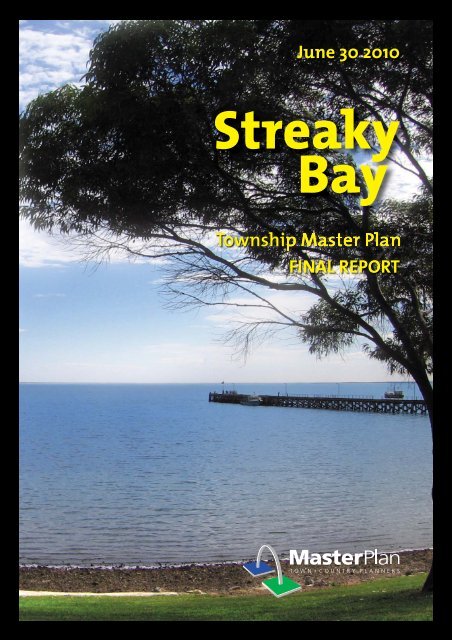
STREAKY BAY TOWNSHIP<br />
MASTER PLAN<br />
FINAL <strong>REPORT</strong><br />
Prepared for the <strong>District</strong> <strong>Council</strong> <strong>of</strong> <strong>Streaky</strong> <strong>Bay</strong><br />
by Master Plan SA Pty Ltd<br />
in association with<br />
Wendy Davidson Enterprises<br />
and<br />
Tonkin Consulting<br />
30 June 2010
TABLE OF CONTENTS<br />
1.0 PROJECT SCOPE ......................................................... 1<br />
1.1 Study Area ....................................................................... 1<br />
1.2 Elected Members and Senior Staff Workshop .................... 1<br />
1.3 Outcomes ........................................................................ 3<br />
2.0 STRATEGIC CONTEXT ................................................ 4<br />
2.1 <strong>Council</strong>’s Strategic Management Plan 2009-2012 ............. 4<br />
2.2 The Planning Strategy for Country SA ............................... 7<br />
3.0 COMMUNITY AND STAKEHOLDER CONSULTATION 9<br />
3.1 The First Round <strong>of</strong> Consultation ........................................ 9<br />
3.2 The Second Round <strong>of</strong> Community Consultation .............. 11<br />
4.0 RECENT INVESTIGATIONS ....................................... 12<br />
4.1 Waste Management Strategy 2008-2011 ....................... 12<br />
4.2 <strong>Streaky</strong> <strong>Bay</strong> Oval Precinct ................................................ 13<br />
4.3 <strong>Streaky</strong> <strong>Bay</strong> Samphire Wetland Concept Study ................ 14<br />
4.4 Vegetation Management Strategy – 1999 ....................... 16<br />
4.5 Trees and Larger Shrubs <strong>of</strong> the <strong>Streaky</strong> <strong>Bay</strong> Streetscape<br />
(1999) ............................................................................ 18<br />
5.0 SUPPLY AND DEMAND ........................................... 19<br />
5.1 2001 and 2006 Census <strong>of</strong> Population and Housing ......... 19<br />
5.2 Subdivision Activity ......................................................... 23<br />
5.3 Dwelling Commencements ............................................. 25<br />
5.4 Blanche Port Rise, Blanche Port Estate and Blanche Port<br />
Heights Residential Estates .............................................. 25<br />
5.5 Tourism .......................................................................... 26
6.0 HERITAGE ................................................................ 28<br />
6.1 European Heritage .......................................................... 28<br />
6.2 Key Dates ....................................................................... 28<br />
6.3 Significant Sites and Buildings ......................................... 29<br />
6.4 Indigenous Heritage ....................................................... 33<br />
6.5 Formal Recognition <strong>of</strong> Heritage Items ............................. 34<br />
6.6 Heritage Trail .................................................................. 34<br />
7.0 BICYCLE AND TRAFFIC <strong>PLANNING</strong> .......................... 35<br />
7.1 Strategic Bicycle Plan ...................................................... 35<br />
7.1.1 Overview ............................................................. 35<br />
7.1.2 Existing Cycling Infrastructure .............................. 35<br />
7.1.3 User Group Questionnaires .................................. 36<br />
7.1.4 Opportunities and Suggestions ............................ 37<br />
7.1.5 Supplementary Connections ................................ 38<br />
7.1.6 Community Consultation ..................................... 39<br />
7.2 Review <strong>of</strong> Traffic Conditions ........................................... 39<br />
8.0 STORMWATER MANAGEMENT .............................. 41<br />
8.1 Introduction ................................................................... 41<br />
8.2 Goals ............................................................................. 42<br />
8.3 Stormwater Management Strategy ................................. 42<br />
9.0 ZONING .................................................................... 44<br />
10.0 FORESHORE AND TOWN CENTRE ........................... 48<br />
10.1 The Toilet Block .............................................................. 48<br />
10.2 The Jetty ........................................................................ 48
10.3 Town Centre Foreshore Reserve ...................................... 49<br />
10.4 Parking ........................................................................... 50<br />
10.5 Key Building and Sites .................................................... 52<br />
10.6 Zero Building Setbacks .................................................... 53<br />
10.7 Extensions to the Foreshore Reserve ................................ 53<br />
10.8 Street Trees .................................................................... 54<br />
10.9 School and Caravan Park ................................................ 55<br />
10.10 The Netball/Tennis Court ................................................ 56<br />
11.0 TOWNSHIP IDENTITY ............................................... 57<br />
11.1 Landscaping/Streetscaping .............................................. 57<br />
11.2 Street Furniture .............................................................. 57<br />
11.3 Picnic Shelters and Barbecues ......................................... 57<br />
11.4 Seating ........................................................................... 58<br />
11.5 Drinking Fountains ......................................................... 58<br />
11.6 Rubbish Bins ................................................................... 58<br />
11.7 Playground ..................................................................... 58<br />
11.8 Fitness and Well-Being .................................................... 59<br />
11.9 Directional and Advisory Signs ........................................ 59<br />
11.10 Interpretative Signs ......................................................... 59<br />
11.11 Pedestrian Lighting ......................................................... 60<br />
11.12 Boardwalks .................................................................... 60<br />
12.0 TOWN ENTRANCES.................................................. 61
13.0 SUMMARY ............................................................... 63<br />
13.1 Background .................................................................... 63<br />
13.2 Community Consultation ................................................ 63<br />
13.3 Relevant Studies and Investigations ................................. 63<br />
13.4 Supply and Demand ....................................................... 63<br />
13.5 European and Indigenous Heritage ................................. 64<br />
13.6 Bicycle and Traffic Parking .............................................. 64<br />
13.7 Stormwater Management ............................................... 65<br />
13.8 Zoning ........................................................................... 65<br />
13.9 The Foreshore and Town Centre ..................................... 65<br />
13.10 Township Identity ........................................................... 66<br />
13.11 Town Entrances .............................................................. 66<br />
14.0 RECOMMENDATIONS .............................................. 67
APPENDICES<br />
Appendix A<br />
First Round <strong>of</strong> Community Consultation – Summary<br />
(February 2010)<br />
Appendix B<br />
Appendix C<br />
Second Round <strong>of</strong> Community Consultation (May 2010)<br />
Arbortech Tree Services – Recommendations for <strong>Streaky</strong> <strong>Bay</strong> Core<br />
Area<br />
Appendix D<br />
Appendix E<br />
Appendix F<br />
Draft Strategic Bicycle Plan 2010<br />
Stormwater Management Plan 2010<br />
Traffic Investigations: April 2010<br />
Appendix G<br />
MasterPlan Drawings<br />
1. Overview<br />
2. Zoning Changes<br />
3. Stormwater Management<br />
4. Local Road Improvements<br />
5. Proposed Bicycle Network<br />
6. Foreshore and Town Centre<br />
7. School and Caravan Park Access and Parking Concept
1.0 PROJECT SCOPE<br />
MasterPlan SA Pty Ltd was appointed by the <strong>District</strong> <strong>Council</strong> <strong>of</strong> <strong>Streaky</strong> <strong>Bay</strong> in<br />
August 2009 to prepare a Master Plan for <strong>Streaky</strong> <strong>Bay</strong> township.<br />
The Project Team responsible for the preparation <strong>of</strong> the Master Plan was made<br />
up <strong>of</strong>:<br />
• MasterPlan SA Pty Ltd (project control, town planning, Master Plan<br />
preparation and coordination);<br />
• Tonkin Consulting Engineers (bicycle plan, traffic investigations and<br />
stormwater management plan); and<br />
• Wendy Davidson Enterprises (stakeholder and community consultation).<br />
The primary purpose <strong>of</strong> the Master Plan is to create a cohesive, community<br />
endorsed framework to guide investment and the development <strong>of</strong> public and<br />
privately owned land. The Master Plan will also be used as the basis for capital<br />
works grant funding, and may form the basis <strong>of</strong> amendments to <strong>Council</strong>’s<br />
Development Plan.<br />
1.1 Study Area<br />
The study area is the township <strong>of</strong> <strong>Streaky</strong> <strong>Bay</strong> including the surrounding<br />
hinterland which is visually and/or functionally connected to the town. The<br />
adjacent waters <strong>of</strong> Blanche Port <strong>Bay</strong> which frame the town’s setting are also part<br />
<strong>of</strong> the study area, but noting that most <strong>of</strong> the bay lies outside <strong>of</strong> the local<br />
government area (low water mark is the <strong>Council</strong> boundary). The use <strong>of</strong> Blanche<br />
Port <strong>Bay</strong> for water-related purposes will be investigated as part <strong>of</strong> a district-wide<br />
review which is being conducted for the <strong>Council</strong> as a separate exercise.<br />
The <strong>Council</strong> has deliberately chosen not to define a precise study area boundary.<br />
1.2 Elected Members and Senior Staff Workshop<br />
Prior to formulation <strong>of</strong> the brief, MasterPlan SA Pty Ltd conducted a workshop<br />
session with elected <strong>Council</strong> members and senior staff on Tuesday 21 October<br />
2008. The primary purpose <strong>of</strong> the workshop was:<br />
(i)<br />
(ii)<br />
to gain a better understanding <strong>of</strong> those local issues <strong>of</strong> concern to the<br />
<strong>Council</strong>; and<br />
to provide <strong>Council</strong> members and senior staff with ideas and suggestions<br />
for improvements to the town’s physical appearance and functional<br />
layout.
Issues and opportunities arising from the <strong>Council</strong> workshop that were to be<br />
examined in further detail as part <strong>of</strong> the Master Plan (subject to consultation<br />
with community and stakeholder groups) were:<br />
(i)<br />
(ii)<br />
(iii)<br />
(iv)<br />
(v)<br />
(vi)<br />
(vii)<br />
(viii)<br />
(ix)<br />
(x)<br />
(xi)<br />
(xii)<br />
(xiii)<br />
(xiv)<br />
(xv)<br />
upgrading and extending the foreshore linear park, with connections to<br />
sites and areas <strong>of</strong> interest;<br />
identification and possible redevelopment <strong>of</strong> key sites such as the Civic<br />
Centre and adjoining vacant land, the Police Station, the caravan park<br />
and adjacent wetlands, existing foreshore reserves, the hospital precinct,<br />
land bounded by Alfred Terrace, the foreshore, the jetty and Howard<br />
Street, the SA Water Depot and land in and around the Cenotaph and<br />
RSL Hall;<br />
identifying additional land for township expansion, and opportunities for<br />
rezoning <strong>of</strong> existing urban areas, including land for aged persons’<br />
accommodation;<br />
workers’ accommodation for remote mining ventures;<br />
additional, suitable land for industrial and commercial expansion;<br />
access to and security <strong>of</strong> potable water and power supplies;<br />
greater use <strong>of</strong> treated effluent and stormwater to irrigate parks, gardens<br />
and reserves;<br />
improved public access to and along the foreshore, including shared<br />
pedestrian and cycle paths, and the development <strong>of</strong> a ‚heritage walk”;<br />
co-ordinated/themed signs at all town entrances and throughout the<br />
town, and removal <strong>of</strong> haphazard/unsightly and excessive signs;<br />
better utilisation <strong>of</strong> public spaces;<br />
more/improved visitor accommodation to cater for peak periods<br />
(Christmas, New Year and Easter);<br />
a cultural heritage centre;<br />
maintain/foster an authentic character and identity which is genuinely<br />
and distinctively “<strong>Streaky</strong> <strong>Bay</strong>”;<br />
improve school drop-<strong>of</strong>f and pick-up parking in Wells Street adjacent to<br />
the Community Area School;<br />
review land area requirements for tourists, including a pull-<strong>of</strong>f area near<br />
the caravan park entrance and a dedicated <strong>of</strong>f-street car park for<br />
caravans and motor homes;<br />
2
(xvi)<br />
(xvii)<br />
(xviii)<br />
improve public amenities particularly along the foreshore, with shade<br />
trees, shade sails, shelters and barbecues;<br />
consolidate common services in the emergency services complex; and<br />
a stronger focus on water harvesting and solar energy use.<br />
1.3 Outcomes<br />
The <strong>Streaky</strong> <strong>Bay</strong> Township Master Plan consists <strong>of</strong>:<br />
(i)<br />
(ii)<br />
(iii)<br />
(iv)<br />
(v)<br />
(vi)<br />
a Master Plan for the township and its immediate surroundings which<br />
draws together the findings and recommendations <strong>of</strong> the Project Team’s<br />
investigations, and which can be used as the basis for future capital<br />
works funding;<br />
the identification <strong>of</strong> key sites and areas within and surrounding the town<br />
for redevelopment and/or further improvement;<br />
recommendations for the rezoning <strong>of</strong> land by way <strong>of</strong> the Development<br />
Plan Amendment (DPA) process;<br />
proposals, ideas and suggestions that have broad community<br />
support/endorsement;<br />
identification and protection <strong>of</strong> significant historic buildings, sites and<br />
places;<br />
detailed plans for the following priority sites, areas and functional<br />
elements;<br />
- a Pedestrian and Cyclist Plan;<br />
- an open space plan, including the location <strong>of</strong> town entrance<br />
statements;<br />
- a Coastal Foreshore Plan;<br />
- a Stormwater Management Plan;<br />
- a Concept Plan for Wells Street adjacent to the school and the<br />
caravan park; and<br />
- a plan to improve the local road network.<br />
3
2.0 STRATEGIC CONTEXT<br />
2.1 <strong>Council</strong>’s Strategic Management Plan 2009-2012<br />
<strong>Council</strong>’s Strategic Management Plan was adopted in December 2008. Its<br />
purpose is to drive decision making and activities over the life <strong>of</strong> the plan.<br />
Vision Statement: <strong>Council</strong>’s vision for the <strong>District</strong> is that it will be widely<br />
recognised for its quality lifestyle, positive rural and coastal environment and<br />
expanding economic base.<br />
Mission Statement: <strong>Council</strong> is committed to:<br />
• responsibly managing the natural and built environment and maintaining<br />
the highly valued character <strong>of</strong> the district;<br />
• facilitating economic prosperity, sustainable growth and employment<br />
throughout the district;<br />
• nurturing a sense <strong>of</strong> community among residents and enhancing their<br />
quality <strong>of</strong> life by actions that support their health and safety, as well as<br />
through the provision <strong>of</strong> social and recreational opportunities;<br />
• providing leadership and ensuring efficient and effective management <strong>of</strong><br />
resources; and<br />
• working collaboratively with other governments and other bodies.<br />
Key Result Areas: The <strong>Council</strong> has identified five key result areas for its<br />
responsibilities. Each key result area has a goal which if achieved will ensure<br />
<strong>Council</strong> fulfils its Mission Statement. The key result areas and their associated<br />
goal are as follows:<br />
1. Governance<br />
Goal: Responsive, accountable and strategic decision<br />
making and efficient, effective and equitable<br />
service delivery.<br />
2. Infrastructure and Other Assets<br />
Goal: Well managed, appropriate stock <strong>of</strong> assets that<br />
meets the community’s affordable service needs<br />
and preferences.<br />
4
3. Environment and Planning<br />
Goal: Sustainability <strong>of</strong> the natural environment and a<br />
built environment that meets the community’s<br />
housing and lifestyle needs.<br />
4. Community, Culture and Recreation<br />
Goal: A caring community that enjoys a high quality <strong>of</strong><br />
life.<br />
5. Business and Tourism<br />
Goal: Ongoing growth in income levels and<br />
employment opportunities for residents that<br />
helps drive population growth and provision <strong>of</strong><br />
additional and upgraded facilities and services.<br />
<strong>Council</strong>’s Strategic Management Plan has been adopted by the Elected <strong>Council</strong>.<br />
The <strong>Council</strong> is ultimately responsible for its achievement through its CEO and<br />
senior staff.<br />
Specific strategies which have relevance to the <strong>Streaky</strong> <strong>Bay</strong> Township Master<br />
Plan are:<br />
Governance<br />
Improve <strong>Council</strong>’s communication, consultative processes,<br />
representation and advocacy.<br />
Infrastructure<br />
Provide a strategic framework for <strong>Council</strong> to manage, maintain,<br />
enhance and develop open space and associated public realm<br />
areas for the benefit <strong>of</strong> residents and visitors.<br />
Community, Culture and Recreation<br />
Identify and respond to current and future open space, sport and<br />
recreation needs.<br />
Promote and encourage provision <strong>of</strong> adequate health services<br />
and aged care accommodation and facilities.<br />
Environment and Planning<br />
Provide a sound framework for strategically planned and orderly<br />
future development by updating and improving <strong>Council</strong>’s<br />
Development Plan.<br />
5
Acquire, utilise and dispose <strong>of</strong> land within the <strong>Streaky</strong> <strong>Bay</strong> Town<br />
Centre to bring about agreed land use outcomes identified from<br />
the proposed <strong>Streaky</strong> <strong>Bay</strong> township review <strong>of</strong> land use zoning.<br />
Improve wastewater treatment practices.<br />
Support and implement improvements to the environment and<br />
natural attractions.<br />
Educate key stakeholders and the community about planning,<br />
environmental and waste management and regulatory matters<br />
and processes.<br />
Business and Tourism<br />
Develop initiatives to attract people to live, work and invest in<br />
the <strong>Council</strong> area.<br />
Increase the number and duration <strong>of</strong> visitations and visitor<br />
expenditure.<br />
Relevant Actions<br />
Actions identified in the Strategic Management Plan which have<br />
relevance to the Master Plan include:<br />
Prepare Infrastructure Master Plans that incorporate the<br />
following elements:<br />
- road and transport network needs;<br />
- pedestrian and cyclist linkages;<br />
- open space and trail linkages;<br />
- coastal foreshore development;<br />
- streetscape and landscape treatments and<br />
improvements;<br />
- signage suite (guidelines – directional and interpretive);<br />
- stormwater (including capture/recycle where feasible);<br />
- township entrance statements;<br />
- identification <strong>of</strong> complementary land use and future<br />
open space land purchase opportunities;<br />
- built form guidelines;<br />
- traffic management;<br />
- infrastructure (built and green form);<br />
- recreational facilities;<br />
- airport;<br />
- jetty pool;<br />
- Community Wastewater Management Scheme.<br />
6
Review land use zoning for the following areas having regard to<br />
identified needs and likely future demographic, economic,<br />
environmental and social trends:<br />
- <strong>Streaky</strong> <strong>Bay</strong> township.<br />
Acquire and dispose any key properties as warranted in response<br />
to market opportunities.<br />
Investigate feasibility <strong>of</strong> increased re-use <strong>of</strong> effluent water from<br />
<strong>Council</strong> Community Wastewater Management Scheme including<br />
opportunities to access funds from LGA Water Smart Program.<br />
Work with <strong>District</strong> <strong>Council</strong> <strong>of</strong> <strong>Streaky</strong> <strong>Bay</strong> sporting bodies to<br />
develop and implement a Master Plan that results in equitably<br />
funded and economically viable upgraded and additional<br />
facilities.<br />
Review business strategy for the <strong>Streaky</strong> <strong>Bay</strong> Foreshore Tourist<br />
Park to ensure it continues to successfully meet evolving market<br />
expectations by identifying opportunities, appropriate capital<br />
works, maintenance and improvements and funding needs.<br />
Review to include consideration <strong>of</strong> caravan park customers,<br />
enhancing entrance and additional camping sites.<br />
Facilitate business ventures through appropriate land use<br />
planning.<br />
Continue to undertake land subdivisions as appropriate to<br />
stimulate the market and where supported by due diligence<br />
considerations.<br />
Provide services, facilities and amenities that attract people to<br />
the area.<br />
Promote the <strong>Council</strong>’s tourism opportunities.<br />
2.2 The Planning Strategy for Country SA<br />
The Planning Strategy for Country South Australia is prepared by the Minister for<br />
Urban Development and Planning in accordance with requirements set out in<br />
the Development Act 1993. The latest edition <strong>of</strong> the Country Planning Strategy<br />
is the amended version dated December 2007.<br />
The Country Planning Strategy sets out the State Government’s vision for<br />
development. It indicates directions for future growth and development for local<br />
communities, the private sector and local Government.<br />
<strong>Streaky</strong> <strong>Bay</strong> township forms part <strong>of</strong> the Country Planning Strategy which is<br />
known as the Eyre Peninsula Planning and Development Area.<br />
7
<strong>Streaky</strong> <strong>Bay</strong> is recognised as a ‚Main Town‛ in the Planning Strategy. Other<br />
policies and strategies which are directly and indirectly relevant to <strong>Streaky</strong> <strong>Bay</strong><br />
township are:<br />
• a reference to the need to upgrade <strong>Streaky</strong> <strong>Bay</strong>’s water supply;<br />
• investigate alternative energy sources such as wind and solar power;<br />
• promote the conservation <strong>of</strong> water resources through land use policies<br />
that support water reuse and water recycling;<br />
• increase housing choice and diversity to meet the needs <strong>of</strong> current and<br />
future residents, including affordable and appropriate workforce housing<br />
to accommodate emerging employment opportunities;<br />
• base residential zoning and policy on demographic data, growth in<br />
industry sectors and local infrastructure capacity;<br />
• encourage infill within town boundaries and selectively increase densities<br />
in appropriate areas;<br />
• ensure all development retains public access to the coast;<br />
• minimise urban run-<strong>of</strong>f discharge to the marine environment;<br />
• promote efficient water use and reuse;<br />
• upgrade recreational boating facilities, and encourage small-scale marina<br />
developments in appropriate areas that enhance the area’s character,<br />
and to facilitate coastal recreation opportunities; and<br />
• allow for land-based infrastructure and support services for the marine<br />
fishing industry.<br />
The Country Planning Strategy is an over-riding guide for amending the<br />
<strong>Council</strong>’s Development Plan. The Strategy is also used to guide infrastructure<br />
provision and as a basis for future development action by Government agencies.<br />
Implementation is therefore largely by way <strong>of</strong> the Development Plan for each<br />
<strong>Council</strong> area, and Government action.<br />
8
3.0 COMMUNITY AND STAKEHOLDER CONSULTATION<br />
<strong>Council</strong> agreed that the Master Plan should be informed and shaped by a<br />
genuine process <strong>of</strong> community consultation. Wendy Davidson Enterprises was<br />
therefore appointed by <strong>Council</strong> to manage the community and stakeholder<br />
consultation process.<br />
The consultation process commenced in November 2009 when the Chief<br />
Executive Officer wrote to all householders in the district, advising <strong>of</strong> a series <strong>of</strong><br />
public meetings scheduled over three days on 1, 2 and 3 February 2010. In late<br />
December 2009, <strong>Council</strong> distributed in advance <strong>of</strong> those public meetings a set<br />
<strong>of</strong> visual diagrams showing various constraints and opportunities.<br />
3.1 The First Round <strong>of</strong> Consultation<br />
Recognising the different interests and opinions that<br />
could be anticipated, the first round <strong>of</strong> consultation<br />
was conducted over three days in early February<br />
2010. In order to allow as much time as possible for<br />
community input and feedback, the consultation<br />
round was split into different community forum<br />
groups. Those groups, and the numbers who<br />
attended them, were as follows:<br />
• Community: 78;<br />
• Tourism: 9;<br />
• Development Assessment Panel: 6;<br />
• Health: 6;<br />
• Environment: 2;<br />
• Developers: 12;<br />
• Foreshore Owners: 28;<br />
• Business Owners/Proprietors: 19;<br />
• Elected Members: 7; and<br />
• Education: 2.<br />
The forums were co-ordinated and run by Wendy Davidson, with presentations<br />
by Graham Burns (MasterPlan SA Pty Ltd) and Drew Jacobi (Tonkin Consulting).<br />
9
Following the conclusion <strong>of</strong> the first round <strong>of</strong> consultation, interested persons<br />
were invited to make written submissions to the Project Team. A complete<br />
summary <strong>of</strong> comments received from the first round <strong>of</strong> consultation is contained<br />
in Appendix A.<br />
The main concerns, observations and suggestions arising from the first round <strong>of</strong><br />
community consultation were identified as:<br />
• Give priority to stormwater capture, collection and re-use in <strong>Streaky</strong> <strong>Bay</strong>.<br />
• Construct a boardwalk up to and through the mangroves north <strong>of</strong><br />
Moore’s Ramp as an extension <strong>of</strong> the existing bicycle/pedestrian path,<br />
and as an added tourist attraction.<br />
• Concerns about the shortage <strong>of</strong> land in <strong>Streaky</strong> <strong>Bay</strong> for industrial and<br />
commercial purposes.<br />
• Give priority to extending the walking track from Moore’s Ramp, but<br />
should not occur over privately owned land.<br />
• Car parking in <strong>Streaky</strong> <strong>Bay</strong> is perceived as an ongoing problem. <strong>Council</strong><br />
should carry out a re-sealing and line marking program.<br />
• Shift the bike racks to the median strip <strong>of</strong> <strong>Bay</strong> Road to get bikes <strong>of</strong>f the<br />
footpath and away from the front facades <strong>of</strong> businesses, rendering it<br />
safer for foot traffic in the township.<br />
• Pedestrian crossings on <strong>Bay</strong> Road and Alfred Terrace are either<br />
non-existent or dangerous, and require re-configuring or implementing<br />
to make them safer for pedestrians.<br />
• Concerns raised in relation to <strong>of</strong>f-road shared bike paths, particularly in<br />
front <strong>of</strong> properties on the sea-ward side <strong>of</strong> Alfred Terrace.<br />
• Concerns expressed over any future development and walkways along<br />
the coastal reserve from the Hospital to Slidy Ramp, as it is a fragile<br />
sloping cliff area and would destroy the native coastal vegetation and<br />
disturb native birds and reptiles.<br />
• General concern that new infrastructure may leave current and future<br />
rate payers with ongoing high maintenance and risk management<br />
obligations.<br />
• An outdoor fitness and well-being facility would be <strong>of</strong> benefit to the<br />
local community and visitors alike.<br />
• Additional signage identifying entry and exit points to and from <strong>Streaky</strong><br />
<strong>Bay</strong> is needed.<br />
• Extension <strong>of</strong> the Residential Zone to take in land currently zoned Rural<br />
(Deferred Urban) should be a priority.<br />
10
• Install shade shelters on the foreshore at Little Islands and Surfers Beach,<br />
and repair the steps under the jetty.<br />
• Remainder <strong>of</strong> the land owned by B & R Enterprises which joins both AB<br />
Smith Road and Woodlawn Road should be rezoned Residential.<br />
• The suggested southern ‘edge’ <strong>of</strong> the town was raised as a concern by<br />
some people, because it would restrict potential growth for <strong>Streaky</strong> <strong>Bay</strong><br />
in a southerly direction. The land is Rural, where it is not permissible to<br />
subdivide land into allotments smaller than 20 acres (8.0 hectares).<br />
A total <strong>of</strong> 104 positive observations were collated after the preliminary<br />
community consultation phase. There was an overwhelming positive response to<br />
the preparation <strong>of</strong> this Master Plan, as well as support for the decision by<br />
<strong>Council</strong> to consult with the community. On the whole, participants were<br />
generally enthused by and grateful for the chance to be included in the Master<br />
Plan process.<br />
A list <strong>of</strong> opportunities were identified from developers and the community.<br />
Developers consider that additional opportunities do exist having regard to<br />
planning, boating facilities, and roads. The general public on the other hand<br />
perceived stormwater, lighting, the jetty and zoning as specific areas where<br />
opportunities exist.<br />
The community at large was very supportive <strong>of</strong> initiatives to capture and harvest<br />
stormwater. Although local and specific areas <strong>of</strong> local concern were identified,<br />
the overwhelming consensus was that <strong>Council</strong> should improve or modify<br />
infrastructure to prevent the discharge <strong>of</strong> stormwater into the sea, and to<br />
explore opportunities for recycling stormwater and treated town effluent.<br />
3.2 The Second Round <strong>of</strong> Community Consultation<br />
A second round <strong>of</strong> community consultation was conducted in <strong>Streaky</strong> <strong>Bay</strong> on<br />
24, 25 and 26 May 2010 by Wendy Davidson and Graham Burns. The purpose<br />
<strong>of</strong> the consultation workshops was to explain the draft <strong>Streaky</strong> <strong>Bay</strong> Township<br />
Master Plan and to give the community an opportunity to comment on the<br />
draft. As with the first round <strong>of</strong> consultation, all <strong>of</strong> the workshops were very<br />
well attended with the Public Workshop on Monday evening attracting well over<br />
70 participants.<br />
A summary <strong>of</strong> all comments received from the workshops and subsequently in<br />
written submissions is contained in Appendix B.<br />
Broadly speaking, the draft Master Plan document was well received, with<br />
widespread support for the preparation <strong>of</strong> a co-ordinated plan to guide future<br />
development in and around the town. Initiatives which received widespread<br />
support included:<br />
• extensions to the bike path around the bay and to other attractions such<br />
as Eyre’s Waterhole;<br />
11
• a Long Term Zoning Plan for the co-ordinated, compact expansion <strong>of</strong> the<br />
town around the bay;<br />
• improvements to alleviate parking and traffic conflicts in and around the<br />
school and the caravan park;<br />
• identifying opportunities for centrally located <strong>of</strong>f-street parking in the<br />
town centre, with those car parks located behind buildings fronting onto<br />
footpaths;<br />
• the development <strong>of</strong> more aged persons housing to cater for a growing<br />
need in the town;<br />
• extending the linear bike path to the new caravan park at Little Islands;<br />
• improve the foreshore reserves, including better lighting on the Eyre<br />
Avenue reserve;<br />
• toilets, shade, a barbeque and shelter at Moore’s Boat Ramp;<br />
• a dedicated area for long vehicle parking in the town centre (vehicles<br />
towing caravans, trailers, boats, etc);<br />
• initiatives to harvest and recycle stormwater were widely supported;<br />
• improved facilities are required in and around the skate park; and<br />
• while the location <strong>of</strong> the toilet block near the jetty is generally not<br />
supported, there was little support for its demolition and relocation to a<br />
less prominent site.<br />
The final Master Plan has been amended to take into account comments<br />
received from the second round <strong>of</strong> community consultation.<br />
4.0 RECENT INVESTIGATIONS<br />
4.1 Waste Management Strategy 2008-2011<br />
The <strong>Council</strong> has six operational landfill sites, as follows:<br />
• Poochera;<br />
• Wirrulla;<br />
• Cungena;<br />
• Haslam;<br />
12
• Sceale <strong>Bay</strong>; and<br />
• <strong>Streaky</strong> <strong>Bay</strong>.<br />
The <strong>Streaky</strong> <strong>Bay</strong> landfill site is located on the Flinders Highway, approximately<br />
1.0 kilometre south-east <strong>of</strong> the town in the Industry Zone. It is the <strong>Council</strong>’s<br />
largest and most centrally located landfill facility. Waste from Poochera, Wirrulla<br />
and Sceale <strong>Bay</strong> is transported to the <strong>Streaky</strong> <strong>Bay</strong> site. The <strong>Streaky</strong> <strong>Bay</strong> facility also<br />
services some 1,200 residents in the town, as well as outlying areas.<br />
The Environment Protection Authority (EPA) released its revised EPA Guidelines,<br />
Environmental Management <strong>of</strong> Landfill Facilities (Municipal Solid Waste and<br />
Commercial and Industrial General Waste) in January 2007. Following release <strong>of</strong><br />
the Guidelines the EPA conducted an inspection <strong>of</strong> landfill sites throughout the<br />
<strong>Council</strong> area.<br />
A Waste Management Committee was set up by the <strong>Council</strong> shortly after the<br />
release <strong>of</strong> the EPA Guidelines to formulate a Waste Management Strategy<br />
2008-2011.<br />
In accordance with the EPA’s Landfill Guidelines and the recommendations <strong>of</strong> its<br />
Waste Management Strategy, the <strong>Council</strong> is committed to relocating to a new<br />
landfill site that is well beyond the confines <strong>of</strong> the township. The existing site at<br />
<strong>Streaky</strong> <strong>Bay</strong> is being rehabilitated for use primarily as a recycling and waste<br />
transfer depot.<br />
4.2 <strong>Streaky</strong> <strong>Bay</strong> Oval Precinct<br />
The <strong>Streaky</strong> <strong>Bay</strong> Sports Facilities and Management Project was prepared by<br />
Swanbury Penglase Architects in conjunction with Wendy Davidson Enterprises<br />
in March 2009. The report makes recommendations for the upgrading,<br />
co-ordinated development and management <strong>of</strong> sporting and recreational<br />
facilities in and around <strong>Streaky</strong> <strong>Bay</strong> Oval.<br />
The Sports Facility and Management Project arose out <strong>of</strong> a concern by the<br />
<strong>Council</strong> that there should be a co-ordinated plan which could be used for facility<br />
upgrades in and around the Oval Precinct. <strong>Council</strong> also identified the need for a<br />
management model to provide greater co-ordination <strong>of</strong> management functions.<br />
The Sports Facilities and Management Plan has the following project objectives:<br />
• identify facility upgrade requirements;<br />
• review the current management structure and make subsequent<br />
recommendations having regard to improvements or changes;<br />
• investigate the possibility <strong>of</strong> future co-operation, networking or<br />
amalgamation <strong>of</strong> sporting groups; and<br />
13
• provide a framework for future development <strong>of</strong> the Oval that<br />
reinvigorates and consolidates the Oval Precinct and accompanying<br />
facilities.<br />
The Management Plan contains Concept Master Plans for the <strong>Streaky</strong> <strong>Bay</strong> Oval<br />
Precinct, estimated costing for the Oval Precinct Infrastructure, and suggested<br />
staging and management models for the Oval Precinct. There are also options<br />
for sporting groups’ co-operation, networking or amalgamations.<br />
The consultation process undertaken as part <strong>of</strong> this project revealed that an<br />
opportunity exists to consolidate management <strong>of</strong> the Precinct. The report<br />
subsequently identified two options to ensure that one management group<br />
could be assembled to run the facility.<br />
The Final Report (March 2009) has suggested a model for the ongoing, efficient<br />
management and co-ordinated future development <strong>of</strong> the Oval Precinct.<br />
4.3 <strong>Streaky</strong> <strong>Bay</strong> Samphire Wetland Concept Study<br />
Consultants were commissioned by the <strong>District</strong> <strong>Council</strong> <strong>of</strong> <strong>Streaky</strong> <strong>Bay</strong> in March<br />
2003 to prepare the <strong>Streaky</strong> <strong>Bay</strong> Samphire Swamp Concept Study. The study<br />
applies to that part <strong>of</strong> the township bounded by the foreshore, the caravan park<br />
and Cape Bauer Road/Wells Street.<br />
The Samphire Swamp Concept Study includes a preferred ‘Management<br />
Direction’ to ensure that the future use <strong>of</strong> this environmental feature takes<br />
account <strong>of</strong> identified and future community needs and expectations.<br />
14
The site occupies approximately 22 hectares <strong>of</strong> tidally inundated samphire<br />
wetland, approximately 1.5 kilometres west <strong>of</strong> the town centre. Parts <strong>of</strong> the<br />
wetland are degraded, including part <strong>of</strong> the site which was formerly used as a<br />
rubbish tip. The wetland is Crown Land and the <strong>District</strong> <strong>Council</strong> <strong>of</strong> <strong>Streaky</strong> <strong>Bay</strong> is<br />
its registered custodian.<br />
A lengthy consultation process involving <strong>Council</strong>, stakeholders and relevant<br />
Government and non-Government agencies was undertaken as part <strong>of</strong> the<br />
study.<br />
A Preferred Concept Plan and an Alternative Concept Plan for the study area<br />
were prepared to reflect the ideas and preferences <strong>of</strong> the consulted stakeholders<br />
as to how the wetland should best be utilised.<br />
The Preferred Concept Plan, whilst identifying some modification to the existing<br />
wetland, proposes a series <strong>of</strong> environmental enhancements and substantially<br />
improved visitor amenities. The Alternative Concept Plan was formulated in<br />
response to community preferences and suggestions, and proposed<br />
modifications to the site with the aim <strong>of</strong> enhancing recreational experiences for<br />
residents and visitors alike. The report suggested that implementing the<br />
Alternative Concept Plan is likely to be expensive. Excavation costs alone are<br />
expected to be significant, subject to the desired depth <strong>of</strong> the lake, whilst<br />
ongoing management <strong>of</strong> the lake would represent a significant responsibility<br />
and financial liability for <strong>Council</strong>. The report also noted that the environmental<br />
approvals required to achieve the Alternative Concept Plan may be difficult to<br />
achieve.<br />
15
Feedback received from both rounds <strong>of</strong> community consultation revealed a<br />
diversity <strong>of</strong> opinions, ranging from ‘do nothing’ to ‘full redevelopment’ with<br />
lakes and waterways. However, the prevailing commentary was that the<br />
wetland’s strategic location next to the foreshore, <strong>Streaky</strong> Bat Foreshore Tourist<br />
Park and Blancheport Rise <strong>of</strong>fers the potential for environmentally sensitive<br />
improvements such as boardwalks, viewing platforms, shelters and revegetation.<br />
It is our recommendation that <strong>Council</strong> should engage with the relevant agencies<br />
who have an interest in or responsibility for the samphire swamp, and then<br />
review the Preferred Concept Plan and seek agency support for it.<br />
4.4 Vegetation Management Strategy – 1999<br />
In November 1999, Arbortech Tree Services Pty Ltd prepared a Vegetation<br />
Management Strategy. The strategy applies to <strong>Streaky</strong> <strong>Bay</strong> township as well as<br />
to five other settlements throughout the district.<br />
It is not known whether the <strong>Council</strong> adopted the findings and recommendations<br />
contained in Arbortech’s Vegetation Management Strategy.<br />
Management <strong>of</strong> vegetation within <strong>Streaky</strong> <strong>Bay</strong> is the primary focus <strong>of</strong> the report.<br />
It was also written as a policy document to assist with implementing<br />
arboriculture works throughout the township, and includes criteria for the<br />
planting, pruning and removal <strong>of</strong> trees, native vegetation and general<br />
specifications for various tree related activities.<br />
A tree inventory <strong>of</strong> all street trees was compiled for the ‘Core Area’ <strong>of</strong> <strong>Streaky</strong><br />
<strong>Bay</strong> township. The inventory was to be used to trial a management system run<br />
by <strong>Council</strong>. It is not known whether the trial management system was devised<br />
and tested, or if it was, whether it was successful.<br />
Arbortech devised the following key management goals:<br />
• improve the quality <strong>of</strong> <strong>Council</strong>’s vegetation resource by providing clear<br />
policy direction to <strong>Council</strong> staff who are engaged in activities likely to<br />
have an impact on the health and safety <strong>of</strong> township vegetation;<br />
• plan for a steady increase in the number, age, diversity and aesthetic<br />
qualities <strong>of</strong> trees;<br />
• use trees more effectively for scenic beautification, to provide shelter and<br />
screening, and for energy and cost savings over time;<br />
• develop and enhance staff planning and vegetation management skills<br />
through ongoing training programs; and<br />
• improve the local community’s understanding <strong>of</strong> the value <strong>of</strong> the town’s<br />
vegetation resource, and the need to manage it on an ‘urban forest’<br />
basis.<br />
16
The tree inventory <strong>of</strong> the ‘core area’ in <strong>Streaky</strong> <strong>Bay</strong> was bounded by<br />
Montgomerie Terrace, Eyre and Alfred Streets, Fleming Terrace and East Terrace.<br />
The inventory identified in the order <strong>of</strong> 50 different species, the most common<br />
being:<br />
• Eucalyptus campaspe (Silver Topped Gimlet): 20;<br />
• Eucalyptus erthracories (Red Capped Gum): 22;<br />
• Eucalyptus gomiphocephala (Tuart): 35;<br />
• Eucalyptus leucoxylon (SA Blue Gum): 13;<br />
• Eucalyptus platypus (Round Leaved Moort): 15;<br />
• Eucalyptus stricklandii (Strickland’s Gum): 15;<br />
• Eucalyptus torquata (Coral Gum): 200; and<br />
• Eucalyptus sp. (newly planted and unidentified, but mainly E. torquata<br />
and E. campaspe: 145<br />
The report noted a number <strong>of</strong> recorded species which could be “<strong>of</strong> far greater<br />
use” in the core area. These species were Weeping Willow Myrtle, Square<br />
Fruited Mallee and Crimson Mallee. These, and other species which could be<br />
utilised, included Araucaria heterophytla (Norfolk Island Pine).<br />
The Vegetation Management Strategy also contained recommendations for the<br />
management, pruning, replacement and planting <strong>of</strong> reserves throughout <strong>Streaky</strong><br />
<strong>Bay</strong>, namely:<br />
• Harbours Head Reserve between Alfred Terrace and the jetty;<br />
• the caravan park;<br />
• Lions Park;<br />
• RSL park;<br />
• Plantation Reserve;<br />
• Howard Street North;<br />
• Recreation Reserve Section 303;<br />
• Apex Park; and<br />
• <strong>Streaky</strong> <strong>Bay</strong> Golf Course.<br />
The report also contained recommendations for streets outside <strong>of</strong> the core area.<br />
17
A complete list <strong>of</strong> the report’s recommendations for <strong>Streaky</strong> <strong>Bay</strong>’s core area and<br />
the streets outside <strong>of</strong> the core area is included in Appendix C.<br />
4.5 Trees and Larger Shrubs <strong>of</strong> the <strong>Streaky</strong> <strong>Bay</strong> Streetscape<br />
(1999)<br />
This further report was prepared by Ian Picken and Robyn Tape for the <strong>Council</strong><br />
shortly after the Arbortech Report. It was prepared with the aim <strong>of</strong> providing<br />
relevant advice and information which is unique to <strong>Streaky</strong> <strong>Bay</strong>. The report<br />
consists <strong>of</strong> a specimen data collection manual for local residents and <strong>Council</strong><br />
staff alike. Comments received from the second round <strong>of</strong> community<br />
consultation urged that this report should be used as the basis for selecting<br />
suitable trees and shrubs for planting in <strong>Streaky</strong> <strong>Bay</strong>.<br />
18
5.0 SUPPLY AND DEMAND<br />
5.1 2001 and 2006 Census <strong>of</strong> Population and Housing<br />
An assessment has been made <strong>of</strong> Australian Bureau <strong>of</strong> Statistics (ABS) data for<br />
the 2001 and 2006 Censuses. Data has been gathered and assessed for <strong>Streaky</strong><br />
<strong>Bay</strong> township only. It should be noted that the ABS statistics are now somewhat<br />
dated. The next Census <strong>of</strong> population and housing, to be conducted in 2011,<br />
will provide more up to date and relevant data upon which to determine<br />
population and housing supply.<br />
In summary, <strong>Streaky</strong> township’s 2006 population <strong>of</strong> 1,060 persons was<br />
characterised by:<br />
• a slight decline in the town’s population over the five year period;<br />
• a median age <strong>of</strong> 44 years;<br />
• a median household weekly income <strong>of</strong> $1,021;<br />
• an average household size <strong>of</strong> 2.3 persons;<br />
• more than 87 percent <strong>of</strong> persons who were born in Australia; and<br />
• 49 percent <strong>of</strong> the labour force who were working full time.<br />
Table 1: 2001 & 2006 <strong>Streaky</strong> <strong>Bay</strong>’s Population by Age<br />
<strong>Streaky</strong> <strong>Bay</strong> (2001)<br />
Township<br />
<strong>Streaky</strong> <strong>Bay</strong> (2006)<br />
Township<br />
0-4 years 64 61<br />
5-14 years 153 155<br />
15-24 years 108 100<br />
Percentage 0-24 years 30.2% 29.8%<br />
25-54 years 431 412<br />
55-64 years 118 134<br />
Percentage 25-64 years 51.2% 51.5%<br />
65 years and over 199 198<br />
Percentage 65 years and<br />
over<br />
18.6% 18.7%<br />
Total Persons 1073 1060<br />
Median age <strong>of</strong> persons 40 44<br />
Source: ABS<br />
19
Table 1 above shows that:<br />
• the town’s population fell slightly between 2001 and 2006, by 13 to<br />
1,060 persons;<br />
• the median age <strong>of</strong> the population rose from 40 in 2001 to 44 in 2001.<br />
This reflects a significant ageing <strong>of</strong> the population;<br />
• in absolute terms, more than half <strong>of</strong> the town’s population in 2001<br />
(51.2 percent) and 2006 (51.5 percent) fell within the middle-age cohort<br />
<strong>of</strong> 25-64;<br />
• the number <strong>of</strong> elderly persons (those aged 65 and over) has not changed<br />
over the five year period; and<br />
• the number <strong>of</strong> children and young adults (those aged from 0-24 years)<br />
has not changed significantly over the five year period.<br />
Table 2: 2001 & 2006 <strong>Streaky</strong> <strong>Bay</strong>’s Dwelling Characteristics<br />
<strong>Streaky</strong> <strong>Bay</strong> (2001)<br />
Township<br />
<strong>Streaky</strong> <strong>Bay</strong> (2006)<br />
Township<br />
Total private dwellings<br />
(Includes unoccupied<br />
dwellings)<br />
Occupied private<br />
dwellings<br />
525 554<br />
437 459<br />
Detached dwellings 366 379<br />
Percentage <strong>of</strong> detached<br />
dwellings<br />
Semi-detached<br />
dwellings<br />
Percentage <strong>of</strong> semidetached<br />
dwellings<br />
Flats, units or<br />
apartments<br />
Percentage <strong>of</strong> flats,<br />
units or apartments<br />
83.8% 82.6%<br />
18 18<br />
4.1% 3.9%<br />
10 28<br />
2.3% 6.1%<br />
Other dwelling types 40 34<br />
Percentage <strong>of</strong> other<br />
dwelling types<br />
9.2% 7.4%<br />
Source: ABS<br />
20
The main features and trends evident from Table 2 are that:<br />
• between 2001 and 2006, the total number <strong>of</strong> privately owned dwellings<br />
increased by 29;<br />
• the overwhelming majority (83%) <strong>of</strong> privately occupied dwellings in<br />
<strong>Streaky</strong> <strong>Bay</strong> consisted <strong>of</strong> detached dwellings in 2006;<br />
• between 2001 and 2006, an additional 13 detached dwellings were built<br />
and an additional 18 flats, units or apartments were built;<br />
• between 2001 and 2006, the number <strong>of</strong> occupied semi-detached<br />
dwellings has not changed; and<br />
• the number <strong>of</strong> unoccupied dwellings in <strong>Streaky</strong> <strong>Bay</strong> has increased, from<br />
88 in 2001 to 95 in 2006. This suggests that an increasing number <strong>of</strong><br />
the town’s dwelling stock are most probably used as holiday homes.<br />
Table 3: 2001 & 2006 <strong>Streaky</strong> <strong>Bay</strong>’s Tenure Types<br />
<strong>Streaky</strong> <strong>Bay</strong> (2001)<br />
Township<br />
<strong>Streaky</strong> <strong>Bay</strong> (2006)<br />
Township<br />
Private dwellings fully<br />
owned<br />
Percentage <strong>of</strong> fully<br />
owned<br />
Dwellings being<br />
purchased<br />
Percentage being<br />
purchased<br />
Private dwellings<br />
Rented<br />
196 190<br />
44.9% 41.4%<br />
74 93<br />
16.9% 20.3%<br />
136 136<br />
Percentage rented 31.1% 29.6%<br />
Other tenure types 13 4<br />
Percentage <strong>of</strong> other<br />
types<br />
3.0% 0.9%<br />
Not stated 16 33<br />
Percentage not stated 3.7% 7.2%<br />
Source: ABS<br />
21
Table 3 above demonstrates that:<br />
• the percentage <strong>of</strong> fully owned private dwellings has decreased between<br />
2001 (44.9%) and 2006 (41.4%);<br />
• the percentage <strong>of</strong> dwellings being purchased at the time <strong>of</strong> the 2006<br />
census had increased by 3.4 percent; and<br />
• the total number <strong>of</strong> private dwellings being rented remained the same<br />
over the five year period (136 dwellings).<br />
Table 4: 2001 & 2006 <strong>Streaky</strong> <strong>Bay</strong>’s Family Characteristics<br />
<strong>Streaky</strong> <strong>Bay</strong> (2001)<br />
Township<br />
<strong>Streaky</strong> <strong>Bay</strong><br />
(2006)Township<br />
Total families 260 281<br />
Families with children 97 105<br />
Percentage with<br />
children<br />
Families without<br />
children<br />
Percentage without<br />
children<br />
37.3% 37.4%<br />
121 126<br />
46.5% 44.8%<br />
One parent families 38 45<br />
Percentage <strong>of</strong> one<br />
parent families<br />
14.6% 16.0%<br />
Other families 4 5<br />
Percentage <strong>of</strong> other<br />
families<br />
1.5% 1.8%<br />
Source: ABS<br />
Table 4 indicates that there was a noticeable increase in the number <strong>of</strong> families<br />
living in <strong>Streaky</strong> <strong>Bay</strong>, rising from 260 in 2001 to 281 in 2006. There was a<br />
corresponding increase in the number <strong>of</strong> families with children over this period.<br />
However, there were more families without children (44.8%) than with children<br />
(37.4%) which is again suggestive <strong>of</strong> an ageing population.<br />
The number <strong>of</strong> one parent families in <strong>Streaky</strong> <strong>Bay</strong> has also increased, from 38 in<br />
2001 to 45 in 2006.<br />
22
5.2 Subdivision Activity<br />
Figure 1 on the following page depicts the extent <strong>of</strong> subdivision activity (by<br />
location and applications lodged) in and around <strong>Streaky</strong> <strong>Bay</strong> over the last 10<br />
years or so. The information has been sourced from the Department <strong>of</strong> Planning<br />
and Local Government’s electronic development application lodgement system,<br />
known as EDALA.<br />
The mapped information on Figure 1 records all applications, whether they have<br />
been approved, refused, lapsed or are still being assessed.<br />
A breakdown <strong>of</strong> those subdivision applications which were either approved or<br />
are under consideration (disregarding two applications that were refused) is<br />
summarised by zone in the following table:<br />
Table 5: New Allotments by Zone – <strong>Streaky</strong> <strong>Bay</strong><br />
Zone<br />
Number <strong>of</strong> Additional Allotments<br />
Proposed/Created<br />
Country Living Zone 190<br />
Residential Zone 156<br />
Rural Fringe Zone 0<br />
Rural (8) Zone 57<br />
Town Centre Zone 3<br />
Industry Zone 43<br />
Total 449<br />
Source: Department <strong>of</strong> Planning and Local Government (EDALA)<br />
The review examined all land division applications lodged since 2001. It shows<br />
that over a nine year period, an average <strong>of</strong> 50 allotments per annum have been<br />
approved in the various zones in and around <strong>Streaky</strong> <strong>Bay</strong>.<br />
It is unknown how many <strong>of</strong> these allotments have been created (ie services<br />
installed, plans deposited and new titles issued) but anecdotally it is reasonable<br />
to assume that most <strong>of</strong> the areas identified on the plan at Figure 1 have been or<br />
are in the process <strong>of</strong> being created.<br />
23
Figure 1<br />
24
5.3 Dwelling Commencements<br />
Statistics sourced from the <strong>District</strong> <strong>Council</strong> <strong>of</strong> <strong>Streaky</strong> <strong>Bay</strong> reveal that there has<br />
been a sustained level <strong>of</strong> housing construction in the township over the last<br />
three years, as indicated by the number <strong>of</strong> approvals granted for new dwellings.<br />
Table 6:<br />
<strong>Streaky</strong> <strong>Bay</strong> Township – New Dwelling Approvals<br />
2008 40<br />
2009 37<br />
2010 (to May) 15<br />
Source: <strong>District</strong> <strong>Council</strong> <strong>of</strong> <strong>Streaky</strong> <strong>Bay</strong><br />
It is reasonable to assume that most <strong>of</strong> these dwellings have been approved on<br />
allotments in either the Country Living, Residential or Rural Fringe Zones in<br />
<strong>Streaky</strong> <strong>Bay</strong>.<br />
The take-up rate or ‘consumption’ <strong>of</strong> allotments is close to 40 dwellings per<br />
annum. This take-up rate is generally consistent with the annual average rate <strong>of</strong><br />
allotment supply (approvals) identified in Section 5.2 above.<br />
5.4 Blanche Port Rise, Blanche Port Estate and Blanche Port<br />
Heights Residential Estates<br />
These estates were developed by the <strong>District</strong> <strong>Council</strong> <strong>of</strong> <strong>Streaky</strong> <strong>Bay</strong> more than<br />
10 years ago. The <strong>Council</strong> initiated the land divisions in response to a demand<br />
for suitably located and serviced allotments that – until that time – were not<br />
available elsewhere in <strong>Streaky</strong> <strong>Bay</strong>.<br />
Of the three estates, Blanche Port Heights is the only<br />
one where allotments still remain for sale. The estate<br />
is located on elevated land and on the western side <strong>of</strong><br />
the town with exceptional views over Blanche Port<br />
<strong>Bay</strong>. Allotments in the estate are subject to a Land<br />
Management Agreement and with Design Guidelines<br />
in place to control matters such as building height,<br />
vegetation requirements, construction materials,<br />
rainwater storage and conservation requirements.<br />
With the entering into <strong>Streaky</strong> <strong>Bay</strong> <strong>of</strong> the private development sector, and the<br />
high number <strong>of</strong> land divisions over suitably zoned land elsewhere in the town,<br />
<strong>Council</strong>’s continuing role as developer <strong>of</strong> serviced township allotments, arguably<br />
in competition with the private development sector, is less important now that it<br />
was previously.<br />
25
Given the choice which now exists with respect to the size, number and location<br />
<strong>of</strong> new allotments in <strong>Streaky</strong> <strong>Bay</strong>, it is timely for <strong>Council</strong> to consider exiting from<br />
the land division market.<br />
We recommend that <strong>Council</strong> should formulate a strategy for disposing in a<br />
timely manner all remaining broad acre land in the Blanche Port subdivision area<br />
which has not yet been divided into residential allotments.<br />
5.5 Tourism<br />
<strong>Streaky</strong> <strong>Bay</strong>’s economy is to a large extent underpinned by the tourism sector.<br />
This sector has traditionally been represented by caravanners, campers and<br />
holiday makers visiting the town mainly over the Christmas - New Year and<br />
Easter periods, as well as motorists passing through the town. Tourists and<br />
visitors are attracted by myriad natural attractions and recreational activities<br />
comprising recreational fishing, whale watching, bush walking, surfing,<br />
snorkeling and scuba diving. The rugged coastline to the west <strong>of</strong> the town is<br />
arguably the State’s, if not the country’s, most spectacular.<br />
The <strong>Streaky</strong> <strong>Bay</strong> Town Pr<strong>of</strong>ile <strong>of</strong> 2003 estimated that around 65,000 tourists<br />
frequented <strong>Streaky</strong> <strong>Bay</strong> each year. Subsequently, the economic contribution <strong>of</strong><br />
tourism to the region was estimated at between $4.7 million and $7.1 million<br />
per annum (2003 dollar terms), or between 8.0 percent and 12 percent <strong>of</strong> the<br />
local economy.<br />
It is reasonable to assume that the number <strong>of</strong> visitors to <strong>Streaky</strong> <strong>Bay</strong> has<br />
increased significantly since 2003. Accompanying that increase has been a<br />
corresponding stimulus to the local economy, represented by an increased<br />
demand for goods and services.<br />
It is known that many tourists visiting <strong>Streaky</strong> <strong>Bay</strong> are persons aged 60 and over<br />
who are <strong>of</strong>ten referred to as ‘grey nomads’. Grey nomads are generally<br />
described as people either approaching or who have entered retirement, and<br />
who have the time, mobility and financial resources to travel by motor home,<br />
caravan, campervan and other motorized forms <strong>of</strong> transport around the country.<br />
Typically, grey nomads <strong>of</strong>ten travel without any particular or definite itineraries,<br />
destinations or committed return dates.<br />
Because grey nomads are relatively foot loose, they are also more inclined to<br />
travel throughout the year, but with a tendency to avoid popular destinations<br />
during peak times such as school holidays. For destinations such as <strong>Streaky</strong> <strong>Bay</strong>,<br />
this has produced a more steady flow <strong>of</strong> tourists and visitors in what were<br />
previously regarded as the quiet winter months.<br />
26
It is likely that <strong>Streaky</strong> <strong>Bay</strong> will continue to be a popular destination for tourists,<br />
particularly grey nomads. This may place strains on the <strong>Streaky</strong> <strong>Bay</strong> Foreshore<br />
Tourist Park at Wells Street, and on surrounding infrastructure. Indeed feedback<br />
received from both rounds <strong>of</strong> community consultation identified levels <strong>of</strong><br />
congestion along Wells Street opposite the caravan park associated with visitor<br />
parking on this section <strong>of</strong> road at the same time as school children are dropped<br />
<strong>of</strong>f and collected.<br />
The imminent opening in the latter half <strong>of</strong> 2010 <strong>of</strong> the Little Islands Caravan<br />
Park on Little Island Road is expected to alleviate congestion in and around Wells<br />
Street Caravan Park. The new caravan park will <strong>of</strong>fer 80 powered sites and<br />
associated ablution and recreational facilities.<br />
Sealing <strong>of</strong> Little Island Road to the new caravan park should be a priority, given<br />
the expected increase in traffic volumes. In association with the road’s sealing,<br />
provision should also be made for a shared <strong>of</strong>f road bicycle path, in order to<br />
complete the around-the-bay bicycle loop described elsewhere in this report.<br />
This detail is shown on the Proposed Bicycle Network Plan at Appendix E,<br />
and is described in further detail in Section 7.<br />
There is also merit in constructing the eastern unmade section <strong>of</strong> Mabie Road, in<br />
order to create a direct link between Little Island Road and Flinders Highway for<br />
persons staying at or visiting the new caravan park.<br />
27
6.0 HERITAGE<br />
6.1 European Heritage<br />
After first being sighted in 1627 by Dutch Explorer Peter Nuyts, <strong>Streaky</strong> <strong>Bay</strong> was<br />
rediscovered by Captain Matthew Flinders in 1802. The name <strong>Streaky</strong> <strong>Bay</strong> came<br />
about after Captain Flinders noticed streaks in the water surrounding the bay,<br />
which are due to the reflections <strong>of</strong> light and seaweed. The settlement was<br />
originally known as Flinders. The name <strong>Streaky</strong> <strong>Bay</strong> was not <strong>of</strong>ficially recognised<br />
until 1940 after its continual use, and a local petition which resulted in a change<br />
<strong>of</strong> name from Flinders.<br />
Prominent explorer Edward John Eyre established a<br />
base in <strong>Streaky</strong> <strong>Bay</strong>, known as Eyre’s Waterhole, and<br />
used it as a depot in 1840. Eyre’s Waterhole is<br />
located approximately 3.5 kilometres out <strong>of</strong> the town<br />
next to the Flinders Highway. Its significance is such<br />
that it is recorded as a State Heritage Item on the<br />
South Australian Heritage Register.<br />
By 1854, the countryside around <strong>Streaky</strong> <strong>Bay</strong> was<br />
being gradually settled by pastoralists. Due to the availability <strong>of</strong> water at shallow<br />
depth, these areas were ideal for grazing, and a number <strong>of</strong> stations were<br />
subsequently established. It was after these stations were established that<br />
<strong>Streaky</strong> <strong>Bay</strong> township began to take shape. With wheat production commencing<br />
in the 1880’s, the use <strong>of</strong> <strong>Streaky</strong> <strong>Bay</strong> as an import/export hub increased, with a<br />
telegraph <strong>of</strong>fice and mail deliveries from Port Lincoln coming to fruition. By<br />
1906, 31,000 bags <strong>of</strong> wheat and 470 bales <strong>of</strong> wool were exported out <strong>of</strong><br />
<strong>Streaky</strong> <strong>Bay</strong> by sea.<br />
An oyster factory opened in the 1870’s to can oysters for export. This industry<br />
was a precursor to the extensive fishing industry <strong>of</strong> today.<br />
6.2 Key Dates<br />
1863 Sheep farmer Dr. John Forster became the first known<br />
medical practitioner.<br />
1866 The town <strong>of</strong> Flinders was laid out – the town comprised<br />
<strong>of</strong> one store, one hotel, and an Indigenous Station.<br />
1876 Population recorded at around 60 persons – telegraph<br />
<strong>of</strong>fice opened.<br />
1887 Local Government was established – with a population<br />
recorded at 111 persons and 30 dwellings.<br />
1890 Mail delivered to Port Lincoln by horse twice per week.<br />
28
1891 Erection <strong>of</strong> jetty began and completed in 1896.<br />
1898 Population approximately 200 persons and an additional<br />
30 dwellings had been built.<br />
1914 31,000 bags <strong>of</strong> wheat and 470 bales <strong>of</strong> wool were<br />
exported by sea from <strong>Streaky</strong> <strong>Bay</strong>. First motorised mail<br />
service began due to the drought and subsequent high<br />
chaff feed prices.<br />
The first Methodist and Catholic churches were<br />
established in <strong>Streaky</strong> <strong>Bay</strong>.<br />
1926 <strong>District</strong> population recorded at 1,427 persons.<br />
1991 <strong>District</strong> population recorded at 1,888 persons (town<br />
population recorded at 959)<br />
2001 <strong>District</strong> population <strong>of</strong> 1,982 persons (ABS).<br />
2002 New 60 kilometre water supply pipeline installed from<br />
Poochera to <strong>Streaky</strong> <strong>Bay</strong>.<br />
6.3 Significant Sites and Buildings<br />
Eyre’s Waterhole (former Cooeyana Well)<br />
Located next to the Flinders Highway on the town’s outskirts. The well is listed<br />
on the SA State Heritage Register.<br />
Powerhouse<br />
Opened in 1992 as a museum for restored engines. It contains an extensive<br />
selection <strong>of</strong> engines, all in working order.<br />
The Cottage<br />
One <strong>of</strong> the original shepherd cottages from Maryvale<br />
Station, used as an isolated ward/morgue for the<br />
hospital. Was used as the Mid West Health and Aged<br />
Care Office for a few years, prior to being used as a<br />
Mental Health Drop-in Centre in 2005.<br />
29
St Canute’s Catholic Church<br />
The St Canute’s Catholic Church opened on 1/9/1912. Father Richard<br />
O’Halloran, the first resident Priest, was appointed in 1914.<br />
The Bungalow<br />
Used until 1913, where mothers-in-waiting from out <strong>of</strong> town rested prior to the<br />
delivery <strong>of</strong> their babies.<br />
Mars<br />
Is now a private residence. Originally used for the filming <strong>of</strong> ‘Blue fin’ – adapted<br />
from a novel by Colin Thiele.<br />
Old Flour Mill<br />
Site <strong>of</strong> the old flour mill. A private residence has now been built on the site.<br />
Uniting Church<br />
Known by this name since 1977, the building was originally a Methodist Church.<br />
It <strong>of</strong>ficially opened on 10/12/1911. The Manse beside the Church was erected in<br />
1929/30 and a new Manse was eventually built behind the Church in 1983. The<br />
Manse beside the Church was sold as a private residence in about 2000.<br />
Church <strong>of</strong> England<br />
Foundation stone for the present St. Augustine’s Church was laid on 14/2/1912.<br />
The first Church was built in 1868, but not on this present site. First clergyman,<br />
Reverend James Orchard, was appointed in 1879.<br />
Balfour House<br />
Built for Baron Von Bockelberg and used as his residence until he took up<br />
farming. Between 1884-1913 a Private Hospital was run by Nurses Ireland and<br />
Rowe. It is now a private residence.<br />
National Trust Museum<br />
The National Trust Museum was originally established as a school from 1901<br />
until 1975. It <strong>of</strong>ficially opened as a Museum in October 1979.<br />
30
The Cenotaph<br />
The Cenotaph was originally erected in 1921 behind<br />
the RSL Hall (Returned Services League). It was<br />
relocated in 1957 to the present position. The RSL<br />
Hall was opened on 25/4/1955. The building was<br />
erected by volunteer labour.<br />
Masonic Temple<br />
The Masonic Temple was consecrated on 11 March<br />
1926. Until then meetings were held in the Institute. The walls are made from<br />
Mount Gambier Stone. The Temple was used until 2001. The <strong>District</strong> <strong>Council</strong> <strong>of</strong><br />
<strong>Streaky</strong> <strong>Bay</strong> purchased the building for the community in about 2004. The<br />
building was extensively renovated and opened as the <strong>Streaky</strong> <strong>Bay</strong> Visitor<br />
Information and Rural Transaction Centre in July 2005.<br />
Criterion Hotel<br />
The Criterion Hotel opened in 1868 but closed in 1868. The building is now<br />
used for <strong>of</strong>fices. The corner ‘shop’ has been used as a Fruit and Veg Shop, a<br />
Restaurant and in 2005, as a hairdressing salon. There is also a children’s<br />
clothing shop.<br />
Two Buildings<br />
These two buildings are early buildings established in the area.<br />
Police Station<br />
In 1863 the first police station was built on an adjoining block. Unfortunately<br />
this example <strong>of</strong> one <strong>of</strong> the town’s earliest buildings was demolished in 1962.<br />
The old cells/jail remain.<br />
Slipway<br />
Known as ‘Campbell’s Landing’, this was the site <strong>of</strong> the site <strong>of</strong> the first store in<br />
<strong>Streaky</strong> <strong>Bay</strong> and had a hole cut in the cliff near the old landing. William<br />
Campbell covered it with iron and opened for business in 1864.<br />
Old <strong>Council</strong> Chambers<br />
The old <strong>Council</strong> Chambers were built in 1892. The building is considered one <strong>of</strong><br />
the town’s most important. There is information on the plaque located at the<br />
front <strong>of</strong> the building.<br />
31
Power Pole<br />
In the cutting with a plaque, commemorating the end<br />
<strong>of</strong> local power in 1970.<br />
Town Jetty<br />
The town jetty was constructed between 1891 and<br />
1896.<br />
Thomas Mudge Memorial<br />
Named after the son <strong>of</strong> John Mudge, one <strong>of</strong> the<br />
town’s first policemen.<br />
Becks Store<br />
The building (currently Betta Electrical) was originally owned by William Henry<br />
Betts. It was burnt down in 1888, but rebuilt in the same position a year or two<br />
later. WH Betts Store continued until 1955 and Beck Brothers bought the store<br />
and moved from the corner <strong>of</strong> <strong>Bay</strong> Road and Wells Street (31) to this site.<br />
Recently, the site was used as Beck Brothers Hardware, until they moved in 2004<br />
to their present site at Mitre 10 Handy (<strong>Bay</strong> Road).<br />
<strong>Council</strong> Office Chambers<br />
The <strong>Council</strong> Office Chambers were opened in<br />
February 1961. An <strong>of</strong>fice extension and second storey<br />
were built in 1982.<br />
Institute<br />
The foundation stone for the original building was<br />
laid in 1887. Building <strong>of</strong> a new Hall was discussed in<br />
1921, however alterations in 1923 consisted <strong>of</strong> a small public reading room and<br />
supper room. Commencement <strong>of</strong> the new Hall started on 27 January 1934. Mrs<br />
WH Betts opened the new Hall later that year.<br />
Cheyne Seat<br />
The seat is located on the edge <strong>of</strong> the Post Office car park. A commemorative<br />
plaque is installed on the site.<br />
Granite Stone<br />
Site <strong>of</strong> the original Post and Telegraph Station.<br />
32
Nuyts Monument<br />
The monument is located on the corner <strong>of</strong> <strong>Bay</strong> Road and Alfred Terrace. A<br />
commemorative plaque is installed on the site.<br />
Wishing Well<br />
The Wishing Well was built to commemorate the 75 th<br />
Anniversary Celebrations <strong>of</strong> the <strong>District</strong> <strong>Council</strong> <strong>of</strong><br />
<strong>Streaky</strong> <strong>Bay</strong>.<br />
Community Hotel<br />
Known as the Flinders Hotel from 1866, until the<br />
name was changed in 1983. A two storey building was erected in 1905. An<br />
earlier hotel built in 1860’s stood on the adjacent block.<br />
Craft Shop<br />
Originally Becks Store.<br />
Sarah Redding<br />
Site <strong>of</strong> the Lying-in-Home for maternity cases for many years. The building was<br />
demolished in 2005, as it was considered unsafe. The site is privately owned.<br />
Cemetery<br />
Pioneer graves enclosed in the walled section near the side entrance. It is<br />
thought that the cemetery also contains a number <strong>of</strong> unmarked Aboriginal<br />
graves.<br />
6.4 Indigenous Heritage<br />
An estimated 1.4 percent <strong>of</strong> <strong>Streaky</strong> <strong>Bay</strong>’s population comprises <strong>of</strong> indigenous<br />
persons. However little published information exists regarding indigenous<br />
heritage, with the exception <strong>of</strong> some remaining artefacts.<br />
Very preliminary discussions have been held with an indigenous representative<br />
who is involved with the formulation <strong>of</strong> an Indigenous Land Use Agreement.<br />
This agreement is under consideration through the National Native Title Tribunal.<br />
It is understood that there are Aboriginal remains buried in the vicinity <strong>of</strong> Eyre’s<br />
Waterhole, and it is thought that there may be a number <strong>of</strong> unmarked graves <strong>of</strong><br />
Aboriginal persons in the Cemetery Reserve. There are also old reserves in and<br />
near Little Islands which could be relevant to indigenous culture.<br />
33
Further consultation with the indigenous representative, or with other<br />
indigenous people living in an around <strong>Streaky</strong> <strong>Bay</strong>, would be required to obtain<br />
a more thorough and complete understanding <strong>of</strong> indigenous heritage and its<br />
relevance to <strong>Streaky</strong> <strong>Bay</strong>.<br />
6.5 Formal Recognition <strong>of</strong> Heritage Items<br />
The <strong>District</strong> <strong>Council</strong> <strong>of</strong> <strong>Streaky</strong> <strong>Bay</strong> Development Plan does not contain any<br />
policies which explicitly recognise or protect heritage items. Therefore, apart<br />
from Eyre’s Waterhole (which is the only recorded State Heritage Place and is<br />
therefore afforded protection under the provisions <strong>of</strong> the Heritage Places Act<br />
1993) all <strong>of</strong> the other sites and buildings listed in Section 6.3 above could, if the<br />
owner so desired, be demolished subject only to the requirement to obtain<br />
Building Rules Consent.<br />
<strong>Council</strong> should be encouraged to conduct a review <strong>of</strong> local heritage items and<br />
places, with the results <strong>of</strong> that review forming the basis <strong>of</strong> a Heritage<br />
Development Plan Amendment. The inclusion <strong>of</strong> State and Local Heritage Places<br />
in the Development Plan would ensure that any buildings and items so listed<br />
could not be demolished or altered without the consent <strong>of</strong> the relevant planning<br />
authority (normally the <strong>Council</strong>), and that any such alterations and additions are<br />
carried out so as to conserve the heritage significance <strong>of</strong> the item.<br />
6.6 Heritage Trail<br />
The concentration <strong>of</strong> places and sites <strong>of</strong> historic<br />
interest in <strong>Streaky</strong> <strong>Bay</strong>, and as listed in Section 6.3,<br />
warrants recognition by the creation <strong>of</strong> a Heritage<br />
Walk. Curiously, the ‘<strong>Streaky</strong> <strong>Bay</strong> Attractions’ sign on<br />
the Flinders Highway entrance from Ceduna advises<br />
the existence <strong>of</strong> such a historical walk, but there is no<br />
evidence <strong>of</strong> any such attraction in <strong>Streaky</strong> <strong>Bay</strong>.<br />
Those buildings and places which are located in and<br />
around the town centre, and along the foreshore,<br />
could also be marked by the installation <strong>of</strong> a plaque on the footpath which<br />
contains a brief description <strong>of</strong> the building and item. A series <strong>of</strong> suitably<br />
designed directional signs should be installed throughout the town which directs<br />
pedestrians to these sites and places.<br />
The <strong>Council</strong> in association with <strong>Streaky</strong> <strong>Bay</strong> Tourist Promotions should as a<br />
matter <strong>of</strong> priority formulate a strategy to identify the town’s stock <strong>of</strong> historically<br />
important sites, and a related heritage walking trail should be developed which<br />
safely and conveniently links as many <strong>of</strong> these sites as possible.<br />
34
7.0 BICYCLE AND TRAFFIC <strong>PLANNING</strong><br />
7.1 Strategic Bicycle Plan<br />
7.1.1 Overview<br />
Tonkin Consulting were engaged by <strong>Council</strong> to prepare a Strategic Bicycle Plan<br />
for the town. The plan – which forms part <strong>of</strong> this Master Plan – identifies onroad<br />
and <strong>of</strong>f-road opportunities to integrate and extend the town’s existing<br />
bicycle network.<br />
A Strategic Bicycle Plan dated January 2010 (Draft for Consultation) was<br />
prepared as the basis for consultation at the community workshops held in early<br />
February 2010 and May 2010. It was based on community and visitor surveys <strong>of</strong><br />
the extent and nature <strong>of</strong> cycling in and around the town, including the<br />
identification <strong>of</strong> common cycling routes. The Strategic Bicycle Plan also takes<br />
into account cycling land use generators such as the school, the caravan park<br />
and the town centre, as well as factors that are perceived by the community as<br />
inhibiting cycling.<br />
Observations were made <strong>of</strong> site conditions and existing cycling infrastructure<br />
(including compliance with relevant standards) and an assessment made <strong>of</strong> the<br />
feasibility <strong>of</strong> new bike routes.<br />
The draft Strategic Bicycle Plan is included as Appendix D.<br />
7.1.2 Existing Cycling Infrastructure<br />
Existing cycling infrastructure in <strong>Streaky</strong> <strong>Bay</strong> consists <strong>of</strong> road lanes and <strong>of</strong>f-road<br />
paths. The lanes and paths are fragmented and do not provide complete<br />
connections between facilities.<br />
Moore’s Ramp Coastal Shared Path: This linear path was developed by<br />
<strong>Council</strong> and extends from Wells Street near the caravan park to approximately<br />
200 metres short <strong>of</strong> Moore’s Ramp. It is approximately 5.0 kilometres long and<br />
2.5 metres wide. The path is relatively flat and <strong>of</strong>fers exceptional views over<br />
Blanche Port <strong>Bay</strong> and back to the town. The path is in reasonable condition but<br />
it lacks user facilities at regular intervals such as seats, shelters, tourist<br />
information and distance markers. Both ends <strong>of</strong> the path are poorly connected<br />
to the surrounding road network. The northern end near Moore’s Ramp in<br />
particular abruptly ends as a gravel surface leading onto the road.<br />
Montgomerie Terrace School Bike Lane: A bike lane has been marked along<br />
the southern side <strong>of</strong> Montgomerie Terrace between East Terrace and Fleming<br />
Terrace. The bike lane then connects into the school <strong>of</strong>f-road path. The path is<br />
not properly sign-posted, and only provides for cycling in one direction<br />
(westwards towards the school).<br />
35
A lane for eastbound cyclists away from the school is not marked on the road.<br />
The lane lacks continuity across the <strong>Bay</strong> Road intersection. At this point, the lane<br />
simply terminates with no other facilities (signs, line marking) to aid or direct<br />
cyclists across the intersection.<br />
Vehicle parking also occurs in the bike lane opposite the child care centre while<br />
a paved, kerb-like protuberance has been built over the lane adjacent to<br />
Linklater Street and the bowling greens.<br />
<strong>Bay</strong> Road Bike Lanes (Park Avenue – Montgomerie Terrace): A bike lane is<br />
marked on the western side only <strong>of</strong> <strong>Bay</strong> Road, between Park Avenue and<br />
Montgomerie Terrace. The lane is not sign-posted, abruptly starting and ending<br />
between the respective intersections.<br />
School Off-Road Path: This path connects Fleming Terrace and Montgomerie<br />
Terrace behind the school oval and bicycle storage area. The bitumen surface<br />
path is in poor condition and requires widening and resurfacing. Poor drainage<br />
at the Montgomerie Terrace end causes gravel to<br />
wash over the path.<br />
Cycle Racks: There are very few cycle racks in the<br />
town. Those that exist were placed somewhat<br />
randomly throughout the town centre as part <strong>of</strong> the<br />
main street upgrade project completed in recent<br />
years. The racks do not appear to be regularly used or<br />
located where they are most needed.<br />
7.1.3 User Group Questionnaires<br />
There are three main cycling groups in <strong>Streaky</strong> <strong>Bay</strong> – children and youths riding<br />
to/from school or for social/recreational purposes, tourists and visitors riding<br />
through the town and along the coastal linear park, and residents riding for<br />
social/pleasure/fitness purposes.<br />
Tonkin Consulting conducted three community surveys – the first during the<br />
October 2009 school holidays and which was aimed at visitors at the caravan<br />
park and the tourist information centre, the second which was distributed<br />
directly to school students during Term 4, and the third being a community-wide<br />
questionnaire publicised through <strong>Council</strong>’s bi-weekly newsletter and on-line<br />
website.<br />
A total <strong>of</strong> 32 responses were received, and these are summarised in the Draft<br />
Strategic Bicycle Plan at Appendix D. A significant number <strong>of</strong> responses<br />
supported more designated bike paths, on-road bike lanes, tourist information<br />
and supporting cycling infrastructure particularly bike racks near the business<br />
centre and jetty precinct. A cycle track to Cape Bauer, Back Beach and Little<br />
Islands was also supported by a significant number <strong>of</strong> respondents.<br />
36
7.1.4 Opportunities and Suggestions<br />
Tonkin Consulting has prepared a proposal for a township cycle network. The<br />
proposal identifies opportunities for <strong>of</strong>f-road shared paths, on-road sign-posted<br />
cycling, and on-road lane/path cycling. The proposal is specifically directed at<br />
improving the network for recreational and school based cycling through the<br />
town, and to points <strong>of</strong> interest beyond the town.<br />
The cycling proposal is summarised on the Proposed Bicycle Network Plan at<br />
Appendix G.<br />
Tonkin Consulting have made a number <strong>of</strong> suggestions to further improve the<br />
bicycle network.<br />
Moore’s Landing Boat Ramp Shared Path: Extend<br />
the existing path in both directions to form a<br />
complete coastal path around the western side <strong>of</strong> the<br />
bay between the jetty and into the mangroves north<br />
<strong>of</strong> the boat ramp via a raised boardwalk or similar<br />
environmentally suitable path. The extent and<br />
alignment <strong>of</strong> the mangrove boardwalk needs to be<br />
determined in consultation with interest groups and<br />
stakeholder agencies. Other suggestions are:<br />
• install seats, shade shelters, directional and information signs and<br />
distance markers along this route;<br />
• extent the path around the edge <strong>of</strong> the caravan park along the foreshore<br />
to eventually connect with the Eyre Avenue footpath. The path should<br />
be delineated and separated from caravan and camping sites and<br />
activities;<br />
• widen the Eyre Avenue footpath to 3.5 metres so that it can be used as<br />
a shared path (pedestrians and cyclists). At 1.2 metres, the path is<br />
currently too narrow for shared use;<br />
• extent the Eyre Avenue shared path past the Campbell’s Landing slipway<br />
and then in front <strong>of</strong> the Old <strong>Council</strong> Office building on the northern side<br />
<strong>of</strong> Alfred Terrace, extending onto the foreshore reserve and town jetty;<br />
and<br />
• consider associated connections between the path and on-road bike<br />
lanes along Back Beach Road and Cape Bauer Drive.<br />
Montgomerie Terrace Shared Path: Upgrade the existing bike path as the<br />
‘back-bone’ for east-west cycling across the town and to improve cycling safety<br />
and convenience for students. The shared path should be widened to 2.5 metres<br />
(minimum) and separated from the traffic flow by a 1.0 metre wide safety strip.<br />
Parking would be prohibited on the southern side <strong>of</strong> the road adjacent to the<br />
shared path.<br />
37
Associated works would include improved crossing facilities over Crawford<br />
Terrace and Flinders Highway, and additional sign-posting, including directional<br />
sign-posting along the Flinders Highway corridor to Eyre’s Waterhole.<br />
School and Recreational Precinct Shared Path: The existing path should be<br />
resealed to its present 3.0 metre width. Signage is also required to legally<br />
provide for shared use.<br />
Identify a preferred path alignment between the school and the recreational<br />
precinct. This path should provide an <strong>of</strong>f-road connection between the school,<br />
recreation precinct, caravan park and the path to Moore’s Landing.<br />
Wells Street – Back Beach Road – Cape Bauer Road: On-road bike lanes are<br />
recommended for Wells Street – Back Beach Road – Cape Bauer Road. The<br />
provision <strong>of</strong> bike lanes along Wells Street should be part <strong>of</strong> an overall Corridor<br />
Management Plan for the road which also addresses parking and access issues in<br />
and around the school and caravan park. The Corridor Management Plan should<br />
also improve the streetscape along this section <strong>of</strong> Wells Street.<br />
Slidy Boat Ramp (and Little Islands) Shared Path: The path from the jetty<br />
and Alfred Terrace should be extended east to Slidy<br />
Ramp (and beyond Slidy Ramp ultimately) via Alfred<br />
Terrace, the foreshore reserve, near the hospital,<br />
Williams Crescent, Flinders Drive and through the<br />
nearest coastal road in the ‘Clearwater Cove Estate’<br />
land division next to Slidy Ramp. A further extension<br />
<strong>of</strong> the path to Little Islands corridor would ultimately<br />
realise a more complete, and challenging, aroundthe-bay<br />
bike path.<br />
Feedback received from the second round <strong>of</strong> community consultation advocated<br />
that extensions to the path around the bay should follow the coastline wherever<br />
possible. This suggestion has merit and is deserving <strong>of</strong> investigation, however<br />
topography, land ownership and native vegetation constraints are likely to result<br />
in the shared path to Little Islands being confined to the existing road reserve <strong>of</strong><br />
Little Island Road.<br />
Eyre’s Waterhole Trail: An <strong>of</strong>f-road recreation trail should be established<br />
along the southern side <strong>of</strong> the Flinders Highway road reserve to Eyre’s<br />
Waterhole. The trail extension – over approximately 3.0 kilometres <strong>of</strong> generally<br />
flat, lightly vegetated terrain – should be constructed to the same standard as<br />
the Moore’s Boat Ramp path (2.5 metres wide minimum). The ability also exists<br />
to meander the trail through the road reserve to avoid removal <strong>of</strong> native<br />
vegetation and to provide a more interesting cycling experience.<br />
7.1.5 Supplementary Connections<br />
In order to complete and fully integrate the bicycle path network, Tonkin<br />
Consulting have suggested the following supplementary connections:<br />
38
• construct a shared used contra-flow path along the west side <strong>of</strong><br />
Crawford Terrace between Montgomerie Terrace and Park Avenue,<br />
similar to the route proposed for the southern side <strong>of</strong> Montgomerie<br />
Terrace;<br />
• construct an <strong>of</strong>f-road path through the golf course reserve between<br />
Crawford Terrace and Yanerbie Road, including a cross-over point over<br />
Park Avenue;<br />
• construct a shared path on the western side <strong>of</strong> Fleming Terrace<br />
connecting Montgomerie Terrace, Wells Street and the proposed<br />
foreshore path;<br />
• provide bike lanes on Flinders Highway/<strong>Bay</strong> Road between Park Avenue<br />
and Montgomerie Terrace; and<br />
• provide bike lanes on Alfred Terrace – Flinders Highway between Jubilee<br />
Road (By Pass) and the CBD.<br />
7.1.6 Community Consultation<br />
The second round <strong>of</strong> community consultation elicited widespread support for<br />
the upgrading, extension and integrated development <strong>of</strong> shared bicycle paths.<br />
Some comments raised the difficulty <strong>of</strong> locating the bike path in front <strong>of</strong> the<br />
<strong>Streaky</strong> <strong>Bay</strong> Foreshore Tourist Park, and in front <strong>of</strong> the hospital. A number <strong>of</strong><br />
comments also referred to the need for complementary facilities along the<br />
coastal bike path such as information and directional signs, shelters, drinking<br />
fountains and toilets.<br />
Notwithstanding these concerns, the <strong>Council</strong> is encouraged to negotiate a route<br />
which follows the coastline wherever possible, in the interests <strong>of</strong> achieving the<br />
best outcome for cyclists and pedestrians.<br />
7.2 Review <strong>of</strong> Traffic Conditions<br />
<strong>Council</strong> engaged Tonkin Consulting to review identified roads in and around<br />
<strong>Streaky</strong> <strong>Bay</strong>, and to prepare initial concept treatment options for further<br />
consideration (<strong>District</strong> <strong>Council</strong> <strong>of</strong> <strong>Streaky</strong> <strong>Bay</strong>: Traffic Investigations, April 2010).<br />
A copy <strong>of</strong> the Traffic Investigations report is contained in Appendix F.<br />
The road locations investigated were:<br />
• Alfred Terrace/Howard Street/Mudge Street;<br />
• Flinders Highway/Williams Crescent;<br />
• East Terrace (Mudge Terrace/Alfred Terrace);<br />
• Flinders Drive/Hospital Drive/Williams Crescent;<br />
39
• Flinders Highway/Bockelberg Street;<br />
• Flinders Highway/Park Avenue/Redding Road;<br />
• Wells Street (<strong>Bay</strong> Road to Cape Bauer Road);<br />
• Alfred Terrace/Linklater Street/Eyre Avenue; and<br />
• Alfred Terrace (Mudge Terrace – Phillip Street).<br />
Schematic concepts have been prepared by Tonkin Consulting for each <strong>of</strong> these<br />
locations. These concepts are subject to survey and detailed design to reach a<br />
preferred design outcome.<br />
The concepts have been prepared in association with the Strategic Bicycle Plan<br />
described in Section 7.1 <strong>of</strong> this report. The recommendations for some <strong>of</strong> the<br />
road upgrades take into account recommendations contained in the Strategic<br />
Bicycle Plan.<br />
Most comments arising from the second round <strong>of</strong> community consultation were<br />
focussed on improvements to the Mudge Terrace/Howard Street/Alfred Terrace<br />
junction. A written submission from the owner <strong>of</strong> property in close proximity to<br />
this junction has urged the closure <strong>of</strong> Mudge Terrace at Howard Street, so that<br />
the section <strong>of</strong> Mudge Terrace between Wells Street and Howard Street can<br />
revert to a service road for local residents. This suggestion has merit, in that it<br />
eliminates a sharp angled road connection onto Alfred Terrace and would divert<br />
a significant amount <strong>of</strong> traffic away from Pioneer Park.<br />
For ease <strong>of</strong> reference, the schematic concepts are shown on the Local Road<br />
Improvements Plan at Appendix G.<br />
40
8.0 STORMWATER MANAGEMENT<br />
8.1 Introduction<br />
A Stormwater Management Plan (SMP) for the township <strong>of</strong> <strong>Streaky</strong> <strong>Bay</strong> was<br />
prepared by Tonkin Consulting in accordance with the requirements <strong>of</strong> the<br />
Guideline Framework for Uniform Catchment Based Stormwater Management<br />
Planning by Local Government <strong>Council</strong>s dated August 2006.<br />
The SMP provides an overview <strong>of</strong> the existing catchments and issues relating to<br />
current stormwater management. It also examines opportunities to improve<br />
stormwater management to address both flood protection as well as the<br />
sustainable management <strong>of</strong> this valuable resource and the environment. The<br />
SMP has also been developed strictly in accordance with the guideline<br />
framework whereby the productive and sustainable use <strong>of</strong> stormwater,<br />
reduction <strong>of</strong> pollution impacts, and enhancement <strong>of</strong> natural watercourses and<br />
ecosystems are key goals, as well as flood minimization.<br />
The Stormwater Management Plan has been prepared to ensure that the above<br />
goals are achieved in an integrated and coordinated manner. It documents<br />
Tonkin Consulting’s findings as follows:<br />
• a summary <strong>of</strong> existing information relevant to the management <strong>of</strong><br />
stormwater in the catchment;<br />
• catchment-specific objectives for the management <strong>of</strong> stormwater run<strong>of</strong>f<br />
from the catchment;<br />
• potential management strategies that may be used to meet the<br />
identified management objectives;<br />
• estimated costs and benefits associated with each <strong>of</strong> the strategies; and<br />
• a clear definition <strong>of</strong> the priorities, responsibilities and timeframe for<br />
implementing the Stormwater Management Plan.<br />
The <strong>Streaky</strong> <strong>Bay</strong> Stormwater Management Plan was developed as part <strong>of</strong> the<br />
development <strong>of</strong> the <strong>Streaky</strong> <strong>Bay</strong> Township Master Plan, undertaken by<br />
MasterPlan SA Pty Ltd. In addition to assistance provided by <strong>Council</strong> staff, the<br />
SMP has been formulated in consultation with the local community, business<br />
groups and relevant State Government departments and agencies including the<br />
Eyre Peninsula NRM Board. Consultation activities and the development <strong>of</strong> both<br />
Plans have been conducted in an integrated manner to ensure that identified<br />
issues and opportunities are recognized and responded to in a consistent<br />
manner.<br />
41
8.2 Goals<br />
Management goals for urban stormwater run<strong>of</strong>f in <strong>Streaky</strong> <strong>Bay</strong> township are<br />
identified as:<br />
Goal 1: Flood Management<br />
• Provide and maintain an adequate degree <strong>of</strong> flood protection to<br />
existing and future development.<br />
Goal 2: Water Quality Improvement<br />
• Improve water quality to meet the requirements for protection <strong>of</strong><br />
the receiving environment and downstream water users.<br />
Goal 3: Water Reuse<br />
• Maximise the use <strong>of</strong> stormwater run<strong>of</strong>f for beneficial purposes<br />
while ensuring sufficient water is maintained for environmental<br />
purposes.<br />
Goal 4: Amenity, Recreation & Environmental<br />
Enhancement<br />
• Where possible, develop land used for stormwater management<br />
purposes to facilitate recreation use, amenity & environmental<br />
enhancement.<br />
8.3 Stormwater Management Strategy<br />
The stormwater management strategy for the town is detailed in the<br />
Stormwater Management Plan at Appendix E. The Stormwater<br />
Management Plan incorporates practical measures that will assist in achieving<br />
the goals outlined above, including:<br />
• specific works to address existing drainage deficiencies;<br />
• a scheme to enable the harvesting <strong>of</strong> stormwater run<strong>of</strong>f, and to increase<br />
supply to the existing treated effluent reuse system; and<br />
• most importantly, identification <strong>of</strong> drainage strategies that need to be<br />
integrated into future development (for example prevention <strong>of</strong> building<br />
across natural flow paths and management <strong>of</strong> run<strong>of</strong>f particularly where<br />
this will enter into downstream developed areas), to ensure that <strong>Council</strong><br />
does not find itself in the position <strong>of</strong> having to retrospectively address<br />
problems created by land developments that could have been dealt with<br />
as part <strong>of</strong> the original development.<br />
42
The stormwater management strategy has been formulated with the aim <strong>of</strong><br />
putting into place a long-term strategy that <strong>Council</strong> can progressively implement<br />
as funds become available.<br />
The harvesting and recycling <strong>of</strong> stormwater as outlined in the SMP has received<br />
broad community support. The community is particularly keen for as much<br />
stormwater as possible to be captured and re-used, rather than discharging<br />
directly into Blanche Port <strong>Bay</strong>. There is also widespread support for harvested<br />
stormwater to be used to irrigate <strong>Council</strong>’s parks and reserves. It has also been<br />
suggested that all new housing in <strong>Streaky</strong> <strong>Bay</strong> not only be required to capture<br />
stormwater, but that it is plumbed into the dwelling to reduce reliance on the<br />
reticulated (SA Water) system. The suggestion has merit.<br />
A summary plan showing the outcomes <strong>of</strong> the SMP appears as a Master Plan<br />
Drawing at Appendix G.<br />
43
9.0 ZONING<br />
The community was provided with a series <strong>of</strong> plans for discussion purposes at<br />
the first round <strong>of</strong> community consultation, including one entitled ‚Zoning Ideas<br />
and Possibilities”. This plan formed the basis <strong>of</strong> discussions at the community<br />
forums conducted on 1, 2 and 3 February 2010 in <strong>Streaky</strong> <strong>Bay</strong>.<br />
Comments on the town’s zoning pattern were received during the community<br />
workshop forums, and in written submissions received subsequently. These<br />
comments and submissions were considered, tested and presented to the<br />
second round <strong>of</strong> community consultation held in May 2010. As a consequence<br />
<strong>of</strong> feedback received, a Proposed Zoning Plan has now been formulated - see<br />
Appendix G.<br />
The form and extent <strong>of</strong> the proposed zoning plan is based on an assessment <strong>of</strong>:<br />
• an assessment <strong>of</strong> allotment supply and demand and population change;<br />
• the suitability <strong>of</strong> the land for the type <strong>of</strong> zone proposed;<br />
• the physical condition <strong>of</strong> the land (slope, drainage, low lying land);<br />
• the prevalence and quality <strong>of</strong> natural features such as native vegetation<br />
and coastal dunes;<br />
• interface considerations;<br />
• the availability <strong>of</strong> utility services and the cost <strong>of</strong> extending those services;<br />
• the desire to maintain a compact township form; and<br />
• a development timeframe which is based on a realistic assessment <strong>of</strong><br />
supply and demand.<br />
The Proposed Zoning Plan recommends the following changes to zones and<br />
zone boundaries in and on the outskirts <strong>of</strong> <strong>Streaky</strong> <strong>Bay</strong> township:<br />
• rezone the Rural (Deferred Urban) Zone between Cape Bauer Road and<br />
the Country Living Zone to Residential;<br />
• rezone the Rural (Fringe) Zone south <strong>of</strong> Alec Baldock Drive, and part <strong>of</strong><br />
the Rural Fringe Zone west <strong>of</strong> AB Smith Road, to Residential;<br />
• rezone the Rural (Deferred Urban) Zone south <strong>of</strong> the cemetery reserve<br />
and north <strong>of</strong> Wallschutzky Road to Residential;<br />
• rezone that part <strong>of</strong> the Industry Zone east <strong>of</strong> Jubilee Road which is low<br />
lying and covered in native vegetation to Rural Fringe;<br />
44
• rezone Sections 89, 90 and 93 Jessie Flat Road from Rural Fringe to<br />
Industry (except for land with frontage to Jessie Flat Road which is<br />
rezoned to Residential);<br />
• rezone that part <strong>of</strong> the Rural Fringe Zone bounded by Jessie Flat Road<br />
and Flinders Highway to Residential;<br />
• rezone that part <strong>of</strong> the Rural (8) Zone north <strong>of</strong> Slidy Ramp and west <strong>of</strong><br />
Flinders Highway to Residential (not covered in coastal vegetation) and<br />
Coastal (covered in coastal vegetation); and<br />
• amend the boundary <strong>of</strong> the Town Centre Zone north <strong>of</strong> Alfred Terrace<br />
so that it applies only to the landward side <strong>of</strong> those allotments whose<br />
title boundaries extend into Blanche Port <strong>Bay</strong>, with the seaward portion<br />
<strong>of</strong> those allotments added to the Coastal Zone.<br />
Some submissions received following the first round <strong>of</strong> consultation advocated<br />
an expansion <strong>of</strong> zone boundaries extending out from the township as far north<br />
as Moore’s Ramp. Given the need to balance the desire by some landowners for<br />
their land to be rezoned against the need to apply a time horizon which is based<br />
on a realistic assessment <strong>of</strong> supply and demand, the ‘up zoning’ <strong>of</strong> areas beyond<br />
those identified on the Proposed Zoning Plan would be premature.<br />
The rezoning <strong>of</strong> land on the eastern and western sides <strong>of</strong> the town for<br />
residential purposes is in line with the broad thrust <strong>of</strong> suggestions and<br />
comments made at the community consultation meetings for the town to<br />
expand in a compact and contiguous manner around the bay. It also reinforces<br />
the market’s clear preference for new allotments to be provided with views<br />
across Blanche Port <strong>Bay</strong>.<br />
The proposed zoning pattern limits further residential growth in a southerly<br />
direction to a line corresponding generally with Wallschutzky Road.<br />
A review <strong>of</strong> the Industry Zone east <strong>of</strong> Jubilee Road has identified that some <strong>of</strong><br />
this land is constrained either by native vegetation or its low lying nature,<br />
particularly near Jubilee Road. Tonkin Consulting has also identified a need for<br />
some <strong>of</strong> this land to be available for stormwater drainage purposes.<br />
There is however a need for suitable land to be made available for industrial and<br />
commercial purposes. It is therefore proposed to create a new Industry Zone<br />
extending generally east along Mudge Terrace, on land that is gently undulating<br />
and free <strong>of</strong> native vegetation. However, land with direct frontage to Mudge<br />
Terrace (Jessie Flat Road) should be zoned Residential.<br />
Vehicle access into this part <strong>of</strong> the Industry Zone should be from a new public<br />
road extending east from Jubilee Road, rather than from Mudge Terrace which<br />
should be retained for local residential access only.<br />
45
That part <strong>of</strong> the Industry Zone adjacent to Flinders Highway is retained (this area<br />
accommodates a number <strong>of</strong> commercial/industrial uses, including <strong>Council</strong>’s<br />
waste management depot) but confined to land that is well drained and largely<br />
free <strong>of</strong> native vegetation.<br />
As well as amending the zone boundaries, consideration should be given to<br />
introducing new Development Plan policies relating to:<br />
• the height, external appearance and orientation <strong>of</strong> development on the<br />
coastal side <strong>of</strong> Alfred Terrace;<br />
• the design and siting <strong>of</strong> development on allotments with frontage to<br />
Alfred Terrace, <strong>Bay</strong> Road and Wells Street;<br />
• a more flexible approach in relation to the size <strong>of</strong> allotments in the<br />
Residential, Country Living and Rural (8) Zones. The Rural (8) Zone in<br />
particular should be reviewed to allow for allotments ranging from<br />
2.0 to 4.0 hectares in size;<br />
• encouraging a greater mix <strong>of</strong> compatible land uses in the Town Centre<br />
Zone;<br />
• introducing into the Development Plan the concepts contained in this<br />
Master Plan;<br />
• the capture and reuse <strong>of</strong> stormwater for all new residential<br />
development; and<br />
• design guidelines and policies for all kinds <strong>of</strong> advertising signs, to achieve<br />
a more consistent approach regarding the size, number and location <strong>of</strong><br />
signs whether they be free standing or attached to buildings.<br />
It is instructive to note that the State Government encourages metropolitan<br />
<strong>Council</strong>s to now carry out forward planning to ensure that there is a 25 year<br />
rolling supply <strong>of</strong> land for residential, commercial and industrial purposes, and a<br />
15 year supply <strong>of</strong> zoned land at any given time for residential, commercial and<br />
industrial purposes 1 . The Government’s aim in setting these targets is to ensure<br />
that an adequate supply <strong>of</strong> allotments will help to make housing, commercial<br />
and industrial development more affordable.<br />
It is appropriate to apply similar time horizons at <strong>Streaky</strong> <strong>Bay</strong> when considering<br />
how much land should be zoned to accommodate future township growth.<br />
The proposed zoning pattern contained in this Master Plan has no legal status.<br />
In order to advance the rezoning process, <strong>Council</strong> will be required to formally<br />
resolve to proceed with the preparation <strong>of</strong> a Development Plan Amendment<br />
1<br />
The 30 Year Plan for Greater Adelaide: A Volume <strong>of</strong> the South Australian Planning Strategy: Department <strong>of</strong><br />
Planning and Local Government 2010.<br />
46
(DPA) in accordance with procedures set out in the Development Act 1992. The<br />
DPA process requires the Minister for Urban Planning and Development to first<br />
reach agreement with the <strong>Council</strong> about the scope and nature <strong>of</strong> the DPA<br />
review. It also requires a period <strong>of</strong> consultation with the community and<br />
affected Government Departments and agencies (usually not less than two<br />
months). The Minister for Urban Development and Planning is responsible for<br />
finally approving, amending or rejecting the DPA document.<br />
47
10.0 FORESHORE AND TOWN CENTRE<br />
The foreshore and town centre – focussed on Alfred Terrace and <strong>Bay</strong> Road and<br />
its visual and functional relationship to Blanche Port – is <strong>Streaky</strong> <strong>Bay</strong>’s strongest<br />
asset. It follows that development within this area, including the public realm,<br />
should be carefully managed to ensure the preservation, enhancement and<br />
improvement <strong>of</strong> this priceless asset.<br />
However, it is apparent from both observation and from community feedback<br />
that many improvements could be made to further enhance the area’s appeal,<br />
useability and appearance.<br />
10.1 The Toilet Block<br />
The toilet block located <strong>of</strong> the foreshore opposite <strong>Bay</strong><br />
Road blocks out all views <strong>of</strong> the town’s iconic<br />
landmark when approaching from <strong>Bay</strong> Road – the<br />
jetty. While architecturally and functionally adequate,<br />
the toilet block is poorly located. While there is<br />
widespread community agreement regarding the<br />
toilet block’s poor location, the general consensus<br />
was that it would be better to retain the toilet block<br />
in its current location, but to perhaps explore the<br />
possibility <strong>of</strong> lowering the structure’s overall height so<br />
as to open up jetty views. This suggestion has merit.<br />
10.2 The Jetty<br />
The jetty is a priceless community asset and focal point <strong>of</strong> the town. It is also<br />
historically significant, having been constructed between 1891 and 1896. Recent<br />
upgrades to the jetty by the Department <strong>of</strong> Transport, Energy and Infrastructure<br />
to improve its structural stability and longevity are<br />
welcome.<br />
Part <strong>of</strong> the jetty’s appeal is its continuing use as a<br />
commercial asset by the local fishing industry. It is<br />
unfortunate that recent upgrades to the jetty’s<br />
infrastructure do not sufficiently recognise this<br />
important role.<br />
Any further alterations and improvements to the jetty<br />
and associated land-side infrastructure, including the<br />
commercial car park, waste oil station and loading area, should be undertaken<br />
in consultation with the local fishing industry.<br />
48
The jetty is also a significant recreational and tourist facility. It is important that<br />
access to and use <strong>of</strong> the jetty by recreational anglers, visitors and pedestrians<br />
alike continues to be readily available, having regard to Occupational Health and<br />
Safety and Welfare obligations.<br />
The swimming enclosure on the eastern side <strong>of</strong> the jetty has been popular with<br />
the local community for many years, particularly children. Suggestions made at<br />
the youth workshop held as part <strong>of</strong> the second round <strong>of</strong> community<br />
consultation advocated specific improvements to the jetty and jetty pool,<br />
including a slide, pontoon, secure storage facilities and platforms. Upgrading <strong>of</strong><br />
the enclosure is urgently required to improve safety and for various other<br />
functional reasons. Subject to the availably <strong>of</strong> adequate funding, the swimming<br />
enclosure’s upgrading should be undertaken as a matter <strong>of</strong> priority, having<br />
particular regard to the ideas and suggestions made by those persons who use<br />
the facility – the town’s children, youths and young adults.<br />
10.3 Town Centre Foreshore Reserve<br />
The foreshore reserve opposite the Community Hotel and adjacent to Alfred<br />
Terrace has significant potential to realise its recreational and aesthetic appeal.<br />
Currently the reserve consists <strong>of</strong> lawn, trees and shrubs, but lacks facilities that<br />
would make it more user friendly.<br />
A detailed Concept Plan for the co-ordinated redevelopment and limited<br />
extension <strong>of</strong> the reserve is required.<br />
Limited extension <strong>of</strong> the reserve in an easterly direction up to and in front <strong>of</strong> the<br />
foreshore café/restaurant (M’Oceans) would benefit both the community and<br />
the café/restaurant, and would further improve the setting and visual appeal <strong>of</strong><br />
the jetty.<br />
Facilities considered appropriate for the upgraded reserve, and which are likely<br />
to improve its use by residents and visitors alike, include:<br />
• additional shade structures;<br />
• public seating;<br />
• Improved lighting;<br />
• free, gas fired barbecue facilities;<br />
• bicycle racks;<br />
• bins;<br />
• bollards;<br />
• a relocated toilet block;<br />
49
• a foreshore boardwalk or shared path;<br />
• a drinking fountain;<br />
• formal landscaping including shade trees;<br />
• conveniently located litter bins;<br />
• repaired steps underneath the jetty;<br />
• installation <strong>of</strong> directional and information signs;<br />
• re-contouring the reserve to improve accessibility particularly for the frail,<br />
elderly and disabled, including access ramps, rails and steps where<br />
necessary.<br />
With the anticipated increase in use <strong>of</strong> an upgraded foreshore reserve, it is<br />
appropriate that the area be maintained to a high standard throughout the year.<br />
This includes litter removal, lawn mowing, shrub pruning, and irrigation <strong>of</strong><br />
lawns, trees and shrubs. On this latter point, the detailed Concept Plan for the<br />
reserve should incorporate Water Sensitive Urban Design (WSUD) features,<br />
including the use <strong>of</strong> drought tolerant plant species, minimal stormwater<br />
outflows into the sea, and using treated effluent for irrigation purposes.<br />
Improvements to the foreshore reserve should showcase the full range <strong>of</strong><br />
environmental measures, with carefully placed interpretive and information<br />
signs.<br />
There is little community support for the development <strong>of</strong> a shared path in front<br />
<strong>of</strong> those properties situated between Alfred Terrace and the foreshore. <strong>Council</strong><br />
should nevertheless consider the strategic acquisition <strong>of</strong> foreshore properties as<br />
and when they are released onto the market, in order to open up views, extend<br />
the foreshore reserve, and for the provision <strong>of</strong> strategically located shared public<br />
parking for visitors and CBD shoppers. Preference should be given to acquiring<br />
those properties situated closest to the jetty, as far east to Phillip Street.<br />
10.4 Parking<br />
Parking for visitors, tourists and shoppers is confined<br />
to on-street parking on both sides <strong>of</strong> Alfred Terrace<br />
and <strong>Bay</strong> Road, on <strong>Council</strong>-owned land next to the<br />
<strong>Council</strong> Chambers between Alfred Street and<br />
Wells Street, and in front <strong>of</strong> the public toilets and<br />
near the town jetty. A large <strong>of</strong>f-street car park is also<br />
available next to the Community Hotel for hotel and<br />
motel patrons, with additional <strong>of</strong>f-street parking<br />
available on vacant land with frontage to Wells Street.<br />
There is an agreement between the hotel and the<br />
<strong>Council</strong> which allows for public access to the hotel car park.<br />
50
A small <strong>of</strong>f-street car park at the corner <strong>of</strong> <strong>Bay</strong> Road and Alfred Terrace in front<br />
<strong>of</strong> the Australia Post building provides additional <strong>of</strong>f-street parking, albeit for<br />
Australia Post customers only.<br />
Improvements to Alfred Terrace (east <strong>of</strong> <strong>Bay</strong> Road) and <strong>Bay</strong> Road between Alfred<br />
Terrace and Wells Street have increased on-street parking capacity through the<br />
provision <strong>of</strong> 45 degree angle parking.<br />
<strong>Council</strong>-owned land next to the Civic Centre is used for <strong>of</strong>f-street parking<br />
because it is centrally located to other businesses. Being unsealed, the car park<br />
generates dust in summer and mud in winter. Its unsealed condition also means<br />
that it is not used as efficiently as it could be for parking purposes. If sealed to<br />
the extent shown on the Foreshore and Town Centre Plan at Appendix G,<br />
and line marked, it is estimated up to 65 vehicles could be parked in this central<br />
area. The car park’s utility would be greatly improved by the creation <strong>of</strong> a<br />
pedestrian path extending westwards through to <strong>Bay</strong> Road. <strong>Council</strong> should<br />
enter into discussions with property owners to secure such a connection as part<br />
<strong>of</strong> any upgrade to the car park.<br />
Likewise, further rationalisation <strong>of</strong> the car park behind the Community Hotel<br />
could yield as many as 140 <strong>of</strong>f-street parking spaces. Improved accommodation<br />
between this car park and <strong>Bay</strong> Road should also be provided, in consultation<br />
with the <strong>Council</strong> and the hotel.<br />
Additional on-street parking along that section <strong>of</strong> Alfred Terrace between <strong>Bay</strong><br />
Road and Linklater Street should be created through the provision <strong>of</strong> 45 degree<br />
angle parking on both sides <strong>of</strong> the road, in conjunction with streetscape<br />
improvements consistent with those made to the eastern end <strong>of</strong> Alfred Terrace.<br />
The provision <strong>of</strong> additional on-street parking, particularly on the northern side <strong>of</strong><br />
this section <strong>of</strong> road, should be provided in association with improvements to the<br />
Town Centre Foreshore Reserve.<br />
These proposals are detailed on the Foreshore and Town Centre Plan at<br />
Appendix E.<br />
The small car park near the base <strong>of</strong> the jetty and the associated loading/work<br />
area should be retained, consistent with the previously stated aim <strong>of</strong> retaining<br />
the jetty’s function as a working commercial asset for the fishing industry.<br />
As a general rule, <strong>of</strong>f-street parking should be centrally and conveniently located<br />
for users, and be allocated on a shared basis in preference to individual private<br />
car parks. Car parks should also be located behind buildings so as not to detract<br />
from the streetscape, but with convenient access that is clearly visible from all<br />
street entrances.<br />
51
A number <strong>of</strong> submissions were made during the community consultation<br />
workshops concerning a lack <strong>of</strong> parking for ‘long vehicles’ such as cars towing<br />
caravans, boats, trailers and larger <strong>of</strong>f-road vehicles. It is apparent that, with the<br />
town’s popularity as a tourist destination, it will continue to attract increasing<br />
numbers <strong>of</strong> long vehicles, as well as the regular Stateline Bus Service. Desirably a<br />
conveniently located, central position should be allocated for these vehicles, in<br />
the area bounded by Wells Street, Alfred Terrace, Phillip Street and<br />
Linklater Street. Designated parts <strong>of</strong> the <strong>Council</strong> car park and/or hotel car park<br />
would be most suited for the parking <strong>of</strong> long vehicles, but to be successful these<br />
areas would need to be appropriately identified and easily accessible.<br />
Sealing, line marking and landscaping <strong>of</strong> the <strong>Council</strong>-owned car park adjacent<br />
to the Civic Centre to yield as many as 65 <strong>of</strong>f-street parking spaces, with<br />
associated access points to Alfred Terrace and Wells Street, and a pedestrian<br />
connection through to <strong>Bay</strong> Road is a priority.<br />
10.5 Key Building and Sites<br />
There are a number <strong>of</strong> vacant and/or under-utilised sites in the town centre that<br />
have significant development potential. They are identified as ‚Key Infill Building<br />
Sites” on the Foreshore and Town Centre Plan at Appendix G.<br />
The sites are:<br />
• <strong>Council</strong>-owned land next to the Civic Centre with frontage to Alfred<br />
Terrace;<br />
• <strong>Council</strong>-owned land behind the Civic Centre with frontage to Wells<br />
Street;<br />
• the Australia Post car park at the corner <strong>of</strong> <strong>Bay</strong> Road and Alfred Terrace;<br />
• the northern end <strong>of</strong> the patron car park associated with the Community<br />
Hotel with frontage to Alfred Terrace;<br />
• vacant land at the rear <strong>of</strong> the Community Hotel with frontage to Wells<br />
Street; and<br />
• vacant land surrounding the Police Station with frontage to Eyre Avenue<br />
and Linklater Street.<br />
All <strong>of</strong> these sites provide an opportunity to create appropriate infill development<br />
to complement nearby built form and the streetscape. In the case <strong>of</strong> the Civic<br />
Centre and Community Hotel sites, well designed and sited buildings to the<br />
relevant street frontages would assist in enclosing these large spaces and<br />
screening the <strong>of</strong>f-street car parks. The construction <strong>of</strong> buildings would also<br />
provide a more cohesive building frontage along Alfred Terrace and Wells Street.<br />
To this end, the <strong>Streaky</strong> <strong>Bay</strong> Community Hotel proposes to develop<br />
accommodation units on the part <strong>of</strong> the car park with frontage to Wells Street.<br />
52
Such a development will need to be carefully designed and sited to ensure the<br />
site’s full potential is realised. A similar form <strong>of</strong> development along the<br />
Alfred Terrace frontage is desirable.<br />
The Australia Post site at the corner <strong>of</strong> <strong>Bay</strong> Road and Alfred Terrace would<br />
benefit from a building which addresses this prominent corner in much the same<br />
way as the Community Hotel does on the opposite corner. Preferably, the<br />
building should be two storeys to match the height and scale <strong>of</strong> the Community<br />
Hotel. A building on this site would also assist in defining and creating an<br />
important edge at a key focal point in the town. Possible uses for any building<br />
on this corner site include extensions to the Civic Centre.<br />
Vacant land next to the Police Station <strong>of</strong>fers potential to be developed for<br />
residential purposes such as aged persons’ housing. It is understood that the<br />
land is Government owned. Any development <strong>of</strong> this site must be sensitive to<br />
the historic significance <strong>of</strong> the adjoining Police Station buildings (old cells and<br />
jail).<br />
10.6 Zero Building Setbacks<br />
The town centre’s ‘main street’ character derives, in part, from the siting <strong>of</strong><br />
buildings hard up to the footpath, with some buildings incorporating posted<br />
verandahs over the footpath for shade and shelter.<br />
This pattern <strong>of</strong> development should be repeated wherever possible along those<br />
sites with frontage to Alfred Terrace and <strong>Bay</strong> Road designated as “Zero Building<br />
Setbacks with Verandahs”. Zero building setbacks applying to any<br />
redevelopment <strong>of</strong> the Australia Post site at the corner <strong>of</strong> <strong>Bay</strong> Road and Alfred<br />
Terrace should be shamferred to match the corner shamfer <strong>of</strong> the Community<br />
Hotel building on the opposite corner.<br />
10.7 Extensions to the Foreshore Reserve<br />
Opportunities to extend the Foreshore Reserve are limited due the location and<br />
configuration <strong>of</strong> privately owned buildings and allotments, particularly on the<br />
northern side <strong>of</strong> Alfred Terrace between the town jetty and Howard Street.<br />
Nevertheless, <strong>Council</strong> should use its initiative and resources to extend the<br />
foreshore reserve as commercial opportunities arise, such as when privately<br />
owned land is <strong>of</strong>fered for sale, or as part <strong>of</strong> any land exchange arrangement.<br />
53
As well as any commercial opportunities that may arise, three areas along the<br />
foreshore have been identified on the Foreshore and Town Centre Plan as being<br />
suitable for extension:<br />
• that part <strong>of</strong> the foreshore which contains the Old <strong>Council</strong> Chambers<br />
building, the Campbell’s Landing slipway and the ‘Carol J’ fishing vessel<br />
should form an extension <strong>of</strong> the reserve to the west, with lawns,<br />
landscaping and an extension <strong>of</strong> the foreshore bicycle and pedestrian<br />
path into Alfred Terrace. The <strong>Streaky</strong> <strong>Bay</strong> Sailing Club and the affiliated<br />
Dragon Boat Club have a three year lease over the old <strong>Council</strong> Chambers<br />
building for the storage <strong>of</strong> equipment and for use as clubrooms<br />
Continuing use <strong>of</strong> the Old <strong>Council</strong> Chambers building and site by the<br />
Sailing Club is desirable, but other compatible uses should also be<br />
investigated for this significant site, such as a visitors’ information centre<br />
or museum. Potential also exists to open up and landscape the grounds<br />
surrounding this building so that it better integrates with the foreshore<br />
reserve. The Carol J should be relocated closer to the slipway in order to<br />
better connect with and visually relate to the coast;<br />
• the area in front <strong>of</strong> and next to M’Oceans Café and extending as far east<br />
as possible should be contoured, grassed and landscaped as a small<br />
extension <strong>of</strong> the main reserve. M’Oceans should be encouraged to<br />
provide additional outdoor dining facilities on the foreshore side <strong>of</strong> its<br />
premises. Other nearby commercial business should be encouraged to<br />
upgrade/enhance the foreshore side <strong>of</strong> their commercial buildings,<br />
including the provision <strong>of</strong> customer access;<br />
• the foreshore reserve between Howard Street/Burke Street and the<br />
hospital, inclusive <strong>of</strong> the Old Shephards’ Hut, should be upgraded with<br />
formal landscaping, a wider, dual-use pedestrian-bicycle path, a free, gas<br />
fired barbecue, seating and shade shelters. The foreshore in front <strong>of</strong> this<br />
reserve is rocky and unsuitable for swimming, and could be replenished<br />
with sand so that the adjacent waters are safer to access and more userfriendly.<br />
A small, unobtrusive car park (up to 10 vehicles maximum)<br />
should be constructed either next to Howard Street/Burke Street, or next<br />
to Williams Crescent, for visitors to this foreshore park.<br />
10.8 Street Trees<br />
A uniform approach to street tree planting is required in order to impart a<br />
distinctive character and greener town setting. With the exceptionally wide road<br />
reserves that exist in and around the town centre, the opportunity exists to plant<br />
large trees at close intervals on both sides <strong>of</strong> these roads. Alfred Terrace and <strong>Bay</strong><br />
Road are both contained with 30 metre wide road<br />
reserves, which provides considerable opportunities<br />
to plant trees on both sides <strong>of</strong> the road for definition,<br />
to add character and to provide shade.<br />
54
Parts <strong>of</strong> the town centre feature rows <strong>of</strong> tuart trees. The number and size <strong>of</strong><br />
these trees indicates their suitability in <strong>Streaky</strong> <strong>Bay</strong> having regard to climate and<br />
soil conditions. However there is mixed opinion as to the suitability <strong>of</strong> these<br />
trees.<br />
Other ‘signature’ trees that might be equally suitable and effective would be<br />
Norfolk Island Pine Trees, particularly as they are commonly associated with<br />
coastal settlements (for example Robe, Glenelg and Victor Harbor).<br />
Whatever the tree type, it is important that a<br />
consistent approach be taken to the planting <strong>of</strong> the<br />
trees, with close and regular spacing, proper ground<br />
preparation, installation <strong>of</strong> tree protection<br />
barriers/devices, regular watering at the initial stages<br />
and a replacement program for those trees which die,<br />
or are irreversibly damaged/vandalised.<br />
Most other roads in the town centre, particularly<br />
Wells Street, Howard Street, Phillip Street,<br />
Montgomerie Street and Linklater Street, are contained withinin 20 metre wide<br />
road reserves. These mainly residential streets should also be tree planted with<br />
either the same species (Norfolk Island Pines) or another suitable species that will<br />
provide shade and contribute to township character.<br />
A diverse range <strong>of</strong> opinions were <strong>of</strong>fered in relation to the town’s trees – some<br />
people would like to see more trees planted, others regard the trees which<br />
currently exist as a potential hazard, while others consider that the planting <strong>of</strong><br />
trees particularly along the foreshore reserves will block coastal views.<br />
The <strong>Council</strong> has obtained separate reports on suitable tree species for <strong>Streaky</strong><br />
<strong>Bay</strong> (see Sections 4.4 and 4.5). It is appropriate that both <strong>of</strong> these reports be<br />
used as the basis for street tree species selection, in the area bounded by Alfred<br />
Terrace, Wells Street, Linklater Street and Howard Street. The planting <strong>of</strong> tall<br />
trees with slender trunks and diverse canopies at regular intervals, to create an<br />
avenue along these roads would have a dramatic and positive effect on the<br />
town’s character, image and visitor appeal, and should be undertaken as a<br />
matter <strong>of</strong> priority.<br />
10.9 School and Caravan Park<br />
Concerns were raised at the <strong>Council</strong> workshop, and subsequently at the<br />
community forums, about parking congestion in Wells Street near the school<br />
and Foreshore Tourist Park. The congestion is at its worst when parents drop <strong>of</strong>f<br />
and pick up children, and is exacerbated by four-wheel drives, campervans and<br />
other vehicles parked outside the caravan park entrance.<br />
55
A concept has been prepared which provides for additional <strong>of</strong>f-street parking for<br />
both user groups within convenient walking distance <strong>of</strong> the respective sites. It<br />
also provides for the parking <strong>of</strong> 24 vehicles in 45 degree angled spaces on the<br />
northern side <strong>of</strong> the road in front <strong>of</strong> Doctor’s Beach. The concept also provides<br />
for a dedicated school bus drop-<strong>of</strong>f and pick-up zone to the east <strong>of</strong> the school,<br />
with a walkway connection around the oval to the school campus. A one way<br />
loop road leading into the school from Montgomerie Terrace and departing via<br />
Fleming Terrace would help to relieve congestion along Wells Street. The<br />
concept is shown on the School and Caravan Park Access and Parking<br />
Concept at Appendix G.<br />
There was broad community support for the concepts presented at<br />
Appendix G. The Montgomerie Terrace/Fleming Terrace concept was generally<br />
supported, notwithstanding perceptions by some as to its distance from the<br />
school campus (approximately 150 metres). The distance is not considered<br />
excessive, particularly given the benefits that would arise by alleviating<br />
congestion in Wells Street.<br />
It is noted that <strong>Council</strong> has programmed a streetscape upgrade on Wells Street<br />
between <strong>Bay</strong> Road and the Caravan Park. That upgrade is scheduled to be<br />
undertaken in 2011/2012. That upgrade should incorporate as many <strong>of</strong> the<br />
features contained in the concept as is reasonably possible and practical.<br />
10.10 The Netball/Tennis Courts<br />
The old tennis/netball courts in Montgomerie Terrace <strong>of</strong>fer potential to be<br />
redeveloped as a community youth centre. The youth forum in particular felt<br />
that this under-utilised facility would be an ideal venue for such purposes, given<br />
its location between the school and the skate park.<br />
The idea has merit and should be further investigated by <strong>Council</strong>.<br />
56
11.0 TOWNSHIP IDENTITY<br />
A co-ordinated approach is required with respect to all improvements and<br />
enhancements that are made to the public realm (streets, footpaths, reserves<br />
and the foreshore). The selection <strong>of</strong> tree and shrub species for landscaping<br />
purposes, signs and street furniture should be carefully chosen with<br />
consideration to the long-term end result, rather than on the basis <strong>of</strong> a shortterm<br />
fix.<br />
11.1 Landscaping/Streetscaping<br />
Street trees should be planted at regular intervals<br />
along both sides <strong>of</strong> Alfred Terrace, <strong>Bay</strong> Road and<br />
Wells Street, and other roads in the town centre. Tall,<br />
shade trees with slender trunks that do not inhibit<br />
views should be chosen. Important principles to be<br />
observed are:<br />
• dead, diseased, dying or inappropriate trees<br />
should be replaced on a regular basis as part<br />
<strong>of</strong> a progressive tree replacement program;<br />
• select tree and shrub species that are drought, salt air and wind tolerant;<br />
• plant trees and shrubs which frame views <strong>of</strong> Blanche Port <strong>Bay</strong> Road, and<br />
enhance view corridors; and<br />
• regularly water, maintain and replace where necessary trees and shrubs.<br />
11.2 Street Furniture<br />
Street furniture should be <strong>of</strong> uniform design throughout the town. Furniture<br />
should be selected which is robust, stylish, weather and vandal resistant,<br />
functional and is visually appropriate to the setting within which it is located.<br />
Street furniture should also complement the town’s coastal character and<br />
setting.<br />
11.3 Picnic Shelters and Barbecues<br />
Shelters are required for shade and protection from<br />
the elements. Larger shelters incorporating gas-fired,<br />
free public barbecues should be installed in the main<br />
foreshore reserves. Smaller shelters should be installed<br />
at regular intervals along the <strong>of</strong>f-road shared paths to<br />
Moore’s Ramp and Slidy Ramp/Little Islands.<br />
57
Shelters should accommodate tables, seats, lights and<br />
benches. They should have an open, light-weight<br />
appearance, and be co-ordinated in design. Materials<br />
<strong>of</strong> construction should be resistant to strong winds,<br />
salt air and harsh sunlight. Equitable access to shelters<br />
and barbecue facilities should be provided.<br />
11.4 Seating<br />
Seating should be <strong>of</strong> hardwood timber or pre-treated<br />
metal with stainless steel fittings. Seats should be<br />
provided in shelters, around playgrounds, at coastal<br />
viewing points, and at destination points such as<br />
Moore’s Ramp, Slidy Ramp, Eyre’s Waterhole and<br />
Little Islands.<br />
11.5 Drinking Fountains<br />
At least four drinking fountains should be installed –<br />
one near the jetty, one near Doctors Beach, one at<br />
Slidy Ramp and one at Moore’s Ramp.<br />
11.6 Rubbish Bins<br />
Rubbish bins should be located at regular intervals in<br />
all reserves, and in view <strong>of</strong> barbecue facilities,<br />
playgrounds, seats and recreational facilities. Plastic<br />
bins should be enclosed in purpose-designed<br />
enclosures to enhance their appearance. All bins<br />
should be regularly emptied by <strong>Council</strong>. Bins for<br />
recycled materials (plastic containers, glass and<br />
cardboard) should also be provided.<br />
11.7 Playground<br />
A children’s playground (preferably shaded) should be<br />
installed in the town foreshore reserve. Expert advice<br />
should be obtained regarding the design and<br />
placement <strong>of</strong> equipment, and treatment <strong>of</strong> s<strong>of</strong>t<br />
surface areas. The playground will be required to<br />
comply with all relevant Australian Standards.<br />
58
11.8 Fitness and Well-Being<br />
A written submission was received as part <strong>of</strong> the community consultation<br />
process, advocating support for the installation <strong>of</strong> fitness and well-being<br />
equipment in a suitable location either in or near the foreshore reserve. The idea<br />
is based on a facility which has been installed by the City <strong>of</strong> Victor Harbor in<br />
Kent Reserve at Encounter <strong>Bay</strong>. The idea has merit, and should be further<br />
investigated by <strong>Council</strong> to identify the most appropriate equipment and most<br />
suitable location.<br />
11.9 Directional and Advisory Signs<br />
Graphics and materials for all signs throughout <strong>Streaky</strong> <strong>Bay</strong> should be<br />
co-ordinated and in keeping with the foreshore setting and character <strong>of</strong> the<br />
town. Directional and advisory signs should be located at highly visible locations,<br />
at commencement/destination points, at key focal points and at intersections.<br />
A co-ordinated set <strong>of</strong> information signs should be<br />
installed at points <strong>of</strong> importance/significance<br />
throughout the town, including near the town jetty,<br />
the Old <strong>Council</strong> Chambers, the Police Station and at<br />
regular intervals along the shared path <strong>of</strong> Moore’s<br />
Ramp and Slidy Ramp. The information signs may<br />
contain information relating to European and<br />
Indigenous heritage, and/or identify sites, places and<br />
items <strong>of</strong> interest/importance and significance.<br />
Directional signs (including distance markers, orientation and wayfinders)<br />
should be installed at key locations such as near the jetty and<br />
at Moore’s Ramp. These signs need to be distinctively designed and<br />
easy to read. Sign graphics need to be consistent.<br />
Directional and advisory signs should be positive. Avoid describing<br />
information/advice in a negative or prohibitive style.<br />
11.10 Interpretative Signs<br />
Interpretative signs should be provided at points <strong>of</strong> interest such as<br />
important heritage buildings and items, the mangroves near Moore’s<br />
Ramp, and the jetty. Information should be displayed via text,<br />
photographs and diagrams. Display materials should be high quality<br />
and weather resistant, such as stainless steel.<br />
59
11.11 Pedestrian Lighting<br />
Pedestrian lighting should be provided at regular intervals along the foreshore<br />
linear park, in the vicinity <strong>of</strong> the jetty and along Wells Street near the school.<br />
There are also parts <strong>of</strong> the town that are poorly illuminated, representing a<br />
potential security risk to pedestrians. Additional street lighting should be<br />
provided, with priority given to those parts <strong>of</strong> the town where no lighting exists.<br />
The installation <strong>of</strong> bollard style lighting along the Eyre Terrace shared path<br />
would provide much needed illumination along a section <strong>of</strong> the foreshore<br />
reserve which links the Foreshore Tourist Park and Doctor’s Beach with the town<br />
centre.<br />
Up-lighting <strong>of</strong> public spaces or natural features (such as the avenue <strong>of</strong> Tuarts<br />
along Alfred Terrace on the foreshore reserve) would add interest and focus<br />
attention on this important public space.<br />
Lighting should be designed and carefully directed to prevent overspill into<br />
sensitive nearby land uses. Consider the use <strong>of</strong> solar powered lighting systems to<br />
reinforce <strong>Council</strong>’s commitment to renewable energy sources.<br />
11.12 Boardwalks<br />
A mangrove boardwalk to the north <strong>of</strong> Moore’s Ramp should be<br />
constructed for pedestrians and cyclists. The boardwalk would be<br />
raised above the mangroves and incorporate timber and stainless<br />
steel wire railings to prevent unauthorised access into the<br />
mangroves. Interpretive signage at regular intervals along the<br />
boardwalk should be installed, displaying information about the<br />
important environmental role <strong>of</strong> mangroves.<br />
A boardwalk along the foreshore extending from both sides <strong>of</strong> the<br />
town jetty and connected to other foreshore improvements and<br />
facilities, would allow pedestrians to walk in safety and with ease along the<br />
water’s edge in close proximity to the jetty.<br />
60
12.0 TOWN ENTRANCES<br />
There are two main approach roads into <strong>Streaky</strong> <strong>Bay</strong> – Flinders Highway from<br />
Port Lincoln and Flinders Highway from Ceduna. Cape Bauer Road from Moore’s<br />
Ramp provides a third approach road, although traffic volumes are <strong>of</strong> a local<br />
nature and much lower compared to Flinders Highway.<br />
Approach roads leading into townships must be attractive and welcoming,<br />
particularly towns such as <strong>Streaky</strong> <strong>Bay</strong> which attract significant numbers <strong>of</strong> firsttime<br />
tourists and visitors. They also need to convey a sense <strong>of</strong> arrival.<br />
The Flinders Highway (Ceduna) entrance into <strong>Streaky</strong><br />
<strong>Bay</strong> is marked only by a standard brown and white<br />
‘Visitor Attractions’ sign. As previously noted, some<br />
<strong>of</strong> the information displayed on this sign is incorrect.<br />
The Flinders Highway (Port Lincoln) entrance into<br />
<strong>Streaky</strong> <strong>Bay</strong> is marked only by a standard, green and<br />
white road sign, the primary purpose <strong>of</strong> which is to<br />
alert motorists <strong>of</strong> the approaching Jubilee Road By<br />
Pass.<br />
A town entrance (<strong>of</strong> sorts) exists at the Woolamai Way, Perlubie turn-<strong>of</strong>f from<br />
the Flinders Highway. The facility incorporates a rest area, shelter and<br />
community information, overlooking Blanche Port <strong>Bay</strong> with distant views <strong>of</strong><br />
<strong>Streaky</strong> <strong>Bay</strong> township. However, the Perlubie lookout is more than 17 kilometres<br />
from <strong>Streaky</strong> <strong>Bay</strong>.<br />
It is appropriate that both <strong>of</strong> the Flinders Highway entrances leading into <strong>Streaky</strong><br />
<strong>Bay</strong> are ‘announced’ by high quality, distinctively designed entry statements. The<br />
location <strong>of</strong> these entry statement gateways is shown on the Overview Plan at<br />
Appendix G.<br />
The two entry statements should be bold, authentic<br />
and reflective <strong>of</strong> <strong>Streaky</strong> <strong>Bay</strong>’s character. They could<br />
for example be constructed with limestone block<br />
sourced from the local area. The use <strong>of</strong> locally sourced<br />
limestone with perhaps a suitable selection <strong>of</strong> drought<br />
tolerant indigenous shrubs and ground covers would<br />
authentically welcome and announce visitors into the<br />
town. The use <strong>of</strong> limestone and drought resistant<br />
plants has been successfully used for the dry-stone<br />
wall gateway at the corner <strong>of</strong> Gibson Way and Cape<br />
Bauer Road.<br />
61
One <strong>of</strong> the suggestions made at the community forums was to incorporate a<br />
water feature into the entry statements, using recycled stormwater. While the<br />
suggestion has merit, use <strong>of</strong> water in an arid climate would not be authentic,<br />
nor would it represent an economic or efficient use <strong>of</strong> a scarce and valuable<br />
resource.<br />
There would however be merit in illuminating the entry statements using solar<br />
powered lighting systems. In this way the entry statements would be constantly<br />
visible to motorists. They would also be a tangible reminder <strong>of</strong> <strong>Council</strong>’s<br />
commitment to renewable energy sources.<br />
62
13.0 SUMMARY<br />
13.1 Background<br />
<strong>Streaky</strong> <strong>Bay</strong> Township Master Plan was commissioned by the <strong>District</strong> <strong>Council</strong> <strong>of</strong><br />
<strong>Streaky</strong> <strong>Bay</strong> following a one day workshop with Elected Members and Senior<br />
Staff in October 2008. The Master Plan has been prepared by MasterPlan SA Pty<br />
Ltd in association with Wendy Davidson Enterprises and Tonkin Consulting.<br />
The Master Plan has been prepared having regard to the <strong>Council</strong>’s Strategic<br />
Management Plan 2009-2012, and the South Australian Government’s Planning<br />
Strategy for Country South Australia.<br />
13.2 Community Consultation<br />
A first round <strong>of</strong> community consultation was conducted over three days in<br />
<strong>Streaky</strong> <strong>Bay</strong> in early February 2010 by Wendy Davidson. Ten community group<br />
forums were conducted over three days by the consultant team. The forums<br />
were very well attended. Information gathered and analysed from the first round<br />
<strong>of</strong> community consultation has informed the draft Master Plan.<br />
A second road <strong>of</strong> community consultation was held on 24, 25 and 26 May<br />
2010. The forms conducted were also very well attended, and the feedback<br />
received from this second round has shaped and informed this final Master Plan.<br />
13.3 Relevant Studies and Investigations<br />
<strong>Council</strong> has undertaken a number <strong>of</strong> studies over recent years. These too have<br />
informed the Master Plan. Of particular relevance are:<br />
• <strong>Streaky</strong> <strong>Bay</strong> Sports Facilities and Management Project: 2009<br />
• <strong>Streaky</strong> <strong>Bay</strong> Samphire Wetland Concept Study: 2003; and<br />
• Vegetation Management Strategy and Trees and Shrubs <strong>of</strong> the <strong>Streaky</strong><br />
<strong>Bay</strong> Streetscape: 1999.<br />
13.4 Supply and Demand<br />
Australian Bureau <strong>of</strong> Statistics’ data from the 2001 and 2006 Censuses <strong>of</strong><br />
Population and Housing was analyses in order to better understand the<br />
characteristics and features <strong>of</strong> <strong>Streaky</strong> <strong>Bay</strong> township’s population and housing.<br />
Among other things the analysis shows that the town’s population has fallen<br />
slightly over the five year period, but the number <strong>of</strong> occupied houses has<br />
increased by almost 30. There has also been a significant increase in the number<br />
<strong>of</strong> families with children living in <strong>Streaky</strong> <strong>Bay</strong>.<br />
63
The statistics however are somewhat dated and may not accurately reflect<br />
changes in population and housing that have occurred over the last four years.<br />
Land subdivision activity was also analysed using land division statistics sourced<br />
from the Department <strong>of</strong> Planning and Local Government. Since 2001, a total <strong>of</strong><br />
449 allotments have either been approved or are in the subdivision pipeline in<br />
and around <strong>Streaky</strong> <strong>Bay</strong>. Most <strong>of</strong> these allotments are for residential, country<br />
living or rural living purposes.<br />
The take-up rate for housing on these allotments is averaging above<br />
40 dwellings per annum, based on an assessment <strong>of</strong> township housing<br />
approvals over the last three years.<br />
Tourism represents a significant and growing part <strong>of</strong> the town’s economy.<br />
Tourist numbers are expected to increase, in line with recent trends. The<br />
development <strong>of</strong> a new caravan park to the north <strong>of</strong> the town near Little Island<br />
will provide a valuable addition to the town’s tourism infrastructure and assist in<br />
alleviating congestion in and near the Foreshore Tourist Park in Wells Street.<br />
13.5 European and Indigenous Heritage<br />
There is only one registered State Heritage Item near <strong>Streaky</strong> <strong>Bay</strong> – Eyre’s<br />
Waterhole. There are many other buildings, items and places in the town which<br />
are historically important, but none <strong>of</strong> those items are formally recognised in<br />
<strong>Council</strong>’s Development Plan as either State or Local Heritage Items.<br />
Information relating to Indigenous Heritage has been difficult to obtain. There is<br />
merit in investigating and recording Aboriginal heritage as it relates to the town,<br />
and for that information to be disseminated as part <strong>of</strong> an interpretive sign<br />
strategy for the benefit <strong>of</strong> residents and visitors to the town.<br />
13.6 Bicycle and Traffic Parking<br />
Tonkin Consulting were engaged as part <strong>of</strong> the Master Plan process to examine<br />
opportunities to improve and extend the town’s bicycle network, and to review<br />
traffic conditions at specified junctions and intersections.<br />
Tonkin’s investigations are documented in appendices forming part <strong>of</strong> the<br />
Master Plan. Key recommendations in relation to the bicycle network include:<br />
• extending the <strong>of</strong>f-road path to and beyond Moore’s Ramp and into the<br />
mangroves via a boardwalk;<br />
• a new on-road and <strong>of</strong>f-road bicycle path as far north as the new caravan<br />
park near Little Island, via Alfred Terrace, Flinders Drive, Slidy Ramp Road<br />
and Little Island Road;<br />
• a new <strong>of</strong>f-road bicycle path to Eyre’s Waterhole; and<br />
• improved on-road and <strong>of</strong>f-road connections to and from the school.<br />
64
Improvements have been recommended to nine intersections and junctions, in<br />
and around the town centre. Those improvements will need to be the subject <strong>of</strong><br />
further survey and concept design.<br />
13.7 Stormwater Management<br />
A Stormwater Management Plan (SMP) has been prepared for the township<br />
which is based on the land use and zoning framework contained in the Master<br />
Plan. The SMP overviews existing catchments, identifies opportunities to improve<br />
stormwater management and deals with localised flooding.<br />
Specific works to address existing drainage deficiencies have been identified. A<br />
scheme to enable the harvesting <strong>of</strong> stormwater, and to increase the supply <strong>of</strong><br />
treated effluent for reuse, has also been devised.<br />
The SMP has been formulated with the aim <strong>of</strong> putting into place a long term<br />
strategy that <strong>Council</strong> can progressively implement as funds become available.<br />
13.8 Zoning<br />
The town’s current land use zoning pattern has been reviewed and a number <strong>of</strong><br />
amendments to zone boundaries have been recommended to provide for the<br />
orderly growth <strong>of</strong> the township. The zoning pattern is based on realistic<br />
assessments <strong>of</strong> supply and demand, and to ensure that there is a 15 year supply<br />
<strong>of</strong> zoned land at any time, and a 25 year rolling supply <strong>of</strong> land for residential,<br />
community and industrial purposes. This 15/25 year timeframe horizon is based<br />
on the approach taken by the South Australian Government to Metropolitan<br />
Adelaide’s land use planning framework.<br />
Changes to Development Plan policies have also been recommended.<br />
13.9 The Foreshore and Town Centre<br />
The Master Plan proposes the following:<br />
• retain the toilet block in its current position, but consider alterations to<br />
the structure to lower its height, in order to improve views <strong>of</strong> the jetty<br />
from <strong>Bay</strong> Road;<br />
• ensure the jetty and associated land side infrastructure continues to be<br />
used by and is freely available to the fishing industry;<br />
• extend the foreshore reserve wherever possible, and redevelop the<br />
foreshore with attractions and facilities so that it can be more intensively<br />
used as a community asset;<br />
• provide <strong>of</strong>f-street public parking next to the Civic Centre and behind the<br />
Community Hotel;<br />
65
• upgrade Alfred Terrace west <strong>of</strong> <strong>Bay</strong> Road to the same standard as the<br />
streetscape improvements recently carried out along Alfred Terrace (East)<br />
and <strong>Bay</strong> Road;<br />
• encourage infill building development on key sites with frontage to<br />
Alfred Terrace, Wells Street and <strong>Bay</strong> Road, and vacant land next to the<br />
Police Station;<br />
• plant tall, shady street trees along both sides <strong>of</strong> Alfred Terrace, and <strong>Bay</strong><br />
Road, and along both sides <strong>of</strong> other main streets where there is capacity<br />
to do so. Select ‘signature’ tree species that will make a lasting<br />
impression, particularly on visitors and tourists to <strong>Streaky</strong> <strong>Bay</strong>;<br />
• improve <strong>of</strong>f-street and on-street parking in and near the school and<br />
caravan park for school buses, parents and visitors, and develop a new<br />
bus drop-<strong>of</strong>f and pick-up zone at the western end <strong>of</strong> Montgomerie<br />
Terrace;<br />
• investigate the use <strong>of</strong> the former tennis/netball courts in Montgomerie<br />
Terrace as a community/youth centre.<br />
13.10 Township Identity<br />
A co-ordinated approach to all improvements and enhancements to the public<br />
realm is required, such as landscaping/streetscaping, street furniture, picnic<br />
shelters and barbecues, seating, drinking fountains, rubbish bins, playgrounds,<br />
fitness and well-being equipment, directional/advisory/interpretive signs,<br />
pedestrian lighting and boardwalks.<br />
13.11 Town Entrances<br />
Major town centre statements are needed on the Flinders Highway entrances via<br />
Port Lincoln and Ceduna. Town entrances need to ‘announce’ motorists’ arrival<br />
into <strong>Streaky</strong> <strong>Bay</strong> in a bold, authentic and stylish manner. They must be reflective<br />
<strong>of</strong> <strong>Streaky</strong> <strong>Bay</strong>’s character and identity.<br />
66
14.0 RECOMMENDATIONS<br />
The following recommendations are made after consideration <strong>of</strong> the preceding<br />
analysis and outcomes <strong>of</strong> the public consultation program. The<br />
recommendations are prioritised but <strong>Council</strong> is encouraged to review the<br />
priorities according to the availability <strong>of</strong> financial and human resources, and its<br />
own needs, preferences and requirements.<br />
RECOMMENDATION 1:<br />
PRIORITY:<br />
Development Plan Amendment<br />
High<br />
Initiate amendments to the <strong>Streaky</strong> <strong>Bay</strong> (DC) Development Plan to give effect to<br />
the findings <strong>of</strong> this Master Plan. The Development Plan Amendment will:<br />
1. Implement land rezoning in accordance with the Zoning Changes maps<br />
contained in Appendix G.<br />
2. Review the number <strong>of</strong> zones applying to <strong>Streaky</strong> <strong>Bay</strong>, with the aim <strong>of</strong><br />
amalgamating the Rural Fringe Zone and the Country Living Zone into a<br />
single zone.<br />
3. Amend the Rural (8) Zone to allow for a range <strong>of</strong> smaller allotments <strong>of</strong><br />
between 2.0 to 4.0 hectares.<br />
4. Review the need for the Rural (Deferred Urban) Zone, in light <strong>of</strong> the<br />
proposed pattern <strong>of</strong> zoning for land in and around <strong>Streaky</strong> <strong>Bay</strong>.<br />
5. Introduce statements <strong>of</strong> desired character for each zone, with greater<br />
emphasis placed on character assessment when assessing individual<br />
development applications.<br />
6. Review quantitative development standards, especially in relation to<br />
building height, building setbacks, <strong>of</strong>f-street parking (including policies<br />
to encourage shared parking), site coverage and built form in the Town<br />
Centre Zone.<br />
7. Introduce Concept Plans into the Development Plan for key areas such as<br />
the town centre and foreshore and Wells Street in the vicinity <strong>of</strong> the<br />
school and the tourist park.<br />
8. Identify and give appropriate protection to local heritage places.<br />
9. Include environmentally sustainable policies to require all new houses to<br />
be connected and plumbed into on-site stormwater storage facilities,<br />
and to give greater emphasis to renewable energy sources such as solar<br />
power for all kinds <strong>of</strong> development.<br />
67
10. Introduce new policies and design guidelines into the Development Plan<br />
for all types <strong>of</strong> outdoor advertising signs.<br />
RECOMMENDATION 2:<br />
PRIORITY:<br />
Property<br />
Medium<br />
Offer for sale on the open market all remaining broadacre land in the Blanche<br />
Port Estate Residential Zone.<br />
Consider the strategic purchase <strong>of</strong> properties on the northern side <strong>of</strong> Alfred<br />
Terrace between the jetty and Phillip Street, as they become available.<br />
Retain ownership <strong>of</strong> vacant land next to the Civic Centre, and consider the<br />
purchase <strong>of</strong> additional land adjoining this parcel, as and when it becomes<br />
available.<br />
RECOMMENDATION 3:<br />
PRIORITY:<br />
Off-street Parking<br />
High<br />
Develop vacant land next to the Civic Centre for shared public parking for up to<br />
65 cars, with vehicle access provided from Alfred Terrace and Wells Street, and a<br />
pedestrian connection provided through to <strong>Bay</strong> Road.<br />
Partner with the <strong>Streaky</strong> <strong>Bay</strong> Community Hotel to develop a shared public car<br />
park for up to 140 vehicles, with vehicle access provided from Alfred Terrace<br />
and Wells Street, and a pedestrian connection provided through to <strong>Bay</strong> Road.<br />
Develop <strong>of</strong>f-street parking adjacent to Wells Street and Fleming Terrace for<br />
school buses, parent drop-<strong>of</strong>f and pick-up and visitors, in accordance with the<br />
school and caravan parking access and parking concept at Appendix G.<br />
Develop a small public car park near The Cottage in Williams Crescent, in<br />
conjunction with the upgrading <strong>of</strong> this small reserve.<br />
RECOMMENDATION 4:<br />
PRIORITY:<br />
Pedestrians and cyclists<br />
High<br />
Develop an around-the-bay shared bicycle and pedestrian path from the<br />
mangroves north <strong>of</strong> Moore’s Ramp to the new Caravan Park at Little Islands:<br />
1. Extend the path to Eyre’s Waterhole via the south-wester corridor <strong>of</strong><br />
Flinders Highway.<br />
68
2. Examine the potential <strong>of</strong> routing the shared path along the foreshore in<br />
front <strong>of</strong> the <strong>Streaky</strong> <strong>Bay</strong> Tourist Park, in front <strong>of</strong> the hospital and other<br />
nearby coastal properties, and through the foreshore reserve between<br />
Slidy Ramp and Little Island Caravan Park. Select a road route only if<br />
coastal routes past these properties cannot be negotiated.<br />
Upgrade and extend the cycle path network in and around <strong>Streaky</strong> <strong>Bay</strong> in<br />
accordance with the Summary <strong>of</strong> Recommendations in the Strategic Bicycle Plan<br />
prepared by Tonkin Consulting at Appendix D.<br />
1. Extend the path to the north <strong>of</strong> Moore’s Ramp and provide seating and<br />
shelters at regular intervals along the path.<br />
2. Widen the Eyre Avenue Reserve path <strong>of</strong> 3.5 metres and sign post<br />
accordingly as a shared path, extend the footpath from Linklater Street<br />
to the northern footpath along Wells Street, and sign post as a shared<br />
path.<br />
3. Reseal the existing path between Fleming Terrace and the school oval.<br />
4. Widen the Montgomerie Terrace shared path to 2.5 metres and provide<br />
appropriate safety barriers, investigate alternative alignments for the<br />
path <strong>of</strong> the southern side <strong>of</strong> Montgomerie Terrace and develop crossing<br />
facilities over Crawford Terrace and Flinders Highway.<br />
5. Develop a Corridor Management Plan for Wells Street, including on-road<br />
bicycle lanes between <strong>Bay</strong> Road and Back Beach Road, and widen Cape<br />
Bauer Road and Back Beach Road and provide on-road bike lanes (only<br />
when this road is sealed).<br />
6. Develop a coastal shared path from Slidy Ramp to Little Island Caravan<br />
Park, either along the coastal reserve or in the Little Island Road reserve<br />
corridor.<br />
7. Construct a shared path along the western side <strong>of</strong> Crawford Terrace<br />
between Montgomerie Terrace and Park Avenue.<br />
8. Construct an <strong>of</strong>f-road path through the reserve between Crawford<br />
Terrace and Yanerbie Road.<br />
9. Construct a shared path along the western side <strong>of</strong> Fleming Terrace<br />
between Montgomerie Terrace and Wells Street.<br />
10. Develop an <strong>of</strong>f-road trail along the southern side <strong>of</strong> the Flinders Highway<br />
road reserve to Eyre’s Waterhole from Dodgson Drive, with sign posting<br />
along this route.<br />
11. Mark bike lanes and parking lanes along Alfred Terrace between Mudge<br />
Terrace and Linklater Street.<br />
69
RECOMMENDATION 5:<br />
PRIORITY:<br />
Local Road Improvements<br />
Medium<br />
Implement the findings <strong>of</strong> the <strong>District</strong> <strong>Council</strong> <strong>of</strong> <strong>Streaky</strong> <strong>Bay</strong> Traffic<br />
Investigations Report prepared by Tonkin Consulting (Appendix F) for the<br />
following roads, junctions and intersections, and as shown diagrammatically on<br />
the Local Road Improvements Plan at Appendix G.<br />
1. Alfred Terrace/Howard Street/Mudge Terrace and Flinders<br />
Highway/Williams Crescent [Note: it is recommended that Mudge<br />
Terrace be fully closed at Howard Street and reconstructed as a<br />
cul-de-sac, as a consequence <strong>of</strong> stakeholder consultation].<br />
2. Flinders Drive/Hospital Drive/Williams Crescent.<br />
3. Flinders Highway/Bockelberg Street.<br />
4. Flinders Highway/Park Avenue/Redding Road.<br />
5. Wells Street (<strong>Bay</strong> Road to Cape Bauer Road).<br />
6. Alfred Terrace/Linklater Street/Eyre Avenue.<br />
7. Alfred Terrace (Mudge Terrace – Phillip Street).<br />
RECOMMENDATION 6:<br />
PRIORITY:<br />
Stormwater Management<br />
High/Ongoing<br />
Finalise and implement the findings <strong>of</strong> the <strong>Streaky</strong> <strong>Bay</strong> Stormwater Management<br />
Plan prepared by Tonkin Consulting in accordance with ‘Table 6.1 – Upgrade<br />
Works Summary’ contained in the Stormwater Management Plan (Appendix E).<br />
RECOMMENDATION 7:<br />
PRIORITY:<br />
Foreshore and Town Centre Improvements<br />
High<br />
Upgrade, extend and improve the coastal reserve, jetty and associated public<br />
open space as funds and resources become available.<br />
1. Repair and upgrade the town jetty swimming enclosure to improve its<br />
safety and utility especially for children, youths and young adults.<br />
70
2. Investigate design options to lower the height <strong>of</strong> the public toilets in<br />
order to improve views <strong>of</strong> Blanche Port <strong>Bay</strong> from <strong>Bay</strong> Road.<br />
3. Upgrade and extend the foreshore reserve with facilities and attractions<br />
that make it more user friendly, including barbeques, a playground,<br />
drinking fountain, information signs, lighting, seating, stairs and<br />
pedestrian paths.<br />
4. Extend foreshore open space at the following locations:<br />
- in and around the Old <strong>Council</strong> Chambers and slipway;<br />
- in front <strong>of</strong> M’Oceans Café; and<br />
- the underutilised foreshore reserve between Howard Street/Burke<br />
Street and the hospital.<br />
5. Ensure that the jetty is used and continues to function as a working jetty<br />
for the local fishing industry.<br />
6. Retain <strong>of</strong>f-street parking in and around the jetty.<br />
7. Install bollard style lighting along the Eyre Terrace foreshore reserve to<br />
improve safety and visibility at night time.<br />
8. Retain the row <strong>of</strong> tuart trees on the north side <strong>of</strong> Alfred Terrace.<br />
9. Prepare and implement a high quality landscape plan for the entire<br />
foreshore area, including a suitable selection <strong>of</strong> shade trees.<br />
10. Upgrade Alfred Terrace between <strong>Bay</strong> Road and Linklater Street with new<br />
footpaths, lighting, kerbing, angle parking and landscaped median<br />
strips, to complement streetscape improvements undertaken in <strong>Bay</strong> Road<br />
and the eastern arm <strong>of</strong> Alfred Terrace.<br />
RECOMMENDATION 8:<br />
PRIORITY:<br />
Community Services<br />
Medium<br />
Investigate the feasibility <strong>of</strong> converting the tennis and netball courts in<br />
Montgomerie Terrace into a multi-purpose community/youth drop-in centre.<br />
Enter into negotiations with the owner <strong>of</strong> the ‘Police Station’ site at the corner<br />
<strong>of</strong> Eyre Terrace and Linklater Street to determine whether the undeveloped<br />
section <strong>of</strong> this property could be annexed and developed for aged persons’<br />
accommodation.<br />
Retain the Civic Centre in its current location in Alfred Terrace, with any further<br />
expansion <strong>of</strong> the Civic Centre being located on adjacent vacant land with<br />
frontage to Alfred Terrace.<br />
71
Construct public toilets at Moore’s Ramp.<br />
RECOMMENDATION 9:<br />
PRIORITY:<br />
Environment and Heritage<br />
High<br />
Promote <strong>Streaky</strong> <strong>Bay</strong> as an environmentally responsible and efficient urban area.<br />
1. Create an environmental boardwalk into and through the mangroves,<br />
north <strong>of</strong> Moore’s Ramp, as an extension <strong>of</strong> the around-the-bay linear<br />
park.<br />
2. Install solar powered lighting throughout the foreshore reserve, the<br />
proposed town entrance statements and other public areas.<br />
3. Adopt ambitious but achievable targets for the harvesting, treatment<br />
and re-use <strong>of</strong> stormwater and wastewater effluent.<br />
4. Encourage the use <strong>of</strong> wind generators to supplement conventional<br />
power supplies.<br />
5. Negotiate with the relevant agencies with an interest in or responsibility<br />
for the samphire wetland adjacent to Cape Bauer Road, review and<br />
amend the 2003 Concept Plan based on those negotiations and then<br />
implement the amended, negotiated concept.<br />
6. Develop a ‘history walking trail’ through the town centre which passes<br />
historically important buildings, sites and features, marked with well<br />
designed, durable and visible information and directional signs.<br />
7. In consultation with indigenous community representatives, incorporate<br />
indigenous heritage information into interpretive/information signs at<br />
relevant locations throughout the town.<br />
RECOMMENDATION 10:<br />
PRIORITY:<br />
Health, Fitness, Recreation<br />
Medium<br />
Ensure suitably located land is available and facilities are provided for the health,<br />
fitness and recreational needs <strong>of</strong> the residents and visitors.<br />
1. Progressively implement the 2009 <strong>Streaky</strong> <strong>Bay</strong> Sports Facilities and<br />
Management Project as funds become available.<br />
2. Install fitness and well-being equipment in an accessible, visible location<br />
near or within the foreshore reserve.<br />
72
3. Investigate extensions to the parklands to accommodate an 18-hole golf<br />
in the vicinity <strong>of</strong> Sections 130 and 131 at the corner <strong>of</strong> AB Smith Road<br />
and Alex Baldock Drive.<br />
4. Encourage continued occupation and recreational use <strong>of</strong> the Old <strong>Council</strong><br />
Chambers building and the adjacent boat ramp for the <strong>Streaky</strong> <strong>Bay</strong><br />
Sailing Club and affiliated Dragon Boat Club, and investigate whether<br />
this facility could be used for compatible small scale commercial<br />
purposes such as a beach-side café overlooking the bay.<br />
RECOMMENDATION 11:<br />
PRIORITY:<br />
Improve Township Image and Identity<br />
High<br />
1. Appoint a landscape architect with local expertise to develop a high<br />
quality Street Tree Planting Plan for all streets in the town centre (Alfred<br />
Terrace, <strong>Bay</strong> Road, Wells Street, Howard Street, Phillip Street, Linklater<br />
Street and Montgomerie Terrace) and the main approach roads (Flinders<br />
Highway Ceduna and Flinders Highway Port Lincoln and Cape Bauer<br />
Road).<br />
2. Implement the Street Tree Planting Plan referred to in 1 above and<br />
irrigate and maintain the trees in accordance with the recommendations<br />
<strong>of</strong> the landscape architect.<br />
3. Develop and apply design guidelines to achieve a consistent, coordinated<br />
approach for all directional advisory and interpretive signage throughout<br />
the town.<br />
4. Install robust, stylish, weather and vandal resistant street furniture which<br />
complements the town’s coastal character and setting (street furniture<br />
includes bollards, picnic shelters, bicycle racks, seating, drinking<br />
fountains, lighting, rubbish bins and children’s’ playgrounds.<br />
5. Construct entry statement gateways on both arms <strong>of</strong> Flinders Highway<br />
to announce motorists’ arrival in <strong>Streaky</strong> <strong>Bay</strong>. Both entry statements will<br />
be bold, authentic and reflective <strong>of</strong> <strong>Streaky</strong> <strong>Bay</strong>’s coastal setting and<br />
character. The use <strong>of</strong> locally sourced limestone blocks, drought resistant<br />
plant species and solar powered illumination should be used.<br />
73
APPENDIX A<br />
First Round <strong>of</strong> Community Consultation – Summary<br />
(February 2010)
<strong>Streaky</strong> <strong>Bay</strong> Master Plan - Community Consultation - February 2010<br />
SORTED DATA - LINKED TO SHEETS WITH GREEN TABS<br />
Ref. # Comments CATEGORY GROUP<br />
W5 Accessibility for all persons to ANZ and Bank SA branches Accessibility Written submission<br />
W5 Motel complex on Alfred Terrace - accessibility for all persons not completed Accessibility Written submission<br />
W5 <strong>Council</strong> CEO house - accessibility for all persons Accessibility Written submission<br />
W27<br />
<strong>Streaky</strong> <strong>Bay</strong> & districts has limited accommodation and limited variety in accommodation. Priority for <strong>Council</strong> to work with other<br />
stakeholders and organisations to attract development in five star accommodation to the area<br />
Accommodation<br />
Tourism - Written submission<br />
W27<br />
Airport: From the SBTP Infrastructure Audit: Proposed Infrastructure development at <strong>Streaky</strong> <strong>Bay</strong> Airport. Feasibility study,<br />
planning, design and implementation into: a) Sustainable air services – Researched in 2009 Renaissance Air project; b) Terminal<br />
building; c) Toilets; d) Security fencing around perimeter; e) Road upgrade; f) Signage; g) Lighting for night flying<br />
Airport<br />
Tourism - Written submission<br />
C Pos 24 Medium strip on Alfred Tce looks good - needs a couple more paths for pedestrian crossings through it Alfred Tce CBD<br />
C Pos 36 Shop access in Alfred Tce if path stays on footpath Alfred Tce FS Landowners<br />
C Opps 50 Alfred Terrace in front <strong>of</strong> Motel / Villas level <strong>of</strong>f footpath areas and grass it instead <strong>of</strong> woodchips that go everywhere. Woodchips Alfred Tce CBD<br />
C Opps 64 Alley way from <strong>Council</strong> car park to <strong>Bay</strong> Rd possibility through Telstra Alleyways CBD<br />
W26 Streetscape - More public artworks i.e. totems, murals etc. Arts YAC - Written submission<br />
W27<br />
Amphitheatre for performing arts and community events: Site options in order <strong>of</strong> preference: 1) In the area next to Nev and Karen Arts<br />
Tourism - Written submission<br />
Trezonas house which is not greatly utilised now; 2) Cutting; 3) Natural area on Cape Bauer Road in front <strong>of</strong> Ali Williams farm on<br />
the bicycle and walking track on the outer region <strong>of</strong> the township<br />
C Opps 51 Maybe some large sculptures around town Arts CBD<br />
C Opps 23 Public toilet / Rubbish bins Back Beach Back Beach Developers<br />
W27<br />
Doctors Beach Playground: a) Childpro<strong>of</strong> fence around the new playground; b) Replace or raise the first shelter (O,HS&W issue<br />
with the height)<br />
Beaches<br />
Tourism - Written submission<br />
C Pos 39 Develop small beach behind Bob Whetstone's old house. Picnic area Beaches FS Landowners<br />
C Opps 42 Beach at front <strong>of</strong> Hospital / Bob Whetstone's old house (Howard Street) needs to be done up. Sand dumped, lawns watered by Beaches<br />
CBD<br />
effluent, picnic area, BBQ, permanent cover<br />
C Opps 48 Beach along from Jetty to Hospital cleaned up and sand dumped Beaches CBD<br />
C Opps 98 Fill with sand jetty area & Hospital <strong>Bay</strong> Beaches Community<br />
C Opps 138 Beautify beach area in front <strong>of</strong> Zipple Court - Hospital point (no large shelters to obscure view <strong>of</strong> current residence) Beaches Community<br />
C Opps 163 Upgrade beach with picnic area between Zipple's and Hospital Beaches Community<br />
C Issue 43 Regular replenishment <strong>of</strong> beach sand at Jetty Beach and Doctors Beach Beaches FS Landowners<br />
C Issue 44 Tidy up west <strong>of</strong> the Jetty e.g. rocks, glass Beaches FS Landowners<br />
C Issue 128 Doctor's Beach is untidy, yucky, full <strong>of</strong> cigarette butts and glass. Where is the sand? Beaches Community<br />
CDAP 13 Have bike track all the way out to the new caravan park Bike tracks & walking trails CDAP<br />
H41 Shaded areas and tanks Bike tracks & walking trails Health<br />
H42 Access spots to the beach Bike tracks & walking trails Health<br />
H43 Cycling track is a good focus <strong>of</strong> the plan for health activities Bike tracks & walking trails Health<br />
ED16 Change bike plan to have bike lanes on: - Park Avenue (Wendy see plan marked with texta) Bike tracks & walking trails Education<br />
ED17 Change bike plan to have bike lanes on: - Bike links around the school (see plan) Bike tracks & walking trails Education<br />
ED18 Change bike plan to have bike lanes on: - Roundabout on highway is an issue Bike tracks & walking trails Education<br />
ED19 Off-road shared bike path may be a problem behind the school re security. However it doe give opportunities Bike tracks & walking trails Education<br />
W7 Strongly object to the proposed “Off road shared bike path” on the coastal reserve adjoining property at 4 Redlyn Court. Bike tracks & walking trails Written submission<br />
W9 Cycling plan comments and photos. Refer to original copy for detail Bike tracks & walking trails Written submission<br />
W25 Bike tracks - shift to median strip on <strong>Bay</strong> Road Bike tracks & walking trails Written submission<br />
W26 Draft Bicycle Plan - Support all recommendations in the draft plan – After a brief run down by Jayne. Bike tracks & walking trails YAC - Written submission<br />
W27 A walking Trail between CBD to Eyre Ave to enhance connectivity Bike tracks & walking trails Tourism - Written submission<br />
W27 Connectivity for walking and bicycle paths through and / or with the Foreshore Tourist Park Bike tracks & walking trails Tourism - Written submission<br />
C Pos 3 Walking trail - extend east Bike tracks & walking trails Developers<br />
C Pos 12 Extension <strong>of</strong> bike track particularly towards the east Bike tracks & walking trails CBD<br />
SB Data Sort 14 Feb 10 Consolid - Sorted 16/04/2010 Page 1 <strong>of</strong> 23
<strong>Streaky</strong> <strong>Bay</strong> Master Plan - Community Consultation - February 2010<br />
SORTED DATA - LINKED TO SHEETS WITH GREEN TABS<br />
Ref. # Comments CATEGORY GROUP<br />
C Pos 22 Bike tracks going out to boat ramp is good. Pavers are already warn through, so may need to look at alternative pavers / cover Bike tracks & walking trails<br />
CBD<br />
for future paths / bike tracks<br />
C Pos 33 Path to Slidey good idea with vision linking new caravan park with bike trail (Little Islands) Bike tracks & walking trails FS Landowners<br />
C Pos 40 If track is to go it should go from Hospital around to new caravan park. Less cost to acquire heavily built-up land Bike tracks & walking trails FS Landowners<br />
C Pos 43 Walkway for tourists, joggers. Unique attraction: join to jetty (Costs!) Bike tracks & walking trails FS Landowners<br />
C Pos 45 Walkway is a positive Bike tracks & walking trails FS Landowners<br />
C Pos 65 Bike track plan satisfactory Bike tracks & walking trails Community<br />
C Pos 75 Happy about extra bike tracks - coastal linear ones and path Bike tracks & walking trails Community<br />
C Pos 85 Walking track in front <strong>of</strong> Hospital Bike tracks & walking trails Community<br />
C Opps 9 Walkway from Blancheport to school Bike tracks & walking trails Developers<br />
C Opps 30 Foreshore needs to be user friendly e.g. elderly, prams etc. Bike tracks & walking trails CBD<br />
C Opps 66 If money is no issue build out past watermark which land is not owned - from Alfred Tce continue pathway around Hospital, Bike tracks & walking trails<br />
FS Landowners<br />
subdivision to Slidys Beach<br />
C Opps 69 Moores Landing extend track to mangroves - Doesn't hinder already established community Bike tracks & walking trails FS Landowners<br />
C Opps 70 Moores Landing extend track to mangroves -Would be something different to do instead <strong>of</strong> a continuation <strong>of</strong> what we already Bike tracks & walking trails<br />
FS Landowners<br />
have<br />
C Opps 71 Moores Landing extend track to mangroves -Toilet and water at Boat Ramp as start <strong>of</strong> extended trail multi-use for fishermen / Bike tracks & walking trails<br />
FS Landowners<br />
sightseers<br />
C Opps 72 Moores Landing extend track to mangroves -Could incorporate educational opportunities Bike tracks & walking trails FS Landowners<br />
C Opps 73 Moores Landing extend track to mangroves - Easier to police and less opportunity for vandalism, invasion <strong>of</strong> privacy and litter,<br />
pet issues<br />
Bike tracks & walking trails<br />
FS Landowners<br />
C Opps 74 Bike track / walking trail too slippery half way up Hospital Point Bike tracks & walking trails FS Landowners<br />
C Opps 75 Existing path at Bob Whetstone's to front <strong>of</strong> Doctor's Surgery & Hospital Point Bike tracks & walking trails FS Landowners<br />
C Opps 100 Track may extend above shark net Bike tracks & walking trails Community<br />
C Opps 102 Construct elevated boardwalk for walking cycling to extend current walking trails Bike tracks & walking trails Community<br />
C Opps 122 Extend bike path past boat ramp Bike tracks & walking trails Community<br />
C Opps 148 Bike track to Little Island Bike tracks & walking trails Community<br />
C Opps 167 Bicycle track to boat ramp should be completed Bike tracks & walking trails Community<br />
C Opps 169 Bicycle track all around coast to new car park Bike tracks & walking trails Community<br />
C Issue 29 Bike track position on Alfred Terrace is potentially dangerous Bike tracks & walking trails CBD<br />
C Issue 58 Walkway in front <strong>of</strong> foreshore houses: Our land (18 Alfred Tce) has our decking and outdoor eating are only 2 meters away from Bike tracks & walking trails<br />
FS Landowners<br />
end <strong>of</strong> rocks. This is our backyard and we oppose this path 100%!!<br />
C Issue 97 The money that has already been granted to the <strong>Council</strong> for bike tracks should be used in very near future. Priority 1 for bike Bike tracks & walking trails<br />
Community<br />
track rather than waiting for the whole plan to be approved and finished<br />
C Issue 98 Bike track at back <strong>of</strong> school could become a security risk. Query fencing <strong>of</strong>f the school Bike tracks & walking trails Community<br />
C Issue 153 Montgomerie Tce on road bike lane with traffic is too dangerous for young children (bike track should be separate - main access Bike tracks & walking trails<br />
Community<br />
to school)<br />
C Issue 175 Develop walkway to Carol J boat to meet up with existing pathway Alfred Tce Bike tracks & walking trails Community<br />
C Opps 4 Flooting pontoon Boat facilities Developers<br />
C Opps 5 Refuelling & mooring Boat facilities Developers<br />
C Opps 6 Facilities for visiting boats Boat facilities Developers<br />
C Opps 147 Permanent casual use boat moorings for visiting yachts etc. Boat facilities Community<br />
C Issue 5 Yachts facilities - fuel, anchorage Boat facilities Developers<br />
C Opps 63 Height restrictions on foreshore development Building height CBD<br />
C Issue 101 Limit the height <strong>of</strong> buildings in the urban/residential areas to 2 storey - no higher than <strong>Council</strong> Chambers Building height Community<br />
C Issue 136 Building height and minimum and maximum block size Building height Community<br />
SB Data Sort 14 Feb 10 Consolid - Sorted 16/04/2010 Page 2 <strong>of</strong> 23
<strong>Streaky</strong> <strong>Bay</strong> Master Plan - Community Consultation - February 2010<br />
SORTED DATA - LINKED TO SHEETS WITH GREEN TABS<br />
Ref. # Comments CATEGORY GROUP<br />
C Issue 147 Proposed future re-zoning to residential should have strict "no high rise" Building height Community<br />
W26 By pass road - Kerbs, pedestrian and cycle walkways By pass road YAC - Written submission<br />
W26 By pass road - Speed limit By pass road YAC - Written submission<br />
W26 Campbell's Landing - Area where people can BBQ and gather Campbell's Landing YAC - Written submission<br />
W26 Campbell's Landing - Notion <strong>of</strong> Recovery Tree for young people to hang out under Campbell's Landing YAC - Written submission<br />
W27 Picnic/ BBQ area at Campbell‟s landing with supporting infrastructure Campbell's Landing Tourism - Written submission<br />
W27<br />
Eyre Ave & Campbell's Landing suggestions: a) Original Encounter trail plans (Jayne to bring to the session); b) This project was Campbell's Landing<br />
Tourism - Written submission<br />
not completed due to shortage <strong>of</strong> funds; c) Chess Game; d) Kiosk for occasional catering uses; e) Carol J set back closer to the<br />
old slipway; f) Vegetation and foliage native to our area; g) Needs to take into account realignment <strong>of</strong> Eyre Avenues and Alfred<br />
Tce.<br />
W27 Opportunity for more structured recreational areas such as: Jumping pillow at caravan park Caravan parks Tourism - Written submission<br />
W27 Areas specifically set aside for young people to do outdoor activities at caravan park : Cycling, Skating, Scooters Caravan parks Tourism - Written submission<br />
W27 Accommodation options a) Increase accommodation; b) More variety and options for visitors Caravan parks Tourism - Written submission<br />
C Pos 93 Extension <strong>of</strong> <strong>Council</strong> caravan park Caravan parks Community<br />
C Opps 11 Another caravan park - nearer boat ramp and town Caravan parks Developers<br />
C Issue 20 Extension <strong>of</strong> caravan park in town not big enough Caravan parks Developers<br />
C Issue 86 No development <strong>of</strong> any kind should take place in Samphire Swamp west <strong>of</strong> caravan park. Therefore how can caravan park Caravan parks<br />
Community<br />
expand? <strong>Council</strong> plans for other parks<br />
C Opps 60 Move the Carol J to a more appropriate position Carol J CBD<br />
C Opps 139 Get rid <strong>of</strong> boat in current position. Tourists that stop to view can be a traffic hazard Carol J Community<br />
EM 7 There is enough room in town centre to accommodate 2,000 and surrounding population CBD Elected Members<br />
W27<br />
Infrastructure in the CBD (including buildings) that caters for public use to have more variety and options (thinking outside the CBD<br />
Tourism - Written submission<br />
normal parameters) for a wide cross section <strong>of</strong> people. For example: catering for young families i.e. baby change facilities that<br />
are accessible by either parent not just in the female toilet.<br />
C Issue 149 Monitoring <strong>of</strong> usage <strong>of</strong> land within town centre CBD Community<br />
C Issue 154 Complete CBD bollards CBD Community<br />
EM 27 We could use the site as a tourism sites and IGA move elsewhere CBD Business Elected Members<br />
EM 28 Foreshore shops could be redeveloped in long-term CBD Business Elected Members<br />
C Opps 114 Future opportunities for growth <strong>of</strong> businesses in CBD CBD Business Community<br />
C Issue 6 Lack <strong>of</strong> CBD space - business CBD Business Developers<br />
EM 20 Native vegetation would approve about 1.5 acres <strong>of</strong> additional space Cemetery Elected Members<br />
EM 21 <strong>Council</strong> should seek approval for the remainder <strong>of</strong> the site. Cemetery Elected Members<br />
C Issue 176 Provision for extension <strong>of</strong> local cemetery Cemetery Community<br />
EM 22 Could redevelop site as shopping precinct (refurbish current building and/or develop new buildings). May require joint venture Civic Centre<br />
Elected Members<br />
with developer, businesses and/or <strong>Council</strong>.<br />
EM 23 Using this site as car parking would be under-utilising the site Civic Centre Elected Members<br />
EM 24 Option to keep the land as a whole parcel and not sell <strong>of</strong>f in small pieces Civic Centre Elected Members<br />
EM 25 Purchasing land surrounding site to facilitate major development could be an option Civic Centre Elected Members<br />
EM 26 Buildings along the front <strong>of</strong> the site and car parking at rear (same idea for hotel) Civic Centre Elected Members<br />
EM 29 Will the value <strong>of</strong> this land be big enough in value to attract a developer and provide sufficient funds to relocate <strong>Council</strong> <strong>of</strong>fice Civic Centre Elected Members<br />
EM 30 Why would we want to shift the civic centre site? It is historical. Civic Centre Elected Members<br />
EM 31 <strong>Council</strong> will need more <strong>of</strong>fices in the future and we need to think about this. Civic Centre Elected Members<br />
W26 Civic Centre Civic Centre YAC - Written submission<br />
W27<br />
Retain the land for now pending a potential long term commercial development <strong>of</strong> the whole area, (<strong>Council</strong> Office, Institute Hall Civic Centre<br />
Tourism - Written submission<br />
and Supper Room, Car parking and John Campbell‟s original block) including the relocation <strong>of</strong> the Civic Centre<br />
C Pos 80 Extension <strong>of</strong> coastal reserve Coastal reserve Community<br />
CDAP 24 Civic Centre – develop front <strong>of</strong> land for commercial and back for public car park Commercial area CDAP<br />
CDAP 27 Need to coordinate retail shopping area Commercial area CDAP<br />
SB Data Sort 14 Feb 10 Consolid - Sorted 16/04/2010 Page 3 <strong>of</strong> 23
<strong>Streaky</strong> <strong>Bay</strong> Master Plan - Community Consultation - February 2010<br />
SORTED DATA - LINKED TO SHEETS WITH GREEN TABS<br />
Ref. # Comments CATEGORY GROUP<br />
C Issue 80 Expansion <strong>of</strong> commercial area <strong>of</strong> the town Commercial area Community<br />
C Issue 38 Newsletters & updates Communication CBD<br />
H60 Mobile phone towers onto radio towers – is this possible Communication infrastructure Health<br />
W6 Support for conservation and recreation reserves Conservation & reserves Written submission<br />
W7<br />
What is an “Off road shared bike path”? Does it mean no infrastructure will be constructed? If so then an on-site inspection Conservation & reserves<br />
Written submission<br />
would reveal the significant hazards (both from a risk management and environmental perspective) from the Hospital to Slidy<br />
Beach. The coastal reserve from the Hospital to Slidy Beach is a fragile sloping cliff (rock and sand) area and we believe it would<br />
destroy the native coastal vegetation and disturb native birds and reptiles if this type <strong>of</strong> development were to go ahead. It would<br />
also have the potential to damage the natural habitat and would create land degradation to the fragile cliff area. There are many<br />
caves and undermined areas along this stretch <strong>of</strong> coast and we don‟t believe that such development should be undertaken. Not<br />
only is there a very real danger <strong>of</strong> environmental damage but any development would have a significant cost involved due to the<br />
need for public safety and construction <strong>of</strong> infrastructure that doesn‟t leave <strong>Council</strong> at risk in a public liability sense.<br />
EM 1 Some feedback from community – positive about the Master Plan process to date. Consultation Elected Members<br />
C Pos 1 Master Plan process Consultation Developers<br />
C Pos 34 Opportunity to commence consultation Consultation FS Landowners<br />
C Pos 44 This consultation process Consultation FS Landowners<br />
C Pos 64 Consultation process positive - engaging across community Consultation Community<br />
C Pos 70 Consultation process excellent Consultation Community<br />
C Pos 77 Chance to be involved. Consultation process Consultation Community<br />
W17 Mount Maria <strong>of</strong>fers a natural boundary to the township Distinct southern edge Written submission<br />
C Issue 146 Proposed distinct southern edge <strong>of</strong> town. Area between A.B. Smith Road and Sceals <strong>Bay</strong> Road: a) This proposal is on private<br />
land; b) Due to topography tall trees will impede scenic view <strong>of</strong> current land holders: c) No road exists at present for this area; d)<br />
Is it your (<strong>Council</strong>'s) intention to compulsory acquire any land?; e) We consider that the rural (more open) view that exists now<br />
enhances the open vista type outlook. This is why we purchased our property (which is directly south/adjacent to suggested<br />
above mentioned area) and consider that areas outside residential zones should remain as is.<br />
Distinct southern edge<br />
Community<br />
C Issue 150 Wallschutzky Road tree band - shouldn't happen Distinct southern edge Community<br />
C Opps 24 Plan for expansion <strong>of</strong> effluent ponds Effluent ponds Developers<br />
H15<br />
<strong>Council</strong> consider buying the 3 blocks adjacent to Elm Haven. This would enable expansion <strong>of</strong> aged care facilities. Current asking Elderly residential facilities<br />
Health<br />
price is estimated at $230-70 each 800sqm block.<br />
H22 Need allocation for aged care facilities Elderly residential facilities Health<br />
H23<br />
Aged care accommodation within town e.g. block near police station, behind the church on Wells Street, near the Catholic Elderly residential facilities<br />
Health<br />
Church<br />
C Opps 136 Senior citizen cottages close to town centre. Elm Haven not suitable because <strong>of</strong> distance from social activity - from personal Elderly residential facilities<br />
Community<br />
experience (We are social beings)<br />
C Issue 132 Disabled & aged accommodation in CBD Elderly residential facilities Community<br />
C Issue 169 Propose area for Senior Citizens Units Elderly residential facilities Community<br />
CDAP 9 Consolidate emergency services and police in one area – with site appropriate for quick response to east and west <strong>of</strong> the town Emergency services CDAP<br />
H53 Opportunity to allocate a site for ambulance, CFS & SES combined building Emergency services Health<br />
H56 Cape Bauer development - how will this impact on the town e.g. emergency services Emergency services Health<br />
EM 9<br />
Should <strong>Council</strong> lead the way in relation to climate change strategies? Yes it can e.g. solar initiatives for <strong>Council</strong> properties and Energy<br />
Elected Members<br />
landowners<br />
H58 <strong>Council</strong> to provide leadership role e.g. solar Energy Health<br />
H59 Wind farms to service a desal plant – Back Beach site is an option Energy Health<br />
C Issue 33 An evacuation plan that is well known and advertised Evacuation plan CBD<br />
C Issue 32 Fire prevention strategy for CBD as well as the outskirts e.g. access roads and access to water etc. Fire prevention CBD<br />
SB Data Sort 14 Feb 10 Consolid - Sorted 16/04/2010 Page 4 <strong>of</strong> 23
<strong>Streaky</strong> <strong>Bay</strong> Master Plan - Community Consultation - February 2010<br />
SORTED DATA - LINKED TO SHEETS WITH GREEN TABS<br />
Ref. # Comments CATEGORY GROUP<br />
CDAP 43 Foreshore lawns – needs to be smoothed out and made safer Foreshore CDAP<br />
H61 Slipway area near Sailing Club - Beautify area Foreshore Health<br />
H62 Slipway area near Sailing Club - There is old debris in the water which needs to be cleared Foreshore Health<br />
Enviro 10 In front <strong>of</strong> Becks – something needs to be done. It is an eyesore Foreshore Environment<br />
W26 Foreshore - BBQs Foreshore YAC - Written submission<br />
W26 Foreshore - Seating Foreshore YAC - Written submission<br />
W26 Foreshore - Lighting Foreshore YAC - Written submission<br />
W26 Foreshore - Large shady trees – Native to our area Foreshore YAC - Written submission<br />
W27 Foreshore – More people friendly „liven it up” and utilise the open spaces better with increased: Foreshore Tourism - Written submission<br />
W27 Foreshore lighting Foreshore Tourism - Written submission<br />
W27 Foreshore seating Foreshore Tourism - Written submission<br />
W27 Green infrastructure that is water friendly i.e. native garden beds and foliage that are in the most part common to this area Foreshore Tourism - Written submission<br />
W27 Shade/ Shelter & BBQ Areas Foreshore Tourism - Written submission<br />
W27 Pedestrian and cycle friendly (Bicycle Plan) Foreshore Tourism - Written submission<br />
W27 Recreational / play areas – Where people can “do” things Foreshore Tourism - Written submission<br />
W27<br />
Signage Suite – Retain some standards for conformity with existing signage guidelines but have something uniquely <strong>Streaky</strong> <strong>Bay</strong> Foreshore<br />
Tourism - Written submission<br />
about the signs (Signage Suite Plan)<br />
W27 Gym & fitness stations along foreshore in CBD and along Eyre Avenue Foreshore Tourism - Written submission<br />
W27 Reiki “well being” Maze Foreshore Tourism - Written submission<br />
W27<br />
The part <strong>of</strong> the foreshore immediately to the east <strong>of</strong> the jetty which is privately owned: a) General consensus is that this won‟t Foreshore<br />
Tourism - Written submission<br />
happen; b) Area in front <strong>of</strong> Becks is State Government land; c) Area in front <strong>of</strong> the Hospital has possibilities; d) Suggestion for<br />
some sort <strong>of</strong> raised boardwalk/walking & cycle trial with potential to go further if possible; e) Connectivity problems - Privately<br />
owned area up to 30 metres into the water provides a stumbling block<br />
W27 All infrastructures need to take into account unobstructed views over the bay Foreshore Tourism - Written submission<br />
C Opps 27 Explore opportunity to purchase Alfred Terrace waterfront properties for public enjoyment Foreshore CBD<br />
C Opps 49 Across front <strong>of</strong> Alfred Tce (foreshore) tidied up. View looking from Jetty back on town doesn't look good Foreshore CBD<br />
C Opps 116 Shade at foreshore areas and playgrounds Foreshore Community<br />
C Opps 118 Redevelopment <strong>of</strong> foreshore lawns (levelling) - better for community events Foreshore Community<br />
C Opps 162 Flattened lawn area in front <strong>of</strong> hotels Foreshore Community<br />
C Issue 42 Lack <strong>of</strong> beach access at Cul-de-sac by Lyn Zipple Foreshore FS Landowners<br />
C Issue 127 Area between jetty & sailing club & further needs improvement - access fore everyone would be ideal Foreshore Community<br />
W6 Support for public access along foreshore Foreshore Written submission<br />
W6 Important part <strong>of</strong> the plan is the coastal reserve and pedestrian access along the foreshore Foreshore Written submission<br />
C Pos 81 Increases access to foreshore for all (not just some) Foreshore Community<br />
W3 Objection to bike and pedestrian path in front <strong>of</strong> Alfred Tce properties Foreshore property pathway / boardwalk Written submission<br />
W25 Not an option to take boardwalk through private land on Alfred Tce Foreshore property pathway / boardwalk Written submission<br />
C Pos 32 Foreshore boardwalk good idea, but need to change route for privacy?? Foreshore property pathway / boardwalk FS Landowners<br />
C Pos 37 Tourists may like it Foreshore property pathway / boardwalk FS Landowners<br />
C Pos 41 If there is a walkway 100 meters out (end <strong>of</strong> private land) into sea then no privacy issues for landowners Foreshore property pathway / boardwalk FS Landowners<br />
C Pos 42 Privacy issues for landowners Foreshore property pathway / boardwalk FS Landowners<br />
C Pos 46 Re-route walkway onto Alfred Tce from Sailing Club to Bob Whetstone's Foreshore property pathway / boardwalk FS Landowners<br />
C Pos 47 Interesting if security can be maintained Foreshore property pathway / boardwalk FS Landowners<br />
C Issue 39 Potential storm damage to boardwalk Foreshore property pathway / boardwalk FS Landowners<br />
C Issue 41 Loss <strong>of</strong> privacy on foreshore Foreshore property pathway / boardwalk FS Landowners<br />
C Issue 46 No one on this table is for the path along front <strong>of</strong> houses. Tourists might not like looking in back yards Foreshore property pathway / boardwalk FS Landowners<br />
C Issue 48 Walkway in front <strong>of</strong> foreshore houses: Foreshore property pathway / boardwalk 0<br />
C Issue 49 Walkway in front <strong>of</strong> foreshore houses: May encourage noise at night / graffiti / litter/ theft Foreshore property pathway / boardwalk FS Landowners<br />
C Issue 50 Walkway in front <strong>of</strong> foreshore houses: Lack <strong>of</strong> privacy Foreshore property pathway / boardwalk FS Landowners<br />
SB Data Sort 14 Feb 10 Consolid - Sorted 16/04/2010 Page 5 <strong>of</strong> 23
<strong>Streaky</strong> <strong>Bay</strong> Master Plan - Community Consultation - February 2010<br />
SORTED DATA - LINKED TO SHEETS WITH GREEN TABS<br />
Ref. # Comments CATEGORY GROUP<br />
C Issue 51 Walkway in front <strong>of</strong> foreshore houses: Who is going to cover public liability for land owners Foreshore property pathway / boardwalk FS Landowners<br />
C Issue 52 Walkway in front <strong>of</strong> foreshore houses: No longer unique is pathway goes through Foreshore property pathway / boardwalk FS Landowners<br />
C Issue 53 Walkway in front <strong>of</strong> foreshore houses: Water comes up too high during storms too dangerous. Very hard to build a safe path Foreshore property pathway / boardwalk FS Landowners<br />
C Issue 54 Walkway in front <strong>of</strong> foreshore houses: Tourists / people walking past shops if going along back - less impulse buyers Foreshore property pathway / boardwalk FS Landowners<br />
C Issue 55 Walkway in front <strong>of</strong> foreshore houses: Not feasible Foreshore property pathway / boardwalk FS Landowners<br />
C Issue 56 Walkway in front <strong>of</strong> foreshore houses: Car access for Becks flats would need to be incorporated with path (trucks/utes). Foreshore property pathway / boardwalk FS Landowners<br />
C Issue 57 Walkway in front <strong>of</strong> foreshore houses: If you have pathway, whose going to police this (are the landowners allowed to tell people Foreshore property pathway / boardwalk FS Landowners<br />
C Issue 63 Bloody big problem - no rubbernecks in backyard Foreshore property pathway / boardwalk FS Landowners<br />
C Issue 64 Safety issue / security Foreshore property pathway / boardwalk FS Landowners<br />
C Issue 65 Forget boardwalk more tar on tourist road Foreshore property pathway / boardwalk FS Landowners<br />
C Issue 66 If boardwalk exists more pollution <strong>of</strong> bay Foreshore property pathway / boardwalk FS Landowners<br />
C Issue 68 Walkway route is problematic Foreshore property pathway / boardwalk FS Landowners<br />
C Issue 69 Is there a need for walkway anyway? We have lots <strong>of</strong> walkways already Foreshore property pathway / boardwalk FS Landowners<br />
C Issue 70 Can privacy issue be ensured Foreshore property pathway / boardwalk FS Landowners<br />
C Issue 71 Litter along cliffs & shoreline especially broken bottles, cans. How will it be collected? Foreshore property pathway / boardwalk FS Landowners<br />
C Issue 72 Alcohol and pets may detract from positive experience <strong>of</strong> extending bike / foot track Foreshore property pathway / boardwalk FS Landowners<br />
C Issue 73 Will it be a dry area and how will it be policed? Foreshore property pathway / boardwalk FS Landowners<br />
C Issue 74 In case <strong>of</strong> accident / injury how will patient be retrieved? Foreshore property pathway / boardwalk FS Landowners<br />
C Issue 75 Ground / cliffs are very unstable - how will this be compensated for? Foreshore property pathway / boardwalk FS Landowners<br />
C Issue 76 How will our wildlife and marine life be protected? Foreshore property pathway / boardwalk FS Landowners<br />
C Issue 77 Up market holiday units (directly on edge above beach) under construction will <strong>of</strong>ten have visitors who will not want strangers Foreshore property pathway / boardwalk FS Landowners<br />
wandering past and spoiling their holiday. Detracts from marketability <strong>of</strong> venture (10 Alfred Tce)<br />
W7<br />
All new infrastructure to be stringently assess to ensure it does not leave future ratepayers with ongoing high maintenance and Funding<br />
Written submission<br />
risk management issues.<br />
C Pos 79 More chance to attract funding Funding Community<br />
W26 Golf Course - Is not technically recreational because it is accessible only to people who play golf. Golf course YAC - Written submission<br />
W26 Golf Course - Need to be more user friendly for people to access through and around. Golf course YAC - Written submission<br />
C Pos 94 Formalising planting around edges <strong>of</strong> golf course Golf Course Community<br />
C Opps 111 Opportunity for Golf Course to be extended along Alec Baldock - so made into 18 hole course. Then Golf Club could possibly Golf Course<br />
Community<br />
become part <strong>of</strong> new sporting complex<br />
Enviro 21 Extending green belt will create fire risks – so this needs to be considered Green belt Environment<br />
C Pos 83 The green belt on rubbish dump area - see Jan 2004 submission to PAR. (Note: not suitable for urban development - not for Green belt<br />
Community<br />
industrial development either)<br />
C Pos 91 Extend and development <strong>of</strong> linear park Green belt Community<br />
C Issue 143 Sighting industrial land where land should be kept for green belt Green belt Community<br />
C Pos 26 The use <strong>of</strong> recycled effluent looks great along the foreshore and golf course Greening CBD<br />
C Pos 29 Highlighting greening areas Greening CBD<br />
CDAP 32 How far do you grow? How far is too big – where you loose the character <strong>of</strong> the town Growth CDAP<br />
H16 Increase community health building size and have <strong>Council</strong> assist as a partner Health infrastructure Health<br />
C Opps 145 Helicopter pad required - possibly near Sailing Club Helicopter pad Community<br />
CDAP 31 Character and heritage <strong>of</strong> the town is strong – need to preserve and highlight more Heritage CDAP<br />
H57 Decide on what is historical and how we highlight this history Heritage Health<br />
SB Data Sort 14 Feb 10 Consolid - Sorted 16/04/2010 Page 6 <strong>of</strong> 23
<strong>Streaky</strong> <strong>Bay</strong> Master Plan - Community Consultation - February 2010<br />
SORTED DATA - LINKED TO SHEETS WITH GREEN TABS<br />
Ref. # Comments CATEGORY GROUP<br />
W27<br />
Sites <strong>of</strong> heritage importance; a) Priority Heritage Trial needs to be formally signposted and have supporting media, marketing Heritage<br />
Tourism - Written submission<br />
and promotion through the tourism role; b) Long term objective to plan and implement a Cultural Heritage Centre containing<br />
managed and curated displays <strong>of</strong> items <strong>of</strong> cultural heritage from existing museums and collections. Benefits: a) Addressing the<br />
current limited number <strong>of</strong> volunteers for existing displays; b) Preserving and cataloging our heritage; c) Pr<strong>of</strong>essionally displayed;<br />
d) Major visitor attraction – User pays providing a source <strong>of</strong> revenue to fund the project; e) Providing support for a more<br />
structured volunteer program and economic benefits to the town including employment potential.<br />
W27<br />
W10<br />
Hetitage, cont. Potential collections to be included: a) National Trust Museum; b) Poochera & <strong>District</strong> Historical Society Museum;<br />
c) Halsam Museum; d) Powerhouse Restored Engine Museum; e) Jean Grocke Shell Collection – Privately owned. Potential site:<br />
Old tennis courts.Potential drawbacks: a) Opposition to the idea from current organisations and volunteers; b) Perception that<br />
some items would never be displayed.This could be addressed by having an archive section which acts as a source for new and<br />
varied displays under a long term management plan; Funding options are limited – Tourism funding not available for collections,<br />
Heritage funding is limited<br />
Historical/heritage important sites: a) Row <strong>of</strong> trees in front <strong>of</strong> dentist surgery; b) Hospital cottage; c) Tiered stone tank near One<br />
Tree Hill<br />
Heritage<br />
Historical/heritage sites<br />
Tourism - Written submission<br />
Written submission<br />
C Issue 170 Demolish Housing Trust units behind Church <strong>of</strong> England and rebuild Housing Trust Community<br />
Enviro 11 Incorporate Indigenous history / story into interpretive signs Indigenous Environment<br />
Enviro 12 Consultation with Indigenous community Indigenous Environment<br />
CDAP 5 Eastern industrial – access road <strong>of</strong>f Jubilee Road to gain access to industrial sites? Industrial CDAP<br />
C Opps 32 The need for an information parking bay for caravans - possibly on police block or in Lions Park or Land near Catholic Church Information bay CBD<br />
CDAP 38 Jetty – look at lighting and illuminate the jetty at night Jetty CDAP<br />
H24 Jetty - improvements Jetty Health<br />
H25 Jetty - Shading Jetty Health<br />
H26 Jetty - Rest spots Jetty Health<br />
H27 Jetty - How to make it safe for kids jumping <strong>of</strong>f the jetty Jetty Health<br />
H28 Jetty pool perimeter – provide extended areas for seating Jetty Health<br />
H29 Jetty - Need the pool area and refurbished / rebuilt Jetty Health<br />
H30 Jetty - Rubbish collection on the jetty Jetty Health<br />
H31 Jetty - Dog poo bags on the jetty Jetty Health<br />
H32 Jetty - Somewhere to store gear for the day (kids) Jetty Health<br />
ED30 Jetty area could be looked at – sand in area, pool area Jetty Education<br />
ED31 Good opportunities in front <strong>of</strong> jetty area for kids activities, family friendly, shaded areas Jetty Education<br />
W23 Fix cement steps which lead to the beach under the jetty Jetty Written submission<br />
W26 Jetty improvement Jetty YAC - Written submission<br />
W26 Jetty - Identified as a priority project for YAC in 2010/2011 Jetty YAC - Written submission<br />
W26 Jetty - Want to have a say in the new pool structure Jetty YAC - Written submission<br />
W26 Jetty - Still like the idea <strong>of</strong> the pool <strong>of</strong>f the jetty V tidal pool Jetty YAC - Written submission<br />
W26 Jetty - Shower at the jetty Jetty YAC - Written submission<br />
W26 Jetty - Bins down the jetty Jetty YAC - Written submission<br />
W26 Jetty - Pontoon Jetty YAC - Written submission<br />
W26 Jetty - Shade on the jetty Jetty YAC - Written submission<br />
W26 Jetty - Diving boards Jetty YAC - Written submission<br />
W26 Jetty Platform Jetty YAC - Written submission<br />
W26 Jetty - More accessible to young people Jetty YAC - Written submission<br />
W26 Jetty - BBQ and supporting infrastructure Jetty YAC - Written submission<br />
SB Data Sort 14 Feb 10 Consolid - Sorted 16/04/2010 Page 7 <strong>of</strong> 23
<strong>Streaky</strong> <strong>Bay</strong> Master Plan - Community Consultation - February 2010<br />
SORTED DATA - LINKED TO SHEETS WITH GREEN TABS<br />
Ref. # Comments CATEGORY GROUP<br />
W27 Jetty Platform: a) Needs to be made better use <strong>of</strong> by enhancing the space to encourage increased public and private use; b) Jetty<br />
Tourism - Written submission<br />
<strong>Council</strong> to provide and hire temporary Infrastructure (such as seating, blinds and dividers etc) which could be hired to make the<br />
space more versatile and user friendly<br />
C Pos 20 Good to see the jetty getting done up Jetty CBD<br />
C Opps 40 Jetty platform needs a bench seat all around the edge <strong>of</strong> it. That way it won't get in the way <strong>of</strong> things happening on platform Jetty CBD<br />
C Opps 62 Shade on the Jetty Jetty CBD<br />
C Opps 92 This map shows no interest in the Jetty. How do we ensure jetty and jetty pool existence for 50-100 years Jetty Community<br />
C Opps 146 Fuel on Jetty Jetty Community<br />
C Opps 157 Shade at Jetty parking area Jetty Community<br />
C Opps 160 Upgrade Jetty Pool (main tourist attraction) Jetty Community<br />
C Opps 161 BBQ at Jetty area Jetty Community<br />
C Opps 181 Replace seawall and playground area at the foot <strong>of</strong> the Jetty. This was a well used feature in the past. There are playgrounds at Jetty<br />
Community<br />
the east and west <strong>of</strong> town but nothing in the centre. (Under the Jetty with kids on 40° days can't be beaten)<br />
W5 Steps to access beach and under jetty area Jetty Written submission<br />
C Issue 90 Commercial facilities <strong>of</strong> secondary port <strong>Streaky</strong> <strong>Bay</strong> Jetty. - No fuel. - No unloading access. - Jetty tracks decommissioned by Jetty<br />
Community<br />
Jetty repairs<br />
W4 Loss <strong>of</strong> two wooden platforms/entrances for the Jetty Pool enclosure. Need to be replaced and <strong>Council</strong> to lobby DTEI Jetty Pool Written submission<br />
W5 Upgrade <strong>of</strong> jetty pool to include access for all persons Jetty Pool Written submission<br />
W12 Maintenance and repair <strong>of</strong> Jetty Pool Jetty Pool Written submission<br />
C Opps 41 Jetty pool needs to have 2 platforms put up again with steps into pool, and permanent cover over it. (curved colour bond ro<strong>of</strong>). Jetty Pool<br />
CBD<br />
Also a permanent cover and seats down the end <strong>of</strong> the jetty.<br />
C Opps 158 Sporting complex to extended and a feature <strong>of</strong> the plan Jetty Pool Community<br />
C Opps 159 Reinstate platforms to Jetty Pool Jetty Pool Community<br />
C Issue 67 Fix swimming pool Jetty pool FS Landowners<br />
C Issue 110 Jetty pool needs improvement and modernisation Jetty pool Community<br />
C Opps 97 Reclaim land on blocks currently under water. Build in buffer for bike track/pedestrian access. Land Community<br />
C Issue 116 Land along Jubilee Road is already in use (marked on map as not suitable for urban development) Land Community<br />
CDAP 17 Cnr AB Smith and Back Beach Rd – needs some landscaping and trees Landscaping & beautification CDAP<br />
CDAP 18 Sub-divisions do not have nice entrances Landscaping & beautification CDAP<br />
CDAP 41 Apex park, RSL up light trees Landscaping & beautification CDAP<br />
CDAP 42 End <strong>of</strong> Howard Street near Shepards hut – there is a reserve there which could be beautified Landscaping & beautification CDAP<br />
H19 Between community services and Shepards Hut could be beautify the coastal area Landscaping & beautification Health<br />
C Pos 104 More greening opportunities Landscaping & beautification Community<br />
C Opps 35 A pr<strong>of</strong>essionally designed landscaping plan and more uniformed for the CBD area Landscaping & beautification CBD<br />
C Opps 172 <strong>Bay</strong> Road entrance - complete landscaping, water feature, picnic area Landscaping & beautification Community<br />
C Issue 45 Ramp at car park opposite Hotel e.g. lawn levelling in front <strong>of</strong> Hotel (not leaning downhill - split level) Landscaping & beautification FS Landowners<br />
CDAP 39 Silos – light at night Lighting CDAP<br />
CDAP 40 Significant trees on foreshore – highlight with lights at night Lighting CDAP<br />
CDAP 44 Lighting all way along the foreshore Lighting CDAP<br />
H14 Footpaths and bike tracks near the Hospital will impact on security. Will there be lighting to provide greater security Lighting Health<br />
H21 Street lighting around the town needs improvement Lighting Health<br />
C Pos 11 Walkway lighting between car park and <strong>Bay</strong> Road Lighting 0<br />
C Opps 34 Light up silos (sell advertising space to people e.g. Happy Birthday etc. Lighting CBD<br />
C Opps 44 Town needs more lighting, especially foreshore path and front <strong>of</strong> Police Station Lighting CBD<br />
C Opps 121 Lighting <strong>of</strong> paths along foreshore and bike paths Lighting Community<br />
C Opps 152 Better spotlight on Jetty Lighting Community<br />
C Opps 153 Light on Eyre Avenue/Bike Track Lighting Community<br />
C Opps 154 Lights on <strong>Bay</strong> Road/Skate Park/golf walking footpath Lighting Community<br />
SB Data Sort 14 Feb 10 Consolid - Sorted 16/04/2010 Page 8 <strong>of</strong> 23
<strong>Streaky</strong> <strong>Bay</strong> Master Plan - Community Consultation - February 2010<br />
SORTED DATA - LINKED TO SHEETS WITH GREEN TABS<br />
Ref. # Comments CATEGORY GROUP<br />
C Opps 155 Spotlights on Silos Lighting Community<br />
C Opps 156 Spotlights on major trees Lighting Community<br />
C Opps 168 Footpaths and lights to <strong>Council</strong> sub-division Lighting Community<br />
C Issue 112 Street lighting - some areas not lit - needs to be upgraded Lighting Community<br />
C Issue 126 Dark corner <strong>of</strong> Eyre Avenue near police station fence - better lighting required generally along foreshore Lighting Community<br />
C Issue 140 Street lighting throughout the town Lighting Community<br />
H54 Great asset and can be used a focal point for the bike track Mangroves Health<br />
Enviro 20 Arno <strong>Bay</strong> is an example <strong>of</strong> environmentally friendly mangrove interpretive enhancement. Yes there is support for this project after Mangroves<br />
Environment<br />
correct approvals etc.<br />
W26 Moores Landing - Mangrove board walk Mangroves YAC - Written submission<br />
C Pos 51 Will this make <strong>Streaky</strong> <strong>Bay</strong> more noteworthy? i.e. Mangrove Walk Mangroves FS Landowners<br />
C Opps 19 Mangrove board walk past boat ramp Mangroves Developers<br />
C Opps 33 Development <strong>of</strong> an interpretative centre re the Mangroves Mangroves CBD<br />
C Opps 179 Plan should extend beyond boat ramp to mangroves with provision <strong>of</strong> boardwalk through the swamp - tourist magnet Mangroves Community<br />
EM 8<br />
Master Plan has no legal status – it is a visionary look at what <strong>Council</strong> would like to see in the long-term. As circumstances Master Plan<br />
Elected Members<br />
change <strong>Council</strong> could review the Master Plan. The Master Plan could be reviewed every 3 years.<br />
C Pos 31 Overall very good Master Plan CBD<br />
C Pos 52 Good holistic plan Master Plan Community<br />
C Pos 53 Plan provides good focus for discussion Master Plan Community<br />
C Pos 71 Whole process - it‟s a great idea Master Plan Community<br />
C Pos 95 The whole concept is positive for our town but let's get it right the first time Master Plan Community<br />
C Issue 1 Scope <strong>of</strong> the plan - larger plan - green paper. Racecourse - boat ramp - Lot 35 - Ayres Waterhole Master Plan Developers<br />
CDAP 30 Physical attributes maintain Miscellaneous CDAP<br />
H17 Assistance with accommodation for medical students Miscellaneous Health<br />
H34 Razor fish - need to be better managed as it is spreading Miscellaneous Health<br />
H55 Do we need a bigger car wash Miscellaneous Health<br />
H64 Clear up old oyster racks in western side <strong>of</strong> the bay Miscellaneous Health<br />
H65 Adequate marking <strong>of</strong> oyster leases Miscellaneous Health<br />
ED32 <strong>Council</strong> may need to look at providing Library, internet access out <strong>of</strong> the school to reduce visitation <strong>of</strong> strangers to the school. Miscellaneous Education<br />
W17 Animal, pest and weed management Miscellaneous Written submission<br />
W17 Services on Wallschutzky Road Miscellaneous Written submission<br />
W17 Dust due to lack <strong>of</strong> vegetation Miscellaneous Written submission<br />
W20 Dust management - recommend Master Plan SA read entire document Miscellaneous Written submission<br />
W20 Fire risk management - recommend Master Plan read entire document Miscellaneous Written submission<br />
W21 Police presence during functions (N/A to Master Plan) Miscellaneous Written submission<br />
W23 Improve street rubbish collection Miscellaneous Written submission<br />
C Pos 2 Rehabilitate gravel pits at One Tree Hill Miscellaneous Developers<br />
C Pos 48 Will give tourists something more to do Miscellaneous FS Landowners<br />
C Pos 49 Will be attractive to all age groups Miscellaneous FS Landowners<br />
C Pos 50 We need to provide something unique to this town, not the same things found elsewhere to be a true tourist attraction Miscellaneous FS Landowners<br />
C Opps 68 Opportunity to share <strong>Streaky</strong> <strong>Bay</strong>'s beautiful town & coast Miscellaneous FS Landowners<br />
C Opps 180 Beware if becoming CBD and Foreshore centric to detriment <strong>of</strong> "Back Streets" - This neglect is already showing Miscellaneous Community<br />
C Issue 10 <strong>Council</strong> plans (existing) unacceptable to environmentalists Miscellaneous Developers<br />
C Pos 21 Monument newly done up on <strong>Bay</strong> Road looks good Monuments CBD<br />
W26 Moores Landing Bike Path extension Moores Landing YAC - Written submission<br />
W26 Moores Landing - Support the whole concept <strong>of</strong> extending the shared pathway Moores Landing YAC - Written submission<br />
W26 Moores Landing - Shade/shelter Moores Landing YAC - Written submission<br />
SB Data Sort 14 Feb 10 Consolid - Sorted 16/04/2010 Page 9 <strong>of</strong> 23
<strong>Streaky</strong> <strong>Bay</strong> Master Plan - Community Consultation - February 2010<br />
SORTED DATA - LINKED TO SHEETS WITH GREEN TABS<br />
Ref. # Comments CATEGORY GROUP<br />
W26 Moores Landing - Bike rack Moores Landing YAC - Written submission<br />
W26 Moores Landing - BBQ Moores Landing YAC - Written submission<br />
W26 Moores Landing - Tables and chairs Moores Landing YAC - Written submission<br />
W27<br />
Moors landing Boat Ramp: a) Toilet facilities; b) Extend the bicycle and walking track out past Moors and provide supporting Moores Landing<br />
Tourism - Written submission<br />
infrastructure (NB: This is in the draft Bicycle Plan and taken from the original Cape Bauer “Linking the Loop” Plan); c) BBQ; d)<br />
Seating; e) Shade / shelter; f) Bike rack; g) Boardwalk; h) Vegetation and foliage native to our area; i) Exercise stations<br />
W27<br />
Moores Boat ramp by the towers. North side <strong>of</strong> the little <strong>Bay</strong> put in a 'breakwater' which extends out into deep water. This to be<br />
more than wide enough to comfortably take large trucks, semis and heavy cranes. The end and a 4 small' section <strong>of</strong> one side to<br />
be constructed so boats can tie up alongside. It also needs to be constructed with several 'culverts' on the rock ledge between<br />
the high and low water marks to allow tidal flow and not a seaweed catchment pond. Put in place some permanent mooring<br />
points for use by 'visiting' yachts and cruisers.<br />
Moores Landing<br />
Tourism - Written submission<br />
C Opps 7 Boat ramp - toilet facilities Moores Landing Developers<br />
C Opps 141 Toilets at boat ramp Moores Landing Community<br />
C Issue 16 Toilet at Boat Ramp Moores Landing Developers<br />
C Issue 145 Toilets at Boat ramp Moores Landing Community<br />
C Pos 14 Grassed areas and nature strips Nature strips & grassed areas CBD<br />
C Opps 189 Irrigate medium strip back to its former excellent state! Nature strips & grassed areas Community<br />
CDAP 10 Could have aged care at the old tennis courts Old tennis courts CDAP<br />
CDAP 11 Old tennis courts sites could be parklands Old tennis courts CDAP<br />
CDAP 12 Old tennis courts as community space e.g. cultural centre, tourist centre etc. Combine this with moving emergency services to Old tennis courts<br />
CDAP<br />
industrial area.<br />
EM 32 Opportunity for police, emergency services, Old tennis courts Elected Members<br />
H35 More recreation in this area. Playground Old tennis courts Health<br />
W26 Old tennis court space - Pool 50 metre Old tennis courts YAC - Written submission<br />
W26 Old tennis court space - Permanent YAC/ Youth space Old tennis courts YAC - Written submission<br />
C Opps 83 Utilise old tennis courts i.e. combined emergency services in future Old tennis courts Community<br />
C Opps 134 Upgrade old tennis courts as Sports Oval Complex is too far out <strong>of</strong> town for children to go unsupervised Old tennis courts Community<br />
C Opps 178 Old tennis courts future use as parklands not anything industrial Old tennis courts Community<br />
C Issue 93 Tennis courts - keep those on Montgomerie Tce for easy town use (safety aspects) Old tennis courts Community<br />
H20 <strong>Council</strong> to consider open space planning resources and documents (Jacqui Clark has reports) Open space & recreation Health<br />
Enviro 30 How will spaces not being utilized? Can they be planted? Open space & recreation Environment<br />
W27<br />
Open space recreation and landscaping: How can the caravan park consolidate and expand. Love the take up <strong>of</strong> the open space Open space & recreation<br />
Tourism - Written submission<br />
native vegetation on the Eastern/ south eastern part <strong>of</strong> the plan.<br />
C Opps 90 Apart from foreshore linear park there are no new proposed parks/open space/recreational areas/BBQ areas. What about skate<br />
parks, tennis courts etc. in other parts <strong>of</strong> the town and edge <strong>of</strong> town to service those on larger blocks and new sub-developments<br />
Open space & recreation<br />
Community<br />
C Opps 91 Open space, recreation and landscaping Open space & recreation Community<br />
C Issue 152 20 acre block on Sceales <strong>Bay</strong> - doesn't need to be retained as open space Open space & recreation Community<br />
C Issue 163 48 Alfred Tce is not in master plan. Looks as though it is gone/demolished. Ref. open space recreation and landscape Open space & recreation Community<br />
H11 Signing <strong>of</strong> disabled needs to be up higher (cutter or post) Parking Health<br />
H18 Hospital car parking can be an issue and extending car park Parking Health<br />
C Opps 38 Car park behind Clearwater/Browns could be designed better with some shade (sails / trees) Parking CBD<br />
C Issue 79 Parking not addressed - this is a huge problem now - with all the developments happening this will get worse Parking Community<br />
C Issue 111 Not enough parking or suitable car parking in CBD Parking Community<br />
C Issue 120 Too many disabled car park in inappropriate positions Parking Community<br />
C Issue 130 Car parking Parking Community<br />
SB Data Sort 14 Feb 10 Consolid - Sorted 16/04/2010 Page 10 <strong>of</strong> 23
<strong>Streaky</strong> <strong>Bay</strong> Master Plan - Community Consultation - February 2010<br />
SORTED DATA - LINKED TO SHEETS WITH GREEN TABS<br />
Ref. # Comments CATEGORY GROUP<br />
C Issue 148 Parking Parking Community<br />
C Pos 9 Looking into car parking presents as perfect opportunity to upgrade / build car park on Hotel land leased by <strong>Council</strong> Parking CBD<br />
C Pos 18 Awareness <strong>of</strong> the need for more parking space Parking CBD<br />
C Opps 84 Bus and caravan parking now Parking Community<br />
CDAP 25 <strong>Council</strong> to keep and increase ownership around the site with long-term view to major development e.g. accommodation, Parking - CBD<br />
CDAP<br />
shopping, civic centre. Civic centre cross reference to other comments i.e. Where could it go in the short-term<br />
CDAP 26 Short-term – keep as parking Parking - CBD CDAP<br />
CDAP 29 Hotel car park – Hotel has leased back car park to the <strong>Council</strong>. It is an option for RVs Parking - CBD CDAP<br />
W14<br />
Car parking in CBD. Retain car parking in <strong>Council</strong> car park. Walkway to <strong>Bay</strong> Road. Time limits for parking on Alfred Tce. Parking Parking - CBD<br />
Written submission<br />
particularly outside the wine cellar during major events is problematic<br />
W15<br />
Car parking on Alfred Tce - creating additional spaces next to Bank SA, outside M'Ocean. Keep current car parking close to Parking - CBD<br />
Written submission<br />
shops e.g. <strong>Council</strong> car parking area<br />
W25 Car parking in town is an ongoing problem. Improve current car parks and signage. Parking - CBD Written submission<br />
W27<br />
CBD needs to become more pedestrian friendly in balance with parking. Parking is an issue now. How to get that balance right?- Parking - CBD<br />
Tourism - Written submission<br />
Park V Walk. Some suggestions for long term parking solutions were: a) High-rise to utilise space in the CBD more effectively; b)<br />
User pays or a Car Park fund to assist to fund any infrastructure<br />
W27<br />
Priority Long term solution needed for caravan and RV parking near to the CBD – This is our major visitor target market. <strong>Streaky</strong> Parking - CBD<br />
Tourism - Written submission<br />
<strong>Bay</strong>‟s Target Market: According to the EP‟s regional pr<strong>of</strong>ile the majority <strong>of</strong> people travelling through the region are: From<br />
Adelaide – 32%, From Regional SA – 46%, Aged 45-64 (33%), Aged 25-44 (31%), Are travelling in an adult couple (33%) or as a<br />
family with children (22%),Travelling in a private vehicle – 87%.Suggested site for Caravan and RV parking – Old tennis courts<br />
C Opps 25 Identified additional car parking spaces in Alfred Terrace. Drive through at Elders Flat and M'Oceans Parking - CBD CBD<br />
C Opps 37 <strong>Council</strong> car park should be two levels to three levels) or tiered car park. When built make sure there is opportunity to build up Parking - CBD<br />
CBD<br />
levels<br />
C Opps 54 Parking opportunities - CBD Parking - CBD CBD<br />
C Opps 55 Get ride <strong>of</strong> medium strip on <strong>Bay</strong> Road for centre street parking Parking - CBD CBD<br />
C Opps 56 Increase parking along Alfred Tce i.e. don't have disabled & footpath zones together Parking - CBD CBD<br />
C Opps 57 Sealing dirt areas in CBD Parking - CBD CBD<br />
C Opps 58 Caravan parking in CBD Parking - CBD CBD<br />
C Opps 59 Loss <strong>of</strong> parking through street scape Parking - CBD CBD<br />
C Issue 17 Town Parking Parking - CBD Developers<br />
C Issue 23 Existing car park is sloping and a hazard & dusty. Suggest 2 level car park on northern part servicing business needs both ends Parking - CBD CBD<br />
C Issue 25 If <strong>Council</strong> sells Alfred Terrace car park then existing businesses on Terrace disadvantaged by losing car parks. Also community Parking - CBD<br />
CBD<br />
events are affected - Mardi Gras, NYE etc.<br />
C Issue 27 No parking for customers <strong>of</strong> shops (Alfred Terrace) during community events Parking - CBD CBD<br />
C Issue 34 Parking - access to shops across Alfred Tce - not user friendly Parking - CBD CBD<br />
C Issue 35 Parking - Car park next to <strong>Council</strong> needs to be levelled at least in short term Parking - CBD CBD<br />
C Issue 92 Parking problems (shortage) in Alfred Tce CBD Parking - CBD Community<br />
C Issue 118 Car parking - lack <strong>of</strong> parking result <strong>of</strong> chicane in front <strong>of</strong> bakery Parking - CBD Community<br />
C Issue 123 Acknowledge <strong>Council</strong> has plans for car park but needs to be made safe and suitable for car parking in meantime Parking - CBD Community<br />
CDAP 14 Parking at school – make a road Parking - School CDAP<br />
CDAP 50 Parking at school – make a road Parking - School CDAP<br />
ED9 Option presented from tourism group would not work as the path on the oval restricts our running track. Parking - School Education<br />
ED10 There are two parks at the front <strong>of</strong> the school and these should be sealed and marked Parking - School Education<br />
ED12 Hard court area at the school is not an option for a car park Parking - School Education<br />
ED14 Car parking for visitors and parents needs to be addressed Parking - School Education<br />
SB Data Sort 14 Feb 10 Consolid - Sorted 16/04/2010 Page 11 <strong>of</strong> 23
<strong>Streaky</strong> <strong>Bay</strong> Master Plan - Community Consultation - February 2010<br />
SORTED DATA - LINKED TO SHEETS WITH GREEN TABS<br />
Ref. # Comments CATEGORY GROUP<br />
W27<br />
Parking at, near school for school :Parking outside, at near caravan park entrance especially for the big units :Clearly defined Parking - School<br />
Tourism - Written submission<br />
and upgraded road connections which go 'around the town' so there is no necessity for 'heavy traffic' or some 'caravans' to go<br />
through town if they do not need to or want to. For example Jubilee Rd, Wallschutzky Rd, Alex Baldock Drive, Flinders Highway<br />
approach to town. Shift 80KM speed sign on flinders highway to south <strong>of</strong> Rubbish dump turn <strong>of</strong>f and put a 60kin sign before<br />
Alcanabee Rd.<br />
C Issue 11 Parking at school grounds & better access Parking - School Developers<br />
C Issue 103 Concern re parking in front <strong>of</strong> school Parking - School Community<br />
W23 Add more BBQ areas around town or at local beaches Parks & Parklands Written submission<br />
W26 Parklands - Green all year round Parks & Parklands YAC - Written submission<br />
W26 Parklands - Better use <strong>of</strong> effluent and storm water Parks & Parklands YAC - Written submission<br />
W26 Pioneer (Lions) Park Parks & Parklands YAC - Written submission<br />
W26 Pioneer (Lions) Park - Path is uneven Parks & Parklands YAC - Written submission<br />
W26 Pioneer (Lions) Park - More people friendly vegetation – Lawn is not s<strong>of</strong>t, shade is not great Parks & Parklands YAC - Written submission<br />
W26 Pioneer (Lions) Park - BBQ – coin operated Parks & Parklands YAC - Written submission<br />
W26 Pioneer (Lions) Park - Lighting Parks & Parklands YAC - Written submission<br />
W26 Pioneer (Lions) Park - Kerbing Parks & Parklands YAC - Written submission<br />
W26 Pioneer (Lions) Park - Potential are for an amphitheatre in an area in the Park that is prone to flooding Parks & Parklands YAC - Written submission<br />
W27<br />
The parklands surrounding the town; a) Watering system linked to our current effluent system (Stormwater Management Plan);<br />
b) Plan future re-vegetation with water friendly native foliage which is in the most part common to this area; c) Signage about<br />
availability <strong>of</strong> drinking water to direct enquiries to <strong>Council</strong>; d) Long term planning potential for more parklands as the town<br />
develops; e) Beautify and improve infrastructure in existing public parklands<br />
Parks & Parklands<br />
Tourism - Written submission<br />
W27 Pioneer (Lions) Park: a) BBQ; b) Upgrade playground; c) Childpro<strong>of</strong> fencing around playground; d) Road surfaced Parks & Parklands Tourism - Written submission<br />
W27 Kerbing around parklands so that supporting infrastructure can be implemented Parks & Parklands Tourism - Written submission<br />
C Opps 39 Part at front <strong>of</strong> Hotel should be tiered (2 levels) with shaded picnic areas Parks & Parklands CBD<br />
C Opps 85 Parkland area between Shepherd Hut and Zipple Court Parks & Parklands Community<br />
C Issue 4 Target Point Headland to be a reserve Parks & parklands Developers<br />
H1 <strong>Council</strong> has been good having good footpaths Pedestrian paths Health<br />
H2 <strong>Council</strong> needs to check there paths (e.g. on a gopher) Pedestrian paths Health<br />
H3 Increased access for gophers Pedestrian paths Health<br />
H4 There is no disabled parking at the hospital Pedestrian paths Health<br />
H5 Coordination <strong>of</strong> path entrances <strong>of</strong>f opposite sides <strong>of</strong> the street. Pedestrian paths Health<br />
H6 Footpath connections from new developments into town Pedestrian paths Health<br />
H7 Elm Haven to hospital footpath needs to be widened Pedestrian paths Health<br />
H8 Elm Haven to town footpath is needed Pedestrian paths Health<br />
H9 Wells street – footpath on both sides <strong>of</strong> the road Pedestrian paths Health<br />
H10 New footpaths – width needs to accommodation 2 people with prams Pedestrian paths Health<br />
W25 Pedestrian crossings on <strong>Bay</strong> Rd and Alfred Tce are non-existent or dangerous - need reconfiguring Pedestrian paths Written submission<br />
C Opps 28 Current footpaths not wide enough or not level in Alfred Terrace Pedestrian paths CBD<br />
C Opps 61 More input on pavers from CBD owners Pedestrian paths CBD<br />
C Opps 109 Pedestrian access in front <strong>of</strong> Blancheport Pedestrian paths Community<br />
C Opps 113 Blancheport and caravan park no pathway for pedestrians Pedestrian paths Community<br />
C Opps 140 Footpath between new sub-divisions west <strong>of</strong> town school Pedestrian paths Community<br />
C Opps 183 Widen verge on northern side <strong>of</strong> Alfred Tce & Eyre Ave slim current path and add bike track to the roadside Pedestrian paths Community<br />
C Issue 12 Access for gophers / aged care form Elmhaven / Hospital to town Pedestrian paths Developers<br />
C Issue 24 Proper marking <strong>of</strong> pedestrian crossing Pedestrian paths CBD<br />
C Issue 26 Current private ownership <strong>of</strong> walking between car park & <strong>Bay</strong> Road. Insurance, safety, public liability, maintenance Pedestrian paths CBD<br />
SB Data Sort 14 Feb 10 Consolid - Sorted 16/04/2010 Page 12 <strong>of</strong> 23
<strong>Streaky</strong> <strong>Bay</strong> Master Plan - Community Consultation - February 2010<br />
SORTED DATA - LINKED TO SHEETS WITH GREEN TABS<br />
Ref. # Comments CATEGORY GROUP<br />
C Issue 28 Wheelchair access used as skateboard ramps Pedestrian paths CBD<br />
C Issue 117 Walking paths in the town all needs checking for tripping hazards - particularly Redding Road and widened for gophers Pedestrian paths Community<br />
C Issue 119 Difficulty in crossing road on Alfred Tce Pedestrian paths Community<br />
C Issue 121 Central access steps required at base <strong>of</strong> <strong>Bay</strong> Road to toilets Pedestrian paths Community<br />
C Issue 141 Zebra crossing in CBD Pedestrian paths Community<br />
C Issue 164 Footpaths in Blacheport Estate and rise. Access to school safely Pedestrian paths Community<br />
CDAP 33 Enhance visual physical aspects <strong>of</strong> the town (e.g. toilet block in front <strong>of</strong> jetty) Physical attributes CDAP<br />
Enviro 7 More uniformity throughout the town e.g. old buildings Planning Environment<br />
Enviro 8 More continuity within CBD Planning Environment<br />
Enviro 9 Thought needs to be given how the CBD can be planned for increased population Planning Environment<br />
W26 Long term plan - Which would allow parking at the back and shop fronts Planning YAC - Written submission<br />
W26 Long term plan - <strong>Council</strong> services to move to another location Planning YAC - Written submission<br />
C Pos 68 Please to be looking ahead Planning Community<br />
C Pos 69 Good to have long-term solutions/plans not short-term fixes Planning Community<br />
C Pos 76 We have got a plan Planning Community<br />
C Opps 12 Have projections & needs been analysed Planning Developers<br />
C Opps 13 Projections & needs analysis - buyers where from? and needs / wants Planning Developers<br />
C Opps 14 Projections & needs analysis - age <strong>of</strong> buyers / owner i.e. retirement / family Planning Developers<br />
C Opps 15 Projections & needs analysis - shack owners? Permanent residents / weekend Planning Developers<br />
C Opps 16 Projections & needs analysis - what size wanted Planning Developers<br />
C Opps 17 Projections & needs analysis - determine size <strong>of</strong> blocks needs or opportunities Planning Developers<br />
C Opps 18 National trends to be considered Planning Developers<br />
C Opps 45 They need to get a plan and stick to it (Don‟t' keep changing development plans) Planning CBD<br />
C Issue 37 Priority proposals. Actual action on proposals not same meetings 5 years down the track Planning CBD<br />
H39 Playground at Lion‟s park needs to be fenced Playgrounds Health<br />
W18 Playgrounds - lack <strong>of</strong> fencing, gates and sun protection areas Playgrounds Written submission<br />
C Pos 23 Playground at Doctors Beach looks great - needs gates, shade over main equipment Playgrounds CBD<br />
C Opps 117 Shade at playgrounds Playgrounds 0<br />
C Opps 123 Redevelopment <strong>of</strong> Doctors Beach playground - more parking, shelter over BBQ and tables, lawn area Playgrounds Community<br />
C Pos 6 Realignment Alfred Terrace at Police Station corner Police Corner Developers<br />
C Pos 17 Opening up police station land Police Corner CBD<br />
C Pos 35 No need to change Police Corner Police Corner FS Landowners<br />
C Pos 38 Turn Police Station land into tourist development. Utilise old jail, <strong>Council</strong> Chambers Police Corner FS Landowners<br />
C Opps 82 Utilisation <strong>of</strong> police block land e.g. retirements homes Police Corner Community<br />
C Opps 104 Utilising land that Police Station is on and making a park with old jail as attraction. Relocate Police Station Police Corner Community<br />
C Opps 190 Acquire portion <strong>of</strong> Police Reserve for Senior citizens Police Corner Community<br />
C Issue 47 Police Station Corner / utilise old jail Police Corner FS Landowners<br />
C Issue 168 Move Police Station to industrial area? Police Corner Community<br />
C Pos 16 Bins that are labelled Public rubbish bins CBD<br />
C Issue 106 Lack <strong>of</strong> rubbish bins in public areas (used by both tourists and locals) around town Public rubbish bins Community<br />
C Issue 142 Garbage bin (stainless steel) to be kept clean Public rubbish bins Community<br />
C Opps 128 Incorporate a fitness and well being area in conjunction with bike paths plan Recreation & Open space Community<br />
ED6 Retention ponds in between the gym and oval is problematic in terms <strong>of</strong> links – element <strong>of</strong> ponds, kids, fences Retention ponds Education<br />
ED7 Are there other areas for the retention ponds e.g. Jubilee road industrial area Retention ponds Education<br />
C Opps 53 Need <strong>Streaky</strong> <strong>Bay</strong> added to all signs coming from Port Augusta Road signs CBD<br />
CDAP 21 Flinders Highway split the road Roads CDAP<br />
H13 Hospital Drive and Flinders Drive intersection – can they realign this intersection make it safer Roads Health<br />
SB Data Sort 14 Feb 10 Consolid - Sorted 16/04/2010 Page 13 <strong>of</strong> 23
<strong>Streaky</strong> <strong>Bay</strong> Master Plan - Community Consultation - February 2010<br />
SORTED DATA - LINKED TO SHEETS WITH GREEN TABS<br />
Ref. # Comments CATEGORY GROUP<br />
W27<br />
<strong>Streaky</strong> <strong>Bay</strong> By-pass Road; Pedestrian and cycle friendly. <strong>Council</strong> to work with DTEI to implement a walking and cycling path, Roads<br />
Tourism - Written submission<br />
signage and kerbing<br />
C Pos 7 Realignment Alec Baldock Drive near Cemetery Roads Developers<br />
C Pos 8 Heavy vehicle bypass review - Flinders Highway intersection with Alfred Terrace Roads Developers<br />
C Pos 13 Width <strong>of</strong> Alfred Terrace Roads CBD<br />
C Pos 25 The round-abouts have worked well with slowing traffic Roads CBD<br />
C Pos 60 Sealing road to Sceales Roads Community<br />
C Pos 61 Bike lanes Roads Community<br />
C Pos 86 <strong>Bay</strong> Road / Flinders entrances upgrades Roads Community<br />
C Pos 88 Realign Eyre Ave/Alfred Tce Roads Community<br />
C Pos 89 Realign Alec Baldock Drive Roads Community<br />
C Pos 90 On road bike land going pas Blancheport Risk Roads Community<br />
C Opps 8 Road between proposed Residential & Country Living 51 & 52 Roads Developers<br />
C Opps 20 Seal road to Sceales <strong>Bay</strong> Roads Developers<br />
C Opps 21 Seal road to Backs Beach Roads Developers<br />
C Opps 22 Traffic surveys to prioritise sealing roads - Sceales / Back Beach Roads Developers<br />
C Opps 26 Bicycle racing on median strip on <strong>Bay</strong> Road Roads CBD<br />
C Opps 81 Realign Flinders Drive / Hospital Drive to remove sharp bend by Hospital Roads Community<br />
C Opps 86 No upgrade to Wallschutzky Road:- Residents along there bought there deliberately because it was zoned rural residential and Roads<br />
Community<br />
were seeking quieter parts <strong>of</strong> town. Don't want the increased traffic level and associated noise<br />
C Opps 87 No upgrade to Wallschutzky Road:- Don't want Wallschutzky Road to be arterial road, leading to Sceale <strong>Bay</strong> Road - with dump Roads<br />
Community<br />
moving to the Sceale <strong>Bay</strong> Road, we don't want trailers full <strong>of</strong> rubbish going down this road<br />
C Opps 88 Changing corner at Cemetery/Sceale Road a good idea. This should remain the main feed road from Sceales Roads Community<br />
C Opps 89 Look at bituminising or improving gravel road - Alcanabie Road Roads Community<br />
C Opps 151 Road train left hand sweep at 5 mile to Ceduna <strong>Streaky</strong> <strong>Bay</strong> Roads Community<br />
C Opps 177 Mudge Tce/Alfred Tce/Howard Street should have a roundabout Roads Community<br />
C Opps 186 State <strong>of</strong> Wallschutzky Road nature strip. Unable to walk on due to overgrown weeds (box thorn) and broken tree branches. Not Roads<br />
Community<br />
safe to walk in roadway due to volume <strong>of</strong> heavy goods vehicles and cars not observing speed limits.<br />
C Opps 187 Roundabout at Wells St/<strong>Bay</strong> Rd intersection. People not giving way to right using Wells St mainly as through road Roads Community<br />
C Issue 21 Corner at Hospital - safety issue - Flinders Drive Roads Developers<br />
C Issue 91 Lincoln Highway into town extremely rough with trailer on. Tourist with caravans get thrown all over the place Roads Community<br />
C Issue 99 Should Alec Baldock Drive be fully bituminised and encourage usage by caravan park users - or else A.B. Smith Road should be Roads<br />
Community<br />
bituminised if <strong>Council</strong> wants to continue encouraging usage <strong>of</strong> this road by caravan park users<br />
C Issue 100 Concern re tall tree boundary along Wallschutzky - should possibly be relocated to the bottom <strong>of</strong> A.B. Smith Road - as this is the Roads<br />
Community<br />
road<br />
C Issue 102 Wells Street - Traffic concerns in front <strong>of</strong> school and caravan park. E.g. reduce speed - bituminise A.B. Smith Road for caravan Roads<br />
Community<br />
use<br />
C Issue 105 Corner <strong>of</strong> A.B. Smith Road and Wells Street - a messy disgrace and should be tidied up Roads Community<br />
C Issue 115 Need kerbing on Jubilee Road and Mudge Tce Roads Community<br />
C Issue 124 Speed limits Roads Community<br />
C Issue 125 Corner <strong>of</strong> Alfred Tce/Mudge Tce/Howard Street needs addressing - roundabout Roads Community<br />
C Issue 133 Speed sign 80km needs to be shifted south <strong>of</strong> rubbish dump Roads Community<br />
C Issue 135 60km sign put up before you get to Wallschutzky Road Roads Community<br />
C Issue 138 Reduce speed in CBD to 40km Roads Community<br />
C Issue 167 Investigate proposed road extension on end <strong>of</strong> Flinders Drive to Clearwater Cove Estate. Increase <strong>of</strong> traffic not popular with Roads<br />
Community<br />
people on Flinders Drive, Hospital Drive, Williams Crescent<br />
EM 17 Area from RSL hall, craft shop there is no comment in the plan at present. RSL Hall Elected Members<br />
SB Data Sort 14 Feb 10 Consolid - Sorted 16/04/2010 Page 14 <strong>of</strong> 23
<strong>Streaky</strong> <strong>Bay</strong> Master Plan - Community Consultation - February 2010<br />
SORTED DATA - LINKED TO SHEETS WITH GREEN TABS<br />
Ref. # Comments CATEGORY GROUP<br />
EM 18 It is an important and significant site – need for discussion to ensure it is taken care <strong>of</strong>. RSL Hall Elected Members<br />
EM 19 Site not listed as a key site in the plan – Graham to address in draft plan RSL Hall Elected Members<br />
W19 RSL flag pole RSL Hall Written submission<br />
H50 Recycling, green and household rubbish as 3 separate collections Rubbish collection Health<br />
H51 Hard refuse collection Rubbish collection Health<br />
H52 As the town expands how will <strong>Council</strong> manage collection <strong>of</strong> rubbish Rubbish collection Health<br />
C Issue 7 Rubbish dump rehabilitation fast track Rubbish dump Developers<br />
C Opps 185 Sailing/Boating club Sailing Club Community<br />
C Issue 40 Loss <strong>of</strong> boat ramp access to Sailing Club Sailing Club FS Landowners<br />
CDAP 15 Open up as a recreational area and lagoon suitable for children. Samphire Swamp CDAP<br />
CDAP 16 Investigation work completed and proposal on the table Samphire Swamp CDAP<br />
H63 Expand foreshore park and set up a pond for water recreation Samphire Swamp Health<br />
ED25 Two viewpoints on keeping it as it is or developing it into a recreation pond area. Samphire Swamp Education<br />
ED26 Boardwalks for students would be beneficial Samphire Swamp Education<br />
Enviro 13 Samphire Swamp Samphire Swamp Environment<br />
Enviro 14 Samphire Swamp - Keep it, beautify its surrounds, functions as nutrient provider to the bay when rains come and flush into the Samphire Swamp<br />
Environment<br />
bay.<br />
Enviro 15 Samphire Swamp - Put in a rock wall Samphire Swamp Environment<br />
Enviro 16 Samphire Swamp - Get permission from Native Veg to remove rabbit harbour (grape bush). Samphire Swamp Environment<br />
Enviro 17 Samphire Swamp - Put in sediment catches during rehabilitation process Samphire Swamp Environment<br />
Enviro 18 Samphire Swamp - EPBC act states the bay area is protected under the act. Permission required for works which will impact on Samphire Swamp<br />
Environment<br />
threatened species and especially shore birds.<br />
Enviro 19 Samphire Swamp - NRM act etc will impact on coastal plantings as well as developments and clearing Samphire Swamp Environment<br />
W27<br />
SBTP supports the concept which will improve connectivity with the existing walking and cycling track, town, Sports Precinct and Samphire Swamp<br />
Tourism - Written submission<br />
Foreshore Tourist Park<br />
C Pos 87 Upgrade Samphire Swamp Samphire Swamp Community<br />
C Opps 46 Swamp area near caravan park needs to be turned into little lake with walkways and bridges. Place for people to canoe and bird Samphire Swamp<br />
CBD<br />
watch<br />
C Opps 115 Improvement <strong>of</strong> the amenity <strong>of</strong> Samphire wetland at Blancheport Samphire Swamp Community<br />
C Opps 137 Walks through Samphire Swamp without compromising pristine environment Samphire Swamp Community<br />
C Opps 164 Samphire Swamp should become a recreational lake and picnic area Samphire Swamp Community<br />
C Opps 191 Create recreational lake in southern portion <strong>of</strong> Samphire Swamp Samphire Swamp Community<br />
C Issue 14 Samphire Swamp greater aesthetic look Samphire Swamp Developers<br />
C Issue 151 Samphire Swamp concept plan - is unknown to us Samphire Swamp Community<br />
C Issue 104 Proposed wetland development - Samphire Swamp - totally inappropriate and process should be restarted Samphire Swamp Community<br />
CDAP 49 As we expand will we need another school? Where will it be? School CDAP<br />
ED8 270 students at present with population <strong>of</strong> 1000. 200 students are in town or close to town. If town population increases to 2,000 School<br />
Education<br />
there will be 350-400 students. There may therefore be a need to look at additional sites.<br />
C Pos 82 Increased number <strong>of</strong> seats Seating Community<br />
W23 Build shelters on the beach at Little Islands and Surfers Beach Shaded areas Written submission<br />
C Opps 31 Shaded areas near foreshore / playgrounds - trees plus artificial shade structures Shaded areas CBD<br />
C Opps 99 Shark net built across Jetty <strong>Bay</strong> Shark net Community<br />
C Opps 129 For elderly swimmers - a shark pro<strong>of</strong> enclosure near the beach - maybe near the Hospital with beachfront access Shark net Community<br />
W21<br />
Signs at eastern end <strong>of</strong> Wells Street directing people how to leave <strong>Streaky</strong> <strong>Bay</strong> at Mudge Tce and also Jubilee Road. Jubilee Signage<br />
Written submission<br />
Rd/Mudge Tce intersection to show Port Lincoln one way and Ceduna/Poochera/Pr Augusta then other<br />
W23 Warning signs/flag for shark sightings in the <strong>Bay</strong> Signage Written submission<br />
W26 Entrance signage be artistic and unique Signage YAC - Written submission<br />
W26 Entrance statements at Sceale <strong>Bay</strong> Road and Cape Bauer Loop Road as well as main town entrances Signage YAC - Written submission<br />
SB Data Sort 14 Feb 10 Consolid - Sorted 16/04/2010 Page 15 <strong>of</strong> 23
<strong>Streaky</strong> <strong>Bay</strong> Master Plan - Community Consultation - February 2010<br />
SORTED DATA - LINKED TO SHEETS WITH GREEN TABS<br />
Ref. # Comments CATEGORY GROUP<br />
W26 YAC like the idea <strong>of</strong> movable signage structures as the town grows i.e. Elliston have a funky corrugated iron welcome sign. Signage YAC - Written submission<br />
W27<br />
Signage Suite: Some suggestions: a) Consistent with existing guidelines but in addition conveys a unique sense <strong>of</strong> place and Signage<br />
Tourism - Written submission<br />
ownership throughout the whole district; b) Interpretative; c) Educational; d) Directional<br />
C Pos 10 Walkway signage between car park and <strong>Bay</strong> Road Signage CBD<br />
C Opps 52 Sign to Poochera saying Ceduna via <strong>Streaky</strong> <strong>Bay</strong> only and extra ….. kms Signage CBD<br />
C Issue 155 Interpretive signs are ugly! Signage Community<br />
W23 Add public toilets at Skate Park Skate park Written submission<br />
C Opps 131 A tennis court and cricket net in the middle <strong>of</strong> the town near skate park Skate park Community<br />
C Opps 132 Skate park desperately needs a shelter and water Skate park Community<br />
C Opps 135 Toilets for skate park Skate park Community<br />
C Issue 94 Skate park - Could benefit from tennis court, cricket pitch in same vicinity Skate park Community<br />
C Issue 144 Toilets at Skate park Skate park Community<br />
C Opps 120 Slipway area upgraded (maybe picnic area) Slipway area Community<br />
CDAP 7 Alec Baldock drive & AB Smith – <strong>Council</strong> acquire land to south <strong>of</strong> AB Smith drive to have ability to extend education, recreation Sporting Complex<br />
CDAP<br />
and public amenities area<br />
EM 16 Should sporting complex be extended southwards by moving Alec Baldock Drive south Sporting Complex Elected Members<br />
H44 Entrance to sporting complex is wasted and can be beautified Sporting Complex Health<br />
ED1 Need to pursue the Sports Complex project and look at linkage to education which would benefit the school Sporting Complex Education<br />
ED2 Courts for netball and basketball are a good asset Sporting Complex Education<br />
ED3 More focus in the Master Plan on developing the Sports Complex precinct Sporting Complex Education<br />
ED4 Links between school and sports precinct Sporting Complex Education<br />
ED5 Opportunity to purchase land to south <strong>of</strong> sports club with the view to ability to expand golf course Sporting Complex Education<br />
Enviro 23 If expanded extend round to the Samphire Swamp to create a buffer for the swamp. Adelaide Uni architecture students<br />
Sporting Complex<br />
Environment<br />
completed plans for the whole area in terms <strong>of</strong> landscaping signage etc.<br />
W26 <strong>Streaky</strong> <strong>Bay</strong> Sport Precinct Project - Support this concept wholeheartedly Sporting Complex YAC - Written submission<br />
W26 <strong>Streaky</strong> <strong>Bay</strong> Sport Precinct Project - Leisure Centre – Strongly support this Sporting Complex YAC - Written submission<br />
C Opps 10 Regeneration / landscape <strong>of</strong> sporting oval area Sporting Complex Developers<br />
C Opps 173 Purchase land along Alec Baldock Road as open space / parklands - to enhance new sporting complex Sporting Complex Community<br />
C Issue 81 Sporting complex not recognised on the map as a key site / feature Sporting Complex Community<br />
C Issue 109 Sports and recreation facilities need upgrading Sporting Complex Community<br />
C Issue 113 Sports oval lighting needs to be upgraded Sporting Complex Community<br />
H40 Develop a horse riding trail Sports & recreation Health<br />
H48 A lot <strong>of</strong> kids use the industrial zone for BMX and motor bikes – what alternative sites can be allocated Sports & recreation Health<br />
Enviro 22 Needs to be a place for motorbike track area. At the moment they use the industrial area Sports & recreation Environment<br />
W26 A legal Scramble track – An illegal one is currently on private land near the dump Sports & recreation YAC - Written submission<br />
W26 A space for motocross and BMX etc. Sports & recreation YAC - Written submission<br />
W26 Surf Lifesaving Club - foreshore location but not sure where Sports & recreation YAC - Written submission<br />
C Opps 1 Sporting facilities - e.g. scrabble track, dirt circuit track Sports & recreation Developers<br />
C Opps 149 BMX track Sports & recreation Community<br />
C Opps 150 Dirt circuit track Sports & recreation Community<br />
CDAP 19 Liner put into stormwater catchment areas cnr Wallschtzky Rd and <strong>Bay</strong> Road Stormwater CDAP<br />
CDAP 46 Stormwater capture Stormwater CDAP<br />
EM 10 There is not much in the new development area Stormwater Elected Members<br />
EM 11 Any idea <strong>of</strong> % stormwater from roads & grounds and ro<strong>of</strong>s Stormwater Elected Members<br />
EM 12 A lot <strong>of</strong> development plans have provisions for capturing <strong>of</strong> stormwater – option for SB Stormwater Elected Members<br />
EM 13 Run<strong>of</strong>f from ro<strong>of</strong>s decanted from tank – why can we not use in recycling (Drew) Stormwater Elected Members<br />
SB Data Sort 14 Feb 10 Consolid - Sorted 16/04/2010 Page 16 <strong>of</strong> 23
<strong>Streaky</strong> <strong>Bay</strong> Master Plan - Community Consultation - February 2010<br />
SORTED DATA - LINKED TO SHEETS WITH GREEN TABS<br />
Ref. # Comments CATEGORY GROUP<br />
EM 14 Blue existing open channels into the ocean are not captured by new drains There is a tank to west <strong>of</strong> jetty and Campbell's Stormwater<br />
Elected Members<br />
landing and redirect from tanks. (Drew, Graham comment).<br />
EM 15 Water catchment around CBD and up to hospital – not existent – needs to be considered Stormwater Elected Members<br />
H45 If there is any water available from stormwater catchment the hospital would like it to beautify the gardens and grounds Stormwater Health<br />
ED20 Part <strong>of</strong> original plan was an extra inlet drain on Fleming Terrace. Needs to be included in the plan Stormwater Education<br />
ED21 Great ideas <strong>of</strong> Wallschutzky and Jubilee ponds and connect to part <strong>of</strong> entire system Stormwater Education<br />
ED22 Can our wetland cope with volume <strong>of</strong> water? Stormwater Education<br />
ED23 If they want to go to 10 ml would you add on to current ponds or build other ponds? Stormwater Education<br />
ED24 Linkages with sporting complex re stormwater? Stormwater Education<br />
Enviro 25 Increase stormwater capture to ensure we can sustain community gardens, landscaped areas Stormwater Environment<br />
Enviro 27 School car park - Run <strong>of</strong>f into wetland would need to be managed – seal and proper guttering. Maybe divert it to the ponds. Stormwater Environment<br />
W2 Stormwater harvest should be a priority to ensure current outward flow <strong>of</strong> water into the <strong>Bay</strong> is reversed Stormwater Written submission<br />
W13<br />
Stormwater problems with block at 14 Jubilee Road caused by bituminised streets running onto the land. Kerbing needed on Stormwater<br />
Written submission<br />
Mudge Tce and landfill onto the blocks along Mudge Tce<br />
W25 Stormwater capture, collection and re-use (Recommend Master Plan SA and Tonkin Consulting read entire email) Stormwater Written submission<br />
C Pos 15 Stormwater usage Stormwater CBD<br />
C Pos 30 Stormwater improvement Stormwater CBD<br />
C Pos 54 Julilee Road stormwater catchment - priority Stormwater Community<br />
C Pos 55 Drainage <strong>of</strong> sub-developments west <strong>of</strong> town along the coast - priority - Swales Stormwater Community<br />
C Pos 56 Continue to develop existing drainage improvements into school wetlands. Current spoon drain doesn't cope - priority Stormwater Community<br />
C Pos 57 Harvesting stormwater Stormwater Community<br />
C Pos 58 Capturing stormwater Stormwater Community<br />
C Pos 59 Re-use <strong>of</strong> stormwater Stormwater Community<br />
C Pos 63 Good that catchment areas for stormwater are being increased Stormwater Community<br />
C Pos 66 Addressing the stormwater situation Stormwater Community<br />
C Pos 67 In short-term maximising stormwater re-use Stormwater Community<br />
C Pos 72 Catchment/storage is essential and should be maximised. Unfortunately we do not have enough knowledge <strong>of</strong> local area to <strong>of</strong>fer Stormwater<br />
Community<br />
constructive alternatives<br />
C Pos 73 Pleased with proposed new drain along Jubilee Road/Mudge terrace - please make a priority Stormwater Community<br />
C Pos 74 Good idea to pump water to Wallschutzky Road Stormwater Community<br />
C Pos 78 Looking at water storage and conservation: Stormwater Community<br />
C Pos 84 Commercial civic re-development opportunities (vacant block car park) also a stormwater issue Stormwater Community<br />
C Pos 96 Very dry area with marvellous possibilities to turn water harvesting into tourist mecca (i.e. Salisbury) with wetland reed beds for Stormwater<br />
Community<br />
purification <strong>of</strong> water and as a bird attractor<br />
C Pos 97 Is Drew aware <strong>of</strong> Salisbury? Stormwater Community<br />
C Pos 98 Money spent on water conservation would potentially give <strong>Council</strong> a larger rate base and help <strong>Streaky</strong> <strong>Bay</strong> become more selfsupporting<br />
Stormwater<br />
Community<br />
C Pos 99 Stormwater catchment plan Stormwater Community<br />
C Pos 100 Utilise dam at eastern basin Stormwater Community<br />
C Pos 101 The opportunity to solve existing drainage problems Stormwater Community<br />
C Pos 102 To stop "dirty" water entering the <strong>Bay</strong> Stormwater Community<br />
C Opps 36 Should be a large underwater catchment under <strong>Council</strong> car park for stormwater to be used Stormwater CBD<br />
C Opps 47 More rainwater tanks attached to businesses Stormwater CBD<br />
C Opps 76 Catchment feeding into a pump by hospital / Flinders Drive / new development an including <strong>Bay</strong> Road Stormwater Community<br />
C Opps 77 Small tanks collecting stormwater going out to sea (blue lines) Stormwater Community<br />
C Opps 78 Catchment <strong>of</strong> the larger buildings in the town centre Stormwater Community<br />
C Opps 79 Priority - to stop the large amounts <strong>of</strong> stormwater going out to sea Stormwater Community<br />
SB Data Sort 14 Feb 10 Consolid - Sorted 16/04/2010 Page 17 <strong>of</strong> 23
<strong>Streaky</strong> <strong>Bay</strong> Master Plan - Community Consultation - February 2010<br />
SORTED DATA - LINKED TO SHEETS WITH GREEN TABS<br />
Ref. # Comments CATEGORY GROUP<br />
C Opps 80 Understand the drainage in the southern catchment area Stormwater Community<br />
C Opps 93 Catch water from Philip Street Stormwater Community<br />
C Opps 94 Divert as much as possible into catchment/storage areas Stormwater Community<br />
C Opps 95 Provide additional storage areas Stormwater Community<br />
C Opps 96 Reclaimed stormwater for domestic garden use Stormwater Community<br />
C Opps 106 Additional areas good - especially linking (SW) Stormwater Community<br />
C Opps 107 Long-term plan more effluent and stormwater ponds to other area? Rubbish dump area? Stormwater Community<br />
C Opps 108 Swales both sides <strong>of</strong> road in front <strong>of</strong> Blancheport Stormwater Community<br />
C Opps 110 Tides across road in front <strong>of</strong> Blancheport - occurred 3 times in 2 years Stormwater Community<br />
C Opps 112 Collection <strong>of</strong> all stormwater for re-use as a long-term solution Stormwater Community<br />
C Opps 124 Liaison with SA Water to incorporate stored water for general use Stormwater Community<br />
C Opps 126 Ro<strong>of</strong> catchment (private and <strong>Council</strong> owned) excesses after rainwater tanks have filled to be fed directly into road drains then Stormwater<br />
Community<br />
into proposed storage areas. Could this provide additional storage in other areas <strong>of</strong> the town?<br />
C Opps 127 <strong>Council</strong> residential development and Love Shack will in future collect run<strong>of</strong>f should be pumped into storage areas not Samphire Stormwater<br />
Community<br />
Swamp<br />
C Opps 142 Lots <strong>of</strong> stormwater runs into Sailing Club and dislodges gravel around footpaths and slipway Stormwater Community<br />
C Opps 143 Pipe from Cash Place should be extended through to Park Ave Stormwater Community<br />
C Opps 144 Blancheport areas to be bought into stormwater management Stormwater Community<br />
C Opps 182 Extra catchment plan for Woodlawn to Bockelberg Hill & below Stormwater Community<br />
C Opps 184 Make infrastructure suitable i.e. pipe size for future use and volume for growth (larger) Stormwater Community<br />
C Opps 188 To overcome problems on the wetlands by putting in a pump station Stormwater Community<br />
C Issue 9 Greater use <strong>of</strong> water run<strong>of</strong>f: i.e. silos e.g. Arno <strong>Bay</strong> Stormwater Developers<br />
C Issue 13 Storm water from Blancheport - especially first section Stormwater Developers<br />
C Issue 36 Storm water on Alfred Tce needs better drainage Stormwater CBD<br />
C Issue 59 Philip St stormwater going out to sea, should be going into STEDS Stormwater FS Landowners<br />
C Issue 60 Woodchips / gum trees blocking stormwater drains during storms Stormwater FS Landowners<br />
C Issue 61 Since new curbing put in & medium strip all water goes down to Philip St & houses along foreshore (18 Alfred Tce insurance bill Stormwater<br />
FS Landowners<br />
$40,000 & rising)<br />
C Issue 62 Stormwater should be put into STEDS not into sea Stormwater FS Landowners<br />
C Issue 78 Losing all freshwater run<strong>of</strong>f from developments - Blancheport Rise & Estate & Love Shack development Stormwater Community<br />
C Issue 82 Dodgson Drive - Nature strip - current drainage issue - doesn't flow even through drain existing Stormwater Community<br />
C Issue 83 Wallschutzky Rd, eastern end - more water collects on opposite side <strong>of</strong> road, basin dug has neither collected reasonable Stormwater<br />
Community<br />
quantities or held water for quantity <strong>of</strong> time<br />
C Issue 84 Wells Street, around numbers 14-16 easement and dip in road doesn't cope with stormwater - runs back up residents driveways Stormwater Community<br />
C Issue 87 Do not want any stormwater to flow directly into <strong>Bay</strong> Stormwater Community<br />
C Issue 88 What does conserve and develop Samphire Swamp mean. Would like to see it conserved Stormwater Community<br />
C Issue 89 Alfred Tce run<strong>of</strong>f through Sailing Club. Existing small stormwater pipe (blocked) Stormwater Community<br />
C Issue 95 Capability/opportunity for filtration in school wetland <strong>of</strong> stormwater Stormwater Community<br />
C Issue 96 What about the storage capability <strong>of</strong> the school stormwater pond - would it cope with extra water - is there room for more ponds? Stormwater Community<br />
C Issue 107 Proximity <strong>of</strong> underground water to proposed catchment area on Jubilee Road Stormwater Community<br />
C Issue 108 Alfred Tce northern side run-<strong>of</strong>f from south side (<strong>Council</strong> car park). Stormwater can it be caught before it reaches the northern Stormwater<br />
Community<br />
side<br />
C Issue 137 Finish gutter in front <strong>of</strong> 28 Alfred Tce Stormwater Community<br />
C Issue 139 Check potential problems regarding taking stormwater from Jubilee Road instead <strong>of</strong> allowing it to keep underground channels Stormwater<br />
Community<br />
open - See January 2004 submission to <strong>Council</strong> PAR (July 2003)<br />
C Issue 156 Provision for storage Stormwater Community<br />
SB Data Sort 14 Feb 10 Consolid - Sorted 16/04/2010 Page 18 <strong>of</strong> 23
<strong>Streaky</strong> <strong>Bay</strong> Master Plan - Community Consultation - February 2010<br />
SORTED DATA - LINKED TO SHEETS WITH GREEN TABS<br />
Ref. # Comments CATEGORY GROUP<br />
C Issue 157 Dodgson Drive/Walch Road dam never effective due to porous bottom. Nor big enough to hold current reticulation <strong>of</strong> run<strong>of</strong>f Stormwater Community<br />
C Issue 158 Eastern side <strong>of</strong> Jubilee Road could probably only be used for salt water wetland and some doubt about quality <strong>of</strong> water that Stormwater<br />
Community<br />
currently runs <strong>of</strong>f the Redding Road Jubilee Rd drain<br />
C Issue 159 All new developments should be required to provide plumbing for use <strong>of</strong> non-potable recycled water Stormwater Community<br />
C Issue 160 Block <strong>of</strong>f all current drains that empty directly into the <strong>Bay</strong> and divert to a holding area, school wetland? Stormwater Community<br />
C Issue 161 Utilise water from catchments Stormwater Community<br />
C Issue 162 Catch as much water as we can Stormwater Community<br />
C Issue 165 Excessive storm water flowing from Centenary Road, Dodgson Drive, Feltus Street into Betts Street and ending on property 11 Stormwater<br />
Community<br />
Wallschutzky Rd. Cannot flow into Wallschutzy Road because it is ½ meter higher than Betts Street<br />
C Issue 166 The drain along Alfred Tce would come further east to pick up the water that flows through the Hotel car park and <strong>Bay</strong> Road. Too Stormwater<br />
Community<br />
much water is going out to sea<br />
C Issue 171 Any new drain put near 18 Alfred Tce will create problems with existing Boat Ramp (Don Steward) as we already have dead area Stormwater<br />
Community<br />
with water flow as boat ramp prevents tidal flow<br />
C Issue 172 Existing boat ramp creates water flow problems. Any new stormwater drains into sea will create more problems e.g. rubbish, Stormwater<br />
Community<br />
butts, bark etc.<br />
C Issue 173 Address drainage in CBD and Hospital area. Draining into the ocean (stormwater) - Tw<strong>of</strong>old water is going into ocean and reuse Stormwater Community<br />
C Issue 174 Retention basin - is it effective effort and does it actually hold water - Wallschutzky Rd Stormwater Community<br />
C Storm 1 What are the priorities? Stormwater Community<br />
C Storm 2 What should be done with captured water? Stormwater Community<br />
C Storm 3 Catchment - catch as much water as we can Stormwater Community<br />
C Storm 4 Run<strong>of</strong>f from <strong>Council</strong> car park to be reduced to avoid pedestrian hazards after rain and cars Stormwater Community<br />
C Storm 5 Swampy Samphire Swamp goes across road - when floods/high tide Stormwater Community<br />
C Storm 6 Stopping drift <strong>of</strong>f land from development west <strong>of</strong> town (as discussed by Drew) Stormwater Community<br />
C Storm 7 Raise road rather than swamp (vital to health <strong>of</strong> the bay) Stormwater Community<br />
C Storm 8 Stop raw stormwater from entering sea and wherever possible Stormwater Community<br />
C Storm 9 Maintain environment <strong>of</strong> Samphire Swamp Stormwater Community<br />
C Storm 10 How to prevent mosquitos breeding in water catchments? Stormwater Community<br />
C Storm 11 AB Smith Road - gravel run<strong>of</strong>f Stormwater Community<br />
C Storm 12 Reduce odours from sewage ponds Stormwater Community<br />
C Storm 13 Questioning value <strong>of</strong> watering the dentist lawns? Stormwater Community<br />
C Storm 14 More water - Lions Park lawns Stormwater Community<br />
C Storm 15 Green area between Zippel Court to Hospital Stormwater Community<br />
C Storm 16 Jubilee Road catchment - priority Stormwater Community<br />
C Storm 17 Concentrate on extra water for the school wetlands Stormwater Community<br />
C Storm 18 Bladder <strong>of</strong> liner for soakage pit on Wallschutzky Road Stormwater Community<br />
C Storm 19 Drain on Jubilee Road should enable land to remain residential to the east (proposed conservation area) Stormwater Community<br />
C Storm 20 Stormwater should be financially viable Stormwater Community<br />
C Storm 21 Continue drain on Redding Road, <strong>Bay</strong> Road in parts Stormwater Community<br />
C Storm 22 Channel stormwater in <strong>Council</strong> car park Stormwater Community<br />
C Storm 23 Cash PL to Reeding Road extended to Park Ave Stormwater Community<br />
C Storm 24 Proposed pipe next to Philip Street Alfred Tce should be put in now development happening Stormwater Community<br />
C Storm 25 Resolve existing flood problems on some residences Stormwater Community<br />
C Storm 26 Ensure that Wallschutzky Rd Dam is utilised for storage and reticulation Stormwater Community<br />
C Storm 27 Ability <strong>of</strong> school wetland to capture volume (increased) Stormwater Community<br />
C Storm 28 Install automatic flow switch from school wetland to stormwater retention ponds Stormwater Community<br />
C Storm 29 Purchase land along Jubilee Road to establish stormwater pond Stormwater Community<br />
C Storm 30 Jubilee Road drain - priority Stormwater Community<br />
SB Data Sort 14 Feb 10 Consolid - Sorted 16/04/2010 Page 19 <strong>of</strong> 23
<strong>Streaky</strong> <strong>Bay</strong> Master Plan - Community Consultation - February 2010<br />
SORTED DATA - LINKED TO SHEETS WITH GREEN TABS<br />
Ref. # Comments CATEGORY GROUP<br />
C Storm 31 Where should water be captured? Not in storage at back <strong>of</strong> school as its too close to the sea. Good on Wallschutzky Road - Stormwater<br />
Community<br />
ponds need to be moved back inland.<br />
C Storm 32 Capture water south-east corner <strong>of</strong> town Stormwater Community<br />
C Storm 33 No stormwater into ocean Stormwater Community<br />
C Pos 19 Some <strong>of</strong> the street scaping has been good except for the lights Street scaping CBD<br />
EM 2 Blancheport development provided land when there was little development. No policy set on future <strong>of</strong> excess land Sub-divisions Elected Members<br />
EM 3<br />
The Blancheport development has provided funds to develop the CBD – funds have gone back into improving infrastructure in Sub-divisions<br />
Elected Members<br />
the community<br />
EM 4 Advantages <strong>of</strong> <strong>Council</strong> not paying rates and taxes is a perception as money is ultimately going back into the community Sub-divisions Elected Members<br />
C Opps 170 <strong>Council</strong> to complete sub-divisions to a better standard with proper entrances Sub-divisions Community<br />
ED33<br />
School has major issues with the swimming pool. It is a community school but funded by the school. Pool is past its life-time and Swimming pool<br />
Education<br />
Department will not fund a new pool – so the community will need to fund it. Good opportunity to increase to a 25 meter pool.<br />
C Opps 65 Swimming pool Swimming pool CBD<br />
C Opps 130 If any new public pools are built they should be seawater Swimming pool Community<br />
H33 Would be great to have a tidal pool Tidal Pool Health<br />
Enviro 32 Tidal pool will result in loosing Doctors Beach. Doctors Beach is where all the sediment goes. Would not gain support. A floating Tidal Pool<br />
Environment<br />
pool could be possible.<br />
W27<br />
Tidal Pool V Floating Pool (To replace existing structure). Benefits <strong>of</strong> tidal pool: a) Utilising existing space along the shoreline<br />
more effectively; b) More user friendly as accessible from the shore line; c) Removes the risk <strong>of</strong> jellyfish and other harmful<br />
creatures; d) Provides the possibility for extensive recreational use beyond what is now possible – Laps, Caters for all ages,<br />
Larger pool /swimming area<br />
Tidal Pool<br />
Tourism - Written submission<br />
C Opps 101 Build a tidal pool Tidal Pool Community<br />
C Pos 27 CBD toilet observation correct. Toilets CBD<br />
C Issue 122 Breastfeeding/baby feeding area/family change rooms - maybe at Rural Transaction Centre Toilets Community<br />
C Opps 29 Build another CBD toilet block reasonably central on same side with the possibility <strong>of</strong> eventually removing the current one Toilets - CBD CBD<br />
C Issue 15 Public toilet in front <strong>of</strong> jetty blocks view from <strong>Bay</strong> Road Toilets - CBD Developers<br />
C Issue 31 Position <strong>of</strong> CBD toilet block Toilets - CBD CBD<br />
CDAP 20 Incorporate lake on <strong>Bay</strong> Road as entrance statement Town entrances CDAP<br />
CDAP 22 Strong entrance to town required – signage, water etc Town entrances CDAP<br />
W27<br />
The main town entrances; a) Signage suite which is uniquely <strong>Streaky</strong> <strong>Bay</strong>; b) Planned and consistent re-vegetation <strong>of</strong> the<br />
roadside areas up to five kilometres leading into all four major town entrances but in particular from the racecourse toward the<br />
township on the <strong>Streaky</strong> <strong>Bay</strong> Highway; c) Plan for consistency with all four exits / entrances; d) Review policy on existing private<br />
signage so the entrances do not look like a maze <strong>of</strong> individual signs; e) Feature signs and stonework walls at the exit / entrance<br />
to Sceale <strong>Bay</strong> Road and Cape Bauer Road highlighting the tourist drives and features on those routes<br />
Town entrances<br />
Tourism - Written submission<br />
C Pos 4 Better aesthetics to town especially PL entrance Town entrances Developers<br />
C Opps 3 Beautify town entrances Town entrances Developers<br />
C Opps 43 Town entrances need to be improved (incorporate with landscape design for whole town) Town entrances CBD<br />
C Opps 119 Town entrance statements - creating <strong>of</strong> Town entrances Community<br />
C Issue 134 Town entrances upgrades Town entrances Community<br />
H12 Clearwater Cove Estate we will have people driving up Flinders Drive and the increase in traffic near the hospital Traffic management Health<br />
ED11<br />
Buses are a big issue – bus zone in front <strong>of</strong> school can accommodate 4 buses. If it increases to 5 buses the entire front <strong>of</strong> the Traffic management<br />
Education<br />
school would be car parks<br />
ED13<br />
With residential expansion to the west traffic will be a major issue. The school has looked at an alternative entrance to the<br />
school. Take traffic <strong>of</strong>f Wells terrace and create a road around the back <strong>of</strong> the school. Then put speed bumps on Wells Terrace<br />
to slow down traffic and encourage people to use back road.<br />
Traffic management<br />
Education<br />
SB Data Sort 14 Feb 10 Consolid - Sorted 16/04/2010 Page 20 <strong>of</strong> 23
<strong>Streaky</strong> <strong>Bay</strong> Master Plan - Community Consultation - February 2010<br />
SORTED DATA - LINKED TO SHEETS WITH GREEN TABS<br />
Ref. # Comments CATEGORY GROUP<br />
C Issue 19 Access to caravan park / waiting zone / turn around zone Traffic management Developers<br />
C Issue 22 Volume <strong>of</strong> traffic on Wells Street especially west side <strong>of</strong> bay Traffic management Developers<br />
C Issue 30 Alfred Tce can be hazardous Traffic management CBD<br />
C Issue 114 Traffic problems along Wells Street in front <strong>of</strong> school/caravan park/sports oval (including drain opposite Doctors Beach Traffic management Community<br />
CDAP 23 Tall trees to form a barrier – it is private land and up to them what they do Trees & plantings CDAP<br />
CDAP 34 Don‟t plant forests along coastal reserve Trees & plantings CDAP<br />
CDAP 35 Shaded areas – increase Trees & plantings CDAP<br />
CDAP 36 Tuart – attract and house white ant. Not suitable for town centre – good for walking tracks Trees & plantings CDAP<br />
CDAP 37 White cedar is a possible tree for the area. Need to look at water requirements. Trees & plantings CDAP<br />
Enviro 1 Plantings should be indigenous to the area Sheaoaks, mallee box (porosa), Tuarts drop branches, get thin and poor looking with Trees & plantings<br />
Environment<br />
age, platypus not viable, starlings and other birds attracted to bigger trees which are not native to the area. Pines are not<br />
suitable.<br />
Enviro 2 Encouraging landholders to plant native plants in strategic areas Trees & plantings Environment<br />
Enviro 4 Height <strong>of</strong> trees and plant species grown in revegetation areas will need to be looked at closely Trees & plantings Environment<br />
Enviro 5 Native shrub lands may be appropriate for coastal landscaping Trees & plantings Environment<br />
Enviro 6 Street tree plan (Ian Picken worked on this project) has information. Need to look at doing tree plan again to ensure tree choice Trees & plantings<br />
Environment<br />
includes consideration for water requirements and maintenance.<br />
Enviro 24 NRM do plantings through golf course with scouts – golf club want large trees and these attract feral birds. Some changes in this Trees & plantings<br />
Environment<br />
area is required<br />
Enviro 26 Use local expertise to purchase plants Trees & plantings Environment<br />
Enviro 28 Needs a planting plan to replace Tuart trees. Needs small and bushier trees Trees & plantings Environment<br />
C Pos 62 Tall tree vistas Trees & plantings Community<br />
C Opps 105 Ensure survival <strong>of</strong> tall trees (Tuarts) through proper maintenance (Value <strong>of</strong> shade, aesthetics, influence on temperature, ground Trees & plantings<br />
Community<br />
water retention)<br />
C Opps 171 Don't block sea views with trees/forests Trees & plantings Community<br />
C Issue 129 Trees in front <strong>of</strong> M'Ocean unloved Trees & plantings Community<br />
W27 Road train staging parking provision - Road train friendly left hand sweep at the five mile when going from <strong>Streaky</strong> to Ceduna. Truck parking Tourism - Written submission<br />
C Issue 131 Road train parking/staging area Truck parking Community<br />
CDAP 45 Water is a major issue for the growth and development Water CDAP<br />
CDAP 47 SA Water liaison Water CDAP<br />
CDAP 48 Desalination plant options Water CDAP<br />
EM 5 Ensure sufficient water to service population increase Water Elected Members<br />
C Pos 103 Ease water restrictions Water Community<br />
C Opps 125 SA Water coverage in general is poor. Needs to be extended to areas like rural fringe Water Community<br />
C Issue 8 More access to water Water Developers<br />
C Issue 85 How come new sub-developments e.g. Clearwater Cove (around old boat ramp) but sub-developments above Samphire Swamp Water<br />
Community<br />
can't get water connection<br />
Enviro 29 Garden escape weed controls Weed control Environment<br />
Enviro 31 Grape bush on Doctors Beach on the top is an eyesore, feral birds, feral rabbits etc. Weed control Environment<br />
C Opps 2 Develop wetlands - recreational lake Wetlands Developers<br />
H36 There is little space for young people Youth Health<br />
H37 Need more spaces in main township for people who don‟t have transport or bike Youth Health<br />
H38 Where in the housing developments or nearby is there allocation for youth activity areas Youth Health<br />
ED27 Master plan seems very adult orientated Youth Education<br />
ED28 How will the kids be consulted in the process? Youth Education<br />
ED29 Entertainment and recreation areas for kids Youth Education<br />
W26 Radio in the streets - Radio through loudspeaker in the BD (like in Ceduna) Youth YAC - Written submission<br />
SB Data Sort 14 Feb 10 Consolid - Sorted 16/04/2010 Page 21 <strong>of</strong> 23
<strong>Streaky</strong> <strong>Bay</strong> Master Plan - Community Consultation - February 2010<br />
SORTED DATA - LINKED TO SHEETS WITH GREEN TABS<br />
Ref. # Comments CATEGORY GROUP<br />
W26 Radio in the streets - Community groups etc. could have a half hour session each day Youth YAC - Written submission<br />
W26 Radio in the streets - Otherwise Triple JJJ piped to the masses Youth YAC - Written submission<br />
C Opps 133 A youth centre with volunteer parent shifts Youth Community<br />
CDAP 1 Residential round to the boat ramp – Possible to implement as deferred urban in short term with long term view <strong>of</strong> residential Zoning<br />
CDAP<br />
development<br />
CDAP 2 Coastal Ru(8) – Need to check coastal conservation zone issues. CDAP position – Ru(8) changed to deferred urban. Zoning CDAP<br />
CDAP 3 Set the scene for residential development around the bay – via deferred urban Zoning CDAP<br />
CDAP 4 Ensure coastal roads are in front <strong>of</strong> residential developments to ensure people can drive along the coast. Zoning CDAP<br />
CDAP 6 West –cnr Woodlawn Road and AB Smith Rd. Make this corner residential. Maybe extend residential to the west as well Zoning CDAP<br />
CDAP 8 Old tennis courts sites could to be re-zoned or should it remain as part <strong>of</strong> the recreational zone. Zoning CDAP<br />
CDAP 28 CBD to be mixed uses, retail, commercial, residential Zoning CDAP<br />
EM 6<br />
Estimate 2000 people in <strong>Streaky</strong> <strong>Bay</strong>. State government philosophy is that a <strong>Council</strong> should have 15 years supply <strong>of</strong> Urban<br />
Reserve zoned land and 25 years <strong>of</strong> land suitable for Urban Reserve.<br />
Zoning<br />
Elected Members<br />
H46 Heavy industrial allocation in zoning Zoning Health<br />
H47 Should industrial in grey shaded area. It is very visible from town. Can we find one spot out <strong>of</strong> the way. Zoning Health<br />
H49 <strong>Council</strong> plan to provide water to industrial sites Zoning Health<br />
Enviro 3 Ru(8) to north east – need to clarify if private land Zoning Environment<br />
W1 Zoning issues Zoning Written submission<br />
W1 Industrial zone Zoning Written submission<br />
W1 Rubbish dump Zoning Written submission<br />
W6<br />
Extension to residential zones that we would not support is the Ru(8) area at Target Point. The area is worthy <strong>of</strong> protection and Zoning<br />
Written submission<br />
preservation (as well as re-vegetation) and when combined with an extended coastal reserve will provide an important amenity<br />
for both residents and visitors for generations to come<br />
W8<br />
Objection to possible re-zoning <strong>of</strong> the Woodlawn Heights Estate from Country Living Residential. Read letter and attached map Zoning<br />
Written submission<br />
for greater detail.<br />
W11 Change allotment 13 D20250 HD Ripon currently Rural Cat 7 to Rural Living Zoning Written submission<br />
W16<br />
Concern that there will be no further development south <strong>of</strong> Wallschutzky Road despite this land having been subdivided for<br />
smaller allotments already. As this land has been previously used for general farming, it is relatively degraded land that should<br />
be considered for further development and for future expansion within the town limits. There will be relatively little impacts on<br />
existing town infrastructure and indeed further carefully planned development and rehabilitation <strong>of</strong> this area would enhance the<br />
visual amenity <strong>of</strong> this southern aspect <strong>of</strong> the township. The proposed exclusion <strong>of</strong> development from Wallschutzky Road will<br />
force future development to continue along the more exposed and fragile coastal fringe creating potential impacts to the coastal<br />
environment as well as visually exposing more housing developments from across the bay. I urge the <strong>Council</strong> to reconsider this<br />
option to allow for future developments along already degraded land which <strong>of</strong>fers more shelter from prevailing winds, prevents<br />
visual impairment from across the bay, fits in with existing town infrastructure and allows for a visual enhancement to the<br />
southern area and the southern approach <strong>of</strong> the town.<br />
Zoning<br />
Written submission<br />
W17 Re-zoning south <strong>of</strong> Wallschutzky Road Zoning Written submission<br />
W22<br />
Proposed possible extension <strong>of</strong> the residential zone to include land north <strong>of</strong> Back Beach Road and West <strong>of</strong> Cape Bauer Rd Zoning<br />
Written submission<br />
should remain a priority. (More detail in letter)<br />
W24<br />
Flinders View Subdivision - remainder <strong>of</strong> land owned by B&R Enterprises which joins both A.B. Smith Road and Woodlawn Road Zoning<br />
Written submission<br />
should be zoned residential<br />
W25 Shortage & placement <strong>of</strong> industrial and commercial land (Recommend Master Plan SA read entire email) Zoning Written submission<br />
W27<br />
Zoning ideas and possibilities - key sites and Features :Low lying and covered with Native vegetation‐not suitable for urban<br />
development. This must include being not suitable for industrial development also. Industrial provision needs to be as suggested<br />
in the January 2004 submission to the councils PAR (July 2003) or perhaps an entirely new area needs to be looked at around<br />
the race course but it should be done from a road <strong>of</strong>f the highway and not alongside the highway.<br />
Zoning<br />
Tourism - Written submission<br />
SB Data Sort 14 Feb 10 Consolid - Sorted 16/04/2010 Page 22 <strong>of</strong> 23
<strong>Streaky</strong> <strong>Bay</strong> Master Plan - Community Consultation - February 2010<br />
SORTED DATA - LINKED TO SHEETS WITH GREEN TABS<br />
Ref. # Comments CATEGORY GROUP<br />
C Pos 5 Set future development to town thus overcoming need for private zoning Zoning Developers<br />
C Pos 28 Recognition <strong>of</strong> CBD / industrial expansion Zoning CBD<br />
C Pos 92 Dean Whitford/Shane Kelsh sub-divisions be zoned Residential Zoning Community<br />
C Opps 67 Re-zoning Section 3D RD Hundred <strong>of</strong> Rippon Zoning FS Landowners<br />
C Opps 103 Consider changing zoning classification <strong>of</strong> Section 3D RD Hundred <strong>of</strong> Rippon Zoning Community<br />
C Opps 165 Target point should be residential Zoning Community<br />
C Opps 166 Industrial zoning should remain same (once stormwater is installed in Jubilee Road and OK for industrial zoning) Zoning Community<br />
C Opps 174 William's sub-division should be residential not country living Zoning Community<br />
C Opps 175 Land at Target Point should be Rural Deferred Urban Zoning Community<br />
C Opps 176 Land along Wallschutzky Road between Lincoln Highway and A.B. Smith Road should be country living Zoning Community<br />
C Opps 192 More proposed zoning changes need to be reviewed. Zoning Community<br />
C Issue 2 Section 80 with approved sub-division in Jubilee Road Zoning Developers<br />
C Issue 3 Possible obstruction to country living zoning (Sect 51 & 52 back to SA Water easement) should be rezoned Res 1 Zoning Developers<br />
C Issue 18 Land zone for commercial shops in town centre Zoning Developers<br />
SB Data Sort 14 Feb 10 Consolid - Sorted 16/04/2010 Page 23 <strong>of</strong> 23
APPENDIX B<br />
Second Round <strong>of</strong> Community Consultation (May 2010)
<strong>Streaky</strong> <strong>Bay</strong> Master Plan - Consultation Outcomes - May 2010<br />
CONSOLIDATED SORTED DATA<br />
SORTED DATA - LINKED TO SHEETS WITH GREEN TABS<br />
Ref. # Comments CATEGORY GROUP<br />
Issue 147 No provisions for an airport / air link improvement Airport Public workshop<br />
Issue 62 Incorrectly named park by the silos (not Apex Park) Apex Park Public workshop<br />
Youth 21 Generate more artwork around the town Artwork Youth<br />
Youth 23 Lets transform some <strong>of</strong> the big walls on buildings in town with murals Artwork Youth<br />
Youth 4 Back Beach needs bins. There are no bins in this area Back Beach Youth<br />
CDAP 23 Bike track will not work in front <strong>of</strong> the caravan park – there is not enough room Bike paths CDAP<br />
CDAP 24 Bike track going to the mangroves is great and is suggested as a priority Bike paths CDAP<br />
CDAP 25<br />
Bike track up to Little Island is good – suggest the track could follow the coast. Approval for this would need to be difficult to Bike paths<br />
CDAP<br />
achieve.<br />
CDAP 26 Why does the bike track not go in front <strong>of</strong> the hospital? Bike paths CDAP<br />
CDAP 27 Freddie Turners block – you will need to get around this freehold block Bike paths CDAP<br />
CDAP 28 Bike track should be along the coast – all the way around the <strong>Bay</strong> Bike paths CDAP<br />
Health 25 Use solar lighting along bike tracks Bike paths Health<br />
Tourism 16 Overall the bike path plan is pretty good Bike paths Tourism<br />
Tourism 17 Not sure <strong>of</strong> path going in front <strong>of</strong> caravan park. There is little room, there is movement <strong>of</strong> sand as well. Bike paths Tourism<br />
Tourism 18<br />
Priority <strong>of</strong> the bike plan should be the Montgomerie Terrace and the other side <strong>of</strong> the school coming in from Blanche Port for the Bike paths<br />
Tourism<br />
kids. Re-kerb the road to make room for the bike path.<br />
Tourism 19 Flemming Terrace needs to be a priority <strong>of</strong> the bike path Bike paths Tourism<br />
ED6 Bike lane at back <strong>of</strong> school is <strong>of</strong> concern due to security. Lighting would be needed. Bike paths Education<br />
Youth 34<br />
Bike rack at the end <strong>of</strong> the Jetty would be good. Current bike rack positions are in the wrong place. Need to reassess position <strong>of</strong> Bike paths<br />
Youth<br />
current bike racks.<br />
Youth 40 If having bike tracks have seats, toilets and shady trees along the way. Bike paths Youth<br />
Youth 69 Don't put the Bike Track through people's properties. Bike paths Youth<br />
Enviro 1<br />
Bike trail to Eyres Waterhole is a good concept - there is an SA Water easement and the main road. Between the two is<br />
vegetation. Will the track go through the vegetation? Can we use the SA Water easement track? Concerns about the clearing <strong>of</strong><br />
this area for the track. Can the bike track be on the side <strong>of</strong> the old road. Need more detail on the specific plan for the track.<br />
Bike paths<br />
Environment<br />
Enviro 2 Keep bike track on Little Island roadside and not through coastal vegetation Bike paths Environment<br />
Enviro 4<br />
Bike track in front <strong>of</strong> the caravan park - in the interest <strong>of</strong> less disturbance (people and bikes) the track should go behind the Bike paths<br />
Environment<br />
caravan park<br />
Enviro 23 Bike track near proposed bus area at school. Need to consider small kids on bike. Bike paths Environment<br />
Written 7 d No bike path needs to be any wider than 2.5 metres Bike paths Resident<br />
Written 8 c<br />
I support the development <strong>of</strong> the bike tracks around the township including the extension to the mangrove area. Once again please Bike paths<br />
Resident<br />
refer to the attached photos to see the extent <strong>of</strong> the tidal movement in front <strong>of</strong> the caravan park. On many occasions during the<br />
year the water actually laps against the stone wall in front <strong>of</strong> the solid cabins in the caravan park and so having the bike track in<br />
front <strong>of</strong> the caravan park could be quite problematic.<br />
Written 8 d<br />
Beach-front <strong>Streaky</strong> <strong>Bay</strong> Caravan Park (photos attached) This was a fairly normal day at 1 hour after high tide, with a strong Bike paths<br />
Resident<br />
southerly wind blowing. If the conditions had been a northerly wind the impact <strong>of</strong> the high tide would have been significantly<br />
different with water actually lapping against the rock wall in front <strong>of</strong> the caravan park units. Even so it is possible to see from the<br />
photos just how close the water line gets to this rock wall. How could there possibly be room for a bike track that wouldn‟t regularly<br />
be under water. I really support the idea <strong>of</strong> the extension <strong>of</strong> the bike tracks around the town but local conditions need to be<br />
considered when planning their placement.<br />
Positive 1 Extension <strong>of</strong> bike and walking trails Bike paths Public workshop<br />
Positive 2 Idea <strong>of</strong> the "loop road" for school drop <strong>of</strong>f and caravan park entrance Bike paths Public workshop<br />
Positive 12 Nice idea to have bike track in front <strong>of</strong> caravan park Bike paths Public workshop<br />
Positive 22 Bike track as a whole Bike paths Public workshop<br />
Positive 31 Like the idea <strong>of</strong> incorporation <strong>of</strong> fitness centres along the bike tracks Bike paths Public workshop<br />
Positive 37 Bike tracks good, but shouldn't encroach on private foreshore homes Bike paths Public workshop<br />
SB SORTED Data - 4 June 2010 Consolidated data 2/07/2010 3:49 PM 1
<strong>Streaky</strong> <strong>Bay</strong> Master Plan - Consultation Outcomes - May 2010<br />
CONSOLIDATED SORTED DATA<br />
Ref. # Comments CATEGORY GROUP<br />
Positive 41 Extension <strong>of</strong> bike tracks around town a good idea Bike paths Public workshop<br />
Positive 50 Bike path to Little Islands would have been better on the coast Bike paths Public workshop<br />
Positive 54 Extension to bike track network a good idea Bike paths Public workshop<br />
Positive 55 Bike track to mangroves / Board walk Bike paths Public workshop<br />
Positive 64 Bike mangrove trail will have great educational value Bike paths Public workshop<br />
Positive 68 Bike track OK Bike paths Public workshop<br />
Positive 74 Upgrade bike tracks Bike paths Public workshop<br />
Positive 78 Like walk/bike road on foreshore/caravan park Bike paths Public workshop<br />
Positive 81 Bike tracks good Bike paths Public workshop<br />
Positive 83 Think the extension <strong>of</strong> bike tracks looks great, especially out to new caravan park and to Eyres Waterhole Bike paths Foreshore landholders<br />
Positive 88 Abandoned the walk/bike track path in front <strong>of</strong> foreshore properties Bike paths Foreshore landholders<br />
Positive 90 Extend bike paths Bike paths Foreshore landholders<br />
Positive 102 Bike ride tracks Bike paths Developers<br />
Issue 1 Bike walking trail up Flinders Drive (narrow). Why not along the coastline? This would provide easy access to coastline Bike paths Public workshop<br />
Issue 22 Like to see bike tracks focussed on kids safety first Bike paths Public workshop<br />
Issue 58 Bike tracks to follow the coastlines as much as possible (37m <strong>of</strong> crown land) Bike paths Public workshop<br />
Issue 59 Bike track in front <strong>of</strong> caravan park - spoil views, high tides to be considered Bike paths Public workshop<br />
Issue 60 Bike track not to encroach on sailing club area - Dragon Boating area Bike paths Public workshop<br />
Issue 77 Bike path from caravan park to back beach road should be on residential side Bike paths Public workshop<br />
Issue 78 Bike tracks should be along the coast Bike paths Public workshop<br />
Issue 79 Bike tracks should be next to road for safety reasons Bike paths Public workshop<br />
Issue 80 Bike track won't work in front <strong>of</strong> caravan park Bike paths Public workshop<br />
Issue 91 Longer bike tacks no needed. Who will use them? Bike paths Public workshop<br />
Issue 92 Where will the water for fountains come from on the proposed bike tracks. Bike paths Public workshop<br />
Issue 110 More toilets on bike tracks and shelters. Tanks for drinking Bike paths Public workshop<br />
Issue 117 First priority <strong>of</strong> bike track should be mangrove area then new car park Bike paths Public workshop<br />
Issue 130 No bike track in front <strong>of</strong> caravan park Bike paths Public workshop<br />
Issue 145 Bike track should be coastal, hug the coast Bike paths Public workshop<br />
Issue 156 Bike track walkway to mangroves causes public liability issues Bike paths Foreshore landholders<br />
Issue 194 Lack <strong>of</strong> facilities on bike track and boat ramps Bike paths Developers<br />
Issue 202 Will the bike paths physically fit on Alfred Terrace? If not, you may not be able to put the line marking down Bike paths CBD Businesses<br />
Youth 57 More bins around town (i.e. Jetty, Back Beach, Hally's, along Bike Tracks). Bins Youth<br />
Enviro 12<br />
As a result <strong>of</strong> no additional formal ramps in the study area people are going to outlying areas and launching boats e.g. people Boat ramps<br />
Environment<br />
going to “The Bushes” and informally launching their boats. A solution is for another boat ramp within Blanche Port e.g. at Little<br />
Islands or upgrade Slidy‟s<br />
Issue 42 Southern boundary <strong>of</strong> township to go along Pipeline Road (AB Smith Road) rather than half way up AB Smith Road Boundaries Public workshop<br />
CDAP 8 Campbell‟s landing / slipway – would like to see some kind <strong>of</strong> activity e.g. boat hire, kiosk etc. Campbell's Landing CDAP<br />
CDAP 13<br />
Residential infill behind the Police Station. We need to look at this site for commercial. It is zoned at Town Centre so can attract CBD<br />
CDAP<br />
commercial use. There is a question as to whether stipulating it as potential residential use is appropriate.<br />
Positive 53 Town centre upgrade <strong>Bay</strong> Road - Alfred Tce looks nice CBD Public workshop<br />
Issue 191 New businesses to town face high up front costs to establish in the Terrace CBD Developers<br />
Positive 14 Good idea to plan buildings on the street front and parking behind CBD - infill areas Public workshop<br />
Positive 97 Residential infill at police reserve for aged persons CBD - infill areas Foreshore landholders<br />
Positive 111 The idea <strong>of</strong> buildings on road frontage rather than car parks is good CBD - infill areas CBD Businesses<br />
Issue 173 Proposed infill where existing parking is utilised will make those parking areas not visible and only create a need for more parks CBD - infill areas Foreshore landholders<br />
Issue 190 Shopfronts in front <strong>of</strong> car parks CBD - infill areas Developers<br />
Issue 15 Ensure planning for adequate cemetery extension Cemetery Public workshop<br />
Tourism 31 The plan needs to have a focus on safety <strong>of</strong> kids Child Safety Tourism<br />
Youth 18 A community arts centre which is open to young people Community Arts Centre Youth<br />
SB SORTED Data - 4 June 2010 Consolidated data 2/07/2010 3:49 PM 2
<strong>Streaky</strong> <strong>Bay</strong> Master Plan - Consultation Outcomes - May 2010<br />
CONSOLIDATED SORTED DATA<br />
Ref. # Comments CATEGORY GROUP<br />
Youth 42 Proposed Civic Centre to be combined with a Community Art Centre. Community Arts Centre Youth<br />
Health 27<br />
Community Health Service – when expansion occurs there is a need for development assistance, additional car parks, traffic Community Health Service<br />
Health<br />
management<br />
Tourism 34 New residential development in outside <strong>of</strong> town – the developers should provide services such as water and power. Developments Tourism<br />
Written 13<br />
Copy <strong>of</strong> submission to DCSB dated 8 Feb 2000 re. development proposals for Lots 144 and 385 <strong>Streaky</strong> <strong>Bay</strong>. The submission has Developments<br />
Resident<br />
detail with regard to: 1) Housing development; 2) Wastewater management; 3) Stormwater management. Refer to hard copy <strong>of</strong><br />
submission<br />
Enviro 24<br />
Eastern end <strong>of</strong> Doctors Beach around the shelter. Traditionally this has been a family area. Positive to see the leashed dogs sign. Doctors Beach<br />
Environment<br />
During long weekends and summer holidays is the use <strong>of</strong> jet skies at this family beach. So families are moving to the western end<br />
<strong>of</strong> Doctors Beach. Need jet ski management policy for the <strong>Bay</strong> including Doctors Beach.<br />
Positive 85 Doing up the area near Doctors Beach as park and BBQ area with lawns would be good for families and tourists Doctors Beach Foreshore landholders<br />
Enviro 19 Area for dog exercise Dog exercise area Environment<br />
Enviro 20<br />
Dog and cat management plan uses most <strong>of</strong> the local beaches as default <strong>of</strong>f leach dog areas. There are restrictions at Doctors Dog exercise area<br />
Environment<br />
Beach which is good. We need a discreet area within the town for dog exercise<br />
Issue 25 Still concerned about smell from ponds/recycled irrigation. Can be smelled widely across town. Effluent ponds Public workshop<br />
Issue 45 Could the effluent ponds be moved further out <strong>of</strong> town - could cause pollution <strong>of</strong> the <strong>Bay</strong>. Land would need to be acquired now. Effluent ponds Public workshop<br />
Health 13 <strong>Streaky</strong> <strong>Bay</strong> Senior Citizens preferred site is Police Corner for elderly residential development Elderly residential facilities Health<br />
Health 14<br />
Extend Elm Haven to Hospital. <strong>Streaky</strong> <strong>Bay</strong> Senior Citizens want to maintain ownership <strong>of</strong> the buildings and land which currently Elderly residential facilities<br />
Health<br />
house Elm Haven and have Health Service manage the site<br />
Health 15 Not sure the Police site will be able to provide sufficient space for „open space‟ for elderly Elderly residential facilities Health<br />
Written 14 Support for aged persons accommodation at Police Corner. Elderly residential facilities Resident<br />
Positive 4 Suggestion <strong>of</strong> aged person accommodation in area that is currently "police reserve" Elderly residential facilities Public workshop<br />
Positive 104 Aged on Police Reserve Elderly residential facilities Developers<br />
Issue 70 Not enough room for aged care on Police Reserve Elderly residential facilities Public workshop<br />
Issue 87 Need large - say 150 unit size block for aged care/independent living/retirement units not one or two house blocks for aged care Elderly residential facilities Public workshop<br />
Issue 88 Aged care / independent living mentioned - concern over size <strong>of</strong> area for future development and facilities required Elderly residential facilities Public workshop<br />
Health 1 Move ambulance in with other emergency services – combined facility Emergency services Health<br />
CDAP 42 Eyres Waterhole needs to be cleaned out regularly. Eyre's Waterhole CDAP<br />
CDAP 9<br />
<strong>Council</strong> owns 3 blocks on the foreshore – should they develop or jointly develop this area with something which goes out into the Foreshore<br />
CDAP<br />
water on pontoons<br />
Youth 19 Floating pathway (pontoon) from the Jetty to Doctors Beach Foreshore Youth<br />
Positive 20 Good idea for <strong>Council</strong> to purchase foreshore properties for green space as it becomes available Foreshore Public workshop<br />
Positive 77 Extended foreshore reserves Foreshore Public workshop<br />
Issue 113 Split level railing on lawns opposite from Hotel for safety e.g. kids functions, stalls, elderly people etc. Foreshore Public workshop<br />
Issue 123 We still need a playground on beach beside jetty Foreshore Public workshop<br />
Issue 155 Foreshore area in front <strong>of</strong> Eyre Ave should stay the same (mainly lawn, doesn't need any more trees planted there) Foreshore Foreshore landholders<br />
Enviro 9 Green belt Green belt Environment<br />
Positive 59 Maintain and strengthen green belt through town. Green Belt Public workshop<br />
Tourism 7 We could collect artefacts from the region and put together in a Cultural Heritage Centre Heritage Tourism<br />
Issue 128 Buildings to be heritage listed <strong>of</strong>ficially Heritage Public workshop<br />
Health 2 Refer to Wendy‟s report copy for detail including disabled access Hospital car park Health<br />
Written 16<br />
Verbal submission from Indigenous community member: There are Indigenous remains at Eyres Waterhole which are not to be<br />
disturbed. There are reserve areas just past the silos which need to be considered. Indigenous consultation is needed for all<br />
developments and site works.<br />
Indigenous<br />
CDAP 37 To put a road through the Industrial area Industrial road CDAP<br />
Youth 38 Internet access is a major education hurdle for the school Internet access Youth<br />
Youth 35 Internet café with c<strong>of</strong>fee facilities (e.g. bakery or Moceans) Internet café Youth<br />
Health 16 Shade on the jetty, platform, Jetty Health<br />
Indigenous community<br />
member<br />
SB SORTED Data - 4 June 2010 Consolidated data 2/07/2010 3:49 PM 3
<strong>Streaky</strong> <strong>Bay</strong> Master Plan - Consultation Outcomes - May 2010<br />
CONSOLIDATED SORTED DATA<br />
Ref. # Comments CATEGORY GROUP<br />
Youth 3 More bins near the Jetty Jetty Youth<br />
Health 17<br />
Jetty pool needs a platform with shade – make shade a quarter <strong>of</strong> the depth <strong>of</strong> the platform. Particularly given the fact that kids are Jetty Pool<br />
Health<br />
using the jetty pool<br />
Tourism 29<br />
It is planned that it be upgraded. Details such as, whether it can keep jellyfish out, has not be decided yet. Consultation regarding Jetty Pool<br />
Tourism<br />
the detail <strong>of</strong> the jetty pool upgrade is required.<br />
Positive 32 Redevelopment <strong>of</strong> jetty swimming pool area to provide for a wider age group <strong>of</strong> people Jetty Pool Public workshop<br />
Positive 48 Upgrade swimming enclosure Jetty Pool Public workshop<br />
Positive 79 I like the pool being fixed Jetty Pool Public workshop<br />
Positive 87 Can't wait to see the jetty pool done up for the kids with platforms and shades. Shades up the end <strong>of</strong> the jetty Jetty Pool Foreshore landholders<br />
Issue 135 Jetty pool to be upgraded with more in and out steps Jetty Pool Public workshop<br />
Youth 1 Jetty cage to be fixed and be able to walk around the edge. Plus another platform. Jetty Pool Youth<br />
Youth 2 Jetty pool – a place to store gear e.g. towels, shoes etc. Jetty Pool Youth<br />
Youth 9 Slide at the jetty pool Jetty Pool Youth<br />
Youth 10 Pontoon at the jetty pool Jetty Pool Youth<br />
Youth 44 Fix and maintain Jetty Pool. Jetty Pool Youth<br />
Youth 45 Platforms back at the Jetty Pool. Jetty Pool Youth<br />
Youth 58<br />
Fix the Jetty Pool (add more platforms, a pontoon, fix up the wood bits around the edges and better steps so we don't cut up our Jetty Pool<br />
Youth<br />
feet).<br />
Youth 68 Put a slide at the Jetty Pool to improve the area. Jetty Pool Youth<br />
Positive 67 Upgrade kerbing <strong>of</strong> town streets. Kerbing Public workshop<br />
Issue 38 Lighting on Eyre Ave walkway required as well as bike track Lighting Public workshop<br />
Issue 69 Need lighting on Eyre Ave path Lighting Public workshop<br />
Issue 132 More lighting on all our streets Lighting Public workshop<br />
Issue 153 Would like to see more lighting along foreshore walk track especially along Eyre Avenue Lighting Foreshore landholders<br />
Issue 154 Would like to see more lighting along streets in all the town centre Lighting Foreshore landholders<br />
Youth 33<br />
Lions Park used to be beautiful green grass, trees and shrubs. Path is being disturbed by tree roots. It was more <strong>of</strong> a family area. Lions Park<br />
Youth<br />
It has been neglected.<br />
Issue 124 Still need direct access to little island - not 600m down wind <strong>of</strong> the islands Little Island Public workshop<br />
Positive 57 Second caravan park and access to Little Island Caravan Park Public workshop<br />
Issue 23 Is road to new caravan park going to be sealed? Little Island Caravan Park Public workshop<br />
Enviro 16 Educational information at the sight to explain the significance <strong>of</strong> mangroves Mangroves Environment<br />
Enviro 17 Close <strong>of</strong>f access by vehicles to the mangroves. Access is available at the moment and this should be closed. Mangroves Environment<br />
Positive 42 Can mangrove development be facilitated environmentally Mangroves Public workshop<br />
Youth 7 Boardwalk through the mangroves Mangroves Boardwalk Youth<br />
Youth 43 What environmental impact studies have been put in place for the Mangroves and Cape Bauer with the walk ways and bike track. Mangroves Boardwalk Youth<br />
Youth 70 The boardwalk through the Mangroves seem to be a really good idea and attractive to students in this class. Mangroves Boardwalk Youth<br />
Enviro 3<br />
<strong>Streaky</strong> <strong>Bay</strong> is recognized as a nationally significant wet land. There has been drop <strong>of</strong> 25% in migrating birds due to disturbance Mangroves Boardwalk<br />
Environment<br />
e.g. razor fish collection. Therefore we recommend no boardwalk through the mangroves. EPBC report (Jane)<br />
Positive 91 Boardwalk extension Mangroves Boardwalk Foreshore landholders<br />
Issue 54 Mangrove bike track will be tricky and mozzies. Track should stop at boat ramp Mangroves Boardwalk Public workshop<br />
Positive 34 Having a Plan Master Plan Public workshop<br />
Positive 82 Bold vision plans Master Plan Public workshop<br />
Positive 100 Very good plan Master Plan Developers<br />
Positive 107 Adequately provides for growth Master Plan Developers<br />
Positive 108 Aesthetically appealing Master Plan Developers<br />
Issue 16<br />
2011 too long to wait for info on population growth. Is there another source i.e.. <strong>Council</strong> records so the Plan can be based on Master Plan<br />
Public workshop<br />
accurate information now?<br />
EM 1<br />
Need for a statement at the front <strong>of</strong> the document explaining what the Master Plan document is used for and subsequent<br />
processes e.g. DPA<br />
Master Plan document<br />
Elected Members<br />
SB SORTED Data - 4 June 2010 Consolidated data 2/07/2010 3:49 PM 4
<strong>Streaky</strong> <strong>Bay</strong> Master Plan - Consultation Outcomes - May 2010<br />
CONSOLIDATED SORTED DATA<br />
Ref. # Comments CATEGORY GROUP<br />
EM 2<br />
Population census data implications for future planning should be stated at the beginning <strong>of</strong> the document and combined with Master Plan document<br />
Elected Members<br />
development approvals.<br />
Written 1 a<br />
I firstly commend you on the content and presentation <strong>of</strong> the <strong>Streaky</strong> <strong>Bay</strong> Township Master Plan Draft. The meetings I attended Master Plan document<br />
Developer<br />
yesterday were positive and appeared to be receptive to your plan in general with a few modifications.<br />
Written 1 b<br />
In reference to my Master Plan Submission dated 1 July 2009 addressed to Mr Des Jennings I appreciate a large proportion <strong>of</strong> the Master Plan document<br />
Developer<br />
content has been covered in your draft. I am very pleased with the outcome and only have a couple <strong>of</strong> observations to mention.<br />
EM 12<br />
Toilets are needed at the boat ramp. Recreational fishers may be able to help with a grant. Option for a user pays system to use Moores Ramp<br />
Elected Members<br />
the boat ramp area.<br />
Tourism 28 Toilets are needed at Moore's ramp Moores Ramp Tourism<br />
Positive 23 Moores Ramp improvements - suggest more lighting Moores Ramp Public workshop<br />
Positive 33 Toilets at boat ramp Moores Ramp Public workshop<br />
Positive 56 Toilets / Seating Moores Ramp Moores Ramp Public workshop<br />
Positive 63 Toilets near the boat ramp Moores Ramp Public workshop<br />
Positive 105 Boat ramp toilets Moores Ramp Developers<br />
Issue 107 BBQ facilities at boat ramp and shade area Moores Ramp Public workshop<br />
Issue 189 Lack <strong>of</strong> fuel near Moores boat ramp Moores Ramp Developers<br />
Youth 36 Motor bike track – but not sure people will use it as they currently use the sand dunes when they go out camping. Motor bike track Youth<br />
Youth 50 Motorbike track. Insurance yeah but sand dunes? Motor bike track Youth<br />
Enviro 18 Need and area for motor bikes (scramble track/dirt bike track) Motor bike track Environment<br />
EM 7 Old tennis courts or back <strong>of</strong> <strong>Council</strong> car park could be used as a short-term solution for long vehicle car parking Old tennis courts Elected Members<br />
Youth 15 Open space where tennis court is now with a ro<strong>of</strong> over it could be good Old tennis courts Youth<br />
Issue 20 Beautiful new seats. Why is it facing the monument? Other Public workshop<br />
Issue 55 Beach access for residents is restricted. Other Public workshop<br />
Issue 99 What is the maintenance plan for existing infrastructure? Other Public workshop<br />
Issue 127 Where have out shark cray boats gone. We are losing because they have gone elsewhere Other Public workshop<br />
Issue 136 What security does this all give us. Privacy / health Other Public workshop<br />
Health 26 Outdoor fitness area – where is this in the plan Outdoor fitness areas Health<br />
Enviro 21 Pull <strong>of</strong>f areas are full <strong>of</strong> caravans – <strong>Council</strong> needs to enforce the bylaws Overnight camping areas Environment<br />
Enviro 22 Need to look at how to manage campers who pull over for the night and do not use designated camping/caravan areas Overnight camping areas Environment<br />
Tourism 27 We need a list <strong>of</strong> priorities for the parking Parking Tourism<br />
Issue 36 Parking on Eyre Ave required and kerbing Parking Public workshop<br />
Issue 43 Car park on Fleming Tce with walkway connection - too far to walk (maybe just for long-term parking) Parking Public workshop<br />
Issue 50 Parking spaces need to be adequate width (dents) Parking Public workshop<br />
Issue 146 Don‟t think Zipple Court is suitable place for car park Parking Public workshop<br />
Issue 195<br />
Some comments in the recommendations state that angle parking has increased capacity. Don‟t agree with this – we have actually Parking<br />
CBD Businesses<br />
lost some car parks<br />
Positive 46 Short term parking for caravan park would like it to be extended Parking - caravan park Public workshop<br />
CDAP 17<br />
Good idea to have the car parking allocation listed in the draft plan. Until the car parking is permanent do we need to<br />
Parking - CBD<br />
CDAP<br />
identify/designate the areas as parking for the long term.<br />
Health 8 45 angle on Wells Street need to make sure it is deep enough Parking - CBD Health<br />
Tourism 26 Should businesses provide <strong>of</strong>f-street parking when they have land available Parking - CBD Tourism<br />
Written 3 <strong>Streaky</strong> <strong>Bay</strong> Community Hotel are planning to place accommodation units on the allotments fronting Wells Terrace. Refer to letter. Parking - CBD <strong>Streaky</strong> <strong>Bay</strong> Community<br />
Hotel<br />
Written 7 j<br />
The vacant allotment/car park next to the <strong>Council</strong> Chambers should be sealed, benched and landscaped to provide access from<br />
either Wells St or Alfred Tce, as decided when the upgrade <strong>of</strong> the Supper Room Studios was approved and undertaken by<br />
<strong>Council</strong>. The Supper Room Studios should once again be utilised instead <strong>of</strong> the Rural Transaction Centre. The Country Arts<br />
Officer should be relocated to this space so that this redeveloped asset is utilised instead <strong>of</strong> the Rural Transaction Centre.<br />
Parking - CBD<br />
Resident<br />
Positive 9 Lots <strong>of</strong> parking planned for town centre Parking - CBD Public workshop<br />
SB SORTED Data - 4 June 2010 Consolidated data 2/07/2010 3:49 PM 5
<strong>Streaky</strong> <strong>Bay</strong> Master Plan - Consultation Outcomes - May 2010<br />
CONSOLIDATED SORTED DATA<br />
Ref. # Comments CATEGORY GROUP<br />
Positive 16 Sealing <strong>Council</strong> car park Parking - CBD Public workshop<br />
Positive 17 Alfred Tce upgrade on street parking Parking - CBD Public workshop<br />
Positive 27 <strong>Council</strong> car park - but walkway to <strong>Bay</strong> Road needed Parking - CBD Public workshop<br />
Positive 92 Sealing <strong>Council</strong> car park and lines. Parking - CBD Foreshore landholders<br />
Issue 3 Parking - shortage in Alfred Tce area. This is acerbated by "curving" landscaping <strong>of</strong> footpaths Parking - CBD Public workshop<br />
Issue 35 Foreshore and Town Centre - Hotel is going ahead with units on land next to Mobile service station Parking - CBD Public workshop<br />
Issue 94 Relying on acquiring land that the <strong>Council</strong> does not own. Town Centre existing car park - new facility - new carpark behind hotel Parking - CBD Public workshop<br />
Issue 102 Hotel car park is private land? Car park insufficient for future Parking - CBD Public workshop<br />
Issue 104 <strong>Council</strong> <strong>of</strong>fice car park will flood Becks Parking - CBD Public workshop<br />
Issue 137 Stateliner bus parking Parking - CBD Public workshop<br />
Issue 165<br />
New kerbing and footpaths in Alfred Tce have resulted in loss <strong>of</strong> car parks. Could be readjusted? In time no kerb in road. So could Parking - CBD<br />
Foreshore landholders<br />
be more car parks in front <strong>of</strong> bakery. Have speed bumps instead for traffic calming.<br />
Issue 197 Car parking – 15 minute parking zones around town in front <strong>of</strong> key shops would help business owners Parking - CBD CBD Businesses<br />
Issue 198 Need to structure car parking so workers park behind the main street to leave car parks in the streets for customers Parking - CBD CBD Businesses<br />
Issue 199 Do you keep the car park at the front <strong>of</strong> the current Civic Centre and/or restrict parking times in Alfred Terrace Parking - CBD CBD Businesses<br />
Issue 200 Need to understand Hotel‟s plans for the car park Parking - CBD CBD Businesses<br />
Issue 201 We don‟t want car parks blocking the back <strong>of</strong> our shops Parking - CBD CBD Businesses<br />
Health 28 Extend the Health Service car park towards Shepherds Hut and/or out the side <strong>of</strong> the hospital Parking - Hospital Health<br />
Issue 7 Parking difficulties in Hospital, Community Health and Shepherds Hut areas Parking - Hospital Public workshop<br />
Issue 74 Hospital Reserve should have angle parking Parking - Hospital Public workshop<br />
Issue 172 Insufficient car parking still in town centre and hospital area. No future plan for Hospital area Parking - Hospital Foreshore landholders<br />
EM 6 Option for long vehicle car parking is at the hotel Parking - long vehicles Elected Members<br />
Tourism 21<br />
Need parking for long vehicles. Key areas currently used are just before State Bank on Wells Terrace, the cutting by the toilets, Parking - long vehicles<br />
Tourism<br />
near the RSL hall, in front <strong>of</strong> Landmark, in front <strong>of</strong> Becks, in front <strong>of</strong> hotel. Some people use the back <strong>of</strong> the hotel to camp<br />
overnight.<br />
Tourism 24 Old tennis courts along Montgomerie Terrace for parking <strong>of</strong> long vehicles as a short-term idea Parking - long vehicles Tourism<br />
Tourism 25 Seal the back carpark <strong>of</strong> the Civic Centre site for long vehicles Parking - long vehicles Tourism<br />
Issue 2 Lack <strong>of</strong> long vehicle parking in town Parking - long vehicles Public workshop<br />
Issue 11 Western area <strong>of</strong> Alfred Tce be available for long vehicle parking Parking - long vehicles Public workshop<br />
Issue 71 No main street parking for vans and buses - town centre Parking - long vehicles Public workshop<br />
Issue 125 Car parks to be big enough for caravans and 4x4s Parking - long vehicles Public workshop<br />
Issue 171 Proposed car parking does not adequately accommodate for long vehicles e.g. cars towing caravans & boats, buses Parking - long vehicles Foreshore landholders<br />
Issue 105 No provision for road train parking - rest parks Parking - road trains Public workshop<br />
Issue 182 No road train hook-up area Parking - road trains Developers<br />
CDAP 1 School wetlands project – there is room in this area for parking Parking - School Area CDAP<br />
CDAP 2 Visitor parking should be at front <strong>of</strong> the school not with the buses Parking - School Area CDAP<br />
CDAP 3 Staff car parking could be up at the wet lands and have the current staff car parking allocated to parents and visitors Parking - School Area CDAP<br />
CDAP 4 Move the caravan park short-term parking up to opposite the caravan park entrance Parking - School Area CDAP<br />
CDAP 5 45 angle parking opposite the shelter sheds - would prefer to see the current triangle area upgraded and used for cars Parking - School Area CDAP<br />
EM 10 Shift the staff carpark to the back with the buses and make the staff carpark a visitor carpark Parking - School Area Elected Members<br />
EM 11 Staff carpark and visitor car park <strong>of</strong>f Wells Tce could be swapped. Parking - School Area Elected Members<br />
Health 9 Can the school come to an agreement to use netball/tennis courts. This would free up school courts for car parking Parking - School Area Health<br />
Tourism 20 Bus parking at school is a good proposal. May need shade for bus area as this is a growing trend in rural communities Parking - School Area Tourism<br />
ED2 Concept <strong>of</strong> the path through the oval – distances for students, weather Parking - School Area Education<br />
ED3<br />
Who will pay for the path through the school? Who will pay for extending the oval? Track used on sports day with 3 weeks set-up Parking - School Area<br />
Education<br />
prior to the sports day<br />
ED4 Good to see some plans – need to make sure the maximum number <strong>of</strong> car parks are gained Parking - School Area Education<br />
Youth 27<br />
School bus path – too long for very small children who are carrying large bags. Running track goes to the edge <strong>of</strong> the wetlands<br />
fence. Issue with the lack <strong>of</strong> shelter along the path.<br />
Parking - School Area<br />
Youth<br />
SB SORTED Data - 4 June 2010 Consolidated data 2/07/2010 3:49 PM 6
<strong>Streaky</strong> <strong>Bay</strong> Master Plan - Consultation Outcomes - May 2010<br />
CONSOLIDATED SORTED DATA<br />
Ref. # Comments CATEGORY GROUP<br />
Youth 28 Car park in front <strong>of</strong> the gym is a good idea – but how many additional spaces will be provided Parking - School Area Youth<br />
Youth 29 Student parking – approximately 30 students at the end <strong>of</strong> each year – Parking - School Area Youth<br />
Youth 73 The bus pull-in area should have a weather protection area. Parking - School Area Youth<br />
Written 4<br />
When the school first had the bike access via Montgomerie Tce - was as parents at this time were asked not to use this street for Parking - School Area<br />
Resident<br />
vehicle access to the school, thus making it safer for the children on their bikes. While I like the idea <strong>of</strong> the parking area on this<br />
new plan is this going to cause more vehicles to be using Montgomerie Terrace?<br />
Positive 6 Lots more parking near school - decongestion <strong>of</strong> Wells Street Parking - School Area Public workshop<br />
Positive 28 Car parks on Wells Street near school Parking - School Area Public workshop<br />
Positive 29 A good idea for caravan park parking area <strong>of</strong>f road near the caravan park entrance Parking - School Area Public workshop<br />
Positive 35 School drop-<strong>of</strong>f zones Parking - School Area Public workshop<br />
Positive 45 School bus drop <strong>of</strong>f Parking - School Area Public workshop<br />
Positive 47 Angle parking at Doctors Beach Parking - School Area Public workshop<br />
Positive 75 Car park proposed / school caravan park Parking - School Area Public workshop<br />
Positive 89 School parking with loop could extend Parking - School Area Foreshore landholders<br />
Positive 96 Off-street school drop <strong>of</strong>f zone Parking - School Area Foreshore landholders<br />
Positive 98 School traffic idea opposite school oval Parking - School Area Developers<br />
Positive 99 Parking opposite caravan park kiosk good idea Parking - School Area Developers<br />
Positive 101 School zone excellent. All needed urgently Parking - School Area Developers<br />
Issue 9 Proposed parking area opposite caravan park entrance be one way only. Enter at east end and exit at west end Parking - School Area Public workshop<br />
Issue 39 Parking near school gym Parking - School Area Public workshop<br />
Issue 40 Teachers parking area to be used by parents. \ Parking - School Area Public workshop<br />
Issue 44 A much more inventive way <strong>of</strong> using the 3 allocated car park areas on Wells Street near school Parking - School Area Public workshop<br />
Issue 64 Buses should load in school grounds Parking - School Area Public workshop<br />
Issue 65 Parent visitor parking too far away. Should be in front <strong>of</strong> school, library etc. Parking - School Area Public workshop<br />
Issue 66 Caravan parking - short term parking is difficult to enter park for large buses Parking - School Area Public workshop<br />
Issue 67 Angle parking at Doctors Beach should still be able to park on beach as well Parking - School Area Public workshop<br />
Issue 166 Suggestion - carpark opposite caravan park be one way only access Parking - School Area Foreshore landholders<br />
Issue 167 Suggestion - walkway from school bus drop-<strong>of</strong>f be covered Parking - School Area Foreshore landholders<br />
Issue 185 45 degree parking at Doctors Beach. No good Parking - School Area Developers<br />
Issue 131 More open parklands Parklands Public workshop<br />
Health 6 Need a safe crossing from the Hotel to green open space area on the foreshore Pedestrian crossings Health<br />
Issue 134 Zebra crossing in each main street Pedestrian crossings Public workshop<br />
Issue 163 Need some zebra crossings in main streets. Pedestrian crossings Foreshore landholders<br />
Issue 206 Should we have dedicated pedestrian crossing in the town centre. There has been an attempt but it is not a pedestrian crossing. Pedestrian crossings CBD Businesses<br />
Health 3 Wells to Caravan park needs double footpath due to people traffic (school, tourists) Pedestrian paths Health<br />
Health 4 From Elm Haven to Town Centre there is no footpath/gopher continual uninterrupted access Pedestrian paths Health<br />
Health 5 Walking access from Hospital carpark to Community Services building Pedestrian paths Health<br />
Positive 5 Great to see many bike and pedestrian paths for safe riding and walking Pedestrian paths Public workshop<br />
Positive 19 Like new crossing road access points throughout CBD Pedestrian paths Public workshop<br />
Positive 76 Path extension from hospital either side Pedestrian paths Public workshop<br />
Positive 106 Pavement from school to Blanche Port Pedestrian paths Developers<br />
Issue 10 Proposed new walkway connection be covered. Sign-posts to guide Pedestrian paths Public workshop<br />
Issue 29 <strong>Council</strong> car park - but walkway to <strong>Bay</strong> Road needed Pedestrian paths Public workshop<br />
Issue 101 Footpaths need upgrading and widening Pedestrian paths Public workshop<br />
Issue 106 Entrance to Bank SA - wheel chair access Pedestrian paths Public workshop<br />
Issue 207 Pedestrian refuges could apply in the island section Pedestrian paths CBD Businesses<br />
Issue 208 No access for prams and trolleys on Alfred Terrace Pedestrian paths CBD Businesses<br />
Issue 196 How can we connect via a walkway to the west <strong>of</strong> <strong>Bay</strong> Road? Pedestrian walkways CBD Businesses<br />
SB SORTED Data - 4 June 2010 Consolidated data 2/07/2010 3:49 PM 7
<strong>Streaky</strong> <strong>Bay</strong> Master Plan - Consultation Outcomes - May 2010<br />
CONSOLIDATED SORTED DATA<br />
Ref. # Comments CATEGORY GROUP<br />
Tourism 22<br />
Can we find a way for people to pull into Pioneer park. On the draft plan map it is called Apex Park – this needs to be corrected. Pioneer Park<br />
Tourism<br />
Apex park is at Doctors Beach<br />
Health 12 Playground up in the centre <strong>of</strong> town – possible site at old tennis court site Playgrounds Health<br />
Youth 14 A playground like Port Noarlunga which is designed for older young people Playgrounds Youth<br />
Youth 32 For smaller kids they need better maintained and bigger playgrounds. Playgrounds Youth<br />
Issue 149 Need provision for bigger playgrounds/recreation areas Playgrounds Public workshop<br />
CDAP 15<br />
Identify the entire Police site rather than L-Shaped. <strong>Council</strong> has approached the Police in the past with the view to freeing up this Police corner<br />
CDAP<br />
area <strong>of</strong> land. Master Plan to identify this initiative.<br />
CDAP 16 Police require a solid fence around sensitive area Police corner CDAP<br />
EM 9<br />
Police site – <strong>Council</strong> has pursued purchasing this site. There is therefore the option to look at development on the whole site rather Police corner<br />
Elected Members<br />
than L-shaped proposal in the Draft MP. VIC Centre & RTC building could be a long-term option if the <strong>Council</strong> moves it‟s<br />
chambers.<br />
Issue 179 Vision improvement on Police street corner Police corner Developers<br />
Youth 59 Add a movie theatre and get it happening as much as possible (i.e. once a fortnight/week). Recreation Youth<br />
Youth 66 The Supper Room should hold regular discos. Recreation Youth<br />
Youth 67 Organise a Paint Ball area/session/service. Recreation Youth<br />
Youth 71 Canoe, Paddle Boats, Paddle Bikes and Kayak rentals should be available in town. Recreation Youth<br />
Tourism 30<br />
Recreational, reserve and green areas - There has been no suggestion for formal protection <strong>of</strong> east side <strong>of</strong> Jubilee Road and the Recreation & Open Space<br />
Tourism<br />
salt pan. Could it be turned into community land via purchase?<br />
Written 12 a Not enough space to expand recreation and parkland areas - please refer to detail in the hard copy <strong>of</strong> the letter. Recreation & Open Space Resident<br />
Written 12 b Zoning to allow for recreation and parkland areas - please refer to detail in the hard copy <strong>of</strong> the letter. Recreation & Open Space Resident<br />
Issue 30 Gateway to Cape Bauer ring route - unnecessary Road Public workshop<br />
Issue 47<br />
Is the bituminising <strong>of</strong> Alex Baldock Rd a consideration as it is very dangerous in wet or dry conditions in its present state and it is Road<br />
Public workshop<br />
used by a lot <strong>of</strong> traffic<br />
Issue 49 We want Sceale <strong>Bay</strong> Road to keep its charm and country living feeling Road Public workshop<br />
Written 7 f<br />
Flinders H/way/East Tce/Hospital Dr Intersection: Due to increased flow <strong>of</strong> traffic along Hospital Dr from new residential allotments Road improvement<br />
Resident<br />
utilizing Flinders Highway to access the CBD, consideration be given to establishing a ROUNDABOUT at this intersection.<br />
Expected outcomes: Round about at Flinders Hwy ..intersection - 1] will slow traffic entering the town; 2] be safer for the high<br />
percentage <strong>of</strong> older people using this corner for access to the senior citizens residences; 3] accommodate the increased traffic<br />
flow from urban development south <strong>of</strong> the Hospital; 4] direct tourist visitation to the public toilets, sullage dump & recreational area.<br />
Tourism 11 Wells Street is going to be upgraded by the caravan park Road improvement - Wells Street Tourism<br />
Tourism 12 Wells Street from <strong>Bay</strong> Road on needs upgrading Road improvement - Wells Street Tourism<br />
Tourism 13 Spoon drain needs to be widened, shallowed on Wells Street Road improvement - Wells Street Tourism<br />
CDAP 21 Put a caldersac Mudge Terrace and Howard Street end. This may discourage people from using it. (1) Road improvement #1 CDAP<br />
Tourism 8<br />
Mudge Terrace becomes one-way traffic therefore it would be helpful for Wells Street to have right <strong>of</strong> way going onto Mudge Road improvement #1<br />
Tourism<br />
Terrace. This would be good for caravans to direct them to the bypass road.<br />
Tourism 9 Mudge Terrace and Jubilee Road intersection needs work at the give-way sign to make it safer and improve viability Road improvement #1 Tourism<br />
Tourism 10 Put a caldersac Mudge Terrace and Howard Street end Road improvement #1 Tourism<br />
Written 7 e<br />
Alfred Tce/Mudge Tce/Howard St intersection: Recommended treatment for Mudge Tce to be reconsidered, alternate suggestion Road improvement #1<br />
Resident<br />
as follows: - Close Mudge Tce to all through traffic at both the Howard St & Wells St; - This section <strong>of</strong> Mudge Tce to be a service<br />
road for residents/utilities etc.; - The 45degree intersection at the Wells St/Mudge Tce stop sign can then be realigned as a bend.<br />
Expected Outcomes: Eliminate a 5 way intersection Alfred Tce/Mudge Tce/ Howard St. The Tonkin Proposal only realigns the<br />
situation. Provide a safer extension by way <strong>of</strong> a bend at Wells St/Mudge Tce instead <strong>of</strong> a 45 degree intersection. As there is a<br />
playground reserve between Flinders Hwy and Mudge Tce, closing through traffic to Mudge Tce will provide a much safer outdoor<br />
play area for children<br />
Issue 33 Howard to Mudge rather than Mudge to Howard. Visibility from Howard to Alfred poor Road improvement #1 Public workshop<br />
Issue 57<br />
Mudge Tce Wells Street intersection. If proposed Mudge Tce termination is at right angles to Howard Street, effectively making it a Road improvement #1<br />
Public workshop<br />
one way street, Wells Street traffic should have right <strong>of</strong> way onto Mudge and northern Mudge should have a stop sign and<br />
southern Mudge a give way sign<br />
SB SORTED Data - 4 June 2010 Consolidated data 2/07/2010 3:49 PM 8
<strong>Streaky</strong> <strong>Bay</strong> Master Plan - Consultation Outcomes - May 2010<br />
CONSOLIDATED SORTED DATA<br />
Ref. # Comments CATEGORY GROUP<br />
Issue 140 No through road Mudge Tce. Incorporate round about on Alfred Tce Road improvement #1 Public workshop<br />
Issue 178 Shut Mudge Tce <strong>of</strong>f at Wells Street - Alfred Tce Road improvement #1 Developers<br />
CDAP 22<br />
If Flinders Ave becomes a major thoroughfare to Clearwater Cove the following option could be explored - Close <strong>of</strong>f the top Road improvement #4<br />
CDAP<br />
Williams Court, shave <strong>of</strong>f the sharp bend by Hospital entrance, close access at that point<br />
Issue 170<br />
Increase <strong>of</strong> car traffic past hospital if Clearwater Cove were to be opened up to Flinders Drive. Bike, pedestrian or bus traffic - is Road improvement #4<br />
Foreshore landholders<br />
there enough room on Flinders Drive?<br />
CDAP 19 Could there be a roundabout at this area? (6) Road improvement #6 CDAP<br />
CDAP 20 Kerbing and line making may be a more economical solution to Flinders Hwy/Park Ave/Redding Road Road improvement #6 CDAP<br />
Issue 76 Junction 6 seems like overkill Road improvement #6 Public workshop<br />
Issue 141 Slipway to turn left on Park Ave (diagram 6) Road improvement #6 Public workshop<br />
CDAP 18 Footpath is a problem at Alfred Tce and Eyre Ave (8) Road improvement #8 CDAP<br />
Issue 75 Junction 8 needs to be straighter Road improvement #8 Public workshop<br />
Issue 143 Proper T-intersection at diagram 8 Road improvement #8 Public workshop<br />
Positive 15 Realigning dangerous intersections Road improvements Public workshop<br />
Positive 36 Intersection redesigns Road improvements Public workshop<br />
Positive 39 Intersection upgrades good Road improvements Public workshop<br />
Positive 60 Re-routing <strong>of</strong> roads around multiple intersections Road improvements Public workshop<br />
Positive 69 AB Smith Rd and Alec Baldock Rd be upgraded to cope with more traffic Road improvements Public workshop<br />
Positive 103 Road configurations excellent Road improvements Developers<br />
Issue 56<br />
Mudge Tce - bypass (Jubilee Rd) intersection has not been included. In a car or long nose truck when parked at stop sign you Road improvements<br />
Public workshop<br />
cannot see far enough in either direction. The bypass is used by road trains<br />
Issue 96 New roadway extending Flinders Drive to Clearwater Cove estate will become a speedway Road improvements Public workshop<br />
Issue 100 Could a roundabout be put at Park Ave and Flinders Hwy. Also at Mudge Tce and Howard Street Road improvements Public workshop<br />
Issue 114 Local road improvements roundabouts?? Cheaper than rezoning roads and slow down the hoons Road improvements Public workshop<br />
EM 5<br />
Suggestion from other consultation meetings to put a caldersac at the end <strong>of</strong> Mudge Tce and Howard Street. <strong>Council</strong> will need to Roads<br />
Elected Members<br />
consider whether to undertake this and next year‟s budget has allocation for stormwater works in this area.<br />
ED7 Roads out to Little Island Road – need to cut across to Flinders Highway up from the racecourse Roads Education<br />
Youth 25 Sceals <strong>Bay</strong> road needs to be sealed Roads Youth<br />
Youth 31 Wells Street will become busier as the western area <strong>of</strong> towns develops. Can there be a road developed behind the school? Roads Youth<br />
Written 1 d<br />
Although minor in significance my other observation is that in most probability the safest access to the new residential zone Roads<br />
Developer<br />
proposed east <strong>of</strong> the Poochera Road will be directly opposite the entrance to Clearwater Cove. Given this area is identified as<br />
vegetated swale in the Stormwater Plan do you think it should be noted on the plan?<br />
Written 8 e<br />
The bituminising <strong>of</strong> Alec Baldock Drive and AB Smith Road/Pipeline Road must be included in the overall plan as was originally Roads<br />
Resident<br />
planned, as these service roads are used frequently by locals and tourists, <strong>of</strong>ten towing vans. Yes the new caravan park<br />
development should be supported but the plan to bituminise that road has only been a recent plan and should not be seen as a<br />
higher priority than the above mentioned roads. Perhaps the developers <strong>of</strong> the new park should subsidise the costs for the road to<br />
be bituminised!<br />
Issue 6 Do not permit vehicular access from Flinders Drive to Clearwater Cove Estate Roads Public workshop<br />
Issue 34 Need road straightened and tree removed on Alfred Tce near "Hair by Jane" Roads Public workshop<br />
Issue 115 Change speed limit from caravan park from 50km to 60km towards boat ramp Roads Public workshop<br />
Issue 169 How a shared car/bike access is to be incorporated in the extension <strong>of</strong> Flinders Drive into new sub-division - Clearwater Cove Roads Foreshore landholders<br />
Issue 177 Upgrade Alec Baldock Drive AB Smith Rd for safety heavy vehicles Roads Developers<br />
Issue 193 Roads (coastal) need to be upgraded Roads Developers<br />
Tourism 6<br />
RSL hall – no identification in the plan. Area at the back <strong>of</strong> RSL should be tagged for possible expansion (e.g. <strong>Council</strong> <strong>of</strong>fice, hall RSL<br />
Tourism<br />
and amenities)<br />
EM 8 Sailing Club building becoming an activity area with a floating pontoon e.g. boat hiring, kiosk etc. Sailing Club Elected Members<br />
Issue 61 Sailing club has disappeared <strong>of</strong>f the maps Sailing Club Public workshop<br />
SB SORTED Data - 4 June 2010 Consolidated data 2/07/2010 3:49 PM 9
<strong>Streaky</strong> <strong>Bay</strong> Master Plan - Consultation Outcomes - May 2010<br />
CONSOLIDATED SORTED DATA<br />
Ref. # Comments CATEGORY GROUP<br />
Written 6<br />
The <strong>Streaky</strong> <strong>Bay</strong> Sailing Club, and affiliated Dragon Boat Club presently have a 3 year lease for the “old <strong>Council</strong> Chambers”, which Sailing Club - boat ramp<br />
<strong>Streaky</strong> <strong>Bay</strong> Sailing Club<br />
is used for storage <strong>of</strong> equipment, and club rooms for both groups. The boat ramp associated with this building was upgraded at<br />
the beginning <strong>of</strong> 2009. This was made possible through an outside grant <strong>of</strong> $8,000 for improved disability access. At present this<br />
area is utilised a minimum <strong>of</strong> 3 times a week, launching boats for training, conducting “come‟n‟try” sessions and holding regattas<br />
with club outside <strong>of</strong> <strong>Streaky</strong> <strong>Bay</strong>. It has been noted in the Master Plan on “Foreshore and Town Centre” map the extension <strong>of</strong> the<br />
foreshore reserve including the “old <strong>Council</strong> Chambers”, surrounding block and boat ramp. While neither the Sailing Club nor<br />
Dragon Boat Club is against this concept, we would like to ensure that the only public boat ramp for recreational use within the<br />
township (CBD) <strong>of</strong> <strong>Streaky</strong> <strong>Bay</strong> remains. This boat ramp encourages people to launch small vessels such as kayaks, canoes,<br />
sailing boats and dragon boats supporting a physically active community utilising its beautiful setting.<br />
Enviro 10 Leave the Samphire Swamp area is its natural state Samphire Swamp Environment<br />
Enviro 11<br />
Do not support the Samphire Wetland Concept Study – this should not be pursued. The area is part <strong>of</strong> the whole eco-system (wet Samphire Swamp<br />
Environment<br />
land system)<br />
Enviro 25 The environmental group suggest the Planner contact Shari Detmar – Coastal management – Western Liaison Person DEH 8124 Samphire Swamp<br />
Environment<br />
4893 or 0428 113 096 re the Samphire Swamp<br />
Written 7 a<br />
“Report suggests that implementing the Alternative Concept Plan is likely to be expensive. Excavation costs alone are expected to Samphire Swamp<br />
Resident<br />
be significant, subject to the desired depth <strong>of</strong> the lake, whilst ongoing management <strong>of</strong> the lake would represent a significant<br />
responsibility and financial liability for <strong>Council</strong>”. The Master Plan talks <strong>of</strong> the Concept Plan, which has it in mind, concept Plan 1, 2<br />
or 3? They are very different I support concept plan 1 as it is in the true nature <strong>of</strong> improving an environmental area with bird, fish<br />
and lastly, people considered. Concept plan 2 which is very similar to the map on pg 14 would require a high level <strong>of</strong> excavation<br />
and ongoing responsibility as discussed above, both physical and financial. Unfortunately, this Township Plan continues to<br />
support the concept that dredging a significant area <strong>of</strong> marine environment be a prerequisite for enhancing this area.<br />
Written 7 b<br />
Written 8 a<br />
Written 8 b<br />
Written 11<br />
This environmental vandalism is unacceptable and will continue to be fought on a local, state and national level. If <strong>Council</strong> wishes<br />
to enhance the site then it needs to be on the premise that Samphire is a valuable asset both economically and environmentally.<br />
Assuming this, funding and support should be sought from Government agencies to conduct soil testing <strong>of</strong> the intertidal zone to<br />
establish if in fact the old <strong>Council</strong> dump site is leaching into the marine environment. Following this, an environmentally based<br />
Plan including the degraded area <strong>of</strong> Coastal zone to the North can be reworked.<br />
This area should be enhanced as was suggested in Concept plan 1- maintaining the area to its natural state, by tidying it up and<br />
respecting the bird and fish life. Boardwalks to the new development areas could be included whilst still being environmentally<br />
conscious. Much <strong>of</strong> the area was the site <strong>of</strong> the original dump and so before any dredging was considered further soil testing would<br />
need to occur to ensure waste products from the dump were not leaching into the marine environment. My personal comment on<br />
this issue: I regularly use the walking/bike track and talk frequently to tourists as I meet them on the path. The general consensus<br />
being that they like the samphire area as it is, because it is natural and a little rough but they enjoy walking from the caravan park<br />
through this area. One comment summed it up beautifully, “ If we wanted to walk through parklands we would have stayed home”.<br />
There are not too many places close to a town and the coast that are still in their natural state.<br />
Please refer to the attached page <strong>of</strong> photos which will give you an idea <strong>of</strong> the tidal movement that can occur in this area. It may<br />
only happen once or twice a year but it does happen. This movement has to be taken into consideration when making any sort <strong>of</strong><br />
plans for this area. It may only happen once or twice a year but it does happen. This movement has to be taken into consideration<br />
when making any sort <strong>of</strong> plans for this area.<br />
Significant submission on Samphire Swamp and Mangroves. Several documents provided: 1) A 3 page document titled "Samphire<br />
Wetland Concept Study"; 2) Significant impact guidelines for 36 migratory shorebirde species - Migratory species Draft EPBC Act<br />
Policy Statement 3.2.1 (17 pages); 3) Significant impact guidelines for 36 migratory shorebirde species - Migratory species -<br />
Background paper Draft EPBC Act Policy Statement 3.2.1 (35 pages); 4) Blanche Port <strong>Streaky</strong> <strong>Bay</strong>_species list (2 pages)<br />
Samphire Swamp<br />
Samphire Swamp<br />
Samphire Swamp<br />
Samphire Swamp<br />
Resident<br />
Resident<br />
Resident<br />
Environment<br />
Positive 44 Samphire Swamp - Recreational lake, picnic area! Samphire Swamp Public workshop<br />
Positive 73 Upgrade to wetlands Samphire Swamp Public workshop<br />
Positive 84 Would be great to see the wetlands near caravan park made family friendly/tourist attraction (used by canoes etc.) Samphire Swamp Foreshore landholders<br />
Positive 112 Need to progress with plans on Samphire Swamp area Samphire Swamp CBD Businesses<br />
SB SORTED Data - 4 June 2010 Consolidated data 2/07/2010 3:49 PM 10
<strong>Streaky</strong> <strong>Bay</strong> Master Plan - Consultation Outcomes - May 2010<br />
CONSOLIDATED SORTED DATA<br />
Ref. # Comments CATEGORY GROUP<br />
Issue 85 Samphire Swamp should be recreational lake Samphire Swamp Public workshop<br />
Issue 157 No discussion about Samphire Swamp Reserve Samphire Swamp Foreshore landholders<br />
Issue 188 Samphire Swamp wetland? Not included Samphire Swamp Developers<br />
Positive 58 Redeveloping <strong>of</strong> school oval School Public workshop<br />
Youth 72 Bigger school buses for use by school. School buses Youth<br />
Positive 8 Area around Shepherds Hut to be developed as park area Shepherds Hut Public workshop<br />
Issue 14 Develop and improve area around Shepherds Hut Shepherds Hut Public workshop<br />
Issue 18 Shepherds Hut needs to be cared for as a significant site. First building in <strong>Streaky</strong> <strong>Bay</strong> Shepherds Hut Public workshop<br />
Youth 20 Wooden poles outside RTC – not clear what they are. Need to have signage to explain Signage Youth<br />
Youth 22 Directional signs around the town Signage Youth<br />
Youth 26 Use the schools to generate signs for the town e.g. large sign highlighting key locations and features Signage Youth<br />
Youth 54 Signs to look after the beaches and environment. Could be school project? Signage Youth<br />
Youth 55 Information bay about <strong>Streaky</strong> <strong>Bay</strong>. Eg. The ones where you can pull up in car park and tells you things to do. Signage Youth<br />
Enviro 13<br />
Township identity section – there needs to be reference to conservation, nature and biodiversity. The area between caravan park Signage<br />
Environment<br />
and Moores Landing is a good area for these types <strong>of</strong> signs.<br />
Enviro 15<br />
There is a need for clear directives to visitors – this can be achieved with a combination <strong>of</strong> “welcome” messages and statements Signage<br />
Environment<br />
regarding “prohibited activities”. Example sign is: “We would like you to enjoy your time in our community. In the interests <strong>of</strong> our<br />
environment and for enjoyment or all there are some things which are not permitted: Unleashed dogs (add symbol); Fires;<br />
Camping<br />
Issue 108 Lions Park - need information centre on 'One Tree Hill' Signage Public workshop<br />
Issue 133 Need interpretive signs at entrances to town Signage Public workshop<br />
Health 19 Drink fountain at skate park Skate Park Health<br />
Health 20 Rubbish bins at skate park Skate Park Health<br />
Tourism 1<br />
Expansion at the skate park is a good part <strong>of</strong> the plan. Maybe put up a long fence with one side is plane for tennis and the other Skate Park<br />
Tourism<br />
side have cricket net, basketball hoop.<br />
Tourism 2 Skate Park would need toilet provision. Skate Park Tourism<br />
Tourism 3<br />
Skate park – could be made into a family focus area with BBQ, basketball ring, seating etc. to encourage families to use the park Skate Park<br />
Tourism<br />
and have parental supervision<br />
Tourism 4<br />
Skate park – short term improvement e.g. BBQ. Long term – golf club and bowling club amalgamating at the bowling club site. Skate Park<br />
Tourism<br />
This would release the Golf Club building which could be a good youth centre<br />
Tourism 5 Will require upgrade in 18 months for safety reasons Skate Park Tourism<br />
Youth 11 Shelter, BBQ, water fountain, street lights (so we can skate at night) at the skate park Skate Park Youth<br />
Youth 12 Continue to upgrade the skate park Skate Park Youth<br />
Youth 46 Toilets, Drink fountain and shade at Skate Park. Skate Park Youth<br />
Youth 61<br />
Add lights to the skate park and add more lights to street areas (add protection to the lights so that they are not able to be Skate Park<br />
Youth<br />
damaged by people throwing rocks at them).<br />
Youth 74 There should be shelter at the Skate Park too. Skate Park Youth<br />
Positive 40<br />
Extra facilities at the skate park - basketball net, cricket hitting wall, toilet facilities. Caters for a large range <strong>of</strong> kids - whole family Skate Park<br />
Public workshop<br />
can be in one spot. Include toilet facilities<br />
Issue 93 Need a water fountain at the skate park Skate Park Public workshop<br />
Issue 120 Slipway sight - needs urgent upgrading as a priority - before reserve en route to Hut and Medical Centre Slipway sight Public workshop<br />
Youth 30 Cape Bauer Road – 50km speed limit needs to be increased Speed Limits Youth<br />
Health 7 Look at speed limits around town. Some areas are 50 when these could be increased Speed limits Health<br />
Tourism 23 The Sports precinct may be an option for overflow issues caravans Sports Complex Tourism<br />
Youth 24 Finish the new netball courts – things get started but not finished <strong>of</strong>f quickly Sports Complex Youth<br />
Youth 62 Finish what you start (i.e. the Netball courts). Sports Complex Youth<br />
Youth 63 Add a gym for individual fitness (weights, sign up for training sessions, etc). Sports Complex Youth<br />
Issue 181 Utilise oval precinct free <strong>Council</strong> land for commercial development Sports Complex Developers<br />
Health 11 Linkage from school to sporting precinct Sports Complex & School Health<br />
CDAP 29 Good to have the collection points e.g. Wallschultzy Road Stormwater CDAP<br />
SB SORTED Data - 4 June 2010 Consolidated data 2/07/2010 3:49 PM 11
<strong>Streaky</strong> <strong>Bay</strong> Master Plan - Consultation Outcomes - May 2010<br />
CONSOLIDATED SORTED DATA<br />
Ref. # Comments CATEGORY GROUP<br />
CDAP 30 Collection pits should be lined. Stormwater CDAP<br />
CDAP 31<br />
Rather than the proposed swales, could we have smaller lined collection areas with pumps. <strong>Council</strong> has looked at this in the past Stormwater<br />
CDAP<br />
and the viability did not stand up. Viability would need to be checked.<br />
Youth 65 Don't have drains leading directly into the bay because rubbish and pollution will go straight into the bay (i.e. Zipple/Burke St). Stormwater Youth<br />
Written 7 g<br />
The draft Plan should acknowledge the “INTEGRATED WATER MANAGEMENT FOR SELECTED RURAL TOWNS AND Stormwater<br />
Resident<br />
COMMUNITIES OF SOUTH AUSTRALIA” Report undertaken in 1996. The Plan fails to acknowledge or address the issue <strong>of</strong><br />
stormwater discharge from over 10000 square metres <strong>of</strong> bitumen road catchment into the samphire wetland or the 4 stormwater<br />
pipes from the Blancheport <strong>Council</strong> subdivision. Consideration should be given to directing all stormwater back to the existing<br />
effluent distribution network so that when the use <strong>of</strong> effluent water on the foreshore lawns is no longer permitted the sprinkler<br />
system can be switched over from effluent to stormwater use.<br />
Positive 7 Idea that <strong>Streaky</strong> <strong>Bay</strong> will be able to catch lots <strong>of</strong> water before it hits the bay is fantastic Stormwater Public workshop<br />
Positive 25 Stormwater catchment positive if remove grape bush Stormwater Public workshop<br />
Positive 38 Fixing stormwater hot spots, some <strong>of</strong> which should have been designed properly in the first place Stormwater Public workshop<br />
Positive 51 Stormwater storage for Walshutzky and Flinders Highway Stormwater Public workshop<br />
Positive 65 Trying to catch more stormwater good for environment. The more we can catch the better Stormwater Public workshop<br />
Positive 66 Will stormwater be filtered before it enters the bay through planned drains? If so how will it be filtered? Stormwater Public workshop<br />
Positive 70 Stormwater system OK Stormwater Public workshop<br />
Positive 86 Stormwater VIP would be good especially to be re-used on park lawns and foreshore lawns Stormwater Foreshore landholders<br />
Positive 94 Saving stormwater Stormwater Foreshore landholders<br />
Issue 4 Inadequate drainage for stormwater (e.g. new drain in Alfred Tce) Stormwater Public workshop<br />
Issue 26 Stormwater plan is difficult to follow - need different symbols/colours in legends Stormwater Public workshop<br />
Issue 28<br />
Will stormwater management plan be implemented and prioritised particularly in regard to polluted water that may occur from Stormwater<br />
Public workshop<br />
business/factories?<br />
Issue 31 Stormwater plan - Wells Street/AB Smith entrance to oval - mosquito breeding area - option with park or other Stormwater Public workshop<br />
Issue 32 Alfred Tce stormwater run<strong>of</strong>f? Stormwater Public workshop<br />
Issue 53 Build treatment plant near storage pond Stormwater Public workshop<br />
Issue 97 Can we recycle more <strong>of</strong> the stormwater instead <strong>of</strong> simply storing it in the swales Stormwater Public workshop<br />
Issue 103 Stormwater system expensive Stormwater Public workshop<br />
Issue 112 Vegetated swale to be shifted to the coastal reserve on west side <strong>of</strong> town Stormwater Public workshop<br />
Issue 118<br />
Harvesting stormwater should be top priority. Also it should be mandatory for new developments to be plumbed for future use (like Stormwater<br />
Public workshop<br />
Mawson Lakes)<br />
Issue 148 Some drainage areas don‟t seem to have swales for natural filtration (Zipple Court) Stormwater Public workshop<br />
Issue 174<br />
Stormwater strategy will be put in too hard basket by <strong>Council</strong> due to it being highlighted that strategies will only be implemented Stormwater<br />
Foreshore landholders<br />
when funds become available. Therefore not a high priority<br />
Issue 176 Don‟t understand the stormwater plan Stormwater Foreshore landholders<br />
ED1<br />
Our pond was built for the schools wetlands capacity <strong>of</strong> 5megs. We use it to top up the wetlands in summer. There is no additional Stormwater - School<br />
Education<br />
capacity for the general community. Would need to discuss expansion <strong>of</strong> the pond. School needs to be consulted re this section <strong>of</strong><br />
the stormwater plan<br />
Youth 37 Street radio (e.g. like at Ceduna where there are speakers in the town). Music in the town will create an atmosphere Street radio Youth<br />
Positive 11 New street scaping excellent Street scaping Public workshop<br />
Health 10 Swimming pool 25 meter needed for community Swimming Pool Health<br />
ED8 Community pool at school – increase to 25 meter pool Swimming Pool Education<br />
Youth 17 25 or 50 meter pool would be good Swimming Pool Youth<br />
CDAP 10 Toilet block – in its current site is insignificant when compared to the whole precinct Toilets - foreshore CDAP<br />
CDAP 11 There is a need for a toilet on the jetty side Toilets - foreshore CDAP<br />
CDAP 12 Dropping the ro<strong>of</strong> is an option which is less expensive than relocating the current toilet Toilets - foreshore CDAP<br />
Tourism 14 For the long-term there will definitely need to be toilets on the foreshore Toilets - foreshore Tourism<br />
SB SORTED Data - 4 June 2010 Consolidated data 2/07/2010 3:49 PM 12
<strong>Streaky</strong> <strong>Bay</strong> Master Plan - Consultation Outcomes - May 2010<br />
CONSOLIDATED SORTED DATA<br />
Ref. # Comments CATEGORY GROUP<br />
Tourism 15<br />
Compromise is to lower the ro<strong>of</strong> <strong>of</strong> the current toilets (change ro<strong>of</strong> height and maybe also remove 1 row <strong>of</strong> besser blocks) which Toilets - foreshore<br />
Tourism<br />
will open up the views. Could put security screen in the ro<strong>of</strong> area at the same time to stop kids playing and pulling blocks down on<br />
themselves<br />
Youth 6 Toilets on foreshore – if they are moved – put them further down in front <strong>of</strong> current site Toilets - foreshore Youth<br />
Youth 39 Move public toilets down bottom near Jetty near shed? Toilets - foreshore Youth<br />
Youth 64<br />
Fix the toilets at the Jetty (don't move them, just update them with attach doors, fix the flush, fix the holes in the doors, someone Toilets - foreshore<br />
Youth<br />
has vandalised the boys toilet sign). They are in the perfect position and it is a waste <strong>of</strong> money moving them from one spot<br />
elsewhere - use the money for something else.<br />
Written 7 k<br />
As much as I agree that the toilet block at the end <strong>of</strong> <strong>Bay</strong> Rd was erected in the wrong spot, I am very much against wasting Toilets - foreshore<br />
Resident<br />
considerable amount <strong>of</strong> money to move it for aesthetic reasons!<br />
Positive 13 Great idea to move toilets Toilets - foreshore Public workshop<br />
Positive 26 Toilet block being moved Toilets - foreshore Public workshop<br />
Positive 30 Movement <strong>of</strong> toilets and levelling <strong>of</strong>f <strong>of</strong> the area opposite the hotel, would be better for Farmers Markets Toilets - foreshore Public workshop<br />
Positive 71 Shift toilet 50m west and reduce height with flat ro<strong>of</strong> (retain in same area) Toilets - foreshore Public workshop<br />
Positive 72 Existing toilet could have flat ro<strong>of</strong> Toilets - foreshore Public workshop<br />
Positive 80 Toilets stay where they are Toilets - foreshore Public workshop<br />
Positive 110 Moving the public toilets Toilets - foreshore Developers<br />
Issue 5 Position <strong>of</strong> toilet - unsuitable. Probably have to leave for the present Toilets - foreshore Public workshop<br />
Issue 13 Plan for information bay (as earlier planned) in "toilet area" Toilets - foreshore Public workshop<br />
Issue 21 Expense <strong>of</strong> moving toilets. Possibly drop ro<strong>of</strong> 60cm. Possible ro<strong>of</strong> garden. Possibly not move toilets if greening <strong>of</strong> ro<strong>of</strong>. Toilets - foreshore Public workshop<br />
Issue 46<br />
If toilets are moved, will (should be in place <strong>of</strong> tanks) the current site be developed and made safe/vandal pro<strong>of</strong> and include Toilets - foreshore<br />
Public workshop<br />
showers. Must stay on northern side <strong>of</strong> Alfred Tce. What happens to the 'cutting' road<br />
Issue 51 Toilet needs to stay on beach side Toilets - foreshore Public workshop<br />
Issue 63 Toilet block to be erected at cemetery Toilets - foreshore Public workshop<br />
Issue 72 Toilet block should not be shifted Toilets - foreshore Public workshop<br />
Issue 73 Toilet block should not be a post <strong>of</strong>fice. Children would have to cross the road Toilets - foreshore Public workshop<br />
Issue 95 One <strong>of</strong> the proposed locations for the public toilets will interrupt the view from the hotel Toilets - foreshore Public workshop<br />
Issue 109 Leave the toilet block as it is don‟t need to spend more money on another one as it was too expensive Toilets - foreshore Public workshop<br />
Issue 116<br />
Advantage to have on seaward site to enable no road crossing for children at the beach. We feel the destruction <strong>of</strong> toilets is Toilets - foreshore<br />
Public workshop<br />
misuse <strong>of</strong> public money at this stage, but if it needs serious renovation down the track suggest site should be in the vicinity <strong>of</strong> old<br />
water tank on foreshore lawns. If toilet is to be destroyed ro<strong>of</strong> structure could remain as shade/shelter.<br />
Issue 138 Toilets dropped lower Toilets - foreshore Public workshop<br />
Issue 139 No toilet on post <strong>of</strong>fice site Toilets - foreshore Public workshop<br />
Issue 162 Waste <strong>of</strong> money to move toilets Toilets - foreshore Foreshore landholders<br />
Issue 164 Wasting money on moving toilets (too late). When necessary OK Toilets - foreshore Foreshore landholders<br />
Issue 168 Suggestion - information bay to be incorporated into existing toilet block on foreshore Toilets - foreshore Foreshore landholders<br />
Issue 186 Don‟t shift the toilets Toilets - foreshore Developers<br />
Issue 187 Toilet should stay Toilets - foreshore Developers<br />
Issue 203 Do not see any reason to move the toilets especially in front <strong>of</strong> the hotel Toilets - foreshore CBD Businesses<br />
Issue 204 Henley Hotel is an example <strong>of</strong> looking out from a hotel onto a toilet block Toilets - foreshore CBD Businesses<br />
Youth 53 Composting toilets at camping sites. Eg. Hally's and Tractors. Toilets at camp sites Youth<br />
CDAP 40 Move both town entrances further out – Graham has documented this on his map Town entrances CDAP<br />
CDAP 41 Gateway on Cape Bauer and Sceale <strong>Bay</strong> Road – take these out. Town entrances CDAP<br />
Enviro 14 Township entrance signage should include words such as “Our beaches are precious please respect our biodiversity”. Town entrances Environment<br />
Positive 24 Town entrance gateways Town entrances Public workshop<br />
Positive 109 Town entrance recognition Town entrances Developers<br />
Issue 122 Why do we need a "Gateway" on the Cape Bauer Road Town entrances Public workshop<br />
Issue 184 Gateway at Eyre's waterhole Town entrances Developers<br />
Issue 17 Concerns about possible increased traffic flow on Richardson Land due to new bus/visitor parking at school Traffic Public workshop<br />
CDAP 6 Question use <strong>of</strong> Tuart trees Trees & plantings CDAP<br />
SB SORTED Data - 4 June 2010 Consolidated data 2/07/2010 3:49 PM 13
<strong>Streaky</strong> <strong>Bay</strong> Master Plan - Consultation Outcomes - May 2010<br />
CONSOLIDATED SORTED DATA<br />
Ref. # Comments CATEGORY GROUP<br />
CDAP 7 Shaded areas attract starlings Trees & plantings CDAP<br />
CDAP 14 Bottlebrush trees are suggested for trees in the foreshore and town centre area. Keep Tuarts out <strong>of</strong> this area. Trees & plantings CDAP<br />
Health 24 Put trees down the centre <strong>of</strong> roads rather than sides Trees & plantings Health<br />
ED5<br />
Big avenues <strong>of</strong> trees down the footpath. Big large trees near schools are too dangerous. Need to be careful about the type <strong>of</strong> trees Trees & plantings<br />
Education<br />
chosen to account for ongoing maintenance.<br />
Youth 8 No trees planted in front <strong>of</strong> resident houses as this blocks the views Trees & plantings Youth<br />
Youth 41 More local trees planted around the town. Trees & plantings Youth<br />
Youth 47 More trees planted around town. Trees & plantings Youth<br />
Youth 48 When cutting trees only trim them instead <strong>of</strong> cutting the whole thing down. Trees & plantings Youth<br />
Youth 49 Need pr<strong>of</strong>essional arborists/trimmers. Incorrect trimming causes all the problems that we are having. Trees & plantings Youth<br />
Youth 56 Stop chopping trees down and put more in (i.e. Cemetery, Scout Hall, Clearwater Cove). Trees & plantings Youth<br />
Youth 60 No trees planted in front <strong>of</strong> resident's houses because you are wrecking their view, and they bought those houses for the view. Trees & plantings Youth<br />
Enviro 5 Norfolk Island pines – they drop pine needles, birds eat the top and then the trees die. Starlings nest in them. Trees & plantings Environment<br />
Enviro 6<br />
The Arbortech Tree Services report is not suitable for decision making. Some suggested species are declared weeds. Master Plan Trees & plantings<br />
Environment<br />
needs to recommend <strong>Council</strong> consider Ian Picken‟s report when deciding the most appropriate trees and plantings for the<br />
township. There needs to be a consistent methodology developed and implemented for the choice <strong>of</strong> plantings. The Arbortech<br />
report is old (1999) and needs to be reviewed as there have been many changes e.g. water availability and climate change in the<br />
last 11 years.<br />
Written 7 c<br />
This Strategy was adopted by a previous <strong>Council</strong> with the understanding that the angst caused by the ad hoc removal <strong>of</strong> Tuarts Trees & plantings<br />
Resident<br />
would be replaced by undertaking the recommendations <strong>of</strong> the Report and to quote a past <strong>District</strong> Clerk “unhealthy trees will be<br />
replaced by healthy avenues <strong>of</strong> trees”<br />
Written 15<br />
Consideration should be given to most appropriate trees for the area. Ian Picken and Robyn Tape completed a Specimen Data Trees & plantings<br />
Environment<br />
Collection Manual <strong>of</strong> trees and larger shrubs <strong>of</strong> the <strong>Streaky</strong> <strong>Bay</strong> Streetscape. People have recommended this is used as a guide to<br />
tree and shrub selection. DCSB has an electronic copy. The first few pages <strong>of</strong> the document are supplied as the written<br />
submission to illustrate the data contained within the manual.<br />
Positive 3 Shade trees necessary in as many areas as possible Trees & plantings Public workshop<br />
Positive 10 Great emphasis on greening/trees Trees & plantings Public workshop<br />
Positive 18 Love new trees on street scaping Trees & plantings Public workshop<br />
Positive 49 Trees along Alfred Tce Trees & plantings Public workshop<br />
Positive 61 More street trees Trees & plantings Public workshop<br />
Positive 93 Would be great to have shade trees in car park Trees & plantings Foreshore landholders<br />
Positive 95 Recommendation that new avenue <strong>of</strong> Tuarts be planted. Bravo! Trees & plantings Foreshore landholders<br />
Issue 8 Removal <strong>of</strong> tall mature trees (as in <strong>Bay</strong> Road) Trees & plantings Public workshop<br />
Issue 12 Maintain / water shade trees Trees & plantings Public workshop<br />
Issue 37 Tuart planting on northern side <strong>of</strong> Wells Street - impact on views, damage to roads and footpaths Trees & plantings Public workshop<br />
Issue 68 Trees - not enough water - foreshore and town centre Trees & plantings Public workshop<br />
Issue 86 Don't block out the coastal views with trees Trees & plantings Public workshop<br />
Issue 90 Why to all the trees need to be the same Trees & plantings Public workshop<br />
Issue 98 Existing trees removed to plant new ones Trees & plantings Public workshop<br />
Issue 119 Rethink the choice <strong>of</strong> trees - Tuarts and Norfolk Pines quite unsuitable Trees & plantings Public workshop<br />
Issue 121<br />
Are the street trees to be on road or foot path? Will they reduce parking? Will the roots bugger up road surface. Will this mean Trees & plantings<br />
Public workshop<br />
digging up the footpaths again?<br />
Issue 129 Why plant trees along the foreshore Trees & plantings Public workshop<br />
Issue 142 Large Tuart gum trees to be heritage listed <strong>Bay</strong> Rd/Alfred Tce Trees & plantings Public workshop<br />
Issue 144 Change in coastal views for residents where replanting occurs Trees & plantings Public workshop<br />
Issue 152<br />
Would like to see the grape bush removed from all coastal areas and deemed as a noxious vine (as its feed for starlings, rabbits, Trees & plantings<br />
Foreshore landholders<br />
and wild cats - All Pests)<br />
Issue 180 Leave <strong>Bay</strong> Road trees as are Trees & plantings Developers<br />
Issue 205 With the amount <strong>of</strong> foliage along Alfred Terrace will there be enough room to see through to the bay? Trees & plantings CBD Businesses<br />
SB SORTED Data - 4 June 2010 Consolidated data 2/07/2010 3:49 PM 14
<strong>Streaky</strong> <strong>Bay</strong> Master Plan - Consultation Outcomes - May 2010<br />
CONSOLIDATED SORTED DATA<br />
Ref. # Comments CATEGORY GROUP<br />
Youth 5 Vet – recruit someone for the community Vet Services Youth<br />
Health 21 Wheelie bins become a component <strong>of</strong> the Waste Management Strategy Waste Management Health<br />
Health 22 Wheelie bin compatible truck Waste Management Health<br />
Health 23 Health Services have to take rubbish out to the dump. Why can it not be picked up from the hospital Waste Management Health<br />
Tourism 33 The plan needs to have a focus on Waste Management Waste Management Tourism<br />
Issue 150<br />
No bins or plans for rubbish collection at popular tourist destinations (e.g. Back Beach, Hallys Beach etc.). Means these areas are Waste Management<br />
Public workshop<br />
badly polluted<br />
Issue 52 Waste water lagoon land could be part <strong>of</strong> sports complex or school parking Waste water lagoons Public workshop<br />
Youth 51 Need water storage and tanks for back up water supply. Water Youth<br />
Youth 52 Drinking water for tourists to access. Water Youth<br />
Written 2<br />
SA Water wishes to advise that we do not have any comments on the <strong>Streaky</strong> <strong>Bay</strong> Township Master Plan (Draft for Community<br />
Consultation May 4 2010). The Master Plan shows a strong commitment to designs that is sensitive to the local water cycle and a<br />
commitment to water conservation. <strong>Streaky</strong> <strong>Bay</strong> <strong>Council</strong>s‟ contribution through the Water Security Reference Group that guided<br />
the development <strong>of</strong> SA Water‟s Long Term Plan for the Eyre Region was greatly appreciated and we look forward to continuing to<br />
work with your council as part <strong>of</strong> the annual review <strong>of</strong> assumptions built into our Long Term Planning process.<br />
Water<br />
SA Water<br />
Issue 19 Where is the water coming from? How can we support the increase in population? Water Public workshop<br />
Issue 24 Where will the water come from to sustain new caravan park? Is the water from Poochera pipeline drinkable? Water Public workshop<br />
Issue 27 Is everyone aware <strong>of</strong> water that exists beneath <strong>Streaky</strong> <strong>Bay</strong>? Water Public workshop<br />
Issue 126 Not sure about water security Water Public workshop<br />
Issue 151 How can we supply fresh water for the planned increases in population and number <strong>of</strong> blocks. Water Public workshop<br />
Tourism 32 The plan needs to have a focus on Water Conservation Water Conservation Tourism<br />
Issue 48<br />
Enlargement <strong>of</strong> 'school wetland' pond is unrealistic as planned on eastern side (due to height and rock). Only possible way is west Wetland - school<br />
Public workshop<br />
or south west.<br />
Health 18 Youth centre at old tennis court site Youth Centre Health<br />
Youth 13 Need a space to hang out e.g. a youth centre Youth Centre Youth<br />
Youth 16 Preferred site is to turn the old tennis club into a youth centre Youth Centre Youth<br />
CDAP 32 Like the compactness <strong>of</strong> the southern, west and east for residential Zoning CDAP<br />
CDAP 33 Suggestion to change the CL area North <strong>of</strong> Blanch Port Heights to Residential Zoning CDAP<br />
CDAP 34 Suggestion to change 3 x CL to the South <strong>of</strong> Blanch Port Heights to Residential Zoning CDAP<br />
CDAP 35 Suggest Coastal area to the north all be zoned residential Zoning CDAP<br />
CDAP 36 Industrial area – one view – keep Bronte Williams block eastern side <strong>of</strong> Jubilee road as Industrial and not change it to RuF. Zoning CDAP<br />
CDAP 38 TCe no change to Coastal Zoning CDAP<br />
CDAP 39 Rural Fringe changes are good. Zoning CDAP<br />
EM 3 Converting TCe to a combination <strong>of</strong> Cst and TCe – Suggestion that <strong>Council</strong> look at this issue from a planning policy point <strong>of</strong> view Zoning Elected Members<br />
EM 4 Provided the capability that converting TCe to Cst does not preclude people using their title to establish moorings or the like Zoning Elected Members<br />
Enviro 7 Concern with residential spread around the <strong>Bay</strong> Zoning Environment<br />
Enviro 8 Residential should be further back to unsightly effect <strong>of</strong> houses so close to the coast Zoning Environment<br />
Written 1 c<br />
The new township boundary in the Overview plan would isolate a portion <strong>of</strong> our property in Section 51 as RuF as indicated on the<br />
enclosed plan. Perhaps this could be rezoned Ru(DU) to blend in with the adjoining land in Sections 51 and 52 which is already <strong>of</strong><br />
that same zoning.<br />
Zoning<br />
Developer<br />
SB SORTED Data - 4 June 2010 Consolidated data 2/07/2010 3:49 PM 15
<strong>Streaky</strong> <strong>Bay</strong> Master Plan - Consultation Outcomes - May 2010<br />
CONSOLIDATED SORTED DATA<br />
Ref. # Comments CATEGORY GROUP<br />
Written 5<br />
I have been instructed to submit to you my client‟s request that the Residential zone be extended to include portion <strong>of</strong> his land. To Zoning<br />
Developer<br />
that end I attach a location plan and a plan showing contours which we have taken on site. The contour plan indicates the<br />
preferred location <strong>of</strong> the zone boundary. Land south <strong>of</strong> this boundary would be in the Residential zone and that to the north could<br />
be in either Country Living or Rural (8) as is currently the case. You will note that immediately south <strong>of</strong> the proposed zone<br />
boundary the contours have located a ridge which runs South West to North East. The ridge forms a natural divide with the land to<br />
the south having views over the bay and township. It could be argued that this natural feature forms a logical boundary for the<br />
residential part <strong>of</strong> the town. The land to the north has views over the bay and surrounding agricultural land but is visually isolated<br />
from the town itself.<br />
Written 7 h<br />
Figure 1 on page 23 does not include the 18 allotments adjacent Moores Landing and is assumed to be outside the scope <strong>of</strong> this Zoning<br />
Resident<br />
Township Plan.<br />
Written 8 f<br />
Questions need to be asked and answered as to why the land on the western side <strong>of</strong> town have been changed to residential when Zoning<br />
Resident<br />
the land to the south <strong>of</strong> the town adjoining AB Smith Road which is closer to the CBD and provide views and access to the town<br />
have not been considered for rezoning. The current 20 acres allotments could realistically be divided into 2-3 acre allotments and<br />
still provide a country feel/living style for those wanting this rather than living in a residential area on a small urban allotment and<br />
yet still have easy access to town facilities.<br />
Written 9 a<br />
Please find attached s<strong>of</strong>t copies <strong>of</strong> maps and plans and comments regarding Mabie Road extension for inclusion in the papers and Zoning<br />
Developer<br />
notes as requested by Graham last week. As discussed, the intersection <strong>of</strong> Mabie Road and the Flinders Hwy creates a natural<br />
entrance point to the town which is also practical for Mabie Road‟s proximity and direct access to the new caravan park at Little<br />
Islands. The road is already gazetted and the adjacent land (Lot 35) is balance rural land from previous development and available<br />
now for development itself. Our original idea for this road and land coming into these discussions was for the road to be<br />
developed as direct access to the new caravan park and the land to hold some Commercial/Industrial blocks along that<br />
intersection with some residential blocks behind that development (as drawn in the diagrams enclosed).<br />
Written 9 b Graham indicated that the road extension to provide a town entrance point and direct access to caravan park holds large appeal<br />
but a better outcome for the land is probably some sort <strong>of</strong> mid-sized (essentially) recreational/residential blocks (say the size <strong>of</strong> Lot<br />
7 in adjacent <strong>Streaky</strong> Heights development) rather than the Commercial/Industrial suggestion already put forward. We would<br />
actually concur with this and may we even suggest that this location may prove to be a great spot for a tourist information<br />
bay/respite point.<br />
Zoning<br />
Written 10 a This hard to write submission is about ongoing encouragement to provide for the ongoing sensible orderly planning <strong>of</strong> <strong>Streaky</strong> Zoning<br />
<strong>Bay</strong>s potential future development in the industrial zone as originally identified and documented in 2003 but not fully adopted in the<br />
zoning changes map presented to the May 2010 consultations.- Let me first tell you a little story about the public toilets in the<br />
middle <strong>of</strong> town at the end <strong>of</strong> the jetty. The council <strong>of</strong> the day decided to build a new set <strong>of</strong> toilets and public consultation was held<br />
[it included many other things but the toilets were part <strong>of</strong> It.] and aspects <strong>of</strong> the design suggestions were taken on board and the<br />
sighting was generally approved. However the sight had a huge sign between it and the main street and the trees and bushes had<br />
grown up far beyond the hight <strong>of</strong> the now existing toilets.<br />
Written 10 b Many long years had passed the population knew the bay and jetty were there but had forgotten there was a view to be had. After Zoning<br />
all the planning had taken place and approvals given; all the trees bushes and the sign were removed and suddenly people<br />
realised they had a view they hadn‟t missed until they saw it. There were some protests, but proper due process had taken place<br />
and it was all over red rover, the toilets were build as planned.<br />
Written 10 c Now back on track, [you really should read the originally 14 page submission with all its maps and detail] the Eastern side <strong>of</strong> Zoning<br />
Jubilee Rd, [also known as the bypass or now Flinders Highway] One <strong>of</strong> the original maps you sent out at the beginning <strong>of</strong> the year<br />
was called open space, recreation and landscaping. Hopefully the quickest way to go about this is to refer you on from that one to<br />
the map called zoning Changes presented at the May 2010 consultations. The land next to the road which has been changed from<br />
Industrial to Rural Fringe, very roughly I would like to see the same amount <strong>of</strong> land to the north also taken out <strong>of</strong> the Industry zone.<br />
However I would prefer the council or the government buy it to become just another part <strong>of</strong> the original tree scape, only it would be<br />
preserved forever this way.<br />
Developer<br />
Resident<br />
Resident<br />
Resident<br />
SB SORTED Data - 4 June 2010 Consolidated data 2/07/2010 3:49 PM 16
<strong>Streaky</strong> <strong>Bay</strong> Master Plan - Consultation Outcomes - May 2010<br />
CONSOLIDATED SORTED DATA<br />
Ref. # Comments CATEGORY GROUP<br />
Written 10 d Redding road <strong>of</strong> course would need to be extended through it to provide access to the newly created industrial ground because<br />
there would be no other access. Whilst I can see it is possible 'to get away with' changing the industrial ground identified to<br />
become rural fringe, that stuff is different and as identified back in 2003 serves a different purpose. I do not believe you can<br />
necessarily rely on anyone being prevented from removing the trees on the majority <strong>of</strong> the northern section against jubilee rd. Then<br />
again if you are so sure that nobody would be allowed to remove any <strong>of</strong> those trees then why continue to call it industrial?<br />
Zoning<br />
Resident<br />
Written 10 e My argument is not for saving the trees as such, however there is no reason not to save them as they are original and they are Zoning<br />
Resident<br />
there. [And these days if the council did own them they can put a $ valuation on them as part <strong>of</strong> the carbon stuff] The ground is<br />
plum pudding limestone. The cost to put in underground services is so restrictive it is really not on. If we are 'really in truly' talking<br />
about a coordinated approach to planing and having industrial blocks available for use then lets put the road into the area that is<br />
already cleared, relatively flat and acceptable for the undergrounding <strong>of</strong> all services. Knock down those daggy old mallee trees<br />
that have been around forever and it is to late, they are gone forever; but suddenly people will realise they were there and<br />
then there will be a hell <strong>of</strong> a stink.- To late, due process has taken place, or has it?<br />
Positive 21 Rezoning plan is good for future development Zoning Public workshop<br />
Positive 43 Good idea to consolidate development zones in orderly views Zoning Public workshop<br />
Positive 52 Residential around back <strong>of</strong> southern side <strong>of</strong> town Zoning Public workshop<br />
Positive 62 Keep the green zones Zoning Public workshop<br />
Issue 41<br />
Concern re possible re-zoning <strong>of</strong> land up AB Smith Road - could be deferred residential as properties here have better views than Zoning<br />
Public workshop<br />
other proposed areas (zones) and same distance to CBD<br />
Issue 81 Williams's subdivision should be residential (Loveshack Ridge) Zoning Public workshop<br />
Issue 82 Target point should be residential Zoning Public workshop<br />
Issue 83 Foreshore should remain Town Centre not Coastal Zoning Public workshop<br />
Issue 84 Industrial should remain industrial not Rural Fringe Zoning Public workshop<br />
Issue 89 Too much new residential at once. Slow down the new releases Zoning Public workshop<br />
Issue 111 Zoning changes to be extended on the north west side <strong>of</strong> town from deferred urban to residential Zoning Public workshop<br />
Issue 158 Concern re effect <strong>of</strong> Coastal rezoning on land value (foreshore properties in Town Centre) Zoning Foreshore landholders<br />
Issue 159 What is allowed under freehold vs. coastal zones (foreshore properties in Town Centre) Zoning Foreshore landholders<br />
Issue 160 Zoning change map. Cape Bauer Rd - Coastal zoning? Zoning Foreshore landholders<br />
Issue 161 Don‟t change zoning <strong>of</strong> properties in the water to Coastal (foreshore properties in Town Centre). No benefits, leave it as it is. Zoning Foreshore landholders<br />
Issue 175 Rezoning <strong>of</strong> foreshore blocks (where did recommendation actually come from?) Zoning Foreshore landholders<br />
Issue 183 No heavy industrial area Zoning Developers<br />
Issue 192 New industry to town will be largely invisible - aesthetically pleasing but commercially problematic Zoning Developers<br />
SB SORTED Data - 4 June 2010 Consolidated data 2/07/2010 3:49 PM 17
APPENDIX C<br />
Arbortech Tree Services – Recommendations for <strong>Streaky</strong> <strong>Bay</strong><br />
Core Area
APPENDIX D<br />
Draft Strategic Bicycle Plan 2010
<strong>District</strong> <strong>Council</strong> <strong>of</strong> <strong>Streaky</strong> <strong>Bay</strong><br />
Strategic Bicycle Plan<br />
Draft for Consultation
<strong>District</strong> <strong>Council</strong> <strong>of</strong> <strong>Streaky</strong> <strong>Bay</strong><br />
Strategic Bicycle Plan<br />
Draft for Consultation<br />
Principal Contacts<br />
Paul Simons<br />
January 2010<br />
Ref No 20090896RA1
Document History and Status<br />
Rev Description Author Reviewed Approved Date<br />
A Draft for Stakeholder Review PCS BAS PCS 12 January 2010<br />
© Tonkin Consulting 2009<br />
This document is and shall remain the property <strong>of</strong> Tonkin Consulting. The document may only be used for the purposes for which it was commissioned and<br />
in accordance with the Terms <strong>of</strong> Engagement for the commission. Unauthorised use <strong>of</strong> this document in any form whatsoever is prohibited.<br />
<strong>District</strong> <strong>Council</strong> <strong>of</strong> <strong>Streaky</strong> <strong>Bay</strong><br />
Strategic Bicycle Plan Draft for Consultation<br />
20090896RA1.doc Revision: A i
Table <strong>of</strong> Contents<br />
1 Introduction 1<br />
2 Cycling in <strong>Streaky</strong> <strong>Bay</strong> – Current Status 2<br />
2.1 Overview 2<br />
2.2 Existing Cycling Infrastructure 3<br />
2.3 Who Rides Bikes in <strong>Streaky</strong> <strong>Bay</strong> – Community Consultation 6<br />
3 Cycling in <strong>Streaky</strong> <strong>Bay</strong> – Opportunities 9<br />
3.1 Moore’s Landing Boat Ramp Shared Path 10<br />
3.2 Montgomerie Terrace Shared Path 11<br />
3.3 School and Recreation Precinct Shared Path 12<br />
3.4 Wells Street – Back Beach Road – Cape Bauer Road 13<br />
3.5 Slidy Boat Ramp (and Little Islands) Shared Path 14<br />
3.6 Eyre’s Waterhole Trail 14<br />
3.7 Supplementary Connections 15<br />
4 Summary <strong>of</strong> Recommendations 17<br />
Appendices<br />
Appendix A<br />
Concept Bike Network<br />
<strong>District</strong> <strong>Council</strong> <strong>of</strong> <strong>Streaky</strong> <strong>Bay</strong><br />
Strategic Bicycle Plan Draft for Consultation<br />
20090896RA1.doc Revision: A ii
1 Introduction<br />
Tonkin Consulting has been engaged by the <strong>District</strong> <strong>Council</strong> <strong>of</strong> <strong>Streaky</strong> <strong>Bay</strong> to develop a strategic bicycle plan to<br />
encourage more cycling within the township <strong>of</strong> <strong>Streaky</strong> <strong>Bay</strong> and the immediate surrounds.<br />
The preparation <strong>of</strong> this draft plan has been based on community and visitor surveys <strong>of</strong> the extent and nature <strong>of</strong><br />
cycling including the identification <strong>of</strong> common cycling routes. The plan has regard to cycling land use generators<br />
(eg school and caravan park), as well as factors that inhibit cycling (as perceived by the community).<br />
Site observations have been undertaken to review existing cycling infrastructure (and its compliance with relevant<br />
standards), and to assess the feasibility <strong>of</strong> new bike lanes and paths.<br />
The draft plan has been prepared having regard to the concurrent development <strong>of</strong> a Strategic Master Plan for<br />
<strong>Streaky</strong> <strong>Bay</strong>.<br />
This draft plan is presented for consultation with key stakeholders including DTEI, the Office <strong>of</strong> Cycling and<br />
Walking, and <strong>Council</strong>’s Bicycle Steering Committee. Further community consultation will be coordinated as part <strong>of</strong><br />
consultation for the overarching Strategic Master Plan.<br />
<strong>District</strong> <strong>Council</strong> <strong>of</strong> <strong>Streaky</strong> <strong>Bay</strong><br />
Strategic Bicycle Plan Draft for Consultation<br />
20090896RA1.doc Revision: A 1
2 Cycling in <strong>Streaky</strong> <strong>Bay</strong> – Current Status<br />
2.1 Overview<br />
<strong>Streaky</strong> <strong>Bay</strong> is an attractive rural township on the Eyre Peninsula that provides important services to the local<br />
community and business district. The population <strong>of</strong> the township is estimated to be around 1,500 permanent<br />
residents. The demographics <strong>of</strong> the township (as represented by the whole <strong>Council</strong> <strong>District</strong>) include a high<br />
percentage <strong>of</strong> children under 14 years <strong>of</strong> age (21%). The percentage <strong>of</strong> residents over 65 years (13.5%) is slightly<br />
less than the State average (15.1%).<br />
Main features <strong>of</strong> the town as they relate to cycling include :<br />
• A strong tourism sector with many families visiting <strong>Streaky</strong> <strong>Bay</strong> during school holidays and alike<br />
• An area wide primary and high school, with many children riding their bikes to/from school<br />
• Magnificent coastal scenery that is readily accessible on bike, particularly along an existing shared path<br />
• Relatively low traffic volumes throughout the town making cycling reasonably safe and accessible<br />
<strong>Council</strong> has developed a Strategic Management Plan for the period 2009-2012. Relevant aspects <strong>of</strong> the Plan<br />
include :<br />
Vision Statement<br />
The <strong>District</strong> will be widely recognised for its quality lifestyle, pristine rural and coastal environment and expanding<br />
economic base.<br />
Mission Statement<br />
<strong>Council</strong> is committed to:<br />
• Responsibly managing the natural and built environment and maintaining the highly valued character <strong>of</strong> the<br />
district<br />
• Facilitating economic prosperity, sustainable growth and employment throughout the district<br />
• Nurturing a sense <strong>of</strong> community amongst residents and enhancing their quality <strong>of</strong> life by actions that support<br />
their health and safety and through the provision <strong>of</strong> social and recreational opportunities<br />
• Providing leadership and ensuring efficient and effective management <strong>of</strong> its resources<br />
• Working collaboratively with other governments and other bodies.<br />
<strong>District</strong> <strong>Council</strong> <strong>of</strong> <strong>Streaky</strong> <strong>Bay</strong><br />
Strategic Bicycle Plan Draft for Consultation<br />
20090896RA1.doc Revision: A 2
Key Result Area : Infrastructure And Other Assets<br />
Goal: Well managed, appropriate stock <strong>of</strong> assets that meets the community’s affordable service needs and<br />
preferences. Prepare Infrastructure Master Plans that incorporate the following elements:<br />
• Road and Transport network needs<br />
• Pedestrian and Cyclist linkages<br />
The development <strong>of</strong> the Strategic Bicycle Plan is therefore integral to <strong>Council</strong>’s overarching Management Plan and<br />
Vision for the future.<br />
2.2 Existing Cycling Infrastructure<br />
Existing cycling infrastructure within <strong>Streaky</strong> <strong>Bay</strong> provides a basis for development, although the existing paths and<br />
on road lanes are fragmented and do not provide a complete connection between facilities. The following plan<br />
shows the extent <strong>of</strong> existing cycle paths / lanes.<br />
Existing Cycle Network<br />
Moore’s Boat Ramp<br />
Coastal Shared Path<br />
School<br />
Off Road Path<br />
<strong>Bay</strong> Road<br />
Bike Lanes<br />
(Not Standard)<br />
Montgomerie Terrace<br />
School Bike Lane<br />
(Not Standard)<br />
<strong>District</strong> <strong>Council</strong> <strong>of</strong> <strong>Streaky</strong> <strong>Bay</strong><br />
Strategic Bicycle Plan Draft for Consultation<br />
20090896RA1.doc Revision: A 3
Moores’ Boat Ramp Coastal Shared Path<br />
An <strong>of</strong>f road path has been developed by <strong>Council</strong> and extends from Wells Street (adjacent the caravan park) to<br />
approximately 200m south <strong>of</strong> Moore’s Boat Ramp, a distance <strong>of</strong> almost 5 km. The path is 2.5m wide and follows<br />
the coast line providing exceptional views <strong>of</strong> the cliff line, bay and township. While the path is in reasonable<br />
condition there is a lack <strong>of</strong> user facilities along the route such as seats/shelters, tourist information and distance<br />
markers. Either end <strong>of</strong> the path has poor connectivity with the surrounding road network. The northern end in<br />
particular simply “peters out” into the main road.<br />
Northern end <strong>of</strong> shared path.<br />
No signage or connectivity to main road<br />
Typical view <strong>of</strong> shared path<br />
Southern end <strong>of</strong> shared path. Note the lack<br />
<strong>of</strong> information/directional/distance signage.<br />
Montgomerie Terrace School Bike Lane<br />
A bike lane has been marked along the southern side <strong>of</strong> Montgomerie Terrace between East Terrace and Fleming<br />
Terrace, connecting into the <strong>of</strong>f road path leading to the school. The path is not signposted appropriately and only<br />
provides for cycling towards the school (westbound). A similar lane is not marked for eastbound movements away<br />
from the school. The lane lacks continuity across the intersection with <strong>Bay</strong> Road. At this location the lane simply<br />
starts / ends with no other facilities to aid cyclists crossing the intersection. Parking occurs within the bike lane<br />
opposite the child care centre, while a protuberance has been built within the lane adjacent Linklater Street and the<br />
bowling greens.<br />
Typical view <strong>of</strong> bike lane along<br />
Montgomerie Tce<br />
End <strong>of</strong> Bike lane approaching <strong>Bay</strong> Road<br />
Kerb protuberance adjacent bowling greens<br />
<strong>District</strong> <strong>Council</strong> <strong>of</strong> <strong>Streaky</strong> <strong>Bay</strong><br />
Strategic Bicycle Plan Draft for Consultation<br />
20090896RA1.doc Revision: A 4
<strong>Bay</strong> Road Bike Lanes (Park Avenue – Montgomerie Terrace)<br />
A bike lane has been marked on the western side (only) <strong>of</strong> <strong>Bay</strong> Road between Park Avenue and Montgomerie<br />
Terrace. The lane is not signposted and simply starts / ends between the respective intersections.<br />
Start <strong>of</strong> bike lane north <strong>of</strong> Park Ave<br />
End <strong>of</strong> bike lane approaching Montgomerie St<br />
School Off Road Path<br />
There is an <strong>of</strong>f road shared path that connects Fleming Terrace and Montgomerie Terrace to the rear <strong>of</strong> the school<br />
oval and bicycle storage area. The path is in relatively poor condition and should be widened and resurfaced.<br />
Poor drainage at the connection with Montgomerie Terrace causes gravel to wash over the path area.<br />
Connection to Montgomerie Terrace (note gravel wash over path)<br />
Typical view <strong>of</strong> <strong>of</strong>f road path condition<br />
Cycle Racks<br />
Only a small number <strong>of</strong> bicycle racks are provided within the town as<br />
part <strong>of</strong> the main street upgrading completed in recent years.<br />
Additional parks should be provided a key locations around the<br />
business centre.<br />
<strong>District</strong> <strong>Council</strong> <strong>of</strong> <strong>Streaky</strong> <strong>Bay</strong><br />
Strategic Bicycle Plan Draft for Consultation<br />
20090896RA1.doc Revision: A 5
2.3 Who Rides Bikes in <strong>Streaky</strong> <strong>Bay</strong> – Community Consultation<br />
Through discussion with the <strong>Streaky</strong> <strong>Bay</strong> Bicycle Committee there are three main cycling groups in the township.<br />
• Youth : school travel and social / recreational ridiing<br />
• Tourism : visitors travelling within the town for facilities and recreationally (particularly along the coast)<br />
• Recreational : residents riding for social / pleasure / fitness<br />
While some people ride to/from employment within the township this is not a primary market group at present,<br />
although represents an opportunity to promote. Three separate questionnaires were circulated within the<br />
community. The first was distributed during the October school holidays to visitors at the Caravan Park and<br />
Tourist Information Centre. The second was distributed directly to school students later in Term 4, while the third<br />
was a community wide questionnaire publicised through <strong>Council</strong>’s bi-weekly newsletter and on line web site.<br />
The following comments summarise the collective responses. This snap shot <strong>of</strong> cyclists in <strong>Streaky</strong> <strong>Bay</strong> reveals a<br />
diverse range <strong>of</strong> ages and genders, from young school children to mature men and women.<br />
Number <strong>of</strong> Responses Received<br />
Visitors 8<br />
School Students 6<br />
Community 18<br />
Age <strong>of</strong> Respondents<br />
Under 12 3<br />
12 to 26 9<br />
26 to 40 7<br />
41 to 60 8<br />
Over 60 5<br />
Gender<br />
Male 14<br />
Female 18<br />
School Students and the Community were also asked how <strong>of</strong>ten the ride a bike and where they usually ride. Most<br />
respondents indicated that they ride a bike at least once or a few times a week.<br />
<strong>District</strong> <strong>Council</strong> <strong>of</strong> <strong>Streaky</strong> <strong>Bay</strong><br />
Strategic Bicycle Plan Draft for Consultation<br />
20090896RA1.doc Revision: A 6
How Often Do You Ride ?<br />
Rarely 2<br />
Once a month 1<br />
Once a week 6<br />
Few times a week 10<br />
Every day 3<br />
Where are you Riding ?<br />
School 11<br />
Shopping 7<br />
Sports 3<br />
Work 3<br />
Friends 9<br />
Jetty 6<br />
Beach 6<br />
A number <strong>of</strong> respondents also commented that they ride for fitness and recreation, and cited using the boat ramp<br />
shared path as a common route.<br />
All <strong>of</strong> the surveys asked respondents to rate the quality <strong>of</strong> information/directional signage for cyclists, the<br />
availability <strong>of</strong> bike racks and lock up areas, and the provision <strong>of</strong> <strong>of</strong>f road paths.<br />
How would you rate : Directional and Information Signage for Cyclists ?<br />
Very Good 4<br />
OK 12<br />
Poor 12<br />
How would you rate : Bike Racks and Lock-Up Areas ?<br />
Very Good 4<br />
OK 14<br />
Poor 13<br />
<strong>District</strong> <strong>Council</strong> <strong>of</strong> <strong>Streaky</strong> <strong>Bay</strong><br />
Strategic Bicycle Plan Draft for Consultation<br />
20090896RA1.doc Revision: A 7
How would you rate : Off Road Paths ?<br />
Very Good 2<br />
OK 17<br />
Poor 12<br />
Many <strong>of</strong> the additional comments made by respondents supported the desire for additional designated paths, on<br />
road bike lanes, tourist information, and supporting cycling infrastructure particularly bike racks in the shopping and<br />
business precinct.<br />
Comment<br />
Number <strong>of</strong> Reponses<br />
More distance markers 1<br />
Need for bike lanes 2<br />
More bike paths / designated tracks 9<br />
Better map for cyclists 1<br />
Improved signage 2<br />
Free bikes for hire 2<br />
More Jumps (for BMX Riders) 1<br />
Drinking taps 2<br />
Training for students and drivers to share the road 1<br />
Improve skate park 1<br />
Bike track to Back Beach 2<br />
Bike track to Eyres Water Hole, Perlubie Beach 3<br />
Better street lighting on main roads 1<br />
More bike racks (near shops and jetty precinct) 5<br />
Bike paths along Poochera Road or Lincoln Highway 1<br />
Cycle track to Cape Bauer, Back Beach and Little Islands 6<br />
Students don't use path in Montgomerie 1<br />
Bike tracks to Ceduna and Elliston 2<br />
Mountain bike event for January Mardi Gras along Cape Bauer Loop 1<br />
Continue coastal path around Hospital, Flinders and Redlyn 1<br />
More room for bikes on Lincoln Highway 1<br />
Continue path around bay in front <strong>of</strong> hospital and Elm Haven to Slidy Beach 1<br />
<strong>District</strong> <strong>Council</strong> <strong>of</strong> <strong>Streaky</strong> <strong>Bay</strong><br />
Strategic Bicycle Plan Draft for Consultation<br />
20090896RA1.doc Revision: A 8
3 Cycling in <strong>Streaky</strong> <strong>Bay</strong> – Opportunities<br />
There is great potential to increase the convenience and attractiveness <strong>of</strong> cycling within and around <strong>Streaky</strong> <strong>Bay</strong>.<br />
The development <strong>of</strong> a cycling network within the township should have regard to current and future demands and<br />
the potential for residential and business growth. <strong>Council</strong> is concurrently developing an overarching Master Plan<br />
for <strong>Streaky</strong> <strong>Bay</strong> to guide future development within the township.<br />
The following plan provides an overview <strong>of</strong> the proposed cycle network, which is specifically directed at improving<br />
the network for recreational and school based riding. All cyclists also benefit from the proposed bike lanes along<br />
major corridors on the approaches to the township.<br />
Proposed Cycle Network<br />
Caravan<br />
Park<br />
Town Centre<br />
Precinct<br />
Sport and<br />
Recreation<br />
School<br />
Off Road Shared Path<br />
On road – Signposted Route<br />
On Road Lane / Path<br />
<strong>District</strong> <strong>Council</strong> <strong>of</strong> <strong>Streaky</strong> <strong>Bay</strong><br />
Strategic Bicycle Plan Draft for Consultation<br />
20090896RA1.doc Revision: A 9
Plans showing the proposed cycling network have been included in Appendix A. The following suggestions should<br />
be read in conjunction with the plans.<br />
3.1 Moore’s Landing Boat Ramp Shared Path<br />
The existing shared path between Wells Street and the boat ramp could be extended in both directions to form a<br />
complete coastal path around the western side <strong>of</strong> the bay between the jetty precinct and the point north <strong>of</strong> the boat<br />
ramp. The development <strong>of</strong> this path would provide <strong>Streaky</strong> <strong>Bay</strong> with a feature recreational bike route for visitors<br />
and the community. Works required to develop the path have been summarised below :<br />
• A board walk structure should be developed to pass around<br />
the cove south <strong>of</strong> the boat ramp. The path currently ends<br />
before the Cove and there is no connection to the boat ramp<br />
or beyond.<br />
• The path could be extended north <strong>of</strong> the boat ramp to the next bay and point further north around the bay.<br />
Informal tracks already exist in this area that could be sealed / formalised to a similar standard as the existing<br />
path.<br />
• Additional facilities should be provided along the path including :<br />
− Seats / shelters<br />
− Signage and distance markers<br />
• The path should be extended around (or through) the caravan park to connect with the existing footpath along<br />
Eyre Avenue. We understand that <strong>Council</strong> is reviewing the layout, size and operation <strong>of</strong> the caravan park. As<br />
part <strong>of</strong> this review we recommend that consideration be give to an alignment <strong>of</strong> the shared path. The path<br />
should ideally following the foreshore and be separate from direct interaction with caravan park activities (eg<br />
camping).<br />
<strong>District</strong> <strong>Council</strong> <strong>of</strong> <strong>Streaky</strong> <strong>Bay</strong><br />
Strategic Bicycle Plan Draft for Consultation<br />
20090896RA1.doc Revision: A 10
• The footpath around Eyre Avenue should be widened to<br />
3.5m and developed as a shared path. While the alignment<br />
<strong>of</strong> the path is ideal as it meanders through the reserve area,<br />
it is too narrow (only 1.2m) for operation as a shared path.<br />
• The Eyre Avenue footpath currently ends just before Alfred<br />
Terrace. The path could be extended along the northern<br />
side <strong>of</strong> Alfred Terrace to connect into the Jetty precinct and<br />
reserve.<br />
• Associated works would include :<br />
− A connection between the existing path and on road bike lanes proposed along Back Beach Road and<br />
Cape Bauer Drive<br />
− A connection over Wells Street between the existing path and a proposed <strong>of</strong>f road path through the<br />
recreation and sports precinct<br />
− A connection between the proposed path and Fleming Terrace<br />
3.2 Montgomerie Terrace Shared Path<br />
The existing ‘bike lane’ along Montgomerie Terrace should be upgraded to provide a formal two-way shared path<br />
along the southern side <strong>of</strong> the road. This path will provide the backbone for east-west cycling across the township<br />
and improve cycling facilities for students at the school. The existing lane is 2.3-2.4m wide and the overall<br />
carriageway width varies between 10.6-12.8m.<br />
A 2.5m (minimum) two-way shared path could be marked along the southern side <strong>of</strong> the road, separated from the<br />
traffic flow by a 1.0m safety strip as shown conceptually below. This would leave a ‘roadway’ between the safety<br />
strip and northern kerb <strong>of</strong> 7.1-9.3m which should be generally adequate for traffic flows and parking on one side <strong>of</strong><br />
the road.<br />
7.1-9.3m Roadway<br />
No Parking Adjacent<br />
Safety Strip<br />
1m Safety Strip<br />
(Chevron and Marker Posts)<br />
2.5m Shared Path<br />
Parking would need to be prohibited along the southern side <strong>of</strong> the road adjacent the shared path. Where the<br />
parking demand requires parking on both sides <strong>of</strong> the road (eg adjacent the child care facility), localised road<br />
widening may be required, or consideration given to realigning the shared path onto the edge <strong>of</strong> Golf Course.<br />
<strong>District</strong> <strong>Council</strong> <strong>of</strong> <strong>Streaky</strong> <strong>Bay</strong><br />
Strategic Bicycle Plan Draft for Consultation<br />
20090896RA1.doc Revision: A 11
Montgomerie Terrace – Schematic Concept Layout for 2-way Shared Path<br />
1.0m Safety Strip<br />
2.5m Shared Path<br />
• Associated works would include :<br />
− Improved crossing facilities over Crawford Terrace and Flinders Highway<br />
− Additional regulatory signposting to formally establish the shared path<br />
− Additional directional signposting (noting that the path will provide connectivity to the proposed Eyre<br />
Waterhole Trail)<br />
3.3 School and Recreation Precinct Shared Path<br />
The existing path between Montgomerie Terrace and the School is in poor condition and should be resealed. The<br />
path is currently 3.0m wide which is considered adequate. Signage is required to legally establish shared path.<br />
We note that there is some scouring <strong>of</strong> the road shoulder in the vicinity <strong>of</strong> Fleming Terrace which should be<br />
addressed.<br />
<strong>District</strong> <strong>Council</strong> <strong>of</strong> <strong>Streaky</strong> <strong>Bay</strong><br />
Strategic Bicycle Plan Draft for Consultation<br />
20090896RA1.doc Revision: A 12
Further investigation is required to identify a preferred path alignment between the School and the Recreational<br />
Precinct. The path should ultimate provide an <strong>of</strong>f road connection between the School, Recreational Precinct,<br />
Caravan Park and Moore’s Landing Boat Ramp Path.<br />
3.4 Wells Street – Back Beach Road – Cape Bauer Road<br />
On road bike lanes are recommended for Wells Street – Back Beach Road – Cape Bauer Road. The provision <strong>of</strong><br />
bike lanes along Wells Street should be considered as part <strong>of</strong> an overall Corridor Management Plan for the road<br />
which should seek to address parking and access issues associated with the caravan park and school. The<br />
Corridor Management Plan should also improve the streetscape along the roads.<br />
Back Beach Road and Cape Bauer Road have an 8.0m carriageway seal with varying unsealed shoulder widths.<br />
Road widening to construct a 10.5m carriageway would enable the provision <strong>of</strong> 3.5m traffic lanes and 1.5m bike<br />
lanes. This would provide an on road connection between the developing residential areas and the town centre.<br />
Road widening could be undertaken as / when the road is reconstructed as part <strong>of</strong> normal asset maintenance<br />
programs.<br />
• Associated works would include :<br />
− A connection between the existing coastal shared path and the proposed on road bike lanes<br />
− A connection over Wells Street between the coastal shared path and the proposed <strong>of</strong>f road path through<br />
the recreation and sports precinct<br />
<strong>District</strong> <strong>Council</strong> <strong>of</strong> <strong>Streaky</strong> <strong>Bay</strong><br />
Strategic Bicycle Plan Draft for Consultation<br />
20090896RA1.doc Revision: A 13
3.5 Slidy Boat Ramp (and Little Islands) Shared Path<br />
In the longer term, and subject to land use and planning changes, consideration could be given to extending the<br />
coastal shared path from the Jetty precinct to the east <strong>of</strong> the town centre. The path could provide an extended<br />
coastal recreational trail, as well as provide connectivity to the developing residential area between Flinders Drive<br />
and the Boat Ramp. A further extension <strong>of</strong> the trail to Little Islands could ultimately realise an ‘around the bay’<br />
recreational trail.<br />
This should be considered a long term prospect as there are no feasible alignments for the path between the Jetty<br />
and <strong>Streaky</strong> <strong>Bay</strong> Hospital along the foreshore. There would have to be significant land use changes in this area to<br />
enable the provision <strong>of</strong> the path in front <strong>of</strong> the various private properties that front the foreshore.<br />
Further consideration is also needed into the possible extension <strong>of</strong> the trail to Little Islands to address the<br />
environmental impact on coastal environments. While the path could be located within the wide road reserve along<br />
Little Islands Road, this route is some distance from the coast and does not provide the views / environment<br />
needed for a quality recreational trail.<br />
3.6 Eyre’s Waterhole Trail<br />
An <strong>of</strong>f road recreational trail could be established along the<br />
southern side <strong>of</strong> the Flinders Highway to Eyre’s Waterhole a<br />
distance <strong>of</strong> approximately 2.5km.<br />
The trail could be constructed to a similar standard as the<br />
Moore’s Boat Ramp path (2.5m wide) and meander through the<br />
road reserve verge area on the southern side <strong>of</strong> the road.<br />
Within the <strong>Streaky</strong> <strong>Bay</strong> township the trail could be simply signposted via Park Avenue, Anderson Place and<br />
Dodgson Drive. Directional signs and bike logos on the pavement would suffice. A separate bike lane or <strong>of</strong>f road<br />
path are not considered needed in this streets due to the low traffic volumes. The path would connect with the<br />
proposed paths along Crawford Terrace – Montgomerie Terrace – Fleming Terrace – Wells Street to provide<br />
connectivity with the Caravan Park, as well as bike lanes along the Flinders Highway between Park Avenue and<br />
Montgomerie Terrace for access to the town centre.<br />
• Associated works would include :<br />
− The construction <strong>of</strong> a cycling connection between Park Avenue and Anderson Place as part <strong>of</strong> an overall<br />
reconstruction <strong>of</strong> this intersection with the Flinders Highway<br />
− The construction <strong>of</strong> a cycling link between Anderson Place and Dodgson Drive including a crossing point<br />
over Centenary Road<br />
− Directional signposting and distance markers along the route<br />
− Seats / shelters<br />
<strong>District</strong> <strong>Council</strong> <strong>of</strong> <strong>Streaky</strong> <strong>Bay</strong><br />
Strategic Bicycle Plan Draft for Consultation<br />
20090896RA1.doc Revision: A 14
3.7 Supplementary Connections<br />
• Construct a shared use contra-flow path along west side <strong>of</strong> Crawford Terrace between Montgomerie Terrace<br />
and Park Avenue. This could be a similar layout to that proposed along the southern side <strong>of</strong> Montgomerie<br />
Terrace.<br />
• Construct an <strong>of</strong>f road path through reserve area between Crawford Terrace and Yanerbie Road, including a<br />
crossing point over Park Avenue<br />
• Construct a shared path on west side <strong>of</strong> Fleming Terrace connecting Montgomerie Terrace, Wells Street and<br />
proposed foreshore shared path<br />
• The provision <strong>of</strong> bike lanes (wider sealed shoulders as a minimum) on Flinders Highway (<strong>Bay</strong> Road) between<br />
Park Avenue and Montgomerie Terrace. The design <strong>of</strong> this treatment should be undertaken as part <strong>of</strong> an<br />
overall re-design <strong>of</strong> the intersection <strong>of</strong> Flinders Highway / Park Avenue / Redding Road and Anderson Place.<br />
For example, a median strip could be installed in Flinders Highway to provide protected right turn lanes into the<br />
various side roads. This treatment would also serve to establish an entry statement to the town centre.<br />
• Bike lanes on Alfred Terrace – Flinders Highway between Jubilee Road (bypass road) and the <strong>District</strong> Centre<br />
Precinct. While Alfred Terrace between Phillip Street and <strong>Bay</strong> Road has been reconstructed with angle<br />
parking and streetscape elements, the section <strong>of</strong> road between Phillip Street and Mudge Terrace is very wide<br />
and open. There is very little by way <strong>of</strong> street scaping or formalisation <strong>of</strong> on street parking arrangements.<br />
The road width varies between<br />
15.0 – 19.0 metres where angle<br />
parking is provided along the<br />
northern side <strong>of</strong> the road. Parking<br />
and bicycle lanes could be<br />
marked as shown on the opposite<br />
plans.<br />
<strong>District</strong> <strong>Council</strong> <strong>of</strong> <strong>Streaky</strong> <strong>Bay</strong><br />
Strategic Bicycle Plan Draft for Consultation<br />
20090896RA1.doc Revision: A 15
Between Mudge Terrace and Jubilee Road the existing carriageway will need widening to accommodate on road<br />
bike lanes. This could be undertaken as part <strong>of</strong> other traffic management works proposed for the area, including<br />
the reconfiguration <strong>of</strong> the Mudge Terrace intersection and rationalisation <strong>of</strong> the service road along the northern<br />
side <strong>of</strong> Flinders Highway.<br />
<strong>District</strong> <strong>Council</strong> <strong>of</strong> <strong>Streaky</strong> <strong>Bay</strong><br />
Strategic Bicycle Plan Draft for Consultation<br />
20090896RA1.doc Revision: A 16
4 Summary <strong>of</strong> Recommendations<br />
Moore’s Landing Boat Ramp Shared Path Priority Further<br />
Investigation<br />
Needed<br />
Develop design options for constructing an elevated board walk (or similar) to<br />
connect the existing end <strong>of</strong> path to Moore’s Boat Ramp<br />
Construct path north <strong>of</strong> Moore’s Boat Ramp to next cove.<br />
Provide seating / shelters at regular intervals along the path<br />
Investigate alternative alignments for continuation <strong>of</strong> shared path around the<br />
caravan park<br />
High *<br />
High<br />
High<br />
High *<br />
Eyre Ave Reserve Path Priority Further<br />
Investigation<br />
Needed<br />
Widen the existing footpath to 3.5m and signpost accordingly as a shared<br />
path<br />
Extend the existing footpath from Linklater Street to the northern footpath<br />
along Wells Street<br />
Signpost the northern footpath along Well Street (between Linklater Street<br />
and the Jetty Reserve) as a shared path<br />
High<br />
High<br />
High<br />
School and Recreation Precinct Priority Further<br />
Investigation<br />
Needed<br />
Reseal the existing shared path between Fleming Terrace and the school<br />
oval and install appropriate regulatory signage<br />
Investigate alternative alignments for continuation <strong>of</strong> shared path to connect<br />
the school path through the recreational precinct and on to Well Street<br />
High *<br />
Medium *<br />
<strong>District</strong> <strong>Council</strong> <strong>of</strong> <strong>Streaky</strong> <strong>Bay</strong><br />
Strategic Bicycle Plan Draft for Consultation<br />
20090896RA1.doc Revision: A 17
Montgomerie Terrace Shared Path Priority Further<br />
Investigation<br />
Needed<br />
Widen the existing ‘lane’ to 2.5m and provide a safety strip configuration as<br />
shown in Section 3.2. Signpost the path as a shared path.<br />
Remove the kerb protuberance within the lane opposite Linklater Street<br />
Investigate alternative alignments <strong>of</strong> path or road widening on the southern<br />
side <strong>of</strong> Montgomerie Terrace in the vicinity <strong>of</strong> the child care centre to<br />
maintain parking on both side <strong>of</strong> the road in this area<br />
Develop crossing facilities over Crawford Terrace and Flinders Highway<br />
High<br />
High<br />
High *<br />
High<br />
Wells Street – Cape Bauer Road Priority Further<br />
Investigation<br />
Needed<br />
Develop a corridor management plan for Wells Street including the provision<br />
<strong>of</strong> on road bike lanes between <strong>Bay</strong> Road and Back Beach Road<br />
Widen Cape Bauer Road and Back Beach Road and provide on road bike<br />
lanes (this could be undertaken when the roads are next resealed)<br />
Medium *<br />
Low<br />
Slidy Boat Ramp – Little Islands Shared Path Priority Further<br />
Investigation<br />
Needed<br />
Monitor developments with land use in this area with a view to developing a<br />
coastal shared path between the Jetty precinct and Slidy’s Boat Ramp –<br />
potentially extending to Little Islands<br />
Low *<br />
Crawford Terrace Priority Further<br />
Investigation<br />
Needed<br />
Construct a shared path along the western side <strong>of</strong> Crawford Terrace between<br />
Montgomerie Terrace and Park Avenue<br />
Construct an <strong>of</strong>f road path through the reserve between Crawford Terrace<br />
and Yanerbie Road<br />
Low<br />
Low<br />
<strong>District</strong> <strong>Council</strong> <strong>of</strong> <strong>Streaky</strong> <strong>Bay</strong><br />
Strategic Bicycle Plan Draft for Consultation<br />
20090896RA1.doc Revision: A 18
Fleming Terrace Priority Further<br />
Investigation<br />
Needed<br />
Construct a shared path along the western side <strong>of</strong> Fleming Terrace between<br />
Montgomerie Terrace and Wells Street<br />
Low *<br />
Eyre’s Waterhole Trail Priority Further<br />
Investigation<br />
Needed<br />
Develop an <strong>of</strong>f road trail through the road reserve on the southern side <strong>of</strong><br />
Flinders Highway between Dodgson Drive and Eyre’s Waterhole<br />
Signpost the recreational trail on road via Park Avenue, Anderson Place and<br />
Dodgson Drive<br />
Provide a connection between Park Avenue and Anderson Place as part <strong>of</strong><br />
an overall reconstruction <strong>of</strong> this intersection with Flinders Highway<br />
Medium *<br />
Medium<br />
Medium *<br />
Flinders Highway Priority Further<br />
Investigation<br />
Needed<br />
Widen Flinders Highway between Jubilee Road and Mudge Terrace and<br />
provide on road bike lanes (this could be undertaken when the roads are<br />
next resealed)<br />
Low<br />
Alfred Terrace Priority Further<br />
Investigation<br />
Needed<br />
Mark bike lanes and parking lanes along Alfred Terrace between Mudge<br />
Terrace and the Town Centre Precinct<br />
Medium<br />
<strong>District</strong> <strong>Council</strong> <strong>of</strong> <strong>Streaky</strong> <strong>Bay</strong><br />
Strategic Bicycle Plan Draft for Consultation<br />
20090896RA1.doc Revision: A 19
General – Connections Priority Further<br />
Investigation<br />
Needed<br />
Develop a signage strategy for the various shared paths to provide additional<br />
route information (distances etc) and tourist information<br />
Construct road crossing connections at the following locations :<br />
High *<br />
High *<br />
• Cape Bauer Road (connecting to Moore’s Boat Ramp Shared Path)<br />
• Cape Bauer Road (between Moore’s Boat Ramp Shared Path and<br />
Recreational Precinct)<br />
• Wells Street (between Moore’s Boat Ramp Shared Path and Fleming<br />
Terrace<br />
• Centenary Road (between Dodgson Drive and Anderson Place<br />
• Park Avenue (opposite Crawford Terrace)<br />
<strong>District</strong> <strong>Council</strong> <strong>of</strong> <strong>Streaky</strong> <strong>Bay</strong><br />
Strategic Bicycle Plan Draft for Consultation<br />
20090896RA1.doc Revision: A 20
Appendix A<br />
Concept Bike Network<br />
<strong>District</strong> <strong>Council</strong> <strong>of</strong> <strong>Streaky</strong> <strong>Bay</strong><br />
Strategic Bicycle Plan Draft for Consultation<br />
20090896RA1.doc<br />
Revision: A
ON ROAD CONTRA FLOW<br />
ON ROAD CONTRA FLOW<br />
ON ROAD CONTRA FLOW<br />
ON ROAD CONTRA FLOW<br />
ON ROAD CONTRA FLOW<br />
ON ROAD CONTRA FLOW<br />
ON ROAD CONTRA FLOW<br />
ON ROAD CONTRA FLOW<br />
ON ROAD CONTRA FLOW<br />
ON ROAD CONTRA FLOW<br />
ON ROAD CONTRA FLOW<br />
ON ROAD CONTRA FLOW<br />
ON ROAD CONTRA FLOW<br />
ON ROAD CONTRA FLOW<br />
ON ROAD CONTRA FLOW<br />
ON ROAD CONTRA FLOW<br />
ON ROAD CONTRA FLOW<br />
ON ROAD CONTRA FLOW<br />
ON ROAD CONTRA FLOW<br />
ON ROAD CONTRA FLOW<br />
ON ROAD CONTRA FLOW<br />
ON ROAD CONTRA FLOW<br />
ON ROAD CONTRA FLOW<br />
ON ROAD CONTRA FLOW<br />
ON ROAD CONTRA FLOW<br />
ON ROAD CONTRA FLOW<br />
ON ROAD CONTRA FLOW<br />
ON ROAD CONTRA FLOW<br />
ON ROAD CONTRA FLOW<br />
ON ROAD CONTRA FLOW<br />
ON ROAD CONTRA FLOW<br />
ON ROAD CONTRA FLOW<br />
ON ROAD CONTRA FLOW<br />
ON ROAD CONTRA FLOW<br />
ON ROAD CONTRA FLOW<br />
ON ROAD CONTRA FLOW<br />
ON ROAD CONTRA FLOW<br />
ON ROAD CONTRA FLOW<br />
ON ROAD CONTRA FLOW<br />
ON ROAD CONTRA FLOW<br />
ON ROAD CONTRA FLOW<br />
ON ROAD CONTRA FLOW<br />
ON ROAD CONTRA FLOW<br />
ON ROAD CONTRA FLOW<br />
ON ROAD CONTRA FLOW<br />
ON ROAD CONTRA FLOW<br />
ON ROAD CONTRA FLOW<br />
ON ROAD CONTRA FLOW<br />
ON ROAD CONTRA FLOW<br />
- Widen existing bike lane<br />
- Widen existing bike lane<br />
- Widen existing bike lane<br />
- Widen existing bike lane<br />
- Widen existing bike lane<br />
- Widen existing bike lane<br />
- Widen existing bike lane<br />
- Widen existing bike lane<br />
- Widen existing bike lane<br />
- Widen existing bike lane<br />
- Widen existing bike lane<br />
- Widen existing bike lane<br />
- Widen existing bike lane<br />
- Widen existing bike lane<br />
- Widen existing bike lane<br />
- Widen existing bike lane<br />
- Widen existing bike lane<br />
- Widen existing bike lane<br />
- Widen existing bike lane<br />
- Widen existing bike lane<br />
- Widen existing bike lane<br />
- Widen existing bike lane<br />
- Widen existing bike lane<br />
- Widen existing bike lane<br />
- Widen existing bike lane<br />
- Widen existing bike lane<br />
- Widen existing bike lane<br />
- Widen existing bike lane<br />
- Widen existing bike lane<br />
- Widen existing bike lane<br />
- Widen existing bike lane<br />
- Widen existing bike lane<br />
- Widen existing bike lane<br />
- Widen existing bike lane<br />
- Widen existing bike lane<br />
- Widen existing bike lane<br />
- Widen existing bike lane<br />
- Widen existing bike lane<br />
- Widen existing bike lane<br />
- Widen existing bike lane<br />
- Widen existing bike lane<br />
- Widen existing bike lane<br />
- Widen existing bike lane<br />
- Widen existing bike lane<br />
- Widen existing bike lane<br />
- Widen existing bike lane<br />
- Widen existing bike lane<br />
- Widen existing bike lane<br />
- Widen existing bike lane<br />
& mark for two-way usage<br />
& mark for two-way usage<br />
& mark for two-way usage<br />
& mark for two-way usage<br />
& mark for two-way usage<br />
& mark for two-way usage<br />
& mark for two-way usage<br />
& mark for two-way usage<br />
& mark for two-way usage<br />
& mark for two-way usage<br />
& mark for two-way usage<br />
& mark for two-way usage<br />
& mark for two-way usage<br />
& mark for two-way usage<br />
& mark for two-way usage<br />
& mark for two-way usage<br />
& mark for two-way usage<br />
& mark for two-way usage<br />
& mark for two-way usage<br />
& mark for two-way usage<br />
& mark for two-way usage<br />
& mark for two-way usage<br />
& mark for two-way usage<br />
& mark for two-way usage<br />
& mark for two-way usage<br />
& mark for two-way usage<br />
& mark for two-way usage<br />
& mark for two-way usage<br />
& mark for two-way usage<br />
& mark for two-way usage<br />
& mark for two-way usage<br />
& mark for two-way usage<br />
& mark for two-way usage<br />
& mark for two-way usage<br />
& mark for two-way usage<br />
& mark for two-way usage<br />
& mark for two-way usage<br />
& mark for two-way usage<br />
& mark for two-way usage<br />
& mark for two-way usage<br />
& mark for two-way usage<br />
& mark for two-way usage<br />
& mark for two-way usage<br />
& mark for two-way usage<br />
& mark for two-way usage<br />
& mark for two-way usage<br />
& mark for two-way usage<br />
& mark for two-way usage<br />
& mark for two-way usage<br />
ON ROAD CONTRA FLOW PATH<br />
ON ROAD CONTRA FLOW PATH<br />
ON ROAD CONTRA FLOW PATH<br />
ON ROAD CONTRA FLOW PATH<br />
ON ROAD CONTRA FLOW PATH<br />
ON ROAD CONTRA FLOW PATH<br />
ON ROAD CONTRA FLOW PATH<br />
ON ROAD CONTRA FLOW PATH<br />
ON ROAD CONTRA FLOW PATH<br />
ON ROAD CONTRA FLOW PATH<br />
ON ROAD CONTRA FLOW PATH<br />
ON ROAD CONTRA FLOW PATH<br />
ON ROAD CONTRA FLOW PATH<br />
ON ROAD CONTRA FLOW PATH<br />
ON ROAD CONTRA FLOW PATH<br />
ON ROAD CONTRA FLOW PATH<br />
ON ROAD CONTRA FLOW PATH<br />
ON ROAD CONTRA FLOW PATH<br />
ON ROAD CONTRA FLOW PATH<br />
ON ROAD CONTRA FLOW PATH<br />
ON ROAD CONTRA FLOW PATH<br />
ON ROAD CONTRA FLOW PATH<br />
ON ROAD CONTRA FLOW PATH<br />
ON ROAD CONTRA FLOW PATH<br />
ON ROAD CONTRA FLOW PATH<br />
ON ROAD CONTRA FLOW PATH<br />
ON ROAD CONTRA FLOW PATH<br />
ON ROAD CONTRA FLOW PATH<br />
ON ROAD CONTRA FLOW PATH<br />
ON ROAD CONTRA FLOW PATH<br />
ON ROAD CONTRA FLOW PATH<br />
ON ROAD CONTRA FLOW PATH<br />
ON ROAD CONTRA FLOW PATH<br />
ON ROAD CONTRA FLOW PATH<br />
ON ROAD CONTRA FLOW PATH<br />
ON ROAD CONTRA FLOW PATH<br />
ON ROAD CONTRA FLOW PATH<br />
ON ROAD CONTRA FLOW PATH<br />
ON ROAD CONTRA FLOW PATH<br />
ON ROAD CONTRA FLOW PATH<br />
ON ROAD CONTRA FLOW PATH<br />
ON ROAD CONTRA FLOW PATH<br />
ON ROAD CONTRA FLOW PATH<br />
ON ROAD CONTRA FLOW PATH<br />
ON ROAD CONTRA FLOW PATH<br />
ON ROAD CONTRA FLOW PATH<br />
ON ROAD CONTRA FLOW PATH<br />
ON ROAD CONTRA FLOW PATH<br />
ON ROAD CONTRA FLOW PATH<br />
- Widen / seal western road shoulder<br />
- Widen / seal western road shoulder<br />
- Widen / seal western road shoulder<br />
- Widen / seal western road shoulder<br />
- Widen / seal western road shoulder<br />
- Widen / seal western road shoulder<br />
- Widen / seal western road shoulder<br />
- Widen / seal western road shoulder<br />
- Widen / seal western road shoulder<br />
- Widen / seal western road shoulder<br />
- Widen / seal western road shoulder<br />
- Widen / seal western road shoulder<br />
- Widen / seal western road shoulder<br />
- Widen / seal western road shoulder<br />
- Widen / seal western road shoulder<br />
- Widen / seal western road shoulder<br />
- Widen / seal western road shoulder<br />
- Widen / seal western road shoulder<br />
- Widen / seal western road shoulder<br />
- Widen / seal western road shoulder<br />
- Widen / seal western road shoulder<br />
- Widen / seal western road shoulder<br />
- Widen / seal western road shoulder<br />
- Widen / seal western road shoulder<br />
- Widen / seal western road shoulder<br />
- Widen / seal western road shoulder<br />
- Widen / seal western road shoulder<br />
- Widen / seal western road shoulder<br />
- Widen / seal western road shoulder<br />
- Widen / seal western road shoulder<br />
- Widen / seal western road shoulder<br />
- Widen / seal western road shoulder<br />
- Widen / seal western road shoulder<br />
- Widen / seal western road shoulder<br />
- Widen / seal western road shoulder<br />
- Widen / seal western road shoulder<br />
- Widen / seal western road shoulder<br />
- Widen / seal western road shoulder<br />
- Widen / seal western road shoulder<br />
- Widen / seal western road shoulder<br />
- Widen / seal western road shoulder<br />
- Widen / seal western road shoulder<br />
- Widen / seal western road shoulder<br />
- Widen / seal western road shoulder<br />
- Widen / seal western road shoulder<br />
- Widen / seal western road shoulder<br />
- Widen / seal western road shoulder<br />
- Widen / seal western road shoulder<br />
- Widen / seal western road shoulder<br />
& provide new connection<br />
& provide new connection<br />
& provide new connection<br />
& provide new connection<br />
& provide new connection<br />
& provide new connection<br />
& provide new connection<br />
& provide new connection<br />
& provide new connection<br />
& provide new connection<br />
& provide new connection<br />
& provide new connection<br />
& provide new connection<br />
& provide new connection<br />
& provide new connection<br />
& provide new connection<br />
& provide new connection<br />
& provide new connection<br />
& provide new connection<br />
& provide new connection<br />
& provide new connection<br />
& provide new connection<br />
& provide new connection<br />
& provide new connection<br />
& provide new connection<br />
& provide new connection<br />
& provide new connection<br />
& provide new connection<br />
& provide new connection<br />
& provide new connection<br />
& provide new connection<br />
& provide new connection<br />
& provide new connection<br />
& provide new connection<br />
& provide new connection<br />
& provide new connection<br />
& provide new connection<br />
& provide new connection<br />
& provide new connection<br />
& provide new connection<br />
& provide new connection<br />
& provide new connection<br />
& provide new connection<br />
& provide new connection<br />
& provide new connection<br />
& provide new connection<br />
& provide new connection<br />
& provide new connection<br />
& provide new connection<br />
ON ROAD BIKE LANES<br />
ON ROAD BIKE LANES<br />
ON ROAD BIKE LANES<br />
ON ROAD BIKE LANES<br />
ON ROAD BIKE LANES<br />
ON ROAD BIKE LANES<br />
ON ROAD BIKE LANES<br />
ON ROAD BIKE LANES<br />
ON ROAD BIKE LANES<br />
ON ROAD BIKE LANES<br />
ON ROAD BIKE LANES<br />
ON ROAD BIKE LANES<br />
ON ROAD BIKE LANES<br />
ON ROAD BIKE LANES<br />
ON ROAD BIKE LANES<br />
ON ROAD BIKE LANES<br />
ON ROAD BIKE LANES<br />
ON ROAD BIKE LANES<br />
ON ROAD BIKE LANES<br />
ON ROAD BIKE LANES<br />
ON ROAD BIKE LANES<br />
ON ROAD BIKE LANES<br />
ON ROAD BIKE LANES<br />
ON ROAD BIKE LANES<br />
ON ROAD BIKE LANES<br />
ON ROAD BIKE LANES<br />
ON ROAD BIKE LANES<br />
ON ROAD BIKE LANES<br />
ON ROAD BIKE LANES<br />
ON ROAD BIKE LANES<br />
ON ROAD BIKE LANES<br />
ON ROAD BIKE LANES<br />
ON ROAD BIKE LANES<br />
ON ROAD BIKE LANES<br />
ON ROAD BIKE LANES<br />
ON ROAD BIKE LANES<br />
ON ROAD BIKE LANES<br />
ON ROAD BIKE LANES<br />
ON ROAD BIKE LANES<br />
ON ROAD BIKE LANES<br />
ON ROAD BIKE LANES<br />
ON ROAD BIKE LANES<br />
ON ROAD BIKE LANES<br />
ON ROAD BIKE LANES<br />
ON ROAD BIKE LANES<br />
ON ROAD BIKE LANES<br />
ON ROAD BIKE LANES<br />
ON ROAD BIKE LANES<br />
ON ROAD BIKE LANES<br />
- Investigate provision <strong>of</strong> bike<br />
- Investigate provision <strong>of</strong> bike<br />
- Investigate provision <strong>of</strong> bike<br />
- Investigate provision <strong>of</strong> bike<br />
- Investigate provision <strong>of</strong> bike<br />
- Investigate provision <strong>of</strong> bike<br />
- Investigate provision <strong>of</strong> bike<br />
- Investigate provision <strong>of</strong> bike<br />
- Investigate provision <strong>of</strong> bike<br />
- Investigate provision <strong>of</strong> bike<br />
- Investigate provision <strong>of</strong> bike<br />
- Investigate provision <strong>of</strong> bike<br />
- Investigate provision <strong>of</strong> bike<br />
- Investigate provision <strong>of</strong> bike<br />
- Investigate provision <strong>of</strong> bike<br />
- Investigate provision <strong>of</strong> bike<br />
- Investigate provision <strong>of</strong> bike<br />
- Investigate provision <strong>of</strong> bike<br />
- Investigate provision <strong>of</strong> bike<br />
- Investigate provision <strong>of</strong> bike<br />
- Investigate provision <strong>of</strong> bike<br />
- Investigate provision <strong>of</strong> bike<br />
- Investigate provision <strong>of</strong> bike<br />
- Investigate provision <strong>of</strong> bike<br />
- Investigate provision <strong>of</strong> bike<br />
- Investigate provision <strong>of</strong> bike<br />
- Investigate provision <strong>of</strong> bike<br />
- Investigate provision <strong>of</strong> bike<br />
- Investigate provision <strong>of</strong> bike<br />
- Investigate provision <strong>of</strong> bike<br />
- Investigate provision <strong>of</strong> bike<br />
- Investigate provision <strong>of</strong> bike<br />
- Investigate provision <strong>of</strong> bike<br />
- Investigate provision <strong>of</strong> bike<br />
- Investigate provision <strong>of</strong> bike<br />
- Investigate provision <strong>of</strong> bike<br />
- Investigate provision <strong>of</strong> bike<br />
- Investigate provision <strong>of</strong> bike<br />
- Investigate provision <strong>of</strong> bike<br />
- Investigate provision <strong>of</strong> bike<br />
- Investigate provision <strong>of</strong> bike<br />
- Investigate provision <strong>of</strong> bike<br />
- Investigate provision <strong>of</strong> bike<br />
- Investigate provision <strong>of</strong> bike<br />
- Investigate provision <strong>of</strong> bike<br />
- Investigate provision <strong>of</strong> bike<br />
- Investigate provision <strong>of</strong> bike<br />
- Investigate provision <strong>of</strong> bike<br />
- Investigate provision <strong>of</strong> bike<br />
lanes as part <strong>of</strong> traffic &<br />
lanes as part <strong>of</strong> traffic &<br />
lanes as part <strong>of</strong> traffic &<br />
lanes as part <strong>of</strong> traffic &<br />
lanes as part <strong>of</strong> traffic &<br />
lanes as part <strong>of</strong> traffic &<br />
lanes as part <strong>of</strong> traffic &<br />
lanes as part <strong>of</strong> traffic &<br />
lanes as part <strong>of</strong> traffic &<br />
lanes as part <strong>of</strong> traffic &<br />
lanes as part <strong>of</strong> traffic &<br />
lanes as part <strong>of</strong> traffic &<br />
lanes as part <strong>of</strong> traffic &<br />
lanes as part <strong>of</strong> traffic &<br />
lanes as part <strong>of</strong> traffic &<br />
lanes as part <strong>of</strong> traffic &<br />
lanes as part <strong>of</strong> traffic &<br />
lanes as part <strong>of</strong> traffic &<br />
lanes as part <strong>of</strong> traffic &<br />
lanes as part <strong>of</strong> traffic &<br />
lanes as part <strong>of</strong> traffic &<br />
lanes as part <strong>of</strong> traffic &<br />
lanes as part <strong>of</strong> traffic &<br />
lanes as part <strong>of</strong> traffic &<br />
lanes as part <strong>of</strong> traffic &<br />
lanes as part <strong>of</strong> traffic &<br />
lanes as part <strong>of</strong> traffic &<br />
lanes as part <strong>of</strong> traffic &<br />
lanes as part <strong>of</strong> traffic &<br />
lanes as part <strong>of</strong> traffic &<br />
lanes as part <strong>of</strong> traffic &<br />
lanes as part <strong>of</strong> traffic &<br />
lanes as part <strong>of</strong> traffic &<br />
lanes as part <strong>of</strong> traffic &<br />
lanes as part <strong>of</strong> traffic &<br />
lanes as part <strong>of</strong> traffic &<br />
lanes as part <strong>of</strong> traffic &<br />
lanes as part <strong>of</strong> traffic &<br />
lanes as part <strong>of</strong> traffic &<br />
lanes as part <strong>of</strong> traffic &<br />
lanes as part <strong>of</strong> traffic &<br />
lanes as part <strong>of</strong> traffic &<br />
lanes as part <strong>of</strong> traffic &<br />
lanes as part <strong>of</strong> traffic &<br />
lanes as part <strong>of</strong> traffic &<br />
lanes as part <strong>of</strong> traffic &<br />
lanes as part <strong>of</strong> traffic &<br />
lanes as part <strong>of</strong> traffic &<br />
lanes as part <strong>of</strong> traffic &<br />
streetscape review<br />
streetscape review<br />
streetscape review<br />
streetscape review<br />
streetscape review<br />
streetscape review<br />
streetscape review<br />
streetscape review<br />
streetscape review<br />
streetscape review<br />
streetscape review<br />
streetscape review<br />
streetscape review<br />
streetscape review<br />
streetscape review<br />
streetscape review<br />
streetscape review<br />
streetscape review<br />
streetscape review<br />
streetscape review<br />
streetscape review<br />
streetscape review<br />
streetscape review<br />
streetscape review<br />
streetscape review<br />
streetscape review<br />
streetscape review<br />
streetscape review<br />
streetscape review<br />
streetscape review<br />
streetscape review<br />
streetscape review<br />
streetscape review<br />
streetscape review<br />
streetscape review<br />
streetscape review<br />
streetscape review<br />
streetscape review<br />
streetscape review<br />
streetscape review<br />
streetscape review<br />
streetscape review<br />
streetscape review<br />
streetscape review<br />
streetscape review<br />
streetscape review<br />
streetscape review<br />
streetscape review<br />
streetscape review<br />
ON ROAD BIKE LANES<br />
ON ROAD BIKE LANES<br />
ON ROAD BIKE LANES<br />
ON ROAD BIKE LANES<br />
ON ROAD BIKE LANES<br />
ON ROAD BIKE LANES<br />
ON ROAD BIKE LANES<br />
ON ROAD BIKE LANES<br />
ON ROAD BIKE LANES<br />
ON ROAD BIKE LANES<br />
ON ROAD BIKE LANES<br />
ON ROAD BIKE LANES<br />
ON ROAD BIKE LANES<br />
ON ROAD BIKE LANES<br />
ON ROAD BIKE LANES<br />
ON ROAD BIKE LANES<br />
ON ROAD BIKE LANES<br />
ON ROAD BIKE LANES<br />
ON ROAD BIKE LANES<br />
ON ROAD BIKE LANES<br />
ON ROAD BIKE LANES<br />
ON ROAD BIKE LANES<br />
ON ROAD BIKE LANES<br />
ON ROAD BIKE LANES<br />
ON ROAD BIKE LANES<br />
ON ROAD BIKE LANES<br />
ON ROAD BIKE LANES<br />
ON ROAD BIKE LANES<br />
ON ROAD BIKE LANES<br />
ON ROAD BIKE LANES<br />
ON ROAD BIKE LANES<br />
ON ROAD BIKE LANES<br />
ON ROAD BIKE LANES<br />
ON ROAD BIKE LANES<br />
ON ROAD BIKE LANES<br />
ON ROAD BIKE LANES<br />
ON ROAD BIKE LANES<br />
ON ROAD BIKE LANES<br />
ON ROAD BIKE LANES<br />
ON ROAD BIKE LANES<br />
ON ROAD BIKE LANES<br />
ON ROAD BIKE LANES<br />
ON ROAD BIKE LANES<br />
ON ROAD BIKE LANES<br />
ON ROAD BIKE LANES<br />
ON ROAD BIKE LANES<br />
ON ROAD BIKE LANES<br />
ON ROAD BIKE LANES<br />
ON ROAD BIKE LANES<br />
- Widen & seal road shoulders<br />
- Widen & seal road shoulders<br />
- Widen & seal road shoulders<br />
- Widen & seal road shoulders<br />
- Widen & seal road shoulders<br />
- Widen & seal road shoulders<br />
- Widen & seal road shoulders<br />
- Widen & seal road shoulders<br />
- Widen & seal road shoulders<br />
- Widen & seal road shoulders<br />
- Widen & seal road shoulders<br />
- Widen & seal road shoulders<br />
- Widen & seal road shoulders<br />
- Widen & seal road shoulders<br />
- Widen & seal road shoulders<br />
- Widen & seal road shoulders<br />
- Widen & seal road shoulders<br />
- Widen & seal road shoulders<br />
- Widen & seal road shoulders<br />
- Widen & seal road shoulders<br />
- Widen & seal road shoulders<br />
- Widen & seal road shoulders<br />
- Widen & seal road shoulders<br />
- Widen & seal road shoulders<br />
- Widen & seal road shoulders<br />
- Widen & seal road shoulders<br />
- Widen & seal road shoulders<br />
- Widen & seal road shoulders<br />
- Widen & seal road shoulders<br />
- Widen & seal road shoulders<br />
- Widen & seal road shoulders<br />
- Widen & seal road shoulders<br />
- Widen & seal road shoulders<br />
- Widen & seal road shoulders<br />
- Widen & seal road shoulders<br />
- Widen & seal road shoulders<br />
- Widen & seal road shoulders<br />
- Widen & seal road shoulders<br />
- Widen & seal road shoulders<br />
- Widen & seal road shoulders<br />
- Widen & seal road shoulders<br />
- Widen & seal road shoulders<br />
- Widen & seal road shoulders<br />
- Widen & seal road shoulders<br />
- Widen & seal road shoulders<br />
- Widen & seal road shoulders<br />
- Widen & seal road shoulders<br />
- Widen & seal road shoulders<br />
- Widen & seal road shoulders<br />
& mark bike lanes<br />
& mark bike lanes<br />
& mark bike lanes<br />
& mark bike lanes<br />
& mark bike lanes<br />
& mark bike lanes<br />
& mark bike lanes<br />
& mark bike lanes<br />
& mark bike lanes<br />
& mark bike lanes<br />
& mark bike lanes<br />
& mark bike lanes<br />
& mark bike lanes<br />
& mark bike lanes<br />
& mark bike lanes<br />
& mark bike lanes<br />
& mark bike lanes<br />
& mark bike lanes<br />
& mark bike lanes<br />
& mark bike lanes<br />
& mark bike lanes<br />
& mark bike lanes<br />
& mark bike lanes<br />
& mark bike lanes<br />
& mark bike lanes<br />
& mark bike lanes<br />
& mark bike lanes<br />
& mark bike lanes<br />
& mark bike lanes<br />
& mark bike lanes<br />
& mark bike lanes<br />
& mark bike lanes<br />
& mark bike lanes<br />
& mark bike lanes<br />
& mark bike lanes<br />
& mark bike lanes<br />
& mark bike lanes<br />
& mark bike lanes<br />
& mark bike lanes<br />
& mark bike lanes<br />
& mark bike lanes<br />
& mark bike lanes<br />
& mark bike lanes<br />
& mark bike lanes<br />
& mark bike lanes<br />
& mark bike lanes<br />
& mark bike lanes<br />
& mark bike lanes<br />
& mark bike lanes<br />
ON ROAD BIKE LANES<br />
ON ROAD BIKE LANES<br />
ON ROAD BIKE LANES<br />
ON ROAD BIKE LANES<br />
ON ROAD BIKE LANES<br />
ON ROAD BIKE LANES<br />
ON ROAD BIKE LANES<br />
ON ROAD BIKE LANES<br />
ON ROAD BIKE LANES<br />
ON ROAD BIKE LANES<br />
ON ROAD BIKE LANES<br />
ON ROAD BIKE LANES<br />
ON ROAD BIKE LANES<br />
ON ROAD BIKE LANES<br />
ON ROAD BIKE LANES<br />
ON ROAD BIKE LANES<br />
ON ROAD BIKE LANES<br />
ON ROAD BIKE LANES<br />
ON ROAD BIKE LANES<br />
ON ROAD BIKE LANES<br />
ON ROAD BIKE LANES<br />
ON ROAD BIKE LANES<br />
ON ROAD BIKE LANES<br />
ON ROAD BIKE LANES<br />
ON ROAD BIKE LANES<br />
ON ROAD BIKE LANES<br />
ON ROAD BIKE LANES<br />
ON ROAD BIKE LANES<br />
ON ROAD BIKE LANES<br />
ON ROAD BIKE LANES<br />
ON ROAD BIKE LANES<br />
ON ROAD BIKE LANES<br />
ON ROAD BIKE LANES<br />
ON ROAD BIKE LANES<br />
ON ROAD BIKE LANES<br />
ON ROAD BIKE LANES<br />
ON ROAD BIKE LANES<br />
ON ROAD BIKE LANES<br />
ON ROAD BIKE LANES<br />
ON ROAD BIKE LANES<br />
ON ROAD BIKE LANES<br />
ON ROAD BIKE LANES<br />
ON ROAD BIKE LANES<br />
ON ROAD BIKE LANES<br />
ON ROAD BIKE LANES<br />
ON ROAD BIKE LANES<br />
ON ROAD BIKE LANES<br />
ON ROAD BIKE LANES<br />
ON ROAD BIKE LANES<br />
- Investigate provision <strong>of</strong> bike lanes<br />
- Investigate provision <strong>of</strong> bike lanes<br />
- Investigate provision <strong>of</strong> bike lanes<br />
- Investigate provision <strong>of</strong> bike lanes<br />
- Investigate provision <strong>of</strong> bike lanes<br />
- Investigate provision <strong>of</strong> bike lanes<br />
- Investigate provision <strong>of</strong> bike lanes<br />
- Investigate provision <strong>of</strong> bike lanes<br />
- Investigate provision <strong>of</strong> bike lanes<br />
- Investigate provision <strong>of</strong> bike lanes<br />
- Investigate provision <strong>of</strong> bike lanes<br />
- Investigate provision <strong>of</strong> bike lanes<br />
- Investigate provision <strong>of</strong> bike lanes<br />
- Investigate provision <strong>of</strong> bike lanes<br />
- Investigate provision <strong>of</strong> bike lanes<br />
- Investigate provision <strong>of</strong> bike lanes<br />
- Investigate provision <strong>of</strong> bike lanes<br />
- Investigate provision <strong>of</strong> bike lanes<br />
- Investigate provision <strong>of</strong> bike lanes<br />
- Investigate provision <strong>of</strong> bike lanes<br />
- Investigate provision <strong>of</strong> bike lanes<br />
- Investigate provision <strong>of</strong> bike lanes<br />
- Investigate provision <strong>of</strong> bike lanes<br />
- Investigate provision <strong>of</strong> bike lanes<br />
- Investigate provision <strong>of</strong> bike lanes<br />
- Investigate provision <strong>of</strong> bike lanes<br />
- Investigate provision <strong>of</strong> bike lanes<br />
- Investigate provision <strong>of</strong> bike lanes<br />
- Investigate provision <strong>of</strong> bike lanes<br />
- Investigate provision <strong>of</strong> bike lanes<br />
- Investigate provision <strong>of</strong> bike lanes<br />
- Investigate provision <strong>of</strong> bike lanes<br />
- Investigate provision <strong>of</strong> bike lanes<br />
- Investigate provision <strong>of</strong> bike lanes<br />
- Investigate provision <strong>of</strong> bike lanes<br />
- Investigate provision <strong>of</strong> bike lanes<br />
- Investigate provision <strong>of</strong> bike lanes<br />
- Investigate provision <strong>of</strong> bike lanes<br />
- Investigate provision <strong>of</strong> bike lanes<br />
- Investigate provision <strong>of</strong> bike lanes<br />
- Investigate provision <strong>of</strong> bike lanes<br />
- Investigate provision <strong>of</strong> bike lanes<br />
- Investigate provision <strong>of</strong> bike lanes<br />
- Investigate provision <strong>of</strong> bike lanes<br />
- Investigate provision <strong>of</strong> bike lanes<br />
- Investigate provision <strong>of</strong> bike lanes<br />
- Investigate provision <strong>of</strong> bike lanes<br />
- Investigate provision <strong>of</strong> bike lanes<br />
- Investigate provision <strong>of</strong> bike lanes<br />
as part <strong>of</strong> traffic & streetscape review<br />
as part <strong>of</strong> traffic & streetscape review<br />
as part <strong>of</strong> traffic & streetscape review<br />
as part <strong>of</strong> traffic & streetscape review<br />
as part <strong>of</strong> traffic & streetscape review<br />
as part <strong>of</strong> traffic & streetscape review<br />
as part <strong>of</strong> traffic & streetscape review<br />
as part <strong>of</strong> traffic & streetscape review<br />
as part <strong>of</strong> traffic & streetscape review<br />
as part <strong>of</strong> traffic & streetscape review<br />
as part <strong>of</strong> traffic & streetscape review<br />
as part <strong>of</strong> traffic & streetscape review<br />
as part <strong>of</strong> traffic & streetscape review<br />
as part <strong>of</strong> traffic & streetscape review<br />
as part <strong>of</strong> traffic & streetscape review<br />
as part <strong>of</strong> traffic & streetscape review<br />
as part <strong>of</strong> traffic & streetscape review<br />
as part <strong>of</strong> traffic & streetscape review<br />
as part <strong>of</strong> traffic & streetscape review<br />
as part <strong>of</strong> traffic & streetscape review<br />
as part <strong>of</strong> traffic & streetscape review<br />
as part <strong>of</strong> traffic & streetscape review<br />
as part <strong>of</strong> traffic & streetscape review<br />
as part <strong>of</strong> traffic & streetscape review<br />
as part <strong>of</strong> traffic & streetscape review<br />
as part <strong>of</strong> traffic & streetscape review<br />
as part <strong>of</strong> traffic & streetscape review<br />
as part <strong>of</strong> traffic & streetscape review<br />
as part <strong>of</strong> traffic & streetscape review<br />
as part <strong>of</strong> traffic & streetscape review<br />
as part <strong>of</strong> traffic & streetscape review<br />
as part <strong>of</strong> traffic & streetscape review<br />
as part <strong>of</strong> traffic & streetscape review<br />
as part <strong>of</strong> traffic & streetscape review<br />
as part <strong>of</strong> traffic & streetscape review<br />
as part <strong>of</strong> traffic & streetscape review<br />
as part <strong>of</strong> traffic & streetscape review<br />
as part <strong>of</strong> traffic & streetscape review<br />
as part <strong>of</strong> traffic & streetscape review<br />
as part <strong>of</strong> traffic & streetscape review<br />
as part <strong>of</strong> traffic & streetscape review<br />
as part <strong>of</strong> traffic & streetscape review<br />
as part <strong>of</strong> traffic & streetscape review<br />
as part <strong>of</strong> traffic & streetscape review<br />
as part <strong>of</strong> traffic & streetscape review<br />
as part <strong>of</strong> traffic & streetscape review<br />
as part <strong>of</strong> traffic & streetscape review<br />
as part <strong>of</strong> traffic & streetscape review<br />
as part <strong>of</strong> traffic & streetscape review<br />
Develop<br />
Develop<br />
Develop<br />
Develop<br />
Develop<br />
Develop<br />
Develop<br />
Develop<br />
Develop<br />
Develop<br />
Develop<br />
Develop<br />
Develop<br />
Develop<br />
Develop<br />
Develop<br />
Develop<br />
Develop<br />
Develop<br />
Develop<br />
Develop<br />
Develop<br />
Develop<br />
Develop<br />
Develop<br />
Develop<br />
Develop<br />
Develop<br />
Develop<br />
Develop<br />
Develop<br />
Develop<br />
Develop<br />
Develop<br />
Develop<br />
Develop<br />
Develop<br />
Develop<br />
Develop<br />
Develop<br />
Develop<br />
Develop<br />
Develop<br />
Develop<br />
Develop<br />
Develop<br />
Develop<br />
Develop<br />
Develop<br />
Connection<br />
Connection<br />
Connection<br />
Connection<br />
Connection<br />
Connection<br />
Connection<br />
Connection<br />
Connection<br />
Connection<br />
Connection<br />
Connection<br />
Connection<br />
Connection<br />
Connection<br />
Connection<br />
Connection<br />
Connection<br />
Connection<br />
Connection<br />
Connection<br />
Connection<br />
Connection<br />
Connection<br />
Connection<br />
Connection<br />
Connection<br />
Connection<br />
Connection<br />
Connection<br />
Connection<br />
Connection<br />
Connection<br />
Connection<br />
Connection<br />
Connection<br />
Connection<br />
Connection<br />
Connection<br />
Connection<br />
Connection<br />
Connection<br />
Connection<br />
Connection<br />
Connection<br />
Connection<br />
Connection<br />
Connection<br />
Connection<br />
OFF ROAD SHARED PATH<br />
OFF ROAD SHARED PATH<br />
OFF ROAD SHARED PATH<br />
OFF ROAD SHARED PATH<br />
OFF ROAD SHARED PATH<br />
OFF ROAD SHARED PATH<br />
OFF ROAD SHARED PATH<br />
OFF ROAD SHARED PATH<br />
OFF ROAD SHARED PATH<br />
OFF ROAD SHARED PATH<br />
OFF ROAD SHARED PATH<br />
OFF ROAD SHARED PATH<br />
OFF ROAD SHARED PATH<br />
OFF ROAD SHARED PATH<br />
OFF ROAD SHARED PATH<br />
OFF ROAD SHARED PATH<br />
OFF ROAD SHARED PATH<br />
OFF ROAD SHARED PATH<br />
OFF ROAD SHARED PATH<br />
OFF ROAD SHARED PATH<br />
OFF ROAD SHARED PATH<br />
OFF ROAD SHARED PATH<br />
OFF ROAD SHARED PATH<br />
OFF ROAD SHARED PATH<br />
OFF ROAD SHARED PATH<br />
OFF ROAD SHARED PATH<br />
OFF ROAD SHARED PATH<br />
OFF ROAD SHARED PATH<br />
OFF ROAD SHARED PATH<br />
OFF ROAD SHARED PATH<br />
OFF ROAD SHARED PATH<br />
OFF ROAD SHARED PATH<br />
OFF ROAD SHARED PATH<br />
OFF ROAD SHARED PATH<br />
OFF ROAD SHARED PATH<br />
OFF ROAD SHARED PATH<br />
OFF ROAD SHARED PATH<br />
OFF ROAD SHARED PATH<br />
OFF ROAD SHARED PATH<br />
OFF ROAD SHARED PATH<br />
OFF ROAD SHARED PATH<br />
OFF ROAD SHARED PATH<br />
OFF ROAD SHARED PATH<br />
OFF ROAD SHARED PATH<br />
OFF ROAD SHARED PATH<br />
OFF ROAD SHARED PATH<br />
OFF ROAD SHARED PATH<br />
OFF ROAD SHARED PATH<br />
OFF ROAD SHARED PATH<br />
- Existing school path requires reseal<br />
- Existing school path requires reseal<br />
- Existing school path requires reseal<br />
- Existing school path requires reseal<br />
- Existing school path requires reseal<br />
- Existing school path requires reseal<br />
- Existing school path requires reseal<br />
- Existing school path requires reseal<br />
- Existing school path requires reseal<br />
- Existing school path requires reseal<br />
- Existing school path requires reseal<br />
- Existing school path requires reseal<br />
- Existing school path requires reseal<br />
- Existing school path requires reseal<br />
- Existing school path requires reseal<br />
- Existing school path requires reseal<br />
- Existing school path requires reseal<br />
- Existing school path requires reseal<br />
- Existing school path requires reseal<br />
- Existing school path requires reseal<br />
- Existing school path requires reseal<br />
- Existing school path requires reseal<br />
- Existing school path requires reseal<br />
- Existing school path requires reseal<br />
- Existing school path requires reseal<br />
- Existing school path requires reseal<br />
- Existing school path requires reseal<br />
- Existing school path requires reseal<br />
- Existing school path requires reseal<br />
- Existing school path requires reseal<br />
- Existing school path requires reseal<br />
- Existing school path requires reseal<br />
- Existing school path requires reseal<br />
- Existing school path requires reseal<br />
- Existing school path requires reseal<br />
- Existing school path requires reseal<br />
- Existing school path requires reseal<br />
- Existing school path requires reseal<br />
- Existing school path requires reseal<br />
- Existing school path requires reseal<br />
- Existing school path requires reseal<br />
- Existing school path requires reseal<br />
- Existing school path requires reseal<br />
- Existing school path requires reseal<br />
- Existing school path requires reseal<br />
- Existing school path requires reseal<br />
- Existing school path requires reseal<br />
- Existing school path requires reseal<br />
- Existing school path requires reseal<br />
OFF ROAD SHARED PATH<br />
OFF ROAD SHARED PATH<br />
OFF ROAD SHARED PATH<br />
OFF ROAD SHARED PATH<br />
OFF ROAD SHARED PATH<br />
OFF ROAD SHARED PATH<br />
OFF ROAD SHARED PATH<br />
OFF ROAD SHARED PATH<br />
OFF ROAD SHARED PATH<br />
OFF ROAD SHARED PATH<br />
OFF ROAD SHARED PATH<br />
OFF ROAD SHARED PATH<br />
OFF ROAD SHARED PATH<br />
OFF ROAD SHARED PATH<br />
OFF ROAD SHARED PATH<br />
OFF ROAD SHARED PATH<br />
OFF ROAD SHARED PATH<br />
OFF ROAD SHARED PATH<br />
OFF ROAD SHARED PATH<br />
OFF ROAD SHARED PATH<br />
OFF ROAD SHARED PATH<br />
OFF ROAD SHARED PATH<br />
OFF ROAD SHARED PATH<br />
OFF ROAD SHARED PATH<br />
OFF ROAD SHARED PATH<br />
OFF ROAD SHARED PATH<br />
OFF ROAD SHARED PATH<br />
OFF ROAD SHARED PATH<br />
OFF ROAD SHARED PATH<br />
OFF ROAD SHARED PATH<br />
OFF ROAD SHARED PATH<br />
OFF ROAD SHARED PATH<br />
OFF ROAD SHARED PATH<br />
OFF ROAD SHARED PATH<br />
OFF ROAD SHARED PATH<br />
OFF ROAD SHARED PATH<br />
OFF ROAD SHARED PATH<br />
OFF ROAD SHARED PATH<br />
OFF ROAD SHARED PATH<br />
OFF ROAD SHARED PATH<br />
OFF ROAD SHARED PATH<br />
OFF ROAD SHARED PATH<br />
OFF ROAD SHARED PATH<br />
OFF ROAD SHARED PATH<br />
OFF ROAD SHARED PATH<br />
OFF ROAD SHARED PATH<br />
OFF ROAD SHARED PATH<br />
OFF ROAD SHARED PATH<br />
OFF ROAD SHARED PATH<br />
- New connection<br />
- New connection<br />
- New connection<br />
- New connection<br />
- New connection<br />
- New connection<br />
- New connection<br />
- New connection<br />
- New connection<br />
- New connection<br />
- New connection<br />
- New connection<br />
- New connection<br />
- New connection<br />
- New connection<br />
- New connection<br />
- New connection<br />
- New connection<br />
- New connection<br />
- New connection<br />
- New connection<br />
- New connection<br />
- New connection<br />
- New connection<br />
- New connection<br />
- New connection<br />
- New connection<br />
- New connection<br />
- New connection<br />
- New connection<br />
- New connection<br />
- New connection<br />
- New connection<br />
- New connection<br />
- New connection<br />
- New connection<br />
- New connection<br />
- New connection<br />
- New connection<br />
- New connection<br />
- New connection<br />
- New connection<br />
- New connection<br />
- New connection<br />
- New connection<br />
- New connection<br />
- New connection<br />
- New connection<br />
- New connection<br />
Develop connection between<br />
Develop connection between<br />
Develop connection between<br />
Develop connection between<br />
Develop connection between<br />
Develop connection between<br />
Develop connection between<br />
Develop connection between<br />
Develop connection between<br />
Develop connection between<br />
Develop connection between<br />
Develop connection between<br />
Develop connection between<br />
Develop connection between<br />
Develop connection between<br />
Develop connection between<br />
Develop connection between<br />
Develop connection between<br />
Develop connection between<br />
Develop connection between<br />
Develop connection between<br />
Develop connection between<br />
Develop connection between<br />
Develop connection between<br />
Develop connection between<br />
Develop connection between<br />
Develop connection between<br />
Develop connection between<br />
Develop connection between<br />
Develop connection between<br />
Develop connection between<br />
Develop connection between<br />
Develop connection between<br />
Develop connection between<br />
Develop connection between<br />
Develop connection between<br />
Develop connection between<br />
Develop connection between<br />
Develop connection between<br />
Develop connection between<br />
Develop connection between<br />
Develop connection between<br />
Develop connection between<br />
Develop connection between<br />
Develop connection between<br />
Develop connection between<br />
Develop connection between<br />
Develop connection between<br />
Develop connection between<br />
existing <strong>of</strong>f road path and<br />
existing <strong>of</strong>f road path and<br />
existing <strong>of</strong>f road path and<br />
existing <strong>of</strong>f road path and<br />
existing <strong>of</strong>f road path and<br />
existing <strong>of</strong>f road path and<br />
existing <strong>of</strong>f road path and<br />
existing <strong>of</strong>f road path and<br />
existing <strong>of</strong>f road path and<br />
existing <strong>of</strong>f road path and<br />
existing <strong>of</strong>f road path and<br />
existing <strong>of</strong>f road path and<br />
existing <strong>of</strong>f road path and<br />
existing <strong>of</strong>f road path and<br />
existing <strong>of</strong>f road path and<br />
existing <strong>of</strong>f road path and<br />
existing <strong>of</strong>f road path and<br />
existing <strong>of</strong>f road path and<br />
existing <strong>of</strong>f road path and<br />
existing <strong>of</strong>f road path and<br />
existing <strong>of</strong>f road path and<br />
existing <strong>of</strong>f road path and<br />
existing <strong>of</strong>f road path and<br />
existing <strong>of</strong>f road path and<br />
existing <strong>of</strong>f road path and<br />
existing <strong>of</strong>f road path and<br />
existing <strong>of</strong>f road path and<br />
existing <strong>of</strong>f road path and<br />
existing <strong>of</strong>f road path and<br />
existing <strong>of</strong>f road path and<br />
existing <strong>of</strong>f road path and<br />
existing <strong>of</strong>f road path and<br />
existing <strong>of</strong>f road path and<br />
existing <strong>of</strong>f road path and<br />
existing <strong>of</strong>f road path and<br />
existing <strong>of</strong>f road path and<br />
existing <strong>of</strong>f road path and<br />
existing <strong>of</strong>f road path and<br />
existing <strong>of</strong>f road path and<br />
existing <strong>of</strong>f road path and<br />
existing <strong>of</strong>f road path and<br />
existing <strong>of</strong>f road path and<br />
existing <strong>of</strong>f road path and<br />
existing <strong>of</strong>f road path and<br />
existing <strong>of</strong>f road path and<br />
existing <strong>of</strong>f road path and<br />
existing <strong>of</strong>f road path and<br />
existing <strong>of</strong>f road path and<br />
existing <strong>of</strong>f road path and<br />
proposed on road bike lanes<br />
proposed on road bike lanes<br />
proposed on road bike lanes<br />
proposed on road bike lanes<br />
proposed on road bike lanes<br />
proposed on road bike lanes<br />
proposed on road bike lanes<br />
proposed on road bike lanes<br />
proposed on road bike lanes<br />
proposed on road bike lanes<br />
proposed on road bike lanes<br />
proposed on road bike lanes<br />
proposed on road bike lanes<br />
proposed on road bike lanes<br />
proposed on road bike lanes<br />
proposed on road bike lanes<br />
proposed on road bike lanes<br />
proposed on road bike lanes<br />
proposed on road bike lanes<br />
proposed on road bike lanes<br />
proposed on road bike lanes<br />
proposed on road bike lanes<br />
proposed on road bike lanes<br />
proposed on road bike lanes<br />
proposed on road bike lanes<br />
proposed on road bike lanes<br />
proposed on road bike lanes<br />
proposed on road bike lanes<br />
proposed on road bike lanes<br />
proposed on road bike lanes<br />
proposed on road bike lanes<br />
proposed on road bike lanes<br />
proposed on road bike lanes<br />
proposed on road bike lanes<br />
proposed on road bike lanes<br />
proposed on road bike lanes<br />
proposed on road bike lanes<br />
proposed on road bike lanes<br />
proposed on road bike lanes<br />
proposed on road bike lanes<br />
proposed on road bike lanes<br />
proposed on road bike lanes<br />
proposed on road bike lanes<br />
proposed on road bike lanes<br />
proposed on road bike lanes<br />
proposed on road bike lanes<br />
proposed on road bike lanes<br />
proposed on road bike lanes<br />
proposed on road bike lanes<br />
Connectivity with<br />
Connectivity with<br />
Connectivity with<br />
Connectivity with<br />
Connectivity with<br />
Connectivity with<br />
Connectivity with<br />
Connectivity with<br />
Connectivity with<br />
Connectivity with<br />
Connectivity with<br />
Connectivity with<br />
Connectivity with<br />
Connectivity with<br />
Connectivity with<br />
Connectivity with<br />
Connectivity with<br />
Connectivity with<br />
Connectivity with<br />
Connectivity with<br />
Connectivity with<br />
Connectivity with<br />
Connectivity with<br />
Connectivity with<br />
Connectivity with<br />
Connectivity with<br />
Connectivity with<br />
Connectivity with<br />
Connectivity with<br />
Connectivity with<br />
Connectivity with<br />
Connectivity with<br />
Connectivity with<br />
Connectivity with<br />
Connectivity with<br />
Connectivity with<br />
Connectivity with<br />
Connectivity with<br />
Connectivity with<br />
Connectivity with<br />
Connectivity with<br />
Connectivity with<br />
Connectivity with<br />
Connectivity with<br />
Connectivity with<br />
Connectivity with<br />
Connectivity with<br />
Connectivity with<br />
Connectivity with<br />
coastal shared path<br />
coastal shared path<br />
coastal shared path<br />
coastal shared path<br />
coastal shared path<br />
coastal shared path<br />
coastal shared path<br />
coastal shared path<br />
coastal shared path<br />
coastal shared path<br />
coastal shared path<br />
coastal shared path<br />
coastal shared path<br />
coastal shared path<br />
coastal shared path<br />
coastal shared path<br />
coastal shared path<br />
coastal shared path<br />
coastal shared path<br />
coastal shared path<br />
coastal shared path<br />
coastal shared path<br />
coastal shared path<br />
coastal shared path<br />
coastal shared path<br />
coastal shared path<br />
coastal shared path<br />
coastal shared path<br />
coastal shared path<br />
coastal shared path<br />
coastal shared path<br />
coastal shared path<br />
coastal shared path<br />
coastal shared path<br />
coastal shared path<br />
coastal shared path<br />
coastal shared path<br />
coastal shared path<br />
coastal shared path<br />
coastal shared path<br />
coastal shared path<br />
coastal shared path<br />
coastal shared path<br />
coastal shared path<br />
coastal shared path<br />
coastal shared path<br />
coastal shared path<br />
coastal shared path<br />
coastal shared path<br />
OFF ROAD SHARED PATH<br />
OFF ROAD SHARED PATH<br />
OFF ROAD SHARED PATH<br />
OFF ROAD SHARED PATH<br />
OFF ROAD SHARED PATH<br />
OFF ROAD SHARED PATH<br />
OFF ROAD SHARED PATH<br />
OFF ROAD SHARED PATH<br />
OFF ROAD SHARED PATH<br />
OFF ROAD SHARED PATH<br />
OFF ROAD SHARED PATH<br />
OFF ROAD SHARED PATH<br />
OFF ROAD SHARED PATH<br />
OFF ROAD SHARED PATH<br />
OFF ROAD SHARED PATH<br />
OFF ROAD SHARED PATH<br />
OFF ROAD SHARED PATH<br />
OFF ROAD SHARED PATH<br />
OFF ROAD SHARED PATH<br />
OFF ROAD SHARED PATH<br />
OFF ROAD SHARED PATH<br />
OFF ROAD SHARED PATH<br />
OFF ROAD SHARED PATH<br />
OFF ROAD SHARED PATH<br />
OFF ROAD SHARED PATH<br />
OFF ROAD SHARED PATH<br />
OFF ROAD SHARED PATH<br />
OFF ROAD SHARED PATH<br />
OFF ROAD SHARED PATH<br />
OFF ROAD SHARED PATH<br />
OFF ROAD SHARED PATH<br />
OFF ROAD SHARED PATH<br />
OFF ROAD SHARED PATH<br />
OFF ROAD SHARED PATH<br />
OFF ROAD SHARED PATH<br />
OFF ROAD SHARED PATH<br />
OFF ROAD SHARED PATH<br />
OFF ROAD SHARED PATH<br />
OFF ROAD SHARED PATH<br />
OFF ROAD SHARED PATH<br />
OFF ROAD SHARED PATH<br />
OFF ROAD SHARED PATH<br />
OFF ROAD SHARED PATH<br />
OFF ROAD SHARED PATH<br />
OFF ROAD SHARED PATH<br />
OFF ROAD SHARED PATH<br />
OFF ROAD SHARED PATH<br />
OFF ROAD SHARED PATH<br />
OFF ROAD SHARED PATH<br />
- Investigate alternative alignments<br />
- Investigate alternative alignments<br />
- Investigate alternative alignments<br />
- Investigate alternative alignments<br />
- Investigate alternative alignments<br />
- Investigate alternative alignments<br />
- Investigate alternative alignments<br />
- Investigate alternative alignments<br />
- Investigate alternative alignments<br />
- Investigate alternative alignments<br />
- Investigate alternative alignments<br />
- Investigate alternative alignments<br />
- Investigate alternative alignments<br />
- Investigate alternative alignments<br />
- Investigate alternative alignments<br />
- Investigate alternative alignments<br />
- Investigate alternative alignments<br />
- Investigate alternative alignments<br />
- Investigate alternative alignments<br />
- Investigate alternative alignments<br />
- Investigate alternative alignments<br />
- Investigate alternative alignments<br />
- Investigate alternative alignments<br />
- Investigate alternative alignments<br />
- Investigate alternative alignments<br />
- Investigate alternative alignments<br />
- Investigate alternative alignments<br />
- Investigate alternative alignments<br />
- Investigate alternative alignments<br />
- Investigate alternative alignments<br />
- Investigate alternative alignments<br />
- Investigate alternative alignments<br />
- Investigate alternative alignments<br />
- Investigate alternative alignments<br />
- Investigate alternative alignments<br />
- Investigate alternative alignments<br />
- Investigate alternative alignments<br />
- Investigate alternative alignments<br />
- Investigate alternative alignments<br />
- Investigate alternative alignments<br />
- Investigate alternative alignments<br />
- Investigate alternative alignments<br />
- Investigate alternative alignments<br />
- Investigate alternative alignments<br />
- Investigate alternative alignments<br />
- Investigate alternative alignments<br />
- Investigate alternative alignments<br />
- Investigate alternative alignments<br />
- Investigate alternative alignments<br />
for shared path connecting school<br />
for shared path connecting school<br />
for shared path connecting school<br />
for shared path connecting school<br />
for shared path connecting school<br />
for shared path connecting school<br />
for shared path connecting school<br />
for shared path connecting school<br />
for shared path connecting school<br />
for shared path connecting school<br />
for shared path connecting school<br />
for shared path connecting school<br />
for shared path connecting school<br />
for shared path connecting school<br />
for shared path connecting school<br />
for shared path connecting school<br />
for shared path connecting school<br />
for shared path connecting school<br />
for shared path connecting school<br />
for shared path connecting school<br />
for shared path connecting school<br />
for shared path connecting school<br />
for shared path connecting school<br />
for shared path connecting school<br />
for shared path connecting school<br />
for shared path connecting school<br />
for shared path connecting school<br />
for shared path connecting school<br />
for shared path connecting school<br />
for shared path connecting school<br />
for shared path connecting school<br />
for shared path connecting school<br />
for shared path connecting school<br />
for shared path connecting school<br />
for shared path connecting school<br />
for shared path connecting school<br />
for shared path connecting school<br />
for shared path connecting school<br />
for shared path connecting school<br />
for shared path connecting school<br />
for shared path connecting school<br />
for shared path connecting school<br />
for shared path connecting school<br />
for shared path connecting school<br />
for shared path connecting school<br />
for shared path connecting school<br />
for shared path connecting school<br />
for shared path connecting school<br />
for shared path connecting school<br />
track to sports facilities.<br />
track to sports facilities.<br />
track to sports facilities.<br />
track to sports facilities.<br />
track to sports facilities.<br />
track to sports facilities.<br />
track to sports facilities.<br />
track to sports facilities.<br />
track to sports facilities.<br />
track to sports facilities.<br />
track to sports facilities.<br />
track to sports facilities.<br />
track to sports facilities.<br />
track to sports facilities.<br />
track to sports facilities.<br />
track to sports facilities.<br />
track to sports facilities.<br />
track to sports facilities.<br />
track to sports facilities.<br />
track to sports facilities.<br />
track to sports facilities.<br />
track to sports facilities.<br />
track to sports facilities.<br />
track to sports facilities.<br />
track to sports facilities.<br />
track to sports facilities.<br />
track to sports facilities.<br />
track to sports facilities.<br />
track to sports facilities.<br />
track to sports facilities.<br />
track to sports facilities.<br />
track to sports facilities.<br />
track to sports facilities.<br />
track to sports facilities.<br />
track to sports facilities.<br />
track to sports facilities.<br />
track to sports facilities.<br />
track to sports facilities.<br />
track to sports facilities.<br />
track to sports facilities.<br />
track to sports facilities.<br />
track to sports facilities.<br />
track to sports facilities.<br />
track to sports facilities.<br />
track to sports facilities.<br />
track to sports facilities.<br />
track to sports facilities.<br />
track to sports facilities.<br />
track to sports facilities.<br />
OFF ROAD SHARED PATH<br />
OFF ROAD SHARED PATH<br />
OFF ROAD SHARED PATH<br />
OFF ROAD SHARED PATH<br />
OFF ROAD SHARED PATH<br />
OFF ROAD SHARED PATH<br />
OFF ROAD SHARED PATH<br />
OFF ROAD SHARED PATH<br />
OFF ROAD SHARED PATH<br />
OFF ROAD SHARED PATH<br />
OFF ROAD SHARED PATH<br />
OFF ROAD SHARED PATH<br />
OFF ROAD SHARED PATH<br />
OFF ROAD SHARED PATH<br />
OFF ROAD SHARED PATH<br />
OFF ROAD SHARED PATH<br />
OFF ROAD SHARED PATH<br />
OFF ROAD SHARED PATH<br />
OFF ROAD SHARED PATH<br />
OFF ROAD SHARED PATH<br />
OFF ROAD SHARED PATH<br />
OFF ROAD SHARED PATH<br />
OFF ROAD SHARED PATH<br />
OFF ROAD SHARED PATH<br />
OFF ROAD SHARED PATH<br />
OFF ROAD SHARED PATH<br />
OFF ROAD SHARED PATH<br />
OFF ROAD SHARED PATH<br />
OFF ROAD SHARED PATH<br />
OFF ROAD SHARED PATH<br />
OFF ROAD SHARED PATH<br />
OFF ROAD SHARED PATH<br />
OFF ROAD SHARED PATH<br />
OFF ROAD SHARED PATH<br />
OFF ROAD SHARED PATH<br />
OFF ROAD SHARED PATH<br />
OFF ROAD SHARED PATH<br />
OFF ROAD SHARED PATH<br />
OFF ROAD SHARED PATH<br />
OFF ROAD SHARED PATH<br />
OFF ROAD SHARED PATH<br />
OFF ROAD SHARED PATH<br />
OFF ROAD SHARED PATH<br />
OFF ROAD SHARED PATH<br />
OFF ROAD SHARED PATH<br />
OFF ROAD SHARED PATH<br />
OFF ROAD SHARED PATH<br />
OFF ROAD SHARED PATH<br />
OFF ROAD SHARED PATH<br />
- Investigate alternative alignments for<br />
- Investigate alternative alignments for<br />
- Investigate alternative alignments for<br />
- Investigate alternative alignments for<br />
- Investigate alternative alignments for<br />
- Investigate alternative alignments for<br />
- Investigate alternative alignments for<br />
- Investigate alternative alignments for<br />
- Investigate alternative alignments for<br />
- Investigate alternative alignments for<br />
- Investigate alternative alignments for<br />
- Investigate alternative alignments for<br />
- Investigate alternative alignments for<br />
- Investigate alternative alignments for<br />
- Investigate alternative alignments for<br />
- Investigate alternative alignments for<br />
- Investigate alternative alignments for<br />
- Investigate alternative alignments for<br />
- Investigate alternative alignments for<br />
- Investigate alternative alignments for<br />
- Investigate alternative alignments for<br />
- Investigate alternative alignments for<br />
- Investigate alternative alignments for<br />
- Investigate alternative alignments for<br />
- Investigate alternative alignments for<br />
- Investigate alternative alignments for<br />
- Investigate alternative alignments for<br />
- Investigate alternative alignments for<br />
- Investigate alternative alignments for<br />
- Investigate alternative alignments for<br />
- Investigate alternative alignments for<br />
- Investigate alternative alignments for<br />
- Investigate alternative alignments for<br />
- Investigate alternative alignments for<br />
- Investigate alternative alignments for<br />
- Investigate alternative alignments for<br />
- Investigate alternative alignments for<br />
- Investigate alternative alignments for<br />
- Investigate alternative alignments for<br />
- Investigate alternative alignments for<br />
- Investigate alternative alignments for<br />
- Investigate alternative alignments for<br />
- Investigate alternative alignments for<br />
- Investigate alternative alignments for<br />
- Investigate alternative alignments for<br />
- Investigate alternative alignments for<br />
- Investigate alternative alignments for<br />
- Investigate alternative alignments for<br />
- Investigate alternative alignments for<br />
continuation <strong>of</strong> shared path in front <strong>of</strong><br />
continuation <strong>of</strong> shared path in front <strong>of</strong><br />
continuation <strong>of</strong> shared path in front <strong>of</strong><br />
continuation <strong>of</strong> shared path in front <strong>of</strong><br />
continuation <strong>of</strong> shared path in front <strong>of</strong><br />
continuation <strong>of</strong> shared path in front <strong>of</strong><br />
continuation <strong>of</strong> shared path in front <strong>of</strong><br />
continuation <strong>of</strong> shared path in front <strong>of</strong><br />
continuation <strong>of</strong> shared path in front <strong>of</strong><br />
continuation <strong>of</strong> shared path in front <strong>of</strong><br />
continuation <strong>of</strong> shared path in front <strong>of</strong><br />
continuation <strong>of</strong> shared path in front <strong>of</strong><br />
continuation <strong>of</strong> shared path in front <strong>of</strong><br />
continuation <strong>of</strong> shared path in front <strong>of</strong><br />
continuation <strong>of</strong> shared path in front <strong>of</strong><br />
continuation <strong>of</strong> shared path in front <strong>of</strong><br />
continuation <strong>of</strong> shared path in front <strong>of</strong><br />
continuation <strong>of</strong> shared path in front <strong>of</strong><br />
continuation <strong>of</strong> shared path in front <strong>of</strong><br />
continuation <strong>of</strong> shared path in front <strong>of</strong><br />
continuation <strong>of</strong> shared path in front <strong>of</strong><br />
continuation <strong>of</strong> shared path in front <strong>of</strong><br />
continuation <strong>of</strong> shared path in front <strong>of</strong><br />
continuation <strong>of</strong> shared path in front <strong>of</strong><br />
continuation <strong>of</strong> shared path in front <strong>of</strong><br />
continuation <strong>of</strong> shared path in front <strong>of</strong><br />
continuation <strong>of</strong> shared path in front <strong>of</strong><br />
continuation <strong>of</strong> shared path in front <strong>of</strong><br />
continuation <strong>of</strong> shared path in front <strong>of</strong><br />
continuation <strong>of</strong> shared path in front <strong>of</strong><br />
continuation <strong>of</strong> shared path in front <strong>of</strong><br />
continuation <strong>of</strong> shared path in front <strong>of</strong><br />
continuation <strong>of</strong> shared path in front <strong>of</strong><br />
continuation <strong>of</strong> shared path in front <strong>of</strong><br />
continuation <strong>of</strong> shared path in front <strong>of</strong><br />
continuation <strong>of</strong> shared path in front <strong>of</strong><br />
continuation <strong>of</strong> shared path in front <strong>of</strong><br />
continuation <strong>of</strong> shared path in front <strong>of</strong><br />
continuation <strong>of</strong> shared path in front <strong>of</strong><br />
continuation <strong>of</strong> shared path in front <strong>of</strong><br />
continuation <strong>of</strong> shared path in front <strong>of</strong><br />
continuation <strong>of</strong> shared path in front <strong>of</strong><br />
continuation <strong>of</strong> shared path in front <strong>of</strong><br />
continuation <strong>of</strong> shared path in front <strong>of</strong><br />
continuation <strong>of</strong> shared path in front <strong>of</strong><br />
continuation <strong>of</strong> shared path in front <strong>of</strong><br />
continuation <strong>of</strong> shared path in front <strong>of</strong><br />
continuation <strong>of</strong> shared path in front <strong>of</strong><br />
continuation <strong>of</strong> shared path in front <strong>of</strong><br />
or through caravan park<br />
or through caravan park<br />
or through caravan park<br />
or through caravan park<br />
or through caravan park<br />
or through caravan park<br />
or through caravan park<br />
or through caravan park<br />
or through caravan park<br />
or through caravan park<br />
or through caravan park<br />
or through caravan park<br />
or through caravan park<br />
or through caravan park<br />
or through caravan park<br />
or through caravan park<br />
or through caravan park<br />
or through caravan park<br />
or through caravan park<br />
or through caravan park<br />
or through caravan park<br />
or through caravan park<br />
or through caravan park<br />
or through caravan park<br />
or through caravan park<br />
or through caravan park<br />
or through caravan park<br />
or through caravan park<br />
or through caravan park<br />
or through caravan park<br />
or through caravan park<br />
or through caravan park<br />
or through caravan park<br />
or through caravan park<br />
or through caravan park<br />
or through caravan park<br />
or through caravan park<br />
or through caravan park<br />
or through caravan park<br />
or through caravan park<br />
or through caravan park<br />
or through caravan park<br />
or through caravan park<br />
or through caravan park<br />
or through caravan park<br />
or through caravan park<br />
or through caravan park<br />
or through caravan park<br />
or through caravan park<br />
CROSSING POINT<br />
CROSSING POINT<br />
CROSSING POINT<br />
CROSSING POINT<br />
CROSSING POINT<br />
CROSSING POINT<br />
CROSSING POINT<br />
CROSSING POINT<br />
CROSSING POINT<br />
CROSSING POINT<br />
CROSSING POINT<br />
CROSSING POINT<br />
CROSSING POINT<br />
CROSSING POINT<br />
CROSSING POINT<br />
CROSSING POINT<br />
CROSSING POINT<br />
CROSSING POINT<br />
CROSSING POINT<br />
CROSSING POINT<br />
CROSSING POINT<br />
CROSSING POINT<br />
CROSSING POINT<br />
CROSSING POINT<br />
CROSSING POINT<br />
CROSSING POINT<br />
CROSSING POINT<br />
CROSSING POINT<br />
CROSSING POINT<br />
CROSSING POINT<br />
CROSSING POINT<br />
CROSSING POINT<br />
CROSSING POINT<br />
CROSSING POINT<br />
CROSSING POINT<br />
CROSSING POINT<br />
CROSSING POINT<br />
CROSSING POINT<br />
CROSSING POINT<br />
CROSSING POINT<br />
CROSSING POINT<br />
CROSSING POINT<br />
CROSSING POINT<br />
CROSSING POINT<br />
CROSSING POINT<br />
CROSSING POINT<br />
CROSSING POINT<br />
CROSSING POINT<br />
CROSSING POINT<br />
OFF ROAD SHARED PATH<br />
OFF ROAD SHARED PATH<br />
OFF ROAD SHARED PATH<br />
OFF ROAD SHARED PATH<br />
OFF ROAD SHARED PATH<br />
OFF ROAD SHARED PATH<br />
OFF ROAD SHARED PATH<br />
OFF ROAD SHARED PATH<br />
OFF ROAD SHARED PATH<br />
OFF ROAD SHARED PATH<br />
OFF ROAD SHARED PATH<br />
OFF ROAD SHARED PATH<br />
OFF ROAD SHARED PATH<br />
OFF ROAD SHARED PATH<br />
OFF ROAD SHARED PATH<br />
OFF ROAD SHARED PATH<br />
OFF ROAD SHARED PATH<br />
OFF ROAD SHARED PATH<br />
OFF ROAD SHARED PATH<br />
OFF ROAD SHARED PATH<br />
OFF ROAD SHARED PATH<br />
OFF ROAD SHARED PATH<br />
OFF ROAD SHARED PATH<br />
OFF ROAD SHARED PATH<br />
OFF ROAD SHARED PATH<br />
OFF ROAD SHARED PATH<br />
OFF ROAD SHARED PATH<br />
OFF ROAD SHARED PATH<br />
OFF ROAD SHARED PATH<br />
OFF ROAD SHARED PATH<br />
OFF ROAD SHARED PATH<br />
OFF ROAD SHARED PATH<br />
OFF ROAD SHARED PATH<br />
OFF ROAD SHARED PATH<br />
OFF ROAD SHARED PATH<br />
OFF ROAD SHARED PATH<br />
OFF ROAD SHARED PATH<br />
OFF ROAD SHARED PATH<br />
OFF ROAD SHARED PATH<br />
OFF ROAD SHARED PATH<br />
OFF ROAD SHARED PATH<br />
OFF ROAD SHARED PATH<br />
OFF ROAD SHARED PATH<br />
OFF ROAD SHARED PATH<br />
OFF ROAD SHARED PATH<br />
OFF ROAD SHARED PATH<br />
OFF ROAD SHARED PATH<br />
OFF ROAD SHARED PATH<br />
OFF ROAD SHARED PATH<br />
- Widen existing path to 3.0m<br />
- Widen existing path to 3.0m<br />
- Widen existing path to 3.0m<br />
- Widen existing path to 3.0m<br />
- Widen existing path to 3.0m<br />
- Widen existing path to 3.0m<br />
- Widen existing path to 3.0m<br />
- Widen existing path to 3.0m<br />
- Widen existing path to 3.0m<br />
- Widen existing path to 3.0m<br />
- Widen existing path to 3.0m<br />
- Widen existing path to 3.0m<br />
- Widen existing path to 3.0m<br />
- Widen existing path to 3.0m<br />
- Widen existing path to 3.0m<br />
- Widen existing path to 3.0m<br />
- Widen existing path to 3.0m<br />
- Widen existing path to 3.0m<br />
- Widen existing path to 3.0m<br />
- Widen existing path to 3.0m<br />
- Widen existing path to 3.0m<br />
- Widen existing path to 3.0m<br />
- Widen existing path to 3.0m<br />
- Widen existing path to 3.0m<br />
- Widen existing path to 3.0m<br />
- Widen existing path to 3.0m<br />
- Widen existing path to 3.0m<br />
- Widen existing path to 3.0m<br />
- Widen existing path to 3.0m<br />
- Widen existing path to 3.0m<br />
- Widen existing path to 3.0m<br />
- Widen existing path to 3.0m<br />
- Widen existing path to 3.0m<br />
- Widen existing path to 3.0m<br />
- Widen existing path to 3.0m<br />
- Widen existing path to 3.0m<br />
- Widen existing path to 3.0m<br />
- Widen existing path to 3.0m<br />
- Widen existing path to 3.0m<br />
- Widen existing path to 3.0m<br />
- Widen existing path to 3.0m<br />
- Widen existing path to 3.0m<br />
- Widen existing path to 3.0m<br />
- Widen existing path to 3.0m<br />
- Widen existing path to 3.0m<br />
- Widen existing path to 3.0m<br />
- Widen existing path to 3.0m<br />
- Widen existing path to 3.0m<br />
- Widen existing path to 3.0m<br />
- Upgrade with signage and rest<br />
- Upgrade with signage and rest<br />
- Upgrade with signage and rest<br />
- Upgrade with signage and rest<br />
- Upgrade with signage and rest<br />
- Upgrade with signage and rest<br />
- Upgrade with signage and rest<br />
- Upgrade with signage and rest<br />
- Upgrade with signage and rest<br />
- Upgrade with signage and rest<br />
- Upgrade with signage and rest<br />
- Upgrade with signage and rest<br />
- Upgrade with signage and rest<br />
- Upgrade with signage and rest<br />
- Upgrade with signage and rest<br />
- Upgrade with signage and rest<br />
- Upgrade with signage and rest<br />
- Upgrade with signage and rest<br />
- Upgrade with signage and rest<br />
- Upgrade with signage and rest<br />
- Upgrade with signage and rest<br />
- Upgrade with signage and rest<br />
- Upgrade with signage and rest<br />
- Upgrade with signage and rest<br />
- Upgrade with signage and rest<br />
- Upgrade with signage and rest<br />
- Upgrade with signage and rest<br />
- Upgrade with signage and rest<br />
- Upgrade with signage and rest<br />
- Upgrade with signage and rest<br />
- Upgrade with signage and rest<br />
- Upgrade with signage and rest<br />
- Upgrade with signage and rest<br />
- Upgrade with signage and rest<br />
- Upgrade with signage and rest<br />
- Upgrade with signage and rest<br />
- Upgrade with signage and rest<br />
- Upgrade with signage and rest<br />
- Upgrade with signage and rest<br />
- Upgrade with signage and rest<br />
- Upgrade with signage and rest<br />
- Upgrade with signage and rest<br />
- Upgrade with signage and rest<br />
- Upgrade with signage and rest<br />
- Upgrade with signage and rest<br />
- Upgrade with signage and rest<br />
- Upgrade with signage and rest<br />
- Upgrade with signage and rest<br />
- Upgrade with signage and rest<br />
facilities<br />
facilities<br />
facilities<br />
facilities<br />
facilities<br />
facilities<br />
facilities<br />
facilities<br />
facilities<br />
facilities<br />
facilities<br />
facilities<br />
facilities<br />
facilities<br />
facilities<br />
facilities<br />
facilities<br />
facilities<br />
facilities<br />
facilities<br />
facilities<br />
facilities<br />
facilities<br />
facilities<br />
facilities<br />
facilities<br />
facilities<br />
facilities<br />
facilities<br />
facilities<br />
facilities<br />
facilities<br />
facilities<br />
facilities<br />
facilities<br />
facilities<br />
facilities<br />
facilities<br />
facilities<br />
facilities<br />
facilities<br />
facilities<br />
facilities<br />
facilities<br />
facilities<br />
facilities<br />
facilities<br />
facilities<br />
facilities<br />
<strong>Streaky</strong> <strong>Bay</strong><br />
Cape Bauer Rd<br />
Cape Bauer Rd<br />
Cape Bauer Rd<br />
Cape Bauer Rd<br />
Cape Bauer Rd<br />
Cape Bauer Rd<br />
Cape Bauer Rd<br />
Cape Bauer Rd<br />
Cape Bauer Rd<br />
Cape Bauer Rd<br />
Cape Bauer Rd<br />
Cape Bauer Rd<br />
Cape Bauer Rd<br />
Cape Bauer Rd<br />
Cape Bauer Rd<br />
Cape Bauer Rd<br />
Cape Bauer Rd<br />
Cape Bauer Rd<br />
Cape Bauer Rd<br />
Cape Bauer Rd<br />
Cape Bauer Rd<br />
Cape Bauer Rd<br />
Cape Bauer Rd<br />
Cape Bauer Rd<br />
Cape Bauer Rd<br />
Cape Bauer Rd<br />
Cape Bauer Rd<br />
Cape Bauer Rd<br />
Cape Bauer Rd<br />
Cape Bauer Rd<br />
Cape Bauer Rd<br />
Cape Bauer Rd<br />
Cape Bauer Rd<br />
Cape Bauer Rd<br />
Cape Bauer Rd<br />
Cape Bauer Rd<br />
Cape Bauer Rd<br />
Cape Bauer Rd<br />
Cape Bauer Rd<br />
Cape Bauer Rd<br />
Cape Bauer Rd<br />
Cape Bauer Rd<br />
Cape Bauer Rd<br />
Cape Bauer Rd<br />
Cape Bauer Rd<br />
Cape Bauer Rd<br />
Cape Bauer Rd<br />
Cape Bauer Rd<br />
Cape Bauer Rd<br />
Alec Baldock Dr<br />
Alec Baldock Dr<br />
Alec Baldock Dr<br />
Alec Baldock Dr<br />
Alec Baldock Dr<br />
Alec Baldock Dr<br />
Alec Baldock Dr<br />
Alec Baldock Dr<br />
Alec Baldock Dr<br />
Alec Baldock Dr<br />
Alec Baldock Dr<br />
Alec Baldock Dr<br />
Alec Baldock Dr<br />
Alec Baldock Dr<br />
Alec Baldock Dr<br />
Alec Baldock Dr<br />
Alec Baldock Dr<br />
Alec Baldock Dr<br />
Alec Baldock Dr<br />
Alec Baldock Dr<br />
Alec Baldock Dr<br />
Alec Baldock Dr<br />
Alec Baldock Dr<br />
Alec Baldock Dr<br />
Alec Baldock Dr<br />
Alec Baldock Dr<br />
Alec Baldock Dr<br />
Alec Baldock Dr<br />
Alec Baldock Dr<br />
Alec Baldock Dr<br />
Alec Baldock Dr<br />
Alec Baldock Dr<br />
Alec Baldock Dr<br />
Alec Baldock Dr<br />
Alec Baldock Dr<br />
Alec Baldock Dr<br />
Alec Baldock Dr<br />
Alec Baldock Dr<br />
Alec Baldock Dr<br />
Alec Baldock Dr<br />
Alec Baldock Dr<br />
Alec Baldock Dr<br />
Alec Baldock Dr<br />
Alec Baldock Dr<br />
Alec Baldock Dr<br />
Alec Baldock Dr<br />
Alec Baldock Dr<br />
Alec Baldock Dr<br />
Alec Baldock Dr<br />
Sceale <strong>Bay</strong> Rd<br />
Sceale <strong>Bay</strong> Rd<br />
Sceale <strong>Bay</strong> Rd<br />
Sceale <strong>Bay</strong> Rd<br />
Sceale <strong>Bay</strong> Rd<br />
Sceale <strong>Bay</strong> Rd<br />
Sceale <strong>Bay</strong> Rd<br />
Sceale <strong>Bay</strong> Rd<br />
Sceale <strong>Bay</strong> Rd<br />
Sceale <strong>Bay</strong> Rd<br />
Sceale <strong>Bay</strong> Rd<br />
Sceale <strong>Bay</strong> Rd<br />
Sceale <strong>Bay</strong> Rd<br />
Sceale <strong>Bay</strong> Rd<br />
Sceale <strong>Bay</strong> Rd<br />
Sceale <strong>Bay</strong> Rd<br />
Sceale <strong>Bay</strong> Rd<br />
Sceale <strong>Bay</strong> Rd<br />
Sceale <strong>Bay</strong> Rd<br />
Sceale <strong>Bay</strong> Rd<br />
Sceale <strong>Bay</strong> Rd<br />
Sceale <strong>Bay</strong> Rd<br />
Sceale <strong>Bay</strong> Rd<br />
Sceale <strong>Bay</strong> Rd<br />
Sceale <strong>Bay</strong> Rd<br />
Sceale <strong>Bay</strong> Rd<br />
Sceale <strong>Bay</strong> Rd<br />
Sceale <strong>Bay</strong> Rd<br />
Sceale <strong>Bay</strong> Rd<br />
Sceale <strong>Bay</strong> Rd<br />
Sceale <strong>Bay</strong> Rd<br />
Sceale <strong>Bay</strong> Rd<br />
Sceale <strong>Bay</strong> Rd<br />
Sceale <strong>Bay</strong> Rd<br />
Sceale <strong>Bay</strong> Rd<br />
Sceale <strong>Bay</strong> Rd<br />
Sceale <strong>Bay</strong> Rd<br />
Sceale <strong>Bay</strong> Rd<br />
Sceale <strong>Bay</strong> Rd<br />
Sceale <strong>Bay</strong> Rd<br />
Sceale <strong>Bay</strong> Rd<br />
Sceale <strong>Bay</strong> Rd<br />
Sceale <strong>Bay</strong> Rd<br />
Sceale <strong>Bay</strong> Rd<br />
Sceale <strong>Bay</strong> Rd<br />
Sceale <strong>Bay</strong> Rd<br />
Sceale <strong>Bay</strong> Rd<br />
Sceale <strong>Bay</strong> Rd<br />
Sceale <strong>Bay</strong> Rd<br />
N<br />
LEGEND<br />
Signposted Route<br />
On Road Contra Flow<br />
Shared Parth<br />
Off Road Shared Path<br />
On Road Bike Lanes<br />
<strong>District</strong> <strong>Council</strong> <strong>of</strong> <strong>Streaky</strong> <strong>Bay</strong><br />
S t r e a k y B a y<br />
S t r a t e g i c B i c y c l e P l a n<br />
Concept Bike Network<br />
© TONKIN CONSULTING<br />
Aerial Image:<br />
Bike Lane Data:<br />
Job Number:<br />
Filename:<br />
Drawn:<br />
Date:<br />
GoogleImage (c/- Masterplan)<br />
Tonkin Consulting<br />
2009.0896<br />
BikePlan_West.wor<br />
Simon Callaghan<br />
11/01/2010<br />
MAP DETAILS<br />
adelaide@tonkin.com.au<br />
LEVEL 2, 66 RUNDLE STREET<br />
KENT TOWN SA 5067<br />
ADELAIDE<br />
TONKIN CONSULTING<br />
E<br />
W<br />
www.tonkin.com.au<br />
+61 8 8273 3100<br />
+61 8 8273 3110<br />
F<br />
T<br />
SEE INSET<br />
SEE INSET<br />
SEE INSET<br />
SEE INSET<br />
SEE INSET<br />
SEE INSET<br />
SEE INSET<br />
SEE INSET<br />
SEE INSET<br />
SEE INSET<br />
SEE INSET<br />
SEE INSET<br />
SEE INSET<br />
SEE INSET<br />
SEE INSET<br />
SEE INSET<br />
SEE INSET<br />
SEE INSET<br />
SEE INSET<br />
SEE INSET<br />
SEE INSET<br />
SEE INSET<br />
SEE INSET<br />
SEE INSET<br />
SEE INSET<br />
SEE INSET<br />
SEE INSET<br />
SEE INSET<br />
SEE INSET<br />
SEE INSET<br />
SEE INSET<br />
SEE INSET<br />
SEE INSET<br />
SEE INSET<br />
SEE INSET<br />
SEE INSET<br />
SEE INSET<br />
SEE INSET<br />
SEE INSET<br />
SEE INSET<br />
SEE INSET<br />
SEE INSET<br />
SEE INSET<br />
SEE INSET<br />
SEE INSET<br />
SEE INSET<br />
SEE INSET<br />
SEE INSET<br />
SEE INSET<br />
INSET<br />
INSET<br />
INSET<br />
INSET<br />
INSET<br />
INSET<br />
INSET<br />
INSET<br />
INSET<br />
INSET<br />
INSET<br />
INSET<br />
INSET<br />
INSET<br />
INSET<br />
INSET<br />
INSET<br />
INSET<br />
INSET<br />
INSET<br />
INSET<br />
INSET<br />
INSET<br />
INSET<br />
INSET<br />
INSET<br />
INSET<br />
INSET<br />
INSET<br />
INSET<br />
INSET<br />
INSET<br />
INSET<br />
INSET<br />
INSET<br />
INSET<br />
INSET<br />
INSET<br />
INSET<br />
INSET<br />
INSET<br />
INSET<br />
INSET<br />
INSET<br />
INSET<br />
INSET<br />
INSET<br />
INSET<br />
INSET<br />
OFF ROAD SHARED PATH<br />
OFF ROAD SHARED PATH<br />
OFF ROAD SHARED PATH<br />
OFF ROAD SHARED PATH<br />
OFF ROAD SHARED PATH<br />
OFF ROAD SHARED PATH<br />
OFF ROAD SHARED PATH<br />
OFF ROAD SHARED PATH<br />
OFF ROAD SHARED PATH<br />
OFF ROAD SHARED PATH<br />
OFF ROAD SHARED PATH<br />
OFF ROAD SHARED PATH<br />
OFF ROAD SHARED PATH<br />
OFF ROAD SHARED PATH<br />
OFF ROAD SHARED PATH<br />
OFF ROAD SHARED PATH<br />
OFF ROAD SHARED PATH<br />
OFF ROAD SHARED PATH<br />
OFF ROAD SHARED PATH<br />
OFF ROAD SHARED PATH<br />
OFF ROAD SHARED PATH<br />
OFF ROAD SHARED PATH<br />
OFF ROAD SHARED PATH<br />
OFF ROAD SHARED PATH<br />
OFF ROAD SHARED PATH<br />
OFF ROAD SHARED PATH<br />
OFF ROAD SHARED PATH<br />
OFF ROAD SHARED PATH<br />
OFF ROAD SHARED PATH<br />
OFF ROAD SHARED PATH<br />
OFF ROAD SHARED PATH<br />
OFF ROAD SHARED PATH<br />
OFF ROAD SHARED PATH<br />
OFF ROAD SHARED PATH<br />
OFF ROAD SHARED PATH<br />
OFF ROAD SHARED PATH<br />
OFF ROAD SHARED PATH<br />
OFF ROAD SHARED PATH<br />
OFF ROAD SHARED PATH<br />
OFF ROAD SHARED PATH<br />
OFF ROAD SHARED PATH<br />
OFF ROAD SHARED PATH<br />
OFF ROAD SHARED PATH<br />
OFF ROAD SHARED PATH<br />
OFF ROAD SHARED PATH<br />
OFF ROAD SHARED PATH<br />
OFF ROAD SHARED PATH<br />
OFF ROAD SHARED PATH<br />
OFF ROAD SHARED PATH<br />
- Extended to boat ramp<br />
- Extended to boat ramp<br />
- Extended to boat ramp<br />
- Extended to boat ramp<br />
- Extended to boat ramp<br />
- Extended to boat ramp<br />
- Extended to boat ramp<br />
- Extended to boat ramp<br />
- Extended to boat ramp<br />
- Extended to boat ramp<br />
- Extended to boat ramp<br />
- Extended to boat ramp<br />
- Extended to boat ramp<br />
- Extended to boat ramp<br />
- Extended to boat ramp<br />
- Extended to boat ramp<br />
- Extended to boat ramp<br />
- Extended to boat ramp<br />
- Extended to boat ramp<br />
- Extended to boat ramp<br />
- Extended to boat ramp<br />
- Extended to boat ramp<br />
- Extended to boat ramp<br />
- Extended to boat ramp<br />
- Extended to boat ramp<br />
- Extended to boat ramp<br />
- Extended to boat ramp<br />
- Extended to boat ramp<br />
- Extended to boat ramp<br />
- Extended to boat ramp<br />
- Extended to boat ramp<br />
- Extended to boat ramp<br />
- Extended to boat ramp<br />
- Extended to boat ramp<br />
- Extended to boat ramp<br />
- Extended to boat ramp<br />
- Extended to boat ramp<br />
- Extended to boat ramp<br />
- Extended to boat ramp<br />
- Extended to boat ramp<br />
- Extended to boat ramp<br />
- Extended to boat ramp<br />
- Extended to boat ramp<br />
- Extended to boat ramp<br />
- Extended to boat ramp<br />
- Extended to boat ramp<br />
- Extended to boat ramp<br />
- Extended to boat ramp<br />
- Extended to boat ramp<br />
& beyond to point<br />
& beyond to point<br />
& beyond to point<br />
& beyond to point<br />
& beyond to point<br />
& beyond to point<br />
& beyond to point<br />
& beyond to point<br />
& beyond to point<br />
& beyond to point<br />
& beyond to point<br />
& beyond to point<br />
& beyond to point<br />
& beyond to point<br />
& beyond to point<br />
& beyond to point<br />
& beyond to point<br />
& beyond to point<br />
& beyond to point<br />
& beyond to point<br />
& beyond to point<br />
& beyond to point<br />
& beyond to point<br />
& beyond to point<br />
& beyond to point<br />
& beyond to point<br />
& beyond to point<br />
& beyond to point<br />
& beyond to point<br />
& beyond to point<br />
& beyond to point<br />
& beyond to point<br />
& beyond to point<br />
& beyond to point<br />
& beyond to point<br />
& beyond to point<br />
& beyond to point<br />
& beyond to point<br />
& beyond to point<br />
& beyond to point<br />
& beyond to point<br />
& beyond to point<br />
& beyond to point<br />
& beyond to point<br />
& beyond to point<br />
& beyond to point<br />
& beyond to point<br />
& beyond to point<br />
& beyond to point<br />
Boardwalk / elevated structure<br />
Boardwalk / elevated structure<br />
Boardwalk / elevated structure<br />
Boardwalk / elevated structure<br />
Boardwalk / elevated structure<br />
Boardwalk / elevated structure<br />
Boardwalk / elevated structure<br />
Boardwalk / elevated structure<br />
Boardwalk / elevated structure<br />
Boardwalk / elevated structure<br />
Boardwalk / elevated structure<br />
Boardwalk / elevated structure<br />
Boardwalk / elevated structure<br />
Boardwalk / elevated structure<br />
Boardwalk / elevated structure<br />
Boardwalk / elevated structure<br />
Boardwalk / elevated structure<br />
Boardwalk / elevated structure<br />
Boardwalk / elevated structure<br />
Boardwalk / elevated structure<br />
Boardwalk / elevated structure<br />
Boardwalk / elevated structure<br />
Boardwalk / elevated structure<br />
Boardwalk / elevated structure<br />
Boardwalk / elevated structure<br />
Boardwalk / elevated structure<br />
Boardwalk / elevated structure<br />
Boardwalk / elevated structure<br />
Boardwalk / elevated structure<br />
Boardwalk / elevated structure<br />
Boardwalk / elevated structure<br />
Boardwalk / elevated structure<br />
Boardwalk / elevated structure<br />
Boardwalk / elevated structure<br />
Boardwalk / elevated structure<br />
Boardwalk / elevated structure<br />
Boardwalk / elevated structure<br />
Boardwalk / elevated structure<br />
Boardwalk / elevated structure<br />
Boardwalk / elevated structure<br />
Boardwalk / elevated structure<br />
Boardwalk / elevated structure<br />
Boardwalk / elevated structure<br />
Boardwalk / elevated structure<br />
Boardwalk / elevated structure<br />
Boardwalk / elevated structure<br />
Boardwalk / elevated structure<br />
Boardwalk / elevated structure<br />
Boardwalk / elevated structure<br />
required to pass cove<br />
required to pass cove<br />
required to pass cove<br />
required to pass cove<br />
required to pass cove<br />
required to pass cove<br />
required to pass cove<br />
required to pass cove<br />
required to pass cove<br />
required to pass cove<br />
required to pass cove<br />
required to pass cove<br />
required to pass cove<br />
required to pass cove<br />
required to pass cove<br />
required to pass cove<br />
required to pass cove<br />
required to pass cove<br />
required to pass cove<br />
required to pass cove<br />
required to pass cove<br />
required to pass cove<br />
required to pass cove<br />
required to pass cove<br />
required to pass cove<br />
required to pass cove<br />
required to pass cove<br />
required to pass cove<br />
required to pass cove<br />
required to pass cove<br />
required to pass cove<br />
required to pass cove<br />
required to pass cove<br />
required to pass cove<br />
required to pass cove<br />
required to pass cove<br />
required to pass cove<br />
required to pass cove<br />
required to pass cove<br />
required to pass cove<br />
required to pass cove<br />
required to pass cove<br />
required to pass cove<br />
required to pass cove<br />
required to pass cove<br />
required to pass cove<br />
required to pass cove<br />
required to pass cove<br />
required to pass cove<br />
OFF ROAD SHARED PATH<br />
OFF ROAD SHARED PATH<br />
OFF ROAD SHARED PATH<br />
OFF ROAD SHARED PATH<br />
OFF ROAD SHARED PATH<br />
OFF ROAD SHARED PATH<br />
OFF ROAD SHARED PATH<br />
OFF ROAD SHARED PATH<br />
OFF ROAD SHARED PATH<br />
OFF ROAD SHARED PATH<br />
OFF ROAD SHARED PATH<br />
OFF ROAD SHARED PATH<br />
OFF ROAD SHARED PATH<br />
OFF ROAD SHARED PATH<br />
OFF ROAD SHARED PATH<br />
OFF ROAD SHARED PATH<br />
OFF ROAD SHARED PATH<br />
OFF ROAD SHARED PATH<br />
OFF ROAD SHARED PATH<br />
OFF ROAD SHARED PATH<br />
OFF ROAD SHARED PATH<br />
OFF ROAD SHARED PATH<br />
OFF ROAD SHARED PATH<br />
OFF ROAD SHARED PATH<br />
OFF ROAD SHARED PATH<br />
OFF ROAD SHARED PATH<br />
OFF ROAD SHARED PATH<br />
OFF ROAD SHARED PATH<br />
OFF ROAD SHARED PATH<br />
OFF ROAD SHARED PATH<br />
OFF ROAD SHARED PATH<br />
OFF ROAD SHARED PATH<br />
OFF ROAD SHARED PATH<br />
OFF ROAD SHARED PATH<br />
OFF ROAD SHARED PATH<br />
OFF ROAD SHARED PATH<br />
OFF ROAD SHARED PATH<br />
OFF ROAD SHARED PATH<br />
OFF ROAD SHARED PATH<br />
OFF ROAD SHARED PATH<br />
OFF ROAD SHARED PATH<br />
OFF ROAD SHARED PATH<br />
OFF ROAD SHARED PATH<br />
OFF ROAD SHARED PATH<br />
OFF ROAD SHARED PATH<br />
OFF ROAD SHARED PATH<br />
OFF ROAD SHARED PATH<br />
OFF ROAD SHARED PATH<br />
OFF ROAD SHARED PATH<br />
- Upgrade with signage &<br />
- Upgrade with signage &<br />
- Upgrade with signage &<br />
- Upgrade with signage &<br />
- Upgrade with signage &<br />
- Upgrade with signage &<br />
- Upgrade with signage &<br />
- Upgrade with signage &<br />
- Upgrade with signage &<br />
- Upgrade with signage &<br />
- Upgrade with signage &<br />
- Upgrade with signage &<br />
- Upgrade with signage &<br />
- Upgrade with signage &<br />
- Upgrade with signage &<br />
- Upgrade with signage &<br />
- Upgrade with signage &<br />
- Upgrade with signage &<br />
- Upgrade with signage &<br />
- Upgrade with signage &<br />
- Upgrade with signage &<br />
- Upgrade with signage &<br />
- Upgrade with signage &<br />
- Upgrade with signage &<br />
- Upgrade with signage &<br />
- Upgrade with signage &<br />
- Upgrade with signage &<br />
- Upgrade with signage &<br />
- Upgrade with signage &<br />
- Upgrade with signage &<br />
- Upgrade with signage &<br />
- Upgrade with signage &<br />
- Upgrade with signage &<br />
- Upgrade with signage &<br />
- Upgrade with signage &<br />
- Upgrade with signage &<br />
- Upgrade with signage &<br />
- Upgrade with signage &<br />
- Upgrade with signage &<br />
- Upgrade with signage &<br />
- Upgrade with signage &<br />
- Upgrade with signage &<br />
- Upgrade with signage &<br />
- Upgrade with signage &<br />
- Upgrade with signage &<br />
- Upgrade with signage &<br />
- Upgrade with signage &<br />
- Upgrade with signage &<br />
- Upgrade with signage &<br />
rest facilities<br />
rest facilities<br />
rest facilities<br />
rest facilities<br />
rest facilities<br />
rest facilities<br />
rest facilities<br />
rest facilities<br />
rest facilities<br />
rest facilities<br />
rest facilities<br />
rest facilities<br />
rest facilities<br />
rest facilities<br />
rest facilities<br />
rest facilities<br />
rest facilities<br />
rest facilities<br />
rest facilities<br />
rest facilities<br />
rest facilities<br />
rest facilities<br />
rest facilities<br />
rest facilities<br />
rest facilities<br />
rest facilities<br />
rest facilities<br />
rest facilities<br />
rest facilities<br />
rest facilities<br />
rest facilities<br />
rest facilities<br />
rest facilities<br />
rest facilities<br />
rest facilities<br />
rest facilities<br />
rest facilities<br />
rest facilities<br />
rest facilities<br />
rest facilities<br />
rest facilities<br />
rest facilities<br />
rest facilities<br />
rest facilities<br />
rest facilities<br />
rest facilities<br />
rest facilities<br />
rest facilities<br />
rest facilities<br />
0 100 200 300m<br />
Scale: 1:7,000
<strong>District</strong> Centre Precinct<br />
<strong>District</strong> Centre Precinct<br />
<strong>District</strong> Centre Precinct<br />
<strong>District</strong> Centre Precinct<br />
<strong>District</strong> Centre Precinct<br />
<strong>District</strong> Centre Precinct<br />
<strong>District</strong> Centre Precinct<br />
<strong>District</strong> Centre Precinct<br />
<strong>District</strong> Centre Precinct<br />
<strong>District</strong> Centre Precinct<br />
<strong>District</strong> Centre Precinct<br />
<strong>District</strong> Centre Precinct<br />
<strong>District</strong> Centre Precinct<br />
<strong>District</strong> Centre Precinct<br />
<strong>District</strong> Centre Precinct<br />
<strong>District</strong> Centre Precinct<br />
<strong>District</strong> Centre Precinct<br />
<strong>District</strong> Centre Precinct<br />
<strong>District</strong> Centre Precinct<br />
<strong>District</strong> Centre Precinct<br />
<strong>District</strong> Centre Precinct<br />
<strong>District</strong> Centre Precinct<br />
<strong>District</strong> Centre Precinct<br />
<strong>District</strong> Centre Precinct<br />
<strong>District</strong> Centre Precinct<br />
<strong>District</strong> Centre Precinct<br />
<strong>District</strong> Centre Precinct<br />
<strong>District</strong> Centre Precinct<br />
<strong>District</strong> Centre Precinct<br />
<strong>District</strong> Centre Precinct<br />
<strong>District</strong> Centre Precinct<br />
<strong>District</strong> Centre Precinct<br />
<strong>District</strong> Centre Precinct<br />
<strong>District</strong> Centre Precinct<br />
<strong>District</strong> Centre Precinct<br />
<strong>District</strong> Centre Precinct<br />
<strong>District</strong> Centre Precinct<br />
<strong>District</strong> Centre Precinct<br />
<strong>District</strong> Centre Precinct<br />
<strong>District</strong> Centre Precinct<br />
<strong>District</strong> Centre Precinct<br />
<strong>District</strong> Centre Precinct<br />
<strong>District</strong> Centre Precinct<br />
<strong>District</strong> Centre Precinct<br />
<strong>District</strong> Centre Precinct<br />
<strong>District</strong> Centre Precinct<br />
<strong>District</strong> Centre Precinct<br />
<strong>District</strong> Centre Precinct<br />
<strong>District</strong> Centre Precinct<br />
ON ROAD CONTRA FLOW<br />
ON ROAD CONTRA FLOW<br />
ON ROAD CONTRA FLOW<br />
ON ROAD CONTRA FLOW<br />
ON ROAD CONTRA FLOW<br />
ON ROAD CONTRA FLOW<br />
ON ROAD CONTRA FLOW<br />
ON ROAD CONTRA FLOW<br />
ON ROAD CONTRA FLOW<br />
ON ROAD CONTRA FLOW<br />
ON ROAD CONTRA FLOW<br />
ON ROAD CONTRA FLOW<br />
ON ROAD CONTRA FLOW<br />
ON ROAD CONTRA FLOW<br />
ON ROAD CONTRA FLOW<br />
ON ROAD CONTRA FLOW<br />
ON ROAD CONTRA FLOW<br />
ON ROAD CONTRA FLOW<br />
ON ROAD CONTRA FLOW<br />
ON ROAD CONTRA FLOW<br />
ON ROAD CONTRA FLOW<br />
ON ROAD CONTRA FLOW<br />
ON ROAD CONTRA FLOW<br />
ON ROAD CONTRA FLOW<br />
ON ROAD CONTRA FLOW<br />
ON ROAD CONTRA FLOW<br />
ON ROAD CONTRA FLOW<br />
ON ROAD CONTRA FLOW<br />
ON ROAD CONTRA FLOW<br />
ON ROAD CONTRA FLOW<br />
ON ROAD CONTRA FLOW<br />
ON ROAD CONTRA FLOW<br />
ON ROAD CONTRA FLOW<br />
ON ROAD CONTRA FLOW<br />
ON ROAD CONTRA FLOW<br />
ON ROAD CONTRA FLOW<br />
ON ROAD CONTRA FLOW<br />
ON ROAD CONTRA FLOW<br />
ON ROAD CONTRA FLOW<br />
ON ROAD CONTRA FLOW<br />
ON ROAD CONTRA FLOW<br />
ON ROAD CONTRA FLOW<br />
ON ROAD CONTRA FLOW<br />
ON ROAD CONTRA FLOW<br />
ON ROAD CONTRA FLOW<br />
ON ROAD CONTRA FLOW<br />
ON ROAD CONTRA FLOW<br />
ON ROAD CONTRA FLOW<br />
ON ROAD CONTRA FLOW<br />
- Widen existing bike lane<br />
- Widen existing bike lane<br />
- Widen existing bike lane<br />
- Widen existing bike lane<br />
- Widen existing bike lane<br />
- Widen existing bike lane<br />
- Widen existing bike lane<br />
- Widen existing bike lane<br />
- Widen existing bike lane<br />
- Widen existing bike lane<br />
- Widen existing bike lane<br />
- Widen existing bike lane<br />
- Widen existing bike lane<br />
- Widen existing bike lane<br />
- Widen existing bike lane<br />
- Widen existing bike lane<br />
- Widen existing bike lane<br />
- Widen existing bike lane<br />
- Widen existing bike lane<br />
- Widen existing bike lane<br />
- Widen existing bike lane<br />
- Widen existing bike lane<br />
- Widen existing bike lane<br />
- Widen existing bike lane<br />
- Widen existing bike lane<br />
- Widen existing bike lane<br />
- Widen existing bike lane<br />
- Widen existing bike lane<br />
- Widen existing bike lane<br />
- Widen existing bike lane<br />
- Widen existing bike lane<br />
- Widen existing bike lane<br />
- Widen existing bike lane<br />
- Widen existing bike lane<br />
- Widen existing bike lane<br />
- Widen existing bike lane<br />
- Widen existing bike lane<br />
- Widen existing bike lane<br />
- Widen existing bike lane<br />
- Widen existing bike lane<br />
- Widen existing bike lane<br />
- Widen existing bike lane<br />
- Widen existing bike lane<br />
- Widen existing bike lane<br />
- Widen existing bike lane<br />
- Widen existing bike lane<br />
- Widen existing bike lane<br />
- Widen existing bike lane<br />
- Widen existing bike lane<br />
& mark for two-way usage<br />
& mark for two-way usage<br />
& mark for two-way usage<br />
& mark for two-way usage<br />
& mark for two-way usage<br />
& mark for two-way usage<br />
& mark for two-way usage<br />
& mark for two-way usage<br />
& mark for two-way usage<br />
& mark for two-way usage<br />
& mark for two-way usage<br />
& mark for two-way usage<br />
& mark for two-way usage<br />
& mark for two-way usage<br />
& mark for two-way usage<br />
& mark for two-way usage<br />
& mark for two-way usage<br />
& mark for two-way usage<br />
& mark for two-way usage<br />
& mark for two-way usage<br />
& mark for two-way usage<br />
& mark for two-way usage<br />
& mark for two-way usage<br />
& mark for two-way usage<br />
& mark for two-way usage<br />
& mark for two-way usage<br />
& mark for two-way usage<br />
& mark for two-way usage<br />
& mark for two-way usage<br />
& mark for two-way usage<br />
& mark for two-way usage<br />
& mark for two-way usage<br />
& mark for two-way usage<br />
& mark for two-way usage<br />
& mark for two-way usage<br />
& mark for two-way usage<br />
& mark for two-way usage<br />
& mark for two-way usage<br />
& mark for two-way usage<br />
& mark for two-way usage<br />
& mark for two-way usage<br />
& mark for two-way usage<br />
& mark for two-way usage<br />
& mark for two-way usage<br />
& mark for two-way usage<br />
& mark for two-way usage<br />
& mark for two-way usage<br />
& mark for two-way usage<br />
& mark for two-way usage<br />
ON ROAD BIKE LANES<br />
ON ROAD BIKE LANES<br />
ON ROAD BIKE LANES<br />
ON ROAD BIKE LANES<br />
ON ROAD BIKE LANES<br />
ON ROAD BIKE LANES<br />
ON ROAD BIKE LANES<br />
ON ROAD BIKE LANES<br />
ON ROAD BIKE LANES<br />
ON ROAD BIKE LANES<br />
ON ROAD BIKE LANES<br />
ON ROAD BIKE LANES<br />
ON ROAD BIKE LANES<br />
ON ROAD BIKE LANES<br />
ON ROAD BIKE LANES<br />
ON ROAD BIKE LANES<br />
ON ROAD BIKE LANES<br />
ON ROAD BIKE LANES<br />
ON ROAD BIKE LANES<br />
ON ROAD BIKE LANES<br />
ON ROAD BIKE LANES<br />
ON ROAD BIKE LANES<br />
ON ROAD BIKE LANES<br />
ON ROAD BIKE LANES<br />
ON ROAD BIKE LANES<br />
ON ROAD BIKE LANES<br />
ON ROAD BIKE LANES<br />
ON ROAD BIKE LANES<br />
ON ROAD BIKE LANES<br />
ON ROAD BIKE LANES<br />
ON ROAD BIKE LANES<br />
ON ROAD BIKE LANES<br />
ON ROAD BIKE LANES<br />
ON ROAD BIKE LANES<br />
ON ROAD BIKE LANES<br />
ON ROAD BIKE LANES<br />
ON ROAD BIKE LANES<br />
ON ROAD BIKE LANES<br />
ON ROAD BIKE LANES<br />
ON ROAD BIKE LANES<br />
ON ROAD BIKE LANES<br />
ON ROAD BIKE LANES<br />
ON ROAD BIKE LANES<br />
ON ROAD BIKE LANES<br />
ON ROAD BIKE LANES<br />
ON ROAD BIKE LANES<br />
ON ROAD BIKE LANES<br />
ON ROAD BIKE LANES<br />
ON ROAD BIKE LANES<br />
- Review as part <strong>of</strong> road<br />
- Review as part <strong>of</strong> road<br />
- Review as part <strong>of</strong> road<br />
- Review as part <strong>of</strong> road<br />
- Review as part <strong>of</strong> road<br />
- Review as part <strong>of</strong> road<br />
- Review as part <strong>of</strong> road<br />
- Review as part <strong>of</strong> road<br />
- Review as part <strong>of</strong> road<br />
- Review as part <strong>of</strong> road<br />
- Review as part <strong>of</strong> road<br />
- Review as part <strong>of</strong> road<br />
- Review as part <strong>of</strong> road<br />
- Review as part <strong>of</strong> road<br />
- Review as part <strong>of</strong> road<br />
- Review as part <strong>of</strong> road<br />
- Review as part <strong>of</strong> road<br />
- Review as part <strong>of</strong> road<br />
- Review as part <strong>of</strong> road<br />
- Review as part <strong>of</strong> road<br />
- Review as part <strong>of</strong> road<br />
- Review as part <strong>of</strong> road<br />
- Review as part <strong>of</strong> road<br />
- Review as part <strong>of</strong> road<br />
- Review as part <strong>of</strong> road<br />
- Review as part <strong>of</strong> road<br />
- Review as part <strong>of</strong> road<br />
- Review as part <strong>of</strong> road<br />
- Review as part <strong>of</strong> road<br />
- Review as part <strong>of</strong> road<br />
- Review as part <strong>of</strong> road<br />
- Review as part <strong>of</strong> road<br />
- Review as part <strong>of</strong> road<br />
- Review as part <strong>of</strong> road<br />
- Review as part <strong>of</strong> road<br />
- Review as part <strong>of</strong> road<br />
- Review as part <strong>of</strong> road<br />
- Review as part <strong>of</strong> road<br />
- Review as part <strong>of</strong> road<br />
- Review as part <strong>of</strong> road<br />
- Review as part <strong>of</strong> road<br />
- Review as part <strong>of</strong> road<br />
- Review as part <strong>of</strong> road<br />
- Review as part <strong>of</strong> road<br />
- Review as part <strong>of</strong> road<br />
- Review as part <strong>of</strong> road<br />
- Review as part <strong>of</strong> road<br />
- Review as part <strong>of</strong> road<br />
- Review as part <strong>of</strong> road<br />
widening & upgrade<br />
widening & upgrade<br />
widening & upgrade<br />
widening & upgrade<br />
widening & upgrade<br />
widening & upgrade<br />
widening & upgrade<br />
widening & upgrade<br />
widening & upgrade<br />
widening & upgrade<br />
widening & upgrade<br />
widening & upgrade<br />
widening & upgrade<br />
widening & upgrade<br />
widening & upgrade<br />
widening & upgrade<br />
widening & upgrade<br />
widening & upgrade<br />
widening & upgrade<br />
widening & upgrade<br />
widening & upgrade<br />
widening & upgrade<br />
widening & upgrade<br />
widening & upgrade<br />
widening & upgrade<br />
widening & upgrade<br />
widening & upgrade<br />
widening & upgrade<br />
widening & upgrade<br />
widening & upgrade<br />
widening & upgrade<br />
widening & upgrade<br />
widening & upgrade<br />
widening & upgrade<br />
widening & upgrade<br />
widening & upgrade<br />
widening & upgrade<br />
widening & upgrade<br />
widening & upgrade<br />
widening & upgrade<br />
widening & upgrade<br />
widening & upgrade<br />
widening & upgrade<br />
widening & upgrade<br />
widening & upgrade<br />
widening & upgrade<br />
widening & upgrade<br />
widening & upgrade<br />
widening & upgrade<br />
ON ROAD CONTRA FLOW PATH<br />
ON ROAD CONTRA FLOW PATH<br />
ON ROAD CONTRA FLOW PATH<br />
ON ROAD CONTRA FLOW PATH<br />
ON ROAD CONTRA FLOW PATH<br />
ON ROAD CONTRA FLOW PATH<br />
ON ROAD CONTRA FLOW PATH<br />
ON ROAD CONTRA FLOW PATH<br />
ON ROAD CONTRA FLOW PATH<br />
ON ROAD CONTRA FLOW PATH<br />
ON ROAD CONTRA FLOW PATH<br />
ON ROAD CONTRA FLOW PATH<br />
ON ROAD CONTRA FLOW PATH<br />
ON ROAD CONTRA FLOW PATH<br />
ON ROAD CONTRA FLOW PATH<br />
ON ROAD CONTRA FLOW PATH<br />
ON ROAD CONTRA FLOW PATH<br />
ON ROAD CONTRA FLOW PATH<br />
ON ROAD CONTRA FLOW PATH<br />
ON ROAD CONTRA FLOW PATH<br />
ON ROAD CONTRA FLOW PATH<br />
ON ROAD CONTRA FLOW PATH<br />
ON ROAD CONTRA FLOW PATH<br />
ON ROAD CONTRA FLOW PATH<br />
ON ROAD CONTRA FLOW PATH<br />
ON ROAD CONTRA FLOW PATH<br />
ON ROAD CONTRA FLOW PATH<br />
ON ROAD CONTRA FLOW PATH<br />
ON ROAD CONTRA FLOW PATH<br />
ON ROAD CONTRA FLOW PATH<br />
ON ROAD CONTRA FLOW PATH<br />
ON ROAD CONTRA FLOW PATH<br />
ON ROAD CONTRA FLOW PATH<br />
ON ROAD CONTRA FLOW PATH<br />
ON ROAD CONTRA FLOW PATH<br />
ON ROAD CONTRA FLOW PATH<br />
ON ROAD CONTRA FLOW PATH<br />
ON ROAD CONTRA FLOW PATH<br />
ON ROAD CONTRA FLOW PATH<br />
ON ROAD CONTRA FLOW PATH<br />
ON ROAD CONTRA FLOW PATH<br />
ON ROAD CONTRA FLOW PATH<br />
ON ROAD CONTRA FLOW PATH<br />
ON ROAD CONTRA FLOW PATH<br />
ON ROAD CONTRA FLOW PATH<br />
ON ROAD CONTRA FLOW PATH<br />
ON ROAD CONTRA FLOW PATH<br />
ON ROAD CONTRA FLOW PATH<br />
ON ROAD CONTRA FLOW PATH<br />
- Widen existingbike lane & mark<br />
- Widen existingbike lane & mark<br />
- Widen existingbike lane & mark<br />
- Widen existingbike lane & mark<br />
- Widen existingbike lane & mark<br />
- Widen existingbike lane & mark<br />
- Widen existingbike lane & mark<br />
- Widen existingbike lane & mark<br />
- Widen existingbike lane & mark<br />
- Widen existingbike lane & mark<br />
- Widen existingbike lane & mark<br />
- Widen existingbike lane & mark<br />
- Widen existingbike lane & mark<br />
- Widen existingbike lane & mark<br />
- Widen existingbike lane & mark<br />
- Widen existingbike lane & mark<br />
- Widen existingbike lane & mark<br />
- Widen existingbike lane & mark<br />
- Widen existingbike lane & mark<br />
- Widen existingbike lane & mark<br />
- Widen existingbike lane & mark<br />
- Widen existingbike lane & mark<br />
- Widen existingbike lane & mark<br />
- Widen existingbike lane & mark<br />
- Widen existingbike lane & mark<br />
- Widen existingbike lane & mark<br />
- Widen existingbike lane & mark<br />
- Widen existingbike lane & mark<br />
- Widen existingbike lane & mark<br />
- Widen existingbike lane & mark<br />
- Widen existingbike lane & mark<br />
- Widen existingbike lane & mark<br />
- Widen existingbike lane & mark<br />
- Widen existingbike lane & mark<br />
- Widen existingbike lane & mark<br />
- Widen existingbike lane & mark<br />
- Widen existingbike lane & mark<br />
- Widen existingbike lane & mark<br />
- Widen existingbike lane & mark<br />
- Widen existingbike lane & mark<br />
- Widen existingbike lane & mark<br />
- Widen existingbike lane & mark<br />
- Widen existingbike lane & mark<br />
- Widen existingbike lane & mark<br />
- Widen existingbike lane & mark<br />
- Widen existingbike lane & mark<br />
- Widen existingbike lane & mark<br />
- Widen existingbike lane & mark<br />
- Widen existingbike lane & mark<br />
for two way usage<br />
for two way usage<br />
for two way usage<br />
for two way usage<br />
for two way usage<br />
for two way usage<br />
for two way usage<br />
for two way usage<br />
for two way usage<br />
for two way usage<br />
for two way usage<br />
for two way usage<br />
for two way usage<br />
for two way usage<br />
for two way usage<br />
for two way usage<br />
for two way usage<br />
for two way usage<br />
for two way usage<br />
for two way usage<br />
for two way usage<br />
for two way usage<br />
for two way usage<br />
for two way usage<br />
for two way usage<br />
for two way usage<br />
for two way usage<br />
for two way usage<br />
for two way usage<br />
for two way usage<br />
for two way usage<br />
for two way usage<br />
for two way usage<br />
for two way usage<br />
for two way usage<br />
for two way usage<br />
for two way usage<br />
for two way usage<br />
for two way usage<br />
for two way usage<br />
for two way usage<br />
for two way usage<br />
for two way usage<br />
for two way usage<br />
for two way usage<br />
for two way usage<br />
for two way usage<br />
for two way usage<br />
for two way usage<br />
subject to width*<br />
subject to width*<br />
subject to width*<br />
subject to width*<br />
subject to width*<br />
subject to width*<br />
subject to width*<br />
subject to width*<br />
subject to width*<br />
subject to width*<br />
subject to width*<br />
subject to width*<br />
subject to width*<br />
subject to width*<br />
subject to width*<br />
subject to width*<br />
subject to width*<br />
subject to width*<br />
subject to width*<br />
subject to width*<br />
subject to width*<br />
subject to width*<br />
subject to width*<br />
subject to width*<br />
subject to width*<br />
subject to width*<br />
subject to width*<br />
subject to width*<br />
subject to width*<br />
subject to width*<br />
subject to width*<br />
subject to width*<br />
subject to width*<br />
subject to width*<br />
subject to width*<br />
subject to width*<br />
subject to width*<br />
subject to width*<br />
subject to width*<br />
subject to width*<br />
subject to width*<br />
subject to width*<br />
subject to width*<br />
subject to width*<br />
subject to width*<br />
subject to width*<br />
subject to width*<br />
subject to width*<br />
subject to width*<br />
ON ROAD BIKE LANES<br />
ON ROAD BIKE LANES<br />
ON ROAD BIKE LANES<br />
ON ROAD BIKE LANES<br />
ON ROAD BIKE LANES<br />
ON ROAD BIKE LANES<br />
ON ROAD BIKE LANES<br />
ON ROAD BIKE LANES<br />
ON ROAD BIKE LANES<br />
ON ROAD BIKE LANES<br />
ON ROAD BIKE LANES<br />
ON ROAD BIKE LANES<br />
ON ROAD BIKE LANES<br />
ON ROAD BIKE LANES<br />
ON ROAD BIKE LANES<br />
ON ROAD BIKE LANES<br />
ON ROAD BIKE LANES<br />
ON ROAD BIKE LANES<br />
ON ROAD BIKE LANES<br />
ON ROAD BIKE LANES<br />
ON ROAD BIKE LANES<br />
ON ROAD BIKE LANES<br />
ON ROAD BIKE LANES<br />
ON ROAD BIKE LANES<br />
ON ROAD BIKE LANES<br />
ON ROAD BIKE LANES<br />
ON ROAD BIKE LANES<br />
ON ROAD BIKE LANES<br />
ON ROAD BIKE LANES<br />
ON ROAD BIKE LANES<br />
ON ROAD BIKE LANES<br />
ON ROAD BIKE LANES<br />
ON ROAD BIKE LANES<br />
ON ROAD BIKE LANES<br />
ON ROAD BIKE LANES<br />
ON ROAD BIKE LANES<br />
ON ROAD BIKE LANES<br />
ON ROAD BIKE LANES<br />
ON ROAD BIKE LANES<br />
ON ROAD BIKE LANES<br />
ON ROAD BIKE LANES<br />
ON ROAD BIKE LANES<br />
ON ROAD BIKE LANES<br />
ON ROAD BIKE LANES<br />
ON ROAD BIKE LANES<br />
ON ROAD BIKE LANES<br />
ON ROAD BIKE LANES<br />
ON ROAD BIKE LANES<br />
ON ROAD BIKE LANES<br />
- Investigate provision <strong>of</strong> bike lanes<br />
- Investigate provision <strong>of</strong> bike lanes<br />
- Investigate provision <strong>of</strong> bike lanes<br />
- Investigate provision <strong>of</strong> bike lanes<br />
- Investigate provision <strong>of</strong> bike lanes<br />
- Investigate provision <strong>of</strong> bike lanes<br />
- Investigate provision <strong>of</strong> bike lanes<br />
- Investigate provision <strong>of</strong> bike lanes<br />
- Investigate provision <strong>of</strong> bike lanes<br />
- Investigate provision <strong>of</strong> bike lanes<br />
- Investigate provision <strong>of</strong> bike lanes<br />
- Investigate provision <strong>of</strong> bike lanes<br />
- Investigate provision <strong>of</strong> bike lanes<br />
- Investigate provision <strong>of</strong> bike lanes<br />
- Investigate provision <strong>of</strong> bike lanes<br />
- Investigate provision <strong>of</strong> bike lanes<br />
- Investigate provision <strong>of</strong> bike lanes<br />
- Investigate provision <strong>of</strong> bike lanes<br />
- Investigate provision <strong>of</strong> bike lanes<br />
- Investigate provision <strong>of</strong> bike lanes<br />
- Investigate provision <strong>of</strong> bike lanes<br />
- Investigate provision <strong>of</strong> bike lanes<br />
- Investigate provision <strong>of</strong> bike lanes<br />
- Investigate provision <strong>of</strong> bike lanes<br />
- Investigate provision <strong>of</strong> bike lanes<br />
- Investigate provision <strong>of</strong> bike lanes<br />
- Investigate provision <strong>of</strong> bike lanes<br />
- Investigate provision <strong>of</strong> bike lanes<br />
- Investigate provision <strong>of</strong> bike lanes<br />
- Investigate provision <strong>of</strong> bike lanes<br />
- Investigate provision <strong>of</strong> bike lanes<br />
- Investigate provision <strong>of</strong> bike lanes<br />
- Investigate provision <strong>of</strong> bike lanes<br />
- Investigate provision <strong>of</strong> bike lanes<br />
- Investigate provision <strong>of</strong> bike lanes<br />
- Investigate provision <strong>of</strong> bike lanes<br />
- Investigate provision <strong>of</strong> bike lanes<br />
- Investigate provision <strong>of</strong> bike lanes<br />
- Investigate provision <strong>of</strong> bike lanes<br />
- Investigate provision <strong>of</strong> bike lanes<br />
- Investigate provision <strong>of</strong> bike lanes<br />
- Investigate provision <strong>of</strong> bike lanes<br />
- Investigate provision <strong>of</strong> bike lanes<br />
- Investigate provision <strong>of</strong> bike lanes<br />
- Investigate provision <strong>of</strong> bike lanes<br />
- Investigate provision <strong>of</strong> bike lanes<br />
- Investigate provision <strong>of</strong> bike lanes<br />
- Investigate provision <strong>of</strong> bike lanes<br />
- Investigate provision <strong>of</strong> bike lanes<br />
as part <strong>of</strong> traffic & streetscape upgrade<br />
as part <strong>of</strong> traffic & streetscape upgrade<br />
as part <strong>of</strong> traffic & streetscape upgrade<br />
as part <strong>of</strong> traffic & streetscape upgrade<br />
as part <strong>of</strong> traffic & streetscape upgrade<br />
as part <strong>of</strong> traffic & streetscape upgrade<br />
as part <strong>of</strong> traffic & streetscape upgrade<br />
as part <strong>of</strong> traffic & streetscape upgrade<br />
as part <strong>of</strong> traffic & streetscape upgrade<br />
as part <strong>of</strong> traffic & streetscape upgrade<br />
as part <strong>of</strong> traffic & streetscape upgrade<br />
as part <strong>of</strong> traffic & streetscape upgrade<br />
as part <strong>of</strong> traffic & streetscape upgrade<br />
as part <strong>of</strong> traffic & streetscape upgrade<br />
as part <strong>of</strong> traffic & streetscape upgrade<br />
as part <strong>of</strong> traffic & streetscape upgrade<br />
as part <strong>of</strong> traffic & streetscape upgrade<br />
as part <strong>of</strong> traffic & streetscape upgrade<br />
as part <strong>of</strong> traffic & streetscape upgrade<br />
as part <strong>of</strong> traffic & streetscape upgrade<br />
as part <strong>of</strong> traffic & streetscape upgrade<br />
as part <strong>of</strong> traffic & streetscape upgrade<br />
as part <strong>of</strong> traffic & streetscape upgrade<br />
as part <strong>of</strong> traffic & streetscape upgrade<br />
as part <strong>of</strong> traffic & streetscape upgrade<br />
as part <strong>of</strong> traffic & streetscape upgrade<br />
as part <strong>of</strong> traffic & streetscape upgrade<br />
as part <strong>of</strong> traffic & streetscape upgrade<br />
as part <strong>of</strong> traffic & streetscape upgrade<br />
as part <strong>of</strong> traffic & streetscape upgrade<br />
as part <strong>of</strong> traffic & streetscape upgrade<br />
as part <strong>of</strong> traffic & streetscape upgrade<br />
as part <strong>of</strong> traffic & streetscape upgrade<br />
as part <strong>of</strong> traffic & streetscape upgrade<br />
as part <strong>of</strong> traffic & streetscape upgrade<br />
as part <strong>of</strong> traffic & streetscape upgrade<br />
as part <strong>of</strong> traffic & streetscape upgrade<br />
as part <strong>of</strong> traffic & streetscape upgrade<br />
as part <strong>of</strong> traffic & streetscape upgrade<br />
as part <strong>of</strong> traffic & streetscape upgrade<br />
as part <strong>of</strong> traffic & streetscape upgrade<br />
as part <strong>of</strong> traffic & streetscape upgrade<br />
as part <strong>of</strong> traffic & streetscape upgrade<br />
as part <strong>of</strong> traffic & streetscape upgrade<br />
as part <strong>of</strong> traffic & streetscape upgrade<br />
as part <strong>of</strong> traffic & streetscape upgrade<br />
as part <strong>of</strong> traffic & streetscape upgrade<br />
as part <strong>of</strong> traffic & streetscape upgrade<br />
as part <strong>of</strong> traffic & streetscape upgrade<br />
Widen road shoulders/seal<br />
Widen road shoulders/seal<br />
Widen road shoulders/seal<br />
Widen road shoulders/seal<br />
Widen road shoulders/seal<br />
Widen road shoulders/seal<br />
Widen road shoulders/seal<br />
Widen road shoulders/seal<br />
Widen road shoulders/seal<br />
Widen road shoulders/seal<br />
Widen road shoulders/seal<br />
Widen road shoulders/seal<br />
Widen road shoulders/seal<br />
Widen road shoulders/seal<br />
Widen road shoulders/seal<br />
Widen road shoulders/seal<br />
Widen road shoulders/seal<br />
Widen road shoulders/seal<br />
Widen road shoulders/seal<br />
Widen road shoulders/seal<br />
Widen road shoulders/seal<br />
Widen road shoulders/seal<br />
Widen road shoulders/seal<br />
Widen road shoulders/seal<br />
Widen road shoulders/seal<br />
Widen road shoulders/seal<br />
Widen road shoulders/seal<br />
Widen road shoulders/seal<br />
Widen road shoulders/seal<br />
Widen road shoulders/seal<br />
Widen road shoulders/seal<br />
Widen road shoulders/seal<br />
Widen road shoulders/seal<br />
Widen road shoulders/seal<br />
Widen road shoulders/seal<br />
Widen road shoulders/seal<br />
Widen road shoulders/seal<br />
Widen road shoulders/seal<br />
Widen road shoulders/seal<br />
Widen road shoulders/seal<br />
Widen road shoulders/seal<br />
Widen road shoulders/seal<br />
Widen road shoulders/seal<br />
Widen road shoulders/seal<br />
Widen road shoulders/seal<br />
Widen road shoulders/seal<br />
Widen road shoulders/seal<br />
Widen road shoulders/seal<br />
Widen road shoulders/seal<br />
& mark bike lanes<br />
& mark bike lanes<br />
& mark bike lanes<br />
& mark bike lanes<br />
& mark bike lanes<br />
& mark bike lanes<br />
& mark bike lanes<br />
& mark bike lanes<br />
& mark bike lanes<br />
& mark bike lanes<br />
& mark bike lanes<br />
& mark bike lanes<br />
& mark bike lanes<br />
& mark bike lanes<br />
& mark bike lanes<br />
& mark bike lanes<br />
& mark bike lanes<br />
& mark bike lanes<br />
& mark bike lanes<br />
& mark bike lanes<br />
& mark bike lanes<br />
& mark bike lanes<br />
& mark bike lanes<br />
& mark bike lanes<br />
& mark bike lanes<br />
& mark bike lanes<br />
& mark bike lanes<br />
& mark bike lanes<br />
& mark bike lanes<br />
& mark bike lanes<br />
& mark bike lanes<br />
& mark bike lanes<br />
& mark bike lanes<br />
& mark bike lanes<br />
& mark bike lanes<br />
& mark bike lanes<br />
& mark bike lanes<br />
& mark bike lanes<br />
& mark bike lanes<br />
& mark bike lanes<br />
& mark bike lanes<br />
& mark bike lanes<br />
& mark bike lanes<br />
& mark bike lanes<br />
& mark bike lanes<br />
& mark bike lanes<br />
& mark bike lanes<br />
& mark bike lanes<br />
& mark bike lanes<br />
ON ROAD BIKE LANES<br />
ON ROAD BIKE LANES<br />
ON ROAD BIKE LANES<br />
ON ROAD BIKE LANES<br />
ON ROAD BIKE LANES<br />
ON ROAD BIKE LANES<br />
ON ROAD BIKE LANES<br />
ON ROAD BIKE LANES<br />
ON ROAD BIKE LANES<br />
ON ROAD BIKE LANES<br />
ON ROAD BIKE LANES<br />
ON ROAD BIKE LANES<br />
ON ROAD BIKE LANES<br />
ON ROAD BIKE LANES<br />
ON ROAD BIKE LANES<br />
ON ROAD BIKE LANES<br />
ON ROAD BIKE LANES<br />
ON ROAD BIKE LANES<br />
ON ROAD BIKE LANES<br />
ON ROAD BIKE LANES<br />
ON ROAD BIKE LANES<br />
ON ROAD BIKE LANES<br />
ON ROAD BIKE LANES<br />
ON ROAD BIKE LANES<br />
ON ROAD BIKE LANES<br />
ON ROAD BIKE LANES<br />
ON ROAD BIKE LANES<br />
ON ROAD BIKE LANES<br />
ON ROAD BIKE LANES<br />
ON ROAD BIKE LANES<br />
ON ROAD BIKE LANES<br />
ON ROAD BIKE LANES<br />
ON ROAD BIKE LANES<br />
ON ROAD BIKE LANES<br />
ON ROAD BIKE LANES<br />
ON ROAD BIKE LANES<br />
ON ROAD BIKE LANES<br />
ON ROAD BIKE LANES<br />
ON ROAD BIKE LANES<br />
ON ROAD BIKE LANES<br />
ON ROAD BIKE LANES<br />
ON ROAD BIKE LANES<br />
ON ROAD BIKE LANES<br />
ON ROAD BIKE LANES<br />
ON ROAD BIKE LANES<br />
ON ROAD BIKE LANES<br />
ON ROAD BIKE LANES<br />
ON ROAD BIKE LANES<br />
ON ROAD BIKE LANES<br />
- Investigate provision <strong>of</strong> bike lanes<br />
- Investigate provision <strong>of</strong> bike lanes<br />
- Investigate provision <strong>of</strong> bike lanes<br />
- Investigate provision <strong>of</strong> bike lanes<br />
- Investigate provision <strong>of</strong> bike lanes<br />
- Investigate provision <strong>of</strong> bike lanes<br />
- Investigate provision <strong>of</strong> bike lanes<br />
- Investigate provision <strong>of</strong> bike lanes<br />
- Investigate provision <strong>of</strong> bike lanes<br />
- Investigate provision <strong>of</strong> bike lanes<br />
- Investigate provision <strong>of</strong> bike lanes<br />
- Investigate provision <strong>of</strong> bike lanes<br />
- Investigate provision <strong>of</strong> bike lanes<br />
- Investigate provision <strong>of</strong> bike lanes<br />
- Investigate provision <strong>of</strong> bike lanes<br />
- Investigate provision <strong>of</strong> bike lanes<br />
- Investigate provision <strong>of</strong> bike lanes<br />
- Investigate provision <strong>of</strong> bike lanes<br />
- Investigate provision <strong>of</strong> bike lanes<br />
- Investigate provision <strong>of</strong> bike lanes<br />
- Investigate provision <strong>of</strong> bike lanes<br />
- Investigate provision <strong>of</strong> bike lanes<br />
- Investigate provision <strong>of</strong> bike lanes<br />
- Investigate provision <strong>of</strong> bike lanes<br />
- Investigate provision <strong>of</strong> bike lanes<br />
- Investigate provision <strong>of</strong> bike lanes<br />
- Investigate provision <strong>of</strong> bike lanes<br />
- Investigate provision <strong>of</strong> bike lanes<br />
- Investigate provision <strong>of</strong> bike lanes<br />
- Investigate provision <strong>of</strong> bike lanes<br />
- Investigate provision <strong>of</strong> bike lanes<br />
- Investigate provision <strong>of</strong> bike lanes<br />
- Investigate provision <strong>of</strong> bike lanes<br />
- Investigate provision <strong>of</strong> bike lanes<br />
- Investigate provision <strong>of</strong> bike lanes<br />
- Investigate provision <strong>of</strong> bike lanes<br />
- Investigate provision <strong>of</strong> bike lanes<br />
- Investigate provision <strong>of</strong> bike lanes<br />
- Investigate provision <strong>of</strong> bike lanes<br />
- Investigate provision <strong>of</strong> bike lanes<br />
- Investigate provision <strong>of</strong> bike lanes<br />
- Investigate provision <strong>of</strong> bike lanes<br />
- Investigate provision <strong>of</strong> bike lanes<br />
- Investigate provision <strong>of</strong> bike lanes<br />
- Investigate provision <strong>of</strong> bike lanes<br />
- Investigate provision <strong>of</strong> bike lanes<br />
- Investigate provision <strong>of</strong> bike lanes<br />
- Investigate provision <strong>of</strong> bike lanes<br />
- Investigate provision <strong>of</strong> bike lanes<br />
as part <strong>of</strong> traffic & streetscape review<br />
as part <strong>of</strong> traffic & streetscape review<br />
as part <strong>of</strong> traffic & streetscape review<br />
as part <strong>of</strong> traffic & streetscape review<br />
as part <strong>of</strong> traffic & streetscape review<br />
as part <strong>of</strong> traffic & streetscape review<br />
as part <strong>of</strong> traffic & streetscape review<br />
as part <strong>of</strong> traffic & streetscape review<br />
as part <strong>of</strong> traffic & streetscape review<br />
as part <strong>of</strong> traffic & streetscape review<br />
as part <strong>of</strong> traffic & streetscape review<br />
as part <strong>of</strong> traffic & streetscape review<br />
as part <strong>of</strong> traffic & streetscape review<br />
as part <strong>of</strong> traffic & streetscape review<br />
as part <strong>of</strong> traffic & streetscape review<br />
as part <strong>of</strong> traffic & streetscape review<br />
as part <strong>of</strong> traffic & streetscape review<br />
as part <strong>of</strong> traffic & streetscape review<br />
as part <strong>of</strong> traffic & streetscape review<br />
as part <strong>of</strong> traffic & streetscape review<br />
as part <strong>of</strong> traffic & streetscape review<br />
as part <strong>of</strong> traffic & streetscape review<br />
as part <strong>of</strong> traffic & streetscape review<br />
as part <strong>of</strong> traffic & streetscape review<br />
as part <strong>of</strong> traffic & streetscape review<br />
as part <strong>of</strong> traffic & streetscape review<br />
as part <strong>of</strong> traffic & streetscape review<br />
as part <strong>of</strong> traffic & streetscape review<br />
as part <strong>of</strong> traffic & streetscape review<br />
as part <strong>of</strong> traffic & streetscape review<br />
as part <strong>of</strong> traffic & streetscape review<br />
as part <strong>of</strong> traffic & streetscape review<br />
as part <strong>of</strong> traffic & streetscape review<br />
as part <strong>of</strong> traffic & streetscape review<br />
as part <strong>of</strong> traffic & streetscape review<br />
as part <strong>of</strong> traffic & streetscape review<br />
as part <strong>of</strong> traffic & streetscape review<br />
as part <strong>of</strong> traffic & streetscape review<br />
as part <strong>of</strong> traffic & streetscape review<br />
as part <strong>of</strong> traffic & streetscape review<br />
as part <strong>of</strong> traffic & streetscape review<br />
as part <strong>of</strong> traffic & streetscape review<br />
as part <strong>of</strong> traffic & streetscape review<br />
as part <strong>of</strong> traffic & streetscape review<br />
as part <strong>of</strong> traffic & streetscape review<br />
as part <strong>of</strong> traffic & streetscape review<br />
as part <strong>of</strong> traffic & streetscape review<br />
as part <strong>of</strong> traffic & streetscape review<br />
as part <strong>of</strong> traffic & streetscape review<br />
Future <strong>of</strong>f road<br />
Future <strong>of</strong>f road<br />
Future <strong>of</strong>f road<br />
Future <strong>of</strong>f road<br />
Future <strong>of</strong>f road<br />
Future <strong>of</strong>f road<br />
Future <strong>of</strong>f road<br />
Future <strong>of</strong>f road<br />
Future <strong>of</strong>f road<br />
Future <strong>of</strong>f road<br />
Future <strong>of</strong>f road<br />
Future <strong>of</strong>f road<br />
Future <strong>of</strong>f road<br />
Future <strong>of</strong>f road<br />
Future <strong>of</strong>f road<br />
Future <strong>of</strong>f road<br />
Future <strong>of</strong>f road<br />
Future <strong>of</strong>f road<br />
Future <strong>of</strong>f road<br />
Future <strong>of</strong>f road<br />
Future <strong>of</strong>f road<br />
Future <strong>of</strong>f road<br />
Future <strong>of</strong>f road<br />
Future <strong>of</strong>f road<br />
Future <strong>of</strong>f road<br />
Future <strong>of</strong>f road<br />
Future <strong>of</strong>f road<br />
Future <strong>of</strong>f road<br />
Future <strong>of</strong>f road<br />
Future <strong>of</strong>f road<br />
Future <strong>of</strong>f road<br />
Future <strong>of</strong>f road<br />
Future <strong>of</strong>f road<br />
Future <strong>of</strong>f road<br />
Future <strong>of</strong>f road<br />
Future <strong>of</strong>f road<br />
Future <strong>of</strong>f road<br />
Future <strong>of</strong>f road<br />
Future <strong>of</strong>f road<br />
Future <strong>of</strong>f road<br />
Future <strong>of</strong>f road<br />
Future <strong>of</strong>f road<br />
Future <strong>of</strong>f road<br />
Future <strong>of</strong>f road<br />
Future <strong>of</strong>f road<br />
Future <strong>of</strong>f road<br />
Future <strong>of</strong>f road<br />
Future <strong>of</strong>f road<br />
Future <strong>of</strong>f road<br />
trail to Eyres<br />
trail to Eyres<br />
trail to Eyres<br />
trail to Eyres<br />
trail to Eyres<br />
trail to Eyres<br />
trail to Eyres<br />
trail to Eyres<br />
trail to Eyres<br />
trail to Eyres<br />
trail to Eyres<br />
trail to Eyres<br />
trail to Eyres<br />
trail to Eyres<br />
trail to Eyres<br />
trail to Eyres<br />
trail to Eyres<br />
trail to Eyres<br />
trail to Eyres<br />
trail to Eyres<br />
trail to Eyres<br />
trail to Eyres<br />
trail to Eyres<br />
trail to Eyres<br />
trail to Eyres<br />
trail to Eyres<br />
trail to Eyres<br />
trail to Eyres<br />
trail to Eyres<br />
trail to Eyres<br />
trail to Eyres<br />
trail to Eyres<br />
trail to Eyres<br />
trail to Eyres<br />
trail to Eyres<br />
trail to Eyres<br />
trail to Eyres<br />
trail to Eyres<br />
trail to Eyres<br />
trail to Eyres<br />
trail to Eyres<br />
trail to Eyres<br />
trail to Eyres<br />
trail to Eyres<br />
trail to Eyres<br />
trail to Eyres<br />
trail to Eyres<br />
trail to Eyres<br />
trail to Eyres<br />
Waterhole<br />
Waterhole<br />
Waterhole<br />
Waterhole<br />
Waterhole<br />
Waterhole<br />
Waterhole<br />
Waterhole<br />
Waterhole<br />
Waterhole<br />
Waterhole<br />
Waterhole<br />
Waterhole<br />
Waterhole<br />
Waterhole<br />
Waterhole<br />
Waterhole<br />
Waterhole<br />
Waterhole<br />
Waterhole<br />
Waterhole<br />
Waterhole<br />
Waterhole<br />
Waterhole<br />
Waterhole<br />
Waterhole<br />
Waterhole<br />
Waterhole<br />
Waterhole<br />
Waterhole<br />
Waterhole<br />
Waterhole<br />
Waterhole<br />
Waterhole<br />
Waterhole<br />
Waterhole<br />
Waterhole<br />
Waterhole<br />
Waterhole<br />
Waterhole<br />
Waterhole<br />
Waterhole<br />
Waterhole<br />
Waterhole<br />
Waterhole<br />
Waterhole<br />
Waterhole<br />
Waterhole<br />
Waterhole<br />
(FUTURE OFF ROAD<br />
(FUTURE OFF ROAD<br />
(FUTURE OFF ROAD<br />
(FUTURE OFF ROAD<br />
(FUTURE OFF ROAD<br />
(FUTURE OFF ROAD<br />
(FUTURE OFF ROAD<br />
(FUTURE OFF ROAD<br />
(FUTURE OFF ROAD<br />
(FUTURE OFF ROAD<br />
(FUTURE OFF ROAD<br />
(FUTURE OFF ROAD<br />
(FUTURE OFF ROAD<br />
(FUTURE OFF ROAD<br />
(FUTURE OFF ROAD<br />
(FUTURE OFF ROAD<br />
(FUTURE OFF ROAD<br />
(FUTURE OFF ROAD<br />
(FUTURE OFF ROAD<br />
(FUTURE OFF ROAD<br />
(FUTURE OFF ROAD<br />
(FUTURE OFF ROAD<br />
(FUTURE OFF ROAD<br />
(FUTURE OFF ROAD<br />
(FUTURE OFF ROAD<br />
(FUTURE OFF ROAD<br />
(FUTURE OFF ROAD<br />
(FUTURE OFF ROAD<br />
(FUTURE OFF ROAD<br />
(FUTURE OFF ROAD<br />
(FUTURE OFF ROAD<br />
(FUTURE OFF ROAD<br />
(FUTURE OFF ROAD<br />
(FUTURE OFF ROAD<br />
(FUTURE OFF ROAD<br />
(FUTURE OFF ROAD<br />
(FUTURE OFF ROAD<br />
(FUTURE OFF ROAD<br />
(FUTURE OFF ROAD<br />
(FUTURE OFF ROAD<br />
(FUTURE OFF ROAD<br />
(FUTURE OFF ROAD<br />
(FUTURE OFF ROAD<br />
(FUTURE OFF ROAD<br />
(FUTURE OFF ROAD<br />
(FUTURE OFF ROAD<br />
(FUTURE OFF ROAD<br />
(FUTURE OFF ROAD<br />
(FUTURE OFF ROAD<br />
SHARED PATH)<br />
SHARED PATH)<br />
SHARED PATH)<br />
SHARED PATH)<br />
SHARED PATH)<br />
SHARED PATH)<br />
SHARED PATH)<br />
SHARED PATH)<br />
SHARED PATH)<br />
SHARED PATH)<br />
SHARED PATH)<br />
SHARED PATH)<br />
SHARED PATH)<br />
SHARED PATH)<br />
SHARED PATH)<br />
SHARED PATH)<br />
SHARED PATH)<br />
SHARED PATH)<br />
SHARED PATH)<br />
SHARED PATH)<br />
SHARED PATH)<br />
SHARED PATH)<br />
SHARED PATH)<br />
SHARED PATH)<br />
SHARED PATH)<br />
SHARED PATH)<br />
SHARED PATH)<br />
SHARED PATH)<br />
SHARED PATH)<br />
SHARED PATH)<br />
SHARED PATH)<br />
SHARED PATH)<br />
SHARED PATH)<br />
SHARED PATH)<br />
SHARED PATH)<br />
SHARED PATH)<br />
SHARED PATH)<br />
SHARED PATH)<br />
SHARED PATH)<br />
SHARED PATH)<br />
SHARED PATH)<br />
SHARED PATH)<br />
SHARED PATH)<br />
SHARED PATH)<br />
SHARED PATH)<br />
SHARED PATH)<br />
SHARED PATH)<br />
SHARED PATH)<br />
SHARED PATH)<br />
- Subject to land<br />
- Subject to land<br />
- Subject to land<br />
- Subject to land<br />
- Subject to land<br />
- Subject to land<br />
- Subject to land<br />
- Subject to land<br />
- Subject to land<br />
- Subject to land<br />
- Subject to land<br />
- Subject to land<br />
- Subject to land<br />
- Subject to land<br />
- Subject to land<br />
- Subject to land<br />
- Subject to land<br />
- Subject to land<br />
- Subject to land<br />
- Subject to land<br />
- Subject to land<br />
- Subject to land<br />
- Subject to land<br />
- Subject to land<br />
- Subject to land<br />
- Subject to land<br />
- Subject to land<br />
- Subject to land<br />
- Subject to land<br />
- Subject to land<br />
- Subject to land<br />
- Subject to land<br />
- Subject to land<br />
- Subject to land<br />
- Subject to land<br />
- Subject to land<br />
- Subject to land<br />
- Subject to land<br />
- Subject to land<br />
- Subject to land<br />
- Subject to land<br />
- Subject to land<br />
- Subject to land<br />
- Subject to land<br />
- Subject to land<br />
- Subject to land<br />
- Subject to land<br />
- Subject to land<br />
- Subject to land<br />
& planning changes<br />
& planning changes<br />
& planning changes<br />
& planning changes<br />
& planning changes<br />
& planning changes<br />
& planning changes<br />
& planning changes<br />
& planning changes<br />
& planning changes<br />
& planning changes<br />
& planning changes<br />
& planning changes<br />
& planning changes<br />
& planning changes<br />
& planning changes<br />
& planning changes<br />
& planning changes<br />
& planning changes<br />
& planning changes<br />
& planning changes<br />
& planning changes<br />
& planning changes<br />
& planning changes<br />
& planning changes<br />
& planning changes<br />
& planning changes<br />
& planning changes<br />
& planning changes<br />
& planning changes<br />
& planning changes<br />
& planning changes<br />
& planning changes<br />
& planning changes<br />
& planning changes<br />
& planning changes<br />
& planning changes<br />
& planning changes<br />
& planning changes<br />
& planning changes<br />
& planning changes<br />
& planning changes<br />
& planning changes<br />
& planning changes<br />
& planning changes<br />
& planning changes<br />
& planning changes<br />
& planning changes<br />
& planning changes<br />
Extend path into Alfred St<br />
Extend path into Alfred St<br />
Extend path into Alfred St<br />
Extend path into Alfred St<br />
Extend path into Alfred St<br />
Extend path into Alfred St<br />
Extend path into Alfred St<br />
Extend path into Alfred St<br />
Extend path into Alfred St<br />
Extend path into Alfred St<br />
Extend path into Alfred St<br />
Extend path into Alfred St<br />
Extend path into Alfred St<br />
Extend path into Alfred St<br />
Extend path into Alfred St<br />
Extend path into Alfred St<br />
Extend path into Alfred St<br />
Extend path into Alfred St<br />
Extend path into Alfred St<br />
Extend path into Alfred St<br />
Extend path into Alfred St<br />
Extend path into Alfred St<br />
Extend path into Alfred St<br />
Extend path into Alfred St<br />
Extend path into Alfred St<br />
Extend path into Alfred St<br />
Extend path into Alfred St<br />
Extend path into Alfred St<br />
Extend path into Alfred St<br />
Extend path into Alfred St<br />
Extend path into Alfred St<br />
Extend path into Alfred St<br />
Extend path into Alfred St<br />
Extend path into Alfred St<br />
Extend path into Alfred St<br />
Extend path into Alfred St<br />
Extend path into Alfred St<br />
Extend path into Alfred St<br />
Extend path into Alfred St<br />
Extend path into Alfred St<br />
Extend path into Alfred St<br />
Extend path into Alfred St<br />
Extend path into Alfred St<br />
Extend path into Alfred St<br />
Extend path into Alfred St<br />
Extend path into Alfred St<br />
Extend path into Alfred St<br />
Extend path into Alfred St<br />
Extend path into Alfred St<br />
along northern footpath<br />
along northern footpath<br />
along northern footpath<br />
along northern footpath<br />
along northern footpath<br />
along northern footpath<br />
along northern footpath<br />
along northern footpath<br />
along northern footpath<br />
along northern footpath<br />
along northern footpath<br />
along northern footpath<br />
along northern footpath<br />
along northern footpath<br />
along northern footpath<br />
along northern footpath<br />
along northern footpath<br />
along northern footpath<br />
along northern footpath<br />
along northern footpath<br />
along northern footpath<br />
along northern footpath<br />
along northern footpath<br />
along northern footpath<br />
along northern footpath<br />
along northern footpath<br />
along northern footpath<br />
along northern footpath<br />
along northern footpath<br />
along northern footpath<br />
along northern footpath<br />
along northern footpath<br />
along northern footpath<br />
along northern footpath<br />
along northern footpath<br />
along northern footpath<br />
along northern footpath<br />
along northern footpath<br />
along northern footpath<br />
along northern footpath<br />
along northern footpath<br />
along northern footpath<br />
along northern footpath<br />
along northern footpath<br />
along northern footpath<br />
along northern footpath<br />
along northern footpath<br />
along northern footpath<br />
along northern footpath<br />
(FUTURE OFF ROAD<br />
(FUTURE OFF ROAD<br />
(FUTURE OFF ROAD<br />
(FUTURE OFF ROAD<br />
(FUTURE OFF ROAD<br />
(FUTURE OFF ROAD<br />
(FUTURE OFF ROAD<br />
(FUTURE OFF ROAD<br />
(FUTURE OFF ROAD<br />
(FUTURE OFF ROAD<br />
(FUTURE OFF ROAD<br />
(FUTURE OFF ROAD<br />
(FUTURE OFF ROAD<br />
(FUTURE OFF ROAD<br />
(FUTURE OFF ROAD<br />
(FUTURE OFF ROAD<br />
(FUTURE OFF ROAD<br />
(FUTURE OFF ROAD<br />
(FUTURE OFF ROAD<br />
(FUTURE OFF ROAD<br />
(FUTURE OFF ROAD<br />
(FUTURE OFF ROAD<br />
(FUTURE OFF ROAD<br />
(FUTURE OFF ROAD<br />
(FUTURE OFF ROAD<br />
(FUTURE OFF ROAD<br />
(FUTURE OFF ROAD<br />
(FUTURE OFF ROAD<br />
(FUTURE OFF ROAD<br />
(FUTURE OFF ROAD<br />
(FUTURE OFF ROAD<br />
(FUTURE OFF ROAD<br />
(FUTURE OFF ROAD<br />
(FUTURE OFF ROAD<br />
(FUTURE OFF ROAD<br />
(FUTURE OFF ROAD<br />
(FUTURE OFF ROAD<br />
(FUTURE OFF ROAD<br />
(FUTURE OFF ROAD<br />
(FUTURE OFF ROAD<br />
(FUTURE OFF ROAD<br />
(FUTURE OFF ROAD<br />
(FUTURE OFF ROAD<br />
(FUTURE OFF ROAD<br />
(FUTURE OFF ROAD<br />
(FUTURE OFF ROAD<br />
(FUTURE OFF ROAD<br />
(FUTURE OFF ROAD<br />
(FUTURE OFF ROAD<br />
SHARED PATH)<br />
SHARED PATH)<br />
SHARED PATH)<br />
SHARED PATH)<br />
SHARED PATH)<br />
SHARED PATH)<br />
SHARED PATH)<br />
SHARED PATH)<br />
SHARED PATH)<br />
SHARED PATH)<br />
SHARED PATH)<br />
SHARED PATH)<br />
SHARED PATH)<br />
SHARED PATH)<br />
SHARED PATH)<br />
SHARED PATH)<br />
SHARED PATH)<br />
SHARED PATH)<br />
SHARED PATH)<br />
SHARED PATH)<br />
SHARED PATH)<br />
SHARED PATH)<br />
SHARED PATH)<br />
SHARED PATH)<br />
SHARED PATH)<br />
SHARED PATH)<br />
SHARED PATH)<br />
SHARED PATH)<br />
SHARED PATH)<br />
SHARED PATH)<br />
SHARED PATH)<br />
SHARED PATH)<br />
SHARED PATH)<br />
SHARED PATH)<br />
SHARED PATH)<br />
SHARED PATH)<br />
SHARED PATH)<br />
SHARED PATH)<br />
SHARED PATH)<br />
SHARED PATH)<br />
SHARED PATH)<br />
SHARED PATH)<br />
SHARED PATH)<br />
SHARED PATH)<br />
SHARED PATH)<br />
SHARED PATH)<br />
SHARED PATH)<br />
SHARED PATH)<br />
SHARED PATH)<br />
- Subject to land<br />
- Subject to land<br />
- Subject to land<br />
- Subject to land<br />
- Subject to land<br />
- Subject to land<br />
- Subject to land<br />
- Subject to land<br />
- Subject to land<br />
- Subject to land<br />
- Subject to land<br />
- Subject to land<br />
- Subject to land<br />
- Subject to land<br />
- Subject to land<br />
- Subject to land<br />
- Subject to land<br />
- Subject to land<br />
- Subject to land<br />
- Subject to land<br />
- Subject to land<br />
- Subject to land<br />
- Subject to land<br />
- Subject to land<br />
- Subject to land<br />
- Subject to land<br />
- Subject to land<br />
- Subject to land<br />
- Subject to land<br />
- Subject to land<br />
- Subject to land<br />
- Subject to land<br />
- Subject to land<br />
- Subject to land<br />
- Subject to land<br />
- Subject to land<br />
- Subject to land<br />
- Subject to land<br />
- Subject to land<br />
- Subject to land<br />
- Subject to land<br />
- Subject to land<br />
- Subject to land<br />
- Subject to land<br />
- Subject to land<br />
- Subject to land<br />
- Subject to land<br />
- Subject to land<br />
- Subject to land<br />
& planning changes<br />
& planning changes<br />
& planning changes<br />
& planning changes<br />
& planning changes<br />
& planning changes<br />
& planning changes<br />
& planning changes<br />
& planning changes<br />
& planning changes<br />
& planning changes<br />
& planning changes<br />
& planning changes<br />
& planning changes<br />
& planning changes<br />
& planning changes<br />
& planning changes<br />
& planning changes<br />
& planning changes<br />
& planning changes<br />
& planning changes<br />
& planning changes<br />
& planning changes<br />
& planning changes<br />
& planning changes<br />
& planning changes<br />
& planning changes<br />
& planning changes<br />
& planning changes<br />
& planning changes<br />
& planning changes<br />
& planning changes<br />
& planning changes<br />
& planning changes<br />
& planning changes<br />
& planning changes<br />
& planning changes<br />
& planning changes<br />
& planning changes<br />
& planning changes<br />
& planning changes<br />
& planning changes<br />
& planning changes<br />
& planning changes<br />
& planning changes<br />
& planning changes<br />
& planning changes<br />
& planning changes<br />
& planning changes<br />
Cycling<br />
Cycling<br />
Cycling<br />
Cycling<br />
Cycling<br />
Cycling<br />
Cycling<br />
Cycling<br />
Cycling<br />
Cycling<br />
Cycling<br />
Cycling<br />
Cycling<br />
Cycling<br />
Cycling<br />
Cycling<br />
Cycling<br />
Cycling<br />
Cycling<br />
Cycling<br />
Cycling<br />
Cycling<br />
Cycling<br />
Cycling<br />
Cycling<br />
Cycling<br />
Cycling<br />
Cycling<br />
Cycling<br />
Cycling<br />
Cycling<br />
Cycling<br />
Cycling<br />
Cycling<br />
Cycling<br />
Cycling<br />
Cycling<br />
Cycling<br />
Cycling<br />
Cycling<br />
Cycling<br />
Cycling<br />
Cycling<br />
Cycling<br />
Cycling<br />
Cycling<br />
Cycling<br />
Cycling<br />
Cycling<br />
Connection<br />
Connection<br />
Connection<br />
Connection<br />
Connection<br />
Connection<br />
Connection<br />
Connection<br />
Connection<br />
Connection<br />
Connection<br />
Connection<br />
Connection<br />
Connection<br />
Connection<br />
Connection<br />
Connection<br />
Connection<br />
Connection<br />
Connection<br />
Connection<br />
Connection<br />
Connection<br />
Connection<br />
Connection<br />
Connection<br />
Connection<br />
Connection<br />
Connection<br />
Connection<br />
Connection<br />
Connection<br />
Connection<br />
Connection<br />
Connection<br />
Connection<br />
Connection<br />
Connection<br />
Connection<br />
Connection<br />
Connection<br />
Connection<br />
Connection<br />
Connection<br />
Connection<br />
Connection<br />
Connection<br />
Connection<br />
Connection<br />
Upgrade intersection & develop<br />
Upgrade intersection & develop<br />
Upgrade intersection & develop<br />
Upgrade intersection & develop<br />
Upgrade intersection & develop<br />
Upgrade intersection & develop<br />
Upgrade intersection & develop<br />
Upgrade intersection & develop<br />
Upgrade intersection & develop<br />
Upgrade intersection & develop<br />
Upgrade intersection & develop<br />
Upgrade intersection & develop<br />
Upgrade intersection & develop<br />
Upgrade intersection & develop<br />
Upgrade intersection & develop<br />
Upgrade intersection & develop<br />
Upgrade intersection & develop<br />
Upgrade intersection & develop<br />
Upgrade intersection & develop<br />
Upgrade intersection & develop<br />
Upgrade intersection & develop<br />
Upgrade intersection & develop<br />
Upgrade intersection & develop<br />
Upgrade intersection & develop<br />
Upgrade intersection & develop<br />
Upgrade intersection & develop<br />
Upgrade intersection & develop<br />
Upgrade intersection & develop<br />
Upgrade intersection & develop<br />
Upgrade intersection & develop<br />
Upgrade intersection & develop<br />
Upgrade intersection & develop<br />
Upgrade intersection & develop<br />
Upgrade intersection & develop<br />
Upgrade intersection & develop<br />
Upgrade intersection & develop<br />
Upgrade intersection & develop<br />
Upgrade intersection & develop<br />
Upgrade intersection & develop<br />
Upgrade intersection & develop<br />
Upgrade intersection & develop<br />
Upgrade intersection & develop<br />
Upgrade intersection & develop<br />
Upgrade intersection & develop<br />
Upgrade intersection & develop<br />
Upgrade intersection & develop<br />
Upgrade intersection & develop<br />
Upgrade intersection & develop<br />
Upgrade intersection & develop<br />
cycling connections<br />
cycling connections<br />
cycling connections<br />
cycling connections<br />
cycling connections<br />
cycling connections<br />
cycling connections<br />
cycling connections<br />
cycling connections<br />
cycling connections<br />
cycling connections<br />
cycling connections<br />
cycling connections<br />
cycling connections<br />
cycling connections<br />
cycling connections<br />
cycling connections<br />
cycling connections<br />
cycling connections<br />
cycling connections<br />
cycling connections<br />
cycling connections<br />
cycling connections<br />
cycling connections<br />
cycling connections<br />
cycling connections<br />
cycling connections<br />
cycling connections<br />
cycling connections<br />
cycling connections<br />
cycling connections<br />
cycling connections<br />
cycling connections<br />
cycling connections<br />
cycling connections<br />
cycling connections<br />
cycling connections<br />
cycling connections<br />
cycling connections<br />
cycling connections<br />
cycling connections<br />
cycling connections<br />
cycling connections<br />
cycling connections<br />
cycling connections<br />
cycling connections<br />
cycling connections<br />
cycling connections<br />
cycling connections<br />
OFF ROAD SHARED PATH<br />
OFF ROAD SHARED PATH<br />
OFF ROAD SHARED PATH<br />
OFF ROAD SHARED PATH<br />
OFF ROAD SHARED PATH<br />
OFF ROAD SHARED PATH<br />
OFF ROAD SHARED PATH<br />
OFF ROAD SHARED PATH<br />
OFF ROAD SHARED PATH<br />
OFF ROAD SHARED PATH<br />
OFF ROAD SHARED PATH<br />
OFF ROAD SHARED PATH<br />
OFF ROAD SHARED PATH<br />
OFF ROAD SHARED PATH<br />
OFF ROAD SHARED PATH<br />
OFF ROAD SHARED PATH<br />
OFF ROAD SHARED PATH<br />
OFF ROAD SHARED PATH<br />
OFF ROAD SHARED PATH<br />
OFF ROAD SHARED PATH<br />
OFF ROAD SHARED PATH<br />
OFF ROAD SHARED PATH<br />
OFF ROAD SHARED PATH<br />
OFF ROAD SHARED PATH<br />
OFF ROAD SHARED PATH<br />
OFF ROAD SHARED PATH<br />
OFF ROAD SHARED PATH<br />
OFF ROAD SHARED PATH<br />
OFF ROAD SHARED PATH<br />
OFF ROAD SHARED PATH<br />
OFF ROAD SHARED PATH<br />
OFF ROAD SHARED PATH<br />
OFF ROAD SHARED PATH<br />
OFF ROAD SHARED PATH<br />
OFF ROAD SHARED PATH<br />
OFF ROAD SHARED PATH<br />
OFF ROAD SHARED PATH<br />
OFF ROAD SHARED PATH<br />
OFF ROAD SHARED PATH<br />
OFF ROAD SHARED PATH<br />
OFF ROAD SHARED PATH<br />
OFF ROAD SHARED PATH<br />
OFF ROAD SHARED PATH<br />
OFF ROAD SHARED PATH<br />
OFF ROAD SHARED PATH<br />
OFF ROAD SHARED PATH<br />
OFF ROAD SHARED PATH<br />
OFF ROAD SHARED PATH<br />
OFF ROAD SHARED PATH<br />
- Develop new connection<br />
- Develop new connection<br />
- Develop new connection<br />
- Develop new connection<br />
- Develop new connection<br />
- Develop new connection<br />
- Develop new connection<br />
- Develop new connection<br />
- Develop new connection<br />
- Develop new connection<br />
- Develop new connection<br />
- Develop new connection<br />
- Develop new connection<br />
- Develop new connection<br />
- Develop new connection<br />
- Develop new connection<br />
- Develop new connection<br />
- Develop new connection<br />
- Develop new connection<br />
- Develop new connection<br />
- Develop new connection<br />
- Develop new connection<br />
- Develop new connection<br />
- Develop new connection<br />
- Develop new connection<br />
- Develop new connection<br />
- Develop new connection<br />
- Develop new connection<br />
- Develop new connection<br />
- Develop new connection<br />
- Develop new connection<br />
- Develop new connection<br />
- Develop new connection<br />
- Develop new connection<br />
- Develop new connection<br />
- Develop new connection<br />
- Develop new connection<br />
- Develop new connection<br />
- Develop new connection<br />
- Develop new connection<br />
- Develop new connection<br />
- Develop new connection<br />
- Develop new connection<br />
- Develop new connection<br />
- Develop new connection<br />
- Develop new connection<br />
- Develop new connection<br />
- Develop new connection<br />
- Develop new connection<br />
OFF ROAD SHARED PATH<br />
OFF ROAD SHARED PATH<br />
OFF ROAD SHARED PATH<br />
OFF ROAD SHARED PATH<br />
OFF ROAD SHARED PATH<br />
OFF ROAD SHARED PATH<br />
OFF ROAD SHARED PATH<br />
OFF ROAD SHARED PATH<br />
OFF ROAD SHARED PATH<br />
OFF ROAD SHARED PATH<br />
OFF ROAD SHARED PATH<br />
OFF ROAD SHARED PATH<br />
OFF ROAD SHARED PATH<br />
OFF ROAD SHARED PATH<br />
OFF ROAD SHARED PATH<br />
OFF ROAD SHARED PATH<br />
OFF ROAD SHARED PATH<br />
OFF ROAD SHARED PATH<br />
OFF ROAD SHARED PATH<br />
OFF ROAD SHARED PATH<br />
OFF ROAD SHARED PATH<br />
OFF ROAD SHARED PATH<br />
OFF ROAD SHARED PATH<br />
OFF ROAD SHARED PATH<br />
OFF ROAD SHARED PATH<br />
OFF ROAD SHARED PATH<br />
OFF ROAD SHARED PATH<br />
OFF ROAD SHARED PATH<br />
OFF ROAD SHARED PATH<br />
OFF ROAD SHARED PATH<br />
OFF ROAD SHARED PATH<br />
OFF ROAD SHARED PATH<br />
OFF ROAD SHARED PATH<br />
OFF ROAD SHARED PATH<br />
OFF ROAD SHARED PATH<br />
OFF ROAD SHARED PATH<br />
OFF ROAD SHARED PATH<br />
OFF ROAD SHARED PATH<br />
OFF ROAD SHARED PATH<br />
OFF ROAD SHARED PATH<br />
OFF ROAD SHARED PATH<br />
OFF ROAD SHARED PATH<br />
OFF ROAD SHARED PATH<br />
OFF ROAD SHARED PATH<br />
OFF ROAD SHARED PATH<br />
OFF ROAD SHARED PATH<br />
OFF ROAD SHARED PATH<br />
OFF ROAD SHARED PATH<br />
OFF ROAD SHARED PATH<br />
- Widen existing path to 3.0m<br />
- Widen existing path to 3.0m<br />
- Widen existing path to 3.0m<br />
- Widen existing path to 3.0m<br />
- Widen existing path to 3.0m<br />
- Widen existing path to 3.0m<br />
- Widen existing path to 3.0m<br />
- Widen existing path to 3.0m<br />
- Widen existing path to 3.0m<br />
- Widen existing path to 3.0m<br />
- Widen existing path to 3.0m<br />
- Widen existing path to 3.0m<br />
- Widen existing path to 3.0m<br />
- Widen existing path to 3.0m<br />
- Widen existing path to 3.0m<br />
- Widen existing path to 3.0m<br />
- Widen existing path to 3.0m<br />
- Widen existing path to 3.0m<br />
- Widen existing path to 3.0m<br />
- Widen existing path to 3.0m<br />
- Widen existing path to 3.0m<br />
- Widen existing path to 3.0m<br />
- Widen existing path to 3.0m<br />
- Widen existing path to 3.0m<br />
- Widen existing path to 3.0m<br />
- Widen existing path to 3.0m<br />
- Widen existing path to 3.0m<br />
- Widen existing path to 3.0m<br />
- Widen existing path to 3.0m<br />
- Widen existing path to 3.0m<br />
- Widen existing path to 3.0m<br />
- Widen existing path to 3.0m<br />
- Widen existing path to 3.0m<br />
- Widen existing path to 3.0m<br />
- Widen existing path to 3.0m<br />
- Widen existing path to 3.0m<br />
- Widen existing path to 3.0m<br />
- Widen existing path to 3.0m<br />
- Widen existing path to 3.0m<br />
- Widen existing path to 3.0m<br />
- Widen existing path to 3.0m<br />
- Widen existing path to 3.0m<br />
- Widen existing path to 3.0m<br />
- Widen existing path to 3.0m<br />
- Widen existing path to 3.0m<br />
- Widen existing path to 3.0m<br />
- Widen existing path to 3.0m<br />
- Widen existing path to 3.0m<br />
- Widen existing path to 3.0m<br />
- Upgrade with signage and rest<br />
- Upgrade with signage and rest<br />
- Upgrade with signage and rest<br />
- Upgrade with signage and rest<br />
- Upgrade with signage and rest<br />
- Upgrade with signage and rest<br />
- Upgrade with signage and rest<br />
- Upgrade with signage and rest<br />
- Upgrade with signage and rest<br />
- Upgrade with signage and rest<br />
- Upgrade with signage and rest<br />
- Upgrade with signage and rest<br />
- Upgrade with signage and rest<br />
- Upgrade with signage and rest<br />
- Upgrade with signage and rest<br />
- Upgrade with signage and rest<br />
- Upgrade with signage and rest<br />
- Upgrade with signage and rest<br />
- Upgrade with signage and rest<br />
- Upgrade with signage and rest<br />
- Upgrade with signage and rest<br />
- Upgrade with signage and rest<br />
- Upgrade with signage and rest<br />
- Upgrade with signage and rest<br />
- Upgrade with signage and rest<br />
- Upgrade with signage and rest<br />
- Upgrade with signage and rest<br />
- Upgrade with signage and rest<br />
- Upgrade with signage and rest<br />
- Upgrade with signage and rest<br />
- Upgrade with signage and rest<br />
- Upgrade with signage and rest<br />
- Upgrade with signage and rest<br />
- Upgrade with signage and rest<br />
- Upgrade with signage and rest<br />
- Upgrade with signage and rest<br />
- Upgrade with signage and rest<br />
- Upgrade with signage and rest<br />
- Upgrade with signage and rest<br />
- Upgrade with signage and rest<br />
- Upgrade with signage and rest<br />
- Upgrade with signage and rest<br />
- Upgrade with signage and rest<br />
- Upgrade with signage and rest<br />
- Upgrade with signage and rest<br />
- Upgrade with signage and rest<br />
- Upgrade with signage and rest<br />
- Upgrade with signage and rest<br />
- Upgrade with signage and rest<br />
facilities<br />
facilities<br />
facilities<br />
facilities<br />
facilities<br />
facilities<br />
facilities<br />
facilities<br />
facilities<br />
facilities<br />
facilities<br />
facilities<br />
facilities<br />
facilities<br />
facilities<br />
facilities<br />
facilities<br />
facilities<br />
facilities<br />
facilities<br />
facilities<br />
facilities<br />
facilities<br />
facilities<br />
facilities<br />
facilities<br />
facilities<br />
facilities<br />
facilities<br />
facilities<br />
facilities<br />
facilities<br />
facilities<br />
facilities<br />
facilities<br />
facilities<br />
facilities<br />
facilities<br />
facilities<br />
facilities<br />
facilities<br />
facilities<br />
facilities<br />
facilities<br />
facilities<br />
facilities<br />
facilities<br />
facilities<br />
facilities<br />
CROSSING POINT<br />
CROSSING POINT<br />
CROSSING POINT<br />
CROSSING POINT<br />
CROSSING POINT<br />
CROSSING POINT<br />
CROSSING POINT<br />
CROSSING POINT<br />
CROSSING POINT<br />
CROSSING POINT<br />
CROSSING POINT<br />
CROSSING POINT<br />
CROSSING POINT<br />
CROSSING POINT<br />
CROSSING POINT<br />
CROSSING POINT<br />
CROSSING POINT<br />
CROSSING POINT<br />
CROSSING POINT<br />
CROSSING POINT<br />
CROSSING POINT<br />
CROSSING POINT<br />
CROSSING POINT<br />
CROSSING POINT<br />
CROSSING POINT<br />
CROSSING POINT<br />
CROSSING POINT<br />
CROSSING POINT<br />
CROSSING POINT<br />
CROSSING POINT<br />
CROSSING POINT<br />
CROSSING POINT<br />
CROSSING POINT<br />
CROSSING POINT<br />
CROSSING POINT<br />
CROSSING POINT<br />
CROSSING POINT<br />
CROSSING POINT<br />
CROSSING POINT<br />
CROSSING POINT<br />
CROSSING POINT<br />
CROSSING POINT<br />
CROSSING POINT<br />
CROSSING POINT<br />
CROSSING POINT<br />
CROSSING POINT<br />
CROSSING POINT<br />
CROSSING POINT<br />
CROSSING POINT<br />
Signposted recreation<br />
Signposted recreation<br />
Signposted recreation<br />
Signposted recreation<br />
Signposted recreation<br />
Signposted recreation<br />
Signposted recreation<br />
Signposted recreation<br />
Signposted recreation<br />
Signposted recreation<br />
Signposted recreation<br />
Signposted recreation<br />
Signposted recreation<br />
Signposted recreation<br />
Signposted recreation<br />
Signposted recreation<br />
Signposted recreation<br />
Signposted recreation<br />
Signposted recreation<br />
Signposted recreation<br />
Signposted recreation<br />
Signposted recreation<br />
Signposted recreation<br />
Signposted recreation<br />
Signposted recreation<br />
Signposted recreation<br />
Signposted recreation<br />
Signposted recreation<br />
Signposted recreation<br />
Signposted recreation<br />
Signposted recreation<br />
Signposted recreation<br />
Signposted recreation<br />
Signposted recreation<br />
Signposted recreation<br />
Signposted recreation<br />
Signposted recreation<br />
Signposted recreation<br />
Signposted recreation<br />
Signposted recreation<br />
Signposted recreation<br />
Signposted recreation<br />
Signposted recreation<br />
Signposted recreation<br />
Signposted recreation<br />
Signposted recreation<br />
Signposted recreation<br />
Signposted recreation<br />
Signposted recreation<br />
route to Eyres Waterhole<br />
route to Eyres Waterhole<br />
route to Eyres Waterhole<br />
route to Eyres Waterhole<br />
route to Eyres Waterhole<br />
route to Eyres Waterhole<br />
route to Eyres Waterhole<br />
route to Eyres Waterhole<br />
route to Eyres Waterhole<br />
route to Eyres Waterhole<br />
route to Eyres Waterhole<br />
route to Eyres Waterhole<br />
route to Eyres Waterhole<br />
route to Eyres Waterhole<br />
route to Eyres Waterhole<br />
route to Eyres Waterhole<br />
route to Eyres Waterhole<br />
route to Eyres Waterhole<br />
route to Eyres Waterhole<br />
route to Eyres Waterhole<br />
route to Eyres Waterhole<br />
route to Eyres Waterhole<br />
route to Eyres Waterhole<br />
route to Eyres Waterhole<br />
route to Eyres Waterhole<br />
route to Eyres Waterhole<br />
route to Eyres Waterhole<br />
route to Eyres Waterhole<br />
route to Eyres Waterhole<br />
route to Eyres Waterhole<br />
route to Eyres Waterhole<br />
route to Eyres Waterhole<br />
route to Eyres Waterhole<br />
route to Eyres Waterhole<br />
route to Eyres Waterhole<br />
route to Eyres Waterhole<br />
route to Eyres Waterhole<br />
route to Eyres Waterhole<br />
route to Eyres Waterhole<br />
route to Eyres Waterhole<br />
route to Eyres Waterhole<br />
route to Eyres Waterhole<br />
route to Eyres Waterhole<br />
route to Eyres Waterhole<br />
route to Eyres Waterhole<br />
route to Eyres Waterhole<br />
route to Eyres Waterhole<br />
route to Eyres Waterhole<br />
route to Eyres Waterhole<br />
Linklater St<br />
Linklater St<br />
Linklater St<br />
Linklater St<br />
Linklater St<br />
Linklater St<br />
Linklater St<br />
Linklater St<br />
Linklater St<br />
Linklater St<br />
Linklater St<br />
Linklater St<br />
Linklater St<br />
Linklater St<br />
Linklater St<br />
Linklater St<br />
Linklater St<br />
Linklater St<br />
Linklater St<br />
Linklater St<br />
Linklater St<br />
Linklater St<br />
Linklater St<br />
Linklater St<br />
Linklater St<br />
Linklater St<br />
Linklater St<br />
Linklater St<br />
Linklater St<br />
Linklater St<br />
Linklater St<br />
Linklater St<br />
Linklater St<br />
Linklater St<br />
Linklater St<br />
Linklater St<br />
Linklater St<br />
Linklater St<br />
Linklater St<br />
Linklater St<br />
Linklater St<br />
Linklater St<br />
Linklater St<br />
Linklater St<br />
Linklater St<br />
Linklater St<br />
Linklater St<br />
Linklater St<br />
Linklater St<br />
Wells St<br />
Wells St<br />
Wells St<br />
Wells St<br />
Wells St<br />
Wells St<br />
Wells St<br />
Wells St<br />
Wells St<br />
Wells St<br />
Wells St<br />
Wells St<br />
Wells St<br />
Wells St<br />
Wells St<br />
Wells St<br />
Wells St<br />
Wells St<br />
Wells St<br />
Wells St<br />
Wells St<br />
Wells St<br />
Wells St<br />
Wells St<br />
Wells St<br />
Wells St<br />
Wells St<br />
Wells St<br />
Wells St<br />
Wells St<br />
Wells St<br />
Wells St<br />
Wells St<br />
Wells St<br />
Wells St<br />
Wells St<br />
Wells St<br />
Wells St<br />
Wells St<br />
Wells St<br />
Wells St<br />
Wells St<br />
Wells St<br />
Wells St<br />
Wells St<br />
Wells St<br />
Wells St<br />
Wells St<br />
Wells St<br />
Montgomerie Tce<br />
Montgomerie Tce<br />
Montgomerie Tce<br />
Montgomerie Tce<br />
Montgomerie Tce<br />
Montgomerie Tce<br />
Montgomerie Tce<br />
Montgomerie Tce<br />
Montgomerie Tce<br />
Montgomerie Tce<br />
Montgomerie Tce<br />
Montgomerie Tce<br />
Montgomerie Tce<br />
Montgomerie Tce<br />
Montgomerie Tce<br />
Montgomerie Tce<br />
Montgomerie Tce<br />
Montgomerie Tce<br />
Montgomerie Tce<br />
Montgomerie Tce<br />
Montgomerie Tce<br />
Montgomerie Tce<br />
Montgomerie Tce<br />
Montgomerie Tce<br />
Montgomerie Tce<br />
Montgomerie Tce<br />
Montgomerie Tce<br />
Montgomerie Tce<br />
Montgomerie Tce<br />
Montgomerie Tce<br />
Montgomerie Tce<br />
Montgomerie Tce<br />
Montgomerie Tce<br />
Montgomerie Tce<br />
Montgomerie Tce<br />
Montgomerie Tce<br />
Montgomerie Tce<br />
Montgomerie Tce<br />
Montgomerie Tce<br />
Montgomerie Tce<br />
Montgomerie Tce<br />
Montgomerie Tce<br />
Montgomerie Tce<br />
Montgomerie Tce<br />
Montgomerie Tce<br />
Montgomerie Tce<br />
Montgomerie Tce<br />
Montgomerie Tce<br />
Montgomerie Tce<br />
Flinders Hwy (Bockelberg St)<br />
Flinders Hwy (Bockelberg St)<br />
Flinders Hwy (Bockelberg St)<br />
Flinders Hwy (Bockelberg St)<br />
Flinders Hwy (Bockelberg St)<br />
Flinders Hwy (Bockelberg St)<br />
Flinders Hwy (Bockelberg St)<br />
Flinders Hwy (Bockelberg St)<br />
Flinders Hwy (Bockelberg St)<br />
Flinders Hwy (Bockelberg St)<br />
Flinders Hwy (Bockelberg St)<br />
Flinders Hwy (Bockelberg St)<br />
Flinders Hwy (Bockelberg St)<br />
Flinders Hwy (Bockelberg St)<br />
Flinders Hwy (Bockelberg St)<br />
Flinders Hwy (Bockelberg St)<br />
Flinders Hwy (Bockelberg St)<br />
Flinders Hwy (Bockelberg St)<br />
Flinders Hwy (Bockelberg St)<br />
Flinders Hwy (Bockelberg St)<br />
Flinders Hwy (Bockelberg St)<br />
Flinders Hwy (Bockelberg St)<br />
Flinders Hwy (Bockelberg St)<br />
Flinders Hwy (Bockelberg St)<br />
Flinders Hwy (Bockelberg St)<br />
Flinders Hwy (Bockelberg St)<br />
Flinders Hwy (Bockelberg St)<br />
Flinders Hwy (Bockelberg St)<br />
Flinders Hwy (Bockelberg St)<br />
Flinders Hwy (Bockelberg St)<br />
Flinders Hwy (Bockelberg St)<br />
Flinders Hwy (Bockelberg St)<br />
Flinders Hwy (Bockelberg St)<br />
Flinders Hwy (Bockelberg St)<br />
Flinders Hwy (Bockelberg St)<br />
Flinders Hwy (Bockelberg St)<br />
Flinders Hwy (Bockelberg St)<br />
Flinders Hwy (Bockelberg St)<br />
Flinders Hwy (Bockelberg St)<br />
Flinders Hwy (Bockelberg St)<br />
Flinders Hwy (Bockelberg St)<br />
Flinders Hwy (Bockelberg St)<br />
Flinders Hwy (Bockelberg St)<br />
Flinders Hwy (Bockelberg St)<br />
Flinders Hwy (Bockelberg St)<br />
Flinders Hwy (Bockelberg St)<br />
Flinders Hwy (Bockelberg St)<br />
Flinders Hwy (Bockelberg St)<br />
Flinders Hwy (Bockelberg St)<br />
Flinders Dr<br />
Flinders Dr<br />
Flinders Dr<br />
Flinders Dr<br />
Flinders Dr<br />
Flinders Dr<br />
Flinders Dr<br />
Flinders Dr<br />
Flinders Dr<br />
Flinders Dr<br />
Flinders Dr<br />
Flinders Dr<br />
Flinders Dr<br />
Flinders Dr<br />
Flinders Dr<br />
Flinders Dr<br />
Flinders Dr<br />
Flinders Dr<br />
Flinders Dr<br />
Flinders Dr<br />
Flinders Dr<br />
Flinders Dr<br />
Flinders Dr<br />
Flinders Dr<br />
Flinders Dr<br />
Flinders Dr<br />
Flinders Dr<br />
Flinders Dr<br />
Flinders Dr<br />
Flinders Dr<br />
Flinders Dr<br />
Flinders Dr<br />
Flinders Dr<br />
Flinders Dr<br />
Flinders Dr<br />
Flinders Dr<br />
Flinders Dr<br />
Flinders Dr<br />
Flinders Dr<br />
Flinders Dr<br />
Flinders Dr<br />
Flinders Dr<br />
Flinders Dr<br />
Flinders Dr<br />
Flinders Dr<br />
Flinders Dr<br />
Flinders Dr<br />
Flinders Dr<br />
Flinders Dr<br />
Redding Rd<br />
Redding Rd<br />
Redding Rd<br />
Redding Rd<br />
Redding Rd<br />
Redding Rd<br />
Redding Rd<br />
Redding Rd<br />
Redding Rd<br />
Redding Rd<br />
Redding Rd<br />
Redding Rd<br />
Redding Rd<br />
Redding Rd<br />
Redding Rd<br />
Redding Rd<br />
Redding Rd<br />
Redding Rd<br />
Redding Rd<br />
Redding Rd<br />
Redding Rd<br />
Redding Rd<br />
Redding Rd<br />
Redding Rd<br />
Redding Rd<br />
Redding Rd<br />
Redding Rd<br />
Redding Rd<br />
Redding Rd<br />
Redding Rd<br />
Redding Rd<br />
Redding Rd<br />
Redding Rd<br />
Redding Rd<br />
Redding Rd<br />
Redding Rd<br />
Redding Rd<br />
Redding Rd<br />
Redding Rd<br />
Redding Rd<br />
Redding Rd<br />
Redding Rd<br />
Redding Rd<br />
Redding Rd<br />
Redding Rd<br />
Redding Rd<br />
Redding Rd<br />
Redding Rd<br />
Redding Rd<br />
Flinders Hwy<br />
Flinders Hwy<br />
Flinders Hwy<br />
Flinders Hwy<br />
Flinders Hwy<br />
Flinders Hwy<br />
Flinders Hwy<br />
Flinders Hwy<br />
Flinders Hwy<br />
Flinders Hwy<br />
Flinders Hwy<br />
Flinders Hwy<br />
Flinders Hwy<br />
Flinders Hwy<br />
Flinders Hwy<br />
Flinders Hwy<br />
Flinders Hwy<br />
Flinders Hwy<br />
Flinders Hwy<br />
Flinders Hwy<br />
Flinders Hwy<br />
Flinders Hwy<br />
Flinders Hwy<br />
Flinders Hwy<br />
Flinders Hwy<br />
Flinders Hwy<br />
Flinders Hwy<br />
Flinders Hwy<br />
Flinders Hwy<br />
Flinders Hwy<br />
Flinders Hwy<br />
Flinders Hwy<br />
Flinders Hwy<br />
Flinders Hwy<br />
Flinders Hwy<br />
Flinders Hwy<br />
Flinders Hwy<br />
Flinders Hwy<br />
Flinders Hwy<br />
Flinders Hwy<br />
Flinders Hwy<br />
Flinders Hwy<br />
Flinders Hwy<br />
Flinders Hwy<br />
Flinders Hwy<br />
Flinders Hwy<br />
Flinders Hwy<br />
Flinders Hwy<br />
Flinders Hwy<br />
Jubilee Rd<br />
Jubilee Rd<br />
Jubilee Rd<br />
Jubilee Rd<br />
Jubilee Rd<br />
Jubilee Rd<br />
Jubilee Rd<br />
Jubilee Rd<br />
Jubilee Rd<br />
Jubilee Rd<br />
Jubilee Rd<br />
Jubilee Rd<br />
Jubilee Rd<br />
Jubilee Rd<br />
Jubilee Rd<br />
Jubilee Rd<br />
Jubilee Rd<br />
Jubilee Rd<br />
Jubilee Rd<br />
Jubilee Rd<br />
Jubilee Rd<br />
Jubilee Rd<br />
Jubilee Rd<br />
Jubilee Rd<br />
Jubilee Rd<br />
Jubilee Rd<br />
Jubilee Rd<br />
Jubilee Rd<br />
Jubilee Rd<br />
Jubilee Rd<br />
Jubilee Rd<br />
Jubilee Rd<br />
Jubilee Rd<br />
Jubilee Rd<br />
Jubilee Rd<br />
Jubilee Rd<br />
Jubilee Rd<br />
Jubilee Rd<br />
Jubilee Rd<br />
Jubilee Rd<br />
Jubilee Rd<br />
Jubilee Rd<br />
Jubilee Rd<br />
Jubilee Rd<br />
Jubilee Rd<br />
Jubilee Rd<br />
Jubilee Rd<br />
Jubilee Rd<br />
Jubilee Rd<br />
Bellenger Wy<br />
Bellenger Wy<br />
Bellenger Wy<br />
Bellenger Wy<br />
Bellenger Wy<br />
Bellenger Wy<br />
Bellenger Wy<br />
Bellenger Wy<br />
Bellenger Wy<br />
Bellenger Wy<br />
Bellenger Wy<br />
Bellenger Wy<br />
Bellenger Wy<br />
Bellenger Wy<br />
Bellenger Wy<br />
Bellenger Wy<br />
Bellenger Wy<br />
Bellenger Wy<br />
Bellenger Wy<br />
Bellenger Wy<br />
Bellenger Wy<br />
Bellenger Wy<br />
Bellenger Wy<br />
Bellenger Wy<br />
Bellenger Wy<br />
Bellenger Wy<br />
Bellenger Wy<br />
Bellenger Wy<br />
Bellenger Wy<br />
Bellenger Wy<br />
Bellenger Wy<br />
Bellenger Wy<br />
Bellenger Wy<br />
Bellenger Wy<br />
Bellenger Wy<br />
Bellenger Wy<br />
Bellenger Wy<br />
Bellenger Wy<br />
Bellenger Wy<br />
Bellenger Wy<br />
Bellenger Wy<br />
Bellenger Wy<br />
Bellenger Wy<br />
Bellenger Wy<br />
Bellenger Wy<br />
Bellenger Wy<br />
Bellenger Wy<br />
Bellenger Wy<br />
Bellenger Wy<br />
Wallschutzky Rd<br />
Wallschutzky Rd<br />
Wallschutzky Rd<br />
Wallschutzky Rd<br />
Wallschutzky Rd<br />
Wallschutzky Rd<br />
Wallschutzky Rd<br />
Wallschutzky Rd<br />
Wallschutzky Rd<br />
Wallschutzky Rd<br />
Wallschutzky Rd<br />
Wallschutzky Rd<br />
Wallschutzky Rd<br />
Wallschutzky Rd<br />
Wallschutzky Rd<br />
Wallschutzky Rd<br />
Wallschutzky Rd<br />
Wallschutzky Rd<br />
Wallschutzky Rd<br />
Wallschutzky Rd<br />
Wallschutzky Rd<br />
Wallschutzky Rd<br />
Wallschutzky Rd<br />
Wallschutzky Rd<br />
Wallschutzky Rd<br />
Wallschutzky Rd<br />
Wallschutzky Rd<br />
Wallschutzky Rd<br />
Wallschutzky Rd<br />
Wallschutzky Rd<br />
Wallschutzky Rd<br />
Wallschutzky Rd<br />
Wallschutzky Rd<br />
Wallschutzky Rd<br />
Wallschutzky Rd<br />
Wallschutzky Rd<br />
Wallschutzky Rd<br />
Wallschutzky Rd<br />
Wallschutzky Rd<br />
Wallschutzky Rd<br />
Wallschutzky Rd<br />
Wallschutzky Rd<br />
Wallschutzky Rd<br />
Wallschutzky Rd<br />
Wallschutzky Rd<br />
Wallschutzky Rd<br />
Wallschutzky Rd<br />
Wallschutzky Rd<br />
Wallschutzky Rd<br />
N<br />
LEGEND<br />
Signposted Route<br />
On Road Contra Flow<br />
Shared Parth<br />
Off Road Shared Path<br />
On Road Bike Lanes<br />
<strong>District</strong> <strong>Council</strong> <strong>of</strong> <strong>Streaky</strong> <strong>Bay</strong><br />
S t r e a k y B a y<br />
S t r a t e g i c B i c y c l e P l a n<br />
Concept Bike Network<br />
© TONKIN CONSULTING<br />
Aerial Image:<br />
Bike Lane Data:<br />
Job Number:<br />
Filename:<br />
Drawn:<br />
Date:<br />
GoogleImage (c/- Masterplan)<br />
Tonkin Consulting<br />
2009.0896<br />
BikePlan_East.wor<br />
Simon Callaghan<br />
11/01/2010<br />
MAP DETAILS<br />
adelaide@tonkin.com.au<br />
LEVEL 2, 66 RUNDLE STREET<br />
KENT TOWN SA 5067<br />
ADELAIDE<br />
TONKIN CONSULTING<br />
E<br />
W<br />
www.tonkin.com.au<br />
+61 8 8273 3100<br />
+61 8 8273 3110<br />
F<br />
T<br />
0 100 200 300m<br />
Scale: 1:6,000
APPENDIX E<br />
Stormwater Management Plan 2010
<strong>District</strong> <strong>Council</strong> <strong>of</strong> <strong>Streaky</strong> <strong>Bay</strong><br />
<strong>Streaky</strong> <strong>Bay</strong><br />
Stormwater Management Plan - DRAFT<br />
Principal Contacts<br />
Drew Jacobi<br />
April 2010<br />
Ref No 20090900RA2
Document History and Status<br />
Rev Description Author Reviewed Approved Date<br />
A Draft IYX/DJ DJ DJ 21 Apr 2010<br />
© Tonkin Consulting 2010<br />
This document is and shall remain the property <strong>of</strong> Tonkin Consulting. The document may only be used for the purposes for which it was commissioned and<br />
in accordance with the Terms <strong>of</strong> Engagement for the commission. Unauthorised use <strong>of</strong> this document in any form whatsoever is prohibited.<br />
<strong>District</strong> <strong>Council</strong> <strong>of</strong> <strong>Streaky</strong> <strong>Bay</strong><br />
<strong>Streaky</strong> <strong>Bay</strong> Stormwater Management Plan - DRAFT<br />
20090900RA2 Revision: A i
Table <strong>of</strong> Contents<br />
1 Introduction 1<br />
2 Catchment Features 2<br />
2.1 Catchment Boundary 2<br />
2.1.1 Sub-catchment Descriptions 2<br />
2.2 Development and Planning Zone Changes 4<br />
2.3 Existing Stormwater Infrastructure 6<br />
2.4 Existing Drainage Performance 8<br />
2.4.1 Hydrological Modelling 8<br />
2.4.2 Evaluated Performance 8<br />
2.5 Previous Investigations and Reports 13<br />
3 Stormwater Management Objectives 15<br />
3.1 Stormwater Management Goals 15<br />
3.2 Catchment Specific Objectives 16<br />
3.2.1 Drainage and Flood Protection 16<br />
3.2.2 Water Quality Improvement 17<br />
3.2.3 Water Reuse 18<br />
3.2.4 Amenity, Recreation & Environmental Enhancement 18<br />
3.2.5 Asset Management 19<br />
4 Consultation and Communication 20<br />
5 Stormwater Management Strategies 21<br />
5.1 Drainage and Flood Protection 21<br />
5.2 Water Quality 23<br />
5.3 Water Reuse 23<br />
5.4 Amenity, Recreation & Environmental Enhancement 23<br />
<strong>District</strong> <strong>Council</strong> <strong>of</strong> <strong>Streaky</strong> <strong>Bay</strong><br />
<strong>Streaky</strong> <strong>Bay</strong> Stormwater Management Plan - DRAFT<br />
20090900RA2 Revision: A ii
5.5 Asset Management 24<br />
6 Costs, Benefits and Funding Arrangements 26<br />
6.1 Strategy Action Costs, Benefits and Priority Summary 26<br />
6.2 Funding, Responsibility 26<br />
6.3 Implementation Timeframe 26<br />
Tables<br />
Table 6.1 Upgrade Works Summary 28<br />
Figures<br />
Figure 2.1 <strong>Streaky</strong> <strong>Bay</strong> Stormwater Management Plan Catchment Boundary 3<br />
Figure 2.2 Future Zoning (Masterplan, 2010) <strong>Streaky</strong> <strong>Bay</strong> Existing Stormwater Infrastructure 5<br />
Figure 2.3 <strong>Streaky</strong> <strong>Bay</strong> Existing Stormwater Infrastructure 7<br />
Figure 2.4 Existing Drainage Performance 11<br />
Figure 2.5 Sub-catchment Impervious Area Fractions 12<br />
Figure 2.6 Samphire Wetland Concept Plan (Connell Wagner, 2003) 13<br />
Figure 2.7 Extract from Oval Precinct Master Plan (WDE & SPA, 2009) 14<br />
Figure 5.1 Stormwater Management Summary Plan 25<br />
<strong>District</strong> <strong>Council</strong> <strong>of</strong> <strong>Streaky</strong> <strong>Bay</strong><br />
<strong>Streaky</strong> <strong>Bay</strong> Stormwater Management Plan - DRAFT<br />
20090900RA2 Revision: A iii
1 Introduction<br />
This Stormwater Management Plan (SMP) for the township <strong>of</strong> <strong>Streaky</strong> <strong>Bay</strong> has been prepared in accordance with<br />
the requirements <strong>of</strong> the Guideline Framework for Uniform Catchment Based Stormwater Management Planning by<br />
Local Government <strong>Council</strong>s dated August 2006.<br />
This Stormwater Management Plan provides an overview <strong>of</strong> the existing catchments and issues relating to current<br />
stormwater management. It also provides an overview <strong>of</strong> the opportunities to improve stormwater management to<br />
both address flood protection and the sustainable management <strong>of</strong> this resource and the environment.<br />
This Stormwater Management Plan has been developed strictly in accordance with the guideline framework<br />
whereby the productive and sustainable use <strong>of</strong> stormwater, reduction <strong>of</strong> pollution impacts, and enhancement <strong>of</strong><br />
natural watercourses and ecosystems are key principles, in addition to flood minimization.<br />
This Stormwater Management Plan is proposed as a means <strong>of</strong> ensuring that the above goals are achieved in an<br />
integrated and coordinated manner. This document contains:<br />
A summary <strong>of</strong> existing information relevant to management <strong>of</strong> stormwater in the catchment;<br />
Catchment specific objectives for management <strong>of</strong> stormwater run<strong>of</strong>f from the catchment;<br />
Potential management strategies that may be used to meet the identified management objectives;<br />
Estimated costs and benefits associated with each <strong>of</strong> the strategies<br />
A clear definition <strong>of</strong> the priorities, responsibilities and timeframe for implementation <strong>of</strong> the Stormwater<br />
Management Plan.<br />
The <strong>Streaky</strong> <strong>Bay</strong> Stormwater Management Plan has been developed in association with the development <strong>of</strong> a<br />
<strong>Streaky</strong> Master Plan, undertaken by Master Plan. In addition to <strong>Council</strong> staff, the plan has been prepared in<br />
consultation with the local community, business groups and relevant State Government departments and agencies<br />
including the Eyre Peninsula NRM Board. Consultation activities and the development <strong>of</strong> both Plans have been<br />
performed in an integrated approach to ensure that the issues and opportunities have been recognised in an<br />
consistent manner.<br />
<strong>District</strong> <strong>Council</strong> <strong>of</strong> <strong>Streaky</strong> <strong>Bay</strong><br />
<strong>Streaky</strong> <strong>Bay</strong> Stormwater Management Plan - DRAFT<br />
20090900RA2<br />
Revision: A
2 Catchment Features<br />
2.1 Catchment Boundary<br />
The Stormwater Management Planning Guidelines require that all Stormwater Management Plans contain a clear<br />
description <strong>of</strong> the area to which the plan relates. Within areas outside <strong>of</strong> metropolitan Adelaide, Stormwater<br />
Management Plans are to be prepared where needed for complete townships.<br />
The catchment boundary for the purposes <strong>of</strong> this Stormwater Management Plan, was determined through<br />
consideration <strong>of</strong> those catchments influenced by the existing township and areas zoned for future residential<br />
growth.<br />
The catchment boundary is shown in Figure 2.1, which has a total area <strong>of</strong> 2238 ha. Of this area, approximately 870<br />
ha is within the extent <strong>of</strong> current and potential future urban area.<br />
Approximately half <strong>of</strong> the township drains north to the coast through 14 outlets along the foreshore. The remaining<br />
portion <strong>of</strong> the town drains inland to the south-east, into a natural low-lying area. The catchment has been<br />
subdivided into sub catchments based on the available road grading information, drainage layout information and<br />
site inspections. These sub catchments are also shown in Figure 2.1.<br />
2.1.1 Sub-catchment Descriptions<br />
Coastal Catchments<br />
The northern portion <strong>of</strong> urban area abutting the coastline drains to the <strong>Bay</strong> from a number <strong>of</strong> separate drainage<br />
systems. The size <strong>of</strong> the individual separate catchments that comprise this subcatchment range from 0.1 to 2.6ha.<br />
These catchments include the more densely developed areas associated with the central business district and<br />
older urban areas.<br />
Town Oval / Caravan Park Catchment<br />
This catchment consists <strong>of</strong> 137 hectares <strong>of</strong> predominantly rural land. Two <strong>of</strong> stormwater detention basins located<br />
adjacent to Wells Street collect and store most <strong>of</strong> the run<strong>of</strong>f. One near the waste water treatment plant was used<br />
for winter storage. Excess run<strong>of</strong>f discharges towards the <strong>Bay</strong> through the Caravan Park at Wells St.<br />
South-Eastern Catchment<br />
The South-Eastern catchment consists <strong>of</strong> a natural depression with no direct outfall. Flinders Highway forms an<br />
additional barrier before floodwater would be able to discharge towards the south-east and to the <strong>Bay</strong>. The<br />
catchment contributing to this depression is estimated to be approximately 1130 hectares. The majority <strong>of</strong> this area<br />
is used for general farming. Therefore, currently the run<strong>of</strong>f from this catchment would be infrequent but would<br />
result in low-lying areas being at risk <strong>of</strong> flooding.<br />
Approximately 78 hectares <strong>of</strong> vacant land east <strong>of</strong> Jubilee Road, including areas subject to flooding, has been<br />
zoned for industrial land use. More investigations in regard to this area are recommended.<br />
<strong>District</strong> <strong>Council</strong> <strong>of</strong> <strong>Streaky</strong> <strong>Bay</strong><br />
<strong>Streaky</strong> <strong>Bay</strong> Stormwater Management Plan - DRAFT<br />
20090900RA2<br />
Revision: A
BAY<br />
BAY<br />
BAY<br />
BAY<br />
BAY<br />
BAY<br />
BAY<br />
BETTS<br />
BETTS<br />
BETTS<br />
BETTS<br />
BETTS<br />
BETTS BETTS<br />
SPEED<br />
SPEED<br />
SPEED<br />
SPEED<br />
SPEED<br />
SPEED SPEED<br />
N<br />
No Window<br />
CAPE BAUER<br />
FREDRICK<br />
LITTLE LITTLE LITTLE LITTLE LITTLE LITTLE LITTLE LITTLE LITTLE LITTLE LITTLE LITTLE LITTLE LITTLE LITTLE LITTLE LITTLE LITTLE LITTLE LITTLE LITTLE LITTLE LITTLE LITTLE LITTLE LITTLE LITTLE LITTLE LITTLE LITTLE LITTLE LITTLE LITTLE LITTLE LITTLE LITTLE LITTLE LITTLE LITTLE LITTLE LITTLE LITTLE LITTLE LITTLE LITTLE LITTLE LITTLE LITTLE LITTLE ISLAND ISLAND ISLAND ISLAND ISLAND ISLAND ISLAND ISLAND ISLAND ISLAND ISLAND ISLAND ISLAND ISLAND ISLAND ISLAND ISLAND ISLAND ISLAND ISLAND ISLAND ISLAND ISLAND ISLAND ISLAND ISLAND ISLAND ISLAND ISLAND ISLAND ISLAND ISLAND ISLAND ISLAND ISLAND ISLAND ISLAND ISLAND ISLAND ISLAND ISLAND ISLAND ISLAND ISLAND ISLAND ISLAND ISLAND ISLAND ISLAND<br />
BACK BACK BEACH<br />
BEACH<br />
Coastal<br />
Catchment<br />
WILLIAMS<br />
REDLYN REDLYN REDLYN REDLYN REDLYN REDLYN REDLYN REDLYN REDLYN REDLYN REDLYN REDLYN REDLYN REDLYN REDLYN REDLYN REDLYN REDLYN REDLYN REDLYN REDLYN REDLYN REDLYN REDLYN REDLYN REDLYN REDLYN REDLYN REDLYN REDLYN REDLYN REDLYN REDLYN REDLYN REDLYN REDLYN REDLYN REDLYN REDLYN REDLYN REDLYN REDLYN REDLYN REDLYN REDLYN REDLYN REDLYN REDLYN REDLYN<br />
FLINDERS FLINDERS FLINDERS FLINDERS FLINDERS FLINDERS FLINDERS FLINDERS FLINDERS FLINDERS FLINDERS FLINDERS FLINDERS FLINDERS FLINDERS FLINDERS FLINDERS FLINDERS FLINDERS FLINDERS FLINDERS FLINDERS FLINDERS FLINDERS FLINDERS FLINDERS FLINDERS FLINDERS FLINDERS FLINDERS FLINDERS FLINDERS FLINDERS FLINDERS FLINDERS FLINDERS FLINDERS FLINDERS FLINDERS FLINDERS FLINDERS FLINDERS FLINDERS FLINDERS FLINDERS FLINDERS FLINDERS FLINDERS FLINDERS<br />
HOWARD HOWARD HOWARD HOWARD HOWARD HOWARD HOWARD HOWARD HOWARD HOWARD HOWARD HOWARD HOWARD HOWARD HOWARD HOWARD HOWARD HOWARD HOWARD HOWARD HOWARD HOWARD HOWARD HOWARD HOWARD HOWARD HOWARD HOWARD HOWARD HOWARD HOWARD HOWARD HOWARD HOWARD HOWARD HOWARD HOWARD HOWARD HOWARD HOWARD HOWARD HOWARD HOWARD HOWARD HOWARD HOWARD HOWARD HOWARD HOWARD<br />
FLORENCE<br />
FLORENCE<br />
FLORENCE<br />
FLORENCE<br />
FLORENCE<br />
FLORENCE<br />
FLORENCE<br />
FLORENCE<br />
FLORENCE<br />
FLORENCE<br />
FLORENCE<br />
FLORENCE<br />
FLORENCE<br />
FLORENCE<br />
FLORENCE<br />
FLORENCE<br />
FLORENCE<br />
FLORENCE<br />
FLORENCE<br />
FLORENCE<br />
FLORENCE<br />
FLORENCE<br />
FLORENCE<br />
FLORENCE<br />
FLORENCE<br />
FLORENCE<br />
FLORENCE<br />
FLORENCE<br />
FLORENCE<br />
FLORENCE<br />
FLORENCE<br />
FLORENCE<br />
FLORENCE<br />
FLORENCE<br />
FLORENCE<br />
FLORENCE<br />
FLORENCE<br />
FLORENCE<br />
FLORENCE<br />
FLORENCE<br />
FLORENCE<br />
FLORENCE<br />
FLORENCE<br />
FLORENCE<br />
FLORENCE<br />
FLORENCE<br />
FLORENCE<br />
FLORENCE<br />
FLORENCE<br />
Western<br />
Catchment<br />
UNKNOWN<br />
ALEC BALDOCK<br />
Town Oval/<br />
Caravan Park<br />
Catchment<br />
FLEMING<br />
FLEMING FLEMING FLEMING FLEMING FLEMING FLEMING FLEMING<br />
EYRE<br />
SCEALE SCEALE SCEALE SCEALE SCEALE SCEALE BAY<br />
BAY<br />
BAY<br />
BAY<br />
BAY<br />
BAY<br />
EDWARDS<br />
EDWARDS<br />
EDWARDS<br />
EDWARDS<br />
EDWARDS<br />
EDWARDS<br />
EDWARDS<br />
EDWARDS<br />
EDWARDS<br />
EDWARDS<br />
EDWARDS<br />
EDWARDS<br />
EDWARDS<br />
EDWARDS<br />
EDWARDS<br />
EDWARDS<br />
EDWARDS<br />
EDWARDS<br />
EDWARDS<br />
EDWARDS<br />
EDWARDS<br />
EDWARDS<br />
EDWARDS<br />
EDWARDS<br />
EDWARDS<br />
EDWARDS<br />
EDWARDS<br />
EDWARDS<br />
EDWARDS<br />
EDWARDS<br />
EDWARDS<br />
EDWARDS<br />
EDWARDS<br />
EDWARDS<br />
EDWARDS<br />
EDWARDS<br />
EDWARDS<br />
EDWARDS<br />
EDWARDS<br />
EDWARDS<br />
EDWARDS<br />
EDWARDS<br />
EDWARDS<br />
EDWARDS<br />
EDWARDS<br />
EDWARDS<br />
EDWARDS<br />
EDWARDS<br />
EDWARDS<br />
CRAWFORD<br />
CRAWFORD<br />
CRAWFORD<br />
CRAWFORD<br />
CRAWFORD<br />
CRAWFORD<br />
ALFRED<br />
WELLS<br />
MONTGOMERIE<br />
YANERBIE<br />
YANERBIE<br />
YANERBIE<br />
YANERBIE<br />
YANERBIE<br />
YANERBIE<br />
YANERBIE<br />
YANERBIE<br />
PARK<br />
PHILIP PHILIP PHILIP PHILIP PHILIP PHILIP PHILIP PHILIP PHILIP PHILIP PHILIP PHILIP PHILIP PHILIP PHILIP PHILIP PHILIP PHILIP PHILIP PHILIP PHILIP PHILIP PHILIP PHILIP PHILIP PHILIP PHILIP PHILIP PHILIP PHILIP PHILIP PHILIP PHILIP PHILIP PHILIP PHILIP PHILIP PHILIP PHILIP PHILIP PHILIP PHILIP PHILIP PHILIP PHILIP PHILIP PHILIP PHILIP PHILIP<br />
CENTENARY<br />
FELTUS<br />
REDDING<br />
MUDGE<br />
BELLENGER<br />
WALLSCHUTZKY<br />
EAST EAST EAST EAST EAST EAST EAST EAST EAST EAST EAST EAST EAST EAST EAST EAST EAST EAST EAST EAST EAST EAST EAST EAST EAST EAST EAST EAST EAST EAST EAST EAST EAST EAST EAST EAST EAST EAST EAST EAST EAST EAST EAST EAST EAST EAST EAST EAST EAST<br />
JUBILEE<br />
JUBILEE<br />
JUBILEE JUBILEE JUBILEE JUBILEE<br />
MCCORMACK<br />
MCCORMACK<br />
MCCORMACK<br />
MCCORMACK<br />
MCCORMACK<br />
MCCORMACK<br />
MCCORMACK<br />
MCCORMACK<br />
JESSIE FLAT<br />
South-Eastern<br />
Catchment<br />
© TONKIN CONSULTING<br />
ADELAIDE<br />
TONKIN CONSULTING<br />
LEVEL 2, 66 RUNDLE STREET<br />
KENT TOWN SA 5067<br />
T +61 8 8273 3100<br />
F +61 8 8273 3110<br />
E adelaide@tonkin.com.au<br />
W www.tonkin.com.au<br />
Cadastral Data:<br />
Catchment Data:<br />
Job Number:<br />
Filename:<br />
Drawn:<br />
Date:<br />
MAP DETAILS<br />
PBBI Australia<br />
Tonkin Consulting<br />
2009.0900<br />
Figure2-1.wor<br />
Simon Callaghan<br />
22/04/2010<br />
-500 0 500 1000 1500m<br />
Scale: 1:30,000<br />
<strong>District</strong> <strong>Council</strong> <strong>of</strong> <strong>Streaky</strong> <strong>Bay</strong><br />
S t r e a k y B a y S M P<br />
<strong>Streaky</strong> <strong>Bay</strong> Stormwater Management<br />
Plan Catchment Boundary<br />
Figure 2.1
Western Catchment<br />
The Western catchment consists <strong>of</strong> 890 hectares <strong>of</strong> rural land. Currently most <strong>of</strong> the Catchment is undeveloped<br />
and no drainage systems exist to cater for the existing run<strong>of</strong>f. All stormwater run<strong>of</strong>f discharges towards the <strong>Bay</strong>. As<br />
future rural living development will significantly increase the run<strong>of</strong>f from this catchment and drainage systems will<br />
need to be planned.<br />
Approximately 71 hectares <strong>of</strong> vacant land south <strong>of</strong> wetland have been zoned for residential housing. Around 30<br />
hectares <strong>of</strong> this land been approved for development with the civil infrastructure in place. The developments<br />
approved to date rely on on-site retention storages. Excess run<strong>of</strong>f follows natural drainage and discharges to the<br />
western side <strong>of</strong> the bay.<br />
2.2 Development and Planning Zone Changes<br />
The existing zoning for the <strong>Streaky</strong> <strong>Bay</strong> township is also presented in Figure 2.1. A Strategic Plan has been<br />
developed for <strong>Streaky</strong> <strong>Bay</strong>, concurrent with the development <strong>of</strong> this Stormwater Management Plan. Rezoning <strong>of</strong><br />
some areas to provide for future growth has been carefully considered, given the recent considerable residential<br />
development activity in <strong>Streaky</strong> <strong>Bay</strong>. The appeal <strong>of</strong> the district’s coastal areas to tourists and retirees and<br />
expected expansion <strong>of</strong> the mining industry will generate population growth and demand for additional housing.<br />
Two ongoing land divisions, located immediately north (Blancheport Rise) and south () <strong>of</strong> the existing township<br />
provide evidence <strong>of</strong> this growth.<br />
Some changes to the development zoning have been proposed as part <strong>of</strong> this review. From a stormwater<br />
management perspective, changes to zoning that will affect future rates <strong>of</strong> run<strong>of</strong>f generation include:<br />
Rezoning <strong>of</strong> the salt plan area east <strong>of</strong> Jubilee Road from Industry to Conservation / Reserve<br />
Extension <strong>of</strong> the southern residential boundary to in line with Wallchutzky Road.<br />
Expansion <strong>of</strong> residential development south <strong>of</strong> the Blancheport Rise development area<br />
New Industry land south <strong>of</strong> Mudge Terrace and east <strong>of</strong> the salt plan area<br />
New residential land along the coast north <strong>of</strong> Back Beach Road<br />
These areas, together with proposed Country Living zones, are shown in Figure 2.2.<br />
<strong>District</strong> <strong>Council</strong> <strong>of</strong> <strong>Streaky</strong> <strong>Bay</strong><br />
<strong>Streaky</strong> <strong>Bay</strong> Stormwater Management Plan - DRAFT<br />
20090900RA2<br />
Revision: A
Figure 2.2<br />
Future Zoning (Masterplan, 2010) <strong>Streaky</strong> <strong>Bay</strong> Existing Stormwater Infrastructure<br />
<strong>District</strong> <strong>Council</strong> <strong>of</strong> <strong>Streaky</strong> <strong>Bay</strong><br />
<strong>Streaky</strong> <strong>Bay</strong> Stormwater Management Plan - DRAFT<br />
20090900RA2 Revision: A 5
2.3 Existing Stormwater Infrastructure<br />
Figure 2.3 shows the location <strong>of</strong> existing stormwater infrastructure within the catchment.<br />
The following infrastructure elements are shown in the Figure:<br />
Underground drainage systems (pipes and box culverts)<br />
Open channel systems<br />
Detention Basins<br />
Dams<br />
Wetlands<br />
There are no known existing gross pollutant traps, pumping stations, aquifer recharge sites and other WSUD<br />
features within the catchment.<br />
<strong>District</strong> <strong>Council</strong> <strong>of</strong> <strong>Streaky</strong> <strong>Bay</strong><br />
<strong>Streaky</strong> <strong>Bay</strong> Stormwater Management Plan - DRAFT<br />
20090900RA2 Revision: A 6
© TONKIN CONSULTING<br />
N<br />
BOCKELBERG BOCKELBERG BOCKELBERG BOCKELBERG BOCKELBERG BOCKELBERG BOCKELBERG BOCKELBERG BOCKELBERG BOCKELBERG BOCKELBERG BOCKELBERG BOCKELBERG BOCKELBERG BOCKELBERG BOCKELBERG BOCKELBERG BOCKELBERG BOCKELBERG BOCKELBERG BOCKELBERG BOCKELBERG BOCKELBERG BOCKELBERG BOCKELBERG BOCKELBERG BOCKELBERG BOCKELBERG BOCKELBERG BOCKELBERG BOCKELBERG BOCKELBERG BOCKELBERG BOCKELBERG BOCKELBERG BOCKELBERG BOCKELBERG BOCKELBERG BOCKELBERG BOCKELBERG BOCKELBERG BOCKELBERG BOCKELBERG BOCKELBERG BOCKELBERG BOCKELBERG BOCKELBERG BOCKELBERG BOCKELBERG HILL<br />
ADELAIDE<br />
TONKIN CONSULTING<br />
LEVEL 2, 66 RUNDLE STREET<br />
KENT TOWN SA 5067<br />
T +61 8 8273 3100<br />
F +61 8 8273 3110<br />
E adelaide@tonkin.com.au<br />
W www.tonkin.com.au<br />
LOVE LOVE LOVE LOVE LOVE LOVE LOVE LOVE LOVE LOVE LOVE LOVE LOVE LOVE LOVE LOVE LOVE LOVE LOVE LOVE LOVE LOVE LOVE LOVE LOVE LOVE LOVE LOVE LOVE LOVE LOVE LOVE LOVE LOVE LOVE LOVE LOVE LOVE LOVE LOVE LOVE LOVE LOVE LOVE LOVE LOVE LOVE LOVE LOVE SHACK SHACK SHACK SHACK SHACK SHACK SHACK SHACK SHACK SHACK SHACK SHACK SHACK SHACK SHACK SHACK SHACK SHACK SHACK SHACK SHACK SHACK SHACK SHACK SHACK SHACK SHACK SHACK SHACK SHACK SHACK SHACK SHACK SHACK SHACK SHACK SHACK SHACK SHACK SHACK SHACK SHACK SHACK SHACK SHACK SHACK SHACK SHACK SHACK<br />
OSCAR WILLIAMS<br />
WOODLAWN<br />
CAPE BAUER<br />
GIBSON<br />
HERBERT EDWARDS<br />
JOHNSON<br />
JOHNSON<br />
BLANCHEPORT<br />
WHARFF WHARFF WHARFF WHARFF WHARFF WHARFF WHARFF WHARFF WHARFF WHARFF WHARFF WHARFF WHARFF WHARFF WHARFF WHARFF WHARFF WHARFF WHARFF WHARFF WHARFF WHARFF WHARFF WHARFF WHARFF WHARFF WHARFF WHARFF WHARFF WHARFF WHARFF WHARFF WHARFF WHARFF WHARFF WHARFF WHARFF WHARFF WHARFF WHARFF WHARFF WHARFF WHARFF WHARFF WHARFF WHARFF WHARFF WHARFF WHARFF<br />
ANASTASIA<br />
Cadastral Data:<br />
Drainage Data:<br />
Job Number:<br />
Filename:<br />
Drawn:<br />
Date:<br />
AB AB AB AB AB AB SMITH<br />
SMITH<br />
SMITH<br />
SMITH<br />
SMITH<br />
SMITH<br />
WELLS<br />
MAP DETAILS<br />
Legend<br />
Proposed Development<br />
Cadastral<br />
Existing Storages<br />
ALEC BALDOCK<br />
School Wetland<br />
School Stormwater Storage<br />
PBBI Australia<br />
Tonkin Consulting<br />
2009.0900<br />
streaky_existing_infrastructures_A3L.wor<br />
Irene Xiong<br />
22/09/2009<br />
Existing Side Entry Pits/Junction Box/Headwalls<br />
Existing Pipes/Open channels<br />
RICHARDSON<br />
SCEALE SCEALE SCEALE SCEALE SCEALE SCEALE SCEALE SCEALE SCEALE SCEALE SCEALE SCEALE SCEALE BAY<br />
BAY<br />
BAY<br />
BAY<br />
BAY<br />
BAY BAY BAY BAY BAY BAY BAY BAY<br />
-0.24<br />
BAXTER BAXTER BAXTER BAXTER BAXTER BAXTER BAXTER BAXTER BAXTER BAXTER BAXTER BAXTER BAXTER BAXTER BAXTER BAXTER BAXTER BAXTER BAXTER BAXTER BAXTER BAXTER BAXTER BAXTER BAXTER BAXTER BAXTER BAXTER BAXTER BAXTER BAXTER BAXTER BAXTER BAXTER BAXTER BAXTER BAXTER BAXTER BAXTER BAXTER BAXTER BAXTER BAXTER BAXTER BAXTER BAXTER BAXTER BAXTER BAXTER<br />
CRAWFORD<br />
CRAWFORD<br />
CRAWFORD<br />
CRAWFORD<br />
CRAWFORD<br />
CRAWFORD<br />
CRAWFORD<br />
EDWARDS<br />
EDWARDS<br />
EDWARDS<br />
EDWARDS<br />
EDWARDS<br />
EDWARDS<br />
EDWARDS<br />
EDWARDS<br />
EDWARDS<br />
EDWARDS<br />
EDWARDS<br />
EDWARDS<br />
EDWARDS<br />
EDWARDS<br />
EDWARDS<br />
EDWARDS<br />
EDWARDS<br />
EDWARDS<br />
EDWARDS<br />
EDWARDS<br />
EDWARDS<br />
EDWARDS<br />
EDWARDS<br />
EDWARDS<br />
EDWARDS<br />
EDWARDS<br />
EDWARDS<br />
EDWARDS<br />
EDWARDS<br />
EDWARDS<br />
EDWARDS<br />
EDWARDS<br />
EDWARDS<br />
EDWARDS<br />
EDWARDS<br />
EDWARDS<br />
EDWARDS<br />
EDWARDS<br />
EDWARDS<br />
EDWARDS<br />
EDWARDS<br />
EDWARDS<br />
EDWARDS<br />
EDWARDS<br />
EDWARDS<br />
EDWARDS<br />
EDWARDS<br />
EDWARDS<br />
EDWARDS<br />
STUART<br />
STUART<br />
STUART<br />
STUART<br />
STUART<br />
STUART STUART STUART STUART STUART STUART STUART STUART<br />
EYRE<br />
YANERBIE<br />
YANERBIE<br />
YANERBIE<br />
YANERBIE<br />
YANERBIE<br />
YANERBIE<br />
YANERBIE<br />
YANERBIE<br />
YANERBIE<br />
LINKLATER<br />
LINKLATER<br />
LINKLATER<br />
LINKLATER<br />
LINKLATER<br />
LINKLATER<br />
LINKLATER<br />
LINKLATER<br />
LINKLATER<br />
CAMPBELL<br />
CAMPBELL<br />
CAMPBELL<br />
CAMPBELL<br />
CAMPBELL<br />
CAMPBELL<br />
CAMPBELL<br />
CAMPBELL<br />
CAMPBELL<br />
BAY<br />
BAY<br />
BAY<br />
BAY<br />
BAY<br />
BAY BAY BAY BAY BAY BAY BAY BAY<br />
CENTENARY<br />
PHILIP PHILIP PHILIP PHILIP PHILIP PHILIP PHILIP PHILIP PHILIP PHILIP PHILIP PHILIP PHILIP PHILIP PHILIP PHILIP PHILIP PHILIP PHILIP PHILIP PHILIP PHILIP PHILIP PHILIP PHILIP PHILIP PHILIP PHILIP PHILIP PHILIP PHILIP PHILIP PHILIP PHILIP PHILIP PHILIP PHILIP PHILIP PHILIP PHILIP PHILIP PHILIP PHILIP PHILIP PHILIP PHILIP PHILIP PHILIP PHILIP<br />
FELTUS<br />
PARK<br />
ALFRED<br />
MONTGOMERIE<br />
0 0.24 0.48 0.72<br />
Kilometres<br />
Scale: 1:12,000<br />
BETTS<br />
BETTS BETTS<br />
HOWARD HOWARD HOWARD HOWARD HOWARD HOWARD HOWARD HOWARD HOWARD HOWARD HOWARD HOWARD HOWARD HOWARD HOWARD HOWARD HOWARD HOWARD HOWARD HOWARD HOWARD HOWARD HOWARD HOWARD HOWARD HOWARD HOWARD HOWARD HOWARD HOWARD HOWARD HOWARD HOWARD HOWARD HOWARD HOWARD HOWARD HOWARD HOWARD HOWARD HOWARD HOWARD HOWARD HOWARD HOWARD HOWARD HOWARD HOWARD HOWARD<br />
CASH<br />
DODGSON<br />
WILLIAMS<br />
WILLIAMS WILLIAMS<br />
HOSPITAL<br />
HOSPITAL<br />
HOSPITAL<br />
HOSPITAL<br />
HOSPITAL<br />
HOSPITAL<br />
HOSPITAL<br />
HOSPITAL<br />
HOSPITAL<br />
HOSPITAL<br />
HOSPITAL<br />
HOSPITAL<br />
HOSPITAL<br />
HOSPITAL<br />
HOSPITAL<br />
HOSPITAL<br />
HOSPITAL<br />
HOSPITAL<br />
HOSPITAL<br />
HOSPITAL<br />
HOSPITAL<br />
HOSPITAL<br />
HOSPITAL<br />
HOSPITAL<br />
HOSPITAL<br />
HOSPITAL<br />
HOSPITAL<br />
HOSPITAL<br />
HOSPITAL<br />
HOSPITAL<br />
HOSPITAL<br />
HOSPITAL<br />
HOSPITAL<br />
HOSPITAL<br />
HOSPITAL<br />
HOSPITAL<br />
HOSPITAL<br />
HOSPITAL<br />
HOSPITAL<br />
HOSPITAL<br />
HOSPITAL<br />
HOSPITAL<br />
HOSPITAL<br />
HOSPITAL<br />
HOSPITAL<br />
HOSPITAL<br />
HOSPITAL<br />
HOSPITAL<br />
HOSPITAL<br />
FLINDERS FLINDERS FLINDERS FLINDERS FLINDERS FLINDERS FLINDERS FLINDERS FLINDERS FLINDERS FLINDERS FLINDERS FLINDERS FLINDERS FLINDERS FLINDERS FLINDERS FLINDERS FLINDERS FLINDERS FLINDERS FLINDERS FLINDERS FLINDERS FLINDERS FLINDERS FLINDERS FLINDERS FLINDERS FLINDERS FLINDERS FLINDERS FLINDERS FLINDERS FLINDERS FLINDERS FLINDERS FLINDERS FLINDERS FLINDERS FLINDERS FLINDERS FLINDERS FLINDERS FLINDERS FLINDERS FLINDERS FLINDERS FLINDERS<br />
MUDGE<br />
EAST EAST EAST EAST EAST EAST EAST EAST EAST EAST EAST EAST EAST EAST EAST EAST EAST EAST EAST EAST EAST EAST EAST EAST EAST EAST EAST EAST EAST EAST EAST EAST EAST EAST EAST EAST EAST EAST EAST EAST EAST EAST EAST EAST EAST EAST EAST EAST EAST<br />
WALLSCHUTZKY<br />
REDLYN REDLYN REDLYN REDLYN REDLYN REDLYN REDLYN REDLYN REDLYN REDLYN REDLYN REDLYN REDLYN REDLYN REDLYN REDLYN REDLYN REDLYN REDLYN REDLYN REDLYN REDLYN REDLYN REDLYN REDLYN REDLYN REDLYN REDLYN REDLYN REDLYN REDLYN REDLYN REDLYN REDLYN REDLYN REDLYN REDLYN REDLYN REDLYN REDLYN REDLYN REDLYN REDLYN REDLYN REDLYN REDLYN REDLYN REDLYN REDLYN<br />
BOCKELBERG<br />
Wallschutzky Road dam<br />
THOMPSON<br />
THOMPSON<br />
THOMPSON<br />
THOMPSON<br />
THOMPSON<br />
THOMPSON<br />
THOMPSON<br />
THOMPSON<br />
MCCORMACK<br />
REDDING<br />
BELLENGER<br />
ELIZABETH<br />
JUBILEE<br />
JUBILEE<br />
JUBILEE JUBILEE JUBILEE JUBILEE<br />
SPEED<br />
SPEED SPEED<br />
JESSIE FLAT<br />
ALCANABIE<br />
ALCANABIE<br />
ALCANABIE<br />
ALCANABIE<br />
ALCANABIE<br />
ALCANABIE<br />
ALCANABIE<br />
ALCANABIE<br />
<strong>District</strong> <strong>Council</strong> <strong>of</strong> <strong>Streaky</strong> <strong>Bay</strong><br />
S t r e a k y B a y S M P<br />
<strong>Streaky</strong> <strong>Bay</strong> Existing<br />
Stormwater Infrastructure<br />
Figure 2.3
2.4 Existing Drainage Performance<br />
2.4.1 Hydrological Modelling<br />
An ILSAX model has been assembled to assess the performance <strong>of</strong> the existing stormwater infrastructure in<br />
<strong>Streaky</strong> <strong>Bay</strong>. The ILSAX hydrological model is a design and analysis tool for urban stormwater drainage systems.<br />
ILSAX simulates the rainfall-run<strong>of</strong>f process on urban catchment, developing flow hydrographs at each entry point<br />
to a pipe or channel system, then routing and combining flows through a drainage network. The ILSAX program<br />
model includes a hydrological model to calculate flows from sub-catchments with different properties, and allows<br />
for the distances and travel times for flows between these sub-catchments.<br />
The model was used to assess the current drainage standard. A second model was then created to explore<br />
drainage upgrade opportunities and water reuse options based on the ultimate level <strong>of</strong> development.<br />
Run<strong>of</strong>f coefficients for sub-catchment were determined from land uses, aerial photography and site inspections.<br />
Data for each sub-catchment was specified individually to represent the proportion <strong>of</strong> that area that is deemed to<br />
be impervious for most <strong>of</strong> the catchments (eg. rooves, paved areas). For those older residential areas, the<br />
impervious areas were further separated into directly connected (i.e. direct discharge to street watertable) and<br />
indirectly connected impervious fractions (i.e. discharge via an overland flow path to the street watertable).<br />
Typical ranges <strong>of</strong> run<strong>of</strong>f coefficients for the old residential sub-catchments were:<br />
0.14 - 0.16 for the directly connected impervious fraction<br />
0.13 - 0.16 for the indirectly connected impervious fraction<br />
The percentages <strong>of</strong> directly connected impervious areas used in the modelling for each <strong>of</strong> the sub-catchments are<br />
shown in Figure 2.5. For the older residential areas, half <strong>of</strong> the impervious areas were indirectly connected to the<br />
drainage system.<br />
Times <strong>of</strong> concentration have been calculated for each <strong>of</strong> the sub-catchments based on the longest length <strong>of</strong> the<br />
flow path to the nearest pit <strong>of</strong> the catchment. Wetting up period, the slope and roughness <strong>of</strong> the surface were also<br />
taken into account. Due to the general nature <strong>of</strong> the township, time <strong>of</strong> concentration for the sub-catchments close<br />
to the coastal line were generally short ranging from 8 to 15 minutes. Time <strong>of</strong> concentration for large rural areas<br />
was typically in the ranges <strong>of</strong> 25 to 60 minutes.<br />
An initial loss/continuous loss model was used to model run<strong>of</strong>f from the pervious portion <strong>of</strong> the catchments. An<br />
initial loss <strong>of</strong> 45mm and a continuing loss <strong>of</strong> 3mm/hr were applied to all <strong>of</strong> the design rainfall events.<br />
Pipe size information was provided by <strong>Council</strong>, while pipe gradients were assessed from survey stringlines taken<br />
<strong>of</strong> the road network.<br />
2.4.2 Evaluated Performance<br />
A number <strong>of</strong> issues have been identified across the network. Issues <strong>of</strong> note are discussed in detail below.<br />
General<br />
Drains through private properties<br />
It is understood that most drains through private properties are not formally recognised through easements. This<br />
has the potential to create obstacles for <strong>Council</strong> in the future to retain these existing drainage paths, and does not<br />
<strong>District</strong> <strong>Council</strong> <strong>of</strong> <strong>Streaky</strong> <strong>Bay</strong><br />
<strong>Streaky</strong> <strong>Bay</strong> Stormwater Management Plan - DRAFT<br />
20090900RA2 Revision: A 8
provide <strong>Council</strong> with the required authority to maintain and upgrade drainage systems to meet existing and future<br />
needs.<br />
Inlets<br />
Many inlets are <strong>of</strong> a form, design or condition that does not achieve an appropriate capacity, to transfer flows into<br />
the underground drain. This creates the unfortunate situation whereby the capacity <strong>of</strong> some drainage systems are<br />
not exploited to their full potential.<br />
Elizabeth Street / Mudge Terrace<br />
Current drainage arrangements at this location result in stormwater run<strong>of</strong>f being discharged into low-lying private<br />
property, creating and nuisance and flood risk issues. Future development in this area is likely to increase the rate<br />
<strong>of</strong> discharge reaching the low point and exacerbate this issue.<br />
Redding Road / Flinders Highway / Wallschulzky Road<br />
The system drains towards the detention basin located at the corner <strong>of</strong> Wallschulzky Road and Flinders Highway.<br />
Modelling has indicated the drain, from Redding Road, along Flinders Highway to the detention basin is with or<br />
exceed 5 year ARI standard except the section across the northern side <strong>of</strong> Flinders Hwy. This is resulting in<br />
occasional flooding to the adjacent areas following large rainfall events.<br />
There is an issue at the southern end <strong>of</strong> Betts St due to the lack <strong>of</strong> a defined stormwater flow path through to<br />
Wallschulzky Road, causing nuisance to a private property.<br />
<strong>Bay</strong> Road<br />
While an underground system is aligned in the lower section <strong>of</strong> <strong>Bay</strong> Road, high gutter flows are experienced down<br />
to the start <strong>of</strong> this system, with some bypass likely to occur at the top end <strong>of</strong> this system.<br />
Alfred Terrace<br />
A series <strong>of</strong> systems drain Alfred Terrace through to the <strong>Bay</strong>. Performance <strong>of</strong> these systems is generally adequate,<br />
with an exception at a trapped low point where insufficient inlet capacity and drain capacity creates a flood risk to a<br />
low-lying property.<br />
East Terrace / Jubilee Road System<br />
This system includes some sections that take the form <strong>of</strong> a small open channel through private properties. Run<strong>of</strong>f<br />
discharges to the natural low point on Jubilee Road (adjacent to the salt pan). The channel appears to be informal<br />
in nature and there is a risk that future development will further obstruct this drain if the corridor is not appropriately<br />
recognised through minor swale construction works and establishment <strong>of</strong> easements.<br />
Blancheport Rise Land Development<br />
Stages <strong>of</strong> this development are ongoing, with stages commencing from the lower (coastal) land, extending up the<br />
hillside. Run<strong>of</strong>f from this area will discharge towards the Samphire wetland that discharges into the <strong>Bay</strong>. While<br />
some stormwater infrastructure is being provided into these developments, no information was available which<br />
indicates that an overall drainage strategy has been developed for the orderly staged development <strong>of</strong> this land<br />
development. There is a risk that future developments further up the hillside will impact on lower recently<br />
developed land if this is not properly considered. There is evidence that some allotments have been created in the<br />
<strong>District</strong> <strong>Council</strong> <strong>of</strong> <strong>Streaky</strong> <strong>Bay</strong><br />
<strong>Streaky</strong> <strong>Bay</strong> Stormwater Management Plan - DRAFT<br />
20090900RA2 Revision: A 9
natural flow path <strong>of</strong> upstream land, and hence some works will be required to provide appropriate protection to<br />
these properties.<br />
<strong>District</strong> <strong>Council</strong> <strong>of</strong> <strong>Streaky</strong> <strong>Bay</strong><br />
<strong>Streaky</strong> <strong>Bay</strong> Stormwater Management Plan - DRAFT<br />
20090900RA2 Revision: A 10
© TONKIN CONSULTING<br />
N<br />
BOCKELBERG BOCKELBERG BOCKELBERG BOCKELBERG BOCKELBERG BOCKELBERG BOCKELBERG BOCKELBERG BOCKELBERG BOCKELBERG BOCKELBERG BOCKELBERG BOCKELBERG BOCKELBERG BOCKELBERG BOCKELBERG BOCKELBERG BOCKELBERG BOCKELBERG BOCKELBERG BOCKELBERG BOCKELBERG BOCKELBERG BOCKELBERG BOCKELBERG BOCKELBERG BOCKELBERG BOCKELBERG BOCKELBERG BOCKELBERG BOCKELBERG BOCKELBERG BOCKELBERG BOCKELBERG BOCKELBERG BOCKELBERG BOCKELBERG BOCKELBERG BOCKELBERG BOCKELBERG BOCKELBERG BOCKELBERG BOCKELBERG BOCKELBERG BOCKELBERG BOCKELBERG BOCKELBERG BOCKELBERG BOCKELBERG HILL<br />
LOVE LOVE LOVE LOVE LOVE LOVE LOVE LOVE LOVE LOVE LOVE LOVE LOVE LOVE LOVE LOVE LOVE LOVE LOVE LOVE LOVE LOVE LOVE LOVE LOVE LOVE LOVE LOVE LOVE LOVE LOVE LOVE LOVE LOVE LOVE LOVE LOVE LOVE LOVE LOVE LOVE LOVE LOVE LOVE LOVE LOVE LOVE LOVE LOVE SHACK SHACK SHACK SHACK SHACK SHACK SHACK SHACK SHACK SHACK SHACK SHACK SHACK SHACK SHACK SHACK SHACK SHACK SHACK SHACK SHACK SHACK SHACK SHACK SHACK SHACK SHACK SHACK SHACK SHACK SHACK SHACK SHACK SHACK SHACK SHACK SHACK SHACK SHACK SHACK SHACK SHACK SHACK SHACK SHACK SHACK SHACK SHACK SHACK<br />
BACK BEACH<br />
OSCAR WILLIAMS<br />
WOODLAWN<br />
CAPE BAUER<br />
HERBERT EDWARDS<br />
BLANCHEPORT<br />
GIBSON<br />
JOHNSON<br />
JOHNSON<br />
ADELAIDE<br />
TONKIN CONSULTING<br />
LEVEL 2, 66 RUNDLE STREET<br />
KENT TOWN SA 5067<br />
T +61 8 8273 3100<br />
F +61 8 8273 3110<br />
E adelaide@tonkin.com.au<br />
W www.tonkin.com.au<br />
WHARFF WHARFF WHARFF WHARFF WHARFF WHARFF WHARFF WHARFF WHARFF WHARFF WHARFF WHARFF WHARFF WHARFF WHARFF WHARFF WHARFF WHARFF WHARFF WHARFF WHARFF WHARFF WHARFF WHARFF WHARFF WHARFF WHARFF WHARFF WHARFF WHARFF WHARFF WHARFF WHARFF WHARFF WHARFF WHARFF WHARFF WHARFF WHARFF WHARFF WHARFF WHARFF WHARFF WHARFF WHARFF WHARFF WHARFF WHARFF WHARFF<br />
ANASTASIA<br />
AB AB AB AB AB AB SMITH<br />
SMITH<br />
SMITH<br />
SMITH<br />
SMITH<br />
SMITH<br />
WELLS<br />
Cadastral Data:<br />
Drainage Data:<br />
Job Number:<br />
Filename:<br />
Drawn:<br />
Date:<br />
ALEC BALDOCK<br />
MAP DETAILS<br />
Legend<br />
Proposed Development<br />
Cadastral<br />
Exceed 5 Year ARI Standard<br />
Less than 5 Year ARI Standard<br />
5 Year ARI Standard<br />
PBBI Australia<br />
Tonkin Consulting<br />
2009.0900<br />
streaky_existing_drain_performance_A3L.wor<br />
Irene Xiong<br />
22/09/2009<br />
FLEMING<br />
FLEMING FLEMING FLEMING FLEMING FLEMING FLEMING FLEMING FLEMING<br />
RICHARDSON<br />
SCEALE SCEALE SCEALE SCEALE SCEALE SCEALE SCEALE SCEALE SCEALE SCEALE SCEALE SCEALE SCEALE BAY<br />
BAY<br />
BAY<br />
BAY<br />
BAY<br />
BAY BAY BAY BAY BAY BAY BAY BAY<br />
BAXTER BAXTER BAXTER BAXTER BAXTER BAXTER BAXTER BAXTER BAXTER BAXTER BAXTER BAXTER BAXTER BAXTER BAXTER BAXTER BAXTER BAXTER BAXTER BAXTER BAXTER BAXTER BAXTER BAXTER BAXTER BAXTER BAXTER BAXTER BAXTER BAXTER BAXTER BAXTER BAXTER BAXTER BAXTER BAXTER BAXTER BAXTER BAXTER BAXTER BAXTER BAXTER BAXTER BAXTER BAXTER BAXTER BAXTER BAXTER BAXTER<br />
CRAWFORD<br />
CRAWFORD<br />
CRAWFORD<br />
CRAWFORD<br />
CRAWFORD<br />
CRAWFORD<br />
CRAWFORD<br />
EDWARDS<br />
EDWARDS<br />
EDWARDS<br />
EDWARDS<br />
EDWARDS<br />
EDWARDS<br />
EDWARDS<br />
EDWARDS<br />
EDWARDS<br />
EDWARDS<br />
EDWARDS<br />
EDWARDS<br />
EDWARDS<br />
EDWARDS<br />
EDWARDS<br />
EDWARDS<br />
EDWARDS<br />
EDWARDS<br />
EDWARDS<br />
EDWARDS<br />
EDWARDS<br />
EDWARDS<br />
EDWARDS<br />
EDWARDS<br />
EDWARDS<br />
EDWARDS<br />
EDWARDS<br />
EDWARDS<br />
EDWARDS<br />
EDWARDS<br />
EDWARDS<br />
EDWARDS<br />
EDWARDS<br />
EDWARDS<br />
EDWARDS<br />
EDWARDS<br />
EDWARDS<br />
EDWARDS<br />
EDWARDS<br />
EDWARDS<br />
EDWARDS<br />
EDWARDS<br />
EDWARDS<br />
EDWARDS<br />
EDWARDS<br />
EDWARDS<br />
EDWARDS<br />
EDWARDS<br />
EDWARDS<br />
STUART<br />
STUART<br />
STUART<br />
STUART<br />
STUART<br />
STUART STUART STUART STUART STUART STUART STUART STUART<br />
-0.2<br />
EYRE<br />
YANERBIE<br />
YANERBIE<br />
YANERBIE<br />
YANERBIE<br />
YANERBIE<br />
YANERBIE<br />
YANERBIE<br />
YANERBIE<br />
YANERBIE<br />
LINKLATER<br />
LINKLATER<br />
LINKLATER<br />
LINKLATER<br />
LINKLATER<br />
LINKLATER<br />
LINKLATER<br />
LINKLATER<br />
LINKLATER<br />
CAMPBELL<br />
CAMPBELL<br />
CAMPBELL<br />
CAMPBELL<br />
CAMPBELL<br />
CAMPBELL<br />
CAMPBELL<br />
CAMPBELL<br />
CAMPBELL<br />
BAY<br />
BAY<br />
BAY<br />
BAY<br />
BAY<br />
BAY BAY BAY BAY BAY BAY BAY BAY<br />
CENTENARY<br />
PHILIP PHILIP PHILIP PHILIP PHILIP PHILIP PHILIP PHILIP PHILIP PHILIP PHILIP PHILIP PHILIP PHILIP PHILIP PHILIP PHILIP PHILIP PHILIP PHILIP PHILIP PHILIP PHILIP PHILIP PHILIP PHILIP PHILIP PHILIP PHILIP PHILIP PHILIP PHILIP PHILIP PHILIP PHILIP PHILIP PHILIP PHILIP PHILIP PHILIP PHILIP PHILIP PHILIP PHILIP PHILIP PHILIP PHILIP PHILIP PHILIP<br />
DODGSON<br />
FELTUS<br />
PARK<br />
WALLSCHUTZKY<br />
MONTGOMERIE<br />
BETTS<br />
BETTS BETTS<br />
ALFRED<br />
HOWARD HOWARD HOWARD HOWARD HOWARD HOWARD HOWARD HOWARD HOWARD HOWARD HOWARD HOWARD HOWARD HOWARD HOWARD HOWARD HOWARD HOWARD HOWARD HOWARD HOWARD HOWARD HOWARD HOWARD HOWARD HOWARD HOWARD HOWARD HOWARD HOWARD HOWARD HOWARD HOWARD HOWARD HOWARD HOWARD HOWARD HOWARD HOWARD HOWARD HOWARD HOWARD HOWARD HOWARD HOWARD HOWARD HOWARD HOWARD HOWARD<br />
CASH<br />
0 0.2 0.4 0.6<br />
Kilometres<br />
Scale: 1:10,000<br />
WILLIAMS<br />
WILLIAMS WILLIAMS<br />
HOSPITAL<br />
HOSPITAL<br />
HOSPITAL<br />
HOSPITAL<br />
HOSPITAL<br />
HOSPITAL<br />
HOSPITAL<br />
HOSPITAL<br />
HOSPITAL<br />
HOSPITAL<br />
HOSPITAL<br />
HOSPITAL<br />
HOSPITAL<br />
HOSPITAL<br />
HOSPITAL<br />
HOSPITAL<br />
HOSPITAL<br />
HOSPITAL<br />
HOSPITAL<br />
HOSPITAL<br />
HOSPITAL<br />
HOSPITAL<br />
HOSPITAL<br />
HOSPITAL<br />
HOSPITAL<br />
HOSPITAL<br />
HOSPITAL<br />
HOSPITAL<br />
HOSPITAL<br />
HOSPITAL<br />
HOSPITAL<br />
HOSPITAL<br />
HOSPITAL<br />
HOSPITAL<br />
HOSPITAL<br />
HOSPITAL<br />
HOSPITAL<br />
HOSPITAL<br />
HOSPITAL<br />
HOSPITAL<br />
HOSPITAL<br />
HOSPITAL<br />
HOSPITAL<br />
HOSPITAL<br />
HOSPITAL<br />
HOSPITAL<br />
HOSPITAL<br />
HOSPITAL<br />
HOSPITAL<br />
FLINDERS FLINDERS FLINDERS FLINDERS FLINDERS FLINDERS FLINDERS FLINDERS FLINDERS FLINDERS FLINDERS FLINDERS FLINDERS FLINDERS FLINDERS FLINDERS FLINDERS FLINDERS FLINDERS FLINDERS FLINDERS FLINDERS FLINDERS FLINDERS FLINDERS FLINDERS FLINDERS FLINDERS FLINDERS FLINDERS FLINDERS FLINDERS FLINDERS FLINDERS FLINDERS FLINDERS FLINDERS FLINDERS FLINDERS FLINDERS FLINDERS FLINDERS FLINDERS FLINDERS FLINDERS FLINDERS FLINDERS FLINDERS FLINDERS<br />
MUDGE<br />
EAST EAST EAST EAST EAST EAST EAST EAST EAST EAST EAST EAST EAST EAST EAST EAST EAST EAST EAST EAST EAST EAST EAST EAST EAST EAST EAST EAST EAST EAST EAST EAST EAST EAST EAST EAST EAST EAST EAST EAST EAST EAST EAST EAST EAST EAST EAST EAST EAST<br />
REDLYN REDLYN REDLYN REDLYN REDLYN REDLYN REDLYN REDLYN REDLYN REDLYN REDLYN REDLYN REDLYN REDLYN REDLYN REDLYN REDLYN REDLYN REDLYN REDLYN REDLYN REDLYN REDLYN REDLYN REDLYN REDLYN REDLYN REDLYN REDLYN REDLYN REDLYN REDLYN REDLYN REDLYN REDLYN REDLYN REDLYN REDLYN REDLYN REDLYN REDLYN REDLYN REDLYN REDLYN REDLYN REDLYN REDLYN REDLYN REDLYN<br />
BOCKELBERG<br />
FLORENCE<br />
FLORENCE<br />
FLORENCE<br />
FLORENCE<br />
FLORENCE<br />
FLORENCE<br />
FLORENCE<br />
FLORENCE<br />
THOMPSON<br />
THOMPSON<br />
THOMPSON<br />
THOMPSON<br />
THOMPSON<br />
THOMPSON<br />
THOMPSON<br />
THOMPSON<br />
MCCORMACK<br />
REDDING<br />
BELLENGER<br />
JUBILEE<br />
JUBILEE<br />
JUBILEE JUBILEE JUBILEE JUBILEE<br />
ELIZABETH<br />
SPEED<br />
SPEED SPEED<br />
JESSIE FLAT<br />
<strong>District</strong> <strong>Council</strong> <strong>of</strong> <strong>Streaky</strong> <strong>Bay</strong><br />
S t r e a k y B a y S M P<br />
Existing Drainage Performance<br />
ALCANABIE<br />
ALCANABIE<br />
ALCANABIE<br />
ALCANABIE<br />
ALCANABIE<br />
ALCANABIE<br />
ALCANABIE<br />
ALCANABIE<br />
Figure 2.4
0.25/0.03<br />
0.25/0.03<br />
0.25/0.03<br />
0.25/0.03<br />
0.25/0.03<br />
0.25/0.03<br />
0.25/0.03<br />
0.25/0.03<br />
0.25/0.03<br />
0.25/0.03<br />
0.25/0.03<br />
0.25/0.03<br />
0.25/0.03<br />
0.25/0.03<br />
0.25/0.03<br />
0.25/0.03<br />
0.25/0.03<br />
0.25/0.03<br />
0.25/0.03<br />
0.25/0.03<br />
0.25/0.03<br />
0.25/0.03<br />
0.25/0.03<br />
0.25/0.03<br />
0.25/0.03<br />
0.25/0.03<br />
0.25/0.03<br />
0.25/0.03<br />
0.25/0.03<br />
0.25/0.03<br />
0.25/0.03<br />
0.25/0.03<br />
0.25/0.03<br />
0.25/0.03<br />
0.25/0.03<br />
0.25/0.03<br />
0.25/0.03<br />
0.25/0.03<br />
0.25/0.03<br />
0.25/0.03<br />
0.25/0.03<br />
0.25/0.03<br />
0.25/0.03<br />
0.25/0.03<br />
0.25/0.03<br />
0.25/0.03<br />
0.25/0.03<br />
0.25/0.03<br />
0.25/0.03<br />
0.14/0.13<br />
0.14/0.13<br />
0.14/0.13<br />
0.14/0.13<br />
0.14/0.13<br />
0.14/0.13<br />
0.14/0.13<br />
0.14/0.13<br />
0.14/0.13<br />
0.14/0.13<br />
0.14/0.13<br />
0.14/0.13<br />
0.14/0.13<br />
0.14/0.13<br />
0.14/0.13<br />
0.14/0.13<br />
0.14/0.13<br />
0.14/0.13<br />
0.14/0.13<br />
0.14/0.13<br />
0.14/0.13<br />
0.14/0.13<br />
0.14/0.13<br />
0.14/0.13<br />
0.14/0.13<br />
0.14/0.13<br />
0.14/0.13<br />
0.14/0.13<br />
0.14/0.13<br />
0.14/0.13<br />
0.14/0.13<br />
0.14/0.13<br />
0.14/0.13<br />
0.14/0.13<br />
0.14/0.13<br />
0.14/0.13<br />
0.14/0.13<br />
0.14/0.13<br />
0.14/0.13<br />
0.14/0.13<br />
0.14/0.13<br />
0.14/0.13<br />
0.14/0.13<br />
0.14/0.13<br />
0.14/0.13<br />
0.14/0.13<br />
0.14/0.13<br />
0.14/0.13<br />
0.14/0.13<br />
0.14/0.13<br />
0.14/0.13<br />
0.14/0.13<br />
0.14/0.13<br />
0.14/0.13<br />
0.14/0.13<br />
0.14/0.13<br />
0.14/0.13<br />
0.14/0.13<br />
0.14/0.13<br />
0.14/0.13<br />
0.14/0.13<br />
0.14/0.13<br />
0.14/0.13<br />
0.14/0.13<br />
0.14/0.13<br />
0.14/0.13<br />
0.14/0.13<br />
0.14/0.13<br />
0.14/0.13<br />
0.14/0.13<br />
0.14/0.13<br />
0.14/0.13<br />
0.14/0.13<br />
0.14/0.13<br />
0.14/0.13<br />
0.14/0.13<br />
0.14/0.13<br />
0.14/0.13<br />
0.14/0.13<br />
0.14/0.13<br />
0.14/0.13<br />
0.14/0.13<br />
0.14/0.13<br />
0.14/0.13<br />
0.14/0.13<br />
0.14/0.13<br />
0.14/0.13<br />
0.14/0.13<br />
0.14/0.13<br />
0.14/0.13<br />
0.14/0.13<br />
0.14/0.13<br />
0.14/0.13<br />
0.14/0.13<br />
0.14/0.13<br />
0.14/0.13<br />
0.14/0.13<br />
0.14/0.13<br />
0.08/0.01<br />
0.08/0.01<br />
0.08/0.01<br />
0.08/0.01<br />
0.08/0.01<br />
0.08/0.01<br />
0.08/0.01<br />
0.08/0.01<br />
0.08/0.01<br />
0.08/0.01<br />
0.08/0.01<br />
0.08/0.01<br />
0.08/0.01<br />
0.08/0.01<br />
0.08/0.01<br />
0.08/0.01<br />
0.08/0.01<br />
0.08/0.01<br />
0.08/0.01<br />
0.08/0.01<br />
0.08/0.01<br />
0.08/0.01<br />
0.08/0.01<br />
0.08/0.01<br />
0.08/0.01<br />
0.08/0.01<br />
0.08/0.01<br />
0.08/0.01<br />
0.08/0.01<br />
0.08/0.01<br />
0.08/0.01<br />
0.08/0.01<br />
0.08/0.01<br />
0.08/0.01<br />
0.08/0.01<br />
0.08/0.01<br />
0.08/0.01<br />
0.08/0.01<br />
0.08/0.01<br />
0.08/0.01<br />
0.08/0.01<br />
0.08/0.01<br />
0.08/0.01<br />
0.08/0.01<br />
0.08/0.01<br />
0.08/0.01<br />
0.08/0.01<br />
0.08/0.01<br />
0.08/0.01<br />
0.14/0.13<br />
0.14/0.13<br />
0.14/0.13<br />
0.14/0.13<br />
0.14/0.13<br />
0.14/0.13<br />
0.14/0.13<br />
0.14/0.13<br />
0.14/0.13<br />
0.14/0.13<br />
0.14/0.13<br />
0.14/0.13<br />
0.14/0.13<br />
0.14/0.13<br />
0.14/0.13<br />
0.14/0.13<br />
0.14/0.13<br />
0.14/0.13<br />
0.14/0.13<br />
0.14/0.13<br />
0.14/0.13<br />
0.14/0.13<br />
0.14/0.13<br />
0.14/0.13<br />
0.14/0.13<br />
0.14/0.13<br />
0.14/0.13<br />
0.14/0.13<br />
0.14/0.13<br />
0.14/0.13<br />
0.14/0.13<br />
0.14/0.13<br />
0.14/0.13<br />
0.14/0.13<br />
0.14/0.13<br />
0.14/0.13<br />
0.14/0.13<br />
0.14/0.13<br />
0.14/0.13<br />
0.14/0.13<br />
0.14/0.13<br />
0.14/0.13<br />
0.14/0.13<br />
0.14/0.13<br />
0.14/0.13<br />
0.14/0.13<br />
0.14/0.13<br />
0.14/0.13<br />
0.14/0.13<br />
0.23/0.06<br />
0.23/0.06<br />
0.23/0.06<br />
0.23/0.06<br />
0.23/0.06<br />
0.23/0.06<br />
0.23/0.06<br />
0.23/0.06<br />
0.23/0.06<br />
0.23/0.06<br />
0.23/0.06<br />
0.23/0.06<br />
0.23/0.06<br />
0.23/0.06<br />
0.23/0.06<br />
0.23/0.06<br />
0.23/0.06<br />
0.23/0.06<br />
0.23/0.06<br />
0.23/0.06<br />
0.23/0.06<br />
0.23/0.06<br />
0.23/0.06<br />
0.23/0.06<br />
0.23/0.06<br />
0.23/0.06<br />
0.23/0.06<br />
0.23/0.06<br />
0.23/0.06<br />
0.23/0.06<br />
0.23/0.06<br />
0.23/0.06<br />
0.23/0.06<br />
0.23/0.06<br />
0.23/0.06<br />
0.23/0.06<br />
0.23/0.06<br />
0.23/0.06<br />
0.23/0.06<br />
0.23/0.06<br />
0.23/0.06<br />
0.23/0.06<br />
0.23/0.06<br />
0.23/0.06<br />
0.23/0.06<br />
0.23/0.06<br />
0.23/0.06<br />
0.23/0.06<br />
0.23/0.06<br />
0.18/0.03<br />
0.18/0.03<br />
0.18/0.03<br />
0.18/0.03<br />
0.18/0.03<br />
0.18/0.03<br />
0.18/0.03<br />
0.18/0.03<br />
0.18/0.03<br />
0.18/0.03<br />
0.18/0.03<br />
0.18/0.03<br />
0.18/0.03<br />
0.18/0.03<br />
0.18/0.03<br />
0.18/0.03<br />
0.18/0.03<br />
0.18/0.03<br />
0.18/0.03<br />
0.18/0.03<br />
0.18/0.03<br />
0.18/0.03<br />
0.18/0.03<br />
0.18/0.03<br />
0.18/0.03<br />
0.18/0.03<br />
0.18/0.03<br />
0.18/0.03<br />
0.18/0.03<br />
0.18/0.03<br />
0.18/0.03<br />
0.18/0.03<br />
0.18/0.03<br />
0.18/0.03<br />
0.18/0.03<br />
0.18/0.03<br />
0.18/0.03<br />
0.18/0.03<br />
0.18/0.03<br />
0.18/0.03<br />
0.18/0.03<br />
0.18/0.03<br />
0.18/0.03<br />
0.18/0.03<br />
0.18/0.03<br />
0.18/0.03<br />
0.18/0.03<br />
0.18/0.03<br />
0.18/0.03<br />
0.3/0.03<br />
0.3/0.03<br />
0.3/0.03<br />
0.3/0.03<br />
0.3/0.03<br />
0.3/0.03<br />
0.3/0.03<br />
0.3/0.03<br />
0.3/0.03<br />
0.3/0.03<br />
0.3/0.03<br />
0.3/0.03<br />
0.3/0.03<br />
0.3/0.03<br />
0.3/0.03<br />
0.3/0.03<br />
0.3/0.03<br />
0.3/0.03<br />
0.3/0.03<br />
0.3/0.03<br />
0.3/0.03<br />
0.3/0.03<br />
0.3/0.03<br />
0.3/0.03<br />
0.3/0.03<br />
0.3/0.03<br />
0.3/0.03<br />
0.3/0.03<br />
0.3/0.03<br />
0.3/0.03<br />
0.3/0.03<br />
0.3/0.03<br />
0.3/0.03<br />
0.3/0.03<br />
0.3/0.03<br />
0.3/0.03<br />
0.3/0.03<br />
0.3/0.03<br />
0.3/0.03<br />
0.3/0.03<br />
0.3/0.03<br />
0.3/0.03<br />
0.3/0.03<br />
0.3/0.03<br />
0.3/0.03<br />
0.3/0.03<br />
0.3/0.03<br />
0.3/0.03<br />
0.3/0.03<br />
0.27/0.06<br />
0.27/0.06<br />
0.27/0.06<br />
0.27/0.06<br />
0.27/0.06<br />
0.27/0.06<br />
0.27/0.06<br />
0.27/0.06<br />
0.27/0.06<br />
0.27/0.06<br />
0.27/0.06<br />
0.27/0.06<br />
0.27/0.06<br />
0.27/0.06<br />
0.27/0.06<br />
0.27/0.06<br />
0.27/0.06<br />
0.27/0.06<br />
0.27/0.06<br />
0.27/0.06<br />
0.27/0.06<br />
0.27/0.06<br />
0.27/0.06<br />
0.27/0.06<br />
0.27/0.06<br />
0.27/0.06<br />
0.27/0.06<br />
0.27/0.06<br />
0.27/0.06<br />
0.27/0.06<br />
0.27/0.06<br />
0.27/0.06<br />
0.27/0.06<br />
0.27/0.06<br />
0.27/0.06<br />
0.27/0.06<br />
0.27/0.06<br />
0.27/0.06<br />
0.27/0.06<br />
0.27/0.06<br />
0.27/0.06<br />
0.27/0.06<br />
0.27/0.06<br />
0.27/0.06<br />
0.27/0.06<br />
0.27/0.06<br />
0.27/0.06<br />
0.27/0.06<br />
0.27/0.06<br />
0.16/0.16<br />
0.16/0.16<br />
0.16/0.16<br />
0.16/0.16<br />
0.16/0.16<br />
0.16/0.16<br />
0.16/0.16<br />
0.16/0.16<br />
0.16/0.16<br />
0.16/0.16<br />
0.16/0.16<br />
0.16/0.16<br />
0.16/0.16<br />
0.16/0.16<br />
0.16/0.16<br />
0.16/0.16<br />
0.16/0.16<br />
0.16/0.16<br />
0.16/0.16<br />
0.16/0.16<br />
0.16/0.16<br />
0.16/0.16<br />
0.16/0.16<br />
0.16/0.16<br />
0.16/0.16<br />
0.16/0.16<br />
0.16/0.16<br />
0.16/0.16<br />
0.16/0.16<br />
0.16/0.16<br />
0.16/0.16<br />
0.16/0.16<br />
0.16/0.16<br />
0.16/0.16<br />
0.16/0.16<br />
0.16/0.16<br />
0.16/0.16<br />
0.16/0.16<br />
0.16/0.16<br />
0.16/0.16<br />
0.16/0.16<br />
0.16/0.16<br />
0.16/0.16<br />
0.16/0.16<br />
0.16/0.16<br />
0.16/0.16<br />
0.16/0.16<br />
0.16/0.16<br />
0.16/0.16<br />
0.98<br />
0.98<br />
0.98<br />
0.98<br />
0.98<br />
0.98<br />
0.98<br />
0.98<br />
0.98<br />
0.98<br />
0.98<br />
0.98<br />
0.98<br />
0.98<br />
0.98<br />
0.98<br />
0.98<br />
0.98<br />
0.98<br />
0.98<br />
0.98<br />
0.98<br />
0.98<br />
0.98<br />
0.98<br />
0.98<br />
0.98<br />
0.98<br />
0.98<br />
0.98<br />
0.98<br />
0.98<br />
0.98<br />
0.98<br />
0.98<br />
0.98<br />
0.98<br />
0.98<br />
0.98<br />
0.98<br />
0.98<br />
0.98<br />
0.98<br />
0.98<br />
0.98<br />
0.98<br />
0.98<br />
0.98<br />
0.98<br />
0.25<br />
0.25<br />
0.25<br />
0.25<br />
0.25<br />
0.25<br />
0.25<br />
0.25<br />
0.25<br />
0.25<br />
0.25<br />
0.25<br />
0.25<br />
0.25<br />
0.25<br />
0.25<br />
0.25<br />
0.25<br />
0.25<br />
0.25<br />
0.25<br />
0.25<br />
0.25<br />
0.25<br />
0.25<br />
0.25<br />
0.25<br />
0.25<br />
0.25<br />
0.25<br />
0.25<br />
0.25<br />
0.25<br />
0.25<br />
0.25<br />
0.25<br />
0.25<br />
0.25<br />
0.25<br />
0.25<br />
0.25<br />
0.25<br />
0.25<br />
0.25<br />
0.25<br />
0.25<br />
0.25<br />
0.25<br />
0.25<br />
0.49<br />
0.49<br />
0.49<br />
0.49<br />
0.49<br />
0.49<br />
0.49<br />
0.49<br />
0.49<br />
0.49<br />
0.49<br />
0.49<br />
0.49<br />
0.49<br />
0.49<br />
0.49<br />
0.49<br />
0.49<br />
0.49<br />
0.49<br />
0.49<br />
0.49<br />
0.49<br />
0.49<br />
0.49<br />
0.49<br />
0.49<br />
0.49<br />
0.49<br />
0.49<br />
0.49<br />
0.49<br />
0.49<br />
0.49<br />
0.49<br />
0.49<br />
0.49<br />
0.49<br />
0.49<br />
0.49<br />
0.49<br />
0.49<br />
0.49<br />
0.49<br />
0.49<br />
0.49<br />
0.49<br />
0.49<br />
0.49<br />
0.3<br />
0.3<br />
0.3<br />
0.3<br />
0.3<br />
0.3<br />
0.3<br />
0.3<br />
0.3<br />
0.3<br />
0.3<br />
0.3<br />
0.3<br />
0.3<br />
0.3<br />
0.3<br />
0.3<br />
0.3<br />
0.3<br />
0.3<br />
0.3<br />
0.3<br />
0.3<br />
0.3<br />
0.3<br />
0.3<br />
0.3<br />
0.3<br />
0.3<br />
0.3<br />
0.3<br />
0.3<br />
0.3<br />
0.3<br />
0.3<br />
0.3<br />
0.3<br />
0.3<br />
0.3<br />
0.3<br />
0.3<br />
0.3<br />
0.3<br />
0.3<br />
0.3<br />
0.3<br />
0.3<br />
0.3<br />
0.3<br />
0.25<br />
0.25<br />
0.25<br />
0.25<br />
0.25<br />
0.25<br />
0.25<br />
0.25<br />
0.25<br />
0.25<br />
0.25<br />
0.25<br />
0.25<br />
0.25<br />
0.25<br />
0.25<br />
0.25<br />
0.25<br />
0.25<br />
0.25<br />
0.25<br />
0.25<br />
0.25<br />
0.25<br />
0.25<br />
0.25<br />
0.25<br />
0.25<br />
0.25<br />
0.25<br />
0.25<br />
0.25<br />
0.25<br />
0.25<br />
0.25<br />
0.25<br />
0.25<br />
0.25<br />
0.25<br />
0.25<br />
0.25<br />
0.25<br />
0.25<br />
0.25<br />
0.25<br />
0.25<br />
0.25<br />
0.25<br />
0.25<br />
0.31<br />
0.31<br />
0.31<br />
0.31<br />
0.31<br />
0.31<br />
0.31<br />
0.31<br />
0.31<br />
0.31<br />
0.31<br />
0.31<br />
0.31<br />
0.31<br />
0.31<br />
0.31<br />
0.31<br />
0.31<br />
0.31<br />
0.31<br />
0.31<br />
0.31<br />
0.31<br />
0.31<br />
0.31<br />
0.31<br />
0.31<br />
0.31<br />
0.31<br />
0.31<br />
0.31<br />
0.31<br />
0.31<br />
0.31<br />
0.31<br />
0.31<br />
0.31<br />
0.31<br />
0.31<br />
0.31<br />
0.31<br />
0.31<br />
0.31<br />
0.31<br />
0.31<br />
0.31<br />
0.31<br />
0.31<br />
0.31<br />
0.45<br />
0.45<br />
0.45<br />
0.45<br />
0.45<br />
0.45<br />
0.45<br />
0.45<br />
0.45<br />
0.45<br />
0.45<br />
0.45<br />
0.45<br />
0.45<br />
0.45<br />
0.45<br />
0.45<br />
0.45<br />
0.45<br />
0.45<br />
0.45<br />
0.45<br />
0.45<br />
0.45<br />
0.45<br />
0.45<br />
0.45<br />
0.45<br />
0.45<br />
0.45<br />
0.45<br />
0.45<br />
0.45<br />
0.45<br />
0.45<br />
0.45<br />
0.45<br />
0.45<br />
0.45<br />
0.45<br />
0.45<br />
0.45<br />
0.45<br />
0.45<br />
0.45<br />
0.45<br />
0.45<br />
0.45<br />
0.45<br />
0.11<br />
0.11<br />
0.11<br />
0.11<br />
0.11<br />
0.11<br />
0.11<br />
0.11<br />
0.11<br />
0.11<br />
0.11<br />
0.11<br />
0.11<br />
0.11<br />
0.11<br />
0.11<br />
0.11<br />
0.11<br />
0.11<br />
0.11<br />
0.11<br />
0.11<br />
0.11<br />
0.11<br />
0.11<br />
0.11<br />
0.11<br />
0.11<br />
0.11<br />
0.11<br />
0.11<br />
0.11<br />
0.11<br />
0.11<br />
0.11<br />
0.11<br />
0.11<br />
0.11<br />
0.11<br />
0.11<br />
0.11<br />
0.11<br />
0.11<br />
0.11<br />
0.11<br />
0.11<br />
0.11<br />
0.11<br />
0.11<br />
0.19<br />
0.19<br />
0.19<br />
0.19<br />
0.19<br />
0.19<br />
0.19<br />
0.19<br />
0.19<br />
0.19<br />
0.19<br />
0.19<br />
0.19<br />
0.19<br />
0.19<br />
0.19<br />
0.19<br />
0.19<br />
0.19<br />
0.19<br />
0.19<br />
0.19<br />
0.19<br />
0.19<br />
0.19<br />
0.19<br />
0.19<br />
0.19<br />
0.19<br />
0.19<br />
0.19<br />
0.19<br />
0.19<br />
0.19<br />
0.19<br />
0.19<br />
0.19<br />
0.19<br />
0.19<br />
0.19<br />
0.19<br />
0.19<br />
0.19<br />
0.19<br />
0.19<br />
0.19<br />
0.19<br />
0.19<br />
0.19<br />
0.21<br />
0.21<br />
0.21<br />
0.21<br />
0.21<br />
0.21<br />
0.21<br />
0.21<br />
0.21<br />
0.21<br />
0.21<br />
0.21<br />
0.21<br />
0.21<br />
0.21<br />
0.21<br />
0.21<br />
0.21<br />
0.21<br />
0.21<br />
0.21<br />
0.21<br />
0.21<br />
0.21<br />
0.21<br />
0.21<br />
0.21<br />
0.21<br />
0.21<br />
0.21<br />
0.21<br />
0.21<br />
0.21<br />
0.21<br />
0.21<br />
0.21<br />
0.21<br />
0.21<br />
0.21<br />
0.21<br />
0.21<br />
0.21<br />
0.21<br />
0.21<br />
0.21<br />
0.21<br />
0.21<br />
0.21<br />
0.21<br />
0.22<br />
0.22<br />
0.22<br />
0.22<br />
0.22<br />
0.22<br />
0.22<br />
0.22<br />
0.22<br />
0.22<br />
0.22<br />
0.22<br />
0.22<br />
0.22<br />
0.22<br />
0.22<br />
0.22<br />
0.22<br />
0.22<br />
0.22<br />
0.22<br />
0.22<br />
0.22<br />
0.22<br />
0.22<br />
0.22<br />
0.22<br />
0.22<br />
0.22<br />
0.22<br />
0.22<br />
0.22<br />
0.22<br />
0.22<br />
0.22<br />
0.22<br />
0.22<br />
0.22<br />
0.22<br />
0.22<br />
0.22<br />
0.22<br />
0.22<br />
0.22<br />
0.22<br />
0.22<br />
0.22<br />
0.22<br />
0.22<br />
0.3<br />
0.3<br />
0.3<br />
0.3<br />
0.3<br />
0.3<br />
0.3<br />
0.3<br />
0.3<br />
0.3<br />
0.3<br />
0.3<br />
0.3<br />
0.3<br />
0.3<br />
0.3<br />
0.3<br />
0.3<br />
0.3<br />
0.3<br />
0.3<br />
0.3<br />
0.3<br />
0.3<br />
0.3<br />
0.3<br />
0.3<br />
0.3<br />
0.3<br />
0.3<br />
0.3<br />
0.3<br />
0.3<br />
0.3<br />
0.3<br />
0.3<br />
0.3<br />
0.3<br />
0.3<br />
0.3<br />
0.3<br />
0.3<br />
0.3<br />
0.3<br />
0.3<br />
0.3<br />
0.3<br />
0.3<br />
0.3<br />
0.3<br />
0.3<br />
0.3<br />
0.3<br />
0.3<br />
0.3<br />
0.3<br />
0.3<br />
0.3<br />
0.3<br />
0.3<br />
0.3<br />
0.3<br />
0.3<br />
0.3<br />
0.3<br />
0.3<br />
0.3<br />
0.3<br />
0.3<br />
0.3<br />
0.3<br />
0.3<br />
0.3<br />
0.3<br />
0.3<br />
0.3<br />
0.3<br />
0.3<br />
0.3<br />
0.3<br />
0.3<br />
0.3<br />
0.3<br />
0.3<br />
0.3<br />
0.3<br />
0.3<br />
0.3<br />
0.3<br />
0.3<br />
0.3<br />
0.3<br />
0.3<br />
0.3<br />
0.3<br />
0.3<br />
0.3<br />
0.3<br />
0.38<br />
0.38<br />
0.38<br />
0.38<br />
0.38<br />
0.38<br />
0.38<br />
0.38<br />
0.38<br />
0.38<br />
0.38<br />
0.38<br />
0.38<br />
0.38<br />
0.38<br />
0.38<br />
0.38<br />
0.38<br />
0.38<br />
0.38<br />
0.38<br />
0.38<br />
0.38<br />
0.38<br />
0.38<br />
0.38<br />
0.38<br />
0.38<br />
0.38<br />
0.38<br />
0.38<br />
0.38<br />
0.38<br />
0.38<br />
0.38<br />
0.38<br />
0.38<br />
0.38<br />
0.38<br />
0.38<br />
0.38<br />
0.38<br />
0.38<br />
0.38<br />
0.38<br />
0.38<br />
0.38<br />
0.38<br />
0.38<br />
0.98<br />
0.98<br />
0.98<br />
0.98<br />
0.98<br />
0.98<br />
0.98<br />
0.98<br />
0.98<br />
0.98<br />
0.98<br />
0.98<br />
0.98<br />
0.98<br />
0.98<br />
0.98<br />
0.98<br />
0.98<br />
0.98<br />
0.98<br />
0.98<br />
0.98<br />
0.98<br />
0.98<br />
0.98<br />
0.98<br />
0.98<br />
0.98<br />
0.98<br />
0.98<br />
0.98<br />
0.98<br />
0.98<br />
0.98<br />
0.98<br />
0.98<br />
0.98<br />
0.98<br />
0.98<br />
0.98<br />
0.98<br />
0.98<br />
0.98<br />
0.98<br />
0.98<br />
0.98<br />
0.98<br />
0.98<br />
0.98<br />
0.98<br />
0.98<br />
0.98<br />
0.98<br />
0.98<br />
0.98<br />
0.98<br />
0.98<br />
0.98<br />
0.98<br />
0.98<br />
0.98<br />
0.98<br />
0.98<br />
0.98<br />
0.98<br />
0.98<br />
0.98<br />
0.98<br />
0.98<br />
0.98<br />
0.98<br />
0.98<br />
0.98<br />
0.98<br />
0.98<br />
0.98<br />
0.98<br />
0.98<br />
0.98<br />
0.98<br />
0.98<br />
0.98<br />
0.98<br />
0.98<br />
0.98<br />
0.98<br />
0.98<br />
0.98<br />
0.98<br />
0.98<br />
0.98<br />
0.98<br />
0.98<br />
0.98<br />
0.98<br />
0.98<br />
0.98<br />
0.98<br />
0.75<br />
0.75<br />
0.75<br />
0.75<br />
0.75<br />
0.75<br />
0.75<br />
0.75<br />
0.75<br />
0.75<br />
0.75<br />
0.75<br />
0.75<br />
0.75<br />
0.75<br />
0.75<br />
0.75<br />
0.75<br />
0.75<br />
0.75<br />
0.75<br />
0.75<br />
0.75<br />
0.75<br />
0.75<br />
0.75<br />
0.75<br />
0.75<br />
0.75<br />
0.75<br />
0.75<br />
0.75<br />
0.75<br />
0.75<br />
0.75<br />
0.75<br />
0.75<br />
0.75<br />
0.75<br />
0.75<br />
0.75<br />
0.75<br />
0.75<br />
0.75<br />
0.75<br />
0.75<br />
0.75<br />
0.75<br />
0.75<br />
0.51<br />
0.51<br />
0.51<br />
0.51<br />
0.51<br />
0.51<br />
0.51<br />
0.51<br />
0.51<br />
0.51<br />
0.51<br />
0.51<br />
0.51<br />
0.51<br />
0.51<br />
0.51<br />
0.51<br />
0.51<br />
0.51<br />
0.51<br />
0.51<br />
0.51<br />
0.51<br />
0.51<br />
0.51<br />
0.51<br />
0.51<br />
0.51<br />
0.51<br />
0.51<br />
0.51<br />
0.51<br />
0.51<br />
0.51<br />
0.51<br />
0.51<br />
0.51<br />
0.51<br />
0.51<br />
0.51<br />
0.51<br />
0.51<br />
0.51<br />
0.51<br />
0.51<br />
0.51<br />
0.51<br />
0.51<br />
0.51<br />
0.76<br />
0.76<br />
0.76<br />
0.76<br />
0.76<br />
0.76<br />
0.76<br />
0.76<br />
0.76<br />
0.76<br />
0.76<br />
0.76<br />
0.76<br />
0.76<br />
0.76<br />
0.76<br />
0.76<br />
0.76<br />
0.76<br />
0.76<br />
0.76<br />
0.76<br />
0.76<br />
0.76<br />
0.76<br />
0.76<br />
0.76<br />
0.76<br />
0.76<br />
0.76<br />
0.76<br />
0.76<br />
0.76<br />
0.76<br />
0.76<br />
0.76<br />
0.76<br />
0.76<br />
0.76<br />
0.76<br />
0.76<br />
0.76<br />
0.76<br />
0.76<br />
0.76<br />
0.76<br />
0.76<br />
0.76<br />
0.76<br />
0.03<br />
0.03<br />
0.03<br />
0.03<br />
0.03<br />
0.03<br />
0.03<br />
0.03<br />
0.03<br />
0.03<br />
0.03<br />
0.03<br />
0.03<br />
0.03<br />
0.03<br />
0.03<br />
0.03<br />
0.03<br />
0.03<br />
0.03<br />
0.03<br />
0.03<br />
0.03<br />
0.03<br />
0.03<br />
0.03<br />
0.03<br />
0.03<br />
0.03<br />
0.03<br />
0.03<br />
0.03<br />
0.03<br />
0.03<br />
0.03<br />
0.03<br />
0.03<br />
0.03<br />
0.03<br />
0.03<br />
0.03<br />
0.03<br />
0.03<br />
0.03<br />
0.03<br />
0.03<br />
0.03<br />
0.03<br />
0.03<br />
0.44<br />
0.44<br />
0.44<br />
0.44<br />
0.44<br />
0.44<br />
0.44<br />
0.44<br />
0.44<br />
0.44<br />
0.44<br />
0.44<br />
0.44<br />
0.44<br />
0.44<br />
0.44<br />
0.44<br />
0.44<br />
0.44<br />
0.44<br />
0.44<br />
0.44<br />
0.44<br />
0.44<br />
0.44<br />
0.44<br />
0.44<br />
0.44<br />
0.44<br />
0.44<br />
0.44<br />
0.44<br />
0.44<br />
0.44<br />
0.44<br />
0.44<br />
0.44<br />
0.44<br />
0.44<br />
0.44<br />
0.44<br />
0.44<br />
0.44<br />
0.44<br />
0.44<br />
0.44<br />
0.44<br />
0.44<br />
0.44<br />
0.38<br />
0.38<br />
0.38<br />
0.38<br />
0.38<br />
0.38<br />
0.38<br />
0.38<br />
0.38<br />
0.38<br />
0.38<br />
0.38<br />
0.38<br />
0.38<br />
0.38<br />
0.38<br />
0.38<br />
0.38<br />
0.38<br />
0.38<br />
0.38<br />
0.38<br />
0.38<br />
0.38<br />
0.38<br />
0.38<br />
0.38<br />
0.38<br />
0.38<br />
0.38<br />
0.38<br />
0.38<br />
0.38<br />
0.38<br />
0.38<br />
0.38<br />
0.38<br />
0.38<br />
0.38<br />
0.38<br />
0.38<br />
0.38<br />
0.38<br />
0.38<br />
0.38<br />
0.38<br />
0.38<br />
0.38<br />
0.38<br />
0.18<br />
0.18<br />
0.18<br />
0.18<br />
0.18<br />
0.18<br />
0.18<br />
0.18<br />
0.18<br />
0.18<br />
0.18<br />
0.18<br />
0.18<br />
0.18<br />
0.18<br />
0.18<br />
0.18<br />
0.18<br />
0.18<br />
0.18<br />
0.18<br />
0.18<br />
0.18<br />
0.18<br />
0.18<br />
0.18<br />
0.18<br />
0.18<br />
0.18<br />
0.18<br />
0.18<br />
0.18<br />
0.18<br />
0.18<br />
0.18<br />
0.18<br />
0.18<br />
0.18<br />
0.18<br />
0.18<br />
0.18<br />
0.18<br />
0.18<br />
0.18<br />
0.18<br />
0.18<br />
0.18<br />
0.18<br />
0.18<br />
0.27<br />
0.27<br />
0.27<br />
0.27<br />
0.27<br />
0.27<br />
0.27<br />
0.27<br />
0.27<br />
0.27<br />
0.27<br />
0.27<br />
0.27<br />
0.27<br />
0.27<br />
0.27<br />
0.27<br />
0.27<br />
0.27<br />
0.27<br />
0.27<br />
0.27<br />
0.27<br />
0.27<br />
0.27<br />
0.27<br />
0.27<br />
0.27<br />
0.27<br />
0.27<br />
0.27<br />
0.27<br />
0.27<br />
0.27<br />
0.27<br />
0.27<br />
0.27<br />
0.27<br />
0.27<br />
0.27<br />
0.27<br />
0.27<br />
0.27<br />
0.27<br />
0.27<br />
0.27<br />
0.27<br />
0.27<br />
0.27<br />
0.98<br />
0.98<br />
0.98<br />
0.98<br />
0.98<br />
0.98<br />
0.98<br />
0.98<br />
0.98<br />
0.98<br />
0.98<br />
0.98<br />
0.98<br />
0.98<br />
0.98<br />
0.98<br />
0.98<br />
0.98<br />
0.98<br />
0.98<br />
0.98<br />
0.98<br />
0.98<br />
0.98<br />
0.98<br />
0.98<br />
0.98<br />
0.98<br />
0.98<br />
0.98<br />
0.98<br />
0.98<br />
0.98<br />
0.98<br />
0.98<br />
0.98<br />
0.98<br />
0.98<br />
0.98<br />
0.98<br />
0.98<br />
0.98<br />
0.98<br />
0.98<br />
0.98<br />
0.98<br />
0.98<br />
0.98<br />
0.98<br />
0.15<br />
0.15<br />
0.15<br />
0.15<br />
0.15<br />
0.15<br />
0.15<br />
0.15<br />
0.15<br />
0.15<br />
0.15<br />
0.15<br />
0.15<br />
0.15<br />
0.15<br />
0.15<br />
0.15<br />
0.15<br />
0.15<br />
0.15<br />
0.15<br />
0.15<br />
0.15<br />
0.15<br />
0.15<br />
0.15<br />
0.15<br />
0.15<br />
0.15<br />
0.15<br />
0.15<br />
0.15<br />
0.15<br />
0.15<br />
0.15<br />
0.15<br />
0.15<br />
0.15<br />
0.15<br />
0.15<br />
0.15<br />
0.15<br />
0.15<br />
0.15<br />
0.15<br />
0.15<br />
0.15<br />
0.15<br />
0.15 0.13<br />
0.13<br />
0.13<br />
0.13<br />
0.13<br />
0.13<br />
0.13<br />
0.13<br />
0.13<br />
0.13<br />
0.13<br />
0.13<br />
0.13<br />
0.13<br />
0.13<br />
0.13<br />
0.13<br />
0.13<br />
0.13<br />
0.13<br />
0.13<br />
0.13<br />
0.13<br />
0.13<br />
0.13<br />
0.13<br />
0.13<br />
0.13<br />
0.13<br />
0.13<br />
0.13<br />
0.13<br />
0.13<br />
0.13<br />
0.13<br />
0.13<br />
0.13<br />
0.13<br />
0.13<br />
0.13<br />
0.13<br />
0.13<br />
0.13<br />
0.13<br />
0.13<br />
0.13<br />
0.13<br />
0.13<br />
0.13<br />
0.14<br />
0.14<br />
0.14<br />
0.14<br />
0.14<br />
0.14<br />
0.14<br />
0.14<br />
0.14<br />
0.14<br />
0.14<br />
0.14<br />
0.14<br />
0.14<br />
0.14<br />
0.14<br />
0.14<br />
0.14<br />
0.14<br />
0.14<br />
0.14<br />
0.14<br />
0.14<br />
0.14<br />
0.14<br />
0.14<br />
0.14<br />
0.14<br />
0.14<br />
0.14<br />
0.14<br />
0.14<br />
0.14<br />
0.14<br />
0.14<br />
0.14<br />
0.14<br />
0.14<br />
0.14<br />
0.14<br />
0.14<br />
0.14<br />
0.14<br />
0.14<br />
0.14<br />
0.14<br />
0.14<br />
0.14<br />
0.14<br />
0.31<br />
0.31<br />
0.31<br />
0.31<br />
0.31<br />
0.31<br />
0.31<br />
0.31<br />
0.31<br />
0.31<br />
0.31<br />
0.31<br />
0.31<br />
0.31<br />
0.31<br />
0.31<br />
0.31<br />
0.31<br />
0.31<br />
0.31<br />
0.31<br />
0.31<br />
0.31<br />
0.31<br />
0.31<br />
0.31<br />
0.31<br />
0.31<br />
0.31<br />
0.31<br />
0.31<br />
0.31<br />
0.31<br />
0.31<br />
0.31<br />
0.31<br />
0.31<br />
0.31<br />
0.31<br />
0.31<br />
0.31<br />
0.31<br />
0.31<br />
0.31<br />
0.31<br />
0.31<br />
0.31<br />
0.31<br />
0.31<br />
0.01<br />
0.01<br />
0.01<br />
0.01<br />
0.01<br />
0.01<br />
0.01<br />
0.01<br />
0.01<br />
0.01<br />
0.01<br />
0.01<br />
0.01<br />
0.01<br />
0.01<br />
0.01<br />
0.01<br />
0.01<br />
0.01<br />
0.01<br />
0.01<br />
0.01<br />
0.01<br />
0.01<br />
0.01<br />
0.01<br />
0.01<br />
0.01<br />
0.01<br />
0.01<br />
0.01<br />
0.01<br />
0.01<br />
0.01<br />
0.01<br />
0.01<br />
0.01<br />
0.01<br />
0.01<br />
0.01<br />
0.01<br />
0.01<br />
0.01<br />
0.01<br />
0.01<br />
0.01<br />
0.01<br />
0.01<br />
0.01<br />
0.1<br />
0.1<br />
0.1<br />
0.1<br />
0.1<br />
0.1<br />
0.1<br />
0.1<br />
0.1<br />
0.1<br />
0.1<br />
0.1<br />
0.1<br />
0.1<br />
0.1<br />
0.1<br />
0.1<br />
0.1<br />
0.1<br />
0.1<br />
0.1<br />
0.1<br />
0.1<br />
0.1<br />
0.1<br />
0.1<br />
0.1<br />
0.1<br />
0.1<br />
0.1<br />
0.1<br />
0.1<br />
0.1<br />
0.1<br />
0.1<br />
0.1<br />
0.1<br />
0.1<br />
0.1<br />
0.1<br />
0.1<br />
0.1<br />
0.1<br />
0.1<br />
0.1<br />
0.1<br />
0.1<br />
0.1<br />
0.1<br />
0.01<br />
0.01<br />
0.01<br />
0.01<br />
0.01<br />
0.01<br />
0.01<br />
0.01<br />
0.01<br />
0.01<br />
0.01<br />
0.01<br />
0.01<br />
0.01<br />
0.01<br />
0.01<br />
0.01<br />
0.01<br />
0.01<br />
0.01<br />
0.01<br />
0.01<br />
0.01<br />
0.01<br />
0.01<br />
0.01<br />
0.01<br />
0.01<br />
0.01<br />
0.01<br />
0.01<br />
0.01<br />
0.01<br />
0.01<br />
0.01<br />
0.01<br />
0.01<br />
0.01<br />
0.01<br />
0.01<br />
0.01<br />
0.01<br />
0.01<br />
0.01<br />
0.01<br />
0.01<br />
0.01<br />
0.01<br />
0.01<br />
0.05<br />
0.05<br />
0.05<br />
0.05<br />
0.05<br />
0.05<br />
0.05<br />
0.05<br />
0.05<br />
0.05<br />
0.05<br />
0.05<br />
0.05<br />
0.05<br />
0.05<br />
0.05<br />
0.05<br />
0.05<br />
0.05<br />
0.05<br />
0.05<br />
0.05<br />
0.05<br />
0.05<br />
0.05<br />
0.05<br />
0.05<br />
0.05<br />
0.05<br />
0.05<br />
0.05<br />
0.05<br />
0.05<br />
0.05<br />
0.05<br />
0.05<br />
0.05<br />
0.05<br />
0.05<br />
0.05<br />
0.05<br />
0.05<br />
0.05<br />
0.05<br />
0.05<br />
0.05<br />
0.05<br />
0.05<br />
0.05<br />
0.01<br />
0.01<br />
0.01<br />
0.01<br />
0.01<br />
0.01<br />
0.01<br />
0.01<br />
0.01<br />
0.01<br />
0.01<br />
0.01<br />
0.01<br />
0.01<br />
0.01<br />
0.01<br />
0.01<br />
0.01<br />
0.01<br />
0.01<br />
0.01<br />
0.01<br />
0.01<br />
0.01<br />
0.01<br />
0.01<br />
0.01<br />
0.01<br />
0.01<br />
0.01<br />
0.01<br />
0.01<br />
0.01<br />
0.01<br />
0.01<br />
0.01<br />
0.01<br />
0.01<br />
0.01<br />
0.01<br />
0.01<br />
0.01<br />
0.01<br />
0.01<br />
0.01<br />
0.01<br />
0.01<br />
0.01<br />
0.01<br />
0.09<br />
0.09<br />
0.09<br />
0.09<br />
0.09<br />
0.09<br />
0.09<br />
0.09<br />
0.09<br />
0.09<br />
0.09<br />
0.09<br />
0.09<br />
0.09<br />
0.09<br />
0.09<br />
0.09<br />
0.09<br />
0.09<br />
0.09<br />
0.09<br />
0.09<br />
0.09<br />
0.09<br />
0.09<br />
0.09<br />
0.09<br />
0.09<br />
0.09<br />
0.09<br />
0.09<br />
0.09<br />
0.09<br />
0.09<br />
0.09<br />
0.09<br />
0.09<br />
0.09<br />
0.09<br />
0.09<br />
0.09<br />
0.09<br />
0.09<br />
0.09<br />
0.09<br />
0.09<br />
0.09<br />
0.09<br />
0.09<br />
0.98<br />
0.98<br />
0.98<br />
0.98<br />
0.98<br />
0.98<br />
0.98<br />
0.98<br />
0.98<br />
0.98<br />
0.98<br />
0.98<br />
0.98<br />
0.98<br />
0.98<br />
0.98<br />
0.98<br />
0.98<br />
0.98<br />
0.98<br />
0.98<br />
0.98<br />
0.98<br />
0.98<br />
0.98<br />
0.98<br />
0.98<br />
0.98<br />
0.98<br />
0.98<br />
0.98<br />
0.98<br />
0.98<br />
0.98<br />
0.98<br />
0.98<br />
0.98<br />
0.98<br />
0.98<br />
0.98<br />
0.98<br />
0.98<br />
0.98<br />
0.98<br />
0.98<br />
0.98<br />
0.98<br />
0.98<br />
0.98<br />
N<br />
Legend<br />
Sub-catchment<br />
Existing SEP/JB/HW<br />
Existing Pipe/Open Channel<br />
Existing Storages<br />
Cadastral<br />
Proposed Development<br />
<strong>District</strong> <strong>Council</strong> <strong>of</strong> <strong>Streaky</strong> <strong>Bay</strong><br />
S t r e a k y B a y S M P<br />
Sub-catchments Impervious Area Fraction<br />
© TONKIN CONSULTING<br />
Cadastral Data:<br />
Drainage Data:<br />
Job Number:<br />
Filename:<br />
Drawn:<br />
Date:<br />
PBBI Australia<br />
Tonkin Consulting<br />
2009.0900<br />
streaky_bay_subcats_impervious_area_fraction_A3L.wor<br />
Irene Xiong<br />
21/01/2010<br />
MAP DETAILS<br />
adelaide@tonkin.com.au<br />
LEVEL 2, 66 RUNDLE STREET<br />
KENT TOWN SA 5067<br />
ADELAIDE<br />
TONKIN CONSULTING<br />
E<br />
W<br />
www.tonkin.com.au<br />
+61 8 8273 3100<br />
+61 8 8273 3110<br />
F<br />
T<br />
Figure 2.5<br />
-0.6<br />
Kilometres<br />
0 0.6 1.2 1.8<br />
Scale: 1:30,000
2.5 Previous Investigations and Reports<br />
There are no known previous studies investigation stormwater drainage within <strong>Streaky</strong> <strong>Bay</strong>.<br />
However, other reports have been considered which are considered to have some influence over aspects<br />
associated this Stormwater Management Plan, as described below.<br />
<strong>Streaky</strong> <strong>Bay</strong> Community Wastewater Management System – Wastewater Re-use, Scoping Study Report<br />
(HDS Australia, 2009)<br />
This Study was commissioned to assess the adequacy, capacity and capability <strong>of</strong> the existing system to meet<br />
future demands <strong>of</strong> population growth and environmental performance. The scoping study report, which includes<br />
recommendations for upgrades and future direction in management <strong>of</strong> the system, provides detail regarding the<br />
volumes <strong>of</strong> treated wastewater that is reused for irrigation <strong>of</strong> the town’s golf course and foreshore areas, and<br />
highlights that current supply does not meet demand.<br />
<strong>Streaky</strong> <strong>Bay</strong> Samphire Wetland Preferred Management Plan (Connell Wagner, 2003)<br />
This report presents the findings <strong>of</strong> a Study assessing the opportunities for future management <strong>of</strong> the samphire<br />
wetland area, located immediately north <strong>of</strong> the <strong>Streaky</strong> <strong>Bay</strong> Caravan Park. A number <strong>of</strong> alternative options were<br />
also developed following consultation with the community and other key stakeholders (which generally consisted in<br />
greater excavation to form permanent water bodies), with a preferred plan (shown in Figure 2.6 below)<br />
documented in the report.<br />
Figure 2.6 Samphire Wetland Concept Plan (Connell Wagner, 2003)<br />
<strong>District</strong> <strong>Council</strong> <strong>of</strong> <strong>Streaky</strong> <strong>Bay</strong><br />
<strong>Streaky</strong> <strong>Bay</strong> Stormwater Management Plan - DRAFT<br />
20090900RA2 Revision: A 13
Since the time that this report was released, no works have been implemented and it is now understood that this<br />
report no longer represents <strong>Council</strong>’s position in relation to the proposed use <strong>of</strong> this area. The consultation<br />
process undertaken during the development <strong>of</strong> this Stormwater Management Plan produced a number <strong>of</strong><br />
responses preferring that the site be protected and maintained. In the consideration <strong>of</strong> stormwater management<br />
strategies for the expanding residential development (Blanche Port Rise) to the immediate west, it has been<br />
assumed that protection <strong>of</strong> the existing environment is the preferred approach.<br />
<strong>Streaky</strong> <strong>Bay</strong> Oval Precinct Master Plan & Management Options (Wendy Davidson Enterprises and<br />
Swanbury Penglase Architects, 2009)<br />
The plan was prepared to provide direction for the future upgrades <strong>of</strong> facilities within the Oval precinct. Of<br />
relevance to the Stormwater Management Plan, is the nomination <strong>of</strong> areas adjacent to Wells Street for stormwater<br />
wetlands / basins, particularly to receive run<strong>of</strong>f generated by the Oval Precinct, as per an extract from the plan<br />
shown in Figure 2.7 below. These ponds would utilise areas which currently contain old excavations.<br />
Figure 2.7 Extract from Oval Precinct Master Plan (WDE & SPA, 2009)<br />
<strong>District</strong> <strong>Council</strong> <strong>of</strong> <strong>Streaky</strong> <strong>Bay</strong><br />
<strong>Streaky</strong> <strong>Bay</strong> Stormwater Management Plan - DRAFT<br />
20090900RA2 Revision: A 14
3 Stormwater Management Objectives<br />
3.1 Stormwater Management Goals<br />
The key issues assessed as being required to be addressed in the development <strong>of</strong> this plan for the management<br />
<strong>of</strong> stormwater run<strong>of</strong>f in <strong>Streaky</strong> <strong>Bay</strong> include:<br />
Drainage and Flood Protection<br />
Water Quality<br />
Water Use<br />
Environmental Protection and Enhancement<br />
Asset Management<br />
Arising from these issues, broad objectives for management <strong>of</strong> urban stormwater run<strong>of</strong>f have been identified as<br />
follows:<br />
Goal 1: Flood Management<br />
Provide and maintain an adequate degree <strong>of</strong> flood protection to existing and future development, and<br />
management <strong>of</strong> nuisance flows.<br />
Goal 2: Water Quality Improvement<br />
Improve water quality to meet the requirements for protection <strong>of</strong> the receiving environment and downstream<br />
water users.<br />
Goal 3: Water Reuse<br />
Maximise the use <strong>of</strong> stormwater run<strong>of</strong>f for beneficial purposes while ensuring sufficient water is maintained for<br />
environmental purposes.<br />
Goal 4: Amenity, Recreation & Environmental Enhancement<br />
Where possible, develop land used for stormwater management purposes to facilitate recreation use, amenity<br />
& environmental enhancement.<br />
Goal 5: Asset Management<br />
Ensure the condition <strong>of</strong> stormwater infrastructure is suitable for its intended purpose.<br />
<strong>District</strong> <strong>Council</strong> <strong>of</strong> <strong>Streaky</strong> <strong>Bay</strong><br />
<strong>Streaky</strong> <strong>Bay</strong> Stormwater Management Plan - DRAFT<br />
20090900RA2 Revision: A 15
The development <strong>of</strong> a Stormwater Management Plan for <strong>Streaky</strong> <strong>Bay</strong> requires these broad objectives to be further<br />
refined to identify catchment specific management objectives. These specific objectives have enabled targeted<br />
management strategies to be identified and assessed.<br />
3.2 Catchment Specific Objectives<br />
3.2.1 Drainage and Flood Protection<br />
Australian Rainfall and Run<strong>of</strong>f (IE Aust, 2000) provides some guidance on design standards for urban stormwater<br />
drainage. The design standard is embodied in the major-minor principle, which aims to ensure that development is<br />
protected from inundation in a 100 year ARI event. Under the major-minor principle, the drainage system is<br />
considered to be comprised <strong>of</strong> a minor (generally underground) component that prevents nuisance flooding <strong>of</strong><br />
roadways resulting from relatively frequent storm events, and a major component (generally along surface flow<br />
paths such as roads and reserves) that carries excess run<strong>of</strong>f during more substantial storm events. The combined<br />
capacity <strong>of</strong> the minor and major system components should be sufficient to carry the peak flow produced by a 100<br />
year ARI event. A design standard <strong>of</strong> between 2 and 5 years is generally adopted for the minor system.<br />
Within areas that are already developed, the ability to provide the same level <strong>of</strong> protection from flooding as in an<br />
area <strong>of</strong> new development is generally limited by the layout <strong>of</strong> existing roads and reserves and by the topography.<br />
In these areas the selection <strong>of</strong> an appropriate design standard to protect property that is at risk <strong>of</strong> inundation<br />
therefore requires the exercise <strong>of</strong> engineering judgement to balance the cost <strong>of</strong> the works against the benefits<br />
obtained.<br />
Components making up the existing drainage system have been broadly categorised into two components:<br />
Lateral or Feeder Drains (minor system)<br />
These drains collect run<strong>of</strong>f from streets within the catchment and have the primary function <strong>of</strong> preventing nuisance<br />
flooding <strong>of</strong> roadways.<br />
Drainage <strong>of</strong> trapped low points (major system)<br />
These drains form the main spines <strong>of</strong> the underground drainage system and act as the discharge point for the<br />
lateral drainage systems. The main drains can carry substantial flows and have the primary purpose <strong>of</strong> preventing<br />
property damage due to concentrated flood flows.<br />
The existing standard for each <strong>of</strong> these components varies across the catchment. In the design <strong>of</strong> future works, the<br />
following standards are recommended:<br />
Lateral Drains: 2-5 year ARI<br />
Drainage <strong>of</strong> trapped low points: 100 year ARI (with ponding in roadways tolerable during these events),<br />
reducing to 20 year ARU where the cost <strong>of</strong> achieving the higher standard cannot be justified<br />
Flood Management Objectives<br />
Based on the above, the following catchment specific objectives for management <strong>of</strong> flooding within the <strong>Streaky</strong><br />
<strong>Bay</strong> catchments have been set. Due to the different constraints that are present in new and existing areas <strong>of</strong><br />
development, different objectives have been set for each <strong>of</strong> these areas.<br />
For new development undertaken within the catchment the following flood management objectives will apply:<br />
<strong>District</strong> <strong>Council</strong> <strong>of</strong> <strong>Streaky</strong> <strong>Bay</strong><br />
<strong>Streaky</strong> <strong>Bay</strong> Stormwater Management Plan - DRAFT<br />
20090900RA2 Revision: A 16
Objective 1.1<br />
Protect all properties from inundation in a 100 year ARI event.<br />
Objective 1.2<br />
Provide an underground drainage system having a minimum capacity sufficient to carry a 2-5 year ARI flow.<br />
Objective 1.3<br />
Ensure that run<strong>of</strong>f from any new development does not increase the degree <strong>of</strong> flood risk to other properties for<br />
all events up to a 100 year ARI.<br />
Within areas <strong>of</strong> existing development within the catchment, the following flood management objectives will apply:<br />
Objective 1.4<br />
Where economically and practically viable, protect existing development from inundation in a 100 year ARI<br />
event. A lower standard <strong>of</strong> flood protection may be adopted where physical and economic constraints limit the<br />
ability to achieve a 100 year ARI level <strong>of</strong> protection. Where a lower standard is adopted, this should be justified<br />
based on an assessment <strong>of</strong> the saving in construction costs relative to the increase in flood damage costs.<br />
Objective 1.5<br />
Where economically and practically viable, provide an underground drainage system having sufficient capacity<br />
to carry a 5 year ARI event. A lower underground drainage standard (as low as 2 year ARI) may be adopted in<br />
existing developed areas provided that adequate surface flow paths are available to carry major flows and the<br />
consequences <strong>of</strong> nuisance flooding <strong>of</strong> roadways are not significant.<br />
3.2.2 Water Quality Improvement<br />
Water from the developed areas <strong>of</strong> <strong>Streaky</strong> <strong>Bay</strong> discharges into the bay or low lying areas with no formalised<br />
treatment. While no impacts from existing practices have been reported, it is appropriate that the importance <strong>of</strong><br />
water quality, particularly where discharged to the bay, be recognised as an important issue. Specific water quality<br />
issues within the catchment include:<br />
Gross Pollutant Management<br />
The main retail and commercial precincts, with which generation <strong>of</strong> gross pollutants would ordinarily be associated,<br />
discharge directly into the bay. Gross pollutants reduce visual amenity, particularly in the main commercial<br />
foreshore area. Gross pollutants can also be a hazard to marine fauna.<br />
Sediment Export<br />
Large quantities <strong>of</strong> sediment can reduce the quality <strong>of</strong> water in the ocean and prevent sunlight penetration, and<br />
hence affecting the growth <strong>of</strong> seagrasses.<br />
Pollutant Point Sources<br />
Spill <strong>of</strong> contaminants that would detrimentally affect the ocean should be managed within the catchment.<br />
<strong>District</strong> <strong>Council</strong> <strong>of</strong> <strong>Streaky</strong> <strong>Bay</strong><br />
<strong>Streaky</strong> <strong>Bay</strong> Stormwater Management Plan - DRAFT<br />
20090900RA2 Revision: A 17
In order to address these issues, the following catchment specific objectives for management <strong>of</strong> water quality have<br />
been set:<br />
Objective 2.1<br />
Minimise the quantity <strong>of</strong> gross pollutants discharged into the ocean to reduce visual nuisance and danger to<br />
wildlife.<br />
Objective 2.2<br />
Minimise the quantity <strong>of</strong> sediment and nutrients discharged into the ocean to improve amenity and water<br />
quality.<br />
Objective 2.3<br />
Intercept pollutants at source from land uses and activities having a high potential for pollutant generation, in<br />
particular sediment and spills.<br />
3.2.3 Water Reuse<br />
Two water reuse schemes are in use in <strong>Streaky</strong> <strong>Bay</strong>, these being the reuse <strong>of</strong> treated effluent (golf course and<br />
foreshore irrigation) and (minor) reuse <strong>of</strong> stormwater (<strong>Streaky</strong> <strong>Bay</strong> Area School oval). Despite these schemes,<br />
there is demand for more (irrigation) water, for use in completely satisfying the demands <strong>of</strong> the golf course, and to<br />
meet the needs <strong>of</strong> other reserve areas. Harvesting <strong>of</strong> run<strong>of</strong>f will also have an associated positive effect <strong>of</strong> reducing<br />
the quantity <strong>of</strong> stormwater (and associated pollutants) into the bay.<br />
Based on the above the following objectives for water use have been adopted:<br />
Objective 3.1<br />
Where economically viable, utilise stormwater run<strong>of</strong>f for beneficial purposes within catchment scale facilities.<br />
3.2.4 Amenity, Recreation & Environmental Enhancement<br />
Opportunities for environmental enhancement in association within management <strong>of</strong> stormwater will be will be<br />
associated with construction <strong>of</strong> new stormwater management facilities in areas <strong>of</strong> open space or along existing<br />
natural gullies.<br />
Development <strong>of</strong> multiple use drainage open space requires a careful consideration <strong>of</strong> the interaction between<br />
drainage provision, environmental enhancement, water quality and recreation provision. By application <strong>of</strong><br />
appropriate principles and implementation <strong>of</strong> suitable guidelines it is possible to serve a range <strong>of</strong> needs while at<br />
the same time providing a suitable drainage system. In doing so, advantages can be compounded beyond those<br />
which may be achieved if each component were considered in isolation.<br />
The following general objectives have therefore been set:<br />
Objective 4.1<br />
<strong>District</strong> <strong>Council</strong> <strong>of</strong> <strong>Streaky</strong> <strong>Bay</strong><br />
<strong>Streaky</strong> <strong>Bay</strong> Stormwater Management Plan - DRAFT<br />
20090900RA2 Revision: A 18
Within new developments, encourage the use <strong>of</strong> open space provided for drainage infrastructure for other<br />
purposes such as amenity enhancement, passive or active recreation and environmental enhancement.<br />
Objective 4.2<br />
Where new stormwater management facilities are constructed on existing open space, maximise the<br />
community use and benefit derived from the facility and ensure that opportunities for biodiversity, amenity and<br />
environmental enhancement are realised.<br />
Objective 4.3<br />
Where possible provide linear open space running parallel with major open channel drainage routes.<br />
3.2.5 Asset Management<br />
Some degree <strong>of</strong> existing drainage structural degradation is likely to occur and they will reduce the ability <strong>of</strong> the<br />
drainage system to act as per its original design intent.<br />
Without careful planning structural failure <strong>of</strong> existing infrastructure may necessitate immediate and expensive<br />
rectification. Careful asset management will allow for future planning to determine the timeline for replacement <strong>of</strong><br />
assets.<br />
The following general objectives have therefore been set:<br />
Objective 5.1<br />
Maintain up to date information on the age and condition <strong>of</strong> existing drainage infrastructure by undertaking<br />
periodic inspections <strong>of</strong> drains.<br />
Objective 5.2<br />
Ensure adequate maintenance is carried out to ensure each asset performs as intended.<br />
<strong>District</strong> <strong>Council</strong> <strong>of</strong> <strong>Streaky</strong> <strong>Bay</strong><br />
<strong>Streaky</strong> <strong>Bay</strong> Stormwater Management Plan - DRAFT<br />
20090900RA2 Revision: A 19
4 Consultation and Communication<br />
<strong>District</strong> <strong>Council</strong> <strong>of</strong> <strong>Streaky</strong> <strong>Bay</strong><br />
<strong>Streaky</strong> <strong>Bay</strong> Stormwater Management Plan - DRAFT<br />
20090900RA2 Revision: A 20
5 Stormwater Management Strategies<br />
5.1 Drainage and Flood Protection<br />
A series <strong>of</strong> works have been identified to achieve improved drainage and flood protection performance standards<br />
across <strong>Streaky</strong> <strong>Bay</strong>. These works are shown on the plan presented in Figure 5.1, and described briefly below.<br />
New Inlets<br />
Greater use can be made <strong>of</strong> existing drainage systems through the replacement <strong>of</strong> existing inlets with new inlets,<br />
preferably double bay side-entry pits with deflector vanes and depressed gutter levels. A budget amount has been<br />
set aside for the replacement <strong>of</strong> 30 inlets.<br />
Bockelberg Street<br />
Improved protection to low lying properties in Bockelberg Street is proposed to be achieved through:<br />
Construction <strong>of</strong> a new drain from this trapped low-lying area, through to Williams Crescent<br />
Drain to also provide for collection <strong>of</strong> run<strong>of</strong>f in the undrained portion <strong>of</strong> the Flinders Highway adjacent to the<br />
silos, and collection <strong>of</strong> flows from the (defunct) culvert under the Flinders Highway at the reserve opposite<br />
Burke Street.<br />
Alfred Terrace<br />
Improved protection to a low lying property on Alfred Terrace is proposed to be achieved through a combination <strong>of</strong>:<br />
Collection <strong>of</strong> flows from Philip Street (that otherwise drain to the low point in Alfred Terrace) and discharge <strong>of</strong><br />
these flows into the drain aligned in Philip Street<br />
Collection <strong>of</strong> flows from Howard Street (that otherwise drain to the low point in Alfred Terrace) and discharge <strong>of</strong><br />
these flows into a new drain aligned in Howard Street<br />
Construction <strong>of</strong> additional inlets at the Alfred Terrace low point to improve inlet capacity<br />
Blancheport Rise Development<br />
A range <strong>of</strong> actions are proposed to appropriately protect existing development, and to plan for future development:<br />
Preparation <strong>of</strong> a drainage strategy, integrated with the proposed ultimate allotment layout for the balance <strong>of</strong> the<br />
land, that highlights key elements required to provide for the ultimate development <strong>of</strong> the land. This may<br />
identify works necessary in and around the lower portions <strong>of</strong> the development that have already been<br />
released.<br />
Creation <strong>of</strong> a swale / levee to redirect flows from the upstream catchment away from new development, and<br />
conveys these flows safely through the reserve between allotments to Back Beach Road.<br />
Creation <strong>of</strong> a vegetated swale alongside Back Beach Road, providing connectivity between the various land<br />
division outfalls, that provides for treatment <strong>of</strong> run<strong>of</strong>f prior to discharge into the samphire wetland area, and, for<br />
<strong>District</strong> <strong>Council</strong> <strong>of</strong> <strong>Streaky</strong> <strong>Bay</strong><br />
<strong>Streaky</strong> <strong>Bay</strong> Stormwater Management Plan - DRAFT<br />
20090900RA2 Revision: A 21
as great a proportion as is found to be feasible, drainage <strong>of</strong> these flows into a future wetland adjacent to AB<br />
Smith Road.<br />
Jubilee Road<br />
Provision <strong>of</strong> improved drainage in this industrial and residential low-lying land surrounding the salt pan is<br />
recommended to be achieved by:<br />
Construction <strong>of</strong> a drain along Jubilee Road collecting flows from Jessie Flat Road and Elizabeth Street. Part <strong>of</strong><br />
this drain along Jubilee Road is proposed to take the form <strong>of</strong> an grass lined swale<br />
Construction <strong>of</strong> a drain extending along Redding Street, into East Terrace, to enable the drain through private<br />
land to be abandoned<br />
The above works would convey flows through to a location on Jubilee Road, immediately south <strong>of</strong> Redding Street,<br />
that is within close proximity to the salt pan. The system could be designed to allow these flows to spill out into the<br />
salt pan area, although it should be noted that the opportunity for harvesting this water has been identified and is<br />
discussed further in Section 5.3below.<br />
Betts Road<br />
Some works are necessary at the southern end <strong>of</strong> Betts Road to allow for these flows to safely pass into<br />
Wallschutzky Road. This is recommended to be achieved by:<br />
Construction <strong>of</strong> an open swale, with some sections <strong>of</strong> pipe as necessary to accommodate driveway crossings,<br />
through private property, to a point whereby this swale can drain into the Wallschutzky Road. Further<br />
consultation with property owners will be necessary to achieve this.<br />
In the long term, development <strong>of</strong> land further to the west <strong>of</strong> Betts Road is likely to require the construction <strong>of</strong> an<br />
underground drain in Wallschutzky Road, and it would then be prudent to ensure that this drain makes<br />
provision for a connection at Betts Road.<br />
Greenfield Land Developments<br />
The existing undeveloped land, together with the potential rezoning <strong>of</strong> land that will create additional scope for<br />
residential development, provides both opportunities and issues for <strong>Council</strong> to manage to ensure that development<br />
occurs in an orderly and integrated manner. The Stormwater Management Summary Plan presented in XX shows<br />
those ‘greenfield’ areas which are the subject <strong>of</strong> potential future rezoning, together with some <strong>of</strong> the major flow<br />
paths that will need to be managed within those developments, and the most appropriate destinations for<br />
discharges from each <strong>of</strong> these development areas. This represents a ‘high level’ overview <strong>of</strong> the issues and<br />
opportunities for each <strong>of</strong> the development areas, and it recommended that as proposal emerge for the<br />
development <strong>of</strong> each <strong>of</strong> these parcels <strong>of</strong> land, that the applicant be requested to prepare a drainage plan that<br />
addresses:<br />
Management <strong>of</strong> major flows through the site and appropriate setbacks <strong>of</strong> allotments / properties<br />
Management <strong>of</strong> flows generated within the site, including detention<br />
Management <strong>of</strong> flows discharged from the site, and required works beyond the site boundary<br />
Consideration <strong>of</strong> direction <strong>of</strong> run<strong>of</strong>f to locations where existing / future harvesting occurs<br />
Appropriate treatment <strong>of</strong> run<strong>of</strong>f (particularly to control sediments) where discharge to marine environments is<br />
proposed<br />
<strong>District</strong> <strong>Council</strong> <strong>of</strong> <strong>Streaky</strong> <strong>Bay</strong><br />
<strong>Streaky</strong> <strong>Bay</strong> Stormwater Management Plan - DRAFT<br />
20090900RA2 Revision: A 22
These plans need to be prepared and approved early in the planning approval process for new development areas<br />
to ensure that <strong>Council</strong> is not left with the burden <strong>of</strong> retr<strong>of</strong>itting solutions that should otherwise have been provided<br />
as part <strong>of</strong> the original development.<br />
5.2 Water Quality<br />
Water quality impacts associated with the existing, older parts <strong>of</strong> the town that drain to the bay area assessed to<br />
be low, due to the relatively very small catchments and the strong sense <strong>of</strong> community and civic pride that is<br />
evident through the generally tidy state <strong>of</strong> the streets. While it is appropriate that some measures be implemented<br />
to improve water quality on outfall, where possible, the key water quality issue for the <strong>Council</strong> to manage in the<br />
future is the generation <strong>of</strong> sediment as new land is developed. Therefore it is recommended that:<br />
A vegetated swale be constructed along Back Beach Road to provide a ‘buffer’ from the ongoing Blancheport<br />
Rise land development, and also to enable the improved management <strong>of</strong> run<strong>of</strong>f reaching Back Beach Road<br />
<strong>Council</strong> require that effective Soil Erosion and Drainage Management Plans (SEDMPs) be observed during the<br />
course <strong>of</strong> land development works<br />
Along the foreshore, where a number <strong>of</strong> small stormwater catchment drain out to the bay, that consideration be<br />
given during future foreshore redevelopment works to the construction <strong>of</strong> short sections <strong>of</strong> vegetated swales to<br />
provide an opportunity for sediment capture<br />
5.3 Water Reuse<br />
The opportunity for stormwater harvesting and reuse within <strong>Streaky</strong> <strong>Bay</strong> has been investigated, with a scheme<br />
presented as part <strong>of</strong> this Plan that provides the opportunity for reuse (for irrigation) <strong>of</strong> up to 30 - 40 ML/year on<br />
average (reuse rates increasing through more aggressive use <strong>of</strong> stored water). This would be achieved through:<br />
Pumping <strong>of</strong> stormwater flows from Jubilee Road to the Wallschutzky Road dam<br />
Enlargement and lining <strong>of</strong> the Wallschutzky Road dam. The scheme as presented in this report would require<br />
the annexing <strong>of</strong> adjacent privately owned land to create an enlarged dam volume <strong>of</strong> 20 ML.<br />
Pump Station at the Wallschutzky Road dam and rising main to connect this storage to the School stormwater<br />
dam<br />
Construction <strong>of</strong> a (small capacity) gravity drain from <strong>Bay</strong> Road to the School wetland, via the Eyre Terrace<br />
foreshore, to divert all low flows (up to the 3 month ARI flow) to the school wetland<br />
Connection <strong>of</strong> the School Stormwater dam to the Winter Storage Treated Effluent pond, allowing for<br />
stormwater to be reuse through the existing treated effluent distribution system<br />
Future greenfield land development <strong>of</strong> the town could enable further development <strong>of</strong> this scheme through:<br />
Construction <strong>of</strong> a wetland / storage in the vicinity <strong>of</strong> the Wells Road / AB Smith<br />
Pump station and rising main to transfer these flows to the School storage dam<br />
In determining whether to proceed with this opportunity, regard needs to be given to the predicted future increases<br />
in wastewater flows (due to development), against an assessment <strong>of</strong> <strong>Council</strong>’s ultimate irrigation demand<br />
associated with existing and proposed future green spaces.<br />
5.4 Amenity, Recreation & Environmental Enhancement<br />
The objectives defined in this area will be achieved through the delivery <strong>of</strong> the other works described above. In<br />
particular, any works along the foreshore area, which is the focus <strong>of</strong> most <strong>of</strong> the town’s local and tourist activity,<br />
must ensure that these objectives are observed.<br />
<strong>District</strong> <strong>Council</strong> <strong>of</strong> <strong>Streaky</strong> <strong>Bay</strong><br />
<strong>Streaky</strong> <strong>Bay</strong> Stormwater Management Plan - DRAFT<br />
20090900RA2 Revision: A 23
5.5 Asset Management<br />
<strong>Council</strong> is already committed to asset management practices that include reporting on stormwater assets. Over<br />
time it is recommended that this be extended to include a program <strong>of</strong> periodic inspection and maintenance to<br />
ensure that the investments made in infrastructure achieve the intended outcome.<br />
<strong>District</strong> <strong>Council</strong> <strong>of</strong> <strong>Streaky</strong> <strong>Bay</strong><br />
<strong>Streaky</strong> <strong>Bay</strong> Stormwater Management Plan - DRAFT<br />
20090900RA2 Revision: A 24
ALEC BALDOCK<br />
ALEC BALDOCK<br />
ALEC BALDOCK<br />
ALEC BALDOCK<br />
ALEC BALDOCK<br />
ALEC BALDOCK<br />
ALEC BALDOCK<br />
ALEC BALDOCK<br />
ALEC BALDOCK<br />
ALEC BALDOCK<br />
ALEC BALDOCK<br />
ALEC BALDOCK<br />
ALEC BALDOCK<br />
ALEC BALDOCK<br />
ALEC BALDOCK<br />
ALEC BALDOCK<br />
ALEC BALDOCK<br />
ALEC BALDOCK<br />
ALEC BALDOCK<br />
ALEC BALDOCK<br />
ALEC BALDOCK<br />
ALEC BALDOCK<br />
ALEC BALDOCK<br />
ALEC BALDOCK<br />
ALEC BALDOCK<br />
ALEC BALDOCK<br />
ALEC BALDOCK<br />
ALEC BALDOCK<br />
ALEC BALDOCK<br />
ALEC BALDOCK<br />
ALEC BALDOCK<br />
ALEC BALDOCK<br />
ALEC BALDOCK<br />
ALEC BALDOCK<br />
ALEC BALDOCK<br />
ALEC BALDOCK<br />
ALEC BALDOCK<br />
ALEC BALDOCK<br />
ALEC BALDOCK<br />
ALEC BALDOCK<br />
ALEC BALDOCK<br />
ALEC BALDOCK<br />
ALEC BALDOCK<br />
ALEC BALDOCK<br />
ALEC BALDOCK<br />
ALEC BALDOCK<br />
ALEC BALDOCK<br />
ALEC BALDOCK<br />
ALEC BALDOCK<br />
BOCKELBERG<br />
BOCKELBERG<br />
BOCKELBERG<br />
BOCKELBERG<br />
BOCKELBERG<br />
BOCKELBERG<br />
BOCKELBERG<br />
BOCKELBERG<br />
BOCKELBERG<br />
BOCKELBERG<br />
BOCKELBERG<br />
BOCKELBERG<br />
BOCKELBERG<br />
BOCKELBERG<br />
BOCKELBERG<br />
BOCKELBERG<br />
BOCKELBERG<br />
BOCKELBERG<br />
BOCKELBERG<br />
BOCKELBERG<br />
BOCKELBERG<br />
BOCKELBERG<br />
BOCKELBERG<br />
BOCKELBERG<br />
BOCKELBERG<br />
BOCKELBERG<br />
BOCKELBERG<br />
BOCKELBERG<br />
BOCKELBERG<br />
BOCKELBERG<br />
BOCKELBERG<br />
BOCKELBERG<br />
BOCKELBERG<br />
BOCKELBERG<br />
BOCKELBERG<br />
BOCKELBERG<br />
BOCKELBERG<br />
BOCKELBERG<br />
BOCKELBERG<br />
BOCKELBERG<br />
BOCKELBERG<br />
BOCKELBERG<br />
BOCKELBERG<br />
BOCKELBERG<br />
BOCKELBERG<br />
BOCKELBERG<br />
BOCKELBERG<br />
BOCKELBERG<br />
BOCKELBERG<br />
ALFRED<br />
ALFRED<br />
ALFRED<br />
ALFRED<br />
ALFRED<br />
ALFRED<br />
ALFRED<br />
ALFRED<br />
ALFRED<br />
ALFRED<br />
ALFRED<br />
ALFRED<br />
ALFRED<br />
ALFRED<br />
ALFRED<br />
ALFRED<br />
ALFRED<br />
ALFRED<br />
ALFRED<br />
ALFRED<br />
ALFRED<br />
ALFRED<br />
ALFRED<br />
ALFRED<br />
ALFRED<br />
ALFRED<br />
ALFRED<br />
ALFRED<br />
ALFRED<br />
ALFRED<br />
ALFRED<br />
ALFRED<br />
ALFRED<br />
ALFRED<br />
ALFRED<br />
ALFRED<br />
ALFRED<br />
ALFRED<br />
ALFRED<br />
ALFRED<br />
ALFRED<br />
ALFRED<br />
ALFRED<br />
ALFRED<br />
ALFRED<br />
ALFRED<br />
ALFRED<br />
ALFRED<br />
ALFRED<br />
Wallschutzky Road dam<br />
Wallschutzky Road dam<br />
Wallschutzky Road dam<br />
Wallschutzky Road dam<br />
Wallschutzky Road dam<br />
Wallschutzky Road dam<br />
Wallschutzky Road dam<br />
Wallschutzky Road dam<br />
Wallschutzky Road dam<br />
Wallschutzky Road dam<br />
Wallschutzky Road dam<br />
Wallschutzky Road dam<br />
Wallschutzky Road dam<br />
Wallschutzky Road dam<br />
Wallschutzky Road dam<br />
Wallschutzky Road dam<br />
Wallschutzky Road dam<br />
Wallschutzky Road dam<br />
Wallschutzky Road dam<br />
Wallschutzky Road dam<br />
Wallschutzky Road dam<br />
Wallschutzky Road dam<br />
Wallschutzky Road dam<br />
Wallschutzky Road dam<br />
Wallschutzky Road dam<br />
Wallschutzky Road dam<br />
Wallschutzky Road dam<br />
Wallschutzky Road dam<br />
Wallschutzky Road dam<br />
Wallschutzky Road dam<br />
Wallschutzky Road dam<br />
Wallschutzky Road dam<br />
Wallschutzky Road dam<br />
Wallschutzky Road dam<br />
Wallschutzky Road dam<br />
Wallschutzky Road dam<br />
Wallschutzky Road dam<br />
Wallschutzky Road dam<br />
Wallschutzky Road dam<br />
Wallschutzky Road dam<br />
Wallschutzky Road dam<br />
Wallschutzky Road dam<br />
Wallschutzky Road dam<br />
Wallschutzky Road dam<br />
Wallschutzky Road dam<br />
Wallschutzky Road dam<br />
Wallschutzky Road dam<br />
Wallschutzky Road dam<br />
Wallschutzky Road dam<br />
Total Volume = 17ML<br />
Total Volume = 17ML<br />
Total Volume = 17ML<br />
Total Volume = 17ML<br />
Total Volume = 17ML<br />
Total Volume = 17ML<br />
Total Volume = 17ML<br />
Total Volume = 17ML<br />
Total Volume = 17ML<br />
Total Volume = 17ML<br />
Total Volume = 17ML<br />
Total Volume = 17ML<br />
Total Volume = 17ML<br />
Total Volume = 17ML<br />
Total Volume = 17ML<br />
Total Volume = 17ML<br />
Total Volume = 17ML<br />
Total Volume = 17ML<br />
Total Volume = 17ML<br />
Total Volume = 17ML<br />
Total Volume = 17ML<br />
Total Volume = 17ML<br />
Total Volume = 17ML<br />
Total Volume = 17ML<br />
Total Volume = 17ML<br />
Total Volume = 17ML<br />
Total Volume = 17ML<br />
Total Volume = 17ML<br />
Total Volume = 17ML<br />
Total Volume = 17ML<br />
Total Volume = 17ML<br />
Total Volume = 17ML<br />
Total Volume = 17ML<br />
Total Volume = 17ML<br />
Total Volume = 17ML<br />
Total Volume = 17ML<br />
Total Volume = 17ML<br />
Total Volume = 17ML<br />
Total Volume = 17ML<br />
Total Volume = 17ML<br />
Total Volume = 17ML<br />
Total Volume = 17ML<br />
Total Volume = 17ML<br />
Total Volume = 17ML<br />
Total Volume = 17ML<br />
Total Volume = 17ML<br />
Total Volume = 17ML<br />
Total Volume = 17ML<br />
Total Volume = 17ML<br />
School Wetland<br />
School Wetland<br />
School Wetland<br />
School Wetland<br />
School Wetland<br />
School Wetland<br />
School Wetland<br />
School Wetland<br />
School Wetland<br />
School Wetland<br />
School Wetland<br />
School Wetland<br />
School Wetland<br />
School Wetland<br />
School Wetland<br />
School Wetland<br />
School Wetland<br />
School Wetland<br />
School Wetland<br />
School Wetland<br />
School Wetland<br />
School Wetland<br />
School Wetland<br />
School Wetland<br />
School Wetland<br />
School Wetland<br />
School Wetland<br />
School Wetland<br />
School Wetland<br />
School Wetland<br />
School Wetland<br />
School Wetland<br />
School Wetland<br />
School Wetland<br />
School Wetland<br />
School Wetland<br />
School Wetland<br />
School Wetland<br />
School Wetland<br />
School Wetland<br />
School Wetland<br />
School Wetland<br />
School Wetland<br />
School Wetland<br />
School Wetland<br />
School Wetland<br />
School Wetland<br />
School Wetland<br />
School Wetland<br />
School Storage<br />
School Storage<br />
School Storage<br />
School Storage<br />
School Storage<br />
School Storage<br />
School Storage<br />
School Storage<br />
School Storage<br />
School Storage<br />
School Storage<br />
School Storage<br />
School Storage<br />
School Storage<br />
School Storage<br />
School Storage<br />
School Storage<br />
School Storage<br />
School Storage<br />
School Storage<br />
School Storage<br />
School Storage<br />
School Storage<br />
School Storage<br />
School Storage<br />
School Storage<br />
School Storage<br />
School Storage<br />
School Storage<br />
School Storage<br />
School Storage<br />
School Storage<br />
School Storage<br />
School Storage<br />
School Storage<br />
School Storage<br />
School Storage<br />
School Storage<br />
School Storage<br />
School Storage<br />
School Storage<br />
School Storage<br />
School Storage<br />
School Storage<br />
School Storage<br />
School Storage<br />
School Storage<br />
School Storage<br />
School Storage<br />
Total Volume = 20ML<br />
Total Volume = 20ML<br />
Total Volume = 20ML<br />
Total Volume = 20ML<br />
Total Volume = 20ML<br />
Total Volume = 20ML<br />
Total Volume = 20ML<br />
Total Volume = 20ML<br />
Total Volume = 20ML<br />
Total Volume = 20ML<br />
Total Volume = 20ML<br />
Total Volume = 20ML<br />
Total Volume = 20ML<br />
Total Volume = 20ML<br />
Total Volume = 20ML<br />
Total Volume = 20ML<br />
Total Volume = 20ML<br />
Total Volume = 20ML<br />
Total Volume = 20ML<br />
Total Volume = 20ML<br />
Total Volume = 20ML<br />
Total Volume = 20ML<br />
Total Volume = 20ML<br />
Total Volume = 20ML<br />
Total Volume = 20ML<br />
Total Volume = 20ML<br />
Total Volume = 20ML<br />
Total Volume = 20ML<br />
Total Volume = 20ML<br />
Total Volume = 20ML<br />
Total Volume = 20ML<br />
Total Volume = 20ML<br />
Total Volume = 20ML<br />
Total Volume = 20ML<br />
Total Volume = 20ML<br />
Total Volume = 20ML<br />
Total Volume = 20ML<br />
Total Volume = 20ML<br />
Total Volume = 20ML<br />
Total Volume = 20ML<br />
Total Volume = 20ML<br />
Total Volume = 20ML<br />
Total Volume = 20ML<br />
Total Volume = 20ML<br />
Total Volume = 20ML<br />
Total Volume = 20ML<br />
Total Volume = 20ML<br />
Total Volume = 20ML<br />
Total Volume = 20ML<br />
Swale<br />
Swale<br />
Swale<br />
Swale<br />
Swale<br />
Swale<br />
Swale<br />
Swale<br />
Swale<br />
Swale<br />
Swale<br />
Swale<br />
Swale<br />
Swale<br />
Swale<br />
Swale<br />
Swale<br />
Swale<br />
Swale<br />
Swale<br />
Swale<br />
Swale<br />
Swale<br />
Swale<br />
Swale<br />
Swale<br />
Swale<br />
Swale<br />
Swale<br />
Swale<br />
Swale<br />
Swale<br />
Swale<br />
Swale<br />
Swale<br />
Swale<br />
Swale<br />
Swale<br />
Swale<br />
Swale<br />
Swale<br />
Swale<br />
Swale<br />
Swale<br />
Swale<br />
Swale<br />
Swale<br />
Swale<br />
Swale<br />
2m base width<br />
2m base width<br />
2m base width<br />
2m base width<br />
2m base width<br />
2m base width<br />
2m base width<br />
2m base width<br />
2m base width<br />
2m base width<br />
2m base width<br />
2m base width<br />
2m base width<br />
2m base width<br />
2m base width<br />
2m base width<br />
2m base width<br />
2m base width<br />
2m base width<br />
2m base width<br />
2m base width<br />
2m base width<br />
2m base width<br />
2m base width<br />
2m base width<br />
2m base width<br />
2m base width<br />
2m base width<br />
2m base width<br />
2m base width<br />
2m base width<br />
2m base width<br />
2m base width<br />
2m base width<br />
2m base width<br />
2m base width<br />
2m base width<br />
2m base width<br />
2m base width<br />
2m base width<br />
2m base width<br />
2m base width<br />
2m base width<br />
2m base width<br />
2m base width<br />
2m base width<br />
2m base width<br />
2m base width<br />
2m base width<br />
1m deep<br />
1m deep<br />
1m deep<br />
1m deep<br />
1m deep<br />
1m deep<br />
1m deep<br />
1m deep<br />
1m deep<br />
1m deep<br />
1m deep<br />
1m deep<br />
1m deep<br />
1m deep<br />
1m deep<br />
1m deep<br />
1m deep<br />
1m deep<br />
1m deep<br />
1m deep<br />
1m deep<br />
1m deep<br />
1m deep<br />
1m deep<br />
1m deep<br />
1m deep<br />
1m deep<br />
1m deep<br />
1m deep<br />
1m deep<br />
1m deep<br />
1m deep<br />
1m deep<br />
1m deep<br />
1m deep<br />
1m deep<br />
1m deep<br />
1m deep<br />
1m deep<br />
1m deep<br />
1m deep<br />
1m deep<br />
1m deep<br />
1m deep<br />
1m deep<br />
1m deep<br />
1m deep<br />
1m deep<br />
1m deep<br />
1in 6 batter<br />
1in 6 batter<br />
1in 6 batter<br />
1in 6 batter<br />
1in 6 batter<br />
1in 6 batter<br />
1in 6 batter<br />
1in 6 batter<br />
1in 6 batter<br />
1in 6 batter<br />
1in 6 batter<br />
1in 6 batter<br />
1in 6 batter<br />
1in 6 batter<br />
1in 6 batter<br />
1in 6 batter<br />
1in 6 batter<br />
1in 6 batter<br />
1in 6 batter<br />
1in 6 batter<br />
1in 6 batter<br />
1in 6 batter<br />
1in 6 batter<br />
1in 6 batter<br />
1in 6 batter<br />
1in 6 batter<br />
1in 6 batter<br />
1in 6 batter<br />
1in 6 batter<br />
1in 6 batter<br />
1in 6 batter<br />
1in 6 batter<br />
1in 6 batter<br />
1in 6 batter<br />
1in 6 batter<br />
1in 6 batter<br />
1in 6 batter<br />
1in 6 batter<br />
1in 6 batter<br />
1in 6 batter<br />
1in 6 batter<br />
1in 6 batter<br />
1in 6 batter<br />
1in 6 batter<br />
1in 6 batter<br />
1in 6 batter<br />
1in 6 batter<br />
1in 6 batter<br />
1in 6 batter<br />
375<br />
375<br />
375<br />
375<br />
375<br />
375<br />
375<br />
375<br />
375<br />
375<br />
375<br />
375<br />
375<br />
375<br />
375<br />
375<br />
375<br />
375<br />
375<br />
375<br />
375<br />
375<br />
375<br />
375<br />
375<br />
375<br />
375<br />
375<br />
375<br />
375<br />
375<br />
375<br />
375<br />
375<br />
375<br />
375<br />
375<br />
375<br />
375<br />
375<br />
375<br />
375<br />
375<br />
375<br />
375<br />
375<br />
375<br />
375<br />
375<br />
600<br />
600<br />
600<br />
600<br />
600<br />
600<br />
600<br />
600<br />
600<br />
600<br />
600<br />
600<br />
600<br />
600<br />
600<br />
600<br />
600<br />
600<br />
600<br />
600<br />
600<br />
600<br />
600<br />
600<br />
600<br />
600<br />
600<br />
600<br />
600<br />
600<br />
600<br />
600<br />
600<br />
600<br />
600<br />
600<br />
600<br />
600<br />
600<br />
600<br />
600<br />
600<br />
600<br />
600<br />
600<br />
600<br />
600<br />
600<br />
600<br />
600<br />
600<br />
600<br />
600<br />
600<br />
600<br />
600<br />
600<br />
600<br />
600<br />
600<br />
600<br />
600<br />
600<br />
600<br />
600<br />
600<br />
600<br />
600<br />
600<br />
600<br />
600<br />
600<br />
600<br />
600<br />
600<br />
600<br />
600<br />
600<br />
600<br />
600<br />
600<br />
600<br />
600<br />
600<br />
600<br />
600<br />
600<br />
600<br />
600<br />
600<br />
600<br />
600<br />
600<br />
600<br />
600<br />
600<br />
600<br />
600<br />
375<br />
375<br />
375<br />
375<br />
375<br />
375<br />
375<br />
375<br />
375<br />
375<br />
375<br />
375<br />
375<br />
375<br />
375<br />
375<br />
375<br />
375<br />
375<br />
375<br />
375<br />
375<br />
375<br />
375<br />
375<br />
375<br />
375<br />
375<br />
375<br />
375<br />
375<br />
375<br />
375<br />
375<br />
375<br />
375<br />
375<br />
375<br />
375<br />
375<br />
375<br />
375<br />
375<br />
375<br />
375<br />
375<br />
375<br />
375<br />
375<br />
150 mm rising main<br />
150 mm rising main<br />
150 mm rising main<br />
150 mm rising main<br />
150 mm rising main<br />
150 mm rising main<br />
150 mm rising main<br />
150 mm rising main<br />
150 mm rising main<br />
150 mm rising main<br />
150 mm rising main<br />
150 mm rising main<br />
150 mm rising main<br />
150 mm rising main<br />
150 mm rising main<br />
150 mm rising main<br />
150 mm rising main<br />
150 mm rising main<br />
150 mm rising main<br />
150 mm rising main<br />
150 mm rising main<br />
150 mm rising main<br />
150 mm rising main<br />
150 mm rising main<br />
150 mm rising main<br />
150 mm rising main<br />
150 mm rising main<br />
150 mm rising main<br />
150 mm rising main<br />
150 mm rising main<br />
150 mm rising main<br />
150 mm rising main<br />
150 mm rising main<br />
150 mm rising main<br />
150 mm rising main<br />
150 mm rising main<br />
150 mm rising main<br />
150 mm rising main<br />
150 mm rising main<br />
150 mm rising main<br />
150 mm rising main<br />
150 mm rising main<br />
150 mm rising main<br />
150 mm rising main<br />
150 mm rising main<br />
150 mm rising main<br />
150 mm rising main<br />
150 mm rising main<br />
150 mm rising main<br />
150 mm rising main<br />
150 mm rising main<br />
150 mm rising main<br />
150 mm rising main<br />
150 mm rising main<br />
150 mm rising main<br />
150 mm rising main<br />
150 mm rising main<br />
150 mm rising main<br />
150 mm rising main<br />
150 mm rising main<br />
150 mm rising main<br />
150 mm rising main<br />
150 mm rising main<br />
150 mm rising main<br />
150 mm rising main<br />
150 mm rising main<br />
150 mm rising main<br />
150 mm rising main<br />
150 mm rising main<br />
150 mm rising main<br />
150 mm rising main<br />
150 mm rising main<br />
150 mm rising main<br />
150 mm rising main<br />
150 mm rising main<br />
150 mm rising main<br />
150 mm rising main<br />
150 mm rising main<br />
150 mm rising main<br />
150 mm rising main<br />
150 mm rising main<br />
150 mm rising main<br />
150 mm rising main<br />
150 mm rising main<br />
150 mm rising main<br />
150 mm rising main<br />
150 mm rising main<br />
150 mm rising main<br />
150 mm rising main<br />
150 mm rising main<br />
150 mm rising main<br />
150 mm rising main<br />
150 mm rising main<br />
150 mm rising main<br />
150 mm rising main<br />
150 mm rising main<br />
150 mm rising main<br />
150 mm rising main<br />
20<br />
20<br />
30<br />
50<br />
30<br />
10<br />
20<br />
20<br />
10<br />
40<br />
20<br />
20<br />
20<br />
50<br />
40<br />
10<br />
40<br />
ALEC BALDOCK<br />
ALEC BALDOCK<br />
ALEC BALDOCK<br />
ALEC BALDOCK<br />
ALEC BALDOCK<br />
ALEC BALDOCK<br />
ALEC BALDOCK<br />
ALEC BALDOCK<br />
ALEC BALDOCK<br />
ALEC BALDOCK<br />
ALEC BALDOCK<br />
ALEC BALDOCK<br />
ALEC BALDOCK<br />
ALEC BALDOCK<br />
ALEC BALDOCK<br />
ALEC BALDOCK<br />
ALEC BALDOCK<br />
ALEC BALDOCK<br />
ALEC BALDOCK<br />
ALEC BALDOCK<br />
ALEC BALDOCK<br />
ALEC BALDOCK<br />
ALEC BALDOCK<br />
ALEC BALDOCK<br />
ALEC BALDOCK<br />
ALEC BALDOCK<br />
ALEC BALDOCK<br />
ALEC BALDOCK<br />
ALEC BALDOCK<br />
ALEC BALDOCK<br />
ALEC BALDOCK<br />
ALEC BALDOCK<br />
ALEC BALDOCK<br />
ALEC BALDOCK<br />
ALEC BALDOCK<br />
ALEC BALDOCK<br />
ALEC BALDOCK<br />
ALEC BALDOCK<br />
ALEC BALDOCK<br />
ALEC BALDOCK<br />
ALEC BALDOCK<br />
ALEC BALDOCK<br />
ALEC BALDOCK<br />
ALEC BALDOCK<br />
ALEC BALDOCK<br />
ALEC BALDOCK<br />
ALEC BALDOCK<br />
ALEC BALDOCK<br />
ALEC BALDOCK<br />
BOCKELBERG<br />
BOCKELBERG<br />
BOCKELBERG<br />
BOCKELBERG<br />
BOCKELBERG<br />
BOCKELBERG<br />
BOCKELBERG<br />
BOCKELBERG<br />
BOCKELBERG<br />
BOCKELBERG<br />
BOCKELBERG<br />
BOCKELBERG<br />
BOCKELBERG<br />
BOCKELBERG<br />
BOCKELBERG<br />
BOCKELBERG<br />
BOCKELBERG<br />
BOCKELBERG<br />
BOCKELBERG<br />
BOCKELBERG<br />
BOCKELBERG<br />
BOCKELBERG<br />
BOCKELBERG<br />
BOCKELBERG<br />
BOCKELBERG<br />
BOCKELBERG<br />
BOCKELBERG<br />
BOCKELBERG<br />
BOCKELBERG<br />
BOCKELBERG<br />
BOCKELBERG<br />
BOCKELBERG<br />
BOCKELBERG<br />
BOCKELBERG<br />
BOCKELBERG<br />
BOCKELBERG<br />
BOCKELBERG<br />
BOCKELBERG<br />
BOCKELBERG<br />
BOCKELBERG<br />
BOCKELBERG<br />
BOCKELBERG<br />
BOCKELBERG<br />
BOCKELBERG<br />
BOCKELBERG<br />
BOCKELBERG<br />
BOCKELBERG<br />
BOCKELBERG<br />
BOCKELBERG<br />
ALFRED<br />
ALFRED<br />
ALFRED<br />
ALFRED<br />
ALFRED<br />
ALFRED<br />
ALFRED<br />
ALFRED<br />
ALFRED<br />
ALFRED<br />
ALFRED<br />
ALFRED<br />
ALFRED<br />
ALFRED<br />
ALFRED<br />
ALFRED<br />
ALFRED<br />
ALFRED<br />
ALFRED<br />
ALFRED<br />
ALFRED<br />
ALFRED<br />
ALFRED<br />
ALFRED<br />
ALFRED<br />
ALFRED<br />
ALFRED<br />
ALFRED<br />
ALFRED<br />
ALFRED<br />
ALFRED<br />
ALFRED<br />
ALFRED<br />
ALFRED<br />
ALFRED<br />
ALFRED<br />
ALFRED<br />
ALFRED<br />
ALFRED<br />
ALFRED<br />
ALFRED<br />
ALFRED<br />
ALFRED<br />
ALFRED<br />
ALFRED<br />
ALFRED<br />
ALFRED<br />
ALFRED<br />
ALFRED<br />
REDDING<br />
REDDING<br />
REDDING<br />
REDDING<br />
REDDING<br />
REDDING<br />
REDDING<br />
REDDING<br />
REDDING<br />
REDDING<br />
REDDING<br />
REDDING<br />
REDDING<br />
REDDING<br />
REDDING<br />
REDDING<br />
REDDING<br />
REDDING<br />
REDDING<br />
REDDING<br />
REDDING<br />
REDDING<br />
REDDING<br />
REDDING<br />
REDDING<br />
REDDING<br />
REDDING<br />
REDDING<br />
REDDING<br />
REDDING<br />
REDDING<br />
REDDING<br />
REDDING<br />
REDDING<br />
REDDING<br />
REDDING<br />
REDDING<br />
REDDING<br />
REDDING<br />
REDDING<br />
REDDING<br />
REDDING<br />
REDDING<br />
REDDING<br />
REDDING<br />
REDDING<br />
REDDING<br />
REDDING<br />
REDDING<br />
CAPE BAUER<br />
CAPE BAUER<br />
CAPE BAUER<br />
CAPE BAUER<br />
CAPE BAUER<br />
CAPE BAUER<br />
CAPE BAUER<br />
CAPE BAUER<br />
CAPE BAUER<br />
CAPE BAUER<br />
CAPE BAUER<br />
CAPE BAUER<br />
CAPE BAUER<br />
CAPE BAUER<br />
CAPE BAUER<br />
CAPE BAUER<br />
CAPE BAUER<br />
CAPE BAUER<br />
CAPE BAUER<br />
CAPE BAUER<br />
CAPE BAUER<br />
CAPE BAUER<br />
CAPE BAUER<br />
CAPE BAUER<br />
CAPE BAUER<br />
CAPE BAUER<br />
CAPE BAUER<br />
CAPE BAUER<br />
CAPE BAUER<br />
CAPE BAUER<br />
CAPE BAUER<br />
CAPE BAUER<br />
CAPE BAUER<br />
CAPE BAUER<br />
CAPE BAUER<br />
CAPE BAUER<br />
CAPE BAUER<br />
CAPE BAUER<br />
CAPE BAUER<br />
CAPE BAUER<br />
CAPE BAUER<br />
CAPE BAUER<br />
CAPE BAUER<br />
CAPE BAUER<br />
CAPE BAUER<br />
CAPE BAUER<br />
CAPE BAUER<br />
CAPE BAUER<br />
CAPE BAUER<br />
SPEED<br />
SPEED<br />
SPEED<br />
SPEED<br />
SPEED<br />
SPEED<br />
SPEED<br />
SPEED<br />
SPEED<br />
SPEED<br />
SPEED<br />
SPEED<br />
SPEED<br />
SPEED<br />
SPEED<br />
SPEED<br />
SPEED<br />
SPEED<br />
SPEED<br />
SPEED<br />
SPEED<br />
SPEED<br />
SPEED<br />
SPEED<br />
SPEED<br />
SPEED<br />
SPEED<br />
SPEED<br />
SPEED<br />
SPEED<br />
SPEED<br />
SPEED<br />
SPEED<br />
SPEED<br />
SPEED<br />
SPEED<br />
SPEED<br />
SPEED<br />
SPEED<br />
SPEED<br />
SPEED<br />
SPEED<br />
SPEED<br />
SPEED<br />
SPEED<br />
SPEED<br />
SPEED<br />
SPEED<br />
SPEED<br />
SCEALE BAY<br />
SCEALE BAY<br />
SCEALE BAY<br />
SCEALE BAY<br />
SCEALE BAY<br />
SCEALE BAY<br />
SCEALE BAY<br />
SCEALE BAY<br />
SCEALE BAY<br />
SCEALE BAY<br />
SCEALE BAY<br />
SCEALE BAY<br />
SCEALE BAY<br />
SCEALE BAY<br />
SCEALE BAY<br />
SCEALE BAY<br />
SCEALE BAY<br />
SCEALE BAY<br />
SCEALE BAY<br />
SCEALE BAY<br />
SCEALE BAY<br />
SCEALE BAY<br />
SCEALE BAY<br />
SCEALE BAY<br />
SCEALE BAY<br />
SCEALE BAY<br />
SCEALE BAY<br />
SCEALE BAY<br />
SCEALE BAY<br />
SCEALE BAY<br />
SCEALE BAY<br />
SCEALE BAY<br />
SCEALE BAY<br />
SCEALE BAY<br />
SCEALE BAY<br />
SCEALE BAY<br />
SCEALE BAY<br />
SCEALE BAY<br />
SCEALE BAY<br />
SCEALE BAY<br />
SCEALE BAY<br />
SCEALE BAY<br />
SCEALE BAY<br />
SCEALE BAY<br />
SCEALE BAY<br />
SCEALE BAY<br />
SCEALE BAY<br />
SCEALE BAY<br />
SCEALE BAY<br />
JESSIE FLAT<br />
JESSIE FLAT<br />
JESSIE FLAT<br />
JESSIE FLAT<br />
JESSIE FLAT<br />
JESSIE FLAT<br />
JESSIE FLAT<br />
JESSIE FLAT<br />
JESSIE FLAT<br />
JESSIE FLAT<br />
JESSIE FLAT<br />
JESSIE FLAT<br />
JESSIE FLAT<br />
JESSIE FLAT<br />
JESSIE FLAT<br />
JESSIE FLAT<br />
JESSIE FLAT<br />
JESSIE FLAT<br />
JESSIE FLAT<br />
JESSIE FLAT<br />
JESSIE FLAT<br />
JESSIE FLAT<br />
JESSIE FLAT<br />
JESSIE FLAT<br />
JESSIE FLAT<br />
JESSIE FLAT<br />
JESSIE FLAT<br />
JESSIE FLAT<br />
JESSIE FLAT<br />
JESSIE FLAT<br />
JESSIE FLAT<br />
JESSIE FLAT<br />
JESSIE FLAT<br />
JESSIE FLAT<br />
JESSIE FLAT<br />
JESSIE FLAT<br />
JESSIE FLAT<br />
JESSIE FLAT<br />
JESSIE FLAT<br />
JESSIE FLAT<br />
JESSIE FLAT<br />
JESSIE FLAT<br />
JESSIE FLAT<br />
JESSIE FLAT<br />
JESSIE FLAT<br />
JESSIE FLAT<br />
JESSIE FLAT<br />
JESSIE FLAT<br />
JESSIE FLAT<br />
BACK BEACH<br />
BACK BEACH<br />
BACK BEACH<br />
BACK BEACH<br />
BACK BEACH<br />
BACK BEACH<br />
BACK BEACH<br />
BACK BEACH<br />
BACK BEACH<br />
BACK BEACH<br />
BACK BEACH<br />
BACK BEACH<br />
BACK BEACH<br />
BACK BEACH<br />
BACK BEACH<br />
BACK BEACH<br />
BACK BEACH<br />
BACK BEACH<br />
BACK BEACH<br />
BACK BEACH<br />
BACK BEACH<br />
BACK BEACH<br />
BACK BEACH<br />
BACK BEACH<br />
BACK BEACH<br />
BACK BEACH<br />
BACK BEACH<br />
BACK BEACH<br />
BACK BEACH<br />
BACK BEACH<br />
BACK BEACH<br />
BACK BEACH<br />
BACK BEACH<br />
BACK BEACH<br />
BACK BEACH<br />
BACK BEACH<br />
BACK BEACH<br />
BACK BEACH<br />
BACK BEACH<br />
BACK BEACH<br />
BACK BEACH<br />
BACK BEACH<br />
BACK BEACH<br />
BACK BEACH<br />
BACK BEACH<br />
BACK BEACH<br />
BACK BEACH<br />
BACK BEACH<br />
BACK BEACH<br />
JOHNSON<br />
JOHNSON<br />
JOHNSON<br />
JOHNSON<br />
JOHNSON<br />
JOHNSON<br />
JOHNSON<br />
JOHNSON<br />
JOHNSON<br />
JOHNSON<br />
JOHNSON<br />
JOHNSON<br />
JOHNSON<br />
JOHNSON<br />
JOHNSON<br />
JOHNSON<br />
JOHNSON<br />
JOHNSON<br />
JOHNSON<br />
JOHNSON<br />
JOHNSON<br />
JOHNSON<br />
JOHNSON<br />
JOHNSON<br />
JOHNSON<br />
JOHNSON<br />
JOHNSON<br />
JOHNSON<br />
JOHNSON<br />
JOHNSON<br />
JOHNSON<br />
JOHNSON<br />
JOHNSON<br />
JOHNSON<br />
JOHNSON<br />
JOHNSON<br />
JOHNSON<br />
JOHNSON<br />
JOHNSON<br />
JOHNSON<br />
JOHNSON<br />
JOHNSON<br />
JOHNSON<br />
JOHNSON<br />
JOHNSON<br />
JOHNSON<br />
JOHNSON<br />
JOHNSON<br />
JOHNSON<br />
HERBERT EDWARDS<br />
HERBERT EDWARDS<br />
HERBERT EDWARDS<br />
HERBERT EDWARDS<br />
HERBERT EDWARDS<br />
HERBERT EDWARDS<br />
HERBERT EDWARDS<br />
HERBERT EDWARDS<br />
HERBERT EDWARDS<br />
HERBERT EDWARDS<br />
HERBERT EDWARDS<br />
HERBERT EDWARDS<br />
HERBERT EDWARDS<br />
HERBERT EDWARDS<br />
HERBERT EDWARDS<br />
HERBERT EDWARDS<br />
HERBERT EDWARDS<br />
HERBERT EDWARDS<br />
HERBERT EDWARDS<br />
HERBERT EDWARDS<br />
HERBERT EDWARDS<br />
HERBERT EDWARDS<br />
HERBERT EDWARDS<br />
HERBERT EDWARDS<br />
HERBERT EDWARDS<br />
HERBERT EDWARDS<br />
HERBERT EDWARDS<br />
HERBERT EDWARDS<br />
HERBERT EDWARDS<br />
HERBERT EDWARDS<br />
HERBERT EDWARDS<br />
HERBERT EDWARDS<br />
HERBERT EDWARDS<br />
HERBERT EDWARDS<br />
HERBERT EDWARDS<br />
HERBERT EDWARDS<br />
HERBERT EDWARDS<br />
HERBERT EDWARDS<br />
HERBERT EDWARDS<br />
HERBERT EDWARDS<br />
HERBERT EDWARDS<br />
HERBERT EDWARDS<br />
HERBERT EDWARDS<br />
HERBERT EDWARDS<br />
HERBERT EDWARDS<br />
HERBERT EDWARDS<br />
HERBERT EDWARDS<br />
HERBERT EDWARDS<br />
HERBERT EDWARDS<br />
WELLS<br />
WELLS<br />
WELLS<br />
WELLS<br />
WELLS<br />
WELLS<br />
WELLS<br />
WELLS<br />
WELLS<br />
WELLS<br />
WELLS<br />
WELLS<br />
WELLS<br />
WELLS<br />
WELLS<br />
WELLS<br />
WELLS<br />
WELLS<br />
WELLS<br />
WELLS<br />
WELLS<br />
WELLS<br />
WELLS<br />
WELLS<br />
WELLS<br />
WELLS<br />
WELLS<br />
WELLS<br />
WELLS<br />
WELLS<br />
WELLS<br />
WELLS<br />
WELLS<br />
WELLS<br />
WELLS<br />
WELLS<br />
WELLS<br />
WELLS<br />
WELLS<br />
WELLS<br />
WELLS<br />
WELLS<br />
WELLS<br />
WELLS<br />
WELLS<br />
WELLS<br />
WELLS<br />
WELLS<br />
WELLS<br />
BLANCHEPORT<br />
BLANCHEPORT<br />
BLANCHEPORT<br />
BLANCHEPORT<br />
BLANCHEPORT<br />
BLANCHEPORT<br />
BLANCHEPORT<br />
BLANCHEPORT<br />
BLANCHEPORT<br />
BLANCHEPORT<br />
BLANCHEPORT<br />
BLANCHEPORT<br />
BLANCHEPORT<br />
BLANCHEPORT<br />
BLANCHEPORT<br />
BLANCHEPORT<br />
BLANCHEPORT<br />
BLANCHEPORT<br />
BLANCHEPORT<br />
BLANCHEPORT<br />
BLANCHEPORT<br />
BLANCHEPORT<br />
BLANCHEPORT<br />
BLANCHEPORT<br />
BLANCHEPORT<br />
BLANCHEPORT<br />
BLANCHEPORT<br />
BLANCHEPORT<br />
BLANCHEPORT<br />
BLANCHEPORT<br />
BLANCHEPORT<br />
BLANCHEPORT<br />
BLANCHEPORT<br />
BLANCHEPORT<br />
BLANCHEPORT<br />
BLANCHEPORT<br />
BLANCHEPORT<br />
BLANCHEPORT<br />
BLANCHEPORT<br />
BLANCHEPORT<br />
BLANCHEPORT<br />
BLANCHEPORT<br />
BLANCHEPORT<br />
BLANCHEPORT<br />
BLANCHEPORT<br />
BLANCHEPORT<br />
BLANCHEPORT<br />
BLANCHEPORT<br />
BLANCHEPORT<br />
BAY<br />
BAY<br />
BAY<br />
BAY<br />
BAY<br />
BAY<br />
BAY<br />
BAY<br />
BAY<br />
BAY<br />
BAY<br />
BAY<br />
BAY<br />
BAY<br />
BAY<br />
BAY<br />
BAY<br />
BAY<br />
BAY<br />
BAY<br />
BAY<br />
BAY<br />
BAY<br />
BAY<br />
BAY<br />
BAY<br />
BAY<br />
BAY<br />
BAY<br />
BAY<br />
BAY<br />
BAY<br />
BAY<br />
BAY<br />
BAY<br />
BAY<br />
BAY<br />
BAY<br />
BAY<br />
BAY<br />
BAY<br />
BAY<br />
BAY<br />
BAY<br />
BAY<br />
BAY<br />
BAY<br />
BAY<br />
BAY<br />
MONTGOMERIE<br />
MONTGOMERIE<br />
MONTGOMERIE<br />
MONTGOMERIE<br />
MONTGOMERIE<br />
MONTGOMERIE<br />
MONTGOMERIE<br />
MONTGOMERIE<br />
MONTGOMERIE<br />
MONTGOMERIE<br />
MONTGOMERIE<br />
MONTGOMERIE<br />
MONTGOMERIE<br />
MONTGOMERIE<br />
MONTGOMERIE<br />
MONTGOMERIE<br />
MONTGOMERIE<br />
MONTGOMERIE<br />
MONTGOMERIE<br />
MONTGOMERIE<br />
MONTGOMERIE<br />
MONTGOMERIE<br />
MONTGOMERIE<br />
MONTGOMERIE<br />
MONTGOMERIE<br />
MONTGOMERIE<br />
MONTGOMERIE<br />
MONTGOMERIE<br />
MONTGOMERIE<br />
MONTGOMERIE<br />
MONTGOMERIE<br />
MONTGOMERIE<br />
MONTGOMERIE<br />
MONTGOMERIE<br />
MONTGOMERIE<br />
MONTGOMERIE<br />
MONTGOMERIE<br />
MONTGOMERIE<br />
MONTGOMERIE<br />
MONTGOMERIE<br />
MONTGOMERIE<br />
MONTGOMERIE<br />
MONTGOMERIE<br />
MONTGOMERIE<br />
MONTGOMERIE<br />
MONTGOMERIE<br />
MONTGOMERIE<br />
MONTGOMERIE<br />
MONTGOMERIE<br />
EAST<br />
EAST<br />
EAST<br />
EAST<br />
EAST<br />
EAST<br />
EAST<br />
EAST<br />
EAST<br />
EAST<br />
EAST<br />
EAST<br />
EAST<br />
EAST<br />
EAST<br />
EAST<br />
EAST<br />
EAST<br />
EAST<br />
EAST<br />
EAST<br />
EAST<br />
EAST<br />
EAST<br />
EAST<br />
EAST<br />
EAST<br />
EAST<br />
EAST<br />
EAST<br />
EAST<br />
EAST<br />
EAST<br />
EAST<br />
EAST<br />
EAST<br />
EAST<br />
EAST<br />
EAST<br />
EAST<br />
EAST<br />
EAST<br />
EAST<br />
EAST<br />
EAST<br />
EAST<br />
EAST<br />
EAST<br />
EAST<br />
CENTENARY<br />
CENTENARY<br />
CENTENARY<br />
CENTENARY<br />
CENTENARY<br />
CENTENARY<br />
CENTENARY<br />
CENTENARY<br />
CENTENARY<br />
CENTENARY<br />
CENTENARY<br />
CENTENARY<br />
CENTENARY<br />
CENTENARY<br />
CENTENARY<br />
CENTENARY<br />
CENTENARY<br />
CENTENARY<br />
CENTENARY<br />
CENTENARY<br />
CENTENARY<br />
CENTENARY<br />
CENTENARY<br />
CENTENARY<br />
CENTENARY<br />
CENTENARY<br />
CENTENARY<br />
CENTENARY<br />
CENTENARY<br />
CENTENARY<br />
CENTENARY<br />
CENTENARY<br />
CENTENARY<br />
CENTENARY<br />
CENTENARY<br />
CENTENARY<br />
CENTENARY<br />
CENTENARY<br />
CENTENARY<br />
CENTENARY<br />
CENTENARY<br />
CENTENARY<br />
CENTENARY<br />
CENTENARY<br />
CENTENARY<br />
CENTENARY<br />
CENTENARY<br />
CENTENARY<br />
CENTENARY<br />
LINKLATER<br />
LINKLATER<br />
LINKLATER<br />
LINKLATER<br />
LINKLATER<br />
LINKLATER<br />
LINKLATER<br />
LINKLATER<br />
LINKLATER<br />
LINKLATER<br />
LINKLATER<br />
LINKLATER<br />
LINKLATER<br />
LINKLATER<br />
LINKLATER<br />
LINKLATER<br />
LINKLATER<br />
LINKLATER<br />
LINKLATER<br />
LINKLATER<br />
LINKLATER<br />
LINKLATER<br />
LINKLATER<br />
LINKLATER<br />
LINKLATER<br />
LINKLATER<br />
LINKLATER<br />
LINKLATER<br />
LINKLATER<br />
LINKLATER<br />
LINKLATER<br />
LINKLATER<br />
LINKLATER<br />
LINKLATER<br />
LINKLATER<br />
LINKLATER<br />
LINKLATER<br />
LINKLATER<br />
LINKLATER<br />
LINKLATER<br />
LINKLATER<br />
LINKLATER<br />
LINKLATER<br />
LINKLATER<br />
LINKLATER<br />
LINKLATER<br />
LINKLATER<br />
LINKLATER<br />
LINKLATER<br />
STUART<br />
STUART<br />
STUART<br />
STUART<br />
STUART<br />
STUART<br />
STUART<br />
STUART<br />
STUART<br />
STUART<br />
STUART<br />
STUART<br />
STUART<br />
STUART<br />
STUART<br />
STUART<br />
STUART<br />
STUART<br />
STUART<br />
STUART<br />
STUART<br />
STUART<br />
STUART<br />
STUART<br />
STUART<br />
STUART<br />
STUART<br />
STUART<br />
STUART<br />
STUART<br />
STUART<br />
STUART<br />
STUART<br />
STUART<br />
STUART<br />
STUART<br />
STUART<br />
STUART<br />
STUART<br />
STUART<br />
STUART<br />
STUART<br />
STUART<br />
STUART<br />
STUART<br />
STUART<br />
STUART<br />
STUART<br />
STUART<br />
EYRE<br />
EYRE<br />
EYRE<br />
EYRE<br />
EYRE<br />
EYRE<br />
EYRE<br />
EYRE<br />
EYRE<br />
EYRE<br />
EYRE<br />
EYRE<br />
EYRE<br />
EYRE<br />
EYRE<br />
EYRE<br />
EYRE<br />
EYRE<br />
EYRE<br />
EYRE<br />
EYRE<br />
EYRE<br />
EYRE<br />
EYRE<br />
EYRE<br />
EYRE<br />
EYRE<br />
EYRE<br />
EYRE<br />
EYRE<br />
EYRE<br />
EYRE<br />
EYRE<br />
EYRE<br />
EYRE<br />
EYRE<br />
EYRE<br />
EYRE<br />
EYRE<br />
EYRE<br />
EYRE<br />
EYRE<br />
EYRE<br />
EYRE<br />
EYRE<br />
EYRE<br />
EYRE<br />
EYRE<br />
EYRE<br />
PHILIP<br />
PHILIP<br />
PHILIP<br />
PHILIP<br />
PHILIP<br />
PHILIP<br />
PHILIP<br />
PHILIP<br />
PHILIP<br />
PHILIP<br />
PHILIP<br />
PHILIP<br />
PHILIP<br />
PHILIP<br />
PHILIP<br />
PHILIP<br />
PHILIP<br />
PHILIP<br />
PHILIP<br />
PHILIP<br />
PHILIP<br />
PHILIP<br />
PHILIP<br />
PHILIP<br />
PHILIP<br />
PHILIP<br />
PHILIP<br />
PHILIP<br />
PHILIP<br />
PHILIP<br />
PHILIP<br />
PHILIP<br />
PHILIP<br />
PHILIP<br />
PHILIP<br />
PHILIP<br />
PHILIP<br />
PHILIP<br />
PHILIP<br />
PHILIP<br />
PHILIP<br />
PHILIP<br />
PHILIP<br />
PHILIP<br />
PHILIP<br />
PHILIP<br />
PHILIP<br />
PHILIP<br />
PHILIP<br />
FLINDERS<br />
FLINDERS<br />
FLINDERS<br />
FLINDERS<br />
FLINDERS<br />
FLINDERS<br />
FLINDERS<br />
FLINDERS<br />
FLINDERS<br />
FLINDERS<br />
FLINDERS<br />
FLINDERS<br />
FLINDERS<br />
FLINDERS<br />
FLINDERS<br />
FLINDERS<br />
FLINDERS<br />
FLINDERS<br />
FLINDERS<br />
FLINDERS<br />
FLINDERS<br />
FLINDERS<br />
FLINDERS<br />
FLINDERS<br />
FLINDERS<br />
FLINDERS<br />
FLINDERS<br />
FLINDERS<br />
FLINDERS<br />
FLINDERS<br />
FLINDERS<br />
FLINDERS<br />
FLINDERS<br />
FLINDERS<br />
FLINDERS<br />
FLINDERS<br />
FLINDERS<br />
FLINDERS<br />
FLINDERS<br />
FLINDERS<br />
FLINDERS<br />
FLINDERS<br />
FLINDERS<br />
FLINDERS<br />
FLINDERS<br />
FLINDERS<br />
FLINDERS<br />
FLINDERS<br />
FLINDERS<br />
MUDGE<br />
MUDGE<br />
MUDGE<br />
MUDGE<br />
MUDGE<br />
MUDGE<br />
MUDGE<br />
MUDGE<br />
MUDGE<br />
MUDGE<br />
MUDGE<br />
MUDGE<br />
MUDGE<br />
MUDGE<br />
MUDGE<br />
MUDGE<br />
MUDGE<br />
MUDGE<br />
MUDGE<br />
MUDGE<br />
MUDGE<br />
MUDGE<br />
MUDGE<br />
MUDGE<br />
MUDGE<br />
MUDGE<br />
MUDGE<br />
MUDGE<br />
MUDGE<br />
MUDGE<br />
MUDGE<br />
MUDGE<br />
MUDGE<br />
MUDGE<br />
MUDGE<br />
MUDGE<br />
MUDGE<br />
MUDGE<br />
MUDGE<br />
MUDGE<br />
MUDGE<br />
MUDGE<br />
MUDGE<br />
MUDGE<br />
MUDGE<br />
MUDGE<br />
MUDGE<br />
MUDGE<br />
MUDGE<br />
CRAWFORD<br />
CRAWFORD<br />
CRAWFORD<br />
CRAWFORD<br />
CRAWFORD<br />
CRAWFORD<br />
CRAWFORD<br />
CRAWFORD<br />
CRAWFORD<br />
CRAWFORD<br />
CRAWFORD<br />
CRAWFORD<br />
CRAWFORD<br />
CRAWFORD<br />
CRAWFORD<br />
CRAWFORD<br />
CRAWFORD<br />
CRAWFORD<br />
CRAWFORD<br />
CRAWFORD<br />
CRAWFORD<br />
CRAWFORD<br />
CRAWFORD<br />
CRAWFORD<br />
CRAWFORD<br />
CRAWFORD<br />
CRAWFORD<br />
CRAWFORD<br />
CRAWFORD<br />
CRAWFORD<br />
CRAWFORD<br />
CRAWFORD<br />
CRAWFORD<br />
CRAWFORD<br />
CRAWFORD<br />
CRAWFORD<br />
CRAWFORD<br />
CRAWFORD<br />
CRAWFORD<br />
CRAWFORD<br />
CRAWFORD<br />
CRAWFORD<br />
CRAWFORD<br />
CRAWFORD<br />
CRAWFORD<br />
CRAWFORD<br />
CRAWFORD<br />
CRAWFORD<br />
CRAWFORD<br />
CAMPBELL<br />
CAMPBELL<br />
CAMPBELL<br />
CAMPBELL<br />
CAMPBELL<br />
CAMPBELL<br />
CAMPBELL<br />
CAMPBELL<br />
CAMPBELL<br />
CAMPBELL<br />
CAMPBELL<br />
CAMPBELL<br />
CAMPBELL<br />
CAMPBELL<br />
CAMPBELL<br />
CAMPBELL<br />
CAMPBELL<br />
CAMPBELL<br />
CAMPBELL<br />
CAMPBELL<br />
CAMPBELL<br />
CAMPBELL<br />
CAMPBELL<br />
CAMPBELL<br />
CAMPBELL<br />
CAMPBELL<br />
CAMPBELL<br />
CAMPBELL<br />
CAMPBELL<br />
CAMPBELL<br />
CAMPBELL<br />
CAMPBELL<br />
CAMPBELL<br />
CAMPBELL<br />
CAMPBELL<br />
CAMPBELL<br />
CAMPBELL<br />
CAMPBELL<br />
CAMPBELL<br />
CAMPBELL<br />
CAMPBELL<br />
CAMPBELL<br />
CAMPBELL<br />
CAMPBELL<br />
CAMPBELL<br />
CAMPBELL<br />
CAMPBELL<br />
CAMPBELL<br />
CAMPBELL<br />
BETTS<br />
BETTS<br />
BETTS<br />
BETTS<br />
BETTS<br />
BETTS<br />
BETTS<br />
BETTS<br />
BETTS<br />
BETTS<br />
BETTS<br />
BETTS<br />
BETTS<br />
BETTS<br />
BETTS<br />
BETTS<br />
BETTS<br />
BETTS<br />
BETTS<br />
BETTS<br />
BETTS<br />
BETTS<br />
BETTS<br />
BETTS<br />
BETTS<br />
BETTS<br />
BETTS<br />
BETTS<br />
BETTS<br />
BETTS<br />
BETTS<br />
BETTS<br />
BETTS<br />
BETTS<br />
BETTS<br />
BETTS<br />
BETTS<br />
BETTS<br />
BETTS<br />
BETTS<br />
BETTS<br />
BETTS<br />
BETTS<br />
BETTS<br />
BETTS<br />
BETTS<br />
BETTS<br />
BETTS<br />
BETTS<br />
JUBILEE<br />
JUBILEE<br />
JUBILEE<br />
JUBILEE<br />
JUBILEE<br />
JUBILEE<br />
JUBILEE<br />
JUBILEE<br />
JUBILEE<br />
JUBILEE<br />
JUBILEE<br />
JUBILEE<br />
JUBILEE<br />
JUBILEE<br />
JUBILEE<br />
JUBILEE<br />
JUBILEE<br />
JUBILEE<br />
JUBILEE<br />
JUBILEE<br />
JUBILEE<br />
JUBILEE<br />
JUBILEE<br />
JUBILEE<br />
JUBILEE<br />
JUBILEE<br />
JUBILEE<br />
JUBILEE<br />
JUBILEE<br />
JUBILEE<br />
JUBILEE<br />
JUBILEE<br />
JUBILEE<br />
JUBILEE<br />
JUBILEE<br />
JUBILEE<br />
JUBILEE<br />
JUBILEE<br />
JUBILEE<br />
JUBILEE<br />
JUBILEE<br />
JUBILEE<br />
JUBILEE<br />
JUBILEE<br />
JUBILEE<br />
JUBILEE<br />
JUBILEE<br />
JUBILEE<br />
JUBILEE<br />
FREDRICK<br />
FREDRICK<br />
FREDRICK<br />
FREDRICK<br />
FREDRICK<br />
FREDRICK<br />
FREDRICK<br />
FREDRICK<br />
FREDRICK<br />
FREDRICK<br />
FREDRICK<br />
FREDRICK<br />
FREDRICK<br />
FREDRICK<br />
FREDRICK<br />
FREDRICK<br />
FREDRICK<br />
FREDRICK<br />
FREDRICK<br />
FREDRICK<br />
FREDRICK<br />
FREDRICK<br />
FREDRICK<br />
FREDRICK<br />
FREDRICK<br />
FREDRICK<br />
FREDRICK<br />
FREDRICK<br />
FREDRICK<br />
FREDRICK<br />
FREDRICK<br />
FREDRICK<br />
FREDRICK<br />
FREDRICK<br />
FREDRICK<br />
FREDRICK<br />
FREDRICK<br />
FREDRICK<br />
FREDRICK<br />
FREDRICK<br />
FREDRICK<br />
FREDRICK<br />
FREDRICK<br />
FREDRICK<br />
FREDRICK<br />
FREDRICK<br />
FREDRICK<br />
FREDRICK<br />
FREDRICK<br />
OSCAR WILLIAMS<br />
OSCAR WILLIAMS<br />
OSCAR WILLIAMS<br />
OSCAR WILLIAMS<br />
OSCAR WILLIAMS<br />
OSCAR WILLIAMS<br />
OSCAR WILLIAMS<br />
OSCAR WILLIAMS<br />
OSCAR WILLIAMS<br />
OSCAR WILLIAMS<br />
OSCAR WILLIAMS<br />
OSCAR WILLIAMS<br />
OSCAR WILLIAMS<br />
OSCAR WILLIAMS<br />
OSCAR WILLIAMS<br />
OSCAR WILLIAMS<br />
OSCAR WILLIAMS<br />
OSCAR WILLIAMS<br />
OSCAR WILLIAMS<br />
OSCAR WILLIAMS<br />
OSCAR WILLIAMS<br />
OSCAR WILLIAMS<br />
OSCAR WILLIAMS<br />
OSCAR WILLIAMS<br />
OSCAR WILLIAMS<br />
OSCAR WILLIAMS<br />
OSCAR WILLIAMS<br />
OSCAR WILLIAMS<br />
OSCAR WILLIAMS<br />
OSCAR WILLIAMS<br />
OSCAR WILLIAMS<br />
OSCAR WILLIAMS<br />
OSCAR WILLIAMS<br />
OSCAR WILLIAMS<br />
OSCAR WILLIAMS<br />
OSCAR WILLIAMS<br />
OSCAR WILLIAMS<br />
OSCAR WILLIAMS<br />
OSCAR WILLIAMS<br />
OSCAR WILLIAMS<br />
OSCAR WILLIAMS<br />
OSCAR WILLIAMS<br />
OSCAR WILLIAMS<br />
OSCAR WILLIAMS<br />
OSCAR WILLIAMS<br />
OSCAR WILLIAMS<br />
OSCAR WILLIAMS<br />
OSCAR WILLIAMS<br />
OSCAR WILLIAMS<br />
GIBSON<br />
GIBSON<br />
GIBSON<br />
GIBSON<br />
GIBSON<br />
GIBSON<br />
GIBSON<br />
GIBSON<br />
GIBSON<br />
GIBSON<br />
GIBSON<br />
GIBSON<br />
GIBSON<br />
GIBSON<br />
GIBSON<br />
GIBSON<br />
GIBSON<br />
GIBSON<br />
GIBSON<br />
GIBSON<br />
GIBSON<br />
GIBSON<br />
GIBSON<br />
GIBSON<br />
GIBSON<br />
GIBSON<br />
GIBSON<br />
GIBSON<br />
GIBSON<br />
GIBSON<br />
GIBSON<br />
GIBSON<br />
GIBSON<br />
GIBSON<br />
GIBSON<br />
GIBSON<br />
GIBSON<br />
GIBSON<br />
GIBSON<br />
GIBSON<br />
GIBSON<br />
GIBSON<br />
GIBSON<br />
GIBSON<br />
GIBSON<br />
GIBSON<br />
GIBSON<br />
GIBSON<br />
GIBSON<br />
RICHARDSON<br />
RICHARDSON<br />
RICHARDSON<br />
RICHARDSON<br />
RICHARDSON<br />
RICHARDSON<br />
RICHARDSON<br />
RICHARDSON<br />
RICHARDSON<br />
RICHARDSON<br />
RICHARDSON<br />
RICHARDSON<br />
RICHARDSON<br />
RICHARDSON<br />
RICHARDSON<br />
RICHARDSON<br />
RICHARDSON<br />
RICHARDSON<br />
RICHARDSON<br />
RICHARDSON<br />
RICHARDSON<br />
RICHARDSON<br />
RICHARDSON<br />
RICHARDSON<br />
RICHARDSON<br />
RICHARDSON<br />
RICHARDSON<br />
RICHARDSON<br />
RICHARDSON<br />
RICHARDSON<br />
RICHARDSON<br />
RICHARDSON<br />
RICHARDSON<br />
RICHARDSON<br />
RICHARDSON<br />
RICHARDSON<br />
RICHARDSON<br />
RICHARDSON<br />
RICHARDSON<br />
RICHARDSON<br />
RICHARDSON<br />
RICHARDSON<br />
RICHARDSON<br />
RICHARDSON<br />
RICHARDSON<br />
RICHARDSON<br />
RICHARDSON<br />
RICHARDSON<br />
RICHARDSON<br />
LITTLE ISLANDS<br />
LITTLE ISLANDS<br />
LITTLE ISLANDS<br />
LITTLE ISLANDS<br />
LITTLE ISLANDS<br />
LITTLE ISLANDS<br />
LITTLE ISLANDS<br />
LITTLE ISLANDS<br />
LITTLE ISLANDS<br />
LITTLE ISLANDS<br />
LITTLE ISLANDS<br />
LITTLE ISLANDS<br />
LITTLE ISLANDS<br />
LITTLE ISLANDS<br />
LITTLE ISLANDS<br />
LITTLE ISLANDS<br />
LITTLE ISLANDS<br />
LITTLE ISLANDS<br />
LITTLE ISLANDS<br />
LITTLE ISLANDS<br />
LITTLE ISLANDS<br />
LITTLE ISLANDS<br />
LITTLE ISLANDS<br />
LITTLE ISLANDS<br />
LITTLE ISLANDS<br />
LITTLE ISLANDS<br />
LITTLE ISLANDS<br />
LITTLE ISLANDS<br />
LITTLE ISLANDS<br />
LITTLE ISLANDS<br />
LITTLE ISLANDS<br />
LITTLE ISLANDS<br />
LITTLE ISLANDS<br />
LITTLE ISLANDS<br />
LITTLE ISLANDS<br />
LITTLE ISLANDS<br />
LITTLE ISLANDS<br />
LITTLE ISLANDS<br />
LITTLE ISLANDS<br />
LITTLE ISLANDS<br />
LITTLE ISLANDS<br />
LITTLE ISLANDS<br />
LITTLE ISLANDS<br />
LITTLE ISLANDS<br />
LITTLE ISLANDS<br />
LITTLE ISLANDS<br />
LITTLE ISLANDS<br />
LITTLE ISLANDS<br />
LITTLE ISLANDS<br />
THOMPSON<br />
THOMPSON<br />
THOMPSON<br />
THOMPSON<br />
THOMPSON<br />
THOMPSON<br />
THOMPSON<br />
THOMPSON<br />
THOMPSON<br />
THOMPSON<br />
THOMPSON<br />
THOMPSON<br />
THOMPSON<br />
THOMPSON<br />
THOMPSON<br />
THOMPSON<br />
THOMPSON<br />
THOMPSON<br />
THOMPSON<br />
THOMPSON<br />
THOMPSON<br />
THOMPSON<br />
THOMPSON<br />
THOMPSON<br />
THOMPSON<br />
THOMPSON<br />
THOMPSON<br />
THOMPSON<br />
THOMPSON<br />
THOMPSON<br />
THOMPSON<br />
THOMPSON<br />
THOMPSON<br />
THOMPSON<br />
THOMPSON<br />
THOMPSON<br />
THOMPSON<br />
THOMPSON<br />
THOMPSON<br />
THOMPSON<br />
THOMPSON<br />
THOMPSON<br />
THOMPSON<br />
THOMPSON<br />
THOMPSON<br />
THOMPSON<br />
THOMPSON<br />
THOMPSON<br />
THOMPSON<br />
WALLSCHUTZKY<br />
WALLSCHUTZKY<br />
WALLSCHUTZKY<br />
WALLSCHUTZKY<br />
WALLSCHUTZKY<br />
WALLSCHUTZKY<br />
WALLSCHUTZKY<br />
WALLSCHUTZKY<br />
WALLSCHUTZKY<br />
WALLSCHUTZKY<br />
WALLSCHUTZKY<br />
WALLSCHUTZKY<br />
WALLSCHUTZKY<br />
WALLSCHUTZKY<br />
WALLSCHUTZKY<br />
WALLSCHUTZKY<br />
WALLSCHUTZKY<br />
WALLSCHUTZKY<br />
WALLSCHUTZKY<br />
WALLSCHUTZKY<br />
WALLSCHUTZKY<br />
WALLSCHUTZKY<br />
WALLSCHUTZKY<br />
WALLSCHUTZKY<br />
WALLSCHUTZKY<br />
WALLSCHUTZKY<br />
WALLSCHUTZKY<br />
WALLSCHUTZKY<br />
WALLSCHUTZKY<br />
WALLSCHUTZKY<br />
WALLSCHUTZKY<br />
WALLSCHUTZKY<br />
WALLSCHUTZKY<br />
WALLSCHUTZKY<br />
WALLSCHUTZKY<br />
WALLSCHUTZKY<br />
WALLSCHUTZKY<br />
WALLSCHUTZKY<br />
WALLSCHUTZKY<br />
WALLSCHUTZKY<br />
WALLSCHUTZKY<br />
WALLSCHUTZKY<br />
WALLSCHUTZKY<br />
WALLSCHUTZKY<br />
WALLSCHUTZKY<br />
WALLSCHUTZKY<br />
WALLSCHUTZKY<br />
WALLSCHUTZKY<br />
WALLSCHUTZKY<br />
BOCKELBERG HILL<br />
BOCKELBERG HILL<br />
BOCKELBERG HILL<br />
BOCKELBERG HILL<br />
BOCKELBERG HILL<br />
BOCKELBERG HILL<br />
BOCKELBERG HILL<br />
BOCKELBERG HILL<br />
BOCKELBERG HILL<br />
BOCKELBERG HILL<br />
BOCKELBERG HILL<br />
BOCKELBERG HILL<br />
BOCKELBERG HILL<br />
BOCKELBERG HILL<br />
BOCKELBERG HILL<br />
BOCKELBERG HILL<br />
BOCKELBERG HILL<br />
BOCKELBERG HILL<br />
BOCKELBERG HILL<br />
BOCKELBERG HILL<br />
BOCKELBERG HILL<br />
BOCKELBERG HILL<br />
BOCKELBERG HILL<br />
BOCKELBERG HILL<br />
BOCKELBERG HILL<br />
BOCKELBERG HILL<br />
BOCKELBERG HILL<br />
BOCKELBERG HILL<br />
BOCKELBERG HILL<br />
BOCKELBERG HILL<br />
BOCKELBERG HILL<br />
BOCKELBERG HILL<br />
BOCKELBERG HILL<br />
BOCKELBERG HILL<br />
BOCKELBERG HILL<br />
BOCKELBERG HILL<br />
BOCKELBERG HILL<br />
BOCKELBERG HILL<br />
BOCKELBERG HILL<br />
BOCKELBERG HILL<br />
BOCKELBERG HILL<br />
BOCKELBERG HILL<br />
BOCKELBERG HILL<br />
BOCKELBERG HILL<br />
BOCKELBERG HILL<br />
BOCKELBERG HILL<br />
BOCKELBERG HILL<br />
BOCKELBERG HILL<br />
BOCKELBERG HILL<br />
ANASTASIA<br />
ANASTASIA<br />
ANASTASIA<br />
ANASTASIA<br />
ANASTASIA<br />
ANASTASIA<br />
ANASTASIA<br />
ANASTASIA<br />
ANASTASIA<br />
ANASTASIA<br />
ANASTASIA<br />
ANASTASIA<br />
ANASTASIA<br />
ANASTASIA<br />
ANASTASIA<br />
ANASTASIA<br />
ANASTASIA<br />
ANASTASIA<br />
ANASTASIA<br />
ANASTASIA<br />
ANASTASIA<br />
ANASTASIA<br />
ANASTASIA<br />
ANASTASIA<br />
ANASTASIA<br />
ANASTASIA<br />
ANASTASIA<br />
ANASTASIA<br />
ANASTASIA<br />
ANASTASIA<br />
ANASTASIA<br />
ANASTASIA<br />
ANASTASIA<br />
ANASTASIA<br />
ANASTASIA<br />
ANASTASIA<br />
ANASTASIA<br />
ANASTASIA<br />
ANASTASIA<br />
ANASTASIA<br />
ANASTASIA<br />
ANASTASIA<br />
ANASTASIA<br />
ANASTASIA<br />
ANASTASIA<br />
ANASTASIA<br />
ANASTASIA<br />
ANASTASIA<br />
ANASTASIA<br />
WOODLAWN<br />
WOODLAWN<br />
WOODLAWN<br />
WOODLAWN<br />
WOODLAWN<br />
WOODLAWN<br />
WOODLAWN<br />
WOODLAWN<br />
WOODLAWN<br />
WOODLAWN<br />
WOODLAWN<br />
WOODLAWN<br />
WOODLAWN<br />
WOODLAWN<br />
WOODLAWN<br />
WOODLAWN<br />
WOODLAWN<br />
WOODLAWN<br />
WOODLAWN<br />
WOODLAWN<br />
WOODLAWN<br />
WOODLAWN<br />
WOODLAWN<br />
WOODLAWN<br />
WOODLAWN<br />
WOODLAWN<br />
WOODLAWN<br />
WOODLAWN<br />
WOODLAWN<br />
WOODLAWN<br />
WOODLAWN<br />
WOODLAWN<br />
WOODLAWN<br />
WOODLAWN<br />
WOODLAWN<br />
WOODLAWN<br />
WOODLAWN<br />
WOODLAWN<br />
WOODLAWN<br />
WOODLAWN<br />
WOODLAWN<br />
WOODLAWN<br />
WOODLAWN<br />
WOODLAWN<br />
WOODLAWN<br />
WOODLAWN<br />
WOODLAWN<br />
WOODLAWN<br />
WOODLAWN<br />
HOSPITAL<br />
HOSPITAL<br />
HOSPITAL<br />
HOSPITAL<br />
HOSPITAL<br />
HOSPITAL<br />
HOSPITAL<br />
HOSPITAL<br />
HOSPITAL<br />
HOSPITAL<br />
HOSPITAL<br />
HOSPITAL<br />
HOSPITAL<br />
HOSPITAL<br />
HOSPITAL<br />
HOSPITAL<br />
HOSPITAL<br />
HOSPITAL<br />
HOSPITAL<br />
HOSPITAL<br />
HOSPITAL<br />
HOSPITAL<br />
HOSPITAL<br />
HOSPITAL<br />
HOSPITAL<br />
HOSPITAL<br />
HOSPITAL<br />
HOSPITAL<br />
HOSPITAL<br />
HOSPITAL<br />
HOSPITAL<br />
HOSPITAL<br />
HOSPITAL<br />
HOSPITAL<br />
HOSPITAL<br />
HOSPITAL<br />
HOSPITAL<br />
HOSPITAL<br />
HOSPITAL<br />
HOSPITAL<br />
HOSPITAL<br />
HOSPITAL<br />
HOSPITAL<br />
HOSPITAL<br />
HOSPITAL<br />
HOSPITAL<br />
HOSPITAL<br />
HOSPITAL<br />
HOSPITAL<br />
ALCANABIE<br />
ALCANABIE<br />
ALCANABIE<br />
ALCANABIE<br />
ALCANABIE<br />
ALCANABIE<br />
ALCANABIE<br />
ALCANABIE<br />
ALCANABIE<br />
ALCANABIE<br />
ALCANABIE<br />
ALCANABIE<br />
ALCANABIE<br />
ALCANABIE<br />
ALCANABIE<br />
ALCANABIE<br />
ALCANABIE<br />
ALCANABIE<br />
ALCANABIE<br />
ALCANABIE<br />
ALCANABIE<br />
ALCANABIE<br />
ALCANABIE<br />
ALCANABIE<br />
ALCANABIE<br />
ALCANABIE<br />
ALCANABIE<br />
ALCANABIE<br />
ALCANABIE<br />
ALCANABIE<br />
ALCANABIE<br />
ALCANABIE<br />
ALCANABIE<br />
ALCANABIE<br />
ALCANABIE<br />
ALCANABIE<br />
ALCANABIE<br />
ALCANABIE<br />
ALCANABIE<br />
ALCANABIE<br />
ALCANABIE<br />
ALCANABIE<br />
ALCANABIE<br />
ALCANABIE<br />
ALCANABIE<br />
ALCANABIE<br />
ALCANABIE<br />
ALCANABIE<br />
ALCANABIE<br />
LOVE SHACK<br />
LOVE SHACK<br />
LOVE SHACK<br />
LOVE SHACK<br />
LOVE SHACK<br />
LOVE SHACK<br />
LOVE SHACK<br />
LOVE SHACK<br />
LOVE SHACK<br />
LOVE SHACK<br />
LOVE SHACK<br />
LOVE SHACK<br />
LOVE SHACK<br />
LOVE SHACK<br />
LOVE SHACK<br />
LOVE SHACK<br />
LOVE SHACK<br />
LOVE SHACK<br />
LOVE SHACK<br />
LOVE SHACK<br />
LOVE SHACK<br />
LOVE SHACK<br />
LOVE SHACK<br />
LOVE SHACK<br />
LOVE SHACK<br />
LOVE SHACK<br />
LOVE SHACK<br />
LOVE SHACK<br />
LOVE SHACK<br />
LOVE SHACK<br />
LOVE SHACK<br />
LOVE SHACK<br />
LOVE SHACK<br />
LOVE SHACK<br />
LOVE SHACK<br />
LOVE SHACK<br />
LOVE SHACK<br />
LOVE SHACK<br />
LOVE SHACK<br />
LOVE SHACK<br />
LOVE SHACK<br />
LOVE SHACK<br />
LOVE SHACK<br />
LOVE SHACK<br />
LOVE SHACK<br />
LOVE SHACK<br />
LOVE SHACK<br />
LOVE SHACK<br />
LOVE SHACK<br />
AB SMITH<br />
AB SMITH<br />
AB SMITH<br />
AB SMITH<br />
AB SMITH<br />
AB SMITH<br />
AB SMITH<br />
AB SMITH<br />
AB SMITH<br />
AB SMITH<br />
AB SMITH<br />
AB SMITH<br />
AB SMITH<br />
AB SMITH<br />
AB SMITH<br />
AB SMITH<br />
AB SMITH<br />
AB SMITH<br />
AB SMITH<br />
AB SMITH<br />
AB SMITH<br />
AB SMITH<br />
AB SMITH<br />
AB SMITH<br />
AB SMITH<br />
AB SMITH<br />
AB SMITH<br />
AB SMITH<br />
AB SMITH<br />
AB SMITH<br />
AB SMITH<br />
AB SMITH<br />
AB SMITH<br />
AB SMITH<br />
AB SMITH<br />
AB SMITH<br />
AB SMITH<br />
AB SMITH<br />
AB SMITH<br />
AB SMITH<br />
AB SMITH<br />
AB SMITH<br />
AB SMITH<br />
AB SMITH<br />
AB SMITH<br />
AB SMITH<br />
AB SMITH<br />
AB SMITH<br />
AB SMITH<br />
ZIPPEL<br />
ZIPPEL<br />
ZIPPEL<br />
ZIPPEL<br />
ZIPPEL<br />
ZIPPEL<br />
ZIPPEL<br />
ZIPPEL<br />
ZIPPEL<br />
ZIPPEL<br />
ZIPPEL<br />
ZIPPEL<br />
ZIPPEL<br />
ZIPPEL<br />
ZIPPEL<br />
ZIPPEL<br />
ZIPPEL<br />
ZIPPEL<br />
ZIPPEL<br />
ZIPPEL<br />
ZIPPEL<br />
ZIPPEL<br />
ZIPPEL<br />
ZIPPEL<br />
ZIPPEL<br />
ZIPPEL<br />
ZIPPEL<br />
ZIPPEL<br />
ZIPPEL<br />
ZIPPEL<br />
ZIPPEL<br />
ZIPPEL<br />
ZIPPEL<br />
ZIPPEL<br />
ZIPPEL<br />
ZIPPEL<br />
ZIPPEL<br />
ZIPPEL<br />
ZIPPEL<br />
ZIPPEL<br />
ZIPPEL<br />
ZIPPEL<br />
ZIPPEL<br />
ZIPPEL<br />
ZIPPEL<br />
ZIPPEL<br />
ZIPPEL<br />
ZIPPEL<br />
ZIPPEL<br />
DODGSON<br />
DODGSON<br />
DODGSON<br />
DODGSON<br />
DODGSON<br />
DODGSON<br />
DODGSON<br />
DODGSON<br />
DODGSON<br />
DODGSON<br />
DODGSON<br />
DODGSON<br />
DODGSON<br />
DODGSON<br />
DODGSON<br />
DODGSON<br />
DODGSON<br />
DODGSON<br />
DODGSON<br />
DODGSON<br />
DODGSON<br />
DODGSON<br />
DODGSON<br />
DODGSON<br />
DODGSON<br />
DODGSON<br />
DODGSON<br />
DODGSON<br />
DODGSON<br />
DODGSON<br />
DODGSON<br />
DODGSON<br />
DODGSON<br />
DODGSON<br />
DODGSON<br />
DODGSON<br />
DODGSON<br />
DODGSON<br />
DODGSON<br />
DODGSON<br />
DODGSON<br />
DODGSON<br />
DODGSON<br />
DODGSON<br />
DODGSON<br />
DODGSON<br />
DODGSON<br />
DODGSON<br />
DODGSON<br />
EDWARDS<br />
EDWARDS<br />
EDWARDS<br />
EDWARDS<br />
EDWARDS<br />
EDWARDS<br />
EDWARDS<br />
EDWARDS<br />
EDWARDS<br />
EDWARDS<br />
EDWARDS<br />
EDWARDS<br />
EDWARDS<br />
EDWARDS<br />
EDWARDS<br />
EDWARDS<br />
EDWARDS<br />
EDWARDS<br />
EDWARDS<br />
EDWARDS<br />
EDWARDS<br />
EDWARDS<br />
EDWARDS<br />
EDWARDS<br />
EDWARDS<br />
EDWARDS<br />
EDWARDS<br />
EDWARDS<br />
EDWARDS<br />
EDWARDS<br />
EDWARDS<br />
EDWARDS<br />
EDWARDS<br />
EDWARDS<br />
EDWARDS<br />
EDWARDS<br />
EDWARDS<br />
EDWARDS<br />
EDWARDS<br />
EDWARDS<br />
EDWARDS<br />
EDWARDS<br />
EDWARDS<br />
EDWARDS<br />
EDWARDS<br />
EDWARDS<br />
EDWARDS<br />
EDWARDS<br />
EDWARDS<br />
FELTUS<br />
FELTUS<br />
FELTUS<br />
FELTUS<br />
FELTUS<br />
FELTUS<br />
FELTUS<br />
FELTUS<br />
FELTUS<br />
FELTUS<br />
FELTUS<br />
FELTUS<br />
FELTUS<br />
FELTUS<br />
FELTUS<br />
FELTUS<br />
FELTUS<br />
FELTUS<br />
FELTUS<br />
FELTUS<br />
FELTUS<br />
FELTUS<br />
FELTUS<br />
FELTUS<br />
FELTUS<br />
FELTUS<br />
FELTUS<br />
FELTUS<br />
FELTUS<br />
FELTUS<br />
FELTUS<br />
FELTUS<br />
FELTUS<br />
FELTUS<br />
FELTUS<br />
FELTUS<br />
FELTUS<br />
FELTUS<br />
FELTUS<br />
FELTUS<br />
FELTUS<br />
FELTUS<br />
FELTUS<br />
FELTUS<br />
FELTUS<br />
FELTUS<br />
FELTUS<br />
FELTUS<br />
FELTUS<br />
PARK<br />
PARK<br />
PARK<br />
PARK<br />
PARK<br />
PARK<br />
PARK<br />
PARK<br />
PARK<br />
PARK<br />
PARK<br />
PARK<br />
PARK<br />
PARK<br />
PARK<br />
PARK<br />
PARK<br />
PARK<br />
PARK<br />
PARK<br />
PARK<br />
PARK<br />
PARK<br />
PARK<br />
PARK<br />
PARK<br />
PARK<br />
PARK<br />
PARK<br />
PARK<br />
PARK<br />
PARK<br />
PARK<br />
PARK<br />
PARK<br />
PARK<br />
PARK<br />
PARK<br />
PARK<br />
PARK<br />
PARK<br />
PARK<br />
PARK<br />
PARK<br />
PARK<br />
PARK<br />
PARK<br />
PARK<br />
PARK<br />
BAXTER<br />
BAXTER<br />
BAXTER<br />
BAXTER<br />
BAXTER<br />
BAXTER<br />
BAXTER<br />
BAXTER<br />
BAXTER<br />
BAXTER<br />
BAXTER<br />
BAXTER<br />
BAXTER<br />
BAXTER<br />
BAXTER<br />
BAXTER<br />
BAXTER<br />
BAXTER<br />
BAXTER<br />
BAXTER<br />
BAXTER<br />
BAXTER<br />
BAXTER<br />
BAXTER<br />
BAXTER<br />
BAXTER<br />
BAXTER<br />
BAXTER<br />
BAXTER<br />
BAXTER<br />
BAXTER<br />
BAXTER<br />
BAXTER<br />
BAXTER<br />
BAXTER<br />
BAXTER<br />
BAXTER<br />
BAXTER<br />
BAXTER<br />
BAXTER<br />
BAXTER<br />
BAXTER<br />
BAXTER<br />
BAXTER<br />
BAXTER<br />
BAXTER<br />
BAXTER<br />
BAXTER<br />
BAXTER<br />
YANERBIE<br />
YANERBIE<br />
YANERBIE<br />
YANERBIE<br />
YANERBIE<br />
YANERBIE<br />
YANERBIE<br />
YANERBIE<br />
YANERBIE<br />
YANERBIE<br />
YANERBIE<br />
YANERBIE<br />
YANERBIE<br />
YANERBIE<br />
YANERBIE<br />
YANERBIE<br />
YANERBIE<br />
YANERBIE<br />
YANERBIE<br />
YANERBIE<br />
YANERBIE<br />
YANERBIE<br />
YANERBIE<br />
YANERBIE<br />
YANERBIE<br />
YANERBIE<br />
YANERBIE<br />
YANERBIE<br />
YANERBIE<br />
YANERBIE<br />
YANERBIE<br />
YANERBIE<br />
YANERBIE<br />
YANERBIE<br />
YANERBIE<br />
YANERBIE<br />
YANERBIE<br />
YANERBIE<br />
YANERBIE<br />
YANERBIE<br />
YANERBIE<br />
YANERBIE<br />
YANERBIE<br />
YANERBIE<br />
YANERBIE<br />
YANERBIE<br />
YANERBIE<br />
YANERBIE<br />
YANERBIE<br />
CASH<br />
CASH<br />
CASH<br />
CASH<br />
CASH<br />
CASH<br />
CASH<br />
CASH<br />
CASH<br />
CASH<br />
CASH<br />
CASH<br />
CASH<br />
CASH<br />
CASH<br />
CASH<br />
CASH<br />
CASH<br />
CASH<br />
CASH<br />
CASH<br />
CASH<br />
CASH<br />
CASH<br />
CASH<br />
CASH<br />
CASH<br />
CASH<br />
CASH<br />
CASH<br />
CASH<br />
CASH<br />
CASH<br />
CASH<br />
CASH<br />
CASH<br />
CASH<br />
CASH<br />
CASH<br />
CASH<br />
CASH<br />
CASH<br />
CASH<br />
CASH<br />
CASH<br />
CASH<br />
CASH<br />
CASH<br />
CASH<br />
ELIZABETH<br />
ELIZABETH<br />
ELIZABETH<br />
ELIZABETH<br />
ELIZABETH<br />
ELIZABETH<br />
ELIZABETH<br />
ELIZABETH<br />
ELIZABETH<br />
ELIZABETH<br />
ELIZABETH<br />
ELIZABETH<br />
ELIZABETH<br />
ELIZABETH<br />
ELIZABETH<br />
ELIZABETH<br />
ELIZABETH<br />
ELIZABETH<br />
ELIZABETH<br />
ELIZABETH<br />
ELIZABETH<br />
ELIZABETH<br />
ELIZABETH<br />
ELIZABETH<br />
ELIZABETH<br />
ELIZABETH<br />
ELIZABETH<br />
ELIZABETH<br />
ELIZABETH<br />
ELIZABETH<br />
ELIZABETH<br />
ELIZABETH<br />
ELIZABETH<br />
ELIZABETH<br />
ELIZABETH<br />
ELIZABETH<br />
ELIZABETH<br />
ELIZABETH<br />
ELIZABETH<br />
ELIZABETH<br />
ELIZABETH<br />
ELIZABETH<br />
ELIZABETH<br />
ELIZABETH<br />
ELIZABETH<br />
ELIZABETH<br />
ELIZABETH<br />
ELIZABETH<br />
ELIZABETH<br />
REDLYN<br />
REDLYN<br />
REDLYN<br />
REDLYN<br />
REDLYN<br />
REDLYN<br />
REDLYN<br />
REDLYN<br />
REDLYN<br />
REDLYN<br />
REDLYN<br />
REDLYN<br />
REDLYN<br />
REDLYN<br />
REDLYN<br />
REDLYN<br />
REDLYN<br />
REDLYN<br />
REDLYN<br />
REDLYN<br />
REDLYN<br />
REDLYN<br />
REDLYN<br />
REDLYN<br />
REDLYN<br />
REDLYN<br />
REDLYN<br />
REDLYN<br />
REDLYN<br />
REDLYN<br />
REDLYN<br />
REDLYN<br />
REDLYN<br />
REDLYN<br />
REDLYN<br />
REDLYN<br />
REDLYN<br />
REDLYN<br />
REDLYN<br />
REDLYN<br />
REDLYN<br />
REDLYN<br />
REDLYN<br />
REDLYN<br />
REDLYN<br />
REDLYN<br />
REDLYN<br />
REDLYN<br />
REDLYN<br />
WHARFF<br />
WHARFF<br />
WHARFF<br />
WHARFF<br />
WHARFF<br />
WHARFF<br />
WHARFF<br />
WHARFF<br />
WHARFF<br />
WHARFF<br />
WHARFF<br />
WHARFF<br />
WHARFF<br />
WHARFF<br />
WHARFF<br />
WHARFF<br />
WHARFF<br />
WHARFF<br />
WHARFF<br />
WHARFF<br />
WHARFF<br />
WHARFF<br />
WHARFF<br />
WHARFF<br />
WHARFF<br />
WHARFF<br />
WHARFF<br />
WHARFF<br />
WHARFF<br />
WHARFF<br />
WHARFF<br />
WHARFF<br />
WHARFF<br />
WHARFF<br />
WHARFF<br />
WHARFF<br />
WHARFF<br />
WHARFF<br />
WHARFF<br />
WHARFF<br />
WHARFF<br />
WHARFF<br />
WHARFF<br />
WHARFF<br />
WHARFF<br />
WHARFF<br />
WHARFF<br />
WHARFF<br />
WHARFF<br />
Wallschutzky Road dam<br />
Wallschutzky Road dam<br />
Wallschutzky Road dam<br />
Wallschutzky Road dam<br />
Wallschutzky Road dam<br />
Wallschutzky Road dam<br />
Wallschutzky Road dam<br />
Wallschutzky Road dam<br />
Wallschutzky Road dam<br />
Wallschutzky Road dam<br />
Wallschutzky Road dam<br />
Wallschutzky Road dam<br />
Wallschutzky Road dam<br />
Wallschutzky Road dam<br />
Wallschutzky Road dam<br />
Wallschutzky Road dam<br />
Wallschutzky Road dam<br />
Wallschutzky Road dam<br />
Wallschutzky Road dam<br />
Wallschutzky Road dam<br />
Wallschutzky Road dam<br />
Wallschutzky Road dam<br />
Wallschutzky Road dam<br />
Wallschutzky Road dam<br />
Wallschutzky Road dam<br />
Wallschutzky Road dam<br />
Wallschutzky Road dam<br />
Wallschutzky Road dam<br />
Wallschutzky Road dam<br />
Wallschutzky Road dam<br />
Wallschutzky Road dam<br />
Wallschutzky Road dam<br />
Wallschutzky Road dam<br />
Wallschutzky Road dam<br />
Wallschutzky Road dam<br />
Wallschutzky Road dam<br />
Wallschutzky Road dam<br />
Wallschutzky Road dam<br />
Wallschutzky Road dam<br />
Wallschutzky Road dam<br />
Wallschutzky Road dam<br />
Wallschutzky Road dam<br />
Wallschutzky Road dam<br />
Wallschutzky Road dam<br />
Wallschutzky Road dam<br />
Wallschutzky Road dam<br />
Wallschutzky Road dam<br />
Wallschutzky Road dam<br />
Wallschutzky Road dam<br />
Total Volume = 17ML<br />
Total Volume = 17ML<br />
Total Volume = 17ML<br />
Total Volume = 17ML<br />
Total Volume = 17ML<br />
Total Volume = 17ML<br />
Total Volume = 17ML<br />
Total Volume = 17ML<br />
Total Volume = 17ML<br />
Total Volume = 17ML<br />
Total Volume = 17ML<br />
Total Volume = 17ML<br />
Total Volume = 17ML<br />
Total Volume = 17ML<br />
Total Volume = 17ML<br />
Total Volume = 17ML<br />
Total Volume = 17ML<br />
Total Volume = 17ML<br />
Total Volume = 17ML<br />
Total Volume = 17ML<br />
Total Volume = 17ML<br />
Total Volume = 17ML<br />
Total Volume = 17ML<br />
Total Volume = 17ML<br />
Total Volume = 17ML<br />
Total Volume = 17ML<br />
Total Volume = 17ML<br />
Total Volume = 17ML<br />
Total Volume = 17ML<br />
Total Volume = 17ML<br />
Total Volume = 17ML<br />
Total Volume = 17ML<br />
Total Volume = 17ML<br />
Total Volume = 17ML<br />
Total Volume = 17ML<br />
Total Volume = 17ML<br />
Total Volume = 17ML<br />
Total Volume = 17ML<br />
Total Volume = 17ML<br />
Total Volume = 17ML<br />
Total Volume = 17ML<br />
Total Volume = 17ML<br />
Total Volume = 17ML<br />
Total Volume = 17ML<br />
Total Volume = 17ML<br />
Total Volume = 17ML<br />
Total Volume = 17ML<br />
Total Volume = 17ML<br />
Total Volume = 17ML<br />
School Wetland<br />
School Wetland<br />
School Wetland<br />
School Wetland<br />
School Wetland<br />
School Wetland<br />
School Wetland<br />
School Wetland<br />
School Wetland<br />
School Wetland<br />
School Wetland<br />
School Wetland<br />
School Wetland<br />
School Wetland<br />
School Wetland<br />
School Wetland<br />
School Wetland<br />
School Wetland<br />
School Wetland<br />
School Wetland<br />
School Wetland<br />
School Wetland<br />
School Wetland<br />
School Wetland<br />
School Wetland<br />
School Wetland<br />
School Wetland<br />
School Wetland<br />
School Wetland<br />
School Wetland<br />
School Wetland<br />
School Wetland<br />
School Wetland<br />
School Wetland<br />
School Wetland<br />
School Wetland<br />
School Wetland<br />
School Wetland<br />
School Wetland<br />
School Wetland<br />
School Wetland<br />
School Wetland<br />
School Wetland<br />
School Wetland<br />
School Wetland<br />
School Wetland<br />
School Wetland<br />
School Wetland<br />
School Wetland<br />
School Storage<br />
School Storage<br />
School Storage<br />
School Storage<br />
School Storage<br />
School Storage<br />
School Storage<br />
School Storage<br />
School Storage<br />
School Storage<br />
School Storage<br />
School Storage<br />
School Storage<br />
School Storage<br />
School Storage<br />
School Storage<br />
School Storage<br />
School Storage<br />
School Storage<br />
School Storage<br />
School Storage<br />
School Storage<br />
School Storage<br />
School Storage<br />
School Storage<br />
School Storage<br />
School Storage<br />
School Storage<br />
School Storage<br />
School Storage<br />
School Storage<br />
School Storage<br />
School Storage<br />
School Storage<br />
School Storage<br />
School Storage<br />
School Storage<br />
School Storage<br />
School Storage<br />
School Storage<br />
School Storage<br />
School Storage<br />
School Storage<br />
School Storage<br />
School Storage<br />
School Storage<br />
School Storage<br />
School Storage<br />
School Storage<br />
Total Volume = 20ML<br />
Total Volume = 20ML<br />
Total Volume = 20ML<br />
Total Volume = 20ML<br />
Total Volume = 20ML<br />
Total Volume = 20ML<br />
Total Volume = 20ML<br />
Total Volume = 20ML<br />
Total Volume = 20ML<br />
Total Volume = 20ML<br />
Total Volume = 20ML<br />
Total Volume = 20ML<br />
Total Volume = 20ML<br />
Total Volume = 20ML<br />
Total Volume = 20ML<br />
Total Volume = 20ML<br />
Total Volume = 20ML<br />
Total Volume = 20ML<br />
Total Volume = 20ML<br />
Total Volume = 20ML<br />
Total Volume = 20ML<br />
Total Volume = 20ML<br />
Total Volume = 20ML<br />
Total Volume = 20ML<br />
Total Volume = 20ML<br />
Total Volume = 20ML<br />
Total Volume = 20ML<br />
Total Volume = 20ML<br />
Total Volume = 20ML<br />
Total Volume = 20ML<br />
Total Volume = 20ML<br />
Total Volume = 20ML<br />
Total Volume = 20ML<br />
Total Volume = 20ML<br />
Total Volume = 20ML<br />
Total Volume = 20ML<br />
Total Volume = 20ML<br />
Total Volume = 20ML<br />
Total Volume = 20ML<br />
Total Volume = 20ML<br />
Total Volume = 20ML<br />
Total Volume = 20ML<br />
Total Volume = 20ML<br />
Total Volume = 20ML<br />
Total Volume = 20ML<br />
Total Volume = 20ML<br />
Total Volume = 20ML<br />
Total Volume = 20ML<br />
Total Volume = 20ML<br />
P<br />
P<br />
375<br />
375<br />
375<br />
375<br />
375<br />
375<br />
375<br />
375<br />
375<br />
375<br />
375<br />
375<br />
375<br />
375<br />
375<br />
375<br />
375<br />
375<br />
375<br />
375<br />
375<br />
375<br />
375<br />
375<br />
375<br />
375<br />
375<br />
375<br />
375<br />
375<br />
375<br />
375<br />
375<br />
375<br />
375<br />
375<br />
375<br />
375<br />
375<br />
375<br />
375<br />
375<br />
375<br />
375<br />
375<br />
375<br />
375<br />
375<br />
375<br />
600<br />
600<br />
600<br />
600<br />
600<br />
600<br />
600<br />
600<br />
600<br />
600<br />
600<br />
600<br />
600<br />
600<br />
600<br />
600<br />
600<br />
600<br />
600<br />
600<br />
600<br />
600<br />
600<br />
600<br />
600<br />
600<br />
600<br />
600<br />
600<br />
600<br />
600<br />
600<br />
600<br />
600<br />
600<br />
600<br />
600<br />
600<br />
600<br />
600<br />
600<br />
600<br />
600<br />
600<br />
600<br />
600<br />
600<br />
600<br />
600<br />
600<br />
600<br />
600<br />
600<br />
600<br />
600<br />
600<br />
600<br />
600<br />
600<br />
600<br />
600<br />
600<br />
600<br />
600<br />
600<br />
600<br />
600<br />
600<br />
600<br />
600<br />
600<br />
600<br />
600<br />
600<br />
600<br />
600<br />
600<br />
600<br />
600<br />
600<br />
600<br />
600<br />
600<br />
600<br />
600<br />
600<br />
600<br />
600<br />
600<br />
600<br />
600<br />
600<br />
600<br />
600<br />
600<br />
600<br />
600<br />
600<br />
375<br />
375<br />
375<br />
375<br />
375<br />
375<br />
375<br />
375<br />
375<br />
375<br />
375<br />
375<br />
375<br />
375<br />
375<br />
375<br />
375<br />
375<br />
375<br />
375<br />
375<br />
375<br />
375<br />
375<br />
375<br />
375<br />
375<br />
375<br />
375<br />
375<br />
375<br />
375<br />
375<br />
375<br />
375<br />
375<br />
375<br />
375<br />
375<br />
375<br />
375<br />
375<br />
375<br />
375<br />
375<br />
375<br />
375<br />
375<br />
375<br />
375<br />
375<br />
375<br />
375<br />
375<br />
375<br />
375<br />
375<br />
375<br />
375<br />
375<br />
375<br />
375<br />
375<br />
375<br />
375<br />
375<br />
375<br />
375<br />
375<br />
375<br />
375<br />
375<br />
375<br />
375<br />
375<br />
375<br />
375<br />
375<br />
375<br />
375<br />
375<br />
375<br />
375<br />
375<br />
375<br />
375<br />
375<br />
375<br />
375<br />
375<br />
375<br />
375<br />
375<br />
375<br />
375<br />
375<br />
375<br />
375<br />
300<br />
300<br />
300<br />
300<br />
300<br />
300<br />
300<br />
300<br />
300<br />
300<br />
300<br />
300<br />
300<br />
300<br />
300<br />
300<br />
300<br />
300<br />
300<br />
300<br />
300<br />
300<br />
300<br />
300<br />
300<br />
300<br />
300<br />
300<br />
300<br />
300<br />
300<br />
300<br />
300<br />
300<br />
300<br />
300<br />
300<br />
300<br />
300<br />
300<br />
300<br />
300<br />
300<br />
300<br />
300<br />
300<br />
300<br />
300<br />
300<br />
300<br />
300<br />
300<br />
300<br />
300<br />
300<br />
300<br />
300<br />
300<br />
300<br />
300<br />
300<br />
300<br />
300<br />
300<br />
300<br />
300<br />
300<br />
300<br />
300<br />
300<br />
300<br />
300<br />
300<br />
300<br />
300<br />
300<br />
300<br />
300<br />
300<br />
300<br />
300<br />
300<br />
300<br />
300<br />
300<br />
300<br />
300<br />
300<br />
300<br />
300<br />
300<br />
300<br />
300<br />
300<br />
300<br />
300<br />
300<br />
300<br />
150<br />
150<br />
150<br />
150<br />
150<br />
150<br />
150<br />
150<br />
150<br />
150<br />
150<br />
150<br />
150<br />
150<br />
150<br />
150<br />
150<br />
150<br />
150<br />
150<br />
150<br />
150<br />
150<br />
150<br />
150<br />
150<br />
150<br />
150<br />
150<br />
150<br />
150<br />
150<br />
150<br />
150<br />
150<br />
150<br />
150<br />
150<br />
150<br />
150<br />
150<br />
150<br />
150<br />
150<br />
150<br />
150<br />
150<br />
150<br />
150<br />
375<br />
375<br />
375<br />
375<br />
375<br />
375<br />
375<br />
375<br />
375<br />
375<br />
375<br />
375<br />
375<br />
375<br />
375<br />
375<br />
375<br />
375<br />
375<br />
375<br />
375<br />
375<br />
375<br />
375<br />
375<br />
375<br />
375<br />
375<br />
375<br />
375<br />
375<br />
375<br />
375<br />
375<br />
375<br />
375<br />
375<br />
375<br />
375<br />
375<br />
375<br />
375<br />
375<br />
375<br />
375<br />
375<br />
375<br />
375<br />
375<br />
375<br />
375<br />
375<br />
375<br />
375<br />
375<br />
375<br />
375<br />
375<br />
375<br />
375<br />
375<br />
375<br />
375<br />
375<br />
375<br />
375<br />
375<br />
375<br />
375<br />
375<br />
375<br />
375<br />
375<br />
375<br />
375<br />
375<br />
375<br />
375<br />
375<br />
375<br />
375<br />
375<br />
375<br />
375<br />
375<br />
375<br />
375<br />
375<br />
375<br />
375<br />
375<br />
375<br />
375<br />
375<br />
375<br />
375<br />
375<br />
375<br />
225<br />
225<br />
225<br />
225<br />
225<br />
225<br />
225<br />
225<br />
225<br />
225<br />
225<br />
225<br />
225<br />
225<br />
225<br />
225<br />
225<br />
225<br />
225<br />
225<br />
225<br />
225<br />
225<br />
225<br />
225<br />
225<br />
225<br />
225<br />
225<br />
225<br />
225<br />
225<br />
225<br />
225<br />
225<br />
225<br />
225<br />
225<br />
225<br />
225<br />
225<br />
225<br />
225<br />
225<br />
225<br />
225<br />
225<br />
225<br />
225<br />
225<br />
225<br />
225<br />
225<br />
225<br />
225<br />
225<br />
225<br />
225<br />
225<br />
225<br />
225<br />
225<br />
225<br />
225<br />
225<br />
225<br />
225<br />
225<br />
225<br />
225<br />
225<br />
225<br />
225<br />
225<br />
225<br />
225<br />
225<br />
225<br />
225<br />
225<br />
225<br />
225<br />
225<br />
225<br />
225<br />
225<br />
225<br />
225<br />
225<br />
225<br />
225<br />
225<br />
225<br />
225<br />
225<br />
225<br />
225<br />
225<br />
375<br />
375<br />
375<br />
375<br />
375<br />
375<br />
375<br />
375<br />
375<br />
375<br />
375<br />
375<br />
375<br />
375<br />
375<br />
375<br />
375<br />
375<br />
375<br />
375<br />
375<br />
375<br />
375<br />
375<br />
375<br />
375<br />
375<br />
375<br />
375<br />
375<br />
375<br />
375<br />
375<br />
375<br />
375<br />
375<br />
375<br />
375<br />
375<br />
375<br />
375<br />
375<br />
375<br />
375<br />
375<br />
375<br />
375<br />
375<br />
375<br />
375<br />
375<br />
375<br />
375<br />
375<br />
375<br />
375<br />
375<br />
375<br />
375<br />
375<br />
375<br />
375<br />
375<br />
375<br />
375<br />
375<br />
375<br />
375<br />
375<br />
375<br />
375<br />
375<br />
375<br />
375<br />
375<br />
375<br />
375<br />
375<br />
375<br />
375<br />
375<br />
375<br />
375<br />
375<br />
375<br />
375<br />
375<br />
375<br />
375<br />
375<br />
375<br />
375<br />
375<br />
375<br />
375<br />
375<br />
375<br />
375<br />
450<br />
450<br />
450<br />
450<br />
450<br />
450<br />
450<br />
450<br />
450<br />
450<br />
450<br />
450<br />
450<br />
450<br />
450<br />
450<br />
450<br />
450<br />
450<br />
450<br />
450<br />
450<br />
450<br />
450<br />
450<br />
450<br />
450<br />
450<br />
450<br />
450<br />
450<br />
450<br />
450<br />
450<br />
450<br />
450<br />
450<br />
450<br />
450<br />
450<br />
450<br />
450<br />
450<br />
450<br />
450<br />
450<br />
450<br />
450<br />
450<br />
450<br />
450<br />
450<br />
450<br />
450<br />
450<br />
450<br />
450<br />
450<br />
450<br />
450<br />
450<br />
450<br />
450<br />
450<br />
450<br />
450<br />
450<br />
450<br />
450<br />
450<br />
450<br />
450<br />
450<br />
450<br />
450<br />
450<br />
450<br />
450<br />
450<br />
450<br />
450<br />
450<br />
450<br />
450<br />
450<br />
450<br />
450<br />
450<br />
450<br />
450<br />
450<br />
450<br />
450<br />
450<br />
450<br />
450<br />
450<br />
450<br />
450<br />
450<br />
450<br />
450<br />
450<br />
450<br />
450<br />
450<br />
450<br />
450<br />
450<br />
450<br />
450<br />
450<br />
450<br />
450<br />
450<br />
450<br />
450<br />
450<br />
450<br />
450<br />
450<br />
450<br />
450<br />
450<br />
450<br />
450<br />
450<br />
450<br />
450<br />
450<br />
450<br />
450<br />
450<br />
450<br />
450<br />
450<br />
450<br />
450<br />
450<br />
450<br />
450<br />
450<br />
450<br />
450<br />
450<br />
450<br />
450<br />
450<br />
450<br />
450<br />
450<br />
450<br />
450<br />
450<br />
450<br />
450<br />
450<br />
450<br />
450<br />
450<br />
450<br />
450<br />
450<br />
450<br />
450<br />
450<br />
450<br />
450<br />
450<br />
450<br />
450<br />
450<br />
450<br />
450<br />
450<br />
450<br />
450<br />
450<br />
450<br />
450<br />
450<br />
450<br />
450<br />
450<br />
450<br />
450<br />
450<br />
450<br />
450<br />
450<br />
450<br />
450<br />
450<br />
450<br />
450<br />
450<br />
375<br />
375<br />
375<br />
375<br />
375<br />
375<br />
375<br />
375<br />
375<br />
375<br />
375<br />
375<br />
375<br />
375<br />
375<br />
375<br />
375<br />
375<br />
375<br />
375<br />
375<br />
375<br />
375<br />
375<br />
375<br />
375<br />
375<br />
375<br />
375<br />
375<br />
375<br />
375<br />
375<br />
375<br />
375<br />
375<br />
375<br />
375<br />
375<br />
375<br />
375<br />
375<br />
375<br />
375<br />
375<br />
375<br />
375<br />
375<br />
375<br />
450<br />
450<br />
450<br />
450<br />
450<br />
450<br />
450<br />
450<br />
450<br />
450<br />
450<br />
450<br />
450<br />
450<br />
450<br />
450<br />
450<br />
450<br />
450<br />
450<br />
450<br />
450<br />
450<br />
450<br />
450<br />
450<br />
450<br />
450<br />
450<br />
450<br />
450<br />
450<br />
450<br />
450<br />
450<br />
450<br />
450<br />
450<br />
450<br />
450<br />
450<br />
450<br />
450<br />
450<br />
450<br />
450<br />
450<br />
450<br />
450<br />
450<br />
450<br />
450<br />
450<br />
450<br />
450<br />
450<br />
450<br />
450<br />
450<br />
450<br />
450<br />
450<br />
450<br />
450<br />
450<br />
450<br />
450<br />
450<br />
450<br />
450<br />
450<br />
450<br />
450<br />
450<br />
450<br />
450<br />
450<br />
450<br />
450<br />
450<br />
450<br />
450<br />
450<br />
450<br />
450<br />
450<br />
450<br />
450<br />
450<br />
450<br />
450<br />
450<br />
450<br />
450<br />
450<br />
450<br />
450<br />
450<br />
525<br />
525<br />
525<br />
525<br />
525<br />
525<br />
525<br />
525<br />
525<br />
525<br />
525<br />
525<br />
525<br />
525<br />
525<br />
525<br />
525<br />
525<br />
525<br />
525<br />
525<br />
525<br />
525<br />
525<br />
525<br />
525<br />
525<br />
525<br />
525<br />
525<br />
525<br />
525<br />
525<br />
525<br />
525<br />
525<br />
525<br />
525<br />
525<br />
525<br />
525<br />
525<br />
525<br />
525<br />
525<br />
525<br />
525<br />
525<br />
525<br />
300<br />
300<br />
300<br />
300<br />
300<br />
300<br />
300<br />
300<br />
300<br />
300<br />
300<br />
300<br />
300<br />
300<br />
300<br />
300<br />
300<br />
300<br />
300<br />
300<br />
300<br />
300<br />
300<br />
300<br />
300<br />
300<br />
300<br />
300<br />
300<br />
300<br />
300<br />
300<br />
300<br />
300<br />
300<br />
300<br />
300<br />
300<br />
300<br />
300<br />
300<br />
300<br />
300<br />
300<br />
300<br />
300<br />
300<br />
300<br />
300<br />
375<br />
375<br />
375<br />
375<br />
375<br />
375<br />
375<br />
375<br />
375<br />
375<br />
375<br />
375<br />
375<br />
375<br />
375<br />
375<br />
375<br />
375<br />
375<br />
375<br />
375<br />
375<br />
375<br />
375<br />
375<br />
375<br />
375<br />
375<br />
375<br />
375<br />
375<br />
375<br />
375<br />
375<br />
375<br />
375<br />
375<br />
375<br />
375<br />
375<br />
375<br />
375<br />
375<br />
375<br />
375<br />
375<br />
375<br />
375<br />
375<br />
375<br />
375<br />
375<br />
375<br />
375<br />
375<br />
375<br />
375<br />
375<br />
375<br />
375<br />
375<br />
375<br />
375<br />
375<br />
375<br />
375<br />
375<br />
375<br />
375<br />
375<br />
375<br />
375<br />
375<br />
375<br />
375<br />
375<br />
375<br />
375<br />
375<br />
375<br />
375<br />
375<br />
375<br />
375<br />
375<br />
375<br />
375<br />
375<br />
375<br />
375<br />
375<br />
375<br />
375<br />
375<br />
375<br />
375<br />
375<br />
375<br />
600<br />
600<br />
600<br />
600<br />
600<br />
600<br />
600<br />
600<br />
600<br />
600<br />
600<br />
600<br />
600<br />
600<br />
600<br />
600<br />
600<br />
600<br />
600<br />
600<br />
600<br />
600<br />
600<br />
600<br />
600<br />
600<br />
600<br />
600<br />
600<br />
600<br />
600<br />
600<br />
600<br />
600<br />
600<br />
600<br />
600<br />
600<br />
600<br />
600<br />
600<br />
600<br />
600<br />
600<br />
600<br />
600<br />
600<br />
600<br />
600<br />
0<br />
225<br />
225<br />
225<br />
225<br />
225<br />
225<br />
225<br />
225<br />
225<br />
225<br />
225<br />
225<br />
225<br />
225<br />
225<br />
225<br />
225<br />
225<br />
225<br />
225<br />
225<br />
225<br />
225<br />
225<br />
225<br />
225<br />
225<br />
225<br />
225<br />
225<br />
225<br />
225<br />
225<br />
225<br />
225<br />
225<br />
225<br />
225<br />
225<br />
225<br />
225<br />
225<br />
225<br />
225<br />
225<br />
225<br />
225<br />
225<br />
225<br />
450<br />
450<br />
450<br />
450<br />
450<br />
450<br />
450<br />
450<br />
450<br />
450<br />
450<br />
450<br />
450<br />
450<br />
450<br />
450<br />
450<br />
450<br />
450<br />
450<br />
450<br />
450<br />
450<br />
450<br />
450<br />
450<br />
450<br />
450<br />
450<br />
450<br />
450<br />
450<br />
450<br />
450<br />
450<br />
450<br />
450<br />
450<br />
450<br />
450<br />
450<br />
450<br />
450<br />
450<br />
450<br />
450<br />
450<br />
450<br />
450<br />
525<br />
525<br />
525<br />
525<br />
525<br />
525<br />
525<br />
525<br />
525<br />
525<br />
525<br />
525<br />
525<br />
525<br />
525<br />
525<br />
525<br />
525<br />
525<br />
525<br />
525<br />
525<br />
525<br />
525<br />
525<br />
525<br />
525<br />
525<br />
525<br />
525<br />
525<br />
525<br />
525<br />
525<br />
525<br />
525<br />
525<br />
525<br />
525<br />
525<br />
525<br />
525<br />
525<br />
525<br />
525<br />
525<br />
525<br />
525<br />
525<br />
150 mm rising main<br />
150 mm rising main<br />
150 mm rising main<br />
150 mm rising main<br />
150 mm rising main<br />
150 mm rising main<br />
150 mm rising main<br />
150 mm rising main<br />
150 mm rising main<br />
150 mm rising main<br />
150 mm rising main<br />
150 mm rising main<br />
150 mm rising main<br />
150 mm rising main<br />
150 mm rising main<br />
150 mm rising main<br />
150 mm rising main<br />
150 mm rising main<br />
150 mm rising main<br />
150 mm rising main<br />
150 mm rising main<br />
150 mm rising main<br />
150 mm rising main<br />
150 mm rising main<br />
150 mm rising main<br />
150 mm rising main<br />
150 mm rising main<br />
150 mm rising main<br />
150 mm rising main<br />
150 mm rising main<br />
150 mm rising main<br />
150 mm rising main<br />
150 mm rising main<br />
150 mm rising main<br />
150 mm rising main<br />
150 mm rising main<br />
150 mm rising main<br />
150 mm rising main<br />
150 mm rising main<br />
150 mm rising main<br />
150 mm rising main<br />
150 mm rising main<br />
150 mm rising main<br />
150 mm rising main<br />
150 mm rising main<br />
150 mm rising main<br />
150 mm rising main<br />
150 mm rising main<br />
150 mm rising main<br />
150 mm rising main<br />
150 mm rising main<br />
150 mm rising main<br />
150 mm rising main<br />
150 mm rising main<br />
150 mm rising main<br />
150 mm rising main<br />
150 mm rising main<br />
150 mm rising main<br />
150 mm rising main<br />
150 mm rising main<br />
150 mm rising main<br />
150 mm rising main<br />
150 mm rising main<br />
150 mm rising main<br />
150 mm rising main<br />
150 mm rising main<br />
150 mm rising main<br />
150 mm rising main<br />
150 mm rising main<br />
150 mm rising main<br />
150 mm rising main<br />
150 mm rising main<br />
150 mm rising main<br />
150 mm rising main<br />
150 mm rising main<br />
150 mm rising main<br />
150 mm rising main<br />
150 mm rising main<br />
150 mm rising main<br />
150 mm rising main<br />
150 mm rising main<br />
150 mm rising main<br />
150 mm rising main<br />
150 mm rising main<br />
150 mm rising main<br />
150 mm rising main<br />
150 mm rising main<br />
150 mm rising main<br />
150 mm rising main<br />
150 mm rising main<br />
150 mm rising main<br />
150 mm rising main<br />
150 mm rising main<br />
150 mm rising main<br />
150 mm rising main<br />
150 mm rising main<br />
150 mm rising main<br />
150 mm rising main<br />
150 mm rising main<br />
150 mm rising main<br />
150 mm rising main<br />
150 mm rising main<br />
150 mm rising main<br />
150 mm rising main<br />
150 mm rising main<br />
150 mm rising main<br />
150 mm rising main<br />
150 mm rising main<br />
150 mm rising main<br />
150 mm rising main<br />
150 mm rising main<br />
150 mm rising main<br />
150 mm rising main<br />
150 mm rising main<br />
150 mm rising main<br />
150 mm rising main<br />
150 mm rising main<br />
150 mm rising main<br />
150 mm rising main<br />
150 mm rising main<br />
150 mm rising main<br />
150 mm rising main<br />
150 mm rising main<br />
150 mm rising main<br />
150 mm rising main<br />
150 mm rising main<br />
150 mm rising main<br />
150 mm rising main<br />
150 mm rising main<br />
150 mm rising main<br />
150 mm rising main<br />
150 mm rising main<br />
150 mm rising main<br />
150 mm rising main<br />
150 mm rising main<br />
150 mm rising main<br />
150 mm rising main<br />
150 mm rising main<br />
150 mm rising main<br />
150 mm rising main<br />
150 mm rising main<br />
150 mm rising main<br />
150 mm rising main<br />
150 mm rising main<br />
150 mm rising main<br />
150 mm rising main<br />
150 mm rising main<br />
N<br />
Legend<br />
Flow Path<br />
Wetland<br />
Future Drain<br />
Future Stormwater Havesting<br />
Salt Pan<br />
Levee<br />
Rising Main<br />
Vegetated Swale<br />
New SEPs<br />
Stormwater Storages<br />
Proposed Drain<br />
Existing SEP/JB/HW<br />
Existing Pipe/Open Channel<br />
Cadastral<br />
<strong>District</strong> <strong>Council</strong> <strong>of</strong> <strong>Streaky</strong> <strong>Bay</strong><br />
S t r e a k y B a y S M P<br />
Stormwater Management Summary Plan<br />
© TONKIN CONSULTING<br />
Cadastral Data:<br />
Drainage Data:<br />
Job Number:<br />
Filename:<br />
Drawn:<br />
Date:<br />
PBBI Australia<br />
Tonkin Consulting<br />
2009.0900<br />
Figure5-1.wor<br />
Irene Xiong<br />
10/03/2010<br />
MAP DETAILS<br />
adelaide@tonkin.com.au<br />
LEVEL 2, 66 RUNDLE STREET<br />
KENT TOWN SA 5067<br />
ADELAIDE<br />
TONKIN CONSULTING<br />
E<br />
W<br />
www.tonkin.com.au<br />
+61 8 8273 3100<br />
+61 8 8273 3110<br />
F<br />
T<br />
Figure 5.1<br />
-0.24<br />
Kilometres<br />
0 0.24 0.48 0.72<br />
Scale: 1:12,000
6 Costs, Benefits and Funding Arrangements<br />
6.1 Strategy Action Costs, Benefits and Priority Summary<br />
The strategies outlined in Section 5 have been costed and presented in summary form in Table 6.1, together with a<br />
brief description <strong>of</strong> the benefits realised through implementation <strong>of</strong> each action.<br />
A priority rating (High – Medium – Low) has been assigned to each <strong>of</strong> the actions, based on judgement guided by<br />
a higher priority bias towards:<br />
Performing works that provide protection to properties that currently have a relatively low level <strong>of</strong> flood<br />
protection<br />
Works that achieve relatively high benefits, proportionate to cost<br />
Notwithstanding the above, it is likely that there will be some instances where it would be appropriate for <strong>Council</strong> to<br />
be flexible with priorities as the timing for respective greenfield developments becomes clearer.<br />
6.2 Funding, Responsibility<br />
All specific actions identified in Table 6.1 are the responsibility <strong>of</strong> <strong>Council</strong> to lead, fund and implement.<br />
None <strong>of</strong> the ‘drainage and flood protection’ projects identified are <strong>of</strong> a sufficient size (serve catchments greater<br />
than 40ha) in order to qualify for funding from the Stormwater Management Authority. It should also be noted that<br />
the Stormwater Management Authority will generally not provide funding for works that provide for the<br />
development <strong>of</strong> new land.<br />
<strong>Council</strong> may be able to secure funding for components <strong>of</strong> the stormwater harvesting proposal, on an opportunistic<br />
basis as funding schemes are available, however it should be noted that most previous Commonwealth / State<br />
based grant schemes have relied on matching contributions from Local Government.<br />
The Eyre Peninsula Natural Resources Management Board may provide support for projects that improve the<br />
quality <strong>of</strong> water discharged to the marine environment, such as the construction <strong>of</strong> vegetated swales and other<br />
WSUD initiatives along the foreshore. (Note – NRM position on funding support requires clarification)<br />
6.3 Implementation Timeframe<br />
Draft requiring <strong>Council</strong> input<br />
The actions outlined in this plan will require progressive implementation over many years, in order to be<br />
accommodated sustainably within <strong>Council</strong>’s budget.<br />
Given that none <strong>of</strong> the actions will attract funding support from the Stormwater Management Authority, the<br />
obligation on <strong>Council</strong> to advise the Stormwater Management Authority <strong>of</strong> its planning in this regard is considered to<br />
be reduced.<br />
Nevertheless, the following timeframe is proposed for the implementation <strong>of</strong> the plan:<br />
High Priority actions – Complete in 5 years (2015)<br />
<strong>District</strong> <strong>Council</strong> <strong>of</strong> <strong>Streaky</strong> <strong>Bay</strong><br />
<strong>Streaky</strong> <strong>Bay</strong> Stormwater Management Plan - DRAFT<br />
20090900RA2 Revision: A 26
Medium Priority actions – Complete in 10 years (2020)<br />
Low priority actions – Complete in alliance with other works where opportunities arise such as road<br />
reconstruction, land development activities<br />
Water Reuse scheme – if / when funds are available<br />
<strong>District</strong> <strong>Council</strong> <strong>of</strong> <strong>Streaky</strong> <strong>Bay</strong><br />
<strong>Streaky</strong> <strong>Bay</strong> Stormwater Management Plan - DRAFT<br />
20090900RA2 Revision: A 27
Priority Item<br />
High<br />
High<br />
High<br />
High<br />
Med<br />
Med<br />
Med<br />
Low<br />
Low<br />
Low<br />
Low<br />
Low<br />
Table 6.1<br />
Side-entry pit upgrades<br />
Upgrade Works Summary<br />
Alfred Terrace trapped low point protection<br />
works<br />
Blancheport Rise overflow route<br />
Bockelberg Street to Williams Crescent Drain<br />
Jubilee Road stormwater drainage (Stage 1)<br />
Back Beach Road vegetated swale<br />
Foreshore vegetated swales<br />
East Terrace / Redding Street drain (Jubilee<br />
Stage 2)<br />
Elizabeth St to Mudge Tce Drain<br />
(Jubilee Stage 3)<br />
Elizabeth St to Wallschutzky Road dam<br />
Stormwater Collection<br />
Connection <strong>of</strong> Wallschutzky Road dam to<br />
School Stormwater Dam<br />
<strong>Bay</strong> Road – Eyre Terrace Drain<br />
Design ARI<br />
(yrs)<br />
Budget<br />
Capital Cost<br />
Potential<br />
Funding<br />
Sources<br />
Flood Mitigation Benefits<br />
Water Harvesting<br />
Benefits<br />
Water Quality Benefits<br />
Other Benefits<br />
5 $90,000 - Reduction in nuisance flooding - - -<br />
20 $300,000 - Protects 1 low lying property on<br />
Alfred Terrace<br />
- - -<br />
100 $50,000 - Protects 5-10 properties - - -<br />
5 $270,000 - Protects 2-3 homes, reduce<br />
nuisance flooding<br />
5 $370,000 - Reduce flooding <strong>of</strong> low-lying<br />
land at Mudge Terrace<br />
20 $100,000 NRM? Potential to provide flow<br />
transfer / treatment role in<br />
future reuse scheme<br />
- - -<br />
- - -<br />
Reduce impact <strong>of</strong><br />
development on samphire<br />
area, suspended solids<br />
discharged to <strong>Bay</strong><br />
5 $40,000 NRM? - Reduce suspended solids<br />
discharged to <strong>Bay</strong><br />
Improved amenity /<br />
landscaping<br />
opportunity along<br />
Back Beach Road<br />
20 $300,000 - Reduce nuisance flows - - Allows <strong>Council</strong> to<br />
avoid need to obtain<br />
easement<br />
20 $110,000 - Reduce nuisance flows - - Allows <strong>Council</strong> to<br />
avoid need to obtain<br />
easement<br />
- $1,035,000 - Reduces impacts on salt pan Up to 30 ML/ year reuse<br />
for irrigation<br />
- $780,000 - Provides opportunity for dam to<br />
be emptied for subsequent<br />
events<br />
- $570,000 - Reduce nuisance flows<br />
Some treatment achieved<br />
through capture and<br />
storage<br />
-<br />
Provides irrigation<br />
water that might allow<br />
<strong>Council</strong> to create<br />
additional reserves<br />
<strong>District</strong> <strong>Council</strong> <strong>of</strong> <strong>Streaky</strong> <strong>Bay</strong><br />
<strong>Streaky</strong> <strong>Bay</strong> Stormwater Management Plan - DRAFT<br />
20090900RA2 Revision: A 28
APPENDIX F<br />
Traffic Investigations: April 2010
<strong>District</strong> <strong>Council</strong> <strong>of</strong> <strong>Streaky</strong> <strong>Bay</strong><br />
Traffic Investigations
<strong>District</strong> <strong>Council</strong> <strong>of</strong> <strong>Streaky</strong> <strong>Bay</strong><br />
Traffic Investigations<br />
Principal Contacts<br />
Paul Simons<br />
April 2010<br />
Ref No 20091052RA1
Document History and Status<br />
Rev Description Author Reviewed Approved Date<br />
A Final PCS BAS PCS 6 Jan 10<br />
B<br />
Amended following <strong>Council</strong><br />
feedback<br />
PCS 28 Apr 10<br />
© Tonkin Consulting 2009<br />
This document is and shall remain the property <strong>of</strong> Tonkin Consulting. The document may only be used for the purposes for which it was commissioned and<br />
in accordance with the Terms <strong>of</strong> Engagement for the commission. Unauthorised use <strong>of</strong> this document in any form whatsoever is prohibited.<br />
<strong>District</strong> <strong>Council</strong> <strong>of</strong> <strong>Streaky</strong> <strong>Bay</strong><br />
Traffic Investigations<br />
20091052RA1.doc Revision: B i
Table <strong>of</strong> Contents<br />
1 Introduction 1<br />
2 Alfred Terrace / Howard Street / Mudge Terrace 3<br />
3 Flinders Highway / Williams Crescent 5<br />
4 East Terrace (Mudge Terrace – Flinders Hwy) 7<br />
5 Flinders Drive / Hospital Drive / Williams Crescent 8<br />
6 Flinders Highway / Bockelberg Street 10<br />
7 Flinders Highway / Park Avenue / Redding Road 12<br />
8 Wells Street (<strong>Bay</strong> Road to Cape Bauer Road) 15<br />
8.1 Overview 15<br />
8.2 Wells Street – Concept Layout for Discussion 16<br />
9 Alfred Terrace / Linklater Street / Eyre Avenue 21<br />
10 Alfred Terrace (Mudge Terrace – Phillip Street) 23<br />
11 Prioritisation 25<br />
11.1 Alfred Terrace / Howard Street / Mudge Terrace and Flinders Highway / Williams Crescent<br />
11.2 Flinders Drive / Hospital Drive / Williams Crescent<br />
25<br />
25<br />
11.3 Flinders Highway / Bockelberg Street 26<br />
11.4 Flinders Highway / Park Avenue / Redding Road 26<br />
11.5 Wells Street (<strong>Bay</strong> Road to Cape Bauer Road) 26<br />
11.6 Alfred Terrace / Linklater Street / Eyre Avenue<br />
11.7 Alfred Terrace (Mudge Terrace – Phillip Street)<br />
26<br />
27<br />
<strong>District</strong> <strong>Council</strong> <strong>of</strong> <strong>Streaky</strong> <strong>Bay</strong><br />
Traffic Investigations<br />
20091052RA1.doc Revision: B ii
1 Introduction<br />
In August 2009 <strong>Council</strong> engaged Tonkin Consulting to undertake a traffic review <strong>of</strong> the following locations within<br />
<strong>Streaky</strong> <strong>Bay</strong> with a view to preparing initial concept treatment options for further consideration. Locations identified<br />
for investigation were :<br />
1. Alfred Terrace / Howard Street / Mudge Terrace – irregular intersection configuration (Section 2)<br />
2. Flinders Highway / Williams Crescent – undefined verge parking (Section 3)<br />
3. East Terrace (Mudge Terrace – Alfred Terrace) – implications <strong>of</strong> closure (Section 4)<br />
4. Flinders Drive / Hospital Drive / Williams Crescent – curve and intersection (Section 5)<br />
5. Flinders Highway / Bockelberg Street – undefined access (Section 6)<br />
6. Flinders Highway / Park Avenue / Redding Road – irregular intersection configuration (Section 7)<br />
7. Wells Street (<strong>Bay</strong> Road to Cape Bauer Road) – parking and streetscape opportunity (Section 8)<br />
8. Alfred Terrace / Linklater Street / Eyre Avenue – curve and intersection (Section 9)<br />
9. Alfred Terrace (Mudge Terrace – Phillip Street) – parking and streetscape opportunity (Section 10)<br />
The following report provides a brief outline <strong>of</strong> the key issues at each location and potential treatment option. The<br />
concepts are only schematic having been based on aerial imagery and limited on-site measurements. Additional<br />
survey and detailed design consideration will be required in many cases to finalise the preferred design outcome.<br />
The investigations were undertaken concurrent to the preparation <strong>of</strong> the Strategic Bicycle Plan for <strong>Streaky</strong> <strong>Bay</strong>.<br />
Some <strong>of</strong> the proposals therefore have regard to recommendations within the Strategic Bicycle Plan.<br />
There is an inter-relationship between some locations as shown on the following site map.<br />
<strong>District</strong> <strong>Council</strong> <strong>of</strong> <strong>Streaky</strong> <strong>Bay</strong><br />
Traffic Investigations<br />
20091052RA1.doc Revision: B 1
Site Locations<br />
7<br />
8<br />
6<br />
9<br />
1<br />
2<br />
4<br />
3<br />
5<br />
<strong>District</strong> <strong>Council</strong> <strong>of</strong> <strong>Streaky</strong> <strong>Bay</strong><br />
Traffic Investigations<br />
20091052RA1.doc Revision: B 2
2 Alfred Terrace / Howard Street / Mudge Terrace<br />
Burke Street<br />
Service Road<br />
Flinders Hwy<br />
Alfred Tce<br />
Mudge Tce<br />
Howard St<br />
The intersection layout is irregular due to the following factors :<br />
The alignment <strong>of</strong> Mudge Terrace and Howard Street<br />
The service road along the northern side <strong>of</strong> Flinders Highway lacks clarity particularly at either end <strong>of</strong> the<br />
service road where it meets Burke Street and Flinders Drive.<br />
The give way requirement between drivers entering/exit Burke Street and the Service Road lacks clarity<br />
The width <strong>of</strong> Alfred Terrace changes considerably through the intersection area.<br />
We believe that it would be appropriate to reconstruct the intersection with a view to reducing the number <strong>of</strong><br />
conflict points at the intersection, better defining the start/end <strong>of</strong> the service road, and better defining the change in<br />
road width and character <strong>of</strong> Alfred Terrace.<br />
The recommended treatment includes :<br />
Half road closure <strong>of</strong> Mudge Terrace – only allowing exits onto Howard Street<br />
The realignment <strong>of</strong> Mudge Terrace to meet Howard Street at 90 degrees and separation <strong>of</strong> the junction <strong>of</strong><br />
Mudge Terrace / Howard Street from the junction <strong>of</strong> Howard Street / Alfred Street<br />
Shoulder sealing / widening <strong>of</strong> Flinders Highway east <strong>of</strong> the intersection to provide on road bicycle lanes and<br />
incorporate indented parking adjacent the Lions Playground and reserve (identified in the Bicycle Plan)<br />
Formalisation <strong>of</strong> the service road – refer section 3<br />
Bike lanes and parking lanes along Alfred Terrace (identified in the Bicycle Plan) – refer section 10<br />
<strong>District</strong> <strong>Council</strong> <strong>of</strong> <strong>Streaky</strong> <strong>Bay</strong><br />
Traffic Investigations<br />
20091052RA1.doc Revision: B 3
Alfred Tce / Howard St / Mudge Tce – Schematic Concept Drawing<br />
<strong>District</strong> <strong>Council</strong> <strong>of</strong> <strong>Streaky</strong> <strong>Bay</strong><br />
Traffic Investigations<br />
20091052RA1.doc Revision: B 4
3 Flinders Highway / Williams Crescent<br />
The photographs above show the sealed verge separation between Flinders Highway and the service road. There<br />
is no control over vehicle movements over the verge area and vehicles can cross between the service road and<br />
main carriageway anywhere along this section between Howard Street and Williams Crescent. <strong>Council</strong> has also<br />
raised concern over vehicles parked informally on the verge area as shown above.<br />
There is a need to improve definition and separation between the service road and main carriageway, to control<br />
vehicle movements over the verge area, manage parking, and clarify give way requirements at the junctions <strong>of</strong> the<br />
service road with Burke Street (refer Section 2) and William Crescent.<br />
The recommended treatment includes :<br />
Kerbing around the intersections <strong>of</strong> the service road with Burke Street and William Crescent<br />
Shoulder sealing / widening <strong>of</strong> Flinders Highway to provide on road bicycle lanes (identified in the Bicycle Plan)<br />
Post / barrier fencing together with additional landscape elements in the verge area between the intersections<br />
<strong>of</strong> Burke Street and William Crescent<br />
<strong>District</strong> <strong>Council</strong> <strong>of</strong> <strong>Streaky</strong> <strong>Bay</strong><br />
Traffic Investigations<br />
20091052RA1.doc Revision: B 5
Flinders Hwy / Williams Crescent – Schematic Concept Drawing<br />
<strong>District</strong> <strong>Council</strong> <strong>of</strong> <strong>Streaky</strong> <strong>Bay</strong><br />
Traffic Investigations<br />
20091052RA1.doc Revision: B 6
4 East Terrace (Mudge Terrace – Flinders Hwy)<br />
<strong>Council</strong> queried whether there would be any value in closing East Terrace as part <strong>of</strong> the resolution <strong>of</strong> the Mudge<br />
Terrace / Howard Street intersection (refer Section 2) and to enable this section <strong>of</strong> East Terrace to be incorporate<br />
within the adjacent Lions Park / Reserve.<br />
As outlined in Section 2 the closure <strong>of</strong> East Terrace is not relevant to the preferred treatment <strong>of</strong> the intersection <strong>of</strong><br />
Howard Street and Mudge Terrace. Further, there is a waste transfer facility on the western side <strong>of</strong> East Terrace<br />
in this section, used by caravaners and the like to pump out sullage etc. It would therefore seem impractical to<br />
close this section <strong>of</strong> East Terrace.<br />
<strong>District</strong> <strong>Council</strong> <strong>of</strong> <strong>Streaky</strong> <strong>Bay</strong><br />
Traffic Investigations<br />
20091052RA1.doc Revision: B 7
5 Flinders Drive / Hospital Drive / Williams Crescent<br />
Flinders Drive<br />
Williams Crescent<br />
Hospital Drive<br />
Issues associated with this location include :<br />
The close proximity <strong>of</strong> the Williams Crescent junction to the 90 degree bend between Hospital Drive and<br />
Flinders Drive<br />
The location <strong>of</strong> the Hospital car park on the bend<br />
Change in width between Hospital Drive and Flinders Drive<br />
Potential for corner cutting by drivers between Hospital Drive and Flinders Drive<br />
Parking near the corner and bend<br />
Increasing traffic demands as there is ongoing residential development at the end <strong>of</strong> eastern end Flinders<br />
Drive<br />
Potential bike path along Hospital Drive and Flinders Drive (identified in the Bicycle Plan)<br />
The recommended treatment includes :<br />
Marking a centre line through the bend and on the approaches to the junction<br />
Clearly marking No Stopping zones<br />
Relocation <strong>of</strong> the 5 minute parking adjacent the Hospital further east <strong>of</strong> the bend<br />
Possible closure <strong>of</strong> the car park access and formalise the access on Williams Crescent<br />
<strong>District</strong> <strong>Council</strong> <strong>of</strong> <strong>Streaky</strong> <strong>Bay</strong><br />
Traffic Investigations<br />
20091052RA1.doc Revision: B 8
Flinders Drive / Hospital Drive / Williams Crescent – Schematic Concept Drawing<br />
<strong>District</strong> <strong>Council</strong> <strong>of</strong> <strong>Streaky</strong> <strong>Bay</strong><br />
Traffic Investigations<br />
20091052RA1.doc Revision: B 9
6 Flinders Highway / Bockelberg Street<br />
Bockelberg Street provides access to several residential properties to the southern side <strong>of</strong> the Flinders Highway.<br />
While Bockelberg Street and its access road to the Highway have been sealed, drivers have established informal<br />
access tracks between Bockelberg Street and the Highway. This is particular obvious at the western end <strong>of</strong><br />
Bockelberg Street, which is at its closest to the Highway and ‘matches in’ to the curve alignment <strong>of</strong> the Highway,<br />
and a driveway associated with the adjacent church. At this location there is an informal track between the<br />
Highway and Bockelberg Street.<br />
The recommended treatment includes :<br />
Formalising a turn-around end <strong>of</strong> the service road with kerbing to prevent access onto the Highway<br />
Use <strong>of</strong> fencing and landscaping to further discourage access onto the Highway<br />
<strong>District</strong> <strong>Council</strong> <strong>of</strong> <strong>Streaky</strong> <strong>Bay</strong><br />
Traffic Investigations<br />
20091052RA1.doc Revision: B 10
Flinders Drive / Bockelberg Street – Schematic Concept Drawing<br />
<strong>District</strong> <strong>Council</strong> <strong>of</strong> <strong>Streaky</strong> <strong>Bay</strong><br />
Traffic Investigations<br />
20091052RA1.doc Revision: B 11
7 Flinders Highway / Park Avenue / Redding Road<br />
Flinders Hwy<br />
Park Ave<br />
Park Ave<br />
Redding Rd<br />
Anderson Pce<br />
This location is particular irregular due to the close proximity <strong>of</strong> two intersection separated by approximately<br />
30 metres. Additional factors include :<br />
Park Avenues West and East do not form a standard 4 way intersection as the approaches are slightly <strong>of</strong>fset<br />
and form a partial staggered T-junction configuration<br />
None <strong>of</strong> the roads meets Flinders Highway at 90 degrees; the junction with Redding Road is particularly acute<br />
Drainage at the intersection is poor and there is localised ponding <strong>of</strong> water around Park Ave (west) and<br />
Anderson Place<br />
The width <strong>of</strong> Flinders Highway changes through the intersection area (by approximately 3 metres)<br />
There is a bicycle lane along the western side <strong>of</strong> Flinders Highway that commences immediately north <strong>of</strong> Park<br />
Avenue (the bike lane is not properly defined and the developing Strategic Bicycle Plan recommends provision<br />
for on-road cycling along the Flinders Highway in this area).<br />
Park Avenue and Anderson Place are identified as potential bicycle routes in the Strategic Bicycle Plan, so<br />
there will be a need to integrate cycling provisions between these routes.<br />
<strong>District</strong> <strong>Council</strong> <strong>of</strong> <strong>Streaky</strong> <strong>Bay</strong><br />
Traffic Investigations<br />
20091052RA1.doc Revision: B 12
The recommended treatment includes :<br />
Widening <strong>of</strong> Flinders Highway to include provision for right turn lanes, based on the following notional cross<br />
section :<br />
− 3.5m lanes + 0.7m sealed shoulders<br />
− 3.0m median<br />
− 1.0m unsealed shoulders<br />
Realignment <strong>of</strong> Park Avenue West to establish a staggered T-junction with Park Avenue East (this may require<br />
corner cut-<strong>of</strong>f from the Golf Course)<br />
Realignment <strong>of</strong> Redding Road through the vacant corner property (presumed to be road reserve) to form a 90<br />
degree junction with the Highway and increase separation from Park Avenue and Anderson Place<br />
Provision for cycling along the Flinders Highway north <strong>of</strong> the intersections with wider lanes and sealed<br />
shoulders (identified in the Bicycle Plan)<br />
Integration <strong>of</strong> bicycle facilities / links to enable cycling between Park Avenue and Anderson Place (identified in<br />
the Bicycle Plan)<br />
This upgrading will represent a significant reconstruction <strong>of</strong> the intersection and approach roads. We recommend<br />
an engineering survey be undertaken to enable the preparation <strong>of</strong> a detailed concept plan for further consideration<br />
(including options to address the drainage issues). The reconstruction <strong>of</strong> the intersection would also provide an<br />
entry ‘gateway’ to <strong>Streaky</strong> <strong>Bay</strong>, with the opportunity for additional landscaping in the proposed median between<br />
Park Avenues and Montgomerie Terrace (adjacent the Golf Course).<br />
<strong>District</strong> <strong>Council</strong> <strong>of</strong> <strong>Streaky</strong> <strong>Bay</strong><br />
Traffic Investigations<br />
20091052RA1.doc Revision: B 13
Flinders Highway / Park Avenue / Redding Road – Schematic Concept Drawing<br />
Park Avenue<br />
Flinders<br />
Highway<br />
Anderson Pce<br />
Park Avenue<br />
Redding Road<br />
<strong>District</strong> <strong>Council</strong> <strong>of</strong> <strong>Streaky</strong> <strong>Bay</strong><br />
Traffic Investigations<br />
20091052RA1.doc Revision: B 14
8 Wells Street (<strong>Bay</strong> Road to Cape Bauer Road)<br />
8.1 Overview<br />
Wells Street is a major distributor road within the township and provides access to the caravan park, school, boat<br />
ramp, developing residential areas on the western side <strong>of</strong> town, Cape Bauer and beyond. We understand that<br />
there are various issues associated with the road including :<br />
Congestion around the school<br />
Queuing associated with vehicles entering the caravan park<br />
The need to integrate bicycle facilities along the road (as identified in the draft Strategic Bicycle Plan)<br />
The need to better manage on street parking<br />
The opportunity to enhance street scaping along the road.<br />
Between <strong>Bay</strong> Road and Fleming Terrace the road is relatively wide with predominantly residential development.<br />
The road verges are also very wide and are already being used informally for verge parking. There appears to be a<br />
good opportunity to develop (for example) a road width that accommodates on road bicycle lanes with indented<br />
parking bays.<br />
Between Fleming Terrace and Cape Bauer Road the road passes the school and caravan park, and there are<br />
existing parking restrictions along both sides <strong>of</strong> Wells Street. Consideration should be given to marking on road<br />
bicycle lanes together with improvements to manage parking around the school and queuing into the caravan park.<br />
The Strategic Bicycle Plan also recommends cycling connections (eg median refuges or kerb protuberances)<br />
adjacent Fleming Terrace and the sports centre access road (to provide connectivity with the existing shared path<br />
to the boat ramp).<br />
We have prepared an initial schematic concept drawing for the road to provide a ‘point <strong>of</strong> discussion’ for further<br />
development. The following paragraphs outline the key aspects/opportunities <strong>of</strong> the design. A separate plan<br />
accompanies this report. (The concept sketch has been undertaken on plans at a scale <strong>of</strong> 1:500. This is<br />
considered sufficiently accurate for this purpose, but measurements have a degree <strong>of</strong> variability that should be<br />
addressed in the detailed design process).<br />
We recommend <strong>Council</strong> consider the development <strong>of</strong> an Integrated Corridor Management Plan for Wells Street<br />
that addresses the opportunities to improve the landscape amenity along the road as well as the need for improved<br />
traffic, parking and cycling opportunities. The development <strong>of</strong> the plan should be undertaken with community and<br />
stakeholder consultation.<br />
<strong>District</strong> <strong>Council</strong> <strong>of</strong> <strong>Streaky</strong> <strong>Bay</strong><br />
Traffic Investigations<br />
20091052RA1.doc Revision: B 15
8.2 Wells Street – Concept Layout for Discussion<br />
8.2.1 Western end - start <strong>of</strong> streetscape<br />
At this point, Wells Street has a seal width <strong>of</strong> about 8.0 metres and transitions from being kerbed on the north side<br />
only to be unkerbed on both sides. West <strong>of</strong> this point, Wells Street becomes gravel.<br />
A refuge at the western end links the existing shared use path with access to the recreation grounds. This is<br />
designed at 1.8 metres in width and a 2.0 metre central gap to accommodate cyclists as well as pedestrians.<br />
Holding rails are provided on either side, for the use <strong>of</strong> cyclists.<br />
Transitions in the road alignment have generally been provided as 20 metres in length, as indicated in this<br />
location by chevron marking on either side <strong>of</strong> the refuge.<br />
The refuge also forms a gateway/ threshold treatment indicating the changed traffic environment commencing<br />
at this point.<br />
A short connecting section <strong>of</strong> path is proposed, with a kerb ramp. Radii are provided at the connection to the<br />
existing path, to assist with turning movements to/from this connecting section. Near this point, the kerb peters<br />
out and a small amount <strong>of</strong> additional kerb and gutter may be required.<br />
The minimum road width used is 3.0 metres.<br />
8.2.2 Western end to caravan park entry<br />
From the refuge east, the seal width <strong>of</strong> Wells Street is generally about 8.0metres and the street is kerbed on the<br />
north side but unkerbed on the south side. Vegetation is low and informal on the southern side, which also hosts<br />
stobie poles, from the western end <strong>of</strong> Wells Street to the road to the recreation grounds. From this point, low and<br />
shrubby trees are located on the southern side but set well back from the edge <strong>of</strong> seal. An avenue <strong>of</strong> established<br />
eucalypts with high canopies front the caravan park.<br />
Bike lanes are proposed at 1.2 metres on the south side and 1.4 metres on the north side, starting shortly<br />
(10m) after the end <strong>of</strong> the transition to the pedestrian refuge . The bike lanes are developed over a length <strong>of</strong><br />
10 metres.<br />
It is assumed that bike lanes are created using line-marking only. A higher level <strong>of</strong> protection could be<br />
provided using a Riley Kerb (a new proprietary product developed for this type <strong>of</strong> application, now being<br />
assessed by DTEI), but this would have a cost penalty associated with it.<br />
Bike lane signs are not shown but should be provided at the start <strong>of</strong> the bike lane, the end <strong>of</strong> the bike lane and<br />
at intervals <strong>of</strong> up to 500 metres.<br />
Bike logos should be provided at intervals <strong>of</strong> up to 200 metres (not shown), at the start and end <strong>of</strong> bike lanes<br />
(as shown in the concept plans) and at strategic locations to highlight the bike lane to motorists (as shown in<br />
the concept plans).<br />
The 1.4 m width <strong>of</strong> the northern bike lane includes 0.3m <strong>of</strong> watertable, leaving a trafficable width <strong>of</strong> only<br />
1.1metres. This is less than desirable but considered acceptable for the limited (100 metre) length <strong>of</strong> bike lane<br />
over which this applies. Road widening to create wider bike lanes would be feasible but the cost vs benefit to<br />
provide an extra 0.1 metre <strong>of</strong> bike lane width is questionable, unless undertaken as part <strong>of</strong> other works (e.g.<br />
kerbing <strong>of</strong> the southern side). Alternatively, traffic running lanes <strong>of</strong> 2.95 metres could be provided instead.<br />
These options should be investigated as part <strong>of</strong> the detailed design phase.<br />
A small amount <strong>of</strong> pavement widening is required where the seal width narrows in order to maintain the<br />
southern bicycle lane; it would be desirable for this to be wider than just to support the bike lane width.<br />
<strong>District</strong> <strong>Council</strong> <strong>of</strong> <strong>Streaky</strong> <strong>Bay</strong><br />
Traffic Investigations<br />
20091052RA1.doc Revision: B 16
Limited road widening is proposed opposite the caravan park entry, to create a 5.0metre wide through lane on<br />
the southern side <strong>of</strong> the street. This allows through traffic to pass vehicles stopped to turn right into the<br />
caravan park, to assist in overcoming congestion issues related to the caravan park. Provision <strong>of</strong> a dedicated<br />
right turn lane would require relocation <strong>of</strong> stobie poles; it is assumed that the cost <strong>of</strong> this is not warranted for<br />
the benefit provided.<br />
When cyclists are not using the bike lane, through vehicles could intrude into the bike lane in order to pass<br />
right turning vehicles. As this is likely to occur at low speeds, and to affect cyclists relatively infrequently, this<br />
should be acceptable. An alternative would be to take the southern bike lane up a kerb ramp onto a short<br />
section <strong>of</strong> bike path provided at footpath level past the right-turning area and back down again.<br />
8.2.3 Caravan park entry to school<br />
In this section, Wells Street has kerbing on both sides <strong>of</strong> the road and vegetation on the south side – though still<br />
low – becomes nearer to the road seal. In conjunction with stobies hosting goose-necked lighting, this creates a<br />
more developed streetscape environment, but is broken by large gravel car park areas with no vegetation in the<br />
verge. The kerb-to-kerb width is about 9.4 metres.<br />
The 1.5 metre bike lanes shown are equivalent to a 1.2 metre width clear <strong>of</strong> the 0.3 metre watertable. 1.2 m is<br />
the absolute minimum width for a bike lane but is considered acceptable as it is clear <strong>of</strong> the watertable.<br />
Narrower through lanes could be provided and up to 0.2 metres <strong>of</strong> additional width given to the bike lanes, but<br />
the benefit is marginal as this would be taken from travel lanes used by larger vehicles (caravans).<br />
It is recommended that consideration be given to formalising the car park layouts, to provide verge areas that<br />
support tree plantings and extend the existing road environment eastwards. By indicating and reducing<br />
driveway widths, this also reduces the length <strong>of</strong> potential conflict between cyclists and motorists. An extension<br />
<strong>of</strong> the footpath past the carparks is allowed for in the concept plans.<br />
Wheel stops, such as perma-pine lengths, could be used to indicate parking spaces to improve parking<br />
utilisation, without needing to seal the car parks.<br />
8.2.4 School to school crossing<br />
In this section, indented parallel parking is provided on the southern side. At its eastern extent, this is used for<br />
school buses. A standard (1.2 metre) width footpath commences along the frontage <strong>of</strong> the school, extending east.<br />
Despite the presence <strong>of</strong> the school, the streetscape environment is reasonably similar to that further west, as small<br />
trees are planted along the inside <strong>of</strong> the school’s property boundary present a similar environment, particularly as<br />
this is set back from the travel lanes by the width <strong>of</strong> indented parking.<br />
The bike lane on the northern side continues at 1.5 metres wide, with an advanced stop line treatment at the<br />
crossing.<br />
The southern bike lane is provided at 1.6 metres adjacent to a 2.1 m wide parking lane (the minimum width for<br />
this treatment), transitioning to 1.5 metres adjacent to a 2.6 metre parking bay for school buses.<br />
8.2.5 School crossing to Fleming Terrace<br />
The visually impermeable fence on the northern side west <strong>of</strong> the school crossing ends at the crossing and views<br />
through the trees open up to the beach, before the tree plantings abruptly end about 50 metres east <strong>of</strong> the school<br />
crossing. The further opening up <strong>of</strong> the streetscape from the end <strong>of</strong> the tree plantings on the north is not reflected<br />
on the southern side. Instead, a short row <strong>of</strong> trees is planted in the verge, giving a more formed edge to the<br />
streetscape for about 65 metres <strong>of</strong> this side <strong>of</strong> the street. This row ends to give views to the detention pond, which<br />
has trees around its southern side that are obscured by the street tree planting and unattractive fencing and<br />
signage on its northern side. The last 30 to 50 metres east to Fleming Terrace has no tree plantings along Wells<br />
Street.<br />
<strong>District</strong> <strong>Council</strong> <strong>of</strong> <strong>Streaky</strong> <strong>Bay</strong><br />
Traffic Investigations<br />
20091052RA1.doc Revision: B 17
The bike lane on the northern side continues at 1.5 metres wide.<br />
The southern bike lane is symmetrical to the northern bike lane at the school crossing, with an advanced stop<br />
line treatment, but transitions past an indented parking bay to a 1.5 metre bike lane further east.. From this<br />
point, the bike lanes are symmetrical to Flemington Terrace.<br />
8.2.6 Fleming Terrace to Eyre Avenue<br />
The northern kerb line moves further north opposite Fleming Terrace, by about 1.5 metres, giving a road pr<strong>of</strong>ile<br />
that continues past Eyre Avenue to Baxter Street.<br />
Although this area represents a strong change <strong>of</strong> street form with the commencement <strong>of</strong> residential development<br />
at Fleming Terrace on the south side, there is a lack <strong>of</strong> focus or definition to this area partly due to the different<br />
characters <strong>of</strong> the north and south sides <strong>of</strong> the street.<br />
The streetscape is dominated by panoramic views to the beach and shoreline to the north, while the end <strong>of</strong> the<br />
built form at Fleming Terrace opens views into the detention pond area. The verge on the south side is quite<br />
generous, with a standard (1.2 metre) width footpath provided adjacent to the property line on this side.<br />
Immediately east <strong>of</strong> Fleming Terrace, a stobie pole on the south side is roughly matched by one on the north side,<br />
bracketing Wells Street. This is also the start <strong>of</strong> a line <strong>of</strong> stobie poles located on the north side <strong>of</strong> Wells Street.<br />
Fleming Terrace has been identified as a location for a crossing point <strong>of</strong> Wells Street, giving access to the path <strong>of</strong>f<br />
Montgomerie Terrace leading around the back <strong>of</strong> the detention pond to the school.<br />
A refuge on the west side <strong>of</strong> Fleming Terrace to the existing shared use path would require some road<br />
widening or transitioning the southern bike lane onto the footpath, as well as minor amendment to the shared<br />
use path to provide turning circles.<br />
Instead, a concept has been prepared for a refuge on the eastern side <strong>of</strong> Fleming Terrace. This involves<br />
providing sections <strong>of</strong> shared use path from the refuge to the existing path, and to Fleming Terrace. Fleming<br />
Terrace is narrowed using a protuberance on the eastern side, providing greater separation between the first<br />
residential driveway and Fleming Terrace.<br />
Low level landscaping from just west <strong>of</strong> Fleming Terrace to the refuge could add focus to the area without<br />
interrupting the views or impeding sightlines to users <strong>of</strong> the refuge. This could perhaps extend to some sort <strong>of</strong><br />
treatment accentuating the paired stobie poles as threshold markers, such as a public art installation around<br />
the base, planting or paving at the base, painting the base, training <strong>of</strong> vines, gooseneck lights, etc.<br />
Indented parking bays are provided on the south side. These are slightly more generous than the minimum<br />
under the Australian Standard. As these are indented with continuing kerb line on either side <strong>of</strong> the space, the<br />
kerb line is maintained as part <strong>of</strong> the streetscape concept.<br />
The western side <strong>of</strong> Eyre Avenue is extended to match into the eastern side.<br />
8.2.7 Eyre Avenue to Crawford Terrace<br />
Residential development commences on the north side <strong>of</strong> the street east <strong>of</strong> Eyre Avenue, matching the south side<br />
but with a less generous verge. The northern kerb line transitions to a narrower pr<strong>of</strong>ile between the west side <strong>of</strong><br />
Baxter Street and Crawford Terrace.<br />
Street trees have been planted in Wells Street and are all native, but are otherwise variable in spacings, age and<br />
type <strong>of</strong> tree. Numerous trees are located in the northern verge, but none are mature. Two mature trees are<br />
located in the southern verge, just east <strong>of</strong> Baxter Street, with a sapling between them.<br />
<strong>District</strong> <strong>Council</strong> <strong>of</strong> <strong>Streaky</strong> <strong>Bay</strong><br />
Traffic Investigations<br />
20091052RA1.doc Revision: B 18
Parking is provided as indented bays using the verge width, allowing the carriageway width to be used for<br />
travel and bicycle lanes.<br />
Parking is provided as fully indented bays on the southern side. Parking is partially indented on the northern<br />
side, i.e. using part <strong>of</strong> the carriageway width to provide the necessary parking bay depth. An alternative<br />
approach would be to extend the kerb line south by 0.9 metres and providing fully indented bays symmetrically<br />
to the southern side. This would present a more consistent streetscape environment, but at a cost penalty.<br />
Instead, protuberances are proposed at Eyre Avenue and Baxter Street to create the same appearance <strong>of</strong> a<br />
symmetrical treatment, with line-marking between driveways.<br />
The partially indented parking allows a footpath width between the parking and the property boundary, allowing<br />
space for pedestrians to walk on the generally level verge or for development <strong>of</strong> a footpath in the future. Kerb<br />
ramps are provided for pedestrians crossing Wells Street adjacent to side streets, where possible.<br />
Parking is provided at a minimum <strong>of</strong> 10 metres from the adjacent kerb line, to assist in maintaining sight lines<br />
at side streets. In places, this has been achieved through the construction <strong>of</strong> protuberances, making use <strong>of</strong><br />
wide side street widths at Wells Street but maintaining side street widths at around 8 metres.<br />
Travel lanes are 3.2 metres in width; these could be narrowed to 3.0 metres. Bike lanes are 1.6 metres in<br />
width, which functions as a 1.3 metre bike lane between parking bays and a 1.2 metre bike lane with 0.4 metre<br />
safety strip adjacent to parallel parking. These are reasonable widths, though not overly generous.<br />
Additional plantings are proposed to reinforce the streetscape character. Given indented parking, tree species<br />
selected should grow to have high canopies to maintain sight lines. In some locations, it is proposed to<br />
remove or if possible relocate small saplings to improve planting spacings or provide space for indented<br />
parking bays. Tree trunks should also be located at least 2 metres from face <strong>of</strong> kerb.<br />
Given the large number <strong>of</strong> stobie poles, consideration should be given to providing pole extensions to lift power<br />
lines on the northern side, and/or bundling power lines, to minimise the future impact <strong>of</strong> pruning on street trees.<br />
Power lines can preferably be under-grounded, but at significant additional cost.<br />
Consideration could also be given to planting climbing plants at the base <strong>of</strong> stobie poles, to provide additional<br />
greenery, ‘s<strong>of</strong>ten’ their visual impact and reduce their visibility once street trees are mature. This is an<br />
alternative approach to planting small trees close to stobie poles to screen the poles, given that many poles<br />
are located close to footpaths, driveways and carriageways, where such plantings may not be desirable due to<br />
their impact on sightlines and pedestrian space.<br />
8.2.8 Crawford Terrace to Linklater Street<br />
There is some minor variability in the location <strong>of</strong> the northern kerb line. A small amount <strong>of</strong> indented parking is<br />
provided opposite Stuart Street. Unlike the proposed parking, this has not retained a verge at either end <strong>of</strong> the<br />
indented spaces. Trees are irregularly spaced on both sides <strong>of</strong> the street.<br />
Variations in the streetscape appearance produced by different materials becomes more apparent.<br />
The general approach proposed is the same as that for the section from Eyre Avenue to Crawford Terrace.<br />
The through lanes widen to the east as road width widens slightly.<br />
The existing indented parking could be modified to be more similar to that proposed, but the overall impact on<br />
the streetscape would be minor and this has not been considered.<br />
<strong>District</strong> <strong>Council</strong> <strong>of</strong> <strong>Streaky</strong> <strong>Bay</strong><br />
Traffic Investigations<br />
20091052RA1.doc Revision: B 19
8.2.9 Linklater Street to <strong>Bay</strong> Road<br />
Kerblines are consistent until the approach to <strong>Bay</strong> Road, where parallel parking has been provided. Off-street<br />
parking is provided and tree plantings occupy the southern verge. The northern verge is reasonably narrow with<br />
frequent driveways, hence few opportunities exist for formalising on-street parking as semi-indented parking.<br />
The pavement at the centre <strong>of</strong> the carriageway exhibits wear compared to the travel lanes. There are no formal<br />
crossing points <strong>of</strong> Wells Road.<br />
The proposal shown is intended to provide transition to the treatment at <strong>Bay</strong> Road and introduce more greenery.<br />
This assumes that <strong>of</strong>f-street parking meets local parking demands; some alternatives/ refinements are noted after<br />
the bullet-point descriptions.<br />
The centre <strong>of</strong> the carriageway is saw-cut and replaced with block paving at carriageway level. As well as<br />
creating a distinctive streetscape, this reduces road maintenance in this central area and assists formal and<br />
informal pedestrian crossings.<br />
The northern footpath is extended west to Linklater Street.<br />
Constructed medians are located along the length <strong>of</strong> the street, forming pedestrian refuges and locations for<br />
low-level landscaping. These are designed around vehicle turning paths into driveways. Path connections to<br />
footpaths feature kerb ramps detailed as at the corner <strong>of</strong> <strong>Bay</strong> Road, and contrasting paving adjacent to the<br />
paths. The connecting paths are shown as concrete with adjacent brick paving, based on footpath links at<br />
Linklater Street. An alternative that may be more desirable is brick paving with contrasting edges, as per<br />
paving further east. These crossing points also serve to provide visual foci along the street.<br />
Additional tree plantings are provided. On the northern side, species are generally smaller, to take account <strong>of</strong><br />
overhead services. Plantings are generally spaced to provide even spacing and augment existing plantings.<br />
8.2.10 Alternative approaches include:<br />
A small roundabout at Linklater Street could be constructed, ‘mirroring’ the one at <strong>Bay</strong> Road. Bicycle lanes<br />
should not be continued through the roundabout; a ‘mixed traffic’ solution would be appropriate.<br />
1.5m semi-indented parking could be provided on the northern side, with 0.7m required from the carriageway<br />
width to achieve a parking bay width <strong>of</strong> 2.2m. The remaining layout on the northern side could be a 1.6m<br />
bicycle lane and 3.0m travel lane, with a central 1.5m median. On the southern side, there would be a 3.0m<br />
travel lane and 1.4m bicycle lane. This would enable up to 6 parking spaces to be created, but as these<br />
wouldn’t be fully indented, sight distance to driveways would be affected. This would also reduce opportunities<br />
for more tree plantings and formal crossing points. The central median may be too narrow for landscaping.<br />
Fully intended parking could be provided on the southern side, if existing tree plantings are removed. For 2.3m<br />
indented parking, a 1.5m bike lane would be acceptable and the design would otherwise be as shown. Up to<br />
about 8 car spaces could be provided, mainly at the western end. As well as reducing tree plantings, this<br />
would reduce opportunities for formal crossing points.<br />
Semi-indented parking can be provided on the northern plus fully indented parking on the southern side, if the<br />
central median is removed. This would provide the most parking but the least amenity.<br />
<strong>District</strong> <strong>Council</strong> <strong>of</strong> <strong>Streaky</strong> <strong>Bay</strong><br />
Traffic Investigations<br />
20091052RA1.doc Revision: B 20
9 Alfred Terrace / Linklater Street / Eyre Avenue<br />
Eyre Ave<br />
Alfred Tce<br />
Linklater St<br />
Issues associated with this location include :<br />
The close proximity <strong>of</strong> the junction to the bend; and<br />
Limited sight distance for drivers in Alfred Terrace <strong>of</strong> drivers approaching from around the bend in Eyre<br />
Avenue.<br />
Actual sight distance is limited to approximately 50m, and is limited by virtue <strong>of</strong> the high corrugated iron fence<br />
around property (Old Police Station). There does not appear to be any practical solution to realigning the roads<br />
and junction to improve sight distance.<br />
We recommended the fence height and materials be changed to improve sight lines across the corner. We<br />
understand that consideration is being given to the future function <strong>of</strong> the Old Police Station and Gaol, as part <strong>of</strong> the<br />
ongoing development <strong>of</strong> a <strong>Streaky</strong> <strong>Bay</strong> Master Plan.<br />
Reconstruction <strong>of</strong> the fence as an open style fence and limiting the height around the corner to 1.2m should<br />
ensure adequate sight distance <strong>of</strong> approaching vehicles.<br />
As an associated recommendation, the Strategic Bicycle Plan proposes the extension <strong>of</strong> the existing footpath<br />
through the coastal reserve into Alfred Terrace.<br />
<strong>District</strong> <strong>Council</strong> <strong>of</strong> <strong>Streaky</strong> <strong>Bay</strong><br />
Traffic Investigations<br />
20091052RA1.doc Revision: B 21
Alfred Terrace / Linklater Street / Eyre Avenue – Schematic Concept Plan<br />
<strong>District</strong> <strong>Council</strong> <strong>of</strong> <strong>Streaky</strong> <strong>Bay</strong><br />
Traffic Investigations<br />
20091052RA1.doc Revision: B 22
10 Alfred Terrace (Mudge Terrace – Phillip Street)<br />
While Alfred Terrace between Phillip Street and <strong>Bay</strong> Road has been reconstructed with angle parking and<br />
streetscape elements, the section <strong>of</strong> road between Phillip Street and Mudge Terrace is very wide and open. There<br />
is very little by way <strong>of</strong> street scaping or formalisation <strong>of</strong> on street parking arrangements. The Cycling strategy<br />
recommends on road bicycle lanes in this area.<br />
As this section <strong>of</strong> road has been recently reconstructed with new kerbs and footpaths, further wholesale changes<br />
to the road configuration have not been considered. The provision <strong>of</strong> a median strip is not considered practicable<br />
due to the number <strong>of</strong> driveways and businesses along the road length.<br />
The recommended treatment includes marking parking lanes and bicycle lanes along both sides <strong>of</strong> the road. The<br />
road width varies between 15.0 – 19.0 metres where angle parking is provided along the northern side <strong>of</strong> the road.<br />
Parking and bicycle lanes could be marked as shown on the following plans.<br />
Further detailed consideration will be needed to transition the bicycle lanes at either end <strong>of</strong> the road section. It is<br />
not possible to continue the bicycle lanes west <strong>of</strong> Phillip Street due to the road narrowing and street scaping in this<br />
area. The end <strong>of</strong> the bicycle lanes and transition <strong>of</strong> road width through the intersection <strong>of</strong> Mudge Terrace should be<br />
considered as part <strong>of</strong> the reconfiguration <strong>of</strong> this intersection and potential extension <strong>of</strong> the bicycle lanes further<br />
east along Flinders Highway (refer Section 2).<br />
<strong>District</strong> <strong>Council</strong> <strong>of</strong> <strong>Streaky</strong> <strong>Bay</strong><br />
Traffic Investigations<br />
20091052RA1.doc Revision: B 23
Alfred Terrace (Mudge Terrace – Phillip Street) – Schematic Concept Drawing<br />
<strong>District</strong> <strong>Council</strong> <strong>of</strong> <strong>Streaky</strong> <strong>Bay</strong><br />
Traffic Investigations<br />
20091052RA1.doc Revision: B 24
11 Prioritisation<br />
The following list provides an indication <strong>of</strong> :<br />
Suggested treatment priority based on road safety considerations<br />
Ease <strong>of</strong> treatment<br />
Cost<br />
Relevance to the Strategic Bike Plan<br />
Whether additional survey is required<br />
Whether further concept planning and consultation is needed<br />
These factors should be considered when programming works.<br />
11.1 Alfred Terrace / Howard Street / Mudge Terrace and Flinders Highway / Williams Crescent<br />
− Will require additional survey to develop overall concept plan<br />
− Stakeholder consultation required (and possibility limited community consultation)<br />
− Higher cost item due to road widening along Flinders Highway and kerbing / reconstruction <strong>of</strong> intersection<br />
− Relevant to Strategic Bike Plan<br />
− Moderate road safety issue due to potential confusion over current intersection layout<br />
− Could be programmed to occur as/when Flinders Highway requires upgrading<br />
11.2 Flinders Drive / Hospital Drive / Williams Crescent<br />
− Will require additional survey to develop overall concept plan<br />
− Stakeholder consultation required (primarily with Hospital regarding changes to on street parking controls<br />
and access to car park)<br />
− Lower cost item<br />
− Relevant to Strategic Bike Plan<br />
− Low road safety issue<br />
− Could be programmed to occur as/when residential development occurs at end <strong>of</strong> Flinders Drive and<br />
consideration is given to shared path along Flinders Drive and Hospital Drive<br />
<strong>District</strong> <strong>Council</strong> <strong>of</strong> <strong>Streaky</strong> <strong>Bay</strong><br />
Traffic Investigations<br />
20091052RA1.doc Revision: B 25
11.3 Flinders Highway / Bockelberg Street<br />
− Limited additional survey may be required (although <strong>Council</strong> could probably undertake the works based on<br />
on-site measurements)<br />
− Lower cost item<br />
− Not relevant Strategic Bike Plan<br />
− Low road safety issue<br />
− Undertake works as budget permits<br />
11.4 Flinders Highway / Park Avenue / Redding Road<br />
− Will require additional survey to develop overall concept plan<br />
− Stakeholder consultation required (primarily with DTEI and adjacent land owners)<br />
− High cost item<br />
− Relevant to Strategic Bike Plan<br />
− Significant road safety issue due to irregular intersection layout<br />
− We suggest a formal road safety audit be undertaken on this location to enable <strong>Council</strong> to apply for ‘Black<br />
Spot’ funding through either the State or Federal programs. Black Spot applications can be made on the<br />
basis <strong>of</strong> accident potential (as identified by a road safety audit) rather than a recorded crash history. In<br />
preparing the concept plans, <strong>Council</strong> should discuss options for improvement with DTEI (if this section <strong>of</strong><br />
road is actually under the care and control <strong>of</strong> the Department).<br />
11.5 Wells Street (<strong>Bay</strong> Road to Cape Bauer Road)<br />
− Survey has already been undertaken along the road<br />
− The project has relevance to the Bike Plan and <strong>Council</strong>’s overarching objective to improve the streetscape<br />
along the road as an important corridor<br />
− High cost item that could be staged over several years<br />
− The development <strong>of</strong> the Corridor Management Plan will require widespread community and stakeholder<br />
consultation<br />
− We recommend the development <strong>of</strong> the Plan in the first instance to enable further consideration be given<br />
to the likely costs and staging options<br />
11.6 Alfred Terrace / Linklater Street / Eyre Avenue<br />
− Survey not required<br />
− Low cost item that is more relevant to future development <strong>of</strong> Old Police Station<br />
− Extension <strong>of</strong> footpath to be undertaken as part <strong>of</strong> Bike Plan.<br />
<strong>District</strong> <strong>Council</strong> <strong>of</strong> <strong>Streaky</strong> <strong>Bay</strong><br />
Traffic Investigations<br />
20091052RA1.doc Revision: B 26
11.7 Alfred Terrace (Mudge Terrace – Phillip Street)<br />
− Survey not required<br />
− Works primarily involve line marking (low cost item)<br />
− Low priority for road safety<br />
− Relevant to Strategic Bike Plan<br />
− Further consideration needed to termination <strong>of</strong> parking and bike lanes near Mudge Terrace<br />
− Could be undertaken as budget permits<br />
<strong>District</strong> <strong>Council</strong> <strong>of</strong> <strong>Streaky</strong> <strong>Bay</strong><br />
Traffic Investigations<br />
20091052RA1.doc Revision: B 27
APPENDIX G<br />
MasterPlan Drawings<br />
1. Overview<br />
2. Zoning Changes<br />
3. Stormwater Management<br />
4. Proposed Bicycle Network<br />
5. Local Road Improvements<br />
6. Foreshore and Town Centre<br />
7. School and Caravan Park Access and Parking Concept
CAPE BAUER<br />
Extend <strong>of</strong>f-road bicycle / pedestrian<br />
path into and through mangroves<br />
with raised boardwalk or similar<br />
Extend <strong>of</strong>f-road bicycle path to<br />
Little Island Caravan Park<br />
MOORES<br />
RAMP Install toilets, shaded seating<br />
and washdown facilities<br />
C A P E B A U E R R O A D<br />
Off-Road<br />
shared bike path<br />
M A B I E R O A D<br />
CEDUNA<br />
B L A N C H E P O R T<br />
L I T T L E I S L A N D R O A D<br />
F L I N D E R S H I G H W A Y<br />
RACECOURSE<br />
GATEWAY<br />
Retain Coastal<br />
Vegetation<br />
Upgrade, restore and<br />
redevelop in accordance with<br />
recommendations <strong>of</strong><br />
Samphire Wetlands Concept Plan<br />
Redevelop Sports Grounds<br />
in accordance with<br />
<strong>Streaky</strong> <strong>Bay</strong> Oval Precinct Sports<br />
Facilities and Management Project<br />
Extend <strong>of</strong>f-road<br />
shared bike path<br />
to Slidy Ramp<br />
SLIDY<br />
RAMP<br />
F L I N D E R S H I G H W A Y<br />
S C E A L E B A Y R O A D<br />
Investigate parklands /<br />
golf course extension<br />
Maintain and strengthen<br />
green belt through town<br />
Extend <strong>of</strong>f-road<br />
shared bike path<br />
to Eyre’s Waterhole<br />
EYRE’S WATERHOLE<br />
(ETERNAL SPRING)<br />
GATEWAY<br />
TOWN BOUNDARY<br />
PEDESTRIAN / CYCLE PATH<br />
MANGROVES / WETLANDS<br />
PUBLIC / PRIVATE OPEN SPACE<br />
PORT LINCOLN<br />
Overview<br />
EXTENSIONS TO PEDESTRIAN / CYCLE PATH<br />
TOWN ENTRANCE GATEWAYS<br />
TOWNSHIP INFILL AND GROWTH (See Zoning Changes for detail)<br />
STREAKY BAY TOWNSHIP MASTER PLAN<br />
Prepared by MasterPlan SA Pty Ltd<br />
in association with Tonkin Consulting<br />
and Wendy Davidson Enterprises<br />
33 Carrington Street<br />
Adelaide SA 5000<br />
Tel: 08 8221 6000<br />
Fax: 08 8221 6001<br />
masterplan.com.au<br />
plan@masterplan.com.au<br />
© June 2010 DS:12234_1.2<br />
1:25000 @ A2<br />
0<br />
500m
C A P E B A U E R R O A D<br />
M A B I E R O A D<br />
Changed from<br />
Ru(8) to new<br />
rural residential zone<br />
(allotments from 2 - 4 ha)<br />
Ru(8)<br />
Changed from<br />
Cst to R<br />
B L A N C H E P O R T<br />
Cst<br />
L I T T L E I S L A N D R O A D<br />
F L I N D E R S H I G H W A Y<br />
RACECOURSE<br />
Ru(DU)<br />
Cst<br />
Changed from<br />
Ru(DU) to R<br />
Changed from<br />
Ru8 to CST<br />
Ru(DU)<br />
CL<br />
Ru(8)<br />
Ru(DU)<br />
SLIDY<br />
RAMP<br />
Changed from<br />
Ru8 to R<br />
Changed from<br />
Ru(DU) to R<br />
CL<br />
Cst<br />
R<br />
RuF<br />
R<br />
Cst<br />
Changed from<br />
TCe to Cst<br />
C(BH)<br />
R<br />
R<br />
TA<br />
P<br />
R<br />
TCe<br />
R<br />
P<br />
In<br />
Changed from<br />
RuF to R<br />
Changed from<br />
RuF to In<br />
CL<br />
Changed from<br />
CL to R<br />
CL<br />
Changed from<br />
RuF to R<br />
RuF<br />
R<br />
Ru(DU)<br />
Changed from<br />
Ru(DU) to R<br />
R<br />
Changed from<br />
In to RuF<br />
In<br />
S C E A L E B A Y R O A D<br />
F L I N D E R S H I G H W A Y<br />
RuF<br />
PIn<br />
RuF<br />
Cst Coastal<br />
CL Country Living<br />
C(BH) Commercial (Bulk Handling)<br />
In Industry<br />
P Parklands<br />
PIn Primary Industry<br />
R Residential<br />
RuF Rural Fringe<br />
Ru(8) Rural (8)<br />
Ru(DU) Rural (Deferred Urban)<br />
TA Tourist Accommodation (Coastal)<br />
TCe Town Centre<br />
Proposed Zoning<br />
STREAKY BAY TOWNSHIP MASTER PLAN<br />
Prepared by MasterPlan SA Pty Ltd<br />
in association with Tonkin Consulting<br />
and Wendy Davidson Enterprises<br />
33 Carrington Street<br />
Adelaide SA 5000<br />
Tel: 08 8221 6000<br />
Fax: 08 8221 6001<br />
masterplan.com.au<br />
plan@masterplan.com.au<br />
© June 2010 DS:12234_1.2<br />
Not to scale
F L I N D E R S H I G H W A Y<br />
M U D G E T E R R A C E<br />
F L I N D E R S H I G H W A Y<br />
F L I N E<br />
V I R D S R E D<br />
M U D G E T C E<br />
E A S T T E R R A C E<br />
H O W A R D S T<br />
M M O O N N T T G G O O M M E E R R I I E E T T E E R R R R A A C C E E<br />
P P A A R R K K A A V V E E N N U U E E<br />
R R E E D D D D I I N N G G R R O O A A D D<br />
B A Y R O A D<br />
D O D G S O N D R I V E<br />
D O D G S O N D R I V E<br />
A A L L F F R R E E D D T T E E R R R R A A C E<br />
W W E E L L L L S S S S T T R R E E E E T T<br />
W W A A L L L L C C H H U U T T Z Z K K Y Y R R O O A A D D<br />
A A L L F F R R E E D D T T C C E E<br />
B A Y R O A D<br />
W E L L S S T R E E T<br />
L I N K L A T E R<br />
P P A A R R K K A A V V E E N N U U E E<br />
C C E E N N T T E N A R Y R O A D<br />
M M O O N N T T G G O O M M E E R R I I E E T T E E R R R R A A C C E E<br />
R E A V E Y E<br />
N U E<br />
W W E E L L L L S S S S T T R R E E E E T T<br />
A A L L E E C C B B A A L L D D O O C C K K D D R R I I V V E E<br />
A B S M I T H R O A D<br />
A D<br />
O R C A P E B A U E R<br />
C A H E B R O A D<br />
K C A B<br />
W O O D L A W N R O A D<br />
* Based on information provided in<br />
Plan <strong>of</strong> New Drainage<br />
by Tonkin Consulting (April 2010)<br />
33 Carrington Street<br />
Adelaide SA 5000<br />
Tel: 08 8221 6000<br />
Fax: 08 8221 6001<br />
masterplan.com.au<br />
Existing SEP/JB/HW<br />
New SEP’s<br />
Existing pipe / open channel<br />
Proposed drain<br />
plan@masterplan.com.au<br />
© June 2010 DS:12234_1.2<br />
Future stormwater harvesting<br />
Future drain<br />
Rising main<br />
Flow path<br />
Wetland<br />
Vegetated Swale<br />
Levee<br />
Salt plain<br />
Stormwater storages<br />
Stormwater Management Plan<br />
STREAKY BAY TOWNSHIP MASTER PLAN<br />
Prepared by MasterPlan SA Pty Ltd<br />
in association with Tonkin Consulting<br />
and Wendy Davidson Enterprises<br />
0<br />
1:9000 @ A2<br />
200m
TO CAPE BAUER<br />
On-road loop<br />
to Cape Bauer Road<br />
via coastal road<br />
C A P E B A U E R D R I V E<br />
On-road loop<br />
to Cape Bauer Drive<br />
via coastal road<br />
C A P E B A U E R R O A D<br />
MOORES<br />
RAMP<br />
Upgrade with directional<br />
signs, distance markers,<br />
shelters and rest facilities<br />
Extend bicycle path to Moores Ramp<br />
and beyond into mangroves<br />
via elevated boardwalk<br />
or similar with return loop<br />
Install toilets, shaded seating<br />
and washdown facilities<br />
Boardwalk or elevated<br />
structure to bypass cove<br />
Bike path extension to new<br />
caravan park and return loop<br />
Slidy Ramp via Little Island Road<br />
LITTLE<br />
ISLANDS<br />
T<br />
L I T T L E I S L A N D R O A D<br />
TO CEDUNA<br />
A N D E R S O N R O A D<br />
F L I N D E R S H I G H W A Y<br />
RACECOURSE<br />
B L A N C H E P O R T<br />
On-road connection<br />
to Back Beach<br />
B A C K B E A C H R O A D<br />
On-road bike lanes:<br />
Widen and seal road<br />
shoulder and make<br />
bike lanes<br />
Connectivity with<br />
Coastal shared path<br />
Extend <strong>of</strong>f-road shared path<br />
to connect school track to<br />
recreation and sports precinct<br />
Develop connection<br />
between existing <strong>of</strong>f-road<br />
path and proposed<br />
on-road bike lanes<br />
Off-road shared path:<br />
Widen to 3 metres and<br />
SLIDY<br />
provide directional signs<br />
RAMP<br />
and rest facilities<br />
Extend on-road bike path<br />
Proposed <strong>of</strong>f and on-road<br />
shared bike path to<br />
New <strong>of</strong>f-road shared<br />
along Wells Street<br />
Slidy Ramp<br />
path along foreshore<br />
in front <strong>of</strong> Caravan Park<br />
DOCTORS<br />
On-road bike path -<br />
BEACH<br />
T<br />
widen existing bike land to<br />
3<br />
make for two way usage<br />
1<br />
along full length <strong>of</strong><br />
Montgomerie Terrace<br />
2<br />
Reseal<br />
school path<br />
Off-road shared<br />
path - new connection<br />
On-road contra flow path -<br />
widen / seal western road shoulder<br />
and provide new connection<br />
F L I N D E R S H I G H W A Y<br />
S C E A L E B A Y R O A D<br />
Propose <strong>of</strong>f-road shared bike path to<br />
rest bay adjacent Eyre’s Waterhole,<br />
with directional signs, distance markers,<br />
shelters and rest facilities<br />
EYRE’S WATERHOLE<br />
(ETERNAL SPRING)<br />
* Based on recommendations contained in<br />
Strategic Bicycle Plan - Draft for Consultation<br />
by Tonkin Consulting (April 2010)<br />
Existing paths to be upgraded - <strong>of</strong>f-road<br />
Existing paths to be upgraded - on-road<br />
Proposed extensions to bicycle path network<br />
Possible alternate path to Little Islands<br />
Connectivity / crossing points<br />
T<br />
1<br />
2<br />
3<br />
Activity nodes<br />
Tourist Accommodation<br />
School<br />
Sports and recreation precinct<br />
Town Centre<br />
TO PORT LINCOLN<br />
Proposed Bicycle Network<br />
STREAKY BAY TOWNSHIP MASTER PLAN<br />
Prepared by MasterPlan SA Pty Ltd<br />
in association with Tonkin Consulting<br />
and Wendy Davidson Enterprises<br />
33 Carrington Street<br />
Adelaide SA 5000<br />
Tel: 08 8221 6000<br />
Fax: 08 8221 6001<br />
masterplan.com.au<br />
plan@masterplan.com.au<br />
© June 2010 DS:12234_1.2<br />
1:25000 @ A2<br />
0<br />
500m
19m Road Width<br />
15m Road Width<br />
BLANCHE PORT<br />
Parallel parking (2.3m)<br />
Bike lane (1.5m)<br />
Traffic lane (3.7m)<br />
Traffic lane (3.7m)<br />
Parallel parking (2.3m)<br />
Bike lane (1.5m)<br />
Traffic lane (3.7m)<br />
Traffic lane (3.7m)<br />
Formalise new<br />
access to carpark<br />
Close access<br />
X<br />
4<br />
Bike lane (1.5m)<br />
Bike lane (1.5m)<br />
Parallel parking (2.3m)<br />
Angle parking and safety strip (6.5m)<br />
POTENTIAL ROAD CONFIGURATIONS FOR ALFRED TERRACE (9)<br />
Formalise<br />
with kerbing<br />
Formalise<br />
with kerbing<br />
Close end <strong>of</strong> road with<br />
kerbing or fencing<br />
1<br />
X X<br />
2<br />
5<br />
BOCKELBERG<br />
STREET<br />
Extend<br />
shared path<br />
8<br />
A L F R E D T C E<br />
A L F R E D T E R R A C E<br />
9<br />
Road closure<br />
New Cul-de-sac<br />
H H O O W W A A R R D D S S T T<br />
Road widening /<br />
Bike lanes<br />
M U D G E T C E<br />
3<br />
3 (See Traffic Investigations<br />
Report by Tonkin Consulting)<br />
Review<br />
Fence<br />
L L I I N N K K L L A A T T E E R R S S T T R R E E E E T T<br />
E E A A S S T T T T E E R R R R A A C C E E<br />
E Y R E A V E N U E<br />
W E L L S S T R E E T<br />
B A Y R O A D<br />
7 (See Traffic Investigations Report by Tonkin Consulting)<br />
W E L L S S T R E E T<br />
M O N T G O M E R I I E T E R R A C E<br />
M O N T G O M E R I E T E R R A C E<br />
P A R K A V E N U E<br />
Median<br />
Based on Traffic Investigations Report: Tonkin Consulting<br />
1 ALFRED TERRACE / HOWARD STREET / MUDGE TERRACE<br />
2 FLINDERS HIGHWAY / WILLIAMS CRESCENT<br />
3 EAST TERRACE (MUDGE TERRACE / ALFRED TERRACE)<br />
4 FLINDERS DRIVE / HOSPITAL DRIVE / WILLIAMS CRESCENT<br />
5 FLINDERS HIGHWAY / BOCKELBERG STREET<br />
6 FLINDERS HIGHWAY / PARK AVENUE / REDDING ROAD<br />
7 WELLS STREET (BAY ROAD TO CAPE BAUER ROAD)<br />
8 ALFRED TERRACE / LINKLATER STREET / EYRE AVENUE<br />
9 ALFRED TERRACE (MUDGE TERRACE - PHILLIP STREET)<br />
X<br />
P A R K A V E N U E<br />
Road alignment<br />
Shared path<br />
Road closure<br />
C E N T E N A R Y R O A D<br />
X X<br />
Realignment<br />
6<br />
X X X<br />
Realignment<br />
R E D D I N G R O A D<br />
Local Road Improvements<br />
STREAKY BAY TOWNSHIP MASTER PLAN<br />
Prepared by MasterPlan SA Pty Ltd<br />
in association with Tonkin Consulting<br />
and Wendy Davidson Enterprises<br />
33 Carrington Street<br />
Adelaide SA 5000<br />
Tel: 08 8221 6000<br />
Fax: 08 8221 6001<br />
masterplan.com.au<br />
plan@masterplan.com.au<br />
© June 2010 DS:12234_1.2<br />
0<br />
1:2500 @ A2<br />
50m
Retain Jetty’s working / recreational role<br />
B L A N C H E P O R T<br />
HOSPITAL<br />
Upgrade Swimming Enclosure<br />
Upgrade & formalise<br />
Coastal Reserve<br />
H O S P I T A L D R I V E<br />
P<br />
DOCTORS BEACH<br />
Residential infill sites<br />
including aged persons<br />
accommodation<br />
Remove solid<br />
fence and replace<br />
with post & rail<br />
or similar<br />
Formalise<br />
Foreshore<br />
Reserve<br />
Upgrade Town Centre<br />
Reserve with:<br />
• Shade Structures<br />
• Seating • Barbecues<br />
• Pedestrian Path<br />
• Lighting<br />
• Structured Landscaping<br />
Sand Replenishment<br />
KEY VISTA: TOWN JETTY<br />
AND BLANCHE PORT<br />
Possible site for<br />
Civic Centre extensions<br />
Upgrade &<br />
Primarily<br />
Extend<br />
Retail and<br />
Retain<br />
Reserve<br />
Commercial<br />
Toilet Block.<br />
Lower building<br />
to open up Jetty Vista<br />
from <strong>Bay</strong> Road<br />
P<br />
A F R E D T<br />
Primarily<br />
Residential<br />
F L I N D E R S H I G H W A Y<br />
Pioneer Park<br />
M U D G E T E R R A C E<br />
H O W A R D S T R E E T<br />
P<br />
E Y R E A V E N U E<br />
L F R E D<br />
(65 Cars )<br />
W E L L S S T R E E T<br />
P<br />
L I N K L A T E R S T R E E T<br />
P H I L L I P S T R E E T<br />
B A Y R O A D<br />
P<br />
(140 Cars )<br />
W E L L S S T R E E T<br />
GOLF COURSE<br />
P<br />
ZERO BUILDING SETBACKS WITH VERANDAHS<br />
KEY INFILL BUILDING SITES<br />
CARPARKS (VEHICLE CAPACITY)<br />
FORESHORE & RESERVE UPGRADE / EXTENSION<br />
STREETSCAPE IMPROVEMENT<br />
SITES OF HISTORIC INTEREST<br />
BIKE / PEDESTRIAN PATH<br />
SHADE TREE AVENUE PLANTING<br />
Foreshore and Town Centre<br />
STREAKY BAY TOWNSHIP MASTER PLAN<br />
Prepared by MasterPlan SA Pty Ltd<br />
in association with Tonkin Consulting<br />
and Wendy Davidson Enterprises<br />
33 Carrington Street<br />
Adelaide SA 5000<br />
Tel: 08 8221 6000<br />
Fax: 08 8221 6001<br />
masterplan.com.au<br />
plan@masterplan.com.au<br />
© June 2010 DS:12234_1.2<br />
0<br />
1:2000 @ A2<br />
40m
BLANCHE PORT<br />
STREAKY BAY<br />
FORESHORE<br />
TOURIST PARK<br />
DOCTORS BEACH<br />
APEX PARK<br />
45° ANGLE PARKING (24 spaces)<br />
W E L L S S T R E E T<br />
RETAIN SCHOOL PICK-UP /<br />
DROP-OFF LAYOUT<br />
SHORT TERM PARKING<br />
FOR CARAVAN PARK TRAFFIC<br />
(5 spaces for caravans / campervans)<br />
SHORT TERM SCHOOL PARKING<br />
(20 spaces)<br />
VISITORS<br />
CARPARK<br />
COURTS<br />
SCHOOL<br />
WETLANDS<br />
PROJECT<br />
F L L E E M M I I N N G G S S T T R R E E E E T T<br />
GYM<br />
HALL<br />
SCHOOL<br />
NEW WALKWAY<br />
CONNECTION<br />
LAGOONS<br />
OVAL<br />
SCHOOLBUS<br />
DROP-OFF<br />
PARENT<br />
PARKING<br />
REVEGETATE<br />
WITH INDIGENOUS<br />
SPECIES<br />
BIKE<br />
RACK<br />
EXISTING<br />
BIKE PATH<br />
New Avenue <strong>of</strong> Tuarts to complement existing<br />
School and Caravan Park<br />
Access and Parking Concept<br />
STREAKY BAY TOWNSHIP MASTER PLAN<br />
Prepared by MasterPlan SA Pty Ltd<br />
in association with Tonkin Consulting<br />
and Wendy Davidson Enterprises<br />
33 Carrington Street<br />
Adelaide SA 5000<br />
Tel: 08 8221 6000<br />
Fax: 08 8221 6001<br />
masterplan.com.au<br />
plan@masterplan.com.au<br />
© June 2010 DS:12234_1.2<br />
0<br />
1:1000 @ A2<br />
20m