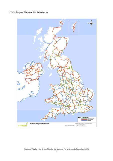
countryside <strong>for</strong> local journeys, and creates a regional network connecting settlements along its way. Approximately one-third is traffic free and <strong>the</strong> rest on traffic-calmed minor town and country roads. Traffic-free sections provide a suitable place <strong>for</strong> children and new cyclists to practice <strong>the</strong>ir skills. Many routes are also used by walkers, wheelchair users and, in some cases, horse riders. The project reaches all parts of <strong>the</strong> UK, benefits all sectors of society and has both a local and national significance. 2.3.2 The concept of cycling and walking as a method of sustainable transport was accorded national recognition in 1995 when <strong>the</strong> <strong>National</strong> <strong>Cycle</strong> <strong>Network</strong> became <strong>the</strong> first major, and truly national, project to gain <strong>the</strong> support of <strong>the</strong> Millennium Commission. Working in conjunction with Local Authorities and o<strong>the</strong>rs to implement <strong>the</strong> practical work, <strong>Sustrans</strong> oversees <strong>the</strong> co-ordination, design and standards of <strong>the</strong> overall project. 2.3.3 The majority of <strong>the</strong> <strong>Network</strong> uses pre-existing paths or linear features of one sort or ano<strong>the</strong>r, with very few completely new routes being created. A very small proportion, less than 15% of <strong>the</strong> entire <strong>Network</strong>, will require new construction. Many paths use disused railway lines and include restoration of some of <strong>the</strong>ir unimproved grassland embankments and cuttings. Over a typical length of disused railway, a 2.5 metre wide path will utilise under 10% of <strong>the</strong> area. This minimises <strong>the</strong> environmental impact of <strong>the</strong> <strong>Network</strong>, particularly from <strong>the</strong> construction process, and <strong>the</strong> disturbance to local wildlife that is often already accustomed to human activity. 2.3.4 The <strong>National</strong> <strong>Cycle</strong> <strong>Network</strong>, and in particular <strong>the</strong> traffic-free sections, comprises linear features that act as wildlife corridors linking habitats and species which would o<strong>the</strong>rwise be isolated from each o<strong>the</strong>r. Fur<strong>the</strong>r investigation into <strong>the</strong> use of <strong>the</strong> cycle and walking routes by wildlife would be valuable and <strong>Sustrans</strong> is involved in a number of research projects including <strong>the</strong> use of bridges along cycle routes by <strong>for</strong>aging bats. The <strong>Network</strong> also <strong>for</strong>ms a valuable resource <strong>for</strong> nature education, and <strong>Sustrans</strong> aims to increase cyclists’ and walkers’ enjoyment of nature along <strong>the</strong> <strong>Network</strong> by enhancing habitat <strong>for</strong> wildlife, and through interpretation where possible. For sensitive sites, management plans are being produced to protect and enhance <strong>the</strong> route <strong>for</strong> wildlife as well as <strong>for</strong> users. These include short-term maintenance e.g. cutting regimes and timing, and longer-term management e.g. embankments and cuttings, bramble, hedgerows, etc. which incorporate maximising wildlife interest. The <strong>Sustrans</strong> NCN BAP is just one of a number of initiatives that <strong>Sustrans</strong> is developing to maximise <strong>the</strong> wildlife potential along its routes. <strong>Sustrans</strong> produces a series of in<strong>for</strong>mation sheets, one of which, ‘Ways <strong>for</strong> Wildlife – wildlife, cycle paths and traffic’, is specifically targeted at <strong>the</strong> value of traffic-free cycle routes to wildlife. A copy of this leaflet can be found in Appendix 1. <strong>Sustrans</strong>’ <strong>Biodiversity</strong> <strong>Action</strong> <strong>Plan</strong> <strong>for</strong> <strong>the</strong> <strong>National</strong> <strong>Cycle</strong> <strong>Network</strong> (December 2007) 10
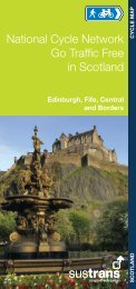
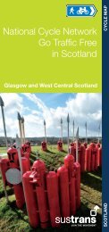
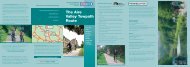
2.3.5 Map of <strong>National</strong> <strong>Cycle</strong> <strong>Network</strong> <strong>Sustrans</strong>’ <strong>Biodiversity</strong> <strong>Action</strong> <strong>Plan</strong> <strong>for</strong> <strong>the</strong> <strong>National</strong> <strong>Cycle</strong> <strong>Network</strong> (December 2007) 11