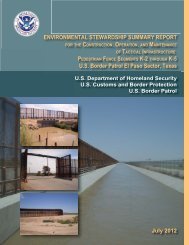
El Centro PF225 ESSR - CBP.gov
El Centro PF225 ESSR - CBP.gov
El Centro PF225 ESSR - CBP.gov

Create successful ePaper yourself
Turn your PDF publications into a flip-book with our unique Google optimized e-Paper software.
1-3<br />
2. To document success of BMPs and any changes or improvements for the future.<br />
3. To document any changes to the planned location or type of the TI.<br />
1.1 PUBLIC AND AGENCY OUTREACH<br />
Before developing the ESP, <strong>CBP</strong> prepared an environmental assessment (EA), mailed copies to<br />
interested parties, posted it on a public website, and announced a 30-day public review and<br />
comment period. A public open house was advertised and held at the Imperial Valley Expo in<br />
Imperial, California, on January 9, 2008. The open house was attended by four people.<br />
After the Secretary of Homeland Security waived compliance with certain environmental laws<br />
and requirements in April 2008, <strong>CBP</strong> reviewed, considered, and incorporated comments on the<br />
draft EA received from the public and other Federal, state, and local agencies, as appropriate,<br />
while preparing the ESP. Results of public and agency coordination efforts for the draft EA<br />
were addressed and incorporated into the ESP and posted for the public.<br />
In addition to the past public involvement and outreach program, <strong>CBP</strong> continued to coordinate<br />
with various Federal and state agencies while developing the ESP and during construction.<br />
Those agencies include but are not limited to the following:<br />
U.S. Section, International Boundary and Water Commission (USIBWC) - <strong>CBP</strong> coordinated<br />
with USIBWC to ensure that any construction along the international border did not adversely<br />
affect international boundary monuments or substantially impede floodwater conveyance within<br />
international drainages.<br />
U.S. Army Corps of Engineers (USACE), Los Angeles District - <strong>CBP</strong> coordinated all activities<br />
with USACE to identify potential jurisdictional Waters of the U.S. (WUS), including wetlands,<br />
and to develop measures to avoid, minimize, or compensate for losses to these resources.<br />
U.S. Fish and Wildlife Service (USFWS) - <strong>CBP</strong> coordinated with USFWS to identify listed<br />
species that could inhabit the project area, identify potential effects on listed species, and develop<br />
BMPs.<br />
U.S. Department of the Interior (DOI) - <strong>CBP</strong> coordinated with the U.S. Bureau of Land<br />
Management (BLM) and U.S. Bureau of Reclamation (Reclamation), since portions of the<br />
planned section were located within BLM’s Algodones Dunes Recreation Area and along<br />
Reclamation’s Salinity Canal.<br />
1.2 METHODS<br />
1.2.1 Environmental Monitoring Process<br />
<strong>CBP</strong> provided an environmental monitor during construction activity in areas where federally<br />
protected species were known or presumed to occur near the project corridor. Duties of the<br />
designated environmental monitor included documenting impacts beyond those described in the<br />
ESP, advising onsite construction managers regarding implementation of the BMPs and other<br />
environmental issues as they arise, and ensuring implementation of the appropriate BMPs.<br />
ELC_<strong>PF225</strong>_<strong>ESSR</strong><br />
Final