

No. 70 The Voice of the Land Surveyors of Califo rnia Winter ... - CLSA
No. 70 The Voice of the Land Surveyors of Califo rnia Winter ... - CLSA
No. 70 The Voice of the Land Surveyors of Califo rnia Winter ... - CLSA

Create successful ePaper yourself
Turn your PDF publications into a flip-book with our unique Google optimized e-Paper software.
<strong>No</strong>. <strong>70</strong><br />
<strong>The</strong> <strong>Voice</strong> <strong>of</strong> <strong>the</strong> <strong>Land</strong> <strong>Surveyors</strong> <strong>of</strong> <strong>Califo</strong> <strong>rnia</strong> <strong>Winter</strong> 1983
Table <strong>of</strong> Contents<br />
President's Message Page 4<br />
Political Action Committee Page 5<br />
Articles Page 7<br />
From <strong>the</strong> Editor Page 8<br />
Of Interest Page 8<br />
Letters Page 9<br />
News Briefs Page 9<br />
New Products Page 11<br />
New Members Page 18<br />
Western Federation News Page 20<br />
<strong>Surveyors</strong> Historical Society Page 20<br />
Book <strong>No</strong>ok Page 22<br />
Advertisers' Index Page 23<br />
1<br />
<strong>The</strong> <strong>Califo</strong><strong>rnia</strong> Surveyor<br />
is <strong>the</strong> quarterly publication <strong>of</strong> <strong>The</strong> <strong>Califo</strong><strong>rnia</strong> <strong>Land</strong> <strong>Surveyors</strong><br />
Association and is pubhshed as a service to <strong>the</strong> <strong>Land</strong> Surveying pr<strong>of</strong>ession<br />
<strong>of</strong> <strong>Califo</strong><strong>rnia</strong>. It is mailed to all Licensed <strong>Land</strong> <strong>Surveyors</strong><br />
and <strong>Land</strong> <strong>Surveyors</strong> in Training in <strong>the</strong> state <strong>of</strong> Cahfo<strong>rnia</strong> as well as<br />
to all members <strong>of</strong> <strong>Califo</strong><strong>rnia</strong> <strong>Land</strong> <strong>Surveyors</strong> Association. <strong>The</strong><br />
<strong>Califo</strong><strong>rnia</strong> Surveyor is an open forum for all surveyors, with an<br />
editorial policy predicated on <strong>the</strong> preamble to <strong>the</strong> constitution <strong>of</strong> <strong>the</strong><br />
<strong>Califo</strong><strong>rnia</strong> <strong>Land</strong> <strong>Surveyors</strong> Association and its stated aims and objectives,<br />
which read:<br />
"Recognizing that <strong>the</strong> true merit <strong>of</strong> a pr<strong>of</strong>ession is determined by<br />
<strong>the</strong> value <strong>of</strong> its services to society, <strong>the</strong> '<strong>Califo</strong><strong>rnia</strong> <strong>Land</strong> <strong>Surveyors</strong><br />
Association' does hereby dedicate itself to <strong>the</strong> promotion and protection<br />
<strong>of</strong> <strong>the</strong> pr<strong>of</strong>ession <strong>of</strong> <strong>Land</strong> Surveying as a social and<br />
economic influence vital to <strong>the</strong> welfare <strong>of</strong> society, community and<br />
state."<br />
"<strong>The</strong> purpose <strong>of</strong> this organization is to promote <strong>the</strong> common good<br />
and welfare <strong>of</strong> its members in <strong>the</strong>ir activities in <strong>the</strong> pr<strong>of</strong>ession <strong>of</strong><br />
<strong>Land</strong> Surveying, to promote and maintain <strong>the</strong> highest possible<br />
standards <strong>of</strong> pr<strong>of</strong>essional ethics and practices, to promote pr<strong>of</strong>essional<br />
uniformity, to promote public faith and dependence in <strong>the</strong><br />
<strong>Land</strong> <strong>Surveyors</strong> and <strong>the</strong>ir work."<br />
Personnel<br />
Owner: <strong>Califo</strong><strong>rnia</strong> <strong>Land</strong> <strong>Surveyors</strong> Association<br />
Editor: J. E, Terry<br />
Sales Manager: D. Calegari<br />
Advertising<br />
Commercial advertising is accepted by <strong>The</strong> <strong>Califo</strong><strong>rnia</strong> Surveyor.<br />
Advertising rates and information can be obtained by contacting<br />
Dorothy Calegari / Lisa Reese, P.O. Box 9098, Santa Rosa, CA<br />
95405, phone (<strong>70</strong>7) 539-3633<br />
CopyrightiEj 1983 <strong>Califo</strong><strong>rnia</strong> <strong>Land</strong> <strong>Surveyors</strong> Association<br />
Sustaining Membership<br />
Membership in <strong>the</strong> <strong>Califo</strong><strong>rnia</strong> <strong>Land</strong> <strong>Surveyors</strong> Association as a<br />
sustaining member is open to any individual, company or corporation<br />
who, by <strong>the</strong>ir interest in <strong>the</strong> <strong>Land</strong> Surveying pr<strong>of</strong>ession, is<br />
desirous <strong>of</strong> supporting <strong>the</strong> purposes and objectives <strong>of</strong> this association.<br />
For information regarding sustaining membership, contact <strong>the</strong><br />
Editor <strong>of</strong> <strong>The</strong> <strong>Califo</strong><strong>rnia</strong> Surveyor.<br />
Editorial Material<br />
All articles, reports, letters and contributions are accepted and<br />
will be considered for publication regardless <strong>of</strong> <strong>the</strong> author's affiUt<br />
tion with <strong>the</strong> <strong>Califo</strong><strong>rnia</strong> <strong>Land</strong> <strong>Surveyors</strong> Association. Material<br />
should be sent to <strong>The</strong> <strong>Califo</strong><strong>rnia</strong> Surveyor.<br />
Unless indicated, all articles in this publication are prepared by<br />
<strong>the</strong> editor.<br />
EDITOR:<br />
J. E. Terry<br />
6059 Harwood Ave.,<br />
Oakland. CA 94618<br />
DEADLINE DATES FOR<br />
THE CALIFORNIA SURVEYOR<br />
Spring March 15, 1983<br />
Aricles, Reports, Letters, etc., received after <strong>the</strong> above mentioned<br />
date will be placed in <strong>the</strong> next edition.<br />
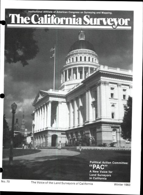
Cover: State Capital Building in Sacramento, <strong>Califo</strong><strong>rnia</strong><br />
Compliments <strong>of</strong> State <strong>of</strong> <strong>Califo</strong><strong>rnia</strong>, Dept. <strong>of</strong> Transportation,<br />
Ed Andersen, Photographer<br />
OFFICERS 1983<br />
James W. Crabtree<br />
President<br />
James R. Dorsey<br />
Vice President<br />
Gary B. Antone<br />
Secretory<br />
Richard P. Siegmund<br />
Treasurer<br />
Dorothy C. Calegari<br />
Executive Director<br />
Charles E. Moore<br />
Immed. Past President<br />
Julie E. Terry<br />
Editor<br />
Bakersfield<br />
Reily H. Smith<br />
Central Coast<br />
Tom Mastin<br />
Central Valley<br />
Jimmy G. Bateman<br />
East Bay<br />
Leroy C. Hennes<br />
Humboldt<br />
Michael Moore<br />
Lake/Mendocino<br />
Thomas Herman<br />
BOARD OF DIRECTORS<br />
Los Angeles/Ventura<br />
Dennis E. <strong>Land</strong>berg<br />
Marin County<br />
John A. Estes<br />
Monterey Bay<br />
Joel Readio<br />
Mo<strong>the</strong>r Lode<br />
Fred W. Wilke<br />
<strong>No</strong>r<strong>the</strong>rn <strong>Califo</strong><strong>rnia</strong><br />
Merle W. Eh<br />
Orange County<br />
Douglas O. Foster<br />
Riverside/San Bernardino<br />
Russell H. Garner<br />
Sacramento<br />
Jan C. Cudrnak<br />
San Diego<br />
Michael J. Pallamary, III<br />
San Joaquin Valley<br />
William O. Gentry<br />
Santa Clara/San Mateo<br />
Richard R. Skierka<br />
Sonoma County<br />
Howard W. Brunner<br />
Page 2 <strong>The</strong> <strong>Califo</strong><strong>rnia</strong> Surveyor — <strong>Winter</strong> 1983
A Geodimeter Survey System<br />
^ handles peak loads without<br />
adding extra help<br />
When you invest in productivity,<br />
you won't need to<br />
add personnel for peak periods<br />
nor lay <strong>the</strong>m <strong>of</strong>f during<br />
slow times. Automation<br />
boosts pr<strong>of</strong>its dramatically<br />
when business booms, allows<br />
you to skate smoothly over<br />
low spots and <strong>of</strong>fers job<br />
security to your field force.<br />
(Besides, <strong>the</strong>re's no Investment<br />
Tax Credit or Accelerated<br />
Depreciation on new<br />
personnel.)<br />
With five efficient mounton<br />
EDMs and a new secondgeneration<br />
Total Station,<br />
Geodat field recorder and<br />
unique Geodimeter<br />
s<strong>of</strong>tware<br />
packages.<br />
we can satisfy your specific<br />
requirements. Fit field/<strong>of</strong>fice<br />
hardware to your work, level<br />
<strong>of</strong> automation to your<br />
budget.<br />
We can even supply a<br />
turnkey field-to-<strong>of</strong>fice system<br />
with Geodimeter instrumentation<br />
(112, 122 or 140)<br />
and s<strong>of</strong>tware, and HP 85<br />
computer at a very<br />
attractive system<br />
price.<br />
It's time to start<br />
thinking system. Call<br />
toll-free today; ask<br />
for our systems<br />
brochure or tell<br />
us your<br />
S Geodimeter<br />
<strong>No</strong>thing else quite measures up . . .<br />
Cad toll-free today for a<br />
hands-on demonstration from<br />
<strong>the</strong> nearest dealer or rep.<br />
800-227-1756<br />
(In Calif. 800-772-2664)<br />
AGA Geodimeter, Inc.<br />
385F Bel Marin Keys Blvd.<br />
<strong>No</strong>valo, CA 94947<br />
415/883-2367 TLX: 330 495
President's Message<br />
IN MEMORIAM<br />
EUGENE LOCKTON<br />
L.S. 2535 (1904-1982)<br />
It is with great sadness that we<br />
note <strong>the</strong> recent death <strong>of</strong> Eugene<br />
Lockton. Gene was a charter<br />
member <strong>of</strong> <strong>CLSA</strong> ICLLSA to you<br />
old-timers). In 1973 he served as<br />
president <strong>of</strong> <strong>the</strong> state <strong>CLSA</strong> organization.<br />
He was also past<br />
president <strong>of</strong> <strong>the</strong> Marin chapter<br />
and for a number <strong>of</strong> years was active<br />
as <strong>the</strong> Marin chapter representative<br />
during that early and<br />
difficult period when <strong>CLSA</strong> was<br />
struggling to establish its identity<br />
and searching for direction.<br />
That was <strong>the</strong> time when <strong>the</strong>re<br />
were basic differences between<br />
surveyors whe<strong>the</strong>r to accept or reject<br />
Plan A as proposed by <strong>Califo</strong><strong>rnia</strong><br />
Council, which would have<br />
included surveying under <strong>the</strong><br />
definition <strong>of</strong> engineering. This<br />
plan would have grandfa<strong>the</strong>red<br />
<strong>the</strong> <strong>the</strong>n present surveyors as engineers,<br />
and as such would not<br />
have affected <strong>the</strong>m. <strong>The</strong>re never<br />
was any doubt in Gene's mind<br />
how he felt on this issue. He was<br />
adament in his opposition to Plan<br />
A, and would debate eloquently<br />
(as only he could) both with surveyors<br />
and engineers on <strong>the</strong> subject.<br />
He felt strongly that <strong>the</strong><br />
surveyor provides a unique service<br />
to <strong>the</strong> community and as<br />
such needs to be separate and independent<br />
from <strong>the</strong> engineer. Our<br />
present organizational strength<br />
and influence is due in no small<br />
part to his contribution.<br />
Gene also took great pride in<br />
<strong>the</strong> fact that for many years he<br />
was <strong>the</strong> oldest practicing surveyor<br />
in Marin County, both in<br />
years <strong>of</strong> service as well as age. It<br />
is unfortunate that we have lost<br />
his insight and contribution to<br />
our organization while he was in<br />
his prime at a youthful age (for<br />
him) <strong>of</strong> 78 years. His pr<strong>of</strong>essionalism,<br />
keen mind and humor will<br />
be missed by all <strong>of</strong> us who were<br />
fortunate enough to have known<br />
him.<br />
Page 4 <strong>The</strong> <strong>Califo</strong><strong>rnia</strong> Surveyor — <strong>Winter</strong> 1983
Political Action Committee<br />
POLITICAL ACTION<br />
COMMITTEE "PAC"<br />
A NEW VOICE FOR LAND<br />
SURVEYORS IN CALIFORNIA<br />
WHY A PAC?<br />
We in a pr<strong>of</strong>ession must do our<br />
personal, individual best to guarantee<br />
association involvement in<br />
public affairs.<br />
<strong>The</strong> <strong>Califo</strong><strong>rnia</strong> <strong>Land</strong> <strong>Surveyors</strong><br />
A ssocia tion (<strong>CLSA</strong>) created a<br />
PAC in 1982 in order to:<br />
• Respond more effectively and<br />
quickly to <strong>the</strong> political challenges<br />
<strong>of</strong> <strong>the</strong> 1980's.<br />
• Upgrade <strong>the</strong> efforts being made<br />
on behalf <strong>of</strong> <strong>Land</strong> <strong>Surveyors</strong> in<br />
<strong>Califo</strong><strong>rnia</strong>.<br />
Collective action has always<br />
been <strong>the</strong> greatest and most visible<br />
important element in electing<br />
candidates. By reason <strong>of</strong> a PAC's<br />
very existence, candidates recognize<br />
us.<br />
A PAC provides <strong>the</strong> Association<br />
^ith a powerful tool to insure that<br />
<strong>the</strong>ir individual voices are<br />
'streng<strong>the</strong>ned through voluntary,<br />
collective effort.<br />
WHAT IS PAC?<br />
A PAC. is a separate entity<br />
from <strong>CLSA</strong>. It is:<br />
• Voluntary<br />
• Distributes monies to candidates<br />
for public <strong>of</strong>fice who support<br />
<strong>the</strong> interest <strong>of</strong> <strong>the</strong> association.<br />
Creation <strong>of</strong> a PAC is only one<br />
part in telling our story to <strong>the</strong><br />
legislature. A PAC increases our<br />
credibility by giving us added leverage<br />
in our overall legislative activities.<br />
A PAC states that it has been<br />
established to provide an opportunity<br />
to individuals interested in<br />
<strong>the</strong> pugure <strong>of</strong> <strong>the</strong> pr<strong>of</strong>ession to<br />
contribute to <strong>the</strong> support <strong>of</strong> candidates<br />
for <strong>of</strong>fice who believe, and<br />
have demonstrated <strong>the</strong>ir beliefs,<br />
in <strong>the</strong> principles to which <strong>the</strong><br />
association is dedicated.<br />
i<br />
WHO IS A PAC? You Are!<br />
<strong>The</strong> explosive growth <strong>of</strong> PACs<br />
uring <strong>the</strong> last decade has increased<br />
<strong>the</strong> ability <strong>of</strong> <strong>the</strong> average<br />
individual to compete for that<br />
rare commodity—<strong>the</strong> legislator's<br />
attention.<br />
A PAC reflects <strong>the</strong> belief that<br />
we must develop higher visibility<br />
and increased recognition in order<br />
to promote our interests.<br />
We can help by electing candidates<br />
who understand, or are at<br />
least willing to listen to, our individual<br />
concerns.<br />
QUESTIONS AND ANSWERS<br />
Q: How can I contribute to <strong>the</strong><br />
<strong>Califo</strong><strong>rnia</strong> <strong>Land</strong> <strong>Surveyors</strong> PA C?<br />
A: You may write your personal<br />
check payable to CLS-PAC by<br />
completing <strong>the</strong> contribution card<br />
and enclosing both <strong>the</strong> check and<br />
<strong>the</strong> card in a prepaid, preaddressed<br />
envelope provided. PAC contributions<br />
should be sent directly to:<br />
<strong>Califo</strong><strong>rnia</strong> <strong>Land</strong> <strong>Surveyors</strong>-<br />
Political Action Committee (CLS-<br />
PAC), P.O. Box 9098, Santa Rosa,<br />
CA 95405.<br />
Q: If I choose not to participate in<br />
<strong>the</strong> PAC, will it affect my membership<br />
?<br />
A: <strong>No</strong>, Federal laws insure that<br />
your participation is voluntary<br />
and free <strong>of</strong> any pressure. Your<br />
decision to not participate has no<br />
effect on membership, just as your<br />
decision to participate does not affect<br />
your membership status.<br />
Q: Can I get a tax credit for my<br />
contribution?<br />
A: Yes! Federal income tax allows<br />
you to take a credit <strong>of</strong> up to $50<br />
for an individual return or $100 for<br />
a joint return for one-half <strong>of</strong> <strong>the</strong><br />
amount you contribute. In o<strong>the</strong>r<br />
words, it only costs you $1.00 to<br />
give $2.00.<br />
Q: How does <strong>the</strong> PAC Committee<br />
decide which candidates to support?<br />
A: Decision about contributions<br />
must sometimes be subjective,<br />
especially in <strong>the</strong> case <strong>of</strong> a<br />
challenger who may not have an<br />
established voting record. In most<br />
cases, however, recipients are<br />
selected on <strong>the</strong> basis <strong>of</strong> meeting<br />
general criteria, including:<br />
• Personal qualifications for <strong>of</strong>fice<br />
- <strong>the</strong> candidate's demonstrated<br />
capacity to render effective, able,<br />
and honest public service in <strong>the</strong> <strong>of</strong>fice<br />
being sought.<br />
• Issue and program positions -<strong>the</strong><br />
candidate's known position and<br />
record on issues and programs <strong>of</strong><br />
importance to <strong>CLSA</strong> and its<br />
members, as well as <strong>the</strong> degree to<br />
which <strong>the</strong> candidate supports <strong>the</strong><br />
overall needs <strong>of</strong> <strong>the</strong> association<br />
community.<br />
• ElectibiUty - <strong>the</strong> degree to which<br />
<strong>the</strong> candidate stands a reasonable<br />
chance <strong>of</strong> being elected or reelected.<br />
• Position - any particular leadership<br />
role, policy-making position,<br />
or unusual stature in government<br />
held by <strong>the</strong> candidate which<br />
makes him or her <strong>of</strong> special<br />
importance to <strong>CLSA</strong> and to <strong>the</strong><br />
land surveying community in<br />
general.<br />
• Financial need - whe<strong>the</strong>r or not<br />
<strong>the</strong> candidate has o<strong>the</strong>r sources <strong>of</strong><br />
financial assistance.<br />
Q: Can contributors suggest candidates<br />
<strong>the</strong>y feel <strong>the</strong> PAC should<br />
support?<br />
A: Any PAC contributor is welcome<br />
to make recommendations at<br />
any time to <strong>the</strong> PAC Committee.<br />
Q: Why should I make a contribution<br />
to <strong>the</strong> CLS-PAC instead <strong>of</strong><br />
giving directly to <strong>the</strong> candidate <strong>of</strong><br />
my choice?<br />
A: Because <strong>the</strong>re is strength in<br />
numbers. By letting CLS-PAC<br />
transmit your contributions to <strong>the</strong><br />
candidate, our contributions have<br />
a greater impact. <strong>The</strong> candidate<br />
understands that he or she is being<br />
supported by many people,<br />
who have an interest in issues <strong>of</strong><br />
importance to land surveying<br />
generally. Fur<strong>the</strong>r, by contributing<br />
to CLS-PAC we streng<strong>the</strong>n<br />
<strong>the</strong> voice <strong>of</strong> land surveyors among<br />
<strong>the</strong> many competing interests in<br />
Sacramento.<br />
Q: When is <strong>the</strong> best time to give to<br />
CLS-PAC?<br />
A: <strong>No</strong>w! CLS-PAC accepts contributions<br />
at any time, but early contributions<br />
allow <strong>the</strong> PAC to plan<br />
<strong>the</strong> most effective means <strong>of</strong><br />
disbursement.<br />
<strong>The</strong> <strong>Califo</strong><strong>rnia</strong> Surveyor — <strong>Winter</strong> 1983 Page 5
LEWIS & LEWIS<br />
surveying •c|ulpm«nt<br />
SALES-RENTALS-REPAIRS<br />
1600 CALLENS ROAD<br />
P 0 BOX 820 - VENTURA. CALIFORNIA 93002<br />
TELEPHONE (805)644 7405<br />
TOLL FREE<br />
800-342-3607 800-235-3377<br />
(FROM CALIFORNIA!<br />
(ALL CONTIGUOUS STATES EXCEPT CALlFORNIAl<br />
RENTAL<br />
STOCK<br />
SALE<br />
CALL FOR A COMPLETE LIST OF<br />
NEW AND USED THEODOLITES.<br />
TRANSITS, AUTOMATIC LEVELS,<br />
ANDE.D.M.s<br />
LIETZ (used)<br />
E.D.M.(used)<br />
TM-1A one second <strong>the</strong>odolite $3,500.00 Lietz RED-1 system #1 $3,754.00<br />
TM-10C ten second <strong>the</strong>odolite $1,800.00 Topcon GTS-1<br />
TM-20C twenty second <strong>the</strong>odolite $1,750.00 semi total station $4,750.00<br />
T-60D one minute <strong>the</strong>odolite $1,750.00 Pentax PM-81<br />
standard package $3,590.00<br />
PENTAX (new)<br />
TH-10WA ten second <strong>the</strong>odolite $1,650.00 'Prices subject to change without notice.<br />
TH-20WA twenty second <strong>the</strong>odolite $1,450.00 *Used instruments subject to availability.<br />
THE VERY BEST IN TITLE SERVICES<br />
with <strong>of</strong>fices located in:<br />
LOS ANGELES ORANGE RIVERSIDE<br />
SAN BERNARDINO SAN DIEGO (<strong>Califo</strong><strong>rnia</strong> World Title Co.)<br />
SOLANO and VENTURA counties<br />
i<br />
Page 6 <strong>The</strong> <strong>Califo</strong><strong>rnia</strong> Surveyor — <strong>Winter</strong> 1983
Articles<br />
ETERMINATION OF MEAN<br />
BEARING IN A FRACTIONAL<br />
SECTION<br />
<strong>The</strong> existence <strong>of</strong> hundreds <strong>of</strong><br />
Mexican <strong>Land</strong> Grants has created<br />
thousands <strong>of</strong> fractional sections.<br />
Several o<strong>the</strong>r factors have also<br />
created fractional sections. A surveyor<br />
will encounter <strong>the</strong>se sections,<br />
from time to time, and perhaps<br />
consult a reference text for<br />
guidance on <strong>the</strong> subdivision <strong>of</strong> <strong>the</strong><br />
fractional section. All references<br />
agree; when <strong>the</strong>re is no opposite<br />
corresponding quarter corner<br />
mean bearings will be employed to<br />
fix <strong>the</strong> direction <strong>of</strong> <strong>the</strong> required<br />
line. <strong>No</strong>w, what is a mean bearing,<br />
and how do we determine one?<br />
Mean indicates average. <strong>The</strong>re<br />
are several methods one might<br />
employ to determine an "average."<br />
Some <strong>of</strong> <strong>the</strong>se methods make more<br />
sense than o<strong>the</strong>rs. In <strong>the</strong> following<br />
discussion we will examine a<br />
typical case, compare some<br />
methods and draw a conclusion.<br />
Shown herein is Fractional Section<br />
14, T.4S., R.7W., S.B.M.,<br />
made fractional by <strong>the</strong> Rancho La<br />
Sierra. In <strong>the</strong> sketch shown, all<br />
controlling corners are found replacements<br />
for original corners or<br />
proper re-establishments <strong>the</strong>re<strong>of</strong>.<br />
<strong>The</strong> N-S and E-W center <strong>of</strong> section<br />
lines will have to be determined by<br />
mean bearing. Let us consider only<br />
<strong>the</strong> E-W line as <strong>the</strong> N-S Hne will be<br />
determined in a like manner.<br />
METHOD 1<br />
Consider each <strong>of</strong> <strong>the</strong> three<br />
governing lines as having equal<br />
weight, <strong>the</strong>refore <strong>the</strong> sum <strong>of</strong> <strong>the</strong><br />
three azimuths divided by three<br />
will yield a mean bearing:<br />
89° 46'38" (1425.93')<br />
90° 08'04" (2610.49')<br />
89° 40'46" (2632.67')<br />
269°35'28" /3 = 89°51'49"<br />
mean bearing: N 89° 51' 49" E<br />
(distances not considered)<br />
METHOD 2<br />
Consider <strong>the</strong> straight line between<br />
section corners to be <strong>the</strong><br />
I mean course on <strong>the</strong> South and<br />
'"average" that with that portion<br />
<strong>of</strong> <strong>the</strong> <strong>No</strong>rth line which we have.<br />
<strong>The</strong>refore <strong>the</strong> sum <strong>of</strong> <strong>the</strong> two<br />
azimuths divided by two will yield<br />
a mean bearing:<br />
89° 46'38" (1425.93')<br />
89° 54'22" (5243.12')<br />
179°41'00" /2 = 89°50'30"<br />
mean bearing: N 89° 50' 30" E<br />
(distances not considered)<br />
METHOD 3<br />
Weight <strong>the</strong> bearing <strong>of</strong> each governing<br />
line by distance. To do this<br />
we will compute <strong>the</strong> mean bearing<br />
from <strong>the</strong> summation <strong>of</strong> <strong>the</strong> latitudes<br />
and departures <strong>of</strong> <strong>the</strong> governing<br />
courses. In practice we will<br />
establish a three leg "traverse"<br />
from <strong>the</strong> governing lines and inverse<br />
beginning to end to obtain<br />
<strong>the</strong> mean course;<br />
Traverse (by azimuth)<br />
89° 46'38" 1425.93'<strong>The</strong>nce<br />
90° 08'04" 2610.49'<strong>The</strong>nce<br />
89° 40'46" <strong>the</strong>n inverse:<br />
89° 52'42" 6669.05'<br />
mean bearing: N 89° 52' 42" E<br />
(distances not considered)<br />
Methods 1 and 2 were suggested<br />
by various surveyors. Method 3<br />
was suggested by <strong>the</strong> B.L.M. and<br />
I think it makes <strong>the</strong> most sense (I<br />
am informed that <strong>the</strong> B.L.M. uses<br />
this method most <strong>of</strong> <strong>the</strong> time - but<br />
not exclusively). <strong>The</strong> fact that<br />
Method 3 weights each course by<br />
distance is what makes this<br />
method an equitable one.<br />
In <strong>the</strong> case shown above, each <strong>of</strong><br />
<strong>the</strong> three methods yields a bearing<br />
very close to that <strong>of</strong> <strong>the</strong> o<strong>the</strong>r two.<br />
<strong>No</strong>w, let us consider a case where<br />
one line is ra<strong>the</strong>r short, say 500<br />
feet. If that short Une should skew<br />
two or three degrees, perhaps because<br />
it's terminus is proportioned,<br />
<strong>the</strong> results would vary<br />
widely. It is in this situation that<br />
<strong>the</strong> equity <strong>of</strong> Method 3 becomes<br />
apparent. Since <strong>the</strong> short course<br />
will be weighted by distance, its<br />
overall effect on <strong>the</strong> sub-section<br />
lines will be tempered with that <strong>of</strong><br />
<strong>the</strong> long course. Method 3 will<br />
allow <strong>the</strong> section to be subdivided<br />
into parcels which, for <strong>the</strong> most<br />
part, are regular. <strong>The</strong> irregular<br />
parcels will be confined to <strong>the</strong> area<br />
abutting <strong>the</strong> skewed hne. <strong>The</strong><br />
equity <strong>of</strong> placing errors and irregularities<br />
where <strong>the</strong>y occur is obvious.<br />
DESCRIPTION V.S.<br />
SPECIFICATION<br />
by: Eugene Lock ton<br />
It has frequently been stated<br />
that "surveying is hand-maiden to<br />
<strong>the</strong> law." This stems from <strong>the</strong> fact<br />
that while <strong>the</strong> law governs <strong>the</strong><br />
rights <strong>of</strong> a land owner, those<br />
rights are physically hmited by<br />
<strong>the</strong> surveyor who estabUshes his<br />
boundaries. A transfer <strong>of</strong> title to<br />
land, nearly tdways requires a<br />
deed with a description <strong>of</strong> <strong>the</strong><br />
parcel being conveyed but <strong>the</strong> description<br />
must yield to monumentation.<br />
This is because <strong>the</strong> boundary<br />
is, "where <strong>the</strong> surveyor put it,<br />
not where he said he put it," <strong>the</strong><br />
description serving only to guide<br />
in <strong>the</strong> location <strong>of</strong> corners in <strong>the</strong><br />
original survey, which presumably<br />
came first. A civil engineering<br />
project, on <strong>the</strong> o<strong>the</strong>r hand, starts<br />
with <strong>the</strong> design by <strong>the</strong> C.E. and<br />
takes <strong>the</strong> form <strong>of</strong> a specification<br />
whose terms are mandatory. Perhaps<br />
this explains why civils who<br />
undertake property surveys follow<br />
<strong>the</strong> deed descriptions literally,<br />
frequently arriving at <strong>the</strong> conclusion<br />
that an original monument<br />
was found to be in error as to location,<br />
confusing a "description"<br />
with a "specification."<br />
Let him who is without sin cast<br />
<strong>the</strong> first stone. Once upon a time,<br />
setting <strong>the</strong> corners for a lot, I<br />
found my measured call to fall<br />
upon a job with <strong>the</strong> original surveyor's<br />
tag about V2 inch distant.<br />
So along side <strong>of</strong> <strong>the</strong> original monument,<br />
I set my tag, L.S. 2535, but<br />
recently assigned to me. That was<br />
over thirty years ago, and I have<br />
since changed my viewpoint considerably.<br />
Sometimes it takes a<br />
crystal ball to decide what to accept<br />
as original monumentations.<br />
I have in mind a large parcel which<br />
was divided down <strong>the</strong> middle by a<br />
line which closed ma<strong>the</strong>matically<br />
but which was not staked.<br />
One <strong>of</strong> <strong>the</strong> parcels was subdivided<br />
into lots by A.C.E. who filed a<br />
map but was too involved with engineering<br />
to stake <strong>the</strong> lots. After<br />
about a year <strong>the</strong> owner demanded<br />
lot stakes, so <strong>the</strong> engineer engaged<br />
an L.S. to stake <strong>the</strong> lots according<br />
<strong>The</strong> <strong>Califo</strong><strong>rnia</strong> Surveyor - <strong>Winter</strong> 1983 Page 7
to <strong>the</strong> map. <strong>The</strong> L.S. quite properly<br />
marked <strong>the</strong> lot corners with his<br />
tags. Some <strong>of</strong> <strong>the</strong> lot corners fell<br />
up on what would be <strong>the</strong> periphery<br />
<strong>of</strong> <strong>the</strong> original unstaked division.<br />
Could <strong>the</strong>y unequivocally be held<br />
against claims by <strong>the</strong> owner <strong>of</strong> <strong>the</strong><br />
unsubsidized parcel? I think not.<br />
Although <strong>the</strong>y were an L.S.'s best<br />
measure <strong>of</strong> a geometrically adequate<br />
line, even L.S.'s don't do<br />
perfect work and <strong>the</strong> location <strong>of</strong><br />
<strong>the</strong> lot corners by <strong>the</strong> L.S. do not<br />
constitute original monumentation.<br />
Some 100 years ago, a supreme<br />
court judge handed down a decision<br />
stating that "<strong>the</strong> peace <strong>of</strong> <strong>the</strong><br />
community is not to be lightly<br />
disturbed by measurements made<br />
from monuments <strong>of</strong> uncertain<br />
origin." So a surveyor is additionally<br />
charged with keeping <strong>the</strong><br />
peace. Accordingly, I held to <strong>the</strong><br />
lot corner hubs in subsequent<br />
work that I undertook.<br />
''ARTICLES''<br />
(continued on page 15)<br />
SIO<br />
r<br />
UJ<br />
^s<br />
-4<br />
isl<br />
V)<br />
.^<br />
s~<br />
0<br />
J ft<br />
ly 0<br />
V<br />
5/5"\<br />
3ZZ<br />
Si I<br />
Sf4-<br />
5/5-<br />
/<br />
/<br />
314-<br />
L5, IS"<br />
S0ef'K'30'\^<br />
I^ZS"^^'<br />
CC-^<br />
^^<br />
RANCHO<br />
l.X<br />
SULRR/^<br />
Z(,/0.4^' Ei.3Z-4.7' i/4<br />
~-- ri£ L./*j& Aye5°54'z-2."£ sz-^s.iz.'<br />
sz^y<br />
Z13<br />
3Z4<br />
L.S. n.<br />
From <strong>the</strong> Editor<br />
Thank You. Those are <strong>the</strong> words<br />
each <strong>of</strong> us should speak to our<br />
friend and colleague, Robert E.<br />
Baldwin, retiring Editor <strong>of</strong> <strong>Califo</strong><strong>rnia</strong><br />
Surveyor. Bob had been editing<br />
this magazine for approximately<br />
three years, and as is <strong>the</strong> case in all<br />
our lives, must move on to o<strong>the</strong>r<br />
things. Just having started this<br />
job, I can already appreciate <strong>the</strong><br />
time and effort he put into making<br />
sure <strong>the</strong> surveyor in our state had<br />
a "pr<strong>of</strong>essional" publication.<br />
Of Interest<br />
Again, all <strong>of</strong> our thanks for a job<br />
well done!<br />
I would also like to take this opportunity<br />
to introduce myself to<br />
<strong>the</strong> membership. My name is Julie<br />
Terry, I'm an LSIT and have been<br />
in surveying since 1975. I started<br />
working on a field crew part time,<br />
and found myself infatuated with<br />
this pr<strong>of</strong>ession. In 1980, I obtained<br />
my LSIT and have made an effort<br />
to be employed in this field<br />
ever since on a full time basis. I<br />
hope to serve my fellow surveyors<br />
by continuing to produce a magazine<br />
worthy <strong>of</strong> merit. I ask everyone<br />
now to be certain to contact<br />
me with questions, comments and<br />
criticism. I may be <strong>the</strong> one to<br />
determine what is chosen to be<br />
printed, but you are <strong>the</strong> ones who<br />
should help decide what kind <strong>of</strong><br />
pubUcation <strong>The</strong> <strong>Califo</strong><strong>rnia</strong> Surveyor<br />
will be. Good Luck to us all.<br />
SONOMA COUNTY CHAPTER<br />
PRESENTS SCHOLARSHIP<br />
<strong>The</strong> Sonoma County Chapter<br />
has presented its first annual, E.R,<br />
Jacobson Memorial Scholarship to<br />
a civil technology student at<br />
Santa Rosa Junior College. Receiving<br />
<strong>the</strong> award for <strong>the</strong> 1982<br />
school year was Aileen Ryan, a<br />
Page 8 <strong>The</strong> <strong>Califo</strong><strong>rnia</strong> Surveyor — <strong>Winter</strong> 1983<br />
second year student in <strong>the</strong> technology<br />
program. <strong>The</strong> scholarship<br />
is to be awarded annually to a second<br />
year student in <strong>the</strong> civil tech<br />
program whose area <strong>of</strong> interest is<br />
surveying.<br />
<strong>The</strong> scholarship is a memorial to<br />
"Bob" Jacobson, a founding member<br />
<strong>of</strong> <strong>the</strong> C.L.S.A. Bob , who<br />
lived and practiced in Sebastopol,<br />
was killed in a plane crash in 1981.<br />
Santa Rosa Junior College is<br />
planning to expand its civil technology<br />
program to include a specific<br />
surveying technology curriculum<br />
in <strong>the</strong> near future.<br />
Richard Coughlan<br />
Geo-Graphics Aerial Survey
Letters<br />
) Editor: This is a letter <strong>of</strong> reply to<br />
Mr. George R. Dunbar's letter on<br />
implied accuracy in <strong>the</strong> spring<br />
edition.<br />
You invite rebuttal—Mister,<br />
you will get rebuttal.<br />
<strong>The</strong> answer as to why things are<br />
shown on record maps as <strong>the</strong>y are,<br />
has absolutely nothing to do with<br />
<strong>the</strong> art <strong>of</strong> surveying. It has to do<br />
with Science <strong>of</strong> Mensuration and<br />
Computer Application.<br />
In April, 1981, I spent two soHd<br />
hours defending <strong>the</strong> technical correctness<br />
<strong>of</strong> a parcel map before <strong>the</strong><br />
Planning Commission <strong>of</strong> Lyon<br />
County, Nevada. <strong>The</strong> argument<br />
began when I submitted a parcel<br />
map whose boundary went through<br />
a non tangent highway curve with<br />
a radius <strong>of</strong> 4,950 feet. <strong>The</strong> Public<br />
Works Department, in running<br />
<strong>the</strong> closure calculations, came out<br />
with a closure reflecting an area<br />
that fell short <strong>of</strong> <strong>the</strong> 2 acre zoning<br />
requirement by 0.00005 acres. I<br />
.argued, I lost. I took back <strong>the</strong> map<br />
Fand converted <strong>the</strong> bearings to my<br />
H.P. 85A readout to 100th <strong>of</strong> a<br />
second and distances rounded to<br />
ten thousandths <strong>of</strong> a foot. <strong>The</strong><br />
pubhc works Wang computer<br />
reran my H.P. garbage. <strong>The</strong><br />
closure reflected a shortage <strong>of</strong> one<br />
ten millionth <strong>of</strong> an acre. I withdrew<br />
<strong>the</strong> map at <strong>the</strong> request <strong>of</strong> <strong>the</strong><br />
County Engineer, a registered expert<br />
Civil Engineer licensed both<br />
in <strong>Califo</strong><strong>rnia</strong> and <strong>the</strong> State <strong>of</strong><br />
Nevada; did a boundary adjustment<br />
survey and map with <strong>the</strong><br />
consent <strong>of</strong> <strong>the</strong> neighboring land<br />
owner; moved <strong>the</strong> property boundary<br />
north one ten thousandth <strong>of</strong><br />
one foot, redrew and re submitted<br />
STOLEN EQUIPMENT?<br />
Multi-witnessed purchase <strong>of</strong><br />
ZE155 TH2 <strong>The</strong>odohte and K&E<br />
MICRORANGER EDM ( + ).<br />
Origin: unknown, possibly east<br />
coast. If equipment yours, please<br />
provide serial numbers or o<strong>the</strong>r<br />
^^personalized I.D. Contact: J.<br />
•Buckley, P.O. Box "H", Boulder<br />
^Creek. CA 95006. (408) 338-2153<br />
(Bus.)—(408) 475-8826 and/or (408)<br />
476-7608—(Res.) Reimbursement<br />
required and reward greatly appreciated.<br />
<strong>the</strong> Parcel Map. <strong>The</strong> Wang computer<br />
<strong>the</strong>n ran an overage <strong>of</strong> one<br />
billionth <strong>of</strong> one acre which<br />
satisfied our Public Works<br />
Department and our technically<br />
oriented planning commission. I,<br />
however, with my own overriding<br />
inferiority complex (and having<br />
become a true behever) investigated<br />
fur<strong>the</strong>r. <strong>The</strong> bearings and<br />
distances shown on my recorded<br />
maps, when pushed through<br />
M.I.T.'s 16 Room. 7 story computer<br />
with <strong>the</strong> funny name, shows<br />
a shortage <strong>of</strong> 3 Quad billionths <strong>of</strong><br />
an acre. I am currently in <strong>the</strong> process<br />
<strong>of</strong> readjusting my north<br />
boundary to <strong>the</strong> north by<br />
0.000001' to correct <strong>the</strong> deficiency.<br />
Once I have recorded a new record<br />
<strong>of</strong> survey and new deeds, I shall<br />
<strong>the</strong>n file an amended parcel map<br />
thus legitimizing <strong>the</strong> Parcel Map<br />
to a great deal <strong>of</strong> prideful satisfaction.<br />
<strong>The</strong> record will be satisfactory.<br />
It's my damned field crew that<br />
is presenting <strong>the</strong> problem.<br />
Although we can, by repetition,<br />
work up a satisfactory probability<br />
factor for <strong>the</strong> overall measurement,<br />
<strong>the</strong>y are having a problem<br />
finding a one miUionth <strong>of</strong> a foot<br />
diameter center punch with which<br />
to mark <strong>the</strong> precise point in <strong>the</strong><br />
middle <strong>of</strong> our 2" Brass Cap. It's<br />
people such as <strong>the</strong>y who hold us<br />
land surveyors back from <strong>the</strong> eminence<br />
enjoyed by our more technically<br />
oriented bre<strong>the</strong>n in <strong>the</strong> civil<br />
engineering pr<strong>of</strong>ession.<br />
You sir, should be ashamed in<br />
advocating a return to a system<br />
that allows such sloppiness. How<br />
can we even consider allowing an<br />
error <strong>of</strong> such magnitude, as is on<br />
News Briefs<br />
LIFE MEMBERSHIP FOR<br />
ROBERT R. BALDWIN<br />
Robert R. Baldwin, L.S. 2678.<br />
was given Life Membership in <strong>the</strong><br />
<strong>Califo</strong><strong>rnia</strong> <strong>Land</strong> <strong>Surveyors</strong><br />
Association at <strong>the</strong> August<br />
meeting <strong>of</strong> <strong>the</strong> Board <strong>of</strong> Directors<br />
for his many years <strong>of</strong> support for<br />
<strong>the</strong> <strong>Land</strong> Surveyor in <strong>Califo</strong><strong>rnia</strong>.<br />
my parcel map, to exist. Think <strong>of</strong><br />
<strong>the</strong> Pain to <strong>the</strong> retracement surveyor<br />
40 years hence,<br />
by: George H. Denson, R.L.S.<br />
Editor; I read <strong>the</strong> letter from<br />
George R. Dunbar on "Implied<br />
Accuracy,'' where he rightfully<br />
questioned <strong>the</strong> propriety <strong>of</strong> showing<br />
map or plat bearings to <strong>the</strong><br />
nearest second <strong>of</strong> arc. This imphed<br />
precision is, as he states, usually a<br />
result <strong>of</strong> calculator or computer<br />
number manipulation. <strong>The</strong> practice<br />
<strong>of</strong> showing bearings, distances,<br />
areas and o<strong>the</strong>r measurements<br />
to significant digits not<br />
warranted by <strong>the</strong> measurement<br />
methods is not unique to <strong>Califo</strong><strong>rnia</strong>,<br />
but is done to some extent<br />
everywhere. <strong>The</strong> cause isn't simply<br />
that <strong>of</strong> <strong>the</strong> surveyor copying<br />
numbers from a computer printout<br />
<strong>of</strong> <strong>the</strong> adjusted measurements,<br />
but is more accurately diagnosed<br />
as a basic misunderstanding <strong>of</strong><br />
measurements. Understanding<br />
measurement requires understanding<br />
measurement <strong>the</strong>ory, error<br />
sources, <strong>the</strong> geometry <strong>of</strong> instruments,<br />
and knowing how to<br />
analyze data. I agree that all measurements<br />
should be shown to <strong>the</strong><br />
proper significant figures. A statement<br />
<strong>of</strong> precision could be given<br />
which would be even better. To do<br />
this, analysis <strong>of</strong> <strong>the</strong> data is required.<br />
<strong>The</strong> computer can assist in<br />
doing that too, // it is given <strong>the</strong><br />
proper uncertainties in each individual<br />
measurement and propagation<br />
equation. Naturally, <strong>the</strong> surveyor<br />
must supply <strong>the</strong>se, which requires<br />
full knowledge <strong>of</strong> measurement<br />
beyond knob — turning and<br />
basic geometric relationships,<br />
by: R.B. Buckner. Ph.D.<br />
SALARY SURVEY DATA<br />
P.O.B. has summarized regional<br />
results <strong>of</strong> a salary survey submitted<br />
by respondants who indicated<br />
<strong>the</strong>y were registered <strong>Land</strong> <strong>Surveyors</strong>.<br />
Anyone wishing a copy <strong>of</strong><br />
this survey may request it from<br />
<strong>the</strong> Editor <strong>of</strong> THE CALIFORNIA<br />
SURVEYOR.<br />
<strong>The</strong> <strong>Califo</strong><strong>rnia</strong> Surveyor — <strong>Winter</strong> 1983 Page 9
.' iv-'<br />
You can<br />
goto<br />
extremes<br />
ih'jn^^Jl<br />
M\<br />
<strong>The</strong> VECTRON System's track<br />
' record includes assignments<br />
on <strong>the</strong> Alaskan<br />
pipeline, in<br />
mid-east desert oil<br />
fields, and in outer<br />
space aboard <strong>the</strong> space<br />
shuttle. <strong>The</strong> reason is clear<br />
why it was chosen for such<br />
vital projects; reliability.<br />
K&E combined ruggedness with<br />
precision when <strong>the</strong>y developed <strong>the</strong><br />
VECTRON System, This modularlydesigned<br />
total surveying station provides<br />
an easy-to-operate system that<br />
reduces <strong>the</strong> potential for error and increases<br />
productivity in <strong>the</strong> field.<br />
Its extensive capabilities make It<br />
ideally suited to handle radial surveys,<br />
trigonometric tacheometry, and<br />
geophysical exploration projects. Operation<br />
is a straightforward procedure<br />
which makes data collection fast and<br />
efficient.<br />
So whe<strong>the</strong>r you're headed for <strong>the</strong><br />
arctic, <strong>the</strong> tropics, or <strong>the</strong> moon, you<br />
can depend on <strong>the</strong> VECTRON System<br />
for totally reliable performance. <strong>The</strong><br />
system is fully described in a free 24-<br />
page catalog. For your copy, or a demonstration,<br />
contact your nearest K&b<br />
Branch or Dealer, or write Keuffel &<br />
Esser Company, 1327 S. Olive St.<br />
Los Angeles, CA 90015<br />
Keuffel & Esser Company<br />
i^tmo^ ^<br />
•^ O * }J<br />
VEaROH<br />
SURVEYING<br />
SYSTEM IS<br />
BUILT TO<br />
TAKE THEM<br />
Whe<strong>the</strong>r it's-20X or + src<br />
Page 10 <strong>The</strong> <strong>Califo</strong><strong>rnia</strong> Surveyor — <strong>Winter</strong> 1983 <strong>the</strong> VECTRON System performs<br />
with precise reliability.<br />
Field-proven for reliability and<br />
cost-effective operation<br />
VECTRON®Surveying Instrument:<br />
makes horizontal and<br />
vertical angle measurements<br />
electronically, with a resolution <strong>of</strong><br />
.001 grad (3.24 sec), and computes<br />
basic surveying coordinates.<br />
Arithmetic functions may<br />
be extended by i
New Products<br />
LIETZ INTRODUCES NEW<br />
TACHEOMETER. SDM3E<br />
<strong>The</strong> Lietz Company introduces<br />
<strong>the</strong> newest addition to its line <strong>of</strong><br />
Lietz/Sokkisha instruments, <strong>the</strong><br />
SDM3E Tacheometer. An automatic<br />
attenuation EDM and rugged<br />
ten-second digital-reading<br />
<strong>the</strong>odohte combined in one unit,<br />
<strong>the</strong> SDM3E provides simultaneous<br />
distance and angle measurement<br />
with a single pointing.<br />
For bright, clear erect images,<br />
<strong>the</strong> SDM3E features a coaxial<br />
telescope, and with variable audio<br />
tone, a visual indicator light and<br />
dual collimator target finders,<br />
sighting is quick and easy. <strong>The</strong><br />
SDM3E measures up to 6,560 feet<br />
to six prisms in less than 4 seconds<br />
in <strong>the</strong> measuring mode and<br />
0.5 seconds in <strong>the</strong> tracking mode.<br />
Accuracy is ±(5mm + 5ppm|m.s.e.<br />
at -20 °C to -1-50 °C. For error-free<br />
readings, <strong>the</strong> intelligent eightdiget<br />
LED readout is monitored<br />
constantly by a self-checking<br />
^microprocessor; not only does it<br />
jrompt <strong>the</strong> user for simple operations,<br />
<strong>the</strong> self-diagnosis system<br />
will also display <strong>the</strong> proper correction<br />
code if necessary.<br />
A microscope eyepiece adjacent<br />
to <strong>the</strong> telescope displays both horizontal<br />
and vertical angle readings<br />
directly to ten seconds, and by estimation,<br />
to five seconds. <strong>The</strong> horizontal<br />
angle reading is <strong>the</strong> mean <strong>of</strong><br />
readings from opposite sides <strong>of</strong> <strong>the</strong><br />
circle to eliminate eccentricity<br />
errors, and automatic vertical circle<br />
indexing with "Rare Earth"<br />
magnetic damping assures fast,<br />
accurate vertical angle readings.<br />
With <strong>the</strong> built-in SF3 keyboard, a<br />
variety <strong>of</strong> calculating functions<br />
(slope, horizontal and vertical<br />
distance, N-coordinate and E-coordinate<br />
computation, stakeout<br />
measurement and data recall) are<br />
within easy reach, without cables<br />
or extra equipment.<br />
An insertable, rechargeable<br />
6VD/C NiCd battery gives 900<br />
continuous measurements on a<br />
Kingle charge; one-hour quick<br />
Charging systems fA/C or D/C) are<br />
also available. Automatic power<br />
cut-<strong>of</strong>f saves battery life.<br />
Selectable prism constant, feet/<br />
meters, atmosphic correction, optical<br />
plummet in <strong>the</strong> upper section<br />
for precise positioning, detachable<br />
tribrach, hinged carrying handle,<br />
transiting telescope and earth curvature<br />
and refraction index corrections<br />
are standare features <strong>of</strong> <strong>the</strong><br />
SDM3E. For more information,<br />
contact Kristy Lantz, <strong>The</strong> Lietz<br />
Company, 9111 Barton, Box 2934,<br />
Overland Park, KS 66201.<br />
McHENRY SYSTEMS, INC.<br />
INTRODUCES DATA-MAC<br />
McHenry introduces <strong>the</strong>ir new<br />
DATA-MAC pocket data collector.<br />
<strong>The</strong> DATA-MAC is designed<br />
to be as small, as rugged, and as<br />
easy to use as a field bookespecially<br />
by those who know <strong>the</strong>ir<br />
jobs, but not computers. Through<br />
its powerful electronic brain, it<br />
fills <strong>the</strong> gap between <strong>the</strong> field and<br />
<strong>the</strong> <strong>of</strong>fice.<br />
<strong>The</strong> DATA-MAC's most remarkable<br />
feature is its Fully Defined<br />
'* Second-Function'' Keyboard.<br />
Every key has a "second function''<br />
such as Vertical Angle, Meters or<br />
Right Deflection. Alternate keyboard<br />
and display functions may<br />
be specified by <strong>the</strong> user when<br />
ordered.<br />
In addition, <strong>the</strong> DATA-MAC<br />
features:<br />
• LOW PRICE: from $995.00<br />
SMALL SIZE: only 5.75" x 3.5"<br />
• LARGE CAPACITY: 8,000 or<br />
16,000 character storage models<br />
• LOW POWER: stores data for<br />
years in its "non-volatile" memory<br />
• LOW WEIGHT: only 15 ozs.<br />
complete<br />
• DISPLAY: 2 line, 32 character<br />
full alphabetic and numerical LCD<br />
• KEYBOARD: full alpha/numeric<br />
with memory recall keys<br />
• SEALED: environmentally sealed<br />
construction (Works in <strong>the</strong><br />
Rain}<br />
• INPUT / OUTPUT: connects to<br />
printers, telephone, computer, etc.<br />
• ACCESSORIES: printer, interfaces,<br />
holster, briefcase system,<br />
telephone interface, tape cassette,<br />
etc.<br />
<strong>The</strong> DATA-MAC is available for<br />
immediate delivery and includes a<br />
10 Day "Money-Back Satisfaction<br />
Guarantee: and a One Year Parts<br />
and Labor Warranty.<br />
For more information write:<br />
McHenry Systems, Inc., P.O. Box<br />
378, Donald, Oregon, U.S.A.<br />
9<strong>70</strong>20, or call (503) 678-1271.<br />
BUILDERS' CATALOG<br />
<strong>The</strong> all-new Lietz Builders'<br />
Catalog is now available: 24 pages<br />
<strong>of</strong> builders' instruments, equipment<br />
and supplies, in four-color<br />
and priced!<br />
<strong>The</strong> Lietz Builders' Catalog<br />
features an instrument selection<br />
guide with specifications and<br />
typical apphcations for <strong>the</strong> complete<br />
line <strong>of</strong> Lietz builders' instruments<br />
a well as illustrated<br />
equipment and supplies necessary<br />
for every building project. Use it<br />
as desk reference or pass it<br />
along—it's designed as a low-cost<br />
self-mailer. As an added bonus,<br />
each catalog contains a coupon for<br />
a FREE Lietz/Eslon nylon-coated<br />
steel tape when you purchase a<br />
qualifying Lietz instrument from<br />
your Lietz Dealer. For more information,<br />
contact Kristy Lantz, <strong>The</strong><br />
Lietz Company, 9111 Barton, Box<br />
2934, Overland Park, KS 66201.<br />
Wfll, I FINALLY LEARNED HOW YOUSt<br />
TO USE THESE THINGS.<br />
FIND OUT THE LATEST<br />
TECHNOLOGY AT THE<br />
WEST FED. CONFERENCE<br />
MARCH 27-31, 1983 AT<br />
CAESAR'S PALACE, LAS<br />
VEGAS, NEVADA<br />
SUPPOSED<br />
<strong>The</strong> <strong>Califo</strong><strong>rnia</strong> Surveyor — <strong>Winter</strong> 1983 Page 11
Call us today at ei<strong>the</strong>r San Jose or Los Angeles,<br />
<strong>Califo</strong><strong>rnia</strong> locations.<br />
WHEN YOU NEED:<br />
'M Dependable Maintenance<br />
or Repair Service<br />
0^ Supplies<br />
2[ Rental instruments<br />
0 Prompt Reliable Service<br />
at Reasonable Prices<br />
When you just want to talk to people<br />
who like <strong>the</strong>ir work <strong>of</strong> taking expert care<br />
<strong>of</strong> <strong>the</strong> instruments that are important to<br />
your pr<strong>of</strong>ession, who understand your<br />
instrument problems and <strong>the</strong> demands<br />
your work places upon <strong>the</strong>m.<br />
Specializing In EDM's<br />
BRUNSON builds <strong>the</strong> finest<br />
BRUNSON repairs <strong>the</strong>m all<br />
We Proudly Stock and Supply<br />
PENTAX<br />
WILD<br />
KERN<br />
LIETZ<br />
K&E<br />
ZENA<br />
PATH<br />
ZEISS<br />
NIKON<br />
TOPCON<br />
HEWLETT-PACKARD<br />
ROLATAPE<br />
BRUNTON<br />
CHICAGO<br />
LUFKIN<br />
LENKER<br />
KESON<br />
GURLEY<br />
DAVID WHITE<br />
We will welcome your inspection <strong>of</strong> our<br />
facilities and an opportunity to add your<br />
name to a long and still growing list <strong>of</strong><br />
Friends.<br />
We Would Enjoy <strong>The</strong> Opportunity To<br />
Discuss Your Company's Needs For <strong>The</strong><br />
Future, And To Supply Those Needs To<br />
Your Satisfaction.<br />
If It's <strong>No</strong>rmal, We Probably Have It, If It's<br />
Special, We'll Try To Get It. Try Us.<br />
693 East Brokaw Road<br />
San Jose, <strong>Califo</strong><strong>rnia</strong> 95112<br />
(408) 295-7500<br />
13115 South Broadway<br />
Los Angeles. <strong>Califo</strong><strong>rnia</strong> 90061<br />
(213) 327-2400<br />
Page 12 <strong>The</strong> <strong>Califo</strong><strong>rnia</strong> Surveyor — <strong>Winter</strong> 1983
• Charges Stop on Day Shipped for Return • Purchase Options Available<br />
* Overnight Delivery Anywhere • Used Equipment Cash Sales<br />
CALL TOLL-FREE (800) 235-3377 (except Calil., Alaska, Hawaii)<br />
I<br />
(800) 342-3607 (from <strong>Califo</strong><strong>rnia</strong>)<br />
^'NO^C; nlmSS^ RENTALS<br />
-.,IOI\3LW* \ ^ ^ ^ ^ ^ B ^ LielzRED-2. ...32.00. .19.20. .12.80<br />
& ^ rr-r;^ ^ M ^ ^ LietzRED-mini 22.00. .. 13,20. .. 8.80 1-10 Days ll-MDays 90+Days<br />
i U l T ^ - y ^ Topcon GTS.2 45.00,. . 27,00 18,00 P- '^^^ P- Jj^.^^ ^.^^'^y<br />
Electronic Distance Meters<br />
Hewlett-Packard 3820A Total Station (3 mile range) 120.00 90.00 60.00<br />
Hewlett-Packard 3810A Total Station (1 mile range) 65.00 39,00 26,00<br />
Hewlett-Packard 3808A Distance Meter (6 mile range) 50,00 30.00 20,00<br />
AGA Geodimeter 120 EDM w/Slope Dist. & Vert, Ang, Sensor 60,00 45,00 30,00<br />
AGA Geodimeter 120 EDM w/TM 1A one second ttieodolite 85.00 60,00 40.00<br />
AGA Geodimeter 120 EDM w/TM-6 or TM10E six or ten second 80,00 57.00 38.00<br />
AGA Geodimeter 120 EDM w/T60D one minute ttieodolite 75.00 55,00 36,00<br />
Lietz Red-1 or RED-1A Distance Meter (2 mile range) 30,00 18,00 12.00<br />
Pentax PM-8I EDM w/Slope Reduction (2 kilometer range) 30.00 18.00 12.00<br />
Nikon ND-160 EDM w/Slope Reduction (1.6 kilometer range) 30.00 18.00 12.00<br />
Nikon ND-250 EDM w/Slope Reduction {2.6 kilometer range) 32.00 19.20 12.80<br />
Topcon Guppy semi-total station (1 kilometer range) 40-00 24.00 16-00<br />
Cubic DM-20 Electrotapes 2 units (30 mile range) 40.00 24.00 16.00<br />
Optical Surveying Equipment<br />
One second <strong>the</strong>odolite (Lietz TM-1 A) 30.00 18.00 12.00<br />
Six second <strong>the</strong>odolite (Lietz TM-6 or Pentax TH-06D) 24.00 14.40 9.60<br />
Ten second <strong>the</strong>odolite (Lietz TM-lOE or Pentax TH-10WA) 20.00 12.00 8.00<br />
Twenty second <strong>the</strong>odolite (Lietz TM-20C or Pentax TH-20WA) 18.00 10.80 7.20<br />
One minute <strong>the</strong>odolite (Lietz T-60D or Pentax TH-60S) 17.00 10.20 6.80<br />
One minute construction <strong>the</strong>odolite (Nikon NT-1) 12.00 7.20 4.80<br />
Twenty second transit with optical plummet (Lietz BT-20) 10.00 6.00 4.00<br />
One minute open transit {D/W Path TR-300) 7.00 4.20 2.80<br />
Aulo. Level, 32X Engrs, (Lietz B-1 or Pentax PAL-2} 10,00 6,00 4.00<br />
Automatic Level. 32X Engineers level (Lietz B-2C) 8,00 4.80 3-20<br />
Automatic Level, 30X (Lietz B-2A) or 28X (Pentax PAL-3C) 7.00 4,20 2.80<br />
Automatic Level, 25X (Lietz C-3A) Engineers level 6.00 3,60 2,40<br />
Automatic Level. 24X (Pentax PAL-5C) or 22X (Lietz B-4) 5,00 3.00 2,00<br />
Construction Level-Transit (David White model 8300) 5.00 3,00 2.00<br />
Construction 12 inch Dumpy Level (David White model 8114) 3,00 1.80 1.20<br />
Positioning Equipment<br />
Motorola Mini-Ranger with two coded transponders 200,00 105.00 <strong>70</strong>.00<br />
Each additional Mini-Ranger coded transponder 36.00 18,00 12,00<br />
Mini-Ranger Printer 15,00 6.00 4.00<br />
Ray<strong>the</strong>on DE-719B Recording Fathometer 25.00 15.00 10.00<br />
Computer Systems<br />
HP-85A with 16K mem, module and L&L Surveying S<strong>of</strong>tware 16.50 9.90 6.60<br />
HP-85A systems with disk drives and/or printers available upon'request<br />
Hewlett-Packard 9815-S (3841B) with Surveying S<strong>of</strong>tware 25.00 15.00 10,00<br />
Hewlett-Packard 9871A Printer with 9815-S interface 22,50 13.50 9.00<br />
Miscellaneous<br />
Schonstedt GA-52 Magnetic Locator 5,00 3.00 2.00<br />
M-2 Surveying Altimeter 0 to 10,000 ft, (2 ft, graduations) 8.00 4,80 3.20<br />
Kern #173 Tripod with centering leg 2,00 1-20 .80<br />
Wide Frame 5/8 x 11 or3'/2 x 8 Tripod 1,00 .60 ,40<br />
Tribrach with optical plummet 2.00 1,20 ,80<br />
Tribrach prism adapter .50 -30 .20<br />
100 ft, add Chain and Reel 1.00 .60 .40<br />
200 ft. add Chain and Reel 1.50 .90 .60<br />
300 ft- add Chain and Reel 2.00 ^M .80<br />
Level Rods 1.00 .60 .40<br />
Range Poles 1.00 .60 .40<br />
Spectra Physics LT-3 transitlite w/fan beam attachment 20.00 12.00 8,00<br />
Spectra Physics 611 Laser on a 20 second transit 15.00 S!UX) 6.00<br />
Retro-Ray single prism assembly (round) 1.00 W -40<br />
Retro-Ray triple prism assembly (round) 2.50 Ivijp 1.00<br />
Retro-Ray tilting single prism assembly (lateral) 1,50 .0 .60<br />
Retro-Ray tilting triple prism assembly (lateral) 3.50 5.i0 1.40<br />
Retro-Ray M-219 tilting mount for round single or triple .50 .30 20<br />
Retro-Ray SMT-1 orYMT-1 tilting mount and target 1.00 .60 .40<br />
AGA single prism in tilting holder and target 3,00 1,80 1.20<br />
AGA triple prism in tilting holder and target 5.00 3.00 2.00<br />
AGA prism in can only 1.00 .60 .40<br />
AGA stake out prism with sight rod 1.50 ,90 .60<br />
AGA stake out prism 1,00 .60 .40<br />
•kNOTE: For 30-day minimum contract rate, disregard "MO Days" column above.<br />
^•New and used equipment available for purchase. Option to purchase information in rental agreement. Additional equipment available for rent or<br />
^<br />
purchase - information on request- Authorized Lietz, Lufkin. Pentax, David White, Retro-Ray distributors. All short-range E.D.M. units are supplied<br />
with power supply, altimeter, <strong>the</strong>rmometer and one single prism assembly,<br />
i<br />
n . j m LEWIS & LEWIS<br />
Lessee pays all round trip shipping charges on renteO equipment Rental Charges IM I ^^ft<br />
commence on <strong>the</strong> day ihe equipment leaves Lewis S Lewis and terminates on <strong>the</strong> \B ^ — '<br />
day <strong>the</strong> equipment is returned or shipped lor return lo same Lewis 8 Lewis <strong>of</strong>fice<br />
IL^^JF<br />
from Lessee's location. Hales for longer periods available on request. Rates ^ ^ ^ ^ Surveying equipment<br />
subject to change without notice.<br />
i<br />
1600 CALLENS RD., VENTURA, CA 93003 • (805) 644-7405 ANYTIME • TOLL FREE (800) 342-3607 (from CA) • TOLL FREE (800) 235-3377 (All Contiguous Stales Except CA)<br />
1/1/82
STAY ALIVE<br />
TILL '85<br />
30 to 1 odds<br />
on Sunshine<br />
Private Rodeo<br />
PRELIMINARY PROGRAM<br />
JOINT REGIONAL CONFERENCE<br />
MARCH 27 - 31, 1983 AT<br />
CAESAR'S PALACE, Las Vegas, Nevada<br />
TECHNICAL<br />
TECHNOLOGY TRANSFER<br />
• Three-Dimensional Positioning<br />
(black box satellite surveying)<br />
• Game Plan <strong>of</strong> a Trial<br />
• Celestial Observation<br />
» 83 Datum<br />
• NGS Services Available to <strong>Surveyors</strong><br />
• Boundaries and Possession<br />
• Mining Surveys<br />
• Regional Equipment Exhibits<br />
BUSINESS<br />
• Effective Marketing<br />
• Federal Contracts<br />
• Interface between Gov't and Private <strong>Surveyors</strong><br />
and Mappers<br />
• R/W Agent-Surveyor and Mapper Interface<br />
• Liability by Victor 0. Schinnerer Co.<br />
NEW HORIZONS<br />
• Modernization <strong>of</strong> tfie Surveying and Mapping<br />
Pr<strong>of</strong>ession<br />
• Self Regulation<br />
• Use <strong>of</strong> Survey Control in Multidisciplinary<br />
Projects<br />
• Economic Planning for Survival<br />
• NCEE Workshop on LS Exam Writing<br />
• Surveying & Photogrammetric Techniques for<br />
Medium size City's Map<br />
• Orthophotos<br />
• Photogrammetry and <strong>the</strong> Digital Terrain Model for<br />
Road Design<br />
• Field Control Requirements for Aerial Photography<br />
• Photogrammetric Measurements on <strong>the</strong> Tombigbee<br />
Project<br />
• Photogrammetry for Mining Related Volumes<br />
• Photogrammetry for Forest Service Cadastral<br />
Programs<br />
• <strong>The</strong> Nicole! National Forest Cadastral Project<br />
• What's New in Photogrammetric Instruments<br />
• Analytical Stereoplotters: <strong>The</strong> Photogrammetrist's<br />
New Tool to Assist <strong>the</strong> Surveyor<br />
• Close Range Photogrammetry on <strong>the</strong> HIMAT Program<br />
• FUN<br />
• GOLF TOURNAMENT<br />
• TENNIS TOURNAMENT<br />
• PRIVATE RODEO<br />
• WESTERN BAR-B-QUE<br />
• TRIP TO HOOVER DAM<br />
FOR INFORMATION and REGISTRATION PACKAGE CONTACT<br />
THE WESTERN FEDERATION <strong>of</strong> PROFESSIONAL LAND SURVEYORS (WFPLS)<br />
at (<strong>70</strong>7) 539-3633 or write P. O. Box 2722, Santa Rosa, CA 95405.
Articles<br />
HENRY D. THOREAU,<br />
SURVEYOR<br />
For many years I was selfappointed<br />
inspector <strong>of</strong> snowstorms<br />
and rain-storms, and did<br />
my duty faithfully; surveyor, if not<br />
<strong>of</strong> highways, <strong>the</strong>n <strong>of</strong> forest paths<br />
and all across-lot routes, keeping<br />
<strong>the</strong>m open, and ravines bridged<br />
and passable at all seasons, where<br />
<strong>the</strong> pulbic heel had testified to<br />
<strong>the</strong>ir utility. From Walden<br />
Many <strong>of</strong> us know Henry D.<br />
Thoreau as a naturalist, philosopher<br />
and writer, but how well do<br />
we know him as a surveyor? From<br />
<strong>the</strong> fall <strong>of</strong> 1840 when he purchased<br />
surveying equipment to introduce<br />
a practical application <strong>of</strong> <strong>the</strong><br />
ma<strong>the</strong>matics he taught in his<br />
short-lived school, to December<br />
1860 when he recorded his last entry<br />
in his field notes, Henry<br />
Thoreau surveyed farms, house<br />
lots, woodlots, roads, ponds and<br />
rivers for <strong>the</strong> people <strong>of</strong> Concord,<br />
Massachusetts. He subdivided an<br />
kstate in Haverhill into sixty<br />
louse lots in 1850; in 1852 he<br />
travelled to New Jersey to divide a<br />
failed cooperative community <strong>of</strong><br />
200 acres into small tracts for New<br />
York City commuters, setting out<br />
a vineyard and an orchard <strong>the</strong>re as<br />
well. As Walter Harding said in<br />
<strong>The</strong> Days <strong>of</strong> Henry Thoreau<br />
(19<strong>70</strong>), "It (surveying) enabled him<br />
simultaneously to earn a living<br />
and to spend most <strong>of</strong> his time out<br />
<strong>of</strong> doors in <strong>the</strong> fields and woods he<br />
loved."<br />
But it was not always his first<br />
choice. He said: "I can get surveying<br />
enough, which a hundred<br />
o<strong>the</strong>rs in <strong>the</strong> country can do as<br />
well as I, though it is not boasting<br />
much to say that a hundred o<strong>the</strong>rs<br />
in New England cannot lecture as<br />
well as I on my <strong>the</strong>mes." Though<br />
he worked as a fence builder,<br />
mason, carpenter, gardener,<br />
painter and pencil maker at<br />
various times during his brief<br />
lifetime, it was as a surveyor that<br />
Ull<br />
e came <strong>the</strong> closest to being<br />
egularly employed"; even so, in<br />
^^ei 'espouse to a request from <strong>the</strong><br />
class secretary for personal information<br />
for a celebration marking<br />
<strong>the</strong> tenth anniversary <strong>of</strong> Thoreau's<br />
graduation from Harvard, he<br />
replied that his "steadfast employment,<br />
if such it can be called, is to<br />
keep myself at <strong>the</strong> top <strong>of</strong> my condition,<br />
and ready for whatever<br />
may turn up in heaven or on<br />
earth."<br />
Surveying did provide an adequate<br />
income for Thoreau, and he<br />
obviously underestimated his<br />
abilities as a land surveyor, for his<br />
neighbors were constantly demanding<br />
his services. <strong>The</strong> demand<br />
brought financial gains, but not<br />
<strong>the</strong> rewards he hungered for most.<br />
He said: "All I find is old boundmarks,<br />
and <strong>the</strong> slowness and dullness<br />
<strong>of</strong> farmers reconfirmed." In<br />
his journal entry for April 5, 1854,<br />
he notes, "I rode with my employer<br />
a dozen miles today, keeping<br />
a pr<strong>of</strong>ound silence almost all<br />
<strong>the</strong> way as <strong>the</strong> most simple and<br />
natural course. I treated him simply<br />
as if he had bronchitis and could<br />
not speak, just as I would a sick<br />
man, a crazy man, or an idiot."<br />
Never<strong>the</strong>less. Thoreau was<br />
known for <strong>the</strong> quality <strong>of</strong> his survey<br />
work. <strong>The</strong> town report <strong>of</strong> Concord<br />
for March 1874-1875, twelve<br />
years after his death, notes:<br />
Miss Sophia E. Thoreau has deposited<br />
in <strong>the</strong> iron safe <strong>of</strong> <strong>the</strong><br />
Library building <strong>the</strong> unpublished<br />
manuscripts <strong>of</strong> her bro<strong>the</strong>r, Henry<br />
D. Thoreau. <strong>The</strong>y fill three trunks<br />
or boxes. One contains a complete<br />
survey <strong>of</strong> almost every farm in<br />
town, which will be <strong>of</strong> great value<br />
in <strong>the</strong> future in regard to <strong>the</strong><br />
boundary lines <strong>of</strong> different estates,<br />
especially so when we consider <strong>the</strong><br />
established accuracy <strong>of</strong> Mr.<br />
Thoreau^s surveys and measurements.<br />
Thoreau himself was not illdisposed<br />
to advertising his pr<strong>of</strong>ession<br />
or trade; at one time he had a<br />
broadside printed which read as<br />
follows:<br />
LAND SURVEYING<br />
Of all kinds, according to <strong>the</strong><br />
best methods known; <strong>the</strong> necessary<br />
data supplied, in order that<br />
<strong>the</strong> boundaries <strong>of</strong> Farms may be<br />
accurately described in Deeds;<br />
Woods lotted <strong>of</strong>f distinctly and according<br />
to a regular plan; roads<br />
laid out, &€., &c. Distinct and accurate<br />
plans <strong>of</strong> farms furnished,<br />
with <strong>the</strong> buildings <strong>the</strong>reon, <strong>of</strong> any<br />
size, and with a scale <strong>of</strong> feet attached,<br />
to accompany <strong>the</strong> Farm<br />
Book, so that <strong>the</strong> land may be laid<br />
out in a winter evening.<br />
Areas warranted accurate within<br />
almost any degree <strong>of</strong> exactness,<br />
and <strong>the</strong> variation <strong>of</strong> <strong>the</strong> Compass<br />
given, so that <strong>the</strong> lines can be run<br />
again. Apply to<br />
HENRY D. THOREAU.<br />
What qualities marked his<br />
survey work? A collection <strong>of</strong> his<br />
survey plats exists as <strong>the</strong> Thoreau<br />
Society Booklet 28: A Catalog <strong>of</strong><br />
Thoreau's Surveys in <strong>the</strong> Concord<br />
Free Public Library, edited by<br />
Marcia Moss in 1976. Over fifteen<br />
<strong>of</strong> his survey plats, as well as<br />
fence, cow stanchion, water mill,<br />
and machine drawings are included.<br />
On <strong>the</strong> various survey plats,<br />
true and magnetic north arrows<br />
are <strong>of</strong>ten shown (with sometimes a<br />
declination); orchards, hills<br />
buildings, roads and fences are<br />
depicted; distances are given to<br />
<strong>the</strong> inch or hundredth <strong>of</strong> a foot or<br />
chain; and bearings are recorded<br />
to one-eighth <strong>of</strong> a degree. Running<br />
<strong>the</strong> calls <strong>of</strong> one tract gives a calculated<br />
precision <strong>of</strong> 1 in 1300.<br />
<strong>The</strong>se are for surveys <strong>of</strong> <strong>the</strong><br />
1850's. As Thorkild Hoy put it in<br />
his article "Thoreau as a Surveyor"<br />
in <strong>the</strong> March 1976 Surveying<br />
and Mapping, "His ability for<br />
and inchnation to precise and accurate<br />
observations undoubtedly<br />
made him a reliable pr<strong>of</strong>essional."<br />
How many <strong>of</strong> us wish <strong>the</strong> old<br />
surveys we <strong>of</strong>ten work with were<br />
<strong>of</strong> this caliber? Thoreau's<br />
surveyor's compass and drafting<br />
materials are on display in <strong>the</strong><br />
Concord Free Pubhc Library.<br />
We can each recall highlights <strong>of</strong><br />
our surveying experiences—<strong>the</strong><br />
farmer's well-meaning son who cut<br />
through <strong>the</strong> chain with his brushhook;<br />
<strong>the</strong> payment <strong>of</strong> $50 per<br />
month; <strong>the</strong> day you fell in <strong>the</strong><br />
creek. Henry Thoreau had his<br />
memorable projects as well. In<br />
1859 Thoreau was hired to make a<br />
study <strong>of</strong> <strong>the</strong> depth <strong>of</strong> <strong>the</strong> Concord<br />
River and <strong>the</strong> heights <strong>of</strong> dams and<br />
bridge abutments; a controversy<br />
had arisen concerning <strong>the</strong> flooding<br />
<strong>of</strong> meadows and <strong>the</strong> possible illegal<br />
raising <strong>of</strong> a grain mill dam.<br />
<strong>The</strong> <strong>Califo</strong><strong>rnia</strong> Surveyor — <strong>Winter</strong> 1983 Page 15
After <strong>the</strong> heated court case<br />
Thoreau thought <strong>the</strong> river "damned<br />
at both ends and cursed in <strong>the</strong><br />
middle." In <strong>the</strong> late 1840's<br />
Thoreau refused to perform a<br />
survey to settle a dispute between<br />
Ralph Waldo Emerson and his<br />
neighbor unless he was paid in advance,<br />
due to his prior dealings<br />
with that neighbor. At <strong>the</strong> request<br />
<strong>of</strong> Emerson he did resurvey <strong>the</strong><br />
two tracts ten years later, and<br />
found both tract locations to be in<br />
error.<br />
During a survey <strong>of</strong> a woodlot for<br />
lumberman James B. Wood, darkness<br />
was approaching as <strong>the</strong> last<br />
line was to be run. After he had set<br />
his compass, Thoreau pulled a candle<br />
and a match from his pocket,<br />
hghted it, and told Wood to hold it<br />
on <strong>the</strong> last bounds. Finishing <strong>the</strong><br />
work that evening would save<br />
Wood from travelling out to <strong>the</strong><br />
woodlot again and from having to<br />
pay for ano<strong>the</strong>r day's survey work<br />
<strong>of</strong> three dollars. But to no avail; in<br />
his field notes Thoreau records for<br />
that day: "<strong>The</strong> distance can be<br />
relied on. <strong>The</strong> last two bearings<br />
are useless being taken after<br />
dark."<br />
In his journal for January 11,<br />
1857, Thoreau relates an experience<br />
that seems timeless;<br />
<strong>The</strong> o<strong>the</strong>r day a man came "just<br />
to get me to run a line in <strong>the</strong><br />
woods. " This is <strong>the</strong> usual request.<br />
"Do you know where one end <strong>of</strong> it<br />
is?" I asked "<strong>No</strong>,'' said he, "I<br />
don^t know ei<strong>the</strong>r end; that is what<br />
I want to find.'' "Do you know<br />
ei<strong>the</strong>r <strong>of</strong> <strong>the</strong> next sides <strong>of</strong> <strong>the</strong> lot?"<br />
Thinking a moment, he answered,<br />
"<strong>No</strong>. " "Well, do you know any one<br />
side <strong>of</strong> <strong>the</strong> whole lot, or any corner?"<br />
After a little hesitation he<br />
said that he did not Here, <strong>the</strong>n,<br />
was a woodlot <strong>of</strong> half a dozen<br />
acres, well enough described in a<br />
deed dated 1777, courses and<br />
distances given, but he could not<br />
tell exactly in what part <strong>of</strong> <strong>the</strong><br />
universe any particular part <strong>of</strong> it<br />
was, but he expected me to find<br />
out. This was what he understood<br />
by "running."<br />
Frequently, when my employl<br />
does not know where his land lies,<br />
and has put into my hands an ancient<br />
and tattered piece <strong>of</strong> paper<br />
called his deed, which throws no<br />
light at all on <strong>the</strong> question, he<br />
turns away, saying, "I want you<br />
to make it all right. Give me all<br />
that belongs to me."<br />
Henry D. Thoreau, <strong>the</strong> reluctant<br />
surveyor who approached whatever<br />
work he undertook with discipline,<br />
skill and integrity, surveyed<br />
Walden Pond in <strong>the</strong> winter <strong>of</strong> 1846<br />
and sounded its depths; about it<br />
Marcia Moss says, "<strong>The</strong>re have<br />
been several surveys made <strong>of</strong><br />
Walden Pond in <strong>the</strong> last few years,<br />
but <strong>the</strong> results have not proven<br />
Thoreau wrong in his conclusions<br />
made from a cod line and a stone<br />
weighing about a pound and a<br />
half. He was a surveyor."<br />
Computer Power<br />
for <strong>Surveyors</strong><br />
& Civil Engineers<br />
Microcomputers<br />
& SURVEY SOFTWARE<br />
for most microcompulers<br />
FiNDeH—Kield <strong>No</strong>le l>aCa Keduciiun<br />
CoGo—Courdinale Ceomeirj<br />
STADIA Reduction<br />
Horiionial Curve Staking<br />
PLOTTER—Puinl-by-puinI I'oordinale piolling<br />
EDM/Topo—Topographic sjney using elec-<br />
Irunic dislancc meter and llieudolile.<br />
Computers as low as $2,450.<br />
including line primer<br />
Aiso available. Foundation Design. tLnerg;<br />
Programs. Specificalion-Writing, and much more.<br />
Call or wtile for free informalion today.<br />
Rising costs demand thai you make every dollar<br />
count. DISCO-TECH's high-quality surveying<br />
and civil engineering programs cut your costs<br />
drastically by culling compulation time to a<br />
fraction, improve your accuracy, print out easyto-use<br />
data, Top-noich instruction manuals.<br />
microcomputei<br />
products<br />
a division <strong>of</strong> Morton Technologies, Inc.<br />
600 B Street<br />
P.O. Box 1659, Santa Rosa, CA 95402<br />
<strong>70</strong>7/523-1600<br />
(JllLIKei.<br />
F.ngineerlns,<br />
Archllecluie.<br />
SunHpyings<br />
Bu&lnesfi progjan<br />
•••••••**•••**•*•••*•••••<br />
Page 16 <strong>The</strong> <strong>Califo</strong><strong>rnia</strong> Surveyor - <strong>Winter</strong> 1983<br />
New Members<br />
7/1/82 thru 12/31/82<br />
CORPORATE MEMBERS<br />
Darryl Alexander, L.S,<br />
- Pleasanton<br />
Michael A. Wunderlin. L.S.<br />
- Escondido<br />
Gary D. Edmundson, L.S.<br />
- Santa Cruz<br />
Forrest N. Francis, L.S.<br />
- Mendocino<br />
Bruce E. Jarvis, L.S.<br />
- Santa Rosa<br />
Paul M. Brown. L.S.<br />
- Petaluma<br />
Patrick R. Busby, L.S.<br />
• Riverside<br />
Steven A. Gardner, L.S.<br />
- Citrus Heights<br />
Pericles M. Cosseboom, L.S.<br />
- Pacifica<br />
Gregory A. Helmer, L.S.<br />
- Poway<br />
Patricia A. Pike. L.S.<br />
- San Diego<br />
Joseph T. RoUheiser, L.S.<br />
- Santa Rosa<br />
Duane E. Anderson, L.S.<br />
- Orange<br />
Larry W. Parmenter,<br />
- La Mesa<br />
Joseph Betit, L.S.<br />
- Carmel<br />
James B. McDaniel, L.S.<br />
- Areata<br />
Peter C. Golding<br />
- San Diego<br />
David L. Cramer, L.S.<br />
- Petaluma<br />
John F. Tanner. L.S.<br />
- San Diego<br />
Richard R. Roper, L.S.<br />
-Chico<br />
John C. Erikson, L.S.<br />
- Trinity Center<br />
Rick 0. Brooks, L.S.<br />
- El Cajon<br />
David M. Thomas, L.S.<br />
- Solano Beach<br />
Bob Smith, L.S.<br />
- Bakers field<br />
Michael Bertrand, L.S.<br />
- Bakersfield<br />
Walter Thompson, L.S-<br />
• Bakersfield<br />
Granville J. Ufesery, L.S.<br />
- Keene<br />
ASSOCIATE MEMBERS<br />
Tony E. Durkee<br />
- San Mateo<br />
Serge L. Desrosiers, L.S.<br />
- El Cajon<br />
Scott Fordyce Fitch<br />
- San Diego<br />
Brian Willimas<br />
- LaMesa<br />
Ronnie P. Morgan<br />
• Ventura<br />
Stuart C. Pirie<br />
- Santa Barbara<br />
Dennis Compomizzo<br />
- Redding<br />
Jacinto S. Bautista<br />
- Canoga Park<br />
(continued on page 18)
SURVEYING<br />
STAKES<br />
SAVE UPWARDS O<br />
ON THE FINEST<br />
STEEL PIPE<br />
BOUNDARY STAKES<br />
IT PAY$<br />
TO RENT<br />
We have<br />
what you<br />
OUR LARGE need!<br />
INVENTORY OF COMPLETE SYSTEMS IS<br />
AVAILABLE FOB LONG OR SHORT TERM CONTRACT AND<br />
CAN BE DELIVERED IN HOURS-ANYWHERE IN THE WORLD.<br />
Electronic Distance Measuring<br />
Equipment:<br />
Hewlett Packard 3820 Total Station (3 mi.)<br />
Hewlett Packard Data Collector System<br />
Hewlett Packard 3810A Total Statiort (1 ml.)<br />
Hewlett Packard 3810B Total Station (5 mi.)<br />
Hewlett Packard 3808 Distance Meter (8 mi.)<br />
TellurometerCAIOOO (18 mi.)<br />
Cubic DM-60Cubitape (1 mi.)<br />
Cubic DM-20 Electrotape* (30 mi.)<br />
Geodimeter 110<br />
[mountable w/Wild T-2 <strong>The</strong>odolite) (1 mi.+)<br />
DAY MONTH<br />
15.00 $3,000.<br />
25.00 450.<br />
60.00 1,200.<br />
60.00 1,400.<br />
50.00 1,200.<br />
35.00 <strong>70</strong>0.<br />
25.00 450.<br />
40.00 <strong>70</strong>0.<br />
40.00<br />
<strong>70</strong>0.<br />
Positioning Equipment:<br />
Motorola Mini-Rangerw/Z Coded Transponders* t 250.00 4,500.<br />
Each additional Mini-Ranger Trar>sponder 50.00 500.<br />
Cubic DM-40 Autotape 200.00 3,000.<br />
Optical Surveying Equipment:<br />
Lietz BT 20 Transit, Optical plummet, 20"<br />
horizontal, 1' vertical<br />
Wild T-2 <strong>The</strong>odolite (V direct reading)<br />
Wild NA2 Automatic Level<br />
Zeiss Ni2 Level<br />
6.00<br />
20.00<br />
15.00<br />
15.00<br />
150<br />
550<br />
150<br />
150<br />
ELECTRO-DIST. & ASSOC.<br />
ELECTRONIC DISTANCE MEASURING<br />
EQUIPMENT RENTALS<br />
HEWLETT-PACKARD<br />
3805 Distance Meter 3808 Distance Meter<br />
3810A Total Station<br />
3820A Electronic Total Station<br />
KERN<br />
<strong>The</strong>odolites and Levels<br />
Also available —qualified technical<br />
assistance and overnight delivery<br />
to most areas. Call or write today.<br />
5383 E. FIG, MANTECA, CALIF. 95336<br />
(209)239-3121<br />
24 HOUR ANSWERING SERVICE<br />
Marine Surveying Equipment:<br />
Ray<strong>the</strong>on DE-719 Recording Fathometer*<br />
EG&G Mark IB Side Scan Sonar "1<br />
EG&GSparker (1000 joule)*t<br />
EG&G Uniboom Siesmic Pr<strong>of</strong>iler<br />
Braincon-Histogram Recording Current Meter<br />
Teledyne-Gurley Current Meter<br />
Honeywell Sea Scanar<br />
Shipek Sediment Sampler<br />
Miscellaneous:<br />
American Paulin Altimeter M-1<br />
American Paulin Recording Barograph<br />
Triple Prism reflector assembly<br />
HP9815S Surveying Calculator w/s<strong>of</strong>tware<br />
Super Cobra (portable drill)<br />
GE Radios (Porta-mobil or Master)<br />
Power Plants (110 & 12 V)<br />
Telen <strong>The</strong>rmal-Electric Generator, 30-dav endu<br />
unattended w/100lb propane bottle<br />
1 tripod included, extras<br />
25.00<br />
500.00<br />
400.00<br />
500.00<br />
50.00<br />
25.00<br />
50.00<br />
50.00<br />
4.00<br />
15.00<br />
3.00<br />
35.00<br />
60.00<br />
10.00<br />
15.00<br />
ance<br />
25.00<br />
2.00<br />
500<br />
4,000<br />
3.000<br />
4,000<br />
500<br />
250<br />
DISCOUNTS: 10% after 30 days, 20% after 60, etc. up to 50%<br />
CALL US COLLECT (801) 586-2001<br />
"Power source not included.<br />
tPlus technicians (if required)<br />
too mile range also available.<br />
New and used equipment available for lease-purchase. Option is<br />
included in agreement.<br />
Prices commence on departure and end upon shipmeni tor return to leasing<br />
<strong>of</strong>fice end do not include transponalion. Rates on long-term leases,<br />
operaior-iechnicians, and aircraft are available on request. Rates subiect to<br />
change without notice. Tripods included with equipment.<br />
<strong>Land</strong>, Aerial &<br />
Hydrographic<br />
Systems<br />
Phone (801<br />
1305 <strong>No</strong>rth Airport Rd. '<br />
500<br />
300<br />
110<br />
150<br />
65<br />
450<br />
650<br />
100<br />
150<br />
400<br />
40<br />
ELECTRONIC<br />
SURVEY<br />
RENTALS, INC<br />
586-2001<br />
Cedar City, Utah 84720<br />
<strong>The</strong> <strong>Califo</strong><strong>rnia</strong> Surveyor — <strong>Winter</strong> 1983 Page 17
(continued from page 16}<br />
Bill Nielson<br />
- Santa Ana<br />
Hans Peter Craig<br />
- Santee<br />
David Hills<br />
- Willows<br />
Robert Vernon Neathamer<br />
- Yreka<br />
Arn J. Leon<br />
• Southgate<br />
James H. Howell<br />
- Forestville<br />
Christopher L. White<br />
- Los Banos<br />
Frank S. Maxim<br />
- Oxnard<br />
Kenneth T. Morrison<br />
- Berkeley<br />
Pete Espinosa<br />
- Fresno<br />
AFFILIATE MEMBERS<br />
Allen B. Carr<br />
- Sonoma<br />
Carl McClain<br />
- Bakersfield<br />
STUDENT MEMBERS<br />
Kambozia S. Naraghi<br />
- Fresno<br />
Max Adreian Keech<br />
- Chico<br />
Gary DeJarnatt<br />
- Clovis<br />
James D. Morrell<br />
- Clovis<br />
Barry L. Kolstad<br />
- Fresno<br />
Timothy S. Merywea<strong>the</strong>r<br />
- San Clemente<br />
Stephen A, McCausland<br />
- Monrovia<br />
<strong>Califo</strong><strong>rnia</strong> <strong>Land</strong> <strong>Surveyors</strong> Association<br />
P.O. Box 9098<br />
Santa Rosa, <strong>Califo</strong><strong>rnia</strong> 95405<br />
NAME,<br />
NEW ADDRESS<br />
Change <strong>of</strong> Address?<br />
If you have a new address, please let us know.<br />
CITY STATE ZIP.<br />
FIRST QUALITY SERVICE WITH OVER 40<br />
YEARS EXPERIENCE<br />
HASELBACH<br />
SURVEYING INSTRUMENTS<br />
SALES & SERVICE<br />
WILD, NIKON, JENA, LIETZ, K & E, ZEISS<br />
EDM'S& SUPPLIES<br />
1447 ROLLINS RD.<br />
BURLINGAME, CALIF. 94010<br />
(415)348-7247<br />
#<br />
ANNOUNCING <strong>the</strong> Electronic Field Book<br />
that can also:<br />
Compute - Print - Plot -<br />
and Communicate at a<br />
price you can afford<br />
$995.00<br />
FEATURES:<br />
• Prompts operator<br />
• Computes angle and distance<br />
deviation<br />
• Computes azimuth closure<br />
• Alpha numeric LCD display<br />
-Station name/number<br />
-Descriptions<br />
-Comments<br />
• Typewriter-like keyboard<br />
• 16K Memory<br />
• Custom S<strong>of</strong>tware<br />
•Size: 8'Vie" X 1 Vi6"x3V4"<br />
D Please send<br />
me information.<br />
D Please contact<br />
me immediately.<br />
154-A Hamilton Dr., <strong>No</strong>vato, CA 94947 / (415) 883-7866<br />
hame .<br />
Company.<br />
Address _<br />
City, State, Zip<br />
Telephone Mumber.<br />
Page 18 <strong>The</strong> <strong>Califo</strong><strong>rnia</strong> Surveyor - <strong>Winter</strong> 1983
-f.rvH^.-<br />
.:"'-V'-:'.<br />
Our Company has been around<br />
over 50 years, you don't stay in<br />
business that long with poor<br />
service.<br />
We think we have <strong>the</strong> best. Try us.<br />
Buy your supplies from us and<br />
compare. <strong>The</strong> money you save is<br />
yours.<br />
Do you need our catalog or your<br />
name on our Monthly Special?<br />
Call or write:<br />
SURVEYORS SERVICE CO.<br />
2942 Century Place - P.O.Box 1 500<br />
Costa Mesa, CA 92626<br />
Calif.Toll Free; 800-432-8380<br />
Outside Calif: 800-854-0471<br />
SALES<br />
<strong>The</strong>odolites<br />
Levels<br />
Transits<br />
Electronic Distance Measurers<br />
Supplies<br />
Pipe Locators<br />
SERVICE<br />
Quality Repairs<br />
WILD • TOPCON • LIETZ<br />
Most clean, oil & adjust<br />
under $200.00<br />
RENTALS<br />
EDM - <strong>The</strong>odolites<br />
Levels - Rods<br />
Tapes - Pipe Locators<br />
p<br />
<strong>The</strong> <strong>Califo</strong><strong>rnia</strong> Surveyor — <strong>Winter</strong> 1983 Page 19
Western Federation News<br />
<strong>The</strong> 1983 Western Federation<br />
Convention will be better than <strong>the</strong><br />
o<strong>the</strong>rs. Mark <strong>the</strong> date, March<br />
27-31, 1983, on your calendars,<br />
and send in your registration<br />
forms before <strong>the</strong> deadline to obtain<br />
<strong>the</strong> discount. In <strong>the</strong>se times <strong>of</strong><br />
poor economic conditions, one<br />
needs all <strong>of</strong> <strong>the</strong> tools and skills you<br />
can get to just survive. This conference<br />
has several workshops<br />
which will help you do just that.<br />
Some <strong>of</strong> <strong>the</strong> highlights are as<br />
follows:<br />
Black Box Geodesy — James<br />
Collins, President <strong>of</strong> GEO-<br />
HYDRO, Inc., registered land<br />
surveyor and certified photogrammetrist<br />
will talk about <strong>the</strong><br />
Macrometer 1000 three dimensional<br />
positioning from satellite<br />
signals. This space age equipment<br />
is operational today and every surveyor<br />
and photogrammetrist<br />
should learn about its uses. 1 cm<br />
(.03') accuracy in x,y and z coordinates<br />
for stations 1 km (0.62 mi)<br />
apart is useable for most <strong>of</strong> our<br />
work.<br />
Federal Contracts — Joe Reeder <strong>of</strong><br />
Patten, Boggs & Blow, <strong>the</strong><br />
ACSM's National Lobbyist.<br />
In order to successfully compete<br />
for government contracts, it is<br />
necessary to be familiar with current<br />
policies and available alternatives<br />
if current federal policies do<br />
not satisfy your needs. This session<br />
covers <strong>the</strong> following topics:<br />
1. Competing under Pr<strong>of</strong>essional<br />
Surveying Requirements <strong>of</strong> <strong>the</strong><br />
Federal Government.<br />
2. Competitive Negotiations, <strong>the</strong><br />
Brooks Bill, and Bidding Procedures;<br />
Pre-Award Protests.<br />
3. Contract changes and claims.<br />
4. Current Administrative and<br />
Legislative Development Impacting<br />
on <strong>the</strong> Surveying and Mapping<br />
Pr<strong>of</strong>essions.<br />
Frequently, federal representatives<br />
will only consider current<br />
poUcy and may not be aware <strong>of</strong> alternative<br />
remedies to problems<br />
you may have. <strong>The</strong> purpose <strong>of</strong> this<br />
session is to help you become<br />
aware <strong>of</strong> ways you can solve your<br />
problems when contracting with<br />
<strong>the</strong> federal government.<br />
Diane Creel from CH^M Hill will<br />
discuss how you can improve your<br />
marketing communications skill<br />
and target your efforts in today's<br />
highly competitive market to get<br />
new business. Learn how to tip <strong>the</strong><br />
balance in your firm's favor.<br />
Improve your technical skill anc^B<br />
competence by attending <strong>the</strong> technical<br />
papers given by <strong>the</strong> American<br />
Society <strong>of</strong> Photogrammetry;<br />
workshops on Boundaries and<br />
Possession, Game Plan <strong>of</strong> a Trial<br />
and Planning for your Organization's<br />
Future. O<strong>the</strong>r technical sessions<br />
on Mining Surveys, 1983<br />
Spheroid, Liability, Celestial<br />
Orientation and Interface with<br />
o<strong>the</strong>r Pr<strong>of</strong>essions.<br />
Learn where we should be expanding<br />
our horizons in sessions<br />
on Self Regulation, Modernization<br />
<strong>of</strong> <strong>the</strong> Survey Pr<strong>of</strong>ession, and<br />
Multi-disciplinary Proj ects and<br />
o<strong>the</strong>r related topics.<br />
You should INVEST IN YOUR<br />
FUTURE and attend <strong>the</strong> 1983<br />
Conference in Las Vegas. Caesars<br />
Palace is giving a very special convention<br />
rate and it is not all work<br />
and no play. Relax on Tuesday<br />
with a tour to Hoover Dam. On<br />
Wednesday we will have a privato^^<br />
rodeo, western barbeque, square^^<br />
dance, beer bust and all around<br />
good time. If you came to <strong>the</strong> last<br />
two conferences and felt that <strong>the</strong>y<br />
were worthwhile, you cannot afford<br />
to miss this one.<br />
<strong>Surveyors</strong> Historical Society<br />
SURVEYING ARTIFACTS<br />
DISPLAYED AT CALIFORNIA<br />
STATE RAILROAD MUSEUM<br />
-SACRAMENTO<br />
<strong>The</strong> largest collection <strong>of</strong><br />
historical surveying artifacts ever<br />
exhibited are on display at <strong>the</strong><br />
<strong>Califo</strong><strong>rnia</strong> State Railroad Museum<br />
complex, from October 9, 1982<br />
through April 8. 1983.<br />
<strong>The</strong> display focuses on 19th century<br />
public land surveys in <strong>the</strong><br />
western United States, complemented<br />
by numerous tools from a<br />
variety <strong>of</strong> o<strong>the</strong>r specialized<br />
branches. It also includes Roman<br />
surveying items dating from <strong>the</strong><br />
Page 20 <strong>The</strong> <strong>Califo</strong><strong>rnia</strong> Surveyor — <strong>Winter</strong> 1983<br />
1st century A.D. and surveying<br />
textbooks spanning five centuries.<br />
Over 100 antique instruments will<br />
be available for viewing, along<br />
with many early photographs and<br />
maps.<br />
It is not generally realized that<br />
pioneer surveyors played a major<br />
role in opening up <strong>the</strong> West. To<br />
help remedy this, <strong>the</strong> <strong>Surveyors</strong><br />
Historical Society, in conjunction<br />
with <strong>the</strong> Cahfo<strong>rnia</strong> State Railroad<br />
Museum, is presenting <strong>the</strong> current<br />
display to commemorate <strong>the</strong>ir efforts<br />
in exploring, charting, and<br />
subdividing <strong>the</strong> vast western territory,<br />
and helping to build <strong>the</strong><br />
railroads, highways, and waterworks<br />
that span <strong>the</strong> continent.<br />
<strong>The</strong> society is a non-pr<strong>of</strong>it organization<br />
formed in 1977 to help<br />
preserve <strong>the</strong> heritage <strong>of</strong> surveying<br />
in maps, documents, books, and<br />
instruments. Eventually <strong>the</strong>y<br />
hope to have a museum <strong>of</strong> <strong>the</strong>ir<br />
own to house <strong>the</strong>ir collection, and<br />
to provide a place for research for<br />
persons interested in surveying,<br />
property boundaries, and real<br />
estate.<br />
<strong>The</strong> display is located in <strong>the</strong> Bi|^^<br />
Four Building at 111 I Streeffl^H<br />
next to <strong>the</strong> State Railroad^*<br />
Museum, and is open Free <strong>of</strong><br />
charge from 10 a.m. until 5 p.m.,<br />
Tuesday through Sunday.
1983 WESTERN FEDERATION<br />
OF PROFESSIONAL LAND SURVEYORS<br />
MARCH 27-31, 1983<br />
CAESARS PALACE, LAS VEGAS, NEVADA<br />
REGISTRATION FORM<br />
YOUR NAME<br />
(As you wish it to appear<br />
on your name badge)<br />
SPOUSE'S NAME<br />
(If Attending)<br />
LAST FIRST MID. INIT,<br />
ADDRESS<br />
STREET<br />
CITY<br />
STATE<br />
ZIP<br />
Employment;<br />
• Private Practice<br />
Q Employer<br />
• Employee<br />
• Agency<br />
D County D Federal<br />
• City D O<strong>the</strong>r<br />
n State<br />
*State Association Member?<br />
n Alaska (ASPLS)<br />
n Arizona (APLS)<br />
D <strong>Califo</strong><strong>rnia</strong> (<strong>CLSA</strong>)<br />
D Colorado {PLSC)<br />
• Idaho (lALS)<br />
• Montana (MARLS)<br />
• Nevada (NALS)<br />
n Yes • <strong>No</strong><br />
n New Mexico (NMASM)<br />
• Oregon (PLSO)<br />
G Utah (UCLS)<br />
n Washington (LSAW)<br />
D Wyoming (WAGES)<br />
• A.S.P.<br />
ITEM<br />
PRICE PER<br />
PERSON<br />
NO AMOUNT ITEM<br />
PRICE PER<br />
PERSON<br />
NO<br />
AMOUNT<br />
•REGISTRATION<br />
^BviEMBER - State Association<br />
Pre-Reg. (prior to 2/25)<br />
Late Reg. (after 2/25)<br />
$100.00<br />
$110.00<br />
Tuesday - Tennis<br />
Tournament<br />
$10.00<br />
NON-MEMBER<br />
STUDENT<br />
$110.00<br />
$ 22.00<br />
Tuesday • Boulder "Hoover"<br />
Dam Tour<br />
$18.00<br />
Wednesday - Ladies Tour<br />
& Luncheon<br />
$33.50<br />
SOCIAL ACTIVITIES<br />
Wednesday • Mens<br />
Luncheon<br />
$16.00<br />
Monday A.M. - Ladies<br />
Gaming Demonstration<br />
<strong>No</strong> chg.<br />
Wednesday - Rodeo, Dinner<br />
& Dance<br />
$39.00<br />
Monday - Ladies & Men's<br />
Joint Lunch<br />
$13.50<br />
WORKSHOP<br />
Tuesday - Golf<br />
Tournament<br />
$39.00<br />
NCEE Workshop - Prep, <strong>of</strong> L.S. Exam.<br />
Quest. (Lie. LS' Only) Lunch IncL<br />
$16.50<br />
CHARGE TO : Master Card<br />
B <strong>of</strong> A (Visa) D<br />
SUBTOTAL<br />
CARD NO<br />
AUTHORIZED SIGNATURE:<br />
Expires:<br />
ACTIVITIES AND MEALS CANNOT BE GUARANTEED FOR THOSE<br />
HO REGISTER LATE.<br />
i<br />
ERE WILL BE NO REFUNDS UNLESS CANCELLATION<br />
REQUESTS ARE RECEIVED PRIOR TO MARCH 20. 1983.<br />
HOTEL AT WHICH YOU PLAN TO STAY<br />
• Caesars Palace<br />
D O<strong>the</strong>r<br />
Less 10% Discount for Cash<br />
$2.00 Donation to support<br />
Students to <strong>the</strong> Conference (optional)<br />
TOTAL:<br />
Make Check Payable to: W.F.P.L.S. Conference '83<br />
Mail to: WFPLS Conference<br />
P.O. Box 2722<br />
Santa Rosa, CA 95405<br />
Tel; (<strong>70</strong>7) 539-3633<br />
<strong>The</strong> <strong>Califo</strong><strong>rnia</strong> Surveyor — <strong>Winter</strong> 1983 Page 21
Book <strong>No</strong>ok<br />
1. Shore and Sea Boundaries<br />
(1962) Reprint 1975-Aaron L.<br />
Shalowitz, U.S. Department <strong>of</strong><br />
Commerce Publication <strong>No</strong>. 10-1<br />
Vol //—<strong>The</strong> Interpretation and<br />
Use <strong>of</strong> U.S. Coast and Geodetic<br />
Survey Data<br />
$11.95 ea.<br />
2. Tide and Current Glossary—<br />
U.S. Department <strong>of</strong> Commerce,<br />
N.O.A.A.—National Ocean Survey<br />
(1949) Revised 1975. Special<br />
Publication <strong>No</strong>. 228 $1.00 ea.<br />
3. Coastal Zone Map ffTP-00189~<br />
Florida, Palm Beach County, Lantana<br />
to Boynton Beach—1.10,000<br />
(19<strong>70</strong>)<br />
An extremely interesting map<br />
format which contains detailed<br />
printed instruction to <strong>Surveyors</strong><br />
on How to Locate a Mean High<br />
Water Line According to Law,<br />
adopted by <strong>the</strong> Florida State<br />
Legislature. A real collector's item<br />
$2.50 ea.<br />
4. Restoration <strong>of</strong> Lost or Obliterated<br />
Corners & Subdivision <strong>of</strong> Sections—a<br />
guide for surveyors-<br />
United States Department <strong>of</strong> Interior,<br />
Bureau <strong>of</strong> <strong>Land</strong> Manage^^<br />
ment—1974 Edition $.75e^A<br />
5. Metric Practice Guide for Su^^<br />
veying and Mapping—Americsin<br />
Congress on Surveying and Mapping.<br />
This Metric Practice Guide<br />
has been prepared to aid those<br />
engaged in surveying and mapping<br />
in <strong>the</strong> use <strong>of</strong> <strong>the</strong> International<br />
System <strong>of</strong> Units (SI) in accordance<br />
with recommendations contained<br />
in <strong>the</strong> Metric Conversion Act <strong>of</strong><br />
1975, Public Law 94-168 $1.50 ea.<br />
ORDERS AND PAYMENTS SHOULD BE DIRECTED TO:<br />
CALIFORNIA LAND SURVEYORS ASSOCIATION. INC.<br />
P.O. Box 9098. Santa Rosa, CA 95405<br />
ITEM NO. DESCRIPTION PRICE EA. TOTAL<br />
Name: TOTAL: $.<br />
Address:<br />
City: _<br />
.State. Zip<br />
MASTER CHARGE OR VISA ACCT. NO.<br />
Expiration Date<br />
4<br />
HP41CV SURVEY NOTES<br />
QUESTION: How do I store and<br />
recall coordinates using <strong>the</strong><br />
HP41CV and <strong>the</strong> HP82161A<br />
Digital Cassette Drive?<br />
ANSWER: Use <strong>the</strong> following<br />
program as a subroutine.<br />
00 LABEL 00<br />
01 CLA Clears <strong>the</strong> Alpha register<br />
02 DATA "DATA" is <strong>the</strong> data<br />
file name.<br />
03<br />
04<br />
05<br />
06<br />
07<br />
08<br />
2<br />
*<br />
SEEKR<br />
20.021<br />
WRTRX<br />
RTN<br />
This positions <strong>the</strong><br />
cassette file.<br />
Page 22 <strong>The</strong> <strong>Califo</strong><strong>rnia</strong> Surveyor — <strong>Winter</strong> 1983<br />
This program uses registers 20<br />
and 21 as temporary storage registers.<br />
Before using this subroutine,<br />
store your northing in register 20<br />
and your easting in register 21.<br />
Enter your point number in <strong>the</strong><br />
"X" register or display and press<br />
XEQ 00. This program stores your<br />
northing and easting on <strong>the</strong><br />
cassette. To recall your northing<br />
and easting, change step 07 to<br />
READRX, enter your point<br />
number in <strong>the</strong> display, and press<br />
XEQ 00.<br />
Questions and comments may be<br />
directed to <strong>the</strong> Editor, or Keith<br />
Houseman, Houseman & Assc,<br />
12337 Jones Road, Houston,<br />
Texas 7<strong>70</strong><strong>70</strong>.<br />
FOR SALE<br />
H.P. 3800A EDM with power<br />
unit, very good condition.<br />
$2,500 or best <strong>of</strong>fer<br />
phone (209) 299-5575
Advertisers'<br />
Index<br />
Page <strong>No</strong>.<br />
AGA 3<br />
Brunson Instrument Co 12<br />
<strong>Califo</strong><strong>rnia</strong> <strong>Land</strong> Title Co 6<br />
Disco-Tech 16<br />
Electro-Dist. & Assoc 17<br />
Electronic Survey Rentals, Inc. ,17<br />
Hadco Instruments 23<br />
Haselbach Surveying<br />
Instruments 18<br />
Industrial Pipe & Steel Co 17<br />
Keuffel&EsserCo 10<br />
Lewis & Lewis 6,13<br />
<strong>Surveyors</strong> Service Co 19<br />
Swiss Precision Instruments , ... 18<br />
HADCO INSTRUMENTS<br />
SURVEY INSTRUMENTS<br />
SALES & SERVICE<br />
UETZ DAVID WHITE WILD<br />
K&E ZEISS/EDM EQUIPMENT<br />
FINEST REPAIRS AVAILABLE<br />
RENTALS- FIELD SUPPLIES<br />
714 630-5050<br />
1189 N. KRAEMER BLVD.<br />
ANAHEIM, CALIFORNIA 92806<br />
ULTRA-SITE<br />
ADJUSTABLE TRIPOD<br />
SVz ft to 10 ft high<br />
FLUORESCENT SURVEY EQUIPMENT<br />
write or phone for details<br />
(714 630-5060)<br />
C&R MANUFACTURING<br />
1189 N. KRAEMER BLVD.<br />
ANAHEIM, CALIF. 92806<br />
OWNED AND OPERATED BY HADCO INSTRUMENTS<br />
Susiaining Members<br />
disco^<br />
a division ot Uorlan Tschnoiogies, Inc.<br />
600 B Street<br />
P.O. Box 11129, Santa Rosa, CA 95406<br />
<strong>70</strong>7/523-1600<br />
SURVEYORS SERVICE CO<br />
P.O Box 1500 COSTA MESA, CA. 92626<br />
j/ps<br />
9936 EAST RUSH STREET<br />
SOUTH EL MONTE, CALIFORNIA<br />
CD<br />
CALIFORNIA LAND TITLE COMPANY<br />
1010 <strong>No</strong>rth M,apn Si<br />
Santa Ana, <strong>Califo</strong><strong>rnia</strong> 92<strong>70</strong>1<br />
LEWIS & LEWIS<br />
Burvvylng •qulpmant<br />
Ventura, <strong>Califo</strong><strong>rnia</strong><br />
^ Geodimeter<br />
<strong>No</strong>thing else quite measures up<br />
AGA Geodimeter, Inc.<br />
385F Bel Marin Keys Blvd.<br />
<strong>No</strong>vate, CA 94947 415/883-2367<br />
<strong>The</strong> <strong>Califo</strong><strong>rnia</strong> Surveyor - <strong>Winter</strong> 1983 Page 23
SUSTAINING MEMBERS (Continued)<br />
< bLI<br />
^ c>:^ —<br />
Since 1882<br />
Surveying Instruments<br />
Engineering Supplies<br />
KEUFFEL CESSER CO.<br />
v/escQ<br />
ZEISS<br />
TECHNICAL ASSISTANCE<br />
AND INSTRUMENT REPAIR<br />
2450 WASHINGTON AVE.<br />
SAN LEANDRCCA 94577<br />
(415)352-3800<br />
WESTERN ENGINEERING & SURVEYING SYSTEMS CO.<br />
•895 lOLIET STREET • DtNVER COIOR^DO 802)9<br />
2?77 CROSSKOADS BlVD . SUITE iOO • GRAND lUNCTION COLO glWl<br />
i05W CSRRITOSAVE • AMAHtIM, CMIFOBNI* g;a05<br />
PRECISION<br />
INSTRUMENTS<br />
-THE SERVICE SPECIALISTS -<br />
"FIFTY YEARS OF SERVICE'<br />
SALES - RENTALS - REPAIRS<br />
693 E.BrokawRd. 131 IS S. 8'oadMav<br />
San Joie. CA9S113 LoiAngeln. CA 90061<br />
i HASELBACH<br />
SURVEYING<br />
INSTRUMENTS<br />
SALES • SERVICE • SUPPLIES • RENTALS<br />
14151 348 7247<br />
1447 Ftollins Road<br />
Burlingame, CA 94010<br />
CHICAGO<br />
STEEL TA»E CO<br />
•^F^<br />
i'^ff^S<br />
829 Cowan Road<br />
Burlingame, CA 94010 1415) 697-6365<br />
CApWflGHT<br />
(^ial Surveys Inc.<br />
•^ -^xeculive Atrporl<br />
^"^ Sacramenio, CA SSBIJ<br />
(916) 421-3465<br />
Consulting Photogiammetric Engineers<br />
Serving Industry and Government Worldwide Since 1946<br />
<strong>The</strong> <strong>Califo</strong><strong>rnia</strong> Sun^^or<br />
Published Quarterly by <strong>the</strong><br />
CALIFORNIA LAND SURVEYORS ASSOCIATION<br />
POST OFFICE BOX 9098<br />
SANTA ROSA, CA 95405-9990<br />
BULK RATE<br />
U.S. POSTAGE<br />
PAID<br />
Permit <strong>No</strong>. 635<br />
Santa Rosa, CA<br />
1<br />
Opinions or assertions expressed in articles in <strong>the</strong> publication<br />
do not necessarily represent <strong>the</strong> <strong>of</strong>ficial views <strong>of</strong> <strong>the</strong> Association<br />
ADDRESS CORRECTION REQUESTED<br />
Page 24 <strong>The</strong> <strong>Califo</strong><strong>rnia</strong> Surveyor — <strong>Winter</strong> 1983


