


You also want an ePaper? Increase the reach of your titles
YUMPU automatically turns print PDFs into web optimized ePapers that Google loves.
Fall 2011 Issue #167<br />
The California<br />
High Precision<br />
Geodetic Network<br />
A 20 Year Retrospective<br />
Article by Robert L. Nelson<br />
and Don D’Onofrio<br />
on page 12<br />
A Reflection on the<br />
San Diego County<br />
High Precision<br />
Geodetic Network<br />
and the Start of the<br />
Statewide HPGN Survey<br />
Article by Steven J. Martin, PLS<br />
on page 18<br />
Big Changes<br />
are Coming for the<br />
California PLS Exam<br />
Interview with Ric Moore, PLS<br />
Executive Officer of BPELSG<br />
By John P. Wilusz’s, PLS, PE<br />
on page 6<br />
CHANGE SERVICE REQUESTED<br />
The California Surveyor<br />
Fall 526 2011So E. Street, Santa Rosa, CA 95404
2011 Board of Directors<br />
<strong>CLSA</strong> Officers 2011<br />
William R. Hofferber, President<br />
Frank R. Lehmann, President-Elect<br />
Thomas A. Taylor, Secretary<br />
Rolland VanDeValk, Treasurer<br />
Aaron R. Smith, Immediate Past President<br />
Dorothy Calegari, Executive Director<br />
Chapter Representatives<br />
BAKERSFIELD CHAPTER<br />
Ron Nelms<br />
CASCADE CHAPTER<br />
Leslie J. Gross<br />
CENTRAL COAST CHAPTER<br />
Randy Ellison • Ian E. McClain • Linda Richardson<br />
CENTRAL VALLEY CHAPTER<br />
Michael D. Jones • Keith W. Spencer<br />
CHANNEL ISLANDS CHAPTER<br />
Debbie Naves • Jim Pilarski<br />
DESERT CHAPTER<br />
Douglas E. Redlin<br />
EAST BAY CHAPTER<br />
Harold B. Davis • Steven J. Martin<br />
GOLD COUNTRY CHAPTER<br />
Marc R. Van Zuuk<br />
HUMBOLDT CHAPTER<br />
Pete Jackson<br />
LAKE/MENDOCINO CHAPTER<br />
Michael Gilmore<br />
LOS ANGELES CHAPTER<br />
Stephen M. Hughey • Mark Price • Jay K. Seymour • Diane W. Wells<br />
MARIN CHAPTER<br />
Lionel K. Vincent<br />
MONTEREY BAY CHAPTER<br />
Christopher Bateman<br />
MOTHER LODE CHAPTER<br />
John P. Gnipp<br />
NORTHERN COUNTIES CHAPTER<br />
Roger K. Hanlin • Jim Herrick<br />
ORANGE COUNTY CHAPTER<br />
Lisa Gaston • Peter Fitzpatrick • Greg Sebourn • Michael Simon • David E. Woolley<br />
RIVERSIDE/SAN BERNARDINO CHAPTER<br />
James A. Drenon • William T. Smith • Ryan Versteeg • Peter Wiseman<br />
SACRAMENTO CHAPTER<br />
Jerry Jones • William E. Telling<br />
SAN DIEGO CHAPTER<br />
David W. Ambler • Anne L. Hoppe • Gary L. Hus<br />
Andrew G. Karydes • Pat McMichael<br />
SAN JOAQUIN VALLEY CHAPTER<br />
Kevin Nehring<br />
SANTA CLARA/SAN MATEO CHAPTER<br />
Paul W. Lamoreaux • Keith L. Nofield<br />
SONOMA COUNTY CHAPTER<br />
Mike Ford • Richard Maddock
Inside This Issue:<br />
The quarterly publication of the California Land Surveyors<br />
Association, Inc. and is published as a service to the land surveying profession<br />
of California. It is mailed to all Licensed Land Surveyors in the<br />
State of California as well as to all members of the California Land<br />
Surveyors Association, Inc. The California Surveyor is an open forum for<br />
all Surveyors, with an editorial policy predicated on the preamble to the<br />
Articles of Incorporation of the California Land Surveyors Association,<br />
Inc. and its stated aims and objectives, which read:<br />
“Recognizing that the true merit of a profession is determined by the<br />
value of its services to society, the California Land Surveyors Association<br />
does hereby dedicate itself to the promotion and protection of the profession<br />
of land surveying as a social and economic influence vital to the welfare<br />
of society, community, and state.”<br />
“The purpose of this organization is to promote the common good<br />
and welfare of its members in their activities in the profession of land surveying,<br />
to promote and maintain the highest possible standards of professional<br />
ethics and practices, to promote professional uniformity, to promote<br />
public faith and dependence in Land Surveyors and their work.”<br />
PERSONNEL<br />
OWNER<br />
California Land Surveyors Association, Inc.<br />
CENTRAL OFFICE<br />
526 So. E Street<br />
Santa Rosa, CA 95404<br />
E-Mail address: clsa@californiasurveyors.org<br />
<strong>CLSA</strong> Homepage: www.californiasurveyors.org<br />
EDITOR<br />
John P. Wilusz, PLS, PE<br />
ASSISTANT EDITORS<br />
Paul M. Brown, PLS – Jill Van Houten, PLS<br />
CONTRIBUTING WRITERS<br />
Michael P. Durkee, Esq.<br />
Richard R. Hertzberg, CPUC, ARM<br />
Ian Wilson, PLS<br />
David E. Woolley, PLS<br />
DESIGN AND PRODUCTION<br />
Tony Monaco<br />
ADVERTISING<br />
Commercial advertising is accepted by The California Surveyor.<br />
Advertising rates and information can be obtained by contacting<br />
<strong>CLSA</strong> 526 So. E Street, Santa Rosa, CA 95404,<br />
Tel. (707) 578-6016 - Fax (707) 578-4406. Circulation: 4,800.<br />
EDITORIAL MATERIAL<br />
All articles reports, letters, and contributions are accepted and will<br />
be considered for publication regardless of the author’s affiliation with the<br />
California Land Surveyors Association, Inc. Contributions should be<br />
emailed to clsa@californiasurveyors.org. We can accept WordPerfect or<br />
Microsoft Word files. We can accept ASCII text files or word processor<br />
files from the following programs: WordPerfect or Microsoft Word.<br />
EDITOR’S ADDRESS<br />
John P. Wilusz, PLS, PE<br />
E-mail: johnwilusz@gmail.com<br />
DEADLINE DATES<br />
Spring . . . . . . . . February 1 Summer . . . . . . . May 1<br />
Fall . . . . . . . . . August 1 Winter . . . . . . . . November 1<br />
Articles, reports, letters, etc., received after the above mentioned<br />
date will be considered for the next edition.<br />
Opinions expressed by the editor or individual writers are not necessarily<br />
endorsed by the California Land Surveyors Association Officers or<br />
its Board of Directors. Original articles may be reprinted with due credit<br />
given to the source and written notification to the California Land<br />
Surveyors Association, unless otherwise noted.<br />
Features:<br />
Congratulations New PLS’s . . . . . . . . . . . . . . . . . . . . .9<br />
The California High Precision Geodetic Network<br />
A 20 Year Retrospective<br />
By: Robert L. Nelson and Don D’Onofrio . . . . . . . . . . . . . . . . . . . .12<br />
A Reflection on the San Diego County High<br />
Precision Geodetic Network<br />
and the Start of the Statewide HPGN Survey<br />
By: Steven J. Martin, PLS . . . . . . . . . . . . . . . . . . . . . . . . . . . . . . . .18<br />
Simultaneous or Sequential Conveyance?<br />
One surveyor’s quest for the answer<br />
By: Frank Romano, PLS . . . . . . . . . . . . . . . . . . . . . . . . . . . . . . . . .26<br />
Uninsurable Professional Liability Coverage<br />
Requests - Watch out for this stuff<br />
By: Richard Hertzberg, CPCU, ARM . . . . . . . . . . . . . . . . . . . . . . . .34<br />
Positioning Using GPS and CORS Part 3<br />
By: Robert Reese, PLS and Tom Mastin, PLS . . . . . . . . . . . . . . . . .36<br />
Two Organizations, an Ideal Partnership<br />
By: William R. Hofferber Jr, PLS . . . . . . . . . . . . . . . . . . . . . . . . . . . .40<br />
SMA Expert Q&A<br />
By: Michael P. Durkee, Esq. . . . . . . . . . . . . . . . . . . . . . . . . . . . . . .42<br />
NCEES Honors Patrick Tami for Service . . . . . . .43<br />
Departments:<br />
From the Editor . . . . . . . . . . . . . . . . . . . . . . . . . . . . . . . . . . . .6<br />
Letters to the Editor . . . . . . . . . . . . . . . . . . . . . . . . . . . . . . . .8<br />
President’s Message . . . . . . . . . . . . . . . . . . . . . . . . . . . . . . .10<br />
Postcards . . . . . . . . . . . . . . . . . . . . . . . . . . . . . . . . . . . . . . .30<br />
Index of Advertisers . . . . . . . . . . . . . . . . . . . . . . . . . . . . . . .30<br />
Welcome New <strong>CLSA</strong> Members . . . . . . . . . . . . . . . . . . . . . .31<br />
The More Things Change . . . . . . . . . . . . . . . . . . . . . . . . . . .32<br />
Membership Application . . . . . . . . . . . . . . . . . . . . . . . . . . . .35<br />
Crossword Puzzle . . . . . . . . . . . . . . . . . . . . . . . . . . . . . . . . .44<br />
Sustaining Members . . . . . . . . . . . . . . . . . . . . . . . . . . . . . . .46<br />
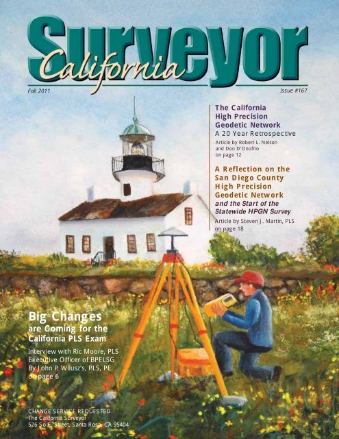
On The Cover:<br />
The painting on the cover is an artistic interpretation of an HPGN<br />
station near Old Point Loma Lighthouse in San Diego. The artist is<br />
Donna Hanby, my lovely and talented sister. Thank you, Donna, for<br />
doing such a beautiful job for the California Surveyor. - Editor<br />
Fall 2011<br />
5
By: John P. Wilusz, PLS, PE - Editor<br />
John works in the Delta Levees Program at the California<br />
Department of Water Resources in Sacramento, CA.<br />
From the Editor<br />
Big Changes are Coming for the California PLS Exam<br />
In September I interviewed Ric Moore, PLS, Executive Officer of<br />
the Board for Professional Engineers, Land Surveyors, and<br />
Geologists. We met at his office in Sacramento.<br />
John: Ric, I heard a rumor that big changes are coming for the<br />
California PLS exam.<br />
Ric: It's true. We're transitioning all of our state examinations,<br />
including the state specific land surveying exam, to computer based<br />
testing (CBT) delivery. For those examinations that are currently<br />
developed and offered in constructive response format, this will<br />
require a change to multiple choice. The state Geotechnical<br />
Engineer exam is the first exam offered through CBT and will be<br />
administered in October 2011, while we anticipate that the state<br />
Professional Land Surveyor exam will be available in CBT format<br />
beginning spring of 2012.<br />
John: What is computer based testing?<br />
Ric: Computer based testing is an exam delivery format. Instead<br />
of administering the exam in the conventional paper and pencil format,<br />
the exam is on a secure computer at a secure site. Each applicant<br />
will sit down at a dedicated station and proceed through the<br />
exam, question by question. Computer based exams are usually in a<br />
multiple choice format. One big advantage of computer based testing<br />
is that applicants will no longer be constrained to five exam sites<br />
throughout the state. We plan to have more like 15 to 20 exam sites<br />
statewide. Many applicants will not have to travel as far as they did<br />
in the past, and that should minimize the overall stress of taking the<br />
examination. Another advantage is that the computer based testing<br />
centers will provide a controlled environment, basically cubicles,<br />
with less noise and distractions, unlike being in a giant building with<br />
2,000 people in it. We also may be able to offer the exam more often,<br />
if we can build up an adequate bank of exam questions. We’re going<br />
to start out once a year, but we're working toward offering the exam<br />
twice a year as soon as possible. Hopefully that will happen within a<br />
couple years. Our plan is within the next two to three years all of our<br />
state issued exams will be the computer based testing format. The<br />
Board wants to redirect our efforts more efficiently towards development<br />
of appropriate exam content rather than spend our resources on<br />
exam administration.<br />
John: Would examinees find out right away whether or not they<br />
passed?<br />
Ric: At this time, no. An instantaneous result is not something<br />
we are looking at right away mainly because, at least for now, we<br />
Ric Moore, PLS<br />
have a limited item bank. For instantaneous results you’re basically<br />
utilizing items over and over. You have to have proven statistics on<br />
those items to ensure they are performing well from a psychometric<br />
point of view in addition to being targeted correctly within the test<br />
plan specifications. For example, you can have an item that is performing<br />
well in terms of distinguishing between people that should<br />
be passing or not passing, but it may not be a valid item in terms of<br />
professional practice. We also measure the performance of each item<br />
statistically; that’s where the test development experts get involved.<br />
The more items we have examined, tested, field tested, and validated,<br />
the closer we will be to offering instantaneous results.<br />
Continued on next page<br />
6<br />
www.californiasurveyors.org
Continued from previous page<br />
John: Are other California boards using computer based testing<br />
right now?<br />
Ric: The Architects Board has been using CBT for its national<br />
exam for several years. In fact, that’s handled through the same vendor<br />
that we’re using for our exam development. In February 2011<br />
the California state specific Architect exam was first issued on<br />
CBT. I think the exam was available at 10 sites throughout<br />
California and about six sites nationally. The Contractors Board has<br />
been using computer based testing for a few years and it's working<br />
out well for them. There are many other licensing boards nationwide,<br />
including some engineering and surveying boards, utilizing<br />
computer based testing.<br />
At the national level, NCEES (National Council of Examiners<br />
for Engineering and Surveying) is developing their exams to be<br />
administered through computer based testing beginning January<br />
2014. NCEES will begin CBT with the Fundamentals of Engineering<br />
exam (FE) and the Fundamentals of Surveying exam (FS). NCEES<br />
plans to cycle administration of these exams throughout the year, two<br />
months open and one month closed, to better serve the candidates<br />
and because there are so many examinees across the nation. There are<br />
about 15,000 FE and FS examinees at any given time. Of these<br />
California accounts for approximately 6,000 FE and FS applicants,<br />
total, every year.<br />
John: Will going to a multiple choice format "dumb down" the<br />
California PLS exam?<br />
Ric: CBT and the need to change how the board administers the<br />
state licensing exams is what are dictating this change in format, not<br />
the other way around. It’s been my experience and advice of our<br />
exam development vendor that multiple choice items can be written<br />
appropriately for the right target audience. There are other states that<br />
have achieved this with their professional level licensing exams.<br />
John: How will this change the way we’ve developed professional<br />
land surveying exams in the past?<br />
Ric: There will be some similarities because we have used the<br />
multiple choice format in the past. Before 2003 we used a combination<br />
of multiple choice and constructive response for the 8-hour PLS<br />
exam. We began using an all constructive response format for the 4-<br />
hour state specific examination in 2003. That's when California<br />
adopted use of the 6-hour NCEES Principals and Practices of Land<br />
Surveying exam.<br />
John: What do you mean by constructive response?<br />
Ric: When I say constructive response I mean that an item or a<br />
problem consists of a scenario that might be encountered in professional<br />
practice. Questions are asked on how the practitioner would<br />
handle the situation. The main factor with constructive response is<br />
that the answers are in a written, narrative format. A correct response<br />
might require providing a list of distinct answers, or writing a paragraph,<br />
or it might require writing a legal description. Developing<br />
constructive response exams is a time-consuming process, and the<br />
subject matter experts (SME) have to pay close attention to details<br />
like page layout and graphics. Our focus for future exams will be to<br />
have our subject matter experts concentrate solely on developing and<br />
validating appropriate items. They'll be working with the exam development<br />
vendor to make sure the statistics are valid, reliable, and fair<br />
rather than worrying about how the booklets are put together.<br />
And now is a good time for subject matter experts to become<br />
involved. Basically anyone that is licensed in good standing is able to<br />
work on our exam development and we really encourage more people<br />
to get involved because it helps our process. A lot of licensees<br />
don’t feel comfortable referring to themselves as experts but in fact<br />
we all are. We’ve demonstrated that we have the knowledge to protect<br />
the public and perform our practice at an appropriate level, so we<br />
are experts. Without all the hard work and effort by the SME’s we’ve<br />
had in the past we wouldn’t be where we are today, and we really<br />
need a lot more involvement, especially with the change in the technology.<br />
With the new item development process we’ll probably be<br />
utilizing more SME’s than we have in the past and we look at that as<br />
a good thing.<br />
John: So how can people get involved?<br />
Ric: From time to time we’ll post a message on our website<br />
looking for experts to help out with exam development or enforcement<br />
cases, but interested parties can always contact the exam unit or<br />
send me an email.<br />
John: And are you looking for any particular skills or experience<br />
level?<br />
Ric: No, actually we’re looking for all levels. We need to cover<br />
the broad range of practice as it is currently conducted throughout the<br />
state. Our exam is geared towards the person meeting the minimum<br />
qualifications to become licensed in California, so newly licensed<br />
persons are very important for that process. They provide a reality<br />
check for the SME's that have been licensed 10 years, 15 years, plus.<br />
We tend to forget what it was like when we first became licensed. We<br />
also like to have a mix of public and private surveyors, and we want<br />
to have surveyors from all over the state: northern, southern, and central<br />
California. We try to get that mix to make sure the exam is representative<br />
of professional practice throughout California.<br />
John: Where does the content for the exams come from?<br />
Ric: From the occupational analysis. Typically the Board initiates<br />
a new occupational analysis every 5 - 7 years. It’s an industry<br />
standard not just in California, but across the nation. Our land surveying<br />
occupational analysis was desperately in need of updating.<br />
Fortunately we were able to find contractual means to do that, and we<br />
have just completed a new occupational analysis both for the state<br />
specific land surveying and civil engineering exams. So we’re actually<br />
doing both of those at the same time. It was important to do these<br />
together to make sure that people see the differences between engineering<br />
surveying and land surveying. There was a survey posted on<br />
the BPELSG website and it was also posted on the <strong>CLSA</strong> Forum.<br />
<strong>CLSA</strong> was kind enough to send an email out to all of its members<br />
and that really helped us out. Within 24 - 48 hours of the survey being<br />
posted we had over 100 responses - that was really great…but not<br />
enough. There are some 4,200 active licensed surveyors in this state,<br />
not counting pre-82 civil engineers. The more people that participate<br />
in the survey, the more accurate our test plan and specifications will<br />
be, because that drives how we will do our exam development.<br />
(Editor's note - As of September 19, 2011 there were more than 230<br />
completed responses to the PLS Occupational Analysis survey. The<br />
survey closed on September 28th, after the magazine went to print.)<br />
Continued on next page<br />
Fall 2011<br />
7
Dear Editor,<br />
Letters to the Editor<br />
It is my belief that there is a common misconception that technical experts for<br />
the Board for Professional Engineers, Land Surveyors and Geologists (BPELSG) have a<br />
goal to punish other surveyors. This is not at all true. I can understand where it comes<br />
from. Other surveyors don’t hear about a case unless an enforcement action is taken<br />
against another surveyor. When an expert opinion is requested, the first question to be<br />
answered by the expert is if they have ever worked with the person the complaint is<br />
filed against. If they have, another expert is contacted and the first never sees the<br />
complaint. By far, the majority of the cases I have given an opinion on are complaints<br />
against a surveyor that are not valid and no enforcement action is taken. Those complaints<br />
just go away without any action taken.<br />
Once a complaint is filed with BPELS they must investigate the validity of the<br />
complaint. Often it is from a disgruntled person who didn’t like the result of the survey<br />
or thought it cost too much and didn’t want to have to pay for it. Sometimes it’s<br />
from a person who simply didn’t understand the result of a survey. Once it is<br />
explained to their satisfaction the case is then closed. Unfortunately, there are complaints<br />
filed that have merit. Often the surveyor who the complaint has been filed<br />
against feels that he or she is being singled out for punishment. They often feel that<br />
many others use the same type of survey practice and can’t understand “why me?”<br />
The answer to that question is because someone has filed a complaint against them<br />
but nobody has filed a complaint against the others. It’s that simple.<br />
Bearing in mind that the main objective of BPELSG is to “protect the public”, I<br />
think they do a pretty good job with complaints from the public. The technical expert<br />
they hire to render an opinion on the merits of a complaint is never asked to prove that<br />
someone is at fault, but rather to help determine if a complaint is valid and, if so, to<br />
explain why in the form of a report to BPELSG. If you are a licensed professional surveyor<br />
and feel that technical experts working for BPELS are “ratting out” fellow surveyors<br />
I strongly encourage you to apply to the Board to be a technical expert so you<br />
can understand just what we really do. I’m proud of the work I’ve done for BPELSG<br />
and I believe anyone who participates would feel the same way.<br />
Linda M. Richardson, PLS<br />
BPELSG Technical Expert<br />
Dear Editor,<br />
Great debate on the higher education issue. However, like Mr. Johnson, I ran the<br />
numbers for the issue #139 of the California Surveyor (although not as complete as<br />
I would have liked) and have a hunch not enough graduate to replace those which<br />
are retiring, or have gone to that double asterisk in the sky. I like the Connecticut connection<br />
Professor Jerry Miller posed. Loved Grandpa Johnson’s quotes! (Lizzard Lick<br />
quotes comes to mind.)<br />
Although the four-year graduate may better fit a “definition” - a degree does not<br />
automatically pass intuition. It is an acquired trait such as that of our esteemed colleague,<br />
Steve Parrish. (Who I assume is as happy as a hunting dog when in the<br />
woods.) Also, those with the four-year degrees are, more likely than not, chained to<br />
an office than on onerous field searches. How would that "read" in the mind of the<br />
judge, et al?<br />
“ If everyone is thinking alike, then someone isn’t thinking” - General George S.<br />
Patton, Jr.<br />
Be careful. Cliffs can be vertical.<br />
Best to all my cousins! And again - great work, John!<br />
Respectfully yours,<br />
Phil Danskin, PLS<br />
(Phil is a past editor of the magazine - Editor) <br />
Continued from previous page<br />
Big Changes are Coming<br />
for the California PLS Exam<br />
John: How do you like your new position as Executive<br />
Officer?<br />
Ric: I like it. I’ve actually come into this position at a<br />
very good time. Two years ago BPELS merged with the<br />
Board for Geologists. I find that very exciting because, just<br />
like in private practice, I get to interact with engineers and<br />
geologist on a daily basis. I think it is really good for all of<br />
us to be more involved with each others' practice so that we<br />
understand how we affect each other and the public. At first<br />
the geologists kind of resisted the merger because it was a<br />
sudden change for them, but I believe they are realizing<br />
now that it is going to be a good thing for everybody.<br />
When I first became involved with the Board as the<br />
Land Surveyor Consultant, like many others I wasn’t<br />
entirely sure of the impact the Board had on both the<br />
licensed professional and the consumer. By observing the<br />
Board’s day to day activities, I learned that this was “my<br />
board, your board, our board” and that we served a valuable<br />
role in working with everyone on a proactive level rather<br />
than the more traditional reactive one.<br />
When the Executive Officer position opened up, I felt<br />
this could be a further opportunity to expand and enhance<br />
that role which could affect positive change in how all of<br />
the professional disciplines interact with, and are perceived<br />
by, the public. I was not the typical employee just seeking<br />
a stepping stone to higher positions in public or private<br />
practice. I would not have been interested if this position<br />
was at another agency or board, I, like all licensees, have a<br />
vested interest in ensuring this board is functioning appropriately<br />
and fairly by servicing all customers, regardless of<br />
licensure status.<br />
Right now, the thing that I enjoy the most about being<br />
Executive Officer is that I get to be involved from a different<br />
level with enforcement cases and disciplinary actions.<br />
This allows me to utilize my experience to look at these<br />
cases in a different light than maybe others have in the past.<br />
I would like to think it is helping both the consumers and<br />
the licensees. I also very much appreciate working alongside<br />
the staff here. They’re really interested in making sure<br />
they do a good job and they get concerned if someone is not<br />
being treated fairly or if something reflects poorly on them<br />
and their efforts.<br />
John: Thanks, Ric. We appreciate your taking the time<br />
to talk with the California Surveyor. <br />
Correction Notice<br />
The article “Educational Requirements for PLS<br />
Licensure Across the United States” in TCS<br />
#166 mistakenly reported Hawaii has mandatory<br />
continuing education. While Hawaii is currently<br />
reviewing implementing mandatory continuing<br />
education, the requirement is not yet in effect.<br />
8<br />
www.californiasurveyors.org
CONGRATULATIONS NEW PLSs<br />
Alexander Abaya, PLS 8855<br />
Joseph Baljet, PLS 8847<br />
Anthony Ballestero, PLS 8882<br />
Sandra Bergam, PLS 8872<br />
Jeffrey Boydston, PLS 8835<br />
Matthew Brockamp, PLS 8871<br />
James Burke, PLS 8889<br />
Alex Calder, PLS 8863<br />
Joe Cardoso, PLS 8851<br />
Nathan Carlson, PLS 8846<br />
Mitchell Cartwright, PLS 8829<br />
Steven Chi, PLS 8860<br />
Christopher Chu, PLS 8857<br />
Kevin Cole, PLS 8853<br />
Jack Cowell, PLS 8888<br />
Joseph Daggett, PLS 8861<br />
Philip Deering, PLS 8879<br />
Jose Dennis, PLS 8865<br />
Keith Doglio, PLS 8834<br />
Beau Dorsett, PLS 8840<br />
Thomas Dougherty, PLS 8819<br />
Jeffrey Dron, PLS 8890<br />
Donn Dwyer, PLS 8837<br />
Michael Farrauto, PLS 8854<br />
Thomas Finnegan, PLS 8894<br />
Joshua Forbey, PLS 8842<br />
Brian Fox, PLS 8839<br />
Ray Freiwald, PLS 8880<br />
Daniel Frink, PLS 8864<br />
Bryan Fryksdale, PLS 8856<br />
Christopher Glantz, PLS 8850<br />
David Gutierrez, PLS 8852<br />
Russell Hanson, PLS 8873<br />
David Johnson, PLS 8876<br />
Chad Johnson, PLS 8833<br />
David Karp, PLS 8841<br />
Christopher Knowlton, PLS 8896<br />
John Koroyan, PLS 8883<br />
Nicholas Labedzki, PLS 8827<br />
Yoon Lai, PLS 8886<br />
Jonathan Lange, PLS 8843<br />
Phillip Latasa, PLS 8887<br />
Jayne Leavitt, PLS 8898<br />
Trevor Leja, PLS 8869<br />
Raymond Lillibridge, PLS 8897<br />
Jason Long, PLS 8826<br />
Ian Macdonald, PLS 8817<br />
Brian MacLellan, PLS 8867<br />
Abraham Magdaleno, PLS 8821<br />
Teodoro Martinez, PLS 8849<br />
Juanita Mathis, PLS 8891<br />
Jered McGrath, PLS 8838<br />
Neal McPherson, PLS 8892<br />
Dirk Nasland, PLS 8893<br />
Ladd Neu, PLS 8868<br />
Thomas Newman, PLS 8875<br />
Bryan Pierce, PLS 8859<br />
Charles Pluta, PLS 8844<br />
Trevor Rice, PLS 8862<br />
Glenn Rick, PLS 8874<br />
Stuart Righter, PLS 8884<br />
James Rios, PLS 8823<br />
Michael Robert, PLS 8895<br />
Eric Sage, PLS 8828<br />
Joseph Sanchez, PLS 8820<br />
Nathan Sellers, PLS 8848<br />
Justin Shaw, PLS 8845<br />
Gary Smith, PLS 8818<br />
Magdi Soliman, PLS 8822<br />
Jeffery Sortman, PLS 8831<br />
Gerry Stuart, PLS 8866<br />
Joshua Tatman, PLS 8858<br />
Thomas Ullrich, PLS 8870<br />
Derek Waggoner, PLS 8824<br />
Ron Wagner, PLS 8830<br />
Ronnie Walker, PLS 8832<br />
Daniel Watkins, PLS 8877<br />
Wayne Wiley, PLS 8836<br />
Aaron Willis, PLS 8881<br />
Bruce Woods, PLS 8825<br />
Michael Zoltek, PLS 8878<br />
Examination Statistics<br />
National PLS<br />
Tested 122<br />
Passed 69<br />
Pass % 56.56%<br />
Failed 53<br />
Fail % 43.44%<br />
State-Specific PLS<br />
Tested 334<br />
Passed 72<br />
Pass % 21.56%<br />
Failed 262<br />
Fail % 78.44%<br />
Cutscore 220<br />
Possible 400<br />
Fall 2011<br />
9
By: William R. Hofferber Jr, PLS - President<br />
Mr. Hofferber is the Chief of Surveying and Mapping at the<br />
Riverside County Flood Control and Water Conservation<br />
District. Bill has been involved in land surveying for over 37<br />
years in both the private and public sector where he has<br />
worked on hundreds of projects from ALTA surveys, construction,<br />
boundary, photogrammetric mapping, and large scale<br />
GPS campaigns. He is also an instructor of land surveying<br />
courses for Riverside Community College District.<br />
President’s Message<br />
As I prepare to write this Presidents Message, my fourth and<br />
final message for the award-winning Cal Surveyor, I am<br />
somewhat perplexed as to what I would like to address. There<br />
have been so many important issues this year. Below is a review<br />
of just a few.<br />
National Voice – NSPS Restructure<br />
I would like to encourage each of you to follow what transpires<br />
in the coming months with the disbanding of the American<br />
Congress on Surveying and Mapping (ACSM) and the creation of<br />
one unified organization under the direction of the National<br />
Society of Professional Surveyors (NSPS). NSPS has committees<br />
in place to conduct financial analysis of each of the member<br />
organizations originally under the umbrella of ACSM, as well as<br />
to review the current member benefits being offered, and soon<br />
develop a 2012 budget. To quote NSPS President, Bill Coleman,<br />
“We have started the journey to a new organization where we want<br />
all professional surveyors to be a member.” Think about that for a<br />
moment, how important that would be if all land surveyors would<br />
unite in support of one national voice. I have heard that there are<br />
approximately 60,000 Professional Land Surveyors in this great<br />
nation, and yet NSPS/ACSM has struggled to keep membership<br />
above 4,000. One united voice of 60,000 would carry much more<br />
impact when taken to Washington. The accomplishments that we<br />
could make would be astonishing. I feel that we are at a turning<br />
point, now is the time to support one unified national land surveying<br />
organization, NSPS, before it may be too late.<br />
Education Requirement/Professional Development<br />
The last issue of the Cal Surveyor included outstanding articles<br />
relating to the potential of a mandatory 4-year degree requirement<br />
for licensure. It is my belief that <strong>CLSA</strong> should play an instrumental<br />
role leading California to a milestone decision on some<br />
form of education requirements to become licensed, and to renew<br />
license registration.<br />
Personally, I am not in favor of a Geomatics ONLY 4-year<br />
degree requirement to sit for the exam. I believe this is much too<br />
restrictive, eliminates far too many outstanding prospects educated<br />
in similar curricula, and would not draw nearly enough students<br />
into the profession to meet future demands. At the current attrition<br />
rate, we would simply run out of professionals. However, we must<br />
do something to keep pace with the balance of the nation.<br />
Additionally, with 47 of 50 states requiring some form of mandatory<br />
professional development/continuing education to renew<br />
licensure, it is time we take a hard look at what is to become of our<br />
profession if we do not institute something similar. While some<br />
argue that mandatory professional development provides no measure<br />
of better protecting the public, I would almost assure a higher<br />
level of professional service should be expected. I strongly urge<br />
each of you to take advantage of the <strong>CLSA</strong> voluntary professional<br />
development program. This is one way you can help yourself by<br />
staying current with education and/or technology changes.<br />
Mentoring<br />
Recently, I had a conversation with a newly licensed surveyor<br />
about survey practice. He mentioned that he sees some fellow surveyors<br />
being untrained, or not trained properly, on methods and<br />
practice procedures. This is another important issue that I would<br />
like to address and that I feel is essential for the profession to succeed.<br />
I believe, we as professional land surveyors, have all been<br />
mentored during our careers by others who took the time to help<br />
us along. As technology changes have replaced the 3 and 4 person<br />
crews to 1 and 2 person operations, some of this inherent training<br />
or mentoring has disappeared. It is now our obligation to mentor<br />
those who choose to follow our paths in this profession. Take the<br />
time, or make the time and if you can’t do it on the job due to cost<br />
or scheduling, look for other available options such as teaching,<br />
volunteering to do a L.S. review session on your area of expertise,<br />
go and speak at a local high school or community college, or help<br />
out at a Trig-Star event. Remember mentoring takes place at all<br />
times, and in different capacities; how we dress and how we conduct<br />
ourselves professionally can be just as important in mentoring<br />
as the education component.<br />
In closing, I would like to say this past year has been a true<br />
honor and a privilege to serve <strong>CLSA</strong> as your President. I have<br />
been supported by an excellent Executive Committee, an outstanding<br />
Board of Directors, and the continued excellence of our<br />
Executive Director and Central Office is unsurpassed. I feel truly<br />
blessed to have experienced all of the professional development I<br />
have gained through these past several years working beside so<br />
many outstanding and dedicated surveyors. I will be happy if my<br />
service has given you but a fraction of what I have received.<br />
Sincerely,<br />
William R. Hofferber Jr. <strong>CLSA</strong> President 2011 <br />
10<br />
www.californiasurveyors.org
By: Robert L. Nelson, Caltrans (retired) and Don D’Onofrio, NGS (retired)<br />
Robert Nelson, (left) Registered Professional Engineer #10292, received<br />
a Bachelor of Science in Civil Engineering from Stanford in 1950. His<br />
subsequent career at Caltrans spanned nearly 40 years, the last 21 of<br />
which he served as Headquarters Surveys Engineer. His retirement in<br />
1991 was precipitated by a heart attack, causing him to miss the actual<br />
completion of the HPGN project.<br />
Don D’Onofrio came to California in October 1991 to assume the role<br />
of the National Geodetic Survey State Geodetic Advisor to California.<br />
Don fulfilled the same role in Alaska from 1982 until moving to<br />
California. He retired in 1999 after almost 40 years of service with NGS<br />
and its predecessor, the Coast and Geodetic Survey.<br />
The California High Precision<br />
Geodetic Network<br />
A 20 Year Retrospective<br />
Introduction by Scott Martin, PLS, Chief of the Geodetic Branch of the California Department of Water Resources<br />
Image courtesy of Scott Martin and Kris Klima, CA Department of Water Resources<br />
12<br />
Introduction<br />
This year marks the 20 th anniversary of the birth of<br />
the original California High Precision Geodetic<br />
Network (HPGN). With the rapidly emerging use of GPS<br />
technology in land surveying, combined with the<br />
unique geological conditions constantly affecting the<br />
quality of survey control in California, a few visionaries<br />
in the industry recognized the need to undertake such<br />
a monumental project. The following article was coauthored<br />
by the two primary players in that effort, Bob<br />
Nelson, RCE (Caltrans – retired) and Don D’Onofrio<br />
(NGS – retired). Although they have done an excellent<br />
job of memorializing the effort, from the idea through<br />
implementation, the magnitude of the accomplishment<br />
cannot be emphasized enough.<br />
Having been involved in a few Height<br />
Modernization densification surveys and re-surveys<br />
myself involving multiple stakeholders, I have some<br />
experience with the effort and energy required to take<br />
something from the “good idea” phase to the “actually<br />
do it” phase. I can’t even imagine it on the scale of the<br />
HPGN. But, somehow Bob was able to convince the<br />
Caltrans Management to fund the project, and NGS<br />
decided to assign Don as the first NGS Geodetic<br />
Advisor to California to assist with the project.<br />
Together, they made it happen. Because of the leadership<br />
of these two men, with assistance and support<br />
from scores of others throughout the State and within<br />
NGS, the backbone for modern GPS based surveying<br />
in California became a reality. This backbone has facilitated<br />
the densification of high quality control throughout<br />
the State in the two decades since.<br />
Continued on next page<br />
www.californiasurveyors.org
Fall 2011<br />
Continued from previous page<br />
For many younger surveyors today, the HPGN, or some<br />
offspring thereof, has just “always been here”, like cell<br />
phones and personal computers. For some of us older folks,<br />
we knew it had a birth date of 1991.35, but probably knew<br />
very little more about how it actually came to be. This article<br />
will be educational and enlightening for all. I know that I personally<br />
learned a lot just through working with Don and Bob<br />
on the content and now have a much greater appreciation<br />
for their respective contributions to the surveying world in<br />
California. They are both to be commended for their lasting<br />
efforts and thanked for taking the time to write this informative<br />
article.<br />
But wait…there’s more. Coupled in this issue with the<br />
statewide HPGN article is an article authored by Steve<br />
Martin, PLS, formerly with San Diego County, chronicling the<br />
HPGN effort in San Diego County and how they integrated a<br />
much denser, county-wide control network simultaneously<br />
with the HPGN work. Talk about extreme coordination of<br />
field observations!!! And remember, geodetic quality GPS<br />
equipment was very expensive and hard to come by back in<br />
1991. I know the readers of the California Surveyor will enjoy<br />
reading these articles as much I have, and will walk away<br />
with a greater appreciation of what was accomplished and<br />
the importance it still has today, some 20 years later.<br />
The California High Precision Geodetic<br />
Network - A 20 Year Retrospective<br />
The California High Precision Geodetic Network (HPGN)<br />
was completed 20 years ago. The authors re-visit the project<br />
from the relative ease and security of retirement. Both Bob<br />
Nelson of the California Department of Transportation<br />
(Caltrans) and Don D’Onofrio of the National Geodetic<br />
Survey (NGS) were major participants in the HPGN.<br />
Bob was the primary proponent for a statewide Global<br />
Positioning System network in California. Caltrans learned<br />
from NGS that a few other states were beginning to plan and<br />
develop High Precision Control Networks. There were two<br />
primary reasons why such a network was not only necessary<br />
but mandatory in California. These were: it was obvious that<br />
the locations and accuracy of the existing horizontal control<br />
network were not adequate to obtain control survey efficiencies<br />
and accuracies that were attainable with the new GPS<br />
equipment and procedures that were becoming available;<br />
and, it was also obvious that ongoing secular crustal<br />
motions (plate tectonics) had distorted (and continue to distort)<br />
the network. In fact, episodic motions (earthquakes)<br />
made portions of the existing network virtually obsolete at<br />
the very moment of their occurrence. At the time of the original<br />
HPGN observations, there were no guidelines for the<br />
establishment of centimeter-level vertical control.<br />
Additionally, because of predicted gross errors in the GEOID<br />
model in many areas of the State in 1991, deriving accurate<br />
orthometric heights through the use of GPS was not feasible.<br />
The primary purpose of the network was to provide an accurate<br />
and unified horizontal control network. The vertical portion<br />
of the network was accurate to, and published at, the<br />
decimeter level with the above noted stipulation.<br />
Caltrans determined that a basic control network with<br />
greater accuracy, uniform spacing and improved GPS<br />
accessibility would permit Caltrans and other surveyors to<br />
perform more accurate and efficient geodetic surveys using<br />
GPS technology. Caltrans Surveys approached its management<br />
for approval to enter into a Cooperative Agreement<br />
with NGS and to use Caltrans basic control survey fund allocations<br />
and additional funds as necessary to fund the development<br />
of a High Precision Geodetic Network for California.<br />
It was important for the HPGN to provide sufficient benefits<br />
to Caltrans to justify the expenditure of transportation funds,<br />
even though the network would also benefit virtually all surveyors<br />
and agencies in the State. To assure adequate benefits<br />
for Caltrans purposes, the network would have to be<br />
designed to provide sufficient density and accuracy while<br />
essentially following State transportation (highway) corridors.<br />
While convincing management was not the easiest<br />
hurdle to overcome, Caltrans Surveys believed this was<br />
achievable.<br />
Network Approval and Design<br />
Caltrans Surveys received the necessary approvals from<br />
its Management to proceed and began by developing a preliminary<br />
plan for the network layout. Most of this was<br />
accomplished in 1989. This included considerable discussion<br />
with several members of the NGS Staff. NGS provided<br />
the criteria for network design, monumentation standards,<br />
data collection procedures, etc. A Cooperative Agreement<br />
between Caltrans and NGS was developed and executed to<br />
establish the respective responsibilities, funding and other<br />
required project requirements. Caltrans provided the primary<br />
funding for basically all work associated with the establishment<br />
of the HPGN including NGS participation. One very<br />
significant result of Caltrans negotiations with NGS was their<br />
agreement to assign a resident Geodetic Advisor for the<br />
State of California. This was invaluable to all, particularly to<br />
those involved in the HPGN project, but also for anyone<br />
involved in geodetic positioning and surveying. NGS<br />
assigned Don D’Onofrio to this position in mid-1990.<br />
Caltrans funded about one-half of the funding for the Advisor<br />
position. The Advisor position has been continuously funded<br />
since that time.<br />
Input for the network was also solicited from Caltrans<br />
District survey personnel, interested county survey staffs<br />
and other local agencies. After consultation with members of<br />
the profession, it was decided that the primary network<br />
design requirement would be approximately 40-mile spacing<br />
along transportation corridors. This was intended to meet<br />
initial basic needs, match terrestrial accuracies, and meet<br />
reasonable productivity levels. If a more dense spacing<br />
might be needed in some areas, this could be addressed<br />
later, as funds became available. This initial network layout<br />
would provide approximately 150 new monumented stations.<br />
NGS required a tie to an existing National Geodetic<br />
Reference System (NGRS) station in each one degree of latitude<br />
by one degree of longitude segment throughout the<br />
Continued on next page<br />
13
Continued from previous page<br />
The California High Precision Geodetic Network<br />
A 20 Year Retrospective<br />
state. This would ensure that there was a sufficient tie<br />
between the newly established stations and the remainder of<br />
the existing horizontal network in California. The ultimate<br />
goal was the overall adjustment of the existing network into<br />
the newly defined GPS-derived HPGN. The result was an<br />
overall network of 245 stations (238 of which were in<br />
California).<br />
The network included the following stations:<br />
• New stations: 148<br />
• Existing National Geodetic Reference System<br />
(NGRS) stations: 28<br />
• NGRS Network Tie stations: 39<br />
• National Crustal Motion Network stations: 18<br />
• Tidal Bench Marks: 5<br />
• Ties to the Oregon High Accuracy Reference<br />
Network (HARN): 6<br />
• Ties to Arizona: Very Long Baseline Interferometry<br />
(VLBI) site: 1 (This site is also labeled a National<br />
Crustal Motion Network – NCMN – site.)<br />
Note: The terms High Precision Geodetic Network<br />
(HPGN) and High Accuracy Reference Network (HARN) were<br />
used for state-wide networks somewhat interchangeably<br />
until NGS settled on using HARN for all state-wide networks.<br />
Caltrans had by then developed its plans using “HPGN” and<br />
decided to keep their terminology.<br />
One unique requirement of the agreement between<br />
Caltrans and NGS was that NGS requested an independent<br />
HPGN adjustment be performed by a third party outside<br />
NGS. This was due to the complications of crustal motions<br />
that had occurred in California and due to the ongoing<br />
crustal motions during the two month survey itself. Caltrans<br />
initiated a separate contract with the University of California,<br />
San Diego to perform this adjustment.<br />
Field Operation Planning and Execution<br />
Caltrans was responsible for laying out the network and<br />
installing specified high-quality stable monuments according<br />
to NGS specifications. District survey personnel would install<br />
the monumentation and assist with data collection. Most of<br />
the monument installation was accomplished about 1990.<br />
The NGS Geodetic Advisor also assisted in station site<br />
selection and the selection of additional ties to the existing<br />
NGRS network. Most new stations consisted of highly stable<br />
NGS Class B driven rods. In addition, it should be noted that<br />
the data collection, field observations, scheduling, etc. were<br />
coordinated by the Geodetic Advisor.<br />
With the completion of station selection and the monumentation<br />
of new stations the project data collection was<br />
scheduled to begin, and did, on April 5, 1991. Project observations<br />
started in southern California with a major densification<br />
of San Diego County geodetic control. This portion of<br />
the network is described in a companion article by Steve<br />
14<br />
Martin who was then employed by San Diego County and is<br />
now the Survey Supervisor for the East Bay Municipal Utility<br />
District (EBMUD), headquartered in Oakland. After the threeday<br />
occupation of the HPGN stations in San Diego County,<br />
Caltrans and NGS observers began moving northward<br />
through the state. The observation schedule called for one<br />
six-hour session (the San Diego County observations called<br />
for seven hour sessions) to be observed daily for five days<br />
per week. By 1991 the satellite constellation was such that<br />
all observations were obtained during the daytime. Caltrans<br />
provided six observers and NGS provided five. Caltrans districts<br />
provided personnel throughout the project as the<br />
observations moved northward through their districts.<br />
District 7 in Los Angeles provided two observers who<br />
observed throughout most of the project.<br />
Computations Provided by NGS<br />
NGS provided computational expertise. The baseline<br />
computations were performed by the NGS computing personnel<br />
in an office provided by Caltrans at its District 11<br />
Kearny Mesa Surveys office. The computational office<br />
remained there until about half way through the project when<br />
it moved to Sacramento at the Caltrans Transportation Lab,<br />
where the NGS Geodetic Advisor had his office, for the<br />
remainder of the project. Observation data were forwarded<br />
to the computational office via overnight mail. These were<br />
early days for transferring digital data and each day’s data<br />
was downloaded by the observer onto pre-formatted 3 1/2-<br />
inch diskettes. Two independent sets of data were downloaded<br />
from the receiver and the second set retained by the<br />
observer until the original set was delivered and verified. In<br />
only a few instances was this second data set required due<br />
to corrupted diskettes.<br />
About three weeks into the project, the observers asked<br />
for a meeting to discuss the observation schedule. The<br />
active HPGN participants met in Ventura to discuss issues<br />
and options related to the schedule. It became apparent that<br />
the time to make long drives between stations was the basic<br />
issue, because many were in excess of 100 miles. The predetermined<br />
work schedule and sending data on a daily basis<br />
via the local post office hours was creating extra long days<br />
and/or missed mailing deadlines. This culminated in excessively<br />
long five-day weeks. The meeting participants agreed<br />
that Caltrans and NGS would each add one extra observer<br />
to the schedule and shorten the observing week to four<br />
days. This provided a minor extension to the overall project<br />
schedule (55 observer days per week with eleven observers<br />
over five days versus 52 observer days with thirteen<br />
observers over four days). The other main decision in the<br />
observation schedule was to allow re-observations to be<br />
scheduled after the completion of the original network. By<br />
the time observation data was received and processed, the<br />
observers had moved too far to recall them for individual<br />
baseline re-observations.<br />
Continued on page 16<br />
www.californiasurveyors.org
Continued from page 14<br />
The California High Precision Geodetic Network<br />
A 20 Year Retrospective<br />
Project Equipment<br />
Primarily two types of GPS equipment were used during<br />
the project, Trimble and Ashtech. Some of the equipment<br />
was borrowed from other agencies. For one period several<br />
Ashtech receivers were borrowed from the Los Angeles<br />
Department of Water and Power office located near Bishop.<br />
The receivers had older eproms (programmable chips) that<br />
might prove problematic when incorporated with receivers<br />
with a later version of the eprom. Ashtech was contacted<br />
and they agreed to replace the eproms on an emergency<br />
basis if we could get the receivers to them. A Caltrans surveyor<br />
made the trip to Ashtech headquarters in Sunnyvale<br />
and Ashtech personnel made the replacements while he<br />
waited. The observation schedule was not affected. The final<br />
observations for the original project were obtained on June<br />
11, 1991. Re-observations were completed on August 13,<br />
1991. Most re-observations were for single baselines and<br />
were scattered throughout the state. In most instances this<br />
necessitated sending a team of two or three observers to<br />
distant areas throughout the state. This was a somewhat<br />
minor but more time-consuming task.<br />
Observation Details and Results<br />
As mentioned above, there were a total of 245 stations<br />
in the project. A total of 570 station occupations were completed<br />
during 65 observing days. This was accomplished by<br />
23 total observers, 15 from Caltrans and 8 from NGS. There<br />
were 23 GPS receivers used during the project. The final<br />
NGS adjustment for the project was accomplished in May,<br />
1992. As noted above, NGS requested that a separate<br />
adjustment be performed by an independent third party. This<br />
adjustment was accomplished by Dr. Yehuda Bock of<br />
Scripps Institution of Oceanography at UC San Diego under<br />
contract from Caltrans. Dr. Bock and his staff had extensive<br />
knowledge of California’s unique crustal motions, GPS technology<br />
and related adjustment processes. This proved to be<br />
a valuable rationale as there was a minor disagreement in<br />
one area of the state between the NGS and Scripps adjustments.<br />
The UC San Diego adjustment was proven correct in<br />
this area. It was incorporated into the NGS adjustment prior<br />
to publication.<br />
Network Adjustment<br />
The HPGN adjustment was a three-step process.<br />
Coordinates were obtained for those Very Long Baseline<br />
Interferometry (VLBI) stations which were to be used as project<br />
constraints. (NGS policy was to constrain statewide networks<br />
to VLBI for accuracy and consistency throughout the<br />
country.) The VLBI stations were occupied by equipment<br />
that received radio signals emanating from sources such as<br />
quasars. In California some of these VLBI sites are permanently<br />
mounted large radio telescopes. In other cases the<br />
site was occupied by mobile equipment. At the permanent<br />
sites a relationship was determined to a nearby survey mark<br />
established for this purpose. Then either this mark or the<br />
actual mark occupied by the mobile VLBI van was occupied<br />
during the HPGN observation phase. These stations were<br />
part of the NGS National Crustal Motion Network (NCMN).<br />
There were about ten such sites in California that were part<br />
of the NCMN.<br />
The existing NSRS HPGN stations were then constrained<br />
to these VLBI/NCMN coordinates. Then HPGN<br />
coordinates were determined for the entire HPGN network<br />
(including those newly established stations). The final results<br />
were published by NGS in July 1992. A comparison was<br />
made between the newly derived HPGN coordinates and the<br />
published coordinates of the NGRS stations included in the<br />
project. The shifts ranged from 0.00 meter to 1.3 meters. The<br />
average shift was 0.27 meter. The differences can be attributed<br />
to a couple of factors. One is the ongoing crustal<br />
motions in California which can vary from zero to as much as<br />
five centimeters per year across the state. Another is the<br />
inconsistencies in the 18,000 station NGRS network in<br />
California due to older and primarily terrestrial observation<br />
techniques which ultimately necessitated the need for the<br />
HPGN.<br />
NGS publishes coordinates that are referred to the<br />
NAD83 datum. These published coordinates include an<br />
epoch date which is the effective date of a project’s observations.<br />
The HPGN epoch date is the decimal year equivalent<br />
for May 8, 1991 or 1991.35. May 8 was the mid-point of<br />
Continued on next page<br />
16<br />
www.californiasurveyors.org
Continued from previous page<br />
the primary HPGN observation period. Some questions were<br />
raised about the effect of crustal motion during the course of<br />
the project. Since the primary network observations took<br />
place in slightly more than two months the worst case scenario<br />
for motion would be less than one centimeter which<br />
would be masked by the noise level of the overall results.<br />
The Subsequent Twenty Years<br />
Since the completion of the 1991 HPGN project there<br />
have been significant crustal motions in California. These<br />
motions take two general forms: secular and episodic.<br />
Secular motion is the normal movement caused by plate tectonics.<br />
California consists of two basic plates: the North<br />
American and the Pacific. Secular motion can reach five centimeters<br />
annually in the west central portion of the state. This<br />
accounts for about a one meter shift since the 1991 HPGN.<br />
Since these shifts occur over somewhat large areas they<br />
have little effect on projects encompassing about 40 kilometers<br />
or less. Secular motions can be effectively ignored for<br />
work within such areas.<br />
Episodic motions, those caused by earthquakes, can be<br />
another matter entirely. In these cases regional coordinate<br />
changes can be significant and instantaneous. After each of<br />
the major earthquakes since 1991 Caltrans has taken a major<br />
role in re-observing HPGN stations affected by the earthquake<br />
extending the survey out to a region deemed unaffected by<br />
the earthquake. In the case of the 1994 Northridge earthquake,<br />
USGS made the observations. Each of these projects<br />
was accompanied by a new epoch date.<br />
Network Densification<br />
It was clear that the spacing of HPGN stations was not<br />
sufficiently close enough for Caltrans ongoing projects, nor to<br />
meet many of the requirements of other State and local agencies<br />
and private firms. Thus, within a short time after completing<br />
the basic HPGN network, Caltrans originated the HPGN-<br />
Densification (HPGN-D) project. This densified the original<br />
network of GPS control throughout the state to about 15 kilometers.<br />
The overall HPGN (Order B) and HPGN-D (First Order)<br />
networks consisted of about 1100 stations.<br />
Today there is an increasing number of Continuous<br />
(CGPS) stations in California operated by public and private<br />
agencies. These “active” CGPS control stations reduce the<br />
need for a large number of passive GPS-suitable control stations.<br />
However, there is a whole generation of GPS surveyors<br />
who have gained an appreciation for the California HPGN and<br />
continue to depend on it. While some CGPS stations are part<br />
of special scientific investigations, e.g., the Plate Boundary<br />
Observatory project, they might have a limited life. Those<br />
1100 passive monuments tied to the California HPGN will<br />
serve at least another generation of geodetic surveyors and<br />
possibly for many decades to come. <br />
Fall 2011<br />
17
By: Steven J. Martin, PLS<br />
Steve Martin is currently the Survey Supervisor for the East Bay<br />
Municipal Utility District (EBMUD), headquartered in Oakland, CA.<br />
Prior to accepting the position at EBMUD, Mr. Martin was employed<br />
by the County of San Diego in increasingly responsible roles spanning<br />
17 1/2 years. He started his Survey career in 1988 while employed by<br />
the City of San Diego as the 4th man on a Survey crew, a position<br />
called “Engineer Trainee”. He has been licensed since 1996 and a<br />
<strong>CLSA</strong> member since 1990.<br />
A Reflection on the San Diego County<br />
High Precision Geodetic Network<br />
and the Start of the Statewide HPGN Survey<br />
years ago, surveyors from Municipal, County, State,<br />
20 Federal agencies and academia worked cooperatively<br />
to establish a High Precision Geodetic Network<br />
(HPGN) over San Diego County. This cooperative effort was<br />
on a scale which likely has not been seen since. Additional<br />
mutually beneficial joint geodetic projects were undertaken<br />
over the following decade. Some of the relationships<br />
developed would go on to foster the creation of the<br />
California Spatial Reference Center (CSRC.) A look back at<br />
this landmark survey is warranted in this 20 th anniversary<br />
year of the HPGN survey.<br />
San Diego County’s goal to establish a high accuracy<br />
uniform horizontal and vertical datum to support a GIS and<br />
“future” widespread use of GPS was initially a Countywide<br />
effort only; however the developing CALTRANS efforts<br />
offered a unique opportunity to partner on HPGN’s, both<br />
countywide and statewide. Practically both were surveyed<br />
at the same time. The San Diego County HPGN is a 34 station,<br />
simultaneously observed, “B” order geodetic network.<br />
This was unique in that 34 survey crews, if you will, with 34<br />
dual-frequency geodetic grade GPS receivers were all up<br />
and running at the same time over stations spread throughout<br />
the 43,000 square miles of San Diego County. Keep in<br />
mind GPS use in the survey industry in 1990 was still fairly<br />
new and 34 dual frequency receivers fielded in one campaign<br />
was unheard of at the time.<br />
The Statewide HPGN, described in a separate article by<br />
Don D’Onofrio and Bob Nelson, consisted of 254 stations<br />
across all of California, only 11 of which were in San Diego<br />
County. It could be said that San Diego County established<br />
a densification network simultaneously with the HPGN survey,<br />
however unique among densification surveys, the San<br />
Diego County network was at the same accuracy level as<br />
the statewide HPGN.<br />
The County’s efforts to establish a HPGN began in late<br />
1989 with a committee established with the following mission<br />
statement: “The purpose of establishing and maintaining<br />
a GPS network in San Diego is to provide a uniform horizontal<br />
and vertical datum to be used in support of the<br />
Regional Urban Information System (RUIS); in the assessment<br />
and management of Infrastructure, Demographics<br />
and Environmental policies; and in the anticipation of future<br />
widespread use of GPS by public and private industry.”<br />
The City of San Diego and CALTRANS District 11<br />
Surveyors joined the committee and inquiries were made to<br />
Continued on next page<br />
18<br />
www.californiasurveyors.org
Continued from previous page<br />
Dan Harrison, longtime County ROS map checker monitors a Trimble<br />
4000 SST receiver during one of the 7 hour sessions<br />
NGS about obtaining a State Advisor. In January of 1990,<br />
Yehuda Bock and Duncan Agnew, scientists at Scripps<br />
Institution of Oceanography joined and recommended that<br />
“A” order accuracy be strived for to support crustal motion<br />
studies. In May of 1990, Bob Nelson and John Fundus of<br />
CALTRANS Headquarters joined and presented their plans<br />
for a statewide network. In November of 1990, Don<br />
D’Onofrio, newly appointed California State Geodetic<br />
Advisor, attended the committee meeting along with Gilbert<br />
Mitchell of NGS. In February of 1991, County Surveyor<br />
Chuck Moore spread the word about the upcoming survey<br />
at meetings, conventions and sent a letter to industry inviting<br />
their participation.<br />
Quite a lot of planning and preparation was still<br />
required before the target San Diego County HPGN survey<br />
date of April 5, 6 & 7 1991. Detailed instructions were written<br />
for the many Surveyors, some of whom would be running<br />
a GPS receiver for the first time. Training meetings<br />
were held. Discussions of minutia such as do we measure<br />
the HI in millimeters to the bottom of the punch mark in the<br />
disk or to the top surface of the disk (a couple of millimeters<br />
difference)? Forms were made up to get a rubbing of<br />
the disk stamping and UHF radios were allocated to each<br />
operator for emergency communications (no cell phones<br />
back then).<br />
The County of San Diego Department of Public Works<br />
(DPW) was an active and energetic organization when I<br />
joined as a newly minted LSIT in February of 1990. Land<br />
Continued on next page<br />
Fall 2011<br />
19
Continued from previous page<br />
A Reflection on the San Diego County High Precision Geodetic Network<br />
and the Start of the Statewide HPGN Survey<br />
Development was still in the boom of the late 1980’s and<br />
the TRANSNET initiative, a half cent sales tax increase for<br />
transportation projects, brought a flood of projects into<br />
DPW, under which was the Field Survey unit that I was hired<br />
into. The planning for a county wide geodetic network only<br />
added to the energy and workload. As a part of the network<br />
preparations, DPW requested proposals from GPS manufacturers<br />
for the purchase of GPS receivers for use on the<br />
HPGN survey and public works projects. The proposal from<br />
Ashtech Inc. of Sunnyvale, California was accepted and we<br />
acquired 5 LD-XII dual-frequency GPS receivers. I volunteered<br />
to work on the crew first selected to learn the use of<br />
this new technology and was selected to attend training at<br />
Then Party Chiefs Norman Peet (County of SD) and Ron Dodds (City of<br />
SD) auger to intall a Bernsten rod type monument in the Eastern San<br />
Diego County desert<br />
Party Chiefs’ Norman Peet (San Diego County) and Tim<br />
Dickey (CALTRANS) had many years experience with geodetic<br />
control networks and were tasked in late 1990 with<br />
selecting sites for the proposed network stations. The committee,<br />
after consultations with NGS, had decided on the<br />
Bernsten rod-driven-to-refusal type monument or a disk set<br />
in bedrock. Tim Dickey was responsible for building the 6<br />
new stations that would become part of the State HPGN<br />
Ashtech’s facility along with Party Chief Norman Peet. The<br />
late, great, Ellis Veach taught the course in Sunnyvale and<br />
he would later come down to San Diego to assist during the<br />
HPGN survey.<br />
and reconnoitering the 5 existing network tie stations.<br />
Norman Peet worked collaboratively with personnel from<br />
various agencies on most of the rest of what was planned<br />
Continued on next page<br />
20<br />
www.californiasurveyors.org
Continued from previous page<br />
to be a 30 station network. I worked on Norman’s crew at<br />
the time and I have to say that the amount of cooperation<br />
between the crews and other agency personnel was<br />
exceptional.<br />
Because the survey was going to mix different types of<br />
GPS receivers, Ashtech and Trimble, an experiment was set<br />
up to test the mixing of data from the two proprietary<br />
receivers. Four marks were set in a nearby field, then<br />
Norman Peet and I traversed around the quadrilateral and<br />
ran levels between the marks. Next, two Trimble 4000 SST<br />
and two Ashtech LD-XII receivers were set up for four hours<br />
or so for the experiment. The data was processed in the<br />
Geodesy lab at Scripps Institution of Oceanography (SIO).<br />
Some weeks went by and we received a phone call from Dr.<br />
Bock indicating that we had to have miss-measured the<br />
antenna heights by a couple of centimeters. We considered<br />
that, and indicated that not only had we measured the HI in<br />
3 places around the ground plane using the precise graduated<br />
millimeter rod before and after each session, we had<br />
measured with a decimal foot tape as a independent check.<br />
Furthermore, we had leveled to each mark and leveled to<br />
the top of each tribrach insert, so our response was that<br />
there was no way we miss-measured an antenna height.<br />
The reply we received back was something along the lines<br />
of “it must be the deflection of the vertical then”, which did<br />
not sound right to me at the time because of the flat terrain<br />
and short, 100’ +/-, distances, but nobody could come up<br />
with a good answer for the discrepancy. With what we now<br />
know about antenna phase center variations and antenna<br />
calibration models, it is highly likely the cause of a couple<br />
of centimeter discrepancy.<br />
As the start date of the survey approached, the outreach<br />
efforts of Chuck Moore, Yehuda Bock and others<br />
gained momentum. Additional resources were identified<br />
and the network was expanded to 34 stations. One side<br />
note: 1990 was a drought year and it had been very dry in<br />
San Diego County that winter, which made for good weather<br />
to install monuments. However, March of 1991 ended up<br />
being what was termed “Miracle March” for the much<br />
needed snow and rainfall that fell all month long. While this<br />
was good for the semi-arid County, the snowpack in the<br />
mountains left a few of the recently built stations on mountaintops<br />
inaccessible. Several stations were built at lower<br />
elevations in the last few weeks to replace these, mostly in<br />
bedrock (less time and labor), including the station in<br />
Rancho Cuyamaca State Park that Dan Harrison is manning<br />
in the photograph at the beginning of the article.<br />
Stations in the San Diego County HPGN are spaced<br />
approximately every 20 kilometers throughout the County,<br />
Continued on next page<br />
Continued on next page<br />
Fall 2011<br />
21
Continued from previous page<br />
A Reflection on the San Diego County High Precision Geodetic Network<br />
and the Start of the Statewide HPGN Survey<br />
A Trimble 4000 SST GPS receiver borrowed from MIT at station SDGPS<br />
15, a station set to replace the mark on Volcan Mountain which was<br />
inaccessible due to snow.<br />
Two of the NGS operators who were assigned existing<br />
NAD83 network stations on mountaintops were late<br />
getting started on the first day after having to slog thru<br />
the snow to get to their respective stations.<br />
One of the County of Orange surveyors was delayed<br />
due to a helicopter crash on the freeway near his<br />
assigned station.<br />
One of the borrowed Trimble receivers was set to log<br />
to an external data collector, so no data was collected<br />
for that station on Friday. A call to Trimble on Saturday<br />
morning corrected the problem.<br />
The crew at a station by the Old Point Loma<br />
Lighthouse, found themselves answering questions<br />
from 10,000 tourists and 200 2 nd graders.<br />
On Saturday and Sunday, the County Party Chief<br />
occupying a station in a desert campground east of<br />
Borrego Springs found himself surrounded by participants<br />
in what is the annual Peg Leg Liars Contest.<br />
When he told them he was making measurements to<br />
satellites, they did not really believe him and thought it<br />
an elaborate setup for a contest entry.<br />
Mike Binge at station Junction Azimuth mark near the Tecate border<br />
crossing during the 1991 San Diego-HPGN survey.<br />
which is really too close together to achieve “A” order relative<br />
accuracy (1:10,000,000 over 20km is smaller than the<br />
expected setup error), however every effort was made to<br />
achieve the highest accuracy possible. Not only were all 34<br />
stations observed simultaneously, the observations were<br />
repeated on 3 days, meteorological observations were<br />
observed at most stations several times during the sessions<br />
and plumb-bobs were used to verify optical plummet<br />
tribrachs. The schedule for operations was set for Friday,<br />
Saturday and Sunday, April 5, 6, & 7, 1991 to minimize<br />
impacts on existing projects and deadlines. Miraculously,<br />
the rain stopped as this start date approached.<br />
With all of the careful planning and preparation, the<br />
actual field operations went off relatively trouble free. Of<br />
course, there were some issues, such as:<br />
22<br />
Once all of the data was downloaded and backed-up to<br />
multiple 3.5” diskettes (I still have memories of formatting<br />
hundreds of diskettes for hours on end…the County IT<br />
department saved 6 cents apiece purchasing unformatted<br />
diskettes), the data was then delivered to Yehuda Bock’s<br />
group at Scripps Institution of Oceanography (SIO) for processing.<br />
Dr. Bock is one of the developers for the GAMIT<br />
software (GPS at MIT) along with scientists at the<br />
Massachusetts Institute of Technology. The GAMIT software<br />
is a true multiple baseline processor in that instead of<br />
looking at one base and rover GPS receiver pair at a time<br />
to determine a vector or baseline, GAMIT looks at all<br />
receivers and double difference combinations available to<br />
determine unknown station coordinate parameters in one<br />
least-squares solution. With 34 simultaneous data sets,<br />
that makes for a lot of double difference combinations and<br />
requires a fair amount of computational power.<br />
Continued on next page<br />
www.californiasurveyors.org
Continued from previous page<br />
Shimone Wdowinski, Jian Zhang and Peng Fang in SIO’s IGPP<br />
basement geodesy lab<br />
I was detailed to work with Dr. Bock’s group on the processing<br />
and spent weeks converting the data to the RINEX<br />
format and manually fixing cycle slips (full automation of the<br />
data “cleaning” process was still in the works). The GAMIT<br />
software ran on the HP Apollo or Sun UNIX workstations in<br />
the geodesy lab down in the basement of Institute of the<br />
Poster by Peng Feng for the 1991 Fall American Geophysical Union<br />
(AGU) meeting<br />
Geophysics and Planetary Physics (IGPP) building at SIO.<br />
Once I got each day’s dataset ready for processing, I would<br />
initiate the process in the afternoon and let it run all night…<br />
only to come in the next day and find that someone else at<br />
SIO had killed my process so their project would run on the<br />
shared network resource. Eventually, I had three good daily<br />
solutions. We had planned on running a grand solution,<br />
where all three days worth of data would be processed<br />
simultaneously to estimate stations coordinate parameters,<br />
i.e. processing and adjustment all in a single step. Because<br />
of the size of the data set, computational power and the<br />
shared resources, we decided to use the daily solutions for<br />
“Bluebooking” and submission to the NGS database.<br />
In my summary for the processing and adjustment at<br />
SIO, I noted that vertical uncertainties were on the order of<br />
3cm or 6 times worse than the horizontal uncertainties, and<br />
that GPS vertical uncertainties are expected to be 3 times<br />
worse than horizontal uncertainties. Again, with what we<br />
now know about antenna phase center models, the discrepancy<br />
I noted then is explainable. Once the project was<br />
submitted to NGS, it took several months for the California<br />
State HPGN to be adjusted. There were some discussions<br />
between NGS and Dr. Bock’s group at SIO, who were contracted<br />
to parallel process and verify the State HPGN,<br />
regarding how to handle the crustal motion that occurred<br />
during the 5 months it took to survey the state HPGN.<br />
Eventually it was decided to use the mid-point of the survey,<br />
1991.35 in decimal year format, to reduce all of the<br />
data. Once the two organizations had agreement on how to<br />
handle the adjustment of the Statewide network, results<br />
were published in 1992 along with the San Diego<br />
HPGN results. Readjustment of existing stations<br />
in the NGS database followed many months later.<br />
The publishing of this High Precision<br />
Geodetic Network in San Diego County ushered<br />
in a new era in the survey industry. It can be said<br />
that the proliferation of GPS survey methods in<br />
the years to follow was enabled by the existence<br />
of an accurate geodetic network to base the work<br />
upon. Many cities within San Diego County subsequently<br />
established their own City-wide 1 st<br />
order control networks and enacted parcel coordinate-tie<br />
ordinances to facilitate GIS databases.<br />
It was also a new era for inter-agency cooperation.<br />
The County Survey Unit assisted CAL-<br />
TRANS District 11 with a project to improve the<br />
Geoid model in San Diego County in 1992 and<br />
again with some cross County 1 st order trig-leveling<br />
in 1995. All participants cooperated once<br />
again in 1998 for a resurvey of select HPGN<br />
points for a readjustment and unification of the<br />
various statewide HPGN’s by NGS (by then, NGS<br />
favored the term HARN – High Accuracy<br />
Reference Network). The California Spatial<br />
Reference Center (CSRC) was founded at<br />
Scripps Institution of Oceanography in 1999 as NGS’s partner<br />
in California. A 1999 densification survey with cooperative<br />
efforts from CALTRANS, the City of San Diego, and<br />
several private survey firms fielded 47 dual frequency<br />
receivers and was processed by CSRC (see ROS 16810). It<br />
really was a decade of change for surveying in California.<br />
Establishing partnerships enabled projects that may have<br />
been too big for one agency alone.<br />
Continued on next page<br />
Fall 2011<br />
23
Continued from previous page<br />
A Reflection on the San Diego County High Precision Geodetic Network<br />
and the Start of the Statewide HPGN Survey<br />
The San Diego County HPGN survey was one of the<br />
highlights in my career and a landmark survey for<br />
California. I hope that by reflecting on how change<br />
occurred 20 years ago, we will gain perspective and insight<br />
on how to manage the change occurring in our profession<br />
today.<br />
Author’s footnote: To give credit where it is due; the<br />
idea for a retrospective article came from a former co-worker<br />
of mine at the County of San Diego, Mike Binge, who<br />
writes a column for POB magazine. I spoke with Mike at the<br />
<strong>CLSA</strong>/NALS conference in March and he mentioned his<br />
idea for a column. As I dug out my old photos for Mike, I<br />
thought that a retrospective was a really good idea and suggested<br />
the idea to the California Surveyor.<br />
Reference: “County of San Diego’s GPS-A-THON” B.<br />
Cooper, POB magazine circa 1992. <br />
24<br />
www.californiasurveyors.org
By: Frank Romano, PLS<br />
Frank Romano, Jr. obtained his CA license in 1990 and NV license<br />
in 1991. He is owner/operator of Frank Romano Surveying and has<br />
recorded over 100 Record of Surveys since 1993. He is currently<br />
employed by Caltrans, District 12, Irvine, CA, and is a former<br />
Adjunct Professor, Survey Program, Santiago Canyon College,<br />
Orange, CA.<br />
Simultaneous or Sequential Conveyance?<br />
One surveyor’s quest for the answer<br />
In the fall of 2007 I acquired a job wherein a five-acre desert parcel<br />
had been split by separate deeds in 1965. This survey<br />
brought up the question of “simultaneous vs. sequential conveyance.”<br />
Can two parcels be created simultaneously by two separate<br />
deeds? More specifically, were the two parcels that I was<br />
tasked to survey created simultaneously by two separate deeds?<br />
What follows is an account of my quest for the answer.<br />
Anyone who has surveyed for any length of time, especially<br />
in the desert, has come across deeds that look like they were written<br />
by a lawyer, realtor, or property owner, without the slightest<br />
understanding of the excess/deficiency nature of the Public Lands<br />
Survey System. Such was the case as I began to investigate the<br />
title history of my two parcels. The description of the two creating<br />
deeds in question clearly overlapped each other (see Fig. 1.) I was<br />
then tasked with determining which deed created the senior parcel.<br />
The created deed for Parcel “A” was found to be recorded in Book<br />
6378, Page 214. The creating deed for Parcel “B” was recorded in<br />
Book 6378, Page 215. Problem solved! Page 214 comes before<br />
Page 215, therefore, Parcel “A” is senior to Parcel “B”.<br />
Wait a minute! Not so fast. What’s this? Both deeds were executed<br />
on the same day by the same Grantor and recorded on the<br />
same day at the same time. Was it the owner’s intent to convey<br />
them simultaneously? The deed for Parcel “A” was recorded on<br />
April 26, 1965 at 10:27AM. The deed for Parcel “B” was also<br />
recorded on April 26, 1965 at 10:27AM. The exact same date and<br />
time. Simultaneous conveyance? Now I began to have second<br />
thoughts. So I did what any self respecting surveyor would do, I<br />
reached over and pulled Brown’s Boundary Control and Legal<br />
Principles 4 th Ed. off of the shelf and turned to the section on<br />
Locating Simultaneously Created Boundaries in which he defines<br />
“A simultaneously created boundary results when several parcels<br />
of land are created in the same ‘legal instant’ by the same person,<br />
persons, or agency and by the same instrument.” 1 emphasis added.<br />
Same legal instant? Check!<br />
Same person? Check!<br />
Same instrument? Negative!<br />
26<br />
Now I realize that his book is a book of legal principles based<br />
on court cases: State and Federal, some in California, and some in<br />
other parts of our country. So I looked for the references that he<br />
bases this statement on especially the “by the same instrument.”<br />
To my surprise there are none. I searched and found none in any<br />
of the many reference books in my library. It was then that I decided<br />
to solicit the aid of others.<br />
My first step was to post the problem on the California Land<br />
Surveyors Association (<strong>CLSA</strong>) Forum, a blog for surveyors hosted<br />
by <strong>CLSA</strong> on their website: www.californiasurveyors.org. I<br />
explained the problem and requested justification and references<br />
for any opinions expressed. I received several responses. One of<br />
Continued on next page<br />
www.californiasurveyors.org
Continued from previous page<br />
the responses reasoned that “the deed with the lower page number<br />
came first, unless the two deeds were recorded as the same instrument.”<br />
and referenced Brown. 1 Another reasoned, “Our state is a<br />
‘recording state’” meaning that higher credibility/status is given<br />
to the first recorded document. In this case, the first document to<br />
record achieved the vaulted status of a recorded deed PRIOR to<br />
the very next one on the page.” The remaining responses agreed<br />
with the two stated above.<br />
Which took me to my next step, what does California law<br />
have to say about recording documents and specifically the order<br />
of recording? California Government Code Section 27320 states:<br />
When any instrument authorized by law to be recorded is<br />
deposited in the recorder's office for record, the recorder shall<br />
endorse upon it in the order in which it is deposited, the year,<br />
month, day, hour, and minute of its reception, and the amount of<br />
fees for recording. The recorder shall record it without delay,<br />
together with the acknowledgements, proofs, certificates, and<br />
prior recording data written upon or annexed to it, with the plats,<br />
surveys, schedules, and other papers thereto annexed, and shall<br />
note on the record its identification number, and the name of the<br />
person at whose request it is recorded. Efforts shall be made to<br />
assign identification numbers sequentially, but an assignment of a<br />
nonsequential number may be made if not in violation of express<br />
recording instructions regarding a group of concurrently recorded<br />
instruments and if, in the discretion of the county recorder, such<br />
assignment best serves the interest of expeditious recording.<br />
A reading of the above section of Code would indicate that<br />
the recording order is “…the year, month, day, hour, and minute of<br />
its reception…” and that the page numbering is “…its identification<br />
number…” and is used for index/retrieval purposes. The code<br />
specifically provides for “…concurrently recorded instruments…”<br />
as the same transaction.<br />
Now for my final step, what about case law? Are there any<br />
court cases that would address this issue? With a little assistance<br />
from a friend and colleague, Tod Coleman, I was directed to the<br />
following case: Soman Properties v. Rikuo Corp. (1994) 2 .<br />
Although this case was not specifically about the order of recording<br />
documents, that question was a side issue. It was used to make<br />
the point that two documents were recorded at the same “exact<br />
time” 2 and that the consecutive sequencing of the assigned numbers<br />
indicated that the documents “…were filed as part of the<br />
same transaction.” 2 The case showed that the Court decided: 1) the<br />
“year, month, day, hour and minute” 2 determined that the documents<br />
were filed at the same “exact time” 2 ; and 2) the assigned<br />
sequential indexing determined that they were part of the same<br />
transaction; Both consistent with CA Gov. Code Section 27320.<br />
In light of said California Code and the Court’s interpretation,<br />
it would seem that Brown’s statement, “A simultaneously created<br />
boundary results when several parcels of land are created in the<br />
same ‘legal instant’by the same person, persons, or agency and by<br />
the same instrument.” 1 should be revised for California to read “A<br />
simultaneously created boundary results when several parcels of<br />
land are created in the same ‘legal instant’ by the same person,<br />
persons, or agency and by the same transaction.” Emphasis added.<br />
It was finally time to hang my hat. For the reasons stated in<br />
the following note, I accepted them as a simultaneous conveyance<br />
and placed the note on my map.<br />
“BOOK 6378, PAGES 214 AND 215 O.R.<br />
WERE BOTH EXECUTED ON THE SAME<br />
DAY AND RECORDED ON THE SAME<br />
YEAR, MONTH, DAY, HOUR AND MINUTE.<br />
IT IS MY OPINION THAT THIS SHOWS THE<br />
GRANTOR’S INTENT TO CONVEY BOTH<br />
PROPERTIES AT THE SAME MOMENT IN<br />
TIME AND THAT THE TWO DEEDS WERE<br />
CONCURRENTLY RECORDED CREATING<br />
A SIMULTANEOUS CONVEYANCE OF THE<br />
TWO PARCELS. MY UNDERSTANDING OF<br />
CALIFORNIA GOVERNMENT CODE SEC-<br />
TION 27320 IS THAT TIME OF RECORD-<br />
ING, NOT THE INDEXING (OR PAGE NUM-<br />
BERING), DETERMINES THE ORDER AND<br />
PRECEDENCE OF RECORDED DOCU-<br />
MENTS.” 3<br />
The map was accepted by the County Surveyor and recorded.<br />
You, on the other hand, may have a different opinion. If so, I<br />
would love to hear it. So pick up that pen and write to the editor.<br />
Do it now! And don’t forget to include your reasoning and references.<br />
I look forward to hearing from you!<br />
“For having lived long, I have experienced<br />
many instances of being obliged, by better information<br />
or fuller consideration, to change opinions,<br />
even on important subjects, which I once<br />
thought right but found to be otherwise.”<br />
Benjamin Franklin<br />
References:<br />
1. “Boundary Control and Legal Principles” 4 th Ed.; Brown, Robillard, and Wilson<br />
2. Soman Properties v. Rikuo Corp. (1994) 24 Cal. App.4 th 471, 29 Cal.Rptr.2d 427<br />
3. Record of Survey 07-244, R.S.B. 133/90, San Bernardino County, CA <br />
Join <strong>CLSA</strong> Today!<br />
www.californiasurveyors.org<br />
Fall 2011<br />
27
Register Online at: www.californiasurveyors.org
Postcards<br />
Photo taken in Rhodope Mountains in Bulgaria near Alamovci<br />
Village, Zlatograd.<br />
The coordinates are: 41°23'34.40" N, 24°59'47.30" E. Submitted by<br />
Stoinan Stoinanov, True North, Ltd., Plovdiv, Bulgaria.<br />
Index To Advertisers<br />
Allen Precision Equipment . . . . . . . . . . . . . . . . . . . . . . . . . . . . .30<br />
Berntsen International, Inc . . . . . . . . . . . . . . . . . . . . . . . . . . . . . .21<br />
California Property Specialists, Inc. . . . . . . . . . . . . . . . . . . . . . . .16<br />
California Surveying & Drafting . . . . . . . . . . . . . . . . . . . . . . . . . .48<br />
Cartwright Aerial Surveys, Inc . . . . . . . . . . . . . . . . . . . . . . . . . . ..31<br />
Central Coast Aerial Mapping, Inc. . . . . . . . . . . . . . . . . . . . . . . . . .9<br />
Engineering Supply Company . . . . . . . . . . . . . . . . . . . . . . . . . . .15<br />
First American Data Tree . . . . . . . . . . . . . . . . . . . . . . . . . . . . . . .25<br />
Leica Geosystems Solutions Center . . . . . . . . . . . . . . . . . . . . 2/ 39<br />
Lewis & Lewis . . . . . . . . . . . . . . . . . . . . . . . . . . . . . . . . . . . . . .19<br />
Office Depot (Member Benefit) . . . . . . . . . . . . . . . . . . . . . . . . . . .4<br />
Reese Water & Land Surveying . . . . . . . . . . . . . . . . . . . . . . . . . .32<br />
Santiago Canyon College . . . . . . . . . . . . . . . . . . . . . . . . . . . . . .42<br />
Sokkia . . . . . . . . . . . . . . . . . . . . . . . . . . . . . . . . . . . . . . . . . . . .11<br />
Subdivision Map Act Seminar . . . . . . . . . . . . . . . . . . . . . . . . . . .31<br />
Total Merchant Savings (Member Benefit) . . . . . . . . . . . . . . . . . .45<br />
Trimble . . . . . . . . . . . . . . . . . . . . . . . . . . . . . . . . . . . . . . . . . . . .3<br />
Tri State Photogrammetry, Ltd . . . . . . . . . . . . . . . . . . . . . . . . . . .43<br />
Vista International . . . . . . . . . . . . . . . . . . . . . . . . . . . . . . . . . . . .17<br />
30<br />
www.californiasurveyors.org
Welcome New <strong>CLSA</strong> Members<br />
CORPORATE<br />
Randall S. Bailey, Cottonwood<br />
Jeffrey M. Barnes, Riverside<br />
Joe M. Cardoso, Mariposa<br />
Steven Chi, Beaumont<br />
Ivan Wai-Kuen Chiu, Altadena<br />
Justin Edward Coons, Acton<br />
Beau Jonathan Dorsett, Redwood City<br />
Michael H. Gardner, San Jose<br />
Dane M. Ince, San Francisco<br />
William Elmer Jackson, Folsom<br />
Chad Kenneth Johnson, Modesto<br />
David William Karp, Paso Robles<br />
Paul A. Kittredge, Walnut Creek<br />
Jonathan Edward Lange, Eastvale<br />
Abraham Magdaleno, Sacramento<br />
Teodoro E. Martinez, San Jose<br />
Lee Coleman McCleary, San Rafael<br />
Jered Lee McGrath, Beaverton, OR<br />
Dale G. Mell, Fresno<br />
David B. Olander, El Cajon<br />
Deyan Pantich, Escondido<br />
Paul A. Perea, Riverside<br />
Trevor D. Rice, Tustin<br />
James R. Rios, Riverside<br />
Shereef C. Surur, Los Angeles<br />
Joseph P. Tennyson, Roseville<br />
Corporate continued<br />
Thomas Chrisitian Ullrich, Whittier<br />
Ronnie V. Walker, Bakersfield<br />
Richard P. Weber, Monterey<br />
Michael John Zoltek, Rochester, NY<br />
ASSOCIATE<br />
Zuzana Balajadia, Fremont<br />
Daniel J. Grier, S El Monte<br />
Geoffrey R. Gulpeo, Lake Forest<br />
Ricardo Haro, Rancho Cucamonga<br />
Ronald D. Holman, Dublin<br />
Gisela Jobst, Campbell<br />
Larry A. Lincoln, Milpitas<br />
Saul Melgarejo, Corona<br />
Taleah Quemada, Redondo Beach<br />
AFFILIATE<br />
Jerry L. Burke, Glendora<br />
Rosemary Hoerning, Rancho Cucamonga<br />
STUDENT<br />
Alan Lawrence, Encinitas<br />
Andres Lopez, Corona<br />
Fall 2011<br />
31
The More<br />
Things Change...<br />
Quotes from the near and distant past that<br />
prove the point: the more things change, the<br />
more they remain the same.<br />
Dave, is the <strong>CLSA</strong> Orange County Chapter Legislative<br />
Chairman, Chapter Representative, State PPC Member,<br />
and owner of D. Woolley & Associates, Tustin, CA<br />
The following quote was taken from “Notice Afforded by Record of Survey Maps in California”<br />
by Neil J. Cummins, Jr., California Surveyor (1978), Issue 50:<br />
What is a Record of Survey?<br />
“It should be noted that a Record of Survey does not affect the record title<br />
to property – its function is limited to a full presentation of the facts as<br />
the surveyor finds them. Normally, the surveyor will advocate a position<br />
for the lines surveyed and disclose conflicting evidence found by note on the<br />
map; however, in extreme cases, the surveyor may not adopt any position for<br />
the lines in question and will limit his findings to a presentation of the evidence<br />
found. Where strongly conflicting evidence is found, the county surveyor will<br />
often place a note on the map drawing attention to the fact pursuant to<br />
California Business and Professions Code, Section 8768. A Record of Survey’s<br />
effect is on the location of the real property, as opposed to title. In the case of<br />
the Record of Survey showing an alternative position of lines, the filing of the<br />
Record of Survey is merely a disclosure of the problem, even though the surveyor<br />
may have shown a solution which in his opinion is correct.”<br />
By: David E. Woolley, PLS<br />
“The effect on the marketability of the record title, however, may be<br />
pronounced. Normally the effect of a Record of Survey showing conflicting<br />
positions is most harmful for the purchaser of the land for development, who<br />
must properly establish the exterior boundaries of his property in order to<br />
subdivide the interior. Also such a survey is potentially harmful to an occupier<br />
of land who constructs improvements within the area of conflict without a<br />
notice of the survey.”<br />
Does a Record of Survey afford constructive notice?<br />
“A Record of Survey is not necessarily made at the request of a person<br />
having any interest in the property surveyed and, even if made at the request of<br />
such an owner, may also show evidence affecting other property not owned.<br />
This Record of Survey does not normally appear in the chain of title, even<br />
though, following examination by the County Surveyor, it must be filed with the<br />
County Recorder (unless it fails to comply with Business and Professions Code,<br />
8762.5, in that is an authorized division of land).”<br />
“If a Record of Survey (which is a public record) is not in the chain of title<br />
it does not operate as a constructive notice to a purchaser. The current standard<br />
coverage title insurance policy in California restricts its coverage to items shown<br />
by public records and defines “public records” as those records imparting constructive<br />
notice. Such a policy therefore does not protect against loss resulting<br />
from the effect of a Record of Survey not in the chain of title.”<br />
Can a title company be held liable for failure to disclose a Record of<br />
Survey?<br />
“California courts began to recognize the tort liability of abstractors in J.<br />
H. Trisdale v. Shasta Co. Title Co permitting an action in negligence for faulty<br />
preparation of a title report. Most recently, Jarchow v. Transamerica Title<br />
Insurance Co. allowed recovery for emotional distress caused by the title company’s<br />
failure to defend and clearly stated that a title insurer who prepares preliminary<br />
title reports in connection with the issuance of a title policy assumes a<br />
duty more rigorous than that assumed in the issuance of a title report. Jarchow<br />
uses the term public records in connection with the abstractor’s liability without<br />
limiting reference to constructive notice; Jarchow’s standard is that of Contini<br />
“the abstractor must report all matters which could affect his client’s interests<br />
and which are readily discoverable from those public records ordinarily examined<br />
when a reasonably diligent title search is made”.”<br />
“Therefore, a title company can be held liable for failing to show a Record<br />
of Survey on a preliminary title report on the basis that it breached the standard<br />
of care owed as an abstractor. The title company will breach that standard of<br />
care if it owed a duty to discover the existence of the Record of Survey.”<br />
Conclusion<br />
“Regardless of the constructive notice afforded by the filing of the Record<br />
of Survey, it appears that the title company issuing a preliminary report within<br />
an area affected by the Record of Survey will be liable to any third party relying<br />
on the report for adverse effects resulting from failure to disclose the Record of<br />
Survey unless the title company can show it was unreasonable to expect the<br />
title company to discover the Record of Survey.”<br />
Continued on next page<br />
32<br />
www.californiasurveyors.org
Commentary by David E. Woolley, PLS<br />
There are several landmark cases which forever changed the practice<br />
of land surveying in California. One such case is Stearns v<br />
Title Insurance and Trust Company (4th App. Dist. 1971) 18 Cal.<br />
App. 3d 162, 95 Cal. Rptr. 682 (“Stearns”).<br />
Background:<br />
The Stearns case centered on a marketable title claim that Plaintiff<br />
Stearns (“Plaintiff”) asserted against his title insurer Defendant Title<br />
Insurance and Trust Company (“Defendant”) seeking damages from an<br />
alleged monetary loss due to a trespass claim (observed encroachments)<br />
and Defendant’s failure to defend Plaintiff in an underlying action between<br />
Plaintiff and his neighbor.<br />
In Stearns, Plaintiff’s claims were based on discrepancies contained<br />
in three properly filed surveys, resulting in a dispute involving Plaintiff and<br />
a neighbor claiming encroachment and ultimately a dispute regarding the<br />
interpretation of Plaintiff’s title insurance policy. Historically and today, title<br />
insurance policies are based upon information available in “public<br />
records”. The Court noted that Plaintiff had prior knowledge of the disputed<br />
boundary seven years before seeking title insurance, and subsequently<br />
when seeking the title insurance policy from Defendant, Plaintiff<br />
did not ask for the survey exception to be removed. Additionally, Plaintiff<br />
did not make Defendant (title insurer) aware of any underlying disputes<br />
when Plaintiff obtained title insurance on his property. Without all of the<br />
details and 45 years after the fact, it appears Mr. Stearns may have set<br />
his moral compass next to a magnet while taking a reading.<br />
Land surveyors, who are familiar with the title insurance survey<br />
exception, recognize the following phrase in the Conditions and<br />
Stipulations of the “Exclusions” section of a title insurance policy:<br />
“Discrepancies, conflicts in boundary lines, shortages in area,<br />
encroachment, or any other facts which a correct survey would disclose,<br />
and which are not shown by the public records”.<br />
Title insurers and lenders understand any one of the above mentioned<br />
items are extremely costly to resolve. It is easy to understand a<br />
lender’s requirement that an ALTA/ACSM land title survey be conducted as<br />
well as the requirement of removing the “survey exception” from the title<br />
insurance policy as a condition of the funding. Few land surveys carry<br />
more liability than the liabilities associated with performing a land title<br />
survey.<br />
Considerations:<br />
Continued from previous page<br />
Several notable rules were set forth in the Stearns case. The most<br />
notable being the following quote:<br />
“[the] mere fact that instrument has been recorded does not give<br />
constructive notice thereof unless there is some statute authorizing or<br />
permitting such an instrument to be placed of record at the same time<br />
making the effect of such recording constructive notice [citation]. Private<br />
records of survey such as [surveyors’ names] …are recorded, however<br />
pursuant to Business and Professions Code § 8762 et. seq. These sections<br />
contain no provisions that such recordation shall impart constructive<br />
notice. The term “public records” is, in turn, unambiguously defined as<br />
those records which impart constructive notice.”<br />
Stearns v Title Insurance and Trust Company, supra, 18 Cal. App.<br />
3d at 169.<br />
The MoreThings Change...<br />
According to the Stearns ruling, the title insurance company is not<br />
liable for the information shown on a Record of Survey (i.e. discrepancies,<br />
conflicts in boundary lines, shortages in area, encroachments, etc.)<br />
because, although the Record of Survey is filed and available to the public,<br />
this information is not a public record. A review of the case history<br />
indicates Stearns is still current and accurate despite the conclusions of<br />
Neil J. Cummins, Jr. as stated above.<br />
This public record definition, as stated in Stearns, begs the question:<br />
Is it possible to make a Record of Survey a public record as defined by<br />
Stearns? The answer is yes. A properly qualified and executed boundary<br />
line agreement results in a public record. Although the State of California<br />
does not recognize boundary line agreements moving a title line (when<br />
the title line location can be determined on the ground by a land surveyor<br />
because such situations are exclusively reserved for lot line adjustments<br />
pursuant to the Government Code), filing a quitclaim of interest for<br />
either side of the established line would (by reference) enter the Record<br />
of Survey into the public record. This solution, however, carries great liability<br />
and risk for the land surveyor. For example, suppose two adjoining<br />
real property owners quitclaim interest either side of a line which is later<br />
determined to have been incorrectly established and shown on a Record<br />
of Survey? This circumstance could result in a bona fide marketable title<br />
claim (against the land surveyor) a basis for rescission and/or monetary<br />
restitution for the value of both properties due to the negligence of the<br />
land surveyor.<br />
In a related hypothetical, suppose that, in the event of an encroachment<br />
onto an adjoining parcel of land, a responsible land surveyor (working<br />
with an attorney) prepares a license or maintenance agreement or<br />
prepares a renewable/temporary easement that refers to an accompanying<br />
Record of Survey? This would result in a public record. I specifically<br />
distinguish a temporary easement as a remedy for an encroachment, as<br />
an easement diminishes the value of a property and encroachments are<br />
often temporary in nature. Depending on the circumstances, a client<br />
resolving an encroachment problem may be better served by a fee title<br />
adjustment rather than an easement. The solutions contained in this<br />
paragraph typically involve less liability for the land surveyor in the<br />
event of a survey mistake.<br />
Conclusion:<br />
The decision on which of these approaches to take will vary (based<br />
on circumstances associated with the properties and owners) and, as with<br />
boundary determinations, the land surveyor with the most complete<br />
research and defensible approach will typically prevail.<br />
The fact the title insurance companies do not recognize Records of<br />
Survey as public records has no bearing on the land surveyor’s obligations<br />
to file a Record of Survey documenting discrepancies, conflicts in boundary<br />
lines, shortages in area and/or encroachments. Failure to file the<br />
Record of Survey is likely to be deemed negligence per se and/or provable<br />
common law negligence by the land surveyor. When existing<br />
encroachments are observed and not noted on a Record of Survey, there<br />
is a valid presumption by public that no such encroachment exists on the<br />
property. If existing encroachments are not shown on the Record of<br />
Survey, a host of other legal claims may be raised against the land surveyor<br />
including constructive fraud, negligent misrepresentation, collusion<br />
(with the property owner) and so on. <br />
Fall 2011<br />
33
By: Richard Hertzberg, CPCU, ARM, Vista International Insurance Brokers<br />
RISK MANAGEMENT FOR LAND SURVEYORS<br />
Uninsurable Professional Liability Coverage Requests<br />
Watch out for this stuff<br />
We’re in complicated and confusing<br />
legal territory now. Your client may<br />
ask you to provide protections that aren’t<br />
insurable.<br />
This article will explore three uninsurable<br />
requests you may receive from a client.<br />
While coverage is similar from company<br />
to company, there are no standard<br />
policies so you will have to carefully read<br />
your policy, and when in doubt, contact<br />
your insurance company or broker.<br />
What is Professional Liability<br />
Insurance?<br />
Professional Liability basic coverage<br />
provides payment on your behalf for damages<br />
resulting from your negligence in providing<br />
professional service. It’s your errors<br />
and omissions, malpractice, mistakes that<br />
ultimately result in property damage or<br />
bodily injury that affects your client. Of<br />
course there are exclusions, modification,<br />
limitations. Again, it is important to read<br />
your policy carefully.<br />
Uninsurable Request #1: Naming Your<br />
Client as Additional Insured<br />
Your client may request that you name<br />
them as additional insured on your policy.<br />
This may be done with a General Liability<br />
policy but may not be done with a<br />
Professional Liability Policy. If your client<br />
was named as additional insured on your<br />
Professional Liability policy, they would,<br />
in fact, be insuring themselves for professional<br />
services which they don’t provide.<br />
If you have a General Liability policy<br />
you may provide additional insured status<br />
to a client which, in essence, shares your<br />
insurance.<br />
Uninsurable Request #2: Contractual<br />
Liability Coverage<br />
You can’t give it away! It is more complex<br />
than additional insured and equally<br />
important to understand.<br />
Contractual liability coverage can be<br />
provided under a General Liability policy<br />
but is excluded under a Professional<br />
Liability policy - except for that which<br />
would be covered under tort or common law.<br />
Here’s a contractual liability exclusion<br />
from a Markel policy that reads “any claim<br />
based upon or arising out of the assumption<br />
of liability in any contract or agreement<br />
including but not limited to hold<br />
harmless and indemnity clauses, warranties,<br />
guarantees, certifications or penalty<br />
clauses; provided, however, this exclusion<br />
shall not apply to liability that the<br />
insured would have in the absence of the<br />
contract or agreement.”<br />
The Chartis contractual liability<br />
exclusion says, “the liability of others<br />
assumed by any Insured under any contract<br />
or agreement unless such liability arises as<br />
a result of a Breach of Professional Duty<br />
by the Insured in performance of<br />
Professional Services and would have<br />
existed absent such contract.”<br />
So, you can indemnify your client as<br />
much as you want, but your Professional<br />
Liability policy won’t cover them like a<br />
General Liability policy. This is because<br />
Professional Liability policies are only<br />
covering your professional services that<br />
would be covered, absent a contract, under<br />
tort or common law.<br />
Uninsurable Request #3: Indemnity<br />
Agreement Provisions<br />
Often, a client will request a broad<br />
form indemnity agreement which includes<br />
indemnification for everything - including<br />
the client’s negligence. This will not be<br />
insured under your Professional Liability<br />
policy.<br />
A limited indemnity agreement, which<br />
may be insured under your Professional<br />
Liability policy, covers you only for your<br />
damages to the client caused by your negligence<br />
in performing or furnishing professional<br />
service.<br />
What You Should Do<br />
Be cautious! Insurance issue can be a<br />
complicated maze, Read your policy carefully<br />
and when necessary, ask for legal<br />
advice or assistance from your insurance<br />
company.<br />
If you decide to sign-off on requests<br />
for things that are uninsurable - remember<br />
you are on your own and if something happens,<br />
the damages will come out of your<br />
own pocket. <br />
34<br />
www.californiasurveyors.org
After some questions and comments from various individuals, it has been<br />
brought to our attention that there were some clarifications needed for<br />
the Part 2 article. The following Erratum 1 is for clarification and Erratum 2<br />
pertains to an omission.<br />
Erratum 1 - In Part 2, METHOD C, STEP 5: The article states "Using a<br />
program like NGS' Horizontal Time Dependent Position (HTDP) will convert an<br />
ITRF2005 position to a NAD83 epoch of your choosing. It also provides you a<br />
link to a map showing you the CGPS stations used for the solution." Note that<br />
HTDP does NOT provide the link; it is SCOUT that does this.<br />
Erratum 2 - In Part 2, COMPARING SOLUTIONS USING ON-LINE PRO-<br />
CESSING: The table of coordinates for comparison of solutions preceding the<br />
NOTES section was inadvertently omitted.<br />
The missing table of data is as follows:<br />
Table notes:<br />
(1) Latitude and Longitude values are shown to the precision returned<br />
by the service.<br />
(2) Accuracy for OPUS is indicating Peak to Peak Values, accuracies for<br />
the other two solutions is standard deviation.<br />
(3) CSRS-PPP and SCOUT datum was ITRF05 and epoch 2010.632.<br />
OPUS datum was ITRF00, epoch 2010.632.Using NGS’s HTDP to convert<br />
the OPUS ITRF 00 value to ITRF05, epoch 2010.632 provides<br />
results of Latitude = 35 18 10.66302; Longitude = 120 39 41.50068<br />
and Ell. Ht. = 64.353 m.<br />
We apologize for any confusion we may have caused. This process can<br />
be complicated enough, even without our finely-honed ability to confuse.<br />
Positioning Using GPS and CORS, Part 3 - DO IT YOURSELF PROCESSING<br />
Part I of this series of articles gave an overview of the acronym-rich GPS<br />
reference station environment, including CORS (Continuously Operating<br />
Reference Station administered by National Geodetic Survey) and CGPS<br />
(non-NGS Continuous GPS stations). These generically are referred to as<br />
CGPSS (Continuous GPS Stations).<br />
In Part II, the use of some on-line services that process your data with<br />
By: Robert Reese, PLS and Tom Mastin, PLS<br />
Robert Reese lives and works in San Luis Obispo, California. He is the owner of REESE Water and Land<br />
Surveying Services, a single person land surveying business providing land surveying and hydrographic<br />
services to a wide array of clients. He has been an active member of <strong>CLSA</strong> for over 25 years.<br />
Tom Mastin has been involved in surveying since 1972, becoming licensed in the State of California in 1980.<br />
His background has been in most aspects of private practice surveying. From time to time he has been active<br />
in both local and state <strong>CLSA</strong>. As a follower of George Bernard Shaw’s belief that “He who can, does. He who<br />
cannot, teaches”, Mr. Mastin has long been involved with the education of surveyors, from organizing LS & LSIT<br />
review classes, to teaching surveying at a local community college, to his current career as a lecturer at Cal<br />
Poly State University, San Luis Obispo, teaching surveying, photogrammetry and remote sensing classes.<br />
Positioning Using GPS and CORS Part 3<br />
In this Part 3 we discuss how to import RINEX data from CORS into your own processing software. But first we have some comments regarding Part 2,<br />
in which we discussed how to process your GPS data with CORS data using on-line services (Part 2 was published in California Surveyor Issue #166).<br />
CORS data was discussed. Often it is easier to add CGPSS observation data<br />
in RINEX format to your own processing software, making the CGPSS an integral<br />
part to your overall solution. The CGPSS can be used as a base station<br />
for all your other measurements, allowing you to perform a rapid static survey<br />
with only one rover.<br />
There are several considerations in using CGPSS data, mainly: site<br />
selection, download sites, data compression, antenna models, and navigation<br />
data. When you are adding the CGPSS data, there are a number of<br />
options on how to download the data. The data is always in Receiver<br />
INdependentEXchange (RINEX) format and may be compressed. There are<br />
three general compression methods: standard ZIP compression, GNU compression<br />
and the Hatanaka compression which is a high compression technique<br />
specific to RINEX data. The GNU compression can usually be expanded<br />
with a standard unzipping program. The Hatanaka compression is sometimes<br />
also compressed<br />
with a<br />
ZIP program,<br />
requiring two<br />
unzipping<br />
processes. At the<br />
end of this article<br />
there is a discussion<br />
about expanding Hatanaka files. This article will discuss using the NGS<br />
website, which will provide NGS sanctioned CORS only, and also using<br />
CSRC website, which provides access to non-NGS CGPS sites.<br />
PROCESS Latitude(1) Accuracy(m)(2) Longitude(1) Accuracy(m)(2) Ellipsoidal HT(m) Accuracy(m)(2)<br />
OPUS 35 18 10.66234 0.045 120 39 41.50075 0.033 64.347 0.075<br />
OPUS HTDP 35 18 10.66302(3) 120 39 41.50068(3) 64.353(3)<br />
CSRS-PPP 35 18 10.6641 0.012 120 39 41.4999 0.045 4.310 0.065<br />
SCOUT 35 18 10.66356 0.013 120 39 41.50102 0.041 64.342 0.057<br />
USING NGS CORS<br />
Under the main NGS webpage, there is a CORS link, or you can go<br />
straight to the CORS page at http://www.ngs.noaa.gov/CORS/<br />
STEP 1 - Determine the CORS you want to use<br />
a. Clicking on the map on the CORS page will bring up an interactive<br />
map. The map currently works better with Firefox or Chrome web<br />
browser than it will with Internet Explorer. If you enter in a city on the<br />
location dialog box (not the SiteID box) and click on the “GO” button the<br />
map will zoom to the city, list all NGS CORS within 250 KM, and put<br />
pushpins of their locations on the map. You may want to zoom the map<br />
out to see all the NGS CORS.<br />
b. Move the cursor to the pushpins and they will show you the name.<br />
c. Click on the name on the list and it will zoom to that station.<br />
Continued on next page<br />
36<br />
www.californiasurveyors.org
Continued from previous page<br />
STEP 2 - Get Coordinates for your stations of interest (SOI)<br />
a. If you are in the map view, click on the station name in the list or the<br />
pushpin on the map.<br />
b. On the balloon that appears over the site click on “Get Site Info”.<br />
c. On the left side of the Site Info page click on “Coordinates”. The coordinate<br />
sheet will come up. You should use the Antenna Reference Point<br />
(ARP) values. There are coordinates on the ITRF2000 datum and the<br />
NAD_83_CORS96 datum. The EPOCH being used will be listed. You will<br />
need to copy and paste these coordinates into your processing software<br />
for site position control.<br />
Note: Looking on the list on Figure1, you will see that you can also get<br />
the Data Sheet (ARP Only) which will also have the coordinates in NAD83<br />
(CORS) and State Plane Values. You may want to download this for project<br />
information used in reporting, etc. The SiteLog will show you the receiver and<br />
antenna for the site. The antenna information is usually embedded in the<br />
RINEX file, but you should verify the antenna type.<br />
STEP 3 Method A– <strong>Download</strong> RINEX using UFCORS<br />
a. To access User Friendly CORS (UFCORS) do one of the following.<br />
1. From the Site Info page from the Map, just click the “Custom Files<br />
(UFCORS)” link on the left, - OR -<br />
2. From the main NGS web page http://www.ngs.noaa.gov/ select<br />
“UFCORS” on the left – OR -<br />
3. From the CORS web page http://www.ngs.noaa.gov/CORS/<br />
select “Data Products” and on that page under “Methods of obtaining<br />
NGS CORS data, 1. Customized”, select “User Friendly CORS<br />
(UFCORS)”. Once you are on the User Friendly CORSweb page,<br />
b. Day Selection: Select the “Starting Day” for your survey. The number<br />
to the right is the ordinal day. That number is usually embedded in<br />
your data file names.<br />
c. Time Selection: Enter the Start time in your time zone, which should<br />
include a period of time prior to when you began collecting data.<br />
d. Enter your time zone. Note that daylight saving time zone changes<br />
are available, so you will have to know that.<br />
e. Determine how many hours of data you need. This should cover the<br />
full time span during which you collected data. These files are not huge<br />
so make sure you get enough hours of data.<br />
f. Click “Continue” to get to the second input page.<br />
At the top of the next web page:<br />
g. Select the site for which you want information.<br />
h. Select the data time interval. This should match the time interval for<br />
your data collection. The default “As is” should be fine, but you can set<br />
it to match your sample rate.<br />
i. You can also download the coordinate files, meteorological files, the<br />
data sheet and if necessary the orbit information in SP3 format which<br />
is an ASCII file with the orbit information.<br />
j. Finally you can select the compression type.<br />
k. Click on “SUBMIT”. A dialog box asking where you want to save the<br />
zip file will come up.<br />
l. Save the data to the appropriate folder. Once you have saved that<br />
data file, you can select the next CORS you need from the<br />
pull-down list, then click submit.<br />
Note: The zip file you just saved contains the site<br />
observation information file, a navigation information file,<br />
and other files.<br />
STEP 3 Method B – Directly copy from the NGS FTP site<br />
a. Go to the main CORS page on the NGS Website<br />
http://www.ngs.noaa.gov/CORS/<br />
b. Select “Data Products” from the left side.<br />
c. Under “Methods of Obtaining NGS CORS Date, 3. FTP”,<br />
click on the “Silver Spring” Anonymous ftp site<br />
ftp://www.ngs.noaa.gov/cors/ . (You can click on the<br />
Alternate site if you just can’t help yourself.)<br />
d. Click on the “rinex/” folder, then the folder for year of your<br />
survey, then the folder for ordinal day.<br />
e. First find the global broadcast orbit file (navigation file)<br />
“brdc[ddd]0.[yy]n.gz”, Where dddde notes the ordinal day and yyde<br />
notes the year.<br />
Continued on next page<br />
Fall 2011<br />
37
Continued from previous page<br />
Positioning Using GPS and CORS Part 3<br />
f. Right click on this navigation file and save to the appropriate folder<br />
on your computer.<br />
Note: If the precise orbits are available, you may download them from<br />
this same folder. These files will start with “igu” for the ultra-rapid orbit<br />
(every 6 hours); “igr” for the rapid orbit (18 hours); “igs” for the final<br />
orbits (14-16 days).<br />
g. For the RINEX observation files, find the NGS CORS you are interested<br />
in and click on the station name to open the folder.<br />
Note: In these folders there two compression type files: “.[yy]d.Z” files<br />
are Hatanaka double compression; “[yy]o.gz” files are GNU zip compression,<br />
where yy is the year. It is easier to download and expand the GNU zipped file<br />
although it is roughly twice the size of the Hatanaka compression. See the<br />
end of this article for how to expand the Hatanaka compression.<br />
USING CALIFORNIA SPATIAL REFERENCE CENTER<br />
(CSRC) FOR CGPS STATIONSIN CALIFORNIA<br />
The CSRC site can be found at<br />
http://csrc.ucsd.edu/. Ultimately, in order to download<br />
the RINEX data for a particular site on a particular<br />
day, you will have to know the site name and<br />
the ordinal day. CSRC has a utility called “Convert<br />
Date” accessed by their “VIEW PORTAL<br />
RESOURCES...Utilities” button. Some of the proprietary<br />
data files use the ordinal day in their file<br />
name.<br />
STEP 1 – Determine the CORS you want to use<br />
a. Use the CSRC interactive map. From the<br />
Main CSRC page click on the “Via MAP<br />
BROWSER” button. Often Windows Internet<br />
Explorer requires a redraw (F5) to bring up the<br />
map. Zoom in on the project area and note all<br />
the sites that might be of interest to you. The<br />
refresh rate on the map tends to be slow, so be<br />
patient.<br />
It is up to you how many sites you want to<br />
incorporate into your static processing.<br />
STEP 2 – Copy directly from the CSRC FTP Site<br />
The actual ftp website can be accessed<br />
directly at ftp://garner.ucsd.edu/pub/. From<br />
the CSRC’s main menu<br />
a. click on "VIEW PORTAL RESOURCES” button.<br />
b. On the Data Portal page, under “RINEX<br />
Data” header, click “Data Browser”<br />
c. At the top of the Data Browser page, click<br />
“Direct FTP Access”<br />
Note: There are several alternate methods to get the data you need from<br />
the CSRC ftp server. The method above is direct and allows you to navigate to<br />
the folders containing an entire day’s observations for one particular site.<br />
STEP 3 – Extract the RINEX Data from the FTP Site<br />
a. Once at the FTP site, click on the “rinex/” folder, then the YEAR folder,<br />
then the ORDINAL DAY folder, then the file for the site you selected.<br />
Note: The file format for the RINEX data at a particular site, on a particular<br />
day, in a particular year is [nnnn][ddd]0.[yy]d.Z, where nnnn is the four<br />
character site code, ddd is the three digit ordinal day and yy is the two digit<br />
year. CSRC makes available two kinds of files on its server for 60 days: the<br />
file listed above, and a “....[yy]o.Z” file, both for the same site. The “...[yy]d.Z”<br />
file is a Hatanaka double compression file, while the “...[yy]o.Z” file is a standard<br />
zip compression. It is easier to download the standard zipped file<br />
although it is roughly 3 times larger than the Hatanaka compression. See the<br />
end of this article for how to deal with the Hatanaka compression. After 60<br />
days, only the Hatanaka compressed file is available.<br />
b. <strong>Download</strong> the compressed RINEX file for your site.<br />
c. From the same folder, download the generic navigation file named<br />
“auto[ddd]0.[yy]n.Z”, where ddd is the ordinal day and yy is the year.<br />
Continued on page 41<br />
38<br />
www.californiasurveyors.org
Rarely is there an opportunity to partner with another organization<br />
where both have an equal, but somewhat different benefit.<br />
An opportunity of this nature did take place for the California<br />
Land Surveyors Association (<strong>CLSA</strong>) and the American Youth Soccer<br />
Organization (AYSO). On the surface it may not seem like a good<br />
paring, but these two organizations are in fact very similar, with<br />
AYSO being founded in 1964 and <strong>CLSA</strong> being founded in 1966<br />
and both are non-profit organizations relying<br />
almost solely on volunteers.<br />
By: William R. Hofferber Jr, PLS - President<br />
Two Organizations,<br />
an Ideal Partnership<br />
AYSO is a national organization with a mission to develop and<br />
deliver quality youth soccer programs which promote fun, in a family<br />
environment. AYSO is mostly run at local levels by teams of volunteers.<br />
These AYSO volunteers indicated that soccer field layout<br />
has always been a time consuming and challenging task; tasks that<br />
the Professional Land Surveyor members of <strong>CLSA</strong> were pleased to<br />
perform.<br />
To have fields ready to go for the fall season, AYSO Region 85<br />
needs 22 fields laid out at 14 different locations with these fields<br />
ranging in size depending on the age groups of the players.<br />
On April 23, 2011 <strong>CLSA</strong> members Tim Smith, Pete Wiseman,<br />
Dee Smith, myself and three surveying students, met with<br />
AYSO Region 85 volunteers Jim Bothwell and Michele<br />
Horwich to lay out 2 of their soccer fields. They were quite<br />
excited to see just how a land surveyor would go about performing<br />
this task which usually takes them approximately 3<br />
hours to accomplish.<br />
The first field we surveyed was at Serrano Intermediate<br />
School in Lake Forest, CA. After setting up the total station and providing<br />
a hands-on demonstration of how the total station worked, we<br />
had the requested 11 points for the field set in about 40 minutes. To<br />
say the least, Jim and Michele were somewhat wowed! After surveying<br />
this field we drove about 1 mile to a second location,<br />
Olivewood Elementary School, to lay out another field of the same<br />
size. The surveying of this field took us about 25 minutes to complete.<br />
Afterwards, I was able to spend some time speaking with Jim<br />
and Michele about how important it is for land surveyors to gain<br />
some positive exposure through outreach.<br />
We thought this would be an<br />
excellent opportunity to showcase the<br />
land surveying profession to the soccer<br />
playing youth, and their parents.<br />
Since completing the original survey<br />
of soccer fields for Region 85,<br />
<strong>CLSA</strong> members from Orange County,<br />
Los Angeles and Riverside/San<br />
Bernardino Chapters have participated<br />
in layout approximately 50 fields for<br />
AYSO. I would like to thank the 30 volunteers<br />
who joined in these efforts!<br />
AYSO was appreciative of our<br />
efforts and allowed <strong>CLSA</strong> an opportunity<br />
to further our goal of creating public<br />
awareness for the land surveying<br />
profession by providing us booth space<br />
at their opening/photo day event. On<br />
September 10th, Jay Seymour and<br />
Mark Danielson, represented <strong>CLSA</strong> at<br />
the opening day/photo day ceremonies<br />
Continued on next page<br />
40<br />
www.californiasurveyors.org
Continued from previous page<br />
in Rancho Palos Verdes and distributed information packets to any,<br />
and all, interested players, parents, and coaches. The following day<br />
Dee Smith, Josh Tatman, and I did the same at El Toro Community<br />
Park for the Lake Forest Region 85 group. I personally found it very<br />
rewarding to show off some of the survey equipment, and spend<br />
some time explaining to parents and players about what it is that we<br />
do as land surveyors and how we helped out their regional field<br />
directors by using our tools and skills.<br />
I am very excited about the opportunities that lie ahead for<br />
<strong>CLSA</strong> to capitalize on this partnership with AYSO and the statewide<br />
outreach and exposure it should have on our profession. I encourage<br />
<strong>CLSA</strong> members to be proactive in this outreach by contacting<br />
your local AYSO and offering assistance. <br />
STEP 4 – Use the data in your processing software<br />
Continued from page 38<br />
Positioning Using GPS<br />
and CORS Part 3<br />
With either file format, you will have to expand the downloaded<br />
files. If you downloaded the GNU compressed files, you can use your<br />
normal unzipping routine. See the end of this article for how to deal<br />
with the Hatanaka compression. Place the RINEX observation file<br />
and the navigation file in the folder where your processing software<br />
can retrieve it. Usually your processing software can directly read<br />
RINEX files, however you may need to rename the navigation file so<br />
that the first 4 characters of the name match the first 4 characters<br />
of the RINEX observation file. Also, you will need to be sure of the<br />
CORS antenna model and any offsets as discussed in Part II, and<br />
incorporate those data into your processing software.<br />
FILE COMPRESSION TYPES: WORKING WITH HATANAKA FILES<br />
If you download an observation file that ends in a “d.Z” or<br />
“d.gz”, this indicates it was originally compressed using Hatanaka<br />
compression technique.<br />
a. First do a standard or GNU expansion of the “...d.Z” file,<br />
using a standard unzipping tool. This will give you a file that<br />
ends with “...[yy]d” where yy indicates the year. The preceding<br />
file name characters remain the same.<br />
b. Then you will need to use a special utility program to<br />
uncompress the resulting Hatanaka file. To download the<br />
“crx2rnx.exe” utility program from the GSI website,<br />
1. Go toftp://terras.gsi.go.jp/software/.<br />
2. Click on the “RNXCMP_4.0.4/” folder, or the current version(by<br />
now you are an ftp expert).<br />
3. <strong>Download</strong> the “RNXCMP_4.0.4_Windows.tar” file, which<br />
itself is a compressed file containing a number of programs,<br />
one of them being “crx2rnx.exe”.<br />
4. Extract the “crx2rnx.exe” and place it in the folder with<br />
the observation files to be extracted. The newest version of<br />
“crx2rnx.exe”allows for drag and drop extraction, which<br />
means you can select your compressed observation files<br />
and drag them to the crx2rnx program.<br />
c. Finally, you should have an uncompressed observation file<br />
which will have the extension “...yyO”.<br />
d. After all this compression, avoid the bends: take your time<br />
coming to the surface.<br />
Good luck and remember it is easier than this article makes it<br />
sound. <br />
Fall 2011<br />
41
By: Michael P. Durkee, ESQ<br />
Q&A<br />
SMA Expert<br />
Michael P. Durkee, a partner in the Walnut Creek<br />
office of Allen Matkins, represents developers, public<br />
agencies and interest groups in all aspects of<br />
land use law. Mike is the principal author of Map<br />
Act Navigator (1997-2011), and co-author of Ballot<br />
Box Navigator (Solano Press 2003), and Land-Use<br />
Initiatives and Referenda in California (Solano<br />
Press 1990, 1991).<br />
415.273.7455 mdurkee@allenmatkins.com<br />
Mike wishes to thank Tom Tunny, Senior Counsel at<br />
Allen Matkins, for his contribution to this article.<br />
Question<br />
Do you know whether the Legislature has taken any action<br />
recently to extend the life of tentative maps and if so, what the<br />
details of the extension are?<br />
Discussion<br />
Yes, in fact, the Legislature did recently approve another<br />
extension of the life of certain tentative maps.<br />
This past July 15th, Governor Brown signed into law AB 208<br />
(Fuentes), which extends for two years the life of those tentative and<br />
vesting tentative maps that were still alive on July 15, 2011 (the date<br />
the new law took effect) and that would have otherwise expired<br />
before January 1, 2014.<br />
AB 208 builds upon two earlier legislative extensions given during<br />
this prolonged economic downturn: (1) the 24-month extension<br />
granted by AB 333 (Fuentes) in 2009; and (2) the 12-month extension<br />
granted by SB 1185 (Lowenthal) in 2008. With nearly 2,500<br />
approved tentative maps representing nearly 330,000 housing units<br />
in California, this measure is significant.<br />
AB 208 creates new Government Code section 66452.23,<br />
which recognizes that this extension is available in addition to all of<br />
the other extensions (or "stays") already recognized by the<br />
Subdivision Map Act (i.e., Sections 66452.6, 66452.11,<br />
66452.13, 66452.21, 66452.22, and 66463.5). So, for example,<br />
even if a tentative map qualifies for the new 24-month extension<br />
granted by AB 208, this would not preclude the subdivider from<br />
employing the phased final map extensions provided under<br />
Government Code section 66452.6(a)(1) and/or any applicable litigation<br />
stays pursuant to Government Code section 66452.6(c).<br />
When calculating whether a tentative map would otherwise<br />
expire before January 1, 2014 and thereby be eligible for AB 208's<br />
two-year extension, one must include any discretionary extension<br />
granted by a city or county pursuant to Government Code sections<br />
66452.6(e) or 66463.5(c) on or before July 15, 2011, and any<br />
extensions effectuated through the filing of one or more multiple<br />
final maps pursuant to Government Code section 66452.6(a) on or<br />
before July 15, 2011. One is not required to count any time that<br />
the map's life is stayed by litigation or a development moratorium<br />
pursuant to Government Code sections 66452.6 or 66463.5.<br />
Like AB 333, AB 208 includes provisions that change the "one<br />
bite of the apple" rules set forth in Government Code section 65961<br />
in two ways. First, it shortens from five to three years the period of<br />
time after the recordation of the final map during which new conditions<br />
cannot be imposed on a project. Second, AB 208 provides<br />
that for any tentative or parcel map subject to AB 208's two-year<br />
extension, Section 65961 does not prohibit a local agency "from<br />
levying a fee or imposing a condition that requires the payment of a<br />
fee … upon the issuance of a building permit, including, but not limited<br />
to, a fee defined in Section 66000" [the Mitigation Fee Act].<br />
(Gov. Code § 65961(f).) Thus, a local agency may attempt to impose<br />
fees or fee-based conditions during building permit issuance. The<br />
"legality" of such local agency efforts would depend on the facts of<br />
each case. <br />
42<br />
www.californiasurveyors.org
NCEES Honors Patrick Tami for Service<br />
Patrick Tami, PLS, has been awarded the NCEES<br />
Distinguished Service Award for his dedicated service<br />
to the engineering and surveying professions. NCEES<br />
recognized the 2011 award winners at its annual meeting,<br />
held August 24–27 in Providence, Rhode Island. Pat<br />
Tami has been a member of the California Board for<br />
Professional Engineers, Land Surveyors, and Geologists<br />
since 2006 and is a former board chair and vice chair.<br />
During his tenure on the California board, Pat has played<br />
an active role in outreach, giving presentations on licensure<br />
and the surveying profession.<br />
In addition to being a Past President of <strong>CLSA</strong>, Pat has<br />
been an active member of NCEES, serving on its board of<br />
directors as Western Zone Vice President from 2008 to<br />
2010. His contributions to the work of NCEES committees<br />
and task forces include chairing the Committee on<br />
Uniform Procedures and Legislative Guidelines. He has<br />
also assisted with the development of the NCEES<br />
Fundamentals of Surveying and Principles and Practice<br />
of Surveying exams, serving on the exam development<br />
and standard setting committees for surveying.<br />
Congratulations Pat!<br />
Fall 2011<br />
43
Crossword Puzzle<br />
By: Ian Wilson, PLS<br />
Ian Wilson, PLS is the Director of Survey for Cardno WRG, Inc. in Roseville, CA. He started surveying<br />
in 1988 in Southern California and is now enjoying life in Northern California. Ian enjoys<br />
hearing from fellow members about the crossword puzzle and is always looking for clue ideas and<br />
input. He is licensed in California and Nevada and has specialized in boundary, topographic and<br />
Land Title surveys. His expert witness practice in boundary and easement issues is growing. Ian<br />
has been a member of <strong>CLSA</strong> since 1988.<br />
<strong>CLSA</strong> Crossword Puzzle #20<br />
If you have an idea for a puzzle theme or a clue you would like to<br />
include in an upcoming puzzle, email to clsa@californiasurveyors.org<br />
44<br />
www.californiasurveyors.org
Across<br />
4. JOINING OF TWO STREAMS<br />
6. GIVE UP, AS A RIGHT-OF-WAY<br />
8. GRANT FOR A PERIOD<br />
12. STREAM CHANNEL<br />
14. ALONG A STREAM<br />
16. DEGREE OF CONFORMITY TO A STANDARD<br />
17. 2.471 ACRES IN EUROPE<br />
19. GAIN BY RECEDING?<br />
22. TEN CHAINS<br />
24. CHAINING PIN<br />
25. STONE MARKING A BOUNDARY<br />
27. FORTY POLES<br />
29. DIRECTOR OF SCRIPPS ORBIT AND PERMANENT<br />
ARRAY CENTER<br />
30. WAY OUT<br />
31. <strong>CLSA</strong>'S SANTA HOME<br />
32. OBJECT OF A GRANT<br />
35. NORTHERN PERCH?<br />
43. LAND SET ASIDE FOR PUBLIC USE<br />
45. SQUARE MILE<br />
46. DEGREE OF STREAM WANDER<br />
47. GPS DATA FORMAT<br />
48. REAL PROPERTY RESTRICTION<br />
Down<br />
1. V-SHAPED CUT, AS IN A STONE<br />
2. EMBANKMENT<br />
3. STUDY OF SUBAQUEOUS GEOMORPHOLOGY<br />
5. NOT MERCATOR<br />
7. 39.37 INCHES IN CALIFORNIA<br />
9. INTEREST IN LAND<br />
10. ANCIENT LAND INFORMATION SYSTEM STILL IN USE<br />
11. RENDER PARALLEL<br />
13. OLD SURVEYING STAFF<br />
15. MINE ENTRANCE<br />
18. ARC CONECTOR<br />
20. SMALLER THAN A PENNINSULA<br />
21. LONG TIME SAN DIEGO COUNTY ROS MAP CHECKER<br />
22. LANDFILL PROBLEM<br />
23. DEGREE OF REFINEMENT IN A MEASUREMENT<br />
26. MAPPING ANGLE<br />
28. HIATUS<br />
32. SCIENCE OF GETTING THE EARTH IN SHAPE?<br />
33. PRESIDENT WHO LATER SERVED AS CHIEF JUSTICE<br />
34. WRITTEN DECLARATION OF FACTS<br />
36. SLOPE AT FOOT OF CLIFF<br />
37. NOT LAMBERT<br />
38. FROM ANOTHER SOURCE<br />
39. 7.92 INCHES<br />
40. SIZE OF "MANDRILLA WOOD"<br />
41. WIDOW'S ESTATE<br />
42. STEEP SIDED LAVA FLOW<br />
44. SHANKAR'S INSTRUMENT<br />
Key to <strong>CLSA</strong> puzzle #19 (Surveyor Issue # 166)<br />
Fall 2011<br />
45
Sustaining Members<br />
46<br />
www.californiasurveyors.org
SUSTAINING MEMBERSHIP<br />
Membership in the California Land Surveyors<br />
Association, Inc. as a Sustaining Member is open to<br />
any individual, company, or corporation who, by<br />
their interest in the land surveying profession, is<br />
desirous of supporting the purposes and objectives<br />
of this Association. For information regarding<br />
Sustaining Membership, contact:<br />
<strong>CLSA</strong> Central Office<br />
526 So. E Street, Santa Rosa, CA 95404<br />
Tel: (707) 578-6016 Fax: (707) 578-4406<br />
Top Captions for issue #166 Cartoon<br />
This has been the worst day ever! Woke up<br />
late, rodman called in sick, totalstation/case fell<br />
out of truck on on-ramp (forgot to close side<br />
cabinet), battery dead (hooked to truck battery),<br />
somebody stole my backsight, got bit by some<br />
sort of an alien bug, and now I can’t get robotic<br />
lock through all of these darn trees. What else<br />
can possibly happen??<br />
Erik T. Howard, PLS<br />
I knew that monument would be a great<br />
human lure<br />
Mark Sidler, PLS<br />
Work slow? Employ your "staff" and "cash in"<br />
on some berries.<br />
Phil Danskin, PLS<br />
Plumb that rod before I eat you!<br />
Ronald Garton, PLS<br />
These trees itch; I wish I had a back scratcher.<br />
Ken McTaggart, PLS<br />
Submit your caption for the cartoon above to clsa@californiasurveyors.org by November 1st.<br />
Our favorite captions will be published in the next issue of the California Surveyor.<br />
Fall 2011<br />
47


