

P - CLSA
P - CLSA
P - CLSA

You also want an ePaper? Increase the reach of your titles
YUMPU automatically turns print PDFs into web optimized ePapers that Google loves.
Institutional Affiliate of American Congress on Surveying and IVIapping.<br />
TheCalifiMniaSun^ior<br />
No. 82 The Voice of the Land Surveyors of California Summer, 1986
sowim<br />
ESP-200®<br />
Engineering<br />
fFomPasSoft<br />
Survey Package<br />
Volume: 1 COGO-200<br />
• All standard cogo routines, plus extras<br />
• Instant Image screen graphics<br />
• Command Memory allows interactive<br />
or batch execution<br />
• Complete surveying & field control<br />
Volume 2: PacDraft-200<br />
• Layering capabilities<br />
• Integrated text editor<br />
• CRT preview and layout ability<br />
• 99 user definable symbols<br />
Volume 3: ROADS-200<br />
• Roadway design S earthwork<br />
• Multiple material layers<br />
• Smart Templates<br />
• Master template file<br />
• Plan & Profile sheet plotting<br />
• Cross section plots with underground<br />
4<br />
utilities<br />
• Roadway perspective plots<br />
Volume 4: Data Collection<br />
• Supports most equipment manufacturers<br />
TOPOGRAPHY<br />
Digital Terrain Modeling<br />
• Automated contour mapping<br />
• 3-D projections<br />
• Digitized Modeling<br />
• Earthwork Volumes<br />
• Slope Analysis<br />
• File compatibility with ESP-200<br />
CEDAR HIULS<br />
25 YEAR STORM<br />
6 HR. TYPE II DISTRIBUTION<br />
STORMWATER HYDROLOGY<br />
^<br />
• SCS and Rational methods<br />
• Route hydrographs through entire drainage<br />
networks automatically<br />
• Multiple storm capability<br />
• Interactive hydraulic elements calculator<br />
• Custom report formats<br />
Ti"E (ripi.)<br />
330 Fourth St., Suite 200<br />
Kirkland.WA 98033 USA<br />
(206)827-0551<br />
PwM<br />
® PRODUCTS<br />
VIklUI tDOID<br />
rrnw sumiiii<br />
Page 2 The California Surveyor — Summer, 1986
Table of Contents<br />
President's Message by Richard P. Siegmund 4<br />
A Bearing Tree by Willis G. Corbitt 4<br />
Weveloping Efficient Survey Techniques<br />
by James K. Cross field, Ph.D 6<br />
Legal Comer by John Briscoe 10<br />
1986 C.L.S.A. Conference Report<br />
by Michael J. Pallamary 14<br />
Varied Forces Affect Survejing on the Surface<br />
byDavidMoore, RPS 23<br />
C.L.S.A. Central Office 28<br />
Board of Directors Meeting by Susan A. Jensen 30<br />
The Comp-You-Ter Comer<br />
by John N. Hatzopoulos, Ph.D 32<br />
Letters to the Editor by Richard J. Mitchell, PE 37<br />
CSU, Fresno Conference Report by John Pettley 40<br />
Education Outlook 41<br />
New Members 42<br />
Orange County C.C.C.E.L.S. by Kevin McHugh 44<br />
Duties of a Good Party Chief 48<br />
^^he Liability Crisis: A Primer for Surveyors<br />
I^P and Mapping Scientists by John M. Palatiello 50<br />
Officers 1986<br />
Richard P. Siegmund, LS<br />
Louis E. Rutledge, LS<br />
Susan A. Jensen, LS<br />
Paul A. Cuomo, LS<br />
Michael R. McGee, LS<br />
Dorothy C. Calegari<br />
President<br />
Vice President<br />
Secretary<br />
Treasurer<br />
Immed. Past President<br />
Executive Director<br />
The California Surveyor<br />
is the quarterly publication of The California Land Surveyors Association<br />
and is pubhshed as a service to the land surveying profession of<br />
California. It is mailed to all Licensed Land Surveyors and Land<br />
Surveyors in Training in the state of California as well as to all<br />
members of California Land Surveyors Association. The California<br />
Surveyor is an open forum for all surveyors, with an editorial policy<br />
predicated on the preamble to the constitution of the California Land<br />
Surveyors Association and its stated aims and objectives, which read:<br />
"Recognizing that the true merit of a profession is determined by the<br />
value of its services to society, the 'California Land Surveyors<br />
Association' does hereby dedicate itself to the promotion and protection<br />
of the profession of Land Surveying as a social and economic influence<br />
vital to the welfare of society, community and state."<br />
"The purpose of this organization is to promote the common good<br />
and welfare of its members in their activities in the profession of<br />
Land Surveying, to promote and maintain the highest possible<br />
standards of professional ethics and practices, to promote professional<br />
uniformity, to promote public faith and dependence in the<br />
Land Surveyors and their work."<br />
PERSONNEL<br />
Owner: California Land Surveyors Association<br />
Central Office: P.O. Box 9098, Santa Rosa, CA 95405-9990<br />
Editor: Ronald C. Greenwell, L.S.<br />
Asst. Editor: Christopher White, L.S.<br />
Sales/Production Manager: Rebecca T. Boehm<br />
ADVERTISING<br />
Commercial advertising is accepted by The California Surveyor.<br />
Advertising rates and information can be obtained by contacting<br />
Rebecca T. Boehm, P.O. Box 9098, Santa Rosa, CA 95405, (707)<br />
578-6016.<br />
SUSTAINING MEMBERSHIP<br />
Membership in the Cahfomia Land Surveyors Association as a sustaining<br />
member is open to any individual, company or corporation who,<br />
by their interest in the Land Surveying profession, is desirous of supporting<br />
the purposes and objectives of this association. For information<br />
regarding sustaining membership, contact the Editor of The<br />
California Surveyor.<br />
EDITORIAL MATERIAL<br />
AH articles, reports, letters and contributions are accepted and will<br />
be considered for publication regardless of the author's affiliation with<br />
the California Land Surveyors Association. Material should be sent to<br />
The California Surveyor.<br />
Unless indicated, all articles in this publication are prepared by the<br />
editor.<br />
EDITOR: Ronald C. GreenweU, L.S.<br />
1023 San Carlos Drive<br />
Antioch, CA 94509<br />
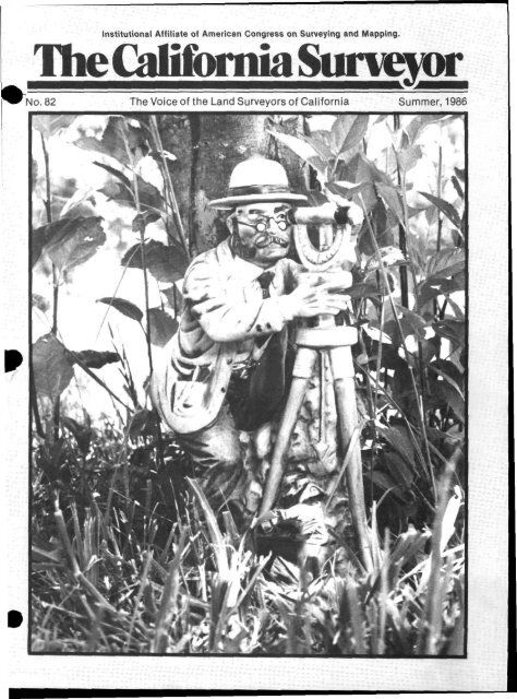
COVER PHOTO by Hal Taylor. Handsculptured porcelain, Umited<br />
edition, previously issued by Kontinental Spirits Kompanie, 1978;<br />
Pioneer Series - Land Surveyor<br />
DEADLINE DATES FOR THE CALIFORNIA SURVEYOR<br />
Fall July 7,1986<br />
Winter October 7,1986<br />
Articles, Reports, Letters, etc., received after the above mentioned<br />
date will be placed in the next edition.<br />
Copyright© 1986 California Land Surveyors Association<br />
Advertisers' Index<br />
ATPAsoft 51<br />
B&H Engineering Inc 42<br />
Ben Meadows Co 16<br />
Bench Mark Co 40<br />
Biocca Engineering 42<br />
•unson Instrument Co 45<br />
• & R Manufacturing 46<br />
C.S.I. Software<br />
U<br />
Chicago Steel Tape 6,18,51<br />
CivU Soft 25<br />
Classifieds 39,51<br />
Concap 18<br />
Geodimeter 31<br />
Hadco Instruments 46<br />
Haselbach Surveying Inst 34<br />
Hasp 33<br />
Houseman & Assoc 36<br />
Industrial Pipe & Steel Co 16<br />
Kern Instruments 29<br />
LanghamyMathisIn3t.& Computers, Inc. . 47<br />
Lewis & Lewis Enterprises 19,20,21.22<br />
MTI Software 49<br />
Ogden Surveying Equipment 34<br />
Pacsoft 2<br />
R-J Enterprises 26<br />
Rodney Stokes 27<br />
Servco 12,24,43<br />
Servco-Teledyne National Tracing Paper . , 17<br />
W.A.C. Corporation 15<br />
CarlZeiss, InC 5.7,9,11,13
President's Message<br />
With the beginning of summer we<br />
look back to review what has happened<br />
the first quarter of the year.<br />
Work is plentiful and most firms<br />
have been wondering how they will<br />
get their work load completed per<br />
schedule. The government agencies<br />
that are checking maps and plans<br />
are having the same problem. The<br />
developers and contractors are<br />
pushing to get the projects underway<br />
and completed before the<br />
money market changes.<br />
Good production and providing<br />
the services desired depends on the<br />
people working for a firm and their<br />
level of training. Today the firms<br />
that are overloaded with work could<br />
resolve their work load by hiring additional<br />
qualified employees, if they<br />
could find them. This situation of<br />
not finding enough well trained<br />
employees brings us to look at our<br />
education levels and goals for our<br />
profession.<br />
Besides the education classes the<br />
schools have, we need to look at<br />
what we in the profession can do.<br />
The Old World method of apprenticeship<br />
was a means of education<br />
that was replaced by the formal<br />
classroom. The formal classroom<br />
provides a fast and efficient means<br />
to communicate information to<br />
students. It provides a very good<br />
way of practicing example problems<br />
and giving time to repetition of<br />
working problems.<br />
When these students start in the<br />
career field, do we spend the time we<br />
should working with them? I feel we<br />
need to look at the young people<br />
coming into the surveying profession<br />
and spend more time on the job<br />
as a tutor and share our knowledge.<br />
The more education time we can<br />
share with these people, the sooner<br />
we will have the trained employees<br />
we need. In my years of teaching in<br />
the past, I have found my education<br />
has also continued.<br />
In the last two years a very small<br />
percentage of the persons taking the<br />
Land Survey examination passed<br />
the test. This is in part due to modifying<br />
the method used to determine<br />
the passing score and also what<br />
should be a minimum level of<br />
knowledge to practice surveying to<br />
the public. With surveying technology<br />
changing and laws being<br />
modified, we begin to believe continuing<br />
education is only around the<br />
corner. We will have to provide<br />
more college classes for the new per-<br />
Page 4 The California Surveyor — Summer, 1986<br />
Richard P. Siegmund<br />
sons of the profession and also<br />
classes for those that have been in<br />
the profession and need to be kept<br />
up to date. Education improves performance<br />
and interest in our work.<br />
Our Education Committee has<br />
been working hard this year to provide<br />
workshops. The <strong>CLSA</strong>/BLM<br />
workshops of May 10 and June 7<br />
had a good attendance response. An<br />
Alta/Vertical Subdivision workshop<br />
is in the plans for September.<br />
Legislation this year focuses on<br />
two main bills. S.B. 1680 deals with<br />
the North American Datum of 1983<br />
and State Plane Coordinates. Many<br />
people and hours have been involved<br />
in perfecting this legislation for<br />
our profession. A.B. 3073 also has<br />
seen several revisions and many<br />
hours by California Council of Civil<br />
Engineers and Land Surveyors<br />
together with California Land<br />
Surveyors Association. One of the<br />
main subjects of this bill deals with<br />
persons who have let their license<br />
lapse. To insure in the future that<br />
those Ucensed will be signing a map<br />
or plat with a vaUd license, starting<br />
January of 1987, the date of expiration<br />
of the Ucense wiU be required.<br />
Other items in the bill deal with<br />
testing items in the L.S. Exam and<br />
the use of "certify" or "certification."<br />
After the bill has become law,<br />
we will publish a copy in the<br />
C.L.S.A. NEWS.<br />
Legislation in the past years has<br />
begun to affect all of us more everyday.<br />
I urge everyone to get to know<br />
your legislators at all levels of<br />
government. Work with these people<br />
to create laws that will benefit<br />
both the consumer and our profession.<br />
Support your PoUtical Action<br />
Committee.<br />
•<br />
A BEARING TREE<br />
by WilUs G. Corbitt<br />
Portland, Oregon<br />
ISSUE No. 78 of The California^<br />
Surveyor pictured a sculpture entii^^M<br />
ed ''The Old BeaHng Tree." M^^<br />
Kenneth J. Omsberg presented the<br />
photo to us for printing and has now<br />
found an appropriate poem to<br />
accompany<br />
the picture.<br />
"A BEARING TREE"<br />
In the year one-eight-seven-nine,<br />
The surveyor ran a second line.<br />
And at the end, he marked a tree.<br />
That stood for years as a B.T.<br />
To the section comer planted there,<br />
After a mile was chained with care.<br />
From this Fir tree, he peeled the bark,<br />
And then with scribe he made a mark<br />
Within the solid growing wood,<br />
To show the place the comer stood<br />
In township, range and section, too.<br />
As the law required that he must do.<br />
Years passed by, and new wood grew.<br />
Over marks once made by such a crew.<br />
Then came a day when other men,<br />
Would find the tree and set again<br />
The comer post, where once it stood<br />
In CaUfomia's densest wood.<br />
By careful search, a Fir was found<br />
That had a trunk both large and<br />
round.<br />
There on the surface of the bark,<br />
One could perceive an ancient mark.<br />
Showing that in a single place.<br />
New growth had covered up a face.<br />
Through bark and wood an axe-man<br />
chopped,<br />
'Til from the tree, there finally popped<br />
A section oft termed over-lay,<br />
That hid the marks from light of day.<br />
Then from the scar was cleaned with<br />
care<br />
The resin that had gathered there,<br />
To cover letters that were good<br />
And well-preserved in solid wood.<br />
Thus did Dame Nature in her way.<br />
Assist the man of present day, ^m<br />
Who must produce in his profession ^M<br />
A good survey for restoration ^^<br />
Of section corners long forgotten.<br />
Because the post, once used,<br />
was rotten.<br />
D
The new<br />
electronic line from<br />
Carl Zeiss.<br />
ta4<br />
ta3<br />
Small, light,<br />
powerful and affordable.<br />
Made possible<br />
by new microprocessor<br />
technology.<br />
ZEISS<br />
West Germany<br />
Zeiss Series E - the new generation of<br />
surveying instruments combining the flexibility<br />
and convenience of electronics with the reliability<br />
and price of conventional instruments.<br />
For details contact: Surveying Instruments Division<br />
Carl Zeiss, Inc. • One Zeiss Drive<br />
Thornwood, NY 10594 • (914) 681-7367<br />
The California Surveyor — Summer, 1986 Page 5
Developing Efficient Survey Techniques<br />
James K. Crossfield, Ph.D<br />
Associatie Professor, Department<br />
of Civil and Surveyng Engineering,<br />
California State University, Fresno,<br />
Fresno, CA 93740<br />
(Continued from Spring Issue)<br />
The Real Property Connection<br />
Perhaps the most significant driving<br />
force behind the burgeoning<br />
number of computerized land information<br />
systems is the lure of<br />
avoiding duplication and waste by<br />
having one department or agency,<br />
rather than several, create and<br />
maintain the maps and related land<br />
records information. Efforts to keep<br />
costs down in such new systems<br />
often lead to development of quickfix,<br />
spatially imprecise systems that<br />
satisfy only some of the system requirements.<br />
More precise spatial requirements<br />
for future large scale<br />
mapping, land ownership records,<br />
or engineering design requirements<br />
are often not attainable in this<br />
scenario. Thus, a system that cannot<br />
avoid redesign may not have<br />
avoided duplication.<br />
The term "spatial imprecision,"<br />
as used here, is a measure of the<br />
distance between the location of a<br />
point as recorded in the computer<br />
and the location of that point on the<br />
ground. Unfortunately, most computerized<br />
land records information<br />
systems disregard spatial precision<br />
in their mapping applications by using<br />
one or more of the following<br />
techniques:<br />
1. "Rubber sheeting" to stretch<br />
and/or distort map data;<br />
2. Arbitrary elimination of apparent<br />
overlaps and gaps that<br />
are fully documented as existent<br />
in written legal records;<br />
3. Digitizing maps of unknown<br />
reliability to create computer<br />
map data having an even<br />
greater lack of spatial precision.<br />
Typical land records information<br />
systems create digitized boundary<br />
files from USGS IV2 minute<br />
topographic map sheets and existing<br />
assessors' maps. The positional<br />
uncertainty of any USGS<br />
map point is typically about 40',<br />
while the typical assessor's map<br />
contains about 10' of spatial im-<br />
FAST FINDING<br />
Locates steel objects:<br />
well casings, cast iron<br />
water lines, valve boxes,<br />
masonry nails, manhole<br />
covers, surveyor's markers<br />
and gas lines.<br />
• New state-of-the-art meter<br />
• Audio and visual readouts<br />
• Continuous one-tube<br />
construction<br />
• Ultra-light 2V& lb.<br />
• Built-in battery charger<br />
• Uses regular C-cell batteries<br />
• Battery condition meter<br />
• Fast battery changing<br />
• Rugged construction<br />
• Solid state electronics<br />
For CST5 new, complete<br />
56-page catalog.<br />
.:i<br />
ObA<br />
FT-60<br />
Mfr. List $525<br />
Audiovisual<br />
Locator<br />
iiiiHTri<br />
Chicago Steel Tape<br />
Dept-CSR, 450 Cips St.. P.O. Box 359<br />
Watseka, IL 60970 • (815)432-5237<br />
Exclusive Canadian Distributor<br />
Norman Wade Co., Ltd.. 75 Milner<br />
Scarborough, Ontario. CANADA MIS 3R7<br />
{416) 291-4211<br />
precision at every map point. Public<br />
decisions about private propertj^^<br />
rights should not be made when th^^^<br />
spatial uncertainty of the system<br />
may be larger than some owners'<br />
properties. A sample survey conducted<br />
in Spring 1985 by surveying<br />
students at California State University,<br />
Fresno, found that property<br />
owners were tolerant of no more<br />
than a one-half foot error in the location<br />
of their boundary lines.<br />
The following list summarizes<br />
several important facts associated<br />
with the increasingly popular computerization<br />
of land records information<br />
systems:<br />
1. Modern computerized land<br />
records information systems<br />
are necessary so that society<br />
can correctly and quickly<br />
answer fundamental questions<br />
about public and private<br />
rights and responsibilities to<br />
land.<br />
2. The common thread linking all<br />
types of environmental,<br />
resource, and ownership<br />
aspects of land is the<br />
geographical location of thesj^^<br />
items on the ground. Thos^^<br />
who deal with ground coordinates<br />
on a daily basis are the<br />
individuals who must provide<br />
guidance for the development<br />
of spatially reliable computerized<br />
land records information<br />
systems.<br />
3. Modernized land records information<br />
systems must be<br />
designed from the ground up<br />
with positional data of known<br />
quality used to create each<br />
new overlay of information.<br />
4. The spatial reliabihty of all<br />
data sets must be known at all<br />
times so that land ownership<br />
rights and responsibilities are<br />
not incorrectly determined<br />
because of imprecise information.<br />
Fundamentally, then, the<br />
cadastral overlay portion of<br />
multipurpose land information<br />
systems must be designed to include<br />
the spatial and written components<br />
of the entire collection of<br />
deed, abstract, and land survei^<br />
records relative to each parcel c^B<br />
land. To do less would run counter<br />
to long-estabUshed common law<br />
(Continued on page 8)<br />
Page 6 The California Surveyor — Summer, 1986
Zeiss ETh 4 -<br />
the electronic<br />
digital theodolite<br />
with exceptional<br />
versatility.<br />
Makes surveying<br />
faster and easier.<br />
Series E - the new electronic line from Carl Zeiss.<br />
Keyboard for<br />
microprocessor<br />
control<br />
Dual display<br />
at the front<br />
and rear<br />
Coaxial design<br />
of clamps and<br />
tangent screws<br />
Automatic<br />
allowance for<br />
vertical index<br />
correction<br />
ZEISS<br />
P<br />
Zeiss ETh 4 - the modern<br />
electronic theodolite. As<br />
compact, light and inexpensive<br />
as a conventional optical<br />
instrument. But easier to<br />
operate, more precise and<br />
powerful due to microprocessor<br />
technology. Electronic<br />
circle scanning and<br />
digital display of results;<br />
angle measuring programs<br />
selectable by the simple<br />
press of a key. Interface for<br />
connection to EDP systems.<br />
West Germany<br />
/MTh4<br />
For details contact:<br />
Surveying Instruments Division<br />
Carl Zeiss, Inc. • One Zeiss Drive<br />
Thornwood, NY 10594 • (914) 681-7367<br />
The California Surveyor — Summer, 1986 Page 7
DEVELOPING EFFICIENT<br />
SURVEY TECHNIQUES<br />
(Continued from page 6)<br />
tradition. Efforts must be encouraged<br />
in this area to provide the most<br />
comprehensive system design possible.<br />
Efficient surveying technology<br />
can have a favorable impact on the<br />
evolution and efficiency of the<br />
system if the system effectively incorporates<br />
and merges the positional<br />
and legal boundary components<br />
of real property.<br />
The Cost Factor<br />
One of the largest component<br />
costs associated with multipurpose<br />
land information system development<br />
are typically considered to be<br />
surveying and mapping positioning<br />
costs. Surveying and mapping<br />
technology costs tend to drop with<br />
the passage of time. New technology<br />
breakthroughs occur frequently,<br />
and knowledge of the<br />
reduced costs offered by these new<br />
technologies should be made clear<br />
to system users as quickly as possible,<br />
lest applicable equipment and<br />
methods be neither considered nor<br />
used in a given system.<br />
Chapter 4 of the NRC report entitled<br />
"Modernization of the Public<br />
Land Siu-vey System" discusses the<br />
economic and technical considerations<br />
for placing coordinates on<br />
PLSS comers. This chapter does<br />
not provide specific guidance to<br />
those who must make difficult decisions<br />
in specific localities. The cost<br />
per point conclusions listed in the<br />
NRC report are misleading because<br />
they tend to ignore the fact Ihat the<br />
economics of PLSS comer positioning<br />
are very dynamic and very<br />
dependent on the specific situation<br />
in which they are being evaluated.<br />
Any given positioning technology<br />
may be superior to any other for a<br />
specific application when cost is the<br />
basic criterion. A very wide range of<br />
per comer costs is possible for any<br />
given method because very different<br />
input data are always possible<br />
for each situation investigated.<br />
Thus, the NRC report on the PLSS<br />
does not help the manager of an<br />
evolving multipurpose system<br />
make decisions about horizontal<br />
geodetic framework implementation<br />
methodology and cost.<br />
Only a specific cost estimation<br />
methodology can answer two fundamental<br />
questions concerning any<br />
given application to multipurpose<br />
cadastres. These are: which application<br />
is cheapest? and how much will<br />
it cost? Fortunately, some researchers<br />
have been working in this<br />
area. Epstein's cost-benefit study of<br />
the economic value of the geodetic<br />
framework is one example.<br />
Crossfield's horizontal geodetic control<br />
surveying cost model is<br />
another. When suppUed with the<br />
proper input data, the latter model<br />
is a valuable plaiming tool for<br />
evaluating the probable cost of and<br />
the appropriate technology for implementing<br />
the horizontal geodetic<br />
framework for evolving multipurpose<br />
cadastres in specific<br />
remonumented Public Land Survey<br />
System areas. When correctly applied<br />
to a specific situation at a<br />
specific time, the cost model provides<br />
useful PLSS comer positioning<br />
technology cost and appUcabiUty<br />
information.<br />
The results of the horizontal geodetic<br />
control survey densification<br />
investigations suggest that intermediate<br />
densification is not always<br />
justified. Due to the rapid improvements<br />
in positioning technology,<br />
it is clear that at least for<br />
some regions of the country the<br />
NRC recommendation for a 3-5 mile<br />
or less spacing of horizontal<br />
geodetic control is ab-eady out of<br />
date.<br />
The value of existing densification<br />
was found to be negUgible from<br />
a strictly PLSS corner positioning<br />
cost point of view. This suggests<br />
that incremental densification may<br />
not be a reasonable alternative to<br />
locaUzed township by township incremental<br />
PLSS positioning. Unfortunately,<br />
the additional cost of incremental<br />
PLSS corner positioning<br />
was shown to be substantial. This<br />
conclusion ignores many other<br />
potential densification uses such as<br />
photo control for use in a large scale<br />
topographic mapping effort.<br />
Another conclusion that can be<br />
made in the £U-ea of monumentation<br />
was predicated upon the knowledge<br />
that in many jurisdictions PLSS<br />
comers £U"e being lost faster than<br />
they are being remonumented.<br />
Jurisdictions that have completed<br />
remonumentation and horizontal<br />
positioning of all PLSS comers and<br />
that have access to modern efficient<br />
positioning technology may ignore<br />
PLSS corner maintenance.<br />
This is appropriate because, once<br />
established, the corner locations will<br />
always be known and may therefore<br />
be relocated on the ground if<br />
necessary. They may never require<br />
relocation if GPS-type technology<br />
and a few good NGS stations are<br />
locally available. Direct use of an inexpensive<br />
and timely positioning<br />
technology on property boundary<br />
corner points will enable the<br />
surveyor to directly and easily correlate<br />
property boundary poin^^^<br />
coordinates to the known coo^^^<br />
dinates of the PLS system.<br />
Application of surveying technology,<br />
regardless of its efficiency,<br />
must occur within an economically<br />
viable multipurpose land records information<br />
system. Thus, within this<br />
context, the fate of the technology is<br />
tied to the fate of the system.<br />
Recommendations<br />
1. The Horizontal Geodetic Control<br />
Survey Cost Model and other<br />
generally applicable surveying<br />
technology cost model research can<br />
and should be expanded, refined and<br />
updated.<br />
2. Research should be initiated immediately<br />
to create the various cost<br />
models that can be used to predict<br />
the costs associated with the<br />
estabUshment of the spatially-based<br />
legal property component of<br />
multipurpose land records information<br />
systems.<br />
3. Research should be immediately<br />
initiated to create several precise<br />
miniature prototype land records in^<br />
formation systems that can serve ai<br />
design laboratories for the development<br />
of standardized data collection,<br />
storage and retrieval activities.<br />
4. Research leading to the development<br />
of real time positioning<br />
technology, like the field positioning<br />
unit, should be funded immediately.<br />
5. Digital image correlation and<br />
related automated photogrammetric<br />
research should be continued<br />
and expanded.<br />
6. Conventional surveying equipment<br />
should not be ruled out from<br />
having a substantial role to play in<br />
the collection of significant<br />
amounts of data vital to the<br />
development of multipurpose land<br />
records information systems.<br />
1. Crossfield. James K.. The Cost of Eetablishbg<br />
Horizontal Geodetic Survey Control on<br />
Remonumented Public Land Survey Comers. Ph.D.<br />
Thesis. UW-Madison, May. i9M.<br />
2. MBrtiti, Robert H.. "A Study of Automation in<br />
Surveying," Unpublished Paper, presented at the<br />
Fall meeting of ACSM. Indianapolis. .September,<br />
1985.<br />
3. Miller, Edwin, (editor), "Surveyors in the year 2000<br />
A Special Report," P.O.B, Magazine, P.O.B<br />
n<br />
Publishing Co., Wayne, Ml, October 1985.<br />
4. National Research Council. Modernization of th<br />
Public Land Survey System, National Academ<br />
Press, Washington. D.C.. 1982.<br />
5. National Research Council, Procedures and Standardig<br />
tor a Multipurpose Cadastre, National<br />
Academy Press, Washington, D.C.. 1983. U<br />
Page 8 The California Surveyor — Summer, 1986
Zeiss ETh 3 -<br />
the electronic<br />
engineering<br />
theodolite<br />
with two-axis<br />
conn pensator.<br />
For more precise<br />
and reliable<br />
surveying.<br />
SECOND<br />
Series E - the new electronic line from Carl Zeiss.<br />
Compensation of<br />
residual vertical<br />
axis inclination<br />
Correction of<br />
circle eccentricity<br />
Correction of<br />
collimation and<br />
index errors<br />
Averaging of<br />
multiple horizontal<br />
angle measurements<br />
ZEISS<br />
P<br />
Zeiss ETh 3 - a precise and<br />
versatile electronic digital<br />
theodolite. Reliable and easy<br />
to operate through the use of<br />
a microprocessor and two-axis<br />
compensator. Determination<br />
and automatic compensation<br />
of the vertical and horizontal<br />
axis inclinations; automatic<br />
correction of angle measurement.<br />
Special programs for<br />
increased accuracy.<br />
Interface for connection<br />
to EDP systems.<br />
; West Germany<br />
/lTh3<br />
For details contact:<br />
Surveying Instruments Division<br />
Carl Zeiss, Inc. • One Zeiss Drive<br />
Thornwood, NY 10594 • (914) 681-7367<br />
The California Surveyor — Summer. 1986 Page 9
Legal Comer<br />
The following article, continued<br />
from the spring 1986 issue, is an<br />
outline of the efforts to correct<br />
problems caused by the various<br />
"state line surveys". The boundary<br />
between California and Nevada<br />
consists of two straight-line<br />
segments. The north-south segment<br />
from Oregon to the 39th<br />
parallel. The oblique segment<br />
from the 39th parallel southeast to<br />
the Colorado River.<br />
"ELEVEN THOUSAND ACRES<br />
OF CLOUDED TITLE"<br />
by John Briscoe<br />
continued from spring issue<br />
Some latter-day sleuthing by F.D.<br />
Uzes, the chief surveyor for the<br />
California State Lands Commission,<br />
brought to light and focused public<br />
attention on the inaccuracies in<br />
both the Von Schmidt north-south<br />
line and the C. & G.S. oblique segment.<br />
Some sabre-rattling between<br />
the two states — not altogether<br />
good natured ~ culminated with<br />
California filing an action in the<br />
United States Supreme Court in<br />
1977 to have the boundary finally<br />
determined by that court. Basically,<br />
California sought a declaration that<br />
the currently recognized line dividing<br />
the two states was in fact the<br />
lawful boundary. The matter was<br />
referred by the Court to a Special<br />
Master, who, acting as a trial judge,<br />
received the evidence and<br />
testimony, and reported back to the<br />
court with a recommendation in the<br />
fall of 1979. Following oral argument,<br />
the Supreme Court held on<br />
June 10, 1980, that, notwithstanding<br />
astronomical or other errors, the<br />
two segments of line (the Von<br />
Schmidt meridian and the C. & G.S.<br />
oblique) had been so long acquiesced<br />
in by the states that, according to a<br />
principle akin to adverse possession<br />
in property law, it had become in<br />
law the true boundary.<br />
In a sense, however, the real problems<br />
had only begun to be addressed.<br />
Prior to the final adjudication of<br />
the boundary dispute between<br />
California and Nevada in 1980,<br />
numerous boundary surveys had<br />
been made resulting in much uncertainty<br />
as to where the line between<br />
the states actually lay. Since 1850,<br />
the United States Government had<br />
granted thousands of acres of lands<br />
from the pubUc domain to CaUfomia<br />
and Nevada for purposes such as<br />
schools, universities, and internal<br />
improvements. In turn, much of this<br />
land was conveyed to third parties,<br />
and many of these lands have been<br />
bought and sold numerous times,<br />
improvements made, and taxes<br />
paid. Now that it is known where<br />
the true boundary between California<br />
and Nevada Ues, it has been<br />
ascertained that approximately<br />
12,000 acres of land, now in supposed<br />
private ownership, were originally<br />
selected and patented by the<br />
wrong state. Approximately 9,400<br />
acres of land, for example, now<br />
known to be in California and<br />
thought to be privately owned, were<br />
originally selected by Nevada before<br />
being granted into private ownership.<br />
California, on the other hand<br />
has selected more than 1,600 acres<br />
of land which lie in Nevada; it has<br />
ostensibly conveyed into private<br />
ownership all but approximately<br />
680 acres of these. The rub in this<br />
state of affairs is that a century-old<br />
decision of the United States<br />
Supreme Court, Coffee v. Groover<br />
(1887), 123 U.S. 1, held that such a<br />
selection, made by a state of lands<br />
beyond its borders, is wholly invalid.<br />
Thus, absent piecemeal or<br />
mass litigation, or action by Congress<br />
to correct these title defects,<br />
the title to these 11,000 acres of<br />
putative private lands really resides<br />
in the federal government.<br />
"...12,000 acres...<br />
originally selected and<br />
patented by the<br />
wrong state."<br />
Congressman Richard H. Lehman<br />
of California, working with other<br />
members of the California delegation<br />
and with those of the Nevada<br />
delegation, introduced legislation<br />
into the United States House of<br />
Representatives on July 25,1985, to<br />
end these uncertainties. As Congressman<br />
Lehman stated before the<br />
full House on July 25, "The history<br />
of California and Nevada is replete<br />
with examples of disputes and<br />
disagreements. I am extremely<br />
pleased to note that in this final<br />
round of the border controversy, the<br />
entire congressional delegation<br />
from both states stands together in<br />
support of legislation to vaUdat^^<br />
thousands of acres of land transfei^^^<br />
made many, many years ago." Thl^^<br />
legislation has exceedingly broad<br />
support, and should hopefully attain<br />
passage during the second session<br />
of the 99th Congress. It is supported<br />
by both parties of both congressional<br />
delegations, the attorneys<br />
general of both states, and<br />
their state land commissions and<br />
land title associations.<br />
FEDERAL LANDS SELECTED BY CALIFORNIA AND NEVADA<br />
POTENTIALLY AFFECTED BY S. 1503 AND H.R, 30SS<br />
The total length of the boundary<br />
between California and Nevada is<br />
620 miles. The counties in California<br />
with lands affected by the proposed<br />
legislation are Modoc, Lassen,<br />
Plumas, Sierra, Nevada, Placer, El<br />
Dorado, Alpine, Mono, Inyo, and<br />
San Bernadino. Nevada counties<br />
having lands affected by the proposed<br />
legislation are Douglas, Lyon,<br />
Mineral. Washoe, Nye and<br />
Esmeralda. While approximately<br />
12,000 acres of lands would be affected<br />
by the curative legislation,<br />
most of which lies in CaUfomia, it is<br />
not kown how many individual<br />
property owners would have their<br />
titles cleared.<br />
D<br />
Mr. Briscoe, the author of the recently<br />
published Surveying the Courtroom (Landmark<br />
Enterprises, 19841, is a member of the<br />
San Francisco-based law firm of Washburn &<br />
Kemp, which specializes in real property,<br />
land title and boundaries, and land-use law.<br />
He expresses his appreciation to Sean E. Mc 'c-<br />
Carthy of his Sacramento office, who ha^<br />
testified before Congress on the Califomi,<br />
Nevada boundary problems, for much of the<br />
information contained in this article.<br />
Page 10 The Calif ornia Surveyor — Summer, 1986
Zeiss Elta 4 -<br />
the Total Station<br />
for everyday<br />
surveying problems.<br />
For more convenient<br />
and reliable<br />
surveying.<br />
7<br />
Series E - the new electronic line from Carl Zeiss.<br />
Only<br />
3 microprocessor<br />
control keys<br />
Optional<br />
main operating<br />
direction<br />
Measuring and<br />
computer programs<br />
for surveying<br />
and setting out<br />
User guidance for<br />
program handling<br />
ZEISS<br />
Zeiss Elta 4 - modern technology<br />
with renowned Zeiss<br />
quality and high-performance<br />
programs at an extremely<br />
active price. Compact<br />
^nvenient operation<br />
and rapid data acquisition.<br />
Easy program selection by the<br />
simple press of a key. User<br />
guidance in the measuring<br />
programs. Interface for<br />
connection to EDP systems.<br />
West Germany<br />
ta4<br />
For details contact:<br />
Surveying Instruments Division<br />
Carl Zeiss, Inc. • One Zeiss Drive<br />
Thornwood, NY 10594 • (914) 681-7367<br />
The California Surveyor — Summer,1986 Page 11
#<br />
YOUR TOTAL STATION<br />
SERVCO/TOPCON THE WINNING COMBINATION<br />
TOPCON DELIVERS THE<br />
TECHNOLOGY, SERVCO<br />
PROVIDES THE BACK-UP<br />
SERVICE THAT IS WAY<br />
AHEAD OFTHE<br />
COMPETITION.<br />
GTS-3 TOTAL STATION<br />
The latest in technology is the<br />
TOPCON GTS-3 Total Station<br />
RUGGED-COMPACT<br />
LIGHTWEIGHT<br />
Call us for information or demo.<br />
SERVCO<br />
We pioneered the west with the<br />
finest instruments in the world. The<br />
leader in sales & service, including<br />
in-house EDM repairs. If you want<br />
the very best, the combination of<br />
SERVCO/TOPCON can t be beat!<br />
GTS-2 TOTAL STATION<br />
ET-1 TOTAL STATION<br />
SURVEYORS SERVICE COMPANY<br />
P.O.Box 1500 - 2942 Century Place<br />
Costa Mesa, California 92628<br />
Call Toll Free in California 800-432-8380<br />
Area Codes 213 & 818 use 800-331-0099<br />
SERVCO-NORTH<br />
A Division of Surveyors Service Company<br />
4135 Northgate Blvd. Suite #2<br />
Sacramento, CA 95834<br />
Call 916-921-1556<br />
HP-41/71 INTERFACE<br />
Page 12 The California Surveyor — Summer, 1986
-'•'•t^<br />
Zeiss Elta 3 -<br />
the Total Station<br />
with two-axis<br />
compensator.<br />
To optimize<br />
accuracy and<br />
operation.<br />
FOURTH<br />
Series E - the new electronic line from Carl Zeiss.<br />
Automatic compensation<br />
of vertical and horizontal<br />
axis inclinations<br />
Correction of circle<br />
eccentricity<br />
Automatic compensation<br />
of error effects In<br />
angle and distance<br />
measurement<br />
Dual display window<br />
on front and rear<br />
ZEISS<br />
Zeiss Elta 3 - the Total Station<br />
that is the most advanced<br />
instrument in its class: versatile,<br />
precise and easy to<br />
operate. Determination and<br />
-automatic compensation of the<br />
vertical and horizontal axis<br />
inclinations. Automatic correction<br />
of instrument errors in<br />
angle and distance measurements.<br />
Interface for connection<br />
to EDP systems.<br />
Wesi Germany<br />
ta3<br />
For details contact:<br />
Surveying Instruments Division<br />
Carl Zeiss, Inc. • One Zeiss Drive<br />
Thornwood, NY 10594 • (914) 681-7367<br />
The California Surveyor — Summer. 1986 Page 13
1986<br />
C.L.S.A. Conference<br />
Report by Michael J. Pallamary<br />
with special assistance by D.K.<br />
Nasland, LS and Kent Whittaker,<br />
LS<br />
In 1966 the California Land<br />
Surveyors Association was formed.<br />
The preamble to our constitution<br />
states: "The purpose of this<br />
organization is to promote the common<br />
good and welfare of its<br />
members in their activities in the<br />
profession of land surveying, to promote<br />
and maintain the highest<br />
possible standards of professional<br />
ethics and practices, to promote<br />
professional uniformity, to promote<br />
public faith and dependance in the<br />
Land Surveyors and their work."<br />
Dedicated to the promotion of the<br />
Professional Land Surveyor,<br />
C.L.S.A. has led the way in many<br />
key issues affecting Land Surveyors<br />
nationwide. On February 11-14,<br />
1986, the association celebrated the<br />
twentieth anniversary of the inception<br />
of this organization. The Red<br />
Lion Motor Inn, in the capital city<br />
of Sacramento, welcomed the many<br />
conference attendees, guests, and<br />
participants to this event.<br />
President Richard P. Siegmund,<br />
LS, officially opened the conference.<br />
His remarks were instrumental in<br />
establishing a sense of unity for<br />
those attending the conference. Mr.<br />
Siegmund took note of the fact that<br />
it was fitting for Sacramento to be<br />
the sight of the conference, as it has<br />
been the center for many of<br />
C.L.S.A.'s legislative activities.<br />
President Siegmund's closing comments<br />
focused on the introduction<br />
of guests and visiting dignitaries.<br />
One of the most important issues<br />
affecting the Land Surveyor today<br />
involves education. With rapidly<br />
changing technology and the<br />
surveyor's scope of practice constantly<br />
expanding, education is an<br />
issue of concern to us all. Appropriately,<br />
one of the greatest advocates<br />
of this principle, Paul<br />
Cuomo, LS, presented the keynote<br />
address. Mr. Cuomo is a proponent<br />
of continuing education and<br />
recognizes the need to educate present<br />
and future Land Surveyors. In<br />
order for the land surveying community<br />
to be accepted without<br />
reservation by others in the various<br />
professional occupations and<br />
organizations, it is becoming increasingly<br />
clear that rigid educational<br />
requirements must be supported<br />
by the words and actions of<br />
C.L.S.A. and its members.<br />
At eleven o'clock in the morning,<br />
the exhibit area was officially opened.<br />
The host of exhibitors did a fine<br />
job of displaying the latest in stateof-the-art<br />
surveying equipment. As<br />
always, the display of equipment<br />
and technology was fascinating and<br />
informative. To many, it represents<br />
the most comprehensive display of<br />
equipment in one location. This important<br />
fecet of the conference cannot<br />
be overemphasized. During the<br />
conference there were many opportunities<br />
to view the exhibits. In the<br />
evening of the opening day, the Exhibitors<br />
hosted a cocktail party for<br />
the attendees and guests. It was a<br />
great opportunity for sociaUzing<br />
and allowed many the chance to<br />
discuss other matters in an informal<br />
atmosphere.<br />
"With rapidly changing<br />
technology and the<br />
surveyor's scope of<br />
practice constantly<br />
expanding, education is<br />
an issue of concern<br />
to us all."<br />
The Wednesday afternoon program<br />
began with John Briscoe, a<br />
San Francisco attorney and writer,<br />
who lectured on "The Trial —<br />
Preparing For It and Being Effective."<br />
A substantial portion of Mr.<br />
Briscoes legal career has been<br />
devoted to cases of land and natural<br />
resources disputes. He has tried<br />
such cases in federal and state<br />
courts and has argued them before<br />
the United States and California<br />
Supreme Courts. Mr. Briscoe, now<br />
with the San Francisco law firm of<br />
Washburn & Kemp, stressed two<br />
points well worth remembering. The<br />
first and foremost was preparation<br />
which, as is true with a sound<br />
survey of land, so too, is this true in<br />
the arena of the courtroom. It is<br />
essential that both attorney and<br />
Land Surveyor be properly<br />
prepared for the ordeal of testimony<br />
and deposition. Mr. Briscoe commented<br />
on the proper use of a<br />
deposition and the need to be<br />
cautious if one is required to provide<br />
one. He suggested that one limit<br />
his/her testimony and authority to<br />
their area of practice and expertise.<br />
To represent oneself as other than<br />
they are is surely bound to diminish<br />
one's credibility.<br />
Following Mr. Briscoe's program<br />
an open forum on the new leadership<br />
of the Board of Registration for Professional<br />
Engineers and Land<br />
Surveyors featured:<br />
1. Recently appointed Executive<br />
Director, G. Harrison Hilt, P.E.,<br />
proceeded to inform the attendees of<br />
the goals and new programs to be<br />
adopted by the State Board. Mr.<br />
Hilt has indicated that he will attempt<br />
to adopt several new policies<br />
of enforcement and organization to,<br />
the recently tumultuous Board.<br />
2. James Dorsey, LS, discussed<br />
the relationship between the<br />
surveyor and the State Board. Mr.<br />
Dorsey was C.L.S.A.'s 1984 President<br />
and is now serving as a Board<br />
Member.<br />
3. Ira H. Alexander, PE, LS and<br />
board TAC Member, joined Mr. Hilt<br />
and Mr. Dorsey in fielding questions<br />
from the audience on procedures,<br />
new Board policies, and<br />
other related matters.<br />
The closing speaker for the conference<br />
opening day was Admiral<br />
J.C. Bossier, Director of the National<br />
Geodetic Survey. He discussed<br />
a topic of extreme importance to<br />
the professional Land Surveyor in<br />
Ught of Senate Bill No. 1680. This<br />
bill would establish the California<br />
Coordinate System of 1983 based<br />
upon the North American Datum of<br />
1983 (NAD 83) as established by the<br />
NGS and would divide the state into<br />
6 zones to accommodate the<br />
system. In addition, the biU would<br />
authorize a local agency to require<br />
by ordinance, that State Plane Coordinates<br />
be used on maps recorded i:<br />
accordance with the Subdivisio:<br />
(Continued on page 1<br />
S<br />
I<br />
Page 14 The California Surveyor — Summer, 1986
CURRENT AERIAL PHOTOGRAPHY<br />
IN STOCK & AFFORDABLE<br />
I S COAST GVM<br />
'RFSEBVATION<br />
PI Sanfs du/<br />
The IN STOCK AERIAL PHOTO<br />
UPDATE PROGRAM is providing<br />
an affordable and convenient<br />
resource for current aerial photography<br />
to surveyors throughout<br />
California.<br />
Full county coverage will be available<br />
for over 73 counties in<br />
Oregon and California. To provide<br />
an ongoing source for current and<br />
comparison coverage, four year<br />
updates are scheduled on all areas<br />
flown.<br />
SERVICES AND PRODUCTS<br />
AVAILABLE:<br />
• STEREO CONTACT PRINTS<br />
• CUSTOM ENLARGEMENTS<br />
Kodak Paper or Reproducible<br />
Mylar<br />
• TITLE BLOCKS & OVERLAYS<br />
• LAMINATING<br />
• MOSIACS<br />
• DIAPOSITIVES<br />
• ORTHOPHOTOS<br />
• CONTOUR MAPPING<br />
THREE TO FIVE DAY SERVICE<br />
WITH OVERNIGHT SHIPPING<br />
AVAILABLE.<br />
Feel free to contact us with your<br />
project needs. We would be happy<br />
to supply a price quotation.<br />
1985 Santa Cruz, Catifornia)<br />
IN STOCK AERIAL PHOTO<br />
UPDATE PROGRAM<br />
Flight Specifications,<br />
County indexes and<br />
photo samples<br />
available by request<br />
at no charge.<br />
IN CALIFORNIA<br />
CALL TOLL FREE:<br />
1-800-845-8088<br />
Vlf« A»C. CORP.<br />
520 CONGER . EUGENE, OR 97402<br />
The California Surveyor — Summer, 1986 Page 15
1986 C.LS.A. CONFERENCE<br />
(Continued from page 14)<br />
Map Act and the Land Surveyor's<br />
Act. The bill would also require,<br />
after January 1, 1995, that when<br />
State Plane Coordinates are used on<br />
new surveys and new mapping projects,<br />
their use be limited to NAD<br />
83, thereby imposing a state mandated<br />
local program. In light of the<br />
fact that this legislation is pending,<br />
input from the profession is important.<br />
It is essential that the land<br />
surveying community become<br />
familiar with NAD 83, and its adoption<br />
and use, both by the pubUc and<br />
the private sector.<br />
The Thursday morning session of<br />
the conference began with a most<br />
fascinating discourse on "Dendrochronology,"<br />
the use of tree<br />
rings to date past events, presented<br />
by C.W. "Wes" Ferguson, Ph.D.<br />
Dr. Ferguson, (now deceased) past<br />
Professor of Dendrochronology at<br />
the University of Arizona, explained<br />
how to use the study of tree rings<br />
to date a diverse range of elements<br />
from the study of sunspots to the<br />
dating of archeological ruins. Tree<br />
ring studies have also been appUed<br />
to climatic reconstruction, fire<br />
history, hydrological studies, insect<br />
infestations, etc.<br />
Professor Ferguson explained<br />
how dendrochronology has played a<br />
role in legal cases involving plant<br />
theft, illegal cutting, riparian<br />
boundary legislation, and the<br />
authentification of tree blazes.<br />
Edward Zimmerman, LS and<br />
James K. Crossfieid, Ph.D.<br />
presented a joint program entitled<br />
"Surveying Technology — the key<br />
to a well rounded technician" and<br />
"The Graduate — An investment<br />
for the future," respectively. This<br />
program was centered around the<br />
skills and education of today's<br />
survey students. Both gentlemen<br />
are proficient instructors and take a<br />
great deal of pride in the quality of<br />
education being provided by their<br />
respective institutions. It is increasingly<br />
important that as education<br />
continues to play a more prominent<br />
role in the changing profile of<br />
today's professional Land<br />
Surveyor, a high standard of education<br />
be both promoted and supported<br />
by all. Only in this fashion<br />
can we expect properly educated<br />
and skilled technicians and<br />
surveyors to supplement manpower<br />
resources.<br />
Liability, incompetency, and<br />
education were noted as some of<br />
"The Dangers of Surveying," a<br />
discussion presented by John S.<br />
Parrish, LS, a surveyor from Carson<br />
City, Nevada. Mr. Parrish outlined<br />
many of the problems associated^^k<br />
with land surveying. Perhaps thd^^<br />
most important of these is the concept<br />
of professionaUsm. It is incumbent<br />
upon the profession to take !<br />
these matters in our own hands and<br />
to clean our own house.<br />
A program by Tom Donahue,<br />
RCE, ran concurrently with Mr.<br />
Parrish's presentation. Mr.<br />
Donahue has an extensive<br />
background in computers. He spoke<br />
regarding the oftentimes confusing<br />
computer technology and the experience<br />
of choosing the system to<br />
meet your needs. Mr. Donahue, who<br />
also founded Automated Engineering<br />
and Office Systems, logically<br />
outlined a step-by-step process for<br />
purchasing a system and software.<br />
Generally this included needs defined,<br />
software located, a preliminary<br />
and secondary evaluation, and the<br />
final selection. Mr. Donahue noted<br />
that the computer was another tool,<br />
similar to any others used in an office.<br />
Finally, he suggested one seek<br />
Special Offer<br />
ly $11.75<br />
Order Today!<br />
iLutkin<br />
Red End<br />
Heavy Duty<br />
Engineer's Rule<br />
Enjoy quick,<br />
convenient catalog<br />
purchasing. Find all of your<br />
indoor/outdoor Surveying and<br />
Engineering supplies, all in one book.<br />
Headquarters: 1-800-241-6401<br />
In Georgia: 1-800-241-3136<br />
In Atlanta: (404) 455-0907<br />
Western Division: 1-800-547-8813<br />
In Oregon: 1-800-452-9010<br />
In Eugene:(503) 344-5468<br />
Prices bubjecl to change without notice.<br />
New<br />
Cata\og<br />
\va\\ab\^<br />
Now-<br />
SURVEYING<br />
STAKES<br />
SAVE UPWARDS O<br />
ON THE FINEST<br />
STEEL PIPE<br />
BOUNDARY STAKES<br />
IMMEDIATE DELIVERY<br />
PLEASE FEEL FREE TO CALL FOR<br />
PRICES ON ANY SIZE<br />
NOT LISTED ABOVE.<br />
WE COT<br />
ANY SIZE AND LENGTH<br />
509QB<br />
Equipmenl Supplier lo Protesslonals Throughout lite VlarM<br />
BenvMeodOM^ Ca<br />
3S89BmaaStrM<br />
2601-B Wffli Sh fcreflue<br />
PiBt OtticB Bw 9)549 Post ORtee Bra 2701<br />
Atlmia ICharate). GHssia 30366 Eugaie, Otegon 97402<br />
Page 16 The California Surveyor — Summer, 1986
I<br />
j<br />
further information in the various<br />
journals and trade magazines.<br />
Dr. Ferguson returned during the<br />
luncheon session to present a most<br />
fascinating discourse entitled, "Carbon<br />
Dating with the Bristle Cone<br />
^^^ine." Studies of the Bristlecone<br />
W^'ine in the White Mountains of east<br />
central California have resulted in<br />
the establishment of a continuous<br />
tree-ring sequence back to 6700<br />
B.C., a total of 8686 years. So<br />
precise is this standard of measure-<br />
I<br />
ment that it has been used to<br />
cahbrate the radiocarbon time scale<br />
for the past seven miUenia, a<br />
development of far reaching consequences<br />
in the fields of archeology<br />
and geology. In Ught of the potential<br />
applications of this aspect of<br />
dendrochronology, it can be readily<br />
seen how, in examining vegetation<br />
structures and bearing trees, one<br />
can possibly determine the history<br />
of any given plant or product.<br />
Following the luncheon was a concurrent<br />
program featuring the<br />
aforementioned "Computer Technology"<br />
presented by Tom Donahue<br />
and "Business Apphcations on the<br />
Microcomputer" presented by<br />
Robert Mix. Mr. Mix is the owner of<br />
Computerize, a turnkey computer<br />
system suppUer to small business.<br />
He has been a microcomputer<br />
business consultant for six years<br />
and is a hardware and software<br />
troubleshooter. Mr. Mix is experienced<br />
in mainframes, minicomputers,<br />
and microcomputers. He has<br />
constructed and owned microcomputers<br />
since 1975.<br />
A concurrent session opened Friday,<br />
the final day of the conference.<br />
"Dendrochronology" was presented<br />
by Dr. Ferguson and "No-Fault<br />
Negotiations'' was presented by<br />
Juhe Rochelle-Stephens, a consultant<br />
who has been active in<br />
organizational development for the<br />
past ten years as a trainer, consultant,<br />
and facihtator. Ms. Rochelle-<br />
Stephens presented a logical approach<br />
to "No-Fault Negotiations"<br />
as she is a speciahst in negotiations,<br />
conflict resolutions, time management,<br />
and team motivation. Her<br />
upbeat presentation provided some<br />
valuable considerations for entering<br />
into any negotiating scenerio.<br />
The second session on the Friday<br />
program was presented by Fred<br />
Weatherill, Contracing Officer with<br />
the U.S. Forest Service. He has been<br />
involved with contracting for 15 of<br />
his 19 years with the U.S. Forest<br />
Service. Owing to his lengthy<br />
career, Mr. Weatherill was well<br />
qualified to represent the contracting<br />
effort by the Forest Service<br />
utilizing the private sector to assist<br />
in defining National Forest System<br />
Land Boundaries. Under the current<br />
administration, much emphasis<br />
is being placed on contracting<br />
with private surveyors rather<br />
than employing in-house personnel.<br />
The above mentioned "No-Fault<br />
Negotiations'' presented by Ms.<br />
Rochelle-Stephens ran concurrently<br />
with Neil Cummins, LS, CE, and<br />
Attorney, presenting a discourse entitled<br />
"The Surveyor and the Law."<br />
Mr. Cummins is a regular contributor<br />
of articles to various professional<br />
journals and has the good fortime<br />
of being able to blend his<br />
diverse background into a meaningful<br />
perspective of the many<br />
issues affecting a given area of the<br />
law. His insight is invaluable and is<br />
of great importance in interpreting<br />
the law as it affects the Land<br />
Surveyor.<br />
Friday's luncheon program was<br />
presented by the Honorable Senator<br />
Leroy Greene. Senator Greene has<br />
carried C.L.S.A. sponsored legislation<br />
for many years and his efforts<br />
^ NATIONAL D<br />
^^TELEDYNE NATIONALTRACING W^PER<br />
QUALITY FIELD BOOKS<br />
FOR THE<br />
WW<br />
DO<br />
DISTRIBUTORS FORTELEDYNE NATIONALTRACING PAPER<br />
0<br />
SURVEYORS SERVICE COMPANY SERVCO-NORTH<br />
P. 0. Box 1500<br />
A Division of Surveyors Service Co.<br />
2942 Century Place<br />
4135 Northgate Blvd. Suite #2<br />
Costa Mesa, California 92628 Sacramento, California 95834<br />
Toll Free in Calif.800-432-8380<br />
Call 916-921-1556<br />
Area Code 213 & 818 use 800-331 -0099<br />
NATIONAL PRODUCTS ale sold only Ihrough aulhonzed<br />
flealers for the location of your local dealer. Telephone;<br />
1-800-439-9516. Miiiliclarttt i Priiltn tf Milii lir Ikt Oiii|i EmlHiritg. Jlrtkilictinl i Cirloiniliic Prttiisitns.<br />
The California Surveyor — Summer, 1986 Page 17
1986 C.LS.A. CONFERENCE<br />
(Continued from page 17)<br />
and aiiigence are much appreciated.<br />
Senator Greene reported on the activities<br />
of the legislature and the<br />
success of our organization. If there<br />
is one effort for C.L.S.A. to undertake,<br />
it is to be persistent and consistent<br />
in monitoring legislation affecting<br />
the profession. Each and<br />
every one of us must take the time<br />
to become involved with the issues<br />
and legislation affecting the Land<br />
Surveyor. Only in this fashion can<br />
we protect our rights as estabhshed<br />
by sound, proper acts of our<br />
legislatures.<br />
Appropriately, following Senator<br />
Greene, Dennis Flatt with Winner/Wagner<br />
& Associates, Inc.,<br />
presented an update on the legislative<br />
activities of C.L.S.A. Mr. Flatt,<br />
as our legislative advocate, is responsible<br />
for monitoring C.L.S.A.<br />
sponsored bills as well as those affecting<br />
the profession. Winner/<br />
Wagner has done a splendid job in<br />
this regard. Once again, this aspect<br />
of our occupation should not be<br />
treated Ughtly.<br />
The final session of the conference<br />
featured Larry L. Reeves, CLU,<br />
CHFC. Mr. Reeves' 20 years experience<br />
in assisting privately held<br />
businesses on a variety of financial<br />
subjects provided a sound platform<br />
from which to base his presentation.<br />
Mr. Reeves is also the vice president<br />
of the financial services division of<br />
Gregg-Miller & Assoc, Inc.<br />
The conference activities came to<br />
a conclusion with the closing<br />
remarks by President Richard P.<br />
Siegmund, LS. As host, Mr. Siegmund's<br />
hospitality and involvement<br />
added to the success of the<br />
conference. The conference committee<br />
also made great contributions to<br />
the program's success. Their efforts<br />
are acknowledged and greatly appreciated.<br />
Please remember their<br />
unselfish contributions the next<br />
time you are asked to give of your<br />
time and professional abiHties. As<br />
the preamble to our constitution<br />
states:<br />
"Recognizing that the true merit<br />
of a profession is determined by the<br />
value of its services to society, the<br />
California Land Surveyors Association<br />
does hereby dedicate itself to<br />
the promotion and protection of the<br />
profession of land surveying as a<br />
social and economic influence vital<br />
to the welfare of society, community,<br />
and state".<br />
D<br />
Page 18 The California Surveyor — Summer, 1986<br />
STRONG LASTING<br />
GST's yellow fiberglass tapes,<br />
made with non-woven PVC-coated<br />
glass fiber, are more durable than steel,<br />
more functional than cloth tapes.<br />
• tough tapes-don't<br />
break even when<br />
vehicles run over<br />
them<br />
• open-type reels are<br />
shatterproof plastic<br />
• easy-to-read<br />
markings are<br />
unaffected by casual<br />
contact with alcohol,<br />
gasoline and similar<br />
fluids<br />
• waterproof, dirtresistant<br />
and<br />
washable<br />
• non-conductive, safe<br />
when working near<br />
electricity<br />
• available in 50,100,<br />
165,200,300 ft<br />
lengths, one-half inch<br />
width<br />
iiiiiiHrrn<br />
Chicago steel Tape<br />
450 Cips Street, P.O. Box 359<br />
Watseka, IL 60970 • (815) 432-5237<br />
Computer Aided Design & Drafting for<br />
CIVIL ENGINEERS AND LAND SURVEYORS<br />
CONCAP software has been employed by hundreds of civil<br />
engineering firms and public works departments for the past 15<br />
years - thru remote timesharing. It is a respected, easy-to-learn,<br />
and very mature package.<br />
Now, CONCAP brings you this proven engineering library for<br />
all IBM compatible MS-DOS desktop microcomputer systems,<br />
including the brand new IBM highspeed AT!<br />
Applications include: Traverse Geometry, Topo Reductions,<br />
Earthwork, Adjustments, Map Checking, Vertical Curves,<br />
Stakeout Routines, Hydraulics, Structural and an enhanced<br />
Subdivision Drafting Package interfaced to the newest plotters<br />
from Calcomp, Hewlett-Packard and Houston Instruments.<br />
For sample printouts and details on our evaluation package.<br />
BBQBQQ<br />
COMPUTING SYSTEMS<br />
call Ron Sawyer at<br />
CONCAP today.<br />
(415)635-5750<br />
680 Hegenberger Road • Oakland, California 94621 4
\}1<br />
LEWIS & LEWIS ENTERPRISES<br />
SURVEYING EQUIPMENT • COMPUTER SYSTEMS<br />
1600CALLENS ROAD<br />
P.O. BOX 820 — VENTURA. CALIFORNIA 93002-0820<br />
TELEPHONE (805) 644-7405<br />
New "LLCOGO ff<br />
For the<br />
HP Vectra,<br />
\^am<br />
IBM PC/XT/AT<br />
and Compatibles<br />
Lewis & Lewis surveying software "LLCOGO" version 6.0 (MSDOS) is<br />
now available to run on your IBM PC/XT/AT or IBM compatible computer,<br />
including the NEW HEWLETT-PACKARD VECTRA.<br />
General Program Features<br />
1. Program written in fast and efficient C language.<br />
2. Enhanced screen presentation showing Status, Input, and Results.<br />
3. Help Window that may be turned OFF or ON as needed.<br />
4. Over 125 "QUICK" codes for faster, more efficient operation.<br />
5. Extensive error trapping, reporting, and recovery.<br />
6. Large 3-Dimensional file capacity of over 32000 points (I -(-megabyte) per file.<br />
7. Unique, "expand as needed" file system which eliminates the need to create oversized files<br />
to hold anticipated data.<br />
8. In LLCOGO version 6.0, we were able to preserve and, in most cases, improve the<br />
functionality of the Series 80 LLCOGO.<br />
CALL TOLL FREE:<br />
(800J 235-3377<br />
outside California<br />
(800) 342-3607<br />
in California<br />
• Demo Disk Available<br />
• Continuing Support Program<br />
• Rent-Purchase • Financing Available<br />
The California Surveyor — Summer. 1986 Page 19
LEWIS & LEWIS<br />
33<br />
' 'FIELD TO FINISH<br />
nnnna<br />
• :!;•••<br />
LIllLUJU<br />
L ] 1 ] r 1 u n<br />
nunc^n<br />
LlULJL JLJ<br />
• TOTAL STATIONS & DATA COLLECTORS FROM<br />
LIETZ ^ NIKON i^ KERN<br />
• TRANSFER PROGRAMS FROM THESE AND<br />
MANY MORE TO LLCOGO<br />
LEWIS & LEWIS SOFTWARE IS<br />
WRIHEN FOR HEWLEH-PACKARD<br />
SERIES 80 COMPUTERS AND<br />
HP PLOHERS<br />
LEWIS & LEWIS SURVEYING &<br />
PLOniNG SOFTWARE<br />
Programs and utilities for the Surveyor and Engineer<br />
''PROFESSIONAL SOLUTIONS<br />
AT AFFORDABLE PRICES >J<br />
• Comprehensive 3-D Coordinate Geometry • Subdivision Design Enhancements • Accurate Plotting on Dot Matrix<br />
Printers to ANY scale • Unique Trig Traverse with State Plane / UTM Coordinate Option • Easy to use Screen<br />
Text Editor • Sunshot - Hour Angle ond Altitude Methods - NO Ephemeris or Updates Required! • Fully Annototed<br />
Computer Aided Map Drawing • Realistic Data Collector Copabilties<br />
I CONTINUING SUPPORT PROGRAM<br />
Satisfaction Guaranteed - Free Trial Period<br />
Our software is configured to allow you to get what you wont and odd additional capabilities later, when you<br />
need them - at prices that moke sense!<br />
If you want powerful, flexible software that's straight forward, easy to learn and use - plus complete error<br />
trapping and a capability to insert, correct and delete without re-entering ail the data - you owe it to<br />
yourself to take a hard look at Lewis & Lewis Surveying Software.<br />
RENT - LEASE PURCHASE<br />
FINANCING AVAILABLE<br />
Write or call one of our toll free numbers now for complete information! We think you will be glad you did!<br />
I<br />
TOLL FREE 800-342-3607 (CA) • 800-235-3377 (Outside CA)<br />
LEWIS & LEWIS SURVEYING EQUIPMENT<br />
1600 Callens Rd., Ventura, California 93003, USA<br />
Pliane: (805) 644-7405, Alaska Ph: (907) 277-9432 • Hours: Mon-Sat. 8:00AM to 5:00PM<br />
Telex: 469116 • Answerback: LEWIS VENTR CI<br />
Page 20 The California Surveyor — Summer. 1986
LEWIS & LEWIS<br />
Fully annotated plot program<br />
A comprehensive coordinate based drafting program<br />
for pen type plotters.<br />
'PRODUCING A FINISHED DRAWING"<br />
With LLPLOT, the user has control of line types, annnotation, the size or spacing of lettering, annotation<br />
location, etc. Text may be placed into the PLOT file from the built-in Editor and placed<br />
anywhere on the drawing with a pre-check feature enabling you to check for proper fit. Location<br />
of text may also be digitized for automatic labeling on drawing.<br />
LLPLOT supports Hewlett-Packard<br />
plotters, HP-7475A, HP-7580A/B<br />
HP-7585A/B, HP-7586B, and Numonics 5624.<br />
Other plotters are currently being evaluated.<br />
Requires:<br />
HP-86/87 LLCOGO Systems<br />
l.O. ROM<br />
Plotter<br />
Interface to Plotter<br />
TOLL FREE<br />
(800) 342-3607 In Calif.<br />
(800) 235-3377 outside Calif.<br />
1600 CALLENS RD. • VENTURA, CA 93003<br />
LEWIS & LEWIS<br />
surveying equipment<br />
CALL TOLL FREE<br />
800-342-3607 In Calif.<br />
800-235-3377 outside Calif.<br />
from the LIETZ CO-<br />
*SET-2 electronic total station<br />
• increased accuracy (±2" Horizontal, ±3" vertical).<br />
• automatic vertical circle indexing.<br />
• automatic compensator.<br />
• double circle reading (reads both sides of the circle).<br />
• increased range (4300 Ft. to a Single • 8300 Ft. to a Triple under average<br />
conditions).<br />
*SET-3A electronic total station<br />
• Identical to the SET-3, but now with automatic compensator<br />
available for:<br />
• REIMT<br />
• PURCHASE<br />
• LEASE PURCHASE<br />
These new total stations are completely interfaced<br />
with the Lietz SDR-2 data recorder and our LLCOGO<br />
on HP cornputers and LLPLOT on HP plotters.<br />
"FIELD TO FINISH"<br />
The California Surveyor — Summer. 1986 Page 21
LEWIS & LEWIS<br />
aV3°>3^7r"<br />
. , . (all contiguous states except Calif.)'<br />
surveying equipment (800)342 3607<br />
M^ ^^B ^ ^ ^^_ ^ _ ^ ^ (in California)<br />
* KEN I ^%L9 l-10dayl''7l-90"'91 +<br />
TOTAL STATIONS<br />
*" '' '^^ """""^'<br />
Lietz SET-3 or SET-10 electronic total station 75.00 45.00 30.00<br />
SDM3ER semi-total station w/vert. sensor 55.00 33.00 22.00<br />
SDM3E semi-total station (one mile range) 45.00 27.00 18.00<br />
Nikon DTM-1 electronic total station 85.00 51.00 34.00<br />
NTD-4 semi-total station (6 second) 45.00 27.00 18.00<br />
NTD-2 semi-total station (20 second) 40.00 24.00 16.00<br />
TOP MOUNT E.D.M.<br />
Lietz RED-2LE.D.M.w/slope reduction (4 mile range) 30.00 18.00 12.00<br />
RED-2 or RED-2A E.D.M. w/slope reduction 25.00 15.00 10.00<br />
NikonND-21 E.D.M. w/slope reduction (1 milerange) 25.00 15.00 10.00<br />
Kern DM-503 distance meter w/5 km. range 45.00 27.00 18.00<br />
AGA Geodimeter 120 or 122 distance meter w/vertical sensor 50.00 30.00 20.00<br />
LONG RANGE E.D.M.<br />
Hewlett-Packard 3808A E.D.M. (6 mile range) 50.00 30.00 20.00<br />
Tellumat CMW-20 microwave system (16 mile range) 100.00 60.00 40.00<br />
DATA RECORDERS<br />
Lietz SDR-2(32K) 25.00 15.00 10.00<br />
Nikon DR-1 (32K) 20.00 12.00 8.00<br />
KernAlphacord-64(64K) 30.00 18.00 12.00<br />
GYRO<br />
LietzGP-1 /TMIA north seeking gyroscopic "one second theodolite" 125.00 85.00 55.00<br />
THEODOLITES<br />
Kern DKM-2AT one second theodolite 35.00 21.00 14.00<br />
Kl-MT six second theodolite 25.00 15.00 10.00<br />
Kl-ST thirty second theodolite 25.00 15.00 10.00<br />
Lietz DT20E electronic theodolite (20 second) 20.00 12.00 8.00<br />
TM-6 six second theodolite 25.00 15.00 10.00<br />
TM-lOE ten second theodolite 22.00 13.20 8.80<br />
TM-20H or TM-20C twenty second theodolite 20.00 12.00 8.00<br />
TS-6 or T-60D one minute theodolite 20.00 12.00 8.00<br />
Nikon NT-4D six second theodolite 25.00 15.00 10.00<br />
NT-2D twenty second theodolite 20.00 12.00 8.00<br />
NT-2S one minute theodolite 20.00 12.00 8.00<br />
TRANSITS<br />
Lietz BT-20 twenty second transit 10.00 6.00 4.00<br />
Nikon TT-400 one minute utility transit 7.00 4.20 2.80<br />
BD-7F five minute utility transit 6.00 3.60 2.40<br />
David White 8300 construction level-transit 5.00 3.00 2.00<br />
LEVELS<br />
Zeiss Ni-2 engineers 32X, 2nd order automoticlevel 12.00 7.20 4.80<br />
Nikon AS or Lietz B-1 32X, 2nd order automatic level 10.00 6.00 4.00<br />
Nikon AE-5 or Lietz B-2A30X, engineers automatic level 7.00 4.20 2.80<br />
Nikon AP-5 or C-3A26X automatic level 6.00 3.60 2.40<br />
Nikon AZ-1 or AZ-1S22X construction automatic level 5.00 3.00 2.00<br />
DavidWhite 8114 construction 12" dumpy level 3.00 1.80 1.20<br />
FATHOMETER<br />
Raytheon DE-719B recording fathometer 25.00 15.00 10.00<br />
CONSTRUCTION LASERS<br />
Spectra-Physics EL-1 electronic level 30.00 18.00 12.00<br />
942 laser level, vertical/horizontal 40.00 24.00 16.00<br />
611 align, laser w/20 sec. transit 15.00 9.00 6.00<br />
LT-3 alignment laser 20.00 12.00 8.00<br />
COMPUTER SYSTEMS<br />
Hewlett-Packard computers — HP-85B, HP-86B, HP-87XM<br />
Call for individual equipment<br />
Disc drives, Printers, and Plotters.<br />
and systems rates.<br />
Lewis and Lewis Surveying software<br />
* MOST ALL OF THE EQUIPMENT YOU SEE ON OUR RENTAL RATE SHEET, IS ALSO AVAILABLE FOR PURCHASE, NEW OR USED. • CALL TODAY — WE'LL HAVE<br />
* RENT WITH PURCHASE OPTION. We will apply 70% of the rent you pay towards the purchase price of the equipment, up IT TO YOU TOMORROW,<br />
to 80% of the value of the equipment.<br />
1600 Callens Rd. — P.O. Box 820 - Ventura, CA 93002 — (805) 644-7405<br />
Page 22 The California Surveyor — Summer. 1986
p<br />
p<br />
Varied Forces<br />
Affect Surveying on the Surface<br />
Reprint from Texas Surveyor<br />
NovJDec. 1985<br />
by David Moore, RPS 2040<br />
NOTE: The following is not written<br />
as a treatis on geodetic science but<br />
to familiarize surveyors with the<br />
forces, concepts and relationships<br />
that exist in the physical and<br />
mathematical conditions that affect<br />
surveying results.<br />
The surveyor, his surveying, and<br />
his resulting data, are directly affected<br />
by certain forces and conditions<br />
that in most cases are not<br />
physically evident and may be<br />
changed by varying the conditions<br />
mathematically. Each of these<br />
forces and conditions may be<br />
visuahzed as a surface and then expressed<br />
in numerical terms.<br />
The obvious surface is that of the<br />
earth or some part thereof, upon, or<br />
near, where we actually make our<br />
measurements. This topographic<br />
surface controls location of the<br />
survey lines and the slope of the<br />
lines of sight, but in and of itself,<br />
and other than in slope, has little<br />
physical affect on the<br />
measurements.<br />
The surface with the greatest<br />
physical affect on the<br />
measurements is that of gravity.<br />
Although we seldom consider gravity<br />
as having a surface, such a concept<br />
allows us to visualize a surface<br />
in which the force of gravity is the<br />
same at all points on that surface —<br />
an equipotential surface. The<br />
equipotential surface which has<br />
been adopted for the earth is called<br />
the geoid.<br />
Of course we can adopt various<br />
potentials and each will be of a different<br />
size, but they will have the<br />
same shape. Because of the mixed<br />
density of the earth, the geoid is not<br />
uniform in shape. The surface undulates,<br />
and one might look at it as<br />
a potato.<br />
Another visualization would be to<br />
cut friction-free channels across the<br />
land masses and fill them with<br />
water, so as not to dimish the<br />
volume in the oceans. Then, having<br />
eliminated the effects of wind, air<br />
pressure, and luni-solar tides, the<br />
resulting water surface would be the<br />
surface of the geoid.<br />
At each point there is a line<br />
perpendicular to the geoidal surface,<br />
called the vertical or the direction of<br />
the force of gravity; and it is the vertical<br />
to which the axis of a survey instrument<br />
is oriented.<br />
Because the geoid is non-uniform<br />
in shape and its surface has no<br />
uniformly variable distance from<br />
The surface with<br />
the greatest<br />
physical affect on<br />
the measurements is<br />
that of gravity.<br />
Tangent Cylinder<br />
>./- -+-;-^l<br />
Figure 1<br />
some fixed point, it offers a very<br />
undesirable surface upon which to<br />
compute.<br />
Another surface, one that is mathematically<br />
expressable, therefore, is<br />
substituted. This surface is usually<br />
an oblate eUipsoid revolved on its<br />
minor axis to provide a soHd form.<br />
(Continued on page 25)<br />
Tangent Cone<br />
The California Surveyor — Summer, 1986 Page 23
t<br />
YOUR TOTAL STATION<br />
K E E FlB FIXJGG<br />
WHEN THERE IS A BREAKTHROUGH IN THE<br />
SURVEYING INDUSTRY,<br />
YOU WILL FIND IT<br />
FIRST WITH WILD<br />
YOU WILL FIND IT<br />
FIRST AT SERVCO<br />
T-2000 with<br />
Dl-5 Distomat<br />
THE LATEST BREAKTHROUGH IS<br />
THE WlLD T-1000 THEOMAT &<br />
WILD DI-1000 DISTOMAT<br />
• IN SIZE<br />
• IN WEIGHT<br />
• IN PERFORMANCE<br />
• IN PRICE<br />
T-1000Theomat<br />
f<br />
Call us for a Demonstration<br />
SERVCO<br />
GRE-3 Data Terminal<br />
DI-1000 Distomat<br />
We pioneered the west with WILD Instruments.<br />
The leader in sales, service, including in-house EDM<br />
repair. If you want the very best, the combination of<br />
WILD/SERVCO can t be beat!<br />
SURVEYORS SERVICE COMPANY<br />
P.O. Box 1500 - 2942 Century Place<br />
Costa Mesa, California 92628<br />
Call Toll Free in California 800-432-8380<br />
Area Codes 213 & 818 use 800-331 -0099<br />
Page 24 The California Surveyor — Summer, 1986
m<br />
VARIED FORCES<br />
(Continued from page 23)<br />
It may be viewed to some extent<br />
much as an egg.<br />
The idea is to select an ellipsoid<br />
hat nearly approximates the size<br />
nd shape of the geoid. A line<br />
perpendicular to the surface of the<br />
ellipsoid is called a normal.<br />
Obviously a perfect geoid-ellipsoid<br />
fit would have all points at<br />
equal elevation and the perpendicular<br />
lines at a point would coincide.<br />
The physical reaUty of the geoid<br />
makes this an impossibility.<br />
The elevation difference is termed<br />
geoid separation while the directional<br />
difference is the deflection of<br />
the vertical.<br />
The surface of an elUpsoid of revolution,<br />
which is usually referred to<br />
as a spheroid, may be defined precisely,<br />
and the relative location of<br />
points upon its surface are easily<br />
computed.<br />
In earlier days, computation was<br />
done by hand with logarithms or<br />
natural trig functions with intermediate<br />
steps tabulated on printed<br />
forms. With electronic computers<br />
such calculations are virtually instantaneous.<br />
Because the multi-curved surface<br />
of the spheroid is not easily correctable<br />
into a plane surface for production<br />
of maps, an auxiliary surface<br />
with a surface curved in only one<br />
direction, e.g., a cylinder or a cone,<br />
is often introduced. Such a surface<br />
may then be flattened without excessive<br />
distortion along the axis and<br />
is easily computed on by non-geodetic<br />
methods in terms of plane<br />
coordinates.<br />
The land surveyor generally performs<br />
plane surveying, in most<br />
cases, assuming a plane touching<br />
the topographic surface, but<br />
oriented by the force of gravity. He<br />
uses a large number of planes, with<br />
a new plane at each instrument station,<br />
and each considered tangent at<br />
the station. In a small area, the<br />
assumption of a single plane is<br />
reasonably valid, especially when<br />
the observational errors are much<br />
greater than the errors in the<br />
assumption. However, when working<br />
within a larger area and using<br />
today's information, errors of the<br />
assumption can become evident as<br />
failure of control to close upon itself.<br />
Consider a 10 mile square to be<br />
traversed, three corners having an<br />
average elevation of 400 feet and<br />
the northwest comer quickly rising<br />
to about 1,100 feet, with traverse<br />
line lengths of about one mile. Lone<br />
lengths reduced to horizontal will<br />
have an average elevation of about<br />
400 feet except for the last mile on<br />
west side and the first mile north<br />
side. These will have an average<br />
elevation of about 770 feet. Failure<br />
to consider the difference in sea<br />
level reduction on just two lines can<br />
cause an error of about 0.20 feet, a<br />
not immeasurable difference with<br />
today's equipment.<br />
Similarly, the plane of the<br />
traverse station at one of the corners<br />
will be about 170 feet below the<br />
plane at the diametrically opposed<br />
station and the vertical will be out<br />
of parallel about 14 minutes of arc.<br />
Failure to consider the earth's curvature<br />
and convergence of meridians<br />
can account for probably<br />
another 0.2 feet of failure to close.<br />
Obviously when working on a larger<br />
systems of local orientation, problems<br />
get progressively worse. But<br />
now consider typing two systems<br />
together.<br />
Our assumptions of the local system<br />
and plane surveying has its<br />
merits under some circumstances,<br />
but, because of the physical reality,<br />
there may well be times we will<br />
want to consider other alternatives.<br />
D<br />
P<br />
CIVIlSOFr" CONTOUR<br />
Why be limited by your software? CONTOUR is a fast, flexible and<br />
accurate contour plotting program that was designed considering the<br />
needs of over 4,000 CIVILSOFT users.<br />
FMST<br />
CONTOUR is fast. Calculations are performed quickly. Take advantage<br />
of an 8087 or 80287 math co-processor and watch CONTOUR run<br />
even faster.<br />
FLEXIBLE Dm INPUT<br />
Look at data from two graphic viewpoints: the familiar two-dimensional<br />
representation or a three-dimensional mesh. Input data a number of<br />
different ways:<br />
• from COGO-80/86,COGO-PC, or DIGIPLUS<br />
• directly from the field or supported data collectors<br />
• from existing maps<br />
• from existing files<br />
• from your own programs<br />
Of course, data can still be entered from the keyboard, the only option<br />
many other programs give you. CONTOUR can also produce the standard<br />
CONTOUR map in AutoCAD format.<br />
MCCUBXTE<br />
CONTOUR uses the TIN method of triangulated irregular networks<br />
for calculations. It can easily describe abrupt drops like curbs or cliffs.<br />
CONTOUR finds the best solution for any type of data.<br />
HARDWARE INDEPENDENCE<br />
CONTOUR supports over 30 high resolution color or monochrome<br />
adapters and displays, and over 15 different models of plotters,<br />
including Hewlett-Packard, Houston Instruments and CalComp. Printer<br />
plotting to exact scale can be made on supported printers. Take a look<br />
at CONTOUR and ^_— , ^ CIVILSOFT^<br />
give us your input.<br />
1592N.Batavia St.,Suite 1-A<br />
Orange, CA 92667<br />
(714)974-1864<br />
CIVILSOFT"^ is a division of tfie Technical Group, Inc.<br />
The California Surveyor — Summer, 1986 Page 25
ADVANCE NOTICE<br />
C.L.S.A. SPONSORED SEMINAR<br />
September 13, 1986<br />
TOPICS<br />
High Rise Surveying Techniques<br />
Holiday Inn<br />
High Rise Condominiums<br />
1050 Burnett Ave.<br />
Alta Surveys Concord, CA 94520<br />
See Coupon Below For Early Registration<br />
SPEAKERS<br />
Perry Cosseboom - High Rise Surveying<br />
Mitch Duryea - High Rise Condos<br />
Gerald Forsman - ALTA Surveys<br />
Dan Barry - Title Company Aspects<br />
•<br />
Seminar Registration Form<br />
Name<br />
Address<br />
City/State/Zip<br />
Daytime Telephone No. / Evenings<br />
D $85 (<strong>CLSA</strong> State Association Member) *$80 Prior to August 1*<br />
n $100 (Non-member) *95 Prior to August 1*<br />
Amount: $_<br />
Make checks payable to: <strong>CLSA</strong> Seminar<br />
Please bill by D MasterCard<br />
Expiration Date:<br />
D Visa<br />
Card No. [<br />
Signature<br />
Return to; C.L.S.A. Seminar<br />
P.O. Box 9098, Santa Rosa, CA 95404<br />
(707) 578-6016<br />
For more information contact: Paul Cuomo (714) 834-2957<br />
ii<br />
Surveying The Sandhills In 1904<br />
R-J Enterprises offers the Surveyor a matted<br />
print ready for framing. You ore buying a<br />
print reproduced from an original oil painting.<br />
The print shows a real life surveyor,<br />
with compass, surveying boundary lines in<br />
western sandhill terrain. You will also<br />
receive the story behind the painting and the<br />
autobiography of the artist. This is a LIMITED<br />
EDITION of 1,000 color prints, numbered and<br />
signed by the artist. Your print will be shipped<br />
first class in a flat parcel. If requested<br />
and available, you will receive a print<br />
number corresponding to your LS/PE<br />
number.<br />
17" K 21" double-motted color print on 100% Rag paper, acid free.<br />
ORDER PORAA<br />
Nome<br />
Street<br />
LS/PE No<br />
City _ _State/Province_ -Zip-<br />
Please send me prints at $50.00 each. Add $3.00 for shipping<br />
and handling- Nebraska residents add 3'/^% for soles tax. Only<br />
Cashier's Check or Money Order accepted. TOTAL $<br />
Send order to: R-J Enterprises, 540 Mears Sireet, Chadron, NE 69337<br />
I<br />
Page 26 The California Surveyor — Summer. 1986
RODNEY STOKES<br />
Co, INC.<br />
ARCHITECTURAL, ENGINEERING & SURVEYING<br />
SUPPLIES, SALES, RENTALS. & SERVICE<br />
PHOTO, BLUEPRINTING & SHACOH REPRODUCTION<br />
PENTAX<br />
STATE OF THE ART SURVEYING EQUIPMENT-<br />
THEODOLITES, TOTAL STATIONS AND<br />
PRECISION LEVELS.<br />
KROY 290<br />
LETTERING SYSTEM<br />
THE EASIEST, MOST ADVANCED WAY TO<br />
CREATE KROY LETTERING EVER. RODNEY<br />
STOKES ALSO CARRIES THE FULL LINE OF<br />
KROY LETTERING MACHINES.<br />
QUANTUM 481<br />
DIAZO WHITEPRINTER<br />
THE STANDARD OF EXCELLENCE<br />
D<br />
D<br />
100 MARKET STREET<br />
SAN DIEGO, CA 92101<br />
619/232-6231<br />
1241 LINDA VISTA RD.<br />
SAN MARCOS. CA --<br />
619/471-1411 I<br />
The California Surveyor — Summer, 1986 Page 27
CALIFORNIA LAND<br />
SURVEYORS ASSOCIATION<br />
CENTRAL OFFICE<br />
Sprinkled throughout The California<br />
Surveyor you may have seen<br />
references to the "Central Office."<br />
Perhaps you've noticed that many<br />
of the reply cards, information requests,<br />
and registration forms are<br />
sent to Post Office Box 9098, Santa<br />
Rosa, California — the mailing address<br />
of CaUfornia Land Surveyors<br />
Association (C.L.S.A.) Central Office.<br />
Have you ever wondered what<br />
the Central Office is all about?<br />
Maybe you have known about the<br />
Central Office for some time now.<br />
Perhaps you talk with the staff over<br />
the phone from time to time and<br />
have wondered about the faces and<br />
backgrounds of the persons attached<br />
to those voices.<br />
If you would like to become acquainted<br />
with the staff of the <strong>CLSA</strong><br />
Central Office and find out about<br />
the various services which they provide<br />
for the Association, then read<br />
on.<br />
REBECCA BOEHM, SALES/<br />
PRODUCTION MANAGER<br />
Rebecca Boehm has been the<br />
Sales/Production Manager for The<br />
California Surveyor magazine since<br />
September of 1985. Working in this<br />
capacity, Rebecca sells the advertising<br />
for The California Surveyor and,<br />
once the advertising is sold, she<br />
then formats the magazine. Her responsibilities<br />
include: working with a<br />
graphics company to have the editorials,<br />
reports, letters and other<br />
contributions typeset; doing the<br />
paste-up of the magazine; and arranging<br />
with the graphics company<br />
to do the printing.<br />
In advertising, Rebecca rarely<br />
meets the advertisers, but does all<br />
Page 28 The California Surveyor — Summer, 1986<br />
business with them over the phone<br />
and by letter. She acquired many<br />
good sales techniques from her previous<br />
experience in telemarketing.<br />
She can hear a "no" and turn it into<br />
a "maybe"; hear a "maybe" and<br />
turn it into a "yes." She also learned<br />
to deal with the rejection which is<br />
part of any sales position, realizing<br />
that when someone says "no^'<br />
they're saying "no" to the offer, not<br />
to the person.<br />
Rebecca has a strong interest in<br />
the mechanical production process<br />
and finds it very exciting to take an<br />
idea, work with it, and have a project<br />
come together as planned. She<br />
gained experience in this process<br />
through personal seminars from<br />
MK Marketing in Rohnert Park.<br />
Photo by Hal Taylor<br />
Rebecca T. Boehm<br />
Through those seminars Rebecca<br />
learned the mechanics of paste-up<br />
and developed the skills needed for<br />
various graphic techniques. The<br />
paste-up work was previously being<br />
done by a graphics company, and<br />
now Rebecca performs this process<br />
"in-house" while still maintaining<br />
the quaUty of the publication.<br />
Rebecca feels that it is important to<br />
produce a publication which is a<br />
good reflection on the California<br />
Land Surveyors Association.<br />
In addition to her involvement<br />
with The California Surveyor,<br />
Rebecca is responsible for producing<br />
the Association's newsletter.<br />
Although she receives guidance<br />
from Dorothy Calegari, editor of the<br />
newsletter, Rebecca formats the ar;<br />
tides and performs the paste-up.<br />
Rebecca is the mother of five<br />
children. Her interests involve<br />
working creatively with her hands,<br />
such as playing the piano, craft<br />
work, and sewing. She has many interests<br />
which deal with magazine<br />
pubUshing and feels it is exciting to<br />
have those interests coincide with<br />
her job.<br />
Photo by Hal Taylor<br />
Cheryle Belli<br />
CHERYLE BELLI,<br />
MEMBERSHIP SERVICES<br />
Cheryle Belli is a recent graduate<br />
of Heald Business College, where<br />
she majored in Legal Secretarial<br />
studies. Her areas of special training<br />
at Heald include accounting,<br />
secretarial courses, shorthand, and<br />
legal courses. Like Rebecca, Cheryle<br />
has also been a member of the Central<br />
Office staff since September of<br />
1985.<br />
At the <strong>CLSA</strong> Central Office,<br />
Cheryle is in charge of ail membership<br />
services. The largest part of<br />
Cheryle' s responsibilities is the<br />
maintenance of membership records,<br />
although she performs other<br />
vital functions such as filling<br />
member requests for Central Office<br />
services. Cheryle utilizes a computer<br />
data base to process new members<br />
and update information about current<br />
members. She also uses the<br />
data base to create mailing labels fori<br />
the various types of mailings which'<br />
are processed at the Central Office.<br />
In order to effectively use the<br />
features of the data base program on
m<br />
the Central Office computer,<br />
Cheryle has attended special training<br />
classes. She is able to query the<br />
member data base in order to select<br />
a certain set of members based on<br />
given criteria, as well as produce<br />
eports for various Association puroses.<br />
Other data base applications<br />
include processing registrants for<br />
conferences, semintirs, and workshops,<br />
as well as keeping detailed information<br />
on speakers.<br />
Cheryle uses a word processor to<br />
accomplish such tasks as typing<br />
agendas to be sent out to members,<br />
typing and formatting articles to<br />
appear in the <strong>CLSA</strong> News, merge<br />
printing (using a data base file) to<br />
create personaHzed correspondence,<br />
and other necessary word processing<br />
such as updating changes in the<br />
Bylaws and the Land Surveyors<br />
Act.<br />
In her leisure hours, Cheryle enjoys<br />
camping, playing tennis, and is<br />
a member of a co-ed softball team.<br />
Photo by Hat Taylor<br />
Karen A. Rogers<br />
KAREN ROGERS, BUSINESS<br />
MICROCOMPUTER<br />
SPECIALIST<br />
The most recent addition to the<br />
Central Office staff is Karen Rogers.<br />
It is Karen's job to make sure that<br />
all computer operations performed<br />
on the Central Office computer system<br />
are implemented using the full<br />
potential of the software. She also<br />
protects data integrity by examining<br />
the contents of the fixed disk<br />
and is developing an easy-to-use fixed<br />
disk backup procedure, an essential<br />
part of microcomputer operations.<br />
Karen specializes in data base<br />
management applications and computerized<br />
accounting. She has designed<br />
and developed the <strong>CLSA</strong><br />
member data base, a data base of<br />
speakers, as well as various registration<br />
data bases. She is currently in<br />
the process of designing a customized<br />
accounting system for the <strong>CLSA</strong>.<br />
The system will keep track of account<br />
balances, budget amounts,<br />
previous year balances, as well as<br />
print checks, financial statements,<br />
and other accounting reports.<br />
Karen's previous experience includes<br />
work with Local Area Network<br />
systems, including implementation<br />
and supervision of such<br />
systems. A Local Area Network<br />
consists of two or more microcomputers<br />
and/or terminals coimected<br />
as an integrated system in order to<br />
share programs, data files, disk<br />
storage space, printers, and other<br />
microcomputer resources. Her previous<br />
experience also includes<br />
development of data base apphcations,<br />
both as a part of a team of programmers<br />
and as an individual consultant.<br />
She is familiar with several<br />
different data base programs.<br />
In addition to data base and accounting<br />
programs, Karen is also<br />
knowledgeable in the use of word<br />
processing, mail merge, spreadsheet,<br />
and computer utiUty programs.<br />
She has also become famihar<br />
with several programming languages<br />
during her four years of experience<br />
with microcomputers.<br />
Karen feels it is important to<br />
balance the indoor activities on a<br />
computer with outdoor activities.<br />
So in addition to computing, she<br />
also enjoys hiking, fishing, gardening,<br />
and writing.<br />
THE CENTRAL OFFICE -<br />
WORKING TOGETHER FOR<br />
THE ASSOCIATION<br />
The <strong>CLSA</strong> Central Office staff<br />
reahze that it is important for the<br />
California Surveyors to have a professional<br />
image; they are professionals<br />
and should be represented as<br />
such. The California Surveyor is one<br />
way of showing professionalism,<br />
through the articles, format, and<br />
total content of the pubhcation.<br />
Future plans include producing a<br />
newsletter every other month, informing<br />
members on a timely basis of<br />
activities of the State Associations<br />
concerning current legislation.<br />
These newsletters will also contain<br />
notices about upcoming seminars<br />
and workshops, as well as provide<br />
information on the resources<br />
available at the Central Office. U<br />
Technology<br />
on Target<br />
Choose from two electronic<br />
theodolites: the<br />
El or E2 (the E2 features<br />
automatic compensation<br />
for both axis inclinations).<br />
With the DM 503 attached<br />
you have a fully automatic<br />
'TOTAL STATION".<br />
For a complete "Field to<br />
Print" system we offer<br />
three data collector-options:<br />
Use your HP41CV<br />
or CX with our DIF41 Interface<br />
and the supplied<br />
SICORD USA program,<br />
the basic 48K Recording<br />
Unit model R48 or the<br />
NEW ALPHACORD Field<br />
Computer/Recorder.<br />
The Alphacord is user<br />
programmable in Basic,<br />
, Pascal or Fortran and<br />
available with either 64K<br />
or a 128K memory capacity.<br />
For the demanding surveyor<br />
and engineer Kern is the<br />
choice. Call or write today<br />
for all the facts.<br />
Kern Instruments, Inc.<br />
Geneva Road,<br />
Brewster, NY 10509<br />
Phone 914/279-5095.<br />
l/ % SWISS /<br />
AN<br />
INVESTMENT<br />
IN QUALITY<br />
The California Surveyor — Summer, 1986 Page 29
MINUTES OF THE FIRST<br />
QUARTER BOARD OF<br />
DIRECTORS MEETING<br />
JANUARY 25. 1968<br />
Prepared by Susan A. Jensen, L.S.,<br />
Secretary.<br />
Condensed for publication.<br />
The first quarter meeting of the<br />
Board of Directors of the Cahfomia<br />
Land Surveyors Association was<br />
held at the Amfac Hotel, Burlingame,<br />
CA on January 25, 1986.<br />
The meeting was called to order<br />
by President Michael R. McGee at<br />
9:40 A.M. An omission from the<br />
minutes of the October 12, 1985<br />
meeting was requested to be included<br />
in this record, as follows:<br />
Frank Fitzpatrick moved that the<br />
Board of Directors rescind the action<br />
of the July C.L.S.A. Board of<br />
Directors meeting approving the<br />
joint policy statement by A.C.S.M.<br />
stating: The profession of surveying<br />
is within the broad spectrum of<br />
engineering. The original motion<br />
was seconded by Gene Rutledge and<br />
was passed by the Board.<br />
The minutes of the October 12,<br />
1985 Board of Directors meeting<br />
were approved, as corrected.<br />
UNFINISHED BUSINESS:<br />
Certificates of Appreciation were<br />
presented to the retiring members<br />
of the State Board of Registration<br />
L.S. Technical Advisory Committee<br />
members, as follows: Vincent<br />
Sincek, Fred Seiji.Timothy Wong,<br />
Frederick Kett, Roger Mcintosh,<br />
and Jim Crabtree.<br />
Neal Campbell, chairman of the<br />
Teller's Committee announced the<br />
1986 officers as follows: President,<br />
Richard P. Siegmund; Vice President,<br />
Louis E. Rutledge; Secretary,<br />
Susan A. Jensen; Treasurer, Paul A.<br />
Cuomo. The chairman also reported<br />
that all By-Law changes had been<br />
approved by the membership.<br />
The gavel was passed to the new<br />
president, Richard Siegmund.<br />
Resolution 86-01, conferring Life<br />
Membership upon Michael McGee<br />
was presented by President Richard<br />
Siegmund. The resolution was moved<br />
by Neal Campbell, seconded by<br />
Lee Hennes and passed unanimously<br />
by the Board.<br />
Resolution 86-02, retaining<br />
Dorothy Calegari as Executive<br />
Director of the association was<br />
presented by President Richard<br />
Siegmund. The resolution was moved<br />
by Lee Hennes, seconded by<br />
Howard Brunner and passed unanimously<br />
by the Board.<br />
Legislative Committee's Report;<br />
Gary Shelton moved that C.L.S.A.<br />
co-sponsor the Cal Council bill to reword<br />
the L.S. Act and that the<br />
President appoint three L.S.<br />
members from C.L.S.A. to work on<br />
this committee. The motion was<br />
seconded by D. K. Nasland. Following<br />
discussion, the President<br />
assured the Board that any committee<br />
work would be carried out under<br />
the guidance of the Legislative<br />
Committee in order to maintain continuity<br />
with our present legislative<br />
efforts. The motion was passed<br />
unanimously.<br />
A request for imput from the<br />
Cahfomia Attorney Generals office<br />
concerning A.G. Opinion No. 86-101<br />
was discussed. Michael McGee<br />
moved that C.L.S.A. support the interpretation<br />
of Government Code<br />
section 66451.301 and 66451.302<br />
pursuant to the proposed Attorney<br />
Generals Opinion No. 86-101 that<br />
would require a Notice of Merger be<br />
recorded prior to January 1, 1988.<br />
This interpretation is consistent<br />
with present state law regarding<br />
merger of non-resource lands and<br />
imparts constructive notice putting<br />
the public on notice and thereby<br />
completing the merger process. The<br />
motion was seconded by Howard<br />
Brunner. The motion passed by<br />
voice vote with one no. Michael<br />
McGee was directed by the Board to<br />
write a letter to this affect to the Attorney<br />
Generals office.<br />
A request was made in writing by<br />
General F. Oldenburg to print two<br />
letters, commonly known as "Big<br />
Brother" and the "Harrison/Blake<br />
Letter" in the Cahfornia Surveyor<br />
and for C.L.S.A. to state their support<br />
of the "Harrison/Blake Letter"<br />
as they pertain to SB 1837. Susan<br />
Jensen moved that C.L.S.A. write a<br />
letter of support concerning SB<br />
1837 and the "Harrison/Blake Letter"<br />
and publish both letters in the<br />
next issue of the California<br />
Surveyor. The motion was seconded<br />
by Lou Hall. After discussion, the<br />
motion was amended to exclude our<br />
written support of the "Har-^^,<br />
rison/BIake Letter". The amendin^^^<br />
motion failed, 8 yes, 13 no. The mai^^<br />
motion was then voted upon and<br />
was passed unanimously.<br />
NEW BUSINESS:<br />
Claude Tomlinson, on behalf of<br />
the Riverside/San Bernardino<br />
Chapter, moved that the quarterly<br />
meetings of the Board of Directors<br />
be alternately held in the northern<br />
area of Cahfornia in or around the<br />
San Francisco area; and, in the<br />
southern area of California in or<br />
around the Greater Los Angeles<br />
area in order to accomodate all the<br />
chapters. The motion was seconded<br />
by D. K. Nasland.<br />
The motion failed, 8 yes, 12 no.<br />
Claude Tomlinson, on behalf of<br />
the Riverside/San Bernardino<br />
Chapter moved that the By-Laws<br />
Committee be instructed to develop<br />
for implementation, the necessary<br />
modifications to the By-Laws,<br />
which will permit the use of a proxy<br />
for voting purposes. The language<br />
should be such that a single Chapter<br />
Representative, with properly ex- _<br />
ecuted proxies from designatec^BI<br />
Chapter Representatives will hav^^H<br />
the abiUty to vote on any or all<br />
issues brought before the Board of<br />
Directors, as though all entitled<br />
representatives were in attendance<br />
at that meeting. The motion was<br />
seconded by Bruce Hall.<br />
After discussion, the motion was<br />
passed, 17 yes, 7 no. The By-Laws<br />
Committee was so directed.<br />
Resolution 86-03, authorizing the<br />
President and/or Vice President,<br />
Secretary and Executive Director to<br />
executive contracts and agreements<br />
on behalf of the association, was<br />
presented by Richard Siegmund.<br />
Bruce Hall moved adoption of the<br />
resolution, seconded by Lee Hennes,<br />
and passed unanimously.<br />
Resolution 86-4, authorizing the<br />
Treasurer and Executive Director<br />
to sign checks on behalf of the<br />
association, was presented by President<br />
Richard Siegmund. Lee<br />
Hennes moved adoption of the<br />
resolution, seconded by Bruce Hall,<br />
passed unanimously.<br />
^^<br />
The meeting was adjourned at^H<br />
4:14 P.M. D<br />
Page 30 The California Surveyor — Summer, 1986
THE FULLY-INTEGRATED SURVEYING SYSTEM THAT'S<br />
EASILY COMPATIBLE WITH YOUR WAY OF WORKING.<br />
System GEODIMETER is a tcnallyintegrated<br />
surveying system ingeniously<br />
designed to adapt to your way of working<br />
in the field, in the office, in the present,<br />
and in the future.<br />
At the heart of System GEODIMETER<br />
is the GEODAT 126— the most capable,<br />
field-intelligent and easy-to-use handheld<br />
data recorder/field calculator available today<br />
With the GEODAT 126 you can create<br />
your own administrative routines and<br />
measuring sequences to suit your own particular<br />
way of working.<br />
In the field, this one-pound giant offers<br />
L/'-p GLVdimetcr's field-tested siirvciiing softivare, tindjmt uixnit anyone tV^c's.<br />
• GEODiMETEH IBM<br />
System S of I ware<br />
• GEODfMETHR Series 80<br />
System Software<br />
• GEODiMETER Hyrfropac<br />
Sysfem Software<br />
• Advance Qsophysicaf<br />
m Autocad<br />
• B C Compuimg<br />
error-free, two way communication to all<br />
Geodimeter instruments with data inputoutput,<br />
^ck at the office, it's connectable to<br />
oamputers, modems, printers, plotters anci<br />
Computer<br />
Plotter<br />
Printer<br />
m Senchmafk<br />
• Berwanger<br />
• C & G Software<br />
• CLM/Syslems<br />
• CIvilsoft<br />
• HASP<br />
• Hewtelt Packard.'Wild<br />
• (ntsfgraph<br />
• K 8 S Software<br />
• Land Irmovalion<br />
• Lewts and Lewis<br />
• Uelz<br />
• M.rr<br />
• Maple ch<br />
• McDonrie!! Dougias<br />
• Pacsoft<br />
• Sierra Cybeinencs<br />
• Tectiriical Advisors<br />
• V L Systems<br />
• Zeiier Pennock<br />
other peripherals with its RS-232C and<br />
HF-IL built-in interfaces.<br />
An integral part of System GEODHVIETER<br />
is our large family of mount-on EDMs,<br />
Total Stations, and our field-tested surveying<br />
software. System GEODIMETER is so<br />
flexible it allows you to interface with just<br />
about anyone else's engineering software.<br />
Best of all. System GEODIMETER was<br />
designed to "meet your nt^ds today, and to<br />
grow with your needs tomorrow.<br />
Call toll free 1-800-227-1756 (in California<br />
1-800-772-2664) for more information.<br />
Sysletii CEODLMETER h de:,is;nai to uvik the umi I/UK do.<br />
P
Surveying, Photogrammetry and . . . Computers<br />
by John N. Hatzopoulos, PhD<br />
Reprinted from Fore Sight, Vol 3,<br />
No. 2, Fall 1985<br />
The computer market is another<br />
important consideration to be<br />
studied before making a final decision<br />
in purchasing computer equipment.<br />
There is a great variety of<br />
computers and peripherals such as<br />
mass storage devices, printers, plotters,<br />
etc. The prices also vary considerably<br />
and there is a strong competition<br />
in the computer market.<br />
Some of the microcomputers which<br />
make a large amount of sales every<br />
year such as the personal computer<br />
(PC) have some very interesting<br />
features which have not yet been exploited<br />
enough by surveying<br />
engineers. Such features are: (a)<br />
large random access memory<br />
(RAM), (b) high speed in computations<br />
such as least squares adjustment,<br />
(c) ability to communicate<br />
and interface with other computers<br />
and peripherals such as plotters, (d)<br />
excellent color or monochrome<br />
graphics on the screen and fullscreen<br />
editing features. The most<br />
important feature, however, is the<br />
very low price which starts with less<br />
than $1,000, averages about $3,000,<br />
and reaches to about $5,000. Most<br />
of the present use of personal computers<br />
is for office automation, such<br />
as word processing, accounting, and<br />
data management. The use of the<br />
personal computer in surveying can<br />
THE COMPYOU-TER CORNER<br />
be further expanded in computing,<br />
graphics and plotting. Another consideration<br />
from the computer<br />
market is the variety and low price<br />
of portable and pocket computers<br />
which are suitable for collecting<br />
data in the field and making calculations.<br />
Pocket computers sometimes<br />
are explicitly offered for surveyors<br />
and there is a great variety of software<br />
associated with them. Perhaps<br />
there has been given too much attention<br />
to the portables by the<br />
surveyors and that has left the personal<br />
computers behind.<br />
The software available for surveying<br />
engineering applications is<br />
another important factor to be<br />
discussed. The software available in<br />
the market for surveying is not<br />
enough to cover the current needs.<br />
Quality packages, however, exist<br />
and come with a relatively high<br />
price because of the limited amount<br />
of sales. Software for simple computations<br />
and simple adjustments<br />
such as COGO packages is abundant<br />
in the market. There is an effort<br />
to develop software for land information<br />
systems which is still in<br />
the development stage. The area<br />
which needs more software development<br />
is the digital mapping based<br />
on digital terrain modeling. This<br />
area has made progress in medium<br />
and small scale mapping and the<br />
development primarily came from<br />
government agencies such as USGS<br />
and the Defense Mapping Agency.<br />
Digital terrain data and digital<br />
mapping is not a problem if the acquisition<br />
system is based on photogrammetry<br />
or orthophotography,<br />
but there is much to be done i^^^<br />
terms of software development fo^^P<br />
data acquired by traditional surveying.<br />
The idea of digital mapping has<br />
been exploited quite well by those<br />
that are marketing graphics work<br />
stations. People in surveying, enthusiastic<br />
about the advantages of<br />
digital mapping, have acquired<br />
some of these stations only later to<br />
discover that they have to develop<br />
the software, often at great expense<br />
of time and money. By the time the<br />
software is operational, the work<br />
station equipment is outdated and<br />
in need of replacement in order to be<br />
productive. This is a typical problem<br />
when there is not enough consideration<br />
given before acquiring<br />
hardware or software components.<br />
Selection of<br />
Computer Equipment<br />
The first step in the selection process<br />
is to define completely the current<br />
needs and make a reasonable<br />
estimate of the future needs. Complete<br />
definition of the needs is obtained<br />
by assessing the amount of<br />
fi<br />
computations performed, the digital<br />
mapping requirements, and infor(<br />
mation management. Then, a projection<br />
of the current needs into the<br />
future is necessary to anticipate ex-<br />
(Continued on page 34)<br />
APPLICATION FOR MEMBERSHIP IN THE CALIFORNIA LAND SURVEYORS ASSOCIATION<br />
D CORPORATE MEMBER GRADE: Shall have a valid California Land Surveyors or Photogrammetric license.<br />
D AFFILIATE MEMBER GRADE: Any person, vt/ho in their profession, relies upon the fundamentals of land surveying.<br />
n ASSOCIATE MEMBER GRADE: Any person who holds a valid certificate as a Land Surveyor in Training.<br />
n STUDENT MEMBER GRADE: A student in a College or University actively pursuing the study of land surveying.<br />
a. Name County<br />
b. Address City Zip<br />
c. Mailing Address<br />
d. Employment: Private.<br />
Name of Firm or Agency<br />
e. SignatureandL.S., P.S.,C.E.,ORL.S.I.T. No.<br />
f. Recommended by (Affiliate and Student Grades only)<br />
Phone No.<br />
(Principal. J Retired. Public.<br />
Dues schedule: *Corporate $104.50 * Affiliate $52.25 * Associate $52.25 Student $10.45 (* Entrance Fees $15.00)<br />
Mail application and payment to: California Land Surveyors Association . P.O. Box 9098 • Santa Rosa, CA 95405-9990<br />
I authorize charge to my: D MasterCard Account No.:<br />
U BankAmericard/VisaNo.:<br />
Expiration Date:<br />
Signature:<br />
FIRST YEAR'S ANNUAL DUES ARE TO BE PRO-RATED FROM DATE OF APPLICATION<br />
•I<br />
Page 32 The California Surveyor — Sununer, 1986
Introducing the HASP Armadillo.<br />
P<br />
We've been using the armadillo for a long time.<br />
We just haven't been calling it an armadillo; until now.<br />
The HASP armadillo is actually a cursor - the commander of much of the HASP DIGICAL System.<br />
So many folks have been asking us if we use a mouse, that we thought they'd remember it better if we<br />
answered, "No, we use an armadillo!"<br />
Here are just a few things the HASP armadillo can do for you...<br />
• DIGICAL COGO - Faster and better than any we know of on the market!<br />
• Retrieve existing points at a rate of 2500 points per second simply by pointing the armadillo at them!<br />
• All calculations, coordinate, bearing, and distance entry on the digitizer!<br />
• Automatic Point Naming!<br />
• Annotations in the position, size, color, and character set you want!<br />
• LInework in as many different line types as you can imagine! Choose from 8 pen sizes or colors!<br />
• Symbols - as many as you want! Use ours, or generate your own!<br />
• Generate finished (and we mean finished) plats from data collectors - we support most of the<br />
present total station data collectors!<br />
• Draw automatic contours from xyz and breakline data!<br />
• Automatic cross sections!<br />
• Calculate volumes, areas, isopacs, and earthwork!<br />
• Much, Much More!<br />
Call us today at HASP and find out what the HASP DIGICAL System can do to increase your productivity<br />
and meet your specific civil engineering, surveying, and photogrammetric needs.<br />
ho/p n<br />
c.<br />
HASP DIGICAL - The clear choice of leading professionals!<br />
1411 West Eisenhower Blvd.<br />
Loveland, Colorado 80537<br />
303/669-6900<br />
TELEX 910-930-9027 HASP INC LVLD<br />
SURVEY & GENERAL<br />
INSTRUMENT CO. LTD.<br />
FIHCHOPT WAV<br />
EDENBRIOGE, KENT TN8 6HA<br />
ENGLAND<br />
(07321864111<br />
BUFETE DE PflOYECTOS<br />
S.A. DE C.V.<br />
FRANCISCO ROJAS<br />
GONZALEZ #142<br />
COL PRADO EHMITA<br />
MEXICO 13, DP MEXICO<br />
(905) 539-0867<br />
COMPANIA ELECTRONICA ASOCIADA LTOA<br />
CARRERA ?" No 22-44 OF. 606<br />
BOGOTA, COLUMBIA<br />
SOUTH AMERICA<br />
PHONE 283 2183<br />
TELEX 43448 SETUR CO<br />
The California Surveyor — Summer. 1986 Page 33
THE COMP-YOU-TER CORNER<br />
(Continued from page 32)<br />
pandability and compatibility of the<br />
initial system with the system to be<br />
developed in the future. An example<br />
of such a development is given<br />
below; start with a pocket computer,<br />
it may be enough to handle<br />
current problems. Later, as the computing<br />
demand increases, a personal<br />
computer is acquired. The pocket<br />
computer then is used in the field for<br />
data collection, preliminary checks,<br />
preliminary adjustment and simple<br />
computations. The personal computer<br />
is used for final adjustment<br />
using least squares, data management,<br />
plotting and office automation.<br />
As the computing demand increases,<br />
more personal computers<br />
are acquired, some of them are used<br />
for office automation, some for computations<br />
and some for plotting.<br />
Having more computing needs demands<br />
a mini or main frame computer<br />
be acquired, and the personal<br />
computers are used as terminals for<br />
the main frame. The pocket computer<br />
is still used in the field and, in<br />
this way, nothing is wasted. Hardware<br />
components with computer<br />
units attached to them, such as<br />
analytical plotters, may be selected<br />
to fit the existing system.<br />
Peripherals such as mass storage<br />
unit must be selected based on the<br />
current and future needs, and taking<br />
into consideration the compatibiHty<br />
and expandabihty factors.<br />
Plotting peripherals may need more<br />
attention, especially in the early<br />
stages of development because of<br />
the constant improvement of this<br />
type of equipment and because of<br />
the relative high cost of both the<br />
h£u*dware and the software. Sometimes,<br />
software developed to<br />
operate with one type plotter is not<br />
suitable to a different type plotter.<br />
The software is another difficult<br />
problem in the equipment selection<br />
process. The expandability and<br />
compatibihty criteria must also be<br />
used for selecting the proper software.<br />
Since there is a great need in<br />
software development, the selected<br />
software must provide the abiUty to<br />
make modifications and additions<br />
into certain areas such as the I/O<br />
modules. Some of the features<br />
which characterize a good software<br />
package are the abiHty to accomplish<br />
a task correctly, the userfriendly<br />
operation through interactive<br />
menu-driven steps and through<br />
screen graphics, and the documentation.<br />
Part of the success in software<br />
modification and development<br />
in the surveying industry depends<br />
on the ability of the personnel to do<br />
such development and modification.<br />
An easy way to make sure that<br />
the hardware and software to be<br />
purchased are suitable for the type^^<br />
of work to be done is to make a fiel^^P<br />
trip and visit a place where the same<br />
computer facilities are used for identical<br />
operations. This will give the<br />
opportunity to ask questions about<br />
their performance and make some<br />
tests to get a personal feeling.<br />
Another suggestion is to make a<br />
complete test of any ordered computer<br />
facihties before accepting the<br />
order.<br />
Conclusions<br />
The selection of proper hardware<br />
and software, as well as the<br />
organization of the computer and<br />
surveying facilities into an efficient<br />
integrated system is the most<br />
significant part of the interrelationship<br />
between surveying<br />
engineering and computers.<br />
The personal computer which is a<br />
very capable machine and is successfully<br />
used in business and office<br />
automation seems to be behind in<br />
engineering apphcations and particularly<br />
in surveying engineering<br />
apphcations.<br />
HASELBACH<br />
SURVEYING ^<br />
INSTRUMENTS<br />
FACTORY AUTHORIZED SALES<br />
AND SERVICE<br />
HEIEIIBFMJOG<br />
(^Mikoii)<br />
Specialists in repairs of optical surveying<br />
instruments - Wild - Nikon - Lietz<br />
- Topcon - Jena - K&E - Zeiss, etc.<br />
Most service orders completed and<br />
shipped within one (1) week<br />
Competitive prices on new instruments<br />
and edm's<br />
Full range of field supplies in stock,<br />
including Lufkin tapes and Lenker rods<br />
Phone:(415)348-7247<br />
1447 Rollins Road<br />
Buriingame, California 94010<br />
(2 miles from San Francisco Airport)<br />
Sales<br />
SURVEYING EQUIPMENT CO.<br />
Rental • Repair<br />
Surveying, Engineering, Drafting & Blueprinting Equipment<br />
FREE CAP<br />
with Lufkin 25' tape<br />
Reg. $20.00<br />
*$14.95!!<br />
Save over 25% and<br />
Get a FREE CAP!<br />
**Send to the store<br />
nearest you today!<br />
W325D VA" X 25' Engineers tape with write-on<br />
wioe-off blade with cushion return.<br />
• FREE 'camouflage' cap with purchase<br />
• One size fits all<br />
Quality, Trust & Service Since 1943<br />
5520 Elvas Ave.<br />
Sacramento, CA 95819<br />
(916)451-72^3<br />
4737 Auburn Blvd.<br />
Sacramento, CA 95841<br />
(916) 332-4748<br />
2619 Parii Marina Dr. 924 So. Central Ave.<br />
Redding, CA 96001 Medford, OR 95701<br />
(916) 244-3441 (503) 773-1236<br />
• CA residents add 90' tax & ALL orders add $1.50 shipping<br />
" Hurry, limited to stocl( on hand.<br />
^<br />
Page 34 The California Surveyor — Summer, 1986
FEBRUARY<br />
CENTRAL COAST<br />
CHAPTER ACTIVITIES<br />
The Central Coast Chapter of<br />
C.L.S.A. donated a lot survey and<br />
map to our local Public Radio Station<br />
(KCBX) in conjunction with<br />
their annual pledge week. Besides<br />
offering high quality noncommercial<br />
programming, the station<br />
also broadcasts the weekly San<br />
Luis Obispo County Board of Supervisors<br />
meetings. The pledge raised<br />
$800 for KCBX and provided our<br />
association with valuable public exposure.<br />
In addition, our chapter invited<br />
students in the Survey program at<br />
California State University at<br />
Fresno to attend our meeting. The<br />
students gave a very professional<br />
slide presentation illustrating their<br />
program and were very interested in<br />
our ideas for improving the program.<br />
Following the meeting the<br />
students split up and stayed in<br />
various surveyors homes. The next<br />
day students went to work at a firm<br />
of their choice or helped with the<br />
pledged survey. It was a totally enjoyable<br />
learning experience for both<br />
the students and the chapter<br />
members. Eleven students participated<br />
but evidently many more<br />
wished to attend. If any other<br />
chapters are interested in this type<br />
of program, please contact C.S.U.<br />
Fresno.<br />
D<br />
»<br />
FINDING A MIDPOINT<br />
Submitted by John Hoffman, L.S. of Taft, CA<br />
The question occasionally arises whether finding the midpoint of one<br />
"centerline" of a section or YA section is equivalent to locating the center "by<br />
intersection." The following is offered as proof that it is, wherever the '4 or<br />
¥4 % comers are the midpoints of the respective sides.<br />
(Center of Sec)<br />
{V4 corner) {Section comer)<br />
Sample VA section; made extremely irregular for emphasis.<br />
Object: to prove that FO = OH and that EO = OG<br />
{V4 corner)<br />
Given: E lies onAB, F onBC, G onCD, H onDA &0 0J1.FH and EG (butjiot,<br />
in general, on BD or AC). Also, AE = EB, BF = FC, CG = GD, DH = HA.<br />
AE/AB =AH/Ab =l/2<br />
PC CAD<br />
THE PROFESSIONAL SOF=TWARE SOLUTION FOR CIVIL ENGINEERS AND SURVEYORS<br />
SEL AIR SUBDIVISION TRACT 1<br />
BELLEVUE<br />
SUBDIVISION<br />
BOOK 3 PAGE 70 OF PLATS<br />
BOOK 5 PAGE 76 OF PLATS<br />
9? 33 N 00° 3a 00 W<br />
i ^<br />
in<br />
^<br />
GEFALDINE GLiOft<br />
AND<br />
flLfiERT J GUi04<br />
C TOCLV DDC 27t44<br />
!7 10 iro BEIVJCOTEOl<br />
gu QD ivi siorureouMDAR<br />
^^^^<br />
EASTERN<br />
AVE<br />
MDNTQYA<br />
J5-193 3D1 0 '<br />
LOT HO 30<br />
4J<br />
«<br />
N 00' 34' 00' W<br />
AMENDED EflSTWOOQ TfiACT ND 1 BOOK [j<br />
PAliEHUOfPlA<br />
When you are looking for a "field to final plot" system, you will find PC CAD combines all of the best total stations,<br />
computers, data collectors, and plotters for the best solution. For total stations and data collectors—Wild, Kern,<br />
Lietz, Zeiss, Nikon, Topcon, and Geodimeter. For computers, almost any system using MS-DOS format. For<br />
plotters, HP, Calcomp, Numonics, HI, and others. For positioning systems, WiId/Magnavox, GPS Macrometer,<br />
TI4100 NAVSTAR, and others. The bottom line for you is more choices means more support, both in software and<br />
hardware. For a demonstration of the PC CAD data collection system, call us today toll-free at 1-800-847-5642.<br />
In Texas, call 1-713-890-5160.<br />
IBM is a trademark of Internalional Business Machines<br />
HP is a trademark of Hewlett-Packard<br />
Wild is a trademark of Wild-Heerbrugg<br />
Topcon is a trademark of Tokyo Optical Corporation<br />
Autocad is a trademark of Autodesk<br />
Wang is a trademark of Wang Computers<br />
Okidala is a trademark of Okidata<br />
Epson is a trademark of Epson America Inc.<br />
ja<br />
HOUSEMAN<br />
Page 36 The California Surveyor — Summer, 1986<br />
& ASSOCIATES<br />
ALLIED CYPRESS BANK<br />
BOX 474 CYPRESS, TEXAS 77429<br />
NATIONAL TOLL FREE<br />
(800) 847-5642<br />
(713)890-5160
Letters to the Editor<br />
Dear Editor:<br />
Reference is made to the paper<br />
itten by Dr. James K. Crossfield<br />
nd published in the Fall 1985 issue<br />
of The California Surveyor and<br />
titled, "Multipurpose Disaster: The<br />
Result of Spatially Imprecise Land<br />
Records Information Systems."<br />
We take no issue with the<br />
technical aspects of Dr. Crossfield's<br />
paper yet hold a somewhat different<br />
philosophy as set forth in the attached<br />
paper.<br />
Thank you for your interest.<br />
Very truly yours,<br />
Richard J. Mitchell. P.E.<br />
ORGANIZATION-WIDE LAND<br />
INFORMATION SYSTEMS -<br />
THE NEW ERA<br />
by Richard J. Mitchell, P.E.<br />
BIOGRAPHICAL SKETCH<br />
Richard J. Mitchell, better known<br />
tomany of usas "Dick", is a Licensed<br />
Land Surveyor and registered<br />
Civil Engineer in California. He is<br />
now "doing a bit of consulting"<br />
after some 42 years with the Los<br />
ngeles County Engineer's Survey<br />
ivision. Dick is a Past President of<br />
AAGS/ACSM and is a member of<br />
the National Research Council's<br />
Committee on Geodesy. He holds a<br />
Bachelor's Degree in Civil Engineering<br />
from West Virginia University<br />
and an MS in CE from USC. He is<br />
now consulting engineer/surveyor<br />
for the U.S. GEOGRAPHICS COR<br />
PORATION (USGC) of Newport<br />
Beach, California. The firm builds<br />
organization-wide geographic information<br />
systems for cities, counties,<br />
and utilities.<br />
V-<br />
INTRODUCTION<br />
While there are a number of<br />
derogatory articles in press that<br />
ridicule the Multipurpose Cadastre<br />
(MPC) there remains an increasing<br />
crescendo of rhetoric about the<br />
development of County-wide geographic<br />
information systems. It is<br />
the opinion of the author that most<br />
of the negative comments are based<br />
on initial system costs and accuracy,<br />
and a lack of understanding<br />
the ability of currently available<br />
Fomputer hardware and program<br />
management methods to resolve the<br />
apparent conflicts between potential<br />
users and beneficiaries of a complete<br />
system. The following pages<br />
will address these problems. The<br />
ACSM and the Committee on Geodesy<br />
as well as a number of cabinet<br />
departments have produced a<br />
number of reports on the subject.<br />
The reader is referred especially to<br />
three reports published by the National<br />
Research Council and titled,<br />
"The Use and Value of a Geodetic<br />
Reference System," "Need for a<br />
Multipurpose Cadastre," and "Procedures<br />
and Standards for a Multipurpose<br />
Cadastre."<br />
County-wide Land Management<br />
Systems (or Multipurpose<br />
Cadastres) are critically necessary<br />
to improve the operations of urban<br />
governments.<br />
Much of the dialogue relates to accuracy.<br />
The surveyor often sees the<br />
system as an "end" for surveying<br />
accuracy and surveying information.<br />
However, although land parcel<br />
information is an end for 5% of the<br />
users of land information (surveyors<br />
and engineers) it is a "means" to the<br />
badly needed organization-wide<br />
County information system which<br />
will serve all users in the County<br />
with geographic-oriented information<br />
requirements. This is because<br />
the geographic address of the land<br />
parcels is the only common<br />
denominator which permits an integrated<br />
expert file to be developed<br />
which will interrelate all County<br />
data baises into a pure data base environment.<br />
The degree of accuracy of the plotted<br />
parcel data for the 95% of the<br />
users is of minor importance. In addition,<br />
to get the data to the accuracy<br />
of the 5% costs many times<br />
more than it does for the 95%.<br />
Historically it has been very difficult<br />
to obtain these funds. The<br />
lack of the accuracy to fulfill the requirements<br />
of the 5% has been an<br />
unnecessarily severe impediment to<br />
the development of organizationwide<br />
geographic information<br />
systems.<br />
While the data management element<br />
of the total system is<br />
somewhat outside the expertise of<br />
the writer, it is nonetheless a critical<br />
element. Suffice it to say that at<br />
least one system has been<br />
demonstrated to the writer's<br />
satisfaction that is independent of<br />
the hardware available or the format<br />
of existing machine-readable<br />
files, yet is capable of addressing<br />
these files by existing addresses,<br />
manipulating them as needed, and<br />
producing the desired output in the<br />
form desired by the user whether<br />
from a pubhc utiUty in alpha format<br />
or from a surveyor's file in graphic<br />
format. The files can be made<br />
"secure" as to either input or output<br />
of both.<br />
THE COUNTY-WIDE<br />
GEOGRAPHIC INFORMATION<br />
SYSTEM<br />
In the writer's opinion, the first<br />
requirement is a graphic (map),<br />
alrnost any graphic, that shows<br />
each individual parcel in its approximate<br />
location relative to each other<br />
parcel. Streets, railways, navigable<br />
waters, and such are considered<br />
parcels as the term is used here. The<br />
graphic must exist in electronic<br />
storage and must be on hne to each<br />
potential user of the system. As<br />
soon as this condition is met, then<br />
each potential user can begin to<br />
enter his specific data into the<br />
system. The tax assessor will probably<br />
be one of the first to begin using<br />
the system. However, he isn't<br />
going to give up his present system<br />
until he has a complete map of his<br />
entire area available.<br />
This first graphic will show street<br />
names and recorder's parcel<br />
designators (lot, block and tract,<br />
pubUc land survey parcel numbers,<br />
recorder's book and page numbers,<br />
etc.) and will, as soon as possible,<br />
have house numbers or other such<br />
popular designators which are common<br />
in the mapped area. Chances<br />
are good that at this point, the<br />
Assessor's maps will have been used<br />
extensively and that a lot of<br />
"shoehorning" will have been done.<br />
Yet it will be a map of sufficient accuracy<br />
to meet the needs of the fire<br />
and pohce agencies, the public utility<br />
people, the political people (census<br />
tracts and poUtical boundaries)<br />
and many of the interests of the<br />
regulatory agencies such as planning<br />
and beverage control.<br />
The fact that an oil well site is<br />
plotted several hundred feet from<br />
its true (whatever that means) loca-<br />
(Continued on page 38)<br />
The California Surveyor — Summer, 1986 Page 37
LETTERS TO THE EDITOR<br />
(Continued from page 37)<br />
tion with respect to some arbitrarily<br />
assigned grid (say, NAD '83 — since<br />
we still don't have it) will not bar the<br />
Assessor from estimating its value.<br />
Neither will the inaccuracy hinder<br />
the Fire Department from finding it<br />
or the pollution control people from<br />
testing its emissions. It's plotted<br />
position with respect to nearby<br />
identifiable Unes or features will be<br />
sufficient for these purposes.<br />
Needless to say, the map will have<br />
been scaled and oriented as well as<br />
possible but perhaps no better than<br />
reference to existing 1:20,000 or<br />
1:24,000 quad sheets or other<br />
similar maps will permit. Here we<br />
might note that we suggest that the<br />
final graphic need be no better than<br />
needed to meet National Map Accuracy<br />
Standards at a scale of 1:600<br />
(1"=50 ft.). In saying this we are<br />
referring only to the graphic, not to<br />
the data in the file from which the<br />
graphic is created. (Differences in<br />
file structure and data manipulation<br />
methods will be, at least, alluded to<br />
if not discussed in later paragraphs).<br />
Now one more stipulation must<br />
be added to the above. This is that<br />
each element of data entered into<br />
the file must have an indicator of<br />
that element's validity and the date<br />
of that vahdity. (And dates are<br />
especially important as NAD '83<br />
data begins to stare us in the face.)<br />
Perhaps our first graphic is simply a<br />
combination of USGS quad sheets<br />
for scale and orientation and<br />
Assessor maps for record dimensions<br />
and parcel shape data. Here, a<br />
qualified technician could probably<br />
provide the weighting and dating<br />
elements to our file; however, if the<br />
data available includes items of<br />
various weights it is even at this<br />
point that the professional ("professional"<br />
= licensed and graduate and<br />
experienced) surveyor must become<br />
a working member of the mapping<br />
team. At this point it may be appropriate<br />
to note that surveying is<br />
both an art and a science. Numerical<br />
methods and measurements processes<br />
constitute elements of the<br />
science. Deed interpretations are<br />
elements of the art. Only the fully<br />
qualified professional is competent<br />
to handle both.<br />
When we used the word<br />
"validity" above, we were thinking<br />
especially of data elements that<br />
would be entered into the system<br />
analytically. For example, we might<br />
create a Ust like this:<br />
1. First order Coordinates of a<br />
found U.S.P.L.S. corner.<br />
2.<br />
3. Bearing and Distance from a<br />
post 1940 Record of Survey.<br />
4. Bearing and Distance from a<br />
pre 1940 Tract Map.<br />
5.<br />
6.<br />
7.<br />
8. Digitized from a USGS<br />
1:24,000 quad sheet.<br />
9. Digitized from the<br />
Assessor's map sheet.<br />
10. Digitized from a map of<br />
unknown origin.<br />
The hst of weights would be<br />
tailored to the community for which<br />
a specific system was being designed<br />
and to the data types that might<br />
immediately and/or become<br />
available. These vahdity statements<br />
(or weights) will later be incorporated<br />
into any adjustment programs<br />
that are to be incorporated<br />
into the sytem (more in the following<br />
paragraphs).<br />
It is at this point in the development<br />
of the total system that the<br />
professional land surveyor must<br />
become a part of the system team<br />
(and we emphasize the words<br />
"must" and "system".) He must<br />
create the above weighting scheme.<br />
This could be accomplished by<br />
simply assigning a weight of zero to<br />
the entire file created to this time.<br />
But, in any event, it is at this point<br />
that he can begin the creation of the<br />
true cadastral element of the complete<br />
Land Information System, i.e.<br />
his 5% of the system. The machine<br />
and its programmer mathematician<br />
custodians can do the requisite drafting<br />
and mass adjustments. The<br />
Land Surveyor can begin to enter<br />
record bearings and distances and<br />
see if they fit between identified<br />
primary control stations. A first incUnation<br />
might be to try for an<br />
overall improvement in the total<br />
scale and orientation of the map;<br />
however, a survey problem of<br />
special interest to a chent or client's<br />
client at the time of the surveyor's<br />
first involvement with a new<br />
system might dictate the use of the<br />
system for the detailed study of a<br />
single block or P.L.S. Section. The<br />
rubber sheet geometry (limited in<br />
any application to the area of interest)<br />
may be appropriate, or<br />
perhaps a traverse analysis would^^<br />
be needed (single or network) o^P<br />
even an analysis by a rigorous firstorder<br />
adjustment would be<br />
necessary. The judgement of the<br />
professional will dictate the method<br />
and its Umit. As each phase (or problem)<br />
is completed the coordinate<br />
values will be put back in the<br />
system with their appropriate<br />
upgraded weights and date.<br />
It is necessary to remain cognizant<br />
that within our philosophy of<br />
the development of a Land Information<br />
System, many activities may<br />
now be taking place at the same<br />
time. Still in the early development<br />
stage the Assessor will be adding (if<br />
it was not an element of the original<br />
plot) assessment parcel numbers<br />
which are ab*eady the key to his<br />
alpha type files. The Fire Department<br />
wii be adding hydrant locations<br />
(that can be keyed to alpha<br />
type hydrant attributes files); the<br />
gas, phone and electric utility people<br />
will be adduig pole, manhole and<br />
lU<br />
valve locations that will also be<br />
be<br />
keyed to alpha type attribute files<br />
pipe sizes, head availabl °^<br />
transformer types and will be I ^ ^<br />
relating the graphics to their<br />
assessment/valuation files, etc., the<br />
Street and Highway Engineering<br />
Departments will want to add a<br />
topogaphic overlay as soon as possible,<br />
and so on.<br />
We must note that, as each parcel<br />
is plotted, the machine (plotter) will<br />
be assigning a parcel identifier to<br />
that parcel. It was, however, the<br />
writer's somewhat lighthearted<br />
stipulation to his client, when he (as<br />
a surveyor and engineer) agreed to<br />
provide consultuig services in the<br />
development of a complete Land Information<br />
System, that he should<br />
never be made aware of this<br />
machine identifier. (The one that<br />
will be used in a project now under<br />
development is proprietary to<br />
USGC). But it was also stipulated<br />
that the system should be capable of<br />
changing the identifier as needed in<br />
the full development of the system.<br />
The surveyor/engineer, already has<br />
a number of identifiers - deedboo]^M<br />
and page, grantee name. Assessor's<br />
book, page and parcel number and<br />
Page 38 The California Surveyor — Summer. 1986
street address to name a few - he<br />
doesn't need any more. Yet as more<br />
reliable scale, orientation and locaion<br />
data become available it will<br />
^ ^ 0<br />
come necessary for the machine<br />
% move parcels around on the<br />
graphic. Programming must be<br />
such that the system will be able to<br />
modify its identifier and apply the<br />
modified identifier to each of the<br />
other files being developed (fire,<br />
assessment, etc.) without the<br />
possibility of confusion or redundancy.<br />
Here, rubber sheeting will<br />
have the outstanding attribute of<br />
moving the fire hydrants (etc.) along<br />
with the land lines and keep all of<br />
these related files consistent with<br />
the graphic and its constantly<br />
developing coordinate control.<br />
Now let us look at an aspect of the<br />
system that many have discussed -<br />
the aspect of accuracy. How many<br />
times has the practicing surveyor,<br />
whether pubhc or private, picked up<br />
the phone and heard the complaint<br />
that "My next door neighbor is putting<br />
in a new driveway (or fence, or<br />
tree, or building or...) two inches<br />
(or two feet or...) onto my property.<br />
What can you do to stop<br />
I him/her? — too many times to<br />
unt, you may be assured. Looking<br />
Bno' W at our Land Information<br />
System, it is going to be many years<br />
before almost any system is<br />
developed that will permit a systemonly<br />
response to such a question,<br />
i.e., when the full cadastral potential<br />
of the system has been developed.<br />
Surely, some day in the future, the<br />
system will be developed to the<br />
point that a practicing private land<br />
surveyor will be able to ask it, from<br />
his field location, for the coordinates<br />
of the end points (and intermediate<br />
points as needed) of the line in question.<br />
Then he would take his G.P.S.<br />
or inertial system to the spot and<br />
mark and monument the line in<br />
question within a couple of<br />
millimeters of its true location. He<br />
would not then have to refer to any<br />
street centerUne or other property<br />
line (he will also transmit back into<br />
the system the location and nature<br />
of the monuments set).<br />
This is the ultimate objective of<br />
the cadastral element of the Land<br />
^^formation System. But, even with<br />
^Be inaccuracies and uncertainties<br />
of the present system at its most<br />
basic level, the surveyor will be able<br />
to use the system to go from street<br />
address to lot and tract, or to<br />
recorder's book and page and to<br />
related survey records (R.S.'S. the<br />
County Engineering field books and<br />
pages etc.) even if the initial plot is<br />
in error by a hundred feet or more. It<br />
must always be remembered that a<br />
map is merely a representation of a<br />
place on the face of the earth.<br />
The philosophy being proposed<br />
will be utihtarian as soon as the map<br />
is made machine-readable.<br />
However, the Fire Department and<br />
other potential users of the system<br />
can't, or won't, begin to use the<br />
system until the entire area of its<br />
jurisdiction is available as a single<br />
graphic file — the Fire Department<br />
can't afford even the few seconds it<br />
would take to determine that the address<br />
given by a caller is not in the<br />
automated system. However, a 100<br />
foot misplot with respect to some<br />
point, several miles away, would not<br />
affect their response. The need to go<br />
to another data source would.<br />
At this point, we could go into<br />
many other aspects of our ultimate<br />
system such as intrasystem communications,<br />
security, handling<br />
"record" information, cross indexing<br />
technology and many, many<br />
more. However, let's now go to<br />
perhaps the most basic element:<br />
Ultimately, the Fire Department,<br />
the Assessor, etc., are going to be<br />
the users of the information system<br />
and are going to be the people who<br />
will pay a major element of the cost<br />
of the system. (Or will justify the<br />
system if they are not in fact the<br />
direct payors). The cost base for<br />
paying for the surveying effort<br />
needed to make the system as accurate<br />
as is desired is now much<br />
broader and the abihty to fund Land<br />
Information System related survey<br />
projects will be significantly increased.<br />
The above is not intended to<br />
minimize the importance of careful<br />
and accurate work or to limit the apphcations<br />
of a complete Land Information<br />
System. It is intended<br />
rather to suggest an economically<br />
justifiable and orderly development<br />
of such a system.<br />
•<br />
ANNOUNCEMENT<br />
Cal State Chico has over 70<br />
students in their second<br />
semester Surveying course.<br />
The University is in need of<br />
some equipment and has<br />
requested some transits.<br />
If you have any equipment<br />
to donate, piease contact:<br />
Professor Tfiomas Ferrara<br />
Dept. of Civil Engineering<br />
Cal State University, Chico<br />
Chico, California 95299-0930<br />
or<br />
IVIr. Tom Landon<br />
Landon Engineering<br />
and Surveying<br />
103 South Plumas Street<br />
P.O. Box 1325<br />
Willows, CA 95988<br />
(916)934-0755<br />
For a Tax Deductible<br />
receipt, send a letter to the<br />
California Foundation for<br />
Land Surveying Education,<br />
P.O. Box 1573, San Juan<br />
Capistrano, California<br />
92693-1573.<br />
Piease make out your<br />
donation to the Foundation<br />
and specifying that it be<br />
given to Chico.<br />
Announcement<br />
"Instrument Adjustment" Workshop<br />
July 12,1986, at USGS Menlo<br />
Park. Sponsored by Santa Clara/<br />
San Mateo Chaper and Haselbach<br />
Inc.<br />
$20—lunch and refreshemnts included.<br />
Contact: Peri Cosseboom,<br />
604 Mission St. 5th Floor, San Francisco,<br />
CA 94105, (415) 543-4500.<br />
CLASSIFIED<br />
SURVEY FIELD EQUIPMENT<br />
FOR SALE: No longer needed<br />
quality equipment at fair<br />
prices for 2 crews.<br />
Call (805)871-9491, or write:<br />
R.H. Smith<br />
3419 Purdue Dr.,<br />
Bakersfield, CA 93306<br />
For complete list of items<br />
and prices.<br />
The California Surveyor - Summer, 1986 Page 39
25th Annual<br />
Surveying and Photogrammetry Conference<br />
California State University, Fresno<br />
Report by John Pettley<br />
President of Surveying and Photogrammetry<br />
Student Association,<br />
California State University, Fresno.<br />
The 25th Annual Surveying and<br />
Photogrammetry Conference at<br />
California State University Fresno<br />
(CSUF) was a great success. The<br />
conference was held January 13 to<br />
January 18 in conjuction with the<br />
Sacramento office of the U.S.<br />
Bureau of Land Management,<br />
Region 5 of the U.S. Forest Service,<br />
and the California Foundation for<br />
Surveying Education. One of the<br />
highlights of this silver anniversary<br />
celebration was a visit and presentation<br />
by Edward Kuhlan. who founded<br />
the surveying engineering program<br />
at CSUF. It was his hard work<br />
and determination that laid the<br />
foundation for the outstanding program<br />
we enjoy today.<br />
There were a number of excellent<br />
speakers including Ira Alexander,<br />
Don Bender, Harold B. Davis, Art<br />
Trinkle, and many others. The<br />
speakers covered a variety of topics<br />
such as monitoring tectonic motion<br />
in Los Angeles, implementing an<br />
analytical photogrammetric<br />
capability, and accuracy issues in<br />
land records systems. Two students<br />
gave presentations during the lunch<br />
sessions. Ken Meme spoke on close<br />
range photogrammetric systems,<br />
and John Pettley spoke on surveying<br />
the Alaska Railroad.<br />
There were numerous workshops<br />
offered including multipurpose land<br />
records systems, analytical photogrammetry,<br />
beginning and advanced<br />
HP41 calculator programming,<br />
and advanced programming for the<br />
HP71B calculator.<br />
At the awards banquet Friday<br />
evening, Dave Goodman gave a<br />
fascinating slide show called<br />
Serving The Southern California<br />
Surveyor With Our Four Locations<br />
m HEWLETT<br />
PACKARD<br />
LI<br />
S/fvC£ WK"<br />
M<br />
Cft<br />
^UFKIN<br />
Nikon<br />
Competitive Pricing Tl^rougiiout Southern California<br />
Riverside North San Diego<br />
County<br />
County<br />
500 W. Harrington St. 7045 Linda Vista Dr.<br />
Unit t-2<br />
San Marcos, CA<br />
Corona, CA 91720 92069<br />
San Diego<br />
County<br />
5490 Complex St.<br />
Unit 601<br />
San Diego, CA 92123<br />
East San Diego<br />
County<br />
445 El Cajon Blvd.<br />
El Cajon. CA<br />
92020<br />
"Surveying in Egypt." The presentation<br />
was about a program to<br />
survey the pyramids and also gave<br />
an indepth look into the culture and<br />
peoples of the Nile. The dinner was<br />
well attended, and numerous<br />
scholarships were awarded. The<br />
Surveying Faculty Award went to<br />
Tracie Mesloh, who was conference<br />
chairperson. The Niel Nelson Award<br />
was given to Mark Lewis. Ken<br />
Meme won the California Foundation<br />
for Surveying Education<br />
scholarship. The Orange County<br />
<strong>CLSA</strong> chapter scholarship was<br />
awarded to Bob Davies, and the<br />
Central Coast <strong>CLSA</strong> chapter<br />
scholarship went to Joan Honda.<br />
Mark Shadburn and Richard<br />
Shepard each won the <strong>CLSA</strong> sponsored<br />
Ed Griffin Awards. Don Liddie<br />
was given the Max Laird Award.<br />
Other Conference scholarship recipients<br />
were Joe Cordoza, Tom Gaudy.<br />
Brian Howard. Kieth Nofiel<br />
Doug Howard, and John Pettle<br />
Ken Meme and Doug Howard had<br />
the dubious distinction of winning<br />
the "broken tape award", for disturbing<br />
a tripod leg during a crucial<br />
astronomic observation. Recipients<br />
of a new award, The Newsletter<br />
Award, were Bob Davies and John<br />
Pettley. The California Land<br />
Surveyors Association was<br />
presented with the Ed Kuhlan<br />
Award for their outstanding support<br />
of the surveying engineering<br />
program at CSUF.<br />
Cassettes and video tapes of the<br />
speakers featured at the conference<br />
are now available, and can be obtained<br />
by writing to Dr. James<br />
Crossfield, Department of Civil and<br />
Surveying Engineering, California<br />
State University Fresno, Fresno,<br />
CaUfornia 93740-009, or by calling<br />
(209) 294-2965 extension 2889.<br />
The students and faculty would<br />
like to express our gratitude to all<br />
those who attended the conference<br />
for making it such a success.<br />
Perhaps our feelings are best ex^^<br />
pressed by the words of our founde!^<br />
Ed Kuhlan who said: "I could not<br />
have done anything without the profession<br />
backing me.''<br />
D<br />
Page 40 The California Surveyor — Summer, 1986
Education Outlook<br />
SURVEYING<br />
ENGINEERING<br />
^ ^ at California State University,<br />
1^^<br />
Fresno<br />
The four-year degree program in<br />
Surveying Engineering at California<br />
State University Fresno pro-<br />
' vides each student with a comprehensive<br />
understanding of the<br />
many aspects of surveying and<br />
photogrammetry. This program, accredited<br />
by the Accreditation Board<br />
for Engineering and Technology<br />
(ABET), prepares students with the<br />
job skills necessary to compete in a<br />
fast-paced world of rapid<br />
technological change.<br />
The modern surveyor performs a<br />
critical function in our society by<br />
coordinating the application of<br />
areawide imaging and point-specific<br />
positioning technologies to development,<br />
construction, resource<br />
monitoring and land records<br />
management activities.<br />
Surveying Engineering involves<br />
the science, art and technology of<br />
ESU, Fresno IS one oflhe California Slate Universities and is an<br />
'equal opportunity/attirmative action institution which does nol<br />
discriminate Dacause of race, color, age, national origin, set or<br />
handicap.<br />
making measurements to determine<br />
the relative positions of points on or<br />
near the earth's surface. Making<br />
measurements on the ground<br />
(surveying) and/or on photographs<br />
(photogrammetry) are the key components<br />
of surveying engineering.<br />
Photogrammetry<br />
Besides map making, the<br />
photogrammetrist's skills may be<br />
used for a wide variety of unusual<br />
measurements: in topology of the<br />
human body, in nondestructive<br />
testing of engineering materials, in<br />
monitoring structural deformations<br />
and in architectural applications.<br />
Surveying<br />
The surveyor apphes his or her<br />
knowledge in locating land and<br />
water property boundaries, collecting<br />
terrain data for engineering<br />
planning, making measurements for<br />
guiding construction operations, accurately<br />
estabUshing horizontal and<br />
vertical control points for scientific<br />
and engineering projects, and coordinating<br />
land records information<br />
systems.<br />
Career Opportunities<br />
Opportunities for specialists in<br />
surveying and photogrammetry<br />
continue to grow with rapid advancements<br />
in analytical<br />
photogrammetry, electronic surveying,<br />
and inertial and sateUite positioning<br />
methods. Graduates of the<br />
CSU, Fresno program find readily<br />
available job opportunities with<br />
federal and state government agencies,<br />
oil and gas companies, and<br />
private consulting firms.<br />
The Curriculum<br />
The Surveying Engineering curriculum<br />
at California State University,<br />
Fresno provides the student<br />
with a unique blend of practical and<br />
theoretical knowledge. The practical<br />
field and office skills gained at<br />
CSU, Fresno mean that the<br />
graduate is immediately valuable as<br />
an employee, ready to contribute to<br />
job-related activities. The theoretical<br />
skills learned at the university<br />
mean that the graduate is equipped<br />
to adapt to technological advances<br />
as they occur throughout the future.<br />
The program requires 130 units or<br />
semester hours of study for graduation.<br />
Required engineering courses<br />
currently comprise 69 of those<br />
units. Mathematics and physical<br />
science requirements total 34 units.<br />
A balanced selection of humanities,<br />
social science and history courses is<br />
also required; and communication<br />
skills are addressed and sharpened<br />
through writing and speech courses.<br />
Computer programming is introduced<br />
early in the curriculum<br />
and used as a problem solving tool<br />
in almost every Surveying Engineering<br />
course offered.<br />
Equipment and Facilities<br />
A wide selection of modem<br />
surveying and photogrammetry<br />
equipment is available to students<br />
at CSU, Fresno. The spacious<br />
photogrammetric laboratories are<br />
among the most complete of any<br />
education facihty in the country,<br />
while the surveying equipment includes<br />
most varieties hkely to be<br />
found on jobs anywhere. In addition,<br />
a field surveying laboratory encompasses<br />
the university's extensive<br />
agricultural fields adjacent to<br />
the campus.<br />
Courses Available<br />
• Plane Surveying<br />
• Advanced Plane Surveying<br />
• Photographic Processes in<br />
Engineering<br />
• Photogrammetry<br />
• Survey Computations<br />
• Route Surveying<br />
• Technology and Society<br />
• Geodetic Surveying<br />
• Geodesy<br />
• Surveying Astronomy<br />
• Photogrammetric Instrumentation<br />
• Advanced Photogrammetry<br />
• Map Design and Reproduction<br />
• Advanced Survey Computations<br />
• Earth Resources Surveying<br />
• Electronic Surveying<br />
• Electronic Distance Measurements<br />
• Boundary Control and Legal<br />
Principles<br />
• Surveying Systems<br />
• Subdivision Preparation<br />
• The Multipurpose Cadastre<br />
• Senior Project<br />
• Surveying Practice<br />
• Independent Study<br />
• Special Topics in Surveying and/or<br />
Photogrammetry (on demand)<br />
• Internship in Surveying and<br />
Photogrammetry<br />
For further information<br />
Write to:<br />
Chairman<br />
Department of Civil and Surveying<br />
Engineering<br />
Engineering East, Room 126<br />
California State University, Fresno<br />
Fresno, CaUfornia 93740-0091 D<br />
The California Surveyor — Summer. 1986 Page 41
C.L.S.A. Welcomes New Members<br />
CORPORATE MEMBERS<br />
Richard S. Bower<br />
Novate, CA<br />
Chris D. Ciremele<br />
San Deigo, CA<br />
Glenn Culver<br />
Costa Mesa, CA<br />
John R. Dawson<br />
Crestline, CA<br />
Robert V. Eagle<br />
Fairfield, CA<br />
Gary R. Faught<br />
Oakland, CA<br />
Robert Giggy<br />
Bakersfield, CA<br />
Claire C. Hawkins<br />
Vacaville, CA<br />
Duane C. Kimball<br />
Modesto, CA<br />
John Koch<br />
Berkeley, CA<br />
Michael J. Moore<br />
Willow Creek, CA<br />
E. A. Oehlert<br />
Santa Ana, CA<br />
Clifford A. Simental<br />
San Bernardino, CA<br />
Daniel F. Sparks<br />
El Cajon, CA<br />
ASSOCIATE MEMBERS<br />
Richard Anderson<br />
Concord, CA<br />
Carl E. Betts<br />
Duarte, CA<br />
Paula R. Christensen<br />
Santa Barbfira, CA<br />
N. E. Duncan<br />
San Pedro, CA<br />
Armando D. Dupont<br />
Aneheim, CA<br />
Roger K. Hanlin<br />
Marysville, CA<br />
Donald R. Ketman<br />
Sebastopol, CA<br />
Clay C. Margason<br />
San Luis Obispo, CA<br />
James J. Moriatry<br />
Livermore, CA<br />
Dennis James Pedersen<br />
Livermore, CA<br />
Ivan D. Puett<br />
San Clemente, CA<br />
Barry 3. Waters<br />
Santa Barbara, CA<br />
Richard D. Wright<br />
Oakdale, CA<br />
AFFILIATE MEMBERS<br />
Carlos R. Fontes<br />
Santa Ana, CA<br />
Charles L. Kavanagh<br />
Burbank, CA<br />
David K. Luker<br />
Riverside, CA<br />
John Robert Peterson<br />
Danville, CA<br />
Paul Seidenstucker<br />
Los Angeles, CA<br />
Willard D. TuUock<br />
Bakersfield, CA<br />
Wes Vanderhost<br />
Sanger, CA<br />
STUDENT MEMBERS<br />
Patricia A. Berkvam<br />
Clovis, CA<br />
William S. Henkle<br />
Fresno, CA<br />
Tom Holcomb<br />
Fresno, CA<br />
Joan H. Honda<br />
Dinuba, CA<br />
Ken A. Meme<br />
Fowler, CA<br />
Mark Shadbum<br />
Fresno, CA<br />
Plastake®<br />
SURVEY LAYOUT STAKES<br />
They replace 2 x 2 K 18 and 1 x 2 « 18 inch wooden slakes.<br />
(Over 2 million sold.)<br />
• price includes delivery<br />
• drive easier<br />
• no painting, easier to see<br />
• several colors available<br />
• lighter to carry<br />
• no ribbons needed<br />
• easy to write on<br />
• take up less space<br />
• no odor<br />
RED 35c EA.<br />
in qty. of 334 up<br />
B & H Engineering Inc.<br />
p.o. box 447<br />
linthicum • maryland 21090<br />
(301)859-8914<br />
CECSI<br />
CIVIL ENGINEER'S<br />
COMPUTATION SYSTEM I<br />
Top quality software for the Civil Engineer or<br />
Land Surveyor office. Functions include balanced<br />
random traverse with rotation and translation<br />
options; coordinate geometry for subdivision<br />
computations with storage and recall; horizontal<br />
and spiral curve staking computations; profile<br />
grade computations; earthwork volumes; reservoir<br />
capacities; field note reductions; and more!<br />
Either our new "String Method" or the conventional<br />
method of data entry may be used. A<br />
private engineer with more than thirty years experience,<br />
has spent more than four years in<br />
developing this system. It is written in the powerful<br />
C language and runs on most IBM-compatible<br />
computers.<br />
CECSI (Sexy) V2.0 is just $700 plus $4 shipping<br />
and handling. Order our demonstration diskette<br />
for just $10 and see why we are so confident that<br />
you will appreciate this value that we can afford<br />
to offer a thirty-day satisfaction guarantee.<br />
(CA residents add 6% sales tax)<br />
BIOCCA ENGINEERING<br />
4591 Lambert Drive<br />
Santa Rosa, California 95401<br />
Phone (707) 545-4419<br />
Page 42 The California Surveyor — Summer, 1986
T[) get ahead<br />
• you ve push<br />
the right buttons<br />
W/ial HEWLETT<br />
mLnM PACKARD<br />
HP41 CX Advanced Progr. Calc $199.00<br />
HP41 CV Advanced Progr. Calc 139.95<br />
/ HP11C Progr. Scientific Calc 48.00<br />
HP71B Handheld Computer 419.00<br />
2225 B Think Jet Printer 40/70 396.00<br />
82162A Thermal Printer 40/70 360.00<br />
82160A HP-IL Interface Module 100.00<br />
82401A HP-IL Interface Module 100.00<br />
41-15005 Survey Pac F/HP-41 31.50<br />
82483A Survey Pac F/HP-71 8 119.00<br />
Call us for a complete line of<br />
Hewlet^Packard Accessories<br />
We Accept American Express, Visa and MasterCard<br />
•<br />
SURVEYORS SERVICE COMPANY<br />
2942 Century Place - P.O.Box 1500<br />
Costa Mesa, CA 92628<br />
In Calif: Call 800-432-8380<br />
Area Codes 213 & 818 Call 800-331-0099<br />
SERVCO-NORTH<br />
4135 Northgate Blvd. Suite 2<br />
Sacramento, CA 95834<br />
916-921-1556<br />
The California Surveyor — Summer, 1986 Page 43
Orange County C.C.C.E.L.S.<br />
Submitted by Paul Cuomo with<br />
the permission of Kevin McHugh<br />
PURPOSE:<br />
The Professional Liaison Committee<br />
was formulated as the result of a<br />
suggestion from a group of concerned<br />
individuals and businessmen in<br />
the civil engineering and land<br />
surveying professions as members<br />
of two Orange County professional<br />
associations, the CCCELS and the<br />
<strong>CLSA</strong>.<br />
The overall objective was stated<br />
as, ' 'an interest in obtaining a<br />
meeting of the minds between<br />
private practice and pubUc agency<br />
on improving the development process<br />
in Orange County."<br />
PROGRESS:<br />
With the cooperation of Carl<br />
Nelson, Director of PubUc Works,<br />
the concept was established and the<br />
first meeting was held on August<br />
20, 1981, where Bob Bein was appointed<br />
Chairman, a statement of<br />
objectives and procedures was<br />
developed, and the nature of items<br />
in the development process requiring<br />
conunittee consideration was<br />
established. It was determined that<br />
the Committee was not estabUshed<br />
as a "griping session" for private<br />
practice, but rather an opportunity<br />
for both private practice and<br />
governmental agencies to review<br />
the development process and concentrate<br />
on methods to streamline<br />
and improve the procedures of the<br />
system.<br />
An energetic proposal of agenda<br />
items was slated for initial discussion,<br />
as follows:<br />
1. Current items being considered<br />
by Standard Plans Committee, Jim<br />
Williams, Orange County.<br />
2. Status of Subdivision Manual<br />
-Floyd McLellan, Orange County.<br />
3. County Pohcy on Monumentation-Gary<br />
Shelton, Orange County.<br />
4. A/E Contracts - Anti-recruitment<br />
policy.<br />
5. GSA Proposal - Profession<br />
m<br />
liabiUty insurance.<br />
6. Status of development processing<br />
center ("one-stop-shop").<br />
7. Processing items, work<br />
slowdown, map check fees, amount<br />
of map checking required.<br />
8. Processing landscape plans.<br />
9. Grading certification - 3 man<br />
survey crew; post occupancy problems,<br />
relationship between<br />
geologist and landscape architect.<br />
From August 1981 to October<br />
1984, the above-mentioned items,<br />
and many others, were brought to<br />
the PLC, and sub-committees composed<br />
of both private practice and<br />
governmental agency personnel,<br />
were appointed to review the details<br />
of the matter and report back to the<br />
Committee with recommendations<br />
for procedures and/or poUcies. Both<br />
private practice and goverrunental<br />
agency committees brought their<br />
arguments to the Committee and<br />
cooperated fully with each other in<br />
Interested In<br />
Joining Your National<br />
Association?,,,<br />
Complete tlie form belo^' to recei\'e iiiformation about<br />
tlie American Congress on Sur\"eying and Mapping,<br />
Yes, I am interested in receiving information<br />
about ACSM. Please send information to:<br />
Name<br />
Address<br />
Cit\-<br />
State<br />
Telephone<br />
Zip<br />
RETLRN FORM TO.<br />
ACSM Memlxrship DeparuTieni<br />
210 Uttle Falls Street<br />
Falls Church, N'irginia 22046<br />
703 241-2446<br />
Data Collector's Survey #1<br />
THEIRS:<br />
2<br />
3<br />
A<br />
5<br />
OURS:<br />
1 Works with any other<br />
Electronic Total Station.<br />
2 Can learn to use in 30 min.<br />
3 Is self-checking for errorfree<br />
staking.<br />
A Prints a "CUT SHEET" as<br />
the stakes are being set.<br />
5 Remembers instrument<br />
set-up. backsight, HI/HS, time<br />
and date after being turned off.<br />
Why put up with the inconvenience<br />
of radial stake out sheets<br />
or expose yourself to the frustration<br />
of lost control points?<br />
Get the Hewlett Packard 71 B<br />
Based system developed by a<br />
licensed surveyor for surveyors<br />
like you. Call or write for more<br />
details.<br />
C.S.I. Software<br />
890 Monterey St., Suite F,<br />
San Luis Obispo, CA 93401<br />
Toll free (800) 541-8040<br />
SUPER SURVEYOR"<br />
Data collector & radial stake out system<br />
«<br />
Page 44 The California Surveyor — Summer, 1986
discussing the merits of their<br />
respective points of view. General<br />
concensus on the part of private<br />
practice members is that much progress<br />
was made in the discussions in<br />
hieving the stated objective of<br />
s mproving the development process,"<br />
not only with the many<br />
achievements ce; of the Committee but<br />
also ac in establishing a true professional<br />
working relationship between<br />
the private sector and the County.<br />
The private sector beUeves this may<br />
be the most significant accompUshment<br />
of all and that the relationship<br />
seems to strengthen and grow as<br />
each new issue is discussed.<br />
Additional items discussed by the<br />
Committee were:<br />
1. Grading Manual Review<br />
2. Hydrology Manual Review<br />
3. Remedial Legislation for Senate<br />
BiU2<br />
4. Participation in High Level County<br />
Engineering Appointments and<br />
Replacement or retiring EMA<br />
Employees<br />
5. Effect of County Rotation Program<br />
6. Erosion Control Comphance<br />
7. Grading Permit Requirements<br />
8. Lot Line Adjustment Procedures<br />
9. County Contracts<br />
10. Generating Funds for Monument<br />
Presentation<br />
11. Plan Check Policies<br />
12. Additional Conditions on Tentative<br />
Map Extensions - SB 1721<br />
13. Organizational structure of<br />
EMA<br />
14. County Recorder's Office Map<br />
Recordation Policies<br />
PROJECTIONS:<br />
The private sector members of the<br />
Committee see a very positive effect<br />
of the opportunity to discuss topics,<br />
such as those outUned above, with<br />
pubhc agency officials, and provide<br />
input from industry in the effort to<br />
streamline and improve the development<br />
process. Many subjects are<br />
planned for discussion in future<br />
meetings and private sector<br />
members look forward to the opportunity<br />
to continue the dialogue in<br />
the interest of achieving the stated<br />
obj ectives. New members have<br />
been, and will continue to be<br />
recruited, in order to develop and<br />
maintain a better agency in the<br />
development process. D<br />
MOVING<br />
SECTION<br />
LINES<br />
Boundary Unes move through<br />
sale, transference, acquisitive<br />
prescription, acquiesence, etc. Section<br />
lines never move.<br />
Section corners are where the<br />
original G.L.O. Surveyor marked<br />
them. They will always be there and<br />
nowhere else. That location may be<br />
lost, or confused, but never moved.<br />
For example, two contiguous<br />
owners in adjacent sections are unsure<br />
of the location of the section<br />
line between their properties, so<br />
they build a fence and agree the<br />
fence is the boundary between<br />
them. The section line does not<br />
move to this new agreed line, only<br />
the boundary between them moves<br />
to the agreed fence.<br />
L 'Arpen teur Louisane<br />
D<br />
r/FTV YEARS OF SERVICE"<br />
SALES • RENTALS • REPAIRS<br />
We Proudly Stock and Supply:<br />
PENTAX<br />
KERN<br />
LIET2<br />
DAVID WHITE<br />
PATH<br />
ZEISS<br />
HEWLETT-PACKARD<br />
ROLATAPE<br />
BRUNTON<br />
CHICAGO<br />
LUFKIN<br />
LENKER<br />
KESON<br />
GURLEY<br />
EDMs. THEODOLITES<br />
LEVELS. TRANSITS<br />
BRUNSON builds the finest<br />
BRUNSON repairs them all<br />
CIVIL ENGINEERS, LAND SURVEYORS,<br />
CONSTRUCTION & AEROSPACE<br />
We specialize In calibration and certification of<br />
optical instruments with traceability to National<br />
Bureau of Standards per mil. std. 45662<br />
We would enjoy the opportunity to discuss your<br />
company's needs for the future, and to supply<br />
those needs to your satisfaction.<br />
If it's normal, we probably have it, if it's<br />
special, we'll try to get it. Try us.<br />
BRUNSON INSTRUMENT COMPANY 13115 south Broadway . Los Angeles, California 90061<br />
TELEPHONE 213-327-2400<br />
The California Surveyor — Summer, 1986 Page 45
CONTINUING ENGINEERING PROGRAM<br />
Preliminary Schedule May 1986 — January 1987<br />
J.K. Crossfield, Ph.D, Dept. of C.S.E., CSU, Fresno, Fresno, CA 93740-0094 (209) 294-2965/288|^<br />
Shortcourse of Workshop Title Hours Instructor Datejs) Cost'<br />
Lotus 1-2-3 Workshop<br />
Astronomy for Azimuth Workshop (Las Vegas)<br />
Computer Programming for Engineers and Scientists (Basic, Fortran)<br />
Workshop<br />
Basic Photogrammetry Shortcourse (Reno)<br />
Satellite Surveying Shortcourse<br />
Astronomy for Azimuth Workshop<br />
Small Business Financial Management Workshop<br />
Analytical Photogrammetry Shortcourse<br />
Geodesy for Surveyors Shortcourse<br />
Monitoring Wells and Groundwater Hydrology Shortcourse<br />
HP41 Programming Workshop<br />
Legal Principles of Land Surveying Shortcourse<br />
Groundwater Sampling Methodology Shortcourse<br />
Basic Photogrammetry Shortcourse<br />
Professional Engineer Exam Review for Civil Engineers<br />
Professional Engineer Exam Review for Electrical Engineers<br />
E.I.T. Comprehensive Review<br />
Land Surveyor Exam Review<br />
L.S.I.T. Exam Review<br />
Least Squares Adjustments Shortcourse<br />
Optimization Techniques Shortcourse<br />
Quality Assurance for Groundwater Sampling Shortcourse<br />
Technical Writing Shortcourse<br />
Electronics Applications for non Electrical Engineers Shortcourse<br />
Multipurpose Land Records Information System Shortcourse<br />
Engineering Economics Shourtcourse<br />
Digital Mapping Shortcourse<br />
Land Records Information System Design Shortcourse<br />
Least Squares Adjustments Shortcourse<br />
HP41 Programming Workshop<br />
HP 41 Advanced Programming Workshop<br />
HP 71 Advanced Programming Workshop<br />
HADCO INSTRUMENTS<br />
SURVEY INSTRUMENTS<br />
SALES & SERVICE<br />
LIEU DAVID WHITE NIKON<br />
K&E ZEISS/EDM EQUIPMENT<br />
FINEST REPAIRS AVAILABLE<br />
RENTALS - FIELD SUPPLIES<br />
714 630-5050<br />
1189 N. KRAEMER BLVD.<br />
ANAHEIM, CALIFORNIA 92806<br />
8<br />
12<br />
16<br />
16<br />
32<br />
12<br />
12<br />
16<br />
16<br />
16<br />
8<br />
16<br />
32<br />
16<br />
32<br />
32<br />
24<br />
30<br />
26<br />
16<br />
16<br />
16<br />
16<br />
16<br />
16<br />
16<br />
16<br />
16<br />
16<br />
8<br />
4<br />
4<br />
Childs<br />
Nader/Cross<br />
McCaUister<br />
Hatzopoulos<br />
Crossfield<br />
Nader/Cross<br />
ChUds<br />
Munjy<br />
Crossfield<br />
Schmidt<br />
Lewis<br />
Knowles<br />
Staff<br />
Hatzopoulos<br />
Staff<br />
Staff<br />
Staff<br />
Staff<br />
Staff<br />
Hatzopoulos<br />
Frair<br />
Longley<br />
Favors<br />
McCaUister<br />
Crossfield<br />
Frair<br />
Hatzopoulos<br />
Crossfield<br />
Hussain<br />
Lewis<br />
Garner<br />
Bell<br />
Jul 12<br />
Jul 11-12<br />
Aug 1-2<br />
Aug 15-16<br />
Aug 18-22<br />
Aug 29-30<br />
Aug 29-30<br />
Sep 5-6<br />
Sep 12-13<br />
Sep 12-13<br />
Sep 14<br />
Sep 19-20<br />
Sep 19-20<br />
& 26-27<br />
Sep 26-27<br />
Sep 26-27<br />
& Oct 3-4<br />
Sep 26-27<br />
& Oct 3-4<br />
Sep 27,<br />
Oct 4, 11<br />
Oct 3-5<br />
Oct 3-5<br />
Oct 10-11<br />
Oct 17-18<br />
Oct 24-25<br />
O 30-N 1<br />
Nov 7-8<br />
Nov 14-15<br />
Nov 21-22<br />
Dec 5-6<br />
Jan 10-11<br />
Jan 13-14<br />
Jan 15<br />
Jan 15<br />
Jan 15<br />
$125<br />
$150<br />
$150<br />
$175<br />
$495<br />
$125<br />
$145<br />
$200<br />
$150<br />
$195<br />
$ 50<br />
$195<br />
$395<br />
$150<br />
$300<br />
$300<br />
$150<br />
$225<br />
$175<br />
$15Q[<br />
$15l<br />
$195<br />
$150<br />
$150<br />
$150<br />
$150<br />
$150<br />
$150<br />
$150<br />
$ 50<br />
$ 30<br />
$30<br />
ULTRA-SITE<br />
ADJUSTABLE TRIPOD<br />
5V2 ft to 10 ft high<br />
FLUORESCENT SURVEY EQUIPMENT<br />
write or phone for details<br />
(714 630-5060)<br />
C&R MANUFACTURING<br />
1189 N. KRAEMER BLVD.<br />
ANAHEIM, CALIF. 92806<br />
OWNED AND OPERATED BY HADCO INSTRUMENTS<br />
Page 46 The California Surveyor — Summer, 1986
LANGHAM / MATHIS<br />
INSTRUMENTS & COMPUTERS, INC.<br />
RENTALS<br />
TOTAL STATIONS<br />
2-14<br />
HP 3820A 3 mile/1 sec $100<br />
3810A 1 mile/10 sec. 50<br />
3810B5 mile/10 sec. 50<br />
3851A coilector 20<br />
Lietz SET 3 1 mile/5 sec 75<br />
SDM3ER 1 mile/10 sec 53<br />
SDR2 coliector 20<br />
SDM3E 1 mile/3 sec 45<br />
Topcon ET1 1 mlle/1 sec 75<br />
FC1 collector 20<br />
GTS3 1 mile/5 sec 53<br />
GTS2 1 mile/6 sec 45<br />
DISTANCE METERS<br />
HP 3808A6 mile/1 ppm $45<br />
3805A 1 mile/5 ppm 35<br />
3800A 2 mile/5 ppm 25<br />
Lietz RED2L 3 mile/5 ppm 35<br />
Topcon DMS3 2 mile/5 ppm 35<br />
THEODOLITES & LEVELS<br />
Lietz TM1A 1 second $30<br />
TM6 6 second 20<br />
DT20E 10 sec/elect. 15<br />
B1 level 32X 11<br />
B2C level 32X 11<br />
Topcon DT20 20 sec/elect. 15<br />
TLIODElOsec. 20<br />
ATF1 level 32X 11<br />
ATF3 level 30X 11<br />
Ziess Ni-2 level 32X 11<br />
Daily Rate<br />
15-60 61 +<br />
$67 $50<br />
33 25<br />
33 25<br />
13 10<br />
50 38<br />
35 27<br />
13 10<br />
30 22<br />
50 38<br />
13 10<br />
35 27<br />
30 22<br />
$30<br />
23<br />
17<br />
24<br />
24<br />
$20<br />
14<br />
10<br />
8<br />
7<br />
10<br />
14<br />
$23<br />
18<br />
13<br />
18<br />
18<br />
$15<br />
10.50<br />
8<br />
6<br />
5<br />
8<br />
10.50<br />
6<br />
5<br />
6<br />
HEWLETT-PACKARD COMPUTERS<br />
HP-11C programmable scientific $50<br />
HP-12C programmable business<br />
HP-15C programmable scientific<br />
w/matrices 83<br />
HP-41CV programmable calculator 145<br />
HP-41CX programmable calculator<br />
w/extended functions 202<br />
HEWLETT-PACKARD<br />
ANNUAL SERVICE AGREEMENTS<br />
3820 A edm<br />
3810Bedm<br />
381OA edm<br />
3808A edm<br />
3805Aedm<br />
SERVICE<br />
fvlodel #<br />
3820A<br />
3810A/B<br />
3808A<br />
3805A<br />
3800A<br />
3801A<br />
CAL<br />
$515<br />
455<br />
360<br />
300<br />
300<br />
110<br />
$1440<br />
785<br />
878<br />
562<br />
524<br />
PM<br />
$240<br />
240<br />
95<br />
95<br />
95<br />
60<br />
Calibration and preventive maintenance includes<br />
minor repairs, adjustments and cleaning. Major<br />
repairs will be quoted as time and material. 90 day<br />
limited warranty.<br />
ACCESSORIES<br />
11441Arebuilt pod<br />
11441Abattery(new)<br />
11421A rebuilt pod<br />
11421Abattery(new)<br />
SUMMER SALE — SPECIALS! 5!<br />
HP 11410D single prism<br />
1141 ID triple prism<br />
SECO 510 range pole<br />
TOPCON tripod<br />
LIETZ tripod<br />
AERVOE paint (case)<br />
LUFKIN W312D 12' tape<br />
W325D 25' tape<br />
1066D wood rule<br />
PRICES SUBJECT TO AVAILABILITY<br />
REG.<br />
$185<br />
480<br />
160<br />
210<br />
199<br />
39<br />
14.60<br />
18.85<br />
13.65<br />
120<br />
180<br />
105<br />
130<br />
SALE<br />
$150<br />
400<br />
125<br />
170<br />
160<br />
35<br />
11.32<br />
14.64<br />
10.92<br />
275<br />
25<br />
Prism poles, tripods, targets, adaptors are all stocked.<br />
All equipment is available to purchase on a RENT-TO-OWN option.<br />
Leasing Is available for 24, 48 or 60 month period.<br />
CALL THE PROFESSIONALS<br />
(415) 490-8956 (408) 286-0568<br />
45333 Fremont Blvd Suite 6 1516 North Fourth Street<br />
Fremont, CaHfornia 94538 San Jose. Cahfornia 95112<br />
The California Surveyor — Summer. 1986 Page 47
Duties of a Good<br />
Party Chief<br />
Reprinted from the Tennessee<br />
Surveyor<br />
1. Make every effort to be at work<br />
every day and arrive at work soon<br />
enough to get your materials and<br />
people ready to leave the office for<br />
field work by work time.<br />
2. Remember that you are a supervisor<br />
and director of your group.<br />
Your value is measured by the success<br />
you achieve in motivating,<br />
training, teaching your assistants<br />
and developing smooth, efficient<br />
and accurate team effort. Accuracy<br />
and completeness of any task are<br />
essential.<br />
3. See that you have the materials<br />
needed to do the job and use these<br />
materials efficiently.<br />
4. Utilize the talents of your<br />
workers so that you get the most<br />
productive work accomplished.<br />
5. Be able to plan your work ahead<br />
so that you know what the next<br />
move will be. Don't wait until one<br />
part of the job is done before<br />
deciding what to do next — think<br />
ahead.<br />
6. Teach each person in your crew<br />
how to do the assigned job. Don't<br />
pretend that he already knows.<br />
7. Teach each person in your crew<br />
to take pride in their work and to<br />
wear the proper clothing and maintain<br />
a neat appearance.<br />
8. Keep a good set of notes. They<br />
should be easily read and not scrunched<br />
together. There should always<br />
be a neat sketch on the righthand<br />
side of the field book showing your<br />
work.<br />
9. Always be a Uttle suspicious of<br />
using control set by others. Always<br />
check them out. Always have a way<br />
to check your work to make sure it<br />
is correct.<br />
10. Try to put yourself in the person's<br />
place who is going to use your<br />
notes. Can your notes be plotted? Is<br />
the sketch properly oriented? Have<br />
you obtained enough information,<br />
such as, names of roads, houses,<br />
poles, trees?<br />
11. Always remember that the<br />
company you work for must meike a<br />
profit to survive. For you to survive,<br />
the company has to make a profit.<br />
The type and amount of services<br />
you perform determine your status<br />
with the company.<br />
12. Do everything you can to improve<br />
yourself. Take the attitude<br />
that someone is just about to pass<br />
you on the road to success.<br />
13. Do not take for granted that<br />
others have gotten permission for<br />
you to survey on private property.<br />
In each case, assume that it has not<br />
been obtained.<br />
14. Be extremely careful about cutting<br />
Une on the owner's land. It will<br />
be more noticeable in the summer<br />
than in the winter.<br />
15. Do not be afraid to tackle a job<br />
that is tough or that requires more<br />
experience than you have. If you are<br />
not sure how to do the job or what is<br />
wanted, ask questions. Remember<br />
that others have been in the same<br />
position you are in and they got the<br />
job done by getting a few pointers<br />
along the way.<br />
16. If you will, take the attitude of<br />
always giving 100% on every job.<br />
There is a great demand for dependable,<br />
aggressive and hard workers.<br />
This type of person will always have<br />
a job and will have very Uttle difficulty<br />
finding one if the need arise|||fe|<br />
QUESTION: Can you the read^M<br />
add anything to this list or do yoi^^<br />
disagree with any item? Return<br />
your comments to the editor. D<br />
SURVEYORS G.P.S. SURVEY<br />
Questionnaire on GPS Receiver<br />
"This survey will help the instrument<br />
manufacturers such as<br />
Rockwell International in the<br />
research and development of a GPS<br />
receiver for land and geodetic<br />
survey applications. In addition<br />
this survey will provide the amount<br />
of interest for a GPS receiver in the<br />
surveying community. Thus your<br />
input will help the future development<br />
of GPS receivers."<br />
Sincerely yours,<br />
K. Jeyapalan<br />
Professor of Civil Engineering<br />
Iowa State University<br />
Page 48 The California Surveyor — Summer, 1986<br />
Type of work you are involved<br />
1. Q Control Surveys • Land Survey<br />
Q Geodetic Survey<br />
D Engineering Survey<br />
Type of GPS instrument you would like to use<br />
2. • 1 cm accuracy D 10 cm accuracy Dim accuracy<br />
• 10 m accuracy D 25 m accuracy D 100 m accuracy<br />
Reasonable Price<br />
3.<br />
for a GPS receiver with accuracy<br />
D $5,000 - 10,000 D 1 cm D 10 cm D 1mm D 10 m<br />
D $10,000 - 25,000 n 1 cm D 10 cm D 1mm D 10 m<br />
• $25,000 - 50,000 D 1 cm n 10 cm D 1mm D 10 m<br />
• $50,000 - 100,000 D 1 cm D 10 cm D 1mm D 10 m<br />
• $100,000 - 200.000 D 1 cm • 10 cm D 1mm D 10 m<br />
Please remove or photocopy your response and mail to C.L.S.A. Central<br />
Office. This information will be reported in the next California Surveyor.<br />
Your questionnaires will be forwarded to Iowa State University.<br />
Staff<br />
t
It takes an engineer or surveyor to really know what other engineers and<br />
surveyors need in software performance. That's why our own professionals<br />
work closely with our programmers to develop programs that<br />
meet the specific demands of your Industry. From field data collection to<br />
plot generation to CAD interface, our programs will help you find fast,<br />
affordable solutions.<br />
Versatile, Integrated Packages<br />
By sharing the same database, our programs work as integrated packages —<br />
speeding up your operations and increasing your profit margin. Whether you're<br />
acivilengineer, surveyor, structural engineer or architect, you'll find our flexible<br />
format complements the way you work. And our software is compatible with all<br />
of today's popular microcomputers.<br />
We're Seven Years New<br />
For seven years, MTI Software has been providing you with reliable software —<br />
under our former name of Disco-Tech. In addition to a new name, we offer new<br />
software, new manuals and, most importantly, a renewed commitment to<br />
product innovation and support.<br />
Pre and Post Sale Technical Assistance-<br />
Our Specialty<br />
Call our toll free number and get high performance software plus pre and post<br />
sale technical assistance from professionals who know your industry.<br />
SOFTWARE<br />
Ask about our demo package & free catalog!<br />
CALL; 1-(800) 624-1197 OR; (707) 523-1600 inside Calif.<br />
The California Surveyor — Summer, 1986 Page 49
**The Liability Crisis:<br />
A Primer for Surveyors<br />
and Mapping Scientists"<br />
This special report was prepared by<br />
the ACSM-ASPRS Joint Government<br />
Affairs Program, John M.<br />
Palatielh, Director, March, 1986.<br />
ACSM Joins Tort Reform Group<br />
FALLS CHURCH, VA - The<br />
American Congress on Surveying<br />
and Mapping has joined more than<br />
100 organizations in the formation<br />
of the American Tort Reform<br />
Association (ATRA). This broad<br />
based coalition of associations,<br />
businesses, professional and pubUc<br />
interests seeks resolution of the<br />
UabiUty crisis, civil justice reform<br />
and promotion of the availabUity of<br />
affordable insurance.<br />
At the Federal level, ACSM wiU<br />
work through ATRA to promote<br />
resolution of the liability crisis by<br />
the White House and Congress.<br />
More importantly, ACSM's participation<br />
in ATRA wiU provide<br />
surveyors and mapping scientists at<br />
the state level the abiUty to join<br />
forces with other businesses and<br />
professions in the formation of<br />
broad based local coaUtions on the<br />
UabiUty crisis by supporting model<br />
state laws and developing training<br />
sessions to establish public<br />
Imagine a young man on a motorcycle<br />
comes racing through a subdivision.<br />
He is drunk and unable to<br />
control his vehicle, particularly at<br />
the high speed at which he is driving.<br />
He approaches a bend in the<br />
road and hits a curb. He is thrown<br />
from his motorcycle and dies from<br />
his injuries. His family sues the<br />
surveyor who designed and drafted<br />
the location of the subdivision<br />
street. Despite the fact that the<br />
motorcycle driver was drunk and<br />
clearly liable and responsible for his<br />
own actions, a court finds the<br />
surveyor hable and awards the victim's<br />
estate $200,000 in damages.<br />
Although this scenario may<br />
sound far fetched, it can happen. In<br />
fact, it has. It is based on an actual<br />
case. Courts have applied the doctrine<br />
of strict, joint and several<br />
Uability — that is UabiUty not based<br />
on fault, but who has the "deep<br />
pocket" of money — in cases<br />
touching every business and profession<br />
in the American economy.<br />
Legal experts believe the explosion<br />
of liability awards to victims is<br />
based on aspects of the American<br />
judicial system which have gone<br />
astray. Attorney General Edwin<br />
Meese, III told a White House conference<br />
there needs to be "a balancing<br />
act in our legal system''<br />
whereby "victims are made whole"<br />
through compensation, but not "to<br />
provide a windfall."<br />
A number of civil justice system<br />
reforms are frequently mentioned as<br />
possible solutions. The most<br />
popular, but long term remedy is a<br />
statute of limitations. All fifty<br />
states have some legal limit on the<br />
time in which a claim can be made<br />
against a design professional, but<br />
several have been held unconstitutional.<br />
According to a recent inquiry<br />
of the NSPS Board of Governors, 11<br />
states are known to have such a law<br />
applying to surveyors.<br />
The U.S. Supreme Court recently<br />
upheld the legality of a California<br />
law limiting punitive damages in<br />
medicial malpractice cases to<br />
$250,000. There are other legal<br />
limits on monetary Habihty, such as<br />
nuclear power plants, airline crashes<br />
and oil spills.<br />
Some have also suggested<br />
limiting trial lawyers' contingent<br />
fees or replacing them with a shding<br />
scale. It is often noted that the<br />
United States is the only major nation<br />
in the world which permits<br />
lawyers to peg their fee as a percentage<br />
of their clients' awards.<br />
It has also been suggested that<br />
the "collateral sources rule," information<br />
on the injured party's<br />
awards from insurance, workers'<br />
compensation and other sources is<br />
not known by juries when they rule<br />
on the amount of a UabUity award to<br />
be taken from the guilty party.<br />
An approach suggested to ease<br />
the burdan when jury awards are<br />
made is a structured settlement<br />
system, whereby incremental,<br />
rather than lump sum payments are<br />
made to injured parties.<br />
While other occupations and professions<br />
have numerous horror<br />
stories to tell about the inavailability<br />
of insurance, skyrocketin<br />
1<br />
awareness of the need for tort<br />
reform.<br />
As one of its first efforts, ATRA<br />
organized a February 19 White<br />
House Conference on Tort Reform.<br />
ACSM Assistant Executive Director<br />
for Public Affairs John M.<br />
Palatiello attended on behalf of<br />
ACSM.<br />
At the briefing. Attorney General<br />
Edwin Meese. Ill told representatives<br />
of ACSM and more than 125<br />
other organizations that the Reagan<br />
Administration is committed to<br />
reforming the Nation's tort law<br />
system.<br />
MerUn Breaux, Special Assistant<br />
to the President for PubUc Liaison,<br />
opened the conference by noting<br />
ATRA has "the support of the<br />
White House." noting that UabiUty<br />
reform is a ' 'top White Hous<br />
I<br />
issue."<br />
Meese recently appointed a wor<br />
ing group on civil justice reform<br />
headed by Assistant Attorney<br />
Page 50 The California Surveyor — Summer, 1986
ADVERTISEMENT<br />
premiums, increased deductibles<br />
and limits and exclusions of<br />
coverage, surveyors are fortunate,<br />
the crisis has not yet had a<br />
catastrophic impact.<br />
Policies written for ACSM<br />
lembers through the endorsed<br />
« NA program of the Victor O.<br />
Schinnerer & Co. (VOSCO), have not<br />
experienced a premium increase for<br />
more than six years. In fact, when<br />
ACSM last renegotiated its agreement<br />
with VOSCO in 1981,<br />
premiums were reduced. Some firms<br />
experience increases at renewal time<br />
due to significant increases in<br />
revenues.<br />
Exclusions are currently standard<br />
for any survey work related to the<br />
production or location of oil or gas.<br />
VOSCO policy holders are also being<br />
advised that poUcies will now<br />
carry an exclusion from coverage for<br />
a wide range of pollution related<br />
work.<br />
Currently, surveyors insured by<br />
VOSCO are not experiencing the<br />
crisis and in comparison to other<br />
professions, surveyors pay less for<br />
liability insurance. Surveyors currently<br />
pay about 1.5 to 2 percent of<br />
gross income for liability coverage,<br />
where civil engineers average 8 per-<br />
Bnt, due to the lower claim and loss<br />
p<br />
General Richard K. WiUard, who<br />
also directs the Justice Department's<br />
civil division. He said the<br />
Administration is seeking broad<br />
based rather than special interest<br />
remedies.<br />
The working group has task<br />
forces investigating problems<br />
related to state and local government<br />
employees. Federal employees,<br />
government contractors,<br />
insurance availability and professional<br />
liability. It will report findings<br />
and recommendations to the<br />
Cabinet Domestic Policy Council by<br />
the end of March.<br />
"Liability pollution is hurting the<br />
users of surveying and mapping services<br />
as much as it is hurting<br />
surveying and mapping practitioners.<br />
ATRA is an organization<br />
that will help correct the causes of<br />
Wke runaway liability crisis that's<br />
Arcing our country and the profession,"<br />
said PalatieUo.<br />
record among surveyors relative to<br />
engineers. VOSCO places firms<br />
whose receipts are primarily derived<br />
from surveying services in the<br />
lowest cost, reduced risk surveyors'<br />
insurance program. Firms which<br />
derive more than 20 percent of their<br />
income from engineering services<br />
are those particularly hard hit, as<br />
the engineering insurance program<br />
face increased premiums, higher<br />
deductibles, and Umits and exclusions<br />
from coverage.<br />
Despite the fact that the picture<br />
for surveyors is not as clouded as<br />
other businesses and professions,<br />
ACSM is working on several fronts<br />
to minimize future problems. The<br />
Superfund hazardous waste cleanup<br />
bill currently before Congress contains<br />
a number of protections advanced<br />
by ACSM and other design<br />
and construction groups. As a<br />
member of American Tort Reform<br />
Association, ACSM will provide information<br />
to its members in state<br />
organizations on efforts in state<br />
legislatures on the aforementioned<br />
solutions.<br />
All surveying and mapping professionals<br />
should dedicate time to<br />
these efforts as their short term insulation<br />
from the crisis could become<br />
their own long term liability.<br />
n<br />
I9]l>'' MK^ PtOlECTi "RZRNnS riLEi rHM OH I<br />
A pomrful tool for surveyors and civil engineers on<br />
HP SOO/300. Solves any trilatented netMork through<br />
Isist square fit. Error ellipses. Nodes fixed or<br />
free. DaU entry through spreadsheet and digitizer.<br />
1 tt\.i-iA.l. ib 320 (206) 361-^050<br />
STOLEN<br />
1. Wild 410 Citation EDM, City of<br />
San Jose Unit "C", City of San Jose<br />
#054479, Wild Serial #21809<br />
2. Lietz 10-C Optical Transit with<br />
mounts for the 410 EDM, City of<br />
San Jose #036835, Lietz Serial<br />
#135521<br />
Stolen from the City of San Jose.<br />
Both items were still in the cases<br />
when stolen.<br />
If anyone has any knowledge of<br />
these items, please contact:<br />
Larry Cloney, Dept. of Public<br />
Works, Room 300 - City Hall, 801<br />
N. 1st Street, San Jose, CA 95110<br />
(408) 277-4607<br />
MEET THE RUNT<br />
Amazing new prism-<br />
Exclusivelyours<br />
CST's outstanding prism is<br />
accurate, versatile and<br />
extra lightweight- manufactured<br />
in our own plant by<br />
people who understand<br />
your EDM needs.<br />
• the "Runt" weighs only<br />
five ounces<br />
• 360° tilt feature<br />
• recorded measurements up<br />
to 5000 plus feet<br />
• high reflectivity<br />
• outstanding optical<br />
accuracy<br />
• durable-sealedinournew<br />
patented process against<br />
moisture, dust and other<br />
foreign matter<br />
• encased in an aluminum<br />
container<br />
• complete with belt-loop<br />
carrying pouch<br />
Chicago Steel Tape<br />
450 Cips Street, P.O. Box 359<br />
Watseka, IL 60970 • (815) 432-5237<br />
The California Surveyor — Summer. 1986 Page 51
Susiaining Members<br />
y<br />
Since 1882<br />
Surveying Instruments<br />
Engineering Supplies<br />
gj^<br />
K"^<br />
M-y^<br />
KEUFFEL CESSER CO.<br />
Carl Zeiss Inc.<br />
Surveying Instrument Div,<br />
One Zeiss Drive<br />
Ttiornwooij, NY 10594<br />
(914)747-1800<br />
Paul Pangus<br />
Regional Sales Mgr.<br />
(916)962.0138<br />
I® Geodimeter<br />
Nothing else quite measures up<br />
Geodimeter, Inc.<br />
385F Bel Marin Keys Blvd.<br />
Novate, CA 94947 415/883-2367<br />
I<br />
HASELBACH<br />
SURVEYING<br />
INSTRUMENTS<br />
SALES • SERVICE * SUPPLIES • RENTALS<br />
14151 3487247<br />
1447 Rollins Road<br />
Burhngame. CA 94010<br />
eoa<br />
CALIFORNIA LAND TITLE COMPANY<br />
lOlO North M.ain ST<br />
Santa Ana, California 92701<br />
LEWIS & LEWIS<br />
murv«ylng<br />
•Qulpm*nl<br />
Ventura, California<br />
P<br />
SURVEYORS SERVICE CO<br />
P.O BoK 1500 COSTA MESA, CA, 92626<br />
SOFTDEV<br />
Consulting Corp.<br />
JOE LINDSEY<br />
P.O. Box 103 Bus. (415)820-0594<br />
Danville, CA94526 Res. (415)838-9049<br />
P.O. Box 27367<br />
Tucson, Arizona 85726<br />
(602) 622-6011/792-4226<br />
m<br />
A DIVISION OF<br />
ALLIED MANUFACTURING CO., INC.<br />
'FIFTY YEARS OF SERVICE"<br />
SALES - RENTALS - REPAIRS<br />
t3115S. Broadway<br />
Loi Angetsi, CA 90061<br />
1141-BOid County Road<br />
Belmont, CA 94002 (415) 592-1341<br />
SUHVEYING EOUIPMENT CO<br />
SALES • RENTAL - REPAIR<br />
5520 Elvas Ave • Sactamtinlo, CA 95819 • (9161 ^51-7253<br />
4737 Auburn Blvd. • Sacramento. CA 95841 • (916) 3324746<br />
Quality. Trust & Service Since 79^3<br />
The California Surv^or<br />
Published Quarterly by the<br />
CALIFORNIA LAND SURVEYORS ASSOCIATION<br />
POST OFFICE BOX 9098<br />
SANTA ROSA, CA 95405-9990<br />
. - • - . .<br />
BULK RATE<br />
U.S. POSTAGE<br />
PAID<br />
Permit No. 635<br />
Santa Rosa, CA<br />
. ' •<br />
II<br />
Opinions or assertions expressed in articles in the publication<br />
do not necessarily represent the official views of the Association<br />
ADDRESS CORRECTION REQUESTED


