Akaroa Historical Overview - Christchurch City Council
Akaroa Historical Overview - Christchurch City Council
Akaroa Historical Overview - Christchurch City Council

Create successful ePaper yourself
Turn your PDF publications into a flip-book with our unique Google optimized e-Paper software.
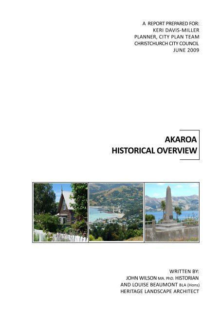
A REPORT PREPARED FOR:<br />
KERI DAVIS-MILLER<br />
PLANNER, CITY PLAN TEAM<br />
CHRISTCHURCH CITY COUNCIL<br />
JUNE 2009<br />
AKAROA<br />
HISTORICAL OVERVIEW<br />
WRITTEN BY:<br />
JOHN WILSON MA. PhD. HISTORIAN<br />
AND LOUISE BEAUMONT BLA (Hons)<br />
HERITAGE LANDSCAPE ARCHITECT
TABLE OF CONTENTS:<br />
Section One<br />
<strong>Overview</strong> …..................................................... 1 - 4<br />
Report context …...................................................... 1 - 2<br />
Background …........................................................... 2<br />
Executive summary and report summary …............. 2 - 3<br />
Authorship …............................................................ 3<br />
Acknowledgments ….................................................3 - 4<br />
Illustrations …............................................................4<br />
Section Two<br />
Introduction …................................................ 5 – 6<br />
Section Three<br />
Landscape and Human History to 1840 …........ 7 – 12<br />
Landscape and Human History …......….....................7 - 11<br />
Extant town fabric & features from 1840 …..............12<br />
Section Four<br />
The French Village 1840 to 1850 ..................... 13 – 32<br />
The French Village ….................................................13 - 30<br />
Snapshot of <strong>Akaroa</strong> in 1850 …...................................31<br />
Extant town fabric & features from 1840 …..............32<br />
Section Five<br />
The Colonial Town 1850 to 1900..................... 33 – 84<br />
The Colonial Town ….................................................33 - 80<br />
Snapshot of <strong>Akaroa</strong> in 1900 …...................................81<br />
Extant town fabric & features from 1850 …..............82 - 84<br />
Section Six<br />
Years of Stability 1900 to 1950.........................85 – 126<br />
Years of Stability ….................................................... 85 - 123<br />
Snapshot of <strong>Akaroa</strong> in 1950 …...................................124<br />
Extant town fabric & features from 1900 …..............125 - 126<br />
Section Seven<br />
Change and Growth 1950 to 2009 ...................127 – 176<br />
Change and Growth ..................................................127 - 172<br />
Snapshot of <strong>Akaroa</strong> in 2009 …...................................173 - 174<br />
Extant town fabric & features from 1950 …..............175 - 176<br />
Section Eight<br />
Endmatters .................................................... 177 – 183<br />
Section Nine<br />
Appendices ….................................................. 184 – 213
LIST OF FIGURES:<br />
Section 2: Introduction<br />
Figure 2.1. <strong>Akaroa</strong> from Brasenose, 2009 …................................................................. page 6<br />
Section 3: Landscape & Human History to 1840<br />
Figure 3.1. Whaling try pots, 2009 ….......................................................................... page 11<br />
Section 4: The French Village 1840 to 1850<br />
Figure 4.1. Bruce Hotel late 19 th century …................................................................. page 16<br />
Figure 4.2. Captain Lavaud's cottage …........................................................................... page 18<br />
Figure 4.3. Emeri de Malmanche cottage ..................................................................... page 18<br />
Figure 4.4. Elie Bouriaud house ...................................................................................... page 18<br />
Figure 4.5. Rue Balguerie cottage, 2009 ..................................................................................... page 20<br />
Figure 4.6. Early French settler dwelling …..................................................... page 25<br />
Figure 4.7. First Bruce Hotel, 1849 .................................................................................... page 26<br />
Figure 4.8. Bouriaud house and landscape…..........................................................................................<br />
page 26<br />
Figure 4.9. The French Cemetery …........................................................................................ page 27<br />
Figure 4.10. 1850 map of town landmarks............................................................................... page 28<br />
Figure 4.11. Map showing French town centre layout............................................... page 29<br />
Figure 4.12. Plan showing sections occupied by French settlers............................... page 30<br />
Figure 4.13. 1853 sketch of <strong>Akaroa</strong> ….......................................................................... page 31<br />
Section 5: The Colonial Town 1850 to 1900<br />
Figure 5.1. The north end of <strong>Akaroa</strong> in the mid 1860s ….................................................. page 33<br />
Figure 5.2. View of <strong>Akaroa</strong>, 1870s …....................................................................................... page 35<br />
Figure 5.3. Postcard view of <strong>Akaroa</strong>, 1881 .................................................................. page 36<br />
Figure 5.4. Curate's Cottage, Alymer Valley Road, 2009 …........................................................ page 38<br />
Figure 5.5. Historic cottage, Bruce Terrace and Aubrey Street, 2009 ….................................... page 38<br />
Figure 5.6. Surviving 19 th century Rue Jolie cottage, 2009 ….................................................... page 38<br />
Figure 5.7. Former Presbyterian manse, Rue Balguerie, 2009 …............................................... page 38<br />
Figure 5.8. Glencarrig, Rev. Alymer's house …..................................................................... page 40<br />
Figure 5.9. Linton, Rue Balguerie, 2009 ...........................................…..........................................<br />
page 40<br />
Figure 5.10. Oinako, Etienne X. Le Lievre's house …......................................................... page 41<br />
Figure 5.11. The Glen …..................................................................................................... page 41<br />
Figure 5.12. Latter's Store at the base of the original town wharf …............................... page 43<br />
Figure 5.13. T. E. Taylor's warehouse and storehouse ….............................................. page 43<br />
Figure 5.14. 19 th century view of Rue Balguerie …............................................................ page 45<br />
Figure 5.15. Postcard view of <strong>Akaroa</strong>'s Beach Road frontage …..................................... page 45
Figure 5.16. Criteron Hotel …........................................................................................ page 46<br />
Figure 5.17. View looking down Rue Lavaud, 1870s …........................................................ page 47<br />
Figure 5.18. Late 19 th century or early 20 th century view of Rue Lavaud …..........................<br />
page 647<br />
Figure 5.19. The 1890s Shipping Office building, 2009 …...............................................................<br />
page 48<br />
Figure 5.20. Post card view of Criterion Hotel and Rue Lavaud........................................... page 51<br />
page 11<br />
Figure 5.21. Town Hall, one of <strong>Akaroa</strong>'s early public buildings …........................................ page 52<br />
Figure 5.22. Literary and Scientific Institute, now the Coronation Library …..................... page 52<br />
Figure 5.23. View of the Court house, now part of the <strong>Akaroa</strong> Museum ….......................<br />
page 16 53<br />
Figure 5.24. Upper end of Rue Jolie ca 1890s ….............................................................<br />
page 18 54<br />
Figure 5.25. Borough School on the site of today's War Memorial …..............................<br />
page 18 56<br />
Figure 5.26. <strong>Akaroa</strong>'s first substantial wharf …....................................................................<br />
page 18 60<br />
Figure 5.27. Wharf at the southern end of <strong>Akaroa</strong> …........................................................<br />
page 20 60<br />
Figure 5.28. View of two wharves..........................................................................................<br />
page 25 61<br />
Figure 5.29. Beach Road promenade.......................................................................................<br />
page 26 62<br />
Figure 5.30. 1866 sketch of the north end of <strong>Akaroa</strong>......................................................<br />
page 26 64<br />
Figure 5.31. Ornamental grounds of Blythcliffe..............................................................<br />
page 27 66<br />
Figure 5.32. Approach to Dr Watkins home on Walnut Avenue…..........................<br />
page 28 67<br />
Figure 5.33. Percy Street …....................................................................................................<br />
page 29 67<br />
Figure 5.34. Sketch of building on Charles Haylock's property.............................................<br />
page 64 69<br />
Figure 5.35. Garden at The Glen .......................................................................................<br />
page 65 70<br />
Figure 5.36. Haylock House, now <strong>Akaroa</strong> House, 2009........................................................<br />
page 65 70<br />
Figure 5.37. Hughes Family Hotel …...................................................................................<br />
page 67 72<br />
Figure 5.38. Lover's Walk, Beach Road …....................................................................<br />
page 68 73<br />
Figure 5.39. Domain summerhouse …......................................................................<br />
page 68 76<br />
Figure 5.40. The Domain …...............................................................................................<br />
page 70 76<br />
Figure 5.41. Green's Point Memorial before 1926 ..........................................................<br />
page 39 77<br />
Figure 5.42. Green's Point Memorial with wirewove fence....................................................<br />
page 39 77<br />
Figure 5.43. Map showing Maori place names around <strong>Akaroa</strong> harbour.......................................<br />
page 40 79<br />
Figure 5.44. Plan of the town 1852 – 1856.….......................................................................................<br />
page 40 80<br />
Figure 5.45. Bruce Hotel 1890s ..................................................................................<br />
page 42 81<br />
page 42<br />
Section 6: Years of Stability 1900 to 1950<br />
page 44<br />
Figure 6.1. View of Settler's Hill subdivision, 2009................…............................................. page 86<br />
page 44<br />
Figure 6.2. View of north end of <strong>Akaroa</strong> just before WW1 …........................................... page 88<br />
page 45<br />
Figure 6.3. 1914 view of the north end of <strong>Akaroa</strong> …........................................................ page 89<br />
page 57<br />
Figure 6.4. Metropole Hotel …........................................................................................... page 91<br />
page 59<br />
Figure 6.5. Late 19 th century view of the Bruce Hotel ….................................................. page 92<br />
page 61<br />
Figure 6.6. Ilfracombe on Beach Road …...................................................................... page 92<br />
page 78<br />
page 79
Figure 6.7. <strong>Akaroa</strong> beach before WW ll................................................................................ page 94<br />
Figure 6.8. Early 20 th century view of <strong>Akaroa</strong>'s southern end........................................ page 97<br />
Figure 6.9. Bank of New Zealand, 2009 …........................................................................................<br />
page 97<br />
Figure 6.10. 1940 Centennial celebrations ….............................................................................. page 98<br />
Figure 6.11. View north up Rue Lavaud............................................................................. page 99<br />
Figure 6.12. <strong>Akaroa</strong>'s Post Office................................................................................... page 99<br />
Figure 6.13. <strong>Akaroa</strong>'s new hospital …............................................................................ page 100<br />
Figure 6.14. Service cars outside Illfracombe …............................................................. page 102<br />
Figure 6.15. Orion Power House Gallery, 2009 …........................................................................ page 104<br />
Figure 6.16. The <strong>Akaroa</strong> sea bath ….................................................................................. page 106<br />
Figure 6.17. Pleasure cruises on the harbour.................................................................... page 106<br />
Figure 6.18. View of the Domain …........................................................................................... page 107<br />
Figure 6.19. Britomart Reserve 1908 …......................................................................... page 108<br />
Figure 6.20. Recently planted Norfolk Pines................................................................ page 109<br />
Figure 6.21. Britomart Reserve …................................................................................... page 109<br />
Figure 6.22. Views of <strong>Akaroa</strong>'s cemetery, 2009......................................................... page 110<br />
Figure 6.23. The French Cemetery in 1926 ….................................................................... page 112<br />
Figure 6.24. The French Cemetery in 1940 …................................................................. page 112<br />
Figure 6.25. The War Memorial Garden in the 1930s …............................................ page 113<br />
Figure 6.26. Contemporary view of the War Memorial Garden, 2009................................ page 113<br />
Figure 6.27. Green's Point Monument, 2009 …............................................................................<br />
page 114<br />
Figure 6.28. Culvert referencing the 1940 centennial …..................................................... page 115<br />
Figure 6.29. Stone edging border, Beach Road................................................................ page 115<br />
Figure 6.30. Stone edging border remnant, Beach Road, 2009......................................................<br />
page 115<br />
Figure 6.31. Orion Powerhouse Museum fountain, 2009 ….................................................................<br />
page 117<br />
Figure 6.32. Commemorative planting and plaque, Garden of Tane….....................................................<br />
page 118<br />
Figure 6.33. Walnut growing in <strong>Akaroa</strong> in 1910.............................................................................<br />
page 119<br />
Figure 6.34. Alymer Valley Road ….................................................................................... page 120<br />
Figure 6.35. The de Malmanche house …................................................................... page 121<br />
Figure 6.36. The Narbey family home ca 1910........................................................... page 122<br />
Figure 6.37. Lavaud Street garden …........................................................................ page 122<br />
Figure 6.38. Percy Street hedges 2009 ….................................................................. page 123<br />
Figure 6.39. Remnant fence fabric, Percy Street ….................................................. page 123<br />
Figure 6.40. 1920s wirewove fence Rue Balguerie …............................................... page 123<br />
Section 7: Change and Growth 1950 to 2009<br />
Figure 7.1. Aerial view of <strong>Akaroa</strong>, early 1960s............................................................ page 128<br />
Figure 7.2. View of the north end of <strong>Akaroa</strong> in the 1950s ….................................... page 128
Figure 7.3. The <strong>Akaroa</strong> Village, late 20 th century holiday accommodation................................................<br />
page 130<br />
Figure 7.4. The new Garthowen …............................................................................... page 132<br />
Figure 7.5. Commercial buildings, Beach Road, 1980s ….......................................... page 133<br />
Figure 7.6. Aerial view of <strong>Akaroa</strong> ca 1950/1960 …......................................................... page 138<br />
Figure 7.7. Aerial view of <strong>Akaroa</strong> late 1950s or early 1960s …................................... page 139<br />
Figure 7.8. The Glen subdivision, 2009 …................................................................................... page 140<br />
Figure 7.9. View of Selwyn Avenue …...............................................................................................<br />
page 141<br />
Figure 7.10. Houses in Selwyn Avenue, 2009 …..............................................................................<br />
page 141<br />
Figure 7.11. View from L'Aube Hill, 2009.................................................................................... page 142<br />
Figure 7.12. <strong>Akaroa</strong> camping ground, Rue Balguerie..................................................... page 143<br />
Figure 7.13. Bach at the base of Dalys Wharf................................................................... page 145<br />
Figure 7.14. Beach Road holiday house.............................................................................. page 146<br />
Figure 7.15. W. H. Trengrove designed house, Beach Road............................................ page 146<br />
Figure 7.16. David Brocherie designed units, Beach Road............................................. page 147<br />
Figure 7.17. The Aubrey Mews …............................................................................................. page 148<br />
Figure 7.18. Hillside units behind the Gaiety Theatre …..................................................... page 150<br />
Figure 7.19. Clearing for new subdivision below Stanley Park......................................... page 151<br />
Figure 7.20. Redeveloped Beach Road waterfront ….................................................... page 151<br />
Figure 7.21. View of one of <strong>Akaroa</strong>'s largest houses............................................................... page 152<br />
Figure 7.22. The Haylock house, 2009 …...................................................................................... page 153<br />
Figure 7.23. Nikau Cottage …............................................................................................. page 153<br />
Figure 7.24. Rue Balguerie home ….............................................................................. page 154<br />
Figure 7.25. School gymnasium ….................................................................................. page 157<br />
Figure 7.26. General view of <strong>Akaroa</strong> from Children's Bay, 2008 …...............................................<br />
page 159<br />
Figure 7.27. General view of <strong>Akaroa</strong> from Lighthouse Road , 2008 …...................................... page 159<br />
Figure 7.28. 1955 subtropical garden …............................................................................... page 161<br />
Figure 7.29. The Giant's House, Linton ….......................................................................... page 161<br />
Figure 7.30. Examples of <strong>Akaroa</strong> gardens, 2009 …...................................................................... page 162<br />
Figure 7.31. Norfolk Island Pine, Alymer's Valley Road, 2009..................................................... page 164<br />
Figure 7.32. Significant pines in the Garden of Tane, 2009 .....................................................................<br />
page 164<br />
Figure 7.33. Horse in the Garden of Tane playground, 2009................................................... page 166<br />
Figure 7.34. Contemporary view into the Garden of Tane, 2009 …...................................... page 166<br />
Figure 7.35. Garden of Tane entrance signage, 2009 …............................................................ page 166<br />
Figure 7.36. Rose, <strong>Akaroa</strong> cemetery, 2009 …........................................................................... page 167<br />
Figure 7.37. Guide map of <strong>Akaroa</strong> 1965................................................................................ page 170<br />
Figure 7.38. 1972 Map of <strong>Akaroa</strong> …......................................................................... page 171<br />
Figure 7.39. A3 Map showing 1999 NZHPT Historic area ....................................... page 172<br />
Figure 7.40. Garden, Rue Balguire, 2009 ................................................................................ page 174
Figure 7.41. View of hillside vegetation 2009...…..............................................<br />
page 174<br />
Section 9: Appendices<br />
Appendix 1. Aerial view of <strong>Akaroa</strong>, early 1960s................................................................. page 183<br />
Appendix 2. DP6472................................................................................................................. page 184<br />
Appendix 3. DP10471......................................................................................................... page 185<br />
Appendix 4. DP10661......................................................................................................... page 186<br />
Appendix 5. DP12926.............................................................................................................. page 187<br />
Appendix 6. DP13113......................................................................................................... page 188<br />
Appendix 7. DP illegible number …................................................................................ page 189<br />
Appendix 8. DP17209 …....................................................................................................... page 190<br />
Appendix 9. DP19708 …........................................................................................................ page 191<br />
Appendix 10. DP22246 …......................................................................................................... page 192<br />
Appendix 11. DP34983 …...................................................................................................... page 193<br />
Appendix 12. DP15299............................................................................................................... page 194<br />
Appendix 13. DP21002 ….................................................................................................... page 195<br />
Appendix 14. DP27893 …...................................................................................................... page 196<br />
Appendix 15. DP39601 …....................................................................................................... page 197<br />
Appendix 16. DP48640 …...............................................................................................................<br />
page 198<br />
Appendix 17. DP21004 …................................................................................................ page 199<br />
Appendix 18. DP41742................................................................................................. page 200<br />
Appendix 19. DP29050 …............................................................................................... page 201<br />
Appendix 20. DP31001 …...................................................................................................... page 202<br />
Appendix 21. DP20274.................................................................................................. page 203<br />
Appendix 22. DP45046 …............................................................................................ page 204<br />
Appendix 23. DP49696 …........................................................................................................ page 205<br />
Appendix 24. DP43488 ….............................................................................................. page 206<br />
Appendix 25. CT13F/1085 …............................................................................................... page 207<br />
Appendix 26. DP20232 …................................................................................................ page 208<br />
Appendix 27. DP13098 ….................................................................................................... page 209<br />
Appendix 28. DP17085 …................................................................................................ page 210<br />
Appendix 29. DP41124............................................................................................... page 211<br />
Appendix 30. DP52439 ….................................................................................................. page 212
AKAROA:<br />
AN HISTORICAL OVERVIEW<br />
Section 1<br />
OVERVIEW
SECTION ONE: OVERVIEW<br />
Report Context<br />
This report was commissioned in September 2008 by Keri Davis-<br />
Miller, Planner, <strong>City</strong> Plan Team, <strong>Christchurch</strong> <strong>City</strong> <strong>Council</strong>.<br />
“<strong>Akaroa</strong> has the highest<br />
density of registered<br />
historic buildings<br />
anywhere in the country,<br />
surpassing even the<br />
historic towns of Russell<br />
and Arrowtown.<br />
Even by this rather clinical<br />
measure, <strong>Akaroa</strong> is a very<br />
special place”<br />
<strong>Akaroa</strong> Civic Trust Newsletter,<br />
November 2008<br />
Based on the original request for quotation and subsequent<br />
discussions it was agreed that the report would provide a general<br />
historical account of change and development in the built and<br />
landscape forms and environment of <strong>Akaroa</strong>, a preliminary<br />
identification of extant heritage fabric, a tentative list of themes<br />
that could assist with the later identification and assessment of<br />
individual heritage items (of all classes) and a tentative definition of<br />
the boundaries of discrete parts of <strong>Akaroa</strong> that could become<br />
conservation areas, for which provisions under the District Plan to<br />
protect those areas from adverse developments would be<br />
developed.<br />
The need was not for a general history of <strong>Akaroa</strong> but for a<br />
systematic presentation of historical information relating to the<br />
town’s development that would assist later identification of specific<br />
heritage items and of general characteristics of the town which<br />
would enable protection policies and measures to be developed for<br />
eventual inclusion in the District Plan.<br />
The authors were advised that the <strong>Council</strong> intended to commission<br />
a separate report on the Maori history and heritage of <strong>Akaroa</strong> and<br />
were instructed to deal in only a summary manner with the town’s<br />
history and heritage prior to the arrival of Europeans.<br />
The authors were requested to set <strong>Akaroa</strong>’s surviving heritage<br />
fabric, features and items in the context of a general account of the<br />
town’s development and to note their distribution through the<br />
built-up area of the town. They were also to identify other features<br />
of <strong>Akaroa</strong> (particularly its broader setting) which contribute to the<br />
present character of the town.<br />
It was also understood that the report should provide a framework<br />
for, and contribute information to, a possible contextual historical<br />
overview for all of Banks Peninsula.<br />
The report was not to attempt any assessment of the relative<br />
significance of individual heritage items or of potential<br />
conservation areas or to set any priorities for the preservation or<br />
protection of individual heritage items or potential conservation<br />
areas.<br />
AKAROA HERITAGE OVERVIEW : SECTION 1 OVERVIEW PAGE 1
The authors were not to evaluate any of the listings of individual buildings or features in<br />
the current Banks Peninsula District Plan 1 or to propose additions to the lists.<br />
Because of constraints of time and resources, the authors were instructed that this<br />
report was to be based mainly on research in secondary and printed sources and on<br />
extensive but not systematic or complete examination of the entire town. Although the<br />
authors have identified and listed all the extant heritage items and features for which<br />
there is already some documentation in various histories, reports etc., some features or<br />
items that should be protected or preserved are not mentioned in this report. A<br />
comprehensive identification of all extant heritage fabric will only be possible when (to<br />
identify the two gaps which struck each of the authors as most serious) research into<br />
<strong>Akaroa</strong>’s 20 th century domestic architecture has been completed and a detailed inventory<br />
of surviving heritage trees and other landscape fabric has been made. One of the report’s<br />
recommendations is, accordingly, that this additional historical research and preparation<br />
of full inventories be undertaken in parallel with the further reports concerning <strong>Akaroa</strong>’s<br />
heritage and character which the <strong>Council</strong> is to commission.<br />
Background<br />
This report is part of an ongoing effort by the <strong>Christchurch</strong> <strong>City</strong> <strong>Council</strong> to devise policies<br />
and strategies that will protect <strong>Akaroa</strong>’s historic character and individual heritage items<br />
in the town. It was understood by the authors of the report that the ultimate goal of the<br />
full exercise was to establish whether there should be a variation to the District Plan to<br />
ensure that effective measures (strategies, policies and rules) are in place to protect the<br />
existing character of <strong>Akaroa</strong> and buildings, structures, trees and other items assessed as<br />
being of heritage interest or worth.<br />
The report has been preceded by an <strong>Akaroa</strong> Streetscapes Report, 2006, prepared by<br />
Robyn Burgess, Opus International Consultants.<br />
At the time this report was being completed, the <strong>Council</strong> commissioned from Boffa<br />
Miskell an <strong>Akaroa</strong> Character Study which is to examine the character of <strong>Akaroa</strong> in great<br />
depth, to take the consideration of conservation areas further and to include a rewriting<br />
of the present Design Guidelines which have been one of the tools the <strong>Council</strong> has been<br />
using to protect <strong>Akaroa</strong>’s existing character. This report has also been completed at the<br />
time the <strong>Council</strong> is engaged in consulting the public on an <strong>Akaroa</strong> Harbour Basin<br />
Settlements Study. A further report was also about to be commissioned at the time this<br />
report was being completed on heritage conservation areas in <strong>Akaroa</strong>.<br />
Executive summary<br />
This report provides the required general historical account of change and development<br />
in <strong>Akaroa</strong> from before 1840 (the year in which the present town was founded) up to the<br />
present. The emphasis in the report is on the surviving heritage of <strong>Akaroa</strong>.<br />
1 The Banks Peninsula District Plan has two lists of buildings, objects and sites . The first list (Appendix IV<br />
Schedule of Protected Buildings, Objects and Sites) includes all those items in <strong>Akaroa</strong> which have been<br />
registered by the New Zealand Historic Places Trust and the second (Appendix V Schedule of Notable<br />
Buildings, Objects and Sites) items which are considered worthy of preservation but have not been<br />
registered by the New Zealand Historic Places Trust.<br />
AKAROA HERITAGE OVERVIEW : SECTION 1 OVERVIEW PAGE 2
It draws particular attention to what remains in <strong>Akaroa</strong> which reflects its history, but also<br />
highlights developments and changes for which there is little or no tangible evidence<br />
remaining in the town but which have to be understood in order to understand how the<br />
town acquired its present character. At the end of each section, a preliminary<br />
identification of extant heritage fabric (including buildings, structures, fences, trees,<br />
other individual plants and landscape fabric) is provided, but these lists are not<br />
exhaustive (for the reasons explained above under the heading Report objectives and<br />
limitations). At the end of the report are a tentative list of themes intended to guide the<br />
future identification of items of heritage interest in <strong>Akaroa</strong> and recommendations, based<br />
on the understanding of <strong>Akaroa</strong>’s history which has emerged from this study, about the<br />
defining of conservation areas in <strong>Akaroa</strong> and the protection of individual surviving<br />
heritage items.<br />
The main body of the report is chronological. The founding of the town of the <strong>Akaroa</strong> and<br />
its first decade of life as a predominantly French village are described in section 1. The<br />
history of the town is then presented in three ‘bites’, covering approximately 50 years<br />
each. Through each of these 50-year periods, <strong>Akaroa</strong> developed in distinct ways which<br />
were different for each period. The years 1850-1900 were characterised by significant<br />
growth and expansion, the loss of the forest cover from the surrounding hills and the<br />
establishment of the gardens and orchards that for long set the town’s character. In the<br />
following 50 years, 1900-1950, the town grew relatively little, in terms of buildings and<br />
population, but changed significantly in terms of its plantings and physical appearance. In<br />
the last half of the 20 th century, 1950-2000, the number of dwellings in the town<br />
expanded significantly while the permanent population grew only slowly. Pressures of<br />
development, largely arising from the wish of residents of <strong>Christchurch</strong> to have holiday<br />
homes in what was well-established in previous decades as one of Canterbury’s premier<br />
resort towns, both changed the town’s physical character and provoked sometimes<br />
heated discussion about the town’s future.<br />
At the end of the section on ‘French <strong>Akaroa</strong> and of the sections covering each of the<br />
following 50-year periods, are “snapshots” of <strong>Akaroa</strong> in 1850, 1900, 1950 and 2000.<br />
These have been included to summarise the historical information presented in each of<br />
the sections and to give a quick “overview” of the changes recounted in detail in each of<br />
the sections.<br />
Authorship<br />
The authors of this report are Louise Beaumont, heritage landscape architect and John<br />
Wilson, historian. Each author wrote their separate sections of the report. John Wilson<br />
edited the combined texts and Louise Beaumont designed the format and laid out the<br />
report.<br />
Acknowledgements<br />
The authors’ main debts are to the staff of the <strong>Akaroa</strong> Museum (Lynda Wallace, Director,<br />
Patsy Turner and Cotrina MacLeod). Without their making the resources of the Museum<br />
readily available, responding promptly and fully to all manner of specific enquiries and<br />
putting their knowledge of photographs and other depictions of <strong>Akaroa</strong> at the disposal of<br />
the authors, the authors could not have written such a full report in the time available.<br />
AKAROA HERITAGE OVERVIEW : SECTION 1 OVERVIEW PAGE 3
Assistance was also readily forthcoming from the staffs of the Aotearoa New Zealand<br />
Centre, <strong>Christchurch</strong> <strong>City</strong> Libraries, of the Documentary Research Centre, Canterbury<br />
Museum, of the Alexander Turnbull Library and the Pictorial Collection Library, Te Papa<br />
Tongarewa, Museum of New Zealand and the Pictorial Collections Department, National<br />
Library of Australia, Canberra.<br />
Jeff Pyle also made his postcard collection available for reference and illustrations, for<br />
which the authors are most appreciative.<br />
John Wilson would also like to acknowledge his debt to Victoria Andrews and Peter<br />
Beaven for stimulating discussion about <strong>Akaroa</strong>’s development and its character.<br />
The authors are also grateful to Keri Davis-Miller, Planner, <strong>City</strong> Plan Team, <strong>Christchurch</strong><br />
<strong>City</strong> <strong>Council</strong>, who commissioned the report and was understanding when they<br />
encountered difficulties meeting the initial deadlines for its completion, and to Amanda<br />
Ohs, Heritage Planner, Policy and Planning Team, Strategy and Planning Group,<br />
<strong>Christchurch</strong> <strong>City</strong> <strong>Council</strong>, who offered useful critique on drafts and who organised the<br />
supply of certificates of title and deposited plans which John Wilson needed to trace the<br />
history of subdivisions in <strong>Akaroa</strong>.<br />
Pictorial illustrations<br />
Unless otherwise indicated all historical images used in this report are from the collection<br />
of the <strong>Akaroa</strong> Museum.<br />
Ashley Curtis contributed his skills as a photographer to the illustration of the report and<br />
other contemporary images are the work of Louise Beaumont.<br />
AKAROA HERITAGE OVERVIEW : SECTION 1 OVERVIEW PAGE 4
AKAROA:<br />
AN HISTORICAL OVERVIEW<br />
Section 2<br />
INTRODUCTION
SECTION TWO: INTRODUCTION<br />
Introduction<br />
<strong>Akaroa</strong> is a town of special historic interest and architectural<br />
significance. The special historic interest stems from its having<br />
been founded as the only organised French settlement in New<br />
Zealand. The architectural significance derives from the survival in<br />
<strong>Akaroa</strong> of a larger number of 19 th century buildings than have<br />
survived in other New Zealand towns of comparable size. <strong>Akaroa</strong>’s<br />
character is set by older buildings to an extent greater than is the<br />
case for any other New Zealand town. The February 1999<br />
designation by the Historic Places Trust of the <strong>Akaroa</strong> Historic Area<br />
was recognition of <strong>Akaroa</strong>’s unique early history and of its<br />
remarkable collection of historic buildings. 1<br />
“A desirable place to live<br />
and an attractive<br />
place to visit.”<br />
<strong>Akaroa</strong> Design Guidelines,<br />
October 2007<br />
The fact that <strong>Akaroa</strong> was founded by settlers sent out by a French<br />
colonising company has misled some into thinking that <strong>Akaroa</strong><br />
today has a French character. But the 19 th and early 20 th century<br />
buildings that set <strong>Akaroa</strong>’s character are of a “Colonial Vernacular”<br />
style that owes more to British than to French precedents.<br />
It was also recognised from the 19 th century that the town’s<br />
character depended as much on its wider setting, especially that it<br />
was a small town set in a dramatic landscape of harbour and hills,<br />
as on its buildings. The existence of gardens and orchards within<br />
the built up area of <strong>Akaroa</strong> has been a key element of its character<br />
since the 19 th century.<br />
This report presents a chronological history of the development of<br />
<strong>Akaroa</strong>’s built environment, gardens and public open spaces and of<br />
changes in its streetscapes and landscapes.<br />
The report is not a full history of <strong>Akaroa</strong>. It focuses on the remaining<br />
physical record of different periods of the town’s history and of<br />
different activities and developments that were important in<br />
determining the town’s physical character today. One aim has<br />
been to establish the extent to which the surviving historic buildings<br />
and its present street- and landscapes reflect all or most key aspects<br />
of <strong>Akaroa</strong>’s history.<br />
A special place<br />
The belief that <strong>Akaroa</strong> is a special place is deeply rooted. When<br />
Lord Lyttelton visited the town in 1868 (travelling from<br />
<strong>Christchurch</strong> via Pigeon Bay and crossing the intervening range to<br />
<strong>Akaroa</strong> Harbour) he noted that <strong>Akaroa</strong> had “a singular charm.<br />
1 <strong>Akaroa</strong> Streetscapes Report, p. 2<br />
AKAROA HERITAGE OVERVIEW : SECTION 2 INTRODUCTION PAGE 5
It had the appearance of remoteness and isolation from all mankind.” His son observed<br />
that if ever he was crossed in love he would return to <strong>Akaroa</strong> to repair the damage. 2<br />
Although the belief is deeply rooted, opinions why <strong>Akaroa</strong> is special have changed over<br />
the years. Some of these changes in what have been considered the special features of<br />
<strong>Akaroa</strong> are traced in this report. It has, for example, lost some of the sense of<br />
remoteness and isolation from all mankind that Lord Lyttelton considered the main<br />
element of its “singular charm”. The town’s historic character has, understandably, come<br />
to be regarded as a more important element in the town’s special character as years<br />
have passed.<br />
One constant feature in people’s understanding of what makes the town special is its<br />
setting, on the edge of a magnificent harbour, surrounded by high, craggy hills (refer<br />
figure 2.1). <strong>Akaroa</strong> has also been appreciated by successive generations for the generous<br />
gardens and notable trees that have been typical of a town with, until recently, a low<br />
density of development.<br />
The question of the extent to which the special character of <strong>Akaroa</strong> today can be linked<br />
to its founding by French settlers in 1840 is given detailed consideration in this report<br />
because the emphasis on its supposed French character or even on its French origins has<br />
tended to obscure that the town is special for other reasons.<br />
The best summary of what constitutes <strong>Akaroa</strong>’s historic character today emerged during<br />
discussions and consultation in the early 21 st century on design guidelines for the town.<br />
The town’s historic character was defined as “the visual and aesthetic impact that results<br />
from the relationship between a wide range of authentic old buildings, and the impact of,<br />
and the relationship they have to, the space around them, adjoining buildings and the<br />
streetscape”. 3<br />
Figure 2.1. General view of <strong>Akaroa</strong> from top of Brasenose photographed 2009.<br />
2 New Zealand Motor World, July 1953<br />
3 <strong>Akaroa</strong> Streetscapes Report, pp. 2-3<br />
AKAROA HERITAGE OVERVIEW : SECTION 2 INTRODUCTION PAGE 6
AKAROA:<br />
AN HISTORICAL OVERVIEW<br />
Section 3<br />
LANDSCAPE & HUMAN HISTORY TO 1840<br />
“The luxuriant vegetation that everywhere<br />
fringed the inlets, showed that the soil was of<br />
exceeding fruit-fullness, the mighty pines that<br />
towered above their meaner fellows gave<br />
promise of a vast supply of timber, whilst the<br />
innumerable Kakas, pigeons, and other native<br />
birds, that woke the echoes of the bush with<br />
their harmonies discords, and the fish that<br />
swarmed in the waters of the bay...”
SECTION THREE: LANDSCAPE & HUMAN HISTORY TO 1840<br />
Geomorphology<br />
The town of <strong>Akaroa</strong> sits within the eroded crater of an extinct<br />
volcano which once towered 3000 metres above sea level and<br />
dominated the coastline. Following a series of eruptions spanning<br />
many millions of years the cone was eroded to the point where the<br />
sea gained ingress. This flooding of the crater formed <strong>Akaroa</strong>'s<br />
deep and sheltered harbour. 1<br />
“The harbour of<br />
<strong>Akaroa</strong> is an estuary<br />
forming a basin which<br />
extends about eight<br />
miles into a Peninsula,<br />
and is surrounded by<br />
very high mountains,<br />
precipitous at the<br />
entrance, and very<br />
narrow, but as you<br />
advance, the<br />
mountains gradually<br />
slope into a succession<br />
of hills clothed in<br />
verdure and timber to<br />
their summits and<br />
abounding in streams<br />
of excellent water”.<br />
Major Bunbury,<br />
June 28, 1840<br />
The remains of the <strong>Akaroa</strong> volcano are a characteristic caldera form<br />
with the rim in a remarkable state of preservation. Prominent peaks<br />
rise to above 600 metres with one, Flag Peak, rising immediately<br />
above <strong>Akaroa</strong> township. 2<br />
Vegetation<br />
Prior to the impact of people, Banks Peninsula was dominated by<br />
species-rich indigenous forest, the exceptions to this being areas of<br />
steep, exposed rocky ground and wetlands. The specifics of this<br />
predominantly podocarp/hardwood forest have been well<br />
documented by Hugh Wilson and the following is a summary from<br />
one of his detailed papers on the subject. The tallest, grandest<br />
forest occupied the valley floors. This was dense podocarp forest<br />
with kahikatea as the principal species. Similar species dominated<br />
the lower slopes; however, there lowland totara and matai were<br />
more common than kahikatea. On the upper slopes totara,<br />
broadleaf and other shrubby hardwoods and tree ferns occurred.<br />
Near the coast, warmth-demanding species such as ngaio, nikau<br />
palm, akeake, titoki, native passion vine and shining broadleaf<br />
were common. On the highest bluffs the shrubland and scrub of<br />
non-forest montane species, including snow tussock, fescue<br />
tussock, Dracophyllum and mountain flax, predominated. 3<br />
Wilson notes that probably as much as three quarters of the area<br />
was still under old growth forest when the Europeans arrived to<br />
settle, the other quarter having been fired and cleared by Maori as<br />
part of their traditional cultivation practices. 4<br />
Rumours of this country's rich marine mammals drew sealers and<br />
whalers to the shores of New Zealand from the 1790s. <strong>Akaroa</strong><br />
Harbour (as discussed below) became a favourite port of call for<br />
European and American whalers.<br />
1 Lowndes, Akaro: a short history<br />
2 Speight, Transactions and Proceedings of the Royal Society of New Zealand, vol. 74, pp. 232-237<br />
3 Wilson, The Natural and Human History of <strong>Akaroa</strong> and Wairewa Counties, p. 12<br />
4 Wilson, Banks Ecological Region: Protected Natural Areas Programme Survey Report No 21, p. 28<br />
AKAROA HERITAGE OVERVIEW : SECTION 3 LANDSCAPE & HUMAN HISTORY TO 1840 PAGE 7
However detailed descriptions of <strong>Akaroa</strong> were not forthcoming until the period just prior<br />
to the arrival of the English Britomart and the French L'Aube and Comte de Paris in<br />
August 1840.<br />
Settler descriptions of the forest into the 1860s suggest that in physical terms it was<br />
dense, vigorous and, according to one visitor, “looked as if the plants had interwoven<br />
themselves into a mass for the purpose of resisting all intruders”. 5 Trees were described<br />
as being of extraordinary proportions and the enormity of their girth was still the focus of<br />
newspaper stories up until the 1860s, with one totara discovered on the bridle track to<br />
<strong>Akaroa</strong> measuring 37 feet in circumference. 6 An even larger totara was described by the<br />
John Piper of the Cumberland Mill who recorded a felled tree with a girth just short of 66<br />
feet. 7<br />
Bird and invertebrate life was similarly rich. Descriptions by many settlers record the<br />
density of birds living in the forest. One early Peninsula settler reminisced about “the<br />
darkening of the sky” when huge flocks of kereru (wood pigeon) came to feed on the<br />
matai, kahikatea and miro berries. 8<br />
The early European response to this largely unmodified natural landscape was<br />
documented in memoirs, official reports and bio-prospecting notes. The descriptions of<br />
<strong>Akaroa</strong> in these various documents reveal a strong aesthetic response to the landscape.<br />
Seen as an example of primitive, picturesque nature, the landscape was also viewed in<br />
terms of its potential economic value and opportunities.<br />
Bunbury, a colonial official, visited <strong>Akaroa</strong> in June 1840 and in his report back to the<br />
Governor, William Hobson, described the setting of <strong>Akaroa</strong> in some detail noting the hills<br />
which he said were “clothed in verdure and timber to their summits and abounding in<br />
streams of excellent water”. Bunbury ended his report by noting, “[t]he country has a<br />
very picturesque and park-like aspect and seems well adapted for farms where both<br />
arable and pasture lands are required”. 9<br />
Two months earlier, two French botanists under the command of Dumont d'Urville<br />
noted, “The pinetree, which furnishes a wood that is much sought after for masts, is<br />
fairly plentiful here. In the forests there are a great many of those tree ferns that give<br />
such charming effect”. 10<br />
Maori settlement in Paka Ariki<br />
The forests of the Peninsula were one feature of the region that made it appealing to<br />
Maori. <strong>Akaroa</strong> is located on the shores of one of many bays around <strong>Akaroa</strong> Harbour.<br />
French Bay was known to the Maori as Paka Ariki, though it is not clear whether the<br />
name was applied to the whole bay or just part of it. 11<br />
5 Muter, Travels and Adventures of an Officer’s wife in India, China and New Zealand, p. 219<br />
6 New Zealand Spectator and Cook Strait Guardian, 7 October 1864, p.3.<br />
7 Piper, quoted in Menzies, Banks Peninsula People and Places<br />
8 Hay, Reminiscences of earliest Canterbury (principally Banks' Peninsula) and its settlers, p. 78<br />
9 Bunbury to Hobson in Jameson, New Zealand, South Australia and New South Wales: a record of recent<br />
travels, p. 321<br />
10 Quoted in Simpson, In Search of New Zealand's Scientific Heritage, p. 66<br />
11 Andersen, Place Names of Banks Peninsula, p. 148<br />
AKAROA HERITAGE OVERVIEW : SECTION 3 LANDSCAPE & HUMAN HISTORY TO 1840 PAGE 8
Paka Ariki seems to have had a less important place in the history of Maori occupation of<br />
the <strong>Akaroa</strong> Harbour Basin in the years immediately preceding European settlement than<br />
other bays, such as Takapuneke and Onuku. Though these bays are close to <strong>Akaroa</strong> and<br />
were the scenes of events that had an impact on the history of the town, their histories<br />
are not covered in this report.<br />
The <strong>Akaroa</strong> Harbour Basin as a whole had a long and important Maori history prior to the<br />
arrival of Europeans and the founding of <strong>Akaroa</strong> in 1840.<br />
The writer of a 1926 editorial in the Press observed that with Cook’s sighting of “Bank’s<br />
Island”, later found to be a peninsula, “so begins our brief history”. 12 In fact <strong>Akaroa</strong><br />
Harbour, if not specifically French Bay, had a long Maori history. Visible from the town is<br />
the peak which was re-named by the French Mount Bossu. Its original name is Tuhiraki,<br />
the name of the ko (digging stick) of Rakaihautu. Rakaihautu, of the Uruao canoe, is<br />
credited with having dug (understood in more prosaic European terms ‘discovered’) the<br />
Southern Lakes. After he had dug out the lakes of the interior, Rakaihautu rejoined the<br />
Uruao at Waihao in South Canterbury and travelled back on it to Banks Peninsula, where<br />
he planted his ko, now identified with the peak Tuhuraki. 13 The visibility of Tuhiraki from<br />
<strong>Akaroa</strong> is one of the most important features of the town’s historic character.<br />
Subsequent to Rakaihautu’s settlement on Banks Peninsula after his exploration of the<br />
South Island, the Peninsula as a whole had one of the largest concentrations of Maori in<br />
Classical times. Traditional oral evidence suggests that Paka Ariki was an important place<br />
of Maori occupation in earlier times. This is substantiated by early European reports of<br />
extensive areas of fern and scrub in Paka Ariki, an indication of Maori gardens in the bay.<br />
But by the mid 1830s, with the Ngai Tahu population of Canterbury seriously depleted by<br />
first the Kai Huanga feuds of the early 19 th century and then the Te Rauparaha raids of<br />
the late 1820s and early 1830s, the nearest Maori settlement of any size to the future<br />
site of <strong>Akaroa</strong> was at Onuku.<br />
By the time Europeans (initially flax traders, followed by whalers) began to frequent<br />
<strong>Akaroa</strong> Harbour in any numbers in the 1820s and 1830s, Maori settlement in the area<br />
was concentrated first at Takapuneke then, after the Brig Elizabeth incident of 1830 and<br />
the sack of Onawe in 1831-32, at Onuku.<br />
Whether there was a Maori settlement of any size in Paka Ariki in the late 1830s,<br />
immediately prior to the arrival of the French settlers, is unclear.<br />
Early European records about the presence of a Maori settlement in Paka Ariki/French<br />
Bay itself in the late 1830s are conflicting. In January 1840, Louis Thiercelin, the doctor on<br />
a visiting French whaling ship, recorded that Maori were living at Onuku. His vessel<br />
anchored off from the Maori settlement there. But when he “went for a walk to the bay,<br />
where the French colonists were to settle a few months later” he found, after passing the<br />
tent in which William Green and his wife were living in Takapuneke, that although in<br />
what became French Bay “the mountains had a gentler slope than those opposite our<br />
berth” they were “covered with forests just as dense and impenetrable”. He ventured a<br />
12 The Press, 28 September 1926<br />
13 Lowndes, Short History, no pagination<br />
AKAROA HERITAGE OVERVIEW : SECTION 3 LANDSCAPE & HUMAN HISTORY TO 1840 PAGE 9
short distance inland into “really primeval virgin forest” and found “not even a track to<br />
signal it is used by Maourys [sic]; and if they came to this beach, they had to arrive by<br />
water”. 14<br />
When the French explorer Dumont D’Urville anchored in <strong>Akaroa</strong> Harbour in April 1840,<br />
one of those with him, Louis Le Breton, sketched a Maori village which some have<br />
suggested was on the shores of Paka Ariki although when artistic licence is taken into<br />
consideration it could equally well have been at Onuku. Thiercelin’s account of just three<br />
months earlier suggests the village was at Onuku and not Paka Ariki, where Thiercelin<br />
found only “impenetrable forests which stopped my walk”. 15<br />
The failure of the French settlers of August 1840 to mention any Maori occupation of<br />
Paka Ariki may reflect their reluctance to admit they displaced a resident population of<br />
Maori, but is probably further proof that Paka Ariki was uninhabited in the late 1830s.<br />
Although Paka Ariki almost certainly had a history of earlier occupation and use by Maori,<br />
there is nothing physical in the town today to recall that history, though the views of<br />
Tuhiraki and the survival of Maori names for the streams and other features of the bay,<br />
not to mention of the bay itself, suggest there was this earlier, now almost lost, history of<br />
occupation.<br />
Early contact<br />
Prior to the arrival of the English and French settlers in <strong>Akaroa</strong>, the bay had been sighted<br />
and recorded by Captain James Cook in 1770. Cook's journal documents the sighting of<br />
smoke and people at this time. 16 A series of English and French explorers followed Cook,<br />
but the first known European to anchor in <strong>Akaroa</strong> Harbour did not do so until about<br />
1791. This was an English schooner or brig of unknown name. When it anchored near<br />
Onuku, the 200 inhabitants of the bay are understood to have initially retreated to their<br />
hill-top pa above Paka Ariki Bay (<strong>Akaroa</strong>). Their chief went aboard and the visit<br />
culminated in an exchange of flax cloaks for axes and spike nails. 17<br />
A whaling port<br />
The first Europeans to visit <strong>Akaroa</strong> Harbour regularly and to settle in the harbour basin<br />
were whalers and deserters from whaling ships or shore whaling stations. The European<br />
town of <strong>Akaroa</strong> owes its origins to <strong>Akaroa</strong> Harbour’s being a favoured port of call for<br />
whaling ships.<br />
Prior to its becoming a whaling port, the harbour had been visited by occasional flax<br />
traders. Supplying flax to these traders became an important occupation for Maori living<br />
in the harbour basin in the 1820s, but the visits of flax traders appear to have been<br />
relatively infrequent and brief.<br />
By the late 1830s, French, American and British whaling ships were calling in to <strong>Akaroa</strong><br />
Harbour in relatively large numbers. They anchored in the harbour between pelagic<br />
(open sea) whaling trips to take on water and to replenish supplies.<br />
14 Thiercelin, Travels in Oceania, pp. 154-55<br />
15 Ogilvie, Cradle, pp. 21-22; Maling, Early Sketches and Charts<br />
16 Wharton, Captain Cook's journal during his first voyage round the world made in HMS bark<br />
“Endeavour” 1768-1771, p. 289<br />
17 Stephenson, Landscape Review, vol. 11 (2), p. 15<br />
AKAROA HERITAGE OVERVIEW : SECTION 3 LANDSCAPE & HUMAN HISTORY TO 1840 PAGE 10
They appear also on occasion to have towed caught whales into the sheltered waters of<br />
the harbour to “try out” the blubber to produce whale oil on board their vessels. There is<br />
no evidence that try works were established ashore within the harbour basin. Whalers<br />
also came to <strong>Akaroa</strong> from the shore whaling stations in the southern bays for supplies.<br />
The demand of the pelagic whalers for food gave the Maori living in the harbour basin a<br />
profitable economic activity. The first shore settlements of whalers on Banks Peninsula,<br />
from 1837 on, were not in the harbour basin but in the more open southern bays (Peraki,<br />
Ikoraki, Oashore and Island Bay) from which whales could be more easily sighted and<br />
chased. The whalers in the southern bay shore stations began rudimentary farming,<br />
growing potatoes. 18<br />
Although <strong>Akaroa</strong> was never a shore whaling station, four try pots in the town are<br />
reminders that whaling played a key role in the establishment of <strong>Akaroa</strong> as a European<br />
town. These try pots were brought into <strong>Akaroa</strong> in the early 20 th century. The three which<br />
are now set in brick close to the French landing site were placed first, in about 1913, near<br />
the base of Dalys Wharf. It is thought that one came from Peraki, one from Island Bay<br />
and one possibly from Ikoraki. These try pots were moved to their present location in<br />
1970 (refer figure 3.1). The third try pot which stands on its own at the northern end of<br />
Beach Road was recovered from its original (unknown) location probably also in 1913.<br />
There is a fourth try pot in the <strong>Akaroa</strong> Museum, where there are also other whaling<br />
relics.<br />
The try pots are the town’s only tangible reminders of the importance of whaling in its<br />
early history. Their long-term survival is of concern and in 2003, the Director of the<br />
<strong>Akaroa</strong> Museum recommended that the three at the French landing site be removed to<br />
the Museum and the fourth on Beach Road be properly conserved. 19<br />
Figure 3.1. The three whaling try pots set in a brick base close to the French landing<br />
site are <strong>Akaroa</strong>’s most conspicuous reminders of the town’s origins as a whaling port.<br />
18 Pawson in Queen Elizabeth II Trust Essays (1987), pp. 42-43<br />
19 Report by Lynda Wallace, April 2003; Booklet published by the <strong>Akaroa</strong> Mail in conjunction with the<br />
<strong>Akaroa</strong> Civic Trust, ca 1975, p. 17; The Press, 28 September 1926, Supplement, p. III<br />
AKAROA HERITAGE OVERVIEW : SECTION 3 LANDSCAPE & HUMAN HISTORY TO 1840 PAGE 11
EXTANT TOWN FABRIC & FEATURES DATING FROM PRE 1840<br />
Vegetation:<br />
Small stands and specimen Kahikatea, Totara and Matai are still visible in a<br />
number of properties in the upper valley areas, particularly Grehan Valley<br />
and upper Woodills Road. Many of these are understood to be over 700 years<br />
old. Specific examples include:<br />
• Tree Crop Farm, upper Rue Greehan - Kahikatea<br />
• Mill Cottage , 81 Rue Greehan - Kahikatea<br />
• Potter's Croft, 57 Rue Grehan - two Kahikatea<br />
• The Herb Farm, Upper Rue Grehan - Kahikatea and Matai<br />
Other properties in the Grehan Valley, including 121 Grehan Valley Rd are also<br />
known to have venerable Kahikatea and Totara and gardens in Woodills Road<br />
and Watson Street have a range of significant native species which include:<br />
• 67 Woodills Road – a group of 3 Totara and one Kahikatea<br />
• 14 Watson St - A group of 2 Rimu and 2 Tanekaha<br />
There are undoubtedly more surviving ancient specimens on the elevated<br />
valley slopes above the town. In the wider <strong>Akaroa</strong> area there are a number of<br />
locally rare and uncommon plants as documented by Hugh Wilson.*<br />
There are also threatened, nationally endangered, vulnerable and critical<br />
species in the wider landscape.**<br />
Landforms:<br />
Despite the loss of vegetation, the landforms which provide the town with its<br />
dramatical physical setting are unchanged.<br />
Watercourses:<br />
<strong>Akaroa</strong>'s four streams are understood to still reflect their pre-1840 courses.<br />
They continue to remain visible landmarks in the town however their names<br />
have been changed post 1840. They are now known as:<br />
• Walnut Stream<br />
• Aylmers Stream<br />
• Balguerie Stream<br />
• Grehan Stream<br />
Whaling industry fabric:<br />
Although not directly connected with the <strong>Akaroa</strong> township the whale try pots<br />
are part of the wider Banks Peninsular history and are a tangible reminder of<br />
this early industry.<br />
Significant <strong>Historical</strong> View Shaft:<br />
• views of Tuhiraki<br />
* Wilson, H. (2001) Rare plants of Banks Peninsula, Canterbury. Botanical Society<br />
Journal, Vol 37, pp. 21-31<br />
** de Lange, P. (2004) New Zealand Journal of Botany, Vol 42<br />
AKAROA HERITAGE OVERVIEW : SECTION 3 LANDSCAPE & HUMAN HISTORY TO 1840 PAGE 12
AKAROA:<br />
AN HISTORICAL OVERVIEW<br />
Section 4<br />
THE FRENCH VILLAGE 1840 to 1850
SECTION FOUR: THE FRENCH VILLAGE 1840 TO 1850<br />
“The land is being<br />
cleared, houses are<br />
being built, roads are<br />
opened. You would not<br />
believe how much this<br />
little valley has changed<br />
in the months we have<br />
been here. There was<br />
nothing here before;<br />
now a large area of the<br />
hillside has been<br />
cleared, several<br />
buildings are underway;<br />
the biggest, which is<br />
about fourteen metres<br />
long, is finished; this<br />
morning I got someone<br />
to water the bouquet<br />
that the builders placed<br />
on its roof”.<br />
Letter from <strong>Akaroa</strong>,<br />
June 1843<br />
The founding of <strong>Akaroa</strong><br />
The story of the founding of the town of <strong>Akaroa</strong> in 1840 by settlers<br />
sent to New Zealand by the Nanto-Bordelaise Company has been<br />
told in detail by several historians, notably T.L Buick in The French<br />
at <strong>Akaroa</strong> and Peter Tremewan in French <strong>Akaroa</strong>. For the purposes<br />
of this report it is not necessary to repeat in detail the story of<br />
Captain Langlois’s purchase of land on Banks Peninsula and the<br />
founding of the Nanto-Bordelaise Company or of the events leading<br />
up to the despatch of the Comte de Paris and L’Aube to <strong>Akaroa</strong>.<br />
That Langlois was the captain of a whaling ship underlines the<br />
connection between <strong>Akaroa</strong> Harbour’s having become a resort of<br />
whaling vessels and the founding of the town of <strong>Akaroa</strong>.<br />
Also well-known is the story of the British demonstration of<br />
sovereignty over the South Island by raising the British flag at<br />
Green’s Point on 11 August 1840 and holding courts of law at<br />
<strong>Akaroa</strong> and elsewhere on the Peninsula immediately prior to the<br />
arrival of the French settlers. The monument raised on Green’s<br />
Point in 1898 is the significant reminder of this key episode in<br />
<strong>Akaroa</strong>’s history. 1<br />
The French settlers were put ashore from the Comte de Paris on 19<br />
August 1840. The settlers lived initially in tents on the foreshore of<br />
Paka Ariki. 2 Under their agreement with the Nanto-Bordelaise<br />
Company the settlers were entitled to small allotments of land<br />
which had to be cleared within five years. Surveying by French<br />
naval personnel began immediately. After the surveyors had laid<br />
out streets and defined the boundaries of individual holdings, the<br />
settlers were allocated their sections, mostly grouped close<br />
together along the foreshore of Paka Ariki. Sections were also<br />
allocated to settlers up two of the streams that flowed into the<br />
bay. The sections of the settlers were mostly long narrow strips,<br />
with frontages on streams or the foreshore (refer appendix 9.1<br />
& figure 4.12). A small number of German settlers took up land in<br />
the next bay north, German Bay (later Takamatua). 3<br />
Some settlers were discouraged from clearing their land because<br />
they feared the title of the Nanto-Bordelaise Company to the land<br />
might be disputed by the British authorities, but most set about<br />
immediately felling the forest and establishing the gardens and<br />
orchards discussed in the landscape section of this report.<br />
1 Andersen, Place Names, p. 20<br />
2 Tremewan, French <strong>Akaroa</strong>, pp. 135-36<br />
3 Tremewan, French <strong>Akaroa</strong>, pp. 137, 139, 222; Ogilvie, Cradle, pp. 24-25<br />
AKAROA HERITAGE OVERVIEW : SECTION 4 THE FRENCH VILLAGE 1840 TO 1850 PAGE 13
The settlers were given clear title to their land by the agent of the Nanto-Bordelaise<br />
Company, Pierre de Belligny, before he returned to France in 1845. In the early 1850s,<br />
the French and German colonists were given Crown grants of their land. 4<br />
A small French village<br />
The French village that <strong>Akaroa</strong> remained for the first decade of the town’s life was small.<br />
The land allotted to the French and German settlers totalled less than 50 hectares. 5 The<br />
European population remained below 200, excluding the French naval personnel. (The<br />
last French naval ship, L’Allier, was withdrawn in 1846.) William Wakefield estimated in<br />
1844 that the resident population of <strong>Akaroa</strong> (by which he seems to have meant a wider<br />
area than just today’s town) was made up of 60 French, 20 Germans, 40 British and 97<br />
‘Aborigines’ [Maori]. 6 Tremewan has calculated that the French and German population<br />
of <strong>Akaroa</strong> (excluding the French naval personnel) peaked at 79 in 1844 and dropped back<br />
to 66 the following year. By 1843, a significant number of British settlers were living in<br />
<strong>Akaroa</strong>, but if the naval personnel are included, the French remained a majority. The<br />
‘permanent’ French population was roughly constant at between 60 and 80 people.<br />
Some of the original French settlers quit <strong>Akaroa</strong> in the 1840s, but most remained. 7<br />
Although increasing numbers of British people arrived in <strong>Akaroa</strong> through the 1840s,<br />
attracted by the economic opportunities in what was then the South Island’s greatest<br />
concentration of Europeans, through this first decade of its life, <strong>Akaroa</strong> was a village<br />
where French was spoken, where the buildings looked different from the buildings of<br />
other early New Zealand settlements and where French officials exercised significant<br />
power and authority, even though New Zealand was a British colony. In the person of<br />
Belligny, <strong>Akaroa</strong> had a de facto French mayor. French Catholic missionaries were the only<br />
resident clergy and French chapels the only places of worship. 8<br />
Early French accounts of <strong>Akaroa</strong>, published in Magasin pittoresque in 1843, talked of land<br />
being cleared, houses built and roads opened. The accounts noted that a large area of<br />
hillside had been cleared and several buildings constructed. The Magasin (Company<br />
store) and Captain Lavaud’s house (see below) had been completed. 9 The artist Charles<br />
Meryon, who came to <strong>Akaroa</strong> on the second French naval vessel stationed there, Le Rhin,<br />
spent the years 1843-46 in <strong>Akaroa</strong> and completed sketches of the infant town. 10<br />
The village economy<br />
By the mid 1840s an extensive area of land was under cultivation in <strong>Akaroa</strong>. One of the<br />
original settlers recollected much later that “in the rich virgin soil fruit and vegetables<br />
grew to perfection”. 11 The British surveyor, Mein Smith, noted in 1842 that “all kinds of<br />
vegetables [were] in abundance and some wheat” and that poultry was “increasing<br />
4 Tremewan, French <strong>Akaroa</strong>, pp. 156, 157, 160<br />
5 Andersen, Place Names, p. 16<br />
6 Andersen, Place Names, p. 40; Fearnley, Unpublished manuscript, ch. 2; Ogilvie, Cradle, p. 30<br />
7 Tremewan, French <strong>Akaroa</strong>, pp. 153-54, 171, 175<br />
8 John Wilson, talk to <strong>Akaroa</strong> Civic Trust, 30 June 2007; Tremewan, French <strong>Akaroa</strong>, pp. xviii-xix<br />
9 Letter Peter Tremewan to Steve Lowndes, 14 June 1999, including quotations from “Les Européens à la<br />
Nouvelle-Zélande”, Magasin pittoresque, XI, 47 (November 1843), pp. 373-76<br />
10 Mona Gordon, “The Early Artists of New Zealand”, New Zealand Railways Magazine, vol. 14, issue 12, 1<br />
March 1960; Maling, Early Sketches and Charts<br />
11 The Press, 28 September 1926, Supplement, p. IV; see also Sewell, Journal, vol. 1, p. 445<br />
AKAROA HERITAGE OVERVIEW : SECTION 4 THE FRENCH VILLAGE 1840 TO 1850 PAGE 14
apidly”. 12<br />
This garden and farmyard production was important economically to the infant<br />
settlement. The settlers supplied potatoes, pork, vegetables and wine to the ships in<br />
exchange for flour, sugar, clothes, rum, brandy and tobacco. In 1842 an American whaler<br />
reported that the settlers “were exporting grain in considerable quantities to Sydney”. 13<br />
William Wakefield noted in 1844 that the produce of the land and of the numerous cows<br />
and poultry were enabling the settlers to maintain themselves in comfort by bartering a<br />
“large portion” of their produce “on board the ships visiting the harbour”. He noted that<br />
“numerous” French and American whaling ships frequented the harbour “to refresh after<br />
the fishing season”. 14<br />
That <strong>Akaroa</strong> remained a favoured port for whaling ships through the first half of the<br />
1840s ensured that the settlement got off to a sound economic start. 15<br />
Whaling vessels continued to put into <strong>Akaroa</strong> until the 1860s, but the industry went into<br />
steep decline from about 1845 and by as early as 1850 was virtually defunct. 16 Some<br />
descriptions suggest <strong>Akaroa</strong> itself went into decline in the 1840s, the withdrawal of the<br />
French naval vessels coinciding with the downturn in whaling. In 1851, Charlotte Godley<br />
observed that some of <strong>Akaroa</strong>’s houses were out of repair and had a desolate look. 17 But<br />
the settlers found alternative markets (Wellington was one) for such products as cattle,<br />
pork, butter and timber. In the late 1840s, the prospect of a British settlement on the<br />
Port Cooper Plains bolstered the economic hopes of the <strong>Akaroa</strong> settlers. 18<br />
The growing of wheat by the French settlers from 1841 provided the basis for <strong>Akaroa</strong>’s<br />
first industry. There may have been a watermill operating in <strong>Akaroa</strong> in 1846. In 1848, the<br />
German settler Christian Waeckerle, established a water-powered flour mill on the<br />
Grehan Stream, which continued in production until at least 1854. 19<br />
The British presence in the French village<br />
Through the 1840s, an increasing number of British colonists settled on the southern side<br />
of French Bay. An Englishman, William Green, had preceded the French settlers. He<br />
arrived in <strong>Akaroa</strong> on 10 November 1839 with about 50 head of cattle, under contract to<br />
W.B. Rhodes, Daniel Cooper and James Holt, Rhodes having purchased a deed that was<br />
the basis for a claim to a tract of land at <strong>Akaroa</strong>. The cattle were landed at Takapuneke,<br />
the bay immediately to the south of Paka Ariki/French Bay. The Greens lived initially in a<br />
tent at Takapuneke, but Green soon built a permanent house on the northern side of the<br />
point that now bears his name, that is inside Paka Ariki/French Bay. When his contract<br />
with Rhodes and Rhodes’ partners ended, Green built a hotel, the Victoria Inn, on the<br />
<strong>Akaroa</strong> side of Green’s Point. He sold this hotel some time before 1843 and eventually<br />
purchased land on the corner of Church Street and Beach Road on which he built the<br />
12 Pawson in Queen Elizabeth II Trust essays (1987), p. 45<br />
13 Fell, Journal of a Voyage, p. 102<br />
14 Andersen, Place Names, p. 40<br />
15 The Press, 28 September 1926, Supplement, p. IV; Tremewan, French <strong>Akaroa</strong>, p. xviii, pp. 175 -76, 183-<br />
185<br />
16 Andersen, Place Names, pp. 22-23; Tremewan, French <strong>Akaroa</strong>, pp. 17 5-76, 183-85<br />
17 Tremewan, French <strong>Akaroa</strong>, p. 204<br />
18 Ogilvie, Cradle, p. 31; Tremewan, French <strong>Akaroa</strong>, pp. 200-04<br />
19 Ogilvie, Cradle, pp. 31-32; Tremewan, French <strong>Akaroa</strong>, pp. 191-93<br />
AKAROA HERITAGE OVERVIEW : SECTION 4 THE FRENCH VILLAGE 1840 TO 1850 PAGE 15
Commercial Hotel. (Green sold this hotel to George Armstrong in 1852 and left <strong>Akaroa</strong> in<br />
1856.) 20<br />
Green was not the only British settler to establish a hotel in <strong>Akaroa</strong> in the 1840s. Captain<br />
James Bruce set up the Bruce Hotel on the waterfront at the southern end of <strong>Akaroa</strong><br />
(refer figure 4.1). He purchased the section from the Nanto-Bordelaise Company in 1843,<br />
but may have built his first hotel earlier than this. He had been captain of the ship<br />
Magnet which was wrecked in 1841 on the southern coast of the Peninsula. 21<br />
The building of both Green’s and Bruce’s hotels at the southern end of <strong>Akaroa</strong>, some<br />
distance from the main body of the French settlers, gave the town’s division into two<br />
parts an original ethnic component. In 1926 it was noted in the Press that “for long the<br />
French and English settlements remained in distinct villages”. 22<br />
In 1845, anxiety about a possible attack on the town by Maori aroused by the Wairau<br />
Incident of 1843 prompted measures to defend <strong>Akaroa</strong>. Blockhouses were built at each<br />
end of <strong>Akaroa</strong> (and a third at German Bay). Part of one of the blockhouses survived for<br />
many years, transformed into a shelter in the <strong>Akaroa</strong> Domain, but even this fragment is<br />
no longer extant. 23<br />
Figure 4.1. One of the earliest British settlers in what was, in the 1840s, a French village,<br />
James Bruce, established a hotel at the southern end of the village. The hotel (seen here<br />
in the late 19 th century) was an <strong>Akaroa</strong> institution for more than a century. Ref: 328-1.<br />
20 T.E. Green, pp. 2-4, 6-7, 11, 13-14, 16, 22<br />
21 Mould, More Tales, p. 63; Ogilvie, Cradle, p. 29<br />
22 The Press, 28 September 1926, Supplement<br />
23 The Press, 28 September 1926, Editorial; Fearnley, Unpublished manuscript, ch. 10; Andersen, Place<br />
Names, p. 39; Tremewan, French <strong>Akaroa</strong>, pp. 228-29<br />
AKAROA HERITAGE OVERVIEW : SECTION 4 THE FRENCH VILLAGE 1840 TO 1850 PAGE 16
The buildings of the French village<br />
By the mid 1840s, <strong>Akaroa</strong> was an established village, with a significant number of<br />
buildings – houses, stores, hotels and public buildings. More substantial buildings of<br />
weatherboard, with shingled roofs, rather quickly replaced the settlers’ earliest huts,<br />
which had timber uprights, cob walls and thatched roofs – they were described as “small<br />
houses with wooden beams and clay walls ... some covered with planks, others with<br />
reeds and rushes”. Tremewan has calculated that by 1844 French settlers owned 28<br />
weatherboard houses with shingled roofs and brick chimneys, but that 23 cob houses,<br />
with straw roofs and clay chimneys, remained in use. 24<br />
The “French end” of <strong>Akaroa</strong> had a larger number of buildings than the “English end”, but<br />
even in the French village, the buildings were scattered and separated by gardens and<br />
orchards and still set against a background of virgin forest. William Wakefield described<br />
the dwellings of the French settlers in 1844 as “few and scattered”, though he did also<br />
remark that buildings – the residence of the English magistrate and the Company’s store<br />
(the Magasin) among them – filled up the frontage to the anchorage. 25<br />
Many of the buildings at the French end of the village were built by carpenters from<br />
L’Aube. One was <strong>Akaroa</strong>’s first public building, the Magasin, erected in 1840-41. (It was<br />
completed by March 1841.) This was the store in which the goods owned by the Nanto-<br />
Bordelaise Company were held, pending distribution or sale to the settlers. The one-anda-half-storey<br />
building had a symmetrical frontage with a high central gable. As the town’s<br />
first, and for some years only, public building, the Magasin was used as a schoolroom,<br />
church, hospital, post office and customs house. The building was already in a decayed<br />
state by 1854. It was demolished sometime between 1865 and 1878. The court house<br />
now stands on its site. 26<br />
One of the longest-surviving of the early French buildings was Captain Lavaud’s cottage,<br />
built by naval carpenters in the winter of 1842 between the stream which crosses Rue<br />
Lavaud and the site of the Magasin. (The French naval garden was across the stream<br />
from Lavaud’s house, on the site now occupied by the town’s service station.) Lavaud’s<br />
cottage had weatherboard walls, a shingle roof, a small dormer, a verandah and a hipped<br />
roof. Its louvred shutters may have been a maritime detail. The house survived, in a<br />
picturesquely decayed state, until about 1913 27 (refer figure 4.2).<br />
One of the larger of the early settlers’ houses was the Bouriaud House, in the lower<br />
Grehan Valley. The most identifiably French of the early buildings of <strong>Akaroa</strong>, the house<br />
had a steeply pitched hip roof with a high ridge-line and relatively small dormers (refer<br />
figure 4.4). The house built by for Aimable Langlois on the corner of Rue Lavaud and Rue<br />
Balguerie probably in 1841 was a small, two-room cottage which had, from when it was<br />
first constructed, a hipped roof of steep pitch which changed angle slightly at the lower<br />
end of each roof slope. 28 (The later history of this building is discussed in the following<br />
section of this report.)<br />
24 Buick, The French at <strong>Akaroa</strong>, p. 150, quoted in Salmond, Old New Zealand Houses, p. 35; Fearnley,<br />
Unpublished manuscript, ch. 3; Tremewan, French <strong>Akaroa</strong>, p. 197<br />
25 Andersen, Place Names, p. 40<br />
26 Text from <strong>Akaroa</strong> Museum notice board; elevation and plan of French Magasin held by the <strong>Akaroa</strong><br />
Museum; Ogilvie, Cradle, pp. 26, 34-35, 37; Tremewan, French <strong>Akaroa</strong>, pp. 141-42<br />
27 Fearnley, Unpublished manuscript, ch. 3; Ogilvie, Cradle, pp. 26-27<br />
28 Tremewan, French <strong>Akaroa</strong>, p. 170<br />
AKAROA HERITAGE OVERVIEW : SECTION 4 THE FRENCH VILLAGE 1840 TO 1850 PAGE 17
Figure 4.2. The cottage built in 1841-42 for the commander of L’Aube, Captain Charles<br />
Lavaud, had distinctively French features. It survived into the early years of the 20 th century.<br />
Figure 4.3. The cottage built by one of the Comte de Paris settlers, Emeri de Malmanche,<br />
had such French features as shutters, casement windows and a hipped roof. In later decades<br />
a large, two-storey addition was built to one side of the original cottage. Ref: 5171 CM<br />
Figure 4.4. The substantial house of one of the French settlers who came on the Comte<br />
de Paris, Elie Bouriaud, was clearly French in style. Ref: 1874 CM<br />
AKAROA HERITAGE OVERVIEW : SECTION 4 THE FRENCH VILLAGE 1840 TO 1850 PAGE 18
Corresponding to the two hotels at the English end of the town was the first French<br />
Hotel, built by Adolphe François near the south-western corner of Chemin Balguerie and<br />
Rue Joly (as they were then known). It had a steeply pitched hipped roof of shingles, a<br />
verandah and a row of three dormers. A second hotel at the French end of the town was<br />
Jules Veron’s Hotel de Normandie, on the beach front at the corner of Smith Street.<br />
Other early commercial premises at the French end of <strong>Akaroa</strong> were the store established<br />
by Jules Duvauchelle and a combined baker’s shop and butchery run by Pierre and<br />
Hippolyte Gendrot. Both these opened probably in 1842, the same year in which François<br />
Le Lievre and François de Malmanche bought land on the corner of Rue Lavaud and Rue<br />
Balguerie to establish a blacksmith’s business. These businesses were on or near the<br />
intersection of Rues Lavaud and Balguerie which remains one of <strong>Akaroa</strong>’s commercial<br />
centres. 29<br />
Two chapels were built at the French end of <strong>Akaroa</strong> in the 1840s. The first, built of cob in<br />
a timber frame in 1841, was in the vicinity of a house erected for the missionary priests<br />
sent south by Bishop Pompallier from his base at Russell. (Pompallier himself visited<br />
<strong>Akaroa</strong> shortly after the French settlers had founded the town.) There were no Catholic<br />
priests resident in <strong>Akaroa</strong> after 1842, but in 1844 Captain Bérard, of the Rhin, was<br />
“engaged in directing the building of a capacious church”. This second church blew down<br />
in 1849. The original church was still standing and came back into use until 1864, when<br />
the present St Patrick’s Church was built. 30<br />
The architecture of several of these buildings of the 1840s at the north (French) end of<br />
the village was, not surprisingly, influenced by French precedents. The buildings appear,<br />
for this reason, different from the buildings of other early European settlements in New<br />
Zealand. This is especially true of their roof forms (hip roofs of steeper pitch than was<br />
common elsewhere in New Zealand), their dormer windows (smaller than became usual<br />
on New Zealand colonial cottages) and a distinctively French feature, the fronton, a<br />
triangular pediment-like feature in the centre of the facade of a building which has its<br />
face flush with the face of the wall of the building (refer figure 4.5).<br />
The double verandah posts seen on many <strong>Akaroa</strong> houses and cottages of the later 19 th<br />
century may also be French in origin. Some of these features are not unique to <strong>Akaroa</strong><br />
but are more prevalent there than elsewhere in New Zealand, which may be because the<br />
styles adopted for later <strong>Akaroa</strong> buildings were influenced by the noticeably French<br />
character of the first generation of <strong>Akaroa</strong> buildings. Both the fronton and the double<br />
verandah post may have been copied by later Banks Peninsula builders and carpenters<br />
from French-built prototypes in the district. 31<br />
This question of a “carry over” from the French buildings of the 1840s into later <strong>Akaroa</strong><br />
buildings was considered first and most fully by the late Charles Fearnley. He concluded<br />
that <strong>Akaroa</strong>’s later 19 th century architecture was “a local variant of the early New Zealand<br />
colonial style of architecture, in which the French inspiration may be much less than was<br />
formerly thought to be the case”. 32<br />
29 Tremewan, French <strong>Akaroa</strong>, pp. 186-88; Ogilvie, Cradle, p. 26<br />
30 Andersen, Place Names, p. 41; Tremewan, French <strong>Akaroa</strong>, pp. 147, 226, 247-49; Ogilvie, Cradle, p. 28<br />
31 John Wilson, talk to <strong>Akaroa</strong> Civic Trust, 30 June 2007. Whether the fronton and double verandah posts<br />
are definitely more prevalent on Banks Peninsula than elsewhere in New Zealand has yet to be<br />
investigated.<br />
32 Fearnley, Unpublished manuscript, ch. 3<br />
AKAROA HERITAGE OVERVIEW : SECTION 4 THE FRENCH VILLAGE 1840 TO 1850 PAGE 19
Charlotte Godley, however, observed in 1851 that the houses of the French settlement<br />
“are somewhat different in pattern from our English wooden houses. They are rather<br />
larger, with larger doors and windows, more pretentious and less snug.” 33<br />
Figure 4.5. This cottage on Rue Balguerie has a fronton, a feature common on <strong>Akaroa</strong><br />
cottages which may, in the <strong>Akaroa</strong> context, be of French origin.<br />
The infrastructure of the village<br />
<strong>Akaroa</strong> also acquired rudimentary infrastructure in the years it was a French village.<br />
When Bérard took over from Lavaud as the French naval commander in <strong>Akaroa</strong> in<br />
January 1843, he continued with the work on roads and bridges which Lavaud had<br />
begun. Under Bérard, jetties were built both at the French end of <strong>Akaroa</strong> and across the<br />
harbour at French Farm. 34 At the English end of the town, both Green and Bruce built<br />
small jetties by their hotels. 35<br />
These early wharves or jetties are important in <strong>Akaroa</strong>’s history because the town’s<br />
“interface” with the sea has remained a key feature of <strong>Akaroa</strong> down to the present. In its<br />
first decade, <strong>Akaroa</strong>’s links with the outside world were almost entirely by sea. The only<br />
‘road’ built in these early years was a track to the head of the harbour constructed by<br />
French naval personnel. In 1844, William Wakefield found “a road made under the<br />
direction of Captain Lavaud and Captain Bérard” which formed “an excellent<br />
communication round the harbour”. 36 There were ‘routes’ rather than tracks across the<br />
hills from the head of the harbour to Pigeon Bay and from French Farm over the higher<br />
hills to the Little River valley. But the sea remained the main highway to <strong>Akaroa</strong> until well<br />
after 1850. 37<br />
33 Stacpoole, Colonial Architecture, p. 47; Salmond, Old New Zealand Houses, p. 83<br />
34 Tremewan, French <strong>Akaroa</strong>, pp. 227-28<br />
35 Ogilvie, Cradle, p. 28<br />
36 Andersen, Place Names, p. 39<br />
37 Fearnley, Unpublished manuscript, ch. 10<br />
AKAROA HERITAGE OVERVIEW : SECTION 4 THE FRENCH VILLAGE 1840 TO 1850 PAGE 20
<strong>Akaroa</strong> was made a port of entry in 1842, as part of an effort to bring the smuggling of<br />
alcohol into the town under control. But the officials appointed to administer the<br />
customs did not operate from their own premises until the following decade (see<br />
below). 38<br />
The lasting influences of early <strong>Akaroa</strong><br />
Once the 1850s brought an influx of British settlers to all parts of Canterbury, <strong>Akaroa</strong><br />
ceased to be a French village. A few of the buildings erected by the French survived for<br />
some decades, and the children of the original settlers continued to speak French as well<br />
as English, but the children of the next generation, many of whom had only one French<br />
parent, lost the language. By the 1860s it was no longer meaningful to describe <strong>Akaroa</strong> as<br />
“a small piece of provincial France”. 39<br />
Only two buildings have survived from the 1840s, and both have been so significantly<br />
modified that neither is any longer representative of the character of the French village<br />
of that decade. The Bouriaud House can just be recognised because of its bulk and<br />
general form, but is no longer the distinctively French building it appeared when it was<br />
first erected. 40 The Langlois-Eteveneaux House looks distinctively French, but it owes<br />
most of its features to a transformation effected in the late 19 th century, the significance<br />
of which is discussed in the next section of this report.<br />
Three features of the French village of the 1840s had an enduring impact on the<br />
character of <strong>Akaroa</strong>. The first was the division of the town into two “ends”. The division<br />
persists to this day, for purely topographical reasons though it has been many decades<br />
since people of 'French' or 'English' origins lived separately at each end. The steep rise of<br />
the hills from the shore between the two ends of the town has kept the two “ends” of<br />
the town from merging.<br />
The second was that <strong>Akaroa</strong> began its life as what it remained – a town of small scale.<br />
The French settlers came from poor backgrounds, and though some were ambitious and<br />
prospered (one or two at least accumulating enough money to send their children back<br />
to France for their schooling), many were satisfied to achieve a high level of selfsufficiency<br />
supplemented by small-scale trade. That early <strong>Akaroa</strong> was a community of<br />
people of relatively slender means accounts to some extent for the scale of the town<br />
today. 41<br />
The third is that the early village was essentially a maritime settlement. Though very few<br />
people now come to <strong>Akaroa</strong> or leave by sea and the commercial fishing industry is almost<br />
non-existent, <strong>Akaroa</strong> still looks to the sea for recreational activity and the sea is still a key<br />
element in its setting. In addition to its maritime setting, the town still has a background<br />
of high hills, though these are no longer forested. The development of the lower hill<br />
slopes after the end of World War II did not significantly diminish the impression <strong>Akaroa</strong><br />
still gives (as it gave 19 th visitors) of being a small settlement, sitting snug between hills<br />
and harbour.<br />
38 Mould, More Tales, pp. 64-65<br />
39 Brooking and Rabel in Greif, ed. Immigration and National Identity in New Zealand, (Dunmore Press,<br />
Palmerston North, 1995), p. 30<br />
40 A thorough examination of this house by a ‘building archaeologist’ might identify surviving features<br />
that give it greater significance than its altered form and detail suggest it has.<br />
41 Fearnley, Unpublished manuscript, ch. 9<br />
AKAROA HERITAGE OVERVIEW : SECTION 4 THE FRENCH VILLAGE 1840 TO 1850 PAGE 21
THE NATURAL AND PLANTED LANDSCAPE<br />
Plants for the colony<br />
The future horticultural success of its new colony was carefully planned into the Nanto-<br />
Bordelaise Company's venture. By the time the Comte de Paris sailed from Rochefort,<br />
considerable time and effort had been invested in acquiring an impressive list of plants,<br />
seeds, animals and agricultural implements. These were to be used to provide rations for<br />
the settlers for their first seventeen months and to feed the crews of L'Aube and the<br />
Comte de Paris. They were also to be offered for sale to the colonists for their own<br />
gardens. The list included cuttings of mulberry and grapevines, apple, pear, plum, peach,<br />
apricots, walnuts and chestnut trees, raspberry and gooseberry canes, hops, grain,<br />
potatoes, tobacco and rape, as well as cabbage, carrot, turnip and lettuce seeds and<br />
strawberry and asparagus roots.<br />
These were plants common to any French garden and were important not only for their<br />
culinary and emblematic values but also for their pharmacological and economic utility.<br />
Walnut trees for example were valuable for their nut crops as well as the sugar that<br />
could be derived from the tree's sap. Oil from the nuts was used as a medicinal<br />
vermifuge and the roots and husks of the nuts were used as a dye. Walnuts were also<br />
used to make walnut liqueur and in rural parts of France walnut wood was used by<br />
peasants to make clogs. Mulberry trees provided berries for jam and wine and the leaves<br />
were used to feed silk worms. As well as their symbolic association with the Emperor<br />
Napoléon Bonaparte, the bark and leaves of the willow were used as an analgesic,<br />
astringent and as a dye. Willow stem was also used to make baskets and the trees were<br />
commonly employed to form a plessage (woven hedge). Chestnuts were used to make<br />
flour, paste and as a sweetmeat (marons glacés). Their meal was used to whiten linen,<br />
bark and chips were used for tanning and as a dye and the timber of the chestnut was<br />
used for making wine barrels and poles. Both walnuts and chestnuts were commonly<br />
planted as hedgerow species.<br />
In addition to the seeds and cuttings brought out by the Nanto-Bordelaise Company, a<br />
number of the émigrés are understood to have brought their own. This would not have<br />
been unusual as early settlers have historically journeyed with tree seed from home as a<br />
way of maintaining a symbolic connection with their past lives. Acorns, walnuts,<br />
chestnuts and other 'self-packaged' viable species have been successfully grown after<br />
lengthy sea voyages while hardy roses and willow slips have survived long periods in<br />
water or inserted into potatoes. A number of the colonists brought their own vegetable<br />
seeds and the Gallica rose 'Charles de Mill', (known at that time as 'Bizarre Triomphant')<br />
and the Bourbon rose Souvenir de la Malmaison are also understood to have arrived via<br />
the Comte de Paris.<br />
Less certain, however, is the persistent legend linking <strong>Akaroa</strong>'s willows with slips<br />
acquired from Napoléon's grave at St. Helena. This was disputed by Jean-Baptiste<br />
Eteveneaux, one of the original party to arrive in <strong>Akaroa</strong>, who claimed that all of <strong>Akaroa</strong>'s<br />
willows came from French stock transported with the settlers on the Comte de Paris 42 .<br />
Another version of the story, by Etienne Le Lievre, dates their arrival at <strong>Akaroa</strong> to 1837.<br />
Le Lievre's father, François, while working as a whaler in the seas off <strong>Akaroa</strong> described<br />
procuring some slips of willow brought out from St. Helena “by another devoted admirer<br />
42 Buick, The French at <strong>Akaroa</strong>, p. 172<br />
AKAROA HERITAGE OVERVIEW : SECTION 4 THE FRENCH VILLAGE 1840 TO 1850 PAGE 22
of Napoléon”. Le Lievre claimed to have planted these in <strong>Akaroa</strong>, and on returning to the<br />
bay in 1840 moved one to Takamatua”. 43<br />
Others have attributed their source to a stop made by the Comte de Paris in St Helena on<br />
the way to New Zealand (subsequently disproved). In any case, Salix babylonica and S.<br />
babylonica 'Napoleona', have been associated with <strong>Akaroa</strong> since its earliest days and<br />
irrespective of their provenance their presence can be clearly read as an expression of<br />
French national sentiment. For the first 140 years of the settlement the direct connection<br />
between these symbolic willows and the landscape of <strong>Akaroa</strong> was perpetuated by an<br />
ongoing regime of propagation. This propagation history is discussed in more detail in<br />
later sections.<br />
The landscape on landing<br />
At the time of landing, the hills which encircled the harbour were densely forested<br />
almost to the skyline and the immediate foreshore was heavily vegetated with bracken<br />
fern, kanuka and manuka. In places this extended down to the foreshore leaving limited<br />
open ground for cultivation and associated housing. In determining the lots for the newly<br />
landed settlers, Captain Lavaud noted that Paka Ariki Bay (French Bay), though large<br />
enough in extent, did not contain enough 'cultivable' land to accommodate all of the<br />
settlers. As a consequence the German colonists agreed to settle in a bay to the north<br />
(Takamatua) and two other settlers were located on the hill separating Paka Ariki and<br />
Takamatua Bays. 44<br />
An early sketch of the settlement dated to November 1840 shows a series of small crude<br />
buildings mostly concentrated at the base of steep hill slopes. Wide fingers of vegetation<br />
extend down the valleys and touch the sea in some places. 45 This same heavily vegetated<br />
landscape is confirmed in the memoirs of Dr Louis Thiercelin, who visited <strong>Akaroa</strong> just<br />
prior to the arrival of the Comte de Paris. Thiercelin described an almost impenetrable<br />
forest that extended right down to the sea and noted that he could see almost nothing<br />
but trees and tree ferns. 46<br />
Breaking in the ground<br />
With assistance from the seamen and carpenters of L'Aube and the Comte de Paris, the<br />
settler's first task was the erection of a rudimentary dwelling (refer figure 4.6). (These<br />
early French dwellings have been described earlier in this report.) Garden making, in<br />
particular the laying out and planting of a kitchen garden and orchard became the next<br />
priority, and by the end of the year most families had cleared and planted half an acre of<br />
land around their huts. By 1841 Pierre de Belligny, the Nanto-Bordelaise Company<br />
representative, was reporting the successful cultivation of potatoes, cabbage, salad and<br />
broad beans despite the vagaries of the weather and the violent south-west winds. 47<br />
The fruit trees, most of which had survived the trip from France and had taken root in<br />
the <strong>Akaroa</strong> soil, were under the control of Belligny. Planted at French Farm, Belligny's<br />
43 Old Days of <strong>Akaroa</strong> Recalled in Plans for the New Zealand Centennial Celebrations<br />
44 Buick, The French at <strong>Akaroa</strong> p. 130<br />
45 Anon. Pencil sketch dated November 1840 in Tremewan, French <strong>Akaroa</strong>, p. 141<br />
46 Thiercelin, Travels in Oceania, pp. 133-134<br />
47 Tremewan, French <strong>Akaroa</strong>, p. 144<br />
AKAROA HERITAGE OVERVIEW : SECTION 4 THE FRENCH VILLAGE 1840 TO 1850 PAGE 23
own property in Takamatua and the naval gardens beside Wai-iti Stream, they were used<br />
as propagating stock, grown on to feed the French seamen and were sold as orchard<br />
stock to those colonists who could afford to purchase them. As well as fruit and nut<br />
trees, tobacco was trialled which proved to be of mixed success. Early attempts at maize<br />
production were initially disappointing and there is no indication as to the success or<br />
otherwise of the mulberry trees.<br />
Belligny was noted to have planted several different sorts of grape vines and was,<br />
according to Edward Shortland, looking forward to the day when wine might become an<br />
article of export. 48 The vines are likely to have been Chasselas, La Folle and Muscat-<br />
Frontignac varieties which were still producing in 1895. 49<br />
According to period accounts, by November 1840 twenty out of the twenty-five plant<br />
species brought from France were flourishing and families had begun to address the<br />
more ornamental aspect of their gardens. The plants most commonly observed in these<br />
gardens were wallflowers, reseda (mignonette), forget-me-not, anemone, stock, and<br />
marigolds. It is likely that the gardens also contained culinary and medicinal herbs as well<br />
as Linum usitatissimum (brown-seeded flax). This was commonly cultivated on French<br />
rural holdings for its hemp which, when processed, provided linen for clothing.<br />
Roses, an important component of mission gardens elsewhere in New Zealand from the<br />
late 1820s, began to appear quickly at <strong>Akaroa</strong>. Cuttings of Sweet Briar, Slater's Crimson<br />
China, Parson's Pink China, Banksia alba and Banksia lutea and others were passed in a<br />
seemingly random pattern throughout New Zealand by missionaries and sometimes<br />
whalers operating around the Bay of Islands. In this way Bishop Pompallier is understood<br />
to have bought 'Fabvier', a red china rose to <strong>Akaroa</strong>. Another early tree introduction<br />
which has been attributed to the French at this time was the necklace poplar (Populus<br />
deltoides 'Frimley' syn. P. deltoides 'Virginiana'). However, no specimens of the requisite<br />
age have ever been found to confirm this. 50<br />
Based on the common layout and plant palette of French peasant holdings of this period,<br />
the <strong>Akaroa</strong> gardens would have presented a very informal appearance. Planted with dual<br />
purpose species that were valued for their utility and their appearance these ornamental<br />
gardens were productive spaces in their own right. English visitors to the French<br />
countryside in the early 19 th century described the gardens of the 'labouring-classes' as<br />
having a total absence of neatness, elegance and taste, or more kindly, as being of a<br />
“gregarious disposition which reflected the wildness of the field”, 51 and it can be<br />
assumed that the early <strong>Akaroa</strong> gardens were of similar character. This can be explained<br />
to some degree by the necessary practice of leaving plants to go to seed or 'over-mature'<br />
to ensure plant material for the following season.<br />
While the wider natural landscape provided useful substitutes for much needed<br />
resources, such as manuka, which was used to make 'biddy-biddy tea', and various tree<br />
barks as substitute tobacco, there is no evidence that any of the settlers incorporated<br />
48 Shortland, The Southern Districts of New Zealand: a Journal, with passing notices of the customs of<br />
the Aborigines, p. 3<br />
49 Bragato, Report on the Prospects of Viticulture in New Zealand, together with illustrations for Planting<br />
and Pruning, p. 6<br />
50 Burstall, Great Trees of New Zealand, p. 140<br />
51 Seaton, Continental Adventuring, p. 125<br />
AKAROA HERITAGE OVERVIEW : SECTION 4 THE FRENCH VILLAGE 1840 TO 1850 PAGE 24
native species into their very earliest gardens. The one exception was Belligny who, as<br />
well as acting as a leader of the settlement, was also employed as a traveling<br />
correspondent for the Le Jardin des Plantes (Botanical Gardens), Paris. Attributed with<br />
the earliest cultivation of native plants in a European garden in Canterbury, Belligny's<br />
Takamatua garden was “laid out handsomely in European style with flower beds” within<br />
which he is understood to have experimented with indigenous plants. 52 Later reports of<br />
his property suggest that he incorporated the surrounding bush into his grounds by<br />
fashioning walks through it.<br />
Visitors to the settlement from as early as September 1841 recorded the success of the<br />
community's horticultural endeavours with Captain Hobson noting that the gardens were<br />
reportedly growing more than was needed for local supplies. These comments may have<br />
reflected the situation at French Farm, Captain Lavaud's house and the attached naval<br />
cultivations rather more accurately than the settler's own gardens where progress was<br />
slow because of a lack of capital.<br />
Figure 4.6. Described by Buick as constructed of cob, timber and thatch the temporary<br />
dwellings erected by the French were said to be rather 'Irish looking'. Evidence of site<br />
clearance for cultivation is visible. Jagersmidt Collection, National Library of Australia<br />
Descriptions of the landscape at this time were still heavily focused on the picturesque<br />
nature of the harbour and the sombre beauty of its dense forest backdrop. However, as<br />
early as 1843 this sylvan aesthetic was under attack. Much of the vegetation in which the<br />
settlement had initially nested had been cleared and more permanent accommodation<br />
was under construction. By 1846 a contrasting mantle of lighter and brighter green<br />
European vegetation was becoming evident as fruit and nut trees came into production. 53<br />
Cultivations of wheat and potatoes were said to be scattered in and about the town<br />
giving it a “lively and cheering appearance” and a large area of the hillside, between 40<br />
and 50 acres, was under cultivation. 54<br />
52 Stongman, In Burrows, C. J. ed. Etienne Raoul and Canterbury botany 1840-1996. p. 73<br />
53 Tremewan, French <strong>Akaroa</strong>, p. 179<br />
54 Nelson Examiner and New Zealand Chronicle, 30 September 1843, p. 327<br />
AKAROA HERITAGE OVERVIEW : SECTION 4 THE FRENCH VILLAGE 1840 TO 1850 PAGE 25
By 1847 cropping and stock breeding were coming into their own necessitating the<br />
removal of greater areas of native bush. Sketches of the settlement at this time show<br />
simply fenced cottages, an open foreshore, basic wooden bridges, shingled roads and<br />
small remnant clumps of native vegetation (refer figure 4.7). Timber was readily available<br />
so the common settler 'ditch and bank' or thorn boundary systems were never<br />
constructed or planted at <strong>Akaroa</strong>.<br />
Figure 4.7. 1849 sketch showing the first Bruce Hotel, rudimentary bridges and Mr C R<br />
Robinson's house nestled in an area of retained native vegetation. This was used by<br />
Robinson as a feature in his garden. His first house is visible to the front of his fenced section.<br />
Walter Mantell sketch. Ref B-063-041, ATL<br />
Figure 4.8. This early picture of the home of the Bouriaud family illustrates how the first<br />
<strong>Akaroa</strong> settlers built their houses on cleared ground in a landscape that was still<br />
dominated by native forest. Ref: 628<br />
AKAROA HERITAGE OVERVIEW : SECTION 4 THE FRENCH VILLAGE 1840 TO 1850 PAGE 26
Early reserves and commons<br />
The location of the first common was a consequence of negotiations between the English<br />
and French. In determining the location for the French settlement it was decided that a<br />
space, common to all, was to be left between the French settlement and Mr William<br />
Green's House. (Green, as already mentioned, was an early English settler who had been<br />
occupying land at Takapuneke (Red House Bay) since 1839.) This common was bounded<br />
on the west by a creek of fresh water (now known as Aylmers Stream) which was noted<br />
to supply all the ships in the bay and never ran dry.<br />
The Cimetière Catholiques, or French Cemetery as it came to be known, was part of land<br />
allocated to the Catholic Mission in 1840. Situated on the elevated prospect of L' Aube<br />
Hill, it was located in close association with the priest's house and the first Catholic<br />
Chapel (Chapel of St James and St Philip) as shown in a sketch plan by Father Seon dated<br />
1850 (refer figure 4.10). It is unclear when the cemetery was set-out or planted but by<br />
August of 1843 it was described as having been 'constructed' by Belligny and the first<br />
burial is understood to have taken place in May 1842. Consecrated by Bishop Pompallier<br />
in the first years of the settlement, it can be seen as a modified flat terrace behind the<br />
first Catholic Church in an 1848 sketch of the town. In Seon's diagrammatic sketch it is<br />
shown as an enclosed area of ground which is divided into two distinct sections, one<br />
containing 14 graves.<br />
Early descriptions of the cemetery landscape indicate that it was originally hedged with<br />
gorse and ornamented with willows, roses (Cloth of Gold, Solfaterre and Pink Briar) and<br />
Ranunculus ficaria (Lesser celandine). Native vegetation, including totara, was retained<br />
and wooden crosses, artistic chain fences, short unpretending epitaphs and simply<br />
formed wooden headboards all contributed to its distinctive vernacular character 55 (refer<br />
figure 4.9).<br />
Figure 4.9. The French cemetery was intensively planted and graves were simply ornamented.<br />
Ref: 262-1<br />
55 Otago Witness, 5 February , 1870, p. 6<br />
AKAROA HERITAGE OVERVIEW : SECTION 4 THE FRENCH VILLAGE 1840 TO 1850 PAGE 27
Figure 4.10. Father Sione's plan showing significant landmarks in the settlement in ca 1850.<br />
Ref: Plan de la place qu'occupe la Mission Catholique a <strong>Akaroa</strong> [compiled by] H T Seon. [ca. 1850]<br />
MapColl-834.44eke/[ca.1850], ATL<br />
AKAROA HERITAGE OVERVIEW : SECTION 4 THE FRENCH VILLAGE 1840 TO 1850 PAGE 28
A plan of the town as surveyed in 1852-1856 (refer figure 5.42) shows a number of other<br />
reserves, most of which were defined in the surveys of the early 1850s, after the<br />
founding of the Canterbury Settlement. These include an Abattoir Reserve, which had by<br />
1862 been 're-gazetted' as a cemetery reserve and apportioned between the Dissenters’<br />
Cemetery and the Roman Catholic Cemetery. 56 Strategic areas of the foreshore had also<br />
been reserved. The French and English blockhouses were constructed in 1845 on land<br />
which was clearly regarded at that early date as public ground. 57<br />
Plans drawn by Tremewan 58 , and reproduced below (refer figures 4.11 & 4.12) show the<br />
early land holdings in both the French and English parts of the town.<br />
Figure 4.11. Plan showing the layout of the French town centre.<br />
Ref: Tremewan, French <strong>Akaroa</strong>.<br />
56 Town of <strong>Akaroa</strong>, 1862, Original Black Map 105, CAIX CH765/6, ANZ <strong>Christchurch</strong><br />
57 Walton, An Inventory of New Zealand Redoubts, Stockades and Blockhouses, p. 9<br />
58 Tremewan, French <strong>Akaroa</strong><br />
AKAROA HERITAGE OVERVIEW : SECTION 4 THE FRENCH VILLAGE 1840 TO 1850 PAGE 29
Figure 4.12. Plan of the <strong>Akaroa</strong> showing early land ownership patterns within the French part of<br />
the town. The original land allocation was by lot with the married men drawing first. Seven<br />
settlers elected to have their land in Takamatua (German Bay) and another two selected land on<br />
the Takamatua side of the hill between the two bays. The early land holdings of the English<br />
magistrate Mr C R Robinson can be seen occupying an extensive area within the English part of<br />
the settlement. Ref: Tremewan, French <strong>Akaroa</strong>.<br />
AKAROA HERITAGE OVERVIEW : SECTION 4 THE FRENCH VILLAGE 1840 TO 1850 PAGE 30
c<br />
SNAPSHOT OF AKAROA IN 1850<br />
After ten years, <strong>Akaroa</strong> was a village of scattered cottages, most surrounded by gardens,<br />
cultivated fields and orchards. Most of these small holdings were along or not far back<br />
from the foreshore, but settlement was already extending up the Grehan and Balguerie<br />
Valleys (refer figure 4.13). In the settled part of the village European vegetation had<br />
already almost completely superseded the native forest, scrub and fern that had greeted<br />
the settlers in 1840, but the hills behind the town that formed its background were still<br />
bush-clad.<br />
Access to the village was still mainly by sea, and rudimentary jetties served as landing<br />
places. The village was in effect, at this stage, two separate villages, a short distance<br />
apart. There were already places of business, for example the four hotels, two at each<br />
end of the village, and a small cluster at the intersection of Rue Lavaud and Chemin<br />
Balguerie. One settler, Waeckerle, had a small water-powered flour mill in operation at<br />
the far northern end of the village. There was already a chapel at the French end of the<br />
village, where the town’s most substantial early building, the Magasin of the Nanto-<br />
Bordelaise Company, was also located. The two blockhouses, erected in 1845 in fear of<br />
an attack by Maori, were prominent features close to the foreshore.<br />
Figure 4.13. For its first ten years, <strong>Akaroa</strong> was the small village it appears in this 1853<br />
sketch. The bush remains on the hills and <strong>Akaroa</strong> consists of scattered cottages and a few<br />
commercial buildings on the foreshore. Exploded detail of buildings below.<br />
Ref: Leigh watercolour, ATL<br />
AKAROA HERITAGE OVERVIEW : SECTION 4 THE FRENCH VILLAGE 1840 TO 1850 PAGE 31
EXTANT TOWN FABRIC & FEATURES DATING FROM 1840's<br />
Sites:<br />
• The French landing site (not the existing memorials)<br />
Buildings:<br />
• 71 Rue Lavaud, Langlois-Eteveneaux Cottage, (significantly modified)<br />
• 8 Rue Grehan, Bouriaud House, (significantly modified)<br />
Urban Design:<br />
Evidence of the French settlement remains in<br />
• Streets in the 'French' part of the town surveyed in metric widths<br />
• Beach front properties in the 'French' part of town have their boundary<br />
at the low water springs rather than the high water mark favoured by<br />
the British system<br />
• Location of French cemetery in relation to Catholic church<br />
Other Urban Design Elements<br />
• Reserved land on the foreshore associated with the blockhouses<br />
Vegetation:<br />
There are suggestions that some of the vines at Mill Cottage were directly<br />
propagated from the earliest grape stocks in <strong>Akaroa</strong> however this remains<br />
unconfirmed.<br />
AKAROA HERITAGE OVERVIEW : SECTION 4 THE FRENCH VILLAGE 1840 TO 1850 PAGE 32
AKAROA:<br />
AN HISTORICAL OVERVIEW<br />
Section 5<br />
THE COLONIAL TOWN 1850 to 1900
SECTION FIVE: THE COLONIAL TOWN 1850 TO 1900<br />
“The harbour at<br />
<strong>Akaroa</strong> is the best in<br />
New Zealand. Formerly<br />
it could boast of the<br />
presence at one time<br />
of several French Menof-War<br />
and seven or<br />
eight Whalers. Now it<br />
is a rare thing to see<br />
more than two small<br />
vessels at anchor. Had<br />
Captain Thomas been<br />
assured of the<br />
possession of the<br />
Peninsula by the<br />
Association, he would<br />
have made it the port,<br />
and then how different<br />
its appearance.”<br />
Nelson Examiner and NZ<br />
Chronicle, 7 Feb 1852<br />
Exit the French<br />
The founding of the Canterbury Association in 1848 and selection<br />
of the Port Cooper Plains as the site for Canterbury’s main town,<br />
<strong>Christchurch</strong>, had a profound influence on the development of<br />
<strong>Akaroa</strong>. The Nanto-Bordelaise Company continued to function<br />
through the 1840s and in 1843 was granted title to 30,000 acres of<br />
Banks Peninsula land in consideration of the money it had spent<br />
sending out the emigrants who had founded <strong>Akaroa</strong>. 1 Through the<br />
second half of the 1840s, the French Government and the Nanto-<br />
Bordelaise Company left the French settlers who had founded<br />
<strong>Akaroa</strong> more or less to their own devices. The French naval<br />
presence in <strong>Akaroa</strong> Harbour ended in 1846.<br />
In 1849, with the plan to found the Canterbury Settlement well<br />
advanced, the Nanto-Bordelaise Company sold all its rights to land<br />
on Banks Peninsula to the New Zealand Company (under whose<br />
auspices the Canterbury Association was operating). This<br />
transaction symbolised the end of “French <strong>Akaroa</strong>”. 2<br />
Figure 5.1. The north, “French”, end of <strong>Akaroa</strong> in the mid 1860s. Three<br />
surviving buildings, St Peter’s Church (1863), the Town Hall (1864) and Criterion<br />
Hotel (1864), have already been built. Centre right is the French Magasin, which<br />
was demolished about ten years later, and the Langlois-Eteveneaux Cottage,<br />
which also survives. Ref: 1<br />
1 Andersen, Place Names, p. 16<br />
2 Andersen, Place Names, p. 18; Lowndes, Short History, no pagination; Tremewan, French <strong>Akaroa</strong>, pp.<br />
291-96<br />
AKAROA HERITAGE OVERVIEW : SECTION 5 THE COLONIAL TOWN 1850 TO 1900 PAGE 33
Surveys and land titles<br />
In July 1850, before the Canterbury Association settlers had arrived in Canterbury, the<br />
New Zealand Company surrendered its property, including all the land acquired from the<br />
Nanto-Bordelaise Company, to the British Crown. Banks Peninsula then became in effect<br />
Crown land, although the purchase of the land from Ngai Tahu had not been completed<br />
at that point. (A small plaque on the Beach Road frontage of the <strong>Akaroa</strong> Village records<br />
that the Kemp Purchase, of much of the South Island, was signed at <strong>Akaroa</strong> in 1848, but<br />
Banks Peninsula was not included in that purchase. 3 ) The Crown promised that all<br />
purchases of land from the Nanto-Bordelaise or New Zealand Companies that could be<br />
substantiated would be recognised.<br />
In 1851, <strong>Akaroa</strong> was resurveyed by two Canterbury Association surveyors, Thomas Cass<br />
and Samuel Hewlings. Although they ignored some old property boundaries and blocked<br />
some existing roads and realigned others, these surveyors defined the areas that the<br />
French and other settlers already held. They also surveyed four large rectangular blocks<br />
that shared boundaries with the existing holdings and included large areas of land that<br />
later became part of the built-up area of <strong>Akaroa</strong>. These four blocks passed, as rural<br />
sections, to four English purchasers of land orders from the Canterbury Association,<br />
William Aylmer, Daniel Watkins, John Watson and Robert d’Oyly. Aylmer’s and Watson’s<br />
sections were at the southern (English) end of the established village and Watson’s and<br />
d’Oyly’s further north, adjoining the sections held mostly by French settlers. “Great<br />
slices” of land that Henry Sewell thought, in 1853, should have been included in the town<br />
(and had been included in a town plan which had remained largely on paper because<br />
only a few sections of it were purchased) lay within these rural sections. 4<br />
In early 1855, after some years of complicated debate about land titles in <strong>Akaroa</strong>,<br />
Thomas Cass returned to <strong>Akaroa</strong>. He made recommendations about reserving land<br />
against sale as rural land, and in a new survey laid out sections of one-eighth of an acre<br />
between Lavaud and Jolie Streets and the high-water mark and sections of one-quarter<br />
of an acre on the east (upper) side of Lavaud Street opposite the rural sections that had<br />
been purchased by Watson and d’Oyly. He also laid out small town sections on Crown<br />
land at the southern end of the town, behind the Bruce Hotel. 5<br />
These sections, and subdivisions of land off the four rural sections, once the owners had<br />
agreed to lines of roads being run across parts of their sections, provided opportunities<br />
for newcomers to <strong>Akaroa</strong> to acquire small holdings and land on which to establish<br />
businesses. The boundaries of the town (which corresponded with the boundaries of the<br />
borough created in 1876) were gazetted in 1856 and the town lands offered for sale in<br />
January 1857. By the end of March 1859, 163 acres of land within the town boundaries<br />
had been freeholded (this total included both town sections and sections cut out of those<br />
parts of the rural sections that lay within the town boundaries). Streets occupied 26 acres<br />
and reserves a further 4½ acres; 35 acres remained unsold. 6<br />
3 The plaque gives the mistaken impression that the Kemp Purchase deed was signed ashore, in the<br />
Bruce Hotel. It was actually signed aboard the Fly, a British vessel anchored in the bay off <strong>Akaroa</strong>.<br />
4 Ogilvie, Cradle, pp. 34-35; Sewell, Journal, vol. I, pp. 330-31; Allison, An <strong>Akaroa</strong> Precinct, p. 17;<br />
Andersen, Place Names, pp. 41-42<br />
5 Ogilvie, Cradle, p. 37<br />
6 Andersen, Place Names, pp. 41-42<br />
AKAROA HERITAGE OVERVIEW : SECTION 5 THE COLONIAL TOWN 1850 TO 1900 PAGE 34
<strong>Akaroa</strong>’s transformation from village to town was neither sudden nor swift. In June 1953,<br />
Henry Sewell said of <strong>Akaroa</strong> “it may be an Irish fishing village or … the first rudiments of<br />
an English watering place. One or two bettermost houses perched about on hill-sides<br />
amongst trees. A white wooden building, Bruce’s Hotel, at the water’s edge and one or<br />
two little tenements by the side shops or stores.” 7 Returning in January 1854, Sewell<br />
described <strong>Akaroa</strong> as “altogether very like a small seaside village in England”. 8<br />
Louis Thiercelin, who had first visited the harbour in early 1840, a few months before the<br />
French settlers had founded <strong>Akaroa</strong>, returned a decade after Sewell had found <strong>Akaroa</strong><br />
still a small village. He was astounded by the changes of a quarter of a century. He<br />
described <strong>Akaroa</strong> as having hills “all covered with elegant buildings, half-hidden by<br />
decorative shrubs or fruit trees”. He recorded a wooden jetty “projecting fifty metres<br />
into the sea”, a customs warehouse, hotels and shops, and a church. 9<br />
Figure 5.2. By the 1870s, the hills around <strong>Akaroa</strong> were denuded of forest. The buildings<br />
of the town itself, clearly in two distinct parts, were concentrated on the foreshore.<br />
Ref 1631<br />
The conspicuous feature of <strong>Akaroa</strong>’s demographic history from the 1850s through to the<br />
end of the 19 th century was that the French became a small minority in <strong>Akaroa</strong> as<br />
newcomers of British and other descent made the town their home. The changing ethnic<br />
composition of <strong>Akaroa</strong>’s population was a direct consequence of the founding of the<br />
Canterbury Settlement at the end of 1850.<br />
The British population of <strong>Akaroa</strong> was significantly augmented early in 1850, almost a year<br />
before the first Canterbury Association settlers arrived in the province. In April 1850, the<br />
Monarch limped into <strong>Akaroa</strong> Harbour for repairs after a difficult voyage from England.<br />
Though the Monarch was bound for Auckland, around 40 of the passengers, aware<br />
Canterbury was soon to be founded, decided to stay in <strong>Akaroa</strong>.<br />
7 Sewell, Journal, vol. I, p. 326<br />
8 Sewell, Journal, vol. I, p. 442<br />
9 Thiercelin, Travels in Oceania, p. 162<br />
AKAROA HERITAGE OVERVIEW : SECTION 5 THE COLONIAL TOWN 1850 TO 1900 PAGE 35
The Monarch settlers included Samuel Farr, who lived in <strong>Akaroa</strong> for 12 years before<br />
moving to <strong>Christchurch</strong> to become one of that city’s important early architects, and the<br />
Pavitt and Haylock families. Descendants of both families still live in <strong>Akaroa</strong>. 10<br />
The Monarch settlers were a portent of things to come. As settlers, overwhelmingly from<br />
Britain, flooded into Canterbury some found their way to <strong>Akaroa</strong>. The purchasers of the<br />
rural sections that adjoined the village of <strong>Akaroa</strong> – William Aylmer, Daniel Watkins, John<br />
Watson and Robert d’Oyly – were the conspicuous examples of these new, non-French<br />
settlers. 11<br />
Another sign of British settlers taking over in <strong>Akaroa</strong> from the original French families,<br />
was that in 1851 the Hotel de Normandie, on the waterfront, which had been managed<br />
by Jules Veron and his wife Marie (née Eteveneaux) was bought by George Armstrong.<br />
The hotel later became his family home. (The family is still represented on Banks<br />
Peninsula.) 12<br />
The proportion of people born in France of <strong>Akaroa</strong>’s total population fell dramatically<br />
after 1850. By 1878, the 10 people who had been born in France living in <strong>Akaroa</strong> were<br />
only 1.5% of the total population of 642. (There were a further 27 French-born people<br />
living in <strong>Akaroa</strong> County in 1878.) By 1878 the New Zealand-born population of <strong>Akaroa</strong>, at<br />
307, had already outstripped the British-born population, 273. The New Zealand-born<br />
population included the children of French settlers. By 1891, the proportion of Frenchborn<br />
people in <strong>Akaroa</strong> had shrunk to 1.2% of the total and by 1901 to 0.5%. 13<br />
Figure 5.3. In 1881, the buildings of <strong>Akaroa</strong> were still largely confined to the<br />
foreshore or valley floors. A few houses, however, had already been built on the<br />
upper hill slopes, which are no longer forested, but cleared, in grass and farmed.<br />
Ref: Muir & Moody 1881<br />
10 Lowndes, Short History, no pagination; Ogilvie, Cradle. P. 33; Farr in Canterbury Old and New, pp. 38,<br />
43; Mould, More Tales, pp. 6-7; Andersen, Place Names, p. 23<br />
11 Mould, More Tales, pp. 47-48<br />
12 The Press, 16 February 2006; Fearnley, Unpublished manuscript, ch. 11. The building later became the<br />
Hughes Family Hotel and was pulled down in the 1920s.<br />
13 These figures are all taken from successive Census reports.<br />
AKAROA HERITAGE OVERVIEW : SECTION 5 THE COLONIAL TOWN 1850 TO 1900 PAGE 36
Although the proportion of <strong>Akaroa</strong>’s population which had been born in France fell<br />
steeply from the 1850s, the French population of the town was augmented by new<br />
arrivals from France, notably François Narbey (who arrived in 1850), Lucien Brocherie<br />
(who settled on Banks Peninsula in 1866) and Henri Citron (who arrived in 1877).<br />
Established French families, notably the Le Lievres and the de Malmanches, brought<br />
relatives out from France to join them in <strong>Akaroa</strong>. 14<br />
Some of the immigrants who settled in <strong>Akaroa</strong> in the second half of the 19 th century were<br />
neither French nor British. They included a Pole (Augustus Kotlowski), a Portuguese<br />
(Antonio Rodrigues), a Greek (Demetrius Koinomopolos) whose wife, Bodiline, was<br />
Danish and an Italian (Joseph Vangioni). Some of these, and other non-British, settlers<br />
became prominent citizens of <strong>Akaroa</strong>. 15<br />
The total number of people living in <strong>Akaroa</strong> increased significantly, but reached a plateau<br />
where it has, more or less, remained ever since. In 1878, the population of the Borough<br />
was 642. It subsequently dropped back to 571 in 1891 and to 559 in 1901. The peak<br />
reached in the late 1870s reflected development in the Vogel years of heavy borrowing<br />
and rapid immigration. In the middle of the 1870s, immigration barracks were built in<br />
<strong>Akaroa</strong>, but they were in use for only a short time and were moved to Takapuneke at the<br />
very end of the century and put to other uses. 16<br />
Houses large and small<br />
As the population of the town grew, the number of residences in the town also<br />
increased. The survival of relatively large number of these 19 th century dwellings in<br />
<strong>Akaroa</strong> is one of the most important elements of the town’s present character.<br />
Although <strong>Akaroa</strong>’s population had a sprinkling of people of other nationalities, the houses<br />
of the non-British residents of the town did not differ from those of British, or French,<br />
ancestry. The style of the houses of all the residents of the town, regardless of their<br />
origins, was derived almost exclusively from Britain. (The possibility that there was a slight<br />
French inflection to <strong>Akaroa</strong>’s colonial architecture was raised in the previous section.)<br />
Because most residents of <strong>Akaroa</strong> through the second half of the 19 th century continued<br />
to be people of modest means, cottages and smaller houses predominate over larger<br />
houses. At most only a handful of 19 th century dwellings in the town can be described as<br />
large.<br />
Charles Fearnley believed that the distinguishing characteristics of <strong>Akaroa</strong>’s architecture<br />
were “the delightfully intimate scale and the detailing of the buildings”; “the houses on<br />
the whole [have] the attractiveness of the miniature” he wrote. He acknowledged that<br />
not all of <strong>Akaroa</strong>’s houses “are of this minimal dimension, but by any standards none are<br />
large”. Even bearing in mind that New Zealand is “built generally on a small scale”,<br />
<strong>Akaroa</strong> and its houses, Fearnley concluded, “are tiny”. 17 The same point was made more<br />
recently in the Streetscapes Report, which noted that “residential buildings are generally<br />
relatively small scale”. 18<br />
14 Mould, More Tales, pp. 39-45; John Wilson talk to <strong>Akaroa</strong> Civic Trust, 30 June 2007<br />
15 Mould, More Tales, pp. 39-45, 66<br />
16 Appendices to the Journal of the House of Representatives, 1874, D5, p. 40<br />
17 Fearnley, Unpublished manuscript, chs 3 & 8<br />
18 Streetscapes Report, p. 48<br />
AKAROA HERITAGE OVERVIEW : SECTION 5 THE COLONIAL TOWN 1850 TO 1900 PAGE 37
The single- or one-and-a-half-storey cottage is the norm of <strong>Akaroa</strong>’s 19 th century<br />
domestic architecture. The use of dormers or small windows set in an end gable meant<br />
attic spaces could be used for sleeping. Examples of these cottages are to be found<br />
throughout the older parts of the town, notably on Rue Jolie south, on Percy and William<br />
Streets and up Rues Balguerie and Grehan. There is also a small cluster of three early<br />
cottages at the corner of Bruce Terrace and Aubrey Street (refer figures 5.4, 5.5 & 5.6).<br />
Although <strong>Akaroa</strong>’s cottages and more modest houses were the homes of people of<br />
slender means, as the 19 th century advanced even these cottages and smaller houses<br />
were increasingly decorated or embellished for appearance or prestige rather than<br />
utility, though never excessively or extravagantly. The almost universal use of timber for<br />
dwellings gave builders and carpenters the opportunity to apply decorations in what<br />
Fearnley describes as an inventive, light-hearted manner. 19<br />
Figure 5.4. (Top left) The mis-named ‘Curate’s Cottage’ (because <strong>Akaroa</strong> never had a curate) on Aylmer’s Valley Road<br />
is typical of the many surviving 19 th century cottages in <strong>Akaroa</strong>.<br />
Figure 5.5 (Top right) One of the small group of historic cottages at the corner of Bruce Terrace and Aubrey Street.<br />
The group is one of the most important, historically, in <strong>Akaroa</strong>.<br />
Figure 5.6 (Bottom left) This Rue Jolie cottage is one of a number of surviving 19 th century cottages that give the<br />
street a strongly historic character.<br />
Figure 5.7 (Bottom right) The former Presbyterian manse on Rue Balguerie, built in the 1870s, is one of the larger of<br />
<strong>Akaroa</strong>’s surviving 19 th century dwellings.<br />
19 Fearnley, Unpublished manuscript, ch. 3<br />
AKAROA HERITAGE OVERVIEW : SECTION 5 THE COLONIAL TOWN 1850 TO 1900 PAGE 38
The most important concentration of these smaller 19 th century homes is on the<br />
southern length of Rue Jolie, from the Beach Road corner up to the entrance to the<br />
Garden of Tane. The older buildings on the lower section of Rue Jolie south are the<br />
subject of a valuable monograph, Barbara Allison’s An <strong>Akaroa</strong> Precinct. 20 The oldest of<br />
the houses in this precinct date from 1860s; the youngest were built in the early 20 th<br />
century. There are more 19 th century cottages on the stretch of Rue Jolie above the Bruce<br />
Terrace corner. (The significance of the stretch of Rue Jolie from the Beach Road corner<br />
up to the entrance to the Garden of Tane is greater because it also has examples of<br />
houses built throughout the 20 th century, making the street a remarkably, perhaps<br />
uniquely, comprehensive catalogue of New Zealand domestic architectural styles. 21 )<br />
As some residents of <strong>Akaroa</strong> became wealthier, when the town gained improved<br />
transport and access to markets, several medium-sized and even large houses were built.<br />
These houses, most of two storeys, were the family homes of people who had done<br />
relatively better than some other <strong>Akaroa</strong> residents.<br />
One early house (possibly 1862) which was not two-storeyed but still larger than a<br />
cottage is the house known as The Poplars towards the northern end of Rue Lavaud. A<br />
slightly later example, of two storeys, is the house on upper Rue Jolie known as The<br />
Maples. The Maples has a twin on Rue Balguerie, the Presbyterian manse of 1872 (refer<br />
figure 5.7). Significantly, most of these larger houses were built on sites where they were<br />
hidden to some extent by the lie of the land and were located in large grounds and<br />
surrounded by trees. They did not dispel the general impression that <strong>Akaroa</strong>’s houses are<br />
cottages or medium-sized. 22<br />
Two of the earliest of the surviving larger 19 th century houses in <strong>Akaroa</strong> are among the<br />
town’s most significant buildings historically. Both were the homes of early <strong>Akaroa</strong><br />
settlers of greater means than most. The first part of Glencarrig was built in 1852-53 by<br />
the Rev. William Aylmer, who took up one of the rural sections adjoining the town. This<br />
first part of Glencarrig is a single storey, square house with a hip roof that extends out<br />
over verandahs. This building has a plain, symmetrical appearance that gives it a Georgian<br />
or Australian Colonial air (refer figure 5.8). Some time in the last 15 years of the 19 th<br />
century, a later owner added a more elaborate, two-storey wing which made the house<br />
larger than was usual for <strong>Akaroa</strong>. 23<br />
Blythcliffe was built after Augustus White bought five acres of John Watson’s 50-acre<br />
rural section in the mid 1850s. Blythcliffe had a generous verandah along its frontage<br />
and, originally, a flat roof which gave it an unusual appearance for a Canterbury house. A<br />
new, pitched roof was built later. Samuel Farr was possibly the architect for the original<br />
house. 24 Some distance further up Rue Balguerie from Blythcliffe, Arthur Westenra,<br />
manager of the Bank of New Zealand in <strong>Akaroa</strong>, built Linton in 1881. This large, grand<br />
Italianate house, which also survives, was designed by a <strong>Christchurch</strong> architect, A.W.<br />
Simpson 25 (refer figure 5.9).<br />
20 Allison, An <strong>Akaroa</strong> Precinct, passim. The references in this report are all from the 2008 edition.<br />
21 Wilson, A Rue Jolie Walk, passim<br />
22 Fearnley, Unpublished manuscript, ch. 8<br />
23 Sewell, Journal, vol. 1, p. 328; Leaflet prepared for <strong>Akaroa</strong> Civic Trust AGM, 18 November 2006<br />
24 The Press, 3 March 1979;<br />
25 Ogilvie, Cradle, p. 39<br />
AKAROA HERITAGE OVERVIEW : SECTION 5 THE COLONIAL TOWN 1850 TO 1900 PAGE 39
Figure 5.8. One of <strong>Akaroa</strong>’s oldest surviving houses is Glencarrig, the home of the<br />
Rev. William Aylmer. When it was built in the early 1850s, Rev. Aylmer incorporated<br />
areas of native bush into his extensive garden.<br />
Exploded detail from Ref: B-K 82-52, ATL<br />
Figure 5.9. Built in the 1880s, Linton, the home of the town’s bank manager, was<br />
one of <strong>Akaroa</strong>’s larger 19 th century houses.<br />
AKAROA HERITAGE OVERVIEW : SECTION 5 THE COLONIAL TOWN 1850 TO 1900 PAGE 40
The largest private home built in 19 th century <strong>Akaroa</strong> dates from the very end of the<br />
century. Oinako was completed in 1896 for E.X. Le Lievre (a descendant of an early<br />
French settler). Designed by the <strong>Christchurch</strong> architect J.C. Maddison, Oinako still stands<br />
on the historic site of Wagstaff’s Hotel 26 (refer figure 5.10).<br />
A larger house which, unlike those already described, has not survived, gave its name to<br />
a section of <strong>Akaroa</strong>. The Glen was built around 1883-85 for a prominent <strong>Akaroa</strong><br />
businessman, James Garwood. The ten-room house, set on nine acres, had twin gables<br />
with a verandah wrapped around them (refer figures 5.11 & 5.34). The Glen was<br />
bulldozed in 1971 and the land subdivided. 27<br />
Figure 5.10. One of <strong>Akaroa</strong>’s largest houses, known originally as Oinako, was built<br />
at the very end of the 19 th th century for Etienne X. Le Lievre, a descendant of one of<br />
<strong>Akaroa</strong>’s early French settlers. The house, designed by the <strong>Christchurch</strong> architect<br />
J.C. Maddison, J.C. Maddison, still stands. still stands.<br />
Figure 5.11. The large 19 th century house known as The Glen, on the southern side<br />
of French Bay, has not survived but has given its name to the subdivision centred on<br />
Hempelman Drive and Stanley Place. Ref: 1634<br />
26 <strong>Akaroa</strong> Mail, 8 September 1896<br />
27 Allison, An <strong>Akaroa</strong> Precinct, p. 48<br />
AKAROA HERITAGE OVERVIEW : SECTION 5 THE COLONIAL TOWN 1850 TO 1900 PAGE 41
Commercial premises<br />
As <strong>Akaroa</strong>’s commercial life developed after 1850, the town acquired building that were<br />
the premises of different businesses. Some of these commercial premises were larger<br />
than most of the town’s dwellings, but some shared with those dwellings the diminutive,<br />
miniature character of those dwellings. 28 Some 19 th commercial premises have survived,<br />
but a significant number have been lost. The commercial premises of 19 th century <strong>Akaroa</strong><br />
were scattered and never formed a tight commercial centre or even “main street”. They<br />
straggled from the northern end of Rue Lavaud to where Beach Road crosses the Aylmer<br />
Stream. There was to some extent concentration along the curve of Beach Road and<br />
along Rue Lavaud towards the intersection of Rues Lavaud and Balguerie. These have<br />
remained the town’s “main streets” to the present, although on Rue Lavaud the<br />
commercial premises have never formed the continuous strip they form on the landward<br />
side of Beach Road.<br />
Among the commercial premises of 19 th century <strong>Akaroa</strong> were the yards of the town’s<br />
builders. As building activity in the town increased in the 1850s and 1860s, so did the<br />
number of carpenters and builders. By 1864, seven builders were active in <strong>Akaroa</strong>. In<br />
1877, there was work for two building surveyors and 19 carpenters and joiners. It was a<br />
further indication that the French were becoming a tiny minority in <strong>Akaroa</strong> that of the<br />
five most active builders in the town in the later 19 th century two were Irish and three<br />
English. 29<br />
<strong>Akaroa</strong> was also unusual among towns of its size in the 1850s for having a resident<br />
architect. Samuel Farr arrived on the Monarch in 1850 and did not move to <strong>Christchurch</strong><br />
until 1862. His work in <strong>Akaroa</strong> is not fully documented, but it is thought he designed<br />
many houses and other buildings (besides those which can be attributed with certainty<br />
to him). 30<br />
By the 1860s and 1870s a large number of small businesses were established in <strong>Akaroa</strong> –<br />
a druggist, a butcher, a baker, a nurseryman, a photographer, a tailor, a watchmaker, a<br />
cabinet-maker and undertaker, a saddler and many others appear in various Almanacs<br />
and trade directories. The vitality of the town’s commercial life is confirmed by an 1883<br />
list of businesses on which there are eight general stores, five builders, two bankers, four<br />
confectioners, five milk-sellers, four shoemakers, five milliners and five blacksmiths. 31<br />
No systematic study has been made of the premises occupied by these various small<br />
businesses. Two early businessmen had “stores” (that is warehouses) on the waterfront.<br />
James Daly’s store was at the base of the wharf that still bears his name and Edward<br />
Latter’s at the base of the first public wharf (refer figure 5.12). Latter’s store, in its later<br />
days the wharfinger’s office, was demolished in 1910. 32 Daly’s store had been demolished<br />
by the early 20 th century.<br />
Several businesses built premises in the 19 th century on the section of Beach Road at the<br />
base of the first public wharf of 1859-60 and the adjoining main wharf of 1888. James<br />
Garwood came to <strong>Akaroa</strong> in 1858, initially to manage Augustus White’s store.<br />
28 Streetscapes Report, p. 48<br />
29 Allison, An <strong>Akaroa</strong> Precinst, p. 73; <strong>Akaroa</strong> Museum display<br />
30 Stacpoole, Colonial Architecture, pp. 162-63; Pam Wilson, Thesis on Farr, passim.<br />
31 Ogilvie, Cradle, pp. 37, 42; Allison, An <strong>Akaroa</strong> Precinct, pp. 14, 16, 18<br />
32 Mould, More Tales, p. 51<br />
AKAROA HERITAGE OVERVIEW : SECTION 5 THE COLONIAL TOWN 1850 TO 1900 PAGE 42
He soon built his own store and coaching stables alongside Bruce’s Hotel. He replaced his<br />
original simple, plain weatherboard and shingle-roofed building with a more substantial<br />
two-storey building some time before 1883. This building still stands, although<br />
significantly modified. 33<br />
Figure 5.12. At the base of the original town wharf in the later 19 th century, Latter’s<br />
Store stood on the site now occupied by the Fishermen’s Rest. Older buildings<br />
occupy the sites of today’s L’Hotel and <strong>Akaroa</strong> Supply Store. Ref: Eliz John's original-1<br />
T.E. Taylor, who became one of <strong>Akaroa</strong>’s most prominent businessmen, went into<br />
business in the town in 1889. He had large premises on Beach Road at the corner of<br />
Church Street (refer figure 5.13). Closest to the corner was a single-storey block and next<br />
to it, north along Beach Road, a two storey, Italianate building. By the early 20 th century,<br />
the original building of three bays had been replaced by one with two windows on each<br />
side of a fifth larger, central window. (It is not known if the original building was<br />
extended or demolished and an entirely new building in the same style built on the site.)<br />
The single-storey section of Taylor’s establishment has not survived, but the larger twostorey<br />
block remains. It has through the years housed a large number of very various<br />
businesses. 34<br />
Figure 5.13. One of the major businesses at the south end of <strong>Akaroa</strong> in the later<br />
19 th century was T.E. Taylor’s warehouse and store. Taylor’s premises stood on the<br />
site occupied by the early 20 th century <strong>Akaroa</strong> Supply Store building and the<br />
modern L’Hotel development. Ref: 4586, CM.<br />
33 Ogilvie, Cradle, p. 39; Allison, An <strong>Akaroa</strong> Precinct, pp. 46-47; Mould, More Tales, p. 55<br />
34 Fearnley, Unpublished manuscript, ch. 10<br />
AKAROA HERITAGE OVERVIEW : SECTION 5 THE COLONIAL TOWN 1850 TO 1900 PAGE 43
Other older commercial buildings on the outward curve of Beach Road between the base<br />
of the main wharf and the Rue Jolie corner, including another two-storey building that<br />
was a drapery for many years, date from the 1870s and 1880s. They are interspersed<br />
among younger buildings, though the general appearance of that stretch of Beach Road<br />
remains much as it was 100 years ago.<br />
At the other end of town, on Rue Lavaud, Joseph Vangioni established a store in a small,<br />
single-storey building with two gables which he replaced in 1878 with a larger, basic but<br />
Italianate, two-storey building which was extended in 1881 and survives. Vangioni sold<br />
general merchandise and traded in cocksfoot seed from these premises. His business was<br />
some distance from most other commercial buildings of the time, which emphasises that<br />
<strong>Akaroa</strong>’s businesses were dispersed rather than concentrated.<br />
The other early commercial building to have survived on this stretch of Rue Lavaud is the<br />
chemist’s shop, a two-storey building with Classical detailing, which was built in 1883 for<br />
Henri Citron, the town’s first chemist, as a “Medical Hall”. It replaced earlier premises on<br />
another site. The chemist’s shop had a narrow escape from destruction when an<br />
aeroplane crashed across the road from it in 1940. The building has, unusually, been a<br />
pharmacy from its earliest days to the present. Most of <strong>Akaroa</strong>’s 19 th century commercial<br />
premises have housed a varied range of businesses in their long lives.<br />
In 1876, <strong>Akaroa</strong> acquired one of the distinguishing features of a town with any<br />
pretension. The <strong>Akaroa</strong> Mail was founded in 1876 (the year <strong>Akaroa</strong> became a borough).<br />
The paper’s first premises were in a simple, gable-ended rectangular building with<br />
Classical detailing on the corner of Beach Road and Rue Jolie, near the surviving<br />
Coronation Library and Gaiety Theatre, both of which were built in the same decade, the<br />
1870s. When this building burned down in November 1897, the paper moved to a new<br />
building of similar form and size but less architectural style on Rue Balguerie, at the other<br />
end of town. This second <strong>Akaroa</strong> Mail building has been demolished. The site of the first<br />
building is now occupied by a dwelling and the site of the second by a café. 35<br />
As <strong>Akaroa</strong>’s commercial life expanded, the need for a bank became pressing. The Bank of<br />
New Zealand established a branch in <strong>Akaroa</strong> in 1863 (refer figure 5.14). The branch was<br />
closed two years later, but then re-opened in 1873. After occupying temporary premises<br />
in other buildings, the Bank built a single-storey Classical building on the corner of Rues<br />
Lavaud and Balguerie in 1875. 36 (The replacement or enlarging of this building in the early<br />
20 th century is mentioned in the following section.)<br />
Among the earliest commercial buildings in <strong>Akaroa</strong> were hotels. These were originally, in<br />
the 1840s, when <strong>Akaroa</strong> was still a whaling port, little more than “grog shops”. In the<br />
1840s there were two hotels at the French end of the village – the French Hotel and the<br />
Hotel de Normandie. At the English end were the hotels of Bruce, Green and Wagstaff.<br />
Bruce’s Hotel rather early on became more than just a “grog shop”, providing<br />
accommodation for visitors to the town and becoming, especially from the 1850s on, one<br />
of the town’s important social centres (refer figure 5.15). Samuel Farr designed the<br />
three-gabled addition of the 1850s to the original hotel, a simple, rectangular,<br />
weatherboard building. This section of the building was rebuilt with four gables some<br />
35 Ogilvie, Cradle, p. 42; Allison, An <strong>Akaroa</strong> Precinct, p. 29; <strong>Akaroa</strong> Mail, 27 July 2001, pp. 9-12<br />
36 <strong>Akaroa</strong> Database, Rue Lavaud<br />
AKAROA HERITAGE OVERVIEW : SECTION 5 THE COLONIAL TOWN 1850 TO 1900 PAGE 44
time after 1884 (probably in 1888) and a rectangular two-storeyed addition built<br />
alongside it. By the early 20 th century this pair of buildings had been replaced by a two<br />
storey building with a verandah and balcony which was not demolished until after a fire<br />
which badly damaged it in 1962. 37<br />
Figure 5.14. In this later 19 th century view up Rue Balguerie, footpaths have been<br />
formed, but the roadway is still in a rough condition. The buildings are, right, the<br />
original Bank of New Zealand and original Post Office and, left, the Criterion Hotel.<br />
Ref: 702<br />
Figure 5.15. The commercial importance of the Beach Road frontage was well<br />
established by the later 19 th century. To the right of Latter’s Store at the base of the<br />
town wharf are the Garwood Building (which survives, though greatly altered) and<br />
the Bruce Hotel, on the site now occupied by the <strong>Akaroa</strong> Village. Ref: 323-1<br />
37 Ogilvie, Cradle, pp. 38-39, 43; Fearnley, Unpublished manuscript, ch. 11<br />
AKAROA HERITAGE OVERVIEW : SECTION 5 THE COLONIAL TOWN 1850 TO 1900 PAGE 45
At the northern (French) end of the town, the Criterion Hotel was built on the corner of<br />
Rues Balguerie and Lavaud (refer figure 5.16). The original building was four-square with<br />
a hipped roof and regular ranges of double-hung windows. It was extended down Rue<br />
Balguerie somewhat later. This building survives, though it has not been a hotel since the<br />
early 20 th century.<br />
A settler from Madeira who arrived in <strong>Akaroa</strong> in 1858, Antonio Rodrigues, went into<br />
business in the early 1860s, in a building in which he ran a butchery and bakery. In 1871<br />
he established a hotel in this building which he named after his home island. This<br />
wooden colonial building, with an appealing line of dormers along one side, survives<br />
alongside the “new” Madeira Hotel of 1907. 38<br />
Figure 5.16. One of the oldest surviving buildings in the north end of <strong>Akaroa</strong> is the<br />
former Criterion Hotel, built in 1864. This early photograph shows the original<br />
building, before it was extended down Rue Balguerie.<br />
One of the original German settlers of 1840, Christian Waeckerle, built a new French<br />
Hotel at the far northern end of the town in 1860 (refer figure 5.17). This wooden<br />
building was destroyed by fire in 1882. Its replacement, a two-storey, Italianate masonry<br />
building, was designed by the <strong>Christchurch</strong> architect Thomas Cane(refer figure 5.18). This<br />
building, the only one in <strong>Akaroa</strong> of its type, survives, though with a 20 th century extension<br />
that has harmed its historic character. 39<br />
As the 19 th century advanced, these hotels became increasingly important as places<br />
where people drawn to <strong>Akaroa</strong> by its growing reputation as an attractive resort town<br />
could stay. <strong>Akaroa</strong>’s reputation as an appealing place to visit (which is described more<br />
fully in the following section of this report) underpinned the development of visitor<br />
accommodation through the second half of the 19 th century. In 1903, for example,<br />
Bruce’s Hotel, the terminus of the coach service from Little River and the nearest hotel to<br />
the town’s main wharf, had 18 rooms for visitors and a well-kept dining room. 40<br />
38 Ogilvie, Cradle, p. 42<br />
39 <strong>Akaroa</strong> Civic Trust booklet on Waeckerle<br />
40 Cyclopedia, p. 606<br />
AKAROA HERITAGE OVERVIEW : SECTION 5 THE COLONIAL TOWN 1850 TO 1900 PAGE 46
Figure 5.17. In this view looking south down Rue Lavaud in the 1870s, Waeckerle’s<br />
Hotel, which was burned down in 1882, stands on the site now occupied by its<br />
replacement, today’s Grand Hotel.<br />
Figure 5.18. In this late 19 th or early 20 th century view looking south down Rue<br />
Lavaud, the Grand Hotel has replaced Waeckerle’s Hotel, the roadway and footpaths<br />
have been formed and the Recreation Ground has been reclaimed. Ref: 712<br />
In that same year, <strong>Akaroa</strong> had three licensed hotels, three temperance hotels and a<br />
number of boarding houses. Two of the boarding houses could have been mistaken for<br />
large residences. Windermere built probably in 1877 but possibly earlier, was a large,<br />
two-storeyed building with a gable end and verandah/balcony right on the street on Rue<br />
Lavaud. It survives and again, after many years as a residence, accommodates visitors. 41 A<br />
short distance up Rue Grehan, The Wilderness was built in the 1870s. It has passed most<br />
of its life as a boarding house or bed and breakfast establishment. It has at times been a<br />
private dwelling, but in the late 20 th century reverted to being a bed and breakfast<br />
establishment.<br />
41 The Press, 5 January 1991, p. 14<br />
AKAROA HERITAGE OVERVIEW : SECTION 5 THE COLONIAL TOWN 1850 TO 1900 PAGE 47
In the last decade of the 19 th century, <strong>Akaroa</strong> gained one business premises of<br />
architectural distinction. With the sea an important way into and out of <strong>Akaroa</strong>, the New<br />
Zealand Shipping Company had an agent in the town. In 1895 premises were built on<br />
Church Street for the Company. The Shipping Office illustrates perhaps better than any<br />
other building the tendency of <strong>Akaroa</strong>’s architecture to be miniature in scale; it is also<br />
one of the country’s best examples of Classical detailing executed in timber rather than<br />
stone 42 (refer figure 5.19).<br />
Figure 5.19. The Shipping Office, built in the 1890s, is an excellent example of both<br />
the small scale of <strong>Akaroa</strong>’s architecture and the mimicking of the forms of stone<br />
construction using timber.<br />
<strong>Akaroa</strong>’s commercial buildings which have survived from the 19 th century are mostly on<br />
two streets – Beach Road and Rue Lavaud. But even on these streets the older buildings<br />
are scattered and dispersed, with buildings of later decades and buildings of other uses<br />
interspersed among them, making it almost impossible to define commercial precincts in<br />
which adjoining buildings are exclusively, or even mainly, older buildings of historical or<br />
architectural interest.<br />
42 Fearnley, Colonial Style, p. 34<br />
AKAROA HERITAGE OVERVIEW : SECTION 5 THE COLONIAL TOWN 1850 TO 1900 PAGE 48
Industry<br />
Industry had less of an impact on the development of <strong>Akaroa</strong> than commerce. Very few<br />
factories were located in <strong>Akaroa</strong>, but the town’s development was influenced by changes<br />
in industry on the wider Peninsula. The importance of the whaling industry in the<br />
founding of <strong>Akaroa</strong> has already been discussed. Subsequent industries of importance in<br />
<strong>Akaroa</strong>’s 19 th century history were timber milling, boat building, commercial fishing, dairy<br />
farming and cocksfooting. 43<br />
Flour milling was <strong>Akaroa</strong>’s first substantial industry after the decline of whaling.<br />
Waeckerle’s mill of the late 1840s has already been mentioned. One of the Monarch<br />
settlers, Charles Haylock, bought land up the Grehan valley and built a water-powered<br />
flour mill which began production in January 1853. New machinery was installed in 1860.<br />
After flour milling ceased on the site, the large building was used as a brewery and then<br />
as a jam factory. The cottage on the property which was built at the same time as the<br />
flour mill survives, but not the factory building. 44<br />
Another early industry in <strong>Akaroa</strong> was brickmaking. Bricks were made locally in small<br />
brickworks in the 1850s and 1860s. One of the kilns longest in use was that of Joseph<br />
Libeau Jr, which was in operation from 1864 until 1886. The output from the kilns was<br />
almost all used locally, through the years <strong>Akaroa</strong> was growing and new buildings were<br />
being erected. 45<br />
The natural cover of forest made the milling of timber an important industry on Banks<br />
Peninsula between 1850 and the end of the century, but the industry had relatively little<br />
impact on the development of <strong>Akaroa</strong>. The nearest timber mills to the town of <strong>Akaroa</strong><br />
were at Onuku and up the Balguerie Valley. A certain amount of sawn timber was<br />
shipped out over <strong>Akaroa</strong>’s wharves from the 1850s on. It was recalled in the Press in<br />
1926 that “<strong>Akaroa</strong> harbour was a busy port with a large number of vessels engaged in<br />
lifting timber for Lyttelton, Dunedin and northern ports”. But more typically sawn timber<br />
was shipped directly to Lyttelton from the bays (both within <strong>Akaroa</strong> Harbour and round<br />
the outer edge of the Peninsula) in which the mills were located. 46<br />
Boat building was a natural extension of timber milling. The first vessel built in <strong>Akaroa</strong>, a<br />
cargo punt built by Jean-Baptiste Eteveneaux, was launched in January 1858. He later<br />
built double-ended whaleboats for goldminers to use on the Buller River. 47<br />
On the hillsides cleared of forest a pasture grass, cocksfoot, flourished, “whitening the<br />
hillsides”. Cutting cocksfoot and processing its seed for export was the pre-eminent<br />
Peninsula industry for several decades. Banks Peninsula was the first large forest area in<br />
New Zealand to be cleared and sown in grass. When the same process was set in train in<br />
the North Island, the demand for cocksfoot seed soared, and was satisfied until the<br />
second decade of the 20 th century almost entirely from Banks Peninsula. Although the<br />
cocksfoot industry was large it was dispersed. The seed was processed on the hillsides or<br />
43 Ogilvie, Cradle, pp. 6-7<br />
44 Ogilvie, Cradle, pp. 35-36; Farr in Canterbury Old and New, pp. 54, 56; Lyttelton Times, 15 January 1853<br />
45 Ogilvie, Cradle, p. 37; Fearnley, Unpublished manuscript, ch. 9<br />
46 The Press, 28 September 1926, Supplement, p. IV; Andersen, Place Names, p. 25; Fearnley,<br />
Unpublished manuscript, ch. 9; Mould, More Tales, p. 8; Pawson in Queen Elizabeth II Trust essays<br />
(1987), pp. 47-48 and fig. 11; Sewell, Journal, vol. 1, p. 444 and vol. 2, p. 132<br />
47 Andersen, Place Names, p. 26; Fearnley, Unpublished manuscript, ch. 9; Ogilvie, Cradle, p. 38<br />
AKAROA HERITAGE OVERVIEW : SECTION 5 THE COLONIAL TOWN 1850 TO 1900 PAGE 49
valley floors, bagged and shipped out from the bays in which the seed had been cut.<br />
Significant quantities of bagged cocksfoot seed was shipped out over the main wharf of<br />
<strong>Akaroa</strong>, but each bay had its own wharf through these years and the seed was usually<br />
shipped out from the bays, rather than being brought into <strong>Akaroa</strong> for shipment.<br />
Some cocksfoot seed merchants, among them Joseph Vangioni, had premises in <strong>Akaroa</strong>.<br />
A large shed opposite the Gaiety, used in later years as a motor garage but recently<br />
demolished, was built originally for the storage and processing of cocksfoot seed. Many<br />
of the seasonal and itinerant workers who harvested the seed spent time, and money, in<br />
<strong>Akaroa</strong>, but the industry otherwise did not have a noticeable presence in the town. The<br />
cocksfoot industry was, however, of critical importance to the economy of the Peninsula<br />
as a whole and had, therefore, a considerable impact on <strong>Akaroa</strong>’s development. “The<br />
Monarch Cocksfoor absorbs all interest in the Peninsula this week” the <strong>Akaroa</strong> Mail<br />
noted in January 1897, “and nothing else is thought of, talked of, or worked at.” 48<br />
By that time, however, the factory system of dairy production was well established on<br />
the Peninsula. From the 1840s, Peninsula farmers had shipped cheese to New Zealand<br />
and Australian markets. Dairy production on the Peninsula remained small-scale until the<br />
1890s when co-operative cheese factories were established first (1893) in German Bay<br />
(Takamatua) and then (1895) in Barry’s Bay. In 1895-96 factories were also opened at<br />
Little Akaloa, Okains Bay and Wainui. In the following years a butter factory at Le Bons<br />
Bay and a cheese factory at Duvauchelles were added to the Peninsula’s tally of dairy<br />
factories. By 1900 dairying was challenging cocksfoot as the Peninsula’s chief industry.<br />
But once again, apart from serving as the point of shipment for some butter and cheese,<br />
and from being the location of the businesses of merchants who traded in dairy<br />
commodities, the proliferation of dairy factories on the Peninsula at the end of the 19 th<br />
century had relatively little impact on the development of the town. (The establishment<br />
of a butter factory in <strong>Akaroa</strong> in the first decade of the 20 th century is discussed in the<br />
following section.) 49<br />
Commercial fishing began in earnest in <strong>Akaroa</strong> in the 1850s, but until the end of the 19 th<br />
century remained small-scale, with the fishermen rowing out to grounds within the<br />
harbour or not far outside the heads. After the new main wharf had been opened in<br />
1888, the old town wharf, at the bottom of Church Street, remained in use by fishermen.<br />
Well into the 20 th century, this wharf, with its litter “of nets and ropes, cray-pots and tarkegs”<br />
remained “sacred to fishermen”. 50<br />
48 The Press, 28 September 1926, Editorial; Andersen, Place Names, pp. 27-28; Coulson, Golden Harvest,<br />
pp. 17-18, 20-23, 25, 27, 45-49, 55; <strong>Akaroa</strong> Mail, 29 January 1897<br />
49 Pawson in Queen Elizabeth II Trust essays (1987), p. 45; Andersen, Place Names, pp. 27-28; The Press,<br />
28 September 1926, Supplement, p. II; Cyclopedia, p. 603; Fearnley, Unpublished manuscript, ch. 9<br />
50 Baughan, <strong>Akaroa</strong>, p. 20<br />
AKAROA HERITAGE OVERVIEW : SECTION 5 THE COLONIAL TOWN 1850 TO 1900 PAGE 50
Public institutions<br />
As <strong>Akaroa</strong> grew through the second half of the 19 th century, it acquired a number of<br />
public buildings where the townsfolk could access various services. A number of local<br />
institutions were founded some of which put up buildings of their own. As for the town’s<br />
19 th century dwellings, a surprisingly large number (in comparison with other New<br />
Zealand towns of comparable size) of these public buildings of various descriptions have<br />
survived, all within the relatively small area of 19 th century <strong>Akaroa</strong>.<br />
One of the oldest of these surviving public buildings is the customs house. <strong>Akaroa</strong> had<br />
been made a port of century in 1842 and customs officials were posted to the town in<br />
that year. In 1853 a simple, gable-ended building, with restrained decoration, was built at<br />
the base of the jetty at the northern (“French”) end of the town (the site of the later<br />
Daly’s wharf). The customs house became part of the <strong>Akaroa</strong> Museum in 1970, after<br />
many years of use as a garden shed by the <strong>Akaroa</strong> Borough and then County <strong>Council</strong>s. 51<br />
The town’s first post office was also built at the northern end of the town (refer figure<br />
5.20). A postmaster was appointed to <strong>Akaroa</strong> in the early 1850s. The 19 th century post<br />
office building was domestic in appearance and scale. It had eventually two gable ends<br />
facing the street with a verandah with fretted posts on the frontage between the gables.<br />
This post office building was replaced, on the same site, in the 20 th century. 52<br />
Figure 5.20. In the late 19 th century the surviving Criterion Hotel building was<br />
conspicuous at the intersection of Rues Balguerie and Lavaud. The roadway and<br />
footpaths had been formed and the original Post Office, left, had been extended.<br />
Ref: 4586 CM<br />
51 Mould, More Tales, pp. 64-65<br />
52 Andersen, Place Names, p. 42<br />
AKAROA HERITAGE OVERVIEW : SECTION 5 THE COLONIAL TOWN 1850 TO 1900 PAGE 51
In the same general area of town a police station and lock-up were built, probably in<br />
1863. So, in 1864, was a town hall. When the Lyttelton Times reported in May 1864 that<br />
the Town Hall building was “rapidly approaching completion”, it declared that the<br />
building would “be a handsome as well as a useful ornament to the town of <strong>Akaroa</strong>”.<br />
C.M. Igglesden of Lyttelton was the architect of the Italianate building which had such<br />
Classical details as round-headed windows, some of them Palladian, a pedimented entry<br />
and pilasters 53 (refer figure 5.21).<br />
The Town Hall survives as commercial premises. The 1876 lodge building which became<br />
the Gaiety Theatre superseded the Town Hall as the town’s main meeting place and in<br />
the early 20 th century the Town Hall building was moved a short distance and turned<br />
through 90 degrees to make it more suitable for alternative uses.<br />
Figure 5.21. One of <strong>Akaroa</strong>’s early public buildings, the Town Hall of 1864, was in the<br />
Italianate style then thought proper for public buildings. It survives, though<br />
repositioned and substantially altered. Ref: 97<br />
Figure 5.22. As society became more sophisticated in <strong>Akaroa</strong> in the 1870s, the town’s<br />
Literary and Scientific Institute built premises which still stand, with a frontage<br />
altered in the early 20 th century, as the Coronation Library. Ref: 114<br />
53 Lyttelton Times, 3 May 1864<br />
AKAROA HERITAGE OVERVIEW : SECTION 5 THE COLONIAL TOWN 1850 TO 1900 PAGE 52
One of the organisations which met for some years in the Town Hall was the <strong>Akaroa</strong><br />
Literary and Scientific Institute, founded in 1860-61. In 1873, the Institute was given land<br />
at the southern end of town and a building designed by S.C. Farr was erected on it. The<br />
opening was on 22 May 1875. The building was a hybrid, with some classical detailing –<br />
window hoods, pilasters and eaves brackets – but also a steeply pitched roof, a fretwork<br />
hood over the door and finials (refer figure 5.22). The building survives, with a near<br />
contemporary, the Gaiety Theatre, as its neighbour, but was substantially remodelled in<br />
1911 (see below). 54<br />
Several clubs and societies were formed in the 1860s. The Bowling Club and Horticultural<br />
Society both began their lives in 1864. The following year a Glee and Dramatic Club was<br />
founded and in 1866 a Musical Society. The Town Hall accommodated several of these<br />
clubs and societies in their early days.<br />
In the 1870s, <strong>Akaroa</strong> also acquired a new court house. An original court house and gaol<br />
was completed in 1858. When it needed replacement an entirely new building, designed<br />
by William Clayton, the Colonial Architect, was erected on the site of the old French<br />
Magasin. Its Italianate design was a variant of a design Clayton used for a number of<br />
court houses erected in small towns in the 1870s (refer figure 5.23). Although <strong>Akaroa</strong>’s<br />
last resident magistrate died in 1885, the court house remained in use for court sittings<br />
until 1979. The building survives as part of the <strong>Akaroa</strong> Museum. 55<br />
Figure 5.23. A court house was built in <strong>Akaroa</strong> in the late 1870s, to a design similar to<br />
that used for court houses in several other small towns. It is now part of the <strong>Akaroa</strong><br />
Museum. The building to the left, which has not survived, stood approximately on the<br />
site of today’s butcher’s shop. Ref: 130-1<br />
54 Allison, An <strong>Akaroa</strong> Precinct, p. 29; Pam Wilson, Farr thesis, pp. 74-75; Leaflet available in Coronation<br />
Library<br />
55 Andersen, Place Names, p. 42; Ogilvie, Cradle, p. 43<br />
AKAROA HERITAGE OVERVIEW : SECTION 5 THE COLONIAL TOWN 1850 TO 1900 PAGE 53
Lodges were first established in <strong>Akaroa</strong> in the 1840s and two lodge buildings which have<br />
survived were erected in the town in the second half of the 19 th century. The foundation<br />
stone of the Phoenix Lodge was laid in December 1876. The simple, rectangular, gableended<br />
building has spare Classical detailing on its street frontage. It was built in an area<br />
that was then and still is (except for the nearby hospital built in the 1920s) residential. It<br />
remains in use as a lodge (refer figure 5.24).<br />
Figure 5.24. At the upper end of Rue Jolie in (probably) the 1890s, the Phoenix Lodge<br />
(left) stood behind a picket fence. In the distance down the street is <strong>Akaroa</strong>’s other<br />
surviving 19 th century lodge building, now the Gaiety Theatre. Ref: 700<br />
The much larger Oddfellows Lodge was built in 1877-78. The architect was A.W. Simpson<br />
of <strong>Christchurch</strong>. This too was a simple, rectangular building, but it was very much larger<br />
than the Phoenix Lodge and its frontage was another essay in Classical detailing executed<br />
in wood comparable to that of the later Shipping Office. The building has been a public<br />
gathering place for longer than it was ever a lodge and still serves the <strong>Akaroa</strong> community<br />
as the Gaiety Theatre. 56<br />
These public and institutional buildings, like the town’s commercial buildings, were<br />
dispersed, some being built at the “French” and some at the “English” end of the town.<br />
There does not appear to be any rational reason for some being at one end of town and<br />
some at the other. Like the town’s commercial buildings, they are widely dispersed,<br />
reinforcing the sense that the town does not have a single, clear centre.<br />
The town’s public and commercial buildings were almost all designed in Classical styles or<br />
were at least given Classical detailing. By contrast the town’s three surviving churches, all<br />
dating from the 19 th century, are Gothic and all in the northern (“French”) end of the<br />
town, though this shared location appears to be accidental and the buildings are some<br />
distance from each other.<br />
56 Allison, An <strong>Akaroa</strong> Precinct, pp. 37-38<br />
AKAROA HERITAGE OVERVIEW : SECTION 5 THE COLONIAL TOWN 1850 TO 1900 PAGE 54
The first Anglican church was built at the “English” (southern) end of the town in 1852 on<br />
reserve land. Sewell described it in 1853 as “a small, neat wooden building ... very plain,<br />
but as good as a plain village Church in England”. The only reminder of its presence at<br />
that end of town is the name Church Street. 57 The congregation quickly outgrew this<br />
original building and in 1863 the new church, St Peter’s, was built on Rue Balguerie.<br />
Designed by A.G. Purchas, and having affinities with the Selwyn churches of regions<br />
further north, St Peter’s was consecrated in November 1864. Transepts were inserted<br />
between the nave and chancel in 1877. 58<br />
<strong>Akaroa</strong>’s Roman Catholic Church, St Patrick’s, occupies the historic site of the chapels and<br />
dwellings of the French missionaries of the 1840s. The present church was built in 1864,<br />
to a design of Mountfort and Bury. The distinctive bell tower, however, was not added<br />
until 1893. The date of the cockscomb barge moulding is not known. 59<br />
The most recent of the town’s three surviving churches, the Presbyterian Church, was<br />
opened in June 1886. Its simplified Gothic design was the work of a <strong>Christchurch</strong><br />
architect, John Whitelaw. It replaced an earlier church of 1860. 60<br />
Although three 19 th century churches have survived, they do not tell the full story of<br />
church building in 19 th century <strong>Akaroa</strong>. Neither of the two original Roman Catholic<br />
chapels nor the original Anglican church of 1851-52 have survived; nor has the Ebenezer<br />
Congregational Church, built in 1885-86 on a section just off Rue Jolie south, which was<br />
moved to become the Convent school in the early 20 th century but was subsequently<br />
demolished. However, the original Presbyterian Church was removed from the site and<br />
survives as commercial premises on Rue Lavaud.<br />
The three surviving churches are significant reminders of the place of religion in the lives<br />
of people living in <strong>Akaroa</strong> in the 19 th century and constitute, architecturally, an<br />
interesting group. Their size and simplicity are further reminders that <strong>Akaroa</strong> in the 19 th<br />
century was a small, self-contained community of unpretentious people of modest<br />
means.<br />
Several school buildings were erected in <strong>Akaroa</strong> in the 19 th century, but none have<br />
survived. In early surveys of the town the site now occupied by the War Memorial was<br />
set aside for a school. A school was erected on the site in 1857-59. Some time later, a<br />
simple, gable-ended wooden building with a distinctive bell turret was erected on the<br />
site (refer figure 5.25). This building remained in use until the early years of the 20 th<br />
century. The high school remained in the area, in another later school building, until the<br />
1930s. In 1881, Parliament passed legislation authorising the establishment of a high<br />
school in <strong>Akaroa</strong>. This school opened in 1883. It was housed in the Garwood’s Store<br />
building and just saw out the century before being closed. 61<br />
A hospital, a small, cottage-like building, was built on the Bruce Terrace frontage of what<br />
is now the site of the <strong>Akaroa</strong> School before 1880. It has not survived.<br />
57 Ogilvie, Cradle, pp. 35-36; Sewell, Journal, vol. I, pp. 329, 442<br />
58 Ogilvie, Cradle, p. 39; <strong>Akaroa</strong> Museum notice board; Booklet produced by <strong>Akaroa</strong> Mail and <strong>Akaroa</strong> Civic<br />
Trust, p. 14<br />
59 Stacpoole, Colonial Architecture, p. 50; Booklet produced by <strong>Akaroa</strong> Mail and <strong>Akaroa</strong> Civic Trust, p. 14<br />
60 Booklet produced by <strong>Akaroa</strong> Mail and <strong>Akaroa</strong> Civic Trust, p. 13; Presbyterian Parish centennial booklet,<br />
not paginated; Ogilvie, Cradle, p. 39<br />
61 Ogilvie, Cradle, p. 38; Area School 150, pp. 2-4<br />
AKAROA HERITAGE OVERVIEW : SECTION 5 THE COLONIAL TOWN 1850 TO 1900 PAGE 55
Figure 5.25. In this late 19 th or early 20 th century view from Beach Road, the principal<br />
building visible is the old Borough School, which stood on the site now occupied by the<br />
War Memorial. A start has been made on the seawall which eventually extended from<br />
Aylmers Stream in the south to beyond Dalys Wharf to the north. Ref: 1896 CM<br />
General comment on <strong>Akaroa</strong>’s 19 th century architecture<br />
The buildings erected in <strong>Akaroa</strong> from the 1850s onwards were not to any significant<br />
extent different from similar buildings erected in other 19 th century New Zealand<br />
settlements of similar size. Almost all were built of timber with, at least from the 1860s<br />
on, corrugated iron roofs. Almost all were in styles that followed common, New Zealandwide<br />
patterns. This is as true of the town’s houses as of a 19 th century structure that was<br />
moved into town in the late 20 th century, the <strong>Akaroa</strong> Lighthouse. The town’s churches are<br />
varied, but all within the common Gothic idiom of 19 th century New Zealand church<br />
architecture. Similarly, variants of the Classical style were used for commercial premises<br />
and for public buildings of various descriptions.<br />
<strong>Akaroa</strong>’s buildings are almost all conventional, typical structures which do not tell a story<br />
peculiar or unique to <strong>Akaroa</strong>. The architectural historian who first made this point in a<br />
compelling way was Charles Fearnley. His views on a supposed “French” style in <strong>Akaroa</strong><br />
architecture have already been discussed. Fearnley concluded that <strong>Akaroa</strong>’s buildings<br />
followed common New Zealand colonial forms, with perhaps a few decorative variants (the<br />
use of double verandah posts and of certain forms of verandah brackets) which may, but<br />
probably did not, derive from the noticeably French in style buildings of <strong>Akaroa</strong>’s first<br />
decade. He dismissed the notion that <strong>Akaroa</strong>’s buildings generally had an “elegance” that<br />
was “truly French”. “French or English end to the town,” he wrote “it makes no difference<br />
to the Colonial style.” <strong>Akaroa</strong>’s 19 th century buildings can all be fitted comfortably within<br />
the “Colonial Vernacular” architectural style, characterised by the use of timber, the<br />
derivation of decorative features and forms from a variety of European sources, but<br />
predominantly from Britain, and by innovation on the part of colonial carpenters and<br />
builders.<br />
What makes <strong>Akaroa</strong> unusual, and possibly unique in New Zealand, is that a large number<br />
of these 19 th century, Colonial Vernacular, buildings have survived in the relatively small<br />
area occupied by the 19 th century town. (<strong>Akaroa</strong> did not spread significantly beyond the<br />
boundaries of the old borough until after the end of World War II.) This, rather than any<br />
AKAROA HERITAGE OVERVIEW : SECTION 5 THE COLONIAL TOWN 1850 TO 1900 PAGE 56
distinctively <strong>Akaroa</strong> style of architecture, is what gives the town its special atmosphere<br />
and character today. 62<br />
A New Zealand colonial, not French, town<br />
These conclusions about the architecture of <strong>Akaroa</strong> in the later 19 th century underline the<br />
extent to which, after the 1840s, <strong>Akaroa</strong> ceased to be a French village. From the 1850s<br />
<strong>Akaroa</strong> became “a small town with French connections in a British colony”. 63 In 1864,<br />
Thiercelin declared that the “best thing” about his return visit to <strong>Akaroa</strong> was “seeing and<br />
hearing French people” in the town. 64 But the 1860s were the last decade in which<br />
French was heard regularly in <strong>Akaroa</strong>’s streets and by then most of those who were still<br />
speaking the French language and conscious of being French by descent had already<br />
been British subjects for more than a decade.<br />
The notion that <strong>Akaroa</strong> is, nevertheless, still in some way French more than 150 years<br />
after the French settlers gave up their nationality of birth remains strong. It is not<br />
uncommon to read of <strong>Akaroa</strong> being “a beautiful and tranquil piece of New Zealand that is<br />
forever France” or that “<strong>Akaroa</strong> retains a hint of France, the feel of something different”.<br />
Claims are made that its older buildings are in “the Gallic style” and that “<strong>Akaroa</strong> gives<br />
the impression of being a sleepy, provincial French fishing village” with “little<br />
weatherboard cottages in the French manner” and a “French colonial architecture” of<br />
“amazing” quality. In the 1970s, even the <strong>Akaroa</strong> Civic Trust subscribed to the belief that<br />
the presence of the French colonists “has undoubtedly influenced the character of the<br />
town and its people”. 65<br />
Better informed observers recognise that if you “scan <strong>Akaroa</strong> today for signs of any<br />
influence from the early days of French settlement ... there is little to find”. More bluntly,<br />
the Director of the <strong>Akaroa</strong> Museum has written that “the reinvention of <strong>Akaroa</strong> as a little<br />
piece of France ... needs to be recognised for what it is – faux”. 66<br />
The strange case of the Langlois-Eteveneaux Cottage<br />
The Langlois-Eteveneaux Cottage is probably the main reason why claims that <strong>Akaroa</strong> in<br />
the early 21 st century is still a French village gain any credence at all. Fearnley described<br />
the cottage as the main cause of all the mistaken ideas that <strong>Akaroa</strong>’s architecture is<br />
French rather than a local variant of New Zealand Colonial. 67<br />
The cottage was built by Aimable Langlois probably 1841, the year he purchased the land<br />
from the Nanto-Bordelaise Company. Langlois returned to France in 1842, but received,<br />
in his absence, a Crown grant of the land in 1856. His cottage was purchased in 1858 by<br />
one of the original French settlers, Jean-Pierre Eteveneaux.<br />
62 Fearnley, Unpublished manuscript, chs 1, 3; Fearnley, Colonial Style, pp. 49-50, 54 (Fearnley titled<br />
chapter 4 of this book “The Legend of <strong>Akaroa</strong>”); John Wilson, Talk to <strong>Akaroa</strong> Civic Trust, 30 June 2007<br />
63 Tremewan, French <strong>Akaroa</strong>, p. xv<br />
64 Thiercelin, Travels in Oceania, p. 162<br />
65 Sunday Star Times, undated clipping; McGill, The Other New Zealanders, p. 13; Priestley in <strong>Christchurch</strong><br />
New Zealand, no date; Temple, <strong>Christchurch</strong> A <strong>City</strong> and Its People, p. 102; Air New Zealand Magazine,<br />
August 2006, pp. 32-35; Booklet produced after 1975 by the <strong>Akaroa</strong> Mail in conjunction with the<br />
<strong>Akaroa</strong> Civic Trust, p. 1<br />
66 D. Reynolds, “Made in New Zealand”, New Zealand Historic Places, November 1997, p. 14; Lynda<br />
Wallace to the Historic Places Trust, 3 April 2007<br />
67 Fearnley, Colonial Style, p. 57<br />
AKAROA HERITAGE OVERVIEW : SECTION 5 THE COLONIAL TOWN 1850 TO 1900 PAGE 57
In the earliest photo to show the cottage, it can be seen clearly enough to establish that<br />
its roof – typically French with its steep hips and slight upturn at the eaves level – is<br />
original. But other detail cannot be seen.<br />
Fearnley was one of the first to suggest that elements of its style – the pilasters, the<br />
fanlights, the side-hung louvred shutters, the entablatures over the door and windows<br />
and the mouldings below the eaves -- are too sophisticated to date from the 1840s.<br />
There is strong, though not conclusive, evidence that the cottage was redecorated in the<br />
1890s by Jean-Baptiste Eteveneaux, a son of Jean-Pierre Eteveneaux. Jean Baptiste<br />
Eteveneaux, who had arrived in <strong>Akaroa</strong> in 1840 as a young boy, perhaps remodelled the<br />
cottage “in the French style” as an assertion of French identity in a town that was by then<br />
overwhelmingly British, in its population and architectural styles.<br />
The cottage was owned after 1869 by another of the Comte de Paris settlers, Christian<br />
Waeckerle, and his daughter Caroline Bayley. These owners may well have been<br />
sympathetic to Eteveneaux’s wish to create a memory of his homeland by giving a<br />
distinctively French look to one of the few buildings that had, by the late 19 th century,<br />
survived from the early days of French settlement.<br />
This account for the present appearance of the Langlois-Eteveneaux Cottage is given<br />
added credibility by the fact that Jean-Baptiste Eteveneaux was a skilled carpenter. (He<br />
made a model of one of the <strong>Akaroa</strong> blockhouses of 1845 at about the turn of the<br />
century.) 68 Structural examination of the building has largely substantiated the belief that<br />
it was significantly remodelled at the end of the 19 th century. 69<br />
In 1940, the bootmaker’s shop which had stood in front of the cottage, on the corner of<br />
Rues Lavaud and Balguerie, was taken down. In the 1960s, at the time the <strong>Akaroa</strong><br />
Museum was established (see below), the cottage was stripped of additions, mainly leantos<br />
at its rear, and refurbished and refurnished as a French settler’s cottage.<br />
19 th century roads, bridges and infrastructure<br />
In 1876, on the abolition of the provinces, <strong>Akaroa</strong> became a borough, surrounded on its<br />
landward sides by <strong>Akaroa</strong> County. Through its 80-year history (the borough merged with<br />
the county in 1957) the Borough <strong>Council</strong> had two homes. Both were humble buildings.<br />
The second Borough <strong>Council</strong> building, erected in 1897 on what was then known as<br />
Balguerie Street, was large enough to accommodate a council chamber, a mayor’s room<br />
and the town clerk’s office, but was still small and simple. Neither this building nor its<br />
predecessor has survived on site. 70<br />
The establishment of the borough in 1876 saw a burst of activity in improvements to<br />
roads and bridges, evidence for which can still be found in the town. Responsibility for<br />
roads, bridges and other infrastructure had previously been held by the <strong>Akaroa</strong> and<br />
Wainui Roads Board (which met for the first time in 1864) and the Canterbury Provincial<br />
Government.<br />
68 Tremewan, French <strong>Akaroa</strong>, p. 170; Fearnley, Unpublished manuscript, ch. 3; Fearnley, Colonial Style, p.<br />
57; D. Reynolds, “Made in New Zealand”, New Zealand Historic Places, November 1997, pp. 14-16; John<br />
Wilson talk to <strong>Akaroa</strong> Civic Trust, 30 June 2007; Salmond, Old New Zealand Houses, p. 83; Stacpoole,<br />
Colonial Architecture, p. 47<br />
69 Pers. comm., Lynda Wallace. The examination was made by conservation architect Ian Bowman.<br />
70 Ogilvie, Cradle, pp. 40-41; Andersen, Place Names, pp. 42-43; Cyclopedia, p. 604<br />
AKAROA HERITAGE OVERVIEW : SECTION 5 THE COLONIAL TOWN 1850 TO 1900 PAGE 58
The <strong>Akaroa</strong> Mail greeted the formation of the borough with exuberance: “Ring out wild<br />
bells, for <strong>Akaroa</strong> has been proclaimed a borough. Ring out the Road Board and ring in the<br />
Municipality; ring out mud and ring in asphalt, ring out ruts and ring in rates.” 71<br />
There are (if any) only “archaeological” remains of the street surface improvements<br />
undertaken by the Borough <strong>Council</strong> in the 19 th century. But above ground several of the<br />
bridges across the small streams which flow down to the sea through <strong>Akaroa</strong> which date<br />
from the early years of the borough remain in use and are important elements of several<br />
<strong>Akaroa</strong> streetscapes. These older bridges include the two bridges with cast-iron<br />
balustrades on Rue Lavaud which were erected in 1879. They are known as the<br />
“Waeckerle bridges” because they were erected while Christian Waeckerle was mayor<br />
and bear his name. Other surviving 19 th century bridges are the bridge which carries<br />
Beach Road over the Aylmer Stream at the southern end of the town (1886, A.I.<br />
McGregor mayor) and the brick-balustraded bridge on Rue Jolie south (1878, H.G.<br />
Watkins mayor). 72<br />
The port of <strong>Akaroa</strong> in the 19 th century<br />
<strong>Akaroa</strong> was born of its connection with the sea and the sea remained an important if not<br />
the main way people and goods arrived at or left the town until the end of the 19 th<br />
century.<br />
The French settlers came ashore at an open beach at what became the southern<br />
(“English”) end of the town, but most took up land at the northern end of French Bay and<br />
it was at that end that the town’s first jetty, the French jetty, was built in the 1840s, very<br />
near the site of the surviving Daly’s Wharf. Little information is available about this jetty.<br />
It may have been little more than short causeway of rocks. Ogilvie suggests that by 1854<br />
the French jetty was “dilapidated” and that around 1859 Charles Haylock started to<br />
rebuild it, but then died. James Daly took over whatever jetty was on the site in the early<br />
1870s and probably built today’s Daly’s wharf. Daly had a store at the jetty’s end. 73<br />
In the meantime, the first public jetty had been built at the southern (“English”) end of<br />
the town in 1859. The jetty was designed by Samuel Farr and largely paid for by the<br />
Provincial Government. This wharf was located at the end of Church Street 74 (refer<br />
figures 5.26 & 5.27).<br />
Regular shipping services between <strong>Akaroa</strong> and Lyttelton began in the late 1850s, about<br />
the time the first town wharf was built. A wooden paddle steamer, the Planet, owned by<br />
the Canterbury Steam Navigation Company, paid its first visit to <strong>Akaroa</strong> in March 1858,<br />
before the new wharf had been finished. The regular service linking <strong>Akaroa</strong> to Lyttelton<br />
was subsequently maintained by other vessels. 75<br />
A new main wharf was opened, a short distance to the south of the first town wharf, in<br />
August 1888 (refer figure 5.28). Subsequently, the first wharf remained in use for many<br />
years, partly, as already noted, as a fishermen’s wharf. But it was poorly maintained and<br />
71 <strong>Akaroa</strong> Mail, 4 August 1876<br />
72 Fearnley, Unpublished manuscript, ch. 5<br />
73 Ogilvie, Cradle, p. 38<br />
74 Ogilvie, Cradle, p. 38; Andersen, Place Names, pp. 42-43; <strong>Akaroa</strong> Museum notice board<br />
75 Ogilvie, Cradle, p. 38; Andersen, Place Names, pp. 42-43<br />
AKAROA HERITAGE OVERVIEW : SECTION 5 THE COLONIAL TOWN 1850 TO 1900 PAGE 59
the remnants were finally removed in the 1930s. 76<br />
The main wharf remains an important element in <strong>Akaroa</strong> life and is the most conspicuous<br />
and important reminder of <strong>Akaroa</strong>’s history of interaction with the sea and of its role as<br />
the Peninsula’s main port. (Another reminder of <strong>Akaroa</strong>’s past as a port, the Shipping<br />
Office, was discussed above.)<br />
Figure 5.26. The building of the town’s first substantial wharf in 1859 was an important<br />
step forward for <strong>Akaroa</strong> in an age when its connections with the outside world were<br />
mainly by sea. Ref: 82-1<br />
Figure 5.27. A wharf was built at the southern end of <strong>Akaroa</strong>, at the foot of Church<br />
Street, in 1859. This original wharf was superseded in 1886-87 by the main wharf but<br />
survived in an increasingly dilapidated state until the 1930s. There are business<br />
premises around the curve of Beach Road, but Rue Jolie, defined by a post-and-rail<br />
fence still has no buildings on its western side. Ref: 7352 CM<br />
76 Ogilvie, Cradle, p. 43<br />
AKAROA HERITAGE OVERVIEW : SECTION 5 THE COLONIAL TOWN 1850 TO 1900 PAGE 60
Figure 5.28. For a time in the late 19 th century and early 20 th century, <strong>Akaroa</strong> had two<br />
wharves side-by-side at its southern end. By this time, Beach Road had an almost<br />
continuous line of business premises and there were houses on the east side of Rue<br />
Jolie above the Gaiety Theatre (lower right) but there is only a single villa (which has<br />
survived) on the west side of the street. Ref: 2231-1<br />
Access to <strong>Akaroa</strong> by land<br />
The sea was the main way <strong>Akaroa</strong> maintained contact with the rest of Canterbury<br />
through the 19 th century, but people started coming and going overland in the 1840s.<br />
While French naval personnel were stationed at <strong>Akaroa</strong> from 1840 to 1846 they built<br />
some roads, including a bridle track from <strong>Akaroa</strong> round to the Head of the Bay<br />
(Duvauchelle).<br />
By the early 1850s, it was not unusual for travellers from <strong>Christchurch</strong> to <strong>Akaroa</strong> to take a<br />
boat from Lyttelton to Pigeon Bay, walk over the relatively low saddle to the Head of the<br />
Bay by way of a foot track, then walk on round to <strong>Akaroa</strong> or take another boat from the<br />
Head of the Bay to <strong>Akaroa</strong>. 77<br />
Henry Sewell made his way to <strong>Akaroa</strong> in 1853-54 by this route. On one of his later visits,<br />
Sewell took an alternative route over the hills on the far side of the harbour from <strong>Akaroa</strong><br />
down to the Little River valley near the shore of Wairewa (Lake Forsyth). 78<br />
From the mid 1850s on, the Provincial Government started providing funds to improve<br />
the “<strong>Akaroa</strong> bridle road” around the head of the harbour. By 1864, the road was good<br />
enough for the ferry service between <strong>Akaroa</strong> and Duvauchelle to be discontinued. 79 Work<br />
began on the road over Hilltop in 1858. But it was not until February 1872 that the coach<br />
road linking <strong>Akaroa</strong> to <strong>Christchurch</strong> was completed. Cobb and Company coaches began<br />
providing a service over the road immediately after the road had been completed, but<br />
traffic by boat between <strong>Akaroa</strong> and Lyttelton continued. 80<br />
77 Lyttelton Times, 31 January 1852<br />
78 Sewell, Journal, vol. I, pp. 328-29, 444-45<br />
79 Andersen, Place Names, p. 42<br />
80 Ogilvie, Cradle, p. 41<br />
AKAROA HERITAGE OVERVIEW : SECTION 5 THE COLONIAL TOWN 1850 TO 1900 PAGE 61
The opening of the railway from <strong>Christchurch</strong> to Little River in 1886 led to an increase in<br />
overland passenger traffic between <strong>Akaroa</strong> and <strong>Christchurch</strong>. Coaches which made the<br />
run over Hilltop and round to <strong>Akaroa</strong> connected with the passenger trains. 81 In 1903<br />
coaches were making the Little River-<strong>Akaroa</strong> run three times a week, and the Pigeon Bay-<br />
<strong>Akaroa</strong> run on alternating days. But the two wharves at the southern end of the town<br />
remained busy and there was “constant communication” by steamer between <strong>Akaroa</strong><br />
and Lyttelton. A small steamer also maintained a regular service to the smaller bays<br />
within the harbour. 82<br />
Recreation on the sea<br />
The harbour was important to 19 th century <strong>Akaroa</strong> not only because it served as a<br />
highway into and out of the town but also because it offered opportunities for<br />
recreation. A boating community has long been part of <strong>Akaroa</strong> life and both sailing and<br />
rowing clubs were founded in the 19 th century. The rowing club’s first boat shed was near<br />
Daly’s Wharf at the northern end of the town. In 1893 a new shed and slip were built on<br />
a site south of the main wharf. This site is still occupied by a boat shed, although the<br />
1893 building burned down in 1913. 83<br />
The first significant alteration to <strong>Akaroa</strong>’s shoreline dates from the same years that the<br />
present main wharf was built. In 1886-88, a shallow section of foreshore at the northern<br />
end of the town was reclaimed and the Recreation Ground formed. A grandstand was<br />
built in 1909 on the seaward edge of the reclaimed land and remained on that site until a<br />
new pavilion was erected to serve the “Rec Ground”. In 1991, the old grandstand was<br />
removed to the Okains Bay Museum. 84<br />
Most of the sea frontage of the town remained open beach until the first significant<br />
stretch of seawall on Beach Road, from the Rue Jolie corner round to the main wharf,<br />
was built in 1901-04. The wall was soon extended right round the main curve of Beach<br />
Road to the start of the northern end of the town, where Beach Road merges into Rue<br />
Lavaud (refer figure 5.29).<br />
Figure 5.29. The extension of the Beach road seawall created a popular<br />
promenade for tourists as seen in this 1909 photograph. Ref: G140553 1/2, ATL<br />
81 Lowndes, Short History, not paginated<br />
82 Cyclopedia, p. 603<br />
83 <strong>Akaroa</strong> Museum display<br />
84 Ogilvie, Cradle, p. 43<br />
AKAROA HERITAGE OVERVIEW : SECTION 5 THE COLONIAL TOWN 1850 TO 1900 PAGE 62
THE COLONIAL LANDSCAPE<br />
The disappearing bush<br />
When Samuel Farr arrived in <strong>Akaroa</strong> in 1850 he and six traveling companions were so<br />
enamoured with the landscape that they climbed the hills behind <strong>Akaroa</strong>, every day for a<br />
week to appreciate the “luxuriant and romantic country”. Farr's descriptions of the wider<br />
landscape at this time suggest that much of the forest cover was still intact and for him at<br />
least the natural beauties of the wider setting were beyond improvement. 85 These<br />
thoughts were echoed by Henry Sewell who described the forest on the hills surrounding<br />
<strong>Akaroa</strong> as "[e]vergreen woods such as would have thrown Capability Brown into an<br />
ecstasy". 86<br />
It was ironic then that the arrival of Canterbury Association settlers later in the same year<br />
that Farr arrived marked the start of the destruction of the Banks Peninsula forests. As<br />
the largest wooded area close to <strong>Christchurch</strong>, Banks Peninsula quickly became the<br />
town’s source of firewood and timber. Timber cutting licenses were granted by the<br />
Provincial Government from as early as 1851. However, the wholesale assault on the<br />
forests did not begin in earnest until the 1860s when, as Wood and Pawson have noted,<br />
the Canterbury economy was boosted by high wool prices and infrastructure<br />
development. During the mid-1860s the amount of timber shipped out of <strong>Akaroa</strong> was<br />
consistently between 1.5 and 2 million super feet per annum. 87<br />
Every type of timber extracted from the bush had a use. Totara, described at this time as<br />
being “as thick as the hairs on a cat's back in places“ was prized for boat building, wharf<br />
piles, bridging, fencing, house construction and shingles. Matai was used for house<br />
frames, flooring and wharf piles; kahikatea for bench tops and butter or cheese boxes;<br />
and miro for weather-boarding. Low rate trees were either used to run the saw milling<br />
machinery or were shipped to <strong>Christchurch</strong> for firewood.<br />
The second major assault on the <strong>Akaroa</strong> landscape came as a consequence of unintended<br />
fires which spread either from settler's attempts to fire the cut-over bush or from fires<br />
inadvertently left burning in sawyer's huts and encampments. Fueled by the northwesterly<br />
föhn winds and dead wastewood, these were regular and extensive, and<br />
effectively completed Banks Peninsula's deforestation. The great fire of 1863 is thought<br />
to have been the most devastating for the <strong>Akaroa</strong> landscape.<br />
A first-hand account of this was recorded by Elizabeth Muter, an English visitor to New<br />
Zealand, who documented the extent of the fire and the severity of the threat it posed to<br />
the town's residents. “Since my first view the fires had not only continued to rage, but to<br />
increase; and now from every side down the great basin they were in full march to the<br />
sea. The harbour seemed a mere funnel for the escape of the smoke and the heated air;<br />
while around the furnace glowed square miles of forest in flames... “[W]e walked to the<br />
house of our friends, where every preparation was in progress to turn or check the<br />
flames advancing towards their property, or, if unsuccessful, to carry away their most<br />
valuable effects. For the two last nights they had watched the direction taken by the fires<br />
with the keenest interest, and now nearly all hope had left them. The flames were<br />
85 Stevenson, Canterbury Old and New, p. 40<br />
86 Sewell, The Journal of Henry Sewell 1853-7, p. 323<br />
87 Wood and Pawson, Environment and History, pp. 453-454<br />
AKAROA HERITAGE OVERVIEW : SECTION 5 THE COLONIAL TOWN 1850 TO 1900 PAGE 63
absolutely roaring up the glen, and down the fern hills, progressing on both sides<br />
towards the town... The inhabitants could be seen in lines beating out the flames with<br />
large boughs of trees, or hurrying in groups to check the inroad of their foe in some new<br />
and unexpected quarter.” 88 Fortunately the fires burnt themselves out before they<br />
reached the town. However, Muter noted, all of vegetation around the town was<br />
'devoured' leaving the settlers resolved to leave more extensive clearings around their<br />
homes in the future.<br />
Figure 5.30. At the north end of <strong>Akaroa</strong> on Rue Lavaud gardens and hillside cultivations<br />
were well established by 1866 when this sketch was completed. The familiar form of willows<br />
is observable in a number of properties together with remnant native specimen trees.<br />
Ref: Nicolas Chevalier, 1912-0044-89, Te Papa<br />
gardens and orchards laid out. Ref: 25<br />
At this time, and up until the coach road was formed in 1872, <strong>Akaroa</strong> was connected to<br />
the outside world primarily by sea so most visitors' first experience of the town was<br />
strongly shaped by their view of the settlement from the harbour. As a consequence<br />
most visitors in the first thirty years of the colony consistently described <strong>Akaroa</strong> in<br />
pictorial terms, with a foreground of sea, the settlement in the mid-ground and the<br />
heavily vegetated, dark olive green hills as background. With the erasure of its forested<br />
backdrop, the aesthetics of this composition were significantly impacted.<br />
Returning visitors like Louis Thiercelin were shocked to find that the imposing forests<br />
that had so captivated him in 1840, had, in the space of 24 years, been reduced to a few<br />
patches of green on the mountain slopes and some clumps of trees in the valleys. <strong>Akaroa</strong><br />
he noted had taken on the appearance of "a European countryside, ... with an air of<br />
youth, vitality and rich disorder”. Now a working landscape “of immense wheat fields and<br />
pasture supporting numerous cows and thousands of sheep”, it had for Thiercelin lost its<br />
local flavour. 89<br />
88 Muter, Travels and Adventures of an Officers wife in India, China and New Zealand, pp. 217-218<br />
89 Thiercelin, Travels in Oceania: Memoirs of a whaling ships doctor, pp.133-134<br />
AKAROA HERITAGE OVERVIEW : SECTION 5 THE COLONIAL TOWN 1850 TO 1900 PAGE 64
By 1900 the forest was virtually gone and only a few bush remnants survived in the<br />
valleys. A new agrarian landscape of pasture and cocksfoot grass had taken its place and<br />
was thriving on the hills behind the town. (The importance of the cocksfoot seed industry<br />
to <strong>Akaroa</strong> has already been discussed.)<br />
Gardens and placemaking<br />
In 1855 the Rev. Robert Bateman Paul visited <strong>Akaroa</strong> and recorded his impressions of the<br />
town. Consistent with newspaper commentary at that time, the Rev. Paul noted that<br />
“the houses of the French settlers, with their vineyards and gardens, form a prominent<br />
feature in the scenery of <strong>Akaroa</strong>”. 90 In fifteen years the cultural landscape of <strong>Akaroa</strong> had<br />
taken on a significance perhaps equal to that of its natural setting. Reports of the<br />
fecundity of the gardens were contrasted with vistas of “curiously injured vegetation” on<br />
the hills. Houses were now 'embedded', 'embosomed' and 'half concealed' in exotic<br />
vegetation rather than the native species which had once covered the town. Fruit trees,<br />
vines and walnuts had become source material for <strong>Christchurch</strong>'s nursery trade and<br />
<strong>Akaroa</strong> gardens “particularly Rev. W. Aylmer, Mr Robinson and Mons. Beauriou<br />
[Bouriaud] were considered well worth a visit”. 91<br />
The Rev. Aylmer's residence Glencarrig on Percy Street was sketched by Janetta Cookson<br />
in 1853, and was the port of call for most official and semi-official visitors to <strong>Akaroa</strong>.<br />
Henry Sewell praised it highly, calling it the nicest residence he had seen in New Zealand<br />
and provided the following description. “A stream rushes down forming one side of the<br />
grounds, and behind and above him is Forest stretching up to the top of the Mountains.<br />
Then the native trees and shrubs scattered about us are as ornamental as the best<br />
dressed shrubs and trees in England. The Naya [ngaio] is as good as the laurel and not<br />
unlike it. Plenty of Tree ferns and Ti-palms [Cordyline]. Mr Alymer is making a nice place,<br />
with gardens and lawn.” 92<br />
Similarly, when Mr Robinson's seaside estate adjoining Bruce's Hotel was advertised for<br />
sale in 1859 it was described as being “bounded on two sides by rivulets of the purest<br />
water and chiefly laid out in gardens, orchards and paddock”. 93 The Rue Balguerie garden<br />
of Mr Watson, the chief magistrate, was also considered noteworthy. Charlotte Godley<br />
visited the property in 1851 and noted that “you go through a very neat gate up a nicely<br />
kept little path of lawn, a beautiful stream on one side, and on the other a high hedge of<br />
roses, the monthly [Chinese] ones in full blow, and the cabbage Provence, just about to<br />
flower”. 94 A watercolour of the garden painted the following year shows a suggestion of<br />
a shrubbery to one side of the cottage with ferns as part of the planting.<br />
Another important property, Augustus White's Blythcliffe, was visited by the American<br />
Mary Lawrence in 1860. Although the property was only two years old it was described<br />
by her as being the best house in <strong>Akaroa</strong> (refer figure 5.31). In her travel journal she<br />
described it as “adorned with lawns, walks, arbors, waterfalls, brooks, caves etc.”. The<br />
orchard she noted was equally impressive, containing an abundance of peaches. 95<br />
90 Paul, Letters from Canterbury, New Zealand, pp. 67-68<br />
91 Paul, Letters from Canterbury, New Zealand, pp. 67-68; Samuel Farr's recollections in the <strong>Akaroa</strong> Mail,<br />
June 20, 1913<br />
92 Sewell, The Journal of Henry Sewell 1853-7, p. 328<br />
93 Nelson Examiner and NZ Chronicle, 21 Sept 1859<br />
94 Godley, Letters from Early New Zealand, 1850-1853 p. 264<br />
95 Garner, The Captains Best Mate : The Journal of Mary Chipman Lawrence on the Whaler Addison, pp.<br />
AKAROA HERITAGE OVERVIEW : SECTION 5 THE COLONIAL TOWN 1850 TO 1900 PAGE 65
Figure 5.31. The ornamental grounds at Bythcliffe. Willows featured prominently in<br />
the grounds. Ref: 1760-1<br />
Not all visitors to <strong>Akaroa</strong> saw the town and its landscape as a picturesque idyll and their<br />
alternative readings of the site are valuable indicators of the ambiguities of visitor's<br />
attitudes to the settlement at this time. Henry Sewell, after being so charmed by the Rev.<br />
Alymer's garden and the scenic qualities of <strong>Akaroa</strong>'s land-locked harbour was singularly<br />
unimpressed with the state of the French settlement, writing in 1853 that they had<br />
hardly advanced beyond the first stage of settlers. 96<br />
The 1860 journal of Mary Lawrence offered a contrasting view to Sewell’s and showed<br />
how successful some of the French settlers had been in establishing themselves and their<br />
gardens. Taken to visit the garden of “Madam Rosello” [Rousselot] in Rue Balguire, Mary<br />
wrote “we went there more particularly to visit their orchard, which consists of four<br />
hundred peach trees all borne down with fruit. Such a sight I never saw before... We<br />
were feasted with peaches, currants, raspberries and strawberries. They were engaged in<br />
making peach wine.” The following day she visited two more orchards laden with fruit<br />
and wrote in her diary “[n]ature has bestowed her gifts with a lavish hand in <strong>Akaroa</strong>.<br />
Every view is delightful”. Throughout her stay she was given boxes of fruit, cuttings of a<br />
geranium and a fuchsia, both in bloom, as well as herbs of various kinds, prunes,<br />
huckleberries, peach jam and a bottle of cherry wine. 97<br />
Four years later and similarly impressed with the fecundity of the landscape, Elizabeth<br />
Muter recorded her astonishment at seeing vegetables and plants profusely flowering<br />
despite the “wildest neglect”. The fruit trees she noted “were all standards, and the<br />
boughs weighed down by a quantity of the finest fruit, greater than they could carry,<br />
however careless the cultivation of the garden”. 98<br />
219-220<br />
96 Sewell, The Journal of Henry Sewell 1853-7, p. 325<br />
97 Garner, The Captains Best Mate : The Journal of Mary Chipman Lawrence on the Whaler Addison, pp.<br />
220-223<br />
98 Muter, Travels and Adventures of an Officers wife in India, China and New Zealand, p. 225<br />
AKAROA HERITAGE OVERVIEW : SECTION 5 THE COLONIAL TOWN 1850 TO 1900 PAGE 66
Figure 5.32. Walnut Avenue was the approach to Dr Watkins home which ran from<br />
Walnut Drive between 109 Rue Jolie and 113 Rue Jolie. Dr Watkins and his nurseryman<br />
son Stephen planted an avenue of walnuts in 1861. Three of these survive today.<br />
Ref: 2165<br />
Figure 5.33. Late 19 th century view of Percy Street with its mix of hedges and<br />
picket fences. Ref: Postcard, private collection, J. Pyle<br />
AKAROA HERITAGE OVERVIEW : SECTION 5 THE COLONIAL TOWN 1850 TO 1900 PAGE 67
New lots and new landscapes<br />
Houses for sale and rent, and sections for lease in the town in the 1850s and 1860s all<br />
advertised well- stocked gardens, with some noting native shrubs as an added feature.<br />
Conversely, the large joint property leasing opportunity offered by the Rev. Alymer, Dr<br />
Watkins and John Watson in 1852 advertised town sections in close proximity to plenty<br />
of 'firing' and water. 99<br />
As well as this land lease opportunity other lots were made available as a consequence of<br />
various town surveys between 1851 and 1855. (These surveys were mentioned in the<br />
previous section of this report.) The surveys saw the creation of a number of eighth of an<br />
acre and quarter acre sections on Lavaud and Jolie Streets between Mill and Balguerie<br />
Roads, and in the Selwyn Street- Church Street- Bruce Terrace block. The houses that<br />
were built on these lots and the others that followed in the 1870s were characteristically<br />
positioned forward on the section, favouring space for a kitchen garden and home<br />
orchard over public ornamental display. Front gates were generally placed directly<br />
opposite the front door and simple white picket fences marked the property boundary<br />
but were less successful in containing the vegetation, which from descriptions matured<br />
into full-blown and vigorous gardens.<br />
New plant species arrived with the new immigrants, which by that time included Scotch,<br />
Irish, Chinese, English, French, German and Portuguese. Figs were recorded in<br />
Waeckerle's Hotel garden in the 1860s and olive trees were successfully growing in a<br />
number of properties along with lilies. A plantation of filberts and a Magnolia grandiflora<br />
was noted in Dr Watkins’ Rue Jolie garden along with a Sequoia gigantea (Californian Big<br />
Tree) at his stables on the corner of Selwyn Avenue and Rue Jolie. An 'Alligator Pear'<br />
(avocado), possibly located in German Bay, was recorded by Robert Dawber in the 1860s.<br />
A catalpa tree brought back from Rio de Janiero was a feature of Mr Watson's Rue<br />
Lavaud garden and loquats, violets and spring bulbs were planted by the magistrate, Mr<br />
Robinson, in his garden on the south side of Bruce Terrace. 100 Other 19 th century plants<br />
included Mr Nalder's Araucaria bidwillii (Bunya Bunya Pine), Magnolia grandiflora and<br />
Cornus (Dogwood), 101, Eucalyptus globulus and Eucalyptus gillii in Charles Haylock's mill<br />
garden, as well as lilacs, laurel, aquilegia, ivy and paeonies in other gardens.<br />
A number of <strong>Akaroa</strong>'s roses have been identified as dating from the 1850s, many of<br />
which are attributed to Robert D'Oyly who arrived in the town in 1857. These include the<br />
pink Old Blush, the red Cramoisie Supérieure, Félicité et Perpétuée, Rosa 'William Lobb',<br />
Gloire de Dijon, the yellow Rosa spinossima and the English tea rose Devoniensis. 102<br />
In the early Le Lievre gardens the Banksia rose was used as a dye to stain fishing lines. 103<br />
The profusion of roses which was so frequently commented on by visitors were also a<br />
notable feature of <strong>Akaroa</strong>'s cemeteries. Some of the earliest graves were smothered with<br />
Rosa Indica major, an old rose traditionally used as root stock, and roses were also<br />
planted on pauper's graves in place of memorial stones. 104<br />
99 Lyttelton Times, 12 January 1852<br />
100 <strong>Akaroa</strong> history : newspapers extracts 19.11.37 -22.6.40; The Lelievre Family: <strong>Akaroa</strong>; Burstall, Forest<br />
Mensuration Report No 22, p. 13<br />
101 New Zealand Gardener, April 2005 pp. 72-76<br />
102 Steen, New Zealand Gardener, July 1 1957, pp. 777-785<br />
103 Lelievre, The Lelievre Family, <strong>Akaroa</strong>: the story of Etienne François and Justine Rose Lelievre<br />
104 Mould, More Tales of Banks Peninsula; Mould, New Zealand Gardener, March 1996, pp. 57-59<br />
AKAROA HERITAGE OVERVIEW : SECTION 5 THE COLONIAL TOWN 1850 TO 1900 PAGE 68
Figure 5.34. Charles Haylock's property, mill and mill manager's house were built in the<br />
1850s. Now subdivided into Potter's Croft, Grehan Lea, Mill Cottage and the Herb Farm<br />
many of Haylock's early fruit trees, walnuts and Eucalyptus species survive in these gardens.<br />
This image shows the property now known as Mill Cottage in 1919. Ref: A-157-007 ATL<br />
Evidence of new plant introductions and fashions was documented in an exhibits list<br />
from the <strong>Akaroa</strong> Horticultural Society Show of 1869. Impressive in the variety of fruit and<br />
vegetables entered, these records illustrated the diversity of fruit species in the town by<br />
this stage. Included in the list are pears, apples and plums all originating from America,<br />
English origin peaches and French apples and crab-apples. This diversity was also<br />
observable in the ornamental plants that were exhibited. Fashionable new plant species<br />
appeared centre stage among the familiar lilies, sweet william, arums, verbena, roses and<br />
stock. These new species included popular plants like pelargoniums, begonias and zonal<br />
geraniums as well as fuchsias, clematis, phlox drummondi, arabella, ferns, picotees,<br />
pinks, ivy and pansies. 105 Interestingly, other than potted-plant or conservatory ferns, no<br />
native species were exhibited.<br />
By the 1880s, specimens of native vegetation were being noted in gardens. Previously<br />
featured in clumps or stands in <strong>Akaroa</strong>'s larger gardens, single or paired ferns, cordylines,<br />
flax and nikaus were now considered to add a touch of the exotic to what was a<br />
predominantly an English garden aesthetic (refer figure 5.35). Sophora (kowhai) and<br />
kanuka were also found mingling with camellias, large walnuts, willows, London plane<br />
trees, Tasmanian bluegums and macrocarpas. Today the remains of this planting can still<br />
be seen in the substantial cabbage trees, kowhai, pohutukawa, gums and other species<br />
that have survived in many of the gardens, particularly on Rue Balguerie, Rue Grehan and<br />
Alymers Valley Road.<br />
105 <strong>Akaroa</strong> Horticultural Society Centennial Schedule 1875-1975<br />
AKAROA HERITAGE OVERVIEW : SECTION 5 THE COLONIAL TOWN 1850 TO 1900 PAGE 69
Figure 5.35. The garden at The Glen. Paired Cordylines signal the formal entrance. A<br />
second path separates the orchard from the kitchen garden and a glasshouse is visible<br />
to the right of the house. Climbers are fashionably draped along the verandah and a<br />
pine shelter belt can be seen behind the house. Ref: 2124<br />
Figure 5.36. Part of the garden at Haylock House, (now known as <strong>Akaroa</strong> House) 13<br />
Alymer Valley Road. Built in 1883 for the Mayor the garden still contains a number of<br />
original plantings including a norfolk pine of significant proportions, a kowhia and a<br />
cabbage tree.<br />
which has reached landmark proportions.<br />
AKAROA HERITAGE OVERVIEW : SECTION 5 THE COLONIAL TOWN 1850 TO 1900 PAGE 70
The resort garden and the seaside holiday<br />
A resort hierarchy which had developed in the mid 19 th century saw <strong>Akaroa</strong> become the<br />
destination of choice for Canterbury and Otago working class families. Organised<br />
excursions to <strong>Akaroa</strong> and other Peninsula bays began very soon after <strong>Christchurch</strong> had<br />
been founded at the end of 1850 and by the 1860s <strong>Akaroa</strong> was being referred to as “the<br />
Brighton of Canterbury”. 106 In 1870 the Illustrated Australia News described it as “one of<br />
the pleasant summer retreats for the hardworking merchants and tradesmen of<br />
<strong>Christchurch</strong> and Dunedin, by whom and their young families it is annually crowded”. The<br />
sea voyage from Dunedin, it was said, added to the enjoyment of the vacation. 107<br />
Associated with this burgeoning tourist industry, the hotel and the guest house garden<br />
emerged as a new and distinct garden type in <strong>Akaroa</strong>. A blend of private and public<br />
landscape, these were often extensive gardens with carefully laid out walks through<br />
impressive orchards and ornamental shrubberies which often included native species.<br />
Their commanding views of the harbour and the salubrity of the location were important<br />
elements of the garden and their aesthetic and health giving properties were marketed<br />
to invalids and convalescents as well as family groups. This had much to do with<br />
contemporary environmental theory that held that the stale air of cities was potentially<br />
harmful whereas areas located near the coast which were 'cleansed by sea breezes' were<br />
beneficial to one's health. This view was echoed by William Dawber when he decided to<br />
make <strong>Akaroa</strong> his home in 1869: “<strong>Christchurch</strong> is not a healthy place, Banks Peninsula is<br />
very healthy”, he wrote. 108<br />
In the resort gardens of <strong>Akaroa</strong>, 'seekers of health or pleasure' were able to breathe<br />
fresh sea air mingled with the perfume of the surrounding flowers. They dined on local<br />
butter and Peninsula cheese; fresh flounder, oysters and crayfish were caught daily in the<br />
harbour and vegetables were provided from the establishments’ gardens. Guests were<br />
encouraged to help themselves to fruit and nuts in the orchards which for many,<br />
including Dawber who was staying at Waeckerle's Hotel on Rue Lavaud, was a novelty.<br />
“We are to help ourselves to what fruit we like to eat out of the garden... We eat dozens<br />
of peaches daily, we go into the garden and help ourselves” he wrote. 109<br />
It is likely that the grounds of many of these hotels and guest houses were professionally<br />
laid out by the nurserymen or gardeners working in <strong>Akaroa</strong> at this time. Certainly<br />
promotional material for Wagstaff's Family and Commercial Hotel on Beach Rd suggests<br />
that by 1875 the garden was designed as an attraction in its own right with built-in<br />
recreational facilities as well as passive amenity. “The grounds to the Hotel extend onesixth<br />
of a mile along a sea beach, and from every part beautiful views of the Harbour of<br />
<strong>Akaroa</strong> can be entertained. They are tastefully laid out and contain beautiful shrubberies,<br />
Flower Borders, Croquet Lawns, Archery Grounds, Shady Walks, Cool Arbours and one of<br />
the best orchards in <strong>Akaroa</strong>”. 110<br />
106 Ogilvie, Cradle, pp. 7-8, 39<br />
107 Illustrated Australia News, 1870 as quoted in Hargreaves & Hearn, New Zealand in the Mid Victorian era<br />
108 Diary of Robert and Rebecca Dawber, p. 85<br />
109 Diary of Robert and Rebecca Dawber, p. 79<br />
110 Southern Provinces Almanac, 1875<br />
AKAROA HERITAGE OVERVIEW : SECTION 5 THE COLONIAL TOWN 1850 TO 1900 PAGE 71
Figure 5.37. Hughes Family Hotel was one of a number of facilities that provided<br />
tourist accommodation in landscaped grounds. Ref: 1683-1<br />
Horticultural ventures: “villainous wines and uncertain cheeses”<br />
<strong>Akaroa</strong>'s well established gardens were seen by new immigrants as an indication of rich<br />
and productive soil and for many this was the encouragement they needed to settle in<br />
the town. From the late 1870s a number of Chinese market gardeners had established<br />
themselves at the entrance to <strong>Akaroa</strong> near Waeckerle's Hotel on Rue Lavaud. It is unclear<br />
whether these sites were already cultivated or were operating as commercial gardens.<br />
One, the garden of Sing Chow, was located on the edge of the Wai-iti (Balguerie) Stream<br />
in the area previously occupied by the naval gardens and it is possible that Chow worked<br />
a portion of this remnant cultivation.<br />
As well as the market garden landscape within the town there were specialist orchards<br />
and other equally impressive private orchards like those of the Rev. Alymer and of Dr<br />
Watkins and his nurseryman son, Stephen. These men, along with others from<br />
Takamatua (German Bay), were exporting much of their fruit as confirmed by<br />
advertisements appearing in Dunedin and <strong>Christchurch</strong> papers for <strong>Akaroa</strong> fruit, jam and<br />
butter from the 1860s. Dr Watkins' other son, Henry, <strong>Akaroa</strong>'s dispensing druggist, was<br />
also a wholesale and retail dealer in jams, jellies and fruits and raspberry and other<br />
syrups as well as grafted fruit trees. 111 A number of the French settlers were sending<br />
large quantities of their walnuts and grapes out of the bay. Wine was made locally with<br />
peach wine a specialty of the town, although 1880s reports of <strong>Akaroa</strong>'s “villainous wines<br />
and uncertain cheeses” suggest that these may have been an acquired taste. 112<br />
The potential for other revenue streams for the <strong>Akaroa</strong> economy was investigated in the<br />
late 1870s and a number of new horticultural initiatives were proposed. The first of<br />
these, a sericulture trial, was promoted by the Government in 1881 and two-hundred<br />
and fifty white mulberry trees from Sydney were planted around the boundaries of<br />
properties and paddocks in the town. Although no white mulberry trees are known to<br />
have survived from this trial, three black mulberry trees are noted in the town, two on<br />
William Street and one on Seaview Avenue. Their size suggests that they may date from<br />
the 1880s if not earlier.<br />
111 Advertisement, Southern Provinces Almanac, in Allison, An <strong>Akaroa</strong> Precinct, p. 12<br />
112 Taranaki Herald, 7 September 1882, p. 2 ; Otago Witness, 10 July 1880, p. 6<br />
AKAROA HERITAGE OVERVIEW : SECTION 5 THE COLONIAL TOWN 1850 TO 1900 PAGE 72
The re-invigoration of the town's early wine and brandy trade was encouraged by Romeo<br />
Bragato in 1895, as part of his investigation into suitable viticultural prospects for the<br />
New Zealand Government. During his field visit to <strong>Akaroa</strong>, Bragato identified several<br />
early vineyards but commented that the French settlers had failed to pass on their<br />
enthusiasm for vine cultivation to their offspring. 113 Later newspaper reports noted that<br />
“the most valuable vines for wine or brandy-making was found to be thriving [in <strong>Akaroa</strong>],<br />
a discovery of much importance as vines of this sort have been urgently wanted in<br />
Victoria”. 114<br />
Anecdotal accounts of the Mill Cottage grape vines (on Rue Grehan) being propagated<br />
from cuttings taken from original 1840s French grape vines remain unconfirmed by the<br />
properties new owners. 115<br />
<strong>Akaroa</strong>'s Public Open Spaces : “for those who do not care to ramble far”<br />
In the various surveys of 1851-55, land had been reserved for different purposes. A<br />
survey map of 1852-56 (refer figure 5.45) shows the area corresponding to the town’s<br />
cemeteries already reserved, although the division into areas for different denominations<br />
and the gazetting of the land as cemetery reserve was not made until a few years later. 116<br />
L’Aube Hill was also made a reserve from an early date. The land that became Stanley<br />
Park was also an early reserve which was taken over by the Borough <strong>Council</strong> in 1887 and<br />
named Stanley Park in 1908.<br />
By 1880, the virtues of a more English landscape aesthetic were being appreciated and<br />
English grass and English trees were identified as one of the town's many charms,<br />
reflecting, as one reporter noted “the old Country”. 117 Beautiful and romantic walks were<br />
possible in all directions and for those who did not care to go far there were the public<br />
foreshore reserves, L'Aube Hill, the <strong>Akaroa</strong> Domain, the reserve later named Stanley Park<br />
and Lover's walk (refer figure 5.38).<br />
Figure 5.38 The stretch of Beach Road known as Lover's walk was a popular<br />
foreshore stroll path. Edged with ngaio it led to Green's Point. Ref Buckland 211<br />
113 Bragato, Report on the Prospects of Viticulture in New Zealand, together with illustrations for Planting<br />
and Pruning, p. 6<br />
114 Otago Witness, 14 March 1895, p. 6<br />
115 Pers.comm, Rosie Smith & Alistair Cocks, March 2009<br />
116 Pers. comm., Lynda Wallace, December 2008<br />
117 Otago Witness, 10 July 1880, p. 10<br />
AKAROA HERITAGE OVERVIEW : SECTION 5 THE COLONIAL TOWN 1850 TO 1900 PAGE 73
Other interesting historical structures around the town proudly recorded <strong>Akaroa</strong>'s early<br />
French and English origins as well as its infrastructural progress. These included:<br />
• the town's bridges; Rue Jolie bridge erected 1878, two Waeckerle bridges erected in<br />
1879, and the Beach Road bridge 1886, all with prominent markings recording the<br />
mayors during whose term they were constructed<br />
• the main wharf with its plaque recording the opening in August 1888<br />
• the Britomart Reserve which was originally the site of the English Blockhouse. This<br />
'New England' style, fenced blockhouse was constructed in 1845 but eventually blew<br />
down and the area was gazetted as an historic reserve in 1856<br />
• the <strong>Akaroa</strong> cemeteries were laid out on reserve lands adjacent to the Domain. Land<br />
was set aside for a cemetery on behalf of the Church of England (Anglican) and the<br />
Dissenter Cemetery. The Roman Catholic community was allocated ground as part of<br />
an exchange involving land previously allocated to the Catholic Church on L'Aube Hill.<br />
The reserves appear in an 1862 plan of the town but are not featured in the 1852-56<br />
survey. Although the cemeteries were denominationally distinct there is no evidence<br />
that they were individually fenced.<br />
The abolition of Provincial Government in 1876 saw <strong>Akaroa</strong> proclaimed a borough and<br />
other public open spaces were gazetted in this early phase of local body stewardship.<br />
Some reserves were developed for public recreation while others were leased for grazing<br />
or held as firewood reserves, their revenue generating funds for future development.<br />
Two of the most prominent public open spaces created in this period were the <strong>Akaroa</strong><br />
Domain and the small area around the Britomart Monument of 1898.<br />
The <strong>Akaroa</strong> Domain<br />
Although the <strong>Akaroa</strong> Domain appears in plans as reserved land from 1873 its development<br />
seems to have been prompted by its transfer from the Provincial Government to the<br />
<strong>Akaroa</strong> Domain Board in 1874. The area was possibly a site of earlier Maori cultivations<br />
and had at some time in the past been cleared of its original vegetation. 118 An 1876<br />
photograph shows it largely covered in regenerating scrub, kanuka and the occasional<br />
kahikatea. It was described as “hardly better than a mass of impenetrable scrub”. 119<br />
However, an acre of it, running from Beach Road to almost the corner of Rue Jolie and<br />
Aylmers Valley Road, had been part of Mr C. B. Robinson's extensive property. This had<br />
been purchased by Mr Latter in 1862 and then sold for £100 in 1873 as recreation<br />
reserve, to be added to the Domain grounds. 120 Photographs which show this block of<br />
land confirm that it was well planted with trees so it is possible that some of the extant<br />
trees in this area of the Domain were associated with Robinson or Latter, and may<br />
predate the development of the Domain by up to 20 years. 121<br />
The Domain was set aside for the recreation and amusement of the people of <strong>Akaroa</strong><br />
and, by 1899, it was, according to one newspaper report “thought to be the prettiest<br />
118 Recreation Reserves - <strong>Akaroa</strong> Domain, AANS 6095 W5491/164 1/265, ANZ Wellington<br />
119 <strong>Akaroa</strong> Museum, Garden of Tane Files<br />
120 Recreation Reserves - <strong>Akaroa</strong> Domain, AANS 6095 W5491/164 1/265, ANZ Wgt<br />
121 Mundy photograph PA1-f-040-21, ATL<br />
AKAROA HERITAGE OVERVIEW : SECTION 5 THE COLONIAL TOWN 1850 TO 1900 PAGE 74
public gardens in the colony” 122 (refer figures 5.39 &5.40). Reflecting the landscape<br />
fashion of the Victorian era, the domain was designed as a promenade and pleasure<br />
ground with walks, shrubberies, plantations of forest trees and two lookouts offering<br />
carefully presented views of the harbour and the town. Its overall design appears to<br />
have been a joint effort by James F. Roberts and the Rev. Alymer “whose good taste and<br />
experience was considered invaluable”.<br />
The Rev. Alymer supervised the tree and shrub placement and Roberts and Alymer<br />
conferred together on the form and location of the numerous walks and the shingle<br />
promenade path. Roberts was responsible for the design and construction drawings for<br />
the lattice bridge, the turnstile and the fountain and pond combination. Exotic trees and<br />
shrubs including oak, beech, sycamore, ash, conifers, rhododendrons and hydrangeas<br />
were selected and provided by the Government Gardener, Canterbury Provincial<br />
Government Gardens. Pinus ponderosa (Ponderosa pine) and possibly Pinus radiata<br />
(Monterey pine) was acquired from James Hector, of the Wellington Colonial Botanical<br />
Gardens, in 1877. 123 This was part of Hector's national distribution programme which<br />
trialled seeds and plants of potential economic merit. It was noted by the Board that if all<br />
of the seed was successfully germinated surplus should be distributed throughout the<br />
district. Extant large pines in the Domain (now the Garden of Tane) are believed to date<br />
from these plantings. 124<br />
As early as 1877 the Domain was described as providing a constant source of pleasure to<br />
the residents of <strong>Akaroa</strong> and an additional attraction to visitors. 125 Further plantings were<br />
carried out in 1896 and Retinospora spp., Wellingtonia gigantea, Cryptomeria, Cedrus<br />
spp, Thugas etc. were added to the grounds to give it a more 'park-like appearance'.<br />
These species were obtained from Nairn and Son, <strong>Christchurch</strong> nurserymen.<br />
A detailed description of the grounds in 1899 notes that comfortable seats with<br />
footboards were positioned at intervals along its 240 chains of walks and a pavilion with<br />
seats and tables was located on higher ground. A fountain with a 12-foot basin and a<br />
drinking fountain were fed by a well. Totara, manuka, kowhai, konini, titoki, nikau, tree<br />
ferns and supplejacks were noted, together with numerous deciduous and evergreen<br />
exotic species. A feature of the Domain at this time was the small wooden name tags on<br />
the more uncommon trees, recording their English and Latin names, and the lack of<br />
flower borders. 126<br />
A macrocarpa hedge was planted around the entire Domain in 1899 and further<br />
development occurred in the early 1900s with the addition of part of the 1845 French<br />
blockhouse.<br />
122 North Otago Times, 6 May, 1899, p. 1<br />
123 <strong>Akaroa</strong> Museum, Garden of Tane Files<br />
124 Recreation Reserves - <strong>Akaroa</strong> Domain, AANS 6095 W5491/164 1/265, ANZ Wgt; Rooney, Patterns of<br />
Tree Planting in Central Canterbury since 1852, in Horticulture in New Zealand, Vol 4, pp. 4-6<br />
125 <strong>Akaroa</strong> Mail, 25 September 1877<br />
126 North Otago Times, 6 May 1899, p. 1<br />
AKAROA HERITAGE OVERVIEW : SECTION 5 THE COLONIAL TOWN 1850 TO 1900 PAGE 75
Figure 5.39. The Domain summerhouse. For some years the caretaker lived in the rear<br />
of this structure, the Board having installed a chimney and windows to make it<br />
habitable in winter. Ref: 10378, CM<br />
Figure 5.40. The Domain featured in numerous tourist publications and postcards<br />
during this time and was, according to the <strong>Akaroa</strong> Mail “a powerful inducement to<br />
visitors and invalids to prolong their stay”. Ref: Buckland image 4-1<br />
AKAROA HERITAGE OVERVIEW : SECTION 5 THE COLONIAL TOWN 1850 TO 1900 PAGE 76
Britomart or Green's Point Monument<br />
The monument on Green’s Point was unveiled in June 1898 by Lord Ranfurly to<br />
commemorate the raising of the British flag on the point immediately prior to the arrival<br />
of the French settlers in 1840. Designed by Samuel Farr, who had known <strong>Akaroa</strong> since<br />
1850, and constructed by J. Tait, monumental masons of <strong>Christchurch</strong>, the granite obelisk<br />
was erected as part of Queen Victoria's 60 th Jubilee celebrations. The building of the<br />
monument was another demonstration that by the end of the 19 th century, the people of<br />
<strong>Akaroa</strong> recognised that the town’s history was an important component of its special<br />
character. 127<br />
Located on the headland of a rural property above Beach Road, it was not until 1926 that<br />
the <strong>Council</strong> finally acquired 12.8 perches around the monument and were able to have it<br />
gazetted as land of historic interest. For its first twenty-eight years the monument sat in<br />
an expansive paddock, unfenced and surrounded by stock (refer figure 5.41). Following<br />
its acquisition by <strong>Council</strong> it was enclosed in a wirewove fence (refer figure 5.42). This was<br />
subsequently replaced by a concrete wall and rail system in 1939. Access to the<br />
monument was via the popular foreshore stroll path known as Lover's Walk, a stretch of<br />
Beach Road which ran from the main wharf to Green's Point.<br />
Figure 5.41. (Top) Green's Point memorial before 1926. Ref: Postcard, Private collection, J Pyle<br />
Figure 5.42 (Bottom) The fashionable crimped wirewove fence lasted until 1939. Ref: 2055-1<br />
127 <strong>Akaroa</strong> Civic Trust Newsletters, 2006-08, passim<br />
AKAROA HERITAGE OVERVIEW : SECTION 5 THE COLONIAL TOWN 1850 TO 1900 PAGE 77
Streetscape<br />
By 1859 <strong>Akaroa</strong> was said to be assuming more of the appearance of a town. Government<br />
employees had cleared the stumps and bushes for roads and levelled the most uneven<br />
areas and by 1867 wooden telegraph poles were a feature of the town. Masonry bridges<br />
had replaced early wooden structures and a wide breakwater, running the length of the<br />
bottom of the bay had been constructed. Ngaios lined the Beach Road foreshore and<br />
were used in other reserve situations.<br />
Contrasts between the topographical layout of the original French and English areas had<br />
become less evident. The imposition of a standardising survey grid of repeated oneeighth<br />
and one-quarter acre lots had contributed to a greater sense of order in the town<br />
and what in the first ten years had been described as a 'promiscuous scattering of<br />
houses' had assumed a more cohesive streetscape. This was strengthened by a<br />
uniformity of fencing styles and materials. Simple post and threaded 2, 3 and 4 rail fences<br />
framed paddocks and cultivations while picket fences bounded much of the housing<br />
stock from the 1850s onwards. Thorn, holly, privet, sweetbriar and broom hedges were<br />
popular boundary treatments from the late 1870s and 1880s.<br />
The repeating form of mature walnuts, poplars, willows and fruit trees did much to tie<br />
the town together. However, differences in garden style were apparent up until the<br />
1860s at least, with visitors to the town making much of the French horticultural<br />
practices that were still in evidence despite the dwindling number of French residents.<br />
The exuberance of these cottage gardens, vines trained over trellis work or as plessaged<br />
low hedges, poplar and chestnut boundary hedges and the 'quaintly cut trees' 128 were all<br />
indications of vernacular French practices.<br />
Contrasting this were the larger established gardens left by the French officials and the<br />
more recently developed grounds of the British officials. Gardens like those of the Rev.<br />
Alymer, Mr Watson, Augustus White and Mr Robinson and many of the resort gardens<br />
reflected a designed refinement in keeping with the style of the buildings. The size of<br />
these properties, 50-acre blocks in some cases, allowed for separate areas for orchards,<br />
kitchen gardens, shrubberies, picking gardens and walks. Their size also allowed for the<br />
development of pictorial compositions which retained clumps and stands of native bush<br />
(kahikatea was especially favoured). Walks were fashioned through native groves and<br />
regenerating bush and picturesque views of the wider landscape were carefully framed.<br />
The streams which ran through the town had always been important topographical<br />
features and these were now layered with new European landscape histories. Not only<br />
did they carry the name of the major property owner whose land they bisected,<br />
displacing their original Maori name, but they were bridged with structures which bore<br />
the names of town's various mayors. <strong>Historical</strong>ly these streams had been used to define<br />
the boundaries of the early settlement and meet the functional water requirements of<br />
the town; now they had acquired an additional value as a desirable garden element.<br />
128 This is likely to be a reference to the quenouille system of fruit tree training commonly used in all parts<br />
of France at this time. Trees were pruned into a pyramid form to reduce shade cast in orchards and<br />
gardens. Horticultural Observations, Transactions of the Horticultural Society of London, 1839<br />
AKAROA HERITAGE OVERVIEW : SECTION 5 THE COLONIAL TOWN 1850 TO 1900 PAGE 78
Names on the landscape in 1900<br />
The original Maori names of the town's waterways, bays and hills had been erased by the<br />
settlers who sought to record and express their own relationships with the landscape<br />
(refer figures 5.43 & 5.44). This had been a two-fold process which first saw French<br />
names applied to streets and topographical elements. Using names which recorded<br />
particular moments and expressions of personal presences these new French names<br />
(Riviѐre de l'Aube, Rue Lavaud, Chemin Balguerie, Rue Pompallier, Rue de la Mission,<br />
Ruisseau de la Pointe, Baie des Français, Pointe du Débarcadѐre, Benoît Peak, Mont<br />
Bérard etc.) effectively 'de-scribed' existing Maori cultural landscapes.<br />
A second phase of renaming occurred in the mid 1850s as French street names were reinscribed<br />
in English terms and the names of many French landmarks were erased, as<br />
observed in the survey plans produced at this time. For the most part the prefix 'chemin'<br />
and 'rue' had been dropped. Chemin Grehan, for example, had became Grehan Road,<br />
Rue Lavaud was Lavaud Street and Rue Pompallier became Pompallier Street. Riviѐre de<br />
l'Aube disappeared from the maps along with Rue de la Mission and Place du Marché<br />
and new English street names like Brittan Street, Short Street and Cross Street had been<br />
inserted into the original French town centre.<br />
By 1900 many new English and other modified French names were well-established, both<br />
in written and mental maps of the town, and in daily conversation. Waipirau Stream had<br />
become Walnut Stream, Hine Pakarariki was renamed Aylmers Stream, Wai-iti Stream<br />
had become Balguerie Stream, Oinako Creek was renamed Grehan Stream, Kaitangata –<br />
the name of the main beach – and Paka Ariki were both replaced by French Bay;<br />
Takamatua was now German Bay; Takapuneke became Red House Bay. In the wider<br />
landscape; Rautahi had become French Farm, O Te Patotu was Purple Peak and Pa Whaiti<br />
became Glen Bay. 129<br />
Figure 5.43. Part map of old Maori place names around <strong>Akaroa</strong> harbour as recorded by Louis Vangioni, 1950.<br />
Ref: Vangioni, Maori Names and Traditions: Points of interest around <strong>Akaroa</strong> Harbour.<br />
129 Vangioni, Maori Names and Traditions: Points of interest around <strong>Akaroa</strong> Harbour<br />
AKAROA HERITAGE OVERVIEW : SECTION 5 THE COLONIAL TOWN 1850 TO 1900 PAGE 79
Figure 5.44. Plan of the town of <strong>Akaroa</strong> 1852 – 1856, drawn in 1878.<br />
Ref: CABK 2949 CH510 8/5/29, Archives NZ; also held by ATL Maps Acc-10597<br />
AKAROA HERITAGE OVERVIEW : SECTION 5 THE COLONIAL TOWN 1850 TO 1900 PAGE 80
c<br />
SNAPSHOT OF AKAROA IN 1900<br />
The 1903 Cyclopaedia of New Zealand described <strong>Akaroa</strong> as a “long favourite holiday<br />
haven not only for New Zealanders but visitors from Australia and the Old World”. The<br />
landscape offered scenery, salubrity, history and 'difference' and the town was said to<br />
have an “arcadian character almost peculiarly its own in New Zealand”. 130<br />
The town's relative isolation and the vestiges of French influence continued to strongly<br />
inform its image as a sleepy hollow and a novelty. Visitors were enchanted by the<br />
remaining French street names, 131 the use of French measurements for road widths<br />
(instead of chains used in the English part of the town) and the legacy of the French<br />
orchards and vineyards. This certainly contributed to its success as an early tourist<br />
destination and by the end of the 19 th century <strong>Akaroa</strong>'s role as North Canterbury’s<br />
premier seaside resort was well-established.<br />
In 1900 <strong>Akaroa</strong> was still largely a waterfront town, with some cottages and houses<br />
scattered up the small valleys but little building yet apparent on the spurs and hillsides.<br />
Many cottages and houses still sat on large sections and there were still empty spaces<br />
between groups of buildings. The town began, at its northern end, at the start of Rue<br />
Lavaud; to the south it did not extend past Cemetery Point. It already had the two<br />
centres that remained until the end of the 20 th century. There was a line of commercial<br />
premises around the curve of Beach Road and up Church Street and another at the<br />
intersection of Rues Lavaud and Balguerie, where the post office and bank were located<br />
in older buildings that were soon to be replaced.<br />
The town’s three churches were all at the northern end of the town, but the southern<br />
end had the main public meeting place, the Oddfellows Lodge building, and the town’s<br />
library. There was coming and going over the coach road to Little River (where<br />
connections could be made with trains to and from <strong>Christchurch</strong>), but the town’s three<br />
wharves remained busy.<br />
Figure 5.45. Bruce Hotel 1890s with <strong>Christchurch</strong> coach.<br />
Ref: Carte de visite. Private collection, J Pyle<br />
130 Cyclopedia of New Zealand Volume 3: Canterbury and Provincial Districts<br />
131 Original street nomenclature was anglicised as French predominance waned.<br />
AKAROA HERITAGE OVERVIEW : SECTION 5 THE COLONIAL TOWN 1850 TO 1900 PAGE 81
Planted Fabric<br />
EXTANT TOWN FABRIC DATING FROM 1850-1900<br />
• 42 Rue Grehan, The Wilderness - Araucaria bidwillii, Magnolia grandiflora, Cornus<br />
sp., Olea europaea, Kunzea ericoides, Meterosideros excelsa, roses, and camellias.<br />
Part of the Nalder's c.1880s garden<br />
• 81 Rue Grehan, Mill Cottage – Eucalyptus globulus, Eucalyptus gillii, remains of 1850s<br />
orchard including Damson plums, pear, peach, cherry, hazelnut and many other<br />
varieties of plum. Three walnuts said to be planted by the Haylock sons.<br />
• Rue Grehan, Herb Farm - Cupressus macrocarpa (Part of Haylock property)<br />
• Millbrook Cottage, Grehan Lea – Laurus nobilis, cherry tree, camellia, grapevine,<br />
Rhopalostylis sapida (part of Haylock property)<br />
• 25 Rue Lavaud - in front of St Patrick's church. Cedrus sp. possibly planted by Mr<br />
Nalder in c.1880<br />
• 81 Rue Lavaud – Eidon Thalassa – Quercis robur c1898, possibly post 1900<br />
• 64 Rue Balgerie – Rhopalostylis sapida in old Rousselot property<br />
• 37 Rue Balgerie - Camellia at Blythcliffe<br />
• Walnut Avenue (Between Rue Jolie and Beach Road) 3 x walnut trees planted by Dr<br />
Watkins and his son Stephen in 1861<br />
• 115 Rue Jolie – Rhodendron ponticum, Camellia japonica 'Variegata', Camellia<br />
japonica 'Alba Plena' and Olea sp. (olive) Stephen Watkins' plantings<br />
• 13 Alymer St, Haylock House – Auraucaria heterophylla, Sophora microphylla,<br />
Cordyline australis planted 1883<br />
• 7 Percy St – Pohutukawa, likely to be part of Rev Alymer's garden<br />
• Beach Rd – 4 x Cedrus libani – likely to be part of early Glen plantings based on size<br />
• 71 Rue Lavaud, Langlois-Eteveneaux Cottage – Koelreutaria paniculata, Brachychiton<br />
acerifolius x populnea<br />
Built Fabric<br />
• Green's Point- monument erected in 1898<br />
• Rue Jolie south - bridge erected 1878<br />
• Rue Lavaud - Waeckerle Bridges (two) erected 1879<br />
• Beach Road - Bridge erected 1886<br />
• Main Wharf<br />
• Daly’s Wharf, rough stone sea wall and other remnant fabric believed to be part of<br />
the salt water baths (refer Opus streetscape Report)<br />
Reserves, Parks etc<br />
• Garden of Tane – Pinus radiata and P. ponderosa planted throughout reserve<br />
extending into cemetery and an extensive collection of exotic species planted<br />
between 1877 and 1900<br />
• Recreation grounds reclaimed 1886/87<br />
Other<br />
• 42 Rue Grehan, The Wilderness - Remains of the servants quarters<br />
AKAROA HERITAGE OVERVIEW : SECTION 5 THE COLONIAL TOWN 1850 TO 1900 PAGE 82
Public buildings and structures<br />
• 69 Rue Lavaud, Court House<br />
• 60 Rue Lavaud Former Town Hall (Pot Pourri) (relocated and modified)<br />
• 1 Rue Balguerie, Customs House<br />
• 105 Rue Jolie, Gaiety Theatre (former lodge)<br />
• 160 Rue Jolie, Phoenix Lodge<br />
• 103 Rue Jolie, Coronation Library (later remodelled)<br />
• Cemetery Point, Beach Road, Lighthouse (relocated)<br />
• 22 Woodills Road, Former Borough <strong>Council</strong> Building (relocated and modified)<br />
• 10 Rue Balguerie, St Peter’s Church<br />
• 25 Rue Lavaud, St Patrick’s Church<br />
• 39 Rue Lavaud, Presbyterian Church<br />
• 63 Rue Lavaud, Original Presbyterian Church (Bon Accord) (relocated & modified)<br />
Commercial buildings<br />
• 81 Beach Road, Garwoods/Brassells building<br />
• 53 Beach Road, Drapery<br />
• 65 Beach Road, Shop<br />
• 67 Beach Road, Shop<br />
• 69 Beach Road, Shop<br />
• 40 Rue Lavaud, Vangioni Store<br />
• 58 Rue Lavaud, Chemist Shop<br />
• 6 Rue Lavaud, Grand Hotel<br />
• 50 Rue Lavaud, Chez La Mer (original Madeira Hotel)<br />
• 74 Rue Lavaud, Former Criterion Hotel (Turenne Dairy)<br />
• 42 Rue Lavaud, ‘Mrs Eteveneaux’s Sweetshop<br />
• 54 Rue Lavaud, Faultline Gallery/former butcher’s shop (possibly post-1900)<br />
• 17 Rue Lavaud, Windermere<br />
• 42 Rue Grehan, The Wilderness<br />
• 9 Church Street, Shipping Office<br />
• 6 Church Street, ‘Fire and Ice’ Building (Brown family bakery)<br />
• 14 Rue Balguerie, Former photographer’s studio<br />
Houses and cottages<br />
• 158 Rue Jolie, The Maples<br />
• 73 Rue Balguerie, Former Presbyterian Manse<br />
• 18 Rue Lavaud, The Poplars<br />
• 7 Percy Street, Glencarrig<br />
• 37 Rue Balguerie, Blythcliffe<br />
• 68 Rue Balguerie, Linton<br />
• 99 Beach Road, Oinako<br />
• 81 Rue Lavaud, Eidon Thalassa (possibly post-1900)<br />
• 2 Rue Lavaud, Waeckerle’s cottage<br />
• 6 Aubrey Street (early cottage)<br />
• 9 Bruce Terrace (early cottage)<br />
• 11 Bruce Terrace (early cottage)<br />
• 23 Bruce Terrace (early cottage)<br />
AKAROA HERITAGE OVERVIEW : SECTION 5 THE COLONIAL TOWN 1850 TO 1900 PAGE 83
Houses and cottages (continued)<br />
• 4 Percy Street (early cottage)<br />
• 10 Percy Street (early cottage)<br />
• 20 Percy Street (early cottage)<br />
• 22a Percy Street (early square villa)<br />
• 11 Rue Balguerie (two-storey cottage)<br />
• 12 Rue Balguerie (Stratton cottage)<br />
• 15 Rue Balguerie (Chaney’s cottage)<br />
• 17 Rue Balguerie<br />
• 18 Rue Balguerie (Banksia cottage)<br />
• 21 Rue Balguerie (Rodrigues cottage)<br />
• 23 Rue Balguerie (Vangioni cottage)<br />
• 36 Rue Balguerie<br />
• 38 Rue Balguerie (‘Mrs Hoppy’s’ house)<br />
• 42 Rue Balguerie (Elizabeth Brown’s cottage)<br />
• 43 Rue Balguerie (‘Branthwaite’)<br />
• 44 Rue Balguerie<br />
• 46 Rue Balguerie (‘Caroline’s cottage’)<br />
• 55 Rue Balguerie<br />
• 15 Williams Street (Staples cottage)<br />
• 29 Aylmer’s Valley Road (‘Curate’s cottage)<br />
• 54 Rue Grehan<br />
• Rue Grehan, Libeau cottage<br />
• Rue Grehan, Millbrook cottage<br />
Rue Grehan, Mill cottage<br />
• Rue Grehan, Rose cottage<br />
• 70 Woodills Road (‘Daisy cottage’)<br />
• 40 Rue Jolie (‘Yew cottage’)<br />
• 109a Rue Jolie<br />
• 113 Rue Jolie (Naumai)<br />
• 114 Rue Jolie (early square villa)<br />
• 115 Rue Jolie<br />
• 117 Rue Jolie (‘Widow Munn’s cottage)<br />
• 130 Rue Jolie (Nikau cottage)<br />
• 147 Rue Jolie<br />
• 147b Rue Jolie<br />
• 153 Rue Jolie (‘Mona Lisa’)<br />
• 154 Rue Jolie (dormered cottage)<br />
• 162 Rue Jolie (dormered cottage)<br />
• 10 Rue Lavaud<br />
• 12 Rue Lavaud<br />
• 31 Rue Lavaud<br />
• 33 Rue Lavaud<br />
• 35 Rue Lavaud (Penlington house)<br />
• 41 Rue Lavaud<br />
• 43 Rue Lavaud<br />
• 47 Rue Lavaud<br />
AKAROA HERITAGE OVERVIEW : SECTION 5 THE COLONIAL TOWN 1850 TO 1900 PAGE 84
AKAROA:<br />
AN HISTORICAL OVERVIEW<br />
Section 6<br />
YEARS OF STABILITY 1900 to 1950
SECTION SIX: YEARS OF STABILITY 1900 TO 1950<br />
“<strong>Akaroa</strong> is celebrated<br />
for its scenery, its<br />
salubrity, and its<br />
historic associations.<br />
The harbour is one of<br />
the finest in New<br />
Zealand, and abounds<br />
in fish; the town, with<br />
its population of 600<br />
persons, has an<br />
arcadian character<br />
which is almost<br />
peculiarly its own in<br />
New Zealand; and the<br />
district, with its<br />
beautiful bays, its<br />
picturesque hills, its<br />
pastoral industries,<br />
idyllic valleys and<br />
pieces of bush, is<br />
dotted with well<br />
managed farms and<br />
pleasant homesteads.”<br />
The Cyclopedia of New<br />
Zealand Canterbury Provincial<br />
District, 1903<br />
A steady population<br />
For <strong>Akaroa</strong>, the first half of the 20 th century was a period of<br />
stability. The town did not expand significantly, although there<br />
were some small subdivisions. The residential population was more<br />
or less steady throughout the period and although the town<br />
became increasingly popular as a holiday resort, the visitors mostly<br />
did not have holiday homes in the town but stayed in hotels or<br />
boarding houses, or used campgrounds.<br />
In 1926, in the middle of the period, the Press ran a special<br />
supplement to mark the 50 th anniversary of the formation of the<br />
<strong>Akaroa</strong> Borough. The paper noted that “after its stormy past,<br />
<strong>Akaroa</strong> settled down to a more peaceful youth” and that despite<br />
communications having become easy and speedy, “the town for<br />
many years has grown little, if at all”. 1 The town’s population had<br />
held more or less steady, between 600 and 700, from the mid<br />
1870s until the 1890s, then dipped in 1901 to 559.<br />
The borough’s population rose again to 622 by 1911, only to fall<br />
slightly to 615 by 1926. Andersen noted in that <strong>Akaroa</strong> was<br />
“standing still as regards population” and the observation<br />
remained true a quarter of a century later. In 1951, the borough’s<br />
population was 557, almost the same as it had been 50 years<br />
before. (A further 103 people were recorded as living “in the<br />
vicinity” of <strong>Akaroa</strong> in 1951; this included the more than 20 Maori<br />
living at Onuku.) The stability of the Peninsula’s population in the<br />
first half of the 20 th century reflects that by 1900 the region had its<br />
“boom” years behind it. 2<br />
Houses large and small<br />
With the population stable through the first 50 years of the<br />
century, the number of houses in the town did not increase<br />
markedly. <strong>Akaroa</strong> had 124 houses in 1901 and only 140 in 1926. 3<br />
1 The Press, 28 September 1926, Editorial<br />
2 Andersen, Place Names, pp. 29, 43<br />
3 Andersen, Place Names, p. 43<br />
There were some new residential subdivisions in these years. In the<br />
early 1920s, the Narbey family subdivided a block of land up<br />
Selwyn Avenue, creating more than 30 sections on the middle<br />
stretch of Selwyn Avenue itself and up the newly formed Seaview<br />
Avenue (refer appendix 9.2). Most other subdivisions between the<br />
two World Wars were small. In 1935, four building lots were<br />
subdivided on the uphill side of Aylmers Valley Road above the<br />
hospital (refer appendices 9.3 & 9.4).<br />
AKAROA HERITAGE OVERVIEW : SECTION 6 YEARS OF STABILITY 1900 TO 1950 PAGE 85
During and just after World War II, two new subdivisions anticipated what was to come<br />
after the Second World War. In 1943-44 there was a small subdivision towards Cemetery<br />
Point between Beach Road and the short dead-end section of Aubrey Street (refer<br />
appendix 9.5). This was followed by a much larger subdivision in 1946 of the block of land<br />
between Muter and Watson Streets, which created almost 40 sections 4 (refer figure 6.1<br />
and appendices 9.6 & 9.7).<br />
Figure 6.1. Looking from L’Aube Hill, over the houses of the late 20 th century Settlers Hill<br />
subdivision, to the area between Muter and Watson Streets, which was one of the first<br />
post-World War II subdivisions in <strong>Akaroa</strong>.<br />
None of these subdivisions before 1950 broke significantly the pattern of <strong>Akaroa</strong>’s earlier<br />
development – that it was confined to the foreshore and the town’s three valleys. A<br />
tourist guide book published in this period noted that “after leaving the seashore the<br />
town runs into three valleys, viz: Grehan Valley at the north end of town, Balguerie Valley<br />
in the centre of the town, and Aylmers Valley at the south end. ... Each has its creek and<br />
winding road, its gardens, hedges and trees and beyond the farmlands.” 5<br />
Apart from the houses in subdivisions, new houses appeared in <strong>Akaroa</strong> when older<br />
houses in the established parts of the town were replaced. The pattern was set in these<br />
years of newer houses mixed indiscriminately with the old. By 1950 there were already<br />
no parts of <strong>Akaroa</strong> beyond very small enclaves where 19 th century cottages and small<br />
houses were not sharing their streets with cottages and houses put up in the years after<br />
1900.<br />
4 Ogilvie, Cradle, p. 49, and several DPs (deposited plans)<br />
5 <strong>Akaroa</strong> Tourist Guide Book I, p. 11<br />
AKAROA HERITAGE OVERVIEW : SECTION 6 YEARS OF STABILITY 1900 TO 1950 PAGE 86
This pattern of the older residential areas of <strong>Akaroa</strong> having houses of various ages was<br />
maintained through the second half of the century. It has important implications for<br />
understanding the character of <strong>Akaroa</strong> today. It is almost impossible to define areas<br />
containing more than just two or three houses in which all the houses are of the 19 th<br />
century. On the lower stretch of Rue Jolie south there is the row of four 19 th century<br />
houses whose histories are covered in Barbarara Allison’s book An <strong>Akaroa</strong> Precinct. These<br />
houses face across the street a row of four more houses two of which – a square villa and<br />
an early bay villa – date from the early 20 th century.<br />
Later dwellings are quite as important in setting <strong>Akaroa</strong>’s character as the earlier ones<br />
which are generally considered to contribute most to the town’s character. Together, the<br />
houses of decades from the 1860s into the present, tell the full story of the development<br />
of New Zealand’s domestic architecture. Nowhere else in New Zealand tells the story of<br />
that development as interestingly and completely as <strong>Akaroa</strong>. 6<br />
For the first half of the 20 th century, examples can be found in different parts of <strong>Akaroa</strong><br />
of all the major domestic styles of the period – from bay and square villas of the years<br />
before World War I (as on Rue Jolie south), through to the transitional villas and earlier<br />
and later bungalows of the 1920s and 1930s. The only style used for New Zealand houses<br />
between the wars which appears not to be represented in <strong>Akaroa</strong> is Art Deco. There are<br />
relatively fewer houses of the five decades from 1900 to 1950 than for the decades<br />
before (1850-1900) or after (1950-2000). These houses have not yet been properly<br />
studied or the best examples of them located.<br />
There are individual houses of several styles built between 1900 and 1950 throughout<br />
the town. Although they have not, as already noted, been studied to the same extent as<br />
the town’s 19 th century cottages and houses, some are clearly buildings of interest. The<br />
vicarage built on Julius Place in 1914 is a good example of an early bungalow, influenced<br />
by both the Arts and Crafts and Art Nouveau movements. 7<br />
The lack of any large precincts dominated by 19 th century cottages and houses and the<br />
inter-mixing of dwellings of different ages is illustrated by Percy Street. From William<br />
Street to Aylmers Valley Road, of the 19 dwellings on Percy Street only four (including<br />
Glencarrig) are 19 th century buildings and only three (two square villas and a bungalow)<br />
from the period 1900-1950. The remaining 12 were all built after 1950. (The post-1950<br />
subdivisions in this area of <strong>Akaroa</strong> are discussed in the next section.)<br />
On Rue Jolie from Church Street to Bruce Terrace, the 19 th century Nikau cottage and a<br />
square villa of the period 1890-1910 flank three late 20 th century houses. Had the older<br />
cottages and houses on the sections on which these new houses were built survived, a<br />
significantly larger group of 19 th and early 20 th century dwellings would have remained.<br />
The building of houses and cottages in the first half of the 20 th century cemented in place<br />
the most important feature of <strong>Akaroa</strong>’s older residential areas – that in addition to<br />
having a remarkably large number of 19 th century dwellings, the full chronological range<br />
of New Zealand domestic architecture is represented.<br />
Relatively few larger houses were built in <strong>Akaroa</strong> in the years 1900-1950, in comparison<br />
6 John Wilson talk to <strong>Akaroa</strong> Civic Trust, 30 June 2007<br />
7 <strong>Akaroa</strong> Mail, 7 September 2001, pp. 8-10<br />
AKAROA HERITAGE OVERVIEW : SECTION 6 YEARS OF STABILITY 1900 TO 1950 PAGE 87
with the previous half century. Two two-storeyed houses on elevated sections above the<br />
point where Rue Lavaud curves into Beach Road, south of the Rue Balguerie intersection,<br />
date from the early 20 th century and reveal Arts and Crafts influences and elements of<br />
what became the New Zealand bungalow style. (A third house beside these two, known<br />
now as Eidon Thalassa, dates probably from 1898 but it belongs stylistically to the 20 th<br />
century rather than the 19 th .)<br />
A town of special character<br />
Through these years of stability and relatively little growth, there was growing<br />
recognition that <strong>Akaroa</strong> was a town of special character. The claim that the town was<br />
special was made most frequently in promotional booklets and articles. It was not<br />
significantly related at this time, as it became later, to concerns about threats to the<br />
town’s character.<br />
Figure 6.2. In this view over the north end of <strong>Akaroa</strong> just before World War I, the<br />
Criterion and Metropole hotel buildings are left of centre. The new, two-storey Bank of<br />
New Zealand (1905) has been built, but the old Post Office still occupies the site of its<br />
1914 successor and the old Borough School, demolished in 1914, stands where the War<br />
Memorial was built after the War. Ref: 818<br />
In its 1926 supplement on <strong>Akaroa</strong>, published to mark the Borough’s jubilee but also to<br />
promote <strong>Akaroa</strong> as a visitor destination, the Press observed that “The old-world<br />
atmosphere of romance and charm is rarely to be found in our New Zealand towns and<br />
villages. Yet there are exceptions and for Canterbury the most notable one is the tranquil<br />
little town of <strong>Akaroa</strong>, nestling by the waters of its beautiful harbour. Here there is<br />
nothing crude and new. In the tangled gardens with their riot of flowers, the white of the<br />
almond blossom and the flush of the peach by the sides of the streets, the simple little<br />
cottage homes half-hidden in greenery with the great shadow of Purple Peak over all, we<br />
have the New Zealand counterpart of many a lovely English village. Yet this now peaceful<br />
village has had its scenes of bloodshed and lawlessness and behind it is a storied past<br />
such as few New Zealand townships have had. ... Its beautiful harbour set with winding<br />
bays and curving beaches, its rough mountain peaks and rock-studded ridges, its ferny<br />
dales and tree-clad streams, its peaceful valleys and quaint gardens, but above all its<br />
AKAROA HERITAGE OVERVIEW : SECTION 6 YEARS OF STABILITY 1900 TO 1950 PAGE 88
atmosphere of peace and old-fashioned beauty make it unique among our Canterbury<br />
townships. We hope that it will never lose its enchantment.” 8 (Later landscape sections<br />
discuss the town’s gardens and plantings in greater detail.)<br />
Elsewhere in the same issue, the paper noted that from Hilltop, “tucked away on the<br />
farther shore nestles lovely <strong>Akaroa</strong>” and quoted the description of a novelist, Ethel<br />
Turner: “On the edge of the blue, blue waters the village could be seen nestling its red<br />
roofs in bosky groves of green while sentinel over it rose two coppery mountains –<br />
Brasenose and Purple Peak.” 9<br />
Figure 6.3. In around 1914, <strong>Akaroa</strong> looked much as it did until the burst of residential<br />
subdivisions after World War II. Before that War, the town was largely confined to the flat<br />
land along the foreshore and to the lower reaches of its three valleys. Ref: 2008<br />
A little over ten years later, a journalist described <strong>Akaroa</strong> in the New Zealand Railways<br />
Magazine as “the quaint old town, one of the most romantic in the Dominion’s history”<br />
and wrote that “this charming old-world town with its people from another land and<br />
another century ... is as close to anywhere to the New Zealand of the early days. The<br />
hand of progress has touched <strong>Akaroa</strong>, but lightly.” 10<br />
These statements about <strong>Akaroa</strong> from the 1920s and 1930s establish that the belief<br />
<strong>Akaroa</strong> was a town with a special character has deep roots. They are also important<br />
because they attribute that special character to features apart from its old buildings that<br />
have been identified in many later claims that the town is special: that the town has a<br />
romantic past and an impressive setting and that its plantings and gardens (discussed<br />
fully in the landscape section) are key elements of its special character.<br />
8 The Press, 28 September 1926, Editorial<br />
9 The Press, 28 September 1926, Supplement, p. I<br />
10 Stuart Perry, “France in New Zealand Historic <strong>Akaroa</strong>”, New Zealand Railways Magazine, vol. 12, issue<br />
9, 1 December 1937<br />
AKAROA HERITAGE OVERVIEW : SECTION 6 YEARS OF STABILITY 1900 TO 1950 PAGE 89
The unveiling of the monument on Green’s Point in 1898 (see the previous section of this<br />
report) was an early acknowledgement of the town’s special history. In the early 20 th<br />
century, George Thomas, <strong>Akaroa</strong>’s town clerk from 1909 to 1922 set up a museum in the<br />
Borough <strong>Council</strong> Chambers, though its fate when he left office is not known. 11<br />
In 1926, the 50 th anniversary of the formation of the <strong>Akaroa</strong> Borough saw particular<br />
efforts made to celebrate the town’s past. The Press in that year declared that “the<br />
beautiful little township bears still many marks of its origin and early history” and drew<br />
attention specifically to the Old French Cemetery, the (then surviving) blockhouse, the<br />
trying-out pots on the beach and other relics which told “of the early days of adventure”.<br />
In 1925-26, the Old French Cemetery on L’Aube Hill was “tidied up” and a concrete<br />
memorial and enclosing wall built. (The changes at the French Cemetery in these years<br />
are discussed more fully in the landscapes section of this report.)<br />
The resort town<br />
The recognition in the first half of the 20 th century that <strong>Akaroa</strong> had a special character<br />
underpinned its development as a holiday or resort town and reflected the increasing<br />
importance of domestic tourism in the town’s economy. People from <strong>Christchurch</strong> came<br />
to <strong>Akaroa</strong> on holiday through the second half of the 19 th century, and hotels had offered<br />
visitors to the town accommodation since the 1840s. But as <strong>Akaroa</strong> acquired the<br />
reputation of being Canterbury’s Riviera and playground it attracted more and more<br />
holidaymakers. 12<br />
A 1914 guide to Canterbury declared that <strong>Akaroa</strong> had “the enviable distinction of being<br />
the premier holiday resort in North Canterbury”. Twelve years later, the Press headed its<br />
supplement on <strong>Akaroa</strong> the “Riviera of Canterbury” and claimed that “no better, no more<br />
satisfying description than Lovely <strong>Akaroa</strong> can be imagined. It is not one attraction but<br />
many that is the secret of the little town’s irresistible appeal”. <strong>Akaroa</strong>, the article<br />
continued, cast a “greatly insinuating spell” over prince, peasant, jaded city man or<br />
much-travelled and blasé globe-trotter. A year later, Andersen wrote that “<strong>Akaroa</strong> has<br />
never, since its busy early days of whaling, milling and shipbuilding, shown any active<br />
desire to be other than a holiday resort; and for this it is eminently suited”. 13<br />
In the first decade of the 20 th century (as in <strong>Christchurch</strong>) pressure from the Licensing<br />
Commission led to new hotels and boarding houses being built in <strong>Akaroa</strong>. The old<br />
Criterion ceased to be a hotel when the imposing Metropole Hotel was built next door to<br />
it in 1907(refer figure 6.4). The Metropole took over the Criterion’s licence. The twostorey<br />
building with high gables facing the street, was the largest building ever erected in<br />
the town, but it later burned down (see below). 14<br />
A new Madeira Hotel was built in the same year, 1907, as the Metropole. The new<br />
Madeira was a two-storey building, with a balcony running the full length of the street<br />
frontage. The old wooden building was retained, next to the new. Both survive. 15<br />
11 Ogilvie, Cradle, p. 46<br />
12 Ogilvie, Cradle, pp. 7-8<br />
13 The Canterbury Guide, p. 148; the Press, 28 September 1926, Supplement, p. I; Andersen, Place Names,<br />
pp. 43-44<br />
14 <strong>Akaroa</strong> Museum display<br />
15 <strong>Akaroa</strong> Museum display; Cyclopedia, p. 606<br />
AKAROA HERITAGE OVERVIEW : SECTION 6 YEARS OF STABILITY 1900 TO 1950 PAGE 90
Two older hotel buildings, the Bruce at the southern end of the town (refer figure 6.5)<br />
and the Grand at the northern end, retained their licenses.<br />
Figure 6.4. <strong>Akaroa</strong>’s largest accommodation building ever was the Metropole Hotel, built<br />
in 1907. It was built just as automobiles were beginning to edge out the old horse-drawn<br />
coaches. It burned down in a fatal fire in 1962. Ref: 1912-1<br />
The rebuilding of the Bruce Hotel in the early 20 th century has already been mentioned.<br />
There were, in addition to the licensed hotels, a number of boarding or guest houses<br />
which offered accommodation to holidaymakers. They included Ilfracombe, on Beach<br />
Road at the corner of Church Street(refer figure 6.6), and Garthowen, also on Beach<br />
Road, near the corner of Smith Street. Ilfracombe was damaged by fire in 1928, but<br />
rebuilt and continued to offer accommodation until the 1960s. The 19 th century boarding<br />
house The Wilderness, on Rue Grehan, remained in business. One of the older houses on<br />
Rue Jolie near the Gaiety Theatre, Naumai, was a boarding house for part of this half<br />
century and the notable house, The Glen, at the far southern end of the town became a<br />
boarding house. So did Oinako, the large house on Beach Road near the Aylmer Stream<br />
bridge. It was renamed Beverley House. Blythcliffe on Rue Balguerie also accommodated<br />
guests. Other boarding houses that came and went included the “centrally situated”<br />
Benoit House on Jolie Street (later renamed The Gables), Burnside Gardens on Percy<br />
Street and Milton House, on Jolie Street south. 16<br />
Typically for <strong>Akaroa</strong>, these various establishments that offered accommodation to<br />
visitors were scattered randomly about the town rather than concentrated in one or two<br />
areas.<br />
16 Ogilvie, Cradle, p. 46; The Press, 28 September 1926, Supplement (advertisers); <strong>Akaroa</strong> Mail, 22<br />
September 1928; Pers. comm., <strong>Akaroa</strong> Museum, December 2008; <strong>Akaroa</strong> Tourist Guide Book II (1947),<br />
(advertisers); <strong>Akaroa</strong> Tourist Guide Book I, (advertisers)<br />
AKAROA HERITAGE OVERVIEW : SECTION 6 YEARS OF STABILITY 1900 TO 1950 PAGE 91
Figure 6.5. James Bruce established a hotel at the southern end of the village. The hotel<br />
(seen here in the late 19 th century) was an <strong>Akaroa</strong> institution for more than a century.<br />
Ref: 3587 CM<br />
Figure 6.6. Through the first half of the 20 th century, Ilfracombe on Beach Road was one of<br />
<strong>Akaroa</strong>’s premier boarding houses. The original building of Ilfracombe is the part slightly<br />
to the rear, with a prominent belvedere. The Le Voyageur Motel now stands on the site.<br />
Ref: 1315-1<br />
In 1930, a prospectus was issued inviting investors to support the building in <strong>Akaroa</strong> of a<br />
very large, four-storey hotel (designed by H. Francis Willis in a Spanish Mission style). This<br />
hotel was to have been built of reinforced concrete and brick in the northern part of<br />
<strong>Akaroa</strong> at the corner of Cross and Jolie Streets. The site had a 250-foot sea frontage. A<br />
building of this size and design (it would have been much larger than any building ever<br />
erected in <strong>Akaroa</strong>) would have had a significant impact on the character of the town. But<br />
the plan was launched when times were not promising (at the start of the Great<br />
Depression) and failed to attract sufficient support for it to proceed. 17<br />
17 Hotel <strong>Akaroa</strong> Ltd prospectus (held by <strong>Akaroa</strong> Museum)<br />
AKAROA HERITAGE OVERVIEW : SECTION 6 YEARS OF STABILITY 1900 TO 1950 PAGE 92
Many who came on holiday to <strong>Akaroa</strong> in the first half of the 20 th century camped. Taylors<br />
camping ground, described as the “official motorists’ camping ground”, was established<br />
on a sloping site on Rue Balguerie. It became the town’s official Automobile Association<br />
campground. In 1947, this camp ground offered penny-in-the-slot electric meters and<br />
plug-ins for caravans. In that year, camping visitors had the option of using the Progress<br />
Association’s camp ground behind the Post Office, but this seems not to have been a<br />
long-lived venture. There was also, for a time in the middle of this period, a camping<br />
ground up Aylmers Valley, near Fyffe’s boarding house. 18<br />
Various activities were promoted to draw people to <strong>Akaroa</strong>. A golf course was laid out<br />
immediately beyond the reservoir of the power station (see below). In 1926, the course<br />
had nine holes and was described as being within 15 minutes walk of town. By 1947 it<br />
was a “splendid” 18-hole course with a good motor road to the club house. It remained<br />
until after 1950. There were tennis courts in the Domain and behind the Grand Hotel,<br />
where the <strong>Akaroa</strong> Lawn Tennis Club was based. On or near the Recreation Ground were<br />
three croquet courts, a basketball court and a bowling green.<br />
Apart from these sports, <strong>Akaroa</strong> was promoted as offering many beautiful walks, places<br />
of historic interest, abundant fishing, boating and bathing, launch trips and “hundreds of<br />
picnic places”. All these activities, the promotional literature promised, could be done in<br />
beautiful surroundings under unusually favourable climatic conditions. By 1926, it was<br />
already possible to take a trip that remained a popular activity for tourists into the early<br />
21 st century. The Press told its readers in 1926 of the Eastern Bays trip with Read’s Royal<br />
Mail motor service that “the ... glories of this marvellous trip are simply indescribable”. 19<br />
The sea remained important because it provided opportunities for recreation not readily<br />
available elsewhere in Canterbury. “From a yachtsman’s viewpopint” the Press declared<br />
in 1926, <strong>Akaroa</strong> “is a paradise”. Launches were available to take visitors on pleasure trips<br />
to “all the most picturesque places of interest around this beautiful harbour” or out<br />
fishing. The fishing included red cod which could be caught “almost anywhere a line is<br />
dropped” and blue cod towards the heads. Crayfish could be taken “in large quantities”<br />
in season. Bathing was also popular, the town’s “lovely sloping sandy beach [being] safe<br />
for the smallest infants to paddle”. 20<br />
In 1913, fire consumed the building which the <strong>Akaroa</strong> Rowing Club had erected on Beach<br />
Road at the far the southern end of the town after its earlier boat house by Daly’s Wharf<br />
had burned down. The Club’s third (surviving) boat house, on the same site as the<br />
second, was opened in 1914. For swimmers, a bathing shed and enclosure for swimming<br />
were built in 1910. It survived until the 1960s. (This facility is discussed more fully in the<br />
following section of this report.) 21<br />
During the Great Depression, private donations and labour made available under<br />
unemployment schemes enabled the Borough <strong>Council</strong> to erect, near these baths, “a<br />
handsome and ornamental building in keeping with its surroundings” to serve as a<br />
Ladies’ Rest Rooms. The building, erected right on the sea wall, behind the War Memorial<br />
18 <strong>Akaroa</strong> Tourist Guide Book II (1947), p. 27<br />
19 <strong>Akaroa</strong> Tourist Guide Book II (1947), pp. 17, 27; <strong>Akaroa</strong> Tourist Guide Book I, pp. 1, 18-19, 36; The Press,<br />
28 September 1926, Supplement, p. I<br />
20 The Press, 28 September 1926, Supplement<br />
21 Ogilvie, Cradle, p. 45;<br />
AKAROA HERITAGE OVERVIEW : SECTION 6 YEARS OF STABILITY 1900 TO 1950 PAGE 93
grounds, was dedicated to the wives of the old pioneers 22 (refer figure 6.7).<br />
The waterfront through these years was a popular place to promenade and rest. It was<br />
well-maintained by the Borough <strong>Council</strong>. “Well cared for garden plots and flower-beds<br />
adorn the waterfront and Britomart reserves” one guide book told prospective visitors.<br />
(The plantings on and use of the waterfront are discussed more fully in the landscape<br />
sections of this report.) 23<br />
Daly’s Wharf, which was used mainly by pleasure boats and launches taking visitors out<br />
on the harbour, was re-opened after it had been reconstructed in February 1915. 24<br />
Figure 6.7. The popularity of swimming and sunbathing among visitors to the resort town<br />
<strong>Akaroa</strong> became in the years between the two World Wars is evident in this photo of the<br />
main beach, probably just before World War II. The Ladies’ Rest Rooms on the foreshore,<br />
visible close to the bathing shed, were built in the early 1930s. Ref: 2182<br />
Industry<br />
It was acknowledged as early as the 1920s that visitors were the economic lifeblood of<br />
<strong>Akaroa</strong>. “The cocksfoot still sometimes waves on the field” the Press declared in 1926<br />
“though it no longer brings wealth; but the township itself now depends largely on the<br />
tourist for its resources.” 25 That industry has never played a significant role in <strong>Akaroa</strong>’s<br />
development has often been celebrated. Andersen wrote in 1927 that “[i]t is a<br />
pleasure ... to know that there is a place of such natural beauty where the ambition is not<br />
to mar it with useful but unbeautiful industries, but rather to preserve such of the natural<br />
beauty that remains, and add to it the parks and gardens of man.” 26<br />
But tourism was far from the sole, or even overwhelmingly important, means of support<br />
<strong>Akaroa</strong> relied on in the first half of the 20 th century. Industry continued to have a small<br />
22 <strong>Akaroa</strong> Mail, 25 October 1933<br />
23 <strong>Akaroa</strong> Tourist Guide Book I, p. 5<br />
24 Ogilvie, Cradle, p. 45<br />
25 The Press, 28 September 1926, Editorial<br />
26 Andersen, Place Names, pp. 43-44<br />
AKAROA HERITAGE OVERVIEW : SECTION 6 YEARS OF STABILITY 1900 TO 1950 PAGE 94
place in <strong>Akaroa</strong>’s development in those years.<br />
Cocksfooting was an important Peninsula industry until the 1930s, but <strong>Akaroa</strong> continued<br />
to play its part in the industry only as the place where many traders in cocksfoot seed<br />
had their places of business and the place through which some of the seed was<br />
shipped. 27<br />
The decline of the cocksfoot industry on the Peninsula began in the 1920s, when<br />
production on flat land elsewhere in Canterbury increased. Although cocksfoot was still<br />
being cut south-east of the town in the early 1950s, by 1945 poorer crops and higher<br />
wages (in a labour-intensive industry) had reduced the contribution the industry made to<br />
the economic well-being of <strong>Akaroa</strong>. 28<br />
The building industry supported small factories, producing entirely for the local market,<br />
in the first half of the 20 th century. In 1908, John James Walker went into partnership<br />
with Louis Vangioni and S.C. Le Lievre to establish a brick kiln at the northern end of the<br />
town, but it was in operation for only a few years, closing down in 1916. In the same<br />
year, 1908, George Henry Haylock set up a joinery factory on Jolie Street which supplied<br />
“all carpenters’ requisites” and avoided the “importing” into <strong>Akaroa</strong> of such items as<br />
doors and window sashes. 29<br />
Up to (and beyond) World War II, <strong>Akaroa</strong> was a fishing port. Between the wars “a fleet of<br />
oil launches [was] engaged in the fishing industry at <strong>Akaroa</strong> and regular supplies [were]<br />
sent to the <strong>Christchurch</strong> market”. 30 One important reminder of the former importance of<br />
the fishing industry to <strong>Akaroa</strong>, the Fishermen’s Rest, dates from around 1910. The small<br />
shelter, with a covered seat, was built as a memorial to a sea captain who was employed<br />
by the merchant Latter and the Borough <strong>Council</strong>. It stands on the site of Latter’s store at<br />
the base of the (now gone) old town wharf, which was used by fishermen for several<br />
decades after the “new” main wharf had been built in 1886. 31<br />
For some years crayfish canning factories were located in <strong>Akaroa</strong>. The first factory,<br />
established by a Dunedin firm, Messrs Irvine and Stevenson, began production in 1895<br />
on a site up Selwyn Avenue. It had closed down by 1903. In 1898, a local businessman<br />
Graecen Black bought the old immigration barracks which had been built on the corner<br />
of Jolie Street and Bruce Terrace in 1874, but been used as a barracks for only a short<br />
period. Black had part of the old barracks re-erected on the foreshore of Red House Bay<br />
(Takapuneke) for use as a crayfish canning factory. In 1901, Black sold this factory to<br />
Irvine and Stevenson who re-opened it in 1905. In 1935 another crayfish canning factory<br />
opened in <strong>Akaroa</strong> on Rue Jolie north (where the Balguerie Stream flows into the sea). It<br />
continued in operation after the end of World War II and closed only when a freezing<br />
plant was installed on the main wharf. Until the 1940s, the crayfish were taken using ring<br />
pots, placed at sea using dinghies. 32<br />
27 Coulson, Golden Harvest, p. 16<br />
28 Tales 1940-1990, pp. 10, 13, 16, 28; Coulson, Golden Harvest, pp. 63-64, 79-86, 96<br />
29 <strong>Akaroa</strong> Museum display<br />
30 <strong>Akaroa</strong> Tourist Guide Book I, p. 39; <strong>Akaroa</strong> Tourist Guide Book II, p. 35<br />
31 <strong>Akaroa</strong> Museum notice board<br />
32 Cyclopedia, p. 605; <strong>Akaroa</strong> Mail, 28 December 2001, p. 17; Ogilvie, Cradle, pp. 43, 47; Tales 1940-1990,<br />
pp. 50-51<br />
AKAROA HERITAGE OVERVIEW : SECTION 6 YEARS OF STABILITY 1900 TO 1950 PAGE 95
Building a dairy factory in <strong>Akaroa</strong> was discussed in 1893-95 and again in 1902, but it was<br />
not until September 1914 that a butter factory was finally opened, in the same part of<br />
town as the crayfish canning factory of 1935. The large brick building, described when it<br />
was opened as “commodious and substantial” stood on the corner of Balguerie and Jolie<br />
Streets, next to the customs house. Production of butter ceased in <strong>Akaroa</strong> in the 1930s,<br />
the decade which saw a noticeable decline in dairying on the Peninsula. The building<br />
stood for several years after that, but was demolished some time before flats were built<br />
on the site in 1969. 33<br />
One other factory used a raw material produced on Peninsula farms. In 1938, the <strong>Akaroa</strong><br />
Tweed factory opened on the corner of Church and Jolie Streets, opposite the school, in<br />
utilitarian buildings that had probably been first erected in the early years of the 20 th<br />
century for an aerated water bottling factory. The tweed was woven from local wool and<br />
found markets throughout New Zealand, as made-up garments or sold by the yard. The<br />
factory, which employed between 10 and 14 hands, closed in 1949. The buildings it<br />
occupied still stand. They housed a motor garage for some years, and then a laundry, but<br />
have been recently converted for retail uses. 34<br />
Although the farming industry did not impinge directly or physically on <strong>Akaroa</strong> dairy and<br />
then sheep farmers of the south-east Peninsula supported local service industries and<br />
shops and joined local sports clubs and cultural societies. 35<br />
Commerce<br />
Through the first half of the 20 th century, <strong>Akaroa</strong>’s retail businesses were oriented<br />
towards serving residents of the town and those who farmed on the hills around <strong>Akaroa</strong><br />
and in the smaller bays where there were no shops. In 1926, a Minister of the Crown<br />
visiting <strong>Akaroa</strong> expressed the hope that <strong>Akaroa</strong> would not degenerate into a “mere<br />
tourist resort”. 36<br />
In 1926 the businesses in <strong>Akaroa</strong> included a saddler and upholsterer, a chemist,<br />
photographer and stationer, a ladies and gents tailor, draperies and clothing shops,<br />
footwear shops, general merchants (who sold a wide range of goods, including drapery,<br />
furniture, hardware and garden supplies) and butcheries. There were local builders,<br />
plumbers and electricians and also hairdressers. These businesses that served the local<br />
community outnumbered those which depended mostly on the tourist trade. There was<br />
always, however, a sprinkling of businesses that served visitors rather than locals. 37<br />
Much the same mix of businesses existed through the 1930s and 1940s, though there<br />
was a turn-over of proprietors. The local souvenir industry (which was continued in later<br />
years by a succession of artists and craftspeople) began with the establishment of a<br />
native wood souvenir maker, who used “genuine Banks Peninsula timber” to produce<br />
various items. 38<br />
33 Ogilvie, Cradle, p. 43; <strong>Akaroa</strong> Mail, 30 December 1902, Editorial<br />
34 Ogilvie, Cradle, p. 46; <strong>Akaroa</strong> Tourist and Guide Book, II, (1947); <strong>Akaroa</strong> Database<br />
35 Tales 1940-1990, pp. 12-13; The Press, 28 September 1926, Supplement, p. III<br />
36 The Press, 27 September 1926<br />
37 The Press, 28 September 1926, Supplement (advertisers)<br />
38 <strong>Akaroa</strong> Tourist and Guide Books I & II<br />
AKAROA HERITAGE OVERVIEW : SECTION 6 YEARS OF STABILITY 1900 TO 1950 PAGE 96
Figure 6.8. Of the buildings visible in this early 20 th century view looking over the south<br />
end of <strong>Akaroa</strong>, the two villas on Rue Jolie in the foreground still survive. So do a number<br />
of the buildings on Beach Road, seen here from behind. Ref: 1482<br />
Most of these businesses continued to operate out of premises built in the 19 th century.<br />
One of the major establishments was T.E. Taylor’s on Beach Road. His two-storey building<br />
was extended (or rebuilt) in 1903 and survives as commercial premises. At the other end<br />
of the town, the old Criterion Hotel building was converted in 1907 (at the time the<br />
Metropole Hotel was built) to provide a shop on the Balguerie Street corner (occupied<br />
initially by a tailor and outfitter), an office on Rue Lavaud and a residence at the rear. The<br />
building has remained in a similar, but varying, mix of uses for more than a century. 39<br />
The Bank of New Zealand maintained its branch in <strong>Akaroa</strong>. In 1905 the Bank extended its<br />
building by adding a second storey (or possibly building an entirely new larger building in<br />
the same Classical style). The Bank still (in 2009) has a branch in the building, which is a<br />
classic example of New Zealand small-town bank architecture(refer figure 6.9).<br />
Figure 6.9. The Bank of New Zealand has stood in its present form at the intersection of<br />
Rues Lavaud and Balguerie since the early 20 th century.<br />
39 <strong>Akaroa</strong> Mail, 19 November 1907, 30 June 2006, p. 6<br />
AKAROA HERITAGE OVERVIEW : SECTION 6 YEARS OF STABILITY 1900 TO 1950 PAGE 97
Community Life<br />
Between 1900 and 1950, <strong>Akaroa</strong> was a socially self-sufficient community. Local people<br />
supported a network of clubs and societies. A local businessman, T.E. Taylor, began<br />
showing movies in the Oddfellows Hall (later the Gaiety Theatre) on Wednesdays and<br />
Saturdays. The Gaiety Theatre and the neighbouring Coronation Library were the main<br />
places of meeting for the people of <strong>Akaroa</strong> through these years. The three churches all<br />
had halls, the Presbyterians building a new hall in 1916 adjoining their 1886 church. The<br />
Anglicans built their church hall on Julius Place, away from the church on Rue Balguerie,<br />
in 1916. Sunday school classes were held in the hall until the 1970s. It was subsequently<br />
converted into a residence. A Temperance Hall built on Rue Jolie in 1908 later burned<br />
down.<br />
For some entertainment, <strong>Akaroa</strong> people made the still relatively long journey into town.<br />
Some teachers at the school made it a point to take children to performances in<br />
<strong>Christchurch</strong>. 40 But generally, with long stretches of the road to <strong>Christchurch</strong> still shingle,<br />
people living in <strong>Akaroa</strong> made or found their own entertainment in the town. A number of<br />
sports clubs had large memberships through these years. There were both rowing and<br />
sailing clubs, with separate facilities, both on the south side of French Bay. 41 Tennis and<br />
bowls remained popular. The Bowling Club built a pavilion by its greens in 1925.<br />
The August 1945 peace celebrations were an indication of the town’s vigorous<br />
community life in the years leading up to 1950. The celebrations extended over several<br />
days and included a thanksgiving service, a children’s party, a victory ball and a grand<br />
procession. 42<br />
Figure 6.10. <strong>Akaroa</strong> was home to a vigorous local community through the first half of the<br />
20 th century. The town turned out in 1940 to mark the Centennial of the signing of the<br />
Treaty of Waitangi (and of the founding of <strong>Akaroa</strong>). Ref: 2007.16.3-1<br />
40 Area School 150, p. 18<br />
41 Tales 1940-1990, pp. 5-8<br />
42 Tales 1940-1990, p. 9<br />
AKAROA HERITAGE OVERVIEW : SECTION 6 YEARS OF STABILITY 1900 TO 1950 PAGE 98
Public buildings<br />
The pattern of there being relatively few new buildings in <strong>Akaroa</strong> for businesses or clubs<br />
and societies through the years 1900 to 1950 is also evident in the history of the town’s<br />
public buildings.<br />
Only two significant new public building erected in <strong>Akaroa</strong> through those five decades<br />
have survived. The new Post Office was erected on the site of the old Post Office in 1914-<br />
15 (refer figures 6.11 & 6.12). The building was almost grand in its <strong>Akaroa</strong> context, but<br />
was in a domestic style, unlike the Baroque style used for small town post offices in the<br />
immediately preceding years. A mail room was added to the side of the Post Office in<br />
1993, but its exterior appearance is otherwise much as it was when it was opened in<br />
1915, although it now serves as a local body service centre and tourist information office<br />
and not as a post office. 43<br />
Figure 6.11. Looking north up Rue Lavaud between 1907 and 1914. The Metropole Hotel<br />
(1907) has been built, but the old Post Office still occupies the site on which the new Post<br />
Office was built in 1914. In these years, travelers to <strong>Akaroa</strong> by land reached the town by<br />
coach from Little River. Ref: Private collection, J. Wilson<br />
Figure 6.12. In 1914, <strong>Akaroa</strong> gained the imposing new Post Office which still stands on the<br />
corner of Rues Lavaud and Balguerie. By 1914, the town’s street poles were carrying<br />
electricity wires and not just telegraph lines. Ref: 2188-1<br />
43 Ogilvie, Cradle, p. 45<br />
AKAROA HERITAGE OVERVIEW : SECTION 6 YEARS OF STABILITY 1900 TO 1950 PAGE 99
The building of the Post Office was the last significant change to the buildings at the<br />
intersection of Rues Lavaud and Balguerie (apart from the 1940 demolition of the<br />
bootmaker’s shop in front of the Langlois-Eteveneaux Cottage and the changes to the<br />
cottage itself associated with its becoming part of the <strong>Akaroa</strong> Museum in the 1960s). The<br />
Director of the <strong>Akaroa</strong> Museum, Lynda Wallace, pointed out in 2006 that it is rare in any<br />
New Zealand town for a business centre to remain intact for such a long period, making<br />
the intersection “a very special historic precinct”. 44<br />
Also visible from this corner is the War Memorial, which is described in the following<br />
section of this report.<br />
Apart from the “new” Post Office, the only other significant surviving public building of<br />
the years 1900-1950 is the “new” hospital. <strong>Akaroa</strong>’s first hospital was on Bruce Terrace,<br />
on land now occupied by the school. The new hospital was opened in June 1924. The<br />
relatively large building is also domestic in style, which reduces its apparent scale (refer<br />
figure 6.13).<br />
One other change to a public building in the early years of the 20 th century was the<br />
remodelling of the Literary Institute’s building. The project, supported by the<br />
Government to mark the coronation of King George V, saw the building given a new<br />
frontage, influenced by the Arts and Crafts style. 45<br />
Figure 6.13. One of the major buildings erected in <strong>Akaroa</strong> in the first half of the 20 th<br />
century was the town’s new hospital, constructed on the rural edge of the town in the<br />
early 1920s. It is now more or less surrounded by houses. Ref: 983-1<br />
<strong>Akaroa</strong>’s schools 1900-50<br />
Several school buildings were erected in <strong>Akaroa</strong> in the first half of the 20 th century but<br />
none have survived.<br />
The old Borough School, on the site now occupied by the War Memorial, remained in use<br />
44 <strong>Akaroa</strong> Mail, 28 July 2006<br />
45 Leaflet available from Coronation Library<br />
AKAROA HERITAGE OVERVIEW : SECTION 6 YEARS OF STABILITY 1900 TO 1950 PAGE 100
until World War I. In July 1901 a District High School was opened in <strong>Akaroa</strong>, taking the<br />
place of an earlier high school which had been closed down not long before.<br />
The new high school occupied rooms on the Rue Jolie side of the old Borough School.<br />
Evening classes of a community technical college began in July 1906 in the Garwood<br />
building. In 1908, a grant was forthcoming from the Government for a new Technical<br />
School building by Daly’s Wharf. The building was opened in May 1909. It was designed<br />
by George Penlington, a <strong>Christchurch</strong> architect who had grown up in <strong>Akaroa</strong>. For a short<br />
time, both the town’s public schools and the technical college were together in this area.<br />
When the old Borough School building was demolished in 1914, the District High School<br />
moved into the Technical School building. 46<br />
The Borough School was demolished after the Education Board had acquired town<br />
section 17, adjoining Stanley Park above Beach Road, from the Charitable Aid Board. A<br />
new brick primary school was built on this land, which remained the site of the primary<br />
(later junior) school until the early 21 st century, although the original brick building was<br />
demolished in 1975-76. 47 The year 1914 saw the start of a long period when the junior<br />
and senior schools (as they came to be known) were on separate sites.<br />
In 1930, the Education Department acquired a property on the corner of Bruce Terrace<br />
and Jolie Street. The acquisition was made at the instigation of the school committee<br />
because the old technical school building by Daly’s Wharf had no playing fields. (This<br />
building appears to have remained in use as a manual block until at least the 1940s and<br />
was not demolished until the 1970s. Its demolition saw the last educational building<br />
disappear from the area in <strong>Akaroa</strong> where public schooling had begun.) The new site was<br />
levelled in 1931-32 and a new high school opened on the site in 1936. In 1945 the old<br />
hospital building on the site was sold for removal and the high school’s playing fields<br />
extended. Various extensions were made and buildings added to the high school in the<br />
late 1930s and through the 1940s. 48<br />
In the late 1940s, the high school was drawing pupils from the <strong>Akaroa</strong> primary school,<br />
from the small schools in various bays and from the convent school. Only a few Peninsula<br />
pupils went to boarding schools in <strong>Christchurch</strong>. This was a further indication of the<br />
“local self-sufficiency” of <strong>Akaroa</strong> in the years before 1950. 49<br />
At the very end of the 19 th century, in 1898, the Sisters of Mercy came to <strong>Akaroa</strong> and<br />
founded a convent school. In 1902-03, the former Congregationalist Ebenezer Church<br />
was moved onto the Roman Catholic land on Rue Lavaud to serve as a schoolroom. A<br />
convent was built in 1907. The convent school did not close until 1969. The school was<br />
subsequently demolished, but the convent building retained. It is now the hospital of a<br />
retirement village. 50<br />
Access to <strong>Akaroa</strong> 1900-1950<br />
The first half of the 20 th century saw a significant shift in how people travelled between<br />
<strong>Akaroa</strong> and <strong>Christchurch</strong>. Travel by sea from Lyttelton declined in favour of travel by land<br />
46 Andersen, Place Names, p. 42; Area School 150, pp. 5-8; Ogilvie, Cradle, pp. 43-44<br />
47 Area School 150, p. 9<br />
48 Ogilvie, Cradle, p. 46; Area School 150, pp. 9-12, 15-16, 20, 32<br />
49 Area School 150, pp. 18-20<br />
50 Ogilvie, Cradle, p. 44<br />
AKAROA HERITAGE OVERVIEW : SECTION 6 YEARS OF STABILITY 1900 TO 1950 PAGE 101
through Little River and over Hilltop. But at the end of the period, the road to <strong>Akaroa</strong> was<br />
still slow and rough.<br />
Much of the town’s freight continued to come and go by sea. Blanche Baughan wrote<br />
between the wars that “once or twice a week a coast-wise steamer may be seen, taking<br />
aboard Peninsula cheese and grass-seed, or discharging a freight of flour, sugar, drapery<br />
etc. for the railway is 20 miles away at the other end of the coach-road”. 51<br />
Symbolic of the town’s continuing reliance on sea transport was the replacement, in<br />
1910, of the old wharfinger’s office, which was in the building at the base of the first<br />
town wharf that had served as Latter’s store, by a new wharfinger’s office at the base of<br />
the town wharf. The new office had a weighbridge in front of it. The rough-cast building<br />
with a Marseilles tile roof was utilitarian but had a somewhat sophisticated, Arts and<br />
Crafts, look. The building survives, now in use as a shop.<br />
Although travel by land became the usual way for people to get to <strong>Akaroa</strong> after World<br />
War I, sea travel remained important. In the 1920s and 1930s, various vessels of the<br />
Union Steam Shipping Company brought large numbers of visitors to <strong>Akaroa</strong> on day<br />
excursions. 52<br />
At the start of the 20 th century, those travelling to <strong>Akaroa</strong> by land usually took the train<br />
to Little River and then a horse-drawn coach over Hilltop. In 1910, the first motor service<br />
between Little River and <strong>Akaroa</strong> began(refer figure 6.14). The horse-drawn coach<br />
services had ceased by the time World War I broke out. By that time the main road to<br />
<strong>Akaroa</strong> was metalled over its full length. 53<br />
Figure 6.14. In the early 20 th century, service cars replaced horse-drawn coaches for the<br />
journey to <strong>Akaroa</strong> from the Little River railway station. Some of the service cars did the<br />
full run into <strong>Christchurch</strong>. Behind these early service cars is Ilfracombe, a popular<br />
boarding house. Ref: Ilfracombe with service cars , Postcard -1<br />
51 Baughan, <strong>Akaroa</strong>, p. 20<br />
52 Ogilvie, Cradle, p. 45; <strong>Akaroa</strong> Museum notice board<br />
53 Ogilvie, Cradle, p. 45; The Canterbury Guide, p. 152<br />
AKAROA HERITAGE OVERVIEW : SECTION 6 YEARS OF STABILITY 1900 TO 1950 PAGE 102
Between the wars New Zealand Railways offered a through rail and motor service from<br />
<strong>Christchurch</strong> to Little River, with a connection at Little River with Pilkington’s service cars.<br />
By the mid 1920s, several <strong>Akaroa</strong>-based firms were offering sedan car services. Some of<br />
these services connected with the trains at Little River; others provided a through<br />
service, by road all the way from <strong>Christchurch</strong>. The journey in the mid 1920s took about<br />
2½ to three hours – a far cry, the Press noted in 1926, from the three days it took in the<br />
1850s to get from <strong>Christchurch</strong> to <strong>Akaroa</strong> overland. By 1926, the paper noted, with a<br />
good macadamised road, the journey which took three days to accomplish “can be done<br />
by motor in as many hours”. When passenger trains were withdrawn from the Little River<br />
line in 1951, a through service by New Zealand Railways motor coaches, taking 2¾ hours,<br />
was inaugurated. 54<br />
Increasing amounts of freight also began to travel to and from <strong>Akaroa</strong> by road. By 1914,<br />
the regular service offered by Union Company boats since the 1880s was withdrawn. A<br />
small bi-weekly steamer from Lyttelton was sufficient to meet the requirements of the<br />
<strong>Akaroa</strong> business community, over and above the road services provided by local freight<br />
firms. 55<br />
The increasing use of cars to get to and from <strong>Akaroa</strong> led to the establishment of entirely<br />
new businesses in <strong>Akaroa</strong> – garages and service stations. There were garages and petrol<br />
pumps at different times on Rue Lavaud, just north of the Rue Balguerie corner at the<br />
corner of Beach Road and Rue Jolie (on the site later occupied by the <strong>Akaroa</strong> Bakery) and<br />
on William Street. Of the older garage or service station premises, only the building on<br />
William Street, outside the town’s established commercial areas, has survived. 56<br />
Utilities and infrastructure<br />
The early years of the 20 th century saw marked improvements in <strong>Akaroa</strong>’s public services<br />
and utilities. A loan for a high-pressure water system, fed from the Aylmer Stream, was<br />
authorised in 1900 and the system was inaugurated in 1902. This was followed, in 1903-<br />
04, by the building of a new sewage system, the loan for which was authorised in 1902.<br />
The system had three large septic tanks and was described in 1914 as being “in point of<br />
success ... second to none in the Dominion”. 57<br />
<strong>Akaroa</strong>’s first fire brigade had been formed in 1877. In November 1902, a station for the<br />
fire brigade was opened on land in front of the <strong>Council</strong> quarry, at the foot of Stanley<br />
Park. This first station was replaced in 1923, and the second station replaced in turn in<br />
1982 by the present building. Though the present building is not historic, on the site is a<br />
metal fire bell tower which was commissioned in January 1903. 58<br />
In 1911, <strong>Akaroa</strong> became one of the first Canterbury towns to have a public electricity<br />
supply, when the generator of the town’s power house was commissioned. Water was<br />
fed from a concrete reservoir on L’Aube Hill down a pipeline to a generator in a small,<br />
brick power house of attractive pavilion design. A larger, plainer brick extension was<br />
added to the original power house probably in 1915.<br />
54 The Press, 28 September 1926, Supplement (advertisers) & Editorial; <strong>Akaroa</strong> Tourist Guide Book I<br />
55 <strong>Akaroa</strong> Tourist Guide Book I (advertisers); The Canterbury Guide, p. 152<br />
56 <strong>Akaroa</strong> Tourist Guide Book I & II (advertisers)<br />
57 Ogilvie, Cradle, p. 43; Cyclopedia, p. 604; The Canterbury Guide, p. 155; Andersen, Place Names, p. 43<br />
58 <strong>Akaroa</strong> Database, Beach Road<br />
AKAROA HERITAGE OVERVIEW : SECTION 6 YEARS OF STABILITY 1900 TO 1950 PAGE 103
Power from the Lake Coleridge power station reached <strong>Akaroa</strong> in 1923, when the<br />
reticulation of the Peninsula was completed, but the plant and equipment in the power<br />
house were retained as stand-by until 1955, when they were sold. The plant was later<br />
returned to <strong>Akaroa</strong> from Maruia Springs and re-installed in the power house, which now<br />
doubles as a small museum of technology and an exhibition gallery. The Orion Power<br />
House Gallery building is the town’s most important relic of improvements to its<br />
infrastructure in the early 20 th century 59 (refer figure 6.15).<br />
Figure 6.15. Orion Power House Gallery 2009.<br />
59 Ogilvie, Cradle, p. 45; tablet on the former Electric Power Board building, <strong>Akaroa</strong>; Andersen, Place<br />
Names, p. 43<br />
AKAROA HERITAGE OVERVIEW : SECTION 6 YEARS OF STABILITY 1900 TO 1950 PAGE 104
AKAROA'S LANDSCAPE 1900 TO 1950<br />
<strong>Akaroa</strong> as pleasure resort: “getting fat on oysters and prohibition”<br />
<strong>Akaroa</strong> had grown steadily through the second half of the 19 th century and by 1900 was<br />
an established town and popular holiday destination. Promoted variously as a recreation<br />
resort, a sanatorium and a honeymoon retreat over this period the landscape's natural<br />
and constructed features were valued as much for their 'health camp' properties as they<br />
were for their aesthetic charms. As Ogilvie has pointed out, Sir Thomas McKenzie, the<br />
Minister of Tourism, and Blanche Baughan, author and poet, both spoke and wrote<br />
eulogistically of its scenic and historic uniqueness. 60 Other Tourist Department<br />
promotions and the town's accommodation industry built on the previous century's idea<br />
of the restorative landscape and marketed the town as the “Riviera of Canterbury,” and<br />
“the premiere seaside tourist resort of Canterbury” with a climate that was said to equal<br />
that of the Mediterranean. (<strong>Akaroa</strong>’s role as a resort has already been discussed in terms<br />
of the impact of this role on the history of the town’s buildings in these decades.)<br />
As part of the resort experience there were endless ways for the tourist to experience<br />
the landscape. This is highlighted in the postcard commentary that flooded out of the<br />
town from 1900. In these missives <strong>Akaroa</strong> is described as both a playground and a<br />
respite, with the landscape supporting each of these roles. Some examples include:<br />
“... Getting fat on oysters and prohibition. Chrysanthemums out. Children well” postcard 1910<br />
“The weather so far has been perfect. We are enjoying ourselves very much indeed and like<br />
Garthowen alright. The food is excellent we are doing little else but eat and sleep and are feeling<br />
all the better for it” postcard March 1918<br />
“<strong>Akaroa</strong> is a very pretty little place just suited for honeymooners so it doesn't suit Gib...” postcard<br />
ca 1918<br />
“Rhonda and I are having a most enjoyable time ... We walked up Walnut Grove and now are<br />
sitting up on the hill overlooking the harbour which is a very pretty site[sic]. We have been ...<br />
tennis in the afternoon, pictures at night. On Thursday went out in the launch... saw numbers of<br />
porpoises out towards the heads... The bathing pools and sheds are nearly opposite Garthowen<br />
so that is very handy” postcard 1920<br />
The hotel, guest house and camping industry flourished with honeymooners, family<br />
groups and the camping public all drawn to the well-packaged amenity on offer. For<br />
anyone seeking rest, recuperation and romantic scenery, <strong>Akaroa</strong> was considered to be<br />
“simply perfection”.<br />
The changing face of public open space<br />
The sea-baths were high on the list of attractions that contributed to the town's success<br />
as a holiday location. Sea bathing in the early 20 th century was considered extremely<br />
beneficial for its invigorating influences and medicinal properties, and was also considered<br />
a wonderful tonic for the liver, stomach and kidneys (if inadvertently swallowed).<br />
The <strong>Akaroa</strong> sea-bath as it was known, allowed visitors to take to the sea in an enclosed<br />
60 Ogilvie, Cradle, p. 45<br />
AKAROA HERITAGE OVERVIEW : SECTION 6 YEARS OF STABILITY 1900 TO 1950 PAGE 105
area without the fear of currents and was an extremely popular if somewhat risqué<br />
amenity (refer figure 6.16). Operating close to Daly's wharf on the foreshore from 1910,<br />
the baths contentiously allowed mixed bathing, attracting comment from other parts of<br />
New Zealand. One newspaper wrote that “Banks Peninsula – plain Canterbury's rugged<br />
nose – is chiefly known to the outside world for two things, which are grass-seed and<br />
<strong>Akaroa</strong>'s mixed bathing”. 61<br />
Figure 6.16. In the early 20 th century a raised bathing shed and enclosed area for<br />
swimming was built at the north end of the town’s main swimming beach, not far from<br />
the base of Dalys Wharf. Sea bathing was a popular activity for the increasing numbers<br />
of visitors flocking to a town. Ref: Postcard, private collection, J, Pyle.<br />
The harbour was a key amenity area providing opportunities for boating, fishing,<br />
porpoise spotting and trips to the other bays. It also allowed visitors scenic views of the<br />
town from the sea. Daily pleasure cruises were offered by a number of companies<br />
operating in <strong>Akaroa</strong> (refer figures 6.17 & 6.18).<br />
Figure 6.17. Scenic harbour trips and porpoise spotting were popular activities through the 20 th<br />
century. Today's contemporary harbour attractions such as swimming with Hector's Dolphins and<br />
wildlife catamaran cruises build on these earlier tourist ventures. Ref: 1936-1<br />
61 Evening Post, 23 January 1911, p. 1<br />
AKAROA HERITAGE OVERVIEW : SECTION 6 YEARS OF STABILITY 1900 TO 1950 PAGE 106
Figure 6.17. One of the highlights in the 1930s was the launch trip to Dan Rogers Rock and the<br />
Lighthouse, which at that time was in Damon's Bay. Cruises to the coloured volcanic rock terraces<br />
known as Scenery Nook were also popular excursions. Ref: Postcard, Private collection J. Pyle<br />
New attractions in the Domain also added to its popularity. These included the addition<br />
of the upper portion of the French Blockhouse and the formation of two asphalt tennis<br />
courts. Members of the public are noted to have given a significant amount of plant<br />
material including shrubs. Rhododendrons came from M. O'Connor of Okains Bay, bulbs<br />
were donated by Mr R. H. Rhodes and <strong>Council</strong>lor Longden offered wild anemones and<br />
English bluebells. In 1908 it was described as a “soft, sleepy, delicious wilderness, where<br />
English laburnum and lilac nestle among the dark leafage of ancient bush” 62 (refer figure<br />
6.18).<br />
By 1920 the 'wilderness' was becoming problematic and attempts by the <strong>Council</strong> to raise<br />
funds for additional gardening assistance saw the sale of Domain acorns and also stands<br />
of manuka for firewood. Compounding the problems associated with upkeep was the<br />
ongoing challenge of would-be plant thieves, vandals and invasive weed species.<br />
Reports show that the Domain was well used up until the war years. At this point it is<br />
noted to have fallen into neglect in areas away from the main drive with gorse,<br />
blackberry, broom and grass invading the walks.<br />
Figure 6.18. By the 1920s the early exotic plantings in the Domain were of considerable size and<br />
although the grounds were under threat by encroaching weeds a walk in the Domain was still a<br />
popular activity. Ref: Postcard, Private collection J. Pyle<br />
62 Otago Witness, 11 November 1908, p. 77<br />
AKAROA HERITAGE OVERVIEW : SECTION 6 YEARS OF STABILITY 1900 TO 1950 PAGE 107
Land reclaimed on the northern beach in 1886-87 for a recreation reserve was developed<br />
into a sports ground offering tennis, croquet and hockey facilities within a gorse<br />
boundary hedge. Some of the excess pines that originated from James Hector's donation<br />
were planted along the western side of the reserve in June 1900 as a shelter or wind<br />
break. 63<br />
Items that referenced the town's early European biography were used as landscape<br />
features on the foreshore. In the case of the Britomart Reserve this was a cannon of the<br />
type which would have been on the English naval vessel the Britomart. Sent out to New<br />
Zealand for the 1906-07 exhibition in <strong>Christchurch</strong> at the instigation of <strong>Akaroa</strong>'s mayor<br />
Etienne Le Lievre, the canon was sent to <strong>Akaroa</strong> following the exhibition and has been a<br />
feature of the Reserve for over 100 years. The 1808 Kinman cannon was placed in the<br />
reserve in 1908 and the reserve grounds were developed by the <strong>Akaroa</strong> Beautifying<br />
Society who erected a post and chain fence, planted trees and laid out shrub and flower<br />
beds 64 (refer figure 6.19).<br />
Figure 6.19. This 1908 photograph shows that the today's<br />
extant spans of post and sharp chain fence have been a<br />
feature of the reserve for 100 years. Ref: 405-1-1<br />
South of the War Memorial a single trypot from one of the southern whaling bays was<br />
positioned under newly planted ngaios, referencing the area's early whaling history.<br />
Further trypots from the shore whaling stations of the southern bays were located in the<br />
children's playground area on the foreshore near Dalys Wharf. These three trypots were<br />
relocated in the 1970s to the other end of the town and incorporated into a brick display<br />
feature. Norfolk pines purchased from the <strong>Christchurch</strong> nursery firm of Nairn and Son<br />
were introduced along Beach Road in the 1920s and 1930s and foreshore seating was<br />
63 <strong>Akaroa</strong> Mail, 1 June 1900, p. 2 quoted in <strong>Akaroa</strong> Museum: Garden of Tane files<br />
64 <strong>Akaroa</strong> Civic Trust website http://www.akaroacivictrust.co.nz/fastpage/fpengine.php/templateid/1<br />
AKAROA HERITAGE OVERVIEW : SECTION 6 YEARS OF STABILITY 1900 TO 1950 PAGE 108
added in 1927 65 (refer 6.20). These pines are still a feature of the <strong>Akaroa</strong> foreshore<br />
together with the four whaling trypots.<br />
Figure 6.20. Norfolk pines were a fashionable seaside planting in New Zealand in the first<br />
part of the C20th century. These were planted in the late 1920s however <strong>Council</strong> minutes<br />
from 1913 discuss long term plans to ornament the foreshore with Norfolk Pines.<br />
Ref: Postcard<br />
Figure 6.21. <strong>Akaroa</strong>'s reserves were, according to 1930s tourist guide books, of exceptional<br />
beauty. Owing much of their appeal to the <strong>Akaroa</strong> Beautifying Association, they were<br />
ornamented with flower beds and shrubberies. Australian pepperwood trees (Schinus molle)<br />
donated by Mr Pool in 1910 were a feature of the Britomart Reserve.<br />
Ref: 2167<br />
The large block of land now known as Stanley Park was leased by <strong>Council</strong> as a horse<br />
paddock until at least 1939 and improvements were made to a number of the town's<br />
other foreshore reserves.<br />
65 <strong>Akaroa</strong> Borough <strong>Council</strong> Minute Books : 1924-1930<br />
AKAROA HERITAGE OVERVIEW : SECTION 6 YEARS OF STABILITY 1900 TO 1950 PAGE 109
<strong>Akaroa</strong> cemetery: “the most inviting kind of long-sleeping ground”<br />
<strong>Akaroa</strong>'s cemeteries were popular places to visit and their elevated aspect allowed<br />
expansive views of the town and harbour (refer figure 6.22). Not only of interest to<br />
tourists, they were featured in poems and prose during this time and these works<br />
describe their experiential qualities as well as their physical attributes, offering an<br />
alternative reading from the usual genealogical record.<br />
Blanche Baughan, in her ca 1918 poem God's Acre, wrote of the cemetery, “Lo, a field of<br />
white crosses, a garden of grief, - and a riot of roses, Of red and white roses, Rich Death!<br />
All in blossom...” 66 while Ursula Bethell, in The Long Harbour, ca 1936, wrote “... seaanswering<br />
pine-groves garrison the burial-ground. It should be very easy to lie down and<br />
sleep there in that sequestered hillside ossuary, underneath a billowy, sun-caressed<br />
grass-knoll...”. 67<br />
In a similar vein the writer James Cowan, a noted historian and journalist, waxed lyrical<br />
about the Dissenter's Cemetery in 1932, writing “there is a cemetery at <strong>Akaroa</strong> that I<br />
thought was really the most inviting kind of long-sleeping ground I had ever seen.<br />
It ought to be the perfect ending to the round of life to be laid to rest in so idyllic a spot,<br />
on that sunny slope of land lying to the glass-smooth sea, with the tui making its<br />
immemorial deep rich music in the branches overhead.” 68<br />
Figure 6.22. <strong>Akaroa</strong>'s cemetery contains a remarkable number of fully intact wrought iron<br />
railing surrounds as well as unusual coloured ledger stones and painted railings. The roses<br />
which grew with such abandon over the graves were removed in the late 20 th century.<br />
66 Baughan, 'God's Acre' in The Oxford Book of Australasian Verse p. 126<br />
67 Bethell, Time and Place, pp. 13-14<br />
68 Cowan, The New Zealand Railways Magazine, Vol 6, Issue 8, 1932 p. 38<br />
AKAROA HERITAGE OVERVIEW : SECTION 6 YEARS OF STABILITY 1900 TO 1950 PAGE 110
The old French Burial Ground: “Ici repose le corps...”<br />
The old French cemetery was perhaps less highly regarded at this time. From as early as<br />
the 1870s the upkeep of the graves had been an issue and by 1906 the interior of the<br />
cemetery was described as being in a most disgraceful state of neglect. As part of the 50 th<br />
anniversary of the constitution of the <strong>Akaroa</strong> Borough, the cemetery was given a total<br />
face lift. Funded by the War Graves Commission, all existing plant fabric and remnant<br />
grave material was cleared from the grounds in favour of a new landscape of concrete<br />
and carpet bedding. Bodies were reburied in a central plot and two coffin inscription<br />
plates were salvaged and included as memorial fabric mounted on a central burial<br />
feature(refer figure 6.23).<br />
The grounds were laid out by the <strong>Council</strong> Gardener in 1925/26 and trees were provided<br />
by the Department of Internal Affairs. A central memorial block was erected and the site<br />
was renamed the Old French Burial Ground. Descriptions of this new landscape were not<br />
all favourable: “the dear old cemetery had been raked bare and clean and tidy” wrote<br />
one critic. Pines were said to have been planted with military precision and the<br />
surrounding fence was a 'severe' iron railing. 69<br />
The unveiling of the memorial by the Hon. J. G. Anderson, Minister of Marine on 25<br />
September 1926 was a grand occasion, with the dignitaries and populace walking in<br />
procession through the streets and sitting down to lunch at the Metropole Hotel. There<br />
were speeches at both the Borough <strong>Council</strong> chambers and at the cemetery, where the<br />
Little River band played the Marseillaise before afternoon tea at the Recreation Ground,<br />
an afternoon football match and an evening ball. 70<br />
In 1939, a willow tree was sent from Jerusalem on the Wanganui River to the Borough<br />
<strong>Council</strong> for the grounds of the French Cemetery. Sent by a former resident of the town,<br />
Mr William Bruce, and planted by Mr E.X. Le Lievre, the occasion was felt to be symbolic<br />
on a number of levels. The willow was said to be descended from Mr Le Lievre's father's<br />
original St Helena plantings. Cuttings from these had been taken by Bishop Pompallier on<br />
one of his visits to <strong>Akaroa</strong> to plant in the North Island, including on the banks of the<br />
Wanganui River. Mr Bruce, having left <strong>Akaroa</strong> as a child to live in Wanganui, had<br />
encountered these and knowing of their association with Napoléon's grave at St Helena<br />
and then <strong>Akaroa</strong>, had propagated from them. Hearing that the <strong>Akaroa</strong> willow had died he<br />
had thought it important that the connection between the early French colonists and this<br />
plant line be continued. It was also felt fitting by the mayor, that the bond between the<br />
French and the English in the settlement was being recalled in the planting of the willow<br />
at this time as England and France were preparing to go to war together against an<br />
aggressor in Europe. 71<br />
Two totara, an oak and a kauri in the wider cemetery area outside of the enclosure<br />
suggest that the cemetery has been used as a site for commemorative or memorial<br />
plantings. It is thought that the Oak may be one of two Coronation Oaks planted in 1911<br />
(discussed later in this section). The provenance of one of the totara is likely to be the<br />
1932 planting by the <strong>Akaroa</strong> Girl Guides who commemorated Girl Guide week in May<br />
that year. 72 At the same time the Brownies planted a Kahikatea in the cemetery grounds.<br />
69 Letters to the Editor, <strong>Akaroa</strong> Mail various between 1926 and 1937<br />
70 Ogilvie, Cradle, p. 46; The Press, 27 September 1926; The Press, 28 September 1926, Editorial<br />
71 <strong>Akaroa</strong> Mail, 5 September 1939<br />
72 <strong>Akaroa</strong> Mail, 7 May 1932<br />
AKAROA HERITAGE OVERVIEW : SECTION 6 YEARS OF STABILITY 1900 TO 1950 PAGE 111
Figure 6.23 The central memorial feature lists the names of those who were buried on<br />
L'Aube Hill as far as it was possible to ascertain them. Ref: 2082-1<br />
Figure 6.24. By the 1940s the cemetery had lost its central planted beds and roses<br />
were ready to claim the burial ground again. Ref: 8219 1/2 CM<br />
The War Memorial Gardens<br />
The War Memorial and its associated garden were constructed on the site originally<br />
occupied by the old Borough School, where many of those whose names appear on the<br />
memorial had been educated. The foundation stone for the imposing Gothic memorial,<br />
which was designed by a <strong>Christchurch</strong> architect, H. St.A. Murray, was laid in March 1922<br />
and the completed structure unveiled on 12 March 1924. 73<br />
Both the memorial and its surrounding wall were constructed from stone from Bob<br />
Bruce's farm at the top of Alymers Valley. The grounds for the memorial are likely to<br />
have been designed by the <strong>Council</strong> Gardener who generously gave 50 rose bushes for the<br />
garden. His design followed the conventions for public grounds in the 1920s with various<br />
geometric shapes cut into the turf, rose beds and bedding annuals which provided<br />
73 Ogilvie, Cradle, pp. 45-46; Fearnley, Unpublished manuscript, ch. 5<br />
AKAROA HERITAGE OVERVIEW : SECTION 6 YEARS OF STABILITY 1900 TO 1950 PAGE 112
seasonal interest and high colour. Permanent structure was provided by four Phoenix<br />
canariensis (Canary Island date palms) which were fashionable seaside plantings at that<br />
time but were also often associated with memorial structures. These were not part of the<br />
original landscape scheme but appear in the grounds in the 1930s(refer figure 6.25).<br />
The landscape was slightly modified in later years with the addition of a trellised<br />
boundary on its northern edge. <strong>Historical</strong>ly the memorial was physically connected to the<br />
foreshore and the adjacent women’s rest room by a cruciform pathway system and views<br />
of the sea were possible through the site from Rue Lavaud. These views and the visual<br />
relationship between the site and the foreshore were closed down when the<br />
Meterosideros excelsa (pohutakawa) hedge bounding the reserve on its western edge<br />
was allowed to reach its current height. The form of the planted beds and the use of<br />
roses in these beds has remained a consistent feature of the Memorial Gardens through<br />
time(refer figure 6.26).<br />
Figure 6.25. The War Memorial garden is an interesting blend of native and exotic planting and<br />
has changed little over time. The Plunket Rooms behind the memorial were constructed in<br />
1933 and it is assumed that the palms date from around this time.<br />
Ref: Postcard, Private collection, J. Pyle<br />
Figure 6.26. <strong>Akaroa</strong>'s War Memorial grounds in 2009.<br />
AKAROA HERITAGE OVERVIEW : SECTION 6 YEARS OF STABILITY 1900 TO 1950 PAGE 113
Centennial celebrations<br />
In preparation for the 1940 celebration of the centennial of the signing of the Treaty of<br />
Waitangi much of <strong>Akaroa</strong>'s public landscape was enhanced or upgraded. The Green's<br />
Point monument was 're-conditioned', which included a re-worded plaque, correcting<br />
historical errors in the original text. A new fence, in the same style as the French<br />
Cemetery, was designed by Paul Pascoe, a <strong>Christchurch</strong> architect, and access to the site<br />
from Lover's Walk (Beach Road) was improved. This fence is still a feature of the<br />
memorial site today (refer figure 6.27).<br />
Figure 6.27. Green's Point monument still sits within its 1939 fence.<br />
AKAROA HERITAGE OVERVIEW : SECTION 6 YEARS OF STABILITY 1900 TO 1950 PAGE 114
Other significant events were inscribed into the fabric of the town as part of the<br />
Centennial. A granite memorial and plaque combination was placed on the road reserve<br />
on Beach Road to mark the location of the site where the French colonists spent their<br />
first night ashore in 1840. Less formal inscriptions document other Centennial projects<br />
and the low rock wall below Stanley Park on Beach Road, with its associated plantings of<br />
red gums, was part of the <strong>Akaroa</strong> Beautifying Society's centennial project. A simple '1940'<br />
inscription on the front of a contained culvert associated with this wall is thought to<br />
reference the event (refer figure 6.28).<br />
Figure 6.28. This date and decorative detailing is thought to be linked to the 1940s<br />
town improvements and planting regime that preceded the Centennial celebrations.<br />
A decorative stone border demarcating the road edge and the grass verge along the<br />
esplanade is also believed to have been part of the <strong>Council</strong>'s Centennial foreshore<br />
improvements programme(refer figure 6.29). A small section of this border remains near<br />
the French landing site (refer figure 6.30).<br />
Figure 6.29. (Top) A small portion of this stone edging is still<br />
in situ near the French landing site. Ref: 758<br />
Figure 6.30 (Right) Remnant stone edging border around a<br />
pohutukawa adjacent to the French landing memorials., 2009<br />
AKAROA HERITAGE OVERVIEW : SECTION 6 YEARS OF STABILITY 1900 TO 1950 PAGE 115
In addition to built landscape elements there was also much associated planting in the<br />
town. Residents were exhorted by the <strong>Council</strong> to tidy their gardens and street frontages<br />
for the celebrations and in the spirit of 'local differentiation' they were encouraged to<br />
plant species that could only be grown in <strong>Akaroa</strong> (and not <strong>Christchurch</strong>). Discounted<br />
plants, grown by the <strong>Council</strong> Gardener were offered for sale to residents to help enliven<br />
the appearance of the town. It is not known what these species were. 74 Concurrent with<br />
this the <strong>Akaroa</strong> Horticultural Society promoted the idea of garden competitions to<br />
stimulate interest in gardening with the desired outcome being “an improvement in<br />
private gardens and a more beautiful town for the centennial celebrations”. 75<br />
The native section of the Canterbury Education Department’s Tree Nursery was<br />
especially developed to provide native species for planting at provincial schools during<br />
the Centennial celebrations. This was not limited to trees. Shrubs, hedges and shelter<br />
belt species were all considered worthy memorials for the occasion. It is likely that other<br />
tree planting activity was associated with the Centennial and more specifically the reenactment<br />
ceremony in April 1940. Among the long list of politicians and church<br />
hierarchy who were in attendance at the event was the Governor-General, Lord Galway,<br />
who was an inveterate commemorative tree planter. 76<br />
Historic Trees<br />
As part of the planning for New Zealand's Centennial celebrations a list of historic trees<br />
around the country was compiled by the Centennial authorities. The trees proposed by<br />
the <strong>Akaroa</strong> Borough <strong>Council</strong> for inclusion included loquat trees in the grounds of Mr E.X.<br />
Le Lievre's residence, which had been planted by Mr C.B. Robinson, and the large gum in<br />
Mr Bruce's property in Percy Street, under which the Rev. Alymer was said to have held<br />
the first church services in the 1850s. A catalpa tree brought back from Rio de Janeiro by<br />
Mr Watson in the 1860s was also proposed, as well as Mr F. Le Lievre's willow from St<br />
Helena (although this would have been the 'Jerusalem' progeny). 77<br />
None of these trees with the exception of the willow (discussed in following section) are<br />
understood to have survived. 78 This is likely to have been the consequence of later<br />
subdivision activity. However, there were undoubtedly more trees, both native and<br />
exotic in the town at this point with a direct link to the 1840s than there are today.<br />
Arbor Day, Commemorative and other plantings<br />
Arbor Day was instituted primarily to encourage the re-vegetation of bare and waste<br />
areas. It was promoted as a patriotic activity which variously cultivated community spirit,<br />
addressed a raft of conservation issues, helped to ameliorate a number of perceived<br />
environmental concerns and had an aesthetic and utilitarian motive. In <strong>Akaroa</strong> the day<br />
appears to have been rather erratically observed with school children taking centre stage<br />
in the early 1890s – 1920s, then members of the <strong>Akaroa</strong> <strong>Council</strong> in the 1930s.<br />
74 Borough <strong>Council</strong> Minutes: Special Meeting, 9 March 1939<br />
75 IA 1 B2028 Record 65/52, Part 1. Centennial Records, <strong>Akaroa</strong>, ANZ<br />
76 Centennial News, No 14, 1941, p. 3<br />
77 <strong>Akaroa</strong> Mail in Centennial clipping file, Alexander Turnbull Library, undated clipping<br />
78 Time constraints precluded investigation of all of the gardens which now cover these originally<br />
extensive sites.<br />
AKAROA HERITAGE OVERVIEW : SECTION 6 YEARS OF STABILITY 1900 TO 1950 PAGE 116
Early plantings occurred to the rear of L'Aube Hill in connection with the development of<br />
the power house reservoir site in 1912. The grounds of the power house are thought to<br />
have been developed between 1912 and 1916. Remnant plantings of Rhopalostylis<br />
sapida (nikau palm), Alectryon excelsis (titoki), Pseudopanax crassifolium (lancewood),<br />
Phoenix canariensis (Canary Island date palm) and two Trachycarpus fortunei (Chusan<br />
palm), together with an unusual fountain dated 1916, are still a feature of these grounds<br />
(refer figure 6.31).<br />
Figure 6.31. Still in working order this unusual fountain in the grounds of the Orion<br />
Powerhouse Museum is dated 1916 on the exterior of its bowl.<br />
The 1912 Arbor Day plantings were concentrated around the reservoir and native<br />
veronicas, (hebe) ngaios, and other native shrubs were planted. A number of these Ngaio<br />
are still evident around the old reservoir. Two years later two hundred and thirty trees,<br />
including pines, were planted over the greater site by school children. 79<br />
School grounds were also the focus on Arbor Day commemorations and it is likely that<br />
the large cedar, gum and spruce trees removed from the <strong>Akaroa</strong> Area School in the<br />
1940s were markers of early Arbor Day observances. Other Arbor Day plantings by the<br />
Women's Institute occurred in the War Memorial grounds, where four roses were<br />
planted, in Selwyn Avenue and the Britomart Reserve in 1936 and in Jubilee Park in<br />
1939. 80<br />
In addition to Arbor Day, school children were active with other planting campaigns<br />
across the town. The most significant of these occurred in 1907 when rows of ngaio trees<br />
were planted in Bruce Terrace and along the waterfront, to commemorate the founding<br />
of the Dominion. 81<br />
79 <strong>Akaroa</strong> Borough <strong>Council</strong> Minutes 1914-1916<br />
80 <strong>Akaroa</strong> Mail in Centennial clipping file, ATL, undated clipping<br />
81 Burstall, Forest Mensuration Report No 22, p. 7<br />
AKAROA HERITAGE OVERVIEW : SECTION 6 YEARS OF STABILITY 1900 TO 1950 PAGE 117
Coronation Oaks were planted on L'Aube Hill in June 1911. Lengthy newspaper coverage<br />
of the event noted that the Mayoress planted the King’s Oak not far from the old French<br />
Cemetery and the wife of the County Chairman planted the Queen’s Oak a little lower<br />
down. Plaques were associated with these plantings. 82 Neither of these plaques have<br />
survived however an oak is noted in the grounds of the French Cemetery.<br />
A peace tree, marking Armistice Day, was planted by Mayor Armstrong in 1918 in the<br />
Domain, near the playground. This oak and its associated plinth and plaque are still a<br />
feature of the grounds (refer figure 6.32). Other Oaks were planted to celebrate the royal<br />
wedding in 1947 however their location and fate remains undetermined.<br />
A bid in 1926 by one of the <strong>Council</strong>lors to plant L'Aube Hill in macrocarpas with the word<br />
‘<strong>Akaroa</strong>’ spelled out 'Hollywood style' in silver birch trees was narrowly beaten and<br />
<strong>Council</strong> improvements turned to the removal of the mature pines on the hill. These, it<br />
was proposed, would be replaced one for one with a native shrub, particularly birdattracting<br />
species. 83 It is unclear if this occurred. However, later Arbor Day plantings<br />
continued with this native planting regime.<br />
Other commemorative trees are likely to have been planted during this period and there<br />
are suggestions that some events in the 1930s and 1940s were marked by plantings in<br />
the <strong>Akaroa</strong> Domain. 84<br />
Figure 6.32. Surviving commemorative planting and plaque from 1911<br />
in the Domain / Garden of Tane.<br />
82 <strong>Akaroa</strong> Mail, 26 June 1911<br />
83 <strong>Akaroa</strong> Borough <strong>Council</strong> Minutes 1920s-1945<br />
84 Ericson, Gardens of Tane, undated manuscript p.1<br />
AKAROA HERITAGE OVERVIEW : SECTION 6 YEARS OF STABILITY 1900 TO 1950 PAGE 118
School Gardens, experimental orchards and other horticultural endeavors<br />
The new District High School building was completed in 1936 and horticulture became<br />
part of the School Certificate syllabus. A small orchard was established in the grounds<br />
and thrived. Peach, pear, nectarine, three plums and two apples along with cane fruits, a<br />
lemon and a grape vine were an important part of the school landscape, along with the<br />
ornamental gardens which had been planted by one of the teachers. 85 No fruit trees are<br />
understood to have survived.<br />
As part of the Department of Agriculture's encouragement of New Zealand's agricultural<br />
resources a succession of experimental stations, farms and orchards were set up<br />
throughout New Zealand from the 1890s. Mrs Porter's property in Aylmer Street was<br />
selected from a number of potential sites in 1912 and by 1913, 96 apples and 40 other<br />
sorts of fruit trees had been planted. Used as a site of instruction for commercial and<br />
home orchardists, it was an intensively cultivated and well-ordered landscape. 86 This was<br />
recently converted to a citrus operation however a number of aging fruit trees are<br />
understood to survive in the grounds(refer figure 6.34).<br />
Reports of the Government Inspector of Orchards suggest that the town was still<br />
continuing to supply significant amounts of fruit and walnuts for the <strong>Christchurch</strong><br />
market (refer figure 6.33). 87<br />
Figure 6.33. Captioned “Walnut growing in <strong>Akaroa</strong>” these images from the New Zealand Farmer and Stock and<br />
Station Journal in August 1910 show walnut threshing (1), drying (2). The sacks of walnuts illustrated (5) were<br />
said to be worth about £2.00 per sack.<br />
85 <strong>Akaroa</strong> Area School 150 th Year celebration<br />
86 <strong>Akaroa</strong> Mail, 18 July 1912; <strong>Akaroa</strong> Mail, 19 February 1914; <strong>Akaroa</strong> Mail, 17 December 1914<br />
87 New Zealand Department of Agriculture, Commerce and Tourism, Annual Report, 1913<br />
AKAROA HERITAGE OVERVIEW : SECTION 6 YEARS OF STABILITY 1900 TO 1950 PAGE 119
Figure 6.34. Aylmers Valley Road in the general area of the government orchard.<br />
Ref: 2006<br />
Private Gardens: “a town of groves and gardens”<br />
Gardens in <strong>Akaroa</strong> at the beginning of the 20 th century were a reflection of the romantic<br />
eclecticism that characterised gardens throughout the rest of the country. Despite the<br />
town's relative isolation, residents had no difficulty accessing the wide range of plant<br />
material that was available in <strong>Christchurch</strong>. As well as having its own nurserymen, <strong>Akaroa</strong><br />
was receiving visits from <strong>Christchurch</strong>'s large nursery firms. A.W. Buxton was one such<br />
firm and a travelling representative from Buxton's Opawa Nursery was a regular visitor to<br />
<strong>Akaroa</strong>. Primarily concerned with taking orders for plant material and garden<br />
ornamentation, it is possible that some of the wirewove fences that are still visible in<br />
properties in Rue Balguerie (Banksia Cottage and along part of the Blythcliffe boundary)<br />
were sourced from Buxton's. Certainly these appear in his catalogues from 1905. 88<br />
It is also likely that Buxton's traveling salesman's role extended to soliciting for landscape<br />
commissions. T.E. Taylor, one of <strong>Akaroa</strong>’s most prominent businessmen, is known to<br />
have been one of Buxton's clients between 1910 and 1926 89 and it is possible that his<br />
property, 1 Rue Benoit (now known as the Maison de la Mer), may retain some of<br />
Buxton's trade mark plantings and design elements. Mr Taylor was reported to have a<br />
much admired fernery, 90 a feature common in Buxton's gardens at this time.<br />
<strong>Akaroa</strong> gardens were said to “nearly conceal the creeper-covered houses, blending their<br />
cultivated beauty with that of the more sombre bush”. 91 Flowers were described as<br />
growing in profusion and many gardens were noted to contain scarlet geraniums,<br />
heliotrope, creamy tea roses, thick fuschia hedges and small, rich, dark French lilac. In<br />
prose as romantic as the gardens she described, Ethel Turner, the Australian novelist,<br />
recorded a visit to <strong>Akaroa</strong> in 1926, and noted houses with close-clipped macrocarpa<br />
hedges, grass-grown streets and “thin aloof poplars”. 92<br />
88 Buxton's Catalogue of Wire and Iron Work, 1905<br />
89 Tipples, Colonial Landscape Gardener: Alfred Buxton of <strong>Christchurch</strong>, New Zealand 1872-1950, p. 160<br />
90 <strong>Akaroa</strong> Mail, 17 December 1914<br />
91 Canterbury Times, 29 April 1900 p. 5<br />
92 <strong>Christchurch</strong> Press, 28 September 1926, Supplement p. 1<br />
AKAROA HERITAGE OVERVIEW : SECTION 6 YEARS OF STABILITY 1900 TO 1950 PAGE 120
Figure 6.35. The de Malmanche house framed by eucalypts. Ref: 104<br />
The same year Blanche Baughan, author and <strong>Akaroa</strong> resident, described the significant<br />
seasonal drama and the ephemeral qualities of the landscape in spring. This was<br />
particularly impressive because of the extensive orchards of fruit tree blossoms ( peach,<br />
plum, pear, cherry and quince) which were bounded by flowering hedges of hawthorn<br />
and broom and backgrounded by hills covered in bright green spring grass. 93 Baughan<br />
also described the town’s cottage gardens in some detail. Lining every lane, these were<br />
variations on the same general theme of “artless loveliness and effortless growth”.<br />
Charactertised by their informality and potager style, Baughan described them as full to<br />
overflowing with columbine, stocks, scented pinks, wallflowers, tulips, polyanthus,<br />
ranunculus, purple honesty, Jug-lilies (arum lilies), snapdragons and larkspur, planted<br />
alongside currants, gooseberries and purple and white lilac. In November, roses claimed<br />
the town. Hedges were festooned with Provence and Cloth of Gold, the Seven Sisters rose<br />
climbed through the trees. This was reiterated by Cowan in 1930 who described <strong>Akaroa</strong><br />
as “one great flower garden”. 94<br />
Two years later Cowan expanded on his description of the town in more detail. <strong>Akaroa</strong><br />
he felt had a peculiar attractiveness to the visitor which he believed was derived from its<br />
landscape, the town's still tangible French associations and the native birdlife. It was “a<br />
town of groves and gardens, of leafy old lanes, of lovers' walks and little parks, of scented<br />
hedgerows and orchards that dangled their fruit-laden branches within tempting reach of<br />
the footpath stroller”. Some of the properties on Aylmers Valley Road, he noted, were<br />
“em-bowered in grape vines and climbing roses, and apricot trees are trained along<br />
cottage walls”. Immense old eucalyptus and oaks were noted along with hedgerows of<br />
alders and hawthorns 95 (refer figure 6.35). Charles Brasch, another visitor to the town in<br />
1938, was struck with the “wiry manukas” on the hill slopes and described ngaio trees<br />
which “grew out of the land rather than weighting it down” and of the town itself he<br />
recorded, “ngaios and Norfolk Island pines grew along the curving line of little old<br />
wooden shops, white and red, with veranda roofs over the pavement”. 96<br />
93 Baughan, Glimpses of New Zealand Scenery, p. 303<br />
94 Cowan, New Zealand Railways Magazine, Vol 5, Issue 3. p. 51<br />
95 Cowan, New Zealand Railways Magazine, Volume 6, Issue 8, 1932, p. 36<br />
96 Brasch, Indirections: a memoir, p. 138<br />
AKAROA HERITAGE OVERVIEW : SECTION 6 YEARS OF STABILITY 1900 TO 1950 PAGE 121
Figure 6.36. The Narbey family home at 115 Rue Jolie ca 1910.<br />
Streetscape<br />
One of the most striking aspects of <strong>Akaroa</strong>'s streetscape at this time was the visual<br />
dominance of its trees. Many of the fastest growing species like the eucalyptus and<br />
poplar shelter belts and the plane and walnut trees had begun to tower over the<br />
predominantly single and one-and-a-half-storeyed cottages. This disparity in scale had<br />
become quite extreme by 1910 (refer figure 6.37). The introduction of 50 power poles<br />
throughout the town in 1911 also added another strongly vertical element to the<br />
streetscape.<br />
<strong>Akaroa</strong>'s residential and reserves fencing at this time appears to have been overwhelmingly<br />
white, simple and open, allowing views into gardens (refer figure 6.36) and across reserve<br />
lawns to the harbour. Hedges seem to have been planted around houses away from the<br />
main street and by the 1950s these had reached maturity and contributed an English<br />
village aesthetic to some parts of the town (refer figure 6.38).<br />
There was an observable mosaic quality to <strong>Akaroa</strong>'s backdrop as surviving native species<br />
and patches of regenerating bush extended into former pasture lands and merged with<br />
planted gardens and orchards which were slowly moving up the valleys.<br />
Figure 6.37. Lavaud Street property showing mature Cupressus, possibly<br />
part of an early hedge or shelter belt. Ref: 108<br />
AKAROA HERITAGE OVERVIEW : SECTION 6 YEARS OF STABILITY 1900 TO 1950 PAGE 122
Examples of boundary treatments 1900-1950:<br />
Figure 6.38 Some of the Percy Street hedges are thought to be part of the original<br />
boundary plantings of earlier larger properties (see also figure 5.32).<br />
Figure 6.39. Remnant post and rail fence in Percy Street.<br />
Figure 6.40. 1920s crimped wirewove fence 18 Rue Balguerie.<br />
AKAROA HERITAGE OVERVIEW : SECTION 6 YEARS OF STABILITY 1900 TO 1950 PAGE 123
c<br />
SNAPSHOT OF AKAROA IN 1950<br />
Descriptions of the town in the years after 1900 document its gradual creep up into the<br />
hills. “All of <strong>Akaroa</strong> that does not lie at the edge of the sea is gently traveling up the soft<br />
grassy ridges of the harbour basin” one journalist noted in 1908. 97 But the significant<br />
growth of the town onto the hill slopes and ridge lines came after 1950. By that year,<br />
building had only just started on the first major post-war subdivision, between Watson<br />
and Muter Streets. The relatively small change in the extent of the town in the first half<br />
of the 20 th century reflected the small growth of the town’s population through those<br />
years.<br />
References to the town's earliest European role as a productive French settlement were<br />
still visible in some of the mature trees but these were now part of rich amalgam of<br />
plantings that included Chinese market gardens, a Government experimental orchard,<br />
fashionable sea-side plantings, greater use of native species in public landscapes and<br />
growing tracts of regenerating bush on the hill slopes.<br />
Many of the properties had acquired a landmark quality within the town by virtue of<br />
their particular plantings, e.g. The Poplars on Rue Lavaud, The Maples at 158 Rue Jolie<br />
and The Willows on Rue Lavaud, while new street names e.g. Walnut Avenue and the<br />
more recent Kowhai Grove directly referenced plantings in their vicinity.<br />
By 1950 the town's public open spaces had been significantly refashioned as memorial<br />
fabric was added and commemorative activities were played out in the town. The War<br />
Memorial was the most conspicuous example of this new fabric. New events were<br />
inscribed into the towns streets and planted into the landscape while other historic<br />
elements, like the grounds of the French Cemetery were erased, or in the case of some of<br />
the town's early memorial trees, were removed, died or were forgotten.<br />
Some larger new buildings appeared in the town through these years: the Metropole and<br />
Madeira Hotels, the new hospital, school buildings on three sites and the butter factory<br />
near the base of Daly’s Wharf. But the town remained mostly one of small scale.<br />
Fishing was still an important economic activity, though the original town wharf of 1859,<br />
which had been used by fishing boats until the 1930s, had disappeared by 1950, and the<br />
fishing boats were using the main wharf. Most people were coming and going by road, in<br />
private vehicles and public service cars, all the way from <strong>Christchurch</strong> after 1951, when<br />
passenger trains were finally withdrawn from the Little River branch line.<br />
97 Otago Witness, 11 November 1908, p. 77<br />
AKAROA HERITAGE OVERVIEW : SECTION 6 YEARS OF STABILITY 1900 TO 1950 PAGE 124
EXTANT TOWN FABRIC DATING FROM 1900-1950<br />
Planted Fabric<br />
• War Memorial Gardens- 4 x Phoenix canarensis and Meterosideros sp. hedge<br />
planted btw 1926 and 1930s<br />
• Garden of Tane - 1918 Peace tree (Oak) at entrance to reserve. It is also possible<br />
that some of the 1920s donated bulbs may have survived in some areas<br />
• French Cemetery - Coronation Oak (Kings Oak) unconfirmed<br />
• Beach Road- under Stanley Park 12 x Eucalyptus ficifolia ca 1939/1940<br />
• Alymers St - remnant fruit tree from Government Experimental Orchard<br />
• 1 Rue Pompallier - Orion Power Station Museum - Rhopalostylis sapida, Alectryon<br />
escelsis, Pseudopanex crassifolium, Phoenix canariensis, Tracycarpus fotunei<br />
planted ca 1912-1916<br />
• 5 Seaview Ave - Morus nigra (possibly earlier)<br />
• 9 William St - Morus nigra (possibly earlier)<br />
• 14 William St - Morus nigra (possibly earlier)<br />
• 130 Rue Jolie (Nikau Cottage) - 2 x Rhopalostylis sapida planted 1900<br />
• Percy Street - some hedges are likely to date from this period<br />
Built Fabric<br />
• 18 Rue Balguerie (Banksia Cottage) - wirewove fence<br />
• 37 Rue Balguerie (Bythcliffe) - remains of wirewove fence<br />
• Rue Lavaud - Lamp placed at the junction of Rue Lavaud and SH 75<br />
• 1 Rue Pompallier - fountain in the grounds of the Power Station museum below<br />
L'Aube Hill (1916 detailed on fountain bowl)<br />
Reserves, Parks etc<br />
• Britomart Reserve – Cannon , post and chain fencing and some planting<br />
• Beach Road Reserve – Norfolk Pines and other foreshore plantings late 1920s<br />
• Beach Road Foreshore– set of three tripots. Originally placed in 1913 near<br />
children's playground, subsequently relocated<br />
• Beach Road Reserve - French landing site memorial<br />
• Beach Road- under Stanley Park ornamental culvert dated 1940<br />
• Decorative stone border (remnant) near French landing site ca1939 / 1940<br />
• Some of the oldest Ngaio on the waterfront date to 1907<br />
• French Burial Ground - fence and memorial structure 1925/26<br />
• Beach Road Reserve - French landing site memorial<br />
• 84 Rue Lavaud - War Memorial structure 1924<br />
• French landing memorial on Beach Road Reserve placed 1940<br />
• Britomart / Green's Point Memorial – fence and steps from Lover's Walk – 1940<br />
• Beach Road - Fisherman's Rest<br />
• Beach Road - Weighbridge building<br />
• Beach Road - Fire bell tower<br />
• L'Aube Hill - Ngaio plantings<br />
AKAROA HERITAGE OVERVIEW : SECTION 6 YEARS OF STABILITY 1900 TO 1950 PAGE 125
Public buildings and structures<br />
• Beach Road - Boat shed<br />
• Rue Jolie - Former Ladies’ Rest Room<br />
• Rue Jolie - Coronation Library (remodelling of)<br />
• Rue Lavaud - Presbyterian church hall<br />
• Julius Place - Former Anglican church hall (now a residence)<br />
• 6 Rue Viard - Former Convent building<br />
• 62 Rue Lavaud - Former Police Station lock-up (Snuggle Inn)<br />
• Onuku Road - Hospital<br />
• 78 Rue Lavaud - Former Post office (now <strong>Council</strong> Service Centre)<br />
• Rue Jolie - Bowling Club pavilion<br />
• 1 Rue Pompallier - Power House<br />
Commercial buildings<br />
• 46 Rue Lavaud - Madeira Hotel<br />
• 45 & 47 Rue Lavaud - Artisans’ Gallery & McCrosties<br />
• Cnr Rule Jolie & Church Street - Former <strong>Akaroa</strong> Tweed factory<br />
• 73 Beach Road - <strong>Akaroa</strong> Supply Store<br />
• 73 Rue Lavaud - Bank of New Zealand<br />
• 67 Rue Lavaud - Butcher’s shop<br />
• 6 William Stree - Former garage<br />
Houses and Cottages<br />
• 5 Julius Place - Vicarage<br />
• 83 Rue Lavaud- Lavaud House<br />
• 47 Rue Balguerie (bungalow)<br />
• 51 Rue Balguerie<br />
• 65 Rue Lavaud (villa)<br />
• 16 Aubrey Street (villa)<br />
• 14 Percy Street (square villa)<br />
• 4 William Street (bay villa)<br />
• 9 William Street (Arts and Crafts bay villa)<br />
• 110 Rue Jolie (villa)<br />
• 116 Rue Jolie (villa)<br />
• 136 Rue Jolie (villa)<br />
• 155 Rue Jolie (cottage)<br />
Other houses in various subdivisions<br />
Lower Selwyn Avenue<br />
Seaview Avenue<br />
Aylmer’s Valley Road - immediately above the hospital<br />
AKAROA HERITAGE OVERVIEW : SECTION 6 YEARS OF STABILITY 1900 TO 1950 PAGE 126
AKAROA:<br />
AN HISTORICAL OVERVIEW<br />
Section 7<br />
CHANGE AND GROWTH 1950 to 2009
SECTION SEVEN: CHANGE AND GROWTH 1950 TO 2009<br />
“<strong>Akaroa</strong>'s<br />
topographical setting is<br />
unique – the splendid<br />
harbour, the eroded<br />
crater of an ancient<br />
volcano, on which the<br />
town sits and the steep<br />
hillsides behind are not<br />
matched anywhere<br />
else in New Zealand or<br />
overseas. When the<br />
history of the French<br />
settlers establishing<br />
their community here<br />
is added in, we have a<br />
place that has a history<br />
combining Maori,<br />
French and English<br />
strands like nowhere<br />
else.<br />
The remarkably well<br />
presented built<br />
environment is a<br />
further unique<br />
characteristic of<br />
<strong>Akaroa</strong>, with the<br />
setting reinforcing the<br />
cultural experience of<br />
its history.”<br />
Alun Wilkie, 2005<br />
<strong>Akaroa</strong> Civic Trust AGM<br />
Introduction: the road over Hilltop<br />
Through the second half of the 20 th century <strong>Akaroa</strong> changed and<br />
grew. The permanent population of the town remained almost<br />
static, though by the 1990s the permanent population was a little<br />
higher than it had been in the 1950s. Paradoxically, the number of<br />
dwellings, and the built-up area, expanded dramatically. This<br />
expansion of the built-up areas is the most conspicuous evidence of<br />
far-reaching changes that altered the economic basis of the town<br />
and its social structure.<br />
These were years, mostly, of rising prosperity through which<br />
increasing numbers of <strong>Christchurch</strong> residents acquired second,<br />
holiday, homes. What made <strong>Akaroa</strong> a natural choice for some of<br />
those wanting holiday homes – especially those interested in<br />
recreational boating and fishing – was the improvement of the<br />
road to <strong>Akaroa</strong>.<br />
The full length of the road from <strong>Christchurch</strong> to <strong>Akaroa</strong> was sealed<br />
in the 1960s. 1 The commonest way to travel to <strong>Akaroa</strong> became the<br />
private car. The Railways Road Services maintained a daily bus<br />
service to <strong>Akaroa</strong> from <strong>Christchurch</strong> into the 1980s and had a depot<br />
in the later years of the service on Aubrey Street. Subsequently,<br />
shuttle and bus services were run by private companies. These<br />
services carried mainly overseas tourists to and from <strong>Akaroa</strong>.<br />
<strong>Akaroa</strong> people wanting to go into “town” (as <strong>Christchurch</strong> was<br />
universally described) and <strong>Christchurch</strong> people wanting to spend<br />
time in <strong>Akaroa</strong>, many now in their own holiday homes, almost all<br />
travelled by car over the excellent road that State Highway 75 had<br />
become by the 1970s. 2 “Progress” came to <strong>Akaroa</strong>, it was noted in<br />
the New Zealand Listener in 1970, “when the road from<br />
<strong>Christchurch</strong> was upgraded”. 3<br />
Politically, the <strong>Akaroa</strong> Borough became part of <strong>Akaroa</strong> County in<br />
1957. The County, in turn, was absorbed into the Banks Peninsula<br />
District in 1989. Then in 2006, Banks Peninsula became part of<br />
<strong>Christchurch</strong> <strong>City</strong>. Presciently, in 1876, when the Borough was<br />
formed, a writer in the <strong>Akaroa</strong> Mail anticipated that when <strong>Akaroa</strong><br />
had grown into womanhood she would be “wedded to the<br />
Plains”, an apt description of the amalgamation of 2006. 4<br />
1 Lowndes, Short History, not paginated<br />
2 <strong>Akaroa</strong> Mail, 31 May 1976, p. 2; Booklet published by the <strong>Akaroa</strong> Mail in conjunction with the <strong>Akaroa</strong><br />
Civic Trist, no date<br />
3 New Zealand Listener, 26 March 1970<br />
4 <strong>Akaroa</strong> Mail, 4 August 1876<br />
AKAROA HERITAGE OVERVIEW : SECTION 7 CHANGE AND GROWTH 1950 TO 2009 PAGE 127
Figure 7.1. In the early 1960s, at the southern end of <strong>Akaroa</strong>, there was still open space<br />
between Rue Jolie and the Beach Road waterfront. By the end of the century, this area<br />
was much more densely developed. Ref: 1125<br />
Figure 7.2. At the north end of <strong>Akaroa</strong> in the 1950s, building was going ahead up the<br />
Balguerie Valley on the land between Muter and Watson Streets which was subdivided<br />
immediately after the War. Otherwise, <strong>Akaroa</strong> is still mostly a foreshore town Ref: 934<br />
Population<br />
Having hovered around 600 from 1870 until 1950, the population of <strong>Akaroa</strong> crept up<br />
through the following decades to reach 722 in 1986 (with another 130 living outside the<br />
town boundary but close to it). The town’s population increased while the population of<br />
the Peninsula as a whole fell – to half what it had been in the late 19 th century. 5<br />
5 Ogilvie, Cradle, pp. 7-8<br />
AKAROA HERITAGE OVERVIEW : SECTION 7 CHANGE AND GROWTH 1950 TO 2009 PAGE 128
When the <strong>Akaroa</strong> County first drew up a planning scheme in the 1970s, it was thought<br />
that the permanent resident population would rise from 638 in 1971 to an estimated 930<br />
20 years later, but that the temporary residents (that is those owning dwellings in <strong>Akaroa</strong><br />
but not living permanently there) would leap from 772 to 1,800 . 6<br />
Neither the permanent nor temporary residents increased to the extent expected in the<br />
early 1970s. The permanent population reached 834 in 1996, then sank back by 2001 to<br />
795. But the number of holiday homes rose inexorably. The expectation that the town<br />
would double in size between 1972 and 1991 was not too far off the mark. 7<br />
The modest increase in the town’s permanent population was due in part to the<br />
popularity of <strong>Akaroa</strong> as a place to retire to. Pensioner flats were built on Rue Viard in<br />
1975 and in 1980 the Pompallier Village development was completed. The architect, Don<br />
Donnithorne, designed the development to respect the historic architecture of <strong>Akaroa</strong><br />
without slavishly imitating it. As part of the over-all project, the old convent building was<br />
converted into a ten-bed geriatric home. 8<br />
The physical expansion of the town was due primarily to the increase in the number of<br />
holiday homes owned mostly by <strong>Christchurch</strong> people. To a limited extent, the town was<br />
protected from development pressures by “the hill”; but countervailing this, <strong>Akaroa</strong><br />
Harbour was, after Lyttelton Harbour, the best expanse of relatively sheltered water for<br />
boating close to the city. 9<br />
The proliferation of privately owned holiday homes in the last quarter of the 20 th century<br />
was a novel development in the town’s life. It marked a shift from <strong>Akaroa</strong>’s being a<br />
significant service centre for a local fishing and farming community to its being primarily<br />
a holiday town. <strong>Akaroa</strong> remained a town for local residents as well as visitors, but the<br />
shift of emphasis was marked.<br />
From the late 1960s the number of building permits for holiday homes began to steadily<br />
outstrip the number of permits for permanent residences. In the first four years of the<br />
1970s, permits were issued for 39 holiday homes and just eight permanent residences.<br />
By 1980 it was estimated that 60 per cent of the homes in <strong>Akaroa</strong> were holiday homes. In<br />
1990, Gordon Ogilvie described <strong>Akaroa</strong> as “a semi-suburban, week-end commuter<br />
village”, implying that the town “belonged” by then as much to non-resident weekenders<br />
as to local, full-time residents. 10<br />
Symptomatic of the change was that in 1980, the Anglican church hall, which had been<br />
built in 1916 near the vicarage on Julius Place, was sold and converted to a holiday home.<br />
Later, the stables of the vicarage were also converted to a holiday home. 11<br />
Many of the holiday home owners were also boat owners. The town gained a concrete<br />
boat ramp at the seaward end of Rue Balugerie and another south of the main wharf. In<br />
the second half of the 1970s, a third slipway was constructed off Rue Brittan, with<br />
parking and picnic facilities on reclaimed land on the seaward side of the Recreation<br />
6 <strong>Akaroa</strong> County District Scheme, 1972<br />
7 2001 Census<br />
8 Ogilvie, Cradle, p. 48; Tales 1940-1990, p. 11; the Press, 12 December 1977<br />
9 <strong>Akaroa</strong> Civic Trust Newsletter, May 2006, pp. 3-4<br />
10 <strong>Akaroa</strong> Civic Trust Newsletter, May 2004, p. 4; the Press, 17 September 1980; Ogilvie, Cradle, pp. 7-8;<br />
<strong>Akaroa</strong> County District Scheme, 1972<br />
11 The Press, 17 September 1980; <strong>Akaroa</strong> Mail, 7 September 2001, pp. 8-10<br />
AKAROA HERITAGE OVERVIEW : SECTION 7 CHANGE AND GROWTH 1950 TO 2009 PAGE 129
Ground (which had been reclaimed in 1886-87). 12<br />
Once the town’s rubbish dump behind the Grand Hotel had been closed, its former site<br />
was reclaimed and part of the area enclosed as a secure boat parking area. In the 1990s,<br />
the demand for boat storage led to the building, as a commercial venture, of boat<br />
storage sheds behind the petrol station. These sheds were large, but their placement<br />
against the base of the hill helped ensure they were not overly conspicuous.<br />
Some facilities continued to serve visitors as well as locals. The tennis courts in the<br />
Domain fell into disuse, but those behind the Grand Hotel were retained. The golf links<br />
on L’Aube Hill were closed, requiring golfers to go to Duvauchelle to play. The bowling<br />
green on Rue Jolie north, near the Recreation Ground, remained. 13<br />
Changing tourist accommodation<br />
Although <strong>Christchurch</strong> holiday makers increasingly had their own holiday homes in<br />
<strong>Akaroa</strong>, other visitors, especially those from overseas, still needed places to stay. In the<br />
second half of the 20 th century, the nature of holiday accommodation in <strong>Akaroa</strong> changed<br />
from hotels and boarding houses to motels and back-packing establishments.<br />
Two hotel fires in 1962 contributed to the change. The Metropole burned down on 5<br />
January, with loss of life, and the Bruce Hotel on 2 November. The site of the Metropole<br />
has been used ever since as carparking for the new supermarket which was built over<br />
part of its site. On the site of the Bruce, a new development, the <strong>Akaroa</strong> Village, went<br />
ahead, with the first part completed in 1981 (referfigure 7.3). The holiday apartments in<br />
this large development, built in two stages, were in differing architectural styles. Both<br />
represented attempts to design new buildings for <strong>Akaroa</strong> which were compatible with<br />
the town’s existing older buildings, but both were also larger and covered more of their<br />
sites than was usual for <strong>Akaroa</strong>. 14<br />
Figure 7.3 The <strong>Akaroa</strong> Village is one of the new breed of larger holiday accommodation<br />
buildings which were built in <strong>Akaroa</strong> from the late 20 th century on. Its two parts reflect<br />
different approaches to efforts to design new buildings that fit into the historic town.<br />
12 Booklet, <strong>Akaroa</strong> Mail in conjunction with <strong>Akaroa</strong> Civic Trust, no date [post 1975], p. 8<br />
13 Booklet, <strong>Akaroa</strong> Mail in conjunction with <strong>Akaroa</strong> Civic Trust, no date [post 1975], p. 9<br />
14 Tales 1940-1990, p. 9; <strong>Akaroa</strong> Museum display; Ogilvie, Cradle, p. 48;<br />
AKAROA HERITAGE OVERVIEW : SECTION 7 CHANGE AND GROWTH 1950 TO 2009 PAGE 130
The Metropole and Bruce fires left <strong>Akaroa</strong> with just two “traditional” hotels – the Grand<br />
and the Madeira (known for some years as Hotel <strong>Akaroa</strong>). They continued to offer some<br />
accommodation, but increasingly concentrated on serving drinks and food. They<br />
remained as significant historic buildings on Rue Lavaud. 15 Other private hotels and<br />
boarding houses which had operated before World War II disappeared, including the<br />
Holiday Inn, McNabs and Sea View. (Little is known about these.)<br />
New visitor accommodation came to <strong>Akaroa</strong> in the form of motels. In 1972, though<br />
there were five motels they were all small and offered only 20 units in total. 16 These early<br />
smaller motels were the start of a steady succession of new motels in <strong>Akaroa</strong>. Le<br />
Voyageur Motel on Beach Road, designed by Peter Beaven and considered by Charles<br />
Fearnley to be “in scale with and in sympathy with the other buildings of the township”,<br />
was completed in the early 1970s. Brassells Motel, in the historic Garwood building on<br />
Beach Road, opened in 1974. Other motels built in the following two decades were<br />
<strong>Akaroa</strong> Motels on Rue Jolie, the La Rive Motel at the start of Rue Lavaud and the Wai-iti<br />
Motel on the waterfront. The Club Lavaud time-share development was built near the<br />
Grand Hotel in 1988.<br />
Building of new motels continued into the last years of the 20 th century and first of the<br />
21 st . These more recent motels included the Criterion Motel on Rue Jolie north, the La<br />
Rochelle Motel at the corner of Rues Lavaud and Grehan and the Tresori Motor Inn on<br />
Rue Jolie south. The designs of all of these new motels provoked debate in the town. Like<br />
almost all other classes of buildings, these motels were dispersed around the town.<br />
Bed and breakfast accommodation was offered in <strong>Akaroa</strong> throughout these years. One<br />
early bed and breakfast establishment was Chez La Mer (the original Madeira Hotel)<br />
which later became a backpackers. The house Oinako became White Rose Lodge (in<br />
1987).<br />
Two old private hotels disappeared. Ilfracombe, on the Beach Road waterfront, repaired<br />
after being damaged by a fire in 1928, was finally demolished in 1969 and the Le<br />
Voyageur Motel built on its site. Garthowen, also on Beach Road and also damaged by an<br />
earlier fire (in 1937), ceased for several years to be a boarding house. In 2005-06 the<br />
forlorn remains of the old Garthowen were demolished and a new Garthowen built on<br />
the site, respecting the old building’s size, scale and general appearance without being a<br />
replica (refer figure 7.4). Blythcliffe, Windermere and The Wilderness all became for a<br />
time private homes, then resumed their roles as bed and breakfast establishments.<br />
The main campground remained some distance up Rue Balguerie until 1984, when a new<br />
holiday park was developed on a hillside site above the north end of the town, with<br />
cabins and holiday flats as well as serviced sites. 17<br />
15 Ogilvie, Cradle, p. 48; Fearnley, Colonial Style, p. 54<br />
16 <strong>Akaroa</strong> County District Plan, p. 46<br />
17 Booklet, <strong>Akaroa</strong> Mail in conjunction with the <strong>Akaroa</strong> Civic Trust, no date [post 1980], accommodation<br />
directory; Ogilvie, Cradle, pp. 48-49; Booklet, <strong>Akaroa</strong> Mail in conjunction with the <strong>Akaroa</strong> Civic Trust, no<br />
date [post 1975], accommodation directory; Fearnley, Colonial Style, pp. 54-55; <strong>Akaroa</strong> Mail, 20 May<br />
1969; Tales 1940-1990, p. 49; Area School 150, p. 17; <strong>Akaroa</strong> Mail, 13 January 2006, p. 26; the Press, 23<br />
January 2006<br />
AKAROA HERITAGE OVERVIEW : SECTION 7 CHANGE AND GROWTH 1950 TO 2009 PAGE 131
Figure 7.4 When a new Garthowen, a long-established boarding house on Beach Road, was<br />
built in the early 21 st century, the new building reflected the proportions and general<br />
appearance of its predecessor.<br />
Changes in the town’s businesses<br />
Changes also overtook the town’s other businesses. Shops began to stock goods for<br />
visitors rather than (or as well as) goods that supplied the day-to-day needs of local<br />
residents. Some of these shops began to stock local arts and crafts. One side-effect of the<br />
emergence of businesses oriented towards visitors was the growth of an artistic<br />
community in <strong>Akaroa</strong> (and on the Peninsula generally).<br />
One of the first of these resident artists was the Swiss-born jeweller Kobi Bosshard, who<br />
lived in <strong>Akaroa</strong> from the late 1960s to the mid 1970s. Kobi and Patricia Bosshard were<br />
largely responsible for the use of the old power house (then still owned by the Central<br />
Canterbury Electric Power Board) as a gallery and performance space. The Bosshards<br />
eventually left <strong>Akaroa</strong>, but the Gallery continued under an incorporated non-profit<br />
body. 18<br />
In the 1970s, the Beaux Arts Gift Shop on Beach Road (one of the first new businesses<br />
which sought visitors rather than locals as customers) advertised “locally hand-crafted<br />
wares”. Similar businesses were established from the 1970s on. Most of these visitororiented<br />
businesses were located in historic buildings of different descriptions. Examples<br />
of businesses that gave a new lease of life to older commercial and other buildings<br />
include Pot Pourri (in the old Town Hall), the Faultline Gallery (in a small older shop), the<br />
Weighbridge (in the old building that once housed a weighbridge at the base of the Main<br />
Wharf), the Picturesque Gallery (in the old Vangioni Store) and La Folie Jolie (in an old<br />
villa on Rue Jolie south).<br />
Other new small, and larger, businesses which catered to the needs and demands of<br />
visitors built on earlier foundations. There had long been launch services on the harbour.<br />
The Canterbury Cat operation built on these foundations. Horse riding and trekking were<br />
18 Ogilvie, Cradle, p. 48; paper held in <strong>Akaroa</strong> Museum<br />
AKAROA HERITAGE OVERVIEW : SECTION 7 CHANGE AND GROWTH 1950 TO 2009 PAGE 132
offered from the 1970s and more recently the Banks Peninsula Track became a major<br />
attraction. 19<br />
Restaurants and cafés proliferated, on Beach Road and at the northern end of the town.<br />
One of the earliest restaurants, L’Auberge Suzette, was established in a 19 th century<br />
cottage a short distance up Rue Balguerie. Chez Nico on Rue Lavaud advertised in 1976<br />
that it was now fully licensed. There were still milk bars and tea rooms and a coffee shop<br />
that offered home-cooked lunches and crayfish salad. 20<br />
Figure 7.5 In the 1980s, the commercial buildings around the curve of Beach Road looked<br />
much as they had for the past 80 years, and much as they still look today, although<br />
redevelopment of the waterfront has altered the relationship of the buildings to the street.<br />
The large building on the right dates from the early 20 th century, when T.E. Taylor had his<br />
business there.<br />
Many of these new eating places also occupied older buildings, several converted from<br />
different original uses. The Old Shipping Office on Church Street was for a period a coffee<br />
house. A cafe and restaurant has found a home in an important early cottage on Rue<br />
Lavaud. The Turenne tea rooms are in part of the old Criterion Hotel building.<br />
The 1863 Criterion Hotel building is an important example of the re-use, for alternative<br />
commercial purposes, of an older building. When it ceased in the early 20 th century,<br />
under pressure from the Licensing Commission, to be a hotel, it was converted to<br />
commercial and residential uses (see above). In 1972, the building was repiled and<br />
refloored and a general store opened in it. When the new supermarket was built next<br />
door, the Criterion became a milk bar and dairy, which it remains. 21<br />
19 Booklet, <strong>Akaroa</strong> Mail in conjunction with the <strong>Akaroa</strong> Civic Trust, no date [post 1975]<br />
20 Booklet, <strong>Akaroa</strong> Mail, no date [pre-1975]<br />
21 <strong>Akaroa</strong> Mail, 30 June 2006, p. 6<br />
AKAROA HERITAGE OVERVIEW : SECTION 7 CHANGE AND GROWTH 1950 TO 2009 PAGE 133
This practice of new businesses finding accommodation in old buildings is important in<br />
accounting for <strong>Akaroa</strong>’s having retained a larger stock of older buildings than other<br />
towns of its size. Significant changes in the nature of the town’s businesses had relatively<br />
little impact on its built form.<br />
Exceptions to this pattern of new businesses finding premises in older buildings were<br />
L’Hotel, on the corner of Beach Road and Church Street, and the Bully Hayes Restaurant,<br />
also on Beach Road, which was essentially a new building, though strictly a rebuilding of<br />
an existing smaller building on the site. Both buildings were modern in style and<br />
materials, but in compatible styles and scale with their historic neighbours. A new<br />
building was erected for the supermarket next door to the old Criterion building. 22<br />
Shops continued to serve local customers, but the tendency from at least the 1980s on<br />
was for even some locals to shop for groceries, clothing, footwear and the like in<br />
<strong>Christchurch</strong>. This resulted in some established businesses ceasing to trade and others<br />
changing in nature.<br />
In the second half of the 1970s, <strong>Akaroa</strong> still had shops selling men’s, ladies’ and children’s<br />
wear, footwear, hardware, groceries, crockery, pharmaceutical supplies, electrical<br />
appliances and meat. Stationery could be bought at either the <strong>Akaroa</strong> Mail office or at<br />
the chemist’s shop.<br />
In 1990 it was lamented that in the previous 50 years <strong>Akaroa</strong> had lost its three drapers,<br />
the blacksmith shop and the boot repairer and that most small businesses in the town<br />
now catered to tourists. 23<br />
Some services, such as building, plumbing and electrical work and lawnmower servicing<br />
and other property maintenance services were needed by the holiday home owners as<br />
well as the local residents and farmers. 24<br />
Many of the goods and services offered in previous years are still available in <strong>Akaroa</strong>. The<br />
chemist’s shop remains and a local butchery has continued in business (though with<br />
interruptions). Both of these are in buildings that have remained in the same use for<br />
many decades. The supermarket at the northern end of the town still offers a full range<br />
of groceries. A single garage still sells petrol and repairs vehicles. Banking services are still<br />
available at the Bank of New Zealand. But these continuities cannot mask a fundamental<br />
shift in the nature of <strong>Akaroa</strong>’s businesses from around 1970 through into the early 21 st<br />
century.<br />
One impact of the changes in <strong>Akaroa</strong>’s businesses that accompanied its growing role as a<br />
tourist resort was the re-establishment of a distinction between the northern and<br />
southern ends of the town which originally, in the 1840s, had an ethnic dimension. Now<br />
the distinction became that almost all the businesses at the southern end of the town<br />
became visitor-oriented (cafés, gift and souvenir shops and the like) while at the<br />
northern end were, along with more visitor-oriented businesses, the shops and other<br />
facilities locals needed to serve their everyday needs – the bank, post office, supermarket<br />
and butcher among them. 25<br />
22 The Press, 27 July 1996, Weekender, p. 1<br />
23 Tales 1940-1990, p. 10<br />
24 <strong>Akaroa</strong> Mail, 31 May 1976; Booklet, <strong>Akaroa</strong> Mail in conjunction with the <strong>Akaroa</strong> Civic Trust, no date<br />
[post 1975], directory and advertisers<br />
25 Pers. comm., Lynda Wallace<br />
AKAROA HERITAGE OVERVIEW : SECTION 7 CHANGE AND GROWTH 1950 TO 2009 PAGE 134
By the late 20 th century, a town which had been a fishing port, a rural service centre and<br />
a holiday town for families had become overwhelmingly a holiday resort for different<br />
sorts of visitors and part-time residents from those who had come to <strong>Akaroa</strong> 50 years<br />
before. But the built character of the town was remarkably unaffected by this critical<br />
shift.<br />
Industry in <strong>Akaroa</strong> from 1950<br />
In 1970, a teacher appointed to the <strong>Akaroa</strong> District High School was told he had made a<br />
mistake accepting the appointment because “<strong>Akaroa</strong> was a fishing town, it was a hard<br />
town and the kids were worse.” 26 The teacher found things in <strong>Akaroa</strong> much different<br />
from what he had been led to believe, but the remark underscores that <strong>Akaroa</strong> remained<br />
a fishing town until well into the second half of the 20 th century. A 1970 handout of the<br />
newly founded Civic Trust noted of <strong>Akaroa</strong> that although tourism was becoming<br />
“increasingly important”, “the main industry is fishing.” At the time around 40 trawlers<br />
and line-fishing and crayfishing boats were still using the main wharf. In 1973, Peninsula<br />
Fisheries were planning to extend the refrigeration plant on the wharf. 27<br />
Through the following 20 years, however, the <strong>Akaroa</strong> fishing industry declined. As late as<br />
1990 there were still 11 boats crayfishing off the Peninsula, but by the early 21 st century<br />
there was no commercial fishing out of <strong>Akaroa</strong> and the freezer on the wharf was no<br />
longer in use. 28<br />
Some boat building continued in <strong>Akaroa</strong> in the years after World War II, mostly the<br />
building of fishing boats in local sheds. This industry ceased before the fishing industry<br />
itself. 29<br />
Changes in farming on the Peninsula in the second half of the 20 th century decreased the<br />
need for <strong>Akaroa</strong> to be a rural service town. In the years immediately after the end of<br />
World War II, labour-intensive dairying declined in favour of running sheep and cattle on<br />
larger farms employing fewer workers. In 1940, Red House Bay (Takapuneke) was a<br />
dairying unit, but after it had been purchased by the <strong>Akaroa</strong> County <strong>Council</strong>, dairying<br />
ceased and the land was used as a <strong>Council</strong> yard, a rubbish dump and as the site of a<br />
sewage treatment plant. Dairying ceased on two farms at Onuku soon after the end of<br />
World War II. Dairying had completely disappeared from south-east Banks Peninsula<br />
(<strong>Akaroa</strong>’s small farming ‘hinterland’) by 1970. 30<br />
These changes resulted in <strong>Akaroa</strong>’s decline as a local farm service centre, just as its<br />
importance as a holiday resort was increasing.<br />
<strong>Akaroa</strong> had an industrial past, but by 2000 it had no active industries. It lost the most<br />
important evidence of its industrial past with the demolition of the old brick dairy<br />
factory.<br />
26 Area School 150, p. 36<br />
27 <strong>Akaroa</strong> Civic Trust leaflet, no date [1970]; <strong>Akaroa</strong> Mail, 28 August 1973, p. 1; <strong>Akaroa</strong> Museum notice<br />
board<br />
28 Tales 1940-1990, pp. 50-51<br />
29 Tales 1940-1990, p. 50<br />
30 Tales 1940-1990, pp. 14-15, 28-29<br />
AKAROA HERITAGE OVERVIEW : SECTION 7 CHANGE AND GROWTH 1950 TO 2009 PAGE 135
The town becomes aware of its history<br />
<strong>Akaroa</strong> had been recognised since at least 1898 (when the monument was built on<br />
Green’s Point) to have a particularly interesting history. This had been reinforced by the<br />
1926 celebration of the 50 th anniversary of the establishment of the <strong>Akaroa</strong> Borough and<br />
by the 1940 celebration of the centennial of the signing of the Treaty of Waitangi and the<br />
founding of the first organised European settlements in New Zealand, of which <strong>Akaroa</strong><br />
was one. 31<br />
The town’s acknowledgement of its special past was given tangible expression with the<br />
founding of the <strong>Akaroa</strong> Museum. On the initiative of W.J. Gardner, a member of the<br />
Board of the Historic Places Trust, the Langlois-Eteveneaux Cottage was purchased in<br />
1961 and eventually vested in the County <strong>Council</strong>. The museum opened in 1964, with the<br />
cottage transformed into, in effect, a large display case. A new museum building was<br />
erected behind the cottage in 1967. Ten years later the museum was further extended. 32<br />
The extension designed by Colin Pilbrow, which provides the main entrance between the<br />
Langlois-Eteveneaux Cottage and the court house, is considered by many to be a model<br />
of new design sympathetic to historic neighbours.<br />
Two important historic buildings were added to the Museum. In December 1976, the<br />
restored customs house, near the base of Daly’s Wharf, was re-opened as part of the<br />
Museum. From the 1920s it had been used as a gardener’s shed before being given, in<br />
1970, by the County <strong>Council</strong> to the Museum Trust Board. 33<br />
After the court house (on a site adjacent to the Museum) closed in 1979, it was used, in<br />
1980-81, by the Lands and Survey Department for a photographic display of the<br />
Peninsula, but it was not until 1990 that it became part of the Museum. 34<br />
A place of special character<br />
Closely associated with an increasingly widespread perception that <strong>Akaroa</strong> was a place of<br />
special historic interest was the perception that it was also a place of special character,<br />
with old buildings and other historic remnants contributing significantly to that character<br />
but not the only reason <strong>Akaroa</strong> was special. By the early 21 st century it was commonly<br />
held that the town’s character derived from its unique topographical setting and gardens<br />
and trees as much as from a history that blended Maori, French and English strands and a<br />
remarkably well-preserved built environment. (The town’s setting, gardens and trees in<br />
the second half of the 20 th century are discussed in the following section.) 35<br />
Direct consequences of this growing perception that <strong>Akaroa</strong> had a special, distinctive<br />
character were the founding of the <strong>Akaroa</strong> Civic Trust in 1969-70 and the drafting of an<br />
“environmental plan” for the town. Both these developments had a profound effect on<br />
the development of <strong>Akaroa</strong> in the following four decades.<br />
A booklet put out later in the 1970s stated: “The character of <strong>Akaroa</strong> is at once unique<br />
and fragile. Conscious of this, residents and visitors have formed the <strong>Akaroa</strong> Trust [sic] to<br />
31 New Zealand Centennial News, 1938-41, passim<br />
32 Ogilvie, Cradle, p. 48<br />
33 The Press, 7 December 1976<br />
34 The Press, 1 December 1980, 9 January 1981, 22 July 1989; <strong>Akaroa</strong> Museum notice board<br />
35 <strong>Akaroa</strong> Civic Trust Newsletter, May 2006, pp. 3-5<br />
AKAROA HERITAGE OVERVIEW : SECTION 7 CHANGE AND GROWTH 1950 TO 2009 PAGE 136
ensure as far as possible that the town’s special character is not overwhelmed by<br />
insensitive development. The Trust encourages and supports the restoration of the<br />
quaint early colonial cottages that provide much of the charm of the town and the design<br />
of new buildings in harmony with them.” 36<br />
The stimulus for the formation of the <strong>Akaroa</strong> Civic Trust and the development of the<br />
“environmental plan” was comments made by the Chairman of the <strong>Akaroa</strong> County<br />
<strong>Council</strong>, Peter de Latour, in 1969. De Latour expressed concern about “declining<br />
individuality” in the appearance of <strong>Akaroa</strong> and declared he did not want to see the town<br />
become “brassy”. Members of the <strong>Christchurch</strong> Civic Trust offered to assist with steps to<br />
ensure developments in <strong>Akaroa</strong> did not harm its existing character. Public opinion was<br />
also aroused by plans of the National Roads Board to widen a road through the town<br />
which for 49 weeks of a year was used mainly by pedestrians and by plans to demolish<br />
the Waeckerle Cottage in the interests of improved traffic flow at the entrance to the<br />
town. Other current concerns were the demolition of the old Borough <strong>Council</strong> office to<br />
create a boat ramp (by Daly’s Wharf), the rebuilding of the Bruce Hotel “with a ghastly<br />
pink stuccoed front” and the tearing down of a charming old boarding house for a<br />
fishmeal factory that never eventuated. 37<br />
The <strong>Akaroa</strong> Civic Trust was formed soon afterwards. Both an inaugural Board meeting<br />
and a public meeting were held in February 1970. 38<br />
The principal author of the “environmental plan” was <strong>Christchurch</strong> architect Peter<br />
Beaven, who had played a key role in establishing the Civic Trust. The aim of the<br />
“environmental plan” was to ensure “that the gentle appeal of <strong>Akaroa</strong> suffers as little as<br />
possible from future unsympathetic development”. 39<br />
Early publicity released by the Civic Trust spoke about “<strong>Akaroa</strong> as it used to be” – a town<br />
with narrow streets, traditional houses and functional wharves, with an “extended<br />
harmony” of waterfront, street, trees, verandahs and dormer window, and of houses<br />
with similar roofs, windows and mouldings, occupied by a community of retired<br />
Peninsula people and fishermen. The “environmental plan” identified the existence of<br />
three large areas of native bush which were effectively within the town, the low density<br />
of development, the undisturbed shoreline and the diversity, scale and over-all harmony<br />
of the colonial town as critical elements of <strong>Akaroa</strong>. It spoke of the town’s narrow streets<br />
running back into little wooded valleys, of the town’s “tiny, tightly-knit” houses being set<br />
in bush and gardens, of the town’s larger houses having extensive gardens and of the<br />
way subdivisions had, up till then, respected the existing streams, ridges, trees and<br />
views. 40<br />
The “environmental plan” was put on public display, submitted to the Ministry of Works<br />
through the County <strong>Council</strong> and subsequently incorporated in part in the first <strong>Akaroa</strong><br />
District Scheme. Peter Beaven’s ideal had been that the entire town would have been<br />
treated as a conditional use zone, with all building activity having to be approved by an<br />
environmental committee acting in concert with the County Engineer. 41<br />
36 Booklet, <strong>Akaroa</strong> Mail in conjunction with the <strong>Akaroa</strong> Civic Trust, no date, [post 1975]<br />
37 New Zealand Listener, 26 March 1970<br />
38 <strong>Akaroa</strong> Mail, 24 February 1970, p. 1<br />
39 <strong>Akaroa</strong> Mail, 31 May 1976, p. 1, 23 January 1970, 13 March 1970; <strong>Akaroa</strong> County District Plan 1972, p.<br />
9; the Press, 15 January 1970; the <strong>Christchurch</strong> Star, 15 January 1970<br />
40 Early <strong>Akaroa</strong> Civic Trust leaflets; <strong>Akaroa</strong> County <strong>Council</strong> Draft Plan, 1972<br />
41 Peter Beaven Report to <strong>Akaroa</strong> Civic Trust members, August 1970; Chairman’s Report to 2 nd AGM of the<br />
AKAROA HERITAGE OVERVIEW : SECTION 7 CHANGE AND GROWTH 1950 TO 2009 PAGE 137
This was too radical a departure for the County <strong>Council</strong> and the Scheme as finally<br />
adopted established three main zones for the town – town centre, restricted residential<br />
and outer residential with different controls over building activity in each zone. The<br />
Scheme also formally established an Advisory Committee on new building in the town.<br />
This committee made recommendations to the Town Committee which in turn made<br />
recommendations to the County <strong>Council</strong>. 42<br />
In 1976, the <strong>Akaroa</strong> Civic Trust, with the approval of the <strong>Akaroa</strong> County <strong>Council</strong>,<br />
produced a booklet, Building in <strong>Akaroa</strong>, which was a guide to prospective home-builders<br />
and was given to everyone applying for a building permit. The booklet noted that<br />
“<strong>Akaroa</strong>, with its sheltered harbour, fishing port and holiday attractions, is similar in<br />
many respects to other seaside towns; it nevertheless enjoys a special character not<br />
found elsewhere in New Zealand and which owes its origin partly to the early French<br />
settlement in 1840. In the township of <strong>Akaroa</strong> ... the style of architecture and layout of<br />
streets shows the influence of these early colonists. Unfortunately, there have been<br />
erected in recent years many buildings – mainly holiday homes – which in their design<br />
and colour schemes fail to harmonise with the landscape. If unchecked they will soon<br />
spoil the charm of this small town.” 43<br />
Subsequently, in 1987, the County <strong>Council</strong> adopted a District Plan which was revised ten<br />
years later. The revised plan included the statement that one objective of the plan was to<br />
preserve and enhance the distinctive character of <strong>Akaroa</strong> and maintained provision for<br />
the Design and Appearance Advisory Committee which had been considering plans for<br />
individual building developments in <strong>Akaroa</strong> since the early 1970s. 44<br />
Figure 7.6 In this aerial view of <strong>Akaroa</strong> taken in the 1950s or early 1960s, newer houses can<br />
be seen up Selwyn Avenue and on the land between Muter and Watson Streets which was<br />
subdivided immediately after the war. But The Glen, far right, is still without houses and<br />
there is little new development yet up the Grehan Valley. Ref: 1003<br />
<strong>Akaroa</strong> Civic Trust, 26 June 1971<br />
42 <strong>Akaroa</strong> Mail, 31 May 1976, p. 1; <strong>Akaroa</strong> Civic Trust, Home Builders’ Brochure, no date [1972?]<br />
43 <strong>Akaroa</strong> Mail, 31 May 1976, p. 1<br />
44 <strong>Akaroa</strong> Civic Trust Newsletter, October 2003, pp. 6-7; the Press, 27 July 1996, Weekender, p. 2; Lois<br />
Holderness, paper prepared 4 March 1997, held in the <strong>Akaroa</strong> Museum<br />
AKAROA HERITAGE OVERVIEW : SECTION 7 CHANGE AND GROWTH 1950 TO 2009 PAGE 138
Figure 7.7. In this aerial view taken in the late 1950s or early 1960s, houses can be seen on<br />
the land part-way up Selwyn Avenue (right centre) subdivided between the Wars and on<br />
the subdivision (surveyed immediately after the end of World War II) of the land between<br />
Muter and Watson Streets (left centre). These houses marked the first stages of <strong>Akaroa</strong>’s<br />
dramatic expansion from the 1960s on. Ref: 1124<br />
Subdivisions<br />
The “environmental plan” drawn up in 1970-72 and the County <strong>Council</strong>’s Draft Plan of<br />
1972 had noted that in the 25 years since the end of World War II, the character of<br />
<strong>Akaroa</strong> had begun to alter. Walls, fences, trees and buildings had begun to disappear and<br />
in their place were appearing smaller versions of the suburban houses the holidaymakers<br />
occupying them had left behind in <strong>Christchurch</strong>. “Quick holiday cottage building<br />
after the war” had happened ahead of recognition of the need to build in a way that<br />
harmonised with the traditional colonial appearance of <strong>Akaroa</strong>. 45 One example of this<br />
was the 1953 subdivision of the grounds of Oinako, the large house on Beach Road<br />
immediately south of Alymers Stream. Six new building sections were created and new<br />
dwellings erected on them (refer appendix 9.8).<br />
In fact, <strong>Akaroa</strong> was, in the early 1970s, on the verge of a much more massive expansion<br />
of holiday homes in new subdivisions than had occurred before 1970. Some subdivision<br />
had begun in the years before 1970, but it was from that decade on that the subdivisions<br />
began to have a noticeable effect on the appearance of <strong>Akaroa</strong>. 46<br />
An entire new “suburb” of <strong>Akaroa</strong>, known as The Glen, grew up on the southern side of<br />
45 <strong>Akaroa</strong> County Draft Plan, 1972, p. 8<br />
46 All the major post-war subdivisions in <strong>Akaroa</strong> are mentioned, but not fully described, in Ogilvie, Cradle,<br />
p. 48; <strong>Akaroa</strong> Mail, 7 September 2001<br />
AKAROA HERITAGE OVERVIEW : SECTION 7 CHANGE AND GROWTH 1950 TO 2009 PAGE 139
Cemetery Point below Onuku Road. Houses eventually stretched all the way from<br />
Cemetery Point to Green’s Point (refer figure 7.8). Initial small subdivisions in the area<br />
went ahead in 1953 and in 1957-58 (refer appendix 9.9).<br />
In 1962-63 a larger subdivision saw residential sections opened up between what was<br />
then Kaik (now Onuku) Road and Beach Road (refer appendix 9.10). Another subdivision<br />
followed in 1966, the first on the property known as The Glen. This was followed in 1969<br />
by the larger Le Clare subdivision, which created more than 60 residential sections on<br />
Stanley Place and Hempelman Drive. (Building on these sections did not actually begin<br />
until the 1970s.) Further subdivisions on Hempelman Drive and Stanley Place in the early<br />
to mid 1970s virtually completed the growth of the new “suburb”(refer appendix 9.11).<br />
Although it extended <strong>Akaroa</strong> significantly further round the southern shoreline of French<br />
Bay, the subdivision of The Glen did not extend the built-up area of the town higher than<br />
it was and the lie of the land ensured that it did not become obtrusive or harm the<br />
impression that <strong>Akaroa</strong> was a small town, nestled round the bay. Thirty years after the<br />
two major subdivisions that created The Glen, the area, although entirely without<br />
historic structures, conforms to the image <strong>Akaroa</strong> has of being a town with character and<br />
charm. A 2005 real estate advertisement declared that The Glen was “renowned for its<br />
seclusion and with that comes the pure pleasure of being surrounded by native bush and<br />
its bountiful birdlife.” The Glen also afforded the holiday home owners a “perfect<br />
panorama of water and mountains”. 47 In later subdivisions the wish to enjoy such<br />
panoramas led to houses being built on more obtrusive locations.<br />
Figure 7.8. In the second half of the 20 th century, <strong>Akaroa</strong> gained an entirely new ‘suburb’<br />
to the south, reaching as far as Green’s Point. The area is known as The Glen, after an old<br />
house of that name which once stood there.<br />
When the <strong>Akaroa</strong> County was first working on a planning scheme in the early 1970s, “a<br />
considerable increase in residential subdivision”, to meet the demand of people living in<br />
<strong>Christchurch</strong> for holiday homes, was anticipated. 48<br />
47 The Press, 19-20 November 2005, p. H1<br />
48 <strong>Akaroa</strong> County Draft Plan, 1972<br />
AKAROA HERITAGE OVERVIEW : SECTION 7 CHANGE AND GROWTH 1950 TO 2009 PAGE 140
This expectation was fulfilled. In 1973 there were about 150 sections approved by the<br />
County <strong>Council</strong> which had not yet been built on. The <strong>Council</strong> suspected that the rash of<br />
applications for subdivisions in the early 1970s had been prompted by land-owners’<br />
wishes to secure approval for the subdivisions before the <strong>Council</strong> adopted a district<br />
plan. 49 But even after the District Plan had been adopted, subdivision pressure was<br />
maintained.<br />
The middle stretch of Selwyn Avenue and Seaview Avenue had been subdivided before<br />
1950. Subdivisions crept further up Selwyn Avenue in a series of small, slow steps,<br />
starting in the early 1950s and continuing until the 1990s (when Rue Noyer was formed).<br />
On the north side of Selwyn Avenue, including Walnut Avenue, sections were created in<br />
1950 and 1966, then more later in the century (refer figure 7.10 & appendices 9.12 &<br />
9.13).<br />
Figure 7.9. The lower stretch of Selwyn Avenue and its little side street, Seaview Avenue, were<br />
formed when land in the area was subdivided between the two World Wars, but it was only after<br />
the end of World War II that Selwyn Avenue became built up along its full length. Ref: 2095<br />
Figure 7.10. Houses typical of the 1960s and 1970s are found in many of the newer areas of <strong>Akaroa</strong>.<br />
These houses are up Selwyn Avenue, an area subdivided in stages mostly after World War II.<br />
49 <strong>Akaroa</strong> Mail, 11 May 1973, p. 1<br />
AKAROA HERITAGE OVERVIEW : SECTION 7 CHANGE AND GROWTH 1950 TO 2009 PAGE 141
Residential growth in the area of the hospital, which until the 1950s was right on the<br />
edge of the town, began with a subdivision in 1956 of five sections on the uphill side of<br />
the lowest stretch of Lighthouse Road. It was followed by a 1969-70 subdivision between<br />
that stretch of Lighthouse Road and Aylmers Valley Road and then a 1976-77 subdivision<br />
(intended originally for state houses) on the uphill side of Onuku Road between the<br />
hospital and the corner of Lighthouse Road (refer appendices 9.14 & 9.15). Finally, the<br />
Kowhai Grove subdivision of 1984 increased the number of residential sections in the<br />
area by about 20 (refer appendix 9.16).<br />
Some of these subdivisions in the hospital area placed houses in prominent positions,<br />
particularly from the water but also from other points around the town.<br />
In the centre of the town, on the northern side of the Stanley Park spur, extending<br />
towards the Balguerie Stream, the subdivision immediately after the war of the land<br />
between Muter and Watson Streets to some extent leap-frogged the area of Julius Place,<br />
Smith Street and Rue Benoit, where steep gullies made subdivision more problematic.<br />
There were a few older dwellings in this area, but it was not until the Armstrong Place<br />
subdivision of 1959-60 that the area began to be opened up for housing (refer appendix<br />
9.17). The 14 Armstrong Place sections were initially leased by the Church Property<br />
Trustees rather than sold outright, although the leases were later mostly converted to<br />
freehold. After 1971, relatively large blocks of land between Rue Benoit and Smith Street<br />
were split up and built on in a piecemeal fashion. A subdivision at the top end of Julius<br />
Place in 1978 linked up with the Armstrong Crescent houses (refer appendix 9.18). The<br />
broken nature of the ground in this area of <strong>Akaroa</strong> meant that many of these houses,<br />
though some were quite large, were not by and large obtrusive, though some houses<br />
built in this area towards the end of the century were uncomfortably large.<br />
The area to the north of the block between Rue Benoit and Smith Street, lying between<br />
Rue Benoit and Rue Balguerie, also remained relatively undeveloped until well after the<br />
end of World War ll. Existing buildings on the two streets stood on large sections until<br />
subdivision in 1964 and 1971 saw the start of the division of the area into smaller<br />
sections, of which new dwellings were erected (refer figure 7.11 & appendices 9.19 &<br />
9.20).<br />
Figure 7.11. The view from L’Aube Hill over the area of Rue Benoit, Smith Street and<br />
Armstrong and Julius Places. Until the later 20 th century, this area had only a few older<br />
houses and cottages. Piecemeal subdivision of several blocks of land, starting in the 1950s,<br />
saw the area become much more intensively developed.<br />
AKAROA HERITAGE OVERVIEW : SECTION 7 CHANGE AND GROWTH 1950 TO 2009 PAGE 142
On Rue Balguerie, subdivision in 1958 saw 11 sections created from the three acres<br />
surrounding the large house Linton (refer appendix 9.21). Work on the Settlers Hill<br />
subdivision, further down Rue Balguerie, began around 1970. Building continued on<br />
sections of the subdivision into the 1980s. Further up Rue Balguerie, immediately below<br />
the 1958 subdivision of the grounds of Linton, Rue Cachalot was formed after the 1984<br />
move of the camping ground to a new site on a hillside north of the town(refer appendix<br />
9.22). More land below Settlers Hill, closer to Rue Balguerie, was subdivided in 1991<br />
(refer appendix 9.23).<br />
Figure 7.12. Until 1984, the <strong>Akaroa</strong> camping ground was on a sloping site some distance up<br />
Rue Balguerie. After a new camping ground had been opened on a high site overlooking the<br />
north end of the town in 1984, the old camping ground was subdivided and new houses,<br />
mostly holiday homes, were built on the land. Ref: Postcard -1<br />
Like the subdivisions in the hospital area, some of the subdivisions up each flank of the<br />
Balguerie Valley were also conspicuous from certain points. The Settlers Hill subdivision,<br />
(refer appendix 9.24) for example, was on a hill slope and extended onto a ridgeline, but<br />
it’s visual impact was lessened by the lie of the land, by conscious efforts to retain bush,<br />
by building narrow roadways and, most significantly, by the Shuttleworth and later<br />
Chaney covenants over areas which were, in the 1970s, mostly open pasture but now<br />
have a rapidly thickening cover of regenerating bush. 50<br />
More subdivision at the top ends of Muter and Watson Streets, along Penlington Place<br />
and Rue Charbonnier, went ahead in stages through all five decades from the 1950s to<br />
the 1990s. One significant subdivision created Meryon Place in 1973-74 (refer appendix<br />
9.25). Peter Beaven had a significant influence on the layout of the subdivision of 12<br />
sections and designed several of the individual houses. Beaven made a conscious<br />
attempt to have the subdivision conform to the existing idiom of <strong>Akaroa</strong>, including<br />
informal road edges.<br />
50 The Press, 27 October 2007<br />
AKAROA HERITAGE OVERVIEW : SECTION 7 CHANGE AND GROWTH 1950 TO 2009 PAGE 143
The history of subdivision up Rue Grehan conformed to patterns set in other parts of the<br />
town, with the formation of short side streets up the sides of the valley which opened up<br />
blocks of land divided into several building sites and the building of new dwellings on the<br />
gardens or orchards of larger holdings. The old cottages on these large holdings up the<br />
Grehan Valley have mostly been retained, and though some have been restored very<br />
recently, the survival of all of them is far from assured.<br />
At the end of World War ll, for some distance up Rue Grehan from Rue Lavaud, the older<br />
houses and cottages, several dating from the 19 th century, remained on relatively large<br />
sections. These large sections on each side of Rue Grehan were subdivided, in a<br />
piecemeal way, beginning in the 1950s. There were small subdivisions in the area, of<br />
around four or five sections each, in 1945, 1948, 1953 and 1955. The 1953 subdivision<br />
saw the start of the formation of Libeau Lane, but it was not until 1987 that a further<br />
subdivision saw the land extended and a number of additional sections put on the<br />
market (refer appendices 9.26, 9.27 & 9.28).<br />
The only large subdivision at the bottom (Rue Lavaud) end of Rue Grehan was a 1977<br />
subdivision of more than 21 sections, with frontages on both Woodills Road and Rue<br />
Grehan. This same sundivision saw the creation of Wackerle's Green, a small area of<br />
public open space. Later subdivisions saw more sections formed on the north side of<br />
Woodills Road, extending along to where the State Highway turns into Rue Lavaud (refer<br />
appendix 9.29).<br />
In some cases, although the subdivisions significantly extended the boundaries of the<br />
built-up areas of the town, many of the new dwellings, as already suggested,<br />
disappeared into the folds created by the rise and fall of the hills. Section sizes were<br />
generally large enough that as newly planted trees and other plantings grew, the<br />
streetscapes began to conform to the older pattern of the long-established residential<br />
areas of the town. This largely fulfilled the hope expressed by Blanche Baughan between<br />
the two World Wars that as <strong>Akaroa</strong> went on “climbing towards the peaks”, clothing the<br />
sides of her three valleys with houses, “many a green space” would be “saved among<br />
them” with “many a pine and poplar still aspiring”. 51<br />
Some of the new subdivisions of holiday homes were not noticeably visible from the<br />
older parts of the town. Their extent only becomes apparent when the town is viewed<br />
from vantage points such as Children’s Bay and the reservoir on L’Aube Hill or from the<br />
water. The protection from development of L’Aube Hill, Stanley Park and the cemetery<br />
reserves (which thrust the bush into town on little cliffs, it was observed in one early<br />
Civic Trust leaflet) helped dispel the impression that <strong>Akaroa</strong> was sprawling onto the hill<br />
slopes above the town. 52<br />
But with some of these subdivisions, <strong>Akaroa</strong> expanded significantly, and in some cases<br />
conspicuously, out of the valleys, up the hill slopes and even onto the ridgelines. In the<br />
1980s, before houses had crept to any extent up onto the hill slopes, Charles Fearnley<br />
wrote that the higher hill slopes determined that <strong>Akaroa</strong> “shall be contained in that little<br />
area in French Bay”. He wrote, perhaps hopefully rather than realistically, that “today it<br />
seems unlikely if not impossible that <strong>Akaroa</strong> should ever become other than that<br />
pleasant, romantic, quiet little town of such great distinction and interest” that he had<br />
written about.<br />
51 Baughan, <strong>Akaroa</strong>, p. 40<br />
52 Early <strong>Akaroa</strong> Civic Trust leaflets and publicity<br />
AKAROA HERITAGE OVERVIEW : SECTION 7 CHANGE AND GROWTH 1950 TO 2009 PAGE 144
But the spread of houses onto those “defining” hill slopes have amounted to the “sprawl”<br />
which Fearnley had hoped would be prevented in <strong>Akaroa</strong>. 53<br />
Not all new residences in <strong>Akaroa</strong> have been built in new subdivisions. Colin Pilbrow, with<br />
John Davey <strong>Akaroa</strong>’s only resident architects in the later 20 th century, successfully located<br />
a modernist house effectively in the grounds of the historic house Blythcliffe. In other<br />
cases, old buildings have been demolished to create clear sites for new houses, or large<br />
gardens or vacant land have been built on. There was controversy when old cottages on<br />
Rue Jolie were demolished in the 1990s for new dwellings and those, and other houses<br />
built close to older cottages and houses, have prompted vigorous debate about whether<br />
the new dwellings “sit” well with their older neighbours. 54<br />
The Percy Street area provides a good example of the impact of such “infill” subdivisions<br />
(refer appendix 9.30). At first glance, with a handful of older cottages and houses and the<br />
historic larger house Glencarrig occupying a good length of one side of the street, Percy<br />
Street seems to be an historic precinct. But only four dwellings of 19 on Percy Street are<br />
from the 19 th century and only three more from the years before World War II.<br />
Most of the houses on the street date from subdivisions of 1958 and 1981, or from the<br />
even later subdivision of the large gardens or orchards of the few older cottages or<br />
houses on the street.<br />
Figure 7.13. Until the 1980s, successive subdivisions had relatively little impact on the overall<br />
appearance of <strong>Akaroa</strong> because people’s expectations of what a holiday home should be<br />
were modest. This typical small bach of the third quarter of the 20 th century was built on a<br />
waterfront site at the base of Dalys Wharf. The bach remains on its prime site.<br />
53 <strong>Akaroa</strong> Civic Trust Newsletter, May 2006, pp. 3-4; Fearnley, Unpublished manuscript, ch. 10<br />
54 Lois Holderness, paper prepared 4 March 1997, held in the <strong>Akaroa</strong> Museum<br />
AKAROA HERITAGE OVERVIEW : SECTION 7 CHANGE AND GROWTH 1950 TO 2009 PAGE 145
Figure 7.14. Through the 1960s and 1970s, holiday homes in <strong>Akaroa</strong> gradually increased in<br />
size. The impact on the town of new subdivisions became greater as these homes became<br />
larger. This holiday home on Beach Road, below Julius Place, is already larger than the<br />
humble baches of the previous years. The house still stands.<br />
Figure 7.15. In the post-World War II era, <strong>Akaroa</strong> gained houses in a range of styles and from<br />
the hand of a number of different architects. This house on Beach Road, typical of the 1950s<br />
and 1960s, was designed by a <strong>Christchurch</strong> architect, W.H. Trengrove.<br />
AKAROA HERITAGE OVERVIEW : SECTION 7 CHANGE AND GROWTH 1950 TO 2009 PAGE 146
Figure 7.16. Some architects who designed residences in <strong>Akaroa</strong> in the second half of the 20 th<br />
century attempted to design buildings which reflected the architectural styles and idioms of<br />
colonial <strong>Akaroa</strong>. These units on Beach Road were designed by David Brocherie.<br />
The architecture of the houses built in <strong>Akaroa</strong> after 1950 has not been studied<br />
systematically or fully. Houses by a considerable number of architects of repute can be<br />
found in the various subdivisions, including Peter Beaven, W.H. Trengrove, Russell Devlin,<br />
Lucking and Vial, David Brocherie and others. There is a need for a study to analyse the<br />
architecture of the holiday homes built since the 1950s and to identify the best examples<br />
of buildings in particular styles. 55<br />
The holiday houses built later in this period reflected changing perceptions of what a<br />
holiday home should be, with a move away from simple baches to large houses which<br />
had a far greater impact on the town’s appearance (refer figures.7.14 &.7.15).<br />
That the building of dwellings continued in <strong>Akaroa</strong> right through the last half of the 20 th<br />
century ensured that the town acquired representation of the full range of New Zealand<br />
domestic architectural styles. These new buildings of the period 1950 to the present,<br />
coupled with the survival of more older dwellings than in most other New Zealand towns,<br />
mean that <strong>Akaroa</strong> has a more comprehensive range of styles in a smaller area than<br />
anywhere else in New Zealand.<br />
On Rue Jolie, for example, from the Beach Road corner up to the Garden of Tane there is<br />
at least one dwelling of every decade from the 1860s to the first decade of the 21 st<br />
century. The comprehensive range of dwellings is as important a feature of <strong>Akaroa</strong> as the<br />
survival of relatively large numbers of 19 th century cottages and houses.<br />
Many of these later 20 th century subdivisions and infill developments went ahead<br />
through years in which the <strong>Akaroa</strong> Civic Trust had lost much of its initial head of steam<br />
and was at a low ebb. Those questioning some of the new developments found it difficult<br />
to get the concept of <strong>Akaroa</strong>’s fragile nature understood and the Advisory Committee<br />
was felt by some to be too easily “rubber-stamping” developments that came before it.<br />
55 The Press, 19-20 November 2005, p. H1, 7 April 2007, p. H3,<br />
AKAROA HERITAGE OVERVIEW : SECTION 7 CHANGE AND GROWTH 1950 TO 2009 PAGE 147
Controversial developments of the 1990s<br />
In the 1990s, new developments renewed community concerns about the damage being<br />
done to <strong>Akaroa</strong>’s character. An <strong>Akaroa</strong> National Treasure Network was formed and<br />
although it had a relatively brief life, it reinvigorated the <strong>Akaroa</strong> Civic Trust. 56<br />
These developments included the La Place (Emerald Endeavours) development on Rue<br />
Jolie south opposite the Gaiety Theatre, the Criterion Motel on Rue Jolie north behind<br />
the old Criterion Hotel building, and the redevelopment of the Beach Road waterfront in<br />
the early 21 st century.<br />
Figure 7.17. The Aubrey Mews, three storeys high and with garages and solid walls on the<br />
street frontage, was one of the first of the new, larger developments which aroused disquiet<br />
among those who felt such buildings had no place in <strong>Akaroa</strong>.<br />
A row of townhouses on Aubrey Street, on the site of the old bus depot, had aroused<br />
initial concern before the 1996 founding of the <strong>Akaroa</strong> National Treasure Network. The<br />
Aubrey Mews townhouses were a row of seven three-storey units with high walls on the<br />
street frontage. They marked a new departure in <strong>Akaroa</strong>’s buildings and streetscapes,<br />
providing the first significant example of street frontages with sold, high masonry walls<br />
rather than picket or similar fences which allowed at least glimpses into the gardens<br />
behind them (refer figure 7.17).<br />
In the mid 1990s proposals for further new developments were excoriated by local writer<br />
Fiona Farrell who described the proposals as three-storey, concrete tilt-slab, pseudo-<br />
Italianate, high density, stuccoed developments of a sort being thrown up from one end<br />
of New Zealand to the other. She described what she saw developers, architects and a<br />
compliant <strong>Council</strong> foisting on <strong>Akaroa</strong> as being against the preferences of residents for old<br />
buildings, exuberant gardens and cautious change. The new buildings themselves she<br />
described as large-scale, dominant, uniform, hard-edged and unrelated to the vernacular,<br />
as opposed to buildings of human scale which were diverse and blended harmoniously<br />
with the environment and the older vernacular buildings. New buildings, she argued,<br />
should not be “imposed aliens” but “belong where they are”. 57<br />
56 Lois Holderness, paper prepared 4 March 1997, held in the <strong>Akaroa</strong> Museum<br />
57 The Press, 27 July 1996, Weekender pp. 1-2; New Zealand Historic Places, November 1997, pp. 10-12<br />
AKAROA HERITAGE OVERVIEW : SECTION 7 CHANGE AND GROWTH 1950 TO 2009 PAGE 148
Farrell stated her case against the new developments forcefully: “Remove old buildings,<br />
however undistinguished they may be individually, and bung in half a dozen barrackblock<br />
accommodation units empty for large parts of the year and devoid of trees and<br />
gardens ... overshadow major public buildings such as the Gaiety Theatre and deprive the<br />
neighbours of their peaceful privacy, and the effect of the whole is destroyed.” 58<br />
Two of the developments which Farrell criticised were built. The La Place development<br />
was three-storey, masonry building of several units immediately opposite the Gaiety<br />
Theatre. The Criterion Motel was also a three-storey masonry building, with an external<br />
staircase. Both were completed before the end of the 1990s, though only part of the<br />
original plan for the Criterion Motel was built.<br />
Only one proposed development was abandoned in the face of public opposition. The<br />
abandoned development was to have been built on the site of a 19 th century shop-anddwelling,<br />
next to the Aubrey Mews. The old building housed a successful business, Fire<br />
and Ice, and the developer eventually (after vehicle access infringements put the<br />
development in doubt) sold the property to the owners of that business.<br />
The architect for these developments – Aubrey Mews, La Place, the Criterion Motel and<br />
the building planned for the Fire and Ice site – was Colin Pilbrow. In defence of his<br />
designs, Pilbrow argued that his designs were “French provincial” and so acceptable in a<br />
village that had been founded by French settlers. Against this it was argued that an<br />
attempt to replicate, or re-create, a French village of the sort <strong>Akaroa</strong> had never been<br />
(even in its first decade when the settlers houses were scattered on their large sections<br />
and not built close together in the typical pattern of a traditional French village)<br />
disrupted and destroyed the qualities and characteristics that <strong>Akaroa</strong> had acquired<br />
through its 150 year history. Pilbrow also discounted the claims made by the <strong>Akaroa</strong><br />
National Treasure Network that the La Place development was too bulky, pointing out<br />
that the Gaiety Theatre was itself a large building that would not be dwarfed by the new<br />
development. 59<br />
One further development caused controversy in the town. In 2001-02 four (the number<br />
was later increased to seven) very similar, modern units were built on a steep hillside<br />
behind the Gaiety Theatre (which many locals had always assumed, wrongly, was part of<br />
Stanley Park). The units were designed by Architecture Warren and Mahoney (refer<br />
figure 7.18). They were described by critical correspondents in the <strong>Akaroa</strong> Mail as being<br />
“hideous”, “a blot on the landscape” and “abortions”. Correspondents urged they be<br />
removed from the “raped hillside” and transplanted to Auckland “where they belong”. 60<br />
58 New Zealand Historic Places, November 1997, p. 13<br />
59 The Press, 27 July 1996, Weekender pp. 1-2<br />
60 The Press, 1 June 2002; <strong>Akaroa</strong> Mail, 25 January 2002, 8 February 2002<br />
AKAROA HERITAGE OVERVIEW : SECTION 7 CHANGE AND GROWTH 1950 TO 2009 PAGE 149
Figure 7.18. The seven similar modern houses built in a prominent location behind the Gaiety<br />
Theatre (seen here from the Garden of Tane) provoked concern in <strong>Akaroa</strong> about the damage<br />
the repetition of a modern design did to the town’s character.<br />
Even Alun Wilkie, a <strong>Christchurch</strong> architect who believed “Modernism” could have a place<br />
in a town like <strong>Akaroa</strong> “provided it is regional and sympathetic to the vernacular styles<br />
and materials of the older existing buildings”, thought the number, prominence and<br />
repetitive character of the units made them “a visually significant intrusion rather than a<br />
pleasing new contribution to the town’s built character”. 61<br />
Shortly after the controversy over these units had died away, the District <strong>Council</strong> put in<br />
hand a remodelling of the waterfront along Beach Road (refer figure 7.20). This too came<br />
in for criticism on the grounds it gave the waterfront “an appearance it never had in the<br />
past” and destroyed an old waterfront that was “original, authentic and distinctive to<br />
<strong>Akaroa</strong>”. 62<br />
In 2008 a further new subdivision (the first large subdivision for several years) was<br />
announced for a conspicuous location. The former junior school site, a large rectangular<br />
area on the northern side of Stanley Park which had been only partly built on when it was<br />
in use for a school, was acquired by Ngai Tahu Properties in 2007(refer figure 7.19).<br />
Ngai Tahu Properties had a subdivision plan drawn up with a new road linking Julius and<br />
Penlington Places. The plan provided for 16 townhouses and 14 individual sections. It<br />
was promised that the new neighbourhood would “seamlessly integrate into the <strong>Akaroa</strong><br />
landscape, ensuring the built form is not only visually attractive but in keeping with the<br />
unique architectural themes which make up the intricate and complex flavour of<br />
<strong>Akaroa</strong>”. The development will see houses and townhouses built on land (with an<br />
underlying residential zoning) that, though it was outside the Park's boundaries, had<br />
always looked like it was part of one of the open spaces that have allowed <strong>Akaroa</strong> to<br />
seem to remain a small town nestled on the shore even as it grew. 63<br />
61 <strong>Akaroa</strong> Civic Trust Newsletter, May 2006, p. 4<br />
62 <strong>Akaroa</strong> Civic Trust Newsletter, October 2003, pp. 6-7, April 2005, pp. 4-6<br />
63 <strong>Akaroa</strong> Mail, 15 June 2007, p. 1, 21 December 2008; the Press, 16 December 2008<br />
AKAROA HERITAGE OVERVIEW : SECTION 7 CHANGE AND GROWTH 1950 TO 2009 PAGE 150
Figure 7.19. Behind the recent and conspicuous buildings on Julius and Armstrong Places<br />
work is proceeding on clearing the ground below Stanley Park for the new development on<br />
the former junior school site.<br />
Figure 7.20. When the Beach Road waterfront was redeveloped in the early 21 st century,<br />
some thought the design and materials were not appropriate for <strong>Akaroa</strong> and that a design<br />
based on the historical appearance of the <strong>Akaroa</strong> waterfront should have been used.<br />
The largest individual new dwelling in <strong>Akaroa</strong> was a house built in 2002-03 for an<br />
international financier. The house of 1,000 square metres on an 8,067 square metre<br />
section was the town’s largest private house, but its location on a low spur, the size of its<br />
section and the design (by local architect John Davey) which gave the house a low profile<br />
meant it was less obtrusive than it could have been (refer figure 7.21). Fears that<br />
<strong>Akaroa</strong>’s part-time population could come to include other very wealthy “high-profile<br />
sanctuary-seekers” who might want to build very large homes that would disrupt<br />
<strong>Akaroa</strong>’s small scale have not yet materialised, but nor have they been allayed. 64<br />
64 The Press, 4 September 2002; Avenues, date and issue number not known, p. 31<br />
AKAROA HERITAGE OVERVIEW : SECTION 7 CHANGE AND GROWTH 1950 TO 2009 PAGE 151
Figure 7.21. One of the largest buildings erected in <strong>Akaroa</strong> in recent years is the holiday<br />
home of an international financier. Although it is a very large house by <strong>Akaroa</strong>'s standards its<br />
siting and design reduced its impact.<br />
Losses of historic buildings<br />
Most of the development in <strong>Akaroa</strong> from the 1970s occurred on “green-field” subdivisions<br />
or by splitting land off the large sections of old cottages or houses. But some building in<br />
the older parts of the town was preceded by the demolition of older buildings or<br />
destruction of gardens and orchards that provided an appropriate setting for the older<br />
buildings. Old cottages on Rue Jolie, possibly dating back to the 1860s or even earlier,<br />
were demolished in the 1990s when new houses were built. 65<br />
Construction of a house associated with the Criterion Motel development was preceded<br />
by the demolition of early 20 th century buildings, including an old stable, which dated<br />
from the time a new police station was built in 1904. 66<br />
The buildings cleared away when the La Place development went ahead were<br />
nondescript but of historic interest as the premises of one of the town’s early motor<br />
garages and one of the town’s last buildings that had associations with the onceimportant<br />
cocksfoot seed industry.<br />
65 Fearnley, Colonial Style, p. 17<br />
66 Notes compiled by Christine Staniforth, 19 October 1999, held by the <strong>Akaroa</strong> Museum, with<br />
photocopied pages from the <strong>Christchurch</strong> Police History, pp. 184-85<br />
AKAROA HERITAGE OVERVIEW : SECTION 7 CHANGE AND GROWTH 1950 TO 2009 PAGE 152
Figure 7.22. The Haylock House on Aylmer’s Valley Road was one of <strong>Akaroa</strong>’s most historic<br />
houses. The recent addition of a second storey seriously compromised its historic value.<br />
Figure 7.23. In the 1980s and 1990s, though recognition of <strong>Akaroa</strong>’s historic character was<br />
higher, the town continued to lose historic cottages and other buildings. Nikau cottage was<br />
once part of a continuous row of four older dwellings. With the demolition of two historic<br />
cottages that were its neighbours, it now sits isolated between modern buildings. Ref: 96<br />
The town lost its historic grandstand on the Recreation Ground in 1991, after a new<br />
pavilion had been built, when it was removed to the Okains Bay Museum. Removal to the<br />
Okains Bay Museum has also been suggested for one of the town’s most important early<br />
cottages (because of its association with Christian Waeckerle, a person prominent in the<br />
town’s 19 th century history). The suggestion has been resisted by those who fear the loss<br />
of the cottage from its original and prominent site would harm the town’s historic<br />
character. 67<br />
67 <strong>Akaroa</strong> Mail, 26 August 2005<br />
AKAROA HERITAGE OVERVIEW : SECTION 7 CHANGE AND GROWTH 1950 TO 2009 PAGE 153
Figure 7.24. The survival of this historic house on Rue Balguerie, for long the home of an<br />
<strong>Akaroa</strong> identity, hangs in the balance as the property awaits a new owner.<br />
Many older houses have been lost without their disappearances being noticed or their<br />
architectural features being properly recorded. One recent loss to fire was noticeable<br />
only because the cottage was highly visible, nestled among vegetation above the school,<br />
and had the typically French feature of a fronton. Two dwellings are to be built on the<br />
site. Despite these losses, and others in earlier years, the town has, as already noted,<br />
retained a remarkably large number of its 19 th and early 20 th century buildings of historic<br />
or architectural importance.<br />
Although the second half of the 20 th century saw <strong>Akaroa</strong> lose significant heritage fabric, it<br />
also made one gain. In October 1980 the <strong>Akaroa</strong> Lighthouse was relocated from the<br />
<strong>Akaroa</strong> Heads to the Cemetery Point road reserve. An important example of the unusual<br />
New Zealand practice of building lighthouses of timber, the structure was cut into three<br />
sections by the Lighthouse Preservation Society, transported over a steep, narrow road<br />
and then reassembled and restored on its new site. It is now managed by the Department<br />
of Conservation. 68<br />
Local life in a tourist town<br />
In the early 1970s, before the flood of development that saw a large number of<br />
subdivisions and the building of a large number of private holiday homes, <strong>Akaroa</strong> was<br />
still, by and large, a small local town. In 1976, the <strong>Akaroa</strong> Mail reported on two problems<br />
– wandering stock trampling gardens and eating vegetables and teen-age schoolchildren<br />
hanging out on street corners catcalling at passersby – which suggest a small local town<br />
rather than a holiday resort. 69<br />
Such minor problems notwithstanding, many permanent <strong>Akaroa</strong> residents came to regret<br />
what they saw as the passing a small, local town, the tone and style of which were set by<br />
full-time residents, and a “take-over” of “their” town by part-time holiday home owners<br />
and other visitors.<br />
68 NZHPT Registration No. 3343<br />
69 <strong>Akaroa</strong> Mail, 31 May 1976, p. 1<br />
AKAROA HERITAGE OVERVIEW : SECTION 7 CHANGE AND GROWTH 1950 TO 2009 PAGE 154
In 1970 a local complained to the writer of an article in the New Zealand Listener about<br />
those waking the sunny, sleeping hills with roaring speedboats before returning to<br />
rounds of parties in multi-coloured, ticky-tacky cottages. 70<br />
In 1975 a retiring teacher declared that “<strong>Akaroa</strong> has changed from a nice, peaceful place<br />
with two-thirds of the houses owned by locals to an awful, littered tourist place with<br />
one-third of the houses owned by locals. The old bathing shed has been pulled down.<br />
There are fewer shops now. There used to be a butcher, a cobbler and a Maxways,<br />
among others. ... I think the changes are for the worse for the type of people that live in<br />
<strong>Akaroa</strong>.” 71<br />
There are telling indices of the decline of local community life in <strong>Akaroa</strong>. Local sports<br />
clubs – rugby, cricket and netball are examples – have either gone into recess or scaled<br />
down their activities. 72<br />
The transition was underlined when the Banks Peninsula District was amalgamated with<br />
<strong>Christchurch</strong> <strong>City</strong> in 2006. The old <strong>Akaroa</strong> Borough had long ago (1957) amalgamated<br />
with the surrounding County. But the 2006 change was seen by many locals as presaging<br />
<strong>Akaroa</strong>’s becoming a “playground” suburb of <strong>Christchurch</strong> and losing its local identity and<br />
capacity to retain what was left of its character as an independent local town.<br />
Of particular concern to those who wanted <strong>Akaroa</strong> to remain a vibrant local town was<br />
that increases in property prices, driven by the wish of relatively wealthy people from<br />
<strong>Christchurch</strong> to buy or build holiday homes in <strong>Akaroa</strong>, were making it difficult for young,<br />
working residents of <strong>Akaroa</strong> to find suitable properties at affordable prices. This concern<br />
was voiced in the Press in 1981. 73<br />
More than a quarter of a century later, residents were critical in 2008 of the plans by<br />
Ngai Tahu Properties to build “high-end” holiday homes on the former junior school site.<br />
Some locals advocated using the land for a variety of purposes, including the low-income<br />
housing needed to ensure that those working in <strong>Akaroa</strong> could live in the town. <strong>Akaroa</strong><br />
already had “buckets-full” of expensive holiday homes, claimed those advocating<br />
alternatives for the junior school land. 74<br />
Despite the attenuation of local life that accompanied the proliferation of holiday homes,<br />
occupied only part-time, the loss of its “political independence” in 2006 and other<br />
changes, local society retained a measure of resilience and strength.<br />
Two neighbouring historic buildings – the Gaiety Theatre and the Coronation Library –<br />
symbolise this. The traditional role of the Coronation Library ended when a combined<br />
school and community library took over its lending library functions in 1989.<br />
Subsequently, a local committee took over running the Coronation Library as a reference<br />
library and community meeting space. 75<br />
The Gaiety Theatre, which had begun its life as a lodge, became used as an all-purpose<br />
community centre and cinema. It was bought in 1958 by the <strong>Akaroa</strong> Progress Association<br />
and redecorated and re-equipped with the help of the Drama Club and Horticultural<br />
70 New Zealand Listener, 26 March 1970<br />
71 Area School 150, p. 40<br />
72 Tales 1940-1990, pp. 57-59<br />
73 The Press, 22 January 1981, p. 8<br />
74 The Press, 16 December 2008<br />
75 Leaflet available in Coronation Library<br />
AKAROA HERITAGE OVERVIEW : SECTION 7 CHANGE AND GROWTH 1950 TO 2009 PAGE 155
Society. In 1971, ownership was transferred to the County <strong>Council</strong>. By the 1990s, still<br />
owned by the local authority, it had become rather rundown. In 1998, three local women<br />
set up a Gaiety Trust which put the building back into good repair. A tired and underused<br />
building became “a vibrant and welcoming venue with facilities to suit a wide<br />
variety of community activities”. A combined churches dinner, a belly-dancers’<br />
workshop, dances, films, charity auctions, afternoon theatre and a school cultural festival<br />
have been among recent uses of the building. 76<br />
Although the changing composition of the population of the town and the decline in the<br />
population of the surrounding rural areas led to school rolls in <strong>Akaroa</strong> dropping through<br />
the last years of the 20 th century and the first of the 21 st , the <strong>Akaroa</strong> School remained an<br />
important focus of local community life.<br />
The high school had been on an expansive site on Rue Jolie south since 1936. In 1959,<br />
with a roll of 54, the school still had only two classrooms. In 1961 a new science room<br />
was completed and in 1968 new “manual” rooms opened. Part of the site was leased for<br />
grazing until 1969. Once that ceased, the land was levelled and sown as playing fields.<br />
There was further building on the senior school site in the 1970s and an extensive<br />
remodelling and rebuilding in 1980-81. On the junior school site, new buildings were<br />
erected in the mid 1970s and the old brick building knocked down over the 1975-76<br />
Christmas holidays. The only alternative to the public schools, the Convent School by St<br />
Patrick’s Church, closed in 1969. 77<br />
Although its roll did not increase to the same degree, between the 1950s and the early<br />
1980s, the high school grew from “our old two-room days” to a complex of 13<br />
classrooms, with 15 on the staff serving around 100 pupils. The number of students has<br />
since fluctuated but remained generally above 100. This figure is down considerably on<br />
earlier years, a result of the ageing of <strong>Akaroa</strong>’s population and reduction in the number<br />
of young families living in the town. 78<br />
The junior school remained on its own site until 2007, when the entire school was<br />
consolidated on the Rue Jolie site of the high school. There had been talk of consolidating<br />
the schools on the Rue Jolie site as long ago as 1938. The idea was revived in the 1970s,<br />
but local resistance scuttled the plan. Another thirty years passed before <strong>Akaroa</strong> had a<br />
single school. 79<br />
Until the late 1990s, the buildings on the school’s site were clustered at the southern<br />
(top) end and along the eastern boundary. Recent building at the northern end of the site<br />
made the school buildings more conspicuous. In February 2004 the old gymnasium and<br />
hall were moved to the corner of Rue Jolie and Selwyn Avenue and rebuilt to<br />
accommodate a new school and community library and a commercial cinema. One of the<br />
largest new buildings to be built in <strong>Akaroa</strong> since 2000 is the gymnasium at the school,<br />
located at the north-eastern corner of the site (refer figure 7.25). It was opened in<br />
September 2006. 80<br />
76 Ogilvie, Cradle, p. 48; <strong>Akaroa</strong> Mail, 28 July 2006 (letter from Dale Thomas)<br />
77 Area School 150, pp. 33, 38, 44, 45, 47<br />
78 Area School 150, pp. 28, 47<br />
79 Area School 150, p. 12, 42, 45<br />
80 <strong>Akaroa</strong> Mail, 30 June 2006; <strong>Akaroa</strong> Area School 150, pp. 47-50<br />
AKAROA HERITAGE OVERVIEW : SECTION 7 CHANGE AND GROWTH 1950 TO 2009 PAGE 156
Figure 7.25. The new gymnasium on the school grounds is one of the largest buildings<br />
erected in <strong>Akaroa</strong> in recent years.<br />
Utilities and infrastructure<br />
Until the early 1970s, <strong>Akaroa</strong>’s rubbish was disposed of in a pit on the foreshore at the<br />
entrance to the town. It was acknowledged that having a sanitary landfill near the town<br />
was not desirable, but an advantage seen in having a low tidal area filled. When the<br />
rubbish tip was relocated to Takapuneke in the early 1970s, the reclaimed area was used<br />
for car-parking and as a boat storage yard, to meet the needs of the increasing number<br />
of holiday home owners and other visitors who owned boats. A sewage treatment plant<br />
was also built at Takapuneke in the 1960s. The rubbish tip at Takapuneke was closed in<br />
the 1990s but the sewage treatment plant remains, despite its now being recognised as<br />
an affront to local Maori because Takapuneke was the scene of a battle and great<br />
slaughter in 1830. 81<br />
Improvements in the town’s water reticulation in the 1970s did not have any significant<br />
impact on the town’s appearance, although those improvements and the building of the<br />
Takapuneke treatment plant and upgrading of the sewers made possible the extensive<br />
subdivisions from the 1970s on which have been discussed already. 82 The only notable<br />
bridge of the period is the 1953 bridge on Rue Jolie north (R. Bruce mayor), opened on<br />
coronation day.<br />
The town’s old manual telephone exchange was not replaced by an automatic exchange<br />
until 1987, but again the change had little impact on the appearance of the town. 83<br />
The town’s reputation today<br />
Some of the changes in <strong>Akaroa</strong> of the second half of the 20 th century had a significant<br />
impact on its built form and character. This impact prompted those residents who feared<br />
development was harming the town’s historic and environmental character to join battle<br />
with those who were promoting the changes.<br />
81 <strong>Akaroa</strong> County Draft Plan 1972, pp. 42, 44<br />
82 <strong>Akaroa</strong> County Draft Plan 1972, p. 44<br />
83 Tales 1940-1990, p. 11<br />
AKAROA HERITAGE OVERVIEW : SECTION 7 CHANGE AND GROWTH 1950 TO 2009 PAGE 157
But some of those who visited the town without any knowledge of its previous<br />
appearance or extent (before the subdivisions and new buildings of the last 30 years of<br />
the 20th century) continued to see it as a special place. An English travel writer waxed as<br />
lyrical about <strong>Akaroa</strong> in the early 21st century as ever anyone (including Blanche Baughan)<br />
did in the first half of the 20 th century, when the town consolidated its reputation as a<br />
special place.<br />
“If ever a small town deserved the epithet of ‘heavenly’ it is <strong>Akaroa</strong>. Orchestrated in<br />
blues and greens and embosomed in the hills, <strong>Akaroa</strong> straggles along the water’s edge of<br />
an inlet created by the sea flooding the crater of an extinct volcano. It is designed for<br />
pleasure, with palm trees and jetties, groups of coloured buildings and waterside walks<br />
and yet the mood is rustic. It is invaded by farms. It has boats, but is not yachty. ... It<br />
preserves a high proportion of its historic architecture as though that were the most<br />
normal thing in the world. ... All is calm and quiet in the sun, with flowers”. 84<br />
A <strong>Christchurch</strong> businessman who had bought property in <strong>Akaroa</strong> wrote that <strong>Akaroa</strong>’s<br />
“lack of a McDonalds and the fact that it has retained its village scale, its appeal and<br />
charm all combine to make it a unique spot. ... [T]here are very few authentic villages of<br />
this calibre left in New Zealand and we want to continue attracting people who are<br />
interested in a natural environment”. 85<br />
A 2007 advertisement for a property on Settlers Hill (one of the subdivisions of the<br />
second half of the 20th century) reflects a still commonly held perception of <strong>Akaroa</strong>’s<br />
character: “<strong>Akaroa</strong> is a place to unwind, to wander and soak up times past. It is the oldest<br />
colonial town in the South Island and famed as New Zealand’s sole French settlement.”<br />
The property itself was described as being “surrounded by bush and ... remote from<br />
immediate neighbours”. 86<br />
These views of <strong>Akaroa</strong> have to be balanced against the views of those who predict that<br />
unless development is checked and or controlled <strong>Akaroa</strong> will become “another<br />
Queenstown”. 87<br />
Finally, although most overseas visitors to <strong>Akaroa</strong> continue to see it as a delightful place<br />
with a special, distinctive character, few of them accept the claim still made ignorantly by<br />
some locals that it is a French village. In a Lonely Planet guide we read that while <strong>Akaroa</strong><br />
is undeniably a picturesque place “the Gallic pretence can sometimes be a tad forced”. 88<br />
A writer in the Guardian noted in 2005 that “[i]t soon becomes clear that any direct<br />
French influence on <strong>Akaroa</strong> ended long ago, yet <strong>Akaroa</strong> deserves to be visited for two,<br />
distinctly un-Gallic reasons; the remarkable wildlife and the town’s small size and<br />
isolation”. 89<br />
84 Duncan Fallowell, Going as far as I can, pp. 203-04<br />
85 Humphrey Rolleston in Avenues magazine, date and issue number not known, pp. 32-33<br />
86 The Press, 7 April 2007, p. H3<br />
87 The phrase “another Queenstown” has been in common currency in <strong>Akaroa</strong> since the 1990s.<br />
88 Lonely Planet, 2008. These quotations, and the quotation from the Guardian cited in the next footnote,<br />
were recorded by Lynda Wallace.<br />
89 The Guardian, 9 April 2005<br />
AKAROA HERITAGE OVERVIEW : SECTION 7 CHANGE AND GROWTH 1950 TO 2009 PAGE 158
Figure 7.26. General view of <strong>Akaroa</strong> from Children’s Bay in late 2008.<br />
Figure 7.27. General view of <strong>Akaroa</strong> from Lighthouse Road in late 2008.<br />
AKAROA HERITAGE OVERVIEW : SECTION 7 CHANGE AND GROWTH 1950 TO 2009 PAGE 159
THE CHANGING LANDSCAPE<br />
Introduction<br />
This period in <strong>Akaroa</strong>'s history is marked by significant landscape change. As previously<br />
discussed the number of dwellings, and the built-up area, expanded dramatically from<br />
the 1950s to meet the growing need for holiday accommodation. Houses were not only<br />
slotted into the existing streetscape and clustered in the lower valley floors but they<br />
were also located on the higher slopes of ridges. 90 In some cases these new subdivisions<br />
were sensitively inserted into the undulating topography of the hills and valleys using<br />
landform and vegetation to mitigate any adverse visual effects. Other subdivisions were<br />
less carefully located and appeared as conspicuous elements on ridges and skylines. 91<br />
This subdivision activity, particularly of larger working blocks of land in the three valleys<br />
resulted in the loss of orchards and mature trees prompting one resident to comment<br />
“given the current rate of building in <strong>Akaroa</strong> the gardens may soon be a little wilderness<br />
among the houses”. 92<br />
Within the wider landscape, moves away from farming or changes in farming practices<br />
encouraged the regeneration of native bush on previously developed pasture and in the<br />
open spaces on ridges and stream margins. This regenerating bush was a narrower<br />
species range than the original forest cover.<br />
Gardens<br />
In 1957, New Zealand's heritage rose expert Nancy Steen visited <strong>Akaroa</strong> to view the<br />
gardens. During her visit she identified a significant number of extant rose species that<br />
she attributed to 19 th century plantings. Many of these were concentrated around Rue<br />
Grehan and Rue Balguerie. Steen recorded honeysuckles, clematis and roses growing up<br />
in the valleys away from the modern parts of the township and noted quaint gabled<br />
houses tucked away in old gardens. Full of lichened fruit trees these were bounded with<br />
hedges that were a tangle of roses, clematis and honeysuckle. On Rue Grehan she<br />
observed, “Almost every cottage has its bushes of China roses in full flower – the pink<br />
Old Blush, the red Cramoisie Supérieure and also the near white form. Noisettes,<br />
Ramblers and Sempervirens ramp everywhere. Paul's Scarlet Climber was much in<br />
evidence and reached to the eves in many cases. Cloth of Gold noticed in several gardens<br />
and one bush of it almost covered the home of Mr Ted Funnell.”<br />
Gloire de Dijon with branches as “thick as a man's arm” grew twenty feet up in a tree off<br />
Balguerie Street on the way to the French Cemetery and in other gardens she recorded<br />
moss roses and centifolias in white, pink, red and red-purple as well as Quatre Saisons<br />
(Damask), the Noisette Cloth of Gold and huge bushes of single pink and white rugosa<br />
roses. 93<br />
Tourist publicity continued to market the 'genial and health giving properties' of <strong>Akaroa</strong><br />
through the 1970s. However, descriptions of an exotic and lush sub-tropical landscape<br />
began to appear instead of the usual quaint, leafy and romantic backwater descriptors.<br />
Grass was said to grow the whole year round and lemons, oranges, peaches, loquats,<br />
90 <strong>Akaroa</strong> Design Guidelines, 2007, p.6<br />
91 <strong>Akaroa</strong> Civic Trust Newsletters, various<br />
92 Jim Coubrough, owner of The Wilderness, in the New Zealand Gardener, April, 2005<br />
93 Steen, New Zealand Gardener, July 1, 1957 pp. 781-782<br />
AKAROA HERITAGE OVERVIEW : SECTION 7 CHANGE AND GROWTH 1950 TO 2009 PAGE 160
palms, sumach, chestnuts and walnuts flourished everywhere. 94<br />
Today, a plurality of garden styles is observable in the town (refer figures 7.28, 7.29 &<br />
7.30). Many of the properties constructed over the last thirty years are associated with<br />
contemporary garden fashions which take their cue from the design or function of the<br />
building. Holiday residences generally present a less ornamentally-intensive landscape<br />
while some of the new Mediterranean inspired structures sit within similarly styled<br />
Mediterranean garden and landscaping contexts. Many colonial period garden recreations<br />
are visible, including the Langlois-Eteveneaux Cottage garden, while other<br />
interesting landscapes blend period architecture in unusual or contemporary settings like<br />
Linton in Rue Balguerie. Other, more traditionally inspired country cottage gardens and<br />
niche, home-based horticulture and bed and breakfast operations are a feature of<br />
Grehan Valley, specifically the Mill House, Potters Croft, Grehan Lea, The Herb Farm and<br />
Tree Crop Farm. A number of these properties contain remnant native species as well as<br />
1850s exotic plantings and in the case of The Wilderness, remains of early buildings<br />
which are treated as 'picturesque relics” in the landscape.<br />
Newer homes such as the Peter Beaven-designed subdivision in Meryon Place, sit within<br />
one seamless garden, free of boundary fences while even more contemporary homes like<br />
the property featured in a recent edition of New Zealand House and Building on Old<br />
Coach Road respond to its creek ecosystem with boardwalks and tracts of native species<br />
blended with leucodendrons, proteas and magnolias. 95<br />
Figure 7.28. (Left) 1955 subtropical garden in <strong>Akaroa</strong> as featured in the NZ Gardener.<br />
Figure 7.29. (Right) “The Giant's House”, Linton, Rue Balgurie. Contemporary garden art in<br />
the form of concrete mosaic sculptures sit within the grounds of the 1880s home.<br />
94 <strong>Akaroa</strong> Civic Trust, <strong>Akaroa</strong>, New Zealand, 1976<br />
95 New Zealand House and Garden. Website article, accessed March 2009<br />
http://www.nzhouseandgarden.co.nz/SearchResults.asp?URL=/Articles/LookingtotheFuture.asp<br />
AKAROA HERITAGE OVERVIEW : SECTION 7 CHANGE AND GROWTH 1950 TO 2009 PAGE 161
Figure 7.30. Examples of some of <strong>Akaroa</strong>'s garden styles.<br />
Clockwise from top left, Elizabeth Brown's Cottage, Rue Balguerie; The Curates Cottage, Aylmers Valley Road;<br />
12 Rue Balguerie; La Belle Villa, 113 Rue Jolie; Tresori Motor Lodge on the corner of Rue Joli and Church Street;<br />
Garthowen on Beach Road; 113 Rue Jolie; Mill Cottage, (Image courtesy of Rosie Smith & Alistair Cocks)<br />
AKAROA HERITAGE OVERVIEW : SECTION 7 CHANGE AND GROWTH 1950 TO 2009 PAGE 162
Commemorative fabric and historic trees<br />
By the 1970s <strong>Akaroa</strong>'s landscape was a mosaic of indigenous regenerating bush and<br />
exotic species which extended from the foreshore reserves to the upper reaches of the<br />
valleys and beyond. Many of these trees had a significant connection with the town by<br />
virtue of their age, rarity or their association with a significant person or event. The New<br />
Zealand Forest Research Institute (FRI) identified a number of these as part of a 1973<br />
Mensuration Report and the list, although not exhaustive, shows the diversity of<br />
surviving historic tree fabric at his time:<br />
• a very old Schinus molle (pepper tree) was noted shading the canon on the Britomart<br />
Reserve. This was understood to be one of a number of trees bought by a Mr Pool<br />
from Australia;<br />
• Dr Watkin's Sequoiadendron giganteum (Californian Big Tree) on the corner of Selwyn<br />
Avenue and Jolie Street, planted ca 1860;<br />
• a row of Myoporum laetum (ngaio) in Bruce Terrace and along the waterfront, planted<br />
1907;<br />
• Mr Nalder's Cedus sp. in front of St Patricks Church, planted ca 1860;<br />
• Mr Toswell's Aruacaria heterophylla (Norfolk Island pine) on Rue Lavaud, planted ca<br />
1850;<br />
• Mr Masefield's Eucalyptus globulus (Tasmanian blue gum) growing on the street verge<br />
of Rue Balguerie, planted ca 1870;<br />
• A collection of at least twelve trees in the Garden of Tane, both native and exotic were<br />
considered to be of national and local significance.<br />
Other than the trees in the Garden of Tane, only a handful of the species from this list<br />
have survived as documented in the Extant Town Fabric Lists. Interestingly, none of the<br />
official commemorative trees or the productive walnuts and fruit trees, or even the 700<br />
year old native species were noted in the FRI report, although many were still alive at this<br />
time.<br />
New layers of commemorative fabric appeared in the town during the last half of the<br />
20th century. These included the bridge on Rue Jolie, opened on coronation day 1953,<br />
and the planting of a Metasequoia glyptostroboides (Dawn redwood) by Arthur Ericson in<br />
the high school grounds to commemorate the Year of the Child in May 1979. This<br />
does not appear to have survived into the 21 st century.<br />
A second stone marker was erected on Beach Road in 1991 to mark the anniversary of<br />
the French landing on the beach. This formed part of a larger commemorative<br />
arrangement with the 1940s stone marker and two commemorative benches. These<br />
benches mark the private family reunions of the Le Lievre and the Libeau families, both<br />
dated to 1990. It is likely that other memorial fabric connected with other early French<br />
families is featured throughout the town.<br />
There were a number of private attempts to protect significant landscapes and trees<br />
during this period which included the placing of covenants on properties and the<br />
registration of trees on the Royal New Zealand Institute of Horticulture's (RNZIH) notable<br />
tree database. Wes Shuttleworth, a previous owner of Blythcliffe (37 Rue Balguerie), is<br />
AKAROA HERITAGE OVERVIEW : SECTION 7 CHANGE AND GROWTH 1950 TO 2009 PAGE 163
understood to have placed a building covenant on the grounds of the property in 1991 to<br />
prevent any potential land development and in 2007 Margaret Chaney (15 Rue Balguerie)<br />
initiated a covenant to protect the hillside leading to the Old French Cemetery from<br />
development. Trees currently listed with the RNZIH include three nikau palms at 130 Rue<br />
Jolie and a Norfolk Island pine at 13 Aylmers Valley Road (refer figure 7.31).<br />
Current Banks Peninsula District Plan schedules (Appendix vii) contain a list of notable<br />
trees which are protected for a range of reasons, most of which relate to size and age.<br />
There are some notable omissions on this list, for example: the Magnolia grandiflora,<br />
Cornus sp., Olea europaea, Kunzea ericoides; Meterosideros excelsa, and camellias at 42<br />
Rue Grehan; the Percy Street hedges; Rhodendron ponticum, Camellia japonica<br />
'Variegata', Camellia japonica 'Alba Plena' and Olea sp. at 15 Rue Jolie; Araucaria<br />
heterophylla, Sophora microphylla, Cordyline australis at 13 Alymers Valley Road. This list<br />
is not exhaustive and while other surviving significant plantings are recorded on the<br />
Extant Town Fabric Summary Lists it should be noted that a comprehensive survey of<br />
vegetation was outside of the scope of this report.<br />
Figure 7.31. Left. Araucaria heterophylla, (Norfolk Island pine), 13 Aylmer’s Valley Road .<br />
Figure 7.32. Pines in Garden of Tane. The oldest of these are sourced to the Wellington Colonial<br />
Botanical Gardens, and date to 1877.<br />
AKAROA HERITAGE OVERVIEW : SECTION 7 CHANGE AND GROWTH 1950 TO 2009 PAGE 164
The changing face of the Domain<br />
During the 1930s enthusiasm for the Domain waned. This was attributed to an increase<br />
in the popularity of motoring and changing tastes in recreation following World War II.<br />
During the war period labour and maintenance funds had been reduced and there was a<br />
consequent deterioration in the state of the grounds. Regardless of this, areas within the<br />
Domain continued to be used as sites for commemorative plantings with two kauri<br />
planted near the entrance gates off Rue Jolie recognising the Coronation of Queen<br />
Elizabeth in 1953. These were replanted twice, the second time in 1957; only one tree<br />
survives from this third attempt. 96<br />
Interest in the Domain was rekindled briefly in the late 1950s when residents lobbied to<br />
have the structure known as the Blockhouse (actually only the upper level of the French<br />
Blockhouse) repatriated to the waterfront. Because of its deteriorated condition this was<br />
not possible and it was eventually broken up and removed from the site in 1961. The<br />
blockhouse was seen by local residents as an important part of <strong>Akaroa</strong>'s history and its<br />
removal generated much criticism.<br />
In the late 1960s Arthur Ericson, a local resident with an interest in botany, began a<br />
voluntary programme of clearing the Domain of its noxious weeds. This initiative was<br />
welcomed by the <strong>Council</strong> and later supported by the Department of Lands and Survey<br />
and his voluntary efforts dominated the management of the Domain until his death in<br />
1991. During this time he successfully eradicated noxious weeds and exotic seedlings,<br />
formed and leveled a children's playground and at some point between 1968 and 1975<br />
purchased play equipment for the playground including the extant play-horse (refer<br />
figure 7.33). Most significantly he introduced over 200 different native species into what<br />
had been a primarily exotic park. Many of these were sourced from different parts of the<br />
country; miro from the West Coast, Cordyline from the East Cape and kauri from the Far<br />
North. 97 Although he wrote in 1979 “My age deters me somewhat” (he was by that time<br />
69) Ericson continued to work and plant in the Domain until only a few months before his<br />
death in 1991. 98<br />
By 1986 management of the Domain had outgrown the capacities of the <strong>Akaroa</strong> County<br />
<strong>Council</strong> and the area was classified as a scenic reserve, its management transferring to<br />
the control of the Department of Conservation. At this point its name was changed to the<br />
Garden of Tane, perhaps to better reflect its planted composition (refer figure 7.35).<br />
Among the many outstanding exotic and now native species in the reserve, five were<br />
considered to be nationally significant in 1973. Some of the original Wellington Colonial<br />
Botanic Garden pines still survive on the cliff overlooking the harbour and also on the<br />
upper boundary, near the cemetery in Kaik Road (refer figure 7.32).<br />
Today the importance of these trees as a significant collection is recognised by the Banks<br />
Peninsula District Plan's blanket protection of all trees in the reserve however the future<br />
management of the reserve has been problematic. Opinion continues to be divided over<br />
regimes necessary to conserve the integrity of the 19 th century exotic vegetation verses<br />
the natural succession of the site by native species.<br />
96 <strong>Akaroa</strong> Mail, 30 August 1957, p. 4; <strong>Akaroa</strong> Mail, 27 September 1957, p. 3; Ericson, Gardens of Tane,<br />
undated manuscript, <strong>Akaroa</strong> Museum<br />
97 Dennis, Banks Peninsula Reserves, p. 30<br />
98 Garden of Tane files, <strong>Akaroa</strong> Museum<br />
AKAROA HERITAGE OVERVIEW : SECTION 7 CHANGE AND GROWTH 1950 TO 2009 PAGE 165
Figure 7.33. (Top) Horse in the children's playground. Added to the Gardens of Tane in the late 1960s.<br />
Figure 7.34. (Middle) View from hospital grounds into the Garden of Tane.<br />
Figure 7.35. (Bottom) Signage dates from the late 1980s.<br />
AKAROA HERITAGE OVERVIEW : SECTION 7 CHANGE AND GROWTH 1950 TO 2009 PAGE 166
Cemetery reserves: “nothing but concrete, bones and neatly mown grass”<br />
Although the <strong>Akaroa</strong> cemetery is actually a group of three denominational reserves, time<br />
and late 20th century cemetery management practices have done much to blunt the<br />
original landscape differentiation. The wholesale removal of graveside vegetation,<br />
particularly the cemetery’s well documented roses, resulted in the loss of much of the<br />
cemetery’s engaging plant detail. Nevertheless, the setting and the experiential qualities<br />
of the site as described by Cowan in the 1930s are still apparent.<br />
In discussing the demise of <strong>Akaroa</strong>'s cemetery roses, Jessie Mould described the site as<br />
“now nothing but concrete, bones and neatly mown grass”. 99 However, there are recent<br />
indications that the more tenacious of the rose species are reappearing (refer figure<br />
7.36). Mould herself is understood to have propagated from many of these early<br />
cemetery roses a number of years before they were removed by the <strong>Council</strong> and these<br />
make up some of her significant personal collection at Banksia Cottage in Rue<br />
Balguerie. 100<br />
Maintenance in the Old French Burial Ground as it is now known appears to have<br />
followed a similar pattern and the 1926 garden beds which ornamented the base of the<br />
memorial column were removed from the site some time in the later part of the 20th<br />
century.<br />
In 1980 interest in the Napoléon willow was revived when Arthur Ericson lobbied the<br />
<strong>Council</strong> to address the issue of the declining willow in the French Cemetery. A<br />
replacement willow was subsequently planted which Ericson had propagated from “stock<br />
of the original Napoleon willows of <strong>Akaroa</strong>” 101 and in this way the relationship between<br />
the French settlers and the willow was continued. There is no evidence of this willow in<br />
the grounds of the cemetery today.<br />
Figure 7.36. Indications that perhaps not all of the roses in the cemetery were eradicated.<br />
99 Mould, New Zealand Gardener, March 1996, p. 58<br />
100 Ibid., pp. 58-60<br />
101 Recreation Reserves - <strong>Akaroa</strong> Domain, AANS 6095 W5491/164 1/265, ANZ Wellington<br />
AKAROA HERITAGE OVERVIEW : SECTION 7 CHANGE AND GROWTH 1950 TO 2009 PAGE 167
Other reserves<br />
L'Aube Hill was also the focus of Arthur Ericson's native tree planting campaign and<br />
during the 1970s he and a fellow enthusiast planted over five hundred native and exotic<br />
trees assisted by school children over several Arbor Days. While it remains unclear what<br />
Mr Ericson was planting, the school pupils planted 180 Sophora sp. (kowhai). In the late<br />
1970s the Lions Club were involved in planting around 200 ngaios on the hill. It is likely<br />
that extant mature trees of both species are dated to this period, but the presence of<br />
some large elderly Ngaio are believed to predate this.<br />
In 1996 four hundred metres of <strong>Akaroa</strong>'s waterfront, from Rue Brittan to Takapuneke<br />
(Red House Bay), was registered by the New Zealand Historic Places Trust as an historic<br />
area. The area encompassed in the registration is marked by the road reserve which runs<br />
around the foreshore, and includes the area 300 metres out from the high tide mark.<br />
Where the road reserve no longer follows the coast, the area continues at an equivalent<br />
width of the road reserve or for those properties in private ownership 300 metres out to<br />
sea from the legal boundaries. This registration recognised the importance of this<br />
landscape as a pre-colonial and early colonial contact place. 102<br />
This was followed in 1999 by the registration of much of <strong>Akaroa</strong>'s central townscape as<br />
an historic area (refer figure 7.40). The southern boundary of this abuts the historic<br />
waterfront area of the <strong>Akaroa</strong> Harbour. The northern boundary is Rue Lavaud/Woodhills<br />
Road; the southern boundary the Garden of Tane; the eastern boundary the L'Aube Hill<br />
Reserve and Old French Cemetery, Stanley Park and Rue Balguerie; and the western<br />
boundary the shoreline. 103<br />
More recently roading upgrades to Rue Jolie and a re-development of the waterfront<br />
area on Beach Road were undertaken. This resulted in the loss of many early features<br />
including period stone guttering, most of the ornamental stone border on the foreshore<br />
(refer figure 6.29) and the removal of 15 notable trees, including the ngaios planted in<br />
1907. As part of the redevelopment, new fabric was introduced in the form of generic<br />
'heritage styled' elements. Roadside plantings of pohutakawa were added along with<br />
freestanding concrete walls. This area of the Beach Road foreshore is considered by<br />
some to contrast strongly with the more easy informality of the other foreshore reserves<br />
like the Britomart Reserve, where the use of vernacular materials and layers of fabric<br />
from many periods is thought to better reflect the town's multiple histories and<br />
character. 104<br />
Changes on the street: “rue Barb and rue de Remarks”<br />
The regularity of the town's main streetscape and its previous intimate scale and<br />
character were impacted to a degree by the loss of a number of old cottages, and the<br />
introduction of a number of new buildings of varying height and visual weight. 105 This is<br />
examined in more depth in the previous section. Compounding this, in ca 1960 the<br />
partial widening of Rue Lavaud at the intersection with Rue Balguerie erased part of the<br />
original surveyed spatial arrangement of the street and its buildings. What had<br />
previously been a road formed using 'French' dimensioning systems of 12 metres was<br />
102 NZHPT Registration No. 7330<br />
103 NZHPT Registration No. 7443<br />
104 <strong>Akaroa</strong> Civic Trust Newsletters, various<br />
105 <strong>Akaroa</strong> Streetscape Report, p 23<br />
AKAROA HERITAGE OVERVIEW : SECTION 7 CHANGE AND GROWTH 1950 TO 2009 PAGE 168
widened in part to better accommodate traffic movement through the town.<br />
A 1992 survey of Rue Lavaud's dimensions in 16 places along its length recorded an<br />
average width of 12.4 metres within extremes of 14 metres and 10.3 metres, presumably<br />
as a consequence of more recent road works. 106 Rue Benoit was also widened at its<br />
eastern end.<br />
Shortly after this, the <strong>Akaroa</strong> Town <strong>Council</strong> began a campaign to emphasise the French<br />
history of the town in an effort to 'position' <strong>Akaroa</strong> in the tourist market. One of the key<br />
strategies involved returning some of the streets to their original names and re-naming<br />
others. New street signs were erected accordingly and Cross Street became Rue Croix,<br />
Grehan Road became Rue Grehan and Pompallier Street became Rue Pompallier, among<br />
others. This rebranding was not embraced by all members of the <strong>Akaroa</strong> community and<br />
alternative signage appeared which included 'rue Barb', 'rue Matics' and 'rue de Remarks'.<br />
Some landmark plantings like the poplars which gave their name to the residence on Rue<br />
Lavaud disappeared and other trees were lost as a consequence of senescence or new<br />
development works.<br />
Streetscape<br />
Over this period the general character of some <strong>Akaroa</strong> streetscapes was impacted by a<br />
dramatic increase in the residential density of the town. New buildings ranging in size<br />
and appointment from modest to substantial were introduced into what had historically<br />
been thought of as a village setting. This was felt in some cases to have compromised an<br />
established streetscape rhythm or historical aesthetic because of the size or position on<br />
these new built forms on their sections. 107<br />
In some cases the proportional relationship between vegetation cover and building was<br />
in extreme variance to surrounding properties, particularly in the case of multiple two<br />
and three storied units situated alongside early cottages.<br />
The introduction of new materials and boundary treatments associated with these new<br />
properties was also felt to impact on the character of the streetscape with solid fences in<br />
brick, corrugated iron and high paling conflicting with the common <strong>Akaroa</strong> practice of a<br />
more open boundary aesthetic where views into sections and gardens were possible. 108<br />
In some instances early houses and their gardens were overwritten by new homes,<br />
multiple dwellings or motel accommodation with extensive footprints. Historic trees<br />
were lost or compromised as a consequence. 109<br />
106 Lowndes, Antipodes, No 6, 2000, pp 40-41<br />
107 <strong>Akaroa</strong> Civic Trust Newsletters, various<br />
108 <strong>Akaroa</strong> Design Guidelines, p. 18<br />
109 Fearnley, Colonial Style, p. 17<br />
AKAROA HERITAGE OVERVIEW : SECTION 7 CHANGE AND GROWTH 1950 TO 2009 PAGE 169
Figure 7.37. <strong>Akaroa</strong> in 1965 showing the limit of the town's built up areas and public open spaces .<br />
Ref: Private collection, V. Andrews<br />
AKAROA HERITAGE OVERVIEW : SECTION 7 CHANGE AND GROWTH 1950 TO 2009 PAGE 170
Figure 7.38. 1972 map of <strong>Akaroa</strong> . Public open spaces shown in red. (Reduced to A3)<br />
Ref: AAQU 889 W3428/83 ANZ, Wellington<br />
AKAROA HERITAGE OVERVIEW : SECTION 7 CHANGE AND GROWTH 1950 TO 2009 PAGE 171
Figure 7.38. 1972 map of <strong>Akaroa</strong> . Public open spaces shown in red.<br />
Ref: AAQU 889 W3428/83 ANZ, Wellington<br />
<strong>Akaroa</strong> identity, hangs in the balance as the property awaits a new owner. 173<br />
Figure 7.39 A3 map showing <strong>Akaroa</strong>'s Historic Area as recognised by New Zealand Historic Places Trust and registered in February 1999<br />
Ref: NZHPT files, <strong>Christchurch</strong><br />
<strong>Akaroa</strong> identity, hangs in the balance as the property awaits a new owner.<br />
AKAROA HERITAGE OVERVIEW : SECTION 7 CHANGE AND GROWTH 1950 TO 2009 PAGE 172
c<br />
SNAPSHOT OF AKAROA TODAY<br />
The second half of the 20th century saw more change in <strong>Akaroa</strong> than had occurred since<br />
the second half of the 19th century, when the colonial town developed out of the<br />
original French village. The greatest change was then proliferation of holiday homes on<br />
new subdivisions. Although many of these subdivisions are not obvious from other parts<br />
of the town, when <strong>Akaroa</strong> is seen from a distance, for example from Childrens Bay, its<br />
spread up the hill slopes and onto the ridge lines above the town is glaringly evident.<br />
Closer up, the increasing residential density of parts of the town arising from the building<br />
of new holiday homes is evident in parts of the town. This increasing density saw, in a<br />
few places, the introduction of an entirely new building form, the multi-unit residential<br />
block three or four storeys high, into <strong>Akaroa</strong>. The two largest new buildings the town<br />
gained in the late 20th century are, however, are a private residence and the new school<br />
gymnasium.<br />
The town’s transition from a local service town which also welcomed visitors to a<br />
primarily holiday town was reflected in the nature of the town’s businesses, the<br />
increasing provision for visitors who came to <strong>Akaroa</strong> with large boats and the<br />
remodelling of the waterfront in a manner that was intended to make it more<br />
accommodating to visitors. The demise of the local fishing industry in the last decade of<br />
the century was another illustration of the town’s changing function in the wider<br />
Canterbury community.<br />
Within the wider landscape reforestation on the hills and valleys has continued with<br />
areas of bush growing exponentially over the hills and thickening in the valleys. This<br />
regenerating native bush varies widely in its successional stages, species diversity and<br />
density. In those areas where regeneration is most advanced there is a good range of<br />
minor hardwood or broadleafed tree species, plus a rich understory of shrubby plants,<br />
climbers and ferns.<br />
Earlier stages of regeneration are observable in other parts of the town and this takes the<br />
form of stands of kanuka trees which are found on many of the steeper slopes. These<br />
perform a valuable role as a nurse crop to minor hardwood species and slower growing<br />
podocarps.<br />
The regenerating native flora has been joined by a diverse array of exotic species, both<br />
naturalised and cultivated and it has been estimated that over 320 exotic species (trees,<br />
shrubs, climbers, ferns etc.) are well established as fully naturalised elements of the<br />
vegetation in the wider landscape, the majority of these being European. 110<br />
Despite the loss of the large working blocks of orchards and vineyards, <strong>Akaroa</strong>'s<br />
horticultural productivity is still clearly evident in the number of walnuts, plums, pears,<br />
apples etc. in the town's gardens. The success of wind and bird dispersal and the speed<br />
at which these trees grow make it difficult to determine planting periods and provenance<br />
but taken as a whole it is an important landscape element, and one which expresses a<br />
significant facet of <strong>Akaroa</strong>'s history.<br />
110 Wilson, Banks Ecological Region: Protected Natural Areas Programme Survey Report No 21, p. 28<br />
AKAROA HERITAGE OVERVIEW : SECTION 7 CHANGE AND GROWTH 1950 TO 2009 PAGE 173
Planted and constructed memorial and commemorative fabric continues to be an<br />
important anchor of memory in the <strong>Akaroa</strong> landscape. A variety of formal and informal<br />
structures, elements and trees act as physical reminders of early habitation locations, the<br />
town's infrastructural progress, early local authority governance, private family histories<br />
and community relationships. They also mark local, national and international events,<br />
and in the case of trees which have been co-opted to act as living messages, reflect<br />
nationalistic sentiments as expressed in the symbolic choice of species: French willow,<br />
English oak and the indigenous kauri.<br />
Figure 7.40. The fecundity of <strong>Akaroa</strong>'s soils is evident in the naturalised and cultivated<br />
fruit and nut trees observable throughout the town.<br />
Figure 7.41. Akaora's landscape today is a blend of exotic and regenerating native vegetation.<br />
Recent references to the vineyard visible on the mid-ground slopes suggest that the property<br />
will most likely end up as residential land in the foreseeable future.<br />
AKAROA HERITAGE OVERVIEW : SECTION 7 CHANGE AND GROWTH 1950 TO 2009 PAGE 174
EXTANT TOWN FABRIC DATING FROM 1950-2009<br />
Planted fabric<br />
• Commemorative kauri in the Garden of Tane 1958<br />
• Native species Garden of Tane<br />
Built<br />
• Rue Jolie – Coronation Day bridge 1953<br />
Reserves, Parks etc<br />
• Beach Road Reserve- commemorative seats placed by Le Lievre family and the<br />
Libeau families, both dated to 1990.<br />
• Beach Road Reserve - second stone marker was erected on Beach Road in 1991 to<br />
mark the 100 th anniversary of the French landing on the beach<br />
• Britomart Reserve- Worsley bust<br />
• Place de la Poste - Charles Meryon sculpture placed 1999<br />
• Cemetery Point Road Reserve - Lighthouse relocated in 1980<br />
• Garden of Tane – playhorse and signage<br />
• Wackerle's Green – reserve created 1944<br />
Public buildings and structures<br />
• Museum extensions 1967<br />
• Museum extensions 1977<br />
• Various buildings of the School<br />
Commercial buildings<br />
• Cnr Beach Road & Bruce Terrace - <strong>Akaroa</strong> Village<br />
• Cnr Beach Road & Church Street - Le Voyageur Motel<br />
• Rue Lavaud - La Rive Motel<br />
• Rue Jolie north - Wai-iti Motel<br />
• Cnr Beach Road & Church Street - L’Hotel<br />
• Rue Jolie south - La Place<br />
Fig 3.37• Rue Jolie north - Criterion Motel<br />
• Aubrey Street - Aubrey Mews<br />
• Church Street - Les Troupes Apartments<br />
• Walnut Place - Units behind Gaiety Theatre<br />
• Rue Lavaud - La Rochelle Motel<br />
• Rue Jolie - Tresori Motor Hotel<br />
• Rue Balguerie - Dolphin Café<br />
• Rue Lavaud - Supermarket<br />
AKAROA HERITAGE OVERVIEW : SECTION 7 CHANGE AND GROWTH 1950 TO 2009 PAGE 175
Houses and Cottages<br />
• Rue Balguerie - Pilbrow House<br />
• Cnr Beach Road & Rue Benoit - Trengrove House,<br />
• Rue Lavaud - Brocherie House<br />
Houses in various subdivisions, e.g.<br />
• Meryon Place (1973-74)<br />
• Onuku Road, above hospital (1976-77)<br />
• Kowhai Grove (1984)<br />
• Armstrong Place (1959-60)<br />
• The Glen<br />
• Muter and Watson Streets<br />
• Smith Street and Rue Benoit<br />
AKAROA HERITAGE OVERVIEW : SECTION 7 CHANGE AND GROWTH 1950 TO 2009 PAGE 176
AKAROA:<br />
AN HISTORICAL OVERVIEW<br />
Section 8.0<br />
ENDMATTERS
SECTION EIGHT: ENDMATTERS<br />
References: Works Consulted<br />
Note: This is a list only of the sources used by both authors. It is not an exhaustive<br />
bibliography for <strong>Akaroa</strong>’s history. This list provides the full references for items which are<br />
cited in brief in the footnotes.<br />
Books and booklets<br />
<strong>Akaroa</strong> Area School 150 th Year Celebration (2007). <strong>Akaroa</strong> Area School, <strong>Akaroa</strong>.<br />
<strong>Akaroa</strong> New Zealand (no date; 1970s?). Published by the <strong>Akaroa</strong> Mail Co. in conjunction<br />
with the <strong>Akaroa</strong> Civic Trust.<br />
<strong>Akaroa</strong> Tourist Guide Book ... Canterbury’s Premier Seaside Resort (no date; 1930s?).<br />
Issued by the <strong>Akaroa</strong> Progress Association; <strong>Akaroa</strong> Mail Print, <strong>Akaroa</strong>.<br />
<strong>Akaroa</strong> Tourist Guide Book ... Canterbury’s Premier Seaside Resort (1947). Printed and<br />
published by the <strong>Akaroa</strong> Mail Co. Ltd for the <strong>Akaroa</strong> Progress Association.<br />
Allison, B. L. (1990) An <strong>Akaroa</strong> Precinct. Macprint, <strong>Christchurch</strong>. (Revised edition 2008,<br />
<strong>Christchurch</strong>).<br />
Andersen, J.C. (1927) Place Names of Banks Peninsula. Government Printer, Wellington;<br />
reprint 1976, Capper Press, <strong>Christchurch</strong>.<br />
Baughan, B. E. (1918) Gimpses of New Zealand Scenery. Whitcombe & Tombs, Auckland.<br />
Baughan, B.E. (no date) <strong>Akaroa</strong>. Whitcombe & Tombs, Auckland.<br />
Bethell, M. U. (1936) Time and Place. Caxton Press, <strong>Christchurch</strong>.<br />
Brasch, C. (1980) Indirections: a memoir. Oxford University Press, Oxford.<br />
Buick, T. L. (1928) The French at <strong>Akaroa</strong>: An adventure in colonization. New Zealand Book<br />
Depot, Wellington; reprint 1980, Capper Press, <strong>Christchurch</strong>.<br />
Burstall, S. W. & Sale, E. V. (1984) Great trees of New Zealand. Reed, Wellington.<br />
Burstall, S. W. (1973) Historic and notable trees of New Zealand: North Canterbury, South<br />
Canterbury and Chatham Islands: Forest mensuration report. No 22. Forest Research<br />
Institute, Rotorua.<br />
Centennial Presbyterian Parish of <strong>Akaroa</strong> 1860-1960 An <strong>Historical</strong> Record (1963). <strong>Akaroa</strong><br />
AKAROA HERITAGE OVERVIEW : SECTION 8 ENDMATTERS PAGE 177
Come to <strong>Akaroa</strong> Canterbury’s Premier Seaside Resort Tourist’s Guide Book (No date)<br />
<strong>Akaroa</strong> Mail Print, issued by the <strong>Akaroa</strong> Advancement Association, <strong>Akaroa</strong>.<br />
Coulson, John (1979) Golden Harvest Grass-seeding Days on Banks Peninsula. Dunmore<br />
Press, Palmerston North.<br />
Cyclopedia Company Limited (1903) Cyclopedia of New Zealand Volume 3: Canterbury<br />
and Provincial Districts.<br />
Dennis, A. (1987) Banks Peninsula Reserves. Department of Lands and Survey,<br />
<strong>Christchurch</strong>.<br />
Fearnley, C. (1986) Colonial Style Pioneer Buildings of New Zealand. Bush Press, Auckland.<br />
Garner, S.B. (1925) The Captain’s Best Mate: The Journal of Mary Chipman Lawrence on<br />
the Whaler Addison. Brown University Press, Rhode Island.<br />
Godley, C. (1951) Letters from Early New Zealand, 1850-1853. Whtcombe & Tombs,<br />
<strong>Christchurch</strong>.<br />
Green, T.E. (1984) To <strong>Akaroa</strong> and Back An Account of William Green of Green’s Point,<br />
<strong>Akaroa</strong>. T.E. Green, Whakatane.<br />
Hargreaves, R.P. & Hearn, T.J. (1977) New Zealand in the Mid Victorian era: an album of<br />
contemporary engravings. McIndoe, Dunedin<br />
Hayward, J.A. (1970) Early Land Settlement, <strong>Akaroa</strong>. Lands and Survey Department,<br />
<strong>Christchurch</strong>. (Copy held by <strong>Akaroa</strong> Museum).<br />
Historic <strong>Akaroa</strong> (1983), Department of Lands and Survey, <strong>Akaroa</strong>.<br />
Jacobson, E. & Jacobson, W. eds. (1940) <strong>Akaroa</strong> and Banks Peninsula, 1840 – 1940: Story<br />
of French colonising venture and early whaling activities: The first settlement of<br />
Canterbury. <strong>Akaroa</strong> Mail Co., <strong>Akaroa</strong>.<br />
Jacobson, H. C. (1917) Tales of Banks Peninsula (3 rd Edition). <strong>Akaroa</strong> Mail Co., <strong>Akaroa</strong>.<br />
Lelievre, V. (1990) The Lelievre family, <strong>Akaroa</strong>: The story of Etienne Francois and Justine<br />
Rose Lelievre and their descendants, 1840 – 1990. Lelievre Family Book Committee,<br />
Ashburton.<br />
Lowndes, Steve (1996) <strong>Akaroa</strong> A Short History. Author published, <strong>Akaroa</strong>.<br />
Mould, J. (1976) More tales of Banks Peninsula. Author published, <strong>Akaroa</strong>.<br />
Mould, J. (1991) The Old Water Wheel. Te Waihora Press, Lincoln.<br />
Muter, E. M. (1864) Travels and Adventures of an Officers wife in India, China and New<br />
Zealand. (Vol. II). Hurst & Blackett, London.<br />
AKAROA HERITAGE OVERVIEW : SECTION 8 ENDMATTERS PAGE 178
Ogilvie, G. (1994) Banks Peninsula: Cradle of Canterbury. GP Books, Wellington. (2 nd<br />
edition 2008).<br />
Ogilvie, G. (1992) Picturing the Peninsula: Early days on Banks Peninsula. Hazard Press,<br />
<strong>Christchurch</strong>.<br />
Paul, R. B. (1857) Letters from Canterbury, New Zealand. Rivingtons, London.<br />
Porteous, T. (1987) The Banks Peninsula landscape. Queen Elizabeth II National Trust,<br />
Wellington.<br />
Queen Elizabeth II National Trust (1987) The natural and human history of <strong>Akaroa</strong> and<br />
Wairewa Counties: Selected essays. Queen Elizabeth II National Trust, Wellington.<br />
Royal Society of New Zealand Bulletin 21 (1984) In search of New Zealand's Scientific<br />
Heritage: selected papers from the History of Science in New Zealand Conference Royal<br />
Society, Wellington.<br />
Salmond, J. (1986) Old New Zealand Houses 1800-1940. Reed Methuen, Auckland.<br />
Sewell, H. (1980) The Journal of Henry Sewell 1853-7. Edited by W.D.McIntyre,<br />
Whitcoulls, <strong>Christchurch</strong>.<br />
Shortland, E. (1851) The Southern District of New Zealand: a Journal, with passing notices<br />
of the customs of the Aborigines. Longman, Brown, Green & Longmans, London.<br />
Southern Provinces Almanac, 1875.<br />
Stacpoole, J. (1976) Colonial Architecture in New Zealand. A.H. & A.W. Reed, Wellington.<br />
Steen, N. (1987). The charm of old roses. (2 nd edition). Reed Methuen, Auckland.<br />
Stevenson, E. ed. (1900) Canterbury Old and New. Whitcombe & Tombs Limited,<br />
<strong>Christchurch</strong>.<br />
Tales of <strong>Akaroa</strong> 1940-1990 (1990). <strong>Akaroa</strong> 1990 Community Committee, <strong>Akaroa</strong>.<br />
The Oxford Book of Australasian Verse, (1918). Oxford University Press, Oxford.<br />
Thiercelin, L. (1866) Travels in Oceania: Memoirs of a whaling ship’s doctor, 1866.<br />
Translated and edited by C. Mortelier. University of Otago Press, Dunedin, 1995.<br />
Tipples, R. (1989) Colonial Landscape Gardener: Alfred Buxton of <strong>Christchurch</strong>, New<br />
Zealand 1872-1950. Lincoln College, <strong>Christchurch</strong>.<br />
Tremewan, P. (1990) French <strong>Akaroa</strong>: An attempt to colonise southern New Zealand.<br />
University of Canterbury Press, <strong>Christchurch</strong>.<br />
AKAROA HERITAGE OVERVIEW : SECTION 8 ENDMATTERS PAGE 179
Vangioni. L. J. (1967) Old Maori place names around <strong>Akaroa</strong> Harbour. <strong>Akaroa</strong> Mail, <strong>Akaroa</strong>.<br />
Wilson, H. D. (1992) Banks Ecological Region: Protected Natural Areas Programme Survey<br />
Report No 21. Department of Conservation, <strong>Christchurch</strong>.<br />
Reports, Journals and Magazines<br />
Bragato, R. ( 1895) Report on the Prospects of Viticulture in New Zealand, together with<br />
illustrations for Planting and Pruning, Department of Agriculture, Wellington.<br />
Burgess, Robyn, (2006) <strong>Akaroa</strong> Streetscapes Report. Opus International Consultants,<br />
<strong>Christchurch</strong>.<br />
Centennial News. (1941) No 14, 1941.<br />
Cowan, J. (1932) New Zealand Railways Magazine, Vol. 6, Issue 8.<br />
Cowan, J. (1930) New Zealand Railways Magazine, Vol. 5, Issue 3.<br />
Harris, W. (2003) Garden of Tane: Conference abstract. Royal New Zealand Institute of<br />
Horticulture, “Greening the <strong>City</strong>: Bringing diversity back conference.<br />
Horticultural Society of London. (1839) Transactions of the Horticultural Society of<br />
London.<br />
Lowndes, S. (2000) “The French connection”, Antipodes, No. 6.<br />
New Zealand Department of Agriculture, Commerce and Tourism, Annual Report, 1913.<br />
New Zealand Historic Places, November 1997<br />
Rooney, D.(1993) “Stem and Branch: Patterns of Tree Planting in Central Canterburysince<br />
1852. Part 1. The Banks Peninsula Area”, Horticulture in New Zealand, Vol 4, No 1. 1993<br />
Steen, N. (1957) “Old Roses in <strong>Akaroa</strong>”, New Zealand Gardner, July 1, 1957.<br />
Stephenson, J. (2006) Public History Review, Vol. 13.<br />
Strongman, T. (1996) “The use of native plants in Canterbury gardens from Raoul until<br />
the present”, Etienne Raoul and Canterbury Botany 1840-1996, Canterbury Botanical<br />
Society.<br />
Taylor, E. (1996) “Lady of Roses”, New Zealand Gardener, March 1996.<br />
Taylor, B. (1998) “On the banks of the old mill stream”, New Zealand Gardener, May<br />
1998.<br />
Walton, A. (2003) An inventory of New Zealand redoubts, stockades and blockhouses.<br />
Department of Conservation, Wellington.<br />
AKAROA HERITAGE OVERVIEW : SECTION 8 ENDMATTERS PAGE 180
Wood, V., & Pawson, E. (2008) “The Banks Peninsula Forests and <strong>Akaroa</strong> Cocksfoot:<br />
Explaining a New Zealand Forest Transition”. Environment and History, Vol. 14, No. 4.<br />
Manuscripts and Papers<br />
<strong>Akaroa</strong> Museum, Garden of Tane Files<br />
Diary of Robert and Rebecca Dawber. Diary Transcript, Alexander Turnbull Library,<br />
Wellington.<br />
Fearnley, C. <strong>Akaroa</strong> and its Architecture. Typescript (unpublished) held by the <strong>Akaroa</strong><br />
Museum.<br />
Plans for the New Zealand Centennial Celebrations. Clippings File, Alexander Turnbull<br />
Library, Wellington.<br />
URL<br />
NZ House and Garden. Website article, accessed March 2009<br />
http://www.nzhouseandgarden.co.nz/SearchResults.asp?<br />
URL=/Articles/LookingtotheFuture.asp<br />
Newspapers<br />
<strong>Akaroa</strong> Mail, 4 August 1876<br />
<strong>Akaroa</strong> Mail, 25 September 1877<br />
<strong>Akaroa</strong> Mail, 8 September 1896<br />
<strong>Akaroa</strong> Mail, 29 January 1897<br />
<strong>Akaroa</strong> Mail, 1 June 1900<br />
<strong>Akaroa</strong> Mail, 30 December 1902<br />
<strong>Akaroa</strong> Mail, 19 November 1907<br />
<strong>Akaroa</strong> Mail, 26 June 1911<br />
<strong>Akaroa</strong> Mail, June 17, 1913<br />
<strong>Akaroa</strong> Mail, June 20, 1913<br />
<strong>Akaroa</strong> Mail, February 17, 1914<br />
<strong>Akaroa</strong> Mail, 22 September 1928<br />
<strong>Akaroa</strong> Mail, 25 October 1933<br />
<strong>Akaroa</strong> Mail, 5 September 1939<br />
<strong>Akaroa</strong> Mail, 30 August 1957<br />
<strong>Akaroa</strong> Mail, 27 September 1957<br />
<strong>Akaroa</strong> Mail, 20 May 1969<br />
<strong>Akaroa</strong> Mail, 23 January 1970<br />
<strong>Akaroa</strong> Mail, 24 February 1970<br />
<strong>Akaroa</strong> Mail, 11 May 1973<br />
<strong>Akaroa</strong> Mail, 28 August 1973<br />
<strong>Akaroa</strong> Mail, 31 May 1976<br />
<strong>Akaroa</strong> Mail, 27 July 2001<br />
AKAROA HERITAGE OVERVIEW : SECTION 8 ENDMATTERS PAGE 181
<strong>Akaroa</strong> Mail, 7 September 2001<br />
<strong>Akaroa</strong> Mail, 25 January 2002<br />
<strong>Akaroa</strong> Mail, 8 February 2002<br />
<strong>Akaroa</strong> Mail, 26 August 2005<br />
<strong>Akaroa</strong> Mail, 13 January 2006<br />
<strong>Akaroa</strong> Mail, 30 June 2006<br />
<strong>Akaroa</strong> Mail, 28 July 2006<br />
<strong>Akaroa</strong> Mail, 15 June 2007<br />
<strong>Christchurch</strong> Star, 15 January 1970<br />
Canterbury Times, 29 April 1900<br />
Evening Post, 23 January 1911<br />
Lyttelton Times, 12 January 1852<br />
Lyttelton Times, 31 January 1852<br />
Lyttelton Times, 15 January 1853<br />
Lyttelton Times, 3 May 1864<br />
Nelson Examiner and New Zealand Chronicle, 30 September 1843<br />
Nelson Examiner and New Zealand Chronicle, 21 September 1859<br />
North Otago Times, 6 May 1899<br />
Otago Witness, 5 February 1870<br />
Otago Witness, 10 July 1880<br />
Otago Witness, 14 March 1895<br />
Otago Witness, 11 November 1908<br />
The Press, 27 September 1926<br />
The Press, 28 September 1926, Supplement<br />
The Press, 7 December 1976<br />
The Press, 12 December 1977<br />
The Press, 3 March 1979<br />
The Press, 17 September 1980<br />
The Press, 1 December 1980<br />
The Press, 21 January 1981<br />
The Press, 22 July 1989<br />
The Press, 5 January 1991<br />
The Press, 27 July 1996<br />
The Press, 1 June 2002<br />
The Press, 4 September 2002<br />
The Press, 19-20 November 2005<br />
The Press, 23 January 2006<br />
The Press, 16 February 2006<br />
The Press, 7 April 2007<br />
The Press, 27 October 2007<br />
The Press, 16 December 2008<br />
Taranaki Herald, 7 September 1882<br />
AKAROA HERITAGE OVERVIEW : SECTION 8 ENDMATTERS PAGE 182
Archives New Zealand<br />
Recreation Reserves - <strong>Akaroa</strong> Domain. AANS 6095 W5491/164 1/265, Archives New<br />
Zealand, Wellington<br />
Townships: <strong>Akaroa</strong>. LS 1 25/1600, Archives New Zealand, Wellington<br />
Centennial Records, <strong>Akaroa</strong>. IA 1 B2028 65/52 Part 1, Archives New Zealand, Wellington<br />
<strong>Christchurch</strong> <strong>City</strong> <strong>Council</strong><br />
<strong>Christchurch</strong> <strong>City</strong> <strong>Council</strong> Archives holds a number of early maps of <strong>Akaroa</strong> dating from<br />
the 1860s. These were undergoing conservation treatment at the Art Gallery at the time<br />
this report was being written and were not able to be photographed for inclusion in this<br />
report.<br />
AKAROA HERITAGE OVERVIEW : SECTION 8 ENDMATTERS PAGE 183
AKAROA:<br />
AN HISTORICAL OVERVIEW<br />
Section 9.0<br />
APPENDICES
SECTION NINE: APPENDICES<br />
Appendix 1. 1841 Map showing 17 parcels of land at French Bay, with the lots allocated to Mr Le Cellier,<br />
Sr Libaud, Sr Le Cellier and Sr Gendrotare identified. Signed by J de Belligny and Le Cellier. Areas of bush<br />
and several streams are also marked. Ref: MapColl-834.44gbbd/[1841-5]/Acc.48869, ATL<br />
AKAROA HERITAGE OVERVIEW : SECTION 9 APPENDICES PAGE 184
Appendix 2. Although <strong>Akaroa</strong>'s population grew hardly at all between the two World Wars, there were<br />
some subdivisions to accommodate residential growth. One of the largest of these inter-war<br />
subdivisions, in 1920, was on the middle stretch of Selwyn Avenue. The subdivision saw the short side<br />
street, Seaview Avenue, formed. Ref: DP6474, LINZ<br />
AKAROA HERITAGE OVERVIEW : SECTION 9 APPENDICES PAGE 185
Appendix 3. A 1934 subdivision on the north side of Rue Balguerie saw the area broken up into large<br />
blocks of between three and five acres. The area was not more closely subdivided and built on until well<br />
after the end of World War II. Ref: DP10471, LINZ<br />
AKAROA HERITAGE OVERVIEW : SECTION 9 APPENDICES PAGE 186
Appendix 4. Typically, subdivisions in <strong>Akaroa</strong> between the two World Wars were small. A 1935<br />
subdivision on Aylmers Valley Road, above the hospital, saw just four building sections, of around a<br />
quarter of an acre each,created. Ref: DP10661, LINZ<br />
AKAROA HERITAGE OVERVIEW : SECTION 9 APPENDICES PAGE 187
Appendix 5. In 1945, the land between Muter and Watson Streets was in a single large block, except for the<br />
small sections fronting onto Rue Balguerie on which there were already dwellings. Ref: DP12926, LINZ<br />
AKAROA HERITAGE OVERVIEW : SECTION 9 APPENDICES PAGE 188
Appendix 6. In 1946, the block of land between Muter and Watson Streets was subdivided. This was the<br />
first large subdivision in <strong>Akaroa</strong> after the end of World War II. It satisfied most of the demand for<br />
building sections in <strong>Akaroa</strong> for some years. Ref: DP13113, LINZ<br />
AKAROA HERITAGE OVERVIEW : SECTION 9 APPENDICES PAGE 189
Appendix 7. While World War II was still raging, in 1943, a block of land on Beach Road towards Cemetery<br />
Point was subdivided. This small subdivision anticipated the spread of <strong>Akaroa</strong> around the foreshore south<br />
of the town. This spread, which eventually extended as far as Green’s Point, brought the new ‘suburb’ of<br />
The Glen into existence. Ref: DP (number illegible), LINZ<br />
AKAROA HERITAGE OVERVIEW : SECTION 9 APPENDICES PAGE 190
Appendix 8. In 1953, the extensive grounds of the large house called Oinako were subdivided. Oinako<br />
stood immediately south of the lower reach of Aylmers Stream. The subdivision created six new<br />
sections, in addition to the slightly larger section on which Oinako stood. Ref: DP 17209, LINZ<br />
AKAROA HERITAGE OVERVIEW : SECTION 9 APPENDICES PAGE 191
Appendix 9. After World War II, <strong>Akaroa</strong> steadily expanded along the foreshore south of the old part of<br />
the town. The land between Beach and Kaik (later Onuku) Roads beyond the town’s cemeteries<br />
eventually became entirely built up as the new section of town known as The Glen developed. One of<br />
the early, smaller subdivisions in this area, in 1957, created five quarter-acre sections with access off<br />
Beach Road. Ref: DP19708, LINZ<br />
AKAROA HERITAGE OVERVIEW : SECTION 9 APPENDICES PAGE 192
Appendix 10. In 1962, one of the first subdivisions that brought The Glen into existence as a new<br />
residential area of <strong>Akaroa</strong> went ahead. Eventually all the land between Kaik (now Onuku) and Beach<br />
Roads as far as Green’s Point was built on. Ref: DP22246, LINZ<br />
AKAROA HERITAGE OVERVIEW : SECTION 9 APPENDICES PAGE 193
Appendix 11. A 1973-74 subdivision below Kaik (now Onuku) Road south of the town’s cemeteries saw a<br />
new road, Hempleman Drive, formed. This was one of the several large subdivisions of the 1970s and<br />
1980s which saw The Glen come into existence as a new residential area of <strong>Akaroa</strong>. The town extended<br />
eventually as far as Green’s Point. Ref: DP34983, LINZ<br />
AKAROA HERITAGE OVERVIEW : SECTION 9 APPENDICES PAGE 194
Appendix 12. After the major subdivision between the two World Wars along the Seaview Avenue<br />
section of Selwyn Avenue, piecemeal subdivision saw Selwyn Avenue gradually built up along its full<br />
length. A 1950 subdivision created six small and two larger building sections on the north side of Selwyn<br />
Avenue, extending up to the boundary of Stanley Park. Ref: DP15299, LINZ<br />
AKAROA HERITAGE OVERVIEW : SECTION 9 APPENDICES PAGE 195
Appendix 13. A 1959 subdivision saw further building sections created on the north side of Selwyn<br />
Avenue, opposite Seaview Avenue and the sections of the 1920 subdivision on the street’s south side.<br />
Ref: DP21002, LINZ<br />
AKAROA HERITAGE OVERVIEW : SECTION 9 APPENDICES PAGE 196
Appendix 14. On the south side of <strong>Akaroa</strong>, a new hospital was built on an upper slope, in a rural setting,<br />
in the 1920s. There was only one small subdivision in the area before World War II. The hospital’s setting<br />
remained rural until subdivisions on Onuku, Lighthouse and Aylmers Valley Roads saw the area become<br />
residential. In 1969 a block of sloping land between Aylmers Valley Road and the lower section of<br />
Lighthouse Road, uphill from the hospital, was subdivided. Access to the building sections was from both<br />
Lighthouse and Aylmers Valley Roads. Ref: DP27893, LINZ<br />
AKAROA HERITAGE OVERVIEW : SECTION 9 APPENDICES PAGE 197
Appendix 15. In 1976, seven new sections, all but one with frontages on Kaik (now Onuku) Road, were<br />
created on sloping land above and behind the hospital, reaching up to the corner of Lighthouse Road.<br />
Ref: DP39601, LINZ<br />
AKAROA HERITAGE OVERVIEW : SECTION 9 APPENDICES PAGE 198
Appendix 16. The most recent large subdivision on the south side of <strong>Akaroa</strong> saw Kowhai Grove formed in<br />
1984 on the north side of Aylmers Valley Road, above the Percy Street corner. Ref: DP48640, LINZ<br />
AKAROA HERITAGE OVERVIEW : SECTION 9 APPENDICES PAGE 199
Appendix 17. The land above the section of Beach Road that curves round the town’s bay is broken and<br />
steep in places. Though it lies between the two oldest parts of the town, this land was not closely<br />
developed until the second half of the 20 th century. Rue Benoit and Smith Street cross the area, joining<br />
Beach Road to Muter Street. The first major post-war subdivision in the area saw Armstrong Crescent built<br />
downhill from Muter Street in 1959-60. Ref: DP21004, LINZ<br />
AKAROA HERITAGE OVERVIEW : SECTION 9 APPENDICES PAGE 200
Appendix 18. Nearly 20 years passed after Armstrong Crescent had been formed before the land<br />
between the lower sections of that subdivision and Beach Road was also subdivided. The additional<br />
sections, with access from Beach Road, were formed in 1978. Ref: DP41742, LINZ<br />
AKAROA HERITAGE OVERVIEW : SECTION 9 APPENDICES PAGE 201
Appendix 19. As late as 1971, the land between Rue Benoit and Smith Street from Beach Road up to<br />
Muter Street was still in relatively large lots on which there were only a few older dwellings. The steeply<br />
gullied land did not become closely built up until later in the 20 th century. Ref: DP29050, LINZ<br />
AKAROA HERITAGE OVERVIEW : SECTION 9 APPENDICES PAGE 202
Appendix 20. In 1971, the block of land north of Rue Benoit through to the lower stretch of Rue Balguerie<br />
was, like the block to the south, between Rue Benoit and Smith Street, still not closely built-up, though<br />
again there were a few older dwellings on large sections. Closer subdivision, and additional new houses,<br />
came to the area towards the end of the 20 th century. Ref: DP31001, LINZ<br />
AKAROA HERITAGE OVERVIEW : SECTION 9 APPENDICES PAGE 203
Appendix 21. On the upper stretches of Rue Balguerie, subdivision and development leapfrogged the<br />
camping ground and other open areas in 1958 when the extensive grounds of the large house Linton, on<br />
the south side of Rue Balguerie, were subdivided. Ref: DP20274, LINZ<br />
AKAROA HERITAGE OVERVIEW : SECTION 9 APPENDICES PAGE 204
Appendix 22. A 1981 subdivision saw Rue Cachalot, a side street off upper Rue Balguerie, extended up the<br />
hill above the sections created by the 1958 subdivision of the grounds of the large house called Linton.<br />
Ref: DP45046, LINZ<br />
AKAROA HERITAGE OVERVIEW : SECTION 9 APPENDICES PAGE 205
Appendix 23. In 1985, the large block of land on the south side of the upper stretch of Rue Balguerie<br />
which had been recently vacated by the town’s camping ground was subdivided. Pompeys Place was<br />
formed off Rue Cachalot to give access to the upper sections of the subdivision. Ref: DP49696, LINZ<br />
AKAROA HERITAGE OVERVIEW : SECTION 9 APPENDICES PAGE 206
Appendix 24. The Settlers Hill subdivision of 1980 saw building sections opened up on the upper slopes of<br />
the ridge on the north side of the Balguerie Valley, above older dwellings built on Rue Balguerie itself.<br />
This was one of the first subdivisions on the higher hill slopes above established parts of the town.<br />
Ref: DP43488, LINZ<br />
AKAROA HERITAGE OVERVIEW : SECTION 9 APPENDICES PAGE 207
Appendix 25. The Meryon Place subdivision of 1974, part of the extension of the town’s built-up area<br />
above the 1946 subdivision of the land between Muter and Watson Streets, was one of those encroaching<br />
on the higher hill slopes, but the lie of the land made it relatively inconspicuous. The unity of design and<br />
careful attention to streetscape values made this one of the more successful of <strong>Akaroa</strong>’s post-war<br />
subdivisions. Ref: CT13F/1085, LINZ<br />
AKAROA HERITAGE OVERVIEW : SECTION 9 APPENDICES PAGE 208
Appendix 26. The houses on Percy Street include a number of 19 th and early 20 th century dwellings, but<br />
they are now interspersed, and dominated in numbers, by newer dwellings. In 1958, the subdivision of<br />
part of the grounds of the historic house Glencarrig saw six new sections formed on the eastern side of<br />
the street. This infill created the mix of old and new dwellings which is characteristic of many parts of<br />
<strong>Akaroa</strong>. Ref: DP20232. LINZ<br />
AKAROA HERITAGE OVERVIEW : SECTION 9 APPENDICES PAGE 209
Appendix 27. When World War II ended, Rue Grehan, for most of its length, had only older cottages and<br />
houses on large sections. A 1945 subdivision on the south side of the street, just above Rue Lavaud, was<br />
the start of progressively more intensive development of the lower stretches of Rue Grehan.<br />
Ref: DP13098. LINZ<br />
AKAROA HERITAGE OVERVIEW : SECTION 9 APPENDICES PAGE 210
Appendix 28. As development extended gradually up the lower reaches of the Grehan Valley, sections<br />
were formed on the slopes above Rue Grehan, with right-of-way access from the street. A 1953<br />
subdivision foreshadowed this pattern of development on the south side of Rue Grehan.<br />
Ref: DP17085. LINZ<br />
AKAROA HERITAGE OVERVIEW : SECTION 9 APPENDICES PAGE 211
Appendix 29. The land on each side of Rue Grehan was mostly developed in a succession of small subdivisions.<br />
One of the few larger subdivisions in this part of <strong>Akaroa</strong> saw a large block of land between the lower stretch of<br />
Rue Grehan and Woodills Road, traversed by both the Grehan and Mill Streams, subdivided as late as 1977,<br />
though the land was close to Rue Lavaud which had been built up since the 19 th century. Lot 14 of this subdivision<br />
was designated a recreation reserve and given the name Waeckerle’s Green. Ref: DP41124. LINZ<br />
AKAROA HERITAGE OVERVIEW : SECTION 9 APPENDICES PAGE 212
Appendix 30. As development crept up Rue Grehan in the 1970s and 1980s, short side streets or<br />
driveways were formed to allow building up the slopes. In this way Libeau and Vangioni Lanes came into<br />
existence. A relatively large subdivision in 1986-87 was typical of this pattern of development. The pattern<br />
also reflected that the mid 19 th century land grants were of long strips of land up the hillsides with<br />
relatively short street frontages. These early property lines partly determined the pattern of development<br />
up Rue Grehan close to 150 years later. Ref: DP52439. LINZ<br />
AKAROA HERITAGE OVERVIEW : SECTION 9 APPENDICES PAGE 213