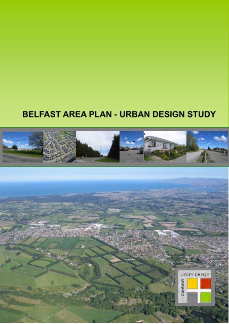
Belfast Area Plan - Urban Design Study - Christchurch City Council
Belfast Area Plan - Urban Design Study - Christchurch City Council
Belfast Area Plan - Urban Design Study - Christchurch City Council

You also want an ePaper? Increase the reach of your titles
YUMPU automatically turns print PDFs into web optimized ePapers that Google loves.
BELFAST AREA PLAN - URBAN DESIGN STUDY
BELFAST AREA PLAN - URBAN DESIGN STUDY<br />
Prepared by<br />
Janet Reeves, Context <strong>Urban</strong> <strong>Design</strong><br />
for<br />
<strong>Christchurch</strong> <strong>City</strong> <strong>Council</strong><br />
November 2006
CONTRIBUTORS<br />
Janet Reeves Consultant
TABLE OF CONTENTS<br />
PART ONE<br />
Executive Summary 1<br />
1.0 INTRODUCTION 3<br />
2.0 POLICY AND GUIDANCE FRAMEWORK 4<br />
2.1. National Guidance 4<br />
2.2. Regional and <strong>City</strong> Policy and Guidance 5<br />
3.0 FRAMEWORK PRINCIPLES FOR GROWTH AREAS 7<br />
3.1. Movement Networks 7<br />
3.2. The Green Network 7<br />
3.3. The Blue Network 8<br />
3.4. Residential Neighbourhoods 8<br />
3.5. Community Facilities 9<br />
3.6. Commercial/Industrial and Mixed Uses 9<br />
3.7. Opportunities for Higher Density Housing 9<br />
4.0 AREA CONTEXT AND DESCRIPTION 12<br />
4.1. The <strong>Study</strong> <strong>Area</strong> 12<br />
4.2. Development History 12<br />
4.3. Housing 12<br />
4.4. Parks, Open Spaces and Waterways 12<br />
4.5. Community Facilities 13<br />
4.6. Commercial Developments 13<br />
4.7. Industry 13<br />
4.8. Transportation 13<br />
5.0 PROPOSALS AFFECTING THE STUDY AREA 14<br />
6.0 URBAN DESIGN ISSUES 15<br />
6.1. Community Identity 15<br />
6.2. Integration of Old and New <strong>Belfast</strong> 15<br />
6.3. Lack of Community Focus 15<br />
6.4. Commercial Facilities 15<br />
6.5. Main Roads 16<br />
6.6. The Railway Corridor 16<br />
6.7. Old <strong>Belfast</strong> 16<br />
6.8. Industrial Activities 16<br />
7.0. ADRESSING THE ISSUES 17<br />
7.1. Community Identity 17<br />
7.2. Integration of Old and New <strong>Belfast</strong> 18<br />
7.3. Community Focus / Community Facilities 18<br />
7.4. Commercial Facilities 19<br />
7.5 Main Roads 20<br />
7.6. The Railway Corridor 21<br />
7.7. Old <strong>Belfast</strong> 21<br />
7.8. Industrial Activity 21<br />
8.0. FUTURE URBAN GROWTH 22<br />
8.1. Defining the extent of urban growth 22<br />
8.2. Integrating new development with the existing built up area 22<br />
8.3. Creating appropriate edges and interfaces 22<br />
8.4. Managing expansion in partially developed areas 24<br />
8.5. <strong>Urban</strong> Growth Framework 24
8.6 Suggested land use zoning changes 25<br />
9.0.POSSIBLE METHODS OF ACHIEVING SOLUTIONS 27<br />
9.1. Location and design of new development 27<br />
9.2. <strong>Christchurch</strong> <strong>City</strong> <strong>Plan</strong> Living G Zone 27<br />
9.3. Rezoning 27<br />
9.4. Statutory and Non-Statutory Structure <strong>Plan</strong>s 27<br />
9.5. Chaneys Site Brief 28<br />
9.6. Neighbourhood <strong>Plan</strong>ning 28<br />
9.7. Non-conforming use fund 28<br />
9.8. <strong>Council</strong> land purchase and development of facilities 28<br />
9.9. Community Board funding 28<br />
9.10. <strong>Study</strong> of Northwood and Styx Mill 28<br />
10. URBAN DESIGN GOALS 29<br />
PART TWO – SUB-AREA STUDIES 31<br />
1. <strong>Belfast</strong> North East 32<br />
2. <strong>Belfast</strong> East Central 37<br />
3. North of <strong>Belfast</strong> 40<br />
4. North East of <strong>Belfast</strong> 43<br />
5. East of <strong>Belfast</strong> 46<br />
6. South East of <strong>Belfast</strong> 49<br />
7. Northwood/Styx Mill 52<br />
8. West of <strong>Belfast</strong> 56<br />
9. <strong>Belfast</strong> West Central 59<br />
10. Johns Road/Main North Road 62<br />
11. <strong>Belfast</strong> North West 65<br />
MAPS ...........................................................................................................Before page<br />
1. <strong>Study</strong> <strong>Area</strong> Map 1. <strong>Study</strong> area boundary 12<br />
2. <strong>Study</strong> <strong>Area</strong> Map 2. Potential locations for community facilities 19<br />
3. <strong>Study</strong> <strong>Area</strong> Map 3. Suggested land uses 27<br />
4. <strong>Study</strong> <strong>Area</strong> Map 4. Sub-area boundaries 31<br />
5. Sub-area Map 1.<strong>Belfast</strong> North East 32<br />
6. Sub-area Map 2 . <strong>Belfast</strong> East Central 37<br />
7. Sub-area Map 3 . North of <strong>Belfast</strong> 40<br />
8. Sub-area Map 4 . North East of <strong>Belfast</strong> 43<br />
9. Sub-area Map 5 . East of <strong>Belfast</strong> 46<br />
10. Sub-area Map 6 . South East of <strong>Belfast</strong> 49<br />
11. Sub-area Map 7a. Northwood East 52<br />
12. Sub-area Map 7b. Northwood/Styx Mill 53<br />
13. Sub-area Map 8 . West of <strong>Belfast</strong> 56<br />
14. Sub-area Map 9 . <strong>Belfast</strong> West Central 59<br />
15. Sub-area Map 10. North West of <strong>Belfast</strong> 62<br />
16. Sub-area Map 11.<strong>Belfast</strong> North West 65<br />
TABLES<br />
Table 1. Analysis of possible locations for community facilities 19<br />
APPENDIX 1<br />
Key to Sub-area maps 67
EXECUTIVE SUMMARY<br />
The <strong>Belfast</strong> area is undergoing and will<br />
continue to undergo significant change.<br />
There have been recent large scale<br />
residential and retail developments to the<br />
south of the township and a new arterial<br />
road is planned to the east of <strong>Belfast</strong>. Both<br />
the <strong>Christchurch</strong> <strong>City</strong> <strong>Plan</strong> and the draft<br />
Greater <strong>Christchurch</strong> <strong>Urban</strong> Development<br />
Strategy have earmarked <strong>Belfast</strong> for future<br />
urban growth.<br />
<strong>Belfast</strong> has many of the characteristics of<br />
a small town and is recognized as a place<br />
separate from <strong>Christchurch</strong> with a strong<br />
community spirit. Care needs to be taken<br />
to ensure that this sense of identity is not<br />
lost. The area is steeped in history and<br />
more could be done to celebrate and<br />
enhance this aspect. There is an<br />
important physical ‘green’ gap between<br />
<strong>Belfast</strong> and Redwood which must be<br />
maintained. The northern gateway to<br />
<strong>Belfast</strong> and the city needs to be<br />
strengthened.<br />
As the settlement expands, particular<br />
attention needs to be paid to the interface<br />
between urban and rural uses and<br />
measures taken to ensure that the current<br />
feel of being close to open space is<br />
maintained.<br />
There is a lack of a community focus and<br />
separate nodes have developed around<br />
Richill Street/Main North Road, Sheldon<br />
Park and the <strong>Belfast</strong> Supa-Centa. It is not<br />
possible to combine these nodes into one<br />
community focus but there is the<br />
opportunity to expand and strengthen any<br />
of them and/or create a new focal point to<br />
the north of Johns Road or to the east and<br />
south of Main North Road, north of Factory<br />
Road.<br />
Older parts of <strong>Belfast</strong> are suffering from<br />
environmental degradation due to older<br />
housing stock and infrastructure and the<br />
conflict between industrial and residential<br />
land uses. New development must be<br />
used positively to bring about the<br />
rejuvenation of the older area. In<br />
particular it is recommended that land<br />
north of Factory Road and west of the<br />
railway line be zoned for residential and<br />
community uses.<br />
A tension has arisen between ‘old’ and<br />
‘new’ <strong>Belfast</strong>. New development provides<br />
the potential to reunite the community<br />
through the strengthening of north <strong>Belfast</strong>.<br />
Additional and more varied housing and<br />
more and improved community and<br />
service facilities in and around older<br />
<strong>Belfast</strong> would help redress the balance.<br />
There is a considerable amount of<br />
underutilised industrial land which is likely<br />
to become increasingly in demand.<br />
Expansion and upgrading (in terms of<br />
infrastructure and improved amenity and<br />
layout) of the industrial area to the east of<br />
the railway line and around Chaneys is<br />
necessary.<br />
New population will bring increased<br />
demand for retail facilities. It may be<br />
possible to ‘reinstate the mainstreet’<br />
between Sheldon Park and Factory Road<br />
to provide an expanded local centre. Local<br />
centres might be possible in new<br />
development areas, if they are in a high<br />
profile location. Expansion of the Supa<br />
Centa could take place adjacent to the<br />
current site.<br />
New urban development will be located in<br />
areas where there are fragmented land<br />
ownership patterns and substantial<br />
existing properties. Mechanisms will need<br />
to be put in place at the outset in order to<br />
achieve co-ordinated and sensitive<br />
expansion in these areas.<br />
The framework for development in new<br />
growth areas (including movement<br />
networks, green and blue networks and<br />
community focal points) will need to be<br />
established and formalised at the outset in<br />
order to ensure high quality sustainable<br />
urban form, that is well integrated with the<br />
existing settlement.<br />
The railway line segregates land on either<br />
side of it. As it is impossible to provide free<br />
passage across it, it must realistically be<br />
considered as a dividing line. The<br />
Northern Arterial will similarly create a<br />
linear barrier. This signals that it is<br />
perhaps better to utilise the whole of the<br />
land between the railway line and the<br />
northern arterial for industrial use.<br />
The proposed Northern Arterial and<br />
<strong>Belfast</strong> Western Bypass will be major<br />
structures in the landscape. Provisions<br />
must be put in place to ensure that they<br />
are harmoniously accommodated within<br />
the landscape and sensitively interface<br />
1
with adjacent uses. They also provide the<br />
opportunity for linear parks and cycleways.<br />
Recommended changes in land use, from<br />
an urban design perspective, are detailed<br />
on Map 2.<br />
<strong>Urban</strong> design goals are identified in<br />
Section 10, Part One of this report. It will<br />
be important that any changes to <strong>City</strong> <strong>Plan</strong><br />
zoning, which arise as a result of the<br />
preparation of this area plan, include<br />
mechanisms such as structure plans and<br />
the necessary changes to rules and<br />
assessment matters in order to achieve<br />
these goals.<br />
Provision needs to be made through the<br />
LTCCP for funding strategic land<br />
purchase, community infrastructure and<br />
technical expertise in order to successfully<br />
implement the <strong>Belfast</strong> <strong>Area</strong> <strong>Plan</strong>.<br />
2
1.0 INTRODUCTION<br />
This report expands and develops the<br />
material contained in that earlier report.<br />
The main objective of this study is to<br />
assess and identify a framework to<br />
promote good urban design outcomes for<br />
the existing <strong>Belfast</strong> settlement and make<br />
recommendations for potential<br />
opportunities for urban design<br />
improvements and the future development<br />
form for new growth areas.<br />
In particular to:<br />
The <strong>Belfast</strong> area is undergoing and will<br />
continue to undergo significant change.<br />
There have been recent large scale<br />
residential and retail developments to the<br />
south of the township and a new arterial<br />
road is planned to the east of <strong>Belfast</strong>. Both<br />
the <strong>Christchurch</strong> <strong>City</strong> <strong>Plan</strong> and the draft<br />
Greater <strong>Christchurch</strong> <strong>Urban</strong> Development<br />
Strategy have earmarked <strong>Belfast</strong> for future<br />
urban growth.<br />
A need to assess the opportunities and<br />
constraints for such rapid land use change<br />
within the <strong>Belfast</strong> <strong>Area</strong> has therefore been<br />
identified. Such an assessment needs to<br />
identify the strategic issues that are likely<br />
to arise in the area and provide for<br />
development that meets the aspirations of<br />
the local community. There is also a need<br />
to identify and protect key resources and<br />
attributes of the area that will help define<br />
and shape the environment over the next<br />
30 years. To this end an <strong>Area</strong><br />
Development <strong>Plan</strong> is being prepared, it will<br />
provide a broad level, strategic planning<br />
tool for the <strong>Council</strong> and the local<br />
community to define and make decisions<br />
on the shape and context of development<br />
within <strong>Belfast</strong>. It involves a<br />
multidisciplinary approach drawing<br />
information from many areas, including<br />
policy, demographics, economics, urban<br />
design and heritage, parks and open<br />
space, transport, essential infrastructure,<br />
and community development.<br />
This urban design report has been<br />
prepared as one component part in the<br />
preparation of the <strong>Belfast</strong> <strong>Area</strong><br />
Development <strong>Plan</strong>. A preliminary urban<br />
design technical report was prepared by<br />
Josie Schroder, <strong>Urban</strong> <strong>Design</strong>er,<br />
<strong>Christchurch</strong> <strong>City</strong> <strong>Council</strong> in June 2003.<br />
• Identify opportunities and<br />
constraints for the future<br />
expansion of <strong>Belfast</strong> including<br />
preliminary<br />
ideas/concepts/networks.<br />
• Identify interface issues<br />
between existing and new<br />
development areas, and<br />
between rural and urban land<br />
uses.<br />
• Identify appropriate<br />
development form and<br />
densities.<br />
• Identify appropriate linkages<br />
between movement, reserve<br />
and blue networks and<br />
landuse.<br />
• Identify overall concepts<br />
/themes for the area.<br />
• Identify opportunities for<br />
linkages and movement<br />
between existing and new<br />
areas.<br />
This report is divided into two parts. Part<br />
One describes the policy and best practice<br />
framework, discusses the components of a<br />
growth framework for new development<br />
areas, describes the study area, identifies<br />
and assesses the main urban design<br />
issues for <strong>Belfast</strong>, outlines possible<br />
methods of achieving solutions and<br />
identifies urban design goals for the <strong>Area</strong><br />
Development <strong>Plan</strong>. Part Two looks in<br />
greater detail at each part of the study<br />
area in order to give detailed consideration<br />
to urban design and local planning issues<br />
and explore the feasibility of implementing<br />
ideals.<br />
3
2.0. POLICY AND GUIDANCE<br />
FRAMEWORK FOR URBAN<br />
DESIGN<br />
<strong>Urban</strong> design is concerned with the design<br />
and layout of new developments and<br />
changes to the existing urban<br />
environment. It looks carefully at the<br />
detailed planning and design of places,<br />
buildings and spaces to ensure that<br />
everything comes together in a way that is<br />
sustainable and provides an environment<br />
which meets people’s needs and<br />
expectations, both now and in the future.<br />
2.1. National Guidance<br />
Until recently the practice of urban design<br />
has not been widely recognised in New<br />
Zealand. Increasing urbanisation and<br />
intensification of urban development<br />
throughout the country has led to a<br />
recognition of the need to pay greater<br />
attention to the quality of our urban, as<br />
well as our rural, environment. Five years<br />
ago, the Ministry for the Environment<br />
embarked upon a major programme,<br />
designed to ensure that good urban<br />
design became a mainstream activity<br />
throughout the country.<br />
2.1.1. Ministry for the Environment,<br />
People+Places+Spaces, March 2002<br />
This document is a design guide for urban<br />
development. It provides a broad overview<br />
of processes and principles appropriate to<br />
the New Zealand context. Five generic<br />
urban design principles are identified:<br />
consolidation and dispersal; integration<br />
and connectivity; diversity and adaptability;<br />
legibility and identity and ecological<br />
responsiveness. These design principles<br />
are applied at different scales of<br />
development, from sub-regional<br />
structuring to building design. The subregional<br />
project level (p38) and<br />
development framework level (p41) are<br />
the most applicable to the <strong>Belfast</strong> <strong>Area</strong><br />
Development <strong>Plan</strong>.<br />
2.1.2. Ministry for the Environment,<br />
<strong>Urban</strong> <strong>Design</strong> Protocol, March 2005<br />
The Protocol is a key part of the<br />
Government's Sustainable Development<br />
Programme of Action and is a voluntary<br />
commitment to specific urban design<br />
initiatives. The purpose of the protocol is<br />
‘to signal the Government’s commitment to<br />
quality urban design, to start debate and<br />
raise awareness of urban design across<br />
the country, to improve the exchange of<br />
learning and information, and to initiate a<br />
programme of action to result in quality<br />
urban design’.<br />
The Protocol identifies seven essential<br />
design qualities (the seven ‘C’s’):<br />
• Context: Seeing that buildings,<br />
places and spaces are part of the<br />
whole town or city<br />
• Character: Reflecting and<br />
enhancing the distinctive<br />
character, heritage and identity of<br />
our urban environment<br />
• Choice: Ensuring diversity and<br />
choice for people<br />
• Connections: Enhancing how<br />
different networks link together for<br />
people<br />
• Creativity: Encouraging innovative<br />
and imaginative solutions<br />
• Custodianship: Ensuring design is<br />
environmentally sustainable, safe<br />
and healthy<br />
• Collaboration: Communicating and<br />
sharing knowledge across sectors,<br />
professions and with<br />
communities.<br />
The protocol itself is a general document<br />
which serves to raise awareness and<br />
legitimize the strive for good urban design.<br />
The seven ‘C’s’ provide a checklist and<br />
are useful for monitoring purposes. A<br />
number of documents have been prepared<br />
to support the Protocol. The following<br />
three are the most relevant to this study.<br />
2.1.3. Ministry for the Environment,<br />
<strong>Urban</strong> <strong>Design</strong> Case Studies, March<br />
2005<br />
Shows practical examples of successful<br />
urban design projects in New Zealand.<br />
2.1.4. Ministry for the Environment,<br />
The Value of <strong>Urban</strong> <strong>Design</strong>, June 2005<br />
Examines the economic, social, cultural<br />
and environmental value added by urban<br />
design.<br />
2.1.5. Ministry for the Environment,<br />
<strong>Urban</strong> <strong>Design</strong> Toolkit, February 2006<br />
This is a web based resource which<br />
identifies and describes a range of tools or<br />
techniques for urban design projects. It<br />
covers research, community participation,<br />
awareness raising, planning and design<br />
and implementation tools.<br />
4
2.1.6. Ministry of Justice, National<br />
Guidelines for Crime Prevention<br />
through Environmental <strong>Design</strong> in New<br />
Zealand, November 2005<br />
This guide outlines how urban planning,<br />
design and place management can reduce<br />
the likelihood of crime and deliver<br />
numerous social and economic benefits in<br />
the long-term. The guideline is in two<br />
parts, Part One, outlines seven qualities<br />
for well designed, safer places, Part Two<br />
outlines some of the ways in which Local<br />
Authorities can implement Crime<br />
Prevention Through Environmental <strong>Design</strong><br />
(CPTED).<br />
2.2. Regional and <strong>City</strong> Policy<br />
and Guidance<br />
2.2.1. Canterbury Regional <strong>Council</strong><br />
(Ecan) The Regional Policy Statement,<br />
1998<br />
Policies 1 and 5 of Chapter 12 (Settlement<br />
and Built Environment) of the Regional<br />
Policy Statement are of particular<br />
relevance to urban design. Policy 1 seeks<br />
settlement and transport patterns which<br />
make effective and efficient use of<br />
resources. Policy 5 seeks to maintain the<br />
contrast between the higher intensity of<br />
development and use in built-up areas and<br />
the lower density of settlement<br />
characteristics of rural areas.<br />
The Draft Greater <strong>Christchurch</strong> <strong>Urban</strong><br />
Development Strategy (see below) seeks<br />
a change to the Regional Policy Statement<br />
which would serve, among other<br />
objectives, to strengthen the urban design<br />
framework of the region.<br />
2.2.2. <strong>Christchurch</strong> <strong>City</strong> <strong>Council</strong>, The<br />
<strong>Christchurch</strong> <strong>City</strong> <strong>Plan</strong>, 1995<br />
The <strong>Christchurch</strong> <strong>City</strong> <strong>Plan</strong> sets out the<br />
objectives and policies for urban<br />
development and urban renewal. Of<br />
particular relevance to this study are<br />
Section 4: <strong>City</strong> Identity; Section 6: <strong>Urban</strong><br />
Growth; Section 9: Community Facilities<br />
and Identity and Section 11: Living. The<br />
<strong>City</strong> <strong>Plan</strong> was developed at a time when<br />
urban design in New Zealand was in its<br />
infancy and although the objectives and<br />
policies of the plan embody sound urban<br />
design principles, there are weaknesses in<br />
the ability of the plan to deliver good urban<br />
design. Changes to the <strong>City</strong> <strong>Plan</strong>, required<br />
as a result of this area plan process, will<br />
offer some opportunity for improvement. A<br />
new zone Living 1 G, has recently been<br />
introduced as a result of an Environment<br />
Court decision. The provisions of this zone<br />
provide a basis on which to deliver better<br />
quality urban design in new growth areas.<br />
2.2.3. Neighbourhood <strong>Plan</strong>s, 1987 -<br />
2001<br />
The <strong>Christchurch</strong> <strong>City</strong> <strong>Council</strong> has been<br />
pursuing urban renewal policies for many<br />
years and urban renewal has been<br />
embodied in the <strong>Christchurch</strong> <strong>City</strong> <strong>Plan</strong>.<br />
Objective 11.6 and supporting policies<br />
relate to neighbourhood planning.<br />
Neighbourhood Improvement <strong>Plan</strong>s were<br />
introduced in the late 80’s to focus<br />
attention in specific areas of decline. The<br />
purpose of Neighbourhood <strong>Plan</strong>s is to help<br />
retain and enhance the physical and social<br />
character of neighbourhoods. <strong>Council</strong><br />
expenditure on traffic calming, street tree<br />
planting, creation of small parks, opening<br />
up and enhancing of waterways,<br />
landscaping, artworks etc. is intended to<br />
act as a catalyst for upgrading private<br />
property and fostering community<br />
initiatives. In recent years the value of<br />
preparing Neighbourhood <strong>Plan</strong>s has been<br />
challenged due to the fact that it is<br />
impossible for the <strong>Council</strong> to honour all of<br />
the proposals set out in the plans. Funding<br />
has been withdrawn for undergrounding<br />
overhead wires in local streets.<br />
2.2.4. <strong>Christchurch</strong> Active Living<br />
Strategy, 2003<br />
This strategy was developed by a Steering<br />
Group drawn from <strong>Christchurch</strong> <strong>City</strong><br />
<strong>Council</strong>, Environment Canterbury, and<br />
community and health sector<br />
organizations. The aim of the strategy is to<br />
enable <strong>Christchurch</strong> people to enjoy<br />
regular physical activity as part of their<br />
everyday lives. One of the key objectives<br />
is to create activity friendly physical<br />
environments.<br />
2.2.5. Canterbury Safety Working<br />
Party, Safer Canterbury, Creating Safer<br />
Communities, 2004<br />
The <strong>Christchurch</strong> Safer Community<br />
<strong>Council</strong> developed a CPTED guide in the<br />
early 1990’s in conjunction with the <strong>City</strong><br />
<strong>Council</strong>, which has provided guidance to<br />
planners and designers over the years.<br />
This guide is an updated version which<br />
provides best practice advice for<br />
residential neighbourhoods, parks and<br />
waterways and streets and car parks.<br />
5
2.2.6. <strong>Christchurch</strong> <strong>City</strong> <strong>Council</strong>, Long<br />
Term <strong>Council</strong> Community <strong>Plan</strong> (LTCCP)<br />
The LTCCP sets out the outcomes that the<br />
people of <strong>Christchurch</strong> wish to see for their<br />
community. The Community Outcomes for<br />
<strong>Christchurch</strong> to 2012 include: a safe city; a<br />
city of inclusive and diverse communities<br />
and an attractive and well designed city.<br />
The plan is also the vehicle for the broad<br />
allocation of <strong>Council</strong> resources.<br />
2.2.6. The Draft Greater <strong>Christchurch</strong><br />
<strong>Urban</strong> Development Strategy,<br />
November 2006<br />
The purpose of the Greater <strong>Christchurch</strong><br />
<strong>Urban</strong> Development Strategy (UDS) is to<br />
provide a direction and planning<br />
framework for the greater <strong>Christchurch</strong><br />
area over the next 35 years. The strategy<br />
seeks to define clear boundaries between<br />
urban and rural areas and develop existing<br />
urban areas in a more intensified form.<br />
<strong>Belfast</strong> is proposed as the northern<br />
gateway into <strong>Christchurch</strong> and a<br />
community services focal point.<br />
Residential intensification and new<br />
employment areas in north <strong>Christchurch</strong><br />
are centred around <strong>Belfast</strong>.<br />
2.2.7. <strong>Christchurch</strong> <strong>City</strong> <strong>Council</strong>, Draft<br />
code of practice for land and<br />
development<br />
The draft code of practice for land and<br />
development being prepared by the<br />
<strong>Christchurch</strong> <strong>City</strong> <strong>Council</strong> currently<br />
includes a Chapter relating to urban<br />
design. The code sets out the <strong>Council</strong>’s<br />
requirements for assets that will be held in<br />
public ownership such as roads, reserves<br />
and community facilities. Its role in<br />
implementing good urban design cannot<br />
be underestimated.<br />
6
3.0. FRAMEWORK<br />
PRINCIPLES FOR GROWTH<br />
AREAS<br />
It is important that new growth areas are<br />
planned and executed to integrate with<br />
existing urban form and activities,<br />
recognise and build on landscape context<br />
and character, and become new<br />
sustainable places where communities<br />
develop. The following components<br />
combine to create a framework for growth.<br />
3.1. Movement networks –<br />
roads, cycleways and pedestrian<br />
paths<br />
The layout of urban areas should be<br />
designed to minimise vehicle travel<br />
distances, maximise the opportunity for<br />
walking and cycling and support bus<br />
services. This means well connected<br />
movement networks with direct and easy<br />
access to and through new developments.<br />
A connected network of roads, as opposed<br />
to a series of unconnected culs-de-sac,<br />
increases accessibility for residents,<br />
allows for safer and more efficient<br />
movement of traffic, and enables more<br />
efficient infrastructure provision. However,<br />
it can be difficult to create a network which<br />
can be constantly extended, particularly<br />
where there are a series of small<br />
developments. For various reasons,<br />
developers are often reluctant to link up to<br />
adjacent subdivisions. Therefore it will be<br />
important for provisions to be put in place<br />
to ensure that a well connected roading<br />
pattern eventuates.<br />
reserves, shops and other community<br />
facilities and bus stops. Residents of new<br />
subdivisions should be able to connect to<br />
longer distance cycleways.<br />
Road layouts should be designed to<br />
support bus services, for example, there<br />
should be spine or loop roads.<br />
Connecting roads and footpaths and<br />
potential locations of bus stops will need to<br />
be considered to ensure that all users will<br />
be within 400m walking distance of a stop.<br />
3.2. The green network<br />
Open green space is an important element<br />
of the urban environment. It provides<br />
visual contrast with built form, a sense of<br />
spaciousness, contact with nature,<br />
opportunity for exercise and social contact.<br />
It plays a valuable role in structuring and<br />
adding character to, residential<br />
neighbourhoods and also in the<br />
establishment of ecological corridors.<br />
Open space must be appropriate to the<br />
needs of residents, accessible and safe. It<br />
will be necessary to create and continue<br />
green corridors and linkages and establish<br />
whether there is a need for playing fields,<br />
expansion of adjacent reserves or creation<br />
of new reserves and small amenity areas.<br />
Parks and open spaces must be<br />
integrated in such a way as to maximise<br />
their potential use. This includes<br />
maximising road frontage, ensuring views<br />
into and from the park, creating easy and<br />
obvious access to the park, siting parks<br />
and open spaces in strategic locations and<br />
a sympathetic interface between the park<br />
and adjacent land uses and activities.<br />
Parks and open spaces can provide a<br />
focal point for new development and unify<br />
new and existing places. Extending<br />
existing parks or restructuring them may<br />
result in a better open space layout in<br />
some cases.<br />
Existing trees and vegetation should be<br />
retained wherever possible as they can<br />
provide the foundation for an attractive<br />
place. In residential areas, mature trees<br />
are best located in public spaces.<br />
Residents will want to, and should be<br />
encouraged to, walk and cycle rather than<br />
use private motorised transport. Provision<br />
therefore needs to be made for practical<br />
linkages from residential areas to<br />
Particular attention will need to be given to<br />
the landscape treatment of the edges of<br />
new land development, especially where<br />
they interface with rural areas or limited<br />
access roads.<br />
7
3.3. The blue network<br />
The blue network, comprising waterways<br />
and waterbodies, combines with the<br />
movement network and green network to<br />
structure urban form. Taking advantage of<br />
existing watercourses and opening up and<br />
naturalising drains can add significantly to<br />
the amenity and ecology of an area. For<br />
example natural springs may be enhanced<br />
to form an ornamental lake in a new<br />
reserve, as has occurred at Waterford<br />
Reserve, Northwood.<br />
Opportunities should be taken to introduce<br />
or continue naturalised watercourses<br />
through sites or alongside roads.<br />
The use of existing drainage patterns,<br />
such as creeks and streams and water<br />
disposal through the use of retention basin<br />
and swales, can reduce the need for<br />
piping, minimise silt runoff and moderate<br />
stormwater peaks. These systems are<br />
considered more resource efficient in the<br />
long-term and offer solutions that have<br />
multiple benefits.<br />
Waterways can act as a barrier to<br />
movement unless frequent bridges are<br />
created. They can also create awkward<br />
shaped parcels of land, which can be<br />
difficult to develop efficiently. Care must<br />
be taken to avoid the formation of<br />
unattractive retention basins, unusable for<br />
recreational purposes.<br />
3.4 Residential neighbourhoods<br />
New neighbourhoods need to be<br />
established which are sustainable, feel<br />
safe and secure, have a sense of place,<br />
and encourage new communities to<br />
develop.<br />
There is widespread acknowledgement<br />
that sustainable settlement forms should<br />
be based on walkable, mixed use<br />
neighbourhoods with interconnected street<br />
and pedestrian movement patterns, where<br />
daily needs are within walking distance of<br />
most residents (see for example: Land<br />
Transport Safety Authority 2005). A five to<br />
ten minute walking distance of 400 – 800<br />
metres is usually taken as a measure of<br />
the accessibility, on foot, of facilities.<br />
The theoretically most efficient<br />
neighbourhood settlement form has<br />
community facilities in the centre<br />
surrounded by concentric rings of<br />
residential development of decreasing<br />
density within 800m. This form is efficient<br />
because it has the maximum number of<br />
houses within walking distance of the<br />
centre and provides a central focal point<br />
for the community.<br />
People wish to live in environments where<br />
they feel safe and secure. Residents and<br />
visitors should be able to move around<br />
their neighbourhood without fear of attack.<br />
Subdivisions, and particularly the public<br />
spaces within them, can be carefully<br />
designed and managed so that both the<br />
fear of crime and the actual incidence of<br />
crime is reduced. Casual surveillance of<br />
public and semi-public space is one of the<br />
most effective means of deterring<br />
wrongdoers. Achieving casual surveillance<br />
requires attention both to the subdivision<br />
layout and to the elements of the<br />
residential environment such as fences,<br />
planting and the relationship of houses<br />
and windows to the streets and reserves.<br />
In order for a sense of place to develop<br />
new development must contain elements<br />
which distinguish it as a particular place.<br />
These include a connection with the past,<br />
distinctive characteristics (such as<br />
consistent building form or vegetation,<br />
landmarks, geographical features) clearly<br />
defined boundaries, a sense of arrival and<br />
departure and a clearly defined centre or<br />
focal point.<br />
A sense of community is derived from<br />
many intangibles but may include: a<br />
feeling of familiarity and belonging, a<br />
sense of pride in being a member of the<br />
community and participation in community<br />
activities. The location, design and<br />
composition of residential development<br />
can help to maintain and develop<br />
community spirit in new growth areas. A<br />
community spirit is more likely to exist<br />
where there is an integrated mix of homes<br />
of different types and tenures to support a<br />
range of household sizes, ages and<br />
incomes and there are places for people to<br />
meet both informally and formally.<br />
New subdivisions may be considered as<br />
add-ons to existing built-up areas or they<br />
may be viewed as separate entities. In the<br />
case of larger developments, such as<br />
Northwood, the tendency is to create a<br />
self-contained community and this may<br />
need to be acknowledged.<br />
8
3.5. Community Facilities<br />
Equitable access to community facilities is<br />
integral to good urban design practice as<br />
they provide opportunity for community<br />
interaction and increase the range of<br />
choices available to people. Community<br />
facilities will only remain viable when there<br />
are sufficient numbers of users. New<br />
development must create, retain or<br />
increase the ability of people to access<br />
community facilities. This should be<br />
through both physical and visual<br />
connections. Good pedestrian, cycling and<br />
public transport links as well as road<br />
access will be essential. Locations in the<br />
centre of catchment areas and buildings<br />
with obvious and welcoming entrances,<br />
which are clearly visible from roads and<br />
other public places, will be required.<br />
New developments should be located in<br />
such a way that the profile and<br />
accessibility of existing community<br />
facilities is retained or enhanced.<br />
Public artworks should be considered at<br />
the outset of the design process whether it<br />
be to integrate the artwork into the<br />
structure of a building; develop the design<br />
to incorporate artworks in the design of<br />
structures such as streetlights and rubbish<br />
bins or to; identify a location for a future<br />
artwork.<br />
Streetlights, road signs, seats and other<br />
street or park furniture, bridge abutments,<br />
underpasses and overbridges, utility boxes<br />
and poles all play their part in creating the<br />
character and success of the outdoor<br />
environment. Advantage can be taken of<br />
some structures to introduce or emphasise<br />
a local sense of identity.<br />
3.6. Commercial/Industrial and<br />
Mixed Uses<br />
A mix of uses in an area, reduces the<br />
need to travel, enlivens streets and public<br />
places for longer periods, creates variety<br />
in building form and street scenes and can<br />
lead to more efficient use of parking<br />
space. The uses most compatible with<br />
residential uses are retail, service, office,<br />
educational, places of worship, leisure and<br />
recreational and community facilities.<br />
It can be difficult for commercial facilities<br />
to establish in new residential areas. They<br />
may only be viable when they are used by<br />
those outside the area. Commercial<br />
facilities stand a greater chance of survival<br />
if they are in a high profile location, i.e.<br />
alongside a main road. However, main<br />
roads through the centre of communities<br />
can be disruptive and dangerous. This<br />
dictates an alternative semi-circular<br />
theoretical optimum settlement form with<br />
the centre alongside a main road. New<br />
development is more likely to strengthen<br />
existing commercial facilities than create<br />
new nodes. Additional population will<br />
increase the viability of existing<br />
commercial concerns and may lead to the<br />
expansion of such areas.<br />
If public facilities such as schools,<br />
community centres or libraries are<br />
required in new growth areas, absolute<br />
advantage must be taken of them to add<br />
structure and focal points to new and<br />
existing communities.<br />
Industrial uses are not generally<br />
compatible with residential uses, however<br />
small scale light industries and workshops<br />
may successfully co-exist with residential<br />
neighbours. There has been some<br />
success in providing residential units<br />
above industrial premises in <strong>Christchurch</strong>.<br />
Higher density housing for the over 50’s at<br />
Northwood<br />
3.7. Opportunities for higher<br />
density housing in new<br />
development areas<br />
Residential density plays a large part in<br />
determining the form, character and<br />
efficiency of a settlement 1 . Higher density<br />
housing is more efficient in terms of land<br />
take and infrastructure costs. It enables<br />
people and facilities to be located closer<br />
together thus making more places<br />
accessible on foot. It generates more<br />
activity on the street, increasing the vitality<br />
1 Creating Great Neighbourhoods: Density<br />
in your Community Sept 2003 . Local<br />
Government Commission in co-operation<br />
with U.S Environmental Protection Agency<br />
www.lgc.org<br />
9
and safety of places. However, higher<br />
density development can lead to a loss of<br />
greenery, increased traffic congestion and<br />
more conflict between neighbours.<br />
Higher density may be achieved through<br />
smaller section sizes alone, or both<br />
smaller section sizes and smaller units of<br />
accommodation. New growth areas could<br />
include a generally higher density across<br />
the whole area or a concentration of<br />
higher density housing in specific nodes,<br />
such as around open spaces, alongside<br />
bus routes or adjacent to community and<br />
retail facilities. Variation in housing density<br />
can help to make new subdivisions more<br />
legible by creating elements of different<br />
character within the overall<br />
neighbourhood. Larger conglomerations of<br />
buildings can become landmarks or<br />
orientating features in the streetscape.<br />
The take up of higher density housing will<br />
depend on demand, and a higher density<br />
of development may not materialise, even<br />
if it is provided for, as has been the<br />
experience to date at Aidanfield.<br />
10
<strong>Study</strong> <strong>Area</strong> Map 1:<br />
<strong>Belfast</strong> <strong>Area</strong> <strong>Plan</strong> <strong>Study</strong> <strong>Area</strong> Boundary<br />
Northern Motorway<br />
Waimakariri River<br />
Chaneys<br />
Industrial<br />
<strong>Area</strong><br />
Clearwater Resort<br />
The Groynes<br />
S293 <strong>Area</strong><br />
Northwood<br />
<strong>Belfast</strong><br />
Supa<br />
Centa<br />
South Island Trunk Railway Line<br />
Styx Mill Reserve<br />
Redwood<br />
Main North Road
4.0. AREA CONTEXT AND<br />
DESCRIPTION<br />
4.1. The <strong>Study</strong> <strong>Area</strong><br />
(See: <strong>Study</strong> <strong>Area</strong> Map 1). <strong>Belfast</strong> lies to<br />
the north of <strong>Christchurch</strong> on the periphery<br />
of the urban area, separated from<br />
<strong>Christchurch</strong> <strong>City</strong> by the Styx River<br />
corridor and remnant rural land. The<br />
southern boundary of the study area runs<br />
along Styx Mill Road and then continues<br />
eastwards just north of Farquhars Road<br />
until it reaches the proposed alignment of<br />
the Northern Arterial. The eastern<br />
boundary follows this road corridor from<br />
the north of Redwood, up to Guthries<br />
Road, then along Marshland Road until it<br />
reaches the South Island Main Trunk<br />
railway line. The boundary follows the line<br />
northwards to the Waimakariri River. The<br />
Western boundary starts from the<br />
Northern Motorway and follows the river<br />
terrace and stop bank running southwest,<br />
adjacent to the Otukaikino Stream, then<br />
south down Gardiners Road back to Styx<br />
Mill Road. Rural land also borders <strong>Belfast</strong><br />
to the north, east and west. The Groynes<br />
Reserve and Clearwater Golf Resort lie to<br />
the north west between <strong>Belfast</strong> and the<br />
Waimakariri River.<br />
The study area is covered by <strong>Belfast</strong> and<br />
Brooklands/Spencerville Neighbourhood<br />
Maps 2 .<br />
4.2. Development History<br />
The Styx River catchment is understood to<br />
have held many sites of significance to<br />
Maori. The area was important for food<br />
gathering and various families were given<br />
responsibility for the management and<br />
harvesting of the different plant and animal<br />
species. Many of these family associations<br />
continue to this day. Early settlers<br />
purchased land in the area as early as<br />
1854. By 1881 the settlement had become<br />
known as <strong>Belfast</strong> and the following year<br />
the Canterbury Frozen Meat company was<br />
established. The railway line was opened<br />
in 1872. The township continued to grow<br />
as an important industrial area and a main<br />
thoroughfare to the north. The surrounding<br />
rural land in addition to being an<br />
agricultural and dairying district was, by<br />
the 1950’s, producing a large amount of<br />
2 <strong>Christchurch</strong> <strong>City</strong> <strong>Council</strong>, Neighbourhood<br />
Maps, Policy and <strong>Plan</strong>ning Team, Winter 2006<br />
fruit. A period of rapid residential growth<br />
occurred in the 1950’s, more subdivisions<br />
were developed between the 1960’s and<br />
70’s and major residential development<br />
has taken place in recent years.<br />
4.3. Housing<br />
A wide range of housing now exists within<br />
the study area, mostly free standing<br />
properties. Older lower cost housing is<br />
concentrated in north <strong>Belfast</strong> and in the<br />
apex between Main North Road and Johns<br />
Road. Houses are generally single storey<br />
and section sizes are mainly around<br />
1000m², except in the few cases where<br />
they have been subdivided. There are a<br />
number of clusters of small attached units,<br />
some of which are <strong>Council</strong> owned. Newer<br />
subdivisions of standard suburban one<br />
and two-storey houses on sections<br />
averaging around 650m² have been<br />
developed adjacent to these original<br />
housing areas. The more recent<br />
subdivisions south of Englefield Road,<br />
including Northwood and Styx Mill contain<br />
a wider range of house types, ranging<br />
from small villas for the over 50’s to large<br />
5 bedroom two storey properties. There is<br />
a corresponding range of section sizes,<br />
starting at around 250m², but even the<br />
largest properties are on sections of only<br />
around 1000m². The general trend, as is<br />
the case elsewhere in the city, appears to<br />
be for larger houses on smaller sections.<br />
In the rural area are a number of houses<br />
on large blocks of land, these comprise<br />
older, smaller, traditional rural dwellings<br />
and newer, substantial lifestyle properties.<br />
Entrance to Sheldon Park<br />
4.4. Parks, open spaces and<br />
waterways<br />
The two largest parks within the built-up<br />
area are Sheldon Park in the centre of<br />
<strong>Belfast</strong>, which was established in 1912<br />
12
and Englefield Reserve and the co-located<br />
Northwood Park, in the south west. There<br />
are a number of smaller reserves, created<br />
as part of subdivisions and the extensive<br />
Styx Mill Conservation Reserve lies to the<br />
south west of Northwood/Styx Mill.<br />
Otukaikino (Wilsons Swamp) is a<br />
freshwater wetland reserve located<br />
between Main North Road and the<br />
<strong>Christchurch</strong> Northern Motorway. The<br />
Kaputone Creek traverses the settlement,<br />
meandering from west to east and then in<br />
a northerly direction.<br />
4.5. Community Facilities<br />
Most of the services and facilities required<br />
to sustain a small town are available within<br />
<strong>Belfast</strong>. Community facilities include<br />
<strong>Belfast</strong> School, Sheldon Park (including a<br />
swimming pool, <strong>Belfast</strong> Rugby Football<br />
Club and sports grounds, <strong>Belfast</strong><br />
Preschool and children’s playground), 2<br />
crèches, 3 churches and a medical centre.<br />
A mobile library, though fairly infrequent,<br />
currently services <strong>Belfast</strong> from the<br />
Redwood library.<br />
4.6. Commercial developments<br />
Three small fully occupied retail business<br />
zones are located on the east side of Main<br />
North Road, two on the corners of Richill<br />
Street (<strong>Belfast</strong> Centre) and one on the<br />
corner of <strong>Belfast</strong> Road. There are also a<br />
few retail and service premises located in<br />
the Living 1 zone in this northern part of<br />
<strong>Belfast</strong>, including a petrol station on the<br />
corner of Main North Road and Johns<br />
Road. <strong>Belfast</strong> Tavern is located at the<br />
northern outskirts of <strong>Belfast</strong> on the<br />
western side of Main North Road.<br />
southern end of <strong>Belfast</strong>. The <strong>Belfast</strong> Supa-<br />
Centa a ‘big box’ retail centre has been<br />
developed on the corner of Main North<br />
Road and Radcliffe Road and on the<br />
opposite side of the main road a New<br />
World supermarket has been established<br />
as part of the Northwood neighbourhood.<br />
4.7. Industry<br />
The major industrial activity is still the<br />
meat processing plant to the east of<br />
<strong>Belfast</strong>, which in the year 2000 accounted<br />
for 53% of those employed in <strong>Belfast</strong>. The<br />
Chaneys Industrial <strong>Area</strong> is strung out<br />
along Main North Road, between the<br />
motorway and the railway line, to the north<br />
of <strong>Belfast</strong>. It comprises a number of<br />
industries on extensive sites dealing with<br />
large and bulky dry materials such as<br />
timber and concrete.<br />
4.8. Transportation<br />
The <strong>Christchurch</strong> Northern Motorway<br />
leads into <strong>Belfast</strong> from the north. State<br />
Highway 1 then continues southwards<br />
along Main North Road to the centre of<br />
<strong>Belfast</strong>, then turns in a westerly direction<br />
along Johns Road. Main North Road<br />
continues southwards through the built-up<br />
area of <strong>Belfast</strong> towards the central city.<br />
The South Island Main Trunk Railway line<br />
runs along the eastern boundary of the<br />
<strong>Belfast</strong> residential area.<br />
<strong>Belfast</strong> is serviced by three public bus<br />
services to an from the central city, each<br />
running along Main North Road at half<br />
hourly intervals. The Rangiora bus runs<br />
through<br />
<strong>Belfast</strong> onto the motorway, the no. 16<br />
terminates at Factory Road and the no.12<br />
at Northwood Boulevard.<br />
There are short stretches of cycle lane<br />
along Main North Road as a result of<br />
intersection upgrades. A cycle lane has<br />
recently been created across the Styx<br />
Overbridge as part of the bridge widening<br />
works.<br />
Supermarket at Northwood<br />
Within the last five years considerable<br />
retail development has occurred at the<br />
There are a number of pedestrian footpath<br />
links through small reserves throughout<br />
the urban area of <strong>Belfast</strong>, see Part Two<br />
and the Waimari Walkway runs through<br />
reserves and rural land to the north west<br />
of <strong>Belfast</strong>.<br />
13
5.0. PROPOSALS AFFECTING<br />
THE STUDY AREA<br />
5.1. Northern Arterial<br />
A roading designation to the east of<br />
<strong>Belfast</strong>, for a two lane major arterial road<br />
from the Northern Motorway to QE11<br />
Drive is included in the <strong>Christchurch</strong> <strong>City</strong><br />
<strong>Plan</strong>. The minimum width of the<br />
designation is 40m. Traffic modelling has<br />
shown that a four lane facility will likely be<br />
required, in which case a minimum width<br />
of 60m will be needed. The alignment of<br />
the Northern Arterial is also being<br />
reconsidered and it has been proposed<br />
that from <strong>Belfast</strong> Road the alignment<br />
swings to the east to cross Radcliffe Road<br />
at a point closer to the Styx River Reserve.<br />
This revised alignment is taken as the<br />
study area boundary. It is understood that<br />
interchanges between the Northern<br />
Arterial and existing roads that it will cross,<br />
will be kept to a minimum and there may<br />
be only one interchange within the study<br />
area, at the point where the road crosses<br />
the railway line.<br />
5.2. Section 293 Proposal<br />
93 hectares of land in the north west area<br />
of <strong>Belfast</strong>, between Main North Road and<br />
the Otukaikino Creek (Applefields/<br />
Devondale land) has been earmarked for<br />
potential residential development, to<br />
include up to 1500 houses, a primary<br />
school and a local shopping centre (see<br />
Part Two, sub-area 10). The proposal is<br />
currently being debated by the<br />
Environment Court and a decision is not<br />
expected to be finalised until mid 2007.<br />
A long term goal is to utilise the railway<br />
line or corridor for a light rail or rapid bus<br />
system. Such a facility would benefit<br />
<strong>Belfast</strong> residents, it would therefore be<br />
prudent to safeguard land for stations<br />
and/or a transport interchange at this<br />
stage. The interchange might usefully be<br />
combined with a Park and Ride terminus.<br />
5.5. Styx River Corridor<br />
A 40 year vision has been developed for<br />
the Styx River corridor (Vision 2000-2040<br />
The Styx) from its source to the sea. The<br />
vision seeks to protect, restore and<br />
enhance the natural character of the river<br />
and its environs. The <strong>City</strong> <strong>Council</strong> seeks<br />
opportunities for enabling enhancement<br />
and public access along the length of the<br />
corridor, through land purchase and<br />
conservation covenants.<br />
5.6. <strong>Belfast</strong> Swimming Pool<br />
The <strong>Belfast</strong> swimming pool in Sheldon<br />
Park is to be closed. While additional<br />
population may increase the demand for<br />
this facility, it is understood to be small,<br />
uneconomic to run and outdated. <strong>Council</strong><br />
policy is to rationalise such facilities and it<br />
is likely that the demand for swimming in<br />
the <strong>Belfast</strong> <strong>Area</strong> will be met by the new<br />
Aquatic Centre to be built in Papanui.<br />
5.3. Western <strong>Belfast</strong> By-Pass<br />
A by-pass connecting Johns Road and the<br />
Northern Motorway via a link to the north<br />
west of <strong>Belfast</strong> has long been proposed.<br />
The council supports such a road and<br />
discussion has taken place in relation to<br />
constructing all or part of it in conjunction<br />
with the S293 proposal.<br />
5.4. Railway corridor<br />
A cycleway has been created within the<br />
railway corridor nearer to the centre of<br />
<strong>Christchurch</strong>. It is the intention to continue<br />
this route along the railway line through<br />
<strong>Belfast</strong>. The cycleway is currently on the<br />
western side of the track.<br />
14
6.0. URBAN DESIGN ISSUES<br />
6.1. Community Identity<br />
Public consultation has highlighted that<br />
there is a strong desire to maintain a<br />
separate character and identity for <strong>Belfast</strong><br />
as distinct from <strong>Christchurch</strong>.<br />
The older part of <strong>Belfast</strong> grew up around<br />
the freezing works and other factories and<br />
had the distinctive character of a small<br />
industrial town, similar to Islington and<br />
Templeton on the south western outskirts<br />
of <strong>Christchurch</strong>. Newer parts of <strong>Belfast</strong><br />
have developed as dormitory suburbs of a<br />
suburban character found elsewhere in<br />
<strong>Christchurch</strong>. Consequently the character<br />
of <strong>Belfast</strong> is different in different parts of<br />
the settlement. Nevertheless, the<br />
community recognises that there is<br />
something distinctive about <strong>Belfast</strong> and<br />
have identified its community spirit, its<br />
location on the edge of the city, its<br />
separation from the rest of <strong>Christchurch</strong><br />
and rural surrounds as aspects of<br />
character that they value. <strong>Belfast</strong> will<br />
remain on the edge of the city, but its rural<br />
boundaries to the east and west are likely<br />
to disappear in time. It will be important<br />
therefore to maintain the identity of <strong>Belfast</strong><br />
by growing the township in a way that<br />
retains the sense of community, maintains<br />
its separateness from <strong>Christchurch</strong> and<br />
maximises the opportunity for continuing<br />
contact with natural or rural environments.<br />
physically and socially separate from Old<br />
<strong>Belfast</strong>. The new residential area south of<br />
Englefield Road including Northwood and<br />
Styx Mill is relatively self-contained in<br />
terms of community facilities and has its<br />
own access off Main North Road.<br />
Residents living here will regularly travel<br />
into and out of <strong>Christchurch</strong> to work or<br />
school or for shopping or leisure activity<br />
and may have little need to go northwards<br />
into Old <strong>Belfast</strong>, so that it does not register<br />
as part of their environment. New<br />
development has had a demonstrable<br />
negative effect in that it has caused the<br />
closure of the supermarket in Old <strong>Belfast</strong>,<br />
when it was relocated in Northwood. It is<br />
understood that there is a tendency for<br />
newer residents to disassociate<br />
themselves with the name <strong>Belfast</strong>,<br />
preferring to be known as Northwood or<br />
Styx Mill.<br />
6.3. Lack of a Community<br />
Focus<br />
Currently community facilities are<br />
clustered in and around Sheldon Park and<br />
strung out along the northern part of Main<br />
North Road. Although there are a number<br />
of small halls associated with churches,<br />
the main meeting place is the <strong>Belfast</strong><br />
Rugby Football Club in the north east<br />
corner of the park. Community facilities<br />
are clustered in a central location but they<br />
are not seen as adequate for the existing<br />
community, let alone an expanded<br />
population. The community has, in<br />
particular, identified a need for a purpose<br />
built community hall.<br />
The <strong>Belfast</strong> Supa-Centa has created a<br />
new node and although not a community<br />
focal point in the traditional sense, it has<br />
become a place where <strong>Belfast</strong> people<br />
meet each other.<br />
Proud residents in Main North Road, <strong>Belfast</strong><br />
6.2. Integration of Old and New<br />
<strong>Belfast</strong><br />
The original <strong>Belfast</strong> settlement has<br />
expanded in recent years almost entirely<br />
in a south westerly direction. Furthermore,<br />
new housing has attracted a higher socioeconomic<br />
group, moving there mainly from<br />
outside <strong>Belfast</strong>. New <strong>Belfast</strong> is therefore<br />
New leisure facilities at Styx Mill and within<br />
the <strong>Belfast</strong> Supa-centa provide a private<br />
alternative for some residents which not<br />
only siphons off potential users of public<br />
facilities but also runs counter to providing<br />
a central unifying community focus. The<br />
issue is therefore how and in what<br />
location, to strengthen a community focus.<br />
6.4. Commercial Facilities<br />
Until recently commercial facilities<br />
consisted of the small local shops and<br />
services located in north east <strong>Belfast</strong> and<br />
15
esidents needed to travel to Northlands or<br />
elsewhere for the majority of their<br />
shopping. The development of the <strong>Belfast</strong><br />
Supa-centa and a new supermarket at<br />
Northwood has provided a much wider<br />
range of goods and services for the<br />
<strong>Belfast</strong> community and others further<br />
afield. However, these facilities have<br />
shifted the focus of retailing away from<br />
north <strong>Belfast</strong> where the population tends<br />
to be less mobile and more reliant on local<br />
shops. Future urban growth around <strong>Belfast</strong><br />
could create a need for additional local<br />
shops and services. Consideration needs<br />
to be given as to whether it is appropriate<br />
for the new commercial node in the south<br />
to expand beyond its current confines.<br />
6.5. Main Roads<br />
Main roads dominate the urban area of<br />
<strong>Belfast</strong>. The settlement is divided in two by<br />
the four lanes of Main North Road. Johns<br />
Road serves as the bypass for vehicles<br />
traveling from north to south or vice versa<br />
and is scheduled for four laning. State<br />
Highway 1 (Johns Road/Main North Road<br />
northern section) is heavily trafficked<br />
carrying some 46,000 vehicles a day,<br />
much of this traffic is Heavy Goods<br />
Vehicles. Main North Road, south of Johns<br />
Road, is not quite as busy but still carries<br />
in excess of 30,000 vehicles per day. The<br />
volume and nature of traffic on these<br />
roads makes it difficult and dangerous to<br />
cross on foot, uncomfortable for cyclists,<br />
creates noise, fumes, vibrations and dirt<br />
which make it unpleasant to live beside or<br />
even walk along, although there are<br />
periods during weekdays when the volume<br />
of traffic is lower and the roadside<br />
environment less hostile. The section of<br />
Main North Road, north of Johns Road is<br />
more badly affected by all these factors,<br />
than the stretch to the south.<br />
6.6. The Railway Corridor<br />
The railway line provides a considerable<br />
barrier to east-west movement on the<br />
eastern side of <strong>Belfast</strong>. It also forms the<br />
dividing line between industrial and<br />
residential use, although there are<br />
industrial uses to the west of it. Where the<br />
railway corridor runs through the urban<br />
area, it is not attractive. Land alongside<br />
the track is often used for storage or is laid<br />
to waste. The interface between the<br />
railway line and residential properties is<br />
generally poor with heavy incidence of<br />
graffiti.<br />
6.7. Old <strong>Belfast</strong><br />
In contrast to the newly developed areas<br />
of south <strong>Belfast</strong> much of old <strong>Belfast</strong><br />
(Lagan, Swift and Darroch Streets and the<br />
area between <strong>Belfast</strong> and Factory Roads)<br />
has poor quality street scenes represented<br />
by a lack of street trees and green space,<br />
old dish kerb and channel and overhead<br />
wiring. North-east <strong>Belfast</strong> has industrial<br />
land uses adjacent to residential ones and<br />
is sandwiched between Main North Road<br />
and the railway line, which both act as<br />
barriers to movement.<br />
6.8. Industrial Activity<br />
Large areas of land, zoned for industrial<br />
use remain vacant at Chaneys and to the<br />
east of the railway line around the freezing<br />
works and at Chaneys. The visual quality<br />
of the existing industrial area is generally<br />
very poor. <strong>Belfast</strong> has been identified as a<br />
potential location for expansion of<br />
industrial land given its proximity to major<br />
transport networks and location in one of<br />
the few areas of <strong>Christchurch</strong> outside the<br />
unconfined aquifer. Environment<br />
Canterbury is examining a sewer link<br />
through to <strong>Belfast</strong> and Mainpower are<br />
upgrading their services. This will mean<br />
that uses can be intensified within the<br />
wider Chaneys area and will provide the<br />
potential for land to the south to be<br />
serviced to enable light industrial<br />
development.<br />
Traffic on Main North Road, looking north from the<br />
Johns Road junction<br />
16
7.0 ADDRESSING THE<br />
ISSUES<br />
7.1. Community Identity<br />
The <strong>Area</strong> Development <strong>Plan</strong> offers the<br />
opportunity to introduce measures<br />
designed to retain and strengthen the<br />
sense of community identity enjoyed by<br />
the <strong>Belfast</strong> community.<br />
Currently <strong>Belfast</strong> is physically separate<br />
from the rest of <strong>Christchurch</strong>. It is<br />
surrounded by rural land to the north, east<br />
and west. To the south is a ‘green gap’<br />
that separates <strong>Belfast</strong> from the urban<br />
area. The free-standing nature of <strong>Belfast</strong><br />
contributes to its recognition as a place.<br />
With the urbanisation of rural land it is<br />
likely that <strong>Belfast</strong> will become physically<br />
attached to the rest of <strong>Christchurch</strong>, to the<br />
south and west. It will therefore be<br />
important to retain some sense of<br />
separateness through other means.<br />
7.1.1. Sense of arrival and departure<br />
When travelling into <strong>Belfast</strong> from the south<br />
the Styx overbridge and then a stretch of<br />
road with greenery on both sides, provides<br />
a real sense of leaving Redwood and the<br />
rest of the city and travelling to another<br />
place. The point of arrival in <strong>Belfast</strong> is at<br />
the traffic lights at Radcliffe Road – where<br />
there is a clear and abrupt change to<br />
urban development with the entrance to<br />
Northwood and supermarket on the left<br />
and the bulky, busy, colourful <strong>Belfast</strong><br />
Supa-centa on the right. Although the<br />
Northwood subdivision begins some<br />
distance before this gateway, it is<br />
screened by a solid shelter belt and does<br />
not read as urban from the road. A<br />
‘<strong>Belfast</strong>’ road sign is located on the berm<br />
about midway between Styx Mill Road and<br />
Northward Boulevard.<br />
Approaching <strong>Belfast</strong> from the south<br />
In order to maintain this sense of arrival<br />
(and sense of departure when travelling in<br />
the other direction) it is important to<br />
safeguard this green corridor in some<br />
form. While it is likely that, the northern<br />
part of the land to the east will be<br />
developed at some stage, it would be<br />
possible to retain the illusion of a rural gap<br />
between Redwood and <strong>Belfast</strong> by<br />
ensuring that any development on the site<br />
were screened from the road by dense<br />
planting, including the retention of the<br />
existing shelter belt. Housing at the<br />
southern end of Northwood close to Styx<br />
Mill Road is currently visible and needs to<br />
be screened. There is some new planting<br />
which should serve this purpose.<br />
Arriving in <strong>Belfast</strong> from the north<br />
Crossing the Waimakariri River signals the<br />
beginning of <strong>Christchurch</strong>, when travelling<br />
from the north. Some distance is travelled<br />
along the green corridor of the motorway<br />
before the start of the built-up area of<br />
<strong>Belfast</strong>, marking arrival in the city. This is<br />
confirmed by the <strong>Christchurch</strong> entry sign,<br />
located opposite the <strong>Belfast</strong> Tavern.<br />
<strong>Belfast</strong>, is not identified as a separate<br />
entity, there being no indication that the<br />
township of <strong>Belfast</strong> has been reached. The<br />
start to the city and <strong>Belfast</strong> is poorly<br />
defined at this point with ribbon<br />
development on the western side of the<br />
road and open rural land to the east.<br />
When travelling in the opposite direction,<br />
the urban area peters out and a view of<br />
mature trees in the central reservation and<br />
rural land to the north and east provides<br />
an open vista, in contrast to the confined<br />
space of the urban area. A more clearly<br />
defined start to the city could be created<br />
when development occurs on the eastern<br />
side of Main North Road. The <strong>Christchurch</strong><br />
sign could be relocated further north and a<br />
<strong>Belfast</strong> sign placed where the <strong>Christchurch</strong><br />
sign currently stands.<br />
17
When travelling into <strong>Belfast</strong> from the west<br />
along Johns Road, it is clear that the road<br />
marks a boundary between rural land to<br />
the north and urban land to the west.<br />
There is no clear sense of entering<br />
<strong>Belfast</strong>, although arrival at the junction<br />
between Johns Road and Main North<br />
Road, confirms that <strong>Belfast</strong> has been<br />
reached. The development of land to the<br />
north and the creation of a western bypass<br />
could offer opportunities for creating<br />
a gateway in the vicinity of the Groynes<br />
access road.<br />
7.1.2. A clearly defined centre<br />
A sense of identity is strengthened when<br />
there is a clearly defined centre to a place.<br />
Currently there is no feeling of being in<br />
‘the centre’ of <strong>Belfast</strong>. Opportunities for<br />
creating a centre through the need for<br />
increased community and commercial<br />
facilities are discussed below.<br />
7.1.3. Something distinctive<br />
A sense of identity can be felt when there<br />
is something distinctive about a place.<br />
<strong>Belfast</strong> is distinctive because of its origins.<br />
The name <strong>Belfast</strong> alerts people to the fact<br />
that it has a history (i.e. why is it called<br />
<strong>Belfast</strong>?) and much more could be made<br />
of its Irish connections, in the way that<br />
Akaroa has capitalised on its French<br />
connections. The areas food producing<br />
history could also be highlighted more in<br />
setting <strong>Belfast</strong> apart from other places.<br />
7.1.4. Sense of pride<br />
People will be proud of where they live<br />
when it looks good and feels friendly and<br />
welcoming. New residents in Northwood<br />
and Styx Mill feel proud of their<br />
environment and are happy to be<br />
associated with it. Upgrading existing<br />
environments through public and private<br />
initiatives and in particular, the reduction of<br />
traffic on the main roads, will help <strong>Belfast</strong><br />
regain a pride of place.<br />
7.1.5. People interact with each other<br />
A feeling of familiarity and belonging is<br />
more likely to endure where there are<br />
places for the community to meet each<br />
other both informally and formally. A<br />
community and recreation needs analysis 3<br />
identifies a wide range of groups and<br />
3 Wylie.S, Community and Recreation Needs<br />
Analysis and Community Facility <strong>Plan</strong> for<br />
<strong>Belfast</strong>, prepared for <strong>Belfast</strong> Community<br />
Network May 2006.<br />
organisations in and around <strong>Belfast</strong>, which<br />
provide settings for social interaction. The<br />
Rugby Football Club was identified as a<br />
key agency in the community and<br />
improvements could be made to raise its<br />
physical profile (see Part Two, sub-area<br />
2). Increased population will assist these<br />
groups and organisations to survive and<br />
allow new ones to establish. Local shops,<br />
reserves and walkways provide<br />
opportunities for chance encounters.<br />
There is a lack of a community wide facility<br />
(as opposed to special interest groups)<br />
which could be met by a new community<br />
centre.<br />
7.2. Integration of Old and New<br />
<strong>Belfast</strong><br />
There is little opportunity to further<br />
physically integrate the existing parts of<br />
<strong>Belfast</strong>. The main opportunity for social<br />
integration is in providing facilities, which<br />
are to serve the whole of <strong>Belfast</strong>, such as<br />
a new primary school, community centre<br />
or shopping facilities to the north of<br />
Northwood and as centrally placed in the<br />
expanded settlement of <strong>Belfast</strong> as<br />
possible. Lower cost housing in the south<br />
of <strong>Belfast</strong> and higher cost housing in the<br />
north of <strong>Belfast</strong>, might also help in social<br />
integration.<br />
As Northwood, including Styx Mill, is large<br />
enough to form a suburb in its own right<br />
and would be comparable with other<br />
recognised suburbs of <strong>Christchurch</strong> such<br />
as Parklands, Westmorland or Russley, it<br />
may be that its separate identity is<br />
acknowledged. <strong>Belfast</strong>, will then comprise<br />
a number of suburbs (one of which, if<br />
approved, will be the S293 area) in much<br />
the same way that Halswell is made up of<br />
several recognised suburbs (Westlake,<br />
Oaklands, Aidanfield, Milns Estate,<br />
Halswell on the Park and Halswell).<br />
7.3. Community<br />
Focus/Community Facilities<br />
Additional population living in <strong>Belfast</strong> will<br />
have the effect of supporting existing<br />
community facilities and bringing new<br />
facilities, both of which could strengthen or<br />
create a new community focus for <strong>Belfast</strong>.<br />
Ideally a community focal point should be<br />
in the centre of the community and<br />
accessible to everyone. However, the<br />
options for creating a community focal<br />
18
<strong>Study</strong> <strong>Area</strong> Map 2:<br />
Potential locations for community facilities<br />
Northern Motorway<br />
Waimakariri River<br />
Chaneys<br />
Industrial<br />
<strong>Area</strong><br />
1<br />
Clearwater Resort<br />
The Groynes<br />
S293 <strong>Area</strong><br />
Northwood<br />
Styx Mill Reserve<br />
2<br />
<strong>Belfast</strong><br />
4<br />
Supa<br />
Centa<br />
3<br />
South Island Trunk Railway Line<br />
Redwood<br />
Main North Road
point are restricted to locations where land<br />
is available. Possible sites include land to<br />
the north of Factory Road/Tyrone Street<br />
and to the south and east of Main North<br />
Road; land in the Section 293 area,<br />
Sheldon Park; and land to the south of the<br />
Supa-Centa. These locations are shown<br />
on <strong>Study</strong> <strong>Area</strong> Map 2 and are analysed in<br />
Table 1 below.<br />
The Ministry of Education has identified a<br />
need for new primary school requiring a<br />
site of about 3.5 hectares, in conjunction<br />
with the development of the S293 area<br />
and suggested a location close to the Main<br />
North Road/Johns Road junction, opposite<br />
Swift Street. In the long term it may be<br />
that the new school could serve the whole<br />
of <strong>Belfast</strong>. A primary school acts as a<br />
community focal point, one school for the<br />
whole of <strong>Belfast</strong> could help in uniting the<br />
community.<br />
The removal of the swimming pool would<br />
free up land in Sheldon Park.<br />
Table 1: Analysis of possible locations for additional/expanded community facilities<br />
Location Advantages Disadvantages<br />
North of<br />
Factory<br />
Road<br />
Section<br />
293 <strong>Area</strong><br />
Sheldon<br />
Park<br />
South of<br />
Supa-<br />
Centa<br />
Close to less mobile population. Could be<br />
accessed off Tyrone St. or Main North<br />
Road. Space for future expansion/creation<br />
of playing field. A gateway location which<br />
could also serve south Waimakariri district<br />
Extensive road frontage. Central location in<br />
<strong>Belfast</strong>. Opportunity to design community<br />
facilities in conjunction with new retail<br />
facilities and school. Land not yet<br />
developed.<br />
Central location. Existing facilities on same<br />
site. Could address safety issues.<br />
Pedestrian/cycling links to north and south.<br />
Playing fields could expand onto land to the<br />
east of the railway line. School site could<br />
be utilised if school relocated.<br />
Main Road frontage. Space for future<br />
expansion. Adjacent retail facilities. Could<br />
be connected to Styx River corridor.<br />
Separate from other community<br />
facilities. Land is low lying. At one<br />
end rather than in the centre of<br />
<strong>Belfast</strong><br />
Not part of S293 proposals. Road<br />
access difficult in short term.<br />
Park area will be reduced. Park has<br />
historic value. Could be legally<br />
difficult and unpopular to reduce size<br />
of park. Park frontage to Main North<br />
Road restricted.<br />
Not in centre and furthest site from<br />
less mobile population. Isolated by<br />
roads/railway.<br />
Of these options, Sheldon Park would be<br />
the most desirable in terms of a achieving<br />
a central focus for the <strong>Belfast</strong> community<br />
by consolidating (rather than dispersing)<br />
community activity in a central location.<br />
Nevertheless intensification of uses in the<br />
park is likely to be problematic and other<br />
options should not be ruled out.<br />
7.4. Commercial Facilities<br />
The shopping centre at <strong>Belfast</strong> Centre is<br />
fully occupied however, it does not provide<br />
the full range of convenience goods.<br />
Residents need to drive to south <strong>Belfast</strong> to<br />
the New World or Woolworths stores for<br />
their grocery shopping. Additional<br />
residents in this area would help to sustain<br />
the existing shops and perhaps enable<br />
more to be opened.<br />
The S293 proposal includes a small local<br />
shopping centre. This could work in<br />
conjunction with the existing northern<br />
<strong>Belfast</strong> shops. However, the proposed<br />
centre will not have a main road frontage<br />
and will be completely separate from the<br />
existing shops. It is likely that local shops<br />
in such a location would only be built and<br />
occupied when a large proportion of the<br />
anticipated residents were living there. An<br />
alternative location would be to locate<br />
local shops along the Johns Road frontage<br />
of the site, where they could be co-located<br />
with a school and other community<br />
facilities. The shops could face Johns<br />
Road but be accessed via internal roads<br />
(in a similar way to Northwood New<br />
World).<br />
Alternatively there could be scope, once<br />
Main North Road is downgraded, for<br />
19
expanding the existing shopping areas on<br />
the eastern side of the road to create a<br />
‘mainstreet’, (see Part Two Sub <strong>Area</strong> 1).<br />
A business technical paper forming part of<br />
the preparation of this <strong>Area</strong> Development<br />
<strong>Plan</strong> 4 finds that the spatial extent of retail<br />
activity in the area is significantly larger<br />
than would be needed to service the<br />
expanded population of <strong>Belfast</strong>. However,<br />
with the addition of passing trade it is likely<br />
that <strong>Belfast</strong> could support a District<br />
Centre. District Centres generally provide<br />
15,000 to 25,000m² of floorspace. The<br />
commercial node around the <strong>Belfast</strong> Supa-<br />
Centa could be expanded to meet the long<br />
term social and community, as well as<br />
retail, needs of the community. An<br />
additional land area of 2 hectares would<br />
be required for expansion and since the<br />
Supa-centa site is fully developed land to<br />
the south of Radcliffe Road would<br />
probably need to be utilised. It is not clear<br />
whether additional retail space would be<br />
required in such a District Centre. The<br />
suitability of this site is discussed in Part<br />
Two, sub-area 6.<br />
In the light of the above discussion in<br />
relation to community and commercial<br />
facilities, the community focus options<br />
recommended for further consideration<br />
are:<br />
1. On the eastern side of Main North<br />
Road between Factory Street and<br />
Sheldon Park, comprising<br />
additional shops and retail<br />
services and community centre in<br />
conjunction with existing facilities<br />
along Main North Road and in and<br />
around Sheldon Park. The<br />
removal of the swimming pool and<br />
possible long term closure of the<br />
school could open up<br />
opportunities for restructuring the<br />
park. Playing fields could be<br />
relocated to the east or to the<br />
north of <strong>Belfast</strong>.<br />
7.5. Main Roads<br />
Traffic lights have been installed at the<br />
intersection of Main North Road with Styx<br />
Mill Road, Northwood Boulevard/Redcliffe<br />
Road, Johns Road and Richill Street, all of<br />
which include pedestrian crossing lights.<br />
Much of the centre of the road between<br />
Radcliffe Road and the start of the<br />
motorway is devoted to right turning lanes<br />
and an intermittent central reservation,<br />
which makes crossing the road on foot a<br />
little easier. There are three crossing<br />
points in front of <strong>Belfast</strong> School and<br />
Sheldon Park. It is difficult to see what<br />
more could be done at present to improve<br />
the crossability of Main North Road or to<br />
ease the incompatibility of the road and its<br />
residential environment on either side.<br />
Tree planting in the centre and alongside<br />
the road has been proposed in the past,<br />
but rejected on traffic safety grounds.<br />
The construction of the Northern Arterial<br />
will take traffic travelling into and out of the<br />
city, off Main North Road, however,<br />
(depending on the location of intersections<br />
with the new road) vehicles travelling to<br />
and from the western parts of <strong>Christchurch</strong><br />
and beyond the city to the south will still<br />
continue to use Main North Road and<br />
Johns Road. The construction of a<br />
Western By Pass would take much of the<br />
heavy traffic off State Highway 1 and<br />
would remove the most problematic traffic<br />
from <strong>Belfast</strong>. Once both these new relief<br />
roads have been completed the roadside<br />
environment of <strong>Belfast</strong> will be much<br />
improved and the opportunity can be taken<br />
to reclaim the street as a local connection<br />
rather than a divide.<br />
2. Shops, community facilities, and<br />
primary school along the Johns<br />
Road frontage of the S293 area.<br />
Northern Arterial alignment runs horizontally through<br />
centre of this view. Interchange could be in this<br />
vicinity<br />
4 Technical Paper on Business Activity,<br />
Consultation Draft January 2006<br />
20
Careful consideration will need to be given<br />
to the design and nature of the Northern<br />
Arterial and the Western Bypass corridors.<br />
Sufficient width needs to be allowed for<br />
landscaping and the provision of<br />
cycleways. Model corridor treatments have<br />
been developed by the <strong>City</strong> <strong>Council</strong> in<br />
conjunction with Transit during the course<br />
of progressing the design of the Southern<br />
Arterial. The road will need to be<br />
sensitively integrated into the landscape,<br />
particularly where there are overbridges<br />
and grade separated interchanges.<br />
Provision will need to be made to ensure<br />
that there is adequate set back and<br />
screening between the new road and new<br />
urban uses alongside it, especially so in<br />
the case of adjacent residential use. The<br />
Northern arterial will act as a barrier to<br />
movement and, will in conjunction with the<br />
railway line, create a large segregated<br />
block of land. Provision will need to be<br />
made at key pedestrian and cyclist<br />
crossing points for overbridges or<br />
underpasses. These will need to be<br />
designed to be as safe and convenient for<br />
users as possible.<br />
possible, therefore it may be appropriate<br />
to consider the railway track as a dividing<br />
line and only maintain or create essential<br />
linkages.<br />
7.7. Old <strong>Belfast</strong><br />
The greatest help can be given to older<br />
parts of <strong>Belfast</strong> through positive planning<br />
in the surrounding area. Land use<br />
decisions need to be taken which have the<br />
potential to enhance the area rather than<br />
further degrade it. Additional people and<br />
facilities in and around the northern part of<br />
<strong>Belfast</strong> will help in its renewal. There<br />
would be little value in designating Old<br />
<strong>Belfast</strong> a neighbourhood improvement<br />
plan area, because of the inability to fully<br />
implement the existing Neighbourhood<br />
<strong>Plan</strong>s, due to lack of resources. Preparing<br />
a plan would only raise false expectations<br />
for the community. However, this does not<br />
mean that neighbourhood planning is<br />
futile, it just means that upgrading the area<br />
needs to be achieved in ways which do<br />
not rely so heavily on <strong>Council</strong> funding and<br />
staff time. For example additional open<br />
space could be created through further<br />
residential development, while the removal<br />
of incompatible industries might be<br />
possible through re-zoning and some<br />
cosmetic improvements could be achieved<br />
through community self-help (See Part<br />
Two, Sub-area 1).<br />
Railway line acts as a dividing line<br />
7.6. The Railway Corridor<br />
Transrail policy is not to increase the<br />
number of level crossings and to close<br />
them wherever possible as they have a<br />
poor safety record. Roads cross the<br />
railway line at four points within the study<br />
area. The most strategic of these are at<br />
<strong>Belfast</strong> Road and Radcliffe Road. Creating<br />
road overbridges is expensive, may not be<br />
physically possible in some cases and<br />
they can be unsightly and intrusive in<br />
residential areas. Pedestrian/cyclist<br />
overbridges would be possible but involve<br />
considerable effort by users to get up and<br />
over them and are difficult for the less<br />
mobile. Free or increased access across<br />
the railway line is never going to be<br />
7.8. Industrial Activity<br />
As the availability of industrial land in and<br />
around <strong>Christchurch</strong> becomes more<br />
scarce, it is likely that industrial land in this<br />
area will become more desirable.<br />
Environmental improvements and a<br />
comprehensive masterplan for the whole<br />
of the Chaneys area could increase its<br />
attractiveness. The downsizing and<br />
possible long term closure of the freezing<br />
works provides the opportunity to provide<br />
a comprehensive plan encompassing<br />
existing and newly zoned industrial land.<br />
(See also para.7.3.1. below and Part Two,<br />
Sub-area 3)<br />
21
8.0. FUTURE URBAN GROWTH<br />
One of the major objectives of the <strong>Area</strong><br />
Development <strong>Plan</strong> is to ensure that urban<br />
growth is planned and managed in a way<br />
that leads to a sustainable and liveable<br />
development form that is well integrated<br />
with the existing natural and built<br />
environment. The primary issues that arise<br />
are: defining the extent of urban growth,<br />
integrating new development with the<br />
existing built-up area, creating appropriate<br />
interfaces and edges, managing the<br />
expansion in areas where there is multiple<br />
land ownership and existing residential<br />
properties and other activities, creating<br />
new urban form that is attractive,<br />
sustainable and enables new communities<br />
to develop.<br />
8.1. Defining the extent of<br />
urban growth<br />
The proposed Northern Arterial will form a<br />
natural barrier to further development to<br />
the east, any expansion to the east of the<br />
arterial would be difficult to contain. The<br />
Styx River and the built-up area of<br />
<strong>Christchurch</strong> form the limit of development<br />
to the south. To the west there is no<br />
obvious barrier other than the airport noise<br />
contours and this issue will need to be<br />
addressed but is outside the scope of this<br />
study. The stopbanks of the Waimakariri<br />
River form a barrier to the north west and<br />
the proposed Western by-pass will<br />
reinforce this boundary. Therefore the<br />
<strong>Belfast</strong> urban growth area is unusually (in<br />
the <strong>Christchurch</strong> context) well defined.<br />
8.2. Integrating new<br />
development with the existing<br />
built-up area<br />
It may be difficult to compatibly integrate<br />
rural land to the north of Factory Road with<br />
the adjacent residential area, depending<br />
upon the future use of the rural land. The<br />
railway line forms a barrier between<br />
existing <strong>Belfast</strong> and potential new urban<br />
development to the east, which will be<br />
difficult to surmount. The block of land<br />
surrounded by Radcliffe Road, the railway<br />
line, Styx River and Main North Road will<br />
be difficult to integrate with the rest of<br />
<strong>Belfast</strong>, especially prior to the<br />
downgrading of Main North Road. Existing<br />
roads and the Styx Mill Reserve provide<br />
linkages to a potential new growth area to<br />
the west of <strong>Belfast</strong>. Main North Road and<br />
Johns Road will segregate the S293 area<br />
from the rest of <strong>Belfast</strong>, until they are<br />
downgraded. Even then integration across<br />
Main North Road could prove difficult.<br />
8.3. Creating appropriate<br />
edges and interfaces<br />
The edges and interfaces between<br />
activities and environments are important<br />
components of urban form. The way in<br />
which they are treated can determine the<br />
character and liveability of settlements.<br />
<strong>Belfast</strong> has interfaces between industrial<br />
and residential uses, between urban and<br />
rural/ open space uses and between<br />
transport corridors and urban uses. New<br />
development will create further interfaces<br />
of these types.<br />
8.3.1. Between industrial and<br />
residential uses<br />
The main interface between industrial and<br />
residential uses is currently across the<br />
railway line, although there are some<br />
industrial buildings immediately adjacent<br />
to residential properties (see Part Two,<br />
Sub-area 1). While some industrial uses<br />
may be compatible with residential areas,<br />
generally the noise, dirt, vibration and<br />
traffic associated with industrial activity<br />
and the scale and nature of buildings and<br />
outdoor operations causes conflicts at the<br />
interface. This can be overcome by a<br />
combination of screening (preferably in the<br />
form of planting) distance and building<br />
design. However, mechanisms need to be<br />
in place, either in the form of <strong>City</strong> <strong>Plan</strong><br />
rules or <strong>City</strong> <strong>Council</strong> control (through<br />
ownership), to ensure that such mitigating<br />
measures are put in place.<br />
Where industrial uses interface with<br />
residential uses across a road they are<br />
more publicly visible and may downgrade<br />
the character of a residential street,<br />
however, the road does at least form a<br />
spatial buffer. Specific existing and<br />
potential industrial/residential interfaces<br />
are discussed in Part Two of this report, in<br />
the sub-areas where they occur.<br />
8.3.2. Between urban uses and rural<br />
areas<br />
<strong>Belfast</strong> has an extensive rural/urban<br />
interface all around the boundary of the<br />
residential part of the township.<br />
Residential densities remain relatively<br />
consistent throughout the residential area,<br />
22
with no increase in section sizes towards<br />
the outskirts. Consequently there is a<br />
‘hard’ edge to the urban area and an<br />
abrupt change from urban to rural.<br />
In the rural area, open space dominates<br />
with lifestyle and other residential<br />
properties being part of the rural scene.<br />
Similarly industrial activities to the east of<br />
the railway line and at Chaneys to the<br />
north are dispersed in the rural area and<br />
there is no clear edge. This contrast<br />
between urban and rural landscapes<br />
heightens the appreciation of <strong>Belfast</strong> as a<br />
‘town in the country’ and enables the<br />
openness of the surroundings to be<br />
enjoyed by the <strong>Belfast</strong> community. With<br />
the urbanisation of the rural land adjacent<br />
to the built-up area this characteristic of<br />
<strong>Belfast</strong> is likely to be lost unless deliberate<br />
measures are taken to maximise the<br />
experience of greenness in and around<br />
the settlement. This might be achieved by<br />
continuing to maintain a hard urban<br />
residential edge, rather than introducing a<br />
gradual increase in densities on the<br />
outskirts, by some clustering of residential<br />
development so that it is set in green<br />
parkland, by ensuring that existing and<br />
new open spaces are highly visible when<br />
moving around and through <strong>Belfast</strong> and by<br />
bordering industrial uses with ‘green’<br />
edges, so that the buildings and activities<br />
are not visible from public places.<br />
8.3.3. Between urban uses and open<br />
spaces and waterways<br />
In most cases it is preferable for open<br />
spaces to have long road frontages and<br />
for houses to face onto them. This<br />
maximises the number of people who<br />
experience the space in an incidental way<br />
and also provides for casual surveillance<br />
to increase safety. New residential<br />
development can take maximum<br />
advantage of existing extensive open<br />
spaces in the area by being designed<br />
around them rather than turning their back<br />
on them.<br />
Some spaces such as Styx Mill Reserve<br />
and The Groynes provide a ‘wilderness’<br />
experience and it would be inappropriate<br />
for them to be ringed by roads. It will be<br />
important that new urban uses do not<br />
intrude on the tranquillity or view from<br />
these reserves. This will require a<br />
combination of distance, planted screening<br />
and lower building heights at the interface.<br />
Poor interface between new housing on the left and<br />
Styx Mill Road. The Styx Mill Reserve is on the right<br />
It can be difficult and costly to front both<br />
sides of a waterway, particularly relatively<br />
narrow ones, such as the Kaputone Creek,<br />
with roads and houses overlooking them,<br />
although the design result can be very<br />
attractive. Waterways could instead run<br />
through reserves or have road and public<br />
access on one side only.<br />
8.3.4. Between urban uses and<br />
transport corridors<br />
Where limited access roads exist, there is<br />
a tendency for new development to turn its<br />
back on the road, resulting in high fences<br />
and blank walls. The alternatives are to<br />
provide access off slip roads or a series of<br />
internal cul-de-sac heads (so that property<br />
faces across the slip road or right of way<br />
from the cul-de-sac head, towards the<br />
main road) or to provide a planted edge to<br />
screen walls and buildings. The former<br />
solution works well for commercial and<br />
industrial uses and where residential uses<br />
are on the northern or western side of the<br />
road. The latter solution helps in<br />
maintaining a green corridor. There are<br />
attractive rural roads in the study area and<br />
it may be possible to retain some of the<br />
character by retaining roadside vegetation.<br />
Consideration needs to be given to the<br />
view from the Northern Arterial and the<br />
railway line of new industrial uses and<br />
conversely the visual and aural impact of<br />
the road and railway on new residential<br />
development needs to be considered.<br />
Industrial buildings can be designed to<br />
present a relatively attractive face to new<br />
transport corridors or alternatively can be<br />
screened. Some combination of distance,<br />
visual and aural screening (planting,<br />
fencing, mounding, double glazing) will<br />
need to be employed to provide a<br />
satisfactory interface between new<br />
residential development and the Northern<br />
Arterial and the railway line.<br />
23
Public open space alongside both the<br />
railway line and the Northern Arterial can<br />
provide linear pedestrian and cycling<br />
routes, stormwater and ecological<br />
corridors, however care must be taken that<br />
they do not become unsafe entrapment<br />
spots.<br />
8.4. Managing expansion in<br />
partially developed areas<br />
The rural land surrounding <strong>Belfast</strong> is<br />
already subdivided into relatively small<br />
parcels and there is a multitude of land<br />
owners. There are existing substantial<br />
properties and other investments in the<br />
land. Some owners will welcome<br />
intensification of land use but there is likely<br />
to be opposition from those who have<br />
bought into a lower density lifestyle and<br />
object to development surrounding them,<br />
particularly industrial development. Some<br />
will want to develop sooner than others.<br />
Development of each land parcel in<br />
isolation will not result in an integrated,<br />
well laid out urban form but, given the<br />
pattern of landholdings it will be extremely<br />
difficult to achieve comprehensive<br />
development which is resource efficient<br />
and well connected, unless intensification<br />
is carefully managed.<br />
It is recommended that structure plans be<br />
prepared, in conjunction with land owners,<br />
for each development area.<br />
8.5. <strong>Urban</strong> Growth Framework<br />
As identified in Section 3, a framework for<br />
growth can be established at the outset.<br />
The broad framework is outlined below,<br />
more detailed multi-disciplinary site based<br />
study and consultation with stakeholders<br />
will be required before a more specific<br />
framework can be determined.<br />
8.5.1. Movement network (see<br />
Transportation Technical Paper)<br />
Existing roads provide the basis of the<br />
road network for new growth areas. Long<br />
distance cycle links can be created<br />
alongside the railway line and the Northern<br />
Arterial. Existing bus services can extend<br />
into the growth areas, providing the<br />
layouts are designed to facilitate bus<br />
services. Off-road pedestrian and cyclists<br />
routes can be created throughout the<br />
greenspace and waterway networks (see<br />
below).<br />
8.5.2. Green network. (see Recreation<br />
and Open Space Technical Paper)<br />
The study area is well endowed with<br />
strategic green spaces. New growth can<br />
create linkages between the Styx Mill<br />
Reserve and the Groynes and it may be<br />
possible to form a link between Otukaikino<br />
Reserve and the Groynes. The Styx River<br />
Corridor can be extended as part of new<br />
development to the south of Radcliffe<br />
Road. New green links could be created in<br />
the east of the study area alongside the<br />
railway line, the Northern Arterial and The<br />
Kaputone Creek. Local reserves can<br />
provide connections between these linear<br />
green spaces.<br />
8.5.3. Blue network<br />
The Styx River and the Kaputone Creek<br />
form the basis for a blue network through<br />
the area<br />
The line of the Kaputone Creek through land on the<br />
eastern side of <strong>Belfast</strong><br />
8.5.4. Residential neighbourhoods<br />
Three new residential neighbourhoods can<br />
be foreseen, the S293 area, land to the<br />
east of the railway line and west of the<br />
northern arterial and land to the west of<br />
Styx Mill/Northwood. If urbanisation<br />
occurs, each of these is likely to become a<br />
new place in its own right. The S293 area<br />
can become part of <strong>Belfast</strong>. The eastern<br />
area will be isolated from <strong>Belfast</strong> by the<br />
railway line and would be best placed to<br />
become a new community. Similarly the<br />
land to the west is some distance from the<br />
centre of <strong>Belfast</strong> and also needs to be<br />
considered as a new community with its<br />
own centre.<br />
An alternative land use scenario, having<br />
urban design advantages, would include a<br />
new residential area to the north of<br />
Factory Road as an extension of the Old<br />
<strong>Belfast</strong> neighbourhood and the use of the<br />
24
land to the east of the Railway line for<br />
industrial rather than residential use.<br />
8.5.5. Community Facilities<br />
Any new community facilities need to be<br />
used to advantage and are best placed as<br />
close to the existing centre of <strong>Belfast</strong> as<br />
possible.<br />
8.5.6. Commercial/Industrial and<br />
Mixed Use<br />
While mixed use development can be<br />
encouraged throughout the study area, it<br />
is most likely to be taken up on the land to<br />
the south of Radcliffe Road, between Main<br />
North Road and the Railway line. There<br />
may be a possibility for mixed use<br />
development in the Chaneys <strong>Area</strong>.<br />
8.6. Suggested land use<br />
zoning changes<br />
The above discussion of urban design<br />
issues and future urban growth and the<br />
detailed area analysis in Part Two leads to<br />
suggested land use changes for the <strong>Area</strong><br />
<strong>Plan</strong> as indicated on <strong>Study</strong> <strong>Area</strong> Map 3.<br />
Local shopping centres might be feasible<br />
in conjunction with new residential<br />
development along Radcliffe Road to the<br />
east of the railway line and along Johns<br />
Road near the entrance to Clearwater.<br />
8.5.7. Higher density housing<br />
Both the Northwood and the Styx Mill<br />
developments contain areas of higher<br />
density housing. Northwood has<br />
successfully incorporated two and three<br />
storey terraced houses, small single storey<br />
stand alone houses on small sections and<br />
an older persons complex. This<br />
development acts as a prototype for others<br />
to follow and also provides lessons to be<br />
learnt in terms of the mix and spread of<br />
higher density housing. Examination of the<br />
development process, the market reaction<br />
and success of this housing would help to<br />
inform decisions in relation to new growth<br />
areas. The proposed S293 development<br />
has been promoted as a community of<br />
mixed density housing.<br />
A mix of housing density provides greater<br />
housing choice and in theory a more<br />
diverse and balanced community.<br />
However, higher density housing in<br />
Northwood and Styx Mill is not providing<br />
lower cost housing. There is a need for the<br />
provision of smaller units of<br />
accommodation, not merely standard<br />
sized houses built closer together. Higher<br />
density housing could be successfully<br />
developed in most locations around<br />
<strong>Belfast</strong>, especially where it has the benefit<br />
of ‘off-site’ open outlooks, however it<br />
cannot be compelled.<br />
25
<strong>Study</strong> <strong>Area</strong> Map 3:<br />
Suggested land use zoning changes<br />
Northern Motorway<br />
Waimakariri River<br />
Chaneys<br />
Industrial<br />
<strong>Area</strong><br />
C1<br />
L1G +<br />
community<br />
Ru3<br />
Clearwater Resort<br />
The Groynes<br />
Business/<br />
Community<br />
Footprint<br />
L2<br />
S293 <strong>Area</strong><br />
L1G + community<br />
Ru3<br />
L1G<br />
B1<br />
Northwood<br />
<strong>Belfast</strong><br />
Supa<br />
Centa<br />
South Island Trunk Railway Line<br />
B4<br />
Styx Mill Reserve<br />
L2<br />
C1<br />
Main North Road<br />
Redwood<br />
Proposed Northern Arterial Alignment
9.0. POSSIBLE METHODS OF<br />
ACHIEVING SOLUTIONS<br />
9.1. Location and design of<br />
new development<br />
The greatest opportunity for change exists<br />
when new development, particularly<br />
residential subdivision occurs, either<br />
because the development itself creates<br />
facilities and linkages or because the<br />
effect of more activity enables<br />
improvements in the wider area. Careful<br />
consideration of the potential effect of new<br />
growth areas on their surroundings,<br />
including the existing built-up area and the<br />
way in which new development areas are<br />
laid out and designed will determine what<br />
provisions need to be put in place to<br />
secure positive impacts of development.<br />
Developers need to be aware of <strong>Council</strong>s<br />
requirements, preferences and processes<br />
at the earliest possible stage, they can<br />
then factor the costs into their<br />
development feasibility analysis.<br />
Introducing requirements at subdivision<br />
stage can render a development unviable<br />
and make the achievement of good urban<br />
design outcomes difficult.<br />
9.2. <strong>Christchurch</strong> <strong>City</strong> <strong>Plan</strong>,<br />
Living G zone<br />
A Living G Zone has been introduced into<br />
the <strong>City</strong> <strong>Plan</strong> as a result of the<br />
Environment Court decision on the<br />
Yaldhurst/Masham Section 293 area. The<br />
<strong>Belfast</strong> Section 293 area is also proposed<br />
to be zoned Living 1 G. There are a series<br />
of rules for the zone, most are based on<br />
the rules, (including subdivision rules) for<br />
other Living zones, but there are a number<br />
developed specifically to ensure that new<br />
urban growth areas are developed to a<br />
good standard of design and overcome<br />
some of the shortcomings of other living<br />
zone rules. The zone provisions include<br />
four frameworks for development: the<br />
outline development plan (which locates<br />
areas of differing housing density); the<br />
movement network; the green network and<br />
the blue network. All of these diagrams<br />
have been drawn on the basis of a<br />
masterplan. This approach can prove<br />
problematic since the masterplan is likely<br />
to change, for various reasons. However,<br />
new subdivision assessment matters are<br />
proposed to ensure that all development<br />
proceeds in accordance with the design<br />
principles identified in the frameworks,<br />
rather than strictly in accordance with the<br />
layouts, which should make the provisions<br />
more workable than has been the case<br />
with some Development <strong>Plan</strong>s currently<br />
included in the <strong>City</strong> <strong>Plan</strong>.<br />
The Living G zone provisions also enable<br />
a mix of densities across a site to be<br />
prescribed. However establishing the<br />
location of varying densities based on a<br />
masterplan is problematic (the position of<br />
higher density zones and the business<br />
zone changed at Northwood) and it could<br />
prove necessary to devise a more flexible<br />
mechanism for managing the zoning of<br />
housing density. Setting density levels on<br />
the basis of houses or bedspaces per<br />
hectare or having no minimum section<br />
sizes might be alternatives to be explored.<br />
9.3. Rezoning<br />
Rezoning of rural land will be necessary<br />
before urban growth can proceed.<br />
Experience has shown that rezoning<br />
without accompanying provisions to<br />
manage the layout and content of these<br />
areas can lead to poor urban design<br />
outcomes. There are also a number of<br />
smaller areas within the built-up area<br />
where re-zoning is recommended.<br />
9.4. Statutory and Non-<br />
Statutory Structure plans<br />
Structure <strong>Plan</strong>s are being introduced<br />
around the country for managing the<br />
development of areas of land in an<br />
integrated manner. They typically<br />
comprise an overall plan or plans for the<br />
area and accompanying written material<br />
setting out the principles and parameters<br />
for development. They can describe<br />
landscape character and features and<br />
cultural values to be protected, define land<br />
uses, development density, infrastructure<br />
requirements, development staging, and<br />
provision of community facilities. Where<br />
there are fragmented land holdings and<br />
existing activities which become<br />
incorporated in new growth areas,<br />
intervention of this type is essential to<br />
ensure co-ordinated growth. This situation<br />
exists all around <strong>Belfast</strong> and therefore it is<br />
recommended that Structure <strong>Plan</strong>s be<br />
prepared for all intended growth areas,<br />
unless they are held in one or few<br />
ownerships. The preparation of a structure<br />
plan can be an extensive exercise and it<br />
27
will be imperative that the <strong>Council</strong> sets<br />
aside sufficient resources.<br />
9.5. Chaneys site brief<br />
As the Chaneys industrial area is already<br />
zoned for industrial use there is little scope<br />
for introducing new <strong>City</strong> <strong>Plan</strong> provisions. In<br />
order to ensure co-ordinated development<br />
and an enhanced environment a site brief<br />
could be prepared in conjunction with the<br />
owners. A site brief could set out roading<br />
layout, walkways or open spaces,<br />
suggestions for co-ordinated landscape<br />
treatment, setback requirements,<br />
opportunities for mixed use development.<br />
9.10. <strong>Study</strong> of Northwood and<br />
Styx Mill<br />
The new development at Northwood and<br />
Styx Mill has been the first large scale<br />
‘new community’ developed in<br />
<strong>Christchurch</strong>. An examination could<br />
provide useful lessons for future planning.<br />
Aspects to be explored might include<br />
environmental sensitivity, whether original<br />
objectives were achieved, passage<br />
through the Resource Management<br />
process, the attractiveness of the<br />
environment, residents satisfaction, impact<br />
on existing <strong>Belfast</strong>, the influence of the<br />
developer and the role of the <strong>City</strong> <strong>Council</strong>.<br />
9.6. Neighbourhood planning<br />
A city wide co-ordinated neighbourhood<br />
planning programme would assist in<br />
targeting those areas which are the most<br />
physically, socially and economically<br />
deprived. Old <strong>Belfast</strong> may benefit from<br />
such a programme.<br />
9.7. Non-conforming use fund<br />
The <strong>City</strong> <strong>Council</strong>’s non-conforming use<br />
fund could be utilized to remove nonresidential<br />
uses which are causing a<br />
nuisance and are located in a Living zone.<br />
9.8. <strong>Council</strong> land purchase<br />
and development of facilities<br />
Some proposals rely on the <strong>Council</strong><br />
acquisition of land, such as the extension<br />
of the reserve to the south east of<br />
Otukaikino. Smaller land and property<br />
purchases may be necessary to achieve<br />
walkway and cycling links. The assembly<br />
of development land by the <strong>Council</strong> and<br />
conditional resale would aid<br />
comprehensive development in areas of<br />
fragmented land ownership. Substantial<br />
increase in population in the area may<br />
support the development of additional<br />
community facilities.<br />
9.9. Community Board funding<br />
The Shirley Papanui Community Board<br />
could champion the promotion of the<br />
historic identity of <strong>Belfast</strong>, including<br />
allocating seed funding as a catalyst for<br />
community self help.<br />
28
10.0. URBAN DESIGN GOALS<br />
The forgoing survey, analysis and<br />
discussion has identified the following<br />
goals for the <strong>Area</strong> Development <strong>Plan</strong><br />
10.7. Provision of adequate<br />
resources,<br />
Resources, both monetary and human, to<br />
enable the necessary planning and land<br />
purchases to be undertaken.<br />
10.1. Maintenance of a <strong>Belfast</strong><br />
sense of identity<br />
To include the strengthening of the <strong>Belfast</strong><br />
community, celebration of the townships<br />
historic origins, a sense of <strong>Belfast</strong> being<br />
an identifiable place.<br />
10.2. Physical and social<br />
integration of <strong>Belfast</strong><br />
New development is located and is of a<br />
type which helps in the integration of<br />
existing and new <strong>Belfast</strong> communities.<br />
10.3. Positive planning to<br />
nurture the regeneration of older<br />
<strong>Belfast</strong><br />
<strong>Urban</strong> growth is planned and managed in<br />
a way that enables older <strong>Belfast</strong> to be<br />
regenerated.<br />
10.4. New development<br />
sensitive to its context<br />
New growth areas are designed to respect<br />
and take advantage of existing natural and<br />
manmade features.<br />
10.5. High quality urban areas<br />
Changes brought about through the <strong>Area</strong><br />
<strong>Plan</strong> result in attractive, convenient, safe<br />
and physically and economically<br />
sustainable, urban environments.<br />
10.6. Appropriate mechanisms<br />
and processes<br />
Establishment of mechanisms and<br />
processes to ensure that comprehensive<br />
land use development and high quality<br />
urban design can be achieved and<br />
landowners, the community and other<br />
stakeholders are appropriately involved in<br />
decision making.<br />
29
<strong>Study</strong> <strong>Area</strong> Map 4:<br />
Sub-area Boundaries<br />
Northern Motorway<br />
Waimakariri River<br />
3<br />
4<br />
11<br />
Clearwater Resort<br />
The Groynes<br />
10<br />
1<br />
8<br />
7<br />
9<br />
2<br />
South Island Trunk Railway Line<br />
5<br />
Styx Mill Reserve<br />
6<br />
Main North Road<br />
Redwood<br />
Proposed Northern Arterial Alignment
PART TWO<br />
Sub-area studies<br />
Introduction<br />
In order to give detailed consideration to<br />
urban design and local planning issues<br />
and explore the feasibility of implementing<br />
ideals, the study area has been divided<br />
into eleven sub-areas. These comprise<br />
five urban areas and six predominantly<br />
rural areas. For each sub-area there is a<br />
description, discussion of issues, and<br />
recommendations. Where applicable the<br />
sub-area analysis also includes comments<br />
on potential land use options. The<br />
suggested land use zoning changes, from<br />
an urban design perspective are indicated<br />
on <strong>Study</strong> <strong>Area</strong> Map 3.<br />
Each sub-area is accompanied by a map<br />
(Sub-area 7. Northwood/Styx Mill has two<br />
maps). The urban sub-area maps are at a<br />
scale of 1:5000 and the rural sub-areas at<br />
a scale of 1:10,000. The location of the<br />
sub-areas is indicated on <strong>Study</strong> <strong>Area</strong> Map<br />
No. 4. and a key to the map notation is<br />
provided as Appendix One.<br />
31
1. <strong>Belfast</strong> North East<br />
FACTORY ROAD<br />
2<br />
Potential to rezone<br />
Living 2 + Reserve<br />
3<br />
Potential<br />
‘Mainstreet’<br />
area<br />
MAIN NORTH ROAD<br />
1<br />
Potential to rezone Living 2<br />
Close Rail<br />
Crossing<br />
Explore potential to<br />
extend open space<br />
<strong>Belfast</strong> Freezing Works<br />
4<br />
Restrict industrial traffic<br />
5<br />
MAIN TRUNK RAILWAY LINE
1.0 BELFAST NORTH EAST.<br />
replacing older housing stock continues,<br />
with a few recently built houses and units.<br />
Burnbridge Place is a short cul-de-sac off<br />
Factory Road which contains a number of<br />
small units of lower cost housing many<br />
occupied by elderly people and Cleland<br />
Street is another short cul-de-sac. A small<br />
park has been created on a house section<br />
in Tyrone Street, otherwise this<br />
neighbourhood is devoid of public open<br />
space. Some of the streets have been<br />
upgraded with new kerb and channel, but<br />
overhead wiring remains throughout the<br />
area.<br />
1.1. Description<br />
1.1.1.This area was the first part of <strong>Belfast</strong><br />
to be developed. Main North Road was<br />
formed up to this point in 1853. Farm<br />
sections, established in the 1850’s were<br />
further subdivided in 1881 to create<br />
smaller farms and quarter acre sections.<br />
Industrial activities began in the 1870’s<br />
with a soap works, the Canterbury Frozen<br />
Meat Works was established in 1881 and<br />
other associated industries followed. The<br />
railway line was opened in April 1872. A<br />
community started to develop with<br />
housing, public buildings (such as a town<br />
hall and post office), general store,<br />
churches, a school and a railway station<br />
and the township became known as<br />
<strong>Belfast</strong>, after <strong>Belfast</strong> in Ireland. Residential<br />
streets were laid out in a grid pattern<br />
between the main road and the railway<br />
line and given names with Irish<br />
connections. Most of the early buildings<br />
have now been lost but a number of older<br />
dwellings remain. These vary in type from<br />
colonial cottages to villas, bay villas and<br />
bungalows. In addition, the Scanes Store<br />
on Main North Road (1) constructed in<br />
1907 still stands and is listed as a Group 3<br />
heritage item in the <strong>City</strong> <strong>Plan</strong>. Adjacent to<br />
it is a small brick building which is thought<br />
to have been built around 1915. It was<br />
originally a baking powder factory and is<br />
now a hamburger bar.<br />
1.1.2. Housing in this sub-area is in the<br />
lower price ranges for the study area.<br />
Factory Road, Tyrone, Richill, Third, and<br />
Donegal Streets are the oldest in the area<br />
and it is in these streets where original<br />
houses and cottages are concentrated.<br />
These are interspersed with houses built<br />
over the years, and the process of<br />
There is a block of undeveloped land<br />
located between Tyrone Street, Factory<br />
Road and the railway line, which is zoned<br />
Living 1 (2). An application has recently<br />
been lodged for the subdivision of this<br />
block into 38 residential sections,<br />
averaging around 700m².<br />
Typical street scene<br />
1.1.3. South of Donegal Street some<br />
newer houses have been constructed in a<br />
series of short cul-de-sacs. Footpath links<br />
exist from the end of Ballymena Drive<br />
through to <strong>Belfast</strong> Road, between Castile<br />
Place, Tahi Place and Shannon Place and<br />
between Shannon Place and Sheldon<br />
Park, this makes it possible for the whole<br />
of this area to gain pedestrian access to<br />
Sheldon Park and <strong>Belfast</strong> School without<br />
the need to walk along Main North Road.<br />
There is no local open space in this<br />
southern half of the sub-area.<br />
Shannon Place<br />
1.1.4.There are local shopping facilities<br />
(<strong>Belfast</strong> Centre) on the corner of Richill<br />
Street and Main North Road and a few<br />
shops, a petrol station and non-residential<br />
uses (including Salvation Army and<br />
Plunket Rooms) are located sporadically<br />
32
further south on Main North Road. There<br />
are two bars on Main South Road close to<br />
the Richill Street junction. Also in this area<br />
is the <strong>Belfast</strong> Medical Centre on the south<br />
side of Richill Street.<br />
which is over 2 kilometres away from<br />
some homes and therefore not within a<br />
walkable distance. Increased residential<br />
population in the area would help to<br />
support more local services.<br />
1.2.3. The pockets of industrial<br />
development on the west side of the<br />
railway line are immediately adjacent to<br />
residential properties.<br />
Richill Street shopping centre<br />
1.1.5. There are a number of industrial<br />
activities to the west of the railway line.<br />
The two in Factory Road (3) are long<br />
established but newer industrial<br />
development has occurred and is still<br />
being developed on both sides of <strong>Belfast</strong><br />
Road and in March Place (4).<br />
The <strong>Belfast</strong> Rugby Football Club (5) is<br />
located adjacent to Sheldon Park and<br />
accessed through the March Place<br />
industrial area. Vehicular access is also<br />
possible through the rugby club car park to<br />
Sheldon Park.<br />
1.2. Issues<br />
1.2.1. This part of <strong>Belfast</strong> is older, contains<br />
lower cost housing and is of a lower socioeconomic<br />
population group, than the rest<br />
of the study area. Its original status as the<br />
centre of <strong>Belfast</strong> has been lost and it now<br />
appears a little neglected and forgotten.<br />
The area is not identified as a<br />
Neighbourhood Improvement <strong>Area</strong>,<br />
although it is comparable in nature with<br />
areas that are. Over the years it has been<br />
subject to the nuisances caused by<br />
industrial activities in close proximity. Of<br />
late, the downscaling of the Freezing<br />
Works has no doubt eased this situation to<br />
some degree.<br />
1.2.2. The area has also suffered recently<br />
from the loss of its supermarket (New<br />
World) on the southern corner of Richill<br />
Street/Main North Road, which closed<br />
when a new one was opened at<br />
Northwood. Residents now have to travel<br />
to south <strong>Belfast</strong> to shop for groceries,<br />
Residential and industrial properties in <strong>Belfast</strong> Road<br />
1.2.4. Other residential properties interface<br />
(across the railway line) with the freezing<br />
works. There is little opportunity for<br />
physical change in the recent industrial<br />
development around <strong>Belfast</strong> Road and<br />
March Place, but there may be potential<br />
for improvement in the Factory Road B4<br />
zone (3) and if and when the freezing<br />
works site is redeveloped.<br />
1.2.5. Currently industrial traffic passes<br />
through the area to gain access to and<br />
from Main North Road. This situation could<br />
be exacerbated or eased by new<br />
development to the east and north of the<br />
area. The construction of the Northern<br />
Arterial to the east of this area could cause<br />
more traffic to pass from east to west<br />
through the residential streets. There may<br />
however be the opportunity to close some<br />
streets, so that extraneous industrial traffic<br />
is excluded from the area.<br />
1.2.6. As is the case elsewhere in <strong>Belfast</strong>,<br />
Main North Road is hard to cross on foot<br />
along this stretch and right turning<br />
vehicular movements are difficult, except<br />
at the Richill Street traffic lights. The<br />
opening of the Northern Arterial will take<br />
some traffic off this stretch of Main North<br />
Road, but traffic will only become less of<br />
an issue if and when both the Northern<br />
Arterial and the Western By-Pass are<br />
constructed.<br />
33
this point and this could also be on this<br />
land currently zoned Living 1.<br />
Tyrone Street reserve<br />
1.2.7. There is a lack of open space within<br />
this neighbourhood, although Sheldon<br />
Park is immediately adjacent to the south<br />
of the sub-area and at the most, 1300m<br />
away from residents. The Tyrone Street<br />
reserve is small and uninviting. Overhead<br />
wires and old dish channel drains<br />
downgrade the appearance of the older<br />
streets. While new kerb and channel will<br />
eventually be constructed, it is highly<br />
unlikely that undergrounding of overhead<br />
wires would be funded, especially in those<br />
streets which already have new kerb and<br />
channel.<br />
1.3.4. There are a number of nonresidential<br />
uses along Main North Road<br />
between Factory Road and Sheldon Park.<br />
When Main North Road is downgraded it<br />
will become a less hostile environment<br />
and there could be scope for re-instating<br />
part of this stretch as a ’mainstreet’.<br />
Further retail and community services<br />
could establish in residential properties or<br />
on residential sites in between the existing<br />
business and community uses to create a<br />
more continuous mainstreet. Existing<br />
character houses could be utilised as<br />
restaurants or shops. It may be possible to<br />
reclaim some of the carriageway for tree<br />
planting and create a slip road in front of<br />
the shops, which also provides car<br />
parking. As a first step it is suggested that<br />
the frontage strip along Main North Road<br />
between Third Street and <strong>Belfast</strong> Road be<br />
zoned a ‘community footprint’ in the<br />
<strong>Christchurch</strong> <strong>City</strong> <strong>Plan</strong><br />
1.3. Recommendations<br />
1.3.1.This area is steeped in history and<br />
more could be made of this to create a<br />
sense of identity and importance for this<br />
part of <strong>Belfast</strong>. The Irish theme could be<br />
further developed and this part of <strong>Belfast</strong><br />
might be identified as Old <strong>Belfast</strong> or<br />
<strong>Belfast</strong> Town to try and regain some of its<br />
former status.<br />
1.3.2. It is recommended that the older<br />
part of the residential area be rezoned<br />
Living 2. This would provide more<br />
incentive to redevelop run down properties<br />
(three properties could be built on one<br />
1000m² section compared with two under<br />
the current zoning) and so lead to a<br />
general upgrade of the area. Additional<br />
population in this area would increase its<br />
vitality and help support local facilities.<br />
1.3.3. If the current subdivision application<br />
does not proceed, the undeveloped block<br />
of Living 1 land (2), could be rezoned<br />
Living 2 and a reserve created on the<br />
corner of Tyrone Street and Factory Road,<br />
as part of the subdivision. It may be<br />
prudent to earmark some land for a light<br />
rail station adjacent to the railway line at<br />
Villa in Main North Road<br />
1.3.5. Industrial concerns in the B4 zones<br />
in Factory Road (3) could be approached<br />
to ascertain whether re-zoning some or all<br />
of the land for residential use might be<br />
feasible. This too could be rezoned Living<br />
2 to give more incentive to a change of<br />
use and bring more people into the area.<br />
1.3.6. The railway crossing could be<br />
closed at Factory Road. This will keep the<br />
traffic in Factory Road to a low level and<br />
would also allow the creation of a level<br />
crossing elsewhere. If a cycleway is<br />
created along the western side of the<br />
railway line it will run close to the backs of<br />
industrial premises and neglected parts of<br />
the residential area and be isolated and<br />
potentially unsafe. It may be preferable for<br />
the cycleway to be run on the eastern side<br />
of the railway along this stretch, where it<br />
34
could be formed as part of any new<br />
development.<br />
increase the length of industrial/residential<br />
interface. Industrial uses are unlikely to<br />
assist in the upgrade of this area, and<br />
could lead to its further demise. The<br />
railway line creates a defined line and it<br />
would seem appropriate to establish this<br />
as a firm boundary between residential<br />
and industrial use. The land to the north of<br />
Factory Road would ideally be used for<br />
residential, recreational or other uses<br />
compatible with residential development<br />
(see sub-area 4).<br />
Interface with the railway line<br />
1.3.7. If there is to be access to the<br />
Northern Arterial at its intersection with<br />
<strong>Belfast</strong> Road then traffic will increase on<br />
<strong>Belfast</strong> Road, through this sub-area.<br />
Industrial traffic from premises in <strong>Belfast</strong><br />
Road and March Place could be restricted<br />
from using the residential part of <strong>Belfast</strong><br />
Road.<br />
1.3.8. The extension of the Tyrone Street<br />
open space, through the acquisition of an<br />
adjacent property, preferably to the south,<br />
be explored.<br />
1.4. Comment on land use<br />
options<br />
1.4.1. New development beyond the<br />
existing built up area can be used to assist<br />
in the rejuvenation of this sub-area.<br />
Additional population, particularly of a<br />
higher socio-economic status, will help to<br />
lift the quality of the area. Extra people will<br />
mean more support for local facilities.<br />
1.4.2. If relatively intensive residential<br />
development is approved in the S293 area<br />
then the population will start to be more<br />
evenly distributed between north and<br />
south <strong>Belfast</strong>. New facilities established in<br />
the S293 area, will be accessible to the<br />
residents of Old <strong>Belfast</strong>. Local shops have<br />
been proposed within the S293 area, an<br />
alternative would be for the eastern side of<br />
Main North Road to become the local<br />
shopping centre for both the existing and<br />
new communities.<br />
1.4.3. Land to the north and east of this<br />
sub-area has been suggested for industrial<br />
use. This would enclose this residential<br />
area with industrial uses on two sides and<br />
35
1<br />
Sheldon Park<br />
Explore opportunities<br />
for change within the park<br />
<strong>Belfast</strong> School<br />
3<br />
Sheldon Park<br />
2<br />
Potential for walkway<br />
link<br />
<strong>Belfast</strong> Supa-centa<br />
Possible road overbridge<br />
MAIN TRUNK RAILWAY LINE<br />
RADCLIFFE ROAD<br />
2. <strong>Belfast</strong> East Central
2.0. BELFAST EAST CENTRAL<br />
Main North Road in the 1920s to the<br />
current location. The remainder of the<br />
school opened in 1938.<br />
2.1.4. A central refuge has been provided<br />
in Main North Road outside the school to<br />
make it easier and safer for school<br />
children and users of Sheldon Park to<br />
cross the road.<br />
2.1.5. The Kaputone Creek forms the<br />
southern boundary of Sheldon Park and<br />
forms an attractive border between the<br />
park and adjacent houses to the south.<br />
2.1. Description<br />
2.1.1.This sub-area is bounded by Main<br />
North Road to the west and the railway<br />
line to the east. Sheldon Park is in the<br />
north of the sub-area and the <strong>Belfast</strong><br />
Supa-Centa in the south. The intervening<br />
area contains a residential subdivision.<br />
2.1.2. Sheldon Park is a long established<br />
park which was gifted to the settlement in<br />
1912 by a resident in memory of his wife.<br />
The park, now 10 hectares in extent,<br />
provides open grassed areas for formal<br />
and informal recreation. Within the park is<br />
a bowling club, two kindergartens, an<br />
outdoor swimming pool, a half-court,<br />
skateboard area, two children’s<br />
playgrounds, toilets and a cricket club. An<br />
historic stone wall with iron gates is<br />
located on the Main North Road frontage<br />
(1), behind which is a war memorial. Both<br />
these features serve as memorials to local<br />
<strong>Belfast</strong> people.<br />
2.1.6. There is a small group of houses on<br />
Main North Road immediately to the south<br />
of the school, alongside which is a narrow<br />
pedestrian access to the park.<br />
Housing in Stable Way, south of Kaputone Creek<br />
2.1.7. South of Kaputone Creek is an area<br />
of housing, mainly constructed in the<br />
1980’s, except for an area of older housing<br />
in Thompson Road and Halligan Place, to<br />
the south. It is laid out as a crescent and<br />
short cul-de-sacs. This neighbourhood is<br />
served via a single access from Main<br />
North Road, a previous access from<br />
Thompsons Road having been closed to<br />
vehicular traffic.<br />
2.1.8. There is a small green space on the<br />
north side of Shenley Place which affords<br />
access via a pedestrian bridge across the<br />
Kaputone Creek to Sheldon Park and<br />
<strong>Belfast</strong> School. A narrow pedestrian<br />
walkway connects through from Stable<br />
Way to Shenley Place.<br />
Sheldon Park, showing toilets and swimming pool<br />
2.1.3. The park wraps around three sides<br />
of the <strong>Belfast</strong> School. The original <strong>Belfast</strong><br />
nursery school was moved from across<br />
37
elsewhere the park is poorly overlooked.<br />
Consequently there is little opportunity for<br />
informal observation of activities and the<br />
park suffers from safety and security<br />
issues.<br />
<strong>Belfast</strong> Supa-Centa<br />
2.1.9. South of this residential area is the<br />
<strong>Belfast</strong> Supa-Centa, which is a retail<br />
complex developed over the past five or<br />
six years. The Supa-Centa is zoned<br />
Business Retail Park (BRP) and contains<br />
large format retail uses as well as several<br />
smaller outlets, including fast food<br />
operations and a gym. There is also a<br />
Woolworths supermarket. Access to the<br />
Supa-Centa is via Radcliffe Road or a<br />
restricted (left in – left out) junction on<br />
Main North Road<br />
2.1.10. The Supa-Centa site is now fully<br />
developed but there is a small block of<br />
land (no. 556 Main North Road) zoned<br />
Rural 3 on the north side of the BRP zone<br />
and south of Thompsons Road (2).<br />
2.2.2. The park frontage is not obvious<br />
when traveling along Main North Road and<br />
the war memorial, stone walls and gates<br />
are not readily picked out as important<br />
historic features.<br />
2.2.3. Main North Road presents a barrier<br />
between the park and the residents on the<br />
western side of the road.<br />
2.2.4. Because the residential part of this<br />
sub-area is contained by Sheldon Park,<br />
the railway line and the Supa-Centa, it is,<br />
and will continue to be, a somewhat<br />
isolated residential enclave.<br />
2.2.5. There is no road or pedestrian<br />
connection between the Supa-Centa site<br />
and the residential area, making it<br />
necessary to pass along Main North Road<br />
to reach it. The block of land at 556 Main<br />
North Road may offer some opportunity for<br />
a connection from the end of Halligan<br />
Street. This block could be difficult to<br />
develop as it is now tucked behind existing<br />
bulky buildings and residential properties .<br />
2.2.6. Consideration needs to be given to<br />
whether provision should be made for the<br />
Supa-Centa to expand or not. Expansion<br />
of the Supa-Centa could have a further<br />
negative effect on north <strong>Belfast</strong>.<br />
Sheldon Park frontage<br />
2.2. Issues<br />
2.2.1. Sheldon Park has a relatively<br />
narrow frontage to Main North Road and<br />
there is not a clear view into the park.<br />
There is a narrow pedestrian access from<br />
Main North Road to the park between<br />
residential properties south of the school<br />
(3). The school divides the space and<br />
inhibits the view across the park.<br />
Surrounding residential properties back<br />
onto the park. Those on the south side,<br />
particularly two storey houses provide<br />
some casual surveillance of the park, but<br />
2.2.7. If there is an intersection at the point<br />
where Radcliffe Road crosses the<br />
Northern Arterial, then Radcliffe Road will<br />
become more heavily trafficked, affecting<br />
the ease of entering and leaving the Supa-<br />
Centa via Radcliffe Road, which is already<br />
difficult at times. <strong>Urban</strong> development on<br />
the southern side of Radcliffe Road could<br />
also be accessed along this stretch of<br />
road.<br />
2.2.8. The Railway line crosses Radcliffe<br />
Road adjacent to the Supa-Centa.<br />
Increased traffic from the Northern Arterial<br />
and urbanisation of land in this area will<br />
greatly increase the number of vehicles<br />
crossing the line. This may lead to build up<br />
of traffic queues when a train is passing<br />
and put more people at a safety risk.<br />
38
2.3. Recommendations<br />
2.3.1. Opportunities for change within<br />
Sheldon Park need to be explored.<br />
Attention needs to be paid to the Main<br />
North Road frontage. The heritage<br />
features need to be given more<br />
recognition and an appropriate setting. If<br />
the swimming pool is to be closed this may<br />
enable a clearer view into the park to be<br />
achieved. It is understood that their may<br />
be a possibility for a land exchange, so<br />
that the school releases some of their<br />
frontage land and occupies more land<br />
within the park. In the long term there may<br />
be opportunities such as relocating the<br />
school or building houses or community<br />
facilities around the edges of the park, to<br />
increase activity and the opportunity for<br />
informal surveillance. However, there may<br />
be restrictions on changing the park due to<br />
the conditions of the gifting.<br />
2.3.2. If expansion of the Supa-Centa is<br />
considered appropriate it could occur<br />
across Radcliffe Road to the south.<br />
Alternatively there may be scope for<br />
intensification within the site through<br />
relocating car parking above existing<br />
buildings and so freeing up ground space.<br />
This could provide the opportunity for a<br />
‘street’ of smaller retail units running<br />
through the centre of the site. Another<br />
possibility is to locate car parking on land<br />
to the east of the railway line and provide<br />
a connecting pedestrian airbridge between<br />
the car parking building and the Supa-<br />
Centa.<br />
2.3.3. The future use and subsequent<br />
rezoning of the block of Rural 3 land<br />
needs to be considered, with a view to<br />
creating a pedestrian link through from<br />
Halligan Place to the Supa Centa. Access<br />
will be into the service/loading area<br />
however, and accompanying<br />
improvements in this area will be needed.<br />
2.3.4. Consideration needs to be given to<br />
whether it would be feasible to construct<br />
an overbridge so that Radcliffe Road<br />
passes over the railway line.<br />
39
3. North of <strong>Belfast</strong><br />
Waimakariri River<br />
Improved screening needed<br />
Chaneys<br />
Industrial<br />
<strong>Area</strong><br />
Land layout<br />
rationalisation and<br />
Environmental<br />
Improvements<br />
needed<br />
MAIN TRUNK RAILWAY LINE<br />
MAIN NORTH ROAD<br />
NORTHERN MOTORWAY<br />
Otukaikino Reserve<br />
1<br />
SPENCERVILLE ROAD<br />
PROPOSED NORTHERN<br />
ARTERIAL ALIGNMENT<br />
MARSHLAND ROAD<br />
MAIN NORTH ROAD
3.0 NORTH OF BELFAST<br />
3.1.2. The designation for the northern<br />
arterial runs from the northern Motorway,<br />
alongside the eastern edge of Otukaikino<br />
Reserve (to the west of the sub-area),<br />
across Main North Road and then<br />
continues in a southerly direction.<br />
3.1. Description<br />
3.1.1. The northern part of the <strong>Belfast</strong><br />
<strong>Area</strong> <strong>Plan</strong> study area is a narrow tract of<br />
land sandwiched between the Northern<br />
Motorway and the South Island main trunk<br />
railway line. It extends northwards to the<br />
Waimakariri River. Main North Road<br />
meanders through the sub-area from north<br />
to south. The Chaneys industrial area,<br />
zoned Business 6 (Rural Industrial), is<br />
located along the Main North Road, and<br />
extends to the northern motorway to the<br />
west, the river to the north, the railway to<br />
the east and the junction of Main North<br />
Road, Spencerville Road and Marshland<br />
Road to the south. The area includes<br />
large amounts of as yet undeveloped land,<br />
and development is constrained at present<br />
by the lack of water supply, and provision<br />
for sewage disposal.<br />
Cement works at Empire Road<br />
3.2. Issues<br />
3.2.1. This area marks the entrance to<br />
<strong>Christchurch</strong> when travelling along the<br />
motorway. One has the feeling of arriving<br />
in <strong>Christchurch</strong> after crossing the<br />
Waimakiri River and this is confirmed<br />
when the <strong>Christchurch</strong> entry sign is<br />
reached and the Motorway becomes Main<br />
North Road. However, the view from the<br />
road to the east, of the industrial uses, is<br />
not attractive and does not create a good<br />
first impression. There is little to screen<br />
the industrial activities from the motorway<br />
or the road or rail corridors.<br />
3.2.2. The industrial uses in this area have<br />
developed in an uncoordinated fashion.<br />
Awkward shaped parcels have been<br />
created by the configuration of roads and<br />
the railway line.<br />
View along Main North Road from junction with<br />
Marshlands Road<br />
Existing uses include extensive timber<br />
processing plants and a cement works and<br />
other large concerns with unsightly<br />
outdoor storage and operational areas.<br />
They are scattered haphazardly<br />
throughout the area.<br />
3.2.3. Around Chaneys junction and<br />
Otukaikino Reserve (1) is a complicated<br />
and disjointed pattern of roads, land<br />
parcels and land uses, which will be<br />
further bisected by the northern arterial.<br />
3.2.4. The land is already zoned for<br />
industrial use and introducing landscaping,<br />
site layout and building design controls<br />
without some accompanying advantage to<br />
landowners could prove problematic.<br />
3.2.5. Much of the land is in the ownership<br />
of Environment Canterbury (Ecan) who<br />
40
are examining the possibility of intensifying<br />
uses within the area and introducing light<br />
industrial uses.<br />
3.3. Recommendations<br />
3.3.1. A detailed study of the area be<br />
carried out in conjunction with Ecan and<br />
other landowners and occupiers, with a<br />
view to rationalising the land uses, and<br />
roading pattern and creating a<br />
comprehensive landscape plan. More<br />
regular shaped sections and boundaries<br />
and a logical road pattern would lead to<br />
more efficient use of the land. It would<br />
allow continuity in planting schemes and<br />
avoid neglected ‘left over’ spaces. It may<br />
be possible to negotiate some voluntary<br />
controls over building bulk and colour.<br />
3.3.2. If the land were to be rezoned to<br />
cater for light industrial use, there would<br />
be an opportunity to introduce layout,<br />
design and landscape rules as part of a<br />
<strong>Plan</strong> Change.<br />
3.4. Comment on land use<br />
options<br />
3.4.1.The continued use of this area for<br />
industrial use is appropriate. Additional<br />
controls should be introduced to improve<br />
the appearance and layout of the zone.<br />
41
MARSHLAND<br />
Kaputone Creek<br />
4. North East of <strong>Belfast</strong><br />
Otukaikino Reserve<br />
1<br />
MAIN NORTH<br />
5<br />
<strong>Christchurch</strong><br />
sign<br />
4<br />
2<br />
3<br />
Possible location<br />
for Park & Ride<br />
PROPOSED INTERCHANGE—<br />
needs to be designed to be absorbed<br />
into landscape<br />
PROPOSED NORTHERN<br />
ARTERIAL ALIGNMENT—<br />
sensitive interfaces needed<br />
Ouruhia<br />
Domain<br />
Underpass or<br />
overbridge required<br />
High quality interface needed<br />
MAIN NORTH ROAD<br />
MAIN TRUNK RAILWAY LINE
4.0. NORTH EAST OF BELFAST<br />
Northern Arterial, north of the Kaputone<br />
Creek and west of Ouruhia Domain (3).<br />
4.2.2. The Northern Arterial will cross the<br />
Kaputone Creek, and will create a barrier<br />
to pedestrian and cyclist movement<br />
alongside the waterway.<br />
4.2.3. It is understood that a major<br />
interchange is proposed at the point where<br />
the Northern Arterial crosses the railway<br />
line and it will provide road connections to<br />
Main North Road and Marshland Road.<br />
4.1. Description<br />
4.1.1. Between Main North Road,<br />
Marshland Road, Guthries Road and<br />
Factory Road is an area of land zoned<br />
Rural 3. The land is traversed by the<br />
railway line and the Kaputone Creek. The<br />
Northern Arterial designation also crosses<br />
the land from north to south. There are a<br />
number of smallholdings and lifestyle<br />
properties. Between Main North Road, the<br />
motorway, and the Northern Arterial<br />
designation is a triangular tract of land, the<br />
north western half of which is the<br />
Otukaikino Wetland Reserve (Wilson<br />
Swamp). The ‘<strong>Christchurch</strong>’ entrance sign<br />
is located on land at the junction of Main<br />
North Road and the Motorway.<br />
4.2.4. An area of low lying land exists<br />
between Main North Road and the railway<br />
line and north of the existing urban edge of<br />
<strong>Belfast</strong> (4). It is in relatively small parcels<br />
making the co-ordination of future<br />
development difficult. Access to most of<br />
the land is currently via an unformed road<br />
running from the end of Tyrone Street.<br />
The development of this land will ‘fill in’ the<br />
open frontage to Main North Road and<br />
extend the built-up area of <strong>Belfast</strong>,<br />
northwards, so that both sides of the road<br />
start at approximately the same point. The<br />
opportunity therefore exists to make more<br />
of this entrance to <strong>Belfast</strong>.<br />
4.1.2. Ouruhia Domain and Cemetery are<br />
situated in the east of this sub-area. The<br />
reserve fronts onto Guthries Road, where<br />
there is a community hall and the<br />
cemetery has a frontage to Marshland<br />
Road. Kaputone Creek runs across the<br />
southern part of the reserve, close to<br />
Guthries Road.<br />
4.2. Issues<br />
4.2.1. The northern arterial road corridor<br />
will further disaggregate this area and<br />
create several triangular parcels of land,<br />
which cannot be used efficiently. Most are<br />
in the ownership of Transit New Zealand.<br />
One awkward shaped parcel of land will<br />
be bounded by the Northern Arterial, the<br />
railway line, Main North Road and<br />
Marshland Road (1). An isolated block of<br />
land will be formed between the Northern<br />
Arterial, the railway line and Kaputone<br />
Creek, with only a very narrow frontage to<br />
Factory Road (2). Two land locked parcels<br />
of land will be created to the east of the<br />
Land north of the existing urban edge<br />
4.3. Recommendations<br />
4.3.1. Any development north of the<br />
existing urban edge should be viewed as<br />
the gateway to <strong>Belfast</strong> and needs to be of<br />
a high design standard. In particular,<br />
provision will need to be made for a<br />
sensitive interface with Main North Road.<br />
Similarly the Northern Arterial and<br />
particularly, the interchange structure, will<br />
need to be visually absorbed into the<br />
landscape, so that it is not unnecessarily<br />
obtrusive.<br />
43
4.3.2. Because of the fragmented land<br />
holdings, awkward land parcel<br />
configurations, the existence of houses,<br />
public reserves and the Kaputone Creek,<br />
and the severance caused by the railway<br />
line and the Northern Arterial, it is<br />
recommended that a structure plan be<br />
prepared, in conjunction with land owners,<br />
in order to assist future development of<br />
this sub-area to be planned and<br />
implemented in a comprehensive and<br />
connected manner.<br />
4.3.3. An pedestrian/cyclist underpass or<br />
overbridge is formed at the point where<br />
the Northern Arterial crosses the Kaputone<br />
Creek.<br />
4.3.4. The triangle of land between Main<br />
North Road, the railway line and the<br />
Northern Arterial (1) could be explored as<br />
a possible site for a ‘Park & Ride’ facility.<br />
4.4. Comment on land use<br />
options<br />
4.4.1. Between the junction of the<br />
motorway, Main North Road and<br />
Otukaikino Reserve is an isolated<br />
triangular parcel of land (5). This land is<br />
low lying and lends itself, as<br />
recommended by others, to becoming an<br />
extension to the Otukaikino Reserve.<br />
4.4.2. The railway/Northern Arterial forms<br />
a natural development boundary, to<br />
extend industrial area to the east will mean<br />
that there is no logical boundary. Use of<br />
that part of the study area east of the<br />
railway line and the Northern Arterial<br />
around Marshland Road and Guthries<br />
Road, for industrial purposes would mean<br />
that existing residential properties would<br />
either be redeveloped or surrounded by<br />
industrial uses. The area would, in any<br />
event, be difficult to develop<br />
comprehensively or satisfactorily for<br />
industrial purposes given that there are<br />
relatively small landholdings, some<br />
containing houses; the Kaputone Creek<br />
runs through the area and the<br />
undeveloped land parcels are separated<br />
by the Ouruhia Domain. Therefore the<br />
railway line and the Northern Arterial<br />
should form the eastern boundary to urban<br />
development.<br />
Housing in Guthries Road<br />
4.4.4. The development option indicates<br />
that the land north of the urban edge (4)<br />
be zoned for industrial purposes. Such a<br />
use would not assist in improving the<br />
environmental quality and facilities of north<br />
<strong>Belfast</strong> and could lead to further<br />
degradation. Residential use would on the<br />
other hand bring more people into this<br />
area, helping to support more local shops<br />
and generally giving more confidence to<br />
the area as a residential area, rather than<br />
it being surrounded by industrial use.<br />
Alternatively this land might be utilised for<br />
community facilities, to become the<br />
northern gateway into the city and a<br />
community services focal point, serving<br />
northern <strong>Christchurch</strong> as well as the south<br />
eastern Waimakariri District.<br />
4.4.5. If industrial use were preferred for<br />
this area north of the urban edge access<br />
would need to be gained to all the area<br />
from Main North Road and/or the Northern<br />
Arterial and not through the existing<br />
residential area. Provision would need to<br />
be made to ensure the compatible<br />
coexistence of residential and industrial<br />
use, including landscape buffers.<br />
4.4.6. If the development of this area for<br />
residential purposes were feasible, access<br />
could be obtained from Tyrone Street.<br />
44
<strong>Belfast</strong> Freezing<br />
Works<br />
Sheldon Park<br />
Cemetery<br />
Impact of road<br />
on cemetery<br />
needs to be<br />
considered<br />
Pedestrian /cyclist<br />
overbridge<br />
Spring<br />
Grove<br />
MAIN TRUNK RAILWAY LINE<br />
Potential for<br />
Kaputone Creek<br />
to be enhanced<br />
through this area<br />
PROPOSED<br />
NORTHERN<br />
ARTERIAL<br />
ALIGNMENT—<br />
sensitive<br />
interfaces<br />
needed<br />
Cycleway<br />
5. East of <strong>Belfast</strong>
5.0 EAST OF BELFAST<br />
Entrance to Spring Grove<br />
5.1. Description<br />
5.1.1. This sub-area is bounded by the<br />
railway line to the west, Factory Road to<br />
the north, the Northern Arterial designation<br />
to the east and Radcliffe Road to the<br />
south. The western part of this area is<br />
zoned Business 5 and occupied by the<br />
<strong>Belfast</strong> Freezing works. The balance of the<br />
land is zoned Rural 3, apart from the<br />
<strong>Belfast</strong> cemetery on the corner of <strong>Belfast</strong><br />
Road and Guthries Road. The Kaputone<br />
Creek meanders through this sub-area.<br />
The freezing works comprises a number of<br />
complexes of industrial buildings, but<br />
much of the Business 5 land is utilised for<br />
surface car parking or grazing.<br />
5.2. Issues<br />
5.2.1. It is possible that the Freezing<br />
Works may vacate their site at some time<br />
in the future. If the site were to be<br />
redeveloped, some of the buildings may<br />
be worthy of retention. There may be<br />
ground contamination issues.<br />
5.2.2. It could prove difficult to<br />
accommodate the Kaputone Stream in any<br />
new development area, due to its<br />
meandering form, which creates odd<br />
shaped parcels of land and a need for<br />
bridges. Also, depending on the alignment<br />
of the Northern Arterial, the creek could be<br />
disrupted by the road, necessitating<br />
underpasses or realignment of the creek.<br />
5.2.3. The peace of the <strong>Belfast</strong> Cemetery<br />
will be disrupted by the Northern Arterial<br />
running to the east. If there is access onto<br />
<strong>Belfast</strong> Road from the Northern Arterial the<br />
junction the tranquility and rural outlook of<br />
the cemetery will be further intruded upon<br />
by the junction itself and the increase in<br />
traffic along <strong>Belfast</strong> Road.<br />
<strong>Belfast</strong> Freezing Works<br />
5.1.2. There are a number of residential<br />
properties in the Rural 3 zone, the largest<br />
of which is Spring Grove, listed in the <strong>City</strong><br />
<strong>Plan</strong> as a Grade 2 heritage building. The<br />
house was constructed about 1897 and is<br />
sited alongside the Kaputone Creek in<br />
extensive grounds. The access to the<br />
house is via a tree lined driveway<br />
alongside the creek and many of the trees<br />
are protected.<br />
<strong>Belfast</strong> Cemetery<br />
46
5.3. Recommendations<br />
5.3.1. The Kaputone Stream should be<br />
viewed as an asset to become a feature of<br />
any new development. Road alignments<br />
could follow the stream and the stream<br />
could form a boundary between uses.<br />
5.3.2. If there is a northern arterial<br />
intersection with <strong>Belfast</strong> Road it should be<br />
sited as far as possible from the Cemetery<br />
and visual and aural screening<br />
incorporated.<br />
5.4. Comment on land use<br />
options<br />
5.4.1.The option for the future use of this<br />
land is either industrial or residential or a<br />
combination of both.<br />
5.4.2. Utilising the whole of this block for<br />
industrial purposes could provide industrial<br />
land in one of the few areas where it will<br />
not be above the unconfined aquifer.<br />
Industrial development would be contained<br />
by the railway line, the northern arterial<br />
and the Styx River. Industrial traffic could<br />
be accessed directly off the arterial from<br />
the north, so that industrial traffic would<br />
not need to pass through residential areas<br />
to the west. A wide corridor could be<br />
created on the northern side of the Styx<br />
River to provide a buffer between the<br />
industrial area and the residential<br />
development to the south. A landscaped<br />
buffer strip would need to be created<br />
between the industrial uses and the<br />
railway line to screen industrial activities<br />
from housing to the west. This could<br />
contain the rail side cycleway. The <strong>Belfast</strong><br />
cemetery, Spring Grove and other existing<br />
houses would however be engulfed by<br />
industrial development and it would be<br />
difficult to incorporate the Kaputone Creek<br />
as a landscape feature.<br />
5.4.2. It would be possible, if the freezing<br />
works closed in its entirety and other<br />
industrial concerns were re-located, to<br />
utilise the whole of this sub-area for<br />
residential purposes. A residential area<br />
between the railway line, the northern<br />
arterial and extending down as far as The<br />
Styx River would be large enough to<br />
become a new community in its own right.<br />
It would provide a better interface across<br />
the railway line with the existing <strong>Belfast</strong><br />
residential development. It would create a<br />
compatible surrounding environment for<br />
the existing houses, including Spring<br />
Grove and the cemetery. The Kaputone<br />
Stream could be enhanced and become a<br />
feature of the residential areas. There may<br />
be soil contamination issues however, due<br />
to the current industrial uses.<br />
5.4.3. The northern half of the sub-area<br />
could be utilised for industrial purposes<br />
and the southern half for residential.<br />
Industrial development would be adjacent<br />
to industrial development in the north and<br />
residential development would be facing<br />
residential development across the Styx<br />
River and could capitalise on the attractive<br />
river frontage. This distribution of land use<br />
would have the advantage of retaining the<br />
freezing works within the industrial area,<br />
while Spring Grove would be located on<br />
the edge of a residential area. <strong>Belfast</strong><br />
cemetery would however be within the<br />
industrial area. The interface between the<br />
industrial and residential uses could be<br />
problematic. However, an extension to<br />
Sheldon Park could be created to form a<br />
buffer between the industrial and uses,<br />
although access between the two halves<br />
of the park, across the railway line would<br />
only be possible if a pedestrian overbridge<br />
were constructed. The Kaputone Creek<br />
could form the boundary between uses on<br />
the eastern side of Blakes Road. There<br />
would be an interface between industrial<br />
and residential uses across Blakes Road<br />
in the vicinity of Spring Grove.<br />
5.4.4. The residential area would be<br />
segregated from the rest of <strong>Belfast</strong> by the<br />
railway line. Access to <strong>Belfast</strong> School,<br />
Sheldon Park, Northwood shops and the<br />
<strong>Belfast</strong> Supa-Centa would involve crossing<br />
the railway line at Radcliffe Road and<br />
apart from the Supa-Centa, travelling<br />
along or crossing Main North Road. If it is<br />
to be successful, residential development<br />
in this area needs to be of a significant<br />
magnitude to become a relatively selfcontained<br />
community. The total area<br />
indicated for residential in this location<br />
amounts to 82 hectares, which is a little<br />
less than Northwood or the S293, but is of<br />
sufficient size to become a new place.<br />
Extension of residential development right<br />
up to the Northern Arterial would increase<br />
the residential population in this sub-area.<br />
A residential development of this size may<br />
be able to sustain a few local shops,<br />
especially if they were located on Radcliffe<br />
47
Road. It might be able to support a new<br />
primary school, but if not, primary school<br />
children would need to attend <strong>Belfast</strong><br />
School and pedestrian/cyclist access over<br />
the railway, directly into Sheldon Park<br />
would be essential.<br />
5.4.5. If the S293 area is approved for<br />
urban residential development, it would be<br />
preferable for that development to proceed<br />
in advance of any residential development<br />
in this area. The location of the S293 area<br />
rounds off the existing township form and<br />
would have the effect of strengthening and<br />
upgrading the older part of <strong>Belfast</strong>,<br />
whereas residential development in this<br />
are would exacerbate the current northsouth<br />
imbalance.<br />
48
6. South East of <strong>Belfast</strong><br />
Kaputone Creek<br />
PROPOSED<br />
NORTHERN<br />
ARTERIAL<br />
ALIGNMENT—<br />
sensitive<br />
Interfaces<br />
needed<br />
Styx River<br />
2<br />
3<br />
1<br />
Potential linear stormwater<br />
reserve +<br />
walkway/cycleway<br />
4<br />
5<br />
Opportunity to extend Styx River Reserve<br />
Green edge to be safeguarded<br />
Opportunity to extend<br />
Styx River Reserve<br />
6<br />
Sensitive interface needed<br />
Sensitive interface with river and<br />
public access points needed along<br />
the whole of its length<br />
7
6.0. SOUTH EAST OF BELFAST<br />
<strong>City</strong> <strong>Council</strong> owned land on the eastern side of Main<br />
North Road<br />
6.1.3. On the south side of Radcliffe Road,<br />
between the railway line and Blakes Road<br />
junction are two large parcels of rural land<br />
extending to the Styx River. On the south<br />
side of the river is the Styx River<br />
Conservation Reserve and south of this is<br />
Redwood Springs, a residential<br />
subdivision developed since 2000.<br />
6.1. Description<br />
6.1.1. Between Main North Road, Radcliffe<br />
Road, the Northern Arterial designation<br />
and the Styx River is an area zoned Rural<br />
3.<br />
6.1.2. South of Radcliffe Road between<br />
the railway line and Main North Road (1)<br />
are four blocks of land, totalling around 8<br />
hectares which are currently used for<br />
orchards, glasshouses and grazing and<br />
there are one or two large houses. To the<br />
south of this land is a river terrace beyond<br />
which is the Styx River. The river<br />
meanders across the low lying block of<br />
land between Main North Road and the<br />
railway line. The <strong>City</strong> <strong>Council</strong> owns a tract<br />
of land between the river and Main North<br />
Road (2). In the far southern corner of this<br />
sub-area in a small triangular area<br />
between the river, the railway line and<br />
Main North Road (3) is a small group of<br />
houses in Cunliffe Road and Tracy Place.<br />
The properties are elevated above the<br />
river and those on the north side have a<br />
northern outlook across the floodplain.<br />
Cunliffe Road has direct access from Main<br />
North Road, close to the Styx overbridge.<br />
6.1.4. The realignment of the Northern<br />
Arterial route further to the east will<br />
encompass further rural blocks (5) some<br />
containing dwellings.<br />
Land to the south of Radcliffe Road<br />
6.2. Issues<br />
6.2.1. The westernmost part of this subarea<br />
forms an isolated block, separated by<br />
the Main North Road (a limited access<br />
road), Radcliffe Road, the railway line and<br />
the Styx River, it is poorly connected to the<br />
rest of <strong>Belfast</strong>. The use of the southern<br />
part of the block is constrained due to lack<br />
of access, the fact that it is low lying and<br />
the meandering path of the Styx River.<br />
The (3.75 ha) block of land to the east of<br />
the river and west of the railway line (6)<br />
has access from the end of Cunliffe Road.<br />
49
6.2.2. The short stretch of Radcliffe Road<br />
between Main North Road and the railway<br />
line provides access to the Supa-Centa. If<br />
the rural land to the south is developed for<br />
urban purposes access will also need to<br />
be along this stretch at a point 200m back<br />
from Main North Road, i,e, opposite the<br />
Supa-Centa entrance.<br />
Radcliffe Road looking east from Supa-Centa<br />
6.2.3. The treatment of the Main North<br />
Road edge of this site will need to be such<br />
to retain the feeling of separation between<br />
Redwood and <strong>Belfast</strong> (see Part One,<br />
7.1.1.).<br />
6.2.4. The interface of the railway line and<br />
any development to the west or east will<br />
need to be carefully considered. It is<br />
anticipated that a cycleway will run to the<br />
west of the railway line and there may be<br />
the need to allocate space for stormwater<br />
management alongside the rail corridor.<br />
6.2.5.The quiet rural character of Radcliffe<br />
Road, east of the railway line will be lost<br />
with the urbanisation of the adjoining land.<br />
It will become even more heavily trafficked<br />
once the Northern Arterial is constructed, if<br />
there is an intersection with it.<br />
safeguarding of the river terrace. Land<br />
could be set aside, as part of any<br />
subdivision in order to continue the<br />
ecological corridor on both sides of the<br />
river. The natural tranquillity of the river<br />
corridor should not be compromised by<br />
new development. Pedestrian/cycling<br />
access to the river from the north and<br />
across the railway line would be needed.<br />
6.3.2. The development constraints of the<br />
southern part of the block west of the<br />
railway line (2) & (6) suggest that its best<br />
use is as an extension of the Styx River<br />
Conservation Reserve and for stormwater<br />
management purposes. Pedestrian/cyclist<br />
access would be possible from Main North<br />
Road and Cunliffe Road. Any vehicular<br />
access from Cunliffe Road would need to<br />
be of a limited nature and access to the<br />
western side of the river will need to be via<br />
Radcliffe Road.<br />
6.3.3. It may be appropriate to create a<br />
linear stormwater reserve on the land to<br />
the west of the railway line, with the<br />
cycleway and walkways running through it.<br />
The interface between this reserve and<br />
urban development will need to be<br />
carefully considered to ensure it does not<br />
become a forgotten and hidden space.<br />
6.3.4. A green edge is safeguarded along<br />
the whole of the Main North Road<br />
frontage, to serve the same purpose as<br />
the green screen on the opposite side of<br />
the road.<br />
6.3.5. The interface between Radcliffe<br />
Road, the Supa-Centa and urban<br />
development on the south side of the road<br />
will need to be considered.<br />
6.2.6. If the northern arterial route is<br />
realigned further to the east, the use of the<br />
land south of Radcliffe Road and east of<br />
Redwood Springs needs to be considered<br />
in conjunction with land to the south of it<br />
(7).<br />
6.3. Recommendations<br />
6.3.1. Development in this area provides<br />
the opportunity for extending the Styx<br />
River linear reserve. A sensitive interface<br />
will need to be created between any<br />
development on the northern part of the<br />
sub-area and the Styx River, including the<br />
Interface between Supa-Centa and land to south<br />
50
6.3.6. In order to connect the western site<br />
with the land to the east it will be<br />
necessary to create a footbridge over the<br />
railway line. If possible a connection to<br />
the west across Main North Road should<br />
be formed at the point opposite the<br />
pedestrian link from O’Neill Avenue.<br />
Pedestrian lights will be needed.<br />
6.3.7. Measures to ensure the<br />
achievement of sensitive interfaces,<br />
linkages through and beyond the site and<br />
other design features will need to be<br />
included as <strong>City</strong> <strong>Plan</strong> provisions to<br />
accompany any change in zoning (i.e. part<br />
of the <strong>Plan</strong> Change).<br />
6.4.4. The site might be utilised for light<br />
industrial or office use or one off uses<br />
such as a cemetery, park and ride facility<br />
in conjunction with the development of a<br />
railway station and bus interchange.<br />
6.4.5. For discussion of the future use of<br />
land south of Radcliffe Road and east of<br />
the railway line see Sub-area 5.<br />
6.4. Comment on land use<br />
options<br />
6.4.1. The northern part of the land west of<br />
the railway line (1) could accommodate<br />
urban uses. Another isolated pocket of<br />
housing would be created however, if the<br />
land were to be used for residential<br />
purposes. Nevertheless, because of its<br />
position between an existing and potential<br />
long term public transport route it would be<br />
an appropriate site for higher density<br />
housing. Residents could take advantage<br />
of existing retail facilities at the Supa-<br />
Centa and at Northwood and the Styx<br />
River corridor could provide recreational<br />
and open space opportunities.<br />
6.4.2. This site could provide some land<br />
for community facilities, such as a<br />
community centre. While the land is a<br />
clear, sizeable block and would be easily<br />
developed in comparison with other sites,<br />
it is not in a central location, is isolated by<br />
roads and the railway line and is separate<br />
from other community facilities such as the<br />
school and parks.<br />
6.4.3. Retail development here would not<br />
be best placed to serve all of <strong>Belfast</strong> and<br />
might contribute to the further demise of<br />
north <strong>Belfast</strong>. Furthermore retail use would<br />
straddle Radcliffe Road, which is not ideal,<br />
and it would be difficult to integrate the two<br />
parts of the complex, given that the current<br />
centre turns its back on Radcliffe Road.<br />
Nevertheless this site provides the best<br />
location for the expansion of the Supa-<br />
Centa and retail use could be provided<br />
along the Radcliffe Road frontage, with the<br />
remainder of the site used for residential<br />
or community purposes.<br />
51
Englefield Reserve<br />
Northwood Park<br />
1<br />
Supermarket<br />
Waterford Reserve<br />
Styx Mill Conservation<br />
Reserve<br />
2<br />
Improve walkway<br />
link<br />
Over 50’s<br />
complex<br />
7a. Northwood East<br />
3<br />
Improve link from<br />
Stxy Reserve
7.0. NORTHWOOD AND STYX<br />
MILL<br />
• A strong open space relationship with<br />
The Groynes picnic area to the north<br />
and Styx Mill reserve to the south.<br />
7.2. Northwood East (Map 7a)<br />
7.1. Description<br />
7.1.1. Over the past six years the orchards<br />
on the western side of Main North Road<br />
have given way to the Northwood<br />
subdivision. The land was rezoned as a<br />
result of a submission to the Proposed<br />
<strong>Christchurch</strong> <strong>City</strong> <strong>Plan</strong> in the mid 1990’s.<br />
Northwood was conceived as a<br />
comprehensively planned new community.<br />
At the <strong>City</strong> <strong>Plan</strong> hearing the owners<br />
presented their urban design intentions for<br />
the development as follows:<br />
7.2.1. Although there have been changes<br />
to the original masterplan the development<br />
principles have been adhered to on this<br />
eastern part of the development. The<br />
housing mix includes, large family houses,<br />
two and three storey town houses, small<br />
single storey properties and a complex for<br />
the over 50’s. The higher density housing<br />
is predominantly concentrated in the<br />
centre of the site around Waterford<br />
Reserve. There is now a supermarket on<br />
the Main North Road frontage and<br />
approval has been given to a block of<br />
smaller shops on this site. In the centre of<br />
the development, adjacent to Waterford<br />
Reserve (1), the land originally intended<br />
for the local shopping centre is<br />
undeveloped, but approval has been<br />
sought for shops with living<br />
accommodation above, in the meantime it<br />
is has been fenced off from the remainder<br />
of the reserve.<br />
• A range of section sizes and housing<br />
styles<br />
• Community facilities<br />
• High levels of amenity through<br />
provision of water features, quality<br />
open space, extensive trees and<br />
walkways<br />
Waterford Reserve and higher density housing<br />
Walkway through Northwood<br />
• A road and open space system<br />
conducive to pedestrian, bicycle and<br />
vehicle movement<br />
7.2.2. The distributor roads are all lined<br />
with trees, the area is well served with<br />
local open spaces and has easy access to<br />
Styx Mill Conservation Reserve to the<br />
south. Northwood Park, the largest open<br />
space in the subdivision was created<br />
adjacent to the existing Englefield<br />
Reserve. The Kaputone Creek runs<br />
between the two reserves. Waterford<br />
Reserve includes a water feature around<br />
the natural springs. A well connected road<br />
network has been created, while still<br />
allowing short cul-de-sac environments.<br />
Open space linkages have been provided<br />
52
To The Groynes<br />
Improve connection<br />
to The Groynes<br />
JOHNS ROAD<br />
7b. Northwood<br />
/Styx Mill<br />
NORTHWOOD BOULEVARD<br />
Styx Mill Conservation Reserve
to provide through the block connections<br />
for pedestrians and cyclists. There is a<br />
pedestrian link from the site through to<br />
Main North Road approximately mid-way<br />
along the frontage (2). A shelter belt has<br />
been retained along the Main North Road<br />
frontage of the site, which provides an<br />
almost total visual screen between the<br />
residential area and the road. On the<br />
western side of the shelterbelt is a<br />
stormwater drain, which has been<br />
enhanced and a stormwater retention<br />
basin has been constructed at the south<br />
end of the site, adjacent to Styx Mill Road.<br />
7.2.3. The traffic lights at the intersection<br />
of Main North Road and Styx Mill Road<br />
include pedestrian controlled lights (3).<br />
7.2.4. The layout of Northwood was<br />
designed to accommodate a bus route and<br />
a bus service, running to and from<br />
<strong>Christchurch</strong> currently operates as far as<br />
Northwood Park. The route for the<br />
extension of the service into Styx Mill and<br />
elsewhere in Northwood, is being<br />
investigated.<br />
Applefield Court, gated enclave<br />
7.3.2. At the northern end of the Styx Mill<br />
development, there is an area zoned<br />
Living 1 deferred (due to lack of capacity<br />
in the sewage system) adjacent to Johns<br />
Road. This land will be accessed from<br />
Brookwater. There will be no access onto<br />
Johns Road and it is likely that properties<br />
will back onto Johns Road with a<br />
landscaped bund between the boundary<br />
fence and the road.<br />
7.3.3. Provision has been made for<br />
Northwood Boulevard to connect to Johns<br />
Road at a point opposite The Groynes<br />
access road.<br />
7.3.4. Hussey Road runs through the area<br />
continuing westwards and provision has<br />
been made for further access to the rural<br />
area to the west from Millstream Drive.<br />
7.4. Issues<br />
Interface with Styx Mill Reserve<br />
7.3. Northwood West/Styx Mill<br />
(Map 7b)<br />
7.3.1.The western part of the Northwood<br />
subdivision is the more recently<br />
developed, having been constructed over<br />
the last three or four years. The major part<br />
of this western area is known as Styx Mill<br />
and has been developed by a different<br />
subdivider from the original Northwood.<br />
This part of the subdivision has altered<br />
more radically from the original<br />
masterplan. There has been a move to a<br />
more privatised environment with the<br />
inclusion of a number of gated enclaves<br />
and a sport and social club for the<br />
exclusive use of Styx Mill residents.<br />
7.4.1. Northwood has proven to be a very<br />
desirable place to live and the<br />
development has proceeded faster than<br />
anticipated. It is perceived as a separate<br />
entity rather than an integral part of<br />
<strong>Belfast</strong>, both by the people that live in<br />
Northwood and conversely by those living<br />
elsewhere in <strong>Belfast</strong>. The reasons for this<br />
are that the development is relatively selfcontained<br />
in terms of community facilities,<br />
it has its own access off Main North Road,<br />
it is on the southern edge of <strong>Belfast</strong> and<br />
many residents will regularly travel into<br />
and out of <strong>Christchurch</strong> to work or school<br />
or for shopping or leisure activity and may<br />
have little need to go northwards into<br />
<strong>Belfast</strong>, so that it does not register as part<br />
of their environment. Also, the<br />
development has attracted those of a<br />
higher socio-economic status than the<br />
traditional <strong>Belfast</strong> resident. Northwood has<br />
had a negative effect on <strong>Belfast</strong> in that it<br />
53
has caused the supermarket to be<br />
relocated here from <strong>Belfast</strong> Centre.<br />
7.4.2. The walkway connection through<br />
the site (2) does not continue in a straight<br />
line between O’Neill Avenue and Main<br />
North Road but instead the final stretch is<br />
an unformed track around the back of the<br />
adjacent house. There is a bus stop in<br />
Main North Road close to the southern<br />
end of Northwood, but there does not<br />
appear to be any way across the<br />
stormwater drain from the adjacent older<br />
persons complex, rendering the bus stop<br />
inaccessible to them.<br />
such as churches, the <strong>Belfast</strong> School and<br />
sports clubs.<br />
7.5.2. Pedestrian/cyclist links need to be<br />
improved across the stormwater drain and<br />
from Styx Mill Reserve to provide<br />
connections between Northwood and Styx<br />
Mill Reserve and Main North Road and<br />
Styx Mill Road.<br />
7.5.3. A pedestrian crossing close to the<br />
Northwood Boulevard/Johns Road junction<br />
would provide a safe crossing point to and<br />
from The Groynes for all <strong>Belfast</strong> residents<br />
living in the area south of Johns Road.<br />
Final stretch of walkway leading across stormwater<br />
drain to Main North Road<br />
7.4.3. There does not appear to be an<br />
obvious pedestrian/cyclist route<br />
connecting Styx Mill Reserve with Main<br />
North Road at the point of the pedestrian<br />
crossing (3).<br />
7.4.4. There is no connection across the<br />
Kaputone stream between Northwood<br />
Park and Englefield Road, however, the<br />
<strong>City</strong> <strong>Council</strong> intends to construct a<br />
footbridge in a central position and is<br />
currently (November 20006) consulting on<br />
a concept plan.<br />
7.4.5. Connection from the site to The<br />
Groynes recreational area is currently<br />
poor. Once Northwood Boulevard joins<br />
Johns Road this will be improved.<br />
7.5. Recommendations<br />
7.5.1. It is difficult to see how Northwood<br />
could become more integrated with the<br />
rest of <strong>Belfast</strong>, except by relationships<br />
being forged between residents at<br />
community social and recreational facilities<br />
54
To Clearwater<br />
JOHNS ROAD<br />
8. West of <strong>Belfast</strong><br />
1<br />
Willowbank<br />
Wildlife Reserve<br />
Styx Mill Reserve<br />
2<br />
Solid Waste Transfer Station<br />
Sensitive interface needed<br />
Sensitive interface needed<br />
Styx River<br />
GARDINERS ROAD<br />
3<br />
STYX AREA PLAN<br />
Possible location of<br />
new local centre<br />
Sensitive interface needed
8.0. WEST OF BELFAST<br />
as a “rural hamlet”. Within this zone, on<br />
the corner of Johns Road and Gardiners<br />
Road is a timber processing plant, which<br />
presumably has existing use rights.<br />
Smacks Creek runs from Gardiners Road<br />
across Hussey Road, through Willowbank<br />
and the adjoining land to the east to join<br />
the Styx River.<br />
8.1. Description<br />
8.1.1. To the west of Northwood/Styx Mill<br />
is a large area predominantly zoned Rural<br />
3. State Highway 1 (Johns Road), Hussey<br />
Road and Styx Mill Road run roughly<br />
parallel to each other in an east-west<br />
alignment. The rural land is subdivided<br />
into relatively small blocks averaging<br />
around 4 hectares and there are a number<br />
of lifestyle residential properties.<br />
8.1.2. The access to Clearwater Golf<br />
Resort runs northwards from Johns Road.<br />
On the eastern side of the access road is<br />
a recently developed boutique hotel (1).<br />
There is a holiday park and a few houses<br />
on suburban size sections in the north<br />
east corner of this area on the Johns Road<br />
frontage (2).<br />
8.1.3. Styx Mill Reserve fronts onto part of<br />
the southern side of Hussey Road close to<br />
Northwood and the privately run<br />
Willowbank Wildlife Reserve is located on<br />
the same side of the road, further to the<br />
west. The Styx River runs south of Hussey<br />
Road and north of Styx Mill Road. The<br />
Styx Mill (solid waste) transfer station is<br />
located on the north side of Styx Mill Road<br />
and is surrounded by Styx Mill Reserve.<br />
8.1.4. Gardiners Road runs in a north<br />
south direction on the western edge of the<br />
study area. There is a small enclave of<br />
housing located around the junction of<br />
Hussey Road and Gardiners Road, zoned<br />
Living 1E (Rural Hamlet - Gardiners Road)<br />
Zone. The <strong>City</strong> <strong>Plan</strong> states that the zone is<br />
based around a core of dwellings that<br />
have existed in the area for some years,<br />
and allows scope for limited further<br />
residential development at low densities<br />
Housing in the L1E zone<br />
8.1.5. The boundary of the proposed Styx<br />
<strong>Area</strong> <strong>Plan</strong> adjoins this sub-area boundary<br />
across Styx Mill Road.<br />
8.2. Issues<br />
8.2.1. Consideration needs to be given to<br />
the long term urbanisation of this area.<br />
Johns Road would form a natural<br />
boundary to urban development, with the<br />
land between Johns Road and Clearwater<br />
remaining as lifestyle blocks. Although the<br />
land north of Johns Road could be<br />
developed in a way similar to Clearwater<br />
with higher density housing clustered in a<br />
landscaped setting, so maintaining an<br />
apparently rural edge to Johns Road.<br />
8.2.2. As this land is already subdivided<br />
into relatively small blocks and there are<br />
some substantial houses any increase in<br />
density will need to be carefully managed.<br />
Development of each land parcel in<br />
isolation will not result in an integrated,<br />
well laid out urban form. The existing<br />
reserves and the Styx River will need to<br />
integrated into new development and the<br />
interface between natural and built-uses<br />
sensitively designed.<br />
56
8.2.6. This sub-area is some distance from<br />
<strong>Belfast</strong> and if developed for urban use is<br />
unlikely to be considered as part of<br />
<strong>Belfast</strong>.<br />
8.3. Recommendations<br />
Willowbank Wildlife Reserve and lifestyle properties<br />
along Hussey Road<br />
8.2.3. The timber plant is unsightly and<br />
incompatible with residential uses. There<br />
are however, other industries of this nature<br />
along Johns Road to the west.<br />
8.2.4. This area has a long frontage to<br />
both sides of Johns Road. As Johns Road<br />
is a limited access road, direct access<br />
from new properties will not be allowed<br />
and a 40m building setback is required.<br />
Consideration will need to be given to how<br />
new development interfaces with the road.<br />
It may be that new development should be<br />
screened and a ‘green’ road corridor<br />
maintained. Alternatively, new properties<br />
can face the road, if slip road access is<br />
created. The former is probably<br />
appropriate for the south side of the road<br />
to give privacy to adjacent north facing<br />
gardens. Similar considerations will need<br />
to be given to the frontages of Hussey<br />
Road and Styx Mill Road.<br />
8.3.1. If this land is rezoned for urban<br />
purposes it should be accompanied by a<br />
structure plan and mechanisms to ensure<br />
comprehensive and integrated<br />
development. It needs to provide for an<br />
appropriate interface with Johns Road,<br />
Husseys Road, Styx Mill Road and Styx<br />
Mill and Willowbank reserves and the Styx<br />
River. Existing housing (both clustered<br />
and freestanding) and tourist facilities,<br />
need to be incorporated in an acceptable<br />
manner.<br />
8.3.2. If land on the eastern side of<br />
Gardiners Road, opposite the timber plant<br />
is intended for residential purposes then<br />
measures will need to be taken (including<br />
exploring removal of the timber plant) to<br />
ensure that conflict between incompatible<br />
uses does not arise.<br />
8.3.3. Land on the north side of Styx Mill<br />
Road needs to be considered in<br />
conjunction with land on the south side of<br />
the road (Styx <strong>Area</strong> <strong>Plan</strong>).<br />
8.3.4. New residential development in this<br />
area needs to be considered as a new<br />
place with its own centre, possibly on the<br />
south side of Johns Road. It could form a<br />
new suburb of <strong>Christchurch</strong> in conjunction<br />
with the existing L1E zone, Styx Mill,<br />
Regents Park and land to the south of<br />
Styx Mill Road.<br />
View along Johns Road<br />
8.2.5. Developing this area will channel<br />
additional traffic through the Styx Mill<br />
Northwood development.<br />
57
Sheldon Park<br />
MAIN NORTH ROAD<br />
JOHNS ROAD<br />
9. <strong>Belfast</strong> West Central<br />
1<br />
Englefield Reserve<br />
7<br />
2<br />
5<br />
4<br />
3<br />
6<br />
<strong>Belfast</strong> School<br />
Rezone Living 1 +<br />
Development <strong>Plan</strong><br />
Potential walkway/<br />
cycleway/waterway link<br />
Potential creek<br />
enhancement
9.0. BELFAST WEST CENTRAL<br />
9.1. Description<br />
9.1.1. West of Main North Road, north of<br />
Northwood and south of Johns Road is a<br />
residential area. Older properties built<br />
prior to the 1930’s are located along the<br />
Main North road frontage and close to the<br />
Main North Road/Johns Road junction.<br />
Development then occurred in Englefield<br />
Road and by the 1990’s the intervening<br />
land around Sefton Street and Connemara<br />
Drive had been developed. Housing was<br />
then constructed to the south of Englefield<br />
Road, at about the same time as the<br />
Northwood subdivision was being<br />
developed. On the western edge of this<br />
sub-area are some houses on larger<br />
lifestyle sections, which have become<br />
surrounded by residential development<br />
(1). The Kaputone Creek runs<br />
intermittently through some of these<br />
blocks.<br />
south. A footpath link connects from the<br />
end of Bayliss Close through to Mounter<br />
Avenue, providing access to the<br />
Northwood Shops (2).<br />
9.1.3.Old <strong>Belfast</strong> School (3) is a heritage<br />
building which has been preserved in a<br />
setting of a reserve (Kapuatohe Reserve)<br />
fronting Main North Road, which contains<br />
protected trees. There is also a small<br />
reserve to the south of the Old <strong>Belfast</strong><br />
School (4) which provides a link from Main<br />
North Road through to Tisch Place and a<br />
walkway runs from Tisch Place through to<br />
Sefton Street. Englefield Reserve, south of<br />
Englefield Road, was previously bounded<br />
by the Kaputone Stream, but the reserve<br />
has now been extended to the south of the<br />
waterway, as part of the recent<br />
subdivisions and a footbridge across the<br />
creek is proposed.<br />
Main North Road frontage of Kapuatohe Reserve<br />
9.1.4. There is a small long established<br />
retail fruit and vegetable operation<br />
immediately north of the New World<br />
supermarket in Main North Road (5) and a<br />
petrol station on the corner of Main North<br />
Road and Johns Road (6). The petrol<br />
station operation includes a fast food<br />
outlet and convenience store.<br />
9.1.5. There is a sizeable vacant site (2<br />
has) on the north side of Englefield Road<br />
(7). Kildare Street leads up to the block on<br />
both the eastern and western sides and<br />
the line of the Kaputone Creek runs across<br />
it.<br />
Tisch Place<br />
9.1.2. Englefield Road has been extended<br />
westwards to connect to the Styx Mill<br />
subdivision and Crombie Green connects<br />
through to Northwood Boulevard to the<br />
59
Vacant site in Englefield Road<br />
9.2. Issues<br />
9.2.1. Johns Road and Main North Road<br />
divide this part of <strong>Belfast</strong> from the eastern<br />
and northern parts of the settlement. The<br />
area around Swift Street forms a separate<br />
enclave not connected to any other part.<br />
Otherwise it is possible to walk, drive and<br />
cycle through to the Englefield Reserve<br />
and walk and cycle to the Northwood<br />
supermarket without travelling along Main<br />
North Road.<br />
9.2.2. The petrol station, due to its high<br />
profile location and range of services is<br />
something of a landmark, provides the<br />
services of a corner dairy and does at<br />
least provide some form of community<br />
focal point for the northern part of this subarea<br />
.<br />
9.2.3. The <strong>Belfast</strong> School and Sheldon<br />
Park are on the opposite side of Main<br />
North Road, however, pedestrian and<br />
cyclists access to these facilities are aided<br />
by a planted central reserve with three<br />
crossing points. A school crossing patrol is<br />
operated from the central one. The<br />
construction of the Northern Arterial and<br />
the Western By-Pass will, in the long term,<br />
lessen the severance caused by the<br />
bounding main roads.<br />
9.2.4. It is likely that the lifestyle lots in the<br />
west of the sub-area will be developed<br />
with suburban density housing at some<br />
stage. They can be formed as small culde-sacs<br />
off Englefield Road and Breton<br />
Close. It will probably not be feasible to<br />
form a road or footpath connection<br />
between Breton Close and Springwater<br />
Avenue, but the possibility should be<br />
borne in mind.<br />
9.2.5. Three of these parcels of land have<br />
a frontage to Johns Road and are zoned<br />
rural 3. It is logical to rezone this land<br />
Living 1. Because of the restricted access<br />
to Johns Road vehicular access will be via<br />
the road reserve link from Englefield Road.<br />
It will be possible to continue this road to<br />
connect with Northwood Boulevard when it<br />
is connected with Johns Road. Residential<br />
properties are likely to back onto Johns<br />
Road. Provision should be made to ensure<br />
that an attractive interface is created<br />
between rear property boundaries and<br />
Johns Road. Subdivision of this Rural 3<br />
land will enable a pedestrian/cyclist<br />
waterway link to be formed through to<br />
Northwood Boulevard close to Johns Road<br />
along the line of the Kaputone Creek.<br />
Rural 3 zone frontage to Johns Road near The<br />
Groynes entrance<br />
9.3. Recommendations<br />
9.3.1. Rezone Rural 3 land in Johns Road<br />
as Living 1, to include a Development <strong>Plan</strong><br />
indicating setback and landscaping<br />
requirements on the Johns Road frontage,<br />
provision for a road link through to<br />
Northwood Boulevard and provision for a<br />
pedestrian link and waterway corridor to<br />
be formed between Englefield/Springfield<br />
Road and Northwood Boulevard..<br />
9.3.2. If and when the vacant site on the<br />
north side of Englefield Road (7) is<br />
subdivided, the opportunity should be<br />
taken to enhance the route of the<br />
Kaputone Creek and create a road<br />
connection between the eastern and<br />
western parts of Kildare Street.<br />
60
Sensitive Interface Required<br />
10. North West of <strong>Belfast</strong><br />
1<br />
Sensitive Interface Required<br />
Sensitive Interface Required<br />
JOHNS ROAD<br />
INDICATIVE WESTERN<br />
BY-PASS ALIGNMENT<br />
Underpass or<br />
overbridge required<br />
The Groynes<br />
2<br />
The Groynes<br />
Driveway<br />
could become<br />
design feature<br />
3
10.0. NORTH WEST OF BELFAST<br />
before the Environment Court. The S293<br />
application proposes that the land be rezoned<br />
Living G (NW <strong>Belfast</strong>). Approval of<br />
this application would ultimately result in<br />
the development of between 1300 and<br />
1500 new dwellings and associated<br />
facilities on the 93 hectares encompassed<br />
by the zone.<br />
10.1.4. The proposed Living G (NW<br />
<strong>Belfast</strong>) zone includes the following:<br />
10.1. Description<br />
10.1.1. The area north of Johns Road and<br />
west of Main North Road is currently<br />
predominantly rural land, zoned Rural 3<br />
and contains rectangular parcels of land<br />
surrounded by shelter belts, some of<br />
which are still utilised as orchards . There<br />
is a line of urban residential properties<br />
along the Main North Road frontage<br />
constructed from about the 1960’s<br />
onwards and a group of sizeable<br />
residential properties alongside the<br />
stopbank, in the centre of the northern<br />
edge of this sub-area (1). These properties<br />
are known collectively as Devondale, and<br />
occupy sections averaging around<br />
5000m².<br />
10.1.2. The indicative route for the<br />
proposed Western By-Pass passes to the<br />
north of this sub-area and then turns<br />
southwards to connect to Johns Road in<br />
the vicinity of Rosebank Winery, west of<br />
The Groynes access road. On the<br />
Rosebank Winery site (2) is a relatively<br />
new hotel (Chardonnay Motor Lodge) in<br />
addition to the winery buildings and<br />
facilities. It is understood that the <strong>City</strong><br />
<strong>Council</strong>/Transit have recently acquired all<br />
or part of the Rosebank Winery site.<br />
• Provision for a mix of residential<br />
densities, community facilities,<br />
local shops and open spaces to<br />
encourage an integrated<br />
community to develop.<br />
• A requirement for a network of<br />
local roads, walkways, cycleways,<br />
and open spaces to be<br />
established as part of subdivision<br />
development<br />
• A requirement for new<br />
development to be supportive of<br />
good access to public transport<br />
• Regard to be had to the<br />
sustainable management of<br />
stormwater and the integration of<br />
stormwater management<br />
measures with open space and<br />
green linkages.<br />
10.1.5. The zone provisions include a<br />
Development <strong>Plan</strong> locating the various<br />
residential densities, open space and<br />
waterway networks. The critical road<br />
network is defined and seeks to ensure<br />
that there is connectivity within the block,<br />
access for public transport, integration with<br />
adjoining parts of <strong>Belfast</strong>, including the<br />
built-up area, The Groynes, Clearwater<br />
and public walkways.<br />
10.1.6. Two areas of retail development<br />
are indicated on the development plan and<br />
the Ministry of Education has indicated<br />
that a site of between 3 and 3.5 hectares<br />
will be required for a new primary school.<br />
10.2. Issues<br />
Access to The Groynes, Rosebank Winery and hotel<br />
10.1.3. Most of this sub-area is the subject<br />
of the Section 293 proposal, currently<br />
10.2.1.If the S293 application is approved<br />
there will be major changes in this subarea,<br />
which will impact on the surrounding<br />
areas of <strong>Belfast</strong>. These impacts can be<br />
both positive and negative.<br />
62
10.2.2. The new development will<br />
obviously be a large traffic generator. In<br />
the long term, the construction of the<br />
Northern Arterial and the western By-Pass<br />
will reduce traffic on Main North Road and<br />
Johns Road adjacent to the application<br />
site. If the S293 application is approved,<br />
the number of new dwellings on the site<br />
will be limited to 400 until the major road<br />
network is upgraded.<br />
10.2.3. Johns Road along the S293<br />
frontage, is a limited access road and a<br />
40m building setback will be imposed. If<br />
and when the Western By-Pass is<br />
completed the need for the extensive<br />
building setback will disappear and<br />
frontage access will be possible. <strong>Urban</strong><br />
design evidence prepared for the S293<br />
hearing, highlighted this issue and<br />
suggested a design solution which would<br />
result ultimately in a sensitive interface<br />
between Johns Road and the new<br />
development.<br />
10.2.4. The S293 area Development <strong>Plan</strong><br />
proposes four road connections with the<br />
surrounding area. Two road accesses are<br />
indicated onto Johns Road one in the<br />
centre of the Johns Road frontage of the<br />
site opposite Connemara Drive and the<br />
other at a point between the junctions of<br />
Lagan and Swift Streets. These accesses<br />
will be formed on currently undeveloped<br />
land and can be designed as attractive<br />
entrances to the new subdivision.<br />
However, access onto Main North Road is<br />
less satisfactory. Two vehicular accesses<br />
onto Main North Road (one opposite<br />
Richill Street and the other opposite<br />
<strong>Belfast</strong> Road) utilising existing occupied<br />
residential sections are proposed. It is not<br />
clear whether the developers own property<br />
in these locations. A pedestrian<br />
accessway is indicated opposite Donegal<br />
Street. No accesses, either pedestrian or<br />
vehicular are shown connecting to Darroch<br />
Street to the north, which does not assist<br />
in integrating the existing settlement with<br />
the new development.<br />
Main North Road frontage adjacent to Section 293<br />
site<br />
10.2.5. There is also a connection<br />
between the S293 spine road and The<br />
Groynes access road at the western end<br />
of the S293 area, opposite Northwood<br />
Boulevard. The construction of a western<br />
by-pass may have some impact, either<br />
positive or negative on this junction and<br />
the adjacent tourist and recreation<br />
facilities.<br />
10.2.6. There is an attractive tree lined<br />
private drive to the Devondale properties<br />
(3) which cuts through the western part of<br />
the S 293 area from north to south. This<br />
effectively separates the S293 area into<br />
two parts. The developers are hopeful of<br />
gaining access across this for the spine<br />
road of the new development and ideally<br />
relocating part of the accessway, so that<br />
Devondale properties are accessed either<br />
via subdivision roads or via their own<br />
alternative access. If the driveway remains<br />
and access across it is not afforded the<br />
<strong>Belfast</strong> 293 area will become two separate<br />
developments, with the only connection<br />
being via (a downgraded) Johns Road.<br />
Private access to Devondale properties<br />
63
10.2.7. The proposed Western Bypass will<br />
sever the road, pedestrian and cyclist<br />
connection to The Groynes, so that new<br />
access provisions will need to be made.<br />
10.2.8. Evidence and submissions for the<br />
S293 application have raised concerns<br />
about the location for any local retail<br />
development. Ideally it should have a<br />
frontage on Main North Road, but the<br />
frontage is already developed with<br />
residential properties. An alternative<br />
location with a frontage to Johns Road has<br />
been mooted, which would at least give<br />
the shops a higher profile and render them<br />
more economically viable. These new<br />
shops are intended to serve the new<br />
population and the existing residents<br />
nearby. Until such time as any retail<br />
facilities are created, new residents can<br />
utilise the shops along the eastern side of<br />
Main North Road (thus helping them to<br />
survive) as well as the petrol station.<br />
10.2.9. A new primary school will need to<br />
be located so that it is easily and safely<br />
accessible on foot and by cycle for<br />
children within the S293 development and<br />
from a wider catchment area. When the<br />
Western By-pass and the Northern Arterial<br />
are completed access across the main<br />
roads will not be such a major concern. In<br />
the meantime, a school located on the<br />
western side of Main North Road will<br />
mean that children will not have to cross<br />
this road, but those from the south west<br />
(Englefield/Northwood) will need to cross<br />
Johns Road instead and a safe crossing<br />
point will be needed. In the long term it<br />
may be that the new school here could<br />
serve the whole of <strong>Belfast</strong>, allowing the<br />
closure of the existing school.<br />
10.2.10. The community and recreation<br />
needs analysis highlighted the need for a<br />
Community centre serving the whole of<br />
<strong>Belfast</strong>. It is possible that such a facility<br />
could be located in this area and colocated<br />
with the school. .<br />
10.3. Recommendations<br />
10.3.1. Once a decision is released on the<br />
S293 application, the nature and form of<br />
any new development allowed, can be<br />
examined and implications for the <strong>Area</strong><br />
Development <strong>Plan</strong> determined.<br />
10.3.2. In order that the accesses from the<br />
S293 area onto Main North Road form<br />
obvious and attractive main entrances and<br />
comply with a good technical design<br />
standard, at least two residential sections<br />
should be utilised at each point.<br />
10.3.3. The pedestrian walkway from the<br />
S293 area opposite Donegal Street needs<br />
to be wide, open, with a clear view through<br />
in order that it does not cause safety<br />
concerns.<br />
10.3.4. The potential for utilising the<br />
driveway to the Devondale properties as a<br />
valuable design feature of any new<br />
development, should be explored.<br />
10.3.5. Provision will need to be made for<br />
pedestrian and cycling access across the<br />
new road to The Groynes at a point which<br />
is convenient for the residents of the S293<br />
area, the Northwood/Styx area and the<br />
wider <strong>Belfast</strong> area.<br />
10.3.6. Instead of creating another<br />
separate block of local shops within the<br />
S293 area, consideration should be given<br />
to upgrading and extending the existing<br />
shops on the eastern side of Main North<br />
Road and in the long term reinstating the<br />
‘mainstreet’.<br />
10.3.7. Consideration be given to the need<br />
for one or two primary schools in <strong>Belfast</strong>. If<br />
one school is considered appropriate<br />
sufficient land should be<br />
acquired/safeguarded by the Ministry of<br />
Education at this stage, in an appropriate<br />
location within the S293 area.<br />
10.2.11. The S293 area interfaces with the<br />
rural area to the north in two stretches. It<br />
appears that lower density housing is<br />
proposed along this edge. It is probably<br />
not possible to introduce any mechanism,<br />
at this stage, to ensure that a sensitive<br />
urban/rural interface occurs.<br />
64
DICKEYS ROAD<br />
11. <strong>Belfast</strong> North West<br />
4<br />
INDICATIVE WESTERN<br />
BYPASS ALIGNMENT<br />
Possible<br />
potential to<br />
extend<br />
Darroch<br />
Reserve<br />
5<br />
1<br />
Investigate potential<br />
for environmental<br />
improvements<br />
Rezone Living<br />
2<br />
Darroch Reserve<br />
Waimari Walkway<br />
3<br />
MAIN NORTH ROAD<br />
Potential for<br />
walkway/<br />
cycleway link<br />
S293 AREA<br />
<strong>Belfast</strong> Local<br />
Shopping<br />
Centre
11.0. BELFAST NORTH WEST<br />
11.1. Description<br />
11.1.1. Darroch Street was one of the first<br />
parts of <strong>Belfast</strong> to be developed, having<br />
been laid out in the 1880’s, the <strong>Belfast</strong><br />
Tavern was also constructed around this<br />
time, this was followed by ribbon<br />
development on the western side of Main<br />
North Road south of the pub prior to the<br />
1930’s. The frontage of Main North Road<br />
was further infilled by the 1970’s. More<br />
recently a cul-de-sac (Rushmore Drive)<br />
has been formed, running northwards from<br />
Darroch Street. Smaller single storey<br />
houses have been constructed along<br />
Rushmoor Drive and around a number of<br />
short culs-de-sac leading from it. A new<br />
subdivision is currently underway (2),<br />
which will complete Rushmore Drive.<br />
Road runs from Main North Road in a<br />
westerly direction. A timber processing<br />
plant is located on the south side of<br />
Dickeys Road just beyond the urban area.<br />
11.1.3. Darroch Reserve (4) has been<br />
created on the western side of the subarea,<br />
running up to the stopbank of the<br />
eastern branch of the Waimakariri River.<br />
Access to this reserve is possible from<br />
Langley Place and Rushmore Drive. The<br />
new subdivision will create a pedestrian<br />
link through to Main North Road, this will<br />
provide a short cut to the tavern and to<br />
Main North Road bus stops.<br />
11.1.4. At the end of Darroch Street<br />
access is afforded to the Waimari<br />
Walkway.<br />
View from walkway access into Darroch Street<br />
11.2. Issues<br />
Reserve and housing in Rushmoor Drive<br />
11.1.2. St Davids Church (3), a heritage<br />
building is located on the Main North Road<br />
frontage, almost opposite the Factory<br />
Road junction. The <strong>Belfast</strong> Tavern is<br />
located almost at the northern extreme of<br />
the built-up area of <strong>Christchurch</strong> on Main<br />
North Road. The tavern was originally the<br />
7 Mile Peg Hotel and is of some historical,<br />
social, architectural, landmark and<br />
archaeological significance. Dickeys<br />
11.2.1. This sub-area is separated from<br />
the rest of <strong>Belfast</strong> by the Main North Road<br />
and the undeveloped rural land to the<br />
south. Additional housing in recent years<br />
has given this area more of a presence but<br />
it is still a somewhat isolated residential<br />
enclave, although residents may consider<br />
this an advantage of living in the area. The<br />
<strong>Belfast</strong> local shopping centre is close by,<br />
but on the opposite side of Main North<br />
Road. Since the installation of traffic lights,<br />
including pedestrian lights, at Richill<br />
Street, about three years ago, access to<br />
and from the shops has been easier for<br />
both vehicular and pedestrian traffic.<br />
However, the loss of the supermarket has<br />
necessitated travelling further a field for<br />
day to day shopping.<br />
65
11.2.2. If new development goes ahead to<br />
the south, residents in this sub-area will be<br />
able to access facilities created as part of<br />
the subdivision such as the school, shops<br />
and reserve. The boundary of the S293<br />
area stops short of properties in Darroch<br />
Street, so that vehicular or pedestrian links<br />
will only be possible from Darroch Street if<br />
land in the ownership of others is<br />
developed or acquired by the <strong>Council</strong>. In<br />
any event, residents of Darroch Street<br />
may be opposed to additional traffic<br />
passing along their street to access the<br />
S293 area. However, access for<br />
pedestrians and cyclists would be<br />
beneficial, particularly to provide a safe<br />
route to the new school.<br />
11.2.3. The timber plant is located in the<br />
Rural 4 (Waimakariri) zone, the purpose of<br />
which is primary production, recreation<br />
and floodplain management. It is likely that<br />
noise and dust from the timber plant is an<br />
issue for residential neighbours. The<br />
development of the northern end of<br />
Rushmoor Drive will bring more residents<br />
in close proximity. Also, the timber<br />
operations are visually incompatible with<br />
the rural scenery of this area close to the<br />
Waimakariri River. The site has been<br />
identified as potentially contaminated and<br />
as prone to flooding. To the south of the<br />
timber yard is an undeveloped parcel of<br />
land. This land is immediately adjacent to<br />
the Darroch Reserve, zoned Rural 4<br />
(Waimakariri) zone and also in an area<br />
prone to flood.<br />
11.2.4. Between the timber yard and the<br />
rear boundaries of properties in Main<br />
North Road is a narrow strip of land zoned<br />
Rural 3. There is a vacant residential<br />
section adjacent to the tavern on Main<br />
North Road (5).<br />
11.2.5. The tavern and the flanking<br />
residential properties mark the entry to the<br />
built-up area of <strong>Christchurch</strong>, These<br />
properties are not of high visual quality<br />
and therefore the first impression of the<br />
city and <strong>Belfast</strong> when arriving from the<br />
north is not especially favourable.<br />
<strong>Belfast</strong> Tavern and adjacent properties<br />
11.3. Recommendations<br />
11.3.1. Opportunities to create a<br />
pedestrian and cyclist link through to the S<br />
293 area from Darroch Street be explored.<br />
11.3.2. Consideration be given to the<br />
future use of the rural zoned land in the<br />
north-west of the sub-area, with a view to<br />
the long term removal of the timber plant<br />
and the use of the land for activities<br />
compatible with the residential and rural<br />
environment. One possibility is to extend<br />
Darroch Reserve right up to Dickeys<br />
Road, so that it meets the boundary of The<br />
Groynes recreation reserve. Any rezoning<br />
should include measures to achieve a<br />
satisfactory rural/urban interface.<br />
11.3.3. Potential for environmental<br />
improvements to the tavern and adjacent<br />
residential properties be investigated,<br />
possibly in conjunction with the<br />
development of the Rural 3 land to the<br />
rear of the these properties.<br />
11.3.4. Consideration will need to be<br />
given to the impact of the Proposed<br />
Western Bypass on this neighbourhood<br />
and appropriate measures taken to ensure<br />
its compatibility when more detailed<br />
feasibility studies are undertaken.<br />
11.2.6. The proposed Western Bypass will<br />
pass to the west of this area and may<br />
need to cross the land occupied by the<br />
sawmill. The road could affect the outlook<br />
from properties on the edge of this subarea<br />
and may cause noise or other<br />
nuisance.<br />
66
APPENDIX ONE<br />
Sub-area map legend<br />
67
All proposals are in<br />
blue typeface or notation