A Review of Remote Sensing Application in Archaeological Research
A Review of Remote Sensing Application in Archaeological Research
A Review of Remote Sensing Application in Archaeological Research

Create successful ePaper yourself
Turn your PDF publications into a flip-book with our unique Google optimized e-Paper software.
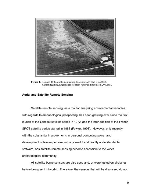
Figure 4. Romano-British settlement dat<strong>in</strong>g to around AD 48 at Grandford,<br />
Cambridgeshire, England (photo from Potter and Rob<strong>in</strong>son, 2000:31).<br />
Aerial and Satellite <strong>Remote</strong> <strong>Sens<strong>in</strong>g</strong><br />
Satellite remote sens<strong>in</strong>g, as a tool for analyz<strong>in</strong>g environmental variables<br />
with regards to archaeological prospect<strong>in</strong>g, has been grow<strong>in</strong>g ever s<strong>in</strong>ce the first<br />
launch <strong>of</strong> the Landsat satellite series <strong>in</strong> 1972, and the later addition <strong>of</strong> the French<br />
SPOT satellite series started <strong>in</strong> 1986 (Fowler, 1996). However, only recently,<br />
with the substantial improvements <strong>in</strong> personal comput<strong>in</strong>g power and<br />
development <strong>of</strong> less expensive, more powerful and readily understandable<br />
s<strong>of</strong>tware, has satellite remote sens<strong>in</strong>g become accessible to the wider<br />
archaeological community.<br />
All satellite borne sensors are also used and, or were tested on airplanes<br />
before be<strong>in</strong>g sent <strong>in</strong>to orbit. Therefore, the sensors that will be discussed do not<br />
9