A Review of Remote Sensing Application in Archaeological Research
A Review of Remote Sensing Application in Archaeological Research
A Review of Remote Sensing Application in Archaeological Research

You also want an ePaper? Increase the reach of your titles
YUMPU automatically turns print PDFs into web optimized ePapers that Google loves.
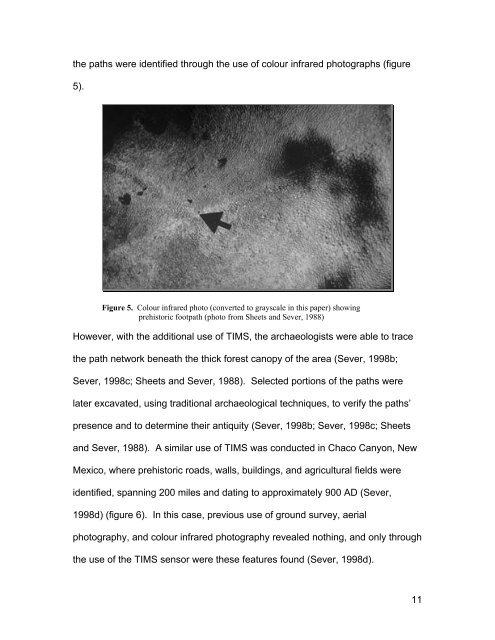
the paths were identified through the use <strong>of</strong> colour <strong>in</strong>frared photographs (figure<br />
5).<br />
Figure 5. Colour <strong>in</strong>frared photo (converted to grayscale <strong>in</strong> this paper) show<strong>in</strong>g<br />
prehistoric footpath (photo from Sheets and Sever, 1988)<br />
However, with the additional use <strong>of</strong> TIMS, the archaeologists were able to trace<br />
the path network beneath the thick forest canopy <strong>of</strong> the area (Sever, 1998b;<br />
Sever, 1998c; Sheets and Sever, 1988). Selected portions <strong>of</strong> the paths were<br />
later excavated, us<strong>in</strong>g traditional archaeological techniques, to verify the paths’<br />
presence and to determ<strong>in</strong>e their antiquity (Sever, 1998b; Sever, 1998c; Sheets<br />
and Sever, 1988). A similar use <strong>of</strong> TIMS was conducted <strong>in</strong> Chaco Canyon, New<br />
Mexico, where prehistoric roads, walls, build<strong>in</strong>gs, and agricultural fields were<br />
identified, spann<strong>in</strong>g 200 miles and dat<strong>in</strong>g to approximately 900 AD (Sever,<br />
1998d) (figure 6). In this case, previous use <strong>of</strong> ground survey, aerial<br />
photography, and colour <strong>in</strong>frared photography revealed noth<strong>in</strong>g, and only through<br />
the use <strong>of</strong> the TIMS sensor were these features found (Sever, 1998d).<br />
11