A Review of Remote Sensing Application in Archaeological Research
A Review of Remote Sensing Application in Archaeological Research
A Review of Remote Sensing Application in Archaeological Research

Create successful ePaper yourself
Turn your PDF publications into a flip-book with our unique Google optimized e-Paper software.
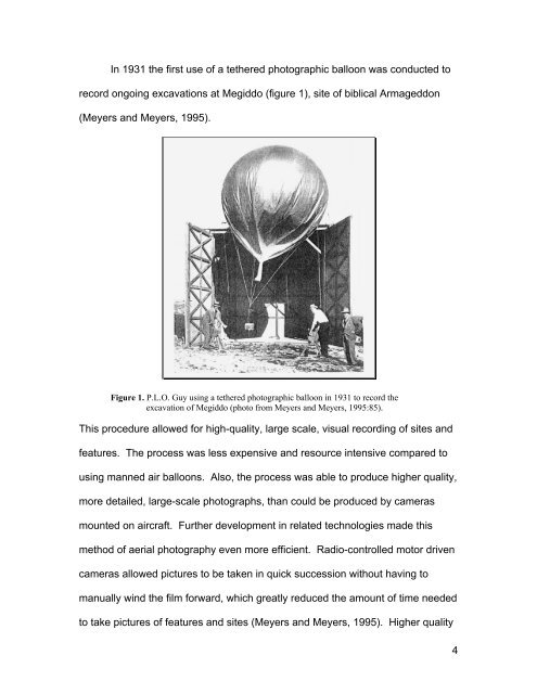
In 1931 the first use <strong>of</strong> a tethered photographic balloon was conducted to<br />
record ongo<strong>in</strong>g excavations at Megiddo (figure 1), site <strong>of</strong> biblical Armageddon<br />
(Meyers and Meyers, 1995).<br />
Figure 1. P.L.O. Guy us<strong>in</strong>g a tethered photographic balloon <strong>in</strong> 1931 to record the<br />
excavation <strong>of</strong> Megiddo (photo from Meyers and Meyers, 1995:85).<br />
This procedure allowed for high-quality, large scale, visual record<strong>in</strong>g <strong>of</strong> sites and<br />
features. The process was less expensive and resource <strong>in</strong>tensive compared to<br />
us<strong>in</strong>g manned air balloons. Also, the process was able to produce higher quality,<br />
more detailed, large-scale photographs, than could be produced by cameras<br />
mounted on aircraft. Further development <strong>in</strong> related technologies made this<br />
method <strong>of</strong> aerial photography even more efficient. Radio-controlled motor driven<br />
cameras allowed pictures to be taken <strong>in</strong> quick succession without hav<strong>in</strong>g to<br />
manually w<strong>in</strong>d the film forward, which greatly reduced the amount <strong>of</strong> time needed<br />
to take pictures <strong>of</strong> features and sites (Meyers and Meyers, 1995). Higher quality<br />
4