A Review of Remote Sensing Application in Archaeological Research
A Review of Remote Sensing Application in Archaeological Research
A Review of Remote Sensing Application in Archaeological Research

You also want an ePaper? Increase the reach of your titles
YUMPU automatically turns print PDFs into web optimized ePapers that Google loves.
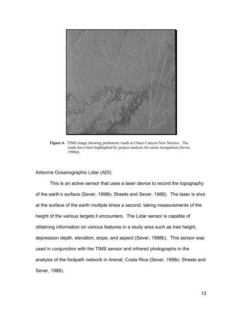
Figure 6. TIMS image show<strong>in</strong>g prehistoric roads at Chaco Canyon New Mexico. The<br />
roads have been highlighted by project analysts for easier recognition (Sever,<br />
1998d).<br />
Airborne Oceanographic Lidar (ADI)<br />
This is an active sensor that uses a laser device to record the topography<br />
<strong>of</strong> the earth’s surface (Sever, 1998b; Sheets and Sever, 1988). The laser is shot<br />
at the surface <strong>of</strong> the earth multiple times a second, tak<strong>in</strong>g measurements <strong>of</strong> the<br />
height <strong>of</strong> the various targets it encounters. The Lidar sensor is capable <strong>of</strong><br />
obta<strong>in</strong><strong>in</strong>g <strong>in</strong>formation on various features <strong>in</strong> a study area such as tree height,<br />
depression depth, elevation, slope, and aspect (Sever, 1998b). This sensor was<br />
used <strong>in</strong> conjunction with the TIMS sensor and <strong>in</strong>frared photographs <strong>in</strong> the<br />
analysis <strong>of</strong> the footpath network <strong>in</strong> Arenal, Costa Rica (Sever, 1998c; Sheets and<br />
Sever, 1988).<br />
12