View the Wisconsin Biking Guide - Wisconsin Department of Tourism
View the Wisconsin Biking Guide - Wisconsin Department of Tourism
View the Wisconsin Biking Guide - Wisconsin Department of Tourism

You also want an ePaper? Increase the reach of your titles
YUMPU automatically turns print PDFs into web optimized ePapers that Google loves.
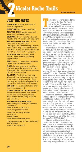
2Nicolet Roche Trails<br />
LANGLADE<br />
JUST THE FACTS<br />
DISTANCE: 14 miles total with 13<br />
miles <strong>of</strong> single-track.<br />
DIFFICULTY: Moderate to difficult.<br />
SURFACE TYPE: Mostly loamy soil,<br />
some sand, rocks and roots.<br />
SIGNAGE: Brown mountain bike silhouette<br />
and “You are here” map signs.<br />
TRAILHEAD LOCATIONS: On <strong>the</strong><br />
south end at Boulder Lake<br />
Campground & Boat Landing 1.8 miles<br />
nor<strong>the</strong>ast <strong>of</strong> Hwy 55 via Cty WW and<br />
Forest Road 2116. On <strong>the</strong> north end on<br />
Hwy 64, 3.3 miles east <strong>of</strong> Langlade.<br />
ATTRACTIONS: Nicolet National<br />
Forest, Depot Museum, paddling<br />
opportunities.<br />
FEES: None, but donations to LAMBA<br />
can be made at Bear Paw Inn.<br />
NOTE: Salvage logging in <strong>the</strong> blowdown<br />
area may be going on at times.<br />
Check with <strong>the</strong> Forest Service for possible<br />
trail section closings.<br />
CAUTION: The trails are two-way.<br />
When extreme obstacles are encountered<br />
obvious bypasses exist. Hikers<br />
may also use <strong>the</strong> trails; always yield to<br />
pedestrians and don’t spook animals.<br />
LEGEND: For a complete listing <strong>of</strong> all<br />
map icons, see page 2.<br />
OTHER TRAILS IN THIS REGION: Go<br />
to www.travelwisconsin.com. In <strong>the</strong><br />
search box, enter Washburn Lake<br />
Trails, Reforestation Camp Trails, or<br />
Ed’s Lake Trail.<br />
FOR MORE INFORMATION:<br />
Antigo/Langlade County Chamber <strong>of</strong><br />
Commerce<br />
888/526-4523, 715/623-4134<br />
www.antigochamber.com<br />
Wolf River Territory <strong>Tourism</strong><br />
Association<br />
715/493-0922<br />
www.wolfriverterritory.com<br />
Chequamegon-Nicolet National Forest<br />
715/362-1300<br />
www.fs.fed.us/r9/cnnf<br />
30<br />
COUNTY<br />
There’s a bit <strong>of</strong> a French connection in<br />
this part <strong>of</strong> <strong>the</strong> state. The Nicolet<br />
unit <strong>of</strong> <strong>the</strong> vast Chequamegon-<br />
Nicolet National Forest is named for<br />
Jean Nicolet, <strong>the</strong> French explorer acknowledged<br />
as <strong>the</strong> first European in <strong>Wisconsin</strong>.<br />
Fur trader Sieur Charles Michel de Langlade<br />
is <strong>the</strong> county’s namesake. Fitting <strong>the</strong>n that<br />
when LAMBA (Landglade Area Mountain<br />
Bicycling Association) members chose a name<br />
for <strong>the</strong>ir new trail’s most distinguishing characteristic<br />
<strong>the</strong>y decided on “roche,” <strong>the</strong><br />
French word for rock.<br />
The rocks you’ll find here are not just<br />
any stones, though <strong>the</strong>re are plenty <strong>of</strong> those<br />
too. Expect encounters with megaliths in a<br />
half-dozen trail sections. One section is even<br />
named MOAB – “Mo<strong>the</strong>r Of All Boulders”–<br />
what a treat! These huge boulders dot <strong>the</strong><br />
forest floor and <strong>of</strong>fer high skill, low consequence<br />
challenges. If you’re riding technique<br />
is not up to tackling <strong>the</strong>se stone monsters<br />
<strong>the</strong>re are always obvious bypasses.<br />
Beyond <strong>the</strong> boulder fields you’ll find<br />
more fun riding with short steep sections traversing<br />
20 to 50 feet <strong>of</strong> elevation. The riding<br />
here is a bit easier. Even though trail section<br />
names like Beast, Gravity Cavity and Psycho<br />
Path suggest a certain amount <strong>of</strong> whimsy in<br />
choosing titles, <strong>the</strong>re may be more than a bit<br />
<strong>of</strong> truth in <strong>the</strong>m as well. For beginners, or<br />
just an easy warm-up, mountain biking is<br />
allowed on <strong>the</strong> Boulder Lake Campground<br />
Trail, a mile-and-a-half ride around a bog on<br />
<strong>the</strong> s<strong>of</strong>t forest floor and boardwalks.<br />
The Nicolet lobe <strong>of</strong> <strong>the</strong> Chequamegon-<br />
Nicolet is gigantic. It encompasses more than<br />
660,000 acres. That’s more than 1,000<br />
square miles. It covers <strong>the</strong> most thinly populated<br />
part <strong>of</strong> <strong>the</strong> state, perfect for getting<br />
away from it all. The nearest sizable town is<br />
Antigo, more than 20 miles to <strong>the</strong> west.<br />
There are services available at <strong>the</strong> tiny towns<br />
<strong>of</strong> Langlade and White Lake. In White Lake<br />
you can learn more about local history at <strong>the</strong><br />
Depot Museum (open MD-LD Sat 9am-3pm,<br />
Sun noon-3pm; 715/882-8581).<br />
More recent history has challenged<br />
LAMBA members and local residents. On<br />
June 7, 2007 an F4 tornado sliced through<br />
<strong>the</strong> forest. The satellite photos <strong>of</strong> <strong>the</strong> damage<br />
are amazing. They show a 35-mile long,<br />
half-mile wide slash running southwest to<br />
nor<strong>the</strong>ast across <strong>the</strong> emerald green forest.<br />
It looks like a gigantic bowling ball rolled<br />
through, flattening everything. This “mo<strong>the</strong>r<br />
<strong>of</strong> all strikes” tracked right across <strong>the</strong> trail’s<br />
central loop. The good news is <strong>the</strong> boulders