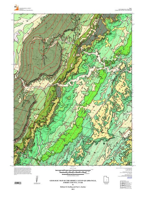
UTAH GEOLOGICAL SURVEY a division of <strong>Utah</strong> Department of Natural Resources Plate 1 <strong>Utah</strong> <strong>Geological</strong> <strong>Survey</strong> Map 255DM Geologic Map of the Short Canyon Quadrangle Qa l Km b Qa l Km b Qa f Qm tc Qm tc Km f Qm tc Qm tc Km t Kd Kc m Qm tc Qa f Kc r Jm b b Qa l Jm s Km b 4900 Qa l 5000 Km b Km b 10 Qa f Km b Km b 5 7 3 4 3 5 Km f Qm tc 5 6 Qm tc Qm tc Qa f Qa f Qa f Qa f Qa f Kd Kc m Kd Qa f Kc m Kc m Kd Kc m Kc s Qa l Jm b p Qa p Jm s Qa l Km b Qa m Km b Qa f 8 8 5100 5200 5400 5300 2 5 Qa f 5500 4 Qa l 2 2 2 Qa f 3 Qa f 4 Qm tc Qa f 5 Qm tc Qa f Qa f Qm tc 5 Qa f Qa f Qa f Km t Qa l Qa f Qa f Qa l Kd Qm tc Qm tc Kc m Kc s Qa f Qa l 4 Qa l Kc m Kc r Kc b Kc m Qm tc 4 Kc b Jm b p Kc m Jm b b Qa f Jm s Kc r 4 Kc b Kc b Kc b 4 Qa p Jm s 4 Qa f Jm s Jm s Jm s Jm s Jm t Qa m Km b Km f 4 Qa l 3 4 Qm tc Km t Km f 2 Qa l 4 5 3 Qm tc Km t 7 Km t Qa l 6 5 Qm tc Qm s 5600 Qm tc 7 5700 Qm tc Qm tc Qa f 5800 5900 Qm tc Qa f Qm tc Kc m Kd Kc s Qa f 6000 6100 Kc b Qa f Kd 5 6200 Jm b b Qa f Qa f 5 Kc b 6300 Kc b Qm tc Kc b Kc m Kc r Jm b p Jm b b Qa l 6400 Jm b b Jm b b Jm b b Qa l Qa f Qa f Jm b b Jm b b Jm b p Jm b b Jm s Qa p Qa p Qa f Qa p Qa f Jm s Qa p Jm s Qa p Jm t Jm t Qa f 4 Jm s 6 Qa f Jm s Qa p Jm s Jm t Jm b b Qa f Jm t Jm s Qa f Jm s Js Jm t Qa f Qa f Jc u 5 Qa p Jc u Qa l Js Qa p Jc l Js Qa f Qea Js Qa f Jc u Qea Jc l Qa f 5 Jc l Jc u Qea Jc l Jeu Jeu Jeu Km f Qm tc 7 Qm tc Qa f Qa l Qa f Jm b p Qa f Jm b b Jm s Jm s 6500 Jm s 6600 Qa f Jm t Js Jc u Qa p Qea Jc l Jem Jeu Km t Qa p Qa f Km t Qa p Qa f Kc s Jm s Qa f 6700 4 Qa f Qa p Qa p Jc l Qm s Qm tc Km t Jm b p 6800 Jeu Jc l Jem Qa f Kc b Jm b b Qa p 6900 Jc l Qea Js A Qm tc 4 Kc m Js 7000 Jc l Qa l Qa p Jm b p Qa l Jm t Jc u Qea Jc l Jc l Km f Qea Km t Qm tc Qm tc Qm tc Qa p Qa p Qm tc Kc m Kc b Qa f Kc m Kd Kd Qa f Qa f Kc m Jm b p Kc r Kc s Kc b Kc s Jm b b Qa f Jm s 3 Qa l Jm t Qa f Js 4 Qa f Jc l Jc u Jc l Jc l 7100 7200 Qa f 5 Jc l 7300 Jc l 4 7400 Jeu Qa f Qa f Jem Qa f Qa l Qa l Qa p Qm tc Qm tc Kc m Kd 3 Qa f Qa l Jm t Qa f Jc u Qea Jc l 7500 Qa f Qa l Qa p Qa p Km t Qm tc Kc m Qm tc Kd Qa l Qa f Qa f Kd Jm b p Qa f Kc r Qm tc Kc m Qm tc Qa l Qm tc Qa f Qa f Kc r Qa f Kc b Kc r Kc b Qa f Qa l Jm s Qa f Qa f Jm s 4 Qa f Jm s Qa f Qea Qa f Qa f Qa l Qea Jc l Qa f Jc l Jc l Qa l Jeu Jem Jeu Jc l Jc l Jel 4 7600 Qa l Qa p Jel Qa f 7700 Qa f 5 Qa l Qa p A' Qa p Kc m Qa l Kc r Jm b p Kc b Jm b b Jm b b Jm b p Jm b b Qa f Qa f Qa l Qa l Qa l Jm s Qa l Jm t Js Jm s Qa f Qa f Jc u Js Qa f Jc l Jc u Jc l Jc u Qea Qea Qa f Jeu 4 Jeu Qa f Qa p Qa f Jel Qa p Jel Jel 7800 Qa p Qa p Jc w 7900 Qa l Although this product represents the work of professional scientists, the <strong>Utah</strong> Department of Natural Resources, <strong>Utah</strong> <strong>Geological</strong> <strong>Survey</strong>, makes no warranty, expressed or implied, regarding its suitability for a particular use, and does not guarantee accuracy or completeness of the data. The <strong>Utah</strong> Department of Natural Resources, <strong>Utah</strong> <strong>Geological</strong> <strong>Survey</strong>, shall not be liable under any circumstances for any direct, indirect, special, incidental, or consequential damages, with respect to claims by users of this product. For use at 1:24,000 scale only. TRU E N ORTH 10°86' MAGN ETIC N ORTH APPROXIMATEMEAN DECLIN ATION ,2013 SCALE1:24,000 1 0.5 0 1 MILE 1000 0 1000 2000 3000 4000 5000 6000 7000 FEET 1 0.5 0 1 KILOMETER CON TOU RIN TERV AL40FEET GEOLOGIC MAP OF THE SHORT CANYON QUADRANGLE, EMERY COUNTY, UTAH by Hellmut H. Doelling and Paul A. Kuehne 2013 U TAH QU ADRAN GLE LOCATION Ba se fro m U SGSSho rtCa nyo n 7.5’Qua dra ngle (1983) Pro jec tio n:U TM Zo ne 12 Da tum :N AD1927 Sphero id:Cla rke 1886 Pro jec tMa na ger:Gra ntC.W illis GISa ndCa rto gra phy:Pa ulA.Kuehne a nd Lo riJ.Stea dm a n <strong>Utah</strong> <strong>Geological</strong> <strong>Survey</strong> 1594W estN o rth Tem ple,Suite 3110 P.O.Bo x 146100,Sa ltLa ke City,U T84114-6100 (801) 537-3300 geo lo gy.uta h.go v 1 2 3 4 5 6 7 8 1.Fe ro n 2.Mo len 3.Ho rn SilverGulc h 4.Em ery Ea st 5.Sida ndCha rley 6.Mesa Bute 7.Big BendDra w 8.Co pperGlo b e ADJOIN IN G 7.5'QU ADRAN GLEN AMES
<strong>Utah</strong> <strong>Geological</strong> <strong>Survey</strong> a division of <strong>Utah</strong> Department of Natural Resources Plate 2 <strong>Utah</strong> <strong>Geological</strong> <strong>Survey</strong> Map 255 DM Geologic Map of the Short Canyon Quadrangle DESCRIPTION OF MAP UNITS LITHOLOGIC COLUMN Qal Qam Qaf Qap Qms Qmtc Qea Km Kmb Kmf Kmt Kd Kc Kcm Kcs Kcr Kcb Stream alluvium (Holocene to Late Pleistocene) – Unconsolidated; poorly to moderately sorted clay, silt, sand, granules, and gravel in stream channels; includes low-level terrace deposits; mostly from local sources; alluvium in the major drainages is mainly Mancos Shale mud interlayered with locally derived very fine grained sand; coarser constituents are commonly interlensed with the finer constituents; includes local colluvium especially south of Short Canyon Spring; uppermost surfaces characterized by weak soil development; upper surfaces adjacent to the main channel are commonly fluted (eroded) by flood waters; as much as 30 feet (9 m) thick. Alluvial-mud deposits (Holocene to late Pleistocene) – Mostly unconsolidated clay, silt, and sand, deposited as fans and mudflows; eroded from Mancos Shale outcrops; form valley fill and mud dominated alluvial fans; locally deeply incised by erosion; unstratified and nearly structureless; as much as 15 feet (5 m) thick. Alluvial-fan deposits (Holocene to late Pleistocene) – Unconsolidated deposits of poorly sorted, generally unstratified, muddy silt, sand, and gravel; gravel ranges from pebbles to boulders; deposits are locally derived and reflect the source materials; as much as 15 feet (5 m) thick. Pediment-mantle deposits (Holocene to early Pleistocene) – Mostly unconsolidated sand and gravel, but with local silt and boulders, deposited on top of older erosional surfaces; deposits are mostly locally derived and contain angular to rounded pebbles and cobbles from Ferron Sandstone, Dakota Formation, Buckhorn Conglomerate and other ledges in the Cedar Mountain Formation, and Saltwash Member of the Morrison Formation; crudely stratified, mostly matrix supported; as much as 15 feet (5 m) thick, but average 10 feet (3 m) in thickness. Landslide and slump deposits (Holocene to late Pleistocene) – Large coherent blocks to fragmented masses of bedrock and surficial debris transported downslope by mass movement; present along the Molen Reef; debris varies in size from 0.5 to 10 feet (0.2 to 3 m) in diameter; thicknesses vary. Talus, colluvium, and rock-fall deposits (Holocene to late Pleistocene) – Generally angular rock-fall blocks, boulders, and small fragments deposited as veneers on slopes below ledges and cliffs; colluvium contains additional slope-wash debris of poorly sorted rock fragments in a sandy matrix; only larger deposits are mapped; mostly present along Molen Reef; thicknesses vary, but average less than 5 feet (1.5 m). Mixed eolian and alluvial deposits (Holocene to Late Pleistocene) – Unconsolidated fine- to mediumgrained sand and minor pebble gravel mostly resting on the lower Curtis Formation from which much of the deposits are derived; deposited by sheetwash and wind; present along South Sand Bench; as much as 10 feet (3 m) thick, but mostly less than 5 feet (1.5 m) thick. Mancos Shale Blue Gate Member (Upper Cretaceous, Campanian-Santonian) – Mostly pale blue-gray marine shale, nodular and irregularly bedded mudstone, and siltstone with several yellow-gray, slightly more resistant, sandy beds; mostly a slope former, with sandy beds more common in the lower and upper parts; only lower part is preserved in the northwest corner of the quadrangle, about 300 feet (100 m) is exposed. Ferron Sandstone Member (Upper Cretaceous, Turonian-Cenomanian) – Alternating yellow-gray, light-brown, and white sandstone, sandy gray shale, gray and carbonaceous shale, and thin coal; mostly fine to medium grained sandstone, commonly calcareous; lenticular, thin to very thick beds; caps the Molen Reef; about 325 feet (100 m) thick, thinning northeastward. Tununk Member (Upper Cretaceous, Cenomanian) – Medium- to dark-gray marine shale; forms steep slope under Ferron Sandstone cliff; becomes increasingly sandy toward top; has 5- to 10-foot (1.5–3 m) thick Moore sandstone bed that makes a ledge (not mapped) 100 feet (30 m) below the top; about 675 feet (205 m) thick. Dakota Formation (Upper Cretaceous, Cenomanian) – Variable assemblages of yellow-gray sandstone, conglomerate, conglomeratic sandstone, light-brown shale, and coal; sandstone is generally fine to coarse grained, cross-bedded, thick bedded, and lenticular; conglomerate contains gray quartzite and black chert pebbles up to 6 inches (15 cm) across; forms ledges and slopes; local coal beds are generally very thin and bony; 50 to 100 feet (15–30 m) thick. Cedar Mountain Formation – Undivided on cross section. Members are designated from Kirkland and others (1997). Mussentuchit Member (Upper to Lower Cretaceous, Cenomanian-Albian) – Mostly gray, silty, smectitic mudstone containing a few thin, green-gray, lenticular sandstone beds and some lignitic zones near the top; form smooth rounded slopes; 38 to 110 feet (12–33 m) thick. Short Canyon Member (informal new name) (Upper to Lower Cretaceous, Cenomanian) – Conglomerate, conglomeratic sandstone, and sandstone ledges, separated by slope-forming sandstone, local gray to black carbonaceous (and possibly coaly) shale, and rare thin gypsiferous sandstone lenses; ledges are crossstratified, gray, gray brown, and brown, and contain poorly sorted subrounded to subangular grit to cobbles as much as 4 inches (12 cm) across; slope-forming sandstone is mostly light gray or green gray, fine to medium grained, poorly cemented and friable; 0 to 104 feet (0–32 m) thick, and discontinuous, thickening northward in quadrangle. Ruby Ranch Member (Lower Cretaceous, Albian-Aptian) – Mostly green-gray, light gray, and purple, silty mudstone that contains nodular brown limestone beds; also has a basal muddy sandstone bed; locally contains a few lenticular ledges of fine-grained, locally pebbly sandstone, especially at base; brown limestone ledges commonly break up and litter the smooth slopes; 76 to 131 feet (23–40 m) thick. Buckhorn Conglomerate Member (Lower Cretaceous, Barremain-Aptian?) – Gray-brown conglomerate, conglomeratic sandstone, and sandstone; contains pebble- and cobble-sized clasts of quartzite, chert, and black siliceous limestone in a matrix of poorly sorted, fine- to coarse-grained sandstone interbedded with gray-green silty and sandy shale; sandstone is trough cross-bedded, lenticular, and discontinuous; forms ledges and benches that are channeled into the underlying purple unit of the Brushy Basin Member of the Morrison Formation; mapped only where the outcrops form benches; is included with the Ruby Ranch Member (Kcr) where thin or less well developed; 0 to 40 feet (0–12 m) thick. Figure 1. View to the southwest near Short Canyon of the Salt Wash Member of the Morrison Formation to the Ferron Sandstone Member of the Mancos Shale. The Short Canyon Member of the Cedar Mountain Formation is not present in this view. Js Kcb Jmbb Jmbp Jms Jms Figure 2. View of the upper member of the Curtis Formation, Summerville Formation, and the Tidwell and Salt Wash Members of the Morrison Formation. View to the east near North Salt Wash. Jcu CORRELATION OF MAP UNITS Qal Qaf Qms Qmtc Qea Qam Qap Kd Upper Lower Upper Middle Lower HOLOCENE Kcm Kcr PLEISTOCENE QUATERNARY Kmf Jmt Kmt Js System Series-Stage CRETACEOUS JURASSIC upper middle upper lower Campanian Santonian Callorian Oxfordian Kimmeridgian Tithonian Aptian Albian Ceuomanian Turonian Mancos Shale Formations, Members feet (m) Blue Gate Shale Member 300+ (100+) Ferron Sandstone Member 325 (100) Tununk Shale Member ~675 (205) Map Symbol Kmb Kmf Kmt Dakota Formation 50–100 (15–30) Kd 38–110 Mussentuchit Mbr (12–33) Kcm 0–104 Short Canyon Mbr(0–32) Kcs Ruby Ranch Mmr 76–131 (23–40) Kcr 0–40 Buckhorn Cong Mbr (0–12) Kcb purple unit 80–120 Jmbp (25–35) Cedar Mtn Formation Morrison Formation Curtis Formation Entrada Sandstone Brushy Basin Member brightly banded unit 205–265 (60–80) Salt Wash Member 95–225 (30–70) Tidwell Member 70–90 (20–25) Summerville Formation 255–295 (80–90) Upper member 85–100 (26–30) Lower member 95–105 (29–32) Upper member ~155 (45) Middle member ~255 (80) Lower member ~295 (90) 50+ Carmel Formation, Winsor Member Bath. (15+) Jmbb Jms Jmt Js Jcu Jcl Jeu Jem Jel Jcw . . . . . . . . . . . . . . . . . . . . . . . . . . . . . . . . . . . . . . . . . . . . . . . . . . . . . . . . . . . . . . . . . . . . . . . . . . . . . . . . . . . . . . . . . . . . . . . . . . . . . . . . . . . . . . . . . . . . . . . . . . . . . . . . . . . . . . . . . . . . . . . . . . . . . . . . . . . . Lithology . . . . . . . . . . . . . . . . . . . . . . . . . . . . . . . . . . . . . . . . . . . . . . . . . . ... ... ... . .. ... ... . ... ... ... ... . . . . .. . .. .. .. .. .. .. .. .. .. .. .. .. .. o . o . o . . o . o . . o . o . . o . o . . o . o . . o . o . . o . . . . . . . . . . . . . . . . . . . . . . . . . . . . . . . . . . . . . . . . . . . . . . . . . . . . . . . . . . . . . . . . . . . . . . . . . . . . . . . . . . . . . . . . . . . . . . . . . . . . . . . . . . . . . . . . . . . . . . . . . . . . . . . . . . . . . . . . . . . . . . . . . . . . . . . . . . . . . . . . . . . . . . . . . . . . . . . . . . . . . . . . . . . . . . . . . . . . . . . . . . . . . . . . . . . . . . . . . . . . . . . . . . . . . . . . . . . . . . . . . . . . . . . . . . . . . . . . . . . . . . . . . . . . . . . . . . . . . . . . . . . . . . . . . . . . . . . . . . . . . . . . . . . . . . . . . . . . . . . . . . . . . . . . . . . . . . . . . . . . . . . . . . . . . . . . . . . . . . . . . . . . . . . . . . . . . . . . . . . . . . . . . . . . . . . . . . . . . . . . . . . . . . . . . . . . . . . . . . . . . . . . . . . . . . . . . . . . . . . . . . . . . . . . . . . . . . . . . . . . . . . . . . . . . . . . . . . . . . . . . . . . . . . . . . . . . . . . . . . . . . . . . . . . . . . . . . . . . . . . . . . . . . . . . . . . . . . . . . . . . . . . . . . . . . . . . . . . . . . . . . . . . . . . . . . . . . . . . . . . . . . . . . . . . . . . . . . . . . . . . . . . . . . . . . . . . . . . . . . . . . . . . . . . . . . . . . . . . . . . . . . . . . . . . . . . . . . . . . . . . . . . . . . . . . . . . . . . . . . . . . . . . . . . . . . . . . . . . . . . . . . . . . . . . . . . . . . . . . . . . . . . . . . . . . . . . . . . . . . . . . . . . . . . . . . . . . . . . . . . . . . . . . . . . . . . . . . . . . . . . . . . . . . . . . . . . . . . . . . . . . . . . . . . . . . . . . . . . . . . . . . . . . . . . Jm Jmb Jmbp Jmbb Jmst Jms Morrison Formation Brushy Basin Member – Undivided on cross section. Purple unit (Upper Jurassic, Tithonian) – Mostly light purple to light pink gray siltstone and mudstone; commonly forms two steep slopes separated by a persistent ledge of sandstone and conglomerate; contains many horizons of brown limestone nodules that break up and litter slopes; 80 to 120 feet (25–35 m) thick. Brightly banded unit (Upper Jurassic, Tithonian) – Mudstone with clay, silt, and fine-grained sandstone, banded in shades of light gray, light brown, or light purple; mudstone is commonly bentonitic; also contains scattered horizons of brown limestone nodules, thin white sandstone beds, and lenticular conglomeratic beds; forms steep slopes with local ledges; 205 to 265 feet (60–80 m) thick. Salt Wash and Tidwell Members, undivided – on cross section only. Salt Wash Member (Upper Jurassic, Kimmeridgian) – Gray conglomeratic sandstone and interbedded green-gray, purple, and light gray mudstone and siltstone; forms slopes, cliffy ledges and benches; 95 to 225 feet (30–70 m) thick, thickening irregularly northward. unconformity Kmb unconformity Km Kmf Kmt local unconformity Kd unconformity? Kcm Kcs Kc unconformity Kcr Kcb unconformity Upper Lower CRETACEOUS MAP SYMBOLS Contact – dashed where gradational or approximate Normal fault – Bar and ball on downthrown side; dashed where approximately located Jmt Js Jc Jcu Jcl Tidwell Member (Upper Jurassic, Kimmeridgian) – Red-brown, locally mottled siltstone and subordinate very fine-grained, platy-weathering sandstone interbedded with gypsum beds; light- to medium-gray, medium- to coarse-grained sandstone beds are locally present in the basal part to lower half of the unit; many siltstone beds contain flattened blebs and lozenges of pink gypsum; 70 to 90 feet (20–25 m) thick; gypsum beds are as much as 14 feet (4.3 m) thick. Summerville Formation (Upper Jurassic, Oxfordian) – Light- to dark-brown and subordinate white or light-gray, thin and evenly bedded siltstone and very fine-grained sandstone; forms convex slopes; 255 to 295 feet (80–90 m) thick. Curtis Formation – Undivided on cross section. Upper member (Upper Jurassic, Oxfordian) – Green-gray and subordinate light-brown, fine-grained sandstone forming a series of slopes divided by thin ribs of more resistant sandstone; mostly thin-bedded; becomes finer-grained and less resistant in upper part; 85 to 100 feet (26–30 m) thick. Lower member (Upper Jurassic, Oxfordian) – Light-gray to light green-gray, fine-grained, thin-to thickbedded, calcareous sandstone; most beds are cliffy and ledgy and weather into thick slabs; lower quarter is green-gray siltstone and mudstone that forms a slightly recessed vertical cliff or a steep slope; a few thin pebbly or gritty beds are commonly found in the lower quarter; 95 to 105 feet (29–32 m) thick. Jm Jmbp Jmb Jmbb Jmst Jms Jmt unconformity? Js Jcu Jc Jcl unconformity Jeu Je Jem Jel Upper Upper Middle JURASSIC A 5500 12 A' Structure contour – contour interval 100 feet, drawn on base of Dakota Formation; short dash where contour is projected above ground surface; long dash where approximate Anticlinal axis – showing plunge Synclinal axis – showing plunge Line of cross section Strike and dip of inclined bedding Spring Prospect Je Jeu Jem Jel Entrada Sandstone upper, middle, and lower members (Middle Jurassic, Callovian) – Undivided on cross-section only. Overall, formation is orange-brown to brown silty sandstone and subordinate siltstone; sandstone is very fine to fine grained with scattered medium or coarse grains; thin bedded to massive or indistinctly bedded; weathers into cliffs, ledges and earthy slopes. Divided into three informal members: upper member (Jeu) commonly stands as a cliff and has a basal white fine-grained sandstone marker bed at its base; middle member (Jem) consists of alternating ledges and thin-bedded earthy slopes; lower member (Jel) forms mostly earthy slopes, has indistinct bedding, and contains abundant gypsum in thin beds and satin-spar veinlets; Je is about 705 feet (215 m) thick; Jeu is about 155 feet (45 m) thick, Jem is about 255 feet (80 m) thick, and Jel is about 295 feet (90 m) thick. Jcw Jcw Carmel Formation, Winsor Member (Middle Jurassic, Bathonian-Callovian) – Mostly siltstone interbedded with calcisiltite, calcarenite, and gypsum; mostly green gray and red brown; criss-crossed with satinspar gypsum veinlets; mostly forms steep earthy slopes littered with platy calcarenite or calcisiltite; only upper 50 feet (15 m) exposed in the quadrangle. 7000 6000 5000 4000 A Elevation (feet) West Kmf Kd Kmt Kc Jmb Jmst Js Jc Molen Reef Je Jcw Kd Kc Jmst Js Jc Je Jcw South Sand Bench Jc Lookout Point Je Jcw Glen Canyon Group and older formations South Salt Wash East A' Elevation (feet) 7000 6000 5000 4000 3000 Quaternary units not shown on cross section. 3000