download pdf - Utah Geological Survey - Utah.gov
download pdf - Utah Geological Survey - Utah.gov
download pdf - Utah Geological Survey - Utah.gov
Create successful ePaper yourself
Turn your PDF publications into a flip-book with our unique Google optimized e-Paper software.
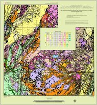
GEOLOGIC MAP OF THE SHORT CANYON<br />
QUADRANGLE, EMERY COUNTY, UTAH<br />
by Hellmut H. Doelling and Paul A. Kuehne<br />
ABSTRACT<br />
The Short Canyon quadrangle lies along the west edge of<br />
the Colorado Plateau physiographic province and the east<br />
edge of the High Plateaus, near a transition zone between<br />
the Colorado Plateau to the east and the Basin and Range<br />
Province to the west, and is in the Colorado River drainage<br />
basin. The west boundary is located about 5 miles (8 km)<br />
east of Emery, <strong>Utah</strong>, and about 40 miles (64 km) east of<br />
Salina, <strong>Utah</strong>. The south boundary is 2 to 3 miles (3–5 km)<br />
north of Interstate Highway 70.<br />
Exposed bedrock ranges from Middle Jurassic to Late<br />
Cretaceous in age, includes (in ascending order) the Carmel<br />
Formation (part), Entrada Sandstone, Curtis Formation,<br />
Summerville Formation, Morrison Formation, Cedar<br />
Mountain Formation, Dakota Formation, and the Mancos<br />
Shale (part), and is about 3700 feet (1200 m) thick. The<br />
rocks of the quadrangle dip gently northwestward from<br />
the large San Rafael Swell anticline (to the southeast) into<br />
the Wasatch Plateau syncline (to the northwest). Quaternary<br />
surficial deposits of Holocene and Pleistocene age<br />
include varieties of alluvium, eolian, mass-movement, and<br />
mixed-environment deposits.<br />
No mineral commodities are known to have been produced<br />
from the quadrangle area. Only thin coal deposits<br />
have been discovered in the Ferron Sandstone Member of<br />
the Mancos Shale and in the Dakota Formation.<br />
INTRODUCTION<br />
The Short Canyon quadrangle is located in Emery County<br />
in central <strong>Utah</strong>. The south boundary of the quadrangle<br />
is 2 to 3 miles (3–5 km) north of Interstate 70; the west<br />
boundary is 5 miles (8 km) east of the town of Emery and<br />
40 miles (64 km) east of Salina, <strong>Utah</strong>. The quadrangle is<br />
named after Short Canyon, which flows into Dry Wash in<br />
the northern third of the quadrangle. The map area coincides<br />
with the west edge of the Colorado Plateau physiographic<br />
province and the east edge of the High Plateaus, a<br />
transition zone between the Colorado Plateau and Basin<br />
and Range Province. Emery and Moore are small towns in<br />
the southern part of Castle Valley, immediately west of the<br />
quadrangle.<br />
The highest elevation on the quadrangle is along the<br />
Molen Reef in section 15, T. 22 S., R. 7 E. at 6930 feet (2113<br />
m) and the lowest elevation is South Salt Wash along the<br />
south margin of the quadrangle in section 28, T. 22 S., R. 8<br />
E., at 5720 feet (1743 m).<br />
The principal access is a paved road that extends east<br />
from Moore to I-70. This road passes northwest-southeast<br />
across the middle of the quadrangle; several poorly maintained<br />
roads extend northeast and southwest from this<br />
principal roadway.<br />
The quadrangle was first mapped geologically by C.T. Lupton<br />
(1916) at a scale of 1:62,500 as part of the U.S. <strong>Geological</strong><br />
<strong>Survey</strong> coal-mapping program. Thereafter, Orkild<br />
(1956) produced a photogeologic map of the quadrangle<br />
(Emery 1NE). With some modification, the Orkild (1956)<br />
map was used in the first geologic map of <strong>Utah</strong>, which<br />
was printed at a scale of 1:250,000 (Hintze and Stokes,<br />
1963). It was also included in a geologic map of the Salina<br />
quadrangle (1:250,000) by Williams and Hackman<br />
(1971). Doelling (1972) mapped part of the quadrangle<br />
at 1:33,500 as part of a study of the Emery coal field, and<br />
Doelling (2004) remapped the quadrangle as part of a<br />
1:100,000-scale mapping project. The present project provides<br />
greater geologic detail at a larger scale.<br />
STRATIGRAPHY<br />
Sedimentary strata exposed in the Short Canyon quadrangle<br />
range in age from Middle Jurassic to Late Cretaceous,<br />
and have a total thickness of 3700 feet (1200 m). Several<br />
Quaternary units have been differentiated, including alluvial,<br />
eolian, mass movement, and mixed-environment<br />
deposits.<br />
Subsurface Rock Units<br />
Nearby drill holes have penetrated a normal stratigraphic<br />
sequence of formations below the oldest exposed units<br />
of the quadrangle. The <strong>Utah</strong> Plateau #1-X Federal well,<br />
SW1/4SW1/4 section 11, T. 22 S., R. 8 E., was spudded in<br />
the Entrada Sandstone about one mile (1.6 km) east of the<br />
quadrangle’s east boundary. Reported thicknesses are:


