Gunsight Mountain, Sabino Canyon Ruin - Archaeology Southwest
Gunsight Mountain, Sabino Canyon Ruin - Archaeology Southwest
Gunsight Mountain, Sabino Canyon Ruin - Archaeology Southwest

Create successful ePaper yourself
Turn your PDF publications into a flip-book with our unique Google optimized e-Paper software.
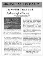
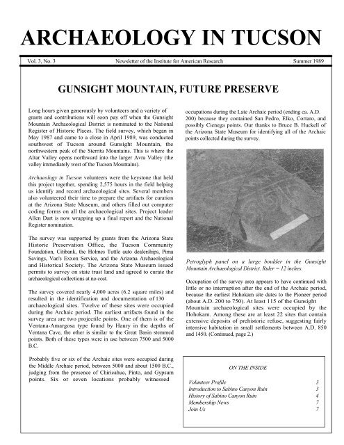
ARCHAEOLOGY IN TUCSON<br />
Vol. 3, No. 3 Newsletter of the Institute for American Research Summer 1989<br />
GUNSIGHT MOUNTAIN, FUTURE PRESERVE<br />
Long hours given generously by volunteers and a variety of<br />
grants and contributions will soon pay off when the <strong>Gunsight</strong><br />
<strong>Mountain</strong> Archaeological District is nominated to the National<br />
Register of Historic Places. The field survey, which began in<br />
May 1987 and came to a close in April 1989, was conducted<br />
southwest of Tucson around <strong>Gunsight</strong> <strong>Mountain</strong>, the<br />
northwestern peak of the Sierrita <strong>Mountain</strong>s. This is where the<br />
Altar Valley opens northward into the larger Avra Valley (the<br />
valley immediately west of the Tucson <strong>Mountain</strong>s).<br />
occupations during the Late Archaic period (ending ca. A.D.<br />
200) because they contained San Pedro, Elko, Cortaro, and<br />
possibly Cienega points. Our thanks to Bruce B. Huckell of<br />
the Arizona State Museum for identifying all of the Archaic<br />
points collected during the survey.<br />
<strong>Archaeology</strong> in Tucson volunteers were the keystone that held<br />
this project together, spending 2,575 hours in the field helping<br />
us identify and record archaeological sites. Several members<br />
also volunteered their time to prepare the artifacts for curation<br />
at the Arizona State Museum, and others filled out computer<br />
coding forms on all the archaeological sites. Project leader<br />
Allen Dart is now wrapping up a final report and the National<br />
Register nomination.<br />
The survey was supported by grants from the Arizona State<br />
Historic Preservation Office, the Tucson Community<br />
Foundation, Citibank, the Holmes Tuttle auto dealerships, Pima<br />
Savings, Van's Exxon Service, and the Arizona Archaeological<br />
and Historical Society. The Arizona State Museum issued<br />
permits to survey on state trust land and agreed to curate the<br />
archaeological collections at no cost.<br />
The survey covered nearly 4,000 acres (6.2 square miles) and<br />
resulted in the identification and documentation of 130<br />
archaeological sites. Twelve of these sites were occupied<br />
during the Archaic period. The earliest artifacts found in the<br />
survey area are two projectile points. One of them is of the<br />
Ventana-Amargosa type found by Haury in the depths of<br />
Ventana Cave, the other is similar to the Great Basin stemmed<br />
points. Both of these types were in use between 7500 and 5000<br />
B.C.<br />
Probably five or six of the Archaic sites were occupied during<br />
the Middle Archaic period, between 5000 and about 1500 B.C.,<br />
judging from the presence of Chiricahua, Pinto, and Gypsum<br />
points. Six or seven locations probably witnessed<br />
Petroglyph panel on a large boulder in the <strong>Gunsight</strong><br />
<strong>Mountain</strong> Archaeological District. Ruler = 12 inches.<br />
Occupation of the survey area appears to have continued with<br />
little or no interruption after the end of the Archaic period,<br />
because the earliest Hohokam site dates to the Pioneer period<br />
(about A.D. 200 to 750). At least 115 of the <strong>Gunsight</strong><br />
<strong>Mountain</strong> archaeological sites were occupied by the<br />
Hohokam. Among these are at least 22 sites that contain<br />
extensive deposits of prehistoric refuse, suggesting fairly<br />
intensive habitation in small settlements between A.D. 850<br />
and 1450. (Continued, page 2.)<br />
ON THE INSIDE<br />
Volunteer Profile 3<br />
Introduction to <strong>Sabino</strong> <strong>Canyon</strong> <strong>Ruin</strong> 3<br />
History of <strong>Sabino</strong> <strong>Canyon</strong> <strong>Ruin</strong> 4<br />
Membership News 7<br />
Join Us 7
Page 2<br />
GUNSIGHT MOUNTAIN (continued from page 1)<br />
Hohokam habitation of the survey area is indicated by 97<br />
earthen mounds strewn with artifacts. Some of these are trash<br />
mounds, but others apparently are the ruins of adobe structures<br />
that were built above ground during the Classic period.<br />
Other sites were inhabited, too, but probably by only one or<br />
two families at a time. And still other Hohokam sites were<br />
utilized for farming, gathering and processing the area's<br />
natural resources, making petroglyphs, or temporary shelter,<br />
rather than for home sites.<br />
Recording bedrock mortars, once used to process mesquite<br />
and other plant foods.<br />
Two plainware pottery sherds that are believed to date to the<br />
protohistoric period (1450-1700) were found. These sherds<br />
may represent either the Tohono O'odham or the Sobaipuri<br />
Indians. Each of the sherds came from the surface of a trash<br />
mound at a large Hohokam site. Whether they represent actual<br />
habitation at these sites or only brief visits to the Hohokam<br />
ruins is unknown.<br />
Of the five sites with evidence of historic period occupation,<br />
one is a ranch that is still inhabited. The 1902 U.S. General<br />
Land Office survey map contains the notation "<strong>Ruin</strong>s of old<br />
House" at this location, suggesting that at least one of the<br />
houses there was inhabited prior to 1900. Two historic sites<br />
contain cabin foundations plus associated refuse. Another<br />
includes glass and artifacts dating between 1880 and the<br />
1920s, plus rock piles evidently used to mark mining claims,<br />
but no evidence of on-site habitation. Historic period use of the<br />
fifth site is indicated solely by the presence of a survey<br />
monument dated 1935.<br />
Within the 130 archaeological sites over 400 cultural features<br />
were visible. They include:<br />
- 176 mortar holes in bedrock and boulders<br />
<strong>Archaeology</strong> in Tucson Newsletter<br />
- 97 earthen mounds at Hohokam habitation sites<br />
(mentioned above)<br />
- 35 rock clusters interpreted as Hohokam<br />
agricultural features<br />
- 27 rock clusters whose fire-affected rocks indicate<br />
use as roasting pits<br />
- 22 rock clusters of unknown function<br />
- 23 petroglyph design elements<br />
- 10 small stone check-dams used for soil or<br />
water control<br />
- 9 miscellaneous masonry features<br />
- 9 polished bedrock metates or "slicks"<br />
- 8 historic fences and walls<br />
- 4 rock rings<br />
- 3 or 4 historic houses or house ruins<br />
- 3 other pits<br />
- 2 Hohokam pithouses (1 exposed by erosion,<br />
the other by a pothunter).<br />
- 2 rock shelters containing prehistoric cultural<br />
material.<br />
Besides archaeological sites, 167 "nonsite" locations were<br />
recorded during the survey. The nonsite locations include<br />
isolated artifacts (mostly prehistoric) plus various post-1945<br />
features, among them an abandoned habitation site; several<br />
recent mine tunnels, shafts, and prospects; over 100 rock<br />
piles, rock clusters, and posts interpreted as monuments<br />
marking mining claims; and rock cairns on mountain tops.<br />
Prehistoric artifacts encountered during the survey include<br />
pottery, chipped stone, ground stone, and shell jewelry items<br />
that are fairly typical of archaeological assemblages in the<br />
Tucson area, although one corrugated potsherd from the Hopi<br />
area was found. Other prehistoric cultural material noted<br />
included large, handmolded clay spindle whorls used for<br />
spinning fibers into thread; a painted, hand-molded ceramic<br />
figurine of a woman; crystals, possibly used for magic or<br />
rituals; bone fragments, apparently of both humans and other<br />
animals; fire-cracked rocks; and mineral specimens that were<br />
likely collected by the prehistoric site inhabitants.<br />
Hohokam point found on the surface during the <strong>Gunsight</strong><br />
<strong>Mountain</strong> survey.<br />
Historic period artifacts consist mostly of glass and metal<br />
items with some wood and various other items made after<br />
1880. (Continued page 7.)
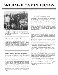
<strong>Archaeology</strong> in Tucson Newsletter Page 3<br />
PROFILE OF AN INSTITUTE VOLUNTEER<br />
In this issue we salute Harry Ashby, an <strong>Archaeology</strong> in Tucson volunteer who has been available and willing to take on most any<br />
kind of task that needed doing. Harry has been volunteering for the Institute since August 1987. Since then he has spent well over<br />
200 hours doing archaeological field work on the <strong>Gunsight</strong> <strong>Mountain</strong> archaeological survey and on the Institute's Los Morteros<br />
and WAPA site excavations. He has also contributed an uncounted number of hours in our laboratory, doing (as he so accurately<br />
puts it) "menial tasks": checking artifact bags in from the field, washing and labeling artifacts, boxing up the artifacts and samples<br />
for curation at the Arizona State Museum, and transferring information from field maps to the permanent records that we turn over<br />
to the Arizona State Museum archives. Harry has also donated his time working on the Arizona Archaeological and Historical<br />
Society's Redtail site excavation and on the Arizona State Museum's archaeological digs at Homolovi State Park and the Marana<br />
Mound site. Those of you who have worked with him know that he gets along well with his co-volunteers—maybe that's why he<br />
was a labor relations manager before he retired.<br />
One thing that we've really come to appreciate is Harry's sensibility about adjusting<br />
one's efforts to the conditions at hand. Working in the hot Arizona desert, we often face<br />
situations of extreme heat, extreme cold, or rugged working conditions, and sometimes<br />
these conditions can become downright dangerous. Realizing this, Harry has been<br />
sensible enough to slow down when the temperature goes over 100 and to "Just Say<br />
No" when asked if he wants to scale a rugged mountain to look at an archaeological<br />
find. His actions have reminded project supervisors—and hopefully other AIT<br />
volunteers—that there are times and places where we must temper our efforts in order to<br />
reduce risks to ourselves and others. Keep up the good work, Harry!<br />
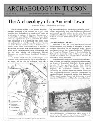
THE SABINO CANYON RUIN: AN INTRODUCTION<br />
It was the large ruins of what is now called the<br />
Hohokam Classic period that drew the interest of early<br />
researchers in southern Arizona. Just over 100 years ago<br />
the Hemenway expedition carried out extensive<br />
excavations in a series of large sites with adobe compounds<br />
and platform mounds in the Phoenix area. Those excavations<br />
were never fully reported by the expedition members, but<br />
they were the basis of Dr. Emil Haury's 1934 doctoral<br />
dissertation at Harvard University, published by the<br />
Peabody Museum in 1945.<br />
In Tucson, early excavations were conducted at the<br />
Tanque Verde <strong>Ruin</strong> on the far east side of the valley, at<br />
Martinez Hill on the San Xavier District of the<br />
Tohono O'odham Reservation, and at University Indian<br />
<strong>Ruin</strong> near the junction of the Pantano and Tanque Verde<br />
Washes. With the notable exception of Julian Hayden's<br />
excellent report on the portion of the excavations at<br />
University Indian <strong>Ruin</strong> that he directed,<br />
information on these early archaeological studies in the<br />
Tucson area are accessible only through Master's<br />
theses, short articles in The Kiva, and through notes in<br />
museum archives.<br />
The <strong>Sabino</strong> <strong>Canyon</strong> <strong>Ruin</strong> is another Classic period site in the<br />
northeastern Tucson Basin that drew early interest. But the<br />
story of its exploration is even more obscure than the others. In<br />
the article that begins on the next page, University of<br />
Arizona graduate student John Welch helps roll back some of the<br />
obscurity surrounding this important site.<br />
This is the first time that an article not directly related to an<br />
AIT or Institute project has been published in the<br />
<strong>Archaeology</strong> in Tucson Newsletter, but we hope that there<br />
are many more to follow. One of the goals of the expanded<br />
format for the Newsletter is to allow a broader coverage of<br />
the archaeology of southern Arizona. Articles that explore<br />
the history of archaeological research in this area are of<br />
special interest.<br />
Anyone wishing to submit a manuscript for publication in the<br />
AIT Newsletter should contact Bill Doelle to discuss the topic and<br />
a time frame. Our thanks to John Welch for pioneering this<br />
expansion of the Newsletter and for sharing his valuable<br />
information about a little-known Tucson Basin site.
Page 4<br />
<strong>Archaeology</strong> in Tucson Newsletter<br />
EARLY INVESTIGATIONS AT THE SABINO CANYON RUIN<br />
John R. Welch<br />
The Fenster School of Southern Arizona<br />
The history of the <strong>Sabino</strong> <strong>Canyon</strong> <strong>Ruin</strong> (AZ BB:9:32 [ASM])<br />
provides a glimpse at prehistoric research done in the Tucson<br />
Basin by scientists who went on to achieve international<br />
reputations. An all star cast that included Ellsworth Huntington,<br />
A.E. Douglass, William N. Smith, Emil W. Haury, and<br />
Garman Harbottle contributed most of what is known about<br />
the large Tanque Verde phase village site that occupies the<br />
triangular terrace of upper bajada above the confluence of the<br />
<strong>Sabino</strong> and Bear <strong>Canyon</strong> drainages.<br />
required per person caused him to wonder at the dearth of<br />
irrigable acreage near the site.<br />
Most of the site is on the campus of The Fenster School of<br />
Southern Arizona, a private boarding school. The Fenster<br />
School has been in operation since 1971. Previously the<br />
campus was home to The Southern Arizona School for Boys<br />
(1930-1971). Students and staff at both institutions have<br />
benefited from and contributed to the traditional partnership<br />
between archaeology and secondary education in Southern<br />
Arizona.<br />
Ellsworth Huntington, the Yale geographer, was among the<br />
first to develop a scholarly interest in Tucson Basin prehistory.<br />
Best known for formalizing the controversial theory of<br />
environmental determinism, Huntington was interested in the<br />
relationship between agrarian settlement patterns and arid<br />
climates where irrigation was imperative for successful food<br />
production. He considered archaeology "the most important<br />
type of evidence as to the relation of man to the climate of pre-<br />
Columbian days". Drawn to Tucson to study the effect of the<br />
environment on the Hohokam, Huntington counted 68 houses<br />
while investigating the <strong>Sabino</strong> <strong>Canyon</strong> <strong>Ruin</strong> on March 18 and<br />
19 of 1910. He offered the following interpretation of the<br />
<strong>Sabino</strong> <strong>Canyon</strong> <strong>Ruin</strong>:<br />
Judging by the number of houses, the amount of<br />
pottery, and the presence of a large public<br />
structure, this was no temporary village, but was<br />
inhabited permanently. The inhabitants must have<br />
been cultivators of the soil, for their village is<br />
carefully placed where the stream comes out of the<br />
mountains and the arable land begins (1914:53).<br />
Huntington listed his assumptions in his field notes:<br />
"Hohokam were a distinctively agricultural people." and<br />
"Arizona agriculture has always been dependent upon<br />
irrigation." Huntington estimated a population of 250 at the<br />
village. His belief that two acres of irrigated fields were<br />
Map of the compounds and rooms at the <strong>Sabino</strong> <strong>Canyon</strong><br />
<strong>Ruin</strong>. Based on the 1921 map of Douglass and Leonard.<br />
Huntington's notes suggest that he believed that the<br />
prehistoric Tucson climate permitted dry farming and that a<br />
change to drier conditions might have caused the canyon<br />
village's downfall. Although Huntington's interpretation was<br />
limited by a failure to consider the enormous diversity of<br />
wild foods available to a settlement less than two miles from<br />
every Sonoran biotic community, the links between<br />
settlement, subsistence, and climatic dynamics remain central<br />
topics in today's investigations of Hohokam prehistory.<br />
Shortly after Huntington's visit to southern Arizona, he began<br />
correspondence and cooperative research with newly<br />
appointed University of Arizona professor Andrew Ellicott<br />
Douglass.
<strong>Archaeology</strong> in Tucson Newsletter Page 5<br />
Douglass, the "Father of Dendrochronology," shared<br />
Huntington's interest in climatic, economic, and settlement<br />
dynamics. Douglass probably first visited the <strong>Sabino</strong> <strong>Canyon</strong><br />
<strong>Ruin</strong> as a result of his attraction to Huntington's idea that<br />
archaeological data can inform on ancient environmental<br />
change.<br />
Between November 14, 1920 and April 9, 1921, Douglass took<br />
time out from his teaching, his administrative responsibilities<br />
as Director of the rapidly expanding Steward Observatory, and<br />
his ambitious research on both archaeological<br />
dendrochronology and the correlation of sun spot activity<br />
and climatic cycles to spend parts of ten weekends at the<br />
<strong>Sabino</strong> <strong>Canyon</strong> <strong>Ruin</strong>.<br />
northeast Basin's rich natural and cultural resources to both<br />
attract students and diversify their education.<br />
Fairgrieve's students at SAS took immediately to this idea.<br />
William Neil Smith, who went on to become a great student<br />
of Sonoran ethnology and ethnohistory, developed his lasting<br />
interest in Native American desert adaptations while exploring<br />
the ruins on the SAS campus between 1934 and 1936. "Seri<br />
Bill's" notes have yet to be found, but he left with the school<br />
a collection of his finds, including a complete duck effigy<br />
pot and a number of whole vessels.<br />
Working with Heman Burr Leonard, a U of A Professor of<br />
Mathematics, Douglass prepared an exacting map of the site's<br />
architecture and a brief report that was presented in 1922 at a<br />
regional meeting of the American Association for the<br />
Advancement of Science (AAAS). The map includes an irrigation<br />
ditch running along the site's west margin. Given Huntington's<br />
interest in agriculture and keen eye, it is peculiar that the feature<br />
was not reported earlier. Douglass's notes are ambiguous, but he<br />
seems to have seen both modern and prehistoric irrigation features<br />
at the site.<br />
The text of the AAAS paper has not been located, but the<br />
abstract reveals that their work was far ahead of its time. The<br />
report explicitly recognized archaeological sites as repositories<br />
of social, ecological, and even astronomical information.<br />
Leonard and Douglass appealed to all scientists, regardless of<br />
disciplinary affiliation, to record the West's quickly<br />
disappearing ruins.<br />
Beyond this, in an early bit of archaeoastronomy, Douglass<br />
and Leonard revealed the rationale behind their considerable<br />
investment in the site map: it appears that Douglass was<br />
searching for evidence that the ancient farmers employed<br />
observations of celestial events to help schedule food<br />
production. In particular, Douglass seems to have been<br />
interested in the idea that wall orientations either helped<br />
predict optimal times to plant or reflected prehistoric concerns<br />
with particular constellations or planets. It would be many<br />
years before archaeology and astronomy would again join<br />
forces to interpret architectural patterns, and this aspect of<br />
Douglass's diverse research interests has yet to be recognized.<br />
Only seven years after Douglass's work, Captain Russell B.<br />
Fairgrieve selected the mouth of <strong>Sabino</strong> <strong>Canyon</strong> as the site for his<br />
Southern Arizona School for Boys (SAS). Fairgrieve<br />
envisioned an institution that would take advantage of the<br />
Tanque Verde Red-on-brown pottery and a large plainware<br />
jar excavated from the <strong>Sabino</strong> <strong>Canyon</strong> <strong>Ruin</strong>.<br />
The next to take up archaeology at the <strong>Sabino</strong> <strong>Canyon</strong> <strong>Ruin</strong><br />
was Mr. J. Donald Everitt, who taught at SAS from 1937<br />
until the campus was sold to the Fenster Ranch School in<br />
1971. Responding enthusiastically to Captain Fairgrieve's<br />
plans, Master Everitt and his "Pathfinders Club" established<br />
many of the trails in the Santa Catalinas. Additionally,<br />
Everitt's "Pothunters Club" (named long before the term<br />
became pejorative) opened digs in Compound D (see map).<br />
Nonetheless, Mr. Everitt remembers abundant earlier<br />
excavations and believes that "Seri Bill" was responsible for<br />
the vast majority of the digging.<br />
One eager member of Everitt's "Pothunters" was Garman<br />
Harbottle, a 1940 SAS graduate. Harbottle has combined his<br />
interests in prehistory and chemistry in a distinguished career as<br />
a Senior Research Scientist at Brookhaven Lab. In a recent<br />
letter to the Fenster School Alumni Office, Harbottle noted<br />
that his research interests were "directly traceable to work on<br />
the 'Indian digs' in the <strong>Canyon</strong> at SAS, 1936-1940."
Page 6<br />
The next work on the site that ended up in the public domain<br />
resulted from a December 1938 visit by Emil W. Haury<br />
to record the <strong>Sabino</strong> <strong>Canyon</strong> <strong>Ruin</strong> for the Arizona State<br />
Museum. Haury's description of the site as "extremely<br />
picked over" supports Everitt's claim that every<br />
definable architectural feature had been probed by 1937.<br />
Haury also mentions a "fort" to the south of the<br />
architectural center, describing a low stone-walled<br />
compound still visible today. The feature is still<br />
puzzling.<br />
Selected Bibliography<br />
<strong>Archaeology</strong> in Tucson Newsletter<br />
Douglass, Andrew Ellicott, and Heman Burr Leonard<br />
1921 Map of the Bear-<strong>Sabino</strong> <strong>Canyon</strong> <strong>Ruin</strong>. Unpublished,<br />
on file, Arizona State Museum, Tucson.<br />
Henry, Bonnie<br />
1989 From an Old Adobe. Arizona Daily Star, May 10.<br />
Huntington, Ellsworth<br />
1910 Field Notebook 10A. Manuscript on file,<br />
Yale University Library, New Haven.<br />
1912 The Fluctuating Climate of North America, Part 1:<br />
The <strong>Ruin</strong>s of the Hohokam. In Annual Report of<br />
the Board of Regents of the Smithsonian Institute,<br />
pp. 383-397.<br />
1912 The Physical Environment of the <strong>Southwest</strong> in Pre-<br />
Columbian Days. Records of the Past 11(3):128-<br />
141.<br />
1914 "The Climatic Factor in Arid North America."<br />
Carnegie Institution of Washington Publication<br />
192.<br />
A black-and-white postcard from the Southern Arizona<br />
School. Garman Harbottle is second from left. The back of<br />
the postcard bears a 1-cent stamp and a 1939 postmark.<br />
Work by SAS students and staff continued<br />
sporadically through the 1960s. Regrettably, many of the<br />
best pieces of the collections made by Smith and Everitt<br />
were pilfered when SAS went under and the campus<br />
changed hands. The Fenster School of Southern<br />
Arizona (coed, college preparatory,<br />
boarding and day) reopened on the former SAS campus<br />
in 1974 (for more information see Bonnie Henry's article<br />
cited in the bibliography below) .<br />
Leonard, Heman Burr, and Andrew Ellicott Douglass<br />
1922 Orientation of Prehistoric House Outlines Near Bear<br />
<strong>Canyon</strong>, Tucson, Arizona. Paper presented at the<br />
2nd Annual Meeting of American Association for<br />
the Advancement of Science, <strong>Southwest</strong> Division.<br />
Tucson, January 26-28.<br />
Wallace, Henry D., and James P. Holmlund<br />
1982 The Classic Period in the Tucson Basin.<br />
Manuscript on file, Arizona State Museum<br />
Library, Tucson.<br />
1984 The Classic Period in the Tucson Basin.<br />
The Kiva 49(2):167-194.<br />
Today, Fenster pursues Captain Fairgrieve's vision of a<br />
school dedicated to exploiting both traditional and<br />
uniquely local educational resources. The long<br />
partnership between secondary schools and Arizona<br />
archaeology lives on at Fenster. The school offers, in<br />
addition to its college preparatory curriculum, a diverse<br />
program of field trips, participation in research<br />
projects, and classes in anthropology and archaeology.<br />
Fenster's archaeological program is successful in large<br />
part because of its proximity to the <strong>Sabino</strong> <strong>Canyon</strong> <strong>Ruin</strong>, a<br />
Tucson Basin site with a fascinating history of early research.<br />
Designs from Tanque Verde Red-on-brown vessels.<br />
Drawings by Ron Beckwith.
<strong>Archaeology</strong> in Tucson Newsletter Page 7<br />
GUNSIGHT MOUNTAIN (continued from page 2)<br />
What is the significance of the archaeological sites around<br />
<strong>Gunsight</strong> <strong>Mountain</strong>? Their importance derives mainly from<br />
their potential to produce a wealth of information about the<br />
changes that have occurred in the human societies that<br />
occupied this desert area. Specific subjects for future study<br />
include changes in prehistoric subsistence on arid-land upper<br />
bajadas; prehistoric and historic changes in demography and<br />
settlement patterns in the Avra and Altar valleys; prehistoric<br />
cultural identity of the people who occupied these valleys; prehistoric<br />
social complexity in southern Arizona; and future<br />
development of the region's archaeological chronology.<br />
The main reason the Institute initiated an archaeological<br />
survey around <strong>Gunsight</strong> <strong>Mountain</strong> is because we see a dire<br />
need for conservation of archaeological sites in southern<br />
Arizona. Steady population growth and land development at<br />
increasing distances from Tucson are having serious<br />
detrimental effects on the cultural heritage of the region. If we<br />
are to preserve a significant percentage of our ancient ruins,<br />
we need to act now to conserve our archaeological resource<br />
base.<br />
The <strong>Gunsight</strong> <strong>Mountain</strong> survey project will culminate in the<br />
nomination of many outstanding examples of undisturbed<br />
archaeological sites to the National Register of Historic Places,<br />
and so will help preserve some of our cultural heritage for<br />
future generations of Arizonans. There are no imminent plans<br />
for excavations at any of these sites, for if they are listed in the<br />
National Register they can serve as a repository of<br />
archaeological information for future research.<br />
NEW MEMBERSHIP CATEGORY<br />
A new membership category is now available for those of<br />
you who would like to upgrade your membership from<br />
Supporting ($25 per year) but find it a long stretch to<br />
Sustaining ($ 100 per year). A Contributing membership will<br />
be $50 per year.<br />
Speaking of membership upgrades, <strong>Archaeology</strong> in Tucson is<br />
fiscally sound at its present level of operation, but our goal is<br />
an expanded program. The training classes and volunteer<br />
excavations outlined in the Winter issue are a high priority.<br />
They are intended to preserve information from local sites<br />
that are threatened by development. Using volunteer labor<br />
lowers costs, but it is important that the artifacts be properly<br />
cleaned, labeled, inventoried, and analyzed prior to<br />
permanent storage in the Arizona State Museum. These<br />
activities all have costs associated with them, and your<br />
support of AIT can help underwrite those costs.<br />
HORNED LIZARDS FROM THE ASM BASEMENT<br />
The horned lizard has caught the fancy of desert dwellers for<br />
more than a thousand years. The Arizona State Museum has<br />
prepared a special summer exhibit to display some of the<br />
diverse ways that these small desert creatures have been<br />
captured in Native American art forms. Stop by the State<br />
Museum, just inside the west gate of the University of<br />
Arizona from 9-5 Monday through Saturday, 2-5 PM<br />
Sundays. The exhibit opens on July 7 and will run through<br />
the end of the year.<br />
The Institute for American Research is a private, nonprofit, research and educational organization that specializes in the<br />
preservation of the American past. The Institute was founded in 1968, and its headquarters are located at 300 N. Los Carneros Road,<br />
Goleta, CA 93117. Telephone: 805-964-3549.<br />
In Arizona, the Institute specializes in the archaeology of the Tucson Basin and southern Arizona. <strong>Archaeology</strong> in Tucson (AIT) is a<br />
membership program of the Institute for American Research, and the AIT Newsletter is published quarterly. The Institute's<br />
Arizona offices are located at 245 South Plumer, Suite 14, Tucson, AZ 85719. Telephone: 602-622-6663.<br />
Annual Membership Rates. Individual ($10), Family ($15), Supporting ($25), Contributing ($50), Sustaining ($100), Patron<br />
($500). Corporate Rates: Active ($100), Supporting ($200), Sustaining ($500).<br />
To Join <strong>Archaeology</strong> in Tucson: Memberships in <strong>Archaeology</strong> in Tucson run for one year from the time they are received. Send your<br />
name, street address, city, state, and zipcode along with a check made out to the Institute for American Research to:<br />
ARCHAEOLOGY IN TUCSON 245<br />
South Plumer, Suite 14 Tucson,<br />
Arizona 85719
INSTITUTE FOR AMERICAN RESEARCH<br />
<strong>Archaeology</strong> in Tucson<br />
245 South Plumer, Suite 14<br />
Tucson, Arizona 85719<br />
n<br />
t<br />
e<br />
r<br />
f<br />
o<br />
r<br />
D<br />
e<br />
s<br />
e<br />
r<br />
t<br />
A<br />
r<br />
c<br />
h<br />
a<br />
e<br />
o<br />
l<br />
o