Summer 2003 â Vol. 17, No. 3 - Archaeology Southwest
Summer 2003 â Vol. 17, No. 3 - Archaeology Southwest
Summer 2003 â Vol. 17, No. 3 - Archaeology Southwest

Create successful ePaper yourself
Turn your PDF publications into a flip-book with our unique Google optimized e-Paper software.
archaeology southwestmagazineC O N T I N U E O N T O T H E N E X T P A G E F O R Y O U R F R E E P D F(formerly the Center for Desert <strong>Archaeology</strong>) is a private501 (c) (3) nonprofit organization that explores and protects the places of our past across theAmerican <strong>Southwest</strong> and Mexican <strong>No</strong>rthwest. We have developed an integrated, conservationbasedapproach known as Preservation <strong>Archaeology</strong>.Although Preservation <strong>Archaeology</strong> begins with the active protection of archaeological sites,it doesn’t end there. We utilize holistic, low-impact investigation methods in order to pursuebig-picture questions about what life was like long ago. As a part of our mission to help fosteradvocacy and appreciation for the special places of our past, we share our discoveries with thepublic. This free back issue of <strong>Archaeology</strong> <strong>Southwest</strong> Magazine is one of many ways we connectpeople with the <strong>Southwest</strong>’s rich past. Enjoy!<strong>No</strong>t yet a member? Join today!Membership to <strong>Archaeology</strong> <strong>Southwest</strong> includes:» A Subscription to our esteemed, quarterly <strong>Archaeology</strong> <strong>Southwest</strong> Magazine» Updates from Preservation <strong>Archaeology</strong> News, our bimonthly e-newsletter» 10% off purchases of in-print, in-stock publications through our bookstore» Free pdf downloads of <strong>Archaeology</strong> <strong>Southwest</strong> Magazine, including ourcurrent and most recent issues» Access to our on-site research library» Updates on opportunities to participate in preservation projects» Invitations to our annual members’ meeting, as well as other special eventsand lecturesJ o i n u s a t a r c h a e o l o g y s o u t h w e s t . o r g / h o w - t o - h e l pI n t h e m e a n t i m e , s t a y i n f o r m e d a t o u r r e g u l a r l y u p d a t e d Fa c e b o o k p a g e !300 N Ash Alley, Tucson AZ, 85701 • (520) 882-6946 • info@archaeologysouthwest.org • www.archaeologysouthwest.org
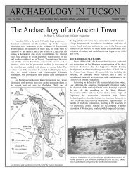
Archaeolog!j 50uthwest<strong>Vol</strong>ume <strong>17</strong>, Number) Center For Desert Archaeolog~ 5ummer 200)f reservation Archaeolog~ in the San f edro Valle~William H. Doelle) Center for Desert Archaeolog!:JJeffer!:J j. Clark) Center for Desert Archaeolog!:JR ALLCOUR.TS, KIVAS, CLOVIS FOINTS, ANDU FR.E.SIDIOS are just a few of the traces of the pastfound in the San Pedro Valley east of Tucson. The humanheritage of this beautiful valley has a richness and a diversitythat has motivated the Center's preservation archaeologyefforts for more than a decade.Preservation archaeology integrates research, publicoutreach, and stewardship of the nonrenewable archaeologicalrecord. This issue of <strong>Archaeology</strong> <strong>Southwest</strong> highlightsour blend of these elements into a long-term programin a single valley. Productive research has been accomplishedusing information gathered with low-impactmethods: reassessing previous excavations, surface surveyssite mapping, and limited new test excavations.This is the first publication of the Center's San PedroPreservation Project. We initiated this project in 1996, afterour 1990-1995 volunteer survey of the 120 km fromWinkelman to Benson made it clear that the archaeologyin the valley, while diminished by vandalism and development,still had remarkable potential for research and preservation.We focused on the large sites from the thirteenthand fourteenth centuries with our mapping and testingprogram.Funding for the San Pedro Preservation Project camefrom a private foundation, with further assistance fromthe Salus Mundi and Amerind foundations and invaluablevolunteer labor by Center members. Another crucialelement was a grant from the National Science Foundationthat funded a related study of the wash sands of thevalley. Determining the natural distribution of sands inthe area has allowed us to identifY places of manufacturefor many types of pottery.Preservation archaeology is more than research. Valleyresidents have participated in the Center's workthrough volunteer opportunities, lectures at local communitycenters, open-house events at specific sites, and numerouspersonal contacts. These outreach efforts are payingof£ In 2002, we accepted the generous donation of aThe Bajada site, one of the last-occupied settlements in the northernSan Pedro valley, is located on the toe of this gently sloping bajada.The Center's work salvaged key architectural information from thisbadly vandalized site. The site, now owned by the Nature Conservancy,is patrolled regularly by Arizona site stewards.conservation easement by Harold and Mignon Elliott thatpreserves three sites inperpetuity, and in July<strong>2003</strong>, we purchased a 95-acre parcel with a significantfourteenth-centurysite on it. Preservation archaeologyin this valley iswell underway, thoughthere is still much to accomplishin the future.This issue was made possible bya generous gift from the<strong>Southwest</strong>ern Foundation forEducation and HistoricalPreservation.ArChaeolog:; 50uthwestis a Quarterl!:Jf' ublication ot theCenter tor DesertArchaeolog!:J
A 5riet Histor~ ot Lower San F edro Archaeolog~Jeffer!J j. Clark, Center for Desert Archaeolog!Jplore ruins along the river,briefly visiting the site ofTres Alamos. In 1908, JesseWalter Fewkes provided thefirst detailed informationon sites in the lower SanPedro, drawing sketchmaps of several of the largerplatform mound ruins, includingLost Mound,Leaverton Mesa, and HighMesa. In 1929, Carl Sauerand Donald Brand visitedseveral sites in the southernportion of the lower SanPedro, among them Redingtonand Bayless ruins.William Duffen, a studentof Byron Cummings at theUniversity of Arizona, conductedthe first formal excavationsin the lower valleyat these two sites in the1930s as part of his Master'sthesis.General setting of the San Pedro valley and some of the major sites atwhich early excavations were conducted. 1: Alder Wash; 2: SecondCanyon compound; 3: Davis Ranch; 4: Reeve Ruin; 5: Tres Alamos; 6:Babocomari Village; and 7: Big Ditch.In the northern lowervalley, avocational archaeologist Alice Hubbard Carpenterwas the primary investigator and steward of the culturalresources for over 50 years. Shortly after she moved toOracle in 1924, until close to the time of her death in 1982,Carpenter was active in the field, advocating site preservation,removing artifacts from threatened sites, participatingin field schools, and aiding professional archaeologists.She also rescued the largest copper bell found to datein the <strong>Southwest</strong>- which was mistakenly thought to be acopper toilet float by its finder. Carpenter and her friendsinvestigated nearly all the large sites along the northernlower San Pedro, naming many of them.In 1931, seven years after Carpenter's arrival, WilliamShirley Fulton established his summer residence on theDouble F Ranch near Dragoon, Arizona, and began investigatinga pithouse settlement on his property. In 1936, hebuilt a small museum and, the following year, establishedDESPITE IMPR.ESSIVE R.U INS and its proximity toTucson, the lower San Pedro Valley has seen onlylimited archaeological work. In the early 1880s, AdolphBandelier was the first professional archaeologist to extheAmerind Foundation. Fulton brought in Carr Tuthill,a University of Arizona student, to serve as field director,report writer, and curator. In 1940, Tuthill conducted largescaleexcavations at Tres Alamos, the principal settlementnear the upper and lowerSan Pedro boundary duringthe pre-Classic andClassic periods. In late1947, Tuthill left the AmerindFoundation and wasreplaced by another Universityof Arizona student,Charles Di Peso.During Di Peso's longtenure, the Amerind Foundationbecame one of thepremier research institutionsin the <strong>Southwest</strong>. In1948 and 1949, as part ofhis Master's thesis research,Di Peso excavated BabocomariVillage in the upperSan Pedro Valley. Di Peso'snext series of excavationsfocused on establishinglinks between the Classicperiod and the early Spanishperiod inhabitants ofsoutheastern Arizona. In1950 and 1951, Di Peso in-vestigated the short-lived Spanish presidio of Santa Cruzde Terrenate and Santa Cruz de Gaybanipitea, a Sobaipurivillage that was also the site of a Spanish visita (see pages14-16). Finally, Di Peso excavated a room at Jose Solas Ruinnear Cascabel, which he misidentified as San Salvador deBaicatcan, a major Sobaipuri settlement mentioned in earlySpanish documents.In 1956, Di Peso focused on the lower San Pedro Valleyin search of migrants from the Pueblo an world. ReeveRuin, roughly 5 km south of Redington, provided the perfectcandidate for such an enclave (see pages 7-10) with itsdefensible location, room block layout, and gypsum-blockmasonry. Di Peso's investigation of Reeve Ruin was followedshortly by a related excavation by Rex Gerald at theDavis Ranch site, another suspected enclave across the SanPedro River, opposite Reeve Ruin. This site yielded a largerectangular kiva, the only example of this type of Pueblo anFage 2 <strong>Archaeology</strong> <strong>Southwest</strong> <strong>Vol</strong>ume <strong>17</strong>, Number :7
ceremonial architecturediscoveredin thevalley to date(see photo onpage 10). ReeveRuin and DavisRanch proved tobe the Amerind' slast forays into£)ring 35 sites and intensively excavating one that was threatenedby construction of a natural-gas pipeline. Mead's fieldschool constitutes, by far, the largest project conducted ina bajada setting within the lower valley.In 1974, upon the advice of Carpenter, Mead movedthe CAC field school to the Aravaipa confluence, about 3km from campus. He began excavating Big Ditch, a largepre-Classic ballcourt village. The Big Ditch excavationscontinued from 1975 through 1977 under the supervisionof Director Bruce Masse and Assistant Director LindaCharles Di Peso in the early 1950s.the San Pedro. Gregonis. In late 1977, Mike Bartlett became the third andThese excavationsfinal CAC field school director. Bartlett moved up the terracewere soon overshadowed by Di Peso's most ambitious project at Casas Grandes in northern Mexico.In the late 1960s, the Arizona Department of Transportationplanned to construct a state highway betweenSan Manuel and Benson. The sites in the northern half ofthe project area were excavated, but the constructionproject was canceled after about 5 km of pavement hadbeen laid. In late 1969 and early 1970, Laurens (Larry)Hammack, the state's highway salvage archaeologist, andfrom Big Ditch and investigated several early Classicperiod rooms to the north of the Ash Terrace platformmound.Interest in San Pedro archaeology waned in the late1970s and early 1980s. Carpenter and Di Peso both passedaway in 1982. Bradley last worked in the area in 1979 atBayless Ruin, the CAC's last field season took place in 1979,and Franklin moved on after publishing the Second Canyonreport in 1980.his assistant director, Hayward Franklin, excavated SecondThe Center's interest in the area- beginning in theCanyon Ruin, a late Classic compound with underlylate 1980s and continuing to the present day- ushered ining pithouses representing several occupations. The compoundwas probably built by the last pithouse occupants,suggesting continuity across this architectural transition.a new era oflower San Pedro archaeology, one that considerspast and present work and integrates research, education,and preservation goals.In late 1970 and early 1971,with Bruce Bradley as assistant director,Hammack investigatedthree pithouse sites near AlderWash as part of the PeppersauceWash Project. Alder Wash Ruin, themost informative of the three investigatedsites, yielded valuable informationon both the late preClassic and Protohistoric inhabitants.An early Spanish periodSobaipuri occupation was discoveredduring the course of the excavations.One of the structures containedEuropean trade beads.Throughout the 1970s, CentralArizona College (CAC) conducteda series of field schools inthe lower San Pedro in collaborationwith the University of Arizona.In the early 1970s, with DudleyMead directing, the CAC fieldschool surveyed about 5 km 2 betweenthe upper reaches of BonitoCanyon and Smelter Wash, about Second Canyon Ruin. Extensive horizontal stripping in 1969 and 1970 exposed a complex sequence of5 km west of San Manuel, identi- masonry-and-adobe rooms overlying earlier pithouses.<strong>Summer</strong> <strong>2003</strong> Archaeolog~ <strong>Southwest</strong> fage 3
5an F edro, River ot the Ancients<strong>No</strong> OTHER RIVER VALLEY reveals the story of thefirst humans in the Greater <strong>Southwest</strong> as completelyas the San Pedro River Valley. Since the late nineteenthcentury, the San Pedro River and its tributaries haveeroded deeply into theirfloodplains, exposing depositslaid down manymillennia ago. Among thefirst scientists to appreciatethe buried record inthis valley were E. B. (Ted)Sayles, Ernst Antevs, andEmil Haury.5ruce 5. Hucke/l, Maxwell Museum of AntAropolog.!:JThese three research-ers, in search of the antecedentsof the Hohokam,surveyed the valley underthe auspices of GilaPueblo, a privately fundedresearch institution.They worked along themain channel of the river,primarily in the upperportion of the valley betweenBenson and Palo minas. In the Fairbank-Charlestonarea, they discovered the sites that ultimately definedthe San Pedro stage of the Cochise culture. The buriedFairbank site was the first excavated example of what wenow regard as the San Pedro phase of the Early Agriculturalperiod. A reinvestigation of the Fairbank site in thelate 1980s showed the presence and importance of maizefor the sustenance of this 3,000- to 3,500-year-old culturalgroup.Amateur archaeologists and local ranchers were alsodrawn to search its arroyos, and because of them, far oldersites were discovered. Ing:J1'5 1951, after a summerCDif flood, Fred and Marco" Navarrete found huge~bones protruding fromthe bank of GreenbushUniversity of New Mexico geoarchaeology students profi'le the stratigraphyexposed by the San Pedro River at an Early Agricultural period site locatedwithin the Bureau of Land Management's San Pedro Riparian NationalConservation Area. The cultural deposit is visible at the level of the shouldersof the two people on the ladders.Draw, near Naco. Upondiscovering a pair ofClovis points among thebones, they reported theirfind to Haury. Later inthe year, with the help ofseveral students and collaborators,Haury recoveredanother six Clovispoints scattered amongthe bones of this lonemammoth. Four yearslater, Ed Lehner toldHaury about numerouslarge mammoth bones in the arroyo north of his ranch,some 20 km northwest of Naco. Excavations there in 1955-1956 revealed parts of9 mammoths, 13 Clovis points, and8 stone butchering tools. The Lehner site provided thefirst accurate radiocarbon date of the Clovis culture, placingthe mammoth kill at approximately 11,200 years ago.To this day, the Lehner and Naco sites remain among theMammoth limb bonesand teeth exposed by excavationsalong a tributmyof Horsethief Draw,northwest of the SanPedro Riparian NationalConservation Area visitorcenter on State Route 90.The bones were in thesame stratigraphic positionas mammoth remainsfound at the Lehner andMurray Springs Clovissites, though no artifactswere found in associationwith this mammoth.best examples of mammothhuntingsites In <strong>No</strong>rthAmerica.In the mid-1960s, C. VanceHaynes and his colleagues continuedthe search for moreClovis sites; he and PeterMehringer discovered theMurray Springs Clovis site in1966. From 1966 to 1971, excavationsthere revealed a mammothcarcass, a multiple-bisonkill, and an associated campstillthe only camp found witha kill. In addition, MurraySprings offered detailed inrage+ Archaeolog~ <strong>Southwest</strong> <strong>Vol</strong>ume <strong>17</strong>, Number ')
sights into late Pleistocene and early Holocene climate,megafaunal extinction, the chronology of Clovis occupation,and the depositional history of the San Pedro and itstributaries. Also in the 1960s and early 1970s, three moresmall Clovis sites were found and investigated: two mammothkills near Naco on Greenbush Draw- the Leikemand Navarrete sites-and another near Murray Springs,the Escapule site. <strong>No</strong>where in <strong>No</strong>rth America has such acl uster of Clovis kill sites been found in such a small area.The San Pedro Valley also contains many Archaic periodsites that postdate Clovis but predate the arrival ofagriculture. In fact, the reinvestigation of the Lehner siteby Haynes in 1974-1975 revealed a brief Early Archaic reuseof the site about 9,800 to 9,900 years ago. The onlyother significant source of information on this intriguingperiod comes from the Double Adobe area of the SulphurSpring Valley, where the Center has recently acquired aparcel of land containing an extensive Archaic site.Archaic campsites are best known from the surfaces ofthe terraces along the San Pedro River and the piedmontslopes of the high mountains that bound the valley. Saylesfound some in his periodic surveys, but it was work byLarry Agenbroad and <strong>No</strong>rman Whalen in the 1960s thatprovided the story of middle Holocene hunter-gatherers.Scattered alonga wash in the Santa Catalina foothills westof Redington is the Lone Hill site, a camp probably occupiedrepeatedly between about 3,500 and 5,500 years ago.Abundant basin metates and one-hand manos reveal theimportant contribution of plant seeds to the Archaic diet,and numerous San Jose/pinto, Chiricahua, Gypsum, andother small dart points testify to the hunting of animalssuch as deer and bighorn sheep. West of Benson, fromterraces overlooking the river to the piedmont slopes ofthe Whetstones, Whalen discovered huge areas of repeatedArchaic occupations. In some cases, these sites covered tensof thousands of square meters. Although containing fewerseed-milling tools, the sites were generally similar in artifactcontent to Lone Hill.The attraction of the San Pedro Valley for Archaic foragersis not difficult to understand, for along the river orwithin a few kilometers of it one can taste the fruit of thesaguaro, prickly pear, and mesquite, roast the hearts of agaves,feast on the bellotas (acorns), and hunt mammals, largeand small.5allcourts and 5ut+ WaresHenr!J D . Wallace, Desert Archaeolog!J' Inc.AN IMFOR.T ANT SHIFT in settlement occurred insouthern Arizona between A.D. 500 and 600, whensmall, seasonally mobile groups began to occupy villagesyear-round. By 550, these villages consisted of central plazassurrounded by residential areas. Although formal ballcourtswere not yet built at these sites, ballgames were probablyplayed in the plazas at this early date, fostering tiesand limiting conflict between communities. The ballgamewas most likely an import from West Mexico, in theNayarit- Zacatecas- Jalisco- Michoacan area, and may havebeen accompanied by a new variety of corn that was morereadily ground into flour than earlier varieties.Concomitant with the shift to more permanent settlementwere changes in leadership from individual lineageor kin-group leaders to village-level political and ritualfigures who headed many different lineages. Thesechanges culminated around 800, with construction oflarge, elliptical, banked ballcourts at the largest villages incentral and much of southeastern Arizona, including thelower San Pedro Valley. These formal ball courts were accompaniedby a new cremation burial ritual and a newartistic style found on decorated buff ware pottery andother artifacts. This complex of traits was probably associatedwith thenew religionthat sweptthrough theentire region.Associated ceremoniesandrituals promotedvillageinteractionDecorated buff ware pottery is common on sitesand the arbitrationof dis-in the lower San Pedro Valley.putes without conflict.There are six known ball courts between the mouth ofthe lower San Pedro River at Winkelman and Tres Alamos,the southernmost known example. Patterns in orientationsuggest that these were part of a connected local system.The long axes of five of the ballcourts parallel the northsouth-trendingvalley. The exception is the large ballcourtat Redington, which is oriented east-west.All of the early ballcourts in the lower San Pedro werelarge, averaging about 56 m in length (a little more thanhalf a football field) . Later ballcourts, built between 930<strong>Summer</strong> 200:; Archaeolog~ <strong>Southwest</strong> rage 5
and 1050, were, on average, about half that long. A newtype of ballgame may have been played within the smallcourts. The two largest sites in the valley, Big Ditch andRedington, each had both a large, early ballcourt and asmall, late ballcourt.From 800, when the first earthen-banked ballcourtsappeared on the scene, until the 900s, villages remainednucleated, with fewpeople living outside thelarge settlements on apermanent basis. Withthe construction of thesecond wave of smallerballcourts, this patternchanged. Villages dispersedalong what wereprobably the locations oftheir canal systems. Thisshift was not unique tothe lower San PedroValley; it occurredthroughout southernand central Arizona atthat time. This intervalwas associated with optimalrainfall conditions,and riverine farmingwas seldom better.Population increased,and families moved outand settled new areas ascanal systems expanded.Warfare was probablynot a major concern.Contacts with WestMexico continued, asevidenced by the recoveryof Mexican artifactsin southern ArizonaMammoth. At Big Ditch, near the mouth of AravaipaCreek, residents manufactured a technologically sophisticatedreplica of Middle Gila Buff Ware pottery. Becausethis ware was not simple to reproduce, it is reasonable tosuppose that at least a few potters from the middle Gilamarried into Big Ditch households. Both the importedMiddle Gila Buff Ware pottery and the local imitation havebeen found in this northernportion of the valley.Ballcourt locations provide insight into the extensive Hohokam interactionnetwork that was focused on the Salt and Gila rivers and extended outwardalong other desert nOvel's.such as copper bells, pyrite-encrusted mirrors, and pottery.For example, one of the small hamlets north of Redingtoncontained a portion of a vessel that probably originatedin Nayarit.Who were the people of the lower San Pedro? Theearliest villages were probably settled by those who hadbeen living in the region for centuries. Certainly, from 500to 1100, the area was within the ideological sphere of theHohokam, and the northern portion of the valley wasclosely tied to the middle Gila Valley.By the time the first ballcourts were constructed in thearea, clear material differences emerged between the populationsliving north and south of the modern town ofSouth of Mammoth,there are relatively abundantexamples of Dragoonand San SimonBrown wares. This redon-brownpottery ispainted in several styles.One style correspondswith designs commonacross southeastern Arizona,northern Sonora,and southwestern NewMexico. From its distributionand frequency inthe valley, it was probablyproduced in the Redingtonarea, as well as at oneor more sites farthersouth. A second style is acombination of this SanSimon style and styles ofdecoration that originatedin the middle Gilaand Tucson areas. Veryfew of these wares arefound north of Mammoth.Coincident with thisnorth-south boundary inlocal artistic and technologicalstyles are differences in residential architecture and,possibly, mortuary practices. The presence of ballcourts,Middle Gila Buff Ware, and other markers of Hohokamideology also suggest a northern influence in the southernportion of the valley, but a difference in ethnic or tribalidentity from the inhabitants of Big Ditch is also likely.Such a distinction became increasingly apparent over time.Late in the eleventh century, Mimbres black-on-white potteryappeared in the southern lower valley, along with otherceramic wares from the east and northeast. These waresare also rarely found north of Mammoth. Later migrations(see pages 7-10) were likely presaged by smaller-scale populationmovements around 1100.lage 6 <strong>Archaeology</strong> <strong>Southwest</strong> <strong>Vol</strong>ume Il, Number)
Mounds and Migrants in the Classic F eriodJeffer!:J j. Clark, Center for Desert Archaeolog!:Jfatrick. D. L!:Jons, Center for Desert Archaeolog!:JTHE. MASONRY RU INS of Classic period settlementsare by far the most visible archaeological featuresin the San Pedro Valley. The high profile of thesesites has both advantages and drawbacks. On the positiveside, we can confidently statethat nearly all of the major occupationsand most of theminor settlements from thisinterval have been identified.On the negative side, thesesites have been, and continueto be, attractive targets forpothunters. The dual motivationof high research andthreat potential provided theprimary impetus for conductingtest excavations. Themain goal was to obtain arepresentative sample of artifactsand plant and animalremains from every majorClassic period settlement, while minimizing the impactto each site. To accomplish this task, trash deposits outsidearchitectural ruins were prioritized. These artifact-richcontexts had high recovery rates even though very littledirt was actually moved.Beginning in Spring 1999, and continuing throughSpring 2001, a group of dedicated volunteers- supervisedby the Center's staff-tested more than 100 of these depositsat 29 sites. Ultimately, nearly 45,000 sherds, 20,000pieces of flaked stone, 5,000 animal bone fragments, 500fragments of ground stone, 300 flotation samples, and 200pieces of shell were recovered. The following account isbased on the analyses of this material and previous work inthe valley and surrounding areas.Dramatic changes occurred in the lower San PedroValley in the A.D. 1200s. By 1300, all of the valley's residentshad moved from dispersed pithouse settlements intomore concentrated masonry and adobe villages. The SanPedro floodplain was covered with maize fields fed by canalsystems up to 8 km long. Each canal system was builtand maintained by an irrigation community containingbetween 100 and 300 people.Beans and perhaps squash were also cultivated. Mesquitebeans and various cacti fruits were favorite gatheredresources. An occasional trip was made to obtain juniper<strong>Vol</strong>unteers, student interns, and professional supervisors excavatedI-m by 2-m test units in trash deposits in 29 sites along 104 linearkm of the San Pedro. These limited impacts to the sites producedhigh-quality information.berries from the mountain slopes far above the floodplain.Although cotton was grown in other river valleys of centraland northern Arizona, we encountered no evidence of thisraw material for textiles. Even more conspicuous is thenear-absence of agave, consideringthe thousands of rockpiles, presumably used in cultivatingthis plant, that linemany of the terraces overlookingthe floodplain. These agriculturalfeatures apparentlyfell out of use by the mid-1200s,as the later inhabitants focusedtheir subsistence efforts on thefloodplain near their villages.These areas were easy to monitorand protect from outsiders.During the late 1200s, platformmounds were built in 11of the irrigation communitycenters along the 56-km stretchof the river from Dudleyville, near the Gila River confluence,to Redington. Although the social function of platformmounds is unclear, they would have been prominentterritorial markers on the landscape for each individualcommunity.On a larger organizational level, platform-moundsettlements and corresponding irrigation communities canbe grouped into two districts based on location and differencesin artifact assemblages. The Aravaipa district includesa cluster offour mound villages and associated settlementsnear the mouth of Aravaipa Creek. This district is one ofthe most fertile in the valley, and there is an extended historyof settlement in the area. Artifacts from Aravaipa districtsettlements suggest limited interaction with outsidegroups and close links with the inhabitants of earlierpithouse settlements in the vicinity, particularly the BigDitch ballcourt village near Ash Terrace. Some of the inhabitantsof Big Ditch produced pottery that imitated buffwares manufactured in the middle Gila River Valley (seepages 5-6).This tradition of pottery production was continuedin the Aravaipa district during the Classic period (1200-1450), with one or more settlements making many of theSan Carlos Red-on-brown and red ware vessels recoveredfrom the lower valley. San Carlos Red-on-brown is the only<strong>Summer</strong> 200) Archaeolog.r::J <strong>Southwest</strong> rage 7
Classic period decoratedware found in quantitythat was made by groupswith deep historicalroots in the region.The San Manueldistrict was composed ofsix mound villages andassociated settlementsdispersed along a 35-kmportion of the river fromLeaverton Mesa to SecondCanyon, the southernmostplatformmound in the valley.Except for LeavertonMesa, the regular 6.5- to8-km spacing of moundsroughly coincides withinferred canal networks,suggesting one moundfor each irrigation community.Beginning in theearly BOOs, and continuingthroughoutmuch of the century,platform-mound settlementsin this districtwere abandoned in agradual retraction ofsettlement toward AravaipaCreek and theGila River. Platform\I~,",....,"BajadaISwingl e's SampleArtifact HillfSaritaCotalllloMOtfntoinsr-------"-------;' '-f "SITE TYPE181 adobe room blocko masonry compoundoplatform mound(!) pueblo enclaveI)\.'i:l\- N0 \Ioj ' 5 15Big Bell , ~~ 111 Ranc~~0{J ~ %Jl / '>,l ./~~\K)J1Key locations of the Center's test excavations. The four districts reflect differentpatterns in the archaeological remains.mounds suggest strongHohokam connections, and the ample quantities of SanCarlos Red-on-brown and red wares indicate contact withAravaipa-district settlements. However, the San Manueldistrictresidents were also interacting closely with variousmigrant groups who were arriving in the lower valley duringthe Classic period.This interaction is best demonstrated by the distributionof locally produced corrugated pottery. Corrugationis a technique associated with Ancestral Pueblo groups tothe north and east of the valley. In the San Pedro Valley,corrugated pottery had a brief history, largely confined tothe late 1100s and early 1200s. Within this narrow timeframe, the density of corrugated wares was remarkably uneven,peaking in the heart of the San Manuel district andrapidly dropping off in the outer mound villages. Hence,a number of corrugated pottery-producing householdsentered the lower San Pedro Valley at the beginning of theClassic period, possibly from the Safford Basin, Point ofPines, or areas farther
cided with several dramatic changes in artifact assemblages.The frequency of obsidian, ideal for making razor-sharpprojectile points, increased dramatically by 1300. Most ofthis material derived from sources in or near the SaffordBasin along the migration route from the north. The Kayenta/Tusayanmigrantsappear to have hadmuch greater access toobsidian than localgroups and may havecontrolled obsidian distributionwithin thevalley. Live macawsfrom Central Americamay also have been enteringthe valley withmigrant groups andtraded to local settlers.Finally, decorated ceramicsincreased dramaticallyin lower SanPedro assemblages atthis time, includingMaverick Mountain seriespottery and RooseveltRed Ware (Saladopolychromes), whichare linked stylisticallyand technologicallywith the Kayenta/Tusayan migrants. Duringthe first half of the1300s, Gila Polychrome,the most prevalentRoosevelt Red Waretype, appeared andeventually dominateddecorated ceramic assemblagesthroughoutthe lower valley.location of several settlements suggests social tension andperhaps even overt conflict. High Mesa and LeavertonMesa, in the San Manuel district, are in walled defensiblelocations. These two settlements anchor the district flankson the eastern side of the river, protecting the less-defenReeve Ruin is located on the relatively flat area in the middle of the photograph.Steep cliffs, deep side canyons, and construction of double walls to restrict accessmade Reeve a highly defensible settlement for its immigrant residents.Our initial hypothesis-that long-distance migrantswere producing most of the Roosevelt Red Ware vessels,both for their own use and trade with the local inhabitants-was largely confirmed by the petrographic analysisof sand used as ceramic temper material. Migrant settlementsin the Cascabel district were the principal producersof Roosevelt Red Ware until the sites were abandonedin the late 1300s. Both obsidian and Roosevelt Red Warevessels were exchanged by KayentalTusayan migrants withlocal groups in substantial quantities.Despite this harmonious picture of trade and coresidencebetween various migrants and local groups, the~£[sible central moundsettlements fromboth the migrants inthe Cascabel districtand localgroups in the Aravaipadistrict. TheReeve Ruin enclaveis in a similarwalled defensibleposition. These fortifiedsettlementssuggest that thevanous groups wereat least suspicious ofeach other, if notopenly hostile attimes. However, theindefensible locationsof the DavisRanch migrant enclave,immediatelyacross the river fromReeve Ruin, and theSecond Canyonp latform mound,presumably occupiedby localgroups, suggest thatthere was little conflict.It is likely thatmigrant and localpopulations engagedin both coop-erative and competitivesocial relations during the century or so they bothinhabited the valley.Many sites in the northern Dudleyville district are associatedwith large quantities of Tonto and Cliffpolychromes, the latest of the Roosevelt Red Ware types(see page 12). During the late 1300s and early 1400s, settlementin the valley was concentrated in this district. Manyof the settlements south of Aravaipa Creek were abandonedby this time. A sherd of Rio Grande Glaze Ware C recoveredfrom Flieger Ruin in the Aravaipa district indicatesthat this settlement may have endured past 1425, slightlymore than a century before the arrival of the Spaniards.<strong>Summer</strong> <strong>2003</strong> Archaeolog.t:J <strong>Southwest</strong> rage 9
Limited evidence andanalogies drawn from comparablelate settlements insoutheastern Arizona,southwestern New Mexico,and in the Phoenix Basinsuggest that these late siteswere occupied by groupswho were descended fromboth local and migrantpopulations.After several generationsof close interactionand intermarriage, an entirely new social identity may have emerged, with connectionsto both the developing Puebloan world and the decliningHohokam world. The inhabitants of these sitesalso made Roosevelt Red Ware vessels and had access toobsidian from a distant source near Flagstaff, attesting tocontinued ties with northern Arizona. As the populationdeclined, the inhabitants of these final settlements mayhave increased their contacts with the occupants of adja-Rectangular kiva at the Davis Ranch site, excavated in 1956 by RexGerald of the Amerind Foundation.cent river valleys for tradeand marriage partners.By 1450, even the lastClassic period occupationsin the north were terminated.<strong>No</strong> archaeologicalsites have been foundthat date to the next 200years, suggesting that veryfew people were living inthe valley until the arrivalof the Sobaipuri, the inhabitantsof the regionwhen the Spaniards firstsettled in southern Arizona in the late 1600s. Sobaipurisites and artifacts are dramatically different from those associatedwith the Classic period inhabitants, and it is difficultto infer that the two populations are related (see page14) . Understanding how such a lush region could havebeen unoccupied for so long requires us to look outsidethe San Pedro Valley to adjacent valleys of the southern<strong>Southwest</strong> and beyond.Sands of the San f edro Valle~Elizabeth j. Miksa, Desert Archaeolog!J' Inc.Jeffer!J j. Clark, Center for Desert Archaeolog!JFE.. TROF ACiE..5 ARE.. ZONE..5 OF 5 IMILAR-LOOKING 5ANDS A valley suchas the San Pedro Valley has a diverse collection of sands, because the bedrockvaries from place to place in the surrounding mountains. Each stream in the valleycarries sand from the mountain bedrock above it. As the bedrock changes, so doesthe sand in the washes. For example, the sand near San Manuel includes alteredminerals from the copper porphyry, and sand from the Galiuro Mountains hasdistinctive volcanic grains in it.The two sands considered in this example allow us to distinguish between thewestern (San Manuel) and eastern (Galiuro) sides of the San Pedro Valley. However,we want to be able to identify much smaller areas wherever possible. Our goalis to characterize the entire valley. To do this, we collected and analyzed 265 sandsamples from washes that enter the San Pedro Valley and Upper Aravaipa Creek.The map displays the 38 petrofacies that we can currently distinguish.Sands can link a potsherd recovered from an archaeological site to the locationwhere a prehistoric potter manufactured a vessel. Much of the pottery that wasproduced in the San Pedro Valley is a mixture of clay and sand. Adding sand to claymade it easier for prehistoric potters to fire their vessels and to subsequently usethem for cooking.Ethnographers studying potters around the world have found that most potterscollect sand from within 1 km of their workshop. Therefore, we assume that thetype of sand in a vessel indicates its location of manufacture. By comparing the sandin San Pedro pottery with our petrofacies map, we have a pretty good idea of where:.: sand samples~ unsampledUN'2:E!?S.:!:A:!:.E~-'~)._._MEXICO (SON)tMiles.............o 10N 0 -==-20Petrofacies map of the San Pedro valley.DUDLEYVILLEDISTRICTrage 10Archaeolog.:J <strong>Southwest</strong><strong>Vol</strong>ume <strong>17</strong>, Number:,
pottery was produced in the valley, as well as where it wastraded.We have analyzed over 2,000 sherds to determinewhere the pots from which they came were manufactured.The initial results of our study of more than 750 RooseveltRed Ware sherds are discussed below.Sergio Castro-Reino and Carlos Lavayen helped processand point count many of the samples.THE.SE. THRE.E. MArS of the lower San Pedro portion of the petrofacies map illustrate how petrographic data can beused to understand pottery production and distribution. By matching sands collected from petrofacies with the sandtemper in pottery recovered from our excavations, we have established that Roosevelt Red Ware was produced in three majorsource areas. In each map, one of these source areas is highlighted, and the percentage of sherds with sands from that sourceis shown where they were recovered. These analyses are still preliminary, and we hope to be able to get finer resolution forsource areas Band C.Source A is a single large petrofacies on the western side of the river in the Cascabel district. The only large settlement inSource A is the migrant community at Reeve Ruin. Most of the Roosevelt Red Ware produced on the western side of the riverwas traded to settlements directly across the river.Source B is more complicated, because two petrofacies are similar enough that they must be considered a single productionarea from a geological perspective. However, distribution patterns in these maps allow an archaeological perspective to beconsidered as well. Over 10 times as many sherds were recovered from the southern petrofacies than from the northernpetrofacies, which strongly suggests that production occurred in the former area. There also appears to have been some tradewith platform-mound settlements in the Aravaipa district.Source C is more complex still. Three adjacent petrofacies in the northern portion of the valley are also similar geologically.Here, the recovery evidence is even more compelling, indicating the northernmost of the three petrofacies was probablythe production area. Within this northern petrofacies, two large late Classic period settlements are the likely producers ofpottery from Source C. Trade across the river with platform-mound settlements in the Dudleyville and Aravaipa districts isindicated, along with limited exchange with migrant settlements in the Cascabel district.We are continuing to refine our petrographic analysis, and there is still much more to do to integrate it with the geologicaland archaeological data. Nevertheless, this study has given us the ability to more closely examine local trading patterns, whichin turn has led to a better understanding of the San Pedro Valley's occupants.Distribution of Roosevelt Red Ware from Three Major Sources of ProductionDUDLEYVILLEDISTRICTDUDLEYVILLEDISTRICTDUDLEYVILLEDISTRICTARAVAIPADISTRICTARAVAIPADISTRICTSAN MANUELDISTRICTSOURCE OF PRODUCTION DIRECTION OF TRADE AMOUNT TRADED OR RETAINEDD 2-10% D 11-30% >30%<strong>Summer</strong> 200) Archaeolog~ <strong>Southwest</strong> rage II
F erForated Flatesfatrick D. L.ljons, Center for Desert Archaeologj~--------------------------~~o'" ;0'"'" 3rnC1l'JECT5 known as perforatedplates have interested archaeologists since the early1900s, when Jesse Walter Fewkes and others encounteredthem at cliff dwellings in Navajo National Monument,Protohistoric villages on the Hopi Mesas, and Classic periodplatform-mound sites in the Phoenix Basin.Contextual clues and use wear suggest that perforatedplates were used as base-molds in pottery making, or aspotter's turntables. Unfired, tempered clay has been foundadhering to the interior surfaces of some whole specimens.A few exhibit traces of pottery pigments in the form ofincidental smudges and fingerprints. In addition, theirexterior surfaces often display abrasions and striations, suggestingthat they were rotated on a regular basis. Perforatedplates have been recovered from "potters' burials"alongside the remains of women interred with potterypolishingstones, shaped-sherd pottery scrapers, raw clay,and pigments.Various hypotheses have been suggested regarding thefunction of the holes in perforated plates. The holes mayhave made the plates easier for potters to grip, or may haveaided in the evaporationof water from potsbeing formed on them.Some researchers believethe holes held fibersthat were drapedPerforated plate fragment from Jose SolasRuin in the Cascabel district.over unfired pots to mark off areas to be painted. A fewarchaeologists have suggested that the plates were used inrituals, and that the holes held flowers or prayer feathers.Regardless of their function, these objects, when foundsouth of the Hopi Mesas, are markers of ancient migrationsfrom northern Arizona. Perforated plates have beenfound in sites dating between A.D. 1250 and 1450, in everymajor river valley in the American <strong>Southwest</strong> and theMexican <strong>No</strong>rthwest, from the San Juan Basin to CasasGrandes, Chihuahua, and from Phoenix to the Cliff Valleyin New Mexico. Many sites that have yielded perforatedplates are known to be places where Roosevelt Red Warepottery was manufactured. Nearly all perforated plates recoveredfrom the Center's test excavations were found atsites in the Cascabel district.Clitt F ol,Ychromefatrick D. L!}ons, Center for Desert Archaeolog!}IN THE LOWER SAN fEDRO VALLEY, recurved (flared-rim) Roosevelt Red Ware bowls likely appeared after A.D.1350, and became more frequent as fewer incurved bowls and hemispherical bowls were produced. In a study ofceramics from Ormand Village, in New Mexico, Francis Harlow referred to Roosevelt Red Ware bowls with recurved rimsas Cliff Polychrome. Gila Polychrome bowls characteristically display a wide painted band ("banding line") just belowand parallel to the inside of the rim. Emil Haury noted that on nearly all recurved bowls, the banding line was painted wellbelow the rim, near the point where the vessel is constricted, and that painted designs were most often applied in the zone~ between the rim and'"~ the banding line. Dis-;03 tinguishing between~ "standard" Gila Polychromeand Cliff Polychromebowls allowsfine-scale sorting oflateClassic period sites inthe San Pedro Valley.This procedure is potentiallyapplicableGila Polychrome rimsherd (left) and partial vessel of Cliff Polychrome (right). <strong>No</strong>te that the solid black "bandingline" on Gila Polychrome occurs at the rim, whereas it is much lower on Cliff Polycht·ome. Recognizing CliffPolychrome helps to identify the latest Classic period occupations in the San Pedm Valley.across the American<strong>Southwest</strong> and Mexican<strong>No</strong>rthwest.f age 12Archaeolog~ <strong>Southwest</strong><strong>Vol</strong>ume <strong>17</strong>, Number ')
In Search ot the Coronado TrailLinda j. fierce, Center for Desert Archaeolog!JDon J5urgess, <strong>Vol</strong>unteer, Center for Desert Archaeolog!JTHE CORONADO NATIONAL MEMORIAL As can be seen in the accompanying illustrations, artilocatedon the United States-Mexico border along facts that are most diagnostic of the Coronado expeditionthe western edge of the San Pedro River Valley, commemo- are fairly mundane. However, they should not be judgedrates the first major European exploration of the South- by their unprepossessing nature. If researchers can learnwest by Spanish explorer Francisco Vazquez de Coronadoof the existence of enough of these artifacts and plot theirin 1540. Although there is no evidence that § ....--------------------,f;? original find locations onCoronado crossed what is now the inter- ~ ~ a map, they will be able tonational border in exactly that spot, most 8 .;r determine the specifichistorians and archaeologists believe that ~f route of the expeditiona prehistoric trade trail somewhere in the ~ ~ into the United States.San Pedro Valley was, in all probability, the ~ ~i" This, in turn, will makeroute followed by this expedition as it trav- ~ the historical documenelednorth out of Mexico to the Pueblo of gtary information from thisZuni and beyond to the plains of Kansasin search of the Seven Cities of Gold(Cibola).~ period more understand-For more than 100 years, archaeologistsand historians have been trying to determineCoronado's exact route. At least 11documented trips were made over all orportions of this trail in the mid-1500s. Althoughthe Spanish written documents describingthese trips are important sourcesof information on the native inhabitantsand natural environment encountered,they are often unclear and open to differinginterpretations.The Coronado expedition was substantial,numbering as many as 350 Spaniardsand more than 1,000 Mexican Indians,along with thousands of horses, mules,cattle, and sheep. Surely a group of thissize lost and discarded numerous personalitems and artifacts along the trail. Recentresearch by historians Richard Flint and Shirley CushingFlint and others is providing new information that mayhold the key to finally determining the actual Coronadotrail. They have concluded that there are at least seven typesof artifacts specific to the Coronado expedition:• copper crossbow boltheads;• crossbow parts and accessories;• short copper or brass aglets (lace tips);• Nueva Cadiz glass beads;• sheet-brass Clarksdale bells;• obsidian-edged swords and lances; and• caret-head nails (horseshoe nails).Top: Copper crossbow boltheads (dart points).Coronado's was the only expedition to carry crossbowsinto this part of the <strong>Southwest</strong>; later Spanish explorerscarried firearms. Bottom: Caret-head nail. Hundredsof these distinctive nails were found at the Jimmy Owenssite in Texas, a Coronado campsite. Seemingly shortlivedin popularity, they were no longer in use by the endof the sixteenth century.able, and shed light on acritical yet very inadequatelyunderstood timein American history.In early 2004, the Centerfor Desert<strong>Archaeology</strong>will launch a concerted effortto educate the publicabout Coronado and arti-~ facts specific to his expe~. dition. This public outitreach campaign will cul;:+~ minate in the spring of:::J:::J 2004, with a series ofCoronado Roadshows insmall communitiesthroughout southeasternand central Arizona andsouthwestern and centralNew Mexico. Members ofthe public will be encouraged to bring possible Coronadoeraand other early Spanish artifacts to these lecture andopen-house events, where archaeologists and historianswill be available to study artifacts and to tell people moreabout their items.Readers who know of the existence of items found insouthern Arizona or New Mexico that are similar to thoseillustrated here are encouraged to contact the Center. Anunimpressive hunk of metal, collected by someone's grandfather100 years ago, may hold the key to this long standingquestion, and provide another chapter in the San Pedro'slong history.<strong>Summer</strong> 200)Archaeolog~ <strong>Southwest</strong> rage I)
Charles Di f eso and the Origins of Sobaipuri fimaResearchJames M. Vint, Center {or Desert Archaeolog!:JTHE. ARCHAE.OLOGICAL A ND HISTORICAL"GAF" between AD. 1450, the end of the Classicperiod, and the 1690s, when the Spaniards began to occupythe San Pedro area, is known as the Protohistoricperiod. Until Charles Di Peso of the Amerind Foundationbegan his study of the Sobaipuri Pima in the San Pedroarea, the Protohistoric period was an interval oflittle interestto archaeologists and historians. Protohistoric archaeologicalmaterials are sparse at best, and there are only a fewsporadic Spanish records relevant to the northern frontierof New Spain during that era.Di Peso intended to find Sobaipuri Pima sites thatwere described by Padre Eusebio Kino and his militaryescort Juan Mateo Manie in the 1690s, and then work backwardin time from Spanish records, and forward in timefrom 1450 using archaeological evidence.Di Peso's research focused on three sites: Qufburi (alsothe location of the Presidio of Terrenate), Gaybanipitea,and a site he thought was Baicatcan. He began his work atwhat he believed was Qufburi, first visited by Kino andManie in 1696. Kino described the village as having morethan 500 people and a fortified enclosure for defense againstthe hostile Apaches and Jocomes. This was probably thelargest Sobaipuri village in the San Pedro River valley inthe 1690s. This site was also the location of the short-livedSpanish Presidio of Terrenate, built and occupied fromabout <strong>17</strong>75 to <strong>17</strong>80 (see pages 15-16).Although the site investigated by Di Peso was unquestionablythe Presidio ofTerrenate, it was probably not thelocation of Qufburi. A compound within the limits of thepresidio interpreted by Di Peso to be of Sobaipuri constructionis now known to be the initial settlement of theSpaniards while the presidio walls were under construction.Although there were Piman guides in residence at Terrenate,there is no archaeological evidence that this wasthe Qufburi visited by Kino. Recent research has suggestedthat the site visited by Kino is somewhat north ofTerrenate.The village may have shifted from one location to anotheralong a several-kilometer stretch of the San Pedro north ofTerrenate. Furthermore, the Sobaipuri population was scatteredamong several rancherfas in the area rather than concentratedin one large village. The massive remains ofTerrenatecould have obscured any earlier Sobaipuri settlement,but the artifact assemblage collected by Di Peso doesnot show much evidence of such a settlement.Sobaipuri houses were simple structures of bent-pole frames coveredwith brush. This excavated house illustrates the typical oval alignmentof cobbles that can be detected by archaeologists in careful surfaceinspections.Di Peso hypothesized that indigenous populations inthe region were descended from a group he called the0' otam, who inhabited the region prehistorically. In aneffort to establish a continuum from prehistory to history,he investigated a site he believed was Baicatcan. Di Pesoargued that plain ware pottery in association with GilaPolychrome was similar, if not identical to, Sobaipuri potterycalled Whetstone Plain, and that it indicated a bridgebetween prehistory and history. This site, also known asthe Jose Solas Ruin, is now known to be a late Classic sitewith no Protohistoric connection.The site identified by Di Peso as Gaybanipitea is clearlya single-component Sobaipuri site, and the work conductedthere established the definitions of Sobaipuri materialculture and architecture still largely used today. Thissite, visited by Kino and Manie in 1697, is located severalkilometers south ofTerrenate. In March 1698, Gaybanipiteawas attacked and destroyed by a group of several hundredApaches, Jocomes, Sumas, and Mansos. Even though thissite is undoubtedly Sobaipuri, and matches the descriptionof the village visited by Kino and Manie, some archaeologistsquestion its identification as Gaybanipitea. Thesite investigated by Di Peso may actually be Pitaitutgam, avillage mentioned only briefly in Spanish records butshown on Kino's 1696-1697 map in approximately thesame location.Regardless of whether Di Peso correctly identified thelocation ofQufburi or Gaybanipitea, he is certainly responsiblefor engendering interest in a time period and peoplepreviously ignored by archaeologists and historians. Sincethe late 1980s, inspired by Di Peso's efforts, archaeologistscontinue to increase our understanding ofSobaipuri sites.Fage 1+ Archaeolog~ <strong>Southwest</strong> <strong>Vol</strong>ume <strong>17</strong>, Number 7
The Life and Times of Santa Cruz de T errenatej. Homer Thiel, Desert Archaeolog.!:J) Inc.James M. Vint) Center for Desert Archaeolog.!:J.-HE.. S HORT AND VIOLE..NT HISTORY of theJ Presidio ofTerrenate began in August <strong>17</strong>75, whenan Irishman named Hugo O'Conor, who was serving inthe Spanish military, selected a location on a terrace abovethe San Pedro River for a new military fortress. The Spaniardswere reorganizing their network of presidios, rebuildingsome and relocating others, in order tostrengthen the northern frontier of Sonora, which wasfacing attacks by Native Americans, as well as possibleencroachment by other European powers.Terrenate was one of three presidios relocated alongthe northern frontier, filling the gap between the newpresidios at Fronteras and Tucson. Although its locationalong a flowing river may have seemed ideal, O'Conorhad selected a site that was very isolated, difficult to supply,and constantly threatened by the Apaches.Soldiers stationed at Las Nutrias probably arrived atthe new presidio in early <strong>17</strong>76. Initially, 46 soldiers, 10Opata Indian scouts, and the soldiers' family memberslived at the fort. Later, additional troops were sent to thepresidio, and the population may have peaked at 300.The men quickly built temporary structures in the plazaof the area planned for the fort. They then began work onmore permanent structures, including an enclosing adobewall with a rock foundation, a bastion at the southwesterncorner of the fort, a commander's house, and a chapel.Construction was slow, because many of the men spenttime guarding supply trains and horse and cattle herds.By <strong>17</strong>80, financial problems in the colony made buyingbasic necessities such as clothing, food, horses, andweapons difficult. Many of the soldiers lacked firearmsand instead used lances when fighting the Apaches, whoviewed the arrival of the soldiers as an encroachment upontheir lands. Over a four-year period, the Apaches attackedrepeatedly, killing two of the fort's commanders in the process.The constant raids and attacks on supply trains resultedin large casualties among the Spanish population.The morale of the soldiers plummeted, and it is likely thatthey were all pleased to see the fort abandoned in <strong>17</strong>80,when the soldiers moved back to Las Nutrias.Looking at the Presidio ofTerrenate today, one has theimpression of a site overgrown by mesquite and other desertshrubs, with a trail passing over buried archaeological featuresand winding among stabilized adobe walls androoms. Its current appearance is even more overgrown thanin a photograph taken by the Historic American Build-;;i~~~o,~~~c;;;r~t{~i~~)~:~::~5~~~ 'Agustm 0 \ '- . '- ; __ :;': ; ~ :C.M.U? ; .. ; ,:\ .J \ including · .... .~: \ ,"; ·::·::··;:~}a(~ .i . ~~I~:I~~;",Sad;tB~e: ' "'~" J/) ~~/ .;~ \ f ''/ 0.. DRAGOON:;:;::: ~enson.\ .// Mfs /~ ...~: S~~~RITA L ... , j/- "j / - '1~/h:'::'l \ . g , ':'~:.: .. ~; ' /' Sa~etrna:nruatZed~ ~; •.:.· ..,- ,, '~':> ' WHETSTONE"':T ". ,'- .::; .; ...;...... MTS .,. ::. .I'f - ~ ~ - /' ..:.>."_// \, ..,-- - - - - -..../.:. .. SUlbun 0 ' -. Gaybanlpltea ~ •Tombstone~ .r ("tJ '\:~/~'.;":.' . .. ' ....: "';;.\ .::', LasNutnas rJ}1 ;;"~:::/:·~',,\ (~ '> ' ~ ,\'~ ~ i;}~L .. ". ~.::-:. \~:;\F~;~ ~; - ~::.>:: ;- ',,:.,' '../' (~'->~~ ::~~t:k~u!.PresidioKEYMilesMission 0 fOl1ified settlement 0 10 20KilometersVlSita 0 Piman or Sobaipuri village 0 20Locations for the presidios at Tucson and Terrenate were selected in August<strong>17</strong>75, as part of a plan to strengthen the northern frontier of New Spainand to provide greater protection from Apache raids. Sobaipuri villagenames on this map are from the 1690s, when Jesuit missionary PadreEusebio Kino made many visits to the area.ings Survey in <strong>No</strong>vember 1937. The seemingly stable conditionbelies the effects of time, visitors, and archaeologistson this important site. The Presidio ofTerrenate has beenknown to residents of the San Pedro River valley since itwas built. The Sobaipuri Pima and Apaches who lived inthe region were, of course, knowledgeable about thepresidio- the Apaches to a disastrous degree. Followingthe Spanish abandonment of the Presidio in <strong>17</strong>80, it fellinto disuse and decay, but may well have served as a temporarycamp for native peoples who still occupied the area,and later settlers and travelers.Some indication of the Presidio's fate during the latenineteenth century comes from Charlie Montejo, who wasJ405ummer <strong>2003</strong> Archaeolog,:t 50uthwest Fage 15
orn in Contention City, Arizona, in 1884. Charles Di Peso,of the Amerind Foundation, interviewed Montejo inTombstone in early 1951. As a child he remembered muchof the presidio still standing, some rooms with intact roofs.His father, IgnacioMontejo, whomoved to the areaIII about 1853when he was <strong>17</strong>or 18 years old,had rememberedthat the Presidiowas abandoned,but had been filledwith "prisoners ofMexico."While Di Pesowas excavatingTerrenate in 1950and 1951, a numberoflocals visitedthe site, which allowedDi Peso tolearn more aboutthe region's history.A SouthernPacific Railroad(SPRR) foremantold Di Peso thatthere was a quarrynear Terrenate untilabout 1940,which stored powderand other materialon the site.The foreman alsomentioned that aPhelps-Dodgesawmill foremanfound a coin at Terrenatethat wasdated either 1665Santa Cruz de Terrenate (above) is accessible by a walkingtrail from a parking area that is about 1 km from the site.Di Peso's excavations (right) focused on the temporary structuresthat housed soldiers and their families during con struction of permanent quarters. The outer wall was completed,but only a portion of the permanent quarters wasfinished prior to abandonment of this location. The chapelwalls appear in both photographs.or 1669, and that a woman had found a medallion on thesite. Clarence Darnell, another SPRR employee, told DiPeso that he had dug up two "skeletons" in a room thatwere buried in a sitting position (a form of burial associatedwith the Sobaipuri Pima tradition). He also commentedthat other SPRR workers had "dug for skulls" onthe site. Darnell told Di Peso that he had heard Mexicanswere living at the Terrenate ruins in 1890. Artifacts reportedlytaken from the site by collectors include a dagger, agold cross, and an "idol."The site was vandalized several times while Di Pesowas working there. However, disturbance to the site cannotbe attributed only to looters and vandals: archaeology,too, is an inherently destructive process, albeit one that iscontrolled, carefully monitored,~ and documented. When Di1[Peso first began work at Terrenate,he had the site areabladed to remove remainingvegetation and some amount ofoverburden. Today's field methodsmight be more thorough,including careful mapping andcontrolled surface collectionprior to excavation, but the endresult is the same: the site is removedfrom the soil and preservedin field notes, maps,photographs, and collectedmaterial remains. This form of"preservation" is only as goodas the methods used to excavateand record the site.Unfortunately, vandals continueto search for buried treasureat Terrenate even though itis on federally protected lands,perhaps because it has been advertisedin several books andmetal-detecting magazines.Treasure hunters are bound to be disappointed,though, for no one has ever found buried treasure at anySpanish mission or presidio site in the United States. Theywill be even more disappointed if they are caught and prosecuted.Two hundred years of neglect have at least beenoffset by Bureau of Land Management oversight, and ongoingarchaeological and historical research continues toreveal new insights into life at the Presidio. Even so, wiseand attentive stewardship is necessary to maintain the integrityand research potential of this important site.rage 16 Archaeolog~ <strong>Southwest</strong> <strong>Vol</strong>ume <strong>17</strong>, Number)
Ficturing the Fast: Images, Histor~, and Flace in theSan F edro Valle~Chip Colwell-Chanthaphonh; ~Center for Desert Archaeolog!) ~ADRIEL HEISEY'S f'HOTOGRAf'HS, like few others of the<strong>Southwest</strong>ern landscape, seamlesslyfuse the objects of history, culture, andnature's dazzling beauty. While theseimages spark our imagination, they arealso a way to talk about history and theway each observer sees the environmentthrough his or her personal and culturallens.In a series of public meetingsand private interviews, four individualswere asked about how they perceiveand experience the places shown inHeisey's photographs of the San PedroValley.Daniel Preston is the former vice chairmanof the San Xavier District of theTohono Q'odham Nation and currentlyworks as a cultural resources consultant.The first time I saw Adriel's photos,I thought that this is what an eaglemust see from above. These images representand give me the feeling of thetime of our ancestors. Our traditionallands go east to New Mexico, north toFlagstaff, west to the Pacific, and southdown in Mexico. The Hoo-hoogam,our ancestors, left their spirit in theselands. These are all of the buildings yousee, and the elders pass on stories aboutthem. But now for a very long timewe've been put on "reservations" andkept away from these places. TheTohono O'odham own three millionacres, but imagine all that we once had.We have creation stories that say weare not above other things, but we areequal to them. Think of water. People move to a new areabecause of resources-beauty and water. In the desert, ifyou do not have enough water, you will die of thirst. But inthe monsoons, if you have too much water, then you willdrown. What we need then, is balance.Our traditional lands are where you live, and wherewe no longer are. People now living on this land often askThe platform-mound village of High Mesa is located above towering cliffs and overlooks thebroad San Pedro R iver floodplain. Vandals have damaged the platform mound (m id-foreground),but the site is generally in good condition.me how best to take care of it. I say that each of us has thatresponsibility- to take care of the place where we live.Those who once lived here, their spirits remain. I appreciatepeople being aware of how their actions affect otherpeople. It's good to see some areas left that are jewels, forpeople do not know what they have until it is gone. Andonce it is gone you can't bring it back.<strong>Summer</strong> 200) Archaeolog~ <strong>Southwest</strong> Fage <strong>17</strong>
William H. Doelle has been a practicing archaeologist for morethan three decades. He is president of the Center for Desert<strong>Archaeology</strong>.I am a scientist by nature and an archaeologist by profession,so I cannot help but see how these images conveytime and history. About 12,000 years ago humans weremaking a living in the San Pedro Valley by hunting bigIn the picture of Reeve Ruin (see page 9), which theAmerind Foundation excavated in the 1950s, you can seethe site perched high off the river bottom, and surroundingthe site is a thick defensive wall. The artifacts excavatedhere tell us that the people who built this ancient villagemigrated from northern Arizona 800 years ago. You wonderwhat it would be like to pick up your entire life, trekacross the desert, and settle in an entirely-tQ. new place. Their home high up off the~I river gives us just a glimpse of their lives.ro00' You often think of archaeologists~down on their knees, using a trowel to pryaway the earth from a fragment of potteryor stone. But these photographs show thatalthough we often do this, we also need tostep away and gaze at the larger landscape.And I am truly impressed by how orderlyand structured is the human impact. WithHeisey's images you can pick out all thethings, and see how large, yet how connectedit all is.A large ballcourt (center foreground) and a small court (obscured by vegetation) mark thisextensive pre-Classic village. The site has been protected by many generations of the Smallhouseand Ronquillo families.game- killing mammoths and bison. Much later, some4,000 years before the present, corn, beans, and squash wereintroduced from Mexico. Although this happened a longtime ago, these lives laid the foundation for future cultures.Andrew Smallhouse is a fifth-generationrancher and farmer on the San Pedro River.His family has worked closely with archaeologistsfor decades.This is where I live. My great-grandparentsfirst came to the area in 1884. Theycame for the same reason many NativeAmerican people came: climate, water, andthe natural resources. The ecology andlandscape has changed a great deal. Seeingthese images is difficult, because wecare so much about the land; we live anddepend on it. We work the land every day,as Native Americans used to work theland. We're growing some of the crops thatwere grown by Native Americans.Lots of these ruins are on privateland, and we're losing private propertymore and more. We believe in preservingall these sites. Archaeologists probablycome across many people who don't wantothers to come on their property, and it'sprobably because of these issues of losingland.I'm fascinated with the history ofNativeAmericans because it tells about how to manage theland, and what's changed over the years. Even in history800 years ago we hear about people fighting for the land,as people are fighting now. The San Pedro was a specialplace; otherwise, why else would they fight?Fage 18 Archaeolog~ <strong>Southwest</strong> <strong>Vol</strong>ume <strong>17</strong>, Number::,
Adriel Heisey has been flying an ultralight aircraft since 1990.His award-winning photographs have been shown across theUnited States.Even just a few feet off the ground the world is seen ina different way. The magic of these photos comes fromescaping specificity. They make you look in new directions-IOO or 200 feet up, you cannot see the landscape asyou usually do. I spend much time trying to find the photo,to take a cupfull of time and freeze it in an image. WhenI'm up there it's very tense because my life is on the line.These photos, I bring them back because they allow forcontemplation.I am deeply troubled when I fly because there are nosecrets, no concealments in the air. Everything and anythingthat we aspired to do is nakedly scrawled on thelandscape. Flying over the land, you are confronted withall of it. You can see the things that are well thought throughand things that are just raw scratches for gain of whateversort could be had.I think the yearnings and strivings of mankind aresomething that has to be reckoned with. Humans are verysincere, but they are often very desperate in a desert. Livinghere, I cannot distance myself from them. So then itbecomes very fascinating as to how other people addressedthose same problems, although they had different perspectivesof the world and resources than we do today. And thefact that what they have left behind continues to exist withinour midst is a very powerful idea that I can't get awayfrom. I feel that these "leavings" really are among us as wego about our daily lives even though they are not recognizedto a large extent. So, in one word, my aim is- awareness.Mignon Elliott) 1923-<strong>2003</strong>WHE.N I FI~5T ME.T MIGNON eLLIOTT, she was already using a walker to get around. It was a fairly high-techwalker, with wheels and hand brakes. The combination of this technology, the loving care of her husband Harold, andher own strong spirit meant that Mignon was in no way handicapped.The Center is a young institution, so we must invest extra energy to show potential donors that we are worthy of their trust.As we worked through the details of the conservation easement that the Elliotts donated to the Center, I had many opportunitiesto get to know Mignon. One day, Center archaeologist Patrick Lyons and I carried the entire excavated collection from theElliott site out to Cascabel to allow Mignon to see what was found and to discuss its significance. Mignon could have chosennot to sign a deed of gift allowing the collection to go to the Arizona State Museum. Except for "funerary objects" associatedwith human burials, Arizona law stipulates that artifacts belong to a landowner.Instead, Mignon listened to our words and decided that she would retain one plain, one corrugated, and one GilaPolychrome sherd. Those three sherds made the story of the past tangible to her. For the many years that Mignon and Haroldhad protected the sites on their property, that seemed a remarkably fitting and generous choice. Mignon Elliott, we will missyou. Harold Elliott, we have some understanding of your loss.William H. DoelleCenter for Desert <strong>Archaeology</strong>See the Center ~or Desert Archaeolog!J website ~or more in~ormation:THE. CE.NTE.R FOR DE.SE.RT ARCHAE.OLOGY, a private, nonprofit organization, promotes stewardship of archaeologicaland historical resources through active research, preservation, and public outreach. The Center is a 501(c)(3) organizationand is supported through donations, memberships, and grants from individuals, foundations, and corporations. Center membersreceive an annual subscription to <strong>Archaeology</strong> <strong>Southwest</strong>, substantial discounts on other Center publications, opportunities to participatein archaeological projects, and invitations to special lectures and events. For more information or to join, contact Linda Pierce,Programs Manager, at 520.882.6946 or lpierce@cdarc.org.Board of Directors: William H. Doelle, Ph.D. (President & CEO), Benjamin W Smith (Vice President), Diana L. Hadley (Treasurer),and Gary A. Hansen (Secretary). Administrative Staff: Linda J. Pierce (Programs Manager), Sally A. Thomas (Office Manager),and Tobi Taylor (Content Editor, <strong>Archaeology</strong> <strong>Southwest</strong>). Preservation Archaeologists: Jeffery J. Clark, Ph.D.; Jacquie M. Dale, M.A.;Douglas W Gann, M.A.; Brett Hill, Ph.D.; Patrick D. Lyons, Ph.D.; and Paul F. Reed, M.A. Preservation Fellows: Chip ColwellChanthaphonh, M.A., Anna A. Neuzil, M.A., and James M. Vint, M.A.<strong>Archaeology</strong> <strong>Southwest</strong> (ISSN 1523-0546) is published quarterly by the Center for Desert <strong>Archaeology</strong>. Copyright <strong>2003</strong> by theCenter for Desert <strong>Archaeology</strong>. All rights reserved; no part of this issue may be reproduced by any means without written permission ofthe publisher. Subscription inquiries: 520.882.6946.<strong>Summer</strong> <strong>2003</strong> Archaeolog!J <strong>Southwest</strong> rage 19
5ack5ightA"SE.NSE. OF FLACE." isa deeply felt relationship betweenpeople and their natural or builtenvironment. Our San Pedro Projecthas helped me realize how archaeologistsdevelop a special archaeologicalsense of place for their research area.Relationships with people playacentral role in building that archaeologicalsense of place. Gaining permissionto access private property requires buildingtrust. Both surveys and excavationscreate close relationships with largenumbers of volunteers. Even analysisand publication depend on team efforts.All of these steps require time to complete,and relationships grow with time.In the San Pedro Valley I feel fortunateto have played an additional role. ISan Pedro essencehaveintroduced many people to the archaeologyof the area through dozens of day trips. I learnsomething new from each visit- from the people with meand from gaining one more chance to walk over sites andtheir surroundings. I emphasize at the outset of each tourthat it will take the entire day to start to get the feel of thevalley and its history.One very special visit to the valley involved DanielPreston and his partner Renee Red Dog. Daniel grew upat San Xavier on the Tohono 0' odham Reservation. Hewas involved with archaeology and archaeologists for manyyears through his role as vice chairman of the San XavierDistrict. Daniel had never visited the San Pedro Valley,other than passingback sight (bAk sit) n. 1. a through on the highway.reading used by surveyors toNear the end of ourcheck the accuracy of their work. day, by the Davis Ranch2. an opportunity to reflect onsite in what I find to beand evaluate the Center forDesert <strong>Archaeology</strong>'s mission. the most peaceful andsaguaro, cottonwood, perennial water.~~special part of the valley,Daniel asked if hecould say a prayer. Helit a piece of wild sagecollected from northernArizona and offereda prayer to the fourdirections. We turnedwith him to face eachdirection. The prayerwas in 0' odham, so theindividual words didnot convey their meaningto me. Instead, I hadto create my own meaning,drawing from thesetting, the sounds of0' odham, the smell ofthe sage, and myfriendship with Daniel.It was a special experiencethat still resonatestoday. Daniel gave me the remnant of the sage that heburned, and it sits in a small shrine on my computer as Itype this. It still retains some of its pungent smell andstimulates my memory of the prayer ceremony.Helping others connect with the rich and diverse landscapesof the <strong>Southwest</strong> is a critical part of the mission ofthe Center, and <strong>Archaeology</strong> <strong>Southwest</strong> is the primary vehiclefor doing this. We seek out authors who have builtdeep connections with the places they write about. Wehope that their passion for the places they know so wellshines through and inspires others to deepen their connectionsto their surroundings. The San Pedro Valley hastouched me and all Center staff and members who haveworked there. So this issue is special to all of us.William H. Doelle, President & CEOCenter for Desert <strong>Archaeology</strong>Center for Desert <strong>Archaeology</strong><strong>Archaeology</strong> <strong>Southwest</strong>300 E. University Blvd., Suite 230Tucson, AZ 85705NONPROFITORGANIZATIONU.S. POSTAGE PAIDTUCSON,AZPermit <strong>No</strong>. 878