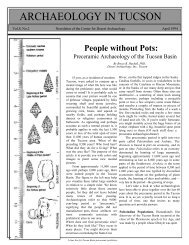
ARCHAEOLOGY IN TUCSON - Archaeology Southwest
ARCHAEOLOGY IN TUCSON - Archaeology Southwest
ARCHAEOLOGY IN TUCSON - Archaeology Southwest

Create successful ePaper yourself
Turn your PDF publications into a flip-book with our unique Google optimized e-Paper software.
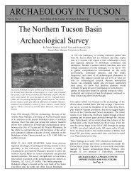
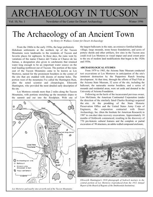
<strong>ARCHAEOLOGY</strong> <strong>IN</strong> <strong>TUCSON</strong><br />
Vol. 10, No. 1 Newsletter of the Center for Desert <strong>Archaeology</strong> Winter 1996<br />
The <strong>Archaeology</strong> of an Ancient Town<br />
by Henry D. Wallace, Center for Desert <strong>Archaeology</strong><br />
From the 1860s to the early 1930s, the large prehistoric<br />
Hohokam settlements at the northern tip of the Tucson<br />
Mountains were landmarks to the residents of Tucson and<br />
favorite places for sightseers. In those days, the ruins went by<br />
variations of the name Charco del Yuma or Charco de las<br />
Jumas, a designation also given to catchments that retained<br />
water long enough to be an important water source on the<br />
trail leading northwest out of Tucson. The portion of the ruins<br />
east of the Tucson Mountains came to be known as Los<br />
Morteros, named for the prominent boulders in the center of<br />
the site that are studded with dozens of mortar holes. The<br />
portion west of the mountains I've called the Huntington Ruin,<br />
after the noted scientist and climatologist, Ellsworth<br />
Huntington, who provided the most detailed early description of<br />
the site.<br />
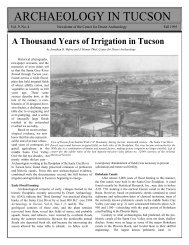
Los Morteros extends more than 2 miles along the Tucson<br />
Mountains, with portions stretching up the mountain slopes to<br />
the summit and out into the floodplain. With one of<br />
the largest ballcourts in the state, an extensive fortified hillside<br />
village, large mounds, stone house foundations, and acres of<br />
pottery sherds and other artifacts, few sites in the Tucson area<br />
could rival Los Morteros in visual impact and areal extent prior<br />
to the era of modem land modifications that began in the 1920s<br />
and 1930s.<br />
ARCHAEOLOGICAL STUDIES<br />
From 1979 to 1983, the Arizona State Museum conducted<br />
test excavations at Los Morteros in anticipation of the site's<br />
imminent destruction by the Peppertree Ranch housing<br />
development. At that time, through the efforts of Paul Fish at<br />
the Arizona State Museum, 32 acres of the site, including the<br />
ballcourt, the namesake mortar boulders, and a series of<br />
mounds and residential areas, were set aside and donated to the<br />
University of Arizona Foundation.<br />
Following on the heels of the incarcerated previous owner,<br />
Lew McGinnis, the American Continental Corporation (under<br />
the direction of the similarly fated Charles Keating) acquired<br />
the site. At the prodding of the State Historic<br />
Preservation Office and the United States Army Corps of<br />
Engineers, the corporation contracted with Desert<br />
<strong>Archaeology</strong>, Inc. (then the Institute for American Research) in<br />
1987 to con-duct data recovery excavations. Approximately 10<br />
months of fieldwork commenced, resulting in the discovery of<br />
770 pre-historic cultural features and the complete or partial<br />
excavation of 98 structures, an adobe-walled compound enclosure,<br />
Los Morteros and nearby sites at north end of the Tucson Mountains.<br />
Ellsworth Huntington's 1910 photograph of bedrock mortars in the<br />
central portion of Los Morteros (reproduced from the 1912 Annual<br />
Report of the Board of Regents of the Smithsonian Institution).
Page 2 <strong>Archaeology</strong> in Tucson Newsletter Vol. 10, No. 1<br />
and a number of related features. Many of the features were<br />
fully or partially excavated by volunteers, who worked<br />
alongside the archaeologists during the week and even gave<br />
up weekends in their dedication to recover as much as<br />
possible before the site was destroyed. Other volunteers<br />
worked with archaeologists in the laboratory, helping to<br />
process the large volume of artifacts and samples recovered.<br />
A stone bighorn sheep or dog effigy censer<br />
from Los Morteros.<br />
been suggested for some large settlements in the Phoenix area<br />
Since the entire area had been plowed, no surface traces of<br />
architecture remained. The only clues as to what lay beneath the<br />
ground were the myriad fragments of pottery, shell, stone tools,<br />
and other durable remnants of the settlement. Two sizable<br />
portions of the community were available to us for investigation<br />
on either side of the ballcourt. Nearly 9 miles of backhoe<br />
trenches and many cultural features were excavated, permitting<br />
a detailed look at the settlement’s organization and how it grew<br />
and changed over time. There were many surprises in store for<br />
us.<br />
Because of the enormous range of archaeological features<br />
exposed from trenching, we were able to select those contexts<br />
that appeared the most promising for providing samples of<br />
artifacts that might date to each portion of the settlement's history.<br />
We were also able to choose and excavate structures that had<br />
burned with large assemblages of artifacts on the floor, resulting in<br />
HOW AND WHY an extraordinary cross-section of household goods and unusual<br />
The guiding items not commonly recovered at archaeological sites, as can be<br />
research interests for<br />
the Los Morteros<br />
project were based<br />
on a desire to learn<br />
how this ancient<br />
community had been<br />
seen in the accompanying illustrations.<br />
To sort out the sequence of occupation at Los Morteros, a<br />
special effort was focused on the evolution of pottery stylistic<br />
attributes. Due to particularly rapid changes in design, it was<br />
possible to identify distinctive traits in the pottery dating from<br />
A.D. 950 to 1150. This allowed for dating within about a 25 to<br />
organized. Where 50-year range in most instances, which greatly facilitated our<br />
did the people live<br />
Was the community<br />
ability to sequence the trends in occupation at the settlement.<br />
The excavated portions of Los Morteros were found to date<br />
organized into neig- from the Rillito to the Tanque Verde phases (ca. A.D. 850 to<br />
borhoods, as had 1300). Surface finds near the unexcavated ballcourt suggest that<br />
the earliest occupation may have been during the Snaketown<br />
phase (A.D. 700 to 750) or earlier, but this awaits confirmation<br />
through excavations there.<br />
EARLY OCCUPANTS<br />
In the portions excavated, occupation during the Rillito phase<br />
(A.D. 850 to 950) was initiated as a series of isolated structures<br />
or little clusters of structures that may represent small<br />
farmsteads or fieldhouses. These were located near<br />
The Point of the Mountains region, where Los Morteros is located, was a colorful spot in the history of Tucson. In 1857<br />
or 1858, the Butterfield Overland Mail Company built a station in the vicinity of Los Morteros called Pointer Mountain<br />
or Point of the Mountain. This station was relocated during the course of the Los Morteros project. The original station<br />
may have burned during the Civil War, but either it, or one constructed shortly thereafter, is seen in this rare photograph<br />
taken by H. E. Murdock in 1927 (photograph courtesy of the Arizona State Museum, University of Arizona).
Winter 1996 <strong>Archaeology</strong> in Tucson Newsletter Page 3<br />
floodwater farming plots on the alluvial fans of the Tucson<br />
Mountains and may have been related to a settlement near the<br />
ballcourt or to one of several other sizable settlements present<br />
nearby. With the abandonment of the nearby Rillito phase<br />
settlements, it is perhaps no coincidence that the population<br />
present at Los Morteros grew rapidly during the succeeding<br />
Early Rincon subphase (A.D. 950 to 1000). At that point, the<br />
structure of the Los Morteros community became firmly<br />
established, and other than normal processes of growth and<br />
attrition, it changed little over the course of the next 150 years.<br />
pottery was no longer imported from Phoenix, though it had<br />
been prior to that time. In addition, the local ceramic designs<br />
shifted noticeably from dynamic swirling or banded layouts to<br />
more static sectioned or basketweave-type designs. While<br />
NEIGHBORHOODS AND VILLAGE SEGMENTS<br />
From the Early Rincon subphase to the early portions of<br />
the Late Rincon subphase (A.D. 950 to 1125), Los Morteros<br />
was divided into a series of neighborhoods called village<br />
segments because they mirrored one another in how they were set<br />
up. Each village segment contained from one to four courtyard<br />
groups. A courtyard group represented a single household that<br />
may have included one family or an extended family. It often<br />
had up to three residential structures and sometimes a dedicated<br />
storage structure.<br />
The courtyard groups or households in each village<br />
segment shared large communal pit ovens called hornos that were<br />
used for roasting agave hearts, and they interred their dead in<br />
communal cemeteries. These shared activities lead us to think<br />
they were composed of families that may have been related or<br />
were socially very close to one another. About 20 to 26 village<br />
segments were present at Los Morteros in the Middle Rincon<br />
subphase (A.D. 1000 to 1100). If all were occupied<br />
simultaneously, a population of between 200 and 624 people (40<br />
to 78 households, with 5 to 8 persons per household) would<br />
have been living at the site.<br />
Sometime during the first half of the Middle Rincon<br />
subphase (A.D. 1000 to 1050), ballcourts in the Tucson area<br />
were no longer built and may not have been used at all. Buffware<br />
Schematic plan of a typical Middle Rincon subphase village segment<br />
at Los Morteros.<br />
Distribution of known and predicted Middle Rincon subphase village<br />
segments at Los Morteros (map by Geo-Map, Inc.).
Page 4 <strong>Archaeology</strong> in Tucson Newsletter Vol. 10, No. 1<br />
ballcourts were falling out of favor, the settlement of Los<br />
Morteros was transformed from a nucleated village<br />
centered on the ballcourt to a widely dispersed, linear<br />
settlement extending over 1 1/2 miles. This same trend<br />
can be seen throughout the Tucson area in other<br />
population centers.<br />
DRASTIC CHANGES<br />
The relatively peaceful period of steady growth and<br />
development during the eleventh century was shattered in<br />
the early 1100s when a complete settlement<br />
reorganization occurred The abandonment of the<br />
southernmost village segments at Los Morteros (which<br />
have been given site numbers AZ AA:12:146, 147, and<br />
148) earlier in the Middle Rincon subphase may have<br />
been a precursor to this phenomenon. Based on the dating<br />
of settlements along a presumed canal system across the<br />
Santa Cruz River from Los Morteros (identified by Paul<br />
Fish, Suzanne Fish, and John Madsen of the Arizona<br />
State Museum), it is evident that a 6-mile-long canal was<br />
constructed sometime during the last 25 to 40 years of the<br />
eleventh century. This canal may have opened up large<br />
areas of formerly marginal land to dependable<br />
agriculture. It seems more than coincidental that at the<br />
same time, the southern half of Los Morteros was<br />
completely abandoned, and a very different settlement<br />
structure was instituted in the northern half. This drastic<br />
change in the community occurred over only a few<br />
decades.<br />
Near the end of the Marana canal system, a platform<br />
mound settlement was founded after AD. 1150.<br />
Numerous smaller settlements were located along the<br />
canal. The arid bajada upslope from the canal saw the<br />
development of a large, rockpile, dry-fanning field<br />
system used for the cultivation of agave and perhaps<br />
other crops.<br />
Some archaeologists have argued that the construction<br />
of the canal system, with its headgate adjacent to Los<br />
Morteros and the platform mound at its tail end is an<br />
indication that Los Morteros and the other settlements<br />
along the canal system were peaceably joined together in<br />
a single large community. They also assume that all or<br />
most of the settlements with the key marker for this<br />
period, Tanque Verde Red-on-brown pottery, were<br />
inhabited at the same time. However, the information<br />
from Los Morteros leads to alternative reconstructions. It<br />
was discovered that housing areas shifted over time and<br />
that one cannot assume contemporaneity between or even<br />
within settlements dated to the lengthy Tanque Verde<br />
phase (AD. 1150 to 1300). Rather than peaceful<br />
coexistence, the data suggest times of stress, if not outand-out<br />
warfare.<br />
WARFARE<br />
The Marana canal system may have been both a<br />
symptom and a cause of strife in the region, and it may<br />
well have been a prescription for disaster. The expansion<br />
of settlement around the Tucson area that occurred in the<br />
eleventh century was probably accompanied by a<br />
dependable rainfall pattern that would have promoted<br />
canal irrigation. The initial construction of the canal<br />
could have been motivated by increasing population<br />
levels and a push to develop new farmland. Construction of<br />
the canal, with its headgate at Los Morteros, opened up large<br />
tracts of previously marginal land and allowed for splintering<br />
of the previous population that had been focused at Los<br />
Morteros. Conflicts over property rights may well have<br />
ensued. The Santa Cruz River probably did not flow yearround<br />
in the Los Morteros/Marana area, and it would have<br />
taken only a few bad years for the canal-supported villages to<br />
experience problems.<br />
Evidence of warfare or at least a perceived threat of deadly<br />
force was found at Los Morteros. On the rocky mountainside<br />
of the Tucson Mountains above the central portions of the<br />
site, a sizable village overlooks the valley below. Called the<br />
Linda Vista trincheras, the village includes 80 or more<br />
structures and a hilltop plaza or compound enclosure. Aside<br />
from the obvious defensive advantage of the hillside<br />
location, a massive masonry wall that blocks the only ready<br />
access to the village from the west was found. We don't know<br />
whether the perceived threat was from nearby settlements or<br />
farther afield.<br />
ABANDONMENT<br />
Los Morteros and an enormous region around it were<br />
abandoned sometime during the middle to late thirteenth<br />
century. Across the Tucson area, other settlements were<br />
abandoned at the same time, and large concentrations of<br />
people were focused in a few well-watered areas such as San<br />
Xavier and the confluence of the Pantano and Tanque Verde<br />
drainages. We pick up the story of the Los Morteros region<br />
again in the late seventeenth century, with the arrival of the<br />
Jesuits. At that time, a series of settlements was present along<br />
the Santa Cruz River in the Tucson area, including one near Los<br />
Morteros called El Valle de Correa, with a population of<br />
100 people.<br />
THE LOS MORTEROS VOLUNTEERS<br />
The list of volunteers on the Los Morteros project is surely<br />
as impressive as the site itself! As a small measure of our<br />
gratitude to all of you who helped out by volunteering your<br />
time in the field and laboratory (not including, but not forgetting,<br />
DAI employees), we list alphabetically those of you<br />
whose names were recorded. Some of you have probably been<br />
left out because your names weren't written down; please<br />
know that your efforts also are greatly appreciated.<br />
Dan Arnit, Bill Atwood, Harry Ashby, John Bishop, Kay<br />
Burk, Jim Burr, Gloria Chivers, Janet Chumbley, Richard<br />
Ciolek-Torello, Susan Ciolek-Torello, Bob Conforti, Valerie<br />
Conforti, Bill Deaver, Sheila Donnelly, Alan Ferg, Cindy<br />
Gibbs, Scott Gongoly, Sky Gradillas, Walt Grassie, Erin<br />
Grassie, Linda Gregonis, Eric Force, Jane Force, Tom<br />
Hartzell, Darlene Heemstra, Stephanie Holding, Jim<br />
Holmlund, Jerry Howard, Ben Huckell, Bruce Huckell, Lisa<br />
Huckell, Liz Huckell, Carli Hummel, Paul Knapp, Bobbie<br />
Lee, Selena Littler, Joan Lloyd, Judy Looper, Joan<br />
Manemann, Betsy Marshall, Cindy Mendelson, Susan Mathes,<br />
Albert Morales, William Morris, John Murray, John Nowlin,<br />
Barry Perron, Preston Perry, Don Reser, Doris Rickard,<br />
Shirley Rivers, Luis Rodriguez, Kay Rosenow, Nancy Russell,<br />
Josh St. John, Joyce St. John, Marc Severson, Robbie Serface,<br />
Cathy Smith, Darlene Smyth, Barbara Snyder, Mike Squires,<br />
Sarah Tuttle, Sharon Urban, Betty Wall, Cindy Wallace,<br />
Phyllis Wallace, and Russ Wilde.
Winter 1996 <strong>Archaeology</strong> in Tucson Newsletter Page 5<br />
Animal bone hairpin with painted design from a Tanque Verde<br />
phase context at Los Morteros.<br />
H. E. Murdock and friend making good use of the bedrock<br />
mortars at Los Morteros in 1927. Photograph courtesy of<br />
the Arizona State Museum, University of Arizona.<br />
Stirrup-spouted vessel from the floor of an eleventh-century<br />
house at Los Morteros. This vessel form and color variant<br />
of Rincon Polychrome (white decoration on a red<br />
background) is unique for the Hohokam culture area prior<br />
to A.D. 1200. This vessel is only the second such known<br />
from southern Arizona. Stirrup-spouted vessels in other<br />
parts of the new world are thought to have been used in<br />
ceremonial contexts as containers for easily poured liquids.<br />
This illustration of a nineteenth-century Pima Indian village along the Gila River may be similar to what Los Morteros village<br />
segments would have looked like. By permission of the Museum of Art, Rhode Island School of Design. Gift of the RISD<br />
Library, photography by Del Bogart.
Page 6 <strong>Archaeology</strong> in Tucson Newsletter Vol. 10, No. 1<br />
1822 Ferdinand VII Coin<br />
Found along Cienega Creek<br />
by Michelle N. Stevens, Center for Desert <strong>Archaeology</strong><br />
Most historic artifacts found on archaeological surveys<br />
consist of pieces of glass bottles, metal can fragments, broken<br />
dishes, and architectural remains. However, AIT volunteers<br />
participating in the Cienega Valley Survey during the fall of<br />
1995 made a surprising discovery when one of them found a<br />
Ferdinand VII coin that dates to 1822. This coin resembles a<br />
Mexican coin worth 8 reales issued during the final coinage<br />
phases of the Mexican War of Independence (1810-1821).<br />
MEXICAN M<strong>IN</strong>TS AND REVOLUTIONS<br />
Southern Arizona was Spanish territory in the early<br />
nineteenth century. The Mexican War of Independence<br />
began September 16, 1810, when Father Miguel Hidalgo<br />
organized a group to fight against Spanish Colonial forces.<br />
During the war, both Spanish royalists and Mexican<br />
insurgents issued coins. The gold and silver coins issued by<br />
the royalists usually had an image of King Ferdinand VII of<br />
Spain (1808-1821) on the obverse side and a crowned coat<br />
of arms and pillars on the reverse. Before the war, coins<br />
were minted only in Mexico City. However, once the war<br />
began, new mints were opened in an effort to stop the<br />
revolutionists or insurgents, depending on whose side you<br />
were on, from robbing the wagon trains that carried ore and<br />
bullion to the mint or newly minted coins to the provinces.<br />
The first insurgent mint was started by Hidalgo in the<br />
town of Guanajuato in October 1810, just a month after the beginning<br />
of the war. A blacksmith and several counterfeiters in<br />
Guanajuato made dies to duplicate coins worth 8 reales that<br />
were issued in Mexico City. Their machinery was so advanced<br />
that the coins they struck cannot be distinguished from those<br />
issued in Mexico City under Spanish rule. When Guanajuato<br />
was re-captured by royalist forces in November 1810, the<br />
Spanish were so impressed with the new machine that they<br />
transported it back to Mexico City, where it became a model<br />
for future Spanish coin machinery. Although the city of<br />
Guanajuato was controlled by royalist forces between 1810<br />
and 1821, the royalists minted coins there only in 1813.<br />
In 1811, Hidalgo was captured and executed by<br />
royalist<br />
forces, who thought that his removal would cause the<br />
revolutionary movement to crumble. However, Don Jose<br />
Maria Morelos y Pavón, a priest who had studied under<br />
Hidalgo, took up the cause and led the revolutionary<br />
movement. In order to pay his troops and buy supplies,<br />
Morelos issued copper coins worth 1/2, 1, 2, and 8 reales.<br />
These coins can be easily identified because all display<br />
the word "SUD," which means south. Though the coins<br />
were minted in copper, they were to be ex-changed for<br />
gold or silver whenever the revolutionaries won the war.<br />
This 1822 Ferdinand VII coin<br />
worth 8 reales was found by<br />
V. Conforti during the survey<br />
along Cienega Creek. The<br />
obverse side has the inscription<br />
"FERD<strong>IN</strong> * VII DEI *<br />
GRATIA * 1822” and a<br />
draped regular bust of King<br />
Ferdinand VII of Spain (1808-<br />
1821),facing right. The<br />
reverse side has the inscription<br />
"* HISPAN * ET <strong>IN</strong>D *<br />
REX * (illegible mint mark) *<br />
8R * C * G"(assayer' s marks)<br />
and a crowned coat of arms<br />
and dividing pillars.<br />
Morelos was captured and executed in 1815, but the war<br />
efforts continued. By 1821, royalist forces were finally defeated.<br />
On September 27, 1821, Agustin Itúrbide became the first ruler<br />
of Mexico. However, coins with the Spanish Colonial design,<br />
i.e., the portrait of King Ferdinand VII, continued to be struck<br />
until new dies could be prepared. On May 18, 1822, Itúrbide<br />
was proclaimed the Emperor, and coins with his image were<br />
struck a few months later.<br />
THE CIENEGA SURVEY CO<strong>IN</strong><br />
The silver coin found during the survey is 1 7/16 inches (4<br />
cm) in diameter and weighs 26.55 grams. It is in relatively<br />
good condition, with the portrait and writing legible, although<br />
the mint mark is illegible. The year and assayer's marks on the<br />
coin match those from the Durango mint, one of the "new"<br />
mints opened by the royalists during the War of Independence.<br />
The Durango mint struck both silver and copper coins; the<br />
silver coins worth 8 reales were poorly manufactured compared<br />
to those struck in Mexico City. The Durango coins are often<br />
offset, and the images less clear. The date on this coin indicates<br />
that it was minted by the first Mexican government before the<br />
dies with a portrait of Itúrbide were manufactured.<br />
How did the coin find its way to southeastern Arizona<br />
Spanish Colonial and Mexican coins were considered legal<br />
tender until 1857 but continued to circulate and were accepted<br />
by the public until the 1880s. Southeastern Arizona was part of<br />
Mexico's northwest territory until the Gadsden Treaty was<br />
signed in 1854. During this period, hostile encounters with the<br />
Apache were common. The Spanish government had given the<br />
Apache rations in exchange for peaceful relations, but this<br />
program ended in 1831 due to a decline in the Mexican<br />
economy and supply shortages in the northwest territory. As a<br />
result, Apache raids increased from the 1830s to 1840s, and
Winter 1996 <strong>Archaeology</strong> in Tucson Newsletter Page 7<br />
many Mexicans moved away from the area.<br />
Increased Apache raids in the northwest territory did not<br />
discourage everyone from passing through this region. After<br />
the War of Independence, the Mexican government opened up<br />
the area, which had been previously restricted by the Spanish<br />
Colonial government, to foreign trade and commerce. Supply<br />
trains traveled through, heading to Tucson, and woodcutters<br />
and hunters also frequented the region. In 1846, Captain Philip<br />
St. George Cooke, a commander of the Mormon Battalion, was<br />
ordered to construct a wagon road between Santa Fe, New<br />
Mexico, and California, and he passed through the Cienega<br />
area. Once Southeastern Arizona became a U.S. territory in<br />
1854, the number of travelers and settlers in the region<br />
increased, and the first stage lines were constructed through the<br />
area shortly thereafter.<br />
Unfortunately, the coin appears to be an isolated<br />
occurrence. It was found on the surface of a prehistoric site, and<br />
no other historical artifacts are present. Therefore, the date<br />
the coin was lost will remain unknown.<br />
REAL OR FAKE<br />
The possibility exists that the coin is a counterfeit. It is<br />
poorly struck, meaning that the stamp on each side is slightly<br />
off-centered and the stamp impression is uneven. The markings<br />
around the edge are crudely manufactured, and the mint<br />
markings are illegible. It also has small pits on its surfaces,<br />
which is common in copies. The heavy wear may be<br />
intentional in order to obscure poor manufacturing techniques,<br />
pitting, and mint markings. Modem counterfeiters often bury or<br />
expose coin copies to weather their surfaces, thus making them<br />
appear older.<br />
It is unlikely, however, that this is the case. The coin was<br />
found in an area that Mexican travelers are known to have<br />
traversed. John Madsen of the Arizona State Museum is<br />
completing a study of isolated Spanish and Mexican period<br />
artifacts and reports that other isolated artifacts have been found<br />
nearby. Lastly, it is known that the Durango mint produced<br />
poorer quality coins. The coin is believed to represent a rare,<br />
dated example of the Mexican presence in southern Arizona.<br />
ACKNOWLEDGMENTS<br />
More information can be found in The Coins of Mexico,<br />
1536-1963, by Neil S. Utberg (1963, DANS CO: Venice, CA).<br />
Mark Santiago of the Arizona Historical Society, John Madsen<br />
of the Arizona State Museum, and Neil Powell of Arizona<br />
Stamp and Coin provided assistance in preparing this article.<br />
CIENEGA SURVEY DATES<br />
First Saturday Third Sunday<br />
MARCH 2 17<br />
APRIL 6 21<br />
MAY 4 19<br />
If you're interested in volunteering for a survey,<br />
call Lisa Piper at 520-881-2244.<br />
SAN PEDRO VALLEY <strong>ARCHAEOLOGY</strong><br />
Protecting Our Legacy<br />
Many volunteers from the Center for Desert <strong>Archaeology</strong><br />
will recall the richness and diversity of archaeological sites that<br />
they encountered during the 4 1/2-year survey of the lower San<br />
Pedro River. Over 500 sites were identified along the 75-mile<br />
stretch of river valley from Winkleman to Benson. But<br />
participants in the San Pedro survey also became aware of the<br />
fragile nature of such resources, and the perils of vandalism<br />
and careless development.<br />
In the face of growing population, economic<br />
development, and competing interests, only a concerted effort<br />
will be effective in preserving the valley's unique archaeological<br />
heritage. The Center for Desert <strong>Archaeology</strong> has received a<br />
grant to prepare an archaeological preservation plan for the<br />
4,000 square miles of the San Pedro drainage system that lie<br />
within the United States. The San Pedro Archaeological<br />
Preservation Project is a natural outgrowth of our previous<br />
reconnaissance work along the river.<br />
The project will not involve new archaeological<br />
fieldwork, however. Our goal will be to build a consensus<br />
among public and private land managers, communities,<br />
educators and researchers, conservation organizations, and<br />
Indian tribes. Activities will center on interviews and forums,<br />
archival research, public education, and support of local<br />
archaeological conservation organizations. For further<br />
information. contact Lisa Armstrong at 520-881-2244.<br />
A Center for Desert <strong>Archaeology</strong> Workshop<br />
A Look Beyond<br />
Metates and Arrowheads<br />
How did the enduring material of stone serve the needs<br />
of prehistoric people of the <strong>Southwest</strong> This will be the main<br />
theme of a two-part May workshop given by archaeologists<br />
Dr. Jenny Adams and Jane Sliva of the Center for Desert<br />
<strong>Archaeology</strong>. Geared to avocational archaeologists, the<br />
workshops will consider how stone tools were made and<br />
used. A focus on the purpose of various stone tools will lead<br />
participants to a better understanding of how ground stone<br />
and chipped stone helped to define technological traditions<br />
in the <strong>Southwest</strong>.<br />
The workshops will include hands-on opportunities and<br />
lab manuals. Saturday, May 11, two lectures; Saturday, May<br />
18, two lab sessions. 8 a.m. to 12:15 p.m., both days. You<br />
are welcome to bring a lunch and join the archaeologists for<br />
discussion. Cost: $45 for Center members, $55 for all others.<br />
Saturday, May 11, lecture only: $35/$45. Limited to 30<br />
participants, reservations required.<br />
Call Lisa Armstrong at 520-881-2244 for more details,<br />
or complete and send in the enclosed form with your check.
Center for Desert <strong>Archaeology</strong><br />
<strong>Archaeology</strong> in Tucson<br />
3975 North Tucson Blvd. Tucson,<br />
AZ 85716<br />
ADDRESS CORRECI1ON REQUESTED<br />
This unusual artifact, a feather<br />
impression on a piece of fired<br />
clay, was found at the Los<br />
Morteros site (see article on<br />
page 1).<br />
Time to Renew<br />
If your address label indicates that your<br />
<strong>Archaeology</strong> in Tucson membership has expired,<br />
please renew promptly to remain eligible for all<br />
activities, newsletters, and discounts on T-shirts<br />
and Center for Desert <strong>Archaeology</strong> publications.<br />
Printed on Recycled Paper<br />
The Center for<br />
Desert <strong>Archaeology</strong><br />
The Center for Desert <strong>Archaeology</strong> is a<br />
nonprofit research and education organization that<br />
specializes in the study of archaeology and history<br />
of desert regions. Our primary research focus has<br />
been southern Arizona.<br />
<strong>Archaeology</strong> in Tucson<br />
is the Center for Desert <strong>Archaeology</strong>’s<br />
membership program. For further information<br />
about the Center for Desert <strong>Archaeology</strong> or<br />
about the <strong>Archaeology</strong> in Tucson program, call use<br />
at 520-881-2244. For information on the<br />
<strong>Archaeology</strong> in Tucson newsletter specifically,<br />
please contact the editor, Homer Thiel.<br />
ACKNOWLEDGEMENTS<br />
Donna Breckenridge edited, formatted, and<br />
provided creative ideas. The photographs of the<br />
coin on page 6 were taken by Greg Berg, and the<br />
drawing of the projectile point on page 7 was<br />
done by Jane Silva. Spectrum Printing, 4651 S.<br />
Butterfield, #161, Tucson, printed this issue.<br />
<strong>Archaeology</strong> in Tucson<br />
Annual Membership Categories and Rates<br />
Individual......................... .$10 Contributing........................... ...$50<br />
Family...............................$15 Active... ..................................$100<br />
Supporting ... ................... ..$25 Sponsor ................................... ..$200<br />
Patron........................ ..$500