Northern Tucson Basin Archaeological Survey - Archaeology ...
Northern Tucson Basin Archaeological Survey - Archaeology ...
Northern Tucson Basin Archaeological Survey - Archaeology ...

Create successful ePaper yourself
Turn your PDF publications into a flip-book with our unique Google optimized e-Paper software.
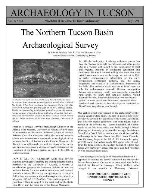
ARCHAEOLOGY IN TUCSON<br />
Vol. 6, No. 3 Newsletter of the Center for Desert <strong>Archaeology</strong> July 1992<br />
The <strong>Northern</strong> <strong>Tucson</strong> <strong>Basin</strong><br />
<strong>Archaeological</strong> <strong>Survey</strong><br />
By John H. Madsen, Paul R. Fish, and Suzanne K. Fish<br />
Arizona State Museum, University of Arizona<br />
An ancient Hohokam rock pile northwest of <strong>Tucson</strong>, partly cut away<br />
by Arizona State Museum archaeologists to reveal what it looked<br />
like inside. It has been concluded that thousands of piles like this<br />
were used mainly for growing agaves on low, exposed slopes.<br />
Unlike the surrounding hard-packed ground surfaces, the uneven,<br />
porous surfaces of the pile allowed infiltration of rainfall. Moistureenhanced<br />
microhabitats created by these features would benefit<br />
agaves. Photo courtesy of Arizona State Museum, University of<br />
Arizona.<br />
From 1981 through 1989 the <strong>Archaeology</strong> Division of the<br />
Arizona State Museum, University of Arizona focused much<br />
of its attention on the ancient Hohokam culture of southern<br />
Arizona. Over this nine-year period the authors' research<br />
efforts were centered on a broad-scale archaeological survey<br />
between the City of <strong>Tucson</strong> and the Picacho Mountains. In<br />
this article we will provide you with the history of the survey<br />
and summarize almost a decade of work centered on the<br />
Hohokam of the Classic period, ca. A.D. 1100-1450, in<br />
southern Arizona.<br />
HOW IT ALL GOT STARTED. Aside from obvious<br />
logistical advantages of teaching and training students in close<br />
proximity to the University of Arizona, a variety of<br />
considerations governed the Museum's decision to select the<br />
northern <strong>Tucson</strong> <strong>Basin</strong> for various educational and personal<br />
research activities. The survey emerged more or less from a<br />
field school excavation at the archaeological site called Los<br />
Morteros, AZ AA:12:57 (ASM). This multicomponent<br />
Hohokam village is located on the west bank of the Santa<br />
Cruz River near the north end of the <strong>Tucson</strong> Mountains.<br />
In 1981 the inadequacy of existing settlement pattern data<br />
from the <strong>Tucson</strong> <strong>Basin</strong> left Los Morteros and other nearby<br />
sites in a vacuum with regard to their relationship to local<br />
and regional patterns of Hohokam settlement and<br />
subsistence. Because it seemed unlikely that these sites were<br />
isolated occurrences over the landscape, we set out in 1981<br />
to gather comprehensive information on the early<br />
environment, settlement patterns, and the kinds,<br />
frequencies, and extent of all archaeological phenomena in<br />
the <strong>Basin</strong>. This endeavor would turn out to be of value not<br />
only for archaeological research. Because metropolitan<br />
<strong>Tucson</strong> was expanding rapidly into previously undisturbed<br />
rural areas, we knew that land-use planners would<br />
eventually be using the survey information we were about to<br />
gather, to make provisions for cultural resources while<br />
residential and commercial land development continued in<br />
Pima County long after we were through.<br />
Our earliest effort was focused on the archaeology of the<br />
diverse desert lowland basin. The map on page 2 shows how<br />
our survey covered the floodplain of the Santa Cruz River,<br />
plus adjacent bajadas (piedmont) and more rugged higher<br />
terrain of the Tortolita and <strong>Tucson</strong> mountains. The initial<br />
results of our field work, which was funded through a federal<br />
planning and inventory grant provided through the Arizona<br />
State Parks Board, left no doubt about the richness of the<br />
archaeology in the lower Santa Cruz River basin. From the<br />
time the survey began in the fall of 1981 through the spring<br />
of 1983, crews had walked nearly 100 square miles of land,<br />
from Ina Road north to the modern hamlet of Rillito; had<br />
found 283 previously unrecorded sites; and had revisited<br />
over 30 previously known sites.<br />
These findings as of early 1983 whetted our intellectual<br />
appetites to continue the survey northward and outside the<br />
<strong>Tucson</strong> <strong>Basin</strong> proper. Our desire to move north was further<br />
inspired by <strong>Tucson</strong> archaeologist Henry Wallace, who<br />
brought to our attention a 13th-century Hohokam<br />
ARCHAEOLOGICAL PROJECTS WITH<br />
OPPORTUNITIES FOR VOLUNTEERS<br />
See Page 6
Page 2 <strong>Archaeology</strong> in <strong>Tucson</strong> Newsletter Vol. 6, No. 3<br />
"platform mound" site near Marana—a site now called the<br />
Marana Platform Mound (for obvious reasons). Platform<br />
mounds are large, formally constructed mounds, usually<br />
associated with walled-in housing compounds, that<br />
apparently served ceremonial or civic functions. The<br />
desert east of Marana and the modern farm lands around<br />
this town were targeted for our next phase of research.<br />
Later in 1983, with additional funding provided through<br />
Arizona State Parks, the Museum's <strong>Archaeology</strong> Division<br />
The <strong>Northern</strong> <strong>Tucson</strong> <strong>Basin</strong> <strong>Survey</strong> study area.<br />
Nearly 2,000 archaeological sites, including 4 platform mounds and 3 ballcourt communities, are now known in this 700-square mile area.
July 1992 <strong>Archaeology</strong> in <strong>Tucson</strong> Newsletter Page 3<br />
began centering its attention on the region around the Marana<br />
Mound, which was occupied during the Tanque Verde phase<br />
(AD. 1150-1300). During the ensuing year, field crews<br />
systematically surveyed 35 square miles around the mound and<br />
recorded 147 new sites.<br />
The data we were gathering on Hohokam settlement patterns<br />
complemented information being recovered during<br />
excavations nearby at sites along the planned course of the<br />
<strong>Tucson</strong> Aqueduct, part of the Central Arizona Project (CAP).<br />
Being in the right place at the right time paid off, for we were<br />
invited by the U.S. Bureau of Reclamation to participate in<br />
the massive federal archaeological study of the CAP route.<br />
We were to provide a regional view of Hohokam settlement<br />
outside the narrow aqueduct corridor. The major theme of our<br />
research now became the investigation of how some<br />
important Hohokam Classic period population centers were<br />
structured. Our emphasis thus turned to agricultural issues,<br />
definition of political units, and the social interaction that<br />
must have occurred at a variety of levels among the several<br />
Classic period platform mound communities located in the<br />
lower Santa Cruz Valley.<br />
From September 1, 1983 through New Year's Day of 1987<br />
our study area burgeoned to nearly 700 square miles. Besides<br />
continued survey northeast of the Marana Mound, we<br />
selected three other large blocks of land around other<br />
platform mounds located along McClellan Wash, Los Robles<br />
Tabular knives like this were used to remove spiny leaves of agave<br />
plants. In the Los Robles community is a large quarry of tabular<br />
stone that was used for these prehistoric artifacts, and traded.<br />
Wash, and Tom Mix Wash as possible candidates for further<br />
l00-percent survey coverage (see map on page 2). The<br />
closeness of these mounds to the <strong>Tucson</strong> Aqueduct's<br />
archaeological sites hinted that the information we collected<br />
would be relevant to all archaeological studies along the CAP<br />
route.<br />
Prior to selecting areas for our intensive "block" surveys, and to<br />
obtain a general sense of the site distribution at and away<br />
from the targeted platform mounds, our field crews were<br />
assigned the task of walking sample "tran-<br />
Preclassic Period (A.D. 300-1100) Classic Period (A.D. 1100-1450)<br />
Ancient Hohokam Settlement Patterns in the Marana Area
Page 4 <strong>Archaeology</strong> in <strong>Tucson</strong> Newsletter Vol. 6, No. 3<br />
permanent occupations that included villages, farmsteads,<br />
agricultural complexes, reservoirs, and numerous small sites<br />
used for a host of other activities. Among the latter were food<br />
collecting and processing sites, and rock quarries for<br />
production of stone tools. By the Classic period many<br />
Hohokam site types, particularly the villages of the preceding<br />
period, continued to be occupied but had become parts of<br />
sprawling platform mound communities.<br />
Rock piles in the Marana agricultural complex, like the pile shown<br />
on page 1, probably number around 45,000. This map shows less<br />
than 1 percent of the entire complex.<br />
sects," or linear swaths of land, spaced at half-mile intervals<br />
across the landscape. East-to-west transects covering 600<br />
linear miles eventually linked the four platform mounds<br />
together (see map, page 2). Based on results from these<br />
transects, the areas immediately surrounding the McClellan<br />
Wash and Los Robles Wash platform mounds were selected<br />
for more intensive survey, as was the countryside north of<br />
Marana. By the spring of 1987 we had surveyed an<br />
additional 112 square miles and had recorded a total of 694<br />
new sites found during both transect and large-block<br />
investigations.<br />
WHAT HAVE WE LEARNED FROM THIS WORK<br />
Prior to the State Museum's surveys in the northern <strong>Tucson</strong><br />
<strong>Basin</strong>, the perception of Hohokam culture had been strongly<br />
shaped by archaeological materials and research in the socalled<br />
Hohokam "core" or "heartland" centered on the lower<br />
Salt and Gila rivers. The term "Hohokam periphery,"<br />
theretofore given to the geographically immense remainder<br />
of Hohokam territory, had carried an implication of lesser<br />
cultural complexity. The results of the <strong>Northern</strong> <strong>Tucson</strong><br />
<strong>Basin</strong> <strong>Survey</strong> were instrumental in redefining our view of<br />
this fundamental "core versus periphery" concept. Our<br />
research indicates that the Hohokam living on and near the<br />
middle and lower Santa Cruz River were every bit as<br />
sophisticated as their "core area" counterparts. While subtle<br />
differences persisted in types and classes of material culture,<br />
by and large the two regions shared the same cultural traits<br />
and development until at least the beginning of the 14th<br />
century.<br />
One obvious difference between the two regions concerns<br />
land use patterns. The lower Santa Cruz River basin,<br />
between the northern tip of the <strong>Tucson</strong> Mountains and the<br />
Picacho Mountains, was occupied in ancient times by three<br />
interrelated and cohesive Hohokam communities: the<br />
Marana, McClellan Wash, and Los Robles Wash settlements.<br />
By AD. 1000 these communities had developed substantial<br />
The Hohokam platform mound communities that arose in the<br />
12th century were—like the pre-AD. 1100 Hohokam<br />
"ballcourt" communities—archaeological site clusters that<br />
seem to have been organized around locations with platform<br />
mounds and other large architectural features. The Classic<br />
period platform mounds and the so-called Hohokam<br />
ballcourts that preceded the platform mounds both are of<br />
sufficient size to suggest they were built by organized labor<br />
forces. Further, the ballcourt and platform mound sites are<br />
thought to have had some administrative function over<br />
expansive areas. For instance, sites with these "public"<br />
architectural features may have housed governing bodies or<br />
perhaps single individuals who had sufficient status to<br />
influence politics, religion, social activities, commerce, and<br />
resource use over specific territories.<br />
On page 3, the map on the left illustrates how during the<br />
Preclassic era the Hohokam sites of the lower Santa Cruz<br />
<strong>Basin</strong> were clustered in the localities of Los Robles Wash,<br />
McClellan Wash, on the bajada of the Tortolita Mountains,<br />
and near present-day Rillito. In most instances we have found<br />
a dozen or more sites distributed around each large village<br />
containing a Hohokam ballcourt (see map). By AD. 1150<br />
many Preclassic villages continued to be occupied but had<br />
become incorporated into the much larger site clusters that<br />
made up sprawling Classic period platform mound<br />
communities, as shown in the lower right map on page 3. One<br />
of the overriding characteristics of this new (Classic period)<br />
organization was the use of previously unoccupied lands for<br />
both habitation and farming.<br />
The Hohokam relied heavily on cultivated crops but the<br />
techniques used for farming set the Santa Cruz River basin<br />
apart from the Hohokam "core" area. In the broad, flat valleys<br />
of the Salt and Gila rivers the Hohokam relied on extensive<br />
canal systems running from flowing rivers to irrigated tracts<br />
of land. This was not possible on a large scale along the Santa<br />
Cruz River, because the <strong>Tucson</strong> <strong>Basin</strong> was not broad enough<br />
or flat enough to allow canals to be extended from the<br />
floodplain out onto the river terraces, and because not all<br />
segments of the Santa Cruz flowed continuously. Even<br />
though there is sufficient evidence to suggest broad<br />
similarities in the foodstuffs grown and used among all<br />
Hohokam, the local environments had a direct bearing on<br />
crop production.<br />
The potential for productive [Concluded on page 7]
July 1992 <strong>Archaeology</strong> in <strong>Tucson</strong> Newsletter Page 5<br />
<strong>Archaeological</strong> Consulting Services, Ltd. (Tempe). ACS<br />
is working on archaeological projects in the <strong>Tucson</strong>, Toltec,<br />
Scottsdale, Sun City West, and Verde Valley areas of<br />
southern Arizona. In a project for the Santa Fe Pacific<br />
Pipeline Co., Archaic period pits filled with fire-cracked rock<br />
and charcoal have been found north of <strong>Tucson</strong>, and Hohokam<br />
structures of the Colonial or Sedentary period are being<br />
excavated at a location near Toltec.<br />
Where the Pima Freeway crosses the Salt River Pima-<br />
Maricopa Reservation near Scottsdale, Hohokam canals that<br />
may predate AD. 750 are being studied for DeLeuw, Cather<br />
& Company (highway design consultants). Previous tests<br />
revealed canal deposits more than 2 m deep.<br />
In Sun City, fieldwork has been completed for the Del Webb<br />
Corporation at two sites in an area slated for development.<br />
One is an early 20th century homestead with a house<br />
foundation, hand-dug well, a drilled well with pumphouse,<br />
animal pens, and a garden. The other is a trash scatter<br />
evidently related to the homestead.<br />
In the Verde River valley a survey of site clusters wherein a<br />
total of 70-80 sites are known has begun. The Bureau of<br />
Reclamation will use data from this study to assess damage<br />
that could result from the sites being inundated after<br />
Horseshoe Dam is reconditioned. With 2 of the 5 weeks in<br />
the field complete, the crew has recorded about 30 sites and<br />
found four "fergoliths" (Hohokam T-shaped stones--see<br />
August & October 1991 AIT issues).<br />
Geo-Marine, Inc. (Plano, TX). Three archaeological<br />
corridor surveys were done in 1991 for the Army Corps<br />
of Engineers's and the Border Patrol's joint War on Drugs<br />
effort. In a 48.5-mile-long corridor in the Douglas-Naco<br />
area, 33 archaeological sites were identified including late<br />
Mogollon settlements, locations of lithic reduction and<br />
resource processing, and historic homesteads, defensive<br />
positions, trash deposits, and a limited activity locus. In<br />
a 7-mile corridor near Nogales, 9 undated lithic scatters and 1<br />
historic limited activity area were found. And in a 48-<br />
mile-long corridor on the Tohono O'odham Reservation<br />
between the Baboquivari and La Lesna mountains, 42 sites of<br />
the Archaic, Formative, and Historic periods have been<br />
identified. These include locations used prehistorically for<br />
habitation (one settlement site contains trash mounds and a<br />
reservoir) and for resource processing, and historic sites used<br />
for habitation as well as limited activities such as saguaro<br />
fruit gathering. In the near future the Tohono O'odham corridor<br />
will be extended westward to the Ajo Mountains, and test<br />
excavations will be conducted at sites in the Douglas-Naco area.<br />
Dames & Moore (Phoenix). A report is nearing completion<br />
on the archaeological excavations done in 1989 in the area of<br />
Phoenix's second Chinatown. Occupied from the 1880s<br />
through the 1930s, this area is now the site of the America<br />
West Sports Arena. On a related subject, D&M recently<br />
completed a "historic context" document that the State<br />
Historic Preservation Office (SHPO) will utilize to identify,<br />
evaluate, and establish preservation priorities for<br />
archaeological sites of Chinese occupations in Arizona. A<br />
similar historic context report now being prepared for the<br />
SHPO concerns cultural properties associated with mining of<br />
gold and silver in Arizona; anyone with information about<br />
gold or silver mining properties that may warrant<br />
preservation is asked to call Melissa Keane at Dames &<br />
Moore in Phoenix at (602) 371-1110.<br />
More recently, D&M recorded four Hohokam sites during a<br />
survey of terraces above the Agua Fria River north of<br />
Phoenix. This area of very high archaeological site density is<br />
less than a mile from the major Casa de los Piedras site. The<br />
newly recorded sites include a campsite, an extensive<br />
habitation area (possibly a pithouse village), a smaller<br />
habitation site indicated by several rock-lined features<br />
interpreted as stone-foundation jacal (pole-and-brush)<br />
structures, and a less easily interpretable site containing<br />
various rock features. These survey findings contribute to the<br />
impression that the Agua Fria drainage witnessed substantial<br />
development during the early Formative era when people<br />
were first settling down into sedentary villages.<br />
Desert <strong>Archaeology</strong>, Inc. (<strong>Tucson</strong>). The third and final<br />
phase of fieldwork on the Roosevelt Community Development<br />
project northeast of Roosevelt Lake ended in June. This<br />
project for the Bureau of Reclamation focused on three major<br />
site complexes—Griffin Wash, Pyramid Point, and Meddler<br />
Point—and on an early ceramic period component of the<br />
Eagle Ridge site. Preliminary data suggest that the Pyramid<br />
and Meddler "platform mounds" functioned in two very<br />
different manners. The much larger Meddler mound may<br />
have been mostly involved in public ceremonies, whereas the<br />
Pyramid mound was a tower apparently associated with<br />
homes of important persons. Nearly 19 person-years were<br />
expended on all three field stages of the Roosevelt<br />
Community Development study; analyses of the project data<br />
are expected to take three years and result in seven published<br />
volumes.<br />
In May, testing for the City of <strong>Tucson</strong> at the intersection of<br />
Church Avenue and Alameda Street revealed walls, still<br />
standing as much as a meter high, from at least 6 rooms that<br />
evidently date from AD. 1860 to 1928. Also
Page 6 <strong>Archaeology</strong> in <strong>Tucson</strong> Newsletter Vol. 6, No. 3<br />
ARCHAEOLOGY PROJECTS FOR VOLUNTEERS<br />
The Lower San Pedro <strong>Archaeological</strong> <strong>Survey</strong>. The<br />
<strong>Archaeology</strong> in <strong>Tucson</strong> program allows its members to<br />
participate in archaeological projects sponsored by the<br />
Center for Desert <strong>Archaeology</strong>. The Center’s current<br />
project is to seek out and document previously<br />
undocumented archaeological sites in the lower San<br />
Pedro Valley east of <strong>Tucson</strong>. In the past 2½ years over<br />
300 prehistoric archaeological sites have been recorded<br />
between Redington and Winkelman by a hundred<br />
volunteers. The fieldwork schedule for the next phase of<br />
this project (which begins in October) will appear in the<br />
next issue of AIT. For more information call (602) 881-<br />
2244.<br />
Excavation Project in Winslow. The Brigham City Fort<br />
was built in what is now Winslow, Arizona, in 1876 by<br />
Mormon settlers colonizing the Little Colorado River<br />
valley. The Fort was a hollow square, 200 feet on a side<br />
with 8-foot-tall stone walls and 10-foot-diameter bastions<br />
at two corners. It also included the pottery kiln of<br />
W.R.O. Behrman—possibly the earliest Anglo-owned<br />
pottery kiln in Arizona. Volunteers may participate in the<br />
Arizona <strong>Archaeological</strong> Society’s excavations at the<br />
Brigham City Fort, September 16-23. For details contact<br />
Alan Ferg at (602) 670-6576.<br />
found there was a prehistoric Hohokam horizon that included a<br />
depression at first thought to be a pithouse but which was<br />
eventually determined to be just a refilled pit. Another test<br />
for the City in June, where a pipeline will be laid near 12th<br />
Avenue and Interstate 19, identified three Rincon phase<br />
Hohokam houses. The City will sponsor excavation of these<br />
features before construction.<br />
Office of Cultural Resource Management, Arizona State<br />
University (Tempe). The third field season of the Roosevelt<br />
Platform Mound Study, sponsored by the Bureau of<br />
Reclamation in conjunction with modifications to Roosevelt<br />
Dam, is winding up. Five Hohokam/Salado platform mounds<br />
were excavated during this project. Three—Pillar Mound,<br />
Pinto Point Mound, and Cline Terrace Mound—are strikingly<br />
similar in their organization of internal space within the<br />
mound's compound. The backs of these mounds had high<br />
sheer walls, but their fronts were characterized by elevated<br />
open areas, and the main entrance in the compound wall was<br />
near the front of the mound. Yet a robust wall connecting the<br />
edge of the mound to the main entrance always prevented<br />
direct access to the front of the mound. To gain access to the<br />
mound's front, a counterclockwise route had to be followed<br />
from the main entrance around the back of the mound. At all<br />
three mounds the counterclockwise route ended in a walled,<br />
ground-level courtyard in front of the open area on the<br />
mound. The pairing of the open area on the mound and the<br />
ground-level courtyard at the end of the counterclockwise<br />
route suggests that these mounds were associated with formal<br />
performance arenas, each with its own stage and audience<br />
area. Interestingly, counterclockwise circuits are depicted in<br />
prehistoric ceramic motifs and are also known from historic<br />
ceremonial contexts and from the oral traditions of Puebloan and<br />
Piman groups.<br />
Pima County Department of Transportation (<strong>Tucson</strong>).<br />
Pima County recently sponsored archaeological sample<br />
surveys that covered 3 square miles to help plan where a new<br />
regional landfill is to be built. Conducted by SWCA, Inc., the<br />
surveys were in three areas south and southeast of <strong>Tucson</strong>.<br />
One archaeological rock cluster, 1 roasting pit, and 1 historic<br />
dump were recorded in the survey area south of <strong>Tucson</strong> near<br />
the ASARCO Mission Mine. Prehistoric sites identified in an<br />
area southeast of <strong>Tucson</strong>'s airport include 2 probable<br />
settlements and 9 agricultural areas characterized by<br />
numerous rock piles and artifact scatters. In the third area<br />
surveyed, near Rita Road west of the County Fairgrounds, 2<br />
isolated rock features and 4 small artifact scatters (some<br />
associated with rock features) were found.<br />
To plan for the widening of Sabino Canyon Road in<br />
northeastern <strong>Tucson</strong>, Pima County contracted Cultural &<br />
Environmental Systems, Inc., to conduct archaeological<br />
testing north of Cloud Road where Sabino Canyon Rd.<br />
crosses or abuts two previously recorded sites. The only<br />
cultural feature identified in test trenches was a large roasting<br />
pit. As this newsletter was going to press the County was<br />
planning to have the roasting pit excavated to recover<br />
archaeological information.<br />
Statistical Research, Inc. (<strong>Tucson</strong>). SRI has been busy on<br />
work for the Pima County Department of Transportation<br />
(PCDOT), Army Corps of Engineers (ACOE), and U.S.<br />
Bureau of Reclamation (USBR). For PCDOT, archaeological<br />
testing was recently completed in a <strong>Tucson</strong> landfill within the<br />
historic San Agustin Mission complex. No significant<br />
archaeological features were found there even though<br />
remnants of several important historic features were<br />
immediately adjacent to the project area.<br />
To help the ACOE plan for bank stabilization projects in<br />
<strong>Tucson</strong>, testing was conducted along the Rillito River at 1<br />
large Hohokam hamlet at the confluence of the Rillito and<br />
Santa Cruz rivers; 2 Hohokam hamlets or farmsteads; 4<br />
Hohokam resource procurement and processing sites; and at 1<br />
historic site near Fort Lowell—the original location of the<br />
Mormon settlement of Binghampton. In another ACOE<br />
project archaeological testing was done at the 49ers site in the<br />
eastern <strong>Tucson</strong> <strong>Basin</strong> along Tanque Verde Creek. Remains of<br />
historic homesteads were found in an area where the ACOE<br />
will build a large earthen dike, and excavations in the core of<br />
the site revealed an early Classic period housing compound.<br />
In Phase 1 of a 4-year excavation project in the lower Verde<br />
River for the USBR, 19 sites near Horseshoe Dam
July 1992 <strong>Archaeology</strong> in <strong>Tucson</strong> Newsletter Page 7<br />
were investigated. Most of the work in this project focused on<br />
a settlement of up to 60 houses that may date from ca. AD.<br />
300 to 1100 (Pioneer-Sedentary periods). Other sites studied<br />
included Hohokam field houses, farmsteads, hamlets, resource<br />
collecting and processing sites, and a large agricultural field<br />
site with at least 250 rock piles, many rock alignments, four<br />
field houses, and several petroglyph boulders. Three small,<br />
late Hohokam settlements exhibit houses within walled<br />
compounds that are similar to the small Roosevelt and Gila<br />
phase compounds of the Tonto <strong>Basin</strong> except for differing<br />
masonry style. This project's Phase 2 begins in September.<br />
Reports are nearing completion for the USBR's Roosevelt<br />
Rural Sites Study, a two-year investigation of 29 small<br />
settlements and agricultural sites in upland areas of the Tonto<br />
National Forest around Roosevelt Lake. This study<br />
complements the investigation of large riverine communities<br />
in Arizona State University's Roosevelt Platform Mound<br />
Study, and provides means of testing ideas about how<br />
settlement and subsistence systems developed in the Tonto<br />
<strong>Basin</strong>. Regional dendroclimatological, agricultural, and soil<br />
survey data are being used to determine how large a<br />
population the Tonto <strong>Basin</strong> could have supported in ancient<br />
times. Preliminary results suggest that prehistoric populations<br />
there were too small to support complex sociopolitical<br />
systems and that rural upland settlements were not<br />
economically tied to the larger platform mound complexes<br />
that arose after AD. 1300. In fact, it seems that most of the<br />
upland areas were abandoned after 1300 and the communities<br />
closer to the river were smaller and denser than previously<br />
thought.<br />
SWCA Environmental Consultants (<strong>Tucson</strong>). Subsurface<br />
testing recently completed at the new Kartchner Caverns<br />
State Park, south of Benson, revealed no substantial<br />
archaeological features. However, surface artifacts provide<br />
evidence that the entire project area was utilized by<br />
Paleoindian, Archaic, and ceramic-period peoples for collecting<br />
stones and chipping them into artifacts. <strong>Archaeological</strong><br />
materials collected include the base of a Paleoindian<br />
projectile point that may be of the Clovis type.<br />
In archaeological testing at Sky Harbor Airport in Phoenix,<br />
three pithouses of unknown age were revealed along with a<br />
segment of the prehistoric Canal Salado. This canal was part<br />
of an extensive prehistoric irrigation system drawn from the<br />
north side of the Salt River near the Hohokam site of Pueblo<br />
Grande.<br />
Acknowledgments. Map on page 2 is from The Marana<br />
Community in the Hohokam World by Suzanne K. Fish, Paul<br />
R. Fish, and John H. Madsen (University of Arizona Press,<br />
1992); illustrations on pages 1, 3, and 4 are courtesy of<br />
Madsen. Rick Ahlstrom, Simon Bruder, Richard Ciolek-<br />
Torrello, Alan Ferg, Margie Green, David Jacobs, Rick<br />
Martynec, Linda Mayro, and Kim Savage also contributed<br />
material for this issue. Carol Richardson and Jean Reid<br />
mailed the April newsletter. <strong>Archaeology</strong> in <strong>Tucson</strong> is<br />
printed by AlphaGraphics, 7306 N. Oracle, <strong>Tucson</strong>.<br />
<strong>Northern</strong> <strong>Tucson</strong> <strong>Basin</strong> (Continued from p. 4) farming in<br />
our study area seems as great as in the river valleys of the<br />
"core" area, even if the greatest emphasis here was not on<br />
growing maize. Though floodplain irrigation was tenuous, the<br />
narrow basins and gently sloping piedmonts in the Marana<br />
area of the Santa Cruz Valley afforded opportunities for the<br />
Hohokam to diversify their farming strategies. This addition of<br />
different techniques may have ensured fairly reliable returns of<br />
traditional crops like maize, but also of more unusual ones,<br />
like agave. Such opportunities were not so forthcoming in the<br />
broad valleys of the Phoenix <strong>Basin</strong>. To offset losses from<br />
unpredictable irrigation systems along the lower Santa Cruz<br />
River, the Hohokam here turned to specialized crops that<br />
thrived on land that would be considered marginal for more<br />
traditional crops like maize or cotton.<br />
Of all the discoveries made during our survey, perhaps the<br />
most important was the identification of extensive agave<br />
plantations like the one illustrated on page 4. Adapted to low<br />
and unpredictable rainfall, agave is the perfect food and fiber<br />
plant to supplement crops that need more predictable moisture.<br />
The discovery of thousands of acres of rock piles, checkdams,<br />
and roasting pits in agriculturally marginal areas in the Marana<br />
and McClellan Wash platform mound communities led us to<br />
conduct peripheral studies of the rock pile field phenomenon<br />
(see page 1 photo). Abundant bits of charred agave in roasting<br />
pits within the massive rock pile fields were clues that these<br />
field complexes were used for agave cultivation. The presence<br />
in the fields of specialized stone tool assemblages—particular<br />
forms of scrapers, and knives of tabular andesite like that<br />
shown on page 3—provided additional evidence. And finally,<br />
studies of agave farming practices among historic and modern<br />
peoples in Mexico supported this conclusion.<br />
Of course, our field experiences during the <strong>Northern</strong> <strong>Tucson</strong><br />
<strong>Basin</strong> <strong>Survey</strong> reminded us once again that archaeological<br />
survey crews don't<br />
"HEAT EXHAUSTION'<br />
In the June and July<br />
and hot August sun<br />
Crew members mumble<br />
This ain't much fun<br />
Two hours to get here,<br />
and three hours back<br />
I drank all my water<br />
I lost my dang hat<br />
You expect me to crawl<br />
on the hot desert ground<br />
So you can publish your reports<br />
When I'm no longer around<br />
Well take your dang pot sherds<br />
and take your dang stone!<br />
I'm dreaming of winter<br />
Just leave me alone<br />
J. H. Madsen<br />
Picacho, AZ<br />
August 1986, 2 PM,109°<br />
always hold up so well<br />
during the sizzling<br />
summers that southern<br />
Arizona offers us. As a<br />
matter of fact, sometimes<br />
the university field<br />
school students (not to<br />
mention us former<br />
students) who worked on<br />
these surveys had a tendency<br />
to get downright<br />
sullen after being out in<br />
the sun perhaps a little<br />
too long. So, we learned<br />
that, like the Hohokam of<br />
y ore, we do what we can<br />
to cope with the world<br />
we live in.
Center for Desert <strong>Archaeology</strong><br />
<strong>Archaeology</strong> in <strong>Tucson</strong><br />
3975 North <strong>Tucson</strong> Blvd.<br />
<strong>Tucson</strong>, AZ 85716<br />
Roasting pits similar to the one shown here were<br />
used by ancient southern Arizonans to cook the<br />
hearts of agave plants. The Hohokam of the<br />
<strong>Tucson</strong> area maintained extensive fields for<br />
cultivating agave for food and textiles (see<br />
page 1 article). Drawing by Janice Johnson<br />
was provided courtesy of the Pimería Alta<br />
Historical Society, Nogales, AZ.<br />
The Center for Desert <strong>Archaeology</strong><br />
The Center for Desert <strong>Archaeology</strong> is a nonprofit research and education organization that specializes in the<br />
study of archaeology and history of desert regions. Our primary research focus has been southern Arizona.<br />
<strong>Archaeology</strong> in <strong>Tucson</strong><br />
<strong>Archaeology</strong> in <strong>Tucson</strong> is the membership program of the Center for Desert <strong>Archaeology</strong>. The <strong>Archaeology</strong> in<br />
<strong>Tucson</strong> Newsletter is published quarterly and is one of the benefits that members receive. Lectures, site tours,<br />
discounts on publications, and participation in archaeological field projects are additional membership<br />
benefits. Memberships run a full year from the time they are received.<br />
<strong>Archaeology</strong> in <strong>Tucson</strong> Membership Application<br />
Name_______________________________________<br />
Address______________________________________<br />
City_________________ State___________ Zip_______<br />
Telephone____________ Amount Enclosed: $________<br />
MAIL APPLICATION AND PAYMENT TO:<br />
Center for Desert <strong>Archaeology</strong><br />
3975 N. <strong>Tucson</strong> Blvd.<br />
<strong>Tucson</strong>. AZ 85716<br />
Annual Membership Rates<br />
Individual $10 Corporate Rates:<br />
Family $15<br />
Supporting $25 Active $100<br />
Contributing $50 Supporting $200<br />
Sustaining $100 Sustaining $500<br />
Patron $500<br />
For further information about the Center for Desert <strong>Archaeology</strong> or<br />
about <strong>Archaeology</strong> in <strong>Tucson</strong> call us at (602) 881-2244.