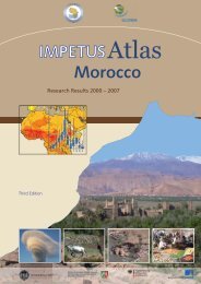
Water Demand - Impetus
Water Demand - Impetus
Water Demand - Impetus

Create successful ePaper yourself
Turn your PDF publications into a flip-book with our unique Google optimized e-Paper software.
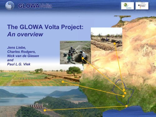
The GLOWA Volta Project:<br />
An overview<br />
Jens Liebe,<br />
Charles Rodgers,<br />
Nick van de Giesen<br />
and<br />
Paul L.G. Vlek
The Volta Basin:<br />
Major Expansion Challenge of irrigated in the Volta<br />
5005%<br />
Basin for agriculture <strong>Water</strong> Resources<br />
mm 2500 mm +++<br />
Management<br />
42%<br />
• 400,000 km 2<br />
• 6 riparian countries<br />
• 20+ million inhabitants<br />
• 1,000 mm avg. precipitation<br />
potential evaporation<br />
<strong>Demand</strong> for irrigation<br />
4%<br />
6%<br />
3%<br />
40%<br />
Hydropower generation<br />
at Akosombo<br />
Population growth rate:<br />
Burkina Faso 3%<br />
Ghana 2%<br />
2000 mm 1500 mm +
Objectives<br />
• Integrated analysis of the physical and social<br />
determinants of the hydrological cycle<br />
• Scientifically sound Decision Support System for the<br />
assessment, sustainable use and development of the<br />
water resources of the Volta Basin<br />
• Development of “Human Capital“ via advanced education<br />
and training, co-operative research and stakeholder participation
Climate, Land Use, Hydrology<br />
Economics, Institutions, Stakeholders<br />
Environmental<br />
Remote<br />
Sensing<br />
Instrumentation<br />
Land Conversion<br />
Change<br />
<strong>Water</strong><br />
Supply<br />
Hydrology<br />
Field<br />
Investigations<br />
<strong>Water</strong> <strong>Demand</strong><br />
Stakeholder<br />
Dialogue,<br />
Processes of decision<br />
making and information<br />
flows<br />
Knowledge<br />
Exchange,<br />
Capacity<br />
Building<br />
Institutional<br />
Analysis<br />
Institutional Analysis<br />
Mesoscale Climate<br />
Integrated Basin<br />
Model
Env. Change – <strong>Water</strong> Supply – <strong>Water</strong> <strong>Demand</strong> – Stakeholders/Capacity – Decision Support<br />
Climate Change<br />
• Increase in Temperature (1.2-1.3 °C )<br />
• Greater variability<br />
• rainfall<br />
• runoff<br />
• greater frequency of extremes<br />
• Regional floods and droughts<br />
Onset of the rainy season<br />
• Prolongation of the dry season<br />
• ORS more variable, today up to 30 days<br />
later than 40 years ago<br />
• Increase and intensification of rainfall<br />
at the end of the rainy season<br />
Precipitation Change [%]
Env. Change – <strong>Water</strong> Supply – <strong>Water</strong> <strong>Demand</strong> – Stakeholders/Capacity – Decision Support<br />
Groundwater<br />
production<br />
Groundwater in the Volta Basin<br />
• in White Volta Basin: annual<br />
recharge 5-8% of annual rainfall<br />
• GW use in Upper East Region of<br />
Ghana ca. 5% of recharge<br />
• Use below the potential
Env. Change – <strong>Water</strong> Supply – <strong>Water</strong> <strong>Demand</strong> – Stakeholders/Capacity – Decision Support<br />
Surface Runoff Change [%]<br />
Surface water in the Volta Basin<br />
• Slight increase of river flow<br />
• shift in runoff patterns<br />
(later runoff generation)<br />
• increase of extreme events<br />
(floods and droughts)
Env. Change – <strong>Water</strong> Supply – <strong>Water</strong> <strong>Demand</strong> – Stakeholders/Capacity – Decision Support<br />
Surface water:<br />
Agricultural & hydropower<br />
development<br />
BURKINA FASO<br />
Lery Reservoir<br />
Volume: 0.6 km³<br />
1976<br />
MALI<br />
Ziga Reservoir<br />
Volume: 0.2 km³<br />
2000<br />
B U R K I N A F A S O<br />
NIGER<br />
Bagre Reservoir<br />
Volume: 1.7 km³<br />
1992<br />
Small Reservoirs<br />
Volume: 0.6 km³<br />
Tono Reservoir<br />
Volume: 0.1 km³<br />
1980<br />
Kompienga Reservoir<br />
Volume: 2.0 km³<br />
1984<br />
BENIN<br />
GHANA<br />
Bui Reservoir<br />
Volume: 12.3<br />
km³<br />
2009/2010<br />
IVORY COAST<br />
lake<br />
Volta<br />
TOGO<br />
Lake Volta<br />
Volume: 148 km³<br />
1964<br />
Small Reservoirs<br />
Volume: 0.1 km³<br />
G H A N A<br />
Kpong Reservoir<br />
Volume: 0.2 km³<br />
1982
MIKE Basin Setup<br />
1. 23 hydro-economic catchments for the Volta<br />
Basin (specific discharge time series are<br />
generated for each catchment) according to<br />
national boundaries and large reservoirs.<br />
2. large reservoirs: Akosombo, Bagre, Kompienga,<br />
Ziga, (Bui), including hydropower and large<br />
reservoir abstractions for irrigation and<br />
portable water.<br />
Area [km^2]<br />
Volume [10^6m^3]<br />
Area, Volume<br />
3000<br />
2000<br />
1000<br />
0<br />
215 220 225 230 235 240<br />
3. water user (sector) per catchment:<br />
domestic use<br />
industrial use<br />
small scale irrigation (small reservoirs)<br />
<strong>Water</strong> demand<br />
[m^3/s]<br />
Deficit carry-over fraction [()]<br />
Groundwater use fraction [()]<br />
Groundwater use absolute [m^3/s]<br />
Elevation [m asl]<br />
abstraction<br />
60<br />
40<br />
20<br />
0<br />
1991 1992 1993 1994 1995 1996 1997 1998 1999 2000<br />
year
Env. Change – <strong>Water</strong> Supply – <strong>Water</strong> <strong>Demand</strong> – Stakeholders/Capacity – Decision Support<br />
Domestic water demand<br />
Agricultural water demand<br />
<strong>Water</strong> demand for hydropower<br />
Urban Energy demand, Ghana<br />
Rural<br />
Burkina Faso<br />
Ghana<br />
Industrial water demand<br />
Burkina Faso<br />
Urban<br />
Rural<br />
Ghana
M³ WATER hydro-economic model<br />
Multi-country Multi-sector Multi-use<br />
COUNTRIES:<br />
SECTORS:<br />
USES:<br />
Ghana / Burkina Faso<br />
Agriculture / Domestic / Industry / Hydropower<br />
(Non) - Consumptive / Environmental<br />
W ater<br />
A llocation<br />
T echnology for the<br />
E fficient management of<br />
R esources in the Volta Basin
M³ WATER MODEL STRUCTURE<br />
simulated specific discharge<br />
g<br />
time series (MM5/WaSiM-ETH)<br />
5//WaSiM-ETH)<br />
water supply<br />
ply<br />
transformation<br />
tio<br />
on<br />
Hydrological HgHydrolog Hgical Hg<br />
model<br />
(MIKE Basin)<br />
Hg<br />
Optimization:<br />
Allocation of water resources that maximizes<br />
the total net benefits to society.<br />
Economic model<br />
(GAMS)<br />
transformation<br />
ti<br />
on<br />
water demand<br />
demographic and economic indices<br />
water use policies<br />
simulated i l t d areal l precipitation p<br />
it ti and d<br />
potential potrapotenpotrapoten<br />
evapotranspiration<br />
p<br />
potransspiration<br />
(MM5/WaSiM-ETH)<br />
pote<br />
5 M
The Climate Generator<br />
High-resolution Regional Climate and Hydrological Modelling for the Volta Basin of<br />
West Africa (Harald Kunstmann and Gerlinde Jung, IMK-IFU, Garmisch-<br />
Partenkirchen, Germany)<br />
• Two time slices (1991-2000 and 2030-2039) of the ECHAM4 scenario IS92a were<br />
dynamically downscaled with MM5 to a spatial resolution of 9 km x 9 km.<br />
• The distributed process-based hydrological model WASIM-ETH was run with the<br />
MM5 generated climate data for the time slices 1991-2000 and 2030-2039 with a<br />
1 km x 1km resolution.
• expansion of irrigated agriculture<br />
• increase in fertilizer use<br />
• self sufficiency in rice
Example: Expansion of irrigated agriculture
Env. Change – <strong>Water</strong> Supply – <strong>Water</strong> <strong>Demand</strong> – Stakeholders/Capacity – Decision Support<br />
Capacity building<br />
• capacity building<br />
• students<br />
• networking<br />
• workshops<br />
• Volta Basin Authority
Env. Change – <strong>Water</strong> Supply – <strong>Water</strong> <strong>Demand</strong> – Stakeholders/Capacity – Decision Support<br />
Example GVP Geoportal<br />
Data search<br />
– find and assess<br />
– download<br />
Interactive geodata<br />
compose, view and<br />
analyze on map<br />
download from map<br />
Publish and share data<br />
index and administrate<br />
assign use rights<br />
upload for distribution
Services
Hydro Argos stations are linked to the GLOWA Volta Geoportal<br />
Lawra<br />
Chache<br />
Yarugu<br />
Pwalugu<br />
Sabari
Decision Support<br />
Decision Support Systems<br />
Decision Support Tools<br />
Decision Support<br />
Characteristics of DST’s/DSS’s<br />
• Foster understanding and assist decision making<br />
• Link decision making, scientific information, and analytical tools<br />
• Help experts to model the expected outcomes of certain actions<br />
• Decision support tools solution tool<br />
• Still require experts<br />
In the Volta Basin: attain consensus/avoid conflict over<br />
water allocation, respecting each<br />
countries policy and development goals
Scales addressed in GVP Decision Support<br />
West Africa Volta Basin Regional Local Independent<br />
MM5<br />
Geoportal<br />
Joint Climate-Hydrology Simulation<br />
Geodatabase<br />
Prediction: Onset of the Rainy Season<br />
Weather forecast<br />
M³ Hydro-Economic Model<br />
Soil moisture model<br />
Institutional Map<br />
Land Cover Change/LUCC detection<br />
Agent based Energy & Land Use Model<br />
Groundwater Recharge<br />
Reservoir storage<br />
Evaporation (Makkink, SEBAL, EC)<br />
RS based runoff<br />
GV-LUDAS<br />
www.glowa-volta.de<br />
LAMPT<br />
Knowledge M’ment<br />
Workshops/Training<br />
Capacity Development and Network building
Conclusions<br />
• Research networks have formed, capacity building was successful<br />
• Data scarcity is reduced<br />
• Environmental change leads to greater variability in precipitation, runoff<br />
• Population growth leads to increased demand, competition for water<br />
• GVP provides Decisions Support Resources at different levels<br />
• GVP supports the Volta Basin Authority