Waipara River Management Strategy - Hurunui District Council
Waipara River Management Strategy - Hurunui District Council
Waipara River Management Strategy - Hurunui District Council

You also want an ePaper? Increase the reach of your titles
YUMPU automatically turns print PDFs into web optimized ePapers that Google loves.
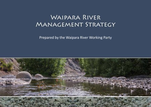
<strong>Waipara</strong> <strong>River</strong><br />
<strong>Management</strong> <strong>Strategy</strong><br />
Prepared by the <strong>Waipara</strong> <strong>River</strong> Working Party
Contents<br />
Introduction . . . . . . . . . . . . . . . . . . . . . . . . . . . . . . . . . . . . . . . . . . . . 3<br />
What is the <strong>Waipara</strong> <strong>River</strong> <strong>Management</strong> <strong>Strategy</strong>?.. .. .. .. .. .. .. .. .. .4<br />
<strong>Strategy</strong> background .. .. .. .. .. .. .. .. .. .. .. .. .. .. .. .. .. .. .. .5<br />
Physical description of the <strong>Waipara</strong> <strong>River</strong> . . . . . . . . . . . . . . . . . . . . . . . . . 6<br />
Ecology . . . . . . . . . . . . . . . . . . . . . . . . . . . . . . . . . . . . . . . . . . . . . . . 8<br />
Geology . . . . . . . . . . . . . . . . . . . . . . . . . . . . . . . . . . . . . . . . . . . . . . 10<br />
Māori cultural values.. .. .. .. .. .. .. .. .. .. .. .. .. .. .. .. .. .. .. 14<br />
Geological, Ecological & Māori Cultural Values - Action Plan.. .. .. .. .. .. 16<br />
Quality of the river environment .. .. .. .. .. .. .. .. .. .. .. .. .. .. .. 18<br />
Access Rights And Privileges. .. .. .. .. .. .. .. .. .. .. .. .. .. .. .. .. 23<br />
Recreational activities. .. .. .. .. .. .. .. .. .. .. .. .. .. .. .. .. .. .. 26<br />
Karetu Bridge To White Gorge - <strong>Management</strong> Area.. .. .. .. .. .. .. .. .. 32<br />
White Gorge To Stringers Bridge - <strong>Management</strong> Area . . . . . . . . . . . . . . . . 35<br />
Stringers Bridge To Barnetts Road - <strong>Management</strong> Area . .. .. .. .. .. .. .. 38<br />
State Highway 1 Bridge - <strong>Management</strong> Area . . . . . . . . . . . . . . . . . . . . . . 41<br />
Wash Creek To Webbs Road - <strong>Management</strong> Area. .. .. .. .. .. .. .. .. .. 44<br />
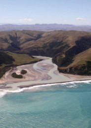
<strong>Waipara</strong> <strong>River</strong> Mouth - <strong>Management</strong> Area . . . . . . . . . . . . . . . . . . . . . . . 47<br />
Acknowledgements . . . . . . . . . . . . . . . . . . . . . . . . . . . . . . . . . . . . . . 51<br />
References . . . . . . . . . . . . . . . . . . . . . . . . . . . . . . . . . . . . . . . . . . . . 52<br />
White Gorge Upstream<br />
MISSION STATEMENT:<br />
To ensure that the <strong>Waipara</strong> <strong>River</strong> is managed in a way that is environmentally<br />
sustainable while ensuring public access is maintained to areas of public interest.<br />
2
Introduction<br />
The <strong>Waipara</strong> <strong>River</strong> is a small sized, hill-fed river located on the northern fringe of the<br />
Canterbury plains within the <strong>Hurunui</strong> <strong>District</strong>. The river flows from the eastern foothills<br />
of the Southern Alps to Pegasus Bay in the west. The <strong>Waipara</strong> <strong>River</strong> is strongly<br />
influenced by the geology and structure of the area that it flows through and contains<br />
a number of historically, scientifically and naturally important sites. The river<br />
is highly valued by the community for its natural, physical, spiritual and recreational<br />
qualities. However, the river is coming under increasing pressure from competing<br />
demands that are affecting those qualities the community values. Vehicular access,<br />
recreational activities such as hunting and camping, and land use practices are seriously<br />
impacting on the natural, cultural, social and economic assets of the river.<br />
The ownership regime in the river is complex with many of the adjoining landowners<br />
having ad medium filum aquae (AMF) rights. AMF rights are a common law<br />
principle that owners of land that is bounded by a (non-tidal) river are presumed<br />
to own the bed of that river to the middle of the stream, unless there is evidence<br />
or a statutory provision to the contrary. Due to the existence of AMF rights and<br />
property boundaries, parts of the riverbed are in effect private land and as such<br />
this has influenced the preparation of this <strong>Strategy</strong>. Use of the riverbed may involve<br />
crossing private land and users of the river are requested to respect this. The river<br />
is also bounded in parts by unformed legal road and by a number of small esplanade<br />
and recreation reserves owned by either the Department of Conservation or<br />
the <strong>Hurunui</strong> <strong>District</strong> <strong>Council</strong>. Where no other party owns the land, then the land is<br />
classed as un-alienated crown land and is administered by Land Information New<br />
Zealand (LINZ).<br />
This management strategy has grown from a community desire to better integrate<br />
the protection and management of the land and ecological values with recreational<br />
values. The strategy sets out why the community values this environment, their<br />
concerns for it and a vision for its future. The strategy is divided into three sections.<br />
The introductory section provides a description of the river system, sets a context<br />
for the partnership that is inherent to the strategy and details where the strategy<br />
‘fits’ in the legislative context. The second section of the strategy identifies the different<br />
management issues. Finally, the strategy looks at the different management<br />
areas and the actions that the community wishes to be implemented in each area.<br />
The management areas of the river are as follows:<br />
• Karetu Bridge to White Gorge<br />
• White Gorge to Stringers Bridge<br />
• Stringers Bridge to Barnetts Road<br />
• State Highway 1 Bridge (Barnetts Road to Wash Creek)<br />
• Wash Creek to Webbs Road<br />
• <strong>Waipara</strong> <strong>River</strong> Mouth (Webbs Road to the coast)<br />
An integrated approach to the management of the strategy will be required to fully<br />
implement this strategy. In addition, the strategy is a ‘living’ document and as such<br />
it is intended that it be reviewed as required after being adopted by the <strong>Hurunui</strong><br />
<strong>District</strong> <strong>Council</strong>.<br />
<strong>Waipara</strong> <strong>River</strong> <strong>Management</strong> <strong>Strategy</strong><br />
3
What is the <strong>Waipara</strong> <strong>River</strong> <strong>Management</strong> <strong>Strategy</strong>?<br />
The <strong>Waipara</strong> <strong>River</strong> <strong>Management</strong> <strong>Strategy</strong> (WRMS) provides a framework for managing<br />
the <strong>Waipara</strong> <strong>River</strong> now and into the future. The <strong>Strategy</strong> is based on the work<br />
of the community as represented by the <strong>Waipara</strong> <strong>River</strong> Working Party. The strategy<br />
itself is a non-statutory document and is therefore flexible to address a wide range of<br />
functions. As a strategic document, WRMS feeds in to many of <strong>Hurunui</strong> <strong>District</strong> <strong>Council</strong>s<br />
functions and other management documents such as the <strong>District</strong> Plan, Annual<br />
Plans, <strong>Hurunui</strong> Community Long-term Community Plan (HCLTP), reserve management<br />
plans, financial planning and by-laws. It is also important to recognise the<br />
influence that national and regional legislation, strategic and policy documents have,<br />
such as the Regional Policy Statement, Natural Resources Regional Plan, Proposed<br />
Canterbury Land and Water Regional Plan, Canterbury Water <strong>Management</strong> <strong>Strategy</strong>,<br />
<strong>Waipara</strong> Catchment Environmental Flow and Water Allocation Regional Plan and<br />
the Reserves Act 1977. Such strategies and legislation may continually evolve and<br />
change and as such the WRMS is a “living document” and will be reviewed regularly<br />
as new information and insights become available.<br />
The WRMS seeks to provide a balance between protecting and recognising the<br />
natural, physical and spiritual values of the river and the enjoyment of passive and<br />
active recreation. The WRMS has been developed recognising that land within the<br />
river is in various forms of ownership. The actions in the strategy are intended to<br />
provide a framework for ensuring that the key values of this environment including<br />
landscape qualities, sustainable land use and water quality are preserved for the<br />
enjoyment of both current and future generations.<br />
The WRMS is a partnership between <strong>Hurunui</strong> <strong>District</strong> <strong>Council</strong> (HDC), Canterbury<br />
Regional <strong>Council</strong> (CRC), Department of Conservation (DOC), Tangata Whenua,<br />
riparian landowners and the communities within the strategy area. The concept of<br />
community for the purposes of the WRMS applies to all groups with an interest in<br />
the river, such as landowners, farmers, residents, visitors and developers, as well<br />
as those who visit the river to enjoy its recreational activities. All partners have a<br />
responsibility for different levels of investment, management and action along the<br />
river. Anyone who reads this document will have an interest in the <strong>Waipara</strong> <strong>River</strong><br />
and its surrounds and will therefore be included in the definition of ‘partnership’.<br />
The implementation of the WRMS will rely not only on HDC and CRC initiatives but<br />
also on a strong sense of ownership and commitment from the community based<br />
on the philosophy of this document. As such, the WRMS depends on the goodwill,<br />
co-operation, participation, and commitment from those identified as responsible<br />
for carrying out the actions.<br />
The recommendations referred to in this strategy extend to the main stem of the<br />
river downstream from Karetu Bridge and all the land between the cadastral property<br />
boundaries designating private property on the true right bank to the cadastral<br />
property boundaries designating private property on the true left bank of the<br />
<strong>Waipara</strong> <strong>River</strong>. The WRMS does not directly address the future use, management<br />
and development in regards to the tributaries of the <strong>Waipara</strong> <strong>River</strong>.<br />
Where any future development has been proposed it is recognised that this will<br />
occur either on land currently in public ownership or land that may be identified<br />
in the <strong>Council</strong>’s <strong>District</strong> Plans as future esplanade reserve. Land in private ownership<br />
will not be developed with walkways or any form of public access unless this<br />
is agreed to through negotiation between the <strong>Council</strong> and the landowners. Any<br />
development is likely to occur in a staged process recognising that this is a long term<br />
strategy for the <strong>Waipara</strong> <strong>River</strong>.<br />
4
<strong>Strategy</strong> background<br />
In August 2007 members of the <strong>Waipara</strong> <strong>River</strong> Protection Group (WRPG), a group<br />
of concerned landowners with land directly adjoining the <strong>Waipara</strong> <strong>River</strong>, gave a<br />
verbal presentation to the <strong>Hurunui</strong> <strong>District</strong> <strong>Council</strong> outlining their concerns regarding<br />
a number of issues in the <strong>Waipara</strong> <strong>River</strong>. Their concerns related to the use of<br />
four wheel drive vehicles; the risk from fires; use of firearms; damage to private<br />
property; illegal rubbish dumping; poaching and killing of livestock; theft; dogs and;<br />
verbal abuse from users of the river.<br />
At its September meeting, the <strong>Council</strong> considered the issues raised by the WRPG.<br />
<strong>Council</strong> resolved to take a lead role in developing and facilitating solutions to the<br />
issues identified by the WRPG. <strong>Council</strong> also resolved to co-ordinate a meeting of<br />
statutory bodies and invite WRPG and representatives from the Combined Four<br />
Wheel Drive Club. The purpose of that meeting was to ensure that all groups that<br />
had some level of statutory control over elements of the river had a common<br />
understanding of the issues. It also enabled representatives of landowners and the<br />
Combined Four Wheel Drive Club to contribute their perspectives to the issues. At<br />
the meeting, attendees reached a clear consensus that the <strong>Waipara</strong> <strong>River</strong> was a<br />
special environment and that a management strategy was needed to ensure protection<br />
of the river and that the <strong>Hurunui</strong> <strong>District</strong> <strong>Council</strong> should take a lead role in<br />
developing the strategy.<br />
river. These visits highlighted those parts of the river identified as having high levels<br />
of historical, geological and cultural values and also allowed the Working Party to<br />
see first hand the inappropriate use of the river and the detrimental environmental<br />
effects resulting from this use. The purpose of the Working Party was to identify the<br />
management issues associated with the <strong>Waipara</strong> <strong>River</strong> and recommend preferred<br />
management responses to the relevant statutory agencies.<br />
The Working Party attended a series of meetings where a variety of working papers<br />
and guest speakers were presented. In addition, there is a wealth of existing information<br />
available on the <strong>Waipara</strong> <strong>River</strong> and these have been reviewed during the<br />
background research stage of the WRMS development. A list of references is provided<br />
at the back of this document.<br />
In March 2008 <strong>Council</strong> resolved to develop a comprehensive management strategy<br />
for the <strong>Waipara</strong> <strong>River</strong> which would set out the means to resolve conflicting uses in<br />
the river as well as protect the natural values and health of the river and the surrounding<br />
environment. The <strong>Council</strong> agreed to the establishment of a working party<br />
process to develop the strategy for the river.<br />
A public meeting was held in September 2008 to accept nominations for Working<br />
Party representatives from various stakeholder and community interest groups. The<br />
Working Party that was established sought to ensure that all community views and<br />
interests would be captured. The Working Party meetings were also open to individual<br />
members of the public. Members of the Working Party are listed in Appendix<br />
1. The Working Party undertook two field trips to cover the entire length of the<br />
<strong>Waipara</strong> <strong>River</strong> <strong>Management</strong> <strong>Strategy</strong><br />
5
Physical description of the <strong>Waipara</strong> <strong>River</strong><br />
The <strong>Waipara</strong> <strong>River</strong> is a relatively small river situated at the northern fringe of the<br />
Canterbury Plains extending from the eastern foothills of the Southern Alps to the<br />
sea at the northern end of Pegasus Bay. The river flows some 40 kilometres from the<br />
Double Tops Range in the west to the <strong>Waipara</strong> Lagoon in the east. The catchment<br />
covers approximately 726km 2 and consists of foothills, an inland plain and a series<br />
of coastal hills. The catchment can be separated into two distinct parts. The steep<br />
rugged upper catchment is drained by four main tributaries; the North, South and<br />
Middle Branches of the <strong>Waipara</strong> <strong>River</strong> and Tommys Stream. The lower catchment is<br />
dominated by the wide flat plains of the <strong>Waipara</strong> Alluvial Basin and is bound to the<br />
east by coastal hills. Two main tributaries; Weka Creek and Omihi Stream flow from<br />
the north of the lower catchment into the river on the alluvial basin (Lloyd, 2002).<br />
The river system is strongly influenced by the geology and structure of the area that<br />
it flows through. The upper catchment consists of moderate to steep hill country<br />
where greywacke and argillite sedimentary bedrock dominates. The North Branch<br />
initially flows eastwards from this hill country and then flows southward across<br />
Masons Flat, an inland basin which has formed from sediment deposits. The Middle<br />
and South Branches join the North Branch below Masons Flat to join the mainstem<br />
of the <strong>Waipara</strong> <strong>River</strong>. From the confluence of the three tributaries, the <strong>Waipara</strong><br />
<strong>River</strong> becomes confined within the Ohuriawa Gorge as it re-enters greywacke/argillite<br />
bedrock that comprises the Doctors Hills. The Doctors Hills, together with Mt<br />
Grey to the south, form an identifiable boundary between the upper and lower<br />
sections of the <strong>Waipara</strong> Catchment (Chater, 2002). The lower catchment is dominated<br />
by a large alluvial basin that formed during the quaternary period by the<br />
deposition of glacial outwash and river gravels including some marine siltstones and<br />
sandstones (Chater, 2002). This basin is bounded by sedimentary rock types such as<br />
limestones, sandstones, mudstones and conglomerates which are all of tertiary age.<br />
Between Ohuriawa Gorge (upstream) and White Gorge (downstream), and just<br />
before the <strong>Waipara</strong> breaks through the limestone escarpments to the west of<br />
South Dean, the river flows for about three kilometres through a depression that<br />
marks more erodible Cretaceous formations. This area is one of unique and internationally<br />
renowned geological significance. It contains the only known exposed,<br />
<strong>Waipara</strong> <strong>River</strong><br />
6
continuous geological sequence from the Cretaceous to the Miocene; and many<br />
examples of fossilised material from the Mesozoic and tertiary periods. It is one of<br />
the few sites in the world where the Cretaceous-Tertiary (K/T) boundary is exposed.<br />
The landscape is a mix of limestone escarpments, alluvial terraces, and steep rocky<br />
bluffs and cliffs. The gorge area also contains spectacular landforms caused by the<br />
action of water on limestone, including the large, perfectly rounded stones termed<br />
concretions. Below White Gorge, the river flows eastward between terraces, below<br />
the general level of the <strong>Waipara</strong> alluvial plain. Weka Creek flows into the mainstem<br />
approximately 10km downstream of White Gorge. Omihi Stream flows into<br />
the mainstem just below State Highway 1. Below the Omihi confluence, the <strong>Waipara</strong><br />
<strong>River</strong> cuts through the sedimentary rocks of the southernmost coastal hills at Teviotdale<br />
Gorge before exiting out and flowing across a narrow coastal plain to the<br />
<strong>Waipara</strong> Lagoon at the coast. The <strong>Waipara</strong> Lagoon is an important bird habitat consisting<br />
of mudflats around a lagoon that is only open to the sea during times of<br />
larger flows, typically in winter and spring.<br />
The water resources of the <strong>Waipara</strong> Catchment are extremely variable with the<br />
catchment being located within a dry microclimate in addition to having poor water<br />
storage. The flow regime of the <strong>Waipara</strong> <strong>River</strong> is one of high flows and floods during<br />
winter months and long periods of low flows during summer and autumn. Extended<br />
periods of low summer flows are a particular feature of the river, in which flows of<br />
less than 100 l/s can last for several weeks. Periods of low flows can extend well into<br />
winter months during some years. However, short duration high volume floods can<br />
also occur. These are more frequent in winter but can also occur at other times of<br />
the year (Hayward et al, 2003). Annual mean flow is 3.0m 3 /s with a median flow of<br />
1m 3 /s (Hayward et al, 2003). Land use in the mid and upper parts of the catchment<br />
accommodates extensive dry land pastoral farming and exotic forestry. The lower<br />
part of the catchment, with more fertile soils, warmer temperatures and easier<br />
country supports more intensive pastoral farming with specialised horticulture and<br />
cropping also present (Lloyd, 2002). In recent years this has included diversification<br />
into viticulture and olive plantations. In addition to land use intensification, there<br />
has been subdivision of larger blocks of land into small lifestyle blocks. The change<br />
in land use from pastoral farming to increased afforestation in the upper catchment<br />
and increased viticultural, horticultural and lifestyle activities in the lower catchment<br />
has led to a significant increase in the use of water within the catchment.<br />
Use of water from the <strong>Waipara</strong> <strong>River</strong> was reviewed by the Canterbury Regional<br />
<strong>Council</strong> and environmental flows have been set in the <strong>Waipara</strong> Catchment Environmental<br />
Flow and Water Allocation Regional Plan which became operative on 10 June<br />
2012.<br />
<strong>Waipara</strong> <strong>River</strong> <strong>Management</strong> <strong>Strategy</strong><br />
7
Ecology<br />
The <strong>Waipara</strong> <strong>River</strong> supports a variety of life forms and ecosystems, including indigenous<br />
plants, birds, aquatic macroinvertebrates, and fish. The Canterbury Regional<br />
<strong>Council</strong> undertakes ecosystem health monitoring on an annual basis at two sites<br />
located at Greenwoods (Teviotdale) Bridge and Laidmore Road. This involves sampling<br />
macroinvertebrates (small aquatic animals such as insect larvae, worms and<br />
snails) as indicators of the health of the aquatic ecosystem, and assessing the quality<br />
of the riparian and instream habitat.<br />
national to international significance for threatened species) and the river as “High-<br />
6” (use by
the upstream sampling stations to receive higher gradings (Hayward et al., 2003).<br />
The available data indicates that the aquatic biota in the <strong>Waipara</strong> <strong>River</strong> is characterised<br />
by species found in a naturally unstable flow regime with long periods of low<br />
flow and periodic high flows. Disturbance by periodic high flows tends to produce a<br />
faunal community that does not include species that require stable substrates and<br />
stable algal covers.<br />
the gravel bar at the mouth, has influenced the abundance of native fish. There<br />
are unlikely to be any problems with fish passage in the <strong>Waipara</strong> <strong>River</strong> given the<br />
fish species present. Eels are the only species found in the upper catchment that<br />
migrate and because of their ability to travel in small volumes of water, either as<br />
downstream adult migrants or juveniles moving upstream, low flows are unlikely to<br />
restrict movement.<br />
Fish<br />
The indigenous fish species found in the <strong>Waipara</strong> <strong>River</strong> are typical of those present<br />
in other Canterbury gravel bedded rivers. Extensive sampling of fish populations<br />
indicates that the distribution and density of fish are typical of East Coast South<br />
Island river’s with no unusual or rare species. A survey of 17 sites in the <strong>Waipara</strong><br />
<strong>River</strong> undertaken by Richardson and Jowett (1994) identified eight native species,<br />
plus brown trout in the river. In the headwaters the native fish population is dominated<br />
by upland bullies and common river galaxias, both of which live their entire<br />
lives in these freshwater areas. In the lower reaches, mainly torrentfish, bluegill<br />
bullies, and common bullies begin to dominate. Shortfin and longfin eels are found<br />
throughout the river system. More recent surveys have also found black flounder,<br />
lamprey and koaro (Mosley, 2003) and NIWA records indicate that common smelt,<br />
Stokell’s smelt and inanga are also present in the river. Of the native species, long<br />
finned eels are in gradual decline nationally. Limited numbers of trout have also<br />
been observed in the river, but the <strong>Waipara</strong> <strong>River</strong> is not a renowned trout fishery<br />
(Mosley, 2003).<br />
Native fish densities in the <strong>Waipara</strong> <strong>River</strong> are comparable with those in other<br />
rivers in the region (NIWA miscellaneous report, 1994). Flood flows are particularly<br />
important in the <strong>Waipara</strong> with regard to maintaining an open river mouth. Freshes<br />
peaking at about 9m 3 /s appear to be able to open the river mouth, which permits<br />
diadramous native fish to enter the river for spawning. The natural flow regime<br />
permits entry of fish during the spawning period in most but not all years (Mosley,<br />
2003). However, there is no evidence that restricted access to the sea, caused by<br />
Bluegill Bully<br />
<strong>Waipara</strong> <strong>River</strong> <strong>Management</strong> <strong>Strategy</strong><br />
9
Geology<br />
The <strong>Waipara</strong> <strong>River</strong> contains a number of historically and scientifically important sites, particularly<br />
in the upper reaches of the river where the sedimentary rocks contain significant amounts<br />
of information about the history of New Zealand. The <strong>Waipara</strong> region has experienced a number<br />
of geological processes and this can be seen and studied through the rocks that are exposed in<br />
the area. Many millions of years ago the entire <strong>Waipara</strong> area (together with much of the South<br />
Island) lay under the ocean. Tectonic activity has resulted in the rocks being uplifted over many<br />
millions of years to form the landscape that we know today. Over time, the <strong>Waipara</strong> <strong>River</strong> has<br />
cut its way down through the many different layers of rock exposing them and allowing access<br />
to the information contained in them. Of historical significance, is the fact, that it was in the<br />
<strong>Waipara</strong> <strong>River</strong>, that the first fossil bones to be discovered in New Zealand were found in 1859.<br />
The most geologically rich areas in the <strong>Waipara</strong> <strong>River</strong> are upstream of White Gorge, although<br />
there are also geologically rich areas downstream of White Gorge e.g the Double Corner shellbeds.<br />
In that area, several rock formations crop out, each with its own suite of fossils (Fig. 1).<br />
These rock units form the cover sequence that was deposited on the older Torlesse basement<br />
after Zelandia (the New Zealand continent) broke away from Gondwana. At the bottom of the<br />
pile is the Broken <strong>River</strong> Formation, comprising mostly sandstones with thin coal seams and<br />
topped by the Ostrea Bed. This unit is not well exposed in the <strong>Waipara</strong> <strong>River</strong>. Next is the Conway<br />
Formation, which is famous for its marine reptile fossils, mostly contained in large nearly spherical<br />
concretions. Some of these concretions contain the bones of plesiosaurs and mosasaurs. A<br />
plesiosaur was a type of carnivorous marine reptile that grew up to 12 metres in length. Specimens<br />
from the <strong>Waipara</strong> <strong>River</strong> are mostly of elamosaurid plesiosaurs that are characterised by<br />
having exceedingly long necks with small heads. Mosasaurs were giant marine lizards up to 15<br />
metres in length with a long head with numerous teeth, stout necks and long, slim bodies and<br />
tails. Both of these marine reptiles are extinct.<br />
The next rock unit, the Loburn Mudstone is poorly exposed and has so far yielded very few<br />
fossils. It is overlain by the <strong>Waipara</strong> Greensand, which in recent years has been the source of<br />
numerous significant fossils. Among these are the teeth of about 17 species of shark, many of<br />
which are now extinct although some are still around today.<br />
Several specimens of a very early penguin, Waimanu, which was first discovered in the 1980s<br />
and dubbed the “<strong>Waipara</strong> bird”, came from the greensand. More recent discoveries have<br />
allowed the characters of this ancient bird to be elucidated. The greensand is also the source of<br />
Concretions found upstream of Laidmore Road<br />
Fig. 1 Rock units in the <strong>Waipara</strong> <strong>River</strong> upstream of the White Gorge<br />
10
several other fossils, including the enigmatic <strong>Waipara</strong>conus, once thought to be a<br />
sort of stalked barnacle, but now believed to be a relative of corals.<br />
The <strong>Waipara</strong> greensand is overlain by Ashley Mudstone, which is not well exposed<br />
so has not provided many fossils. It, in turn, is overlain by the Amuri Limestone,<br />
a thick sequence of calcareous<br />
(limey) rocks in which<br />
several distinct units can be<br />
recognised. The presence of<br />
limestone also indicates that<br />
the land once formed part of<br />
the seabed, as limestone is a<br />
calcareous rock formed when<br />
marine shellfish and other<br />
animals of calcite structure die.<br />
The limestone is rich in fossilised<br />
shells and skeletal debris<br />
from the organisms that inhabited<br />
the warm, marine waters<br />
that were present at that time.<br />
These include marine invertebrates<br />
such as molluscs,<br />
brachiopods, bryozoans and<br />
many others. There are also a<br />
variety of trace fossils, mostly<br />
burrows, in some units.<br />
Concretions found downstream of Laidmore Road<br />
Upstream of Laidmore Road<br />
the boundary between the Cretaceous and Tertiary periods (K/T boundary) can be<br />
viewed. The K/T boundary is a geological signature, usually a thin band, dated to<br />
(65.5 ± 0.3) million years ago. The boundary marks the end of the Mesozoic and<br />
the beginning of the Cenozoic era and is associated with the Cretaceous - Tertiary<br />
extinction event, a mass extinction that included the end of the dinosaurs. The site<br />
on the <strong>Waipara</strong> <strong>River</strong> is one of a few places in the world where the K/T boundary is<br />
exposed.<br />
The historical importance of these sites is recognised in the New Zealand Geopreservation<br />
Inventory. The Geopreservation Inventory aims to list the best examples of<br />
a wide diversity of natural and<br />
physical features and processes<br />
that characterise each part of<br />
New Zealand and document<br />
their complex geological / geomorphological<br />
history.<br />
The Geopreservation Inventory<br />
includes five sites in the <strong>Waipara</strong><br />
<strong>River</strong>. These sites are also recognised<br />
in the <strong>Hurunui</strong> <strong>District</strong><br />
Plan as Significant Natural Areas<br />
(SNA) as shown in the table on<br />
page 12.<br />
Section A7 of the <strong>District</strong> Plan<br />
sets out rules and standards<br />
for the protection of Significant<br />
Natural Areas. Rule A7.2.2<br />
of the <strong>District</strong> Plan states that,<br />
‘No feature, tree, or vegetation<br />
in an area listed in the Schedule<br />
of Significant Natural Areas<br />
shall be damaged, removed<br />
or destroyed, except for exotic vegetation’. This effectively means that any person<br />
wishing to remove, damage or destroy any of the geological features requires<br />
resource consent to do so.<br />
With respect to the importance of these sites, the Geopreservation Inventory uses<br />
the following classification system to identify the ‘importance’ and ‘vulnerability’ of<br />
<strong>Waipara</strong> <strong>River</strong> <strong>Management</strong> <strong>Strategy</strong><br />
11
sites:<br />
Importance:<br />
A = site of international scientific importance<br />
B = site of national scientific, educational or aesthetic importance<br />
C = site of regional scientific, educational or aesthetic importance<br />
Vulnerability:<br />
1 = highly vulnerable to complete destruction or major modification by<br />
humans [i.e. small and/or fragile, could be destroyed by geological hammer]<br />
2 = moderately vulnerable to modification by humans [i.e. could be<br />
destroyed by a bulldozer]<br />
3 = unlikely to be damaged by humans [i.e. large or robust, not destroyed by<br />
either of the above]<br />
4 = could be improved by human activity [e.g. weed spraying on or around<br />
the feature]<br />
Therefore, three of the sites within the <strong>Waipara</strong> <strong>River</strong> are of international scientific<br />
importance with the vulnerability of the <strong>Waipara</strong> <strong>River</strong> Cretaceous “saurian beds”<br />
being moderately vulnerable to modification by humans.<br />
The community is concerned about the potential damage to these special sites from<br />
inappropriate vehicle use. Fossil sites and many smaller scale features cannot withstand<br />
the impact of human activities. Many of the fossilised beds are located on<br />
the banks and under the bed of the <strong>Waipara</strong> <strong>River</strong> and as such, they are particularly<br />
vulnerable to crushing and damage from motorised vehicles in these areas. Furthermore,<br />
the location of these historically and scientifically important sites is within an<br />
area of the <strong>Waipara</strong> <strong>River</strong> that is subject to AMF rights. Therefore, there is in actual<br />
fact no public access via Laidmore Road as this section of the river is effectively in<br />
private ownership. The only pedestrian and vehicular access to the geologically sensitive<br />
areas is across private land and as such the consent of the relevant landowners<br />
is required. It is noted that landowners in this section of the river have a long history<br />
of cooperating with scientists, students and hobbyists wishing to study the geology<br />
and fossils, as well as with walking groups and the general public.<br />
Another concern of the community is whether the existing level of protection is sufficient<br />
particularly given the international significance of some of these sites. In this<br />
regard, it would seem that the provisions of the <strong>Hurunui</strong> <strong>District</strong> Plan are ineffective.<br />
SNA Site <strong>District</strong> Plan<br />
Name Description Importance Vulnerability<br />
Map<br />
G30 3 Double Corner shellbeds Diverse waiauan molluscsa of Miocene origin in riverbanks and hillside C 3<br />
G31 3 Euscalpellum locality Unique occurrence of abundant “barnacle” stalks of international interest A 3<br />
G34 3, 6 <strong>Waipara</strong> <strong>River</strong> Cretaceous-Palaeocene One of the most complete and well exposed sequences in New Zealand A 3<br />
sequence<br />
G35 3 <strong>Waipara</strong> <strong>River</strong> Cretaceous “saurian The most prolific late cretaceous marine reptile locality in New Zealand A 2<br />
beds”<br />
G36 3 <strong>Waipara</strong> <strong>River</strong> pliopleistocene land Unique pre-hawera land molluscs<br />
molluscs<br />
G40 2, 4 Greenwood formation Pliocene fauna Best of very few late Piliocene shallow-water faunal localities in North<br />
Canterbury<br />
C 3<br />
12
In the past, visitors to the Significant Natural Areas including scientists, amateur collectors<br />
and the public in general have collected numerous fossils without applying<br />
for resource consent to do so. This is probably due to people being unaware that<br />
resource consent is required and therefore the provision of some form of education<br />
or information for the public could be beneficial in this respect. Rare fossils<br />
and natural artefacts can be vulnerable to over-collecting and some of the more<br />
unique specimens should be deposited in museums where they can be studied in<br />
detail and interpreted in displays for the public’s benefit. In many instances, it may<br />
be best that fossils are left in the rocks so information about their settings can be<br />
obtained. However given the fluctuating nature of the river, fossils are continually<br />
being eroded from the river banks and washed down stream, so this information<br />
may be lost in any case.<br />
Another issue identified by the community, is that the sites identified in the <strong>District</strong><br />
Plan may not include all the geologically significant sites within the river. There is still<br />
a large amount of research being undertaken in the river and as such, there could<br />
potentially be other significant sites that are yet to be discovered.<br />
The inside of a split concretion<br />
<strong>Waipara</strong> <strong>River</strong> <strong>Management</strong> <strong>Strategy</strong><br />
13
MĀori cultural values<br />
Māori have long held an association with the <strong>Waipara</strong> <strong>River</strong> as it was once a significant<br />
mahinga kai and was part of the trading routes along the coast. The importance<br />
of the <strong>Waipara</strong> <strong>River</strong> and lagoon are reflected in the Statutory Acknowledgement<br />
under the Ngāi Tahu Claims Settlement Act 1998. This means that the <strong>Council</strong> must<br />
forward all relevant resource consents to Te Runanga o Ngāi Tahu and that the<br />
Historic Places Trust or the Environment Court must have regard for the statutory<br />
acknowledgement, to empower officials to enter into a deed of recognition and to<br />
give Ngāi Tahu Whānui proof of their long affiliation with the river. The Statutory<br />
Acknowledgement summarises<br />
the history that Ngāi Tahu<br />
Whānui have with the <strong>Waipara</strong><br />
<strong>River</strong> in the following reference:<br />
“Tradition tells of the duel<br />
between two famous rangatira<br />
(chiefs) which happened in this<br />
area. Tutewaimate, a Ngāti<br />
Māmoe rangatira, found that<br />
the northward trade route that<br />
he had sent his goods along<br />
was being disrupted by Moko,<br />
a rangatira of the Ngati Kurī<br />
hapū of Ngāi Tahu who had<br />
been acting as a bandit along<br />
the route. Tutewaimate went<br />
Wildlife at the river mouth<br />
to confront Moko, who lived in<br />
a cave at <strong>Waipara</strong>, but found<br />
him sleeping. Tutewaimate allowed Moko to awake before attacking him. Tutewaimate’s<br />
sense of fair play cost him his life and is recalled in a tribal proverb.<br />
There are a number of Ngāti Wairaki, Ngāti Māmoe and Ngai Tahu urupā and<br />
wāhi tapu along the river and associated coastline. Urupā are the resting places of<br />
Ngāi Tahu tūpuna and, as such, are the focus for whanau traditions Urupā and wāhi<br />
tapu are places holding the memories, traditions, victories and defeats of Ngāi Tahu<br />
tūpuna, and are frequently protected by secret locations.<br />
The [<strong>Waipara</strong>] river and associated coastline was a significant mahinga kai, with kai<br />
moana [sea food], particularly paua, being taken at the mouth. The tūpuna had considerable<br />
knowledge of whakapapa [genealogy], traditional trails and tūranga waka<br />
[places for gathering food and taonga], ways in which to use the resources of the<br />
river, the relationship of people with the river and their dependence on it and tikanga<br />
[customs] for the proper and<br />
sustainable utilisation of<br />
resources. All of these values<br />
remain important to Ngāi<br />
Tahu today. The mauri of the<br />
<strong>Waipara</strong> <strong>River</strong> represents the<br />
essence that binds the physical<br />
and spiritual elements of all<br />
things together, generating and<br />
upholding all life. All elements<br />
of the natural environment<br />
possess a life force, and all<br />
forms of life are related. Mauri<br />
is a critical element of the spiritual<br />
relationship of Ngāi Tahu<br />
Whānui with the river.”<br />
Schedule 74 Ngāi Tahu Claims<br />
Settlement Act 1998<br />
The deed of settlement signed under the Ngāi Tahu Claims Settlement Act 1998 also<br />
includes redress in the form of nohoanga camping entitlements. Nohoanga entitlements<br />
give Ngāi Tahu the exclusive right to camp temporarily at certain sites situated<br />
near rivers and lakes to facilitate customary activities such as fishing and gathering<br />
of other natural resources like plants. These nohoanga sites can only be created over<br />
14
Crown land within the claim area. Nohoanga sites are located at traditional food<br />
gathering sites and do not allow for commercial use of the site. There are a total of<br />
72 nohoanga spread throughout the South Island with each one around one hectare<br />
in size. The entitlements are seasonal and are a ‘right to occupy’ a site for up to 210<br />
days per year between mid-August and the end of April. A nohoanga right is not<br />
a permit to kill species that are otherwise protected by conservation legislation.<br />
Public access to rivers or fishing rights are not affected within the designated area.<br />
There are two nohoanga sites within the <strong>Waipara</strong> <strong>River</strong>. The first of these is located<br />
at the riverbed at the <strong>Waipara</strong> <strong>River</strong> Mouth, opposite Lot 1 DP 17853. The second<br />
site is located part within the <strong>Waipara</strong> <strong>River</strong> bed adjoining Barnetts Road, <strong>Waipara</strong>.<br />
There are a number of urupā (burial sites), waahi tapu (places of particular significance<br />
to local Māori that hold an element of sacredness due to a certain event),<br />
and waahi taonga (culturally, spiritually, physically and historically significant items)<br />
located in close proximity to <strong>Waipara</strong> <strong>River</strong>. The location of many of these sites<br />
is protected although the following sites are identified in Appendix A8.2 of the<br />
<strong>Hurunui</strong> <strong>District</strong> Plan – Schedule of recorded archaeological features:<br />
No. <strong>District</strong> Plan NZAA Description<br />
Map<br />
A2 2 N34/1 Pa with middens<br />
A5 2 N34/2 Midden(s), oven(s) & pit(s)<br />
A10 2, 4 N34/3 Habitation cave or shelter without art<br />
A11 2 N34/5 Habitation cave or shelter without art<br />
A22 2 N34/10 Oven(s)/midden(s)<br />
A23 2 N34/11 Oven(s)/midden(s)<br />
A37 2 N34/6 Pit(s)<br />
key outcomes recognised and provided for within the future management of the<br />
<strong>Waipara</strong> <strong>River</strong>:<br />
• Protect and enhance the mauri of the river<br />
• Protect all sites and values of tapu and taonga significance to Ngāi Tahu within<br />
the catchment of the river<br />
• Enhance access by members of local Papatupu Rūnanga<br />
• Protect mahinga kai values significant to Ngāi Tahu within the catchment of the<br />
river and the ecology that supports those mahika kai values<br />
• Adopt catchment management as the means to achieving integrated management<br />
of the <strong>Waipara</strong> <strong>River</strong> and its tributaries<br />
• Improve and restore degraded water quality within the river<br />
• Provide a flow regime that adopts the priorities established in the Te Rūnanga o<br />
Ngāi Tahu Freshwater Policy<br />
• Implement a flow regime for the river<br />
• Preserve the existing natural ecological dynamics and habitat that support<br />
healthy populations of native fisheries and aquatic organisms<br />
• Protect native bird habitats and plant with values within the river catchment<br />
• Preserve the existing natural wilderness character and ecological conditions of<br />
the river catchment<br />
• Adopt a precautionary approach to conversion of land use within the <strong>Waipara</strong><br />
<strong>River</strong> catchment<br />
Key issues and opportunities identified through research and<br />
consultation<br />
The <strong>Waipara</strong> <strong>River</strong> lies within the takiwa of Ngāi Tūahuriri. On behalf of the whānau<br />
of Ngāi Tūahuriri, the Ngāi Tūahuriri Rūnanga would seek to have the following<br />
<strong>Waipara</strong> <strong>River</strong> <strong>Management</strong> <strong>Strategy</strong><br />
15
Geological, Ecological & MĀori Cultural Values -<br />
Action Plan<br />
What we want to achieve -<br />
Goals<br />
Improve knowledge of and appreciation<br />
of ecological values important to<br />
the <strong>Waipara</strong> <strong>River</strong><br />
Improve knowledge of geological<br />
values within the <strong>Waipara</strong> <strong>River</strong><br />
Recognise the values that Tangata<br />
Whenua place on the resources in<br />
the <strong>Waipara</strong> <strong>River</strong><br />
The significance of the river in Ngāi<br />
Tahu’s history is respected<br />
What we will do - Actions How we will do it We know we have<br />
succeeded when<br />
Support ongoing research and monitoring<br />
of ecological values<br />
Promote community-based programmes<br />
such as “<strong>River</strong> Care”, as<br />
well as <strong>Council</strong>-led programmes<br />
Initiate a regime of regular ecological<br />
surveys of the <strong>Waipara</strong> <strong>River</strong><br />
Establish interpretative signage /<br />
display boards<br />
Restore and enhance the river’s<br />
mauri (life force)<br />
Consult with iwi regarding their historical<br />
association with the river<br />
• Identify timing and funding for<br />
ongoing research and monitoring<br />
• Hold open days displaying information<br />
on protecting the ecology<br />
of the river<br />
• Update website regularly with<br />
information<br />
• Identify timing and funding for<br />
ongoing research and monitoring<br />
• Information to be provided<br />
on the <strong>Council</strong>’s website and<br />
through signage<br />
• Interpretative signage to be<br />
established at relevant access<br />
point and / or car parking areas<br />
• Complete a ‘cultural audit’ of the<br />
current state of the river’s mauri<br />
• Provide opportunities for iwi participation<br />
in restoration projects<br />
• Commence discussions regarding<br />
the nohoanga sites on the river<br />
• Consult iwi prior to the dissemination<br />
of any interpretive<br />
material (signs or other written<br />
material) that provides information<br />
about sites of importance to<br />
iwi, iwi heritage values, or past<br />
and present cultural activities<br />
• Interpretative signage installed<br />
• Users of the river have an<br />
increased knowledge and respect<br />
of the geological features in the<br />
river<br />
• Degree of satisfaction among Te<br />
Ngāi Tuahuriri Rūnanga<br />
Who will<br />
lead it<br />
HDC<br />
HDC, CRC,<br />
DOC<br />
DOC<br />
HDC<br />
16
What we want to achieve -<br />
Goals<br />
Protect and enhance riparian<br />
margins, remnant wetlands and the<br />
coastal lagoon system<br />
What we will do - Actions How we will do it We know we have<br />
succeeded when<br />
Promote and encourage local restoration<br />
initiatives, such as wetland<br />
restoration, by local landowners and<br />
community groups<br />
Replant public river margins with<br />
nominated eco-sourced species<br />
• Provide contestable funds to<br />
encourage and assist with voluntary<br />
work that benefits the<br />
natural environment<br />
• Provide assistance with completing<br />
funding applications<br />
• Identify appropriate species and<br />
management regime.<br />
• Identify and prioritise list of<br />
areas to be replanted.<br />
• Work in partnership with local<br />
landowners and tangata whenua<br />
• Work with established Landcare<br />
groups<br />
• Riparian margins, remnant<br />
wetlands and the coastal<br />
lagoon system are restored and<br />
enhanced<br />
• Plantings of indigenous species<br />
along the river margins increases<br />
each year<br />
Who will<br />
lead it<br />
HDC, CRC,<br />
DOC, landowners<br />
<strong>Waipara</strong> <strong>River</strong> <strong>Management</strong> <strong>Strategy</strong><br />
17
Quality of the river environment<br />
Plant and animal pests<br />
The <strong>Waipara</strong> <strong>River</strong> has extensive infestations of invasive naturalised plant species,<br />
including old man’s beard, willow, gorse and broom. The presence of these infestations<br />
poses a threat to adjoining farmland, may in places compromise the integrity<br />
of the riverbanks, prevents access over the berm lands and is frequently unsightly.<br />
Animal pest species are also present in the riverbed, notably rabbits, possums and<br />
small predator species. Animal pests threaten indigenous and introduced animals,<br />
including game birds and may threaten restoration plantings.<br />
The legal obligations for plant and animal pest control are set out in the Canterbury<br />
Regional Pest <strong>Management</strong> <strong>Strategy</strong> 2005-2015. The <strong>Strategy</strong> provides a framework<br />
for efficient and effective management or eradication of specified animals and<br />
plants in the Canterbury region. The <strong>Strategy</strong> identifies the animals and plants that<br />
are classified as pests and also identifies other organisms that are to be controlled<br />
under the strategy in targeted high value environmental areas. There are also other<br />
organisms that are not formally included in the <strong>Strategy</strong> but are to be monitored<br />
through a Surveillance Project undertaken by the Canterbury Regional <strong>Council</strong>.<br />
Under the Pest <strong>Management</strong> <strong>Strategy</strong>, landowners are responsible for carrying out<br />
specified control of plants and animals declared as pests and there are regulatory<br />
procedures in place for those land occupiers that do not comply with the <strong>Strategy</strong><br />
rules.<br />
Willows<br />
Willows were initially introduced into many Canterbury rivers as a means of bank<br />
stabilisation. The historical removal of indigenous forest from floodplains and riverbanks<br />
to enable pastoral agriculture had the unwanted side effect of accelerating<br />
bank erosion rates. The response has been to plant willows along thousands of kilometre<br />
of riverbank to replace the trees whose roots formerly resisted bank erosion.<br />
Some willow species such as grey willow (Salix cinerea) and crack willow (Salix fragilis)<br />
spread rapidly by stem fragments carried by water movement. Grey willow<br />
also spreads by seed or suckering from the roots. Crack willow is the predominant<br />
willow species in the <strong>Waipara</strong> <strong>River</strong> although grey willow was also observed on the<br />
field trips.<br />
Willows are becoming increasingly well established in the river corridor and it<br />
appears that the <strong>Waipara</strong>’s flood flows are unable to keep the riverbed clear. Bare<br />
gravels are being replaced by vegetated floodplains and islands. Encroachment by<br />
vegetation is converting it to a narrower, anastamosing river rather than a braided<br />
river. An anastamosing river is one that has several stable channels that flow between<br />
more of less permanent islands, as distinct from a braided river in which the braids<br />
and gravel bars are unstable and impermanent and change position with each flood.<br />
Mosley (2003) identifies that in many places the channel width has been reduced<br />
by 50-70% during the last 50 years. Mosley notes that to maintain the existing river<br />
form would require that floods be maintained or increased in size, frequency and<br />
duration, although the present trend may be to re-establish a more natural, presettlement<br />
river.<br />
A method that has been utilised for the control of willows in other river catchments<br />
has been through the establishment of a river rating district. There are about 60 such<br />
schemes in place for rivers in Canterbury with seven in the <strong>Hurunui</strong> <strong>District</strong> including<br />
the Kowai <strong>River</strong>. The river rating group requires people whose land adjoins the river<br />
to contribute an annual rate based on the capital value of their property. In addition<br />
to the rates collected from private property owners, the Canterbury Regional<br />
<strong>Council</strong> and the <strong>Hurunui</strong> <strong>District</strong> <strong>Council</strong> contribute 25% each of the annual costs.<br />
The rates collected go towards clearing and maintenance of trees along the river.<br />
Overall, the financial input saves ratepayer money, as each time the river floods significant<br />
damage is caused to roads and bridges.<br />
Preliminary discussions with the Canterbury Regional <strong>Council</strong> have indicated that the<br />
likely cost of establishing a river rating district, could be in the vicinity of $10,000. In<br />
addition, a river rating district is generally only considered appropriate where there<br />
is a high potential risk of flooding. For instance, in the above example, there is a high<br />
flood risk for the Leithfield Township. The risk of flooding in the <strong>Waipara</strong> <strong>River</strong> may<br />
not be considered high enough to warrant the establishment of a river rating district.<br />
Gravel extraction<br />
Gravel extraction is an important tool for the management of aggrading rivers (with<br />
rising riverbeds). <strong>River</strong>bed gravels can be removed to maintain or increase flood<br />
18
capacity, correct undesirable river alignments, reduce bank erosion, and prevent<br />
course change onto the adjoining floodplain. A managed gravel extraction regime<br />
can reduce river management costs, and improve flood control effectiveness. On<br />
the other hand, excessive gravel extraction, or extraction from degrading rivers<br />
(with falling beds) can pose an undermining threat to flood protection and erosion<br />
control works.<br />
The input, movement and deposition of gravel in riverbeds is episodic and is affected<br />
by factors such as catchment erosive potential, channel and bank condition, and<br />
flood size and frequency. The correct<br />
management of gravel extraction<br />
can therefore be difficult, requiring<br />
an ongoing monitoring and review<br />
programme, and the ability to target<br />
gravel extraction in terms of location,<br />
quantity and timing.<br />
Gravel extraction activities in the<br />
<strong>Waipara</strong> <strong>River</strong> are controlled by Canterbury<br />
Regional <strong>Council</strong> plans and<br />
the <strong>Hurunui</strong> <strong>District</strong> Plan. The Canterbury<br />
Regional <strong>Council</strong> has approved<br />
seven resource consents for gravel<br />
Gravel extraction in the SH1 Bridge area<br />
extraction with a total volume of<br />
approximately 79,000m 3 per annum.<br />
These activities are located around the end of Webbs Road and generally within the<br />
vicinity of the State Highway 1 Bridge. The Canterbury Regional <strong>Council</strong> released<br />
the Draft Canterbury Regional <strong>River</strong> Gravel <strong>Management</strong> <strong>Strategy</strong> (CRGMS) in May<br />
2012. The draft CRGMS provides the framework for managing the extraction of<br />
gravel from rivers across Canterbury. The purpose of the strategy is to sustainably<br />
manage gravel extraction from rivers for natural hazard purposes that ensures community<br />
safety and well-being and to allow for sustainable economic development<br />
without compromising cultural, social and environmental outcomes and values.<br />
The draft CRGMS is a non-statutory document which aims to provide best practice<br />
objectives by joining up the range of outcomes in a collaborative process with all<br />
stakeholders and the community.<br />
The effects of gravel extraction are wide-ranging, some positive and some negative.<br />
Recreational activities can be affected by gravel extraction. Recreation is restricted at<br />
gravel extraction sites by noise and safety concerns, e.g. no picnicking or swimming.<br />
Where extraction occurs in flowing water, the water becomes dirty from disturbed<br />
sediment deterring swimmers and detracting from amenity values of the river. Extraction<br />
can also change the riverbed area<br />
either improving or deteriorating the<br />
areas for recreational activities.<br />
The ecological effects of gravel<br />
abstraction activities can be wide<br />
ranging, depending upon the extraction<br />
method and the environment<br />
being quarried. Gravel can be<br />
extracted intensively from confined<br />
areas, or extensively over large areas,<br />
and over short or long timeframes.<br />
It can also be taken anywhere from<br />
the ‘wet’ flowing channel, from dry<br />
or ‘wet’ pits on the river fairway, from<br />
‘skimming’ or ‘scalping’ the fairway, or<br />
through to excavating higher floodplain areas inundated only on extreme events.<br />
Community infrastructure such as road and rail bridges and water supply or irrigation<br />
intake structures, can be threatened by river bed aggrade or degrade. In the case of<br />
excessive degrade, bridge abutments could be undermined and pile exposure above<br />
bed level could increase, with a resultant increase in the risk of undermining due to<br />
scour, or damage during earthquake.<br />
Sediment supply to the Canterbury coast is derived from numerous sources such as,<br />
but not exclusively, rivers, eroding cliffs, eroding beaches themselves and longshore<br />
<strong>Waipara</strong> <strong>River</strong> <strong>Management</strong> <strong>Strategy</strong><br />
19
transport from other parts of the coast. Whether a beach is stable, accretionary or<br />
erosional, is dependant on the balance between the quantity of sediment entering<br />
the coastal system and the quantity of material being lost from the system.<br />
Any reduction in the supply of sediment to the coast could cause a change in this<br />
balance, either initiating erosion or exacerbating erosion on an already erosional<br />
beach. The effects of fluvial extraction on coastal stability may not be immediately<br />
obvious. It may take some time, possible years or even decades, for any bedload<br />
deficit to the coast to manifest itself by way of a change in erosion rates. The difficulty<br />
arises when trying to quantify the potential impacts of gravel extraction on<br />
coastal erosion. Generally this must be done using a sediment budgeting approach<br />
but unfortunately, quantities of the various components which go into constructing<br />
coastal sediment budgets are still not known to any certainty.<br />
Gravel extraction can also have an effect on groundwater quality. If gravel extraction<br />
occurs from the bed of a river above a shallow, unconfined aquifer, there will be a<br />
reduction in the depth of gravel above the aquifer. With a reduction in gravel depth<br />
between the bed of the river and the underlying aquifer, the potential exists for<br />
leakage from the river into the shallow groundwater system. Leakage of river flow<br />
into groundwater may also result in any contamination within the river flow to filter<br />
downwards into the groundwater system.<br />
A report prepared for Canterbury Regional <strong>Council</strong> in 2006, ‘<strong>Waipara</strong> <strong>River</strong> report<br />
status of gravel resources and management implications’ provides a review of the<br />
changing bed profile in the river and extraction records to assess the available gravel<br />
supply. The report concludes that there is likely to be a sustainable gravel supply<br />
of around 2,000m 3 /y. The report notes that the current rate of gravel extraction<br />
(average of 14,900m 3 /y from 1994 to 2005) is well in excess of what can be sustainably<br />
taken without lowering the river bed levels. The report recommends that a<br />
monitoring programme to record river bed levels for use in assessing bed status<br />
and changes should be commenced. In addition, to decide whether further gravel<br />
extractions form the <strong>Waipara</strong> <strong>River</strong> should occur in the future (and if so where from<br />
and in what quantity) an assessment of the required and existing flood capacity and<br />
minimum bed levels to protect infrastructure is required. This assessment would<br />
yield design bed levels against which river management decisions could be made.<br />
Water quality<br />
The Canterbury Regional <strong>Council</strong> currently measures the water quality of the <strong>Waipara</strong><br />
<strong>River</strong> at four sampling sites on a quarterly basis (once every three months). These<br />
sampling sites are situated at Laidmore Road, Stringers Bridge, Mt Cass Road and<br />
Greenwoods (Teviotdale) Bridge. Field measurements are taken of dissolved oxygen<br />
and temperature and the samples are analysed in the laboratory for pH, conductivity,<br />
turbidity, suspended solids, dissolved organic carbon, nitrate-nitrite nitrogen,<br />
ammonia-nitrogen, total nitrogen, dissolved reactive phosphorus, total phosphorus<br />
and E. coli. The Canterbury Regional <strong>Council</strong>’s water quality scientists believe that<br />
the <strong>Waipara</strong> <strong>River</strong> is one of the most well studied rivers in terms of overall water<br />
quality and invertebrate numbers.<br />
A report completed in 2003 by the Canterbury Regional <strong>Council</strong> (Hayward, et al.) provided<br />
an assessment of the water quality and ecosystem monitoring of the <strong>Waipara</strong><br />
<strong>River</strong> from 1999 to 2002. The report concluded that periphyton growth and consequent<br />
loss of aesthetic and aquatic ecosystem values were the main water quality<br />
issue in the <strong>Waipara</strong> <strong>River</strong>. The development of periphyton is a complex interaction<br />
between nutrient supply and flow regime therefore managing adequate flows will<br />
be important for managing periphyton. The report notes that ongoing monitoring of<br />
the <strong>Waipara</strong> <strong>River</strong> on a quarterly basis will provide valuable long-term data on trends<br />
in the river.<br />
Mosley (2003) identifies the water quality in the <strong>Waipara</strong> <strong>River</strong> as being better in<br />
many respects than that of other Canterbury rivers that rise in the hill country.<br />
The report notes that water temperatures at Stringers Road and Teviotdale Bridge<br />
often exceed 20 degrees Celsius and periodically exceeds 25 degrees Celsius and<br />
that it is likely that higher temperatures are experienced in the semi-braided reach<br />
from Stringers Road to the Omihi Stream confluence. The report concludes that the<br />
concentrations of dissolved organic nitrogen and dissolved reactive phosphorus in<br />
the river are such that the <strong>Waipara</strong> is classified as eutrophic; bacteriological water<br />
quality is better than the guideline for contact recreation for much of the time, but<br />
shows some signs of contamination by livestock.<br />
20
In terms of the Canterbury Regional <strong>Council</strong>’s Natural Resources Regional Plan<br />
(NRRP), the grazing of livestock in the riverbed is permitted subject to meeting<br />
certain conditions (refer to Rule WQL 21 Discharge of contaminant into water in a<br />
river, lake, or wetland from livestock in or near water, or disturbance of a wetland<br />
or the bed of a river or lake by livestock). However, there are some areas where<br />
stock are not allowed in riverbeds to protect areas which have particular values<br />
(e.g. freshwater bathing sites, fish spawning habitats and community drinking<br />
water intakes). The <strong>Waipara</strong> <strong>River</strong> contains one freshwater bathing area as listed in<br />
Schedule WQL7 of the NRRP which is identified as the <strong>Waipara</strong> Boys Brigade Camp.<br />
Therefore livestock are not permitted within a flowing reach of the river for one<br />
kilometre upstream of the <strong>Waipara</strong> Boys Brigade swimming hole located at the end<br />
of Darnley Road.<br />
The Canterbury Regional <strong>Council</strong> has also notified the Draft Land and Water Regional<br />
Plan in August 2012. The Plan also contains rules regarding stock exclusion from<br />
waterbodies. The rules are similar to those contained in the NRRP and with cattle<br />
or farmed deer being prohibited from the riverbed within 1000 metres upstream of<br />
a fresh water bathing site listed in Schedule 6 (Rule 5.134) with the grazing of stock<br />
in all other areas being dependent on certain conditions being met (Rule 5.135). All<br />
the rules in the Proposed Canterbury Land & Water Regional Plan have effect from<br />
11 August 2012.<br />
Rubbish<br />
The disposal of rubbish, especially household waste, garden waste and abandoned<br />
vehicles is an important management issue. Rubbish is removed periodically from<br />
the river at a cost to the <strong>Hurunui</strong> <strong>District</strong> <strong>Council</strong>. However, getting rubbish out of<br />
the river, particularly with respect to car bodies and larger appliances can be problematic.<br />
In many instances, the areas where material has been dumped can be<br />
inaccessible to vehicles required to remove the rubbish. Illegal dumping of waste<br />
can be detrimental for the environment in a number of ways. Illegal dumping can<br />
disrupt natural processes on land and in the water. Dumped household appliances<br />
and cars are not only an eyesore, but can also release toxic chemicals. The run-off<br />
from improper disposal of toxic substances such as motor oil or household cleaners<br />
can contaminate the river. Dumping of household waste can attract pests and<br />
diseases. Garden waste can contain weed seeds and vegetation fragments that may<br />
establish and become a nuisance.<br />
The illegal dumping of waste is an offence against the Litter Act 1979. The <strong>Council</strong><br />
has a number of available enforcement options including the issuing of an infringement<br />
notice (maximum $400 fine) or prosecution through the Courts. The penalties<br />
of being found guilty at court are high and result in a fine of $5,000.If the illegally<br />
dumped litter was of such a nature as it could endanger any person (example - any<br />
bottle whether broken or not, glass, article containing glass, sharp or jagged material,<br />
or any substance of a toxic or poisonous nature), those responsible could be<br />
sentenced to a maximum of one month imprisonment and/or a maximum fine of<br />
$7,500.<br />
Livestock prohibited areas shown in orange<br />
<strong>Waipara</strong> <strong>River</strong> <strong>Management</strong> <strong>Strategy</strong><br />
21
Quality Of <strong>River</strong> Environment – Action Plan<br />
What we want to<br />
achieve - Goals<br />
To protect and enhance the<br />
natural character of the<br />
<strong>Waipara</strong> <strong>River</strong><br />
What we will do -<br />
Actions<br />
Support pest and weed<br />
control activities of all agencies<br />
and landowners<br />
Reduce current levels of pests<br />
and weeds<br />
Ensure that the gravel<br />
abstraction consenting<br />
process is based on sound<br />
data and current environmental<br />
conditions<br />
Maintain water quality and<br />
habitat in the mainstem of<br />
the river<br />
Reduce the volume of rubbish<br />
dumped in the riverbed<br />
How we will do it<br />
• Work collaboratively with private landowners<br />
to develop pest control strategies<br />
• Work collaboratively with landowners to<br />
support community initiated control of pests<br />
• Carry out an exercise to scope costs to<br />
remove willows from the fairway of the river<br />
with an outline of a river rating / potential<br />
pest control programme<br />
• Notify landowners of any new potential pest<br />
and weed threats<br />
• Monitor CRC’s pest and weed benchmarking<br />
and monitoring programmes<br />
• Encourage gravel extraction consent holders<br />
to remove all willow within the bed of the<br />
river within proposed gravel extraction areas<br />
• Establish a monitoring programme to record<br />
river bed levels for use in assessing bed status<br />
changes and minimum bed level to protect<br />
infrastructure<br />
• Ensure that suitable monitoring programmes<br />
are in place; especially at high risk areas<br />
• Ensure water quality monitoring data is easily<br />
accessible to the public<br />
• Support volunteer groups currently working<br />
to clean rubbish out of the riverbed<br />
• Support a ‘take it in, take it out’ policy on<br />
rubbish<br />
• Issuing of infringement notices where perpetrators<br />
can be traced<br />
We know we have<br />
succeeded when<br />
Who will<br />
lead it<br />
• Pest control strategies are developed HDC, CRC,<br />
DOC<br />
• Public support for controlling willows<br />
has been ascertained.<br />
• The volume of rubbish collected on<br />
‘clean up days’ reduces each year<br />
• The number of service requests<br />
regarding rubbish complaints reduces<br />
each year<br />
• The number of infringement notices<br />
issued reduces each year<br />
HDC, CRC<br />
CRC<br />
CRC<br />
HDC<br />
22
Access Rights And Privileges<br />
The public has a long held expectation that they have unrestricted access to and<br />
along water margins. For Māori, this expectation is based on customary access and<br />
use of coastal resources, confirmed by the Treaty of Waitangi. For other New Zealanders,<br />
this expectation is founded on a legal history of reservations along water<br />
margins for public use.<br />
The ‘Queen’s Chain’ is often used to describe land under various mechanisms and<br />
legislation that provide access along river margins. Most people understand the<br />
Queen’s Chain to be a 20 metre strip along the edge of substantial rivers, lakes and<br />
the coastline, and owned by the Crown or local authority. It is assumed that the<br />
public has a right of access along this strip. However, the legal reality is quite different.<br />
At no time has New Zealand law established that the public has full rights<br />
to access, or use of land alongside all rivers, lakes and the coastline. Over time,<br />
a number of different statutes have established partial public ownership of land<br />
along water boundaries. However, it is often difficult for the public to ascertain<br />
exactly where there is public access and where there is private land with no right<br />
of access. This is particularly the case in the <strong>Waipara</strong> <strong>River</strong> where many properties<br />
have ad medium filum aquae (AMF) rights to the middle line of the river.<br />
Ad medium filum aquae (AMF) rights<br />
Ad medium filum aquae (AMF) rights is a common law principle that owners of<br />
land that is bounded by a (non-tidal) river are presumed to own the bed of that<br />
river to the middle of the stream, unless there is evidence or a statutory provision<br />
to the contrary. AMF rights are limited and do not include rights to interfere with<br />
the natural flow of a river to the injury of other riparian owners, nor to interfere<br />
with rights that have accrued to the public, such as where an esplanade reserve has<br />
been created. The boundary of the property is liable to move with the river. The<br />
ownership rights are therefore not complete rights, and accordingly will not generally<br />
be recorded on the computer register.<br />
There is no requirement to “claim” AMF rights through any official process. At<br />
common law, the default position is that the presumption will apply and the owners<br />
of riparian land on non-tidal and non-navigable rivers own the land under the river<br />
to the centre line. Whether riparian owners along the <strong>Waipara</strong> <strong>River</strong> have property<br />
rights to the middle of the river bed will depend upon several factors and specific<br />
assessment of each parcel of land. However, it is acknowledged that many of the<br />
properties adjoining the <strong>Waipara</strong> <strong>River</strong> are subject to AMF rights and as such large<br />
sections of the riverbed are considered to be in private ownership. Therefore, any<br />
person wishing to access those parts of the river subject to AMF rights are required<br />
to get the permission of the relevant landowners.<br />
The New Zealand Walking Access Commission has released the New Zealand Outdoor<br />
Access Code (‘the Code’). The Code was developed in response to a requirement<br />
under the Walking Access Act which came into force in 2008. The Act established<br />
the New Zealand Walking Access Commission, which now provides a central point<br />
for the co-ordination of all walking access in New Zealand. The Code notes that there<br />
is no right of access over private land. Owners of private land have an inherent right<br />
of exclusive occupation and enjoyment of that land. This right is enforceable by the<br />
provisions of the Trespass Act 1990 which provides for the rights of an occupier of<br />
land to deal with any person that unlawfully enters onto land.<br />
Unformed legal roads<br />
Most of the road network in New Zealand was created by reservation of land on the<br />
initial sale of land to settlers. The water margin reserves generally took the form<br />
of legal road. Not all the land set aside as road has been formed into recognisable<br />
surfaced roads and the water margin land reserved as road was, for the most part,<br />
never intended to be formed. These water margin reservations were created as<br />
roads, as this was the most convenient and secure legal form available at that time<br />
to ensure that this land was kept for public use.<br />
Unformed legal roads or ‘paper roads’ as they are often referred to, are no different<br />
in law from formed roads. That is the public have the right to use them on foot,<br />
on horse, or in vehicles without hindrance from the adjacent landowner or anyone<br />
else. There is a right to assert unhindered passage at all times, however, this right<br />
only applies to the unformed legal road and any deviation off the unformed legal<br />
road onto private property, is trespassing. In terms of the <strong>Waipara</strong> <strong>River</strong>, there is an<br />
unformed legal road along the north bank of the river from Stringers Road Bridge to<br />
approximately 1.5 kilometres upstream of White Gorge. However, on the field trips it<br />
was established that it would not be possible to access White Gorge by vehicle along<br />
this unformed legal road due to the topography and effects of erosion.<br />
<strong>Waipara</strong> <strong>River</strong> <strong>Management</strong> <strong>Strategy</strong><br />
23
Esplanade strips and reserves<br />
Section 6 of the Resource <strong>Management</strong> Act 1991 (RMA) makes provision for the creation<br />
of esplanade strips and reserves on land adjoining the river where subdivision<br />
has occurred. Esplanade reserves, esplanade strips and access strips, collectively<br />
referred to as esplanade areas, are statutory mechanisms to protect riparian and<br />
coastal margins. The protection of these margins helps to conserve environmental<br />
values and provides opportunities for public access and recreational use.<br />
Esplanade reserves may be required when land is subdivided or alternatively they<br />
can be created voluntarily. They are classified as reserves under the Reserves Act<br />
1977 and land ownership is transferred upon deposit of the subdivision plan to the<br />
territorial authority. The boundary of an esplanade reserve is measured from the<br />
bank of the river and the landward line is a fixed survey line. Accordingly, the landward<br />
boundary does not change as the water boundary accretes or erodes. There<br />
are two esplanade reserves located adjacent to the <strong>Waipara</strong> Boys Brigade Camp in<br />
the State Highway 1 bridge area. The westernmost reserve is owned by <strong>Hurunui</strong><br />
<strong>District</strong> <strong>Council</strong> with the easternmost reserve being owned by the Department of<br />
Conservation.<br />
An esplanade strip is a form of easement over water margin land, created in favour<br />
of the territorial authority. They are usually created at the time of subdivision and<br />
are a width of 20 metres or less. The easement is registered on the certificate of title,<br />
but the land within the strip remains in the ownership of the land owner. Therefore<br />
an esplanade strip does not extinguish AMF rights. Although identified on a survey<br />
plan, they do not need to be formally surveyed. The creation of a strip, and restrictions<br />
and requirements relating to its use and management, are noted on the title<br />
and bind every party having an interest in the land. The form of the agreement and<br />
standard restrictions to be imposed on esplanade strips are defined in Schedule 10<br />
of the RMA. This specifies that the following acts are prohibited on the land over<br />
which the esplanade strip has been created<br />
(a)<br />
(b)<br />
(c)<br />
Lighting any fire:<br />
Carrying any firearm:<br />
Discharging or shooting any firearm:<br />
(d)<br />
(e)<br />
(f)<br />
(g)<br />
(h)<br />
Camping:<br />
Taking any animal on to, or having charge of any animal on, the land:<br />
Taking any vehicle on to, or driving or having charge or control of<br />
any vehicle on, the land (whether the vehicle is motorised or nonmotorised):<br />
Wilfully damaging or removing any plant (unless acting in accordance<br />
with the Biosecurity Act 1993):<br />
Laying any poison or setting any snare or trap (unless acting in<br />
accordance with the Biosecurity Act 1993).<br />
Esplanade strips can include provisions to exclude access by the public during certain<br />
times or under certain conditions. Unlike esplanade reserves, the width of an espla-<br />
Rock formations upstream of Laidmore Road<br />
24
nade strip remains unchanged within the same allotment. So if a river bank is eroded<br />
by 2 metres, the width of the esplanade strip then extends beyond its old boundary<br />
by 2 metres to offset the lost ground.<br />
Under the RMA, esplanade reserves or strips are mandatory in the case of subdivision<br />
to lots of less than four hectares. No compensation is payable to the landowner,<br />
as the benefits accruing from the subdivision can be seen as compensation for the<br />
reserve or strip that is taken.<br />
The <strong>Hurunui</strong> <strong>District</strong> Plan provides for the establishment of esplanade reserves or<br />
strips in respect of subdivision of four or more hectares along the <strong>Waipara</strong> <strong>River</strong>.<br />
However, the RMA requires that compensation must be paid to the landowner.<br />
The requirement for compensation greatly limits the likelihood of the creation of<br />
esplanade reserves, or strips on subdivision of lots of four hectares or more. Furthermore,<br />
the provision of a 20 metre wide esplanade strip along the margins of the<br />
<strong>Waipara</strong> <strong>River</strong> is not practicable in many instances given the topography of the land<br />
adjoining the river.<br />
Access strips<br />
Access strips are created by an agreement between a territorial authority and a<br />
landowner, and are easements over land for a defined purpose and for specific<br />
users, rather than for general public access. They are similar to gazetted walkways<br />
in that they are surveyed, recorded on the certificate of title and do not move if the<br />
waterway moves, and ownership remains with the landowner.<br />
Private land<br />
The terms of access over private land are a matter for negotiation, and landholders<br />
have the right to refuse access or to apply conditions. If somebody is interfering<br />
with the rights of an occupier of land by entering their property, there are remedies<br />
under the Trespass Act 1980. Disturbing domestic animals; setting traps; opening<br />
and leaving open a shut gate, or unfastening and leaving unfastened a fastened<br />
gate, or shutting and leaving shut an open gate on private land; are all offences<br />
under the Trespass Act 1980.<br />
The process for dealing with trespassers under the Trespass Act includes giving a<br />
warning to a person who is trespassing. If the person then refuses to leave, they<br />
commit an offence against the Act. However, the offender has several defences,<br />
such as proving that it was necessary to remain for their protection or to protect<br />
someone else. If the person has left the property then, to prevent future trespassing,<br />
a trespass notice should be served on the person (this is referred to in the Act<br />
as a “warning to stay off”). Once someone has been given a warning to stay off, they<br />
commit an offence if they enter the property within two years and may be prosecuted.<br />
The process for serving a trespass notice is set out at www.police.govt.nz/<br />
safety/home.trespassnotice.html.<br />
Access users who are on private land without permission must be warned before<br />
they commit a trespass offence. Because of the difficulties in knowing where property<br />
boundaries are on the ground, it may be hard to determine whether or not<br />
trespass has actually occurred.<br />
Where we are now<br />
The research and consultation undertaken both prior to and during the development<br />
of this strategy has identified the key issue with regard to access rights and<br />
privilege is that adjoining landowners with AMF rights would like users of the river<br />
to respect their private property rights. Some landowners feel that if the public want<br />
access to their property, then the relevant landowners should be asked for permission<br />
to access their properties. A number of submissions to the draft <strong>Strategy</strong> noted<br />
that getting landowner approval from all adjoining landowners would be difficult<br />
and onerous in terms of knowing who to contact and how to contact them. Additionally,<br />
as mentioned above, it can be difficult to determine on the ground whether you<br />
are on private land or publicly accessible land.<br />
<strong>Waipara</strong> <strong>River</strong> <strong>Management</strong> <strong>Strategy</strong><br />
25
Recreational activities<br />
The <strong>Waipara</strong> <strong>River</strong> has a long history of being a significant recreational asset to the<br />
community. There is a range of land and water based activities provided for on the<br />
<strong>Waipara</strong> <strong>River</strong> including walking, four-wheel driving, swimming, fishing, hunting and<br />
camping. People are attracted to the river for its semi wilderness nature, distinctive<br />
character, to enjoy the outdoors, engage with nature and to make use of the recreation<br />
and leisure opportunities it provides. There are three main concerns relating<br />
to recreational activities in the river: access and opportunities, conflicting activities<br />
and water quality.<br />
Walking, mountain biking and horse riding<br />
Horse riding, cycling and pedestrian access are presently provided for informally<br />
within the riverbed on tracks and open ground. These are shared tracks that are<br />
generally used by motor vehicles. Purpose built tracks established elsewhere, such<br />
as at Bottle Lake Plantation and in the Waimakariri <strong>River</strong> Regional Park, have proved<br />
very popular. The <strong>Waipara</strong> <strong>River</strong> offers good potential for the development of such<br />
tracks on Crown land or areas where adjoining landowners with AMF rights will<br />
allow this type of development.<br />
Motorised vehicles<br />
Four-wheel driving and motor-biking are popular recreational activities in the<br />
<strong>Waipara</strong> <strong>River</strong> with motor vehicle access to the riverbed being largely unrestricted<br />
at present. Several roads and access points provide access to the river with the<br />
riverbed accessible to motor vehicles during periods of normal and low river flows.<br />
Over 350 submissions were received on the draft <strong>Strategy</strong> from four wheel drive<br />
enthusiasts requesting that the river upstream from the estuary to White Gorge<br />
remain available for four wheel driving activities. However, motor vehicle use has<br />
encouraged misuse and vandalism in the riverbed, notably dumping of garden<br />
waste and rubbish (including vehicles) and destruction of private property including<br />
fences, pump sheds and other structures located along the river banks. In addition,<br />
motorbikes in the riverbed are noisy and are often travelling at speed. Submitters<br />
to the draft <strong>Strategy</strong> suggested that the statutory agencies work with organisations<br />
such as the Combined Four Wheel Drive Clubs and the New Zealand Four Wheel<br />
Drive Association to educate those that are using the river irresponsibly. In addition,<br />
it was noted that the law relating to vehicles on the road applies equally to the riverbed<br />
and that registered and warranted vehicles acting lawfully with sober drivers<br />
should not be restricted. The relevant rule is the Land Transport (Road User) Rule<br />
2004. Under this rule, a road is interpreted as including:<br />
(a) a street; and<br />
(b) a motorway; and<br />
(c) a beach; and<br />
(d) a place to which the public have access, whether as of right or not; and<br />
(e) all bridges, culverts, ferries and fords forming part of a road or street or<br />
motorway or a place referred to in paragraph (d); and<br />
(f) all sites at which vehicles may be weighed for the purposes of the Act or any<br />
other enactment.<br />
Under this definition, the <strong>Waipara</strong> <strong>River</strong> bed is considered to be a road as the definition<br />
provides that a road includes a place to which the public have access, whether<br />
as of right or not. Accordingly, any users of the <strong>Waipara</strong> <strong>River</strong> must comply with the<br />
relevant provisions of the Road User Rules, which include complying with the appropriate<br />
speed limits; vehicles must have a current warrant of fitness and registration;<br />
operating a vehicle that creates noise that is excessive and; operating a vehicle on<br />
or in which is carried a firearm that is loaded with a bullet. This provision would preclude<br />
spotlighting and any shooting from a vehicle in the riverbed.<br />
Jet boating<br />
The <strong>Waipara</strong> <strong>River</strong> has had a speed uplifting in place since 26 September 1974 and<br />
during times of high flows, is popular with adventure boaters who launch at Greenwoods<br />
(Teviotdale) Bridge and go up as far White Gorge, sometimes further if flows<br />
allow. Jet boats only use the river during high flows and as such the activity is less<br />
likely to conflict with other users of the river. In terms of AMF rights, these only apply<br />
to the bed of the river and any water flowing over the bed of the river is incapable<br />
of ownership. Therefore, activities such as jet boating, rafting and canoeing would<br />
not be hindered by AMF rights as they occur on the water flowing over the riverbed.<br />
Fishing<br />
The <strong>Waipara</strong> <strong>River</strong> is not a particularly popular river for fishing as the river system<br />
26
is not a favourable environment for salmonids. However, the river does provide a<br />
fishery that has some value for locals for recreational fishing and mahinga kai. The<br />
highest diversity of fish species occurs in the lower reaches with fish populations<br />
being dominated by bluegill bullies, upland bullies and torrentfish. In the middle<br />
and upper reaches, upland bullies dominate. Shortfin and longfin eels are found<br />
throughout the river system and could provide a minor recreational fishery. There<br />
is also some minor use of the river mouth and lagoon area for whitebaiting when<br />
flows are suitable. White baiting at the river mouth is managed by the Department<br />
of Conservation.<br />
Hunting<br />
Hunters have a long history of using the <strong>Waipara</strong> <strong>River</strong> bed for hunting small<br />
mammals such as rabbits and possum and game bird hunting at the river mouth.<br />
Game bird hunting is managed by North Canterbury Fish and Game. Today, people<br />
are attracted to the <strong>Waipara</strong> <strong>River</strong> to enjoy the outdoors, engage with nature and to<br />
make use of the recreation and leisure opportunities it provides. The land directly<br />
adjoining the river is becoming more populated as the land is subdivided giving<br />
rise to lifestyle blocks and vineyards. With the growing number of visitors to the<br />
river and increasing development along the river, the potential for conflict between<br />
hunters and other users of the river escalates.<br />
The use of firearms in New Zealand is controlled by the Arms Act 1983 and regulations<br />
made under that Act. The New Zealand Police administer the Arms Act and<br />
issue licences and permits authorised by the Arms Act. Under the Arms Act it is an<br />
offence to discharge a firearm in or near a dwellinghouse or in a public place so as<br />
to endanger property or to endanger, annoy, or frighten any person.<br />
Large sections of the river are subject to AMF rights and as such the riverbed is<br />
effectively in private ownership and permission should be obtained from the landowner<br />
to access these parts of the river to carry out any recreational activity. It<br />
is likely that people using the river for recreational activities such as hunting and<br />
camping are unaware of the ownership regime in the river and subsequently the<br />
constraints around the use of firearms and camping in the river. A number of incidents<br />
have been reported where firearms have been used in close proximity to<br />
dwellings and/or other river users with the potential risk for injury or even death.<br />
In addition, firearms have been used to poach or indiscriminately kill livestock on<br />
adjoining properties.<br />
Dogs<br />
The <strong>Waipara</strong> <strong>River</strong> is a popular location for dog owners to exercise their pets. The<br />
tracks and open space provide extensive area for dog exercising. Dog control in the<br />
<strong>Hurunui</strong> <strong>District</strong> is governed by the <strong>Hurunui</strong> <strong>District</strong> <strong>Council</strong> Dog Control Policy and<br />
Bylaw 2008. Under this bylaw, the <strong>Waipara</strong> <strong>River</strong> is considered a public place. The<br />
bylaw requires that the owner or person in possession of a dog in a public place must<br />
keep that dog under effective control at all times. Effective control is defined under<br />
the bylaw to mean that the dog is either confined on private land, on a leash or under<br />
effective voice command where the dog will come and sit or stop on command. The<br />
bylaw also requires that the owner or person in possession of a dog in a public place<br />
must, remove any faeces deposited by the dog. Under the Dog Control Bylaw, dogs<br />
are prohibited at the <strong>Waipara</strong> <strong>River</strong> Mouth.<br />
Picnicking, Camping and Overnight Stays<br />
Camping is a popular recreational activity beside some sections of the <strong>Waipara</strong><br />
<strong>River</strong> particularly during the summer months. In many instances, people have<br />
been camping in these areas of the riverbed for generations. The most popular<br />
areas for camping in the riverbed appear to be around the State Highway 1 (SH1)<br />
Bridge area downstream to the <strong>Waipara</strong> <strong>River</strong> mouth. Limited camping also occurs<br />
upstream from the SH1 Bridge to Doctors Gorge. The <strong>Waipara</strong> <strong>River</strong> contains two<br />
nohoanga sites which allow Ngāi Tahu to occupy these sites for up to 210 days per<br />
year between mid-August and the end of April to facilitate customary activities such<br />
as fishing and gathering of other natural resources. One of the nohoanga sites is<br />
located at the <strong>Waipara</strong> <strong>River</strong> mouth with the second site located near the end of<br />
Barnetts Road. With the exception of the two nohoanga sites, the <strong>Waipara</strong> <strong>River</strong><br />
does not contain any formal or serviced camping sites. The <strong>Hurunui</strong> <strong>District</strong> <strong>Council</strong>’s<br />
Freedom Camping Bylaw 2011 seeks to minimise the potential adverse environmental<br />
effects of freedom camping. The bylaw only applies to <strong>Council</strong> controlled public<br />
areas, including a road or a reserve that is not an accommodation facility. Under the<br />
<strong>Waipara</strong> <strong>River</strong> <strong>Management</strong> <strong>Strategy</strong><br />
27
ylaw, freedom camping is prohibited at any <strong>Council</strong> controlled public area within<br />
500 metres of an accommodation facility.<br />
Barbeques and Fires<br />
There are currently no formal barbeques or fireplaces in the <strong>Waipara</strong> <strong>River</strong> bed. The<br />
extensive areas of rank vegetation in the river are likely to pose a fire risk during dry<br />
conditions. Any wild fire in the river would threaten river control plantings, restoration<br />
plantings, fences, structures and public safety. The Department of Conservation<br />
(DOC) is responsible for the control of fire in all New Zealand riverbeds where this<br />
is on unoccupied crown land or crown reserve. The rules governing fire restrictions<br />
are outlined in the Forest and Rural Fires Act 1977. It is the Department of Conservations<br />
responsibility for publicly notifying changes in the fire season. All areas<br />
under DOC fire control have a year round restricted fire season, which means any<br />
open air fires require a written permit, with the exception of small fires that provide<br />
for cooking and comfort. If fire conditions worsen DOC may declare a prohibited fire<br />
season, in which case all permits are cancelled and no fires may be lit. Any person<br />
found to have started a fire in a DOC controlled area may be personally liable for the<br />
costs of fighting the fire should it get out of control.<br />
Key issues and opportunities identified through research and<br />
consultation<br />
The research and consultation undertaken both prior to and during the development<br />
of this strategy has identified the following key issues with regard to recreational<br />
activities:<br />
In general the community agrees that the <strong>Waipara</strong> <strong>River</strong> boasts some unique features<br />
and special values and that there is a desire to maintain some form of access<br />
balanced with recreational opportunities in this environment provided that natural<br />
features, fossil deposits and ecosystems are protected from the impacts of vehicles.<br />
Concern was expressed with respect to the potential conflict between those enjoying<br />
the ‘peace and quiet’ values of the river and surrounding environment, such as<br />
adjoining landowners, hikers, swimmers and fishermen, and those that choose to<br />
use motorised vehicles in the river bed. Conflicts between public access and landowner<br />
rights/safety and security are also an issue. As mentioned above, the use of<br />
motor vehicles has encouraged misuse and vandalism in the river and vehicles have<br />
also been responsible for causing damage to the river banks through erosion and<br />
sedimentation of the river affecting water quality and clarity.<br />
It is likely that people using the river for recreational activities such as hunting and<br />
camping are unaware of the ownership regime in the river and subsequently the<br />
constraints around the use of firearms and camping in the river. A number of incidents<br />
have been reported where firearms have been used in close proximity to<br />
dwellings and/ or other river users with the potential risk for injury or even death.<br />
With respect to dogs, the community notes that uncontrolled animals can disturb<br />
nesting birds and be an issue particularly in areas with high recreational use such as<br />
the area around the State Highway 1 Bridge. Adjoining landowners are particularly<br />
concerned that unvaccinated dogs have the potential to spread sheep measles to<br />
livestock.<br />
In terms of camping, the concerns of the community include the potential pollution<br />
of waterways and other places with human waste and rubbish; the risk of fires; loss<br />
of amenity and privacy for residents living in close proximity to camping hotspots;<br />
the increased risk of crime and; the potential conflict between campers and other<br />
users of the river such as those carrying and using firearms and motorised vehicles.<br />
Fire is one of the greatest threats to our environment. The devastating effects of<br />
fire are obvious. The use of fires for cooking, warmth or atmosphere has environmental<br />
consequences. Fires use up wood, destroy insects and other animal life, and<br />
they can scar sites with blackened and charred fireplaces. - Given the existing provisions<br />
in terms of the Forest and Rural Fire Act, it would appear that the main issue<br />
with respect to fire is educating the public and enforcement of the provisions. As<br />
there are only two fire seasons, restricted and prohibited, the Working Party may<br />
want to include fire season information on information signage established at the<br />
river. Other forms of education could include public notices or articles in the local<br />
papers, information on the <strong>Council</strong>’s webpage, and notices in 4WD club newsletters<br />
and websites.<br />
28
Recreational Activities – Action Plan<br />
What we want to achieve -<br />
Goals<br />
To provide for safe and balanced recreation<br />
with a minimum of conflict<br />
between widely different user groups<br />
What we will do - Actions How we will do it We know we have<br />
succeeded when<br />
Educate users on the values of the<br />
river environment<br />
Eliminate noisy and dangerous<br />
misuse of vehicles in the heavily used<br />
sections of the river and minimised<br />
elsewhere<br />
Encourage pedestrian access<br />
throughout the riverbed<br />
• Information on legal and environmental<br />
obligations provided at<br />
key access points in the form of<br />
display panels / signage<br />
• Information provided to 4WD,<br />
ATV and trail bike clubs by way of<br />
leaflets and maps<br />
• Information available on the<br />
<strong>Council</strong>’s website<br />
• Encourage motorbikes to use<br />
only that part of the river<br />
between State Highway 1 and<br />
Webbs Road<br />
• Main access points to the river<br />
be given a tidy appearance to<br />
reflect its high community value<br />
and give impression of a cared<br />
for environment<br />
• Increased enforcement of traffic<br />
regulations by NZ Police<br />
• Extend walking opportunities<br />
both to and along the river<br />
through the provisions in the <strong>District</strong><br />
Plan requiring the creation<br />
of esplanade strips on subdivisions<br />
adjoining the river<br />
• Establish a fund to meet the<br />
requirements to compensate for<br />
esplanade strips<br />
• Encourage adjoining landowners<br />
with AMF rights to allow pedestrian<br />
access across private land<br />
• Access points are signposted and<br />
adequate maps are available.<br />
• Increased understanding by river<br />
users of the river environment<br />
• The number of complaints<br />
regarding noisy motorbikes in the<br />
river reduces each year<br />
• Main access points to the river<br />
are inviting and with appropriate<br />
information readily accessible<br />
• Walking opportunities both to<br />
and along the river are increased<br />
• Walkers feel safe and secure<br />
Who will<br />
lead it<br />
HDC, ECAN,<br />
DOC<br />
HDC, Police<br />
HDC, CRC,<br />
DOC, LINZ<br />
<strong>Waipara</strong> <strong>River</strong> <strong>Management</strong> <strong>Strategy</strong><br />
29
What we want to<br />
achieve - Goals<br />
What we will do -<br />
Actions<br />
Provide for mountain biking<br />
and horse riding in certain<br />
areas<br />
Provide for four wheel drive<br />
activities in certain areas<br />
Encourage camping in<br />
certain areas of the river<br />
Provide for dogs in accordance<br />
with the existing<br />
provisions of the <strong>Hurunui</strong><br />
<strong>District</strong> Dog Control Bylaw<br />
with one exception<br />
How we will do it<br />
• Signage acknowledging that horse riding and<br />
mountain biking are appropriate activities within<br />
the riverbed downstream of White Gorge to the<br />
river mouth<br />
• Investigate the feasibility of developing a dedicated<br />
mountain bike track on the south side of<br />
the river in the area between Webbs Road and<br />
Golf Links Road<br />
• Ban motorised vehicles from parts of the river<br />
with high ecological or geological values<br />
• Install signage at prominent locations indicating<br />
where motorised vehicles are permitted<br />
• Investigate land along the south bank of the river<br />
between Golf Links Road and Webbs Road for<br />
camping areas<br />
• Investigate land from Wash Creek to 1km west of<br />
the SH1 Bridge, excluding the south bank from<br />
Darnley Road west, for camping<br />
• Establish signage at public access points identifying<br />
areas where camping is permitted<br />
• Instigate a change to the <strong>Hurunui</strong> <strong>District</strong> Dog<br />
Control Bylaw to require dogs to be on a leash at<br />
all times when within 50 metres of the swimming<br />
hole near the <strong>Waipara</strong> Boys Brigade Camp.<br />
• No dogs allowed in the swimming hole<br />
• That HDC consider adding dosing for sheep<br />
measles in the next review of the Dog Control<br />
Bylaw<br />
We know we have<br />
succeeded when<br />
• Increased use of the riverbed by<br />
mountain bikers and horse riders<br />
• Decreased use of motorised<br />
vehicles in those areas identified<br />
as having high ecological and<br />
geological values<br />
• Camping occurs only in those<br />
parts of the river that are identified<br />
as appropriate areas<br />
• <strong>Hurunui</strong> <strong>District</strong> Dog Control<br />
Bylaw is amended to take into<br />
account the provisions sought<br />
• Behaviour of dogs and their<br />
owners is in accordance with the<br />
Dog Control Bylaw<br />
Who will<br />
lead it<br />
HDC, CRC<br />
HDC, CRC<br />
HDC<br />
HDC<br />
30
What we want to<br />
achieve - Goals<br />
What we will do -<br />
Actions<br />
Provide for fishing and<br />
white-baiting<br />
Recognise that the use of<br />
firearms in a public place<br />
can be dangerous and irresponsible<br />
use is illegal<br />
How we will do it<br />
• Provide a designated motor vehicle track for whitebaiting<br />
access in the vehicle prohibition area at the<br />
<strong>Waipara</strong> <strong>River</strong> mouth during the season<br />
• Encourage the responsible use of firearms<br />
• Continue to allow game bird hunting at the river<br />
mouth provided this activity is managed in a way<br />
that ensures there is no unacceptable risk or inconvenience<br />
to other users of the river<br />
• Develop an education programme to raise people’s<br />
awareness of the proximity of residences and the<br />
dangers to other river users.<br />
Reduce risk from fire • Support current fire regulations with the provision<br />
appropriate signage be made available at all public<br />
access points to the river.<br />
We know we have<br />
succeeded when<br />
• Irresponsible use of firearms in<br />
the riverbed reduces each year<br />
• Adjoining landowners and other<br />
river users feel safe<br />
Who will<br />
lead it<br />
Fish &<br />
Game, DOC<br />
Fish & Game<br />
HDC<br />
HDC, CRC,<br />
DOC<br />
<strong>Waipara</strong> <strong>River</strong> <strong>Management</strong> <strong>Strategy</strong><br />
31
32<br />
Karetu Bridge To White Gorge - <strong>Management</strong> Area<br />
Karetu Bridge crosses the <strong>Waipara</strong> <strong>River</strong> South Branch between Ram Paddock Road<br />
and MacDonald Downs Road approximately 800 metres upstream from the confluence<br />
with the <strong>Waipara</strong> <strong>River</strong> North Branch. A short distance downstream of the<br />
confluence is Ohuriawa Gorge, a geologically distinctive feature of the <strong>Waipara</strong><br />
<strong>River</strong>. The gorge cuts through the southern extremity of the sandstone Doctors<br />
Hills. The inner gorge is 100-120 metres deep, steep-sided and clad in regenerating<br />
shrubland of which exotic species are<br />
dominant (Mosley, 2003). The surrounding<br />
hillsides consist of unimproved pasture,<br />
reverting shrubland and pine forestry. The<br />
river is single threaded, with a gravel bed<br />
and periodic rock outcrops. The banks are<br />
lined with willows. The Gorge is considered<br />
to have high natural character due to the<br />
combination of active geological processes<br />
that have created the Gorge, the active<br />
regeneration of shrubland on the valley<br />
sides, and the invisibility from river level<br />
of any structures or other obvious signs of<br />
human activity. Ohuriawa Gorge is accessible<br />
only via the riverbed from the road<br />
bridge on MacDonald Downs Road across<br />
the South Branch one kilometre upstream,<br />
or from the Laidmore Road ford one kilometre<br />
downstream. This part of the river is<br />
Downstream from Karetu Bridge<br />
subject to AMF rights and as such there is<br />
no public access to the river unless by prior<br />
arrangement and approval with the relevant landowners.<br />
Between Ohuriawa Gorge and White Gorge the river flows for about three kilometres<br />
through a depression that marks more erodible Cretaceous formations (Mosley,<br />
2003). The White Gorge area is one of unique and internationally renowned geological<br />
significance. It contains the only exposed, continuous geological sequence<br />
from the Cretaceous to the Miocene and many examples of fossilised material from<br />
the Mesozoic and Tertiary Periods. It is one of the few sites where the Cretaceous<br />
– Tertiary (K/T) boundary is exposed. The landscape is interesting with a mix of limestone<br />
escarpments, alluvial terraces and tightly meandering, gravel-bedded river<br />
that periodically cuts into steep rocky bluffs and cliffs. Much of the Gorge and surrounding<br />
area forms part of the Weka Pass Outstanding Landscape unit as identified<br />
in the <strong>District</strong> Plan. The only access to this part of the river is via the Laidmore Road<br />
ford. This part of the river is subject to AMF<br />
rights and as such there is no public access<br />
to the river unless by prior arrangement<br />
and consent of the relevant landowners.<br />
The main contention of landowners is that<br />
they seek proper respect for their private<br />
freehold property and that if members of<br />
the public want to access their property<br />
then they should ask the landowner for their<br />
permission. Landowners in this section of<br />
the river have a long history of cooperating<br />
with scientists, hobbyists and the general<br />
public wishing to study the geology and<br />
fossils. The issue is not so much one about<br />
access but more around the use of vehicles<br />
and the damage they cause to the bed and<br />
banks of the river in this geologically sensitive<br />
area.<br />
There is also a long, narrow section of<br />
Crown land administered by the Department<br />
of Conservation located along the north bank of the river approximately 0.65<br />
– 2.50 kilometres upstream from the Laidmore Road ford. The predominant land<br />
use on the northern side of the river consists of pine forestry plantation. Given the<br />
adjacent forestry plantations and Department of Conservation reserves, the community<br />
is concerned regarding the potential risk from fire and the damage that this<br />
could cause.
Karetu Bridge To White Gorge - Action Plan<br />
What we want to achieve -<br />
Goals<br />
Protect the historical and geological<br />
values within this area of the river<br />
Ensure that recreational activities<br />
protect the amenity values of the<br />
river<br />
What we will do - Actions How we will do it We know we have<br />
succeeded when<br />
Motor vehicles to be banned in this<br />
management area, unless by prior<br />
arrangement and permission of the<br />
landowners.<br />
Educate and inform the general<br />
public about the significance of the<br />
area.<br />
Plan change to be promoted to<br />
correct errors with respect to the<br />
information provided in relation to<br />
the Significant Natural Areas identified<br />
in the <strong>District</strong> Plan<br />
Prohibit camping, dogs, lighting of<br />
fires and the carrying and use of firearms<br />
(unless by prior arrangement<br />
and approval of relevant landowners)<br />
• Use signage to restrict motor<br />
vehicle access<br />
• Update website regularly with<br />
information<br />
• Establish signage / display boards<br />
at access points to the river<br />
• Update and amend information<br />
with respect to the identified<br />
Significant Natural Areas as part<br />
of the <strong>District</strong> Plan review<br />
• Signage and education material<br />
identifying the restrictions in this<br />
management area of the river<br />
• Reported incidences of use of the<br />
river by motor vehicles reduces<br />
each year<br />
• An increased respect by river<br />
users of the geological and<br />
natural features in this part of<br />
the river<br />
• <strong>District</strong> Plan is amended to accurately<br />
reflect the location and<br />
information with respect to the<br />
geological features in this part of<br />
the river<br />
• Reported incidences of camping,<br />
dogs, lighting of fires and the<br />
carrying and use of firearms in<br />
this section of the river reduces<br />
each year<br />
Who will<br />
lead it<br />
HDC<br />
HDC, CRC,<br />
DOC<br />
HDC<br />
HDC<br />
<strong>Waipara</strong> <strong>River</strong> <strong>Management</strong> <strong>Strategy</strong><br />
33
34<br />
Karetu Bridge to White Gorge - Action MAP
White Gorge To Stringers Bridge - <strong>Management</strong> Area<br />
From White Gorge to Stringers Bridge,<br />
the <strong>Waipara</strong> <strong>River</strong> is constrained between<br />
steep, high terraces on either side of the<br />
river with the river shingles being large<br />
and coarser than those found downstream.<br />
There are a number of landowners adjoining<br />
this section of the river particularly on<br />
the southern side. The predominant land<br />
use consists of pastoral farming activities<br />
and viticultural development. The<br />
river banks and terraces throughout this<br />
section of the river are heavily infested<br />
with willows and other exotic plant<br />
species such as broom, gorse and exotic<br />
grasses. There are a number of dwellings<br />
located on top of the river terrace in close<br />
proximity to the river. In terms of land<br />
ownership, the land on the south bank<br />
of the river is subject to AMF rights and<br />
as such is effectively in private ownership<br />
to the centre of the river. There is an<br />
unformed legal road on the northern bank<br />
of the river. The unformed legal road is no<br />
different in law from formed roads and as<br />
such the public have the right to use them<br />
on foot, on horse, or in vehicles. While the<br />
unformed legal road allows the public to<br />
use that part of the river contained within<br />
the road, in reality it is not possible to stay<br />
within the designated road as the terrain<br />
and vegetation within the riverbed is diffi-<br />
White Gorge<br />
cult to negotiate. This means that at times, users have<br />
to cross onto parts of the riverbed that are subject to<br />
AMF rights. The landowners adjoining this section of<br />
the river agree in principal to unrestricted non-motorised<br />
access and appropriate, controlled, motor vehicle<br />
access from Stringers Bridge to <strong>Waipara</strong> Gorge (White<br />
Gorge) without any requirement to seek prior consent<br />
from individual landowners provided that:<br />
• Vehicle access is limited to the first weekend of<br />
each month during daylight hours (organised clubs<br />
may have extra trips by landowner approval).<br />
• Small groups only.<br />
• Vehicles must be road licensed.<br />
• Vehicles must remain in the riverbed and follow a<br />
single track and avoid driving up the main stream<br />
of the river. No mud plugging.<br />
• No camping, no fires, no shooting, no dogs, no<br />
rubbish.<br />
• Vehicles using the riverbed do so at their own risk.<br />
• Landowners will not accept liability of any kind for<br />
vehicles accessing the river, nor guarantee to be<br />
able to assist with vehicle recovery should it be<br />
necessary.<br />
This recommendation to be reviewed within 12<br />
months from the adoption of the <strong>Strategy</strong>.<br />
The only existing access point at Stringers Bridge is currently<br />
located on the north side of the river and is not<br />
particularly obvious from the public road. It has been<br />
suggested that the access point be relocated to the<br />
south side of the river so that it is more readily visible<br />
and provide for a more direct access to the river.<br />
<strong>Waipara</strong> <strong>River</strong> <strong>Management</strong> <strong>Strategy</strong><br />
35
White Gorge to Stringers Bridge - Action Plan<br />
What we want to<br />
achieve - Goals<br />
Ensure that recreational<br />
activities do not reduce<br />
amenity values<br />
Enhance the natural character<br />
of the river<br />
What we will do -<br />
Actions<br />
Control motor vehicle access<br />
from Stringers Bridge to<br />
White Gorge<br />
Prohibit camping, dogs,<br />
lighting of fires and the carrying<br />
and use of firearms<br />
(unless by prior arrangement<br />
and approval of relevant<br />
landowners)<br />
Promote native planting<br />
of river margin and bridge<br />
approaches<br />
How we will do it<br />
Motor vehicle access permitted without any requirement to seek<br />
prior consent from individual landowners provided that:<br />
• Vehicle access is limited to the first weekend of each month<br />
during daylight hours (organised clubs may have extra trips<br />
by landowner approval).<br />
• Small groups only.<br />
• Vehicles must be road licensed.<br />
• Vehicles must remain in the riverbed and follow a single<br />
track and avoid driving up the main stream of the river. No<br />
mud plugging.<br />
• No camping, no fires, no shooting, no dogs, no rubbish.<br />
• Vehicles using the riverbed do so at their own risk.<br />
• Landowners will not accept liability of any kind for vehicles<br />
accessing the river, nor guarantee to be able to assist with<br />
vehicle recovery should it be necessary.<br />
• Install signage at access point advising users of the restrictions<br />
in this part of the river<br />
This recommendation to be reviewed within 12 months from the<br />
adoption of the <strong>Strategy</strong>.<br />
• Relocate access point to south side of river, upstream of<br />
bridge<br />
• Signage and education material identifying the restrictions in<br />
this management area of the river<br />
• Encourage landowners to establish native riparian planting<br />
• Provide assistance for funding applications<br />
• Use local groups to assist in carrying out planting projects on<br />
public land<br />
We know we have<br />
succeeded when<br />
• Motor vehicles accessing<br />
this area of the river do<br />
so in accordance with the<br />
provisions<br />
• Access point is relocated HDC<br />
• Reported incidences of<br />
camping, dogs, lighting<br />
of fires and the carrying<br />
and use of firearms in<br />
this section of the river<br />
reduces each year<br />
• Native riparian planting<br />
increases along the river<br />
margins and access points<br />
to the river<br />
Who will<br />
lead it<br />
Landowners<br />
HDC, CRC<br />
CRC, HDC,<br />
DOC, landowners<br />
36
White Gorge to Stringers Bridge - Action Map<br />
<strong>Waipara</strong> <strong>River</strong> <strong>Management</strong> <strong>Strategy</strong><br />
37
Stringers Bridge To Barnetts Road -<br />
<strong>Management</strong> Area<br />
This management area incorporates that part of the river located between Stringers Bridge and<br />
Barnetts Road. The riverbed throughout this section is wide with elevated river terraces along<br />
the north and south banks. The banks throughout this area are heavily infested with willows<br />
and other exotic plant species such as broom, gorse and exotic grasses. There are three access<br />
points to the <strong>Waipara</strong> <strong>River</strong> in this section. These are located at Stringers Bridge, Barnetts Road<br />
and Darnley Road.<br />
The land on the north bank of the river is comprised of a number of pastoral farming properties.<br />
The land on the south bank of the river consists of smaller parcels of land held under different<br />
ownership. Land use on the south bank of the river consists predominantly of lifestyle blocks<br />
and viticultural development.<br />
The <strong>Waipara</strong> Boys Brigade Camp and swimming hole is located on the south bank of the river<br />
upstream of Darnley Road. The <strong>Waipara</strong> Boys Brigade Camp provides accommodation and a<br />
range of outdoor activities for small to large groups. Facilities on the site include a BMX track,<br />
confidence course, flying fox and abseiling wall. Groups staying at the camp often visit the<br />
<strong>Waipara</strong> <strong>River</strong> to go four-wheel driving, boating, rafting and swimming at the man-made swimming<br />
hole located in the vicinity of the site in the river bed.<br />
The Millist Esplanade Reserve is located along the south bank of the river upstream from<br />
the <strong>Waipara</strong> Boys Brigade Camp. The 1.17 hectare reserve is owned and administered by the<br />
<strong>Hurunui</strong> <strong>District</strong> <strong>Council</strong>. The reserve is open and accessible from the river bed. The reserve<br />
consists of shingle river bed and willow tree plantings. The reserve could be enhanced with the<br />
establishment of some amenity trees and riparian planting.<br />
This section of the river is popular with four wheel drive and motorbike enthusiasts and contains<br />
a number of natural swimming holes which are popular with locals. This area has seen a level of<br />
inappropriate and unacceptable behaviour usually associated with vehicles. Inappropriate use<br />
of firearms has also been a significant issue with the death of livestock in some instances and<br />
use of firearms within close proximity to dwellings located on the terrace above the riverbed.<br />
Millist Esplanade Reserve<br />
38
Stringers Bridge To Barnetts Road - Action Plan<br />
What we want to achieve -<br />
Goals<br />
Ensure that recreational activities do<br />
not reduce amenity values<br />
Enhance Millist Esplanade Reserve<br />
What we will do - Actions How we will do it We know we have<br />
succeeded when<br />
Discourage motorbikes from using<br />
this part of the river<br />
Ensure that dogs are controlled in<br />
the vicinity of the <strong>Waipara</strong> Boys<br />
Brigade swimming hole<br />
Discourage the use of firearms in this<br />
section of the river<br />
Investigate the feasibility of providing<br />
a riverside walkway that connects<br />
with the adjoining DOC esplanade<br />
reserve<br />
Incorporate riparian and amenity<br />
tree planting<br />
• Install signage at access points to<br />
river<br />
• Instigate a change to the <strong>Hurunui</strong><br />
<strong>District</strong> Dog Control Bylaw to<br />
require dogs to be on a leash at<br />
all times when within 50 metres<br />
of the swimming hole near the<br />
<strong>Waipara</strong> Boys Brigade Camp.<br />
• No dogs allowed in the swimming<br />
hole<br />
• Install signage at access points to<br />
the river<br />
• Work collaboratively with the<br />
Department of Conservation and<br />
the <strong>Waipara</strong> Boys Brigade Camp<br />
• Seek funding for walkway project<br />
• That the reserve is enhanced<br />
with amenity and riparian plantings<br />
for passive recreational use.<br />
• Number of complaints regarding<br />
noisy motorbikes in this part of<br />
the river reduces each year<br />
• <strong>Hurunui</strong> <strong>District</strong> Dog Control<br />
Bylaw is considered for amendment<br />
to take into account the<br />
provisions sought.<br />
• Number of complaints regarding<br />
irresponsible use of firearms<br />
in this part of the river reduces<br />
each year<br />
• When a riverside walk is established<br />
along the south bank of<br />
the river<br />
• That adjoining owners be encouraged<br />
to manage the reserve in<br />
conjunction with their land holdings.<br />
Who will<br />
lead it<br />
HDC<br />
HDC<br />
HDC<br />
HDC, DOC,<br />
Landowners<br />
HDC, landonwers<br />
<strong>Waipara</strong> <strong>River</strong> <strong>Management</strong> <strong>Strategy</strong><br />
39
40<br />
Stringers Bridge To Barnetts Road - Action Map
State Highway 1 Bridge - <strong>Management</strong> Area<br />
This management area includes that part of the river located between Barnetts<br />
Road and Wash Creek.<br />
The State Highway 1 (SH1) Bridge<br />
area is a very high use area being<br />
located in close proximity and<br />
within view of State Highway 1<br />
(SH1) and the township of <strong>Waipara</strong>.<br />
There are numerous access points<br />
to the river although these are all<br />
located upstream from the SH1<br />
Bridge. Access on the northern<br />
side of the river is available at<br />
three locations including Barnetts<br />
Road, an unformed legal road and<br />
an access track near the intersection<br />
of Weka Pass Road and SH1<br />
turnoff. The river can be accessed<br />
on the southern side of the bridge<br />
from the end of Darnley Road and<br />
directly from SH1 just south of<br />
the bridge. Some of the access<br />
points from State Highway 1 and<br />
State Highway 7 do not provide<br />
safe entry or exit from the river.<br />
Greater encouragement for the Swimming hole near SH1 bridge<br />
use of particular access points could<br />
be undertaken including the incorporation of signage and information on these<br />
access points.<br />
The land on the downstream side of the bridge is privately owned although there<br />
is an esplanade strip along the northern bank of the river from SH 1 to Wash Creek.<br />
There is also an esplanade strip along the south bank of the river directly adjoining<br />
the Mud House Winery. The Department of Conservation owns a parcel of land<br />
between Darnley Road and the State Highway.<br />
The area is a popular camping and<br />
picnicking spot although there<br />
are no formal camping sites or<br />
toilet facilities in the area. There<br />
is a nohoanga site located towards<br />
the end of Barnetts Road although<br />
it is not clear exactly where the<br />
site is located. Overlays on aerial<br />
mapping give an indication of<br />
where the site is located, however<br />
these are not considered definitive.<br />
The area contains some gravel<br />
extraction activities which have<br />
been consented by the Canterbury<br />
Regional <strong>Council</strong>. Given the popularity<br />
of the area, the community<br />
has expressed concern regarding<br />
the potential safety of other river<br />
users given that the gravel extraction<br />
activities involve the use of<br />
large vehicles and heavy machinery.<br />
The community also has concerns regarding the level of rubbish that is disposed of<br />
in this area including garden waste, building rubble and car bodies.<br />
<strong>Waipara</strong> <strong>River</strong> <strong>Management</strong> <strong>Strategy</strong><br />
41
STATE HIGHWAY 1 Bridge - ACTION PLAN<br />
What we want to achieve -<br />
Goals<br />
Improve the safety and efficiency of<br />
access points and vehicle use in the<br />
river<br />
Enhance the natural character of the<br />
river<br />
Ensure that a wide range of recreational<br />
activities are provided for<br />
What we will do - Actions How we will do it We know we have<br />
succeeded when<br />
Allow for appropriate motor vehicle<br />
use throughout this area<br />
Encourage land use practices which<br />
minimise contamination of the river<br />
Facilitate the development of<br />
recreation and picnic areas with<br />
appropriate facilities<br />
• Signs established at access points<br />
explaining the significance of the<br />
environment and discouraging<br />
rubbish dumping<br />
• Motorbikes be discouraged from<br />
using the area upstream of the<br />
SH1 Bridge<br />
• Promote the exclusion of stock<br />
from the river. Where appropriate<br />
advocate fencing and<br />
restoration/revegetation work<br />
and stock water reticulation<br />
• Identify areas suitable for development,<br />
facilities required i.e.<br />
rubbish bins, toilets, picnic tables<br />
Who will<br />
lead it<br />
HDC<br />
CRC, HDC<br />
HDC, DOC<br />
42
State Highway 1 Bridge - Action Map<br />
<strong>Waipara</strong> <strong>River</strong> <strong>Management</strong> <strong>Strategy</strong><br />
43
Wash Creek To Webbs Road - <strong>Management</strong> Area<br />
The riverbed throughout this area is wide although constrained on either side by<br />
large steep cliffs formed where the river has cut through the underlying sediments.<br />
The lower gorge at Teviotdale is rich in fossils and is recognised as a Significant<br />
Natural Area (G30) in the <strong>Hurunui</strong> <strong>District</strong> Plan. The Double Corner shell beds, as<br />
these fossil beds are referred to, occur on either side of the lower <strong>Waipara</strong> <strong>River</strong><br />
gorge, at the area known as the ‘Horseshoe’(a<br />
deep meandering loop) about three<br />
kilometres upstream from Greenwoods<br />
Bridge. The name Double Corner was<br />
adopted for the sheep station which during<br />
the later part of the 19th century covered<br />
most of the country between the <strong>Waipara</strong><br />
and Kowai <strong>River</strong>s. The fossil beds consist of<br />
fine brown sands and are rich in shell fossils,<br />
mostly molluscs. These fossils date back to<br />
the Miocene period and are about twelve<br />
million years old. The shell beds consist of<br />
several different levels, each of which contains<br />
a variety of shells. When these beds<br />
are examined closely it can be seen that the<br />
sequence of the levels is repeated. This is<br />
because a ‘fault’ or break in the rocks runs<br />
across the river in this area. Movement<br />
along the fault has caused the rock containing<br />
the various shell beds to slide up and<br />
<strong>Waipara</strong> <strong>River</strong> at Greenwoods Bridge<br />
over each other so that the areas which<br />
were originally lying side by side have moved so that they now lie one on top of the<br />
other. One of the more interesting fossil beds consists of thousands of tiny bivalve<br />
shells of the species Turia. Many of the Turia shells have tiny holes which were made<br />
by carnivorous, snail-like molluscs which bored through the shell of the living Turia<br />
eating the animal inside.<br />
There are two public access points to the <strong>Waipara</strong> <strong>River</strong> in this area. These are<br />
located at the end of Webbs Road and the northern side of Greenwoods (Teviotdale)<br />
Bridge on Double Corner Road. The river can be accessed both upstream and downstream<br />
of Greenwoods Bridge. There is a large area directly upstream of the bridge<br />
where vehicles can turn around and park. The area around Greenwoods Bridge is a<br />
popular camping and picnicking spot with a number of good swimming holes in the<br />
vicinity.<br />
This section of the river is one of the most<br />
frequently trafficked areas and is crisscrossed<br />
with a number of vehicle tracks.<br />
The Horse-shoe area is very popular with<br />
motorbikes and ATV’s. One of the main concerns<br />
raised by the community is the noise<br />
generated from these activities and also<br />
the anti-social behaviour associated with<br />
vehicle use in this area, such as dumping<br />
of rubbish and car bodies and vandalism of<br />
fences and structures on adjoining properties..<br />
With respect to land ownership the majority<br />
of land on both the south and north<br />
banks are subject to AMF rights and as such<br />
is effectively in private ownership. In the<br />
past, adjoining landowners have attempted<br />
to keep the public out of this area but this<br />
has proved to be a futile exercise with gates<br />
and fences being constantly removed and damaged. Given these frustrations, some<br />
of the adjoining landowners are prepared to allow the public to use this area for<br />
recreational activities provided that their private property is respected. However,<br />
this situation could change if the public continues to abuse this privilege through<br />
inappropriate and antisocial behaviour.<br />
44
Wash Creek To Webbs Road - Action Plan<br />
What we want to achieve -<br />
Goals<br />
Ensure that recreational activities do<br />
not reduce amenity levels<br />
Enhance the natural character of the<br />
river<br />
What we will do - Actions How we will do it We know we have<br />
succeeded when<br />
Encourage appropriate motor vehicle<br />
use throughout this area<br />
Promote native planting of the river<br />
margin and bridge approaches to<br />
enhance landscape amenity values<br />
• Increased enforcement of traffic<br />
regulations by NZ Police<br />
• Use local groups to assist in carrying<br />
out planting projects<br />
• Provide help for funding applications<br />
• The number of complaints<br />
regarding noisy motorbikes in the<br />
river reduces each year<br />
• Main access point at Greenwoods<br />
Bridges is inviting and<br />
with appropriate information<br />
readily accessible<br />
• Native and riparian planting<br />
increases along the river margins<br />
and access points to the river<br />
Who will<br />
lead it<br />
HDC, CRC,<br />
DOC<br />
CRC, HDC,<br />
DOC, landowners<br />
<strong>Waipara</strong> <strong>River</strong> <strong>Management</strong> <strong>Strategy</strong><br />
45
46<br />
Wash Creek To Webbs Road - Action Map
<strong>Waipara</strong> <strong>River</strong> Mouth - <strong>Management</strong> Area<br />
The <strong>Waipara</strong> <strong>River</strong> Mouth <strong>Management</strong> Area covers that portion of the <strong>Waipara</strong><br />
<strong>River</strong> located between the coast and Webbs Road. The river flows across a narrow<br />
coastal plain to the <strong>Waipara</strong> Lagoon at the coast. The lagoon consists of still water<br />
with unstable gravels and bars between it and the sea. The lagoon is narrow and<br />
extends largely to the north of the river, immediately behind the beach. The lagoon<br />
is generally opened to the sea<br />
by freshes of 8-10 cumecs in<br />
the <strong>Waipara</strong> <strong>River</strong> and closes<br />
again when flow falls below<br />
4 cumecs. The <strong>District</strong> Plan<br />
identifies the river mouth and<br />
lagoon to the north as a Significant<br />
Natural Area (SNA6) and<br />
is described as ‘an unstable<br />
mouth of small braided river<br />
with flow fluctuations causing<br />
frequent changes’. The nature<br />
of the river mouth reflects the<br />
balance between coastal and<br />
fluvial processes, principally<br />
during extreme conditions.<br />
The form of the mouth is<br />
influenced predominantly by<br />
extreme events. There is minor<br />
use of the river mouth and<br />
lagoon for whitebaiting when<br />
<strong>Waipara</strong> <strong>River</strong> mouth<br />
flows are suitable and the area<br />
is also popular for game-bird<br />
hunting during the season.<br />
The <strong>Waipara</strong> <strong>River</strong> mouth is an important and regionally unique estuarine system<br />
having moderate to high values for wildlife. The river mouth is ranked as having<br />
national to international significance for threatened bird species. Threatened<br />
species found in this area include the wrybill, bittern, black fronted tern and banded<br />
dotterel. A total of 25 wetland bird species have been recorded, including migratory<br />
waders which are otherwise uncommon in New Zealand or Canterbury. Wader<br />
numbers are variable and when river flow is low suitable habitat is limited. This area<br />
is also an important nesting and feeding ground for a number of bird species. The<br />
community is concerned that<br />
these important bird nesting<br />
sites are protected from vehicle<br />
damage and pest animals.<br />
The lagoon and associated<br />
coastline was a significant<br />
source of mahinga kai for Ngāi<br />
Tahu and under the Ngāi Tahu<br />
Claims Settlement Act 1998 a<br />
nohoanga site was established<br />
towards the end of Golf Links<br />
Road. It is not clear exactly<br />
where the site is located. It is<br />
important to know the exact<br />
boundaries of the site to<br />
ensure that it is located outside<br />
of the proposed vehicle prohibition<br />
area. While Ngāi Tahu<br />
has exclusive camping rights<br />
at this site for up to 210 days<br />
per year, the reality is that the<br />
nohoanga is not actively used<br />
by Ngāi Tūahuriri as the coastal<br />
lagoon to which it relates no longer holds the kai that it once did.<br />
The <strong>Waipara</strong> <strong>River</strong> mouth area contains a number of archaeological sites as identified<br />
in the <strong>District</strong> Plan. The <strong>River</strong> mouth was the site of a prolonged and sustained occu-<br />
<strong>Waipara</strong> <strong>River</strong> <strong>Management</strong> <strong>Strategy</strong><br />
47
pation with two pa sites located on the northern side of the river. The importance<br />
of the <strong>Waipara</strong> <strong>River</strong> and lagoon are reflected in the Statutory Acknowledgement<br />
under the Ngai Tahu Treaty Claims Settlement Act 1998. One of the main priorities<br />
for Te Ngai Tuahuriri is better access to and management of the lagoon for mahinga<br />
kai.<br />
The surrounding landscape is predominantly unmanaged shrubland, in which exotic<br />
trees such as willows, shrubs and grasses are predominant. The community is keen<br />
to enhance the natural environment in this area through some of revegetation<br />
project.<br />
There are two public access points to the <strong>Waipara</strong> <strong>River</strong> in this area. These are<br />
located at the end of Webbs Road and Golf Links Road. There is a defined 4WD<br />
vehicle track along the north bank of the river to the topographical feature locally<br />
referred to as The Rocks – a rocky headland located at the northern most part of<br />
Pegasus Bay approximately 2.5 km north of the river mouth. The Rocks is a popular<br />
picnic, camping and fishing spot with small boats launched directly from the beach.<br />
The 4WD vehicle track currently crosses private land and as such it is important that<br />
this route either be legitimised or re-routed so that it traverses publicly owned land.<br />
Northern Pegasus Bay Bylaw 2010<br />
In terms of vehicle access in the estuarine area at the river mouth, the Northern<br />
Pegasus Bay Bylaw 2010 seeks to control activities and the use of land, including the<br />
use of vehicles, on the foreshore, beaches and adjacent areas of Northern Pegasus<br />
Bay. Clause 10.1 of the bylaw specifies that ‘no person shall drive any vehicle or<br />
ride, lead or otherwise use any horse or horses within the prohibited vehicle area<br />
marked on Map H2’. The vehicle prohibited area identified in Map H2 of the bylaw<br />
has been reproduced on the Action Map for the <strong>Waipara</strong> <strong>River</strong> Mouth <strong>Management</strong><br />
Area to identify that area where vehicles are prohibited. However, clause 10.2 of the<br />
bylaw specifies that ‘Notwithstanding clause 10.1 and Map H2, a person may drive<br />
a vehicle within the prohibited vehicle area marked on Map H2 during the whitebaiting<br />
season, for the purpose of whitebaiting, provided they remain on an access<br />
track marked by the <strong>Council</strong>.’<br />
48
<strong>Waipara</strong> <strong>River</strong> Mouth - Action Plan<br />
What we want to<br />
achieve - Goals<br />
Acknowledge special relationship<br />
of tangata whenua<br />
with this area<br />
Ensure that recreational<br />
activities do not reduce<br />
amenity levels<br />
Educate the public on<br />
the natural values of the<br />
estuary<br />
What we will do - Actions How we will do it We know we have<br />
succeeded when<br />
Educate the general public on the cultural<br />
values of the area<br />
Allow for appropriate vehicle access to the<br />
Rocks<br />
Incorporate the relevant provisions of the<br />
Northern Pegasus Bay Bylaw 2010<br />
Ban the use of motor vehicles in the area<br />
indicated in blue on the attached plan,<br />
subject to a designated motor vehicle<br />
track for access to the nohoanga site and a<br />
track on the north side of the river<br />
Identify whether camping is appropriate in<br />
this area<br />
Who will<br />
lead it<br />
• In consultation with Ngāi Tahu install interpretive signage HDC, CRC,<br />
DOC<br />
• Liaise with the owners of Teviotdale with regard to the<br />
access track to the rocks<br />
• That motor vehicles are banned in the <strong>Waipara</strong> <strong>River</strong><br />
estuary in the area indicated in red, subject to a designated<br />
motor vehicle track for whitebaiting access during<br />
the season<br />
• Vehicle access continues to<br />
be provided to the Rocks<br />
• Tracks are to be sited to minimise impact on wildlife. • Track marked out with<br />
painted stones<br />
• Investigate suitable land along the south bank of the<br />
river between Golf Links Road and Webbs Road for<br />
camping areas<br />
Encourage mountain biking • Investigate the feasibility of developing a dedicated<br />
mountain bike track on the south site of the river<br />
Establish interpretive signage/ display<br />
boards<br />
That the statutory authorities work collaboratively<br />
on a revegetation project on<br />
the south side of the <strong>Waipara</strong> <strong>River</strong> Mouth<br />
• Information to be provided on the <strong>Council</strong>’s website and<br />
through signage<br />
• Interpretive signage to be established at access points<br />
and carparking areas<br />
• Work collaboratively with local groups to assist in carrying<br />
out the work<br />
• Dedicate set funding for the restoration project<br />
• Use the <strong>Hurunui</strong> <strong>District</strong> <strong>Council</strong>’s biodiversity field<br />
advisor to facilitate the project<br />
• Suitable camping areas<br />
demarcated on management<br />
area maps and<br />
identified on signage<br />
• Dedicated mountain bike<br />
track developed<br />
• Use of area by mountain<br />
bikers increases<br />
• Interpretative signs installed<br />
• Users of the river have an<br />
increased knowledge and<br />
respect of the natural<br />
values of the river<br />
• Increased numbers of native<br />
plants<br />
HDC<br />
HDC, CRC,<br />
DOC<br />
HDC<br />
HDC<br />
HDC<br />
HDC, CRC,<br />
DOC<br />
HDC, DOC,<br />
CRC<br />
<strong>Waipara</strong> <strong>River</strong> <strong>Management</strong> <strong>Strategy</strong><br />
49
50<br />
<strong>Waipara</strong> <strong>River</strong> Mouth - Action Map
Acknowledgements<br />
The following people contributed to the development of the <strong>Waipara</strong> <strong>River</strong> <strong>Management</strong> <strong>Strategy</strong>:<br />
Name<br />
David Beer<br />
Greg Bennett<br />
Marie Black<br />
Major Ash Brunton<br />
Terry Charles<br />
Gary Cooper<br />
Julie Coster<br />
Amelia Dalley<br />
Tony Fitzsimmons<br />
Richard Forbes<br />
James Forbes<br />
David Ford<br />
Mark Forrester<br />
Rob Gerard<br />
Richard Goord<br />
Nico Haima<br />
Jon Harding<br />
Norton Hiller<br />
Sarah Hughes-Games<br />
Garry Jackson<br />
Brian Jensen<br />
Mark Jones<br />
Te Marino Lenihan<br />
Organisation<br />
Education Sector<br />
Amberley Beach Coast Care<br />
<strong>Council</strong>lor, <strong>Hurunui</strong> <strong>District</strong> <strong>Council</strong><br />
New Zealand Army<br />
Environment Canterbury (Pest <strong>Management</strong>)<br />
<strong>Council</strong>lor, <strong>Hurunui</strong> <strong>District</strong> <strong>Council</strong><br />
<strong>Council</strong>lor, <strong>Hurunui</strong> <strong>District</strong> <strong>Council</strong><br />
<strong>Hurunui</strong> <strong>District</strong> <strong>Council</strong><br />
Land Owner<br />
Landowner, Maungatahi<br />
Landowner, Maungatahi<br />
Documentation/photography<br />
Landowner<br />
Environment Canterbury<br />
Landowner, Claremont Estate<br />
Combined Four Wheel Drive Club<br />
University of Canterbury (Biological Sciences)<br />
Canterbury Museum<br />
<strong>Waipara</strong> Promotions Association<br />
Mayor, <strong>Hurunui</strong> <strong>District</strong> <strong>Council</strong><br />
Department of Conservation<br />
Community Representative<br />
Te Ngāi Tūāhuriri Rūnanga<br />
Name<br />
Ross Little<br />
Leigh Love<br />
Brent Maguire<br />
Dale Mainwaring<br />
Ian McCrory<br />
Jan Moir<br />
Major Chris Murphy<br />
Fred Murray<br />
Steve Palmer<br />
Andrew Parrish<br />
John Radley<br />
Chris Rhodes<br />
Helga Rigg<br />
Gareth Renowden<br />
Mathieu Sansoucy<br />
Douschka Saunders<br />
Jeff Scholes<br />
Ian Turnbull<br />
Stuart Ward<br />
Paul Williams<br />
Ross Williams<br />
Organisation<br />
<strong>Council</strong>lor, Environment Canterbury / <strong>Hurunui</strong> <strong>District</strong><br />
<strong>Council</strong><br />
Amateur Palaeontologist<br />
Combined Four-wheel Drive Club<br />
Community Representative<br />
Fish and Game<br />
Landowner, Teviotdale<br />
New Zealand Army<br />
Forest and Bird<br />
Environment Canterbury (Pest <strong>Management</strong>)<br />
Environment Canterbury<br />
Combined Four Wheel Drive Club<br />
Farm Manager, Teviotdale<br />
<strong>Hurunui</strong> <strong>District</strong> <strong>Council</strong><br />
Landowner<br />
Photography<br />
Community Representative<br />
Environment Canterbury (<strong>River</strong> Engineer)<br />
Landowner<br />
<strong>Waipara</strong> Boys Brigade Camp<br />
<strong>Waipara</strong> Residents Association, Community Representative<br />
<strong>Waipara</strong> Boys Brigade Camp<br />
<strong>Waipara</strong> <strong>River</strong> <strong>Management</strong> <strong>Strategy</strong><br />
51
References<br />
Chater, M., 2002: <strong>Waipara</strong> <strong>River</strong> water resource report. Canterbury Regional <strong>Council</strong> report U02/84.<br />
Hayward, S.A,; Meredith, A.S,; Lavender, R.M,: 2003: <strong>Waipara</strong> <strong>River</strong>: assessment of water quality and aquatic ecosystem monitoring, 1999 to 2002.<br />
Canterbury Regional <strong>Council</strong> report U03/11.<br />
Lloyd, I., 2002: The water resources of the <strong>Waipara</strong> Catchment and their management. University of Canterbury Masters Thesis.<br />
Mosley, P.M., 2003: <strong>Waipara</strong> <strong>River</strong>: instream values and flow regime. Canterbury Regional <strong>Council</strong> report R03/1.<br />
O’Donnell, C.F.J., 2000: The significance of river and open water habitats for indigenous birds in Canterbury, New Zealand. Canterbury Regional <strong>Council</strong><br />
Technical report U00/37.<br />
Richardson, J,; Jowett, I.G,; Bonnett, M.L., 2003: The role of flow regime in maintaining fish communities in the <strong>Waipara</strong> <strong>River</strong>, New Zealand.<br />
Richardson, J., and Jowett, I.G., 1994: Fisheries values of the <strong>Waipara</strong> catchment. Miscellaneous report 173, NIWA, Christchurch.<br />
52