Alabama Current Connection - Mobile Bay National Estuary Program
Alabama Current Connection - Mobile Bay National Estuary Program
Alabama Current Connection - Mobile Bay National Estuary Program

Create successful ePaper yourself
Turn your PDF publications into a flip-book with our unique Google optimized e-Paper software.
<strong>Alabama</strong><br />
A quarterly newsletter of the <strong>Alabama</strong> Department of Conservation<br />
and Natural Resources, State Lands Division, Coastal Section<br />
and the <strong>Mobile</strong> <strong>Bay</strong> <strong>National</strong> <strong>Estuary</strong> <strong>Program</strong><br />
current<br />
connection<br />
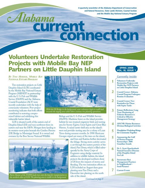
Volunteers Undertake Restoration<br />
Projects with <strong>Mobile</strong> <strong>Bay</strong> NEP<br />
Partners on Little Dauphin Island<br />
BY TOM HERDER, MOBILE BAY<br />
NATIONAL ESTUARY PROGRAM<br />
Two restoration projects on Little<br />
Dauphin Island (LDI) coordinated<br />
by the <strong>Mobile</strong> <strong>Bay</strong> <strong>National</strong> <strong>Estuary</strong><br />
<strong>Program</strong> (MBNEP) in partnership<br />
with the U. S. Fish and Wildlife<br />
Service (F&WS) and the <strong>Alabama</strong><br />
Coastal Foundation (ACF) were<br />
recently undertaken with the help of<br />
community volunteers. Post-project<br />
monitoring indicates that both efforts<br />
contributed to restoring compromised<br />
habitat and stabilizing this<br />
vulnerable barrier island.<br />
LDI is situated north of the eastern end of<br />
Dauphin Island (DI) and runs northwest from its<br />
eastern end near the DI/Ft. Morgan ferry landing to<br />
its western-most point beneath the Gordon Persons<br />
(DI) Bridge in Mississippi Sound. It is owned and<br />
overseen by the Bon Secour <strong>National</strong> Wildlife<br />
Patric Harper of the F&WS loads trees onto the boat for transportation to<br />
the northern shore of LDI.The planting area is visible in the background.<br />
With the DI Bridge in the background, some volunteers begin to walk back<br />
towards the staging area while others continue tree planting operations.<br />
Refuge and the U. S. Fish and Wildlife Service<br />
(F&WS). Maritime forest on the island provides<br />
habitat for neo-tropical migratory birds and nesting<br />
area for Snowy Egrets, Great Egrets and Great Blue<br />
Herons. A raised oyster shell area on the island’s<br />
west end provides nesting area for a colony of Least<br />
Terns during summer months. In 1998 Hurricane<br />
Georges wiped out many of the trees on the island,<br />
and Ivan and Katrina further decimated<br />
the foliage. Strong storm activity carves<br />
a cut through the eastern portion of the<br />
island, Pass Drury, which is filled subsequently<br />
by the Army Corps of<br />
Engineers using dredge material. In<br />
addition to wildlife habitat, the island<br />
protects the developed northern shore<br />
of DI from the impacts of storms and<br />
flooding.The two restoration efforts on<br />
LDI included an August dune grass<br />
planting near Pass Drury and a<br />
December tree planting on the north<br />
side of the island.<br />
Continued on page 8<br />
1<br />
2<br />
2<br />
3<br />
4<br />
5<br />
5<br />
6<br />
6<br />
7<br />
SPING 2008<br />
VOL. III, ISSUE 1<br />
<strong>Current</strong>ly Inside<br />
Volunteers Undertake<br />
Restoration Projects with<br />
<strong>Mobile</strong> <strong>Bay</strong> NEP Partners<br />
on Little Dauphin Island<br />
Coastal Corner: <strong>Alabama</strong><br />
Coastal <strong>Program</strong> Undergoes<br />
Routine Evaluation<br />
Coastal Corner: New<br />
Reminders for Those<br />
with Septic Tanks<br />
<strong>Estuary</strong> Reflections: Long<br />
Term Monitoring of<br />
Fisheries Resources is<br />
Critical to Effective<br />
Management Strategy<br />
ADCNR-Marine Resources<br />
Division Biological Activities<br />
Floodplains Workshop Brings<br />
the Community Together<br />
Announcing the Gulf<br />
of Mexico <strong>Program</strong><br />
Partnership’s 2008<br />
Guardian Awards<br />
Dr. L. Scott Quackenbush<br />
Named Executive Director<br />
of the Dauphin Island<br />
Sea Lab<br />
Stormwater Best<br />
Management Practices<br />
in Neighborhood –<br />
Send Pictures!<br />
<strong>Current</strong> Events
Coastal Corner<br />
BY AMY KING, ADCNR, STATE LANDS DIVISION, COASTAL SECTION<br />
<strong>Alabama</strong> Coastal <strong>Program</strong><br />
Undergoes Routine Evaluation<br />
The <strong>Alabama</strong> Coastal Area Management<br />
<strong>Program</strong> (ACAMP), operated by the<br />
<strong>Alabama</strong> Department of Conservation and<br />
Natural Resources (ADCNR), State Lands<br />
Division, Coastal Section, had its regularly<br />
scheduled federal evaluation this past<br />
December. Under the Coastal Zone<br />
Management Act (CZMA) of 1972, Section<br />
312, as amended, all states<br />
participating in the Coastal<br />
Management <strong>Program</strong> are<br />
subject to an evaluation<br />
every three years. <strong>Alabama</strong><br />
receives funding for the<br />
ACAMP through the<br />
CZMA and is administered<br />
by the <strong>National</strong><br />
Oceanic and Atmospheric<br />
Administration (NOAA).<br />
The evaluation was<br />
conducted by the NOAA<br />
Office of Ocean and Coastal<br />
Resource Management and is intended<br />
to help states improve their Coastal<br />
Management <strong>Program</strong>s<br />
A major part of the evaluation was<br />
to assess if the program is continuing the<br />
mission of an approved coastal zone management<br />
program. Elements of that assessment<br />
included determining if the program was<br />
playing a leadership role in coastal issues,<br />
monitoring the actions of state agencies and<br />
local governments, assuring the opportunity<br />
for full public participation, addressing coastal<br />
A major part of the<br />
evaluation was to<br />
assess if the program<br />
is continuing the<br />
mission of an<br />
approved coastal zone<br />
management program.<br />
2 <strong>Alabama</strong> current connection<br />
management needs, and adhering to the<br />
terms and conditions of financial assistance<br />
awards.The evaluation also reviews the<br />
manner in which the ACAMP implements<br />
federal consistency and determines whether<br />
changes have occurred in the approved<br />
program during the review period.<br />
During the four-day evaluation process,<br />
the evaluation team<br />
reviewed relevant program<br />
documents and conducted<br />
site visits to interview program<br />
staff, federal and state<br />
agencies, and local entities.<br />
In addition, a public meeting<br />
was held to solicit public<br />
input on the ACAMP.<br />
Upon completion of<br />
the assessment, the evaluation<br />
team will prepare a set<br />
of findings that identifies<br />
ACAMP successes andareas<br />
needing improvement. Recommendations<br />
from the findings are used to negotiate future<br />
Coastal Zone Management Act financial<br />
assistance awards to the state.The final<br />
evaluation report is expected to be completed<br />
in spring 2008.The ACAMP is a cooperative<br />
program between NOAA and is administered<br />
by the ADCNR, State Lands Division,<br />
Coastal Section in conjunction with the<br />
<strong>Alabama</strong> Department of Environmental<br />
Management, local governments, and other<br />
partners.<br />
New Reminders<br />
for Those with<br />
Septic Tanks<br />
If you had a new septic tank installed within<br />
the past two years,you will more than likely receive<br />
a reminder to have it pumped or serviced within<br />
the next year. The <strong>Alabama</strong> Department of Public<br />
Health in Baldwin County and the <strong>Mobile</strong> County<br />
Health Department has developed a voluntary<br />
septic tank maintenance reminder program in<br />
efforts to keep tanks working in an efficient and<br />
healthy manner. These programs also track and<br />
monitor onsite sewage disposal systems within<br />
their respective counties. In addition to keeping<br />
the septic tanks working at their optimum level,<br />
the purpose of these programs is to collect an<br />
inventory of area onsite sewage disposal systems<br />
(OSDS) in the two coastal counties in conjunction<br />
withmeetingrequirementsforanapproved<strong>Alabama</strong><br />
Coastal Nonpoint Pollution Control <strong>Program</strong>.<br />
How does this program work? The county<br />
health departments collect Global Positioning<br />
System (GPS) readings for all onsite sewage<br />
systems that are permitted, installed, inspected, or<br />
repaired in their respective counties. Then that<br />
data is entered into the existing permit database.<br />
Next, the data is used to generate and mail notices<br />
for homeowners every three years from the last<br />
documented date of septic tank maintenance,<br />
installation, or repair.<br />
“These programs provide an accurate insight to<br />
what is actually out there from this date forward<br />
and will assist in future water quality issues for<br />
both ground water and possibly surface water.”<br />
says Amy King, Natural Resources Planner for the<br />
<strong>Alabama</strong> Department of Conservation and Natural<br />
Resources (ADCNR), State Lands Division,<br />
Coastal Section.“The next phase of the program is<br />
to record historical information.Where are the tanks<br />
that were installed five, ten, even 15 years ago?”<br />
These programs are sponsored by the <strong>Alabama</strong><br />
Department of Public Health, <strong>Mobile</strong> County<br />
Health Department and the ADCNR, State<br />
Lands Division, Coastal Section.
<strong>Estuary</strong><br />
Reflections<br />
DAVID W. YEAGER, DIRECTOR MOBILE BAY NATIONAL ESTUARY PROGRAM<br />
Long Term Monitoring of Fisheries Resources<br />
is Critical to Effective Management Strategy<br />
Are our commercially and recreationally<br />
important fisheries stocks healthy? This was<br />
an important concern raised in a survey<br />
regarding indicators of environmental quality<br />
by local residents. Two recent analyses of<br />
Fisheries Assessment and Monitoring<br />
<strong>Program</strong> (FAMP) data collected over the<br />
last 20+ years by the <strong>Alabama</strong> Department<br />
of Conservation and Natural Resources,<br />
Marine Resources Division as follow up to<br />
the Gulf of Mexico Estuarine Inventory<br />
(GMEI) are now available to help us answer<br />
this question and to target future sampling<br />
programs.<br />
In March 2008, Harriet Perry, Director<br />
of the Center for Fisheries Research at the<br />
University of Southern Mississippi’s (USM)<br />
Gulf Coast Research Laboratory (GCRL),<br />
and a team of researchers completed a<br />
statistical analysis of the long term FAMP<br />
data sets for coastal <strong>Alabama</strong> and Mississippi<br />
through a grant from the Mississippi-<br />
<strong>Alabama</strong> Sea Grant Consortium.The GCRL<br />
team included Ralf Reidel (GCRL), Steve<br />
Heath (AMRD), and Leslie Hartman<br />
(AMRD).<br />
Their analysis of data from 1981 to 2007<br />
focused on selected species (brown shrimp,<br />
white shrimp, pink shrimp, blue crab, lesser<br />
blue crab, hardhead catfish, Gulf butterfish,<br />
white trout, Gulf menhaden, spot and<br />
Atlantic croaker).The analysis concluded, “for<br />
most species, there was no significant change in<br />
status noted during this time frame. However,<br />
blue crabs did exhibit a significant downward<br />
trend. Declines in abundance of juvenile blue<br />
crabs have also been found in Mississippi and<br />
Louisiana during the same time frame. The<br />
cause of this decline is unknown. Factors that<br />
could be responsible for this trend include habitat<br />
alteration and loss, climatic change, water<br />
quality, and predator-prey interactions. Further<br />
research will be necessary to determine the precise<br />
cause(s) of blue crab population decreases in the<br />
northern Gulf.”<br />
The analysis by Perry’s USM/GCRL<br />
team mirrors concerns regarding Blue Crab<br />
declines identified in a previous analysis of<br />
<strong>Alabama</strong> FAMP data by a team led by<br />
Dr. John Valentine in 2006. The Valentine<br />
team, including Derrick Blackmon and<br />
Kevin Kirsch of the Dauphin Island Sea<br />
Lab, was under contract to the <strong>Mobile</strong> <strong>Bay</strong><br />
<strong>National</strong> <strong>Estuary</strong> <strong>Program</strong> and funded<br />
through the Coastal Impact Assistance<br />
<strong>Program</strong>. However,Perry’s analysis examined<br />
Mississippi FAMP data and similar sampling<br />
data for Louisiana and<br />
links similar declines in those<br />
states.BothPerryandValentine<br />
also noted two years of very<br />
high blue crab abundance<br />
in 1984 and 1989. Valentine’s<br />
analysis concluded that a recent<br />
three year (2001-2003) decline<br />
in abundance of blue crab in<br />
samples “should be of concern<br />
and requires follow up to determine<br />
if the population has<br />
rebounded to previously documented<br />
levels of abundance.”<br />
Inadditiontotheseanalyses<br />
of the FAMP data sets, the<br />
<strong>Alabama</strong> Marine Resources<br />
Division (AMRD) also completed stock<br />
assessments on two more species that are<br />
important, striped mullet and speckled trout<br />
in 2006 and 2007, respectively. According to<br />
AMRD Chief Biologist, Steve Heath, the<br />
striped mullet assessment indicates, “The<br />
current assessment found the stock to be self-sustaining,<br />
but impacted by commercial fishing.<br />
Concerns for future sustainability prompted the<br />
Division to increase the mesh sizes used in the<br />
commercial fishery to improve the reproductive<br />
capability of the stock.” The speckled trout<br />
assessment also shows that “this stock is selfsustaining<br />
and changes in regulations were<br />
not recommended at this time.”<br />
Sound fishery<br />
resource management<br />
strategies depend<br />
on comprehensive<br />
long-term data sets<br />
and reliable baselines<br />
from which to<br />
assess change.<br />
These recent assessments and analyses<br />
exemplify the kind of data necessary<br />
for making good resource management<br />
decisions. The question of the health of our<br />
fishery stocks is a seemingly simple one but<br />
much more difficult to answer. Despite<br />
improvements in monitoring capability, the<br />
revolution made possible by satellite remote<br />
sensing and a myriad of other technological<br />
marvels, sampling programs continue to be<br />
the stock and trade of fishery population<br />
assessments. However fishery-independent<br />
sampling programs are labor<br />
intensive, difficult or impossible<br />
to design for simultaneous<br />
sampling of multiple species,<br />
costly, and provide many<br />
opportunities for gear or other<br />
biases. How much data is<br />
enough? I don’t know the<br />
answer to that question, but I<br />
can tell you that for my money,<br />
we are not there yet.<br />
We are fortunate that there<br />
is recognition in <strong>Alabama</strong><br />
that long-term sampling is a<br />
necessity and that programs<br />
exist to gather such primary<br />
data sets. However, we (as<br />
other states and even federal agencies) are<br />
hampered by the availability of additional<br />
resources to expand and continue these<br />
programs. Sound fishery resource management<br />
strategies depend on comprehensive<br />
long-term data sets and reliable baselines<br />
from which to assess change. So the next<br />
time you are tempted to say our conservation<br />
agencies have an easy task and that we<br />
already have enough data and studies, think<br />
again.<br />
<strong>Alabama</strong> current connection 3
ADCNR-Marine Resources<br />
Division Biological Activities<br />
BY CHRIS DENSON, BIOLOGIST IV,<br />
MARINE RESOURCES DIVISION<br />
The <strong>Alabama</strong> Marine Resources Division<br />
(MRD) continues to monitor <strong>Alabama</strong>’s<br />
marine resources through existing fisheriesdependent<br />
and independent sampling programs.<br />
These programs are designed to collect<br />
landings and effort statistics vital<br />
to maintaining healthy stocks. Identifying<br />
participants using the resources is an essential<br />
task to these efforts. Beginning September 1,<br />
2007, anglers in state waters with recreationally<br />
caught fish, regardless of harvest area, are<br />
required to posses a recreational fishing<br />
license. This includes individuals using cast<br />
nets, gigs, and/or crab traps as well as<br />
conventional gear.<br />
Recreational fishing licenses are no longer<br />
issued for a year from the date of purchase,<br />
but all licenses expire August 31 regardless of<br />
purchase date.<br />
The availability of boater access remains<br />
a high concern for MRD. Renovations were<br />
completed to three Baldwin County coastal<br />
boat ramps during the past year. At the<br />
Cotton <strong>Bay</strong>ou boat ramp, the existing asphalt<br />
parking lot was resurfaced and an unpaved<br />
extension, created in 2006, was paved using<br />
new asphalt. The freshly paved parking lot<br />
was striped to allow for maximum parking<br />
accommodation. The second ramp receiving<br />
attention was the Ft. Morgan boat ramp<br />
where the parking area was repaired using<br />
gravel, spread over the existing gravel base, to<br />
fill in holes and soft spots. In addition to the<br />
parking repairs, the boat launch pier was<br />
strengthened and made safer for public use.<br />
Finally, repairs were conducted at the Pines<br />
boat ramp on Fort Morgan; this ramp had<br />
been closed since Hurricane Katrina due to<br />
safety issues. Renovations included laying<br />
asphalt,restoration of one ramp to operational<br />
capacity, and construction of a new launching<br />
pier. Recent renovations to the Boggy Point<br />
ramp in Orange Beach received national<br />
recognition by receiving the 2007 annual<br />
award for “Outstanding Project – Midsize<br />
Access” from SOBA (States Organization for<br />
Boating Access).<br />
MRD remains committed to the management<br />
of healthy fishery stocks which in turn<br />
depend on a healthy marine environment.<br />
4 <strong>Alabama</strong> current connection<br />
In an effort to clean up the waters and shorelines,<br />
MRD initiated a monofilament recycling<br />
program. Four monofilament recycling stations<br />
on Dauphin Island were established at<br />
the Gulf pier, Dauphin Island Campground,<br />
Little Billy Goat Hole and Billy Goat Hole<br />
boat ramps. A positive response with this<br />
program has been observed; plans are being<br />
made to expand coverage to other locations in<br />
<strong>Mobile</strong> and Baldwin counties.<br />
MRD has been given the responsibility of<br />
overseeing a federally funded Emergency<br />
Disaster Relief <strong>Program</strong> (EDRP) for<br />
<strong>Alabama</strong>. This program was designed to<br />
monitor the impacts and recovery of the fishery<br />
stocks and marine habitat, oversee the<br />
distribution of financial assistance to the<br />
commercial and charter fisherman, and assist<br />
in the re-establishment of the associated<br />
infrastructure post Hurricane Katrina. As per<br />
the requirements of this program, financial<br />
aid designated for commercial and charter<br />
fishermen is being disbursed through the<br />
completion of datasheets that provide<br />
additional information about their fishing<br />
trips that would not be collected through<br />
normal data collection activities. Over 9,900<br />
forms from commercial fishermen and<br />
3,500 forms from charter vessels have been<br />
returned through December 2007.<br />
In addition to the fishermen assistance<br />
portion of the EDRP, habitat restoration<br />
efforts were initiated. A total of 7,500 cubic<br />
yards of cultch material (shell and small rock)<br />
was acquired by MRD and planted by local<br />
oystermen over 1,735 acres of existing oyster<br />
reefs in Heron <strong>Bay</strong>. Just under 850 cubic<br />
yards of large rocks unsuitable to oyster<br />
harvesting were removed from Buoy Reef<br />
in <strong>Mobile</strong> <strong>Bay</strong> by oyster dredgers.<br />
Designated contributions from the<br />
Orange Beach Red Snapper Tournament<br />
were combined to MRD funds to deploy 415<br />
new concrete and steel pyramid reefs in<br />
<strong>Alabama</strong>’s offshore reef areas during the 2007<br />
fiscal year. This cooperative agreement has<br />
resulted in the total deployment 866 pyramid<br />
reefs.These reef modules, each about ten feet<br />
tall and weighing near 5,000 pounds, are covered<br />
on each side with perforated steel plate<br />
up to one inch thick. The modules were<br />
distributed from east to west and shallow to<br />
deep, spreading out the fishing effort over the<br />
widest possible area.<br />
The effort to create new inshore fishery<br />
habitat in south Baldwin County continued.<br />
Demolition of the Gulf State Park lodge and<br />
hotel facilities provided 10,482 tons of clean<br />
concrete rubble which completed the <strong>Bay</strong>ou<br />
St. John Reef in Orange Beach. Demolition<br />
of the Fowl River Bridge provided enough<br />
material to complete approximately 85% of<br />
the Ross Point Reef and approximately 70%<br />
of the Ono Island Reef in Perdido <strong>Bay</strong>.<br />
Approximately 1,650 tons of concrete rubble<br />
was placed on the T.R. “Buddy” Beiser Reef<br />
(Upper Wreck Reef) in <strong>Mobile</strong> <strong>Bay</strong>.<br />
The 2008 edition of the popular<br />
<strong>Alabama</strong> Marine Information Calendar<br />
was produced. This publication, in its<br />
eleventh year of production, is an all-inclusive<br />
source for marine fishing info, tidal data, fishing<br />
creel limits, license schedules, boating<br />
information, and artificial fishing reef coordinates.<br />
Over 1,400 fourth-grade students from<br />
elementary schools in <strong>Mobile</strong> and Baldwin<br />
counties participated in our fifth annual Kid’s<br />
Marine Art Contest, the purpose of which is<br />
to promote an awareness and appreciation of<br />
<strong>Alabama</strong>’s coastal resources. The winning<br />
selections will be displayed in art museums in<br />
both coastal counties in conjunction to the<br />
Kid’s Marine Calendar.<br />
MRD has completed a fifth reprinting<br />
of the Marine Resources’ Kids Activity<br />
Book. This teaching tool is distributed to<br />
elementary schools in <strong>Alabama</strong>’s two coastal<br />
counties and at outreach activities. In addition,<br />
a new kid’s marine coloring book targeting<br />
kindergarten and first-grade students of<br />
<strong>Mobile</strong> and Baldwin counties was developed<br />
by MRD.This new educational resource will<br />
be available upon request to kindergarten and<br />
first-grade teachers.<br />
All Divisional data collection programs<br />
(commercial, recreational and fisheries-independent)<br />
currently in operation will continue<br />
during the next year. Additional programs<br />
designed to assist in hurricane recovery efforts<br />
are expected to be implemented in various<br />
stages. As construction of the new Gulf State<br />
Park fishing pier continues, MRD’s saltwater<br />
pipeline, essential to the production of certain<br />
marine species,grows closer to being put back<br />
in operation.The upcoming year is anticipated<br />
to be an eventful year.
Flood Plains Workshop Brings the<br />
Community Together at the 5 Rivers Center<br />
BY TOM HERDER, MOBILE BAY NATIONAL<br />
ESTUARY PROGRAM (MBNEP)<br />
On Friday, February 15, over eighty<br />
participants met at the 5 Rivers Delta<br />
Center to exchange information about<br />
issues related to flood plain management<br />
in <strong>Alabama</strong> and neighboring Gulf states.<br />
The workshop, Flooding Along the Gulf<br />
Coast – Building a Resilient <strong>Alabama</strong>, was<br />
conceived by free lance journalist Steve<br />
Myers in partnership with the <strong>Mobile</strong> <strong>Bay</strong><br />
<strong>National</strong> <strong>Estuary</strong> <strong>Program</strong>, funded by the<br />
Open Society Institute, and hosted by the<br />
Department of Conservation, State Lands<br />
Division. Invited experts presented information<br />
on issues related to surge modeling,<br />
flood zone mapping, economics, and coastal<br />
construction to elected officials; state, county,<br />
and municipal planners and building officials;<br />
agency representatives; academicians; and<br />
business people.<br />
NEP Director David Yeager opened<br />
the meeting, noting that the rebuilding<br />
effort that followed Hurricane Frederic<br />
was the beginning of the growth boom<br />
that continues today. Mr. Myers, author<br />
of a June Press-Register series on recovery<br />
efforts in flood zones, flood maps, and<br />
insurance, showed a video to provide perspectives<br />
of <strong>Alabama</strong> flood plain residents<br />
rebuilding after Katrina. His presentation<br />
highlighted the problem of the under-predictions<br />
of flooding in current maps.<br />
Dr. Don Resio, the Senior Technologist<br />
for the U. S. Army Engineer Research and<br />
Development Center and Coastal and<br />
Hydraulics Laboratory in Vicksburg,<br />
described complexities of post-Katrina<br />
scientific models currently used to generate<br />
predictions for storm surge. Historical<br />
data and methods and techniques used for<br />
predicting flood events prior to August,<br />
2005 were revealed to be inadequate by<br />
that storm. He described the work of the<br />
Interagency Performance Evaluation<br />
Taskforce to design a new process for<br />
determining “inundation probabilities.<br />
Federal Emergency Management<br />
Agency (FEMA) representatives reported<br />
the current status of mapping efforts<br />
nationally, in neighboring Mississippi, and<br />
in <strong>Alabama</strong>. Region IV Branch Chief Brad<br />
Loar discussed and compared the Mississippi<br />
Advisory Base Flood Elevations (ABFEs),<br />
rapidly prepared after Katrina and paid for<br />
with federal disaster funds, with their pending<br />
Flood Insurance Rate Maps.Their<br />
reported timetable for <strong>Alabama</strong> map revision<br />
sets 2009 for the beginning of the<br />
project with new maps to be delivered not<br />
before 2011. No ABFEs were prepared<br />
for <strong>Alabama</strong>, since no funding has been<br />
available.<br />
Representing the <strong>Mobile</strong> Area Chamber<br />
of Commerce, BankTrust President Terry<br />
Harbin described a strategic planning<br />
initiative being developed with consultant<br />
Michael Gallas. Its goal is to prepare the<br />
<strong>Mobile</strong> <strong>Bay</strong> community for the pressures<br />
and opportunities including resiliency to<br />
changes in the coastal environment. He<br />
stressed the importance of a “regional framework”<br />
to overcome the fragmentation of<br />
public, private, and institutional sectors and<br />
the importance of marketing our “aggregate<br />
resources and people” to compete in a global<br />
economy.<br />
Dr.John Lopez,of the Lake Pontchartrain<br />
Basin Foundation, discussed his Multiple<br />
Lines of Defense Strategy, including large<br />
wetlands tracts to mitigate the effects of<br />
storm surge. He used the experiences of<br />
his home state, Louisiana, to illustrate the<br />
economic and environmental problems<br />
they face not only in their recovery from<br />
the impacts of Katrina but in planning for<br />
future weather events.<br />
Carl Schneider of the <strong>Alabama</strong><br />
Independent Insurance Agents Association,<br />
provided their perspectives on the problems<br />
associated with defined flood zones, wind<br />
verses flood events, inadequate engineering/<br />
construction. He posed several questions<br />
throughout his presentation, and among<br />
his recommendations were to build “higher,<br />
dryer, stronger, safer, and smarter”.<br />
Answers to Mr. Schneider’s questions<br />
were provided by the final speaker, Engineer<br />
Chris Jones, a consultant to FEMA and<br />
one of the authors of FEMA’s Coastal<br />
Construction Manual and the Home<br />
Builder’s Guide to Coastal Construction.<br />
Mr. Jones presented cost-benefit data<br />
which clearly illustrate the terms of damage<br />
reduction and lower insurance premiums.<br />
He pointed out that the cost of elevating a<br />
structure an additional foot represents only<br />
half of a percent of total construction costs.<br />
His presentation described various hazards<br />
inherent in flood zones and appropriate<br />
engineering and construction solutions to<br />
these threats.<br />
Announcing<br />
The Gulf of Mexico <strong>Program</strong> Partnership’s<br />
2008 Gulf Guardian Awards<br />
The Gulf of Mexico <strong>Program</strong> is currently soliciting entries for the<br />
2008 Gulf Guardian Awards <strong>Program</strong>. The entry deadline is May 1, 2008.<br />
Winners will be announced in the fall and the Awards Ceremony will be held during<br />
the month of December 2008. This is the ninth year for the awards program which<br />
was started to honor the businesses, industries, non-profit organizations,<br />
government agencies, individuals and partnerships who are striving to<br />
make an environmental difference in the Gulf of Mexico.<br />
A first, second, and third place award is given in 7 different categories.<br />
We encourage you to apply for this prestigious award!<br />
Go on-line to the website listed below, complete the application,<br />
and e-mail before May 1, 2008 to: gulf.guardian@epa.gov<br />
Gulf Guardian Application at http://www.epa.gov/gmpo<br />
<strong>Alabama</strong> current connection 5
Dr. L. Scott Quackenbush Named<br />
Executive Director of the Dauphin Island Sea Lab<br />
BY LISAYOUNG,DAUPHIN ISLAND SEA LAB<br />
The Board of Directors of the Dauphin<br />
Island Sea Lab (DISL) has named Dr. L.<br />
Scott Quackenbush the Executive Director<br />
of the Marine Environmental Sciences<br />
Consortium at the Dauphin Island Sea<br />
Lab, the state of <strong>Alabama</strong>’s marine science<br />
education and research institution.<br />
Dr. Quackenbush is currently the<br />
Director of Humboldt State University’s<br />
Marine Lab in northern California, where<br />
he is also Associate Dean for Marine Science<br />
<strong>Program</strong>s.His previous professional experience<br />
includes Chair of the Biological Science<br />
Departments at the University of North<br />
Carolina at Wilmington and Florida<br />
International University. He earned his<br />
undergraduate degree at the University of<br />
Minnesota, his Master’s Degree at the<br />
University of West Florida, and his<br />
Doctorate at Florida State University.<br />
The DISL was formed in 1971 by the<br />
State Legislature to minimize duplication of<br />
marine science programs among <strong>Alabama</strong>’s<br />
four-year colleges and to promote the study<br />
of marine science.There are currently 21<br />
public and private colleges and universities<br />
in DISL’s consortium.<br />
As Executive Director of the DISL, Dr.<br />
Quackenbush will be overseeing numerous<br />
educational, research, and outreach programs<br />
that serve the state of <strong>Alabama</strong>, the region,<br />
and the nation.The DISL’s educational<br />
programs include students from Ph.D. to<br />
kindergarten level; its research initiatives span<br />
the disciplines of paleoecology to oceanography<br />
to biogeochemistry, in field sites as near<br />
as <strong>Mobile</strong> <strong>Bay</strong> to as far away as Antarctica.<br />
The DISL also encompasses the Estuarium,<br />
a public aquarium that greeted over 66,000<br />
visitors in 2007.The DISL plays a visible role<br />
in <strong>Alabama</strong>’s coastal policy as thehost of the<br />
<strong>Mobile</strong> <strong>Bay</strong> <strong>National</strong> <strong>Estuary</strong> <strong>Program</strong>.<br />
The Executive Director of the DISL<br />
Dr. L. Scott Quackenbush, the new Executive<br />
Director of the Dauphin Island Sea Lab, will<br />
replace recently retired Dr. George Crozier.<br />
Dr. Quackenbush will begin his tenure in July.<br />
also serves on the Board of Forever Wild,<br />
which provides for the purchase of public<br />
recreational lands for general recreation,<br />
nature preserves, and state parks. Since its<br />
inception in 1992, over 100,000 acres of<br />
lands and wetlands have been purchased.<br />
“I am very pleased that the Board of<br />
Directors has asked me to become the next<br />
Executive Director of the Dauphin Island<br />
Sea Lab,” Quackenbush said.“[Retired<br />
Director] Dr. George Crozier has set an<br />
ambitious course for the DISL for the past<br />
30 years, and his accomplishments on behalf<br />
of the citizens of the state of <strong>Alabama</strong> are<br />
noteworthy.<br />
“I hope to maintain the programs he has<br />
developed, and expand additional opportunities<br />
for the faculty, students, and staff that<br />
are the heart of the DISL. In particular, I<br />
would like to encourage students and faculty<br />
from outside <strong>Alabama</strong> to participate in the<br />
research and educational programs at the<br />
Dauphin Island Sea Lab. By raising the<br />
national visibility of the lab, we can recruit<br />
new participation that will benefit the lab<br />
and its programs.<br />
“The oceans and marine environments<br />
have come under increasing pressure from<br />
human activities in the past decades, and<br />
the Dauphin Island Sea Lab has been at the<br />
forefront of both research and education<br />
to help understand these changes. I look<br />
forward to a bright future for the Dauphin<br />
Island Sea Lab and the participating universities<br />
to continue their leadership in these<br />
areas for the benefit of <strong>Alabama</strong> and the<br />
nation,” he concluded.<br />
Dr. Quackenbush plans to commence<br />
work at the DISL in July 2008. Dr. John<br />
Dindo is currently serving as Interim Director.<br />
Stormwater Best<br />
Management<br />
Practices in<br />
Neighborhood –<br />
Send Pictures!<br />
BY TOM HERDER, MOBILE BAY<br />
NATIONAL ESTUARY PROGRAM<br />
There are lots of ways to treat<br />
stormwater or keep it on your property<br />
before it runs off into storm gutters<br />
and down the watershed. Rain gardens,<br />
rain barrels,retention/infiltration swales,<br />
retention ponds, pervious pavement,<br />
and wheel tracks all contribute to<br />
preventing polluted runoff. All of us<br />
can be part of the “pollution solution”!<br />
Provide some credit to those who<br />
already are, and help us get the word<br />
out and provide ideas. Send pictures of<br />
residential stormwater best management<br />
practices (BMPs) in your neighborhood,<br />
and we’ll publish them in the <strong>Current</strong><br />
<strong>Connection</strong>. E-mail digital photos to<br />
therder@mobilebaynep.com, along with<br />
addresses or locations of the BMPs<br />
and the names of the homeowners or<br />
residents (with their permission). We<br />
look forward to hearing from you.<br />
6 <strong>Alabama</strong> current connection
<strong>Current</strong>events<br />
April<br />
Wednesday and Thursday, April 9-10<br />
What: Green Coast Conference - The conference<br />
and expo will feature interactive education sessions<br />
on commercial, residential, and public green building.<br />
The Green Expo will feature sustainable products<br />
and services used in a green building.<br />
Where: Arthur R. Outlaw Convention Center<br />
Contact: info@smartcoast.org or (251) 928-2309<br />
Saturday, April 19, 10 a.m. - 2 p.m.<br />
What: Discovery Day at the Dauphin Island<br />
Sea Lab Open House at the Sea Lab includes<br />
environmentally themed children’s activities.<br />
Where: Dauphin Island Sea Lab<br />
Contact: Lisa Young at 861-7509.<br />
Saturday, April 19, 10 a.m. - 6 p.m.<br />
What: Earth Day <strong>Mobile</strong> <strong>Bay</strong> 2008 Environmental<br />
displays and activities, Science Fair projects, a wide<br />
variety of interactive educational opportunities, as<br />
well as a live music line-up until 7 p.m.<br />
Contact: (251) 947-4121 or<br />
e-mail earthdaymobilebay@yahoo.com.<br />
Friday, April 25 through Sunday, April 27<br />
What: Weeks <strong>Bay</strong> Photography Class<br />
There will be a registration fee for this event<br />
Where: Weeks <strong>Bay</strong> NERR Auditorium<br />
Contact: Walter Ernest, IV at (251)990-5004 or<br />
L. G. Adams at (251) 928-9792<br />
Tuesday, April 29<br />
What: Coastal Kids Quiz - A well-established<br />
annual educational event sponsored by the<br />
<strong>Alabama</strong> Coastal Foundation for Baldwin and<br />
<strong>Mobile</strong> County Fifth Graders<br />
Where: Daphne United Methodist Church<br />
Contact: ACF Director Bethany Kraft, (251) 990-6002<br />
May<br />
Saturday, May 10, 8 a.m. - Noon<br />
What: Weeks <strong>Bay</strong> Area River Cleanup/Renew<br />
Our Rivers - Clean up of rivers and creeks in the<br />
watershed of Weeks <strong>Bay</strong> and the local component<br />
of the <strong>Alabama</strong> Power Renew Our Rivers program.<br />
Lunch provided. Come by boat or vehicle.<br />
Where: Fish River Marina<br />
Contact: Michael Shelton or Eric Brunden<br />
(251) 928-9792<br />
Tuesday, May 13 - Thursday, May 15<br />
9 a.m. - 5 p.m.<br />
What: Hydric Soils Indicators Workshop -<br />
Weeks <strong>Bay</strong> NERR/Grand <strong>Bay</strong> NERR CTP<br />
Workshop on wetland soils and indicators<br />
Where: Weeks <strong>Bay</strong> NERR<br />
Contact: Michael Shelton, (251) 928-9792<br />
Thursday, May 22, 8 a.m. - Noon<br />
What: Wetland Regulation and Compliance<br />
Workshop - Weeks <strong>Bay</strong> NERR and <strong>Alabama</strong><br />
Coastal Foundation CTP on wetlands regulation<br />
and compliance issues for land use professionals.<br />
Where: Fowl River Community Center.<br />
Contact: Michael Shelton, (251) 928-9792<br />
Saturday, May 31, 7 a.m.<br />
What: The Springhill Medical Center Grandman<br />
Triathlon - The area’s premier triathlon to<br />
benefit <strong>Mobile</strong> <strong>Bay</strong>Keeper. 1/3 mile swim/<br />
16.4 mile bike/3.1 mile run.<br />
Where: Fairhope Municipal Pier<br />
Contact: Visit www.thegrandman.com or<br />
call <strong>Mobile</strong> <strong>Bay</strong>Keeper at 251-433-4229<br />
June<br />
Tuesday and Wednesday, June 10 -11<br />
9 a.m. - 5 p.m.<br />
What: Weeks <strong>Bay</strong> NERR/Grand <strong>Bay</strong> NERR<br />
CTP and NOAA Coastal Services Center<br />
Workshop on using GIS in coastal<br />
management for coastal resource managers.<br />
Proficiency with GIS is prerequisite.<br />
Where: Jackson County Community College,<br />
Gautier, MS<br />
Contact: Michael Shelton, 251) 928-9792<br />
Thursday and Friday, June 12-13<br />
9 a.m.- 5 p.m.<br />
What: Coastal Inundation Mapping GIS<br />
Workshop -Weeks <strong>Bay</strong> NERR/Grand <strong>Bay</strong><br />
NERR CTP/NOAA CSC Workshop on<br />
using GIS in floodplain and storm impact<br />
management for coastal resource managers.<br />
Proficiency with GIS is prerequisite.<br />
Where: Jackson County Community College,<br />
Gautier, MS<br />
Contact: Michael Shelton, 251) 928-9792<br />
Saturday, June 14<br />
What: Dog Paddle - Annual canoe and kayak race<br />
sponsored by the Dog River Clearwater Revival.<br />
Contact: Valerie Blankenship,<br />
(251) 472-8383<br />
<strong>Alabama</strong><br />
current<br />
connection<br />
<strong>Alabama</strong> <strong>Current</strong> <strong>Connection</strong> is<br />
produced as a joint publication<br />
of the <strong>Alabama</strong> Department<br />
of Conservation and Natural<br />
Resources, State Lands Division<br />
(SLD), Coastal Section and the<br />
<strong>Mobile</strong> <strong>Bay</strong> <strong>National</strong> <strong>Estuary</strong><br />
<strong>Program</strong> (MBNEP). Support<br />
provided, in part, by the EPA,<br />
the Dauphin Island Sea Lab/<br />
Marine Environmental Science<br />
Consortium, and the <strong>National</strong> Oceanic<br />
and Atmospheric Administration.<br />
Contributors:<br />
Tom Herder, <strong>Mobile</strong> <strong>Bay</strong> NEP<br />
Kara Lankford, <strong>Mobile</strong> <strong>Bay</strong> NEP<br />
David Yeager, <strong>Mobile</strong> <strong>Bay</strong> NEP<br />
Lisa Young, Dauphin Island Sea Lab<br />
Editor:<br />
Tom Herder, <strong>Mobile</strong> <strong>Bay</strong> NEP<br />
<strong>Alabama</strong> <strong>Current</strong> <strong>Connection</strong><br />
welcomes comments and<br />
suggestions from its readers.<br />
If you have recommendations<br />
for future articles or would like<br />
to subscribe, please contact:<br />
Tom Herder<br />
<strong>Mobile</strong> <strong>Bay</strong> <strong>National</strong> <strong>Estuary</strong> <strong>Program</strong><br />
4172 Commanders Drive<br />
<strong>Mobile</strong>, AL 36615<br />
Office: 251-431-6409<br />
Cell: 251-648-3139<br />
Fax: 251-431-6450<br />
Email: therder@mobilebaynep.com<br />
The editorial staff reserves<br />
the right to edit submissions<br />
for content and grammar.<br />
<strong>Alabama</strong> current connection 7
<strong>Alabama</strong><br />
current<br />
connection<br />
Dauphin Island Sea Lab<br />
Marine Environmental Science Consortium<br />
101 Bienville Boulevard<br />
Dauphin Island, <strong>Alabama</strong> 36528<br />
Non-Profit Org.<br />
U.S. Postage<br />
PAID<br />
Permit No. 1343<br />
<strong>Mobile</strong>, AL 36601<br />
Volunteers Undertake Restoration Projects with<br />
<strong>Mobile</strong> <strong>Bay</strong> NEP Partners on Little Dauphin Island<br />
Continued from page 1<br />
On Saturday, August 25, twenty-five<br />
volunteers from DI participated in planting<br />
1,100 dune plants, including sea oats, panic<br />
grass,seashoreelder,seapurslane,andbeach<br />
morning glory. The volunteers dug 18-24<br />
inch holes in the sand and used Terra Sorb<br />
gel(amoistureabsorbinggel)tohelpensure<br />
the plants’ survival. Four boats – one from<br />
the USFWS and three owned by local volunteers<br />
– were used to shuttle plants,tools,volunteers,<br />
and water to the restoration site, where<br />
the planting was accomplished in about two<br />
hours. Mr. Leroy Hill allowed the use of his<br />
DI home as an overnight storage area for the<br />
plants and a staging area for the volunteers.<br />
On Saturday, December 1, 40 volunteers<br />
joined staff from the MBNEP, F&WS, and<br />
ACF at the Department of Conservation-<br />
Marine Resources Division (MRD) facilities<br />
on DI to plant 325 trees on the island. Five<br />
different tree species - Eastern Baccharis,<br />
Wax Myrtle, Yaupon, Sand Live Oak, and<br />
Slash Pine - all native to coastal <strong>Alabama</strong>,<br />
A tree-laden F&WS boat, looking like a mobile duck blind,<br />
pushes off from the MRD facility for the trip around the eastern<br />
tip of LDI to the planting area mid-island on the northern<br />
shore where trees were left for the next day’s planting effort.<br />
were planted on the island. The project was<br />
coordinated by the MBNEP to re-establish<br />
habitat, stabilize the island, and preserve its<br />
buffering effects. The trees were purchased<br />
by MBNEP with funds from the F&WS,<br />
who also provided boats, staff, and fuel to<br />
transport the trees, tools, and volunteers to<br />
the island.<br />
After a 10 a.m. delivery on the previous<br />
Friday, six F&WS and MBNEP employees<br />
madetwotripsinthreesmallboatstotransport<br />
the trees to the planting site on the north side<br />
of the island. With each boat carrying 30-80<br />
trees in three gallon containers at idle speed<br />
towards Billy Goat Hole, DI residents might<br />
well have wondered about the highly<br />
mobile duck blinds.<br />
The staff of volunteers from <strong>Mobile</strong><br />
and Baldwin Counties,theTown of DI,<br />
DI Sea Lab alumni, and Boy Scout<br />
Troop 42 from Silverhill who gathered<br />
at the MRD docks early Saturday<br />
morning received commemorative t-<br />
shirts from ACF.They were transported<br />
across the shallow channel to the LDI’s<br />
southeastern shore using the F&WS boats as<br />
well as those provided by volunteers Jay Isacks,<br />
Buddy Thompson, and Mike Rogers, whose<br />
boats and efforts were also used in the August<br />
planting. Volunteers with shovels hiked across<br />
the island and west to the area vegetated with<br />
the same five species, where the trees were left<br />
thepreviousday. BonSecourRefugeManager<br />
Jereme Phillips provided planting instructions<br />
to the volunteers, who planted the trees and<br />
marked each one with colored ribbon. The<br />
planting was finished by noon, at which time<br />
volunteers hiked back for a group photo and<br />
transportation back to the MRD facility.