Conserving Alabama's Coastal Habitats - Mobile Bay National ...
Conserving Alabama's Coastal Habitats - Mobile Bay National ...
Conserving Alabama's Coastal Habitats - Mobile Bay National ...
- No tags were found...

Create successful ePaper yourself
Turn your PDF publications into a flip-book with our unique Google optimized e-Paper software.
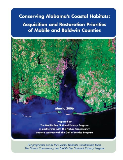
<strong>Conserving</strong> Alabama’s <strong>Coastal</strong> <strong>Habitats</strong>:Acquisition and Restoration Prioritiesof <strong>Mobile</strong> and Baldwin CountiesMarch, 2006Prepared byThe <strong>Mobile</strong> <strong>Bay</strong> <strong>National</strong> Estuary Programin partnership with The Nature Conservancyunder a contract with the Gulf of Mexico ProgramFor proprietary use by the <strong>Coastal</strong> <strong>Habitats</strong> Coordinating Team,The Nature Conservancy, and <strong>Mobile</strong> <strong>Bay</strong> <strong>National</strong> Estuary Program
Table of ContentsPreface . . . . . . . . . . . . . . . . . . . . . . . . . . . . . . . . . . . . . . . . . . . . . . . . . . . . . . . . . . . . . . . . . . . . . . . . . . . . . . . . . . . . . .2Introduction . . . . . . . . . . . . . . . . . . . . . . . . . . . . . . . . . . . . . . . . . . . . . . . . . . . . . . . . . . . . . . . . . . . . . . . . . . . . . . . . . .3Conservation and Restoration Methods . . . . . . . . . . . . . . . . . . . . . . . . . . . . . . . . . . . . . . . . . . . . . . . . . . . . . . . . . . . .4Guiding Principles for Conservation Activities . . . . . . . . . . . . . . . . . . . . . . . . . . . . . . . . . . . . . . . . . . . . . . . . . . . . . .4Overview of Four Target Areas . . . . . . . . . . . . . . . . . . . . . . . . . . . . . . . . . . . . . . . . . . . . . . . . . . . . . . . . . . . . . . . . . . .5Methodology . . . . . . . . . . . . . . . . . . . . . . . . . . . . . . . . . . . . . . . . . . . . . . . . . . . . . . . . . . . . . . . . . . . . . . . . . . . . . . . . .6Priority Acquisition Sites . . . . . . . . . . . . . . . . . . . . . . . . . . . . . . . . . . . . . . . . . . . . . . . . . . . . . . . . . . . . . . . . . . . . . . . .8Overview Map of All Acquisition Sites . . . . . . . . . . . . . . . . . . . . . . . . . . . . . . . . . . . . . . . . . . . . . . . . . . . . . . . . . . . .9Acquisition Priorities by Conservation Area . . . . . . . . . . . . . . . . . . . . . . . . . . . . . . . . . . . . . . . . . . . . . . . . . . . . . .11Grand <strong>Bay</strong> . . . . . . . . . . . . . . . . . . . . . . . . . . . . . . . . . . . . . . . . . . . . . . . . . . . . . . . . . . . . . . . . . . . . . . . . . . . . .111. Map: Cat Island . . . . . . . . . . . . . . . . . . . . . . . . . . . . . . . . . . . . . . . . . . . . . . . . . . . . . . . . . . . . . . . . . .142a. Map: Coppersmith-Cedar Point . . . . . . . . . . . . . . . . . . . . . . . . . . . . . . . . . . . . . . . . . . . . . . . . . . . . .152b. Map: Dezauch Tract . . . . . . . . . . . . . . . . . . . . . . . . . . . . . . . . . . . . . . . . . . . . . . . . . . . . . . . . . . . . . .162c. Map: Tensaw Land and Timber . . . . . . . . . . . . . . . . . . . . . . . . . . . . . . . . . . . . . . . . . . . . . . . . . . . . .172d. Map: Henderson Tract - East Grand <strong>Bay</strong> . . . . . . . . . . . . . . . . . . . . . . . . . . . . . . . . . . . . . . . . . . . . . .182e. Map: West Fowl River Tract . . . . . . . . . . . . . . . . . . . . . . . . . . . . . . . . . . . . . . . . . . . . . . . . . . . . . . . .193a. Map: Whitehead Tract . . . . . . . . . . . . . . . . . . . . . . . . . . . . . . . . . . . . . . . . . . . . . . . . . . . . . . . . . . . . .203b. Map: MC Davis Tract . . . . . . . . . . . . . . . . . . . . . . . . . . . . . . . . . . . . . . . . . . . . . . . . . . . . . . . . . . . . .214a. Map: Solet Tract . . . . . . . . . . . . . . . . . . . . . . . . . . . . . . . . . . . . . . . . . . . . . . . . . . . . . . . . . . . . . . . . .224b. Map: Henderson Tract . . . . . . . . . . . . . . . . . . . . . . . . . . . . . . . . . . . . . . . . . . . . . . . . . . . . . . . . . . . .23Gulf Islands . . . . . . . . . . . . . . . . . . . . . . . . . . . . . . . . . . . . . . . . . . . . . . . . . . . . . . . . . . . . . . . . . . . . . . . . . . . .255. Map: Dauphin Island Migratory Bird Stopover Tracts . . . . . . . . . . . . . . . . . . . . . . . . . . . . . . . . . . .296. Map: Peninsula Tract . . . . . . . . . . . . . . . . . . . . . . . . . . . . . . . . . . . . . . . . . . . . . . . . . . . . . . . . . . . . .307. Map: West End of Dauphin Island . . . . . . . . . . . . . . . . . . . . . . . . . . . . . . . . . . . . . . . . . . . . . . . . . . .318. Map: Gulf State Park In-Holdings . . . . . . . . . . . . . . . . . . . . . . . . . . . . . . . . . . . . . . . . . . . . . . . . . . .32<strong>Mobile</strong> Delta . . . . . . . . . . . . . . . . . . . . . . . . . . . . . . . . . . . . . . . . . . . . . . . . . . . . . . . . . . . . . . . . . . . . . . . . . . .339. Map:<strong>Bay</strong>ou Sara Tracts . . . . . . . . . . . . . . . . . . . . . . . . . . . . . . . . . . . . . . . . . . . . . . . . . . . . . . . . . . .3610. Map: <strong>Coastal</strong> Land Trust (ALCO) Tract . . . . . . . . . . . . . . . . . . . . . . . . . . . . . . . . . . . . . . . . . . . . . .3711. Map: Hells Creek Swamp . . . . . . . . . . . . . . . . . . . . . . . . . . . . . . . . . . . . . . . . . . . . . . . . . . . . . . . . . .3812. Map: Live Oak Landing . . . . . . . . . . . . . . . . . . . . . . . . . . . . . . . . . . . . . . . . . . . . . . . . . . . . . . . . . . .3913a. Map: Weeks <strong>Bay</strong> Tract . . . . . . . . . . . . . . . . . . . . . . . . . . . . . . . . . . . . . . . . . . . . . . . . . . . . . . . . . . . .4013b. Map: Upper Weeks <strong>Bay</strong> . . . . . . . . . . . . . . . . . . . . . . . . . . . . . . . . . . . . . . . . . . . . . . . . . . . . . . . . . . .41Perdido River . . . . . . . . . . . . . . . . . . . . . . . . . . . . . . . . . . . . . . . . . . . . . . . . . . . . . . . . . . . . . . . . . . . . . . . . . . .4314. Map: AIG Baker/Reeder Lake Tract . . . . . . . . . . . . . . . . . . . . . . . . . . . . . . . . . . . . . . . . . . . . . . . . .4715. Map: IP Perdido River Tracts . . . . . . . . . . . . . . . . . . . . . . . . . . . . . . . . . . . . . . . . . . . . . . . . . . . . . . .4816. Map: Lillian Swamp . . . . . . . . . . . . . . . . . . . . . . . . . . . . . . . . . . . . . . . . . . . . . . . . . . . . . . . . . . . . . .4917. Map: Perdido River Delta LLP Connector . . . . . . . . . . . . . . . . . . . . . . . . . . . . . . . . . . . . . . . . . . . .50Restoration Priorities: Detail by Conservation Area . . . . . . . . . . . . . . . . . . . . . . . . . . . . . . . . . . . . . . . . . . . . . . . .51Priority Areas for Restoration . . . . . . . . . . . . . . . . . . . . . . . . . . . . . . . . . . . . . . . . . . . . . . . . . . . . . . . . . .521. East Mississippi Sound Restoration Sites . . . . . . . . . . . . . . . . . . . . . . . . . . . . . . . . . . . . . . . . . . . . .532. Grand <strong>Bay</strong> Upland Restoration Sites . . . . . . . . . . . . . . . . . . . . . . . . . . . . . . . . . . . . . . . . . . . . . . . . .543. Gulf Islands Restoration Sites . . . . . . . . . . . . . . . . . . . . . . . . . . . . . . . . . . . . . . . . . . . . . . . . . . . . . .564. <strong>Mobile</strong> <strong>Bay</strong>/Delta Restoration Sites . . . . . . . . . . . . . . . . . . . . . . . . . . . . . . . . . . . . . . . . . . . . . . . . . .585a. <strong>Mobile</strong> Tensaw River Delta Restoration Sites . . . . . . . . . . . . . . . . . . . . . . . . . . . . . . . . . . . . . . . . . .605b. Delta Perdido Corridor Restoration Sites . . . . . . . . . . . . . . . . . . . . . . . . . . . . . . . . . . . . . . . . . . . . . .626. Perdido River Restoration Sites . . . . . . . . . . . . . . . . . . . . . . . . . . . . . . . . . . . . . . . . . . . . . . . . . . . . .64Conservation Organizations . . . . . . . . . . . . . . . . . . . . . . . . . . . . . . . . . . . . . . . . . . . . . . . . . . . . . . . . . . . . . . . . . . .661
PrefaceThe <strong>Mobile</strong> <strong>Bay</strong> <strong>National</strong> Estuary Program Management Conference, which generally represents all stakeholdersof the estuary, established an objective in its Comprehensive Conservation Management Plan (CCMP) publishedin April 2002 to “provide optimum fish and wildlife habitat in the <strong>Mobile</strong> <strong>Bay</strong> system by effectively preserving,restoring, and managing resources to maintain adequate extent, diversity, distribution, connectivity and naturalfunctions of all habitat types.” The concern was that high quality coastal habitats within the <strong>Mobile</strong> <strong>Bay</strong> <strong>National</strong>Estuary Program target area were not protected from certain habitat threats loss or reduction of species withspecific habitat requirements could result. Many of these habitat threats are associated with population growth andinclude: habitat destruction, degradation, fragmentation, water quantity and quality impacts, non-native speciesand the suppression of natural ecological processes such as periodic fire. Habitat destruction and change have alsorecently resulted from the impacts of two of the most destructive hurricanes to strike the U.S. (Ivan and Katrina.)Direct effects of these storms on sensitive habitat and the secondary impacts resulting from recovery and rebuildefforts must also be considered as we seek to maintain and preserve our sensitive coastal ecology. In response tothis concern, the CCMP includes this Habitat Management Sub-objective:Protect, enhance, restore and manage valuable public landsand work with private property owners to accomplish habitatprotection goals on important, privately held lands, includingthe acquisition of 15 additional high priority sites by 2009through purchase or through other instruments, such as easements.This sub-objective constitutes the foundation of the Acquisition and Restoration Priorities of <strong>Mobile</strong> andBaldwin Counties.2
IntroductionIn 2004 the <strong>Mobile</strong> <strong>Bay</strong> <strong>National</strong> Estuary Program (MBNEP) was awarded a grant by the EPA Gulf of MexicoProgram to conduct a strategic assessment of habitats throughout <strong>Mobile</strong> and Baldwin Counties that would identifypriority sites for acquisition and restoration. At the same time, The Nature Conservancy of Alabama (TNC) wasgoing through an internal process to identify priority habitats through its Conservation by Design EffromysonConservation Workshop methodology. This is a process that assesses habitats for conservation based on quality ofor contributions to the ecosystem, stresses to those systems, sources of the stresses, strategies to abate those sourcesand success in terms of measuring biodiversity health and threat abatement with the goal of the long-term survivalof all viable native species and communities. Recognizing their common objectives, MBNEP and TNC decided topartner and conduct a one-year conservation planning effort using this ecosystem based process to focus on thefollowing conservation areas: Perdido River Corridor, the Gulf Islands, the <strong>Mobile</strong> <strong>Bay</strong> & Delta, and the Grand <strong>Bay</strong>.This effort resulted in the identification of 17 priority acquisition sites (or other conservation options) and over30 other sites/ habitat types where restoration and/or enhancement are considered viable and necessary. Thesesites have been put in this “Atlas” to be used by governments and other community organizations to moreeffectively guide resource management activities in coastal Alabama. Indeed, some state and local agenciesand organizations have already acquired or are already working to acquire certain sites on the list. Similarly,restoration activities are underway or being planned in a number of the identified areas.The need for such an assessment arose because of the many organizations, governments and agencies activelypursuing habitat acquisition, preservation restoration, and management activities in the Alabama coastal area.Often their efforts are ineffective in protecting and managing critical habitat because ways to prioritize activitiesand communicate what individual groups are doing to acquire, preserve, and restore habitat are lacking. Theproblem is exacerbated by individually applying for funding to various agencies and organizations. Throughthe strategic assessment process the contributions of existing preservation and management programs and thecapabilities of all agencies and organizations involved in these programs are coordinated and maximized.Other partners and participants in this strategic assessment covered a wide spectrum of public and privateinterests including: the U.S. Army Corps of Engineers, U.S Fish and Wildlife Service, U.S. Department ofAgriculture’s Natural Resources and Conservation Service, Mississippi-Alabama Sea Grant, AlabamaDepartment of Conservation and Natural Resources State Lands Division, Alabama Forest Resources Council,Weeks <strong>Bay</strong> <strong>National</strong> Estuarine Research Reserve, <strong>Mobile</strong> and Baldwin County governments, <strong>Mobile</strong> <strong>Bay</strong>Audubon Society, Dauphin Island Bird Sanctuary, Alabama <strong>Coastal</strong> Foundation, Alabama Power Company andothers such as local conservationists and realtors.Although long–term success will be judged on the degree to which identified sites are protected or restored, shortterm results are promising. For example, sites and areas identified in the habitat strategic assessment have alsobeen included as priorities for acquisition in recent state planning documents in response to the <strong>Coastal</strong> andEstuarine Land Protection Program (CELP). Further, efforts to create a data base for coastal habitat restorationare in progress. The Mississippi-Alabama Sea Grant Program initiated this data base and funded its developmentin response to the need to be able to track on-going restoration projects and the <strong>Mobile</strong> <strong>Bay</strong> <strong>National</strong> EstuaryProgram will be responsible for managing and maintaining it as part of its Data and Information ManagementSystem. Finally, a steering committee called the <strong>Coastal</strong> <strong>Habitats</strong> Coordinating Team (CHCT) has been createdand left in place to promote a continuing focus on habitat needs in CHCT, the <strong>Mobile</strong> <strong>Bay</strong> <strong>National</strong> EstuaryProgram will work to develop the public-private partnerships necessary to effectively conserve critical habitatsthroughout coastal Alabama.Habitat conservation, protection and restoration are very much community concerns in coastal Alabama. Thedevelopment of effective partnerships and tools such as these, help us better utilize and target existing capabilities,resources, and funding for achieving habitat goals and assist in preventing and diffusing our individual efforts.3
Conservation and Restoration MethodsThe above properties identified for habitat conservation and restoration will require long-term site protectionmeasures to ensure their conservation into perpetuity. There are many different ways to protect restoration sites,including land acquisition, conservation easements, and other land use controls. Efforts to protect restored siteslong-term will require cooperation between landowners, governments and non-profit organizations committed tothe protection of these resources.Land Donation - A land owner may donate parcel amounts to a number of entities within the State of Alabama.These include state agencies, county or city municipalities, or non-governmental organizations such The NatureConservancy, Forever Wild, or Alabama Land Trust to name a few. Tax benefits maybe available and easementscan be developed in perpetuity.Fee Simple Acquisition by a Conservation Agency - Fee-simple acquisition involves obtaining the full rightsassociated with a parcel. It may include or exclude rental rights when an outright purchase of property occurs.Discount Acquisition by a Conservation Agency - The strict definition of discount acquisition is the differencebetween the amount of unpaid principal of a mortgage and the price paid for the mortgage in the secondary market.Acquiring property would be paying that unpaid difference.Conservation Easements executed between a Conservation Agency and an existing land owner - A conservationeasement is a voluntary agreement that willing landowners make to permanently restrict the type and amount ofdevelopment that may take place on their property in the future. Landowners grant conservation easements toprotect their land from inappropriate development while retaining the rights of private ownership. The conservationeasement does not necessarily exclude all development, but restricts any development that would be harmful tothe public benefits the easement seeks to protect.With a conservation easement, the landowner continues to own the property and may sell it, live on it, use it, orleave it to heirs, but the agreed-upon restrictions remain with the land forever. Granting of a conservation easementdoes not mean that landowners must grant public access to their property.Guiding Principles for Conservation ActivitiesThe Priority <strong>Habitats</strong> Atlas of <strong>Mobile</strong> and Baldwin Counties (2005) is a document that prioritizes habitats forconservation based on its ecosystem value, its stressors, the sources of its stress, and the potential for successfullyabating the threat and protecting its biodiversity. However, other guiding principles have been developed to helpfocus conservation efforts. These principles follow:• Give priority to those parcels that are the most vulnerable to environmental pressures• Give priority to those parcels that meet the greatest ecological need• Leverage funds by using a small allocation to generate other private or public investment;• Coordinate activities among public and private entities to accomplish objectives• Seize opportunities as they arise4
Overview of Four Target AreasGrand <strong>Bay</strong>The Grand <strong>Bay</strong> complex is located in southeastern Jackson County, Mississippi and southern <strong>Mobile</strong> County,Alabama. This conservation area extends over 150,000 acres of land and water. The project boundaries are delineatedby the Escatawpa River and the Bangs Lake marsh on the west; Interstate 10 and the Fowl River on the North;<strong>Mobile</strong> <strong>Bay</strong> on the east and the near shore waters and marsh lands of the Mississippi Sound on the south.Gulf IslandsThe Gulf Islands conservation area spans the string of barrier islands that lie just off the coast of Alabama.This includes Dauphin Island, smaller islands in Mississippi Sound, the Fort Morgan Peninsula, Gulf Oak Ridge,East Ono Island, Wolf <strong>Bay</strong>, the Perdido Pass Islands, and the Soldier Creek basin. This area falls within the coastal<strong>Mobile</strong> and Baldwin Counties in Alabama, and is home to the highly developed resort towns of Gulf Shores andOrange beach, Alabama.<strong>Mobile</strong> -Tensaw River Delta / <strong>Mobile</strong> <strong>Bay</strong>The <strong>Mobile</strong>-Tensaw River Delta conservation area is located in southwest Alabama in the East Gulf <strong>Coastal</strong> Plainecoregion in central Alabama and empties into <strong>Mobile</strong> <strong>Bay</strong>. The <strong>Mobile</strong>-Tensaw River Delta is defined as the areafrom the Alabama River cutoff southward to the upper end of <strong>Mobile</strong> <strong>Bay</strong> at U.S. Highway 90 within the ten footcontour interval. The Delta is approximately 45 miles long, averages 8 miles wide, and contains over 400 squaremiles of wetland and associated upland ecosystems. <strong>Mobile</strong> <strong>Bay</strong> itself is comprised of a variety of estuarine andother wetland habitat types. The <strong>Mobile</strong> basin’s southern terminous is the <strong>Mobile</strong>-Tensaw DRiver Delta and<strong>Mobile</strong> <strong>Bay</strong>. This basin drains an area of about 44,000 square miles including 64% of Alabama and smallportions of Georgia and Mississippi. The Delta and the adjacent <strong>Mobile</strong> <strong>Bay</strong> estuary compose one of the largestwetland ecosystems in the United States.Perdido RiverThe Perdido River and <strong>Bay</strong> conservation area covers approximately 700,000 acres of land in Baldwin andEscambia Counties in Alabama and Escambia County, Florida. This watershed lies entirely within the East Gulf<strong>Coastal</strong> Plain of the southeastern United States. The Perdido River flows for approximately 60 miles with itsheadwaters between <strong>Bay</strong> Minette and Atmore, Alabama and eventually flows into the Gulf of Mexico at Perdido<strong>Bay</strong>. The Perdido River and <strong>Bay</strong> form the political boundary between Baldwin County, Alabama and EscambiaCounty, Florida. The land use is mostly forested (85%) with agriculture (13%) also important. Urban/industrialareas make up less than 2% of the watershed but they are increasing. Much of the remaining long-leaf pineforest in <strong>Coastal</strong> Alabama is located in the Perdido River corridor.5
MethodologyThrough a series of workshops held by MBNEP and TNC, area conservation organizations and researchersworked to define conservation targets – the species, systems or natural communities that needed to be protectedacross landscapes. During the first planning workshop, held in December 2003, the group brainstormed a list ofall possible targets, consolidated them into major groupings, identified species that did not fit into groupings andidentified species or communities that required special management or conservation attention. This list wasnarrowed to 8 targets for each conservation area that best reflected the eco-regional conservation goals, representedthe biodiversity of the site, and which were highly threatened.This workshop was followed by a series of one day working sessions held in January 2004 to identify andprioritize threats facing the conservation targets in each area. In the Conservation by Design process, threats aredetermined first by developing a list of stresses. These are the altered ecological indicators that suggest that aconservation target is stressed (i.e. declining population size, altered fire regime, or altered structure/composition).Then, the sources of those alterations are identified (i.e. incompatible recreation, invasive species colonization,or a specific activity like dredging). These stresses and sources of stress combine to form a picture of the threatsfacing our conservation targets. For the four areas, each of these threats was ranked, based on their severity, scope,and likelihood of success for action to provide a sense of the highly ranked threats that needed immediateconservation action.In March 2004, a workshop was held to brainstorm strategies by which highly ranked threats to the conservationtargets could be abated. Such strategies can be roughly divided into two categories – threat abatement strategieswhich protect targets or restoration strategies that improve their viability. This workshop was followed in May2004 by the first meeting of the MBNEP’s <strong>Coastal</strong> Habitat Coordinating Team. This meeting was intended tobring together conservation organizations to brainstorm and priority sites for habitat acquisition and restoration incoastal Alabama, and to identify partnerships for achieving protection of these sites, based on the comprehensivelist generated by the previous workshops.Throughout this meeting the following objectives were considered when prioritizing tracts foracquisition and restoration:• Maintain and/or improve beneficial wetland function within the <strong>Mobile</strong> <strong>Bay</strong>watershed by reducing loss in quality and quantity or restoring degradedmarsh habitats and increase acreage by 5%• Reduce the loss of beach and dune habitat• Reduce the loss of bay/sound/bayou intertidal habitat due to bulkheading• Prevent the loss of nesting habitat for colonial and migratory birds dueto human disturbance and alteration• Restore or protect Submerged aquatic vegetation habitat and increaseacreage by 3% from 2001 levelsAlso considered when selecting priority sites were the habitat goals of the EPA Gulf of Mexico Programwhich are to:• Restore, enhance, or protect important coastal and marine habitats thatare essential to the recreational and commercial fisheries of the Gulf,including the prevention and control of invasive species by 20,000 acres by 2009, and• Restore, protect or enhance 2400 acres of coastal and marine habitat eachyear between 2002 and 2009.6
Finally, The Nature Conservancy’s mission and goals were also considered, focusing on the protection ofbiodiversity across the Grand <strong>Bay</strong>, <strong>Mobile</strong> <strong>Bay</strong>/Delta, Gulf Islands and Perdido River conservation areas, includingthe following species, systems and natural communities:GRAND BAY GULF ISLANDS MOBILE BAY & DELTA PERDIDO RIVERPine Savanna Matrix Beach, dune, scrubland Riverine Channel System Seepage Slopes (A wet,nutrient poor area on theside of a hill where pitcherplants may be found)Depressional Wetlands<strong>Coastal</strong> MarshesEmergent wetlands/brackishmarshesForest Matrix (Riparian hardwoodto upland longleaf pine)Longleaf Pine matrixMaritime Forest System SAV Deltaic Meander Zone Estuarine System (Perdido <strong>Bay</strong>)Seepage-Fed FreshwaterWetlandsOyster reefs Delta Margin System Pine Flatwoods matrixIndependent StreamsMaritime forests and pinelands<strong>Bay</strong>-Tributary Tidal StreamCommunityFloodplain ForestAlabama Red-bellied Turtle Lagoons Open Water Estuarine System Blackwater Rivers and streamsOpen Estuarine System Alabama beach mouse <strong>Coastal</strong> Wetlands Black bearRookeries Sea turtles (Nesting Life Stage) Alabama Red-Bellied TurtleSub-basin Estuarine System(Wolf <strong>Bay</strong>)7
Priority Acquisition SitesThe first charge of the CHCT was to select 16 priority parcels for conservation and protection through purchaseor other means. The following 17 parcels were discussed, and the group selected the top four to five in each coastalarea as the 17 highest priority sites. The priority sites for acquisition were identifiedREGION SITE INCLUDING1. Grand <strong>Bay</strong> Cat Island2. Grand <strong>Bay</strong> East Grand <strong>Bay</strong> <strong>Coastal</strong> Parcels Cuppersmith-Cedar Point Tract,Dezauch Tract,Tensaw Land and Timber Tract,Henderson Tract (Mon Luis Island),3. Grand <strong>Bay</strong> Grand <strong>Bay</strong> <strong>National</strong> Wildlife Refuge WhiteheadWest Fowl River Tract/Chase Bank of TexasMC Davis Tracts4. Grand <strong>Bay</strong> West Grand <strong>Bay</strong> <strong>Coastal</strong> Parcels Solet Tract5. Gulf IslandsDauphin Island MigratoryBird Stopover <strong>Habitats</strong>6. Gulf Islands Peninsula Tract7. Gulf Islands West End of Dauphin Island8. Gulf Islands Gulf State Park In-Holdings9. <strong>Mobile</strong> <strong>Bay</strong> and Delta <strong>Bay</strong>ou Sara10. <strong>Mobile</strong> <strong>Bay</strong> and Delta <strong>Coastal</strong> Land Trust (ALCO) Tract11. <strong>Mobile</strong> <strong>Bay</strong> and Delta Hells Creek Swamp12. <strong>Mobile</strong> <strong>Bay</strong> and Delta Live Oak Landing13. <strong>Mobile</strong> <strong>Bay</strong> and Delta Weeks <strong>Bay</strong> In-holdings14. Perdido River AIG Baker/Reeder Lake Tract15. Perdido River IP Perdido River Tract16. Perdido River Lillian Swamp Tracts17. Perdido River Delta LLP Connector TractsHenderson TractsSteiner PropertiesTupelo Gum SwampGorgas Swamp8
Overview Map of All Acquisition SitesThe map below is a graphical overview of the sites identified as part of the Conservation by Design process toprovide the reader with a regional prospective of conservation priorities. The maps shown in this atlas areavailable in jpg format and as shape files on CD ROM from the MBNEP office.The markers represent specific tracts of land considered for acquisition. They are not, however, thecorrect size or shape, and are only in approximate locations. Any lack or accuracy is allowed forincreased quality of visualization.9
Acquisition Priorities byConservation AreaGRAND BAY11
Grand <strong>Bay</strong>The Grand <strong>Bay</strong> Savanna complex is located in southeastern Jackson County, Mississippi and southern <strong>Mobile</strong>County, Alabama. This conservation area extends over 150,000 acres of land and water. The target area boundariesare delineated by the Escatawpa River and the Bangs Lake marsh on the west; Interstate 10 and the Fowl Riveron the north; <strong>Mobile</strong> <strong>Bay</strong> on the east and the near shore waters and marsh islands of the Mississippi Sound onthe south.The only incorporated community within the conservation area is the coastal fishing city of <strong>Bay</strong>ou La Batre,Alabama. Urban sprawl westward from <strong>Mobile</strong>, Alabama and eastward from Pascagoula, Mississippi will placedevelopment pressures on Grand <strong>Bay</strong>’s remaining natural areas. Conservation lands within the Grand <strong>Bay</strong> Savannainclude a <strong>National</strong> Wildlife Refuge and a <strong>National</strong> Estuarine Research Reserve. In addition, the Forever WildGrand <strong>Bay</strong> Nature Preserve extends over 2,700 acres. The Nature Conservancy owns two tracts in the conservationarea – 197 acres at Dennis Cove and an 80 acre tract along Mississippi Sound. There are four existing or proposedmitigation projects/banks within the conservation area.Habitat Strengths/ImportanceThe Grand <strong>Bay</strong> Savanna is an intact landscape scale example of the mosaic of natural communities that oncecharacterized the southern coastal plain. It is one of the largest unfragmented stretches of wet pine savanna inthe southeast. Much of the diversity within the Grand <strong>Bay</strong> Savanna is concentrated in the botanically rich wet pinesavanna habitats. However, significant rare species occur in its other component communities as well. Otherdominant community types are various woodland/shrublands, including coastal maritime forests and near shoreestuarine communities. The coastal woodland/shrubland community types represent a transition between theestuarine wetland communities and the more inland pine savannas. The woodland/shrublands are dominated bylive oak and ti-ti.The estuarine communities found at Grand <strong>Bay</strong> include tidal marsh, associated shrublands and saltflats, seagrassbeds, mollusk reefs, soft bottom benthic communities and open waters (tidal creeks, near shore). The estuarinecommunity and associated coastline is one of the least developed along the Mississippi and Alabama coast. Thebiological productivity of these habitats is among the highest in the country with an overall biomass supportingone of the nation’s largest fisheries.Wet pine savannas are not associated with riverine floodplains, but are found on broad coastal flats and slopingplains that annually receive over 60 inches of rainfall and remain saturated for long periods during the growingseason. Seepage zones are commonly observed along lower slopes. This coastal region receives ample growingseason rainfall from frequent convective thunderstorms, resulting in the surface horizon remaining saturated forextended periods because of the slow permeability of subsoils.The herbaceous ground cover of wet savannas is exceptionally diverse in stands that are in good condition. Amplesunlight and rainfall create ideal growing conditions, but a lack of soil nutrients prevents any one species or suiteof species from dominating. Of more than 200 understory plants, two thirds are graminoids and one-third consistsof forbs and ferns. Prominent groups of herbs include grasses, asters, sedges, pipeworts, pitcherplants and lilies.Common grasses include beaksedge, toothache grass, switchgrass and three-awn. Forbs include rayless goldenrod,one flowered honeycomb head, sunflowers, pitcher plants, meadow beauties, sundews and orchids.(Source: http://www.mdwfp.com/Level2/cwcs/Final/Chapter%204.%20Habitat%20Type%206.pdf)12
These open pine woodlands occupy sandy flatlands principally in the Gulf Coast flatwoods of the southeasternplains. Pine flatwoods also may be found in portions of the Southern Pine Plains and Hills and the DoughertyPlain subdivisions, where they may be a component of a landscape matrix of several other habitats including xericpine and floodplain forest. Even though this habitat is subject to seasonally high water tables, fire frequency ishigh. Over story vegetation is characterized by longleaf pine and to a lesser degree by slash pine. The understoryranges from dense shrubs to open and herbaceous-dominated, and is heavily influenced by fire history. Thishabitat shares many wildlife species with dry longleaf pine forest, but the flatwoods salamander is found onlyin this habitat. Representative high-quality sites include Grand <strong>Bay</strong> (<strong>Mobile</strong> County), Splinter Hill Bog (BaldwinCounty) and Conecuh <strong>National</strong> Forest (Escambia and Covington counties).(Source: http://www.outdooralabama.com/research-mgmt/cwcs/Chapter4.pdf)Habitat OpportunitiesThere are many opportunities to conserve and restore habitat in the Grand <strong>Bay</strong> area. These opportunities include:sea grass restoration, habitat improvement, fire restoration, control of invasive/exotic species, hydrologic restoration,creation of wood duck nesting boxes, shoreline restoration, and opportunity to mitigate the effects of county dirtroad maintenance.Habitat ThreatsThe biological diversity and complex of natural community assemblages represented at Grand <strong>Bay</strong> are amongthe Nation’s finest, although the future of these resources is not secure. Not unlike many of North America’s finestnatural areas, Grand <strong>Bay</strong> is besieged by a variety of environmental stresses, many related to the continuedpopulation growth in coastal Alabama and Mississippi. While outright habitat destruction is usually quiteobvious, alteration and degradation of sensitive habitats can be more subtle. Often occurring over long periods oftime, habitat degradation lacks the dramatic impact of outright habitat destruction. While habitat destruction is akey threat to Grand <strong>Bay</strong>, impacts from habitat degradation seem to be currently more impending. Degradationsoccurring due to habitat fragmentation caused by roads and utility corridors, the results of population growth;changes in water quality; spread of non-native species and the elimination of key natural ecological processes.The majority of upland habitats at Grand <strong>Bay</strong> have been converted to agriculture, forestry or residential. Thebiodiversity at Grand <strong>Bay</strong> is generally concentrated in wetland communities.Primary Ecological FunctionThe biological significance of Grand <strong>Bay</strong> lies in the mosaic natural community occurrences and the ecologicalprocesses that maintain them, specifically through fire. At least 20 natural community types and 31 rare andimperiled species are found at Grand <strong>Bay</strong>, including 21 plant species, 4 crayfish species, and 4 turtle species.The wet pine savanna ecosystems of the southeastern United States are among the most diverse of all terrestrialcommunities found in North America. More plant species per square meter occur in some savanna types than inany other habitat.13
1a. Map: Cat Island# Acres: 18 acresDescription: <strong>Coastal</strong> Barrier Island, Heron RookeryPotential Partners: <strong>Mobile</strong> <strong>Bay</strong> Audubon Society, DISL, DIBS, ACOE, ADCNR, Alabama Ornithological Society, MBNEPPotential Funding: ACOE Continuing Authorities Program, MBNEP, ADCNRPrevious restoration efforts by DISL not currently in progress; suffered major damage duringConservation Status: Hurricane Katrina; periodic efforts to acquire the site have met with no success due to privateownership of riparian oyster reef.14
2a. Map: Cuppersmith-Cedar Point# Acres: 470 acresDescription: various wetland habitats tidal marshPotential Partners: Porterville <strong>Bay</strong> Revival Group, GBNERR, TNC, ADCNR, AL Forest Legacy, <strong>Mobile</strong> County, USFWSPotential Funding: Forever Wild, <strong>National</strong> Fish and Wildlife Foundation, NAWCA,Conservation Status: Not in Progress15
2b. Map: Dezauch Tract# Acres: 332 acresDescription: various wetland habitats, coastal marsh, pine flatwoodsPotential Partners: Grand <strong>Bay</strong> NERR, ADCNR, MS/AL Sea Grant, MBNEPPotential Funding: USFWS, NCWP, NOAA, SHELL Oil Habitat ProgramConservation Status: Not in Progress16
2c. Map: Tensaw Land and Timber# Acres: 2810 acresDescription: tidal marsh, private oyster leases, pine savannaPotential Partners: ADCNR, MBNEP, ACF, TNC, <strong>Mobile</strong> CountyPotential Funding: Forever Wild, NCWP, CIAP, TNC, USFWSConservation Status: Not in Progress17
2d. Map: Henderson Tract - East Grand <strong>Bay</strong># Acres: 1665 acresDescription: various wetland habitats, tidal marsh, pine savannaPotential Partners: ADCNR, MBNEP, ACF, TNC, <strong>Mobile</strong> CountyPotential Funding: Forever Wild, NCWP, TNC, USFWSConservation Status: Not in Progress18
2e. Map: West Fowl River Tract# Acres: 900 acresDescription: various wetlands, pine savanna and pine flatwoodsPotential Partners: <strong>Mobile</strong> County ADCNT, ACF, TNC, MBNEPPotential Funding: NCWP, TNC, Forever Wild, USFWS, CIAPConservation Status: Not in Progress19
3a. Map: Whitehead Tract# Acres: 387 acresDescription: pine savanna, coastal marsh, pine flatwoodsPotential Partners: Grand <strong>Bay</strong> NERR, ADCNR, TNC, <strong>Mobile</strong> CountyPotential Funding: CIAP, NCWP, USFWS, Forever WildConservation Status: Not in progress20
3b. Map: MC Davis Tract# Acres: 159 acresDescription:Potential Partners:Potential Funding:Conservation Status:various wetland habitats and pine flatwoodsGBNERR, ADCNR, USFWSTNC received this as a charitable donation during strategic assessmentOwned by TNC; TNC would like to donate this land to USFWS or The State of Alabama. Used as partialmatching contribution for Giddens tract.21
4a. Map: Solet Tract# Acres: 2226 acresDescription: various wetlands, pine savanna and pine flatwoodsPotential Partners: ADCNR, Forever Wild, TNC, Grand <strong>Bay</strong> NERR, USFWS, <strong>Mobile</strong> CountyPotential Funding: NAWCA, NCWP, USFWS, TNC, NFWF, Forever WildConservation Status: Subject of a submission by ADCNR in 2004; Grand <strong>Bay</strong> Giddens Tract nearby is under negotiation currently.22
4b. Map: Henderson Tract# Acres: 382 AcresDescription: pine savanna, various wetlandsPotential Partners: <strong>Mobile</strong> County, ADCNR, TNCPotential Funding: NAWCA, NCWP, CIAP, Forever WildConservation Status: Not in progress23
Acquisition Priorities byConservation AreaGULF ISLANDS25
Gulf IslandsThe Gulf Islands conservation area spans the string of barrier islands that lie just off the coast of Alabama, extendingalong the coast of Florida to the east and Mississippi to the west. This includes Dauphin Island, the Fort Morganpeninsula, Gulf Oak Ridge, East Ono Island, Wolf <strong>Bay</strong>, the Perdido Pass Islands, and Soldier Creek basin. Thisareas falls within coastal <strong>Mobile</strong> and Baldwin Counties in Alabama, and is home to the highly developed resorttowns of Gulf Shores and Orange Beach, Alabama.Habitat Strengths/ImportanceThe Fort Morgan Peninsula houses Bon Secour <strong>National</strong> Wildlife Refuge, which contains over 4,000 acres ofcoastal barrier island habitat. The site supports one of the finest examples of globally imperiled coastal scrubremaining in Alabama. The Nature Conservancy has an ongoing land protection partnership with the United StatesFish and Wildlife Service at the Bon Secour NWR. Gulf Oak Ridge extends over 589 acres, and contains theonly remaining Gulf <strong>Coastal</strong> Plain maritime live oak forest in Alabama.The Perdido Pass Islands include four small, low islands which lie scattered in shoal waters just inside PerdidoPass. Robinson, Walker, and Rabbit Island are natural, and are in relatively undisturbed condition. The fourthisland is man-made, the result of spoil accretion from emptying coffer dams during the constructions of the firstbridge over Perdido Pass. The Soldier Creek basin stretches 9 miles, and is adjacent to Perdido <strong>Bay</strong>. The lower2.5 miles are broad and embayed, above which the creek narrows and becomes winding. The upper 1.5 miles areintermittent. This blackwater stream supports four distinct vegetation types: marsh, hardwood swamps, moistpinelands, and upland pine oak forest. The lower section of this river has been subdivided and developed.The near shore environment is generally defined as the area encompassing the transition from subtidal marinehabitats to associated upland systems. Williams and Thom (2001) define this in practical terms as the zone wheredirect functional interactions occur between upland and marine habitats. near shore ecosystems such as seagrassmeadows, shellfish reefs, and coastal marshes supply many vital ecological services in coastal waters, includingshoreline protection, commercial and sport fisheries, and nutrient cycling. Most notably, these ecosystems providefood and refuge that supports a great abundance and diversity of fish as well as shrimp, oysters, crabs, and otherinvertebrates. (Source: http://www.esa.org/science/Issues/TextIssues/issue11.php)Restricted to Alabama’s coastal counties, this habitat includes salt and brackish tidal marshes and adjacentshallow marine waters, including seagrass beds. Salt marshes and adjacent shallow waters support many fishspecies of commercial interest, and are important to a number of other terrestrial and aquatic wildlife species.These habitats are typically associated with mud-bottomed bays behind barrier islands. Some of Alabama’s mostextensive brackish needlerush marshes are associated with lower Mon Louis Island, Dauphin Island, andMississippi Sound. Seagrass meadows are among the most productive habitats in estuarine waters of the GulfCoast. Seagrasses provide food for wintering waterfowl and important spawning and foraging habitat forcommercially important finfish and shellfish. Seagrass communities also support endangered and threatenedspecies, including sea turtles and manatees. Submerged seagrass beds are found in a patchy distribution behindprotective barrier islands and in near-shore areas. Beds occur in greater numbers in Perdido <strong>Bay</strong>, Wolf <strong>Bay</strong>, andMississippi Sound, but have become scarce in <strong>Mobile</strong> <strong>Bay</strong>, where salinity is relatively low and water qualityhas declined more markedly. Wigeon grass (Ruppia maritima) is tolerant of freshwater and consequently is animportant component of this habitat. American wild celery (Vallisneria americana) is also a component. Otherspecies such as shoal grass (Halodule wrightii), southern naiad (Najas guadalupenis) and slender pondweed(Potamogeton pusillus) may be present, usually in small beds. Representative high-quality estuarine sites includeWeeks <strong>Bay</strong> NERR (Baldwin County), Bon Secour NWR (<strong>Mobile</strong> County), W.L. Holland WMA (BaldwinCounty). (Source: http://www.outdooralabama.com/research-mgmt/cwcs/Chapter4.pdf)26
Southeastern maritime communities can be divided into discrete conservation planning units (modified fromSlater and Odum 1993, Gosselink et al., 1979, Sandifer et al., 1980) including the Central Gulf Barrier Islandsand Coastline (Horseshoe Point, Florida to Cat Island, Mississippi. Historical maritime communities, comprisingabout 640,000 ha (1,600,000 acres) in the Southeast, have undergone dramatic changes since European/Africancolonization. Maritime communities are driven by natural disturbances including periodic catastrophic storms(e.g., hurricanes) and dominant plants are variously tolerant of salt-spray, drought conditions, and warm-seasonfire.Today, natural succession and recovery processes are forever interrupted by widespread human alterations occurringin all maritime communities within all conservation planning units identified in this report. The extent andthe rate of recovery for maritime communities from natural disturbances is of course dependent upon the humanhistory (both Native and European/African) in the area, the effects of often distant dredge and fill operations onbeach and dune erosion and accretion rates, and continuing direct pressures to develop upon or manipulate thesecommunities. Maritime communities are interconnected complexes of dunes and beaches, scrub-shrub, woodlands,estuaries, and open ocean. Along the coastal areas of the East Gulf <strong>Coastal</strong> Plain, as of the late 1970’s, lessthan 10% of maritime land cover was in forest, about 15% in beaches in dunes, about 54% in wetlands, 1% wasin rangeland, less than 1% in agriculture, and about 10% in urban or beach resort (Slater and Odum 1993).Each maritime community provides habitats for different subsets of vulnerable species. Maritime forests usuallyform on the leeward side of shrub-scrub thickets or on the bay side of islands. These habitats are relatively tolerantof salt spray, bright sunshine, wind shear, droughty conditions, periodic catastrophic storms (e.g. hurricanes)and nutrient poor soils. Dominant species include oaks, pines, red bay, and numerous understory species and canbe referred to as coastal hammocks or part of southern mixed hardwood forest types (Platt and Schwartz 1990,Ware et al. 1993). The presence or dominance of laurel oak, as well as loblolly or slash pine is indicative ofyounger succession stands. Successional scrub-shrub habitats are usually dominated by saw palmetto, yauponholly, and wax myrtle. (Source: http://www.blm.gov/wildlife/plan/pl_04_10.pdf)This mosaic of woody vegetation, often dominated by live oak, is present on barrier islands and near-coastalstrands. Such areas include relatively stabilized coastal dunes, sometimes with a substantial shell component.Vegetation structure and composition are influenced by salt spray, coastal winds, and extreme disturbance events,especially hurricanes. The most heavily salt influenced examples may appear pruned or sculpted. Fire is infrequent.Although spring migrant birds typically expend energy to fly farther inland before making first landfall,these coastal forests are of critical importance to bird survival during so-called “fallout” conditions—when weatheris inclement and birds are near exhaustion. In Alabama, this habitat is primarily found south of the IntracoastalWaterway from Perdido <strong>Bay</strong> to Fort Morgan in Baldwin County, and along <strong>Mobile</strong> <strong>Bay</strong> and on Dauphin Islandin <strong>Mobile</strong> County. Representative high-quality sites include portions of Bon Secour NWR and the inland portionof Gulf State Park east of the golf course (Baldwin County). (Source: http://www.outdooralabama.com/researchmgmt/cwcs/Chapter4.pdf)27
The coastal scrub community occurs on areas of deep, well-washed, sterile sands. It is an xeric community,temperate or subtropical. Xeric oak scrub is hardwood community typically consisting of clumped patches of lowgrowing oaks interspersed with bare areas of white sand. The xeric oak scrub community is dominated by myrtleoak, Chapman’s oak, sand-live oak, scrub holly, scrub plum, scrub hickory, rosemary, and saw palmetto. Sand pinescrub occurs on extremely well drained, sorted, sterile sands deposited along former shorelines and islands ofancient seas. This xeric plant community is dominated by an overstory of sand pine and has an understory ofmyrtle oak, Chapman’s oak, sand-live oak, and scrub holly. Ground cover is usually sparse to absent, especiallyin mature stands, and rosemary and lichens occur in some open areas.(Source: http://myfwc.com/wildlifelegacy/pdf/ HabitatCategories.pdf)Habitat OpportunitiesOpportunities for bird habitat improvement and restoration, beach restoration via near shore dumping of dredgematerial, native plant restoration, fire restoration, control of invasive/exotic species, living reef restoration,wetlands restoration, and SAV restoration are all present throughout the Gulf Islands.Habitat ThreatsThe Gulf Islands are faced with rapid development that is unparalleled in the state of Alabama. The entire GulfCoast is rapidly being developed for recreational and residential purposes. Virtually all of Alabama’s entire coastalhabitat has been severely impacted.Primary Ecological FunctionThis chain of islands provides critical habitat to a variety of migratory and shorebirds. The Gulf Islands stretch ofsand dunes, mud flats and marsh are a last stronghold for many species requiring undisturbed nesting andfeeding areas. It is critical as a wintering area for several species of migratory28
5. Map: Dauphin Island Migratory Bird Stopover Tracts# Acres: 32 acresDescription:Migratory Bird Habitat that includes brackish ponds that become rich sand flats during low tide;rich interior wetlands; maritime forestPotential Partners: DIBS, Town of Dauphin Island, ADCNR, TNC, MBNEPPotential Funding: Private fundraising; conservation easements; funding received from <strong>Coastal</strong> AL Birdfest in 2004, 2005Conservation Status: In progress29
6. Map: Peninsula Tract# Acres: 50 acresDescription:Potential Partners:Potential Funding:Conservation Status:<strong>Coastal</strong> Beach and Dune, Fort Morgan Peninsula maritime forest; least tern habitatMS/AL Sea Grant, Gulf of Mexico FoundationNOAA Community Restoration Program; private incentive programs for improvements to bird habitats vianative plant restoration.Not in progress30
7. Map: West End of Dauphin Island# Acres: 1107 acresDescription: Stopover point for neo-tropical migratory birds and a critical wintering area for several species of migratoryPotential Partners: DIBS, ADCNR, US Department of Interior, CIAP, CELPPotential Funding: NFWF, Forever Wild, ADCNRConservation Status: Not in Progress.31
8. Map: Gulf State Park In-Holdings# Acres: 60 acresDescription: Maritime forest, beach and dunes (Baldwin County)Potential Partners: ADCNR, Bon Secour <strong>National</strong> Wildlife RefugePotential Funding: NFWF, Forever Wild, CELP, TNCConservation Status: Not in progress32
Acquisition Priorities byConservation AreaMOBILE DELTA33
<strong>Mobile</strong> DeltaThe <strong>Mobile</strong>-Tensaw Delta conservation area, located in southwest Alabama, is part of the East Gulf <strong>Coastal</strong> Plainecoregion and empties into <strong>Mobile</strong> <strong>Bay</strong>. The Tensaw Delta is defined as the area from the Alabama River cutoffsouthward to the upper end of <strong>Mobile</strong> <strong>Bay</strong> at U.S. Highway 90 within the ten foot contour interval. The Deltais approximately 45 miles long, averages 8 miles wide, and contains 400 square miles of wetland and aquaticecosystems. It drains an area of about 44, 000 square miles including 64% of Alabama and small portions ofGeorgia and Mississippi. The Delta and the adjacent <strong>Mobile</strong> <strong>Bay</strong> estuary compose one of the largest wetlandecosystems in the United States.The Delta comprises an extensive wetland ecosystem dominated by deeply flooded swamp forests, seasonallyflooded bottomland hardwoods, freshwater marshes and various aquatic communities. It is characterized by alarge number of distributary rivers, streams, bayous and creeks which form a maze of waterways.Habitat Strengths/ImportanceAn area of 190,000 acres of the Delta was designated as a <strong>National</strong> Natural Landmark in 1974, and four siteswithin the Delta are also listed on the <strong>National</strong> Register of Historic Places. The <strong>Mobile</strong>-Tensaw River Delta hasrecently been identified by Natural Heritage Program as one of the top priority sites for protection within the EastGulf <strong>Coastal</strong> Plain (EGCP) Ecoregion. As such it is deemed to be of irreplaceable value in protecting the full rangeof biodiversity of the EGCP which stretches from eastern Louisiana across coastal Mississippi and Alabama tosouthwest Georgia and the Florida panhandle.According to the Forever Wild ranking system, the <strong>Mobile</strong>-Tensaw Delta has been identified as one of their toppriorities for protection. The ADCNR Game & Fish Division has also listed the <strong>Mobile</strong>-Tensaw Delta as one oftheir highest priorities for inclusion into the state Wildlife Management Area System. Furthermore, the <strong>Mobile</strong>-Tensaw Delta has been identified in a recent nationwide study to be one of the 15% of small watershed areas inthe U.S. recognized as being critical to conserve the nation’s at-risk fish and mussel species (Master et al, 1998).As such, the <strong>Mobile</strong>-Tensaw Delta is one of 327 watersheds (of the 2,100 in the U.S.) to be deemed as being ofirreplaceable value to conserving populations of all freshwater fish and mussel species at risk in the United States.The Bottomland hardwood forests within the Delta are wetland forests that are composed of a diverse assortmentof hydric hardwoods which occur on the rich alluvial soils of silt and clay deposited along several Panhandle riversincluding the Apalachicola, Choctawhatchee, and Escambia. These communities are characterized by an overstorythat includes water hickory, overcup oak, swamp chestnut oak, river birch, American sycamore, red maple, Floridaelm, bald cypress, blue beech, and swamp ash. (Source: http://myfwc.com/wildlifelegacy/pdf/Habitat Categories.pdf)The Tensaw Delta’s freshwater marshes are wetland communities dominated by a wide assortment of herbaceousplant species growing on sand, clay, marl, and organic soils in areas of variable water depths and inundationregimes. Generally, freshwater marshes occur in deeper, more strongly inundated situations and are characterizedby tall emergents and floating-leaved species. Freshwater marshes occur within flatwoods depressions, alongbroad, shallow lake and river shorelines, and scattered in open areas within hardwood and cypress swamps. Also,other portions of freshwater lakes, rivers, and canals that are dominated by floating-leaved plants such as lotus,spatterdock, duck weed, and water hyacinths are included in this category. Freshwater marshes are commonfeatures of many river deltas, such as the Escambia, Apalachicola and Choctawhatchee, where these rivers dischargeinto estuaries.34
Wet prairies commonly occur in shallow, periodically inundated areas and are usually dominated by aquatic grasses,sedges, and their associates. Wet prairies occur as scattered, shallow depressions within dry prairie areas and onmarl prairie areas in south Florida. Also included in this category are areas in Southwest Florida with scattereddwarf cypress having less than 20 percent canopy coverage, and a dense ground cover of freshwater marsh plants.Various combinations of pickerel weed, sawgrass, maidencane, arrowhead, fire flag, cattail, spike rush, bullrush,white water lily, water shield. (Source: http://myfwc.com/wildlifelegacy/pdf/HabitatCategories.pdf)The Tensaw Delta’s hardwood swamps are regularly flooded forested areas dominated to varying degrees andcomposition by cypress, tupelo, and wetland oaks, often with substantial shrub or herbaceous vegetation. Manyswamps develop in stream floodplains, where there is considerable overlap in this habitat and Floodplain Forests,but large peat-bottomed “bay” swamps of the Southeastern Plains are not associated with streams, and do not receiveover-bank flooding. Floodplain swamps are often created by beaver dams. <strong>Coastal</strong> tidal-influenced swamps maybe flooded twice daily. “<strong>Bay</strong>gall” swamps are mostly evergreen forests generally found at the base of slopes orother habitats where seepage flow is concentrated. Swamps are prone to long-duration standing water, and arenormally protected from fire except during extreme droughty periods. Representative high-quality sites includethe <strong>Mobile</strong>-Tensaw river delta (<strong>Mobile</strong>, Baldwin counties), Sipsey River Tract (Tuscaloosa County), WheelerNWR (Morgan County), and Conecuh <strong>National</strong> Forest (Covington, Escambia counties).(Source: http://www.outdooralabama.com/ research-mgmt /cwcs/Chapter4.pdf)Habitat OpportunitiesThe <strong>Mobile</strong>-Tensaw Delta presents many opportunities for restoration of emergent marsh, control of exotic/invasive species, restoration of wetlands, restoration of long leaf pine, and fire restoration.Habitat ThreatsPotential threats to the <strong>Mobile</strong>-Tensaw Delta include decline in water quality, altered hydrological regime,habitat loss and fragmentation and exotic species.Primary Ecological FunctionThe <strong>Mobile</strong>-Tensaw Delta and <strong>Mobile</strong> <strong>Bay</strong> are inextricably linked by freshwater flow-through to create acomplex aquatic-palustrine-estuarine ecosystem. The ecological integrity of the <strong>Mobile</strong> <strong>Bay</strong> estuary is totallydependent on the existence and ecological health of the mosaic of coastal wetland habitats immediately upstream.Hydrology is the most critical ecosystem process to maintain in this conservation area.One of the primary ecological functions of the <strong>Mobile</strong>-Tensaw Delta is its representation as an aquatic palustrineestuarine ecosystem. Palustrine” comes from the Latin word “palus” or marsh. Wetlands within this categoryinclude inland marshes and swamps as well as bogs, fens, tundra and floodplains. Palustrine systems include anyinland wetland which lacks flowing water and contains ocean derived salts in concentrations of less than .05%.(Source: http://agen521.www.ecn.purdue.edu/AGEN521/epadir/wetlands/palustrine_wl.html)35
9. Map: <strong>Bay</strong>ou Sara Tracts# Acres: 675 and 395 acresDescription: various wetlands, bottomland hardwoodsPotential Partners: <strong>Mobile</strong> County, WBNERR, <strong>Coastal</strong> Land TrustPotential Funding: Forever Wild, US Forest Service Forest Legacy, NAWCAConservation Status: Now owned by Forever Wild/ADCNR as a result of Forest Legacy and NAWCA funding36
10. Map: <strong>Coastal</strong> Land Trust (ALCO) Tract# Acres: 1922 acresDescription: various wetland habitats, bottomland hardwoods, upland pinePotential Partners: Baldwin County, ADCNR, Forever Wild, MBNEP, <strong>Coastal</strong> Land Trust, TNCPotential Funding: NAWCA, NCWP, US Forest Service Forest Legacy, CIAPConservation Status: Not in Progress.37
11. Map: Hells Creek Swamp# Acres: 2941 acresDescription: various wetlands and upland habitats, bottomland hardwoodsPotential Partners: ADCNR, Baldwin County, Forever Wild, TNCPotential Funding: NAWCA, NCWP, US Forest Service Forest Legacy, CIAPConservation Status: Not in Progress.38
12. Map: Live Oak Landing# Acres: 764 acresDescription: various wetland and upland habitats, bottomland hardwood, pine uplandsPotential Partners: ADCNR, Baldwin County, TNc, Forever Wild, MBNEPPotential Funding: US Forest Service Forest Legacy, NCWP, CIAPConservation Status: Not in Progress.39
13a. Map: Weeks <strong>Bay</strong> Tract# Acres: 551 acresDescription:Potential Partners:Potential Funding:Conservation Status:various wetlands and upland pine habitatsWeeks <strong>Bay</strong> Foundation, ADCNR-MRD, MS/AL Sea Grant, TNC, MBNEP, Weeks <strong>Bay</strong> NERR, ACOENOAA-Community Restoration Partnership, EPA Gulf of Mexico Program, NFWF Shell MarineHabitat, Us Forest Service Forest Legacy, NCWP, CIAPNot in Progress.40
13b. Map: Upper Weeks <strong>Bay</strong># Acres: 4672 acresDescription: long leaf pinePotential Partners: ADCNR, WBNERR, Baldwin County, MBENPPotential Funding: US Forest Service Forest Legacy, NCWP, CIAPConservation Status: Not in Progress.41
Acquisition Priorities byConservation AreaPERDIDO RIVER43
Perdido RiverThe Perdido River and <strong>Bay</strong> conservation area covers approximately 700,000 acres of land in Baldwin andEscambia Counties in Alabama and Escambia County, Florida. This watershed lies entirely within the East gulfcoastal Plain of the southeastern United States. The Perdido River flows for approximately 60 miles with itsheadwaters between <strong>Bay</strong> Minette and Atmore, Alabama and eventually flows into the Gulf of Mexico at Perdido<strong>Bay</strong>. The Perdido River and <strong>Bay</strong> forms the political boundary between Baldwin County, Alabama and EscambiaCounty, Florida. The land use is mostly forested (85%) with agriculture (13%) also important. Urban/industrialareas make up less than 2 % of the watershed but they are increasing.The Perdido River is a free-flowing coastal blackwater river. Its watershed is home to extensive longleaf pineforests and American white cedar swamps, which are inhabited by several globally imperiled plant species.In addition, Perdido <strong>Bay</strong> provides important habitat for several important species, including the dwarf seahorse,dolphin and bald eagle.This conservation area contains Lillian Swamp, located two miles north of the town of Lillian, AL on the westbank of the Perdido River. Lillian Swamp is bounded to the west by developed land. Lillian Swamp was oncehome to healthy moist pine forests, longleaf and slash pine savannas and associated pitcher plant bogs, bay/tupelo/cypress swamps, as well as freshwater marshes. The moist pine savannas that are found in the PerdidoRiver floodplain are home to numerous endangered and threatened plants. Timber harvesting, fire exclusion, andthe urbanization of the surrounding land have led to the degradation of the original habitat.This conservation area also includes Splinter Hill Bog, located near the town of Rabun in northern BaldwinCounty, AL. Splinter Hill Boy spans portions of the headwaters of Dyas and Bushy Creeks, both tributaries ofthe Perdido River, and contains an extensive longleaf pin savanna/seepage bog complex with interspersed sandhillhabitats. These seepage slopes harbor a very high floral diversity, including grasses, sedges, orchids, yellow-eyedgrasses, bog buttons, meadow butterflies, pitcher plants and daisies.Habitat Strengths/ImportanceThe Perdido River corridor contains the largest population of the imperiled panhandle lily in the world, and theonly population in Alabama of the American chaffseed (listed as threatened under US Endangered Species Act).Splinter Hill Bog has been identified a priority site by the Nature Conservancy because at least 14 rare plantspecies occur there, including high quality occurrences of 8 East Gulf <strong>Coastal</strong> Plain conservation targets. The sitecontains large expanses of intact longleaf pine savanna, herbaceous bog, and associated natural communities,including longleaf pine sandhills, shrub bog and small stream swamp forest. The only examples of seepage slopescurrently afforded some protection occur in Blackwater River State Forest and Eglin Air Force Base, and are notnearly as extensive as those at Splinter Hill.Slash Pine savannas are limited to moist, poorly drained sites, which occasionally occur on ridge crest depressions,but more commonly, along lower slopes and broad flats, at the headwaters of streams, on wet peaty soils andon low terraces of major streams. Moisture determines the dominant pine species with slash replacing longleaf onwetter sites. Scattered loblolly pine may also be present in the canopy. In many instances the soils are nutrient poorand wet. On wetter situations, the pines are stunted and stressed by the wet conditions. Soils of pine flatwoods haverestricted permeability in their subsurface horizons, causing long periods of saturation. Red maple, sweet bay andtulip tree, common as low shrubs and trees in the sub-canopy, occasionally attain a height that reaches into thecanopy. If fire is not frequently prescribed, the shrub layer can become dense and impenetrable, with titi, buckwheattree, gallberries and bayberries. Pitcher plants, St. John’s-wort and numerous grasses often occur on exposed, openpatches where water pools or recent burns have killed shrubs. Frequency of fire determines the height and densityof the shrub layer while soil type appears to influence the presence of buckwheat tree.44
Associated with the Atmore soil series, the buckwheat tree dominates the understory and in some instances reachesdiameters of over six inches and heights of over 25 feet. If fire is excluded, the open, herbaceous character of thepitcher plant flat is lost and titi thickets, consisting of evergreen shrubs, become dominant.Titi thickets are most prevalent on sandy soil in draws and flats along drainage ways and creeks of the lowercoastal plain. They are situated in seepage zones on lower slopes of sandy uplands and along creek channels withhigh water tables. The shrubs aggressively encroach into moist uplands if fire is suppressed. Swamp titi andbuckwheat tree are the most common shrubs. Other common shrubs are fetterbush, large gallberry and bayberry.Shrubby swamp trees, including sweet bay, black gum and slash pine, are often sprinkled throughout the thickets.Ground surfaces are fully shaded and usually exhibit an accumulation of litter. Large amounts of leaf litter oftenbecome trapped in branches and build up on the ground. These conditions limit the presence of herbs.Titi thickets are an association of shrubs, vines and small trees that persist until being felled by logging orconsumed by fire. Stands often become an impenetrable mass of thorny vines (mostly catbrier) woven throughoutthe dense shrubbery. Thickets can be virtually inaccessible by humans until plants become older, taller andmore widely spaced. Shrubs become trees with large trunk dimensions and heights over 25 to 40 feet.(Source: http://www.mdwfp. com/Level2/cwcs/Final/Chapter%204.%20Habitat%20Type%206.pdf)The longleaf pine savanna (a.k.a. “sandhills”, “high pine” and “longleaf pine flatwoods”) is an ecological communitythat depends on naturally occurring fires for its existence. In the past, lightning ignited ground fires swept acrossthe landscape every year or two. The flammable wiregrass, which carried the fire, grew back within days after aburn. Mature longleaf pines have thick bark that insulates from ground fires, and they grew far enough apart thatfire couldn’t spread between their crowns.Young longleafs are vulnerable to fire only during the brief period between the grass stage (when the vulnerablegrowing tip is protected inside a tuft of needles) and the sapling stage, when the growing tip is above the flames.Without frequent fires, other plant species that are not tolerant of fire (e.g., turkey oak, laurel oak, live oak (Q.virginiana), water oak (Q. nigra), red maple (Acer rubrum), and slash pine) invade the pine savanna community andout compete the longleafs and the wiregrass. When the frequency of natural fires was reduced by Europeansettlers who created fireproof barriers like roads, fields, and settlements that stopped the progression of naturalfires, and by outright fire suppression, these and other fire intolerant plants invaded the longleaf pine savanna.Today, remnants of the original fire-maintained ecosystem persists only in conservation areas such as state andnational parks and forests, and Nature Conservancy preserves. (Source:http://www.floridata.com/ref/p/pinu_pal. cfm)Longleaf pine forests were historically widespread in Alabama, occurring above the Fall Line in the Ridge andValley and Piedmont and below the Fall Line in the Southeastern Plains. Longleaf pine habitats range from moistto very well drained sites, including mesic pine flatwoods, pine/scrub oak (Quercus spp.) sandhill, and xericsandhill scrub. “Mountain” longleaf communities occur on rugged ridges north of the Fall Line, including some ofAlabama’s highest elevations. Frequent fire maintains a canopy dominated by longleaf pine, with wiregrass (Aristdabeyrichiana) or other grass/herb ground cover. When fire is infrequent, scrub oaks, other hardwoods, and shrubsbecome common in the midstory and shade out native grasses and forbs. Embedded within longleaf pine habitatsare fire-dependent herbaceous bogs and isolated wetlands that contribute much of the biodiversity of the region.45
The top 10 counties in total natural and planted longleaf acreage include seven in the Southeastern Plains:Escambia (213,600 acres), Baldwin (172,000), <strong>Mobile</strong> (180,500), Covington (133,000), Washington (82,300),Monroe (22,400), and Houston (22,100) and three mostly or entirely above the Fall Line: Bibb (27,100) Shelby(24,200) and Talladega (22,700) (Hartsell and Brown 2002). Representative high-quality sites include Conecuh<strong>National</strong> Forest (Covington, Escambia counties), Mountain Longleaf NWR (Cleburne County), Talladega<strong>National</strong> Forest (Clay, Cleburne, Bibb, Hale, Tuscaloosa counties). (Source: http://www.outdooralabama.com/research-mgmt/cwcs/Chapter4.pdf)Sandhill communities occur in areas of rolling terrain on deep, well-drained, white to yellow, sterile sands.This xeric community is dominated by an overstory of scattered longleaf pine, along with an understory of turkeyoak and bluejack oak. The park-like ground cover consists of various grasses and herbs, including wiregrass,partridge pea, beggars tick, milk pea, queen’s delight, and others. (Source: http://myfwc.com/wildlifelegacy/pdf/Habitat Categories.pdf)Herbaceous bogs are nutrient-poor, precipitation-fed, acidic wetland formed over an accumulation of peat with noinflow or outflow and characterized by a distinctive plant community of peat mosses, shrubs, sedges, orchids,pitcher plants, sundews and coniferous trees. (Source: http://www.iwla.org/sos/awm/kit_defn.html)Habitat OpportunitiesThe main opportunities for restoration along the Perdido River and <strong>Bay</strong> include fire restoration, control or removal ofexotic/invasive species, potential dirt road mitigation, and SAV restoration. In addition, a need has been identified forterrestrial and aquatic inventory work on both the Perdido River and its tributary, the Styx River. The Styx River hasbeen documented to support a concentration of aquatic species, but further inventory will likely increase its biodiversityranking. There are several species that have been documented along or near the Perdido River.Habitat ThreatsSome potential stresses on this conservation area are altered hydrologic regime and degraded water quality, alteredfire regime, incompatible forestry practices and urbanization/development.46
14. Map: AIG/Baker/Reeder Lake Tract# Acres: 2124 acresDescription: long leaf pine flatwoods, various wetlands and forested wetlandsPotential Partners: AIG Baker, Baldwin County, ADCNR, USFWSPotential Funding: None knownConservation Status: Scheduled for development by AIG Baker47
15. Map: IP Perdido River Tracts# Acres: Approx. 30,000 acresDescription: long leaf pinePotential Partners: ADCNR, Baldwin County CommissionPotential Funding: ADCNR, Baldwin County CommissionConservation Status: In progress- 20,000 acres currently protected as result of 2006 purchase by TNC and Forever Wild48
16. Map: Lillian Swamp# Acres: Unknown acresDescription: pine savanna wetlandsPotential Partners: ADCNR, TNC, Baldwin CountyPotential Funding: CIAP, NCWP, US Forest Service Forest Legacy, Forever WildConservation Status: In progress - 288 acre portion acquired in 2003; remainder not in progress.49
17. Map: Perdido River Delta LLP Connector# Acres: variousDescription: long leaf pine, upland hardwood forestPotential Partners: ADCNR, AL Black Bear Alliance, USFWS, Baldwin CountyPotential Funding: CIAP, NFWF, US Forest Service Forest Legacy, TNC, Forever WildConservation Status: Not in Progress.50
Restoration PrioritiesDetail byConservation Area51
Priority Areas for RestorationThe second charge of the CHCT was to prioritize restoration opportunities in the four key coastal conservationareas of Grand <strong>Bay</strong>, <strong>Mobile</strong> <strong>Bay</strong> and Delta, Gulf Islands and Perdido River. For each restoration opportunity, thegroup was asked to identify conservation partners, potential sources of funding, and briefly discuss any progressmade to date. The priority sites for restoration were identified as follows:REGIONLOCATIONGrand <strong>Bay</strong>Cedar Point Sea GrassesGrand <strong>Bay</strong>East MS Sound IslandsGrand <strong>Bay</strong> UplandForever Wild Property- Upland and near shoreGrand <strong>Bay</strong> UplandHenderson Camp Road Boat LaunchGrand <strong>Bay</strong> Upland<strong>National</strong> Wildlife RefugeGrand <strong>Bay</strong> UplandPine SavannaGrand <strong>Bay</strong> Upland School Board Section 16Gulf IslandsAlonzo Landing (Billy Goat Hole Project)Gulf IslandsBon Secour NWR Turtle Nesting HabitatGulf IslandsDauphin Island East end erosionGulf IslandsFort Morgan native plants at Pilot TownGulf IslandsLeast Tern Nesting habitat, DI, Sand IslandGulf IslandsMigratory Stopover Habitat- Steiner PropertyGulf IslandsRobinson Island rip rap removal, native plantsGulf IslandsSand Island erosion/cut<strong>Mobile</strong> <strong>Bay</strong> and DeltaArtificial Reefs<strong>Mobile</strong> <strong>Bay</strong> and DeltaCypress tree planting<strong>Mobile</strong> <strong>Bay</strong> and DeltaDauphin Island Causeway/near shore<strong>Mobile</strong> <strong>Bay</strong> and DeltaD'Olive Creek<strong>Mobile</strong> <strong>Bay</strong> and Deltaemergent marsh restoration<strong>Mobile</strong> <strong>Bay</strong> and DeltaInvasive species/control<strong>Mobile</strong> <strong>Bay</strong> and DeltaMon Luis Island Pine Savannas<strong>Mobile</strong> <strong>Bay</strong> and DeltaSAV restoration<strong>Mobile</strong> <strong>Bay</strong> and DeltaSea Walls<strong>Mobile</strong> <strong>Bay</strong> and Deltashoreline restoration<strong>Mobile</strong> <strong>Bay</strong> and DeltaWeeks <strong>Bay</strong> Fire Restoration<strong>Mobile</strong> <strong>Bay</strong> and DeltaWeeks <strong>Bay</strong> Oyster Restoration<strong>Mobile</strong> TensawDelta North/South Causeway Emergent marsh<strong>Mobile</strong> TensawDelta State Lands Wetlands<strong>Mobile</strong> TensawLongleaf Pine<strong>Mobile</strong> TensawLower Delta Emergent Marshes Aquatic Invasives ControlPerdido RiverAIG Baker/Reeder Lake TractPerdido RiverIP perdido PropertiesPerdido RiverLillian Swamp firePerdido RiverPerdido <strong>Bay</strong> SAVPerdido RiverSplinter Hill Bog Tracts- LL pine replantingPerdido RiverWolf <strong>Bay</strong>52
1. East Mississippi Sound Restoration SitesGeneral sound-wide restoration needs include sea grass restoration at as-of-yet determined sites around EastMississippi Sound where trawling or propeller scarring has damaged existing beds. Site-specific restorationopportunities include:East MS Sound IslandsDescription: Opportunity for habitat improvement on Dog Island, Isle Aux Herbes, and Cat Island forrookeries, and the creation of nesting sites for Mississippi Diamondback Terrapin. These projects mayinvolve the beneficial use of dredge spoil.Potential Partners: DISL, DIBS, ACOE, ADCNR, MBNEPPotential Funding: ACOE, MBNEP , ADCNRStatus: Not in progress.West Cedar Point Sea Grass RestorationDescription: Opportunity for sea grass restoration around Cedar Point, at the confluence of theMississippi Sound and <strong>Mobile</strong> <strong>Bay</strong>.Potential Partners: TNC, GCRL, MS/AL Sea Grant, MBNEP, DISL, ACOEPotential Funding: NOAA Community-based Restoration Program, EPA Gulf of Mexico Program,ACOE Continuing Authorities Program, North American Wetlands Conservation Act Grants Program,NFWF Shell Marine HabitatStatus: Planning Stage.53
2. Grand <strong>Bay</strong> Upland Restoration SitesGeneral Grand <strong>Bay</strong>-wide restoration needs were discussed prior to site-specific opportunities, including theexpansion of bird nesting habitat restoration efforts that have been successful in other areas of coastal Alabama.This would include the creation of osprey nesting sites, eagle hacking platforms, and wood duck nesting boxes.Site-specific restoration opportunities include:Grand <strong>Bay</strong> Pine SavannaDescription: Opportunity for restoration of fire and control of invasive/exotic species across the pinesavannas of Grand <strong>Bay</strong>, specifically on state-owned Forever Wild lands, refuge lands, and other landsin conservation ownership.Potential Partners: ADCNR, TNC-AL, USFWS (Grand <strong>Bay</strong> <strong>National</strong> Wildlife Refuge), Alabama ForestryCommission, South Alabama Regional Planning Commission (SARPC).Potential Funding: Forever Wild Program Stewardship Funds, Federal Appropriations to Refuge,Private donations.Status: In progress on state lands and refuge lands.Grand <strong>Bay</strong> <strong>National</strong> Wildlife RefugeDescription: Opportunity for restoration of gopher tortoise habitat at several sites within the Grand <strong>Bay</strong><strong>National</strong> Wildlife Refuge, including the Whitehead in-holding.Potential Partners: USFWS (Grand <strong>Bay</strong> <strong>National</strong> Wildlife Refuge), WhiteheadPotential Funding: USFWS PartnersStatus: Not in progress.54
Grand <strong>Bay</strong> Forever Wild Property – Upland and near shoreDescription: Opportunity for restoration on the Grand <strong>Bay</strong> Forever Wild property, including:hydrologic restoration between the uplands and marshes through the removal of a roadway blockage,control of feral hog populations creation of wood duck nesting boxes. In addition, there are opportunitiesfor shoreline restoration offshore at the Grand <strong>Bay</strong> Forever Wild property, fronting Little <strong>Bay</strong>.This project would involve the beneficial use of dredge spoil.Potential Partners: ADCNR, ACOE, <strong>Mobile</strong> County Commission, MBNEP, USFWS (wood ducks),Alabama Department of Wildlife & Freshwater Fisheries (feral hog control)Potential Funding: Unknown, with the possibility of Forever Wild Stewardship funds and USFWS Partnersfunds; ACOE Continuing Authorities Program (S204 Dredge Activity or S206 Aquatic Restoration)Status: In discussionSchool Board Section 16Description: Opportunity for longleaf pine and gopher tortoise habitat restoration on a <strong>Mobile</strong> County PublicSchool Board Section 16 property, managed by <strong>Mobile</strong> County. This would involve the removal of existingloblolly pine trees and long-term leasing of the property by a conservation organization.Potential Partners: <strong>Mobile</strong> County, NRCS, USFWS, Alabama Forestry CommissionPotential Funding: NRCS EQUIP/WHIP, USFWS PartnersStatus: Not in progress, but county has expressed interest in conservation organization leasing land.Henderson Camp Road Boat LaunchDescription: Opportunity to mitigate the effects of county dirt road maintenance at the end of HendersonCamp Road, where sedimentation has filled in the area around the boat launch.Potential Partners: ADCNR Marine Resources Department, Private Property OwnersPotential Funding: None identified55
563. Gulf Island Restoration Sites
Several restoration possibilities were discussed that extended across Dauphin Island and the Fort MorganPeninsula, including private as well as public incentives for bird habitat restoration such as:Dauphin IslandDescription: Improvement of bird habitat at Isle Dauphine Golf Course andseveral privately owned stopover habitat sites via private incentives.Potential Partners: DIBS, MBNEP, MS/AL Sea GrantPotential Funding: NFWF Links Program, NFWF Power of FlightStatus: Not in progressFort Morgan PeninsulaDescription: Private incentive program for improvements to bird habitatvia native plant restoration at sites like Pilot Town.Potential Partners: Sea Grant/Gulf of Mexico FoundationPotential Funding: NOAA CRPStatus: In progressLeast Tern Nesting Habitat RestorationDescription: Restoration of least tern nesting habitat across DI, Bon Secour NWR, Sand IslandPotential Partners: Bon Secour NWR, DIBSPotential Funding: NFWF Power of FlightStatus: Not in progressOther site-based restoration opportunities were identified, including:Dauphin Island - Sand Budget RestorationDescription: The dredging of the <strong>Mobile</strong> Shipping Channel and dumping offshore has changed thenatural sand budget of Dauphin Island. Restoration via near shore dumping is under study andcurrent ACOE practices are under lawsuit.Potential Partners: Town of Dauphin Island, DI Property Owners Association, ACOEPotential Funding: None identifiedStatus: Under study, under lawsuit.Dauphin Island - Alonzo Landing Emergent Marsh RestorationDescription: Construction of a breakwater and restoration of emergent marsh behind it.Potential Partners: MS/AL Sea Grant, Gulf of Mexico Foundation, Town of Dauphin IslandPotential Funding: NOAA Community Restoration Partnership, Private FundsStatus: CompleteSand Island StabilizationDescription: Stabilization of Sand Island.Potential Partners: City of Dauphin Island, Alabama Lighthouse Association, Historic PreservationAssociations, ACOEPotential Funding: $ have not been identifiedStatus: In discussion.Bon Secour NWR - Turtle Nesting Habitat ProtectionDescription: Protection of turtle nesting sites throughout Bon Secour NWR.Potential Partners: Bon Secour NWR, USFWS, Volunteers, ACOEPotential Funding: USFWS, Private Funds, ACOEStatus: In progress on public lands, are there private opportunities?Robinson Island & Adjacent Perdido Pass IslandsDescription: Native Plant Restoration and Rip/Rap Removal at Robinson Island and adjacent Perdido Pass Islands.Potential Partners: City of Orange Beach, NEP, DISL, Weeks <strong>Bay</strong> Protective Assoc.Potential Funding: Private Matching Funds, NOAA, EPA GoMP, NFWF Shell Marine Habitat and Five StarStatus: Property in the process of being purchased.57
4. <strong>Mobile</strong> <strong>Bay</strong>/Delta Restoration SitesThere were several general bay-wide restoration needs discussed prior to site-specific opportunities, including:mitigation of sea wall impacts, shoreline restoration, invasive/Exotic species control; SAV restoration; emergentmarsh restoration; the expansion of the successful cypress tree planting efforts; and the expansion of in-shoreartificial reefs.Several restoration needs were recognized across all of the sub-watersheds of <strong>Mobile</strong> <strong>Bay</strong> (ex. Weeks <strong>Bay</strong>, FishRiver, Bon Secour River, etc.), including the expansion of the successful osprey nesting habitat restoration effortsin Fish River, Fowl River and Weeks <strong>Bay</strong> and stream bank restoration and marsh reestablishment on the Fowl Riverand D’Olive Creek. These activities should be expanded throughout the sub-watersheds. In addition, bay-wideneeds include the creation of turtle nesting sites and restoration of the hydrology of grady ponds. Site-specificrestoration opportunities included:Weeks <strong>Bay</strong> Fire RestorationDescription: Opportunity for restoration of fire on several sites within the Weeks <strong>Bay</strong> <strong>National</strong> EstuarineResearch Reserve.Potential Partners: ADCNRPotential Funding: NERR budget, <strong>Coastal</strong> Zone Management funds.Status: In progress.58
Weeks <strong>Bay</strong> Oyster RestorationDescription: Restoration of Existing Reef/Establishment of Reef – adjacent to Williams TractPotential Partners: Weeks <strong>Bay</strong> Foundation, MRD, Sea Grant, TNC, NEP, Weeks <strong>Bay</strong> NERR, ACOEPotential Funding: NOAA-CRP, EPA GoMP, NFWF Shell Marine HabitatStatus: Early planning stage. Not classified, so would have to be monitored. No funding for monitoringby ADEM.D’Olive Creek RestorationDescription: Opportunity for stream bank and in-stream hydrologic restoration in D’Olive Creek,with an emphasis on protection of the Rusty Gravedigger crawfish.Potential Partners: NEP, Baldwin County, City of Daphne, Lake Forest Property Owners, ADOT,Federal Highway Administration, ACOEPotential Funding: ACOE, ADOT TEA-23, EPA, State & Local MatchStatus: In discussion.Mon Louis Island Pine SavannasDescription: Opportunity for replanting, invasive species control, and fire restoration.Potential Partners: Private Landowners (Milton Brown), Shell, Exxon-<strong>Mobile</strong>, <strong>Mobile</strong> County Wildlife,No lead conservation organization.Potential Funding: Gulf of Mexico Foundation, USFWS Partners possibility, no other identified sources.Status: Stalled, no lead organization.Dauphin Island Causeway near shore HabitatDescription: The establishment of a breakwater several hundred yards off shore, which would be seededwith oysters, and the reestablishment of submerged aquatic vegetation and emergent marshes behind it.Potential Partners: Sea Grant, NEP, ACOE, ADCNR, TNCPotential Funding: ACOE, NOAA-CRP, EPA GoMPStatus: Under study by ACOE.59
605a. <strong>Mobile</strong> Tensaw River Delta Restoration Sites
Several possibilities exist along the <strong>Mobile</strong> River Tensaw Delta and the Delta Perdido Corridor includingopportunities for wetlands, emergent marsh and long leaf pine restoration and aquatic Invasive species control.These include:Delta North/South of Causeway Emergent Marsh RestorationDescription: The restoration of emergent marsh communities just north and south of the Causeway.Potential Partners: <strong>Mobile</strong> County Wildlife, ACOE, DU, AWF ADCNR, USFWS, NEP,Baldwin County School System (growing and planting)Potential Funding: NAWCA, NEP Habitat Restoration, Private NGO contributions, NFWF ShellMarine HabitatStatus: In discussion.Lower Delta Emergent Marshes Aquatic Invasive Species ControlDescription: Control of aquatic invasive species such as Giant Salvinia and Eurasian Milfoil.Potential Partners: Wildlife & Freshwater FisheriesPotential Funding: Dingle Johnston Federal AidStatus: In study.Delta State Lands Wetlands RestorationDescription: Restoration of wetlands across DCNR-owned lands in the Delta, including:Terrestrial Invasive Species Control (Ex: Popcorn Tree removal in Helen Woods, Cogon Grass controlon Pineta Island, Hydrologic restoration via the filling of pull ditches in the Upper DeltaPotential Partners: ADCNR, ADEMPotential Funding: EPA Region 4, NFWF Shell Marine, NOAAStatus: Underway61
625b. Delta Perdido Corridor Restoration Site
Delta-Perdido Corridor Longleaf Pine RestorationDescription: Restoration of longleaf pine between the Delta and the Perdido River, including invasive speciescontrol and fire restoration via working forest easements and other methods.Potential Partners: TNC, NRCS, Longleaf AlliancePotential Funding: NFWF Longleaf Legacy, USFWS PartnersStatus: Planning stage. NRCS already working there.63
646. Perdido River Restoration Sites
Lillian SwampDescription: Fire restoration, plugging ditches and control of invasive/exotic species throughout Lillian Swamp.Potential Partners: ADCNR, DOTPotential Funding: EPA, NOAA, Forever Wild Stewardship Funds, NFWF Bring Back the NativesStatus: In progress on Forever Wild Property. More opportunities as more parcels acquired.AIG Baker Reeder Lake SiteDescription: This property is slated for residential development. If developed it will be critical to influenceplans for development to minimize environmental impact. Developer is open to feedback prior to permittingapproval. If this property were protected, there is a need for fire restoration and removal of invasive Ti-Ti.Potential Partners: AIG Baker, Baldwin County Planning & Zoning, Baldwin County EAB, ACOE, USFWSPotential Funding: None knownStatus: Action needed, not yet taken.Splinter Hill BogDescription: Fire Restoration, Invasive Species Control, LLP Re-planting, American Chaffseed direct managementPotential Partners: ADCNR, TNC, Baldwin County CommissionPotential Funding: NFWF Longleaf Legacy, USFWS Partners, EPA GoMP, Neotropical Migratory BirdConservation FundStatus: In progressIP Perdido PropertiesDescription: Loblolly removal, LLP Replanting, Fire Restoration, Potential Dirt Road mitigation.Potential Partners: ADCNR, Baldwin County CommissionPotential Funding: NFWF Longleaf Legacy, EPA GoMP,Status: In progressWolf <strong>Bay</strong>Description: Living Reef Restoration in estuary, and wetlands restoration in east Wolf <strong>Bay</strong>.Potential Partners: ACF, TAI Inc.Potential Funding: NOAA CRPStatus: In progressPerdido <strong>Bay</strong> SAV RestorationDescription: SAV Restoration at appropriate sites throughout the Perdido <strong>Bay</strong> estuary.Potential Partners: DISL, Gulf Shore High School, NEP,Potential Funding: EPA GoMPStatus: Underway65
Conservation OrganizationsOrganizationADCNR - Marine Resources DivisionADCNR - State Lands Division <strong>Coastal</strong> SectionADEM-<strong>Coastal</strong> SectionAlabama <strong>Coastal</strong> FoundationAlabama Forest Resource CenterAlabama Gulf Coast Convention and Visitors BureauAlabama Port Mitigation BankAlabama Power CompanyBon Secour <strong>National</strong> Wildlife Refuge<strong>Coastal</strong> and Estuarine Land Protection Program<strong>Coastal</strong> Land Trust, Inc.Dauphin Island Bird Sanctuaries, Inc.EPA Gulf of Mexico ProgramMississippi Alabama Sea Grant Consortium<strong>Mobile</strong> <strong>Bay</strong> Sierra Club<strong>Mobile</strong> <strong>Bay</strong>watch/<strong>Bay</strong>keeper<strong>Mobile</strong> County Commission<strong>National</strong> <strong>Coastal</strong> Wetlands ProgramNatural Resource Conservation ServiceNorth American Wetlands Conservation ActPartners for Environmental ProgressSouth Alabama Regional Planning CommissionSoutheastern Natural Resources IncorporatedThe Nature ConservancyTrust for Public LandUS Fish and Wildlife ServiceWeeks <strong>Bay</strong> FoundationWeeks <strong>Bay</strong> <strong>National</strong> Estuarine Research ReserveGrand <strong>Bay</strong> <strong>National</strong> Estuarine Research Reserve<strong>National</strong> Fish and Wildlife FoundationU.S. Army Corp of EngineersInitialsADCNR-MRDADCNRADEMACFAFRCAGCCVBAPMBAPCBSNWRCELPCLTDIBSGOMPMASGCMBSCMBBMCCNCWPNRCSNAWCAPEPSARPCSNRITNCALTPLUSFWSWBFWBNERRGBNERRNFWFACOE66
<strong>Mobile</strong> <strong>Bay</strong> <strong>National</strong> Estuary Program4172 Commanders Drive<strong>Mobile</strong>, AL 36615251.431.6409www.mobilebaynep.comThe Nature Conservancy of Alabama<strong>Coastal</strong> Program Office251.379.0544www.nature.org/alabama