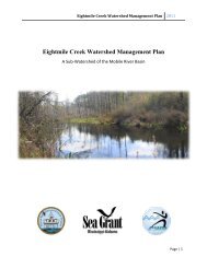
Conserving Alabama's Coastal Habitats - Mobile Bay National ...
Conserving Alabama's Coastal Habitats - Mobile Bay National ...
Conserving Alabama's Coastal Habitats - Mobile Bay National ...
- No tags were found...

Create successful ePaper yourself
Turn your PDF publications into a flip-book with our unique Google optimized e-Paper software.
Perdido RiverThe Perdido River and <strong>Bay</strong> conservation area covers approximately 700,000 acres of land in Baldwin andEscambia Counties in Alabama and Escambia County, Florida. This watershed lies entirely within the East gulfcoastal Plain of the southeastern United States. The Perdido River flows for approximately 60 miles with itsheadwaters between <strong>Bay</strong> Minette and Atmore, Alabama and eventually flows into the Gulf of Mexico at Perdido<strong>Bay</strong>. The Perdido River and <strong>Bay</strong> forms the political boundary between Baldwin County, Alabama and EscambiaCounty, Florida. The land use is mostly forested (85%) with agriculture (13%) also important. Urban/industrialareas make up less than 2 % of the watershed but they are increasing.The Perdido River is a free-flowing coastal blackwater river. Its watershed is home to extensive longleaf pineforests and American white cedar swamps, which are inhabited by several globally imperiled plant species.In addition, Perdido <strong>Bay</strong> provides important habitat for several important species, including the dwarf seahorse,dolphin and bald eagle.This conservation area contains Lillian Swamp, located two miles north of the town of Lillian, AL on the westbank of the Perdido River. Lillian Swamp is bounded to the west by developed land. Lillian Swamp was oncehome to healthy moist pine forests, longleaf and slash pine savannas and associated pitcher plant bogs, bay/tupelo/cypress swamps, as well as freshwater marshes. The moist pine savannas that are found in the PerdidoRiver floodplain are home to numerous endangered and threatened plants. Timber harvesting, fire exclusion, andthe urbanization of the surrounding land have led to the degradation of the original habitat.This conservation area also includes Splinter Hill Bog, located near the town of Rabun in northern BaldwinCounty, AL. Splinter Hill Boy spans portions of the headwaters of Dyas and Bushy Creeks, both tributaries ofthe Perdido River, and contains an extensive longleaf pin savanna/seepage bog complex with interspersed sandhillhabitats. These seepage slopes harbor a very high floral diversity, including grasses, sedges, orchids, yellow-eyedgrasses, bog buttons, meadow butterflies, pitcher plants and daisies.Habitat Strengths/ImportanceThe Perdido River corridor contains the largest population of the imperiled panhandle lily in the world, and theonly population in Alabama of the American chaffseed (listed as threatened under US Endangered Species Act).Splinter Hill Bog has been identified a priority site by the Nature Conservancy because at least 14 rare plantspecies occur there, including high quality occurrences of 8 East Gulf <strong>Coastal</strong> Plain conservation targets. The sitecontains large expanses of intact longleaf pine savanna, herbaceous bog, and associated natural communities,including longleaf pine sandhills, shrub bog and small stream swamp forest. The only examples of seepage slopescurrently afforded some protection occur in Blackwater River State Forest and Eglin Air Force Base, and are notnearly as extensive as those at Splinter Hill.Slash Pine savannas are limited to moist, poorly drained sites, which occasionally occur on ridge crest depressions,but more commonly, along lower slopes and broad flats, at the headwaters of streams, on wet peaty soils andon low terraces of major streams. Moisture determines the dominant pine species with slash replacing longleaf onwetter sites. Scattered loblolly pine may also be present in the canopy. In many instances the soils are nutrient poorand wet. On wetter situations, the pines are stunted and stressed by the wet conditions. Soils of pine flatwoods haverestricted permeability in their subsurface horizons, causing long periods of saturation. Red maple, sweet bay andtulip tree, common as low shrubs and trees in the sub-canopy, occasionally attain a height that reaches into thecanopy. If fire is not frequently prescribed, the shrub layer can become dense and impenetrable, with titi, buckwheattree, gallberries and bayberries. Pitcher plants, St. John’s-wort and numerous grasses often occur on exposed, openpatches where water pools or recent burns have killed shrubs. Frequency of fire determines the height and densityof the shrub layer while soil type appears to influence the presence of buckwheat tree.44