Where Rivers Meet the Sea 3/30/2003 - Mobile Bay National Estuary ...
Where Rivers Meet the Sea 3/30/2003 - Mobile Bay National Estuary ...
Where Rivers Meet the Sea 3/30/2003 - Mobile Bay National Estuary ...
- No tags were found...

Create successful ePaper yourself
Turn your PDF publications into a flip-book with our unique Google optimized e-Paper software.
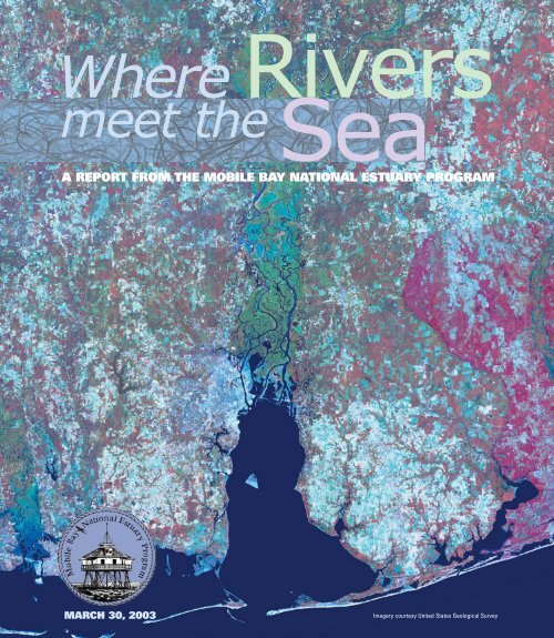
<strong>Rivers</strong><strong>Where</strong>meet <strong>the</strong><strong>Sea</strong>A REPORT FROM THE MOBILE BAY NATIONAL ESTUARY PROGRAMMARCH <strong>30</strong>, <strong>2003</strong>Imagery courtesy United States Geological Survey
<strong>Mobile</strong> <strong>Bay</strong><strong>National</strong> <strong>Estuary</strong> ProgramLee YokelRandy SimsRandy SimsWELCOME<strong>Mobile</strong> <strong>Bay</strong> and <strong>the</strong> <strong>Mobile</strong>-Tensaw River Delta are two ofAlabama’s greatest natural resources. We are truly blessed tolive in such close proximity to <strong>the</strong>m and enjoy <strong>the</strong> benefits<strong>the</strong>y provide. Our estuary is incredibly rich in its diversity ofplant and animal life.In 1995, <strong>Mobile</strong> <strong>Bay</strong> was deemed an estuary of national significanceby <strong>the</strong> Environmental Protection Agency (EPA). A managementconference of diverse interests was convened to create<strong>the</strong> <strong>Mobile</strong> <strong>Bay</strong> <strong>National</strong> <strong>Estuary</strong> Program (<strong>Mobile</strong> <strong>Bay</strong>NEP). The goal of <strong>the</strong> program is to promote <strong>the</strong> wise stewardshipof <strong>the</strong> water quality and living resources of <strong>the</strong> estuary.An environmental plan was developed to promote this goaland was completed in 2002. Today, <strong>the</strong> many members of <strong>the</strong><strong>Mobile</strong> <strong>Bay</strong> NEP work to accomplish <strong>the</strong> tasks outlined in <strong>the</strong>plan. All levels of government, environmental interests,business, researchers and citizens are working toge<strong>the</strong>r.We hope this insert helps introduce you to environmentalstewardship and challenges within <strong>the</strong> <strong>Mobile</strong> estuary. Wehave included information on current and past initiatives tha<strong>the</strong>lp protect our waters and living resources. Our topics are asdiverse as <strong>the</strong> writers who contributed to this document.Indeed, a healthy <strong>Mobile</strong> estuary is dependent upon everyone.<strong>Mobile</strong> <strong>Bay</strong> has a major impact on Alabama’s economy. Someof us depend on it for our livelihood and o<strong>the</strong>rs for recreation.All of us depend on <strong>the</strong> estuary for <strong>the</strong> quality of life and senseof place it provides. The water and living resources of <strong>the</strong><strong>Mobile</strong> <strong>Bay</strong> and Delta are important to us all. These watersand living resources are part of our culture, but <strong>the</strong>y do faceenvironmental challenges and pressures.It has been said we don’t own <strong>the</strong> lands and waters but simplyborrow <strong>the</strong>m from future generations. We must act responsiblyand as good stewards of <strong>the</strong>se precious resources so ourchildren and <strong>the</strong>irs benefit from <strong>the</strong> richness of nature wehave known. I hope you enjoy this insert and you find it useful.David Yeager, Director<strong>Mobile</strong> <strong>Bay</strong> <strong>National</strong> <strong>Estuary</strong> ProgramDauphin Island <strong>Sea</strong> Lab:An Experiment in Science EducationIn 2002, <strong>the</strong> <strong>Mobile</strong> <strong>Bay</strong> NEP was pleased to join <strong>the</strong> CoastalPolicy Center of <strong>the</strong> Dauphin Island <strong>Sea</strong> Lab (DISL). A naturalmatch, <strong>the</strong> Coastal Policy Center assists local, governmentand business interests with comprehensive coastal resourceplanning. Collaborative partnering efforts of <strong>the</strong> <strong>Mobile</strong> <strong>Bay</strong>NEP with <strong>the</strong> community, combined with <strong>the</strong> research and educationof DISL, help to span <strong>the</strong> gaps between science, planning,and concrete projects.DISL celebrated its <strong>30</strong>th anniversary last year, a uniqueexperiment in science education. The 17 founding collegesand universities of Alabama (now 22) established <strong>the</strong> DISL asan educational summer field program for biology and geologymajors. The island location of <strong>the</strong> former Air Force base was anatural to house programs oriented towards <strong>the</strong> marine sciences.The summer program was well subscribed from <strong>the</strong> start, andhas grown to accommodate as many as 1<strong>30</strong> undergraduateand graduate students in each of three sessions. With <strong>the</strong>addition of programs for K-12 and teacher-training, DISL hasbecome <strong>the</strong> largest summer marine educational program in<strong>the</strong> nation. DISL’s most visible teaching tool is <strong>the</strong> Estuarium,a public facility among Alabama’s top twenty attractions.Dr. George CrozierLee YokelFAST FACTS• 1948 – Federal Water Pollution Control Act• 1969 – <strong>National</strong> Environmental Policy Act passed by <strong>the</strong> U.S. Congress• 1970 – Environmental Protection Agency created• 1971 – Dauphin Island <strong>Sea</strong> Lab established• 1972 – U.S. Congress passed <strong>the</strong> Clean Water Act and Coastal Zone Management Act• 1973 – Endangered Species Act passed by U. S. Congress• 1979 – Alabama Coastal Zone Management Act• 1987 – Amendments to <strong>the</strong> Clean Water Act created <strong>National</strong> <strong>Estuary</strong> Program• 1995 – <strong>Mobile</strong> <strong>Bay</strong> <strong>National</strong> <strong>Estuary</strong> Program (<strong>Mobile</strong> <strong>Bay</strong> NEP) established• 2002 – <strong>Mobile</strong> <strong>Bay</strong> NEP Comprehensive Conservation and Management Plan approved2Lee YokelRandy Sims
HISTORY OF COASTAL ZONE MANAGEMENT IN ALABAMALife as we know it has alwaysbeen drawn to water. Over <strong>the</strong> lastcentury, <strong>the</strong>re has been a dramaticexpansion of ocean going commerce,commercial fishing, and offshoreoil and gas exploration,resulting in population growthalong our coasts. Increaseddemands on our coastal resourcesthrough economic developmentactivities have resulted in degradedland and water resources, lossof wildlife habitats, increased pollution,and diminished publicaccess. We have a responsibility toprotect our coastal environment forfuture generations, and to strike anoften difficult balance betweeneconomic growth and protection ofnatural resources.The environmental movement of<strong>the</strong> 1960s drove <strong>the</strong> development ofseveral pieces of landmark legislationthat emerged in 1972, one ofwhich was <strong>the</strong> Coastal ZoneManagement Act. The Act was notstrongly regulatory in its languageand proposed <strong>the</strong> development offederal-state partnerships in whichfederal funds would be made availableto states designing CoastalZone Management (CZM) programsfor <strong>the</strong>ir coastal area thatwere “consistent” with minimumfederal standards. The CZM isadministered at <strong>the</strong> federal levelthrough <strong>the</strong> <strong>National</strong> Oceanic andAtmospheric Administration (NOAA).The state of Alabama entered <strong>the</strong>CZM program in 1979 with <strong>the</strong>development and approval of <strong>the</strong>Alabama Coastal Area ManagementProgram (ACAMP).The ACAMP defined Alabama’scoastal area as <strong>the</strong> upland continuousten-foot contour (ten feetabove mean sea level) seaward to<strong>the</strong> limit of <strong>the</strong> state’s territorialwaters (three miles offshore).Establishment of <strong>the</strong> ten-foot contouras <strong>the</strong> ACAMP managementboundary represents one of <strong>the</strong>first balancing acts of <strong>the</strong> program,as early proposals ranged from aslarge as <strong>the</strong> two county area to assmall as <strong>the</strong> area seaward of <strong>the</strong>mean high tide line.Since its initial adoption in 1979, <strong>the</strong>ACAMP has witnessed an evolutionof governing bodies. Today, <strong>the</strong>duties of administering <strong>the</strong> ACAMPare split between two state agencies.The Alabama Department ofEnvironmental Management haspermitting, regulatory and enforcementauthority for <strong>the</strong> program andhas created a Coastal Programsoffice to fulfill <strong>the</strong>se functions.Administration, education & outreach,planning and overall managementresponsibilities rest with<strong>the</strong> State Lands Division of <strong>the</strong>Alabama Department of Conservationand Natural Resources.The ACAMP consists of comprehensivemanagement policies andguidance for <strong>the</strong> protection andenhancement of <strong>the</strong> quality, quantityand viability of coastal resourcesand <strong>the</strong> management of <strong>the</strong> uses of<strong>the</strong>se resources. The purpose of<strong>the</strong> program is to promote, improveand safeguard <strong>the</strong> lands andwaters located in Alabama’scoastal area through a comprehensiveand cooperative programdesigned to preserve, enhance anddevelop such valuable resourcesfor <strong>the</strong> present and future wellbeingand general welfare of <strong>the</strong>citizens of this state.The ACAMP and <strong>Mobile</strong> <strong>Bay</strong><strong>National</strong> <strong>Estuary</strong> Program go handin-hand.In 2002, ADCNR enteredinto a memorandum of agreementwith <strong>the</strong> <strong>Mobile</strong> <strong>Bay</strong> NEP to serveas <strong>the</strong> state sponsor and championfor <strong>the</strong> NEP. This partnershipensures that <strong>the</strong> two programs willcontinue to work toge<strong>the</strong>r to strike<strong>the</strong> critical balance needed incoastal Alabama.FAST FACTS• <strong>Mobile</strong> <strong>Bay</strong> is a submerged rivervalley about 31 miles long andranging from 10 to 23 miles wide• The <strong>Mobile</strong> estuary is <strong>the</strong> sixthlargest drainage basin in <strong>the</strong>Continental U.S.• Five major rivers empty into<strong>Mobile</strong> <strong>Bay</strong>• The <strong>Bay</strong> and Delta combined are285,000 acres of open water• There are 35 boat ramps thataccess <strong>Mobile</strong> <strong>Bay</strong>• The first <strong>Mobile</strong> <strong>Bay</strong> ship channelwas dredged in 18<strong>30</strong>. The channeltoday is 45 ft. deep and 400 ft. wideOUR RICH SHIP BUILDING HERITAGEMore than one hundred years ago, when Dauphin Island was <strong>the</strong> home portof <strong>Mobile</strong>, a thriving ship-building business owned by <strong>the</strong> Collins family built<strong>the</strong> finest sailing vessels from here to <strong>the</strong> Florida Keys. The <strong>Mobile</strong> Shipyardwas located on Mon Luis Island and built its sleek, wood vessels until 1954.One of <strong>the</strong> reasons for <strong>the</strong> shipyard’s success was <strong>the</strong> standard of work <strong>the</strong>Collins’ put into each vessel. Most of <strong>the</strong> time, <strong>the</strong>y were not able to keep upwith <strong>the</strong> demand. They built everything from pleasure boats to fishing vesselsused to trawl for fish, shrimp and oysters. They even built a 50-footschooner to aid <strong>the</strong> Confederate Army as a blockade runner against <strong>the</strong>Yankees in <strong>Mobile</strong> <strong>Bay</strong> during <strong>the</strong> Civil War. This is just one of <strong>the</strong> manyexamples of <strong>the</strong> richness of <strong>the</strong> <strong>Mobile</strong> <strong>Bay</strong> area, and should serve as areminder that <strong>the</strong> <strong>Bay</strong> needs to be protected to preserve Alabama’s history,and its beautiful environment.Blair BatemanRandy SimsDiana Sturm3
Water QualityWATER QUALITY IN MOBILE BAY?Randy SimsDiana SturmDebbie JonesOne of <strong>the</strong> most commonly asked questions <strong>the</strong> <strong>Mobile</strong><strong>Bay</strong> NEP faces is, “How clean is <strong>the</strong> water in <strong>the</strong> <strong>Mobile</strong><strong>Bay</strong> estuary?” Unfortunately, such a simple question isdifficult to answer.A recently released <strong>National</strong> Coastal Condition Reportassessed <strong>the</strong> overall condition of Gulf of Mexico estuariesas between fair and poor based on seven indicators:water clarity, dissolved oxygen, wetland loss, nutrientenrichment, sediment and fish tissue contamination, anddiversity of bottom communities. In 1998, a report by <strong>the</strong>Alabama Department of Environmental Management(ADEM) rated <strong>the</strong> overall water quality in <strong>Mobile</strong> <strong>Bay</strong> asgood to fair. Assessing water quality is complex anddependent on <strong>the</strong> standards used. It may also be affectedby season among o<strong>the</strong>r factors. Water condition isimpacted not only by regulated industrial discharges(point sources) but by harder to control nonpointsources (see sidebar) Today, ADEM has identified <strong>30</strong>separate stream segments in <strong>Mobile</strong> and BaldwinCounties that are impaired; chiefly due to low oxygen,pathogens and mercury. However Weeks <strong>Bay</strong> is listed asan Outstanding <strong>National</strong> Resource Water and portions of<strong>the</strong> Tensaw River are classed as an OutstandingAlabama Water. The picture is indeed a mixed bag.Historically, water quality was relatively unimpaired duringearly European settlement. An account from a Britishtraveler to <strong>the</strong> area late in <strong>the</strong> 19th century described<strong>Mobile</strong> <strong>Bay</strong>’s “neighboring shores as abounding withimmensely large oysters,” which, out of <strong>the</strong> shell, were“quite commonly as long as a man’s hand!” Becauseoysters are good indicators of a healthy environment, weassume <strong>the</strong> bay’s water quality was still very good.The first “point source pollution” probably emerged with<strong>the</strong> first paper mill located on Three Mile Creek in 1856.<strong>Mobile</strong>’s abundant water supply was recognized <strong>the</strong>n asan acceptable way of disposing of industrial waste. By<strong>the</strong> 1940s, pathogen contamination, presumably fromsewage, was on <strong>the</strong> rise. As late as <strong>the</strong> 1970s, fish killswere common throughout <strong>the</strong> State but declined to onehalfof those values by <strong>the</strong> 1990s. The vast majority ofthose kills were almost certainly attributed to low dissolvedoxygen in <strong>the</strong> water as opposed to chemical toxicity.There is seldom an adequate understanding of <strong>the</strong> factthat <strong>the</strong>re is simply not very much oxygen in water –ever! The “jubilees” of <strong>the</strong> eastern shore are a naturallyoccurring manifestation of oxygen depletion.Dramatic improvements have been made in water qualitysince <strong>the</strong> passage of <strong>the</strong> Clean Water Act in 1970. Initialfederal efforts were aimed at point source dischargerson America’s waterways and creating financial incentivesto municipalities to assist cleaning up domesticsewage and industrial waste. Since <strong>the</strong> requirement topermit point sources, <strong>the</strong> number of permittees in<strong>Mobile</strong> County has risen to over 400, while <strong>the</strong> level ofdischarges has decreased substantially. These effortshave been so successful that today <strong>the</strong> primary threat towater quality is nonpoint source pollution. Land andwater use practices, natural processes, coastal populationincreases, and o<strong>the</strong>r human uses can contributeimpacts larger than those regulated by discharge permits.We can safely say our water quality is not as good as itwas when European settlement began but it is much betterthan it was in <strong>the</strong> 1970’s. We can also safely say that<strong>the</strong>re are areas of particular concern.Our challenge in <strong>the</strong> 21st centuryis to learn how to control<strong>the</strong> difficult issues of humanactivity and habitat alterationdirectly influencing <strong>Mobile</strong> <strong>Bay</strong>water quality.<strong>Mobile</strong> <strong>Bay</strong> NEPFAST FACTS• 1589 – Water closet invented by Sir John Harrington in England but <strong>the</strong> invention was ignored until 1778• 1868 – <strong>Mobile</strong>'s first sewer installed in Conti Street• 1885 – British scientist discovered slow filtration through sand reduces bacteria in drinking water by 98 percent• 1952 – Alabama State legislature enacted "The Enabling Act" empowering municipalities to create entities thatcould acquire, purchase, maintain and operate water systems or any part <strong>the</strong>reof. As a result <strong>the</strong> <strong>Mobile</strong>Board of Water and Sewer Commissioners was created• 1968 – The <strong>Mobile</strong> Area Water and Sewer System was established as we know it today• 1977 – Clean Water Act Amendments• 2002 – Improvements and capital investment in sanitary sewer systems in <strong>Mobile</strong>, Daphne and Fairhope help reduceintroduction of bacteria and pathogens in area waterways. Agreement between <strong>the</strong> <strong>Mobile</strong> Area Water andSewer System and <strong>Mobile</strong> <strong>Bay</strong>Watch resulted in a $60 million dollar upgrade by MAWSS over <strong>the</strong> next five years4 Randy Sims
CLEAN WATER ACTWHO IS MONITORING OUR WATER QUALITY?The condition of <strong>the</strong> water in a certain place – yourswimming pool, your faucet, underground, in <strong>the</strong> riversleading to <strong>the</strong> bay – is measured for healthiness to protecthumans and <strong>the</strong> many species living in our waterways.Just because <strong>the</strong> water looks clear, is it really clean?Many groups and agencies in South Alabama havemade it <strong>the</strong>ir mission to monitor <strong>the</strong> water and educateus on its quality.THE ENVIRONMENTAL PROTECTION AGENCY(www.epa.gov/emap/nca/) is conducting <strong>the</strong> <strong>National</strong>Coastal Assessment, a five-year comprehensive monitoringprogram to survey <strong>the</strong> condition of <strong>the</strong> nation'scoastal resources. Types of data collected include watercolumn parameters, sediment chemistry and toxicity,benthic communities, fish, and tissue contaminants.THE UNITED STATES GEOLOGICAL SURVEY(water.usgs.gov/nawqa/) has a <strong>National</strong> Water QualityAssessment Program to develop long-term, consistentand comparable information on streams, ground water,and aquatic ecosystems. The <strong>Mobile</strong> Basin is a primaryresearch site.ALABAMA DEPARTMENTOF ENVIRONMENTAL MANAGEMENT(www.adem.state.al.us/FieldOps/Monitoring/monitoring.htm)ADEM regulates discharges to state waters and <strong>the</strong>nmonitors waterways throughout <strong>the</strong> <strong>Mobile</strong> <strong>Bay</strong> area.ADEM partners with <strong>the</strong> o<strong>the</strong>r agencies and organizationsto manage <strong>the</strong> collection and integration of data on <strong>the</strong>water column, sediment, bacteria, macro invertebrates,land use data, topographic characteristics, wetlandsand beach monitoring at a number of public recreationalareas. These samples are analyzed for bacteriologicalindicators of potential human pathogens.THE ALABAMA DEPARTMENT OF PUBLIC HEALTH(www.adph.org) issues Fish and Shellfish Advisories to<strong>the</strong> public to understand both <strong>the</strong> benefits and risks ofdifferent types of seafood. Sampling of animals and waterprovides <strong>the</strong> information needed for issuing advisories.THE GEOLOGICAL SURVEY OF ALABAMA(www.gsa.state.al.us/), established in 1848, ga<strong>the</strong>rs dataon a host of scientific parameters, such as shoreline erosion,water well usage, ground-water levels, and surfacewater quality. Three new conductivity sensors, purchasedby <strong>the</strong> <strong>Mobile</strong> <strong>Bay</strong> NEP, monitor wells in Gulf Shores and<strong>the</strong> Fort Morgan Peninsula for saltwater intrusion.THE COASTAL ALABAMA CLEAN WATER PARTNERSHIP(www.ag.auburn.edu/dept/faa/aumerc/Extension/clean_water_partnership/Index.htm) is part of a statewideeffort working on TMDLs (see side bar). Local stakeholdersstrive to identify water quality improvement projectsthrough community participation.THE ALABAMA WATER WATCH(www.alabamawaterwatch.org) is a statewide volunteernetwork promoting citizen-led water quality monitoringprograms and increasing awareness of water resourceconditions and trends. Local monitoring is coordinatedwith <strong>the</strong> following groups:THE ALABAMA COASTAL FOUNDATION(www.alcoastalfoundation.org/) is a nonprofit organizationwith <strong>the</strong> area’s oldest volunteer water monitoring program,Coastwatch. ACF also began monitoring recreationalbeaches in 2002.THE DOG RIVER CLEARWATER REVIVAL(dogriver.southalabama.edu) is a grassroots group concernedwith environmental issues affecting Dog River.One of <strong>the</strong>ir main programs is organizing volunteer waterquality monitoring in <strong>the</strong> Dog River watershed.THE WEEKS BAYNATIONAL ESTUARINE RESEARCH RESERVE(www.weeksbay.org) has two water monitoring stationscontinually collecting data such as water temperature,pH, dissolved oxygen and salinity. Connected to <strong>the</strong>reserve is Weeks <strong>Bay</strong> Water Watch, an active volunteergroup with 34 monitoring sites in <strong>the</strong> Weeks <strong>Bay</strong> watershed.THE MOBILE BAY NEP along with <strong>the</strong> Dauphin Island<strong>Sea</strong> Lab and Weeks <strong>Bay</strong> <strong>National</strong> Estuarine ResearchReserve are establishing long term monitors in <strong>Mobile</strong> <strong>Bay</strong>as part of a multi-state network with Louisiana and Texas.A partnership has formed to study <strong>the</strong> impact caused bydams and <strong>the</strong> Causeway on <strong>the</strong> <strong>Mobile</strong> Tensaw Delta.Water temperature, salinity and dissolved oxygen will bemonitored to determine <strong>the</strong> salinity regime, hydrologicalconditions, and better define habitats for a variety ofspecies. Current partners include ADEM, AlabamaPower, <strong>the</strong> <strong>Mobile</strong> Register, <strong>Mobile</strong> <strong>Bay</strong> Watch, TheNature Conservancy and <strong>the</strong> Scenic CausewayCoalition. More partners are needed.Industry, businesses, and municipalities are required tomonitor discharges and public water supplies. Thisinformation is reported to ADEM on a regular basis.<strong>Mobile</strong> <strong>Bay</strong> Watch, <strong>the</strong> Dauphin Island <strong>Sea</strong> Lab, <strong>Mobile</strong><strong>Bay</strong> NEP, and <strong>the</strong> Coastal Alabama Clean WaterPartnership are developing internet accessible databasesto house research, monitoring information, industry data,and more.Diana Sturm, PhD, Program Scientist <strong>Mobile</strong> <strong>Bay</strong> NEPThe Clean Water Act (CWA) addresses pollution in waters of <strong>the</strong> United States through various grants, planning, voluntaryand regulatory programs. The Act envisions a cooperative effort between States and <strong>the</strong> federal government to assure <strong>the</strong>waters of <strong>the</strong> United States support fishing and swimming uses. An important part of <strong>the</strong> CWA is <strong>the</strong> wastewater dischargepermitting program. Technology based treatment levels form <strong>the</strong> basic permit requirements, set for existing and new dischargers.Greater levels of treatment are required where basic levels are insufficient to meet water quality standards. TheAct largely uses voluntary, grant and loan programs to address nonpoint sources of pollution. Use of technology based bestmanagement practices is envisioned for nonpoint pollution.An important new thrust in implementing <strong>the</strong> Clean Water Act is <strong>the</strong> requirement for states or EPA to develop total maximumdaily loads for streams. (TMDLs, see sidebar). Recent court decisions have required EPA and States to focus great attentionon developing <strong>the</strong>se TMDLs.The CWA also created <strong>the</strong> 404 wetlands program. Persons wishing to fill wetlands must obtain a permit and meet establishedcriteria. The Corps of Engineers issues permits and EPA oversees <strong>the</strong> program.Randy SimsTMDLTHE EPA DEFINES A TOTALMAXIMUM DAILY LOAD(TMDL) as, “a calculation of <strong>the</strong>maximum amount of a pollutantthat a water body can receiveand still meet water quality standards.”Water quality standardsfor Alabama are set by ADEM.They classify water bodiesaccording to use (such as publicwater supply, recreation, andOutstanding Alabama Waters.)ADEM also sets scientific criteriato ensure <strong>the</strong> water quality willcontinue to support that use.The TMDL program is designedto be locally driven by citizensand businesses. The programfollows a four-step process toclean up water quality. First,Alabama must develop a waterquality standard for all bodies ofwater from streams to rivers tolakes. Second, <strong>the</strong> State determineswhat bodies of water arenot meeting <strong>the</strong>se standards forwater quality. Third, <strong>the</strong>se waterbodies are prioritized. The Stateof Alabama, at <strong>the</strong> forefront, isnow working with local citizens,communities and industries todetermine <strong>the</strong> actions requiredfor healthy waters.NONPOINTSOURCE POLLUTIONNonpoint source pollution cannotbe traced back to a single pointlocation. Water running across<strong>the</strong> ground picks up pollutantsfrom natural processes andhuman activity. Material maycome from households, marinas,agricultural lands, industrialsites, paved surfaces, or timberoperations. The water carryingvarious pollutants eventuallymakes its way to streams, riversand <strong>the</strong> <strong>Bay</strong>. Up to 50% of <strong>the</strong>water pollution in <strong>the</strong> UnitedStates comes from nonpointsource pollution. Controlling nonpointsource pollution is one of<strong>the</strong> last remaining hurdles torestoring water quality in manyimpaired bodies of water. Theunique aspect of nonpointsource pollution is that everyonecontributes to it.5
Habitat ManagementTHIS PLACE IS FOR THE BIRDS!The <strong>Mobile</strong> <strong>Bay</strong> NEP area is critical habitat to manyNorth American songbirds because it lies between <strong>the</strong>two major flyways of North America, <strong>the</strong> MississippiRiver and Atlantic Ocean. Dr. Frank Moore, ornithologistat <strong>the</strong> University of Sou<strong>the</strong>rn Mississippi, has recentlypointed out that <strong>the</strong> major river basins (Mississippi and<strong>Mobile</strong>-Tensaw) serve as a natural funnel for songbirdmigration, providing stopover habitat, and a source forinitial re-nourishment after crossing <strong>the</strong> Gulf of Mexico.The estuary also serves as critical habitat for colonialnesting birds. Many local specialists have identified lossof avian nesting habitat as a matter of some concern.As <strong>the</strong> human population has grown along <strong>the</strong> Gulf ofMexico shoreline within South Alabama, <strong>the</strong> increase ofsingle and multi-family dwellings has resulted in <strong>the</strong> lossof trees and low shrubs that support <strong>the</strong> first landfall for<strong>the</strong> northward migrating songbirds. Colonial nestingbirds, especially <strong>the</strong> wading birds, are good indicators of<strong>the</strong> quality of a habitat. These birds require extensivesaltwater and freshwater marsh habitat. Industrial andprivate development within <strong>the</strong> coastal area has causedhabitat loss over <strong>the</strong> past twenty years. This is particularlycritical along <strong>the</strong> <strong>Mobile</strong> and Baldwin County shorelines,specifically Dauphin Island and <strong>the</strong> Fort MorganPeninsula. Numerous groups including The Friends of<strong>the</strong> Dauphin Island Audubon Sanctuary, <strong>the</strong> NatureConservancy, Bon Secour <strong>National</strong> Wildlife Refuge, and<strong>the</strong> Weeks <strong>Bay</strong> Estuarine Reserve have helped in <strong>the</strong>procurement of land to be set-aside in its natural statefor <strong>the</strong>se trans-Gulf migrants and colonial nesting birds.Critical wetland habitat has been added to <strong>the</strong> holdingsover <strong>the</strong> past two years. The <strong>Mobile</strong> <strong>Bay</strong> NEP has alsofunded an experimental enhancement of habitat onDauphin Island in conjunction with <strong>the</strong> AuburnUniversity Shellfish Laboratory and DISL.Historically, Cat Island, located near <strong>Bay</strong>ou la Batre, hassupported a nesting colony of herons and egrets (average2500 adult birds). This island has been <strong>the</strong> site of <strong>the</strong> onlyTri-color Heron and Reddish Egret nesting within <strong>the</strong>state of Alabama. During Hurricanes Frederic and Elena<strong>the</strong> vegetation that supports <strong>the</strong> nesting colony wasreduced, but during Hurricane Georges in 1998 <strong>the</strong> nestingvegetation on Cat Island was almost totally removed bywave activity and overwash. This resulted in only a coupleof hundred adult birds nesting <strong>the</strong> following year, a dramaticand alarming decline.Through a grant from <strong>the</strong> <strong>National</strong> Fish and WildlifeFoundation to DISL, <strong>the</strong> vegetation on Cat Island hasbeen restored. In a unique effort, cuttings were obtainedfrom <strong>the</strong> vegetation remaining on <strong>the</strong> island, grown in acommercial nursery, and <strong>the</strong>n returned to <strong>the</strong> Island.Over two separate occasions, landscape architecturestudents from Auburn University participated in <strong>the</strong>restoration project. In 2002, approximately 1500 adult heronsand egrets returned to establish nests on <strong>the</strong> Island.There have been o<strong>the</strong>r significant changes in <strong>the</strong> <strong>Mobile</strong><strong>Bay</strong> NEP area that have enhanced avian habitats.Gaillard Island, a U.S. Army Corps of Engineers dredgedmaterial disposal site, is <strong>the</strong> only nesting site of <strong>the</strong>Brown Pelican in Alabama. It also supports nesting ofherons, egrets, and a multitude of gulls and terns. Thenesting population of Brown Pelicans is truly one of <strong>the</strong>amazing stories of species recovery.The Alabama Department of Conservation and NaturalResources (ADCNR), State Lands Division recently purchasedover 40,000 acres of <strong>Mobile</strong>-Tensaw delta, whichadded to <strong>the</strong>ir o<strong>the</strong>r delta holdings, bringing <strong>the</strong> total toroughly 100,000 acres. Ano<strong>the</strong>r major habitat acquisitionwas <strong>the</strong> 2,<strong>30</strong>0-acre tract in <strong>the</strong> Grand <strong>Bay</strong> savannah.Setting this habitat aside via Forever Wild and WildlifeManagement Area programs guarantees long-term criticalhabitat for <strong>the</strong> abundant avian fauna found in <strong>the</strong><strong>Mobile</strong> estuary.Dr. John Dindo, Senior Marine ScientistDauphin Island <strong>Sea</strong> LabRandy SimsFAST FACTS• 1773 – American naturalist William Bartram sets out on a five year journey through <strong>the</strong> US Sou<strong>the</strong>ast to describe wildlife andwilderness from Florida to <strong>the</strong> Mississippi• 1874 – Othmar Zeider discovered <strong>the</strong> chemical formula for <strong>the</strong> insecticide DDT• 1903 – President Theodore Roosevelt created first <strong>National</strong> Bird Preserve, (<strong>the</strong> beginning of <strong>the</strong> Wildlife Refuge system), onPelican Island, Florida• 1907 – Alabama legislature established <strong>the</strong> Department of Game and Fish, predecessor of ADCNR• 1979 – Gaillard Island created as a dredged material disposal area• 1980 – Bon Secour <strong>National</strong> Wildlife Refuge established• 1982 – First Brown Pelican nesting in Alabama on Gaillard Island• 1986 – Weeks <strong>Bay</strong> <strong>National</strong> Estuarine Research Reserve established• 1996 – ADCNR purchased 2736 acres to form <strong>the</strong> Grand <strong>Bay</strong> Savannah Nature Preserve• 1999 – Collectively Forever Wild, U.S. Fish and Wildlife Service, U.S. Army Corps of Engineers, Ducks Unlimited, The NatureConservancy, Alabama Wildlife Federation, Coastal Land Trust and o<strong>the</strong>rs begin preservation of, to date, over 100,000acres of land in <strong>Mobile</strong>-Tensaw Delta• 2001 – Gulf State Park expanded to preserve 591 acres of Orange Beach Maritime Forest• 2002 – Alabama Coastal Birding Trail is established in <strong>Mobile</strong> and Baldwin Counties• <strong>2003</strong> – Bartram Canoe Trail is established in <strong>the</strong> <strong>Mobile</strong>-Tensaw Delta6Randy Sims
Randy SimsA HOME TO MANY – DELTA DIVERSITYDiana SturmWhile every state has witnessedspecies extinctions, such losses havenot occurred uniformly across <strong>the</strong>nation. States exhibiting high numbersof extinctions tend to boast highoverall numbers of species, fragileecosystems with at-risk flora andfauna and intense human impact.Unfortunately for Alabama, all three of<strong>the</strong>se scenarios apply. According todata collected by <strong>the</strong> nation’s NaturalHeritage programs and The NatureConservancy, Alabama is <strong>the</strong> mostextinction-prone state of <strong>the</strong> mainlandUnited States, with 96 extinct species(83% of which are aquatic). Becauseof its ancient, complex geologicalterrain and waterways that span fourriver basins, Alabama is home to morespecies of animals and plants thanany state east of <strong>the</strong> Mississippi River.An estimated 15% of <strong>the</strong>se speciesare in peril due to human alteration of<strong>the</strong> landscape.The <strong>Mobile</strong>-Tensaw Delta extendsnorthward from <strong>Mobile</strong> <strong>Bay</strong> to <strong>the</strong>confluence of <strong>the</strong> Alabama andTombigbee <strong>Rivers</strong>, encompassingapproximately 250,000 acres. Thiswatershed is considered by many tobe <strong>the</strong> "best" remaining delta ecosystemof its kind in <strong>the</strong> country and is <strong>the</strong>second largest delta in <strong>the</strong> continentalU.S. It provides habitat for variousinvertebrates, fishes, waterfowl,migrant birds, as well as, o<strong>the</strong>r gameand non-game species.The biodiversity is rich. Historically,over a hundred species foundnowhere else in <strong>the</strong> world lived in <strong>the</strong>drainage basin. Because <strong>the</strong> Delta isa melting pot of freshwater andmarine ecosystems, it supports aphenomenal diversity of at least 126fish species, 40 species of mammals,69 reptiles, <strong>30</strong> amphibians, and anuntold host of insects. The plant life isequally diverse to include ancientpygmy cypress, swamp tupelos, bottomlandhardwoods and beautifulswamp lilies. Sightings of formerlyrare species such as eagles, ospreys,and brown pelicans have becomecommonplace. The delta is alsoattractive to aliens, ecologicallydestructive exotic species such asnutria, feral hogs, and fire ants.Despite this knowledge and <strong>the</strong> obviousimportance of <strong>the</strong> Delta as a naturalfilter, sedimentation trap, and habitatfor rare plant and animal communities,we know very little about <strong>the</strong> biodiversitythat defines this uniqueecosystem. Algae and aquatic plantsare ecologically important as <strong>the</strong>ysupport <strong>the</strong> entire food web and areoften sensitive indicators of ecosystemchange. Because algae and aquaticplants respond rapidly to a wide rangeof environmental stressors (such aschange in water quality, temperature,and salt concentration), <strong>the</strong>y representlargely ignored warning signals ofhabitat deterioration and change.Over <strong>the</strong> last decade, scientists havebecome increasingly aware of <strong>the</strong>negative effects human activitieshave had on aquatic, estuarine, andcoastal ecosystems. Some tell-talesigns of impact include declining biodiversity,occurrence and persistenceof harmful algal blooms, disappearanceand dying-off of critical habitat(seagrass beds) and accumulation oftoxic substances in <strong>the</strong> food chain. The<strong>Mobile</strong> Delta, and o<strong>the</strong>r watershedslike it, have been impinged upon andplagued by nutrient input from sewage,industrialization and human development.In Alabama alone, an estimated3.7 million acres of historic wetlandshave been destroyed, predominantly,around <strong>the</strong> coastal areas of <strong>the</strong> state.Heightened awareness among scientists,politicians and concerned citizenshas prompted recent efforts to conserveand protect <strong>the</strong> <strong>Mobile</strong>-TensawDelta. However, with <strong>the</strong> exception ofharmful phytoplankton blooms andseagrasses, very little attention hasbeen paid to algal and aquatic plantassemblages in this region.Researchers Kelly and Clinton Majorat <strong>the</strong> University of South Alabamaare beginning a project to determinealgal and aquatic plant diversity within<strong>the</strong> <strong>Mobile</strong>-Tensaw Delta. They aretaking note of native, invasive andrare species that may affect <strong>the</strong> area’sproductivity. They hope to identifyspecies that are sensitive to environmentalstress and <strong>the</strong>n apply <strong>the</strong>information toward long-term monitoring,management and preservationof coastal regions and <strong>the</strong> speciesthat inhabit <strong>the</strong>m. The <strong>Mobile</strong> <strong>Bay</strong>NEP hopes that information collectedby <strong>the</strong>se researchers and o<strong>the</strong>rs willultimately support wise policy decisionsin <strong>the</strong> future. To learn more about thisproject and o<strong>the</strong>rs funded by fundedby <strong>the</strong> Alabama Center for EstuarineStudies log on to www.southalabama.edu/aces/.Kelly M. Major and Clinton S. Major,Department of Biological Sciences,University of South AlabamaDiana Sturm<strong>Mobile</strong> <strong>Bay</strong> NEPFAST FACTS• Weeks <strong>Bay</strong> <strong>National</strong> Estuarine Research Reserve comprises over 6,000 acres of protected areas (1800 land 4200water bottoms) some <strong>30</strong>00 of which were added in <strong>the</strong> last ten years• The <strong>Mobile</strong> <strong>Bay</strong> NEP, in cooperation with <strong>the</strong> ADEM Coastal Program, has undertaken major habitat mappingprojects of grass beds and wetlands in <strong>the</strong> <strong>Mobile</strong> <strong>Bay</strong> area• Over <strong>30</strong>0 species of birds have been recorded at <strong>the</strong> 160-acre Audubon Bird Sanctuary on <strong>the</strong> south side ofBienville Boulevard on Dauphin Island• The U.S. Fish and Wildlife Service has used recycled Christmas trees to promote shoreline and habitat stabilization.Keep <strong>Mobile</strong> Beautiful and Baldwin County recycle Christmas trees for mulch• Coastal wetlands help protect inland areas by absorbing <strong>the</strong> surge of large storms. All wetlands help protectadjacent properties by absorbing flood waters and heavy rainfall• Habitat fragmentation and destruction is a primary contributor to species decline and water quality degradationRandy Sims7
EcoKidsUPCOMING EVENTSApril 5 Dauphin Island <strong>Sea</strong> Lab Discovery DayApril 13 Alabama Environmental Council <strong>Bay</strong> AreaEarth Day Fairhope Pier Park157ECO CROSSWORDAcross:1. An estuary is called a _____ to <strong>the</strong> ocean because baby shrimp, crabs and fish live <strong>the</strong>re.2. A place like <strong>Mobile</strong> <strong>Bay</strong>, where rivers meet <strong>the</strong> sea, is called an _____.3. Shrimp boats have large ______ called trawls, which <strong>the</strong>y use to catch shrimp.4. Tiny plants and animals that live in <strong>the</strong> waters of estuaries and are food for larger animals are called _____.5. Many _____ bring thousands of gallons of freshwater into <strong>Mobile</strong> <strong>Bay</strong> each day.6. If you go _____ in <strong>the</strong> bay you might be lucky enough to catch a flounder, redfish or speckled trout.7. These crabs “fiddle around” in <strong>the</strong> salt marsh. The male crab has a giant claw that he waves to attract female crabs.8. Wetlands _____ <strong>the</strong> water that runs into <strong>the</strong> bay.9. Freshwater and saltwater combine in <strong>the</strong> bay to make _____water.Down:1. Saltwater enters <strong>Mobile</strong> <strong>Bay</strong> from <strong>the</strong> ______.2. These “large” birds wade through <strong>the</strong> water and spear fish with <strong>the</strong>ir long beaks.3. These animals live in a “bed” and filter many gallons of water through <strong>the</strong>ir bodies each day.4. A type of grassy wetland that provides food and shelter for animals of <strong>the</strong> estuary.8Diana Sturm1 383922 46April 23 Alabama Coastal Foundation Coastal Kids QuizMay 3 <strong>Mobile</strong> County Public Schools EnvironmentalStudies Center Open House4CHOOSE FROM:estuarynurserybrackishsalt marshplanktonriverscleanoystersnetsfiddler crabsGreat Blue HeronfishingGulf of MexicoCHECK OUT THESE WEBSITESDauphin Island <strong>Sea</strong> Labwww.disl.orgProject Catewww.projectcate.com<strong>Mobile</strong> County Environmental Studies Centerwww.mcpss.com/enviro/enveddep.htmlFairhope K-1 Center Pelican’s Nestwww.fairhopeschools.com/K1%20Center/HomePage/k1_home.htmGulf Coast Exploreumwww.exploreum.net/Bellingrath Gardens & Homewww.bellingrath.org/Bon Secour <strong>National</strong> Wildlife Refuge, Gulf Shoressou<strong>the</strong>ast.fws.gov/pubs/facts/boncon.pdfTurtle Point Science Centerdgonza365.tripod.com/turtlepointSC/index.htmlHigh School Aquaculturewww.ag.auburn.edu/dept/faa/aumerc/Extension/Aquaculture/index.htmlAlabama Environmental Education Resource Databasewww.alenviroed.com/Legacy, Partners for Environmental Progresswww.legacyenved.org/Discovering Alabamawww.discoveringalabama.com/Alabama Wildlife Federationwww.alawild.org/educati.htmEnvironmental Education Association of Alabamawww.aces.edu/eeaa/Auntie Litterwww.auntielitter.org/Alabama 4-H Foundation, Incwww.alabama4hfoundation.org/environmental.htmlAlabama Environmental Education and Nature Centerswww.epa.gov/region4/water/wetlands/states/alcenters.htmlAlabama Museum Of Natural History, Tuscaloosawww.ua.edu/academic/museums/history/Alabama State Parkswww.dcnr.state.al.us/parks/parks_1a.html<strong>National</strong> Institutes of Health Dept. of Health & Human Serviceswww.niehs.nih.gov/kids/home.htmEnvironmental Explorers Clubwww.epa.gov/kids/Environmental Education for Kidswww.dnr.state.wi.us/org/caer/ce/eek/Environmental Kidzwww.environmentalpartners.org/Environmentalkids.htmlEnvironmental History Timelinewww.environmentalhistory.orgThe Globe Programwww.globe.gov/globe_flash.htmlKids Do Ecologywww.nceas.ucsb.edu/nceas-web/kids/index.html<strong>National</strong> Wildlife Federation Kidzonewww.nwf.org/kids/The Watershed Gamewww.bellmuseum.org/mnideals/watershed/watershed2.htmlNonpoint Source Kids Pagewww.epa.gov/OWOW/NPS/kids/The Learning Webwww.usgs.gov/education/NATURE Puzzles and Funwww.pbs.org/wnet/nature/fun.htmlUSGS Water Science for Schoolsga.water.usgs.gov/edu/index.htmlProject Wildwww.projectwild.org/Project Wetwww.projectwet.org/Project Learning Treewww.plt.org/The Green Frog News<strong>the</strong>greenfrognews.com/Science at NASAscience.nasa.gov/Discovery Kidskids.discovery.com/Earth911www.earth911.org/master.asp<strong>National</strong> Geographic Kidswww.nationalgeographic.com/kids/Backyard Junglewww.backyardjungle.org/MOBILE BAYNATIONAL ESTUARYPROGRAM4172 Commanders Drive<strong>Mobile</strong>, AL 36615March <strong>30</strong>, <strong>2003</strong>
We started coloring <strong>the</strong>se special wetland wild flowers for you. You can use crayons or colored pencils to create your own floral masterpiece.
Living ResourcesALABAMA’S SHRIMP: FROM PLANKTON TO PLATEShrimp are <strong>the</strong> most importantfishery in <strong>the</strong> Gulf of Mexico and,historically, have ranked second invalue in <strong>the</strong> US domestic fisherymarket. While only a few residentsof our area shrimp for a living, <strong>the</strong>local economy relies heavily onprocessing and wholesale/retailmarketing. Three species dominate<strong>the</strong> Gulf commercial harvest;brown, white and pink shrimp. InAlabama, brown shrimp accountfor approximately 80% of all shrimpcaught while white shrimp comprise18% and pink shrimp <strong>the</strong>remaining 2%.Life HistoryThe overall life cycle is one of adultshrimp spawning offshore followed bya migration of larval forms into <strong>the</strong>estuaries where <strong>the</strong>y grow andmature. The rates of growth and migrationvary among <strong>the</strong> three species.Brown shrimp live for approximatelyone year. At seven months of age,brown shrimp begin to spawn offshore.Young post-larvae enter <strong>the</strong>estuary beginning in March, anddevelop utilizing marsh edges andseagrass to hide from predatorswhile feeding on available planktonor decaying material. In <strong>the</strong> richestuary, post-larvae grow rapidly,approximately 0.02 inch/day. Whenshrimp range from 3 - 4 inches long(131 to 58 count) <strong>the</strong>y begin <strong>the</strong>irjourney offshore. Adult brown shrimpprefer saltier water and will migrateabout 20 miles offshore to spawn,completing <strong>the</strong>ir life cycle.White shrimp have a similar life historybut differences include <strong>the</strong>ir1 1/2 year life span. Large numbersof post-larval white shrimp begin toappear in local estuaries in June.Some adult white shrimp even remainin <strong>the</strong> estuary and spawn. Becausepink shrimp are less abundant inAlabama, post-larvae are less commonbut begin to enter <strong>the</strong> estuary in April.Environmental FactorsWhile predation is a major cause ofdeath in shrimp, environmental factorssuch as temperature and salinityplay a large role in <strong>the</strong> success of<strong>the</strong> annual shrimp crop. The whiteshrimp spawning period is from Aprilthrough August, while brown andpink shrimp spawn year-round.Brown shrimp have two seasonalpeaks of spawning activity, (Augustthrough November and Aprilthrough June) while pink shrimphave a peak in <strong>the</strong> summer.Brown shrimp post-larvae appear inmarsh areas once temperaturesreach 68° F, usually March. Scientistsbelieve that offshore post-larvaeshrimp are able to “sense”<strong>the</strong> temperaturechange and utilize <strong>the</strong>irability to move up and down <strong>the</strong>water column to allow ocean currentsto carry <strong>the</strong>m into <strong>the</strong> estuary.These adaptations permit brownshrimp to take advantage of latespring and early summer watertemperatures to optimize survival.White shrimp prefer warmer temperaturesthan brown shrimp andwill spawn later to maximize <strong>the</strong>irgrowth during <strong>the</strong> summer. Pinkshrimp also prefer warmer watersthan brown shrimp. Their limitedability to handle cold temperaturesand <strong>the</strong>ir preference for hard, sandybottoms is important to understandingwhy large numbers are caughtoff Florida, but far fewer are caughtin Alabama.Salinity preferences vary amongshrimp species. As offshore larvae,brown and pink shrimp prefer saltywater. Shrimp settling into marshesare not so choosy and mayencounter a range of salinities asfreshwater and saltwater mix,depending on river discharge, rainor drought conditions in <strong>the</strong> estuary.As <strong>the</strong> shrimp age, <strong>the</strong>ir preferencefor saltier water increases and triggers<strong>the</strong>m to move back to <strong>the</strong> Gulf.White shrimp can tolerate broadersalinity ranges throughout <strong>the</strong>ir lifethan brown shrimp but, in general,prefer less salty water than anyo<strong>the</strong>r commercial shrimp and maybe found far<strong>the</strong>r up <strong>the</strong> <strong>Bay</strong>.ManagementShrimp management in Alabama isbased on <strong>the</strong> 68-count law. Thisrequires that <strong>the</strong> Alabama MarineResources Division (AMRD) prohibitshrimping in waters where shrimpare smaller than 68 whole shrimp toone pound. Given <strong>the</strong> variety ofcounts that can be collected at differentsites, effective managementrequires an average legal count beobtained on a regional basis.To open waters to shrimping, biologistssample throughout <strong>the</strong> latespring. These data are used to createa growth curve. Like most animals,younger shrimp grow more quicklythan older ones resulting in a growthpattern that begins rapidly <strong>the</strong>ndecreases in a curve. The regularityof <strong>the</strong>ir growth is predictable andactual sample data factors in anywea<strong>the</strong>r-induced changes, competition,or food supply. Using <strong>the</strong>growth curve, <strong>the</strong> number of daysuntil shrimp become 68 count is predicted.Initially, <strong>the</strong> day predicted forlegal-sized shrimp is fairly rough butwith each additional sample, <strong>the</strong>prediction for opening day is finetuned.This method allows AMRD toannounce <strong>the</strong> initial brown shrimpopening, usually June, between oneand two weeks in advance.Unlike farmers, shrimpers areunable to enhance <strong>the</strong>ir crop. Thereis no magical fertilizer or irrigationscheme that will improve Mo<strong>the</strong>rNature’s bounty. Experienced shrimpfishermen prepare for all types ofseasons. It is <strong>the</strong> responsibility ofbiologists to follow accurately <strong>the</strong>shrimp season to permit <strong>the</strong> mosteffective harvesting of <strong>the</strong> resource.Leslie D. Hartman, Marine Biologist II,Alabama Marine Resources Division10 Jason McAllister
THE HISTORY OF HARVESTING BLUE CRABSFAST FACTSWhen you dig into a plate of crab claws at your favoriterestaurant, you are eating <strong>the</strong> blue crab Callinectessapidus. Each year, Alabama's blue crab fishermen catchapproximately 3.1 million pounds of crabs. AlthoughAlabama ranks fourth among Gulf Coast states in poundsof crabs landed, Alabama crab shops import andprocess an estimated 60% of <strong>the</strong> Gulf of Mexico bluecrab catch. This level of processing has made crabs <strong>the</strong>third most valued marine fishery in Alabama.As early as prehistoric times, blue crabs were harvestedfor subsistence living. Evidence suggests NativeAmericans used spears to gig blue crabs in shallowwater and may also have used simple traps. During colonialtimes, some settlers survived only because of <strong>the</strong>irability to catch blue crabs. As early as 1850, recordsexist that indicate a market for soft-shelled crabs on <strong>the</strong>East Coast of America.In 1870 L. Cooper Dize patented <strong>the</strong> first toothless dredgefor taking peelers or soft-shelled blue crabs. During thisperiod, fishermen wading with scoop nets or seines harvestedhard-shelled crabs. Gulf crab fishermen wouldwade out at night with a long-handled dip net and alantern, towing a skiff or burlap sack to hold <strong>the</strong>ir catch.Some fishermen would use a drop net - a metal framecovered with netting with bait attached in <strong>the</strong> middle.This device would be lowered to <strong>the</strong> bottom to attractcrabs to <strong>the</strong> bait. You can often see some recreationalcrab fishermen still using this today.The 1870s saw <strong>the</strong> evolution of <strong>the</strong> commercial crabbingindustry. Railroads permitted rapid shipping of hardcrabs away from <strong>the</strong> coast. The McMenamin Companyof Hampton canned <strong>the</strong> first crabmeat, and wooden rowboatswith fishing trotlines replaced seines and scoopnets as a means of catching crabs. A trotline is a longmain line with short lines, called snoods, baited andspaced approximately two feet apart. Upon setting <strong>the</strong>line, <strong>the</strong> fisherman would pull his skiff downwind along<strong>the</strong> line and dip out feeding crabs. With <strong>the</strong> availability in<strong>the</strong> early 1900s of motor boats, <strong>the</strong> use of <strong>the</strong> snoods waseliminated and <strong>the</strong> bait tied directly to <strong>the</strong> main line.While trotlines remained <strong>the</strong> standard harvestingmethod in <strong>the</strong> Gulf into <strong>the</strong> 1950s, Benjamin F. Lewispatented <strong>the</strong> first crab trap as early as 1926. With minimalmodifications, this trap resembled those currently inuse. Traps are currently constructed of vinyl-coveredhexagonal mesh, box-shaped with several funnelshapedentrances that force crabs to turn sideways toenter. The narrowness of <strong>the</strong> end of <strong>the</strong> funnel prevents<strong>the</strong>m from exiting easily. Blue crabs are enticed to enter<strong>the</strong> trap by <strong>the</strong> presence of bait, typically pogy.Currently 98-99% of all crabs caught come from crabtraps, with <strong>the</strong> remaining 1-2% caught in shrimp trawls.Even today, <strong>the</strong> crabbing industry continues to change.Crabbing has long been a part of <strong>the</strong> human culture. As<strong>the</strong> human population has grown, <strong>the</strong> industry haschanged to become more efficient. This efficiency, whilea boon to crab fishermen, must always be balanced by<strong>the</strong> need to sustain a viable blue crab population.Management of <strong>the</strong> crab industry is a must for sustainingblue crab harvest.• 1640 – Isaac Walton wrote TheCompleat Angler about fishing andconservation• 1783 – U.S. diplomats made fishingrights in waters off Newfoundland ahigh priority in negotiations overindependence from Britain• 1871 – U.S. Fish Commission formedto study decline of coastal fisheries• 2001 – Oyster Gardening began, asuccessful partnership of <strong>the</strong> <strong>Mobile</strong><strong>Bay</strong> NEP Auburn Marine Extensionand Research Center and <strong>the</strong> MS-AL<strong>Sea</strong> Grant• 2002 – The AMRD supported by <strong>the</strong><strong>Mobile</strong> <strong>Bay</strong> NEP developed a derelictcrab trap recovery program. Manyorganizations and volunteers makethis a success• The seafood industry in Alabamagenerates $350 million dollars a yearat <strong>the</strong> wholesale level• The presence of exotic and invasivespecies such as <strong>the</strong> Australian JellyFish has provided interest in developingplans to deal with aquatic nuisancespecies. Many organizations areworking to identify <strong>the</strong> presence ofnuisance species, develop plans toprevent introduction and study waysto mitigate nuisance species impactCOSTS • THEN & NOW1883 soft shell crabs 1¢ each,10¢ per dzhard crabs 1¢ dz,10¢ per bushel1918 soft shell crabs <strong>30</strong>¢ - 80¢ per dzhard crabs $1- $ 6 per barrel2002 soft shell crabs $2.50 - $3.00 each$24.00 per dzhard crabs $8.50 per dzTHE LIFE CYCLE OF A BLUE CRABRanging from Nova Scotia to Argentina, <strong>the</strong> blue crab reliesheavily on estuaries to complete its life cycle. This fresh/saltymix of water in estuaries creates an environment high in nutrientsand extremely suitable for growth of many marinespecies. Estuarine marsh and grass beds provide extensiveareas for blue crabs to hide from predators and remain safeduring molting.A molting crab is one that has shed its external skeleton and issoft to <strong>the</strong> touch. Male crabs molt throughout <strong>the</strong>ir life. Afemale crab will molt several times but, at sexual maturity, shewill have a final molt. Through pheromones in <strong>the</strong> water, a malecan sense a female is about to shed. He will actively pursueher and will cradle her as she begins to molt. While she is soft,he will transfer a packet of spermatophores to her and continueto carry her until she hardens. This is <strong>the</strong> female's only mating,although she may have multiple spawnings from this singleencounter.Development from zoeal to first crab stage takes approximately40 to 70 days. With luck, food, and shelter available in <strong>the</strong>estuary, a blue crab will molt until it reaches sexual maturity,usually within one year.Leslie D. Hartman, Marine Biologist IIAlabama Marine Resources DivisionLee Yokel<strong>Mobile</strong> <strong>Bay</strong> NEP11
ErosionDOG RIVER – A CLASSIC EROSION PROBLEMConfluence of Moore Creek and Dog RiverPhoto courtesy of dogriver.southalabama.eduOld-timers tell storiesof a pristine Dog Riverwith white sandbarsand deep reddish coloredwater. After a rain,modern day Dog Riverresembles chocolatemilk sprinkled withfloating trash andladen with invisiblebacteria. The recentdredging of a portionof <strong>the</strong> river to removeaccumulated sedimentfrom <strong>the</strong> river hasbeen a costly and controversial project. What happenedto <strong>Mobile</strong>’s river? To answer this question we mustunderstand how a river works, and how <strong>Mobile</strong>’s developmentaffects those natural processes.All of <strong>the</strong> water in a river comes from its watershed, <strong>the</strong>land area that it drains. In <strong>the</strong> case of Dog River, <strong>the</strong>watershed is about 95 square miles. The upper parts of ariver are small streams fed by groundwater and runofffrom <strong>the</strong> land’s surface. Whenever it rains, some waterseeps into <strong>the</strong> ground to become part of <strong>the</strong> water table,and some runs off into <strong>the</strong> tributaries. Abundant vegetationforces runoff water to move more slowly, so more waterseeps into <strong>the</strong> ground. Naturally vegetated areas likewetlands act like huge sponges that soak up waterquickly and release it slowly over time. Vegetation alsohelps to clean water by filtering out sediment, trash, andremoving chemicals like fertilizers. Large intact wetlandsare valuable, but wetland strips along <strong>the</strong> sides ofstreams are also important.Wragg Swamp, a huge bottomland hardwood forest,historically absorbed <strong>the</strong> flow from tributaries and <strong>the</strong>nreleased it slowly into Eslava, Halls Mill, and RabbitCreeks. That swamp was <strong>the</strong> reason <strong>the</strong> water used to beso reddish in color yet so clear. When <strong>the</strong> malls and I-65were built, most of Wragg Swamp was drained, signaling<strong>the</strong> end of those natural filters and beautiful water.In addition, many streamside wetlands have been lostand <strong>Mobile</strong>’s growth continues to replace vegetated surfaceswith impermeable roads, houses, parking lots, andbuildings. When it rains, <strong>the</strong> water hitting <strong>the</strong>m cannotpenetrate into <strong>the</strong> soil to feed <strong>the</strong> groundwater. Instead,it runs off quickly into man-made ditches carrying waterrapidly to <strong>the</strong> nearest stream.In <strong>the</strong> headwaters, where <strong>the</strong> gradient is steep, waterruns faster and has more erosive power. Fast movingwater can transport larger particles than slow movingwater. Near <strong>the</strong> mouth of a river, <strong>the</strong> slope is no longercapable of carrying <strong>the</strong> material it transported in itsupper reaches. Deposition of sediment occurs naturallyin <strong>the</strong> lower part of a stream.In <strong>the</strong> Dog River watershed, <strong>the</strong> steepest tributaries arein west <strong>Mobile</strong> where development is rampant. Landclearance strips away protective vegetation so that duringrains, ditches and streams carry soil away from west<strong>Mobile</strong> and deposit it when <strong>the</strong> water eventually slowsdown in <strong>the</strong> lower portion of Dog River. This includesanything washing from <strong>the</strong> streets and parking lots.The soil carried by stormwater is mostly sand, silt, andclay. Streams carry very small particles of silt and clayfar<strong>the</strong>r downstream. Clay, because it stays suspended solong, is carried all <strong>the</strong> way into <strong>the</strong> wide part of Dog Riverwhere much of <strong>the</strong> clay settles out, causing <strong>the</strong> river toget shallow. Clay deposition is made worse by <strong>the</strong> saltwaterthat comes in from <strong>the</strong> bay causing <strong>the</strong> clay particlesto clump toge<strong>the</strong>r and settle out in larger particles.It is important to understand that <strong>the</strong> filling in of an estuarylike Dog River is a natural process. Urbanization of <strong>the</strong>watershed has accelerated <strong>the</strong> natural filling process byexposing land, increasing runoff and <strong>the</strong> speed of streamflow. To swim in Dog River today is also to accept <strong>the</strong>fact that <strong>the</strong> water has come from gutters throughout <strong>the</strong>watershed. Each rainfall washes cigarette butts, beveragecontainers, automobile fluids, yard waste, fertilizer,pesticide, sewage, and sediment into <strong>the</strong> river.Wetlands and upland fringes along streams are importantbuffer zones between developed areas and <strong>the</strong> wateritself. Voluntary conservation easements, establishingwetlands in front of bulkheads, and leaving streamsideareas as “wild parks” in new subdivisions are wiseinvestments for future water quality. We can also reducerunoff by choosing permeable surfaces over impermeableones. The City of <strong>Mobile</strong>’s landscape ordinance requiringa percentage of any new development to be landscapedra<strong>the</strong>r than paved is a positive step in this direction.Wide grassy swales slow and filter water better thanrock lined straight-sided ditches. Developers shouldmake every effort to clear <strong>the</strong> minimal amount of landnecessary for construction, to stage large projects sothat less land is exposed to erosion, and to implementbest management practices to reduce sediment runoff.Dog River is not <strong>the</strong> only area stream with erosion problems.Many <strong>Mobile</strong> <strong>Bay</strong> tributaries are subject toincreased development, habitat removal, and erosionproblems. The <strong>Mobile</strong> <strong>Bay</strong> NEP encourages <strong>the</strong> developmentof watershed groups and management plans toaddress <strong>the</strong> many pressures on area waterways.Mimi FearnAssociate Professor of Geography, University of South AlabamaFAST FACTS• 500 BC - forward – Greek coastalcities became landlocked afterdeforestation, which increased soilerosion. The siltation filled in <strong>the</strong>bays and mouths of rivers. One riverlocated in Southwestern Greece, <strong>the</strong>Maender, became so silted that itstwists and turns came to represent ariver wandering or meandering• 1388 AD -– English Parliamentpassed an act forbidding <strong>the</strong> throwingof filth and garbage into ditches,rivers and waters• 1899 – U.S. Congress passed <strong>the</strong>River and Harbor Act which prohibitedconstructing structures in navigablewaters without first obtaining a permitfrom <strong>the</strong> U.S. Army Corps ofEngineers• 1955 – 8% of shoreline around <strong>the</strong><strong>Mobile</strong> estuary is armored• 1977 – Soil and Water ConservationAct• 1997 – Research by Douglass andPickel of <strong>the</strong> University of SouthAlabama estimate approximately 29miles of armored shoreline in <strong>the</strong><strong>Mobile</strong> estuary or <strong>30</strong>%• Local homebuilder associationshave developed innovative erosioncontrol mats to control sedimentrunoff on construction sites• The cities of Spanish Fort, Daphne,and Fairhope are working toge<strong>the</strong>rwith <strong>the</strong> Eastern Shore Chamber ofCommerce to develop uniform sedimentcontrol ordinances• USA Graduate Student BeckyRoland is studying <strong>the</strong> establishmentof fringe wetlands as an environmentallypreferable alternative tobulkheads in <strong>the</strong> Dog River watershed• At best, silt fences are only 50%effective even when properly installedOn a personal level, would you throw trash, paint, oil, leaves, dirt into your own bathtub?If you don’t want to swim in it, <strong>the</strong>n don’t throw it down on <strong>the</strong> street ei<strong>the</strong>r. Those drainsalong <strong>the</strong> side of <strong>the</strong> road don’t go to “never-never-land,” but downstream into a river.The rivers in <strong>the</strong> <strong>Mobile</strong> <strong>Bay</strong> NEP study area drain into – <strong>Mobile</strong> <strong>Bay</strong> and <strong>the</strong> Tensaw Delta.<strong>Mobile</strong> <strong>Bay</strong> NEP12 <strong>Mobile</strong> <strong>Bay</strong> NEP
ARE OUR BAYS BECOMING BATHTUBS?Everyone agrees an investment of any kind isworth protecting, particularly when <strong>the</strong> investmentis a costly one. We all know how large <strong>the</strong> pricetag can be on land and homes. Yet, who wouldn'twant to live in a house overlooking <strong>the</strong> water? Manypeople on <strong>the</strong> water don't consider what stepsmay be necessary to protect <strong>the</strong>ir property from –<strong>the</strong> WATER! For, with water, often comes erosion.Inevitably, living on a shoreline may mean <strong>the</strong>gradual eroding of <strong>the</strong> land. This natural process isoften exacerbated by human activity. One popularway to prevent soil loss is bulkheading. The U.S.Army Corps of Engineers' Shore ProtectionManual defines a bulkhead as, “a vertical structureon a shoreline designed to prevent sliding of <strong>the</strong>land.” Aside from <strong>the</strong> primary purpose of protectingupland property, many homeowners construct<strong>the</strong>se "walls" for aes<strong>the</strong>tic purposes or – worse –to keep up with <strong>the</strong> Joneses.Bulkheads are normally constructed to stabilizeshorelines and protect upland areas from wavedamage by completely separating land from water.These retaining walls keep <strong>the</strong> sand and structuresbehind <strong>the</strong>m safe from <strong>the</strong> erosion of tidesand waves. For property owners, bulkheading mayseem an ideal answer to preserving an investment.Actually, hard stabilization can accelerate <strong>the</strong>process of beach erosion. Building a wall along aneroding shoreline almost guarantees <strong>the</strong> loss of abeach. Dr. Scott Douglass of <strong>the</strong> University ofSouth Alabama (USA), fears we are turning ourbays into "bathtubs," constructing <strong>the</strong>se walls upand down <strong>the</strong> bay, and leaving behind no intertidalfringe areas where we walk and submergedgrasses are often found growing.Bulkheads may create additional problems. If <strong>the</strong>structure is not high enough to prevent overtopping(waves overlapping <strong>the</strong> top) <strong>the</strong> land behind <strong>the</strong>structure will erode as if <strong>the</strong> wall were not even<strong>the</strong>re. The U.S. Army Corps of Engineers warnsthat groundwater and rain percolating through <strong>the</strong>soil may build up pressure behind <strong>the</strong> wall, eventuallypushing both soil and wall over.<strong>Sea</strong>walls must be made of strong material to withstand<strong>the</strong> battering of waves and debris. When <strong>the</strong>bulkheads are attacked by storm waves, sometimesas strong as hurricanes, <strong>the</strong>y can weaken.As <strong>the</strong> beach narrows and <strong>the</strong> frequency of waveaction increases, <strong>the</strong> wall must be replaced wi<strong>the</strong>ven more massive structures to ensure continuedprotection.Bulkheads deny adjacent sites <strong>the</strong> sand naturallyeroded and transported from locations landwardof <strong>the</strong> seawall. Bulkheads also alter <strong>the</strong> naturaldeposition of new sand traveling in <strong>the</strong> tidal currents.Aquatic vegetation and many animals thrivein intertidal areas. When we take away from ourshoreline, we take away <strong>the</strong>ir habitat where manyjuvenile commercial species develop. Ultimately,<strong>the</strong> construction of your seawall not only affectsyou but also adjacent property, lending to a chainreaction of erosion, habitat loss, and bulkheads.One successful coastal engineering techniquehas been beach nourishment with headlandbreakwaters. Breakwaters are fixed or floatingstructures that protect a shore area by interceptingwaves. This method has proven successful locally.In 1998 a headland beach demonstration projectwas constructed in <strong>Mobile</strong> at <strong>the</strong> Gulf Pines GolfCourse on <strong>the</strong> USA's Brookley campus. The purposeof <strong>the</strong> project was to "determine <strong>the</strong> minimumengineering factors for design that would protect<strong>the</strong> upland property while preserving valuableintertidal beach". The two offshore breakwaterswere successful in <strong>the</strong> establishment of vegetationin <strong>the</strong> intertidal water. The development haswithstood continued tests by recent tropicalstorms. A year and a half into <strong>the</strong> project, beachsand was accreting in some areas.Besides bulkheads, what o<strong>the</strong>r options are <strong>the</strong>reto protect property investments? There are severalo<strong>the</strong>r ways to achieve essentially <strong>the</strong> same resultwith fewer environmental impacts. Among <strong>the</strong>se arevegetation management, groundwater management,beach nourishment, breakwaters, and appropriatebuilding setbacks. Studies suggest <strong>the</strong>sealternatives often work better and cost less in <strong>the</strong>long run than traditional approaches. The <strong>Mobile</strong><strong>Bay</strong> NEP has actions within <strong>the</strong>ir environmental planto work with local groups to address alternatives.Penny GrubTHE STEPS TO BEACH LOSS1. a natural intertidal zone prior hard stabilization; 2. <strong>the</strong> placement of a bulkhead begins to alter <strong>the</strong> beach andsubmerged vegetation just offshore; 3. as erosion continues at <strong>the</strong> site of <strong>the</strong> bulkhead, <strong>the</strong> beach is lost andsubmerged vegetation suffers; 4. in extreme cases, <strong>the</strong> wall begins to fail and erosion occurs behind <strong>the</strong> bulkhead.<strong>Mobile</strong> <strong>Bay</strong> NEP13
Human UsesMERCURY FELL ON ALABAMAWhat goes up must come down -from air quality to water quality.Various particles are carried into<strong>the</strong> air by <strong>the</strong> wind, from smokestacks,exhaust pipes, natural phenomenon,and many o<strong>the</strong>r sources.This material can be found in dry airas well as rain which can wash intoarea waters.Mercury in <strong>the</strong> environment has beena major environmental issue for <strong>the</strong>past <strong>30</strong>-plus years. During 2001, <strong>the</strong>issue of seafood with high levels ofmethylmercury was raised in a seriesof articles appearing in <strong>the</strong> <strong>Mobile</strong>Register. Several area organizationstook <strong>the</strong> first major step to addressmercury concerns organizing TheMercury Forum, held May 2002. TheMississippi-Alabama <strong>Sea</strong> GrantConsortium (MASGC), <strong>Mobile</strong> <strong>Bay</strong>NEP, The Forum: Industrial Partnersin Environmental Progress, and <strong>Mobile</strong><strong>Bay</strong> Watch/<strong>Mobile</strong> <strong>Bay</strong>Keeper sponsored<strong>the</strong> program. The Mercury Forumdemonstrated <strong>the</strong> ability of partnerswith diverse interests to worktoge<strong>the</strong>r to provide science-baseddata for both <strong>the</strong> public and policymakers. The following are SOMEfrequently asked questions thatresulted from <strong>the</strong> two day event.Q. I heard <strong>the</strong>re is mercury in <strong>the</strong>water and fish/shellfish. <strong>Where</strong> does<strong>the</strong> mercury come from?A. Mercury is released into <strong>the</strong>environment from natural processeslike wea<strong>the</strong>ring of mercury bearingrocks and volcanic eruptions. It isalso released by man’s activitiessuch as incineration of wastes, coalburning, mining and smelting. Thereare hundreds of o<strong>the</strong>r sources rangingfrom batteries and <strong>the</strong>rmometersto drilling mud and municipal wastewater. Most mercury in water andfish is thought to come from atmosphericdeposition. After deposition,mercury may be converted by biologicalprocesses into methylmercury,which is taken up by livingorganisms and passed along frommicroscopic plants and animals tolarger organisms.Q. How does mercury get into fish?A. Some of <strong>the</strong> mercury in water orin <strong>the</strong> water bottom is converted tomethylmercury by bacteria and naturalchemical processes. Bacteria areeaten by small organisms which areeaten by larger organisms which inturn are eaten by even largerorganisms. At each step, <strong>the</strong> concentrationof methylmercury in <strong>the</strong>organism increases. Concentrationsin large predator fish may be 10,000to 100,000 times greater than in <strong>the</strong>surrounding water.Q. Is it safe to eat fish?A. Fish and shellfish are foodsources that are high in protein, lowin saturated fats, and are directsources of beneficial fatty acids.Hundreds of studies have demonstrated<strong>the</strong> health benefits of eatingfish and shellfish. The concentrationof mercury in some fish is consideredunsafe (depending on <strong>the</strong> amountconsumed) by <strong>the</strong> Food and DrugAdministration (FDA) and EPA. Thelevel of consumption consideredsafe is a very conservative standardin order to protect those most at risk(primarily unborn and young children).Q. Will cooking reduce mercury infish?A. No. Methylmercury is foundthroughout <strong>the</strong> muscle tissue and<strong>the</strong>re are no specific areas of <strong>the</strong>edible flesh that have more or less.Similarly, <strong>the</strong>re is no known marinadeor “soak” that would reduce mercury.Q. Are some fish or shellfish lowerin methylmercury?A. Yes. The amount of mercury infish and shellfish is dependent on<strong>the</strong> age and size of <strong>the</strong> fish, what iteats and, in some cases, where itlives. Older fish that prey on largeamounts of o<strong>the</strong>r fish tend to havehigher levels. Short-lived fish thatfeed lower on <strong>the</strong> food chain tend tohave less mercury. Shellfish likeshrimp, oysters and crabs tend to below in mercury as well as younger(and usually smaller fish) of mostspecies. More information is neededon <strong>the</strong> mercury levels for many kindsof fish and for different ages of <strong>the</strong>same kinds of fish.Q. What are <strong>the</strong> consequences ofeating fish with elevated methylmercurylevels?A. Mercury is a heavy metal thataffects <strong>the</strong> human nervous system.Most studies to date have concentratedon <strong>the</strong> effects on childrenborn to mo<strong>the</strong>rs who ate largeamounts fish or whale meat duringpregnancy. Some of <strong>the</strong>se childrenscored slightly lower on standardtests and showed delayed development.There is little information on<strong>the</strong> consequences to adults of eatingmoderate amounts of fish with mercurylevels commonly found in Gulfwaters. Clear evidence of nervoussystem impairment was obtained ina case where large quantities of fishwith very high mercury concentrationswere consumed in Japan.Q. I’m pregnant (or trying). Should Ieat fish?A. The FDA advises against eatingshark, swordfish, king mackerel andtilefish. The FDA fur<strong>the</strong>r notes that“seafood can be an important partof a balanced diet for pregnantwomen and those of childbearingage who may become pregnant.”FDA advises that <strong>the</strong>se women cansafely eat 12 ounces per week ofshellfish, smaller ocean fish or farmraisedfish. The EPA advises to checkstate consumption advisories.Q. Are high levels of mercury in fishpeculiar to <strong>the</strong> coastal areas of <strong>the</strong>Gulf of Mexico?A. No. Elevated mercury levels insome fish have been known fromvarious locations around <strong>the</strong> U.S. forover 20 years. Currently <strong>the</strong>re are2,242 consumption advisories, primarilyin specific fresh-water bodies,from 42 states. Most coastal statesfrom Texas to New Hampshire haveconsumption advisories for fish likelarge mackerel. There is nothingunusual about local fish or levels ofmercury in <strong>the</strong> Gulf of Mexico comparedto o<strong>the</strong>r locations around <strong>the</strong> U.S.The <strong>Mobile</strong> <strong>Bay</strong> NEP works witharea groups and agencies on <strong>the</strong>mercury issue by providing fundingsupport to initiatives such as <strong>the</strong>Mercury Forum, local research, andmonitoring stations within <strong>the</strong> SouthAlabama area.For fish consumption advisories in AL, logonto www.adph.org/risk/. To learn moreon forum recommendations and see <strong>the</strong>full version of <strong>the</strong> mercury questions andanswers, log onto www.masgc.com. Tolearn more about mercury log ontowww.epa.gov/mercury/index.html.Questions and answers prepared by <strong>the</strong>Auburn University Marine Extension(AUMERC) and MASGC.<strong>Mobile</strong> <strong>Bay</strong> NEP14 Randy Sims
MONITORING AIR QUALITYIs anyone testing air quality inSou<strong>the</strong>rn Alabama? The answer isa resounding Yes! The followingagencies are actively testing <strong>the</strong>air to find out exactly what is in itevery day. Many of <strong>the</strong>se effortsare new so <strong>the</strong> data hasn’t beencompiled yet, be patient, we willhave <strong>the</strong> information soon.The primary monitoring agencyfor air quality is <strong>the</strong> AlabamaDepartment of EnvironmentalManagement (ADEM). ADEM regulatessources of air emissionsand routinely monitors ambientair quality statewide. In <strong>Mobile</strong>and Baldwin Counties, <strong>the</strong>re arecurrently 2 mercury and nutrientrainwater deposition monitors, 3ozone monitors, 1 sulfur dioxideand 11 particulate monitors, and 1continuous mercury analyzer.The resulting data is used todetermine compliance with nationaland state air quality standardsand to produce things like <strong>the</strong>ozone forecast (ozone, by <strong>the</strong>way, does not effect water quality).The <strong>Mobile</strong> <strong>Bay</strong> NEP initiated andcurrently supports sampling ofADEM’s four rainwater depositionmonitors. This program measureshow much mercury and nutrientdeposition occurs from rainfall.Our sites were coordinatedthrough <strong>the</strong> <strong>National</strong> AtmosphericDeposition Program. Samples arecollected weekly and analyzed.To see <strong>the</strong> data log ontonadp.sws.uiuc.edu/The <strong>Mobile</strong> Air Quality Studyinitiated 5 monitors in <strong>Mobile</strong>County to sample and analyzetoxins deposited from dry air.Particles deposited on <strong>the</strong> groundduring dry wea<strong>the</strong>r can wash into<strong>the</strong> <strong>Bay</strong> during rainstorms. WhileADEM controls <strong>the</strong> day-to-dayoperations of <strong>the</strong> monitors, thisproject is a partnership comprisedof <strong>Mobile</strong> County, <strong>Mobile</strong> <strong>Bay</strong>Watch Inc. /<strong>Mobile</strong> <strong>Bay</strong>Keeper,The Forum, <strong>the</strong> <strong>Mobile</strong> Chamberof Commerce and <strong>the</strong> City of<strong>Mobile</strong>. According to study partners,<strong>the</strong> condition of area airquality is unknown.Diana Sturm, PhD,Program Scientist <strong>Mobile</strong> <strong>Bay</strong> NEPTHERE’S STILL MOREIt is impossible to note all <strong>the</strong> contributions being made ona daily basis by so many people. It is also important to knowthat we all contribute to <strong>the</strong> integrity of our environment.We would like you to know of projects ongoing in our area.A Scenic Causeway Coalition consisting of many diverseinterests is working to have <strong>the</strong> Causeway designated aFederal Scenic Byway. The U.S. Army Corps of Engineersand Alabama Department of Transportation have studiesunderway to examine <strong>the</strong> feasibility of openings under sectionsof <strong>the</strong> roadway. This would help restore <strong>the</strong> interchangeof fresh and saltwater as well as improve biodiversity.The Cities of <strong>Mobile</strong> and Fairhope are investigating smartgrowth concepts and actively promoting <strong>the</strong> use of permeablepaving, rain gardens, and o<strong>the</strong>r environmentallyfriendly development practices. In addition, <strong>the</strong> <strong>Mobile</strong> <strong>Bay</strong>NEP, MASGC, and AUMERC are supporting a HealthyCoastal Communities Initiative to educate local leadersabout smart growth concepts.Household Hazardous Waste Disposal activities sponsoredby local business interests, supported by <strong>the</strong> AlabamaCoastal Foundation and Keep <strong>Mobile</strong> Beautiful, as well asFAST FACTS• 100 AD – Occupational disease iswell known in ancient Rome.Workers in lead and mercurymines and smelters are knownto suffer from <strong>the</strong> metals• 1886 – First Audubon Society• 1892 – Sierra Club founded• 1936 – <strong>National</strong> Wildlife Federation• 1951 – The Nature Conservancy• 1963 – U.S. Congress passed firstClean Air Act• 1967 – Alabama EnvironmentalCouncil (formerly AlabamaConservancy) founded• 1970 – April 22 First Earth Day• 1972 – First bottle recycling billpassed in Oregon• 1972– Toxic Substances ControlAct required testing forhealth and environmentaleffects prior to a chemical’smanufacture or distributionlocal governments are becoming frequent events in ourarea and help reduce nonpoint source pollution.Public access to our water resources is being enhanced asseen in <strong>Mobile</strong> County with <strong>the</strong> recent purchase andplanned upgrades for Dead Lake Marina. The Village PointFoundation in Daphne has worked steadily to develop<strong>Bay</strong>front Park. The Alabama Marine Resources Divisionhas several area boat launches, <strong>the</strong>ir most recent project islocated on Dauphin Island at Billy Goat Hole.Area environmental groups support a variety of activitiesthat include recycling, field trips, speakers, and activitiesthat affect our quality of life. Area businesses work with <strong>the</strong>community to respond to community concerns.Today, 53% of <strong>the</strong> population nation wide lives within 50miles of a coast. This figure is expected to rise to 75% by2025, placing immense stress on our coastal areas. Wemust find ways to balance human use of our coastlines and<strong>the</strong> preservation of <strong>the</strong>ir environmental quality and ecosystemintegrity. To learn more about <strong>the</strong> information providedthroughout this document and find ways you can help, logonto one of <strong>the</strong> many websites provided on <strong>the</strong> back page.You too can make a difference.Randy SimsRandy Sims 15
EnvironmentalGET INVOLVEDFIND OUT MORE ABOUTLOCAL CONSERVATION EFFORTSPartnersFederalEnvironmental Protection Agencywww.epa.gov/<strong>National</strong> Oceanicand Atmospheric Administrationwww.noaa.gov/Natural ResourcesConservation Servicewww.nrcs.usda.gov/U.S. Army Corps of Engineers,<strong>Mobile</strong> Districtwww.sam.usace.army.mil/U.S. Fish and Wildlife Service,Daphne Ecological Field Officedaphne.fws.gov/news/news.htmU.S. Geological Surveywww.usgs.gov/StateAlabama Department ofConservation and Natural Resourceswww.dcnr.state.al.us/Alabama Department ofEnvironmental Managementwww.adem.state.al.us/Alabama Department of Public Healthwww.adph.org/Alabama State Port Authoritywww.asdd.com/Forever Wild Programwww.dcnr.state.al.us/agfd/forever.htmlGeological Survey of Alabamawww.gsa.state.al.us/Soil and Water ConservationDistrictswww.swcc.state.al.us/EducationalAlabama Center for Estuarine Studieswww.southalabama.edu/aces/Alabama CooperativeExtension Systemwww.aces.eduAuburn University Marine Extension& Research Centerwww.ag.auburn.edu/dept/faa/aumerc/BAMA Environmental Newswww.bamanews.com/Dauphin Island <strong>Sea</strong> Labwww.disl.orgEnvironmental History Timelinewww.environmentalhistory.orgFaulkner State Community CollegeMarine & Estuarine EnvironmentalEducationwww.faulknerstate.edu/meerLegacy, Incwww.legacyenved.com<strong>Mobile</strong> County Public SchoolsEnvironmental Studies Centerwww.mcpss.com/enviro/enveddep.htmlMississippi-Alabama <strong>Sea</strong> GrantConsortiumwww.masgc.org/Project Cate Foundationwww.projectcate.comUniversity of South Alabamawww.usouthal.eduGet InvolvedAlabama Chapter of <strong>the</strong> Sierra Clubwww.alabama.sierraclub.org/Alabama Clean Water Partnershipwww.cleanwaterpartnership.orgAlabama Coastal Foundationwww.alcoastalfoundation.org/Alabama Environmental Councilwww.aeconline.wsAlabama Ornithological Societywww.bham.net/aos/Alabama <strong>Rivers</strong> Alliancewww.alabamarivers.orgAlabama Treasure ForestAssociationwww.atfa.net/Alabama Urban Forestry Associationwww.aufa.comAlabama Water Watchwww.alabamawaterwatch.orgAlabama Wildlife Federationwww.alawild.orgAudubon Societywww.audubon.org/Audubon Bird Sanctuaryon Dauphin Islanddauphinisland.org/bird.htmB.A.S.S.www.bassmaster.comCoastal Conservation Associationwww.joincca.org/Dog River Clearwater Revivaldogriver.southalabama.eduDucks Unlimitedwww.ducks.orgHummer / Bird Study Groupwww.hummingbirdsplus.org/Keep <strong>Mobile</strong> Beautifulwww.cityofmobile.org/html/departments/recycle/index.php<strong>Mobile</strong> <strong>Bay</strong> <strong>National</strong> <strong>Estuary</strong> Programwww.mobilebaynep.com<strong>Mobile</strong> <strong>Bay</strong> Watch, Inc./<strong>Mobile</strong><strong>Bay</strong>Keeperwww.mobilebaywatch.orgSouth Alabama Birding Associationwww.alaweb.com/~kenwood/saba/The Nature Conservancynature.org/wherewework/northamerica/states/alabama/Waste Reduction and TechnologyTransfer (WRATT) Foundationwww.wratt.org/Weeks <strong>Bay</strong> Reserve Foundationwww.weeksbay.orgwww.ocrm.nos.noaa.gov/nerr/reserves/nerrweeks.htmlWolf <strong>Bay</strong> Watershed Watchwww.wolfbay.orgMOBILE BAY NATIONALESTUARY PROGRAM4172 Commanders Drive<strong>Mobile</strong>, AL 36615March <strong>30</strong>, <strong>2003</strong>The staff of <strong>the</strong> <strong>Mobile</strong> <strong>Bay</strong> NEP wouldlike to thank everyone who generouslycontributed to this document.For copies and expanded versionsof stories go to our websitewww.mobilebaynep.com.Cherie ArceneauxPete BarberBlair BatemanCrystal BrowningHank BurchCasi CallowayJohn CareyBethany CarlJohn CarltonGeorge CrozierRose Ellen DeSimoneJohn DindoRobert DixonScott DouglassMimi FearnLynn GarrisLarry GoldmanAndree GonsoulinPenny GrubApril Gu<strong>the</strong>rieLeslie HartmanPhillip HinesleyJanis HeltonBob HowardNeil JohnstonRon JonesDebbie JonesAmy KingBill KovarikClinton MajorKelly MajorJason McAllisterSam MeadBarbara NolanSteve PerryTed PerryPublic Outreach Task ForceSusan ReesTim ReidJody ScanlanRandy SimsSusan SklenarDiana SturmRick WallaceDavid YeagerBurrul YokelLee YokelWilliam YokelLisa YoungPublication design • Janden Richards