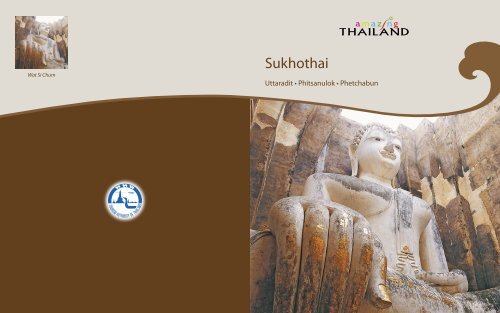
Sukhothai
Sukhothai
Sukhothai

Create successful ePaper yourself
Turn your PDF publications into a flip-book with our unique Google optimized e-Paper software.
Wat Si Chum<br />
<strong>Sukhothai</strong><br />
Uttaradit • Phitsanulok • Phetchabun
Contents<br />
<strong>Sukhothai</strong> 10<br />
Uttaradit 30<br />
Phitsanulok 36<br />
Phetchabun 44
10 11<br />
<strong>Sukhothai</strong> is located on the lower edge of the northern region,<br />
with the provincial capital situated some 450 km. north of<br />
Bangkok and some 350 km. south of Chiang Mai. The province<br />
covers 6,596 sq. km. and is above all noted as the centre of the<br />
old Thai kingdom of <strong>Sukhothai</strong>, with major historical remains<br />
at <strong>Sukhothai</strong> and Si Satchanalai. Its main natural attraction is<br />
Khao Luang mountain park. The provincial capital, sometimes<br />
called New <strong>Sukhothai</strong>, is a small town lying on the Yom River<br />
whose main business is serving tourists who visit the nearby<br />
<strong>Sukhothai</strong> Historical Park.<br />
City Attractions<br />
Phra Mae Ya Shrine<br />
Situated in front of the City Hall, the Shrine houses the Phra<br />
Mae Ya figure, in ancient queen’s dress, said to have been made<br />
by King Ramkhamhaeng as a dedication to his late mother Nang<br />
Sueang.<br />
Sangkhalok Museum<br />
The Museum displays Sangkhalok (Sawankhalok) ceramics of<br />
the kind produced in old <strong>Sukhothai</strong> and ceramics produced in<br />
the old Lanna Kingdom (now northern Thailand). Located 1 km.<br />
from town on the Phitsanulok Road; open daily 8 a.m.-<br />
5 p.m.; admission : 100 baht adults, 20 baht children.<br />
Fish Museum<br />
Located in Rama IV Park on the Phitsanulok Road, the Museum<br />
displays a variety of freshwater fish mentioned in Thai literature.<br />
Open daily except Tuesdays 9 a.m.-5 p.m., admission free.<br />
Wat Si Chum<br />
Phra Mae Ya Shrine<br />
<strong>Sukhothai</strong><br />
The province covers 6,596 sq. km. and is above<br />
all noted as the centre of the old Thai kingdom<br />
of <strong>Sukhothai</strong>, with major historical remains at<br />
<strong>Sukhothai</strong> and Si Satchanalai.
12 13<br />
Old <strong>Sukhothai</strong><br />
Founded in the 13 th century, <strong>Sukhothai</strong> was the first truly<br />
independent Thai kingdom, and it enjoyed a golden age under<br />
the great King Ramkhamhaeng. Abandoned and overgrown<br />
for many centuries, the superb temples and monuments of this<br />
splendid city have been restored in <strong>Sukhothai</strong> Historical Park,<br />
a UNESCO World Heritage Site. A must-see for all travellers,<br />
<strong>Sukhothai</strong> is one of the most important historical sites in<br />
Southeast Asia.<br />
Historical Background<br />
<strong>Sukhothai</strong>, which means “Dawn of Happiness”, was the first<br />
kingdom of the Thais, formed after Thai forces drove the<br />
Khmers out of the city, a major frontier post of the Khmer<br />
Empire, and established it as their capital in 1238. The first<br />
king’s son, Ramkhamhaeng, ascended the throne in 1278 and<br />
reigned for forty years. A fine warrior, King Ramkhamhaeng<br />
the Great made <strong>Sukhothai</strong> a powerful and extensive kingdom<br />
which included many parts of what are today neighbouring<br />
countries. King Ramkhamhaeng the Great opened direct<br />
political relations with China and made two trips there, from<br />
which he brought back Chinese artisans who taught the Thai<br />
fine pottery techniques, resulting in the famous Sawankhalok<br />
ceramics. A major achievement of his reign was the revision of<br />
various forms of the Khmer alphabet into a system suitable for<br />
the writing of Thai. The alphabet that the king invented in 1283<br />
is essentially the same that is used today.<br />
King Ramkhamhaeng the Great’s reign is noted for prosperity<br />
and happiness, as recorded in a stone inscription well-known to<br />
Thais.<br />
Wat Phra Si Rattana Mahathat<br />
Wat Phra Si Rattana Mahathat<br />
“This realm of <strong>Sukhothai</strong> is good. In the water there are fish;<br />
in the fields there is rice. The ruler does not levy a tax on the<br />
people who travel along the road together, leading their oxen<br />
on the way to trade and riding their horses on the way to sell.<br />
Whoever wants to trade in elephants, so trades. Whoever wants<br />
to trade in horses, so trades. Whoever wants to trade in silver<br />
and gold, so trades.”<br />
King Ramkhamhaeng the Great also promoted religion and<br />
culture, and through his efforts Buddhism progressed among<br />
the people. Inspirational faith gave birth to classic forms of<br />
Thai religious art. Images of the Buddha sculpted during the<br />
<strong>Sukhothai</strong> era are cultural treasures which impart a feeling of<br />
peace and serenity. Eight kings ruled <strong>Sukhothai</strong>, whose gradual<br />
decline occurred during the last two reigns. The end of the first<br />
Thai kingdom came in 1365 when it was reduced to a vassal<br />
state by Ayutthaya, a young and rising Thai power to the south,<br />
which became the capital for four centuries, succeeded by<br />
Bangkok.
14 15<br />
<strong>Sukhothai</strong> Historical Park<br />
The Park is located 12 km. from <strong>Sukhothai</strong> town on the Tak<br />
Highway; open daily 6.00 a.m.-9.00 p.m.; admission 40 baht.<br />
Bicycles can be rented for touring the ruins. The Park’s Tourist<br />
Service Centre (Tel: 0 5569 7310) provides information and<br />
displays models of historical buildings and structures of the<br />
old <strong>Sukhothai</strong>. Lying over an extensive area, ruins of the royal<br />
palaces, Buddhist temples, city gates, walls, moats, dams,<br />
ditches, ponds, canals and the water dyke control system are<br />
preserved, with major restoration by the Fine Arts Department<br />
in cooperation with UNESCO.<br />
Inside the City Walls<br />
The core city was surrounded by walls and earthen ramparts;<br />
this forms the centre of the historical park. It was rectangular,<br />
1,300 m. by 1,800 m., with four gates. A stone inscription<br />
records that King Ramkhamhaeng the Great set up a bell at one<br />
of the gates. If his subjects needed help, they could ring the bell<br />
and the king would come out to settle disputes and dispense<br />
justice. Within the walls are the remains of 35 structures. The<br />
most notable are described as follows:<br />
Royal Palace and Wat Mahathat<br />
The Royal Palace lies in the centre of the city, surrounded by<br />
a moat and contains two main compounds: the royal residence<br />
and the royal sanctuary. Here, the famous stone inscription of<br />
King Ramkhamhaeng the Great was found by King Mongkut<br />
(Rama IV) in the 19 th century together with part of the stone<br />
throne called Manangkhasila-at. King Ramkhamhaeng the Great<br />
set up a throne in the midst of a sugar-palm grove where, at his<br />
request, a monk preached on Buddhist holy days and the king<br />
Wat Mahathat<br />
Wat Mahathat
16 17<br />
Wat Mahathat<br />
conducted the affairs of state on other days. This throne was<br />
later installed in Bangkok’s Temple of the Emerald Buddha.<br />
Lying west of the Royal Palace compound is Wat Mahathat, the<br />
royal sanctuary, which is <strong>Sukhothai</strong>’s largest temple with<br />
a customary main chedi (bell-shaped stupa) in a lotus-bud shape<br />
and ruined vihara (image hall). At the base of the chedi are<br />
Buddhist disciples sitting in adoration, and on the pedestal are<br />
sitting Buddha images. In front of this reliquary is a large vihara<br />
formerly containing a remarkable sitting bronze Buddha image<br />
of the <strong>Sukhothai</strong> style, which was cast and installed by King<br />
Lithai of <strong>Sukhothai</strong> in 1362. In the late 18 th century, the image<br />
was moved to the Vihara Luang of Wat Suthat in Bangkok by<br />
the order of King Rama I and has since been named Phra Si<br />
Sakaya Muni. In front of the large vihara, is another smaller<br />
vihara which was probably built during the Ayutthaya period. Its<br />
main Buddha image (8 m. high) was installed inside a separate<br />
building. In front of the southern image, a sculpture called<br />
Khom Dam Din was found, now kept in the Mae Ya Shrine<br />
near the <strong>Sukhothai</strong> City Hall. To the south stands a pedestal of<br />
a large stepped chedi, whose lowest platform is adorned with<br />
beautiful stucco figures of demons, elephants, and lions with<br />
angels riding on their backs. A mural painting adorns this chedi.<br />
Wat Mahathat
18 19<br />
Wat Traphang Ngoen<br />
Situated to the west of Wat Mahathat is Wat Traphang Ngoen<br />
with its square pedestal, main sanctuary and stucco standing<br />
Buddha image in four niches. There is a vihara in front, and to<br />
the east of the pond there is an island with an ubosot<br />
(consecrated assembly hall). This edifice has crumbled and only<br />
its pedestal and laterite columns remain. Many monuments and<br />
magnificent scenery are visible from this location.<br />
Wat Chana Songkhram<br />
Situated to the north of Wat Mahathat is Wat Chana Songkhram.<br />
Its main sanctuary is a round Singhalese-style chedi. In front<br />
of the chedi is the base of a vihara and behind the chedi stands<br />
an ubosot. Bases of twelve small chedi are also visible. Near<br />
Charot Withithong Road is a strange chedi with three bases,<br />
one on top of the other.<br />
San Ta Pha Daeng or Deity Shrine<br />
Situated to the north of Wat Mahathat is San Ta Pha Daeng.<br />
This monument consists of a single laterite prang with<br />
a staircase in front. Sandstone Hindu divine objects (Lop Buri<br />
style) were found here.<br />
King Ramkhamhaeng<br />
King Ramkhamhaeng the Great Monument<br />
Situated to the north of Wat Mahathat, the bronze statue of King<br />
Ramkhamhaeng the Great sits on a throne with a bas-relief at<br />
the base depicting the king’s life.<br />
Wat Mai<br />
Situated to the north of Wat Mahathat is Wat Mai, with an<br />
Ayutthaya-style brick vihara as the main sanctuary, its columns<br />
made of laterite. A bronze image of Buddha under a Naga<br />
(a Lop Buri-style image) was found here and is now preserved<br />
in the Ramkhamhaeng National Museum.<br />
Wat Si Sawai<br />
Wat Si Sawai<br />
Situated amid magnificent scenery southwest of Wat Mahathat<br />
is Wat Si Sawai, with three prangs surrounded by a laterite<br />
wall. Inside the wall, the vihara in the west, built of laterite, is<br />
separated from the main prang (Khmer-style pagoda) which<br />
was constructed in the Lop Buri or Hindu-style. A trace of the<br />
Hindu sculpture Sayomphu was found here, indicating this<br />
was originally a Hindu shrine, later converted into a Buddhist<br />
temple.
20 21<br />
Wat Traphang Thong<br />
Situated to the east of Wat Mahathat is Wat Traphang Thong.<br />
The temple is located on an island in the middle of the large<br />
pond. There is a ruined laterite Singhalese-style chedi and a new<br />
mondop containing the Lord Buddha’s Footprint slab that was<br />
created by King Lithai in 1390. An annual fair to worship this<br />
sacred footprint takes place during the Loi Krathong Festival.<br />
Ramkhamheang National Museum<br />
The museum offers an outstanding introduction to the arts and<br />
crafts of <strong>Sukhothai</strong> and its vassal cities, displaying objects<br />
unearthed or collected from <strong>Sukhothai</strong> and nearby provinces.<br />
Inside the spacious building are Khmer statues, <strong>Sukhothai</strong><br />
Buddha, Sawankhalok ceramics and other archaeological<br />
artefacts gathered from the area. Open daily 9 a.m.- 4 p.m.;<br />
admission 30 baht. For more information, call 0 5569 7367.<br />
Outside the City Walls<br />
The Sites to the North<br />
Wat Phra Phai Luang<br />
This temple lies 500 m. north of San Luang Gate (northerngate).<br />
This sanctuary, formerly a Khmer-Hindu Shrine but later<br />
converted into a Buddhist temple, is surrounded by a moat. It is<br />
second in importance to Wat Mahathat. Inside, there are three<br />
prangs like Wat Si Sawai, but the southern and the central ones<br />
have crumbled leaving only the northern one decorated with<br />
stucco figures. In front of these prangs are a vihara and<br />
Wat Phra Phai Luang<br />
a crumbled chedi; the latter has a pedestal decorated with stucco<br />
sitting Buddha images. A mondop contains ruined Buddha<br />
images in four postures: sitting, reclining, standing and walking.<br />
A Sivalinga (phalic emblem of Hindu gods) was unearthed in<br />
the compound of this sanctuary.<br />
Ruins of the Old Celadon Factory (Thuriang Kiln)<br />
Thuriang Kiln is a site where <strong>Sukhothai</strong> celadons were made.<br />
Kilns exist in an area measuring 100 m. by 700 m. Each kiln is<br />
divided into three sections; the fire area, the baking oven and the<br />
flue. The pottery found here mostly has three painted designs<br />
on the bottom: a disc, a fish and a flower. Forty-nine kilns and<br />
small edifices are visible. To the north, a pond has been dug into<br />
the stone.<br />
Wat Si Chum<br />
This lies about 1,500 m. north of Wat Mahathat and was<br />
originally surrounded by a moat. A square mondop (an edifice<br />
which is square in plan, cubicle in form, with a pyramidal<br />
superstructure for roofing), the main sanctuary, contains a<br />
monumental stucco-over-brick Buddha image in the attitude<br />
of Subduing Mara, called Phra Achana. This Buddha measures<br />
11.3 m. from knee to knee.The mondop is 32 m. square and<br />
15 m. high, and the walls are 3 m. thick. There is a passageway<br />
in the left inner wall itself which leads to the above crossbeam.<br />
On the ceiling of the passageway are more than fifty engraved<br />
slate slabs illustrating Jataka scenes.<br />
The Sites to the West<br />
Wat Saphan Hin<br />
Situated on a 200 m. hill, the sanctuary is approached by<br />
a pathway of slate slabs.<br />
Wat Chang Rop<br />
This temple, situated in the Aranyik area, has a chedi decorated<br />
with an elephant emerging from the base, in front of which is a<br />
vihara base and laterite columns.<br />
Phra Ruang Dam<br />
This earthwork dam was built to hold back water in a dam<br />
between the Phra Bat Yai and Kio-Ai-Ma hills and was restored<br />
by the lrrigation Department. The dam is referred to in the<br />
famous <strong>Sukhothai</strong> stone inscription.
22 23<br />
Buddha flanked by angles descending from Tavatimsa Heaven<br />
(the second heaven in Buddhist six heavens). The west side<br />
portrays the Lord Buddha preaching to his father and relatives.<br />
The north side depicts the episode when the Lord Buddha<br />
returned to preach to his wife. These stucco figures, especially<br />
those on the south side, are masterpieces of <strong>Sukhothai</strong> art.<br />
Wat Saphan Hin<br />
Ramkhamhaeng National Park (Khao Luang <strong>Sukhothai</strong>)<br />
This exquisite national park with a combined natural and<br />
historical background covers an area of 341 sq. km. of high<br />
hills and steep cliffs, some over 1,200 m. high, together with<br />
waterfalls, varied vegetation and wildlife are the natural<br />
attractions alongside archaeological remains.<br />
This park is accessed via Highway 101 south from <strong>Sukhothai</strong><br />
for about 20 km. then west via a 16 km. laterite road. Trekkers<br />
must bring food and essential equipment with them. Bungalows<br />
and tents are available. For more information in Bangkok,<br />
contact the National Park,Wildlife and Plant Conservation<br />
Department Tel. 0 2562 0760.<br />
The Site to the South<br />
Wat Chetuphon<br />
A mondop enshrines four Buddha images in different postures:<br />
sitting, standing, walking, and reclining. The outer walls of<br />
the mondop still retain a section in the form of a slate pillar<br />
balustraded window. There is an entrance to the mondop to<br />
the north. Just behind the mondop is a small sanctuary which<br />
contains a Buddha image known locally as Phra Si Ariya<br />
Maitreya, the Lord Buddha of the Future.<br />
Wat Chang Lom<br />
The Sites to the East<br />
Wat Chang Lom<br />
This temple is located to the north of Charot Withithong Road<br />
with a bell-shaped chedi of Ceylonese influence standing at the<br />
centre. The chedi is situated on a three-tiered square base with<br />
a platform decorated with rows of elephants. This type of<br />
elephant - decorated chedi is to be seen in many ancient towns<br />
of the <strong>Sukhothai</strong> period; for example, Kamphaeng Phet and<br />
Si Satchanalai.<br />
Wat Traphang Thonglang<br />
A square mondop is the main sanctuary. In front of the mondop<br />
to the east is a vihara and beyond the vihara stands an ubosot.<br />
The outer wall of the mondop is beautifully decorated with<br />
stucco figures in niches. The southern side portrays the Lord
24 25<br />
Si Satchanalai Historical Park<br />
Sawankhalok<br />
Sawankhaworanayok National Museum<br />
Located at Sawankhalok town, 38 km. north of <strong>Sukhothai</strong><br />
via Highway 101, the Museum features sculptural art from<br />
various periods and Sangkhalok (Sawankhalok) pottery from<br />
the <strong>Sukhothai</strong> era, some of it retrieved from sunken vessels in<br />
the Gulf of Thailand. Open daily 8.30 a.m.- 4.30 p.m.; except<br />
Monday,Tuesday and public holidays.; admission 30 baht.<br />
For more information, call 0 5564 3166, 0 5564 1571.<br />
Si Satchanalai<br />
Si Satchanalai was a city of the <strong>Sukhothai</strong> kingdom,<br />
located close to the modern town of Si Satchanalai, which is<br />
67 km. north of new <strong>Sukhothai</strong> via Highway 101.<br />
Si Satchanalai Historical Park<br />
Si Satchanalai Historical Park contains the remains of<br />
<strong>Sukhothai</strong>-era Structures in a park and setting similar to<br />
<strong>Sukhothai</strong> Historical Park. The 13 th to 15 th century ruins are<br />
located beside the Yom River among hills and are less restored<br />
than those of <strong>Sukhothai</strong>. Open daily 8.00 a.m.- 5.00 p.m.<br />
The ancient site was the kingdom’s second city and the<br />
residence of the crown prince. It enjoyed great importance, as<br />
demonstrated by the size of its remains. Ruins of 134 structures<br />
have been discovered within the park area.For more<br />
information; call 0 5567 9211.<br />
Wat Phra Si Rattana Mahathat<br />
This temple, also called Wat Phra Borommathat Mueang<br />
Chaliang or Wat Phra Prang, is situated 3 km. to the south of<br />
ancient Si Satchanalai’s walls. An immense laterite prang on<br />
a square base marks the centre of the temple. A steep staircase<br />
in front of the huge prang leads to a room where a reliquary<br />
is enshrined.<br />
Wat Chedi Chet Thaeo
26 27<br />
Wat Khao Phanom Phloeng<br />
This is a hilltop temple within the old town of Si Satchanalai.<br />
A laterite chedi in the centre, a large vihara or image hall in<br />
front and a small sanctuary behind all lie in ruins. Some laterite<br />
pillars and a damaged Buddha image constructed of laterite<br />
slabs and coated with mortar are seen.<br />
Wat Khao Suwan Khiri<br />
The hilltop temple is situated 200 m. from Phanom Phloeng<br />
Hill. A huge bell-shaped chedi on a five-tiered base marks the<br />
centre of the temple. Ruins of a vihara, chedi and fragments of<br />
huge stucco figures lie scattered on the ground. The<br />
similarity between some figures here and those at <strong>Sukhothai</strong>’s<br />
Wat Chang Lom lead to the belief that King Ramkhamhaeng<br />
the Great had this temple constructed.<br />
Wat Chang Lom<br />
A huge bell-shaped chedi supported by 39 elephants, with four<br />
at the cardinal points elaborately decorated marks the centre of<br />
the temple. Above the chedi’s base there are niches enshrining<br />
images in the attitude of Subduing Mara (demon).<br />
Wat Chedi Chet Thaeo<br />
This is one of the most beautiful temples in <strong>Sukhothai</strong> Province.<br />
Stupa of different artistic styles and influence were built here.<br />
Remnants of old mural paintings can still be seen in some<br />
stupa.<br />
Wat Nang Phaya<br />
Wat Suan Kaeo Utthayan Yai<br />
Located near Wat Chedi Chet Thaeo, across a dirt road, this<br />
temple has the ruins of a large image hall. It is also called Wat<br />
Kao Hong, the Nine-Roomed Temple.<br />
Wat Nang Phaya<br />
This temple is famous for its delicate stucco reliefs on the<br />
remains of the northwestern wall of the seven-roomed vihara.<br />
The pillars are decorated with unglazed ceramic designs. The<br />
central laterite stupa is surrounded by lamp-posts and accessible<br />
by a set of narrow stairs.<br />
Wat Suan Kaeo Utthayan Noi<br />
This temple’s ruins consist of a frontal vihara housing<br />
a Buddha, complete with a laterite roof.<br />
Sangkhalok Kiln Site Study and Conservation Centre<br />
At one time, hundreds of huge pottery kilns lined the Yom River<br />
in this area. Several have been carefully excavated and one, oval<br />
with a curved roof and 7-8 m. wide, can be viewed within the<br />
centre, while at another site a short distance away, there is<br />
a large outdoor kiln prepared for viewing. The centre displays<br />
pottery and potsherds, found in the area and information on the<br />
evolution of ancient ceramics. Located some 4 km. north of<br />
Si Satchanalai; open daily 9 a.m.- 4 p.m. To get there, drive<br />
6.5 km. north of Si Satchanalai Historical Park to Ban Ko Noi,<br />
or take Highway 1201 from Si Satchanalai.<br />
Si Satchanalai National Park<br />
This forest and mountain park (213 sq. km.) offers trekking<br />
routes to waterfalls, caves and a hot spring. The park is about<br />
100 km. from <strong>Sukhothai</strong> via Highways 1113 and 1294 and<br />
can be reached by a local bus (once daily, 50 mins) from Si<br />
Satchanalai where there is accommodation. For reservations and<br />
more information in Bangkok, call 0 2579 5734, 0 2579 7223 or<br />
0 5561 9214-5.<br />
Festivals<br />
Si Satchanalai Ordination Celebration<br />
April<br />
Locally called Buat Chang Hat Siao, this event is held at Hat<br />
Sieo, Si Satchanalai, arranged by the local Thai Phuan people.<br />
It features a spectacular procession of ordination candidates<br />
(men about to become Buddhist monks) in colourful costumes<br />
on the backs of some 20-30 decorated elephants.
28 29<br />
How To Get There<br />
• By Car<br />
From Bangkok, take Highway 1 then Highway 32 north to<br />
Nakhon Sawan. Highway 32 becomes Highway 1 again, follow<br />
all the way to Kamphaeng Phet, then take Highway 101 to<br />
<strong>Sukhothai</strong>.<br />
• By Bus<br />
Air-conditioned buses depart from Bangkok Bus Terminal<br />
on Kamphaeng Phet II Road for <strong>Sukhothai</strong> (7-hour journey).<br />
For more information, call 0 2936 2852-66 or visit<br />
www.transport.co.th, Win Tour (0 2936 3753 or 0 5561 1039),<br />
Phitsanulok Yan Yon (0 2936 2924-5, 0 5525 8647).<br />
Loi Krathong and Candle Festival<br />
Songkran Festival<br />
13-15 April<br />
This is the traditional Thai New Year celebration, also known<br />
as the Water Festival. Songkran was mentioned in the famous<br />
stone inscription dating from the reign of King Ramkhamhaeng<br />
the Great.<br />
Loi Krathong and Candle Festival<br />
October/ November<br />
A grand Loi Krathong celebration is held at the <strong>Sukhothai</strong><br />
Historical Park. The Festival is held over five days to celebrate<br />
Loi Krathong, which falls on the full moon night of the 12 th<br />
lunar month. The highlights include a gorgeously costumed<br />
light and sound show in a historical setting. Activities include<br />
krathong floating, a fireworks display, local games and<br />
spectacular performances.<br />
• By Rail<br />
The nearest railway station is at Phitsanulok, from where<br />
there are frequent bus services to <strong>Sukhothai</strong>, some 50 km.<br />
away. Trains depart from Bangkok’s Hua Lamphong Station.<br />
Tel.02220 4334 or Hotline 1690 or www.railway.co.th for more<br />
information.<br />
• By Air<br />
Bangkok Airways flies from Bangkok to <strong>Sukhothai</strong> daily<br />
(1 hour). <strong>Sukhothai</strong> Airport is about 40 km. north of the town.<br />
For more information, Tel. 0 2265 5555, Hotline 1771 or<br />
www.bangkokair.com.<br />
Sangkhalok Pottery<br />
Local Products<br />
Sangkhalok Pottery<br />
A variety of products are available including: Thung Luang terra<br />
cotta of Khiri Mat, with unique patterns; ancient-style gold and<br />
silver products of Si Satchanalai, hand-made by skilled workers;<br />
fried peanuts of Si Samrong, also called “200-year fried<br />
peanuts” following an old recipe; and Hat Siao fabric of<br />
Si Satchanalai, made by descendants of Thai Phuan migrants<br />
from Lao P.D.R.
30 31<br />
Wat Yai Tha Sao<br />
Wat Thammathipatai<br />
Uttaradit<br />
A flourishing port for regional trade, it was<br />
renamed Uttaradit, literally the Port of the<br />
North, by King Rama V (1868-1910) and made<br />
a provincial capital.<br />
A province in the Lower North, Uttaradit has a long history<br />
going back to at least the <strong>Sukhothai</strong> period (13 th century).<br />
Today, it is most noted for the cultivation of langsat fruit and for<br />
the major lake formed by the Sirikit Dam. The provincial capital<br />
is located 491 km. from Bangkok and the province covers an<br />
area of 7,838 sq.km. The original town, called Bang Pho Tha<br />
It, was located on the right bank of the Nan River. A flourishing<br />
port for regional trade, it was renamed Uttaradit, literally the<br />
Port of the North, by King Rama V (1868-1910) and made a<br />
provincial capital. When the northern railway line was built in<br />
the early 20 th century with a stop at Uttaradit, the town received<br />
a further boost. Unfortunately, the town centre was largely<br />
destroyed in a fire in 1967 and was rebuilt in a modern style.<br />
City Attractions<br />
Wat Thammathipatai<br />
At this temple, the door panels of the large and ancient vihara<br />
of Wat Phra Fang are kept. The wooden panels are 2.2 m. wide<br />
and 5.3 m. tall and are carved in the graceful style of the Late<br />
Ayutthaya Period. Only the panels at Wat Suthat in Bangkok are<br />
regarded as better.
32 33<br />
Wat Tha Thanon<br />
Located beside the Nan River, this temple houses Luang Pho<br />
Phet, the principal Buddha statue of the province. It is in the<br />
ancient Chiang Saen style and cast in bronze.<br />
Wat Yai Tha Sao<br />
Situated east of the town centre about 3 km. along Samranrun<br />
Road, this temple features an old chapel with beautifully carved<br />
wood door panels and lintels.<br />
Phaya Phichai Dap Hak Memorial<br />
This statue commemorates a governor who in 1772 valiantly<br />
fought the Burmese invaders until one of his swords broke in<br />
two. Still he prevailed over them, and is remembered as<br />
“Phichai of the Broken Sword”.<br />
Uttaradit Provincial Cultural Hall<br />
Once the official residence of the provincial governor, this<br />
late 19 th century traditional wooden building houses important<br />
historical relics. A major item is the Yan Mat, a carved wooden<br />
carrying pole made by Late Ayutthaya period craftsmen.<br />
Out-Of-City Attractions<br />
Wat Klang<br />
Located about 3 km. outside town at Ban Kae, this old temple<br />
has beautiful plaster bas-reliefs over the ubosot. Inside are rare<br />
wall murals of the Early Rattanakosin period style depicting the<br />
Jataka and assemblage of celestial beings.<br />
Wat Phra Boromathat Thung Yang<br />
Wat Phra Thaen Sila At<br />
Wat Phra Boromathat Thung Yang<br />
Located about 3 km. from town on Highway 102, this old<br />
temple, once called Wat Mahathat, has a large round<br />
Sri Lankan style chedi enshrining a holy relic.<br />
Wat Phra Yun Phutthabat Yukhon<br />
Situated near Wat Phra Boromathat Thung Yang, this temple<br />
features a Chiang Saen-style mondop sheltering holy footprints.<br />
It also houses a bronze <strong>Sukhothai</strong>-style Buddha statue.<br />
Laplae<br />
An ancient community dating from the Ayutthaya period,<br />
Laplae is an attractive place to visit with old wooden houses,<br />
hand-woven textiles and other craft specialities. It is also a<br />
major producer of langsat, the province’s famous fruit. It lies<br />
west of town via Highway 102 for 3 km., then to the right along<br />
Highway 1041 for a further 6 km.<br />
Wat Phra Thaen Sila At<br />
Located near Laplae, this temple is believed to be of the<br />
<strong>Sukhothai</strong> Period. Its major feature is the base of a sermon<br />
platform built with laterite.<br />
Namtok Mae Phun<br />
Located at Ban Ton Klua, about 20 km. from town, the waterfall<br />
features multi-level cascades amid pleasant natural<br />
surroundings.
34 35<br />
Festivals<br />
The Tradition of Buddha Cremation<br />
May<br />
A unique religious ritual, is performed at Wat Phra Boromathat<br />
Thung Yang after Visakha Puja Day in May. It features<br />
a re-enactment of the Buddha’s funeral ceremony.<br />
Langsat Day Fair<br />
Late September<br />
This day celebrates the province’s famous fruit. Langsatgrowing<br />
has long been the main occupation of the local people.<br />
The fair features exhibitions, contests and parades of floats<br />
decorated with fruits and flowers, as well as entertainment.<br />
Sak Yai Forest Park<br />
Bo Lek Nam Phi<br />
Sirikit Dam<br />
Situated at Tha Pla some 68 km. from town on the Uttaradit-<br />
Tha Pla Road, this is the country’s largest earthen dam.<br />
Stemming the Nan River, the dam is 800 m. wide. The large<br />
lake has beautiful scenery and during the cool season the<br />
landscape is covered in a profusion of colourful flowers and<br />
blooms. Accommodation and boating services are available.<br />
Sak Yai Forest Park<br />
This park, located in Amphoe Nam Pat about 80 km. from town<br />
on Highways 1045, 1146 and 1047, features the largest teak<br />
tree in the world. It has a circumference of 9.87 m. and an age<br />
of about 1,500 years. Sadly, its top was broken off in a storm,<br />
cutting its height from 48.5 m. to 37 m., but it is still alive.<br />
Bo Lek Nam Phi<br />
Here swords and other weapons were forged from high quality<br />
steel. There are two mines still in existence, whose ores are<br />
believed to have been used to make the king’s swords only. This<br />
ancient site is reached by going to Thong Saen Khan (42 km.<br />
southeast of town), then taking Highway 1245 for 14 km.<br />
Shopping<br />
Interesting items include woven materials with lovely designs<br />
and colours, and preserved fruit such as the chewy Kluai Kuan<br />
made from bananas.<br />
How To Get There<br />
• By Car<br />
1. From Bangkok, take Highway 1 (alternative: Highway<br />
32 after Ayutthaya) to Nakhon Sawan, then Highway 117 to<br />
Phitsanulok, then Highways 12 and 11 to Uttaradit.<br />
2. From Bangkok, take Highway 1 to Ayutthaya, then<br />
Highway 32 to In Buri, then Highway 11 to Uttaradit.<br />
• By Bus<br />
Air-conditioned and non air-conditioned buses depart from<br />
Bangkok Bus Terminal on Kamphaeng Phet II Road for<br />
Uttaradit. For more information, call 0 2936 2852-66 or visit<br />
www.transport.co.th, or call Win Tour (0 2936 3753-4) or<br />
Cherdchai Tour (0 2936 0199).<br />
• By Rail<br />
Trains depart from Bangkok’s Hua Lamphong Station for<br />
Uttaradit everyday. Tel. 0 2220 4334 or Hotline 1690,<br />
www.railway.co.th for more information.<br />
• By Air<br />
Bangkok Airways flies from Bangkok to <strong>Sukhothai</strong>. For more<br />
information, Tel.0 2265 5555 or Hotline 1771,<br />
www.bangkokair.com.
36 37<br />
Phitsanulok is a major province of the Lower North located<br />
where the Central Plains begin to rise into the Northern region.<br />
The provincial capital is 377 km. north of Bangkok and boasts<br />
a nationally important temple. Most of the terrain is flat,<br />
contrasted by mountain ranges running along the east where<br />
waterfalls and national parks offer opportunities for nature<br />
treks. The town of Phitsanulok, situated on the banks of the Nan<br />
River, has been a major community since ancient Khmer times<br />
and enjoyed great prosperity during the <strong>Sukhothai</strong> and<br />
Ayutthaya periods. During 1463-1487, the city was in effect the<br />
royal capital as King Borom Trailokanat of Ayutthaya resided<br />
permanently in the province. Regrettably, most of the city was<br />
destroyed by a fire in 1955, and today it is built in the modern<br />
style.<br />
City Attractions<br />
Wat Phra Si Rattana Mahathat<br />
This nationally important temple, commonly called Wat Yai,<br />
with its origin in the 14 th century is on the river’s east bank.<br />
The vihara houses what is regarded as the most beautiful and<br />
graceful Buddha statue in Thailand, the large bronze sitting<br />
statue of Phra Phuttha Chinnarat in the <strong>Sukhothai</strong> style, dating<br />
from the 14 th century. A celebration honouring the Chinnarat<br />
Buddha is held in late January. Other prominent features are<br />
the image hall’s large pearl-inlaid doors made in 1756 by royal<br />
Phra Phuttha Chinnarat<br />
Phitsanulok<br />
The provincial capital is 377 km. north of<br />
Bangkok and boasts a nationally important<br />
temple. Most of the terrain is flat, contrasted by<br />
mountain ranges running along the east<br />
where waterfalls and national parks offer<br />
opportunities for nature treks.<br />
Wat Phra Si Rattana Mahathat
38 39<br />
hall containing a holy footprint and inscription stone built by<br />
King Narai the Great of Ayutthaya. There is also a Khmer-style<br />
pagoda (Prang) built with laterite, adorned with intricate swan<br />
designs.<br />
King Naresuan the Great Shrine<br />
The Shrine is on the site of the former Chan Palace, the<br />
birthplace and residence of King Naresuan the Great, a revered<br />
king famous for defending the nation from the Burmese.<br />
Located close to the river on the west bank, it features a statue<br />
of the king declaring independence from Burma.<br />
Wat Phra Si Rattana Mahathat<br />
craftsmen and an 8 m. tall standing Buddha image called Phra<br />
Attharot, of the same period as the Chinnarat Buddha, originally<br />
housed in a large hall which has all but crumbled away. In the<br />
centre of the compound is a great Khmer-style pagoda or prang.<br />
It is thought the structure was originally a lotus bud-shaped<br />
stupa of <strong>Sukhothai</strong> style, and was altered into a prang during the<br />
early Ayutthaya period.<br />
Folklore Museum<br />
This museum on Wisutkasat Road is regarded as Thailand’s<br />
largest and best collection of indigenous arts and utensils,<br />
a labour of love by Dr. Thawi. It displays pottery, kitchenware,<br />
agricultural tools and musical instruments, all reflecting the<br />
lifestyle and creativity of the traditional community. Open<br />
Tuesday to Sunday, 8.30 a.m.- 4.30 p.m.; admission is free.<br />
Buddha - Casting Foundry<br />
Situated opposite the Folklore Museum and also created by<br />
Dr. Thawi, the Foundry specialises in casting bronze Buddha<br />
images and statues, mostly copies of the Chinnarat Buddha in<br />
all sizes. Visitors are welcome; open Tuesday to Sunday,<br />
8.30 a.m.- 4.30 p.m.<br />
Wat Ratchaburana<br />
Situated on the east bank of the Nan River and south of Wat<br />
Phra Si Rattana Mahathat, this temple also survived the fire. The<br />
ordination hall features a graceful three-headed Naga (mythical<br />
serpent) over its eaves and murals painted in the early 19 th<br />
century. It was built by King Borom Trailokanat, who played a<br />
major role in fostering Buddhism in the province.<br />
Wat Chedi Yot Thong<br />
Located on Phaya Sua Road, this temple has a 15 th century lotus<br />
bud-shaped chedi of the typical <strong>Sukhothai</strong> style, the only such<br />
structure left in the province.<br />
Wat Chula Mani<br />
Located on the east bank of the Nan River, about 5 km. south<br />
of the town centre on the Borom Trailokanat Road, this was the<br />
site of the original town. King Borom Trailokanat, accompanied<br />
by more than 2,000 followers, was ordained as a monk here<br />
in 1416. An important ancient structure in the temple is the<br />
City Walls<br />
Originally made of clay like<br />
those of <strong>Sukhothai</strong> and built<br />
during the Ayutthaya period<br />
to deter raids from Lanna<br />
and Burma, remnants can<br />
be seen to the north and<br />
east of town. Part of the<br />
old 12 m. wide city moat<br />
still exists to the west of<br />
town parallel to Phra Ruang<br />
Road.<br />
Houseboats<br />
Uniquely situated within<br />
a Thai city, many people<br />
dwell in houseboats moored<br />
on the river.<br />
King Naresuan the Great Shrine
40 41<br />
watersheds feeding several streams flowing into the Nan River.<br />
A good walking trail starts from the sub-office at Ban Nong<br />
Mae Na (Km.100) and leads alternately through forest and<br />
savanna. Thung Non Son, a grassy plateau in the heart of the<br />
park, abounds with wild flowers in October to December. It lies<br />
16 km. by car and a further 15 km. on foot from Ban Nong Mae<br />
Na.<br />
Namtok Chattrakan National Park<br />
This forest and waterfall park lies some 145 km. from town. It<br />
is reached via Highway 12, turning left at Km.68 onto Highway<br />
2013 to Nakhon Thai, then taking Highway 1143 to Chattrakan<br />
District. The water cascades down seven tiers to a wide pool<br />
with a beach. Some cliff faces carry traces of prehistoric<br />
carvings. Camping is allowed after contacting park officials.<br />
Phu Soi Dao National Park<br />
This park stretches along the Thai-Lao border in Chattrakan<br />
District with the highest peak being 2,102 m. and the climate<br />
is cool most of the year. Attractive features of the park are<br />
wild flowers in the rainy season, savanna and waterfalls. It is<br />
necessary to use guides for access and camping equipment for<br />
overnight stays.<br />
Namtok Wang Nok An<br />
Out-Of-City Attractions<br />
Highway 12 Scenic Route<br />
Cutting through the eastern mountain ranges of Phitsanulok, the<br />
route offers a series of attractive forested areas and waterfalls<br />
within national parks. To visit these places, transport can be<br />
hired in town. Highlights include: Namtok Wang Nok An,<br />
within the Sakunothayan Arboretum, which is 1 km. off the<br />
main highway at Km.33, with Kaeng Sai Rapids. At Km.45,<br />
Kaeng Song Waterfall. At Km.72 and a further 2 km. off the<br />
road is an extensive three-level waterfall, Namtok Kang Sopha<br />
running over massive rock formations amongst lush vegetation.<br />
The best time to visit all waterfalls is from September to<br />
December when the water flows are at a maximum.<br />
Phu Hin Rong Kla National Park<br />
This is an outstanding national park with unique scenic<br />
attractions and historical significance. Located where<br />
Phitsanulok meets Phetchabun Province, Phu Hin Rong Kla is<br />
reached via Highway 12, turning right at Km.68 onto Highway<br />
2013 travelling 28 km. to Nakhon Thai, then taking Highway<br />
2331 for another 31 km. The mountainous area was<br />
Thung Salaeng Luang National Park<br />
Thung Salaeng Luang National Park<br />
This protected area of mountain forests and grasslands covers<br />
1,262 sq. km. The park office, where information may be<br />
obtained and accommodation booked, is at Km.80 on Highway<br />
12. The grasslands are bright with flowers, particularly during<br />
the late rainy season (October). The mountain ranges are
42 43<br />
Shopping<br />
Preserved food products are a speciality, notably Kluai Tak,<br />
which are dried bananas coated with honey. Also popular are<br />
items made from pork such as Nam (sour sausage) and Mu Yo.<br />
How To Get There<br />
• By Car<br />
1. From Bangkok, take Highway 1 and 32 to Nakhon Sawan,<br />
then Highway 117 to Phitsanulok (total 337 km.).<br />
2. From Bangkok, take Highway 1 to Ayutthaya, then<br />
Highway 32 to In Buri, then Highway 11 to Wang Thong, then<br />
Highway 12 to Phitsanulok (total 450 km.).<br />
Namtok Kang Sopha<br />
a communist guerilla base from 1967 to 1982 and many<br />
radical students fled here after the 1976 massacre of students in<br />
Bangkok. Reminders of the struggle are living quarters, schools,<br />
a hospital and other facilities. There are also beautiful waterfalls<br />
and strange rock formations with jagged boulders and deep<br />
crevices. The Park has accommodation, campsites and food<br />
facilities.<br />
Interesting Activity<br />
Flying Vegetables<br />
Touring Phitsanulok city by tricycle rickshaw (samlor, or<br />
trishaw) is recommended, particularly around the river banks<br />
where floating restaurants abound with theatrical cooks making<br />
“flying vegetables”. The speciality is a dish called Phak Bung<br />
Loi Fa to which is attached a big performance in which the<br />
cooks toss fried water spinach “sky-high”.<br />
Festival<br />
Long Boat Races & Fair<br />
October<br />
These races and fair are held when the Nan River is full at the<br />
climax of the rainy season. The Fair is held in front of Wat Phra<br />
Si Rattana Mahathat. Robes are placed over the Phra Phuttha<br />
Chinnarat, and there are contests of boat processions and races<br />
with scores of boats.<br />
• By Bus<br />
Buses depart from Bangkok Bus Terminal on Kamphaeng Phet II<br />
Road. For more information call Transport Co., Ltd. on 0 2936<br />
2852-66; Phitsanulok Yan Yon Tour on 0 2936 2924-5;<br />
Cherdchai Tour on 0 2936 0199 or Win Tour on 0 2936 3753.<br />
• By Rail<br />
Trains depart from Bangkok’s Hua Lamphong Railway Station<br />
for Phitsanulok. Call 1690 for more information.<br />
• By Air<br />
Thai Airways operates daily flights (50 mins) from Bangkok to<br />
Phitsanulok. In Bangkok call 1566 for more information, or in<br />
Phitsanulok call 0 5525 8020.<br />
Long Boat Races
44 45<br />
Situated in the heart of Thailand, with its provincial capital<br />
some 346 km. north of Bangkok, Phetchabun is the meeting<br />
place of three regions, the North, the Central Plains and the<br />
Northeast.<br />
The province centres on the Pa Sak River basin with mountain<br />
ranges running along both the western and eastern reaches.<br />
Because of the fertility of the soil, Phetchabun has always been<br />
a productive area, and its very name means “the land of crops<br />
and food”. The province has a long and prosperous history<br />
and rich tourism potential. Its climate is attractive due to the<br />
mountains and forests.<br />
City Attractions<br />
Wat Mahathat<br />
This temple on Nikon Bamrung Road has several ancient stupas<br />
of the <strong>Sukhothai</strong> style.<br />
Phetchabun City Pillar Shrine<br />
Relocated from the ancient town of Si Thep, this is considered<br />
the oldest such structure in Thailand.<br />
Phu Tab Buek<br />
Phetchabun<br />
Because of the fertility of the soil, Phetchabun<br />
has always been a productive area, and its very<br />
name means “the land of crops and food”. The<br />
province has a long and prosperous history and<br />
rich tourism potential. Its climate is attractive<br />
due to the mountains and forests.<br />
Wat Trai Phum<br />
This temple on Phetcharat Road features a Buddha statue called<br />
Phra Buddha Maha Dhammaracha cast in the ornamental Lop<br />
Buri style. The ritual bathing of the image is performed each<br />
September.<br />
Out-Of-City Atrractions<br />
Huai Pa Dang Dam<br />
Created by a dam constructed for irrigation purposes, located<br />
some 8 km. west of town on Highway 2006, this is<br />
a pleasant place with scenic views.<br />
Accomodation in Khao Kho
46 47<br />
Tat Mok National Park<br />
This forest park has a huge waterfall fed by streams flowing<br />
down mountain crevices, creating twelve beautiful tiers. To<br />
reach the park, drive east for some 15 km. to Ban Chaliang<br />
Lap, then take a right turn onto Highway 2275, then a left fork,<br />
continuing for 20 km.<br />
Si Thep Historical Park<br />
Some 130 km. south of Phetchabun on Highway 21, and another<br />
9 km. after a left turn, lie the ruins of Si Thep. An ancient<br />
town where many structures still remain indicative of its past<br />
prosperity during the 11 th -18 th Buddhist Centuries, Si Thep was<br />
the centre of contact between the Dvaravati Kingdom in the<br />
Central Plains and the Khmer Kingdom in the Northeast. There<br />
are widespread remains of laterite buildings and of several<br />
ponds. Artefacts found here include elaborate lintels, Sema<br />
stones (used to mark out the limits of Buddhist temples) and<br />
jewellery.<br />
Khao Kho<br />
Bare 1,000 m. high mountains to the northwest of town, Khao<br />
Kho was a base from which communist insurgents conducted<br />
their struggle from 1968 to1982. It is accessible via two routes:<br />
off Highway 12 (Phitsanulok-Lom Sak) at Ban Camp Son,<br />
and off Highway 21 at Ban Na Ngua, about 13 km. north of<br />
town. Both routes wind through steep terrain. Interesting places<br />
include various viewing points, remains of guerrilla bases, a war<br />
memorial, an arms museum, a stupa containing a holy relic, the<br />
Si Dit Falls and a royal palace.<br />
B.N. Farm<br />
This experimental farm grows cold-climate crops, including<br />
various flowers which bloom in season and is beautifully scenic.<br />
It is situated on the route to Khao Kho 3 km. from Ban Camp<br />
Son, off Highway 21 to the north of town. Fruit-based items are<br />
on sale.<br />
Phu Hin Rong Kla<br />
Located in the mountains northwest of Lom Sak, in the north<br />
of the province, amidst exotic scenery, this was a communist<br />
guerrilla base in the 1970s and 1980s. See the Phitsanulok<br />
section for more information.<br />
Nam Nao National Park<br />
Its office located some 50 km. east of Lom Sak along Highway<br />
12, this is an immense tract of dry evergreen forest. Spread<br />
Namtok Man Daeng, Phu Hin Rong Kla<br />
over rolling hills and including pineries and grasslands, it is<br />
the habitat of many diverse animals, and more than 100 bird<br />
species. In December and January, the temperature can drop<br />
to as low as 2 degrees Celsius. Points of interest are spread<br />
out. Attractions reached by taking Highway 12 include: Tham<br />
Pha Hong with stalactites and stalagmites, located 300 m.<br />
north from Km.39; Ban Paek Pinery, reached by a 5 km. walk<br />
from Km.49; Phu Khum Khao Pinery, 15 km. from Km.53,<br />
covering an area of about 10 sq.km. and Heo Sai and Sai Thong<br />
Falls, located on the same trail, reached on foot, 1 km. and 1.5<br />
km. respectively off the main road at Km.67. There are also<br />
attractions on Highway 2216 (Lom Kao-Huai Sanam Sai) such<br />
as Pha Lom-Pha Kong which are 5 km. from Km.40 and Tham<br />
Yai Nam Nao near Km.60.<br />
Festivals<br />
Sweet Tamarind Day<br />
January-February<br />
Sweet tamarind is strongly associated with Phetchabun and<br />
Sweet Tamarind Day celebrates the harvest of this fruit. During<br />
the festival, farmers bring their sweet tamarinds to sell at
48 49<br />
reasonable prices at Phetchabun’s provincial athletic field where<br />
best crop contests are held. In addition, there is a variety of<br />
other entertainment.<br />
Um Phra Dam Nam Ceremony<br />
September<br />
Held on the 15 th day of the waning moon in the 10 th lunar<br />
month, or Sat Thai Day, the day in which Thais make merit by<br />
proffering Krayasat, sticky paste made from rice, bean, sesame<br />
and sugar and other offerings to monks. The festival honours<br />
Phra Buddha Maha Dhammaracha, a highly revered ancient<br />
Buddha image. The image was found in the Pasak River by<br />
a group of farmers 400 years ago and taken to Wat Trai Phum.<br />
According to legend, the image twice wandered out of the<br />
temple and was later found in water, and so the ritual bathing<br />
ceremony came about. In the afternoon, the image is carried<br />
around town and then put under a tent in Wat Trai Phum,<br />
so Buddhists can pay respect by applying gold leaf to the statue.<br />
In the evening, prayers are chanted. At night, there are various<br />
kinds of entertainment. The next morning, people make merit<br />
as it is Sat Thai Day. Food and other necessities are given to<br />
monks. The Buddha image is then taken to be immersed in<br />
the Pasak River by the governor of Phetchabun and traditional<br />
dances are performed to show respect to it. After the ceremony,<br />
the water in the river is regarded as sacred, so people swim in<br />
it or take the water to drink, and then there are traditional long<br />
boat races.<br />
Resort in Khao Kho<br />
Um Phra Dam Nam Ceremony<br />
Shopping<br />
Makham Wan, sweet tamarind, a crop widely grown in<br />
Phetchabun. Khanom Chin, a noodle-like dish made from flour,<br />
popular in Lom Kao District.<br />
How To Get There<br />
• By Car<br />
From Bangkok, take Highway 1 via Saraburi to Phu Khae<br />
(Km.125), then turn right onto Highway 21.<br />
• By Bus<br />
Both air-conditioned and non air-conditioned bus services ply<br />
the Bangkok-Phetchabun-Lom Sak route. Buses depart from<br />
the Bangkok Bus Terminal on Kamphaeng Phet II Road. Call<br />
0 2936 2852-66 for more information, or Phet Tour on 0 2936<br />
3230 or Thin Siam Tour on 0 2936 0500.<br />
• By Air<br />
Thai Airways flies from Bangkok to Phetchabun on Tuesday,<br />
Thursday and Saturday. Call 1566 or 0 2628 2000, for more<br />
information.
Wat Phra Si Sanphet<br />
Ayutthaya<br />
<br />
<br />
Wat Phra Kaeo<br />
<br />
<br />
Umbrellas/Parasols<br />
<br />
<br />
Chok Jamroean Tea Plantation<br />
on Doi Mae Salong<br />
<br />
<br />
Hat Samila<br />
<br />
<br />
Hua Hin Beach<br />
<br />
<br />
Ayutthaya Bangkok Chiang Mai Chiang Rai Hat Yai Hua Hin & Cha-am<br />
Phanom Rung Historical Park<br />
<br />
<br />
<br />
Pha That Phanom<br />
<br />
<br />
<br />
<br />
Sangkhla Buri<br />
<br />
<br />
Ko Chang<br />
<br />
<br />
Ao Ban Thong Sai<br />
<br />
<br />
Hong Island<br />
<br />
I-San Lower Northeast I-San Upper Northeast Kanchanaburi Ko Chang Ko Samui Krabi<br />
Lan Island<br />
Pattaya<br />
<br />
<br />
<br />
Wat Si Chum<br />
<br />
<br />
Namtok Thi Lo Re<br />
Tak<br />
<br />
Chao Pho-Chao Mae Pak Nam Pho Festival<br />
Central Plains<br />
<br />
<br />
Tham Morakot<br />
Trang<br />
Pattaya Phuket <strong>Sukhothai</strong> Tak Central Plains Trang<br />
We have more eBrochures available at www.TourismThailand.org.<br />
Produced by Promotional Material Production Division,<br />
Marketing Services Department, Tourism Authority of Thailand for free distribution.<br />
www.tourismthailand.org E/FEB 2010<br />
The contents of this publication are subject to change without notice.