master plan - City of Central
master plan - City of Central
master plan - City of Central

Create successful ePaper yourself
Turn your PDF publications into a flip-book with our unique Google optimized e-Paper software.
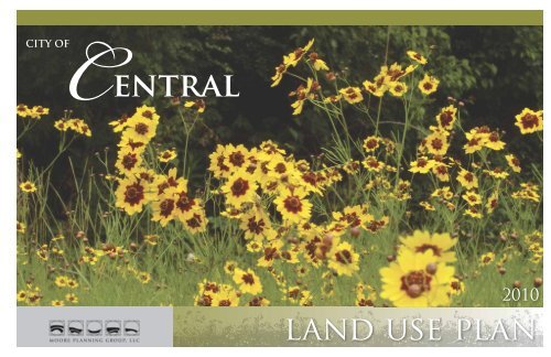
CITY OF<br />
<strong>Central</strong><br />
2010<br />
land use <strong>plan</strong>
TABLE OF CONTENTS<br />
LETTER FROM THE MAYOR<br />
INTRODUCTION<br />
PURPOSE OF THE PLAN<br />
OBJECTIVES AND METHODOLOGY<br />
COMMUNITY HISTORY<br />
COMMUNITY INVENTORY AND ANALYSIS<br />
Regional Infl uences, Regional Generators, Regional Watershed Issues<br />
Natural Resources, Human Resources, Economic Resources<br />
COMMUNITY GOALS<br />
Sustainability Design Assessment Team, Market Feasibility Report, Economic Assessment<br />
Elements <strong>of</strong> Sustainability, Community Planning Workshops<br />
Goals Analysis Matrix, Goals Summary<br />
GUIDING PRINCIPLES<br />
Louisiana Speaks Regional Plan, Smart Growth<br />
SUITABILITY MAPPING<br />
Suitability Criteria, Suitability Mapping Process<br />
SECTOR PLAN<br />
SYNTHESIS LAND USE<br />
Existing Land Use, Floodplains/Open Space, Density Zones<br />
Proposed Land Use<br />
Retail Nodes and ORD Sites<br />
IMPLICATIONS<br />
Zoning Issues, Design Guidelines<br />
Roadway Network, Roadway Design Standards<br />
Sanitary Sewer Capacity<br />
<strong>City</strong> Center<br />
Open Space Conservation, Conservation Subdivisions<br />
Goals Scorecard<br />
Honorable Shelton “Mac” Watts - Mayor<br />
CITY COUNCIL<br />
Ralph Washington,<br />
Mayor Pro-Tem<br />
Louis Dejohn<br />
Joan Lansing<br />
Aaron Moak<br />
DEAR CITIZENS OF CENTRAL March 17, 2010<br />
The purpose <strong>of</strong> the Master Plan is to provide us, your elected leaders, with a tool that<br />
will help us to guide the continuing growth and development <strong>of</strong> our <strong>City</strong> so that <strong>Central</strong><br />
maintains and improves its high quality <strong>of</strong> life.<br />
The vision that dictates the fi nal form <strong>of</strong> the Master Plan comes from you - the many<br />
<strong>Central</strong> citizens who attended well publicized and open <strong>plan</strong>ning meetings and<br />
workshops over the past three years and provided us with your thoughts, ideas and<br />
aspirations for your <strong>City</strong> - translated into four goals which are the guiding principles for<br />
decisions in the <strong>plan</strong>ning.<br />
The fi rst goal is “To Retain the Sanctuary Feeling” by ensuring that when we grow, we<br />
grow in ways that don’t destroy the things we love about <strong>Central</strong> but make them<br />
better.<br />
The second and third goals, “To make our schools even better” and “To improve our<br />
transportation and drainage” are both things that we must continue to work on and<br />
make smart decisions about, and that are very costly.<br />
Which leads to the fourth goal, “To increase business and shopping opportunities”<br />
which as you all know provide jobs and generate the revenue that we need to provide<br />
our residents with the high level <strong>of</strong> services you deserve – including great schools, good<br />
roads, water and sewer service, and police and fi re protection.<br />
Nobody, including me, likes paying high taxes. To avoid that, we must create the<br />
conditions that stimulate business growth. We are going to have to grow as a <strong>City</strong>. The<br />
secret is in growing in a way that satisfi es all <strong>of</strong> the above goals - not just some <strong>of</strong> them,<br />
but ALL <strong>of</strong> them.<br />
The Master Plan uses sophisticated technology, experience and commitment to<br />
translate your goals into something we can use to attract the kinds <strong>of</strong> quality growth<br />
that will enhance our lives and the lives <strong>of</strong> our children.<br />
Can we do it? Can we continue to work together like we did when we decided to<br />
become a city - to work together, support each other, and enjoy together the fruits <strong>of</strong><br />
this vision?<br />
With your support, help, and prayers I think we can.<br />
Sincerely,<br />
Lucky Ross<br />
Shelton “Wac” Watts, Mayor<br />
CITY OF<br />
<strong>Central</strong><br />
a community that cares
INTRODUCTION<br />
PURPOSE OF THE PLAN<br />
In the spring <strong>of</strong> 2005 the residents <strong>of</strong> the<br />
community <strong>of</strong> <strong>Central</strong> made a bold move. After several years<br />
<strong>of</strong> grass roots meetings, coordination, and due diligence<br />
the community went to the polls and voted to incorporate,<br />
This Master Plan is the result <strong>of</strong> that <strong>plan</strong>ning process<br />
- a process initiated in the fall <strong>of</strong> 2006. This report is a summary<br />
documentation <strong>of</strong> four years <strong>of</strong> meetings, mapping, site visits,<br />
and research. It represents the hard work <strong>of</strong> hundreds <strong>of</strong><br />
The ultimate purpose <strong>of</strong> this Master Plan is to<br />
provide community leaders, residents and property owners<br />
with guidance and relevant information for consideration<br />
and assistance in making informed decisions about the future<br />
development in their community but they realized that they<br />
needed a new <strong>plan</strong> that could help them guide the growth in<br />
ways that would allow the community to protect the things they<br />
had worked so hard to assume control over.<br />
becoming the newest municipality in the State <strong>of</strong> Louisiana.<br />
Once this was accomplished, they pushed forward,<br />
establishing the <strong>Central</strong> Community School System as an<br />
independent school district.<br />
Many things contributed to their success. Among the most<br />
important were:<br />
• A determined, skilled, and forward thinking leadership<br />
group;<br />
• A strong community participation ethic;<br />
• A strong sense <strong>of</strong> ownership and commitment to the<br />
excellence <strong>of</strong> their community schools;<br />
• A determination to have control over the growth and<br />
development <strong>of</strong> their community.<br />
Having completed these ambitious tasks they settled into the<br />
equally arduous task <strong>of</strong> managing the myriad <strong>of</strong> responsibilities<br />
now placed squarely upon their shoulders. Among the most<br />
important <strong>of</strong> these new tasks were to initiate <strong>plan</strong>ning the<br />
form <strong>of</strong> their future city - a city that will be an expression <strong>of</strong> the<br />
character and quality <strong>of</strong> the people who call it home.<br />
dedicated citizens, elected leaders and pr<strong>of</strong>essionals who<br />
contributed their diligent efforts and wisdom to its contents.<br />
The <strong>plan</strong> should not, however, be understood as a fi nal<br />
statement <strong>of</strong> purpose and intent. In reality, the work <strong>of</strong><br />
implementation and adaptation is ongoing and perpetual. It<br />
should be understood as a tool upon which the foundations<br />
for the <strong>City</strong> <strong>of</strong> <strong>Central</strong> have been established and from which<br />
it will grow and fl ourish. It should be used as a guide for making<br />
future decisions because it is a translation <strong>of</strong> the community’s<br />
vision for the future. Holding true to the principles and goals set<br />
forth in this Master Plan, present and future leaders and decision<br />
makers have a valuable resource not only for regulating<br />
growth, but for attracting the kind <strong>of</strong> quality growth that will<br />
elevate <strong>Central</strong> <strong>City</strong> as a shining example <strong>of</strong> Smart Growth and<br />
sustainability that others will want to emulate.<br />
The following page documents the <strong>plan</strong>ning process.<br />
growth and development <strong>of</strong> the community.<br />
On a more urgent level, citizens saw the need for a <strong>plan</strong> that<br />
responded more defi nitively to their vision.<br />
Before the <strong>City</strong>’s incorporation, <strong>Central</strong>’s growth and<br />
development was regulated by the Horizon Plan as one <strong>of</strong> the<br />
rural outskirts <strong>of</strong> East Baton Rouge Parish. Although large in area,<br />
the <strong>Central</strong> community represented a small fraction <strong>of</strong> the<br />
metro Baton Rouge area, and residents did not feel that their<br />
priorities received adequate attention. Four months after taking<br />
over the reigns, the community was inundated by development<br />
interests. Several factors were responsible for the heated interest<br />
in building residential development in <strong>Central</strong>:<br />
• Large areas <strong>of</strong> reasonably priced, undeveloped land;<br />
• A school system with strong appeal to young families;<br />
• Very favorable fi nancing for housing development; and<br />
• A super-heated real estate market due to the infl ux <strong>of</strong><br />
people from south Louisiana post Katrina/Rita.<br />
The new community saw challenge and opportunity in the<br />
interest by developers. They wanted growth and economic<br />
Therefore, this <strong>plan</strong> has played a variety <strong>of</strong> roles during its<br />
development. Its fi rst purpose was to help the community<br />
develop a deeper understanding <strong>of</strong> the combination <strong>of</strong><br />
natural, human and economic resources that has shaped it<br />
up to this time. Next it served as a reason to come together<br />
to express their thoughts and dreams about the future and<br />
establish priorities and goals. The suitability Plan <strong>of</strong> 2007 allowed<br />
the <strong>City</strong> to fend <strong>of</strong>f unwanted residential development which<br />
would have seriously stressed their ability to manage. Its fi rst<br />
manifestation - the Interim Land Use Plan <strong>of</strong> early 2009 - allowed<br />
them to focus on economic development -attracting revenue<br />
and job producing investment. This installment <strong>of</strong> the Master<br />
Plan adds yet another layer - the justifi cation for and mapping<br />
<strong>of</strong> future land uses in the <strong>City</strong>. This establishes the basis for<br />
adoption <strong>of</strong> a revised Zoning Ordinance and Development<br />
Code which will help to shape the <strong>City</strong>’s physical, economic,<br />
and to some extent, social and spiritual form.<br />
Its role is to continue serving as resource for all the above needs<br />
while adding a visionary element. After all, <strong>Central</strong> did not<br />
become a city in order to become like every other city.<br />
CITY OF<br />
<strong>Central</strong><br />
a community that cares
OBJECTIVES AND METHODOLOGY<br />
The main objectives <strong>of</strong> this Master Plan are:<br />
• To develop and document the <strong>plan</strong>ning process in an accessible document for use by <strong>City</strong> leaders and citizens.<br />
• To develop a land use <strong>plan</strong> that responds to both the land and the community’s vision and goals, and from which a revised<br />
zoning ordinance and development code can be developed.<br />
• To set forth guidelines that promote orderly and sustainable development patterns and provision <strong>of</strong> effi cient infrastructure.<br />
• To provide the <strong>City</strong> with a tool with which it can pro-actively seek positive investment in the <strong>City</strong>.<br />
In order to achieve the listed objectives, the <strong>plan</strong>ning process that was developed and executed is as follows:<br />
Existing Conditions Inventory - Collection and mapping <strong>of</strong> local and regional Natural, Human and Economic resources<br />
a. Coordination <strong>of</strong> <strong>plan</strong>ning activities for the <strong>City</strong> with other public and/or private regulatory or funding agencies/entities with<br />
concurrent <strong>plan</strong>ning efforts.<br />
b. Initiation and completion <strong>of</strong> Geographic Information System (GIS) mapping <strong>of</strong> existing land and community characteristics<br />
and features.<br />
c. Interpretation <strong>of</strong> a Market Feasibility Analysis, including a demographic and economic pr<strong>of</strong>i le, housing assessment, and<br />
commercial feasibility study.<br />
Community Visioning and Goals - Established by means <strong>of</strong> meetings with the <strong>City</strong> leadership, the Planning Committee, and the<br />
community at large in participative workshops and town hall meetings in order to capture and document the primary concerns<br />
and priorities <strong>of</strong> the community.<br />
Guiding Principles - Utilize Smart Growth Principles and Louisiana Speaks Regional Plan to test community vision and goals<br />
against established <strong>plan</strong>ning principles.<br />
Existing Conditions Analysis - Combining the inventory resource mapping and with community vision and goals utilizing GIS<br />
mapping <strong>of</strong> suitability criteria.<br />
a. Evaluate the land for development suitability, incorporating GIS data and using a process to evaluate and weigh critical<br />
development criteria in terms <strong>of</strong> desirability or benefi t based upon community goals and needs.<br />
b. Study transportation and infrastructure needs and opportunities as they relate to existing developed areas and those<br />
identifi ed as suitable for growth<br />
c. Apply Smart Growth principles to suitability maps, to formulate models identifying growth sectors for goal driven<br />
development.<br />
d. Gather information from the market feasibility research, along with identifi ed growth sector models, to create land<br />
suitability maps.<br />
Synthesis and Land Use - Developing a Proposed Land Use Plan that provides for orderly and fi scally responsible growth that is<br />
both realistic and implementable, to determine best uses for the land and/or control the direction <strong>of</strong> development to suit the<br />
needs <strong>of</strong> the citizens.<br />
Implementation Strategy - Employing the Elements <strong>of</strong> Community Sustainability to establish a sustainable balance between<br />
Infrastructure, Economic Development, Education and Livability through schematic development <strong>of</strong> selected Focus Areas.<br />
CITY OF<br />
<strong>Central</strong><br />
a community that cares
COMMUNITY HISTORY<br />
CITY OF<br />
<strong>Central</strong><br />
a community that cares
HISTORY OF CENTRAL<br />
The area in and around <strong>Central</strong> has a<br />
rich history beginning with European settlers moving in and<br />
homesteading public lands dating as far back as the late 1700’s<br />
and early 1800’s. As with most early European settlements<br />
throughout the United States, Native Americans already had<br />
roots in the region. Amite and Choctaw Indians made their<br />
dwellings along the sandy banks <strong>of</strong> the Amite River that today<br />
River, but had become established enough to contain a post<br />
<strong>of</strong>fi ce, grist and saw mill, a brickyard and blacksmith. Ferry<br />
crossing such as the one functioning during the existence <strong>of</strong><br />
Burlington, have played a major role in the history <strong>of</strong> <strong>Central</strong>.<br />
These crossings were an economically valuable resource that<br />
encouraged people to move through the area. Today, this<br />
same tradition is continued with the Magnolia Bridge crossing.<br />
makes up the eastern boundary <strong>of</strong> the <strong>City</strong> and Parish. The<br />
area’s farmland is strewn with Indian arrowheads that were<br />
made from rocks found along the river’s banks, together<br />
with Indian mounds that are still in existence today. This<br />
heritage should be acknowledged as an important part <strong>of</strong> the<br />
community’s cultural asset base.<br />
In 1853, a <strong>plan</strong> was in the works for the resort community<br />
<strong>of</strong> Greenwell Springs, a name originated from Robert W.<br />
Greenwell who was the previous owner <strong>of</strong> a 250 acre tract <strong>of</strong><br />
land containing several springs. The development <strong>of</strong> a 125 lot<br />
subdivision and seven streets was soon created near the site<br />
<strong>of</strong> the springs. A large hotel with accompanying buildings was<br />
Historical roads <strong>of</strong> commerce traveled along two routes. One<br />
along winding trails that slashed through thick woods <strong>of</strong> pines,<br />
oaks, magnolias and holly, speckled with fl owering dogwoods<br />
and redbuds. The other route required fl atboats and barges<br />
along the meandering Amite River when the stream was<br />
swollen by rains. In time, these muddy trails gave way to roads<br />
that crisscrossed the area. Today, evidence <strong>of</strong> these routes can<br />
still be seen in the form <strong>of</strong> Greenwell Springs Road and Denham<br />
Road. Around 1810, near the current intersection <strong>of</strong> Hooper<br />
and Greenwell Springs Roads, sprang the earliest recorded<br />
community in the area - a small town called Burlington. The<br />
community was primarily known for the ferry crossing the Amite<br />
constructed to house visitors fl eeing yellow fever epidemics<br />
and heat in the cities <strong>of</strong> New Orleans and Baton Rouge. Those<br />
that came to the area looked for work, entertainment, and to<br />
partake in the therapeutic qualities <strong>of</strong> the 10 springs that were<br />
said to cure almost any ailment. At the outbreak <strong>of</strong> the Civil<br />
War more residents from Baton Rouge came to the Greenwell<br />
Springs area, taking refuge from Union forces. During this time<br />
southern troops commandeered the hotel and used it as their<br />
headquarters. After the Battle <strong>of</strong> Baton Rouge in 1862, victorious<br />
northern troops took over the hotel and at the war’s end, the<br />
site was dismantled. During the Reconstruction period many<br />
people sold their land and new settlers moved into the area.<br />
In 1910 a bottling company and new hotel were erected on the<br />
citizens <strong>of</strong> <strong>Central</strong> decided to band together and vote to get<br />
the <strong>City</strong> <strong>of</strong> <strong>Central</strong> incorporated in 2005.<br />
The incorporation <strong>of</strong> <strong>Central</strong> was approved following the vote<br />
by Governor Kathleen Blanco. In 2006, another great step<br />
forward was made for <strong>Central</strong> as voters <strong>of</strong> the city, East Baton<br />
Rouge Parish, and the State <strong>of</strong> Louisiana agreed to allow<br />
<strong>Central</strong> to create the <strong>Central</strong> Independent School District.<br />
The citizens <strong>of</strong> <strong>Central</strong> have had an exciting past and can look<br />
forward to a promising future. Today, with good leadership and<br />
careful <strong>plan</strong>ning future growth will insure an even higher quality<br />
<strong>of</strong> life and continued prosperity.<br />
existing Greenwell Spring’s site. The venture was not successful<br />
and the company went out <strong>of</strong> business. Not long after, the<br />
hotel was converted into the Greenwell Springs Tuberculosis<br />
Hospital. It burned down in 1922 and a new facility was rebuilt.<br />
The hospital treated tuberculosis patients until the 1950’s. Today<br />
Greenwell Springs Hospital is used by the State <strong>of</strong> Louisiana as a<br />
psychiatric facility.<br />
The proximity to the Capital <strong>City</strong> <strong>of</strong> Baton Rouge allowed<br />
<strong>Central</strong> to develop into a thriving community in the 1980’s with<br />
small business growth, high-quality schools, and subdivision<br />
development. As the area <strong>of</strong> <strong>Central</strong> become more and more<br />
<strong>of</strong> an extension <strong>of</strong> Baton Rouge’s lengthening suburbia, the<br />
CITY OF<br />
<strong>Central</strong><br />
a community that cares
COMMUNITY INVENTORY & ANALYSIS<br />
CITY OF<br />
<strong>Central</strong><br />
a community that cares
REGIONAL INFLUENCES<br />
The inventory and analysis mapping represents the majority <strong>of</strong> the<br />
community assessment phase. Community assets and liabilities are<br />
grouped into three categories:<br />
• Natural Resources - Includes land, water, and all other natural<br />
systems that affect or provide resources for living;<br />
• Human Resources - Includes both the status <strong>of</strong> existing residents<br />
and the facilities, structures and systems that provide support;<br />
• Economic Resources - Includes the facilities, products and<br />
services that promote economic activity and the infrastructure<br />
required to support commerce.<br />
10 mile radius<br />
The assessment begins by looking at the community context<br />
at a regional scale. As shown in the map, the <strong>City</strong> <strong>of</strong> <strong>Central</strong> is<br />
located very near the center <strong>of</strong> the Baton Rouge Metro Area. It<br />
shares a boundary with Baton Rouge, the Capitol <strong>City</strong> and the<br />
State’s most populous city. The surrounding areas, including the<br />
<strong>City</strong> <strong>of</strong> Zachary and Livingston and Ascension Parishes have seen<br />
explosive residential growth in the past fi ve years that has seriously<br />
challenged their ability to maintain a high quality <strong>of</strong> life. Crowded<br />
interstate highways take their toll on commuters into Baton Rouge<br />
employment centers. Schools are having to expand faster than<br />
expected and disrupting community life. While <strong>Central</strong> has been<br />
somewhat insulated from these problems, increased development<br />
pressure is being felt.<br />
The map illustrates the wide variety <strong>of</strong> economic and cultural assets<br />
in the region many <strong>of</strong> which are within a ten mile radius <strong>of</strong> <strong>Central</strong>.<br />
CITY OF<br />
<strong>Central</strong><br />
a community that cares
REGIONAL GENERATORS<br />
The Regional Generators map illustrates the relative size and<br />
location <strong>of</strong> the region’s principal economic “engines”. They are<br />
divided into two groups; Public Sector and Private Sector. While<br />
none <strong>of</strong> the major generators are in <strong>Central</strong>, a majority <strong>of</strong> the<br />
<strong>Central</strong> workforce takes advantage <strong>of</strong> the opportunities presented<br />
in the Baton Rouge area. As is typical with most Capital cities,<br />
State Government is by far the largest public employer in the<br />
region providing six times more jobs than the next closest public or<br />
private entity. State <strong>of</strong>fi ces provide well-paying jobs that provide a<br />
secure economic base for the community. Other important public<br />
generators include major educational institutions and the State<br />
Prison in West Feliciana Parish.<br />
The private sector is much more diverse and is represented mainly<br />
by the manufacturing, transportation, construction and health<br />
care industries. Many <strong>of</strong> these entities require a highly trained<br />
workforce and provide good salaries for successful employees.<br />
The presence <strong>of</strong> this and the public sector generators create the<br />
need for a multitude <strong>of</strong> smaller employers that provide services to<br />
the regional population including fi nancial and insurance services,<br />
food, transportation, and specialty products.<br />
Along with the good things associated with its proximity to Baton<br />
Rouge also come some challenges typical <strong>of</strong> large cities. Crime<br />
rates, snarled traffi c , and noise and air pollution among them.<br />
<strong>Central</strong> has fortunately not shared in these negatives but should<br />
remain vigilant to the potential as growth continues.<br />
CITY OF<br />
<strong>Central</strong><br />
a community that cares
WATERSHEDS - AMITE RIVER BASIN<br />
FLOOD REDUCTIONS<br />
57% FLOW<br />
1<br />
10 Year Flood - 1.5 feet lower<br />
50 Year Flood - 1.4 feet lower<br />
100 Year Flood - 1.2 feet lower<br />
4<br />
2<br />
10 Year Flood - 4.5 feet lower<br />
50 Year Flood - 4.0 feet lower<br />
100 Year Flood - 3.8 feet lower<br />
The <strong>City</strong> <strong>of</strong> <strong>Central</strong> is bound to the east and west by two major<br />
rivers: the Amite River and the Comite River. Both waterways<br />
are part <strong>of</strong> the Amite River Watershed that drains parts <strong>of</strong> two<br />
counties in Mississippi and parts <strong>of</strong> eight parishes in Southeast<br />
Louisiana. Due to the volume <strong>of</strong> water fl ow at the downstream<br />
outlet <strong>of</strong> the Amite River into Lake Maurepas, backwater<br />
fl ooding <strong>of</strong>ten occurs during extended rain events within the<br />
lower to middle reaches <strong>of</strong> the Amite River Basin. The last major<br />
fl ood event occurred in April 1983 which produced the highest<br />
43% FLOW<br />
3<br />
Comite River<br />
2<br />
Amite River<br />
3<br />
4<br />
10 Year Flood - 6.0 feet lower<br />
50 Year Flood - 5.1 feet lower<br />
100 Year Flood - 4.9 feet lower<br />
10 Year Flood - 7.2 feet lower<br />
50 Year Flood - 6.3 feet lower<br />
100 Year Flood - 5.5 feet lower<br />
*(After completion <strong>of</strong> the Comite<br />
Diversion Canal Project. Data provided<br />
by the Amite River Basin Commission)<br />
water levels along the Amite River and Comite River during the<br />
20th Century. This fl ooding event had a great impact on the<br />
<strong>City</strong> <strong>of</strong> <strong>Central</strong>.<br />
The U. S. Army Corps <strong>of</strong> Engineers - New Orleans District <strong>of</strong>fi ce<br />
1<br />
has defi ned and proceed with construction <strong>of</strong> several projects<br />
within the Amite River Basin to assist in reducing backwater<br />
fl ooding. One such project is the Comite River Diversion Canal.<br />
The scope <strong>of</strong> this project is the construction <strong>of</strong> a water diversion<br />
canal from the Comite River through East Baton Rouge Parish<br />
to the Mississippi River. During long duration rain storm events,<br />
the diversion canal will displace approximate 57% <strong>of</strong> the fl ow<br />
within the Comite River. The hydraulic models studied by the<br />
Corps <strong>of</strong> Engineers indicate that fl ood levels within the lower<br />
to middle section <strong>of</strong> the Amite River and Comite River will be<br />
reduced between 1.2 to 7.2 feet depending for a storm event<br />
that ranges from a 10 year storm to a 100 year storm.<br />
Even though the diversion canal will assist in alleviating fl ooding levels within the <strong>City</strong> <strong>of</strong> <strong>Central</strong>, fl ooding<br />
along the Comite and Amite Rivers will not be eliminated as fl ooding will continue to occur in the low lying<br />
areas <strong>of</strong> the <strong>City</strong>. As the <strong>City</strong> <strong>of</strong> <strong>Central</strong> and other areas within the Amite River Basin Watershed continue to<br />
grow in the future covering more <strong>of</strong> the land with impervious surfaces, fl ood pressure will continue if other<br />
measures to mitigate and manage storm drainage are not implemented.<br />
CITY OF<br />
<strong>Central</strong><br />
a community that cares
Natural Resources - WATERSHEDS<br />
Natural Resources - FLOOD ZONES<br />
Natural Resources - SOILS<br />
As shown in the map above, most <strong>of</strong> the incorporated area <strong>of</strong> <strong>Central</strong> is served<br />
by the Upper and Lower Comite River drainage basins. Major tributaries include<br />
Saunders, Blackwater and Beaver Bayous, and Draughan’s and Shoe Creek. The<br />
eastern edge <strong>of</strong> the city falls within the Amite Basin. Watershed management and<br />
water quality protection are both considered high priorities at the Local, State and<br />
Federal levels and exert considerable infl uence on development capacity and<br />
patterns. Protecting the watershed from over-development, pollution and activities<br />
that burden the rivers with siltation will have far reaching benefi ts for the community.<br />
Maintaining and enhancing the capacity <strong>of</strong> the drainage system will have to be<br />
a high priority. A Flood Plain Management Plan for the <strong>City</strong> <strong>of</strong> <strong>Central</strong> should be<br />
completed as soon as possible to avoid compromising this crucial natural system.<br />
Recognizing the importance <strong>of</strong> protecting the <strong>City</strong> and regional water quality within<br />
the Amite River Basin and minimizing impacts to new and future development,<br />
the current 100 Year Flood level and topographic elevations within the <strong>City</strong> were<br />
further studied to determine which parts <strong>of</strong> the <strong>City</strong> were at greatest risk <strong>of</strong> repeated<br />
inundation. As shown on the map above, approximately 60% <strong>of</strong> the incorporated<br />
area is within the 100 Year Flood Zone. This presents great challenges to future<br />
development since development within these areas requires substantial fi lling and<br />
can signifi cantly reduce the capacity <strong>of</strong> the drainage basin and cause more severe<br />
fl ooding in the remaining areas. An additional challenge for <strong>Central</strong> is the fact that<br />
fl ood risk can also be aggravated by conditions outside the <strong>City</strong> such as obstructions<br />
and capacity diminishing issues upstream and downstream <strong>of</strong> the two rivers.<br />
The soils in the <strong>City</strong> <strong>of</strong> <strong>Central</strong> fall into fi ve (5) main groups:<br />
Cascilla-Ochlockonee: Loamy soils on fl oodplains along rivers and subject to overfl ow<br />
Freeland-Loring-Olivier: Moderate to well drained loamy soils on the natural levees <strong>of</strong> creeks<br />
Calhoun-Zachary-Frost: Poorly drained loamy soils in broad fl ats and depressions<br />
Oliver-Calhoun-Loring: Poorly to moderately well-drained soils in broad fl ats and depressions<br />
Deerford-Verdun: Level to nearly level somewhat poorly drained loamy soils<br />
Other than the Cascilla-Ochockonee, the other soil associations are capable <strong>of</strong><br />
supporting new construction typical to the region without major costs or need for<br />
extraordinary soil engineering to provide for suffi cient structural bearing capacity<br />
so long as adequate drainage can be provided. Best soils for urban/suburban<br />
development include the Freeland-Loring-Olivier and Deerford-Verdun associations.<br />
CITY OF<br />
<strong>Central</strong><br />
a community that cares
Natural Resources - ELEVATION<br />
Natural Resources - LAND COVER<br />
Natural Resources - TREE COVER<br />
A topographic inventory <strong>of</strong> <strong>Central</strong> shows an east-west banding <strong>of</strong> elevations<br />
ascending from the extreme southeast tip <strong>of</strong> the incorporated area to the north<br />
western extremity. The typical fl ow <strong>of</strong> creeks, bayous and drainage systems follow<br />
land forms and are generally from north to south. While the fl ood zone calculations<br />
are complicated by a variety <strong>of</strong> other issues, the elevation can be a primary indicator<br />
<strong>of</strong> the development potential <strong>of</strong> an individual property based on the potential to<br />
affect positive drainage to lower areas.<br />
Land Cover mapping provides a snapshot view <strong>of</strong> the existing development densities<br />
and coverages in the community. Of primary interest are the following areas:<br />
Vegetated Urban - This category identifi es moderately dense development <strong>of</strong> subdivisions,<br />
and commercial structures<br />
Agriculture/Crop/Pasture - This category identifi es open land with little or no structural<br />
development, or development at very low density.<br />
Forested - This category identifi es areas with dense tree cover outside <strong>of</strong> wetland areas<br />
Forested Wetlands - This category identifi es areas with dense tree cover in wetlands<br />
The land cover map provides valuable insight into the extent and character <strong>of</strong> existing<br />
development patterns and natural features. It also provides indications <strong>of</strong> where open<br />
lands may be available for future development<br />
Tree cover mapping provides an indication <strong>of</strong> the richness <strong>of</strong> the natural environment<br />
in the community. Tree cover serves many important functions - oxygen production,<br />
environmental cooling, water control, wildlife habitat, noise reduction, and many<br />
others. In addition, tree cover and forested areas provide tangible economic benefi ts<br />
well beyond their value as timber. Natural areas attract high-quality development<br />
and add value to them. They provide high quality recreational and educational<br />
opportunities. They inspire with their beauty. This natural asset is one <strong>of</strong> the most<br />
valuable resources available to the <strong>Central</strong> community and should be given serious<br />
consideration in the <strong>plan</strong>ning process.<br />
CITY OF<br />
<strong>Central</strong><br />
a community that cares
Human Resources - DEMOGRAPHICS<br />
Population Age<br />
Education Attainment<br />
Population Growth<br />
The current population composition in <strong>Central</strong> until 2008 had been one that followed<br />
national trends with a large number <strong>of</strong> middle aged and senior citizens, in comparison<br />
to children and young adults. This trend is changing as more young families move<br />
into the <strong>City</strong> and young adults decide to stay. As <strong>of</strong> 2008 the largest percentage <strong>of</strong><br />
male and females were between the ages <strong>of</strong> 18 to 45, a highly desirable group for<br />
marketers and retail developers.<br />
Median Household Income<br />
Similar to Baton Rouge, the majority <strong>of</strong> education attainment in <strong>Central</strong> is<br />
concentrated within the middle education range, with a smaller percentage <strong>of</strong><br />
the population without a high school degree and a smaller percentage <strong>of</strong> college<br />
graduates than the Baton Rouge region. The majority <strong>of</strong> the working population<br />
in <strong>Central</strong>, approximately 88 percent has a high school diploma or equivalent,<br />
compared to 80 percent in the Baton Rouge region. As the population grows it is<br />
anticipated that the educational attainment levels <strong>of</strong> the working-age population will<br />
increase to higher education levels with the infl ux <strong>of</strong> college educated households<br />
that move into the <strong>City</strong>.<br />
In 2005 when the <strong>City</strong> <strong>of</strong> <strong>Central</strong> became an incorporated municipality, it became<br />
Louisiana’s 12th largest city. The total area <strong>of</strong> <strong>Central</strong> is approximately 66 square<br />
miles, which is almost the same area as Baton Rouge, but with only 10% <strong>of</strong> the<br />
population. The close proximity to the employment centers in the region and the<br />
recent creation <strong>of</strong> <strong>Central</strong>’s own public school district has fueled it’s increase in<br />
population. During the 1990’s the <strong>Central</strong> community experienced a growth rate<br />
<strong>of</strong> approximately 10.7 percent. The growth <strong>of</strong> households during this time was<br />
estimated at a cumulative 19.5 percent increase.<br />
From 2000 to 2008 the growth slowed down to an annual rate <strong>of</strong> approximately<br />
4.4 percent with an estimated population <strong>of</strong> 28,045. As improvements begin to<br />
happen with the <strong>Central</strong> School district facilities, it is anticipated that younger<br />
families will move into the <strong>City</strong> playing a major role in annual growth projected to<br />
be 38,430 in 2020.<br />
The median household income in <strong>Central</strong> has consistently been <strong>of</strong> a higher value as<br />
compared to the median household income in the Baton Rouge region and overall in<br />
the State <strong>of</strong> Louisiana. This trend is anticipated to continue as the area grows and new<br />
opportunities for economic development are capitalized.<br />
CITY OF<br />
<strong>Central</strong><br />
a community that cares
Human Resources - SCHOOLS<br />
Human Resources - EMERGENCY RESPONSE<br />
Human Resources - PLACES OF WORSHIP<br />
Proposed New School<br />
Public Library<br />
The map above shows the distribution <strong>of</strong> existing public and private educational<br />
assets. The <strong>City</strong> <strong>of</strong> <strong>Central</strong> was established by the citizens with the desire to create<br />
a high-quality learning environment that is focused on student achievement.<br />
Education is a high priority for the community as proven by the recently approved<br />
tax bond to improve existing facilities and construct new schools. Education<br />
and learning innovation extends beyond the traditional class room setting<br />
and should incorporate all new learning techniques and opportunities. One<br />
such opportunity would be to develop a learning campus within a mixed-use<br />
center that can be used by all citizens. Opportunities for higher and continued<br />
education and learning will give the <strong>City</strong> a strategic advantage for smart growth<br />
and sustainability, and will attract high-quality investment interest.<br />
One challenge the <strong>City</strong> <strong>of</strong> <strong>Central</strong> faces as a newly incorporated community is<br />
establishing adequate public safety and emergency response infrastructure. The<br />
<strong>City</strong> currently has fi ve fi re stations that serve the entire 66 square miles and police<br />
protection within the <strong>City</strong> is currently being served by the East Baton Rouge Parish<br />
Sheriff Department. As the <strong>City</strong> grows and the tax base increases, additional fi re<br />
protection and the creation <strong>of</strong> the <strong>City</strong> <strong>of</strong> <strong>Central</strong> Police Department should be<br />
explored for maintaining and improving high insurance ratings and the promotion <strong>of</strong><br />
the <strong>City</strong> <strong>of</strong> <strong>Central</strong> as being a safe, livable, and caring community for all citizens.<br />
A review <strong>of</strong> the existing Places <strong>of</strong> Worship and Faith Based Organization facilities<br />
reveals that there are approximately 25 opportunities for citizens to participate and<br />
practice personal and community faith-based fellowship. The majority are located<br />
in close proximity to existing neighborhoods and demonstrate that religion is an<br />
important community livability component. Beyond their strictly spiritual function,<br />
community churches are <strong>of</strong>ten the locus for coordination <strong>of</strong> community service<br />
projects, health screenings, civic events and educational opportunities. As such, these<br />
facilities provide important community gathering and outreach facilities.<br />
CITY OF<br />
<strong>Central</strong><br />
a community that cares
Economic Resources - EXISTING PARKS<br />
Economic Resources - TRANSPORTATION<br />
Economic Resources - CONGESTED ROADWAYS<br />
New<br />
BREC<br />
Park<br />
New<br />
BREC<br />
Acquisition<br />
The majority <strong>of</strong> the park and recreation facilities within <strong>Central</strong> are part <strong>of</strong> the overall<br />
Baton Rouge Parish Recreation (BREC) system. These facilities range from small<br />
neighborhood parks to larger regional parks. BREC has recently purchased a tract<br />
<strong>of</strong> land east <strong>of</strong> Joor Road and north <strong>of</strong> Lovett Road and is <strong>plan</strong>ning a new active<br />
recreation sports complex to add needed baseball fi elds. It has also completed the<br />
purchase <strong>of</strong> a large tract at the confl uence <strong>of</strong> the Amite and Comite Rivers. BREC<br />
long range <strong>plan</strong>s also identify several other additions to the system including a strong<br />
desire to develop bicycle and canoe trails in the community which would be great<br />
assets. The outdoor recreation potential in <strong>Central</strong> is tremendous. Combined parks<br />
and conserved open space and wooded areas could be parlayed into a very strong<br />
attraction to future business and residential development.<br />
From the 1980’s to early 2000’s <strong>Central</strong> maintained a rural and low density residential<br />
atmosphere. The roadway network was designed for a rural area and the majority <strong>of</strong><br />
the development is along 2 lane roadway corridors. These roadways were effi cient<br />
in safely moving the low volume traffi c within the <strong>Central</strong> and Greenwell Springs<br />
communities. In recent years Livingston Parish communities east <strong>of</strong> <strong>Central</strong> began<br />
experiencing rapid growth. The main vehicular corridors connecting Livingston Parish<br />
into East Baton Rouge Parish - Interstate 10 and Hwy 190 - became congested with<br />
daily commuters. Many commuters began utilizing the Magnolia Bridge / Wax Road<br />
Amite River crossing as an alternative creating serious traffi c congestion in <strong>Central</strong><br />
during daily peak traffi c times. The majority <strong>of</strong> this traffi c is commuter generated<br />
traffi c which has created a burden for <strong>Central</strong> residents. Additional development<br />
along these transportation corridors should be carefully examined to prevent further<br />
impairment <strong>of</strong> traffi c safety and function. There are several roadway improvement<br />
projects in the <strong>plan</strong>ning and construction phases that will assist in alleviating traffi c<br />
congestion as well as provide capacity for new growth and development in <strong>Central</strong>.<br />
These projects include the widening <strong>of</strong> Joor Road south <strong>of</strong> Hooper Road, the <strong>Central</strong><br />
Thruway, and widening <strong>of</strong> Sullivan Road from Lovett Road to Hooper Road. These<br />
major roadway improvements will have a positive impact. However, <strong>Central</strong>’s<br />
roadway network will still be seriously defi cient in collector class roadways needed to<br />
funnel traffi c to major roadways from the widely spread residential areas around the<br />
community. Providing more route options will also provide for improved emergency<br />
response activities.<br />
CITY OF<br />
<strong>Central</strong><br />
a community that cares
Economic Resources - SANITARY SEWER<br />
Economic Resources - COMMUNITY COMMERCE<br />
Sanitary sewer system improvements are currently<br />
underway that should add some capacity for expansion.<br />
Unfortunately, the improvements were designed before<br />
this <strong>plan</strong>ning process was fi nalized and so will not be totally<br />
integrated with the new land use <strong>plan</strong>.<br />
The existing wastewater system within the <strong>City</strong> was developed to serve mainly<br />
residential areas that contained a density greater than 1 to 5 acre lot development<br />
and is composed <strong>of</strong> both gravity and pressurized force-main systems. The majority<br />
<strong>of</strong> the main service lines are located along existing roadways with a fl ow direction<br />
back to the wastewater treatment facility near the Baton Rouge Metropolitan Airport.<br />
At the time <strong>of</strong> the development <strong>of</strong> this phase <strong>of</strong> the <strong>City</strong> <strong>of</strong> <strong>Central</strong> Master Plan, the<br />
future capacity was unknown as East Baton Rouge Parish was beginning an overall<br />
Parish wastewater improvement <strong>master</strong> <strong>plan</strong>. The capacity to add a large residential<br />
or commercial development in the <strong>City</strong> and tie to the existing sanitary sewer system<br />
is limited. Outlying areas comprise more rural and agriculture land (low density land<br />
use) and have limited access to sanitary sewer and domestic water. The majority<br />
<strong>of</strong> existing development has been single-family detached residential neighborhoods<br />
with lot sizes from 10,000 s.f. lots to over 1 acre lots. Minimal commercial development<br />
along the transportation corridors and at key intersections include grocery,<br />
pharmaceutical, gas / convenient store, and fast-food type uses within strip<br />
commercial centers. Schools, faith-based facilities, and light-industrial businesses are<br />
scattered in close proximity to the residential neighborhoods. In areas without sanitary<br />
sewer service, individual treatment <strong>plan</strong>ts, PAC <strong>plan</strong>ts and septic systems prevail and<br />
pose a threat to health and environmental quality. Sparsely developed areas afford<br />
many development opportunities with large tracts <strong>of</strong> undeveloped land, but are<br />
challenged by lack <strong>of</strong> sanitary sewer infrastructure needed to support them.<br />
Existing commercial development in <strong>Central</strong> is limited. It typically occurs at or<br />
near roadway intersections and in a traditional suburban form - large parking lot in<br />
front, business to the rear. There are four major retail nodes and several minor ones<br />
scattered through the <strong>City</strong>. The most activity is strung out along Hooper Road between<br />
Joor and Sullivan Roads. According to the Market Feasibility report completed for<br />
<strong>Central</strong>, the area could support substantially more commerce than it does at this<br />
time. While this would be a benefi t for the <strong>City</strong> in many ways, careful placement<br />
and arrangement should be sought in order to avoid creating a shallow depth<br />
hodgepodge that presents an unappealing image. There is currently no major<br />
manufacturing/assembly industry in the <strong>City</strong>.<br />
CITY OF<br />
<strong>Central</strong><br />
a community that cares
Economic Resources - HORIZON PLAN LAND USE<br />
Economic Resources - LAND<br />
Economic Resources - RESIDENTIAL SUBDIVISIONS<br />
The Horizon Plan shown above has been the regulating land use <strong>plan</strong> for <strong>Central</strong><br />
up until the adoption <strong>of</strong> the proposed Interim Land Use Plan. The land use <strong>plan</strong><br />
shown above demonstrates that East Baton Rouge Parish continued thinking <strong>of</strong><br />
the <strong>Central</strong> community as a predominantly ‘monotone’ residential area on the<br />
outskirts <strong>of</strong> Baton Rouge with isolated clumps <strong>of</strong> rural uses. There are provisions for<br />
commercial development along the major roadways, but little response to the need<br />
<strong>of</strong> connectivity, open space, and drainage patterns.<br />
The Development Density map above classifi es the community in terms <strong>of</strong> the intensity<br />
<strong>of</strong> existing development:<br />
Dense Development - includes small lot residential and intense commercial development<br />
Medium Density - includes typical subdivisions and suburban style commercial development<br />
Low Density - includes very light residential, commercial, industrial and/or agricultural uses<br />
Undeveloped - includes areas with little or no development<br />
When compared to the Horizon Plan it shows how the “blanket” residential designation<br />
has led to sprawling, shallow development along existing roadways outstripping<br />
the Parish’s ability to provide sanitary sewer service and stressing the transportation<br />
network. On the positive side, it also shows that there are signifi cant areas <strong>of</strong><br />
undeveloped land which can be used for new development or open space.<br />
This map identifi es existing residential subdivisions in the community. Most <strong>of</strong> <strong>Central</strong>’s<br />
residential areas are <strong>of</strong> high-quality and are a great benefi t. Scattered areas <strong>of</strong><br />
dilapidation do exist and bear close scrutiny over the long term to prevent the onset<br />
<strong>of</strong> blight. There are many other residential properties in <strong>Central</strong> not highlighted by this<br />
map due to the fact that they are single residences <strong>of</strong>ten on larger parcels established<br />
before subdivision regulations were institutionalized. The Existing Land Use Plan on<br />
the following page shows a more accurate depiction <strong>of</strong> residential development.<br />
As a land use, residential adds great value to a community if done properly and<br />
maintained adequately. It does, however, impose upon the community the need<br />
to provide a variety <strong>of</strong> services including: schools, roads, water and sewer service,<br />
garbage collection, emergency service, and other essential services.<br />
CITY OF<br />
<strong>Central</strong><br />
a community that cares
COMMUNITY GOALS<br />
CITY OF<br />
<strong>Central</strong><br />
a community that cares
GOALS DEVELOPMENT PROCESS<br />
Three key themes continued to rise to the surface during community<br />
visioning. The themes seem to capture the essence <strong>of</strong> what the<br />
community values and wishes to preserve as it moves forward,<br />
The goals development process provides several important<br />
functions:<br />
Identifi es key issues important to the community<br />
Allows for community expression <strong>of</strong> identity and character<br />
Provides the framework around which <strong>plan</strong>ning decisions are made<br />
This process has spanned four years and has required countless hours <strong>of</strong><br />
community meetings, interviews, and workshops. Citizen participants included<br />
State and local elected leaders, State and Parish <strong>of</strong>fi cials, business owners,<br />
business and social organizations, pr<strong>of</strong>essionals, and high school students.<br />
Additionally, these efforts were enhanced by community participation in three<br />
parallel efforts with overlapping themes and issues:<br />
Sustainability Design Assessment Team<br />
Market Feasibility Study<br />
Economic Development Assessment<br />
The results <strong>of</strong> each <strong>of</strong> these visioning and goals efforts were analyzed and<br />
distilled into a set <strong>of</strong> clearly defi ned goals that were used to guide the <strong>plan</strong>ning<br />
process. The following pages summarize the fi ndings and conclusions.<br />
RURAL CHARACTER - <strong>Central</strong> continues to be one <strong>of</strong> the most rural<br />
parts <strong>of</strong> East Baton Rouge Parish. Horses roam freely over open<br />
pasture land. Deep wooded areas weave throughout the <strong>City</strong><br />
following freshwater creeks and bayous. Narrow country roads<br />
meander through long undeveloped stretches. Long-time residents<br />
have developed a great appreciation for these and many other<br />
attributes and fear that they are being lost to unbridled development.<br />
Preserving the essence <strong>of</strong> the rural feeling will be an important<br />
consideration.<br />
CITY LIVING IN THE COUNTRY - While most residents enjoy living in<br />
“the country”, they also appreciate access to the amenities that<br />
cities have to <strong>of</strong>fer - fi ne dining, entertainment options, health and<br />
medical care, etc. At present, the problem is that they must leave<br />
the “country” to enjoy the “city”. In addition to the inconvenience,<br />
residents also realize that this practice represents a net loss to their<br />
own community in terms <strong>of</strong> business development, job creation and<br />
sales taxes. They would like to have some <strong>of</strong> the niceties <strong>of</strong> the city in<br />
their own community, but only if it can be done without wrecking the<br />
country feeling.<br />
SANCTUARY - Baton Rouge is the most populous city in the State. As<br />
such it <strong>of</strong>fers access to many very important assets. However, along<br />
with the good things it also provides a heaping helping <strong>of</strong> unpleasant<br />
things - traffi c congestion, violent crime, concrete and asphalt, noise,<br />
pollution, etc. In an eloquent statement at one <strong>of</strong> the community<br />
meetings a <strong>Central</strong> citizen described how when she crosses the<br />
bridge across the Comite River into <strong>Central</strong>, her heart rate decreases<br />
and her breathing relaxes. She feels like she has entered a sanctuary<br />
<strong>of</strong> trees and wildlife - <strong>of</strong> a peaceful community that provides for<br />
spiritual re-creation. There was unanimous agreement. Preserving this<br />
sense <strong>of</strong> “sanctuary” will be an important priority for the <strong>plan</strong>ning.<br />
SDAT<br />
MARKET<br />
FEASIBILITY<br />
STUDY<br />
ECONOMIC<br />
DEVELOPMENT<br />
ASSESSMENT<br />
COMMUNITY INVENTORY & ANALYSIS<br />
COMMUNITY<br />
PLANNING<br />
PROCESS<br />
ELEMENTS<br />
OF<br />
COMMUNITY<br />
SUSTANIBILITY<br />
COMMUNITY<br />
VISION<br />
&<br />
GOALS<br />
CITY OF<br />
<strong>Central</strong><br />
a community that cares
SDAT<br />
KEY SDAT RECOMMENDATIONS<br />
NATURAL RESOURCES<br />
Develop a fl oodplain mitigation <strong>plan</strong><br />
Implement sustainable development strategies<br />
Protect valued scenic and cultural sites<br />
TRANSPORTATION<br />
Develop a set <strong>of</strong> near- and long-term needed improvements<br />
Partner with existing initiatives to tailor current/future roadway<br />
designs to match <strong>Central</strong>’s vision and land-use types<br />
Develop an implementation <strong>plan</strong><br />
PLANNING, LAND USE, AND LIVABILITY<br />
In January 2006 <strong>Central</strong> submitted a proposal to the AIA for an SDAT (Sustainable<br />
Development Assessment Team) program to assist the town and its citizens in<br />
addressing key issues facing the community. The issues included creating an<br />
identity for the newly incorporated city, preserving the city’s rural lifestyle and<br />
beauty, developing a response to increasing pressures <strong>of</strong> development and<br />
traffi c congestion, and addressing the ongoing threat <strong>of</strong> natural hazards and<br />
fl ooding. The proposal also emphasized the need to consider the integration <strong>of</strong><br />
education, economic development, infrastructure, and livability as they affect<br />
these issues.<br />
The AIA accepted the proposal and, after a preliminary visit by a small group<br />
in February, the SDAT members arrived in <strong>Central</strong> on April 16. For three days<br />
the team members, working closely with local <strong>of</strong>fi cials, community leaders,<br />
technical experts, and citizens, studied the community and its concerns. During<br />
those three days, the team came to understand the issues and used its expertise<br />
to frame a wide range <strong>of</strong> recommendation which were presented to the<br />
community in a public meeting on April 18, 2006.<br />
Create a sense <strong>of</strong> place through a defi ned “downtown triangle”<br />
Balance jobs and housing in downtown<br />
Adopt zoning and subdivision regulations<br />
Create a set <strong>of</strong> design standards for downtown<br />
SCHOOLS AND EDUCATION<br />
Address physical needs <strong>of</strong> the current school building inventory<br />
Evaluate the location and placement <strong>of</strong> schools<br />
Adopt best practices for all new construction<br />
Set aside land for future neighborhood elementary schools<br />
COMMUNITY LIVABILITY AND SUSTAINABILITY<br />
Create a sense <strong>of</strong> place, reinforcing the idea <strong>of</strong> <strong>Central</strong> as a sanctuary<br />
Foster the development <strong>of</strong> a <strong>Central</strong> vernacular - both for landscape<br />
and architectural design<br />
Embrace livable community strategies and incorporate them into<br />
zoning bylaws<br />
Provide housing affordability for all household types and age groups<br />
Consider “passive survivability” as a design criteria for all<br />
municipal buildings<br />
Ensure that economic development is sustainable<br />
SDAT recommends consideration <strong>of</strong> roundabouts as an alternative road design measure to provide smooth<br />
traffi c fl ow while preserving rural character. The <strong>plan</strong> above shows one option for the Greenwell Springs Sullivan<br />
intersection<br />
CITY OF<br />
<strong>Central</strong><br />
a community that cares
MARKET FEASIBILITY STUDY<br />
DEMOGRAPHIC HIGHLIGHTS<br />
KEY RECOMMENDATIONS<br />
The <strong>City</strong> <strong>of</strong> <strong>Central</strong> contracted with GCR & Associates, Inc. in 2008 to provide<br />
a market feasibility analysis for future retail and commercial development.<br />
By analyzing local purchasing power and employment patterns, this analysis<br />
estimates the demand for additional retail services and commercial square<br />
footage in the coming years.<br />
Ultimately, the analysis will serve as a tool for the city’s elected <strong>of</strong>fi cials and<br />
business leaders to <strong>plan</strong> for future growth through zoning, land assemblage, and<br />
potential public-private partnerships.<br />
The fi rst phase <strong>of</strong> the study concluded that <strong>Central</strong> will add an unprecedented<br />
number <strong>of</strong> new households over the next decade, and these households will<br />
have a higher income and greater number <strong>of</strong> children than current household<br />
averages. The second phase <strong>of</strong> the study translates the initial assessment into<br />
real values by determining local purchasing power, the capacity <strong>of</strong> local retail<br />
to absorb those purchases, and gaps in retail services. This phase also includes a<br />
summary <strong>of</strong> regional workforce patterns and the city’s ability to absorb a portion<br />
<strong>of</strong> the region’s job growth.<br />
The work resulted in general recommendations that will be integrated into the<br />
Master Plan effort.<br />
Population growth in <strong>Central</strong> has been steady, and will rapidly accelerate in<br />
the coming years.<br />
The elderly population and the number <strong>of</strong> children will increase in relative<br />
terms and in real numbers, calling for additional services catering to the<br />
elderly and youth.<br />
The income distribution within <strong>Central</strong> will shift towards higher income<br />
households in the coming years.<br />
The racial pr<strong>of</strong>i le <strong>of</strong> <strong>Central</strong> will become more diverse as the <strong>City</strong> continues<br />
to integrate with the Baton Rouge economy, but the <strong>City</strong> will remain a<br />
predominantly white community.<br />
In general, new residents will have a higher education level than current<br />
residents, and will travel outside the city limits for employment.<br />
<strong>Central</strong> may be able to attract employers in the health care, education,<br />
and fi nance, insurance and real estate industries as a part <strong>of</strong> Baton Rouge<br />
MSA employment growth.<br />
<strong>Central</strong> residents are much more likely to own homes than to rent.<br />
SURVEY HIGHLIGHTS<br />
The overwhelming majority who responded to the survey list two complaints:<br />
limited shopping, services, and entertainment and congested roads and<br />
infrastructure.<br />
The top three goals expressed in the survey, in order <strong>of</strong> importance, were:<br />
1) attract new businesses, services, and retail;<br />
2) improve and expand roads and other infrastructure; and<br />
3) improve and expand education and education infrastructure.<br />
When asked why people visit <strong>Central</strong>, a quarter <strong>of</strong> survey participants did<br />
not know or stated that nothing attracted people to <strong>Central</strong>.<br />
When asked to identify the greatest advantages <strong>of</strong> living in <strong>Central</strong>, residents<br />
declared <strong>Central</strong>’s quality <strong>of</strong> life as its best advantage, due to low crime<br />
rates, peaceful setting, and nice people.<br />
Establish a city-sponsored, non-pr<strong>of</strong>i t development corporation to identify potential areas for<br />
retail development and act as a liaison between the <strong>City</strong> and private development interests.<br />
Dedicate “nodes” within city limits targeted for retail activity. Separate “nodes” by retail<br />
typology through zoning regulations, so that big-box retailers do not detract from the charm <strong>of</strong><br />
a neighborhood lifestyle center, and weekly trips to the grocery store are not overwhelmed with<br />
traffi c to other areas.<br />
To effectively <strong>of</strong>fer the full range <strong>of</strong> services consumers now demand, the <strong>City</strong> will need to<br />
coordinate with private developers to fuse public and private spaces. The initial consideration<br />
could be a town center at Hooper and Sullivan, where the city intends to locate its public<br />
<strong>of</strong>fi ces.<br />
The <strong>City</strong> can <strong>of</strong>fer incentives to potential developers to direct growth. Incentives can include<br />
infrastructure investment, economic incentives or simplifi ed permitting processes. Incentive<br />
programs can be packaged with state and federal incentive programs.<br />
To streamline the process <strong>of</strong> development and to increase interest in <strong>Central</strong> among<br />
developers, market available commercial land through the city’s web site. Provide technical<br />
assistance to landowners and potential developers to streamline real estate transactions.<br />
Identify an interim space for public use in order to help maintain the strong sense <strong>of</strong> community.<br />
Utilize the space on a regular basis as a means <strong>of</strong> facilitating community trade and gathering,<br />
including a farmer’s market, festivals, and craft fairs. Simultaneously, work with the community<br />
to develop permanent gathering spaces.<br />
Develop recreation spaces in proximity to commercial areas to leverage additional spending.<br />
This will foster the relationship between recreation activities and related retail spending.<br />
Encourage new building and design trends through fi nancial incentives and collaboration with<br />
cutting-edge builders. Embracing energy effi ciency and green design will create a buzz about<br />
the city, and act as a marketing tool for bringing in new businesses.<br />
Focus on small enterprises as a part <strong>of</strong> the city’s economic development initiatives. The<br />
competition to attract large fi rms is stiff, and the incentives can be expensive for the jurisdiction.<br />
Smaller businesses and start-ups are more interested in a healthy business climate and<br />
adequate space. The concentration <strong>of</strong> small fi rms will ultimately lead to a diverse business<br />
environment.<br />
CITY OF<br />
<strong>Central</strong><br />
a community that cares
CENTRAL COMMUNITY ASSESSMENT<br />
STRENGTHS and WEAKNESSES<br />
COMMUNITY SURVEY<br />
Early in 2009, <strong>Central</strong> leaders contracted with Steve Vassallo to conduct an<br />
economic development assessment and begin formulation <strong>of</strong> an economic<br />
development strategy for the city. The report is very optimistic:<br />
“<strong>Central</strong>’s economic future is extremely “Bright’ primarily for the multiple<br />
reasons <strong>of</strong> attracting growth from a number <strong>of</strong> different industrial sectors<br />
including residential construction; retail; healthcare; light industrial; and<br />
retirees. A compelling case can be made for all <strong>of</strong> these components;<br />
however the greatest amount <strong>of</strong> growth may come from younger adults<br />
desiring their children to be educated in the <strong>Central</strong> School District.”<br />
The following are some selected highlights from the report that were used to<br />
help guide the <strong>master</strong> <strong>plan</strong> development.<br />
Weaknesses<br />
Lack <strong>of</strong> Storm-water Drainage Capacity<br />
Lack <strong>of</strong> Moderately-Priced Housing<br />
Lack <strong>of</strong> Town Center<br />
Lack <strong>of</strong> Restaurant Options<br />
Lack <strong>of</strong> Good Signage and Gateways<br />
Lack <strong>of</strong> Medical Facilities<br />
Traffi c Congestion<br />
Aged Appearance <strong>of</strong> Schools<br />
Lack <strong>of</strong> Polished Marketing Approach<br />
Sales Tax Leakage<br />
Strengths<br />
Perceived Safety/Security<br />
Proximity to Baton Rouge<br />
Public School Performance<br />
Population Growth<br />
Growing Sales Tax Revenues<br />
Citizen Participation in Community Activities<br />
TND Development<br />
Vibrant Construction Activity<br />
<strong>City</strong> Leadership in Planning<br />
Availability <strong>of</strong> Land<br />
What is <strong>Central</strong>s’ greatest appeal to prospective businesses?<br />
Fast Growing Area<br />
Ground Floor Opportunity For Development<br />
Great Schools<br />
Very Friendly People (country atmosphere)<br />
Which should be <strong>Central</strong>’s highest Economic Development priority?<br />
50 % Retail Recruitment<br />
19% Industrial Recruitment<br />
15 % Service Sector Recruitment<br />
16% High Tech<br />
How would you describe <strong>Central</strong> to someone who has never been here?<br />
Small town country feel<br />
Friendly, caring growing area with great schools<br />
If you could change only one thing about <strong>Central</strong>, what would it be?<br />
Infrastructure (primarily roads)<br />
Traffi c<br />
School Facilities<br />
Is there a “business void” that you would like to see filled in <strong>Central</strong>?<br />
Restaurants<br />
Variety <strong>of</strong> retail options<br />
What do you like most about living in <strong>Central</strong>?<br />
Friendly atmosphere (the people)<br />
Country rural environment<br />
Low crime (safe area)<br />
Great schools<br />
How would you rate “economic opportunity” in <strong>Central</strong> today?<br />
30% Outstanding<br />
47% Above Average<br />
11% Average<br />
4% Poor<br />
CITY OF<br />
<strong>Central</strong><br />
a community that cares
Below are some random quotes by community members made during<br />
economic development workshops.<br />
COMMUNITY QUOTES<br />
“<strong>Central</strong> has a unique opportunity<br />
to shape its own destiny.”<br />
“Last year, <strong>Central</strong> High School recorded the<br />
highest test scores in the state for the mandated<br />
testing required.”<br />
“The land use <strong>plan</strong>ning in <strong>Central</strong> has been a positive step<br />
forward for economic development.”<br />
“ My business has prospered by getting involved in the community.”<br />
TOP 20 ECONOMIC DEVELOPMENT RECOMMENDATIONS<br />
In order <strong>of</strong> urgency as agreed by the community participants<br />
1<br />
2<br />
3<br />
4<br />
5<br />
6<br />
7<br />
8<br />
9<br />
10<br />
11<br />
12<br />
13<br />
14<br />
15<br />
16<br />
17<br />
18<br />
19<br />
20<br />
Recruit Retail Establishments<br />
Expand Medical Facilities<br />
Aesthetic Improvements to Public Schools<br />
Consolidate Zip Codes<br />
Actively Pursue All Grant Opportunities<br />
Establish a Town Center<br />
Extend Hooper Road<br />
Upgrade Chamber <strong>of</strong> Commerce web site<br />
Improve Signage/Gateways<br />
Recruit Louisiana Businesses<br />
Create Economic Development Foundation<br />
Recruit Community College<br />
Basic Economic Development Training<br />
Recruit White Collar Employers<br />
Use Creative Marketing<br />
Promote Business/Technology Parks<br />
Sponsor Annual Event for Realtors<br />
Promote Women Owned Business<br />
Form Sister <strong>City</strong> Alliance<br />
Recruit Corporate Headquarters<br />
CITY OF<br />
<strong>Central</strong><br />
a community that cares
ELEMENTS OF SUSTAINABILITY<br />
HIGH QUALITY OF LIFE<br />
Wikipedia begins its article on “Quality <strong>of</strong> Life” as follows: “The well-being or quality <strong>of</strong> life <strong>of</strong> a population is an<br />
important concern in economics and political science. It is measured by many social and economic factors. A large<br />
part is standard <strong>of</strong> living, the amount <strong>of</strong> money and access to goods and services that a person has; these numbers<br />
are fairly easily measured. Others like freedom, happiness, art, environmental health, and innovation are far harder<br />
to measure. This has created an inevitable imbalance as programs and policies are created to fi t the easily available<br />
economic numbers while ignoring the other measures, that are very diffi cult to <strong>plan</strong> for or assess.”<br />
Debate on quality <strong>of</strong> life is millennia-old, with Aristotle giving it much thought, eventually settling on the notion <strong>of</strong><br />
eudaimonia, a Greek term <strong>of</strong>ten translated as ‘happiness, as central.”<br />
One might otherwise look to Maslow’s Hierarchy <strong>of</strong> Needs and determine that the higher the population is on the<br />
pyramid, the higher their quality <strong>of</strong> life is.<br />
Another description <strong>of</strong> communities with high quality <strong>of</strong> life comes from the United Kingdom, ... “places where people<br />
want to live and work, now and in the future. They meet the diverse needs <strong>of</strong> existing and future residents, are sensitive<br />
to their environment, and contribute to a high quality <strong>of</strong> life. They are safe and inclusive, well <strong>plan</strong>ned, built and run, and<br />
<strong>of</strong>fer equality <strong>of</strong> opportunity and good services for all.”<br />
Regardless <strong>of</strong> the interpretation, quality <strong>of</strong> life should be understood to occur on a continuum - from good to poor,<br />
high to low- and it is the responsibility <strong>of</strong> leadership to create the conditions that elevate the quality <strong>of</strong> life.<br />
SUSTAINABILITY<br />
Community sustainability is a simple concept that seeks equilibrium between production and consumption. Whenever<br />
consumption outpaces production, the community must import production, thus making it dependent and inherently<br />
unsustainable. Therefore, a sustainable community is one that practices good fi scal management and stewardship <strong>of</strong><br />
resources so that it can provide for the basic needs <strong>of</strong> its members. Maintaining a balance between the four essential<br />
elements improves sustainability through careful management <strong>of</strong> natural, human and economic resources.<br />
MAINTAINING BALANCE - As communities work toward a prosperous future<br />
for their citizens, it is essential to maintain a proper balance between the<br />
four essential elements <strong>of</strong> community sustainability: Education, Livability,<br />
Infrastructure and Economic Development. Scant resources must be invested<br />
so that these four areas maintain an equilibrium. Over-investment in one area<br />
will inevitably require cuts in others and will hinder a community’s ability to be<br />
self-sustaining.<br />
The nature <strong>of</strong> the four elements is that they are interlocking and some blending<br />
An enterprise in which all citizens, businesses,<br />
and institutions are actively engaged in the<br />
life-long pursuit <strong>of</strong> knowledge.<br />
The neologism livability is an abstract noun<br />
<strong>of</strong>ten applied to the built environment and its<br />
contribution to the quality <strong>of</strong> life <strong>of</strong> inhabitants.<br />
The built structures and systems which form the<br />
skeletal connections and support for social<br />
and economic activities in a community.<br />
Economic development is a complex multidimensional<br />
concept involving improvements<br />
in human well-being – however defi ned.<br />
inevitably occurs. An educated population is required to stimulate high<br />
quality economic development while transportation and communications<br />
infrastructure make economic development possible. Finally, livability assets<br />
provide quality places within which families fl ourish and with which businesses<br />
can recruit high quality employees. Each element is composed <strong>of</strong> a variety<br />
<strong>of</strong> components which must be assessed and evaluated for quality, balance<br />
and service to the other elements. Investment in any element should always<br />
seek to also satisfy some requirements in others. Once a balance is achieved,<br />
communities can then focus upon looking forward. Anticipating future trends<br />
becomes an important consideration in city <strong>plan</strong>ning. Being aware <strong>of</strong> and<br />
<strong>plan</strong>ning for innovations in education, livability, infrastructure and economic<br />
development can help position a community at the forefront <strong>of</strong> emerging<br />
EDUCATION<br />
Pre-K through 12 (Public and Private)<br />
Libraries, Programs, Remote Learning<br />
Community Colleges<br />
Vocational-Trade School<br />
Universities/Advanced Degrees<br />
Continuing Education<br />
Workforce Training<br />
Enrichment Education<br />
LIVABILITY<br />
Environment<br />
Recycling/Garbage/Solid Waste<br />
Public Safety<br />
Health Care<br />
Open Space/Parks and Recreation<br />
Land Use<br />
Historic/Cultural Amenities<br />
Community Character<br />
Convenience/Access<br />
INFRASTRUCTURE<br />
Transportation<br />
Housing<br />
Storm Water Drainage<br />
Sewer<br />
Water<br />
Energy/Utilities<br />
Communications<br />
ECONOMIC DEVELOPMENT<br />
Natural Resources<br />
Community Development<br />
Business Retention and Growth<br />
Local Business Support<br />
Marketing<br />
Entrepreneurship Development<br />
Job Creation<br />
Market Access<br />
Tax Structure<br />
initiatives and attract positive investments.<br />
Cost <strong>of</strong> Living<br />
Labor Market & Recruiting Strategy<br />
CITY OF<br />
<strong>Central</strong><br />
a community that cares
COMMUNITY PLANNING<br />
EDUCATION GOAL<br />
OBJECTIVES<br />
The <strong>City</strong> <strong>of</strong> <strong>Central</strong> provides a combination <strong>of</strong> educators and<br />
education facilities that serve all residents using technology and<br />
innovative techniques for jobs not yet created.<br />
Objectives<br />
I<br />
The <strong>City</strong>, School Board, and business partners will provide a combination <strong>of</strong> educators and<br />
education facilities that serve all residents <strong>of</strong> the <strong>City</strong>.<br />
Community Perception<br />
The <strong>City</strong> <strong>of</strong> <strong>Central</strong> was established due to the overwhelming desire <strong>of</strong> the<br />
citizens to create a community focused on providing fi rst-rate education.<br />
Citizens held the perception and concern that the school facilities were not<br />
being kept up to date and many buildings had outlived their useful lifespan.<br />
Community leaders recognize that schools are what attract people and<br />
business to a community and it is important for the community to have<br />
control over future investment in the education system.<br />
The location <strong>of</strong> new schools is an important decision in the community. The<br />
perception is that schools are not always built in areas convenient to the<br />
students they serve<br />
II<br />
III<br />
IV<br />
V<br />
The education system will foster work force development for jobs <strong>of</strong> today and tomorrow<br />
through the development and attraction <strong>of</strong> technology based employers and through<br />
partnerships with local and regional businesses<br />
The <strong>Central</strong> education system and facilities will embrace and teach all levels <strong>of</strong> students<br />
about the environment and sustainable living practices.<br />
Education facilities will promote the use <strong>of</strong> next-generation technology to educate<br />
students for future jobs.<br />
Educators and community leaders will explore the opportunity to provide higher education<br />
opportunities in the <strong>City</strong>.<br />
Throughout 2007 and 2008, <strong>Central</strong> leaders worked with Moore Planning<br />
Group, LLC. in the process <strong>of</strong> developing a Master Plan for their new city. MPG<br />
emphasized maintaining a careful balance between the “Four Elements <strong>of</strong> a<br />
Sustainable Community” : Infrastructure, Education, Economic Development<br />
and Livability. The work included extensive citizen workshops and review and<br />
culminated in a community Vision and a series <strong>of</strong> Goals and Objectives to guide<br />
the <strong>plan</strong>ning process. The Goals and Objectives are aligned with the elements<br />
and are provided here for review.<br />
Community Vision<br />
<strong>Central</strong> - A community that cares. A sustainable<br />
community based in faith, education, and diversity<br />
embracing a balance <strong>of</strong> Education, Economic<br />
Development, Infrastructure, and Livability<br />
opportunities for all citizens.<br />
Reality Response<br />
The school system is what attracted current residents to the area and<br />
prompted them to incorporate as a <strong>City</strong>.<br />
As the new <strong>City</strong> grows it is critical to provide a school system that continues<br />
to exceed state and national standards and provides the community with<br />
well educated citizens and leaders <strong>of</strong> the future.<br />
Future school facilities should be developed in a sustainable manner<br />
both as physical structures and in terms <strong>of</strong> where they are located in the<br />
community.<br />
The <strong>City</strong> and <strong>Central</strong> School District have the opportunity to make schools<br />
an integral part <strong>of</strong> village and neighborhood centers.<br />
The <strong>master</strong> <strong>plan</strong> provides an opportunity to develop education<br />
facilities that go beyond the 12th grade and to provide technology that will<br />
enable students to obtain jobs in fi elds that do not exist today.<br />
Dedication to next generation technology will enable the <strong>City</strong> to achieve<br />
it’s unique vision.<br />
Innovation<br />
1. Seamless integration <strong>of</strong> learning between traditional schools and civic realm<br />
2. Monitor / Publicize Test Scores<br />
3. Building Entrepreneurship into secondary school program and physical <strong>plan</strong>ts<br />
4. Turn Brainpower into Pr<strong>of</strong>i t<br />
5. Share Knowledge<br />
6. Teacher Incentives<br />
7. Health Care Alliance (K-16)<br />
CITY OF<br />
<strong>Central</strong><br />
a community that cares
ECONOMIC DEVELOPMENT GOAL<br />
OBJECTIVES<br />
The <strong>City</strong> <strong>of</strong> <strong>Central</strong> provides support for a wide range <strong>of</strong> economic<br />
opportunities, projects, programs, and policies within a diverse and<br />
sustainable employment base and high quality developments.<br />
Community Perception<br />
Objectives<br />
I<br />
To create opportunities in medical and technology fi elds through the development <strong>of</strong><br />
regional research and senior care facilities.<br />
The <strong>City</strong> <strong>of</strong> <strong>Central</strong> is a bedroom community that lacks diversity in business.<br />
There is a need for additional service businesses such as restaurants and<br />
entertainment venues.<br />
There is a need to grow the economic base in a manner that will provide<br />
employment opportunities to residents.<br />
The community does not want heavy industrial business due to<br />
environmental concerns.<br />
The preference is to attract research, technology, medical and education<br />
service industries to the <strong>City</strong>.<br />
II<br />
III<br />
IV<br />
To utilize technology and vocational programs in the educational system to train residents<br />
for current and future employment within the community.<br />
To establish a diverse and sustained employment base including a wide range <strong>of</strong> retail,<br />
restaurant and entertainment service business as well as research, technology, medical<br />
and other pr<strong>of</strong>essional businesses incorporated into village and neighborhood centers.<br />
To provide opportunities for residents to access a wide range <strong>of</strong> employment opportunities<br />
and services in close proximity to their residence through the development <strong>of</strong> mixed-use<br />
village and neighborhood centers. This approach to community development fosters<br />
coordination between the <strong>City</strong> and economic development.<br />
BUFFALO HUNTING vs. ECONOMIC GARDENING<br />
Traditionally, local economic developers have sought growth by trying to lure businesses<br />
from outside a region. Hunting can produce big economic gains, but it poses lots <strong>of</strong><br />
challenges: It’s slow, uncertain and usually requires big marketing budgets and travel<br />
along with a raft <strong>of</strong> local and state incentives. It also may end up attracting highly<br />
mobile companies looking for the cheapest place to do business at the moment - and<br />
willing to leave for another town as soon as they believe the grass is greener elsewhere.<br />
“Economic gardening” focuses on helping so-called second-stage companies with 10<br />
to 50 employees and revenue <strong>of</strong> $1 million to $25 million - local businesses that have<br />
survived at least fi ve years and are growing revenue and adding employees.<br />
Economic gardening doesn’t generate the headlines associated with big business<br />
relocations but can produce solid results within two to three years, its adherents claim.<br />
The approach is also attractive to economic developers because it doesn’t require lots<br />
<strong>of</strong> capital. More than money, second-stage businesses need the kind <strong>of</strong> sophisticated<br />
marketing information, IT and management advice that much larger fi rms take for<br />
granted - and are <strong>of</strong>ten the key to expanding further.<br />
- Barbara Miracle, Florida Trend (Excerpt)<br />
http://www.fl oridatrend.com/article.asp?aID=51943<br />
Reality Response<br />
River transportation, LSU, and State Government established the <strong>City</strong> <strong>of</strong><br />
Baton Rouge as the major regional retail, service, and industrial employer.<br />
The synergy generated by these core industries enables Baton Rouge to<br />
attract other industries and will be a factor in the <strong>City</strong> <strong>of</strong> <strong>Central</strong>’s efforts to<br />
develop an economic base.<br />
The <strong>City</strong> <strong>of</strong> <strong>Central</strong> has is a shared vision that will create a community that<br />
focuses on education, sustainability, and high quality <strong>of</strong> life as a guiding<br />
principle for community development.<br />
These factors become tools that the city can use to attract services and<br />
pr<strong>of</strong>essional businesses to the city.<br />
The <strong>master</strong> <strong>plan</strong> should guide community efforts to retain/attract businesses<br />
that are consistent with the community’s vision, goals and objectives as well<br />
as ensuring that businesses are appropriately located and designed within<br />
the <strong>City</strong>.<br />
Innovation<br />
1. Regional / Global Collaboration / Networking<br />
2. Monitor / Publicize Median Household Income<br />
3. Ingrained IT<br />
4. Higher Learning Partner<br />
5. Patent Assistance Program<br />
6. Branding Consistency (National Image Challenge)<br />
7. Housing Affordability / Range<br />
8. Manage Growth Cycle<br />
9. Attract citizens with “Learning Hunger Disease”<br />
10. Comprehensive Workforce Analysis<br />
CITY OF<br />
<strong>Central</strong><br />
a community that cares
INFRASTRUCTURE GOAL<br />
OBJECTIVES<br />
THE INFRASTRUCTURE PARADIGM<br />
Our communities are frequently disrupted, dissected, and visually polluted by noisy<br />
highways, monstrous transmission towers, utility poles, and drainage ditches.<br />
Undeniably, these structures deliver services essential to modern life. That their physical<br />
presence is <strong>of</strong>ten seen as a “necessary evil” overlooks their potential to meet an even<br />
broader range <strong>of</strong> needs. Their physical presence can, with proper <strong>plan</strong>ning, multiply<br />
the “quality <strong>of</strong> life” assets <strong>of</strong> communities - serving also as open space connections,<br />
recreation, and habitat preservation/continuity without cost multiplication.<br />
This was the subject <strong>of</strong> an article entitled “Shared Wisdom” by William Morrish, FASLA, in<br />
Landscape Architecture Magazine which is excerpted below. These concepts rightly<br />
belong in the filter through which infrastructure improvements should be screened. The<br />
following summarizes Morrish’s “Shared Wisdom”.<br />
Infrastructure ties everything together. Highways, transit stations, water mains,<br />
pumping stations, and treatment and disposal facilities are the visible underpinning <strong>of</strong><br />
civic life that provide our ability to communicate and connect. The idea that you can<br />
escape ugly urban infrastructure has created the problem <strong>of</strong> sprawl.<br />
Complex, multi-use systems that mimic ecological function and are seamlessly<br />
assimilated into their natural surroundings is the goal. Complex systems may use more<br />
land, but the costs pale next to those <strong>of</strong> maintaining concrete and steel. Infrastructure<br />
should protect and replenish natural systems, aggressively recycle products, and<br />
reclaim places. The landscape is a composition <strong>of</strong> man-made or man-modified spaces<br />
which can serve as infrastructure or background for our collective existence.<br />
Land values are highest and crime rates are lowest wherever open space is<br />
integrated into the cultural and natural infrastructure. Merely creating an isolated park<br />
district draws no attention. Infrastructure has to be part <strong>of</strong> the basic civic equation.<br />
Well thought out infrastructure provides a social safety net and a cultural system that<br />
defines place and should inspire and shape the made landscape.<br />
The <strong>City</strong> <strong>of</strong> <strong>Central</strong> has pro-active sustainable infrastructure and<br />
maintains a high priority on safe, functional, and aesthetically designed<br />
facilities.<br />
Community Perception<br />
Traffi c was noted as a major concern in the community, especially gridlock<br />
during morning and afternoon rush hour. People living in Livingston Parish<br />
add to traffi c congestion as they travel through <strong>Central</strong> to and from Baton<br />
Rouge.<br />
Residents are concerned about the environmental and social impacts <strong>of</strong><br />
the proposed Baton Rouge Loop Road. However, a lack <strong>of</strong> transportation<br />
capacity and infrastructure will limit the city’s ability to grow; in particular in<br />
the northern portions <strong>of</strong> the community.<br />
Residents are concerned about environmental problems due to potential<br />
failure or lack <strong>of</strong> maintenance <strong>of</strong> individual sewage treatment systems<br />
Home Owners, Property Owners, and Business Owners believe that the storm<br />
drainage and fl ooding hazards have been reduced by the implementation<br />
<strong>of</strong> the Comite Diversion Canal.<br />
Reality Response<br />
It is important that the city develop infrastructure and transportation <strong>master</strong><br />
<strong>plan</strong>s to guide infrastructure expansion for current and future residents and<br />
businesses.<br />
These <strong>plan</strong>s are also important tools for coordinating the construction <strong>of</strong><br />
infrastructure in the city; such as installing sewer and water lines when<br />
roadway improvements are underway.<br />
The <strong>City</strong> <strong>of</strong> <strong>Central</strong> has taken a pro-active stance related to the Baton<br />
Rouge Loop Road and will work closely with citizens <strong>of</strong> <strong>Central</strong> and regional<br />
neighbors to ensure that this roadway will have minimal impacts on residents<br />
and maximize economic opportunities.<br />
Future growth and infrastructure improvements must incorporate innovative<br />
sustainable technology to minimize cost and waste as well as provide a high<br />
degree <strong>of</strong> protection for the natural environment.<br />
Objectives<br />
I<br />
II<br />
III<br />
IV<br />
V<br />
VI<br />
VII<br />
VIII<br />
IX<br />
To develop a safe, multi-modal transportation system that is designed in an aesthetically<br />
pleasing manner consistent with the vision <strong>of</strong> the city.<br />
To develop an infrastructure <strong>master</strong> <strong>plan</strong> for the city that will guide policy and capital<br />
improvements and be coordinated with other capital investments in the community.<br />
To develop infrastructure that is sustainable and is funded through enterprise programs.<br />
To attain LEED Platinum standards for all <strong>City</strong> facilities for the lowest possible energy<br />
consumption and to minimize costs associated with maintaining the facilities in order to<br />
minimize the expenses associated with infrastructure expansion.<br />
To maintain a high priority on public health, safety and welfare through reducing the number<br />
<strong>of</strong> private sewage treatment <strong>plan</strong>ts, ensuring proper application <strong>of</strong> fl oodplain zoning, and<br />
protecting natural drainage areas and reducing and amount <strong>of</strong> impervious surfaces in the<br />
community.<br />
To embrace a local and regional approach to storm water and fl oodplain management<br />
working with local, Parish, and regional neighbors.<br />
To develop a transportation <strong>master</strong> <strong>plan</strong> that guides developers and city projects so that<br />
commercial and residential areas are easily accessible and interconnected and include<br />
transportation forms that minimize or lower energy consumption such as trails, bikeways, and<br />
alternative transportation services.<br />
To ensure that the location and design <strong>of</strong> the Baton Rouge “LOOP Road” has minimal<br />
negative impacts on the community and provides maximum economic opportunities for<br />
developing village and town centers and employment in the city.<br />
To established an Infrastructure Action Team that provides grass roots input to the<br />
implementation <strong>of</strong> the <strong>plan</strong>.<br />
Innovation<br />
1. Sewer system capacity will drive most big decisions<br />
2. Densifi cation <strong>of</strong> Community – cost to manage / replace<br />
3. Clean water is second only to sanitary sewer in terms <strong>of</strong> future concern<br />
CITY OF<br />
<strong>Central</strong><br />
a community that cares
LIVABILITY GOAL<br />
OBJECTIVES<br />
The <strong>City</strong> <strong>of</strong> <strong>Central</strong> is a healthy, safe, and sustainable community that<br />
preserves and enhances natural character and has well designed and<br />
interconnected mixed-use village and neighborhood centers.<br />
Objectives<br />
I<br />
To maintain a strong moral direction through faith-based interaction, and to provide public<br />
safety and community regulations that keep it safe, secure and protects property values.<br />
Community Perception<br />
The <strong>City</strong> <strong>of</strong> <strong>Central</strong> is blessed with natural beauty, the Comite and Amite<br />
Rivers, and abundant woodland and wetland areas. Residents wish to<br />
preserve these important assets and have voiced concerns over limited<br />
access to the rivers.<br />
There is no real “center” to <strong>Central</strong> and lacks recreational and cultural<br />
activities for visitors.<br />
There is a lack <strong>of</strong> transitional housing for seniors and a need for a regional<br />
medical center in the city.<br />
Faith is important to the community. Some residents voiced a concern that<br />
as the community grows it will loose the moral fi ber that exists now, and<br />
public safety could be threatened.<br />
II<br />
III<br />
IV<br />
V<br />
VI<br />
VII<br />
VIII<br />
To develop defi ned town, village, and neighborhood centers where civic, cultural,<br />
education, entertainment, business and living space are combined in a mixed-use setting.<br />
To adopt ordinances defi ning and preserving open space.<br />
To weave natural and recreation areas into urban centers through the development <strong>of</strong> multiuse<br />
trails.<br />
To provide access to health care services for all segments <strong>of</strong> the population.<br />
To <strong>of</strong>fer a mixture <strong>of</strong> housing for senior citizens into the fabric <strong>of</strong> the village and neighborhood<br />
centers providing easy access to public amenities, health and other important services.<br />
To provide a wide range <strong>of</strong> parks and recreation opportunities for residents and residents <strong>of</strong><br />
the region.<br />
To develop amenities that serve existing residents and attract visitors through an eco-tourism<br />
program and cultural facilities.<br />
The integration <strong>of</strong> livability assets into<br />
the very fabric <strong>of</strong> community life pays<br />
great dividends to citizens. Utilizing<br />
“green infrastructure” as the basic<br />
organizing force provides<br />
easy, pleasing and valueadding<br />
access to the<br />
essential services and<br />
activity centers <strong>of</strong> the<br />
community. Paying<br />
attention to the health<br />
<strong>of</strong> the natural systems<br />
also provide benefi ts<br />
by enhancing the<br />
overall health <strong>of</strong> the<br />
population at a shared cost.<br />
Reality Response<br />
The natural beauty <strong>of</strong> the river corridors, woodlots and wetlands are an<br />
important element in the <strong>City</strong> <strong>of</strong> <strong>Central</strong>. As the city grows it will be important<br />
to protect natural open space areas that benefi t the environment and the<br />
community through the establishment <strong>of</strong> conservation and preservation<br />
<strong>plan</strong>ning policies and through implementation ordinances and codes.<br />
Balancing the need for new development with natural area preservation<br />
requires concentrating mixed-use and neighborhood centers in appropriate<br />
areas where transportation and infrastructure can support them and adhere<br />
to Smart Growth Principles.<br />
Linkages should be developed between open space areas. Village and<br />
neighborhood centers would be the optimal location for medical services<br />
and transitional housing. This type development provides opportunities for all<br />
ages <strong>of</strong> the community to interact as neighbors.<br />
This scheme also links the urban to the rural by providing easy access to<br />
recreation and natural areas through multi-use trails.<br />
IX<br />
X<br />
XI<br />
To incorporate sustainable development practices in all civic endeavors and promote these<br />
practices for the development <strong>of</strong> all property in the city.<br />
To support the establishment <strong>of</strong> a non-pr<strong>of</strong>i t organization whose mission is to identify and<br />
purchase scenic and environmentally sensitive parcels <strong>of</strong> land to remain public open space<br />
for perpetuity.<br />
To establish a citizen-based Livability Action Team that provides grass roots input to city and<br />
business leaders about the implementation <strong>of</strong> this <strong>plan</strong>.<br />
Innovations<br />
1. Entertainment / Venues (Art / Leisure / Sports)<br />
2. Crime (Monitor / Publicize Risk Index)<br />
3. Positive / Purposeful Conversation (Apathy)<br />
4. Baby Boom living<br />
5. Monitor / Publicize Health Statistics (County)<br />
6. Balance civic participation and leadership<br />
7. Communicate Project, Program, and Policy updates<br />
8. Link and leverage assets<br />
9. Alternative Energy<br />
10. Conservation Planning<br />
CITY OF<br />
<strong>Central</strong><br />
a community that cares
CENTRAL GOALS COMMUNITY EVALUATION ASSESSMENT GOALS EVALUATION<br />
STRENGTHS and WEAKNESSES<br />
GOALS ANALYSIS MATRIX COMMUNITY SURVEY<br />
2 Points<br />
1 Point<br />
KEY RECOMMENDATIONS<br />
KEY ISSUES<br />
CITY CENTER<br />
TRANSPORTATION<br />
SCHOOLS<br />
GREEN SPACE<br />
MEDICAL FACILITIES<br />
SENIOR FACILITIES<br />
BUSINESS/RETAIL<br />
INFRASTRUCTURE<br />
MIX USES<br />
RETAIL NODES<br />
Expand Medical Facilities<br />
Establish a Town Center<br />
Create a sense <strong>of</strong> place through a defi ned “downtown triangle”<br />
Extend Hooper Road<br />
Recruit Community College<br />
Promote Business/Technology Parks<br />
Recruit Corporate Headquarters<br />
Recruit Retail Establishments<br />
Develop a fl oodplain mitigation <strong>plan</strong><br />
The Community Goals for this <strong>plan</strong>ning process were formulated by fi rst<br />
identifying a set <strong>of</strong> key issues. The key issues were concerns and concepts that<br />
consistently and repeatedly arose during visioning and goals discussions. The key<br />
issues are:<br />
• The need for a CITY CENTER<br />
• The need to improve TRANSPORTATION and connectivity<br />
• The need to improve SCHOOL facilities<br />
• The need to conserve GREENSPACE<br />
• The need to attract MEDICAL FACILITIES<br />
• The need for SENIOR FACILITIES to serve an aging population<br />
• The need to attract more RETAIL/BUSINESS investment<br />
• The need to improve drainage and sanitary sewer INFRASTRUCTURE<br />
• The need to attract MIXED-USE developments<br />
• The need to focus development in RETAIL NODES and avoid sprawl<br />
These key issues are placed in a matrix (at right) and cross referenced with<br />
conclusions and recommendations taken from the SDAT, Market Feasibility Study,<br />
and the Community Economic Development Assessment for matches. Where<br />
there is total congruity between the Recommendation and Key Issues, entries<br />
recieve double points. Where there is an indirect connection, one point. Where<br />
there is no relationship, zero points. The totals are then tallied to establish the<br />
fi nalized Community Goals.<br />
Balance jobs and housing in downtown<br />
Evaluate the location and placement <strong>of</strong> schools<br />
Set aside land for future neighborhood elementary schools<br />
Dedicate “nodes” within city limits targeted for retail activity.<br />
Coordinate with private developers to fuse a town center at Hooper and Sullivan<br />
Identify an interim space for public use.<br />
Develop recreation spaces in proximity to commercial areas.<br />
Focus on small enterprises as a part <strong>of</strong> the city’s economic development initiatives.<br />
Protect natural drainage areas and reduce impervious surfaces in the community.<br />
Provide transportation network so that areas are easily accessible and interconnected<br />
Provide transportation network that includes trails and bikeways.<br />
Ensure that the Baton Rouge “LOOP Road” has minimal negative impacts .<br />
Develop defi ned town, village, and neighborhood centers.<br />
Weave natural and recreation areas into urban centers.<br />
Provide access to health care facilities for all segments <strong>of</strong> the population.<br />
Offer a mixture <strong>of</strong> housing for senior citizens.<br />
Provide a wide range <strong>of</strong> parks and recreation opportunities.<br />
CITY OF<br />
<strong>Central</strong><br />
a community that cares
CENTRAL GOALS COMMUNITY EVALUATION ASSESSMENTGOALS EVALUATION<br />
STRENGTHS and WEAKNESSES<br />
GOALS ANALYSIS MATRIX COMMUNITY SURVEY<br />
KEY RECOMMENDATIONS<br />
cont’d<br />
KEY ISSUES<br />
CITY CENTER<br />
TRANSPORTATION<br />
SCHOOLS<br />
GREEN SPACE<br />
MEDICAL FACILITIES<br />
SENIOR FACILITIES<br />
BUSINESS/RETAIL<br />
INFRASTRUCTURE<br />
MIX USES<br />
RETAIL NODES<br />
Serve existing residents/attract visitors through eco-tourism and cultural facilities.<br />
Develop medical research and senior care facilities.<br />
Provide employment opportunities in close proximity to residential areas.<br />
Improve Signage/Gateways<br />
Recruit Louisiana Businesses<br />
Develop a set <strong>of</strong> near- and long-term needed improvements<br />
Implement sustainable development strategies<br />
Protect valued scenic and cultural sites<br />
Mayor Watts addresses participants at a visioning workshop<br />
<strong>Central</strong> High School computer lab students assist with community mapping<br />
Tailor current/future roadway designs to match <strong>Central</strong>’s vision<br />
Adopt zoning and subdivision regulations<br />
Create a set <strong>of</strong> design standards for downtown<br />
Address physical needs <strong>of</strong> the current school building inventory<br />
Create a sense <strong>of</strong> place, reinforcing the idea <strong>of</strong> <strong>Central</strong> as sanctuary<br />
Foster the development <strong>of</strong> a <strong>Central</strong> vernacular<br />
Embrace livable community strategies through zoning bylaws<br />
Provide housing affordability for all household types and age groups<br />
Ensure that economic development is sustainable<br />
Offer incentives to potential developers to direct growth.<br />
Encourage new building and design trends.<br />
Provide educators/ facilities that serve all residents <strong>of</strong> the <strong>City</strong>.<br />
Attract technology-based employers<br />
Provide higher education opportunities in the <strong>City</strong>.<br />
Develop transportation system designed in an aesthetically pleasing manner.<br />
Develop infrastructure <strong>master</strong> <strong>plan</strong> to guide policy and capital improvements.<br />
Develop infrastructure that is sustainable.<br />
Attain LEED Platinum standards for all <strong>City</strong> and school facilities.<br />
CITY OF<br />
<strong>Central</strong><br />
a community that cares
CENTRAL GOALS COMMUNITY SUMMARY ASSESSMENTGOALS EVALUATION<br />
STRENGTHS and WEAKNESSES<br />
GOALS ANALYSIS MATRIX COMMUNITY SURVEY<br />
Based upon the analysis, a summary <strong>of</strong> the community goals used to drive<br />
<strong>plan</strong>ning decisions are as follows:<br />
LIVABILITY GOAL<br />
Retain the Sanctuary Feeling<br />
KEY RECOMMENDATIONS<br />
cont’d<br />
KEY ISSUES<br />
CITY CENTER<br />
TRANSPORTATION<br />
SCHOOLS<br />
GREEN SPACE<br />
MEDICAL FACILITIES<br />
SENIOR FACILITIES<br />
BUSINESS/RETAIL<br />
INFRASTRUCTURE<br />
MIX USES<br />
RETAIL NODES<br />
• Preserve the rural setting including trees, open spaces, and wildlife habitat<br />
• Protect against air, water and light pollution<br />
• Demand sensitive architecture and infrastructure design<br />
EDUCATION GOAL<br />
“Make Our Schools Even Better”<br />
Reduce the number <strong>of</strong> private sewage treatment <strong>plan</strong>ts.<br />
Embrace regional approach to storm water and fl oodplain management<br />
Adopt ordinances defi ning and preserving open space.<br />
Incorporate sustainable development practices<br />
Establish non-pr<strong>of</strong>i t organization to purchase scenic and environmentally sensitive land<br />
TOTALS 26 14 16 32 10 12 19 21 13 12<br />
• Expand and upgrade school facilities<br />
• Work to better integrate schools into community life<br />
• Pursue innovation in every aspect <strong>of</strong> education<br />
ECONOMIC DEVELOPMENT GOAL<br />
Increase Shopping and Business Opportunities<br />
• Develop a <strong>City</strong> Center<br />
• Provide space and conditions that attract great development<br />
• Provide incentives and fast-track for great development<br />
INFRASTRUCTURE GOAL<br />
Improve Drainage and Connectivity<br />
• Reduce fl ooding frequency and severity<br />
• Reduce traffi c congestion<br />
• Expand sanitary sewer service<br />
The protection/conservation <strong>of</strong> “green” space is the highest priority among the key issues. This issue affects or is affected by so many <strong>of</strong> the other considerations - from<br />
very practical considerations like providing for better drainage and fl ood-plain management, through the more poetic issue <strong>of</strong> preserving the sanctuary feeling. It<br />
also can be tied into the concept <strong>of</strong> improving connectivity with trail systems and adding value to all new development by insuring permanent “park-like” spaces and<br />
buffering between incompatible uses. Planning concepts will have to respond to this overwhelming public interest in a direct and thorough manner.<br />
GREEN SPACE - 32<br />
CITY CENTER - 26<br />
INFRASTRUCTURE - 21<br />
BUSINESS/RETAIL - 19<br />
SCHOOLS - 16<br />
TRANSPORTATION - 14<br />
MIX USES - 13<br />
SENIOR FACILITIES - 12<br />
RETAIL NODES - 12<br />
MEDICAL FACILITIES -10<br />
CITY OF<br />
<strong>Central</strong><br />
a community that cares
GUIDING PRINCIPLES<br />
CITY OF<br />
<strong>Central</strong><br />
a community that cares
LOUISIANA SPEAKS REGIONAL PLAN CRITERIA<br />
The Louisiana Speaks Regional Plan (LSRP) is the long-term community <strong>plan</strong>ning initiative <strong>of</strong><br />
the Louisiana Recovery Authority (LRA) which was established to provide an action <strong>plan</strong> for<br />
redevelopment within the State after Hurricanes Katrina and Rita devastated the costal regions<br />
and metropolitan areas <strong>of</strong> Lake Charles and New Orleans in 2005. The three Vision Goals;<br />
Recover Sustainably, Grow Smarter, and Think Regionally, provide a dynamic and fl exible<br />
framework for communities to enhance the qualities that provide a safe, functional, and desirable<br />
place to live, work, and play.<br />
The key strategies for each Goal were evaluated during the development <strong>of</strong> the <strong>Central</strong> Master<br />
Plan to gauge <strong>Central</strong>’s existing assets, determine areas which needed to be improved, and<br />
identify projects, programs, and policies that will provide <strong>Central</strong> with a stable foundation for longterm<br />
sustainable growth. A matrix score sheet was developed that compared current <strong>plan</strong>ning<br />
and future <strong>plan</strong>ning initiatives for <strong>Central</strong> to the Actions defi ned within the Regional Plan. An<br />
example <strong>of</strong> the evaluation sheet and evaluation criteria are illustrated below:<br />
Evaluation Categories:<br />
Addressed to an extent in Overlay Plan Will be addressed in Master Plan<br />
Action(s) Performed to Accomplish Vision Goals Action(s) Performed to Accomplish Vision Goals<br />
LRA and Louisiana Speaks Regional Plan<br />
and the <strong>City</strong> <strong>of</strong> <strong>Central</strong> Overlay Development Plan & Master Plan<br />
Vision Goal One Recover Sustainably: Strategies for Near-Term Recovery<br />
Addressed to an extent in Overlay Plan<br />
The Louisiana Speaks Regional Plan is set to guide our state and its people on a bold new course, through our recovery and into a safer, stronger, smarter future.<br />
1 Enable our Recovery by adopting the Louisiana Coastal Protection and Restoration Authority (CPRA) Master Plan to make us safer from storms, and linking land use, transportation, and economic development policies to the CPRA's investments and strategies.<br />
NA 1.1 Adopt the CPRA Master Plan<br />
NA 1.2 Adopt and Fund CPRA Annual Plans<br />
1.3 Maintain and Enforce the State Uniform Construction Code<br />
Locate non-hurricane parts that may not be applicable to Uniform Construction Code<br />
1.4 Elevate and Strengthen Existing Structures<br />
1.5 Coordinate Short Term Implementation <strong>of</strong> Louisiana Speaks Regional Plan with State Protection and Restoration Plans.<br />
2 Insure our Recovery by identifying obstacles to affordable insurance and acting to keep private insurance available to households and businesses.<br />
NA 2.1 Increase Private Insurance Capacity through Statutory and Regulatory Reform<br />
NA 2.2 Explore Short -Term Public Funding to Attract Private Insurers.<br />
NA 2.3 Achieve Public and Individual Risk Management<br />
NA 2.4 Model the Impact <strong>of</strong> Public Risk-Management Strategies<br />
NA 2.5 Promote Louisiana's Progress to Insurers<br />
Will be addressed in Master Plan<br />
Defined base flood elevations and location <strong>of</strong> existing force mains. Overlaid current 2006 FEMA Flood Data & Available LIDAR Topographic information to determine levels <strong>of</strong> inundation.<br />
Utilized the Regional Plan & Planning Toolkit Goals & Objectives to generate a framework for the <strong>City</strong> <strong>of</strong> <strong>Central</strong><br />
3 Align Recovery and Growth Planning by coordinating locate, parish, state, and federal recovery efforts with implementation <strong>of</strong> Louisiana Speaks Regional Plan.<br />
3.1 Prioritize Funding for Local/Parish Projects with High Recovery Value and Regional Significance<br />
Currently coordinating with the Amite River Basin Commission, U. S. Army Corps <strong>of</strong> Engineers, & East Baton Rouge Parish <strong>of</strong>ficials for Stormwater Management & Regional Watershed issues.<br />
3.2 Immediately fund priority regional projects.<br />
Integrate <strong>plan</strong>ning efforts <strong>of</strong> regional loop with evacuation possibilities within <strong>master</strong> <strong>plan</strong><br />
NA 3.3 Support Local Recovery Plans, including the city <strong>of</strong> New Orleans' Recovery Plan<br />
3.4 Coordinate and Provide Technical Support for Municipalities and Parishes Applying for HMGP Funds.<br />
Define areas and infrastructure for potential HMPG funding<br />
3.5 Use the Louisiana Speaks Regional Plan to provide ongoing guidance and criteria for the allocation <strong>of</strong> Federal and State Funds<br />
Comparing goals <strong>of</strong> Regional Plan with outcome <strong>of</strong> <strong>City</strong> <strong>of</strong> <strong>Central</strong> Overlay Plan<br />
NA 3.6 Leverage GO Zone Extensions<br />
NA 3.7 Use the Louisiana Speaks Regional Plan to provide guidance for the transfer <strong>of</strong> properties in the Road Home Corporation.<br />
Action(s) within Strategy Performed to Accomplish Vision Goals<br />
Action(s) within Strategy to be Performed to Accomplish Vision Goals<br />
The initial Evaluation Grade for <strong>Central</strong><br />
Examples <strong>of</strong> key LSRP Strategies achieved are:<br />
LSRP Vision Goal 1: Recover Sustainably<br />
80<br />
70<br />
60<br />
50<br />
40<br />
30<br />
20<br />
10<br />
0<br />
Overlay<br />
Plan 36%<br />
Master Plan<br />
100%<br />
Total Goals Applicable<br />
to <strong>Central</strong><br />
Goals Addressed<br />
1.1.4 Elevate and Strengthen Existing Structures<br />
Defi ned base fl ood elevations and location <strong>of</strong> existing force mains by overlaying current 2006 FEMA Flood Data and<br />
utilized Available LIDAR Topographic information to determine levels <strong>of</strong> inundation for 100 Year storm events.<br />
1.3.5 Use the Louisiana Speaks Regional Plan to provide ongoing guidance and criteria for the allocation <strong>of</strong> Federal and State<br />
Funds<br />
Compared goals <strong>of</strong> Regional Plan with suitability criteria and outcome <strong>of</strong> <strong>City</strong> <strong>of</strong> <strong>Central</strong> Overlay Plan.<br />
1.4.1 Focus Public Investment into Developed Areas and Centers<br />
Utilized GIS suitability mapping to defi ne areas for in-fi ll development.<br />
1.5.1 Enhance and Adequately Fund Workforce Development and Training Programs<br />
Defi ned suitability criteria for land uses near existing schools to encourage extension <strong>of</strong> classroom teachings in real<br />
world businesses.<br />
1.7.8 Integrate Schools and Medical Facilities into Neighborhoods<br />
Defi ned suitability criteria for appropriate land uses within defi ned radii <strong>of</strong> schools.<br />
LSRP Vision Goal 2: Grow Smarter<br />
2.1.5 Purchase High-Risk and Environmentally Sensitive Land<br />
Defi ned High-Risk/ Environmentally Sensitive Land for Conservation and Transferable Development Right Areas (TDR)s.<br />
2.2.3 Develop Model Codes for Community Development<br />
Utilized Transect Zones as a framework for Zoning Code and Site Development Regulations.<br />
2.3.1 Prioritize Regional and Sub-Regional Transportation Projects<br />
Mapped possible routes <strong>of</strong> proposed Baton Rouge Loop Road through <strong>Central</strong> based upon <strong>Central</strong>’s established Vision<br />
and Goals.<br />
2.4.3 Stimulate the Growth <strong>of</strong> knowledge-based industries<br />
Defi ned areas suitable for “High Tech Value” Land Use Industry.<br />
2.5.1 Set regional and sub-regional housing targets<br />
A Market Feasibility Study was conducted to identify sustainable levels <strong>of</strong> Residential, Commercial, and High-Tech<br />
Industry for short-term, medium-term, and long-term growth in <strong>Central</strong>.<br />
2.6.2 Nurture the development <strong>of</strong> Talent<br />
CITY OF<br />
<strong>Central</strong><br />
a community that cares
LOUISIANA SPEAKS REGIONAL PLAN CRITERIA<br />
COMMUNITY PRINCIPLES<br />
The <strong>City</strong> <strong>of</strong> <strong>Central</strong> has established the “<strong>Central</strong> Independent School District” to take control <strong>of</strong> community learning<br />
facilities with the goal to be the No. 1 School District in the State <strong>of</strong> Louisiana.<br />
2.7.4 Locate and Design Schools and Medical Facilities to create better neighborhoods and spur community development<br />
Defi ned suitability criteria for appropriate land uses within defi ned radii <strong>of</strong> schools.<br />
LSRP Vision Goal 3: Think Regionally<br />
3.1.2 Integrate the vision<br />
Conducted series <strong>of</strong> Community Visioning Workshops to receive citizen input.<br />
3.2.4 Enhance Local Planning Capacity<br />
Established Framework <strong>of</strong> Overlay Plan and Master Plan to be consistent with revised <strong>City</strong> <strong>of</strong> <strong>Central</strong> Zoning Codes and<br />
Louisiana Speaks Regional Plan & Planning Toolkit.<br />
These principles were adhered to in the land use <strong>plan</strong>ning and result in more compact growth patterns, a focus on infi ll around<br />
existing development and where existing infrastructure exists, and where providing new infrastructure will be most cost effective.<br />
Growth can provide both opportunities and challenges. All growth provides opportunities for short-term economic development<br />
through new construction, job creation, and market growth. But, if the growth is chaotic, <strong>of</strong> poor quality, and unprincipled,<br />
short-term prosperity quickly gives way to long-term problems. To bring enduring value to the community, growth through new<br />
development must take into consideration the vision for the future expressed by existing residents and landowners.<br />
As expressed in the 2007 by the American Institute <strong>of</strong> America (AIA) program Sustainable Design Assessment Team (SDAT)<br />
Community Charrettes, the community identifi ed several goals for the future direction <strong>of</strong> the city that were used to guide the<br />
<strong>plan</strong>ning. These goals are listed below:<br />
• Develop town, village, and neighborhood centers that include a mix <strong>of</strong> housing, shopping and employment uses.<br />
• Provide education and healthcare facilities that serve all residents <strong>of</strong> the city.<br />
• Develop a mulit-modal transportation system that is aesthetically pleasing and is designed to reduce energy consumption<br />
through alternate forms <strong>of</strong> transportation.<br />
• Ensure proper application <strong>of</strong> floodplain zoning, and the protection <strong>of</strong> natural drainage areas.<br />
• Preserve open space and maintain the rural character <strong>of</strong> the city.<br />
• Incorporate sustainable development practices in the development <strong>of</strong> all property in the city.<br />
*It should be noted that these goals were also used in the suitability criteria to generate the Sector Mapping.<br />
There is no doubt that growth at any level will have an effect on the character <strong>of</strong> the community. In order to manage growth<br />
sustainably, the community agreed to use Smart Growth Principles as a means to evaluate new development.<br />
SMART GROWTH PRINCIPLES<br />
There is no doubt that growth at any level will have an effect on the character <strong>of</strong> the community. In order to manage growth sustainably, the community agreed to use Smart Growth Principles as a means to<br />
evaluate new development. The Smart Growth Principles include:<br />
1. Mix Land Uses - New, clustered development works best if it includes a mix <strong>of</strong> stores, jobs and homes.<br />
2. Take Advantage <strong>of</strong> Existing Assets - Public investments should focus on getting the most out <strong>of</strong> what we’ve already built.<br />
3. Create a Range <strong>of</strong> Housing Opportunities and Choices - Communities should <strong>of</strong>fer a range <strong>of</strong> options: houses, condominiums, affordable homes for low income families, and “granny flats” for empty nesters.<br />
4. Foster “Walkable” Neighborhoods - These places <strong>of</strong>fer not just the opportunity to walk but something to walk to. A compact, neighborhood contributes to peoples’ sense <strong>of</strong> community because neighbors get to<br />
know each other.<br />
S M A R T G R O W T H<br />
N E T W O R K<br />
5. Promote Distinctive, Attractive Communities with a Strong Sense <strong>of</strong> Place, Including Use <strong>of</strong> Historic Buildings - In every community, there are things that make each place special. These should be protected and celebrated.<br />
6. Preserve Open Space, Farmland, Natural Beauty, and Critical Environmental Areas - People want to stay connected to nature and are willing to take action to protect farms, waterways, ecosystems and wildlife.<br />
7. Strengthen and Encourage Growth in Existing Communities - Before we plow up more forests and farms, we should look for opportunities to grow in already built-up areas.<br />
8. Provide a Variety <strong>of</strong> Transportation Choices - People can’t get out <strong>of</strong> their cars unless we provide them with another way to get where they’re going. More communities need safe and reliable public transportation, sidewalks and bike paths.<br />
9. Make Development Decisions Predictable, Fair, and Cost-Effective - Builders wishing to implement smart growth should face no more obstacles than those contributing to sprawl.<br />
10. Encourage Citizen and Stakeholder Participation - Plans developed without strong citizen involvement don’t have staying power.<br />
CITY OF<br />
<strong>Central</strong><br />
a community that cares
SUITABILITY MAPPING<br />
CITY OF<br />
<strong>Central</strong><br />
a community that cares
GIS SUITABILITY CRITERIA AND SCORING<br />
To begin the GIS Suitability and Overlay Development Process, initial analysis for determining development<br />
suitability was factored using three MPG Community Planning Principles; Safety, Function, and Aesthetics.<br />
Existing asset data and mapping for Natural, Human, and Economic Resources were complied using<br />
existing GIS Data obtained from the <strong>City</strong> <strong>of</strong> Baton Rouge Planning Department, LSU Atlas, Louisiana Speaks<br />
Data, windshield surveys, and interviews with <strong>Central</strong> citizens. This data provided the framework for criteria.<br />
The Overlay Development Process Framework and Program are as follows:<br />
Safety<br />
• Limit Development in the 100 year fl ood plain and the Amite River Floodway<br />
• Encourage new development within proximity to existing emergency response infrastructure<br />
• Encourage new development adjacent to existing sanitary sewer infrastructure<br />
Function<br />
• Encourage new development adjacent to existing development<br />
• Provide equitable opportunities and housing affordability<br />
• Preserve open space and indigenous vegetation<br />
Aesthetics<br />
• Encourage conservation <strong>of</strong> areas prone to fl ooding<br />
• Encourage conservation <strong>of</strong> areas containing stands <strong>of</strong> mature over-story tree canopy vegetation<br />
• Establish a unique “sense <strong>of</strong> place” identity<br />
Community Visioning and Goals<br />
In order to “fi ne tune” the suitability mapping to Community’s desires, an additional layer <strong>of</strong> criteria and<br />
weighting selection was based directly upon these community goals:<br />
Retain the Sanctuary Feeling<br />
• Preserve the rural setting including trees, open spaces, and wildlife habitat<br />
• Protect against air, water and light pollution<br />
• Demand sensitive architecture and infrastructure design<br />
“Make Our Schools Even Better”<br />
• Expand and upgrade school facilities<br />
• Work to better integrate schools into community life<br />
• Pursue innovation in every aspect <strong>of</strong> education<br />
Increase Shopping and Business Opportunities<br />
• Develop a <strong>City</strong> Center<br />
• Provide space and conditions that attract great development<br />
• Provide incentives and fast-track for great development<br />
Improve Drainage and Connectivity<br />
• Reduce fl ooding frequency and severity<br />
• Reduce traffi c congestion<br />
• Expand sanitary sewer service<br />
OVERALL LAND DEVELOPMENT<br />
SUITABILITY MAP<br />
CITY OF<br />
<strong>Central</strong><br />
a community that cares
GIS SUITABILITY CRITERIA AND SCORING<br />
Suitability Mapping<br />
The GIS Suitability Mapping for the Overlay Development Plan utilized electronic data gathered<br />
and created that best represented the Program as described previously for Safety, Function, and<br />
Aesthetics and the Community Goals. This data set included eleven (11) types <strong>of</strong> existing Natural,<br />
Human, and Economic assets. The 11 GIS model features are:<br />
• 100 Year Flood Plain<br />
• Soils Types<br />
• Existing Land Cover<br />
• Existing Transportation<br />
• Congested Roadways<br />
• Existing Sanitary Sewer and Water Infrastructure<br />
• Existing Schools<br />
• Existing Parks<br />
• Existing Churches<br />
• Existing Neighborhood Shopping<br />
• Existing Emergency Response<br />
A suitability criteria matrix was developed identifying those features within each data set that<br />
have a desirability/compatibility with new development and or potential for natural resource<br />
conservation. These features were ranked on a scale <strong>of</strong> 0 to 5 with 0 being absolutely not suitable<br />
and 5 being most suitable for four types <strong>of</strong> future land use development. A total <strong>of</strong> 79 features<br />
were evaluated and scored for four (4) land use types; Residential, Light Industrial (High Tech),<br />
Commercial Mixed-Use, and Conservation.<br />
Another level <strong>of</strong> evaluation that was added to the suitability model was the ranking or Weighted<br />
Average that each model feature infl uenced the resulting outcome. Since the majority <strong>of</strong> <strong>Central</strong><br />
is located with the 100 year fl ood plain, and the citizens desire to protect the natural environment,<br />
the infl uence <strong>of</strong> the 100 year fl ood plain and levels <strong>of</strong> possible inundation were assigned a<br />
Weighted Average <strong>of</strong> 33 percent.<br />
The second highest Weighted Average, 20 percent, was assigned to sanitary sewer and water<br />
infrastructure which promotes connection to existing development and utilities.<br />
The third highest Weighted Average , 13 percent, was assigned to existing transportation<br />
infrastructure. The majority <strong>of</strong> the existing roadway network consists <strong>of</strong> 2-lane roads with no<br />
shoulders. Many are located within existing developed areas and are not designed to safely<br />
handle increased sub-urban densities. Many roadways are also heavily congested during peak<br />
daily travel times.<br />
<strong>City</strong> <strong>of</strong> <strong>Central</strong> GIS Suitability Criteria<br />
WEIGHTED<br />
AVERAGE<br />
1. FLOOD PLAIN 33%<br />
a. Zone X - Outside 100 Yr Flood 5 5 5 3<br />
b. Zone AE - 100 yr Flood with no base flood elevation determined 4 4 4 3<br />
c. Zone A - 100 yr with Base Flood Elevation determined - 1 foot inundation 4 4 4 3<br />
d. Zone A - 100 yr with Base Flood Elevation determined - 2 foot inundation 3 3 3 3<br />
e. Zone A - 100 yr with Base Flood Elevation determined - 3 foot inundation 2 2 2 3<br />
f. Zone A - 100 yr with Base Flood Elevation determined - 4 foot inundation 1 1 1 3<br />
g. Zone A - 100 yr with Base Flood Elevation determined - 5 foot inundation 0 0 0 5<br />
h. Areas within Amite River Floodway 0 0 0 5<br />
2. SOILS 10%<br />
BoA 2 2 2 5<br />
CcA 2 2 2 5<br />
DaA 3 3 3 3<br />
DrB 5 5 5 3<br />
FeB 5 5 5 3<br />
FrA 2 2 2 5<br />
GeA 2 2 2 5<br />
GtA 2 2 2 5<br />
KwA 5 5 5 3<br />
LoB 3 3 3 3<br />
OpA 5 5 5 3<br />
OpB 5 5 5 3<br />
OUA 2 2 2 5<br />
Pt 2 2 2 5<br />
Qt 3 3 3 3<br />
SaB 3 3 3 3<br />
ScA 3 3 3 3<br />
ScB 5 5 5 3<br />
ScD 5 5 5 3<br />
UrA 0 0 0 3<br />
W 0 0 0 5<br />
3. EXISTING LAND COVER 4%<br />
a. Open Water 0 0 0 5<br />
b. Developed, Open Space 3 1 1 1<br />
c. Developed, Low Intensity 1 1 1 1<br />
d. Developed, Medium Density 1 1 1 1<br />
e. Developed, High Intensity 1 3 3 1<br />
f. Bare Rock/Sand/Clay 5 5 5 2<br />
g. Deciduous Forest 3 3 3 5<br />
h. Evergreen Forest 3 3 3 5<br />
i. Mixed forest 3 3 3 5<br />
j. Shrub/Scrub 5 5 5 3<br />
k. Grasslands/Herbaceous 3 3 3 3<br />
l. Pasture/Hay 5 5 5 1<br />
m. Row Crops 5 5 5 1<br />
n. Forested Wetland 0 0 0 5<br />
o. Emergent Herbaceous Wetlands 0 0 0 5<br />
4. EXISTING TRANSPORTATION 13%<br />
a. 2 Lane / no shoulder - 0 to 100 feet 1 3 3 5<br />
b. 2 Lane / no shoulder - 100 to 300 feet 3 1 3 3<br />
c. 2 Lane / no shoulder - 300 feet greater 3 1 1 3<br />
d. 2 Lane with shoulder - 0 to 100 feet 3 3 5 5<br />
e. 2 Lane with shoulder - 100 to 300 feet 3 3 3 3<br />
f. 2 Lane with shoulder - 300 feet greater 5 1 3 3<br />
g. 4 Lane with median - 0 to 100 feet 0 5 5 5<br />
h. 4 Lane with median - 100 to 300 feet 3 5 5 3<br />
i. 4 Lane with median - 300 feet greater 5 5 3 3<br />
j. 2 Lane roadway with heavy congestion during peak travel times 1 1 1 1<br />
5. CONGESTED ROADWAYS 4%<br />
a. half mile 1 1 1 1<br />
b. one mile 3 3 3 3<br />
c. greater than one and one half miles 5 5 5 5<br />
RESIDENTIAL<br />
LIGHT INDUSTRY<br />
COMMERCIAL -<br />
MIXED USE<br />
CONSERVATION<br />
6. EXISITNG SANITARY SEWER AND WATER INFRASTRUCTURE 20%<br />
a. 0 to 500 Feet from forcemain 5 5 5 3<br />
b. 500 to 1000 Feet from forcemain 4 4 4 3<br />
c. 1000 to 1500 Feet from forcemain 3 3 3 3<br />
d. 1500 to 2000 Feet from forcemain 2 2 2 3<br />
e. 2000 to 2500 Feet from forcemain 1 1 1 3<br />
f. 2500 Feet and Greater from forcemain 0 0 0 3<br />
g. Existing sanitary sewer gravity lines. 1 1 1 1<br />
7. EXISTING SCHOOLS 4%<br />
a. one mile 5 1 5 5<br />
b. three miles 3 3 3 3<br />
c. greater than three miles 1 5 1 1<br />
8. EXISTING PARKS 3%<br />
a. one mile 5 1 5 5<br />
b. three miles 3 3 3 3<br />
c. greater than three miles 1 5 1 1<br />
9. EXISTING CHURCHES 3%<br />
a. one mile 5 1 5 5<br />
b. three miles 3 3 3 3<br />
c. greater than three miles 1 5 1 1<br />
10. EXISTING NEIGHBORHOOD SHOPPING 3%<br />
a. one mile 5 3 5 5<br />
b. three miles 3 5 3 3<br />
c. greater than three miles 1 1 1 1<br />
11. EXISTING EMERGENCY RESPONSE 3%<br />
a. one mile 5 5 5 5<br />
b. three miles 3 3 3 3<br />
c. greater than three miles 1 1 1 1<br />
100%<br />
CITY OF<br />
<strong>Central</strong><br />
a community that cares
Risk <strong>of</strong> Flooding<br />
Soil Bearing Capacity<br />
Land Cover<br />
Using criteria developed from community goals, natural,<br />
cultural and infrastructure features were mapped individually.<br />
The series <strong>of</strong> fi gures on this and subsequent pages shows a<br />
sampling <strong>of</strong> the mapping that was done and how the criteria<br />
affected the mapping <strong>of</strong> suitability characteristics.<br />
Some criteria were established on the basis <strong>of</strong> scientifi c<br />
practicality - some soils, for example, support construction<br />
activities more readily than others. Others were heavily<br />
infl uenced by Community Goals. The role <strong>of</strong> Community<br />
Goals can be seen in the following example considering<br />
Land Cover analysis:<br />
Forested areas/wooded wetlands were given very low scores<br />
in the suitability criteria for practical reasons and because<br />
preservation <strong>of</strong> these features responds directly to multiple<br />
community goals including:<br />
• Preserve the rural setting including trees, open spaces, and<br />
wildlife habitat<br />
• Protect against air, water and light pollution<br />
• Provide space and conditions that attract great<br />
development<br />
• Reduce fl ooding frequency and severity<br />
Smart Growth Principles played a greater role in<br />
development <strong>of</strong> criteria for determining distances - it is more<br />
suitable to have neighborhoods closer to schools, churches<br />
and neighborhood shopping thereby reducing driving<br />
distances and encouraging biking and walking.<br />
Analyzing 2006 FEMA Flood Map and LIDAR Topographic Data, a map<br />
was created identifying areas <strong>of</strong> <strong>Central</strong> that are at risk for inundation<br />
during rain events, and thus less desirable for future development. Areas<br />
located adjacent to the Comite and Amite Rivers, as well as areas<br />
Soils were examined for their development capacity. Characteristics<br />
such as engineering bearing capacity and infi ltration rates related to<br />
stormwater management were considered in the evaluation <strong>of</strong> twentyone<br />
soils. In general, soils tested throughout the city rated primarily as<br />
Land cover was evaluated for developed and undeveloped areas.<br />
Development priorities were placed on areas <strong>of</strong> disturbed or bare land,<br />
and grasslands, whereas forests and wetlands were determined not as<br />
suitable for development but as areas most important for conservation,<br />
along Beaver Bayou and Blackwater Bayou were identifi ed to be at the<br />
moderate for development, with some isolated areas to the north and<br />
to maintain the rural character <strong>of</strong> the city. The city includes a good mix<br />
highest risk for fl ooding.<br />
south rating as suitable.<br />
<strong>of</strong> both types land cover.<br />
SUITABILITY MAPPING LEGEND<br />
Least Suitable<br />
Unsuitable<br />
Marginally Suitable<br />
Suitable<br />
Most Suitable<br />
In general, green areas are suitable for new development and<br />
red areas are not, with are varying degrees in between. It<br />
should be understood that even if an area is suitable under one<br />
condition, another more highly ranked condition might nullify or<br />
reduce its suitability.<br />
CITY OF<br />
<strong>Central</strong><br />
a community that cares
Existing Parks<br />
Existing Schools<br />
Existing Places <strong>of</strong> Worship<br />
Existing Emergency Response<br />
Development suitability was examined based on distances from<br />
Education plays an important role in any community. When evaluating<br />
Areas in <strong>Central</strong> were assessed on their livability and diversity by their<br />
Sites were examined for future development based on their location<br />
existing recreational facilities. Sites within one mile <strong>of</strong> a facility<br />
<strong>Central</strong>, land most suitable for development was determined as sites<br />
proximity to a place <strong>of</strong> worship. Due to the large quantity <strong>of</strong> places<br />
to emergency response services. Lands within one mile <strong>of</strong> a fi re station<br />
were considered the most suitable, while land within three miles<br />
within one mile <strong>of</strong> an elementary, middle, or high school. <strong>Central</strong>’s<br />
<strong>of</strong> worship found in <strong>Central</strong>, only very small areas <strong>of</strong> land are located<br />
and EBRP Sheriff substations were considered most suitable. The<br />
was rated as only moderate for development. This mapping also<br />
schools are primarily located in the middle or southern portions <strong>of</strong> the<br />
more that fi ve miles away from such an establishment.<br />
analysis highlights the northern portion <strong>of</strong> the city as underserviced in<br />
aids in identifying areas in the city in greater need <strong>of</strong> recreational<br />
city where the northern portion <strong>of</strong> the city lacks schools within fi ve<br />
regards to emergency response facilities.<br />
opportunities.<br />
miles.<br />
CITY OF<br />
<strong>Central</strong><br />
a community that cares
Existing Roadways<br />
Existing Congested Raodways<br />
Existing Sanitary Sewer<br />
Roads were examined in <strong>Central</strong> based on their hierarchy and<br />
connectivity. After examining the current road network, the analysis<br />
determined that because <strong>of</strong> a lack <strong>of</strong> road hierarchy, little land is<br />
conducive for development based on the exisiting system.<br />
Roads were examined in <strong>Central</strong> based on their existing congestion.<br />
Roads that currently have the heaviest congestion were deemed<br />
less suitable for additional development. Land adjacent to the<br />
congested roadway and less than one-half mile from the roadway<br />
was determined as the least desirable for future growth.<br />
Developable land was analyzed based on its connectivity to the<br />
existing wastewater system. Areas determined as most suitable were<br />
those located in close proximity to a forcemain line, with distances<br />
between 0 to 500 feet being the most attractive for development.<br />
Due to the cost <strong>of</strong> adding lines, land 2,500 feet or further away from a<br />
forcemain were rated as unsuitable.<br />
Overlay Composite<br />
Once completed, analysis maps were layered using GIS<br />
technology and, using the ranking criteria, areas with<br />
consistently high or low suitability ratings were magnifi ed.<br />
Medium rated areas were either accentuated or muted<br />
depending upon the combined layers. This process<br />
produces an objective portrait <strong>of</strong> the city land area in<br />
terms <strong>of</strong> overall suitability.<br />
CITY OF<br />
<strong>Central</strong><br />
a community that cares
DEVELOPMENT SUITABILITY<br />
OPEN SPACE SUITABILITY<br />
Suitable Development Composite<br />
Suitable Conservation Composite<br />
The resulting composite <strong>of</strong> suitable areas for new<br />
The Suitable Conservation Composite illustrates those<br />
Residential, Light Industry, and Commercial Mixed-uses<br />
areas within the <strong>City</strong> that should be considered<br />
were placed on the existing East Baton Rouge Land<br />
unsuitable for new development, or that should have<br />
Use Plan (Horizon Plan) at the time <strong>Central</strong> was <strong>of</strong>fi cially<br />
special limitations to the type and extent <strong>of</strong> that<br />
designated a city in 2007.<br />
development. Areas illustrated with the dark green<br />
This composite (as shown to the right) focuses potential<br />
suitable land for development throughout the city but<br />
mainly in clusters in the northern part <strong>of</strong> the city. These<br />
areas typically are outside the 100 year fl ood plain, and<br />
are areas most suitable for conservation or greater<br />
development limitations. Areas in white or light green<br />
as areas <strong>of</strong> existing development or potential future<br />
development locations.<br />
are in areas where minimal disturbance to the existing<br />
As stated earlier, the <strong>City</strong> <strong>of</strong> <strong>Central</strong> is considered by<br />
natural areas would be required.<br />
the majority <strong>of</strong> citizens as a “rural” community. The<br />
The northern part <strong>of</strong> the <strong>City</strong> is the least dense part <strong>of</strong><br />
the city and utility infrastructure is minimal. This area is<br />
well suited for long-term growth as the city builds utility<br />
infrastructure, emergency response, and transportation<br />
capacity.<br />
There is also a strong relationship <strong>of</strong> suitable areas for<br />
development adjacent to existing roadway corridors<br />
that contain 4 lanes <strong>of</strong> vehicular traffi c in the central<br />
and western part <strong>of</strong> the <strong>City</strong>. Hooper Road and recently<br />
widened Joor Road are two existing roadways that have<br />
direct connections to the employment centers and<br />
conservation <strong>of</strong> natural drainage ways, and overstory<br />
tree canopies are critical to maintaining the rural<br />
atmosphere. The composite focuses suitable areas for<br />
conservation along both the Amite and Comite Rivers,<br />
and in drainage corridors north and south <strong>of</strong> Hooper<br />
Road.<br />
Many <strong>of</strong> the existing roadway corridors contain over-story<br />
canopies. As future development occurs, the <strong>City</strong> should<br />
consider incorporating greater landscape setbacks to<br />
protect the existing vegetation or greater landscape<br />
requirements for new developments.<br />
major “big-box” shopping centers in the <strong>City</strong> <strong>of</strong> Baton<br />
Also, areas along internal drainage ways are highlighted<br />
Rouge. The lack <strong>of</strong> employment centers and variety<br />
as potential conservation areas to maintain natural<br />
<strong>of</strong> shopping venues has contributed to <strong>Central</strong> citizens<br />
drainage, protect existing wildlife corridors, and to<br />
traveling outside their community. The promotion and<br />
include possible greenway trails to provide another level<br />
establishment <strong>of</strong> high-quality development will reverse<br />
this current daily out-migration trend.<br />
It is important to understand that although the analysis<br />
RESIDENTIAL, LIGHT INDUSTRY (HIGH-TECH), AND COMMERCIAL<br />
MIXED-USE COMPOSITE<br />
<strong>of</strong> recreation for the citizens <strong>of</strong> <strong>Central</strong>.<br />
CONSERVATION COMPOSITE<br />
shows these areas as suitable for new development,<br />
Legend<br />
Legend<br />
it does not follow that it would be desirable to do so.<br />
Existing Rural as designated by Horizon Plan<br />
Existing Development or least suitable for Conservation<br />
In order to comply with Smart Growth Principles and<br />
Existing Residential (Densities Vary)<br />
Community Goals another layer <strong>of</strong> analysis will be<br />
Suitable for future Residential<br />
applied in the Sector Mapping which follows.<br />
Suitable for future Commercial<br />
Suitable for future ‘High Tech’ Industry<br />
Most suitable for Conservation<br />
CITY OF<br />
<strong>Central</strong><br />
a community that cares
OVERALL LAND DEVELOPMENT SUITABILITY<br />
OVERALL LAND DEVELOPMENT SUMMARY<br />
Final Suitability Mapping Analysis<br />
Final analysis combines conservation suitability and potential development suitability mapping to create the<br />
Overall Land Development Suitability Plan. This <strong>plan</strong> provides the framework and serves as a land use <strong>plan</strong>ning<br />
tool for the Phase One Master Plan and future <strong>master</strong> <strong>plan</strong>ning efforts.<br />
The green “Conservation Overlay” layer is placed on top <strong>of</strong> the Development Suitability layers illustrating which<br />
areas should incorporate a higher level <strong>of</strong> <strong>plan</strong>ning and attention to the existing natural conditions above and<br />
beyond what is currently practiced within East Baton Rouge Parish. Requiring additional conservation <strong>plan</strong>ning<br />
in future development will attract high-quality developments creating a community that will promote itself as the<br />
place to live, work, and play and nurture a sustainable economic base for the <strong>City</strong> <strong>of</strong> <strong>Central</strong>.<br />
Legend<br />
Existing Rural as designated by Horizon Plan<br />
Existing Residential (Densities Vary)<br />
Suitable for future Residential<br />
Suitable for future Commercial<br />
Suitable for future ‘High Tech’ Industry<br />
Conservation Overlay<br />
As the <strong>City</strong> grows and additional detailed mapping is developed and asset features are documented in GIS data<br />
formats, this initial analysis should be updated and refi ned with future <strong>master</strong> <strong>plan</strong> updates. Greater detailed<br />
electronic information will refi ne the suitable areas for conservation and development within the <strong>City</strong>.<br />
Traditional development practices devastate the land in order to maximize pr<strong>of</strong>i t to the detriment <strong>of</strong> the community.<br />
CITY OF<br />
<strong>Central</strong><br />
a community that cares
SECTOR PLAN<br />
The Sector Plan represents the fi nal step in the suitability mapping. With its graduated levels <strong>of</strong> intensity, it provides the <strong>City</strong> with a<br />
powerful tool that helps guide sustainable development by directing it into areas with the greatest potential for success, and at the<br />
least long-term expense to the <strong>City</strong>. It serves as an economic development tool that can be used to attract positive development<br />
by beginning to establish policy guidelines about how the <strong>City</strong> can support new development in priority areas, and discourage illadvised<br />
development in areas that are not suitable at this time.<br />
New development in unsuitable areas creates many challenges; it may pose a danger to existing or future users, it may create<br />
traffi c and drainage problems, or require expensive infrastructure upgrades. Development in unsuitable areas can also result in a<br />
slow and steady degradation <strong>of</strong> the environmental and scenic and rural quality <strong>of</strong> the community.<br />
LEGEND<br />
G3 - Intended Growth Sector<br />
G2 - Controlled Growth Sector<br />
G1 - Restricted Growth Sector<br />
O2 - Reserved Growth Sector<br />
O1 - Preserved Growth Sector<br />
The Sector Plan is a condensation <strong>of</strong> the suitability process<br />
translated into a policy tool. It establishes fi ve sectors:<br />
• G3 Intended Growth Sector<br />
These are areas that match high suitability with adequate<br />
infrastructure resources and can be developed in<br />
compliance with the Smart Growth goals <strong>of</strong> the community.<br />
Most <strong>of</strong>ten, intended growth areas are located and in<br />
conjunction with existing development. Infi ll development is<br />
encouraged because it brings high-value new development/<br />
redevelopment to areas with established community systems,<br />
infrastructure, and social fabric. These are the highest priority<br />
areas in which to direct new growth. Development in these<br />
sectors can be strongly encouraged by <strong>of</strong>fering a variety<br />
<strong>of</strong> incentives such as deferred taxes, tax credits, permit<br />
fast-tracking, density bonuses, and public participation in<br />
infrastructure improvements, upgrades and construction.<br />
• G2 Controlled Growth Sector<br />
Characterized by areas with slightly less suitability and/or<br />
existing infrastructure resources typically adjacent to and<br />
just beyond existing development. Streamlining the permit<br />
process, density bonus options and <strong>of</strong>fering assistance with<br />
infrastructure development are tools that might be used to<br />
encourage development <strong>of</strong> these high-priority areas.<br />
• G1 Restricted Growth Sector<br />
These are areas that have considerable pressure for<br />
development, but due to either poor overall suitability or<br />
lack <strong>of</strong> existing infrastructure should be carefully monitored<br />
to limit new development in the near term. Uncontrolled<br />
new development in these areas could quickly overrun the<br />
ability to provide essential services at a reasonable cost.<br />
In this sector, projects should be considered individualy.<br />
Only very high-value, transformative developments should<br />
receive special assistance with regard to permitting and<br />
development assistance. Other projects that have minimal<br />
benefi cial impact or increase sprawling, unconnected<br />
development should be discouraged.<br />
• O2 Reserved Growth Sector<br />
This sector is primarily composed <strong>of</strong> lands either in agricultural<br />
or forested uses, with increased risk for fl ooding and<br />
where new development could adversely impact existing<br />
development or valued cultural amenities. These areas could<br />
be designated as sending areas for development rights to<br />
the Intended Growth and Controlled Growth Sectors, should<br />
such a scheme prove useful in <strong>Central</strong>.<br />
• O1 Preserved Growth Sector –<br />
These lands are typically wetland areas that are densely<br />
wooded and include lands within the Amite River Floodway.<br />
These areas are subject to frequent fl ooding, have little or<br />
no supporting infrastructure, and should be conserved for<br />
their traditional undeveloped uses. In addition, these lands<br />
provide exceptional recreational and tourism opportunities<br />
that can help to diversify the <strong>City</strong>’s economic base. New<br />
development should be strongly discouraged in these areas.<br />
TRANSFER OF DEVELOPMENT RIGHTS<br />
Transfer <strong>of</strong> development rights programs allow<br />
landowners to transfer the right to develop one parcel<br />
<strong>of</strong> land to a different parcel <strong>of</strong> land. Generally, TDR<br />
programs are established by local zoning ordinances.<br />
In the context <strong>of</strong> sensitive area conservation, TDR is<br />
used to shift development from conservation areas to<br />
designated growth zones closer to municipal services.<br />
The parcel <strong>of</strong> land where the rights originate is called the<br />
“sending” parcel. When the rights are transferred from a<br />
sending parcel, the land is restricted with a permanent<br />
conservation easement. The parcel <strong>of</strong> land to which the<br />
rights are transferred is called the “receiving” parcel.<br />
Buying these rights generally allows the owner to build<br />
at a higher density than ordinarily permitted by the base<br />
zoning.<br />
For more detailed information see the links at http://www.<br />
<strong>plan</strong>nersweb.com/sprawl/solutions_sub_tdr.html<br />
CITY OF<br />
<strong>Central</strong><br />
a community that cares
SYNTHESIS LAND USE<br />
CITY OF<br />
<strong>Central</strong><br />
a community that cares
SYNTHESIS LAND USE<br />
The process for establishing the Proposed Land Use Plan for the <strong>City</strong> <strong>of</strong> <strong>Central</strong> begins with the Horizon Plan, the Land Use Plan<br />
for East Baton Rouge Parish that once regulated new development in the <strong>City</strong>. As mentioned previously, <strong>Central</strong> citizens felt that<br />
this <strong>plan</strong> did not adequately represent their needs and values.<br />
The next phase <strong>of</strong> the process involved the mapping and evaluation <strong>of</strong> existing community assets and preparation <strong>of</strong> suitability<br />
criteria based upon Smart Growth Principles, Louisiana Speaks Regional Plan Guidelines, and most importantly, Community<br />
Goals.<br />
The analysis generated the Suitability Plan that maps areas <strong>of</strong> the <strong>City</strong> that are most suited for new development based upon<br />
the criteria.<br />
From there, the <strong>plan</strong>ning progressed to the Sector Plan which identifi es priority development areas from the <strong>City</strong>’s point <strong>of</strong> view<br />
taking into consideration the ability <strong>of</strong> existing infrastructure to serve new development as well as the short and long-term cost<br />
for provision and maintenance <strong>of</strong> services. In essence, the Sector <strong>plan</strong> identifi es where new development is wanted in the near<br />
future. What remains to be determined is what kind <strong>of</strong> development should occur in these high priority areas.<br />
From there, the process proceeds to a mapping <strong>of</strong> existing land use in order to determine existing development patterns so that<br />
when proposed land uses are integrated into the fabric <strong>of</strong> the community, existing and traditional uses can be respected. The<br />
fi nal step is the delineation <strong>of</strong> the proposed new uses, arranged in a manner that will satisfy a variety <strong>of</strong> conditions as shown at<br />
right.<br />
The arrangement and amount <strong>of</strong> each land use is determined by consideration <strong>of</strong> several layers <strong>of</strong> guiding principles that serve<br />
to structure development patterns based upon shared criteria:<br />
COMMUNITY GOALS require that land use distribution retains the sanctuary feeling, improves drainage and connectivity,<br />
increases shopping and business opportunities, and improves educational opportunities.<br />
SMART GROWTH PRINCIPLES require that there be a range <strong>of</strong> housing choices, a strong sense <strong>of</strong> place, mixed land uses,<br />
preserved open space, walkability, and that new growth be directed toward existing infrastructure.<br />
LOUISIANA SPEAKS REGIONAL PLAN requires that our communities be more sustainable from a social and economic standpoint<br />
and more resilient against natural disasters.<br />
MPG PRINCIPLES require that growth and new development improve <strong>of</strong> enhance community safety, function and beauty.<br />
Finally, the market feasibility component must be taken into account which provides guidelines regarding the capacity <strong>of</strong> the<br />
<strong>Central</strong> community to absorb and grow portions <strong>of</strong> the regional market that are essential for economic sustainability. As has<br />
been mentioned previously, retail and job growth are essential for the future <strong>of</strong> <strong>Central</strong>. These must be supported by existing and<br />
new residential development. A careful balance must be maintained to ensure the overall health <strong>of</strong> the community.<br />
This section <strong>of</strong> the report details the synthesis <strong>of</strong> these factors and culminates in the Proposed Land Use Plan for the <strong>City</strong>.<br />
Horizon Plan Existing Conditions<br />
Suitability Plan Sector Plan<br />
Existing Land Use<br />
Proposed Land Use Plan<br />
CITY OF<br />
<strong>Central</strong><br />
a community that cares
EXISTING LAND USE<br />
The starting point for drafting a proposed land use <strong>plan</strong> is<br />
mapping <strong>of</strong> existing uses. The historical absence <strong>of</strong> major<br />
automobile and railroad transportation arteries through the<br />
<strong>City</strong> has contributed to sparse commercial development and<br />
a predominance <strong>of</strong> residential development, most <strong>of</strong> which is<br />
clustered around existing public roads and highways. Several<br />
large subdivisions have also been built over the past twenty<br />
years. Some <strong>of</strong> these, surprisingly, have even been constructed<br />
wholly or partially within the 100 Year Flood Zone. In general,<br />
the development pattern is chaotic and ineffi cient from a<br />
sustainability standpoint.<br />
As a departure point for the Proposed Land Use Plan, existing<br />
land uses were mapped using classifi cations that respond to a<br />
wide variety <strong>of</strong> development forms and attempt to translate<br />
subtleties that will be helpful in converting existing assets and<br />
community goals into desirable and sustainable patterns. The<br />
greatest variety is seen in residential development. Six different<br />
land use classifi cations are used to provide an accurate<br />
picture - from apartments to estate homes. These classifi cations<br />
are based upon the density <strong>of</strong> existing development and<br />
not necessarily upon the value nor intensity <strong>of</strong> development.<br />
Therefore, based strictly on density and use, a small farmstead<br />
home on a 20 acre parcel is treated the same way as a palatial<br />
estate on a fi ve acre parcel. The key consideration is that they<br />
both provide residence for a single family and occupy at least<br />
one acre.<br />
It should also be noted that on the existing land use map<br />
parcels are not necessarily mapped as contiguous entities.<br />
If only a small part <strong>of</strong> a large parcel is developed, that part<br />
may be shown as a Residential use while the remaining<br />
undeveloped parcel will be shown as Rural/Agricultural. This<br />
is done to provide an accurate accounting <strong>of</strong> how the land<br />
is actually developed, and more accurately depict its future<br />
potential for development.<br />
The following is a listing <strong>of</strong> land use classifi cations used and a<br />
brief defi nition <strong>of</strong> the use.<br />
Rural/Agriculture<br />
This land use designation is used to describe areas<br />
that have not been subdivided into individual<br />
commercial, industrial or residential lots and upon which<br />
development in the form <strong>of</strong> structures is minimal. Scattered<br />
homes and outbuildings such as barns and sheds are typical.<br />
For the purpose <strong>of</strong> this land use <strong>plan</strong>ning effort, this use was also<br />
assigned to the undeveloped (typically rear) portions <strong>of</strong> parcels<br />
<strong>of</strong> fi ve acres or greater area. Most <strong>of</strong> the area is either in pasture<br />
land or in wooded lowlands. Some wooded areas contain trees<br />
<strong>of</strong> forestry value. These lands and the open, undeveloped<br />
spaces they provide are responsible in large part for the “rural”<br />
feeling that is frequently cited as a major community asset. It<br />
represents approximately 62% <strong>of</strong> the total area <strong>of</strong> the <strong>City</strong>.<br />
High Density Residential<br />
This land use designation is used to describe<br />
properties with apartments and condominiums,<br />
typically multi-story units with common parking areas. It<br />
represents approximately .15% <strong>of</strong> the total area <strong>of</strong> the <strong>City</strong>.<br />
Most <strong>of</strong> the existing high density residential units were built on<br />
major road frontage parcels as part <strong>of</strong> subdivisions.<br />
Mobile Home<br />
This land use designation is used to describe<br />
properties occupied by mobile homes. It represents<br />
approximately .25% <strong>of</strong> the total area <strong>of</strong> the <strong>City</strong>. Only a small<br />
percentage <strong>of</strong> these are located in traditional Mobile Home<br />
Parks. The rest are placed on residential lots and frequently<br />
within neighborhoods with more traditional site built homes.<br />
Medium Density Residential<br />
This land use designation is used to describe<br />
properties occupied by homes at a density <strong>of</strong><br />
four or more per acre. It represents approximately .20% <strong>of</strong> the<br />
total area <strong>of</strong> the <strong>City</strong>. These small lot residential properties are<br />
typically found within uniform subdivisions and, in one case, as<br />
part <strong>of</strong> a PUD.<br />
Low Density Residential<br />
This land use designation is used to describe<br />
CITY OF<br />
<strong>Central</strong><br />
a community that cares
EXISTING LAND USE<br />
properties occupied by homes at a density between two and<br />
four per acre. It represents approximately 5% <strong>of</strong> the total area<br />
<strong>of</strong> the <strong>City</strong>. These medium lot residential properties are typically<br />
found within uniform subdivisions and provide housing for a<br />
majority <strong>of</strong> the <strong>Central</strong> <strong>City</strong> population.<br />
Large Lot Residential<br />
This land use designation is used to describe<br />
properties occupied by homes at a density<br />
between one and two per acre. It represents approximately 8%<br />
<strong>of</strong> the total area <strong>of</strong> the <strong>City</strong>. Most <strong>of</strong> these large lot residential<br />
properties are found within uniform subdivisions although<br />
some are located on individual lots along previously existing<br />
roadways in rural areas. A surprisingly high number <strong>of</strong> these<br />
properties are located inside the 100 Year Flood Zone.<br />
Estate Residential<br />
This land use designation is used to describe<br />
properties occupied by homes at a density<br />
between one per acre and one per fi ve acres. It represents<br />
approximately 12.0% <strong>of</strong> the total area <strong>of</strong> the <strong>City</strong>.<br />
Approximately half <strong>of</strong> these large lot residential properties<br />
are found within uniform subdivisions. The rest are located on<br />
individual lots along previously existing roadways in rural areas.<br />
Many <strong>of</strong> these have detached outbuildings such as barns,<br />
sheds and workshops.<br />
General Commercial<br />
This land use designation is used to describe<br />
properties occupied by facilities and/or operations<br />
used for indoor wholesale, retail and <strong>of</strong>fi ce activities. It<br />
represents approximately 1% <strong>of</strong> the total area <strong>of</strong> the <strong>City</strong>.<br />
Facilities vary from large retail stores to small shops and food<br />
service facilities. Larger facilities are located at major roadway<br />
intersections in the form <strong>of</strong> shopping centers. Architectural<br />
design and quality vary greatly. There is no regional retail<br />
currently located in the <strong>City</strong>.<br />
Highway Commercial<br />
This land use designation is used to describe<br />
properties occupied by facilities and/or operations<br />
CITY OF<br />
used for wholesale, retail and service activities typically with<br />
outdoor storage <strong>of</strong> equipment and products. These operations<br />
usually can generate environmental impacts (noise, dust, etc...)<br />
that affect neighboring properties. It represents approximately<br />
1% <strong>of</strong> the total area <strong>of</strong> the <strong>City</strong>.<br />
Industrial<br />
This land use designation is used to describe<br />
properties occupied by facilities and/or operations<br />
used for manufacturing and assembly activities, usually with a<br />
major outdoor component. It represents approximately 3% <strong>of</strong><br />
the total area <strong>of</strong> the <strong>City</strong>. Most <strong>of</strong> these facilities are materials<br />
assembly, storage and transfer operations. There is no known<br />
heavy manufacturing within the city limits.<br />
Schools<br />
This land use designation is used to describe<br />
properties occupied by public and private schools<br />
and associated facilities. It represents approximately .75%<br />
<strong>of</strong> the total area <strong>of</strong> the <strong>City</strong>. There are currently fi ve public<br />
and three private school facilities operating in the <strong>City</strong>. The<br />
<strong>Central</strong> Community School System is currently in the process<br />
<strong>of</strong> <strong>plan</strong>ning a new school facility near the center <strong>of</strong> the city<br />
which will represent an important addition to education on the<br />
community.<br />
Parks and Recreation<br />
This land use designation is used to describe<br />
properties occupied by park and recreational<br />
facilities. It represents approximately 3% <strong>of</strong> the total area <strong>of</strong> the<br />
<strong>City</strong>. Most <strong>of</strong> these are public parks operated by BREC. However<br />
the designation also includes several privately operated<br />
outdoor recreational facilities. It also shows several proposed<br />
facilities - Greenwell Springs, Hooper Road, and mitigation<br />
properties along the Comite River.<br />
Public - Semi Public<br />
This land use designation is used to describe<br />
properties occupied by public and semi-public<br />
facilities including churches, and government <strong>of</strong>fi ces and<br />
facilities. It represents approximately .5% <strong>of</strong> the total area <strong>of</strong> the<br />
<strong>City</strong>.<br />
A typical Public-Semi Public facility<br />
A typical General Commercial development<br />
A typical Low Density Residence<br />
A typical Highway Commercial development<br />
Both <strong>of</strong> these are Estate Residential when occupying more than one acre - undeveloped portions are classifi ed as Rural/Agricultural<br />
<strong>Central</strong><br />
a community that cares
FLOODPLAIN - OPEN SPACE<br />
During the Suitability Mapping described earlier in this report,<br />
it was noted that large areas within <strong>Central</strong> are within the<br />
100 Year Flood Zone and present a relatively high risk for new<br />
development. These areas also serve as fl ood basins and if<br />
left unobstructed can provide considerable safety benefi ts<br />
for existing and future development in the community. The<br />
community also has expressed a strong interest in preserving<br />
open space as a community character and environmental<br />
asset. Based upon these criteria the fi rst element mapped is the<br />
open space.<br />
Greenways<br />
This designates areas where inundation during a<br />
100 year storm event would exceed four feet. These<br />
areas are considered unsuitable for development and should<br />
be protected from development in order to insure adequate<br />
fl ood basin area. Lands located in the greenway designation<br />
can be utilized for agriculturral purposes - pasture, forestry,<br />
etc... - but severe restrictions should be placed upon any<br />
activity that would diminish fl oodplain capacity or contribute to<br />
degradation <strong>of</strong> water quality. Also included in this classifi cation<br />
is the fl ood way <strong>of</strong> the Amite River. The recommended use<br />
for these areas is as public greenspace, including parks and<br />
trails serving to create non-vehicular connections throughout<br />
the <strong>City</strong>. Some areas may also be considered as suitable for<br />
designation as conservation easements and permanent open<br />
space within the framework <strong>of</strong> Conservation Subdivisions when<br />
appropriate. However, maintaining the connectivity capability<br />
should be the highest priority.<br />
Parks<br />
This land use designation is used to describe<br />
properties occupied by public parks and related<br />
recreational facilities. Most <strong>of</strong> these areas are owned and<br />
operated by BREC. Other properties with closely related<br />
activities are also shown as this land use. Also shown are lands<br />
proposed for acquisition as wetland mitigation for the Comite<br />
River Diversion Canal project, since these lands could easily<br />
be programmed to comply with the intended land use in this<br />
classifi cation.<br />
Inundation Depths for 100 Year Event<br />
Restricted Greenspace<br />
This designation is used to describe properties within<br />
the 100 Year Flood Zone with inundation levels <strong>of</strong><br />
less than four feet. The density <strong>of</strong> development in these areas<br />
should be restricted. In some cases, when an underlying land<br />
use designation is shown, density bonuses should be given<br />
priority over development in these areas.<br />
Incentive Greenspace<br />
This designation is used to describe undeveloped<br />
properties that would best serve the overall<br />
community if preserved as open space. Development<br />
proposals for these properties should be reviewed for<br />
compliance with the overall greenspace development <strong>plan</strong><br />
and judged accordingly.<br />
CITY OF<br />
<strong>Central</strong><br />
a community that cares
DENSITY ZONES<br />
The next issue to be addressed in the land use synthesis is<br />
identifying density zones. Density zones were determined based<br />
upon six contributing factors:<br />
• Development Suitability Analysis that identifi ed which areas <strong>of</strong><br />
the <strong>City</strong> were most suitable/unsuitable for new development;<br />
• Character <strong>of</strong> Existing Development where existing<br />
development dictates the overall density <strong>of</strong> the area;<br />
• Capacity <strong>of</strong> Existing Infrastructure, most notably transportation<br />
and sanitary sewer infrastructure;<br />
• Community desire to adopt Smart Growth practices that stress<br />
infi ll, walkability, and density;<br />
• Community desire to respect and preserve an open space<br />
network and maintain some <strong>of</strong> the rural character.<br />
• The need to stimulate retail and job generating business.<br />
With these factors in mind the <strong>plan</strong> identifi es three Density Zones<br />
in the city.<br />
Core Density Zone<br />
This zone identifi es the core <strong>of</strong> the city where the<br />
highest density <strong>of</strong> development will be focused.<br />
Located near the geographic center, the area will be easily<br />
accessible to all parts <strong>of</strong> the community. It also encompasses<br />
the area that currently has the most intense development, and<br />
is served by infrastructure systems with the highest capacity.<br />
Building up the density <strong>of</strong> this area will also help to provide<br />
conditions to support incremental increase in retail and <strong>of</strong>fi ce<br />
development in the <strong>City</strong>. Finally, the Core Density Zone is<br />
surrounded by greenway and priority greenspace areas which<br />
serve to add value to the core area while providing a buffer<br />
between it and less densely developed areas.<br />
Moderate Density Zone<br />
This zone identifi es areas that, based on existing<br />
character and suitability factors, will provide<br />
space for moderate density development. While much <strong>of</strong><br />
this area is currently residential in nature, this zone should also<br />
be considered for some additional commercial and <strong>of</strong>fi ce<br />
development as long as it does not detract from (compete<br />
with) development within the core area. It also identifi es an<br />
area in the northern part <strong>of</strong> the city that should be considered<br />
This map<br />
shows “opportunity<br />
areas” created by overlaying<br />
Density Zones with existing land uses.<br />
for future moderately dense development, but only when<br />
adequate infrastructure facilities can be assured.<br />
Rural Density Zone<br />
This zone identifi es areas that should continue to<br />
preserve the rural character <strong>of</strong> the <strong>City</strong>. Due to<br />
lack <strong>of</strong> infrastructure capacity and suitability issues, these areas<br />
should maintain a very low density. Focus should be placed on<br />
providing appropriate retail and transportation services and<br />
acquisition <strong>of</strong> important fl ood management resources.<br />
CITY OF<br />
<strong>Central</strong><br />
a community that cares
CORE ZONE LAND USE<br />
Proposed land uses in the Core Zone are a combination<br />
<strong>of</strong> residential and commercial <strong>of</strong> the highest intensity<br />
classifi cations including:<br />
• High Density Residential - including apartments, townhomes<br />
and condominiums;<br />
• Medium and Low Density Residential - including small and<br />
medium size lot single family residential development;<br />
• General Commercial - including retail and <strong>of</strong>fi ce<br />
development <strong>of</strong> moderate size; and<br />
• <strong>City</strong> Center - including mixed use development that might<br />
include multi story live/work units, public facilities, and retail<br />
development with a “downtown” character.<br />
Utilization <strong>of</strong> these land use classifi cations to increase the<br />
densities in this zone is <strong>of</strong> critical importance for several<br />
reasons. First, in order for the <strong>City</strong> Center concept to be viable,<br />
a “critical mass” must be established. Current population<br />
density in <strong>Central</strong> does not support the creation <strong>of</strong> what will<br />
have to be a regional commercial development. Adding<br />
to the population in well designed residential developments<br />
around the Core area will provide the necessary market<br />
potential.<br />
The next consideration is a response to Smart Growth Principles<br />
that emphasize quality, density, and walkability. Providing<br />
adequate population within close proximity <strong>of</strong> the <strong>City</strong> Center<br />
will help reduce the need for automobile use and expensive<br />
and ineffi cient parking space requirements. At average<br />
densities, the proposed land use in the Core Zone will provide<br />
for an additional 800-1000 residential units within a two mile<br />
radius <strong>of</strong> the <strong>City</strong> Center. Provision <strong>of</strong> bike lanes and walking<br />
trails should be a required element for development <strong>plan</strong>s in<br />
this zone.<br />
Finally, concentration <strong>of</strong> densities will reduce the need for and<br />
the cost <strong>of</strong> public infrastructure in the Core zone, shifting the<br />
fi nancial burden more toward the development. This will bear<br />
careful monitoring, however, in order to prevent escalation<br />
<strong>of</strong> costs beyond the point <strong>of</strong> reasonable returns for investors.<br />
Careful and innovative approaches and design solutions will<br />
be required to achieve the desired balance.<br />
A typical mixed use commercial development for the <strong>City</strong> Center<br />
CITY OF<br />
<strong>Central</strong><br />
a community that cares
MODERATE ZONE LAND USE<br />
Land uses in the Moderate Zone are a combination<br />
<strong>of</strong> residential and commercial <strong>of</strong> moderate intensity<br />
classifi cations including:<br />
• Medium and Low Density Residential - including medium size<br />
lot single family residential development;<br />
• General Commercial - including retail and <strong>of</strong>fi ce<br />
development <strong>of</strong> moderate size assembled to form Town<br />
Centers; and<br />
• Offi ce/Technology Park - including developments that<br />
provide for scientifi c/medical/technological research facilities,<br />
and research and development <strong>of</strong> products and services not<br />
including heavy industrial processes.<br />
Utilization <strong>of</strong> these land use classifi cations in the Moderate<br />
Zone serves several purposes. First, it provides for continuing<br />
development <strong>of</strong> residential and commercial properties that<br />
are compatible with existing development and infrastructure<br />
assets. Creation <strong>of</strong> commercial nodes at important<br />
intersections also supports the assembly <strong>of</strong> “Town Centers” that<br />
provide shopping opportunities within close proximity to major<br />
residential areas while not detracting from the <strong>City</strong> Center. It<br />
should be noted that most <strong>of</strong> the residential area in this zone is<br />
already built-out,<br />
This zone also includes several important areas <strong>of</strong> the Offi ce/<br />
Technology Park classifi cation. The intent <strong>of</strong> this land use is to<br />
attract and provide space for high value job producing <strong>of</strong>fi ce<br />
parks <strong>of</strong> exceptional design quality to provide good jobs in the<br />
community. The areas are located for access to transportation<br />
infrastructure and availability <strong>of</strong> larger tracts <strong>of</strong> land capable<br />
<strong>of</strong> supporting larger campus-like developments.<br />
The Moderate Zone also includes a substantial area in the<br />
north-central part <strong>of</strong> the <strong>City</strong>. This area, indicated as highly<br />
suitable for new development is mapped with a Town<br />
Center, Offi ce/Technology Park and surrounding residential<br />
development. The area takes advantage <strong>of</strong> relatively good<br />
transportation infrastructure but will require substantial<br />
investments in other public facilities before it can be<br />
developed. For that reason this area should be considered a<br />
future development area.<br />
A typical Technology Park development with conserved open space<br />
CITY OF<br />
<strong>Central</strong><br />
a community that cares
RURAL ZONE LAND USE<br />
Land uses in the Rural Zone include residential and commercial<br />
development <strong>of</strong> low intensity classifi cations including:<br />
• Rural/Agriculture - which consists <strong>of</strong> very Low Density<br />
Residential and agricultural uses including large lot single<br />
family residential development; and<br />
• Neighborhood Commercial - including small scale retail and<br />
<strong>of</strong>fi ce development assembled to form Village Centers at<br />
strategic locations.<br />
Utilization <strong>of</strong> these land use classifi cations in the Rural Zone<br />
serves the purpose <strong>of</strong> limiting near-term development in areas<br />
that do not have the support <strong>of</strong> basic transportation and<br />
sanitary sewer infrastructure. There are several areas within the<br />
Rural Zone that were previously developed at higher densities<br />
in this zone. It is recommended that new development in these<br />
areas be restricted to the new densities specifi ed.<br />
In order to provide for the convenience <strong>of</strong> residents in the<br />
Rural Zone, several Village Center locations are shown on<br />
the map. Generally located at intersections <strong>of</strong> existing roads,<br />
these “centers” provide for the development <strong>of</strong> neighborhood<br />
commercial development <strong>of</strong> small scale and consistent<br />
with the rural character <strong>of</strong> the area. Design guidelines for<br />
such facilities should specify building height and coverage,<br />
signage and parking requirements, and architectural style and<br />
materials.<br />
Appropriate design guidelines could help to create this kind <strong>of</strong> memorable and fi tting “village centers” in <strong>Central</strong>’s Rural Zone<br />
CITY OF<br />
<strong>Central</strong><br />
a community that cares
PROPOSED LAND USE<br />
The Proposed Land Use Plan for the <strong>City</strong> <strong>of</strong> <strong>Central</strong> provides<br />
for a well integrated pattern <strong>of</strong> land uses that responds to the<br />
suitability <strong>of</strong> the land for new development and the goals <strong>of</strong><br />
the community for the future <strong>of</strong> the <strong>City</strong>. In contrast to the East<br />
Baton Rouge Horizon Plan (near right) which is dominated by<br />
low density residential, the Proposed Land Use Plan for <strong>Central</strong><br />
calls for a healthy mixture <strong>of</strong> residential densities, concentrated<br />
commercial nodes, and respect for natural systems and open<br />
space desires <strong>of</strong> the community. A defi nition <strong>of</strong> the Land Use<br />
classifi cations intended are as follows:<br />
Rural /Agriculture<br />
This classifi cation designates areas <strong>of</strong> minimum<br />
density development. Intended for agricultural and<br />
very low density residential uses with a maximum density <strong>of</strong> one<br />
unit per ten acres. Residential and agricultural structures should<br />
be restricted to areas outside the 100 year fl ood plain and<br />
should be not be paced or constructed in ways that reduce or<br />
impede the fl oodplain.<br />
Low Density Residential<br />
This classifi cation designates areas <strong>of</strong> low density<br />
development. Intended for site-built single family<br />
residential construction with a maximum density <strong>of</strong> 2 units per<br />
acre. Minimum allowable densities in these areas should be<br />
restricted to one unit per fi ve acres.<br />
Medium Density Residential<br />
This classifi cation designates areas <strong>of</strong> medium<br />
density development. Intended for site-built single<br />
family residential construction with a maximum density <strong>of</strong> 4<br />
units per acre. Minimum allowable densities in these areas<br />
should be restricted to 2 units per acre. This classifi cation<br />
should be restricted to properties with access to collector class<br />
roadways or be required to upgrade existing roadways to<br />
collector classifi cation if it does not exist.<br />
High Density Residential<br />
This classifi cation designates areas <strong>of</strong> high density<br />
development. Intended for site-built single and<br />
multi- family residential construction with a maximum density<br />
<strong>of</strong> 8 units per acre. Minimum allowable densities in these<br />
areas should be restricted to 5 units per acre. This classifi cation<br />
should be restricted to properties with access to collector class<br />
roadways or be required to upgrade existing roadways to<br />
collector classifi cation if it does not exist.<br />
Neighborhood Commercial<br />
This classifi cation designates areas <strong>of</strong> low intensity<br />
development. Intended for small scale retail<br />
and <strong>of</strong>fi ce development that serves the immediate needs<br />
<strong>of</strong> adjacent residential neighborhoods. These areas are<br />
CITY OF<br />
<strong>Central</strong><br />
a community that cares
LAND USE CATEGORIES<br />
designated as “Village Centers” in the Master Plan and should<br />
be restricted to development <strong>of</strong> integrated clusters <strong>of</strong> retail<br />
and <strong>of</strong>fi ce facilities with shared access and parking.<br />
General Commercial<br />
This classifi cation designates areas <strong>of</strong> moderate to<br />
high intensity development. Intended for medium<br />
to large scale retail and <strong>of</strong>fi ce development that serves<br />
several neighborhoods as well as areas immediately outside<br />
the <strong>City</strong>. These areas are designated as “Town Centers” in<br />
the Master Plan and should be restricted to development <strong>of</strong><br />
integrated grouping <strong>of</strong> retail and <strong>of</strong>fi ce facilities with shared<br />
access and parking. This classifi cation should be restricted to<br />
properties with access to arterial class roadways or be required<br />
to upgrade existing roadways to arterial classifi cation if it does<br />
not exist.<br />
Office/Technology Park<br />
This classifi cation designates areas <strong>of</strong> moderate<br />
intensity development. Intended for the<br />
development <strong>of</strong> research and technology based business<br />
and light manufacturing. These areas are intended to be<br />
developed as integrally designed “park-like” settings with high<br />
aesthetic standards. This classifi cation should be restricted to<br />
properties with access to arterial class roadways or be required<br />
to upgrade existing roadways to arterial classifi cation if it does<br />
not exist.<br />
<strong>City</strong> Center<br />
This classifi cation designates areas <strong>of</strong> high intensity<br />
development. Intended for mixed use residential,<br />
retail and <strong>of</strong>fi ce development that serves as the downtown or<br />
central business district <strong>of</strong> the <strong>City</strong> and as a regional business<br />
and shopping destination. These areas should be restricted<br />
to development <strong>of</strong> integrated grouping <strong>of</strong> retail, <strong>of</strong>fi ce and<br />
dense residential facilities with shared access and parking. It is<br />
also intended that this area will have a signifi cant amount <strong>of</strong><br />
“community space” and may include governmental facilities.<br />
The public realm in this classifi cation (streets/public right <strong>of</strong><br />
ways) will display high levels <strong>of</strong> design and construction quality.<br />
Walkability and connectivity to surrounding neighborhoods,<br />
schools, parks and other community assets will have a high<br />
priority.<br />
Coordination with Zoning Ordinance<br />
The land use classifi cations used vary slightly from the zoning<br />
districts being contemplated in the revised Zoning Ordinance<br />
currently under development. The chart below identifi es<br />
equivalences between the two classifi cations.<br />
Zoning Ordinance Land Use Plan<br />
R/A RURAL/AGRICULTURE<br />
R1 LOW DENSITY RESIDENTIAL<br />
R2 MEDIUM DENSITY RESIDENTIAL<br />
R3 HIGH DENSITY RESIDENTIAL<br />
BI NEIGHBORHOOD BUSINESS<br />
B2 GENERAL BUSINESS<br />
ORD OFFICE/TECHNOLOGY PARK<br />
_ CITY CENTER<br />
The CIty Center is the only land use classifi cation<br />
designation for which there is no equivalent in the zoning<br />
districts. This is a very specialized classifi cation that should<br />
have a response in the zoning ordinance, but will require<br />
additional <strong>plan</strong>ning before this should be attempted.<br />
CITY OF<br />
<strong>Central</strong><br />
a community that cares
PROPOSED RETAIL NODES<br />
PROPOSED ORD NODES<br />
Identifi ed as a key need for the <strong>City</strong> <strong>of</strong> <strong>Central</strong> in all phases<br />
<strong>of</strong> the <strong>plan</strong>ning was the development <strong>of</strong> a strong retail<br />
presence. Retail growth will help the <strong>City</strong> in several ways:<br />
building a strong tax base from which other improvements<br />
can be fi nanced; providing shopping and services to <strong>Central</strong><br />
residents; reducing the need to drive into surrounding cities;<br />
and providing a source <strong>of</strong> jobs. However, developing a<br />
sustainable retail presence requires a careful balancing<br />
<strong>of</strong> market forces and careful attention must be paid to<br />
coordinated growth <strong>of</strong> infrastructure capacity. Finally, in order<br />
to avoid the unsightly and wasteful land consumption practice<br />
<strong>of</strong> strip development, and strengthen the positive benefi ts <strong>of</strong><br />
Smart Growth practices, commercial development must be<br />
harnessed.<br />
The approach in the land use <strong>plan</strong> is to designate a three tier<br />
system <strong>of</strong> Retail Nodes including:<br />
<strong>City</strong> Center - This designation is given to what is intended<br />
to be the most important retail and mixed use cluster in the<br />
community. Envisioned as the future “downtown” <strong>of</strong> the <strong>City</strong> <strong>of</strong><br />
<strong>Central</strong>, this area is expected to serve a variety <strong>of</strong> roles critical<br />
to the success <strong>of</strong> the <strong>City</strong>. In addition to being the business<br />
and retail center, it also has potential to provide a cultural and<br />
civic “heart” <strong>of</strong> the community. Its success will require that<br />
competing use be restrained so as not to dillute the market. It<br />
is intended to be designed as an integrated complex <strong>of</strong> retail,<br />
<strong>of</strong>fi ce, entertainment and residential with ample open and<br />
civic space accessible to the core area via roads and trails<br />
within a fi ve minute trip.<br />
Village Centers- This designation includes some existing and<br />
some new proposed retail nodes along major traffi c routes or<br />
at main intersections around the <strong>City</strong> and will provide easy<br />
access to neighborhoods outside the core development area.<br />
Village Centers provide opportunities for more traditional<br />
development but should also be required to conform to high<br />
community design standards occurring as they do along major<br />
roadways and at several city gateways. In most cases, these<br />
nodes are positioned to take advantage <strong>of</strong> existing residential<br />
Village Centers<br />
<strong>City</strong> Center<br />
Neighborhood<br />
Nodes<br />
areas and provide for convenient access to shopping by<br />
neighborhood residents in the Moderate Density Zone.<br />
Neighborhood Nodes - These relatively small nodes are located<br />
strategically in the Rural Density Zone and are intended to<br />
provide for convenience shopping and business opportunities in<br />
the out-lying areas. As with the Village Centers these too should<br />
be required to conform to community standards in siting and<br />
architectural quality in order to insure that they remain assets to<br />
the overall community.<br />
ORD node designation are for areas with the necessary<br />
suitability, land area, and access to infrastructures that would<br />
support important job and value-creating <strong>of</strong>fi ce and research<br />
campus development. These should be reserved and used<br />
to attract clean industry from the technology, science and<br />
medical sector. Typically these uses bring with them downstream<br />
support businesses which can be integrated into the<br />
campus facilities avoiding fragmentation and unnecessary<br />
duplication <strong>of</strong> facilities and services. These site may also<br />
be ideal locations for medical and educational facilities -<br />
hospitals, clinics, branch campuses, community college, and<br />
technical schools - all <strong>of</strong> which provide support and training for<br />
the more traditional ORD uses.<br />
As might be expected, competition for this kind <strong>of</strong> investment<br />
is intense and will require:<br />
• A strong marketing effort on behalf <strong>of</strong> the <strong>City</strong> to attract<br />
investors, and<br />
• A dedication to providing a high level <strong>of</strong> quality <strong>of</strong> life<br />
amenities throughout the community demanded by<br />
employers and employees in this sector.<br />
• Development <strong>of</strong> sophisticated technology infrastructure<br />
capacity at high levels.<br />
The competition is fi erce but the pay<strong>of</strong>f for even developing a<br />
niche presence in this industry is enormous.<br />
“The creative-class analysis suggests that rural growth depends greatly on the attractiveness <strong>of</strong> rural communities, their<br />
landscapes, and their climates. Visits to websites <strong>of</strong> chambers <strong>of</strong> commerce and local development organizations in rural areas<br />
show that many rural communities are advertising their quality-<strong>of</strong>-life amenities to prospective businesses and residents. However,<br />
economic evaluations <strong>of</strong> the impact <strong>of</strong> public and private investments on growth still rarely consider quality-<strong>of</strong>-life factors. The<br />
creative-class study suggests rural growth impacts cannot be understood without taking these factors into consideration.<br />
Despite an urban affi nity, the creative class—perhaps more able and apt than others in the workforce to choose where to live<br />
based on quality-<strong>of</strong>-life considerations—can be drawn out <strong>of</strong> cities to high-amenity rural locations. Their activities, in turn, appear<br />
to generate new jobs and local growth. Rural areas lack the business and consumer services available to urban businesses and<br />
residents, but rural areas tend to have the upper hand in landscape, which may service the creative temperament. “<br />
Excerpt from “The Creative Class: A Key to Rural Growth”, 2007<br />
http://www.creativeclass.com/creative_class_communities/<br />
CITY OF<br />
<strong>Central</strong><br />
a community that cares
Blackwater Road<br />
Hubbs Road<br />
Peairs Road<br />
C i t y o f<br />
L O U I S I A N A<br />
C e n t r a l<br />
MASTER PLAN - PHASE TWO<br />
PROPOSED LAND USE<br />
January 2010<br />
0 1 mile 2 miles<br />
NORTH<br />
Port Hudson Road<br />
McCullough Road<br />
Dyer Road<br />
Denham Road<br />
Core Lane<br />
Brown Road<br />
Carey Road<br />
Hooper Road<br />
Devall Road<br />
Sullivan Road<br />
Gurney Road<br />
Comite Drive<br />
Blackwater Road<br />
Magnolia Bridge Road<br />
Wax Road<br />
Joor Road<br />
Lovett Road<br />
Greenwell Springs Road<br />
Thibodeaux Road<br />
Utility<br />
Schools<br />
Conservation Areas<br />
Restricted Greenspace<br />
Incentive Greenspace<br />
Rural/Agriculture<br />
High Density Residential<br />
Medium Density Residential<br />
Low Density Residential<br />
Neighborhood Commercial<br />
General Commercial<br />
Office/Technology Park<br />
<strong>City</strong> Center<br />
Parks/Recreation<br />
Existing Rural Road<br />
Proposed Rural Road<br />
Existing Street<br />
Proposed Street<br />
Existing Collector<br />
Proposed Collector<br />
Existing Arterial<br />
Proposed Arterial<br />
<strong>Central</strong> Throughway<br />
Frenchtown Road
IMPLICATIONS<br />
CITY OF<br />
<strong>Central</strong><br />
a community that cares
DEVELOPMENT CODE IMPLICATIONS<br />
Adoption <strong>of</strong> the proposed Land Use Plan will require adaptations to the existing<br />
development code in several areas. First, the <strong>City</strong> is currently using an interim<br />
Land Use Plan which will be superseded by this <strong>plan</strong> and fi nally sever the <strong>City</strong>’s<br />
dependence upon the East Baton Rouge Parish Horizon Plan for guidance on<br />
land use issues. The <strong>City</strong> has also adopted several sections <strong>of</strong> the East Baton<br />
Rouge Parish Unifi ed Development Code for regulating a variety <strong>of</strong> issues.<br />
Some <strong>of</strong> these will carry over into the <strong>City</strong>’s new code while others will require<br />
changes or adaptations.<br />
Zoning Issues - The <strong>City</strong> is currently considering adoption <strong>of</strong> a revised zoning<br />
ordinance that is crafted to provide the Planning and Zoning Commission with<br />
a great deal <strong>of</strong> latitude in guiding new development that complies with the<br />
expressed vision and goals <strong>of</strong> the community. This proposed Land Use Plan<br />
warrants revisiting several issues in the zoning ordinance.<br />
The Zoning Ordinance and Land Use Plan meshes well on the following uses:<br />
RA- Rural/Agricultual Rural/Agricultual<br />
R1- Single Family Low Density Residential<br />
R2- Single Family Medium Density Residential<br />
R3- Single Family Attached/Multi Family High Density Residential<br />
B1- Neighborhood Business Neighborhood Commercial<br />
B2- General Business General Commercial<br />
ORD - Research and Development Offce/Technology Park<br />
However, the Land Use Plan uses several additional classifi cations that are not<br />
addressed in the ordinance. They include the following:<br />
Conservation Areas , Restricted Greenspace, and Incentive<br />
Greenspace - The primary purpose <strong>of</strong> these three uses is<br />
to provide fl ood plain management for existing and future<br />
development in the <strong>City</strong> <strong>of</strong> <strong>Central</strong>. Taken individually,<br />
Conservation Areas include areas at high risk for deep<br />
inundation during heavy rain events. They also include<br />
fl oodways along the Amite River. The intent <strong>of</strong> the Land Use Plan is that no<br />
new development be permitted in these areas. Restricted Greenspace are<br />
also areas at high risk for inundation within the 100 Year Flood Plain. The intent<br />
<strong>of</strong> the Land Use Plan is that new development be heavily restricted in these<br />
areas to prevent excess fi lling in the fl ood plain. Unless previously developed,<br />
the underlying land use is always Rural/Agricultural permitting the lowest density<br />
development. Consideration should be given to providing density bonuses for<br />
developments that set aside permanent open space in these areas. Incentive<br />
Greenspace areas include corridors highly suitable for development <strong>of</strong> open<br />
space linkages connecting important assets throughout the city. Like the<br />
previous use, the underlying land use is always Rural/Agricultural permitting the<br />
lowest density development, and consideration should be given to providing<br />
density bonuses for developments that set aside permanent open space in<br />
these areas. (see following pages for more on this issue)<br />
A secondary consideration is the preservation <strong>of</strong> undeveloped open space,<br />
value enhancement, the potential for non-automobile linkage between<br />
community assets, and as community “health infrastructure”.<br />
In order to fulfi ll the intent, innovative ordinances may have to be included. One<br />
method <strong>of</strong> protecting the interest <strong>of</strong> property owners while preserving open<br />
space is the establishment <strong>of</strong> a Transfer <strong>of</strong> Development Rights Program. Utilizing<br />
a TDR Program, all three <strong>of</strong> these uses would be considered “TDR Sending Areas”<br />
- where the presumed right to develop this land can be transferred to another<br />
development in a “TDR Receiving Area”. These programs can be complicated<br />
to administer and <strong>of</strong>ten require considerable initial investment to “bank”<br />
development rights if receiving areas are not in great demand.<br />
<strong>City</strong> Center - The primary purpose <strong>of</strong> this use, located near<br />
the center <strong>of</strong> the incorporated area, is to provide for the<br />
development <strong>of</strong> a “downtown” area for the community.<br />
The downtown, a well integrated combination <strong>of</strong> public and<br />
private realm is intended to be developed at much higher<br />
density than the rest <strong>of</strong> the city. The anticipated densities also<br />
go well beyond defi nitions and limits found in the draft code. While the current<br />
practice requiring that developments beyond a certain size be treated as<br />
Planned Unit Developments (PUDs) could conceivably be used to regulate this<br />
area, it may need to be addressed as a separate district with its own guidelines<br />
and requirements. (see following pages for more on this issue)<br />
Schools - Schools are typically provided for in other<br />
classifi cations as a conditional use. Every effort should be<br />
made to locate schools in a manner that compliments<br />
surrounding uses and enhances the integration <strong>of</strong><br />
educational activities with community life - including<br />
economic development, business, and recreation. The issue<br />
<strong>of</strong> walkability is <strong>of</strong>ten discussed when considering school placement. While this is an important<br />
consideration, it does not necessarily mean that schools location should be enslaved by proximity<br />
issues. A more important consideration is providing the means by which students can commute<br />
between home and campus without needing to be bussed or driven. Locating school campuses<br />
along public greenways, bike trails, and roadway corridors designed with pedestrians in mind will<br />
pay greater dividends into the future.<br />
Design Guidelines - To fully implement the direction initiated in this <strong>plan</strong>ning process, it will be<br />
necessary to draft and adopt strict design guidelines for a variety <strong>of</strong> elements. Roadway design,<br />
open space conservation, and the <strong>City</strong> Center concepts are discussed on the following pages as<br />
an introduction to the required guidelines, These along with other issues such as lighting, signage,<br />
landscaping, setbacks, may require further refi nement.<br />
Health Utility<br />
There is no question that the built<br />
environment has a tremendous<br />
affect on public health in the United<br />
States. Children and adults with<br />
better access to parks, trails, clean<br />
water and air and who spend ample<br />
time engaged in recreation have<br />
lower disease rates and a higher<br />
quality <strong>of</strong> life. The very conditions<br />
keeping many Americans sick – heart<br />
disease, diabetes and some forms<br />
<strong>of</strong> cancer are preventable, and<br />
incidence rates can be improved with the help <strong>of</strong> the built environment. We can point to<br />
countless examples that facilitate better health: from the presence <strong>of</strong> urban gardens, to the<br />
location <strong>of</strong> parks and trails, to the simple installation <strong>of</strong> more bike racks.<br />
The “Health Utility” is an emerging concept that seeks to institutionalize the relationship<br />
between healthy places and healthy people. Its objective is to provide a steady and<br />
dependable stream <strong>of</strong> funding for the <strong>plan</strong>ning and implementation <strong>of</strong> policies, programs<br />
and built projects that enhance and encourage individuals to engage in healthy lifestyles.<br />
The economic benefi ts - improved productivity, reduced sick time, lower insurance rates, and<br />
savings on medications - represent one <strong>of</strong> the greatest untapped resources available for<br />
communities struggling to meet the fi scal demand for services.<br />
CITY OF<br />
<strong>Central</strong><br />
a community that cares
EXISTING ROADWAY NETWORK<br />
roadways that provide through route connections to destinations outside the<br />
<strong>City</strong>. Collectors refer to roadways that collect vehicles from smaller streets and<br />
roads, and Streets refer to neighborhood and most subdivision streets. A proper<br />
balance <strong>of</strong> these classifi cations is generally considered necessary for effi cient<br />
transportation. The intervals at which the arterials, collectors and streets occur<br />
should be directly related to the density <strong>of</strong> development.<br />
An analysis <strong>of</strong> the existing network reveals several issues that will be a challenge<br />
to the kinds <strong>of</strong> growth and economic development desired by <strong>Central</strong>.<br />
Areterials show serious east-west and north-south defi ciencies. The Port Hudson<br />
Road is the only arterial that traverses <strong>Central</strong> and is at its northern extremity in<br />
a sparsely developed area. Several ongoing and <strong>plan</strong>ned projects will help.<br />
These include the Joor Road widening and the <strong>Central</strong> Throughway projects<br />
which will provide arterial service from Hooper Road south into Baton Rouge. The<br />
The <strong>City</strong> <strong>of</strong> <strong>Central</strong>, having recently become incorporated, has some catching<br />
up to do in terms <strong>of</strong> roadway infrastructure - especially concerning capacity<br />
and connectivity. The existing roadway network has been barely adequate<br />
to support the mostly rural nature <strong>of</strong> <strong>Central</strong> in the past. However, the growth<br />
and development density indicated in the proposed Land Use Plan will require<br />
roadway improvements to ensure adequate access and mobility.<br />
The existing roadway system consists <strong>of</strong> six state highways and a mixture <strong>of</strong><br />
paved Parish and Local roads at fairly regular intervals. The State Routes include<br />
the following: Highway 64 (Port Hudson Road); Highway 410 (Blackwater Road);<br />
Highway 408 (Hooper Road); Highway 37 (Greenwell Springs Road); Highway<br />
946 (Joor Road - south from Hooper); and Highway 3034 (Magnolia Bridge<br />
Road). These roadways, built and maintained to State standards are in good<br />
condition but do not necessarily meet the needs <strong>of</strong> <strong>Central</strong>’s growth <strong>plan</strong>s.<br />
network <strong>of</strong> Collectors are at inadequate intervals to support growth and density<br />
projections for the Core and Medium Zones where density are encouraged. The<br />
primary inadequacy in the Street network is the multitude <strong>of</strong> non-connecting<br />
“stub-outs” in subdivisions throughout the <strong>City</strong>. This forces vehicles to gather on<br />
collectors ill-designed for increasing demands.<br />
The proposed Roadways map on the following page recommends several<br />
enhancements to <strong>Central</strong>’s roadway network.<br />
Other important roadways include Parish Roads including: Sullivan Road, Lovett<br />
Raod, Frenchtown Road, Gurney Road, Core Lane, McCullough Road, Denham<br />
Road, and Deval Road.<br />
These roadways (shown on the map at right) form the basis <strong>of</strong> the existing<br />
transportation network in the <strong>City</strong> <strong>of</strong> <strong>Central</strong>. In order to adequately prepare<br />
the kind <strong>of</strong> quality growth required to meet the community’s goals, careful<br />
roadway <strong>plan</strong>ning will be required. The fi rst step is to adopt a roadway<br />
classifi cation system that will help to support the Land Use Plan and allow <strong>City</strong><br />
leaders to <strong>plan</strong> transportation improvements with confi dence. A classifi cation<br />
system based upon Federal Highway Administration has been used to identify<br />
roadway capacity, mobility and access. In this system, Arterials refer to major<br />
This FHWA model illustrates the fundamentals <strong>of</strong> the classifi cation system. Note that as<br />
mobility increases, access to individual properties decreases and vice versa. This means<br />
that driveways must be limited along arterial routes in order to enhance the smooth<br />
fl ow <strong>of</strong> traffi c. Collectors provide a balance between access and mobility. Streets are<br />
more concerned with providing access and not about speedy transit. Design speed,<br />
horizontal and vertical alignment and cross section are all infl uenced by classifi cation.<br />
CITY OF<br />
<strong>Central</strong><br />
a community that cares
PROPOSED ROADWAY NETWORK<br />
The Proposed Roadway Network <strong>plan</strong> provides connectivity throughout the<br />
CIty that responds to the proposed Land Use Plan and to the desired density set<br />
forth in the <strong>plan</strong>. Higher density areas in the Core Zone are served by expanded<br />
arterials and collectors. The Medium Zone is served by expanded collector<br />
networks, greater connectivity between streets and collectors, and better<br />
access to arterials. Rural Zones show moderate improvements in connectivity.<br />
The following changes are refl ected in the proposed <strong>plan</strong>:<br />
• Highway 408 (Hooper Road) - elevated to an Arterial for its entire length with<br />
a connection accross the Amite River into Livingston Parish.<br />
• Highway 946 (Joor Road) - elevated to an Arterial for its entire length.<br />
• Sullivan Road - elevated to an Arterial for its entire length.<br />
• There are also slight extensions <strong>of</strong> Arterial status along Magnolia Bridge and<br />
Greenwell Springs Roads to coincide with proposed Collector additions.<br />
• New Collectors are shown in most <strong>of</strong> the Core and Medium Zone areas in<br />
order to improve overall connectivity, facilitate movement to Arterials, and<br />
enhance development possibilities in these areas.<br />
• New Streets are also shown in these areas to improve connectivity and<br />
promote greater depth <strong>of</strong> development.<br />
Rapid residential growth to the east in Livingston Parish is causing serious traffi c delays<br />
along some <strong>of</strong> <strong>Central</strong>’s thoroughfares and is a constraint to new business investment.<br />
IMPLEMENTATION CONSIDERATIONS<br />
The roadway improvements shown will likely require many years to accomplish,<br />
however, leadership should pay close attention to careful coordination<br />
between roadway enhancement and new development. In some cases,<br />
private developers should bear the cost <strong>of</strong> expanding the capacity <strong>of</strong> the<br />
transportation network when their proposed developments overburden<br />
the existing infrastructure. This <strong>plan</strong> also will allow the <strong>City</strong> to achieve better<br />
connectivity among and between new and existing developments by requiring<br />
developers to provide for access shown on the <strong>plan</strong>.<br />
A long range capital <strong>plan</strong> should be formulated in order to begin the process <strong>of</strong><br />
funding major roadway improvements and to provide seed money with which<br />
the <strong>City</strong> can assist developers in providing transportation infrastructure for the<br />
growth and continued development <strong>of</strong> the community.<br />
DESIGN CONSIDERATIONS<br />
Roadway design should be related to context. An arterial traversing densely<br />
developed urban area assumes a distinctly different character than<br />
one passing through sparsely populated rural areas. The proposed Land Use<br />
Plan for <strong>Central</strong> includes a variety <strong>of</strong> context areas that should be refl ected in<br />
roadway design. The following pages suggest standards for consideration.<br />
The fi gure at right provides a<br />
diagrammatic version <strong>of</strong> the<br />
proposed roadway <strong>plan</strong> that<br />
emphasizes the relationship<br />
between the three main<br />
classifi cations. Note the<br />
frequency <strong>of</strong> streets and<br />
collectors in the Core Zone and<br />
how that frequency diminishes<br />
in the Medium and Rural Zones.<br />
Areas that appear to be short<br />
on connections are related to<br />
the conservation areas shown<br />
on the Land Use Plan. These lowlying,<br />
fl ood prone areas cannot<br />
generally support densities<br />
that justify investment in public<br />
roadway systems.<br />
CITY OF<br />
<strong>Central</strong><br />
a community that cares
ROADWAY DESIGN STANDARDS<br />
The Land Use Plan recognizes three Density Zones as part <strong>of</strong> the<br />
long-term community development strategy:<br />
Core Zone - where the densest and most walkable<br />
development is envisioned.<br />
Medium Zone - which has a more suburban feeling with welldefi<br />
ned nodes <strong>of</strong> commercial development<br />
Rural Zone - characterized by very light development with a<br />
“country feeling”.<br />
The recommended roadway design standards shown on these<br />
pages are an initial effort at defi ning context sensitive solutions<br />
for <strong>Central</strong>’s roadway development program. They provide<br />
preliminary design section considerations for Arterials, Collectors<br />
and Streets that respond to the overall development goals <strong>of</strong><br />
the <strong>City</strong>. A more detailed description <strong>of</strong> standards and how<br />
they might differ and/or exceed existing State and Parish<br />
design standards should become an integral part <strong>of</strong> the <strong>City</strong><br />
Development Code revision process.<br />
ARTERIALS<br />
As part <strong>of</strong> the roadway network, arterials provide the greatest<br />
mobility for vehicles. Their principal function is to move large<br />
amounts <strong>of</strong> traffi c through an area with minimum delay and<br />
disruption. Contrary to common experience, they do not have<br />
to create unsightly gashes through the community, nor create<br />
barriers to pedestrian and other non-vehicular connectivity.<br />
They can also be designed in such a way that they fi t within the<br />
surrounding context and become an integrated and unifi ed<br />
part <strong>of</strong> the community fabric.<br />
A1 Arterial shown at right should be used in the Core Zone. It<br />
requires a minimum 100’ right <strong>of</strong> way, a landscaped median<br />
that can be utilized for occasional left-turn lanes, curb and<br />
gutter, and paved width that will accommodate street-side<br />
parking and/or bike lanes. When used in an area with zero<br />
set back requirements, additional width should be afforded<br />
for wider sidewalks and angle parking. This design provides<br />
capacity and scale that stimulates “street-life”, encourages<br />
walking, and a safe and beautiful transit corridor.<br />
A2 Arterial should be the minimum standard in the Medium<br />
Core Zone<br />
Medium and Rural Zone<br />
CITY OF<br />
<strong>Central</strong><br />
a community that cares
ROADWAY DESIGN STANDARDS<br />
Zone and may be appropriate for some parts <strong>of</strong> the Rural<br />
Zone as well. It requires a minimum 100’ right <strong>of</strong> way, paved<br />
shoulders that can be utilized for right-turn lanes and/or<br />
bike lanes and a wide easement for utilities and drainage<br />
structures. This design provides added capacity and has the<br />
quality <strong>of</strong> a country highway. The <strong>plan</strong> also recommends<br />
that the <strong>City</strong> adopt, as part <strong>of</strong> the Development Code, some<br />
provision for maintaining existing vegetation as a buffer<br />
between the roadway and new development. This measure<br />
would help to preserve some <strong>of</strong> the beautifully forested lands<br />
and maintain the rural feel <strong>of</strong> <strong>Central</strong>.<br />
A3 Arterial should be used as a minimum standard for all other<br />
applications. The main difference between this and the A2<br />
Arterial is the width <strong>of</strong> pavement. In the Rural Zone, especially<br />
where new development is not anticipated over the next ten<br />
-15 years, this section should provide adequate capacity while<br />
providing a safe and attractive transit space.<br />
A key consideration in establishing standards for roadways is<br />
access spacing- referring to the minimum distance required<br />
Rural Zone<br />
between intersections, as well as minimum distance between<br />
and maximum widths <strong>of</strong> driveways- as they relate to the<br />
roadway. Typical Federal and State Standards lean toward<br />
allowing more access than necessary and controlling access<br />
can substantially improve the safety and overall quality<br />
<strong>of</strong> community facilities unrelated to roadways. Minimum<br />
standards should be adopted and stringently enforced to<br />
This photograph <strong>of</strong> Greenwell Springs Road approaching the<br />
intersection with Sullivan Road typifi es the use <strong>of</strong> the A1 section in a rural<br />
setting. Using minimum standards does not preclude providing better<br />
facilities when appropriate and desirable.<br />
This road shows the wide paved shoulders required in the A2 section.<br />
Paved shoulders are a considerable safety improvement and also<br />
provide additional facilities for bicyclists.<br />
A county highway with preserved vegetation on both sides provides<br />
a very appealing and easily maintained corridor for vehicles and for<br />
people.<br />
insure compatibility with community goals.<br />
CITY OF<br />
<strong>Central</strong><br />
a community that cares
ROADWAY DESIGN STANDARDS<br />
COLLECTORS<br />
The primary function <strong>of</strong> collectors is to gather and organize<br />
vehicles from neighborhood streets, alleys and parking lots<br />
and provide vehicular connections between these areas<br />
and arterials. In the Land Use Plan, Collectors are used mainly<br />
to provide transportation between residential areas and<br />
commercial nodes that are typically located along the arterials.<br />
Collectors can also be designed in such a way that they fi t<br />
within the surrounding context. There are two design sections<br />
recommended.<br />
C1 Collector shown at right should be used in the Core Zone. It<br />
requires a minimum 70’ right <strong>of</strong> way, a landscaped median that<br />
can be utilized for occasional left-turn lanes, curb and gutter,<br />
and paved width that will accommodate street-side parking<br />
and/or bike lanes. When used in an area with zero set back<br />
requirements, additional width should be afforded for wider<br />
sidewalks and angled parking.<br />
C2 Collector should be used in the Medium and Rural Zones<br />
and is a similar standard to most rural State Routes with<br />
the exception that the Collector requires paved shoulders.<br />
Particular attention should be paid to the provision <strong>of</strong> drainage<br />
ditches that are simple to maintain. In some cases, where ditch<br />
depth exceeds 3 feet, additional right <strong>of</strong> way width may be<br />
required. Provision should also be made to provide for a noclear<br />
buffer zone when Collectors traverse forested areas in<br />
order to fulfi ll the Community’s Goals <strong>of</strong> preserving open space<br />
and the natural environment.<br />
Core Zone<br />
The tree protection zone will help to prevent unnecessary clearing <strong>of</strong><br />
roadside trees as shown in the left photo. The photo at right shows the<br />
benefi ts <strong>of</strong> adopting this policy.<br />
Medium and Rural Zone<br />
CITY OF<br />
<strong>Central</strong><br />
a community that cares
ROADWAY DESIGN STANDARDS<br />
MINIMUM REQUIREMENTS<br />
STREETS<br />
The street network includes subdivision streets, neighborhood<br />
streets, and city streets that provide the greatest access to<br />
private property. Streets typically occur at frequent intervals<br />
and should be laid out to promote maximum connectivity.<br />
Dead end streets and cul-de-sacs should be strictly limited and<br />
should always be used in conjunction with streets that provide<br />
multiple options for travel to the same destination. This is a<br />
safety issue (fi re and police protection, evacuation, emergency<br />
access) and an effi ciency issue. There are two design sections<br />
recommended.<br />
S1 Street shown at right should be used in the Core and Medium<br />
Zones. It requires sidewalks, landscaping and curb and gutter,<br />
and a paved width that will accommodate street-side parking<br />
and/or bike lanes.<br />
S2 Street is appropriate for use in the Rural Zone to maintain<br />
a country feel. The minimum required 50 foot right <strong>of</strong> way is<br />
required to provide adequate space for utilities and drainage.<br />
This illustration demonstrates the need for connectivity. Consider the<br />
impact on school buses, fi re trucks, and for normal daily activities like<br />
attending a neighbor’s birthday party.<br />
CITY OF<br />
<strong>Central</strong><br />
a community that cares<br />
Core and Medium Zones<br />
Rural Zone<br />
A1<br />
A2<br />
A3<br />
C1<br />
C2<br />
S1<br />
S2<br />
100’ - 110’ ROW<br />
minimum 5 ‘ sidewalks both sides<br />
minimum 4’ landscape space both sides<br />
minimum 8’ parking or bike lane both sides<br />
minimum 4 - 12.5’ travel lanes w/ curb and gutter<br />
minimum 14’ median w/ left turn lanes as needed<br />
100’ ROW<br />
minimum 8 ‘ utility space both sides<br />
minimum 17’ drainage space both sides<br />
minimum 12’ graded shoulder both sides (8’ paved)<br />
minimum 2 - 12.5’ travel lanes<br />
minimum 30’ no-clear buffer both sides recommended<br />
100’ - 110’ ROW<br />
minimum 16 ‘ utility space both sides<br />
minimum 17’ drainage space both sides<br />
minimum 6’ paved shoulder both sides<br />
minimum 2 - 11’ travel lanes<br />
minimum 30’ no-clear buffer both sides recommended<br />
70’ - 80’ ROW<br />
minimum 5 ‘ sidewalks both sides<br />
minimum 4’ landscape space both sides<br />
minimum 7’ parking or bike lane both sides<br />
minimum 2 - 11’ travel lanes w/ curb and gutter<br />
minimum 14’ median w/ left turn lanes as needed<br />
70’ ROW<br />
minimum 18’ drainage space both sides<br />
minimum 6’ paved shoulder both sides<br />
minimum 2 - 11’ travel lanes<br />
minimum 30’ no-clear buffer both sides recommended<br />
50’ ROW<br />
minimum 5 ‘ sidewalks both sides<br />
minimum 4’ landscape space both sides<br />
minimum 6’ bike lane both sides<br />
minimum 2 - 10’ travel lanes w/ curb and gutter<br />
100’ - 110’ ROW<br />
minimum 12’ drainage space both sides<br />
minimum 3’ graded shoulder both sides<br />
minimum 2 - 10’ travel lanes
SANITARY SEWER SYSTEM CAPACITY<br />
to fi nance the expansion <strong>of</strong> collection and treatment facilities, initiating a<br />
supplementary Municipal system, or allowing de-centralized treatment facilities.<br />
Consideration should focus on long term sustainability rather than on short term<br />
cost savings since short term savings <strong>of</strong>ten translate into long term expense that<br />
far outweighs the savings benefi t.<br />
The priorities should be upon building additional capacity in the desired growth<br />
areas - the Core Zone and Moderate Zones, especially for the most intense<br />
development density areas like the <strong>City</strong> Center - followed by gradual expansion<br />
into un served areas - especially the area in the Moderate Zone at intersection<br />
<strong>of</strong> Port Hudson and Joor Roads.<br />
There are also options for fi nancing the expansion including Low Interest Federal<br />
and State Loan programs, development impact fees and Tax Increment<br />
Financing to name several typical tactics.<br />
In addition to transportation facilities, another “big ticket” item that has the<br />
potential to restrict positive growth is limited sanitary sewerage treatment<br />
capacity. Collection and treatment services are currently provided by East<br />
Baton Rouge system. The Parish is currently evaluating the existing and future<br />
capacity <strong>of</strong> the system and it appears that there are some serious limitations for<br />
growth in the <strong>Central</strong> area.<br />
The current system is dependent upon a series <strong>of</strong> pump stations and force<br />
mains that converge on a main line that parallels Hooper Road and moves the<br />
waste to a treatment facility in north Baton Rouge. There is fairly good coverage<br />
for areas south <strong>of</strong> Hooper Road and parts <strong>of</strong> the area to the north. However,<br />
there are still large expanses in the far north and north west parts <strong>of</strong> the <strong>City</strong> that<br />
have no access to collection facilities.<br />
Having originally been designed for subdivision development typical for outlying<br />
“bedroom” communities, the system will not be capable <strong>of</strong> handling the<br />
densities projected in the Proposed Land Use Plan. The Market Feasibility Study<br />
suggest that a moderate growth scenario projects a population increase <strong>of</strong><br />
15,000 people over the next ten years. This translates into between three and<br />
fi ve thousand new residential units that will require sewerage treatment facilities.<br />
The study also suggests a substantial growth in retail establishments that will<br />
further tax the existing system. Increasing capacity will be required.<br />
Expansion <strong>of</strong> capacity <strong>of</strong><br />
the sewerage treatment<br />
system should be<br />
approached strategically.<br />
This diagram indicates<br />
expansion priority in<br />
three levels. The greatest<br />
urgency will be in<br />
capacity for the Core<br />
Zone which is anticipated<br />
to be the driving force for<br />
economic development<br />
for the <strong>City</strong>. Next will be<br />
enhanced service for<br />
those areas with existing<br />
service where additional<br />
growth is desired,<br />
including the area to the<br />
north which currently is<br />
unserved. Lastly, long<br />
range consideration<br />
should be given to areas<br />
in the Rural Zone whose<br />
densities should be kept<br />
as low as possible until the<br />
capacity expansion can<br />
accommodate them.<br />
Options for adding capacity include working cooperatively with the Parish<br />
CITY OF<br />
<strong>Central</strong><br />
a community that cares
CITY CENTER<br />
<strong>City</strong> Center<br />
From the beginning <strong>of</strong> the <strong>plan</strong>ning process, the community decided that their<br />
new <strong>City</strong> needed some sort <strong>of</strong> identity space - a “<strong>City</strong> Center” - that would<br />
serve as a symbol <strong>of</strong> community aspirations. Indeed, as the <strong>plan</strong>ning process<br />
proceeded, development <strong>of</strong> this city center idea was placed high on the list<br />
<strong>of</strong> community goals, second only to preserving green space. The relationship<br />
between these two primary goals is a strong one. Developing a concentrated<br />
core area will help prevent sprawling strip development that could destroy the<br />
rural character and consume hundreds <strong>of</strong> acres <strong>of</strong> open space. It also supports<br />
the other primary goals <strong>of</strong> increasing business and retail development while<br />
utilizing existing transportation infrastructure. During the SDAT phase <strong>of</strong> <strong>plan</strong>ning<br />
this concept began to take shape both theoretically and physically, The report<br />
leaves no doubt <strong>of</strong> its importance:<br />
“Creating a true downtown with jobs and housing may be the single most<br />
effective economic development measure that <strong>Central</strong> could do. Although<br />
a downtown would create more housing than it would create jobs, it would<br />
create many jobs and create a magnet that would make <strong>Central</strong> more<br />
amenity rich and start drawing additional jobs to the community.”<br />
The fi gure at right is from the SDAT<br />
Report. It illustrates how a dense<br />
retail and <strong>of</strong>fi ce core could take<br />
advantage <strong>of</strong> existing roadways and<br />
provide the critical mass necessary<br />
to fuel economic development. The<br />
scheme below is a refi nement that<br />
takes into consideration existing green<br />
space while extending the retail<br />
development across Hooper Road,<br />
<strong>Central</strong>’s most important arterial.<br />
Creating a quality presence along<br />
Hooper Road will greatly improve the<br />
chances <strong>of</strong> success for the <strong>City</strong> Center<br />
while projecting the quality image<br />
to the many commuters that use this route on a regular basis. The scheme also<br />
demonstrates how parks and green space can be used to link the existing Library<br />
with other public (proposed <strong>City</strong> Hall and historic residence) and private amenities.<br />
While a more detailed design study will have to be completed to fully explore<br />
the potential for this type <strong>of</strong> development, it seems clear that it would address<br />
a great many issues and should be pursued. The area preliminarily identifi ed is<br />
made up <strong>of</strong> a number <strong>of</strong> individual parcels between Hooper, Gurney, Joor and<br />
Sullivan Roads and is very nearly in the center <strong>of</strong> the incorporated area.<br />
CITY OF<br />
<strong>Central</strong><br />
a community that cares
CITY CENTER<br />
CITY CENTER<br />
There is some existing retail development that refl ects the “suburban” reality<br />
<strong>of</strong> <strong>Central</strong>’s past, along with a mixture <strong>of</strong> residential development and some<br />
undeveloped pasture land. There are also some signifi cant forested areas<br />
and one historic home. Every effort should be made to incorporate these<br />
wooded areas into the open space network which would greatly enhance the<br />
quality and value <strong>of</strong> the retail, mixed use and residential development under<br />
consideration.<br />
As in any similar circumstance, the success <strong>of</strong> this effort depends upon the<br />
bringing together <strong>of</strong> a diverse group <strong>of</strong> interests. The fi rst and probably most<br />
important interest is the land owners. They will have to agree to permit the<br />
development <strong>of</strong> the land. Secondly, interest must be generated within the<br />
private development and investment community. In addition, the project could<br />
be phased to allow incremental growth and permit long term fi nancing <strong>of</strong><br />
infrastructure expansion.<br />
EXISTING - Corner <strong>of</strong> Hooper and Sullivan Roads<br />
This fi gure is part <strong>of</strong> a study<br />
model for the <strong>City</strong> Center<br />
area. It illustrates how using<br />
street-side parking, street<br />
trees and sidewalks along<br />
with maximum setback<br />
requirements for commercial<br />
buildings on Hooper Road<br />
can begin to create a<br />
“downtown” effect and<br />
stimulate community activity.<br />
The fi gure below shows an expanded aerial view <strong>of</strong> the model. Note the density <strong>of</strong> commercial development<br />
along Hooper and provision for parking inside each cluster block. This provides the opportunity for street-side<br />
parking and a vibrant streetscape. Also shown are provision for a <strong>City</strong> Hall complex as a link between the library<br />
and the historic home and new “central” park space. Important to note is that the park spaces provide buffering<br />
between the new denser development and existing homes along Joor and Sullivan Roads.<br />
EXISTING PROPOSED<br />
Undeveloped<br />
Commercial<br />
Mixed Use<br />
Industry<br />
Low Density Residential<br />
Med Density Residential<br />
High Density Residential<br />
Public Facilities<br />
Parks/Open Space<br />
The pie charts illustrate changes in land use distribution in the <strong>City</strong> Center<br />
area as proposed: 20% increase in parks and open space; 15% increase in<br />
high-density residential; 12% increase in commercial mixed use; 5% increase<br />
in low density residential; and 2% increases in medium density residential and<br />
public facilities. The proposal shows approximately 700,000 square feet <strong>of</strong><br />
new retail and <strong>of</strong>fi ce space in the new “Downtown <strong>Central</strong>”.<br />
Hooper Road<br />
Sullivan Road<br />
CITY OF<br />
<strong>Central</strong><br />
a community that cares
OPEN SPACE CONSERVATION<br />
the property owner and a developer <strong>of</strong> a different property who wishes to<br />
increase the density beyond that which would normally be permitted. The<br />
compensation is managed through the TDR Program and ownership <strong>of</strong> the<br />
land is transferred to the program operator who agrees to preserve it in an<br />
undeveloped state or according to the specifi c agreement. For example, some<br />
<strong>of</strong> these lands may be minimally developed as recreation areas with trails.<br />
Conservation Easements - In this method, the land is encumbered by an<br />
agreement which restricts its development for the purpose <strong>of</strong> conservation. The<br />
easement may be sold or donated to the receiving entity, and the land remains<br />
the private property <strong>of</strong> the original owner. There are substantial tax incentives<br />
that support this method and it is growing in importance as a means for<br />
conserving undeveloped lands. Depending upon the details <strong>of</strong> the agreement,<br />
the public may or may not have access and/or use rights to the property. Some<br />
communities establish a Conservation Trust as the holder <strong>of</strong> the easement to<br />
allow public entities time to gather the resources to purchase the rights or the<br />
Much <strong>of</strong> the undeveloped land in <strong>Central</strong> consists <strong>of</strong> forested low lands in the<br />
100 year Flood Zone that can become inundated during normal heavy rains.<br />
These low areas play an important role in providing run<strong>of</strong>f collection, retention,<br />
water table replenishment and fl ood prevention. Other undeveloped lands<br />
include pasture land and wooded areas above the fl ood plain. Taken as a<br />
whole, these undeveloped areas provide the community with an abundance<br />
<strong>of</strong> open space and a feeling <strong>of</strong> closeness with nature that is prized by <strong>Central</strong><br />
residents. Assembling these areas and combining them with existing and<br />
proposed park and recreation areas will allow for development <strong>of</strong> recreational<br />
trails that will reduce dependence on automobile use and encourage active<br />
community engagement and more healthy lifestyles.<br />
As in any such initiative, acquisition and assemblage will be the greatest<br />
challenge and will depend on broad community support - both politically and<br />
fi nancially. The <strong>plan</strong> recommends use <strong>of</strong> several implementation tools and<br />
strategies. The implementation strategy involves capturing these lands in one <strong>of</strong><br />
three ways:<br />
Purchase - The most straightforward approach involves buying the land from<br />
a willing seller at a fair price. Most <strong>of</strong> these lands have very little development<br />
potential which should keep the purchase/assessment price down. That does<br />
not, however, always translate into the owner’s estimation <strong>of</strong> its inherent value.<br />
Transfer <strong>of</strong> Development Rights - Introduced earlier in this text, this approach<br />
provides for acquisition <strong>of</strong> the lands through a fi nancial transaction between<br />
property.<br />
In the <strong>City</strong> <strong>of</strong> <strong>Central</strong>, it is advisable to utilize all three <strong>of</strong> these methods to begin<br />
assembling these land as soon as possible.<br />
Sanctuary<br />
The fi gure at right is a<br />
diagrammatic representation <strong>of</strong><br />
the proposed Green Way <strong>plan</strong>- a<br />
concept that creates a network<br />
<strong>of</strong> conserved open space in low<br />
lying and/or priority undeveloped<br />
areas, and provides fl ood plain<br />
management, recreational<br />
opportunities, wildlife habitat,<br />
and a variety <strong>of</strong> other benefi ts<br />
throughout the community.<br />
It provides open space<br />
connections between residential<br />
areas and schools, parks, and<br />
commercial areas and serves to<br />
protect the “sanctuary” feeling<br />
treasured by the community.<br />
CITY OF<br />
<strong>Central</strong><br />
a community that cares
CONSERVATION SUBDIVISIONS<br />
Adopting CONSERVATION SUBDIVISION regulations into the<br />
<strong>City</strong>’s development code will <strong>of</strong>fer greater opportunities<br />
for development <strong>of</strong> high quality residential properties while<br />
conserving the open spaces that are critically important for<br />
fl oodplain management necessities. Communities with open/<br />
green space <strong>master</strong> <strong>plan</strong>s can use conservation practices<br />
to great advantage in assembling integrated open space<br />
networks in areas where they have the greatest positive<br />
impact. Developers and landowners benefi t because density<br />
bonuses may be given that allow construction <strong>of</strong> more housing<br />
product. The development and the community both benefi t<br />
because the end product is <strong>of</strong> higher quality, value, and is more<br />
desirable in the marketplace.<br />
The example shown at right illustrates the general concept.<br />
Figure A shows a 90 acre forested property. Eight acres <strong>of</strong><br />
this are very fl ood prone and designated as Open Space<br />
Preservation. Thirty two acres are in the 100 year fl ood zone<br />
and should be left undeveloped to preserve the fl oodplain.<br />
The property is currently zoned Rural which permits a maximum<br />
density <strong>of</strong> one residence per ten acres. Development per<br />
the requirements might yield the layout shown in Figure B. This<br />
scheme may or may not allow for preservation <strong>of</strong> low lying<br />
wooded areas. A typical development request is shown in<br />
Figure C where dense development and maximum product<br />
are proposed as a way to maximize pr<strong>of</strong>i ts for developers. Low<br />
lands are fi lled and replaced with back lot retention areas<br />
and connectivity is ignored. Figure D demonstrates a possible<br />
development using Conservation Subdivision methods. The<br />
result protects the low land forests as permanent open space<br />
and fl ood plain, increases the density to allow increased<br />
product, reinforces present and future connectivity and adds<br />
value to the homes and the community at large.<br />
A sample ordinance is provided for consideration by the <strong>City</strong> <strong>of</strong><br />
<strong>Central</strong> for adoption into the Development Code.<br />
Figure A - EXISTING CONDITIONS<br />
Figure C - REQUESTED REZONING<br />
Figure B - ZONING REQUIREMENTS<br />
Figure D - CONSERVATION OUTCOME<br />
CITY OF<br />
<strong>Central</strong><br />
a community that cares
GOALS SCORECARD<br />
One <strong>of</strong> the most important advantages <strong>of</strong> having participated in this rigorous <strong>plan</strong>ning process is the surety that decisions made<br />
with the guidance <strong>of</strong> this <strong>plan</strong> will have support <strong>of</strong> the community. The presumption is that when the intent <strong>of</strong> the <strong>plan</strong> is followed,<br />
it represents the consensus will <strong>of</strong> residents. While respecting individual rights, it gives higher value to the “common good” that will<br />
benefi t the greatest number <strong>of</strong> people and will, in the long run, provide greatest benefi ts to each individual.<br />
The <strong>City</strong> <strong>of</strong> <strong>Central</strong> is in the enviable position <strong>of</strong> having a natural attraction to development investment. It has available land, higher<br />
than average income and education levels, great schools, and a beautiful setting. However, this constellation <strong>of</strong> qualities can be<br />
negated if development practices are not brought into line with <strong>plan</strong> objectives.<br />
As a tool for ensuring positive, high value, and goals driven development, this <strong>plan</strong> provides some strong advantages if properly<br />
utilized. The “Goals Scorecard” at right is one example <strong>of</strong> how this can be accomplished. It will help real estate investors in<br />
negotiations with property owners arrive at a reasonable expectations about the value <strong>of</strong> property, and help developers avoid<br />
costly delays in the permit approval process. It will allow Planning and Zoning Commission members and city permit review staff to<br />
make determinations with confi dence, and ensures a level <strong>of</strong> fairness to all parties. Finally, it raises the expectations on all sides <strong>of</strong><br />
the development process about the quality demanded by the community.<br />
As shown at right, the scorecard is a fairly simple questionnaire that uses Community Goals to rate the appropriateness <strong>of</strong><br />
a proposed development. Especially useful in cases where a development proposal requests a variance or other special<br />
consideration, it also would be an appropriate “calling card” that will be quickly disseminated throughout the real estate and<br />
development community and begin to set the tone for negotiations in the <strong>City</strong> <strong>of</strong> <strong>Central</strong>.<br />
The scorecard is a very simplifi ed example <strong>of</strong> how the <strong>plan</strong> can be an effective tool to guide new development. It should be<br />
developed further and consultations with the development community and property owners would be advantageous so that<br />
clarity and transparency is ensured. The precise metrics <strong>of</strong> scoring need refi nements and it is possible that other criteria need to<br />
be included. Used prior to permit application, the scorecard will allow developers an opportunity to self score their idea and, if<br />
necessary, alter the concepts to attain a more favorable response from the community. In the end, the community and the project<br />
promoter will benefi t from speedy approval <strong>of</strong> high-value, goals-linked development in the <strong>City</strong>.<br />
Evaluate the proposed project on a scale <strong>of</strong> 1-10 based upon the criteria below.<br />
Does the proposed project ...?<br />
• Preserve the rural setting including trees, open spaces, and wildlife habitat<br />
• Protect against air, water and light pollution<br />
• Utilize sensitive architecture and infrastructure design<br />
LIVABILITY GOAL - Retain the Sanctuary Feeling <strong>of</strong> 30<br />
• Expand and upgrade school facilities<br />
• Work to better integrate schools into community life<br />
• Pursue innovation in every aspect <strong>of</strong> education<br />
EDUCATION GOAL - “Make Our Schools Even Better” <strong>of</strong> 30<br />
• Develop a <strong>City</strong> Center<br />
• Provide space and conditions that attract great development<br />
• Provide incentives and fast-track for great development<br />
ECONOMIC DEVELOPMENT GOAL - Increase Shopping/Business Opportunities <strong>of</strong> 30<br />
• Reduce fl ooding frequency and severity<br />
• Reduce traffi c congestion<br />
• Expand sanitary sewer service<br />
INFRASTRUCTURE GOAL - Improve Drainage and Connectivity <strong>of</strong> 30<br />
TOTAL <strong>of</strong> 120<br />
CITY OF<br />
<strong>Central</strong><br />
a community that cares