ac 91-004 srvsop - ICAO
ac 91-004 srvsop - ICAO
ac 91-004 srvsop - ICAO

Create successful ePaper yourself
Turn your PDF publications into a flip-book with our unique Google optimized e-Paper software.
AC <strong>91</strong>-<strong>004</strong><br />
SRVSOP<br />
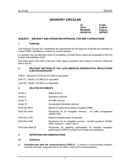
ADVISORY CIRCULAR<br />
AC : <strong>91</strong>-<strong>004</strong><br />
DATE : 01/06/10<br />
REVISION : Original<br />
ISSUED BY : SRVSOP<br />
SUBJECT: AIRCRAFT AND OPERATOR APPROVAL FOR RNP 4 OPERATIONS<br />
1. PURPOSE<br />
This Advisory Circular (AC) establishes the requirements for the approval of aircraft and operators to<br />
conduct RNP 4 operations in oceanic or remote airsp<strong>ac</strong>e.<br />
An operator may use alternate means of compliance, provided those means are <strong>ac</strong>ceptable to the Civil<br />
Aviation Administration (CAA).<br />
The future tense of the verb or the term “shall” apply to operators who choose to meet the criteria set<br />
forth in this AC.<br />
2. RELEVANT SECTIONS OF THE LATIN AMERICAN AERONAUTICAL REGULATIONS<br />
(LAR) OR EQUIVALENT<br />
LAR <strong>91</strong>: Sections <strong>91</strong>.1015 and <strong>91</strong>.1640 or equivalents<br />
LAR 121: Section 121.995 (b) or equivalent<br />
LAR 135: Section 135.565 (c) or equivalent<br />
3. RELATED DOCUMENTS<br />
Annex 2<br />
Annex 6<br />
Annex 11<br />
Annex 15<br />
<strong>ICAO</strong> Doc 9613<br />
<strong>ICAO</strong> Doc 4444<br />
<strong>ICAO</strong> Doc 7030<br />
<strong>ICAO</strong> Doc 8168<br />
FAA Order 8400.33<br />
Rules of the air<br />
Operation of aircraft<br />
Air traffic services<br />
Aeronautical information services<br />
Manual on performance-based navigation (PBN)<br />
Procedures for air navigation services – Air traffic management<br />
(PANS-ATM)<br />
Regional Supplementary Procedures<br />
Procedures for air navigation services - Aircraft operations (PANS-<br />
OPS): Volume II – Parts I and III<br />
Procedures for obtaining authorization for required navigation<br />
performance 4 (RNP-4) oceanic and remote area operations<br />
4. DEFINITIONS AND ABBREVIATIONS<br />
4.1 Definitions<br />
a) Controller-pilot data link communications (CPDLC).- A means of communication between<br />
controller and pilot, using data link for air traffic control (ATC) communications.<br />
1
SRVSOP AC <strong>91</strong>-<strong>004</strong><br />
b) Tr<strong>ac</strong>k.- The projection on the earth´s surf<strong>ac</strong>e of the path of an aircraft, the direction of which<br />
path at any point is usually expressed in degrees from North (true, magnetic or grid).<br />
c) Fault detection and exclusion (FDE).- A function performed by some on-board GNSS<br />
receiver that can detect the signal of a faulty satellite, and exclude it from the position estimation.<br />
At least one satellite needs to be available (6 satellites) in addition to the number required in<br />
order to have the receiver autonomous integrity monitoring (RAIM) function.<br />
d) Path definition error (PDE).- The difference between the defined path and the desired path at a<br />
given pl<strong>ac</strong>e and time.<br />
e) Navigation system error (NSE).- The difference between the true position and the estimated<br />
position.<br />
f) Flight technical error (FTE).- The <strong>ac</strong>cur<strong>ac</strong>y with which an aircraft is controlled as measured by<br />
the indicated aircraft position with respect to the indicated command or desired position. It does<br />
not include blunder errors.<br />
a) Total system error (TSE).- The difference between the true position and the desired position.<br />
This error is equal to the sum of the vectors of the path definition error (PDE), the flight technical<br />
error (FTE), and the navigation system error (NSE).<br />
Note.- On occasions, the FTE is known as path steering error (PSE), and the NSE as position estimation error (PEE).<br />
Total system error (TSE)<br />
Desired path<br />
Total system error (TSE)<br />
Path definition error (PDE)<br />
Flight technical error (FTE)<br />
Navigation system error (NSE)<br />
True position<br />
Defined path<br />
Estimated position<br />
g) Oceanic airsp<strong>ac</strong>e.- Airsp<strong>ac</strong>e over oceanic area considered as international airsp<strong>ac</strong>e and where<br />
<strong>ICAO</strong> procedures and separations apply. The responsibility for the provision of air traffic<br />
services in this airsp<strong>ac</strong>e is delegated to those States with greater geographic proximity and/or<br />
availability of resources.<br />
h) Navigation specifications.- Set of aircraft and flight crew requirements needed to support<br />
performance-based navigation operations in a defined airsp<strong>ac</strong>e. There are two kinds of<br />
navigation specifications:<br />
Required Navigation Performance (RNP) Specification.- Navigation specification based on area<br />
navigation (RNAV) that includes the on-board performance control and alerting requirement,<br />
designated by the prefix RNP; e.g., RNP 4, RNP APCH, RNP AR APCH.<br />
Area Navigation (RNAV) Specification.- Navigation specification based on area navigation that<br />
does not include the on-board performance control and alerting requirement, designated by the<br />
prefix RNAV; e.g., RNAV 5, RNAV 2, RNAV 1.<br />
Note 1.- The Manual on Performance-Based Navigation (PBN) (Doc 9613), Volume II, contains detailed guidelines on<br />
navigation specifications.<br />
2
AC <strong>91</strong>-<strong>004</strong><br />
SRVSOP<br />
Note 2.- The term RNP, formerly defined as “a statement of the navigation performance necessary for operation within a<br />
defined airsp<strong>ac</strong>e”, has been deleted from the Annexes to the Convention on International Civil Aviation because the RNP<br />
concept has been repl<strong>ac</strong>ed by the PBN concept. In said Annexes, the term RNP is now only used within the context of<br />
the navigation specifications that require on-board performance control and alerting; e.g., RNP 4 refers to the aircraft and<br />
the operational requirements, including a lateral performance of 4 nautical miles (NM), with the requirement for on-board<br />
performance control and alerting as described in the PBN Manual (Doc 9613).<br />
i) Estimated position uncertainty (EPU).- A measure in nautical miles (NM) based on a defined<br />
scale that indicates the estimated performance of the current position of the aircraft, also known<br />
as <strong>ac</strong>tual navigation performance (ANP) or estimated position error (EPE) in some aircraft. The<br />
EPU is not an estimate of the <strong>ac</strong>tual error but a defined statistical indication of potential error.<br />
b) Performance-based navigation (PBN).- Performance-based navigation specifies system<br />
performance requirements for aircraft operation along an ATS route, in an instrument appro<strong>ac</strong>h<br />
procedure, or in a designated airsp<strong>ac</strong>e.<br />
Performance requirements are defined in terms of the precision, integrity, continuity, availability,<br />
and functionality required for conducting the proposed operation within the context of a particular<br />
airsp<strong>ac</strong>e concept.<br />
c) Area navigation (RNAV).- A navigation method that allows aircraft to operate on any desired<br />
flight path within the coverage of ground - or sp<strong>ac</strong>e- based navigation aids, or within the<br />
coverage limits of self-contained aids, or a combination of both.<br />
Note.- Area navigation includes performance based navigation as well as other RNAV<br />
operations that do not meet the definition of performance-based navigation.<br />
j) RNP operations.- Aircraft operations using an RNP system for RNP applications.<br />
k) Waypoint (WPT). A specified geographical location used to define an area navigation route or<br />
the flight path of an aircraft employing area navigation. Way-points are identified as either:<br />
Fly-by waypoint (fly-by WPT).- A waypoint which requires turn anticipation to allow tangential<br />
interception of the next segment of a route or procedure.<br />
Fly over waypoint (fly over WPT).- A waypoint at which a turn is initiated in order to join the next<br />
segment of a route or procedure.<br />
l) Heading (of the aircraft).- The direction in which the longitudinal axis of an aircraft is pointed,<br />
usually expressed in degrees from North (true, magnetic, compass or grid).<br />
m) Aircraft-based augmentation system (ABAS).- A system which augments and/or integrates<br />
the information obtained from the other GNSS elements with information available on board the<br />
aircraft. The most common form of ABAS is the receiver autonomous integrity monitoring<br />
(RAIM).<br />
n) Flight management system (FMS).- An integrated system consisting of an on-board sensor, a<br />
receiver and a computer with databases on navigation and aircraft performance, capable of<br />
providing performance values and RNAV guidance to a display and automatic flight command<br />
system.<br />
o) Global positioning system (GPS).- The global positioning system (GNSS) of the United States<br />
is a satellite-based radio navigation system that uses precise distance measurements to<br />
determine the position, speed, and time in any part of the world. The GPS is made up by three<br />
elements: the spatial, control, and user elements. The GPS spatial segment nominally consists<br />
of at least 24 satellites in 6 orbital planes. The control element consists of 5 monitoring stations,<br />
3 ground antennas, and one main control station. The user element consists of antennas and<br />
receivers that provide the user with position, speed, and precise time.<br />
p) Stand-along global positioning system (Stand-alone GPS).- GPS that is not connected to,<br />
or combined with, another navigation system or sensor.<br />
q) Primary-means navigation system.- Navigation system approved for a given operation or<br />
flight phase, which has to meet the precision and integrity requirements, but not full service<br />
3
SRVSOP AC <strong>91</strong>-<strong>004</strong><br />
availability and continuity conditions. Safety is ensured by limiting flights to specific time periods<br />
and by establishing timely restrictive procedures.<br />
r) Sole-means navigation system.- Navigation system approved for a given operation or flight<br />
phase that allows the aircraft to meet the four navigation system requirements: precision,<br />
integrity, availability and continuity of service.<br />
s) Supplemental-means navigation system.- A navigation system that must be used together<br />
with a sole means navigation and meet the precision and integrity requirements but not<br />
availability and continuity conditions.<br />
t) Global navigation satellite system (GNSS).- A generic term used by the International Civil<br />
Aviation Organization (<strong>ICAO</strong>) to define any global position, speed, and time determination<br />
system that includes one or more main satellite constellations, such as GPS and the global<br />
navigation satellite system (GLONASS), aircraft receivers and several integrity monitoring<br />
systems, including aircraft-based augmentation systems (ABAS), satellite-based augmentation<br />
systems (SBAS), such as the wide area augmentation systems (WAAS), and ground-based<br />
augmentation systems (GBAS), such as the local area augmentation system (LAAS).<br />
Distance information will be provided by GPS and GLONASS, at least in the immediate future.<br />
u) RNP system.- An area navigation system which supports on-board performance monitoring and<br />
alerting.<br />
v) Receiver autonomous integrity monitoring (RAIM).- A technique used in a GPS<br />
receiver/processor to determine the integrity of its navigation signals, using only GPS signals or<br />
GPS signals enhanced with barometric altitude data. This determination is <strong>ac</strong>hieved by<br />
comparing redundant pseudo-range measurements. At least one available satellite is required in<br />
addition to the number of satellites needed for the navigation solution.<br />
w) Automatic dependent surveillance - contr<strong>ac</strong>t (ADS-C).- A means that allows the ground<br />
system and the aircraft to establish, through data link, the conditions of an ADS-C agreement,<br />
which stipulates the conditions under which ADS-C reports must be initiated, as well the data<br />
that must appear on such reports.<br />
4.2 Abbreviations<br />
a) CAA Civil Aviation Administration/Civil Aviation Authority<br />
b) AAIM Aircraft autonomous integrity monitoring<br />
c) ABAS Aircraft-based augmentation system<br />
d) ADS-C Automatic dependent surveillance - contr<strong>ac</strong>t<br />
e) AC Advisory circular (FAA)<br />
f) AFM Aircraft flight manual<br />
g) AIP Aeronautical information publication<br />
h) ANP Actual navigation performance<br />
i) AP Automatic pilot<br />
j) ATC Air traffic control<br />
k) ATS Air traffic services<br />
l) CA Advisory circular (SRVSOP)<br />
m) CDI Lateral deviation indicator<br />
n) CDU Control and display unit<br />
o) CF Course to a fix<br />
4
AC <strong>91</strong>-<strong>004</strong><br />
SRVSOP<br />
p) CFR Code of Federal Regulations (United States)<br />
q) CNS/ATM Communications, navigation and surveillance/air traffic management<br />
systems<br />
r) CPDLC Controller-pilot data link communications<br />
s) CS Certification specifications (EASA)<br />
t) DAC Director of civil aviation<br />
u) DF Direct to a fix<br />
v) DME Distance-measuring equipment<br />
w) DV Flight dispatcher<br />
x) EASA European Air Safety Agency<br />
y) EHSI Electronic horizontal situation indicator<br />
z) EPE Estimated position error<br />
aa) EPU Estimated position uncertainty<br />
bb) ETOPS Extended range operations by twin-engine aeroplanes<br />
cc) ETSO European technical standard order<br />
dd) FAA United States Federal Aviation Administration<br />
ee) FD Flight director<br />
ff) FDE Fault detection and exclusion<br />
gg) FMS Flight management system<br />
hh) FTE Flight technical error<br />
ii) GBAS Ground-based augmentation system<br />
jj) GNSS Global navigation satellite system<br />
kk) GLONAS Global navigation satellite system<br />
ll) GPS Global positioning system<br />
mm) GS Ground speed<br />
nn) HAL Horizontal alerting system<br />
oo) IF Initial fix<br />
pp) IMC Instrument meteorological conditions<br />
qq) IPC Illustrated part catalogue<br />
rr) LAAS Local area augmentation system<br />
ss) LAR Latin American Aeronautical Regulations<br />
tt) LNAV Lateral navigation<br />
uu) LOA Letter of authorisation/letter of <strong>ac</strong>ceptance<br />
vv) LRNS Long-range navigation system<br />
ww) MCM Maintenance control manual<br />
xx) MEL Minimum equipment list<br />
yy) MIO Operations inspector manual (SRVSOP)<br />
5
SRVSOP AC <strong>91</strong>-<strong>004</strong><br />
zz) NAVAIDS Navigation aids<br />
aaa) NM Nautical mile<br />
bbb) NSE Navigation system error<br />
ccc) <strong>ICAO</strong> International Civil Aviation Organization<br />
ddd) OM Operations manual<br />
eee) OpSpecs Operation specifications<br />
fff) PANS-OPS Procedures for Air Navigation Services - Aircraft operations<br />
ggg) PANS-ATM Procedures for Air Navigation Services - Air traffic management<br />
hhh) PBN Performance-based navigation<br />
iii) PDE Path definition error<br />
jjj) PEE Position estimation error<br />
kkk) POH Pilot operations handbook<br />
lll) PSE Path steering error<br />
mmm) RAIM Receiver autonomous integrity monitoring<br />
nnn) RNAV Area navigation<br />
ooo) RNP Required navigation performance<br />
ppp) RNP APCH Required navigation performance appro<strong>ac</strong>h<br />
qqq) RNP AR APCH Required navigation performance authorisation required appro<strong>ac</strong>h<br />
rrr) SBAS Satellite-based augmentation system<br />
sss) SOP Standard operating procedures<br />
ttt) SLOP Strategic lateral displ<strong>ac</strong>ement procedures<br />
uuu) SRVSOP Regional Safety Oversight Cooperation System<br />
vvv) SSR Secondary surveillance radar<br />
www) STC Supplemental type certificate<br />
xxx) TC Type certificate<br />
yyy) TF Tr<strong>ac</strong>k to a fix<br />
zzz) TSE Total system error<br />
aaaa) TSO Technical standard order<br />
bbbb) VMC Visual meteorological conditions<br />
cccc) VOR VHF omnidirectional radio range<br />
dddd) WAAS Wide area augmentation system<br />
eeee) WGS World geodetic system<br />
ffff) WPT Waypoint<br />
5. INTRODUCTION<br />
5.1 As part of the global effort towards the implementation of the International Civil Aviation<br />
Organization (<strong>ICAO</strong>) Global air navigation plan (Doc 9750) for communications, navigation and<br />
surveillance/air traffic management (CNS/ATM) systems, the lateral and longitudinal separation<br />
6
AC <strong>91</strong>-<strong>004</strong><br />
SRVSOP<br />
minima were reduced in oceanic regions. This reduction requires lateral and longitudinal separation<br />
minima of 30 NM in RNP 4 airsp<strong>ac</strong>e.<br />
5.2 The criteria of this CA provide guidance on airworthiness and operational approvals.<br />
These approvals will allow an operator to obtain RNP 4 authorisation to operate in oceanic or remote<br />
airsp<strong>ac</strong>es with 30 nautical mile (NM) lateral and longitudinal separations based on distance.<br />
5.3 The implementation of the 30 NM lateral and longitudinal separation minima in oceanic<br />
or remote airsp<strong>ac</strong>es with RNP 4 will provide benefits to the operators in terms of more optimum<br />
routes, reduced delays, increased flexibility and reduced costs without decreasing safety. ATS<br />
providers will derive benefits from the efficient use of airsp<strong>ac</strong>e and increased air traffic flow.<br />
5.4 This guidance document does not address all the requirements that can be specified for<br />
a given operation. These requirements are specified in other documents, such as the operating<br />
rules, aeronautical information publications (AIPs) and Doc 7030 – Regional supplementary<br />
procedures.<br />
5.5 Although operational approval is mainly related to airsp<strong>ac</strong>e navigation requirements,<br />
operators and flight crews must take into <strong>ac</strong>count all of the associated operational documents<br />
required by the CAA before conducting flights in said airsp<strong>ac</strong>e.<br />
5.6 The approval process described in this AC is limited to the aircraft that have received<br />
airworthiness certification indicating that the installed navigation systems meet RNP 4 performance<br />
requirements. This certification may have been issued at the time of manuf<strong>ac</strong>ture or during service,<br />
when the aircraft was retrofitted to meet RNP 4 requirements, through the granting of an appropriate<br />
supplemental type certificate (STC).<br />
5.7 The material described in this AC has been developed based on the following document:<br />
<strong>ICAO</strong> Doc 9613, Volume II, Part C, Chapter 1 – Implementing RNP 4.<br />
5.8 This AC has been harmonised with the following guidance material:<br />
<br />
FAA Order 8400.33 – Procedures for obtaining authorization for required<br />
navigation performance 4 (RNP 4) oceanic and remote area operations.<br />
6. GENERAL CONSIDERATIONS<br />
6.1 Navigation aid infrastructure<br />
RNP 4 was developed for operations in oceanic and remote areas, therefore, it does not<br />
require any ground-based navaid infrastructure. The global navigation satellite system (GNSS) is the<br />
primary navigation sensor that supports RNP 4, either as a stand-alone navigation system or as part of<br />
a multi-sensor system.<br />
6.2 ATS communications and surveillance<br />
Although this guidance material was developed to support 30 NM lateral and longitudinal<br />
separation minima based on RNP 4, it should be noted that it only includes the navigation requirements<br />
associated to these standards and does not specifically refer to air traffic service (ATS)<br />
communications or surveillance requirements.<br />
Note.- The provisions related to these separation minima, including ATS communications and surveillance requirements, are<br />
contained in Section 5.4 of <strong>ICAO</strong> Doc 4444 – Procedures for air navigation services – Air traffic management (PANS-ATM).<br />
Provided that they can support an increased reporting rate required, controller-pilot data link communications (CPDLC) and<br />
automatic dependent surveillance – contr<strong>ac</strong>t (ADS – C) systems which meet the requirements for application of the 50 NM lateral<br />
and longitudinal separation minima based on RNP 10 will also meet the requirements for the application of the 30 NM lateral and<br />
longitudinal minima.<br />
6.3 Obst<strong>ac</strong>le clearance and en-route sp<strong>ac</strong>ing<br />
a) Doc 8168 – Procedures for air navigation services – Aircraft operations (PANS OPS), Volume II,<br />
provides a detailed guide on obst<strong>ac</strong>le clearance. The general criteria of Parts I and III apply.<br />
b) Separation minima are described in Section 5.4 of Doc 4444 PANS-ATM.<br />
7
SRVSOP AC <strong>91</strong>-<strong>004</strong><br />
c) RNP 4 may be used to support the application of en-route separation/sp<strong>ac</strong>ing standards of less<br />
than 30 NM in continental airsp<strong>ac</strong>e, provided the CAA has conducted the necessary safety<br />
assessments described in Doc 4444, PANS-ATM. However, the ATS communications and<br />
surveillance parameters that support the application of new separation standards will be different<br />
from those used for a 30 NM standard.<br />
6.4 Publications<br />
a) When reference is made to the existing routes, the AIP should clearly indicate that the navigation<br />
application is RNP 4. The route should identify the minimum altitude requirements of the<br />
segments.<br />
b) The navigation information published in the AIP for routes and supporting navigation aids must<br />
meet the requirements of Annex 15 – Aeronautical information services. All routes must be<br />
based on the World Geodetic System - 1984 (WGS-84) coordinates.<br />
6.5 Additional considerations<br />
a) Many aircraft have the following capabilities:<br />
1) fly parallel paths displ<strong>ac</strong>ed to the left or right of the original <strong>ac</strong>tive route; and<br />
2) execute a holding pattern manoeuvre using an RNP system. The purpose of this function<br />
is to give the ATC flexibility for the design of RNP operations.<br />
7. AIRWORTHINESS AND OPERATIONAL APPROVAL<br />
7.1 Commercial air transport operators require two types of approvals before receiving an<br />
RNP 4 authorisation:<br />
a) Airworthiness approval, issued by the State of Registry (see Article 31 of the Chicago<br />
Convention, and Paragraphs 5.2.3 and 8.1.1 of Annex 6, Part I); and<br />
b) Operational approval, issued by the State of the Operator (see Paragraph 4.2.1 and Att<strong>ac</strong>hment<br />
F to Annex 6, Part I).<br />
7.2 For general aviation operators, the State of Registry will determine if the aircraft meets the<br />
applicable RNP 4 requirements, and will issue the operational authorisation (e.g., a letter of<br />
authorisation – LOA) (see paragraph 2.5.2.2 of Annex 6, Part II).<br />
7.3 Before submitting their request, operators shall review all aircraft qualification<br />
requirements. Compliance with airworthiness or equipment installation requirements, by themselves,<br />
does not constitute operational approval.<br />
8. AIRWORTHINESS APPROVAL<br />
8.1 Aircraft requirements<br />
8.1.1 Navigation systems<br />
a) For RNP 4 operations in oceanic or remote airsp<strong>ac</strong>e, the aircraft must have, at least two fully<br />
operational and independent long-range navigation systems (LRNS), with integrity such that the<br />
navigation system does not provide misleading information and form part of the basis upon<br />
which RNP 4 operations approval is granted. GNSS must be used as either a stand-alone<br />
navigation system or as one of the sensors in a multi-sensor system.<br />
b) The United Stated Federal Aviation Administration (FAA) AC 20-138A – Airworthiness approval<br />
of global navigation satellite system (GNSS) equipment, or equivalent documents provide an<br />
<strong>ac</strong>ceptable means of complying with installation requirements for aircraft that use, but do not<br />
integrate, the GNSS output with that of other sensors.<br />
8
AC <strong>91</strong>-<strong>004</strong><br />
SRVSOP<br />
c) The FAA AC 20-130A – Airworthiness approval of navigation or flight management systems<br />
integrating multiple navigation sensors, or equivalent documents describe an <strong>ac</strong>ceptable means<br />
of compliance for navigation systems with multiple sensors that incorporate GNSS.<br />
d) The configuration of the equipment used for demonstrating the required <strong>ac</strong>cur<strong>ac</strong>y must be<br />
identical to the one specified in the minimum equipment list (MEL) or in the aircraft flight manual<br />
(AFM).<br />
e) The installation design must meet the design standards applicable to the aircraft that is being<br />
modified, and changes must be reflected in the AFM before starting operations requiring RNP 4<br />
navigation approval.<br />
8.1.2 System performance, monitoring and alert<br />
a) Accur<strong>ac</strong>y.- During operations in airsp<strong>ac</strong>e or on routes designates as RNP4:<br />
1) The lateral total system error must not exceed + 4 NM for at least 95% of the total flight<br />
time.<br />
2) Likewise, the along-tr<strong>ac</strong>k error must not exceed + 4 NM at least 95% of the total flight time.<br />
3) A flight technical error (FTE) of 2.0 NM (95%) may be assumed.<br />
b) Integrity.- Malfunctioning of the aircraft navigation equipment is classified as a major failure<br />
<strong>ac</strong>cording to airworthiness regulations (e.g., 10 -5 per hour).<br />
c) Continuity.- Loss of function is classified as a major failure for oceanic and remote navigation.<br />
The continuity requirement is met by carrying on board two independent LRNS systems<br />
(excluding the signal-in-sp<strong>ac</strong>e).<br />
d) Performance monitoring and alerting.- The RNP system or the RNP system in combination<br />
with the pilot will provide an alert if the <strong>ac</strong>cur<strong>ac</strong>y requirement is not met, or if the probability that<br />
the lateral total system error exceeds 8 NM is greater than 10 -5 .<br />
e) Signal-in-sp<strong>ac</strong>e.- If GNSS is used, the aircraft navigation equipment must provide an alert if the<br />
probability of signal-in-sp<strong>ac</strong>e errors causing a lateral position error greater than 8 NM exceeds<br />
10 -7 per hour (Annex 10, Volume I, Table 3.7.2.4-1).<br />
Note.- Compliance with the performance monitoring and alerting requirement does not imply an automatic monitor of<br />
FTE. The on-board monitoring and alerting function should consist at least of a navigation system error (NSE) monitoring<br />
and alerting algorithm and a lateral deviation display that enables the crew to monitor the FTE. To the extent operational<br />
procedures are used to monitor FTE, the crew procedures, equipment char<strong>ac</strong>teristics, and installations are evaluated for<br />
their effectiveness and equivalence as described in the functional requirements and operating procedures. The path<br />
definition error (PDE) is considered negligible due to the quality assurance process (Section 13) and crew procedures<br />
(Section 11).<br />
8.1.3 GNSS Monitor<br />
The GNSS navigation system must detect satellite failures before they cause the aircraft to<br />
exceed the limits of the defined airsp<strong>ac</strong>e. This requirement is derived from the overall effect of a GNSS<br />
failure and applies to all navigation uses of the system. The probability of missed detection of satellite<br />
failures must be less than or equal to 10 -3 and the effective limit of the monitor for these failures of the<br />
navigation solution, known as the horizontal alert limit (HAL) must consider the other normal errors that<br />
may exist during the satellite fault, the latency of the alert, the crew re<strong>ac</strong>tion time to an alert and the<br />
aircraft response. An <strong>ac</strong>ceptable means of compliance is to use a HAL of 4 NM for RNP 4 oceanic<br />
airsp<strong>ac</strong>e.<br />
8.2 Determination of aircraft eligibility for RNP 4 operations<br />
8.2.1 Airworthiness eligibility documents<br />
a) The operator must have relevant documentation <strong>ac</strong>ceptable to the CAA of the State of<br />
Registry showing that aircraft are equipped with RNP systems that meet RNP 4 requirements.<br />
9
SRVSOP AC <strong>91</strong>-<strong>004</strong><br />
b) In order to avoid unnecessary regulatory <strong>ac</strong>tivity, the determination of the eligibility of existing<br />
systems should take into <strong>ac</strong>count the <strong>ac</strong>ceptance of manuf<strong>ac</strong>turer documentation of<br />
compliance, e.g., EASA AMC 20 series.<br />
c) New systems may demonstrate compliance with RNP 4 requirements for oceanic or remote<br />
operations as part of their airworthiness approval.<br />
d) For existing systems, the operator shall determine RNP 4 compliance as stated in the AFM<br />
supplement or additional airworthiness documents, or as obtained per amended type<br />
certificate (TC) or supplemental type certificate (STC).<br />
e) Documented confirmation by the manuf<strong>ac</strong>turer will be required, indicating that aircraft meet the<br />
RNP 4 performance requirements of this AC, if the operator chooses to claim additional<br />
performance beyond the original airworthiness approval or as declared in the AFM, amended<br />
TC or STC. Navigation performance must consider the navigation infrastructure used in the<br />
original airworthiness approval.<br />
8.2.2 Aircraft eligibility groups<br />
a) Group 1: RNP certification<br />
1) Group 1 aircraft are those that have official certification and approval of on-board RNP<br />
integration. RNP compliance is documented in the AFM.<br />
2) Certification will not be necessarily limited to a given type of RNP. The AFM must<br />
address the RNP levels that have been demonstrated and any related provisions<br />
applicable to their use (e.g., navaid sensor requirements). Operational approval is based<br />
on the performance stated in the AFM.<br />
3) This method is also applicable in case where certification is received through an STC<br />
issued to cover retrofitting of equipment, such as the installation of GNSS receivers to<br />
enable the aircraft to meet RNP 4 requirements in oceanic and remote airsp<strong>ac</strong>e.<br />
b) Group 2: Previous certification of the navigation system<br />
1) Group 2 aircraft are those than can equate their certified level of performance, granted<br />
on the basis of previous requirements, to RNP 4 criteria. The standards shown in Subparagraphs<br />
(a) to (c) can be used to classify aircraft in Group 2.<br />
(a)<br />
(b)<br />
Global navigation satellite systems (GNSS) as primary means of navigation.-<br />
Aircraft equipped only with GNSS as primary means of long-range navigation,<br />
approved for operations in oceanic and remote airsp<strong>ac</strong>e, must meet the technical<br />
requirements specified in Paragraph 8.1.1 of this section. The AFM must indicate<br />
that dual GNSS equipment, approved <strong>ac</strong>cording to an appropriate standard, is<br />
required. The appropriate standards are FAA technical standard orders (TSO)<br />
C129a or C146(), and the European technical standard orders (ETSO) C129a or<br />
C146() of EASA. Furthermore, an approved dispatch fault detection and exclusion<br />
(FDE) availability prediction programme must be used. The maximum allowable<br />
time for which FDE capability is projected to be unavailable on any event is 25<br />
minutes. This maximum outage time must be included as a condition for RNP 4<br />
operational approval. If predictions indicate that the maximum allowable FDE<br />
outage time will be exceeded, the operation must be rescheduled to a time when<br />
FDE is available.<br />
Multi-sensor systems that incorporate GNSS with integrity provided by<br />
receiver autonomous integrity monitoring (RAIM).- Multi-sensor systems that<br />
incorporate the global positioning system (GPS) with RAIM and FDE, and which<br />
are approved based on FAA AC 20-130A or other equivalent documents, meet the<br />
performance requirements specified in Paragraph 8.1.1 of this section. It should<br />
be noted that there is no requirement to use dispatch FDE availability prediction<br />
programmes when multi-sensor systems are installed and used.<br />
10
AC <strong>91</strong>-<strong>004</strong><br />
SRVSOP<br />
(c)<br />
c) Group 3: New technology<br />
Multi-sensor systems that incorporate GNSS with integrity provided by<br />
aircraft autonomous integrity monitoring (AAIM).- The AAIM uses the<br />
redundancy of position calculations from multiple sensors, including GNSS, to<br />
provide integrity performance that is at least equivalent to RAIM. These airborne<br />
augmentations must be certified <strong>ac</strong>cording to TSO C-115b, ETSO C-115b or other<br />
equivalent documents. An example is the use of an inertial navigation system or<br />
other navigation sensors as an integrity check on GNSS data when RAIM is not<br />
available but GNSS positioning information continues to be valid.<br />
This group has been included in order to cover new navigation systems that meet the<br />
technical requirements for operations in RNP 4 airsp<strong>ac</strong>e.<br />
8.3 Required functions<br />
8.3.1 The on-board navigation system must provide the following functions:<br />
a) navigation data display;<br />
b) tr<strong>ac</strong>k to a fix (TF);<br />
c) direct to a fix (DF);<br />
d) direct to function;<br />
e) course to a fix (CF);<br />
f) parallel offset;<br />
g) fly-by transition criteria<br />
h) user interf<strong>ac</strong>e displays;<br />
i) displays and controls;<br />
j) flight planning path selection;<br />
k) flight planning fix sequencing;<br />
l) user defined course to fix (CF);<br />
m) path steering;<br />
n) alerting requirements;<br />
o) navigation database <strong>ac</strong>cess; and<br />
p) WGS 84 reference system.<br />
8.3.2 Explanation of the required functions<br />
a) Navigation data display<br />
The navigation data display must use either a lateral deviation display or a navigation map<br />
display that meets the following requirements:<br />
1) a non-numerical lateral deviation display (e.g., a lateral deviation indicator (CDI) or an<br />
electronic horizontal situation indicator ((E)HSI)), with a to/from indication and failure<br />
annunciation, to be used as a primary flight instrument for aircraft navigation, for<br />
manoeuvre anticipation, and for failure/status/integrity indication, with the following<br />
attributes:<br />
(a) the display must be visible to the pilot and located in his/her primary field of view<br />
(+ 15 degrees from the pilot´s normal line of sight) when looking forward along the<br />
flight path;<br />
(b) lateral deviation scaling must agree with any alerting and annunciation limits, if<br />
11
SRVSOP AC <strong>91</strong>-<strong>004</strong><br />
(c)<br />
implements;<br />
the lateral deviation display must be automatically slaved to the RNP computed<br />
path. The lateral deviation display also must have full-scale deflection suitable for<br />
the current phase of flight, and must be based on the required tr<strong>ac</strong>k-keeping<br />
<strong>ac</strong>cur<strong>ac</strong>y. The course selector of the lateral deviation display should be<br />
automatically slewed to the RNP computed path, or the pilot must adjust the CDI<br />
or HSI selected course to the computed desired tr<strong>ac</strong>k.<br />
Note.- The normal function of stand-alone GNSS equipment meets this requirement.<br />
(d) the display scaling may be set automatically by default logic or set to a value<br />
obtained from the navigation database. The full-scale deflection value must be<br />
known or must be available to the pilot and must be consistent with the values of<br />
the en-route, terminal or appro<strong>ac</strong>h phases.<br />
2) A navigation map display, readily visible to the pilot, with appropriate map scales (scaling<br />
may be set manually by the pilot), and giving equivalent functionality to a lateral deviation<br />
display.<br />
b) Tr<strong>ac</strong>k to a fix (TF)<br />
The primary segment of an RNAV straight route is a TF route. The TF leg is a geodetic path<br />
between two waypoints (WPT). The first is a termination WPT of the previous leg or an initial<br />
fix (IF). The intermediate and final appro<strong>ac</strong>h segments should always be TF routes. In cases<br />
where an FMS requires a course to fix (CF) to the final appro<strong>ac</strong>h segment, the database coder<br />
may use a CF instead of a TF. The termination fix is normally provided by the navigation<br />
database, but can also be defined by the user.<br />
c) Direct to a fix (DF)<br />
The DF leg is used to define a route segment from an unspecified position, on the aircraft´s<br />
present tr<strong>ac</strong>k, to a specified fix/WPT. The DF path termination does not provide a predictable<br />
flight path that can be repeated, and is very variable in its application.<br />
d) “Direct to” function<br />
The “direct to” function must be able to be <strong>ac</strong>tivated at any time by the flight crew, as<br />
necessary. The “direct to” function must be available to any fix. The system must be capable<br />
of generating a geodetic path to the designated “to” fix. The aircraft must capture this path<br />
without “S turns” and without undue delays.<br />
e) Course to a fix (CF)<br />
A CF is defined as a course that ends at a fix/WPT followed by a specific route segment. The<br />
inbound course at the termination fix and the fix are provided by the navigation database. If<br />
the inbound course is defined as the magnetic course, the source of the magnetic variation<br />
needed to convert magnetic courses to true courses is required.<br />
f) Parallel offset<br />
The system must have the capability to fly parallel tr<strong>ac</strong>ks at a selected offset distance. When<br />
executing a parallel offset, the navigation precision and all the performance requirements of<br />
the original route in the <strong>ac</strong>tive flight plan must be applicable to the offset route. The system<br />
must permit the entry of offset distances in increments of 1 MN, to the left or right of the<br />
course. The system must be capable of offsets of at least 20 NM. When in use, the system<br />
offset mode of operation must be clearly indicated to the flight crew. When in offset mode,<br />
the system must provide reference parameters (for example, cross-tr<strong>ac</strong>k deviation, distance<br />
to-go, time to-go) relative to the offset path and offset reference points. An offset must not be<br />
propagated through route discontinuities, unreasonable (excessive) path geometries, or<br />
beyond the initial appro<strong>ac</strong>h fix. An announcement must be given to the flight crew before the<br />
end of the offset path, giving sufficient time to return to the original path. Once a parallel<br />
offset has been <strong>ac</strong>tivated, it must remain <strong>ac</strong>tive throughout all the route segments of the flight<br />
12
AC <strong>91</strong>-<strong>004</strong><br />
SRVSOP<br />
plan until removed automatically, until the flight crew enters a direct-to route, or until manually<br />
cancelled by the flight crew. The parallel offset function must be available for the en-route TF<br />
segment and the geodetic portion of DF leg types.<br />
g) “Fly-by” transition criteria<br />
The navigation system must be capable of performing “fly-by” transitions. No predictable and<br />
repeatable path is specified because the optimum path varies with airspeed and bank angle.<br />
However, the boundaries of the transition are defined. The path definition error (PDE) is<br />
defined as the difference between the defined path and the theoretical transition area. If the<br />
path lies within the transition area, there is no PDE. “Fly-by” transitions must be the default<br />
transitions when the type of transition is not specified. The theoretical transition area<br />
requirements are applicable for the following assumptions:<br />
1) course changes do not exceed 120º for low altitude transitions (when the barometric<br />
altitude of the aircraft is less than FL 195); and<br />
2) course changes do not exceed 70º for high-altitude transitions (when the barometric<br />
altitude of the aircraft is equal to or greater than FL 195).<br />
h) User interf<strong>ac</strong>e displays<br />
The general features of user interf<strong>ac</strong>e displays must permit the display of information, provide<br />
situational awareness, and be designed and implemented taking into <strong>ac</strong>count human f<strong>ac</strong>tors.<br />
The main design considerations include:<br />
1) minimizing reliance on flight crew memory for any operational procedure or task of a<br />
system;<br />
2) developing a clear and unambiguous display of system modes and sub-modes and<br />
navigation data, with emphasis on the requirements for enhanced situational awareness<br />
for any automatic changes in the mode, if provided;<br />
3) the use of the context-sensitive help capability and error messages (e.g., invalid inputs or<br />
invalid data entry messages should provide a simple means for determining how to enter<br />
“valid” data);<br />
4) failure-tolerant data entry methods instead of rigid rule-based concepts;<br />
5) pl<strong>ac</strong>ing special emphasis on the number of steps and minimizing the time required to<br />
<strong>ac</strong>complish flight plan modification to <strong>ac</strong>commodate ATS clearances, holding<br />
procedures, changes of runway and instrument appro<strong>ac</strong>hes, missed appro<strong>ac</strong>hes and<br />
diversions to alternate destination aerodromes; and<br />
6) minimizing the number of nuisance alerts so that the flight crew may recognize the real<br />
ones and properly respond when so required.<br />
i) Displays and controls<br />
1) E<strong>ac</strong>h display element used as primary flight instrument for aircraft guidance and control,<br />
for manoeuvre anticipation, or for failure/status/integrity annunciation, must be located in<br />
a pl<strong>ac</strong>e clearly visible to the pilot (in the pilot´s primary field of view) with the least<br />
possible deviation with respect to the normal position of the pilot and his/her line of vision<br />
when looking forward towards the flight path. It is expected that aircraft that meet the<br />
requirements of the Latin American Aeronautical Regulations (LAR) 25 / Title 14, Part 25<br />
of the United States Code of Federal Regulations (CFR) / Certification Specification (CS)<br />
25 of the European Air Safety Agency (EASA) or equivalent documents, will meet the<br />
provisions of certification documents, such as AC 25-11, AMJ 25-11 and other applicable<br />
documents.<br />
2) All system displays, controls and annunciations must be readable under normal cockpit<br />
conditions and under foreseen ambient lighting conditions. Night lighting provisions must<br />
be compatible with other lighting conditions in the cockpit.<br />
13
SRVSOP AC <strong>91</strong>-<strong>004</strong><br />
3) All displays and controls must be arranged to f<strong>ac</strong>ilitate <strong>ac</strong>cess and use by the flight crew.<br />
The controls that are normally adjusted in flight must be readily <strong>ac</strong>cessible and have<br />
standardized labels indicating their function. System controls and displays must be<br />
designed to maximize operational suitability and minimize pilot workload. The controls<br />
intended for use during the flight must be designed to minimize errors, and when<br />
operated in all possible combinations and sequences, they must not result in a condition<br />
that would be detrimental to the continued performance of the system. System controls<br />
must be arranged to provide adequate protection against inadvertent system failure.<br />
j) Flight planning path selection<br />
The navigation system must provide the crew the capability to create, review and <strong>ac</strong>tivate a<br />
flight plan. The system must provide the capability for modification (e.g., deletion and addition<br />
of fixes and creation of along the tr<strong>ac</strong>k fixes), review and user <strong>ac</strong>ceptance of changes to the<br />
flight plans. When this capability is exercised, guidance output must not be affected until the<br />
modification(s) is(are) <strong>ac</strong>tivated. The <strong>ac</strong>tivation of any flight plan modification must require a<br />
positive <strong>ac</strong>tion and verification by the flight crew after data entry.<br />
k) Flight planning fix sequencing<br />
The navigation system must provide the capability for automatic sequencing of fixes.<br />
l) User-defined course to a fix (CF)<br />
The navigation system must provide the capability to define a user-defined course to a fix.<br />
The pilot must be able to intercept the user-defined course.<br />
m) Path steering<br />
The system must provide data to enable the generation of command signals for the<br />
autopilot/flight director/CDI, as applicable. In all cases, a path steering error (PSE) must be<br />
defined at the time of certification, which will meet the requirements of the desired RNP<br />
operation in combination with the other system errors. During the certification process, the<br />
ability of the crew to operate the aircraft within the specified PSE must be demonstrated.<br />
Aircraft type, operating enveloped, displays, autopilot performance and leg transition guidance<br />
(specifically between arc legs) should be <strong>ac</strong>counted for in the demonstration of PSE<br />
compliance. A measured PSE value may be used to monitor system compliance with RNP<br />
requirements. For operations in all leg types, this value must be the distance to the defined<br />
path. In order to comply with cross-tr<strong>ac</strong>k containment, any in<strong>ac</strong>cur<strong>ac</strong>ies in the cross-tr<strong>ac</strong>k<br />
errors computation (e.g., resolution) must be <strong>ac</strong>counted for in the total system error (TSE),<br />
n) Alerting requirements<br />
The system must also provide an annunciation if the manually entered navigation <strong>ac</strong>cur<strong>ac</strong>y is<br />
larger than the navigation <strong>ac</strong>cur<strong>ac</strong>y associated with the current airsp<strong>ac</strong>e as defined in the<br />
navigation data base. Any subsequent reduction of the navigation <strong>ac</strong>cur<strong>ac</strong>y must reinstate this<br />
annunciation. When an aircraft is appro<strong>ac</strong>hing to RNP airsp<strong>ac</strong>e from non-RNP airsp<strong>ac</strong>e, an<br />
alert must be provided when the cross-tr<strong>ac</strong>k distance to the desired path is equal to or less<br />
than one-half the navigation <strong>ac</strong>cur<strong>ac</strong>y and the aircraft has passed the first fix in the RNP<br />
airsp<strong>ac</strong>e.<br />
o) Navigation database <strong>ac</strong>cess<br />
The navigation database must provide <strong>ac</strong>cess to navigation information in support of<br />
navigation system references and flight planning char<strong>ac</strong>teristics. Manual modification of data<br />
in the navigation database must not be possible. This requirement does not preclude the<br />
storage of “user-defined data” in the equipment (e.g., for flex-tr<strong>ac</strong>k routes). When data are<br />
retrieved from storage they must also be retained in storage. The system must provide a<br />
means to identify the version of the navigation database and the validity of the operating<br />
period.<br />
p) Geodetic reference system<br />
14
AC <strong>91</strong>-<strong>004</strong><br />
SRVSOP<br />
The World Geodetic System - 1984 (WGS-84) or an equivalent Earth reference model must be<br />
the reference Earth model for error determination. If the WGS-84 is not used, any differences<br />
between the selected Earth model and the WGS-84 Earth model must be included as part of<br />
the PDE. Errors induced by the data resolution must also be taken into <strong>ac</strong>count.<br />
8.4 Recommended functions<br />
a) The following additional functions are recommended:<br />
1) display of cross-tr<strong>ac</strong>k error on the control and display unit (CDU);<br />
2) display present position of the aircraft in terms of distance/bearing to the selected<br />
waypoints (WPT);<br />
3) provide time to WPTs on the CDU;<br />
4) display along-tr<strong>ac</strong>k distance;<br />
5) display ground speed (GS);<br />
6) indication of tr<strong>ac</strong>k angle;<br />
7) provide automatic navigation aids selection;<br />
8) manually inhibit a navigation f<strong>ac</strong>ility;<br />
9) automatic selection and tuning of the distance-measuring equipment (DME) and/or VHF<br />
omnidirectional radio range (VOR);<br />
10) estimate of position uncertainty (EPU);<br />
11) display current RNP level and type selection;<br />
12) capability to display flight plan discontinuities; and<br />
13) display of operating and degraded navigation sensors.<br />
8.5 Automatic radio position updating<br />
Automatic updating is considered to be any updating procedure that does not require the<br />
crew to insert the coordinates manually. If used, automatic updating may be considered as<br />
<strong>ac</strong>ceptable for operations in RNP 4 airsp<strong>ac</strong>e, provided:<br />
a) automatic updating procedures are included in the operator training programme; and<br />
b) crews are knowledgeable of the updating procedures and of the effect of the update on the<br />
navigation solution.<br />
8.6 Continued airworthiness<br />
a) Operators of RNP 4 approved aircraft must ensure the continuity of their technical capability to<br />
meet the technical requirements established in this AC.<br />
b) E<strong>ac</strong>h operator requesting an RNP 4 operational approval shall submit to the CAA of the State of<br />
Registry a maintenance and inspection programme that includes all those maintenance<br />
requirements needed to ensure that the navigation systems will continue to meet the RNP 4<br />
approval criteria.<br />
c) The following maintenance documents must be revised, as applicable, to incorporate RNP 4<br />
aspects:<br />
1) Maintenance control manual (MCM);<br />
2) Illustrated part catalogues (IPC); and<br />
3) Maintenance programme.<br />
15
SRVSOP AC <strong>91</strong>-<strong>004</strong><br />
d) The approved maintenance programme for the aircraft involved must include the maintenance<br />
pr<strong>ac</strong>tices indicated in the corresponding maintenance manual of the aircraft and component<br />
manuf<strong>ac</strong>turer, and must consider that:<br />
1) equipment involved in RNP 4 operations must be maintained <strong>ac</strong>cording to the instructions<br />
of the component manuf<strong>ac</strong>turer;<br />
2) any modification or change in the navigation system that affects in any way the initial RNP<br />
4 approval must be reported and reviewed by the CAA for <strong>ac</strong>ceptance or approval of said<br />
changes prior to their implementation; and<br />
3) any repair that is not included in the approved/<strong>ac</strong>cepted maintenance documentation and<br />
that could affect navigation performance integrity must be reported to the CAA for its<br />
<strong>ac</strong>ceptance and approval of such repair.<br />
e) RNP maintenance documentation must contain the training programme for maintenance<br />
personnel, which, amongst other aspects, must include:<br />
1) the PBN concept;<br />
2) RNP 4 implementation;<br />
3) the equipment involved in the RNP 4 operation; and<br />
4) use of the MEL.<br />
9. OPERATIONAL APPROVAL<br />
Airworthiness approval alone does not authorise an applicant or operator to conduct RNP 4<br />
operations. In addition to the airworthiness approval, the applicant or operator must obtain an<br />
operational approval to confirm the suitability of normal and contingency procedures in connection to<br />
the installation of specific equipment.<br />
For commercial air transport, applications for RNP 4 operational approval are assessed by<br />
the State of the Operator, in <strong>ac</strong>cordance with current operating rules (e.g., LAR 121.995 (b) and LAR<br />
135.565 (c) or equivalent) supported by the criteria described in this AC.<br />
For general aviation, applications for RNP 4 operational approval are assessed by the<br />
State of Registry, in <strong>ac</strong>cordance with current operating rules (e.g., LAR <strong>91</strong>.1015 and LAR <strong>91</strong>.1640 or<br />
equivalent), supported by the criteria established in this AC.<br />
9.1 Operational approval requirements<br />
9.1.1 In order to obtain RNP 4 approval, the applicant or operator will take the following steps,<br />
taking into <strong>ac</strong>count the criteria established in this paragraph and in Paragraphs 10, 11, 12 and 13:<br />
a) Airworthiness approval.- Aircraft shall have the corresponding airworthiness approvals, pursuant<br />
to Paragraph 8 of this AC.<br />
b) Application.- The operator will submit the following documentation to the CAA:<br />
1) The application for RNP 4 operational approval;<br />
2) Airworthiness documents related to aircraft eligibility.- The operator will submit relevant<br />
documentation, <strong>ac</strong>ceptable to the CAA, establishing that the aircraft has long-range<br />
navigation systems (LRNS) that meet RNP 4 requirements, as described in Paragraph 8 of<br />
this AC. For example, the operator will submit the parts of the AFM or AFM supplement<br />
that contain the airworthiness statement.<br />
3) Description of aircraft equipment.- The operator will provide a configuration list with details<br />
of the relevant components and the equipment to be used for RNP 4 operations. The list<br />
shall include e<strong>ac</strong>h manuf<strong>ac</strong>turer, model and version of the GNSS equipment and of the<br />
software of the installed FMS.<br />
16
AC <strong>91</strong>-<strong>004</strong><br />
SRVSOP<br />
4) Flight crew and flight dispatcher training programme<br />
(a) Commercial operators (e.g., LAR 121 and 135 operators) must submit to the CAA<br />
the training curriculum and other appropriate material (e.g., computer-based<br />
training) to show that operational procedures and pr<strong>ac</strong>tices and the training<br />
aspects described in Paragraph 12 concerning RNP 4 operations, have been<br />
included in the training programmes, as applicable (for example, in the initial,<br />
upgrade or recurrent training curriculum for flight crews and flight dispatchers).<br />
Note.- A separate training programme is not required if the RNP 4 training identified in Paragraph 12<br />
has already been included in the training programme of the operator. However, it should be possible to<br />
identify what aspects of RNP 4 are covered in the training programme.<br />
(b) Non-commercial operators (e.g., LAR <strong>91</strong> operators) must be familiar with, and<br />
demonstrate that they will implement the pr<strong>ac</strong>tices and procedures described in<br />
Paragraph 11.<br />
5) Operations manual and checklists<br />
(a) Commercial operators (e.g., LAR 121 and 135 operators) must revise the operations<br />
manual (OM) and the checklists to include information and guidance on the standard<br />
operating procedures (SOP) detailed in Paragraph 11 of this AC. The appropriate<br />
manuals must contain the operating instructions of the navigation system and the<br />
contingency procedures, where specified (e.g., procedures for deviations due to<br />
weather conditions). The manuals and checklists must be submitted for review as<br />
att<strong>ac</strong>hments to the formal application in Phase 2 of the approval process.<br />
(b) Non-commercial operators (e.g., LAR <strong>91</strong> operators) must develop navigation system<br />
operating instructions and contingency procedures. This information must be<br />
available for crews in the OM or in the pilot operations handbook (POH). These<br />
manuals and manuf<strong>ac</strong>turer instructions on the operation of aircraft navigation<br />
equipment, as appropriate, must be submitted as att<strong>ac</strong>hments to the formal<br />
application, for review by the CAA.<br />
6) Minimum equipment list (MEL).- Any revision of the MEL to incorporate RNP 4 provisions<br />
must be approved. Operators must modify the MEL and specify the required dispatch<br />
conditions.<br />
7) Maintenance.- All operators or owners must submit for approval, at the time of the<br />
application, their maintenance programmes, including equipment monitoring reliability<br />
programme. The holder of the design approval, including either the type certificate (TC) or<br />
supplemental type certificate (STC), for e<strong>ac</strong>h individual navigation system installation, must<br />
provide at least one set of complete instructions for continuing airworthiness.<br />
8) Training programme for maintenance personnel.- Operators will send the training<br />
curriculum that corresponds to their maintenance personnel, pursuant to Paragraph 8.6 e).<br />
9) Performance history.- The application will include the operating history of the operator.<br />
The applicant will include the events or incidents related to navigation errors in oceanic or<br />
remote airsp<strong>ac</strong>e (e.g., those reported in the navigation error investigation forms of e<strong>ac</strong>h<br />
State) and the methods used by the operator to address such events or incidents through<br />
new or revised training programmes, procedures, maintenance or aircraft modifications.<br />
10) Navigation data validation programme.- The operator will present the details of the<br />
navigation data validation programme, as described in Appendix 1 to this AC.<br />
c) Programming of the training.- Once the amendments to manuals, programmes and documents<br />
submitted have been <strong>ac</strong>cepted or approved, the operator will provide the required training to its<br />
personnel.<br />
d) Validation flight.- The CAA may deem it advisable to conduct a validation flight before granting<br />
the operational approval. Such validation may be performed on commercial flights. The<br />
validation flight will be carried out <strong>ac</strong>cording to Chapter 13, Volume II, Part II of the Operation<br />
17
SRVSOP AC <strong>91</strong>-<strong>004</strong><br />
Inspector Manual (MIO) of the Regional Safety Oversight Cooperation System (SRVSOP).<br />
e) Issuance of the authorisation to conduct RNP 4 operations - Once the operator has successfully<br />
completed the operational approval process, the CAA will grant the operator the authorisation to<br />
conduct RNP 4 operations.<br />
1) LAR 121 and/or 135 operators.- For LAR 121 and/or LAR 135 operators, the CAA will<br />
issue the corresponding operation specifications (OpSpecs) reflecting the authorisation to<br />
conduct RNP 4 operations.<br />
2) LAR <strong>91</strong> operators.- For LAR <strong>91</strong> operators, the CAA will issue a letter of authorisation<br />
(LOA).<br />
10. OPERATIONAL REQUIREMENTS<br />
10.1 Navigation performance<br />
For RNP 4 operations, aircraft must meet a cross-tr<strong>ac</strong>k (lateral) keeping <strong>ac</strong>cur<strong>ac</strong>y and<br />
along-tr<strong>ac</strong>k (longitudinal) position <strong>ac</strong>cur<strong>ac</strong>y of not greater than + 4 NM for 95% of the flight time.<br />
10.2 Navigation equipment<br />
For RNP 4 operations in oceanic or remote airsp<strong>ac</strong>e, the aircraft must have, at least two<br />
fully operational and independent long-range navigation systems (LRNS), with integrity such that the<br />
navigation system does not provide misleading information and form part of the basis upon which RNP<br />
4 operations approval is granted. GNSS must be used as either a stand-alone navigation system or as<br />
one of the sensors in a multi-sensor system.<br />
10.3 Flight plan designation<br />
a) Operators must indicate their ability to meet RNP 4 for the route or airsp<strong>ac</strong>e in <strong>ac</strong>cordance<br />
with Doc 4444 - Procedures for air navigation services – Air traffic management (PANS-ATM),<br />
Appendix 2, which requires the insertion of letter “R” in Block 10 (equipment) of the <strong>ICAO</strong> flight<br />
plan. Likewise, operators must meet other additional flight planning requirements specified in<br />
Doc 7030 and in the State AIP.<br />
b) The insertion of letter “R” indicates that the pilot has:<br />
1) examined the planned flight route, including routes to alternate aerodromes, in order to<br />
determine the types of RNP involved;<br />
2) confirmed that the operator and the aircraft have been approved by the CAA for<br />
conducting RNP 4 operations; and<br />
3) confirmed that the aircraft can meet all the approval conditions for the planned flight<br />
route, within airsp<strong>ac</strong>e or on routes requiring RNP 4.<br />
c) Additional information should be displayed in the remarks section indicating the <strong>ac</strong>cur<strong>ac</strong>y<br />
capability, such RNP 4 versus RNP 10. It is important to understand that additional<br />
requirements will have to be met for operational authorization in RNP 4 airsp<strong>ac</strong>e or on RNP 4<br />
routes.<br />
d) Controller-pilot data link communication (CPDLC) and automatic dependent surveillance -<br />
contr<strong>ac</strong>t (ADS-C) systems will also be required when the lateral and/or longitudinal separation<br />
standard is 30 NM. The on-board navigation data must be current and include appropriate<br />
procedures.<br />
Note.- It is expected that navigation databases will be valid for the duration of the flight. If the AIRAC cycle expires<br />
during the flight, operators and pilots must establish procedures to ensure the <strong>ac</strong>cur<strong>ac</strong>y of the navigation data,<br />
including the adequ<strong>ac</strong>y of navigation f<strong>ac</strong>ilities used for defining the routes and procedures for the flight.<br />
10.4 Availability of navigation aids (NAVAIDS)<br />
At the time of aircraft dispatch or during flight planning, the operator must make sure that<br />
the appropriate en-route navigation aids are available to allow the aircraft to conduct RNP 4<br />
18
AC <strong>91</strong>-<strong>004</strong><br />
SRVSOP<br />
operations.<br />
11. OPERATING PROCEDURES<br />
11.1 The following topics must be standardized and included in the training programmes and in<br />
the operational pr<strong>ac</strong>tices and procedures. Some topics may have been properly standardized in the<br />
existing programmes and procedures of the operator. The new technologies can also eliminate the<br />
need for the crew to take some <strong>ac</strong>tions. If this is the case, it can be considered that the objective of<br />
this text has been met.<br />
Note.- This guidance material has been written for a wide variety of operator types and therefore some topics may not be<br />
applicable to all operators.<br />
a) Flight planning.- During flight planning, flight crews and flight dispatchers must pay special<br />
attention to the conditions that may affect operations in RNP 4 airsp<strong>ac</strong>e or routes, including,<br />
but not limited to:<br />
1) verifying if the aircraft is approved for RNP 4 operations in oceanic or remote airsp<strong>ac</strong>e;<br />
2) verifying if the operator is authorised to conduct RNP 4 operations in oceanic or remote<br />
airsp<strong>ac</strong>e. This authorisation supports the 30 NM lateral and longitudinal separation (or<br />
other) minima required by RNP 4 operations.<br />
(a) it should be noted that the authorisation only addresses navigation requirements<br />
associated to these standards.<br />
(b) the authorisation does not consider communications or surveillance requirements.<br />
These requirements are listed in the AIPs and in the regional supplementary<br />
procedures (<strong>ICAO</strong> Doc 7030) for a specific airsp<strong>ac</strong>e or ATS route.<br />
3) verifying that letter “R” has been entered in Block 10 (equipment) of the <strong>ICAO</strong> flight plan;<br />
4) verifying GNSS requirements, such as FDE, if applicable to the operation; and<br />
5) verifying if any operating restriction related to the RNP 4 approval has been taken into<br />
<strong>ac</strong>count, if so required.<br />
b) Pre-flight procedures.- The following <strong>ac</strong>tion must be taken during pre-flight:<br />
1) review the technical flight records (maintenance logs) and forms to determine the<br />
condition of the equipment required for flying in RNP 4 airsp<strong>ac</strong>e or route.<br />
2) ensure that maintenance <strong>ac</strong>tion has been taken to correct defects on the required<br />
equipment; and<br />
3) review the contingency procedures for operations in airsp<strong>ac</strong>e or routes that require RNP<br />
4 navigation capability. These are no different than normal oceanic contingency<br />
procedures with one exception: crews must be able to recognize, and the ATC must be<br />
advised, when the aircraft is no longer able to navigate to its RNP 4 navigation capability.<br />
c) GNSS availability.- During flight planning or at dispatch, the operator must ensure that<br />
GNSS availability requirements on which the operator approval has been based will be met<br />
throughout the flight.<br />
d) En-route procedures.- The following shall be obtained:<br />
1) At least two LRNS, capable of navigating to RNP 4 and listed in the AFM must be<br />
operational at the entry point of the RNP airsp<strong>ac</strong>e. In an item of equipment required for<br />
RNP 4 operations is unserviceable, then the pilot will consider an alternate route or<br />
diversion for repairs;<br />
2) In-flight operating procedures of the operator must include mandatory cross-check<br />
procedures to identify navigation errors sufficiently in advance, in order to prevent the<br />
19
SRVSOP AC <strong>91</strong>-<strong>004</strong><br />
aircraft from inadvertently deviating from the routes cleared by the ATC;<br />
3) Crews must advise the ATC of any deterioration or failure of the navigation equipment<br />
that cause navigation performance to fall below the required level, and/or any deviation<br />
required for a contingency procedure; and<br />
4) Pilots must use a lateral deviation indicator, flight director, or autopilot in lateral<br />
navigation mode on RNP 4 routes. Pilots may use a navigation map display with<br />
equivalent functionality to a lateral deviation indicator. Pilots of aircraft with a lateral<br />
deviation indicator must ensure that the lateral deviation indicator scaling (full-scale<br />
deflection) is suitable for the navigation <strong>ac</strong>cur<strong>ac</strong>y associated with the route (i.e. ± 4 NM).<br />
All pilots are expected to maintain route centrelines, as depicted by on-board lateral<br />
deviation indicators and/or flight guidance during all RNP 4 operations, unless authorized<br />
to deviate by ATC or under emergency conditions. For normal operations, cross-tr<strong>ac</strong>k<br />
error/deviation (the difference between the RNAV system computed path and the aircraft<br />
estimated position relative to that path, i.e. FTE) must be limited to ± ½ the navigation<br />
<strong>ac</strong>cur<strong>ac</strong>y associated with the route (i.e. 2 NM). Brief deviations from this standard (e.g.<br />
overshoots or undershoots) during and immediately after route turns, up to a maximum<br />
of one-times the navigation <strong>ac</strong>cur<strong>ac</strong>y (i.e. 4 NM), are allowable.<br />
e) Contingency procedures<br />
1) Flight crews and flight dispatchers shall be familiar with the following general provisions:<br />
(a) if an aircraft cannot continue the flight <strong>ac</strong>cording to the current ATC authorization<br />
or cannot maintain RNP 4 <strong>ac</strong>cur<strong>ac</strong>y, it will not enter into or continue operating in<br />
RNP 4 airsp<strong>ac</strong>e. In this case, the pilot will obtain a revised clearance, if that is<br />
possible, before initiating any <strong>ac</strong>tion.<br />
(b) in all cases, the flight crew shall follow the contingency procedures established for<br />
e<strong>ac</strong>h region or area of operation (e.g., South Atlantic (SAT), P<strong>ac</strong>ific, etc.) and<br />
obtain ATC clearance as soon as possible.<br />
2) Procedures for flight contingencies, deviations due to weather conditions and strategic<br />
lateral offset procedures.- The operator will develop procedures for flight contingencies,<br />
deviations due to weather conditions and strategic lateral offset procedures (SLOP), in<br />
<strong>ac</strong>cordance with Paragraph 15.2 of <strong>ICAO</strong> Doc 4444 – Special procedures for flight<br />
contingencies in oceanic airsp<strong>ac</strong>e. These procedures are of general application in<br />
oceanic and remote continental areas of operation. As a minimum, the following aspects<br />
will be included:<br />
(a) Special procedures for flight contingencies in oceanic airsp<strong>ac</strong>e.<br />
(1) Introduction;<br />
(2) General procedures; and<br />
(3) Extended-range operations by twin-engine aeroplanes (ETOPS).<br />
(b) Procedures for deviating due to weather conditions.<br />
(1) General;<br />
(2) Measures to be adopted when controller-pilot communications are<br />
established;<br />
(3) Measures to be adopted if a revised clearance from the ATC cannot be<br />
obtained; and<br />
(c) Strategic lateral offset procedures in oceanic airsp<strong>ac</strong>es and remote continental<br />
areas.<br />
12. TRAINING PROGRAMME<br />
20
AC <strong>91</strong>-<strong>004</strong><br />
SRVSOP<br />
12.1 Operators or owners must ensure that flight crews have been trained and have the<br />
appropriate knowledge on the topics contained in these guidelines.<br />
a) Commercial operators (e.g., LAR 121 and 135 operators).- Commercial operators must make<br />
sure that their programmes cover training for flights crews and flight dispatchers on the<br />
following aspects:<br />
1) General<br />
(a) definition of RNP in relation to RNP 4 requirements;<br />
(b) knowledge of the airsp<strong>ac</strong>e where RNP 4 is required;<br />
(c) aeronautical charts and documents that reflect RNP 4 operations;<br />
(d) equipment required to operate in RNP 4 airsp<strong>ac</strong>e, and its operation;<br />
(e) limitations associated to navigation equipment; and<br />
(f) use of the MEL.<br />
2) Operational procedures<br />
(a) flight planning;<br />
(b) pre-flight procedures;<br />
(c) GNSS availability;<br />
(d) en-route operations;<br />
(e) contingency procedures; and<br />
(f) aspects contained in this AC.<br />
b) Non-commercial operators (e.g., LAR <strong>91</strong> operators).- Non-commercial operators must<br />
demonstrate the CAA that their pilots have knowledge of the material contained in this AC.<br />
The following are <strong>ac</strong>ceptable means for these operators: training at home, LAR 142 training<br />
centres or other training courses. Upon determining whether the training of a non-commercial<br />
operator is appropriate, the CAA may:<br />
1) <strong>ac</strong>cept a certificate from a training centre without any further assessment;<br />
2) assess a training course before <strong>ac</strong>cepting a certificate from a given training centre;<br />
3) <strong>ac</strong>cept a statement in the operator application in the sense that the operator guarantees<br />
and will continue to guarantee that flight crews are aware of the RNP 4 pr<strong>ac</strong>tices and<br />
operational procedures contained in this AC; and<br />
4) <strong>ac</strong>cept a statement by the operator in the sense that it has already implemented or will<br />
implement an RNP 4 at-home training programme and that it will use the guide contained<br />
in this document.<br />
13. NAVIGATION DATABASE<br />
13.1 The on-board database must be valid and suitable for RNP 4 operations and must<br />
include the navigation aids and waypoints (WPTs) required for the route.<br />
a) The operator must obtain the navigation database from a supplier that complies with<br />
document RTCA DO 200A/EUROCAE ED 76 – Standards for processing aeronautical data.<br />
b) Navigation data suppliers must have a letter of <strong>ac</strong>ceptance (LOA) for processing navigation<br />
information (e.g., FAA AC 20-153 or a document on the conditions for the issuance of letters<br />
of <strong>ac</strong>ceptance to navigation data suppliers by the European Aviation Safety Agency – EASA<br />
(EASA IR 21 Sub-part G) or equivalent documents). An LOA recognises as data suppliers the<br />
one whose information quality, integrity and quality management pr<strong>ac</strong>tices are consistent with<br />
21
SRVSOP AC <strong>91</strong>-<strong>004</strong><br />
the criteria contained in document DO-200A/ED-76. The database suppliers of an operator<br />
must have a Type 2 LOA and its respective suppliers must have a Type 1 or 2 LOA. The CAA<br />
may <strong>ac</strong>cept an LOA issued to navigation data suppliers or issue its own LOA.<br />
c) The operator must advise the navigation data supplier of any discrepancy that invalidates a<br />
route, or prohibit the use of the procedures involved through a notice to flight crews.<br />
d) Operators should consider the need to conduct periodic verifications of the navigation<br />
databases in order to maintain the existing requirements of the quality system or safety<br />
management system.<br />
14. SURVILLANCE, INVESTIGATION OF NAVIGATION ERRORS AND WITHDRAWAL OF<br />
RNP 4 AUTHORISATION<br />
a) The operator will establish a process to receive, analyse and follow-up on navigation error<br />
reports in order to determine the appropriate corrective <strong>ac</strong>tion.<br />
b) The information on the potential of repetitive errors may call for a modification of the training<br />
programme of the operator.<br />
c) Information that attributes multiple errors to the pilot may call for additional training or a license<br />
revision.<br />
d) The occurrence of repetitive navigation errors attributed to a piece of equipment or a specific<br />
part of the navigation equipment or to operating procedures may result in the cancellation of<br />
the operational approval (withdrawal of RNP 4 authorisation from the OpSpecs or withdrawal<br />
of the LOA in the case of private operators).<br />
22
AC <strong>91</strong>-<strong>004</strong><br />
SRVSOP<br />
1. INTRODUCTION<br />
APPENDIX 1<br />
NAVIGATION DATA VALIDATION PROGRAMME<br />
Information stored in the navigation database defines the aircraft lateral and longitudinal<br />
guide for RNP 4 operations. The navigation database is updated every 28 days. The navigation<br />
data used for e<strong>ac</strong>h update are critical for the integrity of e<strong>ac</strong>h RNP 4 route. This appendix provides<br />
guidance on operator procedures for validating the navigation data associated with RNP 4<br />
operations.<br />
2. DATA PROCESSING<br />
a) In its procedures, the operator will identify the person responsible for updating navigation data.<br />
b) The operator must document a process for <strong>ac</strong>cepting, verifying and loading navigation data<br />
into the aircraft.<br />
c) The operator must pl<strong>ac</strong>e its documented data process under configuration control.<br />
3. INITIAL DATA VALIDATION<br />
3.1 The operator must validate e<strong>ac</strong>h RNP 4 route before flying under instrument<br />
meteorological conditions (IMC) to ensure compatibility with its aircraft and to ensure that the<br />
resulting paths are consistent with the published routes. As a minimum, the operator must:<br />
a) compare the navigation data of the routes to be loaded into the FMS with a valid chart<br />
containing the published routes.<br />
b) validate the navigation data loaded for the routes, either on the flight simulator or on the<br />
aircraft under visual meteorological conditions (VMC). The routes outlined on a chart display<br />
must be compared to the published procedures. The complete routes must be flown in order to<br />
ensure that the paths can be used, that they have no apparent lateral or longitudinal<br />
discrepancies, and that they are consistent with the published routes.<br />
c) Once the routes are validated, a copy of the validated navigation data must be kept and<br />
maintained in order to compare them with subsequent data updates.<br />
4. DATA UPDATING<br />
Upon receiving a navigation data update and before using such data on the aircraft, the<br />
operator must compare the update with the validated routes. This comparison must identify and<br />
resolve any discrepancy in the navigation data. If there are significant changes (any change affecting<br />
the path or the performance of the routes) in any part of the routes, and if those changes are verified<br />
through the initial data, the operator must validate the amended route in <strong>ac</strong>cordance with the initial<br />
data validation.<br />
5. NAVIGATION DATA SUPPLIERS<br />
Navigation data suppliers must have a letter of <strong>ac</strong>ceptance (LOA) in order to process<br />
these data (e.g., FAA AC 20-153 or the document on the conditions for the issuance of letters of<br />
<strong>ac</strong>ceptance to navigation data suppliers by the European Aviation Safety Agency – EASA (EASA IR<br />
21 Sub-part G) or equivalent documents). A LOA recognises the data supplier as one whose data<br />
quality, integrity and quality management pr<strong>ac</strong>tices are consistent with the criteria of document DO-<br />
200A/ED-76. The supplier of an operator (e.g., an FMS company) must have a Type 2 LOA and its<br />
respective suppliers must have a Type 1 or 2 LOA. The CAA may <strong>ac</strong>cept a LOA issued to navigation<br />
data suppliers, or issue its own LOA.<br />
23
SRVSOP AC <strong>91</strong>-<strong>004</strong><br />
6. AIRCRAFT MODIFICATIONS (DATABASE UPDATE)<br />
If an aircraft system necessary for RNP 4 operations is modified (e.g., change of<br />
software), the operator is responsible for validating the RNP 4 routes with the navigation database<br />
and the modified system. This may be <strong>ac</strong>complished without any direct evaluation if the<br />
manuf<strong>ac</strong>turer verifies that the modification has no effect on the navigation database or path<br />
computation. If there is no such verification by the manuf<strong>ac</strong>turer, the operator must perform an initial<br />
validation of the navigation data with the modified system.<br />
24
AC <strong>91</strong>-<strong>004</strong><br />
SRVSOP<br />
APPENDIX 2<br />
RNP 4 APPROVAL PROCESS<br />
a) The RNP 4 approval process consists of two types of approvals, airworthiness and<br />
operational. Although the two have different requirements, they must be considered in one<br />
single process.<br />
b) This process is an orderly method used by the CAA to ensure that applicants meet the<br />
established requirements.<br />
c) The approval process is made up by the following phases:<br />
1) Phase one: Pre-application<br />
2) Phase two: Formal application<br />
3) Phase three: Documentation evaluation<br />
4) Phase four: Inspection and demonstration<br />
5) Phase five: Approval<br />
d) In Phase one - Pre-application, the CAA calls the applicant or operator to a pre-application<br />
meeting. At this meeting, the CAA informs the applicant or operator of all the operational and<br />
airworthiness requirements that must be met during the approval process, including the<br />
following:<br />
1) the contents of the formal application;<br />
2) the review and evaluation of the application by the CAA;<br />
3) the limitations (if any) applicable to the approval; and<br />
4) conditions under which the RNP 4 approval could be cancelled.<br />
e) In Phase two – Formal Application, the applicant or operator submits the formal application<br />
along with all the relevant documentation, as established in Paragraph 9.1.1 b) of this AC.<br />
f) In Phase three – Documentation evaluation, the CAA evaluates all the documentation and the<br />
navigation system to determine their eligibility and the approval method to be followed in<br />
connection with the aircraft. As a result of this analysis and evaluation, the CAA may <strong>ac</strong>cept<br />
or reject the formal application along with the documentation.<br />
g) In Phase four – Inspection and demonstration, the operator will provide training to its<br />
personnel and will carry out the validation flights, if required.<br />
h) In Phase five - Approval, the CAA issues the RNP 4 approval once the operator has met the<br />
airworthiness and operational requirements. For LAR 121 and 135 operators, the CAA will<br />
issue the OpSpecs, and for LAR <strong>91</strong> operators, a LOA.<br />
25
SRVSOP AC <strong>91</strong>-<strong>004</strong><br />
PAGE LEFT BLANK INTENTIONALLY<br />
26
AC <strong>91</strong>-<strong>004</strong><br />
SRVSOP<br />
APPENDIX 3<br />
SAMPLE LETTER OF APPLICATION TO OBTAIN RNP 4 OPERATIONAL AUTHORISATION<br />
[Date]<br />
Mr. [Name of the Director of Civil Aviation (DCA)]<br />
[Title of the DCA]<br />
Dear sir,<br />
(Company letterhead)<br />
(Insert the name of the operator) hereby requests authorisation to conduct RNP 4 operations<br />
in oceanic or remote airsp<strong>ac</strong>e.<br />
The following aircraft meet the requirements and capabilities specified in SRVSOP CA <strong>91</strong>-<strong>004</strong><br />
dated 20 January 2010, for RNP 4 operations.<br />
Make/Model/<br />
Series<br />
Registration<br />
Hexadecimal<br />
SSR code<br />
RNP 4<br />
Equipment<br />
Communication<br />
equipment<br />
The documents required in Paragraph 9.1 of the aforementioned AC are herewith att<strong>ac</strong>hed.<br />
Yours truly,<br />
(Signature)<br />
(Name and position)<br />
Director of Operations<br />
27
SRVSOP AC <strong>91</strong>-<strong>004</strong><br />
PAGE LEFT BLANK INTENTIONALLY<br />
28
AC <strong>91</strong>-<strong>004</strong><br />
SRVSOP<br />
APPENDIX 4<br />
SAMPLE LETTER OF RNP 4 OPERATIONAL AUTHORISATION<br />
[Date]<br />
Mr. [Name of the operator representative]<br />
[Title]<br />
Dear sir,<br />
(CAA letterhead)<br />
RNP 4 OPERATIONAL AUTHORISATION<br />
After analysing your request, this CAA grants the RNP 4 operational authorisation for<br />
operations in oceanic or remote airsp<strong>ac</strong>e, in <strong>ac</strong>cordance with SRVSOP CA <strong>91</strong>-<strong>004</strong> dated 20 January<br />
2010 and <strong>ICAO</strong> Regional Supplementary Procedures (Doc 7030/4). This approval is valid exclusively<br />
for the following aircraft.<br />
Operator<br />
Fleet<br />
Serial number<br />
Registrations<br />
(Company)<br />
(Model)<br />
(Serial number)<br />
(Registrations)<br />
Associated<br />
equipment<br />
(Signature)<br />
(Name and position)<br />
29
SRVSOP AC <strong>91</strong>-<strong>004</strong><br />
PAGE LEFT BLANK INTENTIONALLY<br />
30