Uley Basin
Uley Basin
Uley Basin
Create successful ePaper yourself
Turn your PDF publications into a flip-book with our unique Google optimized e-Paper software.
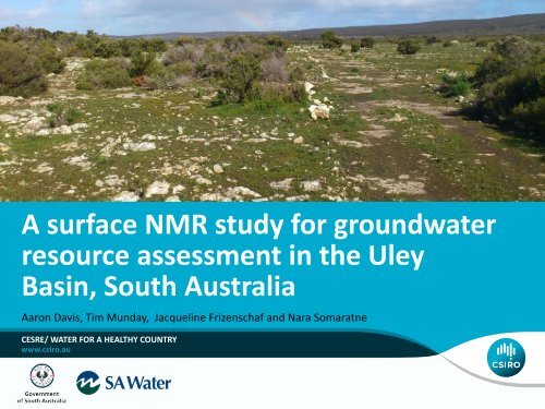
A surface NMR study for groundwater<br />
resource assessment in the <strong>Uley</strong><br />
<strong>Basin</strong>, South Australia<br />
Aaron Davis, Tim Munday, Jacqueline Frizenschaf and Nara Somaratne<br />
CESRE/ WATER FOR A HEALTHY COUNTRY
Purpose of study<br />
• Use hydrogeophysics to refine the model for <strong>Uley</strong> South Lens<br />
• Better define aquifer thickness, geometry and hydraulic<br />
properties in areas where little information exists.<br />
• Determine the depth to groundwater, aquifer porosity an<br />
hydraulic conductivity<br />
• Determine whether aquifer bounds could be revised in GW<br />
model<br />
• Trial non-invasive approach<br />
to examine as a pre-cursor to<br />
drilling<br />
A surface NMR study for groundwater resource assessment in the <strong>Uley</strong> <strong>Basin</strong>, South Australia
Approach<br />
• Employ surface Nuclear Magnetic Resonance (sNMR) and<br />
Time Domain Electromagnetic (TDEM) soundings in the SW<br />
corner of <strong>Uley</strong> South Lens<br />
A surface NMR study for groundwater resource assessment in the <strong>Uley</strong> <strong>Basin</strong>, South Australia
Why use NMR?<br />
• The only geophysical technique that allows for direct detection<br />
of water in the subsurface<br />
• Non-invasive<br />
• Minimal environmental footprint<br />
• Less expensive than exploratory drilling<br />
Estimate<br />
• Water content<br />
• Aquifer porosity<br />
• Hydraulic conductivity<br />
A surface NMR study for groundwater resource assessment in the <strong>Uley</strong> <strong>Basin</strong>, South Australia
Eyre Peninsula and <strong>Uley</strong> South<br />
• Only few aquifers<br />
provide potable<br />
water to Eyre<br />
Peninsula<br />
• <strong>Uley</strong> South is<br />
most important<br />
one<br />
• Supports Port<br />
Lincoln and east<br />
coast of the Eyre<br />
• 2007-2008 water<br />
allocation was<br />
~7200 Ml<br />
100 km<br />
A surface NMR study for groundwater resource assessment in the <strong>Uley</strong> <strong>Basin</strong>, South Australia
<strong>Uley</strong> South groundwater lenses<br />
Coffin Bay ‘A’<br />
Coffin Bay<br />
Coffin Bay<br />
National Park<br />
<strong>Uley</strong> South<br />
<strong>Uley</strong> Wanilla<br />
<strong>Uley</strong> East<br />
Port<br />
Lincoln<br />
25 km<br />
A surface NMR study for groundwater resource assessment in the <strong>Uley</strong> <strong>Basin</strong>, South Australia
Eyre Peninsula and <strong>Uley</strong> South<br />
• Quaternary limestone<br />
6028-00754<br />
aquifers in the very<br />
near surface<br />
• Rainfall dependent for<br />
recharge (~500 mm/a)<br />
Begin of extraction<br />
• Water levels had been<br />
dropping from<br />
beginning of<br />
production until 2008<br />
Reduction of pumping<br />
A surface NMR study for groundwater resource assessment in the <strong>Uley</strong> <strong>Basin</strong>, South Australia
<strong>Uley</strong> South lens recharge<br />
• Recharge is generally through sinkholes directly<br />
into the Quaternary Bridgewater formation<br />
• Water age can be as little as 60 days<br />
A surface NMR study for groundwater resource assessment in the <strong>Uley</strong> <strong>Basin</strong>, South Australia
Conceptual hydrogeological model<br />
Source: EPNRM<br />
A surface NMR study for groundwater resource assessment in the <strong>Uley</strong> <strong>Basin</strong>, South Australia
Previous work: TEMPEST AEM<br />
• Fitzpatrick et al, 2009<br />
• Tempest AEM survey<br />
• <strong>Basin</strong> and aquifer geometry<br />
• Possible connection between<br />
Coffin Bay ‘A’ and <strong>Uley</strong> South<br />
• Thickness and extent of <strong>Uley</strong><br />
South and Coffin Bay ‘A’<br />
freshwater lenses<br />
• Confirmed seawater<br />
intrusion to extent of ~700 m<br />
in <strong>Uley</strong> South<br />
A surface NMR study for groundwater resource assessment in the <strong>Uley</strong> <strong>Basin</strong>, South Australia
There’s water in the hills: Elevation<br />
10 km<br />
A surface NMR study for groundwater resource assessment in the <strong>Uley</strong> <strong>Basin</strong>, South Australia
Magnetics - basement geometry<br />
10 km<br />
Basement highs<br />
A surface NMR study for groundwater resource assessment in the <strong>Uley</strong> <strong>Basin</strong>, South Australia
Interval Conductivity -23 mAHD<br />
10 km<br />
Basement highs<br />
A surface NMR study for groundwater resource assessment in the <strong>Uley</strong> <strong>Basin</strong>, South Australia
Planning of soundings<br />
Inferred directions of<br />
groundwater flow<br />
(Quaternary Limestone)<br />
10 km<br />
A surface NMR study for groundwater resource assessment in the <strong>Uley</strong> <strong>Basin</strong>, South Australia
Planning of soundings<br />
10 km<br />
A surface NMR study for groundwater resource assessment in the <strong>Uley</strong> <strong>Basin</strong>, South Australia
sNMR & TEM Soundings<br />
Vista-Clara GMR<br />
Single-turn 72.5 m loop<br />
Aligned with magnetic North (-67.4° inclination, ~59000 nT)<br />
~2530 Hz<br />
Depth of penetration/resolution ~60 m<br />
NanoTEM<br />
Operating at 32Hz<br />
40 m loop<br />
Depth of penetration ~80 m<br />
A surface NMR study for groundwater resource assessment in the <strong>Uley</strong> <strong>Basin</strong>, South Australia
sNMR: Site 3<br />
10 km<br />
A surface NMR study for groundwater resource assessment in the <strong>Uley</strong> <strong>Basin</strong>, South Australia
sNMR: Site 3 Sounding data<br />
A surface NMR study for groundwater resource assessment in the <strong>Uley</strong> <strong>Basin</strong>, South Australia
sNMR: Site 3 Inversion<br />
•ULE098 is 460 m away from Site 3<br />
A surface NMR study for groundwater resource assessment in the <strong>Uley</strong> <strong>Basin</strong>, South Australia
sNMR: Site 6<br />
10 km<br />
A surface NMR study for groundwater resource assessment in the <strong>Uley</strong> <strong>Basin</strong>, South Australia
sNMR: Site 6 Inversion<br />
No<br />
cutting<br />
returns<br />
•ULE208 is 240 m away from Site 6<br />
A surface NMR study for groundwater resource assessment in the <strong>Uley</strong> <strong>Basin</strong>, South Australia
sNMR: Site ULE193<br />
10 km<br />
A surface NMR study for groundwater resource assessment in the <strong>Uley</strong> <strong>Basin</strong>, South Australia
sNMR: Site ULE193 Inversion<br />
~450 m/day<br />
A surface NMR study for groundwater resource assessment in the <strong>Uley</strong> <strong>Basin</strong>, South Australia
sNMR: Comparisons<br />
6 3<br />
A surface NMR study for groundwater resource assessment in the <strong>Uley</strong> <strong>Basin</strong>, South Australia
sNMR Sections (with AEM)<br />
10 km<br />
A surface NMR study for groundwater resource assessment in the <strong>Uley</strong> <strong>Basin</strong>, South Australia
sNMR Sections (with AEM)<br />
N<br />
S<br />
A surface NMR study for groundwater resource assessment in the <strong>Uley</strong> <strong>Basin</strong>, South Australia
sNMR Sections (with AEM)<br />
N<br />
S<br />
A surface NMR study for groundwater resource assessment in the <strong>Uley</strong> <strong>Basin</strong>, South Australia
Conclusion<br />
Detected water in:<br />
Quaternary aquifer (Bridgewater Formation)<br />
– FREE WILLY, porosity ~20%, HIGH k VALUES?<br />
– Partially constrained by <strong>Uley</strong> Formation<br />
Tertiary aquifer (Wanilla Formation)<br />
– Mainly mobile, partly bound, porosity ~20%<br />
– More saline than Bridgewater<br />
AEM and sNMR assist in hydrogeological interpretation<br />
Produce a section that shows extent of formations<br />
Refined conceptual understanding of aquifer system and variation in<br />
aquifer characteristics, which provide opportunity to update GW<br />
models and management options.<br />
A surface NMR study for groundwater resource assessment in the <strong>Uley</strong> <strong>Basin</strong>, South Australia
Future planning of soundings<br />
10 km<br />
A surface NMR study for groundwater resource assessment in the <strong>Uley</strong> <strong>Basin</strong>, South Australia
Thank you<br />
EM Applications<br />
Dr Aaron Davis<br />
Senior Research Geophysicist<br />
t +61 8 6436 8951<br />
e aaron.davis@csiro.au<br />
w www.csiro.au<br />
WATER FOR A HEALTHY COUNTRY


