

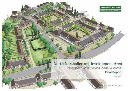
North Northallerton Development Area - Hambleton District Council
North Northallerton Development Area - Hambleton District Council
North Northallerton Development Area - Hambleton District Council

Create successful ePaper yourself
Turn your PDF publications into a flip-book with our unique Google optimized e-Paper software.
<strong>North</strong> <strong>North</strong>allerton <strong>Development</strong> <strong>Area</strong><br />
Masterplan Framework and Design Guidance<br />
Final Report<br />
May 2011
<strong>North</strong> <strong>North</strong>allerton <strong>Development</strong> <strong>Area</strong> – Masterplan Framework & Design Guidance<br />
<strong>North</strong> <strong>North</strong>allerton<br />
<strong>Development</strong> <strong>Area</strong><br />
Masterplan Framework and Design Guidance<br />
May 2011<br />
FINAL REPORT<br />
Document: 5335.doc.2.03<br />
Compiled By: SP/BW<br />
Reviewed By: JF<br />
Date: May 2011<br />
Taylor Young<br />
Chadsworth House<br />
Wilmslow Road<br />
Handforth<br />
Cheshire SK9 3HP<br />
Tel: 01625 542 200<br />
Fax: 01625 542 250<br />
Email: HUmailroom@tayloryoung.co.ukU<br />
1
<strong>North</strong> <strong>North</strong>allerton <strong>Development</strong> <strong>Area</strong> – Masterplan Framework & Design Guidance<br />
Contents<br />
1. Introduction 4<br />
2. Policy Context 10<br />
3. Vision and Objectives 16<br />
4. Issues and Opportunities 22<br />
5. Design Evolution 36<br />
6. Masterplan Framework 48<br />
7. Design Guidance 82<br />
8. Indicative Sketch Designs 148<br />
9. Delivery Plan 162<br />
List of Tables<br />
Table 3.1: Project Matrix<br />
Table 5.1: Consultation exercise - comments and responses<br />
Table 5.2: <strong>North</strong>allerton <strong>Area</strong> Forum – comments and responses<br />
Table 6.1: Ingredients Schedule<br />
Table 6.2: Policy requirements for open space<br />
Table A2: Street typology and recommended treatments<br />
Table 9.1: Indicative Phasing<br />
List of Figures<br />
Figure 1.1: Strategic Context<br />
Figure 1.2: Town Context<br />
Figure 1.3: Study <strong>Area</strong> Boundary<br />
Figure 1.4: Social Infrastructure Context<br />
Figure 2.1: <strong>North</strong> <strong>North</strong>allerton <strong>Development</strong> <strong>Area</strong> (from Allocations DPD)<br />
Figure 4.1: Key Views and Contours<br />
Figure 4.2: Settlement Form<br />
Figure 4.3: Village Studies<br />
Figure 4.4: Preliminary Constraints<br />
Figure 4.5: Potential Opportunities<br />
Figure 6.1: Land-use Framework<br />
Figure 6.2: Movement Framework<br />
Figure 6.3: Open Space & Landscape Framework<br />
Figure 6.4: Character <strong>Area</strong>s<br />
Figure 6.5: Masterplan Framework<br />
Figure 6.6: Illustrative Masterplan<br />
Figure 7.1: Gateways & Approaches<br />
Figure 8.1: <strong>Area</strong> 1 Sketch – Village Centre<br />
Figure 8.2: Indicative Plan of Village Centre<br />
Figure 8.3: <strong>Area</strong> 2 Sketch – Stokesley View<br />
Figure 8.4: <strong>Area</strong> 3 Sketch – Halfway Park/Hawthorne<br />
Figure 8.5: Indicative Plan of Halfway Park area<br />
Figure 9.1: Land Ownership<br />
Figure 9.2: Indicative Phasing<br />
2
<strong>North</strong> <strong>North</strong>allerton <strong>Development</strong> <strong>Area</strong> – Masterplan Framework & Design Guidance<br />
3
<strong>North</strong> <strong>North</strong>allerton <strong>Development</strong> <strong>Area</strong> – Masterplan Framework & Design Guidance<br />
1. Introduction<br />
1.1 In September 2010 Taylor Young were appointed by <strong>Hambleton</strong><br />
<strong>District</strong> <strong>Council</strong> (HDC) and the Homes and Communities Agency<br />
(HCA) to prepare a Masterplan Framework and Design Guidance<br />
for the <strong>North</strong> <strong>North</strong>allerton <strong>Development</strong> <strong>Area</strong> (NNDA). This is an<br />
area, designated in the Allocations <strong>Development</strong> Plan Document<br />
(DPD), proposed for a sustainable mixed-use extension to the<br />
north of the town, comprising around 965 new homes,<br />
employment space and recreation facilities. The extension also<br />
includes a new road linking Stokesley Road to Darlington Road<br />
through the area.<br />
1.2 The purpose of the Masterplan Framework and Design Guidance<br />
is:<br />
To set out an overall approach and shared vision for the<br />
NNDA;<br />
To provide a clear planning framework for the site,<br />
including a balance of land uses, type, mix and design;<br />
To identify a deliverable and financially viable project that<br />
delivers the vision for the area;<br />
To identify social and physical infrastructure requirements<br />
and the funding mechanisms for this, including likely<br />
development contributions;<br />
To determine the appropriate phasing to ensure the timely<br />
delivery of the development and infrastructure and a<br />
sustainable quality place;<br />
To provide a clear planning framework for the site against<br />
which to assess planning applications and to ensure the<br />
delivery of the NNDA vision and objectives and a<br />
comprehensive and integrated place.<br />
To provide design guidance to inform detailed<br />
masterplanning.<br />
1.3 This masterplanning study has been commissioned jointly by<br />
<strong>Hambleton</strong> <strong>District</strong> <strong>Council</strong> and the Homes and Communities<br />
Agency. It has been funded through the HCA’s Rural<br />
Masterplanning Fund and consequently has the aspiration of<br />
becoming a project that will exemplify best practice in placemaking<br />
for rural communities. It is being managed by HDC with<br />
the advice and assistance of ATLAS (The Advisory Team for<br />
Large Applications – part of the HCA).<br />
1.4 Taylor Young are supported by ekosgen (economic and property<br />
market consultants), WYG (engineers advising on transport,<br />
utilities and flood risk) and Instinctively Green (sustainability<br />
specialist). The project is overseen by a steering group that also<br />
includes HDC and key stakeholders.<br />
1.5 This document represents the Draft Masterplan Framework and<br />
Design Guidance. It builds upon the earlier Baseline Report and<br />
Preferred Masterplan Framework Paper. The report presents the<br />
masterplan and design guidance and explains how these have<br />
been arrived at, referring to the earlier stages of the study. It also<br />
provides a Delivery Framework to guide the partners in moving<br />
this project forward.<br />
1.6 The following figures describe the location of the NNDA (the study<br />
area). Figure 1.1 first shows the strategic context of <strong>North</strong>allerton,<br />
showing its position in the sub-region and its relationship with<br />
surrounding towns and communication networks. Figure 1.2<br />
places the NNDA in the context of <strong>North</strong>allerton, showing how it<br />
will act as a northern expansion to the town. Finally, Figure 1.3<br />
defines the boundary of the NNDA as established by the<br />
Allocations DPD. Please note that this has now been slightly<br />
amended in the Masterplan Framework in order to provide better<br />
integration with the surrounding topography.<br />
4
<strong>North</strong> <strong>North</strong>allerton <strong>Development</strong> <strong>Area</strong> – Masterplan Framework & Design Guidance<br />
Figure 1.1: Strategic Context<br />
5
<strong>North</strong> <strong>North</strong>allerton <strong>Development</strong> <strong>Area</strong> – Masterplan Framework & Design Guidance<br />
Figure 1.2: Town Context<br />
6
<strong>North</strong> <strong>North</strong>allerton <strong>Development</strong> <strong>Area</strong> – Masterplan Framework & Design Guidance<br />
Figure 1.3: Study <strong>Area</strong> Boundary<br />
7
<strong>North</strong> <strong>North</strong>allerton <strong>Development</strong> <strong>Area</strong> – Masterplan Framework & Design Guidance<br />
Figure 1.4: Social Infrastructure Context<br />
8
<strong>North</strong> <strong>North</strong>allerton <strong>Development</strong> <strong>Area</strong> – Masterplan Framework & Design Guidance<br />
9
<strong>North</strong> <strong>North</strong>allerton <strong>Development</strong> <strong>Area</strong> – Masterplan Framework & Design Guidance<br />
2. Policy Context<br />
2.1 This section sets out the planning policy context that supports the<br />
development proposed for the <strong>North</strong> <strong>North</strong>allerton <strong>Development</strong><br />
<strong>Area</strong>. This includes national guidance notes and local planning<br />
policy.<br />
National Policy and Guidance<br />
2.2 The Masterplan is fully compliant with current national planning<br />
guidance, particularly PPS1 (Delivering Sustainable<br />
<strong>Development</strong>) and PPS3 (Housing). Also important are PPS4<br />
(Planning for Sustainable Economic Growth), PPG13 (Transport),<br />
.PPG17 (Open Space, Sport and Recreation) and PPS22<br />
(Renewable Energy).<br />
2.3 The recently published Manual for Streets 2 – Wider Application<br />
of the Principles (2010), takes the philosophies and design<br />
principles set out in Manual for Streets and demonstrates how<br />
they can be extended beyond residential streets to encompass<br />
both urban and rural situations. The guidance encourages a<br />
breaking away from inflexible standards and traditional<br />
engineering solutions towards approaches which respond to local<br />
context and which improve quality of life and environment.<br />
2.4 In the context of urban extensions Manual for Streets 2<br />
recommends that roads should allow for the growth of towns and<br />
cities in a sustainable way, enabling new residents to benefit from<br />
existing facilities in the town. Of specific relevance to <strong>North</strong><br />
<strong>North</strong>allerton, it states that “practice that relies on limited access<br />
via distributor and relief road limits the level of connectivity that<br />
can be delivered and is not recommended”.<br />
Housing Density<br />
2.5 Originally, PPS3 (2000) stated that housing densities should<br />
always be more than 30 dwellings per hectare (dph). As of July<br />
2010, this minimum requirement has been scrapped. This was in<br />
response to “too many high rise blocks with affordable apartments<br />
too small for families”. Nevertheless, sustainability and climate<br />
change remain crucially important. The new wording in PPS3<br />
provides supporting text encouraging local planning authorities to<br />
adopt good policies on density and housing design in order to<br />
address the efficient use of land, walkable densities, responding<br />
to local character and affordable housing provision. This is<br />
reflected in <strong>Hambleton</strong> DC’s policy on required densities for<br />
development at <strong>North</strong> <strong>North</strong>allerton (see under Local Policy<br />
below).<br />
2.6 PPG17 (Open Space, Sport and Recreation) states that open<br />
space, sport and recreation provision levels will be set locally.<br />
Where local assessments find that there are deficiencies caused<br />
by new development the use of planning obligations to remedy<br />
these is advised.<br />
Local Policy<br />
2.7 <strong>Hambleton</strong> <strong>District</strong> <strong>Council</strong> has made good progress with their<br />
Local <strong>Development</strong> Framework (LDF). This includes the Core<br />
Strategy, which was adopted in April 2007, and the<br />
<strong>Development</strong> Policies <strong>Development</strong> Plan Document (DPD),<br />
adopted in February 2008. These policy documents establish<br />
<strong>North</strong>allerton as one of two Principal Service Centres in the<br />
<strong>District</strong> where the majority of development should be focused.<br />
Brompton is identified as a ‘service village’. The Core Strategy<br />
establishes the following vision for <strong>Hambleton</strong>.<br />
10
<strong>North</strong> <strong>North</strong>allerton <strong>Development</strong> <strong>Area</strong> – Masterplan Framework & Design Guidance<br />
<strong>Hambleton</strong>’s LDF Vision<br />
“By 2021 <strong>Hambleton</strong>’s communities will have become sustainable,<br />
prosperous, safe, healthy and vibrant. The development of vibrant<br />
and prosperous market towns and sustainable rural communities<br />
will have been supported. People from all sections of society will<br />
have been provided with access to homes, jobs and services,<br />
more of the <strong>District</strong>’s younger population will have been retained<br />
and the needs of the elderly will have been better met. This will all<br />
have been achieved in ways that reduce the impact of society on<br />
the environment, improve the quality of design of the built<br />
environment and protect and enhance <strong>Hambleton</strong>’s environmental<br />
assets such as its historic heritage.”<br />
2.8 Two objectives are proposed relating to the scale of new<br />
development in the <strong>District</strong>. The LDF will seek to:<br />
increase significantly the proportion of new houses that<br />
are lower priced, securing affordable opportunities<br />
particularly for local first-time buyers; and<br />
reduce the rate of in-migration into the <strong>District</strong> from those<br />
seeking retirement homes or more attractive locations to<br />
live, whilst working outside the <strong>District</strong> to north or south.<br />
2.9 The Regional Spatial Strategy (RSS) for Yorkshire and the<br />
Humber still forms part of the <strong>Development</strong> Plan (at the time of<br />
writing). The key elements of the RSS that inform local policy,<br />
notably housing numbers, have now been established within the<br />
Allocations DPD as statutory local policy.<br />
Allocations DPD<br />
2.10 The key local planning policy document in respect of the <strong>North</strong><br />
<strong>North</strong>allerton <strong>Development</strong> <strong>Area</strong> is the Allocations DPD. This<br />
was adopted by HDC on 21 December 2010, having been found<br />
sound by the Inspector in September 2010. This DPD is built on<br />
an extensive and robust evidence base, which also informs this<br />
masterplanning study.<br />
2.11 The Allocations DPD clearly identified the <strong>North</strong> <strong>North</strong>allerton<br />
<strong>Development</strong> <strong>Area</strong> as a development site: NM5, and goes on to<br />
sub-divide into separate land parcels and state appropriate uses<br />
for each. Policy NM5 therefore forms the planning policy<br />
foundation for this current masterplanning exercise.<br />
2.12 In brief, the policy states the following uses and development<br />
requirements for each parcel, which are labeled A to G and are<br />
located on the plan extracted opposite.<br />
NM5A: 200 dwellings (based on 5.7 ha @ 35 dph) in<br />
Phases 2 & 3. Flood attenuation measures will be<br />
required. Open space will need to be incorporated. Access<br />
will be taken from the new Link Road.<br />
NM5B: 200 dwellings (6.5 ha @ 30 dph) in Phase 3. Flood<br />
attenuation and sewage disposal improvements will be<br />
required. Access will be taken from Brompton Road and<br />
the Link Road.<br />
NM5C: 165 dwellings (5.5 ha @ 30 dph) in Phase 3.<br />
Access will be taken from Stokesley Road, and also<br />
pedestrian access from Winton Road.<br />
NM5D: Mixed use development comprising: 400 dwellings<br />
(11.4 ha @ 35 dph) and 5.8 ha of B1/B2 employment.<br />
Balancing ponds will be required as part of the drainage<br />
and flooding alleviation works. Access will be taken from<br />
the Link Road.<br />
NM5E: 5.7 ha of B1/B2/B8 employment. Access will be<br />
taken directly from a new roundabout between the A167<br />
and the new Link Road. High quality B1 uses are required<br />
to define this gateway.<br />
11
<strong>North</strong> <strong>North</strong>allerton <strong>Development</strong> <strong>Area</strong> – Masterplan Framework & Design Guidance<br />
Figure 2.1: <strong>North</strong> <strong>North</strong>allerton <strong>Development</strong> <strong>Area</strong> (NM5) (from HDC Allocations DPD)<br />
12
<strong>North</strong> <strong>North</strong>allerton <strong>Development</strong> <strong>Area</strong> – Masterplan Framework & Design Guidance<br />
NM5F: <strong>North</strong> <strong>North</strong>allerton Link Road (8m carriageway<br />
plus cycleway, footpath and bridge over the railway line).<br />
The cost will be met from developer contributions.<br />
NM5G: Recreation development. Increased and better<br />
facilities for local sports clubs. Access will be taken from<br />
Brompton Road and will also be connected to the footpath<br />
and cycleway network. This will help to maintain the<br />
physical separation between <strong>North</strong>allerton and Brompton.<br />
2.13 The DPD also makes the following important points regarding<br />
development of the <strong>North</strong> <strong>North</strong>allerton site:<br />
Phase 1 is identified as being up to 2016; Phase 2 is<br />
identified as 2016-2021; Phase 3 is 2021-2026.<br />
A requirement for 40% affordable housing is applied to all<br />
the residential allocations on the site (based on Core<br />
Policy CP9).<br />
Flood alleviation measures are required before<br />
development can commence on any sites in the flood<br />
plain. This needs to be considered in the context of the<br />
alleviation measures currently being explored by the<br />
Environment Agency.<br />
Developer contributions toward the Link Road, primary<br />
school places, public open space and improved access to<br />
local healthcare facilities will be required.<br />
Opportunities to incorporate sustainable and renewable<br />
energy generation should be maximised.<br />
Incorporation of high quality landscaping within each<br />
development site is required.<br />
Housing is proposed at a density of at least 30 dph in<br />
order to reflect the “predominantly urban fringe location”.<br />
Densities of 35 dph are recommended in some areas in<br />
order to meet housing requirements and maximise the<br />
accessibility of services and facilities.<br />
<strong>North</strong>allerton and Thirsk will contribute at least 51% of the<br />
housing development target for the district for the plan<br />
period (based on Core Policy CP6).<br />
The housing requirement has been informed by the<br />
Housing Market Demand Study (2008). This indicated a<br />
demand for all types of housing within the <strong>North</strong>allerton<br />
sub-area. It is therefore expected that the development will<br />
deliver a mix of two, three, four and five bedroom homes.<br />
2.14 The <strong>Development</strong> Policies DPD was adopted in February 2008.<br />
The policies within this document are derived from the Core<br />
Strategy. They include a large range of development policies.<br />
Relevant policies from this document will inform the preparation of<br />
the masterplan and will be reflected in the design guidance to<br />
direct subsequent detailed design.<br />
2.15 In July 2003, <strong>North</strong>allerton was awarded Renaissance Market<br />
Town status by Yorkshire Forward as part of their commitment<br />
to development of the economies in rural areas. The town has<br />
benefited from the support of town planning, transport, tourism<br />
and socio-economic expertise. This intensive programme has built<br />
on the existing Community Plan written by the <strong>North</strong>allerton and<br />
Villages Community Plan Forum with a number of additional<br />
consultations and research work being undertaken.<br />
2.16 The Community Plan for <strong>Hambleton</strong> 2006 to 2011 was adopted<br />
in 2006. The Plan has been produced by the <strong>Hambleton</strong> Strategic<br />
Partnership, which brings together representatives from the<br />
public, private and voluntary sector. It lists a series of objectives<br />
for the local community to improve quality of life.<br />
2.17 HDC have also produced a series of useful SPDs (Supplementary<br />
Planning Documents) that have been referred to as part of this<br />
study and will guide development within the NNDA moving<br />
forward. These include the Sustainable <strong>Development</strong> SPD and<br />
the Open Spaces, Sport & Recreation SPD.<br />
2.18 The <strong>North</strong> Yorkshire Strategic Housing Market Assessment<br />
(SHMA) is being prepared by GVA Grimley. This study will<br />
include primary research to identify housing demand across <strong>North</strong><br />
13
<strong>North</strong> <strong>North</strong>allerton <strong>Development</strong> <strong>Area</strong> – Masterplan Framework & Design Guidance<br />
Yorkshire. Results of this survey work and the draft SHMA are<br />
expected in May 2011. Initial secondary research suggests that<br />
housing needs have not changed significantly in <strong>Hambleton</strong> from<br />
the <strong>Hambleton</strong> Housing Demand Study, although it identifies<br />
particular housing needs for older persons and vulnerable adults<br />
(albeit on a small scale).<br />
2.19 The <strong>North</strong> Yorkshire Local Investment Plan 2011-2021 is<br />
currently in preparation. The Local Investment Plan (LIP) process<br />
is a means of bringing added value to the delivery of local<br />
priorities. Individual local authorities can determine whether to<br />
undertake this process alone or to work with neighbours to<br />
develop a shared investment plan. The following points within the<br />
document have particular relevance to the NNDA Masterplan:<br />
The importance of infrastructure and bridges to facilitate<br />
growth;<br />
Five priority objectives:<br />
1. Enabling the provision of more affordable homes<br />
2. Maintaining and improving existing housing stock<br />
3. Delivering Community Renaissance<br />
4. Improving access to housing services<br />
5. Reducing homelessness<br />
The NNDA is identified as the Key Strategic Growth<br />
Scheme in the Tees and Valley Links sub-area;<br />
The NNDA is described as an investment priority for 2011-<br />
2015. It also mentions a new ‘sports village’, green<br />
accessways, 40% (c.400) affordable homes), and an<br />
emerging Infrastructure Delivery SPD.<br />
Design Guidance<br />
2.20 A significant body of national guidance now exists to aid<br />
implementation of good quality urban design, as outlined in<br />
PPS1. This includes ‘By Design’ (DETR/CABE, 2000) and the<br />
supplementary ‘By Design – Better Places to Live’<br />
(DETR/CABE, 2001); the ‘Urban Design Compendium’ (English<br />
Partnerships & Housing Corporation, 2000) and Urban Design<br />
Compendium II (2007); and ‘Places, Streets and Movement’<br />
(DETR, 1998). All of these documents outline the importance of<br />
urban design and place-making in our urban areas and provide<br />
practical advice and best practice examples.<br />
2.21 Central to the concept of successful placemaking is the need to<br />
create ‘sustainable communities’. This is expressed in<br />
‘Sustainable Communities: Building for the Future (ODPM,<br />
2003) and ‘Creating Successful Neighbourhoods’ (CABE,<br />
2005). The sustainable communities agenda is about focusing on<br />
places where people will want to live now and in the future, which<br />
involves housing and the local environment in addition to<br />
consideration of employment, shops and services and socioeconomic<br />
factors.<br />
2.22 A Conservation <strong>Area</strong> Appraisal for the <strong>North</strong>allerton<br />
Conservation <strong>Area</strong> was produced in 2009. Although this<br />
conservation area is focused on the Town Centre it is useful for<br />
the masterplan in that it provides a definition of the special<br />
character and vernacular styles of the town, which should be<br />
referenced in the <strong>North</strong> <strong>North</strong>allerton area. The Appraisal has now<br />
been adopted as an SPD (December 2010). It has been studied<br />
by the masterplanning team and has informed the townscape and<br />
vernacular analysis in Section 4 of this report.<br />
2.23 A Sustainable <strong>Development</strong> SPD was adopted by <strong>Hambleton</strong><br />
DC in 2009. This has been produced to provide supporting<br />
information and guidance on LDF policies relating to the<br />
achievement of sustainability in new developments. This<br />
document has informed the outline sustainability strategy for the<br />
site (see Section 6).<br />
2.24 The intention is that the Masterplan Framework will update and<br />
refine the planning and infrastructure requirements set out in the<br />
LDF, following further technical and viability testing, design<br />
development, analysis and consultation.<br />
14
<strong>North</strong> <strong>North</strong>allerton <strong>Development</strong> <strong>Area</strong> – Masterplan Framework & Design Guidance<br />
15
<strong>North</strong> <strong>North</strong>allerton <strong>Development</strong> <strong>Area</strong> – Masterplan Framework & Design Guidance<br />
3. Vision & Objectives<br />
3.1 The Masterplan Framework has been informed by the project brief<br />
and by the opportunities and constraints that have been identified<br />
in the baseline report. At the start of the project ATLAS (Advisory<br />
Team for Large Applications) facilitated a Visioning event for<br />
stakeholders. This has resulted in a vision and series of project<br />
objectives for the masterplan. Since then, the vision and<br />
objectives have been crystallized through a series of Steering<br />
Group meetings, community and stakeholder consultation and a<br />
Preferred Masterplan Framework Paper.<br />
ATLAS Visioning Workshop and Emerging<br />
Objectives<br />
3.2 The workshop was held on 1st September 2010, facilitated by the<br />
ATLAS with officers from <strong>Hambleton</strong> <strong>District</strong> <strong>Council</strong> as well as<br />
representatives from <strong>North</strong> Yorkshire County <strong>Council</strong>,<br />
Environment Agency, Castlevale Group Ltd, Broadacres Housing<br />
Association and Taylor Young. Key objectives of the workshop<br />
were to discuss developing a shared vision and objectives to<br />
clearly identify the type of place the NNDA will become and how<br />
this will contribute to wider placemaking and sustainability.<br />
3.3 After a series of group discussions around themes relating to<br />
issues and opportunities affecting the NNDA the basis for an<br />
emerging vision and objectives was agreed.<br />
3.4 The emerging vision of the NNDA is that the area will be<br />
developed as a high quality comprehensive mixed use scheme; it<br />
is the principal Local <strong>Development</strong> Framework (LDF) allocation for<br />
<strong>North</strong>allerton and is key to building the community to 2026 and<br />
beyond. The NNDA provides a significant opportunity for quality<br />
development and place shaping, ensuring the needs of the area<br />
are well served.<br />
3.5 Attendees were organised into three theme workshop groups.<br />
Each group agreed emerging broad objectives for the Masterplan<br />
Framework, as set out below.<br />
Theme 1: Sustainability and Design<br />
<strong>Development</strong> Objectives:<br />
1. To manage flood risk of site and sustainable urban<br />
drainage and integrate this with recreation and leisure<br />
objectives and enhancement of the Brompton Gap.<br />
2. To explore potential for ecology/green corridors and<br />
green roofs to achieve biodiversity and water<br />
management objectives.<br />
3. To enhance/increase the quality of sustainable<br />
transport links to and from existing and new<br />
communities – include bus links through the new<br />
development.<br />
4. To secure quality in design at all spatial scales from<br />
houses to streets and infrastructure and to ensure<br />
design is informed by the strong local character.<br />
5. To develop a sense of place and local distinctiveness<br />
with distinct character areas, form and pattern<br />
informed by local character and vernacular.<br />
6. To create a positive visual and functional definition to<br />
the new settlement edge, including a variety of<br />
frontages and backs that accommodates any long<br />
term post 2026 development.<br />
16
<strong>North</strong> <strong>North</strong>allerton <strong>Development</strong> <strong>Area</strong> – Masterplan Framework & Design Guidance<br />
Theme 2: Transport and Land-use<br />
<strong>Development</strong> Objectives:<br />
8. To encourage strong functional and physical linkages<br />
between the NNDA and the northern end of High<br />
Street to support its use and improve trade.<br />
1. To positively integrate the multi-functional role of the<br />
’link’ road – as a movement route for vehicles,<br />
pedestrian and cycle friendly environment, green<br />
corridor, attractive gateway feature and landmark to<br />
the town, and location for social interaction.<br />
2. To develop high quality and attractive foot/cycle links<br />
to the town centre, neighbouring employment areas<br />
and surrounding countryside.<br />
3. To maximise the potential for new bus routes utilising<br />
the link road to improve public transport to and from<br />
the site.<br />
4. To facilitate the early construction of the rail bridge –<br />
to realise its public transport benefits/potential as<br />
soon as possible and establish sustainable transport<br />
patterns amongst new residents (e.g. provide bus<br />
service to rail station).<br />
5. To integrate land use mix, density and typologies with<br />
public transport network, hubs and accessibility to<br />
create a sustainable land use pattern and reduce the<br />
need to travel by private car.<br />
6. To integrate a hierarchy of transport networks and<br />
facilities with emphasis on creating a pedestrian<br />
friendly environment through appropriate design<br />
principles.<br />
7. To ensure appropriate neighbourhood provision of<br />
facilities such as retail, food & drink etc to support<br />
establishment of new community, social interaction,<br />
provision of everyday facilities and reduce the need to<br />
travel.<br />
Theme 3: Delivery and Viability<br />
<strong>Development</strong> Objectives:<br />
1. To provide a comprehensive mix of quality housing<br />
and allow for flexibility in the delivery of housing<br />
(phasing, quantum, density) to support viability.<br />
2. To explore options for wider community benefits from<br />
the development (e.g. Combined Heat and Power,<br />
recreational assets, community enterprise).<br />
3. To explore community ownership / social enterprise<br />
potential to include residents of Brompton in the<br />
design, definition of uses and management of<br />
recreational facilities.<br />
4. To develop linkages from the site and <strong>North</strong> Beck to<br />
wider recreational destinations and activities such as<br />
the Battle of the Standard, Coast to Coast walk/cycle<br />
ride etc<br />
5. To explore opportunities for utilising any required<br />
flood mitigation measures for recreational/leisure<br />
uses (e.g. balancing ponds)<br />
3.6 The workshop then went on to agree issues and tasks to be<br />
addressed, with responsibilities. This informed the preparation of<br />
a shared project plan and project management structures.<br />
17
<strong>North</strong> <strong>North</strong>allerton <strong>Development</strong> <strong>Area</strong> – Masterplan Framework & Design Guidance<br />
Vision and Project Matrix<br />
3.7 The Vision and ‘Project Matrix’ builds upon the work facilitated by<br />
ATLAS and discussions with the Steering Group. This sets out a<br />
Vision and a series of themes, objectives and targets which will<br />
have informed the development of the Masterplan Framework and<br />
Design Guidance. These are described below and summarised on<br />
the following Project Matrix (Table 4.1).<br />
The Vision<br />
3.8 The ‘Vision’ is a positive projection of the place that is intended to<br />
be created by the Masterplan. It is provided as an aspiration in<br />
reaching this goal and a benchmark to assess the final result of<br />
development.<br />
“By 2026 <strong>North</strong> <strong>North</strong>allerton will have developed into a<br />
cluster of attractive sustainable communities<br />
complementing the existing town of <strong>North</strong>allerton and<br />
its neighbouring villages. High quality community<br />
facilities serve their residential and working<br />
communities well. The area is known for its ‘green<br />
heart’, excellent parks, recreation facilities and nature<br />
areas.”<br />
Project Objectives<br />
3.9 The Project Objectives for the Masterplan Framework are set out<br />
below. These represent a development of the emerging principles<br />
agreed at the ATLAS workshop, which have been discussed and<br />
agreed with the Project Steering Group. These ten objectives<br />
clearly set out the aims of the Masterplan Framework.<br />
3.10 Project Objectives<br />
1. To provide a comprehensive mix of housing type and tenure to<br />
meet a wide range of housing needs and requirements (e.g.<br />
vulnerable adults, older persons housing), including a target of<br />
40% affordable housing.<br />
2. To ensure appropriate provision of community facilities to<br />
support the existing and new population and ensure sustainable<br />
integration of the NNDA.<br />
3. To enhance existing sports and leisure infrastructure and<br />
deliver new recreational development, including the creation of a<br />
sports village hub to serve the needs of the local community and a<br />
wide range of users.<br />
4. To provide a mix of high quality development to meet local<br />
needs and commercial demand, including a gateway on the<br />
Darlington Road approach to town.<br />
5. To create a multi-functional green infrastructure network<br />
throughout the site and beyond, which provides for sustainability,<br />
recreational, biodiversity, water management and movement<br />
opportunities.<br />
6. To incorporate on-site renewable energy generation where<br />
appropriate to help meet the <strong>Council</strong>’s and<br />
community’ssustainability aspirations and principles<br />
7. To ensure a high standard of design quality throughout the<br />
development that creates a sustainable and locally distinctive<br />
place.<br />
8. To explore community ownership/social enterprise potential to<br />
include residents in the design, and management of recreational<br />
and community facilities.<br />
18
<strong>North</strong> <strong>North</strong>allerton <strong>Development</strong> <strong>Area</strong> – Masterplan Framework & Design Guidance<br />
9. To create a sustainable transport network throughout the site<br />
including a well designed primary route (link road) that creates a<br />
high quality, safe and pedestrian friendly environment.<br />
10. To ensure that the development, implementation and management<br />
of the NNDA includes the active participation and involvement<br />
of the community and key stakeholders to deliver the shared vision<br />
and objectives.<br />
Design Themes<br />
3.11 The four Design Themes are the key concepts, distilled from the<br />
vision, that underpin the place that is being created. They provide<br />
an essential steer through the masterplanning and delivery<br />
processes and are used as organising principles for the design<br />
guidance.<br />
Design Themes<br />
Quality place making and design<br />
Environmentally sensitive<br />
Well served and run communities<br />
Sustainably well connected<br />
3.12 Within each theme there are a series of 3-4 design guidance<br />
principles (see Section 7). These principles will shape and instruct<br />
development in order for it to be truly representative of these<br />
themes and to deliver the Vision. These principles are listed on<br />
Table 4.1.<br />
Targets and Standards<br />
3.13 There are a number of external standards and measurable targets<br />
that can be applied to the Masterplan. These allow the vision and<br />
objectives to be calibrated in a more tangible, comparable and<br />
easily-understood form. The appropriate standards for<br />
development within the NNDA have been fully considered and are<br />
set out below, organised under the Design Themes. These are<br />
derived from the aspirations expressed in the Vision and Project<br />
Objectives and are fully integrated with the design guidance<br />
principles, which provide more detailed guidance to support these<br />
targets and standards.<br />
3.14 Quality place making and design<br />
Building for Life Silver+<br />
3.15 Environmentally sensitive:<br />
CSH 4+<br />
BREEAM Excellent+<br />
BREEAM Communities<br />
3.16 Well served communities<br />
25-35 dwellings per hectare; 40% affordable<br />
Provision of range of local services within walkable access<br />
3.17 Sustainably well connected<br />
30mph max link / access road (subject to modelling)<br />
Residents within 400m of a bus stop<br />
3.18 The project matrix is included on the following page.<br />
19
<strong>North</strong> <strong>North</strong>allerton <strong>Development</strong> <strong>Area</strong> – Masterplan Framework & Design Guidance<br />
Table 3.1: Project Matrix<br />
20
<strong>North</strong> <strong>North</strong>allerton <strong>Development</strong> <strong>Area</strong> – Masterplan Framework & Design Guidance<br />
21
<strong>North</strong> <strong>North</strong>allerton <strong>Development</strong> <strong>Area</strong> – Masterplan Framework & Design Guidance<br />
4. Issues & Opportunities<br />
4.1 This section highlights the key findings of our baseline analysis,<br />
identifying the key opportunities and constraints affecting the<br />
<strong>North</strong> <strong>North</strong>allerton <strong>Development</strong> <strong>Area</strong>. These have informed the<br />
vision and objectives, as set out in Section 3. For full details of the<br />
baseline analysis please refer to the Baseline Report.<br />
Understanding the Place – Key Issues<br />
Landscape Character<br />
4.2 In terms of mitigating views to new development across the north<br />
of <strong>North</strong>allerton the Landscape and Settlement Character<br />
Assessment (Dec 2008) is prescriptive, recommending general<br />
mitigation measures including, breaking up massing, using<br />
buildings of different shapes and sizes, along with internal tree<br />
and hedge planting. It also proposes that native tree and shrub<br />
planting can be used along sensitive boundaries. The nature and<br />
proximity to development of relevant planting is discussed in the<br />
mitigation for each of these typologies.<br />
4.3 Within and to the north of the site are, broadly, large open fields.<br />
There are some significant structural landscape elements. As<br />
described above, the landscape character of the area includes<br />
some significant structural landscape elements, including <strong>North</strong><br />
Beck and its associated woodland areas.<br />
4.4 Field and road boundaries are generally hedges; however some<br />
of the field boundaries are thin and patchy. There are some rows<br />
of individual trees within these hedgerows and in places beside<br />
the road there are some short belts of woodland planting.<br />
4.5 There is also some scrub and light tree planting associated to the<br />
railway through the site.<br />
4.6 The flood zones within the site are reasonably wide and largely<br />
follow the alignment of the Beck. This constraint is covered in<br />
more depth elsewhere in the baseline analysis (see the Baseline<br />
Report).<br />
4.7 Very little work has been undertaken in terms of understanding<br />
the ecology across the site; the most relevant documents are the<br />
Habitat Regulations Screening Report, LDF designations and the<br />
<strong>Hambleton</strong> Biodiversity Action Plan (HBAP). These reports show<br />
that there are no designated wildlife sites within the site and<br />
development would have no impact on regional Natura 2000 or<br />
RAMSAR sites. The HBAP gives more general advice on the<br />
various habitats and tackles wildlife conservation issues. Habitat<br />
classification work has shown that the habitats that are of highest<br />
value for wildlife are scarce in the <strong>District</strong>.<br />
4.8 The Wildlife Audit Steering group formed for the HBAP was<br />
tasked with preparing a wildlife audit and was seeking to put this<br />
information on GIS; however this does not seem to be available<br />
for the site at present.<br />
4.9 Discussion with the County <strong>Council</strong>’s ecology unit has underlined<br />
the following as elements which should be promoted in the<br />
masterplan:<br />
Wetlands<br />
Woodland<br />
Species rich grassland (protect existing within the verges)<br />
Wet grasslands<br />
4.10 They are also keen to underline the importance of a joined up<br />
ecology framework underpinned by a network of wildlife<br />
corridors.<br />
4.11 It is also worth noting the existence of the Green Infrastructure<br />
and the Regional Spatial Strategy for Yorkshire and the Humber:<br />
developing the evidence base. Yorkshire and Humber Assembly,<br />
11th June 2008. This document is a regional strategic document<br />
22
<strong>North</strong> <strong>North</strong>allerton <strong>Development</strong> <strong>Area</strong> – Masterplan Framework & Design Guidance<br />
Figure 4.1: Key Views and Contours<br />
23
<strong>North</strong> <strong>North</strong>allerton <strong>Development</strong> <strong>Area</strong> – Masterplan Framework & Design Guidance<br />
and does not give guidance on the infrastructure specifically<br />
around <strong>North</strong>allerton. Note should be taken of the typologies in the<br />
Green Infrastructure report.<br />
4.12 Key landscape Issues include:<br />
The Open Spaces, Sport & Recreation SPD suggests the<br />
need for around 10 ha of open space split under various<br />
typologies for the new development, of which around 5Ha<br />
is for sports (excludes wider catchment).<br />
8 ha suggested in the Allocations DPD cannot be formed<br />
in a single area as shown. It needs to account for<br />
placemaking, retained features, accessibility and<br />
appropriate locations, more open space may be required<br />
to meet these objectives.<br />
Appropriate uses for areas of undevelopable flood zone<br />
need to be found, recreation facilities in the flood zone<br />
may not be acceptable.<br />
Landscape features such as the woodland and the<br />
hedgerows should be retained where possible.<br />
Wildlife corridors particularly those along the railway and<br />
the Beck need to be protected and where appropriate<br />
enhanced.<br />
The Environmental Assessment may require a<br />
maintenance strip of 8m from the top of the bank of the<br />
Beck.<br />
Hard ‘green’ wooded edge to development is not suitable.<br />
The brief suggests that the recreation facilities outlined for<br />
the masterplan will be funded by both developer<br />
contributions and other funding opportunities - this will be<br />
a challenge in the current economic climate.<br />
Settlement Form - Townscape and Local Vernacular<br />
4.13 Given the isolated nature of development around the town centre<br />
and the lack of cohesive townscape in many of the residential<br />
areas it will be difficult to tie new development into the existing.<br />
4.14 The coalescence of Romanby into <strong>North</strong>allerton could provide a<br />
starting concept. It may be appropriate to generate a<br />
contemporary village core based on the model from the local<br />
historic villages, stitching a higher density development here back<br />
into the town with sensitively designed new development.<br />
4.15 One of the lessons to be learnt though is that this development<br />
should not create an inward facing and poorly connected layout.<br />
Linking routes across the scheme should ensure that the area is<br />
permeable.<br />
4.16 Though the development falls within a largely rural setting it is<br />
important to understand the prevalent form and evolution of the<br />
existing townscape and local vernacular, to enable new<br />
development to respond positively to the built context.<br />
Townscape studies have been undertaken in the baseline<br />
analysis, looking at <strong>North</strong>allerton, Brompton and Romanby.<br />
4.17 Recommendations from contextual analysis:<br />
Village green to the core of development, usually<br />
bookended by a cross road and significant village buildings<br />
to one end, the vista at the other closed with attractive<br />
detached buildings.<br />
Tight knit urban form around the green and the village<br />
centre with some farmstead type of arrangement of<br />
buildings to the rear.<br />
Narrow carriageways, foot paths associated to the property<br />
not the open space.<br />
24
<strong>North</strong> <strong>North</strong>allerton <strong>Development</strong> <strong>Area</strong> – Masterplan Framework & Design Guidance<br />
Formal open space can form the setting for becks and<br />
streams cutting through the development.<br />
Modest buildings emphasising symmetry and rhythm.<br />
Materials as outlined in the <strong>North</strong>allerton Conversation <strong>Area</strong><br />
Appraisal.<br />
4.18 Key townscape issues include:<br />
The railway and beck form a barrier cutting the site in half.<br />
Links into the town could prove difficult to establish - the<br />
existing edge of the town is formed by inward looking and<br />
poorly connected development.<br />
New development alongside the existing business/industrial<br />
park will have to be sensitive to the adjacent uses.<br />
Brompton: houses face onto linear open space<br />
The edge of the development will be visible from the north of<br />
the site, the massing of built form and combination of<br />
landscape treatments will have to be sound.<br />
The new link/access road will have to be carefully integrated<br />
into the townscape to ensure that it has a positive impact on<br />
the character of the settlement.<br />
Brompton: organic street form<br />
25
<strong>North</strong> <strong>North</strong>allerton <strong>Development</strong> <strong>Area</strong> – Masterplan Framework & Design Guidance<br />
Figure 4.2: Settlement Form<br />
26
<strong>North</strong> <strong>North</strong>allerton <strong>Development</strong> <strong>Area</strong> – Masterplan Framework & Design Guidance<br />
Figure 4.3: Village Studies<br />
27
<strong>North</strong> <strong>North</strong>allerton <strong>Development</strong> <strong>Area</strong> – Masterplan Framework & Design Guidance<br />
28
<strong>North</strong> <strong>North</strong>allerton <strong>Development</strong> <strong>Area</strong> – Masterplan Framework & Design Guidance<br />
4.19 Transport<br />
4.20 Flood Risk<br />
The access/link road is the key constraint to achieving<br />
successful movement patterns to and within the site.<br />
Phasing of the link/access road – this needs to be in<br />
place early on to prevent the Darlington Road/Yafforth<br />
Road junction becoming over capacity.<br />
The link/access road requires a structure over the<br />
railway line and Brompton Beck. Network Rail and<br />
Environment Agency requirements will need to be<br />
fulfilled.<br />
Public transport provision is currently poor for the<br />
western side of the site. If the access road is not<br />
completed at opening of the first parts of the<br />
development area an interim improvement to services<br />
and infrastructure along Darlington Road is required.<br />
Position of the access junction into the site from<br />
Darlington Road is fixed from the designed link road<br />
options as there is little land either side to relocate the<br />
proposed position. The use of a roundabout would also<br />
appear to be the most suitable means of highlighting the<br />
change of speed limit at this point.<br />
The extent of the flood plain for a 1:100yr and below<br />
event, associated with the Brompton Beck and its<br />
tributaries, renders large areas unsuitable for<br />
development.<br />
The flood alleviation works to the north of Brompton may<br />
have an effect on the developable area.<br />
NM5A slopes west away from the Brompton Beck.<br />
The general slope of the land towards the water courses<br />
is extremely shallow.<br />
Standing surface water seems to be prevalent within the<br />
site boundary.<br />
The current agreed surface water run-off rate appears<br />
quite restrictive<br />
Flood risk has been addressed by natural solutions locally to the site<br />
(new employment development at the eastern end of Thurston Road).<br />
4.21 Energy and Utilities<br />
There is insufficient sewage treatment and network<br />
capacity to support the whole development.<br />
There is insufficient electricity network capacity (at 11kV)<br />
to support the whole site.<br />
There is a foul pumping station at the site boundary<br />
requiring a 15m environmental health buffer.<br />
There is a foul water rising main within the site - can be<br />
diverted at cost.<br />
29
<strong>North</strong> <strong>North</strong>allerton <strong>Development</strong> <strong>Area</strong> – Masterplan Framework & Design Guidance<br />
There are overhead 11kV electricity lines within the site<br />
– can be diverted at cost.<br />
4.22 Property Market<br />
4.23 Delivery & Risks<br />
The residential property market remains weak following<br />
the economic recession, although there are signs of<br />
recovery. However, property prices remain below the<br />
2007 peak and mortgage lending remains low.<br />
The Commercial property market also remains weak,<br />
without the signs of recovery in the residential market. A<br />
significant quantity of new build office and industrial<br />
property remains vacant.<br />
Whilst borrowing costs remain low, access to mortgage<br />
finance is tough, with stringent mortgage terms being<br />
enforced by the banks.<br />
The highway and placemaking functions of the<br />
access/link road will need to be reconciled.<br />
The site is in multiple ownerships, with limited<br />
collaboration between landowners.<br />
Delivery of the site requires a new bridge over the<br />
<strong>North</strong>allerton to Middlesbrough railway.<br />
<strong>Development</strong> viability remains weak due to low property<br />
prices and costs associated with physical and<br />
community infrastructure.<br />
Gently rolling hills create strong landscape character<br />
Opportunities<br />
4.24 Landscape<br />
Landscape is used to define a strong character for the<br />
development weaving elements of the landscape into the<br />
placemaking objectives.<br />
The rural landscape character can be preserved within<br />
the Brompton Gap.<br />
Mitigate views to the development, using the precedence<br />
of some of the existing linear landscape elements.<br />
Existing hedgerows and woodland planting retained to<br />
settle new development in the landscape and create<br />
wildlife corridors.<br />
Create a well connected network of wildlife corridors<br />
30
<strong>North</strong> <strong>North</strong>allerton <strong>Development</strong> <strong>Area</strong> – Masterplan Framework & Design Guidance<br />
using existing features.<br />
A new sustainable urban drainage system (SUDS)<br />
should be considered; new development should not put<br />
further pressure on the amount of surface water draining<br />
to <strong>North</strong> Beck.<br />
Create a new recreation hub close to the council offices,<br />
providing a high quality and central facility for the whole<br />
area.<br />
close to the existing Esso/Co-op could be explored<br />
(outside the red line).<br />
Design principles developed from the evolution of<br />
existing local villages could help to inform design of an<br />
attractive hub within the development.<br />
The character of streets such as South Parade and<br />
hedge-lined country lanes could help define a character<br />
for the new access/link road.<br />
Linking routes across the scheme should ensure that the<br />
area is permeable.<br />
Connections into the town centre should be promoted<br />
and pick out good existing links e.g. <strong>North</strong>allerton Road.<br />
The use of the local vernacular should be considered.<br />
4.26 Community Infrastructure<br />
The masterplan provides the opportunity to address a<br />
spatial under-provision in accessible community<br />
infrastructure in the northern part of the town. This could<br />
be by way of one or two community hubs and a primary<br />
school, which would serve the new residents and<br />
adjacent existing neighbourhoods.<br />
Romanby: townscape form<br />
4.25 Townscape<br />
The surviving village character of Romanby – including<br />
the village green - within the wider <strong>North</strong>allerton<br />
settlement could form an interesting concept for<br />
townscape character.<br />
Opportunities to reinforce the existing hub at the<br />
intersection of <strong>North</strong>allerton Road and Stokesley Road<br />
4.27 Transport<br />
New access/link road provides the opportunity to<br />
connect areas within <strong>North</strong>allerton rather than act as a<br />
local barrier.<br />
Close proximity to town centre allows for cycling and<br />
walking trips to be made. There is the basis of a good<br />
existing network for these users, with the link/access<br />
road corridor providing a ‘missing link’ between the west<br />
and east of <strong>North</strong> <strong>North</strong>allerton.<br />
31
<strong>North</strong> <strong>North</strong>allerton <strong>Development</strong> <strong>Area</strong> – Masterplan Framework & Design Guidance<br />
New link/ site access road provides the chance to<br />
improve transport for all modes in to the <strong>North</strong> of the<br />
centre of the town. It is a new road but as part of the<br />
development area public transport, walking and cycling<br />
provisions can be greatly enhanced.<br />
Opportunity to enhance existing public transport services<br />
and infrastructure through the creation of the new link/<br />
access road.<br />
New link/access road will allow the currently fragmented<br />
west and east sides (through the railway and Brompton<br />
Beck) of the NNDA to be joined up.<br />
The area can provide a transport gateway to the town<br />
centre along the existing radial routes into <strong>North</strong>allerton.<br />
The positioning and design of new junctions into NNDA<br />
will help to manage traffic speeds.<br />
<strong>Area</strong> wide workplace travel planning measures could be<br />
undertaken which would benefit new developments and<br />
the existing employment premises situated close to the<br />
area.<br />
4.28 Flood Risk<br />
4.29 Energy and Utilities<br />
The site is unconstrained by any existing buildings or<br />
drainage infrastructure.<br />
The site slopes along its length rather than width<br />
allowing more credible surface water collection methods.<br />
The Brompton Beck and tributaries can be turned into an<br />
attractive feature of the site and integrated into the<br />
landscaping.<br />
The majority of the site does slope towards the natural<br />
water course and there are no apparent hollows or<br />
depressions.<br />
1.24 Ha of water storage, distributed across the site, is<br />
required for flood attenuation.<br />
Opportunity to explore local solid waste and local waste<br />
heat providers to understand technically and<br />
economically viable opportunities for community heating<br />
provision.<br />
Potential to explore whether parts of the local community<br />
could transfer to a low-carbon energy supply and<br />
become the anchor load within a new community energy<br />
company.<br />
Community buildings could be developed to maximise<br />
any revenue from Feed in Tariffs and other renewable<br />
energy subsidies where economically and technically<br />
viable.<br />
<strong>North</strong>allerton Road: links to Brompton are important.<br />
32
<strong>North</strong> <strong>North</strong>allerton <strong>Development</strong> <strong>Area</strong> – Masterplan Framework & Design Guidance<br />
4.30 Property Market<br />
The site provides a significant supply of land for housing<br />
and employment, with multiple accesses.<br />
The site relates well to existing employment in<br />
<strong>North</strong>allerton and the town centre.<br />
<strong>North</strong>allerton is the main service centre for the district<br />
and the wider area. It includes a wide range of services,<br />
facilities and employment opportunities and is well<br />
connected by road and rail.<br />
<strong>North</strong>allerton is a compact centre with a good range of<br />
national multiple and independent retailers.<br />
The residential market benefits from high levels of home<br />
ownership and house prices above average for <strong>North</strong><br />
Yorkshire.<br />
Part of the development site<br />
4.31 Delivery & Risks<br />
The NNDA is a large Greenfield site, allocated for mixed<br />
use development including housing, employment and<br />
ancillary uses.<br />
<strong>Hambleton</strong> <strong>District</strong> <strong>Council</strong> and the Homes and<br />
Communities Agency are committed to enabling delivery<br />
of the site.<br />
Borrowing costs remain low.<br />
Initial financial appraisals highlight the overall viability of<br />
the NNDA.<br />
33
<strong>North</strong> <strong>North</strong>allerton <strong>Development</strong> <strong>Area</strong> – Masterplan Framework & Design Guidance<br />
Figure 4.4: Preliminary Constraints<br />
34
<strong>North</strong> <strong>North</strong>allerton <strong>Development</strong> <strong>Area</strong> – Masterplan Framework & Design Guidance<br />
Figure 4.5: Opportunities Plan<br />
35
<strong>North</strong> <strong>North</strong>allerton <strong>Development</strong> <strong>Area</strong> – Masterplan Framework & Design Guidance<br />
5. Design Evolution<br />
Design Evolution<br />
The design process has evolved through the previous baseline<br />
and preferred options stages with the following influences:<br />
Allocations DPD – the document produced by <strong>Hambleton</strong> DC<br />
and subsequently adopted establishes the broad site, land-use<br />
mix and key policy parameters.<br />
Visioning Event – at this event, facilitated by ATLAS, a Vision<br />
and ‘10 Objectives’ provided placemaking and sustainability<br />
inspiration.<br />
Landscape assessment – we then developed a landscape<br />
framework including recreation land, SUDs and countryside<br />
edge treatment to ensure a sensitive fit with the landscape.<br />
Constraints mapping – this mapped known key constraints<br />
(such as flood risk) and clarified developable areas.<br />
Transport assessment – The Manual for Streets 2 and<br />
transport modelling contexts helped to develop the design<br />
concept for the east-west route.<br />
Consultation – consultation with stakeholders and residents<br />
allowed us to develop the countryside edge, open space and<br />
movement elements.<br />
Developer testing and financial appraisal – the emerging<br />
masterplan was tested to confirm broad commerciality<br />
Preferred Masterplan Framework assessment – this<br />
confirmed the masterplan approach and gained consensus<br />
around a Preferred Masterplan (see the Preferred Masterplan<br />
Paper).<br />
Refinement and detail – finally the Preferred Masterplan was<br />
fine-tuned with the Steering Group. Further layers of detail were<br />
added (such as the movement hierarchy, open space<br />
framework, character areas and phasing plans).<br />
5.1 This section explains how the design of the Masterplan<br />
Framework has evolved during the masterplanning process to<br />
achieve the form described in the following section of this report.<br />
It explains how this has been achieved collaboratively, with the<br />
Steering Group, key stakeholders and local community<br />
influencing the design progression work of the consultant team.<br />
Masterplanning Process<br />
36
<strong>North</strong> <strong>North</strong>allerton <strong>Development</strong> <strong>Area</strong> – Masterplan Framework & Design Guidance<br />
Requirements<br />
5.2 The requirements for the <strong>North</strong> <strong>North</strong>allerton <strong>Development</strong> <strong>Area</strong><br />
(NNDA) have been explained in Section 3. These requirements<br />
were first developed by the client group and presented in the<br />
project brief to the consultant team. They were then refined<br />
collectively by key stakeholders at the ATLAS Visioning<br />
Workshop. A clear vision and series of objectives were then<br />
agreed by the client team and consultant team.<br />
5.3 Full details of these requirements are explained in Section 3 but<br />
principally these included the need to deliver a quantum of new<br />
housing numbers and employment space, acting as a<br />
sustainable extension to <strong>North</strong>allerton. There was also the need<br />
to deliver open space and recreation facilities, both to serve the<br />
new residents and to address the needs of the town as a whole.<br />
The new development must also sit comfortably in the<br />
surrounding landscape and within the established settlement<br />
form, i.e. preserving the integrity of the separate village of<br />
Brompton.<br />
5.4 The requirements were also refined, and to some degree<br />
expanded, during the study. For example, discussions with<br />
the Local Education Authority allowed us to understand the local<br />
complexities in determining how to deal with the increased need<br />
for primary school places. This allowed for an indicative location<br />
for a school to be included in the masterplan, should it be<br />
determined that this is the best way to deal with the increased<br />
need.<br />
Allocations DPD<br />
5.5 The spatial form of the requirements were first expressed in the<br />
form of the land-use plan in the Allocations DPD. This was<br />
prepared by <strong>Hambleton</strong> DC in a process that involved significant<br />
public consultation, and has subsequently become adopted.<br />
This plan (see Figure 2.1 in Section 2) is a land-use plan, with<br />
five large single-use land-use areas (for residential, employment<br />
and open space uses) and a suggested broad alignment for the<br />
new east-west route. These land-use areas were allocated<br />
broad housing densities to provide an approximate indication of<br />
housing numbers. The Allocations DPD established the principle<br />
of these uses in planning policy terms.<br />
5.6 Whilst the broad land-use principles within the DPD remain<br />
valid, a detailed masterplanning exercise was needed to:<br />
Benefit from a greater understanding of the landscape<br />
and townscape contexts to aid integration with<br />
<strong>North</strong>allerton and foster greater sense of place.<br />
Understand site constraints and opportunities – i.e. flood<br />
risk, utilities, ecology and topography. These factors<br />
mean that not all the development areas indicated in the<br />
DPD plan can be developed and also influence the form<br />
of development.<br />
Provide a finer grain mix of uses to support sustainability<br />
objectives.<br />
Reduce the impact of the east-west road, especially on<br />
the northern countryside edge, and incorporating value<br />
savings and functional requirements of the road from<br />
both transport engineering and placemaking<br />
perspectives.<br />
Create a useable network of accessible open spaces<br />
across the site.<br />
Consider access to local shops, services and public<br />
transport hubs across the NNDA.<br />
Provide a more realistic estimate of housing numbers<br />
across the site, allowing for on-site constraints, the ability<br />
to vary densities within sites (to aid placemaking,<br />
sustainability and landscape integration) and<br />
consideration of block form.<br />
37
<strong>North</strong> <strong>North</strong>allerton <strong>Development</strong> <strong>Area</strong> – Masterplan Framework & Design Guidance<br />
Baseline Analysis<br />
5.7 The early stages of the masterplanning process involved the<br />
consultant team gaining a detailed understanding of site<br />
opportunities and constraints, and of the landscape and<br />
townscape contexts, in order to address the points listed above.<br />
The key points from this exercise have been summarised in<br />
Section 4 of this report and are described in full in the Baseline<br />
Report. This stage involved workshops with key stakeholders<br />
and discussions with the client group.<br />
5.8 In addition to this greater understanding of place the consultant<br />
team added expertise in three crucial areas:<br />
Urban Design – understanding how to create successful<br />
and sustainable places.<br />
Viability and Deliverability – ensuring that the masterplan<br />
would be deliverable by the private sector whilst still<br />
delivering the quality and wider objectives required,<br />
within a reasonable timescale. Without this thinking the<br />
masterplan would fail.<br />
Transport and Environment Engineering – ensuring that<br />
the masterplan proposals were deliverable, efficient and<br />
represented the optimum solution to technical issues.<br />
Maximising Viability – an approach that maximises<br />
viability whilst being aware of constraints.<br />
Single Centre Garden Suburban – A garden village<br />
style extension to <strong>North</strong>allerton that expands the town<br />
around a single centre in a low-density suburban manner<br />
without developing new higher density hubs.<br />
5.10 Sustainable Communities in the Landscape (I) – An<br />
approach that follows best practice by creating neighbourhoods<br />
based around community hubs, integrating with the surrounding<br />
landscape.<br />
5.11 Following feedback from the Steering Group and key<br />
stakeholders the Sustainable Communities in the Landscape (I)<br />
was then further developed as Sustainable Communities in<br />
the Landscape (II) to represent the preferred concept.<br />
Concept Evolution<br />
5.9 At the end of the Baseline stage the team developed the<br />
strategic design concept through stages. A series of simple<br />
conceptual masterplan sketches (see the Preferred Option<br />
Paper) were developed by Taylor Young and discussed with the<br />
Steering Group and key stakeholders. These used a range of<br />
masterplanning influences:<br />
Zoning – allocating different sub-areas to different landuses<br />
(as in the Allocations DPD).<br />
Preferred Masterplan Framework <strong>Development</strong><br />
5.12 The baseline analysis and consultant thinking resulted in a<br />
number of key factors that refined the masterplan from the form<br />
38
<strong>North</strong> <strong>North</strong>allerton <strong>Development</strong> <strong>Area</strong> – Masterplan Framework & Design Guidance<br />
illustrated in the DPD. These key factors and changes are<br />
summarised below.<br />
Flood risk was a significant issue. This meant that a<br />
large part of site NM5A (all proposed for residential<br />
development in the DPD) could not be developed and<br />
also that significant parts of other development sites<br />
were needed for water attenuation, significantly reducing<br />
the development area.<br />
The decision was taken to relocate the east-west route<br />
further south. This would reduce its visual impact on the<br />
open countryside in the Brompton Gap, especially when<br />
seen from residents to the north. Locating the road at the<br />
point where the Brompton Beck and railway line were<br />
located closer to each other would also result in a<br />
shorter bridge span being required, thereby saving costs.<br />
A short span solution was preferred because the beck<br />
cannot be culverted.<br />
The alignment of the east-west route was also made<br />
more circuitous as it passed through the residential area.<br />
This was a deliberate attempt to reduce vehicle speeds,<br />
reduce severance and improve placemaking and<br />
residential amenity. This thinking is in line with the<br />
guidance in Manual for Streets 2.<br />
Whilst the southern part of the Brompton Gap area (site<br />
NM5G) remains the focus for open space recreation<br />
facilities there was a need to distribute smaller open<br />
spaces within an open space framework across the<br />
NNDA, to provide for local accessibility, improved<br />
placemaking and to address flood risk issues.<br />
It was considered, following a review of social<br />
infrastructure, that there was a need to address<br />
anticipated spatial shortfalls in the NNDA by providing<br />
two ‘community hubs’ for local shops and services.<br />
These would be for local needs only and would not<br />
challenge the primacy of <strong>North</strong>allerton Town Centre, to<br />
which strong links were also proposed.<br />
The northern edge of the development from the<br />
Allocations DPD , has been re-considered in order to<br />
allow for better integration with the surrounding<br />
landscape, for example by following contours and field<br />
boundaries. This has also allowed for the shortfall in<br />
housing numbers, resulting from the undevelopable<br />
areas due to flood risk, being partially addressed in order<br />
to maintain the housing numbers set out in the<br />
requirements and in the DPD.<br />
The viability advice provided by the consultant team also<br />
challenged the extent of employment land included<br />
within the Allocations DPD. This appeared somewhat<br />
larger than the expected level of demand, especially in<br />
the current economic circumstances, for the projected<br />
masterplan period. Altering the balance between<br />
employment and residential also allowed for the shortfall<br />
in housing numbers resulting from other factors to be<br />
addressed. There still remains a significant extent of<br />
employment provision in the masterplan. The designers<br />
also planned the interface between the two uses in<br />
greater detail, allowing for better residential amenity after<br />
considering integration with Standard Way employment<br />
park and the position of existing heavy manufacturing<br />
uses.<br />
5.13 All of the above changes were discussed and agreed with the<br />
Steering Group and a Preferred Masterplan Framework was<br />
produced. This plan incorporated all the above changes and<br />
provided an indicative block layout for residential and<br />
employment uses, a recommended alignment for the east-west<br />
route and an open space framework. This Preferred Masterplan<br />
Framework included three ‘inset variations’ for both the northern<br />
‘countryside edge’ and the ‘central greenspace’ (i.e. the<br />
Brompton Gap). These insets plans explored different<br />
approaches to the issues described above in these areas.<br />
5.14 The Preferred Masterplan Framework was thoroughly tested by<br />
the consultant team. This included an assessment against the<br />
ten project objectives, a viability and deliverability assessment<br />
39
<strong>North</strong> <strong>North</strong>allerton <strong>Development</strong> <strong>Area</strong> – Masterplan Framework & Design Guidance<br />
and a transport assessment. This stage also included a<br />
community consultation exercise. These assessments are<br />
explained in detail in the Preferred Masterplan Framework<br />
Paper.<br />
Community Consultation<br />
5.15 The consultation process included a drop-in day at The Forum<br />
on 22 November 2010 and a public meeting on the same day. A<br />
public exhibition was produced to explain the emerging<br />
Preferred Masterplan and to seek comments. This was left on<br />
display at the <strong>Council</strong> offices, and online, with facility to leave<br />
comments for the following three weeks.<br />
5.16 The outcome of this exercise was broad support for the<br />
emerging masterplan, with preferences expressed for individual<br />
inset variations for the countryside edge and central<br />
greenspace. Comments were also made about detailed<br />
masterplanning points (for example linkages between the<br />
Stokesley View character area (NM5C) and the adjacent<br />
neighbourhood to the south).<br />
5.17 Comments were also made about detailed masterplanning<br />
points . The table below describes the principal comments<br />
arising from the consultation exercise and the resulting<br />
amendments that were made to the masterplan.<br />
Route and role of the eastwest<br />
route needs to be<br />
clarified and explained.<br />
Safe linkage for pedestrians<br />
(especially school children)<br />
and cyclists between<br />
Brompton and <strong>North</strong>allerton is<br />
a key concern.<br />
The visual impact of the new<br />
road bridge must be<br />
ameliorated.<br />
The favoured inset variation<br />
for the countryside edge is a<br />
mix of variations 1 and 2,<br />
maximising greenspace but<br />
allowing for some social and<br />
community infrastructure in<br />
this area.<br />
The Draft Masterplan Report<br />
provides further explanation<br />
with cross-sections and<br />
examples. The route was<br />
further considered and<br />
discussed,<br />
The need for a safe route<br />
alongside <strong>North</strong>allerton Road<br />
has been empahasised in the<br />
Movement Framework and<br />
design guidance.<br />
Landscape guidance and<br />
indicative sketches to address<br />
these are now provided.<br />
This was used as the basis for<br />
the Draft Masterplan<br />
Framework.<br />
Table 5.1: Consultation exercise - comments and responses<br />
Consultation Comment<br />
Need to achieve housing<br />
numbers.<br />
Masterplan Response<br />
Sensitive extensions to the<br />
countryside edge, and a<br />
reduced proportion of<br />
employment, now allows<br />
housing numbers to be broadly<br />
achieved.<br />
Landscaping in the Brompton<br />
Gap needs to be carefully<br />
managed, with integration of<br />
formal and informal recreation<br />
incorporating footpaths (with<br />
consideration given to the<br />
over 55s).<br />
The contour-led inset variation<br />
(variation 2) is preferred for<br />
This has informed the Open<br />
Space & Landscape<br />
Framework and the associated<br />
design guidance.<br />
This variation has been used<br />
for the Draft Masterplan<br />
40
<strong>North</strong> <strong>North</strong>allerton <strong>Development</strong> <strong>Area</strong> – Masterplan Framework & Design Guidance<br />
the northern countryside edge.<br />
The number of additional<br />
dwellings this provides for<br />
should be defined.<br />
Framework. It provides for<br />
around 85 additional units,<br />
Table 5.2: <strong>North</strong>allerton <strong>Area</strong> Forum - comments and<br />
responses<br />
Consultation Comment<br />
Masterplan Response<br />
There should be no vehicle<br />
link between Winton Road and<br />
Mowbray Road (in DPD area<br />
NM5C), only pedestrian and<br />
cycle links.<br />
Potential locations for public<br />
art.<br />
This link is now pedestrian and<br />
cycle only in the masterplan.<br />
Design guidance point B2<br />
makes recommendation<br />
regarding the siting of public<br />
art.<br />
5.18 The assessments undertaken by the consultant team, and<br />
discussed and agreed with the Steering Group, also provided a<br />
robust testing and support of the Preferred Masterplan<br />
Framework. Comments were also provided from key<br />
stakeholders on the emerging masterplan and these influenced<br />
subsequent design development.<br />
5.19 The emerging Preferred Masterplan was also tabled at a<br />
meeting of the <strong>North</strong>allerton <strong>Area</strong> Forum on 1 st February 2011.<br />
This resulted in the following comments and responses.<br />
Road issues: design speed<br />
and alignment; traffic and<br />
noise levels; access to<br />
industrial estate; landscaping.<br />
Flooding issues: concern with<br />
the potential position of the<br />
new school.<br />
EA engagement: query over<br />
whether the EA (Environment<br />
Agency) were specifically<br />
engaged by the consultants.<br />
Extensions to the LDF<br />
allocation<br />
boundary<br />
(specifically land parcel NM5c)<br />
and the additional housing<br />
proposed.<br />
A traffic model was<br />
commissioned to test the road<br />
design. Noise reduction and<br />
landscaping is addressed in<br />
masterplan amendments.<br />
Ultimately a dual solution was<br />
reached – providing a<br />
separate access to the<br />
industrial estate.<br />
It is confirmed that this location<br />
is outside of the EA flood<br />
zone.<br />
Confirmation that WYG did<br />
interview the EA and that the<br />
EA also attended workshops<br />
and meetings during the study.<br />
A further meeting was held<br />
with the EA - who confirmed<br />
that areas of flooding concern<br />
could be resolved by improved<br />
surface water drainage in the<br />
development).<br />
Confirmation that the<br />
extension represented 3.08 Ha<br />
and approximately 48<br />
dwellings, although total<br />
numbers still did not exceed<br />
the Allocations DPD total.<br />
Further Forum consultation. The masterplan was also<br />
41
<strong>North</strong> <strong>North</strong>allerton <strong>Development</strong> <strong>Area</strong> – Masterplan Framework & Design Guidance<br />
discussed at the Forum<br />
meeting 23 rd March.<br />
5.20 Representatives present at the 1 st February 2011 <strong>North</strong>allerton<br />
<strong>Area</strong> Forum included the Clerk of Brompton Town <strong>Council</strong> who<br />
issued the following statement after that meeting:<br />
“Brompton <strong>Council</strong> were extremely pleased to learn tonight of<br />
the way forward that <strong>Hambleton</strong> <strong>District</strong> <strong>Council</strong> is intending to<br />
move with the <strong>North</strong> <strong>North</strong>allerton development in the months<br />
and years to come.<br />
The <strong>Council</strong> hopes that what was seen at the recent meeting of<br />
the Forum will not be too much different to the final report from<br />
the Consultants.<br />
In particular the <strong>Council</strong> is very supportive of the new location of<br />
the access/link road and considers that this location is far<br />
preferable to what was initially being considered.<br />
Also the plans as envisaged now appear to acknowledge a<br />
proper green demarcation between the development and the<br />
Parish of Brompton rather than some more minor separation<br />
perhaps by a row of trees or similar boundary.<br />
The <strong>Council</strong> understands that much of the work that has been<br />
undertaken up to now has been carried out by officers of the<br />
<strong>District</strong> <strong>Council</strong> and Brompton Town <strong>Council</strong> wishes to<br />
acknowledge the vision that the officers have sought to achieve<br />
in their plans to date.<br />
Brompton <strong>Council</strong> very much hopes that the development, future<br />
economic circumstances etc permitting, will move forward very<br />
much as is currently envisaged.”<br />
Paul Atkin, Clerk to Brompton Town <strong>Council</strong><br />
Draft Masterplan Framework<br />
5.21 A Draft Masterplan Framework was then prepared. This<br />
incorporated the inset variation preferences described above<br />
and other comments received during consultation and from the<br />
Steering Group. This new framework also resulted from<br />
additional design development by the consultant team. A<br />
number of minor changes were made to the Preferred<br />
Masterplan Framework, whilst maintaining the overall form that<br />
had been assessed. These changes are described below.<br />
Inset variation 1 (maximising pitches and greenspace)<br />
was used for the central greenspace and variation 2<br />
(contour-led) was used for the countryside edge. Both of<br />
these followed preferences expressed during community<br />
consultation and the preferred direction of the Steering<br />
Group.<br />
The block form in the western employment area (Site<br />
NM5E) has been amended to provide better movement<br />
and legibility and to provide for slightly more employment<br />
development. Small open spaces were removed here as<br />
it was felt that they were not needed in the context of the<br />
wider open space framework.<br />
The alignment of the east-west route has been made<br />
slightly less circuitous following discussions with the<br />
highways authority. This has led to amendments to<br />
surrounding block shapes.<br />
The interface between the employment area and the<br />
new housing to the north has been improved, with a<br />
frontage of housing now facing the road from the south.<br />
Block form in the Stokesley View character area<br />
(NM5C) has been slightly amended to provide a better<br />
gateway to the NNDA and to ensure that linkage to<br />
Mowbray Road (east of Stokesley Road) is for<br />
pedestrians and cyclists only, following consultation with<br />
local residents.<br />
42
<strong>North</strong> <strong>North</strong>allerton <strong>Development</strong> <strong>Area</strong> – Masterplan Framework & Design Guidance<br />
5.22 This amended version of the Masterplan was presented at the<br />
end of the Preferred Masterplan Framework and, with only very<br />
minor amendment (the removal of one open space in NM5E)<br />
this was the masterplan described in the Draft Masterplan<br />
Framework report. This document was concerned primarily with<br />
the development of a series of supporting frameworks (i.e. open<br />
space, movement, character areas) and the preparation of<br />
design guidance, now that the masterplan has been agreed.<br />
Option 1: Link Road – Site Allocation<br />
East-West Route<br />
5.23 In order to respond to issues and comments regarding the eastwest<br />
route a number of options were prepared and assessed by<br />
the consultant team. These are summarised below alongside<br />
the relative pros/cons of each.<br />
5.24 Pros:<br />
• Ease of access for vehicles<br />
• Strong traffic relief function<br />
• Strong gateway opportunity<br />
• Conforms to Allocations DPD<br />
5.25 Cons:<br />
• Segregation of communities & facilities<br />
• Doesn’t support local character/place-making<br />
• Poor fit with Manual for Streets<br />
• Costly bridging point<br />
43
<strong>North</strong> <strong>North</strong>allerton <strong>Development</strong> <strong>Area</strong> – Masterplan Framework & Design Guidance<br />
Option 2: Manual for Streets led<br />
Option 3a: Southerly Fork<br />
5.26 Pros:<br />
• Pedestrian friendly environment<br />
• Strong fit with Manual for Streets<br />
• Cost effective bridging point<br />
• Well integrated communities & facilities<br />
• Supports local character/place-making<br />
• Strong gateway opportunity<br />
• Local centre maximises passing trade<br />
5.27 Cons:<br />
• Less strong traffic relief function<br />
• This option is not supported by the County Highways Authority.<br />
5.28 Pros:<br />
• Ease of access for vehicles<br />
• Adequate traffic relief function<br />
• Cost effective bridging point<br />
5.29 Cons:<br />
• Split gateway/weak legibility<br />
• Weaker local centre function<br />
• Segregation of communities & employment<br />
• Additional costs<br />
44
<strong>North</strong> <strong>North</strong>allerton <strong>Development</strong> <strong>Area</strong> – Masterplan Framework & Design Guidance<br />
Option 3b: Centre/Access Balance<br />
5.32 It was decided by the consultant team and client group that<br />
Option 3b (Centre/Access Balance) was the most favourable<br />
solution. <strong>Hambleton</strong> DC endorsed the decision to progress the<br />
Masterplan Framework on this basis. Taylor Young have<br />
consequently amended the framework to incorporate these<br />
changes and this is the version that now appears in the Final<br />
Report.<br />
Final Masterplan Framework<br />
5.30 Pros:<br />
• Cost effective bridging point<br />
• Adequate traffic relief function<br />
• Supports local character/ place-making<br />
• Strong gateway opportunity<br />
• Local centre location maximises passing trade<br />
5.31 Cons:<br />
• Degree of segregation of communities and facilities<br />
• Additional effort needed to ensure place-making on southern<br />
route.<br />
5.33 The Masterplan Framework was developed further with<br />
substantive changes to the layout and street hierarchy to reflect<br />
ongoing concerns over strategic connectivity and the east-west<br />
route through the heart of the development.<br />
5.34 The main concern was that the sinuous and tightly meandering<br />
street designed as part of the draft masterplan would prove suboptimal<br />
in terms of traffic movements at the town wide level. In<br />
simple terms the traffic modeling showed that the street as<br />
designed would not offer sufficient relief to the town from traffic.<br />
5.35 It was always the intention to balance the function of the eastwest<br />
link and to create a pedestrian friendly environment where<br />
traffic was calmed and where through movement of vehicles<br />
occurred but at slow speeds and priority given to pedestrians<br />
and cyclists. The balance in the draft masterplan has been<br />
challenged and the agreed way forward is to create a street<br />
which offers greater efficiency in terms of traffic movements<br />
east-west. In reponse (as outlined in Option 3b above) the eastwest<br />
route is now oriented further south in the western part of<br />
the NNDA, providing more direct access to the adjacent<br />
industrial park and new employment uses to the south and west.<br />
This has been a clear message from the project steering group<br />
and accordingly the layout has been redesigned. The street<br />
hierarchy has been updated to include the new more direct link<br />
road – 30pmh as opposed to 20mph – which can be designed<br />
as a formal avenue or boulevard.<br />
45
<strong>North</strong> <strong>North</strong>allerton <strong>Development</strong> <strong>Area</strong> – Masterplan Framework & Design Guidance<br />
5.36 This does not mean the abandonment of the ‘Manual for<br />
Streets’ (MfS) ethos which underpinned the residential layout.<br />
The Option 3b approach allows the former alignment of the<br />
east-west route to the north to act as a downgraded local<br />
residential access which will better facilitate placemaking in the<br />
heart of the new neighbourhood. The MfS approach has been<br />
applied to all residential streets outside the principal east-west<br />
link (including this parallel northern route) and so this remains<br />
identifiable within the Masterplan.<br />
5.37 Importantly the east-west route retains its broad alignment and<br />
connects with Darlington Road at the local centre which remains<br />
in the same location as the draft masterplan. As options were<br />
assessed to agree a sensible redesign of the east-west link, the<br />
potential for the local centre (which requires co-location with the<br />
east-west route in order to maximise passing trade) to change<br />
location was discussed. None of the potential relocation areas<br />
proved satisfactory and it quickly became apparent that the<br />
optimum location for the centre was that shown in the draft<br />
masterplan.<br />
5.38 The final arrangement of east-west route and local centre<br />
creates the best design response to the constraints, best<br />
practice and client feedback to provide a pragmatic and<br />
practical layout which can meet the needs of wide-ranging<br />
stakeholders, whilst also providing the basis for a successful<br />
development.<br />
46
<strong>North</strong> <strong>North</strong>allerton <strong>Development</strong> <strong>Area</strong> – Masterplan Framework & Design Guidance<br />
47
<strong>North</strong> <strong>North</strong>allerton <strong>Development</strong> <strong>Area</strong> – Masterplan Framework & Design Guidance<br />
6. Masterplan Framework<br />
6.1 The Masterplan Framework is the key element of this report. It<br />
sets out the form of development that is proposed for the <strong>North</strong><br />
<strong>North</strong>allerton <strong>Development</strong> <strong>Area</strong> (NNDA). This is then amplified<br />
in further detail by the design guidance in Section 7.<br />
6.2 The Masterplan Framework exists as a series of ‘layers’, each<br />
covering different aspects of the masterplan. All of these layers<br />
are fully integrated with each other and collectively represent<br />
the Masterplan Framework.<br />
6.3 The Masterplan Framework is therefore comprised of the<br />
following complementary frameworks:<br />
Land-use Framework<br />
Movement Framework<br />
Open Space and Landscape Framework<br />
6.4 These spatial frameworks are complemented with the following<br />
supporting elements, which are also included within this section:<br />
Sustainability Strategy – the establishment of<br />
sustainability principles for the site with an explanation of<br />
how these are being met by the Masterplan Framework<br />
and how they should be further delivered through<br />
subsequent detailed design.<br />
Character <strong>Area</strong> Framework – an explanation of how<br />
the design guidance will result in a series of distinct<br />
‘places’ being created within the NNDA. This should be<br />
read alongside design guidance principle B2: Memorable<br />
Gateways and Approaches (with Figure 7.1).<br />
Indicative Masterplan – an illustrative plan (Figure 6.5)<br />
providing a further level of detail - demonstrating how the<br />
Masterplan Framework and design guidance may be<br />
interpreted in a block layout form.<br />
The Masterplan Framework is comprised of a series of layers<br />
6.5 The Masterplan Framework has been developed in direct<br />
response to the ten Project Objectives (see Section 3). Each of<br />
the sections listed above addresses different project objectives<br />
and this is set out at the beginning of each section.<br />
48
<strong>North</strong> <strong>North</strong>allerton <strong>Development</strong> <strong>Area</strong> – Masterplan Framework & Design Guidance<br />
Land-use Framework<br />
Project Objectives<br />
6.6 The Land-use Framework addresses the following Project<br />
Objectives:<br />
1. To meet a wide range of housing needs and<br />
requirements (e.g. vulnerable adults, older persons<br />
housing), including a target of 40% affordable housing.<br />
2. To ensure appropriate provision of community facilities to<br />
support the existing and new population and ensure<br />
sustainable integration of the NNDA.<br />
3. To enhance existing sports and leisure infrastructure and<br />
deliver new recreational development, including the creation<br />
of a sports village hub to serve the needs of the local<br />
community and a wide range of users.<br />
4. To provide a mix of high quality development to meet<br />
local needs and commercial demand, including a gateway<br />
on the Darlington Road approach to town.<br />
Explanation<br />
6.7 The broad land-uses for the NNDA and their distribution have<br />
been defined in the Allocations DPD. This sensibly proposes<br />
employment uses largely alongside the existing Standard Way<br />
employment area, open space focused on the Brompton Gap<br />
and residential across the rest of the site in the form of distinct<br />
neighbourhoods.<br />
6.8 We then looked in more detail at this land-use mix, responding<br />
to issues and constraints and providing a more fine-grain<br />
approach. This has resulted in the land-use framework that is<br />
described by the Preferred Masterplan and set out in the<br />
Ingredients Table. In particular, the land-use framework has<br />
responded to the following considerations:<br />
6.9 Open space is provided in response to the figures and location<br />
set out in the DPD but also accommodating more specific<br />
requirements for sports pitches from the local authority. There<br />
was also the extent of flood risk areas and EA confirmed areas<br />
for surface water attenuation (0.44 ha) meaning an additional<br />
area adjacent to the previously identified open space could not<br />
be developed and this area was also included in the Brompton<br />
Gap open space. Finally, there was a need to provide open<br />
space for residential amenity and children’s play in accessible<br />
locations throughout the new housing areas, and not just<br />
centrally at the Brompton Gap. These factors have all resulted<br />
in a significantly higher open space provision being included.<br />
6.10 Community hubs have been provided at two locations. This is<br />
in response to the need to provide accessible services to the<br />
new residents and workers and to address existing shortfalls.<br />
This assessment is explained in the Social Infrastructure<br />
Review section of the Baseline Report. The community hubs will<br />
include convenience retail, a primary school, pub/restaurant,<br />
hotel and potentially a primary school and health centre. The<br />
primary school is likely to be provided just outside the<br />
masterplan area.<br />
6.11 Initial residential densities were provided in the DPD for each<br />
Allocation. In order to understand the capacity of the NNDA and<br />
deliver the quantum of housing required this study has<br />
considered this in more detail. Each site allocation has been<br />
broken down into smaller blocks and an appropriate density has<br />
been provided for each. These now vary between 25 dph<br />
(dwellings per hectare) to 35 dph, reducing densities to blend<br />
better into the countryside edge and raising them around<br />
community hubs and the more urban parts of the site to aid<br />
sustainability and integration. This more detailed density<br />
consideration has also indicated the space required for road<br />
infrastructure and incidental open space, ensuring that the<br />
densities and resulting block form remains realistic and<br />
deliverable.<br />
6.12 The NNDA is expected to deliver 40% affordable housing, in<br />
accordance with the principles and delivery mechanisms<br />
described in the <strong>Council</strong>’s Affordable Housing SPD (June 2007).<br />
49
<strong>North</strong> <strong>North</strong>allerton <strong>Development</strong> <strong>Area</strong> – Masterplan Framework & Design Guidance<br />
6.13 This affordable housing is required to be developed to address<br />
a range of local housing needs, including those of older people,<br />
families with children, young people and newly forming<br />
households. The affordable homes will be visually<br />
indistinguishable from the open market homes, built to similar or<br />
more exacting standards and will be ‘pepperpotted’ throughout<br />
the developments, avoiding the creation of large clusters of<br />
affordable units. The provision will be a range of 1 and 2<br />
bedroom apartments, 2,3 and 4 bedroom houses, the quantum<br />
of which will be informed by the results of the forthcoming<br />
Strategic Housing Market Assessment (SHMA) – expected July<br />
2011 - and other local evidence (please see Section 9 for further<br />
detail on the delivery of affordable housing).<br />
6.14 Employment uses are provided at a location, and in a form,<br />
where they can effectively integrate with similar adjacent<br />
existing uses. The interface and relationship between these and<br />
neighbouring residential uses has also been considered,<br />
ensuring that separate access can be achieved and residential<br />
amenity not prejudiced. For example, this has led to new softer<br />
employment uses being located to form an interface between<br />
heavy manufacturing on Thurston Road and the new residential<br />
neighbourhood to the north. The quantum of employment space<br />
has been reduced from the figure in the DPD but remains<br />
significant. This is in response to delivery advice on the<br />
employment market and on the need to deliver the quantum of<br />
residential development indicated in the DPD (which would not<br />
otherwise be possible given the additional open space<br />
requirements, greater known constraints (especially flood risk,<br />
and the more detailed understanding of density and site<br />
capacity).<br />
6.15 Countryside edge and the Brompton Gap – we have looked<br />
in more detail at the outer boundary of the NNDA. The boundary<br />
in the brief has evolved to its present position after taking the<br />
opportunity to consider landscape features and contours and<br />
define a boundary that will allow development to sit well in the<br />
landscape. In some cases this has meant extending the<br />
boundary. This allows the quantum of development allocated in<br />
the DPD to be delivered. The importance of the Brompton Gap<br />
is understood and this area has not been proposed for<br />
development, indeed its openness has been increased by siting<br />
the east-west road further south.<br />
6.16 The Ingredients Schedule (Table 6.1) sets out the quantum of<br />
development that is delivered in the Masterplan Framework,<br />
based on the uses and housing densities. This indicates the<br />
level of community facilities and open space that would be<br />
needed to support this new population and address current<br />
shortfalls. Some of these facilities will be delivered outside of<br />
the red-line boundary of the NNDA. The figures in bold are the<br />
areas within the NNDA.<br />
50
<strong>North</strong> <strong>North</strong>allerton <strong>Development</strong> <strong>Area</strong> – Masterplan Framework & Design Guidance<br />
Figure 6.1 Land-use Framework<br />
51
<strong>North</strong> <strong>North</strong>allerton <strong>Development</strong> <strong>Area</strong> – Masterplan Framework & Design Guidance<br />
Table 6.1: Ingredients Schedule<br />
Ingredients Extent Comments<br />
Community Infrastructure/hub(s)<br />
Retail/pub/hotel<br />
Retail:
<strong>North</strong> <strong>North</strong>allerton <strong>Development</strong> <strong>Area</strong> – Masterplan Framework & Design Guidance<br />
Movement Framework<br />
Project Objectives<br />
6.17 The Movement Framework addresses the following Project<br />
Objectives:<br />
9. To create a sustainable transport network throughout<br />
the site including a well designed primary route (link<br />
road) that creates a high quality, safe and pedestrian<br />
friendly environment.<br />
Explanation<br />
6.18 The Movement Framework for the <strong>North</strong> <strong>North</strong>allerton<br />
<strong>Development</strong> <strong>Area</strong> will enable an attractive, accessible and well<br />
integrated neighbourhood in which to live. The street structure<br />
for NNDA has been designed around people and developed to<br />
facilitate and encourage use of sustainable modes of transport<br />
in line with Manual for Streets 2. The framework recognises<br />
existing movement networks and maximises connections, using<br />
existing routes as opportunities within the NNDA and to link with<br />
surrounding areas such as the town centre, Brompton and<br />
nearby employment.<br />
6.19 The masterplan has been developed against the following<br />
movement hierarchy:<br />
Manage/reduce the need to travel<br />
Walking<br />
Cycling<br />
Public Transport<br />
Essential service vehicles (e.g. refuse collection)<br />
Other motorised vehicles.<br />
6.20 The function of each street is described in the Design Guidance<br />
(Section 7) uner principle A2. The Movement Framework has<br />
the following principles, which are connected to the hierarchy:<br />
6.21 Manage/reduce the need to travel and optimise smarter<br />
choices<br />
Support the use of public transport, cycling and walking<br />
particularly through workplace and residential travel<br />
plans.<br />
Provide bus service enhancements suitable for all<br />
phases of the development (e.g. early phase<br />
enhancements to the Darlington Road services) to<br />
ensure public transport is a realistic option from the<br />
outset not just once the area is fully developed.<br />
6.22 Maximise connections to provide strong walking, cycling<br />
and public transport links<br />
Provide a legible layout with short blocks and multiple<br />
direct connections offering a choice of routes and a<br />
hierarchy of street character types making it easy for<br />
residents and visitors to find their way around.<br />
Developing a permeable hierarchy of well proportioned<br />
streets, maximising integration both within the NNDA<br />
and to neighbouring areas.<br />
Provide strong, attractive, overlooked, convenient and<br />
accessible pedestrian and cycling routes through the<br />
development.<br />
Utilise and enhance key routes that minimise congestion<br />
and support pedestrian desire lines.<br />
The location of new facilities and investment in the public<br />
realm shall create efficient and safe connections with<br />
<strong>North</strong>allerton town centre and Brompton.<br />
Ensure that every property is within 400m walking<br />
distance of a bus stop.<br />
53
<strong>North</strong> <strong>North</strong>allerton <strong>Development</strong> <strong>Area</strong> – Masterplan Framework & Design Guidance<br />
Figure 6.2: Movement Framework<br />
54
<strong>North</strong> <strong>North</strong>allerton <strong>Development</strong> <strong>Area</strong> - Masterplan Framework & Design Guidance<br />
6.23 Create a place that is designed around the needs of people<br />
rather than cars<br />
Create a walkable, integrated neighbourhood,<br />
characterised as having a range of facilities within 10<br />
minutes walking distance.<br />
Provide streets and spaces that are well defined, safe,<br />
overlooked, high quality and will be well used.<br />
20mph speed limits throughout the area (except for the<br />
access/link road).<br />
Roundabouts will be provided at the proposed junctions of<br />
the access street with the A167 Darlington Road and the<br />
A684 Stokesley Road. This gateway treatment will<br />
emphasise the reduction in the speed limit on the entry<br />
points to the NNDA, which in turn will provide an<br />
environment conducive to pedestrian and cycling<br />
movements.<br />
is approximately 10,000 in Annual Average Daily Traffic<br />
flows.<br />
Noise and air quality will need to be confirmed by further<br />
traffic modelling and more detailed environmental<br />
modelling of the potential for noise and air pollution. Noise<br />
mitigation measures such as screening and planting could<br />
be investigated as the detailed design of the street<br />
progresses.<br />
The primary purpose of the road is to provide the<br />
necessary traffic relief in the town centre to accommodate<br />
traffic generated by the development.<br />
The peak hour two way traffic flow of 1,140 vehicles<br />
indicates a 2026 two way daily flow of around 10,000. This<br />
can be compared to a number of case studies used in<br />
Manual for Streets, where a street concept or reduction in<br />
carriageway width to promote pedestrian movement has<br />
been used.<br />
6.24 Enable access for all vehicles<br />
The link/access street will be designed with a 30mph<br />
speed limit, however there will be no restrictions on the<br />
types of vehicles that can use the street, which will be<br />
important for encouraging use of the existing/proposed<br />
employment areas located around the area.<br />
6.25 Ability to accommodate the anticipated traffic flows and mix<br />
The evidence base provided by the modelling previously<br />
carried out for <strong>Hambleton</strong> <strong>District</strong> <strong>Council</strong>'s LDF Strategic<br />
Option Testing Report shows that the road is required to<br />
be a relief road. The predicted traffic flows (LDF Strategic<br />
Options modeling) for the 2026 AM peak hour two way<br />
flow of up to 1,140 (535 eastbound and 605 westbound<br />
near junction with Stokesley Road) with the new road in<br />
place and the assumed Sustainable Urban Extension. This<br />
6.26 Pedestrians and cyclists<br />
The street will be a place for people not just vehicles.<br />
It maximises the opportunities for integration between the<br />
different transport modes identified in the street hierarchy.<br />
The area shall be a ‘walking’ neighbourhood,<br />
characterised as having a range of facilities within 10<br />
minutes walking distance or around 800 metres (DfT’s<br />
‘Building Sustainable Transport into New <strong>Development</strong>s’).<br />
Existing Public Rights of Way shall be retained and<br />
enhanced wherever directly affected by the proposed<br />
street. At the western side of the NNDA the existing public<br />
footpath will be diverted onto the proposed footway<br />
adjacent to the north of the access street for a short<br />
section.<br />
Connections shall be provided for pedestrians and cyclists<br />
55
<strong>North</strong> <strong>North</strong>allerton <strong>Development</strong> <strong>Area</strong> - Masterplan Framework & Design Guidance<br />
6.27 Public Transport<br />
between the existing Industrial <strong>Area</strong> on Thurston Road<br />
and the proposed industrial uses at the south of the<br />
NNDA.<br />
Pedestrian and cycle connections to the easternmost<br />
residential area are important. This shall enable safe<br />
crossing over Stokesley Road and provide pedestrian/<br />
cycle only links to Mowbray Road and Winton Road.<br />
The current proposal for the access street is for cyclists to<br />
use the 6.0m carriageway (7.2m on the bridge) due to the<br />
envisaged mix of traffic and to provide a clear area for<br />
pedestrian activity along the corridor. If required the<br />
corridor could accommodate wider footways to enable<br />
shared footway/ cycleways, however.<br />
All residential properties will be within 400m of bus stops<br />
to be located on the access street;<br />
Bus stops will consist of on-carriageway marked clearways<br />
rather than lay-bys.<br />
New bus services will be required to serve Darlington<br />
Road in the early stages and once the access street is<br />
complete to serve the entire area as far as Stokesley<br />
Road.<br />
The existing industrial areas around Darlington Road will<br />
benefit from the bus route improvements as well as the<br />
NNDA.<br />
enforcing for residential traffic speeds. The street concept<br />
allows for lower mean speeds to be generated without the<br />
need for traffic calming.<br />
The access street shall provide a safe environment where<br />
potential conflicts between the mix of traffic can be<br />
managed.<br />
Pedestrian and cycle crossing opportunities, along with<br />
measures to reduce vehicle speeds will be provided.<br />
6.29 Frontage <strong>Development</strong><br />
Frontage development shall be situated along the access<br />
street to enable a vibrant mix of uses which are not<br />
dominated by motorised traffic. MfS2 suggests that<br />
“providing direct access to buildings and public spaces is<br />
an important element in creating streets that are linked to<br />
their surroundings, rather than simply being conduits for<br />
passing traffic. Access is a key part of the place function of<br />
streets and should be facilitated where possible”. It<br />
concludes that the use of “direct access is applicable to all<br />
urban roads, and that providing direct frontage access is<br />
unlikely to have significant disbenefits in road safety<br />
terms”.<br />
On-street limited waiting parking bays should be used to<br />
encourage activity. MfS2 suggests that this adds to the<br />
street activity, provides improved security and provides a<br />
barrier between pedestrian and motorised vehicular<br />
movements.<br />
6.28 Road Safety<br />
Enabling a safe and convenient mix of traffic is a key<br />
aspiration of the project.<br />
The access route should be as much as possible self<br />
6.30 Structures<br />
A structure is required to cross the <strong>North</strong> Beck and<br />
<strong>North</strong>allerton to Middlesbrough railway. Initial discussions<br />
with Network Rail have identified that their primary<br />
concern relates to the structure’s height being sufficient to<br />
56
<strong>North</strong> <strong>North</strong>allerton <strong>Development</strong> <strong>Area</strong> - Masterplan Framework & Design Guidance<br />
6.31 Junctions<br />
accommodate any future electrification of the line, rather<br />
than its particular position within the site. The Environment<br />
Agency will require flood compensation land to account for<br />
the structure being within the flood plain. Locating the<br />
structure towards the south of the site allows for less land<br />
of potential flood risk being affected so less flood<br />
compensation land is required. This also potentially<br />
reduces the cost of construction through allowing a single<br />
span structure over both the watercourse and railway,<br />
rather than separate structures as would be required<br />
further north.<br />
The position away from the northern boundary is less<br />
visually intrusive, particularly where the structure over the<br />
<strong>North</strong> Beck and <strong>North</strong>allerton to Middlesbrough railway will<br />
be in place. Further south the road and structure will blend<br />
in with the existing built environment more acceptably and<br />
there will be greater opportunities to landscape/ shield the<br />
impact of the embankments associated with the structure<br />
through planting through all of the surrounding land being<br />
within the development area.<br />
The access street’s proposed junction with the A167<br />
Darlington Road shall provide a gateway from the north to<br />
both the development area and <strong>North</strong>allerton as a whole.<br />
At the junction with A684 Stokesley Road a roundabout<br />
junction is proposed with controlled pedestrian and cycle<br />
facilities towards the eastern residential section of the<br />
development.<br />
A junction is proposed for the access street and<br />
<strong>North</strong>allerton Road. The initial form suggested was a 4-<br />
arm signalised junction. From consultation responses it is<br />
understood that there are some fears this could allow for<br />
through traffic to use the new access street and<br />
<strong>North</strong>allerton Road to access the town centre to avoid<br />
6.32 Phasing<br />
congestion from the level crossing on Darlington Road. To<br />
allay this concern, the transport strategy will consider the<br />
possibility of stopping up <strong>North</strong>allerton Road to motorised<br />
vehicles at the proposed junction with the access street.<br />
Cycling and pedestrian connections, including controlled<br />
crossings at the signals, should still be provided.<br />
The implementation of the access street will need to<br />
consider phasing and the ‘trigger’ points for when off-site<br />
transport improvements are required.<br />
Interim bus route enhancements will be required for<br />
Darlington Road if the access street is not constructed in<br />
its entirety at the opening of the development.<br />
6.33 The Movement Framework plan (Figure 6.2) establishes the key<br />
principles desirable for the extension area in urban design terms.<br />
However, detailed interpretation of this framework guidance will<br />
need discussions with <strong>North</strong> Yorkshire County <strong>Council</strong> as<br />
Highway Authority.<br />
57
<strong>North</strong> <strong>North</strong>allerton <strong>Development</strong> <strong>Area</strong> - Masterplan Framework & Design Guidance<br />
Open Space & Landscape Framework<br />
Objectives<br />
6.34 The Open Space and Landscape Framework relates directly to<br />
Project Objective 5:<br />
5. To create a multi-functional green infrastructure<br />
network throughout the site and beyond, which provides<br />
for sustainability, recreational, biodiversity, water<br />
management and movement opportunities.<br />
6.35 The following is an overview of the open space framework, the<br />
concept, and its elements are expanded in C2: Creating a Green<br />
Framework in the design guidance.<br />
A Legible Framework<br />
6.36 A clear landscape concept, particularly on a green field site, helps<br />
to create a legible and well connected place; ensuring that a good<br />
variety of different open spaces are easy to locate and more<br />
accessible.<br />
6.37 The open space network needs to balance a range of<br />
considerations and demands but the overriding ambition is to<br />
retain visual/landscape character as well as habitat values.<br />
These have been considered across a number of policy<br />
documents, the overarching aims of the <strong>North</strong> <strong>North</strong>allerton<br />
network are to:<br />
Meet quantitative targets set by the <strong>District</strong> for PPG 17<br />
typologies in the Open Spaces, Sport & Recreation SPD<br />
and relevant deficits of open space;<br />
Respond appropriately to the regional Landscape<br />
Character;<br />
Draw together and improve Green Infrastructure (GI)<br />
throughout the area;<br />
Protect and include appropriate wildlife corridors and<br />
habitats;<br />
Create varied open space experiences with diverse<br />
recreational appeal, including considering recreational<br />
needs of local people and visitors;<br />
Consider how open space and formal recreational<br />
provision can be used appropriately and safely;<br />
Create a network of open space sensibly threaded through<br />
the development providing walkable, accessible spaces,<br />
appropriately located for their type;<br />
Link new open space to existing provision around the site<br />
including good connections to the broader countryside and<br />
network of footpaths to the north and west of the<br />
development area;<br />
Provide a context for comfortable and safe non-car<br />
movement that does not create barriers to appropriate<br />
movement across the development area;<br />
Ensure open space is integrated throughout development<br />
– including employment areas.<br />
Incorporate elements of a sustainable urban drainage<br />
system as appropriate, maximising landscape character<br />
and utilising the existing watercourses and wetlands.<br />
Landscape and placemaking<br />
6.38 Clearly landscape is also important in the placemaking of <strong>North</strong><br />
<strong>North</strong>allerton. The site has a semi-rural landscape character at<br />
present and it is important that this continues to drive the design<br />
of the development.<br />
6.39 The landscape and open space framework will play a significant<br />
role in the sustainability of the development and the residents’<br />
lifestyles providing opportunities for recreation, sustainable<br />
drainage, biodiversity and healthy living. The framework itself<br />
58
<strong>North</strong> <strong>North</strong>allerton <strong>Development</strong> <strong>Area</strong> - Masterplan Framework & Design Guidance<br />
Figure 6.3: Open Space & Landscape Framework<br />
59
<strong>North</strong> <strong>North</strong>allerton <strong>Development</strong> <strong>Area</strong> - Masterplan Framework & Design Guidance<br />
contains a number of different types of landscape. The largest<br />
areas of open space, taken from the councils Open Spaces, Sport<br />
& Recreation SPD, are broadly amenity space and outdoor sports<br />
facilities. However, this does not describe the quality and<br />
placemaking functions which are described in the specific<br />
framework elements.<br />
6.40 Some of the key principles for the development are:<br />
To ensure that <strong>North</strong> <strong>North</strong>allerton draws on the high<br />
quality of the public realm in the town centre, not only<br />
creating an attractive new place but adding value to the<br />
town as a whole;<br />
To provide a focus at the village centre;<br />
To create distinctive green gateways and arrival points, for<br />
both <strong>North</strong>allerton and <strong>North</strong> <strong>North</strong>allerton;<br />
To incorporate a memorable and attractive journey along<br />
the new village street/ access road;<br />
To provide a high quality regional sports facility, forming a<br />
key destination in the town;<br />
To reinforce the street hierarchy;<br />
To settle the development in the broader environment;<br />
To create a robust structure into which biodiversity and<br />
sustainable urban drainage frameworks can be<br />
successfully integrated;<br />
To protect important views to the edge of the town;<br />
To preserve the separate identities of <strong>North</strong>allerton and<br />
Brompton;<br />
To create a legible and easily navigable new place;<br />
To respect the category 3 flood zone and incorporate only<br />
appropriate open space functions within the zone, i.e.<br />
functions that can withstand occasional flooding;<br />
To provide required flood attenuation features, (such as<br />
1.24 ha of ponds, and SUDS);<br />
To protect and retain existing significant landscape<br />
features, including the Beck and associated vegetation;<br />
To meet the additional requirement for sports pitches from<br />
<strong>Hambleton</strong> <strong>District</strong> <strong>Council</strong>.<br />
The Masterplan will create focal points and incorporate memorable<br />
journeys.<br />
60
<strong>North</strong> <strong>North</strong>allerton <strong>Development</strong> <strong>Area</strong> - Masterplan Framework & Design Guidance<br />
The landscape concept and key components in the new<br />
development<br />
6.41 The concept for the open space framework is largely formed<br />
around three key structuring features, Brompton Gap, the<br />
northern edge of the development and the new east-west access<br />
link road. Given the narrow nature of the site open spaces and<br />
corridors principally hang off these.<br />
6.42 The key zone for sports and recreation is in Brompton Gap,<br />
Halfway Park and along <strong>North</strong> Beck, helping to reinforce a new<br />
community hub around the leisure centre. Strong routes into the<br />
town centre running alongside the beck.<br />
6.43 The access link road cuts through the northern edge of Halfway<br />
Park, the intersection of these two elements the road bridge is a<br />
significant structural feature which needs to be settled in the<br />
landscape. The road is seen in the open space framework as a<br />
green link however it should not form a corridor through the<br />
scheme but be stitched into the development largely through the<br />
landscapes along its edge.<br />
6.44 After Halfway Park, there are three key landmark spaces/<br />
gateways along the green link these are, the Village Green,<br />
Stokesley View gateway and Hawthorne Wetlands. These occur<br />
where the access link road intersects with the main north-south<br />
routes along Darlington Road, Stokesley Road and a proposed<br />
pedestrian and cycle route along <strong>North</strong> Beck.<br />
6.45 The green link along the access road is the principle movement<br />
spine for people and will also form the main linking feature in the<br />
new SUD system.<br />
6.46 The northern edge of the development is the interface with the<br />
Greenfield landscape beyond the site, the edge will have a<br />
number of functions, including movement of people and wildlife,<br />
connected to Halfway Park, <strong>North</strong> Beck and the wider<br />
countryside.<br />
6.47 All the key elements of the vision are set out below, and<br />
discussed in more detail in part C2 of the design guidance:<br />
Halfway Park<br />
The Village Green<br />
Stokesely View gateway<br />
The meander at Hawthorne<br />
Green link<br />
- The access/link road at the new bridge<br />
<strong>North</strong> Beck corridor<br />
<strong>North</strong> Beck allotment<br />
Stokesley View orchards<br />
Hawthorne Wetlands<br />
Edge of development<br />
Significant SUD system<br />
The Masterplan will create a series of formal and less formal spaces for<br />
the new community to enjoy.<br />
61
<strong>North</strong> <strong>North</strong>allerton <strong>Development</strong> <strong>Area</strong> - Masterplan Framework & Design Guidance<br />
Types of Open Space based on the Open Spaces, Sport &<br />
Recreation SPD<br />
6.48 As mentioned above the open space provision should broadly<br />
follow the guidance from the district’s Open Space, Sport and<br />
Recreation Study and this largely sets out standards for the<br />
quantity of and accessibility to open space.<br />
6.49 An interpretation of these standards based on the proposed<br />
housing numbers and size of development areas is set out in the<br />
table below. This has informed the distribution of provision within<br />
the Open Space Framework.<br />
Open space calculations<br />
Referenced in POS SPD<br />
Quality<br />
Standard -<br />
Policy DP37<br />
<strong>Area</strong>s in<br />
SPD/<br />
person<br />
<strong>Area</strong>s in FIT<br />
(planning<br />
and design<br />
for outdoor<br />
sport and<br />
play)<br />
Accessibility<br />
/ Service<br />
Centre<br />
Accessibility<br />
/Villages<br />
NNDA<br />
(2400<br />
persons<br />
using SPD)<br />
Type<br />
Amenity Green<br />
Space 1.38Ha/1000 13.8 sqm 15mins walk 10mins walk 3.312<br />
Play areas 1facility/1350 2.7 sqm 10mins walk 10mins walk 0.65<br />
Facilities for young<br />
people and<br />
teenagers 1 facility/4000 2.1 sqm<br />
800sqm for<br />
both types of<br />
play 15mins walk 15mins walk 0.504<br />
Outdoor sports<br />
facilites 2.1Ha/1000 21sqm 15mins walk 15mins walk 5.04<br />
Allotment gardens 0.2Ha/1000 2sqm 15mins walk 15mins walk 0.48<br />
Table 6.2: Policy requirements for open space<br />
62
<strong>North</strong> <strong>North</strong>allerton <strong>Development</strong> <strong>Area</strong> - Masterplan Framework & Design Guidance<br />
Outline Sustainability Strategy<br />
Objectives<br />
6.50 The Outline Sustainability Strategy addresses the following<br />
Project Objectives, in addition to ensuring more generally that the<br />
NNDA represents sustainable development.<br />
6. To incorporate on-site renewable energy generation<br />
where appropriate to help meet the <strong>Council</strong>’s and<br />
communities sustainability aspirations and principles<br />
8. To explore community ownership/social enterprise<br />
potential to include residents in the design, and<br />
management of recreational and community facilities.<br />
10. To ensure that the development, implementation and<br />
management of the NNDA includes the active<br />
participation and involvement of the community and key<br />
stakeholders to deliver the shared vision and objectives.<br />
6.51 The project to date has involved the active participation of key<br />
stakeholders and the community (as explained in Section 5). As<br />
the sustainability strategy is further developed (see Next Steps<br />
below) it will ensure the continued involvements of the community<br />
and key stakeholders.<br />
Explanation<br />
6.52 Sustainability has been a key driver throughout the masterplanning<br />
process, incorporating land-uses, movement, landscape<br />
and energy. A Sustainability Strategy brings all these elements<br />
together, considers them holistically and ensures that our<br />
approach to sustainability is co-ordinated, comprehensive and<br />
supports wider masterplan objectives. The sustainability principles<br />
outlined below have been followed in the development of the<br />
Masterplan Framework and should subsequently be followed by<br />
developers as designs are progressed in detail. This will increase<br />
the potential for the <strong>North</strong> <strong>North</strong>allerton <strong>Development</strong> <strong>Area</strong> to<br />
deliver a place which represents a viable sustainable community.<br />
Sustainable building design<br />
6.53 <strong>Hambleton</strong> DC are committed to ensuring sustainable<br />
development, in the NNDA as for elsewhere in the district.<br />
Sustainability is a key objective of the adopted Core Strategy.<br />
This includes spatial principles, which will ensure sustainability<br />
and Policy CP1 explains how this will affect development<br />
management decisions. Policy Policy CP18 provides more<br />
detailed guidance on sustainable building design. The<br />
<strong>Development</strong> Policies DPD (adopted February 2008) includes<br />
further, more detailed policies on sutstainable development in<br />
support of the core strategy policies (for example DP34:<br />
sustainable energy and DP36: waste). Both of these documents<br />
should be referred to with regard to sustainability. Developers<br />
should also refer to the Sustainable <strong>Development</strong> DPD, adopted<br />
in September 2009, which provides detailed guidance on<br />
designing and implementing sustainable development (through<br />
water, energy, waste and biodiversity and materials).<br />
6.54 Sustainability has been a key driver in the development of the<br />
Masterplan Framework, and the principles established in the local<br />
planning policy context have been followed. The points below,<br />
organised around the themes in the Project Matrix, explain how<br />
the Masterplan Framework ensures that development in the<br />
63
<strong>North</strong> <strong>North</strong>allerton <strong>Development</strong> <strong>Area</strong> - Masterplan Framework & Design Guidance<br />
NNDA will be sustainable – in terms of the frameworks that are<br />
presented in this section of the report and the structure that this<br />
gives for developers to follow in developing more detailed layouts<br />
(similar to that illustrated in Figure 6.5). This forms an Outline<br />
Sustainability Strategy for the site, which will be further developed<br />
as the project progresses through further design and delivery<br />
stages.<br />
6.55 This strategy should be read in conjunction with principle C4:<br />
Supporting Environmentally Sensitive Solutions within the design<br />
guidance (Section 7). This explains how the outline sustainability<br />
strategy should be further developed through detailed design and<br />
development in the NNDA.<br />
Theme A. Sustainably Well Connected<br />
6.56 Supporting public transport – development has been sited to<br />
maximise accessibility by public transport. This has involved<br />
considering existing routes, providing sufficient densities (see 1a)<br />
and destinations to support new/extended routes and providing<br />
bus stops within easy reach of homes (400m walking distance<br />
wherever possible). Public transport routes will link the new<br />
houses to the town centre, to the new community hubs, and from<br />
the town centre to the new employment areas. The masterplan<br />
includes densities to support public transport along key corridors<br />
with designs that allow buses to penetrate residential areas with<br />
good access to bus stops. Attention to the location of bus stops<br />
has been considered to encourage increased use of public<br />
transport.<br />
6.57 Creating walkable neighbourhoods – the design of the NNDA,<br />
especially the residential neighbourhoods, will encourage walking<br />
by making routes direct, attractive and safe. The density of<br />
development will ensure that distances are short and walkable.<br />
The block layout is permeable – ensuring that a wealth of direct<br />
routes are available. The siting and design of buildings and<br />
streets within this framework should create a legible layout to aid<br />
wayfinding. Houses should present habitable rooms overlooking<br />
pedestrian routes to increase safety. Routes should be made<br />
attractive through public realm design and the creation of<br />
pedestrian dominant environments with low vehicle speeds (20<br />
mph in residential areas is proposed). The block layout in the<br />
masterplan supports these principles and the design guidance<br />
(specifically A2, B2 and D4) develops these points further.<br />
6.58 Supporting cycling and walking between land-uses –<br />
Attractive, safe and well-lit routes should be created to link across<br />
the NNDA and to link the NNDA with the town centre and existing<br />
residential and employment areas. Crucially, this will include safe<br />
routes to schools (such as to Allertonshire School via<br />
<strong>North</strong>allerton Road). These routes will accommodate cycling,<br />
walking (and bridleways where appropriate), They should be<br />
separate safe routes, often alongside roads but protected from<br />
vehicle traffic. The routes should link in to existing networks and<br />
be integrated with the open space and landscape strategy. Their<br />
design will also encourage passive recreational use such as<br />
jogging.<br />
Sustainable neighbourhoods are walkable<br />
64
<strong>North</strong> <strong>North</strong>allerton <strong>Development</strong> <strong>Area</strong> - Masterplan Framework & Design Guidance<br />
Theme B. Quality Placemaking and Design<br />
6.59 Making efficient use of the land – land is a finite resource and<br />
as such it should be used efficiently. This is especially true in the<br />
case of greenfield development. The density of development<br />
should pay regard to this maxim, whilst also allowing effective<br />
integration with the character of surrounding development and<br />
landscape. Generally, density in the Masterplan Framework is at<br />
30-35 dwellings per hectare and not less than 25 dph at the<br />
countryside edge. The Indicative Masterplan (Figure 6.5)<br />
demonstrates that these densities can achieve the required<br />
housing numbers and design quality.<br />
6.60 Integration with surrounding uses and infrastructure – landuses<br />
in the masterplan area should be sited, where possible, to<br />
maximise the opportunity provided by adjacent existing uses. This<br />
will include grouping retail/community uses together to create<br />
consolidated community hubs, extending existing employment<br />
areas to benefit from existing road infrastructure and energy<br />
capacity, and allowing residential neighbourhoods to integrate<br />
with adjoining neighbourhoods. This is the approach that has<br />
been followed in the Land-use Framework, allowing the<br />
employment uses to extend from the Standard Way business park<br />
and for housing in the east of the area to integrate with the<br />
existing neighbourhood to the south.<br />
Theme C. Environmentally Sensitive<br />
6.61 Integrating landscape features – the Masterplan Framework<br />
retains existing significant landscape and topographical features<br />
where possible, allowing development to blend naturally and<br />
coherently into the landscape, reinforcing the sense of place. This<br />
has been a prime consideration in the Open Space and Landsape<br />
framework, for example the incorporation of the Beck and of<br />
existing significant trees. Please refer to design guidance for C1<br />
for detail on how this should be taken forward further.<br />
6.62 Protect and enhance existing habitats – significant existing<br />
habitats and landscape features will be enhanced and not<br />
prejudiced by new development. This is especially important for<br />
protected species. The integration of the new development within<br />
the existing landscape will be key to achieving environmental<br />
sustainability benefits. Detailed ecology studies will be required to<br />
support future planning applications.<br />
6.63 Create new habitats – the Open Space and Landscape<br />
Framework proposes the creation of significant new habitat areas,<br />
for example within the informal open spaces, creating new<br />
wetlands as part of the flood attenuation strategy and creating<br />
habitats within SUDs. Consideration has also been made to<br />
create and extend wildlife corridors.<br />
6.64 Drainage and flood risk – the design of development areas will<br />
address climate change by reducing flood risk and attenuating<br />
surface water run-off. The Masterplan Framework provides for the<br />
required 12,400 sqm of flood water attenuation and the Open<br />
Space Framework promotes the use of sustainable urban<br />
drainage (SUD). Detailed design will involve the inclusion of<br />
features such as permeable paving, green roofs etc.<br />
6.65 Promotion of healthy living – the design of neighbourhoods can<br />
promote healthy and sustainable lifestyles for individuals. The<br />
Masterplan Framework provides walkable neighbourhoods (see<br />
paragraph 6.43), access to open space (including sports pitches,<br />
play areas and informal recreation) and the provision of<br />
community allotments. Subsequent planning applications should<br />
be accompanied with Green Travel Plans.<br />
65
<strong>North</strong> <strong>North</strong>allerton <strong>Development</strong> <strong>Area</strong> - Masterplan Framework & Design Guidance<br />
catchments for their users, encourage linked trips and also to act<br />
as destinations on public transport routes.<br />
Emerging Energy Strategy<br />
Allotments promote healthy lifestyles<br />
Theme D. Well Served and Run Communities<br />
6.66 Reducing the need to travel through mixing uses – differing<br />
land-uses should be sited within walking or cycling distance of<br />
each, wherever possible, to reduce the need for individual car<br />
travel. The Masterplan includes housing, employment and<br />
retail/community uses within walking and cycling distance of each<br />
other. It also provides cycling proximity from the NNDA to the<br />
Town Centre and from existing neighbourhoods to the new open<br />
space and recreation facilities.<br />
6.67 Providing community hubs – community hubs are groupings of<br />
facilities to provide for local retail, social and community needs for<br />
the new neighbourhoods, employment users, passing trade and<br />
the existing communities. Two community hubs are included in<br />
the Masterplan Framework and have been sited to allow walkable<br />
6.68 The energy strategy for the NNDA has been considered by the<br />
masterplanning team and WYG have produced a short report:<br />
Emerging Energy Strategy <strong>Development</strong> (March 2011). This<br />
report should be referred to in full; it is summarised here. The<br />
report aims to define the scheme’s approach to the delivery of a<br />
carbon reduction strategy. A key aim is to incorporate on-site<br />
renewable energy generation, where appropriate, within the<br />
NNDA.<br />
6.69 The report summarises national and local requirements and<br />
aspirations for energy provision. This includes the national target<br />
for Zero Carbon homes by 2016, the aspiration to deliver Code<br />
Level 4 homes in the NNDA (See C4 in Section 7) and the<br />
requirement (in Policy DP34 of the LDF) to deliver 10% of energy<br />
demand from on-site renewable generation.<br />
6.70 An on-site district heating network, including Combined Heat and<br />
Power (CHP) is considered potentially technically and<br />
economically feasible in meeting heating and hot water demand.<br />
The location of the Standard Way Industrial Estate next to the<br />
NNDA could represent an opportunity for a wider communityheating<br />
network to be established.<br />
6.71 The site’s potential for solar technologies has been indentified and<br />
solar thermal hot water systems are a proven technology well<br />
suited to residential demand for hot water. Photovaltaic (PV)<br />
systems are costly but technically suitable.<br />
6.72 Heat pump systems may also be integrated at a dwelling or<br />
building level subject to restrictions with land and services.<br />
However, these systems are not considered complimentary to any<br />
CHP led network. There is also the potential for utilising individual<br />
building or community heating biomass boilers.<br />
66
<strong>North</strong> <strong>North</strong>allerton <strong>Development</strong> <strong>Area</strong> - Masterplan Framework & Design Guidance<br />
6.73 The NNDA will need to deliver Zero Carbon development and two<br />
alternative scenarios are set out to achieve this standard. Both<br />
scenarios consider high standards of building energy performance<br />
and efficiency that are in accordance with recommended<br />
standards.<br />
6.74 Energy Scenario 1: presents a building integrated approach to<br />
delivering Zero Carbon development at <strong>North</strong> <strong>North</strong>allerton<br />
whereby individual dwelling and building solutions are adopted to<br />
achieve the target standards set for <strong>North</strong> <strong>North</strong>allerton. This<br />
requires little initial infrastructure planning or investment and<br />
allows individual land parcel developers to adopt different<br />
approaches at different phases and utilise different technologies<br />
over time. However, this approach is unable to benefit from the<br />
potential economies of scale and efficiencies achieved through a<br />
site wide energy strategy. Consideration will have to be made to<br />
ensure that the amount of south facing roof area is maximised to<br />
allow the use of PV (20-30m2) and solar thermal panels (2- 5m2)<br />
to meet the 70% targets. Sufficient space for the inclusion of<br />
ground source heat pumps would also need to be considered<br />
6.75 Energy Scenario 2: Scenario 2 presents a <strong>North</strong> <strong>North</strong>allerton<br />
community heat and possibly power network, whereby<br />
decentralised energy is generated onsite at <strong>North</strong> <strong>North</strong>allerton<br />
from one or more energy centres and distributed to dwellings and<br />
buildings via a low temperature hot water and electricity network.<br />
This strategy would enable efficient CHP generation and biomass<br />
technologies to be integrated in combination with conventional<br />
gas boiler plant to meet all of <strong>North</strong> <strong>North</strong>allerton's space heating<br />
and hot water demand. Within the masterplan, careful<br />
consideration of the location of the energy centre will have to be<br />
made so that it is as close to the centre of the main heat load and<br />
that the visual impacts are mitigated. If a biomass fuel source is<br />
chosen, there will be air quality impacts and consideration will<br />
need to be made of the increased deliveries and storage of the<br />
fuel source (c500m2).<br />
6.76 The two scenarios will require the following masterplanning<br />
considerations. The Masterplan Framework allows these to be<br />
included.<br />
6.77 Either scenario is potentially appropriate and the role of the report<br />
was not to make a recommendation between them. Further work<br />
is required in relation to both scenarios.<br />
6.78 A provisional energy strategy for the NNDA looks to combine a<br />
mix of passive and active solutions based on the built form and<br />
characteristics of the development proposals within the<br />
Masterplan Framework. The mix of development and volume of<br />
homes is considered sufficient to consider a community energy<br />
strategy using district heating, although the density of<br />
development and proximity of development areas may ultimately<br />
mean only certain areas of development can be served<br />
economically. If district heating is to be progressed then a suitable<br />
strategy for delivery must be established early on in the<br />
67
<strong>North</strong> <strong>North</strong>allerton <strong>Development</strong> <strong>Area</strong> - Masterplan Framework & Design Guidance<br />
development process as the governance arrangements and initial<br />
planning and coordination for any network is critical. <strong>Area</strong>s of low<br />
heat but high electricity demand could be targeted for renewable<br />
power generation technologies such as PV.<br />
6.79 It is recommended that a dedicated <strong>North</strong> <strong>North</strong>allerton Carbon<br />
Reduction Working Group is established; led by <strong>Hambleton</strong><br />
<strong>District</strong> <strong>Council</strong>, will develop the Energy Scenarios outlined in this<br />
emerging energy strategy as part of a Carbon Reduction<br />
Framework for the scheme.<br />
6.80 The agreed targets of any final <strong>North</strong> <strong>North</strong>allerton sustainable<br />
energy strategy are defined as:<br />
1. Delivery of Zero Carbon homes to meet the requirements of future<br />
Building Regulations and Code for Sustainable Homes Level 6<br />
from 2016.<br />
2. All Non-residential buildings to achieve BREEAM 'Excellent' or<br />
above.<br />
3. All Non-residential buildings to be Zero Carbon from 2019.<br />
6.81 This framework and associated targets will result in a robust long<br />
term procurement and delivery strategy for <strong>North</strong> <strong>North</strong>allerton<br />
that will establish the final energy supply strategy in order to<br />
achieve the outline targets set in this report and find an<br />
acceptable balance of sustainable development objectives.<br />
Technology will continue to advance and other building envelope<br />
and low carbon energy systems will emerge and need to be<br />
continually evaluated.<br />
6.82 It is anticipated that this Carbon Reduction Framework be a<br />
condition of any outline planning consent and that as individual<br />
phases of development are bought forward a full energy and<br />
carbon dioxide emissions assessment be required to demonstrate<br />
compliance with the targets established for <strong>North</strong> <strong>North</strong>allerton.<br />
South-facing homes with PV panels<br />
Next Steps<br />
6.83 The Outline Sustainability Strategy highlights the key areas which<br />
need to be addressed if <strong>North</strong> <strong>North</strong>allerton is to become a viable<br />
and attractive sustainable community.<br />
6.84 Principle C4: Supporting Environmentally Sensitive Solutions<br />
within the design guidance (Section 7) provides additional<br />
sustainability principles that are appropriate for detailed design<br />
stages. This integrates fully with the principles described above<br />
and C4 should also be considered as part of the Outline<br />
Sustainability Strategy.<br />
6.85 To provide rigor to the development process a detailed<br />
sustainability strategy which sets out specific target and objectives<br />
should be established. These targets and objectives should be<br />
tested to ensure that they can be achieved viably and ensure that<br />
the overall vision is delivered. Targets need to be smart,<br />
appropriate and deliverable.<br />
68
<strong>North</strong> <strong>North</strong>allerton <strong>Development</strong> <strong>Area</strong> - Masterplan Framework & Design Guidance<br />
6.86 The sustainability strategy should be tested with key stakeholders<br />
to ensure that statutory and voluntary organisations and local<br />
community groups gain consensus and ownership through an<br />
engagement exercise.<br />
6.87 Future planning applications should be judged on their compliance<br />
with the sustainability strategy as part of the formal detailed<br />
planning stage.<br />
6.88 A system of performance will need to be put in place which is<br />
accurate, easy to measure and allows clear presentation of<br />
results.<br />
6.89 Further work should be considered on the future-proofing and<br />
adaptability of the masterplan. For example, how homes can be<br />
extended, changed; and how community buildings can be flexible<br />
to enable affordable renovation for change of use.<br />
6.90 During the subsequent delivery stages <strong>Hambleton</strong> DC should<br />
make a clear statement on the provision of ICT infrastructure in<br />
the NNDA, such as high speed broadband or its future equivalent,<br />
as well as providing re-charging points for electric vehicles.<br />
6.91 Early consideration needs to be given to setting up appropriate<br />
governance and long term management arrangements for the<br />
new place, especially around the public realm and community<br />
infrastructure, potentially involving parish and town councils and<br />
forums.<br />
69
<strong>North</strong> <strong>North</strong>allerton <strong>Development</strong> <strong>Area</strong> - Masterplan Framework & Design Guidance<br />
Character <strong>Area</strong> Framework<br />
Objectives<br />
6.92 The Character <strong>Area</strong> Framework addresses Project Object 7<br />
(below) and facilitates the creation of a series of distinct and well<br />
integrated places.<br />
7. To ensure a high standard of design quality throughout<br />
the development that creates a sustainable and locally<br />
distinctive place.<br />
Explanation<br />
6.93 It is vitally important that new development within <strong>North</strong><br />
<strong>North</strong>allerton <strong>Development</strong> <strong>Area</strong> (NNDA) creates a distinct sense<br />
of place, and is well-related to the local context. In part this will be<br />
about taking care to design buildings which provide a strong<br />
response to the best local buildings. More broadly, this will<br />
involve designing building, streets and spaces together. The aim<br />
being to achieve places which have the qualities which are<br />
evident in the historic townscapes and village settings distinct to<br />
this part of <strong>North</strong> Yorkshire.<br />
6.94 This will be a large area of new development. Whilst it will be<br />
delivered over a number of years, this time period will be much<br />
shorter than the many decades and centuries taken to develop<br />
and evolve the historic towns and villages with which we are so<br />
familiar today. There is a threat from development on this scale,<br />
over such a relatively short time period, that the interest, variety<br />
and coherence, which make established historic places so<br />
distinctive and memorable will be missing. It is very difficult to<br />
design this level of layered authenticity and character into new<br />
developments created all together. We say this is the challenge.<br />
6.95 Character areas are typically used in larger developments to subdivide<br />
a development with the aim of creating character and local<br />
distinctiveness. Whilst this can be a useful device when done<br />
effectively, care does need to be taken to create genuine areas of<br />
character and not just zones of different types of building one next<br />
to another. Our best towns and villages did not evolve in this way<br />
and are not typically comprised of zones of different building<br />
styles. Instead, they grew and evolved through different periods,<br />
within and from established streets and places. Changing<br />
architectural tastes would add new layers of variety to already<br />
established places or through natural incremental outward growth.<br />
The mosaic of different buildings would typically be controlled by a<br />
consistent use of local materials and the conventions of street<br />
design. So our first principle about character areas is to create a<br />
mosaic of character buildings well related to one another through<br />
strongly defined streets and spaces.<br />
6.96 Developing this concept, it is then important to identify the key<br />
‘structural elements’ in the masterplan that will anchor the<br />
development and create a series of genuinely different focal<br />
points and areas of differing character. This is again how historic<br />
places evolved both in terms of towns and villages and particularly<br />
developments at the rural-urban edge. These are the essential<br />
set-pieces. For example buildings gathered around a junction or<br />
fork in the road creating unusual and striking spaces and changes<br />
in direction. Similarly, buildings steadily defining and edging<br />
common land which evolve into a distinctive village green.<br />
Likewise a beck which is captured within a streetscape, to<br />
improve drainage and deliver development land, which then forms<br />
a picturesque ‘watery’ village street.<br />
6.97 Landscape features such as trees and hedgerows are also very<br />
often structural components in defining areas of character. In<br />
NNDA,all of these features will contribute to the sense of place.<br />
The various deliberate relationships formed between buildings will<br />
be a key part of this structure. For example, will streets be<br />
formally planned avenues? - i.e. South Parade in <strong>North</strong>allerton,<br />
with its trees and polite villas set back from the street. Will streets<br />
be more organic and informal? - i.e. the historic lanes in<br />
Brompton. Will there be a combination of the two? - With principal<br />
streets designed in a formal language and mews lanes off of the<br />
principal streets design in a more intimate and organic fashion.<br />
70
<strong>North</strong> <strong>North</strong>allerton <strong>Development</strong> <strong>Area</strong> - Masterplan Framework & Design Guidance<br />
Figure 6.4: Character <strong>Area</strong>s<br />
71
<strong>North</strong> <strong>North</strong>allerton <strong>Development</strong> <strong>Area</strong> - Masterplan Framework & Design Guidance<br />
Figure 7.1: Gateways & Approaches<br />
72
<strong>North</strong> <strong>North</strong>allerton <strong>Development</strong> <strong>Area</strong> - Masterplan Framework & Design Guidance<br />
6.98 The following areas are identified and described as character<br />
areas which will have their own interpretation and response to the<br />
overall theme:<br />
of important adjacencies which need to be accommodated within<br />
this area and which will have a bearing on character<br />
Darlington Road Business Park<br />
6.99 This comprises two separate areas of small and medium sized<br />
new employment buildings either side of Darlington Road (of circa<br />
1000-3000sq ft industrial units) This should be a high quality<br />
development, raising the bar on the Standard Way and Thurston<br />
Road Industrial Parks. The smaller and better quality buildings<br />
with a more domestic scale of architecture should be located<br />
along Darlington Road. These buildings should respond to the<br />
scale and vernacular of the surrounding farm buildings and relate<br />
well to the proposals for development in the village centre along<br />
Darlington Road.<br />
6.100 Within the development area a clearly defined and legible layout<br />
should be created. The illustrative master plan indicates a main<br />
avenue fronted by a number of small developments on the site<br />
west of Darlington Road. There are a number of opportunities to<br />
incorporate SUD’s into this part of the development and the<br />
naturalistic landscape should also include formal tree planting.<br />
6.101 The southern edge of the village centre meets the proposed band<br />
of new employment shown to wrap around the existing industrial<br />
uses. This new employment area will form part of the Darlington<br />
Employment <strong>Area</strong>. The village centre development at this edge<br />
will be medium density, larger plot ‘cottages’ and relate well to the<br />
smaller ‘office type units’ in the employment area. The key to the<br />
symbiotic relationship between these two uses will be the design<br />
and nature of the street bisecting them.<br />
Village Centre<br />
6.102 The Village centre is the largest of the character areas and<br />
though it has a common theme in the design, there are a number<br />
Higher density development is appropriate in the Village Centre area<br />
6.103 To the west of this character area is the proposed community hub.<br />
It is proposed that the hub is sited at the intersection of Darlington<br />
Road and the new village street. The development and frontage<br />
character of this part of the community hub will be key to place<br />
making in <strong>North</strong> <strong>North</strong>allerton as this will be a highly visible part of<br />
the site and a key hub for commercial uses.<br />
6.104 It is envisaged that retail would be largely along the village street<br />
and this ‘one sided street’ would have an attractive and active<br />
frontage visible to passing traffic along Darlington Road.<br />
Proposals for the local centre include a village pub and<br />
associated budget type hotel, this development should be<br />
clustered together and present a well articulated frontage onto<br />
Darlington Road. The new hotel and pub present opportunities to<br />
increase the quality of the built form along the road and create a<br />
significant landmark on the way into <strong>North</strong>allerton.<br />
6.105 The hotel and pub should respond to the scale and pattern of<br />
traditional street frontage type developments in <strong>North</strong>allerton, for<br />
73
<strong>North</strong> <strong>North</strong>allerton <strong>Development</strong> <strong>Area</strong> - Masterplan Framework & Design Guidance<br />
example period houses and also vernacular farmstead and<br />
agricultural buildings. Conscious design rationale is needed to<br />
govern these buildings and these should not be standard in their<br />
design. These buildings should also be pulled slightly back from<br />
the carriageway, in part to respond to the existing building and<br />
houses along the road and in part providing a better relationship<br />
with the street.<br />
6.106 The proposed village green at the intersection between Darlington<br />
Road and the Village Street is intended to provide a memorable<br />
gateway to the development. The form and configuration of road,<br />
space and development in the illustrative master plan is based on<br />
the historic village evolution of the traditional places such as<br />
Brompton and Romanby. The buildings on Darlington Road<br />
relating to the green should be pulled close to the carriageway to<br />
create pinch points, creating a degree of enclosure along the<br />
street, before the built form opens up into the green. Views<br />
across the grassed area will be created towards the new local<br />
centre, and the strong urban edges defined by residential<br />
development to the north of the green. It is envisaged that these<br />
properties will relate well to the space and the associated access<br />
road for the houses will be an attractive lower order street relating<br />
well to the space.<br />
6.107 A new linear space is proposed along the street and this would be<br />
a core around which uses can be drawn together. This space will<br />
have an informal landscape character and may include some<br />
wetland typology landscape. The development around the open<br />
space would have a good relationship with the space and would<br />
have limited or no private open space addressing the street here.<br />
6.108 The development to the east of the local centre has a strong<br />
relationship with the new village street and associated road<br />
bridge. The treatment of the street will be the dominant character<br />
feature. As the new street drops down from the bridge towards the<br />
local centre, it may be an opportunity to incorporate some of the<br />
design sensibilities from South Parade in the town centre,<br />
development set some way back from the street, to allow large<br />
attractive front gardens and street trees to create lush formal<br />
urban landscape.<br />
6.109 To the north of this section of the village street the indicative<br />
master plan proposes the retention and use of the existing<br />
structural landscape and water course to create enclosure and<br />
define a more information ‘green’ edge. The integration of the<br />
beck/watercourse is very important to character here and this<br />
feature should become a striking and attractive part of the<br />
development. The watercourse should meander close to the<br />
street to develop a relationship with the public realm and be open<br />
to the wider countryside beyond to the north.<br />
Illustrative sketch of the Village Centre (see also Figure 8.1)<br />
74
<strong>North</strong> <strong>North</strong>allerton <strong>Development</strong> <strong>Area</strong> - Masterplan Framework & Design Guidance<br />
Hawthorne<br />
6.110 This area is essentially the edge of the new development and the<br />
transition between the fringes of <strong>North</strong>allerton and the broader<br />
countryside. The concept for this character area broadly falls in<br />
line with the rural vernacular and setting, the lower density of the<br />
residential development here carefully blended with informal<br />
landscape characteristics.<br />
Green corridors can provide strong local character<br />
A compact perimeter block within the village centre can accommodate a<br />
well articulated built form and varied parking strategy, whilst retaining the<br />
strong continuous frontage which helps to define the character of the<br />
area.<br />
6.111 Small groups of individual dwellings might be clustered together<br />
using the farmstead typology of farmhouse, and individual barn /<br />
agricultural outbuildings. The clustering of buildings into visual<br />
and functional groupings with a clear hierarchy and design<br />
narrative and sense of belonging can help new development echo<br />
traditional forms of development at the urban rural edge and<br />
buildings within the countryside.<br />
75
<strong>North</strong> <strong>North</strong>allerton <strong>Development</strong> <strong>Area</strong> - Masterplan Framework & Design Guidance<br />
6.112 There should be a good outward aspect particularly from these<br />
larger properties across the generally flat countryside to the north<br />
of the site. However it is envisaged that the edge of development<br />
will be broken with important belts of tree and hedge planting,<br />
following the alignment of the historic hedge, which forms the<br />
boundary to the site and open countryside<br />
6.113 The street hierarchy in this character area should be composed<br />
principally of ‘lower order streets’ for example the courtyards and<br />
mews. On the Masterplan Framework these emanate from village<br />
access routes. This part of the development is directly accessed<br />
from the main east-west village street at one location.<br />
Cross-section of the village lane with a watercourse<br />
Illustrative layout showing how larger the built form and landscape might work<br />
along the rural edge at Hawthorn.<br />
76
<strong>North</strong> <strong>North</strong>allerton <strong>Development</strong> <strong>Area</strong> - Masterplan Framework & Design Guidance<br />
Halfway Park<br />
6.114 This is essentially the part of the NNDA falling within the<br />
Brompton Gap. It comprises the recreational facilities, existing<br />
and enhanced open space and green infrastructure elements. It<br />
also includes the road bridge associated to the new village street<br />
– the access/link road.<br />
6.115 It is essential that the right balance is struck here between<br />
bringing forward the appropriate recreational function and<br />
ensuring that the formality of a well developed sports centre does<br />
not, to all intents and purposes, contribute to coalescence<br />
between Brompton and <strong>North</strong>allerton.<br />
6.116 There are a number of existing hedgerows and stands of trees in<br />
the park and these will be embraced within the design of the park<br />
wherever possible. There is a strong informal landscape running<br />
beside the railway and the opportunities within the flood zone at<br />
this point to consider wetlands, and potentially water bodies for a<br />
SUD’s system.<br />
6.117 The key structural elements which need to be carefully designed<br />
are the inclusion of the floodlighting of the sports pitches and the<br />
new road bridge crossing the railway and the beck. The design of<br />
the road bridge should be more than just a functional structure as<br />
this will be highly visible within this area.<br />
Indicatice sketch of the interace between Halfway Park and new housing<br />
to the west (looking south from Brompton)<br />
Halfway Park should be an area that unites rather than divides<br />
communities<br />
6.118 It is considered that the use of belt tree planting, not dissimilar to<br />
those beside the railway and the current northern boundary of<br />
<strong>North</strong>allerton, will form good foils and reduce the stark nature of<br />
these elements.<br />
6.119 The village street (access/link road), should have the character of<br />
a slow country road, lined by hedges in places to create a sense<br />
of enclosure. Tree planting along the street will also help create a<br />
strong and structural green edge.<br />
6.120 To the south of Halfway Park is one of the two community hubs.<br />
This would make a good location for the potential school and<br />
health centre. These buildings should be designed to sit<br />
77
<strong>North</strong> <strong>North</strong>allerton <strong>Development</strong> <strong>Area</strong> - Masterplan Framework & Design Guidance<br />
comfortably in the landscape, though as key civic buildings both<br />
should be well overlooked and have a good relationship with the<br />
broader townscape setting.<br />
Stokesley View<br />
6.121 There are two sub-character areas within Stokesley View, the<br />
development on the rural fringe and the development relating to<br />
Brompton Road and Stokesley Road. At the rural fringe the most<br />
appropriate development will be larger villa type detached<br />
housing interspersed with parkland quality landscape. This will<br />
provide a series of high quality distinct individual buildings within a<br />
’soft’ green setting, with development fronting onto the<br />
countryside whilst also relating well to the building typology of the<br />
existing residential property in this part of <strong>North</strong>allerton.<br />
Indicative sketch of Stokesley View (see also Figure 8.3)<br />
Conclusions<br />
Character provided by soft landscaping<br />
6.122 To conclude this section of the report it is important to consider<br />
the architecture and the buildings which will be delivered on site.<br />
Many developers still prefer to develop a traditional product and<br />
this would be a legitimate approach at NNDA. Equally buildings<br />
designed in a contemporary language would also be encouraged<br />
to add a new layer of interest to the built form of the town.<br />
6.123 If a developer chooses to adopt a traditional approach then it will<br />
be expected that the development will meet very high standards in<br />
terms of the accuracy and authenticity of traditional buildings so<br />
that they are indivisible from the vernacular and period buildings<br />
found in this locality. This is not about designing buildings which<br />
look old. It is about a fit and proper response to local character<br />
78
<strong>North</strong> <strong>North</strong>allerton <strong>Development</strong> <strong>Area</strong> - Masterplan Framework & Design Guidance<br />
and the buildings found locally. Traditional arrangements of<br />
buildings, traditional forms of buildings, traditional materials and<br />
details must all be thoroughly researched and referenced.<br />
6.124 A contemporary approach will give a developer and designer<br />
more freedom to innovate and to be creative. Arguably also more<br />
scope to design with the environmental sustainability agenda.<br />
Architectural quality will be vital and a strong architectural concept<br />
would be needed which created a narrative between the existing<br />
palette of traditional buildings in this area and the contemporary<br />
interpretation proposed. Hence context remains important and<br />
relevant.<br />
Masterplan Framework<br />
6.125 Figures 6.5 and 6.6 provides the Masterplan Framework for <strong>North</strong><br />
<strong>North</strong>allerton (Figure 6.6 in a more graphical form). This serves as<br />
a demonstration of how the frameworks described above, and the<br />
design guidance principles described in the following section, can<br />
be followed whilst delivering the quantum of outputs described on<br />
the Ingredients Schedule (Table 6.1). The masterplan illustrates<br />
how the guidance can be interpreted, whilst being flexible and not<br />
overly prescriptive. It provides an indication of likely development<br />
form and a benchmark for expected urban design quality.<br />
6.126 This framework should be applied flexibly. An alternative layout<br />
that is sufficiently evidenced and remains consistent with the<br />
design guidance and overall masterplan framework may also be<br />
deemed appropriate.<br />
.<br />
Contemporary design can fit well with local character.<br />
79
<strong>North</strong> <strong>North</strong>allerton <strong>Development</strong> <strong>Area</strong> - Masterplan Framework & Design Guidance<br />
Figure 6.5: Masterplan Framework<br />
80
<strong>North</strong> <strong>North</strong>allerton <strong>Development</strong> <strong>Area</strong> - Masterplan Framework & Design Guidance<br />
Figure 6.6: Illustrative Masterplan<br />
81
<strong>North</strong> <strong>North</strong>allerton <strong>Development</strong> <strong>Area</strong> - Masterplan Framework & Design Guidance<br />
7. Design Guidance<br />
7.1 This section sets out the Design Guidance which development in<br />
the <strong>North</strong> <strong>North</strong>allerton <strong>Development</strong> <strong>Area</strong> (NNDA) will be<br />
expected to follow. This will become a material consideration used<br />
to assess planning applications.<br />
7.2 All of these principles follow nationally accepted best practice in<br />
urban design, sustainability and urban extensions. They are<br />
based on a series of recognised exemplars (see the case studies<br />
in Appendix 2 of the Baseline Report) and on national design<br />
guidance. More importantly, the design guidance is based on a<br />
thorough understanding of the local context (as summarised in<br />
Section 4 of this report). Nationally accepted best practice<br />
principles have been applied to this context in a considered<br />
manner and bespoke solutions have been developed. The design<br />
guidance is intended to work in tandem with the Masterplan<br />
Framework (Figure 6.5).<br />
7.3 The design guidance is structured around the Themes and<br />
Principles expressed in the Project Matrix (see Section 3). These<br />
ensure that all the principles are in place to create a truly<br />
sustainable community and that sustainability is considered<br />
holistically across a series of themes.<br />
7.4 The Design Guidance follows the structure set out in the Project<br />
Matrix, based around four over-arching themes. The principles<br />
within each form the building blocks of the design guidance.<br />
These are referred to by letter and number as set out below:<br />
A. Sustainably Well Connected<br />
A1. Connecting with Towns and Villages<br />
A2. Movement (Hierarchy of Streets)<br />
A3. Integrating Parking<br />
B. Quality Placemaking and Design<br />
B1. Developing a Distinctive Identity<br />
B2. Memorable Approaches and Gateways<br />
B3. Improving Safety and Security through Design<br />
C. Environmentally Sensitive<br />
C1. Setting <strong>Development</strong> within the Landscape<br />
C2. Creating a Green Framework<br />
C3. Increasing Local Biodiversity<br />
C4. Supporting Environmentally Sensitive Solutions<br />
D. Well Served and Run Communities<br />
D1. Integrating a Mix of Uses<br />
D2. Developing Community Hubs<br />
D3. Designing for a Variety of Employment Opportunities<br />
D4. Design for a Range of Housing Needs<br />
82
<strong>North</strong> <strong>North</strong>allerton <strong>Development</strong> <strong>Area</strong> - Masterplan Framework & Design Guidance<br />
A. Sustainably Well Connected<br />
A1. Connecting with Towns and Villages<br />
The following paragraphs provide broad guidance on how an urban<br />
expansion of this scale can be knitted into the existing settlement pattern<br />
and environment considering integrating sub areas, integrating across<br />
development boundaries and providing flexibility for future growth. These<br />
issues are developed further in later sections.<br />
<strong>Development</strong> boundaries<br />
The new development and community will need to be integrated with<br />
<strong>North</strong>allerton and its landscape setting.<br />
Key boundaries include the connection to the <strong>North</strong>allerton Business Park,<br />
integration with the community hub at the Civic Centre and <strong>District</strong> <strong>Council</strong><br />
offices and the surrounding countryside, in particular Brompton Gap.<br />
It is important to understand the sensitive relationship between the<br />
development and the rural fringe and this is therefore covered in detail in<br />
design principle C1: Settling development within the landscape.<br />
Integrated sub-areas<br />
The scale of the development is too great to be created as a single zone.<br />
It needs to be broken down into a series of integrated character areas and<br />
places that residents and visitors can differentiate from each other and<br />
feel a sense of belonging. This can be supported by physical<br />
characteristics and the orientation of homes around clusters of facilities.<br />
The Masterplan Framework highlights the scope for five character areas,<br />
which are described in Section 6.<br />
The following design principles should be followed:<br />
Develop distinct neighbourhoods of an appropriate scale, each with<br />
their own sense of place;<br />
Design the development to a scale and density that can support<br />
appropriate community and commercial hubs;<br />
Integrate the development as part of a complementary network of<br />
communities, both within the extension itself and relating to existing<br />
suburbs and villages.<br />
<strong>Development</strong> should sit sensitively into views of the landscape<br />
The Noartallerton Industrial Park offers specific opportunities to integrate<br />
new employment development alongside more established uses. The<br />
range of existing employment uses is varied some will need careful<br />
consideration as to their appropriate neighbours e.g. Allerton Engineering.<br />
It is considered that new employment could be well sited along the southwest<br />
boundary of the site and provide a suitable transition between new<br />
residential and commercial property and the existing employment uses.<br />
83
<strong>North</strong> <strong>North</strong>allerton <strong>Development</strong> <strong>Area</strong> - Masterplan Framework & Design Guidance<br />
There are few adjacencies with residential development, only a small part<br />
of the development area abuts houses in the south-east of the site. This is<br />
a particularly sensitive edge to the site and it is felt that though there<br />
should be selective pedestrian links into the existing town here,<br />
development should respect the fringe setting of these properties.<br />
Landscape can aid wider integration<br />
The key relationships with residential development to be promoted are<br />
those along the linear north-south route of Darlington Road and Stokesley<br />
Road into and out of the town centre. Though there are opportunities to<br />
build on this historic townscape development emanating from<br />
<strong>North</strong>allerton, it is important that a clear distinction is made between <strong>North</strong><br />
<strong>North</strong>allerton and Brompton. <strong>Development</strong> along these streets should not<br />
create coalescence between the settlements. It is particularly important<br />
that the character of the landscape through Brompton Gap beside<br />
Brompton Road responds to the rural landscape character, preserving the<br />
definition between the two settlements.<br />
When considering these development boundaries the following key broad<br />
principles should be considered:<br />
Respect the environmental characteristics and sensitivities of the<br />
area,<br />
Utilise topography, landscape and supporting man-made features to<br />
provide a clear boundary for the development and its sub areas.<br />
Integrated movement network<br />
Much of the residential development connected to the site is situated<br />
along the arterial roads of Darlington Road and Stokesley Road. As<br />
discussed above it is important that the clearly defined character areas are<br />
preserved however it is equally important that good movement underpins<br />
the connections between the development and the wider area.<br />
On the whole connections to the broader environment will be along<br />
Darlington, Stokesley, <strong>North</strong>allerton and Brompton Roads. These routes<br />
already have good vehicular connections to the broader area and<br />
reasonably good pedestrian and cycle provision. It is important that the<br />
movement network across the new development picks up on these<br />
existing links and in particular new east-west pedestrian routes stitch<br />
these together across the development.<br />
The most significant connecting element is the new access road across<br />
the site. The design of the road needs to form part of the placemaking of<br />
this new part of the town and respond to the character of the other key<br />
roads.<br />
Links into the existing development need to be carefully considered, as<br />
although good permeability is a desirable aim, it is neither practical nor<br />
appropriate in some cases. Particular thought needs to be given to linking<br />
into the Darlington Road/Thurston Road Industrial Estate and the area of<br />
residential development to the east of the site.<br />
When considering linking the new development into the existing in terms of<br />
movement, developers should:<br />
Ensure that good cycle and pedestrian connections linking the<br />
existing north-south routes are created<br />
The new link road is fully integrated in the design of this new part of<br />
<strong>North</strong>allerton<br />
84
<strong>North</strong> <strong>North</strong>allerton <strong>Development</strong> <strong>Area</strong> - Masterplan Framework & Design Guidance<br />
There is a good north-south pedestrian route linking the new<br />
community hub and the facilities at Halfway Park with the town<br />
centre.<br />
Flexibility for future growth<br />
<strong>North</strong>allerton has historically experienced a number of significant<br />
expansion phases – notably for residential development in late Victorian<br />
and Edwardian times and the 1950s to 1970s and 1980’s to date in the<br />
employment areas.<br />
The principle of providing adaptability for longer term change - and<br />
potentially growth - should be considered, if only in very broad terms. This<br />
could be addressed by the phasing of development through a series of<br />
clear boundaries from the south west of the area to the north and east.<br />
These clear boundaries include the edges of the potential new<br />
neighbourhoods and boundaries of the landscape framework.<br />
The following design principle applies:<br />
Orientate development and design boundaries to allow for potential<br />
longer term growth options.<br />
85
<strong>North</strong> <strong>North</strong>allerton <strong>Development</strong> <strong>Area</strong> - Masterplan Framework & Design Guidance<br />
A2. Movement (Hierarchy of Streets)<br />
A sustainable design approach takes the circulation of people on foot and<br />
bicycle, and the effectiveness of public transport as starting points. This<br />
involves developing a permeable street structure which is easy to move<br />
through and navigate. The road network and the needs of the car are then<br />
accommodated around this hierarchy. At every scale of the development<br />
designers are challenged to create energy efficient movement networks<br />
around these principles.<br />
The guidance contained in this section should be read in conjunction with<br />
the modelled traffic flow along the access road undertaken by the county<br />
council.<br />
Walking and Cycling<br />
<strong>North</strong> <strong>North</strong>allerton is within fifteen minutes walking and five minutes<br />
cyling time of the town centre and the route along <strong>North</strong>allerton Road from<br />
Brompton is already well used. A walkable new neighbourhood which<br />
ensures that all residents have good access to local amenities by foot or<br />
cycle will play a significant part in the development of this area.<br />
A walkable neighbourhood encourages people out of their cars. This has<br />
obvious benefits for the environment but also for community health and<br />
well being. In response, developers will need to ensure that, in line with<br />
the indicative masterplan framework, schools, shops and facilities are<br />
located in accessible positions within the overall movement hierarchy and<br />
closely related to the green space network in order to provide attractive,<br />
safe routes for pedestrians and cyclists.<br />
The indicative movement framework respects the established footpaths<br />
and connects them with a network of key pedestrian routes. New<br />
pedestrian and cycle routes will be combined with the significant streets, in<br />
particular the east-west access link road, and new north-south links<br />
towards the town centre. Developers will be expected to integrate new<br />
pedestrian and cycle routes into the street hierarchy and enhance access<br />
to the surrounding countryside and wider open space networks.<br />
The following key design principles should be followed:<br />
Site local facilities within 10 minutes walk of all residential areas;<br />
Create permeable and legible urban areas and avoid cul-de-sac<br />
development;<br />
Design streets according to the needs of pedestrians and cyclists;<br />
Ensure, attractive, convenient and convivial routes are created;<br />
Ensure pedestrian and cycling routes feel safe and benefit from<br />
good levels of natural surveillance;<br />
Improve the existing public rights of way and footpath network and<br />
ensure proposed infrastructure connects to provide continuous<br />
routes for pedestrians and cyclists;<br />
Ensure that each phase of the development makes provision for<br />
secure, covered cycle parking and ideally changing facilities to<br />
improve the attractiveness of cycling trips to and from the area.<br />
Design comfortable places for pedestrians and cyclists, and encourage non-car<br />
travel.<br />
86
<strong>North</strong> <strong>North</strong>allerton <strong>Development</strong> <strong>Area</strong> - Masterplan Framework & Design Guidance<br />
Public Transport<br />
The indicative movement framework allows for excellent public transport<br />
integration and accessibility. A network of bus routes is shown which uses<br />
the access / link road within the road hierarchy (shown on the Movement<br />
Framework) to ensure that all parts of the development are within easy<br />
walking distance of a bus stop. Detailed design needs to be discussed<br />
with the Highway Authority at an early stage.<br />
Public transport should ideally be in place from the outset, as habits are<br />
hard to change, but the routes should be planned in a phased manner in<br />
agreement with the bus companies. Bus stops should be provided before<br />
nearby houses are occupied to ensure that facilities are available and to<br />
avoid inconveniencing new residents.<br />
Unless the access link road and bridge is in place at the start of the<br />
development, an interim improvement will be required to bus services to<br />
the A167 Darlington Road corridor.<br />
Plan public transport accessibility from the start,<br />
Provide high quality bus stops and shelters in appropriate locations<br />
and the provision of real-time bus information,<br />
Ensure bus stops and waiting facilities are situated in accessible<br />
locations which benefit from good natural surveillance.<br />
Ensure that all residential properties are within 400m of a bus stop.<br />
The Street Hierarchy<br />
The proposed movement hierarchy for the area is:<br />
Manage/ reduce the need to travel<br />
Walking<br />
Cycling<br />
Public Transport<br />
Essential service vehicles (e.g. refuse collection)<br />
Other motorised vehicles.<br />
Appropriate public transport facilities are key (indicative aspirational images)<br />
The following key design principles should be adhered to:<br />
Undertake early discussions with bus operators to understand<br />
feasibility and capacity issues,<br />
The provision of a defined hierarchy of streets is necessary not only to<br />
provide a suitable level of infrastructure for expected traffic levels, but also<br />
to provide a means of logical and legible progression through the<br />
development area.<br />
The indicative movement framework illustrates routes within the top tiers<br />
of the hierarchy (see Table A2 street hierarchy typology and<br />
recommended treatments) capable of accommodating a bus service and a<br />
cycleway. A permeable movement grid should be developed between<br />
these strategic routes, comprised of streets lower down the movement<br />
hierarchy. National good practice guidance such as Manual for Streets<br />
supports more innovative shared surface treatments designed around<br />
‘home zone’ principles for streets at the bottom end of the hierarchy where<br />
streets are not expected to carry much traffic. In such instances, a<br />
reduction in access and visibility standards can also be achieved.<br />
87
<strong>North</strong> <strong>North</strong>allerton <strong>Development</strong> <strong>Area</strong> - Masterplan Framework & Design Guidance<br />
Therefore, designers are encouraged to seek early advice from the<br />
Highway Authority when developing proposals in order to assess the<br />
potential for innovative solutions.<br />
The Access/Link road<br />
The proposed access / link road is described in the MasterplanFramework<br />
in Section 6.<br />
The function of this road will underpin the entire development. The<br />
guidance given in this section of the report relates to a new access road<br />
with the following broad functions:<br />
The main street through the new development, bringing visitors and<br />
local people into the area,<br />
A key place making feature defining a memorable journey through<br />
the development,<br />
Providing traffic relief to the town centre, particularly with regard to<br />
providing good direct access to Standard Way industrial park.<br />
A street designed for people first, this illustrates how one of the village access<br />
routes in the low density areas might work.<br />
Streets should be designed using ‘tracking’ principles, whereby the<br />
arrangement of buildings and spaces is designed before the carriageway.<br />
Swept path analysis can then be used to ensure the street / carriageway<br />
can accommodate the minimum width required for that class. This can<br />
help to create more interesting and varied streets. Streets need to be<br />
considered in their entirety, not simply as a series of roads. This requires<br />
the consideration of surrounding buildings and uses.<br />
The character of the street will vary along its length; the general character<br />
is described in the Character <strong>Area</strong> Framework in Section 6. The cross<br />
sections below set out the principles of three key cross sections:<br />
a general section through residential areas<br />
a section through Halfway Park<br />
a section showing the road bridge over the railway and <strong>North</strong> Beck<br />
One of the most significant sections of the new road is where it rises to<br />
cross the railway and the beck.<br />
The below 3D sketch model illustrates how this might be settled in the<br />
landscape of Halfway Park. Using gentle earth modelling and groups of<br />
trees to give structure, view from Brompton towards the town centre can<br />
managed to mitigate the visual impact of the road.<br />
Guidance on dimensions, quality and character are given in Table A2:<br />
Street Typology.<br />
88
<strong>North</strong> <strong>North</strong>allerton <strong>Development</strong> <strong>Area</strong> - Masterplan Framework & Design Guidance<br />
A cross section through the access/link road in a residential area.<br />
Elevated view southward showing new bridge in the landscape<br />
Cross section through access/link road at Halfway Park as road rises to bridge<br />
89
<strong>North</strong> <strong>North</strong>allerton <strong>Development</strong> <strong>Area</strong> - Masterplan Framework & Design Guidance<br />
Precedent images illustrating some of the key characteristics<br />
The access road and residential development<br />
An attractive village centre, with residential development fronting the street.<br />
Good integration between pedestrians and motor vehicles on the street.<br />
This is the main street though Market Harborough and draws together all forms of<br />
transport.<br />
Village green and the main street, the village green is a key part of place making.<br />
90
<strong>North</strong> <strong>North</strong>allerton <strong>Development</strong> <strong>Area</strong> - Masterplan Framework & Design Guidance<br />
Figure 6.2: Movement Framework<br />
(repeated here for ease of reference)<br />
91
<strong>North</strong> <strong>North</strong>allerton <strong>Development</strong> <strong>Area</strong> - Masterplan Framework & Design Guidance<br />
Table A2: Street typology and recommended treatments<br />
Illustrative<br />
Framework<br />
typology<br />
Designed<br />
Speed<br />
Movement /<br />
vehicles<br />
Carriageway<br />
width and<br />
Street<br />
Proportions<br />
(height /width<br />
ratio)<br />
Edge treatments Characteristics Other uses Traffic management<br />
opportunities<br />
Village Street -<br />
(access/link road)<br />
Village Street –<br />
Local Centre only<br />
(access/link road)<br />
30 mph All movement /<br />
all vehicles on<br />
own side of<br />
carriageway.<br />
Some direct<br />
access to<br />
dwellings<br />
permitted.<br />
Limited onstreet<br />
parking.<br />
30mph All movement<br />
Limited direct<br />
access to<br />
dwellings<br />
6m (without<br />
Bus<br />
Lay-bys; 7.2m<br />
on the bridge)<br />
1:3<br />
Varying<br />
dependant on<br />
size and<br />
facilities of<br />
centre.<br />
Minimum 5.5m<br />
1:3<br />
Minimum 2m footways to both sides,<br />
1.5m cycleway incorporated into<br />
carriageway, both directions.<br />
4-6m width pavement beside active<br />
frontage in Local centre. Additional<br />
1.2m for verges or street furniture<br />
zones as appropriate. All street<br />
furniture in first 0.4m behind kerb.<br />
4-6m wide pavement adjacent to<br />
active frontage. Minimum 2m<br />
footways to both sides. Additional<br />
1.2m for street furniture zones. All<br />
street furniture in first 0.4m behind<br />
kerb, with exception of benches<br />
which should be placed<br />
appropriately for micro-climate,<br />
aspect, and ease of use.<br />
‘Greened’ Urban Street<br />
Tree lined, informal and<br />
formal boulevard as<br />
appropriate.<br />
Active frontage. Good<br />
degree of enclosure.<br />
Street well overlooked.<br />
2-3 storey buildings (3<br />
storey buildings in the<br />
local centre).<br />
Tree lined street,<br />
informal planting.<br />
Cycle parking at<br />
appropriate<br />
destination. Bus<br />
stops. Sitting,<br />
meeting people.<br />
Art.<br />
Cycle parking at<br />
appropriate<br />
destinations. Bus<br />
stops. Sitting,<br />
meeting people.<br />
Art. Cycling on<br />
road<br />
Alignment of street<br />
designed to limit<br />
traffic speeds.<br />
Limited shared<br />
surfaces associated<br />
to open space.<br />
Raised crossings.<br />
Tables at junctions.<br />
Raised crossing<br />
points. Car parking.<br />
Pinch Points at<br />
crossings. Shared<br />
surfaces.<br />
Village Lane 20mph All movement /<br />
all vehicles on<br />
own side of<br />
carriageway.<br />
Direct access<br />
to dwellings<br />
permitted; on<br />
site turning<br />
required.<br />
5.5m<br />
1:3<br />
Minimum 2m footways to both sides.<br />
Additional 1.2m for verges or street<br />
furniture zones as appropriate. All<br />
street furniture in first 0.4m behind<br />
kerb.<br />
Tree lined, informal<br />
planting.<br />
Relatively small front<br />
gardens (2-3m) related<br />
to road width. Good<br />
degree of enclosure.<br />
Street well overlooked.<br />
2-2.5 storey buildings.<br />
Car and Cycle<br />
Parking.<br />
Limited garage<br />
access off street<br />
permitted.<br />
Cycling on road<br />
Alignment of street<br />
designed to limit<br />
traffic speeds.<br />
Parking layout, pinch<br />
points along street,<br />
shared surface areas.<br />
92
<strong>North</strong> <strong>North</strong>allerton <strong>Development</strong> <strong>Area</strong> - Masterplan Framework & Design Guidance<br />
Illustrative<br />
Framework<br />
typology<br />
Designed<br />
Speed<br />
Movement /<br />
vehicles<br />
Carriageway<br />
width and<br />
Street<br />
Proportions<br />
(height /width<br />
ratio)<br />
Edge treatments Characteristics Other uses Traffic management<br />
opportunities<br />
Employment<br />
access road<br />
Village Access<br />
Route - Medium<br />
density areas<br />
Village Access<br />
Route - Low<br />
density areas<br />
20mph All movement /<br />
all vehicles on<br />
own side of<br />
carriageway.<br />
20mph<br />
10mph<br />
Refuse<br />
vehicles and<br />
delivery<br />
vehicles<br />
entering using<br />
on own side of<br />
road. Refuse<br />
vehicles<br />
passing car<br />
throughout.<br />
Access to<br />
dwellings.<br />
Refuse and<br />
emergency<br />
vehicles<br />
access<br />
7.3m Minimum 2m footways to both sides Tree lined, informal<br />
planting.<br />
4.8m<br />
1:1.5<br />
4.8m (or<br />
between 4.1-<br />
5.5m where<br />
widths of less<br />
than 4.8m<br />
where minimal<br />
on-street<br />
parking. First<br />
10m from<br />
junction to be<br />
minimum 4.8m<br />
Minimum 2m footways to both sides<br />
2m footways to either side minimum.<br />
Or 2m footway to one side and 1.1m<br />
service strip to other. OR Shared<br />
surface allowing comfortable<br />
movement for pedestrians.<br />
2-2.5 storey buildings,<br />
over looking road.<br />
Some street trees<br />
species and centers to<br />
create low key informal<br />
character. Less<br />
enclosure, larger front<br />
gardens. Front garden<br />
to offer opportunities for<br />
greening street. Small<br />
street space carefully<br />
integrated for residents’<br />
amenity.<br />
2-2.5 storey buildings,<br />
over looking road.<br />
Small street space<br />
carefully integrated for<br />
residents’ amenity.<br />
Build outs<br />
included where<br />
appropriate to<br />
accommodate<br />
signage for units.<br />
Parking. Walking.<br />
Cycling on road.<br />
Some amenity<br />
space for sitting,<br />
meeting people,<br />
LAP play.<br />
Parking. Walking.<br />
Cycling on road.<br />
Some amenity<br />
space for sitting,<br />
meeting people,<br />
LAP play.<br />
Pinch points at<br />
crossings.<br />
Parking layout, pinch<br />
points along street,<br />
shared surface areas.<br />
Road alignment<br />
designed embracing<br />
‘street’ spaces to<br />
reduce traffic speeds.<br />
Surface materials<br />
Shared<br />
surfaces/pedestrian<br />
priority. Pinch points.<br />
Parking layout. Road<br />
Alignment.<br />
1:1.5<br />
93
<strong>North</strong> <strong>North</strong>allerton <strong>Development</strong> <strong>Area</strong> - Masterplan Framework & Design Guidance<br />
Illustrative<br />
Framework<br />
typology<br />
Designed<br />
Speed<br />
Movement /<br />
vehicles<br />
Carriageway<br />
width and<br />
Street<br />
Proportions<br />
(height /width<br />
ratio)<br />
Edge treatments Characteristics Other uses Traffic management<br />
opportunities<br />
Lower order<br />
streets, not<br />
illustrated.<br />
Public Courtyards<br />
10mph<br />
Refuse and<br />
emergency<br />
vehicles<br />
access<br />
4.8m<br />
1:1.5<br />
0.5-1.5m privacy and access strip<br />
(incorporating part of 1.1m service<br />
strip to each side minimum.)<br />
2-2.5 storey buildings,<br />
scale of ‘courtyard<br />
space’ to relate well and<br />
create good sense of<br />
enclosure, good<br />
overlooking of space.<br />
Smaller street space<br />
carefully integrated for<br />
residents’ amenity.<br />
Parking. Walking.<br />
Cycling on road.<br />
Some amenity<br />
space for sitting,<br />
meeting people,<br />
LAP play.<br />
Surface materials<br />
Shared<br />
surfaces/pedestrian<br />
priority<br />
Integrate street<br />
spaces<br />
Street furniture.<br />
Lower order<br />
streets, not<br />
illustrated.<br />
Mews.<br />
High and medium<br />
density areas<br />
10mph<br />
Refuse and<br />
emergency<br />
vehicles<br />
access<br />
Varying –<br />
minimum 4.1m,<br />
flush with hard<br />
strips to create<br />
shared surface.<br />
1:1.5<br />
0.5-1.5m privacy and access strip<br />
(incorporating part of 1m hard strip<br />
to each side minimum.)<br />
NB localized widening to allow<br />
passing<br />
2-2.5 storey buildings,<br />
scale of mews to relate<br />
well and create good<br />
sense of enclosure,<br />
good overlooking of<br />
space.<br />
Parking. Walking.<br />
Cycling on road.<br />
Materials and street<br />
furniture.<br />
Shared<br />
surfaces/pedestrian<br />
priority.<br />
94
<strong>North</strong> <strong>North</strong>allerton <strong>Development</strong> <strong>Area</strong> - Masterplan Framework & Design Guidance<br />
A3. Integrating Parking<br />
An overarching objective for the new development is to create walkable<br />
neighbourhoods, encouraging local people to move away from using their<br />
cars. Even though sustainable patterns of travel are encouraged, people<br />
are still likely to own a car. Cars will therefore need to be accommodated<br />
and parking provision should be carefully considered to ensure<br />
appropriate levels of parking provision are sensitively integrated into the<br />
public realm, at the same time balancing the desire for spaces close to the<br />
home in safe and attractive locations.<br />
Parking provision will be predominantly in residential areas, however there<br />
will need to be particular consideration to how the cars are accommodated<br />
in the community hub, employment area, schools and other community<br />
buildings. PPS3 and PPG13, along with local guidance on street design<br />
and parking should be used to inform provision. General guidance is given<br />
below along with more detailed information on parking in residential and<br />
shopping areas.<br />
Integrating parking successfully and seamlessly in the public realm throws<br />
up many challenges and there are a number of key ideas which should be<br />
incorporated, including:<br />
Promoting a layout which embraces a clear street character not<br />
dominated by car parking.<br />
Considering a variety of methods to accommodate the car, to find<br />
the best mix.<br />
Allowing a certain amount of appropriate on-street parking along<br />
streets in the hierarchy helping to animate the street.<br />
Preventing car parking from creating unusable and unattractive<br />
places for pedestrians and non-car users.<br />
Providing parking which is convenient, safe and secure.<br />
95
<strong>North</strong> <strong>North</strong>allerton <strong>Development</strong> <strong>Area</strong> - Masterplan Framework & Design Guidance<br />
The parking in the local centre should be integrated into the public realm in<br />
order to support accessibility and the economic vitality. The general<br />
guidance above should be followed however the following opportunities<br />
should be explored:<br />
Larger parking areas, e.g. for the pub/hotel and convenience store<br />
integrated in the block form, should not create dead spaces.<br />
On-street parking in the local centre and in low order roads in<br />
neighbourhoods.<br />
Private parking can be seen in two ways in <strong>North</strong> <strong>North</strong>allerton; either as<br />
within curtilage or private courtyard parking.<br />
Within curtilage parking should:<br />
Include occasional integral garages; reference could be made to the<br />
historic stable entrances seen in Brompton. Integral garages should<br />
be used sparingly as they can create dead frontage onto the street.<br />
Discourage car platforms and private drives to the front of property,<br />
where appropriate to include this type of provision it should be<br />
located between properties or on shared drives to the rear.<br />
Include only limited garage spaces, which should be sensitively<br />
integrated to maintain continuity.<br />
An example of parking poorly integrated into the urban form<br />
Large areas of parking within the development, servicing the uses such as the<br />
pub and the hotel need to be carefully integrated into the character of the new<br />
local centre.<br />
Examples of a variety of well integrated parking solutions<br />
96
<strong>North</strong> <strong>North</strong>allerton <strong>Development</strong> <strong>Area</strong> - Masterplan Framework & Design Guidance<br />
Private courtyards will:<br />
Accommodate no more than 8 vehicles;<br />
Have at least one space as a dedicated disabled bay;<br />
Have some overlooking from property;<br />
Have clear and easy access to property;<br />
Be visually attractive, and in some instances create opportunities for<br />
activity e.g. Local <strong>Area</strong>s of Play or seating areas;<br />
Accommodate cycle parking and bin storage where appropriate.<br />
provides a safety and comfort barrier between pedestrian and motorised<br />
vehicular movements.<br />
Where on street parking is included it should:<br />
be incorporated as short runs of parking bays (maximum 5 bays)<br />
integrated into the street scene by interspersing them with street<br />
trees, and spaces ;<br />
aid traffic calming in residential areas e.g. parking layout in<br />
Homezones, pinch points along streets;<br />
be visually integrated with the pedestrian zones, reducing the<br />
dominance of the carriageway;<br />
be well overlooked and close to access to dwellings;<br />
not create a barrier to pedestrian or cycle movement;<br />
be carefully considered in the design of street spaces for example<br />
public courtyard spaces and homezones;<br />
be designed with safe opportunities for pedestrians to cross streets<br />
by providing appropriate gaps or built out areas to allow good<br />
visibility between parked vehicles.<br />
Private courtyards will be visually attractive<br />
Parking on street has to be handled carefully; the public realm should not<br />
be dominated by cars however the associated activity can help to animate<br />
a street.<br />
Streets should have a mixed approach to parking provision and on-street<br />
parking animating the streets will have a large part to play in this. Onstreet<br />
limited waiting parking bays should be used to encourage trade and<br />
activity around the local centre in particular. Manual for Streets 2 suggests<br />
that this adds to the street activity, provides improved security and<br />
Short runs of parking should be integrated into the street.<br />
97
<strong>North</strong> <strong>North</strong>allerton <strong>Development</strong> <strong>Area</strong> - Masterplan Framework & Design Guidance<br />
Parking spaces in residential areas should be designated:<br />
to assist onward movement from the parked vehicle for people with<br />
disabilities and young children.<br />
be well distributed around the development.<br />
be located close to access to homes.<br />
incorporate appropriate signage, road marking and level access<br />
being mindful of street clutter.<br />
Additional spaces might also be designated for drivers who car pool or<br />
drive electric cars. Cycle parking should also be provided at key<br />
destinations, such as at shops and public transport interchange stops.<br />
Parking integrated onto the street can aid traffic calming<br />
Waiting and loading restrictions may be required at certain locations within<br />
the development such as:<br />
at main street/ road junctions to allow sufficient visibility<br />
protecting bus stops from parked vehicles<br />
limiting waiting around shops to ensure a turnover of spaces<br />
safeguarding residents’ parking opportunities from commuter<br />
parking to employment areas or the town centre<br />
It will be important to ensure that the restrictions are sympathetically<br />
signed and lined to constitute a balance between enforcing any traffic<br />
orders and ensuring that the environment is not compromised by<br />
unnecessary ‘clutter’.<br />
Parking courts should be well overlooked and close to property<br />
98
<strong>North</strong> <strong>North</strong>allerton <strong>Development</strong> <strong>Area</strong> - Masterplan Framework & Design Guidance<br />
B. Quality Placemaking and Design<br />
B1. Developing a Distinctive Identity<br />
Creating local distinctiveness character and identity<br />
It is vitally important that new development within <strong>North</strong> <strong>North</strong>allerton<br />
<strong>Development</strong> <strong>Area</strong> (NNDA) creates a distinct sense of place, and is wellrelated<br />
to the local context. The Masterplan Framework (see Figure 6.5)<br />
establishes the correct approach to delivering character and local<br />
distinctiveness at NNDA.<br />
Section 6 (the Masterplan Framework) provides an overview of the main<br />
character areas and an indication of the general approach to development.<br />
Within these broad character areas there is scope to provide a wide range<br />
of housing and develop distinctive sub areas, which will help to create a<br />
legible urban structure and enhance identity. More detailed design work<br />
should carry forward the design intentions and concepts for these areas<br />
and add to the structural approach set by the indicative masterplan. An<br />
agreed design palette will be required for the whole site and then this can<br />
be augmented and refined for character areas and phase by phase.<br />
Local distinctiveness and a sense of place are essentially about the<br />
physical characteristics of places and the relationship established between<br />
buildings, landscape, public realm and uses. Also people’s experience of<br />
those places where it is as much about the commonplace as about the<br />
rare, about the everyday as much as the endangered, and about the<br />
ordinary as much as the spectacular.<br />
The <strong>Council</strong> will strive to secure development with a strong sense of<br />
character. At this stage there is neither a preference for contemporary or<br />
traditional architecture, but that in either event the quality of buildings and<br />
their appropriateness for the site and <strong>North</strong>allerton will need to be<br />
demonstrated.<br />
The strongest local vernacular can be found in the surrounding historical<br />
villages and the <strong>Council</strong> will support an approach which attempts to reinterpret<br />
the positive characteristics of these existing areas in a<br />
contemporary way. Developers will be expected to demonstrate how they<br />
have drawn upon the building traditions of <strong>North</strong>allerton and its<br />
surrounding villages in any design proposals. However, it is not just<br />
buildings which create character, it is the layout of the street and<br />
relationships with open space. This necessitates consideration of the<br />
interrelationships between building, street and space at every level of the<br />
design process, from masterplan to detailed design and internal layout.<br />
New homes should have a positive relationship with village greens<br />
99
<strong>North</strong> <strong>North</strong>allerton <strong>Development</strong> <strong>Area</strong> - Masterplan Framework & Design Guidance<br />
Village green in Brompton, incorporating open space at the heart of the local<br />
centre<br />
The roundabout on the green forms part of the street scene in Romanby<br />
Simple uncluttered elevations<br />
Character is often derived from how buildings address the street<br />
100
<strong>North</strong> <strong>North</strong>allerton <strong>Development</strong> <strong>Area</strong> - Masterplan Framework & Design Guidance<br />
B2. Memorable Approaches and Gateways<br />
To create a successful and fully functioning environment the urban<br />
extension needs to represent a new ‘place’ in people’s perceptions –<br />
including both those that live and work there, and those that visit and pass<br />
through. This will involve creating environments that are memorable and<br />
distinctive, through their built form, landscape and streetscenes.<br />
A key part of the way people remember and understand places is by<br />
easily identifying gateways, key nodes, intersections and corners – using<br />
these reference points to navigate through the neighbourhood and<br />
understand their place within it. The routes between these points should<br />
also have a presence that reflects their role and importance. These<br />
elements should all fit within a logical and clear hierarchical structure,<br />
which relates to the movement framework and the uses that are taking<br />
place within it. It is also helpful to define the transition between different<br />
character areas.<br />
A clear hierarchy of intersections and street-types must be developed. The<br />
street hierarchy includes the following typology of routes: existing<br />
significant town route; village street (i.e. the new access road); village<br />
lane; village access route. Please see principle A3 for further details. To<br />
integrate with this route typology a hierarchy of gateways has been<br />
developed.<br />
public art installation, if this is deemed to be appropriate and in that event<br />
the artwork should be part of a wider landscape theme.<br />
Buildings here will need to be of a large scale, relative to the overall area,<br />
in order to match the scale of the junction. They are unlikely to be<br />
accessed directly off the junction but they must present a primary element<br />
to face it (i.e. raised in height or a strong frontage). Buildings here should<br />
be landmarks with a specially high design quality. This is especially true of<br />
the Darlington Road gateway, where the buildings will be offices and<br />
elements of the local centre (i.e. hotel or pub). The buildings will be set<br />
back from the junction but should have a high quality landscape scheme<br />
to front the gateway.<br />
Strategic Gateways<br />
Strategic gateways are the junctions at either end of the new access road:<br />
i.e. with Darlington Road and Stokesley Road. The new road bridge over<br />
the railway will also be a strategic gateway. These are the entry points to<br />
the new development and will be used both by highway traffic passing<br />
through the area and people accessing the uses within the NNDA. These<br />
are gateways and arrival points to <strong>North</strong>allerton as well as being gateways<br />
to the NNDA.<br />
Strategic gateways are junctions that will carry a large amount of traffic,<br />
and are likely to be roundabouts. It is important that the roundabout has a<br />
landscape scheme that will make it visually distinctive, potentially with a<br />
Public art and effective lighting at a business use gateway<br />
101
<strong>North</strong> <strong>North</strong>allerton <strong>Development</strong> <strong>Area</strong> - Masterplan Framework & Design Guidance<br />
Figure 7.1: Gateways & Approaches<br />
102
<strong>North</strong> <strong>North</strong>allerton <strong>Development</strong> <strong>Area</strong> - Masterplan Framework & Design Guidance<br />
Strategic Approaches<br />
The strategic approaches are the approaches to the strategic gateways,<br />
namely Stokesley Road north of the strategic gateway and on Darlington<br />
Road north of the strategic gateway. These approaches represent the first<br />
development that traffic will experience when entering the <strong>North</strong>allerton<br />
(and the NNDA in particular). As such it is important that this presents a<br />
strong first impression to the town. The railway line, as it passes through<br />
the NNDA is also a strategic approach as it presents a well used route<br />
with good visibility to the NNDA as it passes through.<br />
Character Gateways<br />
Character gateways are the entry points to the different character areas<br />
within the development – namely the point on Stokesley Road when one<br />
enters the Stokseley View character area when travelling northwards; the<br />
junction of the new access road with <strong>North</strong>allerton Road (representing the<br />
transition between the Halfway and Stokesley View character areas); and<br />
the point further west on the new access road where development begins<br />
(the transition between Halfway and the Hawthorne/Village Centre<br />
character areas). These changes in character should not be crude or<br />
cosmetic changes in buildings design. They should be signalled by a<br />
visual marker (building / group / landscape element).<br />
Strong frontages on major roads form a positive approach<br />
On the strategic approaches the amenity of adjacent development will<br />
need to be protected from the levels of traffic on these roads. This is likely<br />
to mean that development is set back from the road. Access to adjacent<br />
development may also be taken from surrounding roads. Nonetheless,<br />
development here should still present a strong frontage to these roads<br />
with high quality design. The scale of development should reflect the<br />
status and width of the road. High quality landscaping is needed where<br />
development is set back. This will include both sides of the road. An<br />
environmental enhancement scheme may also be required for Darlington<br />
Road and <strong>North</strong>allerton Road themselves.<br />
Character gateways can be more locally focused and community-led<br />
Character gateways need to present a positive impression of the distinct<br />
character of the local place, through architectural expression.<br />
<strong>Development</strong> here should be slightly taller than the surrounding form,<br />
more interesting in appearance and should address these gateways in a<br />
positive manner (i.e. facing the gateway at 45 degrees and with a taller<br />
and more interesting element of built form). Landscape features are also<br />
recommended to define these points, and there may be potential for<br />
community-led gateway signage or public art.<br />
103
<strong>North</strong> <strong>North</strong>allerton <strong>Development</strong> <strong>Area</strong> - Masterplan Framework & Design Guidance<br />
Character Approaches<br />
The character approaches are the routes where traffic passes through the<br />
NNDA, namely on Stokesley Road between the character gateway and<br />
strategic gateway; on <strong>North</strong>allerton Road as it passes through the NNDA<br />
(with the development of Stokesley View on one side and the open space<br />
of Halfway on the other); and on Darlington Road between the strategic<br />
gateway and the existing industrial development to the south These are<br />
important as the frontage here will be visible to those using the significant<br />
town routes, and not just visiting the new development. This is in effect a<br />
front door to the development and it is important that a positive impression<br />
is made.<br />
The character approaches require strong development frontages, with a<br />
more continuous frontage than other streets and slightly taller<br />
development. Parking solutions should not undermine continuity of<br />
frontages along this route. The road here will be slightly wider and should<br />
be lined with development of greater visual prominence. There should be<br />
more opportunities for landscaping and these routes must provide safe<br />
and attractive pedestrian and cycle routes. Where frontages face the open<br />
spaces of Halfway on <strong>North</strong>allerton Road they should be three storeys and<br />
present active primary frontages to overlook this space.<br />
Character approaches should have interesting and<br />
continuous frontages,rising in height at key nodes.<br />
Neighbourhood Nodes<br />
Neighbourhood Nodes are the six points on the new access road where<br />
junctions are formed with Village Lanes (where these are not greater level<br />
gateways described above). These are internal locations within the NNDA<br />
that will be visible to all those using the access road and will be well used<br />
for navigation by residents and visitors.<br />
Neighbourhood Nodes should be marked by development that turns the<br />
corner, addressing both the access road and the side-street. Height<br />
should be slightly increased with the corner elements more prominent and<br />
interesting and with their primary entrances here. Windows should<br />
overlook both streets. The houses should be located close to the corner<br />
and not set back too far. Pedestrian crossing facilities should be aligned<br />
closely to these nodes and node should allow for pedestrian movement in<br />
a generous and attractive manner with strong public realm.<br />
At key nodes buildings should be articulated to<br />
provide greater interest<br />
104
<strong>North</strong> <strong>North</strong>allerton <strong>Development</strong> <strong>Area</strong> - Masterplan Framework & Design Guidance<br />
Key Corners<br />
Key Corners are points in the perimeter block layout where road junctions<br />
are formed (for example, as indicated in the Masterplan Framework).<br />
These are where village access routes and village lanes intersect with<br />
themselves or each other. Intersections with pedestrian routes, shared<br />
surface streets and one-way accesses to plots should not be classed as<br />
key corners.<br />
As part of the housing layout all key corners should be articulated with<br />
development that addresses the corner and provides either slightly greater<br />
height or visual interest (see D4). This is also true where vistas are formed<br />
down streets, in which case the facing building that terminates the vista<br />
needs greater articulation. The design of the corner building should ensure<br />
that dead frontages are minimised and activity and surveillance is<br />
provided to both elevations. Where key corners form crossroads the<br />
opportunity should be taken to create a stronger public realm with<br />
increased landscaping.<br />
All other corner locations need buildings which address each corner (see<br />
D4).<br />
Vistas should be terminated with features of visual interest<br />
Corner development should provide surveillance to both streets<br />
105
<strong>North</strong> <strong>North</strong>allerton <strong>Development</strong> <strong>Area</strong> - Masterplan Framework & Design Guidance<br />
B3. Improving Safety and Security through Design<br />
To make the NNDA a successful place where people want to live, work<br />
and enjoy leisure activities, people must feel safe and secure. It is well<br />
publicised that the design and layout of buildings and spaces in between<br />
have an impact on crime, fear of crime and anti-social behaviour. It can<br />
also affect the reputation of an area constraining its potential for long term<br />
sustainability. This has influenced the form of the Masterplan Framework<br />
and must continue to influence its detailed design.<br />
Policy CP20 of the Core Strategy states that “Design of all developments<br />
(including transport schemes) must take account of the need to reduce the<br />
opportunities for crime and the fear of crime, disorder and anti-social<br />
behaviour, and promote safe living environments.”<br />
All new development in the NNDA will be expected to be designed to<br />
‘Secure by Design’ accreditation standards. Further detail on Secure by<br />
Design should be obtained from <strong>North</strong> Yorkshire Police. Secure by<br />
Design provides useful guidance for safety and security. This will involve<br />
detailed consideration of the guidance below at all spatial scales.<br />
safety.<br />
Buildings should front the street and provide active frontages, blank<br />
frontages should be avoided.<br />
A mix of uses, housing types and sizes can increase activity<br />
throughout the day which increases presence and surveillance. The<br />
masterplan achieves this by including residential and employment<br />
uses and by siting community hubs where they can act as focus for<br />
the community.<br />
In detailed design it is important to ensure that increased<br />
overlooking does not compromise the privacy of residential areas.<br />
Activity and natural surveillance<br />
Natural surveillance has a fundamental role to play in creating safe and<br />
secure places. <strong>Area</strong>s which are well used throughout the day and well<br />
overlooked, feel safer and therefore create places where people want to<br />
spend time. As a result, there is more activity which in turn increases<br />
surveillance. This increases the opportunity for criminal activity to be seen<br />
and therefore can deter criminal or antisocial behaviour.<br />
To increase activity and natural surveillance, the following principles have<br />
been followed and should be adhered to as detailed designs develop:<br />
Public areas including: streets, footpaths; cycle paths; play areas;<br />
open space; and car parking should be well overlooked. The<br />
masterplan layout enables this to be achieved for the green routes,<br />
green wedges and community hubs due to the siting of adjacent<br />
residential blocks. These public areas should be well lit to increase<br />
Houses provides natural surveillance over the open space<br />
Access and movement<br />
Creating safe and secure movement networks are essential to encourage<br />
people out of their cars and to walk, cycle or use public transport. This<br />
has both environmental and health benefits for the community. The<br />
106
<strong>North</strong> <strong>North</strong>allerton <strong>Development</strong> <strong>Area</strong> - Masterplan Framework & Design Guidance<br />
NNDA is designed to be a ‘walking neighbourhood’ with a range of<br />
facilities available within 10 minutes walk. Existing Public Rights of Way<br />
are retained and enhanced alongside new connections for pedestrians<br />
and cyclists (for example between the Standard Way employment area<br />
and the new employment uses. The Movement Framework (see Section<br />
6) offers the opportunity to create safe routes. It proposes the use of<br />
village access routes for cyclists within the 6m carriageway (7.2m on the<br />
bridge), and providing a clear corridor for pedestrians. The framework also<br />
utilises the complementary open space and landscape framework, for<br />
example for pedestrian and cycle routes.<br />
Within the movement frameworks it is important that routes feel safe. To<br />
achieve this they will need to be overlooked, well lit and well designed.<br />
This will ensure that they will be well used, which reinforces natural<br />
surveillance.<br />
To create safe and secure routes within the movement framework, the<br />
principles below should be followed during detailed design:<br />
Routes must be well defined and legible, with good visibility at each<br />
end.<br />
Footpaths and accesses should be well overlooked and well used.<br />
Routes should be of a generous width, to avoid the feeling of<br />
enclosure, which can be threatening.<br />
Routes should be well lit, to increase feelings of safety and facilitate<br />
surveillance and provide greater opportunity for crime and antisocial<br />
behaviour to be detected.<br />
Routes should have a purpose, with a balance struck between<br />
permeable layouts and creating surplus routes which provide more<br />
escape routes for criminals.<br />
Access and footpath networks to the rear of buildings should be<br />
controlled.<br />
Ownership<br />
Pedestrian routes should benefit from natural<br />
surveillance from adjacent buildings.<br />
The masterplan framework includes a series of public spaces, and further<br />
spaces will be created within the housing blocks during detailed design.<br />
Public and private spaces with a clear role and well defined boundaries<br />
promote a sense of ownership and responsibility. Public space without a<br />
purpose can encourage anti-social behaviour, which reduces the feeling of<br />
safety. If the ownership of spaces is unclear, it increases the chance of<br />
crime / anti-social behaviour going unchallenged.<br />
107
<strong>North</strong> <strong>North</strong>allerton <strong>Development</strong> <strong>Area</strong> - Masterplan Framework & Design Guidance<br />
The following principles should be promoted as the spaces are designed<br />
in detail:<br />
Private space should be well defined and enclosed, for example<br />
through the use of fences, walls, gates, hedges or changes in<br />
surface treatments.<br />
Public and semi-public spaces should have a clear purpose and not<br />
just become ‘left over space’.<br />
All spaces should be designed to have a clear function.<br />
access, but not to create a fortress appearance;<br />
Colour – fences should, where appropriate be a colour<br />
which will minimise visual impact;<br />
Visual permeability – it is often appropriate to allow views<br />
through a fence to aid surveillance and avoid the creation of<br />
hiding places;<br />
Robustness - material selection and build quality should<br />
ensure longevity and easy maintenance.<br />
Security features<br />
In some circumstances it is necessary to include appropriate security<br />
features, for example fences and shutters. This may be required at the<br />
boundary to some of the new employment uses, for example. However,<br />
such measures must be well integrated with the design of the building,<br />
and therefore must be an important consideration from the outset.<br />
Security measures which are not integrated into the design and layout of a<br />
building or space can actually dominate the space and increase fear of<br />
crime.<br />
When considering the use of security features, the subsequent principles<br />
should be followed:<br />
Where shutters are needed (such as on retail units in the community<br />
hubs), internal shutters should be provided. They should also be as<br />
transparent as possible to maintain window shopping views and<br />
interest. This reduces vandalism, fly posting and minimises the<br />
impact on the streetscene – which increases feelings of safety. This<br />
will need to be considered in the village and local centres.<br />
If well designed, bollards and gates can be attractive features. It<br />
must be ensured that bollards do not hinder pedestrian movement,<br />
particularly for those with disabilities.<br />
Fences obviously play an important role in enclosing space, and<br />
defining ownership/access arrangements. Key considerations when<br />
selecting fencing include:<br />
Height – fences should be a suitable height, to discourage<br />
Fences should be robust and simple but also visually permeable and<br />
coloured to reduce their visual impact.<br />
108
<strong>North</strong> <strong>North</strong>allerton <strong>Development</strong> <strong>Area</strong> - Masterplan Framework & Design Guidance<br />
C. Environmentally Sensitive<br />
C1. Setting <strong>Development</strong> within the Landscape<br />
Integration at the rural edges<br />
There are broken views to the new development from the north and east<br />
across the fields. The semi-open landscape and gently sloping topography<br />
allow some filtered views to the edge of <strong>North</strong>allerton and new<br />
development has to be sensitively considered in this context. The open<br />
landscape between the village of Brompton and the new development –<br />
the Brompton Gap - is considered unsuitable for development for a<br />
number of reasons including development coalescing and changes to the<br />
prospect from the houses at the edge of the village. This is very clearly set<br />
out in the <strong>Hambleton</strong> LDF Allocations Plan, December 2010.<br />
New development should relate to the wider countryside, some aspects of the<br />
traditional linear landscape features such as trees and hedges should be<br />
incorporated.<br />
The indicative masterplan illustrates a ‘soft’ edge to development. It’s<br />
considered inappropriate to create constant ‘green edge’ as dense<br />
planting can create a similarly inappropriate impact to that of built<br />
development.<br />
Structural landscape can be used in the green edge; however this should<br />
be done with great sympathy for the existing landscape character. Over<br />
lapping linear belts of trees and hedges are typical of the area and if<br />
located carefully can offer controlled views to the edge of the<br />
development. However it is important that these sit comfortably within the<br />
strong multi – functional concept for this part of the open space network.<br />
Developers are therefore encouraged to consider a sensitive and varied<br />
response to the rural edge that is based around a framework of the<br />
existing landscape structure. The use of the existing mature hedgerow<br />
and associated ditch which forms part to of the northern boundary of the<br />
site should be used to form a naturalistic edge treatment in keeping with<br />
the overall character in the wider area. Low density housing at the edge,<br />
interspersed with gardens and open spaces will also go a long way<br />
towards breaking up the edge of the development.<br />
Decreasing the densities and increasing plot size will also bring<br />
open/green space in between individual properties. This ‘open’ townscape<br />
layout should be informal in character. This would be supported by the<br />
design and layout of buildings which respond sensitively to the rural<br />
context; without undermining the legibility of the development.<br />
The key aims for development along the northern and eastern edges of<br />
the site are:<br />
To settle the new development sensitively in the existing landscape<br />
setting.<br />
To maintain some of the existing rural character at the edge of the<br />
development.<br />
In summary the rural edge of development should incorporate the<br />
following principles:<br />
A key part of the development of this site is the protection of the<br />
Brompton Gap. Great care must be taken to protect this space<br />
109
<strong>North</strong> <strong>North</strong>allerton <strong>Development</strong> <strong>Area</strong> - Masterplan Framework & Design Guidance<br />
between the edge of Brompton Village and <strong>North</strong>allerton. In<br />
particular the impact of the new access road and traffic and the<br />
landscape character around the new sports pitches need to be well<br />
considered.<br />
The existing landscape infrastructure, e.g. the hedgerows and the<br />
beck associated to the northern boundary of the site, should be<br />
used to settle the development in the landscape, mitigate some<br />
views and to create a ‘soft’ structure to offset the edge of the built<br />
development.<br />
There should be a layering approach to the development edge.<br />
Drawing together the built form, open space and structural<br />
landscape is the preferred approach to mitigate long views to the<br />
edge of the development. Long stretches of development or green<br />
screen are discouraged.<br />
Backs to the open countryside are discouraged, advantage should<br />
be taken of the rural prospect from the site.<br />
Larger residential property set in more informal streets are appropriate to<br />
some areas of N` orthallerton<br />
New housing at Newton-on-Ouse provides a strong, contemporary<br />
countryside edge<br />
110
<strong>North</strong> <strong>North</strong>allerton <strong>Development</strong> <strong>Area</strong> - Masterplan Framework & Design Guidance<br />
C2. Creating a Green Framework<br />
The Open Space and Landscape Framework will be one of the<br />
fundamental parts of the masterplan and a key structuring element.<br />
The overarching aims and objectives for this framework are set out in<br />
Project Objective 5.<br />
To deliver these objectives the following section describes each of the key<br />
vision elements in the indicative masterplan and provides design criteria<br />
for the various types of open space they sit within, the elements and the<br />
open space typologies are shown on Figure 6.3: Open Space Framework.<br />
The vision elements below will set the quality and placemaking criteria for<br />
the development and the landscape typologies in the open space<br />
framework into which these sit.<br />
The key elements of the vision are:<br />
A. Halfway park<br />
B. The Village Green<br />
C. Stokesely View Gateway<br />
D. The meander at Hawthorne<br />
E. Green link<br />
- The access/link road at the new bridge<br />
F. <strong>North</strong> Beck corridor<br />
G. <strong>North</strong> Beck allotment<br />
H. Stokesley View orchards<br />
I. Hawthorne Wetlands<br />
J. Edge of development<br />
K. Significant SUD system<br />
Halfway Park<br />
The open landscape to the south of Brompton, known locally as Brompton<br />
Gap, will be protected for the amenity of the residents of the village and<br />
new development. To prevent coalescence between <strong>North</strong>allerton and<br />
Brompton, this area has been left clear of built development in the<br />
Masterplan Framework.. <strong>North</strong> Beck and the regional railway run northsouth<br />
through this open space and it is important that these and the<br />
corridor of the category 3 flood zone associated to the beck is carefully<br />
incorporated into the landscape plans.<br />
The <strong>District</strong> <strong>Council</strong> is also seeking to form a new local sports hub based<br />
around existing recreation provision including the community centre and<br />
the swimming pool (see project objective 4). There may also be<br />
opportunities to link to sports provision at Allertonshire Secondary School<br />
and <strong>North</strong>allerton Rugby Club.<br />
The Masterplan Framework seeks therefore to provide a new park at the<br />
heart of the development and it is envisaged that part of the gap will form<br />
the park. This piece of new green infrastructure will unify the east and<br />
west of the expansion area and link into the strong north-south corridor<br />
dropping down towards the town centre along <strong>North</strong> Beck.<br />
The new access/link road will be a new village street joining Stokesley<br />
Road in the east to Darlington Road in the west, this will pass though the<br />
landscape here, rising to cross the railway and the beck, and dropping<br />
away to either side towards the new development. The access/link road<br />
will have an effect on the landscape character of the area and particularly<br />
the Park, which needs to be carefully considered.<br />
The key principles for the Park are to:<br />
Create a central and easily accessible public open space;<br />
Define a strong character of the development and form an important<br />
landmark;<br />
Ensure that the new access link road doesn’t bisect the park and<br />
reduce the efficiency of the space;<br />
Preserve the rural character of the Brompton Gap as appropriate;<br />
Create a significant piece of green infrastructure, well linked to the<br />
wider landscape and the <strong>North</strong> Beck corridor;<br />
Retain existing landscape features including the beck, mature tree<br />
and hedge planting;<br />
111
<strong>North</strong> <strong>North</strong>allerton <strong>Development</strong> <strong>Area</strong> - Masterplan Framework & Design Guidance<br />
Use the existing structural landscape as the framework for new<br />
wildlife corridors cutting across the site;<br />
Accommodate appropriate new wetlands and associated habitats to<br />
support bio-diversity;<br />
Mitigate views to the development, using linear landscape elements<br />
mimicking the overarching landscape character in the area;<br />
Protect views from Brompton towards the town centre and in<br />
particular All Saints Church;<br />
Ensure that a new SUD’s system is considered and fully integrated,<br />
new development should not put further pressure on <strong>North</strong> Beck.<br />
The design of the park should specifically:<br />
Include <strong>Hambleton</strong> <strong>District</strong> <strong>Council</strong> register of sports facilities<br />
compiled to meet regional needs which will be required within the<br />
development:<br />
- 6no. mini football pitches<br />
- 3no. senior football pitches;<br />
Associated lighting and ancillary facilities as required;<br />
These are the minimum requirements and future needs should be<br />
subject to further discussions as the development is detailed;<br />
Further design guidance specifically for outdoor sports provision is<br />
given with the Outdoor Sports Facilities typology information below;<br />
Including re-profiled landform to ensure level playing fields, and<br />
pitches which have appropriate drainage;<br />
Well orientated sports .pitches in a generally north-south<br />
arrangement.<br />
Sports pitches can have a more formal development character<br />
Ensure Halfway Park is an attractive and cohesive place with a<br />
balanced approach to the integration of sport and informal parkland<br />
character. Bringing through some of the informal, semi-rural<br />
characteristics of existing landscape features e.g. the beck and<br />
associated wetland and scrub planting into the design and layout of<br />
‘the gap’ provides opportunities to preserve some of the existing<br />
landscape character.<br />
Include a high quality all age play area located close to the existing<br />
recreational facilities, schools and proposed new sports facilities<br />
and ancillary buildings, to create a recreation cluster for young<br />
people.<br />
Further design guidance specifically for play areas is given in Play<br />
<strong>Area</strong>s in the typology text.<br />
Locate new sports facilities and their new ancillary facilities close to<br />
the existing community infrastructure, including the Civic Centre,<br />
and <strong>North</strong>allerton Leisure Centre, to create a new recreation hub.<br />
These should be connected with potential around a shared arrival<br />
space.<br />
112
<strong>North</strong> <strong>North</strong>allerton <strong>Development</strong> <strong>Area</strong> - Masterplan Framework & Design Guidance<br />
Provide a strong ecological corridor back into the town centre; this<br />
should be supported with the enhancement and inclusion of new<br />
habitats.<br />
Bring through some of the informal, semi-rural characteristics of<br />
existing landscape features e.g. the beck and associated wetland<br />
and scrub planting into the design and layout of ‘the gap’ provides<br />
opportunities to preserve some of the existing landscape character.<br />
Reinforce the unique character areas while providing a unifying<br />
element across the whole area.<br />
The key principles of the village green are:<br />
The linear green should be located close to the village centre, at the<br />
cross road between the main streets;<br />
The green will be an informal open space reflecting the character of<br />
traditional village greens in the area;<br />
It will become a memorable landmark and focus for village activities;<br />
That surrounding streets and spaces will relate in scale and<br />
character to the green and will not dominate the space;<br />
To create space of appropriate scale and proportions for its function<br />
and character. The village green shown on the indicative masterplan<br />
is broadly the same size and proportions as the historic green in<br />
Romanby.<br />
Sports pitches can have a formal character but the setting can be more<br />
informal<br />
The Village Green<br />
The new village green is a significant part of development, a new gateway<br />
into both the town and the new expansion; it is visible on the intersection<br />
of both the link/access road and Darlington Road. It will provide a<br />
gathering and social space at the heart of the village close to the<br />
commercial and retail centre. It will also provide a memorable landmark<br />
along Darlington Road.<br />
The village green is one of the key community components which will<br />
define the identity of this new place. The surrounding villages have greens<br />
at their core and it is an element which should make the development<br />
quintessentially of the local vernacular.<br />
The design of the green should include:<br />
Casual recreation (i.e. kick about etc), the green is essentially an<br />
informal space for sitting out close to the activity in the village centre<br />
(watching the world go by, dog walking, village fete’s, bonfire night<br />
etc);<br />
Appropriate community infrastructure, including a sign board,<br />
seating and lighting;<br />
Opportunities for art should be considered here;<br />
Some element of the SUD system, to mitigate against the effects of<br />
surface water run-off, it is envisaged that this will be a swale, and<br />
this may provide opportunities to incorporate a linear wetland<br />
feature;<br />
Some limited car parking could be sensitively incorporated, due to<br />
the surrounding commercial uses; however, suitable road crossings<br />
would need to be provided.<br />
113
<strong>North</strong> <strong>North</strong>allerton <strong>Development</strong> <strong>Area</strong> - Masterplan Framework & Design Guidance<br />
It is a gateway to both the new development and <strong>North</strong>allerton;<br />
It is the point at which road users can join the access link road and<br />
circumnavigate the town centre if appropriate.<br />
The key principles of the design include:<br />
Forming a new ‘green gateway’ and small open space as a<br />
landmark at this junction;<br />
Combining open space well with the built form to open up a<br />
distinctive space in the landscape;<br />
Create a suitable ‘buffer’ between the built form and the road to<br />
protect residential amenity;<br />
Reduce the ‘engineered’ impact of the road junction.<br />
One side of Romanby Green - the proposed green at <strong>North</strong> <strong>North</strong>allerton is similar<br />
in size to the full extent of that at Romanby.<br />
Design of the gateway should incorporate:<br />
Opportunities for art where appropriate;<br />
Opportunities to include distinctive landscape features for example<br />
water of specimen tree to create a landmark.<br />
Village greens can be distinctive elements in the urban framework<br />
Stokesley View Gateway<br />
The junction of the new new access link road and Stokesely Road will be<br />
an important orientation point in the town. It is significant for two reasons,<br />
The Meander at Hawthorne<br />
There will be a variety of experiences but one of the most obviously<br />
landscape led is where development runs next to the meandering eastwest<br />
watercourse at the edge of Hawthorne.<br />
The key principles around the design are:<br />
To protect and enhance the landscape and habitats along the water<br />
course.<br />
To use the water and the emblem of the water to drive a strong<br />
character and place-making element.<br />
Creating a meander associated to the streets with an informal<br />
landscape feel.<br />
114
<strong>North</strong> <strong>North</strong>allerton <strong>Development</strong> <strong>Area</strong> - Masterplan Framework & Design Guidance<br />
Minimise the number of times the corridor is crossed to reduce<br />
impact on the wildlife corridor.<br />
To create an off-set between the road and the property in<br />
Hawthorne.<br />
The design of this corridor should include:<br />
Sensitively incorporate the existing ditch and structure planting, a<br />
minimum wildlife corridor of 15m containing these elements is<br />
desired.<br />
Wetlands and swales where appropriate as part of an integrated<br />
SUD system.<br />
Green link<br />
The landscape associated to the new east-west access/link road will play<br />
an important role in the placemaking and orientation through the<br />
development. It is envisaged that the character of the street will vary along<br />
its length becoming more formal at key points in the townscape for<br />
example the village centre and significant intersections.<br />
The length of the street heavily influenced by the green framework is<br />
where the street passes through Halfway Park crossing the new bridge.<br />
Particular consideration needs to be given to the inclusion of existing<br />
landscape features, such as water courses and existing vegetation. At<br />
these points the road alignment has been influence by these elements to<br />
promote opportunities to retain and enhance some of these environments<br />
and bring them into the place-making of the new development.<br />
The Access/Link Road at the Bridge<br />
The road bridge gently rises and over sails the railway and <strong>North</strong> Beck,<br />
the change in level is up to 7m, and therefore the views to and from the<br />
bridge need to be carefully managed.<br />
The gentle rise of the access/link road and any views from the street will<br />
be a memorable part of the journey through the development. This will<br />
create a number of opportunities to develop the character.<br />
The key principles of the design for the road are:<br />
To create a rural lane character along the street.<br />
To ensure, as far as possible, that the bridge should not be a barrier<br />
to pedestrian movement, with the exception of the area under the<br />
bridge close to the beck and the railway line.<br />
To sensitively set the bridge structure in the landscape.<br />
To carefully manage views of the bridge from Brompton.<br />
To encourage views along <strong>North</strong> Beck towards the town centre.<br />
To ensure that there are good connections to and from the footpath<br />
and cycleways along the access/link road, Halfway Park and into<br />
the town centre.<br />
Specific guidance in relation to the bridge in the landscape includes:<br />
Using gently sloping landform to grade the bridge structure into the<br />
landscape, slopes should be no greater than 1:3 and where space<br />
allows shallower to encourage movement across the site.<br />
Employing belts of selective native tree planting to the north of the<br />
bridge used to create filtered views to the structure from Brompton.<br />
It is acknowledged that there will be glimpsed views to the elevated<br />
sections of the road and traffic and lighting. However using the local<br />
landscape vernacular, including hedgerows and narrow woodland<br />
belts direct views should be limited.<br />
The use of hedgerows beside the road to create the character of a<br />
rural lane along stretches of the street and mitigate views of traffic<br />
on the bridge.<br />
115
<strong>North</strong> <strong>North</strong>allerton <strong>Development</strong> <strong>Area</strong> - Masterplan Framework & Design Guidance<br />
The key principles around protection and incorporation of the Beck are:<br />
To protect the existing structural landscape and enhance the<br />
landscape.<br />
To ensure that the effect on the beck and the biodiversity in the<br />
beck is protected and enhanced during and after construction of the<br />
access road.<br />
To promote selected views to the beck from the access/link road.<br />
To encourage appropriate waterside activity at suitable locations.<br />
To reduce access to the waterside where habitats need to be<br />
protected or enhanced.<br />
To respect the category 3 flood zone along the water course.<br />
Green links should be threaded through the development<br />
<strong>North</strong> Beck<br />
<strong>North</strong> Beck is a water course running north-south from Brompton towards<br />
the town centre. The watercourse it’s flood zone and the associated<br />
vegetation and habitats create a significant wildlife corridor connecting the<br />
edge of the town centre and the wider countryside.<br />
The regional railway line sits close to the beck and there is a strip of land<br />
between, which is for the most part protected for wildlife. The character of<br />
the becks is naturalistic and creates a strong linear structuring element<br />
through the site.<br />
The beck and railway form a threshold between the east and west of the<br />
development and the treatment of this in terms of pedestrian and vehicular<br />
routes is particularly significant.<br />
The landscape design considerations around the incorporation of the<br />
water course in the design are:<br />
Create long views down the watercourse from the apex of the new<br />
access road bridge.<br />
Co-ordinate a new north-south foot and cycle path into the town<br />
centre with the alignment of the beck.<br />
Sensitively work the landform and new gradients associated to the<br />
new access road into the existing watercourse corridor<br />
The impact of the earthworks associated to the new bridge on the<br />
flood zone.<br />
Access beside the beck under the road bridge should be designed<br />
out using landscape rather than heavily engineered solutions<br />
A limited number of low key pedestrian footbridges should be<br />
provided crossing the beck at significant locations i.e. close to the<br />
proposed Primary School, and at the northern end of the <strong>North</strong> Beck<br />
allotments.<br />
Landscape treatment e.g. reed or marginal planting buffers as<br />
appropriate, should control access to the edge of the beck rather<br />
116
<strong>North</strong> <strong>North</strong>allerton <strong>Development</strong> <strong>Area</strong> - Masterplan Framework & Design Guidance<br />
than engineered barriers.<br />
ROSPA should be invited to comment on waterside safety in<br />
relation to the landscape design and access to the beck.<br />
<strong>North</strong> Beck allotments<br />
The location of the allotments in the indicative masterplan has been<br />
considered within the broader landscape and movement frameworks. The<br />
key principles around the incorporation of the allotments in the masterplan<br />
are:<br />
To locate them on a key pedestrian/cycle route for good overlooking<br />
and accessibility.<br />
To provide approx 0.5Ha, however this could be expanded as the<br />
optimum size for allotments is around 1.5Ha<br />
To locate allotments close to the recreation activity in Halfway Park<br />
and the proposed primary school to promote key messages around<br />
healthy living.<br />
To provide vehicle access and parking clustered with the provision<br />
for other amenities including the sports and play area, minimising<br />
access roads.<br />
Take advantage of the relatively open aspect of the linear corridor<br />
alongside the beck for the micro-climate.<br />
Specific design considerations referring to more detailed information is in<br />
the typology guidance below.<br />
Stokesley View Orchard<br />
The new orchard is located close to the remnants of an existing plantation<br />
adjacent to the Warren; the private property in the east of the site. This<br />
would link old and new orchards providing a new amenity for access for<br />
new and existing residents and an attractive landscape buffer around the<br />
existing property.<br />
The key principles for the incorporation of the orchard in the indicative<br />
masterplan are:<br />
To provide an attractive space which will help link together the new<br />
and existing development in the east of the site.<br />
To create a landscape focus at the heart of the lower density<br />
development in the east of the site.<br />
To provide an attractive buffer around sensitive private dwelling<br />
such as the Warrens.<br />
Specific design considerations referring to more detailed information is in<br />
the typology guidance below.<br />
Hawthorne wetlands<br />
To the west of the new road bridge it is envisaged that the landscape<br />
character will borrow much from the watercourses and flood plain<br />
character of the existing landscape and drive the character of the built<br />
development as such.<br />
This area also provides a good opportunity to introduce wetlands in line<br />
with ecological aspirations to increase wetland habitats in this area.<br />
The key principles for the incorporation of the wetlands into the indicative<br />
masterplan at this point are:<br />
The proximity to the existing watercourses offering opportunities for<br />
the creation of natural wetlands, providing opportunities to increase<br />
this scarce local habitat.<br />
Creating a memorable landscape approach to the village centre;<br />
carefully defined long views over the wetlands from the bridge will<br />
ensure this a memorable new place.<br />
Incorporate a series of attractive recreation experiences around<br />
(and over) the waterbodies.<br />
Creating a local recreation destination, for informal activities such as<br />
leisure walks, dog walking and seating.<br />
117
<strong>North</strong> <strong>North</strong>allerton <strong>Development</strong> <strong>Area</strong> - Masterplan Framework & Design Guidance<br />
Creating new formal opportunities around the wetlands for example<br />
for education about the ecology in the area, fishing, feeding ducks<br />
or model boating etc. It is envisaged that this area would provide the<br />
environment for fairly genteel activities.<br />
Ensure water safety for all.<br />
Particular guidance around the design of the wetlands includes:<br />
The opportunity to create a series of attenuation ponds linked in<br />
character to the existing pond south of the site in the Standard Way<br />
Business Park.<br />
The inclusion of a mini football pitch and teenage facilities linked by<br />
pedestrian routes to Halfway Park, to support the recreation offer<br />
there, it is envisaged that this is well over looked from the road and<br />
the adjacent houses however set back from the wetlands.<br />
At the edges of the development, in the north and south of the<br />
wetland area, locate new woodland spinneys. These small copses<br />
will sit well in the landscape and act as part of the visual mitigation<br />
to the development.<br />
The inclusion of landmark planting, e.g. a specimen tree, to create a<br />
strong landmark.<br />
The potential for art, integrated landscape art, earthworks or<br />
planting.<br />
A ROSPA inspection to comment on waterside safety in relation to<br />
the landscape design and access to the beck.<br />
The Edge of <strong>Development</strong><br />
This is discussed in some detail in C1: Environmentally Sensitive – Setting<br />
development within the landscape, however, there is some merit in<br />
highlighting some of the key principles within the open space framework.<br />
The landscape along the northern edge of this development is significant<br />
in settling the new built form in its surroundings and breaking up views<br />
from the edge of Brompton and beyond.<br />
Although linear landscapes are local features it is important that the views<br />
of the edge of the development are layered, with landscape elements not<br />
simply formed into a strong ‘green edge’.<br />
The lower density development proposed at the edges along Stokesley<br />
View and Hawthorne need to work sensitively with the open space and<br />
landscape ensuring this development is congruous with its surroundings.<br />
The key principles of open spaces and the landscape at the edge of<br />
development are:<br />
To set the new development, including the new road bridge,<br />
sensitively in the existing landscape.<br />
To maintain some of the existing rural character at the edge of the<br />
development.<br />
To include new recreation routes and connections to existing off site<br />
public rights of way.<br />
Specific design considerations include:<br />
Use of locally appropriate native species of trees and hedgerow<br />
plants to ensure the new landscape is settled in the broader rural<br />
environment.<br />
Use hedge planting and some staggered belts of planting to filter<br />
views from Brompton to the new road bridge whilst opening up<br />
some views from the access road over the surrounding landscape to<br />
ensure good natural surveillance of the spaces.<br />
A small number of judiciously located plantations or spinneys,<br />
planted at key locations however the prevalent landscape features<br />
are narrow linear belts of trees and hedgerows these should be<br />
used in stretches combined with the build form where appropriate<br />
Existing hedgerows and structure planting, retained wherever<br />
118
<strong>North</strong> <strong>North</strong>allerton <strong>Development</strong> <strong>Area</strong> - Masterplan Framework & Design Guidance<br />
possible and integrated into the design for the edges<br />
Small open spaces, woven into the development edge in<br />
relationship to the built form, to break up the mass at the edge of the<br />
development and provide amenity for the new residents.<br />
smaller ponds dispersed around the development rather than one<br />
large water body.<br />
To create wetlands as part of the creation of a the SUD system; one<br />
of the local habitats identified as scarce in the area<br />
Linear landscape elements are local features<br />
SUD system<br />
A key part of the landscape framework is the sustainable urban drainage<br />
system. It is important that this is integrated into a variety of the framework<br />
layers, in particular the open space. Opportunities to link the SUD system<br />
to placemaking and habitat creation along with the drainage strategies are<br />
a key part of this.<br />
The key principles in the inclusion of the SUD system in the open space<br />
framework are:<br />
To create a network of ponds, swales and ditches fully integrated in<br />
the open space framework<br />
To employ water and the character of water at key places in the<br />
development to create memorable landmarks and a strong identity<br />
for the lower density character areas.<br />
To appropriately integrate water bodies in the landscape, a series of<br />
The landscape design principles relating particularly to the SUD system<br />
are:<br />
To create a new wetlands area close to Hawthorne and a threshold<br />
to the village centre<br />
Include a SUD element at the village green as a feature of the<br />
landscape<br />
To create attractive amenity spaces with the new employment<br />
areas, incorporating SUD to bring in an informal rural character<br />
reflecting the rural fringe location.<br />
Vary the character of the linear SUD elements e.g .ditches and<br />
swales along the access/link road to differentiate the character<br />
along the street. Some of these elements could be formalised in the<br />
village centre e.g. creating rills or more architectural responses<br />
Local open spaces<br />
Local amenity will be appropriately created within the development plots.<br />
Some of the more significant spaces have been indicated on the indicative<br />
masterplan and these include the small green incorporating the existing<br />
orchard and landscape features in front of the Warren and the linear<br />
landscapes following the field pattern in Stokesley View and Hawthorne.<br />
More detailed design guidance is given below in the amenity green space<br />
guidance.<br />
119
<strong>North</strong> <strong>North</strong>allerton <strong>Development</strong> <strong>Area</strong> - Masterplan Framework & Design Guidance<br />
With additional typologies of:<br />
Private outdoor space<br />
Accessible countryside in urban fringe areas including footpaths<br />
and recreation routes.<br />
Simple informal spaces can provide relaxing amenity spaces for local people<br />
Open space typologies and guidance<br />
The individual vision elements above are all located within the broader<br />
open space framework made up of different types of space.<br />
This section briefly describes the character of the different open space<br />
typologies which will be expected to be provided within the development<br />
and outlines key principles that will influence their design. For the<br />
purposes of this guidance the <strong>District</strong> <strong>Council</strong>’s typologies are set out.<br />
Amenity green space<br />
Play areas<br />
Facilities for young people<br />
Outdoor sports facilities<br />
Allotments<br />
Amenity greenspace<br />
Amenity is taken to mean informal recreation spaces. Informal areas are<br />
important flexible spaces allowing a range of impromptu recreational<br />
opportunities. These spaces would occur throughout the development<br />
area within an open space network and be particularly integrated as local<br />
green spaces.<br />
Amenity green space within the area should be designed to maximise its<br />
value from one or a number of perspectives including:<br />
Informal, imaginative play;<br />
Exercise;<br />
Habitat creation;<br />
Aesthetics;<br />
Views, and<br />
Opportunities for artwork.<br />
Amenity green spaces should also be designed so they are:<br />
An important component of the scheme and not left over spaces.<br />
These areas can be integral to the quality of the place, for example,<br />
it is envisaged that the linear green spaces lining the access road<br />
will provide part of the distinctive character of north <strong>North</strong>allerton.<br />
Be of a suitable size to allow appropriate use of space. The location<br />
of appropriate uses should form part of the overall open and green<br />
space strategy which is to be agreed between the developer<br />
and local authority.<br />
120
<strong>North</strong> <strong>North</strong>allerton <strong>Development</strong> <strong>Area</strong> - Masterplan Framework & Design Guidance<br />
Designed and located in a manner which will not cause nuisance to<br />
adjacent land uses. Building in factors such as: natural<br />
surveillance; a sense of ownership; strong, effective<br />
management; and sufficient maintenance budgets are essential.<br />
The Open Space and Landscape Framework plan illustrates a potential<br />
location for such a provision related within the Masterplan Framework. It<br />
should be noted that this plan illustrates the opportunity to site play close<br />
to appropriate destinations e.g. schools, the leisure centre, sports<br />
provision and within key public spaces. It does not describe the level of<br />
provision and accessibility requirements. Developers should agree these<br />
with the <strong>District</strong> <strong>Council</strong>.<br />
Amenity space with some simple provision for teenagers<br />
Provision for children and teenagers<br />
These types of spaces can include play areas, skateboard parks, outdoor<br />
basketball hoops, and other more informal areas (eg 'hanging out' areas,<br />
teenage shelters). The quality of these spaces is important as they can<br />
provide exciting recreational opportunities for the young and encourage a<br />
healthy and active lifestyle.<br />
The Local Authority will expect children’s play spaces to be provided<br />
strategically using the traditional Fields in Trust (formally NPFA)<br />
guidance, Planning and Design for Outdoor Sport and Play as a basis for<br />
minimum provision. It will also welcome innovative proposals to augment<br />
these areas with other types of play and sports facilities. Early discussion<br />
of mechanisms to secure appropriately phased provision will be required<br />
and it is anticipated that house builders will contribute to a strategic fund.<br />
This type of provision should:<br />
Include play facilities in line with the <strong>Council</strong>’s SPD requirements<br />
which expand and rationalise National Standards set out by the FIT<br />
planning and design for outdoor sports and play in line with <strong>District</strong><br />
need.<br />
Be well overlooked, whilst respecting appropriate buffer zones.<br />
Be accessible and inclusive, easy to reach and welcoming for<br />
children of all abilities. They might be located at key intersections<br />
and nodes of activity. It is recommended this might include<br />
clustering play areas close to schools and other family destinations.<br />
Be of the highest quality establishing a designed space to inspire<br />
and welcome children.<br />
Be designed for the age group they intend to serve, to discourage<br />
inappropriate use by older children.<br />
Be sensibly located to aid parent and guardian supervision.<br />
Potentially clustering age defined play areas.<br />
Provide a variety of safe opportunities for teenagers taking into<br />
account their particular needs and social behaviours.<br />
121
<strong>North</strong> <strong>North</strong>allerton <strong>Development</strong> <strong>Area</strong> - Masterplan Framework & Design Guidance<br />
provision.<br />
Provide appropriate ancillary facilities. Lighting, parking, toilets and<br />
changing provision should all be considered.<br />
Provide facilities that are accessible and inclusive, with a cluster of<br />
facilities located at key destinations and on good pedestrian and<br />
cycle routes. Design of the areas should be carefully considered to<br />
provide a user friendly environment.<br />
Provide for a range of abilities; e.g. club level to community facilities<br />
as appropriate.<br />
Have access arrangements and long term maintenance implications<br />
agreed prior to inclusion in the development.<br />
Play can be sensitively and simply integrated into the landscape<br />
Outdoor sports facilities<br />
This would include sports facilities on the whole natural surfaces or where<br />
appropriate artificial surfaces, it is anticipated this will be publicly<br />
accessible provision. The Open Space and Landscape Framework<br />
outlines where sports provision could be provided. These are in some<br />
instances located close to exsitng sports destinations but more<br />
importantly located close to green links and within good walking<br />
distances for the urban extension and the wider area in particular<br />
Brompton and the Town centre<br />
Sports provision should:<br />
Include appropriate facilities in terms of need for the immediate and<br />
broader area through discussions with the <strong>District</strong> <strong>Council</strong> and<br />
reference to the SPD.<br />
Deliver the highest quality public facilities. For example publicly<br />
managed facilities and partnerships including dual use school<br />
grounds and commercial provision with agreed public access. The<br />
provision of these managed facilities would need to be discussed<br />
and agreed with the <strong>District</strong> prior to inclusion as part of sports<br />
Sports facilities e.g. changing and pavilions can be sensitively integrated into the<br />
landscape<br />
122
<strong>North</strong> <strong>North</strong>allerton <strong>Development</strong> <strong>Area</strong> - Masterplan Framework & Design Guidance<br />
Allotments and orchards<br />
Growing food on allotments can form a part of a healthy lifestyle however<br />
allotments are not always well used and success is very much based on<br />
take up. The SPD takes a pragmatic approach to the provision of<br />
allotments and it is suggested that they are provided on a demand led<br />
basis.<br />
However given that against national standards <strong>North</strong>allerton has a<br />
shortfall of this type of open space and the potential opportunities to<br />
create a centrally located facility within the Brompton Gap, new allotment<br />
provision should be considered within the development and discussed<br />
with the <strong>District</strong> <strong>Council</strong> as part of open space provision for this<br />
development.<br />
The area of allotments required for the quantum of development is<br />
around 0.5Ha, as set out in the SPD. The most efficient size for an area<br />
of allotments is thought to be around 1.5Ha.<br />
To meet the accessibility criteria it may be prudent to look for a small<br />
area of allotments on the site, ideally located with the amenities provided<br />
in Brompton Gap. There should be some room for expansion as part of<br />
this.<br />
The indicative masterplan identifies a potential area for 0.5HA of<br />
allotments; located in Brompton Gap, in the south of the site on existing<br />
agricultural land. Discrete yet accessible areas might be appropriate for<br />
allotments; locations which are visible in the townscape might be suitable<br />
for ‘designed’ orchards or gardens.<br />
Allotments should:<br />
Be located within walking distance of homes and on major routes.<br />
Residents should ideally be within 15 minutes walk of the<br />
allotments.<br />
Be carefully integrated into the urban framework. Spaces do not<br />
have to be well overlooked but must not diminish the visual amenity<br />
of the townscape.<br />
Where appropriate be secure and gated, with controlled access.<br />
Be located with respect to quality of soil, aspect and micro-climate.<br />
Allow approx 250sqm per allotment plot. The number of individual<br />
allotments should be agreed with the Local Authority.<br />
Allotments can offer healthy lifestyle options for new residents.<br />
Private outdoor space<br />
Over recent years there has been a growing trend for smaller and smaller<br />
private gardens. This is in part due to requirements for higher density<br />
standards, but also relates to a desire from housebuilders to maximise<br />
the number of units on any land parcel. The <strong>Council</strong> are keen to see<br />
adequately sized gardens, across all property types, as advocated by<br />
PPS3 (Housing). The density gradients advocated in this document allow<br />
scope for this to happen (average density of 30 dwellings per hectare<br />
across the site). The dimension of gardens should be agreed with the<br />
authority in relation to residential development proposed.<br />
123
<strong>North</strong> <strong>North</strong>allerton <strong>Development</strong> <strong>Area</strong> - Masterplan Framework & Design Guidance<br />
Accessible countryside in urban fringe areas including footpaths<br />
and recreation routes<br />
Linking into welcoming recreational routes crossing the countryside can<br />
have health and education benefits for local people.<br />
<strong>Development</strong> at the rural fringe should allow good access to the<br />
countryside and there are a small number of existing footpaths emanating<br />
from the site which offer opportunities for connections to new footpaths.<br />
There will be an emphasis on the retention and extension of the existing<br />
footpath network and the orientation of the routes. These existing<br />
networks have been considered as part of the indicative open space<br />
framework. Developers will be expected to do likewise and ensure that<br />
these routes are retained and enhanced as part of the open space and<br />
movement networks.<br />
Access to countryside should be promoted through:<br />
Retention and extension of existing footpaths linked to new<br />
footpaths shown in the movement framework;<br />
Comfortable ‘recreational’ north-south routes across the site<br />
ensuring connections from the town centre to the rural landscape<br />
and villages beyond the town;<br />
A network of routes crossing the site including recreational routes<br />
connected into the existing footpath system;<br />
A clear and well signed system of footpaths connecting key<br />
destinations.<br />
The promotion of the new footpath connections through healthy<br />
living initiatives and footpath information. Developers should support<br />
this and ensure routes are well publicised.<br />
Existing public rights of way from and through the site should be promoted.<br />
Other opportunities for open space<br />
Open space provision can accommodate many diverse activities, ideas<br />
and opportunities and this should be covered in the development<br />
proposals. Ideas including events space, possibly for festivals or<br />
community gatherings; opportunities to include educational initiatives for<br />
example interpretation boards or trails; or even community structures<br />
such as pavilions, bandstands or small shelters might also be considered.<br />
Potential opportunities to include water and wetlands associated to the<br />
SUD’s system as a recreational resource need to be considered. In<br />
particular wildlife and education opportunities should be looked at. It may<br />
not be appropriate to encourage active recreational use on the water;<br />
however this should not be ruled out.<br />
Developers should be particularly aware of their responsibilities in regard<br />
to waterside safety and ROSPA should be negotiated in respect of this.<br />
124
<strong>North</strong> <strong>North</strong>allerton <strong>Development</strong> <strong>Area</strong> - Masterplan Framework & Design Guidance<br />
features will need to be protected in the same way as retained, during<br />
construction.<br />
Advanced landscape and planting should:<br />
Ensure that structure planting is implemented at least three years in<br />
advance of development to allow for good establishment, earlier if<br />
possible;<br />
Ensure that advanced planting reflects appropriate species mixes<br />
for the function e.g. quick screen to protect amenity during<br />
construction, and any management required for example thinning is<br />
undertaken as appropriate;<br />
Be protected during the construction phase, to ensure all landscape<br />
elements to be retained are not lost during the build out of plots.<br />
There may be opportunities for an array of different type of function within some of<br />
the open spaces, including events and gathering spaces.<br />
Implementing landscape framework, advanced planting<br />
It is important that the phasing and implementation of the landscape<br />
framework is logical. If the open space network is to protect habitats, and<br />
act as a conduit for movement and potentially a SUD system; its creation<br />
should ensure that elements relating to these particular functions can be<br />
put in place early in the construction phase.<br />
Planting structural vegetation well before the construction of the built form<br />
will allow plants to become established and help to settle the<br />
development in the landscape. This might also be a consideration in the<br />
establishment of temporary planting to preserve visual amenity during<br />
construction and shelterbelts (if they are to be included). New landscape<br />
Long term aspirations for management<br />
It is critical at the outset to understand how different areas will be<br />
managed. Identifying who will have management responsibility and<br />
ensuring that the levels of maintenance required for certain types of<br />
landscape can be met financially, and the maintenance skills required are<br />
available.<br />
It is important that a collaborative approach to the long term management<br />
is undertaken. A number of opportunities to structure a management<br />
vehicle for a high quality and varied open space network might be<br />
explored, and should consider:<br />
Management Companies and Trusts;<br />
<strong>Council</strong> management;<br />
Management of areas by other bodies for example partnerships<br />
such as the Forestry Commission;<br />
Public/private partnerships for example managed sports facilities.<br />
125
<strong>North</strong> <strong>North</strong>allerton <strong>Development</strong> <strong>Area</strong> - Masterplan Framework & Design Guidance<br />
Viable and integrated approaches to the management of all open space<br />
will need to be agreed in advance of implementation. Where areas of<br />
open space are considered for adoption by the <strong>District</strong> <strong>Council</strong> a detailed<br />
and costed management plan for the maintenance of areas should be<br />
provided for agreement. The <strong>Council</strong> is also likely to require developers<br />
to maintain them for not less than three years prior to adoption in order to<br />
be certain that planting is establishing and will grow on to achieve the<br />
design objective. The <strong>Council</strong> will also require a commuted maintenance<br />
payment providing for a period of ten years from the date of adoption.<br />
The design should consider opportunities to include alternative<br />
management methods which might be considered more sustainable,<br />
reducing the environmental impact of the spaces.<br />
Consideration might be given to:<br />
The use of informal landscape treatments which might require less<br />
intensive management regimes;<br />
Siting new landscape habitats at appropriate locations to benefit<br />
from microclimate, aspect, soil, seed bed and water movement;<br />
Linking where appropriate landscape type so they can be easily<br />
managed;<br />
Design landscapes which might be managed with limited chemical<br />
or mechanical intervention;<br />
The use of traditional non mechanical maintenance methods for<br />
example grazing areas;<br />
Technologies which reduce long term interventions and ensure<br />
good establishment of planting for example the incorporation of<br />
mycorrhizae fungi at implementation.<br />
The landscape framework can provide a strong amenity setting for new<br />
housing<br />
126
<strong>North</strong> <strong>North</strong>allerton <strong>Development</strong> <strong>Area</strong> - Masterplan Framework & Design Guidance<br />
C3. Increasing Local Biodiversity<br />
Increasing Local Biodiversity<br />
The open space network must have an ecological function. It is important<br />
to create a complete network of wildlife corridors and opportunities for<br />
wildlife reaching across the site. Protecting and enhancing existing<br />
habitats within the open space network will reduce the impact of the<br />
development on existing species. Retaining significant elements will also<br />
form the building blocks for a robust biodiversity framework, which will<br />
need to be presented as part of the development proposals.<br />
Bringing existing landscape structure and areas of ecology through the<br />
design of the new development will shape development areas at a<br />
strategic level. Working with influences such as biodiversity, topography,<br />
drainage and existing vegetation offers opportunities to sensitively site and<br />
orientate development, new open spaces and roads.<br />
One of the key elements of the design of the new settlement, therefore,<br />
will be incorporating an ecology framework and ensuring there is a good<br />
network of wildlife corridors connecting the development to the broader<br />
countryside beyond.<br />
The most relevant documents with regard to ecology and biodiversity in<br />
the district are the Habitat Regulations Screening Report, LDF<br />
designations and the <strong>Hambleton</strong> Biodiversity Action Plan (HBAP). These<br />
reports show that there are no designated wildlife sites within the site and<br />
that the development would have no impact on regional Natura 2000 or<br />
RAMSAR sites. The HBAP gives more general advice on the various<br />
habitats and tackles wildlife conservation issues. Habitat classification<br />
work has shown that the habitats that are of highest value for wildlife are<br />
scarce in the <strong>District</strong>.<br />
The Wildlife Audit Steering group formed for the HBAP was tasked with<br />
preparing a wildlife audit and was seeking to put this information on GIS;<br />
this is not available for the site at present.<br />
A recent phase one habitat survey for the site indicates the potential for a<br />
number of protected species, however it is felt that the majority of the<br />
existing biodiversity is focused along the becks and key structural features<br />
such as the hedgerows. However, the intensively managed farmland<br />
covering much of the site does have potential to support breeding birds.<br />
Early discussion with the County <strong>Council</strong>’s ecology unit is recommended<br />
and it is suggested that the following elements should be promoted where<br />
appropriate in the masterplan:<br />
Wetlands<br />
Woodland<br />
Species rich grassland (protect existing within the verges)<br />
Wet grasslands<br />
Opportunities should be taken for new woodland creation<br />
Working with the existing landform and wildlife corridors will reduce the<br />
impact of the development on the wider area and its resources, making it<br />
more sustainable.<br />
This site is essentially rural fringe and greenfield, though intensively<br />
managed for many years as farmland there are a number of significant<br />
features focused on the Brompton Beck, associated ditches and the<br />
127
<strong>North</strong> <strong>North</strong>allerton <strong>Development</strong> <strong>Area</strong> - Masterplan Framework & Design Guidance<br />
railway corridor. The zone 3 flood area associated to Brompton Beck is a<br />
significant landscape element and constraint on the developable area<br />
however this area offers a range of landscape, recreation and ecological<br />
opportunities which should be embraced in the new development.<br />
On the whole the hedgerows through the site are not of particular<br />
ecological merit intrinsically (i.e. are species-poor hedgerows); however,<br />
as they provide landscape structure and relate to the history of the site, it<br />
would be sensible to use them as a reference point for the layout. These<br />
hedgerows may also provide the structure for some existing, new and<br />
enhanced wildlife refuge habitat and corridors through the site.<br />
Existing retained hedgerows should preferably be retained within the<br />
public realm. Should this not be feasible, measures to mitigate against the<br />
potential future loss or deterioration in hedgerows which have become<br />
part of private curtilage should be demonstrated. It is thought that<br />
hedgerows should for the most part be preserved and enhanced in public<br />
places, though consideration can be given to incorporating them in private<br />
property.<br />
Existing hedges can provide a linear feature for infrastructure such as<br />
sustainable drainage systems and footpaths to follow.<br />
The selection of appropriate native species to enhance hedgerows and<br />
reinstate the tree planting should be discussed and agreed with the<br />
County <strong>Council</strong>’s Ecology Unit.<br />
Careful consideration should be given to species selection across the site<br />
both in terms of enhancement of existing and new. On the whole it is felt<br />
that the ‘rural’ character of this location should be reflected by the use of<br />
native species. Species selection should be discussed and agreed with<br />
the <strong>District</strong> <strong>Council</strong>.<br />
This development will aim to:<br />
Include a well connected network of wildlife corridors through the<br />
development;<br />
Avoid (where possible) any direct harm or disturbance to legally<br />
protected species;<br />
Protect existing scarce ecological features in the network e.g. the<br />
wetlands and water courses;<br />
Enhance ecology and biodiversity within the network and where<br />
appropriate across the site.<br />
New wetlands can act as recreation as well as ecological resources<br />
With respect to biodiversity, the principle aim is to minimise damage to the<br />
existing local ecology and, where possible, to enhance it. Where damage<br />
to functioning ecosystems, their associated habitats and species is<br />
unavoidable, measures must be proposed to mitigate and compensate for<br />
these impacts as well as avoid any breech of wildlife legislation through for<br />
example the application of European Protected Species (EPS) licences<br />
where applicable.<br />
These existing ecological resources have been identified as providing<br />
potential habitats for a number of protected species including great<br />
crested newts, reptiles, breeding birds, wintering birds and barn owls, bats<br />
(roosting, foraging and commuting), water vole, otter and white-clawed<br />
crayfish.<br />
Information outlining species found on the site and measures taken to<br />
protect habitats should be presented to the <strong>District</strong> <strong>Council</strong>, and Natural<br />
128
<strong>North</strong> <strong>North</strong>allerton <strong>Development</strong> <strong>Area</strong> - Masterplan Framework & Design Guidance<br />
England at an early stage for discussions around retention and<br />
incorporation of wildlife habitats.<br />
The following guidance should be considered regarding the strategic<br />
integration of existing and potential ecological features in the development<br />
framework. A new biodiversity network for the expansion area should:<br />
site management plan is produced to ensure that biodiversity is<br />
protected through the site clearance and construction phases, and<br />
that existing, enhanced and newly created habitats are appropriately<br />
maintained into the future.<br />
Ensure significant existing habitats are integrated and enhanced;<br />
Support opportunities through the development to increase habitats<br />
in line with the <strong>Hambleton</strong> Biodiversity Action Plan (HBAP) targets<br />
e.g. the creation of wetlands;<br />
Consider opportunities to retain and enhance some wooded areas<br />
as nature conservation areas without public access, particularly<br />
close to Brompton Beck and the railway line where public access<br />
would not be appropriate;<br />
Promote the integration of potential habitats ‘outside’ the open<br />
space network, for example boundary treatments such as hedges,<br />
gardens, street spaces and trees. These can be integrated into the<br />
biodiversity strategy to cast a fine green net across the remainder of<br />
the development;<br />
Integrate and enhance existing Green Infrastructure;<br />
Implement a strategic programme of hedgelaying as appropriate;<br />
Ensure hedgerows are only breached where there is no alternative -<br />
services should be carefully tunnelled underneath with minimal root<br />
severance using trenchless technology where possible;<br />
Discourage development in the areas associated with Brompton<br />
Beck and the flood zone, where it is likely that the greatest areas of<br />
biodiversity occur;<br />
Consider new wetland areas as part of any SUD systems on the<br />
development, and these areas should be incorporated and<br />
contribute to the overall wildlife strategy for the site;<br />
It is recommended that following further protected species surveys<br />
to determine which species are present on the site, an ecological<br />
The NNDA should become an area for wildlife as well as people<br />
129
<strong>North</strong> <strong>North</strong>allerton <strong>Development</strong> <strong>Area</strong> - Masterplan Framework & Design Guidance<br />
C4. Supporting Environmentally Sensitive<br />
Solutions<br />
should form an integral part of the building design and not be an<br />
afterthought, ‘stuck onto’ the built envelope.<br />
The Outline Sustainability Strategy has been explained in Section 6. This<br />
set out the masterplanning principles which have been followed in the<br />
preparation of the Masterplan Framework and which will ensure<br />
sustainability within the NNDA. It also highlighted <strong>Hambleton</strong> DC’s local<br />
policies on sustainability, which developers will be expected to follow for<br />
development in the NNDA. The purpose of this section is to supplement<br />
this Strategy by providing further guidance, beneath the masterplanning<br />
level, that developers should follow at detailed design stages.<br />
Developers will be expected to produce a detailed Sustainable Design<br />
Statement (as a supplement to the design and access statement) for all<br />
new schemes within the development area. This will ensure that<br />
sustainability issues are built in to the design process from the start. The<br />
Sustainable Design Statement should drive the overall design approach<br />
and should aim for exceptional standards. The statement should set out<br />
how the design and construction of buildings responds to the requirements<br />
of this section of the design guide and any relevant policy guidance which<br />
may increase in importance in the future. The content and approach<br />
described in the Sustainable Design Statement should be agreed by all<br />
members of the design team, the developer and the Local Authority early<br />
in the process. Developers (and future house builders) will be expected to<br />
adhere to the sustainable design statement. The council will expect to see<br />
a good link made to the Climate Change Act 2008 and the opportunities to<br />
generate renewable energy and feed in tariff payments.<br />
It is important to recognise the impact of development and an increased<br />
population on the environment. It is also appropriate to consider the whole<br />
life cost of a building and how its design and specification can benefit<br />
consumers and users in the longer term.<br />
Green design features such as enhancing the natural environment,<br />
protecting water use and increased use of local and natural building<br />
materials, must be considered throughout new residential areas,<br />
particularly where this will help to meet the minimum environmental<br />
standards set out above. Where new green technologies are applied, they<br />
Green Roofs<br />
Sustainability Principles for Detailed Design<br />
The following sustainability principles provide a brief description of the<br />
attributes that the <strong>Council</strong> will expect to see implemented when the NNDA<br />
is progressed. More detailed development and discussion with officers will<br />
be required as proposals are developed.<br />
1. Building sustainability targets<br />
Buildings should be designed to reach the maximum sustainability levels<br />
that can be achieved within the site and project parameters. This is<br />
expected to represent a minimum target of Code for Sustainable Homes<br />
Level 4 and BREEAM ‘Excellent’ for non-residential buildings, rising as<br />
standards increase over time. These targets will increase and adjust in<br />
time in accordance with prevailing Government guidance. A minimum<br />
standard of ‘Silver’ in the Building for Life criteria should also be sought.<br />
130
<strong>North</strong> <strong>North</strong>allerton <strong>Development</strong> <strong>Area</strong> - Masterplan Framework & Design Guidance<br />
2. Layout and orientation<br />
The layout design and positioning of buildings should have regard, where<br />
possible, to solar gain, natural cooling through shading of streets and<br />
providing shelter from the wind by buildings, walls and planting. This will<br />
minimise energy requirements. In the NNDA Masterplan the orientation<br />
and topography of the site has been used to maximise the extent of southfacing<br />
development.<br />
3. Designing for flexibility and adaptability<br />
Buildings should be designed and constructed to enable their long-life and<br />
to accommodate flexibility and future-proofing. This will include<br />
consideration of whole life-cycle costs, the provision of adaptable nonresidential<br />
buildings and adoption of Lifetime Homes principles<br />
Designing for flexibility and adaptability applies to residential properties,<br />
and commercial and industrial premises. The principle is to allow change<br />
and development to occur over a period of time, for example buildings<br />
near community hubs that can be either residential, retail or commercial<br />
without significant interior or exterior alterations.<br />
Homes should be designed to enable home working with excellent internal<br />
cabling and high broadband infrastructure.<br />
4. Designing for energy efficiency and renewable energy provision<br />
Policy DP34 in the <strong>Council</strong>’s <strong>Development</strong> Policies DPD requires new<br />
developments to deliver 10% of total energy demand from renewable<br />
sources. WYG have considered an emerging energy strategy for the<br />
NNDA and this has been summarised in the Outline Sustainability<br />
Strategy.<br />
Similarly, micro generation technologies should be considered as a way of<br />
reducing the carbon footprint of new buildings and homes, to help achieve<br />
zero-carbon ratings. Such provision would help reduce energy<br />
requirements of the urban extension and help residents and businesses to<br />
make good use of the Feed in Tariff. Developers will be expected to<br />
demonstrate that they have considered these approaches in their<br />
Sustainable Design Statement.<br />
Designers and developers should reduce the energy demand by<br />
facilitating positive micro-climatic conditions through the layout of<br />
buildings, creation of shelterbelts and integration of landscape, maximising<br />
solar orientation and light penetration.<br />
The performance of new property in reducing energy consumption also<br />
needs to be well considered and new buildings will potentially include<br />
insulation, mechanical cooling, timers and thermostats as methods of<br />
controlling heating, and environmentally friendly, locally sourced or<br />
recycled building materials.<br />
Grey water recycling<br />
5. Designing to conserve water<br />
There are many simple measures that can be incorporated into buildings<br />
to significantly reduce water consumption and save money.<br />
For example where appropriate, developers should provide rainwater<br />
harvesting systems that use rainwater to flush toilets and grey water<br />
recycling systems that clean and re-use water from sinks and washing<br />
machines.<br />
131
<strong>North</strong> <strong>North</strong>allerton <strong>Development</strong> <strong>Area</strong> - Masterplan Framework & Design Guidance<br />
6. Waste management<br />
The design of buildings should incorporate the storage of segregated<br />
recycling waste. The design of the street layout must provide for its<br />
collection and an appropriate collection strategy must be agreed with<br />
<strong>Hambleton</strong> DC. This applies to residential, employment, retail and<br />
community uses. Household composting should be accommodated and<br />
encouraged.<br />
7. Landscape embracing the highest environmental ambitions<br />
The Open Space and Landscape Framework provides a number of<br />
opportunities to minimise the environmental impact of new development.<br />
This includes potential opportunities for:<br />
Sustainable Urban Drainage (SUDs) and natural filtration methods<br />
incorporated to help reduce surface water run-off and control water<br />
release and reuse from the site;<br />
A network of good non-car routes across the site;<br />
Locating new landscape typologies close to key destinations to<br />
reduce journeys;<br />
Multiple use of the landscaped areas to enable passive leisure<br />
activities as well access corridors;<br />
Increased biodiversity.<br />
Within sustainable design statements, developers will be expected to<br />
present design codes and guidance for the development area including a<br />
Landscape and Visual Impact Assessment<br />
By including landscape objectives for Code for Sustainable Homes Level<br />
4, embracing wildlife friendly planting and bird and bat roosts and using<br />
green roofs the biodiversity network across the site could be reinforced.<br />
Within development areas planting should support local biodiversity, for<br />
example in hedgerows, street trees and within private gardens. The<br />
inclusion of green roofs would also reduce the urban heat island effect and<br />
in some cases provide additional open space.<br />
Long term maintenance aspirations for the new landscapes should be<br />
worked through designs from the outset. The landscape features should<br />
be designed to allow appropriate management, in the interest of protecting<br />
flora and fauna. Clear management regimes and responsibilities should be<br />
in put in place from the outset. Opportunities to reduce the need for<br />
chemical interventions such as fertilizers and weed killers, by use of green<br />
manure or mycorrhizal fungi to aid establishment should be part of the<br />
implementation process.<br />
Apprenticeships and local jobs managing and maintaining local<br />
landscapes should be encouraged by identifying and supporting local<br />
initiatives. Healthy living initiatives, including walking routes, healthy eating<br />
information and allotments schemes should also be promoted.<br />
Allotments can encourage healthy eating<br />
8. Sustainable Construction<br />
The construction process itself should be as sustainable as possible and<br />
contractors/developers should be considered using an assessment of their<br />
sustainability credentials. Materials should be responsibly sourced<br />
(including recycled materials where appropriate), waste should be<br />
minimised, transportation impacts reduced and energy impacts managed.<br />
132
<strong>North</strong> <strong>North</strong>allerton <strong>Development</strong> <strong>Area</strong> - Masterplan Framework & Design Guidance<br />
9. Minimise disruption during construction<br />
The development of the NNDA should be planned and implemented with<br />
the aim of minimising the disruption to local wildlife and vegetation. This<br />
will include conducting appropriate surveys, seasonal timing of works,<br />
longer term phasing, replacement and temporary habitat, tree protection<br />
etc.<br />
133
<strong>North</strong> <strong>North</strong>allerton <strong>Development</strong> <strong>Area</strong> - Masterplan Framework & Design Guidance<br />
D. Well Served and Run Communities<br />
D1. Integrating a Mix of Uses<br />
Developing a mix of land uses, as opposed to zoned housing estates or<br />
business parks, is essential to the creation of sustainable communities.<br />
The need to travel can be greatly reduced. Vital places develop where<br />
there is interaction between the users of different facilities and buildings -<br />
cafes serving business uses, residents supporting local shops and pupils<br />
accessing leisure facilities. Such integration also ensures the use of areas<br />
through an extended day, creating safer environments with more ‘eyes on<br />
the street’.<br />
community infrastructure and local hubs are covered in the next section.<br />
Some uses will not be appropriate for mixed use elements, such as<br />
distribution warehouses, due to bad neighbour issues.<br />
A fine grain mix of<br />
uses promotes<br />
pedestrian movement<br />
and activity<br />
Active uses should front key public spaces<br />
The indicative masterplan framework allows for a mix of uses including<br />
local centres or community hubs containing commercial and community<br />
facilities, schools, leisure activities and employment opportunities. Uses<br />
are mixed wherever possible, both horizontally and vertically. The latter is<br />
particularly appropriate for living above the shop, small scale office /<br />
workspace above retail and live/ work units. Specific issues relating to<br />
In providing for a mix of land uses the following should be adhered to:<br />
Sensitively integrate land uses horizontally to avoid unsustainable<br />
zoning of development;<br />
Where possible integrate uses vertically, ensuring that safe and<br />
attractive access is provided from the street – this is of particular<br />
relevance in and around community hubs;<br />
Design mixed use schemes to minimize potential conflicts between<br />
different users, including noise, amenity and servicing;<br />
Locate employment where there is good access by public transport<br />
and foot/cycle as well as for vehicles;<br />
Ensure that employment uses positively address the street with<br />
active frontages, rather than being set back behind car parking or<br />
being fronted by blank facades;<br />
Where possible break up the bulk of larger footplate uses by<br />
‘wrapping’ smaller units around key frontages.<br />
134
<strong>North</strong> <strong>North</strong>allerton <strong>Development</strong> <strong>Area</strong> - Masterplan Framework & Design Guidance<br />
D2. Developing Community Hubs<br />
Providing local commercial and community facilities for the development is<br />
critical in creating a sustainable community rather than merely a housing<br />
estate. The clustering of such facilities as hubs assists in providing a<br />
‘heart’ for the area and providing mutual support for shops and facilities.<br />
Importantly community hubs need to be integral to the broader hierarchy<br />
of town, suburban and village centres – and not compete with them. Long<br />
term sustainability is a key consideration, as many small neighbourhood<br />
centres and parades were developed in the 20 th century that have not<br />
proved to be viable, in large part due to locations that have left them<br />
isolated from potential passing trade. Schools and open spaces and their<br />
relationship with community hubs will be considered in later sections.<br />
community facility and changing rooms linked to sports facilities<br />
immediately to the north.<br />
Activity should spill out into the public realm<br />
Hubs provide a range of uses for the local community<br />
The indicative masterplan framework allows for two community hubs. One<br />
on Darlington Road with a commercial focus including potentially half a<br />
dozen small shops with homes or workspace above and a hotel/family pub<br />
orientated around a village green. The second is located around the road<br />
fork of Brompton Road / Stokesley Road. Building on the existing shop,<br />
school, council offices and leisure centre this hub provides a focus for<br />
further community facilities potentially including a primary school, health/<br />
Key design principles should be followed:<br />
Develop at a scale that complements the town centre and other<br />
nearby facilities as part of a <strong>North</strong>allerton wide hierarchy of centres<br />
and hubs;<br />
Locate so as to maximise the potential of passing trade related to<br />
main road frontages, public transport and foot / cycle routes;<br />
Provide safe and convenient connections to schools, residential and<br />
business areas including new developments and the existing<br />
Standard Way employment area;<br />
Distribute facilities in a compact form – courtyard or two sided street<br />
- so as to encourage a safe and convenient user circuit;<br />
Design in flexibility at the edges to allow for future potential<br />
expansion of the centre – including the construction of residential<br />
properties with generous ceiling heights to enable potential future<br />
conversions to retail or commercial uses;<br />
135
<strong>North</strong> <strong>North</strong>allerton <strong>Development</strong> <strong>Area</strong> - Masterplan Framework & Design Guidance<br />
Mix uses over 3 / 4 storeys to emphasise the hub as a focal point for<br />
<strong>North</strong> <strong>North</strong>allerton ;<br />
Design the public realm so as to provide a distinctive identity and<br />
community focal point including open space / village green<br />
opportunities.<br />
Community hubs should provide focal points for a sense of place<br />
Vibrant public space: <strong>North</strong>allerton High Street<br />
136
<strong>North</strong> <strong>North</strong>allerton <strong>Development</strong> <strong>Area</strong> - Masterplan Framework & Design Guidance<br />
D3. Designing for a Variety of Employment<br />
Opportunities<br />
supported by the opening up of the reserved secondary access north from<br />
the estate.<br />
Successful places where people want to work, do business and invest<br />
balance a positive identity and image with functional design aspects. This<br />
applies at the area wide level and to clusters of business premises.<br />
Attention to layout, form, access, landscaping and boundary treatments<br />
can help to overcome many of the design issues often associated with<br />
employment areas. These areas have the potential to become active parts<br />
of towns contributing to mixed use characteristics and supporting the<br />
vibrancy of local centres as well as providing jobs.<br />
Effective landscaping can enhance appearance<br />
Site Layout and Building Design<br />
Employment buildings can still have interesting facades<br />
The indicative masterplan framework allows for a focus for employment<br />
uses east and west of Darlington Road. It provides a northern extension to<br />
the Standard Way employment area that also bleeds into the new<br />
community hub. Hub facilities – shops, hotel, family pub – would provide<br />
important services for local businesses. The larger footprint uses can be<br />
located in the less sensitive location to the west of Darlington Road whilst<br />
higher quality, finer grained offices and workspace can be located to the<br />
east including the interface with new residential neighbourhoods. Access<br />
is focused on the existing arrangements to the Standard Way estate,<br />
Orientate active parts of buildings (i.e. entrances,<br />
reception areas, offices) toward the street frontage; in turn<br />
the most visually interesting and actively used facades of<br />
the building should be open to public view;<br />
Focus landscaping within the highly visible space created<br />
in front of the buildings and use coordinated boundary<br />
treatments to clearly demarcate public and private realm<br />
(see B3);<br />
In terms of massing, larger building blocks and<br />
arrangements should be broken down into constituent<br />
parts wherever possible to avoid monolithic blocks;<br />
Encourage visually interesting skylines by using the roofs<br />
of buildings creatively;<br />
Blank exterior walls should be avoided and made more<br />
137
<strong>North</strong> <strong>North</strong>allerton <strong>Development</strong> <strong>Area</strong> - Masterplan Framework & Design Guidance<br />
interesting through simple techniques such as breaking<br />
the elevations up into smaller parts either by line, colour or<br />
the introduction of new elements;<br />
<strong>Area</strong>s of glazing are encouraged to provide ‘eyes on the<br />
street’ as well as visual interest.<br />
It is accepted that on larger employment sites some (e.g.<br />
visitor) parking can provide a suitable treatment to the<br />
front of buildings provided it is properly landscape;<br />
Conveniently situate cycle parking in an area that is well<br />
overlooked.<br />
Service <strong>Area</strong>s<br />
Incorporate satisfactory servicing arrangements to the side<br />
or rear of buildings;<br />
Base the design of service areas on the maximum number<br />
of vehicles likely to be used at any one time;<br />
Locate in a position to avoid conflicts with other areas of<br />
the site (e.g. pedestrian routes, car parks).<br />
The massing of buildings can be broken up in three dimensions<br />
Parking<br />
Parking should not be allowed to dominate development<br />
plots visually and should be sensitively laid out within the<br />
development;<br />
Break parking up into smaller bays of not more than 10<br />
spaces and designed as an integral part of any landscape<br />
treatment;<br />
Locate parking to the rear of any buildings or landscape<br />
elements wherever possible; where this is not feasible,<br />
parking should be situated to the side of the main<br />
structures, or in an area that is obscured from view;<br />
Frontages can be both secure and well landscaped<br />
138
<strong>North</strong> <strong>North</strong>allerton <strong>Development</strong> <strong>Area</strong> - Masterplan Framework & Design Guidance<br />
D4. Design for a Range of Housing<br />
Providing an appropriate housing mix within a structured framework<br />
Successful and sustainable places tend to provide a mix of different types<br />
and sizes of dwellings, catering for a range of opportunities. This variety<br />
of housing types and forms combine to support more diverse local<br />
communities and mean that as housing needs change an area can more<br />
readily cater for these needs, reducing the pressure to leave the area.<br />
It is envisaged that this development will include houses, some elderly<br />
persons accommodation and retirement development and potential<br />
opportunities for some self build. It is important that these elements hang<br />
well together and for this a robust layout and design principles need to be<br />
adhered to.<br />
The sections below describe some of key elements of built form in<br />
successful places and the guidance for settling dwellings in a well<br />
considered urban framework.<br />
The size of the block has a direct correlation with the permeability of an<br />
area for pedestrians, and therefore smaller block sizes are encouraged.<br />
However, in some instances, particularly in mixed use blocks, the size<br />
may be increased. It is appropriate to create a grid of streets around the<br />
block structure. In the more ‘urban’ locations where densities are higher<br />
this grid should be of a regular form which corresponds with the linearity of<br />
the streets. As densities decrease across the site more varied, irregular<br />
street grids are appropriate and desired.<br />
Continuity and enclosure along individual streets should be ensured.<br />
Buildings of a similar height scale, massing and proportions should face<br />
onto the street at either side of the road. This approach will define the<br />
public realm and enclose key spaces, allowing good natural surveillance<br />
and security.<br />
The importance of the street and urban block<br />
Developers will be expected to use a traditional street based approach to<br />
the layout of the extension and residential development. Widespread use<br />
of cul-de-sac development is not appropriate. The <strong>Council</strong> will look more<br />
favourably upon downgraded streets and mews solutions for more<br />
intimate residential streets, which whilst restricting through movement of<br />
traffic ensure pedestrian and cyclist permeability. Housing quality should<br />
be judged in terms of the quality of streets and spaces formed.<br />
The urban block is an organising structure which is flexible, can<br />
accommodate different uses and allows areas to change over time. It<br />
facilitates good overlooking of the street and restricts access to the rear of<br />
properties, creating a clear distinction between ‘front’ and ‘back’. It allows<br />
scope for gardens, parking and servicing within the block, which has the<br />
benefit of reducing parking pressures and its visual consequences on the<br />
street.<br />
A perimeter block form provides continuous frontages and well-integrated<br />
approaches to parking.<br />
139
<strong>North</strong> <strong>North</strong>allerton <strong>Development</strong> <strong>Area</strong> - Masterplan Framework & Design Guidance<br />
<strong>Development</strong> proposals should create a legible layout, whereby the<br />
articulation and orientation of streets and buildings will enable people to<br />
find their way around. Important views and vistas should be terminated by<br />
buildings to provide visual linkages through the residential areas and<br />
landmarks proposed in appropriate locations.<br />
Variety and unity<br />
Within each of the character areas and sub areas, designers are<br />
challenged to create a coherent approach to building form and aesthetic.<br />
This will require developers to work together to prepare complementary<br />
designs or further, more detailed, design guidance / codes for character<br />
areas.<br />
Much discussion of character often focuses upon material choices.<br />
However, the individual elements of which buildings are composed also<br />
have a key role to play in determining the character of an area. Building<br />
elements include; doors, windows and surrounds, porches, roofs, lighting,<br />
gutters pipes, balconies, garage doors, etc. It is the consistent<br />
arrangement and repetition of a number of similar building elements in a<br />
variety of different building forms, which combine to create an overall<br />
architectural approach which has integrity.<br />
In order to encourage a varied but coherent character, designers and<br />
developers should:<br />
Work together with the <strong>Council</strong> to develop detailed guidance for<br />
backcloth buildings within each of the character areas;<br />
Consider the proportions, scale and qualities of existing building<br />
elements in and around <strong>North</strong>allerton, as outlined in earlier sections<br />
(i.e. B1);<br />
Develop a common palette of building elements and variants for<br />
NNDA and which can be applied within specific character areas and<br />
across the whole area to offer nuance and subtle variety;<br />
Avoid artificial ‘stick on’ building elements which do not respond to<br />
local building traditions;<br />
Give careful consideration to the design of interface elements and<br />
their cumulative effect on character.<br />
Butts Green - creating variety and unity in a traditional aesthetic<br />
Specialist Housing<br />
The mix of housing provision should respond to established housing need<br />
in the district (see Section 9 for further detail) and will predominantly<br />
provide family housing. Within this mix there is expected to be two<br />
particular specialist housing types: elderly accommodation and self-build<br />
plots. Developers should consider the optimum locational requirements of<br />
both these groups and identify specific locations for them in their detailed<br />
masterplan. The following points provide recommendations for each.<br />
Elderly housing<br />
Elderly housing should be located with consideration to the following<br />
points:<br />
It must be located within easy walking distance of shops and<br />
services (i.e.directly adjacent to a community hub).<br />
Access to shops, services and open space should be level and safe.<br />
140
<strong>North</strong> <strong>North</strong>allerton <strong>Development</strong> <strong>Area</strong> - Masterplan Framework & Design Guidance<br />
There should be excellent access to public transport.<br />
The siting should provide opportunities for sheltered housing and<br />
extra care facilities.<br />
The location should not suffer from excess noise and traffic.<br />
There should be positive visual amenity and access to nearby green<br />
space, especially when properties do not contain gardens.<br />
Self-build plots<br />
Self-build housing plots should be located with consideration to the<br />
following points:<br />
Self-build plots should be well sited to offer attractive views to the<br />
open countryside.<br />
By their nature self-build houses will appear less visually coherent<br />
than developer-built housing and so should be located in an area<br />
where they will not be expected to present a representative and<br />
strong public face to the development (i.e. away from gateways and<br />
key approach frontages).<br />
Self-build houses are likely to be detached dwellings within their<br />
own grounds and so should be sited in low density areas of the<br />
Masterplan Framework.<br />
A strong landscape framework (including boundary treatments) will<br />
be required in order to establish a unifying streetscene of quality to<br />
the plots.<br />
Building form and massing<br />
The building form and scale of the different buildings in each of the<br />
character areas has an important influence on the qualities of place. The<br />
spatial form of traditional village centres in the local area is generally<br />
building dominated with a strong sense of enclosure created by almost<br />
continuous frontages along the roads. The buildings line the roads which<br />
in turn generally follow the contours. Houses are either built against one<br />
another or are linked by connecting walls which are positioned at the back<br />
edge of the footways. The buildings are also often staggered against each<br />
other so they articulate the street.<br />
In response to the desire to create attractive, varied streets with<br />
continuous frontages designers should:<br />
Develop alternative shallow and square plan house types which<br />
provide the same space and facilities, but which combine more<br />
attractively into groups and street scenes, referencing the traditional<br />
local villages, and allow more flexibility of layout.<br />
Seek to create wide frontage, shallow-plan properties that combine<br />
to form L shapes, T shapes and corner-turning units. This can<br />
include large, four or five bedroom houses with on-plot parking for<br />
three or more cars, which nevertheless are capable of joining on to<br />
other houses to compose strong street frontages.<br />
In the low density edge of extension areas, a variety of both rectangular<br />
and shallow plan housing forms are encouraged. In the higher density<br />
areas around the Village character area, it is more appropriate to develop<br />
a greater proportion of narrow frontage / deep plan housing such as<br />
terraces and town houses, which provide a more land efficient layout.<br />
These forms are also appropriate fronting the more important streets in<br />
the movement hierarchy.<br />
Corner buildings<br />
Corner buildings (apartments or houses) are especially important because<br />
they have two frontages, which means they have the potential to form<br />
strong townscape elements and landmarks. Standard housing units often<br />
result in blank walls, and so special designs should be considered to<br />
ensure surveillance in both directions. In response, corner buildings<br />
should:<br />
Step up in height at appropriate locations to help legibility and<br />
define key spaces;<br />
Avoid blank walls / frontages as buildings turn the corner.<br />
141
<strong>North</strong> <strong>North</strong>allerton <strong>Development</strong> <strong>Area</strong> - Masterplan Framework & Design Guidance<br />
Roof forms<br />
The roofscape is particularly important considering the potential for long<br />
distance views. The desire is to break up the roofscape when viewed<br />
from a distance by alternating the siting of properties along the street<br />
(either parallel or perpendicular).<br />
More contemporary roof designs are appropriate in the lower lying areas<br />
of the site, where densities are higher and mixed use / employment uses<br />
are more common. Similarly they can be used effectively to accentuate<br />
the landmark properties of key buildings particularly from wider views<br />
outside the new settlement.<br />
House-types may address corners well (top) or fail to do so completely (bottom).<br />
New homes with traditional pitched roofs<br />
142
<strong>North</strong> <strong>North</strong>allerton <strong>Development</strong> <strong>Area</strong> - Masterplan Framework & Design Guidance<br />
Where traditional roof forms are used they should be:<br />
Pitched at a steep angle, preferably 45 degrees or steeper;<br />
Similar within character areas, along the street, and next to<br />
neighbouring properties;<br />
Designed so that the ridge line is either parallel or perpendicular to<br />
the street;<br />
Roofs offer a potential surface for the mounting of photovoltaics and<br />
solar heating systems, and this factor should be considered when<br />
determining roof pitches, particularly for south facing elevations.<br />
Steeper roof pitches will help in this respect. Monitors and skylights<br />
are appropriate within the roof and can help to generate a more<br />
contemporary aesthetic, however these elements should not visually<br />
dominate the surface area of the roof.<br />
Chimneys can add greatly to the architectural richness of building forms,<br />
and are often significant elements in the roofscape. However, it is<br />
important that they are designed as strong and meaningful forms and<br />
have a legitimate purpose. They should not be simply ‘stuck on’ for<br />
aesthetics. They can be linked to internal ventilation systems and offer<br />
the opportunities to incorporate micro renewable technologies such as<br />
certain wind turbines, where these are integrated into the design in a<br />
sensitive way.<br />
metres in height from the top of the upper storey. Where the ridgeline<br />
exceeds this height the building can be considered to have an additional<br />
storey of accommodation. This requirement is brought about by the steep<br />
roof pitches and large roof elevations characteristic of the locality.<br />
Repetition and interpretation of these roof forms is encouraged, however<br />
this should not have a detrimental effect on building heights and street<br />
proportions.<br />
In general, across the site residential dwellings should be between 2 and 3<br />
storeys in height.<br />
Taller dwellings lining key routes are a desirable characteristic which are<br />
prevalent in the town. In this situation taller houses and buildings of 3<br />
storeys are appropriate in order to provide a greater degree of enclosure<br />
to the wider routes in the movement hierarchy and enhance natural<br />
surveillance.<br />
Well articulated<br />
three storey<br />
frontages on<br />
Thirsk Road<br />
Height and scale<br />
In general the urban to semi rural character and edge of settlement<br />
context suggests development which is of a traditional domestic scale.<br />
However, throughout the extension area the scale of development will<br />
vary in response to the density gradients, public transport accessibility, the<br />
route hierarchy and landscape and topographical considerations.<br />
For the purpose of this guidance, storey height is taken to be the distance<br />
from the ground to the building eaves; however additional accommodation<br />
can be included in the roof space where the ridgeline is no greater than 3<br />
143
<strong>North</strong> <strong>North</strong>allerton <strong>Development</strong> <strong>Area</strong> - Masterplan Framework & Design Guidance<br />
Within each of the character areas and the residential sub areas:<br />
Buildings should be of a similar height along a street,<br />
Buildings should help to articulate the street hierarchy and aid<br />
legibility,<br />
There should be no sudden changes in building height, and<br />
<strong>Development</strong> should either step up or down by no more than a<br />
storey in height per property.<br />
In more contemporary designs, use of balconies offers opportunities to<br />
create greater depth. Whatever the architectural aesthetic, changes in<br />
materials and detailing should relate to the design of the building and its<br />
architectural integrity, not be added in an arbitrary way to create interest or<br />
mimic a style. Similarly, fake / pastiche details which do not relate to the<br />
simple, non fussy local building traditions are not appropriate and should<br />
be avoided.<br />
Visual richness<br />
All new buildings, be that residential, commercial, mixed use or<br />
community, should be well proportioned and designed to a human scale<br />
whatever their height or massing. <strong>Development</strong> is of a human scale if its<br />
size, position and details relate to passers by in a way that makes them<br />
feel comfortable rather than intimidated.<br />
This involves designing buildings so that their individual elements are<br />
related to the proportions of a human figure. Designing to human scale<br />
also involves using materials and external finishes which follow these<br />
rules. In general, smaller more intimate materials and building elements<br />
should be concentrated at ground floor level where they are more open to<br />
view and closer to the pedestrian environment. At ground floor level<br />
buildings and boundary treatments should be visually rich and contain a<br />
greater degree of detail.<br />
The number and composition of elements on the building’s façade, and<br />
the contrasting relationships between them near and far determine visual<br />
quality, richness and interest. Wherever possible the 3 dimensional<br />
qualities of buildings should be emphasised to add depth, shadow and<br />
interest to the façade. This can be achieved by observing the traditional<br />
qualities of buildings in the town, windows are recessed, eaves overhang<br />
walls, projections, porches and bays reach out into the public realm and<br />
corbelling overhangs from elevations.<br />
Georgian buildings in Brompton provide a visual richness<br />
Materials<br />
It is anticipated that prescription of materials will be dealt with primarily<br />
through agreement of detailed design codes (palettes) for new<br />
development. Therefore this section focuses upon the key principles that<br />
the <strong>Council</strong> will expect developers and designers to consider in their<br />
approach to material selection. In general the <strong>Council</strong> will seek to ensure<br />
that materials demonstrate local relevance and sustainable properties.<br />
This is important as it is the embodied energy within the fabrication of<br />
construction materials and the material composition which (like the<br />
efficiency of building design) has a significant effect upon the environment.<br />
144
<strong>North</strong> <strong>North</strong>allerton <strong>Development</strong> <strong>Area</strong> - Masterplan Framework & Design Guidance<br />
Facing and roof materials should be selected with reference to the<br />
range of local and regional materials characteristic of the locality.<br />
Contemporary materials may be appropriate to add variety and as part of<br />
contemporary architecture, but their quality, appropriateness, detailing will<br />
need to be demonstrated. For example great variety in colour, texture and<br />
finish can be achieved in contemporary materials and innovation is<br />
welcomed providing it works with and not against local character and the<br />
identity of <strong>North</strong>allerton.<br />
New housing in Brompton responds to the established materials, colours and<br />
proportions.<br />
A contemporary response to traditional materials, Newton-on-Ouse.<br />
Whilst it is acknowledged that the potential for widespread use of specific<br />
materials is constrained, designers are challenged to think creatively how<br />
the traditional characteristics and qualities can be replicated through the<br />
use of contemporary materials. For example, this could include<br />
undertaking a colour study of the existing town and surrounding area to<br />
inform material selection and develop an appropriate palette of locally<br />
relevant colours. Similarly it could involve looking toward the town centre,<br />
where there are a broader range of potentially relevant local materials to<br />
inform selection choices.<br />
Contemporary alternative materials could include brick, render, timber and<br />
rainscreen/cladding panels selected with reference to the properties of the<br />
traditional areas. A higher proportion of glazing within an elevation will<br />
also help derive a more contemporary aesthetic and facilitate greater light<br />
penetration which helps to meet sustainable design objectives. When<br />
undertaking material selection developers and designers will be expected<br />
to:<br />
145
<strong>North</strong> <strong>North</strong>allerton <strong>Development</strong> <strong>Area</strong> - Masterplan Framework & Design Guidance<br />
Develop further detailed design guidance/codes covering materials<br />
through pre-application discussions;<br />
Ensure materials are locally appropriate. For traditional materials<br />
this is relatively straightforward. For modern materials this will<br />
require careful and sensitive design;<br />
Reflect existing traditional materials in surrounding villages and<br />
materials found in town;<br />
Ensure there are no ozone depleting substances in building<br />
materials;<br />
Use long life materials that discourage later replacement with more<br />
advanced features;<br />
Use materials from sustainable sources.<br />
New development fronting green space<br />
146
<strong>North</strong> <strong>North</strong>allerton <strong>Development</strong> <strong>Area</strong> - Masterplan Framework & Design Guidance<br />
147
<strong>North</strong> <strong>North</strong>allerton <strong>Development</strong> <strong>Area</strong> - Masterplan Framework & Design Guidance<br />
8. Illustrative Sketch Designs<br />
8.1 This section provides a number of illustrative sketch designs, both<br />
for the masterplan area as a whole and, in more detail, for a<br />
number of selected sample areas. The intention is to use the<br />
preceding Masterplan Framework and Design Guidance to inform<br />
a more detailed stage of sketch design. The purpose behind this<br />
is to provide a demonstration of how these principles can be<br />
applied to create a functional layout, and also to act as a<br />
benchmark for the design quality that is expected for the <strong>North</strong><br />
<strong>North</strong>allerton <strong>Development</strong> <strong>Area</strong>. The sketch designs in this<br />
section are not themselves part of the Masterplan Framework.<br />
Developers are expted to follow them in spirit but not in detail.<br />
Other responses to the Masterplan Framework and Design<br />
Guidance may also be valid.<br />
8.2 The Illustrative Masterplan (Figure 6.6), provided in the<br />
Masterplan Framework (Section 5) developed the notions of street<br />
patterns, frontages and open spaces to give a holistic view and<br />
these placemaking elements. This is followed by sketch plans for<br />
three sample areas, located within the Village Centre, Stokesley<br />
View and Halfway Park/Hawthorne. These areas have been<br />
selected to illustrate particular points of importance in the<br />
masterplan design. For each one a 3D model/sketch plan are<br />
provided. Each area is also explained in detail within a series of<br />
tables. These tables are structured using the design guidance<br />
principles and explain how the sketch designs respond to each<br />
principle and therefore fulfill the project objectives.<br />
148
<strong>North</strong> <strong>North</strong>allerton <strong>Development</strong> <strong>Area</strong> - Masterplan Framework & Design Guidance<br />
Sample <strong>Area</strong>s<br />
Figure 8.1: <strong>Area</strong> 1 Sketch - Village Centre<br />
View east across the development looking down the new high street and<br />
village green.<br />
149
<strong>North</strong> <strong>North</strong>allerton <strong>Development</strong> <strong>Area</strong> - Masterplan Framework & Design Guidance<br />
Figure 8.2: Village Centre Indicative Plan<br />
Plan extract illustrating how the new gateway within the development<br />
might work<br />
150
<strong>North</strong> <strong>North</strong>allerton <strong>Development</strong> <strong>Area</strong> - Masterplan Framework & Design Guidance<br />
A: Sustainably well connected<br />
A1: Connecting with<br />
towns and villages<br />
A2: Movement<br />
The example shows:<br />
A community hub well appointed for local<br />
shops to serve the new population, workers<br />
at Standard Way and Thurston Road<br />
industrial parks and commuters<br />
The siting of retail that relates well to the<br />
east –west access link road, and the village<br />
green uses. It is prominent across the<br />
green from Darlington Road. The pub and<br />
hotel are located on Darlington Road<br />
ensuring that the activities have a presence<br />
on this main street<br />
Residential density in the village centre will<br />
be approx 35unit/Ha, with a predominantly<br />
continuous frontage, in keeping with the<br />
local vernacular<br />
A single village centre groups together the<br />
retail and commercial opportunities to<br />
create an important destination in the<br />
broader area. e.g. Pub/hotel/retail/light<br />
industrial (office/workshop)<br />
<strong>Development</strong> edges respecting the<br />
boundary to the existing properties to the<br />
north of the development<br />
Good pedestrian crossings link the new<br />
and existing employment to the<br />
development<br />
The location of the community hub is well<br />
placed on the key intersections in the<br />
movement hierarchy. e.g. the junction<br />
between Darlington Road and the east –<br />
west access road<br />
The village street (access/link road) is 6m<br />
(7.2m on the bridge) with wide pavements<br />
varying from 4-6m in front of retail property<br />
A3: Integrated<br />
parking<br />
A clear network of streets is provided,<br />
some are pedestrian priorities routes that<br />
do not permit vehicle access or egress,<br />
providing excellent connections for those<br />
on foot or cycle to access the development<br />
at a number of points<br />
Wide pavements at key activity points for<br />
example in front of the shops and along<br />
Darlington Road<br />
Secure covered cycle parking<br />
Routes that are well overlooked<br />
Bus stops in the village centre at<br />
landmarks, e.g. the village green<br />
The access/link road is designed to<br />
respond to the character of the village high<br />
street close to the retail centre<br />
The street is not dominated by car parking<br />
A variety of methods are used to integrate<br />
parking – including small-short stay parking<br />
areas for shoppers in front of the shops,<br />
larger parking courts within the<br />
development block to cater for longer stay<br />
use, i.e. guests at the hotel or pub<br />
Some on -street parking for property<br />
around the village green is provided; other<br />
parking is shown to the rear of property<br />
with access via gateways<br />
Only limited integral garage spaces within<br />
continuous frontage encouraging active<br />
frontage onto the street<br />
151
<strong>North</strong> <strong>North</strong>allerton <strong>Development</strong> <strong>Area</strong> - Masterplan Framework & Design Guidance<br />
B: Quality placemaking and design<br />
B1: Developing a<br />
distinctive identity<br />
B2: Memorable<br />
Approaches and<br />
gateways<br />
B3: Improving safety<br />
and security<br />
Simple uncluttered elevations, in keeping<br />
with the local vernacular<br />
Outside the local centre the buildings<br />
address the street in a number of ways to<br />
vary the approach towards the centre and<br />
create interest<br />
The South Parade typology includes<br />
terraced villas and larger front gardens is<br />
used along the approach to the local<br />
centre<br />
The streetscape at the local centre widens<br />
out to form a new place around the village<br />
green and a memorable destination<br />
The linear green is a distinctive part of the<br />
local vernacular<br />
The design of the community hub at the<br />
Darlington Road junction is integral to the<br />
Darlington Road strategic gateway and<br />
strategic approach, the village green and<br />
pub/hotel and associated public realm set<br />
the tone for a memorable gateway<br />
The strong relationship between the<br />
continuous frontage of the new<br />
employment areas and the village centre<br />
positioned close to the street signifies an<br />
approach to an urban area<br />
Open spaces, footpaths and parking are<br />
well over-looked to ensure good<br />
surveillance<br />
The access/link road passes through the<br />
village centre ensuring that the road users<br />
regularly pass by the green and these<br />
other spaces making them safe and<br />
secure<br />
C: Environmentally sensitive<br />
C1: Setting<br />
development within<br />
the landscape<br />
C2: Creating a green<br />
framework<br />
C3: Increasing local<br />
biodiversity<br />
Routes which are generous and well lit<br />
provide attractive footpaths and invites<br />
pedestrians and cyclists to use them<br />
Private spaces, e.g. front and back<br />
gardens, are well defined<br />
The village green is a well defined space,<br />
although there are some defined public<br />
uses this is essentially an occasional<br />
gathering or quiet recreation space<br />
The northern boundary to the<br />
development, close to existing property<br />
and the garden centre, is clearly defined<br />
and protected by new structure planting<br />
strengthening the existing landscape<br />
The design of the green heavily<br />
influences placemaking, opening up<br />
views to some of the key buildings in the<br />
vicinity. The green illustrated is<br />
approximately the same size as Romanby<br />
village green<br />
Appropriate uses and recreation<br />
opportunities are provided i.e. kick-about<br />
and siting-out areas<br />
The inclusion of SUD’s i.e. swales in the<br />
design of the village green<br />
Tree planting along the access/link road<br />
and village lanes help reinforce character<br />
and the street hierarchy<br />
A dense belt of native woodland planting<br />
between the new development in the<br />
village centre and the existing property,<br />
links to the existing network of structure<br />
planting, including the existing hedges<br />
and tree planting<br />
152
<strong>North</strong> <strong>North</strong>allerton <strong>Development</strong> <strong>Area</strong> - Masterplan Framework & Design Guidance<br />
C4: Supporting<br />
environmentally<br />
sensitive solutions<br />
D : Well served and run communities<br />
D1 :Integrating a mix<br />
of uses<br />
D2: Developing<br />
community hubs<br />
Some increased wet grassland may be<br />
included in the open space at the village<br />
green<br />
South-facing development, or plots with<br />
long back gardens allow sun penetration<br />
Green roofs on the larger commercial and<br />
public buildings reduces surface water<br />
runoff<br />
Use of photovoltatics and where<br />
appropriate and low energy measures on<br />
all homes<br />
Comfortable, wide and well over looked<br />
routes to the centre, inviting good none<br />
car movement<br />
The inclusion of a hotel and pub complex<br />
provides a mix of uses with activity and<br />
longevity<br />
Residential property above small shops<br />
provides an integrated mix of uses<br />
Clustering of a mix of uses around the<br />
Darlington Road Business <strong>Area</strong> and<br />
approaches including, small industrial<br />
units/offices, retail, leisure and residential<br />
property. This mix creates good<br />
punctuation along Darlington Road<br />
The new employment areas are well<br />
integrated into the existing and proposed<br />
network of streets. Good crossing and<br />
pedestrian access onto Darlington road is<br />
promoted<br />
A strongly commercial and leisure -led<br />
offer in the community hub, Community<br />
facilities are largely set around the village<br />
green. The pub and hotel are also<br />
prominently located close to the village<br />
D3: Designing for a<br />
variety of<br />
employment<br />
opportunities<br />
D4: Design for a<br />
range of housing<br />
needs<br />
green<br />
The community hub is located to maximise<br />
passing trade<br />
The bus route along the access/link road<br />
passes through the village centre and is<br />
connected to the sports facilities in<br />
Halfway Park and a short walk through the<br />
park to the proposed school and<br />
recreation facilities in the park<br />
The public realm and the village green<br />
provide a distinctive setting for the<br />
buildings<br />
There are good parking facilities for<br />
cyclists and vehicles in front of the shops<br />
and some within the village green<br />
The new Darlington Road Business Park,<br />
including small to medium sized units<br />
relating well to the domestic architecture<br />
within the NNDA<br />
The new business premises relate well to<br />
the Darlington Road and have a good<br />
commercial presence on one of the key<br />
routes into the town<br />
There are new employment opportunities<br />
in the retail and commercial units along<br />
the high street. Good connections via road<br />
and pedestrian/cycle networks will make<br />
these accessible for local people<br />
The village centre presents the greatest<br />
opportunities for a range of housing types<br />
A variety of property is provided in the<br />
higher density area, including terraced<br />
housing, and a number of properties<br />
designed for the elderly and a handful of<br />
flats above shops<br />
A mix of housing types is designed to<br />
meet the foreseeable needs of the local<br />
community<br />
153
<strong>North</strong> <strong>North</strong>allerton <strong>Development</strong> <strong>Area</strong> - Masterplan Framework & Design Guidance<br />
Figure 8.3: <strong>Area</strong> 2 Sketch - Stokesley View<br />
An illustrative view west from the countryside edge toward Stokesley Road<br />
154
<strong>North</strong> <strong>North</strong>allerton <strong>Development</strong> <strong>Area</strong> - Masterplan Framework & Design Guidance<br />
A : Sustainably well connected<br />
B : Quality placemaking and design<br />
A1: Connecting with<br />
towns and villages<br />
A2: Movement<br />
A3: Integrated<br />
parking<br />
The Stokesley View extract shows:<br />
Residential density at the edge of<br />
development of around 25dph gently<br />
stepping up to densities in the region of 30<br />
dph to help settle the development in the<br />
broader landscape more comfortably<br />
Spaces and planting are integrated into the<br />
edge of the development to create a softer<br />
edge<br />
There is a strong pedestrian link, northsouth,<br />
through Stokesley View cross cut by<br />
links to the edge of the development<br />
A clear hierarchy of streets, designed<br />
primarily with good pedestrian access in<br />
mind<br />
The connections from higher density areas<br />
are roads with footways to either side,<br />
those in lower density areas with a<br />
relationship to the countryside beyond are<br />
pedestrian priority or shared surface<br />
Clear pedestrian routes encourage links to<br />
the edge of the development with footpaths<br />
and lower order streets looping around<br />
development<br />
Routes are well overlooked<br />
A mix of parking solutions used to vary the<br />
streetscape and reduce the dominance of<br />
parked cars on the street<br />
Some small parking courts, within<br />
‘farmstead’ type housing layouts, well<br />
overlooked<br />
Some occasional on-plot parking or<br />
integrated parking on larger housing plots<br />
On-street parking permitted on the lower<br />
order roads, e.g. the shared surface streets<br />
close to the edge of the development<br />
B1: Developing a<br />
distinctive identity<br />
B2: Memorable<br />
Approaches and<br />
gateways<br />
B3: Improving safety<br />
and security<br />
C : Environmentally sensitive<br />
C1:Setting<br />
development within<br />
the landscape<br />
C2:Creating a green<br />
framework<br />
C3:Increasing local<br />
biodiversity<br />
Property in Stokesley View will have a<br />
strong local identity, with particular<br />
reference to the farmstead and stabling<br />
vernacular of villages such as Brompton<br />
There is a clear hierarchy of routes across<br />
the development. These are legible and<br />
easy for both pedestrians and motor<br />
vehicles to navigate<br />
All street and spaces are well over looked<br />
<strong>Development</strong> fronts the countryside edge,<br />
there is good passive surveillance at the<br />
edge of the development<br />
All streets in the hierarchy are well<br />
connected, there are no culs-de-sac<br />
Individual and detached properties on<br />
larger plots are interspersed with smaller<br />
open spaces and structural planting. This<br />
helps to settle the buildings and the edge<br />
of the development in the landscape<br />
The existing and new orchard close to the<br />
Warrens creates an informal linear green<br />
for use by local residents<br />
This linear green gives some separation<br />
between the proposed and existing<br />
development and should provide some<br />
setting for the Warrens<br />
Larger gardens at the edge of the<br />
development support the biodiversity<br />
function of the adjacent countryside<br />
The network of tree planting along streets<br />
and through open spaces supports<br />
wildlife movement across the site<br />
155
<strong>North</strong> <strong>North</strong>allerton <strong>Development</strong> <strong>Area</strong> - Masterplan Framework & Design Guidance<br />
C4:Supporting<br />
environmentally<br />
sensitive solutions<br />
Good connections to the town and village<br />
centres for pedestrians<br />
Larger gardens help reduce surface water<br />
run-off<br />
Opportunities for the inclusion of SUD<br />
systems in connected green spaces<br />
Open spaces and community food<br />
production is sited close to residential<br />
areas<br />
D : Well served and run communities<br />
D1: Integrating a mix<br />
of uses<br />
D2: Developing<br />
community hubs<br />
D3: Designing for a<br />
variety of<br />
employment<br />
opportunities<br />
D4: Design for a<br />
range of housing<br />
needs<br />
Residential housing is the primary use in<br />
this area and this integrates with<br />
surrounding open space and existing<br />
neighbourhoods<br />
There are good links to the community hub<br />
at Halfway Park.<br />
Proximity to community facilities, for<br />
example the orchard within this character<br />
area and the open spaces in the broader<br />
environment<br />
Good footpath connections link to<br />
employment in existing and new business<br />
and industrial parks and the town centre<br />
Medium and large housing plots are<br />
located at the edge of the development,<br />
these provide for larger families<br />
156
<strong>North</strong> <strong>North</strong>allerton <strong>Development</strong> <strong>Area</strong> - Masterplan Framework & Design Guidance<br />
Figure 8.4: <strong>Area</strong> 3 Sketch - Halfway Park and Hawthorne<br />
An illustrative view south from near Brompton towards Hawthorne and the<br />
proposed road bridge<br />
157
<strong>North</strong> <strong>North</strong>allerton <strong>Development</strong> <strong>Area</strong> - Masterplan Framework & Design Guidance<br />
Figure 8.5: Indicative Plan of Halfway Park area<br />
158
<strong>North</strong> <strong>North</strong>allerton <strong>Development</strong> <strong>Area</strong> - Masterplan Framework & Design Guidance<br />
A : Sustainably well connected<br />
A1: Connecting with<br />
towns and villages<br />
A2: Movement<br />
The Halfway Park extract shows:<br />
<strong>North</strong> Beck and the railway line create a<br />
barrier to east-west movement; the new<br />
access/link road connects these<br />
Footpaths and open spaces relate to the<br />
bridge and create good access onto the<br />
link road<br />
Good connections are provided <strong>North</strong>-<br />
South through the site into Standard Way<br />
Industrial Park<br />
A range of housing densities range from<br />
properties with continuous frontages facing<br />
the access/link road to individual properties<br />
on larger plots towards the edge of<br />
development<br />
Access on foot to the Park is via a number<br />
of formal gateways and informally from<br />
points along the access/link road<br />
The character of the access/link road is<br />
largely determined by the character of the<br />
Park in this part of the development<br />
There are directional views from the bridge<br />
towards the village centre along the<br />
access/link road these will be very<br />
significant in intuitive orientation and<br />
reducing signage<br />
The access link road will be 6m wide (7.2m<br />
on the bridge) with pavements varying<br />
from 2m-3m beside the park. Cycle routes<br />
are incorporated in the highway<br />
A clear network of streets is illustrated,<br />
some of which are pedestrian priority with<br />
limited vehicle access or egress, providing<br />
excellent connections for those on foot or<br />
cycle to access the development at a<br />
number of points<br />
A3: Integrated<br />
parking<br />
B : Quality placemaking and design<br />
B1: Developing a<br />
distinctive identity<br />
B2: Memorable<br />
Approaches and<br />
gateways<br />
B3: Improving safety<br />
and security<br />
C : Environmentally sensitive<br />
C1: Setting<br />
development within<br />
the landscape<br />
Parking within the Park is integrated within<br />
a single shared car park well over looked<br />
from the school, play area, allotments and<br />
recreational route along <strong>North</strong> Beck<br />
Parking associated to the houses in<br />
Hawthorne fronting the park will be on-plot<br />
and also on-street in the lower order<br />
shared spaces<br />
The park is the most distinctive feature in<br />
the development and should be designed<br />
to reflect the high quality aspirations of<br />
<strong>North</strong> <strong>North</strong>allerton<br />
The new access/link road rises up to cross<br />
the railway and the beck, creating a<br />
memorable ‘event’ in the development,<br />
Open views across the Park ensure that<br />
Halfway Park is a memorable landmark<br />
The character of the Park changes from<br />
informal wetlands in the west to formal<br />
parkland in the east, helping orientation<br />
Dwellings overlook the new park and<br />
recreation spaces, providing passive<br />
surveillance<br />
Footpaths are well overlooked from<br />
dwellings and the access/link road<br />
The bridge sits comfortably in the<br />
landscape, the landform gently slopes up<br />
to the road, and structure planting is used<br />
in blocks to filter views to the structure<br />
from Brompton<br />
Sporadic hedgerow planting creates the<br />
character of a country lane along part of<br />
159
<strong>North</strong> <strong>North</strong>allerton <strong>Development</strong> <strong>Area</strong> - Masterplan Framework & Design Guidance<br />
C2: Creating a green<br />
framework<br />
the access road, linking it to the broader<br />
context whilst also helping to mitigate<br />
views of the traffic on the bridge<br />
The density of the development at the<br />
edge of Hawthorne is around 25dph.<br />
Open space and structural landscape is<br />
interspersed between these to create a<br />
soft edge<br />
Views to the railway will remain as they<br />
do at present; mitigated by field hedge<br />
and tree planting<br />
The football pitches (and potential<br />
floodlighting) at Halfway Park are south of<br />
the access/link road. The road and the<br />
structural landscape to the north will help<br />
to settle these formal facilities in the<br />
landscape<br />
Halfway Park is a sizable and significant<br />
open space for all of <strong>North</strong>allerton as well<br />
as for the new development<br />
East of the railway line the function of the<br />
park is primarily for formal recreation. The<br />
design of the park is used to settle formal<br />
pitches within a holistic park design.<br />
The flood zone and SUDs provision is<br />
carefully woven into the design of the<br />
park, the attenuation ponds forming<br />
distinctive elements in the landscape<br />
The bridge is a key factor in connecting<br />
the two halves of the park<br />
The <strong>North</strong>-South connection along <strong>North</strong><br />
Beck is a key and distinctive pedestrian<br />
route<br />
A new wetland area is created in the<br />
western part of the Park, which has a<br />
distinctly different character to sports<br />
pitches and recreational landscape to the<br />
east of the railway<br />
C3: Increasing local<br />
biodiversity<br />
C4: Supporting<br />
environmentally<br />
sensitive solutions<br />
D : Well served and run communities<br />
D1: Integrating a mix<br />
of uses<br />
D2: Developing<br />
community hubs<br />
Halfway Park is part of the Brompton<br />
Gap, the parkland will include diverse<br />
habitats not present within the adjacent<br />
fields and will form a wildlife oasis on the<br />
edge of the town<br />
<strong>North</strong> Beck and the railway line are<br />
significant ecological corridors and are<br />
protected and enhanced within the new<br />
masterplan<br />
The informal landscape areas in and<br />
around the park e.g. the wetlands will<br />
form focused habitats along the beck<br />
The strong structural landscape, small<br />
woodland belts and hedgerows are a key<br />
part of the biodiversity of Halfway Park<br />
and create good connections back into<br />
the broader countryside<br />
That the park could be managed in a<br />
sensitive environmental manner and there<br />
may be opportunities to<br />
recycle/compost/mulch waste from the<br />
park within the proposed allotment site<br />
This part of the development has a<br />
community focus and good access is<br />
provided to amenity green space and<br />
sports facilities along with allotments and<br />
community facilities<br />
Halfway Park includes a community hub;<br />
uses are clustered close together to create<br />
critical mass of functions which can be<br />
supported efficiently by ancillary facilities<br />
The potential new primary school<br />
overlooks the park, the car parking and<br />
sports fields could be used by the school<br />
as appropriate<br />
160
<strong>North</strong> <strong>North</strong>allerton <strong>Development</strong> <strong>Area</strong> - Masterplan Framework & Design Guidance<br />
D3: Designing for a<br />
variety of<br />
employment<br />
opportunities<br />
D4: Design for a<br />
range of housing<br />
needs<br />
A new community building/pavilion is<br />
proposed on the Park. This, along with the<br />
potential new school, could provide<br />
facilities to support the formal use of the<br />
playing fields, the allotments<br />
Uses in the community pavilion tie into the<br />
design of the Park<br />
There will be some employment<br />
opportunities associated with the new<br />
recreation facilities<br />
Links though the Park to Standard Way<br />
Industrial Park are promoted<br />
Housing overlooking the Park is of a lower<br />
density to ‘settle’ the built form within the<br />
landscape of the Park<br />
The frontage of property onto the park is<br />
articulated to give variety and to ensure<br />
there are good views of the open space.<br />
Buildings are used to announce access<br />
into and out of the park from Hawthorne<br />
161
<strong>North</strong> <strong>North</strong>allerton <strong>Development</strong> <strong>Area</strong> - Masterplan Framework & Design Guidance<br />
9. Delivery Summary<br />
Introduction<br />
9.1 This section of the Masterplan summarises the delivery path for<br />
the development of the <strong>North</strong> <strong>North</strong>allerton <strong>Development</strong> <strong>Area</strong><br />
(NNDA). It sets out the broad principles and process for delivery.<br />
More detailed information on development delivery is provided in<br />
the Delivery Plan (provided separately).<br />
9.2 The NNDA is identified in the <strong>Hambleton</strong> LDF as a strategic site<br />
for mixed development. The allocated site covers an area of<br />
approximately 50 hectares falling within a number of private land<br />
holdings. It will be delivered in a number of consistent and<br />
interconnected phases and is expected to take in the order of 10-<br />
15 years to complete.<br />
9.3 There is strong developer interest in the NNDA and it is<br />
reasonable to expect that the private sector will take a lead in<br />
development delivery. The <strong>Council</strong>'s expectation is that the entire<br />
NNDA development will be privately funded. The costs of<br />
delivering homes, employment and retail accommodation at the<br />
NNDA will be developer driven. However, it is recognised that<br />
there may be a need for some upfront costs to be borne by the<br />
public sector and assumed that these costs will be recovered<br />
through future developer contributions.<br />
Market Context<br />
9.4 The <strong>North</strong> Yorkshire Strategic Housing Market Assessment<br />
(SHMA) is being prepared by GVA Grimley. This study will<br />
include primary research to identify housing needs across <strong>North</strong><br />
Yorkshire. Results of this survey work and the draft SHMA are<br />
expected in May 2011. Initial secondary research suggests that<br />
housing needs have not changed significantly in <strong>Hambleton</strong> from<br />
the <strong>Hambleton</strong> Housing Demand Study, although it identifies<br />
particular housing needs for older persons and vulnerable adults<br />
(albeit on a small scale). Affordability remains an issue and the<br />
current 40% affordable housing requirement remains appropriate.<br />
9.5 The NNDA is expected to deliver 40% affordable housing, in<br />
accordance with the principles and delivery mechanisms<br />
described in the <strong>Council</strong>’s Affordable Housing SPD (June 2007).<br />
9.6 The affordable housing should be developed to address a range<br />
of local housing needs, including those of older people, families<br />
with children, young people and newly forming households. As a<br />
guide, 5% of the 40% should be developed in close co-operation<br />
with <strong>North</strong> Yorkshire County <strong>Council</strong>, to address the housing<br />
needs and requirements of vulnerable adults.<br />
9.7 The provision will be a range of 1 and 2 bedroom apartments, 2,3<br />
and 4 bedroom houses, the quantum of which will be informed by<br />
the results of the forthcoming Strategic Housing Market<br />
Assessment (SHMA) – expected July 2011 - and other local<br />
evidence. The affordable homes will also address a range of<br />
needs and aspirations by offering a range of tenure and<br />
ownership options, informed by the SHMA and local evidence.<br />
This will range from rented homes offered at ‘social’ rented prices,<br />
through rented homes offered at affordable rents, to ownership<br />
options. A starting point will be the provision of 50% rented<br />
homes at ‘social’ rented prices, and 50% provision of low cost<br />
home ownership or other sub market ownership or rented<br />
products. Developers will be expected to engage with the <strong>District</strong><br />
<strong>Council</strong> and the Homes and Communities Agency to embrace<br />
opportunities to widen the home ownership opportunities available<br />
to local people, especially first time buyers.<br />
9.8 The affordable housing should reflect the range of housing<br />
provision on the site, and comprise terraced, semi detached and<br />
detached houses, together with some apartments and<br />
bungalows. The higher density elements of the NNDA may<br />
provide scope for older persons accommodation in line with the<br />
‘Extra Care’ model.<br />
9.9 In order to maintain levels of affordability, affordable homes will be<br />
transferred to Registered Providers at set transfer prices,<br />
described in the Affordable Housing SPD and reviewed annually.<br />
These prices are tenure neutral, thus allowing for the commission<br />
of a full range of tenure options to be developed. The affordable<br />
housing requirements may change over time, and this masterplan<br />
162
<strong>North</strong> <strong>North</strong>allerton <strong>Development</strong> <strong>Area</strong> - Masterplan Framework & Design Guidance<br />
and its delivery plan is designed to be flexible in order to address<br />
changing need, demand and economic circumstances.<br />
9.10 The <strong>Hambleton</strong> Housing Market Demand Study identifies housing<br />
demand based on two key sources, the Housing Needs Survey<br />
2004 and consultation with Estate Agents. The main priorities<br />
and key messages identified for housing provision were:<br />
Household Aspirations<br />
Detached house 28.8%<br />
Semi-detached house 18.7%<br />
Terraced house 23.6%<br />
Bungalow 22.0%<br />
Flat/apartment 6.9%<br />
Other 0%<br />
Total 100.0%<br />
One bed 4.1%<br />
Two beds 21.9%<br />
Three beds 42.3%<br />
Four or more 31.7%<br />
Total 100.0%<br />
Source: 2004 Housing Needs Survey<br />
9.11 Generally, housing development at the NNDA should reflect local<br />
housing demand identified through the ongoing <strong>North</strong> Yorkshire<br />
Strategic SHMA. The particular need for housing for older<br />
persons and vulnerable adults must be reflected in the mix of<br />
housing on site. It will be appropriate to cluster this type of<br />
housing in close proximity to the two local centres at the NNDA<br />
where residents will have easy access to local services and<br />
facilities.<br />
9.12 In a reflection of the age profile of the local population the housing<br />
demand study identified a significant aspiration for bungalows.<br />
<strong>Development</strong> of new bungalows has become much less common<br />
in the recent past, largely due to the higher density standards in<br />
development and the price of housing land. Very few developers<br />
will build bungalows. The NNDA is unlikely to reflect the<br />
aspiration for this type of accommodation in the Housing Demand<br />
Study. However, development plots could be reserved for selfbuilders,<br />
which would enable individuals to satisfy individual<br />
housing preference. Self build development is typically detached<br />
and therefore lower density. This type of development would be<br />
suited to lower density character areas in the development (i.e.<br />
countryside edge).<br />
9.13 Consultation with a number of housebuilders and RSLs confirmed<br />
significant interest in the NNDA. Housebuilders were particularly<br />
keen to establish that for the short term at least, apartment<br />
development is not viable. Initial development should focus on<br />
houses (typically 2-4 bedroom family houses).<br />
9.14 There is a common opinion that following a spate of development<br />
activity in the office sector prior to the recession, the office market<br />
in <strong>North</strong>allerton is currently saturated with vacant stock. Agents<br />
and developers suggested that it will be several years before<br />
further speculative office building occurs in the town. There is<br />
potential developer interest in developing small business units<br />
(light industrial or hybrid units), where there is a perceived gap in<br />
supply.<br />
9.15 There is likely to be early interest in development of the village<br />
centre (and particularly convenience floorspace) from the major<br />
food retailers. This demand will be partly sustained in the early<br />
years of development by passing trade given the proposed<br />
location of the local centre on Darlington Road. Castlevale have<br />
also report interest in the site for a public house and potentially a<br />
hotel.<br />
Land Ownership<br />
9.16 The site is within multiple land ownerships. Figure 9.1 identifies<br />
these land ownerships. The red line represents the NNDA site<br />
allocation boundary from the <strong>Hambleton</strong> LDF.<br />
9.17 The emerging masterplan has varied this boundary slightly to<br />
include additional land under control of landowners with existing<br />
interests in the NNDA.<br />
163
<strong>North</strong> <strong>North</strong>allerton <strong>Development</strong> <strong>Area</strong> - Masterplan Framework & Design Guidance<br />
Figure 9.1. Land Ownership<br />
164
<strong>North</strong> <strong>North</strong>allerton <strong>Development</strong> <strong>Area</strong> - Masterplan Framework & Design Guidance<br />
Phasing<br />
9.18 The LDF Allocation DPD identified a broad phasing strategy for<br />
the housing elements of the seven land parcels that form the<br />
NNDA. It broadly proposes phasing of the site working from West<br />
– East. Trigger points for the provision of the link road, recreation<br />
and employment are not specified in the allocations DPD.<br />
9.19 Critical to creating a successful and sustainable community at the<br />
NNDA is the early development of the local centre and providing<br />
strong links with neighbouring residential and employment areas<br />
to the south. The proposed phasing of development, with parcel<br />
NM5D identified as the first phase of development, supports this<br />
objective.<br />
9.20 Soft market testing confirmed clear demand amongst the<br />
housebuilders and RSLs in the NNDA, however, the housing<br />
market is at an early stage of recovery and confidence is fragile.<br />
Housebuilders are therefore currently keen to develop house<br />
types where demand is strongest, currently family housing (2-4<br />
bedroom houses). The emerging masterplan supports a mix of<br />
house types and does not preclude a focus on family housing in<br />
early phases.<br />
9.21 It has been assumed (on the basis of housebuilder consultation<br />
and experience elsewhere) that up to three housebuilders would<br />
be on-site at any time, each working on one phase of<br />
approximately 40 units per annum. On this basis up to<br />
approximately 120 residential units would be completed per<br />
annum.<br />
9.22 Based on the LDF Allocation DPD and in order to support early<br />
delivery of the local centre, physical and social infrastructure the<br />
following phasing plan has been developed.<br />
9.23 The following table provides a breakdown of the approximate<br />
housing numbers for each phase and a cumulative total.<br />
Table 9.1. Indicative Phasing<br />
Phase Dwellings Cumulative Total<br />
1A 179 179<br />
1B 163 342<br />
1C 221 563<br />
2A 123 686<br />
2B 38 724<br />
3A 90 814<br />
3B 108 922<br />
Total Dwellings 922<br />
Infrastructure & Phasing<br />
9.24 The <strong>Hambleton</strong> LDF Allocations DPD sets out a phasing strategy<br />
for the delivery of the <strong>North</strong> <strong>North</strong>allerton <strong>Development</strong> <strong>Area</strong><br />
which is adopted and remains in place. However, during the<br />
public examination, the Planning Inspector acknowledged that<br />
some flexibility in this phasing strategy may be required to reflect<br />
under delivery and changing circumstances, which may be<br />
informed and justified through the masterplanning process.<br />
Therefore, this phasing strategy will be reviewed through the<br />
Planning Performance Agreement (PPA) process and some<br />
flexibility will be established, to reflect under delivery of housing<br />
and other such changes in circumstance. The PPA process will<br />
also establish much of the wider delivery details for the NNDA<br />
with input from developers and other key delivery partners.<br />
9.25 In particular, additional transport modeling is necessary to<br />
determine highways capacity and identify triggers for<br />
implementation of the <strong>North</strong> <strong>North</strong>allerton Link Road and other off<br />
sites highway improvements. Further engagement with the Local<br />
Education Authority and PCT is necessary to determine existing<br />
and forecast capacity of education and healthcare services and<br />
potential investment and associated triggers associated with<br />
NNDA delivery.<br />
9.26 A full schedule of infrastructure works, services and facilities<br />
needs to be agreed and triggers or milestones for the delivery of<br />
165
<strong>North</strong> <strong>North</strong>allerton <strong>Development</strong> <strong>Area</strong> - Masterplan Framework & Design Guidance<br />
such facilities set. This work could form a component of the<br />
Planning Performance Agreement.<br />
9.27 As part of this masterplan process Taylor Young and White Young<br />
Green have completed an initial assessment of physical and<br />
community infrastructure requirements. The timing and phasing<br />
of infrastructure is likely to be a condition of planning permission.<br />
9.28 The provisional list of education, community and leisure facilities<br />
includes:<br />
A primary school (approx 240 places)<br />
A health/community centre<br />
Local centre shops<br />
Sports pitches<br />
Formal and informal green space<br />
9.29 Provisionally, on and off site infrastructure works are anticipated<br />
to include:<br />
<strong>North</strong> <strong>North</strong>allerton Link Road<br />
Darlington Road/Yafforth Road junction improvement<br />
(there will also be a number of contributions dues in lieu of<br />
junction improvements to East Road/Bullamoor Road,<br />
High Street/Quaker Lane and Brompton Road/Quaker<br />
Lane<br />
Pedestrian and cycle link improvements<br />
Bus infrastructure<br />
9.30 Triggers for the implementation of physical, social and community<br />
infrastructure need to be agreed by the <strong>District</strong> <strong>Council</strong> and linked<br />
to future planning permissions.<br />
166
<strong>North</strong> <strong>North</strong>allerton <strong>Development</strong> <strong>Area</strong> - Masterplan Framework & Design Guidance<br />
Figure 9.2: Indicative Phasing<br />
167
<strong>North</strong> <strong>North</strong>allerton <strong>Development</strong> <strong>Area</strong> - Masterplan Framework & Design Guidance<br />
<strong>Development</strong> Viability<br />
9.31 ekosgen has prepared an initial assessment of the financial<br />
viability of the preferred option.<br />
9.32 The appraisal is based upon data gathered at the baseline stage<br />
and through consultation with locally active developers,<br />
housebuilders and property agents and officers of <strong>Hambleton</strong><br />
<strong>District</strong> and <strong>North</strong> Yorkshire County <strong>Council</strong>s. The viability of the<br />
NNDA has previously been assessed in a number of appraisals<br />
prepared to inform earlier masterplan iterations and the Local<br />
<strong>Development</strong> Framework process, including:<br />
JR Stroughair’s dedicated ‘NNDA Viability and Financial<br />
Appraisal’ (May 2007) and ‘Viability Studies of Housing<br />
Sites’ for Proposed Submission Allocations DPD (January<br />
2009).<br />
<strong>District</strong> Valuer Services’ ‘Housing Viability Studies Critique’<br />
- a critique of Stroughair’s 2009 report in March 2010.<br />
These appraisals were part of the evidence base prepared<br />
to inform the Local <strong>Development</strong> Framework and were<br />
considered through the Independent Examination of the<br />
Proposed Submissions Allocations DPD.<br />
9.33 ekosgen’s viability assessment builds upon and updates these<br />
previous appraisals. Updates reflect the development of the<br />
NNDA Masterplan, changes to market conditions and<br />
development values, refinement of build costs, infrastructure and<br />
other associated works.<br />
9.34 The appraisal calculates the residual land value. That is the sum<br />
available to acquire land after all estimated development costs<br />
and off site margins (including developer’s profit, borrowing costs,<br />
professional and marketing fees) is discounted from the estimated<br />
gross development value. The development costs include<br />
estimates for:<br />
build costs;<br />
on and off-site infrastructure works (highways, drainage,<br />
sewerage);<br />
social infrastructure (open space provision and commuted<br />
payments towards education and healthcare);<br />
public transport improvements (commuted payments) ;<br />
and<br />
<strong>North</strong> <strong>North</strong>allerton Link Road (commuted payments).<br />
9.35 The development appraisal identifies the residual site value.<br />
Sensitivity analysis identifies the impact on the residual site value<br />
from changes to development values and development costs.<br />
9.36 There is a minimum value for development land which developers<br />
will have to take into account in order to successfully bid for a site.<br />
It is entirely appropriate that this value reflects reasonable<br />
affordable housing, social and physical infrastructure costs. In<br />
practise, landowners will be unwilling to part with their land until it<br />
reaches a level that they feel is equivalent to its worth or<br />
adequately compensates for any loss of income or inconvenience.<br />
Utilising the outputs from the residual appraisal, the judgement of<br />
the market value (or price at which landowners will part with land)<br />
determines the viability of the NNDA.<br />
9.37 The <strong>District</strong> Valuer Services suggest that minimum prices for<br />
residential land in <strong>North</strong> Yorkshire are approximately £617,741<br />
per hectare (£250,000 per acre). Minimum values for<br />
employment land of a type and location similar to the NNDA are<br />
estimated to be about £370,645 per hectare (£150,000 per acre).<br />
It is reasonable to assume (given the landowners support for the<br />
allocation of the NNDA) that they will be willing sellers if a<br />
reasonable price is achieved for the land. It is fair to adopt the<br />
prevailing minimum sales price as an indicator for development<br />
viability.<br />
9.38 The development appraisal identifies that the NNDA will generate<br />
an equalised land price that exceeds the minimum land values<br />
quoted by the <strong>District</strong> Valuer Services.<br />
168
<strong>North</strong> <strong>North</strong>allerton <strong>Development</strong> <strong>Area</strong> - Masterplan Framework & Design Guidance<br />
9.39 What’s more, sensitivity analysis demonstrates that the estimated<br />
gross development value could fall by about 5% and estimated<br />
development costs rise by about 5% before the preferred option<br />
becomes unviable.<br />
9.40 The development appraisal indicates that the preferred option is a<br />
viable proposition, but careful planning of development phasing<br />
and triggers for commencement/completion of infrastructure work<br />
and commuted payments will be essential to maintain<br />
development viability.<br />
<strong>Development</strong> Delivery<br />
9.41 The various development appraisals prepared for the NNDA have<br />
indicated that the development is viable. Consultation with locally<br />
active developers confirmed interest in the site and an expectation<br />
that it would be delivered by the private sector. Given the<br />
indications from the various development appraisals it is realistic<br />
to expect private sector delivery of the NNDA.<br />
9.42 The site is within multiple ownerships. It is common to find that<br />
landowners and or developers of sites such as the NNDA will<br />
have formed a consortium arrangement for development<br />
promotion, design and planning, land disposal and development<br />
delivery. No such arrangement yet exists for the NNDA site,<br />
although it is apparent that a key landowners and developers are<br />
beginning to explore collaborative working arrangements. It is not<br />
essential that such an arrangement exists but its absence does<br />
make development delivery more complex.<br />
9.43 The development will be delivered in phases and it is possible that<br />
these phases could reflect land ownership. However,<br />
infrastructure such as the <strong>North</strong> <strong>North</strong>allerton Link Road dissects<br />
a number of ownership parcels and its delivery will not necessarily<br />
coincide with development of particular phases. Indeed, such<br />
infrastructure could be required early in the development process<br />
when proceeds from land disposal might be a number of years off.<br />
9.44 It will also be necessary to design and secure planning permission<br />
for the infrastructure to serve the site. In the absence of a<br />
consortium arrangement it will be necessary for an organisation to<br />
assume a lead role in designing key infrastructure, preparing and<br />
submitting an associated planning application. It will then be for<br />
the market to realise development delivery through a process of<br />
plot purchase or site assembly.<br />
9.45 There are three approaches to the planning and design process<br />
and development delivery:<br />
agreement of a consortium arrangement between<br />
landowners and / or developers for the preparation of site<br />
design, planning, implementation of key infrastructure and<br />
site disposal (potentially including land equalisation);<br />
a lead landowner or developer assumes responsibility for<br />
the design and implementation of key infrastructure and<br />
individual landowners or developers deliver development<br />
parcels; or<br />
the <strong>Council</strong> assumes responsibility for the design of key<br />
infrastructure and secures planning permission. The<br />
<strong>Council</strong> could also assume responsibility for the delivery of<br />
key infrastructure. This would involve agreement with all<br />
landowners to obtain access to implement the key<br />
infrastructure.<br />
9.46 Given the current austerity measures and the developer interest in<br />
the NNDA, it would perhaps be inappropriate for the <strong>Council</strong> to<br />
use public resources to pursue the third approach. Therefore, it is<br />
recommended that this approach is discounted. If the developer<br />
interest in the NNDA wavers or fails to realise development, then<br />
it would be appropriate for the authority to reconsider this<br />
approach.<br />
9.47 Whether the first or second approach is adopted can potentially<br />
be left to landowners and developers. The benefits and<br />
disadvantages of the two approaches are summarised in the<br />
following table:<br />
169
<strong>North</strong> <strong>North</strong>allerton <strong>Development</strong> <strong>Area</strong> - Masterplan Framework & Design Guidance<br />
Consortium<br />
arrangement<br />
Lead<br />
developer<br />
Benefits<br />
Clear parameters and<br />
conditions for collaboration<br />
between landowners and<br />
developers<br />
Definition of role and<br />
responsibilities to the<br />
consortium<br />
Apportionment of<br />
development costs and<br />
receipts<br />
Programme of works and<br />
phasing<br />
Avoids costly and<br />
protracted legal<br />
negotiations<br />
Proactive landowner or<br />
developer driven to secure<br />
development delivery<br />
Disadvantages<br />
Legal costs associated with<br />
often complex negotiation<br />
and legal agreement<br />
Delays associated with<br />
reaching agreement<br />
Lead developer does not<br />
always represent all<br />
stakeholders<br />
Lead developer potentially<br />
carries burden of design<br />
and planning costs for key<br />
infrastructure<br />
<strong>Development</strong> delivery is<br />
dependent on site<br />
assembly and land<br />
purchase<br />
Collaboration between all<br />
landowners and / or<br />
developers is not<br />
guaranteed<br />
Risk of piecemeal<br />
development delivery<br />
9.48 It appears that a number of key landowners and developers are<br />
exploring options for collaboration. Landowner / developer<br />
collaboration will undoubtedly make development delivery more<br />
straightforward and therefore this approach should be supported<br />
by the <strong>Council</strong> and its partners.<br />
Planning Performance Agreement<br />
9.49 Under either private sector led delivery approach a Planning<br />
Performance Agreement (PPA) would help to ensure collaboration<br />
and improve the quality of planning applications and the decision<br />
making process. PPAs bring together the Local Planning<br />
Authority (LPA), developers and key stakeholders to work<br />
together throughout the planning process. They are essentially a<br />
collaborative project management process and tool that provide<br />
greater certainty and transparency to the development of scheme<br />
proposals, the planning application assessment and decision<br />
making. The PPA can establish the full scope of works required<br />
to develop scheme proposals, the planning application and<br />
decision making process, along with roles, responsibilities and a<br />
programme.<br />
9.50 Advice on how to undertake and use Planning Performance<br />
Agreements for complex projects is contained in the published<br />
Guidance Note produced by ATLAS in conjunction with the<br />
Department for Communities and Local Government (DCLG)<br />
entitled 'Implementing Planning Performance Agreements’. In<br />
addition, the British Property Federation published: 'A Guide to<br />
Planning Performance Agreements' to assist their members with<br />
understanding the key ideas and how they can be implemented.<br />
Infrastructure Delivery<br />
9.51 The <strong>North</strong> <strong>North</strong>allerton Link Road (and potentially other<br />
community and social infrastructure works) will be funded through<br />
developer contributions for new development across<br />
<strong>North</strong>allerton. The timing for the implementation of infrastructure<br />
will therefore determine whether funding is required to meet the<br />
difference between settled developer contributions and those that<br />
remain to be paid. A significant gap between contributions<br />
previously paid to the authority and the cost of infrastructure will<br />
170
<strong>North</strong> <strong>North</strong>allerton <strong>Development</strong> <strong>Area</strong> - Masterplan Framework & Design Guidance<br />
potentially hamper development delivery. Infrastructure delivery<br />
should therefore be deferred until absolutely necessary to<br />
maximise the developer contributions available and minimise<br />
potential borrowing.<br />
9.52 If significant infrastructure works (such as the <strong>North</strong> <strong>North</strong>allerton<br />
Link Road) is required early in the development process, public<br />
sector support might be necessary to plug any gap between<br />
settled developer contributions and the cost of infrastructure. This<br />
funding could potentially be secured from the HCA or borrowing<br />
against projected income from developer contributions.<br />
9.53 Developer consultation suggests that developers favour<br />
responsibility for infrastructure delivery. This includes on and offsite<br />
infrastructure and also strategic infrastructure paid for with<br />
developer contributions. Subject to satisfying relevant<br />
procurement rules, it would not be inappropriate for developers<br />
involved in the NNDA delivering strategic infrastructure and this<br />
approach might achieve best value.<br />
9.54 Design and planning for the key infrastructure can be undertaken<br />
by a landowner or developer acting in isolation. Without broad<br />
consensus and a commitment amongst landowners to<br />
development delivery whereby landowners or developers stifle<br />
development delivery by preventing implementation of key<br />
infrastructure, it might be necessary for the <strong>Council</strong> to support the<br />
delivery of the development through use of its compulsory<br />
purchase powers. This approach should be a last resort for the<br />
NNDA delivery, employed only when all reasonable attempts at<br />
site assembly or collaboration amongst landowners and<br />
developers have been exhausted.<br />
Favoured Delivery Approach<br />
9.55 It appears that a number of landowners and developers are<br />
exploring collaboration arrangements. An informal consortium of<br />
developers working under the banner of a PPA is the favoured<br />
delivery arrangement. This approach has the advantage of<br />
cooperation between landowners/developers, the <strong>Council</strong> and<br />
other key stakeholders with definition of role and responsibilities.<br />
Delivering Design Quality<br />
9.56 Design quality is instrumental to the delivery of development in<br />
NNDA. This masterplan process has established a design-led<br />
approach to place-making in support of substantial detailed work<br />
through the statutory planning process. The planning process<br />
provides the means by which the design concepts and ideas in<br />
this document can be operationalised and delivered through<br />
developments on the ground.<br />
9.57 It is intended that the Masterplan will be adopted by the <strong>Council</strong><br />
and used as a material consideration in the determination of<br />
future planning applications. There is the opportunity for the<br />
council with developers to prepare more detailed design guidance<br />
in preparation for outline planning. Preparation of this more<br />
detailed design guidance could be a component of the work<br />
undertaken in the planning performance agreement (PPA).<br />
9.58 Thereafter, one or more developers will deliver development on a<br />
phased basis in consultation with the LPA. It will be vital that in<br />
this detailed work the design intentions are not lost. Close review<br />
and monitoring will be required through pre-planning application.<br />
9.59 Any publicly funded project must demonstrate how it is feeding<br />
into and delivering design quality and place-making for example<br />
road and bridge infrastructure.<br />
Critical Path<br />
9.60 The critical path to enable delivery of the NNDA broadly falls into<br />
three broad timeframes:<br />
Short term actions - through to start on site<br />
Medium term actions - the first phase of development<br />
Longer term actions - build out and site management<br />
9.61 Assuming that the development delivery will be private sector led,<br />
the medium and long term actions will be the responsibility of<br />
landowners and developers. Public sector involvement will<br />
171
<strong>North</strong> <strong>North</strong>allerton <strong>Development</strong> <strong>Area</strong> - Masterplan Framework & Design Guidance<br />
primarily focus on development management. Preparation of the<br />
the clear design and development parameters within this<br />
document should guide the medium and long term actions.<br />
9.62 Short term actions comprise:<br />
Finalise the NNDA masterplan<br />
Potential negotiation of a consortium arrangement or collaboration<br />
agreement between landowners and developers<br />
Preparation of a Planning Performance Agreement to establish the<br />
parameters and programme for the planning application(s)<br />
<strong>North</strong> <strong>North</strong>allerton Link<br />
Road design, leading to<br />
preparation, submission<br />
and determination of Link<br />
Road planning application<br />
Site design, leading to<br />
preparation, submission<br />
and determination of<br />
Phase 1 planning<br />
application<br />
OR<br />
Subject to a consortium<br />
or collaboration<br />
agreement:<br />
Site design, leading to<br />
preparation of a hybrid<br />
planning application<br />
comprising detailed<br />
design of the Link Road<br />
and all other matters for<br />
the NNDA in outline<br />
Detailed site design<br />
leading to reserved<br />
matters application for<br />
Phase 1<br />
Leading to start on site led by private sector developers<br />
9.63 The approach to delivery that is selected will inform actions and<br />
responsibilities for future years and phases of development.<br />
172


