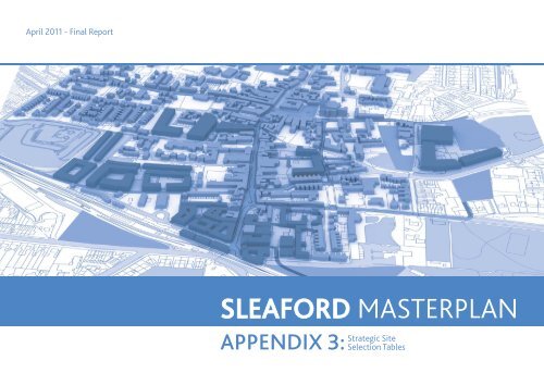
SLEAFORD MASTERPLAN
SLEAFORD MASTERPLAN
SLEAFORD MASTERPLAN

Create successful ePaper yourself
Turn your PDF publications into a flip-book with our unique Google optimized e-Paper software.
April 2011 - Final Report<br />
<strong>SLEAFORD</strong> <strong>MASTERPLAN</strong><br />
APPENDIX 3:<br />
Strategic Site<br />
Selection Tables
CENTRAL LINCOLNSHIRE STRATEGIC HOUSING LAND AVAILABILITY ASSESSMENT (SHLAA)
<strong>MASTERPLAN</strong> STRATEGIC SITES<br />
KEY<br />
Potential housing sites for Masterplan<br />
period<br />
10. Land at south of A17<br />
B<br />
A17<br />
E<br />
F<br />
Potential long term housing sites (post<br />
Masterplan period)<br />
Potential employment opportunities<br />
G<br />
H<br />
L<br />
Existing employment sites<br />
Potential Green wedge/Sustainable corridor 3. West<br />
Quadrant<br />
Sleaford Wood<br />
Railway Line<br />
Waterways<br />
A<br />
I<br />
M<br />
J<br />
K<br />
8. Hoplands<br />
Potential strategic pedestrian/cycle links<br />
Key Roads<br />
S<br />
1. Housing Sites within town centre area<br />
5 min walk, 3 minute cycle<br />
A15<br />
15 min walk, 7 minute cycle<br />
Potential new access<br />
C<br />
Link road<br />
S<br />
S<br />
Potential future school site options<br />
7. Land off Mareham Road<br />
D<br />
5. South West<br />
Quadrant<br />
S<br />
N<br />
9. Land at Stump<br />
Cross Hill<br />
6. Land to the East of London Road<br />
4.South Quadrant<br />
2. Infill sites outside the town<br />
centre area
SHORT LIST HOUSING SITES FOR <strong>MASTERPLAN</strong> PERIOD<br />
For circa next 25 years - total of 3,700 dwellings<br />
SHLAA Site Categories (refer to Appendix 6<br />
for further details):<br />
Catagory A - Deliverable<br />
Catagory B - Developable<br />
Catagory D1 - Potentially Developable<br />
No Name SHLAA<br />
Reference<br />
1 Housing Sites<br />
within the town<br />
centre area<br />
Refer to plan<br />
Area (ha)<br />
Total area:<br />
1.0 ha<br />
Max housing<br />
capacity<br />
40* (with<br />
40 houses<br />
per hectare<br />
density)<br />
SHLAA status Positive Aspects/ Opportunities Negative Aspects/ Constraints<br />
Mainly category<br />
A<br />
<br />
This involves development in current urban areas- not encroaching on<br />
greenfield sites.<br />
<br />
<br />
Sufficient services may already NOTE: be Refer available to Appendix to support 6 for new further housing details of SHLAA<br />
Brownfield Sites<br />
Categories<br />
<br />
Smaller sites would suit specialist housing developer which could<br />
potentially be harder to fund<br />
2 Infill sites outside<br />
the town centre<br />
area<br />
Refer to Plan<br />
Total Area<br />
24.5 ha<br />
930* (with<br />
40 houses<br />
per hectare<br />
density)<br />
Mainly categories<br />
A & B<br />
<br />
57H/218 & 57/HorE/42 Land at Electric Road (noted as significant in the Local<br />
Market overview)<br />
<br />
57/H/292 Bass Maltings presents a significant opportunity (overall housing<br />
capacity figures assume 228 dwellings as part of this development).<br />
<br />
<br />
Sufficient services may already be available to support new housing<br />
Brownfield Sites<br />
<br />
Smaller sites would suit specialist housing developer which could<br />
potentially be harder to fund<br />
<br />
Includes a couple of areas that are located in the flood zone, the area<br />
between the curve of the railway line and the two water courses to the west<br />
of the town. These would also place more pressure on Castle Causeway<br />
which is used as a rat run. Alterations to the city centre transport should<br />
however look to reduce this though.<br />
3 West Quadrant 57/H/304,<br />
57/H/182,<br />
57/H/267,<br />
57/H/218,<br />
57/H/219<br />
56 ha 1700 (with<br />
30 houses<br />
per hectare<br />
density)<br />
Mainly category<br />
D2<br />
<br />
These sites combined could form a comprehensive development<br />
<br />
Subject to access off A15, this will reduce exacerbation of the current town<br />
centre congestion as travel to work routes are mainly to the south west, west or<br />
north north west (scoping study)<br />
<br />
57/H/182 Land at Lincoln Road Sleaford (noted as significant in the Local<br />
Market overview)<br />
<br />
Pleasant cycle walking routes into the town centre could be created along<br />
green wedge<br />
<br />
Greenfield site in the countryside<br />
<br />
Located directly adjacent to Ring Road- would perhaps need to consider<br />
a ‘buffer’<br />
<br />
Adjacent to first tier settlement<br />
<br />
<br />
Currently in agricultural use<br />
57/H/219 & 218 have flood zone 2&3 to the south<br />
<br />
Advantage of allotment site acting as a central greenspace<br />
<br />
Aspect onto countryside surroundings<br />
<br />
Could look to connect some of the infrastructure to the existing environmental<br />
features, e.g. the drainage into the river.<br />
<br />
Located to the west, which is seen to be on the desired side of town for<br />
connection to larger towns to the west. Existing minor highway infrastructure<br />
and connections already exist to the A15 (unadopted road) so upgrades would be<br />
needed but A15 is more receptive to new junctions than the larger A17.<br />
<br />
Already a road bridge in over the railway line, which appear to be of generous<br />
width so could be upgraded for vehicle/pedestrian/cycle use.<br />
<br />
Adjacent to first tier settlement<br />
4 South Quadrant<br />
Suggested that<br />
north part of the<br />
site should be<br />
developed in the<br />
short list (Land<br />
east of London<br />
Road Sleaford)<br />
57/H/208<br />
(northern side)<br />
20 ha 600 (with<br />
30 houses<br />
per hectare<br />
density)<br />
D2<br />
<br />
<br />
<br />
Adjacent to first tier settlement<br />
Allows for a completion of the existing built form<br />
Good aspect onto surrounding agricultural land<br />
<br />
Greenfield site<br />
<br />
Strain on local primary schools within Quarrington Area - need to think<br />
about growth of this area- risk of becoming separated from Sleaford as a<br />
whole.<br />
<br />
Adjacent to first tier settlement<br />
<br />
Utilities (water)<br />
* The infill sites identified in Zones 1 & 2 include ongoing developments. Those which have reached construction have been excluded from the calculations shown in this table.
5 South West<br />
Quadrant (Land<br />
to the South of<br />
B1517, Sleaford)<br />
57/H/194A, ,<br />
Total Area<br />
7 ha<br />
210 (with 30<br />
houses hectare<br />
density)<br />
Category D2<br />
<br />
<br />
Sites noted as significant in the Local Market overview<br />
Good access from B1517 road<br />
<br />
Relatively small addition to current housing- potentially good integration with<br />
existing residents<br />
<br />
<br />
Greenfield site<br />
Adjacent to first tier settlement<br />
<br />
Adjacent to B1517 road- could be issues with noise pollution affecting<br />
future residents<br />
<br />
Strain on local primary schools within Quarrington Area - need to think<br />
about growth of this area- risk of becoming separated from Sleaford as a<br />
whole<br />
10 Land at Poplar<br />
Farm south of<br />
A17<br />
57/H/185 7.5 ha 230 (with 30<br />
houses density)<br />
Category D2<br />
<br />
<br />
<br />
In a potential floodzone<br />
Opportunity to reinforce recent gateway residential development<br />
Would require a green buffer adjacent to A17<br />
LONG LIST HOUSING SITES (FOR BEYOND <strong>MASTERPLAN</strong> PERIOD)<br />
For circa next 50 years - additional 2,700 dwellings<br />
No Name SHLAA<br />
Reference<br />
6 Land East of 57/H/208<br />
London Road (southern side)<br />
Sleaford, Land at<br />
57/H/1<br />
Stump Cross Hill<br />
(West of London<br />
Road)<br />
7 Land to the south<br />
of Sleaford, Land<br />
off Mareham<br />
Lane<br />
Area (ha)<br />
Total area<br />
46<br />
Max<br />
housing<br />
capacity<br />
1,400(with<br />
30 houses<br />
per hectare<br />
density)<br />
57/H/247 30 900 (with<br />
30 houses<br />
per hectare<br />
density)<br />
SHLAA status Positive Aspects/ Opportunities Negative Aspects/ Constraints<br />
Category D2 & D1<br />
Catagory D2<br />
<br />
Site noted as significant in the Local Market overview<br />
<br />
Desirable location with aspect over the adjacent farmland- little disruption<br />
from railway, bypass etc.<br />
<br />
Good walking/ cycling distance from the town centre<br />
<br />
<br />
Single ownership with no significant development constrains<br />
Located in Flood Zone 1 (suitable for development)<br />
<br />
Located close to the Maltings and with further development could contribute<br />
towards a larger housing area. Should be considered in conjunction with the<br />
Maltings development<br />
<br />
<br />
Site currently on a greenfield site<br />
Currently in agricultural use<br />
<br />
A large area of expansion to the south of Sleaford- risk of taking the<br />
focus away from the Town centre and creating small centre in Quarrington<br />
area<br />
<br />
Site 57/H/1 located on old Quarry/pit site - could be a risk of<br />
contamination.<br />
<br />
Risk of becoming ‘cut off’ from the Town centre<br />
<br />
Does not appear to be on the desired side of town for connections to the<br />
larger employment hubs that are in the towns to the west.<br />
<br />
This does not appear to be on the desired side of town and has relatively<br />
poor infrastructure connections. If the green wedge were introduced there<br />
could be a development site to the west that is a natural progression of the<br />
residential wedge that is starting to be seen there, around Mareham Lane,<br />
but not quite sure in its current arrangement.<br />
<br />
Opportunity for showcase sustainable development as a follow on to<br />
the Maltings<br />
8 North of<br />
Hoplands &<br />
Hoplands Depot<br />
57/H/176 & 57/<br />
AH/4<br />
5.5 170 (with<br />
30 houses<br />
per hectare<br />
density)<br />
Catagory D1<br />
<br />
57/H/176 The Hoplands Depot (noted as significant in the Local Market<br />
overview)<br />
<br />
57/AH/4 North of Hoplands (noted as significant in the Local Market<br />
overview)<br />
<br />
<br />
Development of these sites would encroach slightly on the Green Wedge<br />
Potential access issues across railway line<br />
<br />
Potential flood risk due to an increase in surface run off of a new<br />
development<br />
<br />
Isolated site could potentially require considerable new infrastructure<br />
<br />
Similar to site 7 in that it does not appear to be as desirable in terms of<br />
connectivity and position to enable connection to employment hubs to the<br />
west<br />
<br />
Could potentially increase the congestion in the centre of town, as the<br />
alternative route around the A17 is considerably further<br />
9 Land at Stump<br />
Cross Hill<br />
57/H/1 7 ha 210 (with<br />
30 houses<br />
density<br />
Category D1<br />
<br />
Greenfield site<br />
<br />
Strain on local primary schools within Quarrington Area - need to think<br />
about growth of this area- risk of becoming separated from Sleaford as a<br />
whole
SITES DISCOUNTED FOR HOUSING AS PART OF<br />
<strong>MASTERPLAN</strong> PROCESS<br />
Name<br />
SHLAA<br />
Reference<br />
Area (ha)<br />
Comments<br />
Land at Poplar Farm south of A17 57/H/185 25.5 ha <br />
Site lends itself to employment use, however there is an opportunity to incorporate a housing element (refer to Short List Site 10)<br />
<br />
In a potential floodzone (refer to Environment Agency flood data)<br />
Land adjacent to Holdingham roundabout 07-1051 2.5 ha <br />
Area has already been developed<br />
Land E1 SLEA7 3 Sleaford 57/E/58 17 ha <br />
Employment Area<br />
Land of East Sleaford Road 57/E/115 7 ha <br />
Employment Area<br />
Land to the north east of Sleaford 57/H/318 40 ha <br />
Land beyond the Railway Line so was dismissed due to connection limitations<br />
Yard at Bone Mill Lane East Sleaford 57/E/123 0.5 ha <br />
Discounted due to size and location on the green wedge<br />
Land at Drove Lane West of A15 57/H/217 6 ha <br />
Discounted due to location beyond the A15<br />
Land at Quarrington 57/H/E/314 80 ha <br />
Land at Mareham Lane Sleaford 57/HorE/88 1 ha <br />
Discounted due the proximity to current Quarrington development and going against the current urban form<br />
Discounted due to larger sites being available close by. Also retention of greenspace within housing areas<br />
Sleaford Ballast Pits 34/H/280 21 ha <br />
Discounted due to the proximity to the Maltings and the unfavourable location for transport links
STRATEGIC EMPLOYMENT SITES FOR <strong>MASTERPLAN</strong> PERIOD<br />
FUTURE EMPLOYMENT SITES:<br />
No Name SHLAA<br />
Reference if<br />
applicable<br />
Area (ha) Potential Use Comments<br />
A Land south of A17 N/A 15 ha Office/Light industrial <br />
<br />
High profile frontage for offices onto A15<br />
Potential for employment area to act as a buffer on the edge of the Main Residential Quadrant<br />
B Land at Poplar Farm south of A17 57/H/185 15 ha Office/Light Industrial <br />
<br />
<br />
<br />
High profile frontage for offices onto A17<br />
Potential for employment area to act as a buffer on the edge northern edge of existing residential<br />
Potential issue due to flood status<br />
Ground floor space could be used for parking (in response to flood risk)<br />
C Southern Southgate N/A 0.5 ha Town Centre Mixed Use<br />
Development<br />
<br />
<br />
Current Southgate masterplan for mixed use (Office/Retail/Residential)<br />
Gateway development<br />
D Land to South of B1517 57/H/194B 8 ha Office/Light industrial <br />
Greenfield Site<br />
<br />
Opportunity to create a strategic employment site to the south of the town with quality links to adjacent<br />
population
EXISTING EMPLOYMENT SITES:<br />
No Name SHLAA/<br />
Employment<br />
Land Review<br />
Reference if<br />
applicable<br />
E<br />
Land to the west of the Reservation, Sleaford<br />
Enterprise Park<br />
Area (ha) Potential Use Comments<br />
SLE 1a 15 ha B1, B2, B8 <br />
Part of existing employment allocation<br />
F<br />
Land to the north of the Reservation, Sleaford<br />
Enterprise Park<br />
SLE 1b 0.84 B1, B2, B8 <br />
Part of existing employment allocation<br />
G Land E1 SLEA7 3 Sleaford SLE 1c & 1d 7 ha B1, B2, B8 <br />
Part of existing employment allocation<br />
H<br />
Land to south of Pride Parkway including Poplar<br />
Business Park<br />
SLE 1e, 1f, 1g 2.0 ha B1, B2, B8 <br />
Part of existing employment allocation<br />
I<br />
Land off Hadley Road, Woodbridge Road Industrial<br />
Estate<br />
SLE 2a 2.7 ha B1, B2, B8 <br />
Part of existing employment allocation<br />
J Land at Oakside Park, East Road SLE 2c 0.4 ha B1, B2, B8 <br />
Part of existing employment allocation<br />
K Land of East Sleaford Road SLE 3a 4.3 ha B1, B2, B8 <br />
Part of existing employment allocation<br />
L Bonemill Lane SLE 4b 0.5 ha B1, B2, B8 <br />
Part of existing employment allocation<br />
M Land to south west of Employment Quarter 57/H/173 1.5 ha B1, B2, B8 <br />
Part of existing employment allocation