- Page 3 and 4:
The following persons may be contac
- Page 5 and 6:
S.7 Evaluation of the Alternatives
- Page 7 and 8:
3.8 Ecosystems ....................
- Page 9 and 10:
5. FINANCIAL ANALYSIS AND EVALUATIO
- Page 11 and 12:
Technical Results Reports Air Quali
- Page 13 and 14:
LIST OF TABLES Table S-1 Summary of
- Page 15 and 16:
Table 3.11-2 Estimated Regional Ave
- Page 17:
Table 5.1-8 Capital Funding Plan fo
- Page 21:
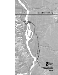
S.1 PORTLAND-MILWAUKIE CORRIDOR The
- Page 24:
S.3.1 Project Goals and Objectives
- Page 28 and 29:
The light rail alignment then would
- Page 30 and 31:
LPA Phasing Option The LPA Phasing
- Page 32 and 33:
Table S-1 Summary of Transit and Ro
- Page 34 and 35:
S.5 TRANSPORTATION IMPACTS This sec
- Page 36 and 37:
Festival have higher clearance requ
- Page 38 and 39:
The project supports the regional 2
- Page 40 and 41:
S.6.9 Water Quality, Hydrology, and
- Page 42 and 43:
Pile driving or drilling Concrete c
- Page 44 and 45:
S.7.2.2 Capital Funding Conclusions
- Page 46 and 47:
The light rail project would includ
- Page 49:
1. PURPOSE AND NEED CHAPTER CONTENT
- Page 53 and 54:
transportation system, is environme
- Page 56 and 57:
1.3 DESCRIPTION OF THE PORTLAND-MIL
- Page 59 and 60:
1.4 GROWTH IN THE REGION AND THE PR
- Page 61:
and classrooms. Zidell Companies is
- Page 66:
1.6 STATE, REGIONAL, AND LOCAL PLAN
- Page 70:
2.1 DEFINITION OF ALTERNATIVES The
- Page 73 and 74:
Table 2.1-1 Summary of Transit and
- Page 78:
The Portland-Milwaukie Light Rail P
- Page 81 and 82:
UPRR to the Clinton Station. Under
- Page 84:
The project would modify intersecti
- Page 87 and 88:
A new pedestrian overcrossing at th
- Page 89 and 90:
2.1.1.5 Ruby Junction Maintenance F
- Page 93 and 94:
2.1.1.7 Other Light Rail Facilities
- Page 95 and 96:
From approximately 250 feet south o
- Page 97 and 98:
ack at Union Station, or would cont
- Page 99 and 100:
Light Rail Early Operations The lig
- Page 101 and 102:
Construction Duration and Timing Co
- Page 103 and 104:
constructed north of Kellogg Lake b
- Page 105 and 106:
Barges and temporary work bridges w
- Page 107 and 108:
noise requirements as required by l
- Page 109 and 110:
2.2 COST ESTIMATES This section pro
- Page 111:
2000 South Corridor Transportation
- Page 116 and 117:
Elevated station in South Waterfron
- Page 118 and 119:
Loss of over 100 parking spaces Con
- Page 122 and 123:
comparison for the options describe
- Page 124 and 125:
composite bridge types were elimina
- Page 126 and 127:
Require fewer impacts to traffic an
- Page 128 and 129:
Current land uses and zoning do not
- Page 130:
must also provide approvals for the
- Page 133 and 134:
Noise and vibration - the operation
- Page 135:
addition, TriMet is a municipal gov
- Page 138 and 139:
Road to SE Park Avenue, including s
- Page 140 and 141:
Ruby Junction Maintenance Facility
- Page 142 and 143:
3.2.1 Affected Environment This sec
- Page 146 and 147:
Growth Concept and the Regional Fra
- Page 148 and 149:
South Waterfront Plan (2002) The So
- Page 150:
Boulevard and residential neighborh
- Page 155 and 156:
3.2.2.1 Compatibility with Adopted
- Page 157 and 158:
LPA Phasing Option Compatibility wi
- Page 159 and 160:
subsequently provides the opportuni
- Page 161 and 162:
acquisition would be from the UPRR
- Page 163 and 164:
Table 3.2-1 Current Zoning and Pote
- Page 165 and 166:
Table 3.2-1 Current Zoning and Pote
- Page 167 and 168:
Table 3.2-2 Assessments of Redevelo
- Page 169 and 170:
Ruby Junction Maintenance Facility
- Page 171 and 172:
Special Tax Districts - Urban Renew
- Page 173 and 174:
with the expansion of the Ruby Junc
- Page 175 and 176:
Since the project runs beside the T
- Page 177 and 178:
temporary jobs over the constructio
- Page 179 and 180:
Portland-Milwaukie Light Rail Proje
- Page 181:
and property owners are fully infor
- Page 184:
Neighborhood Portland Table 3.3-2 S
- Page 188 and 189:
Table 3.3-3 Percentages of Homes wi
- Page 190 and 191:
were on transit. Another group that
- Page 192 and 193:
Station, but they can be mitigated.
- Page 194 and 195:
The LPA to Park Avenue would have l
- Page 196 and 197:
access route, while at the Rhine St
- Page 198 and 199:
streetcar for travelers using SW Mo
- Page 200 and 201:
3.3.4 Environmental Justice Complia
- Page 202 and 203:
state levels. This is a very low le
- Page 204 and 205:
The project team surveyed the prope
- Page 206 and 207:
Therefore, according to the definit
- Page 209 and 210:
Inner Eastside Portland Visual Anal
- Page 211 and 212:
Topography - The visibility and sca
- Page 213 and 214:
SW 4 th Avenue and SW 1 st Avenue,
- Page 215 and 216:
Inner Eastside Portland Visual Anal
- Page 217 and 218:
on SE 16 th Avenue and small busine
- Page 219 and 220:
ut would be less visible from other
- Page 221 and 222:
Downtown Milwaukie Visual Analysis
- Page 223 and 224:
Unincorporated Clackamas County/Oak
- Page 225 and 226:
The overall area includes a mix of
- Page 227 and 228:
Alternative LPA to Park Ave. (cont.
- Page 229 and 230:
Alternative LPA to Park Ave. (cont.
- Page 231 and 232:
may be unavoidable, particularly wh
- Page 233 and 234:
extended the APE, and FTA submitted
- Page 235 and 236:
Table 3.5-1 Historic Resources and
- Page 237 and 238:
Map ID # Address Name/Type 39 40 41
- Page 240 and 241: An area where there is a reasonable
- Page 242 and 243: Table 3.5-1 identifies the specific
- Page 244 and 245: Ruby Junction Maintenance Facility
- Page 246 and 247: Ruby Junction Maintenance Facility
- Page 248 and 249: it could be built into the retainin
- Page 250 and 251: As defined in the MOA, geotechnical
- Page 252: Table 3.6-1 Summary of Potential Pa
- Page 255 and 256: Table 3.6-2 Summary of Direct Impac
- Page 257 and 258: Dogwood Park This small park in dow
- Page 259 and 260: The amount of property needed to de
- Page 261 and 262: following planned or existing park
- Page 263 and 264: Unconsolidated Sedimentary Aquifer
- Page 266 and 267: Hazardous Soil Properties Two soil
- Page 268 and 269: LPA Phasing Option The LPA Phasing
- Page 270 and 271: 3.7.3 Mitigation The project incorp
- Page 272 and 273: Table 3.8-1 Summary of Potential Na
- Page 274 and 275: Site/Wetland PM 0 PM 1 Table 3.8-2
- Page 277 and 278: Table 3.8-4 Summary of Existing Con
- Page 280 and 281: In addition to these general vegeta
- Page 282 and 283: lackberry, Himalayan blackberry, sw
- Page 284 and 285: Section 7 of the federal ESA ensure
- Page 286 and 287: Native Species Table 3.8-7 Fish Spe
- Page 288 and 289: 3.8.2.2 Locally Preferred Alternati
- Page 290: and/or waterways located within the
- Page 295 and 296: time. Section 3.9, Water Quality an
- Page 297 and 298: Vegetation Type Table 3.8-11 Potent
- Page 299 and 300: Short-Term Impacts (Construction) S
- Page 301 and 302: driving, and other construction act
- Page 303 and 304: to these species and their habitats
- Page 305 and 306: Fish and Wildlife Resources (ODFW 2
- Page 307 and 308: Work Area Isolation. Any action, ex
- Page 309 and 310: Where native vegetation removal is
- Page 312 and 313: Table 3.9-1 summarizes the baseline
- Page 314 and 315: (COP 2008a; DEQ 2009). The DEQ also
- Page 316 and 317: Stream 1 Table 3.9-3 Project Area S
- Page 318 and 319: Consequently, adverse water quality
- Page 320 and 321: Ruby Junction Maintenance Facility
- Page 322 and 323: than five percent of the average an
- Page 324 and 325: approximately 200 square feet. As w
- Page 326 and 327: 3.9.2.3 Cumulative Impacts Past and
- Page 328 and 329: and water quality impacts also may
- Page 330 and 331: sound level (L dn ) is an L eq over
- Page 332 and 333: Moderate. In this range, other proj
- Page 334 and 335: For roadways that meet the above re
- Page 336 and 337: The proposed light rail alignment w
- Page 338: 3.10.3.7 Fixed Noise Sources and An
- Page 341 and 342:
Table 3.10-3 Existing Conditions No
- Page 343 and 344:
Figure 3.10-5 Freight Train Pass-By
- Page 345 and 346:
predicted to remain below the impac
- Page 347 and 348:
impacts are not anticipated, but if
- Page 349 and 350:
Rec.# 1 Type 3 Area Description 2 U
- Page 351 and 352:
Rec.# 1 Type 3 Area Description 2 U
- Page 353 and 354:
Along SW Lincoln Street, traffic no
- Page 356 and 357:
3.10.5.3 Noise at Park-and-Rides an
- Page 358 and 359:
to the Tacoma Park-and-Ride because
- Page 360 and 361:
Rec. # Area Description 1 Land Use
- Page 362 and 363:
General construction of the alignme
- Page 364 and 365:
and for pedestrian crossings not in
- Page 366 and 367:
policy is to provide mitigation at
- Page 368 and 369:
1 2 3 4 5 6 7 8 9 Table 3.10-8 Summ
- Page 370 and 371:
Vibration mitigation for the Portla
- Page 372 and 373:
package would ensure that the inter
- Page 374 and 375:
area for ground level ozone. Over t
- Page 376 and 377:
Table 3.11-2 also shows, for inform
- Page 378 and 379:
Table 3.11-4 Highest Projected 8-Ho
- Page 380 and 381:
3.11.3.2 Short-Term Impact Mitigati
- Page 382 and 383:
Energy that would be consumed durin
- Page 384 and 385:
Alternative Table 3.12-4 Summary of
- Page 386 and 387:
subsurface. Underlying these units
- Page 388:
R I 34TH AVE 37TH AVE 50TH AVE SET
- Page 391 and 392:
The remedial design of the river em
- Page 393 and 394:
contamination likely occurred from
- Page 395 and 396:
Table 3.13-1 Summary of Sites with
- Page 397 and 398:
LPA Phasing Option The LPA Phasing
- Page 399 and 400:
Precipitation events can generate s
- Page 401 and 402:
Minimum Operable Segment (MOS) to L
- Page 403 and 404:
Phase I Environmental Site Assessme
- Page 405 and 406:
Locally Preferred Alternative (LPA)
- Page 407 and 408:
At SE 4 th Avenue, drainage for wat
- Page 409 and 410:
At SE Reedway Street, a 60-inch con
- Page 411 and 412:
Minimum Operable Segment (MOS) to L
- Page 414 and 415:
Avenue and SE McLoughlin Boulevard
- Page 416 and 417:
To access Oak Grove Elementary Scho
- Page 418 and 419:
typically occur every 7.5 minutes.
- Page 420 and 421:
City of Milwaukie Police Department
- Page 422 and 423:
3.16.1.1 Law Enforcement, Fire, and
- Page 424 and 425:
City of Portland and City of Milwau
- Page 426 and 427:
the potential for the incidence of
- Page 428 and 429:
Thirty TriMet staff members are ded
- Page 430 and 431:
equired element, will verify that i
- Page 432 and 433:
The Final Section 4(f) Evaluation p
- Page 434 and 435:
Table 3.17-2 Portland-Milwaukie Lig
- Page 437 and 438:
4. TRANSPORTATION This chapter desc
- Page 439 and 440:
(OMSI) and the Central Eastside Ind
- Page 442 and 443:
SE Park Avenue/SE Oatfield Road (tw
- Page 444 and 445:
SE McLoughlin Boulevard at SE Bybee
- Page 446 and 447:
at both SE 17 th Avenue/SE Mall Str
- Page 448 and 449:
priority treatment. Streetcar stops
- Page 452 and 453:
4.2.1.1 Amount of Service The amoun
- Page 454 and 455:
Table 4.2-2 Transit and Auto Averag
- Page 456 and 457:
Table 4.2-4 Average Weekday Light R
- Page 458 and 459:
Bridge Ridership Table 4.2-6 illust
- Page 461 and 462:
Station Table 4.2-8 Milwaukie LRT A
- Page 463 and 464:
4.2.1.9 Year 2016 Forecast A riders
- Page 465 and 466:
VMT on the region’s roadways woul
- Page 467 and 468:
LPA Phasing Option With the LPA Pha
- Page 469 and 470:
discussion of parking impacts and m
- Page 471 and 472:
lower availability of unrestricted
- Page 473 and 474:
SE 8 th Avenue/SE Powell Boulevard
- Page 475 and 476:
Table 4.3-7 Sub-area A - Portland S
- Page 477 and 478:
Table 4.3-8 Sub-area A - Portland S
- Page 479 and 480:
Intersection SE 8 th Avenue/SE Wood
- Page 481 and 482:
volume movements (typically the thr
- Page 483 and 484:
Table 4.3-11 Sub-area B - SE Powell
- Page 485 and 486:
SE Tacoma Street/SE McLoughlin Boul
- Page 487 and 488:
Table 4.3-14 Sub-area C - SE Tacoma
- Page 489 and 490:
LPA Phasing Option Intersection ana
- Page 491 and 492:
north is SE McLoughlin Boulevard/SE
- Page 493 and 494:
Table 4.3-16 Sub-Area D - Highway 2
- Page 495 and 496:
mitigations remain. Intersection wo
- Page 497 and 498:
Table 4.3-18 Sub-Area D - Highway 2
- Page 499 and 500:
location of onshore facilities, fre
- Page 501:
may cause maneuvering difficulties
- Page 504 and 505:
are only those costs associated wit
- Page 506 and 507:
Table 5.1-1 Capital Costs for Portl
- Page 508 and 509:
Table 5.1-3 Summary of Transit Syst
- Page 510 and 511:
TriMet and Metro have entered into
- Page 512 and 513:
Discussions are underway with parti
- Page 514 and 515:
evenue source, contributing about $
- Page 516 and 517:
Fiscal Year Table 5.1-7 System Fisc
- Page 518 and 519:
5.1.4.2 System Revenue Options As s
- Page 520 and 521:
Operating Revenues Table 5.1-9: Sum
- Page 522 and 523:
Objective/Criteria Support of Activ
- Page 524 and 525:
Table 5.2-3 Transit and Auto Averag
- Page 526 and 527:
Table 5.2-6 Average Weekday Transit
- Page 528 and 529:
Table 5.2-8 Highway System Use: 203
- Page 530 and 531:
Table 5.2-9 Cost-Effectiveness: Cor
- Page 532 and 533:
Measures Regional Air Quality (tons
- Page 534 and 535:
Alternative, which is the NEPA base
- Page 536:
Economic Development: High This cri
- Page 539 and 540:
Public involvement programs designe
- Page 541 and 542:
6.1.2 Stakeholder Meetings To suppl
- Page 543 and 544:
Table 6.1-1 Stakeholder Meetings Da
- Page 545 and 546:
Table 6.1-2 Project Briefings to Es
- Page 547 and 548:
Table 6.1-2 Project Briefings to Es
- Page 549 and 550:
Table 6.1-2 Project Briefings to Es
- Page 551 and 552:
Table 6.1-2 Project Briefings to Es
- Page 553 and 554:
Direct mailing. Postcards were mail
- Page 555 and 556:
Corridor Project evolved from a re-
- Page 557 and 558:
Local government outreach activitie
- Page 559 and 560:
Table 6.3-1 Federal, State, and Loc
- Page 561 and 562:
National Historic Preservation Act
- Page 563 and 564:
Demolition - BDS Signage - BDS Elec
- Page 566 and 567:
7. PUBLIC COMMENT SUMMARY This chap
- Page 568 and 569:
Educational institutions: Oregon He
- Page 570 and 571:
The Central Eastside Industrial Cou
- Page 572 and 573:
7.2.3.2 Comments Relating to Techni
- Page 574 and 575:
The Oak Grove Sanitary District pro
- Page 576 and 577:
Single station in downtown Milwauki
- Page 578 and 579:
needed for the Portland-Milwaukie L