- Page 4 and 5: S. EXECUTIVE SUMMARY TABLE OF CONTE
- Page 6 and 7: 3. ENVIRONMENTAL ANALYSIS AND CONSE
- Page 8 and 9: 3.16 Safety and Security ..........
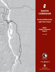
- Page 10 and 11: 7. PUBLIC COMMENT SUMMARY 7.1 SDEIS
- Page 12 and 13: Figure 3.2-1 2040 Growth Concept ..
- Page 14 and 15: Table 3.6-2 Summary of Direct Impac
- Page 16 and 17: Table 4.3-4 Bicycle Facility Improv
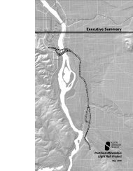
- Page 19: S. EXECUTIVE SUMMARY The Portland-M
- Page 23 and 24: Other planning and environmental st
- Page 27 and 28: Downtown Portland to SE Tacoma Stre
- Page 29 and 30: efore crossing Johnson Creek on a n
- Page 31 and 32: S.4.4 Stations and Park-and-Rides T
- Page 33 and 34: Table S-1 Summary of Transit and Ro
- Page 35 and 36: S.5.2.2 Local Transportation Impact
- Page 37 and 38: Measures Table S-2 Summary of Envir
- Page 39 and 40: Phasing Option), at SE Lake Road (o
- Page 41 and 42: S.6.13 Hazardous Materials The proj
- Page 43 and 44: System Fiscal Feasibility Analysis
- Page 45 and 46: (costs for LPA to Park Avenue and M
- Page 47: would be eligible for additional fe
- Page 52 and 53:
alternatives connecting downtown Po
- Page 54:
1.2 HIGH CAPACITY TRANSIT AND THE R
- Page 57:
TriMet’s light rail service (i.e.
- Page 60 and 61:
Table 1.4-1 Historical and Future G
- Page 64:
1.5 THE EFFECT OF TRAFFIC CONGESTIO
- Page 69 and 70:
2. ALTERNATIVES The Portland-Milwau
- Page 72 and 73:
Ruby Junction Maintenance Facility.
- Page 74:
Three bus lines, #9 Powell, #17 Hol
- Page 80 and 81:
Science and Industry (OMSI) and imm
- Page 82:
North of SE Bybee Boulevard, near t
- Page 86 and 87:
The tracks would terminate at a sta
- Page 88 and 89:
FTA may issue an amended ROD to ide
- Page 90:
The extension of streetcar over the
- Page 94 and 95:
Signal and communication facilities
- Page 96 and 97:
Stormwater collection pipes will be
- Page 98 and 99:
designed to control all transit tra
- Page 100 and 101:
Concrete casting Roadway constructi
- Page 102 and 103:
Demolition and Utility Work The ini
- Page 104 and 105:
Relocation of site utilities Instal
- Page 106 and 107:
einforced concrete pile cap for eac
- Page 108 and 109:
Once the abutments and piers are co
- Page 110 and 111:
Capital cost estimates are based on
- Page 115 and 116:
Be environmentally sensitive Suppor
- Page 117 and 118:
During the refinement phase, the fo
- Page 119:
2003 LPA with extension to SE Park
- Page 123 and 124:
Be more compatible with the South W
- Page 125 and 126:
presentations, and meeting summarie
- Page 127 and 128:
Based on Citizen Advisory Committee
- Page 129 and 130:
comments received during the SDEIS
- Page 132 and 133:
3. ENVIRONMENTAL ANALYSIS AND CONSE
- Page 134 and 135:
Starting from the north, the Portla
- Page 137 and 138:
Avenue: six residences within the c
- Page 139 and 140:
properties deferred until later exp
- Page 141 and 142:
during preliminary engineering, as
- Page 143:
South/North Corridor Project. The L
- Page 147 and 148:
egional transportation system inten
- Page 149 and 150:
City of Milwaukie Land Use Planning
- Page 152:
Many of the other established neigh
- Page 156 and 157:
also include replacement of the exi
- Page 158 and 159:
The MOS to Lake Road is less compat
- Page 160 and 161:
owners and are part of an ongoing p
- Page 162 and 163:
a summary of station-area zoning an
- Page 164 and 165:
Table 3.2-1 Current Zoning and Pote
- Page 166 and 167:
Table 3.2-1 Current Zoning and Pote
- Page 168 and 169:
Ruby Junction Maintenance Facility
- Page 170 and 171:
3.2.4.2 Local Economic Conditions S
- Page 172 and 173:
3.2.5.1 Long-Term Direct Impacts Th
- Page 174 and 175:
construction approach refinements w
- Page 176 and 177:
Income Tax Revenue The degree to wh
- Page 178 and 179:
the pouring of concrete foundations
- Page 180 and 181:
Ruby Junction Maintenance Facility
- Page 183 and 184:
3.3.1.1 County, Regional, and Neigh
- Page 187 and 188:
To update census data after 2000, d
- Page 189 and 190:
as much as 33 minutes slower for tr
- Page 191 and 192:
icycle and pedestrian access in the
- Page 193 and 194:
shortening the length of the overal
- Page 195 and 196:
Island Station and Unincorporated C
- Page 197 and 198:
Ruby Junction Maintenance Facility
- Page 199 and 200:
For the light rail project, constru
- Page 201 and 202:
Findings According to the 2000 U.S.
- Page 203 and 204:
proposed light rail stations, but p
- Page 205 and 206:
functions. While a phased approach
- Page 207:
Suburban development moved east in
- Page 210 and 211:
Milwaukie’s downtown area is a sm
- Page 212 and 213:
Other projects and additional devel
- Page 214 and 215:
unning parallel to SW Harbor Drive
- Page 216 and 217:
Visual impacts of the LPA Phasing O
- Page 218 and 219:
y the traffic on SE McLoughlin Boul
- Page 220 and 221:
Development of the Tacoma Station,
- Page 222 and 223:
existing power transmission line th
- Page 224 and 225:
support its operation as an initial
- Page 226 and 227:
Alternative Visual Analysis Unit In
- Page 228 and 229:
Alternative LPA to Park Ave. (cont.
- Page 230 and 231:
elocation of utilities, clearing, d
- Page 232 and 233:
a defined grid street pattern, the
- Page 234 and 235:
Table 3.5-1 Historic Resources and
- Page 236 and 237:
Table 3.5-1 Historic Resources and
- Page 238:
Map ID # Address Name/Type 50 51 52
- Page 241 and 242:
Full identification and evaluation
- Page 243 and 244:
Westmoreland Historic District woul
- Page 245 and 246:
disturbance in the South Waterfront
- Page 247 and 248:
Related Facilities Related Bridge A
- Page 249 and 250:
egion are concealed beneath sidewal
- Page 251 and 252:
Additional details on parks and rec
- Page 254 and 255:
3.6.2 Environmental Impacts This se
- Page 256 and 257:
The reconstructed trail will be ret
- Page 258 and 259:
the roadway and the planned Trolley
- Page 260 and 261:
safety reasons during construction,
- Page 262 and 263:
3.7 GEOLOGY, SOILS, AND GROUNDWATER
- Page 264:
convergence of the two crustal plat
- Page 267 and 268:
and construction techniques. For in
- Page 269 and 270:
Locally Preferred Alternative (LPA)
- Page 271 and 272:
structures. Separate geotechnical r
- Page 273 and 274:
avoid new construction in wetlands
- Page 275:
3.8.1.2 Waterways Transit improveme
- Page 278:
Crystal Springs Creek - east of SE
- Page 281 and 282:
Scrub-shrub Scrub-shrub is dominate
- Page 283 and 284:
At least 20 species of amphibians a
- Page 285 and 286:
species associated with riparian ar
- Page 287 and 288:
footprint of the project. Short-ter
- Page 289 and 290:
In addition to the wetland impacts
- Page 292 and 293:
Although the LPA to Park Avenue wou
- Page 294 and 295:
It provides a surface for collectin
- Page 296 and 297:
iver, extending up to 200 feet out
- Page 298 and 299:
Planned future projects include res
- Page 300 and 301:
Map Revision for the flood rise. Fl
- Page 302 and 303:
TES Species As part of the developm
- Page 304 and 305:
The project would temporarily impac
- Page 306 and 307:
utilized. No water will be diverted
- Page 308 and 309:
Additional discussion of mitigation
- Page 310:
agencies also have natural resource
- Page 313 and 314:
The lower Willamette River is withi
- Page 315 and 316:
therefore would likely contribute t
- Page 317 and 318:
tracks do not generate pollutants.
- Page 319 and 320:
Willamette River The proposed Willa
- Page 321 and 322:
Alternative 3 Basin Water Quality T
- Page 323 and 324:
No-Build Alternative Existing condi
- Page 325 and 326:
with regulatory permit compliance.
- Page 327 and 328:
Detailed results are available in t
- Page 329 and 330:
the Willamette River for the placem
- Page 331 and 332:
Figure 3.10-2 Typical Vibration Lev
- Page 333 and 334:
For light rail systems with 10 to 2
- Page 335 and 336:
ides and maintenance bases, and to
- Page 337 and 338:
project’s commitments for support
- Page 340 and 341:
planned Robert Kronberg Park, and c
- Page 342 and 343:
The analysis of potential noise imp
- Page 344 and 345:
Traffic noise analysis using FHWA c
- Page 346 and 347:
SE Roswell Street and SE Olsen Stre
- Page 348 and 349:
34TH AVE 37TH AVE 50TH AVE NSET BLV
- Page 350 and 351:
Rec.# 1 Type 3 Area Description 2 U
- Page 352 and 353:
Rec.# 1 Type 3 Area Description 2 U
- Page 354:
Rec. # 1 TR15 TR16 SE Rhone SFR on
- Page 357 and 358:
3.10.5.4 Vibration Impacts Since th
- Page 359 and 360:
Rec. # Area Description 1 Land Use
- Page 361 and 362:
weekday and Saturday, daytime hours
- Page 363 and 364:
Table 3.10-7 Summary and Comparison
- Page 365 and 366:
A noise wall will be used to mitiga
- Page 367 and 368:
Table 3.10-8 Summary of Noise Mitig
- Page 369 and 370:
3.10.8 Light Rail Vibration Mitigat
- Page 371 and 372:
Table 3.10-9 Light Rail Vibration M
- Page 373 and 374:
Carbon Monoxide Table 3.11-1 Federa
- Page 375 and 376:
Qualitative analysis for projects w
- Page 377 and 378:
among the alternatives. Also, regar
- Page 379 and 380:
Greenhouse Gas Emissions The light
- Page 381 and 382:
impacts during construction and ope
- Page 383 and 384:
Table 3.12-2 Summary of Daily Corri
- Page 385 and 386:
3.13.1 Affected Environment 3.13.1.
- Page 387 and 388:
Type of database listing. Identifie
- Page 390 and 391:
Industrial activities have been con
- Page 392 and 393:
The Miller Products Company operate
- Page 394 and 395:
3.13.2 Environmental Impacts 3.13.2
- Page 396 and 397:
The No-Build Alternative would not
- Page 398 and 399:
The degree to which existing contam
- Page 400 and 401:
egulations. Characterizing, managin
- Page 402 and 403:
Focused site assessments conducted
- Page 404 and 405:
the advanced engineering phase of t
- Page 406 and 407:
Locally Preferred Alternative (LPA)
- Page 408 and 409:
Underground Electrical Utilities: E
- Page 410 and 411:
At Kellogg Lake, a power line will
- Page 412:
law enforcement, fire and emergency
- Page 415 and 416:
Station 4: Serves the Lake Road, We
- Page 417 and 418:
Portland-Milwaukie corridor grow, t
- Page 419 and 420:
if a train is passing at the same t
- Page 421 and 422:
Mitigation Related Facilities Relat
- Page 423 and 424:
Clackamas County Sheriff’s Office
- Page 425 and 426:
Clackamas County crime statistics a
- Page 427 and 428:
In general, the majority of crimes
- Page 429 and 430:
environments with high degrees of v
- Page 431 and 432:
locations for security personnel in
- Page 433 and 434:
3.17.2.2 Historic and Cultural Reso
- Page 435:
The LPA to Park Avenue would provid
- Page 438 and 439:
4.1.1.1 Public Transportation Provi
- Page 440:
4.1.3.2 Local Street Network Motor
- Page 443 and 444:
SE 17 th Avenue/SE Tacoma Street -
- Page 445 and 446:
hour. The highest bicycle volumes a
- Page 447 and 448:
Table 4.1-2 Existing Portland-Milwa
- Page 449:
Boulevard/SE Ochoco Street has the
- Page 453 and 454:
4.2.1.2 Service Growth Service grow
- Page 455 and 456:
average weekday passenger miles in
- Page 457 and 458:
Corridor and Total System-wide Ride
- Page 459:
4.2.1.7 Work and Nonwork Transit Tr
- Page 462 and 463:
Table 4.2-8 Milwaukie LRT Average W
- Page 464 and 465:
ODOT’s access spacing standards a
- Page 466 and 467:
4.3.2.1 Pedestrian Facilities The f
- Page 468 and 469:
following table summarizes proposed
- Page 470 and 471:
Table 4.3-5 Off-Street Parking Redu
- Page 472 and 473:
In addition to the intersections li
- Page 474 and 475:
Non-Intersection Impacts Delays fro
- Page 476 and 477:
Table 4.3-8 Sub-area A - Portland S
- Page 478 and 479:
Table 4.3-8 Sub-area A - Portland S
- Page 480 and 481:
Sub-area B - SE Powell Boulevard to
- Page 482 and 483:
Table 4.3-10 Sub-area B - SE Powell
- Page 484 and 485:
Sub-area C - SE Tacoma Street to Hi
- Page 486 and 487:
Table 4.3-13 summarizes the interse
- Page 488 and 489:
Table 4.3-14 Sub-area C - SE Tacoma
- Page 490 and 491:
Intersection/Location Table 4.3-15
- Page 492 and 493:
signal timing. This results in queu
- Page 494 and 495:
Table 4.3-17 Sub-Area D - Highway 2
- Page 496 and 497:
Table 4.3-18 Sub-Area D - Highway 2
- Page 498 and 499:
Heavy trucks that currently access
- Page 500 and 501:
describes the types of areas where
- Page 503 and 504:
5. FINANCIAL ANALYSIS AND EVALUATIO
- Page 505 and 506:
• Operations Cost Inflation. The
- Page 507 and 508:
Table 5.1-2 Portland-Milwaukie Ligh
- Page 509 and 510:
Table 5.1-4 Required Local Matching
- Page 511 and 512:
Up to $164.9 million in Committed S
- Page 513 and 514:
State Payroll “In-Lieu” Revenue
- Page 515 and 516:
5.1.3 Existing Revenue Shortfalls T
- Page 517 and 518:
Additional Budgeted TriMet Contribu
- Page 519 and 520:
In years when less New Starts funds
- Page 521 and 522:
5.2 EVALUATION OF THE PROJECT This
- Page 523 and 524:
Table 5.2-2 Households and Employme
- Page 525 and 526:
Transit Ridership Table 5.2-5 summa
- Page 527 and 528:
5.2.1.4 Transit Network’s Ability
- Page 529 and 530:
Milwaukie will be in or near single
- Page 531 and 532:
Measures Displacements and Acquisit
- Page 533 and 534:
The No-Build Alternative would avoi
- Page 535 and 536:
measure of user benefits per passen
- Page 538 and 539:
6. COMMUNITY PARTICIPATION, AGENCY
- Page 540 and 541:
Lloyd District Transportation Manag
- Page 542 and 543:
Table 6.1-1 Stakeholder Meetings Da
- Page 544 and 545:
meetings were open to the public, w
- Page 546 and 547:
Table 6.1-2 Project Briefings to Es
- Page 548 and 549:
Table 6.1-2 Project Briefings to Es
- Page 550 and 551:
Table 6.1-2 Project Briefings to Es
- Page 552 and 553:
Table 6.1-2 Project Briefings to Es
- Page 554 and 555:
SDEIS Public Comment and Responses.
- Page 556 and 557:
Project events and meetings Project
- Page 558 and 559:
Table 6.3-1 Federal, State, and Loc
- Page 560 and 561:
Table 6.3-1 Federal, State, and Loc
- Page 562 and 563:
Section 401 Water Quality Certifica
- Page 564:
Building Permits - Department of Tr
- Page 567 and 568:
The project also received over 51 c
- Page 569 and 570:
7.2.3.1 Comments Related to Design
- Page 571 and 572:
elicited significant support. Comme
- Page 573 and 574:
Noise and Vibration Fifty-two peopl
- Page 575 and 576:
ail line’s influence on other tra
- Page 577 and 578:
treatments will be designed to meet
- Page 579:
Transit-oriented development - The