Transportation Plan - Town of Garner
Transportation Plan - Town of Garner
Transportation Plan - Town of Garner

Create successful ePaper yourself
Turn your PDF publications into a flip-book with our unique Google optimized e-Paper software.
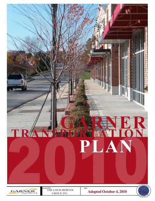
GARNER<br />
TRANSPORTATION<br />
GARNER<br />
PLAN<br />
prepared by<br />
THE LOUIS BERGER<br />
GROUP, INC.<br />
date<br />
Adopted October 4, 2010
TABLE OF CONTENTS<br />
PAGE<br />
Executive Summary ................................................................................................................. 2<br />
Chapter 1: Past Events and <strong>Plan</strong>s ............................................................................................. 7<br />
1.1 History <strong>of</strong> <strong>Garner</strong> ................................................................................................................................................. 7<br />
1.2 <strong>Plan</strong>ning Context ............................................................................................................................................... 10<br />
Chapter 2: The <strong>Plan</strong>ning Process ............................................................................................ 19<br />
2.1 Vision and Goals ................................................................................................................................................ 19<br />
2.2 The <strong>Plan</strong>ning Process and Steering .................................................................................................................... 20<br />
Chapter 3: Existing Conditions ............................................................................................... 22<br />
3.1 Roadway Conditions .......................................................................................................................................... 22<br />
3.2 Transit Conditions ............................................................................................................................................. 26<br />
3.3 Bicycle and Pedestrian Conditions .................................................................................................................... 38<br />
Chapter 4: Recommendations ............................................................................................... 53<br />
4. 1 Changes in <strong>Transportation</strong> and How We Live .................................................................................................. 53<br />
4.2 Roadway Capacity Improvements ..................................................................................................................... 56<br />
4.3 Bicycle and Pedestrian....................................................................................................................................... 62<br />
4.4 Public <strong>Transportation</strong> Services .......................................................................................................................... 81<br />
Chapter 5: Implementation Guidance.................................................................................... 89<br />
5.1 Best Practice Design Guidance .......................................................................................................................... 90<br />
5.2 Anticipated Revenues and Project Costs ......................................................................................................... 106<br />
5.3 Policies and Programs ..................................................................................................................................... 113<br />
List <strong>of</strong> Appendices ............................................................................................................... 126<br />
Acknowledgements<br />
The Citizens <strong>of</strong> the <strong>Town</strong> <strong>of</strong> <strong>Garner</strong><br />
The <strong>Transportation</strong> <strong>Plan</strong> Steering Committee<br />
The <strong>Town</strong> Council <strong>of</strong> <strong>Garner</strong><br />
The <strong>Town</strong> Staff, with special thanks to Brad Bass, Frank Powell, and Hardin Watkins<br />
The Louis Berger Group, Inc. and Earth Tech | AECOM<br />
Table <strong>of</strong> Contents Page | 1
LIST OF FIGURES AND TABLES<br />
PAGE<br />
Figure 1. <strong>Garner</strong> Road Corridor Future Land Uses – North <strong>Garner</strong> <strong>Plan</strong> ..................................................................... 10<br />
Figure 2. North <strong>Garner</strong> Greenway / Urban Pedestrian Way (2005) ............................................................................ 12<br />
Figure 3. 2025 Thoroughfare <strong>Plan</strong> Depicting Future Corridors in <strong>Garner</strong> .................................................................... 13<br />
Figure 4. Master <strong>Plan</strong> Map from Parks and Greenways Master <strong>Plan</strong> .......................................................................... 14<br />
Figure 5. <strong>Garner</strong> Area Projects in the 2030 CAMPO Long‐Range <strong>Transportation</strong> <strong>Plan</strong> ............................................... 18<br />
Figure 6. NCRR Passenger Rail Service Study Assumptions ......................................................................................... 35<br />
Figure 7. Existing and Emergent Forms <strong>of</strong> Public <strong>Transportation</strong> in <strong>Garner</strong> ............................................................... 36<br />
Figure 8. Important Bicycle and Pedestrian Destinations ............................................................................................ 40<br />
Figure 9. Vehicle and Bicycle/Pedestrian Crashes ....................................................................................................... 47<br />
Figure 10. Vehicle Availability ...................................................................................................................................... 49<br />
Figure 11. Green Mode Share ...................................................................................................................................... 49<br />
Figure 12. Roadway and Intersection Recommendations ........................................................................................... 60<br />
Figure 13. Proposed Sidewalk Projects ........................................................................................................................ 73<br />
Figure 14. Proposed Bicycle Facilities .......................................................................................................................... 78<br />
Figure 15. Public <strong>Transportation</strong> Recommendations .................................................................................................. 87<br />
Figure 16. Example <strong>of</strong> a Mixed Use Street Design from the <strong>Garner</strong> Comprehensive Growth <strong>Plan</strong> ............................. 91<br />
Figure 17. Horizontal clearance “zones” for a sidewalk, most typically found in a central business district .............. 93<br />
Figure 18. Comparing Vandora Springs Road (Above) and Lakeside Drive ................................................................. 96<br />
Figure 19. Chatwalk ................................................................................................................................................... 116<br />
Table 1. Steering Committee Meeting Subjects .......................................................................................................... 21<br />
Table 2. CAT Fare Schedule.......................................................................................................................................... 28<br />
Table 3. Triangle Transit Fare Schedule ....................................................................................................................... 30<br />
Table 4. TRACS Fare Schedule...................................................................................................................................... 31<br />
Table 5. Summary <strong>of</strong> <strong>Garner</strong>‐Area Public <strong>Transportation</strong> Providers ........................................................................... 32<br />
Table 6. Transit Service Mode Characteristics ............................................................................................................. 37<br />
Table 7. Changes in Past Trends Influencing Macro‐Scale Economic Developments .................................................. 54<br />
Table 8A/B/C. Current (Top), 2035 Build w/o S. Wake Freeway (Middle), and 2035 Build w/S. Wake Freeway<br />
(Bottom) Conditions on 10 Streets in <strong>Garner</strong> .............................................................................................................. 58<br />
Table 9. Recommended Sidewalk Corridor Locations ................................................................................................ 64<br />
Table 10. Sidewalk / Greenway Phasing Schedule and Project Costs .......................................................................... 70<br />
Table 11. Crossing Improvement Locations ................................................................................................................. 79<br />
Table 12. Evaluation <strong>of</strong> Three Drive‐Access Rail Stations ............................................................................................ 86<br />
Table 13. Summary <strong>of</strong> <strong>Garner</strong> Area Federal‐State Roadway Funding, 2009 ‐ 2015 .................................................. 106<br />
Table 14. 2009 ‐ 2015 STIP Projects (<strong>Garner</strong> Area) .................................................................................................... 108<br />
Table 15. <strong>Garner</strong> Capital Expenditures (Anticipated) in <strong>Transportation</strong>, FY2007 to FY2011 ..................................... 109<br />
Table 16. High Priority Sidewalk Project Cost Estimates ........................................................................................... 110<br />
Table 17. Roadway Priority Project Cost Estimates ................................................................................................... 111<br />
Table 18. Bus Transit Project Cost Estimates ............................................................................................................. 112<br />
Table 19. Pedestrian and Transit Connectivity Checklist ........................................................................................... 121<br />
Table <strong>of</strong> Contents Page | 1
Executive Summary<br />
For More Information<br />
<strong>Plan</strong>ning Director, <strong>Town</strong> <strong>of</strong> <strong>Garner</strong><br />
919.773.4444<br />
http://www.garnernc.gov<br />
900 7th Avenue, PO Box 446<br />
<strong>Garner</strong>, NC 27529<br />
THE TOWN OF GARNER UNDERTOOK THE UPDATE OF ITS TRANSPORTATION PLAN to<br />
ensure that as the <strong>Town</strong> grows, so does its vision <strong>of</strong> itself as a dynamic<br />
community sensitive to a changing transportation environment. <strong>Garner</strong>’s<br />
strategic location along a Class I railroad influenced its earliest<br />
development, and connections to the City <strong>of</strong> Raleigh, Raleigh‐Durham<br />
International Airport, and the Research Triangle Park campus have, along<br />
with its persistent small‐town character, made it a popular choice for<br />
residents and businesses alike. With over 26,000 residents at the time <strong>of</strong><br />
this writing, <strong>Garner</strong> recognizes that it must change to accommodate the<br />
wishes <strong>of</strong> its citizens as well as the demands <strong>of</strong> the outside world. As this<br />
plan was being written, the country was experiencing severe economic<br />
hardship, felt by the <strong>Town</strong> as well in terms <strong>of</strong> declining revenues. Public<br />
transportation, bicycling, and walking as modes <strong>of</strong> travel were all seeing<br />
significant increases as a result <strong>of</strong> spikes in fuel prices, while vehicle miles<br />
<strong>of</strong> travel (VMT) flattened out and even declined for the first time in<br />
several decades.<br />
However, hardships can be viewed opportunistically, and the <strong>Town</strong> chose<br />
to take a non‐traditional approach to planning for its transportation<br />
future. As a result, this transportation plan contains a number <strong>of</strong> shortrange<br />
actionable items and recommendations for all modes <strong>of</strong> travel, as<br />
well as longer‐term, visionary elements. Policy and<br />
program recommendations are also included that will<br />
help leverage private sector resources to shape the<br />
community positively, according to the many comments<br />
received at open houses and completed surveys. The<br />
following is a summary <strong>of</strong> the contents <strong>of</strong> each <strong>of</strong> the<br />
five major sections <strong>of</strong> the <strong>Transportation</strong> <strong>Plan</strong>; we also<br />
invite you to take a closer look at the items that interest<br />
you and to contact our staff with any questions (see text box at left).<br />
Chapter 1: Past Events and <strong>Plan</strong>s discusses the history <strong>of</strong> <strong>Garner</strong> and the<br />
planning context that will shape the recommendations <strong>of</strong> the<br />
<strong>Transportation</strong> <strong>Plan</strong>. The <strong>Transportation</strong> <strong>Plan</strong> isn’t the only relevant<br />
guidance that will influence transportation systems, since the North<br />
<strong>Garner</strong> <strong>Plan</strong>, Comprehensive Growth <strong>Plan</strong>, Comprehensive Parks and<br />
Recreation <strong>Plan</strong>, and Hazard Mitigation <strong>Plan</strong> contain recommendations<br />
that influenced the development <strong>of</strong> the <strong>Transportation</strong> <strong>Plan</strong>. The<br />
Comprehensive Growth <strong>Plan</strong> (2006), for example, suggested the creation<br />
<strong>of</strong> a different system <strong>of</strong> street typology that includes tree‐lined<br />
boulevards; mixed‐use development streets; and rear lanes or alleyways.<br />
Other plans spoke to specific improvements (e.g., greenways) that have<br />
Executive Summary Page | 2
to be considered in the recommendations for bicycle and pedestrian<br />
facility recommendations.<br />
Chapter 2: The <strong>Plan</strong>ning Process discusses the Vision and Goals <strong>of</strong> the<br />
planning study process, which are included below in their entirety. The<br />
planning process was driven by a 15‐member Steering Committee<br />
appointed by the <strong>Town</strong> Council The Steering Committee was comprised<br />
<strong>of</strong> elected <strong>of</strong>ficials, business owners, and residents <strong>of</strong> <strong>Garner</strong>, and<br />
formulated their own procedural ground rules. They met a total <strong>of</strong> ten<br />
times between 2008 and 2009 to discuss specific recommendations and<br />
learn more about how transportation systems work in their <strong>Town</strong>.<br />
Vision<br />
Statement<br />
<strong>Garner</strong>’s transportation system provides its citizens and<br />
businesses with efficient and safe travel options for<br />
auto, bicycle, pedestrian, and public transit users that<br />
serve transportation needs in a balance with land use<br />
development patterns as well as regional and local<br />
partnerships.<br />
Goals Goal Number One: The <strong>Garner</strong> <strong>Transportation</strong> <strong>Plan</strong> will be a<br />
visionary document that includes a variety <strong>of</strong> strategies and partners<br />
from adjacent communities and our own to address transportation<br />
needs.<br />
Goal Number Two: The <strong>Garner</strong> <strong>Transportation</strong> <strong>Plan</strong> is achievable<br />
because it includes both short‐term and longer‐term actions that<br />
respect political and regulatory frameworks, and can be undertaken<br />
with currently available or projected resources.<br />
Goal Number Three: The <strong>Garner</strong> <strong>Transportation</strong> <strong>Plan</strong> considers users <strong>of</strong><br />
all modes <strong>of</strong> transportation to produce a community that is more<br />
walking‐, bicycling‐, and public transit‐friendly than it is today.<br />
Goal Number Four: The <strong>Garner</strong> <strong>Transportation</strong> <strong>Plan</strong> will provide<br />
efficient and reliable access for its citizens and businesses, while<br />
maximizing their safety.<br />
Executive Summary Page | 3
An important part <strong>of</strong> the planning process was the contact that was made<br />
with the public, which was always reported back to the Steering<br />
Committee at each meeting. Over 160 people responded to the survey<br />
that was provided, 40% <strong>of</strong> whom were <strong>Garner</strong> residents, with many<br />
respondents citing extending Timber Drive eastward, public<br />
transportation, and cycling / walking options as core concerns for the<br />
<strong>Town</strong>. Appendices A and B provide detailed reports <strong>of</strong> the public<br />
comments that were received throughout the planning process.<br />
Chapter 3: Existing Conditions reports the existing conditions assessment<br />
for <strong>Garner</strong>’s roadways, transit services and Bicycle/Pedestrian modes <strong>of</strong><br />
travel, highlighting deficiencies as appropriate. Along with the input<br />
received from the public, analyses were conducted based on outputs <strong>of</strong><br />
the Triangle Regional Model (TRM) and Quality‐Level <strong>of</strong> Service s<strong>of</strong>tware<br />
to estimate before‐and‐after performance. Notable issues identified in<br />
this Chapter include the lack <strong>of</strong> east‐west connectivity across the <strong>Town</strong>; a<br />
trends towards lower connectivity between neighborhoods that is<br />
reducing the number <strong>of</strong> options for all modes <strong>of</strong> travel and increasing<br />
pressure on minor and major thoroughfares; the lack <strong>of</strong> town‐wide<br />
transit service; and the notable number <strong>of</strong> people, including school‐age<br />
children, that are walking and bicycling throughout the <strong>Town</strong>. Appendix<br />
C contains detailed cross‐section diagrams for 11 <strong>of</strong> the <strong>Town</strong>’s most<br />
important roadways, each <strong>of</strong> which includes recommendations for<br />
improvements.<br />
Chapter 4: Recommendations opens with a primer on some <strong>of</strong> the<br />
changing trends that will affect the recommendations in the <strong>Plan</strong> as well<br />
as the demands that will be placed on the transportation system. While<br />
the current economic downturn has stifled rapid development, business<br />
conditions and traffic demand were expected to resume. However, past<br />
trends such as women entering the workforce in large numbers; a trend<br />
towards decentralization in housing; reduction in household size; flat<br />
public transportation usage; and artificially low fuel prices are all at an<br />
end or nearing their end as significant drivers <strong>of</strong> transportation usage and<br />
travel patterns. The new trends that are expected to influence<br />
transportation in the coming decades; comments from the public and<br />
Steering Committee; and technical analyses were used to shape the<br />
recommendations for specific travel modes.<br />
A one‐page summary <strong>of</strong> the key recommendations for each mode <strong>of</strong><br />
travel is shown on the following page.<br />
Executive Summary Page | 4
Roadways While generally in good repair, <strong>Garner</strong>’s roadway system lacks eastwest<br />
connectivity due to topographic and, now, development<br />
constraints. While the addition <strong>of</strong> Southern Wake Freeway will help<br />
divert through traffic, that project is many years away and faces stiff<br />
environmental and financial challenges. Recommendations for creating<br />
a collector system in less‐developed areas <strong>of</strong> <strong>Town</strong>, extending<br />
thoroughfares, and widening on surface streets are critical, as is<br />
preserving valuable roadway capacity through better management.<br />
New interchanges at Timber Drive/US 70 and I‐40/White Oak Road are<br />
long‐term suggestions, while three conceptual inter‐section redesigns<br />
can be accomplished in the near term. Further recommendations<br />
include studying traffic flow and operations around schools<br />
conceptually to support actions that can improve traffic flow during<br />
peak pick‐up and drop‐<strong>of</strong>f periods <strong>of</strong> the school day.<br />
Public<br />
<strong>Transportation</strong><br />
Expanding the Capital Area Transit (CAT) service is an important midterm<br />
recommendation, and can be partially financed with Job<br />
Access/Reverse Commute (JARC) and New Freedom grants. The<br />
proposal is to provide a circulator route in the center <strong>of</strong> town that<br />
would connect the existing local and express routes that then go to<br />
downtown Raleigh with major shopping destinations; current and<br />
historic downtowns; and higher‐density residential units. Ultimately,<br />
rail service on the existing Norfolk Southern/NCRR line would tie into<br />
downtown and suburban park‐and‐ride stations.<br />
Walking The Steering Committee focused on increasing connectivity around<br />
schools and access to parks and shopping areas, resulting in a program<br />
<strong>of</strong> 62 sidewalk projects totaling 56 miles in length prioritized into three<br />
tiers (short‐, medium‐ and long‐term). Priorities include finishing the<br />
downtown pedestrian “loop” and connecting Lake Benson and Lake<br />
Wheeler parks. Another 3.4 miles <strong>of</strong> greenway facilities are also shown<br />
in the <strong>Plan</strong>. Importantly, the study recommends that pedestrian<br />
accessibility to schools be further studied.<br />
Cycling Bicycle recommendations include 18 miles <strong>of</strong> sharrow pavement<br />
markings, 25 miles <strong>of</strong> bicycle lanes (plus six miles from new road<br />
construction), and 12 miles <strong>of</strong> paved outside shoulders. A road “diet”<br />
(narrowing <strong>of</strong> the number <strong>of</strong> travel lanes) is proposed for Aversboro<br />
Road and Lakeside Drive, and 19 intersection treatments are also<br />
recommended.<br />
Executive Summary Page | 5
Chapter 5: Implementation Guidance outlines how transportation<br />
projects are typically financed, and provides distinct recommendations<br />
for additional (or modified) policies and programs that influence how the<br />
transportation system is created over time or how it is used now. These<br />
program recommendations are focused on alternative modes <strong>of</strong><br />
transportation since the default mode <strong>of</strong> transport in our current society<br />
– riding along in a private automobile – needs no additional<br />
encouragement. Program recommendations focus on awareness and<br />
encouragement, and include recommendations for starting a Safe Routes<br />
to School Program. This section also contains information about revenue<br />
sources and project capital and operating costs for high‐priority bicycle,<br />
pedestrian, roadway, and transit projects.<br />
A separate design guide chapter ties together the recommendations from<br />
the Comprehensive Growth <strong>Plan</strong> (2006) and expands it in terms <strong>of</strong> detail<br />
to include specific practices for incorporating public transportation,<br />
bicycling, and pedestrian accommodations into the overall transportation<br />
system. A separate guidance document (Appendix D) provides specific<br />
information on how to enact higher access management standards, the<br />
purpose <strong>of</strong> which is to increase safety and maintain long‐term capacity on<br />
existing roadways.<br />
While the <strong>Garner</strong> <strong>Transportation</strong> <strong>Plan</strong> is a fair and accurate<br />
representation <strong>of</strong> the beliefs and understanding <strong>of</strong> the Steering<br />
Committee and technical staff, no planning document lives very long or<br />
successfully if it is not updated. The <strong>Transportation</strong> <strong>Plan</strong> should be<br />
updated every five (5) years, at a minimum, and an annual monitoring<br />
report prepared in the interim years highlighting the progress towards<br />
achieving its specific strategies and recommendations.<br />
Executive Summary Page | 6
Chapter 1: Past Events and <strong>Plan</strong>s<br />
1.1 History <strong>of</strong> <strong>Garner</strong><br />
TRANSPORTATION HAS PLAYED A MAJOR ROLE in defining <strong>Garner</strong>’s history, first<br />
with the expansion <strong>of</strong> the railroad through the area in 1847; then with<br />
<strong>Garner</strong>’s position along North Carolina’s Central Highway, which linked<br />
the mountains to the sea in the early 1900s. 1 Today, transportation has<br />
emerged as a focal point again for <strong>Garner</strong>, only this time it is centered on<br />
commuter rail and new transportation corridors that link Triangle<br />
communities. The Central Highway has become US 70, which now<br />
bypasses downtown <strong>Garner</strong>, but still provides a vital link in the town’s<br />
and region’s transportation system. The Southern Railroad is now owned<br />
by the State <strong>of</strong> North Carolina and is part <strong>of</strong> a strategic plan to connect<br />
the Triangle region and other reaches <strong>of</strong> the state with passenger and<br />
commuter rail.<br />
It would have been hard to envision a present‐day <strong>Garner</strong> with more than<br />
26,000 residents when the area was originally incorporated in 1883<br />
under the name <strong>Garner</strong>’s Station. The name itself is <strong>of</strong> unknown origins<br />
as the original postmaster, Thomas Bingham, had requested the name<br />
<strong>Garner</strong>’s Station in 1878 from the postal service and then departed<br />
shortly thereafter to Clayton without ever explaining the name. 2<br />
Furthering the <strong>Town</strong>’s mysterious origins, the Village <strong>of</strong> <strong>Garner</strong>’s Station<br />
had its charter revoked in 1891. 3 Its limits covered only 400 square yards<br />
at that time and had grown to only a half‐square mile when the area was<br />
re‐incorporated in 1905 as the <strong>Town</strong> <strong>of</strong> <strong>Garner</strong>.<br />
The <strong>Town</strong>’s early days reflect a common historical link to other<br />
municipalities and their issues at the time, as well as current issues <strong>of</strong><br />
today. The <strong>Town</strong> began paying its Mayor a stipend <strong>of</strong> $125 per year in<br />
1907 after an expansion <strong>of</strong> local authority, and also began taxing the<br />
owners <strong>of</strong> dogs that would run loose on the streets. License fees for<br />
certain merchants – farmers were almost universally excepted – were<br />
commonplace and incredibly detailed: rope / wire dancing, tumbling,<br />
traveling salesmen, itinerant photographers were all subject to a business<br />
license. By the mid‐1910’s a portion <strong>of</strong> <strong>Garner</strong> Road had been paved with<br />
Chapter 1: History and <strong>Plan</strong>ning Context Page | 7
concrete to allay safety concerns, the first paved road in the State and<br />
predating electricity in the <strong>Town</strong> by nearly a decade. A five‐mile stretch<br />
between <strong>Garner</strong> and Raleigh was delayed to work out right‐<strong>of</strong>‐way issues<br />
with Southern Railway.<br />
By 1950, the passenger rail era had passed and the town’s population<br />
had reached only 1,200 residents. 4 This modest population growth is<br />
attributable to the agrarian lifestyle that dominated <strong>Garner</strong> for almost<br />
200 years, from the founding days <strong>of</strong> Wake County in the 1770s to the<br />
1950s when cotton and tobacco were the primary crops grown in the<br />
area. As state government grew and Raleigh expanded after the 1950s,<br />
existing <strong>Garner</strong> residents and newcomers were drawn to government,<br />
education and other jobs in North Carolina’s Capital City, the Research<br />
Triangle and nearby communities. While the agrarian era has passed,<br />
<strong>Garner</strong> has significant remnants <strong>of</strong> agricultural and industrial uses within<br />
the town limits. The 2006 Comprehensive Growth <strong>Plan</strong> indicated<br />
approximately 4,500 acres <strong>of</strong> agricultural land, primarily east <strong>of</strong> Benson<br />
Road.<br />
Much <strong>of</strong> <strong>Garner</strong>’s recent growth, however, has been reflective <strong>of</strong> its<br />
position adjacent to Raleigh and other municipalities, colleges,<br />
universities, employment centers, museums and seasonal events like the<br />
State Fair. 5 The small‐town character combined with proximity to<br />
regional job centers, Interstate 40, other key regional corridors and the<br />
hub <strong>of</strong> state government has created an urban and suburban society that<br />
is highly dependent on the automobile for daily travel.<br />
<strong>Garner</strong>’s strategic location along the North Carolina Railroad has given<br />
the <strong>Town</strong> an opportunity to re‐create its history as a community<br />
dependent on the rails. In the early 1900s, one could hop the train to<br />
Raleigh for a dime in the morning or afternoon and make the return by<br />
noon or 8 o’clock in the evening. 6 Today, it is envisioned that peak period<br />
commuter rail services could once again connect downtown <strong>Garner</strong> to<br />
Raleigh, Durham and Greensboro as well as points east to Goldsboro.<br />
The core <strong>of</strong> <strong>Garner</strong>’s history – its downtown – remains largely intact from<br />
its early days, although its importance as a center <strong>of</strong> commerce has<br />
declined dramatically in the intervening years. The narrow strip <strong>of</strong><br />
commercial buildings fronting the railroad tracks and Main Street; the old<br />
neighborhoods south <strong>of</strong> downtown are part <strong>of</strong> what created the smalltown<br />
feel; and the larger estate homes along <strong>Garner</strong> Road (formerly the<br />
Central Highway, and the first paved road in North Carolina) reflect a<br />
bygone era when well‐to‐do citizens desired a highly visible location for<br />
their residences along new, fashionable highways.<br />
Chapter 1: History and <strong>Plan</strong>ning Context Page | 8
Like many North Carolina locales, <strong>Garner</strong>’s downtown has yet to fully<br />
recover from the decline in railroad traffic and the impacts <strong>of</strong> bypassing<br />
the central business district. As the town and region grew, the traffic<br />
volumes for <strong>Garner</strong> Road (then US 70) became so burdensome that the<br />
State sought a route to relieve downtown <strong>Garner</strong> from traffic congestion.<br />
The current alignment <strong>of</strong> US 70 is now a congested roadway that will<br />
likely require further relief in the future.<br />
Meanwhile, the lack <strong>of</strong> traffic volumes in the tens <strong>of</strong> thousands per day<br />
along Main Street and <strong>Garner</strong> Road may be seen as an advantage for the<br />
<strong>Town</strong> <strong>of</strong> <strong>Garner</strong> and the future <strong>of</strong> its downtown. The <strong>Town</strong>’s residents<br />
now desire a historic and cultural centerpiece for their community and a<br />
renewed sense <strong>of</strong> place for downtown. 7 Downtown <strong>Garner</strong> <strong>of</strong>fers that<br />
opportunity and the Downtown Streetscape <strong>Plan</strong> will identify the design<br />
treatments and strategies to create this centerpiece.<br />
Beyond downtown, <strong>Garner</strong> has grown into a collection <strong>of</strong> commercial and<br />
residential developments, each reflective <strong>of</strong> its era in terms <strong>of</strong> design and<br />
orientation. The Cloverdale, Hilltop, Forest Hills and Heather Hills housing<br />
developments were the first <strong>of</strong> their kind in <strong>Garner</strong> and are indicative <strong>of</strong><br />
1950s and 1960s era ranch‐style homes. The growth patterns since then<br />
have primarily followed nationwide trends in modern housing and<br />
commercial development practices, with a division <strong>of</strong> uses and lack <strong>of</strong><br />
connectivity within the roadway system.<br />
The <strong>Town</strong>’s roadway system is also a collection <strong>of</strong> streets that reflect the<br />
era in which they were constructed. Meandering country roads traverse<br />
rolling hills in and around <strong>Garner</strong> and many previously served as farm‐tomarket<br />
corridors. While <strong>Garner</strong>’s recent growth has strained the<br />
transportation system to the point that capacity improvements are<br />
desired along many <strong>of</strong> <strong>Garner</strong>’s key corridors, many <strong>of</strong> these corridors<br />
remain unimproved from their original dimensions. When combined with<br />
the desires <strong>of</strong> current residents for more <strong>of</strong> a sense <strong>of</strong> place and<br />
aesthetics, there are many positive examples within <strong>Garner</strong> to build upon<br />
in developing a new <strong>Transportation</strong> <strong>Plan</strong> to define how and where<br />
<strong>Garner</strong>’s current and future residents will go. Clearly, <strong>Garner</strong>’s history as<br />
a crossroads <strong>of</strong> transportation will also help define its future.<br />
Chapter 1: History and <strong>Plan</strong>ning Context Page | 9
1.2 <strong>Plan</strong>ning Context<br />
SEVERAL PLANNING EFFORTS COMPLETED IN THE PAST 10 YEARS will help define<br />
portions <strong>of</strong> the <strong>Town</strong> <strong>of</strong> <strong>Garner</strong> <strong>Transportation</strong> <strong>Plan</strong> and Downtown<br />
Streetscape <strong>Plan</strong>. Below is a summary <strong>of</strong> those documents and how they<br />
will relate to or inform the current planning effort.<br />
FIGURE 1. GARNER ROAD CORRIDOR FUTURE LAND USES – NORTH GARNER PLAN<br />
Historic Downtown <strong>Garner</strong> <strong>Plan</strong> (2010). A three‐phase process – market<br />
analysis, charrette, and implementation plan – resulted in a plan for a<br />
study area encompassing 660 acres as well as proposed rail station<br />
locations and other transportation services discussed in this<br />
(transportation) plan. The recommendations in the Downtown <strong>Plan</strong><br />
generally support the concepts <strong>of</strong> creating a space that is more amenable<br />
to transit, walking, and bicycling. Other recommendations include a<br />
number <strong>of</strong> street changes, including a Purvis Street extension to US 70<br />
and redesigns <strong>of</strong> existing intersections at Montague Street. Better<br />
connectivity with US 70 is an important theme in this document.<br />
Chapter 1: History and <strong>Plan</strong>ning Context Page | 10
North <strong>Garner</strong> <strong>Plan</strong> (2004). The North <strong>Garner</strong> <strong>Plan</strong> developed as a small<br />
area plan with a primary focus on downtown <strong>Garner</strong>. The Downtown<br />
Streetscape <strong>Plan</strong> is a direct result <strong>of</strong> the North <strong>Garner</strong> <strong>Plan</strong>, which<br />
included several recommendations for the transportation system in the<br />
area. These included:<br />
• Enhanced appearance and function <strong>of</strong> <strong>Garner</strong> Road;<br />
• Investment in existing neighborhoods;<br />
• Multi‐modal system enhancements;<br />
• A bikeway map for the North <strong>Garner</strong> area; and<br />
• A connection <strong>of</strong> Rand Mill Road to US 70.<br />
The prospects <strong>of</strong> the railroad emerging as a commuter rail corridor were<br />
also a major component <strong>of</strong> the <strong>Plan</strong>, which identified potential station<br />
areas and opportunities for transit‐supportive residential densities within<br />
½‐mile <strong>of</strong> the station. The <strong>Plan</strong> acknowledged that a commuter bus<br />
service could be the short‐term option for service to this area, but that is<br />
was advantageous for <strong>Garner</strong> to plan for land uses to support the future<br />
commuter rail option.<br />
Comprehensive Growth <strong>Plan</strong> (2006). The land use plan for <strong>Garner</strong> was<br />
updated in 2006 and provides direction for growth in the <strong>Town</strong> through<br />
2020. The 2006 <strong>Plan</strong> continued the focus on nodal development<br />
previously adopted in the 1989 <strong>Plan</strong>, including a desire for regional<br />
centers and transportation corridors to connect these nodes. Citizen<br />
input indicated that there was strong desire to establish a community<br />
focal point and create a cultural and historic centerpiece for <strong>Garner</strong>, as<br />
well as a sense <strong>of</strong> place for the downtown area. The <strong>Plan</strong> also identified<br />
the need for design improvements to new development and public<br />
spaces, which included streetscape improvements on the <strong>Garner</strong> Road<br />
corridor, street design guidelines and improved aesthetics for US 70 and<br />
US 401. Additional transportation recommendations included: a need for<br />
more east‐west corridors; improvements to the bus system; greater<br />
connectivity <strong>of</strong> major and minor roadways; and strategic expansion or<br />
extension to some corridors.<br />
North <strong>Garner</strong> Greenway/Urban Pedestrian Way: Feasibility Study<br />
Report (2005). This plan focuses on only a small subarea <strong>of</strong> <strong>Town</strong> north <strong>of</strong><br />
US Highway 70, and provides specific trail recommendations for a portion<br />
<strong>of</strong> North <strong>Garner</strong>. Two trail types are suggested: a 10’‐wide bike/ped trail<br />
with 2’ clear zones, and a traditional 5’‐wide sidewalk with 5’ planting<br />
buffers (note: it is not clear how bicycles are to be accommodated on<br />
Chapter 1: History and <strong>Plan</strong>ning Context Page | 11
those sections <strong>of</strong> the trail that consist solely <strong>of</strong> sidewalk). Construction<br />
costs, as well as suggested maintenance costs ($2,900 per mile <strong>of</strong><br />
greenway annually) are provided in the document. The key references<br />
from this report to the <strong>Transportation</strong> <strong>Plan</strong> are the location <strong>of</strong> trail<br />
components along Adams Branch and Big Branch Creeks, as well as<br />
Curtiss Drive and Creech Road. These design recommendations have<br />
been incorporated into recommendations and mapping for the bicycle<br />
and pedestrian components <strong>of</strong> the <strong>Transportation</strong> <strong>Plan</strong> (Figure 2).<br />
FIGURE 2. NORTH GARNER GREENWAY / URBAN PEDESTRIAN WAY (2005)<br />
2025 Thoroughfare <strong>Plan</strong> (2004). The original 2025 Thoroughfare <strong>Plan</strong> was<br />
developed in 1999 and amended in 2004. The result <strong>of</strong> the plan is a map<br />
indicating existing and proposed freeways as well as major and minor<br />
thoroughfares. The facilities identified on the map consist primarily <strong>of</strong><br />
Chapter 1: History and <strong>Plan</strong>ning Context Page | 12
oadways under the authority <strong>of</strong> the North Carolina Department <strong>of</strong><br />
<strong>Transportation</strong>. Major new facilities identified in the <strong>Plan</strong> included: the<br />
extension <strong>of</strong> Timber Drive to the east, with a split connecting to Jones<br />
Sausage Road and Greenfield Parkway; the extension <strong>of</strong> Vandora Springs<br />
Road to the west connecting to US 401 and Lake Wheeler Road; an<br />
interchange at the intersection <strong>of</strong> US 70 and Timber Drive in northwest<br />
<strong>Garner</strong>; and the completion <strong>of</strong> the southern portions <strong>of</strong> the I‐540 Outer<br />
Beltway.<br />
FIGURE 3. 2025 THOROUGHFARE PLAN DEPICTING FUTURE CORRIDORS IN GARNER<br />
Parks and Greenways Master <strong>Plan</strong> (2007). The Parks and Greenways<br />
Master <strong>Plan</strong> identified several action items to expand and enhance the<br />
system <strong>of</strong> parks and greenways provided by the <strong>Town</strong> <strong>of</strong> <strong>Garner</strong>. Of<br />
particular interest are the recommendations for Greenway and Sidewalk<br />
Needs contained in Chapter 4 <strong>of</strong> the 2007 <strong>Plan</strong>. There was nearly<br />
unanimous consensus that a greenway system was needed in <strong>Garner</strong> to<br />
link community gathering places. Several immediate and long‐term<br />
facilities were identified as part <strong>of</strong> this effort and will help guide the<br />
<strong>Transportation</strong> <strong>Plan</strong>’s update <strong>of</strong> the Sidewalk Master <strong>Plan</strong> and identify<br />
street design components to further these goals. Of particular interest<br />
Chapter 1: History and <strong>Plan</strong>ning Context Page | 13
The image cannot be displayed. Your computer may not have enough memory to open the image, or the image may have been corrupted. Restart your computer, and then open the file again. If the red x still appears, you may have to delete the image and then insert it again.<br />
are: the Downtown Pedestrian Route that is proposed to link North<br />
<strong>Garner</strong> with US 70; the six‐mile <strong>Garner</strong> Sidewalk Loop to connect the<br />
library, parks, <strong>Town</strong> complex and schools; and the overall greenway<br />
system. Some <strong>of</strong> the recreation facility needs identified in the plan may<br />
also inform the Downtown Streetscape <strong>Plan</strong> as this design effort may<br />
incorporate some <strong>of</strong> these facilities into the preferred design.<br />
FIGURE 4. MASTER PLAN MAP FROM PARKS AND GREENWAYS MASTER PLAN<br />
Unified Development Ordinance (2003). The Unified Development<br />
Ordinance (UDO) provides for the regulation <strong>of</strong> development within the<br />
town and planning limits <strong>of</strong> <strong>Garner</strong>. Intended to provide for the general<br />
welfare <strong>of</strong> <strong>Garner</strong>’s residents, the UDO is the implementation tool for the<br />
Comprehensive Growth <strong>Plan</strong> and ensures the adequate provision or<br />
availability <strong>of</strong> transportation, police and fire protection, water, sewage<br />
disposal, parks and other recreational facilities, affordable housing,<br />
disaster evacuation and other public services through the review <strong>of</strong><br />
development applications and enforcement <strong>of</strong> the <strong>Town</strong>’s Municipal<br />
Code. Articles 6, 7 and 8 <strong>of</strong> the UDO are <strong>of</strong> most relevance to the<br />
Chapter 1: History and <strong>Plan</strong>ning Context Page | 14
<strong>Transportation</strong> <strong>Plan</strong>. Article 6 provides for Development Standards <strong>of</strong><br />
different types <strong>of</strong> land uses while Article 7 outlines landscaping and<br />
parking requirements for development. These sections will help inform<br />
the process and may be recommended for modifications for the <strong>Garner</strong><br />
Road and Main Street areas based on the outcomes <strong>of</strong> the Streetscape<br />
<strong>Plan</strong>.<br />
Sidewalk Master <strong>Plan</strong> (2001). The sidewalk master planning effort<br />
resulted in a map covering the <strong>Garner</strong> Extraterritorial Jurisdiction (ETJ) as<br />
<strong>of</strong> 2001. The plan identified existing sidewalks and greenways and<br />
proposed primary and secondary connections. New facility<br />
recommendations consisted solely <strong>of</strong> improvements connecting the<br />
sidewalk system to schools, <strong>Town</strong> Hall and the library. Although not<br />
specifically documented on the map, the plan also identified those<br />
improvements that could post a construction constraint. The Sidewalk<br />
Master <strong>Plan</strong> has been updated as part <strong>of</strong> this <strong>Transportation</strong> <strong>Plan</strong>.<br />
Hazard Mitigation <strong>Plan</strong> (2004). The Hazard Mitigation <strong>Plan</strong> was<br />
developed to comply with federal and state requirements and to reduce<br />
<strong>Garner</strong>’s exposure to natural hazards by limiting development in hazard<br />
sensitive areas, including floodplain or flood hazard areas. While there<br />
was limited inclusion <strong>of</strong> transportation‐specific measures in the plan,<br />
there were some mitigation actions that related to the Streetscape and<br />
<strong>Transportation</strong> <strong>Plan</strong> for <strong>Garner</strong>. These include:<br />
• Keeping infrastructure extensions out <strong>of</strong> hazardous areas in order<br />
limit development in known hazardous areas;<br />
• Zoning ordinances that minimize impervious surface coverage;<br />
• Implementing soil erosion and sedimentation control measures in the<br />
development approval process;<br />
• Addressing street connectivity as well as paving and widening <strong>of</strong><br />
roads for evacuation routes; and<br />
• Amending landscape ordinance requirements for maintenance <strong>of</strong><br />
pervious surface areas for stormwater detention.<br />
Wake County <strong>Transportation</strong> <strong>Plan</strong> (2003). The Wake County<br />
<strong>Transportation</strong> <strong>Plan</strong> focuses on unincorporated areas <strong>of</strong> Wake County,<br />
including many corridors that connect to and through <strong>Garner</strong>. One goal <strong>of</strong><br />
the <strong>Garner</strong> <strong>Transportation</strong> <strong>Plan</strong> was to match or recommend<br />
modifications to create a seamless future transportation system between<br />
the <strong>Town</strong> <strong>of</strong> <strong>Garner</strong> and Wake County. Ideally, this transportation system<br />
would be consistent or transition smoothly from one jurisdiction to<br />
Chapter 1: History and <strong>Plan</strong>ning Context Page | 15
another, particularly in relation to number lanes, lane widths, pedestrian<br />
facility connections, transit routes and bikeway connectivity.<br />
There are some specific elements <strong>of</strong> the Wake County <strong>Transportation</strong><br />
<strong>Plan</strong> that relate to <strong>Garner</strong>. The Outer Loop is one such facility, as is the<br />
“future transit corridor” identified along the US 401 / Norfolk Southern<br />
Corridor. The concept for this service shows transit activity centers<br />
designated in <strong>Garner</strong>, east <strong>of</strong> <strong>Garner</strong> and south <strong>of</strong> <strong>Garner</strong> near the<br />
proposed intersection <strong>of</strong> US 401 and the Outer Loop.<br />
The <strong>Plan</strong> also indicates planned Intelligent <strong>Transportation</strong> System<br />
improvements along US 70 and US 401 through <strong>Garner</strong>. These<br />
improvements are designated to be for traffic signal control systems and<br />
Closed Circuit Television (CCTV) at the intersection <strong>of</strong> US 70 and US 401.<br />
The <strong>Plan</strong> also identifies CCTV installation as part <strong>of</strong> a freeway<br />
management system along the US 70 corridor east <strong>of</strong> <strong>Garner</strong>.<br />
“All jurisdictions must do a better job <strong>of</strong><br />
ensuring that land‐use planning and<br />
regulation take into account local<br />
transportation needs and constraints. A<br />
major contributor to traffic congestion<br />
is the amount and type <strong>of</strong> development<br />
that is approved in many places in the<br />
county, without regard to the capacity<br />
<strong>of</strong> the roadway system.”<br />
‐ Wake County<br />
Wake County Growth Management<br />
Strategy (2003). One <strong>of</strong> the more<br />
impressive and comprehensive<br />
efforts undertaken by Wake County<br />
and all <strong>of</strong> its municipalities<br />
culminated in the Wake County<br />
Growth Management Strategy and<br />
report. The report covers a number<br />
<strong>of</strong> areas like governance and intergovernmental<br />
cooperation; land use and community character; open<br />
space and recreation; and schools. A section is<br />
devoted to transportation as well, and identifies a<br />
number <strong>of</strong> recommendations that are still relevant to mainstream,<br />
integrative transportation planning today:<br />
• Coordinating high‐priority preservation areas with future<br />
transportation improvements to avoid conflicts and negative,<br />
secondary growth impacts;<br />
• Conversely, in areas where growth is “preferred,” work to set<br />
minimum development densities and growth thresholds in part to<br />
reduce vehicle miles <strong>of</strong> travel;<br />
• Tailor parking, pedestrian, and land use codes to promote mixed‐use<br />
development in growth areas; and<br />
• Develop and administer cooperative transportation strategies and<br />
plans between jurisdictions, the Capital Area Metropolitan <strong>Plan</strong>ning<br />
Organization (CAMPO), and the state department <strong>of</strong> transportation<br />
Chapter 1: History and <strong>Plan</strong>ning Context Page | 16
that includes unincorporated areas <strong>of</strong> the county as well as a<br />
multimodal secondary street system.<br />
Specific strategies like developing a new financing mechanisms for local<br />
road improvements and implementing a larger and more aggressive<br />
menu <strong>of</strong> travel demand options (e.g., carpooling, employer flex time<br />
scheduling) seem even more compatible with circumstances today than<br />
when they were written, given the current fiscal conditions in which state<br />
and federal transportation authorities find themselves. It is worth noting<br />
that when this report was written, counties in North Carolina did not<br />
carry the authority to purchase street rights‐<strong>of</strong>‐way or build and maintain<br />
transportation facilities. However, the authority to do so has since been<br />
granted by the N.C. State Legislature. Other relevant, current conditions<br />
such as the current economic recession that has forced many more<br />
people to turn to walking, bicycling and transit modes were not foreseen<br />
at the time <strong>of</strong> this committee’s actions.<br />
North Carolina Railroad Shared Corridor Commuter Rail Capacity and<br />
Ridership Studies (2008, 2010). The North Carolina Railroad Company<br />
completed capacity and ridership studies for a commuter rail service that<br />
would operate in a shared corridor with freight traffic from Greensboro<br />
to Goldsboro. The North Carolina Railroad is a private company owned by<br />
the State <strong>of</strong> North Carolina and extends from Morehead City to Charlotte.<br />
The proposed commuter rail service would operate along this corridor,<br />
with four different service segment anticipated along the corridor<br />
between Greensboro and Goldsboro. <strong>Garner</strong> is included in the eastern<br />
sector <strong>of</strong> the corridor in an 84‐mile segment that would connect West<br />
Durham to Goldsboro. A preliminary schematic <strong>of</strong> the service indicates<br />
two stations in the <strong>Garner</strong> area (South Raleigh / West <strong>Garner</strong> and <strong>Garner</strong><br />
Area), with an additional station shown for the future Outer Loop<br />
location east <strong>of</strong> <strong>Garner</strong>. The <strong>Garner</strong> Area station would provide about 190<br />
boardings daily (out <strong>of</strong> over 4,500 for the system), and is in the highestridership<br />
segment <strong>of</strong> the Greensboro‐Goldsboro line.<br />
CAMPO 2030 Long‐Range <strong>Transportation</strong> <strong>Plan</strong> (2005). The North<br />
Carolina Capital Area Metropolitan <strong>Plan</strong>ning Organization (CAMPO) Long‐<br />
Range <strong>Transportation</strong> <strong>Plan</strong> identified more than 20 roadway projects in<br />
and around <strong>Garner</strong> to be completed by 2030. The plan also identified<br />
several other projects that were unfunded but identified as needs with<br />
the year 2040 designated for these projects. The project list consists<br />
primarily <strong>of</strong> capacity projects, with only a few identified for bicycle<br />
facilities. Additionally, expansion <strong>of</strong> bus services along US 401, US 70 and<br />
Vandora Springs / Old Stage Road were identified in the plan, including<br />
park‐and‐ride facilities. Freeway management systems were tabbed for<br />
Chapter 1: History and <strong>Plan</strong>ning Context Page | 17
US 401, US 70 and NC50 by the NCDOT Intelligent <strong>Transportation</strong> Systems<br />
Section.<br />
FIGURE 5. GARNER AREA PROJECTS IN THE 2030 CAMPO LONG‐RANGE TRANSPORTATION PLAN<br />
Chapter 1: History and <strong>Plan</strong>ning Context Page | 18
Chapter 2: The <strong>Plan</strong>ning Process<br />
THE GARNER TRANSPORTATION PLAN IS INTENDED TO BE A COMPONENT OF BROADER<br />
framework <strong>of</strong> planning efforts undertaken by the <strong>Town</strong> <strong>of</strong> <strong>Garner</strong>.<br />
Previous studies, in particular the current Comprehensive <strong>Plan</strong>, have<br />
pointed toward the need for <strong>Garner</strong> to conduct a specific transportation<br />
planning effort. The <strong>Plan</strong> will guide future updates <strong>of</strong> the relevant<br />
components <strong>of</strong> <strong>Garner</strong>’s Comprehensive <strong>Plan</strong> and Unified Development<br />
Ordinance. Additionally, the <strong>Transportation</strong> <strong>Plan</strong> established a vision and<br />
set <strong>of</strong> strategic transportation improvements that will guide future<br />
budget and capital program considerations for <strong>Garner</strong>. It is also<br />
anticipated that <strong>Garner</strong> will utilize the <strong>Transportation</strong> <strong>Plan</strong> to provide<br />
input to CAMPO, Wake County, NCDOT and Triangle Transit for<br />
consideration <strong>of</strong> future transportation and service investments.<br />
2.1 Vision and Goals<br />
THE GARNER TRANSPORTATION PLAN IDENTIFIED A NUMBER OF GOALS and<br />
objectives for the outcome <strong>of</strong> the <strong>Plan</strong> and planning process as well as an<br />
overarching Vision. The definition <strong>of</strong> the terms “Vision Statement” (and<br />
Mission Statement), “Goal,” and “Objective” are commonly<br />
misunderstood and were defined to the <strong>Transportation</strong> <strong>Plan</strong> Steering<br />
Committee as follows:<br />
Mission Statement: Focuses on the <strong>Town</strong>’s present state relative to its<br />
customer focus, capabilities, and composition reflecting the views <strong>of</strong> both<br />
internal and external stakeholders.<br />
Vision Statement: Describes the future state <strong>of</strong> an organization, and<br />
should express the viewpoints <strong>of</strong> primarily the internal <strong>Town</strong> staff,<br />
elected <strong>of</strong>ficials, and steering committee about future directions.<br />
Goals: Describe where the <strong>Town</strong> is going; each goal does not conflict with<br />
other goals or Mission and Vision statements; and contain information<br />
about time frame and expectations <strong>of</strong> outcomes.<br />
Objectives: Provide information on specific strategies to achieve the<br />
goals.<br />
Chapter 2: The <strong>Plan</strong>ning Process Page | 19
The Steering Committee developed the following Vision, Goals, and<br />
Objectives for the <strong>Plan</strong>; these were later used to help target strategies as<br />
well as performance measures for the <strong>Plan</strong> alternatives.<br />
Vision Statement<br />
GARNER’S TRANSPORTATION SYSTEM PROVIDES ITS CITIZENS AND<br />
BUSINESSES WITH EFFICIENT AND SAFE TRAVEL OPTIONS FOR AUTO,<br />
BICYCLE, PEDESTRIAN, AND PUBLIC TRANSIT USERS THAT SERVE<br />
TRANSPORTATION NEEDS IN A BALANCE WITH LAND USE DEVELOPMENT<br />
PATTERNS AS WELL AS REGIONAL AND LOCAL PARTNERSHIPS.<br />
Goals<br />
Goal Number One: The <strong>Garner</strong> <strong>Transportation</strong> <strong>Plan</strong> will be a visionary<br />
document that includes a variety <strong>of</strong> strategies and partners from adjacent<br />
communities and our own to address transportation needs.<br />
Goal Number Two: The <strong>Garner</strong> <strong>Transportation</strong> <strong>Plan</strong> is achievable because<br />
it includes both short‐term and longer‐term actions that respect political<br />
and regulatory frameworks, and can be undertaken with currently<br />
available or projected resources.<br />
Goal Number Three: The <strong>Garner</strong> <strong>Transportation</strong> <strong>Plan</strong> considers users <strong>of</strong><br />
all modes <strong>of</strong> transportation to produce a community that is more<br />
walking‐, bicycling‐, and public transit‐friendly than it is today.<br />
Goal Number Four: The <strong>Garner</strong> <strong>Transportation</strong> <strong>Plan</strong> will provide efficient<br />
and reliable access for its citizens and businesses, while maximizing their<br />
safety.<br />
2.2 The <strong>Plan</strong>ning Process and Steering<br />
The <strong>Garner</strong> City Council appointed 15 people to a project steering<br />
committee to guide the development <strong>of</strong> the <strong>Transportation</strong> <strong>Plan</strong>, and to<br />
ensure that it was reviewed by a range <strong>of</strong> interests. The following is a list<br />
<strong>of</strong> people that participated in the planning process at this level.<br />
• Douglas Ball<br />
• Fred Huebner<br />
• Jim Hunnicutt<br />
• Carol Hutchison<br />
Chapter 2: The <strong>Plan</strong>ning Process Page | 20
• Norm Karr<br />
• Council Member Buck Kennedy<br />
• Council Member Ken Marshburn<br />
• Tim Montgomery<br />
• Neal Padgett<br />
• Keith Roberts<br />
• Ralph Smith<br />
• Donna Sorrell<br />
• Charles Williams<br />
In all, ten meetings <strong>of</strong> the Steering Committee were conducted between<br />
January <strong>of</strong> 2009 and January <strong>of</strong> 2010. Each meeting featured an agenda<br />
and a follow‐up summary <strong>of</strong> the meeting. The premier content <strong>of</strong> each <strong>of</strong><br />
these meetings is shown in Table 1.<br />
TABLE 1. STEERING COMMITTEE MEETING SUBJECTS<br />
Meeting No./ Date Meeting Topics<br />
1 / January, 2009 Review <strong>of</strong> the planning process and committee “ground rules”<br />
2 / February, 2009 Draft Vision and Goals statements and review <strong>of</strong> roadway considerations<br />
3/ March, 2009 Review <strong>of</strong> the on‐line citizen survey and transit considerations<br />
4/ April, 2009 Project priority review and cycling / pedestrian considerations<br />
5 / June, 2009 Review <strong>of</strong> preliminary roadway, transit, and bike/pedestrian recommendations<br />
6 / July, 2009<br />
7/ September, 2009<br />
Second review <strong>of</strong> preliminary recommendations and intersection review<br />
Third review <strong>of</strong> draft plan and discussion <strong>of</strong> public meeting<br />
8/October, 2009 Discussion <strong>of</strong> candidate transit stations, first review <strong>of</strong> conceptual intersections<br />
9/November, 2009 Discussion <strong>of</strong> conceptual intersections, roadway priorities, transit stations<br />
10/January, 2010 Did final “walk‐through” <strong>of</strong> <strong>Plan</strong>ning document prior to Public Workshop review<br />
Chapter 2: The <strong>Plan</strong>ning Process Page | 21
Chapter 3: Existing Conditions<br />
IN ORDER TO APPROPRIATELY MEASURE OUR PROGRESS towards our<br />
recommendations, it is necessary to understand the current conditions <strong>of</strong><br />
our roadways, public transportation, bicycle, and pedestrian systems. The<br />
following sections highlight the current status and conditions <strong>of</strong> each<br />
mode <strong>of</strong> transportation, beginning with major roadways.<br />
3.1 Roadway Conditions<br />
Old Stage Road<br />
This two‐lane, rural roadway is anticipated to<br />
operate at or above 80% <strong>of</strong> its capacity south<br />
<strong>of</strong> Vandora Springs Road in 2035 even with a<br />
five‐lane cross‐section. Due to right‐<strong>of</strong>‐way<br />
constraints and the desire to preserve a rural<br />
character in this corridor, the<br />
recommendation for Old Stage Road is to<br />
transition to a three‐lane (center, two‐way<br />
left‐turn lane) cross‐section to accommodate<br />
left turning movements throughout the<br />
corridor. As Vandora Springs Road is widened,<br />
additional northbound turning lanes should be<br />
installed at the intersection with Old Stage Road to maximize turning<br />
movement capacity.<br />
Vandora Springs Road<br />
Vandora Springs Road is anticipated to operate<br />
at or above 80% <strong>of</strong> its capacity in 2035<br />
southwest <strong>of</strong> its intersection with Timber Drive<br />
as a two‐lane roadway. The recommended<br />
cross‐section is (1) four‐lane, median‐divided<br />
between Old Stage Road and Timber Drive;<br />
and (2) three‐lane with center two‐way leftturn<br />
lane from Timber Drive through the ramp<br />
complex at US Highway 70. The bridge over US<br />
Chapter 3: Existing Conditions Page | 22
70 would ultimately be replaced as a three‐lane cross‐section to<br />
accommodate left‐turn storage deficiencies, as well as provide sidewalks<br />
with vertical separation on both sides <strong>of</strong> the structure.<br />
US 401 (Fayetteville Road)<br />
Typically a four‐lane, median‐divided crosssection<br />
south <strong>of</strong> US 70 transitioning to a<br />
median‐divided, four‐lane section, this roadway<br />
is anticipated to operate at or above 80% <strong>of</strong> its<br />
capacity in 2035 even as a six‐lane roadway.<br />
The dual bridge structures over the CSX rail line<br />
south <strong>of</strong> Legend Drive are a significant cost<br />
constraint to widening the roadway beyond the<br />
existing four lane configuration. The<br />
recommendations for this roadway are (1)<br />
transition to a six‐lane cross‐section between<br />
Old Stage Road and US Highway 70 as a priority;<br />
(2) prioritize the extension <strong>of</strong> Vandora Springs Road Extension between<br />
Old Stage Road and US 401/Fayetteville Road as a four‐lane, mediandivided<br />
roadway; and (3) in the near‐term begin working with<br />
landowners throughout the corridor on driveway consolidations and<br />
cross‐access improvements. A review <strong>of</strong> this corridor indicates that 11<br />
driveway eliminations, consolidations, or reductions could be<br />
accomplished, and reduce the number <strong>of</strong> accidents and increase<br />
throughput between US 70 and Old Stage Road. Typically, this requires<br />
financial compensation, design/construction services, or roadway<br />
enhancements to secure the cooperation <strong>of</strong> landowners.<br />
Timber Drive/Hammond Road<br />
The transition <strong>of</strong> Timber Drive, a major<br />
circumferential and connector to the core <strong>of</strong><br />
<strong>Garner</strong>, to Hammond Road north <strong>of</strong> Mechanical<br />
Boulevard, is accomplished with a large<br />
intersection at US 70 featuring dual left‐turning<br />
lanes on every approach and high‐speed, rightturn<br />
lanes. Nowhere is the separation <strong>of</strong> <strong>Garner</strong><br />
created by US 70 more apparent than at this<br />
location. Hammond Road is forecasted to<br />
operate at or above 80% <strong>of</strong> its capacity in year<br />
2035 even as a six‐lane facility north <strong>of</strong> Tryon<br />
Road. Recommendations include (1) widening<br />
Chapter 3: Existing Conditions Page | 23
to six lanes with a median north <strong>of</strong> Tryon Road; (2) maintaining the fourlane<br />
cross‐section south <strong>of</strong> Tryon Road to US 70; and (3) redesigning the<br />
intersection to accommodate an interchange with US 70, acquiring<br />
necessary right‐<strong>of</strong>‐way in the short‐term.<br />
West <strong>Garner</strong> Road<br />
The travel demand model predicts that West<br />
<strong>Garner</strong> Road will be largely operating at or<br />
above 80% <strong>of</strong> its capacity as a two‐lane<br />
roadway. The recommendations for this road<br />
are (1) to carry a center turn lane from<br />
Vandora Springs Road to Tryon Road; and (2)<br />
implement the recently adopted overlay<br />
district that respects the historic nature <strong>of</strong> the<br />
roadway and properties along its edges; better<br />
access management and driveway<br />
improvements to reduce conflict points; and<br />
the interaction with the railroad and many<br />
cyclists that use this corridor.<br />
East <strong>Garner</strong> Road<br />
More rural in nature than West <strong>Garner</strong> Road,<br />
East <strong>Garner</strong> Road nevertheless connects the<br />
historic downtown, future proposed rail<br />
service, bus service, shopping, and industrial<br />
uses along its length. Right‐<strong>of</strong>‐way constraints<br />
associated with the CSX/NCRR railroad on the<br />
south side make widening this roadway<br />
problematic in some sections, although a northside,<br />
asymmetrical widening is possible starting<br />
east <strong>of</strong> downtown. The recommendation for<br />
East <strong>Garner</strong> Road is to widen the roadway to<br />
three lanes with a center two‐way left‐turn lane<br />
to facilitate turning movements.<br />
Chapter 3: Existing Conditions Page | 24
White Oak Road<br />
Currently a two‐lane roadway, White Oak<br />
will still experience volumes in excess <strong>of</strong><br />
80% <strong>of</strong> its future capacity as a four‐lane<br />
road in 2035, according to traffic forecasts.<br />
The road provides a convenient<br />
circumvention <strong>of</strong> Interstate 40 and US<br />
Highway 70, and provides direct access to<br />
the White Oak Shopping Center. The<br />
recommendation for White Oak Road is to<br />
continue the four‐lane cross‐section with a<br />
landscaped median such has been<br />
constructed at its north end. While not<br />
providing for Level‐<strong>of</strong>‐Service “D” conditions, right‐<strong>of</strong>‐way and cost<br />
constraints will play a discouraging factor in additional widening. The<br />
narrow, two‐lange bridge over Interstate 40 is particularly noteworthy as<br />
a constraint to widening the roadway; hence, prioritizing the section<br />
between the southern terminus <strong>of</strong> the existing four‐lane, median‐divided<br />
section and Hebron Church Road is also recommended.<br />
NC 50 (Benson Road)<br />
Providing an important north‐south relief<br />
route between Interstate 40 to the east and<br />
Old Stage Road to the west, Benson Road is<br />
currently a two‐lane road. The completion<br />
<strong>of</strong> the Southern Wake Freeway would<br />
increase this road’s importance and traffic<br />
burden; it is projected to experience<br />
volumes in excess <strong>of</strong> 80% <strong>of</strong> its capacity in<br />
2035 even as a four‐lane, divided facility.<br />
Recommendations for Benson Road are (1)<br />
employ stricter access management and<br />
driveway spacing guidelines now to preserve<br />
limited roadway capacity; (2) construct to a median‐divided, four‐lane<br />
roadway; and (3) redesign the multi‐leg intersection <strong>of</strong> New Rand Road<br />
and Timber Drive to reduce the queuing conflicts that currently occur.<br />
Chapter 3: Existing Conditions Page | 25
US Highway 70<br />
This four‐ to six‐lane divided highway has<br />
traditionally been both the major<br />
commercial corridor that binds the <strong>Town</strong><br />
together economically as well as the major<br />
barrier to north‐south travel with the<br />
notable exceptions at several gradeseparated<br />
interchanges (i.e., Yeargan Road,<br />
Vandora Springs Road, and Benson<br />
Road/NC 50 as well as Interstate 40). The<br />
high‐speed intersection at US 401 marks a<br />
gateway <strong>of</strong> sorts for travelers heading south<br />
from Raleigh, as well as providing a nearly<br />
impassable obstacle for pedestrians and<br />
cyclists. The land uses are strictly<br />
commercial, accessed by frequent driveways. The 5.2‐mile corridor from<br />
US 401 to I‐40 needs a thorough conceptual re‐design, followed by an<br />
incremental phasing <strong>of</strong> improvements. This would include driveway<br />
consolidation, consideration <strong>of</strong> “super‐street” concepts to eliminate<br />
some left‐turning movements, and parallel collector‐distributor roadways<br />
on each side <strong>of</strong> the facility in conjunction with bicycle/pedestrian and<br />
streetscaping improvements.<br />
3.2 Transit Conditions<br />
Public transportation service nationally has seen strong ridership gains<br />
throughout the past decade, culminating in sometimes double‐digit gains<br />
in 2007 and 2008 (when compared to similar time periods in the<br />
preceding years) due to the spikes in fuel prices. For example,<br />
Jacksonville’s “Loop” transit system experienced a 19% increase in 2006;<br />
Concord/Kannapolis, in only its second year <strong>of</strong> operation, increased<br />
ridership by over 30%. Some <strong>of</strong> this growth in North Carolina’s public<br />
transit systems is attributable to increased public outreach and improved<br />
service <strong>of</strong>ferings.<br />
Locally, <strong>Garner</strong> is serviced directly by three transit operators which, along<br />
with other operators in Durham, Cary, and Chapel Hill, have increasingly<br />
focused on efforts at collaboration to provide more seamless services in<br />
the Triangle Region. One <strong>of</strong> the most easily observed efforts is the recent<br />
GoTriangle.com service that provides route and transfer information<br />
among the major transit providers in the Region depending on user‐<br />
Chapter 3: Existing Conditions Page | 26
defined starting and ending points. Another recent effort is the <strong>of</strong>fering<br />
<strong>of</strong> regional bus passes that allow travel on Triangle Transit (Triangle<br />
Region), DATA (City <strong>of</strong> Durham), CAT (Raleigh), and C‐Tran (Cary) systems.<br />
Additional, ongoing efforts to procure new funding sources (by county<br />
referendum, if passed in the State legislature) may also create new<br />
opportunities for increased services and inter‐operator cooperation. The<br />
current discussion surrounding future funding centers on the ability <strong>of</strong><br />
North Carolina counties to levy a half‐cent sales tax to finance bus and<br />
rail services. Another potential source <strong>of</strong> financing is the recent American<br />
Recovery and Reinvestment Act <strong>of</strong> 2009 (aka, the “Stimulus Bill”). A part<br />
<strong>of</strong> this bill includes not only monies for acquiring new buses for existing<br />
service providers (although the omission <strong>of</strong> additional operating funds<br />
was an oversight towards expanding service), but also includes $8 billion<br />
for new high‐speed rail improvements. North Carolina, with recent<br />
increases in rail ridership and continuous improvements on its Raleigh to<br />
Charlotte trackage for the last decade, is in an excellent position to<br />
compete effectively for some <strong>of</strong> these funds to get it closer to<br />
implementing the Southeast High Speed Rail Corridor (maximum speeds<br />
<strong>of</strong> 110 mph).<br />
The following is a brief description <strong>of</strong> the three primary transit providers<br />
serving <strong>Garner</strong> and the surrounding area; their current performance<br />
characteristics; and proposed modifications to service that are<br />
anticipated to occur in the near‐term. After the descriptions <strong>of</strong> service, a<br />
brief summary and investigation into two recent studies that would have<br />
a direct bearing on the future <strong>of</strong> public transportation in <strong>Garner</strong> are<br />
provided.<br />
City <strong>of</strong> Raleigh Transit System (Capital Area Transit, CAT). Transit service<br />
in the Capital City has a significant history, beginning with mule‐drawn<br />
carriages in 1886; the service was short‐lived, being replaced by electric<br />
trolleys by 1891 operated by CP&L electric company. The era <strong>of</strong> electric<br />
streetcars would not last longer than 1933, in turn replaced by gasoline<br />
buses. As ridership fell in the early 1950’s, CP&L abandoned the service,<br />
which was eventually taken over by City Coach Lines, Inc. The City <strong>of</strong><br />
Raleigh only recently took control over its own system in the early 1990s.<br />
Today, CAT service is provided by 39 routes (including seven connector<br />
routes) covering an area <strong>of</strong> 97 square miles. Additionally, CAT provides 12<br />
“demand responsive zones” that operate in the early morning and<br />
evening or late evening time periods to extend their service hours in<br />
sections <strong>of</strong> the City. CAT also provides subsidies to taxicab and 'handicab'<br />
companies to serve those unable to ride CAT buses (Accessible Raleigh<br />
<strong>Transportation</strong>, or ART). CAT also services the annual State Fair, providing<br />
$4.00 two‐way or $3.00 one‐way fares for nearly 32,000 people (2002). In<br />
2008, this service included a park‐and‐ride stop in <strong>Garner</strong> at the<br />
Chapter 3: Existing Conditions Page | 27
intersection <strong>of</strong> US 70 and US 401. The complete fare structure is<br />
indicated in Table 1. Sunday transit service is provided on nine routes;<br />
Saturday service is very similar to weekday service with the exception <strong>of</strong><br />
two routes (Routes 19 and 35 at Apollo Heights and Poole Road). Hours<br />
<strong>of</strong> service vary by route, but all routes generally cover a 6:00AM to<br />
8:00PM time period. Notably, the downtown circulator service is<br />
provided by hybrid electric vehicles.<br />
Type <strong>of</strong> Fare<br />
Capital Area Transit<br />
TABLE 2. CAT FARE SCHEDULE<br />
Full Fare<br />
Cash Fare $1.00 $0.50<br />
31‐Day Pass<br />
Unlimited Rides<br />
Weekly Pass<br />
Unlimited Rides<br />
$36.00 $15.00<br />
$11.00 $4.00<br />
Senior Citizens (65+) &<br />
Persons with Disabilities<br />
11‐Ride Pass $9.00 Not Available<br />
10‐Ride Pass Not Available $4.50<br />
Day Pass<br />
Unlimited Rides<br />
Regional Day Pass<br />
Unlimited rides on CAT, Triangle Transit,<br />
and DATA<br />
Children less than 40" tall<br />
$2.00 $1.00<br />
$4.00 $2.00<br />
Free with a paying passenger<br />
While comprehensive, the City <strong>of</strong> Raleigh system has had serious issues<br />
with its garaging capacity, but the issue has been addressed by relocating<br />
from the former facility on South Wilmington Street. In spite <strong>of</strong> recent<br />
increases in ridership, passenger revenues account for approximately<br />
23% <strong>of</strong> service costs, estimated at nearly $16 million for FY 2009. This<br />
recovery percentage is a typical indicator <strong>of</strong> the economic efficiency <strong>of</strong> a<br />
public transportation system and, for North Carolina, is fairly high<br />
compared to most <strong>of</strong> the other systems. Currently, two routes enter<br />
<strong>Garner</strong>: Route 27, that travels down Wilmington Street and connects<br />
<strong>Garner</strong> Station Shopping Center to Southgate Shopping Center and<br />
downtown Raleigh; and Route 28 connecting the Raleigh Oaks Shopping<br />
Center, downtown Raleigh, and swinging out as far west as Buck Jones<br />
Road.<br />
Chapter 3: Existing Conditions Page | 28
It is worthwhile to note that CAT also operates the relatively new (start:<br />
July, 2008) circulator bus route, or “Loop,” in Wake Forest (CAT operates<br />
this system since the garage is closer to the service and thus less<br />
expensive). The Loop route is free to ride, subsidized entirely by the <strong>Town</strong><br />
<strong>of</strong> Wake Forest for the first year <strong>of</strong> operation; the fare gets reassessed at<br />
the end <strong>of</strong> Fiscal Year 2009. This service operates between 6:00AM and<br />
8:20PM, Monday through Friday only. A new express route between<br />
Wake Forest and Raleigh is also in operation, and synchronized with the<br />
Wake Forest Loop route as well as CAT Route 1 (Capital Boulevard). The<br />
fare for the express route is $2.50 one‐way. The elderly and disabled ride<br />
at half‐price on the CAT system. Approximately $90,000 per year <strong>of</strong> the<br />
$185,000 service cost for the Loop route is financed by the <strong>Town</strong>, with<br />
the rest provided by the City <strong>of</strong> Raleigh and grants, including Job Access<br />
Reverse Commute (JARC) and New Freedom grants. The Wake Forest to<br />
Raleigh Express route is subsidized by the City <strong>of</strong> Raleigh ($100,000 for<br />
operating costs) and a JARC grant ($125,000), with the remainder <strong>of</strong> the<br />
$375,000 annual cost ($150,000) supplied by Triangle Transit. Triangle<br />
Transit may end up taking over the entire cost <strong>of</strong> the Express Route at<br />
some point in the future. 1<br />
Triangle Transit. The Triangle Transit service is regional in scope, serving<br />
Durham, Orange, and Wake Counties. Authorized in 1989 by the North<br />
Carolina General Assembly, then provided with the ability to levy vehicle<br />
registration fees in 1991 and license plate fees in 1997 (subject to the<br />
approval <strong>of</strong> county governments), Triangle Transit is unique in the scale<br />
<strong>of</strong> its service as well as its range <strong>of</strong> services, providing vanpooling,<br />
ridematching, and emergency ride home services as well as fixed‐route<br />
bus service. Triangle Transit also provides support for teleworking and<br />
bike/walk to work options on its website. Triangle Transit continues to<br />
take a leadership role in rail service planning, as well as extending its<br />
services to local governments. These services recently included helping to<br />
plan circulator and express routes in Wake Forest and planning for an<br />
eastern service connecting Knightdale, Wendell, and Zebulon in Wake<br />
County. Triangle transit is governed by a 13‐member Board <strong>of</strong> Trustees.<br />
The existing bus service is comprised <strong>of</strong> 12 weekday routes, three<br />
evening routes, three regular Saturday routes, five express routes, and<br />
shuttle services to Raleigh‐Durham International (RDU) airport (one <strong>of</strong><br />
which runs on Saturday) and Research Triangle Park. Hours <strong>of</strong> fixed‐route<br />
bus service generally run between 6:00AM to 10:30PM Monday through<br />
Friday and 7:00AM to 5:30PM on Saturdays. Door‐to‐door paratransit (for<br />
those unable to ride Triangle Transit buses) operates for trips between<br />
1<br />
Landfried, Erik, Transit Service <strong>Plan</strong>ner, Triangle Transit. Conversation on March 3,<br />
2009 at 2:00PM.<br />
Chapter 3: Existing Conditions Page | 29
Raleigh, Cary, Durham, RTP/RDU, and Chapel Hill at a one‐way fare <strong>of</strong><br />
$4.00. Notable for <strong>Garner</strong> residents is the park‐and‐ride lot at the Forest<br />
Hills Shopping Center (Seventh Avenue) served by Route 102 which links<br />
to the White Oak Shopping Center and downtown Raleigh via US 70 and<br />
Hammond Road.<br />
Triangle Transit currently operates one vanpool serving <strong>Garner</strong>. It<br />
originates in Clayton at 7AM, stops in <strong>Garner</strong>, then proceeds to the RTP.<br />
It returns to Clayton/<strong>Garner</strong> at 4:40PM from the RTP.<br />
Type <strong>of</strong> Fare<br />
Triangle Transit<br />
TABLE 3. TRIANGLE TRANSIT FARE SCHEDULE<br />
Full Fare<br />
Cash Fare $2.00 $1.00<br />
Express Service Routes $2.50 $1.25<br />
Regional Day Pass (not used on Express<br />
Routes)<br />
Unlimited Rides on C‐Tran, DATA, and CAT<br />
Bundles <strong>of</strong> Six and 12 Available for<br />
Discounted Price<br />
Express Day Pass<br />
Unlimited Rides on DATA and CAT<br />
30‐Day Pass (not used on Express Routes)<br />
Unlimited Rides on C‐Tran, DATA, and CAT<br />
routes<br />
Express 30‐Day Pass<br />
Unlimited Rides on C‐Tran, DATA, and CAT<br />
routes<br />
$4.00 $2.00<br />
$5.00 $2.50<br />
$64.00 32.00<br />
$80.00 $40.00<br />
Senior Citizens (65+) &<br />
Persons with Disabilities<br />
10‐Ride Card $16.00 Not Available<br />
$25 Value Card $20.00 Not Available<br />
Children less than 40" tall<br />
Free with a paying passenger<br />
Triangle Transit has recently undergone a name change (formerly<br />
Triangle Transit Authority), rebranding efforts, and changed its central<br />
hub station to the Imperial Center in Durham (901 Slater Road), the last<br />
in part due to the inability <strong>of</strong> renewing its lease at the former hub site.<br />
The most recent five‐year transit plan suggests that, in Fiscal Year 2011,<br />
Chapter 3: Existing Conditions Page | 30
the <strong>Garner</strong> Route 102 will extend to Clayton. In so doing, the route will<br />
become more <strong>of</strong> an express route with one stop in <strong>Garner</strong>. The location<br />
<strong>of</strong> the stop is as yet unknown, but would need to be worked out between<br />
the <strong>Town</strong> and Triangle Transit. Finally, Triangle Transit has created and<br />
adopted new language about financial partnerships with municipalities.<br />
The policy states that if a town wants to create a local service to connect<br />
to an existing Triangle Transit Route, a financial contribution <strong>of</strong> one‐third<br />
<strong>of</strong> the total operating cost will be required. The final apportionment may<br />
change as the organization reviews this policy.<br />
Wake County Coordinated <strong>Transportation</strong> Services (<strong>Transportation</strong> and<br />
Rural Access, TRACS). Wake County operates both a human service<br />
system oriented towards Medicaid, Public / Mental Health, and Work<br />
First program‐eligible persons, and a general service called TRACS. TRACS<br />
service is available Monday through Friday for door‐to‐door service<br />
anyplace in non‐urbanized (i.e., not inside or between Cary and Raleigh<br />
due to restrictions on the Rural Program grants used in part to fund<br />
TRACS) Wake County between 7:00AM to 12:00PM and 1:00PM to<br />
6:00PM. Service is requested by telephone on a first‐come, first‐serve<br />
basis 24 hours in advance <strong>of</strong> the start <strong>of</strong> the trip. TRACS provides this<br />
service through a van fleet operated by Wake County, as well as<br />
additional private sector transportation providers. The service has been<br />
focusing on technology improvements, including mobile data computers<br />
and automatic vehicle locators to help dispatching, improving scheduling<br />
and productivity. The fare structure is divided into four service zones,<br />
with <strong>Garner</strong> being the only municipality in the Southern zone; trip costs<br />
are doubled for service that cross these zone boundaries, as illustrated in<br />
Table 4.<br />
TABLE 4. TRACS FARE SCHEDULE<br />
Type <strong>of</strong> Fare<br />
TRACS Service (Wake County)<br />
Cash Fare Inside Single Zone, One Way $2.00<br />
Cash Fare Between One <strong>of</strong> Four Zones, One Way $4.00<br />
Regular Fare<br />
Initially envisioned as a limited service option to accommodate a few<br />
residents, TRACS has encountered problems with over‐demand for its<br />
services in recent years, with approximately one out <strong>of</strong> four requesting<br />
riders being denied service. <strong>Garner</strong> currently provides approximately<br />
$3,000 <strong>of</strong> monetary compensation to TRACS and Wake County, but short<br />
<strong>of</strong> the $10,000 per year amount requested by Wake County to ensure a<br />
limited number <strong>of</strong> seats for <strong>Garner</strong> residents (Apex, Morrisville, and<br />
Chapter 3: Existing Conditions Page | 31
Wake Forest contribute $10,000 currently). <strong>Town</strong>s that do provide full<br />
support are given preferential service, even within a zone, a move in<br />
response to some towns providing funding support and others in the<br />
same zone not contributing financial support. The service requires a onehour<br />
window around the pick‐up and drop‐<strong>of</strong>f times that may<br />
inconvenience some riders. Future impacts include Triangle Transit’s<br />
consideration <strong>of</strong> rolling out regional services to the east and south<br />
(including <strong>Garner</strong>), as well as assigning dedicated vendors, or even<br />
drivers, to certain geographic areas to improve performance.<br />
Public <strong>Transportation</strong> Service Summary<br />
Table 5 indicates a snapshot summary <strong>of</strong> the major public transportation<br />
providers and their service pr<strong>of</strong>iles. The most recent data available was<br />
used to compile this summary, but complete operating characteristics<br />
usually lag for several years, so the actual data is typically from Fiscal Year<br />
2006.<br />
TABLE 5. SUMMARY OF GARNER‐AREA PUBLIC TRANSPORTATION PROVIDERS<br />
Agency<br />
Annual<br />
Trips (1)<br />
Annual<br />
Expenses<br />
Buses in<br />
Service<br />
Typical<br />
Peak<br />
Headway<br />
Typical<br />
Off‐Peak<br />
Headway<br />
Revenue<br />
Hours(4)<br />
Fare<br />
Revenue /<br />
Expenses<br />
Capital Area Transit<br />
(CAT) 3,937,310 $12.1 m 48 15 30 165,178 16.9%<br />
Triangle Transit 802,570 $8.1 m 49 15 60 89,932 9.3%<br />
<strong>Town</strong> <strong>of</strong> Cary (CTRAN) 23,354 $0.60 m 5 30 60 9,946 4.6%<br />
Wake County (TRACS) 140,000 $0.19 m 35 NA NA<br />
1.4 trips /<br />
hr 15%<br />
Table Notes:<br />
• Refers to Unlinked Passenger Trips.<br />
• Data typically refers to Fiscal Year 2006.<br />
• Sources include: American Public Transit Association; Public <strong>Transportation</strong> Division, NCDOT<br />
Operating Statistics Summary 2005‐2006; individual public transportation agency representatives.<br />
• TRACS uses a trips / hour measure for productivity since they are not a fixed‐route service like the<br />
others.<br />
The trends toward increased ridership on most transit systems have<br />
already been identified, trends that exist in part due to increased fuel<br />
prices and incremental service improvements. The following two studies<br />
specifically affect the Triangle Region and the <strong>Town</strong> <strong>of</strong> <strong>Garner</strong>’s transit<br />
future.<br />
Chapter 3: Existing Conditions Page | 32
Special Transit Advisory Commission Regional Transit Vision <strong>Plan</strong> (STAC). The<br />
STAC consisted <strong>of</strong> 38 people that were appointed by the Triangle Region’s<br />
two metropolitan planning organizations (MPOs) to create a Regional<br />
Transit Vision <strong>Plan</strong>. The report concluded that rush hour service only<br />
would be provided to “outlying” communities; this service would consist<br />
<strong>of</strong> high‐frequency bus lines and enhanced bus service<br />
for <strong>Garner</strong>. The recommended rail service would not<br />
include <strong>Garner</strong>, but connect north Raleigh to Durham<br />
(light rail would connect Durham to Chapel Hill). The<br />
figure at left indicates the regional bus service<br />
envisioned for the <strong>Garner</strong> area; generally, every major<br />
highway is shown as having enhanced bus service,<br />
including US 70, US 401, West <strong>Garner</strong> Road / Benson<br />
Road and Timber Drive. The bus service option is the<br />
most viable in the shortest period <strong>of</strong> time, and would<br />
provide both flexibility and connectivity to future rail<br />
corridors. For <strong>Garner</strong>, implementing this service implies<br />
political support for the necessary financing mechanisms to create and<br />
operate the regional service, and commit to the kinds <strong>of</strong> design, density,<br />
and diversity (<strong>of</strong>ten termed the “Three Ds” <strong>of</strong> transit‐oriented<br />
developments, or TOD) necessary in land use patterns to support such a<br />
major transit investment.<br />
Shared Corridor Commuter Rail Capacity and Ridership Studies (North Carolina<br />
Railroad). These reports address the potential ridership and costs for<br />
establishing commuter rail service on the Norfolk Southern‐owned line<br />
between Goldsboro and Greensboro (the line actually extends further,<br />
into Charlotte, but that segment was not discussed in this study). The<br />
motivations for the report are many, including the following list.<br />
• Anticipated fuel price increases and shortages<br />
• The recommendations made by the 21 st Century <strong>Transportation</strong><br />
Commission that would, if implemented, allow local governments to<br />
raise taxes to support transit projects<br />
• The recommendations made by the Special Transit Advisory<br />
Commission (STAC) for a regional transit system<br />
• Increasing congestion and air quality concerns<br />
• Recent increases in passenger rail ridership in recent years, including<br />
the successful start‐up <strong>of</strong> the Lynx system in Charlotte<br />
The North Carolina Railroad has trackage rights based on a 1999<br />
agreement. NCRR has focused its attentions to improving the line<br />
between Raleigh and the port at Morehead City, to the tune <strong>of</strong> $60<br />
million that will eventually total $161 million <strong>of</strong> improvements. The<br />
trackage agreement specifies that passenger rail is allowed on the NCRR<br />
Chapter 3: Existing Conditions Page | 33
lines, as long as it does not interfere with Norfolk Southern freight<br />
operations.<br />
The definition <strong>of</strong> commuter rail service employed by NCRR for this study<br />
describes station locations between two and 10 miles apart. This<br />
minimum distance would preclude having a station location both near<br />
the I‐40 / US 70 interchange – a desirable park‐and‐ride configuration for<br />
commuters inbound from Johnston County – and another station located<br />
near the historic downtown <strong>of</strong> <strong>Garner</strong>. However, the focus <strong>of</strong> the study<br />
was specifically focused on commuter traffic, examining four trains in the<br />
morning and four trains in the evening peak periods. The route was<br />
broken into three lines, one <strong>of</strong> which, the “Red Line,” would travel<br />
between Goldsboro to University Station Road in west Durham, and<br />
includes the <strong>Garner</strong> area.<br />
Providing service on the Red Line is complicated by the anticipated<br />
increases <strong>of</strong> both freight (19 more trains per week) and AMTRAK service<br />
(two more round trip trains between Raleigh and Charlotte) anticipated<br />
in 2012 by the report. The cost estimate for construction the portion <strong>of</strong><br />
the Red Line that runs 49 miles between Raleigh and Goldsboro is $115.7<br />
million (2008 dollars). This figure assumes nine stations and no additional<br />
right‐<strong>of</strong>‐way acquisition costs, and has the lowest per‐mile cost <strong>of</strong> any <strong>of</strong><br />
the five segments reported. Another $1.013 billion would be needed for<br />
the initial capital start‐up costs for purchasing train sets and station /<br />
maintenance facility development (2010 dollars).<br />
The cost feasibility study concludes by noting that additional<br />
environmental and ridership studies; detailed cost studies for insurance<br />
and maintenance; additional design standards for station development;<br />
and financing studies are still required to solidify the conclusions <strong>of</strong> this<br />
report.<br />
Ridership was forecasted using the three regional travel models in the<br />
study corridor plus an additional area created by the consultant. The<br />
modeling effort was enhanced by a stated preference survey completed<br />
by a sample 1,670 respondents to assess travel behavior. Assuming a<br />
zonal fare system ranging from $2 to $10 and 40‐minute peak period<br />
headways, daily ridership averaged 4,558 in 2012 (16 th among current US<br />
rail systems) with $3.21 million in revenue. Notably, ridership peaks in<br />
the Raleigh‐<strong>Garner</strong> section <strong>of</strong> the corridor, underscoring the potential <strong>of</strong><br />
<strong>Garner</strong> for commuter rail, although total daily boardings in <strong>Garner</strong> were<br />
forecasted to be about 190 riders in 2017.<br />
Chapter 3: Existing Conditions Page | 34
FIGURE 6. NCRR PASSENGER RAIL SERVICE STUDY ASSUMPTIONS<br />
Chapter 3: Existing Conditions Page | 35
As <strong>Garner</strong> continues to grow and evolve, the type <strong>of</strong> transit services<br />
available to its citizens will also evolve. This will occur in the context <strong>of</strong><br />
what is developed by other transit agencies in the region and what<br />
<strong>Garner</strong> is able to accomplish in terms <strong>of</strong> its population, density and<br />
resources to support such services. The most balanced public<br />
transportation systems in the United States contain a variety <strong>of</strong> different<br />
modes that correspond to the unique needs <strong>of</strong> citizens and service areas<br />
within a region. This is why some communities have services such as<br />
light‐rail while others may only have express buses.<br />
In the future, new services such as commuter rail may replace existing<br />
express bus services. Express bus service may replace vanpools. And light<br />
rail could someday replace commuter rail and local bus services. In all<br />
likelihood, <strong>Garner</strong>’s future transit services will continue to be a mix <strong>of</strong><br />
different mode and service types.<br />
Table 6 provides a summary <strong>of</strong> various transit services and their key<br />
characteristics. 2 These modes have been identified by the existing service<br />
providers as possible future service to or within <strong>Garner</strong>. This table can<br />
help guide <strong>Garner</strong> in considering the type <strong>of</strong> services that best fit the<br />
community and provide its citizens with a comparative table to reference<br />
when the region’s transit interests conduct public outreach.<br />
FIGURE 7. EXISTING AND EMERGENT FORMS OF PUBLIC TRANSPORTATION IN GARNER<br />
2<br />
Note: Service characteristics represent typical systems and may vary due to local circumstances, operating<br />
authority and other financial or feasibility limitations.<br />
Chapter 3: Existing Conditions Page | 36
TABLE 6. TRANSIT SERVICE MODE CHARACTERISTICS<br />
Mode /<br />
Characteristics<br />
Commuter<br />
Rail<br />
Bus Rapid<br />
Transit<br />
Express Bus City Bus Vanpool Carpool<br />
Vehicle Type<br />
Locomotive,<br />
with<br />
passenger<br />
cars<br />
Varies, can be<br />
unique design<br />
or standard<br />
city bus<br />
Charter‐style<br />
bus or standard<br />
city bus<br />
Transit bus or<br />
“cutaway”<br />
shuttle vehicle<br />
Mini‐van or 15‐<br />
passenger van.<br />
Varies<br />
Geographic Service<br />
Region‐to‐<br />
Region;<br />
City‐to‐city;<br />
or Suburb‐to‐<br />
City<br />
Suburb‐to‐<br />
City;<br />
Neighborhood‐<br />
to‐<br />
Neighborhood<br />
Suburb‐to‐City<br />
Neighborhood‐<br />
to‐<br />
Neighborhood<br />
Suburb‐to‐City;<br />
City‐to‐Suburb;<br />
or Region‐to‐<br />
Region<br />
Region‐to‐<br />
Region;<br />
Suburb‐to‐<br />
City; or<br />
City‐to‐<br />
Suburb<br />
Service Length > 15 miles < 15 miles > 10 miles < 10 miles > 10 miles Varies<br />
Frequency 30 – 60 min. 5 – 30 min. During morning<br />
& evening peak<br />
5 – 30 min. Varies N/A<br />
Operating hours<br />
Weekday<br />
work hours<br />
Same as city<br />
bus services<br />
Weekday work<br />
hours<br />
5 am to<br />
Midnight;<br />
varies by city<br />
Weekday work<br />
hours<br />
Varies<br />
Stop Spacing > 1 mile ¼ mile to > 1<br />
mile<br />
Typically at<br />
designated<br />
locations such<br />
as park‐n‐ride<br />
¼ mile to 1<br />
mile<br />
Typically at<br />
designated<br />
locations such<br />
as park‐n‐ride<br />
N/A<br />
Stop Type<br />
Platform or<br />
depot<br />
Platform or<br />
sheltered bus<br />
stop<br />
Shelter at parkn‐ride<br />
or other<br />
location<br />
Bus stop sign,<br />
some with<br />
bench or<br />
shelter<br />
Shelter or<br />
bench if located<br />
at park‐n‐ride<br />
or transfer<br />
facility<br />
Varies<br />
Capital Costs High High Moderate Moderate Low Low<br />
Operation Costs Moderate Moderate Moderate High Low Low<br />
Weekend service Probably not Yes No Yes Possible Yes<br />
Chapter 3: Existing Conditions Page | 37
3.3 Bicycle and Pedestrian Conditions<br />
In order to understand bicycle and pedestrian needs in <strong>Garner</strong>, an<br />
existing conditions analysis was conducted to assess the current bicycle<br />
and pedestrian network and its relationship to residential/commercial<br />
development as well as major local attractors. The existing conditions<br />
analysis is an important element <strong>of</strong> the planning process, as it builds the<br />
foundation for and guides the development <strong>of</strong> any project, program, and<br />
policy recommendations. To address the needs <strong>of</strong> cyclists and<br />
pedestrians, the existing conditions analysis considers not only physical<br />
conditions, such as roads, parks, and schools, but also less concrete<br />
items, such as demographic information, public perceptions, and travel<br />
behaviors.<br />
This section reviews the following items:<br />
• Land‐use and <strong>Transportation</strong> Linkages in <strong>Garner</strong><br />
• Existing Bicycle/Pedestrian Facilities<br />
• Major Roads<br />
• Major Destinations including Schools, Parks and Greenways<br />
• Transit Access<br />
• Bicycle/Pedestrian Crash Analysis<br />
• Demographic Analysis<br />
• Designing for Accessibility<br />
Land Use and <strong>Transportation</strong> Linkages in <strong>Garner</strong><br />
As did many communities in North Carolina, the <strong>Town</strong> <strong>of</strong> <strong>Garner</strong> started<br />
with humble beginnings in the late 1800’s around the North Carolina<br />
Railroad (NCRR) corridor, which was expanded through the small<br />
township in 1847. Several successful general stores and a train depot<br />
followed as did the Central Highway or old US 70, which is now <strong>Garner</strong><br />
Road. <strong>Garner</strong> Road and the adjacent rail line connected the heart <strong>of</strong><br />
downtown <strong>Garner</strong> to nearby Raleigh, which helped to anchor the <strong>Town</strong>’s<br />
economic growth and physical expansion for years to come. Traffic on US<br />
70 picked up as rail travel tapered <strong>of</strong>f, and the roadway was eventually<br />
realigned south <strong>of</strong> the original <strong>Garner</strong> Road and NCRR corridor.<br />
Commercial development re‐oriented toward the new US 70 alignment<br />
and the <strong>Town</strong> filled out to the south through new residential and<br />
commercial areas reaching just beyond the scenic Lake Benson.<br />
Today, <strong>Garner</strong> is still experiencing growth, especially along the northeastern<br />
edges <strong>of</strong> the <strong>Town</strong> near the US 70 and I‐40 interchange. With its<br />
small town feel and a combination <strong>of</strong> rural and urban‐suburban<br />
attractions, <strong>Garner</strong> continues to increase in popularity for Triangle area<br />
Chapter 3: Existing Conditions Page | 38
families and businesses looking to relocate. The <strong>Town</strong> is home to ten<br />
parks and a number <strong>of</strong> recreational centers including the <strong>Garner</strong> Senior<br />
Center, Avery Street Recreation Center and <strong>Garner</strong> Historic Auditorium.<br />
Part <strong>of</strong> the Wake County School System, <strong>Garner</strong> has 11 public schools<br />
within the <strong>Town</strong> limits, several <strong>of</strong> which are magnet schools: eight<br />
elementary schools, two middle schools and one high school. Other<br />
popular destinations include the Wake County Southeast Regional<br />
Library, local YMCA, a number <strong>of</strong> historic landmarks and the Greenfield<br />
Parkway Business Park. Figure 8 illustrates a number <strong>of</strong> important bicycle<br />
and pedestrian destinations in <strong>Garner</strong>, as well as an inventory <strong>of</strong> existing<br />
sidewalk and bicycle facilities.<br />
Chapter 3: Existing Conditions Page | 39
FIGURE 8. IMPORTANT BICYCLE AND PEDESTRIAN DESTINATIONS<br />
Chapter 3: Existing Conditions Page | 40
This page left intentionally blank.<br />
Chapter 3: Existing Conditions Page | 41
Top Photo. Worn paths between sidewalk segments<br />
suggest that pedestrians are walking along Aversboro<br />
Road, despite gaps.<br />
Middle Photo. A greenway trail opportunity exists to<br />
connect Vandora Springs Elementary to residences<br />
along Vandora Avenue.<br />
Bottom Photo. Supervised and unsupervised children<br />
walking/biking home from Aversboro Elementary<br />
School.<br />
Existing Conditions Analysis<br />
Part <strong>of</strong> the answer as to why people walk and<br />
bike in <strong>Garner</strong> – and why more people don’t –<br />
can be found in the level <strong>of</strong> accommodation for<br />
pedestrians and cyclists. While <strong>Garner</strong>’s<br />
downtown and some older neighborhoods in the<br />
center city were developed with sidewalks and<br />
well‐connected streets, the <strong>Town</strong> has<br />
experienced much suburban and commercial<br />
growth in recent years that has not always<br />
complemented non‐motorized transport. The<br />
rail corridor and several major roadways create<br />
barriers to walking and biking, and many outlying<br />
areas <strong>of</strong> town have few pedestrian and bicycle<br />
amenities or tend toward cul‐de‐sac streets with<br />
sparse land use patterns. These types <strong>of</strong><br />
development create long distances between<br />
destinations and may discourage walking or<br />
biking for transportation, but can be retr<strong>of</strong>itted<br />
with sidewalks, bikeways, traffic calming and<br />
greenways, as well as infill development, to<br />
create a much more bikeable, walkable<br />
environment. In the outlying areas <strong>of</strong> town,<br />
<strong>Garner</strong>’s rural roadways create scenic bikeways<br />
for recreational cyclists looking to achieve fitness<br />
and enjoy fresh air on the weekends or after<br />
work.<br />
Figure 13 includes an inventory <strong>of</strong> existing<br />
sidewalk facilities in <strong>Garner</strong>, most <strong>of</strong> which are<br />
concentrated along major roads in central<br />
<strong>Garner</strong> such as Timber Drive, Aversboro Road<br />
and Vandora Springs Road, as well as within<br />
various residential areas throughout town.<br />
Many <strong>of</strong> these existing sidewalks are<br />
discontinuous due to gaps in the sidewalk<br />
network, but the Central Loop Project completed<br />
in August 2009 helped to create connectivity<br />
along nearly 4.5 miles <strong>of</strong> the aforementioned<br />
roadways, giving pedestrians and child cyclists<br />
access to many attractions such as the<br />
Southeastern Wake Regional Library, <strong>Town</strong> Hall,<br />
Forest Hills Shopping Center, as well as<br />
Aversboro and Vandora Springs Elementary.<br />
Many adult and child pedestrians were observed<br />
Chapter 3: Existing Conditions Page | 42
walking in the central <strong>Garner</strong> area, and worn paths or “desire lines” are<br />
evident where gaps in the sidewalk network appear. Such desire lines<br />
can <strong>of</strong>ten help identify areas where sidewalks are needed due to existing<br />
demand. Reviewing the map in Figure 8, it is<br />
easy to see that many pedestrian destinations<br />
are concentrated in the central <strong>Garner</strong> area,<br />
which reinforces the need for sidewalks here.<br />
Additional east‐west connections (such as<br />
along Vandora Avenue) should also be<br />
considered, as well as opportunities for<br />
connections between parks, neighborhoods<br />
and schools.<br />
East <strong>Garner</strong> is growing in popularity and as<br />
development occurs will draw more<br />
Top. Pedestrians were observed taking advantage <strong>of</strong><br />
sidewalks along Greenfield Parkway within the <strong>of</strong>fice<br />
park during lunch, but those sidewalks do not continue<br />
outside <strong>of</strong> the development.<br />
Bottom. The Streetscape <strong>Plan</strong> recommends pedestrian<br />
improvements at the tricky intersection <strong>of</strong> <strong>Garner</strong><br />
Road and Benson Road.<br />
residents, shoppers and employees. When<br />
the proposed Timber Drive roadway<br />
connection is achieved, sidewalks should be<br />
constructed incidental to that project in order<br />
to provide better pedestrian connectivity<br />
to/from White Oak Crossing. The Greenfield<br />
Parkway <strong>of</strong>fice park should also be<br />
considered a bicycle and pedestrian<br />
destination in East <strong>Garner</strong>. As a major<br />
employment center, this concentration <strong>of</strong><br />
<strong>of</strong>fices and shipping centers will attract<br />
employees from throughout town. During a<br />
field inventory <strong>of</strong> the area, pedestrians and<br />
cyclists were observed walking to/from the<br />
park during the lunch hour, some most likely<br />
partaking in a regular fitness routine, while<br />
others may have been walking to nearby<br />
residential areas to go home for lunch.<br />
Sidewalk, greenway and bikeway connections<br />
to the <strong>of</strong>fice park should be considered,<br />
especially as or if development occurs nearby.<br />
Chapter 3: Existing Conditions Page | 43
Top. Lake Benson Park’s greenway trails are<br />
quite popular with bicyclists and pedestrians.<br />
Additionally, sidewalk and bikeway connections<br />
to other schools, parks and shopping centers<br />
should be prioritized, such as in North <strong>Garner</strong><br />
around Creech Elementary, Avery Recreation<br />
Center and the <strong>Garner</strong> Senior Center, as well as<br />
to/from downtown <strong>Garner</strong>. Several<br />
neighborhood streets such as sections <strong>of</strong> Curtiss<br />
Drive and Johnson Street have sidewalks, but<br />
many <strong>of</strong> the adjacent collector streets lack<br />
pedestrian facilities. Given the number <strong>of</strong> bicycle<br />
and pedestrian attractors in the area, further<br />
study was necessary to recommend sidewalks,<br />
bikeways and greenway trails to access nearby<br />
civic destinations.<br />
Recommendations for this<br />
Bottom. White Oak Road, a potential scenic area are partially addressed by the<br />
bikeway for recreational cyclists.<br />
complementary <strong>Garner</strong> Streetscape <strong>Plan</strong> and<br />
include wide sidewalks and high‐visibility<br />
crosswalks in and near downtown, plus<br />
intersection re‐designs at Main Street and Benson<br />
Road (near Creech Elementary School), as well as<br />
at <strong>Garner</strong> Road and Benson Road, to create safer,<br />
more pedestrian‐friendly crossings. These<br />
proposed crossing improvements will greatly<br />
enhance the appearance <strong>of</strong> and access to<br />
downtown <strong>Garner</strong>, as well as improve pedestrian<br />
and bicycle access to North <strong>Garner</strong> Middle<br />
School, Creech Elementary School, Creech Road<br />
Park, Hope Park, Cloverdale Park, the <strong>Garner</strong><br />
Senior Center, the Avery Recreation Center and other destinations north<br />
<strong>of</strong> <strong>Garner</strong> Road. The Streetscape <strong>Plan</strong> also recommends street trees,<br />
directional signage, benches, trash cans, bicycle parking and other<br />
amenities within its study area to create a more appealing biking and<br />
walking environment. Bike lanes are recommended along <strong>Garner</strong> Road<br />
from Benson Road to Jones Sausage Road, which will help encourage safe<br />
bicycling in the corridor.<br />
<strong>Garner</strong> has a number <strong>of</strong> bicycle and pedestrian trails in local parks, such<br />
as Lake Benson Park, South <strong>Garner</strong> Park, Creech Park, Centennial Park,<br />
Cloverdale Park, and White Deer Park though no specific on‐road bicycle<br />
facilities (e.g. bicycle lanes) are in place. The <strong>Town</strong> should consider<br />
building <strong>of</strong>f <strong>of</strong> the existing greenway trail network and take advantage <strong>of</strong><br />
opportunities for short bicycle connections in order to expand its bicycle<br />
network in the near‐term. Roadways with wide outside lanes (14’‐16’)<br />
should be evaluated for opportunities to mark bike lanes. Roadways with<br />
wide cross‐sections may be suitable for road diets to provide room for<br />
Chapter 3: Existing Conditions Page | 44
ike lanes and improve traffic flow for all roadway users. Additionally,<br />
local residential and low‐speed/low‐volume streets should be considered<br />
for shared bikeway, or “sharrow,” markings and/or bike route signage.<br />
Several scenic, rural roadways might be targeted for paved shoulders<br />
and/or “Share the Road” signage, and all proposed new roadway and<br />
road widening projects should be considered opportunities for new<br />
bicycle (and pedestrian) facility construction incidental to the roadway<br />
improvements. Furthermore, the local policy environment and culture<br />
towards cyclists and pedestrians should be considered, as many other<br />
factors impact mode choice such as intersection design, the location <strong>of</strong><br />
shops, businesses and homes, education and enforcement <strong>of</strong> traffic<br />
behavior, and the encouragement inherent in a sense <strong>of</strong> community<br />
among cyclists and pedestrians.<br />
Finally, transit stops and related amenities should be considered major<br />
bicycle and pedestrian attractors, as most transit users access stops by<br />
bike or by foot. For this reason, <strong>Garner</strong> Station shopping center in the<br />
northwestern quadrant <strong>of</strong> town should be considered a bicycle and<br />
pedestrian attractor, as both Triangle Transit and Capitol Area Transit<br />
buses stop at this location. Any new, future transit locations for buses,<br />
light rail or other forms <strong>of</strong> public transportation should be considered for<br />
safety‐ and access‐related improvements in the bicycle and pedestrian<br />
transportation systems.<br />
Bicycle/Pedestrian Crash Analysis<br />
A bicycle/pedestrian crash analysis is useful because it can be an<br />
indicator <strong>of</strong> the friendliness <strong>of</strong> a community to non‐motorized modes,<br />
and can also provide information on key locations or educational<br />
outreach areas where improvements could be made to enhance safety. A<br />
crash analysis can <strong>of</strong>ten indicate popular biking and walking routes, and<br />
sometimes illustrate conflict areas between pedestrians and cyclists.<br />
Crash data for <strong>Garner</strong> was available from the North Carolina Department<br />
<strong>of</strong> <strong>Transportation</strong> (NCDOT) for the period <strong>of</strong> time between 2003 and<br />
2008; a summary <strong>of</strong> this data is provided in Figure 9.<br />
Bicycle and pedestrian crash data for <strong>Garner</strong> does not in all cases mimic<br />
vehicular crash data. Many crashes in <strong>Garner</strong> appear at intersections,<br />
reinforcing a need to consider safety improvements for cyclists and<br />
pedestrians at intersections throughout the City. The recommendations<br />
for the Bicycle and Pedestrian Element <strong>of</strong> the <strong>Garner</strong> <strong>Transportation</strong> <strong>Plan</strong><br />
incorporate such elements focused on crossing improvements at crash<br />
sites. Clusters <strong>of</strong> crashes are particularly notable, as they may indicate a<br />
design flaw that negatively impacts bicycle/pedestrian safety. Clusters <strong>of</strong><br />
bicycle/pedestrian crashes appear at several major intersections,<br />
including the intersection <strong>of</strong> Fayetteville Road (US 401) and US 70,<br />
Chapter 3: Existing Conditions Page | 45
Vandora Springs Road and US 70, as well as the askew intersection <strong>of</strong><br />
Benson Road (NC 50) and Main Street. The only fatal bicycle/pedestrian<br />
crash occurred at the intersection <strong>of</strong> US 401 and US 70, prior to the<br />
installation <strong>of</strong> pedestrian signalization at that location. Many <strong>of</strong> the<br />
severe crashes with evident and/or disabling injury incurred by the<br />
pedestrian or cyclist occurred along major thoroughfares.<br />
In the case <strong>of</strong> the US401/US70 intersection, the wide fork where US70<br />
splits into US401 and US70 creates a wide crossing distance for<br />
pedestrians that could be addressed through a road diet, signal timing<br />
changes, the addition <strong>of</strong> median refuge islands and/or other alternatives<br />
that will be addressed in the <strong>Plan</strong>’s recommendations. The cluster <strong>of</strong><br />
crashes at the intersection <strong>of</strong> Benson Road (NC50) and Main Street are<br />
likely attributed to the skewed angle <strong>of</strong> the intersection and use <strong>of</strong> slip<br />
lanes. These two design elements create wide crossing distances for<br />
pedestrians and increase the speed <strong>of</strong> turning vehicles at an intersection.<br />
The <strong>Garner</strong> Streetscape <strong>Plan</strong> recommends several improvements to this<br />
intersection to create a traffic calming effect and safer, more pedestrian<br />
friendly environment.<br />
The cluster <strong>of</strong> bicycle/pedestrian crashes at the intersection <strong>of</strong> Vandora<br />
Springs Road and US70, along with the individual crashes occurring<br />
throughout the central <strong>Garner</strong> area, may be somewhat attributed to a<br />
higher volume <strong>of</strong> bicycle and pedestrian traffic in and around the center<br />
<strong>of</strong> the city. Numerous pedestrians were observed in this area, including<br />
children and parents biking/walking from school at Aversboro Elementary<br />
and Vandora Springs Elementary. The proximity <strong>of</strong> schools, parks,<br />
shopping areas and other destinations to residential developments in<br />
central <strong>Garner</strong> create a walkable mix <strong>of</strong> land uses. The Central <strong>Garner</strong><br />
Loop project to install sidewalk connections on Vandora Springs Road,<br />
Timber Drive and Aversboro Road will greatly enhance the walking<br />
environment (and bicycling environment for child cyclists) in this area. As<br />
appropriate, the <strong>Town</strong> might consider future crossing treatments to<br />
improve intersections for bicyclists and pedestrians in this area to<br />
connect sidewalks with various attractions within the individual corridors.<br />
Finally, as with any comprehensive bicycle and pedestrian program,<br />
educational outreach and enforcement may also be warranted in some<br />
cases to improve bicycle and pedestrian safety at intersections and to<br />
encourage safe travel behavior by all roadway users.<br />
Chapter 3: Existing Conditions Page | 46
FIGURE 9. VEHICLE AND BICYCLE/PEDESTRIAN CRASHES<br />
Chapter 3: Existing Conditions Page | 47
Hispanic: People who<br />
identify themselves as<br />
Latino, Spanish or Hispanic<br />
(the terms are used<br />
interchangeably by the US<br />
Census Bureau, and different<br />
people will recognize<br />
themselves by different<br />
terms) are noting their<br />
country <strong>of</strong> origin as Puerto<br />
Rico, Central America,<br />
Mexico, South America,<br />
Cuba, or Spain. Hispanics<br />
may be <strong>of</strong> any race.<br />
Median: The median is a<br />
mathematical statistic that<br />
identifies the number where<br />
half the responses fall above<br />
and half below. Compared to<br />
an average (or “mean”), the<br />
median is less susceptible to<br />
being skewed by a small<br />
number <strong>of</strong> radically different<br />
values in a group.<br />
US Census: The U.S. has<br />
taken a decennial (once<br />
every 10 years) count <strong>of</strong> its<br />
people since 1790 with few<br />
breaks. Most people have<br />
answered the “short form”<br />
questionnaire which asks<br />
basic questions about race,<br />
ethnicity, age, and so forth.<br />
One in seven people answer<br />
the long form, which is used<br />
to estimate many other<br />
characteristics <strong>of</strong> the<br />
population.<br />
ABOUT DEMOGRAPHICS<br />
Demographic Analysis<br />
It is important to examine a city’s demographics before developing a<br />
transportation plan because demographic information provides valuable<br />
clues about citizen travel behavior and preferences. Characteristics such<br />
as age, income, vehicle ownership, and commute time can suggest a<br />
population’s potential for various travel modes, such as biking and<br />
walking. The following paragraphs provide a summary <strong>of</strong> the<br />
demographic analysis for the <strong>Town</strong> <strong>of</strong> <strong>Garner</strong> and explain the<br />
implications <strong>of</strong> the analysis for the recommendations made in the <strong>Garner</strong><br />
<strong>Transportation</strong> <strong>Plan</strong>.<br />
According to 2000 U.S. Census data, middle‐aged adults from 25 ‐ 44<br />
collectively make up 47.7 percent <strong>of</strong> the town's overall population. This is<br />
relatively similar to state and national demographics where this age<br />
group accounts for 44.5 percent <strong>of</strong> the North Carolina population and<br />
43.6 percent <strong>of</strong> the United States population. Children age 14 and under<br />
make up one‐fifth <strong>of</strong> the population at 20.8 percent, also mimicking state<br />
and national trends. Overall, <strong>Garner</strong>’s age demographics strongly<br />
correlate to state and national demographics and indicate that the<br />
town’s age pyramid is fairly evenly distributed and does not lean heavily<br />
to any age group due to any unusual circumstances in the community.<br />
This fact reinforces the notion that <strong>Garner</strong> is a popular home to many<br />
families in the Triangle and very appealing to people <strong>of</strong> all ages and<br />
lifestyles.<br />
<strong>Garner</strong>'s population is 67.0 percent Caucasian and 27.1 percent African‐<br />
American, with no other group occupying a significant share <strong>of</strong> the total.<br />
These figures are very similar to state averages, where Caucasians make<br />
up 72.1 percent <strong>of</strong> North Carolina’s population and African‐Americans<br />
make up 21.6 percent. Both the town and state figures are more racially<br />
balanced than national averages, where Caucasians make up 75.1<br />
percent <strong>of</strong> the overall US population while African‐Americans account for<br />
only 12.3 percent. Interesting, 4.7 percent <strong>of</strong> <strong>Garner</strong>’s population self<br />
identify as Hispanic which is only slightly less than in Wake County’s<br />
(5.4%) and the same as the state (4.7%), though dramatically lower than<br />
the nation (12.5%).<br />
<strong>Garner</strong> has Median Household Incomes and Median Family Incomes well<br />
above state and national averages. <strong>Garner</strong> also has a significantly lower<br />
percentage <strong>of</strong> individuals living below the poverty level. Poverty levels in<br />
<strong>Garner</strong> appear to affect seniors more than other age groups. While the<br />
10.5% <strong>of</strong> seniors over<br />
Chapter 3: Existing Conditions Page | 48
the age <strong>of</strong> 65 live below the<br />
national poverty level in <strong>Garner</strong>, 7.8<br />
percent <strong>of</strong> children under age 5/6<br />
live below the poverty level and<br />
only 6.8 percent <strong>of</strong> all individuals<br />
live below poverty level. In<br />
contrast, 11.9 percent <strong>of</strong> the state's<br />
population lives below poverty level<br />
and 12 percent <strong>of</strong> the nation's<br />
population do so.<br />
The <strong>Town</strong>'s household vehicle<br />
availability statistics reflect the<br />
FIGURE 10. VEHICLE AVAILABILITY higher than average median<br />
incomes for <strong>Garner</strong> as compared to<br />
the state and nation, with far fewer<br />
households having no car available.<br />
Only 4.3 percent <strong>of</strong> <strong>Garner</strong><br />
residents have no vehicle, as<br />
compared to 7.5 percent <strong>of</strong> North<br />
Carolinians and 10.3 percent <strong>of</strong> the<br />
national population. <strong>Garner</strong><br />
households with access to one<br />
vehicle trends toward the state and<br />
national average, while <strong>Garner</strong><br />
households with access to two<br />
vehicles is slightly higher at 43.3<br />
percent than the state (39.9%) and<br />
national (38.4%) averages. Given<br />
the widespread availability <strong>of</strong><br />
vehicles, 82 percent <strong>of</strong> commuters<br />
drive alone to work which is<br />
somewhat higher than the state and<br />
national averages. Far fewer <strong>Garner</strong> workers commute by public transit<br />
(0.8% compared to 4.7% nationally), and all who reported commuting via<br />
public transportation took taxicabs to work. With <strong>Garner</strong>’s lack <strong>of</strong> local<br />
or regional transit service at the time <strong>of</strong> the 2000 Census, this data is not<br />
reflective <strong>of</strong> current trends. Similarly, according to the 2000 Census, few<br />
commuters are walking (0.9%) or biking (0.2%). <strong>Garner</strong>’s bicycle mode<br />
share mimics the county and state average (both at 0.2%) and is slightly<br />
lower than the national average at 0.4 percent. However, pedestrian<br />
mode share is higher at the county (1.7%), state (1.9%) and national<br />
(2.9%) level than in <strong>Garner</strong>. It can be assumed that the next Census will<br />
FIGURE 11. GREEN MODE SHARE<br />
Chapter 3: Existing Conditions Page | 49
show a shift in commute modes as Triangle Transit and Capital Area<br />
Transit now service <strong>Garner</strong>, which should result in a direct rise in<br />
commutes via public transportation and may indirectly impact walk/bike<br />
mode shares.<br />
The demographic analysis also reveals that the majority <strong>of</strong> <strong>Garner</strong><br />
commuters travel between 15 minutes and 34 minutes to work,<br />
indicating that many <strong>Garner</strong> residents work outside <strong>of</strong> town, most likely<br />
in Raleigh, RTP or other nearby communities. However, 21.7 percent <strong>of</strong><br />
<strong>Garner</strong> residents live within 14 minutes <strong>of</strong> work, wherein walking or<br />
biking might be a realistic goal thereby setting this group as a potential<br />
target audience for increased bike and pedestrian commute trips.<br />
Designing for Accessibility<br />
The Americans with Disabilities Act (ADA) <strong>of</strong> 1990 and subsequent<br />
regulations established by the United States Access Board (Access Board)<br />
were instituted to ensure accessibility to public facilities and programs<br />
for mobility‐impaired populations. While these regulations are intended<br />
for mobility‐impaired populations, a well‐designed pedestrian system<br />
provides for accessibility for persons <strong>of</strong> all ages and abilities, from the<br />
parent pushing their child in a stroller to a senior citizen who finds it<br />
difficult to navigate a driveway crossing due to its slope.<br />
ADA provides comprehensive civil rights protections to persons with<br />
disabilities in the areas <strong>of</strong> employment, state and local government<br />
services, access to public accommodations, transportation, and<br />
telecommunications. Title II <strong>of</strong> ADA is <strong>of</strong> most concern regarding<br />
pedestrian facilities, as it states “no qualified individual with a disability<br />
shall, by reason <strong>of</strong> such disability, be excluded from participation in or be<br />
denied the benefits <strong>of</strong> the services, programs, or activities <strong>of</strong> a public<br />
entity, or be subjected to discrimination by any such entity.” 8 Title II also<br />
requires a public entity to evaluate its services, programs, policies, and<br />
practices to determine whether they are in compliance with the<br />
nondiscrimination requirements <strong>of</strong> the ADA.<br />
The Access Board’s work on design standards for public rights‐<strong>of</strong>‐way are<br />
intended to guide municipalities in the proper methods by which to<br />
design pedestrian facilities and parking spaces for accessibility<br />
(http://www.access‐board.gov/prowac/) Of most relevance within the<br />
<strong>Garner</strong> <strong>Transportation</strong> <strong>Plan</strong> are the design <strong>of</strong> sidewalks and curb ramps.<br />
The general condition and design <strong>of</strong> sidewalks and curb ramps within<br />
<strong>Garner</strong> were analyzed as part <strong>of</strong> the street system inventory. In general,<br />
the configuration, widths and slopes <strong>of</strong> <strong>Garner</strong>’s existing sidewalks<br />
Chapter 3: Existing Conditions Page | 50
conform to existing regulations for design <strong>of</strong> such facilities. The key<br />
design features for sidewalks are that they are at least 5’ wide (they can<br />
be 4’ wide if there is a “passing” area at least 5’ wide every 200’) and do<br />
not have a cross‐slope greater than 2%. <strong>Garner</strong>’s existing Unified<br />
Development Ordinance provides for adequate width on sidewalks but<br />
does not specify the need for a cross‐slope no greater than 2%.<br />
Of most concern was the design <strong>of</strong> curb ramps. The Unified Development<br />
Ordinance, Article 8.2 Streets, Section Q, regulates the design <strong>of</strong> curb<br />
ramps through reference to North Carolina Department <strong>of</strong> <strong>Transportation</strong><br />
Division <strong>of</strong> Highways standards. Unfortunately, NCDOT’s design standards<br />
for curb ramps do not comply with the Access Board’s regulations for<br />
accessible curb ramps in that they do not require a 4’x4’ flat landing<br />
either at the top <strong>of</strong> the typical ramp design or inset into a diagonal ramp.<br />
Figure A depicts the typical design for curb ramps in <strong>Garner</strong>, showing the<br />
top <strong>of</strong> the ramp lacking the 4’x4’ landing area.<br />
The figures on this page illustrate the standard drawing as developed by<br />
NCDOT, and depict curb ramp designs that comply with the landing<br />
requirements.<br />
It is recommended that <strong>Garner</strong> modify its UDO to reference a drawing for<br />
curb ramps that is in compliance with the public rights‐<strong>of</strong>‐way guidelines<br />
as established by the Access Board. This would specify the ramp landing<br />
configuration and slope requirements as noted previously. Additionally,<br />
while the concrete coloring to highlight the curb ramp can make the<br />
ramp more visible, it is not required in addition to the placement <strong>of</strong> a<br />
detectable warning device.<br />
Figure A: The standard curb ramp being constructed<br />
in <strong>Garner</strong> does not conform to ADA‐related standards<br />
that require a 4’x4’ flat landing at the top <strong>of</strong> the ramp<br />
to allow a person in a wheelchair the space to orient<br />
themselves to their desired direction <strong>of</strong> travel.<br />
Chapter 3: Existing Conditions Page | 51
Figure B: The standard drawing provided by NCDOT<br />
(drawing 848.05) does not provide for the 4’x4’ flat<br />
landing or specify that the landing have less than a<br />
2% cross‐slope.<br />
Figure C: The curb ramp shown below accounts for the<br />
need to have a 4’x 4’ landing area at the top <strong>of</strong> the<br />
ramp and allow for bi‐directional sidewalk access to the<br />
ramp.<br />
Figure D: Where existing buildings or topography will not<br />
allow for a flat landing at the top <strong>of</strong> a curb ramp, the 4’x4’<br />
landing area can be provided at the bottom <strong>of</strong> the ramp,<br />
with the ramp sloping up to connecting sidewalks.<br />
Chapter 3: Existing Conditions Page | 52
Chapter 4: Recommendations<br />
4. 1 Changes in <strong>Transportation</strong> and How We Live<br />
“Of the more than 29,000 observational<br />
data series, from 75 studies, that show<br />
significant change in many physical and<br />
biological systems, more than 89% are<br />
consistent with the direction <strong>of</strong> change<br />
expected as a response to warming....”<br />
‐ International Panel on Climate Change, 2007<br />
The first decade <strong>of</strong> the new millennium, while not bearing out the degree<br />
<strong>of</strong> change feared or anticipated by many an astrologist 9 and credible<br />
journalist, 10 the actual outcome <strong>of</strong> the Y2K fear, Millennium Bug, and<br />
other associated concerns was generally limited to a sharp increase in the<br />
sales <strong>of</strong> portable generators, services <strong>of</strong> computer technicians, and<br />
similar reactions. A secondary reaction may also have been the further<br />
deterioration in the credibility <strong>of</strong> any forecast predicting fundamental<br />
changes in social structure that would dramatically affect everyday<br />
experiences. An excellent example <strong>of</strong> a credibility war is the ongoing<br />
debate over fundamental shifts in climate change; while the<br />
overwhelming evidence and weight <strong>of</strong> scientists are moving behind the<br />
basic tenants <strong>of</strong> sea‐level rise, temperature changes, and associated<br />
effects created by man‐made carbon emissions, countervailing views are<br />
still published and cast uncertainty over the technical underpinnings <strong>of</strong><br />
the theory. 11 Even the notion that there is a broad‐based scientific<br />
consensus about carbon emissions and the role <strong>of</strong> man‐made emissions 12<br />
has received recent ‐ and credible ‐ criticism 13 even as climate change<br />
legislation is working its way through the Congress as <strong>of</strong> this writing. The<br />
relevant lesson from this debate is that while credibility <strong>of</strong> forecasting<br />
should always be a goal, it is important to examine the<br />
assumptions behind the forecasts. As regards<br />
transportation and travel behavior, and therefore the<br />
recommendations contained in the <strong>Garner</strong> <strong>Transportation</strong><br />
<strong>Plan</strong>, a number <strong>of</strong> important “prime mover” issues are<br />
worthy <strong>of</strong> mentioning since these factors have the power<br />
to affect past trends that practitioners and decision‐makers<br />
have taken largely for granted in the past 30 to 40 years <strong>of</strong><br />
transportation planning. 14<br />
Many <strong>of</strong> the past trends that have shaped U.S. transportation policy since<br />
World War II are currently undergoing major directional changes or at<br />
least slowing their rate <strong>of</strong> increase. Since it is the purpose <strong>of</strong> this report<br />
Chapter 4: Recommendations Page | 53
to recognize scenarios that are reasonably foreseeable, these changes<br />
need to be acknowledged (Table 7).<br />
TABLE 7. CHANGES IN PAST TRENDS INFLUENCING MACRO‐SCALE ECONOMIC<br />
DEVELOPMENTS<br />
Trend Element Past Potential Future Shift and<br />
Implications<br />
Household Size<br />
Women in<br />
Workforce<br />
Vehicle Occupancy<br />
Public<br />
<strong>Transportation</strong><br />
Usage<br />
The trend has been towards<br />
shrinking household sizes,<br />
from 4.5 persons per<br />
household in 1915 to 2.6<br />
persons in 2007.<br />
Lowered household size indicates more<br />
households and more demand for travel;<br />
however, there is a logical limit and<br />
anticipated plateau – perhaps even a<br />
reversal – <strong>of</strong> this trend that would lead to<br />
lowered vehicle miles <strong>of</strong> travel (VMT) from<br />
reduced trip lengths.<br />
The increase in women’s participation in the<br />
The labor force participation<br />
1975 and 1996. 15 participation rate (59.2%) has not changed<br />
rate <strong>of</strong> women has risen since<br />
World War II, increasing from<br />
US labor force stopped in the early 1990’s<br />
then resumed; this trend will eventually<br />
46% to nearly 59% between level <strong>of</strong>f. In 2004, the labor force<br />
since the 1996 figure. As fewer women enter<br />
the labor force, vehicle miles <strong>of</strong> travel and<br />
(perhaps) trip frequency also decline.<br />
The vehicle occupancy rate<br />
dropped from 1.89 persons<br />
per vehicle in 1977 to 1.59 in<br />
1995.<br />
Decades <strong>of</strong> generally declining<br />
ridership figures for much <strong>of</strong><br />
the country from 1945 (19<br />
billion passenger trips) to<br />
1990 (6.0 billion passenger<br />
trips).<br />
This trend <strong>of</strong> declining vehicle occupancy<br />
rates (VOR) has to level <strong>of</strong>f above 1.0, and<br />
there are signs it is already doing so; for<br />
example, a 2007 vehicle occupancy survey in<br />
Richmond, VA indicated a slight rise in VOR<br />
from 2002. 16 The national VOR also slowed<br />
its rate <strong>of</strong> decline between 1977 to 1995.<br />
Fewer people riding alone implies fewer<br />
trips and lower VMT.<br />
Recent price spikes in the global oil market<br />
are credited with recent jumps in transit<br />
usage since 2004, although the number <strong>of</strong><br />
public transportation trips has actually been<br />
increasing nationally since 1990. 17<br />
For every variable and trend listed above, which have collectively shaped<br />
the economic and transportation policy decisions for six decades, there<br />
are indications that their rate <strong>of</strong> change is tapering now or will decline in<br />
the near future. The overall implication is that the historic rise <strong>of</strong> vehicle<br />
miles <strong>of</strong> travel for six decades – <strong>of</strong>ten faster than the rate <strong>of</strong> population<br />
growth – is reaching a plateau. A Brookings Institute report cited that the<br />
Chapter 4: Recommendations Page | 54
“ ‘Due to the 2007 federal energy bill<br />
that phases out inefficient incandescent<br />
light bulbs beginning in 2012, we are<br />
finally seeing a race’ to develop more<br />
efficient ones.”<br />
‐ Noah Horowitz<br />
rate <strong>of</strong> VMT increase actually stopped in 2004 and showed a decline in<br />
2007 for the first time since 1980. Per capita miles driven probably<br />
stopped growing as early as 2000. It is worth noting that the most driving<br />
per capita occurred in southern states during the 2000 to 2008 time<br />
period. 18 Underlying some <strong>of</strong> these changes is the rising trend in gasoline<br />
prices, which is expected to generally continue over a long duration but<br />
fluctuate dramatically in the short term. The secondary implications <strong>of</strong> a<br />
leveling <strong>of</strong>f <strong>of</strong> VMT in the United States are (a) that demand for new<br />
roadway capacity may also decline, although regional demand will<br />
continue in rapidly‐growing metropolitan regions like the Triangle, for<br />
example; and (2) that the ability <strong>of</strong> the fuel tax as a meaningful revenue<br />
source to fund new capital expansion projects will also decline.<br />
Seldom is any credibility battle decided with the finality and expediency<br />
<strong>of</strong> the Y2K phenomenon; more <strong>of</strong>ten, history simply forgets or<br />
reinterprets the loser. In the case <strong>of</strong> finding solutions for <strong>Garner</strong>’s<br />
transportation issues, this response is particularly difficult to accept,<br />
since our decisions have pr<strong>of</strong>ound effects on how an increasingly limited<br />
financial resource is expended: we shouldn’t assume that there will<br />
always be more money available to create a significant change <strong>of</strong> course<br />
should our forecasts <strong>of</strong> travel demand and behavior prove inaccurate.<br />
Reassessing these assumptions frequently is the only rational response<br />
when confronted by changes created by many different operators in an<br />
imperfect state <strong>of</strong> understanding; a key recommendation is that <strong>Garner</strong><br />
work closely with the Capital Area MPO on four‐year intervals to reassess<br />
and update their individual transportation plan, including the key<br />
underlying assumptions. A final issue worthy <strong>of</strong> mentioning is that there<br />
is a misconception about the effect <strong>of</strong> creating new government policies<br />
and the effects that new regulations have on innovation or the private<br />
marketplace. Programs and policies have substantial long‐term power to<br />
shape the “free” market, which will typically respond to these changes<br />
with innovations to increase efficiency and maximize short‐term<br />
pr<strong>of</strong>itability. Private sector representatives must work<br />
with their public sector counterparts to craft policies to<br />
help ensure equity and a thorough cost accounting, but<br />
the need for thoughtful and innovative public sector<br />
leadership in areas <strong>of</strong> long‐term change is paramount.<br />
A recent example <strong>of</strong> both the need to frequently<br />
reexamine past assumptions as well as the positive<br />
aspects <strong>of</strong> policy changes rests with the light bulb. On July<br />
5th 2009 the New York Times reported that the<br />
incandescent light bulb, long thought to be on the way to being replaced<br />
by the more energy‐efficient fluorescent bulbs, is staging a comeback.<br />
Chapter 4: Recommendations Page | 55
When Congress passed an energy law in 2007 that set energy efficiency<br />
standards for 2012 that no incandescent light bulb could then meet, the<br />
industry responded by revising the design <strong>of</strong> the incandescent bulb. The<br />
new bulb has lower mercury content than compact fluorescent bulbs, the<br />
same favorable light color quality <strong>of</strong> the Edison bulb, and works with<br />
dimmer switches. The new incandescent is being sold in some stores<br />
now, and new technologies are also under development. 19<br />
As we proceed forward, the emphasis with which each <strong>of</strong> the following<br />
recommendations receives attention, financial or otherwise, will be in<br />
part due to the changing course <strong>of</strong> transportation and its interaction with<br />
lives and businesses.<br />
4.2 Roadway Capacity Improvements<br />
While the amount <strong>of</strong> public capital available to create large, new<br />
roadways or make major expansions <strong>of</strong> existing roads has decreased in<br />
relative terms, the importance <strong>of</strong> roads to all kinds <strong>of</strong> vehicles – cars,<br />
buses, bicycles, and shoes – remains the paramount concern in<br />
transportation planning and design practice. The street catalog and best<br />
practice design guidance located in this document help to ensure that the<br />
following recommendations discussed in this section <strong>of</strong> the<br />
<strong>Transportation</strong> <strong>Plan</strong> address every element <strong>of</strong> the street and its use. This<br />
section begins, however, with a brief comparison <strong>of</strong> the current and<br />
anticipated performance <strong>of</strong> major roadway corridors in <strong>Garner</strong> under<br />
three main scenarios: current, future (2035) recommended, and future<br />
recommended with the completion <strong>of</strong> the Southern Wake Freeway<br />
project. While the current and recommended (in this plan) scenarios are<br />
self‐explanatory, the rationale for considering the future conditions with<br />
the Southern Wake Freeway project may not be as immediately intuitive.<br />
This multi‐billion dollar project connects the proposed western leg <strong>of</strong> the<br />
I‐540 beltline to the I‐40 near the Wake and Johnston County boundary.<br />
In so doing, it provides a viable relief valve for the bedroom communities<br />
<strong>of</strong> Johnston County to access Research Triangle Park, RDU Airport, the<br />
City <strong>of</strong> Raleigh and other premier destinations without first going through<br />
<strong>Garner</strong> on I‐40, Tryon Road, NC 50, US 70 and smaller, less‐capable<br />
secondary roads. Due to the expense and promises tied to this roadway<br />
in previous decades and iterations <strong>of</strong> transportation plans in <strong>Garner</strong>,<br />
examining the impacts <strong>of</strong> this project were felt to be worthwhile.<br />
Chapter 4: Recommendations Page | 56
Recommendation: Conduct a<br />
conceptual study <strong>of</strong> traffic (and<br />
pedestrian) access and mobility<br />
around <strong>Garner</strong>’s High School and<br />
middle schools. These areas are<br />
congested twice a day on school days,<br />
and are deserving <strong>of</strong> further attention<br />
for the sake <strong>of</strong> our children and our<br />
drivers.<br />
Finally, the <strong>Plan</strong> recommends conceptually studying the pedestrian and<br />
automobile accessibility and traffic flow around the high school and<br />
middle schools. Such a study can be done for a relatively modest cost,<br />
and should coordinate with the <strong>Town</strong>, Wake County Public Schools, and<br />
the North Carolina Department <strong>of</strong> <strong>Transportation</strong>.<br />
Tables 8A, 8B, and 8C on the following page illustrates performance<br />
measures created for several <strong>of</strong> the major roadways in<br />
<strong>Garner</strong> under these three scenarios. This analysis<br />
depended on three important resources: the input <strong>of</strong><br />
the Steering Committee, <strong>Town</strong> staff, and public; the<br />
Triangle Regional Travel Demand Model; and the<br />
Quality/Level <strong>of</strong> Service Handbook and LOS<strong>Plan</strong> 2007<br />
s<strong>of</strong>tware. The public and stakeholder input processes<br />
have already been explained. The Triangle Regional<br />
Model (TRM, for short) uses local forecasts <strong>of</strong><br />
population and employment, anticipated roadway<br />
improvements, and other variables to calculate future<br />
travel demand and traffic on major roadways throughout the Region for<br />
various time periods. The LOS<strong>Plan</strong> s<strong>of</strong>tware is a quick method <strong>of</strong><br />
calculating link and intersection performance for cars, buses, cyclists and<br />
pedestrians on arterial streets, and is based on the nationally accepted<br />
standard for calculating these measures, the Highway Capacity Manual<br />
(2000 edition). Both the TRM and LOS<strong>Plan</strong> s<strong>of</strong>tware represent<br />
simplifications <strong>of</strong> a complex and inter‐related set <strong>of</strong> circumstances that<br />
comprise the day‐to‐day reality <strong>of</strong> travelers, and therefore cannot be<br />
expected to replicate future conditions with a high degree <strong>of</strong> accuracy.<br />
But they also represent commonly accepted ways <strong>of</strong> forecasting a<br />
complicated future involving many factors, and thus are very useful in<br />
studying alternatives. Three scenarios are reported: a baseline scenario<br />
that represents approximately current conditions in the peak period <strong>of</strong><br />
traffic; a 2035 scenario for a scenario that does not include the Southern<br />
Wake Freeway; and a 2035 scenario (bottom table) that does include the<br />
Southern Wake Freeway. Although these tables are worth examining in<br />
detail, a few notable observations can be made.<br />
Chapter 4: Recommendations Page | 57
TABLE 8A/B/C. CURRENT (TOP), 2035 BUILD W/O S. WAKE FREEWAY (MIDDLE), AND 2035 BUILD W/S.<br />
WAKE FREEWAY (BOTTOM) CONDITIONS ON 10 STREETS IN GARNER<br />
V/C Ratio<br />
Delay (secs)<br />
Speed<br />
Auto LOS<br />
Road Name<br />
Aversboro Road 0.37 42 29.2 B 4.1 D 2.9 C 0.0 F<br />
<strong>Garner</strong> Road 1.23 194 13.2 F 4.8 E 4.8 E 0.3 F<br />
Jones Sausage Road 1.59 314 7.6 F 5.1 E 5.9 F 0.0 F<br />
NC 50 (Benson Road) 1.47 265 20.1 F 4.3 D 3.5 C 1.1 E<br />
Old Stage Road 1.25 166 23.7 F 4.6 E 5.8 F 0.0 F<br />
Ten Ten Road 0.82 73 31.6 F 4.5 D 5.4 E 0.0 F<br />
Timber Drive 0.63 33 29.8 B 4.4 D 4.7 E 0.7 F<br />
US 70 0.94 55 25.9 F 4.6 E 5.6 F 0.0 F<br />
US 401 1.49 254 11.0 F 4.9 E 7.2 F 1.0 F<br />
Vandora Springs Road 0.69 41 21.0 C 4.3 D 4.3 D 0.0 F<br />
Bicycle Score<br />
Bicycle LOS<br />
Pedestrian Score<br />
Pedestrian LOS<br />
Bus Score<br />
Bus LOS<br />
8A<br />
V/C Ratio<br />
Delay (secs)<br />
Speed<br />
Auto LOS<br />
Road Name<br />
Aversboro Road 0.74 53 23.6 C 2.5 C 3.2 C 2.0 E<br />
<strong>Garner</strong> Road 1.17 177 15.9 F 4.6 E 5.0 E 0.5 F<br />
Jones Sausage Road 2.51 740 6.3 F 5.1 E 4.7 E 0.9 F<br />
Benson Road (NC 50) 0.94 82 31.5 F 3.1 C 6.1 F 0.4 F<br />
Old Stage Road 2.46 710 9.0 F 4.6 E 4.0 D 2.1 D<br />
Ten Ten Road 0.87 45 33.9 B 3.1 C 5.2 E 0.0 F<br />
Timber Drive 0.59 32 30.1 B 2.9 C 4.9 E 0.0 F<br />
US 70 1.00 66 24.3 F 4.6 E 5.7 F 0.8 F<br />
US 401 1.94 458 6.9 F 5.0 E 8.2 F 1.5 E<br />
Vandora Springs 0.71 63 20.3 F 2.9 C 3.4 C 0.0 F<br />
8B<br />
Bicycle Score<br />
Bicycle LOS<br />
Pedestrian Score<br />
Pedestrian LOS<br />
Bus Score<br />
Bus LOS<br />
V/C Ratio<br />
Delay (secs)<br />
Speed<br />
Auto LOS<br />
Road Name<br />
Aversboro Road 0.58 48 24.7 C 2.4 B 2.9 C 2.0 E<br />
<strong>Garner</strong> Road 1.11 160 16.6 F 4.6 E 4.9 E 0.5 F<br />
Jones Sausage Road 2.41 684 5.2 F 4.9 E 7.1 F 0.0 F<br />
Benson Road (NC 50) 0.82 64 33.7 F 4.5 D 4.0 D 1.1 E<br />
Old Stage Road 2.11 553 10.5 F 4.9 E 7.3 F 0.4 F<br />
Ten Ten Road 0.80 44 34.5 B 3.0 C 5.1 E 0.0 F<br />
Timber Drive 0.81 38 27.7 B 2.9 C 4.8 E 0.0 F<br />
US 70 0.96 52 25.9 C 4.6 E 5.7 F 0.8 F<br />
US 401 2.09 527 6.3 F 5.1 E 8.6 F 1.5 E<br />
Vandora Springs 0.69 53 21.3 C 2.9 C 3.3 C 0.0 F<br />
8C<br />
Bicycle Score<br />
Bicycle LOS<br />
Pedestrian Score<br />
Pedestrian LOS<br />
Bus Score<br />
Bus LOS<br />
Chapter 4: Recommendations Page | 58
Automobile Performance. The bottom table (8C) indicates that the<br />
Southern Wake Freeway does make an important difference on several<br />
roadways. However, the most recent travel demand model does not<br />
indicate the degree <strong>of</strong> issues associated with not building the propose<br />
freeway, which would work as a bypass around the <strong>Town</strong>. Some<br />
roadways are still performing at poor (LOS “F”) levels even with the<br />
Southern Wake Freeway being constructed (<strong>Garner</strong> Road, Jones Sausage<br />
Road, Benson Road, Old Stage Road and US 401).<br />
Bicycle and Pedestrian Performance. The recommendations for bicycle<br />
and pedestrian system performance should be compared against either<br />
Table 8B or 8C, since there is not much difference between them (the<br />
bicycle LOS score does vary in on instance because <strong>of</strong> some traffic<br />
reductions with the Southern Wake Freeway in place). Some roadways,<br />
such as Old Stage Road, clearly benefit from the recommendations,<br />
jumping two categories <strong>of</strong> level‐<strong>of</strong>‐service. Others stay in fairly poor<br />
condition due to the absence <strong>of</strong> bicycle facilities. One factor that hurts<br />
the pedestrian ratings almost universally for these 10 streets is the lack <strong>of</strong><br />
a greater than three‐foot separation from the roadway, principally due to<br />
right‐<strong>of</strong>‐way and cost constraints.<br />
Public <strong>Transportation</strong> Performance. The public transportation<br />
performance, which hinges on the frequency <strong>of</strong> bus services in this<br />
example, is nearly always poor in the current scenario (Table 8A). Some<br />
positive movement does occur in the future scenario, but only in a few<br />
instances. Even with the recommendations in place, bus frequency is still<br />
typically only 2‐4 vehicles per hour in one direction, not enough to shift<br />
the LOS very far from the current scenario.<br />
Figure 12 on the next page identifies the recommendations for<br />
improvements for each street in the <strong>Town</strong>, as well as their hierarchy<br />
(purpose) in the transportation system. Intersection improvements are<br />
also indicated as variously colored or styled dots on this figure.<br />
The Southern Wake Freeway (now termed the “Southeast Extension” <strong>of</strong> I‐<br />
540 by the NC Turnpike Authority) has started forward movement<br />
through the National Environmental Policy Act (NEPA) planning process.<br />
The <strong>Town</strong> <strong>of</strong> <strong>Garner</strong> should request quarterly small group meetings with<br />
the project consultant and NEPA manager <strong>of</strong> NCTA/NCDOT to ensure that<br />
this project is designed in accordance with the goals <strong>of</strong> <strong>Garner</strong>. This<br />
recommendation is critical: no other single project stands to impact the<br />
traffic and travel patterns <strong>of</strong> automobile traffic to the degree <strong>of</strong> this<br />
proposed project.<br />
Chapter 4: Recommendations Page | 59
FIGURE 12. ROADWAY<br />
AND INTERSECTION<br />
RECOMMENDATIONS<br />
Chapter 4: Recommendations Page | 60
[This page left intentionally blank]<br />
Chapter 4: Recommendations Page | 61
4.3 Bicycle and Pedestrian<br />
This section presents the pedestrian and bicycle project<br />
recommendations for the <strong>Garner</strong> <strong>Transportation</strong> <strong>Plan</strong>. Projects are the<br />
physical improvements that will make the <strong>Town</strong> more bicycle‐ and<br />
pedestrian‐friendly. In order to identify a wide range <strong>of</strong> projects to serve<br />
a variety <strong>of</strong> users, the recommendations include on‐road projects such as<br />
adding sidewalks and bike lanes along roadways, to <strong>of</strong>f‐road projects<br />
such as greenway trails and small neighborhood connections. Projects<br />
also address trail and street crossings to make it easier for pedestrians<br />
and cyclists to pass through intersections or cross major roads. All <strong>of</strong><br />
these improvements will help to create an interconnected pedestrian and<br />
bicycle network in <strong>Garner</strong>.<br />
Project recommendations are organized into three sections below:<br />
pedestrian projects, bicycle projects and intersection improvements. The<br />
pedestrian projects include a variety <strong>of</strong> short sidewalk recommendations,<br />
called “spot improvements,” and longer sidewalk corridor projects.<br />
Sidewalk recommendations have been prioritized based on criteria<br />
identified by the Steering Committee and public feedback, as well as<br />
safety and economic considerations. The bicycle projects identified in<br />
the <strong>Plan</strong> include bike lanes, sharrows and paved shoulders to<br />
accommodate cyclists on <strong>Garner</strong> streets and raise motorist awareness <strong>of</strong><br />
the presence <strong>of</strong> bicyclists on local roadways. The proposed intersection<br />
improvements include safety enhancements <strong>of</strong> various roadway crossings<br />
throughout the <strong>Town</strong>.<br />
Though not identified in a separate table, shared‐use greenway trail<br />
recommendations are included in the <strong>Plan</strong> to provide <strong>of</strong>f‐road options for<br />
cyclists and pedestrians <strong>of</strong> all skill levels. Greenway trails should be<br />
constructed at 10‐14 ft in width to serve as dual‐purpose facilities for<br />
both pedestrians and bicyclists and meet ADA requirements. The<br />
greenway recommendations in the <strong>Plan</strong> include previously proposed<br />
greenway trails from the Wake County Greenway <strong>Plan</strong> and North <strong>Garner</strong><br />
<strong>Plan</strong>, in addition to new recommendations for connector trails that will<br />
link important bicycle and pedestrian destinations in town.<br />
Pedestrian Project Recommendations<br />
Pedestrian facilities can include sidewalks, greenways, and intersection<br />
improvements, as well as streetscaping projects and traffic calming<br />
efforts. Such facilities can be built “incidentally” as part <strong>of</strong> a roadway<br />
construction project, or independently. The <strong>Transportation</strong> <strong>Plan</strong><br />
Chapter 4: Recommendations Page | 62
identifies a number <strong>of</strong> proposed pedestrian facilities that can help make<br />
<strong>Garner</strong> a more walkable community. These projects were identified<br />
through the public involvement process, survey results, discussions with<br />
staff and Steering Committee members, as well as field and data reviews<br />
by the consultants. All pedestrian project recommendations should be<br />
considered as new roadways or developments are constructed, so that<br />
new streets or reconstructed streets include proposed sidewalk facilities.<br />
Recommended locations and treatments for each project type are<br />
summarized, respectively, in the tables below. Each table shows the<br />
project and proposed action. All sidewalk projects have been prioritized<br />
based on criteria set by the Steering Committee at their April 4, 2009<br />
meeting, which include proximity to local schools, parks, shopping venues<br />
and major employment centers (see Figure 6 for local pedestrian<br />
destinations), as well as factors such as connectivity to existing sidewalks<br />
and economic development opportunities such as accessibility within and<br />
to downtown <strong>Garner</strong>. The original sidewalk prioritizations suggested by<br />
the steering committee and by public comments are shown in Table 9.<br />
Table 10 shows the costs <strong>of</strong> the sidewalk projects and tiered priorities<br />
refined by the steering committee and <strong>Town</strong> staff.<br />
Chapter 4: Recommendations Page | 63
TABLE 9. RECOMMENDED SIDEWALK CORRIDOR LOCATIONS<br />
On Road To Road From Road Priority Score Length (mi)<br />
Ackerman Rd White Oak Rd Existing sidewalk 85 0.64<br />
Aversboro 1 US 70 Vandora 118 0.36<br />
Aversboro 2 Vandora Lakeside 206 0.43<br />
Avery 1<br />
Existing sidewalk<br />
(Belhaven St)<br />
Curtiss Dr<br />
206 0.35<br />
Benson 1 <strong>Garner</strong> Rd Existing sidewalk 187 0.25<br />
Benson 2 Main St Plaza Cir 164 0.33<br />
Benson 3 Circle Dr Timber Dr 157 1.41<br />
Benson 4 Timber Dr Centennial Park 149 1.06<br />
Benson 5 Centennial Park Buffaloe Rd 182 1.43<br />
Bryan 1 Ackerman Rd White Oak Rd 63 1.36<br />
Bryan 2 Ackerman Rd Cllifford Rd 82 0.99<br />
Buffaloe 1 Aversboro Rd Old Scarborough Rd 130 0.32<br />
Buffaloe 4<br />
Misty Meadow Ln<br />
(existing trail)<br />
Vandora Springs<br />
139 0.98<br />
Buffaloe 3 Dunnhaven Ct Benson Rd 22 0.59<br />
Buffaloe 2 Old Scarborough Rd Dunnhaven Ct 65 0.58<br />
Buffaloe 5<br />
Misty Meadow Ln<br />
Lake Benson Park<br />
(existing sidewalk) 124 0.99<br />
Claymore 1 South <strong>Garner</strong> Park Aversboro Rd 208 0.58<br />
Claymore 2 Aversboro Rd Elementary Dr 172 0.15<br />
Clifford Rd<br />
New Bethel Church<br />
Rd Hebron Church Rd 85 1.04<br />
Creech 1 Powell Dr Extension <strong>Garner</strong> Rd 282 0.49<br />
Creech 2<br />
Charles St (existing<br />
sidewalk) <strong>Town</strong> Limits 201 0.90<br />
E <strong>Garner</strong> 1<br />
New Rand Rd<br />
Ashlyn Ridge Dr<br />
(existing sidewalk) 193 0.74<br />
E <strong>Garner</strong> 2<br />
Ashlyn Ridge Dr<br />
(existing sidewalk)<br />
Greenfield Pkwy<br />
115 0.85<br />
Forest Dr Aversboro Benson 157 0.28<br />
Fowlers Dr Vandora Springs Rd South <strong>Garner</strong> Park 124 0.24<br />
<strong>Garner</strong> Station 1 Existing sidewalk Fayetteville Rd 123 1.16<br />
<strong>Garner</strong> Station 2 Junction Blvd Mechanical Dr 122 1.07<br />
Greenbrier Rd Roxanne Dr Winterlochen Rd 145 0.39<br />
Greenfield Pkwy Auburn Rd Waterfield Dr 65 0.90<br />
Hebron Church Rd Clifford Rd<br />
New Bethel Church<br />
Rd 48 0.56<br />
Jones Sausage Rd<br />
<strong>Garner</strong> Middle<br />
School<br />
US 70<br />
130 0.90<br />
Chapter 4: Recommendations Page | 64
On Road To Road From Road Priority Score Length (mi)<br />
Kentucky Dr Benson New Rand 128 0.34<br />
Lakeside Dr Vandora Springs Aversboro 199 0.81<br />
Main St Benson Pear St 208 0.29<br />
Maxwell Dr Vanessa Greenbrier 126 0.61<br />
Meadowbrook Dr <strong>Garner</strong> Rd Weston Rd 126 0.74<br />
Mechanical Dr US 70 McCormick Ct 99 0.51<br />
New Bethel Church 1 Existing sidewalk Clifford Rd 87 0.65<br />
New Bethel Church 2 <strong>Town</strong> Limit Hebron Church Rd 85 1.06<br />
New Rand Rd Rand Mill Rd<br />
Existing Sidewalk<br />
(Timber) 119 0.67<br />
Old Mechanical Ct McCormick St US 70 65 0.44<br />
Park Ave Vandora Springs Rd Lakeside Dr 202 0.59<br />
Spring Dr<br />
Buckhorn Rd<br />
(Existing Sidewalk) Vandora Springs 157 0.88<br />
Thompson Rd Timber Dr<br />
Existing sidewalk<br />
(Briar Rose Ln) 152 0.28<br />
Timber 3 Thompson Aversboro 199 1.04<br />
Timber 2 Woodland Vandora Springs 140 0.62<br />
Timber 1 US 70 Spring Dr 119 0.64<br />
Timber 4<br />
Aversboro<br />
Benson (existing<br />
sidewalk) 214 0.55<br />
Vandora Ave Vandora Springs Aversboro 194 0.53<br />
Vandora Springs 1 Seventh US70 140 0.14<br />
Vandora Springs 2 N Gleneagle Seventh 189 0.97<br />
Vandora Springs 3 Buffaloe Rd Timber Dr 127 0.64<br />
Vesta Dr<br />
Longneedle Ct<br />
(existing sidewalk)<br />
US 70<br />
154 0.74<br />
Wakeland Dr New Rand Rd Dead End 103 0.33<br />
Waterfield Dr Greenfield Pkwy Raynor Rd 48 0.89<br />
West <strong>Garner</strong> Rd<br />
Creech Road Park<br />
(existing sidewalk)<br />
New Rand Rd<br />
234 0.08<br />
Weston 1 Curtiss Dr Meadowbrook Dr 162 0.53<br />
Weston 2 <strong>Garner</strong> Rd Curtiss Dr 151 0.40<br />
White Oak Rd<br />
Existing sidewalk<br />
(Hillandale Ln)<br />
<strong>Town</strong> Limits<br />
81 1.86<br />
Woodland Ave Ford Gates Vandora Springs 106 0.58<br />
Woodland 1 (south) Brompton Ln Vandora Springs Rd 179 0.41<br />
Woodland 2 (north)<br />
Old Stage Rd<br />
Existing sidewalk<br />
(Timber Dr) 179 0.71<br />
*Projects denoted with an asterisk correspond directly to the more detailed Streetscape <strong>Plan</strong>, created concurrently with the <strong>Garner</strong> <strong>Transportation</strong> <strong>Plan</strong><br />
NOTE: <strong>Plan</strong>ning‐level cost estimates are based on a $50/linear foot cost for sidewalk construction and do not include line item details for grading, curb‐andgutter,<br />
retaining walls, or other engineered elements.<br />
Chapter 4: Recommendations Page | 65
While these project priorities represent community input on the<br />
importance <strong>of</strong> access to parks, schools and downtown <strong>Garner</strong>,<br />
connectivity to existing sidewalks, and other factors discussed on pages<br />
71‐73, the <strong>Town</strong> should take advantage <strong>of</strong> opportunities that may arise<br />
“out <strong>of</strong> order” for new sidewalk construction. Such opportunities might<br />
include roadway reconstruction, citizen or developer funded sidewalks,<br />
or access to location‐specific funding, such as through a Safe Routes to<br />
School grant. Flexible decision‐making and the combination <strong>of</strong><br />
independent and incidental construction will allow the <strong>Town</strong> to most<br />
effectively apply limited resources toward implementation <strong>of</strong> sidewalk<br />
segments that will, in the end, create a well‐connected pedestrian<br />
network.<br />
Chapter 4: Recommendations Page | 66
Sidewalk Project Prioritization & Phasing Recommendations<br />
Following project development, sidewalk corridor projects were<br />
prioritized. As can be seen, the proposed sidewalk corridor projects are<br />
extensive – they cover over 41 miles <strong>of</strong> roadway in <strong>Garner</strong> on 39 named<br />
roads. In addition, 6.1 miles have been identified for 10 projects in<br />
<strong>Garner</strong> to fill small gaps in the existing sidewalk network. Even if <strong>Garner</strong><br />
plans to expand its budget for pedestrian facilities, it will still take a long<br />
time for all <strong>of</strong> these projects to be constructed. To help the <strong>Town</strong><br />
determine which projects to construct first, an analysis was performed to<br />
prioritize projects and create a recommended phasing schedule <strong>of</strong> shortterm,<br />
mid‐term, and long‐term projects for construction.<br />
Prioritization and scheduling were based on the following factors:<br />
• Public input: Comments from the Steering Committee and<br />
participants in the Open Houses, survey, and other public forums<br />
• Project characteristics: During the fourth Steering Committee<br />
meeting, committee members were asked to identify their priority<br />
projects regardless <strong>of</strong> cost. Members then discussed the priority<br />
criteria that contributed to the identification <strong>of</strong> those projects,<br />
including access to schools, parks and existing sidewalks. Other<br />
priority criteria included access to commercial areas and major<br />
employment centers, as well as safety factors such as whether the<br />
project was located along a corridor with a proclivity to frequent<br />
bicycle and pedestrian crashes. From this discussion, the following<br />
items were identified as important project characteristics to making a<br />
project a priority:<br />
• Accessibility: Proximity to schools, parks/greenways, commercial<br />
areas and major employment centers<br />
• <strong>Town</strong> Marketability: Project ability to create a walkable downtown<br />
and connect residents or visitors to/from downtown <strong>Garner</strong><br />
• Safety: Measured by crash frequency along a project corridor<br />
• Connectivity: Project’s potential to complete a critical connection<br />
from one location to another, measured by the project’s connection<br />
to existing sidewalks<br />
• Constructability and Cost: Ease <strong>of</strong> constructing the project, including<br />
preliminary design analysis and engineering preparation, right‐<strong>of</strong>‐way<br />
purchase and actual construction<br />
Project prioritization and scheduling was a layered process which<br />
incorporated all <strong>of</strong> the above factors in the following steps:<br />
Chapter 4: Recommendations Page | 67<br />
December 10, 2009
1. Rate projects on key characteristics. Projects were rated on<br />
accessibility, town marketability, safety and connectivity. A project<br />
received points for any <strong>of</strong> the following characteristics:<br />
o Accessibility: Schools. Is a school located within the project limits?<br />
Yes, between 0 to 1/8 miles = 4 points<br />
Yes, between 1/8 to ¼ miles = 3 points<br />
Yes, between 1/4 to 1/2 miles = 2 points<br />
Yes, between ½ to 1 mile = 1 point<br />
No = 0 points<br />
o Accessibility: Parks & Existing Greenways. Is a park or greenway<br />
located within the project limits?<br />
Yes, between 0 ‐.125 miles = 4 points<br />
Yes, between .125 ‐ .25 miles = 3 points<br />
Yes, between .25 ‐ .5 miles = 2 points<br />
Yes, between .5 – 1 mile = 1 point<br />
No = 0 points<br />
o Accessibility: Commercial Areas. Is a major shopping center<br />
located within the project limits?<br />
Yes, between 0 ‐.125 miles = 4 points<br />
Yes, between .125 ‐ .25 miles = 3 points<br />
Yes, between .25 ‐ .5 miles = 2 points<br />
Yes, between .5 – 1 mile = 1 point<br />
No = 0 points<br />
o Accessibility: Major Employment Centers. Is the project within one<br />
quarter mile <strong>of</strong> an employable land use?<br />
Yes, near 4 or more employable uses = 4 points<br />
Yes, near 3 or more employable uses = 3 points<br />
Yes, near 2 or more employable uses = 2 points<br />
Yes, near 1 or more employable uses = 1 point<br />
No = 0 points<br />
o Marketability: Downtown <strong>Garner</strong>. Is the sidewalk project linking<br />
surrounding areas to/from downtown <strong>Garner</strong> such that it would<br />
add value to a downtown revitalization?<br />
Yes, from between 0 ‐.125 miles = 4 points<br />
Yes, from between .125 ‐ .25 miles = 3 points<br />
Yes, from between .25 ‐ .5 miles = 2 points<br />
Yes, from between .5 – 1 mile = 1 point<br />
No = 0 points<br />
o Safety. Was there a recent pedestrian crash within the project<br />
corridor?<br />
(Yes = 1 point, No = 0 points)<br />
Chapter 4: Recommendations Page | 68<br />
December 10, 2009
Facility Type<br />
Mileage<br />
Sidewalk 56.0<br />
Greenway Trails 3.4<br />
o Connectivity. Does the project link one destination to another by<br />
way <strong>of</strong> existing sidewalk?<br />
(Yes = 1 point, No = 0 points)<br />
2. Assess cost estimates and constructability. Next, projects were<br />
assessed a cost estimate based on proposed treatments and existing<br />
conditions. Cost estimates for treatments were as follows:<br />
o High Cost: > $200,000 (one‐side only)<br />
• Generally, high cost projects entail construction <strong>of</strong> significant<br />
sections <strong>of</strong> sidewalk or installation <strong>of</strong> sidewalk on roadways<br />
without existing shoulder width to accommodate sidewalks as<br />
is. The latter would prove costly due to the need to pipe<br />
existing drainage ditches and install curb and gutter on<br />
roadways with shoulder sections.<br />
o Moderate Cost: $140,000 ‐ $200,000 (one‐side only)<br />
• Projects in this range generally have some curb and gutter and<br />
are less lengthy sidewalk installations on roadways that may<br />
have some existing sidewalk in place.<br />
o Low Cost: < $140,000 (one‐side only)<br />
• Projects in this category are generally short sidewalk segments<br />
(“spot improvements”) on roadways with adequate width to<br />
install new sidewalks without significant roadway engineering.<br />
3. Place projects into schedule. The project cost analysis was then<br />
compared to the list <strong>of</strong> projects organized by rating to determine the<br />
appropriate phased implementation schedule. Projects which were<br />
estimated to be low cost and also received high ratings were placed in<br />
the short‐term project category, whereas projects with high cost and<br />
low ratings were placed in the long‐term project category. Mid‐term<br />
projects included those projects with low costs and low ratings, and<br />
those with high cost but high ratings. By organizing projects in a<br />
short‐term, mid‐term, and long‐term fashion, the <strong>Town</strong> has a list <strong>of</strong><br />
projects that it can implement quickly in order to take immediate<br />
steps towards making <strong>Garner</strong> more pedestrian‐friendly in the interim<br />
before more intensive, long‐term projects are undertaken. Table 10<br />
(following two pages) and Figure 13 (page 72) show projects<br />
organized by high, short‐, mid‐, and long‐term priority, or phases.<br />
Short‐term projects would typically occur between 1‐5 years, midterm<br />
projects would occur between 6‐10 years, and long‐term<br />
projects would occur in 11 years or more.<br />
Chapter 4: Recommendations Page | 69<br />
December 10, 2009
TABLE 10. SIDEWALK / GREENWAY PHASING SCHEDULE AND PROJECT COSTS<br />
Phase Location From To<br />
Estimated Cost<br />
(one‐side)<br />
High Priority Buckingham Flanders Rd Leary Rd $141,000<br />
High Priority Spring Drive Timber Dr Vandora Springs Rd $579,000<br />
High Priority<br />
Timber Drive and Briar<br />
Timber Drive Elementary<br />
Thompson Rd<br />
Rose Lane<br />
School<br />
$138,000<br />
High Priority Don Miller Dr Claymore Dr Timber Dr $96,000<br />
High Priority<br />
North <strong>Garner</strong> Middle<br />
School Connections<br />
Belhaven St Curtiss Dr $148,000<br />
High Priority Main Street Benson Rd Downtown Area $70,000<br />
High Priority Benson Rd<br />
<strong>Garner</strong> Fire<br />
Department<br />
<strong>Garner</strong> Rd $79,000<br />
High Priority Greenway White Deer Park Timber Dr $512,000<br />
High Priority Greenway (Option 1) Christian Road White Deer Greenway $560,000<br />
High Priority Greenway (Option 2) Christian Road Thompson/Sewer $517,000<br />
High Priority Buffalo Rd 5 (Option 3) Misty Meadow Lane Lake Benson Park $1,137,840<br />
High<br />
Priority<br />
Buffaloe 1 Aversboro Rd Old Scarborough Lane $271,040<br />
High<br />
Priority<br />
Buffaloe 2 Old Scarborough Rd Dunnhavan Rd $175,560<br />
Short‐term Avery St <strong>Garner</strong> Rd Existing sidewalk $ 25,000<br />
Short‐term <strong>Garner</strong>/Benson Rd * Weston Main St $ 49,000<br />
Short‐term Timber Drive Don Miller Dr Harth Dr $27,500<br />
Short‐term Lakeside Dr Aversboro Rd Existing sidewalk $17,000<br />
Short‐term New Rand Rd (East) * US 70 Existing sidewalk $33,000<br />
Short‐term New Rand Rd (West) * US 70 Main St $ 50,000<br />
Short‐term Powell Dr<br />
Existing sidewalk<br />
(School)<br />
Avery St $17,000<br />
Short‐term St Mary’s St (North) Forest Dr Existing sidewalk $25,000<br />
Short‐term Benson Rd * US 70 Plaza Cir $25,000<br />
Short‐term Curtiss Dr Weston Rd Avery St $46,000<br />
Creech Road Park<br />
Short‐term West <strong>Garner</strong> Rd<br />
(Existing Sidewalk)<br />
New Rand Rd $20,000<br />
Short‐term Weston 2 <strong>Garner</strong> Rd Curtiss Dr $105,000<br />
Short‐term Woodland 1 (south) Brompton Ln Vandora Springs Rd $109,000<br />
Mid‐term Ackerman Rd White Oak Rd Existing Sidewalk $169,000<br />
Mid‐term Claymore 1 South <strong>Garner</strong> Park Aversboro Rd $154,000<br />
Mid‐term E <strong>Garner</strong> 1 New Rand Rd<br />
Ashlyn Ridge Dr (Existing<br />
Sidewalk)<br />
$196,000<br />
Mid‐term Hebron Church Rd Clifford Rd New Bethel Church Rd $147,000<br />
Mid‐term Maxwell Dr Vanessa Greenbrier $162,000<br />
Chapter 4: Recommendations Page | 70<br />
December 10, 2009
Phase Location From To<br />
Estimated Cost<br />
(one‐side)<br />
Mid‐term St Mary’s St (South) Existing sidewalk Benson Rd $ 14,000<br />
Mid‐term Vandora Springs Rd Existing sidewalk Timber $ 17,000<br />
Mid‐term Vandora Springs Rd Foxwood Dr Existing sidewalk $ 9,000<br />
Mid‐term Park Ave Vandora Springs Rd Lakeside Dr $157,000<br />
Mid‐term Timber 1 US 70 Spring St $168,000<br />
Mid‐term Timber 2 Woodland Vandora Springs $165,000<br />
Mid‐term Timber 4 Aversboro Benson (exist. sidewalk) $146,000<br />
Mid‐term Vandora Ave Vandora Springs Aversboro $141,000<br />
Mid‐term Vandora Springs 3 Buffaloe Rd Timber Dr $169,000<br />
Mid‐term Vesta Dr<br />
Longneedle Ct<br />
(Existing Sidewalk)<br />
US 70 $195,000<br />
Mid‐term Weston 1 Curtiss Dr Meadowbrook Dr $141,000<br />
Mid‐term<br />
Existing sidewalk (Timber<br />
Woodland 2 (north) Old Stage Rd Dr)<br />
$188,000<br />
Mid‐term Woodland Ave Ford Gates Vandora Springs $154,000<br />
Long‐term Lakeside Dr Vandora Springs Aversboro $214,000<br />
Long‐term E <strong>Garner</strong> 2<br />
Long‐term<br />
Spring Dr<br />
Ashlyn Ridge Dr<br />
(Existing Sidewalk)<br />
Buckhorn Rd<br />
(Existing Sidewalk)<br />
Greenfield Pkwy $225,000<br />
Vandora Springs $232,000<br />
Long‐term Waterfield Dr Greenfield Pkwy Raynor Rd $236,000<br />
Long‐term Creech 2<br />
Charles St<br />
(Existing Sidewalk)<br />
<strong>Town</strong> Limits $236,000<br />
Long‐term Jones Sausage Rd<br />
<strong>Garner</strong> Middle<br />
School<br />
US 70 $237,000<br />
Long‐term Greenfield Pkwy Auburn Rd Waterfield Dr $238,000<br />
Long‐term Vandora Springs 2 N. Gleneagle Dr Seventh $255,000<br />
Long‐term Buffalo Rd 4 Misty Meadow Lane Vandora Springs Rd $492,800<br />
Long‐term Buffalo Rd 3 Dunnhaven Rd Benson Rd $181,720<br />
Long‐term Bryan 2 Ackerman Rd Cllifford Rd $262,000<br />
Long‐term Timber 3 Thompson Aversboro $274,000<br />
Long‐term<br />
New Bethel Church<br />
Clifford Rd<br />
Rd<br />
Hebron Church Rd $275,000<br />
Long‐term Benson 4 Timber Dr Centennial Park $280,000<br />
Long‐term New Bethel Church 2 <strong>Town</strong> Limit Hebron Church Rd $280,000<br />
Long‐term <strong>Garner</strong> Station 2 Junction Blvd Mechanical Dr $284,000<br />
Long‐term <strong>Garner</strong> Station 1 Existing sidewalk Fayetteville Rd $306,000<br />
Long‐term Bryan 1 Ackerman Rd White Oak Rd $359,000<br />
Long‐term Benson 3 Circle Dr Timber Dr $372,000<br />
Long‐term Benson 5 Centennial Park Buffaloe Rd $376,000<br />
Long‐term White Oak Rd<br />
Existing sidewalk<br />
(Hillandale Ln)<br />
<strong>Town</strong> Limits $490,000<br />
Chapter 4: Recommendations Page | 71<br />
December 10, 2009
*Projects denoted with an asterisk correspond directly to the more detailed Streetscape <strong>Plan</strong>, created concurrently with the <strong>Garner</strong> <strong>Transportation</strong> <strong>Plan</strong>.<br />
NOTE: <strong>Plan</strong>ning‐level cost estimates are based on a $50/linear foot cost for sidewalk construction and do not include line item details for grading, curb‐and‐gutter,<br />
retaining walls, or other engineered elements.<br />
New road construction and roadway widening projects are opportunities<br />
to install sidewalks in a cost‐effective manner as incidental<br />
improvements. In addition the ranked projects above, there are a<br />
number <strong>of</strong> planned roadways for <strong>Garner</strong> that should include sidewalks<br />
and bike lanes upon construction. These future roadways include, but are<br />
not limited to the following:<br />
• Ackerman Drive Extension<br />
• Clifford Road – New Bethel Road Connector<br />
• Jones Sausage Road Extension<br />
• Powell Drive Extension<br />
• Poole Drive Extension<br />
• Timber Drive Extension<br />
• Vandora Springs Road Extension<br />
Finally, the <strong>Plan</strong> recommends conceptually studying the pedestrian and<br />
automobile accessibility and traffic flow around the high school and<br />
middle schools. Such a study can be done for a relatively modest cost,<br />
and should coordinate with the <strong>Town</strong>, Wake County Public Schools, and<br />
the North Carolina Department <strong>of</strong> <strong>Transportation</strong>.<br />
Chapter 4: Recommendations Page | 72<br />
December 10, 2009
FIGURE 13. PROPOSED SIDEWALK PROJECTS<br />
Chapter 4: Recommendations Page | 73
This page left intentionally blank.<br />
Chapter 4: Recommendations Page | 74
Bicycle Lane (Top) and Sharrows<br />
Source: www.pedbikeimages.org<br />
Bicycle Project Recommendations<br />
A number <strong>of</strong> on‐road bicycle projects are recommended in order to<br />
provide quick, convenient and safe cycling access to local destinations<br />
along <strong>Garner</strong>’s existing street network. On‐road projects are<br />
improvements to existing or planned roads in <strong>Garner</strong> that incorporate<br />
bicycle facilities such as bike lanes, sharrows, or paved shoulders to make<br />
a roadway more conducive to bicycling. On‐road projects <strong>of</strong>ten form the<br />
backbone <strong>of</strong> a local bicycle network because they are built on pre‐existing<br />
roads that already provide access to many <strong>of</strong> the most important<br />
destinations in a city.<br />
It is important that <strong>Garner</strong> consider implementing on‐road projects<br />
quickly, because they are sometimes the easiest, most cost‐effective<br />
measures to improving the bicycle‐friendliness <strong>of</strong> a town. Frequently, onroad<br />
projects require little more than additional painting and signage on<br />
a road. Other times, on‐road projects can be constructed incidentally to<br />
other roadway improvements (such as a resurfacing or widening), which<br />
can save on mobilization and construction costs. Road diets are also a<br />
common practice for converting a roadway relatively easily into a crosssection<br />
that better accommodates bicyclists. All <strong>of</strong> these practices should<br />
be considered in the implementation <strong>of</strong> the <strong>Plan</strong>, keeping in mind that<br />
bicycle‐related improvements can <strong>of</strong>ten make<br />
roadways safer for vehicles and improve maintenance<br />
conditions by providing additional shoulder width.<br />
Project development for the on‐road bicycle projects<br />
was a multi‐step process which included the<br />
identification <strong>of</strong> locations for potential projects and<br />
determining the appropriate treatments for those<br />
projects. Typically, bike lanes are recommended for<br />
urban roadways that with 4 lanes or less. Sharrows, or<br />
shared lane markings, are recommended for smaller,<br />
local streets or those roadways with constrained right<strong>of</strong>‐way.<br />
Paved shoulders are recommended for more<br />
rural facilities that might experience truck and tractor<br />
traffic and/or high‐speed but low‐volume automobile<br />
traffic. Each <strong>of</strong> these facility types is described in more<br />
detail in Appendix E (Design Guidelines).<br />
Bicycle lanes are designated bicycle travel lanes on a<br />
roadway, specifically marked by striping, signage and<br />
pavement markings for the preferential or exclusive<br />
use <strong>of</strong> bicyclists. Bike lanes are usually 4‐6 ft wide.<br />
Sharrows are a pavement marking used to indicate a<br />
Chapter 4: Recommendations Page | 75
shared lane facility, and are <strong>of</strong>ten used for roadways without quite<br />
enough width or opportunity to mark bicycle lanes. Sharrows can be<br />
painted or stenciled onto the travel lane, and are intended to raise<br />
motorist awareness <strong>of</strong> bicycle use on a marked roadway while indicating<br />
to cyclists where to ride in the travel lane. Though sharrows have not yet<br />
been adopted in the national Manual for Uniform Traffic Control Devices<br />
(MUTCD), they have been pre‐approved by the Federal Highway<br />
Administration and are expected to be included in the upcoming MUTCD<br />
update.<br />
Paved Shoulders are 4‐6 ft striped shoulders to the right <strong>of</strong> the<br />
travel lanes, which are not marked as bike lanes but serve as a<br />
“safe zone” for cyclists. Typically, paved shoulder treatments<br />
are used on rural roads without curb and gutter, and <strong>of</strong>fer<br />
space for cyclists to ride between the travel lane and the ditch<br />
or shoulder. Since paved shoulders are not marked as bike<br />
lanes, they can double as an emergency lane for vehicles and<br />
also help to prevent asphalt buckling at the edge <strong>of</strong> pavement.<br />
Paved Shoulder (Top)<br />
Source: www.pedbikeimages.org<br />
Shared‐use Trails<br />
Source: Louis Berger Group<br />
Off‐Road Facilities is a term used to refer to shared‐use paths<br />
or greenway trails are for pedestrians, bicyclists, skaters and<br />
other non‐motorized users. Such facilities are <strong>of</strong>ten along<br />
linear parks, stream buffers or green space corridors, and are<br />
favored by recreational and beginner cyclists for their scenic<br />
qualities. Shared‐use paths can provide important links to onroad<br />
bicycle facilities and complete a network that is more<br />
convenient and accessible for bicycle transportation. These<br />
paths can also be useful for child and senior cyclists, as well as<br />
important recreation routes for exercise.<br />
Several shared‐use paths are recommended in the <strong>Garner</strong><br />
<strong>Transportation</strong> <strong>Plan</strong>. Though it may take years for the <strong>Town</strong> to<br />
acquire contiguous easements for trail construction through<br />
future development and right‐<strong>of</strong>‐way purchase, these facilities<br />
can be a worthwhile investment and valuable asset for any<br />
community. In addition to providing transportation and<br />
recreational options for residents, shared‐use paths can be an<br />
economic development tool to attract tourists and newcomers,<br />
and have also been known to raise property values for<br />
adjacent landowners. The <strong>Town</strong> <strong>of</strong> <strong>Garner</strong> should consider<br />
policy changes and new ordinance language that requires<br />
dedication <strong>of</strong> trail easements for future construction and/or<br />
construction <strong>of</strong> connector trails to proposed and existing<br />
greenways during all new development.<br />
Chapter 4: Recommendations Page | 76
Minimum easements for a shared‐use path include width for a 10‐14 foot<br />
trail surface, in addition to a minimum four‐foot buffer (two feet on each<br />
side) with a recommended 10‐20 foot buffer, depending on the nature <strong>of</strong><br />
the corridor. Typically, a wider buffer provides a more scenic greenway.<br />
The <strong>Town</strong> should consider inclusion <strong>of</strong> the recommended greenway trails<br />
into any future Open Space and Trails or Parks and Recreation <strong>Plan</strong>s, and<br />
may also consider educating development review staff and developers on<br />
any new requirements for trail easements to ensure appropriate right‐<strong>of</strong>way<br />
dedication. Additionally, the <strong>Town</strong> might work with a citizen advisory<br />
committee on concept development for the proposed greenway trails<br />
and related amenities.<br />
The greenway cross‐section provides two‐way bicycle and pedestrian traffic. Bollards and<br />
markings (below) help ensure that only pedestrians and cyclists use the trail; the bollards can<br />
be <strong>of</strong> the lock‐down variety to help emergency vehicles to gain access to the trail.<br />
Facility Type<br />
Mileage<br />
Bicycle Lane 25.0<br />
Paved Shoulders 12.0<br />
Greenways 3.4<br />
Sharrows 18.4<br />
Figure 14 on the following page maps the recommendations for bicycle<br />
facilities in the <strong>Town</strong> <strong>of</strong> <strong>Garner</strong>, including greenways, bicycle lanes, paved<br />
roadway shoulders, and sharrow lanes. Bicycle lanes connect most <strong>of</strong> the<br />
core area <strong>of</strong> the <strong>Town</strong>; sharrows and wide outside lanes are used on high<br />
traffic facilities. Note that Aversboro Road and Lakeside Drive are<br />
recommended to have a road diet, restricting their lanes to down to two<br />
travel lanes and a two‐way, center turn lane to calm traffic, reduce<br />
accidents, facilitate left‐turning movements, and accommodate cyclists.<br />
Chapter 4: Recommendations Page | 77
FIGURE 14. PROPOSED BICYCLE FACILITIES<br />
[This page left intentionally blank]<br />
Chapter 4: Recommendations Page | 78
Crossing Improvements<br />
Crossing improvements are a critical step in creating a safe and<br />
convenient pedestrian and bicycle network. Safe crossings are necessary<br />
to provide access across major roads and bridges, as well as through key<br />
intersections that could otherwise be major barriers to walking and<br />
biking. Primarily, crossing improvements should involve adjusting traffic<br />
signals to allow for adequate travel time for non‐motorized users to<br />
cross, especially at large intersections, and installing pedestrian<br />
countdown signals to provide visual cues to pedestrians and cyclists<br />
crossing <strong>Garner</strong> streets. At some intersections, signage might be provided<br />
to alert motorists <strong>of</strong> the potential presence <strong>of</strong> pedestrians and cyclists,<br />
and in some cases, medians might be installed to <strong>of</strong>fer refuge to<br />
pedestrians and cyclists on large roads with wide crossing distances.<br />
Table 13 and Figure 14 summarize recommended crossing improvements<br />
for <strong>Garner</strong>, along major roads and bridges, and over railroads.<br />
TABLE 11. CROSSING IMPROVEMENT LOCATIONS<br />
Location Recommendation Crossing Type<br />
Timber Dr @ Harth Dr Add high‐visibility crosswalk and median refuge island school crossing<br />
Timber Dr @ Vandora Springs Rd Add high‐visibility crosswalk & ped signal school crossing<br />
<strong>Garner</strong> Rd @ New Rand Rd Add crosswalks & ped signal (see Streetscape <strong>Plan</strong>) ped crossing<br />
US 70 @ New Rand<br />
<strong>Garner</strong> Rd @ Benson Rd<br />
Remove slip lanes; add crosswalks & pedheads (see<br />
Streetscape <strong>Plan</strong>)<br />
Remove slip lane; add crosswalks & pedhead (see<br />
Streetscape <strong>Plan</strong>)<br />
ped crossing<br />
ped crossing<br />
Main St @ Benson Rd Add roundabout with sidewalks (see Streetscape <strong>Plan</strong>) ped crossing<br />
Fayetteville Rd @ Purser Dr Add high‐visibility east‐west crosswalk & ped heads ped crossing<br />
Timber Dr @ Grovement Rd Add pedheads school crossing<br />
Buffaloe Rd @ Lake Benson Bridge<br />
Add sidewalks and shoulder/bike lane on new bridge<br />
OR construct adjacent bike/ped bridge<br />
bridge<br />
improvement<br />
E <strong>Garner</strong> Rd @ RR Crossing<br />
Create pedestrian crossing over or under railroad<br />
tracks for access to future transit stop<br />
RR crossing<br />
Mechanical Blvd @ Fayetteville Rd<br />
(401)<br />
Add crosswalks and pedheads<br />
ped crossing<br />
Mechanical Blvd @ US70 Add crosswalks and pedheads ped crossing<br />
Timber Dr @ US70 Add median refuge island, crosswalks & pedheads ped crossing<br />
Vandora Springs @ 7th Avenue Add crosswalks & pedheads ped crossing<br />
Aversboro @ 5th Avenue Add crosswalks & pedheads ped crossing<br />
Benson Rd @ Timber Dr Add pedheads ped crossing<br />
Jones Sausage Rd @ US 70 Add crosswalks & pedheads ped crossing<br />
Vandora Springs @ US 70 Extend sidewalks to 5 ft on bridge ped crossing<br />
Benson Rd @ US 70 Improve sidewalk approaches to bridge ped crossing<br />
Chapter 4: Recommendations Page | 79<br />
December 10, 2009
The images below illustrate one <strong>of</strong> many opportunities to improve<br />
pedestrian crossings in <strong>Garner</strong>. This school crossing on Timber Drive at<br />
Harth Drive is presently marked with a sign and a standard crosswalk<br />
striping, barely visible to a motorist. As shown in the bottom‐most<br />
visualization, a high‐visibility crosswalk and median refuge island could be<br />
installed to improve the appearance <strong>of</strong> this location as well as the safety<br />
<strong>of</strong> child pedestrians using the crossing.<br />
Chapter 4: Recommendations Page | 80<br />
December 10, 2009
4.4 Public <strong>Transportation</strong> Services<br />
<strong>Garner</strong>’s transit options are limited today, however the <strong>Town</strong>’s proximity<br />
to downtown Raleigh and its status as one <strong>of</strong> the fastest growing<br />
communities in the region will lead to greater options for <strong>Garner</strong><br />
residents in the future. In preparation for these future transit options,<br />
the <strong>Town</strong> <strong>of</strong> <strong>Garner</strong> can begin exploring and enacting policies to provide<br />
for existing and future transit services. By establishing policies to<br />
promote existing and future transit, <strong>Garner</strong> can improve its position<br />
within the region as a community that will be a future candidate for more<br />
fixed‐route regional services such as commuter rail or bus rapid transit.<br />
There are several short‐ and long‐term policies and actions that can be<br />
implemented by the <strong>Town</strong> <strong>of</strong> <strong>Garner</strong> following the adoption <strong>of</strong> the<br />
<strong>Transportation</strong> <strong>Plan</strong>. Of primary interest are the pursuit <strong>of</strong> expanded or<br />
new bus service in <strong>Garner</strong>, which can be achieved through coordination<br />
with the City <strong>of</strong> Raleigh, Triangle Transit and CAMPO. Additionally, the<br />
<strong>Town</strong> <strong>of</strong> <strong>Garner</strong> should pursue the location <strong>of</strong> two stations (a downtown<br />
center station and a I‐40/US 70 park‐n‐ride) along the proposed<br />
commuter rail service that would extend from downtown Raleigh to<br />
Goldsboro.<br />
New and Expanded Bus Services in <strong>Garner</strong><br />
<strong>Garner</strong> has several options to explore expanded bus services to its<br />
residents. Current transit service is provided only to the western fringes<br />
<strong>of</strong> the <strong>Town</strong> and is focused on Wake Tech students and commuters. By<br />
working with existing service agencies to link these routes, either through<br />
extension or development <strong>of</strong> a circulator route, the <strong>Town</strong> <strong>of</strong> <strong>Garner</strong><br />
should work to provide service to likely ridership generators, such as high<br />
density residential areas (including apartment complexes), downtown<br />
<strong>Garner</strong>, the senior center, the senior residences located in the old school,<br />
and areas near <strong>Town</strong> Hall and the Library.<br />
Through discussions with the Raleigh Transit Administrator, David<br />
Eatman, there appears to be several opportunities <strong>Garner</strong> can pursue to<br />
expand existing CAT services in the town limits. Mr. Eatman recommends<br />
working through CAMPO to apply for Job Access / Reverse Commute and<br />
New Freedom funding; applications will go out in March 2010 and be due<br />
back in 30 days. CAMPO has fully funded all previous requests; 50/50<br />
match required by the <strong>Town</strong> for approximately $200,000 per year for the<br />
entire MPO. Wake Forest is using these funds this year for the express<br />
and loop services, and they are also being utilized for the Triangle Transit<br />
Chapter 4: Recommendations Page | 81
egional call center. With the new Raleigh bus garage coming on‐line in<br />
2010, the facility can readily handle the new buses for <strong>Garner</strong>, if desired.<br />
System capacity generally is more amenable to an 18‐month timeframe<br />
than it is right now.<br />
There is an existing route to the Wake Technical Campus (Express Route<br />
40) that Raleigh would like to have a park‐and‐ride location for (outside<br />
the <strong>Town</strong>), and the Wal‐Mart shopping center (No. 7) which cannot be<br />
extended without the provision <strong>of</strong> an additional bus. The <strong>Town</strong> would<br />
need to provide 12% <strong>of</strong> the vehicle cost (about $360,000 ea. translating<br />
to about $35,000). The <strong>Town</strong> has to provide all <strong>of</strong> the funds for operation<br />
<strong>of</strong> a circulator, but Raleigh may provide some cost <strong>of</strong>fsets for an<br />
extension <strong>of</strong> No. 7. The <strong>Town</strong> needs to provide 15’x20’x4” concrete pads<br />
for furniture and shelter in back <strong>of</strong> sidewalk or between the sidewalk and<br />
curb (depending on available space). Lighting is provided or adjusted on<br />
existing lamp heads by Progress Energy to provide lighting, although<br />
pedestrian‐scale lighting is highly desirable. Raleigh would be interested<br />
in looking at creating a stop for the Wake Tech Express Route in <strong>Garner</strong>,<br />
which may provide the best, near‐term option for new service.<br />
$75/revenue service hour is the break‐even point on the Raleigh system<br />
and the amount that the <strong>Town</strong> should plan on covering through grants or<br />
general revenue.<br />
Below are service options identified through discussions with CAT,<br />
Triangle Transit, and the <strong>Plan</strong> Steering Committee.<br />
Express 40E. The stop into Purser Drive is currently difficult to get in and<br />
out <strong>of</strong> the Super Wal‐Mart, and it seems possible to synchronize this<br />
route with the No. 7 route should a stop be added here. However, the<br />
AM peak period is running very heavy, even factoring in three (2 in the<br />
morning and one in the evening) rush hour day trippers to handle the<br />
additional volumes. April 2009 counts for this route indicates a passenger<br />
volume <strong>of</strong> 5,785. An extension to Fuquay‐Varina over the next 18‐24<br />
months will entail adding still more vehicles to this route. The fare for this<br />
route is still $1.00 since it does not meet all <strong>of</strong> the characteristics <strong>of</strong> a<br />
true express route; however, if improvements to the route and service<br />
were made then the fare would probably be increased (Note: students<br />
ride for no cost). The Wake County Technical College is paying the<br />
majority <strong>of</strong> the costs for operating this route, so any changes would need<br />
to be approved by them as well.<br />
The City <strong>of</strong> Raleigh and <strong>Town</strong> <strong>of</strong> <strong>Garner</strong> have been negotiating a leasing<br />
agreement for some time to create a transit station at the Wal‐Mart site.<br />
When this issue is resolved, the City <strong>of</strong> Raleigh is prepared to spend<br />
$25,000 (approximately) to extend sidewalk, add a shelter, add a bench,<br />
Chapter 4: Recommendations Page | 82
add a garbage receptacle, and add a bicycle rack as part <strong>of</strong> the station<br />
redesign at the Super Wal‐Mart. Additionally, the Food Lion (US 401 and<br />
Ten‐Ten Road) stop location is very desirable from the viewpoint <strong>of</strong> the<br />
CAT staff. They would like to see 25 dedicated and 25 undedicated parkand‐ride<br />
spaces at this location, as well as an easement to accommodate<br />
the 15’x20’ concrete shelter pad.<br />
Downtown Circulator The Wake Forest and Knightdale circulators are<br />
funded by those towns with participation from JARC / New Freedom<br />
funding, which can cover 50% <strong>of</strong> the costs. Working with Triangle Transit,<br />
the <strong>Town</strong> and City <strong>of</strong> Raleigh could package a trial service for 1‐2 years in<br />
this manner. The proposed lines in downtown <strong>Garner</strong> would certainly be<br />
circulator routes, not an extension <strong>of</strong> Route No. 7. The City <strong>of</strong> Raleigh is<br />
considering adding 15 – 17 passenger vehicles to service the circulator<br />
routes, which would reduce the hourly operating costs from<br />
approximately $80/revenue service hour to $50/revenue service hour.<br />
The South Saunders (Route 7) service is high‐performing, and in early<br />
2010 seven additional vehicles were added to this route on Saturdays to<br />
reduce the headways to 30 minutes all day. This level <strong>of</strong> acceptance is a<br />
solid indicator <strong>of</strong> the potential for a new circulator service to feed this<br />
enhanced north‐south route.<br />
Identification <strong>of</strong> Future Station Areas along the North Carolina Railroad<br />
The region is in the planning stages <strong>of</strong> implementing a commuter rail<br />
service which includes a potential line from Raleigh to Goldsboro, linking<br />
<strong>Garner</strong> to downtown Raleigh and other major employment centers <strong>of</strong> the<br />
region. The <strong>Town</strong> <strong>of</strong> <strong>Garner</strong> is an advantageous position as its proximity<br />
to downtown Raleigh has the potential for residents to be <strong>of</strong>fered a<br />
limited stop option for a commute to downtown or a short ride to a<br />
connecting service to Research Triangle Park or points west in Wake<br />
County or Durham.<br />
Much <strong>of</strong> the discussion to‐date as centered on located a <strong>Garner</strong> station<br />
east <strong>of</strong> downtown near the interchange <strong>of</strong> the Interstate 40 and US<br />
Highway 70. While this location could be very beneficial to commuters<br />
from the White Oak area, eastern Wake County and Johnston County, it<br />
is not likely to be beneficial to the <strong>Town</strong> <strong>of</strong> <strong>Garner</strong> or many <strong>of</strong> its<br />
residents in terms <strong>of</strong> transit access or potential for transit‐oriented<br />
development. The prospects <strong>of</strong> locating such a station at this regional<br />
transportation hub will be a service to long‐haul commuters from points<br />
south and east <strong>of</strong> the interchange to use as a park‐and‐ride lot on their<br />
daily commutes.<br />
Chapter 4: Recommendations Page | 83
As such, the <strong>Town</strong> <strong>of</strong> <strong>Garner</strong> should also pursue the location <strong>of</strong> a<br />
potential stop in or near <strong>Garner</strong>, perhaps west <strong>of</strong> the existing downtown<br />
core. Through the <strong>Transportation</strong> <strong>Plan</strong> development process, the<br />
consultant team examined commuter rail services in other parts <strong>of</strong> the<br />
country to make the best fit recommendation for services in <strong>Garner</strong>. It is<br />
recommended that <strong>Garner</strong> pursue a downtown station in addition to the<br />
Interstate 40 / US Highway 70 station. This is a common occurrence in<br />
many <strong>of</strong> the existing commuter rail services in the United States that<br />
serve two distinct markets within their services areas – commuters and<br />
historical small town / suburban centers.<br />
History has shown that towns that proactively plan for future transit<br />
stations are almost universally granted those stations once service begins<br />
as transit agencies are <strong>of</strong>tentimes searching for partnerships to help fund<br />
and develop station locations. By proactively planning for a downtown<br />
station (as identified in the Streetscape Design <strong>Plan</strong>) along with a parkand‐ride<br />
station on its eastern boundaries, and incorporating appropriate<br />
design and siting <strong>of</strong> stations and parking facilities, the <strong>Town</strong> <strong>of</strong> <strong>Garner</strong> can<br />
help ensure the best combination <strong>of</strong> station types for its residents and<br />
commuters who currently rely on the transportation system in and<br />
around <strong>Garner</strong> to access employment in Raleigh and elsewhere in the<br />
Triangle.<br />
The Streetscape Design <strong>Plan</strong> for <strong>Garner</strong> Road and Main Street includes a<br />
discussion on potential siting <strong>of</strong> a future commuter rail station. Once the<br />
preferred location is selected through the Streetscape <strong>Plan</strong> or future<br />
downtown redevelopment plans, the <strong>Town</strong> <strong>of</strong> <strong>Garner</strong> can implement<br />
design and density standards to ensure the location is supportive <strong>of</strong><br />
transit once service is initiated. The <strong>Town</strong> may also identify parcels for<br />
future acquisition that can serve as parking facilities, potentially for dual<br />
use by downtown businesses and transit patrons. Other future transit<br />
actions should consider:<br />
• Work with Capital Area Transit<br />
(CAT) and Triangle Transit to<br />
identify end‐<strong>of</strong>‐trip needs.<br />
Through consultation with CAT,<br />
Triangle Transit, the <strong>Town</strong> <strong>of</strong><br />
<strong>Garner</strong> can identify end <strong>of</strong> trip<br />
needs that can be pursued by<br />
either local or federal funding<br />
sources. These may include<br />
transit shelters, benches or<br />
common transfer locations. The<br />
Big box stores are starting to adapt<br />
to local land use ordinances that<br />
require more transit and pedestrianfriendly<br />
design<br />
Chapter 4: Recommendations Page | 84
<strong>Town</strong> <strong>of</strong> <strong>Garner</strong> may also pursue appropriate land use regulations to<br />
help ensure end <strong>of</strong> trip businesses are present at future transit stops<br />
to help riders reduce trips and reliance upon the automobile. End <strong>of</strong><br />
trip businesses that are important to commuters include dry cleaners,<br />
c<strong>of</strong>fee shops, daycares, and grocery stores.<br />
• Pursue park‐and‐ride agreements with area landowners. Large<br />
commercial developments and churches typically have parking<br />
facilities that are under‐utilized during weekday work hours.<br />
Oftentimes, these facilities are located adjacent to transit routes and<br />
can serve as designated park‐and‐ride stalls during these times. The<br />
<strong>Town</strong> <strong>of</strong> <strong>Garner</strong> can explore<br />
formal agreements with these<br />
property owners or require<br />
dedication <strong>of</strong> spaces for these<br />
purposes through the<br />
development approval process.<br />
NCDOT may also have remnant<br />
parcels from past projects that<br />
can be developed as park‐andride<br />
lots. Where possible, the<br />
designated parking stalls should<br />
be adjacent to the corridor being<br />
served by transit so that riders<br />
are not required to walk across a<br />
parking lot to access services.<br />
Parking spaces designated for<br />
carpool and vanpool riders can<br />
be pursued as part <strong>of</strong> the<br />
development review process for<br />
commercial and <strong>of</strong>fice complexes<br />
• Require construction or easements for bus stop facilities. Once<br />
future transit services are identified along key corridors in <strong>Garner</strong>, the<br />
<strong>Town</strong> may pursue the requirement <strong>of</strong> construction <strong>of</strong> bus stop<br />
facilities or establishment <strong>of</strong> an easement for future facilities from<br />
developments proposed along existing or future transit routes.<br />
Construction requirements should be established in consultation with<br />
the relevant transit authority to ensure consistent treatment and<br />
accessibility and may need to occur on a development‐bydevelopment<br />
basis depending on local service standards.<br />
• Require transportation management associations as part <strong>of</strong> major<br />
commercial or <strong>of</strong>fice developments. To reduce the burden on the<br />
local roadway system and provide encouragement for area<br />
businesses to promote alternative transportation, the <strong>Town</strong> <strong>of</strong> <strong>Garner</strong><br />
may require the establishment <strong>of</strong> transportation management<br />
associations (TMAs) through its development review process. TMAs<br />
are typically organized through a tenant association or the<br />
management company and provide services such as: carpool partner<br />
identification; organization <strong>of</strong> vanpools; distribution or sale <strong>of</strong> bus<br />
Chapter 4: Recommendations Page | 85
passes; providing incentives to employees who regularly use<br />
alternative modes <strong>of</strong> transportation; inviting area transit services to<br />
conduct lunchtime information forums; and fund guaranteed ride<br />
home programs. New commercial and <strong>of</strong>fice development may also<br />
be required to designate parking spaces for employees who commute<br />
via a carpool or vanpool. Other facility considerations may also<br />
include shower and locker facilities for bicycle commuters, bicycle<br />
storage areas, and kiosks containing information about area transit<br />
services.<br />
Figure 15 on the following page illustrates many <strong>of</strong> the recommended<br />
public transportation improvements. These recommendations include a<br />
downtown circulator loop with service to central and west <strong>Garner</strong> (green<br />
loop), east side to access the White Oak Shopping Center (yellow), and<br />
the preferred route (orange) that combines the two. Also proposed are<br />
more frequent north‐south bus service to connect <strong>Garner</strong> with<br />
downtown Raleigh, one additional stop, and long‐term rail service<br />
described below.<br />
During the discussions with the <strong>Plan</strong> Steering Committee, the St. Mary’s<br />
Street station, which would be primarily a walk‐access location to serve a<br />
revitalized downtown, was preferred over six other candidate station<br />
locations. Three other candidates that could be options, or chosen in<br />
addition to the St. Mary’s Street station to serve commuter volumes, are<br />
also indicated in this figure. The evaluation <strong>of</strong> these three stations is<br />
shown in Table 12, but are not prioritized in this <strong>Plan</strong>.<br />
TABLE 12. EVALUATION OF THREE DRIVE‐ACCESS RAIL STATIONS<br />
2 3 4<br />
Chapter 4: Recommendations Page | 86
FIGURE 15. PUBLIC TRANSPORTATION RECOMMENDATIONS<br />
Chapter 4: Recommendations Page | 87
Chapter 4: Recommendations Page | 88<br />
[This page intentionally left blank]
Chapter 5: Implementation Guidance<br />
The need for additional guidance to implement the recommendations <strong>of</strong><br />
the <strong>Transportation</strong> <strong>Plan</strong> is driven by three key factors:<br />
1. There will always be more desire than capital. Since the<br />
transportation needs <strong>of</strong> the <strong>Garner</strong> area significantly exceed what can<br />
be expected to be purchased from all revenue sources in any given<br />
year – or 10‐year span – there exists a need to be able to establish a<br />
long‐term solution to transportation financing.<br />
2. The project recommendations alone are insufficient to recall their<br />
motivation. The informed opinions expressed by the Steering<br />
Committee and public are highly valuable, paid for with tax revenues<br />
and considerable effort on the part <strong>of</strong> many participants in the<br />
planning process. However, they are also ephemeral and not<br />
succinctly captured on a map or table <strong>of</strong> project needs. Hence, there<br />
exists a need to monitor the progress <strong>of</strong> the <strong>Transportation</strong> <strong>Plan</strong> and<br />
update it again according to a reasonable schedule.<br />
3. Both major and minor decisions determine the transportation<br />
environment in a community, usually over a great deal <strong>of</strong> time. While<br />
a <strong>Town</strong> may celebrate the opening <strong>of</strong> a new roadway, briefly, once or<br />
twice every decade, every day in‐between presents decisions that<br />
collectively shape the way the transportation system performs for<br />
diverse users <strong>of</strong> that system. Therefore, a need exists to provide best<br />
practice guidance to the staff and decision‐makers, as well as private<br />
developers, which can be used to create a better community over a<br />
long period <strong>of</strong> time. Even “best practice” is not static but will change<br />
over time as our understanding <strong>of</strong> transportation dynamics grows and<br />
changes occur in vehicle design and modal trends shift in reaction to<br />
fuel prices or external policy changes.<br />
The following sections illustrate important concepts such as guidance<br />
that exhibits best practice in the design <strong>of</strong> streets, available revenues,<br />
and policies and programs that can help implement the<br />
recommendations contained in this <strong>Plan</strong>.<br />
Chapter 5: Implementation Page | 89
5.1 Best Practice Design Guidance<br />
The <strong>Transportation</strong> <strong>Plan</strong> is intended to be a comprehensive examination<br />
<strong>of</strong> transportation facilities within and connecting to the <strong>Town</strong> <strong>of</strong> <strong>Garner</strong>.<br />
One component <strong>of</strong> this plan is the development <strong>of</strong> a Street Catalog and<br />
best practice guidance for street design. The Catalog contains an<br />
inventory <strong>of</strong> roadway design elements along existing streets within the<br />
<strong>Town</strong> Limits or in nearby communities, where necessary. The Design<br />
Guidance in Appendix E illustrates additional, multimodal design<br />
considerations.<br />
The Street Catalog is one <strong>of</strong> the tools used for input into the future street<br />
design standards that will be developed through the <strong>Garner</strong><br />
<strong>Transportation</strong> <strong>Plan</strong>. Other inputs will include: street design<br />
recommendations from the 2006 Comprehensive Growth <strong>Plan</strong>, the<br />
<strong>Garner</strong> Streetscape <strong>Plan</strong>, the <strong>Town</strong> staff, and the <strong>Transportation</strong> <strong>Plan</strong><br />
Steering Committee.<br />
What is a Street Catalog? A street catalog is a collection <strong>of</strong> photographs<br />
from existing streets. The catalog outlines the unique design elements <strong>of</strong><br />
those streets that can then be used to develop new roadway cross<br />
sections for the <strong>Town</strong> <strong>of</strong> <strong>Garner</strong>. The <strong>Transportation</strong> <strong>Plan</strong> Steering<br />
Committee will use this catalog to identify and define various elements to<br />
roadway design that should be incorporated into the design elements <strong>of</strong><br />
the plan. The street catalog documents pedestrian facilities, sidewalk<br />
buffers, bicycle facilities, travel lanes, parking lanes and land uses along a<br />
dozen various streets in and around <strong>Garner</strong>.<br />
Thinking about Streets in their Context. Different users have different<br />
needs along different streets. The <strong>Garner</strong> Comprehensive <strong>Plan</strong> addressed<br />
these different needs and provided some conceptual street design<br />
techniques that the <strong>Town</strong> should explore as part <strong>of</strong> the <strong>Transportation</strong><br />
<strong>Plan</strong>. The driver who wants to quickly get from home to work will likely<br />
prefer a higher speed facility with as few distractions as possible. The<br />
child walking to school needs an environment that ensures safety while<br />
navigating driveway crossings and intersections. The bicyclist needs space<br />
within the street that will minimize conflict with vehicles and/or<br />
pedestrians.<br />
Considering these diverse yet interrelated needs to design a street that is<br />
accommodating to all users can become a challenge. In order to<br />
understand what is needed across different contexts within <strong>Garner</strong> the<br />
evaluation <strong>of</strong> street design begins with land use, then evaluates the<br />
needs <strong>of</strong> the different types <strong>of</strong> users in that context. For this reason, the<br />
street design considerations can be examined by zone.<br />
Chapter 5: Implementation Page | 90
• Land Use Zone. Defining the needs for pedestrians, bicyclists, drivers<br />
and transit riders begins with an assessment <strong>of</strong> the existing or<br />
planned land use and its design features. A house that addresses the<br />
street can create a very different feel for users than one whose<br />
backyard or fence creates a blank wall along the roadway. A town<br />
center retail area where the front door is accessed directly from the<br />
sidewalk creates a different feel along the street than a big box<br />
commercial development with a large parking lot separating the<br />
street from the buildings. This is why it is important to first define the<br />
land use zone prior to designing other street facilities.<br />
• Pedestrian & Access Zone. The pedestrian and access zone is defined<br />
as the area within the street right‐<strong>of</strong>‐way that is behind the curb and<br />
typically includes the sidewalk, buffer strip, and curb and gutter, as<br />
well as street furniture in some cases. Much more occurs in this zone<br />
than is typically considered within street design (Figure 16).<br />
FIGURE 16. EXAMPLE OF A MIXED USE STREET DESIGN FROM THE GARNER<br />
COMPREHENSIVE GROWTH PLAN<br />
Obviously, pedestrians operate in this zone but they share this space with<br />
many other uses. It is in this zone that driveways access the street,<br />
utilities are placed, street signs are erected, bus stops are built and trash<br />
is placed for pickup. In the central business district, this zone might also<br />
function as an extension <strong>of</strong> downtown businesses, housing outdoor café<br />
Chapter 5: Implementation Page | 91
seating or retail bins. Careful consideration must be given to all <strong>of</strong> these<br />
activities to ensure a safe environment for the pedestrian, transit riders,<br />
crossing vehicles and compliance with the Americans with Disability Act.<br />
• Parking Zone. The presence <strong>of</strong> parking along a street is dictated by<br />
the surrounding land use and its orientation to the street. Parking<br />
may only be necessary on one side <strong>of</strong> the street; the parking lane may<br />
need to be wider in certain contexts based on anticipated use; stalls<br />
may be diagonal or parallel; or accommodation <strong>of</strong> parking may not be<br />
necessary along a street designed for mobility.<br />
• Bicycle Zone. The bicycle zone is typically within three to five feet <strong>of</strong><br />
the curb, where a standalone bicycle lane is present or proposed, or<br />
where bikes are typically positioned in a shared curb lane. Bicyclists<br />
might also mingle within the Pedestrian & Access Zone (in the case <strong>of</strong><br />
a rare parallel multi‐use path) or the Mixed Vehicle Zone (in the case<br />
<strong>of</strong> low speed / low volume roadways or other shared lane situations).<br />
Bicycle lane widths should be considered in the context <strong>of</strong> the<br />
roadway, its existing or proposed speeds, and the type <strong>of</strong> bicyclists<br />
that use the facility.<br />
• Mixed Vehicle Zone. Travel lanes, turn lanes and medians are all part<br />
<strong>of</strong> the vehicle zone, which is used primarily for automobile travel.<br />
Other uses, such as buses and bicycles, may be present in this zone.<br />
The widths <strong>of</strong> the travel and turn lanes can vary based on the<br />
function, speed and proportion <strong>of</strong> vehicle types that use the street.<br />
For example, a street designed for low speeds and anticipated to have<br />
low truck volumes can have 10‐foot travel lanes (as already exist on<br />
many streets within <strong>Garner</strong>), whereas a high speed mobility corridor<br />
with high volumes and measurable truck volumes may need 11‐foot<br />
or 12‐foot travel lanes.<br />
Chapter 5: Implementation Page | 92
FIGURE 17. HORIZONTAL CLEARANCE “ZONES” FOR A SIDEWALK, MOST TYPICALLY<br />
FOUND IN A CENTRAL BUSINESS DISTRICT<br />
Source: Derived from FHWA/USDOT “Accessible Sidewalks and Street Crossings” Informational Guide<br />
How is the Street Catalog used? While no single street in <strong>Garner</strong> is a fullscale<br />
representation <strong>of</strong> the “perfect roadway”, there are many positive<br />
design elements within the existing street system that can be used to<br />
develop a set <strong>of</strong> new cross sections that meets the goals <strong>of</strong> previous<br />
<strong>Garner</strong> planning efforts to develop a multi‐modal transportation system.<br />
A cross section is a graphic representation <strong>of</strong> a street to show the public,<br />
developers, town staff and others the preferred design <strong>of</strong> a new street.<br />
Cross sections can vary greatly in width and character based on their<br />
location, land uses and needs for a particular type <strong>of</strong> street (e.g. an<br />
arterial, collector or local road).<br />
It is likely that the design features <strong>of</strong> one roadway, perhaps a sidewalk<br />
and buffer width, will be combined with lane widths and bike lanes from<br />
another to develop a preferred cross section for, say, a residential<br />
collector or a commercial arterial.<br />
Existing and projected deficiencies in the roadway system will be<br />
identified through examination <strong>of</strong> the Triangle Regional Travel Demand<br />
Model and completion <strong>of</strong> the <strong>Garner</strong> Street Inventory. This will identify<br />
where future needs for capacity improvements to roadways or<br />
intersections are desired or necessary. The resulting cross sections from<br />
Chapter 5: Implementation Page | 93
the street catalog will be applied to various roadways and could vary<br />
based on the area <strong>of</strong> town, land use and other factors.<br />
The new cross sections will guide construction <strong>of</strong> streets by developers,<br />
the <strong>Town</strong> <strong>of</strong> <strong>Garner</strong> and perhaps the North Carolina Department <strong>of</strong><br />
<strong>Transportation</strong>. The Street Catalog and subsequent products <strong>of</strong> the<br />
transportation plan will examine the following aspects <strong>of</strong> street design:<br />
• Right‐<strong>of</strong>‐way width;<br />
• Pedestrian facility design;<br />
• Aesthetics;<br />
• Number <strong>of</strong> automobile lanes;<br />
• Width <strong>of</strong> automobile lanes;<br />
• Type and width <strong>of</strong> bicycle lanes;<br />
• Type and width <strong>of</strong> parking lanes;<br />
• Sidewalk buffers;<br />
• Medians;<br />
• Utility placement;<br />
• Intersection features;<br />
• Land use;<br />
• Designing for accessibility; and<br />
• Roundabout design.<br />
Comparing Street Design in <strong>Garner</strong>. <strong>Garner</strong>’s transportation system is a<br />
combination <strong>of</strong> multi‐lane high speed / high mobility state highways, local<br />
and regional mobility routes, two‐lane country roads and numerous<br />
urban streets that provide a varied level <strong>of</strong> mobility and function. Like<br />
many communities, these roadways are a collection <strong>of</strong> improved and<br />
unimproved streets. Some were constructed by the state or county<br />
decades ago; others have been built by developers; and the <strong>Town</strong> <strong>of</strong><br />
<strong>Garner</strong> has built or improved other streets.<br />
Many streets appear to have evolved over time, with spot improvements<br />
to satisfy local needs or a new development. While some may not<br />
consider this ideal as there is a desire to complete full sections <strong>of</strong><br />
roadways in an orderly manner, the results are not necessarily negative.<br />
One such example is Vandora Springs Road, south <strong>of</strong> 7 th Avenue near<br />
Lakeside Drive. In glancing at this section <strong>of</strong> roadway it could be asked:<br />
What came first, the street or the people? Over time this area has<br />
evolved from a farm‐to‐market corridor into a hybrid <strong>of</strong> semi‐rural and<br />
suburban housing. However, the feel <strong>of</strong> the road has not followed the<br />
development trends in the area in terms <strong>of</strong> its design. The utilitarian<br />
street remains narrow with only nine‐foot travel lanes (27‐foot total<br />
pavement width), including the center turn lane; a sidewalk has been<br />
Chapter 5: Implementation Page | 94
added to the east side, including a two‐foot buffer; and there are<br />
drainage swales on the west side <strong>of</strong> the road. Hence traffic is noticeably<br />
slower through this section.<br />
As a result, this section <strong>of</strong> Vandora Springs Road has a human scale<br />
despite the nearly 8,000 vehicles per day (vpd) that use this street. If this<br />
design were to be repeated along the rest <strong>of</strong> the corridor, the result<br />
would likely be a walkable environment connecting key commercial areas<br />
<strong>of</strong> <strong>Garner</strong> and the <strong>Town</strong> complex to residential areas.<br />
Compare these design features to nearby Lakeside Drive (Figure 18), an<br />
east‐west residential collector that connects to the north‐south corridors<br />
<strong>of</strong> Vandora Springs Road, Aversboro Road, and NC 50 (Benson Road).<br />
Lakeside Drive is 43‐feet wide from curb‐to‐curb and has no sidewalks.<br />
The street could accommodate three travel lanes and two parking lanes<br />
within the existing cross section; however, the street has only 1,500 vpd<br />
and almost no parking on the street. The surplus width in the roadway<br />
and lack <strong>of</strong> sidewalks could make it a candidate for a retr<strong>of</strong>it project to<br />
include a pedestrian way within the curb‐to‐curb section or a more<br />
ambitious plan to move the curb line and construct sidewalks on one or<br />
both sides <strong>of</strong> the street.<br />
The existing cross section <strong>of</strong> Vandora Springs Road could be the starting<br />
point for a residential arterial or collector that is projected for moderate<br />
traffic volumes (less than 18,000) and few trucks. Possible modifications<br />
in a final cross section could include:<br />
• Additional sidewalk buffer space to provide greater separation;<br />
• Sidewalks along both sides <strong>of</strong> the road;<br />
• Consideration <strong>of</strong> drainage swales between the edge <strong>of</strong> pavement and<br />
the sidewalk instead <strong>of</strong> curb and gutter;<br />
• Shared lane markings for bicycles or addition <strong>of</strong> bicycle lanes; and<br />
• Median treatments in areas with limited access points.<br />
A cross‐section using Lakeside Drive as a base would likely need several<br />
modifications to represent a cross‐section for residential collector or local<br />
streets. Modifications could include:<br />
• Narrowing <strong>of</strong> curb‐to‐curb section;<br />
• Consideration <strong>of</strong> parking on one side due to limited usage; and<br />
• Addition <strong>of</strong> pedestrian and bicycle facilities.<br />
Chapter 5: Implementation Page | 95
Vandora Springs Road<br />
Vehicles Per<br />
Day<br />
8,000<br />
Lane Width 9’<br />
Sidewalk<br />
Buffer<br />
Drainage<br />
Parking<br />
Land Use<br />
Bike Lanes<br />
Yes, one side<br />
Yes<br />
Urban/Rural<br />
No<br />
Residential /<br />
Commercial<br />
No<br />
Speed Limit 35<br />
Accessible<br />
Limited<br />
FIGURE 18. COMPARING VANDORA SPRINGS ROAD (ABOVE) AND LAKESIDE DRIVE<br />
Lakeside Drive<br />
Vehicles Per Day 1,500<br />
Lane Width >12’<br />
Sidewalk<br />
No<br />
Buffer<br />
No<br />
Drainage<br />
Urban<br />
Parking<br />
Yes, limited<br />
use<br />
Land Use<br />
Residential<br />
Bike Lanes No<br />
Speed Limit 25<br />
Accessible No<br />
Chapter 5: Implementation Page | 96
The Street Catalog. The following pages contain summary graphics <strong>of</strong><br />
various streets in and around <strong>Garner</strong>. These streets were selected after a<br />
tour by the consultant team <strong>of</strong> various commercial and residential streets<br />
within <strong>Garner</strong> to identify best practices in street design elements. Those<br />
depicted in the street catalog have elements that reflect current practices<br />
related to context‐sensitive solutions and multi‐modal design<br />
considerations. They are intended to be a critique <strong>of</strong> the design elements<br />
<strong>of</strong> the roadway and not a recommendation on how to improve a specific<br />
street (although this may be explored further during the <strong>Transportation</strong><br />
<strong>Plan</strong>). Roads evolve over time and the various design elements included<br />
in these streets must be understood within the context <strong>of</strong> the era,<br />
topography, existing property lines and fiscal realities in which they were<br />
constructed.<br />
As stated earlier, the <strong>Transportation</strong> <strong>Plan</strong> will develop new street cross<br />
sections for the <strong>Town</strong> <strong>of</strong> <strong>Garner</strong> to help guide future development and<br />
construction <strong>of</strong> streets. These will be based in part on existing elements<br />
within <strong>Garner</strong>’s street system as well as emerging design practices that<br />
enhance the vehicular, pedestrian and bicycle elements <strong>of</strong> the street.<br />
Additional design guidance is provided in Appendix D (Access<br />
Management Guide) and Appendix E (Design Guidance) that builds on<br />
best practices for various transportation facilities.<br />
Chapter 5: Implementation Page | 97
Chapter 5: Implementation Page | 98
Chapter 5: Implementation Page | 99
Chapter 5: Implementation Page | 100
Chapter 5: Implementation Page | 101
Chapter 5: Implementation Page | 102
Chapter 5: Implementation Page | 103
Chapter 5: Implementation Page | 104
Chapter 5: Implementation Page | 105
5.2 Anticipated Revenues and Project Costs<br />
Since the Great Depression and the 1930’s, state and federal<br />
governments have been the primary providers <strong>of</strong> major capital<br />
infrastructure improvements for transportation, especially in the modal<br />
areas <strong>of</strong> roadways and public transportation. North Carolina, unlike most<br />
states, has not reverted control <strong>of</strong> public streets back to local<br />
governments (towns, cities, and counties) and maintains an 80,000‐mile<br />
or greater roadway network through use taxes. Every two years, the<br />
North Carolina Department <strong>of</strong> <strong>Transportation</strong> (NCDOT) publishes a<br />
compendium <strong>of</strong> transportation improvement projects that are<br />
programmed for the next seven years. Federal regulations stipulate that<br />
the first three years <strong>of</strong> the State <strong>Transportation</strong> Improvement Program<br />
(STIP) are obligated funds; the remaining four years (and beyond, termed<br />
“post‐year” in the language <strong>of</strong> the STIP) are forecasted values based on<br />
known funding trends and revenue streams. The most recent available<br />
STIP at the time <strong>of</strong> publication is the 2009 – 2015 STIP. Table 13<br />
summarizes the major funding for individual projects, while Table 14<br />
indicates those projects that are currently shown in that document that<br />
impact <strong>Garner</strong> directly. Note that expenditures in FY 2007 and FY 2008<br />
are also included in the 2009 – 2015 program.<br />
TABLE 13. SUMMARY OF GARNER AREA FEDERAL‐STATE ROADWAY FUNDING,<br />
2009 ‐ 2015<br />
Prior Years FY07 FY08 FY09 FY10 FY11 FY12 FY13 FY14 FY15<br />
Post‐<br />
Years<br />
8,046 3,200 2,985 9,600 ‐ 500 5,000 ‐ ‐ ‐ 20,000<br />
Funded Total, 2007 ‐ 2015: $ 21,285<br />
Average Annual Funding: $ 2,365<br />
• As can be readily seen from these two tables, the amount <strong>of</strong> funding<br />
that <strong>Garner</strong> can expect to receive from federal and state sources is<br />
under $2.5 million dollars annually. If only the revenues between<br />
FY2007 and FY2012 are averaged, the annual amount increases to<br />
$3.55 million.<br />
• The Timber Drive/US 70 interchange project (State TIP No. U‐0515E)<br />
alone is expected to cost more than $10 million, over four times the<br />
annual allotment <strong>of</strong> state and federal funds that are expected to<br />
come into the area between 2007 and 2015.<br />
• Funding expected in the later years <strong>of</strong> the STIP is non‐existent, with<br />
no funds for capital replacement projects after Fiscal Year 2012<br />
currently programmed.<br />
Chapter 5: Implementation Page | 106
• The post‐year (i.e., after 2015) funding is nearly as great as the total<br />
<strong>of</strong> funds expected to be expended between 2007 and 2015.<br />
• Nearly two‐thirds (64%) <strong>of</strong> the programmed funding between 2007<br />
and 2009 is locked into one project, the extension <strong>of</strong> Timber Drive<br />
east to White Oak Road.<br />
These observations reinforce a trend <strong>of</strong> generally declining revenue from<br />
state and federal sources that have been seen in larger geographic areas,<br />
in large part due to declining fuel tax receipts and increases in the costs<br />
<strong>of</strong> construction.<br />
Chapter 5: Implementation Page | 107
TABLE 14. 2009 ‐ 2015 STIP PROJECTS (GARNER AREA)<br />
On Road State TIP No. Description Length Stage<br />
New Rand<br />
Road<br />
Timber<br />
Drive<br />
Extension<br />
US 70<br />
and NC 50<br />
U‐3607 Timber Drive to US<br />
Highway 70: widen to<br />
three lanes<br />
U‐4703 Timber Drive East<br />
Extension, NC 50 to<br />
White Oak Road:<br />
construct four‐lane<br />
roadway on new location<br />
Cost<br />
(000s<br />
) Status<br />
1.1<br />
miles Right‐<strong>of</strong>‐Way 3,250 Unfunded<br />
Construction 3,250 Unfunded<br />
TOTAL 6,500<br />
1.3<br />
miles<br />
965 Prior Years<br />
<strong>Plan</strong>ning &<br />
Design<br />
Right‐<strong>of</strong>‐Way 2,360 FY 08<br />
Mitigation 125 FY 08<br />
Mitigation 500 FY 08<br />
Construction 1,920 FY 09<br />
Construction 7,680 FY 09<br />
TOTAL 13,550<br />
In Progress<br />
B‐4946 Replace Bridge Over US<br />
Highway 401 100 Prior Years<br />
Right‐<strong>of</strong>‐Way 500 FY 11<br />
NC 50 B‐4654 Replace Bridge over US<br />
Highway 70<br />
Creech Rd<br />
(SR 2564)<br />
Old Stage<br />
Rd (SR<br />
1006)<br />
B‐3376 Replace Bridge over Big<br />
Branch Creek<br />
B‐4299 Replace Bridge over<br />
unnamed creek<br />
Construction 5,000 FY 12<br />
TOTAL 5,600<br />
300 Prior Years<br />
Right‐<strong>of</strong>‐Way 300 Unfunded<br />
Construction 3,000 Unfunded<br />
TOTAL 3,600<br />
Construction<br />
TOTAL 2,076<br />
2,076 Prior Years<br />
In Progress<br />
190 Prior Years<br />
Right‐<strong>of</strong>‐Way<br />
Construction 850 FY 07<br />
In Progress<br />
Lake<br />
Wheeler<br />
Rd<br />
(SR 1375)<br />
B‐3375 Replace two bridges over<br />
Swift Creek and Lake<br />
Wheeler Spillway<br />
US 401 B‐3916 Replace Bridge over<br />
Middle Creek<br />
US<br />
Highway<br />
70<br />
U‐0515E<br />
Construct interchange at<br />
Hammond Road/Timber<br />
Drive intersection<br />
TOTAL 1,040<br />
Construction<br />
TOTAL 4,035<br />
4,035 Prior Years<br />
In Progress<br />
380 Prior Years<br />
In Progress<br />
Right‐<strong>of</strong>‐Way<br />
Construction 2,350 FY 07<br />
TOTAL 2,730<br />
Construction 10,200 Unfunded<br />
TOTAL 10,200<br />
Chapter 5: Implementation Page | 108
This leaves only two premier sources <strong>of</strong> financing available to<br />
transportation capital improvement projects: local (<strong>Town</strong> <strong>of</strong> <strong>Garner</strong>) and<br />
private sector financing. Table 15 below is a summary <strong>of</strong> the capital<br />
improvement budget for transportation‐related projects financed by the<br />
<strong>Town</strong> <strong>of</strong> <strong>Garner</strong>.<br />
Table 15. <strong>Garner</strong> Capital Expenditures (Anticipated) in <strong>Transportation</strong>,<br />
FY2007 to FY2011<br />
TOTAL<br />
Expenditures FY07 FY08 FY09 FY10 FY11 (000s)<br />
Timber Dr. Extension $2,000 $2,000<br />
Vandora Springs Rd. Straightening $150 $0 $3,000 $3,150<br />
Aversboro Sidewalk $149 $149<br />
Vandora Springs Sidewalk $100 $100<br />
White Deer Nature Shelter, Trails $120 $584 $584 $1,287<br />
North <strong>Garner</strong> Greenway $10 $200 $275 $485<br />
Swift Creek Greenway $200 $275 $475<br />
U.S. 70 Median Landscaping $34 $34<br />
US 401 Gateway <strong>Plan</strong>ting $5 $5<br />
US 70 East Gateway <strong>Plan</strong>ting $12 $12<br />
North <strong>Garner</strong> Main St. Streetscape $80 $80<br />
Street Maintenance $450 $300 $300 $1,050<br />
TOTAL $2,580 $979 $918 $3,400 $950 $8,827<br />
Funded Total, 2007 ‐ 2011: $8,827<br />
Average Annual Funding: $1,765<br />
Note that this average includes street maintenance (resurfacing and<br />
patching) and some allotment towards a nature shelter, which the<br />
federal/state summaries does not include. However, local funding is<br />
expected to average $1.7 million annually over a comparable time period<br />
to the State TIP, nearly 50% <strong>of</strong> the state/federal financing.<br />
Private sector contributions typically arrive in the form <strong>of</strong> required street<br />
improvements such as new turning lanes, traffic signal improvements,<br />
and limited widening and sidewalk or trail improvements. These<br />
requirements are determined during the project review process, but are<br />
not catalogued and thus cannot be summarized or predicted with<br />
accuracy. However, it is not unreasonable to surmise from the available<br />
data and past experiences that the combination <strong>of</strong> local and private<br />
sector contributions to major and minor transportation expenditures is<br />
approximately 60% <strong>of</strong> the state / federal levels. This is not proportionate<br />
to the much higher level <strong>of</strong> ownership that the state has in the roadway<br />
system compared to the local (<strong>Garner</strong>) government. Tables 16, 17 and 18<br />
identify high priority pedestrian, roadway and transit projects and the<br />
associated costs.<br />
Chapter 5: Implementation Page | 109
TABLE 16. HIGH PRIORITY SIDEWALK PROJECT COST ESTIMATES<br />
Asphalt Greenway/Multi-Use Trail (mi.)<br />
Sidewalks (mi.)<br />
Wide Shoulder (Add pavement)<br />
Pedestrian Bridge (linear mile)<br />
Curbing (mi.)<br />
ADA Ramp (ea.)<br />
Bike Lockers (1 unit per 2 bicycles)<br />
Project Name<br />
Total<br />
Buckingham/Flanders/Leary 0.4 8 4 4 $127,956 $12,796 $140,752<br />
Spring Drive (from Timber Drive to Vandora Springs) 1.9 2 $526,074 $52,607 $578,682<br />
Greenway: White Deer Park to Vandora Springs Road 1.0 2 2 1 2 4 1 $465,583 $46,558 $512,142<br />
Timber Drive and Briar Rose Lane 0.4 2 $125,483 $12,548 $138,032<br />
Don Miller Drive and Timber Drive 0.4 2 $123,786 $12,379 $136,165<br />
North <strong>Garner</strong> Middle School Area Connections 0.4 8 4 4 4 $134,989 $13,499 $148,488<br />
H1. Christian Rd east to Greenway at White Deer Park 0.8 0.0 2 2 0.5 $509,233 $50,923 $560,156<br />
H2. Christian Road to Thompson Road down Sewer Easements 0.8 0.0 2 2 $470,400 $47,040 $517,440<br />
Buffalo Rd 3 from Dunnhaven Rd to Benson Rd 0.6 $165,200 $16,520 $181,720<br />
Buffalo Rd 4 from Misty Meadow Lane to Vandora Springs Rd 1.6 $448,000 $44,800 $492,800<br />
Buffalo Rd 5 from Misty Meadow Lane to Lake Benson Park 1.4 0.1 0.1 0.5 $1,034,400 $103,440 $1,137,840<br />
Benson Road to <strong>Garner</strong> Road 0.2 2 $72,241 $7,224 $79,465<br />
Main Street to Benson Road 0.2 2 $63,703 $6,370 $70,073<br />
Total Quantity 3 8 0 0.1 0.5 28.0 0.0 6.0 8.0 1.0 6.0 8.0 8.0 1.0 0.0 0.0 0.5 0.0<br />
Total Cost ($1,000) $1 $2,139 $14 $758 $70 $34 $0 $2 $15 $2 $1 $1 $2 $20 $0 $0 $71 $0 $4,267.05 $426.70 $4,693.75<br />
Notes:<br />
(1) Costs are subject to variation based on inflation, cost <strong>of</strong> materials, and other factors.<br />
(2) Cost Source(s): NCDOT, City <strong>of</strong> Asheville, City <strong>of</strong> Durham<br />
Bike Racks (Inverted U, 2 bicycles)<br />
Pedestrian Signal (2-way)<br />
Trail Gates (ea.)<br />
Sign and Post (ea.)<br />
Crosswalk (Tape, Transverse Lines, ea.)<br />
Crosswalk (Tape, Ladder, ea.)<br />
Crosswalk (Textured Concrete, ea.)<br />
Farmland/Wooded (ac.)<br />
Neighborhood/Retail (ac.)<br />
Residential (ac.)<br />
Office and Industrial (ac.)<br />
Construction Subtotal<br />
Contingency<br />
Chapter 5: Implementation Page | 110
TABLE 17. ROADWAY PRIORITY PROJECT COST ESTIMATES<br />
Notes:<br />
(1) Costs are subject to variation based on inflation, cost <strong>of</strong><br />
materials, and other factors.<br />
(2) Cost Source(s): NCDOT, The Louis Berger Group, Inc.<br />
Chapter 5: Implementation Page | 111
TABLE 18. BUS TRANSIT PROJECT COST ESTIMATES<br />
Cost Per Vehicle Hour<br />
Route Length (Miles)<br />
Area Type (urban, suburban, express, rural)<br />
Average Bus Travel Speed (mph)<br />
Total Round Trip Time (Minutes)<br />
Bus Headway in Peak (minutes)<br />
Bus Headway in Off-Peak (minutes)<br />
Number <strong>of</strong> Buses in Peak Period<br />
Number <strong>of</strong> Buses in Off-Peak Period<br />
Weekday Peak Service (Hours)<br />
Weakday Off-Peak Service (Hours)<br />
Number <strong>of</strong> Regular (40') Buses<br />
Number <strong>of</strong> Small Bus or Van<br />
Shelters w/Concrete Pads<br />
Benches<br />
Bicycle Rack (Standard)<br />
Trash Receptacle<br />
Pedestrian Scale Lighting and Electrical<br />
Contingency (% <strong>of</strong> Capital Items)<br />
Annual Operating Cost<br />
Startup (Capital) Cost)<br />
First-Year Costs<br />
Route Name From To<br />
1 Green Loop Route US 401 US 401 $75 11.2 Urban 12 56 30 60 1.9 0.9 4 8 2 0 10 7 5 17 4 10% $324,800 $796,750 $1,201,225<br />
2 Yellow Loop Ext NC 50 NC 50 $75 4.4 Urban 12 22 30 60 0.7 0.4 4 8 1 0 2 3 3 5 2 10% $127,600 $346,700 $508,970<br />
3 Full Route (Green+Yellow) $75 14.6 Urban 12 73 30 60 2.4 1.2 4 8 2 0 12 7 6 19 5 10% $423,400 $727,950 $1,224,145<br />
TOTALS $875,800 $1,871,400 $2,934,340<br />
Notes:<br />
(1) Costs are subject to variation based on inflation, cost <strong>of</strong> materials, and other factors.<br />
(2) Cost Source(s): City <strong>of</strong> Raleigh<br />
Chapter 5: Implementation Page | 112
5.3 Policies and Programs<br />
The <strong>Town</strong> <strong>of</strong> <strong>Garner</strong> has adopted and amended policies – development<br />
ordinances – throughout its 100+ year history with the intent <strong>of</strong> creating<br />
a better environment for its citizens and more opportunity for economic<br />
development. Additionally, the <strong>Town</strong> can and does underwrite certain<br />
programs for generally the same purposes. Examples <strong>of</strong> beneficial<br />
programs and policies include the Music on Main concert series; the<br />
<strong>Garner</strong> Road and Timber Drive Overlay Districts that discourage unsightly<br />
and dangerous “strip” development patterns; the creation <strong>of</strong> an<br />
Economic Development Department; creation <strong>of</strong> a signage enforcement<br />
policy and neighborhood traffic calming program. Obviously, state and<br />
federal regulations and financial implications must be considered in the<br />
development <strong>of</strong> any new policy. Examples in the transportation arena<br />
include NCDOT policies on driveway design or street standards; and<br />
federal guidance, particularly the Manual on Uniform Traffic Control<br />
Devices, Highway Capacity Manual, and Policy on Geometric Design <strong>of</strong><br />
Highways and Streets. The following are recommendations for the <strong>Town</strong><br />
to continue to build on its history <strong>of</strong> effective and practical policies in the<br />
specific area <strong>of</strong> transportation. For ease <strong>of</strong> implementation, these<br />
recommendations are couched in the same order and under the same<br />
headings as existing development ordinances adopted by the <strong>Town</strong>.<br />
Where additional research is required prior to creating detailed<br />
recommendations, it is noted. These are only recommendations; the<br />
adoption <strong>of</strong> these recommendations in the <strong>Transportation</strong> <strong>Plan</strong> does not<br />
indicate immediate compliance but rather a concept that would require<br />
further detailing and undergoing the usual review process for an<br />
ordinance amendment.<br />
These are only recommendations; the<br />
adoption <strong>of</strong> these recommendations<br />
in the <strong>Transportation</strong> <strong>Plan</strong> does not<br />
indicate immediate compliance but<br />
rather a concept that would require<br />
further detailing and undergo the<br />
usual review process for an ordinance<br />
amendment.<br />
Recommended Policy (UDO) Modifications and Updates<br />
1.0 Recommendation: Modifications to the Traffic<br />
Impact Analyses Requirements (Unified Development<br />
Ordinance: Article 3.5.) Traffic Impact Analyses (TIAs) or<br />
studies are used to help determine the impact that new<br />
or expanded business or residential land uses have on<br />
surrounding streets.<br />
1.1 Include a requirement for calculation <strong>of</strong> internal trip<br />
capture and trip generation rates, respecting the mix <strong>of</strong><br />
land uses, internal and external connectivity by<br />
biking/walking, and transit facilities and services. While<br />
Chapter 5: Implementation Page | 113
these <strong>of</strong>fsets typically won’t counteract the need to make roadway<br />
improvements, there will be an increased awareness <strong>of</strong> the seriousness<br />
with which <strong>Garner</strong> approaches these modes <strong>of</strong> travel.<br />
1.2 Include mitigation measures for pedestrian and bicycling modes <strong>of</strong><br />
travel, including interconnectivity and construction <strong>of</strong> proposed<br />
greenway trail and sidewalk network on the property; intersection<br />
improvements that may include enhanced crossing measures or<br />
signalization; and construction <strong>of</strong> sidewalk on public right‐<strong>of</strong>‐way from<br />
proposed major subdivisions to nearby (1/4‐mile) major pedestrian<br />
generators (parks, schools, and shopping centers or <strong>of</strong>fice complexes <strong>of</strong><br />
greater than 50,000 GLA). For all new public and private development or<br />
redevelopment projects, require the dedication <strong>of</strong> trail easements and<br />
construction <strong>of</strong> proposed bicycle facilities and/or greenway segments for<br />
those facilities identified in adopted plans, such as the <strong>Transportation</strong><br />
<strong>Plan</strong> and previously adopted greenway plans.<br />
2.0 Recommendation: Modification to TND and MXD <strong>Plan</strong>ned<br />
Development Districts (Unified Development Ordinance: Article 4.7).<br />
Traditional Neighborhood Development (TND) and Mixed Use District<br />
(MXD) are “floating” zoning categories that encourage non‐homogenous<br />
land uses which, in turn, promote less automobile trips, reduce fuel<br />
consumption and pollution, and promote walking, bicycling and public<br />
transportation as viable forms <strong>of</strong> transportation.<br />
2.1 Reduce minimum tract size for TND use from 40 acres to 25 acres.<br />
2.2 Reduce minimum tract size for MXD use from 75 acres to 40 acres.<br />
3.0 Recommendation: Modify Timber Drive, US 401/US 70, Timber Drive<br />
East, and I‐40 Overlay Districts (Unified Development Ordinance: Articles<br />
4.10 through 4.12 and 4.15). Another type <strong>of</strong> overlay zoning category, the<br />
overlay district specifies types <strong>of</strong> acceptable development and various<br />
design criteria to make development more amenable to adjacent<br />
property owners (e.g., zero foot‐candle luminosity from lighting fixtures<br />
at property boundaries in the Timber Drive Overlay District).<br />
3.1 Clarify that the restricted placement <strong>of</strong> “bus stations” does not<br />
include bus transfer centers or bus stops.<br />
3.2 Modify the section on Street Access Standards to clarify that the<br />
access management guidelines in Appendix D <strong>of</strong> this <strong>Plan</strong> should be<br />
observed.<br />
Chapter 5: Implementation Page | 114
3.3 Add an element to the I‐40 Overlay District that restricts new<br />
driveways within its area to one per existing parcel, and that this one<br />
access point may be required to be a right‐in, right‐out (RIRO)<br />
configuration if the property has adjacent access to another connecting<br />
street or to the parking area <strong>of</strong> an adjacent development.<br />
4.0 Recommendation: Modify Swift Creek Conservation District to allow<br />
for pervious pavements for sidewalks, trail areas, and lightly used or<br />
overflow parking areas (Unified Development Ordinance: Article 4.13).<br />
Pervious pavements allow for infiltration <strong>of</strong> groundwater, albeit at a<br />
sometimes reduced rate compared with natural vegetation. Pervious<br />
pavements also require maintenance agreements.<br />
4.1 Add an element to allow for pervious pavements for sidewalks,<br />
outlying parking areas, and trails/greenways such that these areas are<br />
not counted against the impervious surface calculations contained in this<br />
Article. Stipulate that a maintenance agreement with the <strong>Town</strong> must be<br />
in place prior to final approval that will maintain and keep in good repair<br />
and functioning condition the public area sidewalks and trails that use<br />
these technologies. Additional research on both the form <strong>of</strong> the<br />
maintenance agreement and its content (e.g., suction <strong>of</strong> debris to<br />
maintain a given level <strong>of</strong> perviousness) is required.<br />
5.0 Recommendation: Modify Off‐Street Parking Requirements. The<br />
values for required parking spaces do not accommodate shared parking<br />
or complimentary parking arrangements (Unified Development<br />
Ordinance: Article 7.4). Some additional research will be required to<br />
derive exact values for various categories <strong>of</strong> land use.<br />
5.1 Create parking maximums for general categories <strong>of</strong> use, particularly<br />
retail establishments and <strong>of</strong>fice uses.<br />
5.2 Require that no more than 25% <strong>of</strong> the parking <strong>of</strong> any new<br />
development occur between the fronting roadway and the front <strong>of</strong> the<br />
main structure for non‐residential uses. An additional requirement may<br />
be considered such that no more than 25% <strong>of</strong> the parking be located to<br />
the side <strong>of</strong> the building (implying that at least 50% <strong>of</strong> the parking area is<br />
to the rear <strong>of</strong> the building).<br />
5.3. The current section on joint parking use is couched as voluntary; this<br />
should be made mandatory unless clear hardship on one <strong>of</strong> the property<br />
owners is established.<br />
Chapter 5: Implementation Page | 115
5.4 Require bicycle parking installations at new commercial and<br />
institutional developments, as well as at high‐density residential<br />
developments. A bicycle parking requirement can be achieved as a<br />
percentage <strong>of</strong> motor vehicle parking requirements, or assigned on a peruse<br />
basis (e.g. require one bike parking space for every four students at a<br />
new school site, etc). Examples <strong>of</strong> bicycle parking ordinances and<br />
specifications are available at<br />
http://www.bicyclinginfo.org/engineering/parking.cfm. The <strong>Town</strong> should<br />
also develop a retr<strong>of</strong>it plan for existing facilities at libraries, parks,<br />
shopping centers, and municipal facilities where racks are not present.<br />
6.0 Recommendation: Discourage the use <strong>of</strong> the cul‐de‐sac (Unified<br />
Development Ordinance: Article 8). Cul‐de‐sacs, while promoting the<br />
segregation <strong>of</strong> housing to achieve higher purchasing prices for some<br />
units, also demote the interconnectivity <strong>of</strong> streets; place more traffic on<br />
and reduce performance <strong>of</strong> thoroughfares; discourage lower levels <strong>of</strong><br />
transportation‐motivated walking and cycling; and are less accessible to<br />
emergency vehicles.<br />
6.1 There are several ways to mitigate the negative effects <strong>of</strong> cul‐de‐sacs:<br />
reducing maximum allowable cul‐de‐sac length; implementing a<br />
connectivity ordinance; or reducing maximum block face lengths or<br />
perimeters. This recommendation is <strong>of</strong>ten difficult to achieve, must<br />
respect the different land use characteristics <strong>of</strong> different neighborhoods,<br />
and should be undertaken with a task force that<br />
includes various private development interests,<br />
including at least one private developer that has a<br />
regular history <strong>of</strong> promoting interconnected and<br />
mixed use developments.<br />
6.2 For all new public and private development or<br />
redevelopment projects, require direct pedestrian<br />
connections between cul‐de‐sacs to provide more<br />
walkable developments, and/or require greenway<br />
connections between adjacent cul‐de‐sacs and/or<br />
from cul‐de‐sacs to nearby schools, greenways, or<br />
other major public destinations (Figure 19).<br />
FIGURE 19. CHATWALK<br />
7.0 Recommendation: Improve street design<br />
standards for more cycling and walking, as well as general updates and<br />
conformity checks (Unified Development Ordinance: Article 8.2). The<br />
current street design standards do not seem to conform to the most<br />
recent comprehensive land use plan intent, and include too‐wide local<br />
Chapter 5: Implementation Page | 116
streets and non‐uniform provisions for other modes <strong>of</strong> travel. See also<br />
the Best Practice Design Guidance in Section 5.1 <strong>of</strong> this <strong>Plan</strong> as well as the<br />
Access Management Guidance in Appendix D.<br />
7.1 Modify the Table Inset in Part (I) to note that local streets and rural<br />
streets (those with existing or anticipated traffic volumes <strong>of</strong> 5,000<br />
vehicles per day or greater) should have sidewalk on both sides <strong>of</strong> the<br />
roadway.<br />
7.2 Modify the street design standards so that local and non‐commercial<br />
collector streets have a back‐to‐back curb width <strong>of</strong> no more than 27 feet<br />
(implying 11’ travel lanes instead <strong>of</strong> 12’ and 29’ back‐to‐back widths).<br />
7.3 Modify street design standards to require bicycle facilities on<br />
collector streets and thoroughfares. Generally, bicycle lanes are preferred<br />
where there are fewer driveway or street intersections that break the<br />
plane <strong>of</strong> a bicycle lane; wide outside lanes or sharrows are preferred in<br />
conditions where there is a prevalence <strong>of</strong> on‐street parking or many curb<br />
cuts.<br />
7.4 Revisit the Streets section language, since there is a misuse <strong>of</strong><br />
subdivision “conformity” instead <strong>of</strong> “uniformity”; disagreement in table<br />
(580’) and text (500’) <strong>of</strong> maximum cul‐de‐sac lengths; lack <strong>of</strong> clarity about<br />
wheel stop overhang requirements (should always be three feet between<br />
wheel stop and pedestrian way), and a need for a general update <strong>of</strong> these<br />
requirements to include more up‐to‐date thinking <strong>of</strong> these requirements<br />
and their support <strong>of</strong> the comprehensive growth plan. Even on stateowned<br />
streets, the Traditional Neighborhood Street Design guidelines<br />
created by NCDOT can be applied to afford greater flexibility and lower<br />
impacts in downtown and mixed use development areas <strong>of</strong> the <strong>Town</strong>.<br />
• Upon installation <strong>of</strong> bicycle lanes and facilities in the community,<br />
amend Sec. 10‐83. Parking in specific places prohibited to also<br />
prohibit parking in/on a striped bicycle lane.<br />
• Engineering Design Standards (“<strong>Town</strong> Standards”) should be updated<br />
to include specs and standards for sharrow pavement markings and<br />
placement, bike lanes, greenway trail design and minimum sidewalk<br />
widths and buffer requirements. Bike lanes and sharrows should<br />
follow state and national guidelines; the NCDOT recommended width<br />
for a bike lane is five feet (with additional width for gutter apron).<br />
• Update Appendix A <strong>of</strong> the Subdivision Ordinance to specify a 5’<br />
minimum for all sidewalks, with a 2’‐3’ minimum buffer (planting<br />
strip) for curb‐and‐gutter street sections.<br />
• Develop overlay districts for the downtown area, requiring wide<br />
sidewalks (8 ft minimum) and strict requirements for parking lot<br />
design (placing parking lots behind buildings), more guidance on<br />
Chapter 5: Implementation Page | 117
massing, fenestration, scale and other building aesthetics, as well as<br />
uniform street furniture specifications (e.g. street lights, trash cans,<br />
benches, etc).<br />
• Require direct pedestrian access to a building entrance via<br />
perpendicular sidewalks connections from street frontage (sidewalks)<br />
to building entrance. Additionally, require clear pedestrian walkways<br />
and crossing zones in parking lots.<br />
Roadways and automobile travel are the predominant, even default<br />
travel mode for the great majority <strong>of</strong> people in <strong>Garner</strong>, and require no<br />
additional encouragement for their use. However, local policies, plans<br />
and programs can heavily influence the walkability and “bikeability” <strong>of</strong> a<br />
community, and significantly shape the pedestrian and bicycle<br />
environment over time. Creating strong policies and programs that help<br />
to actively promote good walking and biking conditions will mean a more<br />
balanced future transportation network and a shared private/public<br />
burden for providing that benefit. Policy amendments and planning<br />
activities can <strong>of</strong>ten be achieved at a low‐cost to a municipality while<br />
resulting in substantial outcomes, and could help <strong>Garner</strong> make notable<br />
progress in developing a more livable community.<br />
<strong>Garner</strong> and Wake County are experiencing and will<br />
continue to experience significant growth and development<br />
in the years to come. The shape and quality <strong>of</strong> future<br />
development will greatly impact the pedestrian‐ and<br />
bicycle‐friendliness <strong>of</strong> the <strong>Town</strong>. If the <strong>Town</strong> can work with<br />
the development community to create a more multi‐modal<br />
transportation network that includes sidewalk connections,<br />
bicycle facilities and greenways, <strong>Garner</strong> will continue to<br />
stand out as a <strong>Town</strong> with a high quality <strong>of</strong> life that attracts<br />
new residents, businesses and further economic<br />
development.<br />
While private/public partnerships are important, it is also<br />
recommended that the <strong>Town</strong> create new policies to help<br />
guide <strong>Town</strong> staff in serving the local pedestrians’ and cyclists’ needs.<br />
Such policies will help “institutionalize” good pedestrian and bicycle<br />
design and programming throughout all <strong>Town</strong> departments, and create a<br />
truly balanced and comprehensive approach to implementing the Bicycle<br />
and Pedestrian Element <strong>of</strong> the <strong>Transportation</strong> <strong>Plan</strong>. Policy changes might<br />
include instituting local bicycle parking requirements, or develop a set <strong>of</strong><br />
“green streets” design guidelines to encourage an environmentally‐sound<br />
approach to future streetscaping, roadway and sidewalk projects. Safe<br />
Routes to School programming or a bicycle and pedestrian safety<br />
Chapter 5: Implementation Page | 118
education campaign could be implemented to encourage and educate<br />
the public about the benefits <strong>of</strong> biking and walking, and practicing safe<br />
driving behavior. The recommendations below summarize opportunities<br />
for policy and programmatic changes in <strong>Garner</strong> that will enhance the<br />
biking and walking environment.<br />
It is recommended that a Bicycle and Pedestrian Advisory Committee or<br />
Task Force be formed to assist the <strong>Plan</strong>ning Commission, <strong>Town</strong> Council<br />
and <strong>Garner</strong> staff in implementing and evaluating the policy and program<br />
recommendations. The standing advisory committee could oversee the<br />
implementation <strong>of</strong> the bicycle and pedestrian elements <strong>of</strong> the<br />
<strong>Transportation</strong> <strong>Plan</strong>, and coordinate local bicycle and pedestrian policies<br />
and actions. The Committee could also coordinate annual bicycling<br />
events, review development plans for bicycle and pedestrian friendliness,<br />
and create other education and encouragement material and programs<br />
specific to <strong>Garner</strong>. The Committee and/or town staff should also<br />
consider creation <strong>of</strong> a bicycle and pedestrian program website to inform<br />
the public <strong>of</strong> their efforts and help to track progress on the <strong>Plan</strong>’s<br />
implementation.<br />
• Road Construction and Maintenance – Bicycle facilities such as bike<br />
lanes, sharrows, bicycle parking, bicycle‐friendly drainage grates and<br />
signage should be considered on all new streets, roadway<br />
construction projects, and in all transportation maintenance projects.<br />
<strong>Garner</strong> should require other entities responsible for construction to<br />
consider bicycle facilities.<br />
• Interconnected Streets – The amount <strong>of</strong> dollars available from<br />
traditional federal, state and local (public) revenue sources to finance<br />
major new roadway capacity projects continues to shrink. The status<br />
<strong>of</strong> North Carolina as a “Dillon’s Rule” state translates into fewer<br />
opportunities for adding new public revenue sources by local<br />
governments. And, although the NC legislature has recently modified<br />
a statute that now allows counties to construct and maintain<br />
roadways (long the purview <strong>of</strong> the State and, much less frequently,<br />
municipalities), there has been no accompanying divestiture <strong>of</strong> state<br />
funding to accomplish county‐level roadway construction. Therefore,<br />
the need to interconnect streets has become more important to the<br />
mobility and economic development <strong>of</strong> every community. Often, this<br />
is accomplished through a combination <strong>of</strong> site ordinances that require<br />
connections to the edge <strong>of</strong> property lines; development and<br />
adherence to a collector street plan; and longer‐term planning that<br />
speaks to both capacities <strong>of</strong> public transportation infrastructure and<br />
the allowable types and traffic generation characteristics <strong>of</strong> future<br />
land development. Each <strong>of</strong> these should be undertaken to ensure that<br />
Chapter 5: Implementation Page | 119
the street system becomes more connected, and monitored using a<br />
simple statistic that compares the number <strong>of</strong> street intersections to<br />
the number <strong>of</strong> street segments to provide a target and performance<br />
benchmark. Any new ordinance and practice should be developed<br />
with the input <strong>of</strong> private sector developers to fashion a fair but<br />
meaningful standard.<br />
• School Siting Policy ‐ The <strong>Town</strong> should work with Wake County to<br />
consider pedestrian needs during all new school placement decisions,<br />
especially when determining a rural/suburban site for a new school<br />
that is not within walking/biking distance <strong>of</strong> any residential<br />
development.<br />
• Sidewalk Maintenance ‐ The <strong>Town</strong> should consider a payment in‐lieu<br />
option for limited cases where sidewalk may not be required, and<br />
utilize funds for sidewalk maintenance or spot improvements in other<br />
areas. In addition, the <strong>Town</strong> should develop an annual maintenance<br />
budget and schedule for routine sidewalk and crosswalk repair.<br />
• Integrate Explicit Pedestrian and Transit Requirements into<br />
Development Review Process ‐ Making the connection between<br />
pedestrians and transit use is a critical endeavor: without safe and<br />
consistent pedestrian access to transit stops, transit users <strong>of</strong>ten find<br />
themselves walking through muddy ground or in busy streets. Both<br />
existing and future transit provisions are important to consider, since<br />
many future transit provisions are provided on a piecemeal basis as<br />
new private development accesses adjoining street and pedestrian<br />
systems. An example is requiring all major pedestrian “attractors”<br />
(e.g., parks and schools) be shown within a quarter‐mile on the<br />
location map on the front sheet <strong>of</strong> any proposed subdivision,<br />
rezoning, or construction plans.<br />
• Provide cursory review opportunities for any new/proposed<br />
development (or an expansion worth 50% <strong>of</strong> the value <strong>of</strong> the existing<br />
property) that is located adjacent to any existing or proposed transit<br />
service line (CAT or Triangle Transit), including proposed Triangle<br />
Transit rail stations.<br />
• Modify the current “checklist” <strong>of</strong> items that should be reviewed for<br />
each new/proposed development or expansion <strong>of</strong> 50% <strong>of</strong> the value<br />
<strong>of</strong> an existing property that cover pedestrian, cycling, and transit<br />
provisions. Internal sidewalks, transit connections to the property,<br />
mobility‐handicapped provisions, and street furniture should adhere<br />
to existing minimum standards. (See Table 18 for a comprehensive<br />
pedestrian‐transit checklist.)<br />
Chapter 5: Implementation Page | 120
TABLE 19. PEDESTRIAN AND TRANSIT CONNECTIVITY CHECKLIST<br />
Landscaping and Amenities<br />
Bus Stop Location and Placement<br />
Shelters should be well‐lit and constructed <strong>of</strong> materials that do<br />
not obstruct views out <strong>of</strong> or into the shelter.<br />
Provide a minimum four‐foot wide clearance zone from the<br />
curb so that opening bus doors are not blocked by street<br />
furnishings, sign posts, landscaping, or other obstructions.<br />
Sidewalks should be provided within designated bus zones with<br />
a flat landing area for wheelchair access to transit services.<br />
Provide open sight lines and avoid placing shelters, furnishings,<br />
and vegetation that may obstruct driver and waiting passenger<br />
views. Clear zones should be a minimum <strong>of</strong> 4’ wide.<br />
When there is a planting strip adjacent to the curb, provide a<br />
sidewalk slab that extends from the existing sidewalk to the<br />
curb so that passengers do not have to cross wet grass or mud<br />
during inclement weather.<br />
Traffic and Stop Design Considerations<br />
Bus pullout locations are <strong>of</strong>ten warranted where there are<br />
heavy traffic conditions. When pullouts are to be located near<br />
intersections, a far‐side location is preferred. The needs <strong>of</strong> the<br />
passengers boarding and exiting the bus should not conflict<br />
with the needs <strong>of</strong> pedestrians and bicyclists moving through the<br />
area. Curb bulb‐outs at the nearby intersection help pedestrian<br />
crossing movements, prevent motorists from entering the bus<br />
pullout area, and reduce conflicts with bicyclists traveling<br />
through. Pullouts should be designed to meet roadway<br />
conditions and bus characteristics. Configurations <strong>of</strong> pullouts<br />
should allow buses to pull up directly adjacent to the curb.<br />
Curb heights should never be higher than the height <strong>of</strong> the bus<br />
step to prevent falls during passenger boarding and departing.<br />
Older buses tend to have a bottom step that is 14 to 18 inches<br />
above the roadway. Newer buses can have bottom steps as low<br />
as 11 inches above the roadway.<br />
On streets with parallel parking, near‐side bus stops can benefit<br />
from elongated curb extensions that provide passengers<br />
adequate area to board or exit the bus without having to step<br />
into the street or the stream <strong>of</strong> pedestrian travel on the<br />
adjacent sidewalk.<br />
Transit riders need to be able to cross the road safely at transit<br />
stops. On a typical two‐way street, with residences and<br />
development on both sides, half the riders will need to cross<br />
the road when boarding or exiting the bus. Mid‐block crossing<br />
facilities should be provided at mid‐block bus stop locations.<br />
Provide nine feet <strong>of</strong> clearance from the<br />
curb for wheelchair lift operation; four<br />
feet for the lift to extend and 5 feet for<br />
the wheelchair to maneuver beyond the<br />
lift. The ADA requires a minimum width<br />
<strong>of</strong> three feet for accessible paths <strong>of</strong><br />
travel but generally, path widths<br />
adjacent to transit should be wider to<br />
accommodate groups <strong>of</strong> pedestrians as<br />
well as wheelchair users. Six‐foot<br />
minimum sidewalk width is suggested<br />
for paths next to transit. In high‐use<br />
urban areas, 10 feet minimum is<br />
recommended. Design bus stops to<br />
accommodate wheelchair lifts. Only as a<br />
last resort should a zone or stop be<br />
inaccessible, including nearby curb<br />
ramps.<br />
Bus stop design should avoid conflicts<br />
with other types <strong>of</strong> uses. For example,<br />
bus stops should not interrupt bike<br />
lanes, and waiting areas and shelters<br />
should be provided to the side <strong>of</strong> the<br />
walkway so that pedestrians can pass<br />
passengers waiting to board.<br />
Avoid locating bus stops where there<br />
are curbs <strong>of</strong> varying heights.<br />
All transit stops should be easy to reach<br />
by walkways. Transit stops should<br />
include sheltered, visible, and<br />
comfortable seating areas and waiting<br />
spaces, set back from the walkway.<br />
Strategically locate bus stops to<br />
minimize crosswalk movements <strong>of</strong><br />
transferring passengers if transfer<br />
movements between bus routes are<br />
heavy. For example, locate bus stops on<br />
the same corner <strong>of</strong> an intersection so<br />
users are not required to cross the<br />
street.<br />
Bus stops should provide shelters for<br />
protection from weather and a secure<br />
waiting place for transit riders based on<br />
boarding/alighting counts.<br />
Chapter 5: Implementation Page | 121
• Promote pedestrian‐oriented transit development, especially near<br />
future Triangle Transit rail transit stations. Additional discussion <strong>of</strong><br />
development near regional rail stations can be found in Station Area<br />
Development Guidelines for the Regional Transit Stations (December,<br />
1998). Although somewhat dated, these guidelines were done<br />
specifically for rail service <strong>of</strong> the type being contemplated for this<br />
region, and are recognized as important guidance.<br />
• Create a “Universal Access Certificate” for developers that exceed<br />
minimum standards in the areas <strong>of</strong> pedestrian, cycling, and transit<br />
design. Developers like to acknowledge the merits <strong>of</strong> their projects<br />
during <strong>Plan</strong>ning Board and Council reviews, and may be convinced to<br />
“go the extra mile” to receive such a commendation from the review<br />
committee. Exceeding requirements is interpreted as adhering to the<br />
best practice guidelines in Section 5.1, as well as to the transit<br />
checklist provided in this section. The determination <strong>of</strong> the certificate<br />
award will be made by the majority <strong>of</strong> staff conducting reviews during<br />
the circulation <strong>of</strong> the site plan.<br />
• Annual Bicycle Projects Budget – Bicycle improvement projects are<br />
presently implemented as ancillary construction to larger projects,<br />
such as a road widening or multi‐use path as part <strong>of</strong> a new parks and<br />
recreation project. <strong>Garner</strong>’s bicycle needs cannot be met with<br />
ancillary projects alone. The major roadblock to increased bicycle<br />
projects is financing. <strong>Garner</strong> should create an annual budget for<br />
dedicated bicycle projects as a way to accelerate the process <strong>of</strong><br />
improving bicycle friendliness in <strong>Garner</strong>. While roadway construction<br />
projects will remain the primary source for incidental installations,<br />
other projects that increase awareness <strong>of</strong> bicycling as a viable<br />
alternative to the automobile and implementation <strong>of</strong> many <strong>of</strong> the<br />
recommendations <strong>of</strong> this <strong>Plan</strong> should be considered.<br />
• <strong>Town</strong> Employee Bicycle Use – The <strong>Town</strong> should support and promote<br />
bicycling by <strong>Town</strong> and other government employees. <strong>Garner</strong> should<br />
establish policies that encourage bicycling, including flexible<br />
commuting times and habits that may be needed by cycling<br />
commuters. <strong>Garner</strong> should consider establishing an emergency ride<br />
home policy for bicycling commuters. All <strong>Town</strong> facilities should have<br />
safe, secure, and adequate bicycling facilities such as bicycling<br />
parking, showers, and dressing areas for workers who cycle to work.<br />
These policies should be advertised and distributed to existing <strong>Town</strong><br />
employees and be included in new employee information packets.<br />
• Cyclist / Driver Education Pamphlets – <strong>Garner</strong> should develop and<br />
distribute educational material that clearly explains the rights and<br />
responsibilities <strong>of</strong> motorists and cyclists alike. A good example <strong>of</strong> one<br />
Chapter 5: Implementation Page | 122
such pamphlet has been developed by NCDOT. This “Bicycle Laws <strong>of</strong><br />
NC” provides concise information for road users. These pamphlets<br />
should be provided to police as well as the public to ensure those<br />
enforcing the laws are educated on the State’s bicycling laws and the<br />
bicycle/vehicle relationship. These pamphlets might serve as a good<br />
substitute or be provided in addition to a first time <strong>of</strong>fender’s<br />
citation. Schools can also serve as an excellent dissemination method<br />
for this information. Driver education program providers in <strong>Garner</strong><br />
could also be provided with copies <strong>of</strong> the pamphlets and encouraged<br />
to review the material with student drivers. This could be <strong>of</strong><br />
particular benefit during driving lessons by providing real‐world<br />
examples that reinforce correct behavior and illustrate wrong<br />
behavior that should not be copied. Bicycle‐related laws are available<br />
online<br />
at<br />
http://www.ncdot.org/transit/bicycle/laws/laws_bikelaws.html. The<br />
full bicycle/pedestrian law guidebook is available at<br />
http://www.ncdot.org/transit/bicycle/laws/resources/BikePedLawsG<br />
uidebook‐Full.pdf. Triangle specific materials are also available<br />
through Triangle Transit’s Commuter Resources department:<br />
http://triangletransit.org/about/directory/#cr.<br />
• Annual Bicycling Events – <strong>Garner</strong> should develop bicycling events<br />
that take place throughout the year. These events could be stand<br />
alone events or tied to other special happenings in the community<br />
and could be weekly, monthly, yearly or periodic events that are<br />
designed to promote cycling in <strong>Garner</strong>.<br />
• Bike to Work Week ‐ <strong>Garner</strong> should encourage <strong>Town</strong> employees,<br />
local businesses and the community at‐large to participate in a<br />
town‐wide Bike to Work Week program. This could include a<br />
pledge and a town‐wide event with contests, incentives, and<br />
prizes for employers and their employees who participate in Bike<br />
to Work Week activities. Prizes could include gift certificates to<br />
area or online businesses that encourage bicycling. More<br />
information on national “Bike Month” events is available at<br />
http://www.bikeleague.org/programs/bikemonth/.<br />
• SmartCommute Challenge ‐ <strong>Garner</strong> should continue to participate<br />
in the annual SmartCommute Challenge event, coordinated<br />
regionally by Triangle Transit. This event not only provides social<br />
marketing to encourage biking, walking and taking transit to work,<br />
but also involves opportunities for major employers to track and<br />
report alternative commute rates over time. More information is<br />
available at www.smartcommute.org<br />
Chapter 5: Implementation Page | 123
FREE PEDESTRIAN SAFETY<br />
POSTER AVAILABLE FROM<br />
FHWA. OTHER AVAILABLE<br />
ITEMS INCLUDE<br />
BROCHURES, PSAS, MEDIA<br />
MATERIALS AND A<br />
CAMPAIGN PLANNING<br />
GUIDE.<br />
Source:<br />
http://safety.fhwa.dot.gov/local_p<br />
rogram/pedcampaign/index.htm<br />
• Sidewalk Spot Improvement Program ‐ This is a capital improvement<br />
program item that targets short, missing segments <strong>of</strong> sidewalk;<br />
pedestrian crossing aids; signage; and other low‐cost improvements<br />
costing less than a fixed amount. Maximum return <strong>of</strong> limited dollars is<br />
the goal <strong>of</strong> the program.<br />
• Pedestrian Safety Education Campaign ‐ A pedestrian safety campaign can<br />
be a branded town‐wide effort involving multiple departments (e.g. Public<br />
Works, <strong>Plan</strong>ning, Police Department), civic organizations and neighborhood<br />
groups in an awareness building effort to address local pedestrian issues.<br />
Pedestrian safety initiatives might focus on speeding, reckless driving,<br />
unsafe pedestrian behavior, child safety or failure to yield issues. For<br />
instance, speeding motorists might be targeted with a “Keep Kids Alive,<br />
Drive 25” campaign, while common but unsafe pedestrian behavior is<br />
addressed through educational materials and handouts distributed at local<br />
events and public venues like the library and schools. TV and radio PSAs on<br />
pedestrian safety might be utilized to create local awareness <strong>of</strong> issues such<br />
as school zone safety. Finally, the <strong>Town</strong> might also consider posting bicycle<br />
and pedestrian related laws and safety information permanently on the<br />
New Bern <strong>Town</strong> website for reference. For a list <strong>of</strong> relevant state statutes,<br />
visit www.ncdot.org/transit/bicycle.<br />
• Safe Routes to School Program ‐ A Safe Routes to School (SRTS) program is<br />
a school‐based effort that involves young students, teachers, law<br />
enforcement <strong>of</strong>ficers and parents in the development <strong>of</strong> school safety and<br />
encouragement initiatives such as Walk to School Day, Walking<br />
Wednesdays, pedestrian safety assemblies and bicycle rodeos. These<br />
programs can help engage children in safe walking behaviors and encourage<br />
more walking and healthier lifestyles. Common steps to creating a<br />
successful program are to kick‐<strong>of</strong>f with an event on International Walk‐to‐<br />
School Day, then subsequently work with PTA members, teachers and<br />
students to identify needs and program ideas while incorporating<br />
encouragement measures and education into the school curriculum for<br />
students to learn safe walking and bicycling skills and the benefits <strong>of</strong> an<br />
active lifestyle.<br />
Funds are available through the North Carolina Department <strong>of</strong><br />
<strong>Transportation</strong> for planning and infrastructure work intended to encourage<br />
safe walking and bicycling to elementary and middle schools. Development<br />
<strong>of</strong> a SRTS Action <strong>Plan</strong> could help with program development and in making<br />
key physical improvements within the vicinity <strong>of</strong> local schools. SRTS<br />
workshops are also available through NCDOT to aid in the development <strong>of</strong><br />
local SRTS Action <strong>Plan</strong>s and are an opportunity to bring together school<br />
administrators, faculty, staff, and representatives from related agencies<br />
such as health departments, law enforcement, engineering, and town<br />
planning to discuss local issues and solutions. Resources and information<br />
are available at www.saferoutesinfo.org. NCDOT funding applications and<br />
Chapter 5: Implementation Page | 124
information on local resources are available at<br />
http://www.ncdot.org/transit/bicycle/saferoutes/SafeRoutes.html.<br />
• Start a Self‐Guided Walking Tour for the Downtown Loop. Walking<br />
loops, tours, and historic walks are gaining in popularity. A number <strong>of</strong><br />
<strong>Garner</strong> residents commented on how much they enjoy the Lake<br />
Benson loop walk, and completing the sidewalk sections for the<br />
<strong>Garner</strong> Loop would be popular as well. Suggestions for supporting the<br />
Loop Walk include unobtrusive, in‐ground mile markers; less‐frequent<br />
wayfinding and monument signage; and developing a reference map<br />
to be given out to local area restaurants and retail centers. More<br />
people walking will invariably lead to more support for additional<br />
pedestrian improvements and facilities, as well as achieve the goal <strong>of</strong><br />
a healthier, tighter‐knit community.<br />
Chapter 5: Implementation Page | 125
List <strong>of</strong> Appendices<br />
Appendix A: Public Engagement Process Results<br />
Appendix B: Survey Results<br />
Appendix C: Roadway Maps<br />
Appendix D: Access Management Guidelines<br />
Appendix E: Best Practice Design Guide<br />
Appendix F: Conceptual Intersection Designs<br />
Appendices Page | 126<br />
December 10, 2009
Appendix A: Public Engagement Process and Comments<br />
The following pages and table summarize the public engagement comments<br />
received through an on‐line and paper‐based survey instrument, as well as<br />
comments received from the Steering Committee and public at a kiosk at the<br />
annual July 3 rd Celebration at Lake Benson Park (2009). At this last event,<br />
consulting and <strong>Town</strong> staff received 37 comments as people stopped by the<br />
booth to look at preliminary recommendations for roadways, public<br />
transportation services, and bicycle/pedestrian facilities.<br />
Appendix A: Public Engagement Process Page | 127
July 3 rd Celebration Comments<br />
Roadway Comments Transit Comments Pedestrian Comments Bicycle Comments<br />
Timber extension ASAP!<br />
Love Vandora Springs<br />
extension idea!<br />
Better access is good<br />
More sidewalks, or at least<br />
wider shoulders<br />
More is better ‐ Bike<br />
lanes and Green<br />
ways<br />
Thanks for finally building my<br />
sidewalk!! ‐ Vandora Springs Need more!<br />
Light at intersection <strong>of</strong> Ten‐<br />
Ten & Fanny Brown<br />
Looking forward to Timber Dr.<br />
being completed<br />
It seems like when it's done,<br />
there will be less traffic.<br />
It will be more convenient to<br />
get out <strong>of</strong> town.<br />
Too much traffic. Too<br />
many people and not enough<br />
roadways.<br />
Widen 50<br />
Liked the timber extension to<br />
70 & to Lake Wheeler. I<br />
strongly agree with the<br />
roundabout at Vandora<br />
Springs.<br />
Gotten very busy.<br />
Keep <strong>Garner</strong>'s small town<br />
appeal.<br />
I‐540 would be a huge benefit<br />
for our lifestyle; working in<br />
North Raleigh.<br />
401: Old Stage gets backed up<br />
a lot. Not sure what can be<br />
done.<br />
You need a bus stop in<br />
<strong>Garner</strong> going to Wake<br />
Tech. I do not believe<br />
there are enough<br />
people to justify a<br />
light rail.<br />
I like the park‐and‐ride<br />
on south 401<br />
Not accommodating<br />
for my commute, but<br />
may alleviate traffic<br />
pollution for many<br />
Wasn't aware <strong>of</strong><br />
transit system.<br />
Looking forward to<br />
more info.<br />
We need rail<br />
Very interested in<br />
ability to catch ride<br />
connecting to<br />
CAT/Raleigh.<br />
Wish there was more<br />
public transit.<br />
Safe sidewalks and crossings<br />
are excellent ideas<br />
Lots <strong>of</strong> areas for walking.<br />
Looking forward to the<br />
greenways.<br />
Would like to see a pedestrian<br />
walking connecting Eagle<br />
Ridge to Vandora Springs like<br />
the proposed sidewalk at<br />
Buffalo Rd. to Lake Benson.<br />
Work on previously proposed<br />
greenway to Cloverdale Park.<br />
We need more sidewalk<br />
construction.<br />
Living in Eagle Ridge, there is<br />
no pedestrian access out <strong>of</strong><br />
the subdivision.<br />
Need bike paths.<br />
Difficult to share the<br />
road with bikers.<br />
Restrict riding to bike<br />
ways.<br />
Work on previously<br />
proposed greenway<br />
to Cloverdale Park.<br />
Appendix A: Public Engagement Process and Comments Page | 128
Roadway Comments Transit Comments Pedestrian Comments Bicycle Comments<br />
We live <strong>of</strong>f <strong>of</strong> Hwy 50 & the<br />
volume <strong>of</strong> traffic has<br />
increased greatly, especially in<br />
the AM. We would like to see<br />
it widened.<br />
Rail system needed.<br />
Like more<br />
greenways/ bike<br />
lanes.<br />
Timber Dr. all the way to<br />
White Oak<br />
We need sidewalks<br />
connecting from Vandora<br />
Springs to Buffalo (connecting<br />
the existing neighborhoods).<br />
Bicycle path would<br />
also be great to have<br />
along the road to<br />
Lake Benson Park.<br />
Timber Dr. to White Oak with<br />
side walks<br />
Trails to White Oak/ Lake<br />
Benson from all directions in<br />
<strong>Garner</strong><br />
Trails to White Oak/<br />
Lake Benson from all<br />
directions in <strong>Garner</strong><br />
Timber Dr. to White Oak!<br />
Thanks!<br />
Well kept, some areas need<br />
work.<br />
4 lanes on Hwy 50 to Swift<br />
Creek.<br />
Do not condemn land for right<br />
<strong>of</strong> way expansion. Need more<br />
impact [assessment] before<br />
decision.<br />
Need sidewalk from Lake<br />
Moor to Lake Benson Park.<br />
Share the road signs.<br />
Bike lanes.<br />
I am a bicycle<br />
commuter. Bike<br />
lanes on Hwy 70 and<br />
401 would be<br />
awesome!!<br />
Roadways are bad.<br />
We all like transit to<br />
get around.<br />
It would be good to<br />
get Triangle Transit<br />
service from <strong>Garner</strong> to<br />
RTP directly.<br />
More sidewalks along<br />
Aversboro past Lake Benson.<br />
Bike routes to<br />
shopping areas,<br />
please!! Trails<br />
should terminate at<br />
Sharrows!<br />
Appendix A: Public Engagement Process and Comments Page | 129
Roadway Comments Transit Comments Pedestrian Comments Bicycle Comments<br />
Timber Dr. between Hwy 50 &<br />
Aversboro: add landscaped<br />
grassy median in place <strong>of</strong><br />
center turn lane where<br />
possible (there are several<br />
long stretches where people<br />
don't need to turn ‐ need this<br />
for pedestrian access to US<br />
Post Office & other stores,<br />
etc.).<br />
Continue to protect Lake<br />
Benson watershed. Large<br />
church with paved parking is<br />
being built on Rand Rd. near<br />
10‐10.<br />
would be nice to have Timber<br />
Rd. complete.<br />
Complete Timber Dr. (near<br />
Rex Healthcare)<br />
Ease congestion.<br />
Hope it comes ‐ soon!<br />
Good roads. Well planned.<br />
Great idea to extend<br />
Bus #7 route,<br />
especially for magnet<br />
schools.<br />
Check lights at 401 &<br />
Old Stage Rd., at times<br />
the wait is more than<br />
3 minutes.<br />
Trail/Train/Bus ‐<br />
Raleigh commuters<br />
At the moment I<br />
sometimes take the<br />
Triangle Transit to<br />
Downtown, so I would<br />
be very happy to have<br />
more options.<br />
Same as Roadway Comment<br />
Great idea to add sidewalks.<br />
We NEED safe walking on<br />
Vandora Springs by Buffalo!<br />
More sidewalks.<br />
Sidewalks on Vandora Ave.<br />
and Lakeside. Good start ‐ 7th<br />
Ave.<br />
Excellent accessibility.<br />
Glad to see side walks<br />
everywhere.<br />
Would be nice to see<br />
more bike trails.<br />
I would like to have<br />
the bike trails to start<br />
biking!<br />
Glad to have more pedestrian<br />
walkways in <strong>Garner</strong> for my<br />
family.<br />
This is great to help<br />
<strong>Garner</strong> residents stay<br />
healthy.<br />
Appendix A: Public Engagement Process and Comments Page | 130
Appendix B: Survey Results<br />
Summary <strong>of</strong> Survey Methodology. In total, 159 survey responses<br />
were received (n=159 unless otherwise noted), 145 <strong>of</strong> which were<br />
conducted through an on‐line survey mechanism. The survey tool<br />
used allows for cross‐tabulation <strong>of</strong> responses; that is, how a group<br />
responds to one question can be compared to how this same<br />
group responds to another question. All survey responses were<br />
ultimately entered into the on‐line system with a label <strong>of</strong> “Paper<br />
Survey” inserted into the comment field for those surveys<br />
completed on paper. The survey was open from February 26<br />
through May 30 <strong>of</strong> 2009, and was promoted at the Steering<br />
Committee Meetings, where members were asked to distribute<br />
survey reminders with the www.Go<strong>Garner</strong>.org website prominently<br />
visible. Additional reminders were created and distributed at a<br />
Chamber <strong>of</strong> Commerce open house event as well.<br />
Summary <strong>of</strong> Respondent Demographics. Nearly 65% <strong>of</strong><br />
respondents lived in <strong>Garner</strong> or lived and worked in <strong>Garner</strong>. Over<br />
half (55%) stated that they had lived in <strong>Garner</strong> longer than 20<br />
years, and just 4% less than two years. This is a fairly noteworthy<br />
demographic statistic, since the Triangle Region has tended to<br />
attract many newcomers over the past two decades. Over threequarters<br />
(76%) stated that they lived with a spouse or partner.<br />
Most (54%) <strong>of</strong> the respondents were between 45 and 65 years <strong>of</strong><br />
age, with no (0%) persons responding being under the age <strong>of</strong> 18<br />
years. Since over a quarter (27%) <strong>of</strong> <strong>Garner</strong>’s residents were<br />
under the age <strong>of</strong> 19 in the 2000 US Census, this statistic is<br />
noteworthy for its probable skew on biking and walking<br />
propensity in later questions although slightly more people cited<br />
that they bicycled and walked than the US Census indicated in<br />
2000.<br />
Table 1. Comparison <strong>of</strong> <strong>Transportation</strong> <strong>Plan</strong> Survey (2009) with US Census (2000)<br />
Source Spouse* Age Over 40 Bike/Walk to Work<br />
<strong>Transportation</strong> Survey (2009) 76% 59.8% 2.0%<br />
US Census (2000) 52% 42.2% 1.1%<br />
*Includes “partner” (unmarried) option in the transportation survey.<br />
Summary <strong>of</strong> Survey Findings. Respondents were asked a variety <strong>of</strong><br />
questions about issues concerning their transportation<br />
experiences in <strong>Garner</strong>, as well as weighing the goals that the<br />
Steering Committee had created earlier.<br />
Appendix B: Survey Results Page | 131
• Roadway and Intersection Improvements. NC 50 (Benson<br />
Road) was cited most frequently by all respondents as needing<br />
improvements, followed by Old Stage Road and US Highway<br />
70. <strong>Garner</strong> Road was also cited frequently. Table 2 indicates<br />
that there are some differences in the way certain groups<br />
responded according to their age and their status as residents<br />
in <strong>Garner</strong>. NC 50 (Benson Road) and Timber Drive is the mostcited<br />
intersection needing improvements; this will eventually<br />
become a four‐legged intersection that will accrue only minor<br />
improvements in the level <strong>of</strong> service after Timber Drive is<br />
extended. Other intersections needing an improvement were<br />
US 70 / US 401, and Ten‐Ten Road / Old Stage Road.<br />
Table 2. Comparison <strong>of</strong> Roadway Priorities by Age and Residency<br />
Road Name All (n=159) Over 65 (n=14) Live in <strong>Garner</strong> (n=65)<br />
NC 50 / Benson Road 43% 36% 32%<br />
Old Stage Road 38% 50% 28%<br />
US 70 38% 29% 42%<br />
US 401 / Fayetteville Road 31% 36% 35%<br />
Ten‐Ten Road 26% 14% 20%<br />
Timber Drive 20% 21% 26%<br />
<strong>Garner</strong> Road 18% 36% 17%<br />
Jones Sausage Road 15% 7% 9%<br />
• Bicycling and Walking. A friend’s house, park/recreation<br />
center, and, somewhat surprisingly, a grocery store (11% at<br />
least once per week) are the places where people are most<br />
<strong>of</strong>ten walking or biking now in <strong>Garner</strong>. Over one‐fifth <strong>of</strong> the<br />
respondents noted that they walk to a park or recreation<br />
center at least once each week. Table 3 below indicates which<br />
improvements in the bicycling and walking environment might<br />
have the largest impact to certain destinations. More facilities<br />
(sidewalks and bicycle lanes) are important to a great many<br />
people, especially for park/recreation center/library, grocery<br />
store, and visiting friend trip destinations. Land use planning<br />
and organization are almost equally important to many <strong>of</strong> the<br />
respondents, with most citing in the 15% to 21% range <strong>of</strong><br />
willingness to bicycle and walk more <strong>of</strong>ten if the destination<br />
were closer to their starting point.<br />
Appendix B: Survey Results Page | 132
Table 3. More Bicycling and Walking if Improvements Were Implemented<br />
Destination<br />
I would walk/bike<br />
there more <strong>of</strong>ten if<br />
there were more<br />
sidewalks or bike<br />
lanes.<br />
I would walk/bike<br />
there if the<br />
location were<br />
closer.<br />
I would walk/bike<br />
there if one or more<br />
intersections were<br />
made safer to cross.<br />
I would walk/bike<br />
there more <strong>of</strong>ten<br />
if there were<br />
benches, bike<br />
parking or other<br />
amenities.<br />
work 11% 13% 0% 2%<br />
a school 18% 6% 2% 3%<br />
religious institution 9% 15% 6% 3%<br />
the grocery store 25% 11% 11% 6%<br />
the library 28% 14% 9% 6%<br />
a park or 39% 15% 6% 8%<br />
recreation center<br />
a restaurant 23% 19% 5% 4%<br />
shopping 22% 17% 6% 4%<br />
a friend's house or 37% 15% 7% 3%<br />
to visit family<br />
the post <strong>of</strong>fice 20% 21% 3% 5%<br />
• Goals for the <strong>Transportation</strong> <strong>Plan</strong>. Creating a safer, more<br />
efficient plan was important to the respondents, but so was<br />
creating a plan that was achievable and implementationoriented.<br />
• Additional Comments. The comments were typically diverse,<br />
but a surprisingly frequent response was the desire for more<br />
public transportation in the <strong>Town</strong> (especially to downtown<br />
Raleigh), as well as more bicycle and pedestrian facilities. The<br />
area, and the nation, was just emerging from a nearly<br />
unprecedented spike in fuel prices which may explain some <strong>of</strong><br />
the desire to see more <strong>of</strong> this type <strong>of</strong> transportation. Other<br />
responses were not unexpected, such as the need to complete<br />
Timber Drive Extension as well as making minor roadway<br />
repairs.<br />
Appendix B: Survey Results Page | 133
Part I: Tell Us About Yourself<br />
Please tells us if you live or work in <strong>Garner</strong>…<br />
Please tells us how long you have lived in <strong>Garner</strong>…<br />
Please give us an idea <strong>of</strong> your family status (check all that apply)…<br />
Please tells us your approximate age…<br />
Appendix B: Survey Results Page | 134
Part II. About <strong>Transportation</strong> in <strong>Garner</strong><br />
In order <strong>of</strong> priority to fix, please identify the TOP THREE roads where you<br />
currently encounter traffic safety or other problems….<br />
Please tell us which three intersections need to be improved to make<br />
traffic move faster and / or safer. You may choose your TOP THREE<br />
intersections….<br />
Appendix B: Survey Results Page | 135
Please tell us how much you walk or bike to the following places NOW ….<br />
the post <strong>of</strong>fice<br />
a friend's house or to visit family<br />
shopping<br />
a restaurant<br />
a park or recreation center<br />
the library<br />
the grocery store<br />
religious institution<br />
a school<br />
work<br />
I walk/bike<br />
there now<br />
at least<br />
once per<br />
month.<br />
I walk/bike<br />
there now<br />
more than<br />
twice per<br />
week.<br />
0% 10% 20% 30%<br />
Please tell us how much you WOULD walk or bike to the following places if they were<br />
made safer….<br />
40% I would walk/bike<br />
there more <strong>of</strong>ten<br />
35%<br />
if there were more<br />
30%<br />
sidewalks or bike<br />
lanes.<br />
25%<br />
I would walk/bike<br />
20%<br />
there if the<br />
15%<br />
location were<br />
closer.<br />
10%<br />
5%<br />
0%<br />
I would walk/bike<br />
there if one or<br />
more intersections<br />
were made safer<br />
to cross.<br />
I would walk/bike<br />
there more <strong>of</strong>ten<br />
if there were<br />
benches, bike<br />
parking or other<br />
amenities.<br />
Appendix B: Survey Results Page | 136
We always have to weigh our priorities ‐ how would you like to see your time and<br />
money spent on the following goals for <strong>Garner</strong>'s transportation future? Please spend<br />
EXACTLY $10 on each <strong>of</strong> the following goals.<br />
Safety<br />
Efficiency<br />
Achievable<br />
Cost Effectiveness<br />
Land Access<br />
Visionary<br />
Pedestrian‐Friendly<br />
Regional<br />
0.0 1.0 2.0 3.0<br />
Appendix B: Survey Results Page | 137
Please tell us if there are any other issues you<br />
believe should be a goal <strong>of</strong> the <strong>Garner</strong><br />
<strong>Transportation</strong> <strong>Plan</strong><br />
I would like to see sidewalks, crosswalks, and safe travel areas for<br />
pedestrians and bikes to access the library, restaurants, parks, etc.<br />
Landscaping along roadways essential, shouldn't be an afterthought or low<br />
monetary priority. Pedestrian and cycling areas should be well lighted for<br />
safety.<br />
Join Hwy 70 to Main Street to have every government <strong>of</strong>fice there<br />
centrally.<br />
Take a bus to Raleigh from where I live. Now the bus leaves <strong>Garner</strong> and get<br />
to Raleigh at 7:30. I need to be in downtown Raleigh at 7:00 am. Triangle<br />
Transit Bus<br />
We should explore commuter rail and bus service to Raleigh and other<br />
surrounding towns.<br />
I have 2 young children and we are constantly afraid to have the children<br />
out in the yard because <strong>of</strong> the speed <strong>of</strong> the vehicles that travel on Lakeside<br />
Drive between Aversboro and Vandora Springs. Some <strong>of</strong> these vehicles<br />
exceed 60 mph in a posted 25 mph zone. A 3‐way stop at the top <strong>of</strong> the hill<br />
at Frances Drive would be a big help in slowing these cars down.<br />
OLD STAGE & US HWY 401 AREA<br />
none<br />
Finish Timber Drive to White Oak (Timber Dr East)<br />
Extend Timber Drive to White Oak SC soon<br />
Better bus access beyond 5th avenue and white oak<br />
Please pave Bryan Rd. With all the new construction on Bryan it is being<br />
used more and more to access Hwy 50. We could also use a light at Bryan &<br />
White Oak. This is a dangerous intersection. Thank you<br />
NEED MORE SIDEWALKS AND NEED A GREENWAY<br />
Future planning for businesses associated with the Timber Dr extension.<br />
Please tell us if you have any other<br />
comments or concerns about<br />
TRANSPORTATION issues in <strong>Garner</strong><br />
no<br />
Lack <strong>of</strong> major connectivity to areas west <strong>of</strong> <strong>Garner</strong> may hinder<br />
higher income homeowners from locating in <strong>Garner</strong> .<br />
Entrances into <strong>Garner</strong> from 70 or 401 aren't as appealing as<br />
they could be.<br />
Thanks for having this study!!<br />
none<br />
None at this time<br />
None<br />
N/A<br />
Consider better traffic flow at the 70/401 split. There are so<br />
many retail stores and restaurants that I avoid going to<br />
because <strong>of</strong> the congestion and complicated traffic pattern in<br />
that area.<br />
Light is too long at Rand Rd and US 70E as far as the light on<br />
7th Ave and Vandora Springs Rd the NO TURN ON RED<br />
between hours don't work. People are turning anyway.<br />
<strong>Garner</strong> police should look at safety when pulling a car <strong>of</strong>f the<br />
road. Many times that leave both cars in a traffic lane that ties<br />
up traffic<br />
Concerned that there is not enough public transportation and<br />
REALLY want sidewalks!<br />
Complete Timber Drive extension!<br />
WOULD REALLY LIKE TO SEE A SIDEWALK ON BUFFALO ROAD<br />
NEAR DUNHAVEN‐‐‐TOO CLOSE TO PARKS BUT TOO<br />
DANGEROUS TO WALK. NEED TRAFFIC LIGHT AT BUFFALO<br />
ROAD AND BENSON ROAD.<br />
Overall, the transportation system is very efficient.<br />
Finishing Timber Drive.<br />
N/A<br />
COMPLETE TIMBER DRIVE!!!!!!!!!!!!!!!!!! This has been in the planning for<br />
years. Quit building new parks and complete this plan. It will relieve traffic<br />
congestion on HWY 70!<br />
Fix the potholes!<br />
Would like to see Triangle Transit service restored to Timber<br />
.<br />
Dr.<br />
Extend a turning or additional lane from Timber Drive to Van<br />
Please re‐evaluate all the egress onto 50 highway in the stretch <strong>of</strong> road Story Hills Subdivision. Accidents here, traffic bottlenecks.<br />
between Timber Dr. and Van Story Hills Subdivision. Shouldn't we close Close access road that travels behind the old Gas<br />
that access road behind the old Hardees and route people to the light at<br />
the intersection? Have you seen this at rush hour?<br />
Station/Hardees and route people to use just the Timber/50<br />
intersection.<br />
I moved to <strong>Garner</strong> because <strong>of</strong> the accessibility to shopping,<br />
Raleigh downtown, the NC beaches and (believe it or not) less<br />
<strong>Transportation</strong> to RDU airport and Raleigh downtown with safe pickup and expensive gas stations. My bicycle and I feel "trapped" in<br />
drop <strong>of</strong>f locations so we can leave our cars home. Complete the Vandora Pines subdivision because there are no shoulders,<br />
connection <strong>of</strong> Timber Road to White Oak.<br />
sidewalks or bike paths on Buffaloe Road.<br />
We need well planned out bus routes in <strong>Garner</strong> to cover our area with<br />
reasonable walking distance to the bus stop. Our senior population will be no<br />
Appendix B: Survey Results Page | 138
Please tell us if there are any other issues you<br />
believe should be a goal <strong>of</strong> the <strong>Garner</strong><br />
<strong>Transportation</strong> <strong>Plan</strong><br />
Please tell us if you have any other<br />
comments or concerns about<br />
TRANSPORTATION issues in <strong>Garner</strong><br />
growing and they would possibly use buses much more if timing,<br />
connectivity and cost are reasonable. Our students could be using the<br />
buses to go to school and cut out the school buses. School bus cost would<br />
be transferred to local transportation systems.<br />
People are running red lights and making U‐turns where there are signs not<br />
to (additional signs need to be put on the medians‐ driver's height)<br />
beautification ‐ landscape architecture<br />
Connect Timber Drive to White Oak<br />
More bike lanes! I live in Hunter's Mark on Jones Sausage Road. There<br />
should be bike paths to connect East <strong>Garner</strong> Middle School and Creech<br />
Road.<br />
Living <strong>of</strong>f Buffaloe, I really want sidewalks and I think this would be quick...a<br />
lot <strong>of</strong> families in this area. Also, with the new park across from Lake<br />
Benson going in, more people would utilize it.<br />
Synchronize Timber Drive stoplights all the way through Hammond Rd.<br />
Synchronize Hwy 70 lights from Timber to White Oak.<br />
Develop Timber Drive to White Oak as soon as possible. Also make this<br />
more pedestrian friendly. Place as many sidewalks as possible on Timber<br />
Drive, Aversboro Rd., Vandora Springs Rd to provide pedestrian access to<br />
<strong>Town</strong> Hall, Library, grocery stores and pharmacies.<br />
Extend Timber Dr. To White Oak Shopping Center<br />
light rail. Alternatives to car.<br />
Timber Dr while we are alive!!!!!!!<br />
Look at doing something in a timely manner. Act on decisions instead <strong>of</strong><br />
having them be put <strong>of</strong>f for 5 or 10 years. <strong>Garner</strong> needs bicycle paths,<br />
walking paths, safe street crossings ‐ NOW. The <strong>Town</strong> is growing faster than<br />
the <strong>Town</strong> can provide for the citizens. More people will be looking at<br />
moving to Clayton instead <strong>of</strong> <strong>Garner</strong>.<br />
Fix the timing on existing traffic signals. The people changing or setting the<br />
green time lengths at the intersections <strong>of</strong> Timber Dr./Aversboro (green<br />
time for Aversboro is like 10 sec), NC50/Timber Dr, Vandora (we need a left<br />
turn green arrow from Timber onto NC50)Springs/Timber (just in the last<br />
week! Vandora Springs green time cut in half, during morning commute<br />
this is causing large back‐ups on Vandora from Old Stage)<br />
I would spend the $10 on the development for a more accessible transit<br />
system throughout <strong>Garner</strong> especially Aversboro & Timber.<br />
1) a round‐a‐bout between the confusing intersection <strong>of</strong> Fifth Avenue,<br />
Village Court Drive, and Aversboro Road. The entire sections <strong>of</strong> Aversboro<br />
Road from Hwy. 70 to the light at Seventh Ave. needs to be widened with<br />
curb & gutter and at least a sidewalk along one side <strong>of</strong> Aversboro Rd. 2)<br />
improvements to the intersection <strong>of</strong> Buffaloe Road and Vandora Springs<br />
road; a round‐a‐bout has been proposed by NC DOT and may be a safe<br />
solution. 3) improvements at the intersection <strong>of</strong> Circle Drive and Benson<br />
Road (Hwy 50); the close proximity to the exit ramp <strong>of</strong>f Hwy 70 makes this<br />
a dangerous and tricky intersection; need to close this part <strong>of</strong> circle Drive<br />
<strong>of</strong>f and move the intersection south closer to the First Baptist Church. 4)<br />
need to provide a straight lane and a turn lane at the intersection <strong>of</strong><br />
Broughton Street and <strong>Garner</strong> Road on Broughton St.; the AM traffic from<br />
the middle school would flow better if there was a right only lane at<br />
Broughton St. and <strong>Garner</strong> Road. 5) continue the sidewalks along Main<br />
Street from where the sidewalk ends all the way to Benson Road.<br />
You are doing a wonderful job and I appreciate all that you are<br />
trying to do to improve <strong>Garner</strong>.<br />
none<br />
none<br />
To sound like a broken record, more bike lanes!<br />
Making things look "prettier" along <strong>Garner</strong> (especially) near 70<br />
and 410.<br />
none at this time<br />
none<br />
We need more sidewalks<br />
That we not get farther behind in transportation. Thank you<br />
for looking ahead.<br />
Hwy 70 because the Timber Dr extension is not done or even<br />
started!<br />
I am very excited about the sidewalks finally going in on<br />
Aversboro Road and completing a loop. This is a real plus to<br />
the <strong>Town</strong>. Now if we can get some bicycle paths and have<br />
some races the <strong>Town</strong> can make some money and promote our<br />
<strong>Town</strong> as well.<br />
I believe that putting a roundabout at the intersection <strong>of</strong><br />
Buffaloe/Vandora Springs is a dumb idea. A roundabout will<br />
cause more confusion and accidents than anything and<br />
currently the intersection is (based on my daily commutes<br />
through the intersection is not bad. Constructing a right turn<br />
lane from Buffaloe onto Vandora Springs would be the only<br />
improvement I feel is warranted.<br />
I would love to see <strong>Garner</strong> have a better transit system<br />
because not everyone own a vehicle and better yet if they do<br />
they could save on gas money by riding the transit bus. I hope<br />
to see <strong>Garner</strong> have a transit bus that holds the hours <strong>of</strong> the #7<br />
CAT bus running at least every hour M‐Sat.<br />
Continue to push for an accelerated time‐line for the<br />
completion <strong>of</strong> Timber Drive east!!<br />
Appendix B: Survey Results Page | 139
Please tell us if there are any other issues you<br />
believe should be a goal <strong>of</strong> the <strong>Garner</strong><br />
<strong>Transportation</strong> <strong>Plan</strong><br />
Please tell us if you have any other<br />
comments or concerns about<br />
TRANSPORTATION issues in <strong>Garner</strong><br />
As I stated before, I am very concerned about the future <strong>of</strong> Foley Station<br />
and our lack <strong>of</strong> safety with regards to sidewalks, shoulders and the<br />
impending extension <strong>of</strong> Timber Drive. We need to be protected from<br />
becoming a pass‐through for speeding cars and our families deserve the<br />
opportunity to ride our bikes or safely walk outside <strong>of</strong> our small<br />
neighborhood. I'm happy to volunteer for the committee if need be.<br />
I don't have anything to add.<br />
<strong>Garner</strong> has limited roadway access from east to west with US 70 being<br />
about the only corridor that we should still push for trying to connect<br />
Vandora Springs to 401 in order to provide more connectivity to White Oak<br />
area to 401 area.<br />
always have a good budget number for road maintenance and repaving<br />
Highway or Road safety implementation.<br />
Dupree St, Circle Dr and Hilltop Ave areas are a constant cut through for<br />
<strong>Town</strong> employees and many others. It desperately need curb and gutter.<br />
These locations are behind the chamber <strong>of</strong> commerce and all surrounding<br />
streets have curb and gutter. The town needs to do away with the unsightly<br />
ditches along these streets and the streets are entirely too narrow. Another<br />
problem is that there are kids in this area and the stop sign at the corner <strong>of</strong><br />
Dupree and Butler is ran more <strong>of</strong>ten than not.<br />
More stoplights at dangerous intersections. Eliminate 4‐way stop signs<br />
since it seems to me that most people don't know when to go or stop.<br />
Complete Timber Drive.<br />
maintenance would be nice. Places sidewalks exist are not always well<br />
maintained.<br />
Completion <strong>of</strong> Timber Drive<br />
Updating speed limits when developments go in such as housing<br />
developments, shopping centers, etc. Speeds at these locations should be<br />
at a lower speed limit or turn lanes or lights be added. Hwy 50 is a prime<br />
example <strong>of</strong> a very unsafe area when it comes to the housing developments<br />
just south <strong>of</strong> the timber drive intersection. The speed limit is too high for<br />
the traffic and amount <strong>of</strong> stops that are going on in that area.<br />
Add more medians to the sides <strong>of</strong> the roads like Vandora springs from<br />
timber to old stage road. sad sad how there is no side median. No<br />
sidewalk. Sad. I used to live in North Raleigh and we had all <strong>of</strong> those<br />
amenities and it was nice.<br />
widen nc50<br />
Personally, I would probably not use public transportation because my<br />
husband and I both have a car. I think that a lot <strong>of</strong> people in <strong>Garner</strong> are in a<br />
similar position and wouldn't use the transportation frequently. I do think<br />
however, that putting money into walking trails, and better walking/biking<br />
routes or lanes would be a good use <strong>of</strong> money.<br />
I think we should be actively planning for transportation that does not<br />
requires family‐owned cars as the primary mode.<br />
Maybe a better bus route and more bus stops at convenient places<br />
local bus system such as the one in Cary, maybe 3 times a day that circles<br />
senior center, recreation areas, Rex wellness shopping centers<br />
Local bus system that was timely and affordable.<br />
Fix the Jones Sausage/<strong>Garner</strong> Road Intersection.<br />
Thank you for taking the time to read my comments.<br />
the lights along US 70 from timber to white oak need to be<br />
synchronized during rush hours times especially at 70 and rand<br />
rd, traffic is almost backed up to Hwy 50 bridge in the<br />
afternoon, and then it lets maybe 10 cars thru at a time. It is<br />
ridiculous to have to wait that long on 1 light.<br />
Some roads still in bad need <strong>of</strong> resurfacing such as Rand Road<br />
from 70 to 50 and Vandora from 7th Ave across the bridge to<br />
Old <strong>Garner</strong> Road.<br />
Please stop wasting time and taxpayer money Greenbrier<br />
traffic calming study.<br />
complete timber drive more sidewalks to connect housing communities to thanks for the light at New Bethel and Hwy 50!!<br />
Appendix B: Survey Results Page | 140<br />
None<br />
We need more concentration and improvements in older<br />
sections <strong>of</strong> <strong>Garner</strong> 1st!<br />
Something needs to be done at Timber and Thompson Road<br />
during the hours when school is beginning and ending so that<br />
the traffic can move more smoothly.<br />
Please finish Timber Drive!<br />
Completion <strong>of</strong> Timber Drive<br />
Only one listed above.<br />
I have several but I'd like to hear more about your plans before<br />
I fire <strong>of</strong>f. I know that change is like turning around a big ship in<br />
the sea. It takes time.<br />
none<br />
No, I'm good. But, could the park in the Cloverdale<br />
community be developed a little more? It could really be a<br />
great asset to <strong>Garner</strong>. Just to pave or better develop the trail<br />
running through it would be great!<br />
n/a<br />
More sidewalks and better bus routes<br />
Strongly support sidewalks in residential neighborhoods to<br />
promote health and fitness as well as safety. See comment<br />
about local bus service<br />
None right now.<br />
none
Please tell us if there are any other issues you<br />
believe should be a goal <strong>of</strong> the <strong>Garner</strong><br />
<strong>Transportation</strong> <strong>Plan</strong><br />
Please tell us if you have any other<br />
comments or concerns about<br />
TRANSPORTATION issues in <strong>Garner</strong><br />
shopping<br />
Improve the safety <strong>of</strong> intersections on Timber Drive , light controlled turn<br />
lanes. Walkways to our parks etc. Better maintenance <strong>of</strong> our existing<br />
streets<br />
Improve business opportunities.<br />
Make the transportation an action plan with achievable low‐hanging fruit<br />
improvements. The State <strong>of</strong> North Carolina can no longer be depended<br />
upon to handle our "town" transportation needs. We must do it ourselves<br />
and our citizens should get accustomed to "doing it yourself". If we can<br />
identify that one or two projects that we can achieve on our own, we will<br />
go a long way in altering the mindset from waiting for others to do it to<br />
self‐sufficiency. Let's not make this just another plan but rather an<br />
achievable action plan.<br />
in <strong>Garner</strong>, we need to build a link or connector between hwy 50 Hwy 70<br />
and Hwy 401; there needs to be an easier route these 2 hwys. SR 1010<br />
should be widened to 4 lanes between Hwy 50 all the way to Cary and<br />
Apex, NC<br />
Extend Timber Dr to White Oak<br />
Pot holes, speeding, safety<br />
Years ago the Chamber <strong>of</strong> Commerce did a study that indicated<br />
the desire <strong>of</strong> our citizens to have better connectivity with 401<br />
South. Nothing has ever occurred with this issue. This survey<br />
did not raise that issue in any way. Suggest a more meaningful<br />
survey that addresses this issue.<br />
I hope the plan can ease congestion.<br />
1. Improve the appearance <strong>of</strong> Old <strong>Garner</strong> Road. The town has<br />
a landscaping incentive plan in place and we may need to<br />
expand our scope to strategic widening. 2. Realign and<br />
improve the grade(s) on the segment <strong>of</strong> Vandora Springs Road<br />
from Old Stage road to Timber Drive. 3. Educating the<br />
working public on public transportation opportunities in<br />
<strong>Garner</strong> is an issue <strong>of</strong> some concern and the <strong>Town</strong> may be able<br />
to assist in this arena. If we can gain more ridership, we can<br />
secure support for increased levels <strong>of</strong> service. I have never<br />
liked or used local public transportation; however, the<br />
necessity is becoming more obvious with each passing day.<br />
we need a local bus that runs along Timber Drive and loops<br />
over to White Oak; goes by Kroger at 70 and Timber<br />
Paper Survey<br />
paper survey<br />
Safe Access to Raleigh<br />
Paper Survey<br />
The future is public transportation. We need to work toward a car less Paper Survey. <strong>Garner</strong> is not pedestrian friendly and all <strong>of</strong> our<br />
society<br />
overweight citizens need more incentives to walk, run and bike<br />
Fix NC 50/<strong>Garner</strong> Rd intersection very dangerous. provide Sidewalks on NC<br />
50. Connect parks with trails and greenways paper survey<br />
connectivity <strong>of</strong> neighborhoods<br />
None<br />
Re‐paving New Rand Rd and Mechanical Blvd<br />
More greenways, where biking and walking can be achieved without having<br />
to worry about safety<br />
I can imagine that you have a hard job weighing the priorities <strong>of</strong> the vision<br />
for <strong>Garner</strong>. I think we have a great town. I'd like to see an innovative plan<br />
that's cost efficient and can meet the needs <strong>of</strong> a number <strong>of</strong> various transit<br />
methods.<br />
Make <strong>Garner</strong> more walkable (pedestrian friendly) There are a lot <strong>of</strong><br />
shopping near residential subdivision and parks. We currently can only<br />
access them safely by driving even though the park is only two blocks away.<br />
Continue with Timber Dr ext<br />
It's already being addressed, but sidewalk connectivity is important. Though<br />
I like my house, I regret now that I did not purchase one that is in the older<br />
residential area that is more connected to the library, restaurants and<br />
shops. I hope the 50 Timber area will become more safely connected as<br />
<strong>Garner</strong> extends Timber Drive.<br />
To provide safe access from my sub‐division to the Parks that are close by<br />
my neighborhood. Even though we are close there is a feeling <strong>of</strong> isolation<br />
not having sidewalks or bike paths. Also, the fact that the traffic and speed<br />
paper survey<br />
Bus service to expand more into <strong>Garner</strong> to run more <strong>of</strong>ten.<br />
paper survey<br />
paper survey<br />
Widen NC 50. Morning traffic is tough especially during school<br />
times<br />
I'd love to see a rail stop near downtown. I'd love for our<br />
neighboring towns to get together and work on a mass<br />
transportation plan. I think the reality <strong>of</strong> focusing a lot <strong>of</strong><br />
money into making <strong>Garner</strong> more pedestrian friendly is absurd.<br />
Keep the pedestrian budget limited to neighborhoods. <strong>Garner</strong><br />
is spread out, I can't imagine walking anywhere besides my<br />
neighborhood.<br />
I currently do not use public transportation; however I do bike<br />
and walk and find it quite difficult to get around safely.<br />
Accidents at new light on Hwy 70 at Exxon prior to timer drive.<br />
Again, I see it being addressed, but safer intersections,<br />
especially in the residential areas will be key to getting people<br />
to walk and bike. Also, I think we need to build awareness to<br />
break the assumption that residential and commercial should<br />
be separate. Thank you for being proactive on transportation<br />
planning!<br />
Thank you for this opportunity to express my concerns<br />
regarding connecting my neighborhood with the excellent<br />
recreational facilities the <strong>Town</strong> is investing in. It would be<br />
Appendix B: Survey Results Page | 141
Please tell us if there are any other issues you<br />
believe should be a goal <strong>of</strong> the <strong>Garner</strong><br />
<strong>Transportation</strong> <strong>Plan</strong><br />
Please tell us if you have any other<br />
comments or concerns about<br />
TRANSPORTATION issues in <strong>Garner</strong><br />
on Buffaloe Road makes walking on the road unsafe.<br />
New Rand Rd is in need <strong>of</strong> repaving. It is constantly getting pot holes, most<br />
<strong>of</strong> which are filled in a timely manner but is a terribly bumpy ride<br />
accommodate increased traffic<br />
Making some <strong>of</strong> the traffic lights better as far as timing goes.<br />
great to have either bike or walking access to these Parks and<br />
more. Regards, Jeff Mullen<br />
Fix the traffic light @ Ten Ten rd. & Old Stage for a turning signal, from Old Pedestrian friendly and less congestion on Ten Ten Rd.; and<br />
Appendix B: Survey Results Page | 142<br />
no<br />
rush hour congestion<br />
n/a the traffic on hwy 50<br />
The regular Traffic Back Up from Rand Mill Road to Lakeside<br />
Timber Drive Extension needs to be completed from Hwy 50 to Hwy 70 Drive on Hwy 50 with the ancillary back ups on Timber Drive<br />
with access to I‐40 as soon as possible.<br />
needs serious attention.<br />
Additional east and west corridors through <strong>Garner</strong>. Timber, US 70 and<br />
<strong>Garner</strong> Road is not enough.<br />
No<br />
complete timber drive extension ASAP, turn timber drive into the Cary<br />
parkway <strong>of</strong> garner<br />
Vandora Springs needs repaved badly, commerce suffers<br />
Be careful when weighing the walking/biking option. If you look at<br />
communities where walking and biking are popular it is because the have<br />
facilities that people want to go to i.e. parks, museums, theaters, clubs,<br />
restaurants, etc. <strong>Garner</strong> is a bedroom community with no central<br />
shopping/entertainment district ‐ things are awfully spread out so<br />
biking/walking/running should be examined as an activity in and <strong>of</strong> itself. In<br />
other words. Exercise and not a viable transportation alternative.<br />
I do not.<br />
Alternative modes <strong>of</strong> transportation, bus route. Better road system with<br />
more lanes to accommodate traffic.<br />
none<br />
connecting White Oak Rd. with Timber Dr.<br />
speed bumps in neighborhoods to slow traffic especially in neighborhoods<br />
that can be used to "cut through" form one major road to another.<br />
connect to all wake county towns with a mass transit system.<br />
Not that I can think <strong>of</strong>.<br />
Build roads without so many stoplights<br />
I would ask if the <strong>Town</strong> would look into improving the crossing at Timber &<br />
Aversboro by the Lowes foods. My daughter crosses there 3 days a week<br />
and EVEN with the crossing button has almost been hit 3 times!!!! One GPD<br />
<strong>of</strong>ficer stated that it is a VERY dangerous intersection, and that they write<br />
around 30 tickets every week there!!!!Needs help there!!! Thank you for<br />
your survey.<br />
repair existing street<br />
Segway parking I would love to see a program where you rent a bike ride it<br />
to destination and turn it back in‐ You would need several docking stations<br />
for bikes for this to work, i.e. Lake Benson, Timber Crossings, Aversboro<br />
school, <strong>Town</strong> Hall/ Library area, Target shopping Center<br />
I appreciate the new sidewalks that are being installed on Aversboro Road.<br />
It would be nice to have sidewalks in all residential areas.<br />
Get Timber Drive extended to White Oak.<br />
Cannot think <strong>of</strong> it right now<br />
It would be great if these things could be done without raising taxes.<br />
the bus system from Raleigh should be extended into more <strong>of</strong> garner<br />
HAVING CHILDREN ASSIGNED TO NEIGHBORHOOD SCHOOLS SO THEY MAY<br />
WALK OR RIDE BIKES TO SCHOOL IF IN A CERTAIN DISTANCE. WOULD<br />
SERVE AS A BUS SAVINGS ALSO CARPOOL LANES WOULD NOT CAUSE A<br />
TRAFFIC HAZARD.<br />
Senior transportation for those who cannot drive is important. The senior<br />
population is expected to quadruple in the next 15‐20 years.<br />
none<br />
none<br />
possibly increase use <strong>of</strong> bus stops with Triangle Transit target<br />
lower income areas<br />
high priority<br />
Not unless you could get moped drivers a place to ride instead<br />
<strong>of</strong> the street.<br />
There is a lot <strong>of</strong> maintenance needed<br />
not at this time.<br />
no<br />
We need a healthy mode <strong>of</strong> transportation system to<br />
encourage getting out and moving‐ a biking system would be<br />
great<br />
No comments or concerns<br />
N/A<br />
<strong>Transportation</strong> to Raleigh<br />
none<br />
none at this time<br />
WIDENING OF TEN TEN & OLD STAGE DUE TO TRAFFIC AS WELL<br />
AS DAILY ACCIDENT OCCURENCES. REVAMP ACCESS IN & OUT<br />
OF SHOPS AT 401S & TEN TEN.<br />
none
Please tell us if there are any other issues you<br />
believe should be a goal <strong>of</strong> the <strong>Garner</strong><br />
<strong>Transportation</strong> <strong>Plan</strong><br />
Please tell us if you have any other<br />
comments or concerns about<br />
TRANSPORTATION issues in <strong>Garner</strong><br />
Stage left onto Ten Ten Rd. Some sort <strong>of</strong> fix for road congestion and<br />
occasional accidents at Ten Ten Rd. & Fanny Brown.<br />
widen highway 50 from 70 all the way to 42 to 4 lanes <strong>of</strong> traffic. It is<br />
impossible to get anywhere at rush hour in AM or PM on 50 or 40<br />
Improve traffic flow on NC50. Traffic in the mornings and evenings backs<br />
up for miles<br />
ensure emphasis for commercial growth is matched by adequate<br />
transportation infrastructure for all users. also, no specific mention <strong>of</strong> light<br />
rail? for commuter into the beltline, with <strong>Garner</strong> growth, this element<br />
would serve better than bike paths, walkways, or greenways @ this point.<br />
Not that those are not important, but first must meet the needs <strong>of</strong> the folks<br />
trying to get to work & not burden them with added commercial traffic<br />
generated from the new tax base. ‐prioritize‐efficiency 1st, aesthetics &<br />
ambiance later?<br />
traffic flow on main hwy.. timber, 50, 70,401 especially at rush hr time..<br />
light are not sequenced to allow for smooth traffic flow out <strong>of</strong> Raleigh<br />
convert hwy 70 to a curb and gutter, sidewalks, tree lined parkway,<br />
aesthetically pleasing and friendly to business.<br />
I walk within the shopping center where I work also I walk at home but I<br />
live outside the city limits.<br />
Goals should keep the main stream <strong>of</strong> traffic from residential areas and on<br />
the main highways. All high traffic residential areas should have sidewalks<br />
or paths.<br />
Old Stage and Fanny Brown Rd.<br />
I'd have to see what was on the table for discussion as this<br />
survey was not very enlightening as to what is possible nor<br />
what is probable nor what is in budget<br />
no<br />
fast growing town, right trans plan now, can save huge<br />
$$modifications later. again key is to prioritize to ensure<br />
growth plans & infrastructure plans are in alignment.<br />
none<br />
I think this should be left to the transportation experts. Not<br />
people without the knowledge to know all the facts.<br />
main problem is too many people speeding and driving on side<br />
roads instead <strong>of</strong> taking the longer main roads, this is dangerous<br />
for residents and makes it nearly impossible to leave or get<br />
home.<br />
No major issues except the intersection <strong>of</strong> Jones Sausage and Rock Quarry<br />
Rd. .<br />
Extend Timber to White Oak, close the part <strong>of</strong> Old Rand Road that bears <strong>of</strong>f<br />
to the right <strong>of</strong>f 50, and the mess at 401, 70 & Mechanical<br />
Thank you for all you guys/ladies are doing and have done.<br />
Put more roads in place that will connect North <strong>Garner</strong> to Southern <strong>Garner</strong><br />
other than US 70 or E <strong>Garner</strong> Rd.<br />
N/A<br />
Synchronize stoplights along Hwy 70<br />
? intersection <strong>of</strong> Aversboro & Village Ct dangerous<br />
I believe the main goal for transportation should focus on pedestrian traffic<br />
(walking, bicycling, scooters).<br />
None<br />
Consider transit transportation with the elders <strong>of</strong> this community in mind.<br />
Work on timing the traffic signals<br />
Hwy 50 south corridor should be upgraded as well as the corridors from it,<br />
i.e. Rand Road and 1010 and i40 and 42 area<br />
The extension <strong>of</strong> Timber Drive from Hwy 50 to White Oak Rd.<br />
While I do not know its current state, 30 years ago Ames, Iowa was ideal for<br />
bicycling. Every major road had a bicycle lane and paved bicycle paths cut<br />
between roads to shorten bike trips. The result was lots <strong>of</strong> bicycles (with<br />
baskets or carriers) and trips, even across town, that hardly took longer<br />
than driving. Because <strong>of</strong> the quantity <strong>of</strong> bicycles, they did have low cost<br />
optional bicycle registration stickers from the police department to reduce<br />
theft. <strong>Garner</strong> is still small enough and has enough amenities to approach<br />
that if it fits the vision.<br />
None<br />
No<br />
Signal light coordination seems to be one <strong>of</strong> the most<br />
important issues ‐ if it is improved, I believe the traffic on 401<br />
and 70 would flow<br />
not at this time<br />
The stop light on Hwy 70 at New Rand Rd. backs‐up east‐bound<br />
traffic for three light changes during afternoon rush‐hour<br />
traffic.<br />
I live in Foley Station and many neighbors are concerned about<br />
cut through traffic from Benson Rd to New Rand Rd. We<br />
understand it will happen, but many cars are going way too<br />
fast. It is a broad street so the cars tend to go 25‐35 mph. This<br />
is a neighborhood with many children aged 2‐15 and visibility<br />
up the street is poor because <strong>of</strong> curves, landscaping and<br />
parked cars. We all feel lucky no child has been hit and wish<br />
we could somehow slow the traffic. Unfortunately, the street<br />
is long enough that obstacles seem impractical and the traffic<br />
seems almost entirely to be going in and out <strong>of</strong> Bainbridge so I<br />
really don't see a way to reduce it without losing accessibility<br />
to our neighborhood.<br />
Appendix B: Survey Results Page | 143
Please tell us if there are any other issues you<br />
believe should be a goal <strong>of</strong> the <strong>Garner</strong><br />
<strong>Transportation</strong> <strong>Plan</strong><br />
I would love to see more sidewalks. Especially along Vandora Springs Road<br />
so that my family and I could walk to the Food Lion and Swift Creek C<strong>of</strong>fee<br />
area. I believe that sidewalk‐heavy communities bring in young people<br />
(exercisers) and young families that we need desperately here in <strong>Garner</strong>,<br />
especially now. I have lived in this town for nearly 30 years and I can see<br />
the town turning negatively. We need to bring in more desirable residents<br />
and stop losing them to Holly Springs and Fuquay. We are located way too<br />
close to Downtown Raleigh to not see my co‐workers and their ilk moving<br />
here. Houses are cheap here and can be fixed up for less than these cookie<br />
cutter homes in those mentioned towns. We need to <strong>of</strong>fer a tight<br />
community and get people out <strong>of</strong> their homes and into the community, and<br />
I think sidewalks and more recreational areas will help tremendously.<br />
A small, specific, time limited tax for sidewalks and bikeways should be<br />
considered.<br />
Please tell us if you have any other<br />
comments or concerns about<br />
TRANSPORTATION issues in <strong>Garner</strong><br />
Thank you for this survey and the voice.<br />
Thank you!<br />
Appendix B: Survey Results Page | 144
Appendix C: Roadway Maps<br />
The following pages are descriptions <strong>of</strong> the major roadways in <strong>Garner</strong> and their existing and<br />
anticipated future conditions. Each is accompanied by a graphic showing the current (as <strong>of</strong> this<br />
writing) land use at the top <strong>of</strong> the page, and major conditions for sidewalk presence, traffic<br />
volumes, accidents and other information in alignment down the page. The graphic below<br />
shows the location <strong>of</strong> various elements <strong>of</strong> the roadway maps on each page.<br />
Land Use Graphic<br />
Condition Data<br />
‐‐‐‐‐‐‐‐‐‐‐‐‐‐‐‐‐‐‐‐‐‐‐‐‐‐‐‐‐‐‐‐‐‐‐‐‐‐‐‐‐‐‐‐<br />
‐‐‐‐‐‐‐‐‐‐‐‐‐‐‐‐‐‐‐‐‐‐‐‐‐‐‐‐‐‐‐‐‐‐‐‐‐‐‐‐‐‐‐‐<br />
‐‐‐‐‐‐‐‐‐‐‐‐‐‐‐‐‐‐‐‐‐‐‐‐‐‐‐‐‐‐‐‐‐‐‐‐‐‐‐‐‐‐‐‐<br />
‐‐‐‐‐‐‐‐‐‐‐‐‐‐‐‐‐‐‐‐‐‐‐‐‐‐‐‐‐‐‐‐‐‐‐‐‐‐‐‐‐‐‐‐<br />
‐‐‐‐‐‐‐‐‐‐‐‐‐‐‐‐‐‐‐‐‐‐‐‐‐‐‐‐‐‐‐‐‐‐‐‐‐‐‐‐‐‐‐‐<br />
‐‐‐‐‐‐‐‐‐‐‐‐‐‐‐‐‐‐‐‐‐‐‐‐‐‐‐‐‐‐‐‐‐‐‐‐‐‐‐‐‐‐‐‐<br />
Land Use<br />
Legend<br />
Comments<br />
and Text<br />
Descriptions<br />
<strong>of</strong> Special<br />
Conditions<br />
Pictures and Typical Cross‐<br />
Sections<br />
Figure. Roadway Map Page Layout<br />
Appendix C: Roadway Maps and Cross‐Sections Page | 145
The chart at left<br />
indicates the<br />
existing street<br />
cross‐sections for<br />
major and minor<br />
streets in <strong>Garner</strong>.<br />
Appendix C: Roadway Maps and Cross‐Sections Page | 146
Appendix C: Roadway Maps and Cross‐Sections Page | 147
Appendix C: Roadway Maps and Cross‐Sections Page | 148
Appendix C: Roadway Maps and Cross‐Sections Page | 149
Appendix C: Roadway Maps and Cross‐Sections Page | 150
Appendix C: Roadway Maps and Cross‐Sections Page | 151
Appendix C: Roadway Maps and Cross‐Sections Page | 152
Appendix C: Roadway Maps and Cross‐Sections Page | 153
Appendix C: Roadway Maps and Cross‐Sections Page | 154
Appendix C: Roadway Maps and Cross‐Sections Page | 155
Appendix C: Roadway Maps and Cross‐Sections Page | 156
Appendix C: Roadway Maps and Cross‐Sections Page | 157
Appendix C: Roadway Maps and Cross‐Sections Page | 158
Appendix D: Access Management Guidelines<br />
The intent <strong>of</strong> the access management guidelines is to permit reasonably<br />
convenient and suitable access to land abutting the road system included<br />
in the <strong>Garner</strong> <strong>Transportation</strong> <strong>Plan</strong> while preserving the regional flow <strong>of</strong><br />
traffic in terms <strong>of</strong> safety, capacity, and speed. Appropriate access<br />
management will protect the substantial public investment in the <strong>Garner</strong><br />
roadway system and reduce the future need for construction measures<br />
that are costly to taxpayers, the environment, and local residents and<br />
businesses.<br />
In North Carolina as in few other states, the state owns and maintains<br />
nearly all <strong>of</strong> the public street system. Ultimately, the North Carolina<br />
Department <strong>of</strong> <strong>Transportation</strong> is responsible for regulating the location,<br />
design, construction, and maintenance <strong>of</strong> street and driveway<br />
connections to the roadways that it owns. However, <strong>Garner</strong> is<br />
responsible for regulating land use and development patterns with its<br />
town limits and Extra‐Territorial Jurisdiction (ETJ: the limits beyond the<br />
town boundaries where <strong>Garner</strong> exercises planning and zoning control<br />
with Wake County). Both the State and <strong>Garner</strong> have a vested interest in<br />
working together to address transportation and land use issues that<br />
protect the integrity <strong>of</strong> the roadway system.<br />
Appendix D: Access Management Guidelines Page | 159<br />
December 10, 2009
Figure 1. <strong>Town</strong> <strong>of</strong> <strong>Garner</strong> Jurisdictional Boundaries<br />
Appendix D: Access Management Guidelines Page | 160<br />
December 10, 2009
Administration:<br />
The Policy on Street and Driveway Access to North Carolina Highways<br />
published by the North Carolina Department <strong>of</strong> <strong>Transportation</strong> (NCDOT)<br />
establishes a minimum criteria for granting access connections: however,<br />
a provision in the policy manual defers evaluation <strong>of</strong> a Street and<br />
Driveway Access Permit to criteria established by the local government<br />
when they are deemed more restrictive than NCDOT requirements. The<br />
criteria contained within these guidelines meet or exceed minimum<br />
requirements established in the Policy on Street and Driveway Access to<br />
North Carolina Highways and should be used for evaluating access<br />
connection permits. If there is a conflict between any provisions in the<br />
<strong>Garner</strong> Access Management Guidelines and any provision <strong>of</strong> <strong>Garner</strong>’s<br />
zoning, subdivision, or other regulation, the more restrictive provision<br />
shall apply.<br />
An approval <strong>of</strong> a development application by <strong>Garner</strong> does not confer any<br />
obligation on the North Carolina DOT to allow the same number,<br />
location, or design <strong>of</strong> any <strong>of</strong> the access or traffic control measures<br />
illustrated on the approved development plan without first securing a<br />
Street and Driveway Access Permit from the NCDOT for the exact same<br />
improvements.<br />
The <strong>Garner</strong> <strong>Town</strong> Engineer or his designee shall administer and enforce<br />
the provisions <strong>of</strong> the access management guidelines in cooperation with<br />
the North Carolina DOT. Approval <strong>of</strong> a Street and Driveway Access Permit<br />
from <strong>Garner</strong> and the North Carolina DOT is required prior to any one <strong>of</strong><br />
the following events; additionally, an encroachment agreement may be<br />
required separately.<br />
• The approval <strong>of</strong> any land subdivision, conditional use permit, interim<br />
use permit, site plan, or zoning‐related permit for any property<br />
located within <strong>Garner</strong> or the <strong>Garner</strong> ETJ.<br />
• The construction <strong>of</strong> any new public or private access to a public street<br />
in <strong>Garner</strong> or the <strong>Garner</strong> ETJ.<br />
• The reconstruction or relocation <strong>of</strong> any existing public or private<br />
access to a public street.<br />
• A substantial enlargement or improvement occurs at an existing<br />
development, defined as an increase in gross floor area (GFA) <strong>of</strong> a<br />
primary or secondary structure by 25% or 500 square feet, whichever<br />
is greater, or an increase in parking stalls by 25% or five (5) stalls,<br />
whichever is greater.<br />
• An application for a site‐specific Street and Driveway Access Permit<br />
shall be submitted to the North Carolina DOT and <strong>Garner</strong> in<br />
accordance with the minimum rules and procedures as set forth in<br />
Appendix D: Access Management Guidelines Page | 161<br />
December 10, 2009
the <strong>Garner</strong> Access Management Guidelines and the Policy on Street<br />
and Driveway Access to North Carolina Highways.<br />
Requests for new median openings shall be submitted to <strong>Garner</strong> and the<br />
North Carolina DOT in accordance with the minimum rules and<br />
procedures as set forth in the <strong>Garner</strong> Access Management Guidelines and<br />
the Median Crossover Guidelines for North Carolina Streets and<br />
Highways. It is the sole responsibility <strong>of</strong> the property owner to provide<br />
the justification necessary for a new median opening.<br />
Requests regarding access locations and /or new median openings<br />
requested as part <strong>of</strong> a development application will be coordinated<br />
between the <strong>Garner</strong> Engineer and the District Engineer for the North<br />
Carolina DOT.<br />
Definitions:<br />
For purposes <strong>of</strong> this guideline, the following definitions will apply. If not<br />
defined in the guidelines, the definitions used in <strong>Garner</strong>’s zoning or<br />
subdivision ordinances or in the Policy on Street and Driveway Access to<br />
North Carolina Highways or Median Crossover Guidelines for North<br />
Carolina Streets and Highways.<br />
Access – A public or private roadway used to enter or leave a public<br />
highway from adjacent land using an on‐road motor vehicle. An access<br />
may be a driveway or a street.<br />
Access Point – The intersection <strong>of</strong> an existing or proposed access with the<br />
public right <strong>of</strong> way.<br />
AADT – Average annual daily traffic volume – The total two‐way yearly<br />
traffic volume on a section <strong>of</strong> roadway, divided by 365; <strong>of</strong>ten referred to<br />
as the average daily traffic (ADT).<br />
Applicant – The person or organization applying for a driveway permit.<br />
Change <strong>of</strong> Land Use – Any proposed property use that is different from<br />
the current use <strong>of</strong> the property, or current use that is different than the<br />
use identified in a pre‐existing driveway permit.<br />
Connectivity – A term used to infer connections between adjoining<br />
properties for vehicular and/or pedestrian usage.<br />
Corner Clearance – The minimum distance, measured parallel to a<br />
highway, between the nearest curb, pavement or shoulder line <strong>of</strong> an<br />
intersecting public way and the nearest edge <strong>of</strong> a driveway excluding its<br />
radii.<br />
Appendix D: Access Management Guidelines Page | 162<br />
December 10, 2009
Cross‐Access – A service drive providing vehicular access between two or<br />
more continuous properties so that the driver need not enter the public<br />
street system to travel between adjacent uses.<br />
Directional Median Opening – An opening in a restrictive median which<br />
provides for U‐turns and or left‐turn ingress or egress movements.<br />
Driveway – An entrance used by vehicular traffic to access property<br />
abutting a street. As used in this guideline, the term includes private<br />
residential, non‐residential, and mixed‐use driveways.<br />
Driveway Throat – The portion <strong>of</strong> a driveway between the public road<br />
and the internal circulation system or area where parking maneuvers<br />
occur.<br />
Figure 2. Access Distances Between Driveways and Full Median Openings 3<br />
3 Note: Also depends on queuing analysis and pr<strong>of</strong>essional opinion <strong>of</strong> <strong>Town</strong> Engineer.<br />
Appendix D: Access Management Guidelines Page | 163<br />
December 10, 2009
Frontage – The length along the street right‐<strong>of</strong>‐way line <strong>of</strong> a single<br />
property tract or roadside development area between the edges <strong>of</strong> the<br />
property lines. Property at a street intersection (i.e., corner lot) has a<br />
separate frontage along each street.<br />
Full Median Opening – An opening in a restrictive median that allows all<br />
turning and through movements to be made.<br />
Fully Developed (Type <strong>of</strong> Area) – The land use adjacent to the roadway is<br />
less than 10% vacant.<br />
ITE – Institute <strong>of</strong> <strong>Transportation</strong> Engineers.<br />
Joint Driveway – A single access point connecting two or more contiguous<br />
sites to a public roadway that serves more than one property or<br />
development, including those in different ownership or in which access<br />
rights are provided in legal descriptions.<br />
Major Intersection – An intersection with high volumes exceeding the<br />
MUTCD warrants for signalization.<br />
Median – The portion <strong>of</strong> a divided highway separating the traveled ways<br />
for traffic in opposing directions.<br />
Median Opening Spacing – The spacing between openings in a restrictive<br />
median that allow for crossing the opposing traffic to access property or<br />
U‐turns. The distance is measured from centerline to centerline <strong>of</strong> the<br />
openings.<br />
MUTCD – Manual on Uniform Traffic Control Devices.<br />
NCDOT – North Carolina Department <strong>of</strong> <strong>Transportation</strong><br />
Posted Speed – The speed limit set and maintained by the NCDOT or<br />
<strong>Garner</strong>.<br />
Sight Distance – This is the area that establishes a clear line <strong>of</strong> sight for a<br />
waiting vehicle to see on‐coming traffic and make turning movements<br />
into or out <strong>of</strong> a street or driveway connection safely or for traffic to see<br />
entering or waiting vehicles.<br />
Storage Length – Additional lane footage added to a turning lane to hold<br />
the maximum number <strong>of</strong> vehicles likely during a peak period so as not to<br />
interfere with through travel lanes.<br />
Throat Length – The distance between the edge <strong>of</strong> the nearest travel lane<br />
to the near edge <strong>of</strong> an internal drive interior to the site that represents<br />
the first opportunity for a car to make a turn into a parking lot.<br />
Appendix D: Access Management Guidelines Page | 164<br />
December 10, 2009
Traffic Impact Study – A report initiated in response to a proposed<br />
development that compares the anticipated roadway conditions with and<br />
without the development. The report may include an analysis <strong>of</strong><br />
mitigation measures.<br />
Access Connections:<br />
All connections in <strong>Garner</strong> shall meet or exceed the minimum connection<br />
spacing requirements as specified in Table 1 (refer also to Figure 2).<br />
Table 1. Minimum Median Opening, Driveway, and Signal Spacing<br />
Posted Speed<br />
Limit<br />
Signal<br />
Spacing<br />
Full Median<br />
Spacing<br />
Directional<br />
Median<br />
Opening<br />
Adjacent<br />
Driveway<br />
Spacing<br />
Opposite<br />
Street<br />
Driveway<br />
> 45MPH 2,000 ft 2,000 ft 1,000 ft 500 ft 500 ft<br />
26‐44 MPH 1,200 ft 1,200 ft 600 ft 100 ft 100 ft<br />
< 25 MPH 600 ft 600 ft 300 ft 100 ft 100 ft<br />
• Spacing between driveways or medians shall be measured along the<br />
right‐<strong>of</strong>‐way line between the tangent projection <strong>of</strong> the inside edges<br />
<strong>of</strong> adjacent driveways, opposite street driveways or median openings.<br />
• The <strong>Garner</strong> <strong>Town</strong> Engineer may reduce the connection spacing<br />
requirements for situations where they prove impractical, but in no<br />
case shall the permitted spacing be less than 85% <strong>of</strong> the standard.<br />
Spacing below 85% <strong>of</strong> the standard will require the issuance <strong>of</strong> a<br />
variance.<br />
• For sites with insufficient road frontage to meet minimum spacing<br />
requirements, consideration shall first be given to providing access via<br />
connection to a side street, utilization <strong>of</strong> a joint or shared driveway<br />
with an adjacent property that meets the recommended spacing<br />
requirement, or development <strong>of</strong> a service road to serve multiple<br />
properties.<br />
• The <strong>Garner</strong> <strong>Town</strong> Engineer, in coordination with the North Carolina<br />
DOT, may grant access approval for a permanent use not meeting the<br />
spacing requirements <strong>of</strong> these guidelines on an interim basis if an<br />
access plan is submitted that demonstrates how spacing<br />
requirements will ultimately be met and appropriate assurances in<br />
the form <strong>of</strong> a recordable and enforceable easement <strong>of</strong> access<br />
Appendix D: Access Management Guidelines Page | 165<br />
December 10, 2009
agreement will be provided insuring future provision <strong>of</strong> a conforming<br />
access.<br />
• Deviation from these spacing standards may be permitted at the<br />
discretion <strong>of</strong> the <strong>Garner</strong> Engineer in cooperation with the North<br />
Carolina DOT where the effect would to enhance the safety and<br />
operation <strong>of</strong> the roadway. Examples might include a pair <strong>of</strong> one‐way<br />
driveways in lieu <strong>of</strong> a two‐way driveway, or alignment <strong>of</strong> median<br />
openings with existing access connections. Approval <strong>of</strong> a deviation or<br />
variance from the minimum spacing standards in this guideline may<br />
require the applicant to submit a study prepared by a registered<br />
engineer in the State <strong>of</strong> North Carolina that evaluates whether the<br />
proposed change would exceed roadway safety or operational<br />
benefits <strong>of</strong> the guideline standards.<br />
• All road and driveway connections to a single parcel shall be brought<br />
into compliance with the minimum connection spacing requirements<br />
set forth in the guidelines when the lane use (s) on the single parcel is<br />
modified or expanded.<br />
• The North Carolina DOT may additionally prohibit, restrict, or modify<br />
the placement <strong>of</strong> any connection, at any time, to a single property in<br />
the interest <strong>of</strong> public safety and mobility on state‐maintained streets.<br />
Corner Clearances:<br />
Corner clearance is the distance between an intersection and the first<br />
point <strong>of</strong> ingress or egress to a corner property’s driveway. The purpose<br />
<strong>of</strong> corner clearance is to remove conflicting movements from the<br />
functional area <strong>of</strong> intersections and provide sufficient stacking space for<br />
queued vehicles at intersections so that the driveways are not blocked.<br />
No driveway will be permitted to enter directly into an intersection.<br />
Driveways must turn traffic into the traffic stream <strong>of</strong> the highway and/or<br />
intersecting road or street before it is permitted to pass through the<br />
intersection. Unless an exception is granted, the minimum corner<br />
clearance for entrances will be established by a queuing analysis or 100<br />
feet for unsignalized intersections and 125 feet for signalized<br />
intersections, whichever is larger. If an exception is requested and<br />
approved at an intersection where no provision has been made for sight<br />
distance or clear vision areas (flared right‐<strong>of</strong>‐way), no part <strong>of</strong> a driveway<br />
entrance or exit may be permitted to connect with either the highway or<br />
crossroad or street within 50 feet from the outside shoulder line <strong>of</strong> the<br />
adjacent street and the access will be a right‐in/right‐out. Exceptions may<br />
be approved if as a result <strong>of</strong> <strong>Garner</strong> or the North Carolina DOT action the<br />
property would become landlocked. No part <strong>of</strong> a driveway entrance or<br />
exit may be permitted within a corner radius.<br />
Appendix D: Access Management Guidelines Page | 166<br />
December 10, 2009
Near a signalized intersection, the location for a full movement driveway<br />
connection may be required to exceed the minimum spacing<br />
requirements set forth in the guidelines to avoid interference with the<br />
operations <strong>of</strong> the traffic signal and resulting traffic queues. The radius <strong>of</strong><br />
a full movement driveway connection shall not encroach on the<br />
minimum corner clearance.<br />
The minimum lot size for any new corner lot created through the<br />
subdivision process shall be <strong>of</strong> adequate size to provide for the minimum<br />
corner spacing as specified in the guidelines.<br />
Joint and Cross Access:<br />
Non‐residential and Mixed‐Use Projects<br />
• Adjacent land uses classified as major traffic generators shall provide<br />
a cross access drive and pedestrian access to allow circulation<br />
between sites.<br />
• A system <strong>of</strong> joint use driveways and cross access easements shall be<br />
established if deemed feasible by the <strong>Garner</strong> Engineer and the<br />
building site shall incorporate the following:<br />
• A continuous service drive or cross access corridor extending the<br />
entire length <strong>of</strong> the property frontage and to provide driveway<br />
separation in order to provide the minimum spacing requirements<br />
as contained in the guidelines.<br />
• A design speed <strong>of</strong> ten miles per hour and sufficient width to<br />
accommodate two‐way travel aisles designed to accommodate<br />
automobiles, service vehicles, and loading vehicles.<br />
• Stub‐out connections and other design features that make it<br />
visually obvious that the abutting properties may be tied‐in to<br />
provide cross access via a service drive.<br />
• A unified access and circulation system plan that includes<br />
coordinated or shared‐use parking areas wherever feasible.<br />
• The property owner shall record an easement with the deed for<br />
the property that allows cross access to and from other properties<br />
served by a joint use driveway, cross‐access, or service drive.<br />
• The property owner shall record a joint maintenance agreement<br />
with the deed for the property defining maintenance<br />
responsibilities <strong>of</strong> the adjacent property owners.<br />
Residential Projects<br />
• Residential subdivisions with lots fronting along the <strong>Garner</strong><br />
Thoroughfare System shall be designed with joint access points to the<br />
Appendix D: Access Management Guidelines Page | 167<br />
December 10, 2009
highway. Normally a maximum <strong>of</strong> two access points shall be allowed<br />
regardless <strong>of</strong> the number <strong>of</strong> lots served.<br />
• The property owner shall enter into a written agreement with <strong>Garner</strong>,<br />
recorded with the deed for the property, that pre‐existing<br />
connections along the frontage will be closed and eliminated after<br />
construction <strong>of</strong> joint use driveways.<br />
• The <strong>Garner</strong> <strong>Town</strong> Engineer may modify or waive the requirements <strong>of</strong><br />
this section where the characteristics or layout <strong>of</strong> abutting properties<br />
would make implementation <strong>of</strong> joint use driveways or development<br />
<strong>of</strong> a shared access circulation system impractical, provided that all the<br />
following requirements are met:<br />
• Joint access driveways and cross access easements are provided<br />
wherever feasible.<br />
• The site plan incorporates a unified access and circulation system.<br />
Median Openings:<br />
• No new median openings shall be allowed along roadways with an<br />
existing center median unless it is in conformance with latest edition<br />
<strong>of</strong> Median Crossover Guidelines for North Carolina Streets and<br />
Highways published by the North Carolina DOT. In all circumstances,<br />
new median openings shall not encroach on the functional area <strong>of</strong> an<br />
existing median opening or intersection. Approval <strong>of</strong> any new<br />
opening lies ultimately with the North Carolina DOT Traffic<br />
Engineering and Safety Systems Branch.<br />
• Minimum criteria for evaluating a request for a new median opening<br />
may include, but not be limited to, the following:<br />
• Median openings shall not be located where intersection sight<br />
distance (both vertical and horizontal) cannot meet current design<br />
criteria required by the North Carolina DOT.<br />
• Median openings shall not be placed in areas where the grade <strong>of</strong> the<br />
crossover will exceed five percent. Special consideration should be<br />
given to the vertical pr<strong>of</strong>ile <strong>of</strong> any proposed new median opening that<br />
has the potential for future signalization.<br />
• A median opening shall not be provided where the median width is<br />
less than sixteen feet.<br />
• Median openings that require a traffic signal, or where one may be<br />
expected in the future, should be avoided.<br />
• It is the responsibility <strong>of</strong> the property owner to provide the<br />
justification for new medians.<br />
Appendix D: Access Management Guidelines Page | 168<br />
December 10, 2009
Throat Length Distances:<br />
The connection depth <strong>of</strong> a driveway (throat length) as measured from the<br />
edge <strong>of</strong> the abutting roadway to the near edge <strong>of</strong> the internal circulation<br />
road or buffer area shall be <strong>of</strong> sufficient length to allow a driver to enter<br />
the site without interfering with the mainline <strong>of</strong> traffic. The Figure below<br />
shows the minimum throat lengths based on both site activities as well as<br />
the category <strong>of</strong> adjacent roadway (either minor or major thoroughfare).<br />
Figure 3. Minimum Throat Lengths for Minor and Major Thoroughfare Entrances<br />
SITE ACTIVITY<br />
THROAT LENGTHS<br />
Minor | Major<br />
Regional Shopping Centers (Malls) 250’ 250’<br />
Community Shopping Center (Supermarket, Drug Store) 80’ 100’<br />
Small Strip Shopping Center 30’ 100’<br />
Regional Office Complex 250’ 250’<br />
Office Center 80’ 100’<br />
Small Commercial Developments 30’ 100’<br />
Sight Distance Requirements:<br />
Driveways shall not be permitted to connect with any highway, road,<br />
street or frontage road at a location if it does not meet the minimum<br />
stopping sight distance criteria, based on vertical or horizontal alignment,<br />
terrain or other reasons which will cause an undue hazard to the<br />
traveling public. Any driveway application that does not provide<br />
adequate sight distance as outlined in the above listed design manual<br />
shall be denied. In order to provide adequate sight distance in both<br />
directions when entering the highway, driveway entrances and exits<br />
Appendix D: Access Management Guidelines Page | 169<br />
December 10, 2009
should be at a 90 degree angle. Angles less than 90 degrees should not<br />
be constructed unless justified by an engineering analysis and in no case<br />
shall be less than 60 degrees with the highway.<br />
Additional Design Criteria:<br />
• Offset Access Connections: On undivided roadway segments, access<br />
connections on opposing sides <strong>of</strong> the highway shall be <strong>of</strong>fset at an<br />
adequate distance to minimize overlapping left turns and other<br />
maneuvers that may result in safety hazards or operational problems.<br />
• Auxiliary Lanes: Auxiliary lanes (left or right turn lanes) shall be<br />
required for new driveways where they meet the North Carolina DOT<br />
or ITE warrants.<br />
• Out‐parcel Access: All access to an out‐parcel shall be internalized<br />
using the shared circulation system <strong>of</strong> the principle development.<br />
Access to out‐parcels shall be designed to avoid excessive movement<br />
across parking aisles and queuing across surrounding parking and<br />
driving aisles.<br />
Minimum On‐Site Vehicle Storage Area:<br />
Adequate storage must be provided within the internal circulation system<br />
for properties that include either a drop‐<strong>of</strong>f loop or drive‐through facility<br />
so that vehicles do not queue onto the highway system. Specific storage<br />
areas will be determined by the <strong>Garner</strong> Engineer in cooperation with the<br />
North Carolina DOT on a case‐by‐case basis during the development<br />
review process. However, the following minimum storage lengths are<br />
required for specific development types:<br />
(A) For single‐lane drive‐in banks, storage to accommodate a minimum<br />
queue <strong>of</strong> six vehicles will be provided. Banks having several drive‐in<br />
service windows will have storage to accommodate a minimum <strong>of</strong><br />
four vehicles per service lane.<br />
(B) For single‐lane drive‐through full service car washes, storage to<br />
accommodate a minimum <strong>of</strong> twelve vehicles will be provided.<br />
Automatic or self service car washes having a multi‐bay design will<br />
have a minimum vehicle storage length <strong>of</strong> three vehicles per bay.<br />
(C) For fast‐food restaurants with drive‐in window service, storage<br />
within the site to accommodate a minimum <strong>of</strong> eight vehicles per<br />
service lane from the menu board/ ordering station will be provided.<br />
(D) For service stations where the pump islands are parallel to the<br />
pavement edge, a minimum setback <strong>of</strong> 35 feet between the pump<br />
islands and the public right‐<strong>of</strong>‐way will be provided. For service<br />
stations where the pump islands are not parallel to the pavement<br />
Appendix D: Access Management Guidelines Page | 170<br />
December 10, 2009
edge, minimum vehicle storage <strong>of</strong> 50 feet in length between the<br />
pump islands and the public right‐<strong>of</strong>‐way will be provided.<br />
(E) For land uses that require an entry transaction or have service<br />
attendants, gates or other entry control devices, the vehicle storage<br />
will have an adequate length so that entering vehicles do not queue<br />
back on the adjacent right‐<strong>of</strong>‐way. No portion <strong>of</strong> a parking area,<br />
attendant booth, gates, signing or parking activity shall encroach on<br />
the public right‐<strong>of</strong>‐way.<br />
(F) For schools, adequate storage for parental drop‐<strong>of</strong>f and pick up<br />
areas should be provided entirely on the school campus site.<br />
Crossroad Access Spacing at Interchanges:<br />
Minimum access spacing on crossroads for freeway interchange areas is<br />
critical for avoiding traffic backups and providing safe maneuvering<br />
distances for turning and weaving vehicles to enter the appropriate lanes.<br />
No driveway, intersection, or median opening will be allowed less than<br />
500 feet from the end <strong>of</strong> the taper <strong>of</strong> the ramp furthest from the<br />
interchange. If the proposed distances are less than the minimum<br />
spacing then a written justification demonstrating why the recommended<br />
distances cannot be met shall be submitted to the <strong>Garner</strong> and NCDOT for<br />
approval as an exception.<br />
Traffic Impact Assessment:<br />
A traffic impact assessment (TIA) study may be required by the <strong>Garner</strong><br />
Engineer or the North Carolina DOT District Engineer to evaluate one or<br />
all access locations proposed in a development application. The<br />
estimated trip generation shall be based on the latest edition <strong>of</strong> the ITE<br />
Trip Generation Report. If required according to the <strong>Garner</strong> Unified<br />
Development Ordinance Article 3.5, the traffic study shall be completed<br />
in conformance with the minimum rules and procedures set forth in the<br />
Policy on Street and Driveway Access to North Carolina Highways.<br />
Variances:<br />
The granting <strong>of</strong> a variance shall be in harmony with the purpose and<br />
intent <strong>of</strong> the <strong>Garner</strong> Access Management Guidelines and shall not be<br />
considered until every feasible option for meeting the minimum access<br />
management standards is explored.<br />
Applicants for a variance from the standards must provide pro<strong>of</strong> <strong>of</strong><br />
unique or special conditions that make strict application <strong>of</strong> the provisions<br />
impractical. This shall include pro<strong>of</strong> that:<br />
• Indirect or restricted access cannot be obtained.<br />
Appendix D: Access Management Guidelines Page | 171<br />
December 10, 2009
• No engineering or construction solutions can be applied to mitigate<br />
the conditions.<br />
• No alternative access is available from a side street.<br />
• Under no circumstances shall a variance be granted, unless not<br />
granting the variance would deny all reasonable access, endanger<br />
public health, welfare or safety, or cause an exceptional and undue<br />
hardship on the applicant. No variance shall be granted where such<br />
hardship is self‐created.<br />
Business Impact Mitigation:<br />
An important aspect <strong>of</strong> minimizing the impact <strong>of</strong> access management<br />
projects and medians is to maintain open access to businesses during the<br />
construction phase. Potential actions to mitigate construction impacts<br />
include:<br />
• Clearly sign business entrances from the roadway;<br />
• Provide temporary and/or secondary business access points, where<br />
feasible:<br />
• Schedule construction during after‐business hours or during times <strong>of</strong><br />
low usage for seasonally‐oriented businesses;<br />
• Avoid blocking business entrances with construction equipment or<br />
construction barriers;<br />
• Provide alternative parking, if possible and avoid taking or blocking<br />
parking spaces;<br />
• Establish a single point <strong>of</strong> contact in the agency about the<br />
construction project to communicate with property and business<br />
owners; and<br />
• Provide regular project progress reports to business and property<br />
owners.<br />
Appendix D: Access Management Guidelines Page | 172<br />
December 10, 2009
DRIVEWAY ACCESS REVIEW CHECKLIST<br />
The following checklist is intended to be used by the <strong>Garner</strong> engineering staff for an initial<br />
review <strong>of</strong> access permit requests. Standards to be applied are from the Policy on Street and<br />
Driveway Access to North Carolina Highways and this guideline.<br />
YES NO<br />
The distance between driveways and adjacent intersections or other intersections meet corner<br />
clearances and spacing standards.<br />
Comment:<br />
Sight distance at the proposed location is sufficient. Proposed signs and/or landscaping do not<br />
obscure sight distance.<br />
Comment:<br />
Driveway grades and widths meet standards.<br />
Comment:<br />
The driveway throat length meets standards and is sufficient to provide storage for vehicles waiting<br />
to enter or exit without creating conflicts.<br />
Comment:<br />
Shared driveways, frontage roads, rear service driveway or connecting driveways have been<br />
considered if appropriate.<br />
Comment:<br />
Driveway radii for both inbound and outbound are sufficient to accommodate the type <strong>of</strong> vehicular<br />
traffic that is expected to enter the site.<br />
Comment:<br />
Pedestrian traffic has been accommodated and ADA requirements have been met.<br />
Comment:<br />
Alternative access to a side street has been considered where available.<br />
Comment:<br />
Where possible the driveway is aligned with driveways across the street.<br />
Comment:<br />
For driveways that meet the trip generation standards a traffic impact analysis was conducted. The<br />
need for bypass lanes, turn lanes, deceleration lanes, deceleration tapers, and width and number <strong>of</strong><br />
ingress/egress lanes has been evaluated.<br />
Comment:<br />
Appendix D: Access Management Guidelines Page | 173<br />
December 10, 2009
Appendix E:<br />
Design Guidance<br />
The following pages illustrate approaches to designing roadways,<br />
bicycle/pedestrian facilities, intersections, and rail crossings to meet the<br />
goals and objectives <strong>of</strong> the <strong>Garner</strong> <strong>Transportation</strong> <strong>Plan</strong>. This guidance<br />
does not supersede state or federal practices or policies, but as local<br />
governments continue to exert more control over local streets, and as<br />
federal and state policies move closer to accommodating more modes <strong>of</strong><br />
travel equally, these policies may be implemented in an increasing<br />
number <strong>of</strong> circumstances. Individual conditions such as topography /<br />
grade, land uses, and environmental features will need to be consulted<br />
during development phases <strong>of</strong> work.<br />
Appendix D: Access Management Guidelines Page | 174<br />
December 10, 2009
DESIGN GUIDANCE<br />
PURPOSES<br />
The <strong>Garner</strong> <strong>Transportation</strong> Design Guide on best practices is intended to augment the federal and state policies<br />
represented by the Policy on Geometric Design <strong>of</strong> Streets, Manual on Uniform Traffic Control Devices, and other<br />
established guidance volumes. This guidance is written not as a requirement for every new or retr<strong>of</strong>itted street,<br />
but in the recognition that our standards do change over time to recognize the importance <strong>of</strong> streets as a means <strong>of</strong><br />
commerce and enhancing the quality <strong>of</strong> life <strong>of</strong> residents. This is in addition to the more traditional goals <strong>of</strong> moving<br />
people and things from one place to another as quickly and as a safely as possible.<br />
Appendix E: Design Guidance Page | 175
LOCAL STREET<br />
PURPOSES<br />
To allow connections to low‐density residential and neighborhood commercial areas throughout <strong>Town</strong><br />
VOLUMES<br />
500 and 3,000 vehicles per day / 500 vehicles in peak hour<br />
VEHICLE TARGET SPEED (85TH PERCENTILE)<br />
15 ‐ 25mph<br />
WIDTH<br />
Maximum <strong>of</strong> 24 feet for two lanes; narrower limits may be allowed without on‐street parking or in tight rights‐<strong>of</strong>way<br />
situations<br />
BICYCLE FACILITY<br />
None, or Sharrows for the internal streets <strong>of</strong> larger residential developments<br />
PLANTING STRIP<br />
Minimum <strong>of</strong> five feet<br />
FOREST RIDGE ROAD. This local street is fairly narrow (24’ wide from<br />
edge to edge <strong>of</strong> pavement) and features older growth pines and onstreet<br />
parking to help keep a sense <strong>of</strong> “enclosure” to the street, driving<br />
down speeds by sending a clear message that reflects the purpose <strong>of</strong><br />
this small street. From this image, it would be impossible to tell that<br />
you are only 3,600’ from the Timber Drive and US 70 intersection, one<br />
<strong>of</strong> the busiest in the <strong>Town</strong>.<br />
Appendix E: Design Guidance Page | 176
COLLECTOR STREET<br />
PURPOSES<br />
To create connections between neighborhoods and local streets to Minor and Major Thoroughfares, as well as to<br />
service neighborhood retail and small commercial developments.<br />
VOLUMES<br />
500 and 6,000 vehicles per day / 1,000 vehicles in peak hour<br />
VEHICLE TARGET SPEED (85TH PERCENTILE)<br />
25 ‐ 35mph<br />
WIDTH<br />
Maximum <strong>of</strong> 35 feet or three lanes; narrower limits may be allowed without on‐street parking or in tight rights‐<strong>of</strong>way<br />
situations<br />
BICYCLE FACILITY<br />
Sharrows or Bicycle Lane<br />
PLANTING STRIP<br />
Minimum <strong>of</strong> five feet<br />
LAKESIDE DRIVE. Many <strong>of</strong> <strong>Garner</strong>’s collector roads have a uniform<br />
design: narrow or non‐existent shoulders, no sidewalks, and no<br />
provision for on‐street parking. The wide “clear zones” and lack <strong>of</strong><br />
parking or landscaping nearby, as well as the straight‐ahead<br />
construction, promote higher speeds. Lakeside is a perfect example <strong>of</strong><br />
a collector street, however, with connections to Vandora Springs Road<br />
on the west end and Benson Road (NC 50) on the east. Smaller, local<br />
streets feed into Lakeside from both sides <strong>of</strong> the road to eventually<br />
access the major roadways on either end.<br />
Appendix E: Design Guidance Page | 177
MINOR THOROUGHFARE<br />
PURPOSES<br />
Minor Thoroughfares typically serve as a connection to Major Thoroughfares, with collector streets feeding into<br />
them.<br />
VOLUMES<br />
3,000 and 20,000 vehicles per day / 1,500 vehicles in peak hour<br />
VEHICLE TARGET SPEED (85TH PERCENTILE)<br />
35 ‐ 45mph<br />
WIDTH<br />
Maximum <strong>of</strong> 35 feet or three lanes; narrower limits may be allowed without on‐street parking or in constrained<br />
right‐<strong>of</strong>‐way situations<br />
BICYCLE FACILITY<br />
Sharrows or Bicycle Lane<br />
PLANTING STRIP<br />
Minimum <strong>of</strong> five feet<br />
SIDEWALKS<br />
Yes, both sides<br />
GARNER ROAD. The lack <strong>of</strong> curb‐and‐gutter is actually an advantage<br />
here, allowing stormwater to run <strong>of</strong>f into the adjacent swale area<br />
between the edge <strong>of</strong> pavement and the sidewalk. The sidewalk and<br />
road have a rare and very desirable wide separation in this particular<br />
location, although bicycle facilities are not present and, combined<br />
with frequent driveway cuts, make this a difficult roadway to traverse<br />
by bicycle.<br />
Appendix E: Design Guidance Page | 178
BOULEVARD<br />
PURPOSES<br />
An important connecting link between cultural and historic areas to the rest <strong>of</strong> the <strong>Town</strong>, with local and collector<br />
streets feeding into each side. May terminate in a major civic building, park, or thoroughfare.<br />
VOLUMES<br />
10,000 ‐ 40,000 vehicles per day / 3,000 vehicles in peak hour<br />
VEHICLE TARGET SPEED (85TH PERCENTILE)<br />
35 ‐ 55mph<br />
WIDTH<br />
Maximum <strong>of</strong> six lanes plus 22’ (minimum) center median and 6’ bicycle lanes<br />
BICYCLE FACILITY<br />
Bicycle Lane or separated facility<br />
PLANTING STRIPS<br />
Minimum <strong>of</strong> 10’ on the outside. Landscaping in the interior <strong>of</strong> the median will consist <strong>of</strong> native tree species,<br />
respecting the long‐term maintenance costs involved. Outside planting areas will also be planted with regularlyspaced<br />
trees respecting sight distance and minimum 5’ clearance zones behind the back‐<strong>of</strong>‐gutter.<br />
SIDEWALKS<br />
Yes, both sides<br />
ON‐STREET PARKING<br />
None, unless on parallel collector/distributor streets<br />
TIMBER DRIVE. The role <strong>of</strong> Timber Drive is important, and increasing as<br />
it extends eastward to provide another cross‐town route in <strong>Garner</strong>.<br />
However, the nicely landscaped median is fairly low maintenance and<br />
provides a degree <strong>of</strong> aesthetics that compliment the land uses (school,<br />
residential subdivisions) and people that have to use the road every<br />
day.<br />
Appendix E: Design Guidance Page | 179
INTERSECTIONS<br />
PURPOSES<br />
Intersections have to strike a balance between vehicular traffic throughput (intersection delays are the major<br />
source <strong>of</strong> delay in urbanized areas) with the need to promote safe walking and bicycling. The following are best<br />
practice targets for <strong>Garner</strong>’s intersections for Local/Collector and Boulevard/Thoroughfare typologies. Note that<br />
the turning radii expand with the speed <strong>of</strong> the intersecting facility, as do the requirements for managing driveway<br />
access points.<br />
CHALLENGES<br />
• Maintaining adherence to state and national standards for vehicular throughput that may not be sensitive to<br />
the surrounding land uses<br />
• Accomplishing multiple objectives to accommodate cars, bicycles, pedestrians and transit vehicles (on transit<br />
routes) safely and effectively<br />
PARTS OF AN INTERSECTION. Strong crosswalk treatments (A)<br />
help to ensure pedestrian safety and ADA compliance that<br />
otherwise could cost the <strong>Town</strong> heavily; (B) wayfinding signage at<br />
congested locations can help reinforce a welcoming and open<br />
public atmosphere that is proven to increase foot traffic and<br />
decrease crime; (C) and (D) are amenities like water fountains,<br />
trash receptacles, and seating areas that increase the utility and<br />
vitality <strong>of</strong> the street; and (E) indicates curb extensions or “bulb<br />
outs” that reduce the pedestrian crossing distance and force<br />
traffic to slow to make turns.<br />
The bottom graphic indicates the various zones <strong>of</strong> a street: the<br />
door zone that, on a residential street includes front and side<br />
yard setbacks; an amenity zone that may include everything from<br />
mailboxes to front porches; a streetscaping zone with planted<br />
materials that can serve as a stormwater retention area to<br />
improve the quality <strong>of</strong> drinking water (see Green Streets section);<br />
and street interface area, where pedestrians, cyclists, and<br />
automobile drivers must interact. Design elements on both sides<br />
<strong>of</strong> the curbline can greatly influence how that interaction occurs.<br />
Appendix E: Design Guidance Page | 180
RAIL CROSSINGS<br />
PURPOSES<br />
Rail crossings in <strong>Garner</strong> are associated with the Norfolk Southern freight line that operates roughly parallel to<br />
<strong>Garner</strong> Road for most <strong>of</strong> its length. Working with the N.C. Railroad Company (NCRR) that leases rights to the use <strong>of</strong><br />
this trackage and the N.C. Department <strong>of</strong> <strong>Transportation</strong> Rail Division, additional crossing provisions like those<br />
shown here can be implemented to improve pedestrian and vehicular occupant safety by reducing the chance <strong>of</strong><br />
collisions.<br />
CHALLENGES<br />
• Gaining concurrence with multiple authorities responsible for rail and street maintenance<br />
• Implementing new devices or treatments that may be non‐standard or set a precedent that is financially<br />
unfeasible to apply to many additional crossings<br />
• Extending electric power across rail company rights‐<strong>of</strong>‐way and gaining necessary encroachment agreements<br />
CROSSING SAFELY. Unlike other types <strong>of</strong> street crossings, rail crossing conflicts<br />
typically have low exposure rates but universally high consequences in the<br />
event <strong>of</strong> a train‐car collision. The graphic at bottom illustrates various safety<br />
devices and measures, which would need to be coordinated with NCDOT Rail<br />
Division, NC Railroad Company, and Norfolk Southern before implementation.<br />
The graphic at far left illustrates how to<br />
improve a skewed crossing for bicyclists,<br />
while the picture at near left is skewed on<br />
purpose for pedestrians to make sure they<br />
are looking in the right direction for<br />
predominant train traffic.<br />
Appendix E: Design Guidance Page | 181
BICYCLE FACILITIES<br />
PURPOSES<br />
Bicycling is an important transportation element, part <strong>of</strong> a philosophy <strong>of</strong> providing “complete” street designs to<br />
accommodate every user. The number <strong>of</strong> cyclists is increasing over time in approximate correlation to rising fuel<br />
prices and declining automobile availability for lower‐income populations.<br />
CHALLENGES<br />
• Providing safe facilities in <strong>of</strong>ten‐limited rights‐<strong>of</strong>‐way<br />
• Accommodating cyclists with varying skill levels, purposes, speeds, and equipment<br />
BICYCLE DETAILS. Like walking, cycling occurs at a very personal level: the rider feels every bump, senses more<br />
objects passing by, and is more inconvenienced with poor or neglectful design. Casual cyclists have a low tolerance<br />
for non‐existing or poorly placed bicycle parking devices (top left); can be aided by knowing where to stop at an<br />
intersection at the “sweet spot” <strong>of</strong> a magnetic loop sensor (bottom left); and can be guided safely on busier streets<br />
by the appropriate placement <strong>of</strong> signs and markings like the sharrows marking shown in the graphic at right.<br />
Appendix E: Design Guidance Page | 182
PEDESTRIAN FACILITIES<br />
PURPOSES<br />
Walking is more than a recreational activity on a warm summer evening, and is a critical part <strong>of</strong> the transportation<br />
system by itself or in conjunction with other modes <strong>of</strong> travel, particularly public transportation. Especially for those<br />
without cars (or for people trying to lower their exposure to higher gasoline prices) walking connects individual<br />
residences to shopping, employment, transit stations, parks, and each other.<br />
CHALLENGES<br />
• Long expanses <strong>of</strong> new sidewalks or greenways are expensive undertakings, particularly if public rights‐<strong>of</strong>‐way<br />
or existing curb‐and‐gutter are unavailable<br />
• Creating safe crossings at heavily traveled street intersections<br />
WALKING IN THEIR SHOES. Walking is the most personal kind <strong>of</strong> transportation:<br />
everyone becomes a pedestrian sometimes. Those that have trouble navigating<br />
uneven pavement (graphic at left) benefit from adherence to a 1% to 2% slope, as<br />
well as an understanding <strong>of</strong> the standards prompted by the Americans with<br />
Disabilities Act <strong>of</strong> 1990. At street intersections, the pedestrian enters the realm <strong>of</strong><br />
the automobile, with the latter having a near‐exclusive advantage in almost every<br />
sense. Strong indications <strong>of</strong> pedestrian crossings like those shown in the graphic at<br />
bottom illustrate various kinds <strong>of</strong> crossing treatments where there are fewer (e.g.,<br />
standard crosswalk) or greater numbers <strong>of</strong> pedestrians and cars (lighted crosswalk)<br />
that may come into conflict.<br />
Appendix E: Design Guidance Page | 183
TRANSIT FACILITIES<br />
PURPOSES<br />
Public transportation has enjoyed a surge <strong>of</strong> ridership and importance in the Triangle Region, <strong>Garner</strong>, and around<br />
the country as people react to rising fuel prices and continue to move into our urbanized areas. Apart from<br />
providing a choice for automobile drivers, public transport creates the only means <strong>of</strong> financially viable longdistance<br />
travel for many people. Our best practice design guidance will help <strong>Garner</strong> create safe transit stops<br />
compatible with the standards provided by area transit providers.<br />
CHALLENGES<br />
• Requiring new / expanded private development to incorporate bus waiting areas into their site designs<br />
• Working with existing private sites and owners to create new public transportation waiting areas, including<br />
the development <strong>of</strong> suitable encroachment arrangements<br />
• Working with local partners to raise awareness <strong>of</strong> public transportation opportunities<br />
• Financing the operating expenses to provide a stable, long‐term bus solution<br />
Appendix E: Design Guidance Page | 184
TRAFFIC CALMING<br />
PURPOSES<br />
Due to state and federal standards for street design, as well as the simple nature <strong>of</strong> many drivers to react to those<br />
designs by driving faster than the speed limit allows, there will always be a desire to “calm” (e.g., “slow”) vehicular<br />
traffic in residential areas. Traffic calming measures, when properly installed, reduce accidents and average travel<br />
speeds. Better street connectivity, more sensitive design that incorporates curves, multi‐way STOP controls and so<br />
forth can improve the situation on new streets. For retr<strong>of</strong>itting streets with traffic calming devices, it is important<br />
to recognize the adopted calming guidelines <strong>of</strong> <strong>Garner</strong> and the following Challenges and other issues that poorly<br />
thought‐out traffic calming solutions may incur.<br />
CHALLENGES<br />
• Balancing the need for roadway capacity in any area with the desires <strong>of</strong> residents to keep traffic moving slowly<br />
(or at least generally adhere to the speed limit) in front <strong>of</strong> their homes<br />
• Creating designs and installations that are safe for all travelers and minimize the potential for expensive legal<br />
actions against the <strong>Town</strong> <strong>of</strong> <strong>Garner</strong><br />
ADDITIONAL RESOURCES<br />
• Institute <strong>of</strong> Traffic Engineers: www.ite.org/traffic<br />
• Victoria Transport Policy Institute: www.vtpi.org/tdm/tdm4.htm<br />
• Refer also to the adopted traffic calming policy adopted by the <strong>Town</strong> <strong>of</strong> <strong>Garner</strong><br />
CALMING IN MANY PLACES. The curb extension (far left) is effective in low‐speed, downtown locations; parking lots<br />
create pedestrians from drivers, and good design practice is <strong>of</strong>ten overlooked (bottom‐left). In the long‐term,<br />
creating interconnected streets and pedestrian paths (top right)<br />
<strong>of</strong>fer more opportunities more cheaply than<br />
any other public option,<br />
and promote better<br />
neighborhoods than<br />
conventional,<br />
segregated land<br />
use practices<br />
(bottomright).<br />
Connected <br />
Disconnected<br />
<br />
Appendix E: Design Guidance Page | 185
GREEN STREETS<br />
PURPOSES<br />
A rapidly emerging interest in creating sustainable street solutions (and parking solutions) can translate into lower<br />
stormwater treatment costs, improved stream quality, and enhanced aesthetics. The following sample techniques<br />
have been adopted by the City <strong>of</strong> Jacksonville, NC and are already being implemented on some new residential<br />
streets. A more complete guide can and should be developed in concert with the private development community<br />
and a clear mandate from the <strong>Town</strong> that this aspect <strong>of</strong> street design is a critical piece <strong>of</strong> greening <strong>Garner</strong>.<br />
CHALLENGES<br />
• Green street designs will frequently require exceptions to some state street design policies<br />
• The initial installation costs may be more expensive; a combined approach to treating stormwater and the<br />
sizing <strong>of</strong> underground and above‐ground utilities would <strong>of</strong>fset these costs<br />
• There are long‐term maintenance costs that can be borne by the <strong>Town</strong> or, with an agreement, a community<br />
organization<br />
SAMPLE GREEN STREET.<br />
The illustration and<br />
photograph at left depict<br />
how green streets<br />
actually work to direct<br />
the first ½” to 1” <strong>of</strong><br />
stormwater into<br />
retention areas where<br />
water will infiltrate back<br />
into the water table,<br />
cleaning it <strong>of</strong> impurities<br />
along the way.<br />
Appendix E: Design Guidance Page | 186
CONTACT NUMBERS<br />
PURPOSES<br />
The streets <strong>of</strong> <strong>Garner</strong> are the responsibility <strong>of</strong> several agencies to ensure that they operate smoothly. The<br />
following figure provides contact information about whom to contact for information about different aspects <strong>of</strong><br />
<strong>Garner</strong>’s transportation system.<br />
Appendix E: Design Guidance Page | 187
Appendix F:<br />
Conceptual Intersection Designs<br />
The <strong>Garner</strong> <strong>Transportation</strong> <strong>Plan</strong> Steering Committee, based on input from<br />
the public and staff, chose the following three locations to conduct<br />
conceptual design studies. Old Stage Road/US 401; Aversboro/Fifth<br />
Avenue (extending to ramp interchange at Vandora Springs Road and US<br />
70); and Ackerman Road/NC 50 were considered for basic improvements<br />
that would allow for safer, smoother flows <strong>of</strong> traffic based on existing<br />
knowledge <strong>of</strong> traffic conditions and congestion points in the study area.<br />
This more detailed approach to planning is in concert with the wishes <strong>of</strong><br />
the Steering Committee and <strong>Town</strong> <strong>of</strong> <strong>Garner</strong> to pursue cost‐effective,<br />
high‐yield solutions to everyday traffic concerns. Preliminary and final<br />
designs will probably indicate some changes to the following designs.<br />
Appendix E: Design Guidance Page | 188
Appendix E: Design Guidance Page | 189
Appendix E: Design Guidance Page | 190
Appendix E: Design Guidance Page | 191
Endnotes and Resources<br />
1 <strong>Town</strong> <strong>of</strong> <strong>Garner</strong> web site. www.garnernc.com/history.htm. Accessed on November 11, 2008<br />
2 Johnson, K. Todd and Murray, Elizabeth Reid, “Wake: Capital County <strong>of</strong> North Carolina.” Volume II:<br />
Reconstruction to 1920. (Durham, NC: BW&A Books), 2008. Page 534.<br />
3 Ibid. page 584.<br />
4 Whaley, K., Images <strong>of</strong> America: <strong>Garner</strong>. (Charleston, SC: Arcadia Publishing), 2003. p. 8.<br />
5 Encyclopedia <strong>of</strong> North Carolina, William S. Powell, ed. (Chapel Hill, NC: University <strong>of</strong> North Carolina Press),<br />
2006. Page 1172.<br />
6 Whaley, K., Images <strong>of</strong> America: <strong>Garner</strong>. (Charleston, SC: Arcadia Publishing), 2003. p. 8.<br />
7 <strong>Town</strong> <strong>of</strong> <strong>Garner</strong> Comprehensive Growth Management <strong>Plan</strong>. 2006.<br />
8 42 U.S.C. § 12131(1).<br />
9 Pottenger, Maritha, Millennium Fears, Fantasies, and Facts: Astrologers Predict 2000. Starcraft Publishing.<br />
1998. 157 pp.<br />
10 Lean, Ge<strong>of</strong>frey, Nuclear war fear over Y2K bug, The Independent. December 19, 1999.<br />
11 Koutsoyiannis, D., et. al., On the credibility <strong>of</strong> climate predictions. Hydrological Sciences–Journal–des<br />
Sciences Hydrologiques, 53(4). August, 2008. Pages 671‐684.<br />
12 Intergovernmental Panel on Climate Change, Climate Change 2007: Synthesis Report. November, 2007.<br />
13 U. S. Senate Minority Report: More Than 700 International Scientists Dissent Over Man‐Made Global<br />
Warming Claims: Scientists Continue to Debunk “Consensus” in 2008 & 2009. December 11, 2008.<br />
14 Lave, Charles, Things Won’t Get a Lot Worse: The Future <strong>of</strong> U.S. Traffic Congestion. Department <strong>of</strong><br />
Economics and Institute <strong>of</strong> <strong>Transportation</strong> Studies at University <strong>of</strong> California, Irvine. February, 1990.<br />
15 United States Department <strong>of</strong> Labor and Hayghe, Howard V., “Developments in women's labor force<br />
participation.” Monthly Labor Review Online, September 1997, Vol. 120, No. 9.<br />
16 Richmond Regional <strong>Plan</strong>ning District Commission, “2007/2008 Vehicle Occupancy Study For the Richmond<br />
Area MPO: (Draft) TECHNICAL REPORT.” July 7, 2008 (http://www.richmondregional.org/Urban%20Transp‐<br />
MPO/MPO_Div_Cats/congestion_files/ Sec_2_Vehicle_Occupancy_Survey_Report.pdf).<br />
17 Statistical Abstract <strong>of</strong> the United States, American Public Transit Association, US Department <strong>of</strong><br />
<strong>Transportation</strong>.<br />
18 Puentes, Robert and Tomer, Adie, “The Road…Less Traveled: An Analysis <strong>of</strong> Vehicle Miles Traveled Trends<br />
in the U.S.”Brookings Institute, December, 2008.<br />
19 Vestel, Leora Broydo, “Incandescent Bulbs Return to the Cutting Edge.” New York Times, July 5, 2009<br />
(http://www.nytimes.com).<br />
Appendix E: Design Guidance Page | 192